Doubleview - Innaloo -Scarborough Local Area Plan - City of Stirling
Doubleview - Innaloo -Scarborough Local Area Plan - City of Stirling
Doubleview - Innaloo -Scarborough Local Area Plan - City of Stirling

Create successful ePaper yourself
Turn your PDF publications into a flip-book with our unique Google optimized e-Paper software.
uilt environment<br />
issues & opportunities<br />
How a piece <strong>of</strong> land can be used or developed<br />
in the <strong>City</strong> <strong>of</strong> <strong>Stirling</strong> is determined by the <strong>City</strong>’s<br />
<strong>Local</strong> <strong>Plan</strong>ning Scheme No. 3 (LPS 3). Zones<br />
applied by this document, such as ‘Residential’,<br />
‘<strong>Local</strong> Centre’, ‘Business’ and ‘Industry’, to<br />
name a few, together with the Scheme Text<br />
sets out what a piece <strong>of</strong> land can be used<br />
for and how it can be developed (i.e. height,<br />
parking and landscaping requirements).<br />
LPS 3 was adopted in August 2010 and<br />
replaced District <strong>Plan</strong>ning Scheme No. 2<br />
which came into effect in 1985.<br />
Development and land use in the <strong>City</strong> is<br />
also influenced by various State and <strong>Local</strong><br />
Government policies, including Directions<br />
2031 and Beyond, the Residential Design<br />
Codes and the Metropolitan Region<br />
Scheme.<br />
The <strong>Doubleview</strong> – <strong>Innaloo</strong> – <strong>Scarborough</strong><br />
<strong>Local</strong> <strong>Area</strong> predominantly consists <strong>of</strong> land zoned<br />
‘Residential’. The land north <strong>of</strong> <strong>Scarborough</strong> Beach<br />
Road is primarily zoned ‘Residential R40’ with the land south<br />
<strong>of</strong> <strong>Scarborough</strong> Beach Road zoned mostly ‘Residential R30’.<br />
Further to these residential densities however, there are pockets<br />
<strong>of</strong> Residential R50 and Residential R60 in the northern area and<br />
conversely a limited area <strong>of</strong> Residential R20 and Residential R25<br />
in the south eastern area <strong>of</strong> the <strong>Local</strong> <strong>Area</strong>.<br />
The greatest variation to these residential densities occurs in and<br />
around the <strong>Scarborough</strong> Beach area. Previous Amendments 457<br />
and 458 to District <strong>Plan</strong>ning Scheme No. 2 created the planning<br />
framework (now incorporated as part <strong>of</strong> LPS 3 as the ‘Special<br />
Beach Development zone) which allows significantly higher<br />
residential densities and the identification <strong>of</strong> landmark sites,<br />
with increased height provisions in certain circumstances. This<br />
framework prescribes the relevant development guidelines and<br />
other requirements such as development contributions for land<br />
within this zone. For detailed information relating to this zone,<br />
see LPS 3.<br />
The <strong>Local</strong> <strong>Area</strong> also contains a mix <strong>of</strong> other land uses and<br />
residential densities, represented by the various zones<br />
located within the <strong>Area</strong>. The ‘<strong>Doubleview</strong> Commercial <strong>Area</strong>’ on<br />
<strong>Scarborough</strong> Beach Road, Morris Place and Muriel Avenue are<br />
examples <strong>of</strong> ‘<strong>Local</strong> Centres’ which are commercial and retail based<br />
centres servicing the everyday needs <strong>of</strong> the local community. It<br />
is common in most <strong>Local</strong> <strong>Area</strong>s that these zones represent the<br />
traditional ‘corner deli’ which has survived the evolution <strong>of</strong> the<br />
suburb, and in some cases, expanded.<br />
The intersection <strong>of</strong> <strong>Scarborough</strong> Beach Road and West Coast<br />
Drive is a large scale example <strong>of</strong> the <strong>City</strong>’s mixed use zones. The<br />
western portion <strong>of</strong> <strong>Scarborough</strong> Beach Road is lined with mixed<br />
use zone, allowing landowners to operate shops and commercial<br />
enterprises in conjunction with high density residential uses (up<br />
to Residential R80).<br />
<strong>Scarborough</strong> Beach is considered to be the focal point <strong>of</strong> the<br />
coastal region. The current planning framework established for<br />
that precinct is designed to strengthen and refresh its role within<br />
the <strong>City</strong> <strong>of</strong> <strong>Stirling</strong> and the Perth Metropolitan Region alike.<br />
Other features <strong>of</strong> the <strong>Local</strong> <strong>Area</strong> include a community centre on<br />
Gildercliffe Street in <strong>Scarborough</strong> as well as a centre at the Morris<br />
Place shopping area. There is no land zoned ‘Industry’ within this<br />
<strong>Local</strong> <strong>Area</strong>, however, the Osborne Park and Herdsman Lake<br />
industrial area is located to the east <strong>of</strong> the <strong>Local</strong> <strong>Area</strong>.<br />
Housing Stock<br />
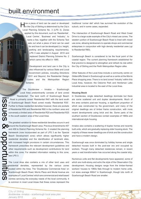
In <strong>Doubleview</strong>, single detached dwellings dominate but there<br />
are some scattered unit and duplex developments. Much <strong>of</strong><br />
the area contains post-war housing, a significant proportion <strong>of</strong><br />
which was constructed by the government, and many <strong>of</strong> the<br />
original dwellings are <strong>of</strong> timber frame construction, with more<br />
recent developments using brick and tile. Some parts <strong>of</strong> the<br />
southern section <strong>of</strong> <strong>Doubleview</strong> contain examples <strong>of</strong> 1960s and<br />
international-style housing.<br />
<strong>Innaloo</strong> also contains a scattering <strong>of</strong> duplex homes and recently<br />
built units, which are gradually replacing older housing stock. The<br />
majority <strong>of</strong> these newer dwellings are <strong>of</strong> brick and tile construction<br />
and have a modern design.<br />
<strong>Scarborough</strong> was once dominated by holiday homes and single<br />
detached houses built in the post-war era and occupied by<br />
workers. Though many detached residences remain, in recent<br />
years a vast transformation has occurred along the coastal strip.<br />
Numerous units and flat developments have appeared, some <strong>of</strong><br />
which are multi-storey and echo the style <strong>of</strong> the Observation <strong>City</strong><br />
development. Housing designs range from the timber-framed<br />
workers’ houses to 1960s flats through to modern home units.<br />
Lot sizes average 800m² in <strong>Scarborough</strong>, though lots north <strong>of</strong><br />
<strong>Scarborough</strong> Beach Road are smaller.<br />
<strong>City</strong> <strong>of</strong> <strong>Stirling</strong><br />
doubleview -innaloo - scarborough local area plan<br />
January 2012<br />
38