Doubleview - Innaloo -Scarborough Local Area Plan - City of Stirling
Doubleview - Innaloo -Scarborough Local Area Plan - City of Stirling
Doubleview - Innaloo -Scarborough Local Area Plan - City of Stirling

Create successful ePaper yourself
Turn your PDF publications into a flip-book with our unique Google optimized e-Paper software.
uilt environment<br />
not support this while 20.8% supported this. When asked to<br />
consider densities in the area that respondents lived themselves,<br />
most respondents were generally against changes to density.<br />
Respondents were more supportive <strong>of</strong> increasing density near<br />
major bus routes or activity centres; however there were only<br />
marginal differences between the proportions <strong>of</strong> respondents<br />
who were supportive, not supportive and unsure about this.<br />
Development <strong>of</strong> identified <strong>Local</strong> Centres as community<br />
hubs<br />
As discussed in Economic Environment the <strong>City</strong> is supporting<br />
and encouraging development in and around existing local<br />
centres. The <strong>City</strong> has identified ‘priority local centres’ within this<br />
<strong>Local</strong> <strong>Area</strong> and marked a 200m development buffer around each<br />
<strong>of</strong> the local centres (referred to as Neighbourhood Centres by<br />
this document).<br />
(south <strong>of</strong> <strong>Scarborough</strong> Beach Road) is zoned Residential R30<br />
with the north side being predominantly R40. The <strong>City</strong> considers<br />
<strong>Scarborough</strong> to be an important Regional attractor to residents<br />
<strong>of</strong> the <strong>City</strong> <strong>of</strong> <strong>Stirling</strong>, as well as the greater metropolitan area.<br />
Significant investment has been made by the <strong>City</strong> into the<br />
planning and development <strong>of</strong> <strong>Scarborough</strong> ensuring that it fulfils<br />
its role as a regional hub. It is on this basis that it is considered<br />
appropriate to identify the land immediately surrounding SEAS<br />
(both north and south, as identified on the Key Opportunities<br />
<strong>Plan</strong>) to Residential R60, which provides a logical and appropriate<br />
gradient <strong>of</strong> residential densities from east to west.<br />
It is proposed that the <strong>City</strong>’s draft <strong>Plan</strong>ning and Sustainability<br />
Strategy will iclude a schedule <strong>of</strong> the Neighbourhood Centres<br />
identified considered a priority for redevelopment and<br />
consideration <strong>of</strong> a higher residential zone in and directly abutting<br />
the centres.<br />
Non-residential zones identified by <strong>Local</strong> <strong>Plan</strong>ning Scheme No.<br />
3 are already permitted a mix <strong>of</strong> commercial and residential<br />
development <strong>of</strong> up to High Density Residential R80 as <strong>of</strong> right.<br />
The <strong>City</strong> is taking this one step further and considering high<br />
density residential development within a 200m radius around the<br />
identified neighbourhood centre.<br />
The neighbourhood centres have been identified as centres<br />
<strong>of</strong> priority due to a number <strong>of</strong> relevant factors. Firstly their<br />
geographical locations have been important. The neighbourhood<br />
centred in this <strong>Local</strong> <strong>Area</strong> fits into a <strong>City</strong> wide network <strong>of</strong> centres<br />
which are well connected and display adequate redevelopment<br />
potential. An assessment <strong>of</strong> the current housing stock, lot size and<br />
orientation <strong>of</strong> the surrounding residential areas were important<br />
factors in selecting the centres as well as the size, current uses<br />
and land ownership <strong>of</strong> the centres themselves. It is critical that<br />
the two components <strong>of</strong> the centre (i.e. inner centre and outer<br />
centre) are integrated as their use and function is inextricably<br />
linked.<br />
This <strong>Local</strong> <strong>Area</strong> <strong>Plan</strong> also identifies the opportunity to increase<br />
residential desntity surrounding the precinct formally known as<br />
the <strong>Scarborough</strong> Environs <strong>Area</strong> Strategy (SEAS). Just as selected<br />
local centres have been identified by the <strong>Local</strong> <strong>Area</strong> <strong>Plan</strong>ning<br />
process for potential increases in density in surrounding areas,<br />
so to has the surrounds <strong>of</strong> the SEAS boundary. The <strong>Scarborough</strong><br />
Special Control <strong>Area</strong> or ‘Sub <strong>Area</strong>s’ known as the ‘Residential<br />
- Outer’ is zoned Residential R80 under the <strong>Local</strong> <strong>Plan</strong>ning<br />
Scheme No. 3. The land immediately surrounding this sub area<br />
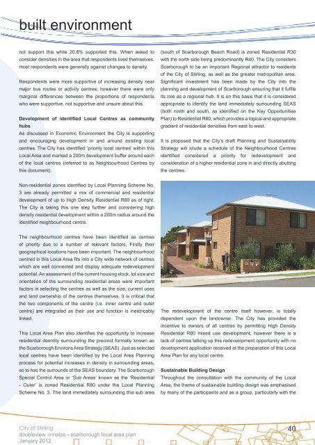
The redevelopment <strong>of</strong> the centre itself however, is totally<br />
dependent upon the landowner. The <strong>City</strong> has provided the<br />
incentive to owners <strong>of</strong> all centres by permitting High Density<br />
Residential R80 mixed use development, however there is a<br />
lack <strong>of</strong> centres talking up this redevelopment opportunity with no<br />
development application received at the preparation <strong>of</strong> this <strong>Local</strong><br />
<strong>Area</strong> <strong>Plan</strong> for any local centre.<br />
Sustainable Building Design<br />
Throughout the consultation with the community <strong>of</strong> the <strong>Local</strong><br />
<strong>Area</strong>, the theme <strong>of</strong> sustainable building design was emphasised<br />
by many <strong>of</strong> the participants and as a group, particularly with the<br />
<strong>City</strong> <strong>of</strong> <strong>Stirling</strong><br />
doubleview -innaloo - scarborough local area plan<br />
January 2012<br />
40