Read the full report (PDF27.8 MB) - CO2CRC
Read the full report (PDF27.8 MB) - CO2CRC
Read the full report (PDF27.8 MB) - CO2CRC

Create successful ePaper yourself
Turn your PDF publications into a flip-book with our unique Google optimized e-Paper software.
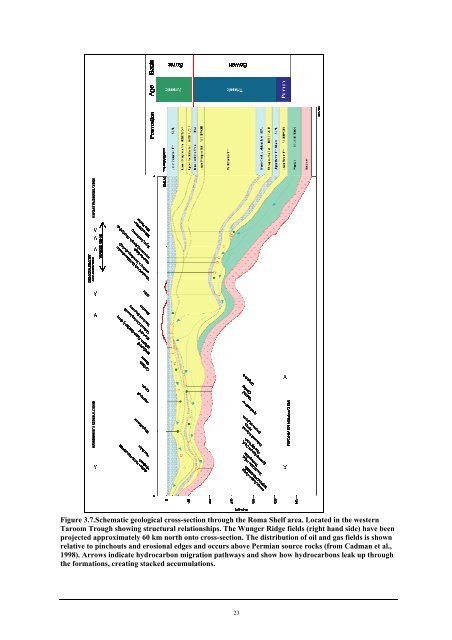
Figure 3.7.Schematic geological cross-section through <strong>the</strong> Roma Shelf area. Located in <strong>the</strong> western<br />
Taroom Trough showing structural relationships. The Wunger Ridge fields (right hand side) have been<br />
projected approximately 60 km north onto cross-section. The distribution of oil and gas fields is shown<br />
relative to pinchouts and erosional edges and occurs above Permian source rocks (from Cadman et al.,<br />
1998). Arrows indicate hydrocarbon migration pathways and show how hydrocarbons leak up through<br />
<strong>the</strong> formations, creating stacked accumulations.<br />
23
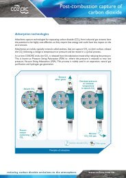
![Post-combustion solvent absorption [PDF 438KB] - CO2CRC](https://img.yumpu.com/48575763/1/184x260/post-combustion-solvent-absorption-pdf-438kb-co2crc.jpg?quality=85)