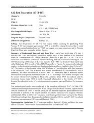
AISP Kamehameha Highway Guideway - Honolulu Rail Transit Project
AISP Kamehameha Highway Guideway - Honolulu Rail Transit Project
AISP Kamehameha Highway Guideway - Honolulu Rail Transit Project

Create successful ePaper yourself
Turn your PDF publications into a flip-book with our unique Google optimized e-Paper software.
Cultural Surveys Hawai‘i Job Code: MANANA 1<br />
Management Summary<br />
Management Summary<br />
Reference<br />
Archaeological Inventory Survey Plan for Construction Phase II of the<br />
<strong>Honolulu</strong> High-Capacity <strong>Transit</strong> Corridor <strong>Project</strong>, Waiawa, Mānana,<br />
Waimano, Waiau, Waimalu, Kalauao, ‘Aiea, and Hālawa Ahupua‘a,<br />
‘Ewa District, Island of O‘ahu (TMK: [1] 9-7, 9-8, and 9-9 - Various<br />
Plats and Parcels) (Hammatt 2010)<br />
Date April 2010<br />
<strong>Project</strong> Number (s) Cultural Surveys Hawai‘i, Inc. (CSH) Job Code: MANANA 1<br />
Investigation<br />
Permit Number<br />
<strong>Project</strong> Location<br />
and Planned AIS<br />
Study Area<br />
The fieldwork component of the planned archaeological inventory<br />
survey (AIS) investigation will likely be carried out under<br />
archaeological permit number 10-10, issued by the Hawai‘i State<br />
Historic Preservation Division / Department of Land and Natural<br />
Resources (SHPD/DLNR), per Hawai‘i Administrative Rules (HAR)<br />
Chapter 13-282.<br />
The proposed <strong>Honolulu</strong> High-Capacity <strong>Transit</strong> Corridor <strong>Project</strong><br />
(HHCTCP) extends approximately 23 miles from Kapolei in the west<br />
to the University of Hawai‘i at Mānoa and Waikīkī in the east. The<br />
focus of this planned AIS investigation is an approximately 4.1-mile<br />
long portion of the overall project area. The AIS study area includes<br />
the entire Construction Phase II of the HHCTCP, which consists of an<br />
approximately 3.7-mile segment extending east from the Pearl<br />
Highlands Station in Pearl City to the Aloha Stadium Station, and the<br />
western portion of Construction Phase III, extending east<br />
approximately 0.4 miles from the Aloha Stadium Station to Kalaloa<br />
Street in Hālawa. The AIS study area is depicted on the U.S.<br />
Geological Survey 7.5- Minute Series Topographic Map, Waipahu<br />
(1998) and Pearl Harbor (1999) Quadrangles. The western-most<br />
portion of Construction Phase III was included in this AIS study so<br />
that the historic preservation review process of at least a portion of the<br />
project’s Construction Phase III would be concluded well ahead of<br />
actual construction. For the purposes of this investigation, the<br />
project area includes all of Construction Phase II and the westernmost<br />
portion of Construction Phase III.<br />
Archaeological Inventory Survey Plan, HHCTCP Construction Phase II, Waiawa, Mānana, Waimano, Waiau,<br />
Waimalu, Kalauao, ‘Aiea, and Hālawa Ahupua‘a, ‘Ewa District, Island of O‘ahu<br />
TMK[1] 9-7, 9-8, and 9-9 --Various Plats and Parcels<br />
i