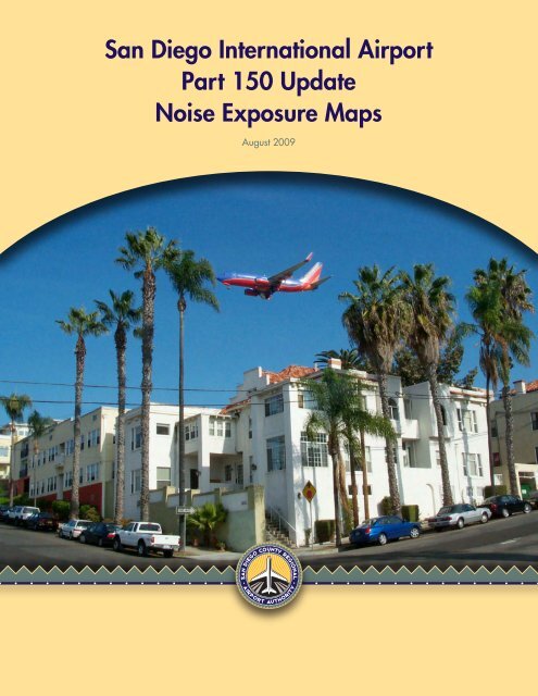
San Diego International Airport Part 150 Update Noise Exposure Maps
San Diego International Airport Part 150 Update Noise Exposure Maps
San Diego International Airport Part 150 Update Noise Exposure Maps

You also want an ePaper? Increase the reach of your titles
YUMPU automatically turns print PDFs into web optimized ePapers that Google loves.
<strong>San</strong> <strong>Diego</strong> <strong>International</strong> <strong>Airport</strong><br />
<strong>Part</strong> <strong>150</strong> <strong>Update</strong><br />
<strong>Noise</strong> <strong>Exposure</strong> <strong>Maps</strong><br />
August 2009
14 CFR <strong>Part</strong> <strong>150</strong> <strong>Update</strong> August 2009<br />
<strong>San</strong> <strong>Diego</strong> <strong>International</strong> <strong>Airport</strong><br />
Page iv<br />
This page intentionally left blank<br />
SAN DIEGO COUNTY REGIONAL AIRPORT AUTHORITY
14 CFR <strong>Part</strong> <strong>150</strong> <strong>Update</strong> August 2009<br />
<strong>San</strong> <strong>Diego</strong> <strong>International</strong> <strong>Airport</strong><br />
Page v<br />
TABLE OF CONTENTS<br />
1 INTRODUCTION .................................................................................................................. 1<br />
1.1 Historical Perspective ............................................................................................................. 1<br />
1.2 Project Location and Setting................................................................................................... 2<br />
1.3 14 CFR <strong>Part</strong> <strong>150</strong> Overview..................................................................................................... 3<br />
1.3.1 <strong>Noise</strong> <strong>Exposure</strong> <strong>Maps</strong> ............................................................................................................. 3<br />
1.3.2 <strong>Noise</strong> Compatibility Program ................................................................................................. 4<br />
1.4 Roles and Responsibilities...................................................................................................... 5<br />
1.4.1 <strong>San</strong> <strong>Diego</strong> County Regional <strong>Airport</strong> Authority ...................................................................... 5<br />
1.4.2 <strong>Part</strong> <strong>150</strong> <strong>Noise</strong> Technical Advisory Group............................................................................. 5<br />
1.4.3 Federal Aviation Administration ............................................................................................ 5<br />
1.5 FAA <strong>Noise</strong> <strong>Exposure</strong> Map Checklist...................................................................................... 6<br />
2 NOISE / LAND USE COMPATIBILITY GUIDELINES ................................................... 11<br />
2.1 FAA Land Use Guidelines.................................................................................................... 11<br />
2.2 Local Land Use Guidelines................................................................................................... 14<br />
3 NOISE MEASUREMENTS................................................................................................. 17<br />
3.1 Permanent <strong>Noise</strong> Monitoring Program ................................................................................. 17<br />
3.2 Supplemental <strong>Noise</strong> Measurement Program......................................................................... 21<br />
4 EXISTING NOISE COMPATIBILITY PROGRAM .......................................................... 23<br />
4.1 Program Elements Summary of Original 1988 NCP............................................................ 23<br />
4.2 Additional Measures Summary Implemented Since NCP Adoption in 1991....................... 30<br />
5 EXISTING AND FORECAST NOISE EXPOSURE MAPS............................................... 33<br />
5.1 Comparison to Measured <strong>Noise</strong> <strong>Exposure</strong>............................................................................ 33<br />
5.2 Development of <strong>Noise</strong> Contours........................................................................................... 41<br />
5.2.1 <strong>Airport</strong> physical parameters.................................................................................................. 41<br />
5.2.2 Aircraft operations ................................................................................................................ 42<br />
5.2.3 Aircraft noise and performance characteristics..................................................................... 48<br />
5.2.4 Runway utilization................................................................................................................ 48<br />
5.2.5 Flight track geometry............................................................................................................ 48<br />
5.3 Compatible Land Use Analysis ............................................................................................ 57<br />
SAN DIEGO COUNTY REGIONAL AIRPORT AUTHORITY
14 CFR <strong>Part</strong> <strong>150</strong> <strong>Update</strong> August 2009<br />
<strong>San</strong> <strong>Diego</strong> <strong>International</strong> <strong>Airport</strong><br />
Page vi<br />
6 PUBLIC CONSULTATION ................................................................................................ 61<br />
6.1 <strong>Noise</strong> Technical Advisory Group ......................................................................................... 61<br />
6.2 Community Information Meetings and Other Stakeholder Opportunities to Comment....... 63<br />
6.3 Project Newsletters ............................................................................................................... 63<br />
6.4 Public and Planning Agency Consultation ........................................................................... 64<br />
6.5 Other Public Input Received During the Study Process ....................................................... 64<br />
SAN DIEGO COUNTY REGIONAL AIRPORT AUTHORITY
14 CFR <strong>Part</strong> <strong>150</strong> <strong>Update</strong> August 2009<br />
<strong>San</strong> <strong>Diego</strong> <strong>International</strong> <strong>Airport</strong><br />
Page vii<br />
LIST OF FIGURES<br />
Figure 1 Remote Monitoring Terminal Locations ................................................................................19<br />
Figure 2 Existing Conditions (2009) <strong>Noise</strong> <strong>Exposure</strong> Map ..................................................................35<br />
Figure 3 Forecast Conditions (2014) <strong>Noise</strong> <strong>Exposure</strong> Map..................................................................37<br />
Figure 4 Comparison of Existing (2009) and Forecast (2014) <strong>Noise</strong> <strong>Exposure</strong> <strong>Maps</strong> .........................39<br />
Figure 5 Existing SAN <strong>Airport</strong> Layout.................................................................................................41<br />
Figure 6 Runway 9 Departure and Arrival Flight Tracks .....................................................................51<br />
Figure 7 Runway 27 Departure and Arrival Flight Tracks ...................................................................53<br />
Figure 8 Helicopter Departure and Arrival Flight Tracks.....................................................................55<br />
SAN DIEGO COUNTY REGIONAL AIRPORT AUTHORITY
14 CFR <strong>Part</strong> <strong>150</strong> <strong>Update</strong> August 2009<br />
<strong>San</strong> <strong>Diego</strong> <strong>International</strong> <strong>Airport</strong><br />
Page viii<br />
LIST OF TABLES<br />
Table 1 <strong>Part</strong> <strong>150</strong> <strong>Noise</strong> <strong>Exposure</strong> <strong>Maps</strong> Checklist..................................................................................6<br />
Table 2 14CFR <strong>Part</strong> <strong>150</strong> ”Land Use Compatibility* with Yearly Day-Night Average Sound Levels”12<br />
Table 3 Annual CNEL Measured at the RMTs.....................................................................................18<br />
Table 4 Comparison of Annual CNEL - Measured and Modeled..........................................................34<br />
Table 5 2007 Aircraft Operations .........................................................................................................42<br />
Table 6 Existing (2009) Modeled Average Daily Aircraft Operations .................................................44<br />
Table 7 Forecast (2014) Modeled Average Daily Aircraft Operations.................................................46<br />
Table 8 Runway Utilization ..................................................................................................................48<br />
Table 9 Number of Non-Residential Sensitive Receptors within 2009 and 2014 CNEL Contours......57<br />
Table 10 Listing of Non-Residential Sensitive Receptors within 2009 and 2014 CNEL Contours .....58<br />
Table 11 Estimated Residential Population within 2009 and 2014 CNEL Contours............................59<br />
Table 12 Number of Single-Family Homes Eligible for Mitigation .....................................................60<br />
Table 13 Number of Multi-Family Residential Units Eligible for Mitigation ......................................60<br />
Table 14 <strong>Noise</strong> Technical Advisory Group Members ..........................................................................62<br />
Table 15 <strong>Noise</strong> Technical Advisory Group Meetings...........................................................................63<br />
Table 16 Community Information Workshops Content........................................................................63<br />
SAN DIEGO COUNTY REGIONAL AIRPORT AUTHORITY
14 CFR <strong>Part</strong> <strong>150</strong> <strong>Update</strong> August 2009<br />
<strong>San</strong> <strong>Diego</strong> <strong>International</strong> <strong>Airport</strong> Page 1<br />
1 INTRODUCTION<br />
From a historical perspective the beginning of an emphasis on aircraft noise compatibility planning<br />
started with the passing of the <strong>Airport</strong> Safety and <strong>Noise</strong> Abatement (ASNA) Act of 1979. This act<br />
gave the Federal Aviation Administration (FAA) the authority to issue regulations on noise<br />
compatibility planning and provide a means for federal funding for projects dedicated to improving<br />
the noise environment around an airport. These regulations became the impetus for publishing Title<br />
14 of the Code of Regulations (CFR) <strong>Part</strong> <strong>150</strong>. In 1990 the passage of the <strong>Airport</strong> <strong>Noise</strong> and<br />
Capacity Act (ANCA) established a national policy on aircraft noise with an emphasis on a phase out<br />
of the noisier aircraft types. ANCA also instructed FAA to develop plans or programs that addressed<br />
reviewing any noise and access restrictions for different aircraft types.<br />
As a result, Title 14 CFR <strong>Part</strong> <strong>150</strong> “<strong>Airport</strong> <strong>Noise</strong> Compatibility Planning” 1 sets forth standards for<br />
airport operators to use in documenting noise exposure in the airport environs and establishing<br />
programs to minimize noise-related land use incompatibilities. While participation in this program<br />
by an airport is strictly voluntary, over 250 airports have participated in this program which assists in<br />
standardizing noise analysis at a national level. <strong>Part</strong>icipation does provide access to federal funding<br />
for implementing any FAA-approved measure. A formal submission to the FAA under <strong>Part</strong> <strong>150</strong><br />
includes two principal elements: (1) the <strong>Noise</strong> <strong>Exposure</strong> <strong>Maps</strong> (NEMs) and (2) the <strong>Noise</strong><br />
Compatibility Program (NCP).<br />
This volume presents the updated NEMs documentation for <strong>San</strong> <strong>Diego</strong> <strong>International</strong> <strong>Airport</strong>, as<br />
required by the specific provisions of <strong>Part</strong> <strong>150</strong> Subpart B, Section <strong>150</strong>.21, and Appendix A. A<br />
separate volume, “<strong>San</strong> <strong>Diego</strong> <strong>International</strong> <strong>Airport</strong> <strong>Part</strong> <strong>150</strong> <strong>Update</strong> <strong>Noise</strong> <strong>Exposure</strong> <strong>Maps</strong><br />
Appendices”, includes the Appendices referenced in the NEMs documentation.<br />
This chapter provides an historical perspective of the <strong>Part</strong> <strong>150</strong> at <strong>San</strong> <strong>Diego</strong> <strong>International</strong> <strong>Airport</strong><br />
(Section 1.1), a brief summary of the location and setting (Section 1.2), an introduction to 14 CFR<br />
<strong>Part</strong> <strong>150</strong> (Section 1.3), a summary of project organization (Section 1.4), and a completed copy of the<br />
FAA NEM review checklist (Section 1.5).<br />
1.1 Historical Perspective<br />
<strong>San</strong> <strong>Diego</strong> <strong>International</strong> <strong>Airport</strong> (SAN) was dedicated as the <strong>San</strong> <strong>Diego</strong> region’s municipal airport on<br />
August 28, 1928. On December 18, 1962, the <strong>San</strong> <strong>Diego</strong> Unified Port District (Port District) was<br />
created when the California Legislature approved State Senate Bill 41, which was certified by the<br />
<strong>San</strong> <strong>Diego</strong> County Board of Supervisors. Senate Bill 41 also granted ownership and operation of<br />
SAN to the newly created Port District.<br />
In 2002 the California Legislature approved State Assembly Bill (AB) 93, the “<strong>San</strong> <strong>Diego</strong> County<br />
Regional <strong>Airport</strong> Authority Act”. This bill created the <strong>San</strong> <strong>Diego</strong> County Regional <strong>Airport</strong><br />
Authority (hereinafter “<strong>Airport</strong> Authority”) as a local government authority with the responsibility<br />
for the operation of and planning for SAN. On January 1, 2003, the effective date of AB 93, the<br />
ownership and operation of SAN was transferred to the <strong>Airport</strong> Authority from the Port District.<br />
This transfer shifted all planning responsibilities, including the preparation of any airport noise<br />
studies to the <strong>Airport</strong> Authority.<br />
1 14 CFR <strong>Part</strong> <strong>150</strong><br />
SAN DIEGO COUNTY REGIONAL AIRPORT AUTHORITY
14 CFR <strong>Part</strong> <strong>150</strong> <strong>Update</strong> August 2009<br />
<strong>San</strong> <strong>Diego</strong> <strong>International</strong> <strong>Airport</strong> Page 2<br />
The <strong>Airport</strong> Authority is governed by a nine-member Board whose members are chosen to represent<br />
all geographic areas of <strong>San</strong> <strong>Diego</strong> County. Board members are appointed, and include both elected<br />
officials and private citizens.<br />
The Port District prepared the only approved 14 CFR <strong>Part</strong> <strong>150</strong> study for SAN in 1988. The FAA<br />
completed its review of the original NEMs and found them in compliance with <strong>Part</strong> <strong>150</strong><br />
requirements on January 30, 1989 (Appendix F). The FAA approved the NCP and published a<br />
“Record of Approval” (ROA) on June 5, 1991 (Appendix G). Subsequently, there were two FAAapproved<br />
revisions to the approved NCP prior to the creation of the <strong>Airport</strong> Authority:<br />
■<br />
■<br />
Revision 1, approved in FAA Record of Approval on May 11, 1995, considered one program<br />
element to sound attenuate five schools within the 65 dB Community <strong>Noise</strong> Equivalent Level 2<br />
(CNEL) contour<br />
Revision 2, approved in FAA Record of Approval on June 17, 1998, considered two program<br />
elements: one to implement a sound attenuation program for residential homes located between<br />
the 65 and 75 dB CNEL contours and one to modify the structure of the <strong>Airport</strong> <strong>Noise</strong> Advisory<br />
Committee such that it could evaluate the Residential Sound Attenuation Program as it<br />
progresses<br />
The <strong>Airport</strong> Authority decided to update its 1991 14 CFR <strong>Part</strong> <strong>150</strong> study to seek a balance between<br />
the airport’s operational needs and the noise impacts that the airport’s aircraft operations have on<br />
surrounding neighborhoods. An updated set of NEMs is necessary to clarify boundaries for SAN’s<br />
Residential Sound Insulation Program, while evaluating the success of in-place NCP elements and<br />
exploring new NCP options that would refine how SAN moves forward in mitigating aircraft noise<br />
to the maximum extent possible.<br />
In 2007, the <strong>San</strong> <strong>Diego</strong> County Regional <strong>Airport</strong> Authority retained a team of consulting firms to<br />
update the <strong>Part</strong> <strong>150</strong>, including development and documentation of updated NEMs, comprehensive<br />
evaluation of NCP alternatives, and preparation of required NCP update documentation.<br />
1.2 Project Location and Setting<br />
<strong>San</strong> <strong>Diego</strong> <strong>International</strong> <strong>Airport</strong> (SAN) is a single runway, large hub commercial service airport<br />
located in an urban setting on approximately 661 acres of property. In 2008, SDIA enplaned<br />
approximately 9,000,000 domestic and international passengers with approximately 222,000 aircraft<br />
operations.<br />
The airport is situated in a bowl within the city limits of <strong>San</strong> <strong>Diego</strong>. Rising terrain on three sides<br />
with the <strong>San</strong> <strong>Diego</strong> Bay on the south provides less than a 1.5 mile buffer. A nearby military airport<br />
(North Island Naval Air Station) further limits conventional arrival/departure options.<br />
The close proximity in airports presents air traffic control challenges. Arrivals and departures result<br />
in noise impacts to surrounding communities quantified by SAN flight tracking and noise monitoring<br />
equipment. With 24 remote noise monitors strategically placed around the airport, SAN is the most<br />
noise-instrumented single-runway airport in the nation. The consequence of single runway<br />
operations at an airport with significant airspace management restrictions acts to project aircraft<br />
noise into the same communities day in and day out.<br />
2 See Appendix B for definition of Community <strong>Noise</strong> Equivalent Level (CNEL)<br />
SAN DIEGO COUNTY REGIONAL AIRPORT AUTHORITY
14 CFR <strong>Part</strong> <strong>150</strong> <strong>Update</strong> August 2009<br />
<strong>San</strong> <strong>Diego</strong> <strong>International</strong> <strong>Airport</strong> Page 3<br />
The most current <strong>San</strong> <strong>Diego</strong> <strong>International</strong> <strong>Airport</strong> <strong>Noise</strong> Impact Area (calendar year 2008), based on<br />
the 65 dB CNEL noise contour submitted to Caltrans in the Quarterly <strong>Noise</strong> Report for the 4 th quarter<br />
of 2008, contains approximately 1.05 square miles of prime residential real estate, or roughly 10,686<br />
single and multi-family residences and 24,170 individuals.<br />
1.3 14 CFR <strong>Part</strong> <strong>150</strong> Overview<br />
<strong>Part</strong> <strong>150</strong> sets forth a process for airport proprietors to follow in developing and obtaining FAA<br />
approval of programs to reduce or eliminate incompatibilities between aircraft noise and surrounding<br />
land uses. <strong>Part</strong> <strong>150</strong> prescribes specific standards and systems for:<br />
■<br />
■<br />
■<br />
■<br />
■<br />
■<br />
■<br />
■<br />
Measuring noise<br />
Estimating cumulative noise exposure<br />
Describing noise exposure (including instantaneous, single event and cumulative levels)<br />
Coordinating NCP development with local land use officials and other interested parties<br />
Documenting the analytical process and development of the compatibility program<br />
Submitting documentation to the FAA<br />
FAA and public review processes<br />
FAA approval or disapproval of the submission<br />
As a result of applying these specific standards and systems, as stated earlier, <strong>Part</strong> <strong>150</strong> includes two<br />
formal submissions to the FAA; the NEMs and the NCP.<br />
1.3.1 <strong>Noise</strong> <strong>Exposure</strong> <strong>Maps</strong><br />
The NEMs describe the airport layout and operation, aircraft-related noise exposure, land uses in the<br />
airport environs, and the resulting noise/land use compatibility situation. The noise exposure is<br />
expressed in decibels (dB) in terms of the Community <strong>Noise</strong> Equivalent Level (CNEL) 3 . Contours<br />
of equal CNEL values, similar to terrain contours of equal elevation, form the basis for evaluating<br />
the noise exposure to the community. The NEMs must address two time frames: (1) data<br />
representing the year of submission (the “existing conditions”) and (2) the fifth calendar year or later<br />
following the year of submission (the “forecast conditions”). The NEMs also address how the<br />
forecast operations will affect the compatibility of the land uses depicted.<br />
The primary objective is to describe the current and forecast conditions at the airport and the noise<br />
effects of the aircraft activity on the surrounding communities. While this description is normally<br />
processed into individual NEMs, <strong>Part</strong> <strong>150</strong> requires more than a simple “map” to provide all the<br />
necessary information. The information required to provide the graphics and background for<br />
analysis include such tasks as<br />
■<br />
■<br />
■<br />
■<br />
■<br />
Collecting historical aviation activity data such as aircraft fleet mix, number and type of<br />
operations, aircraft departure weights, runway utilization<br />
Developing a forecast aircraft activity for a period at least five years in the future from the year<br />
representing the existing conditions<br />
Determining aircraft flight tracks and usage based on radar data, if available, or other source data<br />
Creating the necessary inputs to the FAA Integrated <strong>Noise</strong> Model using the average annual input<br />
conditions to include airport configuration, meteorological data, operations, etc.<br />
Obtaining approval for user-specified aircraft substitutions or profiles from the FAA points of<br />
contact<br />
3 <strong>Noise</strong> metrics and noise effects are discussed in detail in Appendix B.<br />
SAN DIEGO COUNTY REGIONAL AIRPORT AUTHORITY
14 CFR <strong>Part</strong> <strong>150</strong> <strong>Update</strong> August 2009<br />
<strong>San</strong> <strong>Diego</strong> <strong>International</strong> <strong>Airport</strong> Page 4<br />
■<br />
■<br />
■<br />
Conducting supplemental noise measurements in accordance with 14 CFR <strong>Part</strong> <strong>150</strong> §A<strong>150</strong>.5 to<br />
better characterize any special noise effects on the community (optional)<br />
Collecting data from local jurisdictions to establish detailed land use data in the airport environs<br />
Estimating population data within the local area<br />
Therefore, in addition to the graphics, an extensive effort is made to document, through tabulated<br />
information and text discussions, the noise environment due to aircraft activity at the airport now and<br />
in the future. Thus, the NEMs documentation describes the data collection and analysis undertaken<br />
in development and graphic depiction of existing and future noise exposure resulting from aircraft<br />
operations and the land uses in the airport environs. During the process the airport initiates and<br />
maintains contact with the local airport community to get the various perspectives on the modeling<br />
inputs to the NEMs. After considering all comments the NEMs document is submitted to the FAA<br />
and, subsequent to a thorough review, the FAA makes a determination of compliance with the <strong>Part</strong><br />
<strong>150</strong> standards.<br />
The year of submission for this update is 2009. Therefore, the existing conditions noise contours are<br />
for 2009 and the five-year forecast case contours are for 2014.<br />
1.3.2 <strong>Noise</strong> Compatibility Program<br />
The NCP provides a planning process for evaluating aircraft noise impacts and the costs and benefits<br />
of alternative noise abatement measures. It also engages the local planning authorities to review the<br />
policies toward managing the noncompatible land uses now and in the future around the airport.<br />
Involving the public and local agencies, the NCP is essentially the total process used by the airport<br />
proprietor to propose a list of the actions to undertake to minimize existing and future noncompatible<br />
noise/land uses. These actions may involve<br />
■<br />
■<br />
■<br />
■<br />
■<br />
Changes to the physical layout of the airport<br />
Changes to airport and airspace use<br />
Changes to aircraft operations<br />
Review of land use administration practices for preventing noncompatible uses or mitigating<br />
noise<br />
Review of noise management program practices<br />
There are certain measures that must be considered for applicability and feasibility:<br />
■<br />
■<br />
■<br />
■<br />
■<br />
Acquisition of land which includes overflight, easement, and development rights to ensure<br />
property use is compatible with airport operations<br />
Construction of barriers or shielding through sound insulating buildings<br />
Implementation of a preferential runway use<br />
Utilization of flight procedures to reduce noise from the source (aircraft) through actions such as<br />
flight track changes or aircraft performance profile adjustments<br />
Restriction of use of the airport by specific aircraft types, nighttime operations, etc.<br />
The NCP documentation must recount the development of the program, including a description of all<br />
measures considered, the reasons that individual measures were accepted or rejected, how measures<br />
will be implemented and funded, and the predicted effectiveness of individual measures and the<br />
overall program. As in the case of the NEMs, public participation is a vital part of developing a<br />
program that will promote understanding, awareness, and an opportunity for involving the<br />
perspectives of the different jurisdictions and their constituents on the role of the airport and the<br />
community.<br />
SAN DIEGO COUNTY REGIONAL AIRPORT AUTHORITY
14 CFR <strong>Part</strong> <strong>150</strong> <strong>Update</strong> August 2009<br />
<strong>San</strong> <strong>Diego</strong> <strong>International</strong> <strong>Airport</strong> Page 5<br />
Upon completion of the analyses and coordination, the NCP is submitted to the FAA for review and<br />
approval. The FAA reviews the NCP and may approve or disapprove each measure on its merits and<br />
adherence to the national aviation policy. Upon approval, the airport will begin its implementation<br />
schedule based on the availability of federal funding and <strong>Airport</strong> Authority resources.<br />
1.4 Roles and Responsibilities<br />
Several groups had major roles in the development of the NEMs, including the <strong>San</strong> <strong>Diego</strong> County<br />
Regional <strong>Airport</strong> Authority, the consulting team, the SAN <strong>Part</strong> <strong>150</strong> <strong>Noise</strong> Technical Advisory Group<br />
(NTAG), and the FAA.<br />
1.4.1 <strong>San</strong> <strong>Diego</strong> County Regional <strong>Airport</strong> Authority<br />
As the “airport operator”, the <strong>San</strong> <strong>Diego</strong> County Regional <strong>Airport</strong> Authority has authority over the<br />
<strong>Part</strong> <strong>150</strong> update, including ultimate responsibility for determining the elements to include in the NCP<br />
when it is submitted to the FAA for review. The <strong>Airport</strong> Authority is responsible for pursuing<br />
implementation of adopted measures.<br />
The <strong>Airport</strong> Authority retained a team of consultants to conduct the technical work required to fulfill<br />
<strong>Part</strong> <strong>150</strong> analysis and documentation requirements. Appendix A describes the composition of the<br />
consulting team and the general assignment of responsibilities among its members.<br />
The <strong>Airport</strong> Authority established the <strong>Part</strong> <strong>150</strong> <strong>Noise</strong> Technical Advisory Group “NTAG” to ensure<br />
that a wide range of stakeholders is given official representation in the study process. The NTAG is<br />
a key element of the comprehensive public involvement program conducted over the course of the<br />
<strong>Part</strong> <strong>150</strong> update, as described in the following section and Section 6.1.<br />
1.4.2 <strong>Part</strong> <strong>150</strong> <strong>Noise</strong> Technical Advisory Group<br />
The <strong>Noise</strong> Technical Advisory Group (NTAG) is formed to provide different perspectives and inputs<br />
to the NEMs or NCP development process. As a group, the primary emphases are creating an<br />
atmosphere of understanding, awareness, and working together to derive solutions to noise<br />
compatibility problems. Through an invitation from the <strong>Airport</strong> Authority and a voluntary<br />
participation process, the NTAG brings together representatives from a broad spectrum of entities<br />
with interest in the <strong>Part</strong> <strong>150</strong> update process and its products. These entities include: representatives<br />
of the affected communities in the airport’s environs, government agencies with aviation and land<br />
use responsibilities; and private sector interests, particularly in the aviation industry.<br />
The NTAG members are responsible for representing their constituents throughout the study process,<br />
to include commenting on the adequacy and accuracy of collected data, simplifying assumptions and<br />
technical analyses, and reporting back to their constituents. The NTAG also serves as a forum for<br />
the varied interest groups to discuss complex issues and share their differing perspectives on aircraft<br />
noise issues.<br />
Section 6.1 discusses the NTAG process during the development of the NEMs.<br />
1.4.3 Federal Aviation Administration<br />
For the NEMs update, FAA responsibility includes a review of the submission to determine that the<br />
technical work, consultation and documentation comply with <strong>Part</strong> <strong>150</strong> requirements. The FAA must<br />
also approve non-standard modeling requests. The final role of the FAA is to accept or not accept<br />
the NEMs.<br />
SAN DIEGO COUNTY REGIONAL AIRPORT AUTHORITY
14 CFR <strong>Part</strong> <strong>150</strong> <strong>Update</strong> August 2009<br />
<strong>San</strong> <strong>Diego</strong> <strong>International</strong> <strong>Airport</strong> Page 6<br />
For an NCP update, the FAA has ultimate review authority over the NCP submitted under <strong>Part</strong> <strong>150</strong>.<br />
The FAA's review of the NCP encompasses the details of technical documentation as well as broader<br />
issues of safety and constitutionality of recommended noise abatement alternatives. The final role of<br />
the FAA is to approve or disapprove each measure proposed in the NCP.<br />
FAA involvement includes participation by staff from at least three levels in the agency: (1) The Air<br />
Traffic Organization (ATO), (2) the <strong>Airport</strong>s District Office (ADO), and (3) the region.<br />
■<br />
■<br />
■<br />
The Air Traffic Organization (ATO) includes the Air Traffic Controllers and support staff.<br />
SAN's Air Traffic Control Tower (ATCT) provides significant input in several areas,<br />
including: operational data from their files, judgment regarding safety and capacity effects of<br />
alternative noise abatement measures, and input on implementation requirements. The Southern<br />
California TRACON (Terminal Radar Approach Control) also provides input on air traffic<br />
issues to the extent that they might affect procedures at SAN and other nearby airports.<br />
The FAA's Los Angeles <strong>Airport</strong>s District Office (ADO) is responsible for determining if the<br />
NCP satisfies all requirements.<br />
The FAA’s Western Pacific Region <strong>Airport</strong> Division Manager is responsible for final review of<br />
the NCP submission for adequacy in satisfying technical and legal requirements.<br />
Prior to acceptance of the NEMs and approval of the NCP, the submitted documents will go through<br />
FAA Line-of-Business review, which includes Air Traffic, Flight Standards, Legal, Special<br />
Programs, Planning & Requirements, Flight Procedures and Regional Review.<br />
1.5 FAA <strong>Noise</strong> <strong>Exposure</strong> Map Checklist<br />
The FAA has developed checklists for their internal use in reviewing NEMs and NCP submissions.<br />
The FAA prefers that the <strong>Part</strong> <strong>150</strong> documentation include copies of the checklists. Table 1 presents<br />
a completed copy of the NEMs checklist.<br />
Table 1 <strong>Part</strong> <strong>150</strong> <strong>Noise</strong> <strong>Exposure</strong> <strong>Maps</strong> Checklist<br />
Source: FAA/APP, Washington, DC, March 1989; revised June 2005; reviewed for currency 12/2007<br />
<strong>Airport</strong> Name: <strong>San</strong> <strong>Diego</strong> <strong>International</strong> <strong>Airport</strong><br />
I. Submitting and Identifying the NEMs:<br />
II.<br />
A. Submission properly identified:<br />
14 CFR PART <strong>150</strong><br />
NOISE EXPOSURE MAPS CHECKLIST-PART I<br />
REVIEWER:<br />
Yes/No/<br />
NA<br />
Page/Other<br />
Reference<br />
1. 14 C.F.R. <strong>Part</strong> <strong>150</strong> NEMs? Yes Cover page,<br />
Chapter 1, p. 1<br />
2. NEMs and NCP together? NA<br />
3. Revision to NEMs FAA previously determined to be in<br />
compliance with <strong>Part</strong> <strong>150</strong>?<br />
Yes Chapter 1.1,<br />
p. 1<br />
B. <strong>Airport</strong> and <strong>Airport</strong> Operator’s name are identified? Yes Certification, p. iii<br />
C. NCP is transmitted by operator’s dated cover letter,<br />
describing it as a <strong>Part</strong> <strong>150</strong> submittal and requesting<br />
appropriate FAA determination?<br />
Consultation: [<strong>150</strong>.21(b), A<strong>150</strong>.105(a)]<br />
A. Is there a narrative description of the consultation<br />
accomplished, including opportunities for public review and<br />
comment during map development?<br />
Yes<br />
Cover letter<br />
Yes Chapter 6, p.61<br />
Notes/<br />
Comments<br />
SAN DIEGO COUNTY REGIONAL AIRPORT AUTHORITY
14 CFR <strong>Part</strong> <strong>150</strong> <strong>Update</strong> August 2009<br />
<strong>San</strong> <strong>Diego</strong> <strong>International</strong> <strong>Airport</strong> Page 7<br />
<strong>Airport</strong> Name: <strong>San</strong> <strong>Diego</strong> <strong>International</strong> <strong>Airport</strong><br />
B. Identification of consulted parties:<br />
14 CFR PART <strong>150</strong><br />
NOISE EXPOSURE MAPS CHECKLIST-PART I<br />
REVIEWER:<br />
Yes/No/<br />
NA<br />
Page/Other<br />
Reference<br />
1. Are the consulted parties identified? Yes Chapter 6, p.62,<br />
Table 14<br />
2. Do they include all those required by <strong>150</strong>.21(b) and<br />
A<strong>150</strong>.105 (a)?<br />
3. Agencies in 2. , above, correspond to those indicated<br />
on the NEM?<br />
C. Does the documentation include the airport operator's<br />
certification, and evidence to support it, that interested<br />
persons have been afforded adequate opportunity to submit<br />
their views, data, and comments during map development<br />
and in accordance with <strong>150</strong>.21(b)?<br />
D. Does the document indicate whether written comments<br />
were received during consultation and, if there were<br />
comments that they are on file with the FAA regional<br />
airports division manager?<br />
III. General Requirements: [<strong>150</strong>.21]<br />
IV.<br />
A. Are there two maps, each clearly labeled on the face with<br />
year (existing condition year and one that is at least 5 years<br />
into the future)?<br />
B. Map currency:<br />
1. Does the year on the face of the existing condition map<br />
graphic match the year on the airport operator's NEM<br />
submittal letter?<br />
2. Is the forecast year map based on reasonable<br />
forecasts and other planning assumptions and is it for<br />
at least the fifth calendar year after the year of<br />
submission?<br />
3. If the answer to 1 and 2 above is no, the airport<br />
operator must verify in writing that data in the<br />
documentation are representative of existing condition<br />
and at least 5 years’ forecast conditions as of the date<br />
of submission?<br />
C. If the NEMs and NCP are submitted together:<br />
1. Has the airport operator indicated whether the forecast<br />
year map is based on either forecast conditions<br />
without the program or forecast conditions if the<br />
program is implemented?<br />
2. If the forecast year map is based on program<br />
implementation:<br />
a. Are the specific program measures that are<br />
reflected on the map identified?<br />
b. Does the documentation specifically describe how<br />
these measures affect land use compatibilities<br />
depicted on the map?<br />
3. If the forecast year NEM does not model program<br />
implementation, the airport operator must either submit<br />
a revised forecast NEM showing program<br />
implementation conditions [B<strong>150</strong>.3 (b), <strong>150</strong>.35 (f)] or<br />
the sponsor must demonstrate the adopted forecast<br />
year NEM with approved NCP measures would not<br />
change by plus/minus 1.5 CNEL? [<strong>150</strong>.21(d)]<br />
MAP SCALE, GRAPHICS, AND DATA REQUIREMENTS:<br />
[A<strong>150</strong>.101, A<strong>150</strong>.103, A<strong>150</strong>.105, <strong>150</strong>.21(a)]<br />
Yes Chapter 6, p.61<br />
Yes Chapter 6, p.61<br />
Yes<br />
Yes<br />
Certification, p. iii<br />
and Chapter 6<br />
Chapter 6 and<br />
Appendices V,<br />
W, BB, & FF<br />
Notes/<br />
Comments<br />
Yes Existing (2009) NEM is Figure 2<br />
and Figure 3 is 5-year forecast<br />
(2014) NEM<br />
Yes Cover letter; Figure 2 is 2009<br />
existing NEM<br />
Yes Cover letter; Figure 3 is 2014 5-<br />
year forecast NEM<br />
NA<br />
NA<br />
NA<br />
NA<br />
NA<br />
NA<br />
SAN DIEGO COUNTY REGIONAL AIRPORT AUTHORITY
14 CFR <strong>Part</strong> <strong>150</strong> <strong>Update</strong> August 2009<br />
<strong>San</strong> <strong>Diego</strong> <strong>International</strong> <strong>Airport</strong> Page 8<br />
<strong>Airport</strong> Name: <strong>San</strong> <strong>Diego</strong> <strong>International</strong> <strong>Airport</strong><br />
14 CFR PART <strong>150</strong><br />
NOISE EXPOSURE MAPS CHECKLIST-PART I<br />
A. Are the maps of sufficient scale to be clear and readable<br />
(they must be not be less than 1" to 2,000'), and is the scale<br />
indicated on the maps?<br />
(Note (1) if the submittal uses separate graphics to depict<br />
flight tracks and/or noise monitoring sites, these must be of<br />
the same scale, because they are part of the documentation<br />
required for NEMs.)<br />
(Note (2) supplemental graphics that are not required by the<br />
regulation do not need to be at the 1” to 2,000’ scale)<br />
B. Is the quality of the graphics such that required information<br />
is clear and readable? (Refer to C. through G., below, for<br />
specific graphic depictions that must be clear and readable)<br />
C. Depiction of the airport and its environs.<br />
1. Is the following graphically depicted to scale on both<br />
the existing condition and forecast year maps:<br />
REVIEWER:<br />
Yes/No/<br />
NA<br />
Yes<br />
Yes<br />
a. <strong>Airport</strong> boundaries Yes<br />
b. Runway configurations with runway end numbers Yes<br />
2. Does the depiction of the off-airport data include?<br />
a. A land use base map depicting streets and other<br />
identifiable geographic features<br />
b. The area within the CNEL 65 dB (or beyond, at<br />
local discretion)<br />
c. Clear delineation of geographic boundaries and<br />
the names of all jurisdictions with planning and<br />
land use control authority within the CNEL 65 dB<br />
(or beyond, at local discretion)<br />
D. 1. Continuous contours for at least CNEL 65, 70, and 75<br />
dB?<br />
2. Has the local land use jurisdiction(s) adopted a lower<br />
local standard and, if so, has the sponsor depicted this<br />
on the NEMs?<br />
3. Based on current airport and operational data for the<br />
existing condition year NEM, and forecast data<br />
representative of the selected year for the forecast<br />
NEM?<br />
E. Flight tracks for the existing condition and forecast year<br />
timeframes (these may be on supplemental graphics which<br />
must use the same land use base map and scale as the<br />
existing condition and forecast year NEM), which are<br />
numbered to correspond to accompanying narrative?<br />
F. Locations of any noise monitoring sites (these may be on<br />
supplemental graphics which must use the same land use<br />
base map and scale as the official NEMs)<br />
Yes<br />
Yes<br />
Yes<br />
Yes<br />
No<br />
Yes<br />
Page/Other<br />
Reference<br />
Notes/<br />
Comments<br />
1” to 4,000’ scale of all map figures<br />
in main document with 1” to 2,000’<br />
scale maps of NEMs, flight tracks,<br />
and noise monitoring sites included<br />
in pocket folders<br />
All figures<br />
Figure 2 (2009) and Figure 3<br />
(2014) NEMs contain all this<br />
information.<br />
Every figure with geographic<br />
information delineates the<br />
boundaries and names of<br />
jurisdictions with planning and land<br />
use control authority in an area<br />
well beyond 65 CNEL.<br />
City of <strong>San</strong> <strong>Diego</strong> is the sole<br />
jurisdiction with planning and land<br />
use control authority within the 65<br />
CNEL.<br />
All contour figures<br />
Certification Letter, p.iii and<br />
Section 5.2 presents current and<br />
forecast operational data and other<br />
modeling inputs.<br />
Yes Figure 6 through Figure 8<br />
Yes<br />
Figure 1 and NEM graphics<br />
(Figures 2, 3, 4).<br />
SAN DIEGO COUNTY REGIONAL AIRPORT AUTHORITY
14 CFR <strong>Part</strong> <strong>150</strong> <strong>Update</strong> August 2009<br />
<strong>San</strong> <strong>Diego</strong> <strong>International</strong> <strong>Airport</strong> Page 9<br />
<strong>Airport</strong> Name: <strong>San</strong> <strong>Diego</strong> <strong>International</strong> <strong>Airport</strong><br />
G. Noncompatible land use identification:<br />
14 CFR PART <strong>150</strong><br />
NOISE EXPOSURE MAPS CHECKLIST-PART I<br />
1. Are noncompatible land uses within at least the CNEL<br />
65 dB noise contour depicted on the map graphics?<br />
2. Are noise sensitive public buildings and historic<br />
properties identified? (Note: If none are within the<br />
depicted NEM noise contours, this should be stated in<br />
the accompanying narrative text.)<br />
3. Are the noncompatible uses and noise sensitive public<br />
buildings readily identifiable and explained on the map<br />
legend?<br />
4. Are compatible land uses, which would normally be<br />
considered noncompatible, explained in the<br />
accompanying narrative?<br />
V. NARRATIVE SUPPORT OF MAP DATA: [<strong>150</strong>.21(a), A<strong>150</strong>.1,<br />
A<strong>150</strong>.101, A<strong>150</strong>.103]<br />
A. 1. Are the technical data and data sources on which the<br />
NEMs are based adequately described in the<br />
narrative?<br />
2. Are the underlying technical data and planning<br />
assumptions reasonable?<br />
B. Calculation of <strong>Noise</strong> Contours:<br />
REVIEWER:<br />
Yes/No/<br />
NA<br />
Yes<br />
Yes<br />
Yes<br />
NA<br />
Yes<br />
Yes<br />
1. Is the methodology indicated? Yes<br />
a. Is it FAA approved? Yes<br />
Page/Other<br />
Reference<br />
Notes/<br />
Comments<br />
Depicted on Figure 2 (2009) and<br />
Figure 3 (2014) NEMs.<br />
Tables 9 and 10 provide nonresidential<br />
sensitive receptor<br />
counts for 2009 and 2014.<br />
Section 5.2 presents current and<br />
forecast operational data and other<br />
modeling inputs. Appendix I.<br />
b. Was the same model used for both maps? (Note:<br />
The same model also must be used for NCP<br />
submittals associated with NEM determinations<br />
already issued by FAA where the NCP is<br />
submitted later, unless the airport sponsor<br />
submits a combined NEMs/NCP submittal as a<br />
replacement, in which case the model used must<br />
be the most recent version at the time the update<br />
was started.)<br />
c. Has AEE approval been obtained for use of a<br />
model other than those that have previous<br />
blanket FAA approval?<br />
2. Correct use of noise models:<br />
a. Does the documentation indicate, or is there<br />
evidence, the airport operator (or its consultant)<br />
has adjusted or calibrated FAA-approved noise<br />
models or substituted one aircraft type for another<br />
that was not included on the FAA’s pre-approved<br />
list of aircraft substitutions?<br />
b. If so, does this have written approval from AEE,<br />
and is that written approval included in the<br />
submitted document?<br />
3. If noise monitoring was used, does the narrative<br />
indicate that <strong>Part</strong> <strong>150</strong> guidelines were followed?<br />
Yes<br />
NA<br />
Yes<br />
Yes<br />
Yes<br />
Section 5.2, p.41. INM 7.0a was<br />
used, the most current INM version<br />
at the time this <strong>Part</strong> <strong>150</strong> <strong>Update</strong><br />
was prepared.<br />
Used INM7.0a.<br />
Letter requesting FAA approval of<br />
recommended adjustments<br />
provided to the FAA. FAA<br />
approved aircraft substitutes and<br />
adjustments for non-standard<br />
approach angle to Runway 27.<br />
See Appendices C, D, and E.<br />
Chapter 3, page<br />
17<br />
SAN DIEGO COUNTY REGIONAL AIRPORT AUTHORITY
14 CFR <strong>Part</strong> <strong>150</strong> <strong>Update</strong> August 2009<br />
<strong>San</strong> <strong>Diego</strong> <strong>International</strong> <strong>Airport</strong> Page 10<br />
<strong>Airport</strong> Name: <strong>San</strong> <strong>Diego</strong> <strong>International</strong> <strong>Airport</strong><br />
14 CFR PART <strong>150</strong><br />
NOISE EXPOSURE MAPS CHECKLIST-PART I<br />
4. For noise contours below CNEL 65 dB, does the<br />
supporting documentation include an explanation of<br />
local reasons? (Note: A narrative explanation,<br />
including evidence the local jurisdiction(s) have<br />
adopted a noise level less than CNEL 65 dB as<br />
sensitive for the local community(ies), and including a<br />
table or other depiction of the differences from the<br />
Federal table, is highly desirable but not specifically<br />
required by the rule. However, if the airport sponsor<br />
submits NCP measures within the locally significant<br />
noise contour, an explanation must be included if it<br />
wants the FAA to consider the measure(s) for approval<br />
for purposes of eligibility for Federal aid.)<br />
C. Noncompatible Land Use Information:<br />
1. Does the narrative (or map graphics) give estimates of<br />
the number of people residing in each of the contours<br />
(CNEL 65, 70 and 75, at a minimum) for both the<br />
existing condition and forecast year maps?<br />
2. Does the documentation indicate whether the airport<br />
operator used Table 1 of <strong>Part</strong> <strong>150</strong>?<br />
a. If a local variation to table 1 was used:<br />
(1) Does the narrative clearly indicate which<br />
adjustments were made and the local<br />
reasons for doing so?<br />
(2) Does the narrative include the airport<br />
operator's complete substitution for table 1?<br />
3. Does the narrative include information on selfgenerated<br />
or ambient noise where compatible or<br />
noncompatible land use identifications consider nonairport<br />
and non-aircraft noise sources?<br />
4. Where normally noncompatible land uses are not<br />
depicted as such on the NEMs, does the narrative<br />
satisfactorily explain why, with reference to the specific<br />
geographic areas?<br />
5. Does the narrative describe how forecast aircraft<br />
operations, forecast airport layout changes, and<br />
forecast land use changes will affect land use<br />
compatibility in the future?<br />
REVIEWER:<br />
Yes/No/<br />
NA<br />
NA<br />
Yes<br />
Yes<br />
NA<br />
NA<br />
NA<br />
NA<br />
Page/Other<br />
Reference<br />
Notes/<br />
Comments<br />
Section 5.3. Table 11 provides<br />
estimated population counts for<br />
2009 and 2014.<br />
Section 2.1 and<br />
Section 5.3<br />
Yes Section 5<br />
VI.<br />
MAP CERTIFICATIONS: [<strong>150</strong>.21(b), <strong>150</strong>.21(e)]<br />
A. Has the operator certified in writing that interested persons<br />
have been afforded adequate opportunity to submit views,<br />
data, and comments concerning the correctness and<br />
adequacy of the draft maps and forecasts?<br />
B. Has the operator certified in writing that each map and<br />
description of consultation and opportunity for public<br />
comment are true and complete under penalty of 18 U.S.C.<br />
Section 1001?<br />
Yes<br />
Yes<br />
Certification, p. iii<br />
SAN DIEGO COUNTY REGIONAL AIRPORT AUTHORITY
14 CFR <strong>Part</strong> <strong>150</strong> <strong>Update</strong> August 2009<br />
<strong>San</strong> <strong>Diego</strong> <strong>International</strong> <strong>Airport</strong> Page 11<br />
2 NOISE / LAND USE COMPATIBILITY GUIDELINES<br />
The degree of annoyance that people experience from aircraft noise varies, depending on their<br />
activities at any given time. People are usually less disturbed by aircraft noise when they are<br />
shopping, working, or driving than when they are at home. Transient hotel and motel residents<br />
seldom express as much concern with aircraft noise as do permanent residents. The concept of “land<br />
use compatibility” has arisen from this systematic variation in community reaction to noise.<br />
In a <strong>Part</strong> <strong>150</strong> study, cumulative noise exposure estimates, in terms of either Community <strong>Noise</strong><br />
Equivalent Level (CNEL) or Day-Night Average Sound Level (DNL), have two principal uses:<br />
1. Provide a basis for comparing existing noise conditions to the effects of noise abatement<br />
procedures and/or forecast changes in airport activity; and<br />
2. Provide a quantitative basis for identifying potential noise impacts.<br />
Both of these functions require the application of objective criteria for evaluating noise impacts.<br />
2.1 FAA Land Use Guidelines<br />
<strong>Part</strong> <strong>150</strong> provides the FAA’s recommended guidelines for noise-land use compatibility evaluation.<br />
Table 2 reproduces these guidelines. Although the FAA’s guidelines are defined in terms of the DNL<br />
metric, the standards would be applied using the CNEL metric for airports in the state of California<br />
for the purpose of <strong>Part</strong> <strong>150</strong>.<br />
SAN DIEGO COUNTY REGIONAL AIRPORT AUTHORITY
14 CFR <strong>Part</strong> <strong>150</strong> <strong>Update</strong> August 2009<br />
<strong>San</strong> <strong>Diego</strong> <strong>International</strong> <strong>Airport</strong> Page 12<br />
Table 2 14CFR <strong>Part</strong> <strong>150</strong> ”Land Use Compatibility* with Yearly Day-Night Average Sound Levels”<br />
Source: 14 CFR <strong>Part</strong> <strong>150</strong>, Appendix A, Table 1<br />
Yearly Day-Night Average Sound Level, DNL, [or<br />
Community <strong>Noise</strong> Equivalent Level, CNEL], in dB<br />
(Key and notes on following page)<br />
Land Use 85<br />
Residential Use<br />
Residential other than mobile homes and transient<br />
lodgings Y N(1) N(1) N N N<br />
Mobile home park Y N N N N N<br />
Transient lodgings Y N(1) N(1) N(1) N N<br />
Public Use<br />
Schools Y N(1) N(1) N N N<br />
Hospitals and nursing homes Y 25 30 N N N<br />
Churches, auditoriums, and concert halls Y 25 30 N N N<br />
Governmental services Y Y 25 30 N N<br />
Transportation Y Y Y(2) Y(3) Y(4) Y(4)<br />
Parking Y Y Y(2) Y(3) Y(4) N<br />
Commercial Use<br />
Offices, business and professional Y Y 25 30 N N<br />
Wholesale and retail--building materials, hardware<br />
and farm equipment Y Y Y(2) Y(3) Y(4) N<br />
Retail trade--general Y Y Y(2) Y(3) Y(4) N<br />
Utilities Y Y Y(2) Y(3) Y(4) N<br />
Communication Y Y 25 30 N N<br />
Manufacturing and Production<br />
Manufacturing general Y Y Y(2) Y(3) Y(4) N<br />
Photographic and optical Y Y 25 30 N N<br />
Agriculture (except livestock) and forestry Y Y(6) Y(7) Y(8) Y(8) Y(8)<br />
Livestock farming and breeding Y Y(6) Y(7) N N N<br />
Mining and fishing, resource production and<br />
extraction Y Y Y Y Y Y<br />
Recreational<br />
Outdoor sports arenas and spectator sports Y Y(5) Y(5) N N N<br />
Outdoor music shells, amphitheaters Y N N N N N<br />
Nature exhibits and zoos Y Y N N N N<br />
Amusements, parks, resorts and camps Y Y Y N N N<br />
Golf courses, riding stables, and water recreation Y Y 25 30 N N<br />
* The designations contained in this table do not constitute a Federal determination that any use of land covered by the<br />
program is acceptable or unacceptable under Federal, State, or local law. The responsibility for determining the<br />
acceptable and permissible land uses and the relationship between specific properties and specific noise contours<br />
rests with the local authorities. FAA determinations under <strong>Part</strong> <strong>150</strong> are not intended to substitute federally determined<br />
land uses for those determined to be appropriate by local authorities in response to locally determined needs and<br />
values in achieving noise compatible land uses.<br />
SAN DIEGO COUNTY REGIONAL AIRPORT AUTHORITY
14 CFR <strong>Part</strong> <strong>150</strong> <strong>Update</strong> August 2009<br />
<strong>San</strong> <strong>Diego</strong> <strong>International</strong> <strong>Airport</strong> Page 13<br />
Key to Table 2<br />
SLUCM:<br />
Y(Yes):<br />
N(No):<br />
NLR:<br />
Standard Land Use Coding Manual.<br />
Land use and related structures compatible without restrictions.<br />
Land use and related structures are not compatible and should be prohibited.<br />
<strong>Noise</strong> Level Reduction (outdoor to indoor) to be achieved through incorporation of noise<br />
attenuation into the design and construction of the structure.<br />
25, 30, or 35: Land use and related structures generally compatible; measures to achieve NLR of 25,<br />
30, or 35 dB must be incorporated into design and construction of structure.<br />
Notes for Table 2<br />
(1) Where the community determines that residential or school uses must be allowed, measures to achieve outdoor to<br />
indoor <strong>Noise</strong> Level Reduction (NLR) of at least 25 dB and 30 dB should be incorporated into building codes and be<br />
considered in individual approvals. Normal residential construction can be expected to provide a NLR of 20 dB, thus,<br />
the reduction requirements are often started as 5, 10, or 15 dB over standard construction and normally assume<br />
mechanical ventilation and closed windows year round. However, the use of NLR criteria will not eliminate outdoor<br />
noise problems.<br />
(2) Measures to achieve NLR of 25 dB must be incorporated into the design and construction of portions of these<br />
buildings where the public is received, office areas, noise sensitive areas or where the normal noise level is low.<br />
(3) Measures to achieve NLR of 30 dB must be incorporated into the design and construction of portions of these<br />
buildings where the public is received, office areas, noise sensitive areas or where the normal noise level is low.<br />
(4) Measures to achieve NLR of 35 dB must be incorporated into the design and construction of portions of these<br />
buildings where the public is received, office areas, noise sensitive areas or where the normal noise level is low.<br />
(5) Land use compatible provided special sound reinforcement systems are installed.<br />
(6) Residential buildings require an NLR of 25.<br />
(7) Residential buildings require an NLR of 30<br />
(8) Residential buildings not permitted.<br />
SAN DIEGO COUNTY REGIONAL AIRPORT AUTHORITY
14 CFR <strong>Part</strong> <strong>150</strong> <strong>Update</strong> August 2009<br />
<strong>San</strong> <strong>Diego</strong> <strong>International</strong> <strong>Airport</strong> Page 14<br />
The FAA’s guidelines represent a compilation of the results of scientific research into noise-related<br />
activity interference and attitudinal response. <strong>Part</strong> <strong>150</strong> guidelines indicate that all uses normally are<br />
compatible with aircraft noise at exposure levels below 65 dB CNEL. This limit is supported in a<br />
formal way by standards adopted by the U. S. Department of Housing and Urban Development<br />
(HUD). The HUD standards set forth in 24 CFR <strong>Part</strong> 51, “Environmental Criteria and Standards”,<br />
Section §103, define areas with exterior CNEL exposure not exceeding 65 dB as acceptable. Areas<br />
exposed to noise levels between 65 dB and 75 dB CNEL are "normally unacceptable," and require<br />
special abatement measures and review. Those at 75 dB and above are "unacceptable" except under<br />
very limited circumstances. HUD assistance, subsidy, or insurance “for the construction of new<br />
noise sensitive uses is prohibited generally for projects with unacceptable noise exposures and is<br />
discouraged for projects with normally unacceptable noise exposure”. 4<br />
2.2 Local Land Use Guidelines<br />
With limited exceptions, California state law requires each county in the state to establish an airport<br />
land use commission (ALUC). As expressed in the statutes, the purpose of ALUCs is:<br />
“...to protect public health, safety, and welfare by ensuring the orderly expansion of<br />
airports and the adoption of land use measures that minimize the public’s exposure<br />
to excessive noise and safety hazards within areas around public airports to the<br />
extent that these areas are not already devoted to incompatible uses.”<br />
In <strong>San</strong> <strong>Diego</strong> County, the airport land use commission function rests with the Board of the <strong>San</strong><br />
<strong>Diego</strong> County Regional <strong>Airport</strong> Authority (<strong>Airport</strong> Authority), as provided in Section 21670.3 of the<br />
California Public Utilities Code. The <strong>Airport</strong> Authority assumed the ALUC role from the <strong>San</strong> <strong>Diego</strong><br />
County Association of Governments (SANDAG) in January 2003.<br />
As with all ALUCs, the <strong>San</strong> <strong>Diego</strong> County ALUC has two primary responsibilities. One is to<br />
prepare and adopt an airport land use compatibility plan (ALUCP)—formerly referred to as a<br />
comprehensive land use plan (CLUP)—for each of the public-use and military airports within its<br />
jurisdiction. The second is to review the plans, regulations, and certain other actions of local<br />
agencies—the County of <strong>San</strong> <strong>Diego</strong> and each of the cities having jurisdiction over lands around<br />
airports in the county, plus any affected school districts and special districts—and airport operators<br />
for consistency with the ALUCP.<br />
Despite the broad policy-direction role of the ALUC, the responsibility for implementation of<br />
compatibility policies rests with the local agencies. In particular, the county and cities are required<br />
to modify their general plans and specific plans to be consistent with any ALUCP that affects their<br />
jurisdiction or to take special steps to overrule the ALUC. Once a local agency makes their plans<br />
consistent, individual development actions will not be sent for ALUC review as the county and cities<br />
are tasked with ensuring that those actions comply with the adopted compatibility criteria. Local<br />
agencies will still send over general plan, specific plans, zoning amendments and airport master<br />
plans to the ALUC for consistency with the ALUCP.<br />
For <strong>San</strong> <strong>Diego</strong> <strong>International</strong> <strong>Airport</strong>, the effective ALUCP, as of early 2009, is the <strong>San</strong> <strong>Diego</strong><br />
<strong>International</strong> <strong>Airport</strong> Land Use Compatibility Plan, which was last amended in 2004. This plan is<br />
4 Title 24 CFR <strong>Part</strong> 51, “Environmental Criteria and Standards”, § 51.101, (a) (3). 44 FR 40861, July 12, 1979,<br />
as amended at 50 FR 9268, Mar. 7, 1985, 61 FR 13333, Mar. 26, 1996.<br />
SAN DIEGO COUNTY REGIONAL AIRPORT AUTHORITY
14 CFR <strong>Part</strong> <strong>150</strong> <strong>Update</strong> August 2009<br />
<strong>San</strong> <strong>Diego</strong> <strong>International</strong> <strong>Airport</strong> Page 15<br />
largely identical to the Comprehensive Land Use Plan adopted in 1992 when SANDAG served as the<br />
ALUC. Preparation of an entirely new ALUCP is in progress and is expected to be adopted in late<br />
2009 or 2010.<br />
<strong>Noise</strong> compatibility policies in the adopted ALUCP indicate that residential land use is acceptable<br />
for noise exposures up to CNEL 65 dB provided that, where new development is to be located within<br />
the CNEL 60-65 dB noise contours, an acoustical study is conducted to assure that interior noise<br />
levels will not exceed CNEL 45 dB. Above CNEL 65 dB, new residential uses are deemed<br />
incompatible. Residential hotels, retirement homes, intermediate care facilities, hospitals, nursing<br />
homes, schools, preschools, and libraries are subject to the same criteria. Also, “appropriate legal<br />
notice” describing the potential noise impact of airport operations is to be given to all purchasers,<br />
lessees, and renters of property situated within the airport noise impact area in accordance with State<br />
Assembly Bill (AB) 3026 (Simitian), Chapter 496, Statutes of 2002. This bill is included in three<br />
different codes:<br />
■<br />
■<br />
■<br />
Business and Professions Code Section 11010 sets the disclosure requirements for new<br />
subdivisions.<br />
Civil Code Section 1353 sets similar requirements with regard to new common interest<br />
developments including community apartments, condominiums, planned development, and stock<br />
development.<br />
Civil Code Section 1103 et seq. addresses disclosure for transfer of existing residential property.<br />
It is important to note, however, that this section requires airport proximity disclosure only if<br />
other hazard zones (flood, fire, earthquake fault, seismic hazard) must be disclosed. If a<br />
residence near an airport is not within one of these other hazard zones, then disclosure of its<br />
proximity to the airport is not required.<br />
The ALUC’s consistency determination process as currently implemented by the Authority has been<br />
used to obtain avigation easements when new development is proposed within the noise impacted<br />
area. New developments which have granted avigation easements are deemed compatible for airport<br />
noise purposes.<br />
The FAA recommended guidelines provided in Table 2 were used to determine land use<br />
compatibility for purposes of <strong>Part</strong> <strong>150</strong> and this <strong>Noise</strong> <strong>Exposure</strong> <strong>Maps</strong> update.<br />
SAN DIEGO COUNTY REGIONAL AIRPORT AUTHORITY
14 CFR <strong>Part</strong> <strong>150</strong> <strong>Update</strong> August 2009<br />
<strong>San</strong> <strong>Diego</strong> <strong>International</strong> <strong>Airport</strong> Page 16<br />
This page intentionally left blank<br />
SAN DIEGO COUNTY REGIONAL AIRPORT AUTHORITY
14 CFR <strong>Part</strong> <strong>150</strong> <strong>Update</strong> August 2009<br />
<strong>San</strong> <strong>Diego</strong> <strong>International</strong> <strong>Airport</strong> Page 17<br />
3 NOISE MEASUREMENTS<br />
<strong>Noise</strong> measurements provide important input to an understanding of the noise environment. The<br />
<strong>Airport</strong> Authority has an extensive permanent noise monitoring system that provides information<br />
used to validate the CNEL contours in accordance with Title 21 “the California <strong>Airport</strong> <strong>Noise</strong><br />
Standards” of the Code of California Regulations. The noise monitoring system began with eight<br />
remote monitoring terminals (RMT) installed in 1974 along with a central processing unit and public<br />
information display board. In subsequent years, additional RMTs were added totaling 24 operational<br />
RMTs at the end of a 1983 upgrade. In the 1991 Record of Approval, the FAA approved the SAN<br />
NCP measure to upgrade their noise monitoring system with software and hardware able to identify<br />
single event noise by aircraft type and operator. This resulted in the upgrade of the system software<br />
through installation of the Aircraft <strong>Noise</strong> and Operations Monitoring System (ANOMS) provided<br />
and supported by Technology Integrated, Inc. along with the PASSUR flight tracking system<br />
provided by Megadata. Then in 2004 the <strong>Airport</strong> Authority began the replacement of their aging<br />
RMTs with the most reliable and technologically advanced noise monitors available. The installation<br />
of 25 Environmental Monitoring Units (EMU-2100), which were produced and installed by the<br />
Lochard Corporation, included upgrading all RMTs with wireless modem technology and<br />
reconfiguring 10 RMTs to new locations powered by solar energy. Subsequent to installation, RMT<br />
5 was removed from service due to an increase in construction in the surrounding area thereby<br />
resulting in a system of 24 RMTs. Figure 1 shows the locations of the RMTs in relation to the<br />
airport and its surrounding communities.<br />
3.1 Permanent <strong>Noise</strong> Monitoring Program<br />
ANOMS collects noise, aircraft identification, weather, and complaint data; and correlates the data<br />
to the aircraft flight tracks to determine the noise measured from aircraft operations that generate<br />
noise events in excess of the minimum noise level “threshold” set at each of the 24 RMTs. The<br />
aircraft correlated noise data is then used to calculate the aircraft noise exposure in terms of CNEL<br />
on a daily basis. For comparison to the annual-average CNEL, the <strong>Airport</strong> Authority combined the<br />
daily CNELs to calculate the annual CNEL at each RMT. The annual CNEL measured at each RMT<br />
during calendar year 2008 is provided in Table 3.<br />
<strong>San</strong> <strong>Diego</strong> <strong>International</strong> <strong>Airport</strong> predominantly operates in a west flow configuration, i.e., aircraft<br />
arrive from the east and depart to the west. Under certain weather conditions that contain an<br />
offshore wind at relatively steady high speeds or during periods of low visibility, the airport operates<br />
in the opposite direction, which is less than 5% of the time. Therefore, for purposes of the following<br />
discussion the departure end of the airport is to the west and the arrival end is to the east.<br />
Fourteen RMT sites (numbered 6, 7, 10 through 15 and 20 through 25) predominantly measure<br />
departure noise as they are to the west of the airport; seven RMT sites (1 through 4, 16, 17 and 26)<br />
predominantly measure arrival noise as they are to the east of the airport; and three RMT sites (9, 18<br />
and 19) predominantly measure aircraft operations near or on the runway, i.e., start-of-takeoff noise<br />
on departure and reverse thrust noise on arrival; both of these events occur while the aircraft is on the<br />
runway.<br />
SAN DIEGO COUNTY REGIONAL AIRPORT AUTHORITY
14 CFR <strong>Part</strong> <strong>150</strong> <strong>Update</strong> August 2009<br />
<strong>San</strong> <strong>Diego</strong> <strong>International</strong> <strong>Airport</strong> Page 18<br />
Table 3 Annual CNEL Measured at the RMTs<br />
Source: <strong>Airport</strong> Authority, ANOMS January 1, 2008 through December 31, 2008<br />
Location<br />
Site Address Latitude Longitude<br />
Annual<br />
CNEL<br />
(dB)<br />
1 Park & Rec Bldg - Balboa Park 32.725170 -117.157071 70.8<br />
2 1328 1/2 Dale St 32.719510 -117.131235 66.4<br />
3 1698 1/2 Eighth St 32.722851 -117.157577 66.5<br />
4 200 1/2 E. Juniper St. 32.729363 -117.162840 66.1<br />
6 Marine Corps Recruit Depot 32.740452 -117.200950 69.4<br />
7 Liberty Station, Historic Decatur Rd 32.738923 -117.211829 74.7<br />
9 1134 1/2 Redwood St. 32.736781 -117.172882 67.0<br />
10 3225 1/2 Michaelmas Terrace 32.748280 -117.209302 63.6<br />
11 3413 1/2 Browning St. 32.740748 -117.221897 71.8<br />
12 3232 1/2 Duke St. 32.753464 -117.218971 61.8<br />
13 4669 1/2 Larkspur St. 32.750030 -117.239540 65.8<br />
14 4799 1/2 Cape May Ave. 32.747069 -117.244984 66.3<br />
15 809 1/2 Dover Ct. 32.766465 -117.250600 59.8<br />
16 3385 1/2 B St. 32.717931 -117.121128 64.2<br />
17 3651 1/2 A St. 32.718475 -117.137127 64.7<br />
18 418 W. Nutmeg St. 32.733414 -117.167147 60.7<br />
19 1290 1/2 West Thorn St. 32.739609 -117.174537 62.4<br />
20 1944 1/2 Plum St. 32.734008 -117.227287 60.5<br />
21 1615 1/2 Froude St. 32.737964 -117.248051 59.4<br />
22 5029 1/2 Lotus St. 32.752754 -117.246852 64.1<br />
23 2600 Mission Boulevard 32.759700 -117.249016 62.4<br />
24 Barnes Tennis Center Parking Lot 32.752721 -117.235338 64.7<br />
25 1873 <strong>San</strong>ta Barbara Ave. 32.739900 -117.241050 63.3<br />
26 750 Gateway Center Way 32.714521 -117.112670 63.2<br />
SAN DIEGO COUNTY REGIONAL AIRPORT AUTHORITY
H:\GIS\USA\CA\302100_<strong>San</strong><strong>Diego</strong>\302100_SAN_Figure_1_RMT_Locations.mxd<br />
P a c i f i c O c e a n<br />
MISSION<br />
BEACH<br />
#*<br />
15<br />
23<br />
#*<br />
MISSION BAY<br />
22 24<br />
12<br />
#*<br />
#*<br />
13<br />
#*<br />
#*<br />
10<br />
#*<br />
#* UV<br />
14<br />
209<br />
POINT LOMA POINT LOMA<br />
HEIGHTS<br />
#* 25<br />
#* 11<br />
21<br />
7<br />
#*<br />
#*<br />
20<br />
MIDWAY<br />
DISTRICT<br />
#*<br />
ROSEVILLE /<br />
FLEET RIDGE<br />
UV 209<br />
OCEAN BEACH<br />
SUNSET<br />
CLIFFS<br />
WOODED AREA<br />
LA PLAYA<br />
PACIFIC<br />
BEACH<br />
MISSION BAY<br />
PARK<br />
S a<br />
n<br />
D<br />
i e<br />
g o<br />
BIRDLAND<br />
SERRA MESA<br />
GRANTVI §¨¦ 15<br />
BAY PARK<br />
LINDA VISTA<br />
§¨¦ 805<br />
UV<br />
§¨¦ 163<br />
5 MISSION<br />
VALLEY EAST<br />
KENSINGTON<br />
MORENA<br />
ADAMS NORTH<br />
MISSION<br />
VALLEY WEST<br />
NORMAL<br />
§¨¦ 8<br />
UNIVERSITY<br />
HEIGHTS<br />
OLD TOWN<br />
HEIGHTS<br />
MISSION<br />
CORRIDOR<br />
HILLS<br />
HILLCREST<br />
CHEROKEE<br />
NORTH PARK<br />
POINT<br />
6<br />
#*<br />
19<br />
MIDTOWN<br />
#*<br />
9<br />
CASTLE<br />
#*<br />
18<br />
#*<br />
BURLINGAME<br />
AZALEA/HO<br />
PARK WEST<br />
BALBOA PARK<br />
PAR<br />
#* 4<br />
UV 15<br />
9<br />
B<br />
a y<br />
NORTH<br />
ISLAND<br />
HARBORVIEW<br />
LITTLE<br />
ITALY CORTEZ<br />
CORE-COLUMBIA<br />
CORONADO<br />
UV<br />
UV 75<br />
209 UV 75<br />
27<br />
1<br />
#*<br />
#* 3<br />
HORTON<br />
PLAZA<br />
GASLAMP<br />
MARINA<br />
EAST<br />
VILLAGE<br />
17<br />
#*<br />
BARRIO<br />
LOGAN<br />
SOUTH PARK<br />
2<br />
#*<br />
GOLDEN HILL<br />
SHERMAN UV 94<br />
HEIGHTS<br />
GRANT HILL<br />
STOCKTON<br />
UV 15<br />
LOGAN<br />
UV HEIGHTS<br />
282<br />
§¨¦ 5<br />
#* 16<br />
FAIRMONT<br />
PARK<br />
26<br />
#*<br />
MT HOPE<br />
MOUNTAIN<br />
VIEW<br />
SOUTHCREST<br />
SHELLTOWN<br />
Remote Monitoring Terminal Locations<br />
Figure 1<br />
#* RMT Site Location<br />
<strong>Airport</strong> Property<br />
Roads<br />
Single Family Residential<br />
Multi-Family Residential<br />
Mobile Home Parks<br />
Hotel/Motel, Group Quarters<br />
Commercial<br />
Industrial<br />
Agriculture<br />
Parks<br />
14 CFR <strong>Part</strong> <strong>150</strong> <strong>Update</strong><br />
SAN <strong>Airport</strong> Runways<br />
River / Stream<br />
Golf Courses<br />
Public Service<br />
Schools<br />
Military Use<br />
Transportation/Communication/<br />
Utilities<br />
Land Under Construction<br />
Vacant and Undeveloped Land<br />
Water<br />
Data Sources: <strong>San</strong> <strong>Diego</strong> <strong>International</strong> <strong>Airport</strong>; <strong>San</strong> <strong>Diego</strong> Association of Governments<br />
(SANDAG); City of <strong>San</strong> <strong>Diego</strong> and County of <strong>San</strong> <strong>Diego</strong> (<strong>San</strong>GIS); Environmental<br />
Systems Research Institute, Inc. (ESRI),<br />
0 4,000 8,000 Feet ©
14 CFR <strong>Part</strong> <strong>150</strong> <strong>Update</strong> August 2009<br />
<strong>San</strong> <strong>Diego</strong> <strong>International</strong> <strong>Airport</strong> Page 21<br />
3.2 Supplemental <strong>Noise</strong> Measurement Program<br />
A supplemental noise measurement program was initiated to examine the effects of rising terrain<br />
behind the start of takeoff for Runway 27 on the noise exposure experienced by the community. The<br />
<strong>Airport</strong> Authority quarterly adjusts its modeled CNEL contours to better reflect the measured values<br />
up on the hill behind the start of takeoff as required by Title 21 to determine the extents of the 65 dB<br />
CNEL contour. A 3 to 5 dB difference in measured versus modeled has occurred consistently for<br />
years and the noise monitors have been shown to accurately measure aircraft noise at these locations.<br />
Therefore, the <strong>Airport</strong> Authority directed a supplemental noise measurement program with the <strong>Part</strong><br />
<strong>150</strong> update to: (1) determine whether the hill effect exists; (2) determine a repeatable and defensible<br />
process to accurately adjust the CNEL contours in this area to account for the hill effect; and (3)<br />
obtain FAA approval of the process and the resulting CNEL contours.<br />
The noise measurement program was conducted and an adjustment to the lateral attenuation in the<br />
FAA Integrated <strong>Noise</strong> Model 7.0 (INM7.0) was proposed to the FAA for approval at SAN<br />
(Appendices C and D). While it was understood that there may be a need to remove some lateral<br />
attenuation adjustment in the INM when the elevation angle between receiver and source becomes<br />
negative, the FAA did not approve the proposed approach or method and indicated further research<br />
is underway to address this situation (Appendix E). Almost simultaneous to this decision, INM 7.0a<br />
was released which provided slight improvement to the noise modeling behind the start of takeoff.<br />
Thus, INM7.0a was used in the modeling of the NEMs without any adjustments made for hill effects.<br />
SAN DIEGO COUNTY REGIONAL AIRPORT AUTHORITY
14 CFR <strong>Part</strong> <strong>150</strong> <strong>Update</strong> August 2009<br />
<strong>San</strong> <strong>Diego</strong> <strong>International</strong> <strong>Airport</strong> Page 22<br />
This page intentionally left blank<br />
SAN DIEGO COUNTY REGIONAL AIRPORT AUTHORITY
14 CFR <strong>Part</strong> <strong>150</strong> <strong>Update</strong> August 2009<br />
<strong>San</strong> <strong>Diego</strong> <strong>International</strong> <strong>Airport</strong> Page 23<br />
4 EXISTING NOISE COMPATIBILITY PROGRAM<br />
The <strong>San</strong> <strong>Diego</strong> County Regional <strong>Airport</strong> Authority has an extensive <strong>Noise</strong> Compatibility Program<br />
(NCP) at <strong>San</strong> <strong>Diego</strong> <strong>International</strong> <strong>Airport</strong> (SAN) that was initiated in 1972, advanced through the<br />
initial 1988 <strong>Part</strong> <strong>150</strong> Study, and continued cooperative efforts with residents and tenant users with<br />
implementation of approved NCP measures resulting from the initial <strong>Part</strong> <strong>150</strong> Study. While<br />
operational (departure curfew) and implementation (Residential Sound Attenuation Program)<br />
measures receive the most public attention, the program is well rounded, and includes resident input<br />
at the <strong>Airport</strong> <strong>Noise</strong> Advisory Committee, complementary compatible land use measures and<br />
“continuing program” measures that focus on communication, monitoring, enforcement of<br />
restrictions and updating of the Program. The cooperative efforts with noise-impacted community<br />
residents and airport tenants will continue to be the key to the success of the noise abatement and<br />
mitigation program at SAN. Residents provide critical input related to the identification of needs<br />
and program effectiveness. Users provide critical input related to the development, communication,<br />
and implementation of practical measures.<br />
Appendix G presents a copy of the FAA’s 1991 “Record of Approval” and Revisions on the NCP<br />
submission that the City made to the FAA in 1988. That submission recommended 24 program<br />
elements. Some of these measures were new, some proposed continuation of existing measures, and<br />
some proposed revision of existing measures. Section 4.1 summarizes the recommendations, FAA<br />
findings and current implementation status of the original 1988 NCP. Section 4.2 summarizes the<br />
recommendations, FAA action and status of the measures subsequent to the original NCP.<br />
4.1 Program Elements Summary of Original 1988 NCP<br />
Of the 24 program elements, the FAA approved implementation of 19 measures in whole or part, as<br />
summarized below. Many of the elements became part of the codified <strong>Airport</strong> Use Regulations for<br />
<strong>San</strong> <strong>Diego</strong> <strong>International</strong> <strong>Airport</strong>, which are included in their entirety in Appendix H.<br />
4.1.1 Prohibit aircraft generating more than 104 EPNdB 5 at the FAR <strong>Part</strong> 36 takeoff<br />
measuring point from Lindbergh.<br />
FAA Action: Disapproved for purposes of <strong>Part</strong> <strong>150</strong>. Measure does not have any practical impact on<br />
noise.<br />
Implementation Status: In effect since 1985 with the initial purpose of prohibiting Stage 1 aircraft<br />
operations at SAN. Due to runway and facility limitations, no aircraft can operate at SAN that would<br />
be affected by this measure. Although determined not to meet the <strong>Part</strong> <strong>150</strong> standard, this element<br />
remains as part of the codified <strong>Airport</strong> Use Regulations. The <strong>Airport</strong> Authority uses FAA Advisory<br />
Circular (AC) 36-2 (or any superseding AC) to determine noise levels at 6,500 meters from brake<br />
release and prohibits operation of aircraft exceeding the 104 EPNdB limit.<br />
5 Effective Perceived <strong>Noise</strong> Level in decibels (EPNdB) is a single event sound level metric that includes<br />
correction terms for the duration of an aircraft flyover and the presence of audible pure tones or discrete<br />
frequencies in the noise signal. It is used by the FAA as the noise certification metric for large aircraft and<br />
helicopters.<br />
SAN DIEGO COUNTY REGIONAL AIRPORT AUTHORITY
14 CFR <strong>Part</strong> <strong>150</strong> <strong>Update</strong> August 2009<br />
<strong>San</strong> <strong>Diego</strong> <strong>International</strong> <strong>Airport</strong> Page 24<br />
4.1.2 Require each scheduled air carrier to operate an increasing percentage of stage 3<br />
aircraft at Lindbergh Field to a mandatory level of 100 percent Stage 3 operating at<br />
Lindbergh Field by January 1, 1999.<br />
FAA Action: Disapproved pending submission of updated information to make an informed<br />
analysis.<br />
Implementation Status: Aircraft not certificated can be independently determined to be the noise<br />
equivalent of a Stage 3 aircraft. Program goal was to have only Stage 3 or noise equivalent<br />
operations at SAN by January 1, 1999. Prior to the 1991 ROA, the Board of Port Commissioners<br />
(owners and operators of SAN at the time) adopted a regulation that began the phase out of non-<br />
Stage 3 aircraft operating at SAN January 1, 1989. Although the <strong>Airport</strong> <strong>Noise</strong> and Capacity Act of<br />
1990 (ANCA), which established a phase out of Stage 2 aircraft on a national scale, was passed by<br />
Congress subsequent to the submittal of the NCP, the more aggressive SAN phase-out schedule<br />
continued, which resulted in 100 percent Stage 3 fleet operating at SAN prior to January 1, 1999.<br />
Implementation is complete and superseded by ANCA.<br />
4.1.3 Prohibit departures at Lindbergh Field by all non-Stage 3 aircraft except for<br />
emergency and approved mercy flights between 2200 and 0700 Hours. Only Stage 3<br />
may depart between 0630 and 0700 Hours beginning January 1, 1989.<br />
FAA Action: Approved. FAA reserves the right to reevaluate this determination should unforeseen<br />
impacts on commerce occur. FAA also notes that approval is limited to <strong>Part</strong> <strong>150</strong>.<br />
Implementation Status: Similar to 4.1.2 Implementation is complete and superseded by ANCA.<br />
4.1.4 Continue to prohibit departures by all aircraft except for emergency and approved<br />
mercy flights between 2330 and 0630 hours.<br />
FAA Action: Disapprove pending submission of additional information to make an informed<br />
analysis on the reasonableness of the scope of the restriction to the reduction of noise.<br />
Implementation Status: Although disapproved under <strong>Part</strong> <strong>150</strong>, the <strong>Airport</strong> Authority continues this<br />
measure as part of the <strong>Airport</strong> Use Regulations.<br />
4.1.5 Prohibit any scheduled air carrier from publishing or establishing gate departure<br />
times at Lindbergh Field: (a): For Stage 3 aircraft after 2315 hours; and (b) for all other<br />
aircraft after 2145 hours.<br />
FAA Action: Disapproved as approval has the potential for being construed as violating section 105<br />
of the Federal Aviation Act.<br />
Implementation Status: Implemented. This was codified by the Board of Port Commissioners in<br />
1989 as part of the <strong>Airport</strong> Use Regulations, time of Day Restrictions, and has been a part of the<br />
<strong>Airport</strong> Use Regulations at SAN. This can currently be found under <strong>Airport</strong> Authority Code 9.40,<br />
section f 2 A and f 2 B.<br />
4.1.6 Prohibit above-idle static engine tests or engine runups at Lindbergh Field between<br />
2330 and 0630 hours.<br />
FAA Action: Approved.<br />
Implementation Status: Implemented as part of the <strong>Airport</strong> Use Regulations, with the following<br />
exception: The prohibitions on Engine Run-ups shall not be applicable when the run-up is necessary<br />
SAN DIEGO COUNTY REGIONAL AIRPORT AUTHORITY
14 CFR <strong>Part</strong> <strong>150</strong> <strong>Update</strong> August 2009<br />
<strong>San</strong> <strong>Diego</strong> <strong>International</strong> <strong>Airport</strong> Page 25<br />
to allow an aircraft engaged in an emergency, mercy flight or military flight of necessity to comply<br />
with safety, legal, or regulatory obligations or requirements prior to commencing that emergency or<br />
mercy operation.<br />
4.1.7 The Port District [<strong>Airport</strong> Authority] has adopted and will enforce administrative<br />
penalties to deter noise abatement regulation [<strong>Airport</strong> Use Regulations] violations.<br />
FAA Action: Disapproved. Penalties associated with violation of Measures 1 and 4 disapproved<br />
because those measures were disapproved. Penalties associated with Measure 3 disapproved as the<br />
escalating penalties become too severe with a possible limitation on, or suspension of, operating<br />
privileges, which raises questions of reasonableness and possible violation of the <strong>Airport</strong> and Airway<br />
Act of 1982, as amended.<br />
Implementation Status: Although disapproved under <strong>Part</strong> <strong>150</strong>, this measure was adopted as written<br />
and the <strong>Airport</strong> Authority continues the implementation as part of the <strong>Airport</strong> Use Regulations.<br />
Currently the administrative penalties include:<br />
■ 1st offense per calendar 6-month compliance period: $2,000<br />
■ 2nd offense per calendar 6-month compliance period: $6,000<br />
■ 3rd offense per calendar 6-month compliance period: $10,000<br />
A multiplier is added to reflect the number of violations during the previous compliance period. In<br />
addition, airport operating privileges may be suspended or terminated.<br />
In the event of any violation of Section 3.0 [Section 4.1.1] of this regulation (Operation of aircraft<br />
with Advisory Circular Takeoff <strong>Noise</strong> Levels which exceed 104 EPNdB) the person(s) committing<br />
such violation shall be assessed a penalty of $10,000 and all airport operating privileges will be<br />
terminated.<br />
4.1.8 Establish a pilot evaluation program to perform sound attenuation construction at one<br />
public school, selected by the <strong>San</strong> <strong>Diego</strong> Unified School District, located within the<br />
1988 65 CNEL noise contour. Evaluate the results of the “soundproofing” program to<br />
determine if the program should be expanded to other educational facilities.<br />
FAA Action: Approved.<br />
Implementation Status: The <strong>San</strong> <strong>Diego</strong> Unified School District selected the Loma Portal Elementary<br />
School for the pilot program. Sound attenuation has been completed at the school and, based upon<br />
evaluations by its staff and independent acoustical consultants, it was concluded that sound<br />
attenuation construction can produce educational benefits by significantly reducing aircraft noise<br />
levels in the classrooms if School District staff takes full advantage of the improvements by keeping<br />
the classroom doors and windows closed. Therefore, the program was expanded to four public<br />
schools and one private school – see Section 4.2.1.<br />
4.1.9 Continue to urge the City of <strong>San</strong> <strong>Diego</strong> to prohibit incompatible land uses in terms of<br />
the operation of Lindbergh Field under the California <strong>Noise</strong> Standards.<br />
FAA Action: Approved.<br />
Implementation Status: The <strong>Airport</strong> Authority continues to work with the City of <strong>San</strong> <strong>Diego</strong>, as the<br />
principal land use regulator of all non-federal lands in the general vicinity of SAN, to use its land use<br />
SAN DIEGO COUNTY REGIONAL AIRPORT AUTHORITY
14 CFR <strong>Part</strong> <strong>150</strong> <strong>Update</strong> August 2009<br />
<strong>San</strong> <strong>Diego</strong> <strong>International</strong> <strong>Airport</strong> Page 26<br />
authority in a manner which precludes the construction of any additional land uses deemed<br />
“incompatible” with the operation of SAN under the California <strong>Noise</strong> Standards.<br />
4.1.10 The Port District [<strong>Airport</strong> Authority] will encourage the City of <strong>San</strong> <strong>Diego</strong> to conduct a<br />
formal review of its land use policies, regulations and practices as they affect<br />
Lindbergh Field to protect the ability of the airport to operate and to address land use<br />
restrictions in the vicinity of Lindbergh Field on uses that are or might be<br />
incompatible with airport operations<br />
FAA Action: Approved.<br />
Implementation Status: Not formally implemented but a component of the consistency<br />
determination process for individual development actions and when the City presents its general plan<br />
and associated planning documents for implementation of the upcoming ALUCP.<br />
4.1.11 Develop a program to identify software and hardware necessary to upgrade the noise<br />
monitoring system to be able to identify single event noise by aircraft type and<br />
operator.<br />
FAA Action: Approved.<br />
Implementation Status: Upon FAA approval, the District developed a program design to provide<br />
software and hardware upgrades to its existing aircraft noise monitoring system.<br />
4.1.12 Upon completion of the design program identified in Item 11 above, the Port District<br />
will submit an application to the FAA for assistance in the implementation of<br />
upgrading the noise monitoring system.<br />
FAA Action: Approved.<br />
Implementation Status: Promptly upon completion and approval of the program design, the District<br />
submitted its application for Federal <strong>Airport</strong> Improvement Program funds and implemented the noise<br />
monitoring system upgrade. The noise monitoring system was upgraded to the <strong>Airport</strong> <strong>Noise</strong> and<br />
Operations Monitoring System (ANOMS) currently supported by the Lochard Corporation and<br />
subsequently upgraded the noise monitors at the RMTs to state-of-the-art EMUs also installed and<br />
supported by the Lochard Corporation.<br />
4.1.13 Develop, using the upgraded noise monitoring system, a data base concerning<br />
general aviation and “commuter” aircraft to determine any changing noise<br />
contribution and what additional regulations may be necessary or appropriate.<br />
FAA Action: Approved in part. The approval does not extend to approval of any additional<br />
regulations.<br />
Implementation Status: ANOMS currently stores multiple years of aircraft identification data<br />
associated with the flight tracks. RealContours, a product integrated with ANOMS, can<br />
determine noise contribution from any grouping of aircraft from the flight track and identification<br />
data.<br />
4.1.14 Maintain the Port District’s noise advisory committee<br />
FAA Action: Approved.<br />
SAN DIEGO COUNTY REGIONAL AIRPORT AUTHORITY
14 CFR <strong>Part</strong> <strong>150</strong> <strong>Update</strong> August 2009<br />
<strong>San</strong> <strong>Diego</strong> <strong>International</strong> <strong>Airport</strong> Page 27<br />
Implementation Status: Implemented the <strong>Airport</strong> <strong>Noise</strong> Advisory Committee (ANAC). The <strong>San</strong><br />
<strong>Diego</strong> County Regional <strong>Airport</strong> Authority recognizes that neighborhoods surrounding <strong>San</strong> <strong>Diego</strong><br />
<strong>International</strong> <strong>Airport</strong> are affected by noise from aircraft operations. An <strong>Airport</strong> <strong>Noise</strong> Advisory<br />
Committee (Committee), consisting of individuals from various community planning organizations,<br />
residents from noise-impacted areas, technical and professional associations, was formed in 1981<br />
under the <strong>San</strong> <strong>Diego</strong> Unified Port District, previous owner and operator of SAN.<br />
The Committee — composed of 13 voting members — provides a forum for collaborative discussion<br />
of airport noise issues and other related matters. Committee members represent the following<br />
agencies, industries, or interested groups:<br />
■<br />
■<br />
■<br />
■<br />
■<br />
■<br />
■<br />
■<br />
■<br />
■<br />
■<br />
■<br />
■<br />
Commercial Airline Pilot<br />
Acoustician<br />
Military<br />
Federal Aviation Administration<br />
Greater Golden Hill Planning Board<br />
Little Italy Association<br />
Midway Community Plan Advisory Committee<br />
Ocean Beach Planning Board<br />
Peninsula Community Planning Board<br />
Uptown Planners<br />
City of <strong>San</strong> <strong>Diego</strong><br />
County of <strong>San</strong> <strong>Diego</strong><br />
At-large Community Member<br />
The United States Congress, 53rd District Representative, or appointee, County of <strong>San</strong> <strong>Diego</strong>,<br />
District One Supervisor, or appointee, and City of <strong>San</strong> <strong>Diego</strong>, District Two Council member, or<br />
appointee, air carrier representative and Mission Beach Precise Planning Board representative shall<br />
serve as ex-officio (nonvoting) members of the Committee.<br />
The Director, <strong>Airport</strong> <strong>Noise</strong> Mitigation, provides primary airport staff support for the Committee.<br />
The Committee makes recommendations to the <strong>Airport</strong> Authority Board regarding:<br />
■<br />
■<br />
■<br />
■<br />
■<br />
The Residential Sound Attenuation Program (Quieter Home)<br />
<strong>Part</strong> <strong>150</strong> — <strong>Airport</strong> <strong>Noise</strong> & Land Use Compatibility Program<br />
<strong>Airport</strong> <strong>Noise</strong> Monitoring and Mitigation Efforts<br />
Community Outreach Programs<br />
Other <strong>Airport</strong> <strong>Noise</strong>-Related Issues<br />
4.1.15 Maintain existing noise information center at Lindbergh Field.<br />
FAA Action: Approved.<br />
SAN DIEGO COUNTY REGIONAL AIRPORT AUTHORITY
14 CFR <strong>Part</strong> <strong>150</strong> <strong>Update</strong> August 2009<br />
<strong>San</strong> <strong>Diego</strong> <strong>International</strong> <strong>Airport</strong> Page 28<br />
Implementation Status: Implemented with the <strong>Airport</strong> <strong>Noise</strong> Mitigation Department being located<br />
on the third floor of the Commuter Terminal at SAN, which includes a noise monitoring conference<br />
room available to the public upon request and schedule for viewing the ANOMS data. The Office<br />
is currently staffed with four full-time employees, including:<br />
■<br />
■<br />
■<br />
■<br />
Director, <strong>Airport</strong> <strong>Noise</strong> Mitigation<br />
Sr. <strong>Airport</strong> <strong>Noise</strong> Specialist/GIS Coordinator<br />
<strong>Airport</strong> <strong>Noise</strong> Specialist<br />
Administrative Assistant<br />
4.1.16 Maintain all public records relating to, or created by the operation of the noise<br />
information center for a period of at least two (2) years and make the records available<br />
for public inspection.<br />
FAA Action: Approved.<br />
Implementation Status: Implemented. As required by the State of California <strong>Airport</strong> <strong>Noise</strong><br />
Standards (“CA PUC Title 21”), all public records relating to, or created by, the operation of the<br />
noise Mitigation Department are maintained for at least three (3) years, and are available for public<br />
inspection and copying at the Department during normal business hours.<br />
4.1.17 The Port District will continue to employ a noise information officer.<br />
FAA Action: Approved.<br />
Implementation Status: Implemented. The <strong>Airport</strong> Authority continues to employ a designated noise<br />
information officer, as Director, <strong>Airport</strong> <strong>Noise</strong> Mitigation. The duties of the noise officer include:<br />
(A) Oversees the planning, coordination and implementation of aircraft noise mitigation and<br />
management programs for SAN, assisting as staff liaison to the ANAC; (B) Monitors and evaluates<br />
compliance with <strong>Airport</strong> Authority and state airport use regulations and initiates enforcement action<br />
as required (C) acts as staff liaison with airline representatives, airport users and the community with<br />
respect to aircraft noise-related issues.<br />
4.1.18 The <strong>Noise</strong> Information Officer will meet on a regular basis with representatives from<br />
commercial airlines using Lindbergh Field to discuss noise problems, issues and/or<br />
potential solutions.<br />
FAA Action: Approved.<br />
Implementation Status: Implemented.<br />
4.1.19 The Port District will deliver to each existing and future airline serving Lindbergh Field<br />
correspondence substantially in the form of Attachment B of this program statement.<br />
“Attachment B” is a form letter to new entrants asking them to implement their best efforts to<br />
comply with the airport’s regulations and policies. Actions include notifying all SAN tenant air<br />
carriers and general aviation operators that SAN is noise sensitive on all sides and requesting<br />
designation of a company representative to interact with the <strong>Noise</strong> Mitigation Department.<br />
FAA Action: Approved as a voluntary measure.<br />
Implementation Status: Implemented.<br />
SAN DIEGO COUNTY REGIONAL AIRPORT AUTHORITY
14 CFR <strong>Part</strong> <strong>150</strong> <strong>Update</strong> August 2009<br />
<strong>San</strong> <strong>Diego</strong> <strong>International</strong> <strong>Airport</strong> Page 29<br />
4.1.20 The Port District will continue to provide to the County of <strong>San</strong> <strong>Diego</strong>, and will make<br />
available for public inspection and review, the noise and aircraft operations related<br />
information contained in the quarterly reports prepared by the District pursuant to the<br />
California <strong>Noise</strong> Standards.<br />
FAA Action: Approved.<br />
Implementation Status: Implemented as required by the California <strong>Noise</strong> Standards, Title 21.<br />
4.1.21 The Port District will expand the quarterly reports, beginning in the First Quarter of<br />
1989, including information at Lindbergh Field concerning air carrier fleet mix,<br />
anticipated aircraft deliveries, operations activities, applications for fleet variances,<br />
and a summary of any enforcement activity taken during the quarterly period.<br />
FAA Action: Approved.<br />
Implementation Status: Implemented. The <strong>Airport</strong> Authority ceased providing this additional<br />
information into the quarterly reports after calendar year 2000 when the commercial aircraft fleet for<br />
the nation became 100% Stage 3. Fleet variances ended in 1999 when all SAN operators were<br />
required to be 100% Stage 3.<br />
4.1.22 The Port District will cooperate with any program developed by the City of <strong>San</strong> <strong>Diego</strong><br />
and the County of <strong>San</strong> <strong>Diego</strong>, to give public recognition to airport users who have<br />
conducted their operations at Lindbergh Field in a manner of substantial benefit to<br />
the people of <strong>San</strong> <strong>Diego</strong>. This cooperation does not obligate the Port District to<br />
expend funds in support of any program.<br />
FAA Action: Approved.<br />
Implementation Status: Implemented. Each year the <strong>Noise</strong> Mitigation Department publicly<br />
acknowledges each of the regularly scheduled airlines who maintain compliance with the <strong>Airport</strong><br />
Use Regulations for the previous calendar year through a compliance award.<br />
4.1.23 The Port District will cooperate with the pending, Federally-funded SANDAG airport<br />
site selection study and with any other studies conducted by public agencies in <strong>San</strong><br />
<strong>Diego</strong> County concerning air service in the <strong>San</strong> <strong>Diego</strong> Region. This cooperation does<br />
not obligate the Port District to expend funds in support of any program.<br />
FAA Action: Approved.<br />
Implementation Status: Implemented. Potential sites for relocating <strong>San</strong> <strong>Diego</strong> <strong>International</strong> <strong>Airport</strong><br />
were under continuous study from 2001 to a County-wide election in 2006. The effort began with<br />
the Air Transportation Action Program, a joint prospect of the <strong>San</strong> <strong>Diego</strong> Association of<br />
Governments and the Port District, and continued as the <strong>Airport</strong> Site Selection Program (ASSP).<br />
The ASSP was conducted by the <strong>San</strong> <strong>Diego</strong> County Regional <strong>Airport</strong> Authority as part of the<br />
California legislative requirement to conduct a comprehensive study of all potential airport sites and<br />
solutions to meet the region’s air transportation needs through the year 2030. Seventy -two potential<br />
sites for relocating <strong>San</strong> <strong>Diego</strong> <strong>International</strong> <strong>Airport</strong> were evaluated, and five sites were selected to<br />
undergo a comprehensive detailed alternatives analysis for the purpose of developing a<br />
recommendation for a new airport location. A final recommendation was presented to the people of<br />
<strong>San</strong> <strong>Diego</strong> County as a ballot measure for a county-wide (non-binding) vote in November 2006,<br />
which did not pass. Therefore, the <strong>Airport</strong> Authority must continue to ensure the viability of the<br />
current site to provide the air service to meet the needs of the local communities.<br />
SAN DIEGO COUNTY REGIONAL AIRPORT AUTHORITY
14 CFR <strong>Part</strong> <strong>150</strong> <strong>Update</strong> August 2009<br />
<strong>San</strong> <strong>Diego</strong> <strong>International</strong> <strong>Airport</strong> Page 30<br />
4.1.24 This FAR <strong>Part</strong> <strong>150</strong> <strong>Noise</strong> Compatibility Program will be reviewed by the Board of Port<br />
Commissioners for possible revisions, modifications, or amendments to the program<br />
no later than the fifth anniversary of the adoption of this program or sooner if<br />
significant changes in the fleet mix, operations, land use issues, or specific direction<br />
by the Board of Port Commissioners occurs first.<br />
FAA Action: Approved.<br />
Implementation Status: On December 10, 2007 the <strong>Airport</strong> Authority executed a contract with the<br />
consulting firm of Harris Miller Miller & Hanson Inc. to assist with the 14 CFR <strong>Part</strong> <strong>150</strong> <strong>Update</strong> at<br />
<strong>San</strong> <strong>Diego</strong> <strong>International</strong> <strong>Airport</strong>. The completion of this project will complete the implementation of<br />
this measure. Implementation is in progress and expected to be completed before the end of calendar<br />
year 2010.<br />
4.2 Additional Measures Summary Implemented Since NCP Adoption in 1991<br />
The <strong>Airport</strong> Authority submitted two NCP revisions to the FAA that slightly modified or further<br />
expanded original NCP elements. The FAA approved the first in May 1995, which added program<br />
element 8.1 and approved the second in June 1998, which added one new program element 8.2 and<br />
modified an exiting program element 14<br />
4.2.1 Revision #1 –New Program Element 8.1 – Sound attenuate four public schools and<br />
one private school<br />
The pilot program to sound attenuate one school provided the conclusion that “sound attenuation<br />
construction can produce educational benefits by significantly reducing aircraft noise levels in the<br />
classrooms if School District staff takes full advantage of the improvements by keeping the<br />
classroom doors and windows closed.” A request was then forwarded to the FAA along with a<br />
supplemental CNEL noise contour for the year 2000 by the District to work with the School District<br />
to subsequently provide sound attenuation at four public schools and one private school. One school<br />
is within the 75-dB CNEL contour and the other four are within the 65-dB CNEL contour for year<br />
2000.<br />
FAA Action: Approved.<br />
Implementation Status: An additional four public schools and one private school within the year<br />
2000 65 dB CNEL contour, as approved by the FAA, were provided with sound attenuation<br />
treatment. Implementation is complete as the following schools received sound attenuation: Loma<br />
Portal Elementary, Brooklyn Elementary, Correia Junior High, Barnard Elementary, St. Charles<br />
Borromeo Academy (private), and Point Loma High School.<br />
4.2.2 Revision #2 – New Program Element 8.2 –Residential Sound Attenuation Program<br />
The Residential Sound Attenuation Program is a voluntary program for residences within the 65-,<br />
70- and 75-dB CNEL noise contours, as defined by the Year 2000 <strong>Noise</strong> <strong>Exposure</strong> Map. As a<br />
condition for this program, each property owner who participates in the program must grant an<br />
aviation easement to the Port District (<strong>Airport</strong> Authority) and execute a Certificate of Land Use<br />
Compatibility.<br />
FAA Action: Approved.<br />
SAN DIEGO COUNTY REGIONAL AIRPORT AUTHORITY
14 CFR <strong>Part</strong> <strong>150</strong> <strong>Update</strong> August 2009<br />
<strong>San</strong> <strong>Diego</strong> <strong>International</strong> <strong>Airport</strong> Page 31<br />
Implementation Status: Implementation is ongoing through the Quieter Home Program. As of<br />
March 31, 2008, the <strong>Airport</strong> Authority has completed sound attenuation in 780 dwelling units and<br />
has begun the treatment process for an additional 192 dwelling units.<br />
4.2.3 Revision #2 – Modify Program Element 14 – Modify structure of the <strong>Airport</strong> <strong>Noise</strong><br />
Advisory Committee<br />
Restructure the <strong>Airport</strong> <strong>Noise</strong> Advisory Committee (ANAC) in order to allow the committee to,<br />
among other things, evaluate the Residential Sound Attenuation Program as it progresses. This<br />
restructured committee would evaluate the <strong>Airport</strong> <strong>Noise</strong> Information staffing and/or efficiency<br />
regarding the Program; evaluate the construction management firm(s) selected; review hardship<br />
cases; and keep abreast of federal funding levels. As recommended by community involvement, the<br />
committee was restructured to include 18 representatives consisting of 15 voting members and 3 exofficio<br />
members (non-voting). The ANAC was subsequently restructured by a vote of the existing<br />
members, per the ANAC charter, to have 13 voting members and 5 ex-officio members.<br />
FAA Action: Approved<br />
Implementation Status: Implemented as described in Section 4.1.14.<br />
SAN DIEGO COUNTY REGIONAL AIRPORT AUTHORITY
14 CFR <strong>Part</strong> <strong>150</strong> <strong>Update</strong> August 2009<br />
<strong>San</strong> <strong>Diego</strong> <strong>International</strong> <strong>Airport</strong> Page 32<br />
This page intentionally left blank<br />
SAN DIEGO COUNTY REGIONAL AIRPORT AUTHORITY
14 CFR <strong>Part</strong> <strong>150</strong> <strong>Update</strong> August 2009<br />
<strong>San</strong> <strong>Diego</strong> <strong>International</strong> <strong>Airport</strong> Page 33<br />
5 EXISTING AND FORECAST NOISE EXPOSURE MAPS<br />
The development of NEMs requires the use of an FAA approved methodology or computer program,<br />
which for this project is Version 7.0a of the Integrated <strong>Noise</strong> Model (INM). Measurements are used<br />
for comparison purposes and not to determine the noise exposure contours.<br />
The fundamental noise elements of NEMs are CNEL contours for existing and five-year forecast<br />
conditions: i.e., 2009 and 2014 in this update.<br />
Figure 2 and Figure 3 present the contours for existing conditions (2009) and forecast conditions<br />
(2014), respectively. Figure 4 compares the existing and forecast conditions contours.<br />
The aircraft operations assumptions used in developing these two sets of contours are presented in<br />
Section 5.2.2. They differ only in terms of the level and mix of aircraft activity. The modeling<br />
assumptions related to airport layout, runway use, and flight track assumptions are unchanged from<br />
2009 to 2014. The comparison shows that the contours are very similar with a slight increase to the<br />
east and a slight reduction to the west. These minute changes are likely due to the anticipated<br />
replacement of the fuselage-mounted-engine aircraft (MD-80) with wing-mounted-engine aircraft<br />
(Boeing 737). MD-80 aircraft have older technology engines that increase the noise on departure,<br />
but the fuselage mounting of the engines make them quieter than wing-mounted-engine aircraft on<br />
arrival. The forecast increase in overall airport activity of 1.6% produces a negligible difference to<br />
the noise environment.<br />
5.1 Comparison to Measured <strong>Noise</strong> <strong>Exposure</strong><br />
As with many major air carrier airports in the U.S., the <strong>Airport</strong> Authority operates and maintains a<br />
noise and operations monitoring system “ANOMS” that produces daily CNEL values at 24<br />
distinct locations dispersed throughout the communities to the east and west of SAN. ANOMS<br />
determines the aircraft contribution to CNEL at each of the 24 RMTs by correlating the noise events<br />
captured to an aircraft operation in the area of the RMT at the time of the event. The <strong>Airport</strong><br />
Authority has verified that the ANOMS, in general, separates aircraft from non-aircraft events<br />
quite well at most sites. The <strong>Airport</strong> Authority determined the annual aircraft CNEL at each RMT<br />
by combining the daily aircraft CNEL values using ANOMS. The INM provided CNEL values at<br />
each of the RMTs from the 2009 NEM for comparison to the measured values. The results of the<br />
comparison are provided in Table 4.<br />
SAN DIEGO COUNTY REGIONAL AIRPORT AUTHORITY
14 CFR <strong>Part</strong> <strong>150</strong> <strong>Update</strong> August 2009<br />
<strong>San</strong> <strong>Diego</strong> <strong>International</strong> <strong>Airport</strong> Page 34<br />
Table 4 Comparison of Annual CNEL - Measured and Modeled<br />
Source: HMMH, INM 7.0a and <strong>Airport</strong> Authority, ANOMS January 1, 2008 through December 31, 2008<br />
Annual CNEL (dB)<br />
RMT Site Measured (A) Modeled (B) Difference (B-A)<br />
1 70.8 72.0 1.2<br />
2 66.4 66.2 -0.2<br />
3 66.5 63.1 -3.4<br />
4 66.1 64.7 -1.4<br />
6 69.4 71.0 1.6<br />
7 74.7 74.0 -0.7<br />
9 67.0 62.6 -4.4<br />
10 63.6 63.5 -0.1<br />
11 71.8 71.0 -0.8<br />
12 61.8 61.3 -0.5<br />
13 65.8 66.0 0.2<br />
14 66.3 65.0 -1.3<br />
15 59.8 59.4 -0.4<br />
16 64.2 64.1 -0.1<br />
17 64.7 64.6 -0.1<br />
18 60.7 63.1 2.4<br />
19 62.4 59.6 -2.8<br />
20 60.5 60.6 0.1<br />
21 59.4 57.3 -2.1<br />
22 64.1 64.0 -0.1<br />
23 62.4 62.1 -0.3<br />
24 64.7 65.3 0.6<br />
25 63.3 61.2 -2.1<br />
26 63.2 63.1 -0.1<br />
Notes: Light gray shading indicates predominant departure noise, dark<br />
gray shading indicates predominant runway noise, and predominant arrival<br />
noise sites are indicated with no shading.<br />
Differences in measured and modeled levels within 1 dB are in good agreement. Only 10 of the 24<br />
RMTs varied from the modeled levels by more than 1 dB and, of those, only 7 disagreed by 1.5 dB<br />
or more, which is the level to which Title 21 expects agreement within the 65 dB CNEL contour. Of<br />
note, three of the seven RMTs where differences exceed 1.5 dB are in locations primarily affected by<br />
aircraft on Runway 27 as they start their takeoff roll. In two cases, measured levels are higher than<br />
modeled. As previously discussed, rising terrain up the face of the hill to the northeast of the airport<br />
provides a relatively unobstructed view of the runway end and may contribute to the higher levels at<br />
each RMT and the homes that surround them. In the third case, RMT 18, there are some intervening<br />
hills between the runway and the site, providing a natural sound barrier, which may contribute to the<br />
lower measured noise level. The condition is also exacerbated by the fact that the RMTs are located<br />
approximately 120 degrees from the Runway 27 heading, generally along an axis where the jet<br />
aircraft is producing its highest noise levels during the takeoff roll.<br />
SAN DIEGO COUNTY REGIONAL AIRPORT AUTHORITY
H:\GIS\USA\CA\302100_<strong>San</strong><strong>Diego</strong>\302100_SAN_Figure_2_2009_NEM.mxd<br />
P a c i f i c O c e a n<br />
²W<br />
PACIFIC<br />
BEACH<br />
BIRDLAND k<br />
²W k<br />
²W<br />
²W Æc<br />
SERRA MESA<br />
GRANTVI §¨¦ 15<br />
²W<br />
BAY PARK<br />
k<br />
MISSION BAY<br />
²W<br />
²W ²W ²W<br />
k<br />
LINDA VISTA k<br />
§¨¦ 805 ²W<br />
Æc<br />
k UV<br />
²W<br />
§¨¦ 163<br />
5 ²W<br />
!(<br />
²W<br />
²W<br />
²W ; k<br />
k<br />
MISSION<br />
k<br />
VALLEY EAST<br />
KENSINGTON<br />
MISSION<br />
MORENA<br />
BEACH<br />
kk<br />
ADAMS NORTH<br />
#*<br />
15<br />
MISSION BAY<br />
k<br />
PARK<br />
²W<br />
²W ²W<br />
23<br />
MISSION<br />
²W<br />
²W ²W<br />
²W ²W<br />
VALLEY WEST<br />
k<br />
#*<br />
² k<br />
W<br />
k<br />
²W k<br />
NORMAL<br />
!( §¨¦ 8<br />
UNIVERSITY k<br />
HEIGHTS<br />
OLD TOWN<br />
¯K<br />
HEIGHTS<br />
²W<br />
²W<br />
!(<br />
²W<br />
22 24<br />
12<br />
k ¯K<br />
²W<br />
!( !(<br />
k ¯K<br />
k<br />
k<br />
²W<br />
#*<br />
k<br />
#*<br />
²W<br />
²W<br />
Æc<br />
13<br />
#*<br />
¯K<br />
k<br />
²W<br />
²W<br />
MISSION<br />
²W<br />
²W CORRIDOR<br />
²W<br />
²W ²W<br />
²W !( ²W<br />
²W<br />
#*<br />
10<br />
HILLS<br />
k<br />
¯K<br />
²W<br />
²W ²W ²W k<br />
k<br />
²W<br />
OCEAN BEACH<br />
k<br />
²W<br />
²W<br />
!(<br />
²W<br />
²W ²W ²W<br />
k<br />
¯K<br />
Æc<br />
k #*<br />
#* UV k HILLCREST<br />
²W<br />
²W<br />
²W<br />
²W ²W<br />
k<br />
²W 14<br />
209<br />
²W k ²W²W ²W<br />
Æc ²W ²W<br />
!( k<br />
Æc<br />
²W<br />
CHEROKEE k<br />
k<br />
²W<br />
POINT LOMA POINT LOMA<br />
²W<br />
NORTH PARK<br />
POINT<br />
HEIGHTS<br />
k<br />
²W<br />
²W<br />
!(<br />
!(<br />
k<br />
6<br />
!(<br />
!( ²W<br />
#* 25 Æc k<br />
#* 11<br />
²W<br />
k<br />
7 #*<br />
19<br />
21<br />
MIDTOWN<br />
k<br />
²W<br />
#*<br />
#*<br />
#*<br />
9 !( !(<br />
!(<br />
²W<br />
CASTLE<br />
20<br />
MIDWAY<br />
k !(<br />
k#*<br />
k<br />
k<br />
k<br />
DISTRICT<br />
k!(<br />
²W<br />
²W<br />
k<br />
k<br />
#*<br />
18<br />
k<br />
k<br />
#* ²W<br />
k<br />
BURLINGAME<br />
AZALEA/HO<br />
!( PARK WEST<br />
²W ²W<br />
!( !(<br />
!(<br />
!( BALBOA PARK<br />
PAR<br />
#*<br />
SUNSET<br />
ROSEVILLE /<br />
!( 4<br />
CLIFFS<br />
FLEET RIDGE<br />
!(<br />
²W<br />
k 1!(<br />
k<br />
²W #*<br />
UV<br />
HARBORVIEW<br />
²W ²W ¯K<br />
²W<br />
²W<br />
k<br />
k<br />
UV 15<br />
209 ² W<br />
²W<br />
k !(<br />
k<br />
LITTLE ²W<br />
k #* 3<br />
SOUTH PARK<br />
²W ²W<br />
FAIRMONT<br />
ITALY<br />
k<br />
CORTEZ<br />
²W<br />
!(<br />
; k k k<br />
2<br />
PARK<br />
²W<br />
17<br />
²W<br />
!(<br />
!( !( k!(<br />
²W ;<br />
k<br />
!(<br />
k #*<br />
#* ²W<br />
k<br />
²W<br />
!( CORE-COLUMBIA Æc<br />
²W ²W k #*<br />
16<br />
!(<br />
!(<br />
!( !(<br />
GOLDEN HILL ²W<br />
26<br />
!( !( Æc ²W<br />
²W<br />
!(<br />
LA PLAYA<br />
HORTON<br />
!( !(<br />
!(<br />
!( ²W<br />
²W<br />
#*<br />
PLAZA<br />
²W<br />
!( EAST<br />
²W<br />
!(<br />
SHERMAN ²W<br />
!( !(<br />
k<br />
UV 94<br />
MT HOPE<br />
!(<br />
GASLAMP VILLAGE<br />
MARINA<br />
²W HEIGHTS ²W STOCKTON k<br />
²W<br />
²W k GRANT HILL k k<br />
!( ²W<br />
WOODED AREA<br />
!(<br />
S a<br />
n<br />
D i<br />
e g<br />
o<br />
9<br />
k<br />
B a<br />
NORTH<br />
ISLAND<br />
y<br />
²W<br />
CORONADO !(<br />
k<br />
UV<br />
²W<br />
²W<br />
UV 75<br />
209 UV 75 ²W k<br />
!(<br />
k²W<br />
k<br />
²W<br />
²W<br />
!(<br />
k<br />
² W<br />
²W<br />
CNEL Contours<br />
<strong>Airport</strong> Property<br />
Roads<br />
!( 65 !( 70 !( 75<br />
²W<br />
²W<br />
²W<br />
²W<br />
²W<br />
²W<br />
²W ²W ²W<br />
²W<br />
²W ²W<br />
!(<br />
²W<br />
²W<br />
UV<br />
²W<br />
²W<br />
k<br />
15<br />
²W<br />
²W<br />
²W<br />
²W<br />
²W<br />
LOGAN²W<br />
MOUNTAIN²W<br />
²W ²W ²W<br />
k<br />
²W<br />
k HEIGHTS k ²W ²W VIEW ²W ²W<br />
²W<br />
UV 282 ²W<br />
k ²W<br />
²W<br />
²W<br />
²W<br />
²W ²W Æc k<br />
²W ²W<br />
²W<br />
²W ²W<br />
²W<br />
²W<br />
²W ²W<br />
k ² W<br />
k k ¯K<br />
²W ²W<br />
kÆc<br />
27<br />
§¨¦ 5<br />
²W<br />
k<br />
BARRIO<br />
LOGAN<br />
k<br />
SOUTHCREST<br />
²W<br />
²W<br />
SHELLTOWN<br />
Existing Condition (2009) <strong>Noise</strong> <strong>Exposure</strong> Map<br />
Figure 2<br />
#* RMT Site Location<br />
¯K<br />
Hospital<br />
k Schools<br />
;<br />
²W<br />
!(<br />
Single Family Residential<br />
Multi-Family Residential<br />
Mobile Home Parks<br />
Hotel/Motel, Group Quarters<br />
Commercial<br />
Industrial<br />
Agriculture<br />
Parks<br />
Place of Worship<br />
National Register of Historic Places<br />
Library<br />
College / University<br />
Data Sources: <strong>San</strong> <strong>Diego</strong> <strong>International</strong> <strong>Airport</strong>; <strong>San</strong> <strong>Diego</strong> Association of Governments<br />
(SANDAG); City of <strong>San</strong> <strong>Diego</strong> and County of <strong>San</strong> <strong>Diego</strong> (<strong>San</strong>GIS); Environmental<br />
Systems Research Institute, Inc. (ESRI),<br />
0 4,000 8,000 Feet ©<br />
Æc<br />
14 CFR <strong>Part</strong> <strong>150</strong> <strong>Update</strong><br />
SAN <strong>Airport</strong> Runways<br />
River / Stream<br />
Golf Courses<br />
Public Service<br />
Schools<br />
Military Use<br />
Transportation/Communication/<br />
Utilities<br />
Land Under Construction<br />
Vacant and Undeveloped Land<br />
Water
H:\GIS\USA\CA\302100_<strong>San</strong><strong>Diego</strong>\302100_SAN_Figure_3_2014_NEM.mxd<br />
P a c i f i c O c e a n<br />
²W<br />
PACIFIC<br />
BEACH<br />
BIRDLAND k<br />
²W k<br />
²W<br />
²W Æc<br />
SERRA MESA<br />
GRANTVI §¨¦ 15<br />
²W<br />
BAY PARK<br />
k<br />
MISSION BAY<br />
²W<br />
²W ²W ²W<br />
k<br />
LINDA VISTA k<br />
§¨¦ 805 ²W<br />
Æc<br />
k UV<br />
²W<br />
§¨¦ 163<br />
5 ²W<br />
!(<br />
²W<br />
²W<br />
²W ; k<br />
k<br />
MISSION<br />
k<br />
VALLEY EAST<br />
KENSINGTON<br />
MISSION<br />
MORENA<br />
BEACH<br />
kk<br />
ADAMS NORTH<br />
#*<br />
15<br />
MISSION BAY<br />
k<br />
PARK<br />
²W<br />
²W ²W<br />
23<br />
MISSION<br />
²W<br />
²W ²W<br />
²W ²W<br />
VALLEY WEST<br />
k<br />
#*<br />
² k<br />
W<br />
k<br />
²W k<br />
NORMAL<br />
!( §¨¦ 8<br />
UNIVERSITY k<br />
HEIGHTS<br />
OLD TOWN<br />
¯K<br />
HEIGHTS<br />
²W<br />
²W<br />
!(<br />
²W<br />
22 24<br />
12<br />
k ¯K<br />
²W<br />
!( !(<br />
k ¯K<br />
k<br />
k<br />
²W<br />
#*<br />
k<br />
#*<br />
²W<br />
²W<br />
Æc<br />
13<br />
#*<br />
¯K<br />
k<br />
²W<br />
²W<br />
MISSION<br />
²W<br />
²W CORRIDOR<br />
²W<br />
²W ²W<br />
²W !( ²W<br />
²W<br />
#*<br />
10<br />
HILLS<br />
k<br />
¯K<br />
²W<br />
²W ²W ²W k<br />
k<br />
²W<br />
OCEAN BEACH<br />
k<br />
²W<br />
²W<br />
!(<br />
²W<br />
²W ²W ²W<br />
k<br />
¯K<br />
Æc<br />
k #*<br />
#* UV k HILLCREST<br />
²W<br />
²W<br />
²W<br />
²W ²W<br />
k<br />
²W 14<br />
209<br />
²W k ²W²W ²W<br />
Æc ²W ²W<br />
!( k<br />
Æc<br />
²W<br />
CHEROKEE k<br />
k<br />
²W<br />
POINT LOMA POINT LOMA<br />
²W<br />
NORTH PARK<br />
POINT<br />
HEIGHTS<br />
k<br />
²W<br />
²W<br />
!(<br />
!(<br />
k<br />
6<br />
!(<br />
²W<br />
!( ²W<br />
#* 25 Æc k<br />
#* 11<br />
k<br />
7 #*<br />
19<br />
21<br />
MIDTOWN<br />
k<br />
²W<br />
#*<br />
#*<br />
#*<br />
9 !( !(<br />
!(<br />
²W<br />
CASTLE<br />
20<br />
MIDWAY<br />
k !(<br />
k#*<br />
k<br />
k<br />
k<br />
DISTRICT<br />
k!(<br />
²W<br />
²W<br />
k<br />
k<br />
#*<br />
18<br />
k<br />
k<br />
#* ²W<br />
k<br />
BURLINGAME<br />
AZALEA/HO<br />
!( PARK WEST<br />
²W ²W<br />
!( !(<br />
!(<br />
!( BALBOA PARK<br />
PAR<br />
#*<br />
SUNSET<br />
ROSEVILLE /<br />
!( 4<br />
CLIFFS<br />
FLEET RIDGE<br />
!(<br />
²W<br />
k 1!(<br />
k<br />
²W #*<br />
UV<br />
HARBORVIEW<br />
²W ²W ¯K<br />
²W<br />
²W<br />
k<br />
k<br />
UV 15<br />
209 ² W<br />
²W<br />
k !(<br />
k<br />
LITTLE ²W<br />
k #* 3<br />
SOUTH PARK<br />
²W ²W<br />
FAIRMONT<br />
ITALY<br />
k<br />
CORTEZ<br />
²W<br />
!(<br />
; k k k<br />
2<br />
PARK<br />
²W<br />
17<br />
²W<br />
!(<br />
!( !( k!(<br />
²W ;<br />
k<br />
²W<br />
!(<br />
k #*<br />
#*<br />
k<br />
²W<br />
!( CORE-COLUMBIA Æc<br />
²W ²W k #*<br />
16<br />
!(<br />
!(<br />
!( !(<br />
GOLDEN HILL ²W<br />
26<br />
!( !( Æc ²W<br />
²W<br />
!(<br />
LA PLAYA<br />
HORTON<br />
!( !(<br />
!(<br />
!( ²W<br />
²W<br />
#*<br />
PLAZA<br />
²W<br />
!( EAST<br />
²W<br />
!(<br />
SHERMAN ²W<br />
!( !(<br />
k<br />
UV 94<br />
MT HOPE<br />
!(<br />
GASLAMP VILLAGE<br />
MARINA<br />
²W HEIGHTS ²W STOCKTON k<br />
²W<br />
²W k GRANT HILL k k<br />
!( ²W<br />
WOODED AREA<br />
!(<br />
S a<br />
n<br />
D i<br />
e g<br />
o<br />
9<br />
k<br />
B a<br />
NORTH<br />
ISLAND<br />
y<br />
²W<br />
CORONADO !(<br />
k<br />
UV<br />
²W<br />
²W<br />
UV 75<br />
209 UV 75 ²W k<br />
!(<br />
k²W<br />
k<br />
²W<br />
²W<br />
!(<br />
k<br />
² W<br />
²W<br />
CNEL Contours<br />
<strong>Airport</strong> Property<br />
Roads<br />
!( 65 !( 70 !( 75<br />
²W<br />
²W<br />
²W<br />
²W<br />
²W<br />
²W<br />
²W ²W ²W<br />
²W<br />
²W ²W<br />
!(<br />
²W<br />
²W<br />
UV<br />
²W<br />
²W<br />
k<br />
15<br />
²W<br />
²W<br />
²W<br />
²W<br />
²W<br />
LOGAN²W<br />
MOUNTAIN²W<br />
²W ²W ²W<br />
k<br />
²W<br />
k HEIGHTS k ²W ²W VIEW ²W ²W<br />
²W<br />
UV 282 ²W<br />
k ²W<br />
²W<br />
²W<br />
²W<br />
²W ²W Æc k<br />
²W ²W<br />
²W<br />
²W ²W<br />
²W<br />
²W<br />
²W ²W<br />
k ² W<br />
k k ¯K<br />
²W ²W<br />
kÆc<br />
27<br />
§¨¦ 5<br />
²W<br />
k<br />
BARRIO<br />
LOGAN<br />
k<br />
SOUTHCREST<br />
²W<br />
²W<br />
SHELLTOWN<br />
Forecast Condition (2014) <strong>Noise</strong> <strong>Exposure</strong> Map<br />
Figure 3<br />
#* RMT Site Location<br />
¯K<br />
Hospital<br />
k Schools<br />
;<br />
²W<br />
!(<br />
Single Family Residential<br />
Multi-Family Residential<br />
Mobile Home Parks<br />
Hotel/Motel, Group Quarters<br />
Commercial<br />
Industrial<br />
Agriculture<br />
Parks<br />
Place of Worship<br />
National Register of Historic Places<br />
Library<br />
College / University<br />
Data Sources: <strong>San</strong> <strong>Diego</strong> <strong>International</strong> <strong>Airport</strong>; <strong>San</strong> <strong>Diego</strong> Association of Governments<br />
(SANDAG); City of <strong>San</strong> <strong>Diego</strong> and County of <strong>San</strong> <strong>Diego</strong> (<strong>San</strong>GIS); Environmental<br />
Systems Research Institute, Inc. (ESRI),<br />
0 4,000 8,000 Feet ©<br />
Æc<br />
14 CFR <strong>Part</strong> <strong>150</strong> <strong>Update</strong><br />
SAN <strong>Airport</strong> Runways<br />
River / Stream<br />
Golf Courses<br />
Public Service<br />
Schools<br />
Military Use<br />
Transportation/Communication/<br />
Utilities<br />
Land Under Construction<br />
Vacant and Undeveloped Land<br />
Water
H:\GIS\USA\CA\302100_<strong>San</strong><strong>Diego</strong>\302100_SAN_Figure_4_2009-2014_NEM.mxd<br />
P a c i f i c O c e a n<br />
²W<br />
PACIFIC<br />
BEACH<br />
BIRDLAND k<br />
²W k<br />
²W<br />
²W Æc<br />
SERRA MESA<br />
GRANTVI §¨¦ 15<br />
²W<br />
BAY PARK<br />
k<br />
MISSION BAY<br />
²W<br />
²W ²W ²W<br />
k<br />
LINDA VISTA k<br />
§¨¦ 805 ²W<br />
Æc<br />
k UV<br />
²W<br />
§¨¦ 163<br />
5 ²W<br />
!(<br />
²W<br />
²W<br />
²W ; k<br />
k<br />
MISSION<br />
k<br />
VALLEY EAST<br />
KENSINGTON<br />
MISSION<br />
MORENA<br />
BEACH<br />
kk<br />
ADAMS NORTH<br />
#*<br />
15<br />
MISSION BAY<br />
k<br />
PARK<br />
²W<br />
²W ²W<br />
23<br />
MISSION<br />
²W<br />
²W ²W<br />
²W ²W<br />
VALLEY WEST<br />
k<br />
#*<br />
² k<br />
W<br />
k<br />
²W k<br />
NORMAL<br />
!( §¨¦ 8<br />
UNIVERSITY k<br />
HEIGHTS<br />
OLD TOWN<br />
¯K<br />
HEIGHTS<br />
²W<br />
²W<br />
!(<br />
²W<br />
22 24<br />
12<br />
k ¯K<br />
²W<br />
!( !(<br />
k ¯K<br />
k<br />
k<br />
²W<br />
#*<br />
k<br />
#*<br />
²W<br />
²W<br />
Æc<br />
13<br />
#*<br />
¯K<br />
k<br />
²W<br />
²W<br />
MISSION<br />
²W<br />
²W CORRIDOR<br />
²W<br />
²W ²W<br />
²W !( ²W<br />
²W<br />
#*<br />
10<br />
HILLS<br />
k<br />
¯K<br />
²W<br />
²W ²W ²W k<br />
k<br />
²W<br />
OCEAN BEACH<br />
k<br />
²W<br />
²W<br />
!(<br />
²W<br />
²W ²W ²W<br />
k<br />
¯K<br />
Æc<br />
k #*<br />
#* UV k HILLCREST<br />
²W<br />
²W<br />
²W<br />
²W ²W<br />
k<br />
²W 14<br />
209<br />
²W k ²W²W ²W<br />
Æc ²W ²W<br />
!( k<br />
Æc<br />
²W<br />
CHEROKEE k<br />
k<br />
²W<br />
POINT LOMA POINT LOMA<br />
²W<br />
NORTH PARK<br />
POINT<br />
HEIGHTS<br />
k<br />
²W<br />
²W<br />
!(<br />
!(<br />
k<br />
6<br />
!(<br />
²W<br />
!( ²W<br />
#* 25 Æc k<br />
#* 11<br />
k<br />
7 #*<br />
19<br />
21<br />
MIDTOWN<br />
k<br />
²W<br />
#*<br />
#*<br />
#*<br />
9 !( !(<br />
!(<br />
²W<br />
CASTLE<br />
20<br />
MIDWAY<br />
k !(<br />
k#*<br />
k<br />
k<br />
k<br />
DISTRICT<br />
k!(<br />
²W<br />
²W<br />
k<br />
k<br />
#*<br />
18<br />
k<br />
k<br />
#* ²W<br />
k<br />
BURLINGAME<br />
AZALEA/HO<br />
!( PARK WEST<br />
²W ²W<br />
!( !(<br />
!(<br />
!( BALBOA PARK<br />
PAR<br />
#*<br />
SUNSET<br />
ROSEVILLE /<br />
!( 4<br />
CLIFFS<br />
FLEET RIDGE<br />
!(<br />
²W<br />
k 1!(<br />
k<br />
²W #*<br />
UV<br />
HARBORVIEW<br />
²W ²W ¯K<br />
²W<br />
²W<br />
k<br />
k<br />
UV 15<br />
209 ² W<br />
²W<br />
k !(<br />
k<br />
LITTLE ²W<br />
k #* 3<br />
SOUTH PARK<br />
²W ²W<br />
FAIRMONT<br />
ITALY<br />
k<br />
CORTEZ<br />
²W<br />
!(<br />
; k k k<br />
2<br />
PARK<br />
²W<br />
17<br />
²W<br />
!(<br />
!( !( k!(<br />
²W ;<br />
k<br />
²W<br />
!(<br />
k #*<br />
#*<br />
k<br />
²W<br />
!( CORE-COLUMBIA Æc<br />
²W ²W k #*<br />
16<br />
!(<br />
!(<br />
!( !(<br />
GOLDEN HILL ²W<br />
26<br />
!( !( Æc ²W<br />
²W<br />
!(<br />
LA PLAYA<br />
HORTON<br />
!( !(<br />
!(<br />
!( ²W<br />
²W<br />
#*<br />
PLAZA<br />
²W<br />
!( EAST<br />
²W<br />
!(<br />
SHERMAN ²W<br />
!( !(<br />
k<br />
UV 94<br />
MT HOPE<br />
!(<br />
GASLAMP VILLAGE<br />
MARINA<br />
²W HEIGHTS ²W STOCKTON k<br />
²W<br />
²W k GRANT HILL k k<br />
!( ²W<br />
WOODED AREA<br />
!(<br />
S a<br />
n<br />
D i<br />
e g<br />
o<br />
9<br />
k<br />
B a<br />
NORTH<br />
ISLAND<br />
y<br />
²W<br />
CORONADO !(<br />
k<br />
UV<br />
²W<br />
²W<br />
UV 75<br />
209 UV 75 ²W k<br />
!(<br />
k²W<br />
k<br />
²W<br />
²W<br />
!(<br />
k<br />
² W<br />
²W<br />
²W<br />
²W<br />
²W<br />
²W<br />
²W<br />
²W<br />
²W ²W ²W<br />
²W<br />
²W ²W<br />
!(<br />
²W<br />
²W<br />
UV<br />
²W<br />
²W<br />
k<br />
15<br />
²W<br />
²W<br />
²W<br />
²W<br />
²W<br />
LOGAN²W<br />
MOUNTAIN²W<br />
²W ²W ²W<br />
k<br />
²W<br />
k HEIGHTS k ²W ²W VIEW ²W ²W<br />
²W<br />
UV 282 ²W<br />
k ²W<br />
²W<br />
²W<br />
²W<br />
²W ²W Æc k<br />
²W ²W<br />
²W<br />
²W ²W<br />
²W<br />
²W<br />
²W ²W<br />
k ² W<br />
k k ¯K<br />
²W ²W<br />
kÆc<br />
27<br />
§¨¦ 5<br />
²W<br />
k<br />
BARRIO<br />
LOGAN<br />
k<br />
SOUTHCREST<br />
²W<br />
²W<br />
SHELLTOWN<br />
Comparison of Existing (2009) and<br />
Forecast (2014) <strong>Noise</strong> <strong>Exposure</strong> <strong>Maps</strong><br />
Figure 4<br />
2009 CNEL Contours<br />
!( 75<br />
!( 65 !( 70 Mobile Home Parks<br />
2014 CNEL Contours<br />
#* RMT Site Location<br />
<strong>Airport</strong> Property<br />
Roads<br />
¯K<br />
Hospital<br />
k Schools<br />
;<br />
²W<br />
!(<br />
Single Family Residential<br />
Multi-Family Residential<br />
Hotel/Motel, Group Quarters<br />
Commercial<br />
Industrial<br />
Agriculture<br />
Parks<br />
Place of Worship<br />
National Register of Historic Places<br />
Library<br />
College / University<br />
Data Sources: <strong>San</strong> <strong>Diego</strong> <strong>International</strong> <strong>Airport</strong>; <strong>San</strong> <strong>Diego</strong> Association of Governments<br />
(SANDAG); City of <strong>San</strong> <strong>Diego</strong> and County of <strong>San</strong> <strong>Diego</strong> (<strong>San</strong>GIS); Environmental<br />
Systems Research Institute, Inc. (ESRI),<br />
0 4,000 8,000 Feet ©<br />
Æc<br />
14 CFR <strong>Part</strong> <strong>150</strong> <strong>Update</strong><br />
SAN <strong>Airport</strong> Runways<br />
River / Stream<br />
Golf Courses<br />
Public Service<br />
Schools<br />
Military Use<br />
Transportation/Communication/<br />
Utilities<br />
Land Under Construction<br />
Vacant and Undeveloped Land<br />
Water
14 CFR <strong>Part</strong> <strong>150</strong> <strong>Update</strong> August 2009<br />
<strong>San</strong> <strong>Diego</strong> <strong>International</strong> <strong>Airport</strong> Page 41<br />
5.2 Development of <strong>Noise</strong> Contours<br />
The CNEL contours for this study were prepared using the most recent release of the FAA’s<br />
Integrated <strong>Noise</strong> Model (INM), Version 7.0a.<br />
The INM requires inputs in the following categories:<br />
■<br />
■<br />
■<br />
■<br />
■<br />
■<br />
Physical description of the airport layout;<br />
Number and mix of aircraft operations;<br />
Day-evening-night split of operations (by aircraft type);<br />
Runway utilization rates;<br />
Prototypical flight track descriptions; and<br />
Flight track utilization rates.<br />
Contour input was developed using RealContours, a proprietary program that provides greater<br />
detail to the modeling process by improving the precision of modeling individual aircraft flight<br />
tracks and is further described in Section 5.2.5.<br />
5.2.1 <strong>Airport</strong> physical parameters<br />
SAN is located in the City of <strong>San</strong> <strong>Diego</strong>, California. SAN has a single operational runway: Runway<br />
9/27 at 9,401 feet long and 200 feet wide. Runway 9 has a displaced landing threshold of 700 feet.<br />
Runway 27 has a displaced landing threshold of 1,810 feet. The published airport elevation is 17 feet<br />
above mean sea level. The existing SAN airport layout is shown in Figure 5.<br />
Figure 5 Existing SAN <strong>Airport</strong> Layout<br />
Source: FAA, 2008<br />
SAN DIEGO COUNTY REGIONAL AIRPORT AUTHORITY
14 CFR <strong>Part</strong> <strong>150</strong> <strong>Update</strong> August 2009<br />
<strong>San</strong> <strong>Diego</strong> <strong>International</strong> <strong>Airport</strong> Page 42<br />
The INM includes an internal database that contains the airport layout, including runway locations,<br />
orientation, start-of-takeoff roll points, runway end elevations, landing thresholds, approach angles,<br />
etc. HMMH verified and corrected, when necessary, the information in the INM database, using the<br />
existing SAN <strong>Airport</strong> Layout Plan (ALP).<br />
5.2.2 Aircraft operations<br />
As a result of a discussion with the FAA ADO, the <strong>Airport</strong> Authority, and HMMH representatives at<br />
the first <strong>Noise</strong> Technical Advisory Group (NTAG) meeting for this project, it was decided that<br />
calendar year 2007 operations would form the basis for the representative operations of the existing<br />
condition for submittal in 2008.. Radar data for calendar year 2007 (January 1, 2007 through<br />
December 31, 2007) was scaled to the 2007 operations reported by the <strong>Airport</strong> Authority (SAN<br />
activity records). The total number of modeled operations for the base case is 229,486 as shown in<br />
Table 5 along with the Air Traffic Activity Data System (ATADS) and the Air Traffic Control<br />
Tower (ATCT) counts.<br />
Table 5 2007 Aircraft Operations<br />
Source: 2007 FAA Air Traffic Activity Data System (ATADS), FAA TRACON & Tower Counts, <strong>Airport</strong><br />
Authority<br />
Source<br />
Itinerant<br />
Local<br />
AC AT GA MIL GA MIL<br />
Total<br />
FAA ATADS 161,896 54,788 16,644 1,042 1,659 1,545 237,574<br />
Tower Counts 172,057 53,542 13,545 460 * * 239,604<br />
SAN Counts 6 177,404 27,582 24,284 216 * * 229,486<br />
Notes: AC denotes air carrier operations<br />
AT denotes air taxi operations<br />
GA denotes general aviation operations<br />
MIL denotes military operations<br />
* denotes data “not available” – local and itinerant traffic not separated by the source.<br />
Due to the extended time in preparing documentation and obtaining the required approval for userspecified<br />
noise model inputs, the year of submission is 2009. The 12 months of operational data for<br />
calendar year 2008, 221,993, were reviewed and compared to the original 2007 baseline, 229,486 in<br />
accordance with 14 CFR <strong>Part</strong> <strong>150</strong>, Subpart B, §<strong>150</strong>.21. The major reductions (nearly 7,000<br />
operations) occurred for the Air Taxi and General Aviation categories together. Air Carriers<br />
decreased approximately 600 operations or less than two operations per day. This difference in<br />
operations would not create a significant reduction in noise exposure over existing noncompatible<br />
land uses as the resulting decrease in CNEL is less than 1.5 dB. Based on this review, the operations<br />
and general aircraft fleet mix for 2007 were determined to be representative of the existing condition<br />
operations for the 2009 NEMs submittal.<br />
The 2013 forecast of 251,360 operations provided by SH&E (as a subcontractor to HMMH) utilizes<br />
calendar year 2007 SAN activity records and data from the FAA Aircraft Situation Display to<br />
Industry (ASDI) database as its starting point. Forecast results include an estimate of 2008<br />
operations (reflecting data available for the first two months of the year) as well as a forecast of<br />
operations for the year 2013.<br />
The forecast is generally consistent with the Master Plan forecasts prepared in June 2004.<br />
Specifically, the forecast uses High Scenario 2009-2014 growth rates to project future airline<br />
6 For SAN Counts, the designated categories are slightly different from the FAA (which uses FAAO 7210.3).<br />
The SAN four categories are Commercial Operations, Commuter Operations, General Aviation, &<br />
Military/Governmental.<br />
SAN DIEGO COUNTY REGIONAL AIRPORT AUTHORITY
14 CFR <strong>Part</strong> <strong>150</strong> <strong>Update</strong> August 2009<br />
<strong>San</strong> <strong>Diego</strong> <strong>International</strong> <strong>Airport</strong> Page 43<br />
passenger demand, and Low Scenario growth rates to project future general aviation aircraft activity.<br />
As a result, the forecast results are consistent with the economic analysis that provides the<br />
foundation for the Master Plan forecasts. Because factors including the rapid increase in fuel prices<br />
have changed airline operating strategies since 2004, the forecast differs from the Master Plan<br />
forecasts in terms of fleet mix and number of operations. To better reflect recent economic<br />
developments, the <strong>Part</strong> <strong>150</strong> <strong>Update</strong> forecast uses North American growth rates from the most recent<br />
Boeing World Air Cargo Forecast as the basis for future air cargo aircraft activity.<br />
A similar review of the forecast data (presented in Appendix I) representing the year of submittal<br />
plus five years determined that, due to the recent reductions in airline capacity, the growth in<br />
operations originally forecast for 2013 is expected to be delayed until 2014. No additional changes<br />
are anticipated in the aircraft fleet mix. Therefore, the operations and general aircraft fleet mix<br />
forecast for 2013 were determined to be representative of the 2014 forecast condition operations for<br />
the 2009 NEMs submittal.<br />
The detailed modeled average daily aircraft operations for 2009 and 2014 are presented in Table 6<br />
and Table 7, respectively.<br />
SAN DIEGO COUNTY REGIONAL AIRPORT AUTHORITY
14 CFR <strong>Part</strong> <strong>150</strong> <strong>Update</strong> August 2009<br />
<strong>San</strong> <strong>Diego</strong> <strong>International</strong> <strong>Airport</strong> Page 44<br />
Aircraft<br />
Category<br />
Air Carrier<br />
Table 6 Existing (2009) Modeled Average Daily Aircraft Operations<br />
INM Aircraft<br />
Arrivals<br />
Departures<br />
Type Day Evening Night Day Evening Night<br />
Total<br />
717200 0.9904 0.5849 0.0299 1.5999 0.0027 0.0000 3.2079<br />
727EM2 1.3837 0.0312 0.0139 1.3765 0.0363 0.0151 2.8568<br />
737300 27.1640 7.0452 2.7512 27.9422 7.0718 1.7329 73.7072<br />
7373B2 7.1435 1.5365 1.0091 7.8578 1.3678 0.6642 19.5789<br />
737400 3.2918 0.9684 0.8809 4.3530 0.9302 0.6581 11.0825<br />
737500 3.0311 1.0312 0.3918 3.3413 0.3156 0.7730 8.8839<br />
737700 42.6253 10.2141 5.4501 45.9806 9.6450 3.6350 117.5501<br />
737800 9.6379 2.7943 1.5998 11.1334 1.0148 1.8665 28.0466<br />
737900 1 0.9005 0.0354 0.1252 1.0747 0.0626 0.0082 2.2065<br />
737N17 0.0000 0.0000 0.0033 0.0033 0.0000 0.0000 0.0067<br />
74720B 0.0088 0.0054 0.0061 0.0169 0.0000 0.0033 0.0405<br />
757300 0.0296 0.0054 0.0082 0.0290 0.0000 0.0142 0.0865<br />
757PW 7.2862 3.7504 3.0034 10.5827 0.1343 3.2329 27.9900<br />
757RR 2.1690 1.5774 0.1907 3.1961 0.2275 0.5543 7.9<strong>150</strong><br />
767300 1.8229 2.6636 0.7836 3.4772 0.7074 1.0176 10.4723<br />
767400 0.0082 0.0027 0.0000 0.0054 0.0054 0.0000 0.0218<br />
767CF6 0.1067 0.0027 0.5785 0.1040 0.6067 0.0000 1.3985<br />
767JT9 0.0109 0.0000 0.1017 0.0055 0.0790 0.0027 0.1999<br />
A300-622R 1.3413 0.0272 1.0774 0.7265 1.0883 0.6067 4.8674<br />
A310-304 0.5605 0.0054 0.6748 0.0408 0.6802 0.5251 2.4868<br />
A319-131 10.5216 2.6826 1.7140 11.1737 1.6869 2.1140 29.8929<br />
A320-211 3.0255 1.6439 0.2465 4.1189 0.0085 0.7552 9.7985<br />
A320-232 7.5200 5.5987 1.9084 8.5413 2.3613 4.0823 30.0120<br />
A321-232 1.6053 1.4338 0.1306 1.7848 0.8570 0.5170 6.3286<br />
A330-301 0.0027 0.0000 0.0000 0.0000 0.0000 0.0027 0.0054<br />
DC1010 0.1411 0.0000 0.1326 0.1224 0.1297 0.0299 0.5558<br />
DC1030 0.0412 0.0109 0.0470 0.0408 0.0336 0.0054 0.1789<br />
DC870 0.0054 0.0027 0.0000 0.0082 0.0000 0.0000 0.0163<br />
DC93LW 0.0067 0.0000 0.0000 0.0033 0.0033 0.0000 0.0133<br />
DC95HW 0.0027 0.0000 0.0000 0.0027 0.0000 0.0000 0.0054<br />
MD11GE 0.0054 0.0000 0.0000 0.0000 0.0036 0.0009 0.0100<br />
MD11PW 0.0054 0.0000 0.0027 0.0000 0.0073 0.0018 0.0172<br />
MD81 0.0027 0.0000 0.0000 0.0027 0.0000 0.0000 0.0054<br />
MD82 3.3140 0.7772 0.7620 4.3181 0.0354 0.5415 9.7481<br />
MD83 8.9321 1.8918 1.8228 10.0043 0.6774 1.8663 25.1949<br />
MD9025 0.8325 0.0680 0.0163 0.8135 0.0272 0.0707 1.8283<br />
Air Carrier Subtotal 145.4768 46.3911 25.4623 163.7815 29.8070 25.2978 436.2165<br />
Commuter<br />
1900D 0.1932 0.0000 0.0000 0.0109 0.1333 0.0000 0.3374<br />
CL601 2.7173 0.0893 0.0967 2.7042 0.1374 0.0940 5.8389<br />
DHC6 2.7914 0.2985 0.1199 2.5835 0.6774 0.2585 6.7293<br />
DHC8 0.0000 0.0033 0.0000 0.0000 0.0000 0.0000 0.0033<br />
SAN DIEGO COUNTY REGIONAL AIRPORT AUTHORITY
14 CFR <strong>Part</strong> <strong>150</strong> <strong>Update</strong> August 2009<br />
<strong>San</strong> <strong>Diego</strong> <strong>International</strong> <strong>Airport</strong> Page 45<br />
Aircraft<br />
Category<br />
INM Aircraft<br />
Arrivals<br />
Departures<br />
Type Day Evening Night Day Evening Night<br />
Total<br />
DHC830 0.0027 0.0000 0.0000 0.0027 0.0000 0.0000 0.0054<br />
EMB120 14.3385 2.4269 0.7128 14.3596 2.8760 0.2394 34.9532<br />
EMB145 9.0369 1.9252 1.5720 9.1733 1.8406 1.5966 25.1447<br />
EMB14L 8.8445 1.7191 0.0950 9.1385 0.7109 0.7119 21.2197<br />
J328 1 0.0300 0.0033 0.0000 0.0200 0.0100 0.0000 0.0633<br />
SF340 9.3077 2.3071 1.4991 8.6546 3.0853 1.3659 26.2197<br />
Commuter Subtotal 47.2623 8.7727 4.0955 46.6473 9.4709 4.2662 120.5<strong>150</strong><br />
General<br />
Aviation<br />
B206L 0.1375 0.0000 0.0000 0.1365 0.0000 0.0000 0.2741<br />
BEC58P 0.6360 0.0433 0.0233 0.5395 0.0866 0.0599 1.3886<br />
CIT3 1.1491 0.1496 0.0384 1.1342 0.1018 0.0579 2.6310<br />
CL600 1.1083 0.0974 0.0420 1.1344 0.0878 0.0581 2.5280<br />
CNA172 0.1732 0.0300 0.0233 0.1632 0.0366 0.0433 0.4695<br />
CNA206 0.2364 0.0157 0.0033 0.2250 0.0133 0.0133 0.5071<br />
CNA20T 0.0466 0.0010 0.0000 0.0247 0.0200 0.0000 0.0923<br />
CNA441 0.4928 0.0433 0.0133 0.4762 0.0466 0.0200 1.0923<br />
CNA500 2.5751 0.2526 0.1382 2.6241 0.3043 0.1382 6.0325<br />
CNA55B 0.1106 0.0000 0.0000 0.0524 0.0092 0.0300 0.2023<br />
CNA750 1.7225 0.1932 0.0871 1.8157 0.1425 0.1004 4.0613<br />
DC3 0.0033 0.0000 0.0000 0.0000 0.0033 0.0000 0.0067<br />
FAL20 0.0577 0.0000 0.0000 0.0665 0.0044 0.0033 0.1320<br />
FAL50 0.2164 0.0333 0.0200 0.2531 0.0167 0.0033 0.5428<br />
FAL900 0.2631 0.0366 0.0067 0.2930 0.0133 0.0100 0.6227<br />
GASEPF 2.9315 0.0254 0.0221 2.6564 0.0387 0.3105 5.9846<br />
GASEPV 0.7493 0.0932 0.0167 0.7593 0.1099 0.0500 1.7783<br />
GII 0.0641 0.0321 0.0067 0.0838 0.0083 0.0000 0.1950<br />
GIIB 0.2323 0.0312 0.0200 0.2825 0.0283 0.0100 0.6042<br />
GIV 1.0138 0.1220 0.0553 1.0388 0.0910 0.0653 2.3864<br />
GV 4.5038 0.3231 0.2771 3.9655 1.0545 0.3168 10.4407<br />
IA1125 1.5687 0.2095 0.0705 1.6520 0.1300 0.0938 3.7245<br />
LEAR25 0.1199 0.0100 0.0000 0.1247 0.0033 0.0000 0.2579<br />
LEAR35 2.7478 0.2468 0.1852 2.8321 0.2698 0.1252 6.4069<br />
MU3001 7.3507 0.7583 0.3599 7.8654 0.6671 0.3403 17.3418<br />
PA28 0.0400 0.0033 0.0000 0.0333 0.0033 0.0000 0.0799<br />
PA31 0.0160 0.0067 0.0033 0.0160 0.0033 0.0033 0.0487<br />
SABR80 0.0000 0.0000 0.0000 0.0085 0.0000 0.0000 0.0085<br />
SA350D 0.1375 0.0000 0.0000 0.1365 0.0000 0.0000 0.2741<br />
SD330 0.8359 0.0733 0.0200 0.8259 0.0866 0.0433 1.8848<br />
General Aviation Subtotal 31.2400 2.8308 1.4323 31.2195 3.3807 1.8963 71.9996<br />
Total 2 223.9791 57.9947 30.9901 241.6483 42.6587 31.4603 628.7311<br />
Notes:<br />
1 737900 and J328 are a user defined aircraft. See Appendices C and E for additional information, project specific<br />
request, and FAA approval.<br />
2 Any discrepancies between the total number of operations from the forecast and the average daily operations are due<br />
to rounding.<br />
SAN DIEGO COUNTY REGIONAL AIRPORT AUTHORITY
14 CFR <strong>Part</strong> <strong>150</strong> <strong>Update</strong> August 2009<br />
<strong>San</strong> <strong>Diego</strong> <strong>International</strong> <strong>Airport</strong> Page 46<br />
Aircraft<br />
Category<br />
Air Carrier<br />
Table 7 Forecast (2014) Modeled Average Daily Aircraft Operations<br />
INM Aircraft<br />
Arrivals<br />
Departures<br />
Type Day Evening Night Day Evening Night<br />
Total<br />
717200 0.4395 0.2596 0.0133 0.7099 0.0012 0.0000 1.4234<br />
727EM2 0.0993 0.0037 0.0010 0.0991 0.0033 0.0018 0.2082<br />
737300 19.9661 5.1785 2.0223 20.5400 5.1984 1.2737 54.1789<br />
7373B2 5.2506 1.1294 0.7417 5.7762 1.0055 0.4882 14.3916<br />
737400 2.6411 0.7811 0.7082 3.4962 0.7448 0.5278 8.8992<br />
737500 0.6833 0.2325 0.0883 0.7532 0.0711 0.1743 2.0028<br />
737700 86.3679 20.6980 11.0423 93.1556 19.5483 7.3669 238.1790<br />
737800 19.5122 5.6630 3.2424 22.5350 2.0568 3.7827 56.7920<br />
737900 1 1.6365 0.0643 0.2274 1.9530 0.1137 0.0148 4.0098<br />
737N17 0.0000 0.0000 0.0033 0.0033 0.0000 0.0000 0.0066<br />
74720B 0.0033 0.0000 0.0033 0.0033 0.0000 0.0033 0.0133<br />
757300 0.0263 0.0043 0.0065 0.0251 0.0000 0.0120 0.0743<br />
757PW 5.3607 2.7577 2.2077 7.7827 0.0997 2.3767 20.5852<br />
757RR 1.5957 1.1597 0.1402 2.3505 0.1688 0.4075 5.8225<br />
767300 1.9791 2.7466 0.9024 3.5904 0.8438 1.1158 11.1782<br />
767400 0.0084 0.0028 0.0000 0.0056 0.0056 0.0000 0.0224<br />
767CF6 0.0792 0.0033 0.6934 0.0752 0.7258 0.0000 1.5768<br />
767JT9 0.0081 0.0000 0.1220 0.0040 0.0945 0.0033 0.2318<br />
A300-622R 1.6079 0.0326 1.2915 0.8708 1.3046 0.7273 5.8347<br />
A310-304 0.6718 0.0065 0.8088 0.0489 0.8154 0.6294 2.9809<br />
A319-131 13.5351 3.4358 2.1549 14.2662 2.1453 2.6829 38.2202<br />
A320-211 3.9818 2.1635 0.3244 5.4205 0.0112 0.9938 12.8952<br />
A320-232 9.8968 7.3683 2.5114 11.2405 3.1074 5.3723 39.4968<br />
A321-232 2.1125 1.8870 0.1719 2.3490 1.1279 0.6803 8.3287<br />
A330-301 0.0033 0.0000 0.0000 0.0000 0.0000 0.0033 0.0065<br />
DC1010 0.1691 0.0000 0.1589 0.1468 0.1555 0.0359 0.6662<br />
DC1030 0.0494 0.0130 0.0563 0.0489 0.0402 0.0065 0.2144<br />
DC93LW 0.0066 0.0000 0.0000 0.0033 0.0033 0.0000 0.0133<br />
DC95HW 0.0033 0.0000 0.0000 0.0033 0.0000 0.0000 0.0065<br />
MD11GE 0.0065 0.0000 0.0000 0.0000 0.0043 0.0011 0.0120<br />
MD11PW 0.0065 0.0000 0.0033 0.0000 0.0087 0.0022 0.0207<br />
MD81 0.0033 0.0000 0.0000 0.0033 0.0000 0.0000 0.0065<br />
MD82 0.7077 0.1660 0.1627 0.9224 0.0076 0.1157 2.0821<br />
MD83 1.9073 0.4041 0.3894 2.1361 0.1447 0.3986 5.3802<br />
MD9025 0.1778 0.0145 0.0035 0.1737 0.0058 0.0151 0.3905<br />
Air Carrier Subtotal 180.5040 56.1759 30.2027 200.4921 39.5632 29.2132 536.1512<br />
Commuter<br />
1900D 0.2316 0.0000 0.0000 0.0130 0.1598 0.0000 0.4044<br />
CL601 0.6626 0.0618 0.0448 0.6931 0.0718 0.0421 1.5761<br />
DHC6 2.3290 0.2935 0.1193 2.4407 0.3510 0.2584 5.7919<br />
DHC8 0.0000 0.0033 0.0000 0.0000 0.0000 0.0000 0.0033<br />
DHC830 6.0000 0.0000 0.0000 6.0000 0.0000 0.0000 12.0000<br />
SAN DIEGO COUNTY REGIONAL AIRPORT AUTHORITY
14 CFR <strong>Part</strong> <strong>150</strong> <strong>Update</strong> August 2009<br />
<strong>San</strong> <strong>Diego</strong> <strong>International</strong> <strong>Airport</strong> Page 47<br />
Aircraft<br />
Category<br />
INM Aircraft<br />
Arrivals<br />
Departures<br />
Type Day Evening Night Day Evening Night<br />
Total<br />
EMB145 10.8101 2.3129 1.8875 10.9708 2.2070 1.9178 30.1060<br />
EMB14L 10.6310 2.0664 0.1142 10.9841 0.8545 0.8557 25.5059<br />
J328 1 0.0298 0.0033 0.0000 0.0199 0.0099 0.0000 0.0630<br />
Commuter Subtotal 30.6941 4.7411 2.1658 31.1216 3.6540 3.0740 75.4506<br />
General<br />
Aviation<br />
B206L 0.1426 0.0000 0.0000 0.1416 0.0000 0.0000 0.2842<br />
BEC58P 0.6331 0.0431 0.0232 0.5370 0.0862 0.0597 1.3822<br />
CIT3 1.2168 0.1594 0.0404 1.1925 0.1073 0.0621 2.7786<br />
CL600 1.1032 0.0969 0.0418 1.1292 0.0874 0.0578 2.5162<br />
CNA172 0.1724 0.0298 0.0232 0.1624 0.0365 0.0431 0.4674<br />
CNA206 0.2353 0.0156 0.0033 0.2240 0.0133 0.0133 0.5048<br />
CNA20T 0.0464 0.0009 0.0000 0.0246 0.0199 0.0000 0.0919<br />
CNA441 0.4906 0.0431 0.0133 0.4740 0.0464 0.0199 1.0872<br />
CNA500 2.5632 0.2515 0.1375 2.6120 0.3029 0.1375 6.0045<br />
CNA55B 0.1101 0.0000 0.0000 0.0522 0.0092 0.0298 0.2013<br />
CNA750 1.9170 0.2<strong>150</strong> 0.0969 2.0207 0.1586 0.1117 4.5199<br />
DC3 0.0033 0.0000 0.0000 0.0000 0.0033 0.0000 0.0066<br />
FAL20 0.0576 0.0000 0.0000 0.0663 0.0044 0.0033 0.1316<br />
FAL50 0.2154 0.0331 0.0199 0.2519 0.0166 0.0033 0.5403<br />
FAL900 0.2619 0.0365 0.0066 0.2917 0.0133 0.0099 0.6198<br />
GASEPF 3.3704 0.0262 0.0229 3.0493 0.0395 0.3572 6.8655<br />
GASEPV 0.7458 0.0928 0.0166 0.7557 0.1094 0.0497 1.7700<br />
GII 0.0471 0.0236 0.0049 0.0616 0.0061 0.0000 0.1433<br />
GIIB 0.1707 0.0229 0.0147 0.2076 0.0208 0.0073 0.4442<br />
GIV 1.0091 0.1215 0.0551 1.0340 0.0906 0.0650 2.3753<br />
GV 5.3482 0.3745 0.4437 4.6837 1.2690 0.4892 12.6082<br />
IA1125 1.5614 0.2085 0.0701 1.6443 0.1294 0.0933 3.7071<br />
LEAR25 0.0835 0.0070 0.0000 0.0868 0.0023 0.0000 0.1796<br />
LEAR35 2.6962 0.2426 0.1823 2.7801 0.2675 0.1237 6.2925<br />
MU3001 8.1617 0.8424 0.3990 8.7283 0.7417 0.3776 19.2508<br />
PA28 0.0398 0.0033 0.0000 0.0331 0.0033 0.0000 0.0796<br />
PA31 0.0165 0.0066 0.0033 0.0165 0.0033 0.0033 0.0496<br />
SABR80 0.0000 0.0000 0.0000 0.0059 0.0000 0.0000 0.0059<br />
SA350D 0.1426 0.0000 0.0000 0.1416 0.0000 0.0000 0.2842<br />
SD330 0.8320 0.0729 0.0199 0.8220 0.0862 0.0431 1.8761<br />
General Aviation Subtotal 33.3939 2.9698 1.6386 33.2308 3.6742 2.1611 77.0683<br />
Total 2 244.5920 63.8869 34.0071 264.8445 46.8914 34.4482 688.6701<br />
Notes:<br />
1 737900 and J328 are a user defined aircraft. See Appendices C and E for additional information, project specific<br />
request, and FAA approval.<br />
2 Any discrepancies between the total number of operations from the forecast and the average daily operations are due<br />
to rounding.<br />
SAN DIEGO COUNTY REGIONAL AIRPORT AUTHORITY
14 CFR <strong>Part</strong> <strong>150</strong> <strong>Update</strong> August 2009<br />
<strong>San</strong> <strong>Diego</strong> <strong>International</strong> <strong>Airport</strong> Page 48<br />
5.2.3 Aircraft noise and performance characteristics<br />
Specific noise and performance data must be entered for each aircraft type operating at the airport.<br />
<strong>Noise</strong> data is included in the form of sound exposure level (SEL – see Appendix B) at a range of<br />
distances (from 200 feet to 25,000 feet) from a particular aircraft with engines at a specific thrust<br />
level. Performance data includes thrust, speed and altitude profiles for takeoff and landing<br />
operations. The INM database contains standard noise and performance data for over one hundred<br />
different fixed wing aircraft types, most of which are civilian aircraft. The program automatically<br />
accesses the applicable noise and performance data for departure and approach operations by those<br />
aircraft.<br />
This study included many different aircraft types. While many aircraft could be modeled by direct<br />
assignments from the standard INM database, many were not in the INM database. For those aircraft<br />
types not in the INM standard database, FAA approved substitutions were used to model the aircraft<br />
with a similar type that was in the database, or a user-defined aircraft was created for that specific<br />
aircraft type. FAA approved substitutions came from the following three sources:<br />
■<br />
■<br />
■<br />
INM Version 7.0a includes the current list of standard FAA substitutions;<br />
SAN <strong>Part</strong> <strong>150</strong> specific request to the FAA for non-standard substitutions and user-defined<br />
aircraft (request and FAA approval documented in Appendices C, D, and E);<br />
INM 5.0 User’s Guide for pre-approved user defined aircraft, specifically three-engine business<br />
jets.<br />
5.2.4 Runway utilization<br />
The SAN operations database contains a record of each flight detected by passive radar and collected<br />
and retained by ANOM. Each record in the database contains the date and time of flight and the<br />
runway used. From these records, overall runway usage tables for 2009 and 2014 were compiled by<br />
arrival or departure, day or night, and aircraft type. Table 8 presents the runway utilization rates that<br />
HMMH developed for this study.<br />
Table 8 Runway Utilization<br />
Source: ANOMS, HMMH<br />
Runway Use<br />
Runway<br />
Arrivals<br />
Departures<br />
Day Evening Night Day Evening Night<br />
Runway 09 1.36% 1.24% 4.73% .94% 1.13% 0.86%<br />
Runway 27 98.64% 98.76% 95.27% 99.06% 98.87% 99.14%<br />
Total 100% 100% 100% 100% 100% 100%<br />
5.2.5 Flight track geometry<br />
As discussed earlier, RealContours provides increased precision in modeling INM flight tracks.<br />
RealContours uses individual flight tracks taken directly from radar systems rather than relying on<br />
consolidated, representative flight tracks data. This provides the advantage of modeling each aircraft<br />
operation on the specific runway it actually used and at the actual time of day of the arrival or<br />
departure. RealContours then sets up an INM study for each day using INM standard data. Each<br />
day is then modeled in the INM and the results for each day combined and averaged to get the annual<br />
contour.<br />
SAN DIEGO COUNTY REGIONAL AIRPORT AUTHORITY
14 CFR <strong>Part</strong> <strong>150</strong> <strong>Update</strong> August 2009<br />
<strong>San</strong> <strong>Diego</strong> <strong>International</strong> <strong>Airport</strong> Page 49<br />
Sample model tracks for Runway 9 and Runway 27 are provided in Figure 6 and Figure 7,<br />
respectively. The Runway 9 flight tracks were recorded on November 30, 2007 and the Runway 27<br />
tracks on August 10, 2007. Due to the incompleteness of the helicopter flight tracks in the radar<br />
data, HMMH produced modeled flight tracks in the conventional INM method by using a sample of<br />
radar data from helicopters to determine predominant flight paths. The resulting modeled flight<br />
tracks for helicopters are shown in Figure 8. A total of 215,099 individual flight tracks were<br />
modeled for the 2009 and 2014 NEMs and 999 of these model tracks are presented in Figure 6 and<br />
Figure 7. No changes to the airfield or airspace are expected within the 5-year time frame for this<br />
project and therefore, no changes to the flight tracks resulted from the 2009 base year to the 2014<br />
forecast year.<br />
The SAN approach angle for Runway 27 is 3.5 degrees. The standard INM7.0a aircraft approach<br />
profiles assume a 3.0-degree approach angle. To compensate for this difference, the FAA approved<br />
the use of an approach grid that applies a noise level correction for the difference in altitude based on<br />
the greater approach angle (Appendices C, D, and E). The approach grid was applied to the<br />
INM7.0a modeled contours to derive both NEMs.<br />
SAN DIEGO COUNTY REGIONAL AIRPORT AUTHORITY
14 CFR <strong>Part</strong> <strong>150</strong> <strong>Update</strong> August 2009<br />
<strong>San</strong> <strong>Diego</strong> <strong>International</strong> <strong>Airport</strong> Page 50<br />
This page intentionally left blank<br />
SAN DIEGO COUNTY REGIONAL AIRPORT AUTHORITY
MISSION<br />
BEACH<br />
PACIFIC<br />
BEACH<br />
MISSION BAY<br />
MISSION BAY<br />
PARK<br />
BIRDLAND<br />
§¨¦ 15<br />
SERRA MESA<br />
BAY PARK<br />
§¨¦ 805<br />
LINDA VISTA<br />
§¨¦ 5<br />
OLD TOWN<br />
MORENA<br />
MISSION<br />
VALLEY WEST<br />
§¨¦ 8<br />
UNIVERSITY<br />
HEIGHTS<br />
MISSION<br />
VALLEY EAST<br />
KENSINGTON<br />
ADAMS NORTH<br />
NORMAL<br />
HEIGHTS<br />
Runway 9 Departure and Arrival Tracks<br />
Figure 6<br />
14 CFR <strong>Part</strong> <strong>150</strong> <strong>Update</strong><br />
Departure Flight Track<br />
Arrival Flight Track<br />
<strong>Airport</strong> Property<br />
SAN <strong>Airport</strong> Runways<br />
H:\GIS\USA\CA\302100_<strong>San</strong><strong>Diego</strong>\302100_SAN_Figure_6_RWY9_Flight_Tracks.mxd<br />
P a c i f i c O c e a n<br />
OCEAN BEACH<br />
SUNSET<br />
CLIFFS<br />
WOODED AREA<br />
LA PLAYA<br />
POINT LOMA<br />
HEIGHTS<br />
UV 209<br />
POINT LOMA<br />
MIDWAY<br />
DISTRICT<br />
UV 209<br />
ROSEVILLE /<br />
FLEET RIDGE<br />
n<br />
S a<br />
D i<br />
e g<br />
o<br />
9<br />
B a<br />
NORTH<br />
ISLAND<br />
y<br />
MISSION<br />
HILLS<br />
CORONADO<br />
UV<br />
UV 75<br />
209<br />
UV 163 UV 15<br />
UV 282 UV 15<br />
UV 75<br />
MIDTOWN<br />
27<br />
HARBORVIEW<br />
LITTLE<br />
ITALY<br />
PARK WEST<br />
HILLCREST<br />
CORE-COLUMBIA<br />
CORTEZ<br />
BALBOA PARK<br />
HORTON<br />
PLAZA<br />
GASLAMP<br />
MARINA<br />
EAST<br />
VILLAGE §¨¦ 5<br />
SHERMAN<br />
HEIGHTS<br />
NORTH PARK<br />
GOLDEN HILL<br />
UV 94<br />
GRANT HILL<br />
BARRIO<br />
LOGAN<br />
BURLINGAME<br />
SOUTH PARK<br />
STOCKTON<br />
LOGAN<br />
HEIGHTS<br />
CORRIDOR<br />
CHEROKEE<br />
POINT<br />
CASTLE<br />
FAIRMONT<br />
PARK<br />
MT HOPE<br />
MOUNTAIN<br />
VIEW<br />
SOUTHCREST<br />
SHELLTOWN<br />
¯K<br />
Hospital<br />
k Schools<br />
;<br />
²W<br />
!(<br />
Roads<br />
Single Family Residential<br />
Multi-Family Residential<br />
Mobile Home Parks<br />
Hotel/Motel, Group Quarters<br />
Commercial<br />
Industrial<br />
Agriculture<br />
Parks<br />
Place of Worship<br />
National Register of Historic Places<br />
Library<br />
College / University<br />
Data Sources: <strong>San</strong> <strong>Diego</strong> <strong>International</strong> <strong>Airport</strong>; <strong>San</strong> <strong>Diego</strong> Association of Governments<br />
(SANDAG); City of <strong>San</strong> <strong>Diego</strong> and County of <strong>San</strong> <strong>Diego</strong> (<strong>San</strong>GIS); Environmental<br />
Systems Research Institute, Inc. (ESRI),<br />
0 4,000 8,000 Feet ©<br />
Æc<br />
River / Stream<br />
Golf Courses<br />
Public Service<br />
Schools<br />
Military Use<br />
Transportation/Communication/<br />
Utilities<br />
Land Under Construction<br />
Vacant and Undeveloped Land<br />
Water
MISSION<br />
BEACH<br />
PACIFIC<br />
BEACH<br />
MISSION BAY<br />
MISSION BAY<br />
PARK<br />
BIRDLAND<br />
§¨¦ 15<br />
SERRA MESA<br />
BAY PARK<br />
§¨¦ 805<br />
LINDA VISTA<br />
§¨¦ 5<br />
OLD TOWN<br />
MORENA<br />
MISSION<br />
VALLEY WEST<br />
§¨¦ 8<br />
UNIVERSITY<br />
HEIGHTS<br />
MISSION<br />
VALLEY EAST<br />
KENSINGTON<br />
ADAMS NORTH<br />
NORMAL<br />
HEIGHTS<br />
Runway 27 Departure and Arrival Tracks<br />
Figure 7<br />
14 CFR <strong>Part</strong> <strong>150</strong> <strong>Update</strong><br />
Departure Flight Track<br />
Arrival Flight Track<br />
<strong>Airport</strong> Property<br />
SAN <strong>Airport</strong> Runways<br />
H:\GIS\USA\CA\302100_<strong>San</strong><strong>Diego</strong>\302100_SAN_Figure_7_RWY27_Flight_Tracks.mxd<br />
P a c i f i c O c e a n<br />
OCEAN BEACH<br />
SUNSET<br />
CLIFFS<br />
WOODED AREA<br />
LA PLAYA<br />
POINT LOMA<br />
HEIGHTS<br />
UV 209<br />
POINT LOMA<br />
MIDWAY<br />
DISTRICT<br />
UV 209<br />
ROSEVILLE /<br />
FLEET RIDGE<br />
n<br />
S a<br />
D i<br />
e g<br />
o<br />
9<br />
B a<br />
NORTH<br />
ISLAND<br />
y<br />
MISSION<br />
HILLS<br />
CORONADO<br />
UV<br />
UV 75<br />
209<br />
UV 163 UV 15<br />
UV 282 UV 15<br />
UV 75<br />
MIDTOWN<br />
27<br />
HARBORVIEW<br />
LITTLE<br />
ITALY<br />
PARK WEST<br />
HILLCREST<br />
CORE-COLUMBIA<br />
CORTEZ<br />
BALBOA PARK<br />
HORTON<br />
PLAZA<br />
GASLAMP<br />
MARINA<br />
EAST<br />
VILLAGE §¨¦ 5<br />
SHERMAN<br />
HEIGHTS<br />
NORTH PARK<br />
GOLDEN HILL<br />
UV 94<br />
GRANT HILL<br />
BARRIO<br />
LOGAN<br />
BURLINGAME<br />
SOUTH PARK<br />
STOCKTON<br />
LOGAN<br />
HEIGHTS<br />
CORRIDOR<br />
CHEROKEE<br />
POINT<br />
CASTLE<br />
FAIRMONT<br />
PARK<br />
MT HOPE<br />
MOUNTAIN<br />
VIEW<br />
SOUTHCREST<br />
SHELLTOWN<br />
¯K<br />
Hospital<br />
k Schools<br />
;<br />
²W<br />
!(<br />
Roads<br />
Single Family Residential<br />
Multi-Family Residential<br />
Mobile Home Parks<br />
Hotel/Motel, Group Quarters<br />
Commercial<br />
Industrial<br />
Agriculture<br />
Parks<br />
Place of Worship<br />
National Register of Historic Places<br />
Library<br />
College / University<br />
Data Sources: <strong>San</strong> <strong>Diego</strong> <strong>International</strong> <strong>Airport</strong>; <strong>San</strong> <strong>Diego</strong> Association of Governments<br />
(SANDAG); City of <strong>San</strong> <strong>Diego</strong> and County of <strong>San</strong> <strong>Diego</strong> (<strong>San</strong>GIS); Environmental<br />
Systems Research Institute, Inc. (ESRI),<br />
0 4,000 8,000 Feet ©<br />
Æc<br />
River / Stream<br />
Golf Courses<br />
Public Service<br />
Schools<br />
Military Use<br />
Transportation/Communication/<br />
Utilities<br />
Land Under Construction<br />
Vacant and Undeveloped Land<br />
Water
H:\GIS\USA\CA\302100_<strong>San</strong><strong>Diego</strong>\302100_SAN_Figure_8_Helo_Flight_Tracks.mxd<br />
P a c i f i c O c e a n<br />
²W<br />
WOODED AREA<br />
!(<br />
PACIFIC<br />
BEACH<br />
DHTC1<br />
AHTC1<br />
AHTC2<br />
S a<br />
n<br />
DHTC2<br />
D i<br />
e g<br />
o<br />
k<br />
²W<br />
BIRDLAND<br />
²W k<br />
²W<br />
²W Æc<br />
§¨¦ 15<br />
SERRA MESA<br />
k ²W<br />
BAY PARK<br />
²W<br />
²W ²W ²W<br />
k<br />
k<br />
§¨¦ 805 Æc<br />
§¨¦ 5<br />
MISSION BAY<br />
²W<br />
LINDA VISTA<br />
k UV 163<br />
²W<br />
²W<br />
!(<br />
²W<br />
²W<br />
²W ; k<br />
k<br />
MISSION<br />
k<br />
VALLEY EAST<br />
KENSINGTON<br />
MORENA kk<br />
MISSION<br />
ADAMS NORTH<br />
BEACH<br />
MISSION BAY<br />
k<br />
PARK<br />
²W<br />
MISSION<br />
²W ²W ²W<br />
²W ²W<br />
²W ²W<br />
VALLEY WEST<br />
k ² k<br />
W<br />
k<br />
²W k<br />
!( §¨¦ 8<br />
UNIVERSITY<br />
NORMAL<br />
HEIGHTS k<br />
HEIGHTS<br />
OLD TOWN<br />
¯K<br />
k²W<br />
!( ¯K<br />
²W<br />
²W<br />
²W<br />
!( !(<br />
k ¯K<br />
k<br />
k<br />
²W<br />
k<br />
²W<br />
¯K<br />
²W<br />
Æc<br />
CORRIDOR k<br />
²W<br />
²W<br />
MISSION<br />
²W<br />
²W<br />
²W<br />
²W k²W<br />
¯K<br />
²W !( ²W<br />
²W<br />
OCEAN BEACH<br />
HILLS<br />
²W ²W ²W k<br />
k<br />
²W<br />
²W<br />
k<br />
²W<br />
²W<br />
!(<br />
²W<br />
²W ²W ²W<br />
k<br />
¯K<br />
Æc<br />
k<br />
UV k<br />
²W<br />
²W<br />
²W<br />
²W ²W<br />
k<br />
209<br />
HILLCREST<br />
²W<br />
²W k ²W²W ²W<br />
Æc ²W ²W<br />
!( k<br />
Æc<br />
k<br />
²W<br />
k<br />
²W<br />
CHEROKEE<br />
POINT LOMA POINT LOMA<br />
²W<br />
k<br />
NORTH PARK<br />
POINT<br />
HEIGHTS<br />
²W<br />
²W<br />
!(<br />
!(<br />
k<br />
!(<br />
²W<br />
!( ²W<br />
Æc k k<br />
MIDWAY<br />
MIDTOWN<br />
k<br />
²W<br />
!( !(<br />
!(<br />
²W<br />
DISTRICT<br />
CASTLE<br />
!(<br />
k<br />
k<br />
k<br />
k<br />
k<br />
k!(<br />
²W<br />
²W<br />
k<br />
k<br />
k<br />
k<br />
PARK WEST ²W<br />
k<br />
BURLINGAME<br />
!( ²W ²W<br />
!( !(<br />
!(<br />
!( BALBOA PARK<br />
SUNSET<br />
ROSEVILLE /<br />
!(<br />
CLIFFS<br />
FLEET RIDGE<br />
!(<br />
²W<br />
k<br />
!(<br />
SOUTH PARK<br />
UV<br />
k<br />
²W<br />
²W ²W ¯K<br />
²W<br />
k<br />
k<br />
15<br />
HARBORVIEW<br />
²W<br />
UV 209 ² W<br />
²W<br />
LITTLE k !(<br />
k<br />
²W<br />
ITALY k<br />
CORTEZ<br />
²W ²W<br />
FAIRMONT<br />
k<br />
²W<br />
!(<br />
; k k k<br />
PARK<br />
²W<br />
²W<br />
!(<br />
!( !( k!(<br />
²W ;<br />
k<br />
²W<br />
!(<br />
k<br />
k<br />
²W<br />
!( CORE-COLUMBIA Æc<br />
GOLDEN HILL ²W ²W k<br />
!(<br />
!(<br />
!( !(<br />
²W<br />
!( !( Æc ²W<br />
²W<br />
!(<br />
LA PLAYA<br />
HORTON<br />
!( !(<br />
!(<br />
!( ²W<br />
²W<br />
PLAZA<br />
²W<br />
!(<br />
²W<br />
!(<br />
²W<br />
!( !(<br />
k<br />
UV 94<br />
!(<br />
GASLAMP<br />
MT HOPE<br />
MARINA<br />
²W<br />
²W STOCKTON k<br />
²W<br />
EAST ²W k GRANT HILL k k<br />
VILLAGE §¨¦ 5 !( ²W<br />
²W<br />
²W<br />
MOUNTAIN<br />
SHERMAN<br />
²W<br />
²W<br />
²W<br />
²W ²W ²W<br />
VIEW<br />
HEIGHTS<br />
²W<br />
²W ²W<br />
!(<br />
²W<br />
9<br />
B a<br />
NORTH<br />
ISLAND<br />
y<br />
CORONADO !(<br />
k<br />
UV<br />
²W<br />
²W<br />
UV 75<br />
209 UV 75 ²W k<br />
!(<br />
k²W<br />
k<br />
²W<br />
²W<br />
AHTC3<br />
!(<br />
k<br />
² W<br />
²W<br />
²W<br />
k<br />
²W<br />
UV<br />
²W<br />
²W<br />
k<br />
15<br />
²W<br />
²W<br />
²W<br />
²W<br />
²W<br />
²W<br />
²W<br />
²W ²W ²W<br />
k<br />
²W<br />
k k ²W ²W ²W ²W<br />
²W<br />
UV 282 ²W<br />
k ²W<br />
²W<br />
²W<br />
²W<br />
²W ²W Æc k<br />
²W ²W<br />
²W<br />
²W ²W LOGAN<br />
²W<br />
²W<br />
²W ²W<br />
k ² W<br />
k k ¯K<br />
HEIGHTS<br />
²W ²W<br />
kÆc<br />
27<br />
DHTC3<br />
DHTC4<br />
AHTC5<br />
AHTC4<br />
²W<br />
k<br />
DHTC5<br />
BARRIO<br />
LOGAN<br />
k<br />
SOUTHCREST<br />
²W<br />
²W<br />
SHELLTOWN<br />
Helicopter Departure and Arrival Tracks<br />
Figure 8<br />
¯K<br />
Departure Flight Track<br />
Hospital<br />
k Schools<br />
;<br />
²W<br />
!(<br />
<strong>Airport</strong> Property<br />
Roads<br />
Single Family Residential<br />
Multi-Family Residential<br />
Mobile Home Parks<br />
Hotel/Motel, Group Quarters<br />
Commercial<br />
Industrial<br />
Agriculture<br />
Parks<br />
Place of Worship<br />
National Register of Historic Places<br />
Arrival Flight Track<br />
Library<br />
College / University<br />
Data Sources: <strong>San</strong> <strong>Diego</strong> <strong>International</strong> <strong>Airport</strong>; <strong>San</strong> <strong>Diego</strong> Association of Governments<br />
(SANDAG); City of <strong>San</strong> <strong>Diego</strong> and County of <strong>San</strong> <strong>Diego</strong> (<strong>San</strong>GIS); Environmental<br />
Systems Research Institute, Inc. (ESRI),<br />
0 4,000 8,000 Feet ©<br />
Æc<br />
14 CFR <strong>Part</strong> <strong>150</strong> <strong>Update</strong><br />
SAN <strong>Airport</strong> Runways<br />
River / Stream<br />
Golf Courses<br />
Public Service<br />
Schools<br />
Military Use<br />
Transportation/Communication/<br />
Utilities<br />
Land Under Construction<br />
Vacant and Undeveloped Land<br />
Water
14 CFR <strong>Part</strong> <strong>150</strong> <strong>Update</strong> August 2009<br />
<strong>San</strong> <strong>Diego</strong> <strong>International</strong> <strong>Airport</strong> Page 57<br />
5.3 Compatible Land Use Analysis<br />
The objective of airport noise compatibility planning is to promote the compatible growth and<br />
development of airports with their surrounding communities. As discussed in Section 2.2, the<br />
<strong>Airport</strong> Authority land use guidelines adopted in its 2004 <strong>Airport</strong> Land Use Compatibility Plan<br />
“ALUCP” (then known as CLUP) is similar to the FAA’s land-use compatibility guidelines, as set<br />
forth in 14 CFR <strong>Part</strong> <strong>150</strong>, Appendix A, Table 1, which is reproduced in Section 2.1 of this document.<br />
As the table indicates, the FAA considers all land uses to be compatible with aircraft-related CNEL<br />
Levels below 65 dB. The <strong>Airport</strong> Authority recommends sound attenuation to show that the interior<br />
levels of new residential structures do not exceed 45 dB using the CNEL metric. Residential hotels,<br />
retirement homes, intermediate care facilities, hospitals, nursing homes, schools, preschools, and<br />
libraries are subject to the same criteria.<br />
The NEM base map depicts existing land uses, according to major categories identified in the <strong>Part</strong><br />
<strong>150</strong> guidelines, including residential, commercial, exempt commercial, industrial, and<br />
agriculture/forest. The “industrial” classification includes warehouse, light manufacturing, assembly<br />
and heavy commercial uses. Where industrial, office and other commercial uses are intermixed; the<br />
figure indicates the most common use. With the exception of some development infill, it is expected<br />
that the land uses within the 65 CNEL will not change within the projected 5-year forecast.<br />
As mentioned previously, Figure 2 and Figure 3 present NEMs for 2009 and 2014, respectively. The<br />
2009 and 2014 CNEL contours are generally the same size and shape, with slight growth in the east<br />
and slight reduction in the west due to different activity levels and fleet mix variation.<br />
There are currently 37 noise-sensitive public facilities and historic properties within the noise<br />
exposure (65-dB CNEL) associated with SAN’s operations; the 2014 forecast also identifies 37<br />
public facilities and historic properties with some added and some removed from the existing<br />
operation’s contour. The number of non-residential noise sensitive receptors and the respective<br />
contour intervals are provided in Table 9 with a listing of each identified receptor in Table 10.<br />
Table 9 Number of Non-Residential Sensitive Receptors within 2009 and 2014 CNEL Contours<br />
Source: HMMH, SDCRAA<br />
<strong>Noise</strong><br />
Level,<br />
CNEL<br />
Educational<br />
Facilities<br />
Places of<br />
Worship<br />
2009 2014<br />
National<br />
Register<br />
of<br />
Historic<br />
Places<br />
Other<br />
Educational<br />
Facilities<br />
Places of<br />
Worship<br />
National<br />
Register<br />
of<br />
Historic<br />
Places<br />
65-70 11 12 4 3 13 10 4 3<br />
70-75 2 2 2 1 1 2 3 1<br />
75+ 0 0 0 0 0 0 0 0<br />
Total 13 14 6 4 14 12 7 4<br />
Note: “Other” includes hospitals, libraries and other noise sensitive receptors.<br />
Other<br />
SAN DIEGO COUNTY REGIONAL AIRPORT AUTHORITY
14 CFR <strong>Part</strong> <strong>150</strong> <strong>Update</strong> August 2009<br />
<strong>San</strong> <strong>Diego</strong> <strong>International</strong> <strong>Airport</strong> Page 58<br />
Table 10 Listing of Non-Residential Sensitive Receptors within 2009 and 2014 CNEL Contours<br />
Source: HMMH, SDCRAA<br />
CNEL Contour Interval<br />
Receptor<br />
2009 2014<br />
65-70 70-75 65-70 70-75<br />
Hospitals<br />
Sharp Cabrillo Hospital X X<br />
Naval Hospital Center <strong>San</strong> <strong>Diego</strong> X X<br />
Sharp Rees-Stealy Downtown <strong>San</strong> <strong>Diego</strong> X X<br />
Library<br />
Point Loma/Hervey Branch X X<br />
Schools<br />
Barnard Elementary X X<br />
Correia Middle X X<br />
Dewey Elementary X X<br />
Loma Portal Elementary X X<br />
High Tech Middle X X<br />
High Tech High X X<br />
Point Loma High X X<br />
Rock Academy X X<br />
St. Charles Borromeo Academy X X<br />
Einstein Academy X X<br />
Albert Einstein Academy Charter Middle X X<br />
Brooklyn Child Development Center X X<br />
Golden Hill Elementary<br />
<strong>San</strong> <strong>Diego</strong> High X X<br />
Places of Worship<br />
Bethany Lutheran<br />
Elim Assembly of God<br />
Holy Trinity Episcopal<br />
Point Loma Seventh Day Adventist X X<br />
Point Loma Community Presbyterian<br />
St. Charles Borromeo X X<br />
Ocean Beach Congregation of Jehovah’s Witnesses X X<br />
Korean United Presbyterian Church of <strong>San</strong> <strong>Diego</strong><br />
Sixth Church of Christ Scientist of <strong>San</strong> <strong>Diego</strong> X X<br />
Rock Church X X<br />
Disciples Seminary Foundation X X<br />
First Presbyterian Church of <strong>San</strong> <strong>Diego</strong> X X<br />
Chapel of Happiness<br />
Horizon Christian Fellowship Park Chapel X X<br />
Christ Church of <strong>San</strong> <strong>Diego</strong> X X<br />
Christ Corner Stone Church X X<br />
Notes:<br />
1) X denotes location within the reference contour interval<br />
2) No receptors in areas within CNEL 75 dB<br />
X<br />
X<br />
X<br />
X<br />
X<br />
X<br />
X<br />
SAN DIEGO COUNTY REGIONAL AIRPORT AUTHORITY
14 CFR <strong>Part</strong> <strong>150</strong> <strong>Update</strong> August 2009<br />
<strong>San</strong> <strong>Diego</strong> <strong>International</strong> <strong>Airport</strong> Page 59<br />
Table 10 (Cont) Listing of Non-Residential Sensitive Receptors within 2009 and 2014 CNEL Contours<br />
Source: HMMH, SDCRAA<br />
CNEL Contour Interval<br />
Receptor<br />
2009 2014<br />
65-70 70-75 65-70 70-75<br />
National Register of Historic Places<br />
<strong>San</strong> <strong>Diego</strong> Civic Center (County Admin)<br />
Ford Building X X<br />
Marine Corps Recruit Depot (MCRD) Historic Dist X X<br />
Maj. Myles Moylan House X X<br />
Naval Training Station (NTC) X X<br />
Notes:<br />
1) X denotes location within the reference contour interval<br />
2) No receptors in areas within CNEL 75 dB<br />
Six of the educational facilities (Loma Portal Elementary, Einstein Academy, Albert Einstein<br />
Academy Charter Middle, Correia Junior High, St. Charles Borromeo Academy (private), and Point<br />
Loma High School) have all received sound treatment as part of SAN’s school sound attenuation<br />
program as discussed in 4.2.1 and are compatible. .<br />
The listing of National Register of Historic Places is derived from the website and current as of the<br />
end of year 2008 (http://www.nps.gov/nr/).<br />
Table 11 presents the estimated residential population within these contours. Residential population<br />
and housing unit count estimates for the 2009 and 2014 CNEL contour impacts were calculated<br />
using <strong>San</strong> <strong>Diego</strong> parcel data and Census 2000 data. Utilizing the smallest enumeration unit, Census<br />
block data, and Geographic Information Systems (GIS) tools, the contours were intersected with the<br />
Census block data for each CNEL noise contour interval (65-70, 70-75, >75). The resultant wholly<br />
or partially encompassed Census blocks were then used to determine the total population and total<br />
housing units within the impacted area. The results were then used to develop the population factor.<br />
Using the <strong>San</strong> <strong>Diego</strong> Graphic Information System (SANGIS) parcel coverage, parcel and unit counts<br />
were derived by selecting all single- and multi-family parcels that intersect each contour interval and<br />
summarizing the unit values in the respective database. These counts were then multiplied by the<br />
population factor to determine total population impacted.<br />
<strong>Noise</strong> Level,<br />
CNEL<br />
Table 11 Estimated Residential Population within 2009 and 2014 CNEL Contours<br />
Source: SANGIS, HMMH<br />
Estimated<br />
Population 7<br />
2009 2014<br />
Estimated<br />
Single Family<br />
Houses<br />
Estimated<br />
Multi-Family<br />
Housing Units<br />
Estimated<br />
Population<br />
X<br />
Estimated<br />
Single Family<br />
Houses<br />
Estimated Multi-<br />
Family Housing<br />
Units<br />
65-70 21,616 1,971 6,961 23,515 2,055 7,662<br />
70-75 4,288 714 1,058 3,952 654 979<br />
75+ 0 0 0 450 10 176<br />
Total 25,904 2,685 8,019 27,917 2,719 8,817<br />
7 Population estimates assume 2.42 people per single-family house and per multi-family unit. Both estimates<br />
are from analysis of U.S. Census 2000 data.<br />
SAN DIEGO COUNTY REGIONAL AIRPORT AUTHORITY
14 CFR <strong>Part</strong> <strong>150</strong> <strong>Update</strong> August 2009<br />
<strong>San</strong> <strong>Diego</strong> <strong>International</strong> <strong>Airport</strong> Page 60<br />
The increase in number of houses or units within the contours is based on increases in the noise<br />
contours and not new construction. GIS analysis of residential land use was also prepared to develop<br />
a more precise count of the number of residential parcels eligible for mitigation. The analysis also<br />
considered parcels previously mitigated through the Quieter Home Program within the specified<br />
CNEL values on the 2009 and 2014 contours as shown in Figure 2 and Figure 3, respectively. Table<br />
12 presents the results of this analysis.<br />
<strong>Noise</strong> Level, CNEL<br />
Table 12 Number of Single-Family Homes Eligible for Mitigation<br />
Source: SANGIS, HMMH<br />
Previously<br />
Mitigated<br />
2009 2014<br />
Eligible for<br />
Mitigation<br />
Total<br />
Previously<br />
Mitigated<br />
Eligible for<br />
Mitigation<br />
Total<br />
65-70 23 1,948 1,971 22 2,033 2,055<br />
70-75 329 385 714 326 328 654<br />
75+ 0 0 0 4 6 10<br />
Total 352 2,333 2,685 352 2,367 2,719<br />
Note: Changes in “previously mitigated” numbers within CNEL contours are due to the slight changes in the contours; total<br />
(352) remains the same<br />
Table 13 presents an estimate of the number of units in multi-family complexes that would be<br />
eligible and within the specified CNEL contour levels.<br />
Table 13 Number of Multi-Family Residential Units Eligible for Mitigation<br />
Source: SANGIS, HMMH<br />
<strong>Noise</strong> Level, CNEL<br />
Previously<br />
Mitigated<br />
2009 2014<br />
Eligible for<br />
Mitigation<br />
Total<br />
Previously<br />
Mitigated<br />
Eligible for<br />
Mitigation<br />
Total<br />
65-70 13 6,948 6,961 6 7,656 7,662<br />
70-75 190 868 1,058 144 835 979<br />
75+ 0 0 0 53 123 176<br />
Total 203 7,816 8,019 203 8,614 8,817<br />
Note: Changes in “previously mitigated” numbers within CNEL contours are due to the slight changes in the contours; total<br />
(203) remains the same<br />
SAN DIEGO COUNTY REGIONAL AIRPORT AUTHORITY
14 CFR <strong>Part</strong> <strong>150</strong> <strong>Update</strong> August 2009<br />
<strong>San</strong> <strong>Diego</strong> <strong>International</strong> <strong>Airport</strong> Page 61<br />
6 PUBLIC CONSULTATION<br />
The <strong>Airport</strong> Authority is conducting this <strong>Part</strong> <strong>150</strong> update with extensive consultation with all<br />
members of the airport public, including airport users, fixed based operators, pilots, potentially<br />
affected residents of the airport environs, and local, state, and federal officials. The public<br />
consultation process exceeds <strong>Part</strong> <strong>150</strong> requirements.<br />
The <strong>Airport</strong> Authority and its consultants used several mechanisms in pursuing these external<br />
consultations, through the full study process:<br />
■<br />
■<br />
■<br />
■<br />
■<br />
■<br />
Six meetings with the <strong>Part</strong> <strong>150</strong> <strong>Noise</strong> Technical Advisory Group<br />
Three Community Information Workshops, with the last including a public hearing<br />
A study website to provide up-to-date information and progress<br />
A toll-free phone number for the public to provide their comments and ask questions<br />
Periodic project newsletters provided in the <strong>Airport</strong> Authority’s “<strong>Noise</strong> Matters” newsletter<br />
General communications throughout the study process with officials of government agencies<br />
having jurisdiction over land in the airport environs, and over airport operations<br />
6.1 <strong>Noise</strong> Technical Advisory Group<br />
A noise technical advisory group (NTAG) has been formed as part of the public participation<br />
component of the <strong>Part</strong> <strong>150</strong> Study. The NTAG is comprised of representatives of communities<br />
surrounding the airport, representatives of government agencies with an interest in the airport or<br />
airport noise, representative of the airlines and general aviation groups, and other interested<br />
stakeholders. Table 14 lists the NTAG membership. NTAG members will represent their respective<br />
constituencies, provide input on the NEM, and review and make recommendations regarding the<br />
NCP.<br />
The study includes six meetings with this group. The first meeting to introduce the <strong>Part</strong> <strong>150</strong> update<br />
was January 24, 2008 and the second meeting was June 26, 2008. At the June 26, 2008 meeting the<br />
NTAG reviewed the draft NEM preliminary results without the document and provided comments.<br />
Due to the delay in obtaining FAA direction on the non-standard modeling for the NEM, the third<br />
NTAG meeting held on September 18, 2008 focused on the NCP in an attempt to keep the project<br />
moving forward. The fourth meeting of the NTAG on January 15, 2009 presented the draft NEM for<br />
review and comment. Table 15 summarizes NTAG meeting dates and topics. Committee members<br />
helped disseminate information on the study to the rest of the community and aviation industry and<br />
solicit their input.<br />
Appendix J through Appendix HH present copies of background material, minutes, and sign-in<br />
sheets from each meeting, for public participation efforts related to the NEMs element of the <strong>Part</strong><br />
<strong>150</strong> update process.<br />
SAN DIEGO COUNTY REGIONAL AIRPORT AUTHORITY
14 CFR <strong>Part</strong> <strong>150</strong> <strong>Update</strong> August 2009<br />
<strong>San</strong> <strong>Diego</strong> <strong>International</strong> <strong>Airport</strong> Page 62<br />
Table 14 <strong>Noise</strong> Technical Advisory Group Members<br />
<strong>Airport</strong> Authority<br />
Consultant<br />
Community<br />
FAA<br />
HMMH<br />
CommuniQuest<br />
Mead & Hunt<br />
CALTRANS Aeronautics Division<br />
U.S. Navy<br />
U.S. Marine Corps (MCRD)<br />
City of <strong>San</strong> <strong>Diego</strong><br />
Centre City Development Corp.<br />
<strong>San</strong> <strong>Diego</strong> County<br />
Port of <strong>San</strong> <strong>Diego</strong><br />
<strong>San</strong> <strong>Diego</strong> Unified School District<br />
<strong>Airport</strong> Advisory Committee<br />
<strong>Airport</strong> Land Use Commission<br />
<strong>Airport</strong> <strong>Noise</strong> Advisory Committee<br />
Air carriers<br />
Air Cargo carriers<br />
General Aviation<br />
Paul Webb<br />
Eugene Reindel<br />
Robert Behr<br />
Christine Eberhard<br />
Ken Brody<br />
Shane Finneran, Ocean Beach<br />
Suhail Khalil, Point Loma<br />
William Keaton, Midway Planning<br />
David Caldwell, Golden Hill<br />
Luke Vinci, Centre City Advisory Committee<br />
Hirsch Gottschalk, Uptown Planners<br />
Jeff Tittle, Air Traffic Control Tower<br />
Jim McNamara, Flight Standards District Office<br />
Victor Globa, <strong>Airport</strong>s District Office<br />
Betsy Eskridge<br />
Sheila Donovan<br />
Cliff Myers<br />
Tait Galloway, Planning<br />
Mike Tussey, <strong>Airport</strong>s<br />
Brad Richter<br />
John Bennett, Land Use<br />
Peter Drinkwater, <strong>Airport</strong>s<br />
John Helmer<br />
Jim Watts<br />
Doug Eatros<br />
<strong>San</strong>di Sawa<br />
Tait Galloway<br />
Billy Self, Air carrier representative<br />
Doug Eatros, Federal Express<br />
Daniel Burkhart, National Business Aviation Association<br />
SAN DIEGO COUNTY REGIONAL AIRPORT AUTHORITY
14 CFR <strong>Part</strong> <strong>150</strong> <strong>Update</strong> August 2009<br />
<strong>San</strong> <strong>Diego</strong> <strong>International</strong> <strong>Airport</strong> Page 63<br />
Table 15 <strong>Noise</strong> Technical Advisory Group Meetings<br />
Date<br />
January 24, 2008<br />
June 26, 2008<br />
September 18, 2008<br />
January 15, 2009<br />
NTAG <strong>Update</strong> Topics<br />
NTAG Meeting No. 1 - Introduced Project Team, established committee<br />
operations and expectations, provided tentative meeting schedule, reviewed<br />
previous studies and purpose of update, and reviewed upcoming agenda.<br />
NTAG Meeting No. 2 – Discussed progress of NEMs and draft preliminary<br />
results.<br />
NTAG Meeting No. 3 – Discussed previously adopted NCP measures and<br />
possible alternatives to study . Information included in NCP document.<br />
NTAG Meeting No. 4 – Presented the Draft NEMs for review and comment.<br />
Presented the initial study of NCP alternatives which will be documented in the<br />
NCP.<br />
6.2 Community Information Meetings and Other Stakeholder<br />
Opportunities to Comment<br />
The study included Community Information Workshops to ensure that every interested party had<br />
the opportunity to obtain information on the study process and progress. The meetings were held<br />
in a workshop format, with a time-certain briefing, to permit the general public to ask specific<br />
questions to study team members. Table 16 summarizes the information presented and discussed<br />
at the meetings.<br />
Table 16 Community Information Workshops Content<br />
Date<br />
June 26, 2008<br />
March 10, 2009<br />
Topics<br />
Community Information Workshop No. 1 - Provided forum for individual comments,<br />
questions, and discussion with consultant team on the presentation of the draft<br />
NEMs<br />
Community Information Workshop No. 2 – Provided forum for individual comments,<br />
questions, and discussion with consultant team on the presentation of the updated<br />
draft NEMs prior to submittal to the FAA.<br />
Appendix T through Appendix X present the materials related to the first Community Information<br />
Workshop.<br />
Appendix DD through Appendix HH present the materials related to the second Community<br />
Information Workshop.<br />
6.3 Project Newsletters<br />
In April 2008, the <strong>Airport</strong> Authority placed information regarding the study progress in their<br />
periodical publication “<strong>Noise</strong> Matters”, which is mailed to over 38,000 residents in the SAN<br />
<strong>Noise</strong> Impact Area. The newsletter contained general information about the study process and<br />
provided a link to the study website as well as a toll free telephone line for any inquiries from<br />
community members or airport tenants. Appendix N and Appendix DD present copies of these<br />
newsletters.<br />
SAN DIEGO COUNTY REGIONAL AIRPORT AUTHORITY
14 CFR <strong>Part</strong> <strong>150</strong> <strong>Update</strong> August 2009<br />
<strong>San</strong> <strong>Diego</strong> <strong>International</strong> <strong>Airport</strong> Page 64<br />
6.4 Public and Planning Agency Consultation<br />
<strong>Part</strong> <strong>150</strong> Section A<strong>150</strong>.105(a) requires that the NEMs identify each public agency and planning<br />
agency whose jurisdiction or responsibility is either wholly or partially contained within the 65<br />
dB CNEL contour, and also requires that the NEMs documentation identify the geographic areas<br />
over which those agencies have responsibility.<br />
Only one agency has land use jurisdiction within the 65 dB CNEL contours: the City of <strong>San</strong><br />
<strong>Diego</strong>. Table 14 lists members of those jurisdiction’s planning staffs included in the <strong>Noise</strong><br />
Technical Advisory Group to provide the consultation required under 14 CFR <strong>Part</strong> <strong>150</strong>, Subpart<br />
B, §<strong>150</strong>.21 (b).<br />
6.5 Other Public Input Received During the Study Process<br />
Appendices W, X, and HH present copies of written public input received during the study<br />
process, prior to submission of this document to the FAA, and Appendix O provides the toll-free<br />
phone log.<br />
SAN DIEGO COUNTY REGIONAL AIRPORT AUTHORITY