Brown Field Municipal Airport Land Use Compatibility Plan
Brown Field Municipal Airport Land Use Compatibility Plan
Brown Field Municipal Airport Land Use Compatibility Plan
- No tags were found...

You also want an ePaper? Increase the reach of your titles
YUMPU automatically turns print PDFs into web optimized ePapers that Google loves.
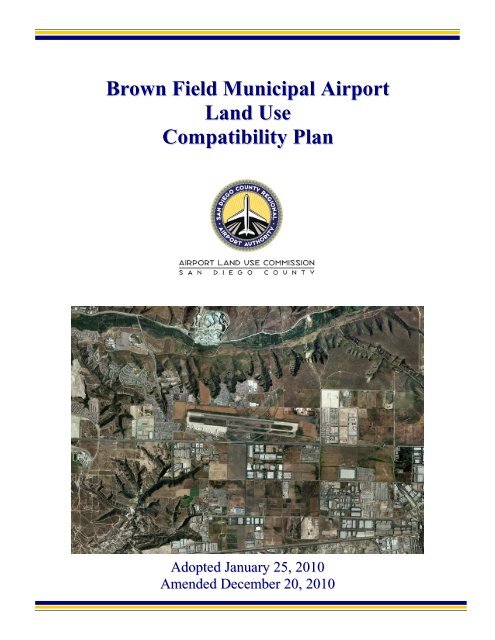
<strong>Brown</strong> <strong>Field</strong> <strong>Municipal</strong> <strong>Airport</strong><strong>Land</strong> <strong>Use</strong><strong>Compatibility</strong> <strong>Plan</strong>Adopted January 25, 2010Amended December 20, 2010
San Diego County Regional <strong>Airport</strong> Authority<strong>Brown</strong> <strong>Field</strong> <strong>Municipal</strong> <strong>Airport</strong><strong>Land</strong> <strong>Use</strong> <strong>Compatibility</strong> <strong>Plan</strong>Prepared for:San Diego County Regional <strong>Airport</strong> AuthorityPrepared by:Ricondo & Associates, Inc.Adopted by the San Diego County<strong>Airport</strong> <strong>Land</strong> <strong>Use</strong> CommissionJanuary 25, 2010
San Diego County Regional <strong>Airport</strong> Authority(as of January 25, 2010)Executive Committee MembersBob Watkins, ChairmanRamona Finnila, Vice ChairAnthony K. YoungGeneral MembersBruce R. BolandJim DesmondRobert GleasonJim PankninTom SmisekJohn DaviesStaffThella F. BowensPresident/CEOAngela Shafer-PayneVice President, Strategic <strong>Plan</strong>ning and OperationsKeith B. WilschetzDirector, <strong>Airport</strong> <strong>Plan</strong>ningSandi SawaManager, <strong>Airport</strong> <strong>Plan</strong>ningKim Sheredy, AICP<strong>Airport</strong> <strong>Plan</strong>ner IIBreton K. LobnerGeneral CounselAmy GonzalezDirector, Counsel ServicesLori D. BallanceOutside Legal Counsel
Table of Contents<strong>Brown</strong> <strong>Field</strong> <strong>Municipal</strong> <strong>Airport</strong>Chapter 1: Introduction ................................................................................................ 1-11.1 Overview of the <strong>Plan</strong> .......................................................................................... 1-11.1.1 Function and Applicability of the <strong>Compatibility</strong> <strong>Plan</strong> ....................... 1-11.1.2 Statutory Reqirements ........................................................................ 1-21.1.3 San Diego County <strong>Airport</strong> <strong>Land</strong> <strong>Use</strong> Commission ............................ 1-41.1.4 Relationship of the ALUC to Local Agencies ................................... 1-41.2 Policy Framework .............................................................................................. 1-41.2.1 State Laws and Guidelines ................................................................. 1-51.2.2 Relationship to <strong>Airport</strong> Master <strong>Plan</strong>s ................................................. 1-51.3 Forecasting Methodology ................................................................................... 1-61.4 <strong>Plan</strong> Implementation .......................................................................................... 1-71.4.1 General <strong>Plan</strong> Consistency .................................................................. 1-71.4.2 Project Referrals ................................................................................. 1-81.5 <strong>Plan</strong> Contents ..................................................................................................... 1-8Chapter 2: <strong>Airport</strong> <strong>Land</strong> <strong>Use</strong> Commission Policies ................................................... 2-12.1 Chapter Overview .............................................................................................. 2-12.2 Definitions .......................................................................................................... 2-22.3 Effective Date ..................................................................................................... 2-72.4 Types of <strong>Airport</strong> Impacts ................................................................................. 2-102.5 Geographic Scope ............................................................................................ 2-122.6 Types of Actions Reviewed ............................................................................. 2-122.7 General Review Process for <strong>Land</strong> <strong>Use</strong> Actions ............................................... 2-142.8 Review Process for General <strong>Plan</strong>s, Specific <strong>Plan</strong>s, Zoning Ordinances,and Building Regulations ................................................................................. 2-162.9 General <strong>Plan</strong> Consistency with <strong>Compatibility</strong> <strong>Plan</strong> ......................................... 2-192.10 Review Process for Other <strong>Land</strong> <strong>Use</strong> Actions ................................................. 2-212.11 Special <strong>Compatibility</strong> Considerations ............................................................ 2-242.12 Review of <strong>Airport</strong> Master <strong>Plan</strong>s and Development <strong>Plan</strong>s .............................. 2-29<strong>Brown</strong> <strong>Field</strong> <strong>Municipal</strong> <strong>Airport</strong> <strong>Land</strong> <strong>Use</strong> <strong>Compatibility</strong> <strong>Plan</strong>January 25, 2010 Amended December 20, 2010i
TABLE OF CONTENTS BROWN FIELD MUNICIPAL AIRPORTChapter 3: <strong>Brown</strong> <strong>Field</strong> <strong>Municipal</strong> <strong>Airport</strong> Policies and Maps ................................ 3-13.1 Chapter Overview .............................................................................................. 3-13.2 <strong>Compatibility</strong> Zone Delineation ......................................................................... 3-13.2.1 Underlying <strong>Airport</strong> Data .................................................................... 3-13.2.2 <strong>Compatibility</strong> Policy Maps ................................................................ 3-33.3 Noise <strong>Compatibility</strong> Policies for <strong>Brown</strong> <strong>Field</strong> <strong>Municipal</strong> <strong>Airport</strong> .................. 3-233.4 Safety <strong>Compatibility</strong> Policies for <strong>Brown</strong> <strong>Field</strong> <strong>Municipal</strong> <strong>Airport</strong> ................. 3-293.5 Airspace Protection <strong>Compatibility</strong> Policies for <strong>Brown</strong> <strong>Field</strong><strong>Municipal</strong> <strong>Airport</strong> ............................................................................................ 3-573.6 Overflight <strong>Compatibility</strong> Policies for <strong>Brown</strong> <strong>Field</strong> <strong>Municipal</strong> <strong>Airport</strong> ........... 3-59Chapter 4: Background Data: <strong>Brown</strong> <strong>Field</strong> <strong>Municipal</strong> <strong>Airport</strong> and Environs ...... 4-14.1 <strong>Airport</strong> Overview ............................................................................................... 4-14.1.1 <strong>Airport</strong> Location ................................................................................. 4-14.1.2 <strong>Airport</strong> Facilities ................................................................................ 4-14.1.3 Existing <strong>Airport</strong> Activity.................................................................... 4-24.1.4 <strong>Airport</strong> Activity Forecast ................................................................... 4-24.1.5 Existing and Future Noise Exposure Contours ................................ 4-134.2 <strong>Airport</strong> Environs ............................................................................................... 4-144.3 <strong>Compatibility</strong> Factors/Layers ........................................................................... 4-144.3.1 <strong>Compatibility</strong> Data: Noise............................................................... 4-144.3.2 <strong>Compatibility</strong> Data: Safety .............................................................. 4-394.3.3 <strong>Compatibility</strong> Data: Airspace Protection ........................................ 4-434.3.4 <strong>Compatibility</strong> Data: Overflight ....................................................... 4-43AppendicesA. State Laws Related to <strong>Airport</strong> <strong>Land</strong> <strong>Use</strong> <strong>Plan</strong>ning ............................................ A-1B. 14 Code of Federal Regulations Part 77: Objects Affecting NavigableAirspace............................................................................................................. B-1C. <strong>Airport</strong> <strong>Land</strong> use <strong>Compatibility</strong> Concepts .......................................................... C-1ii<strong>Brown</strong> <strong>Field</strong> <strong>Municipal</strong> <strong>Airport</strong> <strong>Land</strong> <strong>Use</strong> <strong>Compatibility</strong> <strong>Plan</strong>January 25, 2010 Amended December 20, 2010
TABLE OF CONTENTS BROWN FIELD MUNICIPAL AIRPORTD. Methods for Determining Concentrations of People ......................................... D-1E. General <strong>Plan</strong> Consistency Checklist ................................................................... E-1F. Sample Implementation Documents .................................................................... F-1G. On-Line Implementation Tool ............................................................................ G-1H. Glossary .............................................................................................................. H-1I. Correspondence with the Division of Aeronautics ................................................ I-1List of TablesTable III-1 Noise <strong>Compatibility</strong> Criteria ............................................................................................. 3-27Table III-2 Safety <strong>Compatibility</strong> Criteria ............................................................................................ 3-49Table IV-1 <strong>Airport</strong> Features Summary – <strong>Brown</strong> <strong>Field</strong> <strong>Municipal</strong> <strong>Airport</strong> ........................................... 4-5Table IV-2 <strong>Airport</strong> Activity Data Summary – <strong>Brown</strong> <strong>Field</strong> <strong>Municipal</strong> <strong>Airport</strong> ................................. 4-15Table IV-3 <strong>Airport</strong> Environs Information – <strong>Brown</strong> <strong>Field</strong> <strong>Municipal</strong> <strong>Airport</strong> ..................................... 4-23List of ExhibitsExhibit III-1 <strong>Compatibility</strong> Policy Map – Noise .................................................................................. 3-5Exhibit III-2 <strong>Compatibility</strong> Policy Map – Safety ................................................................................. 3-7Exhibit III-3 <strong>Compatibility</strong> Policy Map – Part 77 Airspace Protection ............................................. 3-11Exhibit III-4 <strong>Compatibility</strong> Policy Map – TERPS Airspace Protection ............................................. 3-13Exhibit III-5 <strong>Compatibility</strong> Policy Map – Overflight ......................................................................... 3-15Exhibit III-6 <strong>Compatibility</strong> Policy Map – <strong>Airport</strong> Influence Area ..................................................... 3-19Exhibit III-7 Avigation Easement and Overflight Notification Areas ................................................ 3-21Exhibit IV-1 <strong>Airport</strong> Aerial – <strong>Brown</strong> <strong>Field</strong> <strong>Municipal</strong> <strong>Airport</strong> ............................................................ 4-7<strong>Brown</strong> <strong>Field</strong> <strong>Municipal</strong> <strong>Airport</strong> <strong>Land</strong> <strong>Use</strong> <strong>Compatibility</strong> <strong>Plan</strong>January 25, 2010 Amended December 20, 2010iii
TABLE OF CONTENTS BROWN FIELD MUNICIPAL AIRPORTExhibit IV-2 <strong>Airport</strong> Diagram – <strong>Brown</strong> <strong>Field</strong> <strong>Municipal</strong> <strong>Airport</strong> ........................................................ 4-9Exhibit IV-3 <strong>Airport</strong> Layout <strong>Plan</strong> ....................................................................................................... 4-11Exhibit IV-4 <strong>Airport</strong> Noise Contours – Existing Conditions.............................................................. 4-19Exhibit IV-5 <strong>Airport</strong> Noise Contours – Future Conditions ................................................................ 4-21Exhibit IV-6 Existing <strong>Land</strong> <strong>Use</strong> – <strong>Airport</strong> Environs .......................................................................... 4-27Exhibit IV-7 <strong>Plan</strong>ned <strong>Land</strong> <strong>Use</strong> – <strong>Airport</strong> Environs ........................................................................... 4-29Exhibit IV-8 Community <strong>Plan</strong>ning Areas – <strong>Airport</strong> Environs ............................................................ 4-31Exhibit IV-9 <strong>Plan</strong>ned <strong>Land</strong> <strong>Use</strong> – Otay Community <strong>Plan</strong> .................................................................. 4-33Exhibit IV-10 <strong>Plan</strong>ned <strong>Land</strong> <strong>Use</strong> – Otay Mesa Community <strong>Plan</strong> ........................................................ 4-35Exhibit IV-11 <strong>Compatibility</strong> Data Map – Noise ................................................................................... 4-37Exhibit IV-12 <strong>Compatibility</strong> Data Map – Safety .................................................................................. 4-41Exhibit IV-13 <strong>Compatibility</strong> Data Map – Part 77 Airspace Protection ................................................ 4-45Exhibit IV-14 <strong>Compatibility</strong> Data Map – TERPS Airspace Protection ............................................... 4-47Exhibit IV-15 <strong>Compatibility</strong> Data Map – Overflight ............................................................................ 4-49iv<strong>Brown</strong> <strong>Field</strong> <strong>Municipal</strong> <strong>Airport</strong> <strong>Land</strong> <strong>Use</strong> <strong>Compatibility</strong> <strong>Plan</strong>January 25, 2010 Amended December 20, 2010
Chapter 1Introduction<strong>Brown</strong> <strong>Field</strong> <strong>Municipal</strong> <strong>Airport</strong> <strong>Land</strong> <strong>Use</strong> <strong>Compatibility</strong> <strong>Plan</strong>
1Introduction1.1 OVERVIEW OF THE PLANThe basic function of airport land use compatibility plans (compatibility plans) is to promotecompatibility between airports and the land uses that surround them “to the extent that these areas are notalready devoted to incompatible uses” (Pub. Util. Code §21674(a)). With limited exception, Californialaw requires preparation of compatibility plans for each public-use and military airport in the state. Mostcounties have established an <strong>Airport</strong> <strong>Land</strong> <strong>Use</strong> Commission (ALUC), as provided for by law, to preparecompatibility plans for the airports in that county and to review land use plans, development proposals,and certain airport development plans for consistency with the compatibility plans. In San Diego County,the ALUC function rests with the Board of the San Diego County Regional <strong>Airport</strong> Authority (SDCRAA),in accordance with section 21670.3 of the California Public Utilities Code.1.1.1 Function and Applicability of the <strong>Compatibility</strong> <strong>Plan</strong>This <strong>Compatibility</strong> <strong>Plan</strong>, prepared for <strong>Brown</strong> <strong>Field</strong> <strong>Municipal</strong> <strong>Airport</strong> (the <strong>Airport</strong>), is the fundamentaltool used by the SDCRAA, acting in its capacity as the San Diego County ALUC, in fulfilling its purposeof promoting airport land use compatibility. Specifically, this <strong>Compatibility</strong> <strong>Plan</strong>: (1) provides for theorderly growth of the <strong>Airport</strong> and the area surrounding the <strong>Airport</strong>; and (2) safeguards the general welfareof the inhabitants within the vicinity of the <strong>Airport</strong> and the public in general (Pub. Util. Code §21675(a)).In essence, this <strong>Compatibility</strong> <strong>Plan</strong> serves as a tool for the ALUC to use in fulfilling its duty to reviewland use plans and development proposals within the <strong>Airport</strong> Influence Area (AIA) at the <strong>Airport</strong>. Inaddition, this <strong>Compatibility</strong> <strong>Plan</strong> provides compatibility policies and criteria applicable to local agenciesin their preparation or amendment of general plans and to landowners in their design of newdevelopment. (Please note that this <strong>Compatibility</strong> <strong>Plan</strong> defines general plans to include any general plan,community plan, specific plan, zoning ordinance, building regulation, land use policy document, orimplementing ordinance. See Policy 2.2.21.)Details regarding the purpose, scope, and applicability of this <strong>Compatibility</strong> <strong>Plan</strong> are provided in Chapter2, which also includes the procedural requirements for the review of development proposals. Theseprocedures, together with the compatibility criteria, maps, and other policies in Chapter 3, comprise thetools the ALUC uses in reviewing proposed land use plans, development proposals, and airport1-1<strong>Brown</strong> <strong>Field</strong> <strong>Municipal</strong> <strong>Airport</strong> <strong>Land</strong> <strong>Use</strong> <strong>Compatibility</strong> <strong>Plan</strong>January 25, 2010
CHAPTER 1INTRODUCTIONdevelopment actions. Finally, Chapter 4 provides background information on the <strong>Airport</strong>, includinginformation regarding its existing and planned facilities, existing and future conditions, and local agenciesaffected by this <strong>Compatibility</strong> <strong>Plan</strong> in the <strong>Airport</strong> environs.<strong>Use</strong> of this <strong>Compatibility</strong> <strong>Plan</strong> is not solely limited to the ALUC. As noted above, the compatibilitycriteria included in this <strong>Compatibility</strong> <strong>Plan</strong> must be used by local agencies during their preparation oramendment of general plans. The AIA at the <strong>Airport</strong> encompasses lands within the cities of San Diego,Chula Vista, Imperial Beach, National City and unincorporated areas of San Diego County. State lawrequires each local agency to modify its general plans to be consistent with this <strong>Compatibility</strong> <strong>Plan</strong> or totake special steps to overrule the ALUC. Furthermore, this <strong>Compatibility</strong> <strong>Plan</strong> applies not just to SanDiego County and the cities listed above, but to school districts, community college districts, specialdistricts, and other local agencies when these entities consider the siting and design of new facilities orexpansion of existing ones. Finally, private parties are subject to this <strong>Compatibility</strong> <strong>Plan</strong> either directly oras required in the general plans of San Diego County and the cities of San Diego, Chula Vista, ImperialBeach, and National City.This <strong>Compatibility</strong> <strong>Plan</strong> replaces the <strong>Brown</strong> <strong>Field</strong> <strong>Municipal</strong> <strong>Airport</strong> <strong>Land</strong> <strong>Use</strong> <strong>Compatibility</strong> <strong>Plan</strong>adopted on September 21, 1981 by the San Diego Association of Governments (SANDAG) when itserved as the San Diego County ALUC. The 1981 Comprehensive <strong>Land</strong> <strong>Use</strong> <strong>Plan</strong> was amended inOctober 2004 and renamed the <strong>Airport</strong> <strong>Land</strong> <strong>Use</strong> <strong>Compatibility</strong> <strong>Plan</strong> by the SDCRAA, which assumed theresponsibilities of the ALUC in January 2003.This <strong>Compatibility</strong> <strong>Plan</strong> is based on the Federal Aviation Administration (FAA) approved <strong>Airport</strong> Layout<strong>Plan</strong> (ALP), as amended by the updated December 2007 airport diagram. The ALP was accepted forairport compatibility planning by the California Department of Transportation, Division of Aeronautics(Division of Aeronautics), in June 2008. The ALP and updated 2007 airport diagram reflect theanticipated growth of the <strong>Airport</strong> for at least the next 20 years and depict both existing and plannedfacilities at the <strong>Airport</strong>, including the airfield, runway protection zones, and the <strong>Airport</strong> propertyboundary. A copy of the Division of Aeronautics letter determining that the ALP and updated airportdiagram are appropriate and acceptable for preparing this <strong>Compatibility</strong> <strong>Plan</strong> for the <strong>Airport</strong> and theSDCRAA’s request for written acceptance of these documents are provided in Appendix I of this<strong>Compatibility</strong> <strong>Plan</strong>. Additional information about the <strong>Airport</strong> assumptions (which have been clarified bythe <strong>Airport</strong>’s operator), is provided in Chapter 4.1.1.2 Statutory RequirementsPowers and DutiesRequirements for creation of ALUCs were first established in 1967 under the California State AeronauticsAct (Pub. Util. Code §21670 et seq.). The text of the statute is in Appendix A. Although the law hasbeen amended numerous times since its enactment, the fundamental purpose of ALUCs has remainedunchanged. The ALUC has the responsibility to “assist local agencies in ensuring compatible land uses in1–2<strong>Brown</strong> <strong>Field</strong> <strong>Municipal</strong> <strong>Airport</strong> <strong>Land</strong> <strong>Use</strong> <strong>Compatibility</strong> <strong>Plan</strong>January 25, 2010
CHAPTER 1INTRODUCTIONthe vicinity of … airports to the extent that the land in the vicinity of those airports is not already devotedto incompatible uses…” The ALUC is also empowered to “coordinate planning at the state, regional, andlocal levels so as to provide for the orderly development of air transportation, while at the same timeprotecting the public health, safety, and welfare” (Pub. Util. Code §21674).The law defines the powers and duties of ALUCs in terms that parallel the ALUC’s purpose:• To assist local agencies in ensuring compatible land uses in the vicinity of airports to the extent thatland is not already devoted to incompatible uses.• To prepare and adopt an airport land use compatibility plan for each airport within its jurisdiction.• To review the plans, regulations, and certain other actions of local agencies and airport operators forconsistency with that plan.• To coordinate planning at the state, regional and local levels, so as to provide for the orderlydevelopment of air transportation, while at the same time protecting the public health, safety andwelfare (Pub. Util. Code §21674).LimitationsThe above fundamental purpose and the powers and duties notwithstanding, the Aeronautics Act citesthree important limitations on an ALUC’s authority: (1) ALUCs have no authority over “existing landuses” regardless of whether such uses are incompatible with airport activities (Pub. Util. Code §21670(a)(2) and §21674(a)); (2) ALUCs have no jurisdiction over the “operation of airports” (Pub. Util. Code§21674(e)); and (3) ALUCs have no jurisdiction over federal lands, such as military bases and landscontrolled by the U.S. Forest Service, U.S. Bureau of <strong>Land</strong> Management, or lands under the authority ofAmerican Indian tribes and bands (Pub. Util. Code §21675(b)). The term existing land use is defined, forpurposes of this <strong>Compatibility</strong> <strong>Plan</strong>, in Chapter 2.A fourth, less absolute, limitation on ALUC authority concerns the types of land use actions that aresubject to ALUC review. The law emphasizes that general plans are the primary mechanism forimplementing the compatibility policies of an ALUC’s compatibility plan. Thus, each local agency withland located within the AIA for an airport is required to make its general plan consistent with thecompatibility plan, or to take special steps to overrule all or part of an ALUC’s compatibility plan (Pub.Util. Code §§21675.1(d), 21676, 21676.5(a)). If a local agency fails to take either action, then it isrequired to submit all land use development actions involving property located within the AIA to theALUC for review (Pub. Util. Code §21676.5(a)). Once the ALUC has determined that the local agency'sgeneral plan is consistent with the compatibility plan, or the local agency overrules the ALUC’scompatibility plan, the ALUC’s authority to review projects within that agency’s jurisdiction is limited.After this point, submittal of individual projects for ALUC review is voluntary, and ALUCdeterminations on these projects are advisory and are not subject to the overruling provisions associatedwith mandatory reviews (Pub. Util. Code §21676.5(b)). However, ALUC review remains mandatory forthe proposed adoption or amendment of general plans affecting land within the AIA.1-3<strong>Brown</strong> <strong>Field</strong> <strong>Municipal</strong> <strong>Airport</strong> <strong>Land</strong> <strong>Use</strong> <strong>Compatibility</strong> <strong>Plan</strong>January 25, 2010
CHAPTER 1INTRODUCTION1.1.3 San Diego County <strong>Airport</strong> <strong>Land</strong> <strong>Use</strong> CommissionAs noted earlier in this chapter, the SDCRAA serves as the ALUC in San Diego County. The SDCRAAdesignation as the San Diego County ALUC is written into state law (Pub. Util. Code §21670.3), andSDCRAA assumed the ALUC duties from SANDAG when the SDCRAA came into existence on January 1,2003. (SANDAG had served as the San Diego County ALUC since December 1970 when the ALUCfunction was first established.)The SDCRAA is also the operator of San Diego International <strong>Airport</strong>, the sole major domestic andinternational airport in the county. In addition, the SDCRAA is responsible for leading the comprehensiveplanning effort directed at meeting the long-term air transportation service demands of the region. Inconnection with this responsibility, the SDCRAA must complete a Regional Aviation Strategic <strong>Plan</strong>(RASP) by June 30, 2011. The goal of the RASP is to evaluate the aviation needs of San Diego County.While these three functions are housed within a single organization, the ALUC’s role is largelyindependent of the others because ALUCs legally have no authority over airport operations.1.1.4 Relationship of the ALUC to Local AgenciesThe fundamental relationship between the San Diego County ALUC and the local agencies that may beaffected by this <strong>Compatibility</strong> <strong>Plan</strong> is set forth in the Aeronautics Act. The ALUC does not need approvalof the County or any city in order to adopt this <strong>Compatibility</strong> <strong>Plan</strong> or to carry out the ALUC projectreview responsibilities; however, the ALUC must coordinate its activities with local agencies. In oneparticular respect, this coordination is mandatory. State law requires “hearing and consultation with theinvolved agencies” with regard to establishment and modification of AIA boundaries (Pub. Util. Code§21675(c)).Another aspect of the relationship between the ALUC and local agencies concerns implementation of this<strong>Compatibility</strong> <strong>Plan</strong>. Although the ALUC has the sole authority to adopt this <strong>Compatibility</strong> <strong>Plan</strong> and toconduct compatibility reviews, the authority and responsibility for implementing the compatibilitypolicies rests with the local agencies that control land uses within the AIA. Actions that these localagencies can take to implement this <strong>Compatibility</strong> <strong>Plan</strong>'s policies are outlined later in this chapter.1.2 POLICY FRAMEWORKThe policies in Chapters 2 and 3 of this <strong>Compatibility</strong> <strong>Plan</strong> are based on the following primary sources:the Aeronautics Act, the ALP and the updated airport diagram for the <strong>Airport</strong>, and other state laws,regulations, and guidelines, including those in the California <strong>Airport</strong> <strong>Land</strong> <strong>Use</strong> <strong>Plan</strong>ning Handbook(Handbook) published by the Division of Aeronautics in January 2002. The Handbook is available on thewebsites of both the Division of Aeronautics (www.dot.ca.gov/hq/planning/aeronaut/) and the SDCRAA(www.san.org/airport_authority).1–4<strong>Brown</strong> <strong>Field</strong> <strong>Municipal</strong> <strong>Airport</strong> <strong>Land</strong> <strong>Use</strong> <strong>Compatibility</strong> <strong>Plan</strong>January 25, 2010
CHAPTER 1INTRODUCTION1.2.1 State Laws and GuidelinesMany of the procedures that govern how ALUCs operate are defined by state law. Statutory provisions inthe Public Utilities Code require ALUC adoption of compatibility plans for each public-use and militaryairport, and establish certain steps to be taken during the plan adoption process (see Pub. Util. Code§21675). The law also dictates the requirements for airport land use compatibility reviews by ALUCsand the types of actions that local agencies must submit to ALUCs for consistency reviews (see Pub. Util.Code §§21675.2, 21676, 21676.5).When preparing compatibility plans for individual airports, ALUCs must be guided by the information inthe Handbook (Pub. Util. Code §21674.7). To be guided by the Handbook, ALUCs must have at leastexamined and duly considered the material contained in it. The burden is presumed to be on ALUCs todemonstrate their reasons for deviating from the guidance that the Handbook provides. Theserequirements notwithstanding, ALUCs have a significant degree of flexibility and discretion to makeplanning decisions they deem appropriate for the airports within their jurisdiction. The Handbook is notregulatory in that it does not constitute formal state policy, except to the extent that it explicitly refers tostate laws. The Handbook provides guidance and is intended to serve as the starting point forcompatibility planning around individual airports. When in doubt regarding the Handbook’s guidance,ALUCs are encouraged to contact the Division of Aeronautics staff. The policies and maps in this<strong>Compatibility</strong> <strong>Plan</strong> take into account the guidance provided by the current edition of the Handbook, datedJanuary 2002.An additional function of the Handbook is established elsewhere in California state law. The PublicResources Code creates a tie between the Handbook and California Environmental Quality Act (CEQA)documents. Public Resources Code section 21096 requires that CEQA lead agencies use the Handbook as“a technical resource” when assessing airport-related noise and safety impacts of projects located in thevicinity of airports.1.2.2 Relationship to <strong>Airport</strong> Master <strong>Plan</strong>s<strong>Compatibility</strong> plans are distinct from airport master plans in function and content. In simple terms, theissues addressed by airport master plans are primarily on-airport, whereas those of concern in acompatibility plan are generally off-airport. The purpose of airport master plans is to assess the demandfor airport facilities and to guide the development necessary to meet those demands. An airport masterplan is prepared for, and adopted by, the agency that owns and/or operates the airport. In contrast, themajor purpose of a compatibility plan is to ensure that incompatible development does not occur on landsurrounding the airports.This distinction notwithstanding, the relationship between the two types of plans is close. State lawrequires that compatibility plans be based on a long-range airport master plan or ALP, as determined bythe Division of Aeronautics, which reflects the anticipated growth of the airport for at least the next 201-5<strong>Brown</strong> <strong>Field</strong> <strong>Municipal</strong> <strong>Airport</strong> <strong>Land</strong> <strong>Use</strong> <strong>Compatibility</strong> <strong>Plan</strong>January 25, 2010
CHAPTER 1INTRODUCTIONyears. The relationship between a compatibility plan and an airport master plan or ALP, centers on thecurrent and future airport layout and existing and projected airport activity.The responsibility for the <strong>Airport</strong>’s master plan lies with the airport proprietor, the City of San Diego.The current master plan for the <strong>Airport</strong> was adopted in May 1980. Updates to the <strong>Airport</strong>’s master planwere prepared in 1990 and 2000 but were never adopted. In late 2007/early 2008 the City initiated aMaster <strong>Plan</strong> Update process. Approval of the Master <strong>Plan</strong> Update, which includes a comprehensiveupdate to the <strong>Airport</strong>’s ALP, is anticipated in 2010. In the absence of a current master plan, state lawallows an ALUC’s compatibility plan to be based on an ALP with the approval of the Division ofAeronautics. In a letter dated June 19, 2008, the Division of Aeronautics approved the ALUC’s request touse the airport operator’s most recent ALP for the <strong>Airport</strong>. The approval letter is provided in Appendix I.1.3 FORECASTING METHODOLOGYState law requires that a compatibility plan reflect “the anticipated growth of the airport during at least thenext 20 years” (Pub. Util. Code §21675(a)). In addition, as discussed above, the compatibility plan is tobe based on the airport operator’s adopted airport master plan, where one exists, or an ALP that has beenaccepted by the Division of Aeronautics for airport compatibility planning. ALUC planning assumptionsregarding future aircraft activity at an airport must be consistent with the role of the airport as identifiedin an airport master plan or ALP.Frequently, unless the airport master plan is recent, the forecasts cannot be used directly because they donot cover the requisite 20-year period. This issue is addressed in the Handbook:[M]ost airports presumably will remain in operation for more than 20 years. This factor combinedwith the characteristic uncertainty of forecasting suggests that, for the purpose of airport land usecompatibility planning, using a high estimate of long-range activity levels is generally preferableto underestimating the future potential. This strategy especially applies with respect toassessment of noise impacts. Too low of a forecast may allow compatibility conflicts that cannotlater be undone.The caveat to this methodology, as also stated in the Handbook, is that “activity projections must also bereasonable” and remain consistent with the role of the airport as envisioned by the airport owner.Policies in this <strong>Compatibility</strong> <strong>Plan</strong> are based on projected airport activity levels located in the airportmaster plan and ALP, and have been developed in accordance with the forecasting methodology guidancein the Handbook. Specific factors considered when determining the 20+ year future activity levels for the<strong>Airport</strong> are described in Chapter 4. Consistent with the Handbook, the forecast is at the high end of therange of activity likely to be reached during the 20+ year horizon that state law requires.1–6<strong>Brown</strong> <strong>Field</strong> <strong>Municipal</strong> <strong>Airport</strong> <strong>Land</strong> <strong>Use</strong> <strong>Compatibility</strong> <strong>Plan</strong>January 25, 2010
CHAPTER 1INTRODUCTION1.4 PLAN IMPLEMENTATION1.4.1 General <strong>Plan</strong> ConsistencyAs noted previously, state law requires each local agency having jurisdiction over land uses within anALUC’s influence area to modify its general plans to be consistent with the compatibility plan. Theother option is to take steps to overrule all or part of an ALUC’s compatibility plan within 180 days ofwhen the ALUC adopts or amends it. If a local agency fails to take either action, it is required to submitall land use development actions involving property within the AIA to the ALUC for review (Pub. Util.Code §21676.5 (a)).The local agency may propose to overrule an ALUC’s compatibility plan after a hearing by a two-thirdsvote of its governing body if it makes specific findings that the local agency’s plans are consistent withthe intent of state airport land use planning statutes. The local agency must provide both the ALUC andthe Division of Aeronautics a copy of the local agency’s proposed decision and findings at least 45 daysin advance of its decision to overrule the ALUC and must hold a public hearing on the proposedoverruling (Pub. Util. Code §21676(a) and (b)). If the ALUC and the Division of Aeronautics choose toprovide comments to the local agency, they must do so within 30 days of receiving the proposed decisionand findings. All comments received from the ALUC or Division of Aeronautics must be included in thepublic record of the local agency’s final decision to overrule the ALUC (Pub. Util. Code §§21676,21676.5 and 21677). Similar requirements apply to a local agency’s decision to overrule the ALUC’sconsistency determinations for individual development proposals for which ALUC review is mandatory(Pub. Util. Code §21676.5(a)) and airport master plans (Pub. Util. Code §21676(c)).General plans do not need to be identical to an ALUC’s compatibility plan to be consistent. To meet theconsistency test, general plans must do two things:• Eliminate direct conflicts with compatibility planning criteria.• Establish procedures that implement and ensure compliance with compatibility policies.To do this, general plans must:• Delineate the compatibility criteria to be applied to individual land use actions.• Identify the mechanisms to be used to tie the applicable criteria to a particular development.• Indicate the procedures to be followed in review and approval of development actions affecting landswithin the AIA.Policy 2.9 in Chapter 2 contains additional information, including the methods local agencies can employto make general plans consistent with an ALUC’s compatibility plan.1-7<strong>Brown</strong> <strong>Field</strong> <strong>Municipal</strong> <strong>Airport</strong> <strong>Land</strong> <strong>Use</strong> <strong>Compatibility</strong> <strong>Plan</strong>January 25, 2010
CHAPTER 1INTRODUCTION1.4.2 Project ReferralsThe types of land use actions for which referral to the ALUC are mandatory include the adoption andamendment of general plans if land within an AIA, as defined by the ALUC, is impacted. Thisrequirement to refer land use actions to the ALUC for review should be indicated in the general plans ofall affected local agencies.Beginning with adoption of the compatibility plan by the ALUC and continuing until each affected localagency has made the necessary modifications to its general plan or overruled the ALUC’s compatibilityplan, all subsequent land use actions, regulations and permits within the AIA must be submitted to theALUC for review. After the local agency has made its general plan consistent with the compatibility planor has overruled the ALUC’s compatibility plan, submittal of individual actions, regulations, and permitsgenerally is not required. The ALUC and the local agency, however, can agree on continued submittal ofcertain actions on an informal basis.Proposed airport master plans, expansion of an existing airport, and plans for construction of a newairport (or heliport) also must be submitted to the ALUC for review in accordance with Public UtilitiesCode sections 21676 (c), 21664.5, and 21661.5, respectively. This referral requirement is independent ofwhether the local agency has taken action with regard to the consistency of its general plan.1.5 PLAN CONTENTSThis <strong>Compatibility</strong> <strong>Plan</strong> is complete unto itself and is separate and independent from compatibility plansadopted by the ALUC for other airports in San Diego County. This <strong>Compatibility</strong> <strong>Plan</strong> is organized intofour chapters and nine appendices. The intent of this introductory chapter is to set the general overallcontext of airport land use compatibility planning and for the <strong>Airport</strong> and the San Diego County ALUC inparticular.Chapters 2 and 3 contain the policies by which the ALUC operates and conducts compatibility reviews ofproposed land use and airport development actions. The policies in Chapter 2 are written broadly, so asto address overarching compatibility concerns. The compatibility criteria and other policies applicable tothe <strong>Airport</strong> are described in Chapter 3. Chapter 4 presents a variety of background data on the <strong>Airport</strong>and its environs, and documents the data and assumptions on which the compatibility policies for the<strong>Airport</strong> are based.The appendices contain copies of state and Federal statutes pertaining to airport and airport land usecompatibility planning and other supporting information.1–8<strong>Brown</strong> <strong>Field</strong> <strong>Municipal</strong> <strong>Airport</strong> <strong>Land</strong> <strong>Use</strong> <strong>Compatibility</strong> <strong>Plan</strong>January 25, 2010
Chapter 2<strong>Airport</strong> <strong>Land</strong> <strong>Use</strong>Commission Policies<strong>Brown</strong> <strong>Field</strong> <strong>Municipal</strong> <strong>Airport</strong> <strong>Land</strong> <strong>Use</strong> <strong>Compatibility</strong> <strong>Plan</strong>
2<strong>Airport</strong> <strong>Land</strong> <strong>Use</strong>Commission Policies2.1 CHAPTER OVERVIEW2.1.1 Purpose: The policies set forth in this chapter and Chapter 3 of this <strong>Compatibility</strong> <strong>Plan</strong> serve twofunctions:(a) To articulate the procedures to be used by the SDCRAA, acting in its capacity as the SanDiego County ALUC, and affected local agencies to fulfill the airport land usecompatibility review requirements set forth in the Aeronautics Act (Pub. Util. Code §21670et seq.). Specifically, these procedures define:(1) The steps to be taken by local agencies, specifically the County of San Diego, cities ofChula Vista, Imperial Beach, National City and San Diego, special districts, schooldistricts, and community college districts, in submitting certain land use actions to theALUC for review in accordance with Policies 2.6.1 and 2.6.2 of this <strong>Compatibility</strong> <strong>Plan</strong>.(2) The steps to be taken by the City of San Diego, as operator of the <strong>Airport</strong>, in submittingairport master plans and other certain airport-related plans to the ALUC for review inaccordance with Policies 2.6.1(b) and 2.6.1(c) of this <strong>Compatibility</strong> <strong>Plan</strong>.(3) The process, as stated in Policies 2.7 through 2.10 of this <strong>Compatibility</strong> <strong>Plan</strong>, to be usedby the ALUC in reviewing the above actions for compliance with the compatibilitycriteria set forth in this <strong>Compatibility</strong> <strong>Plan</strong>.(b) To identify compatibility criteria to be utilized by:(1) The ALUC in review of land use actions within the <strong>Airport</strong>’s AIA and airport masterplans and other development plans for the <strong>Airport</strong>.(2) Local agencies in modifying their respective general plans for consistency with this<strong>Compatibility</strong> <strong>Plan</strong>.2.1.2 Relationship to Chapter 3 Policies: The policies in this chapter address ALUC review proceduresand overarching compatibility considerations. <strong>Compatibility</strong> criteria and other policies applicable2-1<strong>Brown</strong> <strong>Field</strong> <strong>Municipal</strong> <strong>Airport</strong> <strong>Land</strong> <strong>Use</strong> <strong>Compatibility</strong> <strong>Plan</strong>January 25, 2010
CHAPTER 2AIRPORT LAND USE COMMISSION POLICIESto the <strong>Airport</strong> are set forth in Chapter 3. For purposes of this <strong>Compatibility</strong> <strong>Plan</strong>, as listed inPolicy 2.1.1, adherence to the policies in both chapters is required.2.2 DEFINITIONSThe following defined terms are used throughout this <strong>Compatibility</strong> <strong>Plan</strong> and are shown in italics. Thelocal agencies may have adopted alternative definitions for some of the terms presented below.However, for purposes of this <strong>Compatibility</strong> <strong>Plan</strong>, the terms shall be defined as presented below.Definitions for other commonly used aviation terms are provided in Appendix H.2.2.1 Aeronautics Act: Except as indicated otherwise, the article of the California Public Utilities Codesection 21670 et seq., as amended, pertaining to ALUCs.2.2.2 <strong>Airport</strong>: The <strong>Brown</strong> <strong>Field</strong> <strong>Municipal</strong> <strong>Airport</strong>.2.2.3 <strong>Airport</strong> Influence Area (AIA): The AIA defines the jurisdiction of the ALUC and is the area whereairport-related noise, safety, airspace protection, and overflight factors may significantly affectland use compatibility or necessitate restrictions on certain land uses as determined by the ALUC.<strong>Land</strong> use actions that affect property within the AIA are subject to the compatibility policies andcriteria in this <strong>Compatibility</strong> <strong>Plan</strong>.2.2.4 <strong>Airport</strong> <strong>Land</strong> <strong>Use</strong> Commission (ALUC): The San Diego County Regional <strong>Airport</strong> Authority,acting in its capacity as the San Diego County <strong>Airport</strong> <strong>Land</strong> <strong>Use</strong> Commission.2.2.5 <strong>Airport</strong> <strong>Land</strong> <strong>Use</strong> Commission (ALUC) staff: The President/CEO (Chief Executive Officer) of theSan Diego County Regional <strong>Airport</strong> Authority or person(s) designated by the President/CEO, withthe approval of the ALUC chairperson.2.2.6 <strong>Airport</strong> Layout <strong>Plan</strong>: A scale drawing of existing and proposed airport facilities, their location onan airport, and the pertinent clearance and dimensional information required to demonstrateconformance with applicable standards.2.2.7 <strong>Airport</strong> Master <strong>Plan</strong>: A long-range plan for development of an airport, including descriptions ofthe data and analyses on which the plan is based.2.2.8 Airspace Protection Area: The area beneath the airspace protection surfaces for the <strong>Airport</strong>.2.2.9 Airspace Protection Surfaces: Imaginary surfaces in the airspace surrounding airports, as definedfor an individual airport in accordance with criteria set forth in Part 77 and the U.S. Standard forTerminal Instrument Procedures (TERPS). These surfaces establish the maximum height that2–2<strong>Brown</strong> <strong>Field</strong> <strong>Municipal</strong> <strong>Airport</strong> <strong>Land</strong> <strong>Use</strong> <strong>Compatibility</strong> <strong>Plan</strong>January 25, 2010 Amended December 20, 2010
CHAPTER 2AIRPORT LAND USE COMMISSION POLICIESobjects on the ground can reach without potentially creating constraints or hazards to the use ofthe airspace by aircraft approaching, departing, or maneuvering in the vicinity of an airport.2.2.10 Aviation-Related <strong>Use</strong>: Any facility or activity directly associated with the air transportation ofpersons or cargo or the operation, storage, or maintenance of aircraft at an airport or heliport.Such uses specifically include runways, taxiways, and their associated protection areas defined bythe Federal Aviation Administration (FAA), together with aircraft aprons, hangars, fixed-baseoperations facilities, terminal buildings, and related facilities.2.2.11 Avigation Easement: An easement that transfers certain property rights from a property owner toan airport owner.2.2.12 California Building Code (CBC): The CBC is located in Title 24, Part 2, of the California Codeof Regulations and governs general building construction standards.2.2.13 California Environmental Quality Act (CEQA): Statutory scheme adopted to maintain a qualityenvironment for the people of the state now and in the future. CEQA establishes a process forstate and local agency review of projects, as defined in the implementing guidelines, that mayadversely affect the environment (Pub. Resources Code §2100 et seq.; Cal. Code Regs., tit. 14,§15000 et seq.).2.2.14 Community Noise Equivalent Level (CNEL): The noise metric adopted by the State of Californiafor land use planning and describing airport noise impacts. This noise metric compensates for theincrease in people’s sensitivity to noise during evening and nighttime hours. Community noiseequivalent levels are typically depicted on maps by a set of contours, each of which represents aseries of points having the same CNEL value.2.2.15 <strong>Compatibility</strong> <strong>Plan</strong>: This document, the <strong>Brown</strong> <strong>Field</strong> <strong>Municipal</strong> <strong>Airport</strong> <strong>Land</strong> <strong>Use</strong> <strong>Compatibility</strong><strong>Plan</strong>, also referred to as “this <strong>Compatibility</strong> <strong>Plan</strong>.”2.2.16 Development Proposal: See Project.2.2.17 Division of Aeronautics: A Division of the State of California, Department of Transportation.2.2.18 Existing <strong>Land</strong> <strong>Use</strong>: A project shall be considered an “existing land use” when:(a) A “vested right” is obtained, as follows:(1) A vesting tentative map has been approved pursuant to California Government Codesection 66498.1, and has not expired; or2-3<strong>Brown</strong> <strong>Field</strong> <strong>Municipal</strong> <strong>Airport</strong> <strong>Land</strong> <strong>Use</strong> <strong>Compatibility</strong> <strong>Plan</strong>January 25, 2010 Amended December 20, 2010
CHAPTER 2AIRPORT LAND USE COMMISSION POLICIES(2) A development agreement has been executed pursuant to California Government Codesection 65866, and remains in effect; or(3) A valid building permit has been issued, substantial work has been performed, andsubstantial liabilities have been incurred in good faith reliance on the permit, pursuant tothe California Supreme Court decision in Avco Community Developers, Inc. v. SouthCoast Regional Com. (1976) 17 Cal.3d 785,791, and its progeny.(i) A proposed modification to an existing land use that will result in an increase inheight, a change of use, or an increase in density or intensity of use that is not insubstantial conformance with the project entitled by the local agency shall be subject tothis <strong>Compatibility</strong> <strong>Plan</strong> (see Policy 2.10.4).(ii) Any proposed reuse or reinitiation of an existing land use, even if thereuse/reinitiation of the existing land use will not modify the previously existing land use,will be subject to this <strong>Compatibility</strong> <strong>Plan</strong> if the previously existing land use has beendiscontinued for more than 24 months.(iii) The determination of whether a project meets the criteria of an “existing landuse” shall be made by the local agency and the ALUC.(b) A new occupancy is proposed within an existing building, provided the new occupancyremains within the same or reduced level of occupancy as the most recent one. A newoccupancy which increases intensity shall not qualify as an existing land use.2.2.19 Floor Area Ratio (FAR): For this <strong>Compatibility</strong> <strong>Plan</strong>, this term means the gross building squarefootage (excluding parking garages) divided by the entire site’s square footage (site area).2.2.20 General <strong>Plan</strong>: For this <strong>Compatibility</strong> <strong>Plan</strong>, this term means any general plan, community plan, orspecific plan, zoning ordinance, building regulation, land use policy document, or implementingordinance or any change thereto, and any amendment thereto (see Pub. Util. Code §21676 andPolicy 2.9).2.2.21 Handbook: The California <strong>Airport</strong> <strong>Land</strong> <strong>Use</strong> <strong>Plan</strong>ning Handbook, published by the Division ofAeronautics (January 2002).2.2.22 High Terrain Zone: Areas of land in the vicinity of an airport where the ground lies above a Part77 surface. In addition, any location where the ground level reaches to within 100 feet of aninstrument approach or departure surface defined by TERPS.2.2.23 Infill: Development of vacant or underutilized land within established communities orneighborhoods that is: (a) already served with streets, water, sewer, and other infrastructure; and(b) comprised of existing land uses inconsistent with the compatibility criteria in this2–4<strong>Brown</strong> <strong>Field</strong> <strong>Municipal</strong> <strong>Airport</strong> <strong>Land</strong> <strong>Use</strong> <strong>Compatibility</strong> <strong>Plan</strong>January 25, 2010 Amended December 20, 2010
CHAPTER 2AIRPORT LAND USE COMMISSION POLICIES<strong>Compatibility</strong> <strong>Plan</strong> (see Policy 2.11.1 for criteria to be used by local agencies to identify potentialinfill areas for compatibility planning purposes).2.2.24 <strong>Land</strong> <strong>Use</strong> Action: See Project.2.2.25 Local agency: For this <strong>Compatibility</strong> <strong>Plan</strong>, the County of San Diego, the cities of Chula Vista,Imperial Beach, National City and San Diego, and other local governmental entities, such as aspecial district, school district, or community college district, having jurisdiction over land useswithin the AIA defined in this <strong>Compatibility</strong> <strong>Plan</strong>. These entities are subject to the provisions ofthis <strong>Compatibility</strong> <strong>Plan</strong>; the ALUC does not have authority over land use actions of federalagencies or Indian tribes.2.2.26 Lot Coverage: The ratio between the ground floor area of a building (or buildings) and the areaof a lot/parcel.2.2.27 Nonconforming <strong>Use</strong>: A land use or building that does not comply with this <strong>Compatibility</strong> <strong>Plan</strong>(see Policies 2.11.2 and 2.11.3 for criteria applicable to land use actions involving nonconforminguses.).2.2.28 Object Free Area (OFA): An area on the ground, measured from a runway, taxiway, or taxilanecenterline, which is provided to safeguard aircraft operations by having the area free of objects,except for objects that are needed for air navigation or aircraft ground maneuvering purposes (seeFAA Advisory Circular 150/5300-13, “<strong>Airport</strong> Design”).2.2.29 Overflight Notification: An overflight notification is a buyer awareness tool designed to ensurethat prospective buyers of property near an airport, particularly residential property, are informedabout the airport's potential impact on the property. An overflight notification is recorded in theproperty's chain of title and indicates that the property may be subject to some of the annoyancesor inconveniences associated with proximity to an airport and aircraft operations (such as noise,vibration, overflights, or odors). Unlike an avigation easement, an overflight notification does notconvey property rights from the property owner to the airport and does not restrict the height ofobjects. It simply documents the existence of conditions that may affect the property.2.2.30 Part 77: The part of the Federal Aviation Regulations (Title 14 of the Code of FederalRegulations) that deals with objects affecting navigable airspace in the vicinity of airports. Part77 establishes standards for identifying obstructions to navigable airspace, sets forth requirementsfor notice to the FAA of certain proposed construction or alteration, and provides for aeronauticalstudies of obstructions to determine their effect on the safe and efficient use of airspace (seeAppendix B).2.2.31 Permit: See Project.2-5<strong>Brown</strong> <strong>Field</strong> <strong>Municipal</strong> <strong>Airport</strong> <strong>Land</strong> <strong>Use</strong> <strong>Compatibility</strong> <strong>Plan</strong>January 25, 2010 Amended December 20, 2010
CHAPTER 2AIRPORT LAND USE COMMISSION POLICIES2.2.32 Project: Any land use matter, either publicly or privately sponsored, that is subject to theprovisions of this <strong>Compatibility</strong> <strong>Plan</strong>. For this <strong>Compatibility</strong> <strong>Plan</strong>, this term means any action,regulation, or permit (see Pub. Util. Code §21676.5).2.2.33 Real Estate Disclosure: A real estate disclosure is required by state law as a condition of the saleof most residential property if the property is located in the vicinity of an airport and within itsAIA (see Bus. & Prof. Code §11010; Civ. Code §§1102.6, 1103.4, 1353). The disclosure notifiesthe prospective purchaser of potential annoyances or inconveniences associated with airportoperations prior to completing the purchase. Unlike the avigation easement and overflightnotification, the real estate disclosure in not recorded in the chain of title. Typically, a real estatedisclosure is provided at the real estate sales or leasing offices.2.2.34 Reconstruction: The rebuilding of an existing nonconforming structure that has been fully orpartially destroyed as a result of a calamity (not planned construction or redevelopment).2.2.35 Redevelopment: Development of a new use (not necessarily a new type of use) to replace anexisting use at a density or intensity that may vary from the existing use. Redevelopment projectsare subject to the provisions of this <strong>Compatibility</strong> <strong>Plan</strong> to the same extent as other forms ofproposed development (see Policy 2.6.2(c)).2.2.36 Runway Protection Zone: An area immediately off the end of an airport runway. Runwayprotection zones have the greatest potential for aircraft accidents and should remain undeveloped.2.2.37 San Diego County Regional <strong>Airport</strong> Authority (SDCRAA): The ALUC for the County of SanDiego.2.2.38 Sensitive <strong>Land</strong> <strong>Use</strong>s: <strong>Land</strong> uses for which the associated primary activities, whether indoor oroutdoor, are susceptible to disruption by aircraft operations and require special protection fromhazards (e.g., potential aircraft accidents) because of, for example, the low effective mobility ofoccupants or the presence of hazardous materials. The most common types of sensitive land usesinclude residential neighborhoods, hospitals, nursing facilities, intermediate care facilities,educational facilities, outdoor assembly uses, libraries, museums, places of worship, and childcarefacilities.2.2.39 TERPS (U.S. Standard for Terminal Instrument Procedures): Standardized criteria adopted bythe FAA, U.S. military branches, and the U.S. Coast Guard for designing airport area and en routeinstrument flight procedures. The criteria are predicated on normal aircraft operations forconsidering obstacle clearance requirements.2–6<strong>Brown</strong> <strong>Field</strong> <strong>Municipal</strong> <strong>Airport</strong> <strong>Land</strong> <strong>Use</strong> <strong>Compatibility</strong> <strong>Plan</strong>January 25, 2010 Amended December 20, 2010
CHAPTER 2AIRPORT LAND USE COMMISSION POLICIES2.3 EFFECTIVE DATE2.3.1 <strong>Plan</strong> Adoption: The policies in this <strong>Compatibility</strong> <strong>Plan</strong> shall become effective on the date that theALUC adopts this <strong>Compatibility</strong> <strong>Plan</strong>.(a) The compatibility plan for the <strong>Airport</strong> adopted in 1981 (amended in 2004) shall remain ineffect until adoption by the ALUC of this <strong>Compatibility</strong> <strong>Plan</strong>, and shall again becomeeffective if the entirety of this <strong>Compatibility</strong> <strong>Plan</strong> should be rendered invalid by courtaction.(b) If any portion of this <strong>Compatibility</strong> <strong>Plan</strong> should be invalidated by court action, it shall notinvalidate the portions of this <strong>Compatibility</strong> <strong>Plan</strong> that are not invalidated by the courtaction.(c) Any action to invalidate all or portions of a compatibility plan adopted by the ALUC forany other airport within its jurisdiction shall not invalidate this <strong>Compatibility</strong> <strong>Plan</strong>.2.3.2 Applicability to Projects Not Yet Completed: The compatibility policies, if any, that will be usedto perform a consistency review for a proposed project, and any subsequent implementingaction(s) associated with that project, shall be determined according to the following, as providedin Paragraphs (a) through (f) below. However, in no instance shall the ALUC apply any<strong>Compatibility</strong> <strong>Plan</strong> rules, regulations, and policies to any land use action, or to any subsequentdiscretionary or ministerial implementing permit or action for that project, that are inconsistentwith the provisions of Part 77, California <strong>Airport</strong> Noise Regulations (Cal. Code Regs., tit. 21,§5000 et seq.), or any other state or federal laws.(a) <strong>Airport</strong> <strong>Plan</strong>s: Notwithstanding any provision of this Section, the ALUC shall apply this<strong>Compatibility</strong> <strong>Plan</strong>'s rules, regulations, and policies to any land use action, and anysubsequent discretionary or ministerial implementing permit or action for that project, thathave been approved based upon:(1) An airport master plan, or amendments or modifications to an airport master plan (Pub.Util. Code §21676(c)); or(2) Any airport expansion project that requires amendment of the <strong>Airport</strong> Permit issued bythe Division of Aeronautics, including the construction of a new runway, the extension orrealignment of an existing runway, the acquisition of runway protection zones, or theacquisition of any interest in land for the purpose of any airport expansion project (Pub.Util. Code §21664.5), that has been submitted to the ALUC for review by the publicagency owning the <strong>Airport</strong>.2-7<strong>Brown</strong> <strong>Field</strong> <strong>Municipal</strong> <strong>Airport</strong> <strong>Land</strong> <strong>Use</strong> <strong>Compatibility</strong> <strong>Plan</strong>January 25, 2010 Amended December 20, 2010
CHAPTER 2AIRPORT LAND USE COMMISSION POLICIES(b) General <strong>Plan</strong> Consistent with Prior <strong>Compatibility</strong> <strong>Plan</strong>: A project, and any subsequentimplementing action(s) for that project, that is located within an area in which the localagency has modified its general plan to be consistent with the compatibility plan in effectprior to approval of this <strong>Compatibility</strong> <strong>Plan</strong>, or within an area in which a local agency hastaken the special steps necessary to overrule the prior compatibility plan, shall not besubject to ALUC review under this <strong>Compatibility</strong> <strong>Plan</strong>, provided that the local agency:(1) Has deemed the project application to be complete prior to the effective date of this<strong>Compatibility</strong> <strong>Plan</strong>;(2) The project is consistent with the local agency’s ALUC-approved general plan (or thelocal agency has overruled the prior compatibility plan); and(3) The project and any subsequent implementing land use action(s) have not changed in asubstantive manner that would potentially invalidate any original approval of the projectby the local agency and require a subsequent review, as determined by the local agencyand the ALUC based on the criteria provided in Policy 2.10.4.(c) General <strong>Plan</strong> Not Consistent with Prior <strong>Compatibility</strong> <strong>Plan</strong>: A project that is within theAIA defined in this <strong>Compatibility</strong> <strong>Plan</strong>, is not an existing land use, and any subsequentimplementing action(s) for that project, that is located within an area in which a localagency has not modified its general plan to be consistent with the compatibility plan ineffect prior to approval of this <strong>Compatibility</strong> <strong>Plan</strong>, or taken the special steps necessary tooverrule the prior compatibility plan, shall be submitted to the ALUC to be reviewed inaccordance with the compatibility plan in effect at the time the application was deemedcomplete by the local agency, except where such application is materially deficientpursuant to Paragraph (1) below. In this case, the project shall be reviewed in accordancewith the compatibility plan in effect at the time the application is deemed complete by theALUC, as specifically provided in Paragraphs (2) through (4) below.(1) If an application for a project has been submitted to the local agency and the applicationhas been deemed complete by the local agency, the information contained in thisapplication may be used to submit a consistency determination application and shallconstitute a complete application for purposes of a consistency review by the ALUC,unless the ALUC determines that the application is not complete because it lacks one ormore of the components required in Policy 2.7.2.(2) If an application for consistency is determined by the ALUC to be incomplete pursuant toParagraph (1) above, then not later than 30 calendar days after the ALUC has received anapplication for a determination of consistency, the ALUC shall respond in writing as towhy the application is not complete and shall immediately transmit the information to thelocal agency. The ALUC shall specify those parts of the application that are incompleteand indicate how they can be made complete by including a list and thorough description2–8<strong>Brown</strong> <strong>Field</strong> <strong>Municipal</strong> <strong>Airport</strong> <strong>Land</strong> <strong>Use</strong> <strong>Compatibility</strong> <strong>Plan</strong>January 25, 2010 Amended December 20, 2010
CHAPTER 2AIRPORT LAND USE COMMISSION POLICIESof the specific information needed to complete the application for a determination ofconsistency.(3) If the written response as to the completeness of the application is not made by theALUC within 30 calendar days after receipt of the consistency application, and/or afterreceipt of any additional information requested, the project will be evaluated using thecompatibility plan in effect on the date of expiration of the 30 calendar day time limit fordetermining completeness of the application materials submitted.(4) Nothing in this policy precludes a local agency and the ALUC from mutually agreeing,with the concurrence of the project applicant, to an extension of any time limit providedby this policy.(d) Subsequent Review of Project(s) Found Consistent: A project previously reviewed by theALUC and found to be consistent with the compatibility plan in effect at the time of theproject review shall not be subject to further review under a subsequently adoptedcompatibility plan unless the project changes in a substantive manner at any point—asdetermined by the local agency or by the ALUC when the ALUC concludes that furtherreview is warranted based on criteria provided in Policy 2.10.4(b)—that potentially wouldinvalidate the original ALUC consistency findings.(1) Any project requiring subsequent ALUC review will be evaluated using the compatibilityplan in effect at the time the resubmittal was deemed complete by the local agencyunless the ALUC determines that such resubmittal lacks one or more of the componentsrequired in Policy 2.7.2. In this case, the project will be evaluated in accordance withParagraphs 2.3.2 (c)(2) through (c)(4), inclusive, above.(2) Any project requiring subsequent ALUC review need not be resubmitted for ALUCreview if prior to resubmittal the general plan of the local agency in which the project issituated has been reviewed by the ALUC and found to be consistent with this<strong>Compatibility</strong> <strong>Plan</strong> and the revised project is consistent with that ALUC-approvedgeneral plan.(e) ALUC Review Not Required: A project application that was deemed complete by the localagency prior to the effective date of this <strong>Compatibility</strong> <strong>Plan</strong>, and which did not requireALUC review because it was located beyond the boundary of the AIA defined by thecompatibility plan in place at the time the application was deemed complete shall notrequire subsequent ALUC review under this <strong>Compatibility</strong> <strong>Plan</strong> unless the project changesin a substantive manner.(f) Long-Term Project: Except as otherwise provided in Paragraphs (a) through (e) above, along-term project, such as a master plan, large subdivision which consists of severalphases, or functionally comparable discretionary permit or action (“original long-termproject”), and any subsequent discretionary or ministerial implementing permit or action2-9<strong>Brown</strong> <strong>Field</strong> <strong>Municipal</strong> <strong>Airport</strong> <strong>Land</strong> <strong>Use</strong> <strong>Compatibility</strong> <strong>Plan</strong>January 25, 2010 Amended December 20, 2010
CHAPTER 2AIRPORT LAND USE COMMISSION POLICIESfor that original long-term project, shall be governed by the compatibility plan in effect atthe time the first such permit or action for the original long-term project was issued by thelocal agency, provided all of the following exist:(1) The project applicant obtained from a local agency final approval of the original longtermproject prior to the effective date of this <strong>Compatibility</strong> <strong>Plan</strong>;(2) The local agency obtained a consistency determination for the original long-termproject’s approval where the general plan was not consistent with the compatibility planin effect at the time of the original long-term project's final approval;(3) The original long-term project approval(s) remain(s) in effect;(4) Final approval of the original long-term project was obtained not more than 15 yearsprior to the effective date of this <strong>Compatibility</strong> <strong>Plan</strong>;(5) The project applicant used reasonable good faith efforts in proceeding with the originallong-term project including, without limitation, processing any other governmentalpermits and approvals necessary to implement the original long-term project’s approval(such as preparing and processing any subsequent or additional CEQA documents orresource agency permits), preparing architectural or engineering plans, or constructinginfrastructure for the original approval(s), such as roadways, storm drains, parks, sewer,water or other utilities;(6) The local agency approved a related implementing permit or action for the original longtermproject’s approval within 5 years prior to the effective date of this <strong>Compatibility</strong><strong>Plan</strong>, or the project applicant has an application on file that has been deemed completeby the local agency for any related implementing permit or action as of the effective dateof this <strong>Compatibility</strong> <strong>Plan</strong>; and(7) The original long-term project has not changed in a substantive manner, as determinedby the local agency or the ALUC (see Policy 2.10.4).2.4 TYPES OF AIRPORT IMPACTS2.4.1 Principal <strong>Compatibility</strong> Concerns: As established by state law (Pub. Util. Code §21670), theALUC has the responsibility both “to provide for the orderly development of airports” and “toprevent the creation of new noise and safety problems.” ALUC policies thus have the dualobjectives of: (1) protecting against constraints on airport expansion and operations that can resultfrom encroachment of incompatible land uses, and (2) minimizing the public’s exposure toexcessive noise and safety hazards.2–10<strong>Brown</strong> <strong>Field</strong> <strong>Municipal</strong> <strong>Airport</strong> <strong>Land</strong> <strong>Use</strong> <strong>Compatibility</strong> <strong>Plan</strong>January 25, 2010 Amended December 20, 2010
CHAPTER 2AIRPORT LAND USE COMMISSION POLICIES(a) To meet these objectives, this <strong>Compatibility</strong> <strong>Plan</strong> addresses potential airport compatibilityimpacts related to four specific airport-related factors/layers;(1) Noise—Exposure to aircraft noise(2) Safety—<strong>Land</strong> use that affects safety both for people on the ground and in aircraft(3) Airspace Protection—Protection of airport airspace(4) Overflight—Annoyance and other general concerns related to aircraft overflights(b) <strong>Compatibility</strong> policies concerning each of these factors/layers are enumerated in Chapter 3.Each factor/layer is addressed separately. Proposed land use actions must comply with thecompatibility policies and maps for each compatibility factor/layer, as well as all otherpolicies in this <strong>Compatibility</strong> <strong>Plan</strong>.2.4.2 Policy Objectives: For each compatibility factor/layer, specific policy objectives are as follows:(a) Noise: The purpose of noise compatibility policies is to avoid the establishment of newincompatible land uses and exposure of the users to levels of aircraft noise that can disruptthe activities involved. The characteristics of the <strong>Airport</strong> and the surrounding communityare taken into account in determining the level of noise deemed acceptable for each type ofland use.(b) Safety: The purpose of safety compatibility policies is to minimize the risks of an offairportaircraft accident or emergency landing. Risks to people and property on the groundin the vicinity of the <strong>Airport</strong> and to people on board aircraft are considered.(c) Airspace Protection: The purpose of airspace protection compatibility policies is to ensurethat structures and other uses of the land do not cause hazards to aircraft in flight withinthe <strong>Airport</strong> vicinity. Hazards to flight include but are not limited to:(1) Physical obstructions to the navigable airspace(2) Wildlife hazards, particularly bird strikes(3) <strong>Land</strong> use characteristics that create visual or electronic interference with aircraftnavigation or communication(d) Overflight: Given that sensitivity to aircraft overflights varies from one person to another,the purpose of overflight compatibility policies is to help notify people about the presenceof overflights near airports so that they can make informed decisions regarding acquisitionor leasing property in the affected areas. Noise from aircraft overflights, especially bycomparatively loud aircraft, can be intrusive and annoying in locations beyond the limits ofthe mapped noise contours.2-11<strong>Brown</strong> <strong>Field</strong> <strong>Municipal</strong> <strong>Airport</strong> <strong>Land</strong> <strong>Use</strong> <strong>Compatibility</strong> <strong>Plan</strong>January 25, 2010 Amended December 20, 2010
CHAPTER 2AIRPORT LAND USE COMMISSION POLICIES2.4.3 <strong>Airport</strong> Impacts Not Considered: Other impacts sometimes created by airports (e.g., air pollutionor automobile traffic) are not addressed by these compatibility policies and are not subject toALUC review. Also, in accordance with state law (Pub. Util. Code §21674(e)), neither this<strong>Compatibility</strong> <strong>Plan</strong> nor the ALUC have authority over the operation of the <strong>Airport</strong> (e.g., whereand when aircraft fly or airport security).2.5 GEOGRAPHIC SCOPEThe geographic scope of this <strong>Compatibility</strong> <strong>Plan</strong> is established though an AIA delineated as follows:2.5.1 The AIA for the <strong>Airport</strong> is the area in which current and projected future airport-related noise,safety, airspace protection, or overflight factors/layers may significantly affect land use ornecessitate restrictions on land use. The AIA is presented on Exhibit III-5 in Chapter 3 of this<strong>Compatibility</strong> <strong>Plan</strong>.2.5.2 The AIA for the <strong>Airport</strong> is divided into two subareas, Review Area 1 and Review Area 2.Descriptions of each area and the basis for their delineation are provided in Chapter 3.2.6 TYPES OF ACTIONS REVIEWED2.6.1 Actions that Always Require ALUC Review: As required by state law, even if a local agency’sgeneral plan is consistent with the current compatibility plan, the following types of actions shallbe referred to the ALUC for determination of consistency with this <strong>Compatibility</strong> <strong>Plan</strong> prior totheir approval by the local agency:(a) The adoption, approval or amendment of any general plan (Pub. Util. Code §21676(b))that affects lands within the AIA and involves:(1) Noise or safety concerns within Review Area 1; or(2) <strong>Land</strong> use actions that have been determined to be a hazard by the FAA in accordancewith Part 77 within Review Areas 1 and 2.(b) Adoption or modification of the airport master plan for the <strong>Airport</strong> (Pub. Util. Code§21676(c)).(c) Any proposal for expansion of the <strong>Airport</strong> if such expansion will require an amended<strong>Airport</strong> Permit from the State of California (Pub. Util. Code §21664.5).2–12<strong>Brown</strong> <strong>Field</strong> <strong>Municipal</strong> <strong>Airport</strong> <strong>Land</strong> <strong>Use</strong> <strong>Compatibility</strong> <strong>Plan</strong>January 25, 2010 Amended December 20, 2010
CHAPTER 2AIRPORT LAND USE COMMISSION POLICIES(d) Any proposal for construction of a new airport or heliport (Pub. Util Code §21661.5).2.6.2 Other <strong>Land</strong> <strong>Use</strong> Actions Subject to ALUC Review: Other types of land use actions are subject toreview under these circumstances:(a) Until such time as the ALUC finds that a local agency’s general plan is consistent with this<strong>Compatibility</strong> <strong>Plan</strong>, or the local agency has overruled the ALUC’s determination ofinconsistency, state law allows ALUCs to require that local agencies submit all land useactions involving land within an AIA to the ALUC for review (Pub. Util. Code§21676.5(a)). Only those actions that an ALUC elects not to review are exempt from thisrequirement.(1) Within Review Area 1, all land use actions are subject to ALUC review, except asprovided in Section 2.6.3.(2) Within Review Area 2, only the following land use actions require ALUC review:(i) Any object which has received a final notice of determination from the FAA thatthe project will constitute a hazard or obstruction to air navigation, to the extentapplicable.(ii) Any proposed object in a High Terrain Zone or in an area of terrain penetrationto airspace surfaces which has a height greater than 35 feet above ground level.(iii) Any project having the potential to create electrical or visual hazards to aircraftin flight, including: electrical interference with radio communications or navigationalsignals; lighting which could be mistaken for airport lighting; glare or bright lights(including laser lights) in the eyes of pilots or aircraft using the <strong>Airport</strong>; certain colors ofneon lights- especially red and white- that can interfere with night vision goggles; andimpaired visibility near the <strong>Airport</strong>. The local agency should coordinate with the airportoperator in making this determination.(iv) Any project having the potential to cause an increase in the attraction of birds orother wildlife that can be hazardous to aircraft operations in the vicinity of the <strong>Airport</strong>.The local agency should coordinate with the airport operator in making this decision.(3) On <strong>Airport</strong> property, proposed nonaviation development shall also be subject to ALUCreview (see Section 2.2 for definition of aviation-related use).(4) Any project located in the runway protection zone.(b) After a local agency has revised its general plan to be consistent with this <strong>Compatibility</strong><strong>Plan</strong> or has overruled the ALUC’s <strong>Compatibility</strong> <strong>Plan</strong>, the ALUC no longer has authorityunder state law to require that all land use actions be submitted for review. Some land useactions still require mandatory review. Moreover, the ALUC and the local agency can2-13<strong>Brown</strong> <strong>Field</strong> <strong>Municipal</strong> <strong>Airport</strong> <strong>Land</strong> <strong>Use</strong> <strong>Compatibility</strong> <strong>Plan</strong>January 25, 2010 Amended December 20, 2010
CHAPTER 2AIRPORT LAND USE COMMISSION POLICIESagree that the ALUC should continue to review and comment upon individual projects(Pub. Util. Code §21676.5(b)). Because the ALUC reviews are discretionary and advisoryunder these circumstances, local agencies are not required to adhere to the overrulingprocess if they elect to approve a project without incorporating design changes orconditions recommended by the ALUC.(c) Proposed redevelopment of property for which the existing land use is consistent with thegeneral plan (including a general plan that has been reviewed by the ALUC and found tobe consistent with this <strong>Compatibility</strong> <strong>Plan</strong> or a prior compatibility plan for the <strong>Airport</strong>), butnonconforming with the compatibility criteria set forth in this <strong>Compatibility</strong> <strong>Plan</strong>, shall besubject to ALUC review. This policy is intended to address circumstances that arise whena general plan land use designation does not conform to ALUC compatibility criteria, butis deemed consistent with this <strong>Compatibility</strong> <strong>Plan</strong> because the designation reflects anexisting land use. Proposed redevelopment of such land voids the consistency status and isto be treated as new development subject to ALUC review even if the proposed use isconsistent with the local general plan (also see Policies 2.3.2, 2.11.2 and 2.11.3).2.6.3 <strong>Land</strong> <strong>Use</strong> Actions Subject to Discretionary ALUC Staff Review: ALUC staff has the authorityand discretion to make a consistency determination without formal ALUC review of the project ifthe land use action:(a) Is “compatible” with both noise and safety compatibility policies; and(b) Has received a final notice of determination from the FAA that the project will not constitutea hazard or obstruction to air navigation, to the extent applicable; and(c) Has been conditioned by the local agency to require an overflight notification consistent withthe requirements of Policy 3.6.3, to the extent applicable.2.7 GENERAL REVIEW PROCESS FOR LAND USE ACTIONS2.7.1 Timing of Project Submittal: The precise timing of ALUC review of a proposed land use actionmay vary depending upon the nature of the project.(a) General plans and projects should be referred to the ALUC at the earliest reasonable timeso that the ALUC’s review can be duly considered by the local agency before formalizingits actions. Depending upon the type of general plan or project and the normal schedulingof meetings, ALUC review can be completed before, after, or concurrently with the reviewby the local planning commission and other advisory bodies, but must be accomplishedbefore final action by the local agency.2–14<strong>Brown</strong> <strong>Field</strong> <strong>Municipal</strong> <strong>Airport</strong> <strong>Land</strong> <strong>Use</strong> <strong>Compatibility</strong> <strong>Plan</strong>January 25, 2010 Amended December 20, 2010
CHAPTER 2AIRPORT LAND USE COMMISSION POLICIES(b) Although the most appropriate time for a proposed land use action to be referred to theALUC for review is once an application has been deemed complete by the local agency,the completion of an application is not required for a local agency to refer a proposed landuse action to the ALUC staff for preliminary review. Rather, the local agency may refer aproposed land use action with potential policy significance to the ALUC staff for apreliminary review so long as the local agency is able to provide the ALUC with theproject submittal information for the proposed land use action, as specified in Policy 2.7.2of this <strong>Compatibility</strong> <strong>Plan</strong>. The ALUC staff’s review under these circumstances isdiscretionary and, if completed, is preliminary and not binding on subsequent ALUCdeterminations.(c) If the project changes in a substantive manner during the local agency’s review/approvalprocess, the project must be resubmitted for a consistency determination.2.7.2 Project Submittal Information: A proposed land use action submitted to the ALUC (or to theALUC staff) for review that requires a new or amended general plan in accordance with Policy2.6.1 or other land use actions submitted to the ALUC in accordance with Policy 2.6.2 shallinclude this information:(a) Property location data (assessor’s parcel number, street address, subdivision lot number).(b) An accurately scaled map showing the relationship (distance and direction) of the projectsite to the <strong>Airport</strong> boundary and runways. When available, a digital version of the exhibitshall be provided on a CD-ROM along with a paper copy. The map shall not exceed 24 x36 inches.(c) A description of the existing use(s) of the land in question, including current general planand zoning designations, height of structures, maximum intensity limits, floor area ratio,and other applicable information.(d) A description of the proposed use(s) and the type of land use action being sought from thelocal agency (e.g., zoning change, building permit).(e) For residential uses, the proposed number of dwelling units per acre (excluding anysecondary units on a parcel); or, for nonresidential uses, the number of people potentiallyoccupying the total site or portions of it at any one time, the proposed floor area ratio, andlot coverage of the project.(f) If applicable, as determined by ALUC staff, a detailed site plan showing ground elevations;location of structures, open spaces, and water bodies; and the heights of structures andtrees above mean sea level and above ground level. A profile view of proposed features2-15<strong>Brown</strong> <strong>Field</strong> <strong>Municipal</strong> <strong>Airport</strong> <strong>Land</strong> <strong>Use</strong> <strong>Compatibility</strong> <strong>Plan</strong>January 25, 2010 Amended December 20, 2010
CHAPTER 2AIRPORT LAND USE COMMISSION POLICIESand all relevant information provided in connection with a Part 77 submittal. Whenavailable, a digital version of the drawings shall be provided on a CD-ROM along with thepaper version.(g) Identification of any features that would increase the attraction of birds or cause otherwildlife hazards to aircraft operations on the <strong>Airport</strong> or in its environs.(h) Identification of any characteristics that could create electrical interference, confusing orbright lights, glare, smoke, or other electrical or visual hazards to aircraft flight.(i) Any draft or final environmental document (initial study, negative declaration, mitigatednegative declaration, environmental assessment, environmental impact statement, orenvironmental impact report) that has been prepared for the project.(j) Any staff reports regarding the project that may have been presented to local agencydecision makers.(k) Any project submittal information and final airspace determination that has been obtainedfrom the FAA in accordance with Part 77.(l) Other relevant information that the ALUC determines to be necessary to enable acomprehensive review of the project.(m) The project submittal information also shall include applicable review fees, as establishedby the ALUC (Pub. Util. Code §21671.5(f)).(n) The documents submitted to the ALUC (or to the ALUC staff) shall not exceed 24 x 36inches.2.7.3 Public Input: Where applicable the ALUC shall provide public notice and obtain public input inaccordance with Public Utilities Code section 21675.2(d) before acting on any proposed projectunder consideration.2.8 REVIEW PROCESS FOR GENERAL PLANS, SPECIFIC PLANS,ZONING ORDINANCES, AND BUILDING REGULATIONS2.8.1 Initial ALUC Review of General <strong>Plan</strong> Consistency: Along with the adoption or amendment ofthis <strong>Compatibility</strong> <strong>Plan</strong>, the ALUC shall review the general plans of affected local agencies todetermine their consistency with this <strong>Compatibility</strong> <strong>Plan</strong>.2–16<strong>Brown</strong> <strong>Field</strong> <strong>Municipal</strong> <strong>Airport</strong> <strong>Land</strong> <strong>Use</strong> <strong>Compatibility</strong> <strong>Plan</strong>January 25, 2010 Amended December 20, 2010
CHAPTER 2AIRPORT LAND USE COMMISSION POLICIES(a) Within 180 days of the ALUC’s adoption or amendment of this <strong>Compatibility</strong> <strong>Plan</strong>, eachlocal agency affected by the plan must amend its general plan to be consistent with theALUC’s <strong>Compatibility</strong> <strong>Plan</strong> or, alternatively, provide required notice, adopt findings, andoverrule the ALUC’s <strong>Compatibility</strong> <strong>Plan</strong> by two-thirds vote of the local agency’sgoverning body in accordance with Public Utilities Code sections 21675.1(d), 21676(b),and 21676.5(a) (Gov. Code §65302.3). If a local agency fails to take either action, then itis required to submit all land use actions involving property located within the AIA to theALUC for review (Pub. Util. Code §21676.5(a)).(b) Before taking action on a proposed general plan amendment, the local agency shall submitthe draft of the general plan to the ALUC for review and a consistency determination.(c) Along with its submittal of a general plan to the ALUC, a local agency shall identify areasthat the local agency requests the ALUC to consider as infill in accordance with Policy2.11.1 if it wishes to take advantage of the infill policy provisions. The ALUC will includea determination on the infill designation/identification as part of its action on theconsistency review of the general plan or other enabling documents.2.8.2 Subsequent Reviews of Related <strong>Land</strong> <strong>Use</strong> Actions: As indicated in Policy 2.6.1, before takingaction on the adoption or amendment of a general plan affecting property located within the AIAdefined in this <strong>Compatibility</strong> <strong>Plan</strong>, local agencies must submit the proposed general plan to theALUC for review and a consistency determination. Once the general plan has been madeconsistent with this <strong>Compatibility</strong> <strong>Plan</strong>, subsequent land use actions that are consistent with thegeneral plan, are subject to ALUC review only under the conditions indicated in Policy 2.6.2 andPolicy 2.10.4. When subsequent review is required:(a) Copies of the complete text and maps of the proposed general plan and any supportingmaterials documenting that the land use action is consistent with this <strong>Compatibility</strong> <strong>Plan</strong>shall be submitted.(b) If the amendment is required as part of a proposed land use action, then the applicableinformation listed in Policy 2.7.2 shall also be included.2.8.3 ALUC Action Choices: When reviewing a general plan for consistency with this <strong>Compatibility</strong><strong>Plan</strong>, the ALUC has three choices:(a) Find the general plan consistent with this <strong>Compatibility</strong> <strong>Plan</strong>. The conditions identified inPolicy 2.9 must be met.(b) Find the general plan conditionally consistent with this <strong>Compatibility</strong> <strong>Plan</strong>, subject toconditions and modifications that the ALUC may require. Any such conditions should be2-17<strong>Brown</strong> <strong>Field</strong> <strong>Municipal</strong> <strong>Airport</strong> <strong>Land</strong> <strong>Use</strong> <strong>Compatibility</strong> <strong>Plan</strong>January 25, 2010 Amended December 20, 2010
CHAPTER 2AIRPORT LAND USE COMMISSION POLICIESlimited in scope, consistent with the policy provisions and requirements of this<strong>Compatibility</strong> <strong>Plan</strong>, and described in a manner that allows compliance to be clearlyassessed.(c) Find the general plan inconsistent with this <strong>Compatibility</strong> <strong>Plan</strong>. In making a finding ofinconsistency, the ALUC shall note the specific conflicts or shortcomings upon which itsdetermination of inconsistency is based.2.8.4 Response Time: The ALUC must respond to a local agency’s request for a consistencydetermination on a general plan within 60 days from the date of submittal (Pub. Util. Code§21676(d)). However, this response period does not begin until the ALUC staff has determinedthat all information necessary for accomplishment of the project review has been submitted to theALUC (Handbook at page 4-12; Pub. Util. Code §21675.2 (a) and §21676 (d)).(a) The 60-day review period may be extended if the submitting local agency agrees in writingor so states at an ALUC public hearing on the action.(b) The date of submittal is deemed to be the date on which all applicable project informationis received by ALUC and the ALUC determines that the application for a consistencydetermination is complete (see Policy 2.10.2).(c) If the ALUC fails to make a determination within the time required or agreed upon, theproposed action shall be deemed consistent with this <strong>Compatibility</strong> <strong>Plan</strong> (Pub. Util. Code§21676(d)).(d) Regardless of any action or failure to act on the part of the ALUC, the proposed action stillmust comply with other applicable local, state, and federal laws and regulations.(e) The submitting local agency shall be notified of the ALUC’s determination in writing.2.8.5 ALUC Response to Notification of Proposed Overruling: If a local agency proposes to overrulean ALUC, it must provide a copy of the proposed decision and findings to both the ALUC and theDivision of Aeronautics at least 45 days prior to taking action. The ALUC and Division ofAeronautics have 30 days in which to provide the local agency with their comments (Pub. Util.Code §21676(a)-(b)). The ALUC authorizes the ALUC staff to respond to any notification ofproposed overruling. The comments of the Division of Aeronautics and the ALUC are advisory,but must be made part of the record of final decision to overrule the ALUC (Pub. Util. Code§§21676, 21676.5).2–18<strong>Brown</strong> <strong>Field</strong> <strong>Municipal</strong> <strong>Airport</strong> <strong>Land</strong> <strong>Use</strong> <strong>Compatibility</strong> <strong>Plan</strong>January 25, 2010 Amended December 20, 2010
CHAPTER 2AIRPORT LAND USE COMMISSION POLICIES2.9 GENERAL PLAN CONSISTENCY WITH COMPATIBILITY PLANThis section discusses the requirements that need to be met for a general plan to be considered consistentwith this <strong>Compatibility</strong> <strong>Plan</strong>. Appendix E provides additional guidance in the form of a General <strong>Plan</strong>Consistency Checklist.2.9.1 Elimination of Conflicts: No direct conflicts can exist between the two plans.(a) Direct conflicts primarily involve general plan land use designations that do not meet thedensity (number of dwelling units per acre for residential uses) or intensity (number ofpeople per acre for nonresidential uses) criteria or height limitations as specified inChapter 3 of this <strong>Compatibility</strong> <strong>Plan</strong>.(b) A general plan cannot be found inconsistent with this <strong>Compatibility</strong> <strong>Plan</strong> because of landuse designations that reflect existing land uses even if those designations conflict with thecompatibility criteria of this <strong>Compatibility</strong> <strong>Plan</strong>. General plan land use designations thatreflect the existing uses are exempt from requirements for general plan consistency withthis <strong>Compatibility</strong> <strong>Plan</strong>. This exemption derives from state law that proscribes ALUCauthority over existing land uses. However, proposed redevelopment or other changes toexisting land uses are not exempt from compatibility policies and are subject to ALUCreview in accordance with Policy 2.6.2 (f). General plans must include policies settinglimitations on the expansion and reconstruction of nonconforming uses located within theAIA, consistent with Policies 2.11.2 and 2.11.3, to prevent an increase in the number ofnonconforming uses.(c) To be consistent with this <strong>Compatibility</strong> <strong>Plan</strong>, a general plan also must include provisionsensuring long-term compliance with the compatibility criteria. Therefore, animplementation process must be defined in the general plan. <strong>Compatibility</strong> planning canbe reflected in a general plan in several ways:(1) Incorporate Policies into Existing General <strong>Plan</strong> Elements—One approach for achievingthe necessary planning consistency is to modify existing general plan elements. Forexample, airport land use noise policies could be inserted into the noise element, safetypolicies could be provided in the safety element, and the primary compatibility criteriaand associated maps, in addition to the procedural policies, might fit into the land useelement. With this approach, direct conflicts would be eliminated and most of themechanisms and procedures to ensure compliance with, and implementation of, thecompatibility criteria could be fully incorporated into the local agency’s general plan.(2) Adopt a General <strong>Plan</strong> <strong>Airport</strong> Element—Another approach is to prepare a separateairport element as part of the general plan. Such a format may be advantageous whenthe local agency's general plan also needs to address on-airport development and2-19<strong>Brown</strong> <strong>Field</strong> <strong>Municipal</strong> <strong>Airport</strong> <strong>Land</strong> <strong>Use</strong> <strong>Compatibility</strong> <strong>Plan</strong>January 25, 2010 Amended December 20, 2010
CHAPTER 2AIRPORT LAND USE COMMISSION POLICIESoperational issues. Modification of other plan elements to provide cross-referencing andeliminate conflicts would still be necessary.(3) Adopt a <strong>Compatibility</strong> <strong>Plan</strong> as Stand-Alone Document—Local agencies could alsoadopt, as a local policy document, the relevant portions of this <strong>Compatibility</strong> <strong>Plan</strong>–specifically, the policies and maps in Chapters 2 and 3. Background information fromChapter 4 could be included as well, if applicable. Changes to the local agency'sexisting general plan would be minimal. Policy reference to this <strong>Compatibility</strong> <strong>Plan</strong>would need to be added and direct land use or other conflicts with compatibility planningcriteria would have to be removed. Limited discussion of compatibility planning issuescould be included in the general plan, but the substance of most compatibility policieswould appear only in the stand-alone document.(4) Adopt <strong>Airport</strong> Combining District or Overlay Zoning Ordinance—This approach issimilar to the stand-alone document except that the local agency would not explicitlyadopt this <strong>Compatibility</strong> <strong>Plan</strong> as policy. Instead, the compatibility policies would berestructured as an airport combining district or overlay zoning ordinance. A combiningdistrict or overlay zoning ordinance serves as an overlay to standard community-wideland use zones and modifies or limits the uses permitted by the underlying zone. Floodhazard combining zoning is a common example. An airport combining district oroverlay zoning ordinance can be a convenient means of bringing various airportcompatibility criteria into one place. The airport-related height-limit zoning that manylocal agencies have adopted for protecting airport airspace is a form of combiningdistrict zoning. Noise and safety compatibility criteria, together with procedural policies,would need to be added to create a complete airport compatibility zoning ordinance.Other than where direct conflicts need to be eliminated from the general plan,implementation of the compatibility policies would be accomplished solely through thecombining district or overlay zoning ordinance. To be consistent with this <strong>Compatibility</strong><strong>Plan</strong>, the general plan can simply state it supports the ALUC by implementing itspolicies through the combining district or overlay zoning ordinance. An outline of topicswhich could be addressed in a combining district or overlay zoning ordinance is includedin Appendix F.2.9.2 Identification of Mechanisms for Compliance: Local agencies must define the mechanisms bywhich applicable compatibility criteria will be tied to an individual development and continue tobe enforced.2.9.3 Establishment of Review and Approval Process: Local agencies must define the process they willfollow when reviewing and approving land use actions within an AIA to ensure that thedevelopment will be consistent with the policies in this <strong>Compatibility</strong> <strong>Plan</strong>.2–20<strong>Brown</strong> <strong>Field</strong> <strong>Municipal</strong> <strong>Airport</strong> <strong>Land</strong> <strong>Use</strong> <strong>Compatibility</strong> <strong>Plan</strong>January 25, 2010 Amended December 20, 2010
CHAPTER 2AIRPORT LAND USE COMMISSION POLICIES(a) The process established must ensure that the proposed development is consistent with theland use or zoning designation indicated in the local agency’s general plan that the ALUChas previously found consistent with this <strong>Compatibility</strong> <strong>Plan</strong> and that the development’ssubsequent use or reuse will remain consistent over time. Consistency with otherapplicable compatibility criteria—e.g., maximum density and intensity limits, heightlimitations, sound attenuation, avigation easement dedication, and overflight notification—must be assessed.(b) This review process may be described either within land use plans themselves or inimplementing ordinances. Local agencies satisfy the review process requirement throughchoosing one or more of these means:(1) Sufficient detail can be included in the general plan to enable the local agency to assesswhether a proposed development fully meets the compatibility criteria specified in theapplicable compatibility plan. These details should identify the compatibility criteriaand describe project review and approval procedures;(2) The ALUC’s <strong>Compatibility</strong> <strong>Plan</strong> can be adopted by reference. In this case, the generalplan must describe the project review and approval procedures in a separate policydocument or memorandum of understanding that is presented to the ALUC for itsapproval;(3) The general plan can indicate that all land use actions, or a list of land use actionsagreed to by the ALUC, shall be submitted to the ALUC for review in accordance withthe policies in this <strong>Compatibility</strong> <strong>Plan</strong>.2.10 REVIEW PROCESS FOR OTHER LAND USE ACTIONS2.10.1 ALUC Consistency Determinations: When reviewing land use actions other than general plans,the ALUC shall make one of the following determinations:(a) Find the project consistent with this <strong>Compatibility</strong> <strong>Plan</strong>.(b) Find the project conditionally consistent with this <strong>Compatibility</strong> <strong>Plan</strong>, subject tocompliance with conditions and/or modifications that the ALUC may require. Any suchconditions should be consistent with the policy provisions and requirements of this<strong>Compatibility</strong> <strong>Plan</strong>, and described in a manner that allows compliance to be clearlyassessed.2-21<strong>Brown</strong> <strong>Field</strong> <strong>Municipal</strong> <strong>Airport</strong> <strong>Land</strong> <strong>Use</strong> <strong>Compatibility</strong> <strong>Plan</strong>January 25, 2010 Amended December 20, 2010
CHAPTER 2AIRPORT LAND USE COMMISSION POLICIES(c) Find the project inconsistent with this <strong>Compatibility</strong> <strong>Plan</strong>. In making a finding ofinconsistency, the ALUC shall note the specific conflicts on which it based itsdetermination of inconsistency.2.10.2 Response Time: In responding to land use actions other than general plans submitted for review,the policy of the ALUC is that:(a) Reviews of projects forwarded to the ALUC for a consistency determination shall becompleted within 60 days of the date of “project submittal,” as defined in Paragraph (b)below. This response period does not begin until a complete application and allinformation necessary for accomplishment of the project review have been submitted to theALUC (Pub. Util. Code §21675.2(a) and 21676(d)).(b) The date of “project submittal” shall be the date on which all applicable project submittalinformation, as listed in Policy 2.7.2, is received by the ALUC staff and the ALUC staff hasdetermined the application to be complete (also see Policy 2.3.2). Not later than 30calendar days after the ALUC has received an application, the ALUC staff shall determinein writing whether the application is complete and shall immediately transmit thedetermination to the local agency. If the written determination of completeness of theapplication is not made within 30 days after receipt of the application, and the applicationincludes a statement that it is an application for a consistency determination, theapplication shall be determined complete. Upon receipt of any resubmittal of theapplication, a new 30-day period shall begin, during which the ALUC staff shall determinethe completeness of the application. If the application is determined not to be complete, theALUC staff’s determination shall specify those parts of the application that are incompleteand indicate the manner in which the application can be made complete by providing a listand thorough description of the specific information needed to complete the application fora determination of consistency.(c) If the ALUC fails to make a determination within 60 days after ALUC staff has determinedthe application to be complete, the proposed land use action shall be deemed consistentwith this <strong>Compatibility</strong> <strong>Plan</strong> unless the local agency agrees in writing to an extensionbeyond 60 days or so states at an ALUC public hearing on the action.(d) Regardless of any action or failure to act on the part of the ALUC, the proposed land useaction still must comply with other applicable local, state, and federal laws andregulations.(e) The local agency shall be notified of the ALUC’s determination in writing.2–22<strong>Brown</strong> <strong>Field</strong> <strong>Municipal</strong> <strong>Airport</strong> <strong>Land</strong> <strong>Use</strong> <strong>Compatibility</strong> <strong>Plan</strong>January 25, 2010 Amended December 20, 2010
CHAPTER 2AIRPORT LAND USE COMMISSION POLICIES2.10.3 ALUC Response to Notification of Proposed Overruling: If a local agency proposes to overrulean ALUC decision regarding a land use action for which ALUC review is mandatory under thissection, then the local agency must provide a copy of the proposed decision and findings to boththe ALUC and the Division of Aeronautics at least 45 days prior to taking action. The ALUC andDivision of Aeronautics have 30 days to provide the local agency with their comments (Pub. Util.Code §21676(a)-(b)). The ALUC may authorize the ALUC staff to respond to any notification ofproposed overruling. The comments of the Division of Aeronautics and the ALUC are advisory,but must be made part of the record of final decision to overrule the ALUC (Pub. Util. Code§§21676, 21676.5).2.10.4 Subsequent Review: Even after a project has been found consistent or conditionally consistentwith this <strong>Compatibility</strong> <strong>Plan</strong>, it may still need be submitted for review in later stages of theplanning process if any of the following are true:(a) At the time of the original ALUC review, the project information available was onlysufficient to determine consistency with compatibility criteria at a planning level of detail,not at the project design level. For example, the proposed land use designation indicated ina general plan may have been found consistent, but information on site layout, maximumdensity and intensity limits, building heights, and other such factors may not have yet beenknown that affect the consistency determination for a project.(b) The design of the project subsequently changes in a manner that affects previouslyconsidered compatibility issues and could raise questions as to the validity of the earlierfinding of consistency. Proposed changes warranting a new review may include, but arenot limited to, the following:(1) An increase in the density of use (number of dwelling units) or intensity of use (morepeople on the site);(2) Any cumulative increase in the total building area or lot coverage for non-residentialuses in excess of 10% of the previous project;(3) An increase in the height of structures which has been deemed a hazard by the FAA; and(4) Major site design changes (such as incorporation of clustering or modifications to theconfiguration of open land areas proposed for the site).(c) The local agency concludes that further review is warranted.(d) At the time of the original ALUC review, conditions are placed on the project that requiresubsequent ALUC review.2-23<strong>Brown</strong> <strong>Field</strong> <strong>Municipal</strong> <strong>Airport</strong> <strong>Land</strong> <strong>Use</strong> <strong>Compatibility</strong> <strong>Plan</strong>January 25, 2010 Amended December 20, 2010
CHAPTER 2AIRPORT LAND USE COMMISSION POLICIES2.11 SPECIAL COMPATIBILITY CONSIDERATIONS2.11.1 Infill: Where land uses not in conformance with the criteria set forth in this <strong>Compatibility</strong> <strong>Plan</strong>exist in one area at the time of this <strong>Compatibility</strong> <strong>Plan</strong>’s adoption, infill development of a similarland use may be allowed in that area even if the proposed new land use is otherwise incompatiblewithin the factor/layer.(a) Except as specifically provided below, all policies provided in this <strong>Compatibility</strong> <strong>Plan</strong>shall apply to infill.(b) Infill development is not permitted in the following locations.(1) No type of infill development shall be permitted in Safety Zone 1 (the runway protectionzones).(2) Residential infill development shall not be permitted within Safety Zone 2 or SafetyZone 5, except as provided for in Policy 2.11.4.(3) Residential infill development shall not be allowed where the dwellings would beexposed to noise levels of more than 70 dB CNEL.(4) Infill is not applicable within Review Area 2 as land uses are not restricted in this area,other than with respect to height limits, related airspace protection policies, andoverflight notification requirements.(c) In locations within Safety Zones 2 and 5 (nonresidential development) and Safety Zones 3,4 and 6 (residential and nonresidential development), development can be considered forinfill if it meets any one of the following criteria.(1) The parcel or parcels on which the project is to be situated is part of an area identified bythe local agency on a map as appropriate for infill development, the local agency hassubmitted the map to the ALUC for infill identification and processing, and the ALUChas concurred with the infill identification. The intent is that all parcels eligible for infillbe identified at one time by the local agency. This action may take place along with theprocess of amending a general plan for consistency with this <strong>Compatibility</strong> <strong>Plan</strong> or maybe submitted by the local agency for consideration by the ALUC at the time of initialadoption of this <strong>Compatibility</strong> <strong>Plan</strong>.(2) The project application submitted by the local agency to the ALUC for a consistencydetermination identifies the site as an area appropriate for infill development and theALUC concurs with the infill identification. This situation may apply if a map has notbeen submitted by the local agency for infill identification consistent with therequirements of Policy 2.11.1 (c)(1), above.2–24<strong>Brown</strong> <strong>Field</strong> <strong>Municipal</strong> <strong>Airport</strong> <strong>Land</strong> <strong>Use</strong> <strong>Compatibility</strong> <strong>Plan</strong>January 25, 2010 Amended December 20, 2010
CHAPTER 2AIRPORT LAND USE COMMISSION POLICIES(3) The ALUC determines that the parcel is part of an identifiable area of existingdevelopment, and:• At least 65% of the identifiable area was developed prior to adoption of this<strong>Compatibility</strong> <strong>Plan</strong> with land uses not in conformance with this<strong>Compatibility</strong> <strong>Plan</strong>;• The proposed development of the parcel would not extend the perimeter ofthe area defined by the surrounding, already developed, incompatible uses;• The proposed development of the parcel would be consistent with zoningregulations governing the existing, already developed, surrounding area;• The area to be developed cannot previously have been set aside as open landin accordance with policies contained in this <strong>Compatibility</strong> <strong>Plan</strong> unlessreplacement open land is provided within the same compatibility zone.(d) In locations within Safety Zones 2, 3, 4, 5 and 6 that qualify as infill in accordance with thecriteria in Paragraphs (b) and (c) above, the average maximum intensity (the number ofpeople per acre) or density (the number of dwelling units per acre) of the site’s proposeduse shall not exceed the following:(1) 110% of the intensity and/or 110% of the density of all similar uses that lie fully orpartially within the boundary of the area identified by the local agency as appropriate forinfill development, as specified in Paragraph (c)(1) above, or the boundary of the areadetermined by the ALUC to be part of an identifiable area of existing development asspecified in Paragraph (c)(3) above; or(2) 110% of the intensity and/or 110% of the density of all similar existing uses that arefully or partially within a distance of 0.25 mile from the boundary of the proposeddevelopment and within the identified safety zone, as specified in Paragraph (c)(2)above.(e) In locations within Safety Zones 2, 3, 4, 5 and 6 that qualify as infill in accordance with thecriteria in Paragraphs (b) and (c) above, and where there is no similar or comparable usewithin the infill boundary or within 0.25 miles from the boundary of the proposeddevelopment and within the identified safety zone, the average maximum intensity of thesite’s proposed use shall not exceed 110% of the intensity and/or 110% of the density asspecified in the safety policies for the specific safety zone where the project is located (seeTable III-2 in Chapter 3).2.11.2 Nonconforming <strong>Use</strong>s: Existing uses (including a parcel or building) not in conformance with this<strong>Compatibility</strong> <strong>Plan</strong> are subject to the following restrictions:2-25<strong>Brown</strong> <strong>Field</strong> <strong>Municipal</strong> <strong>Airport</strong> <strong>Land</strong> <strong>Use</strong> <strong>Compatibility</strong> <strong>Plan</strong>January 25, 2010 Amended December 20, 2010
CHAPTER 2AIRPORT LAND USE COMMISSION POLICIES(a) Except as specifically provided below, all policies provided in this <strong>Compatibility</strong> <strong>Plan</strong>shall apply to nonconforming uses.(b) Nonconforming residential uses:(1) A nonconforming single-family residence may be reconstructed (see Policy 2.11.3) orexpanded in building size if the reconstruction or expansion does not increase thenumber of dwelling units. For example, a bedroom could be added to an existingresidence, but an additional dwelling unit could not be built unless that unit is asecondary dwelling unit as defined by state law (Gov't Code §§ 65852.150, 65852). Anew single-family residence may be constructed.(2) A nonconforming multi-family use may be reconstructed in accordance with Policy2.11.3(b), but not expanded in number of dwelling units, floor area of the building, orheight of the previously existing building.(3) No ALUC review of these improvements is required; however, the sound attenuation,avigation easement dedication, overflight notification, and height requirements set byPolicies 3.3.5, 3.5.3, and 3.6.3 in Chapter 3 and Policy 2.11.5 in this chapter shall apply.(c) Nonconforming nonresidential uses:(1) A nonconforming nonresidential use may be continued, leased, or sold, and the facilitiesmay be maintained, altered, or reconstructed subject to the conditions below.(2) Any maintenance, alteration, or reconstruction must not result in expansion of either theportion of the site or the floor area of the building devoted to the nonconforming use in amanner that would increase the maximum intensity limits (number of people per acre) orthe floor area ratios to levels above those existing at the time of adoption of this<strong>Compatibility</strong> <strong>Plan</strong>.(3) No ALUC review of these changes is required when they meet the conditions for soundattenuation, avigation easement dedication, overflight notification, and heightrequirements set by Policies 3.3.5, 3.5.3, and 3.6.3 in Chapter 3 and Policy 2.11.5 in thischapter.(4) Exceptions to the expansion limitation apply with respect to schools, hospitals, andcertain other uses. The criteria applicable to these uses are listed in Policy 3.4.6 ofChapter 3.(d) ALUC review is required for any proposed expansion of a nonconforming use that wouldincrease the number of dwelling units, increase the number of people on the site fornonresidential uses, or increase the height of the structure such that it would be deemed ahazard by the FAA.2–26<strong>Brown</strong> <strong>Field</strong> <strong>Municipal</strong> <strong>Airport</strong> <strong>Land</strong> <strong>Use</strong> <strong>Compatibility</strong> <strong>Plan</strong>January 25, 2010 Amended December 20, 2010
CHAPTER 2AIRPORT LAND USE COMMISSION POLICIES2.11.3 Reconstruction: An existing nonconforming development that has been fully or partiallydestroyed as the result of a calamity (not planned reconstruction or redevelopment) may be rebuiltonly under the following conditions:(a) Except as specifically provided below, all policies provided in this <strong>Compatibility</strong> <strong>Plan</strong>shall apply to reconstruction.(b) Nonconforming residential uses may be rebuilt provided that the reconstruction does notresult in either more dwelling units than existed on the parcel at the time of the damage(e.g., an increase in density) or an increase in the floor area of the building or the height ofthe structure. Addition of a secondary dwelling unit to a single-family residence ispermitted if in accordance with state law. (Gov't Code §§ 65852.150, 65852.)(c) A nonconforming nonresidential development may be rebuilt if the reconstruction does notincrease the floor area or height of the previous structure or result in an increased intensityof use (i.e., more people per acre).(d) Reconstruction is only permitted under Paragraphs (b) or (c) above when these conditionsare also met:(1) A permit deemed complete by the local agency must be on file within 24 months of thedate the damage occurred.(2) The project shall incorporate sound attenuation features, to the extent required by Policy3.3.5 of Chapter 3 and consistent with the California Noise Standards.(3) An avigation easement shall be dedicated to the airport operator, if required under Policy2.11.5.(4) The project shall comply with Part 77 requirements.(e) Reconstruction in accordance with Paragraphs (b), (c), and (d) above shall not be permittedin Safety Zone 1 (see Policy 3.4.12 of Chapter 3 for exceptions).(f) Nothing in the above policies is intended to preclude work required for normalmaintenance and repair.2.11.4 Development by Right:(a) Except as specifically provided below, all policies provided in this <strong>Compatibility</strong> <strong>Plan</strong>shall apply to development by right.(b) Nothing in these policies prohibits:2-27<strong>Brown</strong> <strong>Field</strong> <strong>Municipal</strong> <strong>Airport</strong> <strong>Land</strong> <strong>Use</strong> <strong>Compatibility</strong> <strong>Plan</strong>January 25, 2010 Amended December 20, 2010
CHAPTER 2AIRPORT LAND USE COMMISSION POLICIES(1) Other than in Safety Zone 1 (the runway protection zone), construction of a single-familyhome, including a second dwelling unit as defined by state or local law, on a legal lot ofrecord if such use is permitted by local land use regulations.(2) Construction of other types of uses if local agency approvals qualify the development asan existing land use.(3) Lot line adjustments provided that new developable parcels would not be created and theresulting density or intensity of the affected property would not exceed the applicablecriteria indicated in Table III-2 of Chapter 3.(c) The sound attenuation, avigation easement dedication, overflight notification, and heightrequirements set by Policies 3.3.5, 3.5.3, and 3.6.3 in Chapter 3 and Policy 2.11.5 in thischapter shall apply to development by right permitted under this policy.2.11.5 Avigation Easement Dedication: As a condition for approval of the types of projects listed inParagraph (a) below, the owner of the property involved shall be required to dedicate an avigationeasement to the entity owning the airport. See Exhibit III-7 in Chapter 3 for applicable avigationeasement and overflight notification areas.(a) An avigation easement is required for any project:(1) Where proposed structures, trees, or other objects would constitute an obstruction asdefined by the FAA;(2) Located on a site where the ground level penetrates a Part 77 surface; or(3) Situated on property lying within the projected 65 dB CNEL noise contour of the<strong>Airport</strong>, as depicted on Exhibit III-7 in Chapter 3, that has been designated as aconditional land use in Table III-1.(4) Located partially or entirely within Safety Zone 1. For projects where the property liesonly partially within Safety Zone 1, and where (1), (2), and (3) above are not applicableto the project, the avigation easement shall be required only over the portion of theproperty within Safety Zone 1.(b) The avigation easement shall:(1) Provide the right of flight in the airspace above the property;(2) Allow the generation of noise and other impacts associated with aircraft overflight;(3) Restrict the height of structures, trees, and other objects;(4) Permit access to the property for the removal or aeronautical marking of objectsexceeding the established height limit; and2–28<strong>Brown</strong> <strong>Field</strong> <strong>Municipal</strong> <strong>Airport</strong> <strong>Land</strong> <strong>Use</strong> <strong>Compatibility</strong> <strong>Plan</strong>January 25, 2010 Amended December 20, 2010
CHAPTER 2AIRPORT LAND USE COMMISSION POLICIES(5) Prohibit electrical interference, glare, and other potential hazards to flight from beingcreated on the property.(c) An example of an avigation easement is in Appendix F.2.12 REVIEW OF AIRPORT MASTER PLANS AND DEVELOPMENTPLANS2.12.1 Actions for which ALUC Review is Required: State law requires that prior to modifying anairport master plan, the public agency owning the airport must submit the proposed modificationto the ALUC for review (Pub. Util. Code §21676(c)).)). Additionally, for any airport expansionthat entails modification or amendment of the <strong>Airport</strong> Permit issued by the Division ofAeronautics, the public agency owning the airport must also submit the proposal to the ALUC(Pub. Util. Code §21664.5). <strong>Airport</strong> expansion is defined to include the construction of a newrunway, the extension or realignment of an existing runway, and the acquisition of runwayprotection zones or the acquisition of any interest in land for the purposes identified above.Finally, any construction plans for a new airport must be submitted to the ALUC (Pub. Util. Code§21661.5).(a) Beyond these mandatory reviews, the ALUC has no authority over airport operations andother types of aviation-related development on airport property (see Section 2.2 for adefinition of aviation-related use).(b) Nonaviation development of airport property, however, is subject to ALUC review eitheron an individual project basis or, in a manner comparable to ALUC review of generalplans, as part of an airport master plan.2.12.2 Project Submittal Information: Any proposed new or amended airport master plan, airportexpansion plan, or development plan for the <strong>Airport</strong> submitted to the ALUC for review shallcontain sufficient information to enable the ALUC to assess the noise, safety, airspace protection,and overflight impacts of airport activity upon surrounding land uses.(a) At a minimum, information to be submitted shall include:(1) A layout plan drawing of the proposed facility showing these locations:• Property boundaries• Runways or helicopter takeoff and landing areas• Runway or helipad protection zones2-29<strong>Brown</strong> <strong>Field</strong> <strong>Municipal</strong> <strong>Airport</strong> <strong>Land</strong> <strong>Use</strong> <strong>Compatibility</strong> <strong>Plan</strong>January 25, 2010 Amended December 20, 2010
CHAPTER 2AIRPORT LAND USE COMMISSION POLICIES• Aircraft or helicopter approach/departure flight routes.(2) A map of the proposed airspace surfaces as defined by Part 77, if the proposal wouldresult in changes to these surfaces.(3) Activity forecasts, including the number of operations by each type of aircraft proposedto use the facility, the percentage of day versus night operations, and the distribution oftakeoffs and landings for each runway direction.(4) Existing and proposed flight track locations, current and projected noise contours, andother supplementary noise impact data that may be relevant.(5) An exhibit showing existing and planned land uses in the areas affected by aircraftactivity associated with implementation of the proposed master plan or developmentplan.(6) Any environmental document (initial study, negative declaration, mitigated negativedeclaration, environmental assessment, draft environmental impact report, draftenvironmental impact statement, etc.) that may have been prepared for the project.(7) Identification and proposed mitigation of impacts on surrounding land uses.(b) Applicable review fees, as established by the ALUC.2.12.3 ALUC Action Choices: When reviewing airport master plans or expansion plans for the <strong>Airport</strong>,the ALUC’s basic choices are to determine whether the proposal is consistent or inconsistent withthis <strong>Compatibility</strong> <strong>Plan</strong>. However, there are also associated actions the ALUC may wish to take inconnection with this determination.(a) When an inconsistency exists between an airport master plan and this <strong>Compatibility</strong> <strong>Plan</strong>,the ALUC has the option of first modifying this <strong>Compatibility</strong> <strong>Plan</strong> to reflect theassumptions and proposals in the airport master plan.(b) <strong>Plan</strong>s for expansion of a runway system at an airport normally will be based on a longrangeairport master plan previously reviewed by the ALUC. The consistency reviewtherefore involves only a comparison of the proposed expansion project with the airportmaster plan.2.12.4 Response Time: The ALUC must respond to submittal of an airport master plan, airportexpansion plan/development plan, or plan for a new airport/heliport within 60 days from the dateof project submittal (Pub. Util. Code §21676(d)).(a) The 60-day review period may be extended if the submitting agency agrees in writing or sostates at an ALUC public hearing on the action.2–30<strong>Brown</strong> <strong>Field</strong> <strong>Municipal</strong> <strong>Airport</strong> <strong>Land</strong> <strong>Use</strong> <strong>Compatibility</strong> <strong>Plan</strong>January 25, 2010 Amended December 20, 2010
CHAPTER 2AIRPORT LAND USE COMMISSION POLICIES(b) The date of submittal is deemed to be the date on which all applicable project informationis received by the ALUC and the ALUC determines that the application for a consistencydetermination is complete.(c) If the ALUC fails to make a determination within the time required or agreed upon, theproposed action shall be deemed consistent with this <strong>Compatibility</strong> <strong>Plan</strong> (Pub. Util. Code§21676(d)).(d) Regardless of action or failure to act on the part of the ALUC, the proposed action mustcomply with other applicable local, state, and federal regulations and laws.(e) The submitting agency shall be notified of the ALUC’s action in writing.2.12.5 ALUC Response to Notification of Proposed Overruling: If the agency owning the <strong>Airport</strong>proposes to overrule an ALUC action regarding the airport master plan or airportexpansion/development plan, it must provide a copy of the proposed decision and findings to boththe ALUC and the Division of Aeronautics at least 45 days prior to taking action. The ALUC andthe Division of Aeronautics then have 30 days to respond to the agency with their comments (Pub.Util. Code §21676(c)). The ALUC may authorize the ALUC staff to respond to any notification ofproposed overruling. The comments of the Division of Aeronautics and the ALUC are advisory,but must be made part of the record of final decision to overrule the ALUC.2.12.6 Substance of Review: When reviewing airport master plans or airport expansion/developmentplans for airports, the ALUC shall determine whether activity forecasts or proposed facilitydevelopment identified in the plans differ from the forecasts and development assumed for thatairport in this <strong>Compatibility</strong> <strong>Plan</strong>. Attention should specifically focus on:(a) Activity forecasts that are:(1) Significantly higher than those in this <strong>Compatibility</strong> <strong>Plan</strong>, or(2) Include a higher proportion of larger or noisier aircraft.(b) Proposals to:(1) Construct a new runway or helicopter takeoff and landing area;(2) Change the length, width, or landing threshold location of an existing runway; or(3) Establish an instrument approach procedure.2-31<strong>Brown</strong> <strong>Field</strong> <strong>Municipal</strong> <strong>Airport</strong> <strong>Land</strong> <strong>Use</strong> <strong>Compatibility</strong> <strong>Plan</strong>January 25, 2010 Amended December 20, 2010
Chapter 3<strong>Brown</strong> <strong>Field</strong> <strong>Municipal</strong> <strong>Airport</strong>Policies and Maps<strong>Brown</strong> <strong>Field</strong> <strong>Municipal</strong> <strong>Airport</strong> <strong>Land</strong> <strong>Use</strong> <strong>Compatibility</strong> <strong>Plan</strong>
3<strong>Brown</strong> <strong>Field</strong> <strong>Municipal</strong> <strong>Airport</strong>Policies and Maps3.1 CHAPTER OVERVIEWThe policies and maps presented in this chapter of this <strong>Compatibility</strong> <strong>Plan</strong> function together with thebasic policies outlined in Chapter 2. While the policies in Chapter 2 establish the procedures by whichthe ALUC conducts compatibility reviews for certain proposed land use actions and airport-relatedactions within the AIA for the <strong>Airport</strong>, the policies and maps in this chapter identify the substantivecompatibility criteria and policies used during the compatibility reviews.The following portions of this chapter summarize the physical and operational data about the <strong>Airport</strong> thatwere relied upon in development of the compatibility policy maps. Specific factors considered indelineation of each map are noted. A more detailed presentation of the data used to develop thecompatibility policy maps is included in Chapter 4. The remaining portion of this chapter contains the<strong>Airport</strong> compatibility criteria and policies.3.2 COMPATIBILITY ZONE DELINEATION3.2.1 Underlying <strong>Airport</strong> Data• <strong>Airport</strong> Master <strong>Plan</strong> Status: State law (Pub. Util. Code §21675(a)) with guidance from the Handbookrequire an airport land use compatibility plan for a civilian airport to be based upon a long-rangeairport master plan. If no such plan has been approved by the airport proprietor, or if the plan isoutdated, as is the case with the <strong>Airport</strong>, this <strong>Compatibility</strong> <strong>Plan</strong> may be based on an ALP drawingaccepted for compatibility planning purposes by the Division of Aeronautics. The City of San Diego,owner of the <strong>Airport</strong>, last adopted an airport master plan for the facility in 1980. Updates to theairport master plan were prepared in 1990 and 2000, but were never adopted.3-1<strong>Brown</strong> <strong>Field</strong> <strong>Municipal</strong> <strong>Airport</strong> <strong>Land</strong> <strong>Use</strong> <strong>Compatibility</strong> <strong>Plan</strong>January 25, 2010 Amended December 20, 2010
CHAPTER 3BROWN FIELD MUNICIPAL AIRPORT POLICIES AND MAPS• <strong>Airport</strong> Layout <strong>Plan</strong>: This <strong>Compatibility</strong> <strong>Plan</strong> is based on the FAA-approved ALP that was acceptedfor airport compatibility planning purposes by the Division of Aeronautics in July 2005, as amendedby the updated October 2009 airport diagram (see Exhibit IV-2).that was accepted by the Division ofAeronautics in June 2008. The ALP and updated 2009 airport diagram reflect the anticipated growthof the <strong>Airport</strong> for at least the next 20 years and depict both existing and planned facilities at the<strong>Airport</strong>, including the airfield, runway protection zones, and the <strong>Airport</strong> property boundary. (A copyof the Division of Aeronautics letter determining that the ALP and updated airport diagram areappropriate and acceptable for use in preparing this <strong>Compatibility</strong> <strong>Plan</strong> and the SDCRAA’s requestfor written acceptance of these documents are provided in Appendix I of this <strong>Compatibility</strong> <strong>Plan</strong>.)On March 13, 2009 the City of San Diego submitted a draft ALP to the FAA for review and approval.Once the new ALP has been approved by FAA, the City will submit the approved ALP to the ALUCstaff for information and review. The ALUC staff will determine at that time whether any revisionsare required to this <strong>Compatibility</strong> <strong>Plan</strong>. Until the new ALP has been approved by FAA and submittedto the ALUC staff for review, this <strong>Compatibility</strong> <strong>Plan</strong> must be based upon the 2005 ALP, as updatedby the 2009 airport diagram• Airfield Configuration: The <strong>Airport</strong> has two parallel runways and three small helipads which arelocated southwest of the air traffic control tower. The March 2005 ALP reflects several airfieldimprovement projects, some of which have been constructed by the City. Recent constructionprojects include shortening the main runway (8L-26R) to 7,972 feet in order to provide the requiredrunway safety area, and increasing the length of the parallel runway (8R-26L) from 3,057 feet to3,180 feet in order to improve circulation. A future helipad with three helicopter parking spaces isproposed north of the approach end of Runway 8L-26R. Additionally, there is a fire station helipadlocated in the southeast corner of the <strong>Airport</strong> and a helipad at the U.S. Border Patrol complex locatedimmediately north of the <strong>Airport</strong>. The Fire Station and U.S. Border Patrol helipads are restricted-usefacilities. Runway 8L is served with a straight-in nonprecision (RNAV/GPS) instrument approach.The compatibility maps for the <strong>Airport</strong> reflect the current and proposed future configuration of theparallel runways, the future helipad, and the two restricted-use helipads. The airfield configurationhas been accepted by the Division of Aeronautics for use in the preparation of this <strong>Compatibility</strong><strong>Plan</strong> (see correspondence from the Division of Aeronautics in Appendix I of this <strong>Compatibility</strong><strong>Plan</strong>).• <strong>Airport</strong> Activity Forecast: The 1980 Master <strong>Plan</strong> provides two 20-year future forecast scenarios: anunconstrained forecast activity level of 390,500 annual aircraft operations and an airfield capacityactivity level of 442,000 annual aircraft operations. The activity levels envisioned in the 1980Master <strong>Plan</strong> have not been realized. In 2006, approximately 159 aircraft were based at the <strong>Airport</strong>and there were 141,500 annual aircraft operations. For the purposes of this <strong>Compatibility</strong> <strong>Plan</strong>, along-term projection of 240,000 annual aircraft operations is used. This forecast is more reflective ofthe actual airport activity levels in the past decade and is consistent with the City’s policy ofcontinuing to operate the <strong>Airport</strong> as a general aviation reliever facility during the twenty yearplanning horizon. <strong>Airport</strong> activity forecasts have been accepted by the Division of Aeronautics for3–2<strong>Brown</strong> <strong>Field</strong> <strong>Municipal</strong> <strong>Airport</strong> <strong>Land</strong> <strong>Use</strong> <strong>Compatibility</strong> <strong>Plan</strong>January 25, 2010 Amended December 20, 2010
CHAPTER 3BROWN FIELD MUNICIPAL AIRPORT POLICIES AND MAPSuse by the ALUC in the preparation of this <strong>Compatibility</strong> <strong>Plan</strong>. Further discussion is provided inChapter 4.3.2.2 <strong>Compatibility</strong> Policy MapsAs indicated in Chapter 2, this <strong>Compatibility</strong> <strong>Plan</strong> addresses four types of airport land use compatibilityfactors: noise, safety, airspace protection, and overflight. Each factor represents a separate “layer” forthe purpose of assessing the compatibility of proposed land use action. The policies and maps applicableto each factor/layer are found in this chapter. In accordance with state law, the combination of the fourfactors/layers determines the boundary of the AIA (see Bus. & Prof. Code §11010(b)).Noise (see Section 3.3 for noise compatibility policies)The noise contours established for the purpose of evaluating the noise compatibility of land use actionsin the AIA of the <strong>Airport</strong> are depicted on Exhibit III-1.As required by state law (Pub. Util. Code §21675(a)), the noise contours reflect the anticipated growth ofthe <strong>Airport</strong> for at least the next 20 years. The activity forecast described above was used in the noisecontour calculations. Aircraft operational data used in the noise contour calculations are summarized inChapter 4 of this <strong>Compatibility</strong> <strong>Plan</strong>.Safety (see Section 3.4 for safety compatibility policies)The safety zones established for the purpose of evaluating the safety compatibility of land use actions inthe AIA of the <strong>Airport</strong> are depicted on Exhibit III-2. The zone boundaries are based on general aviationaircraft accident location data contained in the Handbook and data regarding the runway configurationand aircraft operational procedures at the <strong>Airport</strong>. This information is described in Chapter 4 of this<strong>Compatibility</strong> <strong>Plan</strong>.3-3<strong>Brown</strong> <strong>Field</strong> <strong>Municipal</strong> <strong>Airport</strong> <strong>Land</strong> <strong>Use</strong> <strong>Compatibility</strong> <strong>Plan</strong>January 25, 2010 Amended December 20, 2010
CHAPTER 3BROWN FIELD MUNICIPAL AIRPORT POLICIES AND MAPSTHIS PAGE LEFT INTENTIONALLY BLANK3–4<strong>Brown</strong> <strong>Field</strong> <strong>Municipal</strong> <strong>Airport</strong> <strong>Land</strong> <strong>Use</strong> <strong>Compatibility</strong> <strong>Plan</strong>January 25, 2010 Amended December 20, 2010
CHAPTER 3 BROWN FIELD MUNICIPAL AIRPORT POLICIES AND MAPS805East Orange Ave.City ofSan DiegoBrandywine Ave.City of Chula VistaCity of San DiegoUnincorporatedSan Diego CountyOtay Valley Rd.City of Chula VistaUnincorporatedSan Diego CountyUnincorporatedSan Diego CountyLEGEND<strong>Airport</strong> Property BoundaryParcel LineHighways<strong>Municipal</strong> BoundaryNo Overflights Below 1,500' MSLNoise Exposure Range:60 - 65 dB CNEL65 - 70 dB CNEL70 - 75 dB CNELFuture AverageAnnual Day(658 operations)75 + dB CNEL8L8L8R8R26L26L26R26R905Otay Mesa Rd.City of San Diego75 dB CNEL70 dB CNEL65 dB CNEL60 dB CNELAirway Rd.Heritage Rd.La Media Rd.Cactus Rd.north03,000 ft.5Siempre Viva Rd.CALIFORNIA, UNITED STATESBAJA CALIFORNIA, MEXICONotes: 1. See Table III-1 for criteria applicable within each noise exposure area.2. CNEL = Community Noise Equivalent Level3. MSL = Mean Sea LevelSources: Parcels - San Diego Geographic Information Source (SanGIS), 2008;Noise Contours - Harris, Miller, Miller & Hanson, January 2007.Prepared by: Ricondo & Associates, Inc., October 2009.9Exhibit III-1Tijuana International <strong>Airport</strong>27<strong>Compatibility</strong> Policy Map: NoisePortions of this DERIVED PRODUCT contain geographicinformation copyrighted by SanGIS. All Rights Reserved.<strong>Brown</strong> <strong>Field</strong> <strong>Municipal</strong> <strong>Airport</strong> <strong>Land</strong> <strong>Use</strong> <strong>Compatibility</strong> <strong>Plan</strong>October January January 2009 2010 25, (DRAFT) 2010
CHAPTER 3BROWN FIELD MUNICIPAL AIRPORT POLICIES AND MAPSTHIS PAGE LEFT INTENTIONALLY BLANK3-6<strong>Brown</strong> <strong>Field</strong> <strong>Municipal</strong> <strong>Airport</strong> <strong>Land</strong> <strong>Use</strong> <strong>Compatibility</strong> <strong>Plan</strong>January 25, 2010 Amended December 20, 2010
CHAPTER 3 BROWN FIELD MUNICIPAL AIRPORT POLICIES AND MAPS125805East Orange Ave.City ofSan Diegot.Brandywine Ave.City of Chula VistaCity of San DiegoUnincorporatedSan Diego CountyCity of Chula VistaUnincorporatedSan Diego CountyLEGEND<strong>Airport</strong> Property BoundaryParcel LineHighways<strong>Municipal</strong> BoundaryH Existing Heliport/HelipadH Future Heliport/HelipadOtay Valley Rd.2UnincorporatedSan Diego CountyNo Overflights Below 1,500' MSLSafety ZonesZone 1 - Runway Protection ZoneZone 2 - Inner Approach/Departure Zone905423341 58L3 238R6H26LH5 2326R3312Otay Mesa Rd.44Zone 3 - Inner Turning ZoneZone 4 - Outer Approach/Departure ZoneZone 5 - Sideline ZoneZone 6 - Traffic Pattern ZoneCity of San Diego6Airway Rd.Heritage Rd.La Media Rd.Cactus Rd.north03,000Siempre Viva Rd.Notes: 1. See Table III-2 for criteria applicable within each safety zone.2. MSL = Mean Sea Level5Portions of this DERIVED PRODUCT contain geographicinformation copyrighted by SanGIS. All Rights Reserved.Tijuana International <strong>Airport</strong>CALIFORNIA, UNITED STATESBAJA CALIFORNIA, MEXICOSources: Parcels - San Diego Geographic Information Source (SanGIS), 2008;Safety Zones - Mead & Hunt, Inc., 2008.Prepared by: Ricondo & Associates, Inc., October 2009.Exhibit III-2<strong>Compatibility</strong> Policy Map: Safety<strong>Brown</strong> <strong>Field</strong> <strong>Municipal</strong> <strong>Airport</strong> <strong>Land</strong> <strong>Use</strong> <strong>Compatibility</strong> <strong>Plan</strong>January October January 2010 2009 25, (DRAFT)2010
CHAPTER 3BROWN FIELD MUNICIPAL AIRPORT POLICIES AND MAPSTHIS PAGE LEFT INTENTIONALLY BLANK3-8<strong>Brown</strong> <strong>Field</strong> <strong>Municipal</strong> <strong>Airport</strong> <strong>Land</strong> <strong>Use</strong> <strong>Compatibility</strong> <strong>Plan</strong>January 25, 2010 Amended December 20, 2010
CHAPTER 3BROWN FIELD MUNICIPAL AIRPORT POLICIES AND MAPSTo depict the relative risks of aircraft accidents near runway ends, the Handbook provides both a seriesof risk contours and a set of generic safety zones. The contours are derived directly from the accidentlocation database described in the Handbook and show the relative concentrations of arrival anddeparture accidents near the ends of runways of different lengths. The generic safety zones are based onthe same data and are depicted for different runway lengths and operational characteristics, butadditionally consider aeronautical factors that affect where aircraft accidents are likely to occur. Unlikethe contours, these zones have regular geometric shapes. Also, the generic safety zones assume an equaldistribution of takeoffs and landings at each runway end. More information regarding the risk contoursand generic safety zones is presented in Appendix C of this <strong>Compatibility</strong> <strong>Plan</strong> and in the Handbookitself.When applying the generic safety zones to a particular airport runway, it is important to recognize thatnot every runway will fit neatly into one of the categories of safety zones presented on Figure 9K in theHandbook. Factors such as runway length, approach visibility minimums, single-sided traffic patterns,and aircraft activity levels must be taken into account and the safety zone geometry adjusted accordingly.Therefore, for example, it may be appropriate to establish different safety zone geometry at opposite endsof a runway.This risk contours and generic safety zones that apply to Runway 8L-26R at the <strong>Airport</strong> are those for arunway length of 6,000 feet or more. The risk contours and generic safety zones that apply to Runway8R-26L at the <strong>Airport</strong> are those for a runway length of less than 4,000 feet. Generic safety zones from theHandbook were adjusted to reflect the runway configuration and operational characteristics at the<strong>Airport</strong>. Additional information is provided in Chapter 4 of this <strong>Compatibility</strong> <strong>Plan</strong>.Airspace Protection (see Section 3.5 for airspace protection compatibility policies)The airspace protection surfaces established for the purpose of evaluating the airspace compatibility ofland use actions in the AIA of the <strong>Airport</strong> are depicted on Exhibit III-3 and Exhibit III-4. Exhibit III-3shows the Part 77 surfaces and the FAA’s height notification boundary as defined in Part 77, Subpart B.Exhibit III-4 shows the airspace surfaces based on TERPS. Taken together, Exhibits III-3 and III-4reflect the areas that should be protected for the safe use of the <strong>Airport</strong>’s airspace. Additionalinformation regarding airspace protection surfaces is provided in Chapter 4.Overflight (see Section 3.6 for overflight compatibility policies)The overflight notification area established for the <strong>Airport</strong>, within which developers of new residentialdevelopment projects shall record an overflight notification document as a condition of developmentapproval, is depicted on Exhibit III-5. Note that the overflight notification area reflects the airporttraffic pattern, which is limited to the north side of the <strong>Airport</strong> due to the proximity of the Mexicanborder. Radar flight track data from two days in August 2006 were used to define the extent of theoverflight notification area for the <strong>Airport</strong>. The radar flight track data were supplied by the SDCRAA’s3-9<strong>Brown</strong> <strong>Field</strong> <strong>Municipal</strong> <strong>Airport</strong> <strong>Land</strong> <strong>Use</strong> <strong>Compatibility</strong> <strong>Plan</strong>January 25, 2010 Amended December 20, 2010
CHAPTER 3BROWN FIELD MUNICIPAL AIRPORT POLICIES AND MAPSNoise Office and provide a representative sample of arrival and departure operations at the <strong>Airport</strong>.Additional information regarding the overflight notification area is provided in Chapter 4.3–10<strong>Brown</strong> <strong>Field</strong> <strong>Municipal</strong> <strong>Airport</strong> <strong>Land</strong> <strong>Use</strong> <strong>Compatibility</strong> <strong>Plan</strong>January 25, 2010 Amended December 20, 2010
<strong>Brown</strong> <strong>Field</strong> <strong>Municipal</strong> <strong>Airport</strong> <strong>Land</strong> <strong>Use</strong> <strong>Compatibility</strong> <strong>Plan</strong>January January 2010 25, (DRAFT) 2010
CHAPTER 3BROWN FIELD MUNICIPAL AIRPORT POLICIES AND MAPSTHIS PAGE LEFT INTENTIONALLY BLANK3-12<strong>Brown</strong> <strong>Field</strong> <strong>Municipal</strong> <strong>Airport</strong> <strong>Land</strong> <strong>Use</strong> <strong>Compatibility</strong> <strong>Plan</strong>January 25, 2010 Amended December 20, 2010
<strong>Brown</strong> <strong>Field</strong> <strong>Municipal</strong> <strong>Airport</strong> <strong>Land</strong> <strong>Use</strong> <strong>Compatibility</strong> <strong>Plan</strong>January January 2010 25, (DRAFT) 2010
CHAPTER 3BROWN FIELD MUNICIPAL AIRPORT POLICIES AND MAPSTHIS PAGE LEFT INTENTIONALLY BLANK3-14<strong>Brown</strong> <strong>Field</strong> <strong>Municipal</strong> <strong>Airport</strong> <strong>Land</strong> <strong>Use</strong> <strong>Compatibility</strong> <strong>Plan</strong>January 25, 2010 Amended December 20, 2010
CHAPTER 3 BROWN FIELD MUNICIPAL AIRPORT POLICIES AND MAPS805East Orange Ave.125L O W E RO T A YL A K ECity ofSan DiegoLEGENDMain St.Brandywine Ave.City of Chula VistaCity of San DiegoUnincorporatedSan Diego CountyCity of Chula VistaUnincorporatedSan Diego County<strong>Airport</strong> Property BoundaryParcel LineHighways<strong>Municipal</strong> BoundaryNo Overflights Below 1,500' MSL<strong>Airport</strong> Overflight Notification AreaOtay Valley Rd.Palm Ave.8L9058R26LR 26Otay Mesa Rd.City of San DiegoAirway Rd.Heritage Rd.La Media Rd.Cactus Rd.5Siempre Viva Rd.UnincorporatedSan Diego County9CALIFORNIA, UNITED STATESBAJA CALIFORNIA, MEXICOnorth04,000 ft.Notes: 1. See Policy 3.6.3 for overflight notification requirements.2. See <strong>Airport</strong> Influence Area map for the real estate disclosure area.3. MSL = Mean Sea LevelTijuana International <strong>Airport</strong>27Sources: Parcels - San Diego Geographic Information Source (SanGIS), 2008;<strong>Airport</strong> Overflight Notification Area - Mead & Hunt, Inc., 2008.Prepared by: Ricondo & Associates, Inc., October 2009.Exhibit III-5Portions of this DERIVED PRODUCT contain geographicinformation copyrighted by SanGIS. All Rights Reserved.<strong>Compatibility</strong> Policy Map:Overflight<strong>Brown</strong> <strong>Field</strong> <strong>Municipal</strong> <strong>Airport</strong> <strong>Land</strong> <strong>Use</strong> <strong>Compatibility</strong> <strong>Plan</strong>October January January 2009 2010 25, (DRAFT) 2010
CHAPTER 3BROWN FIELD MUNICIPAL AIRPORT POLICIES AND MAPSTHIS PAGE LEFT INTENTIONALLY BLANK3-16<strong>Brown</strong> <strong>Field</strong> <strong>Municipal</strong> <strong>Airport</strong> <strong>Land</strong> <strong>Use</strong> <strong>Compatibility</strong> <strong>Plan</strong>January 25, 2010 Amended December 20, 2010
CHAPTER 3BROWN FIELD MUNICIPAL AIRPORT POLICIES AND MAPSAvigation Easement and Overflight Notification AreasExhibit III-7 depicts the areas within which developers of selected projects shall be required to dedicateavigation easements to the airport operator. The avigation easement requirement is described in Policy2.11.5 in Chapter Two.Exhibit III-7 also depicts the overflight notification area presented in Exhibit III-5. Within this areadevelopers of residential projects shall be required to record overflight notification documents as acondition of approval. The overflight notification requirement is described in Section 3.6.3 of thisChapter.<strong>Airport</strong> Influence AreaIn accordance with guidance from the Handbook and as defined in the California Business andProfessions Code 11010(b)(13)(b), the <strong>Airport</strong>’s AIA is “the area in which current or future airportrelatednoise, overflight, safety, or airspace protection factors may significantly affect land uses ornecessitate restrictions on those uses.” The AIA is divided into Review Area 1 and Review Area 2. Thecomposition of each area is determined as follows:• Review Area 1 consists of locations where noise or safety concerns may necessitate limitations onthe types of land use actions. Specifically, Review Area 1 encompasses locations exposed to aircraftnoise levels of 60 dB CNEL or greater together with all of the safety zones depicted on the associatedmaps in this chapter.• Review Area 2 consists of locations beyond Review Area 1 but within the airspace protection and/oroverflight notification areas depicted on Exhibits III-3 and III-4 in this chapter. Limits on theheights of structures, particularly in areas of high terrain, are the only restrictions on land uses withinReview Area 2. The recordation of overflight notification documents is also required in locationswithin Review Area 2.The boundaries of the AIA are shown on Exhibit III-6. The boundary of Review Area 1 of the AIAencompasses land within the City of San Diego, the City of Chula Vista, and unincorporated San DiegoCounty. Review Area 2 includes the same jurisdictions, in addition to the City of National City and theCity of Imperial Beach. The U.S./Mexico border is located one mile south of <strong>Airport</strong> and delineates thesouthern edge of the AIA.3-17<strong>Brown</strong> <strong>Field</strong> <strong>Municipal</strong> <strong>Airport</strong> <strong>Land</strong> <strong>Use</strong> <strong>Compatibility</strong> <strong>Plan</strong>January 25, 2010 Amended December 20, 2010
CHAPTER 3BROWN FIELD MUNICIPAL AIRPORT POLICIES AND MAPSTHIS PAGE LEFT INTENTIONALLY BLANK3–18<strong>Brown</strong> <strong>Field</strong> <strong>Municipal</strong> <strong>Airport</strong> <strong>Land</strong> <strong>Use</strong> <strong>Compatibility</strong> <strong>Plan</strong>January 25, 2010 Amended December 20, 2010
CHAPTER 3 BROWN FIELD MUNICIPAL AIRPORT POLICIES AND MAPSCity ofCoronadoCity of National CityCity of Chula VistaUnincorporatedSan Diego CountyCity of Chula Vista125City of Chula VistaCounty of San DiegoLEGEND<strong>Airport</strong> Property BoundaryRoadsLowerOtayLakeHighways<strong>Municipal</strong> Boundary<strong>Airport</strong> Influence AreaCity of NationalCityCity of Chula VistaCity of San Diego805UnincorporatedSan Diego CountyCity of Chula VistaCity of San DiegoUnincorporatedSan Diego CountyReview Area 1Review Area 2City ofImperial Beach8L9058R26L26RUnincorporatedSan Diego CountyCity of San Diego5Pacific OceanCALIFORNIA, UNITED STATESBAJA CALIFORNIA, MEXICO9Tijuana International <strong>Airport</strong>27north06,000 ft.Note: Real estate disclosure required in the entire <strong>Airport</strong> Influence Area (seePolicy 3.6.2).Sources: Roads - San Diego Association of Governments (SANDAG), 2006;<strong>Airport</strong> Influence Area - Mead & Hunt, Inc., 2008.Prepared by: Ricondo & Associates, Inc., October 2009.Exhibit III-6<strong>Compatibility</strong> Policy Map:<strong>Airport</strong> Influence Area<strong>Brown</strong> <strong>Field</strong> <strong>Municipal</strong> <strong>Airport</strong> <strong>Land</strong> <strong>Use</strong> <strong>Compatibility</strong> <strong>Plan</strong>January October January 2010 2009 25, (DRAFT)2010
CHAPTER 3BROWN FIELD MUNICIPAL AIRPORT POLICIES AND MAPSTHIS PAGE LEFT INTENTIONALLY BLANK3-20<strong>Brown</strong> <strong>Field</strong> <strong>Municipal</strong> <strong>Airport</strong> <strong>Land</strong> <strong>Use</strong> <strong>Compatibility</strong> <strong>Plan</strong>January 25, 2010 Amended December 20, 2010
CHAPTER 3LowerOtayReservoirECity ofSan DiegoUnincorporatedSan Diego CountyLEGENDOTAY VALLEY RDCity of Chula VistaUV 905§¨¦ 805 UV 125 UV 905UnincorporatedSan Diego CountyOCEAN VIEW HI LLS P K WY8L8R26Rnorth26L03,000 ft.City of San DiegoSIEMPRE VIVA RDAIRWAY RD§¨¦ 5Portions of this DERIVED PRODUCT containgeographic information copyrighted by SanGIS.All Rights Reserved.CALIFORNIA, UNITED STATESBAJA CALIFORNIA, MEXICO9Tijuana International <strong>Airport</strong>27Exhibit III-7Avigation Easement andOverflight Notification Areas<strong>Brown</strong> <strong>Field</strong> <strong>Municipal</strong> <strong>Airport</strong> <strong>Land</strong> <strong>Use</strong> <strong>Compatibility</strong> <strong>Plan</strong>January January 2010 (DRAFT) 25, 2010
CHAPTER 3BROWN FIELD MUNICIPAL AIRPORT POLICIES AND MAPSTHIS PAGE LEFT INTENTIONALLY BLANK3-22<strong>Brown</strong> <strong>Field</strong> <strong>Municipal</strong> <strong>Airport</strong> <strong>Land</strong> <strong>Use</strong> <strong>Compatibility</strong> <strong>Plan</strong>January 25, 2010 Amended December 20, 2010
CHAPTER 3BROWN FIELD MUNICIPAL AIRPORT POLICIES AND MAPS3.3 NOISE COMPATIBILITY POLICIES FOR BROWN FIELD MUNICIPALAIRPORT3.3.1 Evaluating Acceptable Noise Levels for New Development: The noise compatibility of proposedland use actions within the AIA of the <strong>Airport</strong> shall be evaluated in accordance with the policiesset forth in this section, including the criteria listed in Table III-1 and the noise contoursdepicted on Exhibit III-2.3.3.2 Measures of Noise <strong>Compatibility</strong>: The criteria in Table III-1 indicate the maximum acceptableairport-related noise levels, measured in terms of CNEL, for residential and a range ofnonresidential land uses. Factors considered in setting the criteria include the following:(a) Established federal and state regulations and guidelines.(b) The ambient noise levels in the community. Ambient noise levels influence the potentialintrusiveness of aircraft noise upon a particular land use and vary greatly between rural,suburban, and urban communities. For the purposes of this <strong>Compatibility</strong> <strong>Plan</strong>, the <strong>Airport</strong>vicinity is considered an urban community.(c) The extent to which noise would intrude upon and interrupt the activity associated with aparticular use.(d) The extent to which the activity itself generates noise.(e) The extent of outdoor activity associated with a particular land use.(f) The extent to which indoor uses associated with a particular land use may be madecompatible with application of sound attenuation in accordance with Policy 3.3.5.3.3.3 Acceptable Noise Levels for Specific Types of <strong>Land</strong> <strong>Use</strong> Actions:(a) The threshold for evaluation is the projected 60 dB CNEL contour. This contour defines thenoise impact area of the <strong>Airport</strong>. All land uses located outside this noise contour areconsistent with the noise compatibility policies.(b) The maximum airport-related noise level considered compatible for new residentialdevelopment in the environs of the <strong>Airport</strong> is 65 dB CNEL.3-23<strong>Brown</strong> <strong>Field</strong> <strong>Municipal</strong> <strong>Airport</strong> <strong>Land</strong> <strong>Use</strong> <strong>Compatibility</strong> <strong>Plan</strong>January 25, 2010 Amended December 20, 2010
CHAPTER 3BROWN FIELD MUNICIPAL AIRPORT POLICIES AND MAPS(c) The compatibility of new nonresidential development with noise levels generated by the<strong>Airport</strong> is indicated in Table III-1.(1) Buildings associated with land uses listed as “conditional” in Table III-1 must becapable of attenuating exterior noise levels to meet the interior noise level standardsindicated in Table III-1 and Policy 3.3.5.(2) <strong>Land</strong> uses not specifically listed shall be evaluated using criteria for similarly listed uses,as determined by the ALUC.(d) Dedication of an avigation easement in accordance with Policy 2.11.5 of Chapter 2 is arequirement for compatibility of any type of development within the 65 dB CNEL contourthat is designated as a conditional land use in Table III-1.3.3.4 Application of Noise Contours to Individual Project Sites to Determine <strong>Compatibility</strong>: Projectednoise contours are inherently imprecise because, especially at general aviation airports, flightpaths and other factors that influence noise emissions are variable and activity projections arealways uncertain. Given this imprecision, noise contours shall be utilized, as follows, inassessing the compatibility of a proposed use at a specific development site.(a) In general, the highest CNEL to which a project site is anticipated to be exposed to shall beused in evaluating the compatibility of development over the entire site.(b) An exception to this policy is where no part of the building(s) or residential unit(s)proposed on the site fall within the higher CNEL range; the criteria for the CNEL rangewhere the buildings are located shall apply.3.3.5 Interior Noise Levels: <strong>Land</strong> uses for which indoor activities may be easily disrupted by noiseshall be required to comply with the interior noise level criteria, as indicated in Table III-1.(a) The noise contours depicted on Exhibit III-2 shall be used in calculating compliance withthese criteria. The calculations should assume that windows are closed. When structuresare part of a proposed land use action submitted to the ALUC for review, evidence thatproposed structures will be designed to comply with the sound attenuation requirementsspecified in Table III-1 must be provided, when applicable.(b) When a proposed building lies within multiple CNEL ranges, the 5 dB range within which75% or more of the building is located shall apply for purposes of determining soundattenuation requirements.3–24<strong>Brown</strong> <strong>Field</strong> <strong>Municipal</strong> <strong>Airport</strong> <strong>Land</strong> <strong>Use</strong> <strong>Compatibility</strong> <strong>Plan</strong>January 25, 2010 Amended December 20, 2010
CHAPTER 3BROWN FIELD MUNICIPAL AIRPORT POLICIES AND MAPS(c) Exceptions to the sound attenuation requirements specified in Table III-1 may be allowed,as determined by the ALUC, where evidence is provided that the indoor noise generated bythe use itself exceeds the indoor noise level criteria.3.3.6 Engine Run-Up and Testing Noise: ALUC consideration of noise from aircraft engine run-upsand testing activities shall be limited as follows:(a) Aircraft noise associated with pre-flight engine run-ups, taxiing of aircraft to and fromrunways, and other operation of aircraft on the ground is considered part of airportoperations and, therefore, is not subject to ALUC authority.(1) Noise from these sources can be, but normally is not, represented in airport noisecontours. These sources are not included in the noise contours prepared for this<strong>Compatibility</strong> <strong>Plan</strong>. Nevertheless, when reviewing the compatibility of proposed landuse actions in locations near the <strong>Airport</strong> where such noise may be significant, the ALUCmay seek additional data and may take into account noise from these ground-basedsources.(2) Noise from aircraft ground operations also should be considered by the ALUC whenreviewing airport master plans or development plans in accordance with Policy 2.12 ofChapter 2 of this <strong>Compatibility</strong> <strong>Plan</strong>.(b) Noise from the testing of aircraft engines on airport property is not deemed an activityinherent in the operation of an airport, and thus it is not an airport-related impact addressedby this <strong>Compatibility</strong> <strong>Plan</strong>. Noise from these sources should be addressed by the noisepolicies of local agencies in the same manner as noise from other industrial sources.(Engine testing noise is not included in the noise contours prepared for the <strong>Airport</strong>.)3-25<strong>Brown</strong> <strong>Field</strong> <strong>Municipal</strong> <strong>Airport</strong> <strong>Land</strong> <strong>Use</strong> <strong>Compatibility</strong> <strong>Plan</strong>January 25, 2010 Amended December 20, 2010
CHAPTER 3BROWN FIELD MUNICIPAL AIRPORT POLICIES AND MAPSTHIS PAGE LEFT INTENTIONALLY BLANK3–26<strong>Brown</strong> <strong>Field</strong> <strong>Municipal</strong> <strong>Airport</strong> <strong>Land</strong> <strong>Use</strong> <strong>Compatibility</strong> <strong>Plan</strong>January 25, 2010 Amended December 20, 2010
CHAPTER 3BROWN FIELD MUNICIPAL AIRPORT POLICIES AND MAPSTable III-1Noise <strong>Compatibility</strong> Criteria<strong>Land</strong> <strong>Use</strong> Category1Exterior Noise Exposure (dB CNELNote: Multiple categories may apply to a project 60–65 65–70 70–75 75-80Agricultural and Animal-Relatedhorse stables; livestock breeding or farming A A Anature preserves; wildlife preservesinteractive nature exhibitsAzoos A Aagriculture (except residences and livestock); greenhouses; fishingARecreationalchildren-oriented neighborhood parks; playgroundsAcampgrounds; recreational vehicle/motor home parkscommunity parks; regional parks; golf courses; tennis courts; athletic fields; outdoorspectator sports; fairgrounds; water recreation facilitiesArecreation buildings; gymnasiums; club houses; athletic clubs; dance studios 50 50Publicoutdoor amphitheatersAchildren’s schools (K-12); day care centers (>14 children) 45libraries 45auditoriums; concert halls; indoor arenas; places of worship 45 45adult schools; colleges; universities 2 45 45prisons; reformatories 50public safety facilities (e.g., police, fire stations) 50 50cemeteries; cemetery chapels; mortuariesResidential, Lodging, and Careresidential (including single-family, multi-family, and mobile homes); family day carehomes (≤14 children)extended-stay hotels; retirement homes; assisted living; hospitals; nursing homes;intermediate care facilitieshotels; motels; other transient lodging 3 45 45 45Commercial and Industrialoffice buildings; office areas of industrial facilities; medical clinics; clinical laboratories;radio, television, recording studiosretail sales; eating/drinking establishments; movie theaters; personal services 50wholesale sales; warehouses; mini/other indoor storage454545A45A50 5050B50C3-27<strong>Brown</strong> <strong>Field</strong> <strong>Municipal</strong> <strong>Airport</strong> <strong>Land</strong> <strong>Use</strong> <strong>Compatibility</strong> <strong>Plan</strong>January 25, 2010 Amended December 20, 2010
CHAPTER 3BROWN FIELD MUNICIPAL AIRPORT POLICIES AND MAPSTable III-1 ContinuedNoise <strong>Compatibility</strong> Criteria<strong>Land</strong> <strong>Use</strong> Category1Exterior Noise Exposure (dB CNELNote: Multiple categories may apply to a project 60–65 65–70 70–75 75-80industrial; manufacturing; research & development; auto, marine, other sales & repairservices; car washes; gas stations; trucking, transportation terminalsextractive industry; utilities; road, rail rights-of-way; outdoor storage; public worksyards;automobile parking; automobile dismantling; solid waste facilitiesanimal shelters/kennels 50 50 5050C50C<strong>Land</strong> <strong>Use</strong> AcceptabilityCompatibleInterpretation/CommentsIndoor <strong>Use</strong>s: Standard construction methods will sufficiently attenuate exterior noise to an acceptableindoor community noise equivalent level (CNEL)Outdoor <strong>Use</strong>s: Activities associated with the land use may be carried out with essentially no interferencefrom aircraft noise4550ABCConditionalConditional44IncompatibleIndoor <strong>Use</strong>s: Building structure must be capable of attenuating exterior noise to the indoor CNEL indicatedby the number; standard construction methods will normally sufficeOutdoor <strong>Use</strong>s: CNEL is acceptable for outdoor activities, although some noise interference may occur.Indoor or Outdoor <strong>Use</strong>s:A Caution should be exercised with regard to noise-sensitive outdoor uses; these uses are likely to bedisrupted by aircraft noise events; acceptability is dependent upon characteristics of the specific use5B Outdoor dining or gathering places incompatible above 70 dB CNELC Sound attenuation must be provided for associated office, retail, and other noise-sensitive indoor spacessufficient to reduce exterior noise to an interior maximum of 50 dB CNEL<strong>Use</strong> is not compatible under any circumstances.Notes:1 <strong>Land</strong> uses not specifically listed shall be evaluated, as determined by the ALUC, using the criteria for similar uses.2 Applies only to classrooms, offices, and related indoor uses. Laboratory facilities, gymnasiums, outdoor athletic facilities, and other usesto be evaluated as indicated for those land use categories.3 Lodging intended for stays by an individual person of no more than 25 days consecutively and no more than 90 days total per year;facilities for longer stays are in the extended- stay hotel category.4 An avigation easement is required for any project situated on a property lying within the projected 65 dB CNEL noise contour. See Policy2.11.5 and Policy 3.3.3(d).5 Noise-sensitive land uses are ones for which the associated primary activities, whether indoor or outdoor, are susceptible to disruption byloud noise events. The most common types of noise-sensitive land uses include, but are not limited to, the following: residential,hospitals, nursing facilities, intermediate care facilities, educational facilities, libraries, museums, places of worship, child-care facilities,and certain types of passive recreational parks and open space.Source: San Diego County Regional <strong>Airport</strong> Authority, October 2009.Prepared by: Ricondo & Associates, Inc., January 2010.3–28<strong>Brown</strong> <strong>Field</strong> <strong>Municipal</strong> <strong>Airport</strong> <strong>Land</strong> <strong>Use</strong> <strong>Compatibility</strong> <strong>Plan</strong>January 25, 2010 Amended December 20, 2010
CHAPTER 3BROWN FIELD MUNICIPAL AIRPORT POLICIES AND MAPS3.4 SAFETY COMPATIBILITY POLICIES FOR BROWN FIELD MUNICIPALAIRPORT3.4.1 Evaluating Safety <strong>Compatibility</strong> for New Development: The safety compatibility of proposedland use actions within the AIA of the <strong>Airport</strong> shall be evaluated in accordance with the policiesset forth in this section and the safety zones depicted on Exhibit III-2. Table III-2 shows eachlisted land use type as being either “incompatible,” “conditionally compatible,” or “compatible”within each safety zone. The meaning of these terms is as follows:(a) Incompatible: The use should not be permitted under any circumstances.(b) Conditionally Compatible: The use is compatible if the FAR, maximum intensity,maximum lot coverage, and/or other conditions listed at the right side of Table III-2, and asfurther described in the policies in this section, are satisfied. If these conditions are notmet, the use is “incompatible.”(c) Compatible: The use is compatible if the basic usage intensity and maximum lot coveragecriteria are met. Noise, airspace protection, and/or overflight compatibility criteria stillneed to be considered.3.4.2 Measures of Safety <strong>Compatibility</strong>: To minimize risks to people and property on the ground andto people on board aircraft, the safety compatibility criteria set limits on:(a) The density of residential development, as measured by the number of dwelling units peracre. The residential density limitations cannot be equated to the usage intensity limitationsfor nonresidential uses. Further, as suggested by the Handbook, a greater degree ofprotection is warranted for residential uses.(b) The intensity of nonresidential development, as measured by the number of people per acrein areas most susceptible to aircraft accidents.(c) The development or expansion of certain uses that represent special safety concernsregardless of the number of people present.(d) The extent to which development covers the project site and thus limits the options ofwhere an aircraft in distress can attempt an emergency landing.3.4.3 Factors Considered in Setting Safety <strong>Compatibility</strong> Criteria: The principal factors considered insetting criteria applicable within each safety zone are:3-29<strong>Brown</strong> <strong>Field</strong> <strong>Municipal</strong> <strong>Airport</strong> <strong>Land</strong> <strong>Use</strong> <strong>Compatibility</strong> <strong>Plan</strong>January 25, 2010 Amended December 20, 2010
CHAPTER 3BROWN FIELD MUNICIPAL AIRPORT POLICIES AND MAPS(a) The proximity to a general aviation airport within which aircraft accidents typically occur.The most stringent land use controls shall be applied to the areas with the greatest potentialrisks. The risk information utilized is the general aviation accident data and analysescontained in the Handbook.(b) The volume and type of aircraft operations, runway length, and runway instrumentation arethe primary factors used in adjusting the sizes of the safety zones.(c) The existing land use characteristics of the <strong>Airport</strong> environs were also used to determine theappropriate safety compatibility criteria for new residential and non-residentialdevelopment. Generally, more intense/dense development is considered acceptable withinthe areas surrounding the <strong>Airport</strong> than in the areas surrounding the rural airports in SanDiego County because the costs of avoiding future development are greater than in ruralareas. Table 9C of the Handbook provides a range of intensity and density levels by safetyzone that make a distinction between settings which are heavily urbanized versus ones insuburban or rural areas where much of the land remains undeveloped. Due to the heavilyurbanized nature of the <strong>Airport</strong> environs and the existing general plan/zoning designationsand development patterns around the <strong>Airport</strong>, the base-level density has been set at a higherrange than indicated in Table 9C for all safety zones, and the base-level intensity for nonresidentialdevelopment has been set at the highest end of the range indicated in Table 9Cfor all safety zones (e.g., the base level intensity for Safety Zone 2 is 60 people per acrerather than 40).3.4.4 Residential Development Criteria: Criteria applicable to proposed residential development in thevicinity of the <strong>Airport</strong> are as follows:(a) In Safety Zone 1, no new residential development shall be constructed under anycircumstances.(b) In Safety Zones 2 and 5:(1) New residential development at a density greater than 4 dwelling units per gross acre is“incompatible.”(2) New residential development at a density less than or equal to 4 dwelling units per grossacre is "conditionally compatible" provided that the residential development is locatedon a parcel that falls only partially within Safety Zones 2 or 5 and provided that theresidential development on the parcel is located outside of these restricted zones.(c) In Safety Zone 3:(1) New residential development at a density greater than 16 dwelling units per gross acre is“incompatible.”3–30<strong>Brown</strong> <strong>Field</strong> <strong>Municipal</strong> <strong>Airport</strong> <strong>Land</strong> <strong>Use</strong> <strong>Compatibility</strong> <strong>Plan</strong>January 25, 2010 Amended December 20, 2010
CHAPTER 3BROWN FIELD MUNICIPAL AIRPORT POLICIES AND MAPS(2) New residential development at a density of 4 dwelling units per gross acre or less is“compatible.”(3) New residential development at a density of more than 4 dwelling units per gross acrebut not more than 13 dwelling units per gross acre is "conditionally compatible"provided that the development complies with the clustering requirements indicated inParagraph (f) below. The clustering of residential development must not result in thedensity within any single 1-acre area exceeding 20 dwelling units per net acre.(4) New residential development at a density of more than 13 dwelling units per gross acrebut not more than 16 dwelling units per gross acre is "conditionally compatible"provided that the development meets the following conditions:(d) In Safety Zone 4:• Fifteen percent of the site meets the “open land” criteria. (See Policy 3.4.9.)• One of the following exists within 1,650 feet of the geographic center of thesite: a four-lane divided highway; a golf course; or, other public landqualifying as “open land” in accordance with Policy 3.4.9.• Utility lines on and along the perimeter of the site are underground or will beplaced underground in conjunction with the proposed project.• Development is clustered if required in accordance with Paragraph (f) below.The clustering of residential development must not result in the densitywithin any single 1-acre area exceeding 20 dwelling units per net acre.(1) New residential development at a density greater than 20 dwelling units per gross acre is“incompatible.”(2) New residential development at a density of 4 dwelling units per gross acre or less is“compatible.”(3) New residential development at a density of more than 4 dwelling units per gross acrebut not more than 13 dwelling units per gross acre is "conditionally compatible" basedupon compliance with the clustering requirements indicated in Paragraph (f) below. Theclustering of residential development must not result in the density within any single 1-acre area exceeding 25 dwelling units per net acre.(4) New residential development at a density of more than 13 dwelling units per acre but notmore than 20 dwelling units per gross acre is "conditionally compatible" only if:• Fifteen percent of the site meets the “open land” criteria. (See Policy 3.4.9.)3-31<strong>Brown</strong> <strong>Field</strong> <strong>Municipal</strong> <strong>Airport</strong> <strong>Land</strong> <strong>Use</strong> <strong>Compatibility</strong> <strong>Plan</strong>January 25, 2010 Amended December 20, 2010
CHAPTER 3BROWN FIELD MUNICIPAL AIRPORT POLICIES AND MAPS• One of the following exists within 1,650 feet of the geographic center of thesite: a four-lane divided highway; a golf course; or, other public landqualifying as “open land” in accordance with Policy 3.4.9.• Utility lines on and along the perimeter of the site are underground or will beplaced underground in conjunction with the proposed project.• Development is clustered, if required in accordance with Paragraph (f)below. The clustering of residential development must not result in thedensity within any single 1-acre area exceeding 25 dwelling units per netacre.(e) In Safety Zone 6, new residential development is “compatible.”(f) Where indicated in Paragraphs (c) and (d) above, residential building sites are to beclustered in a manner that maximizes the “open land” on which an aircraft could execute anemergency landing. The criteria for minimum contiguous "open land" area are listed inPolicy 3.4.9.(1) Clustering is mandatory for projects of 10 or more acres with one “open land” area to bededicated per each 10 acres of the site.(2) For projects of less than 10 acres, compliance with the clustering conditions is desirable,but not required as a condition for project approval.(g) The following factors shall be taken into account in measuring densities indicated in theabove paragraphs:(1) The acreage evaluated equals the project site size, which may include multiple parcels.(2) The maximum allowable residential densities indicated in Table III-2 and Paragraphs(a) through (e) above are intended to include any density bonuses that local agenciesmay provide for affordable housing developed in accordance with the provisions of stateand/or local law. Residential densities above those indicated are not allowed irrespectiveof whether the increase in density is provided for affordable housing in connection withthe density bonus or other allowance provisions. Therefore, local agencies must includeany density bonus allowances for a project when determining whether a project meetsthe allowable densities indicated in Table III-2 and Paragraphs (a) through (e) above.(h) Second dwelling units, as defined by state law (Gov’t. Code §§65852.150, 65852) or locallaw, shall be included in density calculations.(i) As indicated in Policy 2.11.4(b)(1) of Chapter 2, construction of a single-family home,including a second dwelling unit as defined by state or local law, on a legal lot of record, is3–32<strong>Brown</strong> <strong>Field</strong> <strong>Municipal</strong> <strong>Airport</strong> <strong>Land</strong> <strong>Use</strong> <strong>Compatibility</strong> <strong>Plan</strong>January 25, 2010 Amended December 20, 2010
CHAPTER 3BROWN FIELD MUNICIPAL AIRPORT POLICIES AND MAPSallowed in all safety zones, except Safety Zone 1, if such use is permitted by local land useregulations.3.4.5 Nonresidential Development Criteria: The criteria in Paragraphs (a) and (b) below apply to mostproposed nonresidential development. Additional or different criteria apply to the nonresidentialuses described in Paragraphs (d), (e), (f), and (g) and to uses of special concern that are describedin Policy 3.4.6. (Concepts associated with these criteria are discussed in Appendix C.) SeePolicy 3.4.13 for information regarding nonresidential development that incorporates riskreduction policy objectives.(a) For the purposes of this <strong>Compatibility</strong> <strong>Plan</strong>, the fundamental measure of risk exposure forpeople on the ground in the event of an aircraft accident is the number of people per acreconcentrated in areas most susceptible to aircraft accidents. This measure is the chiefdeterminant of whether particular types of nonresidential development are designated as“incompatible,” “conditionally compatible,” or “compatible” in Table III-2.(1) The maximum acceptable intensity (calculated as people per gross acre on a sitewideaverage) of proposed development (without risk reduction policy objectives) within theenvirons of the <strong>Airport</strong> is:• Within Safety Zone 1: 0 people per acre• Within Safety Zone 2: 70 people per acre• Within Safety Zone 3: 130 people per acre• Within Safety Zone 4: 130 people per acre• Within Safety Zone 5: 200 people per acre• Within Safety Zone 6: no limit(2) If an applicant chooses to calculate nonresidential intensity as people per net acre ratherthan gross acre, a 20% increase in the maximum intensity levels shown above and inTable III-2 is permitted.(3) <strong>Land</strong> use types listed in Table III-2 as “compatible” are presumed to meet the aboveusage intensity criteria without constraints on the development.(4) Maximum intensity calculations shall include all people (e.g., employees, customers,visitors) who may be on the property at any single point in time, whether indoors oroutdoors.(5) FAR limitations may be exceeded, provided that the project meets the applicablemaximum intensity limits (people/acre) and that, as a condition of project approval:3-33<strong>Brown</strong> <strong>Field</strong> <strong>Municipal</strong> <strong>Airport</strong> <strong>Land</strong> <strong>Use</strong> <strong>Compatibility</strong> <strong>Plan</strong>January 25, 2010 Amended December 20, 2010
CHAPTER 3BROWN FIELD MUNICIPAL AIRPORT POLICIES AND MAPS(i) The project provides a deed restriction regarding the maximum intensity limitsfor the project; and(ii) The project meets the applicable local agency parking requirements consistentwith the maximum intensity limits for the project.(6) Local agencies may make exceptions for special events for which either an on-airport oroff-airport facility is not designed and normally not used, and for which extra safetyprecautions will be taken as appropriate.(b) Evaluation of the compatibility of a proposed nonresidential land use action shall be madeusing the land use types listed in Table III-2.(1) The nonresidential uses are categorized primarily with respect to the typical occupancyload factor of the use measured in terms of square footage per occupant. Occupancyload factors take into account all occupants of the facility including employees,customers, and others. Also indicated in the table is the CBC classification under whicheach facility is presumed to be constructed. The CBC classification is presented as anaid in the categorization of a proposed land use.(2) Proposed development for which no land use type is listed in Table III-2 shall beevaluated by ALUC staff using a comparable land use identified in the table. Theoccupancy load factor of the unlisted use and that of the similar listed use shall be theprimary basis for comparison, except where the unlisted use is most similar to a land useof special concern (see Policy 3.4.6). Unlisted uses also may be compared to listed useshaving the same construction type as noted in the CBC column in the table. Theappropriate evaluation criteria for any proposed land use shall be determined by ALUCstaff.(c) For land use types that are “conditionally compatible” in a particular zone, the condition tobe met in many instances is a limitation on the FAR of the proposed development. Somelocal agencies in San Diego County have not adopted FAR standards. These agencies areadvised to review the maximum intensity and maximum lot coverage requirementspresented at the top of Table III-2 and as defined in Policy 3.4.5 (a)(1), Policy 3.4.8, and3.4.13.(1) The FAR criteria differ among different land uses because the usage intensities varysubstantially from one land use type to another—a low-intensity warehouse versus ahigh-intensity restaurant, for example. (Appendix D describes the relationship betweenusage intensity and FAR.)(2) For purposes of compliance with this <strong>Compatibility</strong> <strong>Plan</strong>, FAR calculations shall bebased upon the gross floor area of the buildings (excluding parking garages) proposed forthe project site.3–34<strong>Brown</strong> <strong>Field</strong> <strong>Municipal</strong> <strong>Airport</strong> <strong>Land</strong> <strong>Use</strong> <strong>Compatibility</strong> <strong>Plan</strong>January 25, 2010 Amended December 20, 2010
CHAPTER 3BROWN FIELD MUNICIPAL AIRPORT POLICIES AND MAPS(d) Assembly Facilities: Assembly facilities are uses in which 50 or more people areconcentrated in a confined space. These uses are restricted as follows:(1) Indoor: Structural elements surrounding indoor assembly rooms may at least partiallyprotect occupants from a small aircraft accident. The ability of large numbers ofoccupants to exit the space is a concern. Therefore:• Indoor major assembly rooms (capacity of 1,000 or more people) are“incompatible” in all safety zones except Safety Zone 6. In Safety Zone 6,this use is "conditionally compatible." One additional exit is required forevery 1,000 people in Safety Zone 6.• Indoor large assembly rooms (capacity 300 to 999 people) are“incompatible” in Safety Zones 1, 2, and 5. In Safety Zones 3 and 4, thissize assembly room is "conditionally compatible," and allowed only if theconditions specified in Table III-2 are met. . This type of use is“compatible” in Zone 6.• Indoor small assembly rooms (capacity 50 to 299 people) are “incompatible”in Safety Zone 1. In Safety Zones 2, 3, 4, and 5, this size assembly room is"conditionally compatible" and allowed only if the conditions specified inTable III-2 are met. This type of use is “compatible” in Zone 6.(2) Outdoor: Outdoor assembly uses pose particular risks because no roof protects theoccupants from accidents involving small aircraft.• Outdoor major assembly facilities (capacity 1,000 or more people) are“incompatible” in all safety zones except Safety Zone 6. In Safety Zone 6,the use is "conditionally compatible," and allowed only if the fixed seatingportion of the facility does not have a capacity of more than 1,000 people;additional people may occupy areas without fixed seating but one additionalexit is required for every 1,000 people in enclosed areas.• Outdoor large assembly facilities (capacity 300 to 999 people) are“incompatible” in Safety Zones 1, 2, 3, and 5. In Safety Zone 4, the facilityis "conditionally compatible," and allowed only if the use complies with theusage intensity criterion for the zone. Moreover, in Safety Zone 4, the fixedseating portion of the facility cannot have a capacity of more than 300people. Additional people may occupy areas without fixed seating, but oneadditional exit is required in enclosed areas. This type of use is"compatible" in Safety Zone 6.• Outdoor small assembly facilities (capacity 50 to 299 people) are“incompatible” in Safety Zones 1, 2, and 5. In Safety Zones 3 and 4, thefacility is "conditionally compatible," and allowed only if the use complies3-35<strong>Brown</strong> <strong>Field</strong> <strong>Municipal</strong> <strong>Airport</strong> <strong>Land</strong> <strong>Use</strong> <strong>Compatibility</strong> <strong>Plan</strong>January 25, 2010 Amended December 20, 2010
CHAPTER 3BROWN FIELD MUNICIPAL AIRPORT POLICIES AND MAPSwith the usage intensity criterion for the zone. Additionally, in Safety Zone3, the fixed seating portion of the facility cannot have a capacity of morethan 240 people. This type of use is "compatible" in Safety Zone 6.(e) Eating and Drinking Establishments in Free-Standing Buildings: These uses are restricted aslisted below.(1) Large eating and drinking establishments in free-standing buildings (capacity 300 peopleor more) are “incompatible” in Safety Zones 1, 2 and 5. In Safety Zones 3 and 4, theseuses are "conditionally compatible," and allowed if the conditions specified in Table III-2 are met. This use is “compatible” in Safety Zone 6.(2) Mid-size eating and drinking establishments in free-standing buildings (capacity 50 to299 people) are “incompatible” in Safety Zone 1 and “compatible” in Safety Zone 6.This use is "conditionally compatible" in Safety Zones 2, 3, 4, and 5, and allowed if theconditions specified in Table III-2 are met.(3) Small eating and drinking establishments in free-standing buildings (capacity less than50 people) are “incompatible” in Safety Zone 1 and “compatible” in Safety Zone 6. Thisuse is "conditionally compatible" in Safety Zones 2, 3, 4, and 5, and allowed if theconditions specified in Table III-2 are met.. Additionally, in Safety Zone 2, the buildingsize shall not exceed 3,000 gross square feet.(f) Regional and Community/Neighborhood Shopping Centers: The compatibility of shoppingcenters containing a mixture of uses, including eating/drinking establishments, dependsupon the size of the center.(1) Regional shopping centers, for the purposes of this <strong>Compatibility</strong> <strong>Plan</strong>, are defined asshopping centers having a total floor area of 300,000 square feet or more. These uses arerestricted as follows:• This use is “incompatible” in Safety Zone 1 and “compatible” in Safety Zone6.• In Safety Zones 2, 3, 4, and 5, the use is "conditionally compatible," andallowed if the conditions specified in Table III-2 are met.• Furthermore, for any regional shopping center that lies fully or partiallywithin Safety Zone 2 or 5, no room with a capacity of 300 people or more(i.e., a large assembly room) shall be allowed within the Safety Zone 2 orSafety Zone 5 portion.(2) Community/neighborhood shopping centers are, for the purposes of this <strong>Compatibility</strong><strong>Plan</strong>, defined as shopping centers having a total floor area of less than 300,000 squarefeet. These uses are restricted as follows:3–36<strong>Brown</strong> <strong>Field</strong> <strong>Municipal</strong> <strong>Airport</strong> <strong>Land</strong> <strong>Use</strong> <strong>Compatibility</strong> <strong>Plan</strong>January 25, 2010 Amended December 20, 2010
CHAPTER 3BROWN FIELD MUNICIPAL AIRPORT POLICIES AND MAPS• This use is “incompatible” in Safety Zone 1 and “compatible” in Safety Zone6.• In Safety Zones 2, 3, 4, and 5 the use is "conditionally compatible," andallowed if the development complies with the conditions specified in TableIII-2.• For any community/neighborhood shopping center that lies fully or partiallywithin Safety Zone 2 or 5, no room with a capacity of 300 people or more(i.e., a large assembly room) shall be allowed within the Safety Zone 2 orSafety Zone 5 portion. Eating/drinking uses within the Safety Zone 2portion of a retail shopping center shall be limited to a maximum of 10% ofthe total floor area within that zone or 3,000 square feet, whichever is less.(3) To the extent that shopping center sites encompass more than one safety zone:• The portion of the building or buildings within each safety zone must notexceed either the maximum intensity and lot coverage limits or themaximum FAR indicated in Table III-2 for that zone. That is, the intensityand lot coverage (or the FAR) for the portion of the development within eachzone is to be calculated with respect to the building floor area and portion ofthe site within the zone.• However, the development allowed within the more restricted portion of asite can (and is encouraged to) be reallocated to the less restricted portioneven if the allowable intensity and lot coverage (or the FAR) in the lessrestricted portion would then be exceeded. No development, however, shallbe clustered in a manner that would then place it in an assembly facilitycategory listed as “incompatible” in Table III-2 (see Policy 3.4.10(b)).• Automobile parking is the preferred use for any portion of a shopping centersite in Safety Zones 2 and 5.• The objective of these conditions is to place the most intensive uses in theleast risk-exposed locations.(g) Retail Stores (stand-alone building less than 25,000 square feet): These uses, whichexclude eating and drinking establishments, are “incompatible” in Safety Zone 1 and“compatible” in Safety Zone 6. In Safety Zones 2, 3, 4, and 5, retail stores are"conditionally compatible" and allowed only if the development complies with theconditions specified in Table III-2.(h) Low-Intensity or Outdoor-Oriented Retail or Wholesale Trade: These uses are“incompatible” in Safety Zone 1 and “compatible” in Safety Zone 6. In Safety Zones 2, 3,3-37<strong>Brown</strong> <strong>Field</strong> <strong>Municipal</strong> <strong>Airport</strong> <strong>Land</strong> <strong>Use</strong> <strong>Compatibility</strong> <strong>Plan</strong>January 25, 2010 Amended December 20, 2010
CHAPTER 3BROWN FIELD MUNICIPAL AIRPORT POLICIES AND MAPS4, and 5, these uses are "conditionally compatible," and allowed only if the developmentcomplies with the conditions specified in Table III-2.(i) Low-Hazard Storage: These uses, which include mini-storage facilities and greenhouses are“incompatible” in Safety Zone 1 and “compatible” in Safety Zones 2, 3, 4, 5 and 6.(j) Office Buildings: For purposes of this <strong>Compatibility</strong> <strong>Plan</strong>, office buildings include singlestory and multi-story buildings occupied by a wide-range of professional and financialservices companies, doctors, and/or civic tenants. These uses are “incompatible” in SafetyZone 1 and “compatible” in Safety Zone 6. In Safety Zones 2, 3, 4, and 5, these uses are"conditionally compatible," and allowed only if the development complies with theconditions specified in Table III-2.(k) Miscellaneous Service <strong>Use</strong>s: For purposes of this <strong>Compatibility</strong> <strong>Plan</strong>, these uses includecar washes, barbers, animal kennels, and print shops. These uses are “incompatible” inSafety Zone 1 and “compatible” in Safety Zones 3, 4, 5, and 6. In Safety Zone 2, these usesare "conditionally compatible," and allowed only if the development complies with theconditions specified in Table III-2.(l) Hotels and Motels: These uses, excluding associated conference and assembly facilities,are “incompatible” in Safety Zone 1 and “compatible” in Safety Zone 6. In Safety Zones 2,3, 4, and 5, these uses are "conditionally compatible," and allowed only if the developmentcomplies with the conditions specified in Table III-2.(m) Bed and Breakfast Establishments: These uses are “incompatible” in Safety Zone 1 and“compatible” in Safety Zone 6. In Safety Zones 2, 3, 4, and 5, these uses are "conditionallycompatible," and allowed only if the development complies with the conditions specifiedin Table III-2. Bed and breakfast establishments located in Safety Zone 2 may not havemore than five bedrooms.(n) Auto, Aircraft, Marine Repair Services: These uses are “incompatible” in Safety Zone 1and “compatible” in Safety Zones 2, 3, 4, 5, and 6.(o) Manufacturing: Manufacturing uses are “incompatible” in Safety Zone 1 and “compatible”in Safety Zone 6. These uses are "conditionally compatible" in Safety Zones 2, 3, 4, and 5,and allowed only if the development complies with the conditions specified in Table III-2.(p) Research and Development: These uses are “incompatible” in Safety Zone 1 and“compatible” in Safety Zone 6. These uses are "conditionally compatible" in Safety Zones2, 3, 4, and 5, and allowed only if the development complies with the conditions specifiedin Table III-2.3–38<strong>Brown</strong> <strong>Field</strong> <strong>Municipal</strong> <strong>Airport</strong> <strong>Land</strong> <strong>Use</strong> <strong>Compatibility</strong> <strong>Plan</strong>January 25, 2010 Amended December 20, 2010
CHAPTER 3BROWN FIELD MUNICIPAL AIRPORT POLICIES AND MAPS(q) Industrial Outdoor Storage (except hazardous uses): These uses, which include publicworks yards and auto wrecking yards are “compatible” in Safety Zones 2, 3, 4, 5, and 6, and“conditionally compatible” in Safety Zone 1. In Safety Zone 1, no habitable structures (e.g.,offices) may be constructed and no development is allowed in the Object Free Area.(r) Warehouses and Distribution Facilities: These uses are “incompatible” in Safety Zone 1and “compatible” in Safety Zones 2, 3, 4, 5, and 6.(s) Gas Stations and Repair Garages: These uses are “incompatible” in Safety Zone 1 and“compatible” in Safety Zones 2, 3, 4, 5, and 6.(t) Colleges and Universities: Colleges and universities are “incompatible” in Safety Zones 1,2, and 5 and “compatible” in Safety Zone 6. These uses are "conditionally compatible" inSafety Zones 3 and 4. Colleges and universities constitute a mixed-use development;therefore, in Safety Zones 3 and 4, component uses must be evaluated separately todetermine compatibility (see Policy 3.4.7).(u) <strong>Airport</strong> Terminals: <strong>Airport</strong> Terminals are “incompatible” in Safety Zone 1 and“compatible” in Safety Zones 2, 3, 4, 5, and 6.(v) Nonaviation Transportation Terminals: These uses, including rail, bus, and marineterminals, are "compatible" in Safety Zones 3, 4, and 6. These uses are “incompatible” inSafety Zones 1 and 2, and “conditionally compatible” in Safety Zone 5. In Safety Zone 5,the use is allowed only if associated with providing access to the <strong>Airport</strong>.(w) Truck Terminals and Truck Storage: These uses are “incompatible” in Safety Zone 1 and“compatible” in Safety Zones 2, 3, 4, 5, and 6.(x) Small Transportation Hubs; Automobile Parking Structures; and Cell Phone Towers: Theseuses, which include bus stops, are “incompatible” in Safety Zone 1 and “compatible” inSafety Zones 2, 3, 4, 5, and 6.(y) Aircraft Storage; Automobile Parking Surface Lots; Street and Highway Rights-of-Way;and Railroads and Public Transit Lines: These uses are “compatible” in Safety Zones 2, 3,4, 5, and 6. In Safety Zone 1 these uses are “conditionally compatible” they are not allowedin the object free area.(z) Agricultural and Other <strong>Use</strong>s: Safety compatibility criteria and policies for agricultural,open space, recreational, and other miscellaneous land uses are presented in Table III-2.3-39<strong>Brown</strong> <strong>Field</strong> <strong>Municipal</strong> <strong>Airport</strong> <strong>Land</strong> <strong>Use</strong> <strong>Compatibility</strong> <strong>Plan</strong>January 25, 2010 Amended December 20, 2010
CHAPTER 3BROWN FIELD MUNICIPAL AIRPORT POLICIES AND MAPS3.4.6 <strong>Land</strong> <strong>Use</strong>s of Special Concern: Certain types of land uses represent special safety concernsirrespective of the number of people associated with those uses. <strong>Land</strong> uses of particular concern,the nature of the concern, and the conditions which the development must meet to be compatiblewithin a particular safety zone are provided below.(a) <strong>Use</strong>s Having Vulnerable Occupants: These are uses in which the majority of occupants arechildren, elderly, and/or disabled—people who have reduced effective mobility or may beunable to respond to emergency situations. The primary uses in this category and theconditions applicable to new facilities or expansion of existing facilities are as follows:(1) Children’s Schools (grades K–12): Children’s schools are “incompatible” in SafetyZones 1, 2, and 5 and “compatible” in Safety Zone 6. In Safety Zones 3 and 4, these landuses are "conditionally compatible" – buildings may be replaced and/or expanded atexisting schools if required by state law; however no new assembly facilities (spaceswith capacities of 50 or more people) shall be created. In addition, no new school sitesor acquisition of land for existing schools are acceptable within Safety Zones 3 and 4.(2) Day Care Centers (facilities with 15 or more children, as defined in the California Healthand Safety Code): Day care centers are “incompatible” in Safety Zones 1, 2, and 5 and“compatible” in Safety Zone 6. In Safety Zones 3 and 4, these land uses are"conditionally compatible" – buildings may be replaced and/or expanded at existingcenters if required by state law; however, no new assembly facilities (spaces withcapacities of 50 or more people) shall be created. In addition, no new day care centersites or acquisition of land for existing sites are acceptable within Safety Zones 3 and 4.(3) Family Day Care Homes (14 or fewer children): Family day care homes are“incompatible” in Safety Zones 1, 2, and 5 and “compatible” in Safety Zone 6. In SafetyZones 3 and 4, this use is "conditionally compatible," and allowed only if it is located inan existing residential area.(4) Hospitals, Health Care Centers, Mental Hospitals, Other Medical Facilities (exceptdoctors’ offices): These uses are “incompatible” in Safety Zones 1, 2, and 5, and“compatible” in Safety Zone 6. In Safety Zones 3 and 4, these land uses are"conditionally compatible" – no new sites or acquisition of land to expand existing sitesare acceptable. In addition, existing buildings may be expanded only up to either themaximum intensity and lot coverage or the maximum FAR indicated in Table III-2.(5) Congregate Care Facilities (less than five clients), Nursing Homes, and Assisted LivingFacilities: These uses are “incompatible” in Safety Zones 1, 2, and 5, and “compatible”in Safety Zone 6. In Safety Zones 3 and 4, these uses are "conditionally compatible,"and allowed if the development complies with the conditions specified in Table III-2.(6) Public Inmate Facilities (e.g., prisons, reformatories): Public inmate facilities are“incompatible” in Safety Zones 1, 2, and 5, and “compatible” in Safety Zone 6. In Safety3–40<strong>Brown</strong> <strong>Field</strong> <strong>Municipal</strong> <strong>Airport</strong> <strong>Land</strong> <strong>Use</strong> <strong>Compatibility</strong> <strong>Plan</strong>January 25, 2010 Amended December 20, 2010
CHAPTER 3BROWN FIELD MUNICIPAL AIRPORT POLICIES AND MAPSZones 3 and 4, these land uses are "conditionally compatible." Specific limitationsinclude a prohibition on the acquisition of new sites or land to expand existing sites.However, buildings within Safety Zones 3 and 4 may be expanded or replaced at existingfacilities if required by state law, provided that the expansion or replacement of theexisting facilities complies with the conditions specified in Table III-2.(b) Hazardous Materials Storage: Materials that are flammable, explosive, corrosive, or toxicconstitute special safety compatibility concerns to the extent that an aircraft accident couldcause release of the materials and thereby pose dangers to people and property in thevicinity.(1) Two categories of hazardous materials storage facilities are defined in Table III-2.• Facilities such as oil refineries and chemical plants that process and storebulk quantities (tank capacities greater than 10,000 gallons) of highlyhazardous materials: These facilities are “incompatible” in all safety zonesexcept Safety Zone 6, and “compatible” in Safety Zone 6 only if theconditions in Paragraph (2) below are met.• Facilities where hazardous materials are stored primarily for use at anotherwise compatible land use: These facilities are “incompatible” in SafetyZone 1 and “compatible” in Safety Zones 2, 3, 4, and 5 only if the conditionsin Paragraph (2) below are met.(2) Where the above facilities are "conditionally compatible" in the indicated zones, theymust comply with all applicable federal, state, and local standards pertaining to thespecific use. Additionally, permitting agencies shall evaluate whether extra precautionsor special measures would be warranted to protect against release of the hazardoussubstances in the event that the facility where the substances are stored and used shouldbe involved in an aircraft accident. Both new facilities and expansion or replacement ofexisting facilities are to be evaluated against this criterion.(3) The occupied portion of any facility containing hazardous materials must also beconsistent with the compatibility evaluation for that use indicated in Table III-2 andcomply with any conditions (such as maximum FAR, the usage intensity and maximumlot coverage requirements) that may be listed for that use.(c) Critical Community Infrastructure: This category pertains to facilities, the damage ordestruction of which would cause significant adverse effects to public health and welfarewell beyond the immediate vicinity of the facility.(1) Public Emergency Services Facilities: Facilities, such as police and fire stations, are“incompatible” in Safety Zones 1 and 2. These facilities are "conditionally compatible"in Safety Zones 3 and 4, but they should be constructed or expanded in Safety Zones 33-41<strong>Brown</strong> <strong>Field</strong> <strong>Municipal</strong> <strong>Airport</strong> <strong>Land</strong> <strong>Use</strong> <strong>Compatibility</strong> <strong>Plan</strong>January 25, 2010 Amended December 20, 2010
CHAPTER 3BROWN FIELD MUNICIPAL AIRPORT POLICIES AND MAPSand 4 only if the local agency documents that an alternative site outside these zoneswould not serve the intended public function consistent with statutory requirements.Any facilities built under this condition must be designed in a manner that protectsagainst the facility being rendered unusable if it were to be struck by a light aircraft. Therisk reduction policy objectives listed in Policy 3.4.13 should be utilized, to the extentpossible, to reduce the risk of damage to the facility in the event of an aircraft accident.In addition, the usage intensity and maximum lot coverage requirements provided inTable III-2 must be met. These uses are “compatible” in Safety Zones 5 and 6.(2) Emergency Communications Facilities: These facilities are “incompatible” in SafetyZone 1 and “conditionally compatible” in all other safety zones. In Safety Zones 2, 3, 45, and 6, no new sites for these facilities or land acquisition for expansion of existingsites is allowed. Facilities on existing sites may be modified, replaced, or expanded.(3) Power <strong>Plan</strong>ts: Construction or expansion of power plants is “incompatible” in SafetyZones 1, 2, and 5. In Safety Zones 3, 4, and 6, these facilities are "conditionallycompatible" – these land uses may be modified, replaced, or expanded on existing sites,but no new sites or land acquisition for expansion of existing sites is allowed. Thelimitations on new sites and land acquisition do not apply in Safety Zone 6 for peakerplants.3.4.7 Mixed-<strong>Use</strong> Development and Ancillary <strong>Use</strong>s: Where a combination of land use types listedseparately in Table III-2 are proposed for a single project, the following policies apply:(a) Development in which residential uses are proposed to be located along with nonresidentialuses in the same or nearby buildings on the same site must meet both residential density andnonresidential intensity criteria. Each nonresidential component use shall be considered asoccupying a proportionate share of the total project’s square footage. For the residentialcomponent, the number of dwelling units shall not exceed the density limits indicated inTable III-2. For the nonresidential component, the intensity shall not exceed the intensitylimits in Table III-2, based on each nonresidential use’s component proportion of the totalproject’s square footage. For example, if 70% of a project’s total square footage isresidential and 30% is retail, the maximum allowable FAR for the retail component wouldbe 30% of the retail FAR in Table III-2. Each component nonresidential use must notexceed the proportionate FAR limit applicable to each use in order for the use to be allowedas part of the project.(1) Except as limited by Paragraph (2) below, this mixed-use development policy is intendedfor dense, urban-type developments where the overall usage intensity and ambient noiselevels are relatively high. The policy is not intended to apply to projects in which theresidential component is isolated from the nonresidential uses of the site.3–42<strong>Brown</strong> <strong>Field</strong> <strong>Municipal</strong> <strong>Airport</strong> <strong>Land</strong> <strong>Use</strong> <strong>Compatibility</strong> <strong>Plan</strong>January 25, 2010 Amended December 20, 2010
CHAPTER 3BROWN FIELD MUNICIPAL AIRPORT POLICIES AND MAPS(2) Mixed-use development shall not be allowed where the residential component would beexposed to noise levels above the limits set in Policy 3.3.3.(b) Where proposed development will contain a mixture of nonresidential uses listed separatelyin Table III-2, each component use must comply with the applicable criteria listed in thetable.(1) The FAR for each component use shall be calculated as a proportion of the FARspecified for that use. For example, if 70% of a project’s total square footage is officeand 30% is retail, the allowable FAR for the office component would be 70% of theoffice FAR in Table III-2 and the allowable FAR for the retail component would be 30%of the retail FAR in Table III-2. Each component use must not exceed the proportionateFAR limit applicable to that use in order for the use to be allowed as part of the project.(2) Ancillary uses – ones that occupy less than 10% of the total floor area – are not requiredto be included in the above calculation (this criterion is intended to parallel CBCstandards). See Paragraph (c) below.(3) See Policy 3.4.11 with regard to criteria for project sites that occupy two or more safetyzones.(c) <strong>Land</strong> use types for which a FAR limit is listed in Table III-2 as a condition for acceptabilityin a particular safety zone may have up to 10% of the floor space devoted to an ancillary useof another type, even a use with a higher occupancy load factor, provided that the ancillaryuse is neither:(1) An assembly room having more than 650 occupants; nor(2) A school, day care center, or other risk-sensitive use that is “incompatible” within thesafety zone where the primary use is to be located.3.4.8 Maximum Lot Coverage: Lot coverage requirements do not apply to compatible land uses. All“conditionally compatible” development in Safety Zones 2, 3, 4, and 5 shall adhere to themaximum lot coverage limitations indicated in Table III-2. No structures are permitted inSafety Zone 1 and there are no limits on lot coverage in Safety Zone 6. All structures, includingparking structures and support buildings, shall be counted when determining maximum lotcoverage. In addition:(a) On project sites of 10 acres or more, structures and other large objects shall be arranged soas to meet the “open land” criteria in Policy 3.4.9, below, at the rate of one “open land” areaper each 10 acres of the site.(b) On project sites of less than 10 acres, provision of “open land” areas is desirable, but notrequired.3-43<strong>Brown</strong> <strong>Field</strong> <strong>Municipal</strong> <strong>Airport</strong> <strong>Land</strong> <strong>Use</strong> <strong>Compatibility</strong> <strong>Plan</strong>January 25, 2010 Amended December 20, 2010
CHAPTER 3BROWN FIELD MUNICIPAL AIRPORT POLICIES AND MAPS3.4.9 Open <strong>Land</strong>: In the event that a light aircraft is forced to land away from an airport, the risks tothe people on board can best be minimized by providing as much “open land” area as possiblewithin the airport vicinity. This concept is based upon the fact that the majority of light aircraftaccidents and incidents occurring away from an airport runway are controlled emergencylandings in which the pilot has reasonable opportunity to select the landing site. For businessjets and other large or fast aircraft, including most military aircraft, the provision of open land foremergency landing purposes has minimal benefit unless the areas are very large and flat.(a) Open land criteria are applicable to all general aviation airport runways in that even therunways frequently used by business jets are mostly used by light aircraft.(b) To qualify as “open land”, an area must:(1) Have minimum dimensions of approximately 75 feet by 300 feet (0.5 acres).(2) Consist of level (maximum 5% slope) ground with no major surface irregularities.(3) Be free of most structures and other major obstacles, such as walls, large trees or poles(greater than 4 inches in diameter, measured 4 feet above the ground), and overheadwires.(4) Not have buildings or other large obstacles more than 15 feet in height situated within100 feet beyond the ends of the open land area. Shorter objects and ground surfaceirregularities are allowed. This clear airspace is intended to enhance the potential foraircraft to descend to an open land area.(c) Open land areas should be oriented with the typical direction of aircraft flight over thelocation involved.(d) Roads and automobile parking lots are acceptable as open land areas if they meet the abovecriteria.(e) Open land criteria for each safety zone are most appropriately applied with respect to theentire zone. Individual parcels may be too small to accommodate the minimum size openarea requirement. Consequently, the identification of open land areas must initially beaccomplished at the general plan level or as part of large (10 acres or more) projects.(f) Clustering of development, subject to the limitations noted in Policy 3.4.10 below, andproviding contiguous landscaped and parking areas is encouraged as a means of increasingthe size of open land areas.(g) Building envelopes and the airport compatibility zones should be indicated on alldevelopment plans and tentative maps, when applicable, for projects located within the AIA3–44<strong>Brown</strong> <strong>Field</strong> <strong>Municipal</strong> <strong>Airport</strong> <strong>Land</strong> <strong>Use</strong> <strong>Compatibility</strong> <strong>Plan</strong>January 25, 2010 Amended December 20, 2010
CHAPTER 3BROWN FIELD MUNICIPAL AIRPORT POLICIES AND MAPScovered by this <strong>Compatibility</strong> <strong>Plan</strong>. Portraying this information is intended to ensure thatindividual projects provide the open land areas identified in the applicable general plan.3.4.10 Limits on Clustering of Residential Development: As used in this <strong>Compatibility</strong> <strong>Plan</strong>,“clustering” refers to the concentration of development (measured in terms of dwelling units)into a portion of the site, leaving other portions of the site relatively less developed or as openland. To a degree, clustering of development is desirable from an airport land use safetycompatibility perspective in that more places where an aircraft can attempt an emergency landingwould then potentially remain. However, clustering poses the risk that an out-of-control aircraftcould strike the location where the development is clustered. To guard against this risk,limitations on the maximum concentrations of dwelling units in a small area of a large projectsite are appropriate. Clustering of residential development shall be limited, as indicated inPolicies 3.4.4(c) and 3.4.4(d).3.4.11 Project Sites Lying Partially within a Safety Zone or within Two or More Safety Zones: For thepurpose of evaluating consistency with the compatibility criteria set forth in Table III-2, anyparcel that is split by compatibility zone boundaries shall be considered as if it were multipleparcels divided at the compatibility zone boundary line. Guidelines regarding clustering ofresidential and nonresidential development shall apply. (See Policies 3.4.4 and 3.4.10.)3.4.12 Special Provisions for Safety Zone 1: In accordance with FAA Advisory Circular 150/5300-13“<strong>Airport</strong> Design,” the basic compatibility criteria for Safety Zone 1 (the runway protection zone),as listed in Table III-2, preclude most uses, including any new structures and uses having anassemblage of people.(a) The presumption is that the airport owner owns or intends to acquire property interests—feetitle or easements—sufficient to effectuate this policy. The ALUC policy is to encourageairport owner acquisition of these property interests in all of Safety Zone 1 with fundingassistance from the FAA.(b) In instances where the affected property is privately owned and the airport owner does notintend to acquire property interests, the following uses and only these uses shall beconsidered acceptable:(1) Within the runway object free area (OFA): No uses except FAA-approved uses relatedto aeronautical functions.(2) Within the extended runway object free area:• Roads.• Farm crops that do not attract wildlife.(3) Outside the runway object free area and extended runway object free area.3-45<strong>Brown</strong> <strong>Field</strong> <strong>Municipal</strong> <strong>Airport</strong> <strong>Land</strong> <strong>Use</strong> <strong>Compatibility</strong> <strong>Plan</strong>January 25, 2010 Amended December 20, 2010
CHAPTER 3BROWN FIELD MUNICIPAL AIRPORT POLICIES AND MAPS• <strong>Use</strong>s listed in Paragraph (2) above.• Surface automobile parking.• Other uses not in structures and not exceeding a usage intensity of 10 peopleper any single acre.(4) The acceptability of uses not listed shall be consistent with FAA Advisory Circular150/5300-13, “<strong>Airport</strong> Design,” and the ALUC determination shall be made inconsultation with the FAA and the airport owner.3.4.13 Risk Reduction Policy Objectives and Intensity of Nonresidential Development: Althoughavoidance of intensive land use development is always preferable, a concept that may beacceptable in some situations, as provided below, is incorporating risk reduction policyobjectives into building design/construction in order to minimize the risk and maximize thesafety of building occupants. In accordance with guidance provided in the Handbook, thisconcept should be limited to airports located in urban locations and used predominantly by smallaircraft. In these circumstances, consideration may be given to allowing additional intensity,beyond the maximum intensity limits (calculated as people per acre on a sitewide average)provided at the top of Table III-2, in buildings that incorporate special risk reduction policyobjectives. This policy is not applicable to conditionally compatible uses in Safety Zone 1 or toconditionally compatible uses in Safety Zone 2 indicated with an “A” in Table III-2. Such “A”uses can only be developed to the maximum base-level intensity limits described in Policy3.4.5(a)(1), above, even if the risk reduction policy objectives listed in Paragraph (b) below areprovided.(a) Buildings that incorporate the special risk reduction policy objectives listed below areallowed maximum usage intensities as follows. A corresponding increase in FAR is alsoallowed:• Within Safety Zone 2: up to 105 people per acre• Within Safety Zone 3: up to 260 people per acre• Within Safety Zone 4: up to 260 people per acre• Within Safety Zone 5: up to 400 people per acre(b) To qualify for the maximum usage intensities described in paragraph (a) above, an applicantshall demonstrate to the satisfaction of the responsible local agency that the building hasbeen designed to minimize risk and increase the safety of building occupants beyond theminimum requirements of the California Building Code. Applicants requesting increasedintensity in exchange for risk reduction are to be evaluated against the policy objectiveslisted below:3–46<strong>Brown</strong> <strong>Field</strong> <strong>Municipal</strong> <strong>Airport</strong> <strong>Land</strong> <strong>Use</strong> <strong>Compatibility</strong> <strong>Plan</strong>January 25, 2010 Amended December 20, 2010
CHAPTER 3BROWN FIELD MUNICIPAL AIRPORT POLICIES AND MAPS(c)(1) Provides increased fire resistance rated construction to prevent or delay fire-inducedstructural damage;(2) Provides increased fire protection systems to allow occupants more time to exit thebuilding and to delay the spread of fire to adjacent buildings;(3) Provides enhanced means for building egress;(4) Addresses aircraft impact loads in the design of the building’s structural systems in orderto reduce the potential for structural damage.The local agency may substitute comparable risk reduction policy objectives to thosespecified in Paragraph (b) above, provided that:(1) The objective(s) meet safe-building objectives defined in <strong>Compatibility</strong> <strong>Plan</strong> policies;and(2) The local agency and/or design architect/structural engineer certify that the objective(s)meet <strong>Compatibility</strong> <strong>Plan</strong> policy objectives.Some local agencies do not provide usage intensity limits or people per acre limits in theirgeneral plans; rather, the local agencies adopt specific FAR limits. To facilitate local agencyimplementation, Table III-2 has been structured around FAR measures to determine usageintensity limits for many types of nonresidential land use development. Where applicable, twoFAR numbers are included in Table III-2 to correspond to the permitted FAR based on whetherrisk reduction measures are incorporated into a project. Appendix D provides informationregarding how the FAR numbers in Table III-2 were calculated based upon the assumedoccupancy load factor for various land uses. As shown in Appendix D, FAR is calculated bypeople per acre multiplied by the occupancy load factor (or square footage per person) for eachland use divided by 43,560.This formula must also be used in order to determine the FAR increase that will be permitted ifrisk reduction objectives are incorporated into project design. For example, a mid-sizedeating/drinking establishment in Safety Zone 3 with no risk reduction objectives is allowed a0.18 FAR:130 (maximum people per acre) x 60 (sf per person)43,560= 0.18 FAR3-47<strong>Brown</strong> <strong>Field</strong> <strong>Municipal</strong> <strong>Airport</strong> <strong>Land</strong> <strong>Use</strong> <strong>Compatibility</strong> <strong>Plan</strong>January 25, 2010 Amended December 20, 2010
CHAPTER 3BROWN FIELD MUNICIPAL AIRPORT POLICIES AND MAPSIf the risk reduction policy objectives described in Paragraph (b) above are incorporated intoproject design, the maximum permitted FAR for a mid-sized eating/drinking establishment inSafety Zone 3 would be 0.36 FAR and would be calculated as follows:260 (maximum people per acre) x 60 (sf per person)43,560= 0.36 FAR3.4.14 Relationship of Maximum FAR to Maximum Intensity and Lot Coverage Limits: In Table III-2,maximum allowable FARs are indicated for some conditional uses. In those cases, either (1) themaximum FAR or (2) the maximum intensity and lot coverage limits shall apply.3–48<strong>Brown</strong> <strong>Field</strong> <strong>Municipal</strong> <strong>Airport</strong> <strong>Land</strong> <strong>Use</strong> <strong>Compatibility</strong> <strong>Plan</strong>January 25, 2010 Amended December 20, 2010
CHAPTER 3BROWN FIELD MUNICIPAL AIRPORT POLICIES AND MAPSTable III-2Safety <strong>Compatibility</strong> Criteria<strong>Land</strong> <strong>Use</strong> Types / Typical <strong>Use</strong>sSafety Zone• Multiple land use categories andcompatibility criteria may apply to a project CBC 1 2 3 4 5 6• See Policy 3-4.7 for limits on ancillary uses 1 Group*Maximum IntensityNo(People/Gross Acre – sitewide average) 2 0 70 130 130 200limitNonresidential developmentIntensity with Risk Reduction PolicyObjectives(People/Gross Acre – sitewide average)Nonresidential development 3Maximum Lot Coverage(Bldg footprint/site size)Applicable to all conditional developmentResidential <strong>Use</strong>sResidential, ≤0.2 d.u./acre (5+ acre lots) R-3Residential, >0.2, ≤4.0 d.u./acre R-3Residential, >4.0, ≤8.0 d.u./ acre R-3Residential, >8.0, ≤13.0 d.u./acre R-1Residential, >13.0, ≤16.0 d.u./acre R-1Residential, >16.0 d.u./acre, ≤20.0 d.u./acre R-1Residential, >20.0 d.u/acre R-1n/a 105 260 260 400Nolimit0% 50% 60% 70% 70% 100%Criteria for Conditional(yellow) <strong>Use</strong>s• Maximum Intensity and Lot Coveragelimits apply to all Conditional uses 4• Numbers below refer to zones inwhich condition specified isapplicable• Numbers in yellow cells are FloorArea Ratios for indicated uses 42, 5: Portions of parcel including accessorybuildings can be in Zone 2 or 5, butdwelling must be outside these zonesSee Policy 3.4.4(b)(2)2, 5: Portions of parcel including accessorybuildings can be in Zone 2 or 5, butdwelling must be outside these zonesSee Policy 3.4.4(b)(2)3, 4: 10% of site must meet “open land”criteria; maximum allowable density in anysingle acre limited to 20.0 d.u./ac. in Zone3, 25.0 d.u./ac. in Zone 4See Policies 3.4.4 and 3.4.93, 4: 15% of site must meet “open land"criteria; maximum allowable density in anysingle acre limited to 20.0 d.u./ac. in Zone3, 25.0 d.u./ac. in Zone 4See Policies 3.4.4 and 3.4.93, 4: 15% of site must meet “open land”criteria; this density permitted only on sitesor parts of sites located within 0.25 mile ofa 4-lane divided highway, golf course, orother public land qualifying as “open land;”utility lines on site and along perimetermust be underground or placedunderground in conjunction with project;maximum allowable density in any singleacre limited to 20.0 d.u./ac. in Zone 3, 25.0d.u./ac. in Zone 4See Policies 3.4.4 and 3.4.94: Same conditions as for >13.0, ≤16.0d.u./acreSee Policies 3.4.4 and 3.4.93-50<strong>Brown</strong> <strong>Field</strong> <strong>Municipal</strong> <strong>Airport</strong> <strong>Land</strong> <strong>Use</strong> <strong>Compatibility</strong> <strong>Plan</strong>January 25, 2010 Amended December 20, 2010
CHAPTER 3BROWN FIELD MUNICIPAL AIRPORT POLICIES AND MAPSTable III-2Safety <strong>Compatibility</strong> Criteria<strong>Land</strong> <strong>Use</strong> Types / Typical <strong>Use</strong>sSafety Zone• Multiple land use categories and compatibilitycriteria may apply to a projectCBC 1 2 3 4 5 6• See Policy 3-4.7 for limits on ancillary uses 1 Group*Maximum IntensityNo(People/Gross Acre – sitewide average) 2 0 70 130 130 200limitNonresidential developmentIntensity with RiskReduction Policy Objectives(People/Gross Acre – sitewide average)Nonresidential development 3Maximum Lot Coverage(Bldg footprint/site size)Applicable to all conditional developmentAssembly Facilities (≥50 people)Indoor Major Assembly Room (capacity ≥1,000people): major sports arenas, concert hallsA-1n/a 105 260 260 400Nolimit0% 50% 60% 70% 70% 100%Criteria for Conditional(yellow) <strong>Use</strong>s• Maximum Intensity and Lot Coveragelimits apply to all Conditional uses 4• Numbers below refer to zones inwhich condition specified isapplicable• Numbers in yellow cells are Floor AreaRatios for indicated uses 46: Enhanced exiting capabilities requiredSee Policy 3.4.5(d)(1)Outdoor Major Assembly Facility (capacity ≥1,000people): amphitheaters, stadiums, race tracks,fairgrounds, zoosA-46: No fixed seating with capacity ≥1,000people; 1 additional exit/1,000 people inenclosed areasSee Policy 3.4.5(d)(2)Indoor Large Assembly Room (capacity 300 to 999people): sports arenas, theaters, auditoriums,assembly halls [approx. 15 s.f./person]A-20.040.090.040.093, 4: FAR limits as indicatedSee Policy 3.4.5(d)(1)Outdoor Large Assembly Facility (capacity 300 to999 people)A-44: No fixed seating with capacity ≥300people; 1 additional exit required inenclosed areasSee Policy 3.4.5(d)(2)Indoor Small Assembly Room (capacity 50 to 299people): meeting rooms, dining halls, dancestudios, places of worship [approx. 60 s.f./person]A-3A0.100.180.360.180.360.280.552 - 5: FAR limits as indicatedSee Policy 3.4.5(d)(1)Outdoor Small Assembly Facility (capacity 50 to299 people): community swimming pools, groupcampsA-43: No fixed seating with capacity ≥240people4: No conditions other than intensity limitas indicated at top of pageSee Policy 3.4.5(d)(2)3-51<strong>Brown</strong> <strong>Field</strong> <strong>Municipal</strong> <strong>Airport</strong> <strong>Land</strong> <strong>Use</strong> <strong>Compatibility</strong> <strong>Plan</strong>January 25, 2010 Amended December 20, 2010
CHAPTER 3BROWN FIELD MUNICIPAL AIRPORT POLICIES AND MAPSTable III-2Safety <strong>Compatibility</strong> Criteria<strong>Land</strong> <strong>Use</strong> Types / Typical <strong>Use</strong>sSafety Zone• Multiple land use categories and compatibilitycriteria may apply to a projectCBC 1 2 3 4 5 6• See Policy 3-4.7 for limits on ancillary uses 1 Group*Maximum IntensityNo(People/Gross Acre – sitewide average) 2 0 70 130 130 200limitNonresidential developmentIntensity with RiskReduction Policy Objectives(People/Gross Acre – sitewide average)Nonresidential development 3Maximum Lot Coverage(Bldg footprint/site size)Applicable to all conditional developmentOffice, Commercial, Service, and Lodging <strong>Use</strong>sLarge Eating/Drinking Establishments in freestandingbuilding (capacity ≥300 people) [approx.60 s.f./person]Mid-Size Eating/Drinking Establishments in freestandingbldg (capacity 50 to 299 people) [approx.60 s.f./person]Small Eating/Drinking Establishments in freestandingbuilding (capacity
CHAPTER 3BROWN FIELD MUNICIPAL AIRPORT POLICIES AND MAPSTable III-2Safety <strong>Compatibility</strong> Criteria<strong>Land</strong> <strong>Use</strong> Types / Typical <strong>Use</strong>s• Multiple land use categories and compatibilitycriteria may apply to a project• See Policy 3-4.7 for limits on ancillary uses 1(People/Gross Acre – sitewide average)Nonresidential developmentIntensity with RiskReduction Policy Objectives(People/Gross Acre – sitewide average)Nonresidential development 3Maximum Lot Coverage(Bldg footprint/site size)Applicable to all conditional developmentMisc. Service <strong>Use</strong>s: car washes, barbers, animalkennels, print shops [approx. 200 s.f./person]Hotels, Motels (except conference/ assemblyfacilities) [approx. 200 s.f./person]Safety ZoneCBCGroup 1 2 3 4 5 6*Maximum Intensity2 0 70 130 130 200BR-1n/a 105 260 260 400NolimitNolimit0% 50% 60% 70% 70% 100%0.320.480.320.480.601.190.601.190.921.84Criteria for Conditional(yellow) <strong>Use</strong>s• Maximum Intensity and Lot Coveragelimits apply to all Conditional uses 4• Numbers below refer to zones inwhich condition specified isapplicable• Numbers in yellow cells are Floor AreaRatios for indicated uses 42: FAR limits as indicated2 - 5: FAR limits as indicatedBed & Breakfast Establishments R-3 2-5: Maximum 5 roomsIndustrial, Manufacturing, and Warehouse <strong>Use</strong>sProcessing and Storage of Bulk Quantities of HighlyHazardous Materials (tank capacity >10,000gallons): oil refineries, chemical plantsStorage or <strong>Use</strong> of Hazardous (flammable, explosive,corrosive, or toxic) MaterialsAuto, Aircraft, Marine Repair Services H-4——6: Must comply with all federal, state, andlocal standards; permitting agencies shallevaluate need for special measures tominimize hazards if facility struck byaircraftSee Policy 3.4.6(b)2 - 5: Must comply with all federal, state,and local standards; permitting agenciesshall evaluate need for special measuresto minimize hazards if facility struck byaircraftSee Policy 3.4.6(b)Manufacturing [300 s.f./person]F-1, 2,H-1, 2,3, 70.480.720.901.790.901.791.382.752 - 5: FAR limits as indicatedResearch & Development [300 s.f./person] H-60.480.900.901.382 - 5: FAR limits as indicatedIndustrial Outdoor Storage, except hazardous uses:public works yards, auto wrecking yards—Warehouses, Distribution Facilities S-1, 2Gas Stations, Repair Garages S-30.721.791.792.751: No habitable structures (e.g., offices); nodevelopment in Object Free Area **3-53<strong>Brown</strong> <strong>Field</strong> <strong>Municipal</strong> <strong>Airport</strong> <strong>Land</strong> <strong>Use</strong> <strong>Compatibility</strong> <strong>Plan</strong>January 25, 2010 Amended December 20, 2010
CHAPTER 3BROWN FIELD MUNICIPAL AIRPORT POLICIES AND MAPSTable III-2Safety <strong>Compatibility</strong> Criteria<strong>Land</strong> <strong>Use</strong> Types / Typical <strong>Use</strong>s• Multiple land use categories and compatibilitycriteria may apply to a project• See Policy 3-4.7 for limits on ancillary uses 1(People/Gross Acre – sitewide average)Nonresidential developmentIntensity with RiskReduction Policy Objectives(People/Gross Acre – sitewide average)Nonresidential development 3Maximum Lot Coverage(Bldg footprint/site size)Applicable to all conditional developmentEducational and Institutional <strong>Use</strong>sColleges and UniversitiesChildren Schools, K – 12Day Care Centers (>14 children)Safety ZoneCBCGroup 1 2 3 4 5 6*Maximum Intensity2 0 70 130 130 200BE-1,E-2I-1.1,E-3n/a 105 260 260 400NolimitNolimit0% 50% 60% 70% 70% 100%Criteria for Conditional(yellow) <strong>Use</strong>s• Maximum Intensity and Lot Coveragelimits apply to all Conditional uses 4• Numbers below refer to zones inwhich condition specified isapplicable• Numbers in yellow cells are Floor AreaRatios for indicated uses 43, 4: Evaluate individual component usesSee Policy 3.4.7(a) and (b)3, 4: No new school sites or land acquisition;bldg replacement/expansion allowedfor existing schools if required by state law;expansion limited to ≤50 studentsSee Policy 3.4.6(a)(1)3, 4: No new sites or land acquisition;building replacement/expansion allowed forexisting centers if required by state law;expansion limited to ≤50 studentsSee Policy 3.4.6(a)(2)Family Day Care Homes (≤14 children)I-1.1,E-33, 4: Allowed only in existing residentialareasSee Policy 3.4.6(a)(3)Hospitals, Health Care Centers, Mental Hospitals,Other Medical Facilities (except doctors offices)[approx. 240 s.f./ person]Congregate Care Facilities (>5 clients): nursinghomes, assisted living facilities [approx. 100 s.f./person]Public Emergency Services Facilities: police stations(except jails), fire stationsI-1.1,I-1.2I-1.1,I-2Public Inmate Facilities: prisons, reformatories I-3B0.721.430.300.600.721.430.300.603, 4: No new sites or land acquisition; FARlimits as indicated for expansion of existingfacilitiesSee Policy 3.4.6(a)(4)3 ,4: FAR limits as indicated3, 4: Allowed only if site outside zonewould not serve intended public functionconsistent with statutory requirementsSee Policy 3.4.6(c)(1) and (2)3, 4: No new sites or land acquisition;building replacement/expansion allowed forexisting facilities if required by state lawSee Policy 3.4.6(a)(6)3-54<strong>Brown</strong> <strong>Field</strong> <strong>Municipal</strong> <strong>Airport</strong> <strong>Land</strong> <strong>Use</strong> <strong>Compatibility</strong> <strong>Plan</strong>January 25, 2010 Amended December 20, 2010
CHAPTER 3BROWN FIELD MUNICIPAL AIRPORT POLICIES AND MAPSTable III-2Safety <strong>Compatibility</strong> Criteria<strong>Land</strong> <strong>Use</strong> Types / Typical <strong>Use</strong>s• Multiple land use categories and compatibilitycriteria may apply to a project• See Policy 3-4.7 for limits on ancillary uses 1(People/Gross Acre – sitewide average)Nonresidential developmentIntensity with RiskReduction Policy Objectives(People/Gross Acre – sitewide average)Nonresidential development 3Maximum Lot Coverage(Bldg footprint/site size)Applicable to all conditional developmentTransportation, Communication, and Utilities<strong>Airport</strong> TerminalsSafety ZoneCBCGroup 1 2 3 4 5 6*Maximum Intensity2 0 70 130 130 200n/a 105 260 260 400NolimitNolimit0% 50% 60% 70% 70% 100%Criteria for Conditional(yellow) <strong>Use</strong>s• Maximum Intensity and Lot Coveragelimits apply to all Conditional uses 4• Numbers below refer to zones inwhich condition specified isapplicable• Numbers in yellow cells are Floor AreaRatios for indicated uses 4A-2.1Transportation Terminals: rail, bus, marineA-2.15: Allowed only if associated with airportaccessSee Policy 3.4.5(v)Truck Terminals; Truck Storage A-3Small Transportation Hubs: bus stops —Aircraft Storage S-5 1: Not allowed in Object Free Area **Automobile Parking Structures U-1Automobile Parking Surface Lots — 1: Not allowed in Object Free Area **Street, Highway Rights-of-Way — 1: Not allowed in Object Free Area **Railroads, Public Transit Lines — 1: Not allowed in Object Free Area **Power <strong>Plan</strong>ts —Electrical SubstationsEmergency Communications Facilities —Cell Phone Towers, Wind Turbines U-23, 4, 6: No new sites or land acquisition;modification, replacement, expansion offacilities on existing sites allowed6: Peaker plants allowedSee Policy 3.4.6(c)(3)2 - 6: No new sites or land acquisition;modification, replacement, expansion offacilities on existing sites allowedSee Policy 3.4.6(c)(2)3-55<strong>Brown</strong> <strong>Field</strong> <strong>Municipal</strong> <strong>Airport</strong> <strong>Land</strong> <strong>Use</strong> <strong>Compatibility</strong> <strong>Plan</strong>January 25, 2010 Amended December 20, 2010
CHAPTER 3BROWN FIELD MUNICIPAL AIRPORT POLICIES AND MAPSTable III-2Safety <strong>Compatibility</strong> Criteria<strong>Land</strong> <strong>Use</strong> Types / Typical <strong>Use</strong>sSafety Zone• Multiple land use categories and compatibilitycriteria may apply to a projectCBC 1 2 3 4 5 6• See Policy 3-4.7 for limits on ancillary uses 1 Group*Maximum IntensityNo(People/Gross Acre – sitewide average) 2 0 70 130 130 200limitNonresidential developmentIntensity with RiskReduction Policy Objectives(People/Gross Acre – sitewide average)Nonresidential development 3Maximum Lot Coverage(Bldg footprint/site size)Applicable to all conditional developmentAgricultural and Other <strong>Use</strong>sAgricultural <strong>Land</strong>s: pasture, rangelands, field crops,grain crops, dry farming, vineyardsAgricultural Buildings: barns, feed lots, stockyards,U-1riding stablesWooded Areas: forests, tree farms, orchards —<strong>Land</strong>s with Low or No Vegetation: brush lands,—deserts, beaches, flood hazard areasWater: rivers, creeks, canals, wetlands, bays,lakes, reservoirsn/a 105 260 260 400Nolimit0% 50% 60% 70% 70% 100%Criteria for Conditional(yellow) <strong>Use</strong>s• Maximum Intensity and Lot Coveragelimits apply to all Conditional uses 4• Numbers below refer to zones inwhich condition specified isapplicable• Numbers in yellow cells are Floor AreaRatios for indicated uses 4— 1: Not allowed in Object Free Area **1: Subject to FAA standards (inaccordance with FAA AC 150/5300-13)— 1: Not allowed in Runway Safety Area **Marinas —2, 3: No group activities exceeding usageintensity limitsLarge Group Recreation: team athletic fields, picnicareas— 3: Allowed only in existing residential areasNon-Group Recreation: golf courses, tennis courts,parks, camp grounds— 1: Not allowed in Object Free Area **Shooting Ranges —Memorial Parks, Cemeteries —2, 3: No group activities exceeding usageintensity limitsWastewater Treatment and Disposal Facilities —Sanitary <strong>Land</strong>fills —3-56<strong>Brown</strong> <strong>Field</strong> <strong>Municipal</strong> <strong>Airport</strong> <strong>Land</strong> <strong>Use</strong> <strong>Compatibility</strong> <strong>Plan</strong>January 25, 2010 Amended December 20, 2010
CHAPTER 3BROWN FIELD MUNICIPAL AIRPORT POLICIES AND MAPSTable III-2Safety <strong>Compatibility</strong> Criteria<strong>Land</strong> <strong>Use</strong> AcceptabilityCompatibleInterpretation/Comments<strong>Use</strong> is compatible (noise, airspace protection, and/or overflight limitations may apply).<strong>Use</strong> is compatible if all listed conditions are met; additionally, the following condition applies to the indicated landuses and safety zones:ConditionalIncompatibleAThis land use is conditionally compatible in Safety Zone 2. The maximum intensity is limited to 70 peopleper acre, whether or not risk reduction policy objectives are incorporated into buildings. To the maximumextent that the site permits, buildings associated with this use should be situated outside of Safety Zone 2and the Safety Zone 2 portion should be devoted primarily to automobile parking, circulation, landscaping,or other low-intensity functions.<strong>Use</strong> is not compatible under any circumstances.Notes: d.u. = dwelling units; s.f.= square feet.* CBC Group: Refers to building occupancy types established by California Building Code (see Appendix D of this document for listing).** Runway Safety Area (RSA), Object Free Area (OFA): Dimensions are as established by FAA airport design standards for the runway.1 Ancillary <strong>Use</strong>s: <strong>Land</strong> use types for which a FAR limit is listed in this table as a condition for acceptability in a particular safety zone may have upto 25% of the floor space devoted to an ancillary use of another type, even a use with a higher occupancy load factor, provided that the ancillaryuse is neither:(a) An assembly room having more than 650 occupants; nor(b) A school, day care center, or other risk-sensitive use that is “conditionally compatible” or “incompatible” within the safety zone where theprimary use is to be located.2 Gross Acreage and Net Acreage: If an applicant chooses to calculate nonresidential intensity as people per net acre rather than gross acre, a20% increase in the maximum intensity levels presented in this table is permitted.3Risk Reduction Policy Objectives: The goal of risk reduction design features is to ensure safety for building occupants. Buildings thatincorporate the special risk reduction policy objectives listed below are allowed maximum usage intensities as shown along the top of this table. Acorresponding increase in FAR is also allowed.(a) To qualify for the maximum usage intensities described above, an applicant shall demonstrate to the satisfaction of the responsible localagency that the building has been designed to minimize risk and increase the safety of building occupants beyond the minimum requirements ofthe California Building Code. Applicants requesting increased intensity in exchange for risk reduction are to be evaluated against the policyobjectives listed below:(1) Provides increased fire resistance rated construction to prevent or delay fire-induced structural damage;(2) Provides increased fire protection systems to allow occupants more time to exit the building and to delay the spread of fire to adjacent buildings;(3) Provides enhanced means for building egress;(4) Addresses aircraft impact loads in the design of the building’s structural systems in order to reduce the potential for structural damage.(b) The local agency may substitute comparable risk reduction policy objectives to those specified above, provided that:(1) the objective(s) meet safe-building objectives defined in <strong>Compatibility</strong> <strong>Plan</strong> policies; and(2) the local agency and/or a design architect/structural engineer certify that the objective(s) meet <strong>Compatibility</strong> <strong>Plan</strong> policy objectives.4Relationship of FAR to Maximum Intensity and Lot Coverage Limits: Maximum allowable FAR is indicated for some conditional uses. Inthose cases, either (1) the maximum FAR or (2) the maximum intensity and lot coverage limits apply.Sources: San Diego County Regional <strong>Airport</strong> Authority, December 2009.Prepared by: Ricondo & Associates, Inc., January 2010.3-57<strong>Brown</strong> <strong>Field</strong> <strong>Municipal</strong> <strong>Airport</strong> <strong>Land</strong> <strong>Use</strong> <strong>Compatibility</strong> <strong>Plan</strong>January 25, 2010 Amended December 20, 2010
CHAPTER 3BROWN FIELD MUNICIPAL AIRPORT POLICIES AND MAPS3.5 AIRSPACE PROTECTION COMPATIBILITY POLICIES FOR BROWNFIELD MUNICIPAL AIRPORT3.5.1 Evaluating Airspace Protection <strong>Compatibility</strong> for New Development: The airspace protectioncompatibility of proposed land uses within the AIA of the <strong>Airport</strong> shall be evaluated inaccordance with the policies in this section, including the airspace protection surfaces depictedon Exhibit III-3 and Exhibit III-4. The policies apply to all of the AIA (Review Area 1 andReview Area 2).3.5.2 Measures of Airspace Protection <strong>Compatibility</strong>: In establishing airspace protection policies, theALUC primarily relies upon regulations enacted by the FAA and the State of California. TheALUC policies are intended to help implement the federal and state regulations. Specificregulations are referenced in subsequent policies of this section.(a) The FAA has well-defined standards by which potential hazards to flight can be assessed.However, the agency has no authority to prevent creation of such hazards. That authorityrests with state and local governments.(b) State airspace protection standards for the most part mirror those of the FAA. A keydifference, though, is that state law gives the Division of Aeronautics and local agencies theauthority to enforce the standards.3.5.3 Requirements for FAA Notification of Proposed Construction: Proponents of a projectcontaining structures or other objects that may exceed the height standards defined in Part 77,Subpart C, as applied to the <strong>Airport</strong> must submit notification of the proposal to the FAA whererequired by the provisions of Part 77, Subpart B, and by the California Public Utilities Codesections 21658 and 21659. (Notification to the FAA under Part 77, Subpart B, is required evenfor certain proposed construction that does not exceed the height limits allowed by Subpart C ofthe regulations. See Appendix B of this <strong>Compatibility</strong> <strong>Plan</strong> for the complete text of Part 77.The boundaries of the FAA notification area for the <strong>Airport</strong> are shown on Exhibit III-3.) TheFAA will conduct an “aeronautical study” of the object(s) and determine whether the object(s)would be of a height that would constitute a hazard to air navigation. These requirements applyto all objects including structures, antennas, trees, mobile objects, and temporary objects, such asconstruction cranes.(a) Local agencies shall inform project proponents of the FAA notification requirements.(b) Any proposed project that includes construction of a structure or other object and that isrequired to be submitted to the ALUC for a consistency review in accordance with Policy2.6 of Chapter 2 shall include a copy of the completed Part 77 notification form to the FAA,3-57<strong>Brown</strong> <strong>Field</strong> <strong>Municipal</strong> <strong>Airport</strong> <strong>Land</strong> <strong>Use</strong> <strong>Compatibility</strong> <strong>Plan</strong>January 25, 2010 Amended December 20, 2010
CHAPTER 3BROWN FIELD MUNICIPAL AIRPORT POLICIES AND MAPSif applicable, and a copy of the final FAA findings from its aeronautical study (i.e., notice ofdetermination letter).(c) The requirement for notification to the FAA shall not trigger an airport compatibility reviewof an individual project by the ALUC unless the general plan of the local agency in whichthe project is to be located has not been deemed consistent with this <strong>Compatibility</strong> <strong>Plan</strong>.3.5.4 ALUC Airspace Obstruction Criteria: The ALUC criteria for determining the acceptability of aproject with respect to height shall be based upon: the standards set forth in Part 77, Subpart C;the TERPS; and applicable airport design standards published by the FAA. Additionally, theALUC shall, where an FAA aeronautical study of a proposed object has been required, take intoaccount the results of that study.(a) Except as provided in Paragraphs (b) and (c) of this policy, no object, including a mobileobject such as a vehicle or temporary object such as construction crane, shall have a heightthat would result in penetration of the airspace protection surfaces depicted for the <strong>Airport</strong>on Exhibits III-3 and III-4. Any object that penetrates one of these surfaces is, by FAAdefinition, deemed an obstruction.(b) Objects shall be limited in height consistent with airspace protection surfaces defined byPart 77 and TERPS within portions of the airspace protection area (within the primarysurface and beneath the approach and transitional surfaces). Elsewhere within the airspaceprotection area, no object shall be limited to a height of less than 35 feet above the groundeven if the object would constitute an obstruction (i.e., penetrate Part 77 or TERPSsurfaces).(c) A proposed object having a height that exceeds the <strong>Airport</strong>’s airspace protection surfaces iscompatible with airspace protection only if all of the following apply:(1) As the result of an aeronautical study, the FAA determines that the object would not be ahazard to air navigation; and(2) FAA or other expert analysis conducted under the auspices of the ALUC or the airportoperator concludes that, despite being an airspace obstruction (not necessarily a hazard),the object would not cause any of the following:• An increase in the ceiling or visibility minimums of the <strong>Airport</strong> for anexisting or planned instrument procedure (a planned procedure is one that isformally on file with the FAA or that is consistent with the FAA-approvedALP);• A diminution of the established operational efficiency and capacity of the<strong>Airport</strong>, such as by causing the usable length of the runway to be reduced; or3–58<strong>Brown</strong> <strong>Field</strong> <strong>Municipal</strong> <strong>Airport</strong> <strong>Land</strong> <strong>Use</strong> <strong>Compatibility</strong> <strong>Plan</strong>January 25, 2010 Amended December 20, 2010
CHAPTER 3BROWN FIELD MUNICIPAL AIRPORT POLICIES AND MAPS• Conflict with the visual flight rules (VFR) airspace used for the airporttraffic pattern or en route navigation to and from the <strong>Airport</strong>; and(3) Marking and lighting of the object will be installed as directed by the FAA aeronauticalstudy or the Division of Aeronautics and in a manner consistent with FAA standards ineffect at the time the construction is proposed (Advisory Circular 70/7460-1J,Obstruction Marking and Lighting, or any later guidance).(4) An avigation easement as described in Policy 2.11.5 of Chapter 2 is dedicated to theagency owning the <strong>Airport</strong>.(5) The project complies with all policies of this <strong>Compatibility</strong> <strong>Plan</strong>.3.5.5 Other Flight Hazards: <strong>Land</strong> uses that may cause visual, electronic, or wildlife hazards,particularly bird strike hazards, to aircraft in flight or taking off or landing at the <strong>Airport</strong> shall beallowed within the AIA only if the uses are consistent with FAA rules and regulations.(a) Specific characteristics to be avoided include:(1) Sources of glare (such as from mirrored or other highly reflective buildings or buildingfeatures) or bright lights (including search lights and laser light displays);(2) Distracting lights that could be mistaken for airport lights;(3) Sources of dust, steam, or smoke that may impair pilot visibility;(4) Sources of electrical interference with aircraft communications or navigation; and(5) Any proposed use that creates an increased attraction for wildlife and that is inconsistentwith FAA rules and regulations including, but not limited to, FAA Order 5200.5A, WasteDisposal Sites on or Near <strong>Airport</strong>s, and Advisory Circular 150/5200-33, HazardousWildlife Attractants On or Near <strong>Airport</strong>s. Of particular concern are landfills and certainrecreational or agricultural uses that attract large flocks of birds which pose bird strikehazards to aircraft in flight.(b) To resolve any uncertainties with regard to the significance of the above types of flighthazards, local agencies should consult with FAA officials and airport operators.3.6 OVERFLIGHT COMPATIBILITY POLICIES FOR BROWN FIELDMUNICIPAL AIRPORT3.6.1 Overflight <strong>Compatibility</strong> Criteria: The overflight compatibility of proposed land uses within theAIA of the <strong>Airport</strong> shall be evaluated in accordance with the policies set forth in this section3-59<strong>Brown</strong> <strong>Field</strong> <strong>Municipal</strong> <strong>Airport</strong> <strong>Land</strong> <strong>Use</strong> <strong>Compatibility</strong> <strong>Plan</strong>January 25, 2010 Amended December 20, 2010
CHAPTER 3BROWN FIELD MUNICIPAL AIRPORT POLICIES AND MAPStogether with the overflight zones depicted on Exhibit III-5 of this chapter. The policies applyto all of the AIA (Review Area 1 and Review Area 2).3.6.2 State Law Requirements Regarding Real Estate Disclosure: Effective January 1, 2004,California statutes (Business and Professional Code section 11010 and Civil Code sections1102.6, 1103.4, and 1353) require that, as part of many residential real estate transactions,information be disclosed regarding whether the property is situated within an AIA.(a) These state requirements apply to the sale or lease of newly subdivided lands andcondominium conversions and to the sale of certain existing residential property.(b) The statutes define an airport influence area as “the area in which current or future airportrelatednoise, overflight, safety, or airspace protection factors may significantly affect landuses or necessitate restrictions on those uses as determined by an airport land usecommission.”(1) The AIA for the <strong>Airport</strong> is identified on Exhibit III-6.(2) For the purposes of compliance with the state statutes, ALUC policy is that the disclosurerequirements shall apply within the AIA (Review Area 1 and Review Area 2).(c) Where disclosure is required, the state statutes dictate that the following statement shall beprovided:NOTICE OF AIRPORT IN VICINITY: This property is presently located in thevicinity of an airport, within what is known as an airport influence area. For thatreason, the property may be subject to some of the annoyances or inconveniencesassociated with proximity to airport operations (for example: noise, vibration, orodors). Individual sensitivities to those annoyances can vary from person toperson. You may wish to consider what airport annoyances, if any, areassociated with the property before you complete your purchase and determinewhether they are acceptable to you.(d) For the purposes of this <strong>Compatibility</strong> <strong>Plan</strong>, the disclosure provisions of state law aredeemed mandatory for new development and shall continue in effect as ALUC policy evenif the state law is revised or rescinded. Also, ALUC policy requires that signs providing theabove notice be prominently posted in the real estate sales office and/or other key locationsat any new project within the AIA (Review Area 1 and Review Area 2).(e) Although not required by state law, the recommendation of the ALUC is that the aboveairport proximity disclosure should be provided as part of all real estate transactionsinvolving private property within the AIA (Review Area 1 and Review Area 2), especiallyany sale, lease, or rental of residential property. Furthermore, the ALUC recommends that3–60<strong>Brown</strong> <strong>Field</strong> <strong>Municipal</strong> <strong>Airport</strong> <strong>Land</strong> <strong>Use</strong> <strong>Compatibility</strong> <strong>Plan</strong>January 25, 2010 Amended December 20, 2010
CHAPTER 3BROWN FIELD MUNICIPAL AIRPORT POLICIES AND MAPSeach local agency affected by this <strong>Compatibility</strong> <strong>Plan</strong> adopt a policy designating these areasas the places where disclosure of airport proximity is required under state law or isotherwise appropriate. Although strongly encouraged, adherence to this policy is notmandatory as it applies to existing land uses over which the ALUC does not have authority.3.6.3 Overflight Notification: In addition to the preceding real estate disclosure requirements, anoverflight notification document shall be recorded for any local agency approval of newresidential land use development within the area indicated on Exhibit III-5.(a) The overflight notification document shall disclose the following:NOTICE OF AIRPORT IN VICINITY: This property is presently located in thevicinity of an airport, within what is known as an airport influence area. For thatreason, the property may be subject to some of the annoyances or inconveniencesassociated with proximity to airport operations (for example: noise, vibration, orodors). Individual sensitivities to those annoyances can vary from person toperson. You may wish to consider what airport annoyances, if any, areassociated with the property before you complete your purchase and determinewhether they are acceptable to you.(b) A separate overflight notification document is not necessary where an avigation easement isrequired.(c) Recordation of an overflight notification document is not required for nonresidentialdevelopment.(d) Nothing in this policy is intended to prevent a local agency from adopting andimplementing an expanded form of overflight notification.(e) Examples of overflight notification documents are provided in Appendix F.3-61<strong>Brown</strong> <strong>Field</strong> <strong>Municipal</strong> <strong>Airport</strong> <strong>Land</strong> <strong>Use</strong> <strong>Compatibility</strong> <strong>Plan</strong>January 25, 2010 Amended December 20, 2010
CHAPTER 3BROWN FIELD MUNICIPAL AIRPORT POLICIES AND MAPSTHIS PAGE LEFT INTENTIONALLY BLANK3–62<strong>Brown</strong> <strong>Field</strong> <strong>Municipal</strong> <strong>Airport</strong> <strong>Land</strong> <strong>Use</strong> <strong>Compatibility</strong> <strong>Plan</strong>January 25, 2010 Amended December 20, 2010
Chapter 4Background Data:<strong>Brown</strong> <strong>Field</strong> <strong>Municipal</strong> <strong>Airport</strong> and Environs<strong>Brown</strong> <strong>Field</strong> <strong>Municipal</strong> <strong>Airport</strong> <strong>Land</strong> <strong>Use</strong> <strong>Compatibility</strong> <strong>Plan</strong>
4.1 AIRPORT OVERVIEW4.1.1 <strong>Airport</strong> Location4Background Data:<strong>Brown</strong> <strong>Field</strong> <strong>Municipal</strong> <strong>Airport</strong>and EnvironsThe <strong>Airport</strong> is located in southern San Diego County, about 21 miles southeast of downtown San Diegoand one mile north of the Mexican border and Tijuana International <strong>Airport</strong>. Constructed in 1918, the<strong>Airport</strong> was originally owned and operated by the military and served as an aerial gunnery and aerobaticsschool. Since 1962, the <strong>Airport</strong> has operated as a public-use, general aviation airport; however, militaryaircraft (fixed-wing and helicopters) still operate at the <strong>Airport</strong> for flight training missions. Today, the<strong>Airport</strong> is owned and operated by the City of San Diego and the majority of its property lies within theSan Diego city limits. A small portion of the <strong>Airport</strong> property is located within the jurisdiction of theCity of Chula Vista. The <strong>Airport</strong> is classified as a general aviation reliever airport for San DiegoInternational <strong>Airport</strong> (SAN), the region’s principal commercial airport. The <strong>Airport</strong> also serves as a portof-entryinto the United States for private aircraft inbound from Mexico to California.4.1.2 <strong>Airport</strong> FacilitiesThe <strong>Airport</strong> has two parallel runways: Runway 8L-26R is the primary runway and Runway 8R-26L isthe secondary runway. Runway 8L is served with a straight-in nonprecision (RNAV/GPS) instrumentapproach. (A nonprecision VOR approach to the <strong>Airport</strong> from the north is also available). Runway 8R-26L is used primarily for pattern work when the primary pattern is full. In 2005, the City of San Diegocompleted several improvements to the airfield, including reducing the length of the primary runway (8L-26R) from 7,999 feet to 7,972 feet in order to provide the required runway safety area at the west end andincreasing the runway length of the secondary runway (8R-26L) from 3,057 feet to 3,180 feet to improverunway and taxiway circulation. No future changes to the approach capabilities at the runways areplanned at this time. While the City of San Diego had been planning for a precision approach to Runway8L, the FAA has determined that airspace and terrain constraints make it impossible to establish aprecision approach in compliance with its design criteria. (See letter from Jason Pitts, FAA WesternFlight Procedures Office to M.C. Tussey, Deputy Director of <strong>Airport</strong>s, June 29, 2009 in Appendix I).4-1<strong>Brown</strong> <strong>Field</strong> <strong>Municipal</strong> <strong>Airport</strong> <strong>Land</strong> <strong>Use</strong> <strong>Compatibility</strong> <strong>Plan</strong>January 25, 2010
CHAPTER 4BACKGROUND DATA: BROWN FIELD MUNICIPAL AIRPORT AND ENVIRONSCaltrans Division of Aeronautics has acknowledged and accepted this FAA determination for airportcompatibility planning purposes (see documentation in Appendix I).There are three small helipads at the <strong>Airport</strong> located southwest of the air traffic control tower. Thehelipads are open to the public, but are used primarily by military helicopters for flight training.Although not on <strong>Airport</strong> property, a helipad operated by U.S. Customs and Border Protection (BorderPatrol) is located just north of the airfield. Since Border Patrol helicopters operate within the <strong>Airport</strong>’sairspace and contribute to total aircraft activity levels at the <strong>Airport</strong>, they were considered during thedevelopment of this <strong>Compatibility</strong> <strong>Plan</strong>.Table IV-1 describes other major features of the <strong>Airport</strong>. Exhibit IV-1 depicts an aerial photograph ofthe <strong>Airport</strong> and the surrounding community. Exhibits IV-2 and IV-3 present information regardingexisting and planned facilities at the <strong>Airport</strong>.4.1.3 Existing <strong>Airport</strong> ActivityIn 2006, approximately 159 aircraft were based at the <strong>Airport</strong> and there were 141,500 annual operations.An operation is defined as one departure or one arrival conducted by an aircraft; therefore, touch-and-gooperations are considered two operations. The 2006 activity levels are based on the air traffic controltower count of 135,485 annual operations, plus an estimated 6,015 annual nighttime operations. The airtraffic control tower is closed between the hours of 8:00 p.m. and 8:00 a.m. Approximately 8,500 annualhelicopter operations are conducted by the Border Patrol at their heliport/helipad facility locatedimmediately north of the <strong>Airport</strong>.Local activity accounts for over two-thirds of total aircraft operations. Local activity is defined as anarrival or departure performed by an aircraft operating in the <strong>Airport</strong>’s traffic pattern or within the<strong>Airport</strong>’s airspace, while itinerant operations are those conducted by aircraft that are transitioning in andout of the <strong>Airport</strong>’s airspace. The majority of local operations at the <strong>Airport</strong> are conducted by small,single-engine aircraft. The itinerant operations at the <strong>Airport</strong> are performed mostly by business jets andBorder Patrol helicopters. Operations conducted by business jets accounted for 15 percent of total<strong>Airport</strong> operations in 2006.4.1.4 <strong>Airport</strong> Activity ForecastThe current <strong>Brown</strong> <strong>Field</strong> <strong>Airport</strong> Master <strong>Plan</strong> (Master <strong>Plan</strong>) was adopted in May 1980 and provides two20-year (2000) forecast scenarios: 390,500 total annual operations (unconstrained) and 442,000 totalannual operations (airfield capacity). Both forecast scenarios are based on the assumption that the mostaircraft operations are performed by single-engine propeller aircraft with few operations being performedby jet aircraft. The Master <strong>Plan</strong> also concluded that initiating air carrier operations at the <strong>Airport</strong> withinthe twenty-year planning horizon was unrealistic due to a variety of operational constraints and economicfactors.4–2<strong>Brown</strong> <strong>Field</strong> <strong>Municipal</strong> <strong>Airport</strong> <strong>Land</strong> <strong>Use</strong> <strong>Compatibility</strong> <strong>Plan</strong>January 25, 2010
CHAPTER 4BACKGROUND DATA: BROWN FIELD MUNICIPAL AIRPORT AND ENVIRONSThe City initiated updates of the Master <strong>Plan</strong> in 1990 and 2000; however neither plan was adopted. Inlate 2007/early 2008, the City initiated another Master <strong>Plan</strong> Update process. Approval of the Master <strong>Plan</strong>Update, which includes a comprehensive update to the <strong>Airport</strong>’s ALP, is anticipated in 2010.4-3<strong>Brown</strong> <strong>Field</strong> <strong>Municipal</strong> <strong>Airport</strong> <strong>Land</strong> <strong>Use</strong> <strong>Compatibility</strong> <strong>Plan</strong>January 25, 2010
CHAPTER 4BACKGROUND DATA: BROWN FIELD MUNICIPAL AIRPORT AND ENVIRONSTHIS PAGE LEFT INTENTIONALLY BLANK4–4<strong>Brown</strong> <strong>Field</strong> <strong>Municipal</strong> <strong>Airport</strong> <strong>Land</strong> <strong>Use</strong> <strong>Compatibility</strong> <strong>Plan</strong>January 25, 2010
CHAPTER 4BACKGROUND DATA: BROWN FIELD MUNICIPAL AIRPORT AND ENVIRONSTable IV-1<strong>Airport</strong> Features Summary – <strong>Brown</strong> <strong>Field</strong> <strong>Municipal</strong> <strong>Airport</strong>General Information<strong>Airport</strong> OwnershipDescriptionCity of San DiegoYear Opened as Public-<strong>Use</strong> <strong>Airport</strong> 1962, built as military flight training base in 1918Property Size<strong>Airport</strong> Classification<strong>Airport</strong> Elevation864 acres (fee simple); 2.5 acres (avigation easement)Reliever airport (general aviation)526 feet MSL<strong>Airport</strong> <strong>Plan</strong>ning Documents<strong>Airport</strong> Master <strong>Plan</strong><strong>Airport</strong> Layout <strong>Plan</strong> DrawingAdopted May 1980; 1990 and 2000 updates never adopted; <strong>Airport</strong> Master <strong>Plan</strong> Update inprogress; approval anticipated in late 2009.Approved by the FAA in March 2005. Accepted by the Division of Aeronautics in July 2005 foruse in ALUC land use compatibility planning; ALP update in progress; approval anticipated inlate 2009.Building AreaAircraft Parking LocationSouthwest of airfieldAircraft Parking CapacityHangar spaces 112Tie-downs 85Helicopter spaces 3Other Facilities<strong>Airport</strong> Traffic Control Tower Open weekdays from 8 a.m. to 8 p.m. local timeU.S. Border PatrolHelipad north of airport propertyServicesFuel100LL, jet A, military fuel (upon request)OtherAir freight, avionics, cargo, charter, flight instruction, parachute jumping, aircraft rental and sales<strong>Plan</strong>ned Facility ImprovementsAirfieldREILBuilding AreaPropertyFuture helipad/heliport north side of airfield with three helicopter parking spacesPractice pads to be closedCorporate and hangar developmentTerminal facilityEasement acquisition for Runway Protection Zones (RPZs)4-5<strong>Brown</strong> <strong>Field</strong> <strong>Municipal</strong> <strong>Airport</strong> <strong>Land</strong> <strong>Use</strong> <strong>Compatibility</strong> <strong>Plan</strong>January 25, 2010
CHAPTER 4BACKGROUND DATA: BROWN FIELD MUNICIPAL AIRPORT AND ENVIRONSTable IV-1 Continued<strong>Airport</strong> Features Summary – <strong>Brown</strong> <strong>Field</strong> <strong>Municipal</strong> <strong>Airport</strong>Runway / Taxiway Design Runway 8L-26R Runway 8R-26L<strong>Airport</strong> Reference Code (ARC) D-IV B-I (Small)Critical Design Aircraft C-130 Twin-engine, pistonRunway Dimensions 7,972 feet long, 150 feet wide 3,180 feet long, 75 feet widePavement Strength 180,000 pounds (single wheel)12,000 pounds (single wheel)110,000 pounds (dual wheel)175,000 pounds (dual-tandem wheel)Average Gradient 0.23 % (rising to the west) 0.46 % (rising to the west)Runway Lighting MIRL NonePrimary TaxiwaysFull-length parallel Taxiway A on south side, alsoserves Runway 8R-26LFull-length parallel Taxiway A onsouth sideHelicopter Practice PadsThree (3) small helipads located south of airfieldApproach ProtectionRunway Protection Zones (RPZ)Runway 8L (Existing)58% off-airport; future avigation easement proposedRunway 8L (Future):72% off-airport; future avigation easement proposedRunway 26R20% off-airport; area within existing and futureavigation easementRunways 8R & 26LAll on airport propertyApproach Obstacles None NoneTraffic Patterns and Approach ProceduresAirplane Traffic Patterns Right traffic (26R) Right traffic (8R)Typical Pattern Altitude (downwind 1,526 feet MSL (1,000 feet AGL) 1,126 ft. MSL (600 ft. AGL)leg)Instrument Approach Procedures(lowest minimums)Runway 8L RNAV (GPS)Straight-in: 1 statute mile visibility, 414 feet AGL MDACircling: 1 statute mile visibility, 454 feet AGL MDAVOR or GPS-ACircling: 2 ¾ statute miles visibility, 696 feet AGL MDACircling (SDIA Altimeter Setting): 2 ¾ statute miles visibility, 816 feet AGL MDAVisual Approach Aids<strong>Airport</strong>: Segmented CircleOperational Restrictions / NoiseAbatement ProceduresNotes:AGL = Above ground levelMDA = Minimum descent altitude; MIRL= Medium Intensity Runway LightsMSL = Mean sea level; REIL= Runway End Identifier lightsRNAV= Area Navigation; VOR= VHF Omnidirectional Range1 Main landing gear configuration.Source: Mead & Hunt, Inc., December 2007.Prepared by: Ricondo & Associates, Inc., October 2009.Mexican border 1 mile south; Noise sensitive area located about 2 miles west of airport; Runway8R-26L daylight hours only; High terrain 6 miles east of airport; Antenna array north of airport;no overflight of less than 1,526 feet MSL4–6<strong>Brown</strong> <strong>Field</strong> <strong>Municipal</strong> <strong>Airport</strong> <strong>Land</strong> <strong>Use</strong> <strong>Compatibility</strong> <strong>Plan</strong>January 25, 2010
CHAPTER 4BACKGROUND DATA: BROWN FIELD MUNICIPAL AIRPORT AND ENVIRONSUnincorporatedSan Diego CountyCity of Chula VistaMAIN STLEGEND<strong>Airport</strong> Property Boundary<strong>Municipal</strong> BoundaryOTAY VALLEY RDUnincorporatedSan Diego CountyLONESTAR RD<strong>Brown</strong> <strong>Field</strong> <strong>Municipal</strong> <strong>Airport</strong>UV 1258L8R26L26RLA MEDIA RDHARVEST RDOTAY MESA RDCity of San DiegoSANYO AVEnorth02,000 ft.CACTUS RDBRITANNIA BLVDAIRWAY RDSources: Aerial Photo - AirPhoto USA, 2007; <strong>Municipal</strong> Boundaries - San DiegoAssociation of Governments (SANDAG), 2008.Prepared by: Ricondo & Associates, Inc., October 2009.Exhibit IV-1SIEMPRE VIVA RD<strong>Airport</strong> Aerial<strong>Brown</strong> <strong>Field</strong> <strong>Municipal</strong> <strong>Airport</strong><strong>Brown</strong> <strong>Field</strong> <strong>Municipal</strong> <strong>Airport</strong> <strong>Land</strong> <strong>Use</strong> <strong>Compatibility</strong> <strong>Plan</strong>October January January 2009 2010 25, (DRAFT)2010
CHAPTER 4BACKGROUND DATA: BROWN FIELD MUNICIPAL AIRPORT AND ENVIRONSTHIS PAGE LEFT INTENTIONALLY BLANK4-8<strong>Brown</strong> <strong>Field</strong> <strong>Municipal</strong> <strong>Airport</strong> <strong>Land</strong> <strong>Use</strong> <strong>Compatibility</strong> <strong>Plan</strong>January 25, 2010
CHAPTER 4BACKGROUND DATA: BROWN FIELD MUNICIPAL AIRPORT AND ENVIRONSSEE INSETExisting Runway EndLat. 32° 34' 17.94" NLong. 116° 58' 03.61" WEL. 508.0'INSETExisting Runway Protection Zone250'X450'X1,000'20:1 Approach Slope (Visual)Existing/Future RunwayProtection Zone500'X1,010'X1,700'20:1 Approach Slope(Vis ual)Existing Runway EndLat. 32° 34' 14.63" NLong. 116° 58' 26.61" WEL. 505.0'Existing Runway EndLat. 32° 34' 17.69" NLong. 116° 59' 03.60" WEL. 521.2'Existing/FutureRunway Protec tion Zone250'X450X1,000''20:1 Approach Slops (Vis ual)Existing Runway EndLat. 32° 34' 25.64" NLong. 116° 59' 36.32" WEL. 526.3'Existing/FutureRunway Protection Zone500'X1,010'X1,700'34:1 Approach Slope(Non-Precision)NOTES:1 Airfield projects shown on the March 2005 ALP have been constructed. Projectsinclude shortening Runway 8L-27R by 27 feet to provide a full runway safetyarea at west end and lengthening Runway 8R-26L by 123 feet to improvecirculation at the east end.2 <strong>Airport</strong> Traffic Control Tower (open weekdays 8 a.m. to 8 p.m. local time)3 Existing small helicopter practice pads (to be closed)4 Future Heliport/Helipad (public-use)5 Fire Station Heliport/Helipad (restricted-use)6 U.S. Border Patrol Heliport/Helipad (restricted-use)LEGEND:Active Airfield PavementOther Pavement in <strong>Use</strong>Existing <strong>Airport</strong> Property BoundaryExisting Avigation EasementFuture Avigation EasementExisting <strong>Airport</strong> Building AreaFuture Hangar DevelopmentFuture Aviation <strong>Use</strong>sXYZBRLOFARPZCritical Airfield AreasBuilding Restriction LineObject Free AreaRunway Protection Zonenorth01,600 ft.Source: Mead & Hunt, Inc., <strong>Brown</strong> <strong>Field</strong> <strong>Municipal</strong> <strong>Airport</strong> Layout <strong>Plan</strong> , March 2005.Prepared by: Ricondo & Associates, Inc., October 2009.Exhibit IV-2<strong>Airport</strong> Diagram<strong>Brown</strong> <strong>Field</strong> <strong>Municipal</strong> <strong>Airport</strong><strong>Brown</strong> <strong>Field</strong> <strong>Municipal</strong> <strong>Airport</strong> <strong>Land</strong> <strong>Use</strong> <strong>Compatibility</strong> <strong>Plan</strong>January October January 2010 2009 25, (DRAFT)2010
CHAPTER 4BACKGROUND DATA: BROWN FIELD MUNICIPAL AIRPORT AND ENVIRONSTHIS PAGE LEFT INTENTIONALLY BLANK4–10<strong>Brown</strong> <strong>Field</strong> <strong>Municipal</strong> <strong>Airport</strong> <strong>Land</strong> <strong>Use</strong> <strong>Compatibility</strong> <strong>Plan</strong>January 25, 2010
CHAPTER 4BACKGROUND DATA: BROWN FIELD MUNICIPAL AIRPORT AND ENVIRONSExhibit IV-3<strong>Airport</strong> Layout <strong>Plan</strong><strong>Brown</strong> <strong>Field</strong> <strong>Municipal</strong> <strong>Airport</strong> <strong>Land</strong> <strong>Use</strong> <strong>Compatibility</strong> <strong>Plan</strong>January October January 2010 2009 25, (DRAFT)2010
CHAPTER 4BACKGROUND DATA: BROWN FIELD MUNICIPAL AIRPORT AND ENVIRONSTHIS PAGE LEFT INTENTIONALLY BLANK4-12<strong>Brown</strong> <strong>Field</strong> <strong>Municipal</strong> <strong>Airport</strong> <strong>Land</strong> <strong>Use</strong> <strong>Compatibility</strong> <strong>Plan</strong>January 25, 2010
CHAPTER 4BACKGROUND DATA: BROWN FIELD MUNICIPAL AIRPORT AND ENVIRONSThe airfield capacity forecast from the 1980 Master <strong>Plan</strong> (442,000 total annual operations at airfieldcapacity) was used as the basis for the <strong>Brown</strong> <strong>Field</strong> <strong>Municipal</strong> <strong>Airport</strong> Comprehensive <strong>Land</strong> <strong>Use</strong> <strong>Plan</strong>(CLUP) adopted in September 1981 by SANDAG. In 2004, the SDCRAA, acting in its capacity as thecurrent ALUC, adopted an amended <strong>Airport</strong> <strong>Land</strong> <strong>Use</strong> <strong>Compatibility</strong> <strong>Plan</strong> for the <strong>Airport</strong> with minorchanges. The 2004 <strong>Airport</strong> <strong>Land</strong> <strong>Use</strong> <strong>Compatibility</strong> <strong>Plan</strong> continues to rely on the airfield capacityforecast from the 1980 Master <strong>Plan</strong>.For the purposes of this <strong>Compatibility</strong> <strong>Plan</strong>, a long-term projection of 240,000 annual aircraft operationsis used. This forecast is more reflective of actual activity levels at the <strong>Airport</strong> in the past decade and isconsistent with the City’s policy of continuing to operate the <strong>Airport</strong> as a general aviation, relieverfacility for the future planning horizon. The long-term projection (i.e., 240,000 annual aircraftoperations) was based on the theoretical, 20-year planning horizon capacity for parking aircraft at the<strong>Airport</strong>, as described further below: .• The existing south-side building area is about 40 acres in size and has approximately 200 aircraftspaces. This reflects an existing building area capacity of about five spaces per acre (200/40). Thecurrent ALP designates an additional 80 acres for future aircraft parking development (aircrafthangars and tiedowns). This represents a future parking capacity of about 600 aircraft. The projectedactivity level of 240,000 annual operations combines the future parking capacity of 600 aircraft withthe anticipated utilization rate of 400 annual operations per aircraft (600*400). The utilization rate of400 operations is reflective of an airport that is nearing its operational capacity.• The <strong>Airport</strong>'s current utilization rate is about 708 operations per aircraft (141,500/200). The forecastassumes that operations per aircraft will decrease over time as the <strong>Airport</strong> gets busier and morecongested. The forecast also assumes that the <strong>Airport</strong> will remain a general aviation airport and thatair carrier and air cargo activity will not be accommodated at the <strong>Airport</strong> within the next twentyyears.Additional details regarding the airport activity forecast are provided in a December 3, 2007 lettersubmitted to the Division of Aeronautics. State law allows an ALUC's compatibility plan to be based onan ALP with the approval of the Division of Aeronautics. The December 3, 2007 letter requested theDivision of Aeronautics' approval to base this <strong>Compatibility</strong> <strong>Plan</strong> on the ALP for the <strong>Airport</strong> with certainupdated assumptions, as proposed by the airport operator. The Division of Aeronautics approved this<strong>Compatibility</strong> <strong>Plan</strong>’s assumptions in a letter dated June 19, 2008. Copies of both letters are provided inAppendix I.4.1.5 Existing and Future Noise Exposure ContoursTable IV-2 summarizes data regarding present and future activity levels at the <strong>Airport</strong>. Exhibit IV-4 andExhibit IV-5 reflect existing (2006) and future (20+ year) noise exposure contours prepared for this<strong>Compatibility</strong> <strong>Plan</strong>. These noise contour exhibits indicate that noise levels in the vicinity of the <strong>Airport</strong>are expected to stay fairly constant, despite the projected increase in aircraft operations. The similarity4-13<strong>Brown</strong> <strong>Field</strong> <strong>Municipal</strong> <strong>Airport</strong> <strong>Land</strong> <strong>Use</strong> <strong>Compatibility</strong> <strong>Plan</strong>January 25, 2010
CHAPTER 4BACKGROUND DATA: BROWN FIELD MUNICIPAL AIRPORT AND ENVIRONSbetween the existing conditions noise contours and future noise contours can be attributed to anticipatedchanges in the type of business jets operating at the <strong>Airport</strong>. With the anticipated increase in business jetactivity at the <strong>Airport</strong>, it is assumed that the older and noisier business jets that operated in 2006 willgradually be replaced with quieter turbojet aircraft in the future. The noise contours reflect the operatingand noise abatement departure procedures described in Table IV-1.4.2 AIRPORT ENVIRONSThe <strong>Airport</strong> lies within the rapidly growing community of Otay Mesa in the City of San Diego. East ofthe <strong>Airport</strong> and beyond Highway 125 is primarily unincorporated San Diego County. The City of ChulaVista is located north of the <strong>Airport</strong>. Over the last decade, the rural character of the area surrounding the<strong>Airport</strong> has been transformed - various residential developments have been constructed to the west of the<strong>Airport</strong> while areas to the south and east have been developed with commercial and industrial land uses.Additional information regarding <strong>Airport</strong> land uses and established compatibility measures if provided inTable IV-3.Exhibit IV-6 and Exhibit IV-7 depict existing and planned land uses in areas surrounding the <strong>Airport</strong>based on information obtained from SANDAG. Exhibit IV-8 presents information regarding communityplans within the AIA. Exhibits IV-9 and IV-10 present planned land use information for the East OtayMesa (County of San Diego) and Otay Mesa (City of San Diego) Community <strong>Plan</strong>ning areas,respectively.4.3 COMPATIBILITY FACTORS/LAYERSThe compatibility policy maps included in Chapter 3 were developed in accordance with guidanceprovided in the Handbook and in consideration of local factors specific to the <strong>Airport</strong>. Additionalinformation regarding the assessment of the four compatibility factors/layers (noise, safety, airspaceprotection, and overflight) is provided below.4.3.1 <strong>Compatibility</strong> Data: NoiseExhibit IV-11 depicts compatibility data associated with noise resulting from <strong>Airport</strong> operations. Themapped noise contours represent the forecast of 240,000 annual aircraft operations. The flight tracks usedto generate the noise contours are also shown on the map to indicate the approximate areas commonlyoverflown by fixed-wing and rotary-wing aircraft arriving at and departing from the <strong>Airport</strong>.4–14<strong>Brown</strong> <strong>Field</strong> <strong>Municipal</strong> <strong>Airport</strong> <strong>Land</strong> <strong>Use</strong> <strong>Compatibility</strong> <strong>Plan</strong>January 25, 2010
CHAPTER 4BACKGROUND DATA: BROWN FIELD MUNICIPAL AIRPORT AND ENVIRONSTable IV-2<strong>Airport</strong> Activity Data – <strong>Brown</strong> <strong>Field</strong> <strong>Municipal</strong> <strong>Airport</strong>Based Aircraft Current (2006) 1 Future (20+ years) 2Single-engine, piston 159 n.a.Multi-engine, piston, and turboprop 15 n.a.Business jet 14 n.a.Helicopters 2 n.a.Total 190 600Aircraft Operations Current (2006) 1, 3 Future (20+ years) 2Annual total 141,500 240,000Average day total 388 658Distribution by Aircraft Type 1Single-engine, piston 52.0% 43.5%Twin-engine, piston 5.0% 8.0%Twin turboprop 6.0% 10.0%Business jet 15.0% 20.0%Helicopter 11.0% 10.0%Helicopter (border patrol) 6.0% 4.0%Military (fixed-wing) 2.0% 2.0%Military (helicopter) 3.0% 2.5%Local Operations 6Itinerant OperationsDistribution by Type of Operation 4 Current (2006) 1, 3 Future (20+ years) 2 Current (2006) 1, 3 Future (20+ years) 2Single-engine 96% 60% 4% 40%Twin-engine 52% 40% 48% 60%Twin turboprop 43% 30% 57% 70%Business jet 0% 0% 100% 100%Helicopter 92% 80% 8% 20%Helicopter (border patrol) 4 0% 0% 100% 100%Military (fixed-wing) 41% 40% 59% 60%Military (helicopter) 49% 50% 51% 50%Total 67% 42% 33% 58%4-15<strong>Brown</strong> <strong>Field</strong> <strong>Municipal</strong> <strong>Airport</strong> <strong>Land</strong> <strong>Use</strong> <strong>Compatibility</strong> <strong>Plan</strong>January 25, 2010
CHAPTER 4BACKGROUND DATA: BROWN FIELD MUNICIPAL AIRPORT AND ENVIRONSTable IV-2 Continued<strong>Airport</strong> Activity Data – <strong>Brown</strong> <strong>Field</strong> <strong>Municipal</strong> <strong>Airport</strong>Time of Day Distribution 1 Existing (2006) Future (20+ years)Helicopter (border patrol)Day 50.0% No changeEvening 13.0% No changeNight 37.0% No changeItinerantLocalDay 90.5% No changeEvening 3.0% No changeNight 6.5% No changeDay 95.0% No changeEvening 5.0% No changeNight 0.0% No changeRunway <strong>Use</strong> Distribution 1 Existing (2006) Future (20+ years)Takeoffs/<strong>Land</strong>ings – Day/Evening/NightBusiness JetRunway 8L 10% No changeRunway 26R 90% No changeHelicoptersExisting helipad 20% 0%Future North Helipad 0% 20%Runway 8L 2% 2%Runway 26R 22% 22%Runway 8R 6% 6%Runway 26L 50% 50%All Other AircraftRunway 8L 9% No changeRunway 26R 80% No changeRunway 8R 1% No changeRunway 26L 10% No changeTakeoff, Start of Roll Single-engine, piston Twin-engine, turbopropRunway 8L 60% (runway end); 40% (Taxiway B) 60% (runway end); 40% (Taxiway B)Runway 26R 60% (runway end); 30% (Taxiway C)10% (Taxiway B)70% (runway end); 30% (Taxiway C)4–16<strong>Brown</strong> <strong>Field</strong> <strong>Municipal</strong> <strong>Airport</strong> <strong>Land</strong> <strong>Use</strong> <strong>Compatibility</strong> <strong>Plan</strong>January 25, 2010
CHAPTER 4BACKGROUND DATA: BROWN FIELD MUNICIPAL AIRPORT AND ENVIRONSTable IV-2 Continued<strong>Airport</strong> Activity Data – <strong>Brown</strong> <strong>Field</strong> <strong>Municipal</strong> <strong>Airport</strong>Flight Track UsageHelicopters1, 4, 5HelipadStraight-in/out or northeast arrivals and departures; enter close-in pattern;closed-circuit flight training on runwayAll Other Aircraft 1 Departures Arrivals (except jets) Arrivals (jets only)Runway 8LRunway 26RRunway 8RRunway 26L40% left turn north;60% left turn downwind20% straight-out;20% right-turn;60% right turn downwind50% left turn downwind;50% straight-out50% left turn downwind;50% straight-out10% straight-in;90% left turn downwind10% straight-in;90% right turn downwind75% straight-in;25% right to left downwindn.a.50% right turn downwind; n.a.50% straight-in100% left turn downwind 75% straight-in;25% left to right downwindNotes:n.a. = Not available1 Estimated by Mead & Hunt, Inc. and HMMH for compatibility planning purposes. Estimate is based on conversations with City of SanDiego, <strong>Airport</strong> Operations staff and U.S. Border Patrol personnel.2 Estimate is based on the theoretical parking capacity of 600 aircraft, as reflected on the <strong>Brown</strong> <strong>Field</strong> <strong>Municipal</strong> <strong>Airport</strong> Layout <strong>Plan</strong> (2005)and updated airport diagram.3 Estimate is based on Air Traffic Control Tower counts plus estimated nighttime operations when tower is closed (8 pm – 8 am local time).4 U.S. Border Patrol helicopters operate on a helipad located immediately north of the airport property. Operations contribute to the airport’stotal aircraft activity level, as helicopters function within the airport’s airspace.5 Future helipad located north of approach end of Runway 26, as reflected on the <strong>Brown</strong> <strong>Field</strong> <strong>Municipal</strong> <strong>Airport</strong> Layout <strong>Plan</strong> (2005).6 Local operations include touch-and-go’s.Source: Mead & Hunt, Inc., December 2007.Prepared by: Ricondo & Associates, Inc., October 2009.4-17<strong>Brown</strong> <strong>Field</strong> <strong>Municipal</strong> <strong>Airport</strong> <strong>Land</strong> <strong>Use</strong> <strong>Compatibility</strong> <strong>Plan</strong>January 25, 2010
CHAPTER 4BACKGROUND DATA: BROWN FIELD MUNICIPAL AIRPORT AND ENVIRONSTHIS PAGE LEFT INTENTIONALLY BLANK4–18<strong>Brown</strong> <strong>Field</strong> <strong>Municipal</strong> <strong>Airport</strong> <strong>Land</strong> <strong>Use</strong> <strong>Compatibility</strong> <strong>Plan</strong>January 25, 2010
CHAPTER 4BACKGROUND DATA: BROWN FIELD MUNICIPAL AIRPORT AND ENVIRONSUnincorporatedSan Diego CountyCity of Chula Vista60 dB CNEL65 dB CNEL70 dB CNEL75 dB CNELCity of Chula VistaUnincorporatedSan Diego CountyOtay Valley Rd.City of San Diego8L8R26L26ROtay Mesa Rd.City of San DiegoUnincorporatedSan Diego CountyHeritage Rd.La Media Rd.Cactus Rd.Airway Rd.Siempre Viva Rd.CALIFORNIA, UNITED STATESBAJA CALIFORNIA, MEXICO9Tijuana International <strong>Airport</strong>27EXISTING (2006)Annual Operations141,500Portions of this DERIVED PRODUCT contain geographicinformation copyrighted by SanGIS. All Rights Reserved.Average Annual Day384LEGEND:<strong>Airport</strong> Property Boundary<strong>Municipal</strong> BoundaryParcel LineNo Overflights Below 1,500' MSLNoise Exposure Range:60 - 65 dB CNEL65 - 70 dB CNEL70 - 75 dB CNEL75 + dB CNELNote: MSL = Mean Sea Level; CNEL = Community Noise Equivalent Level.Sources: Parcels - San Diego Geographic Information Source (SanGIS), 2008; Noise Contours - Harris, Miller, Miller & Hanson, January 2007.Prepared by: Ricondo & Associates, Inc., October 2009.north04,000 ft.Exhibit IV-4<strong>Airport</strong> Noise ContoursExisting Conditions<strong>Brown</strong> <strong>Field</strong> <strong>Municipal</strong> <strong>Airport</strong> <strong>Land</strong> <strong>Use</strong> <strong>Compatibility</strong> <strong>Plan</strong>October January January 2009 2010 25, (DRAFT) 2010
CHAPTER 4BACKGROUND DATA: BROWN FIELD MUNICIPAL AIRPORT AND ENVIRONSTHIS PAGE LEFT INTENTIONALLY BLANK4–20<strong>Brown</strong> <strong>Field</strong> <strong>Municipal</strong> <strong>Airport</strong> <strong>Land</strong> <strong>Use</strong> <strong>Compatibility</strong> <strong>Plan</strong>January 25, 2010
CHAPTER 4BACKGROUND DATA: BROWN FIELD MUNICIPAL AIRPORT AND ENVIRONSUnincorporatedSan Diego CountyCity of Chula Vista60 dB CNEL65 dB CNEL70 dB CNEL75 dB CNELCity of Chula VistaUnincorporatedSan Diego CountyOtay Valley Rd.City of San Diego8L8R26L26ROtay Mesa Rd.City of San DiegoUnincorporatedSan Diego CountyHeritage Rd.La Media Rd.Cactus Rd.Airway Rd.Siempre Viva Rd.CALIFORNIA, UNITED STATESBAJA CALIFORNIA, MEXICO9Tijuana International <strong>Airport</strong>27FUTURE (20+ Years)Annual Operations240,000Portions of this DERIVED PRODUCT contain geographicinformation copyrighted by SanGIS. All Rights Reserved.Average Annual Day658LEGEND:<strong>Airport</strong> Property Boundary<strong>Municipal</strong> BoundaryParcel LineNo Overflights Below 1,500' MSLNoise Exposure Range:60 - 65 dB CNEL65 - 70 dB CNEL70 - 75 dB CNEL75 + dB CNELNote: MSL = Mean Sea Level; CNEL = Community Noise Equivalent Level.Sources: Parcels - San Diego Geographic Information Source (SanGIS), 2008; Noise Contours - Harris, Miller, Miller & Hanson, January 2007.Prepared by: Ricondo & Associates, Inc., October 2009.04,000 ft.Exhibit IV-5<strong>Airport</strong> Noise ContoursFuture Conditions<strong>Brown</strong> <strong>Field</strong> <strong>Municipal</strong> <strong>Airport</strong> <strong>Land</strong> <strong>Use</strong> <strong>Compatibility</strong> <strong>Plan</strong>October January January 2009 2010 25, (DRAFT) 2010
CHAPTER 4BACKGROUND DATA: BROWN FIELD MUNICIPAL AIRPORT AND ENVIRONSTHIS PAGE LEFT INTENTIONALLY BLANK4–22<strong>Brown</strong> <strong>Field</strong> <strong>Municipal</strong> <strong>Airport</strong> <strong>Land</strong> <strong>Use</strong> <strong>Compatibility</strong> <strong>Plan</strong>January 25, 2010
CHAPTER 4BACKGROUND DATA: BROWN FIELD MUNICIPAL AIRPORT AND ENVIRONSTable IV-3<strong>Airport</strong> Environs Information – <strong>Brown</strong> <strong>Field</strong> <strong>Municipal</strong> <strong>Airport</strong>LocationNearby Terrain<strong>Airport</strong> SiteDescriptionSouthern San Diego County21 miles southeast of downtown San Diego1 mile north of U.S.-Mexico borderGenerally level terrain in immediate areaOtay Lake two miles northExisting <strong>Airport</strong> Area <strong>Land</strong> <strong>Use</strong>sGeneral CharacterRunway ApproachesEast (Runway 26L and 26R)West (Runway 8L and 8R)<strong>Plan</strong>ned <strong>Airport</strong> Area <strong>Land</strong> <strong>Use</strong>sCounty of San DiegoCity of San DiegoDescriptionAreas to the east, west and south are developed; less developed in other areasLa Media Road; S.R. 125;Transportation and UtilitiesHeritage Road; Transportation and Utilities; Industrial; Warehouse/Storage; OpenSpaceDescriptionEast: Specific <strong>Plan</strong> Area, Rural Residential (Estate), Public/Semi-PublicNorth: Open Space, Light IndustrialSouth: Industrial, Commercial, and Open SpaceCity of Chula VistaLocal Agency General <strong>Plan</strong>sSan Diego County General <strong>Plan</strong> (2008 Draft)East: Light IndustrialWest: Light Industrial, Commercial, Residential (various densities), Education andPublic facilities, and Open SpaceNorth/Northeast: Open Space, Residential (various densities), Education and Publicfacilities, Commercial, and Light IndustrialDescriptionMeeting <strong>Airport</strong> Needs. Operate and improve airport facilities to meet airtransportation needs in a manner that adequately considers impacts toenvironmental resources and surrounding communities. (Mobility Element, p. 4-19.)<strong>Land</strong> <strong>Use</strong> <strong>Compatibility</strong>. Require land uses surrounding airports to be compatiblewith the operation of each airport. (Safety Element, p. 7-23).<strong>Airport</strong> Operational <strong>Plan</strong>s. Require operational plans for new public/private airportsand heliports, as well as future operational changes to existing airports, to becompatible with existing and planned land uses that surround the airport facility.(Safety Element, p. 7-23).Hazardous Obstructions within <strong>Airport</strong> Approach and Departure. Restrict potentiallyhazardous obstructions or other hazards to flight located within airport approach anddeparture areas or known flight patterns and discourage uses that may impact airportoperations or do not meet Federal or State aviation standards. (Safety Element, p.7-23).4-23<strong>Brown</strong> <strong>Field</strong> <strong>Municipal</strong> <strong>Airport</strong> <strong>Land</strong> <strong>Use</strong> <strong>Compatibility</strong> <strong>Plan</strong>January 25, 2010
CHAPTER 4BACKGROUND DATA: BROWN FIELD MUNICIPAL AIRPORT AND ENVIRONSTable IV-3 Continued<strong>Airport</strong> Environs Information – <strong>Brown</strong> <strong>Field</strong> <strong>Municipal</strong> <strong>Airport</strong>Local Agency General <strong>Plan</strong>s (Continued)San Diego County General <strong>Plan</strong> (2008 Draft)(Continued)San Diego County General <strong>Plan</strong> (1979)San Diego County Zoning CodeCity of Chula Vista General <strong>Plan</strong> (2005)City of Chula Vista Zoning CodeCity of San Diego General <strong>Plan</strong> (2008)DescriptionPrivate Airstrip and Heliport Location. Locate private airstrips and heliports outside ofsafety zones and flight paths for existing airports and in a manner to avoid impactingpublic roadways and facilities compatible with surrounding established and plannedland uses. (Safety Element, p. 7-23).Noise Management Strategies. Encourage the following strategies as higherpriorities than construction of conventional noise barriers where noise abatement isnecessary:Avoid placement of noise sensitive uses within noisy areas (Noise Element, p. 8-11).<strong>Airport</strong> <strong>Compatibility</strong>. Assure the noise compatibility of any development projects thatmay be affected by noise from public or private airports and helipads during projectreview by coordinating, as appropriate, with appropriate agencies such as the SanDiego County Regional <strong>Airport</strong> Authority (SDCRAA) and the Federal AviationAdministration (FAA). (Noise Element, p. 8-13).Review, amend community plans and General <strong>Plan</strong> Elements based on noiseconflicts identified in <strong>Airport</strong> Influence Area <strong>Plan</strong>s prepared by ALUC (Noise Element– AP 1.8)Noise Element sets sound attenuation requirements for high-noise areasNo specific reference to airport compatibility or ALUCNo specific reference to airport compatibility or ALUCNo specific reference to airport compatibility or ALUCWork with ALUC to develop policies that are consistent with state and federalregulations and guidelines, that balance airport land use compatibility goals withother citywide and regional goals, and that emphasize the major airport land usecompatibility factors. (<strong>Land</strong> <strong>Use</strong> and Community <strong>Plan</strong>ning Element, p. LU-33)Submit all amendments and updates to General <strong>Plan</strong>, community plans, specificplans, airport plans, development regulations and zoning ordinances affected by anairport influence area to ALUC to ensure that they are consistent with the <strong>Airport</strong><strong>Land</strong> <strong>Use</strong> <strong>Compatibility</strong> <strong>Plan</strong> or have City Council take steps to overrule ALUC.(<strong>Land</strong> <strong>Use</strong> and Community <strong>Plan</strong>ning Element, p. LU-33)Submit the General <strong>Plan</strong>, community plans, and specific plans affected by an airportinfluence area to ALUC after adoption or amendment to an <strong>Airport</strong> <strong>Land</strong> <strong>Use</strong><strong>Compatibility</strong> <strong>Plan</strong> to ensure that they are consistent or have City Council take stepsto overrule ALUC. (<strong>Land</strong> <strong>Use</strong> and Community <strong>Plan</strong>ning Element, p. LU-33)Submit development projects affected by an airport influence area to ALUC after theadoption or amendment to an <strong>Airport</strong> <strong>Land</strong> <strong>Use</strong> <strong>Compatibility</strong> <strong>Plan</strong> to ensure that theyare consistent up until the time that ALUC has determined the General <strong>Plan</strong>,community plans, and specific plans consistent with the <strong>Airport</strong> <strong>Land</strong> <strong>Use</strong><strong>Compatibility</strong> <strong>Plan</strong> or have City Council take steps to overrule the ALUC. (<strong>Land</strong> <strong>Use</strong>and Community <strong>Plan</strong>ning Element, p. LU-33)4–24<strong>Brown</strong> <strong>Field</strong> <strong>Municipal</strong> <strong>Airport</strong> <strong>Land</strong> <strong>Use</strong> <strong>Compatibility</strong> <strong>Plan</strong>January 25, 2010
CHAPTER 4BACKGROUND DATA: BROWN FIELD MUNICIPAL AIRPORT AND ENVIRONSTable IV-3 Continued<strong>Airport</strong> Environs Information – <strong>Brown</strong> <strong>Field</strong> <strong>Municipal</strong> <strong>Airport</strong>Local Agency General <strong>Plan</strong>s (Continued)City of San Diego General <strong>Plan</strong> (2008) (Continued)DescriptionImplement the height standards used by FAA as defined by Code of FederalRegulations Title 14, Part 77 through development regulations and zoningordinances. (<strong>Land</strong> <strong>Use</strong> and Community <strong>Plan</strong>ning Element, p. LU-33)Require that all proposed development projects (ministerial and discretionaryactions) notify FAA in areas where the proposed development meets the notificationcriteria as defined by Code of Federal Regulation Title 14, Part 77.• Require that all proposed development projects that are subject to FAAnotification requirement provide documentation that FAA has determinedthat the project is not a Hazard to Air Navigation prior to project approval.• Require that <strong>Plan</strong>ning Commission and City Council approve anyproposed development that FAA has determined to be a Hazard to AirNavigation once state and ALUC requirements are satisfied.Evaluate the siting and expansions of airports, heliports, and helipads/helistops onthe basis of aviation and land use need and potential safety and noise impacts onexisting and planned surrounding land uses. (<strong>Land</strong> <strong>Use</strong> and Community <strong>Plan</strong>ningElement, p. LU-33)Submit all airport/heliport master plans and development plans to ALUC prior to CityCouncil adoption. (<strong>Land</strong> <strong>Use</strong> and Community <strong>Plan</strong>ning Element, p. LU-33)Coordinate with Navy and Marine Corps to ensure that future land use and General<strong>Plan</strong> community plan, specific plan, development regulations and zoning ordinancesamendments are consistent with the Air Installation Compatible <strong>Use</strong> Zone study formilitary air installations. (<strong>Land</strong> <strong>Use</strong> and Community <strong>Plan</strong>ning Element, p. LU-33)Encourage civilian and military airport operators, to the extent practical, to:• Ensure safe airport operations to minimize noise and safety concerns;• Purchase land within the airport runway protection zone, given availablefunding sources, to protect airport operations; and• Obtain avigation easements or deed restrictions from property ownerswithin the airport influence area to prevent air navigation obstructions andincrease awareness of aircraft operating overhead. (<strong>Land</strong> <strong>Use</strong> andCommunity <strong>Plan</strong>ning Element, p. LU-33)Encourage noise-compatible land use within airport influence areas in accordancewith federal and state noise standards and guidelines. (Noise Element, p. NE-14)Limit future residential uses within airport influence areas to the 65 dBA CNEL airportnoise contour, except for multiple-unit, mixed-use, and live work residential useswithin the San Diego International <strong>Airport</strong> influence area in areas with existingresidential uses and where a community plan and the <strong>Airport</strong> <strong>Land</strong> <strong>Use</strong> <strong>Compatibility</strong><strong>Plan</strong> allow future residential uses. (Noise Element, p. NE-14)4-25<strong>Brown</strong> <strong>Field</strong> <strong>Municipal</strong> <strong>Airport</strong> <strong>Land</strong> <strong>Use</strong> <strong>Compatibility</strong> <strong>Plan</strong>January 25, 2010
CHAPTER 4BACKGROUND DATA: BROWN FIELD MUNICIPAL AIRPORT AND ENVIRONSTable IV-3 Continued<strong>Airport</strong> Environs Information – <strong>Brown</strong> <strong>Field</strong> <strong>Municipal</strong> <strong>Airport</strong>Local Agency General <strong>Plan</strong>s (Continued)DescriptionCity of San Diego General <strong>Plan</strong> (2008) (Continued)Require noise attenuation measures to reduce the noise to an acceptable noise levelfor proposed developments to ensure an acceptable interior noise level, asappropriate, in accordance with California’s noise insulation standards (CCR Title 24)and <strong>Airport</strong> <strong>Land</strong> <strong>Use</strong> <strong>Compatibility</strong> <strong>Plan</strong>s. (Noise Element, p. NE-20)City of San Diego <strong>Municipal</strong> CodeNo construction or alteration resulting in permanent encroachment within 50 feet ofFAA approach path (CH 13, Art 2, Div 2 – 132.0205)Notify FAA and the <strong>Airport</strong> Authority of any permit applications within airportapproach overlay zone (CH 13, Art 2, Div 2 – 132.0206)Proposals shall comply with the noise and density restrictions as indicated in theairport noise/land use compatibility matrix or CLUP (CH 13, Art 2, Div 3 – 132.0306)If development increases number of dwelling units within the <strong>Airport</strong> EnvironsOverlay Zone, avigation easements are required (CH 13, Art 2, Div 3 – 132.0309)City of Imperial BeachGeneral <strong>Plan</strong> adopted 1994. No specific reference to airport compatibility or ALUCCity of National City Updated General <strong>Plan</strong> adopted in 2005.Note:CNEL = Community Noise Equivalent LevelSource: Mead & Hunt, Inc., December 2007.Prepared by: Ricondo & Associates, Inc., January 2010.4–26<strong>Brown</strong> <strong>Field</strong> <strong>Municipal</strong> <strong>Airport</strong> <strong>Land</strong> <strong>Use</strong> <strong>Compatibility</strong> <strong>Plan</strong>January 25, 2010
CHAPTER 4BACKGROUND DATA: BROWN FIELD MUNICIPAL AIRPORT AND ENVIRONSTELEGRAPH CANYO N RDPALOMAR STOLYMPIC PKWYBIRCH RDLowerOtayReservoirPICADOR BLVDBEYER BLVDORANGE AVEPAL M AV E§¨¦ 805§¨¦ 5 UV 905 MAIN ST§¨¦ 805 UV 125 UV 125UnincorporatedSan Diego CountyOCEAN VI E W HILLS PKWYCity of San DiegoCity of Chula Vista8L8R26L26RUV 905City ofSan DiegoUnincorporatedSan Diego CountyLEGENDVery Low Density Residential (0.1 - 1.0 d.u./ac)Low to Medium Density Residential (1.1 - 12 d.u./ac)Medium to Very High Density Residential (>12 d.u./ac)Residential Under ConstructionMobile Home ParkHotel/Motel/Other LodgingRegional CommercialNeighborhood CommercialCommercial RecreationOfficeCommercial Under ConstructionLight IndustryHeavy IndustryIndustry Under ConstructionPublic FacilityEducationMilitaryTransportation/Utilities/Misc.Parks and Open SpaceAgricultureWaterUndeveloped<strong>Airport</strong> Property Boundary<strong>Municipal</strong> BoundaryInternational BoundaryHighways04,000 ft.northCALIFORNIA, UNITED STATESBAJA CALIFORNIA, MEXICO9Note:<strong>Land</strong> use information presented is subject to change by the applicablelocal agency.Sources: Parcels - San Diego Geographic Information Source (SanGIS), 2008;Existing <strong>Land</strong> <strong>Use</strong>s, Roads, Highways - San Diego Association ofGovernments (SANDAG), 2008.Tijuana International <strong>Airport</strong>27Prepared by: Ricondo & Associates, Inc., October 2009.Exhibit IV-6Portions of this DERIVED PRODUCT containgeographic information copyrighted by SanGIS.All Rights Reserved.Existing <strong>Land</strong> <strong>Use</strong><strong>Airport</strong> Environs<strong>Brown</strong> <strong>Field</strong> <strong>Municipal</strong> <strong>Airport</strong> <strong>Land</strong> <strong>Use</strong> <strong>Compatibility</strong> <strong>Plan</strong>October January January 2009 2010 25, (DRAFT) 2010
CHAPTER 4BACKGROUND DATA: BROWN FIELD MUNICIPAL AIRPORT AND ENVIRONSTHIS PAGE LEFT INTENTIONALLY BLANK4-28<strong>Brown</strong> <strong>Field</strong> <strong>Municipal</strong> <strong>Airport</strong> <strong>Land</strong> <strong>Use</strong> <strong>Compatibility</strong> <strong>Plan</strong>January 25, 2010
CHAPTER 4BACKGROUND DATA: BROWN FIELD MUNICIPAL AIRPORT AND ENVIRONSTELEGRAPH CANYO N RDPALOMAR STOLYMPIC PKWYBIRCH RDLowerOtayReservoirPICADOR BLVDBEYER BLVDORANGE AVEPAL M AV E§¨¦ 805§¨¦ 5 UV 905 MAIN ST§¨¦ 805 UV 125 UV 125UnincorporatedSan Diego CountyOCEAN VI E W HILLS PKWYCity of San DiegoCity of Chula Vista8L8R26L26RUV 905City ofSan DiegoUnincorporatedSan Diego CountyLEGENDnorthNote:Very Low Density Residential (0.1 - 1.0 d.u./ac)Low to Medium Density Residential (1.1 - 12 d.u./ac)Medium to Very High Density Residential (>12 d.u./ac)Mobile Home ParkHotel/Motel/Other LodgingMixed <strong>Use</strong>; Mixed <strong>Use</strong>Regional CommercialNeighborhood CommercialCommercial RecreationOfficeLight IndustryHeavy IndustryPublic FacilityEastern Urban CenterRegional Technology ParkTown CenterEducationMilitaryTransportation/Utilities/Misc.Parks and Open SpaceOpen Space Preserve (Multiple Species Conservation Program)AgricultureTribal <strong>Land</strong>sWaterUndeveloped<strong>Airport</strong> Property Boundary<strong>Municipal</strong> BoundaryInternational BoundaryHighways04,000 ft.<strong>Plan</strong>ned land use shown represents an aggregate of general andcommunity plan land uses and may vary slightly from land usesidentified in local general and community plans.CALIFORNIA, UNITED STATESBAJA CALIFORNIA, MEXICO9Sources: Parcels - San Diego Geographic Information Source (SanGIS), 2008;<strong>Plan</strong>ned <strong>Land</strong> <strong>Use</strong>s - San Diego Association of Governments (SANDAG),2005; City of Chula Vista <strong>Plan</strong>ning Department, 2008; Roads andHighways - SANDAG, 2008.Tijuana International <strong>Airport</strong>27Prepared by: Ricondo & Associates, Inc., October 2009.Exhibit IV-7Portions of this DERIVED PRODUCT containgeographic information copyrighted by SanGIS.All Rights Reserved.<strong>Plan</strong>ned <strong>Land</strong> <strong>Use</strong><strong>Airport</strong> Environs<strong>Brown</strong> <strong>Field</strong> <strong>Municipal</strong> <strong>Airport</strong> <strong>Land</strong> <strong>Use</strong> <strong>Compatibility</strong> <strong>Plan</strong>October January January 2009 2010 25, (DRAFT)2010
CHAPTER 4BACKGROUND DATA: BROWN FIELD MUNICIPAL AIRPORT AND ENVIRONSTHIS PAGE LEFT INTENTIONALLY BLANK4-30<strong>Brown</strong> <strong>Field</strong> <strong>Municipal</strong> <strong>Airport</strong> <strong>Land</strong> <strong>Use</strong> <strong>Compatibility</strong> <strong>Plan</strong>January 25, 2010
CHAPTER 4BACKGROUND DATA: BROWN FIELD MUNICIPAL AIRPORT AND ENVIRONSTELEGRAPH CANYO N RDPALOMAR STOLYMPIC PKWYBIRCH RDLowerOtayReservoirCity ofSan DiegoLEGENDPICADOR BLVDBEYER BLVDPAL M AV EORANGE AVE§¨¦ 805§¨¦ 5 UV 905 MAIN STOCEAN VIEW HUnincorporatedSan Diego CountyOtay Community<strong>Plan</strong>ning AreaIL LS PKWYCity of San Diego§¨¦ 805 UV 125 UV 125City of Chula Vista8L<strong>Brown</strong> <strong>Field</strong> <strong>Municipal</strong> <strong>Airport</strong>8R26LOtay Mesa Community<strong>Plan</strong>ning Area26RUV 905UnincorporatedSan Diego CountyOtay Community<strong>Plan</strong>ning Area<strong>Airport</strong> Property Boundary<strong>Airport</strong> Influence Area Review Area 1<strong>Airport</strong> Influence Area Review Area 2<strong>Municipal</strong> BoundaryInternational BoundaryHighways04,000 ft.northCALIFORNIA, UNITED STATESBAJA CALIFORNIA, MEXICO9Sources: Highways - San Diego Association of Governments (SANDAG), 2008;<strong>Airport</strong> Influence Area - Mead & Hunt, Inc., 2008; Aerial Photo USA,2007.Tijuana International <strong>Airport</strong>27Prepared by: Ricondo & Associates, Inc., October 2009.Exhibit IV-8Community <strong>Plan</strong>ning Areas<strong>Airport</strong> Environs<strong>Brown</strong> <strong>Field</strong> <strong>Municipal</strong> <strong>Airport</strong> <strong>Land</strong> <strong>Use</strong> <strong>Compatibility</strong> <strong>Plan</strong>October January January 2009 2010 25, (DRAFT)2010
CHAPTER 4BACKGROUND DATA: BROWN FIELD MUNICIPAL AIRPORT AND ENVIRONSTHIS PAGE LEFT INTENTIONALLY BLANK4-32<strong>Brown</strong> <strong>Field</strong> <strong>Municipal</strong> <strong>Airport</strong> <strong>Land</strong> <strong>Use</strong> <strong>Compatibility</strong> <strong>Plan</strong>January 25, 2010
CHAPTER 4BACKGROUND DATA: BROWN FIELD MUNICIPAL AIRPORT AND ENVIRONSCIty of Chula VistaUnincorporatedSan Diego CountyLEGENDEstate ResidentialImpact Sensitive; 1 du/4, 8, 20 acresMultiple Rural <strong>Use</strong>Public/Semi-Public <strong>Land</strong>Specific <strong>Plan</strong> Area<strong>Airport</strong> Property Boundary<strong>Airport</strong> Influence Area Review Area 1<strong>Airport</strong> Influence Area Review Area 2Community <strong>Plan</strong> Boundary<strong>Municipal</strong> BoundaryHighwaysLONESTAR RD8L<strong>Brown</strong> <strong>Field</strong> <strong>Municipal</strong> <strong>Airport</strong>8R26L26RLA MEDIA RDUV 125PIPER RANCH RDOTAY MESA RDHARVEST RDEast Otay MesaSpecific <strong>Plan</strong> AreaALTA RDnorthNote:02,000 ft.<strong>Plan</strong>ned land use shown represents an aggregate of general andcommunity plan land uses and may vary slightly from land usesidentified in local general and community plans.UV 905Sources: Parcels - San Diego Geographic Information Source (SanGIS), 2008;<strong>Land</strong> <strong>Use</strong>s - County of San Diego, Otay Community <strong>Plan</strong>ning AreaMap, Adopted 1983 (Amended 1994); Roads and Highways -SANDAG, 2008; <strong>Airport</strong> Influence Area - Mead & Hunt, Inc., 2008.Prepared by: Ricondo & Associates, Inc., October 2009.Portions of this DERIVED PRODUCT containgeographic information copyrighted by SanGIS.All Rights Reserved.City of San DiegoExhibit IV-9<strong>Plan</strong>ned <strong>Land</strong> <strong>Use</strong>Otay Community <strong>Plan</strong><strong>Brown</strong> <strong>Field</strong> <strong>Municipal</strong> <strong>Airport</strong> <strong>Land</strong> <strong>Use</strong> <strong>Compatibility</strong> <strong>Plan</strong>October January January 2009 2010 25, (DRAFT) 2010
CHAPTER 4BACKGROUND DATA: BROWN FIELD MUNICIPAL AIRPORT AND ENVIRONSTHIS PAGE LEFT INTENTIONALLY BLANK4-34<strong>Brown</strong> <strong>Field</strong> <strong>Municipal</strong> <strong>Airport</strong> <strong>Land</strong> <strong>Use</strong> <strong>Compatibility</strong> <strong>Plan</strong>January 25, 2010
CHAPTER 4BACKGROUND DATA: BROWN FIELD MUNICIPAL AIRPORT AND ENVIRONSTELEG RAPH CANYO N RDPALOMAR STCity of Chula VistaOLYMPIC PKWYBIRCH RDLowerOtayReservoirLEGENDResidential - Very Low (0-5 DU/AC)Residential - Low (5-10 DU/AC)Residential - Low Medium (10-15 DU/AC)City ofSan DiegoResidential - Medium (15-30 DU/AC)Residential - Medium High (30-45 DU/AC)Commercial - NeighborhoodCommercial - SpecializedUnincorporatedSan Diego CountyCommercial - Town CenterCommercial CenterUtilities and TransportationIndustrial ParksInstitutionalMAIN STOTAY VALLEY RDUnincorporatedSan DiegoCountyEducationOpen SpaceParkWater<strong>Airport</strong> Property Boundary<strong>Airport</strong> Influence Area Review Area 1<strong>Airport</strong> Influence Area Review Area 2Community <strong>Plan</strong> Boundary<strong>Municipal</strong> BoundaryHighways§¨¦ 805UV 905OCE AN VIE W HI LLS PKWYOTAY MESA RD8L§¨¦ 805 UV 125 UV 125<strong>Brown</strong> <strong>Field</strong> <strong>Municipal</strong> <strong>Airport</strong>8R26L26RnorthNote:03,000 ft.<strong>Plan</strong>ned land use shown represents an aggregate of general andcommunity plan land uses and may vary slightly from land usesidentified in local general and community plans.Sources: Parcels - San Diego Geographic Information Source (SanGIS), 2008;<strong>Land</strong> <strong>Use</strong>s - City of San Diego, Otay Mesa Community <strong>Plan</strong> <strong>Land</strong> <strong>Use</strong>Map, Adopted 1981 (Amended 2005); Roads and Highways -SANDAG, 2008; <strong>Airport</strong> Influence Area - Mead & Hunt, Inc., 2008.DILLONS TRLPrepared by: Ricondo & Associates, Inc., October 2009.Portions of this DERIVED PRODUCT containgeographic information copyrighted by SanGIS.All Rights Reserved.City of San DiegoCACTUS RDSIEMPRE VIVA RDLA MEDIA RDUV 905<strong>Plan</strong>ned <strong>Land</strong> <strong>Use</strong>Otay Mesa Community <strong>Plan</strong>Exhibit IV-10<strong>Brown</strong> <strong>Field</strong> <strong>Municipal</strong> <strong>Airport</strong> <strong>Land</strong> <strong>Use</strong> <strong>Compatibility</strong> <strong>Plan</strong>October January January 2009 2010 25, (DRAFT) 2010
CHAPTER 4BACKGROUND DATA: BROWN FIELD MUNICIPAL AIRPORT AND ENVIRONSTHIS PAGE LEFT INTENTIONALLY BLANK4-36<strong>Brown</strong> <strong>Field</strong> <strong>Municipal</strong> <strong>Airport</strong> <strong>Land</strong> <strong>Use</strong> <strong>Compatibility</strong> <strong>Plan</strong>January 25, 2010
CHAPTER 4BACKGROUND DATA: BROWN FIELD MUNICIPAL AIRPORT AND ENVIRONSTELEGRAPH CANYON RDLower OtayReservoirCity ofSan DiegoUnincorporatedSan Diego CountyCity of Chula VistaLEGEND<strong>Airport</strong> Property BoundaryT<strong>Municipal</strong> BoundaryInternational BoundaryHighwaysWaterNo OverflightsBelow 1,500 MSL§¨¦ 805UnincorporatedSan Diego CountyNoise Exposure Range:60 - 65 dB CNEL65 - 70 dB CNEL70 - 75 dB CNELFuture AverageAnnual Day(658 operations)75 + dB CNELFlight Track Altitude (MSL):8LBelow 1500'8R26L26R1500' - 2500'60 dB CNEL65 dB CNEL70 dB CNEL75 dB CNELUV 905north03,000 ft.Notes:1. <strong>Airport</strong> elevation is 526.3 feet above mean sea level (MSL).2. Radar flight tracks represent two days in August 2006.3. Radar flight tracks were obtained from the San Diego CountyRegional <strong>Airport</strong> Authority's Noise Office.4. MSL: Mean Sea Level; CNEL: Community Noise Equivalent LevelCity of San DiegoSources: Parcels - San Diego Geographic Information Source (SanGIS), 2008;Noise Contours - Harris, Miller, Miller & Hanson, January 2007;Roads and Highways - SANDAG, 2008.Prepared by: Ricondo & Associates, Inc., January 2010.Portions of this DERIVED PRODUCT containgeographic information copyrighted by SanGIS.All Rights Reserved.CALIFORNIA, UNITED STATESBAJA CALIFORNIA, MEXICO9Tijuana International <strong>Airport</strong>27Exhibit IV-11<strong>Compatibility</strong> Data Map: Noise<strong>Brown</strong> <strong>Field</strong> <strong>Municipal</strong> <strong>Airport</strong> <strong>Land</strong> <strong>Use</strong> <strong>Compatibility</strong> <strong>Plan</strong>January January 2010 25, (DRAFT) 2010
CHAPTER 4BACKGROUND DATA: BROWN FIELD MUNICIPAL AIRPORT AND ENVIRONSTHIS PAGE LEFT INTENTIONALLY BLANK4-38<strong>Brown</strong> <strong>Field</strong> <strong>Municipal</strong> <strong>Airport</strong> <strong>Land</strong> <strong>Use</strong> <strong>Compatibility</strong> <strong>Plan</strong>January 25, 2010
CHAPTER 4BACKGROUND DATA: BROWN FIELD MUNICIPAL AIRPORT AND ENVIRONS4.3.2 <strong>Compatibility</strong> Data: SafetyExhibit IV-12 depicts compatibility data associated with the safety zones at the <strong>Airport</strong>. The safetyzones illustrated on the map were developed based on guidance included in the Handbook. Safety zonestranslate aircraft accident distribution pattern data into a set of distinct zones with regular geometricshapes and sizes. For Runway 8L-26R, the safety zones were developed for a long general aviationrunway, with a length of 6,000 feet or more, and approach visibility minimums of less than 0.75 miles.For Runway 8R-26L, the safety zones developed were for a short general aviation runway, with a lengthof less than 4,000 feet, and having only visual approach capabilities.As stated in the Handbook, the generic safety zones must be adjusted to reflect the runway configurationand operational characteristics of a particular airport runway. Factors specifically considered in adjustingthe generic zones to apply to the <strong>Airport</strong> included:• The length of Runway 8R-26L—few turns are made close to the runway ends, especially on departuredue to the runway length (approximately 2,500 feet).• No arrivals from or departures to the south occur on either runway due to the proximity of theMexican border.• Arrival and departure routes are nonstandard because of high terrain in the vicinity of the <strong>Airport</strong>.High terrain (approximately 700 feet above the airport elevation) is located east of the <strong>Airport</strong> andrestricts the flight routes flown by airplanes.• Closed circuit (flight training) traffic pattern use by fixed-wing aircraft is minimal.• The direction of traffic is predominantly (80 to 90%) from east to west on Runways 26R and 26L—with arrivals from the east and departures to the west (see Exhibit BRO-4 in Appendix I).• Relatively low volume of future aircraft operations.The specific adjustments that were made to the generic safety zones for Runway 8L-26R are summarizedbelow:• Reduced Zone 1 for both ends of Runway 8L-26R to reflect 1,700-foot long runway protection zones.• Widened Zone 3 on northeast side to reflect close-in base leg traffic pattern.• Reduced Zone 3 on southwest and southeast sides to reflect lack of traffic pattern.• Added Zone 4 segment beyond Zone 3 on northeast side to reflect high volume of base leg flighttracks.• Widened Zone 6 to the north 7,000 feet from the runway centerline to encompass the wide trafficpattern.• Reduced Zone 6 to the south to reflect lack of traffic pattern.• Added Zones 1, 2, and 4 for existing and proposed heliports/helipads located north of the airfield.The safety zones for Runway 8R-26L follow basic safety zones for a short general aviation runway,except where subsumed within safety zones for Runway 8L-26R.4-39<strong>Brown</strong> <strong>Field</strong> <strong>Municipal</strong> <strong>Airport</strong> <strong>Land</strong> <strong>Use</strong> <strong>Compatibility</strong> <strong>Plan</strong>January 25, 2010
CHAPTER 4BACKGROUND DATA: BROWN FIELD MUNICIPAL AIRPORT AND ENVIRONSTHIS PAGE LEFT INTENTIONALLY BLANK4–40<strong>Brown</strong> <strong>Field</strong> <strong>Municipal</strong> <strong>Airport</strong> <strong>Land</strong> <strong>Use</strong> <strong>Compatibility</strong> <strong>Plan</strong>January 25, 2010
CHAPTER 4LowerOtayReservoirECity ofSan DiegoUnincorporatedSan Diego CountyLEGENDOTAY VALLEY RDCity of Chula Vista66UnincorporatedSan Diego CountyOCEAN VIEW HI LLS P K WY§¨¦ 805 UV 125 UV 905443112252314 2§¨¦ 5 UV 90533 21532 3326AIRWAY RDSIEMPRE VIVA RDCity of San DiegoPortions of this DERIVED PRODUCT containgeographic information copyrighted by SanGIS.All Rights Reserved.CALIFORNIA, UNITED STATESBAJA CALIFORNIA, MEXICO8L98R26L26RTijuana International <strong>Airport</strong>274north03,000 ft.Exhibit IV-12<strong>Compatibility</strong> Data Map: Safety<strong>Brown</strong> <strong>Field</strong> <strong>Municipal</strong> <strong>Airport</strong> <strong>Land</strong> <strong>Use</strong> <strong>Compatibility</strong> <strong>Plan</strong>October January January 2009 2010 25, (DRAFT) 2010
CHAPTER 4BACKGROUND DATA: BROWN FIELD MUNICIPAL AIRPORT AND ENVIRONSTHIS PAGE LEFT INTENTIONALLY BLANK4-42<strong>Brown</strong> <strong>Field</strong> <strong>Municipal</strong> <strong>Airport</strong> <strong>Land</strong> <strong>Use</strong> <strong>Compatibility</strong> <strong>Plan</strong>January 25, 2010
CHAPTER 4BACKGROUND DATA: BROWN FIELD MUNICIPAL AIRPORT AND ENVIRONS4.3.3 <strong>Compatibility</strong> Data: Airspace ProtectionExhibits IV-13 and IV-14 depict compatibility data associated with airspace protection. The Part 77airspace surfaces and the TERPS non-precision approach surfaces (RNAV/GPS Runway 8L) depict areaswhich should be kept free of obstructions. These areas should be protected for the safe and efficient useof navigable airspace by aircraft.4.3.4 <strong>Compatibility</strong> Data: OverflightExhibit IV-15 depicts compatibility data associated with overflights. Radar flight tracks for a two-dayperiod in August 2006 are shown on Exhibit IV-15 to indicate the areas that are subject to frequentoverflights and single-event noise exposure. The flight tracks are color-coded by altitude. With theairport elevation of 526 feet above mean sea level (MSL), the flight tracks indicate aircraft altitudes ofless than 1,000 feet above the airfield and 1,000 to 2,000 feet above the airfield.4-43<strong>Brown</strong> <strong>Field</strong> <strong>Municipal</strong> <strong>Airport</strong> <strong>Land</strong> <strong>Use</strong> <strong>Compatibility</strong> <strong>Plan</strong>January 25, 2010
CHAPTER 4BACKGROUND DATA: BROWN FIELD MUNICIPAL AIRPORT AND ENVIRONSTHIS PAGE LEFT INTENTIONALLY BLANK4–44<strong>Brown</strong> <strong>Field</strong> <strong>Municipal</strong> <strong>Airport</strong> <strong>Land</strong> <strong>Use</strong> <strong>Compatibility</strong> <strong>Plan</strong>January 25, 2010
<strong>Brown</strong> <strong>Field</strong> <strong>Municipal</strong> <strong>Airport</strong> <strong>Land</strong> <strong>Use</strong> <strong>Compatibility</strong> <strong>Plan</strong>January January 201025, (DRAFT) 2010
CHAPTER 4BACKGROUND DATA: BROWN FIELD MUNICIPAL AIRPORT AND ENVIRONSTHIS PAGE LEFT INTENTIONALLY BLANK4-46<strong>Brown</strong> <strong>Field</strong> <strong>Municipal</strong> <strong>Airport</strong> <strong>Land</strong> <strong>Use</strong> <strong>Compatibility</strong> <strong>Plan</strong>January 25, 2010
<strong>Brown</strong> <strong>Field</strong> <strong>Municipal</strong> <strong>Airport</strong> <strong>Land</strong> <strong>Use</strong> <strong>Compatibility</strong> <strong>Plan</strong>January January 201025, (DRAFT) 2010
CHAPTER 4BACKGROUND DATA: BROWN FIELD MUNICIPAL AIRPORT AND ENVIRONSTHIS PAGE LEFT INTENTIONALLY BLANK4-48<strong>Brown</strong> <strong>Field</strong> <strong>Municipal</strong> <strong>Airport</strong> <strong>Land</strong> <strong>Use</strong> <strong>Compatibility</strong> <strong>Plan</strong>January 25, 2010
CHAPTER 4BACKGROUND DATA: BROWN FIELD MUNICIPAL AIRPORT AND ENVIRONSTELEGRAPH CANYO N RDPALOMAR STOLYMPIC PKWYBIRCH RDLowerOtayReservoirCity ofSan DiegoLEGENDORANGE AVEUnincorporatedSan Diego County<strong>Airport</strong> Property Boundary<strong>Municipal</strong> BoundaryInternational BoundaryHighwaysPICADOR BLVDBEYER BLVDPAL M AV E§¨¦ 5 UV 905 MAIN STOCEAN VI E W HILLS PKWY§¨¦ 805 §¨¦ 805 UV 125 UV 125BAJA CALIFORNIA, MEXICOCity of San DiegoCALIFORNIA, UNITED STATESCity of Chula Vista8L98R26L26RUV 905UnincorporatedSan Diego CountyALUC Policy Boundary:Flight Track Altitude (MSL):northNotes:WaterNo OverflightsBelow 1,500 MSL<strong>Airport</strong> Overflight Notification AreaBelow 1500'1500' - 2500'04,000 ft.1. <strong>Airport</strong> elevation is 526.3 feet above mean sea level (MSL).2. 80% of aircraft overflights at an altitude of 1,500 feet or less abovethe airport elevation are located within the proposed OverflightNotification Area.3. Radar flight tracks represent two days in August 2006.4. Radar flight tracks were obtained from the San Diego CountyRegional <strong>Airport</strong> Authority's Noise Office.Sources: Parcels - San Diego Geographic Information Source (SanGIS), 2008;<strong>Airport</strong> Overflight Notification Area - Mead & Hunt, Inc., 2008; Roadsand Highways - SANDAG, 2008.Tijuana International <strong>Airport</strong>27Prepared by: Ricondo & Associates, Inc., October 2009.Exhibit IV-15Portions of this DERIVED PRODUCT containgeographic information copyrighted by SanGIS.All Rights Reserved.<strong>Compatibility</strong> Data Map: Overflight<strong>Brown</strong> <strong>Field</strong> <strong>Municipal</strong> <strong>Airport</strong> <strong>Land</strong> <strong>Use</strong> <strong>Compatibility</strong> <strong>Plan</strong>October January January 2009 2010 25, (DRAFT)2010
CHAPTER 4BACKGROUND DATA: BROWN FIELD MUNICIPAL AIRPORT AND ENVIRONSTHIS PAGE LEFT INTENTIONALLY BLANK4-50<strong>Brown</strong> <strong>Field</strong> <strong>Municipal</strong> <strong>Airport</strong> <strong>Land</strong> <strong>Use</strong> <strong>Compatibility</strong> <strong>Plan</strong>January 25, 2010
Appendix AState Laws Related to<strong>Airport</strong> <strong>Land</strong> <strong>Use</strong> <strong>Plan</strong>ning<strong>Brown</strong> <strong>Field</strong> <strong>Municipal</strong> <strong>Airport</strong> <strong>Land</strong> <strong>Use</strong> <strong>Compatibility</strong> <strong>Plan</strong>
Appendix AState Laws Related to <strong>Airport</strong> <strong>Land</strong> <strong>Use</strong> <strong>Plan</strong>ningTABLE OF CONTENTS(as of January 2008)SectionsPUBLIC UTILITIES CODE21670 – 21679.5 <strong>Airport</strong> <strong>Land</strong> <strong>Use</strong> Commission A–3(complete article)21402 – 21403 Regulation of Aeronautics A–19(excerpts pertaining to rights of aircraft flight)21655, 21658, 21659 Regulation of Obstructions A–21(excerpts)21661.5, 21664.5 Regulation of <strong>Airport</strong>s A–23(excerpts pertaining to approval of new airports and airport expansion)SectionsGOVERNMENT CODE65302.3 Authority for and Scope of General <strong>Plan</strong>s A–25(excerpts pertaining to general plans consistency with airport land use plans)65852.2 Creation of Secondary Dwelling Units A-2765943 – 65945.7 Application for Development Projects A–31(excerpts referenced in State Aeronautics Act)66030 – 66031 Mediation and Resolution of <strong>Land</strong> <strong>Use</strong> Disputes A–37(excerpts applicable to ALUC decisions)66455.9 School Site Review A–39(excerpts applicable to ALUCs)SectionsEDUCATION CODE17215 School Facilities, General Provisions A–41(excerpts pertaining to Department of Transportation review of elementary andsecondary school sites)81033 Community Colleges, School Sites A–43A–1<strong>Brown</strong> <strong>Field</strong> <strong>Municipal</strong> <strong>Airport</strong> <strong>Land</strong> <strong>Use</strong> <strong>Compatibility</strong> <strong>Plan</strong>January 25, 2010
APPENDIX ASTATE LAWS RELATED TO AIRPORT LAND USE PLANNING(excerpts pertaining to Department of Transportation review of communitycollege sites)SectionPUBLIC RESOURCES CODE21096 California Environmental Quality Act, <strong>Airport</strong> <strong>Plan</strong>ning A–45(excerpts pertaining to projects near airports)SectionBUSINESS AND PROFESSIONS CODE11010 Regulation of Real Estate Transactions, Subdivided <strong>Land</strong>s A–47(excerpts regarding airport influence area disclosure requirements)SectionsCIVIL CODE1103–1103.4 Disclosure of Natural Hazards upon Transfer of Residential Property A–491353 Common Interest Developments A–53(excerpts regarding airport influence area disclosure requirements)LEGISLATIVE HISTORY SUMMARY<strong>Airport</strong> <strong>Land</strong> <strong>Use</strong> Commission Statutes A–55A–2<strong>Brown</strong> <strong>Field</strong> <strong>Municipal</strong> <strong>Airport</strong> <strong>Land</strong> <strong>Use</strong> <strong>Compatibility</strong> <strong>Plan</strong>January 25, 2010
APPENDIX ASTATE LAWS RELATED TO AIRPORT LAND USE PLANNING21670. Creation; Membership; Selection(a) The Legislature hereby finds and declares that:AERONAUTICS LAWPUBLIC UTILITIES CODEDivision 9—AviationPart 1—State Aeronautics ActChapter 4—<strong>Airport</strong>s and Air Navigation FacilitiesArticle 3.5—<strong>Airport</strong> <strong>Land</strong> <strong>Use</strong> Commission(1) It is in the public interest to provide for the orderly development of each public use airport in thisstate and the area surrounding these airports so as to promote the overall goals and objectives ofthe California airport noise standards adopted pursuant to Section 21669 and to prevent thecreation of new noise and safety problems.(2) It is the purpose of this article to protect public health, safety, and welfare by ensuring theorderly expansion of airports and the adoption of land use measures that minimize the public’sexposure to excessive noise and safety hazards within areas around public airports to the extentthat these areas are not already devoted to incompatible uses.(b) In order to achieve the purposes of this article, every county in which there is located an airportwhich is served by a scheduled airline shall establish an airport land use commission. Every county,in which there is located an airport which is not served by a scheduled airline, but is operated for thebenefit of the general public, shall establish an airport land use commission, except that the board ofsupervisors for the county may, after consultation with the appropriate airport operators and affectedlocal entities and after a public hearing, adopt a resolution finding that there are no noise, publicsafety, or land use issues affecting any airport in the county which require the creation of acommission and declaring the county exempt from that requirement. The board shall, in this event,transmit a copy of the resolution to the Director of Transportation. For purposes of this section,“commission” means an airport land use commission. Each commission shall consist of sevenmembers to be selected as follows:(1) Two representing the cities in the county, appointed by a city selection committee comprised ofthe mayors of all the cities within that county, except that if there are any cities contiguous oradjacent to the qualifying airport, at least one representative shall be appointed therefrom. Ifthere are no cities within a county, the number of representatives provided for by paragraphs (2)and (3) shall each be increased by one.(2) Two representing the county, appointed by the board of supervisors.(3) Two having expertise in aviation, appointed by a selection committee comprised of the managersof all the public airports within that county.(4) One representing the general public, appointed by the other six members of the commission.A–3<strong>Brown</strong> <strong>Field</strong> <strong>Municipal</strong> <strong>Airport</strong> <strong>Land</strong> <strong>Use</strong> <strong>Compatibility</strong> <strong>Plan</strong>January 25, 2010
APPENDIX ASTATE LAWS RELATED TO AIRPORT LAND USE PLANNING(c) Public officers, whether elected or appointed, may be appointed and serve as members of thecommission during their terms of public office.(d) Each member shall promptly appoint a single proxy to represent him or her in commission affairsand to vote on all matters when the member is not in attendance. The proxy shall be designated in asigned written instrument which shall be kept on file at the commission offices, and the proxy shallserve at the pleasure of the appointing member. A vacancy in the office of proxy shall be filledpromptly by appointment of a new proxy.(e) A person having an “expertise in aviation” means a person who, by way of education, training,business, experience, vocation, or avocation has acquired and possesses particular knowledge of, andfamiliarity with, the function, operation, and role of airports, or is an elected official of a localagency which owns or operates an airport.(f) It is the intent of the Legislature to clarify that, for the purposes of this article, special districts,school districts and community college districts are included among the local agencies that aresubject to airport land use laws and other requirements of this article.21670.1. Action by Designated Body Instead of Commission(a) Notwithstanding any other provision of this article, if the board of supervisors and the city selectioncommittee of mayors in the county each makes a determination by a majority vote that proper landuse planning can be accomplished through the actions of an appropriately designated body, then thebody so designated shall assume the planning responsibilities of an airport land use commission asprovided for in this article, and a commission need not be formed in that county.(b) A body designated pursuant to subdivision (a) that does not include among its membership at leasttwo members having expertise in aviation, as defined in subdivision (e) of Section 21670, shall,when acting in the capacity of an airport land use commission, be augmented so that the body, asaugmented, will have at least two members having that expertise. The commission shall beconstituted pursuant to this section on and after March 1, 1988.(c) (1) Notwithstanding subdivisions (a) and (b), and subdivision (b) of Section 21670, if the board ofsupervisors of a county and each affected city in that county each makes a determination thatproper land use planning pursuant to this article can be accomplished pursuant to thissubdivision, then a commission need not be formed in that county.(2) If the board of supervisors of a county and each affected city makes a determination that properland use planning may be accomplished and a commission is not formed pursuant toparagraph (1) that county and the appropriate affected cities having jurisdiction over an airport,subject to the review and approval by the Division of Aeronautics of the department, shall do allof the following:(A) Adopt processes for the preparation, adoption, and amendment of the airport land usecompatibility plan for each airport that is served by a scheduled airline or operated for thebenefit of the general public.A–4<strong>Brown</strong> <strong>Field</strong> <strong>Municipal</strong> <strong>Airport</strong> <strong>Land</strong> <strong>Use</strong> <strong>Compatibility</strong> <strong>Plan</strong>January 25, 2010
APPENDIX ASTATE LAWS RELATED TO AIRPORT LAND USE PLANNING(B) Adopt processes for the notification of the general public, landowners, interested groups,and other public agencies regarding the preparation, adoption, and amendment of the airportland use compatibility plans.(C) Adopt processes for the mediation of disputes arising from the preparation, adoption, andamendment of the airport land use compatibility plans.(D) Adopt processes for the amendment of general and specific plans to be consistent with theairport land use compatibility plans.(E) Designate the agency that shall be responsible for the preparation, adoption, andamendment of each airport land use compatibility plan.(3) The Division of Aeronautics of the department shall review the processes adopted pursuant toparagraph (2), and shall approve the processes if the division determines that the processes areconsistent with the procedure required by this article and will do all of the following:(A) Result in the preparation, adoption, and implementation of plans within a reasonableamount of time.(B) Rely on the height, use, noise, safety, and density criteria that are compatible with airportoperations, as established by this article, and referred to as the <strong>Airport</strong> <strong>Land</strong> <strong>Use</strong> <strong>Plan</strong>ningHandbook, published by the division, and any applicable federal aviation regulations,including, but not limited to, Part 77 (commencing with Section 77.1) of Title 14 of theCode of Federal Regulations.(C) Provide adequate opportunities for notice to, review of, and comment by the general public,landowners, interested groups, and other public agencies.(4) If the county does not comply with the requirements of paragraph (2) within 120 days, then theairport land use compatibility plan and amendments shall not be considered adopted pursuant tothis article and a commission shall be established within 90 days of the determination ofnoncompliance by the division and an airport land use compatibility plan shall be adoptedpursuant to this article within 90 days of the establishment of the commission.(d) A commission need not be formed in a county that has contracted for the preparation of airport landuse compatibility plans with the Division of Aeronautics under the California Aid to <strong>Airport</strong>Program (Chapter 4 (commencing with Section 4050) of Title 21 of the California Code ofRegulations), Project Ker-VAR 90-1, and that submits all of the following information to theDivision of Aeronautics for review and comment that the county and the cities affected by theairports within the county, as defined by the airport land use compatibility plans:(1) Agree to adopt and implement the airport land use compatibility plans that have been developedunder contract.(2) Incorporated the height, use, noise, safety, and density criteria that are compatible with airportoperations as established by this article, and referred to as the <strong>Airport</strong> <strong>Land</strong> <strong>Use</strong> <strong>Plan</strong>ningA–5<strong>Brown</strong> <strong>Field</strong> <strong>Municipal</strong> <strong>Airport</strong> <strong>Land</strong> <strong>Use</strong> <strong>Compatibility</strong> <strong>Plan</strong>January 25, 2010
APPENDIX ASTATE LAWS RELATED TO AIRPORT LAND USE PLANNINGHandbook, published by the division, and any applicable federal aviation regulations, including,but not limited to, Part 77 (commencing with Section 77.1) of Title 14 of the Code of FederalRegulations as part of the general and specific plans for the county and for each affected city.(3) If the county does not comply with this subdivision on or before May 1, 1995, then acommission shall be established in accordance with this article.(e) (1) A commission need not be formed in a county if all of the following conditions are met:(A) The county has only one public use airport that is owned by a city.(B) (i) The county and the affected city adopt the elements in paragraph (2) of subdivision (d),as part of their general and specific plans for the county and the affected city.(ii) The general and specific plans shall be submitted, upon adoption, to the Division ofAeronautics. If the county and the affected city do not submit the elements specified inparagraph (2) of subdivision (d), on or before May 1, 1996, then a commission shall beestablished in accordance with this article.21670.2. Application to Counties Having over 4 Million in Population(a) Sections 21670 and 21670.1 do not apply to the County of Los Angeles. In that county, the countyregional planning commission has the responsibility for coordinating the airport planning of publicagencies within the county. In instances where impasses result relative to this planning, an appealmay be made to the county regional planning commission by any public agency involved. Theaction taken by the county regional planning commission on such an appeal may be overruled by afour-fifths vote of the governing body of a public agency whose planning led to the appeal.(b) By January 1, 1992, the county regional planning commission shall adopt the airport land usecompatibility plans required pursuant to Section 21675.(c) Sections 21675.1, 21675.2, and 21679.5 do not apply to the County of Los Angeles until January 1,1992. If the airport land use compatibility plans required pursuant to Section 21675 are not adoptedby the county regional planning commission by January 1, 1992, Sections 21675.1 and 21675.2 shallapply to the County of Los Angeles until the airport land use compatibility plans are adopted.21670.3 San Diego County(a) Sections 21670 and 21670.1 do not apply to the County of San Diego. In that county, the San DiegoCounty Regional <strong>Airport</strong> Authority, as established pursuant to Section 170002, shall be responsiblefor the preparation, adoption, and amendment of an airport land use compatibility plan for eachairport in San Diego County.(b) The San Diego County Regional <strong>Airport</strong> Authority shall engage in a public collaborative planningprocess when preparing and updating an airport land use compatibility plan.A–6<strong>Brown</strong> <strong>Field</strong> <strong>Municipal</strong> <strong>Airport</strong> <strong>Land</strong> <strong>Use</strong> <strong>Compatibility</strong> <strong>Plan</strong>January 25, 2010
APPENDIX ASTATE LAWS RELATED TO AIRPORT LAND USE PLANNING21670.4. Intercounty <strong>Airport</strong>s(a) As used in this section, “intercounty airport” means any airport bisected by a county line through itsrunways, runway protection zones, inner safety zones, inner turning zones, outer safety zones, orsideline safety zones, as defined by the department’s <strong>Airport</strong> <strong>Land</strong> <strong>Use</strong> <strong>Plan</strong>ning Handbook andreferenced in the airport land use compatibility plan formulated under Section 21675.(b) It is the purpose of this section to provide the opportunity to establish a separate airport land usecommission so that an intercounty airport may be served by a single airport land use planningagency, rather than having to look separately to the airport land use commissions of the affectedcounties.(c) In addition to the airport land use commissions created under Section 21670 or the alternativesestablished under Section 21670.1, for their respective counties, the boards of supervisors and cityselection committees for the affected counties, by independent majority vote of each county’s twodelegations, for any intercounty airport, may do either of the following:(1) Establish a single separate airport land use commission for that airport. That commission shallconsist of seven members to be selected as follows:(A) One representing the cities in each of the counties, appointed by that county’s city selectioncommittee.(B) One representing each of the counties, appointed by the board of supervisors of eachcounty.(C) One from each county having expertise in aviation, appointed by a selection committeecomprised of the managers of all the public airports within that county.(D) One representing the general public, appointed by the other six members of the commission.(2) In accordance with subdivision (a) or (b) of Section 21670.1, designate an existing appropriateentity as that airport’s land use commission.21671. <strong>Airport</strong>s Owned by a City, District, or CountyIn any county where there is an airport operated for the general public which is owned by a city or districtin another county or by another county, one of the representatives provided by paragraph (1) ofsubdivision (b) of Section 21670 shall be appointed by the city selection committee of mayors of thecities of the county in which the owner of that airport is located, and one of the representatives providedby paragraph (2) subdivision (b) of Section 21670 shall be appointed by the board of supervisors of thecounty in which the owner of that airport is located.21671.5. Term of Office(a) Except for the terms of office of the members of the first commission, the term of office of eachmember shall be four years and until the appointment and qualification of his or her successor. TheA–7<strong>Brown</strong> <strong>Field</strong> <strong>Municipal</strong> <strong>Airport</strong> <strong>Land</strong> <strong>Use</strong> <strong>Compatibility</strong> <strong>Plan</strong>January 25, 2010
APPENDIX ASTATE LAWS RELATED TO AIRPORT LAND USE PLANNINGmembers of the first commission shall classify themselves by lot so that the term of office of onemember is one year, of two members is two years, of two members is three years, and of twomembers if four years. The body that originally appointed a member whose term has expired shallappoint his or her successor for a full term of four years. Any member may be removed at any timeand without cause by the body appointing that member. The expiration date of the term of office ofeach member shall be the first Monday in May in the year in which that member’s term is to expire.Any vacancy in the membership of the commission shall be filled for the unexpired term byappointment by the body which originally appointed the member whose office has become vacant.The chairperson of the commission shall be selected by the members thereof.(b) Compensation, if any, shall be determined by the board of supervisors.(c) Staff assistance, including the mailing of notices and the keeping of minutes, and necessary quarters,equipment, and supplies shall be provided by the county. The usual and necessary expenses of thecommission shall be a county charge.(d) Notwithstanding any other provisions of this article, the commission shall not employ any personneleither as employees or independent contractors without the prior approval of the board ofsupervisors.(e) The commission shall meet at the call of the commission chairperson or at the request of the majorityof the commission members. A majority of the commission members shall constitute a quorum forthe transaction of business. No action shall be taken by the commission except by the recorded voteof a majority of the full membership.(f) The commission may establish a schedule of fees necessary to comply with this article. Those feesshall be charged to the proponents of actions, regulations, or permits, shall not exceed the estimatedreasonable cost of providing the service, and shall be imposed pursuant to Section 66016 of theGovernment Code. Except as provided in subdivision (g), after June 30, 1991, a commission whichhas not adopted the airport land use compatibility plan required by Section 21675 shall not chargefees pursuant to this subdivision until the commission adopts the plan.(g) In any county which has undertaken by contract or otherwise completed land use plans for at leastone-half of all public use airports in the county, the commission may continue to charge feesnecessary to comply with this article until June 30, 1992, and, if the land use plans are complete bythat date, may continue charging fees after June 30, 1992. If the airport land use compatibility plansare not complete by June 30, 1992, the commission shall not charge fees pursuant to subdivision (f)until the commission adopts the land use plans.21672. Rules and RegulationsEach commission shall adopt rules and regulations with respect to the temporary disqualification of itsmembers from participating in the review or adoption of a proposal because of conflict of interest andwith respect to appointment of substitute members in such cases.A–8<strong>Brown</strong> <strong>Field</strong> <strong>Municipal</strong> <strong>Airport</strong> <strong>Land</strong> <strong>Use</strong> <strong>Compatibility</strong> <strong>Plan</strong>January 25, 2010
APPENDIX ASTATE LAWS RELATED TO AIRPORT LAND USE PLANNING21673. Initiation of Proceedings for Creation by Owner of <strong>Airport</strong>In any county not having a commission or a body designated to carry out the responsibilities of acommission, any owner of a public airport may initiate proceedings for the creation of a commission bypresenting a request to the board of supervisors that a commission be created and showing the needtherefore to the satisfaction of the board of supervisors.21674. Powers and DutiesThe commission has the following powers and duties, subject to the limitations upon its jurisdiction setforth in Section 21676:(a) To assist local agencies in ensuring compatible land uses in the vicinity of all new airports and in thevicinity of existing airports to the extent that the land in the vicinity of those airports is not alreadydevoted to incompatible uses.(b) To coordinate planning at the state, regional, and local levels so as to provide for the orderlydevelopment of air transportation, while at the same time protecting the public health, safety, andwelfare.(c) To prepare and adopt an airport land use compatibility plan pursuant to Section 21675.(d) To review the plans, regulations, and other actions of local agencies and airport operators pursuant toSection 21676.(e) The powers of the commission shall in no way be construed to give the commission jurisdiction overthe operation of any airport.(f) In order to carry out its responsibilities, the commission may adopt rules and regulations consistentwith this article.21674.5. Training of <strong>Airport</strong> <strong>Land</strong> <strong>Use</strong> Commission’s Staff(a) The Department of Transportation shall develop and implement a program or programs to assist inthe training and development of the staff of airport land use commissions, after consulting withairport land use commissions, cities, counties, and other appropriate public entities.(b) The training and development program or programs are intended to assist the staff of airport land usecommissions in addressing high priority needs, and may include, but need not be limited to, thefollowing:(1) The establishment of a process for the development and adoption of airport land usecompatibility plans.(2) The development of criteria for determining the airport influence area.A–9<strong>Brown</strong> <strong>Field</strong> <strong>Municipal</strong> <strong>Airport</strong> <strong>Land</strong> <strong>Use</strong> <strong>Compatibility</strong> <strong>Plan</strong>January 25, 2010
APPENDIX ASTATE LAWS RELATED TO AIRPORT LAND USE PLANNING(3) The identification of essential elements which should be included in the airport land usecompatibility plans.(4) Appropriate criteria and procedures for reviewing proposed developments and determiningwhether proposed developments are compatible with the airport use.(5) Any other organizational, operational, procedural, or technical responsibilities and functions thatthe department determines to be appropriate to provide the commission staff and for which itdetermines there is a need for staff training and development.(c) The department may provide training and development programs for airport land commission staffpursuant to this section by any means it deems appropriate. Those programs may be presented in anyof the following ways:(1) By offering formal courses or training programs.(2) By sponsoring or assisting in the organization and sponsorship of conferences, seminars, or othersimilar events.(3) By producing and making available written information.(4) Any other feasible method of providing information and assisting in the training anddevelopment of airport land use commission staff.21674.7. <strong>Airport</strong> <strong>Land</strong> <strong>Use</strong> <strong>Plan</strong>ning Handbook(a) An airport land use commission that formulates, adopts or amends an airport land use compatibilityplan shall be guided by information prepared and updated pursuant to Section 21674.5 and referredto as the <strong>Airport</strong> <strong>Land</strong> <strong>Use</strong> <strong>Plan</strong>ning Handbook published by the Division of Aeronautics of theDepartment of Transportation.(b) It is the intent of the Legislature to discourage incompatible land uses near existing airports.Therefore, prior to granting permits for the renovation or remodeling of an existing building,structure, or facility, and before the construction of a new building, it is the intent of the Legislaturethat local agencies shall be guided by the height, use, noise, safety, and density criteria that arecompatible with airport operations, as established by this article, and referred to as the <strong>Airport</strong> <strong>Land</strong><strong>Use</strong> <strong>Plan</strong>ning Handbook, published by the division, and any applicable federal aviation regulations,including, but not limited to, Part 77 (commencing with Section 77.1) of Title 14 of the Code ofFederal Regulations, to the extent that the criteria has been incorporated into the plan prepared by acommission pursuant to Section 21675. This subdivision does not limit the jurisdiction of acommission as established by this article. This subdivision does not limit the authority of localagencies to overrule commission actions or recommendations pursuant to Sections 21676, 21676.5,or 21677.A–10<strong>Brown</strong> <strong>Field</strong> <strong>Municipal</strong> <strong>Airport</strong> <strong>Land</strong> <strong>Use</strong> <strong>Compatibility</strong> <strong>Plan</strong>January 25, 2010
APPENDIX ASTATE LAWS RELATED TO AIRPORT LAND USE PLANNING21675. <strong>Land</strong> <strong>Use</strong> <strong>Plan</strong>(a) Each commission shall formulate an airport land use compatibility plan that will provide for theorderly growth of each public airport and the area surrounding the airport within the jurisdiction ofthe commission, and will safeguard the general welfare of the inhabitants within the vicinity of theairport and the public in general. The commission airport land use compatibility plan shall includeand shall be based on a long-range master plan or an airport layout plan, as determined by theDivision of Aeronautics of the Department of Transportation, which reflects the anticipated growthof the airport during at least the next 20 years. In formulating an airport land use compatibility plan,the commission may develop height restrictions on buildings, specify use of land, and determinebuilding standards, including soundproofing adjacent to airports, within the planning area. Theairport land use compatibility plan shall be reviewed as often as necessary in order to accomplish itspurposes, but shall not be amended more than once in any calendar year.(b) The commission shall include, within its airport land use compatibility plan formulated pursuant tosubdivision (a), the area within the jurisdiction of the commission surrounding any military airportfor all the purpose specified in subdivision (a). The airport land use compatibility plan shall beconsistent with the safety and noise standards in the Air Installation Compatible <strong>Use</strong> Zone preparedfor that military airport. This subdivision does not give the commission any jurisdiction or authorityover the territory or operations of any military airport.(c) The airport influence area boundaries shall be established by the commission after hearing andconsultation with the involved agencies.(d) The commission shall submit to the Division of Aeronautics of the department one copy of the planand each amendment to the plan.(e) If an airport land use compatibility plan does not include the matters required to be included pursuantto this article, the Division of Aeronautics of the department shall notify the commission responsiblefor the plan.21675.1. Adoption of <strong>Land</strong> <strong>Use</strong> <strong>Plan</strong>(a) By June 30, 1991, each commission shall adopt the airport land use compatibility plan requiredpursuant to Section 21675, except that any county that has undertaken by contract or otherwisecompleted airport land use compatibility plans for at least one-half of all public use airports in thecounty shall adopt the airport land use compatibility plan on or before June 30, 1992.(b) Until a commission adopts an airport land use compatibility plan, a city or county shall first submitall actions, regulations, and permits within the vicinity of a public airport to the commission forreview and approval. Before the commission approves or disapproves any actions, regulations, orpermits, the commission shall give public notice in the same manner as the city or county is requiredto give for those actions, regulations, or permits. As used in this section, “vicinity” means land thatwill be included or reasonably could be included within the airport land use compatibility plan. IfA–11<strong>Brown</strong> <strong>Field</strong> <strong>Municipal</strong> <strong>Airport</strong> <strong>Land</strong> <strong>Use</strong> <strong>Compatibility</strong> <strong>Plan</strong>January 25, 2010
APPENDIX ASTATE LAWS RELATED TO AIRPORT LAND USE PLANNINGthe commission has not designated an airport influence area, then “vicinity” means land within twomiles of the boundary of a public airport.(c) The commission may approve an action, regulation, or permit if it finds, based on substantialevidence in the record, all of the following:(1) The commission is making substantial progress toward the completion of the airport land usecompatibility plan.(2) There is a reasonable probability that the action, regulation, or permit will be consistent with theairport land use compatibility plan being prepared by the commission.(3) There is little or no probability of substantial detriment to or interference with the future adoptedairport land use compatibility plan if the action, regulation, or permit is ultimately inconsistentwith the airport land use compatibility plan.(d) If the commission disapproves an action, regulation, or permit, the commission shall notify the cityor county. The city or county may overrule the commission, by a two-thirds vote of its governingbody, if it makes specific findings that the proposed action, regulation, or permit is consistent withthe purposes of this article, as stated in Section 21670.(e) If a city or county overrules the commission pursuant to subdivision (d), that action shall not relievethe city or county from further compliance with this article after the commission adopts the airportland use compatibility plan.(f) If a city or county overrules the commission pursuant to subdivision (d) with respect to a publiclyowned airport that the city or county does not operate, the operator of the airport is not liable fordamages to property or personal injury from the city’s or county’s decision to proceed with theaction, regulation, or permit.(g) A commission may adopt rules and regulations that exempt any ministerial permit for single-familydwellings from the requirements of subdivision (b) if it makes the findings required pursuant tosubdivision (c) for the proposed rules and regulations, except that the rules and regulations may notexempt either of the following:(1) More than two single-family dwellings by the same applicant within a subdivision prior toJune 30, 1991.(2) Single-family dwellings in a subdivision where 25 percent or more of the parcels areundeveloped.21675.2. Approval or Disapproval of Actions, Regulations, or Permits(a) If a commission fails to act to approve or disapprove any actions, regulations, or permits within60 days of receiving the request pursuant to Section 21675.1, the applicant or his or herrepresentative may file an action pursuant to Section 1094.5 of the Code of Civil Procedure toA–12<strong>Brown</strong> <strong>Field</strong> <strong>Municipal</strong> <strong>Airport</strong> <strong>Land</strong> <strong>Use</strong> <strong>Compatibility</strong> <strong>Plan</strong>January 25, 2010
APPENDIX ASTATE LAWS RELATED TO AIRPORT LAND USE PLANNINGcompel the commission to act, and the court shall give the proceedings preference over all otheractions or proceedings, except previously filed pending matters of the same character.(b) The action, regulation, or permit shall be deemed approved only if the public notice required by thissubdivision has occurred. If the applicant has provided seven days advance notice to the commissionof the intent to provide public notice pursuant to this subdivision, then, not earlier than the date ofthe expiration the time limit established by Section 21675.1, an applicant may provide the requiredpublic notice. If the applicant chooses to provide public notice, that notice shall include adescription of the proposed action, regulation, or permit substantially similar to the descriptionswhich are commonly used in public notices by the commission, the name and address of thecommission, and a statement that the action, regulation, or permit shall be deemed approved if thecommission has not acted within 60 days. If the applicant has provided the public notice specified inthis subdivision, the time limit for action by the commission shall be extended to 60 days after thepublic notice is provided. If the applicant provides notice pursuant to this section, the commissionshall refund to the applicant any fees which were collected for providing notice and which were notused for that purpose.(c) Failure of an applicant to submit complete or adequate information pursuant to Sections 65943 to65946, inclusive, of the Government Code, may constitute grounds for disapproval of actions,regulations, or permits.(d) Nothing in this section diminishes the commission’s legal responsibility to provide, whereapplicable, public notice and hearing before acting on an action, regulation, or permit.21676. Review of Local General <strong>Plan</strong>s(a) Each local agency whose general plan includes areas covered by an airport land use compatibilityplan shall, by July 1, 1983, submit a copy of its plan or specific plans to the airport land usecommission. The commission shall determine by August 31, 1983, whether the plan or plans areconsistent or inconsistent with the airport land use compatibility plan. If the plan or plans areinconsistent with the airport land use compatibility plan, the local agency shall be notified and thatlocal agency shall have another hearing to reconsider its airport land use compatibility plans. Thelocal agency may propose to overrule the commission after the hearing by a two-thirds vote of itsgoverning body if it makes specific findings that the proposed action is consistent with the purposesof this article stated in Section 21670. At least 45 days prior to the decision to overrule thecommission, the local agency governing body shall provide the commission and the division a copyof the proposed decision and findings. The commission and the division may provide comments tothe local agency governing body within 30 days of receiving the proposed decision and findings. Ifthe commission or the division’s comments are not available within this time limit, the local agencygoverning body may act without them. The comments by the division or the commission areadvisory to the local agency governing body. The local agency governing body shall includecomments from the commission and the division in the final record of any final decision to overrulethe commission, which may only be adopted by a two-thirds vote of the governing body.A–13<strong>Brown</strong> <strong>Field</strong> <strong>Municipal</strong> <strong>Airport</strong> <strong>Land</strong> <strong>Use</strong> <strong>Compatibility</strong> <strong>Plan</strong>January 25, 2010
APPENDIX ASTATE LAWS RELATED TO AIRPORT LAND USE PLANNING(b) Prior to the amendment of a general plan or specific plan, or the adoption or approval of a zoningordinance or building regulation within the planning boundary established by the airport land usecommission pursuant to Section 21675, the local agency shall first refer the proposed action to thecommission. If the commission determines that the proposed action is inconsistent with thecommission’s plan, the referring agency shall be notified. The local agency may, after a publichearing, propose to overrule the commission by a two-thirds vote of its governing body if it makesspecific findings that the proposed action is consistent with the purposes of this article stated inSection 21670. At least 45 days prior to the decision to overrule the commission, the local agencygoverning body shall provide the commission and the division a copy of the proposed decision andfindings. The commission and the division may provide comments to the local agency governingbody within 30 days of receiving the proposed decision and findings. If the commission or thedivision’s comments are not available within this time limit, the local agency governing body mayact without them. The comments by the division or the commission are advisory to the local agencygoverning body. The local agency governing body shall include comments from the commissionand the division in the final record of any final decision to overrule the commission, which may onlybe adopted by a two-thirds vote of the governing body.(c) Each public agency owning any airport within the boundaries of an airport land use compatibilityplan shall, prior to modification of its airport master plan, refer any proposed change to the airportland use commission. If the commission determines that the proposed action is inconsistent with thecommission’s plan, the referring agency shall be notified. The public agency may, after a publichearing, propose to overrule the commission by a two-thirds vote of its governing body if it makesspecific findings that the proposed action is consistent with the purposes of this article stated inSection 21670. At least 45 days prior to the decision to overrule the commission, the local agencygoverning body shall provide the commission and the division a copy of the proposed decision andfindings. The commission and the division may provide comments to the local agency governingbody within 30 days of receiving the proposed decision and findings. If the commission or thedivision’s comments are not available within this time limit, the local agency governing body mayact without them. The comments by the division or the commission are advisory to the local agencygoverning body. The local agency governing body shall include comments from the commissionand the division in the final record of any final decision to overrule the commission, which may onlybe adopted by a two-thirds vote of the governing body.(d) Each commission determination pursuant to subdivision (b) or (c) shall be made within 60 days fromthe date of referral of the proposed action. If a commission fails to make the determination withinthat period, the proposed action shall be deemed consistent with the airport land use compatibilityplan.21676.5. Review of Local <strong>Plan</strong>s(a) If the commission finds that a local agency has not revised its general plan or specific plan oroverruled the commission by a two-thirds vote of its governing body after making specific findingsthat the proposed action is consistent with the purposes of this article as stated in Section 21670, theA–14<strong>Brown</strong> <strong>Field</strong> <strong>Municipal</strong> <strong>Airport</strong> <strong>Land</strong> <strong>Use</strong> <strong>Compatibility</strong> <strong>Plan</strong>January 25, 2010
APPENDIX ASTATE LAWS RELATED TO AIRPORT LAND USE PLANNINGcommission may require that the local agency submit all subsequent actions, regulations, and permitsto the commission for review until its general plan or specific plan is revised or the specific findingsare made. If, in the determination of the commission, an action, regulation, or permit of the localagency is inconsistent with the airport land use compatibility plan, the local agency shall be notifiedand that local agency shall hold a hearing to reconsider its plan. The local agency may propose tooverrule the commission after the hearing by a two-thirds vote of its governing body if it makesspecific findings that the proposed action is consistent with the purposes of this article as stated inSection 21670. At least 45 days prior to the decision to overrule the commission, the local agencygoverning body shall provide the commission and the division a copy of the proposed decision andfindings. The commission and the division may provide comments to the local agency governingbody within 30 days of receiving the proposed decision and findings. If the commission or thedivision’s comments are not available within this time limit, the local agency governing body mayact without them. The comments by the division or the commission are advisory to the local agencygoverning body. The local agency governing body shall include comments from the commission andthe division in the final record of any final decision to overrule the commission, which may only beadopted by a two-thirds vote of the governing body.(b) Whenever the local agency has revised its general plan or specific plan or has overruled thecommission pursuant to subdivision (a), the proposed action of the local agency shall not be subjectto further commission review, unless the commission and the local agency agree that individualprojects shall be reviewed by the commission.21677. Marin County Override ProvisionsNotwithstanding the two-thirds vote required by Section 21676, any public agency in the County ofMarin may overrule the Marin County <strong>Airport</strong> <strong>Land</strong> <strong>Use</strong> Commission by a majority vote of its governingbody. At least 45 days prior to the decision to overrule the commission, the public agency governingbody shall provide the commission and the division a copy of the proposed decision and findings. Thecommission and the division may provide comments to the public agency governing body within 30 daysof receiving the proposed decision and findings. If the commission or the division’s comments are notavailable within this time limit, the public agency governing body may act without them. The commentsby the division or the commission are advisory to the public governing body. The public agencygoverning body shall include comments from the commission and the division in the public record of thefinal decision to overrule the commission, which may be adopted by a majority vote of the governingbody.21678. <strong>Airport</strong> Owner’s ImmunityWith respect to a publicly owned airport that a public agency does not operate, if the public agencypursuant to Section 21676 or 21676.5 or 21677 overrules a commission’s action or recommendation, theoperator of the airport shall be immune from liability for damages to property or personal injury causedA–15<strong>Brown</strong> <strong>Field</strong> <strong>Municipal</strong> <strong>Airport</strong> <strong>Land</strong> <strong>Use</strong> <strong>Compatibility</strong> <strong>Plan</strong>January 25, 2010
APPENDIX ASTATE LAWS RELATED TO AIRPORT LAND USE PLANNINGby or resulting directly or indirectly from the public agency’s decision to overrule the commission’saction or recommendation.21679. Court Review(a) In any county in which there is no airport land use commission or other body designated to assumethe responsibilities of an airport land use commission, or in which the commission or otherdesignated body has not adopted an airport land use compatibility plan, an interested party mayinitiate proceedings in a court of competent jurisdiction to postpone the effective date of a zoningchange, a zoning variance, the issuance of a permit, or the adoption of a regulation by a local agency,that directly affects the use of land within one mile of the boundary of a public airport within thecounty.(b) The court may issue an injunction which postpones the effective date of the zoning change, zoningvariance, permit, or regulation until the governing body of the local agency which took the actiondoes one of the following:(1) In the case of an action that is a legislative act, adopts a resolution declaring that the proposedaction is consistent with the purposes of this article stated in Section 21670.(2) In the case of an action that is not a legislative act, adopts a resolution making findings based onsubstantial evidence in the record that the proposed action is consistent with the purposes of thisarticle stated in Section 21670.(3) Rescinds the action.(4) Amends its action to make it consistent with the purposes of this article stated in Section 21670,and complies with either paragraph (1) or (2) of this subdivision, whichever is applicable.(c) The court shall not issue an injunction pursuant to subdivision (b) if the local agency which took theaction demonstrates that the general plan and any applicable specific plan of the agencyaccomplishes the purposes of an airport land use compatibility plan as provided in Section 21675.(d) An action brought pursuant to subdivision (a) shall be commenced within 30 days of the decision orwithin the appropriate time periods set by Section 21167 of the Public Resources Code, whichever islonger.(e) If the governing body of the local agency adopts a resolution pursuant to subdivision (b) with respectto a publicly owned airport that the local agency does not operate, the operator of the airport shall beimmune from liability for damages to property or personal injury from the local agency’s decision toproceed with the zoning change, zoning variance, permit, or regulation.(f) As used in this section, “interested party” means any owner of land within two miles of the boundaryof the airport or any organization with a demonstrated interest in airport safety and efficiency.A–16<strong>Brown</strong> <strong>Field</strong> <strong>Municipal</strong> <strong>Airport</strong> <strong>Land</strong> <strong>Use</strong> <strong>Compatibility</strong> <strong>Plan</strong>January 25, 2010
APPENDIX ASTATE LAWS RELATED TO AIRPORT LAND USE PLANNING21679.5. Deferral of Court Review(a) Until June 30, 1991, no action pursuant to Section 21679 to postpone the effective date of a zoningchange, a zoning variance, the issuance of a permit, or the adoption of a regulation by a local agency,directly affecting the use of land within one mile of the boundary or a public airport, shall becommenced in any county in which the commission or other designated body has not adopted anairport land use plan, but is making substantial progress toward the completion of the airport landuse compatibility plan.(b) If a commission has been prevented from adopting the comprehensive land use plan by June 30,1991, or if the adopted plan could not become effective because of a lawsuit involving the adoptionof the plan, the June 30, 1991 date in subdivision (a) shall be extended by the period of time duringwhich the lawsuit was pending in a court of competent jurisdiction.(c) Any action pursuant to Section 21679 commenced prior to January 1, 1990, in a county in which thecommission or other designated body has not adopted an airport land use compatibility plan, but ismaking substantial progress toward the completion of the airport land use compatibility plan, whichhas not proceeded to final judgment, shall be held in abeyance until June 30, 1991. If the commissionor other designated body adopts an airport land use compatibility plan on or before June 30, 1991,the action shall be dismissed. If the commission or other designated body does not adopt an airportland use plan on or before June 30, 1991, the plaintiff or plaintiffs may proceed with the action.(d) An action to postpone the effective date of a zoning change, a zoning variance, the issuance of apermit, or the adoption of a regulation by a local agency, directly affecting the use of land within onemile of the boundary of a public airport for which an airport land use compatibility plan has not beenadopted by June 30, 1991, shall be commenced within 30 days of June 30, 1991, or within 30 days ofthe decision by the local agency, or within the appropriate time periods set by Section 21167 of thePublic Resources Code, whichever date is later.A–17<strong>Brown</strong> <strong>Field</strong> <strong>Municipal</strong> <strong>Airport</strong> <strong>Land</strong> <strong>Use</strong> <strong>Compatibility</strong> <strong>Plan</strong>January 25, 2010
APPENDIX ASTATE LAWS RELATED TO AIRPORT LAND USE PLANNINGTHIS PAGE LEFT INTENTIONALLY BLANKA–18<strong>Brown</strong> <strong>Field</strong> <strong>Municipal</strong> <strong>Airport</strong> <strong>Land</strong> <strong>Use</strong> <strong>Compatibility</strong> <strong>Plan</strong>January 25, 2010
APPENDIX ASTATE LAWS RELATED TO AIRPORT LAND USE PLANNINGAERONAUTICS LAWPUBLIC UTILITIES CODEDivision 9, Part 1Chapter 3—Regulation of Aeronautics(excerpts)21402. Ownership; Prohibited <strong>Use</strong> of AirspaceThe ownership of the space above the land and waters of this State is vested in the several owners of thesurface beneath, subject to the right of flight; provided, that any use of property in conformity with anoriginal zone of approach of an airport shall not be rendered unlawful by reason of a change in such zoneof approach.21403. Lawful Flight; Flight Within <strong>Airport</strong> Approach Zone(a) Flight in aircraft over the land and waters of this State is lawful, unless at altitudes below thoseprescribed by federal authority, or unless conducted so as to be imminently dangerous to persons orproperty lawfully on the land or water beneath. The landing of an aircraft on the land or waters ofanother, without his or her consent, is unlawful except in the case of a forced landing or pursuant toSection 21662.1. The owner, lessee, or operator of the aircraft is liable, as provided by law, fordamages caused by a forced landing.(b) The landing, takeoff, or taxiing of an aircraft on a public freeway, highway, road, or street isunlawful except in the following cases:(1) A forced landing.(2) A landing during a natural disaster or other public emergency if the landing has received priorapproval from the public agency having primary jurisdiction over traffic upon the freeway,highway, road, or street.(3) When the landing, takeoff, or taxiing has received prior approval from the public agency havingprimary jurisdiction over traffic upon the freeway, highway, road or street.The prosecution bears the burden of proving that none of the exceptions apply to the act which isalleged to be unlawful.(c) The right of flight in aircraft includes the right of safe access to public airports, which includes theright of flight within the zone of approach of any public airport without restriction or hazard. Thezone of approach of an airport shall conform to the specifications of Part 77 of the Federal AviationRegulations of the Federal Aviation Administration, Department of Transportation.A–19<strong>Brown</strong> <strong>Field</strong> <strong>Municipal</strong> <strong>Airport</strong> <strong>Land</strong> <strong>Use</strong> <strong>Compatibility</strong> <strong>Plan</strong>January 25, 2010
APPENDIX ASTATE LAWS RELATED TO AIRPORT LAND USE PLANNINGTHIS PAGE LEFT INTENTIONALLY BLANKA–20<strong>Brown</strong> <strong>Field</strong> <strong>Municipal</strong> <strong>Airport</strong> <strong>Land</strong> <strong>Use</strong> <strong>Compatibility</strong> <strong>Plan</strong>January 25, 2010
APPENDIX ASTATE LAWS RELATED TO AIRPORT LAND USE PLANNINGAERONAUTICS LAWPUBLIC UTILITIES CODEDivision 9, Part 1Chapter 4—<strong>Airport</strong>s and Air Navigation FacilitiesArticle 2.7—Regulation of Obstructions(excerpts)21655. Proposed Site for Construction of State Building Within Two Miles of <strong>Airport</strong>BoundaryNotwithstanding any other provision of law, if the proposed site of any state building or other enclosure iswithin two miles, measured by air line, of that point on an airport runway, or runway proposed by anairport master plan, which is nearest the site, the state agency or office which proposes to construct thebuilding or other enclosure shall, before acquiring title to property for the new state building or otherenclosure site or for an addition to a present site, notify the Department of Transportation, in writing, ofthe proposed acquisition. The department shall investigate the proposed site and, within 30 working daysafter receipt of the notice, shall submit to the state agency or office which proposes to construct thebuilding or other enclosure a written report of the investigation and its recommendations concerningacquisition of the site.If the report of the department does not favor acquisition of the site, no state funds shall be expended forthe acquisition of the new state building or other enclosure site, or the expansion of the present site, or forthe construction of the state building or other enclosure, provided that the provisions of this section shallnot affect title to real property once it is acquired.21658. Construction of Utility Pole or Line in Vicinity of Aircraft <strong>Land</strong>ing AreaNo public utility shall construct any pole, pole line, distribution or transmission tower, or tower line, orsubstation structure in the vicinity of the exterior boundary of an aircraft landing area of any airport opento public use, in a location with respect to the airport and at a height so as to constitute an obstruction toair navigation, as an obstruction is defined in accordance with Part 77 of the Federal AviationRegulations, Federal Aviation Administration, or any corresponding rules or regulations of the FederalAviation Administration, unless the Federal Aviation Administration has determined that the pole, line,tower, or structure does not constitute a hazard to air navigation. This section shall not apply to existingpoles, lines, towers, or structures or to the repair, replacement, or reconstruction thereof if the originalheight is not materially exceeded and this section shall not apply unless just compensation shall have firstbeen paid to the public utility by the owner of any airport for any property or property rights which wouldbe taken or damaged hereby.A–21<strong>Brown</strong> <strong>Field</strong> <strong>Municipal</strong> <strong>Airport</strong> <strong>Land</strong> <strong>Use</strong> <strong>Compatibility</strong> <strong>Plan</strong>January 25, 2010
APPENDIX ASTATE LAWS RELATED TO AIRPORT LAND USE PLANNING21659. Hazards Near <strong>Airport</strong>s Prohibited(a) No person shall construct or alter any structure or permit any natural growth to grow at a heightwhich exceeds the obstruction standards set forth in the regulations of the Federal AviationAdministration relating to objects affecting navigable airspace contained in Title 14 of the Code ofFederal Regulations, Part 77, Subpart C, unless a permit allowing the construction, alteration, orgrowth is issued by the department.(b) The permit is not required if the Federal Aviation Administration has determined that theconstruction, alteration, or growth does not constitute a hazard to air navigation or would not createan unsafe condition for air navigation. Subdivision (a) does not apply to a pole, pole line, distributionor transmission tower, or tower line or substation of a public utility.(c) Section 21658 is applicable to subdivision (b).A–22<strong>Brown</strong> <strong>Field</strong> <strong>Municipal</strong> <strong>Airport</strong> <strong>Land</strong> <strong>Use</strong> <strong>Compatibility</strong> <strong>Plan</strong>January 25, 2010
APPENDIX ASTATE LAWS RELATED TO AIRPORT LAND USE PLANNINGAERONAUTICS LAWPUBLIC UTILITIES CODEDivision 9, Part 1Chapter 4—<strong>Airport</strong>s and Air Navigation FacilitiesArticle 3—Regulation of <strong>Airport</strong>s(excerpts)21661.5. City Council or Board of Supervisors and ALUC Approvals(a) No political subdivision, any of its officers or employees, or any person may submit any applicationfor the construction of a new airport to any local, regional, state, or federal agency unless the plan forsuch construction is first approved by the board of supervisors of the county, or the city council ofthe city, in which the airport is to be located and unless the plan is submitted to the appropriatecommission exercising powers pursuant to Article 3.5 (commencing with Section 21670) ofChapter 4 of Part 1 of Division 9, and acted upon by such commission in accordance with theprovisions of such article.(b) A county board of supervisors or a city council may, pursuant to Section 65100 of the GovernmentCode, delegate its responsibility under this section for the approval of plan for construction of newhelicopter landing and takeoff areas, to the county or city planning agency.21664.5. Amended <strong>Airport</strong> Permits; <strong>Airport</strong> Expansion Defined(a) An amended airport permit shall be required for every expansion of an existing airport. An applicantfor an amended airport permit shall comply with each requirement of this article pertaining topermits for new airports. The department may by regulation provide for exemptions from theoperation of the section pursuant to Section 21661, except that no exemption shall be made limitingthe applicability of subdivision (e) of Section 21666, pertaining to environmental considerations,including the requirement for public hearings in connection therewith.(b) As used in this section, “airport expansion” includes any of the following:(1) The acquisition of runway protection zones, as defined in Federal Aviation AdministrationAdvisory Circular 150/5300-13, or of any interest in land for the purpose of any other expansionas set forth in this section.(2) The construction of a new runway.(3) The extension or realignment of an existing runway.(4) Any other expansion of the airport’s physical facilities for the purpose of accomplishing orwhich are related to the purpose of paragraph (1), (2), or (3).(c) This section does not apply to any expansion of an existing airport if the expansion commenced onor prior to the effective date of this section and the expansion met the approval on or prior to thateffective date of each governmental agency that by law required the approval by law.A–23<strong>Brown</strong> <strong>Field</strong> <strong>Municipal</strong> <strong>Airport</strong> <strong>Land</strong> <strong>Use</strong> <strong>Compatibility</strong> <strong>Plan</strong>January 25, 2010
APPENDIX ASTATE LAWS RELATED TO AIRPORT LAND USE PLANNINGTHIS PAGE LEFT INTENTIONALLY BLANKA–24<strong>Brown</strong> <strong>Field</strong> <strong>Municipal</strong> <strong>Airport</strong> <strong>Land</strong> <strong>Use</strong> <strong>Compatibility</strong> <strong>Plan</strong>January 25, 2010
APPENDIX ASTATE LAWS RELATED TO AIRPORT LAND USE PLANNINGPLANNING AND ZONING LAWGOVERNMENT CODETitle 7—<strong>Plan</strong>ning and <strong>Land</strong> <strong>Use</strong>Division 1—<strong>Plan</strong>ning and ZoningChapter 3—Local <strong>Plan</strong>ningArticle 5—Authority for and Scope of General <strong>Plan</strong>s(excerpts)65302.3. General and Applicable Specific <strong>Plan</strong>s; Consistency with <strong>Airport</strong> <strong>Land</strong> <strong>Use</strong> <strong>Plan</strong>s;Amendment; Nonconcurrence Findings(a) The general plan, and any applicable specific plan prepared pursuant to Article 8 (commencing withSection 65450), shall be consistent with the plan adopted or amended pursuant to Section 21675 ofthe Public Utilities Code.(b) The general plan, and any applicable specific plan, shall be amended, as necessary, within 180 daysof any amendment to the plan required under Section 21675 of the Public Utilities Code.(c) If the legislative body does not concur with any of the provisions of the plan required under Section21675 of the Public Utilities Code, it may satisfy the provisions of this section by adopting findingspursuant to Section 21676 of the Public Utilities Code.(d) In each county where an airport land use commission does not exist, but where there is a militaryairport, the general plan, and any applicable specific plan prepared pursuant to Article 8(commencing with Section 65450), shall be consistent with the safety and noise standards in the AirInstallation Compatible <strong>Use</strong> Zone prepared for that military airport.A–25<strong>Brown</strong> <strong>Field</strong> <strong>Municipal</strong> <strong>Airport</strong> <strong>Land</strong> <strong>Use</strong> <strong>Compatibility</strong> <strong>Plan</strong>January 25, 2010
APPENDIX ASTATE LAWS RELATED TO AIRPORT LAND USE PLANNINGTHIS PAGE LEFT INTENTIONALLY BLANKA–26<strong>Brown</strong> <strong>Field</strong> <strong>Municipal</strong> <strong>Airport</strong> <strong>Land</strong> <strong>Use</strong> <strong>Compatibility</strong> <strong>Plan</strong>January 25, 2010
APPENDIX ASTATE LAWS RELATED TO AIRPORT LAND USE PLANNINGPLANNING AND ZONING LAWGOVERNMENT CODETitle 7—<strong>Plan</strong>ning and <strong>Land</strong> <strong>Use</strong>Division 1—<strong>Plan</strong>ning and ZoningChapter 4—Adoption of RegulationsArticle 3—Creation of Secondary Dwelling Units(excerpts)65852.2(a)(1) Any local agency may, by ordinance, provide for the creation of second units in single-familyand multifamily residential zones. The ordinance may do any of the following:(A) Designate areas within the jurisdiction of the local agency where second units may bepermitted. The designation of areas may be based on criteria, that may include, but are notlimited to, the adequacy of water and sewer services and the impact of second units on trafficflow.(B) Impose standards on second units that include, but are not limited to, parking, height,setback, lot coverage, architectural review, maximum size of a unit, and standards that preventadverse impacts on any real property that is listed in the California Register of Historic Places.(C) Provide that second units do not exceed the allowable density for the lot upon which thesecond unit is located, and that second units are a residential use that is consistent with theexisting general plan and zoning designation for the lot.(2) The ordinance shall not be considered in the application of any local ordinance, policy, orprogram to limit residential growth.(3) When a local agency receives its first application on or after July 1, 2003, for a permit pursuant tothis subdivision, the application shall be considered ministerially without discretionary review or ahearing, notwithstanding Section 65901 or 65906 or any local ordinance regulating the issuance ofvariances or special use permits. Nothing in this paragraph may be construed to require a localgovernment to adopt or amend an ordinance for the creation of second units. A local agency maycharge a fee to reimburse it for costs that it incurs as a result of amendments to this paragraph enactedduring the 2001-02 Regular Session of the Legislature, including the costs of adopting or amendingany ordinance that provides for the creation of second units.(b)(1) When a local agency which has not adopted an ordinance governing second units in accordancewith subdivision (a) or (c) receives its first application on or after July 1, 1983, for a permit pursuantto this subdivision, the local agency shall accept the application and approve or disapprove theapplication ministerially without discretionary review pursuant to this subdivision unless it adopts anordinance in accordance with subdivision (a) or (c) within 120 days after receiving the application.A–27<strong>Brown</strong> <strong>Field</strong> <strong>Municipal</strong> <strong>Airport</strong> <strong>Land</strong> <strong>Use</strong> <strong>Compatibility</strong> <strong>Plan</strong>January 25, 2010
APPENDIX ASTATE LAWS RELATED TO AIRPORT LAND USE PLANNINGNotwithstanding Section 65901 or 65906, every local agency shall grant a variance or special usepermit for the creation of a second unit if the second unit complies with all of the following:(A) The unit is not intended for sale and may be rented.(B) The lot is zoned for single-family or multifamily use.(C) The lot contains an existing single-family dwelling.(D) The second unit is either attached to the existing dwelling and located within the living areaof the existing dwelling or detached from the existing dwelling and located on the same lot as theexisting dwelling.(E) The increased floor area of an attached second unit shall not exceed 30 percent of theexisting living area.(F) The total area of floorspace for a detached second unit shall not exceed 1,200 square feet.(G) Requirements relating to height, setback, lot coverage, architectural review, site plan review,fees, charges, and other zoning requirements generally applicable to residential construction inthe zone in which the property is located.(H) Local building code requirements which apply to detached dwellings, as appropriate.(I) Approval by the local health officer where a private sewage disposal system is being used, ifrequired.(2) No other local ordinance, policy, or regulation shall be the basis for the denial of a building permitor a use permit under this subdivision.(3) This subdivision establishes the maximum standards that local agencies shall use to evaluateproposed second units on lots zoned for residential use which contain an existing single-familydwelling. No additional standards, other than those provided in this subdivision or subdivision (a),shall be utilized or imposed, except that a local agency may require an applicant for a permit issuedpursuant to this subdivision to be an owner-occupant.(4) No changes in zoning ordinances or other ordinances or any changes in the general plan shall berequired to implement this subdivision. Any local agency may amend its zoning ordinance or generalplan to incorporate the policies, procedures, or other provisions applicable to the creation of secondunits if these provisions are consistent with the limitations of this subdivision.(5) A second unit which conforms to the requirements of this subdivision shall not be considered toexceed the allowable density for the lot upon which it is located, and shall be deemed to be aresidential use which is consistent with the existing general plan and zoning designations for the lot.The second units shall not be considered in the application of any local ordinance, policy, or programto limit residential growth.(c) No local agency shall adopt an ordinance which totally precludes second units within single-family ormultifamily zoned areas unless the ordinance contains findings acknowledging that the ordinance mayA–28<strong>Brown</strong> <strong>Field</strong> <strong>Municipal</strong> <strong>Airport</strong> <strong>Land</strong> <strong>Use</strong> <strong>Compatibility</strong> <strong>Plan</strong>January 25, 2010
APPENDIX ASTATE LAWS RELATED TO AIRPORT LAND USE PLANNINGlimit housing opportunities of the region and further contains findings that specific adverse impacts on thepublic health, safety, and welfare that would result from allowing second units within single-family andmultifamily zoned areas justify adopting the ordinance.(d) A local agency may establish minimum and maximum unit size requirements for both attached anddetached second units. No minimum or maximum size for a second unit, or size based upon a percentageof the existing dwelling, shall be established by ordinance for either attached or detached dwellings whichdoes not permit at least an efficiency unit to be constructed in compliance with local developmentstandards.(e) Parking requirements for second units shall not exceed one parking space per unit or per bedroom.Additional parking may be required provided that a finding is made that the additional parkingrequirements are directly related to the use of the second unit and are consistent with existingneighborhood standards applicable to existing dwellings. Off-street parking shall be permitted in setbackareas in locations determined by the local agency or through tandem parking, unless specific findings aremade that parking in setback areas or tandem parking is not feasible based upon specific site or regionaltopographical or fire and life safety conditions, or that it is not permitted anywhere else in the jurisdiction.(f) Fees charged for the construction of second units shall be determined in accordance with Chapter 5(commencing with Section 66000).(g) This section does not limit the authority of local agencies to adopt less restrictive requirements for thecreation of second units.(h) Local agencies shall submit a copy of the ordinances adopted pursuant to subdivision (a) or (c) to theDepartment of Housing and Community Development within 60 days after adoption.(i) As used in this section, the following terms mean:(1) "Living area," means the interior habitable area of a dwelling unit including basements and atticsbut does not include a garage or any accessory structure.(2) "Local agency" means a city, county, or city and county, whether general law or chartered.(3) For purposes of this section, "neighborhood" has the same meaning as set forth in Section65589.5.(4) "Second unit" means an attached or a detached residential dwelling unit which provides completeindependent living facilities for one or more persons. It shall include permanent provisions for living,sleeping, eating, cooking, and sanitation on the same parcel as the single-family dwelling is situated.A second unit also includes the following:(A) An efficiency unit, as defined in Section 17958.1 of Health and Safety Code.(B) A manufactured home, as defined in Section 18007 of the Health and Safety Code.(j) Nothing in this section shall be construed to supersede or in any way alter or lessen the effect orapplication of the California Coastal Act (Division 20 (commencing with Section 30000) of the PublicA–29<strong>Brown</strong> <strong>Field</strong> <strong>Municipal</strong> <strong>Airport</strong> <strong>Land</strong> <strong>Use</strong> <strong>Compatibility</strong> <strong>Plan</strong>January 25, 2010
APPENDIX ASTATE LAWS RELATED TO AIRPORT LAND USE PLANNINGResources Code), except that the local government shall not be required to hold public hearings forcoastal development permit applications for second units.A–30<strong>Brown</strong> <strong>Field</strong> <strong>Municipal</strong> <strong>Airport</strong> <strong>Land</strong> <strong>Use</strong> <strong>Compatibility</strong> <strong>Plan</strong>January 25, 2010
APPENDIX ASTATE LAWS RELATED TO AIRPORT LAND USE PLANNINGPLANNING AND ZONING LAWGOVERNMENT CODETitle 7—<strong>Plan</strong>ning and <strong>Land</strong> <strong>Use</strong>Division 1—<strong>Plan</strong>ning and ZoningChapter 4.5—Review and Approval of Development ProjectsArticle 5—3—Application for Development Projects(excerpts)Note: The following government code sections are referenced in Section 21675.2(c) of the ALUC statutes.65943. Completeness of Application; Determination; Time; Specification of Parts notComplete and Manner of Completion(a) Not later than 30 calendar days after any public agency has received an application for adevelopment project, the agency shall determine in writing whether the application is complete andshall immediately transmit the determination to the applicant for the development project. If thewritten determination is not made within 30 days after receipt of the application, and the applicationincludes a statement that it is an application for a development permit, the application shall bedeemed complete for purposes of this chapter. Upon receipt of any resubmittal of the application, anew 30-day period shall begin, during which the public agency shall determine the completeness ofthe application. If the application is determined not to be complete, the agency’s determination shallspecify those parts of the application which are incomplete and shall indicate the manner in whichthey can be made complete, including a list and thorough description of the specific informationneeded to complete the application. The applicant shall submit materials to the public agency inresponse to the list and description.(b) Not later than 30 calendar days after receipt of the submitted materials, the public agency shalldetermine in writing whether they are complete and shall immediately transmit that determination tothe applicant. If the written determination is not made within that 30-day period, the applicationtogether with the submitted materials shall be deemed complete for the purposes of this chapter.(c) If the application together with the submitted materials are determined not to be complete pursuant tosubdivision (b), the public agency shall provide a process for the applicant to appeal that decision inwriting to the governing body of the agency or, if there is no governing body, to the director of theagency, as provided by that agency. A city or county shall provide that the right of appeal is to thegoverning body or, at their option, the planning commission, or both.There shall be a final written determination by the agency of the appeal not later than 60 calendardays after receipt of the applicant’s written appeal. The fact that an appeal is permitted to both theplanning commission and to the governing body does not extend the 60-day period.Notwithstanding a decision pursuant to subdivision (b) that the application and submitted materialsare not complete, if the final written determination on the appeal is not made within that 60-dayA–31<strong>Brown</strong> <strong>Field</strong> <strong>Municipal</strong> <strong>Airport</strong> <strong>Land</strong> <strong>Use</strong> <strong>Compatibility</strong> <strong>Plan</strong>January 25, 2010
APPENDIX ASTATE LAWS RELATED TO AIRPORT LAND USE PLANNINGperiod, the application with the submitted materials shall be deemed complete for the purposes ofthis chapter.(d) Nothing in this section precludes an applicant and a public agency from mutually agreeing to anextension of any time limit provided by this section.(e) A public agency may charge applicants a fee not to exceed the amount reasonably necessary toprovide the service required by this section. If a fee is charged pursuant to this section, the fee shallbe collected as part of the application fee charged for the development permit.65943.5.(a) Notwithstanding any other provision of this chapter, any appeal pursuant to subdivision (c) ofSection 65943 involving a permit application to a board, office, or department within the CaliforniaEnvironmental Protection Agency shall be made to the Secretary for Environmental Protection.(b) Notwithstanding any other provision of this chapter, any appeal pursuant to subdivision (c) ofSection 65943 involving an application for the issuance of an environmental permit from anenvironmental agency shall be made to the Secretary for Environmental Protection under either ofthe following circumstances:(1) The environmental agency has not adopted an appeals process pursuant to subdivision (c) ofSection 65943.(2) The environmental agency declines to accept an appeal for a decision pursuant to subdivision (c)of Section 65943.(c) For purposes of subdivision (b), “environmental permit” has the same meaning as defined inSection 72012 of the Public Resources Code, and “environmental agency” has the same meaning asdefined in Section 71011 of the Public Resources Code, except that “environmental agency” doesnot include the agencies described in subdivisions (c) and (h) of Section 71011 of the PublicResources Code.65944. Acceptance of Application as Complete; Requests for Additional Information;Restrictions; Clarification, Amplification, Correction, etc; Prior to Notice of NecessaryInformation(a) After a public agency accepts an application as complete, the agency shall not subsequently requestof an applicant any new or additional information which was not specified in the list preparedpursuant to Section 65940. The agency may, in the course of processing the application, request theapplicant to clarify, amplify, correct, or otherwise supplement the information required for theapplication.(b) The provisions of subdivision (a) shall not be construed as requiring an applicant to submit with hisor her initial application the entirety of the information which a public agency may require in orderto take final action on the application. Prior to accepting an application, each public agency shallA–32<strong>Brown</strong> <strong>Field</strong> <strong>Municipal</strong> <strong>Airport</strong> <strong>Land</strong> <strong>Use</strong> <strong>Compatibility</strong> <strong>Plan</strong>January 25, 2010
APPENDIX ASTATE LAWS RELATED TO AIRPORT LAND USE PLANNINGinform the applicant of any information included in the list prepared pursuant to Section 65940which will subsequently be required from the applicant in order to complete final action on theapplication.(c) This section shall not be construed as limiting the ability of a public agency to request and obtaininformation which may be needed in order to comply with the provisions of Division 13(commencing with Section 21000) of the Public Resources Code.(d) (1) After a public agency accepts an application as complete, and if the project applicant hasidentified that the proposed project is located within 1,000 feet of a military installation orwithin special use airspace or beneath a low-level flight path in accordance with Section 65940,the public agency shall provide a copy of the complete application to any branch of the UnitedStates Armed Forces that has provided the Office of <strong>Plan</strong>ning and Research with a singleCalifornia mailing address within the state for the delivery of a copy of these applications. Thissubdivision shall apply only to development applications submitted to a public agency 30 daysafter the Office of <strong>Plan</strong>ning and Research has notified cities, counties, and cities and counties ofthe availability of Department of Defense information on the Internet pursuant to subdivision (d)of Section 65940.(2) Except for a project within 1,000 feet of a military installation, the public agency is not requiredto provide a copy of the application if the project is located entirely in an “urbanized area.” Anurbanized area is any urban location that meets the definition used by the United StateDepartment of Commerce’s Bureau of Census for “urban” and includes locations with corecensus block groups containing at least 1,000 people per square mile and surrounding censusblock groups containing at least 500 people per square mile.(e) Upon receipt of a copy of the application as required in subdivision (d), any branch of the UnitedStates Armed Forces may request consultation with the public agency and the project applicant todiscuss the effects of the proposed project on military installations, low-level flight paths, or specialuse airspace, and potential alternatives and mitigation measures.(f)(1) Subdivisions (d), (e), and (f) as these relate to low-level flight paths, special use airspace, andurbanized areas shall not be operative until the United States Department of Defense provideselectronic maps of low-level flight paths, special use airspace, and military installations, at ascale and in an electronic format that is acceptable to the Office of <strong>Plan</strong>ning and Research.(2) Within 30 days of a determination by the Office of <strong>Plan</strong>ning and Research that the informationprovided by the Department of Defense is sufficient and in an acceptable scale and format, theoffice shall notify cities, counties, and cities and counties of the availability of the informationon the Internet. Cities, counties, and cities and counties shall comply with subdivision (d) within30 days of receiving this notice from the office.A–33<strong>Brown</strong> <strong>Field</strong> <strong>Municipal</strong> <strong>Airport</strong> <strong>Land</strong> <strong>Use</strong> <strong>Compatibility</strong> <strong>Plan</strong>January 25, 2010
APPENDIX ASTATE LAWS RELATED TO AIRPORT LAND USE PLANNING65945. Notice of Proposal to Adopt or Amend Certain <strong>Plan</strong>s or Ordinances by City orCounty, Fee; Subscription to Periodically Updated Notice as Alternative, Fee(a) At the time of filing an application for a development permit with a city or county, the city or countyshall inform the applicant that he or she may make a written request to retrieve notice from the cityor county of a proposal to adopt or amend any of the following plans or ordinances:(1) A general plan.(2) A specific plan.(3) A zoning ordinance.(4) An ordinance affecting building permits or grading permits.The applicant shall specify, in the written request, the types of proposed action for which notice isrequested. Prior to taking any of those actions, the city or county shall give notice to any applicantwho has requested notice of the type of action proposed and whose development project is pendingbefore the city or county if the city or county determines that the proposal is reasonably related to theapplicant’s request for the development permit. Notice shall be given only for those types of actionswhich the applicant specifies in the request for notification.The city or county may charge the applicant for a development permit, to whom notice is providedpursuant to this subdivision, a reasonable fee not to exceed the actual cost of providing that notice. Ifa fee is charged pursuant to this subdivision, the fee shall be collected as part of the application feecharged for the development permit.(b) As an alternative to the notification procedure prescribed by subdivision (a), a city or county mayinform the applicant at the time of filing an application for a development permit that he or she maysubscribe to a periodically updated notice or set of notices from the city or county which listspending proposals to adopt or amend any of the plans or ordinances specified in subdivision (a),together with the status of the proposal and the date of any hearings thereon which have been set.Only those proposals which are general, as opposed to parcel-specific in nature, and which the cityor county determines are reasonably related to requests for development permits, need be listed inthe notice. No proposals shall be required to be listed until such time as the first public hearingthereon has been set. The notice shall be updated and mailed at least once every six weeks; exceptthat a notice need not be updated and mailed until a change in its contents is required.The city or county may charge the applicant for a development permit, to whom notice is providedpursuant to this subdivision, a reasonable fee not to exceed the actual cost of providing that notice,including the costs of updating the notice, for the length of time the applicant requests to be sent thenotice or notices.A–34<strong>Brown</strong> <strong>Field</strong> <strong>Municipal</strong> <strong>Airport</strong> <strong>Land</strong> <strong>Use</strong> <strong>Compatibility</strong> <strong>Plan</strong>January 25, 2010
APPENDIX ASTATE LAWS RELATED TO AIRPORT LAND USE PLANNING65945.3. Notice of Proposal to Adopt or Amend Rules or Regulations Affecting Issuance ofPermits by Local Agency other than City or County; FeeAt the time of filing an application for a development permit with a local agency, other than a city orcounty, the local agency shall inform the applicant that he or she may make a written request to receivenotice of any proposal to adopt or amend a rule or regulation affecting the issuance of developmentpermits.Prior to adopting or amending any such rule or regulation, the local agency shall give notice to anyapplicant who has requested such notice and whose development project is pending before the agency ifthe local agency determines that the proposal is reasonably related to the applicant’s request for thedevelopment permit.The local agency may charge the applicant for a development permit, to whom notice is providedpursuant to this section, a reasonable fee not to exceed the actual cost of providing that notice. If a fee ischarged pursuant to this section, the fee shall be collected as part of the application fee charged for thedevelopment permit.65945.5. Notice of Proposal to Adopt or Amend Regulation Affecting Issuance of Permitsand Which Implements Statutory Provision by State AgencyAt the time of filing an application for a development permit with a state agency, the state agency shallinform the applicant that he or she may make a written request to receive notice of any proposal to adoptor amend a regulation affecting the issuance of development permits and which implements a statutoryprovision.Prior to adopting or amending any such regulation, the state agency shall give notice to any applicant whohas requested such notice and whose development project is pending before the state agency if the stateagency determines that the proposal is reasonably related to the applicant’s request for the developmentpermit.65945.7. Actions, Inactions, or Recommendations Regarding Ordinances, Rules orRegulations; Invalidity or Setting Aside Ground of Error Only if PrejudicialNo action, inaction, or recommendation regarding any ordinance, rule, or regulation subject to thisSection 65945, 65945.3, or 65945.5 by any legislative body, administrative body, or the officials of anystate or local agency shall be held void or invalid or be set aside by any court on the ground of any error,irregularity, informality, neglect, or omission (hereinafter called “error”) as to any matter pertaining tonotices, records, determinations, publications, or any matters of procedure whatever, unless after anexamination of the entire case, including evidence, the court shall be of the opinion that the errorcomplained of was prejudicial, and that by reason of such error that party complaining or appealingsustained and suffered substantial injury, and that a different result would have been probable if suchA–35<strong>Brown</strong> <strong>Field</strong> <strong>Municipal</strong> <strong>Airport</strong> <strong>Land</strong> <strong>Use</strong> <strong>Compatibility</strong> <strong>Plan</strong>January 25, 2010
APPENDIX ASTATE LAWS RELATED TO AIRPORT LAND USE PLANNINGerror had not occurred or existed. There shall be no presumption that error is prejudicial or that injury wasdone if error is shown.65946. [Replaced by AB2351 Statutes of 1993]A–36<strong>Brown</strong> <strong>Field</strong> <strong>Municipal</strong> <strong>Airport</strong> <strong>Land</strong> <strong>Use</strong> <strong>Compatibility</strong> <strong>Plan</strong>January 25, 2010
APPENDIX ASTATE LAWS RELATED TO AIRPORT LAND USE PLANNING66030.PLANNING AND ZONING LAWGOVERNMENT CODETitle 7—<strong>Plan</strong>ning and <strong>Land</strong> <strong>Use</strong>Division 1—<strong>Plan</strong>ning and ZoningChapter 9.3—Mediation and Resolution of <strong>Land</strong> <strong>Use</strong> Disputes(excerpts)(a) The Legislature finds and declares all of the following:(1) Current law provides that aggrieved agencies, project proponents, and affected residents maybring suit against the land use decisions of state and local governmental agencies. In practicalterms, nearly anyone can sue once a project has been approved.(2) Contention often arises over projects involving local general plans and zoning, redevelopmentplans, the California Environmental Quality Act (Division 13 (commencing with Section 21000)of the Public Resources Code), development impact fees, annexations and incorporations, andthe Permit Streamlining Act (Chapter 4.5 (commencing with Section 65920)).(3) When a public agency approves a development project that is not in accordance with the law, orwhen the prerogative to bring suit is abused, lawsuits can delay development, add uncertaintyand cost to the development process, make housing more expensive, and damage California’scompetitiveness. This litigation begins in the superior court, and often progresses on appeal tothe Court of Appeal and the Supreme Court, adding to the workload of the state’s alreadyoverburdened judicial system.(b) It is, therefore, the intent of the Legislature to help litigants resolve their differences by establishingformal mediation processes for land use disputes. In establishing these mediation processes, it is notthe intent of the Legislature to interfere with the ability of litigants to pursue remedies through thecourts.66031.(a) Notwithstanding any other provision of law, any action brought in the superior court relating to anyof the following subjects may be subject to a mediation proceeding conducted pursuant to thischapter:(1) The approval or denial by a public agency of any development project.(2) Any act or decision of a public agency made pursuant to the California Environmental QualityAct (Division 13 (commencing with Section 21000) of the Public Resources Code).(3) The failure of a public agency to meet the time limits specified in Chapter 4.5 (commencing withSection 65920), commonly known as the Permit Streamlining Act, or in the Subdivision MapAct (Division 2 (commencing with Section 66410)).A–37<strong>Brown</strong> <strong>Field</strong> <strong>Municipal</strong> <strong>Airport</strong> <strong>Land</strong> <strong>Use</strong> <strong>Compatibility</strong> <strong>Plan</strong>January 25, 2010
APPENDIX ASTATE LAWS RELATED TO AIRPORT LAND USE PLANNING(4) Fees determined pursuant to Sections 53080 to 53082, inclusive, or Chapter 4.9 (commencingwith Section 65995).(5) Fees determined pursuant to Chapter 5 (commencing with Section 66000).(6) The adequacy of a general plan or specific plan adopted pursuant to Chapter 3 (commencingwith Section 65100).(7) The validity of any sphere of influence, urban service area, change of organization orreorganization, or any other decision made pursuant to the Cortese-Knox Local GovernmentReorganization Act (Division 3 (commencing with Section 56000) of Title 5).(8) The adoption or amendment of a redevelopment plan pursuant to the CommunityRedevelopment Law (Part 1 (commencing with Section 33000) of Division 24 of the Health andSafety Code).(9) The validity of any zoning decision made pursuant to Chapter 4 (commencing withSection 65800).(10) The validity of any decision made pursuant to Article 3.5 (commencing with Section 21670) ofChapter 4 of Part 1 of Division 9 of the Public Utilities Code.(b) Within five days after the deadline for the respondent or defendant to file its reply to an action, thecourt may invite the parties to consider resolving their dispute by selecting a mutually acceptableperson to serve as a mediator, or an organization or agency to provide a mediator.(c) In selecting a person to serve as a mediator, or an organization or agency to provide a mediator, theparties shall consider the following:(1) The council of governments having jurisdiction in the county where the dispute arose.(2) Any subregional or countywide council of governments in the county where the dispute arose.(3) Any other person with experience or training in mediation including those with experience inland use issues, or any other organization or agency which can provide a person with experienceor training in mediation, including those with experience in land use issues.(d) If the court invites the parties to consider mediation, the parties shall notify the court within 30 daysif they have selected a mutually acceptable person to serve as a mediator. If the parties have notselected a mediator within 30 days, the action shall proceed. The court shall not draw anyimplication, favorable or otherwise, from the refusal by a party to accept the invitation by the courtto consider mediation. Nothing in this section shall preclude the parties from using mediation at anyother time while the action is pending.A–38<strong>Brown</strong> <strong>Field</strong> <strong>Municipal</strong> <strong>Airport</strong> <strong>Land</strong> <strong>Use</strong> <strong>Compatibility</strong> <strong>Plan</strong>January 25, 2010
APPENDIX ASTATE LAWS RELATED TO AIRPORT LAND USE PLANNINGPLANNING AND ZONING LAWGOVERNMENT CODETitle 7—<strong>Plan</strong>ning and <strong>Land</strong> <strong>Use</strong>Division 2—SubdivisionsChapter 3—ProcedureArticle 3—Review of Tentative Map by Other Agencies(excerpts)66455.9.Whenever there is consideration of an area within a development for a public school site, the advisoryagency shall give the affected districts and the State Department of Education written notice of theproposed site. The written notice shall include the identification of any existing or proposed runwayswithin the distance specified in Section 17215 of the Education Code. If the site is within the distance ofan existing or proposed airport runway as described in Section 17215 of the Education Code, thedepartment shall notify the State Department of Transportation as required by the section and the siteshall be investigated by the State Department of Transportation as required by Section 17215.A–39<strong>Brown</strong> <strong>Field</strong> <strong>Municipal</strong> <strong>Airport</strong> <strong>Land</strong> <strong>Use</strong> <strong>Compatibility</strong> <strong>Plan</strong>January 25, 2010
APPENDIX ASTATE LAWS RELATED TO AIRPORT LAND USE PLANNINGTHIS PAGE LEFT INTENTIONALLY BLANKA–40<strong>Brown</strong> <strong>Field</strong> <strong>Municipal</strong> <strong>Airport</strong> <strong>Land</strong> <strong>Use</strong> <strong>Compatibility</strong> <strong>Plan</strong>January 25, 2010
APPENDIX ASTATE LAWS RELATED TO AIRPORT LAND USE PLANNING17215.EDUCATION CODETitle 1— General Education Code ProvisionsDivision 1—General Education Code ProvisionsPart 10.5—School FacilitiesChapter 1—School SitesArticle 1—General Provisions(excerpts)(a) In order to promote the safety of pupils, comprehensive community planning, and greatereducational usefulness of school sites, before acquiring title to or leasing property for a new schoolsite, the governing board of each school district, including any district governed by a city board ofeducation or a charter school, shall give the State Department of Education written notice of theproposed acquisition or leasing and shall submit any information required by the State Department ofEducation if the site is within two miles, measured by air line, of that point on an airport runway or apotential runway included in an airport master plan that is nearest to the site.(b) Upon receipt of the notice required pursuant to subdivision (a), the State Department of Educationshall notify the Department of Transportation in writing of the proposed acquisition or lease. If theDepartment of Transportation is no longer in operation, the State Department of Education shall, inlieu of notifying the Department of Transportation, notify the United States Department ofTransportation or any other appropriate agency, in writing, of the proposed acquisition for thepurpose of obtaining from the department or other agency any information or assistance that it maydesire to give.(c) The Department of Transportation shall investigate the proposed site and, within 30 working daysafter receipt of the notice, shall submit to the State Department of Education a written report of itsfindings including recommendations concerning acquisition or lease of the site. As part of theinvestigation, the Department of Transportation shall give notice thereof to the owner and operatorof the airport who shall be granted the opportunity to comment upon the site. The Department ofTransportation shall adopt regulations setting forth the criteria by which a site will be evaluatedpursuant to this section.(d) The State Department of Education shall, within 10 days of receiving the Department ofTransportation's report, forward the report to the governing board of the school district or charterschool. The governing board or charter school may not acquire title to or lease the property until thereport of the Department of Transportation has been received. If the report does not favor theacquisition or lease of the property for a school site or an addition to a present school site, thegoverning board or charter school may not acquire title to or lease the property. If the report doesfavor the acquisition or lease of the property for a school site or an addition to a present school site,the governing board or charter school shall hold a public hearing on the matter prior to acquiring orleasing the site.A–41<strong>Brown</strong> <strong>Field</strong> <strong>Municipal</strong> <strong>Airport</strong> <strong>Land</strong> <strong>Use</strong> <strong>Compatibility</strong> <strong>Plan</strong>January 25, 2010
APPENDIX ASTATE LAWS RELATED TO AIRPORT LAND USE PLANNING(e) If the Department of Transportation’s recommendation does not favor acquisition or lease of theproposed site, state funds or local funds may not be apportioned or expended for the acquisition ofthat site, construction of any school building on that site, or for the expansion of any existing site toinclude that site.(f) This section does not apply to sites acquired prior to January 1, 1966, nor to any additions orextensions to those sites.A–42<strong>Brown</strong> <strong>Field</strong> <strong>Municipal</strong> <strong>Airport</strong> <strong>Land</strong> <strong>Use</strong> <strong>Compatibility</strong> <strong>Plan</strong>January 25, 2010
APPENDIX ASTATE LAWS RELATED TO AIRPORT LAND USE PLANNINGEDUCATION CODETitle 3—Postsecondary EducationDivision 7—Community CollegesPart 49—Community Colleges, Education FacilitiesChapter 1—School SitesArticle 2—School Sites(excerpts)81033. Investigation: Geologic and Soil Engineering Studies; <strong>Airport</strong> in Proximity(c) To promote the safety of students, comprehensive community planning, and greater educationalusefulness of community college sites, the governing board of each community college district, if theproposed site is within two miles, measured by air line, of that point on an airport runway, or arunway proposed by an airport master plan, which is nearest the site and excluding them if theproperty is not so located, before acquiring title to property for a new community college site or foran addition to a present site, shall give the board of governors notice in writing of the proposedacquisition and shall submit any information required by the board of governors.Immediately after receiving notice of the proposed acquisition of property which is within two miles,measured by air line, of that point on an airport runway, or a runway proposed by an airport masterplan, which is nearest the site, the board of governors shall notify the Division of Aeronautics of theDepartment of Transportation, in writing, of the proposed acquisition. The Division of Aeronauticsshall make an investigation and report to the board of governors within 30 working days after receiptof the notice. If the Division of Aeronautics is no longer in operation, the board of governors shall, inlieu of notifying the Division of Aeronautics, notify the Federal Aviation Administration or any otherappropriate agency, in writing, of the proposed acquisition for the purpose of obtaining from theauthority or other agency such information or assistance as it may desire to give.The board of governors shall investigate the proposed site and within 35 working days after receiptof the notice shall submit to the governing board a written report and its recommendationsconcerning acquisition of the site. The governing board shall not acquire title to the property until thereport of the board of governors has been received. If the report does not favor the acquisition of theproperty for a community college site or an addition to a present community college site, thegoverning board shall not acquire title to the property until 30 days after the department’s report isreceived and until the board of governors’ report has been read at a public hearing duly called after10 days’ notice published once in a newspaper of general circulation within the community collegedistrict, or if there is no such newspaper, then in a newspaper of general circulation within the countyin which the property is located.(d) If, with respect to a proposed site located within two miles of an operative airport runway, the reportof the board of governors submitted to a community college district governing board undersubdivision (c) does not favor the acquisition of the site on the sole or partial basis of theunfavorable recommendation of the Division of Aeronautics of the Department of Transportation, noA–43<strong>Brown</strong> <strong>Field</strong> <strong>Municipal</strong> <strong>Airport</strong> <strong>Land</strong> <strong>Use</strong> <strong>Compatibility</strong> <strong>Plan</strong>January 25, 2010
APPENDIX ASTATE LAWS RELATED TO AIRPORT LAND USE PLANNINGstate agency or officer shall grant, apportion, or allow to such community college district forexpenditure in connection with that site, any state funds otherwise made available under any statelaw whatever for a community college site acquisition or college building construction, or forexpansion of existing sites and buildings, and no funds of the community college district or of thecounty in which the district lies shall be expended for such purposes; provided that provisions of thissection shall not be applicable to sites acquired prior to January 1, 1966, nor any additions orextensions to such sites.If the recommendations of the Division of Aeronautics are unfavorable, such recommendations shallnot be overruled without the express approval of the board of governors and the State AllocationBoard.A–44<strong>Brown</strong> <strong>Field</strong> <strong>Municipal</strong> <strong>Airport</strong> <strong>Land</strong> <strong>Use</strong> <strong>Compatibility</strong> <strong>Plan</strong>January 25, 2010
APPENDIX ASTATE LAWS RELATED TO AIRPORT LAND USE PLANNINGCALIFORNIA ENVIRONMENTAL QUALITY ACT STATUTESPUBLIC RESOURCES CODEDivision 13—Environmental QualityChapter 2.6—General(excerpts)21096. <strong>Airport</strong> <strong>Plan</strong>ning(a) If a lead agency prepares an environmental impact report for a project situated within airportcomprehensive land use plan boundaries, or, if a comprehensive land use plan has not been adopted,for a project within two nautical miles of a public airport or public use airport, the <strong>Airport</strong> <strong>Land</strong> <strong>Use</strong><strong>Plan</strong>ning Handbook published by the Division of Aeronautics of the Department of Transportation,in compliance with Section 21674.5 of the Public Utilities Code and other documents, shall beutilized as technical resources to assist in the preparation of the environmental impact report as thereport relates to airport-related safety hazards and noise problems.(b) A lead agency shall not adopt a negative declaration for a project described in subdivision (a) unlessthe lead agency considers whether the project will result in a safety hazard or noise problem forpersons using the airport or for persons residing or working in the project area.A–45<strong>Brown</strong> <strong>Field</strong> <strong>Municipal</strong> <strong>Airport</strong> <strong>Land</strong> <strong>Use</strong> <strong>Compatibility</strong> <strong>Plan</strong>January 25, 2010
APPENDIX ASTATE LAWS RELATED TO AIRPORT LAND USE PLANNINGTHIS PAGE LEFT INTENTIONALLY BLANKA–46<strong>Brown</strong> <strong>Field</strong> <strong>Municipal</strong> <strong>Airport</strong> <strong>Land</strong> <strong>Use</strong> <strong>Compatibility</strong> <strong>Plan</strong>January 25, 2010
APPENDIX ASTATE LAWS RELATED TO AIRPORT LAND USE PLANNING11010.BUSINESS AND PROFESSIONS CODEDivision 4—Real EstatePart 2—Regulation of TransactionsChapter 1—Subdivided <strong>Land</strong>sArticle 2—Investigation, Regulation and Report(excerpts)(a) Except as otherwise provided pursuant to subdivision (c)or elsewhere in this chapter, any personwho intends to offer subdivided lands within this state for sale or lease shall file with the Departmentof Real Estate an application for a public report consisting of a notice of intention and a completedquestionnaire on a form prepared by the department.(b) The notice of intention shall contain the following information about the subdivided lands and theproposed offering:[Sub-Sections (1) through (12) omitted](13) (A) The location of all existing airports, and of all proposed airports shown on the generalplan of any city or county, located within two statute miles of the subdivision. If theproperty is located within an airport influence area, the following statement shall beincluded in the notice of intention:NOTICE OF AIRPORT IN VICINITYThis property is presently located in the vicinity of an airport, withinwhat is known as an airport influence area. For that reason, the propertymay be subject to some of the annoyances or inconveniences associatedwith proximity to airport operations (for example: noise, vibration, orodors). Individual sensitivities to those annoyances can vary from personto person. You may wish to consider what airport annoyances, if any, areassociated with the property before you complete your purchase anddetermine whether they are acceptable to you.(B) For purposes of this section, an “airport influence area,” also known as an “airportreferral area,” is the area in which current or future airport-related noise, overflight,safety, or airspace protection factors may significantly affect land uses or necessitaterestrictions on those uses as determined by an airport land use commission.A–47<strong>Brown</strong> <strong>Field</strong> <strong>Municipal</strong> <strong>Airport</strong> <strong>Land</strong> <strong>Use</strong> <strong>Compatibility</strong> <strong>Plan</strong>January 25, 2010
APPENDIX ASTATE LAWS RELATED TO AIRPORT LAND USE PLANNINGTHIS PAGE LEFT INTENTIONALLY BLANKA–48<strong>Brown</strong> <strong>Field</strong> <strong>Municipal</strong> <strong>Airport</strong> <strong>Land</strong> <strong>Use</strong> <strong>Compatibility</strong> <strong>Plan</strong>January 25, 2010
APPENDIX ASTATE LAWS RELATED TO AIRPORT LAND USE PLANNING1103.CIVIL CODEDivision 2—PropertyPART 4—Acquisition of PropertyTitle 4—TransferChapter 2—Transfer of Real PropertyArticle 1.7—Disclosure of Natural Hazards Upon Transfer of Residential Property(excerpts)(a) Except as provided in Section 1103.1, this article applies to any transfer by sale, exchange,installment land sale contract, as defined in Section 2985, lease with an option to purchase, any otheroption to purchase, or ground lease coupled with improvements, of any real property described insubdivision (c), or residential stock cooperative, improved with or consisting of not less than one normore than four dwelling units.(b) Except as provided in Section 1103.1, this article shall apply to a resale transaction entered into on orafter January 1, 2000, for a manufactured home, as defined in Section 18007 of the Health andSafety Code, that is classified as personal property intended for use as a residence, or a mobilehome,as defined in Section 18008 of the Health and Safety Code, that is classified as personal propertyintended for use as a residence, if the real property on which the manufactured home or mobilehomeis located is real property described in subdivision (c).(c) This article shall apply to the transactions described in subdivisions (a) and (b) only if the transferoror his or her agent is required by one or more of the following to disclose the property’s locationwithin a hazard zone:(1) A person who is acting as an agent for a transferor of real property that is located within aspecial flood hazard area (any type Zone “A” or “V”) designated by the Federal EmergencyManagement Agency, or the transferor if he or she is acting without an agent, shall disclose toany prospective transferee the fact that the property is located within a special flood hazard areaif either:(A) The transferor, or the transferor’s agent, has actual knowledge that the property is within aspecial flood hazard area.(B) The local jurisdiction has compiled a list, by parcel, of properties that are within the specialflood hazard area and a notice has been posted at the offices of the county recorder, countyassessor, and county planning agency that identifies the location of the parcel list.(2) … is located within an area of potential flooding … shall disclose to any prospective transfereethe fact that the property is located within an area of potential flooding …(3) … is located within a very high fire hazard severity zone, designated pursuant to Section 51178of the Public Resources Code … shall disclose to any prospective transferee the fact that theA–49<strong>Brown</strong> <strong>Field</strong> <strong>Municipal</strong> <strong>Airport</strong> <strong>Land</strong> <strong>Use</strong> <strong>Compatibility</strong> <strong>Plan</strong>January 25, 2010
APPENDIX ASTATE LAWS RELATED TO AIRPORT LAND USE PLANNINGproperty is located within a very high fire hazard severity zone and is subject to the requirementsof Section 51182 …(4) … is located within an earthquake fault zone, designated pursuant to Section 2622 of the PublicResources Code … shall disclose to any prospective transferee the fact that the property islocated within a delineated earthquake fault zone(5) … is located within a seismic hazard zone, designated pursuant to Section 2696 of the PublicResources Code … shall disclose to any prospective transferee the fact that the property islocated within a seismic hazard zone(6) … is located within a state responsibility area determined by the board, pursuant to Section 4125of the Public Resources Code, shall disclose to any prospective transferee the fact that theproperty is located within a wildland area that may contain substantial forest fire risks andhazards and is subject to the requirements of Section 4291 …(d) Any waiver of the requirements of this article is void as against public policy.1103.1.(a) This article does not apply to the following transfers:(1) Transfers pursuant to court order, including, but not limited to, transfers ordered by a probatecourt in administration of an estate, transfers pursuant to a writ of execution, transfers by anyforeclosure sale, transfers by a trustee in bankruptcy, transfers by eminent domain, and transfersresulting from a decree for specific performance.(2) Transfers to a mortgagee by a mortgagor or successor in interest who is in default, transfers to abeneficiary of a deed of trust by a trustor or successor in interest who is in default, transfers byany foreclosure sale after default, transfers by any foreclosure sale after default in an obligationsecured by a mortgage, transfers by a sale under a power of sale or any foreclosure sale under adecree of foreclosure after default in an obligation secured by a deed of trust or secured by anyother instrument containing a power of sale, or transfers by a mortgagee or a beneficiary under adeed of trust who has acquired the real property at a sale conducted pursuant to a power of saleunder a mortgage or deed of trust or a sale pursuant to a decree of foreclosure or has acquired thereal property by a deed in lieu of foreclosure.(3) Transfers by a fiduciary in the course of the administration of a decedent’s estate, guardianship,conservatorship, or trust.(4) Transfers from one co-owner to one or more other co-owners.(5) Transfers made to a spouse, or to a person or persons in the lineal line of consanguinity of one ormore of the transferors.(6) Transfers between spouses resulting from a judgment of dissolution of marriage or of legalseparation of the parties or from a property settlement agreement incidental to that judgment.A–50<strong>Brown</strong> <strong>Field</strong> <strong>Municipal</strong> <strong>Airport</strong> <strong>Land</strong> <strong>Use</strong> <strong>Compatibility</strong> <strong>Plan</strong>January 25, 2010
APPENDIX ASTATE LAWS RELATED TO AIRPORT LAND USE PLANNING(7) Transfers by the Controller in the course of administering Chapter 7 (commencing with Section1500) of Title 10 of Part 3 of the Code of Civil Procedure.(8) Transfers under Chapter 7 (commencing with Section 3691) or Chapter 8 (commencing withSection 3771) of Part 6 of Division 1 of the Revenue and Taxation Code.(9) Transfers or exchanges to or from any governmental entity.(b) Transfers not subject to this article may be subject to other disclosure requirements, including thoseunder Sections 8589.3, 8589.4, and 51183.5 of the Government Code and Sections 2621.9, 2694,and 4136 of the Public Resources Code. In transfers not subject to this article, agents may makerequired disclosures in a separate writing.1103.2.(a) The disclosures required by this article are set forth in, and shall be made on a copy of, the followingNatural Hazard Disclosure Statement: [content omitted].(b) If an earthquake fault zone, seismic hazard zone, very high fire hazard severity zone, or wildland firearea map or accompanying information is not of sufficient accuracy or scale that a reasonable personcan determine if the subject real property is included in a natural hazard area, the transferor ortransferor’s agent shall mark “Yes” on the Natural Hazard Disclosure Statement. The transferor ortransferor’s agent may mark “No” on the Natural Hazard Disclosure Statement if he or she attaches areport prepared pursuant to subdivision (c) of Section 1103.4 that verifies the property is not in thehazard zone. Nothing in this subdivision is intended to limit or abridge any existing duty of thetransferor or the transferor’s agents to exercise reasonable care in making a determination under thissubdivision.[Sub-Sections (c) through (h) omitted][Section 1103.3 omitted]1103.4.(a) Neither the transferor nor any listing or selling agent shall be liable for any error, inaccuracy, oromission of any information delivered pursuant to this article if the error, inaccuracy, or omissionwas not within the personal knowledge of the transferor or the listing or selling agent, and was basedon information timely provided by public agencies or by other persons providing information asspecified in subdivision (c) that is required to be disclosed pursuant to this article, and ordinary carewas exercised in obtaining and transmitting the information.(b) The delivery of any information required to be disclosed by this article to a prospective transferee bya public agency or other person providing information required to be disclosed pursuant to thisarticle shall be deemed to comply with the requirements of this article and shall relieve the transferorA–51<strong>Brown</strong> <strong>Field</strong> <strong>Municipal</strong> <strong>Airport</strong> <strong>Land</strong> <strong>Use</strong> <strong>Compatibility</strong> <strong>Plan</strong>January 25, 2010
APPENDIX ASTATE LAWS RELATED TO AIRPORT LAND USE PLANNINGor any listing or selling agent of any further duty under this article with respect to that item ofinformation.(c) The delivery of a report or opinion prepared by a licensed engineer, land surveyor, geologist, orexpert in natural hazard discovery dealing with matters within the scope of the professional’s licenseor expertise, shall be sufficient compliance for application of the exemption provided by subdivision(a) if the information is provided to the prospective transferee pursuant to a request therefor, whetherwritten or oral. In responding to that request, an expert may indicate, in writing, an understandingthat the information provided will be used in fulfilling the requirements of Section 1103.2 and, if so,shall indicate the required disclosures, or parts thereof, to which the information being furnished isapplicable. Where that statement is furnished, the expert shall not be responsible for any items ofinformation, or parts thereof, other than those expressly set forth in the statement. In responding tothe request, the expert shall determine whether the property is within an airport influence area asdefined in subdivision (b) of Section 11010 of the Business and Professions Code. If the property iswithin an airport influence area, the report shall contain the following statement:[Remainder of Article 1.7 omitted]NOTICE OF AIRPORT IN VICINITYThis property is presently located in the vicinity of an airport, withinwhat is known as an airport influence area. For that reason, the propertymay be subject to some of the annoyances or inconveniences associatedwith proximity to airport operations (for example: noise, vibration, orodors). Individual sensitivities to those annoyances can vary from personto person. You may wish to consider what airport annoyances, if any, areassociated with the property before you complete your purchase anddetermine whether they are acceptable to you.A–52<strong>Brown</strong> <strong>Field</strong> <strong>Municipal</strong> <strong>Airport</strong> <strong>Land</strong> <strong>Use</strong> <strong>Compatibility</strong> <strong>Plan</strong>January 25, 2010
APPENDIX ASTATE LAWS RELATED TO AIRPORT LAND USE PLANNING1353.PUBLIC UTILITIES CODEDivision 2, Part 4Title 6—Common Interest Developments(excerpts)(a) (1) A declaration, recorded on or after January 1, 1986, shall contain a legal description of thecommon interest development, and a statement that the common interest development is acommunity apartment project, condominium project, planned development, stock cooperative, orcombination thereof. The declaration shall additionally set forth the name of the association andthe restrictions on the use or enjoyment of any portion of the common interest development thatare intended to be enforceable equitable servitudes. If the property is located within an airportinfluence area, a declaration, recorded after January 1, 2004, shall contain the followingstatement:NOTICE OF AIRPORT IN VICINITYThis property is presently located in the vicinity of an airport, withinwhat is known as an airport influence area. For that reason, the propertymay be subject to some of the annoyances or inconveniences associatedwith proximity to airport operations (for example: noise, vibration, orodors). Individual sensitivities to those annoyances can vary from personto person. You may wish to consider what airport annoyances, if any, areassociated with the property before you complete your purchase anddetermine whether they are acceptable to you.(2) For purposes of this section, an “airport influence area,” also known as an “airport referral area,”is the area in which current or future airport-related noise, overflight, safety, or airspaceprotection factors may significantly affect land uses or necessitate restrictions on those uses asdetermined by an airport land use commission.(3) [Omitted](4) The statement in a declaration acknowledging that a property is located in an airport influencearea does not constitute a title defect, lien, or encumbrance.(b) The declaration may contain any other matters the original signator of the declaration or the ownersconsider appropriate.A–53<strong>Brown</strong> <strong>Field</strong> <strong>Municipal</strong> <strong>Airport</strong> <strong>Land</strong> <strong>Use</strong> <strong>Compatibility</strong> <strong>Plan</strong>January 25, 2010
APPENDIX ASTATE LAWS RELATED TO AIRPORT LAND USE PLANNINGTHIS PAGE LEFT INTENTIONALLY BLANKA–54<strong>Brown</strong> <strong>Field</strong> <strong>Municipal</strong> <strong>Airport</strong> <strong>Land</strong> <strong>Use</strong> <strong>Compatibility</strong> <strong>Plan</strong>January 25, 2010
APPENDIX ASTATE LAWS RELATED TO AIRPORT LAND USE PLANNING1967 Original ALUC Statute EnactedLEGISLATIVE HISTORY SUMMARYPUBLIC UTILITIES CODESECTIONS 21670 et seq.<strong>Airport</strong> <strong>Land</strong> <strong>Use</strong> Commission Statutes and Related Statutes• Establishment of ALUCs required in each county containing a public airport served by a certificatedair carrier.• The purpose of ALUCs is indicated as being to make recommendations regarding height restrictionson buildings and the use of land surrounding airports.1970 Assembly Bill 1856 (Badham) Chapter 1182, Statutes of 1970—Adds provisions which:• Require ALUCs to prepare comprehensive land use plans.• Require such plans to include a long-range plan and to reflect the airport’s forecast growth during thenext 20 years.• Require ALUC review of airport construction plans (Section 21661.5).• Exempt Los Angeles County from the requirement of establishing an ALUC.1971 The function of ALUCs is restated as being to require new construction to conform toDepartment of Aeronautics standards.1973 ALUCs are permitted to establish compatibility plans for military airports.1982 Assembly Bill 2920 (Rogers) Chapter 1041, Statutes of 1982—Adds major changes which:• More clearly articulate the purpose of ALUCs.• Eliminate reference to “achieve by zoning.”• Require consistency between local general and specific plans and airport land use commission plans;the requirements define the process for attaining consistency, they do not establish standards forconsistency.• Eliminate the requirement for proposed individual development projects to be referred to an ALUC forreview once local general/specific plans are consistent with the ALUC’s plan.• Require that local agencies make findings of fact before overriding an ALUC decision.• Change the vote required for an override from 4/5 to 2/3.1984 Assembly Bill 3551 (Mountjoy) Chapter 1117, Statutes of 1984—Amends the law to:• Require ALUCs in all counties having an airport which serves the general public unless a county andits cities determine an ALUC is not needed.• Limit amendments to compatibility plans to once per year.• Allow individual projects to continue to be referred to the ALUC by agreement.• Extend immunity to airports if an ALUC action is overridden by a local agency not owning the airport.A–55<strong>Brown</strong> <strong>Field</strong> <strong>Municipal</strong> <strong>Airport</strong> <strong>Land</strong> <strong>Use</strong> <strong>Compatibility</strong> <strong>Plan</strong>January 25, 2010
APPENDIX ASTATE LAWS RELATED TO AIRPORT LAND USE PLANNING• Provide state funding eligibility for preparation of compatibility plans through the RegionalTransportation Improvement Program process.1987 Senate Bill 633 (Rogers) Chapter 1018, Statutes of 1987—Makes revisions which:• Require that a designated body serving as an ALUC include two members having “expertise inaviation.”• Allows an interested party to initiate court proceedings to postpone the effective date of a local landuse action if a compatibility plan has not been adopted.• Delete sunset provisions contained in certain clauses of the law. Allows reimbursement for ALUCcosts in accordance with the Commission on State Mandates.1989 Senate Bill 255 (Bergeson) Chapter 54, Statutes of 1989—• Sets a requirement that comprehensive land use plans be completed by June 1991.• Establishes a method for compelling ALUCs to act on matters submitted for review.• Allows ALUCs to charge fees for review of projects.• Suspends any lawsuits that would stop development until the ALUC adopts its plan or until June 1,1991.1989 Senate Bill 235 (Alquist) Chapter 788, Statutes of 1989—Appropriates $3,672,000 for thepayment of claims to counties seeking reimbursement of costs incurred during fiscal years 1985-86 through 1989-90 pursuant to state-mandated requirement (Chapter 1117, Statutes of 1984) forcreation of ALUCs in most counties. This statute was repealed in 1993.1990 Assembly Bill 4164 (Mountjoy) Chapter 1008, Statutes of 1990—Adds Section 21674.5requiring the Division of Aeronautics to develop and implement a training program for ALUCstaffs.1990 Assembly Bill 4265 (Clute) Chapter 563, Statutes of 1990—With the concurrence of the Divisionof Aeronautics, allows ALUCs to use an airport layout plan, rather than a long-range airportmaster plan, as the basis for preparation of a compatibility plan.1990 Senate Bill 1288 (Beverly) Chapter 54, Statutes of 1990—Amends Section 21670.2 to give LosAngeles County additional time to prepare compatibility plans and meet other provisions of theALUC statutes.1991 Senate Bill 532 (Bergeson) Chapter 140, Statutes of 1991—• Allows counties having half of their compatibility plans completed or under preparation by June 30,1991, an additional year to complete the remainder.• Allows ALUCs to continue to charge fees under these circumstances.• Fees may be charged only until June 30, 1992, if plans are not completed by then.A–56<strong>Brown</strong> <strong>Field</strong> <strong>Municipal</strong> <strong>Airport</strong> <strong>Land</strong> <strong>Use</strong> <strong>Compatibility</strong> <strong>Plan</strong>January 25, 2010
APPENDIX ASTATE LAWS RELATED TO AIRPORT LAND USE PLANNING1993 Senate Bill 443 (Committee on Budget and Fiscal Review) Chapter 59, Statutes of 1993—Amends Section 21670(b) to make the formation of ALUCs permissive rather than mandatory asof June 30, 1993. (Note: Section 21670.2 which assigns responsibility for coordinating the airportplanning of public agencies in Los Angeles County is not affected by this amendment.)1994 Assembly Bill 2831 (Mountjoy) Chapter 644, Statutes of 1994 —Reinstates the language inSection 21670(b) mandating establishment of ALUCs, but also provides for an alternative airportland use planning process. Lists specific actions which a county and affected cities must take inorder for such alternative process to receive Caltrans approval. Requires that ALUCs be guidedby information in the Caltrans <strong>Airport</strong> <strong>Land</strong> <strong>Use</strong> <strong>Plan</strong>ning Handbook when formulating airportland use plans.1994 Senate Bill 1453 (Rogers) Chapter 438, Statutes of 1994—Amends California EnvironmentalQuality Act (CEQA) statutes as applied to preparation of environmental documents affectingprojects in the vicinity of airports. Requires lead agencies to use the <strong>Airport</strong> <strong>Land</strong> <strong>Use</strong> <strong>Plan</strong>ningHandbook as a technical resource when assessing the airport-related noise and safety impacts ofsuch projects.1997 Assembly Bill 1130 (Oller) Chapter 81, Statutes of 1997—Added Section 21670.4 concerningairports whose planning boundary straddles a county line.2000 Senate Bill 1350 (Rainey) Chapter 506, Statutes of 2000—Added Section 21670(f) clarifying thatspecial districts are among the local agencies to which airport land use planning laws are intendedto apply.2001 Assembly Bill 93 (Wayne) Chapter 946, Statutes of 2001—Added Section 21670.3 regarding SanDiego County Regional <strong>Airport</strong> Authority’s responsibility for airport planning within San DiegoCounty.2002 Assembly Bill 3026 (Committee on Transportation) Chapter 438, Statutes of 2002—Changes theterm “comprehensive land use plan” to “airport land use compatibility plan.”2002 Assembly Bill 2776 (Simitian) Chapter 496, Statutes of 2002—Requires information regardingthe location of a property within an airport influence area be disclosed as part of certain realestate transactions effective January 1, 2004.2002 Senate Bill 1468 (Knight) Chapter 971, Statutes of 2002—Changes ALUC preparation of airportland use compatibility plans for military airports from optional to required. Requires that theplans be consistent with the safety and noise standards in the Air Installation Compatible <strong>Use</strong>Zone for that airport. Requires that the general plan and any specific plans be consistent withthese standards where there is military airport, but an airport land use commission does not exist.A–57<strong>Brown</strong> <strong>Field</strong> <strong>Municipal</strong> <strong>Airport</strong> <strong>Land</strong> <strong>Use</strong> <strong>Compatibility</strong> <strong>Plan</strong>January 25, 2010
APPENDIX ASTATE LAWS RELATED TO AIRPORT LAND USE PLANNING2003 Assembly Bill 332 (Mullin) Chapter 351, Statutes of 2003—Clarifies that school districts andcommunity college districts are subject to compatibility plans. Requires local public agencies tonotify ALUC and Division of Aeronautics at least 45 days prior to deciding to overrule theALUC.2004 Senate Bill 1223 (Committee on Transportation) Chapter 615, Statutes of 2004—Technicalrevisions eliminating most remaining references to the term “comprehensive land use plan” andreplacing it with “airport land use compatibility plan.” Also replaces the terms “planning area”and “study area” with “airport influence area.”2005 Assembly Bill 1358 (Mullin) Chapter 29, Statutes of 2005—Requires a school district to notifythe Department of Transportation before leasing property for a new school site. Also makes theseprovisions applicable to charter schools.A–58<strong>Brown</strong> <strong>Field</strong> <strong>Municipal</strong> <strong>Airport</strong> <strong>Land</strong> <strong>Use</strong> <strong>Compatibility</strong> <strong>Plan</strong>January 25, 2010
Appendix B14 Code of Federal Regulations Part 77:Objects Affecting Navigable Airspace<strong>Brown</strong> <strong>Field</strong> <strong>Municipal</strong> <strong>Airport</strong> <strong>Land</strong> <strong>Use</strong> <strong>Compatibility</strong> <strong>Plan</strong>
Appendix B14 Code of Federal Regulations Part 77:Objects Affecting Navigable AirspaceAmdt. 77-11, September 25, 1989.Subpart AGENERAL77.1 ScopeThis part:(a) Establishes standards for determining obstructions in navigable airspace;(b) Sets forth the requirements for notice to the Administrator of certain proposed construction oralteration;(c) Provides for aeronautical studies of obstructions to air navigation, to determine their effect on thesafe and efficient use of airspace;(d) Provides for public hearings on the hazardous effect of proposed construction or alteration on airnavigation; and(e) Provides for establishing antenna farm areas.77.2 Definition of Terms.For the purpose of this part:“<strong>Airport</strong> available for public use” means an airport that is open to the general public with or without aprior request to use the airport.“A seaplane base” is considered to be an airport only if its sea lanes are outlined by visual markers.“Nonprecision instrument runway” means a runway having an existing instrument approach procedureutilizing air navigation facilities with only horizontal guidance, or area type navigation equipment, forwhich a straight in nonprecision instrument approach procedure has been approved, or planned, and forwhich no precision approach facilities are planned, or indicated on an FAA planning document or militaryservice military airport planning document.“Precision instrument runway” means a runway having an existing instrument approach procedureutilizing an Instrument <strong>Land</strong>ing System (ILS), or a Precision Approach Radar (PAR). It also means arunway for which a precision approach system is planned and is so indicated by an FAA approved airportB–1<strong>Brown</strong> <strong>Field</strong> <strong>Municipal</strong> <strong>Airport</strong> <strong>Land</strong> <strong>Use</strong> <strong>Compatibility</strong> <strong>Plan</strong>January 25, 2010
APPENDIX B14 CODE OF FEDERAL REGULATIONS PART 77: OBJECTS AFFECTING NAVIGABLE AIRSPACElayout plan; a military service approved military airport layout plan; any other FAA planning document,or military service military airport planning document.“Utility runway” means a runway that is constructed for and intended to be used by propeller drivenaircraft of 12,500 pounds maximum gross weight and less.“Visual runway” means a runway intended solely for the operation of aircraft using visual approachprocedures, with no straight in instrument approach procedure and no instrument designation indicated onan FAA approved airport layout plan, a military service approved military airport layout plan, or by anyplanning document submitted to the FAA by competent authority.77.3 Standards.(a) The standards established in this part for determining obstructions to air navigation are used by theAdministrator in:(1) Administering the Federal aid <strong>Airport</strong> Program and the Surplus <strong>Airport</strong> Program;(2) Transferring property of the United States under section 16 of the Federal <strong>Airport</strong> Act;(3) Developing technical standards and guidance in the design and construction of airports; and(4) Imposing requirements for public notice of the construction or alteration of any structure wherenotice will promote air safety.(b) The standards used by the Administrator in the establishment of flight procedures and aircraftoperational limitations are not set forth in this part but are contained in other publications of theAdministrator.77.5 Kinds of Objects Affected.This part applies to:(a) Any object of natural growth, terrain, or permanent or temporary construction or alteration, includingequipment or materials used therein, and apparatus of a permanent or temporary character; and(b) Alteration of any permanent or temporary existing structure by a change in its height (includingappurtenances), or lateral dimensions, including equipment or materials used therein.B–2<strong>Brown</strong> <strong>Field</strong> <strong>Municipal</strong> <strong>Airport</strong> <strong>Land</strong> <strong>Use</strong> <strong>Compatibility</strong> <strong>Plan</strong>January 25, 2010
APPENDIX B14 CODE OF FEDERAL REGULATIONS PART 77: OBJECTS AFFECTING NAVIGABLE AIRSPACE77.11 Scope.Subpart BNOTICE OF CONSTRUCTION OR ALTERATION(a) This subpart requires each person proposing any kind of construction or alteration described in§77.13(a) to give adequate notice to the Administrator. It specifies the locations and dimensions ofthe construction or alteration for which notice is required and prescribes the form and manner of thenotice. It also requires supplemental notices 48 hours before the start and upon the completion ofcertain construction or alteration that was the subject of a notice under §77.13(a).(b) Notices received under this subpart provide a basis for:(1) Evaluating the effect of the construction or alteration on operational procedures and proposedoperational procedures;(2) Determinations of the possible hazardous effect of the proposed construction or alteration on airnavigation;(3) Recommendations for identifying the construction or alteration in accordance with the currentFederal Aviation Administration Advisory Circular AC 70/7460 1 entitled “Obstruction Markingand Lighting,” which is available without charge from the Department of Transportation,Distribution Unit, TAD 484.3, Washington, D.C. 20590.(4) Determining other appropriate measures to be applied for continued safety of air navigation; and(5) Charting and other notification to airmen of the construction or alteration.77.13 Construction or Alteration Requiring Notice.(a) Except as provided in §77.15, each sponsor who proposes any of the following construction oralteration shall notify the Administrator in the form and manner prescribed in §77.17:(1) Any construction or alteration of more than 200 feet in height above the ground level at its site.(2) Any construction or alteration of greater height than an imaginary surface extending outward andupward at one of the following slopes:(i) 100 to 1 for a horizontal distance of 20,000 feet from the nearest point of the nearest runwayof each airport specified in paragraph (a)(5) of this section with at least one runway morethan 3,200 feet in actual length, excluding heliports.(ii) 50 to 1 for a horizontal distance of 10,000 feet from the nearest point of the nearest runwayof each airport specified in paragraph (a)(5) of this section with its longest runway no morethan 3,200 feet in actual length, excluding heliports.(iii) 5 to 1 for a horizontal distance of 5,000 feet from the nearest point of the nearest landingand takeoff area of each heliport specified in paragraph (a)(5) of this section.B–3<strong>Brown</strong> <strong>Field</strong> <strong>Municipal</strong> <strong>Airport</strong> <strong>Land</strong> <strong>Use</strong> <strong>Compatibility</strong> <strong>Plan</strong>January 25, 2010
APPENDIX B14 CODE OF FEDERAL REGULATIONS PART 77: OBJECTS AFFECTING NAVIGABLE AIRSPACE(3) Any highway, railroad, or other traverse way for mobile objects, of a height which, if adjustedupward 17 feet for an Interstate Highway that is part of the National System of Military andInterstate Highways where overcrossings are designed for a minimum of 17 feet verticaldistance, 15 feet for any other public roadway, 10 feet or the height of the highest mobile objectthat would normally traverse the road, whichever is greater, for a private road, 23 feet for arailroad, and for a waterway or any other traverse way not previously mentioned, an amountequal to the height of the highest mobile object that would normally traverse it, would exceed astandard of paragraph (a) (1) or (2) of this section.(4) When requested by the FAA, any construction or alteration that would be in an instrumentapproach area (defined in the FAA standards governing instrument approach procedures) andavailable information indicates it might exceed a standard of Subpart C of this part.(5) Any construction or alteration on any of the following airports (including heliports):(i) An airport that is available for public use and is listed in the <strong>Airport</strong> Directory of the currentAirman’s Information Manual or in either the Alaska or Pacific Airman’s Guide and ChartSupplement.(ii) An airport under construction, that is the subject of a notice or proposal on file with theFederal Aviation Administration, and, except for military airports, it is clearly indicated thatairport will be available for public use.(iii) An airport that is operated by an armed force of the United States.(b) Each sponsor who proposes construction or alteration that is the subject of a notice under paragraph(a) of this section and is advised by an FAA regional office that a supplemental notice is requiredshall submit that notice on a prescribed form to be received by the FAA regional office at least48 hours before the start of the construction or alteration.(c) Each sponsor who undertakes construction or alteration that is the subject of a notice underparagraph (a) of this section shall, within 5 days after that construction or alteration reaches itsgreatest height, submit a supplemental notice on a prescribed form to the FAA regional office havingjurisdiction over the region involved, if(1) The construction or alteration is more than 200 feet above the surface level of its site; or(2) An FAA regional office advises him that submission of the form is required.77.15 Construction or Alteration Not Requiring Notice.No person is required to notify the Administrator for any of the following construction or alteration:(a) Any object that would be shielded by existing structures of a permanent and substantial character orby natural terrain or topographic features of equal or greater height, and would be located in thecongested area of a city, town, or settlement where it is evident beyond all reasonable doubt that thestructure so shielded will not adversely affect safety in air navigation.B–4<strong>Brown</strong> <strong>Field</strong> <strong>Municipal</strong> <strong>Airport</strong> <strong>Land</strong> <strong>Use</strong> <strong>Compatibility</strong> <strong>Plan</strong>January 25, 2010
APPENDIX B14 CODE OF FEDERAL REGULATIONS PART 77: OBJECTS AFFECTING NAVIGABLE AIRSPACE(b) Any antenna structure of 20 feet or less in height except one that would increase the height ofanother antenna structure.(c) Any air navigation facility, airport visual approach or landing aid, aircraft arresting device, ormeteorological device, of a type approved by the Administrator, or an appropriate military service onmilitary airports, the location and height of which is fixed by its functional purpose.(d) Any construction or alteration for which notice is required by any other FAA regulation.77.17 Form and Time of Notice.(a) Each person who is required to notify the Administrator under §77.13 (a) shall send one executedform set (four copies) of FAA Form 7460 1, Notice of Proposed Construction or Alteration, to theManager, Air Traffic Division, FAA Regional Office having jurisdiction over the area within whichthe construction or alteration will be located. Copies of FAA Form 7460 1 may be obtained from theheadquarters of the Federal Aviation Administration and the regional offices.(b) The notice required under §77.13(a) (1) through (4) must be submitted at least 30 days before theearlier of the following dates:(1) The date the proposed construction or alteration is to begin.(2) The date an application for a construction permit is to be filed.However, a notice relating to proposed construction or alteration that is subject to the licensingrequirements of the Federal Communications Act may be sent to FAA at the same time theapplication for construction is filed with the Federal Communications Commission, or at any timebefore that filing.(c) A proposed structure or an alteration to an existing structure that exceeds 2,000 feet in height abovethe ground will be presumed to be a hazard to air navigation and to result in an inefficient utilizationof airspace and the applicant has the burden of overcoming that presumption. Each notice submittedunder the pertinent provisions of this Part 77 proposing a structure in excess of 2,000 feet aboveground, or an alteration that will make an existing structure exceed that height, must contain adetailed showing, directed to meeting this burden. Only in exceptional cases, where the FAAconcludes that a clear and compelling showing has been made that it would not result in aninefficient utilization of the airspace and would not result in a hazard to air navigation, will adetermination of no hazard be issued.(d) In the case of an emergency involving essential public services, public health, or public safety thatrequires immediate construction or alteration, the 30 day requirement in paragraph (b) of this sectiondoes not apply and the notice may be sent by telephone, telegraph, or other expeditious means, withan executed FAA Form 7460 1 submitted within 5 days thereafter. Outside normal business hours,emergency notices by telephone or telegraph may be submitted to the nearest FAA Flight ServiceStation.B–5<strong>Brown</strong> <strong>Field</strong> <strong>Municipal</strong> <strong>Airport</strong> <strong>Land</strong> <strong>Use</strong> <strong>Compatibility</strong> <strong>Plan</strong>January 25, 2010
APPENDIX B14 CODE OF FEDERAL REGULATIONS PART 77: OBJECTS AFFECTING NAVIGABLE AIRSPACE(e) Each person who is required to notify the Administrator by paragraph (b) or (c) of §77.13, or both,shall send an executed copy of FAA Form 117 1, Notice of Progress of Construction or Alteration, tothe Manager, Air Traffic Division, FAA Regional Office having jurisdiction over the area involved.77.19 Acknowledgment of Notice.(a) The FAA acknowledges in writing the receipt of each notice submitted under §77.13(a).(b) If the construction or alteration proposed in a notice is one for which lighting or marking standardsare prescribed in the FAA Advisory Circular AC 70/7460 1, entitled “Obstruction Marking andLighting,” the acknowledgment contains a statement to that effect and information on how thestructure should be marked and lighted in accordance with the manual.(c) The acknowledgment states that an aeronautical study of the proposed construction or alteration hasresulted in a determination that the construction or alteration:(1) Would not exceed any standard of Subpart C and would not be a hazard to air navigation;(2) Would exceed a standard of Subpart C but would not be a hazard to air navigation; or(3) Would exceed a standard of Subpart C and further aeronautical study is necessary to determinewhether it would be a hazard to air navigation, that the sponsor may request within 30 days thatfurther study, and that, pending completion of any further study, it is presumed the constructionor alteration would be a hazard to air navigation.77.21 Scope.Subpart COBSTRUCTION STANDARDS(a) This subpart establishes standards for determining obstructions to air navigation. It applies toexisting and proposed manmade objects, objects of natural growth, and terrain. The standards applyto the use of navigable airspace by aircraft and to existing air navigation facilities, such as an airnavigation aid, airport, Federal airway, instrument approach or departure procedure, or approved offairway route. Additionally, they apply to a planned facility or use, or a change in an existing facilityor use, if a proposal therefore is on file with the Federal Aviation Administration or an appropriatemilitary service on the date the notice required by §77.13(a) is filed.(b) At those airports having defined runways with specially prepared hard surfaces, the primary surfacefor each such runway extends 200 feet beyond each end of the runway. At those airports havingdefined strips or pathways that are used regularly for the taking off and landing of aircraft and havebeen designated by appropriate authority as runways, but do not have specially prepared hardsurfaces, each end of the primary surface for each such runway shall coincide with the correspondingend of the runway. At those airports, excluding seaplane bases, having a defined landing and takeoffB–6<strong>Brown</strong> <strong>Field</strong> <strong>Municipal</strong> <strong>Airport</strong> <strong>Land</strong> <strong>Use</strong> <strong>Compatibility</strong> <strong>Plan</strong>January 25, 2010
APPENDIX B14 CODE OF FEDERAL REGULATIONS PART 77: OBJECTS AFFECTING NAVIGABLE AIRSPACEarea with no defined pathways for the landing and taking off of aircraft, a determination shall bemade as to which portions of the landing and takeoff area are regularly used as landing and takeoffpathways. Those pathways so determined shall be considered runways and an appropriate primarysurface as defined in §77.25(c) will be considered as being longitudinally centered on each runwayso determined, and each end of that primary surface shall coincide with the corresponding end of thatrunway.(c) The standards in this subpart apply to the effect of construction or alteration proposals upon anairport if, at the time of filing of the notice required by §77.13(a), that airport is(1) Available for public use and is listed in the <strong>Airport</strong> Directory of the current Airman’sInformation Manual or in either the Alaska or Pacific Airman’s Guide and Chart Supplement; or(2) A planned or proposed airport or an airport under construction, that is the subject of a notice orproposal on file with the Federal Aviation Administration, and, except for military airports, it isclearly indicated that that airport will be available for public use; or,(3) An airport that is operated by an armed force of the United States.77.23 Standards for Determining Obstructions.(a) An existing object, including a mobile object, is, and a future object would be, an obstruction to airnavigation if it is of greater height than any of the following heights or surfaces:(1) A height of 500 feet above ground level at the site of the object.(2) A height that is 200 feet above ground level or above the established airport elevation,whichever is higher, within 3 nautical miles of the established reference point of an airport,excluding heliports, with its longest runway more than 3,200 feet in actual length, and thatheight increases in the proportion of 100 feet for each additional nautical mile of distance fromthe airport up to a maximum of 500 feet.(3) A height within a terminal obstacle clearance area, including an initial approach segment, adeparture area, and a circling approach area, which would result in the vertical distance betweenany point on the object and an established minimum instrument flight altitude within that area orsegment to be less than the required obstacle clearance.(4) A height within an en route obstacle clearance area, including turn and termination areas, of aFederal airway or approved off airway route, that would increase the minimum obstacleclearance altitude.(5) The surface of a takeoff and landing area of an airport or any imaginary surface establishedunder §77.25, §77.28, or §77.29. However, no part of the takeoff or landing area itself will beconsidered an obstruction.(b) Except for traverse ways on or near an airport with an operative ground traffic control service,furnished by an air traffic control tower or by the airport management and coordinated with the airB–7<strong>Brown</strong> <strong>Field</strong> <strong>Municipal</strong> <strong>Airport</strong> <strong>Land</strong> <strong>Use</strong> <strong>Compatibility</strong> <strong>Plan</strong>January 25, 2010
APPENDIX B14 CODE OF FEDERAL REGULATIONS PART 77: OBJECTS AFFECTING NAVIGABLE AIRSPACEtraffic control service, the standards of paragraph (a) of this section apply to traverse ways used or tobe used for the passage of mobile objects only after the heights of these traverse ways are increasedby:(1) Seventeen feet for an Interstate Highway that is part of the National System of Military andInterstate Highways where overcrossings are designed for a minimum of 17 feet verticaldistance.(2) Fifteen feet for any other public roadway.(3) Ten feet or the height of the highest mobile object that would normally traverse the road,whichever is greater, for a private road.(4) Twenty three feet for a railroad, and,(5) For a waterway or any other traverse way not previously mentioned, an amount equal to theheight of the highest mobile object that would normally traverse it.77.25 Civil <strong>Airport</strong> Imaginary Surfaces.The following civil airport imaginary surfaces are established with relation to the airport and to eachrunway. The size of each such imaginary surface is based on the category of each runway according tothe type of approach available or planned for that runway. The slope and dimensions of the approachsurface applied to each end of a runway are determined by the most precise approach existing or plannedfor that runway end.(a) Horizontal surface. A horizontal plane 150 feet above the established airport elevation, the perimeterof which is constructed by swinging arcs of specified radii from the center of each end of the primarysurface of each runway of each airport and connecting the adjacent arcs by lines tangent to thosearcs. The radius of each arc is:(1) 5,000 feet for all runways designated as utility or visual;(2) 10,000 feet for all other runways. The radius of the arc specified for each end of a runway willhave the same arithmetical value. That value will be the highest determined for either end of therunway. When a 5,000-foot arc is encompassed by tangents connecting two adjacent 10,000-foot arcs, the 5,000-foot arc shall be disregarded on the construction of the perimeter of thehorizontal surface.(b) Conical surface. A surface extending outward and upward from the periphery of the horizontalsurface at a slope of 20 to 1 for a horizontal distance of 4,000 feet.(c) Primary surface. A surface longitudinally centered on a runway. When the runway has a speciallyprepared hard surface, the primary surface extends 200 feet beyond each end of that runway; butwhen the runway has no specially prepared hard surface, or planned hard surface, the primarysurface ends at each end of that runway. The elevation of any point on the primary surface is theB–8<strong>Brown</strong> <strong>Field</strong> <strong>Municipal</strong> <strong>Airport</strong> <strong>Land</strong> <strong>Use</strong> <strong>Compatibility</strong> <strong>Plan</strong>January 25, 2010
APPENDIX B14 CODE OF FEDERAL REGULATIONS PART 77: OBJECTS AFFECTING NAVIGABLE AIRSPACEsame as the elevation of the nearest point on the runway centerline. The width of a primary surfaceis:(1) 250 feet for utility runways having only visual approaches.(2) 500 feet for utility runways having nonprecision instrument approaches.(3) For other than utility runways the width is:(i) 500 feet for visual runways having only visual approaches.(ii) 500 feet for nonprecision instrument runways having visibility minimums greater than threefourths statute mile.(iii) 1,000 feet for a nonprecision instrument runway having a nonprecision instrument approachwith visibility minimums as low as three fourths of a statute mile, and for precisioninstrument runways.The width of the primary surface of a runway will be that width prescribed in this section for themost precise approach existing or planned for either end of that runway.(d) Approach surface. A surface longitudinally centered on the extended runway centerline andextending outward and upward from each end of the primary surface. An approach surface isapplied to each end of each runway based upon the type of approach available or planned for thatrunway end.(1) The inner edge of the approach surface is the same width as the primary surface and it expandsuniformly to a width of:(i) 1,250 feet for that end of a utility runway with only visual approaches;(ii) 1,500 feet for that end of a runway other than a utility runway with only visual approaches;(iii) 2,000 feet for that end of a utility runway with a nonprecision instrument approach;(iv) 3,500 feet for that end of a nonprecision instrument runway other than utility, havingvisibility minimums greater than three fourths of a statute mile;(v) 4,000 feet for that end of a nonprecision instrument runway, other than utility, having anonprecision instrument approach with visibility minimums as low as three fourths statutemile; and(vi) 16,000 feet for precision instrument runways.(2) The approach surface extends for a horizontal distance of:(i) 5,000 feet at a slope of 20 to 1 for all utility and visual runways;(ii) 10,000 feet at a slope of 34 to 1 for all nonprecision instrument runways other than utility;and,B–9<strong>Brown</strong> <strong>Field</strong> <strong>Municipal</strong> <strong>Airport</strong> <strong>Land</strong> <strong>Use</strong> <strong>Compatibility</strong> <strong>Plan</strong>January 25, 2010
APPENDIX B14 CODE OF FEDERAL REGULATIONS PART 77: OBJECTS AFFECTING NAVIGABLE AIRSPACE(iii) 10,000 feet at a slope of 50 to 1 with an additional 40,000 feet at a slope of 40 to 1 for allprecision instrument runways.(3) The outer width of an approach surface to an end of a runway will be that width prescribed inthis subsection for the most precise approach existing or planned for that runway end.(e) Transitional surface. These surfaces extend outward and upward at right angles to the runwaycenterline and the runway centerline extended at a slope of 7 to 1 from the sides of the primarysurface and from the sides of the approach surfaces. Transitional surfaces for those portions of theprecision approach surface which project through and beyond the limits of the conical surface,extend a distance of 5,000 feet measured horizontally from the edge of the approach surface and atright angles to the runway centerline.77.27 [Reserved]77.28 Military <strong>Airport</strong> Imaginary Surfaces.(a) Related to airport reference points. These surfaces apply to all military airports. For the purposes ofthis section a military airport is any airport operated by an armed force of the United States.(1) Inner horizontal surface. A plane is oval in shape at a height of 150 feet above the establishedairfield elevation. The plane is constructed by scribing an arc with a radius of 7,500 feet aboutthe centerline at the end of each runway and interconnecting these arcs with tangents.(2) Conical surface. A surface extending from the periphery of the inner horizontal surface outwardand upward at a slope of 20 to 1 for a horizontal distance of 7,000 feet to a height of 500 feetabove the established airfield elevation.(3) Outer horizontal surface. A plane, located 500 feet above the established airfield elevation,extending outward from the outer periphery of the conical surface for a horizontal distance of30,000 feet.(b) Related to runways. These surfaces apply to all military airports.(1) Primary surface. A surface located on the ground or water longitudinally centered on eachrunway with the same length as the runway. The width of the primary surface for runways is2,000 feet. However, at established bases where substantial construction has taken place inaccordance with a previous lateral clearance criteria, the 2,000 foot width may be reduced to theformer criteria.(2) Clear zone surface. A surface located on the ground or water at each end of the primary surface,with a length of 1,000 feet and the same width as the primary surface.(3) Approach clearance surface. An inclined plane, symmetrical about the runway centerlineextended, beginning 200 feet beyond each end of the primary surface at the centerline elevationof the runway end and extending for 50,000 feet. The slope of the approach clearance surface is50 to 1 along the runway centerline extended until it reaches an elevation of 500 feet above theB–10<strong>Brown</strong> <strong>Field</strong> <strong>Municipal</strong> <strong>Airport</strong> <strong>Land</strong> <strong>Use</strong> <strong>Compatibility</strong> <strong>Plan</strong>January 25, 2010
APPENDIX B14 CODE OF FEDERAL REGULATIONS PART 77: OBJECTS AFFECTING NAVIGABLE AIRSPACEestablished airport elevation. It then continues horizontally at this elevation to a point 50,000feet from the point of beginning. The width of this surface at the runway end is the same as theprimary surface, it flares uniformly, and the width at 50,000 is 16,000 feet.(4) Transitional surfaces. These surfaces connect the primary surfaces, the first 200 feet of the clearzone surfaces, and the approach clearance surfaces to the inner horizontal surface, conicalsurface, outer horizontal surface or other transitional surfaces. The slope of the transitionalsurface is 7 to 1 outward and upward at right angles to the runway centerline.77.29 <strong>Airport</strong> Imaginary Surfaces for Heliports.(a) Heliport primary surface. The area of the primary surface coincides in size and shape with thedesignated takeoff and landing area of a heliport. This surface is a horizontal plane at the elevationof the established heliport elevation.(b)Heliport approach surface. The approach surface begins ateach end of the heliport primary surface with the same width as the primary surface, and extendsoutward and upward for a horizontal distance of 4,000 feet where its width is 500 feet. The slope ofthe approach surface is 8 to 1 for civil heliports and 10 to 1 for military heliports.(b) Heliport transitional surfaces. These surfaces extend outward and upward from the lateralboundaries of the heliport primary surface and from the approach surfaces at a slope of 2 to 1 for adistance of 250 feet measured horizontally from the centerline of the primary and approach surfaces.77.31 Scope.Subpart DAERONAUTICAL STUDIES EFFECT OFPROPOSED CONSTRUCTION ON NAVIGABLE AIRSPACE(a) This subpart applies to the conduct of aeronautical studies of the effect of proposed construction oralteration on the use of air navigation facilities or navigable airspace by aircraft. In the aeronauticalstudies, present and future IFR and VFR aeronautical operations and procedures are reviewed andany possible changes in those operations and procedures and in the construction proposal that wouldeliminate or alleviate the conflicting demands are ascertained.(b) The conclusion of a study made under this subpart is normally a determination as to whether thespecific proposal studied would be a hazard to air navigation.77.33 Initiation of Studies.(a) An aeronautical study is conducted by the FAA:(1) Upon the request of the sponsor of any construction or alteration for which a notice is submittedunder Subpart B of this part, unless that construction or alteration would be located within anantenna farm area established under Subpart F of this part; orB–11<strong>Brown</strong> <strong>Field</strong> <strong>Municipal</strong> <strong>Airport</strong> <strong>Land</strong> <strong>Use</strong> <strong>Compatibility</strong> <strong>Plan</strong>January 25, 2010
APPENDIX B14 CODE OF FEDERAL REGULATIONS PART 77: OBJECTS AFFECTING NAVIGABLE AIRSPACE(2) Whenever the FAA determines it appropriate.77.35 Aeronautical Studies.(a) The Regional Manager, Air Traffic Division of the region in which the proposed construction oralteration would be located, or his designee, conducts the aeronautical study of the effect of theproposal upon the operation of air navigation facilities and the safe and efficient utilization of thenavigable airspace. This study may include the physical and electromagnetic radiation effect theproposal may have on the operation of an air navigation facility.(b) To the extent considered necessary, the Regional Manager, Air Traffic Division or his designee:(1) Solicits comments from all interested persons;(2) Explores objections to the proposal and attempts to develop recommendations for adjustment ofaviation requirements that would accommodate the proposed construction or alteration;(3) Examines possible revisions of the proposal that would eliminate the exceeding of the standardsin Subpart C of this part; and(4) Convenes a meeting with all interested persons for the purpose of gathering all facts relevant tothe effect of the proposed construction or alteration on the safe and efficient utilization of thenavigable airspace.(c) The Regional Manager, Air Traffic Division or his designee issues a determination as to whether theproposed construction or alteration would be a hazard to air navigation and sends copies to all knowninterested persons. This determination is final unless a petition for review is granted under §77.37.(d) If the sponsor revises his proposal to eliminate exceeding of the standards of Subpart C of this part,or withdraws it, the Regional Manager, Air Traffic Division, or his designee, terminates the studyand notifies all known interested persons.77.37 Discretionary Review.(a) The sponsor of any proposed construction or alteration or any person who stated a substantialaeronautical objection to it in an aeronautical study, or any person who has a substantial aeronauticalobjection to it but was not given an opportunity to state it, may petition the Administrator, within 30days after issuance of the determination under §77.19 or §77.35 or revision or extension of thedetermination under §77.39 (c), for a review of the determination, revision, or extension. Thisparagraph does not apply to any acknowledgment issued under §77.19 (c) (1).(b) The petition must be in triplicate and contain a full statement of the basis upon which it is made.(c) The Administrator examines each petition and decides whether a review will be made and, if so,whether it will be:(1) A review on the basis of written materials, including study of a report by the Regional Manager,Air Traffic Division of the aeronautical study, briefs, and related submissions by any interestedB–12<strong>Brown</strong> <strong>Field</strong> <strong>Municipal</strong> <strong>Airport</strong> <strong>Land</strong> <strong>Use</strong> <strong>Compatibility</strong> <strong>Plan</strong>January 25, 2010
APPENDIX B14 CODE OF FEDERAL REGULATIONS PART 77: OBJECTS AFFECTING NAVIGABLE AIRSPACEparty, and other relevant facts, with the Administrator affirming, revising, or reversing thedetermination issued under §77.19, §77.35 or §77.39 (c); or(2) A review on the basis of a public hearing, conducted in accordance with the proceduresprescribed in Subpart E of this part.77.39 Effective Period of Determination of No Hazard.(a) Unless it is otherwise extended, revised, or terminated, each final determination of no hazard madeunder this subpart or Subpart B or E of this part expires 18 months after its effective date, regardlessof whether the proposed construction or alteration has been started, or on the date the proposedconstruction or alteration is abandoned, whichever is earlier.(b) In any case, including a determination to which paragraph (d) of this section applies, where theproposed construction or alteration has not been started during the applicable period by actualstructural work, such as the laying of a foundation, but not including excavation, any interestedperson may, at least 15 days before the date the final determination expires, petition the FAA officialwho issued the determination to:(1) Revise the determination based on new facts that change the basis on which it was made; or(2) Extend its effective period.(c) The FAA official who issued the determination reviews each petition presented under paragraph (b)of this section, and revises, extends, or affirms the determination as indicated by his findings.(d) In any case in which a final determination made under this subpart or Subpart B or E of this partrelates to proposed construction or alteration that may not be started unless the FederalCommunications Commission issues an appropriate construction permit, the effective period of eachfinal determination includes:(1) The time required to apply to the Commission for a construction permit, but not more than 6months after the effective date of the determination; and(2) The time necessary for the Commission to process the application except in a case where theAdministrator determines a shorter effective period is required by the circumstances.(e) If the Commission issues a construction permit, the final determination is effective until the dateprescribed for completion of the construction. If the Commission refuses to issue a constructionpermit, the final determination expires on the date of its refusal.B–13<strong>Brown</strong> <strong>Field</strong> <strong>Municipal</strong> <strong>Airport</strong> <strong>Land</strong> <strong>Use</strong> <strong>Compatibility</strong> <strong>Plan</strong>January 25, 2010
APPENDIX B14 CODE OF FEDERAL REGULATIONS PART 77: OBJECTS AFFECTING NAVIGABLE AIRSPACETHIS PAGE LEFT INTENTIONALLY BLANKB–14<strong>Brown</strong> <strong>Field</strong> <strong>Municipal</strong> <strong>Airport</strong> <strong>Land</strong> <strong>Use</strong> <strong>Compatibility</strong> <strong>Plan</strong>January 25, 2010
APPENDIX B14 CODE OF FEDERAL REGULATIONS PART 77: OBJECTS AFFECTING NAVIGABLE AIRSPACEExhibit B-114 Code of Federal Regulations Part 77 Imaginary SurfacesSource: 14 Code of Federal Regulations Part 77, Objects Affecting Navigable Airspace. September 25, 1989.Prepared by: Ricondo & Associates, Inc., October 2009.B–15<strong>Brown</strong> <strong>Field</strong> <strong>Municipal</strong> <strong>Airport</strong> <strong>Land</strong> <strong>Use</strong> <strong>Compatibility</strong> <strong>Plan</strong>January 25, 2010
APPENDIX B14 CODE OF FEDERAL REGULATIONS PART 77: OBJECTS AFFECTING NAVIGABLE AIRSPACETHIS PAGE LEFT INTENTIONALLY BLANKB–16<strong>Brown</strong> <strong>Field</strong> <strong>Municipal</strong> <strong>Airport</strong> <strong>Land</strong> <strong>Use</strong> <strong>Compatibility</strong> <strong>Plan</strong>January 25, 2010
APPENDIX B14 CODE OF FEDERAL REGULATIONS PART 77: OBJECTS AFFECTING NAVIGABLE AIRSPACEExhibit B-214 Code of Federal Regulations Part 77 NotificationB–17<strong>Brown</strong> <strong>Field</strong> <strong>Municipal</strong> <strong>Airport</strong> <strong>Land</strong> <strong>Use</strong> <strong>Compatibility</strong> <strong>Plan</strong>January 25, 2010
APPENDIX B14 CODE OF FEDERAL REGULATIONS PART 77: OBJECTS AFFECTING NAVIGABLE AIRSPACEExhibit B-2 Continued14 Code of Federal Regulations Part 77 NotificationA Notice of Proposed Construction or Alteration (Form 7460-1) must be filed with the FederalAviation Administration (FAA).If construction or alteration is not located on an airport, you may file electronically (i.e., e-filing) usingthe following web-link:https://oeaaa.faa.gov/oeaaaEXT/portal.jspIf construction or alteration is located on an airport, you must file Form 7460-1 via US Postal Mail to:Western Pacific RegionHI, CA, NV, AZ, GUWestern-Pacific Regional Office Air Traffic Division, AWP-52015000 Aviation Boulevard Hawthorne, CA 90260Tel: 310-725-6557Form 7460-1 is available online in PDF (printable version, only) or Word format (data may be typed intoform).http://forms.faa.gov/forms/faa7460-1.pdfhttp://www.faa.gov/aso/aso500/7460-1n.docNote:Original form on Federal Aviation Administration website contains interactive fields.Source: Federal Aviation Administration, Form 7460-1, February 1999.Prepared by: Ricondo & Associates, Inc., October 2009.B–18<strong>Brown</strong> <strong>Field</strong> <strong>Municipal</strong> <strong>Airport</strong> <strong>Land</strong> <strong>Use</strong> <strong>Compatibility</strong> <strong>Plan</strong>January 25, 2010
Appendix C<strong>Airport</strong> <strong>Land</strong> <strong>Use</strong><strong>Compatibility</strong> Concepts<strong>Brown</strong> <strong>Field</strong> <strong>Municipal</strong> <strong>Airport</strong> <strong>Land</strong> <strong>Use</strong> <strong>Compatibility</strong> <strong>Plan</strong>
Appendix C<strong>Airport</strong> <strong>Land</strong> <strong>Use</strong> <strong>Compatibility</strong> ConceptsINTRODUCTIONThis appendix provides basic information regarding the concepts and rationale used to develop thecompatibility policies and maps discussed in Chapters 2 and 3 of this <strong>Airport</strong> <strong>Land</strong> <strong>Use</strong> <strong>Compatibility</strong><strong>Plan</strong> (the <strong>Compatibility</strong> <strong>Plan</strong>). Some of the material is excerpted directly from the California <strong>Airport</strong><strong>Land</strong> <strong>Use</strong> <strong>Plan</strong>ning Handbook (the Handbook) published by the California Department of Transportation,Division of Aeronautics (Division of Aeronautics) in January 2002. Other portions are based on conceptsthat evolved from technical input obtained during review and discussion of preliminary drafts of keypolicies.State law requires that airport land use commissions “be guided by” the information presented in theHandbook. Despite the statutory reference to it, though, the Handbook does not constitute formal statepolicy or regulation. Indeed, adjustment of the guidelines to fit the circumstances of individual airports issuggested by the Handbook. The Handbook guidance does not supersede or otherwise take precedenceover the policies adopted by the San Diego County <strong>Airport</strong> <strong>Land</strong> <strong>Use</strong> Commission (ALUC) in this<strong>Compatibility</strong> <strong>Plan</strong>. Furthermore, this appendix itself does not constitute ALUC policy. If the materialherein conflicts in any way with the actual policy language or maps, the policies and maps govern.As outlined in the Handbook, the noise and safety compatibility concerns of ALUCs fall into fourcategories. This <strong>Compatibility</strong> <strong>Plan</strong> refers to these categories as “factors/layers:”• Noise: As defined by cumulative noise exposure contours describing noise from aircraft operationsnear an airport.• Safety: From the perspective of minimizing the risks of aircraft accidents beyond the runwayenvironment.• Airspace Protection: Accomplished by limits on the height of structures and other objects in the airportvicinity and restrictions on other uses that potentially pose hazards to flight.• Overflight: The impacts of routine aircraft flight over a community.The documentation in the remainder of this appendix is organized under these four factors. Under each ofthe four compatibility category headings, the discussion is presented in relation to four topics:• <strong>Compatibility</strong> Objective: The objective to be sought by establishment and implementation of thecompatibility policies.• Measurement: The scale on which attainment of the objectives can be measured.• <strong>Compatibility</strong> Strategies: The types of strategies that, when formulated as compatibility policies, canbe used to accomplish the objectives.C–1<strong>Brown</strong> <strong>Field</strong> <strong>Municipal</strong> <strong>Airport</strong> <strong>Land</strong> <strong>Use</strong> <strong>Compatibility</strong> <strong>Plan</strong>January 25, 2010
APPENDIX CAIRPORT LAND USE COMPATIBILITY CONCEPTS• Basis for Setting Criteria: The factors that should be considered in setting the respective compatibilitycriteria.NOISENoise is perhaps the most basic airport land use compatibility concern. Certainly, it is the most noticeableimpact of airport operations.<strong>Compatibility</strong> ObjectiveThe purpose of noise compatibility policies is to avoid introducing new noise-sensitive land uses in theportions of an airport environs that are exposed to significant levels of aircraft noise, taking into accountthe characteristics of the airport and the communities surrounding the airport.MeasurementFor the purposes of airport land use compatibility planning, noise generated by aircraft operations to,from, and around an airport is primarily measured in terms of the cumulative noise levels of all aircraftoperations. In California, the cumulative noise level metric established by State regulations, including themetric used for measuring aircraft noise, is the Community Noise Equivalent Level (CNEL). Cumulativenoise level metrics are used to measure the noise levels of all aircraft operating at an airport on an averageday (1/365) of the year. The calculations take into account the number of operations of each aircraft type,the noise levels they produce, the time of day at which they operation, and their geographic distribution(the runways and flight tracks used). To reflect an assumed greater community sensitivity to nighttimeand evening noise, the CNEL metric treats events during these periods as being louder than actuallymeasured. Specifically, an extra weight of 4.77 dB is added to noise events between 7:00 p.m. and 10:00p.m., and an extra 10.0 dB is added to events between 10:00 p.m. and 7:00 a.m.Cumulative noise level metrics provide a single measure of the sound level, in decibels (dB), to whichany point near an airport is exposed during an average day. Although the maximum noise levelsproduced by individual aircraft are a major component of the calculations, cumulative noise level metricsdo not explicitly describe these peak values. Cumulative noise levels are usually illustrated on airportarea maps as contour lines connecting points of equal noise exposure.For civilian airports, noise contours are typically calculated using the Federal Aviation Administration’s(FAA's) Integrated Noise Model (INM) computer program. For military airports, the similar Departmentof Defense’s NOISEMAP model is used. Inputs to these models are of two basic types: standardizedaircraft performance and noise data this data can be adjusted for a particular airport if necessary) andairport-specific data (including aircraft types and number of operations, time of day of aircraft operations,runway usage distribution, and the location and usage of flight tracks). <strong>Airport</strong> elevation and surroundingC–2<strong>Brown</strong> <strong>Field</strong> <strong>Municipal</strong> <strong>Airport</strong> <strong>Land</strong> <strong>Use</strong> <strong>Compatibility</strong> <strong>Plan</strong>January 25, 2010
APPENDIX CAIRPORT LAND USE COMPATIBILITY CONCEPTStopographic data can also be entered. For airports with airport traffic control towers, some of these inputscan be obtained from recorded data. Noise monitoring and radar flight tracking data available for airportsin metropolitan areas are other sources of valuable information. At most airports, though, the individualinput variables must be estimated. The underlying aircraft operational data used to develop noiseexposure contours for this <strong>Compatibility</strong> <strong>Plan</strong> is described in Chapter 4.<strong>Compatibility</strong> StrategiesThe basic strategy for achieving noise compatibility in an airport vicinity is to limit development of landuses that are particularly sensitive to noise. The most acceptable land uses are ones that either involvefew people (especially people engaged in noise-sensitive activities) or generate significant noise levelsthemselves (such as other transportation facilities or some industrial uses).Generally, California law regards any residential land uses as normally incompatible where noiseexposure exceeds 65 dB CNEL. State airport noise regulations, though, apply only to “noise problemairports,” which are defined by specific criteria in the regulations and which can operate only under anoise variance from the State Department of Transportation. In addition, the 65 dB CNEL standard is setwith respect to high-activity airports, particularly major air carrier airports in urban locations whereambient noise levels are generally higher than in suburban and rural areas. As discussed below and asprovided in the Handbook, a lower threshold of incompatibility is often appropriate at certain airports,particularly in suburban or rural locations where the ambient noise levels are lower than in urban areas.In places where the noise exposure is not so severe as to warrant exclusion of new residentialdevelopment, one strategy is to have very low densities—that is, parcels large enough that the dwellingcan be placed in a portion of the property that is less affected by aircraft noise. In urban areas, however,this strategy is seldom viable. The alternative for such locations is to encourage high-density, multifamilyresidential development with little, if any, outdoor areas, provided that the 65 dB CNEL standard andlimitations based on safety are not exceeded. Ambient noise levels are typically higher in multifamilydevelopments than in single-family subdivisions, outdoor living space is less, and sound insulationfeatures can more easily be added to the buildings. All of these factors tend to make aircraft noise lessintrusive.Sound insulation is an important requirement for residential and other noise-sensitive indoor uses in highnoise areas. The California Building Code requires that sufficient acoustic insulation be provided in anyhabitable rooms of new hotels, motels, dormitories, dwellings (other than detached single-familyresidences) to ensure that aircraft noise is reduced to an interior level of 45 dB CNEL or less. Todemonstrate compliance with this standard, an acoustical analysis must be completed for any residentialstructure proposed to be located where the annual CNEL exceeds 60 dB. This <strong>Compatibility</strong> <strong>Plan</strong> extendsthe 45 dB CNEL interior noise limit standard to single-family dwellings as well. The <strong>Compatibility</strong> <strong>Plan</strong>further requires dedication of an avigation easement (see later discussion in this appendix) as a conditionfor development approval in locations where these standards apply.C–3<strong>Brown</strong> <strong>Field</strong> <strong>Municipal</strong> <strong>Airport</strong> <strong>Land</strong> <strong>Use</strong> <strong>Compatibility</strong> <strong>Plan</strong>January 25, 2010
APPENDIX CAIRPORT LAND USE COMPATIBILITY CONCEPTSBasis for Setting Criteria<strong>Compatibility</strong> criteria related to cumulative noise levels are well-established in federal and State laws andregulations. The California <strong>Airport</strong> Noise Regulations (California Code of Regulations, Section 5000 etseq.) states that:The level of noise acceptable to a reasonable person residing in the vicinity of an airport isestablished as a community noise equivalent level (CNEL) value of 65 dB for purposes ofthese regulations. This criterion level has been chosen for reasonable persons residing inurban residential areas where houses are of typical California construction and may havewindows partially open. It has been selected with reference to speech, sleep and communityreaction.No airport declared by a county board of supervisors as having a “noise problem” is to operate in amanner that results in incompatible uses being located within the 65 dB CNEL contour. In San DiegoCounty, only San Diego International <strong>Airport</strong> has been so designated. Incompatible uses are defined asbeing: residences of all types, public and private schools, hospitals and convalescent homes, and placesof worship. However, these uses are not regarded as incompatible where acoustical insulation has beeninstalled to reduce the interior noise level to 45 dB CNEL or the airport sponsor has acquired an avigationeasement for aircraft noise.As noted in the regulations, the 65 dB CNEL standard is set with respect to urban areas. For manyairports and in many communities, 65 dB CNEL is too high to be considered acceptable to “reasonablepersons.” Through a process referred to as “normalization,” adjustments can be made to take into accountsuch factors as the background noise levels of the community and previous exposure to particular noisesources. This process suggests, for example, that 60 dB CNEL may be a more suitable criterion forsuburban communities not exposed to significant industrial noise and 55 dB CNEL may be appropriate forquiet suburban or rural communities remote from industrial noise and truck traffic. On the other hand,even though it exceeds State standards, 70 dB CNEL may be regarded as acceptable noise exposure innoisy urban residential communities near industrial areas and busy roads.Industrial activity and transportation noise are two of the most prominent contributors to backgroundnoise levels in a community. According to a U.S. Environmental Protection Agency (EPA) study,however, the variable that correlates best with ambient noise levels across a broad range of communitiesis population density (Population Distribution of the United States as a Function of Outdoor Noise Level,EPA Report No. 550/9-74-009, June 1974). This study established the following formula as a means ofestimating the typical background noise level of a community:DNL EPA = 22 + 10 * log(p)where “p” is the population density measured in people per square statute mile.C–4<strong>Brown</strong> <strong>Field</strong> <strong>Municipal</strong> <strong>Airport</strong> <strong>Land</strong> <strong>Use</strong> <strong>Compatibility</strong> <strong>Plan</strong>January 25, 2010
APPENDIX CAIRPORT LAND USE COMPATIBILITY CONCEPTSThese factors are central considerations in the noise level criteria for new residential developmentendorsed by the San Diego County ALUC and reflected in the policies of this <strong>Compatibility</strong> <strong>Plan</strong>. TheALUC considers the maximum normally acceptable noise exposure for new residential development nearairports in urban areas to be 65 dB CNEL, 60 dB CNEL near airports in suburban areas, and 55 dB CNELnear low-activity airports in rural areas. Based on the above EPA equation, these criteria are a minimumof 5 dB above the predicted ambient noise levels in the respective communities.Similar considerations apply in establishing maximum acceptable noise exposure for nonresidential landuses, particularly those that are noise sensitive. For schools, lodging, and other such uses, a higher noiseexposure may be tolerated in noisy urban communities than in quieter suburban and rural areas. For usesthat are not noise sensitive or that generate their own noise, the maximum acceptable noise exposurelevels tend to be the same regardless of ambient noise conditions. The criteria listed in Chapter 3 of this<strong>Compatibility</strong> <strong>Plan</strong> are set with these various factors in mind.SAFETYCompared to noise, safety is, in many respects, a more difficult concern to address in airport land usecompatibility policies. A major reason for this difference is that safety policies address uncertain eventsthat occur only occasionally, whereas noise policies deal with known, more or less predictable, eventsthat do occur with every aircraft operation. Because aircraft accidents happen infrequently and the time,place, and consequences of an individual accident cannot be predicted, the concept of risk is central to theassessment of safety compatibility.<strong>Compatibility</strong> ObjectiveThe overall objective of safety compatibility criteria is to minimize the risks associated with potential offairportaircraft accidents and emergency landings beyond the runway environment. This objective hastwo components:• Safety on the Ground: The most fundamental safety compatibility component is to provide for thesafety of people and property on the ground in the event of an aircraft accident near an airport.• Safety of Aircraft Occupants: The other important component is to enhance the chances of survival ofthe occupants of an aircraft involved in an accident that takes place beyond the immediate runwayenvironment.MeasurementBecause aircraft accidents happen infrequently, measuring the risks associated with their occurrence isdifficult. It is necessary to look at accident-related information for many airports to assemble enough datato be statistically valid. It is beyond the intent of this document to provide statistical data about aircraftC–5<strong>Brown</strong> <strong>Field</strong> <strong>Municipal</strong> <strong>Airport</strong> <strong>Land</strong> <strong>Use</strong> <strong>Compatibility</strong> <strong>Plan</strong>January 25, 2010
APPENDIX CAIRPORT LAND USE COMPATIBILITY CONCEPTSaccidents. Information on that topic can be found in the Handbook. However, certain aspects of aircraftaccidents are necessary to discuss in that they have a direct bearing on land use compatibility strategies.From the standpoint of land use planning, two variables determine the degree of risk posed by potentialaircraft accidents: frequency and consequences.Frequency VariableThe frequency variable relates to where and when aircraft accidents occur in the vicinity of an airport.More specifically, these two elements can be described as follows:• Spatial Element: The spatial element describes where aircraft accidents can be expected to occur. Ofall accidents that take place in the vicinity of airports, what percentage occurs in any given location?• Time Element: The time element describes, in any given location around a particular airport, thechance that an accident will occur in a specified period of time.Of these two elements, the spatial element is the one most meaningfully applied to land use compatibilityplanning around an individual airport. A sufficient number of aircraft accidents have occurred nationwideto provide useful data regarding where they mostly occur in the environs of airports. As described below,the Handbook uses these data to define a set of safety zones. Additionally, the relative concentration ofaccidents in certain parts of the airport environs is a key consideration in the establishment ofcompatibility criteria applicable within those zones.The time element, in contrast, is not very useful for land use compatibility planning for several reasons.First, at any given airport, the number of accidents is, with rare exception, too few to be statisticallymeaningful in determining where future accidents might occur. Second, a calculation of accidentfrequency over time depends upon the size of the area under consideration—the smaller the areaexamined, the less likely it is that an accident will occur in that spot.The Handbook presents a set of diagrams indicating where accidents are most likely to occur aroundcommercial and general aviation airports. Exhibits C-1 and C-2 show the spatial distribution of generalaviation aircraft accidents in the vicinity of airports on arrival and departure, respectively. (Note thatthese diagrams show data for all general aviation accidents in the Handbook database.) Data on accidentsassociated with different runway lengths are also provided in the Handbook, and were considered indelineating the safety zones depicted in Chapter 3 of this <strong>Compatibility</strong> <strong>Plan</strong>.The diagrams reveal several facts:• About half of arrival accidents and a third of departure accidents take place within the FAA-definedrunway protection zone for a runway with a low-visibility instrument approach procedure (a 2,500-foot-long trapezoid, varying from 1,000 feet wide at the inner edge to 1,750 feet wide at the outeredge). This lends validity to the importance of runway protection zones as areas within which land useactivities should be minimal.C–6<strong>Brown</strong> <strong>Field</strong> <strong>Municipal</strong> <strong>Airport</strong> <strong>Land</strong> <strong>Use</strong> <strong>Compatibility</strong> <strong>Plan</strong>January 25, 2010
APPENDIX CAIRPORT LAND USE COMPATIBILITY CONCEPTS• Although the runway protection zones represent the locations within which risk levels are highest, asignificant degree of risk exists well beyond the runway protection zone boundaries. Among allnear-airport (within 5 miles) accidents, over 80% are concentrated within 1.5 to 2.0 miles of a runwayend.• Arrival accidents tend to be concentrated relatively close to the extended runway centerline.Approximately 80% of arrival accidents occur within a strip extending 10,000 feet from the runwaylanding threshold and 2,000 feet on each side of the runway centerline.• Departure accidents are comparatively more dispersed laterally from the runway centerline, but areconcentrated closer to the runway end. Many departure accidents also occur lateral to the runwayitself, particularly when the runway is long. Approximately 80% of the departure accident sites arewithin an area 2,500 feet from the runway centerline and 6,000 feet beyond the runway end or adjacentto the runway.To provide some sense of order to the scatter of individual accident points, an analysis presented in theHandbook aggregates the accident location points (the scatter diagrams showing where accidents haveoccurred relative to the runway) in a manner that better identifies where the accident sites are mostconcentrated. The results are presented as risk intensity contours. Exhibits C-1 and C-2 divide the nearairportaccident location points into five groups of 20% occurrence each (note that only accident sites thatwere not on a runway, but were within 5 miles of an airport are included in the database). The 20%contour represents the highest or most concentrated risk intensity, the 40% contour represents the nexthighest risk intensity, and so on up to 80%. The final 20% of the accident sites are beyond the 80%contour. Each contour is drawn so as to encompass 20% of the points within the most compact area. Thecontours are irregular in shape. No attempt was made to create geometric shapes. However, the riskcontours can serve as the basis for creating geometric shapes that can then be used as safety zones. TheHandbook contains several examples.The Handbook takes the additional step of translating the risk contours into generic safety zones withregular geometric shapes. Generic safety zones are illustrated for different types and lengths of runways.The shapes of these zones reflect not just the accident distribution data, but also the ways in whichdifferent phases of aircraft operations create different accident risk characteristics near an airport. Formost runways, the Handbook suggests the creation of six safety zones. The locations, typical dimensions,and characteristics of the accident risks within each zone are outlined in Table C-1. In general terms, therelative degree of the risk in each zone is described below.• Zone 1 is exposed to the greatest risk of aircraft accidents. The dimensions of this zone are establishedby FAA standards. The FAA encourages airport ownership of this zone and provides specific land usestandards to the extent that the land is airport owned. Where the land is not airport owned, the FAAstates that the standards should serve as recommendations.• Zone 2 lies beyond Zone 1 and also has a significant degree of risk as reflected in both national andlocal accident location data.• Zone 3 has less risk than Zone 2, Zone 3 encompasses locations where aircraft often turn at low altitudewhile approaching or departing a runway.C–7<strong>Brown</strong> <strong>Field</strong> <strong>Municipal</strong> <strong>Airport</strong> <strong>Land</strong> <strong>Use</strong> <strong>Compatibility</strong> <strong>Plan</strong>January 25, 2010
APPENDIX CAIRPORT LAND USE COMPATIBILITY CONCEPTSTHIS PAGE LEFT INTENTIONALLY BLANKC–8<strong>Brown</strong> <strong>Field</strong> <strong>Municipal</strong> <strong>Airport</strong> <strong>Land</strong> <strong>Use</strong> <strong>Compatibility</strong> <strong>Plan</strong>January 25, 2010
APPENDIX CAIRPORT LAND USE COMPATIBILITY CONCEPTSExhibit C-1General Aviation Accident Distribution Contours – All ArrivalsNotes:445 arrival accidents in database – each dot represents one accident site.Contours represent relative intensities (highest concentrations) of points in 20 percent increments.Source:2002.State of California Department of Transportation, Division of Aeronautics. California <strong>Airport</strong> <strong>Land</strong> <strong>Use</strong> <strong>Plan</strong>ning Handbook. Figure 9C, JanuaryPrepared by: Ricondo & Associates, Inc., October 2009.C–9<strong>Brown</strong> <strong>Field</strong> <strong>Municipal</strong> <strong>Airport</strong> <strong>Land</strong> <strong>Use</strong> <strong>Compatibility</strong> <strong>Plan</strong>January 25, 2010
APPENDIX CAIRPORT LAND USE COMPATIBILITY CONCEPTSTHIS PAGE LEFT INTENTIONALLY BLANKC–10<strong>Brown</strong> <strong>Field</strong> <strong>Municipal</strong> <strong>Airport</strong> <strong>Land</strong> <strong>Use</strong> <strong>Compatibility</strong> <strong>Plan</strong>January 25, 2010
APPENDIX CAIRPORT LAND USE COMPATIBILITY CONCEPTSExhibit C-2General Aviation Accident Distribution Contours – All DeparturesNotes:428 departure accidents in database – each dot represents one accident site.Contours represent relative intensities (highest concentrations) of points in 20 percent increments.Source:2002.State of California Department of Transportation, Division of Aeronautics. California <strong>Airport</strong> <strong>Land</strong> <strong>Use</strong> <strong>Plan</strong>ning Handbook, Figure 9D, JanuaryPrepared by: Ricondo & Associates, Inc., October 2009.C–11<strong>Brown</strong> <strong>Field</strong> <strong>Municipal</strong> <strong>Airport</strong> <strong>Land</strong> <strong>Use</strong> <strong>Compatibility</strong> <strong>Plan</strong>January 25, 2010
APPENDIX CAIRPORT LAND USE COMPATIBILITY CONCEPTSTHIS PAGE LEFT INTENTIONALLY BLANKC–12<strong>Brown</strong> <strong>Field</strong> <strong>Municipal</strong> <strong>Airport</strong> <strong>Land</strong> <strong>Use</strong> <strong>Compatibility</strong> <strong>Plan</strong>January 25, 2010
APPENDIX CAIRPORT LAND USE COMPATIBILITY CONCEPTS• Zone 4 lies along the extended runway centerline beyond Zone 2 and is especially significant at airportsthat have straight-in instrument approach procedures or a high volume of operations, resulting in anextended traffic pattern.• Zone 5 is a unique area adjacent to the runway that, for most airports, is on airport property. The risk iscomparable to that of Zone 4.• Zone 6 contains the aircraft traffic pattern. Although a high percentage of accidents occur withinZone 6, for any given runway, Zone 6 is larger than all the other zones combined. Relative to the otherzones, the risks in Zone 6 are much lower, but are still greater than in locations more distant from theairport.Although accident location data, together with information on how aircraft flight parameters affect whereaccidents occur, are the bases for delineation of the generic safety zones, the Handbook indicates that thezone sizes and shapes must be adjusted in recognition of airport-specific characteristics. Among thesecharacteristics are:• The Particular Mix of Aircraft Types Operating at the <strong>Airport</strong>. Larger aircraft generally are faster thansmaller aircraft and thus fly longer and wider traffic patterns or make straight-in approaches.• The Overall Volume of Aircraft Operations. At busy airports, a larger traffic pattern is commonbecause aircraft must get in sequence for landing.• Nearby Terrain or Other <strong>Airport</strong>s. These physical features may, for example, limit a traffic pattern to asingle side of the airport or dictate “nonstandard” approach and departure routes.• Instrument Approach Procedures. Aircraft following these procedures typically fly long, straight-in,gradual descents to the runway. In some cases, though, an approach route may be aligned at an angleto the runway rather than straight in.• Existence of an <strong>Airport</strong> Traffic Control Tower. When a tower is present, controllers may direct orallow pilots to fly unusual routes to expedite traffic flow. By comparison, at relatively busy airportslacking airport traffic control towers, aircraft mostly follow the “standard” pattern dictated by federalaviation regulations.• A Dominant Direction of Traffic Flow. As reflected in the Handbook analysis of accident locations,landing aircraft tend to follow routes directly in line with the runway during final descent and thusaccident sites are also concentrated along this alignment. Departing aircraft are more likely to turn tohead to their intended destination and the accident pattern is thus more dispersed. On runways wherethe flow of aircraft operations is typically in one direction, this distinction in accident patterns isconsidered.Radar data are particularly helpful in showing exactly where aircraft fly when approaching or departingan airport. These data can be used to further support adjustments to the safety zones based on the abovecharacteristics. Radar data, though, are not available for many of the outlying airports in San DiegoCounty. In these instances, information on normal traffic pattern locations was obtained through contactwith local flight instructors and others familiar with a particular airport.C–13<strong>Brown</strong> <strong>Field</strong> <strong>Municipal</strong> <strong>Airport</strong> <strong>Land</strong> <strong>Use</strong> <strong>Compatibility</strong> <strong>Plan</strong>January 25, 2010
APPENDIX CAIRPORT LAND USE COMPATIBILITY CONCEPTSTable C-1Safety Zone Aircraft Accident Risk CharacteristicsZone Description Nominal DimensionsRelativeRisk LevelNature of Accident RiskPercent of Accidentsin Zone1 Runway ProtectionZone (RPZ) andwithin RunwayPrimary Surfaceprimarily on airportproperty; airportownershipencouragedDepending upon approach visibilityminimums: 1,200 feet minimum,2,700 feet maximum beyond runwayends; 125 to 500 feet from centerlineadjacent to runway (zone dimensionsestablished by FAA standards).Acreage (one runway end): 8 to 79(RPZ only)Very High<strong>Land</strong>ing undershoots andovershoots; over-runs onaborted take-offs; loss ofcontrol on take-off.Arrivals: 28%–56%Departures: 23%–29%Total: 33%–39%2 Inner Safety Zone Along extended runway centerline, toa distance of 2,000 feet minimum,6,000 feet maximum beyond runwayends.Acreage (one runway end): 44 to 114HighAircraft at low altitude withlimited directional optionsin emergencies: typicallyunder 400 feet on landing;on take-off, engine atmaximum stress.Arrivals: 9%–15%Departures: 3%–28%Total: 8%–22%3 Inner Turning Zone Fan-shaped area adjacent to Zone 2extending 2,000 feet minimum, 4,000feet maximum from runway ends.Acreage (one runway end): 50 to 151ModerateTurns at low altitude onarrival for aircraft flyingtight base leg present stallspinpotential; likelytouchdown area ifemergency at low altitudeon take-off, especially toleft of centerline.Arrivals: 2%–6%Departures: 5%–9%Total: 4%–7%4 Outer Safety Zone Along extended runway centerlineextending 3,500 feet minimum,10,000 feet maximum beyond runwayends.Acreage (one runway end): 35 to 92Low toModerateLow altitude overflight foraircraft on straight-inapproaches, especiallyinstrument approaches; ondeparture, aircraft normallycomplete transition fromtake-off power and flapsettings to climb mode andbegin turns to en routeheading.Arrivals: 3%–8%Departures: 2%–4%Total: 2%–6%5 Sideline Zoneprimarily on airportpropertyAdjacent to runway, 500 feetminimum, 1,000 feet maximum fromcenterline.Acreage: varies with runway lengthLow toModerateLow risk on landing;moderate risk from loss ofdirectional control on takeoff,especially with twinengineaircraft.Arrivals: 1%–3%Departures: 5%–8%Total: 3%–5%6 Traffic Pattern Zone Oval area around other zones: 5,000feet minimum, 10,000 feet maximumbeyond runway ends; 4,500 feetminimum, 6,000 feet maximum fromrunway centerline.LowSignificant percentage ofaccidents, but spread overwide area; widely variedcauses.Arrivals: 10%–21%Departures: 24%–39%Total: 18%–29%Acreage: varies with runway lengthSource: State of California Department of Transportation, Division of Aeronautics. California <strong>Airport</strong> <strong>Land</strong> <strong>Use</strong> <strong>Plan</strong>ning Handbook., Figures 9K and 9L,Tables 9B, 9C, and 9D, January 2002.Prepared by: Ricondo & Associates, Inc., October 2009.C–14<strong>Brown</strong> <strong>Field</strong> <strong>Municipal</strong> <strong>Airport</strong> <strong>Land</strong> <strong>Use</strong> <strong>Compatibility</strong> <strong>Plan</strong>January 25, 2010
APPENDIX CAIRPORT LAND USE COMPATIBILITY CONCEPTSAs an added note with regard to this discussion of the spatial distribution of aircraft accidents, a questionthat arose during the preparation of this <strong>Compatibility</strong> <strong>Plan</strong> should be noted. The issue was whether thedistribution of accidents around airports in San Diego County is comparable to the nationwide dataincluded in the Handbook. With the assistance of local airport operators, aviation businesses, and otherindividuals having long-term familiarity with the airports in the County, data were assembled on aircraftaccident locations near three of the major general aviation airports in the County: <strong>Brown</strong> <strong>Field</strong> <strong>Municipal</strong><strong>Airport</strong>, McClellan-Palomar <strong>Airport</strong>, and Montgomery <strong>Field</strong>. To the extent that a difference in theaccident location patterns for these three airports could be discerned from the assembled data, thedifferences appear to be more airport-specific than representative of a distinct pattern of accidentlocations for all general aviation airports in the County. Given this outcome, reliance continues to beplaced upon the larger and more statistically valid nationwide accident location database.Consequences VariableThe consequences variable describes what happens when an aircraft accident occurs. Specific measurescan be defined in terms of deaths, injuries, property damage, or other such characteristics. In manyrespects, the consequences component of the aircraft accident risk assessment is a more importantvariable than accident frequency. Not only can a single accident cost many lives, it can indirectly forceoperational changes or even airport closure.Relatively little data are available specifically documenting the consequences of aircraft accidents.Except with regard to numbers of deaths or injuries to people on the ground, data on various aspects ofaircraft accidents must be used to infer what the consequences were. Swath size, which indicates the areaover which accident debris is spread, is useful information. Swath size depends upon the type of aircraftand the nature of the accident: was the aircraft in controlled flight (an engine failure for example), butthen collided with something on the ground or did a catastrophic event (such as a midair collision or stallspin)result in the aircraft making an uncontrolled descent? For small general aviation aircraft, swath sizedata suggest that a controlled emergency landing in which the aircraft occupants have a strong chance ofsurviving is possible in an area about the size of a football field: 75 feet by 300 feet or about 0.5 acre.For larger aircraft, the minimum flight speed is so much faster that the consequences for people on boardand on the ground are likely to be severe regardless of the land use or terrain characteristics.<strong>Compatibility</strong> StrategiesThe relatively low numbers of deaths and injuries from aircraft accidents is sometimes cited as indicatingthat the risks related to such accidents are low. Clearly, though, the more people occupying the criticalareas around airports, the greater the risks. Aircraft accidents may be rare, but when they occur, theconsequences can be severe.From a land use compatibility perspective, it is therefore essential to avoid conditions that can lead tocatastrophic results. Basically, the question is: what land use planning measures can be taken to reducethe severity of an aircraft accident if one occurs in a particular location near an airport? In determiningC–15<strong>Brown</strong> <strong>Field</strong> <strong>Municipal</strong> <strong>Airport</strong> <strong>Land</strong> <strong>Use</strong> <strong>Compatibility</strong> <strong>Plan</strong>January 25, 2010
APPENDIX CAIRPORT LAND USE COMPATIBILITY CONCEPTSspecific strategies, both components of the safety compatibility objective must be considered:(1) protecting people and property on the ground and (2) primarily for general aviation airports,enhancing safety for aircraft occupants. In each case, the primary strategy is to limit the intensity of use(the number of people concentrated on the site) in locations most susceptible to an off-airport aircraftaccident. Three types of criteria help limit this intensity of use, as discussed below.Density and Intensity Limitation CriteriaEstablishing criteria limiting the maximum number of dwellings or people in areas close to an airport isthe most direct method of reducing the potential severity of an aircraft accident. In setting these criteria,consideration must be given to the two different categories of aircraft accidents: those in which theaircraft is descending, and is flying under directional control of the pilot or those in which the aircraft isout of control as it falls. Available data documented in the Handbook and confirmed during analysis ofdata regarding aircraft accidents in San Diego County indicate that a substantial percentage, if not themajority, of general aviation aircraft accidents are in the first category. Moreover, these data do notinclude the incidents in which the pilot made a successful emergency landing—the latter are generallycategorized as “incidents” rather than "accidents" and do not appear in the National Transportation SafetyBoard data from which the database in the Handbook is drawn.Limitations on usage intensity—the number of people per acre—must take into account both types ofpotential aircraft accidents. To the extent that accidents and incidents are of the controlled variety,allowing high concentrations of people in a small area would be sensible, as long as sparsely populatedopen areas are in the immediate airport vicinity. However, concentrated populations present a greater riskfor severe consequences in the event of an uncontrolled accident at that location. The policies in Chapter3 address both of these circumstances. Limiting the average usage intensity over a site reduces the risksassociated with either type of accident. In most types of land use development, though, people are notspread equally throughout the site. To minimize the risks from an uncontrolled accident, the policies alsolimit the extent to which people can be concentrated and development can be clustered in any small area.Open <strong>Land</strong> RequirementsDeveloping requirements for open land near an airport addresses the objective of enhancing safety for theoccupants of an aircraft forced to make an emergency landing away from a runway. If sufficiently largeand clear of obstacles, open land areas can be valuable for light aircraft having to land anywhere near anairport. For large and high-performance aircraft, however, open land has little value for emergencylanding purposes and is useful primarily where it is an extension of the clear areas immediately adjoininga runway.C–16<strong>Brown</strong> <strong>Field</strong> <strong>Municipal</strong> <strong>Airport</strong> <strong>Land</strong> <strong>Use</strong> <strong>Compatibility</strong> <strong>Plan</strong>January 25, 2010
APPENDIX CAIRPORT LAND USE COMPATIBILITY CONCEPTSHighly Risk-Sensitive <strong>Use</strong>sCertain critical types of land uses—particularly schools, hospitals, and other uses in which the mobility ofoccupants is effectively limited—should be avoided near the ends of runways regardless of the number ofpeople involved. Critical community infrastructure also should be avoided near airports. These types offacilities include power plants, electrical substations, public communications facilities and other facilities,the damage or destruction of which could cause significant adverse effects to public health and welfarewell beyond the immediate vicinity of the facility. Lastly, above-ground storage of large quantities ofhighly flammable or hazardous materials may pose high risks if involved in an aircraft accident and,therefore, are generally incompatible close to runway ends.Basis for Setting CriteriaAs with noise contours, risk data alone does not answer the question as to the degree of land userestrictions that should be established in response to the risks. Although most ALUCs have adoptedpolicies that restrict certain land use activities in locations beyond the runway protection zones, the size ofthe area in which restrictions are established and the specific restrictions applied vary from one county toanother.Data useful in defining the geographic extent of airport safety areas are discussed above. Determining thesafety compatibility criteria applicable within these areas presents the fundamental question of what issafe. Expressed another way: what is an acceptable risk? In one respect, it may seem ideal to minimizerisks by prohibiting most types of land use development from areas near airports. However, as addressedin the Handbook, there are usually costs associated with such high degrees of restriction. In practice,safety criteria are set on a progressive scale with the greatest restrictions established in locations with thegreatest potential for aircraft accidents.Little established guidance is available to ALUCs regarding how restrictive safety criteria for variousparts of an airport environs should be. Unlike the case with noise, no formal federal or State laws orregulations that set safety criteria for airport area land uses exist for civilian airports except within runwayprotection zones (and with regard to airspace obstructions, as described separately in the next section).FAA safety criteria primarily focus on the runway and its immediate environment. Runway protectionzones—formerly called clear zones—were originally established mostly for the purpose of protecting theoccupants of aircraft that overrun or land short of a runway. Now, they are defined by the FAA as zonesintended to enhance the protection of people and property on the ground.The most useful reference that ALUCs can use to determine appropriate safety compatibility criteria forairport environs is the Handbook itself. Although the Handbook is not regulatory in nature, State lawobligates ALUCs to “be guided by” the information presented in the Handbook. Suggested usageintensity limitations, measured in terms of people per acre, are set forth along with other safety criteria.Reference should be made to that document for detailed descriptions of the suggested criteria. Three riskrelatedvariables discussed in the Handbook are worth noting here, as follows.C–17<strong>Brown</strong> <strong>Field</strong> <strong>Municipal</strong> <strong>Airport</strong> <strong>Land</strong> <strong>Use</strong> <strong>Compatibility</strong> <strong>Plan</strong>January 25, 2010
APPENDIX CAIRPORT LAND USE COMPATIBILITY CONCEPTS• Runway Proximity: In general, the areas of highest risk are closest to the runway ends and secondarilyalong the extended runway centerline. However, many common aircraft flight tracks do not follow therunway alignment, particularly on departure. Also, where an aircraft crashes may not be along theflight path that was intended to be followed.• Urban versus Rural Areas: Irrespective of airports, people living in urban areas face different types ofrisks than those living in rural areas. The cost of avoiding risks differs between these two settings aswell. The Handbook acknowledges these differences by indicating that usage intensities can be greaterin heavily developed urban areas compared to partially undeveloped suburban areas or minimallydeveloped rural locations, yet be equivalent in terms of the level of acceptable risk.• Existing versus Proposed <strong>Use</strong>s: Another distinction in compatibility policies can be drawn betweenexisting and proposed development. It is reasonable for safety-related policies to be established thatprohibit certain types of new development while considering identical existing development to beacceptable. The range of risks can be divided into three levels (see page 9-15 of the Handbook). At thebottom of the scale are negligible and acceptable risks for which no action is necessary. At the top ofthe scale are intolerable risks for which action is necessary regardless of the cost. In between are risksthat are significant, but tolerable. Whether or not action should be taken to reduce these risks dependsupon the costs involved. Typically, the cost of removing an incompatible development is greater thanthe cost of avoiding its construction in the first place.Preparation of this <strong>Compatibility</strong> <strong>Plan</strong> has been greatly guided by information in the Handbook. TheHandbook, though, also recognizes the importance of tailoring compatibility plans to local circumstances.Such is the case with the safety compatibility criteria included in this <strong>Compatibility</strong> <strong>Plan</strong>. In manyrespects, San Diego County not only has areas of highly intensive existing development, but also strongcontinuing demands for further development. The airport environs are not exempt from these pressures.A major effort has been made in this <strong>Compatibility</strong> <strong>Plan</strong> to adhere to the fundamental objective, asidentified in State law, of minimizing the public’s exposure to excessive safety hazards within airportenvirons while not unduly restricting needed land use development.AIRSPACE PROTECTIONRelatively few aircraft accidents are caused by land use conditions that are hazards to flight. Thepotential exists, however, and protecting against such land use conditions is essential to airport land usesafety compatibility. In addition, and importantly, land use conditions that are hazards to flight mayaffect the continued viability of airport operations and limit the ability of an airport to operate in themanner identified by the airport sponsor in an adopted airport master plan and airport layout plan.<strong>Compatibility</strong> ObjectiveBecause airspace protection is, in effect, a safety factor, its objective can also be thought of in terms ofrisk. Specifically, the objective is to avoid the development of land use conditions that, by posing hazardsto flight, can increase the risk of an accident occurring. The particular hazards of concern are:C–18<strong>Brown</strong> <strong>Field</strong> <strong>Municipal</strong> <strong>Airport</strong> <strong>Land</strong> <strong>Use</strong> <strong>Compatibility</strong> <strong>Plan</strong>January 25, 2010
APPENDIX CAIRPORT LAND USE COMPATIBILITY CONCEPTS• Airspace obstructions;• Wildlife hazards, particularly bird strikes; and• <strong>Land</strong> use characteristics that pose other potential hazards to flight by creating visual or electronicinterference with air navigation.This objective (i.e., aircraft accident risk reduction) is best accomplished by policies that (1) limit theheight of structures and other objects in the airport vicinity and (2) restrict other uses that potentially posehazards to flight.MeasurementThe measurement of requirements for airspace protection around an airport is a function of severalvariables, including: the dimensions and layout of the runway system, the type of operating proceduresestablished for the airport, and, indirectly, the performance capabilities of aircraft operated at the airport.• Airspace Obstructions: Whether a particular object constitutes an airspace obstruction depends upontwo factors: the height of the object relative to the runway elevation and the proximity of the object tothe airport. The acceptable height of objects near an airport is most commonly determined by standardsset forth in Federal Aviation Regulation (FAR) Part 77, Objects Affecting Navigable Airspace. Theseregulations (cited as 14 Code of Federal Regulations – CFR - Part 77) establish a three-dimensional"structure" in the airspace above an airport. Any object that penetrates this airspace is considered to bean “obstruction” and may affect the aeronautical use of the airspace. Additionally, another set ofairspace protection surfaces is defined by the U.S. Standard for Terminal Instrument Procedures(TERPS) (FAA Order 8260.3B). Although the intended function of these TERPS standards relates tothe design of instrument approach and departure procedures, the standards can be important for airportland use compatibility planning purposes where ground elevations near an airport exceed the FAR Part77 criteria.• Wildlife and Other Hazards to Flight: The significance of other potential hazards to flight isprincipally measured in terms of the specific characteristics of the hazards and their distance from theairport and/or its normal traffic patterns.<strong>Compatibility</strong> Strategies<strong>Compatibility</strong> strategies for the protection of aeronautical airspace are relatively simple and are directlyassociated with the individual types of hazards:• Airspace Obstructions: Buildings, antennas, other types of structures, and trees should be limited inheight so as not to pose a potential hazard to flight.• Wildlife and Other Hazards to Flight: <strong>Land</strong> uses that may create or attract other types of hazards toflight near an airport should be avoided or modified so as not to include the offending characteristic.C–19<strong>Brown</strong> <strong>Field</strong> <strong>Municipal</strong> <strong>Airport</strong> <strong>Land</strong> <strong>Use</strong> <strong>Compatibility</strong> <strong>Plan</strong>January 25, 2010
APPENDIX CAIRPORT LAND USE COMPATIBILITY CONCEPTSBasis for Setting CriteriaThe criteria for determining airspace obstructions have been long-established in FAR Part 77. Also, Stateof California regulation of obstructions under the State Aeronautics Act (Public Utilities Code, §21659) isbased on FAR Part 77 criteria. A shortcoming of FAR Part 77 criteria, however, is that they often are toogeneric to fit the conditions specific to individual airports. The airspace protection surfaces defined inthese criteria can be either more or less restrictive than appropriate for a particular airport. For example,the surfaces can be less restrictive than needed in instances where an instrument approach procedure or itsmissed approach segment are not aligned with the runway. FAR Part 77 also does not take into accountinstrument departure procedures that, at some airports, can have critical airspace requirements. Moreover,FAR Part 77 provides no useful guidance as to acceptable heights of objects where the ground levelalready penetrates the airspace surfaces.To define airspace protection surfaces better suited to these situations, reference must be made to theTERPS standards. These standards are used for creation of instrument approach and departureprocedures. Thus, they exactly match the procedures in effect at an individual airport. Unlike the FARPart 77 surfaces, the elevations of which are set relative to the runway end elevations irrespective ofsurrounding terrain and obstacles, the TERPS surface elevations are directly determined by the locationand elevation of critical obstacles. By design, neither the ground nor any obstacles can penetrate a TERPSsurface. However, construction of a tall object that penetrates a TERPS surface can dictate immediatemodifications to the location and elevation of the surfaces and directly cause flight visibility and altitudeminimums to be raised or the instrument course to be realigned. In severe instances, obstructions canforce a procedure to be cancelled altogether. A significant downside to use of TERPS surfaces forcompatibility planning purposes is that they are highly complex compared to the relative simplicity ofFAR Part 77 surfaces. Also, the configuration and elevations of TERPS surfaces can change, not only inresponse to new obstacles, but as implementation of new navigational technologies permits additional ormodified instrument procedures to be established at an airport.As presented in Chapter 3 of this <strong>Compatibility</strong> <strong>Plan</strong>, primary reliance is placed on FAR Part 77 criteria.Where an instrument approach procedure is established, the associated TERPS surfaces were evaluated aswell. In most locations, the TERPS surfaces are well above the underlying terrain and present nosignificant constraint on land use development. As a precaution to help ensure that tall towers orantennas located on high terrain do not penetrate a TERPS surface, locations where the ground elevationis within 100 feet of a TERPS surface are shown on exhibits in Chapter 3.Among other hazards to flight, bird strikes represent the most widespread concern. The FAArecommends that uses known to attract birds—sanitary landfills being a primary example—be kept atleast 10,000 feet away from any runway used by turbine-powered aircraft. More information regardingcriteria for avoiding uses that can attract wildlife to airports is provided in FAA Advisory Circulars150/5200-34, Construction or Establishment of <strong>Land</strong>fills near Public <strong>Airport</strong>s, and 150/5300-33,Hazardous Wildlife Attractants on or near <strong>Airport</strong>s.C–20<strong>Brown</strong> <strong>Field</strong> <strong>Municipal</strong> <strong>Airport</strong> <strong>Land</strong> <strong>Use</strong> <strong>Compatibility</strong> <strong>Plan</strong>January 25, 2010
APPENDIX CAIRPORT LAND USE COMPATIBILITY CONCEPTSOther flight hazards include land uses that may cause visual or electronic hazards to aircraft in flight ortaking off from or landing at the airport. Specific characteristics to be avoided include sources of glare orbright lights; distracting lights that could be mistaken for airport lights; sources of dust, steam, or smokethat may impair pilot visibility; and sources of electrical interference with aircraft communications ornavigation.OVERFLIGHTExperience at many airports has shown that noise-related concerns do not stop at the boundary of theoutermost mapped CNEL contours. Many people are sensitive to the frequent presence of aircraftoverhead, even at low levels of noise. These reactions can mostly be expressed in the form of annoyance.The Handbook notes that, at many airports, particularly air carrier airports, complaints are often receivedfrom locations beyond any of the defined noise contours. Indeed, heavily used flight corridors to andfrom metropolitan areas are known to generate noise complaints 50 miles or more from the associatedairport. The basis for such complaints may be a desire and expectation that outside noise sources not beintrusive—or, in some circumstances, even distinctly audible—above the quiet, natural background noiselevel. Elsewhere, especially in locations beneath the traffic patterns of general aviation airports, a fearfactor also contributes to some individuals’ sensitivity to aircraft overflights.While these noise impacts may be important community concerns, the question of importance here iswhether any land use planning actions can be taken to avoid or mitigate the impacts or otherwise addressthe concerns. Commonly, when overflight impacts are under discussion in a community, the focus is onmodification of the flight routes. Indeed, some might argue that overflight impacts should be addressedsolely on the aviation side of the equation—not only by flight route changes, but also through othermodifications as to where, when, and how aircraft are operated. Such changes are not always possiblebecause of terrain, aircraft performance capabilities, FAA regulations, and other factors.In any case, ALUCs are particularly limited in their ability to deal with overflight concerns. Mostsignificantly, ALUCs have no authority over aircraft operations. The most they can do to bring aboutchanges in aircraft overflights is to make requests or recommendations. Even with regard to land use, theauthority of ALUCs extends only to proposed development and the delineation of an airport’s overallinfluence area. The authority and responsibility for implementing the <strong>Compatibility</strong> <strong>Plan</strong>’s policies andcriteria rest with the local governments.These limitations notwithstanding, ALUCs can and should take steps to help minimize overflight impacts.C–21<strong>Brown</strong> <strong>Field</strong> <strong>Municipal</strong> <strong>Airport</strong> <strong>Land</strong> <strong>Use</strong> <strong>Compatibility</strong> <strong>Plan</strong>January 25, 2010
APPENDIX CAIRPORT LAND USE COMPATIBILITY CONCEPTS<strong>Compatibility</strong> ObjectiveIn an idealistic sense, the compatibility objective with respect to aircraft overflight is the same as fornoise: avoid new land use development that would be disrupted by overflight activity and lead toannoyance and complaints. However, given the extensive geographic area subject to overflights, thisobjective is unrealistic except relatively close to the airport. A more realistic objective of overflightcompatibility policies, therefore, is to help notify people about the presence of aircraft overflights nearairports so that they can make more informed decisions regarding acquisition or lease of property in theaffected areas.MeasurementCumulative noise metrics, such as CNEL, Day-Night Average Sound Level (DNL), or Equivalent SoundLevel (Leq), are well-suited for use in establishing land use compatibility policy criteria and are the onlynoise metrics for which widely accepted standards have been adopted. However, these metrics are notvery helpful in determining the extent of overflight impact areas. Locations where overflight concernsmay be significant are typically well beyond where noise contours can be drawn with precision. Flighttracks tend to be quite divergent and noise monitoring data are seldom available. Moreover, even if thecontours could be drawn precisely, the noise levels indicated by such contours may not be much abovethe ambient noise levels.For the purposes of airport land use compatibility planning, two other forms of noise exposureinformation are more useful. One form is the momentary, maximum sound level (L max ) experienced onthe ground as the aircraft flies overhead while landing at and taking off from a runway. These noiselevels can be depicted in the form of a noise “footprint”, as shown on Exhibits C-3 and C-4 for a varietyof air carrier and general aviation aircraft. Each of these footprints is broadly representative of thoseproduced by other aircraft types similar to those shown. The actual sound level produced by any singleaircraft takeoff or landing will vary not only among specific makes and models of aircraft, but also fromone operation to another of identical aircraft.In examining the noise footprints, two additional points are important to note. One is the importance ofthe outermost contour. This noise level (65 dBA L max ) is the level at which interference with speechbegins to be significant. <strong>Land</strong> uses anywhere within the noise footprint of a given aircraft operationwould experience noise, even if only briefly, that could be disruptive to outdoor conversation. Indoors,with windows closed, the aircraft noise level would have to be at least 20 dBA louder to result in similareffects.C–22<strong>Brown</strong> <strong>Field</strong> <strong>Municipal</strong> <strong>Airport</strong> <strong>Land</strong> <strong>Use</strong> <strong>Compatibility</strong> <strong>Plan</strong>January 25, 2010
APPENDIX CAIRPORT LAND USE COMPATIBILITY CONCEPTSExhibit C-3Noise Footprints of Selected Aircraft – General Aviation AircraftNotes: This drawing shows the relative noise levels produced by different types of aircraft during landing andtakeoff. The contours represent the momentary maximum sound level experienced on the ground as the aircraftflies over. The outermost contour for each aircraft indicates a 65 dBA sound level. Additional contours are at 10dBA increments (75, 85, and in most cases 95 dBA). Aircraft are not to scale.Source: Ricondo & Associates, Inc., November 2009, noise footprints developed using Integrated Noise Model (INM)Path<strong>Plan</strong>ner v5.41.v7.0a; aircraft templates fromPrepared by: Ricondo & Associates, Inc., January 2010.C–23<strong>Brown</strong> <strong>Field</strong> <strong>Municipal</strong> <strong>Airport</strong> <strong>Land</strong> <strong>Use</strong> <strong>Compatibility</strong> <strong>Plan</strong>January 25, 2010
APPENDIX CAIRPORT LAND USE COMPATIBILITY CONCEPTSTHIS PAGE LEFT INTENTIONALLY BLANKC–24<strong>Brown</strong> <strong>Field</strong> <strong>Municipal</strong> <strong>Airport</strong> <strong>Land</strong> <strong>Use</strong> <strong>Compatibility</strong> <strong>Plan</strong>January 25, 2010
APPENDIX CAIRPORT LAND USE COMPATIBILITY CONCEPTSExhibit C-4Noise Footprints of Selected Airline and Military AircraftNotes: This drawing shows the relative noise levels produced by different types of aircraft during landing andtakeoff. The contours represent the momentary maximum sound level experienced on the ground as the aircraftflies over. The outermost contour for each aircraft indicates a 65 dBA sound level. Additional contours are at 10dBA increments (75, 85, and in most cases 95 dBA). Aircraft are not to scale.Source: Ricondo & Associates, Inc., November 2009, noise footprints developed using Integrated Noise Model (INM) v7.0a; aircraft templates fromPath<strong>Plan</strong>ner v5.41.Prepared by: Ricondo & Associates, Inc., January 2010.C–25<strong>Brown</strong> <strong>Field</strong> <strong>Municipal</strong> <strong>Airport</strong> <strong>Land</strong> <strong>Use</strong> <strong>Compatibility</strong> <strong>Plan</strong>January 25, 2010
APPENDIX CAIRPORT LAND USE COMPATIBILITY CONCEPTSTHIS PAGE LEFT INTENTIONALLY BLANKC–26<strong>Brown</strong> <strong>Field</strong> <strong>Municipal</strong> <strong>Airport</strong> <strong>Land</strong> <strong>Use</strong> <strong>Compatibility</strong> <strong>Plan</strong>January 25, 2010
APPENDIX CAIRPORT LAND USE COMPATIBILITY CONCEPTSThe second point to note concerns the differences among various aircraft, particularly among businessjets. As the data show, business jets manufactured in the 1990s are much quieter than those manufactured10 and 20 years earlier. The noise impacts of the 1990s era jets are similar to those of twin-engine pistonaircraft, and jets manufactured in this century are quieter yet. At many general aviation airports, the sizeof the CNEL contours is driven by a relatively small number of operations by the older, noisier businessjets. These aircraft are gradually disappearing from the nationwide aircraft fleet and will likely be mostlygone within 20 years, but it is uncertain when they will be completely retired.The second useful form of overflight information is a mapping of the common flight tracks used byaircraft when approaching and departing an airport. Where available, recorded radar data are an idealsource for flight track mapping. Even more informative is a refinement of the simple flight track mappingwith data such as the frequency of use and aircraft altitudes. This type of data is available for San DiegoInternational <strong>Airport</strong> and other airports in the metropolitan area. Unfortunately, at the more outlyinggeneral aviation airports, radar flight track data are either unavailable for the low altitudes of interest ornot recorded in a manner that is very useful. For these airports, it is necessary to rely upon standardtraffic pattern locations defined by the FAA, supplemented by anecdotal information obtained from airtraffic controllers, airport staff, flight instructors, and others familiar with operations at the airports.Considerations used in delineating the area of overflight concern in this <strong>Compatibility</strong> <strong>Plan</strong> are discussedin Chapter 4.<strong>Compatibility</strong> StrategiesAs noted earlier, the ideal land use compatibility strategy with respect to overflight annoyance is to avoidthe development of new residential and other noise-sensitive uses in the affected locations. To the extentthat this strategy is not practical, other strategies need to be explored.The strategy emphasized in this <strong>Compatibility</strong> <strong>Plan</strong> is to help those with above-average sensitivity tonoise from aircraft overflights—people who are highly annoyed by such overflights—to avoid living inlocations where frequent overflights occur. This strategy involves ensuring that people are aware of anairport’s proximity and its current and potential aircraft noise impacts on the community before theymove to the area. Buyer awareness measures such as dedication of avigation easements, recorded deednotices, and/or real estate disclosure statements are some ways to accomplish the strategy.The two specific types of buyer awareness measures included in this <strong>Compatibility</strong> <strong>Plan</strong> are overflightnotifications and real estate disclosure statements. The Overflight Notification, as described in Chapter 3and Appendix F, is a form of recorded deed notice. Real estate disclosure statements are a requirementof State law, and this <strong>Compatibility</strong> <strong>Plan</strong> serves to define the boundaries of the areas in which disclosureis deemed appropriate.A second strategy is to minimize annoyance by promoting types of land uses that tend to mask or reducethe intrusiveness of aircraft noise. Although this strategy does not directly appear in the overflightC–27<strong>Brown</strong> <strong>Field</strong> <strong>Municipal</strong> <strong>Airport</strong> <strong>Land</strong> <strong>Use</strong> <strong>Compatibility</strong> <strong>Plan</strong>January 25, 2010
APPENDIX CAIRPORT LAND USE COMPATIBILITY CONCEPTSpolicies of this <strong>Compatibility</strong> <strong>Plan</strong>, the objectives of the <strong>Plan</strong> would be well-served if local jurisdictionsconsider this strategy in their own planning efforts. To the extent that residential land uses must belocated in aircraft overflight areas, multifamily residences—because they tend to have comparatively littleoutdoor living areas, fewer external walls through which aircraft noise can intrude to each dwelling unit,and relatively high noise levels of their own—are preferable to single-family dwellings. Particularlyundesirable are “ranchette” style residential areas consisting of large (about an acre on average) lots.Such developments are dense enough to expose many people to overflight noise, yet sufficiently rural incharacter that background noise levels are likely to be low.Basis for Setting CriteriaIn California, the most definitive guidance on determining where overflight impacts are significant orwhat actions should be taken in response is provided in a State law that became effective in January 2004.California statutes (Business and Professions Code, §11010; Civil Code, §§ 1103, 1353) now requiremost residential real estate transactions, including all involving new subdivisions, to include disclosurethat an airport is nearby. The area encompassed by the disclosure requirements is 2 miles from the airportor the airport influence area established by the county’s airport land use commission. The law defines theairport influence area as “the area in which current or future airport-related noise, overflight, safety, orairspace protection factors may significantly affect land uses or necessitate restrictions on those uses asdetermined by an airport land use commission.” This <strong>Compatibility</strong> <strong>Plan</strong> recommends that the disclosureof airport proximity be applied to all new developments within the airport influence area and recommendsthat disclosure be provided as part of all real estate transactions involving private property, especially anysale, lease, or rental of residential property.In addition to the real estate disclosure requirements, this <strong>Compatibility</strong> <strong>Plan</strong> recommends an OverflightNotification to be recorded for local agency approval of residential land use developments with theOverflight Notification area boundary depicted in Chapter 3 of this <strong>Compatibility</strong> <strong>Plan</strong>.C–28<strong>Brown</strong> <strong>Field</strong> <strong>Municipal</strong> <strong>Airport</strong> <strong>Land</strong> <strong>Use</strong> <strong>Compatibility</strong> <strong>Plan</strong>January 25, 2010
Appendix DMethods for DeterminingConcentrations of People<strong>Brown</strong> <strong>Field</strong> <strong>Municipal</strong> <strong>Airport</strong> <strong>Land</strong> <strong>Use</strong> <strong>Compatibility</strong> <strong>Plan</strong>
Appendix DMethods for Determining Concentrations of PeopleINTRODUCTIONThe underlying safety compatibility criterion used by the San Diego County <strong>Airport</strong> <strong>Land</strong> <strong>Use</strong>Commission (ALUC) in this <strong>Airport</strong> <strong>Land</strong> <strong>Use</strong> <strong>Compatibility</strong> <strong>Plan</strong> (the <strong>Compatibility</strong> <strong>Plan</strong>) is “usageintensity”—the maximum number of people per acre that can be in a given area at any one time. If aproposed use exceeds the maximum intensity, it is considered incompatible and thus inconsistent withcompatibility planning policies. The usage intensity concept is identified in the California <strong>Airport</strong> <strong>Land</strong><strong>Use</strong> <strong>Plan</strong>ning Handbook (the Handbook) as the measure best suited for assessing land use safetycompatibility with airports. The Handbook is published by the California Department of Transportation,Division of Aeronautics, and is required under State law to be used as a guide in preparing airport landuse compatibility plans.It is recognized, though, that “people per acre” is not a common measure in other facets of land useplanning. This <strong>Compatibility</strong> <strong>Plan</strong>, therefore, also uses the more common Floor Area Ratio (FAR) as ameasure of usage intensity on the local level. The local implementing agency is responsible fordetermining which method of identifying usage intensity is best suited to their jurisdiction. This appendixprovides guidance on ways to determine usage intensity and defines the relationships between thismeasure, FAR, and other measures used in land use planning. For a discussion of the rationale for use ofpeople per acre as a measure of risk exposure, see Appendix C.COUNTING PEOPLEThe most difficult task in calculating usage intensity is estimating the number of people expected to use aparticular facility under normal circumstances. All people—not just employees, but also customers andvisitors—who may be on the property at a single point in time, whether inside or outside, must becounted. The only exceptions are rare special events, such as an air show at an airport, for which afacility is not designed and not typically used, and for which extra safety precautions can be taken, asappropriate.Ideally, the actual number of people for which the facility is designed would be known. For example, thenumber of seats in a proposed movie theater can be determined with accuracy once the theater size isdecided. Other buildings, though, may be built as a shell and the eventual number of occupants notknown until a specific tenant is secured. Furthermore, even then, the number of occupants can change inthe future as tenants change. Even greater uncertainty is involved with relatively open uses that do nothave fixed seating—retail stores or sports parks, for example.D–1<strong>Brown</strong> <strong>Field</strong> <strong>Municipal</strong> <strong>Airport</strong> <strong>Land</strong> <strong>Use</strong> <strong>Compatibility</strong> <strong>Plan</strong>January 25, 2010
APPENDIX DMETHODS FOR DETERMINING CONCENTRATIONS OF PEOPLEWithout clearly measurable occupancy numbers, other sources must be relied upon to estimate thenumber of people expected to use a proposed development.Survey of Similar <strong>Use</strong>sOne option is to conduct a survey of similar uses already in existence. However, gathering data in thismanner can be time consuming and costly. Also, unless the survey sample is sufficiently large and thesurvey is conducted at various times, inconsistent numbers may result. Except for uncommon uses forwhich occupancy levels cannot be estimated through other means, surveys are most appropriate assupplemental information.Maximum OccupancyA second option for estimating the number of people that would be on a site is to rely upon dataindicating the maximum occupancy of a building measured in terms of occupancy load factor—thenumber of square feet per occupant. The number of people on the site, assuming limited outdoor orperipheral uses, can be calculated by dividing the total floor area of a proposed use by the occupancy loadfactor. The challenge of this methodology is to establish realistic figures for square footage per occupant.The number varies greatly among uses and, for some uses, changes over time.A commonly used source of maximum occupancy data is the standards set in the California BuildingCode (CBC). The chart reproduced as Table D-1 indicates the occupancy load factors for various typesof uses. The CBC, however, is intended primarily for purposes of structural design and fire safety andrepresents a legal maximum occupancy in most jurisdictions. A CBC-based methodology consequentlyresults in occupancy numbers that are higher than typical maximum use in most instances. The numbersalso are based on usable floor area and do not take into account corridors, stairs, building equipmentrooms, and other functions that are part of a building’s gross square footage. Surveys of actualoccupancy load factors conducted by various agencies have indicated that many retail and office uses aregenerally occupied at no more than 50% of their maximum occupancy levels, even at the busiest times ofday. Therefore, the Handbook indicates that the number of people calculated for office and retail uses canusually be divided in half to reflect the actual occupancy levels before making the final people-per-acredetermination. Even with this adjustment, the CBC-based methodology typically produces intensities atthe high end of the likely range.D–2<strong>Brown</strong> <strong>Field</strong> <strong>Municipal</strong> <strong>Airport</strong> <strong>Land</strong> <strong>Use</strong> <strong>Compatibility</strong> <strong>Plan</strong>January 25, 2010
APPENDIX DMETHODS FOR DETERMINING CONCENTRATIONS OF PEOPLETable D-1Occupant Load Factors – California Building Code<strong>Use</strong>Minimum Square Feet per Occupant1. Aircraft Hangars (no repair) 5002. Auction Rooms 73. Assembly Areas, Concentrated use (without fixed seats)AuditoriumsChurches and chapelsDance floorsLobby accessory to assembly occupancyLodge roomsReviewing standsStadiumsWaiting Areas 34. Assembly Areas, Less Concentrated <strong>Use</strong>Conference roomsDining roomsDrinking establishmentsExhibit roomsGymnasiumsLoungesStagesGaming 115. Bowling Alley (assume no occupant load for bowling lanes) 46. Children’s Homes and Homes for the Aged 807. Classrooms 208. Congregate residences 2009. Courtrooms 4010. Dormitories 5011. Dwellings 30012. Exercising rooms 5013. Garage, parking 20014. Health-care facilities 80Sleeping rooms 120Treatment rooms 24015. Hotels and apartments 20016. Kitchen—commercial 20017. Library reading room 50Stacked areas 10018. Locker rooms 50715D–3<strong>Brown</strong> <strong>Field</strong> <strong>Municipal</strong> <strong>Airport</strong> <strong>Land</strong> <strong>Use</strong> <strong>Compatibility</strong> <strong>Plan</strong>January 25, 2010
APPENDIX DMETHODS FOR DETERMINING CONCENTRATIONS OF PEOPLETable D-1 ContinuedOccupant Load Factors – California Building Code<strong>Use</strong>Minimum Square Feet per Occupant19. Malls Varies20. Manufacturing areas 20021. Mechanical equipment room 30022. Nurseries for children (daycare) 3523. Offices 10024. School shops and vocational rooms 5025. Skating rinks 50 on the skating area; 15 on the deck26. Storage and stock rooms 30027. Stores – Retail sales roomsBasements and ground floors 30Upper floors 6028. Swimming pools 50 on the skating area; 15 on the deck29. Warehouses 50030. All others 100Source: California Building Standards Commission. California Building Code, Table 10-A, 2001.Prepared by: Ricondo & Associates, Inc., October 2009.Another source of data on square footage per occupant is the facility management industry. The data areused to help businesses determine how much building space they need to construct or lease and thereforetend to be more generous than the CBC standards. The numbers vary not only by type of facility, as withthe CBC standards, but also by type of industry. The following are selected examples of square footageper employee gathered from a variety of sources.Table D-2Square Footage by Employee for Selected IndustriesSource: Mead & Hunt, Inc., February 2007.Prepared by: Mead & Hunt, February 2007.Type of FacilitySquare foot per EmployeeCall Centers 150 – 175Typical Offices 180 – 250Law, Finance, Real Estate Offices 300 – 325Research and Development, LightIndustry 300 – 500Health Services 500D–4<strong>Brown</strong> <strong>Field</strong> <strong>Municipal</strong> <strong>Airport</strong> <strong>Land</strong> <strong>Use</strong> <strong>Compatibility</strong> <strong>Plan</strong>January 25, 2010
APPENDIX DMETHODS FOR DETERMINING CONCENTRATIONS OF PEOPLEThe numbers above do not take into account the customers that may also be present for certain uses. Forretail businesses, dining establishments, theaters, and other uses where customers outnumber employees,either direct measures of occupancy—the number of seats, for example—or other methodologies must beused to estimate the potential number of people on the site.Parking Space RequirementsFor many jurisdictions and a wide variety of uses, the number of people on a site can be calculated basedon the number of automobile parking spaces required. Certain limitations and assumptions must beconsidered when applying this methodology, however. An obvious limitation is that parking spacerequirements can be correlated with occupancy numbers only where nearly all users arrive by privatevehicle rather than by public transportation, walking, or other method. Secondly, the jurisdiction needs tohave a well-defined parking ordinance that lists parking space requirements for a wide range of land uses.For most uses, these requirements are typically stated in terms of the number of parking spaces that mustbe provided per 1,000 square feet of gross building size or a similar ratio. Lastly, assumptions must bemade with regard to the average number of people that would arrive in each vehicle.Both of the critical ratios associated with this methodology—parking spaces to building size andoccupants to vehicles—vary from among jurisdictions even for the same types of uses. Research of localordinances and other sources indicates that the following ratios are typical.• Parking Space Ratios—The examples of parking space requirements in the table below are typicalof those found in ordinances adopted by urban and suburban jurisdictions. The numbers are ratios ofspaces required per 1,000 square feet of gross floor area. Gross floor area is typically measured to theoutside surfaces of a building and includes all floor levels as well as stairways, elevators, storage, andmechanical rooms.Table D-3Typical Urban and Suburban Zoning Requirements for Automobile ParkingSource: Mead & Hunt, Inc., February 2007.Prepared by: Mead & Hunt, February 2007.Ratio of Parking Space per 1,000 sq.Type of Facilityft. Gross Floor AreaSmall Restaurants 10.0Medical Offices 4.0 – 5.7Shopping Centers 4.0 – 5.0Health Clubs 3.3 – 5.0Business, Professional Offices 3.3 – 4.0Retail Stores 3.0 – 3.5Research and Development 2.5 – 4.0Manufacturing 2.0 – 2.5Furniture, Building Supply Stores 0.7 – 1.0D–5<strong>Brown</strong> <strong>Field</strong> <strong>Municipal</strong> <strong>Airport</strong> <strong>Land</strong> <strong>Use</strong> <strong>Compatibility</strong> <strong>Plan</strong>January 25, 2010
APPENDIX DMETHODS FOR DETERMINING CONCENTRATIONS OF PEOPLE• Vehicle Occupancy Ratio—Data indicating the average number of people occupying each vehicleparked at a particular business or other land use are provided in various transportation surveys. Thenumbers vary among communities or regions and over time, thus current local data are best, ifavailable. The following data represent typical vehicle occupancies for different trip purposes.Table D-4Typical Vehicle Occupancy by <strong>Land</strong> <strong>Use</strong> or Trip PurposeSource: Mead & Hunt, Inc., February 2007.Prepared by: Mead & Hunt, February 2007.Vehicle Occupancy (average number of people perType of Facility/<strong>Land</strong> <strong>Use</strong>vehicle)Work 1.05 – 1.2Education 1.2 – 2.0Medical 1.5 – 1.7Shopping 1.5 – 1.8Dining, Social, Recreational 1.7 – 2.3USAGE INTENSITY RELATIONSHIP TO OTHER DEVELOPMENT MEASURESCalculating Usage IntensitiesOnce the number of people expected to occupy a particular development—both the entire site andindividual buildings—has been estimated, the usage intensity can be calculated. The criteria in Chapter 3of this <strong>Compatibility</strong> <strong>Plan</strong> are measured in terms of the average intensity over the entire project site.The average intensity is calculated by dividing the total number of people on the site by the site size. A10-acre site expected to be occupied by as many as 1,000 people at a time would have an average usageintensity of 100 people per acre. The site size equals the total size of the parcel or parcels to bedeveloped.After calculating the usage intensities of a proposed development, a comparison can be made with thecriteria set forth in the <strong>Compatibility</strong> <strong>Plan</strong> to determine whether the proposal is consistent or inconsistentwith the policies.Comparison with Floor Area RatioAs noted earlier, usage intensity or people per acre is not a common metric in land use planning. FloorArea Ratio or FAR—the gross square footage of the buildings on a site divided by the site size—is a morecommon measure in land use planning. Some counties and cities adopt explicit FAR limits in their zoningordinances or other policies. Those that do not set FAR limits often set other requirements, such as aD–6<strong>Brown</strong> <strong>Field</strong> <strong>Municipal</strong> <strong>Airport</strong> <strong>Land</strong> <strong>Use</strong> <strong>Compatibility</strong> <strong>Plan</strong>January 25, 2010
APPENDIX DMETHODS FOR DETERMINING CONCENTRATIONS OF PEOPLEmaximum number of building floors, minimum setback distances from the property line, and minimumnumber of parking spaces. These requirements effectively limit floor area ratio as well.To facilitate local jurisdictional implementation, Table III-2 in Chapter 3 has structured around FARmeasures to determine usage intensity limits for many types of nonresidential land use development. Touse FAR in this manner, a critical additional piece of information is necessary to mitigate a shortcomingof using FAR as a safety compatibility measure. FAR does not directly correlate with risks to peoplebecause different types of buildings with the same FAR can have vastly different numbers of peopleinside—a low-intensity warehouse versus a high-intensity restaurant, for example. For FAR to be appliedas a factor in setting development limitations, assumptions must be made as to the amount of space eachperson (employees and others) in the building would occupy. Table III-2 indicates the assumedoccupancy load factor for various land uses. Mathematically, the relationship between usage intensityand FAR is:Floor Area Ratio =(allowable usage intensity) x (occupancy load factor)43,560where usage intensity is measured in terms of people per acreand occupancy load factor is measured as square footage per person.The land use types in Table III-2 are organized, in part, based upon CBC occupancy type classifications.These classifications are indicated in the table. Table D-5 below briefly describes each of theseclassifications. Other land use types, especially ones not associated with buildings, were added to thetable to better address the range of land use categories included in general plans and zoning ordinances.For most of these added land use types, FAR limits are not applicable.The usage intensity, occupancy level, and FAR numbers in Table III-2 were selected in an iterativemanner wherein each component was considered both separately and together. Usage intensities wereinitially set with respect to guidelines provided in the Handbook (see Appendix C). Occupancy levelswere derived from the CBC, but were adjusted based on additional research of both local and nationalsources as discussed earlier in this appendix. The FAR limits were initially calculated from these othertwo measures using the formula above.Additionally, research was conducted to determine the typical FARs of existing development in thevicinity of urban airports in San Diego County. Extensive data provided by the City of Carlsbad indicatethat most of the development near McClellan-Palomar <strong>Airport</strong> has a FAR of 0.40 or less (some smallparcels that are part of larger sites and do not individually include parking have higher FARs). The Cityof Carlsbad does not have a defined maximum FAR, but buildings have a three-story height limit.Parking typically is all at ground level. FARs in the City of San Diego are higher, particularly for morerecent development. City of San Diego staff indicates that the typical FAR for new office and industrialuses in its jurisdiction is 2.0. Table D-6 summarizes the usage intensities that correspond to the aboveFAR data.D–7<strong>Brown</strong> <strong>Field</strong> <strong>Municipal</strong> <strong>Airport</strong> <strong>Land</strong> <strong>Use</strong> <strong>Compatibility</strong> <strong>Plan</strong>January 25, 2010
APPENDIX DMETHODS FOR DETERMINING CONCENTRATIONS OF PEOPLETable D-5Occupancy Types – California Building CodeGroup andDivisionA-1A-2A-2.1A-3A-4BE-1E-2E-3F-1F-2H-1H-2CBCSection Description of Occupancy 1/303.1.1A building or portion of a building having an assembly room with an occupant load of 1,000 or more and alegitimate stage.A building or portion of a building having an assembly room with an occupant load of less than 1,000 and alegitimate stage.A building or portion of a building having an assembly room with an occupant load of 300 or more without alegitimate stage, including such buildings used for educational purposes and not classed as a Group E orGroup B Occupancy.Any building or portion of a building having an assembly room with an occupant load of less than 300 without alegitimate stage, including such buildings used for educational purposes and not classed as a Group E orGroup B Occupancy.Stadiums, reviewing stands and amusement park structures not included within other Group A Occupancies.304.1 A building or structure, or a portion thereof, for office, professional, or service-type transactions, includingstorage of records and accounts; eating and drinking establishments with an occupant load of less than 50.305.1306.1Any building used for educational purposes through the 12th grade by 50 or more persons for more than12 hours per week or 4 hours in any one day.Any building used for educational purposes through the 12th grade by less than 50 persons for more than12 hours per week or 4 hours in any one day.Any building or portion thereof used for day-care purposes for more than six persons.Moderate-hazard factory and industrial occupancies include factory and industrial uses not classified as GroupF, Division 2 Occupancies.Low-hazard factory and industrial occupancies include facilities producing noncombustible or nonexplosivematerials that during finishing, packing or processing do not involve a significant fire hazard.Occupancies with a quantity of material in the building in excess of those listed in Table 3-D that present a highexplosion hazard as listed in Section 307.1.1.Occupancies with a quantity of material in the building in excess of those listed in Table 3-D that present amoderate explosion hazard or a hazard from accelerated burning as listed in Section 307.1.1.Occupancies with a quantity of material in the building in excess of those listed in Table 3-D that present a highH-3fire or physical hazard as listed in Section 307.1.1.H-4 Repair garages not classified as Group S, Division 3 Occupancies.H-5Aircraft repair hangars not classified as Group S, Division 5 Occupancies and heliports.H-6H-730.71307.1 and307.11Semiconductor fabrication facilities and comparable research and development areas when the facilities inwhich the hazardous production materials are used, and the aggregate quantity of material is in excess of thoselisted in Table 3-D or 3-E.307.1 Occupancies having quantities of materials in excess of those listed in Table 3-E that are health hazards aslisted in Section 307.1.1.D–8<strong>Brown</strong> <strong>Field</strong> <strong>Municipal</strong> <strong>Airport</strong> <strong>Land</strong> <strong>Use</strong> <strong>Compatibility</strong> <strong>Plan</strong>January 25, 2010
APPENDIX DMETHODS FOR DETERMINING CONCENTRATIONS OF PEOPLETable D-5 ContinuedOccupancy Types – California Building CodeGroup andDivisionCBCSection Description of Occupancy 1/308.1 Nurseries for the full-time care of children under the age of six (each accommodating more than five children),hospitals, sanitariums, nursing homes with nonambulatory patients and similar buildings (each accommodatingI-1.1more than five patients [for SFM] six patients or children).Health-care centers for ambulatory patients receiving outpatient medical care which may render the patientI-1.2incapable of unassisted self-preservation (each tenant space accommodating more than five such patients).Nursing homes for ambulatory patients, homes for children six years of age or older (each accommodatingI-2more than five persons [for SFM] six patients or children).Mental hospitals, mental sanitariums, jails, prisons, reformatories and buildings where personal liberties ofI-3inmates are similarly restrained.309.1 A building or structure, or a portion thereof, for the display and sale of merchandise, and involving stocks ofMgoods, wares or merchandise, incidental to such purposes and accessible to the public.R-1 310.1 Hotels and apartment houses, congregate residences (each accommodating more than 10 persons).R-2.1Residential care facilities for the elderly (each accommodating more than six nonambulatory clients).R-2.2Residential care facilities for the elderly (each accommodating more than six ambulatory clients).R-2.1.1Residential care facilities for the elderly (each accommodating six or less nonambulatory clients).R-2.2.1Residential care facilities for the elderly (each accommodating six or less ambulatory clients).R-2.3Residential-based licensed facilities providing hospice care throughout, accommodating more than sixbedridden clients.R-2.3.1Residential-based facilities providing hospice care throughout, accommodating six or less bedridden clients.R-3Dwellings, lodging houses, congregate residences (each accommodating 10 or fewer persons).S-1311.1 Moderate-hazard storage occupancies including buildings or portions of buildings used for storage ofcombustible materials not classified as Group S, Division 2 or Group H Occupancies.S-2Low-hazard storage occupancies including buildings or portions of buildings used for storage ofnoncombustible materialsS-3Repair garages where work is limited to exchange of parts and maintenance not requiring open flame orwelding, and parking garages not classified as Group S, Division 4 Occupancies.S-4 Open parking garages.S-5Aircraft hangars and helistops.U-1 312.1 Private garages, carports, sheds and agricultural buildings.U-2Fences over 6 feet (1829 mm) high, tanks and towers.Notes:All references to tables are contained in the California Building Code.SFM = State Fire Marshall1 For detailed descriptions, see occupancy definitions in noted sections of the California Building Code.Source: California Building Standards Commission. California Building Code, 2001.Prepared by: Ricondo & Associates, Inc., October 2009.D–9<strong>Brown</strong> <strong>Field</strong> <strong>Municipal</strong> <strong>Airport</strong> <strong>Land</strong> <strong>Use</strong> <strong>Compatibility</strong> <strong>Plan</strong>January 25, 2010
APPENDIX DMETHODS FOR DETERMINING CONCENTRATIONS OF PEOPLETable D-6Usage Intensities of Existing Development – San Diego County Urban AreasExisting Development IntensitiesMedian 90 th Percentile Specific Sites(people/acre) Average Acre Single Acre Average Acre Single Acre Average Acre Single AcreMontgomery <strong>Field</strong> EnvironsIndustrial 39 110 44 152Office 56 290 72 351Retail/Commercial 95 350 174 459Marine Corps Air Station (MCAS)Miramar EnvironsIndustrial 37 110 45 218Office 63 292 70 321Retail/Commercial 92 350 116 355McClellan-Palomar <strong>Airport</strong> EnvironsOffice/Research & Development 70 150 80 250Shopping CentersSingle Story / Surface Parking(Floor Area Ratio = 0.24) 100 425Two Story / Parking Structure(Floor Area Ratio = 0.54) 212 600Notes:1. “Average acre” means the development intensity averaged over the entire site of the particular development. “Single acre” means themaximum intensity for any single acre of the particular development.2. Intensities were calculated on the basis of 300 square feet per person for Research & Development uses, 200 square feet per person foroffice uses, and 125 square feet per person for retail/commercial uses using jurisdictional data on building and parcel sizes; all intensitynumbers are approximate3. Montgomery <strong>Field</strong> and MCAS Miramar environs data from the City of San Diego.4. McClellan-Palomar <strong>Airport</strong> environs data from the City of Carlsbad.Source: Mead & Hunt, Inc., February 2007, except as noted.Prepared by: Ricondo & Associates, Inc., October 2009.Comparison with Parking Space RequirementsAs discussed above, many jurisdictions have adopted parking space requirements that vary among landuse types. The occupancy load factor can be calculated by factoring in an estimated vehicle occupancyrate for various land uses, as described earlier. For example, a typical parking space requirement foroffice uses is 4.0 spaces per 1,000 square feet, or 1.0 space per 250 square feet. If each vehicle isassumed to be occupied by 1.1 persons, the equivalent occupancy load factor would be 1.0 person per227 square feet. This number is within the range noted above that was determined through separateresearch of norms in the facility management industry.As an added note, the occupancy load factor of 215 square feet per person indicated for office uses inTable III-2 is slightly more conservative than that produced by the above calculation. Therefore, for agiven usage intensity standard, the FAR limit in the table is slightly more restrictive than would resultfrom a higher occupancy load factor.D–10<strong>Brown</strong> <strong>Field</strong> <strong>Municipal</strong> <strong>Airport</strong> <strong>Land</strong> <strong>Use</strong> <strong>Compatibility</strong> <strong>Plan</strong>January 25, 2010
Appendix EGeneral <strong>Plan</strong> Consistency Checklist<strong>Brown</strong> <strong>Field</strong> <strong>Municipal</strong> <strong>Airport</strong> <strong>Land</strong> <strong>Use</strong> <strong>Compatibility</strong> <strong>Plan</strong>
Appendix EGeneral <strong>Plan</strong> Consistency ChecklistINTRODUCTIONThis checklist is derived from the California <strong>Airport</strong> <strong>Land</strong> <strong>Use</strong> <strong>Compatibility</strong> Handbook (the Handbook)and is intended to guide counties and cities as they modify their general plans and other local policies tobe consistent with the San Diego County <strong>Airport</strong> <strong>Land</strong> <strong>Use</strong> Commission’s (ALUC's) compatibilityplan(s). This checklist is also designed to facilitate ALUC reviews of those local plans and policies.COMPATIBILITY CHECKLISTGeneral <strong>Plan</strong> DocumentThe following items typically appear directly in a general plan document. Amendment of the generalplan will be required if there are any conflicts with the compatibility plan.• <strong>Land</strong> <strong>Use</strong> Map—No direct conflicts should exist between proposed land uses indicated on a generalplan land use map and the ALUC land use compatibility criteria.• Residential densities (dwelling units per acre) should not exceed the set limits. Differencesbetween gross and net densities and the potential for secondary dwellings on single parcels (seebelow) may need to be considered.• Proposed nonresidential developments should be assessed with respect to applicable intensitylimits (see below).• No new land uses of a type listed as specifically prohibited should be planned within affectedareas.• Noise Element—General plan noise elements typically include criteria indicating the maximum noiseexposure normally acceptable for residential development. This limit must be consistent with theequivalent compatibility plan criteria. Note, however, that a general plan may establish a different limitwith respect to aviation-related noise than for noise from other sources (this may be appropriate in thataviation-related noise is often judged to be more objectionable than other types of equally loud noise).Zoning or Other Policy DocumentsThe following items should be reflected either in the general plan or in a separate policy document, suchas a combining zone ordinance. If a separate policy document is adopted, modification of the generalplan to achieve consistency with the compatibility plan may not be necessary. Modifications wouldE–1<strong>Brown</strong> <strong>Field</strong> <strong>Municipal</strong> <strong>Airport</strong> <strong>Land</strong> <strong>Use</strong> <strong>Compatibility</strong> <strong>Plan</strong>January 25, 2010
APPENDIX EGENERAL PLAN CONSISTENCY CHECKLISTtypically be required only to eliminate any conflicting language that may be present and to makereference to the separate policy document.• Intensity Limitations on Nonresidential <strong>Use</strong>s—Local policies must be established to limit the usageintensities of commercial, industrial, and other nonresidential land uses. Such policies can beestablished by duplicating the performance-oriented criteria—specifically, the number of people peracre—indicated in the compatibility plan. Alternatively, local jurisdictions may create a detailed list ofland uses that are allowable or not allowable within each compatibility zone. For certain land uses,such a list may need to include limits on building sizes, floor area ratios, habitable floors, or otherdesign parameters equivalent to the usage intensity criteria.• Identification of Prohibited <strong>Use</strong>s—<strong>Compatibility</strong> plans may prohibit day care centers, hospitals, andcertain other uses within much of each airport’s influence area. These facilities are often permitted orconditionally permitted uses within many commercial or industrial land use designations. Policies needto be established that preclude these uses in accordance with the compatibility criteria.• Open <strong>Land</strong> Requirements—<strong>Compatibility</strong> plan requirements, if any, for assuring that a minimumamount of open land is preserved in the airport vicinity must be reflected in local policies. Typically,the locations intended to be maintained as open land would be identified on a map, with the totalacreage within each compatibility zone indicated. If some of the area included as open land is privateproperty, then policies must be established that ensure that the open land will continue to exist as theproperty develops. Policies specifying the required characteristics of eligible open land must also beestablished.• Infill Development—If a compatibility plan contains infill policies and a local government wishes toapply them within its jurisdiction, the lands that meet the qualifications must be shown on a map.• Height Limitations and Other Hazards to Flight—To protect the airspace surrounding airports,limitations must be set on the height of structures and other objects near airports. These limitations areto be based on Part 77 of the Federal Aviation Regulations, but may include exceptions for objects onhigh terrain if provided for in the compatibility plan. Restrictions must also be established on otherland use characteristics that can cause hazards to flight (specifically, visual or electronic interferencewith navigation and uses that attract birds). Note that many jurisdictions have already adopted airportrelatedhazard and height limit zoning ordinances that, if up to date, will satisfy this consistencyrequirement.• Noise Insulation Requirements—Some compatibility plans require, for certain buildings proposed forconstruction within high noise-impact areas, that the buildings incorporate sufficient sound insulationto reduce aircraft-related noise to an acceptable level. These criteria apply to new residences, schools,and certain other buildings housing noise-sensitive uses. Local policies must include parallel criteria.• Buyer Awareness Measures—As a condition for approval of development within certaincompatibility zones, some compatibility plans require either dedication of an avigation easement to theairport sponsor or placement on deeds of a notice regarding airport-related impacts. If so, localjurisdictional policies must contain similar requirements. <strong>Compatibility</strong> plans also may encourage, butshould not require, local jurisdictions to adopt a policy stating that airport proximity and the potentialfor aircraft overflights be disclosed as part of real estate transactions regarding property in the airportinfluence area.• Nonconforming <strong>Use</strong>s and Reconstruction—Local jurisdictional policies regarding nonconforminguses and reconstruction must be equivalent to or more restrictive than those in the compatibility plan, ifany.E–2<strong>Brown</strong> <strong>Field</strong> <strong>Municipal</strong> <strong>Airport</strong> <strong>Land</strong> <strong>Use</strong> <strong>Compatibility</strong> <strong>Plan</strong>January 25, 2010
APPENDIX EGENERAL PLAN CONSISTENCY CHECKLISTREVIEW PROCEDURESIn addition to incorporation of ALUC compatibility criteria, local jurisdictional implementing documentsmust specify the manner in which development proposals will be reviewed for consistency with thecompatibility criteria.• Actions Always Required to Be Submitted for ALUC Review—State law specifies which types ofdevelopment actions must be submitted for ALUC review. Local policies should either list theseactions or, at a minimum, note the jurisdiction’s intent to comply with the State statute.• Other <strong>Land</strong> <strong>Use</strong> Actions Potentially Subject to ALUC Review—In addition to the above actions,compatibility plan may identify certain major land use actions for which referral to the ALUC isdependent upon agreement between the jurisdiction and the ALUC. If the jurisdiction fully complieswith all items in this general plan consistency checklist or has taken the necessary steps to overrule theALUC, then referral of the additional actions to the ALUC is voluntary. On the other hand, ajurisdiction may elect not to incorporate all of the necessary compatibility criteria and reviewprocedures into its own policies. In this case, referral of major land use actions to the ALUC ismandatory. Local policies should indicate the jurisdiction’s intentions in this regard.• Process for <strong>Compatibility</strong> Reviews by Local Jurisdictions—If a jurisdiction chooses to submit onlythe mandatory actions for ALUC review, then it must establish a policy indicating the procedures thatwill be used to ensure that airport compatibility criteria are addressed during review of other projects.Possibilities include a standard review procedure checklist that includes reference to compatibilitycriteria and use of a geographic information system to identify all parcels within the airport influencearea, among other possibilities.• Variance Procedures—Local procedures for granting variances to the zoning ordinance must includeprovisions to ensure that any such variances do not result in a conflict with the compatibility criteria.Any variance that involves issues of noise, safety, airspace protection, or overflight compatibility, asaddressed in the compatibility plan, must be referred to the ALUC for review.• Enforcement—Policies must be established to ensure compliance with compatibility criteria during thelifetime of the development. Enforcement procedures are especially necessary with regard tolimitations on usage intensities and the heights of trees. An airport combining district zoning ordinanceis one means of implementing enforcement requirements.E–3<strong>Brown</strong> <strong>Field</strong> <strong>Municipal</strong> <strong>Airport</strong> <strong>Land</strong> <strong>Use</strong> <strong>Compatibility</strong> <strong>Plan</strong>January 25, 2010
APPENDIX EGENERAL PLAN CONSISTENCY CHECKLISTTHIS PAGE LEFT INTENTIONALLY BLANKE–4<strong>Brown</strong> <strong>Field</strong> <strong>Municipal</strong> <strong>Airport</strong> <strong>Land</strong> <strong>Use</strong> <strong>Compatibility</strong> <strong>Plan</strong>January 25, 2010
Appendix FSample Implementation Documents<strong>Brown</strong> <strong>Field</strong> <strong>Municipal</strong> <strong>Airport</strong> <strong>Land</strong> <strong>Use</strong> <strong>Compatibility</strong> <strong>Plan</strong>
Appendix FSample Implementation DocumentsThe responsibility for implementing the compatibility criteria set forth in this <strong>Airport</strong> <strong>Land</strong> <strong>Use</strong><strong>Compatibility</strong> <strong>Plan</strong> (the <strong>Compatibility</strong> <strong>Plan</strong>) rests largely with the local governments with jurisdiction inthe <strong>Airport</strong> Influence Area (AIA). As described in Appendix E, modification of general plans forconsistency with applicable compatibility plans is the major step in this process. However, not all of themeasures necessary for achievement of airport land use compatibility are necessarily included in generalplans. Other types of documents are also instrumental to implementation of <strong>Compatibility</strong> <strong>Plan</strong> policies.Samples of such implementation documents are included in this appendix. It remains the responsibility ofeach affected local agency to determine the specific methods to use in submitting their general plans andother documents to the ALUC for a determination of consistency with the <strong>Compatibility</strong> <strong>Plan</strong>.<strong>Airport</strong> Combining Zone OrdinanceAs noted in Chapter 1 of this <strong>Compatibility</strong> <strong>Plan</strong>, one option that affected local agencies can use toimplement airport land use compatibility criteria and associated policies is adoption of an airportcombining zone ordinance. An airport combining zone ordinance is one method of collecting variousairport-related development conditions into one local policy document. Adoption of a combining zone isnot required, but suggested as an option. Table F-1 describes some of the potential components of anairport combining zone ordinance.Buyer Awareness MeasuresBuyer awareness is an umbrella category for several types of implementation documents, all of whichhave the objective of ensuring that prospective buyers of airport area property, particularly residentialproperty, are informed about the airport’s potential impact on the property. The <strong>Compatibility</strong> <strong>Plan</strong>policies include the following measures.• Avigation Easement—Avigation easements transfer certain property rights from the owner of theunderlying property to the owner of an airport or, in the case of military airports, to a local governmentagency on behalf of the federal government (the U.S. Department of Defense is not authorized toaccept avigation easements). This <strong>Compatibility</strong> <strong>Plan</strong> recommends avigation easement dedication as acondition for approval of development on properties exposed to high noise levels or when needed torestrict the height of structures and trees to less than might ordinarily be the case on the properties.Specific easement dedication requirements are set forth in Chapter 2. Also, airport sponsors mayrequire avigation easements in conjunction with programs for noise insulation of existing structures inthe airport vicinity. A sample of a standard avigation easement is included as Exhibit F-1.• Overflight Notification—An Overflight Notification informs property owners that the property issubject to aircraft overflight, aircraft noise exposure, and other airport-related impacts. No restrictionson the height of objects, requirements for marking or lighting of objects, or access to the property forthese purposes are included in an Overflight Notification. An Overflight Notification serves only asbuyer acceptance of overflight conditions. Suggested wording of an Overflight Notification is includedF–1<strong>Brown</strong> <strong>Field</strong> <strong>Municipal</strong> <strong>Airport</strong> <strong>Land</strong> <strong>Use</strong> <strong>Compatibility</strong> <strong>Plan</strong>January 25, 2010
APPENDIX FSAMPLE IMPLEMENTATION DOCUMENTSon Exhibit F-2. Unlike an avigation easement or other type of easement, an Overflight Notification isnot a conveyance of property rights. However, similar to an easement, an Overflight Notification isrecorded on the property deed and, therefore, remains in effect with sale of the property to subsequentowners. Overflight Notifications are generally appropriate is areas outside the area exposed to 60 dBCommunity Noise Equivalent Level (CNEL), outside safety zones, and within areas where the height ofstructures and other objects would not pose a significant potential of being airspace obstructionhazards.• Real Estate Disclosure—A less definitive, but more all-encompassing, form of buyer awarenessmeasure is for the ALUC and local jurisdictions to establish a policy indicating that information aboutan airport’s influence area should be disclosed to prospective buyers of all airport-vicinity propertiesprior to the transfer of title. The advantage of this type of measure is that it applies to existing landuses as well as new development. The requirement for disclosure of information about the proximity ofan airport has been included in State of California law for some time, but legislation adopted in 2002,which became effective in January 2004, explicitly ties the requirement to the airport influence areasestablished by ALUCs (see Appendix A for excerpts from sections of the Business and ProfessionsCode and Civil Code that define these requirements). With certain exceptions, this legislation requiresdisclosure of a property’s location within an airport influence area under any of the following threecircumstances: (1) sale or lease of subdivided lands; (2) sale of common interest developments; and (3)sale of residential real property. In each case, the disclosure statement to be used is defined by Statelaw as follows:NOTICE OF AIRPORT IN VICINITYThis property is presently located in the vicinity of an airport, withinwhat is known as an airport influence area. For that reason, theproperty may be subject to some of the annoyances or inconveniencesassociated with proximity to airport operations (for example: noise,vibration, or odors). Individual sensitivities to those annoyances canvary from person to person. You may wish to consider what airportannoyances, if any, are associated with the property before youcomplete your purchase and determine whether they are acceptable toyou.F–2<strong>Brown</strong> <strong>Field</strong> <strong>Municipal</strong> <strong>Airport</strong> <strong>Land</strong> <strong>Use</strong> <strong>Compatibility</strong> <strong>Plan</strong>January 25, 2010
APPENDIX FSAMPLE IMPLEMENTATION DOCUMENTSTable F-1Sample <strong>Airport</strong> Combining Zone ComponentsZoning OrdinanceAirspace ProtectionFAA NotificationRequirementsState Regulation ofObstructionDesignation of HighNoise-Impact AreasMaximumDensities/IntensitiesOpen Areas forEmergency <strong>Land</strong>ingof AircraftDescriptionA combining district can establish restrictions on the height of buildings, antennas, trees, and other objects asnecessary to protect the airspace needed for operation of the airport. These restrictions should be based upon thecurrent version of Federal Aviation Regulations (FAR) Part 77, Objects Affecting Navigable Airspace, Subpart C.Additions or adjustment to take into account instrument approach (TERPS) surfaces should be made as necessary.Provisions prohibiting smoke, glare, bird attractions, and other hazards to flight should also be included.Combining districts also can be used to ensure that project developers are informed about the need for compliancewith the notification requirements of FAR Part 77. Subpart B of the regulations requires that the proponent of anyproject that exceeds a specified set of height criteria submit a Notice of Proposed Construction or Alteration (Form7460-1) to the Federal Aviation Administration (FAA) prior to commencement of construction. The height criteriaassociated with this notification requirement are lower than those in FAR Part 77, Subpart C, which define airspaceobstructions. The purpose of the notification is to determine if the proposed construction would constitute a potentialhazard or obstruction to flight. Notification is not required for proposed structures that would be shielded by existingstructures or by natural terrain of equal or greater height, where it is obvious that the proposal would not adverselyaffect air safety.State law prohibits anyone from constructing or altering a structure or permitting an object of natural growth toexceed the heights established by FAR Part 77, Subpart C, unless the FAA has determined the object would or doesnot constitute a hazard to air navigation (Public Utilities Code, Section 21659). Additionally, a permit from theDepartment of Transportation is required for any structure taller than 500 feet above the ground unless the height isreviewed and approved by the Federal Communications Commission or the FAA (Public Utilities Code, Section21656).California statutes require that multifamily residential structures in high-noise exposure areas be constructed so as tolimit the interior noise to a Community Noise Equivalent Level (CNEL) of no more than 45 dB. A combining districtcould be used to indicate the locations where special construction techniques may be necessary to ensurecompliance with this requirement. The combining district also could extend this criterion to single-family dwellings.<strong>Airport</strong> noise and safety compatibility criteria are frequently expressed in terms of dwelling units per acre forresidential uses and people per acre for other land uses. These standards can either be directly included in acombining zone or used to modify the underlying land use designations. For residential land uses, the correlationbetween the compatibility criteria and land use designations is direct. For other land uses, the method of calculatingthe intensity limitations needs to be defined. Alternatively, a matrix can be established indicating whether eachspecific type of land use is compatible with each compatibility zone. To be useful, the land use categories need to bemore detailed than typically provided by general plan or zoning ordinance land use designations.In most circumstances in which an accident involving a small aircraft occurs near an airport, the aircraft is under pilotcontrol as it descends. When forced to make an off-airport emergency landing, pilots will usually attempt to do so inthe most readily available open areas. To enhance safety both for people on the ground and the occupants of theaircraft, airport compatibility plans often contain criteria requiring a certain amount of open land near airports. Thesecriteria are most effectively implemented by planning at the general or specific plan level, but may also need to beincluded in a combining district so that they will be applied to development of large parcels. Adequate open areascan often be provided by clustering development on adjacent land.F–3<strong>Brown</strong> <strong>Field</strong> <strong>Municipal</strong> <strong>Airport</strong> <strong>Land</strong> <strong>Use</strong> <strong>Compatibility</strong> <strong>Plan</strong>January 25, 2010
APPENDIX FSAMPLE IMPLEMENTATION DOCUMENTSTable F-1 ContinuedSample <strong>Airport</strong> Combining Zone ComponentsZoning OrdinanceAreas of Special<strong>Compatibility</strong>ConcernReal EstateDisclosure PoliciesNotes:DescriptionA significant drawback of standard general plan and zoning ordinance land use designations is that they can bechanged. <strong>Use</strong>s that are currently compatible may not continue to be compatible in the future. Designation of areasof special compatibility concern would serve as a reminder that airport impacts should be carefully considered in anydecision to change the existing land use designation. [A legal consideration supporting the value of this concept isthat down-zoning of a property to a less intensive use is becoming more difficult. It is much better not toinappropriately up-zone the property in the first place.]The geographic extent and specific language of recommended real estate disclosure statements can be described inan airport combining zone ordinance.FAR = Federal Aviation Regulations (Title 14 of the Code of Federal Regulations)TERPS = U.S. Standard for Terminal Instrument Procedures, Federal Aviation Administration Order 8260.3B.Source: State of California Department of Transportation, Division of Aeronautics. California <strong>Airport</strong> <strong>Land</strong> <strong>Use</strong> <strong>Plan</strong>ning Handbook, Table 5B, January2002.Prepared by: Ricondo & Associates, Inc., October 2009.F–4<strong>Brown</strong> <strong>Field</strong> <strong>Municipal</strong> <strong>Airport</strong> <strong>Land</strong> <strong>Use</strong> <strong>Compatibility</strong> <strong>Plan</strong>January 25, 2010
APPENDIX FSAMPLE IMPLEMENTATION DOCUMENTSExhibit F-1Typical Avigation EasementThis indenture made this _____ day of ____________, 20__, between _________________________ hereinafter referred to as Grantor,and the [Insert County or City name], a political subdivision in the State of California, hereinafter referred to as Grantee.The Grantor, for good and valuable consideration, the receipt and sufficiency of which are hereby acknowledged, does hereby grant to theGrantee, its successors and assigns, a perpetual and assignable easement over the following described parcel of land in which the Grantorholds a fee simple estate. [For military airports: Grantee shall hold said easement on behalf of the United States Government.] Theproperty which is subject to this easement is depicted as _____________________ on “Exhibit A” attached and is more particularly describedas follows:[Insert legal description of real property]The easement applies to the Airspace above an imaginary plane over the real property. The plane is described as follows:The imaginary plane above the hereinbefore described real property, as such plane is defined by Part 77 of the Federal AviationRegulations, and consists of a plane [describe approach, transition, or horizontal surface]; the elevation of said plane being based upon the____________ <strong>Airport</strong> official runway end elevation of _____ feet Above Mean Sea Level (AMSL), as determined by [Insert Name and Dateof Survey or <strong>Airport</strong> Layout <strong>Plan</strong> that determines the elevation] the approximate dimensions of which said plane are described and shown onExhibit A attached hereto and incorporated herein by reference.The aforesaid easement and right-of-way includes, but is not limited to:(1) For the use and benefit of the public, the easement and continuing right to fly, or cause or permit the flight by any and all persons,or any aircraft, of any and all kinds now or hereafter known, in, through, across, or about any portion of the Airspace hereinabovedescribed; and(2) The easement and right to cause or create, or permit or allow to be caused and created within all space above the existingsurface of the hereinabove described real property and any and all Airspace laterally adjacent to said real property, such noise,vibration, currents and other effects of air illumination and fuel consumption as may be inherent in, or may arise or occur from orduring the operation of aircraft of any and all kinds, now or hereafter known or used, for navigation of or flight in air; and(3) A continuing right to clear and keep clear from the Airspace any portions of buildings, structures or improvements of any kinds,and of trees or other objects, including the right to remove or demolish those portions of such buildings, structures, improvements,trees, or other things which extend into or above said Airspace, and the right to cut to the ground level and remove, any treeswhich extend into or above the Airspace; also the right to modify or remove any structures or uses of the land that generatevisual, electronic, or physical interference with aircraft flight including, but not limited to sources of glare or bright lights, distractinglights that could be mistaken for airport lights, sources of dust, steam, or smoke that may impair pilot visibility, sources ofelectrical interference with aircraft communications, and uses that create an increased attraction for wildlife in a manner that isinconsistent with FAA rules and regulations; and(4) The right to mark and light, or cause or require to be marked and lighted, as obstructions to air navigation, any and all buildings,structures or other improvements, and trees or other objects, which extend into or above the Airspace; and(5) The right of ingress to, passage within, and egress from the hereinabove described real property, for the purposes described insubparagraphs (3) and (4) above at reasonable times and after reasonable notice.For and on behalf of itself, its successors and assigns, the Grantor hereby covenants with the [Insert County or City name], for the directbenefit of the real property constituting the _____________ <strong>Airport</strong> hereinafter de-scribed, that neither the Grantor, nor its successors ininterest or assigns will construct, install, erect, place or grow, in or upon the hereinabove described real property, nor will they permit or allowany building structure, improvement, tree, or other object to extend into or above the Airspace so as to constitute an obstruction to airnavigation or to obstruct or interfere with the use of the easement and rights-of-way herein granted.The easements and rights-of-way herein granted shall be deemed both appurtenant to and for the direct benefit of that real property whichconstitutes the ____________<strong>Airport</strong>, in the [Insert County or City name], State of California; and shall further be deemed in gross, beingconveyed to the Grantee for the benefit of [for public-use airports: the Grantee and any and all members of the general public] [for militaryairports: the United States Government] who may use said easement or right-of-way, in landing at, taking off from or operating such aircraftin or about the ____________ <strong>Airport</strong>, or in otherwise flying through said Airspace.F–5<strong>Brown</strong> <strong>Field</strong> <strong>Municipal</strong> <strong>Airport</strong> <strong>Land</strong> <strong>Use</strong> <strong>Compatibility</strong> <strong>Plan</strong>January 25, 2010
APPENDIX FSAMPLE IMPLEMENTATION DOCUMENTSExhibit F-1 ContinuedTypical Avigation EasementGrantor, together with its successors in interest and assigns, hereby waives its right to legal action against Grantee, its successors orassigns for monetary damages or other redress due to impacts, as described in paragraph (2) of the granted rights of easement, associatedwith aircraft operations in the air or on the ground at the airport, including future increases in the volume or changes in location of saidoperations. Furthermore, Grantee, its successors, and assigns shall have no duty to avoid or mitigate such damages through physicalmodification of airport facilities or establishment or modification of aircraft operational procedures or restrictions. However, this waiver shallnot apply if the airport role or character of its usage (as identified in an adopted airport master plan, for example) changes in a fundamentalmanner which could not reasonably have been anticipated at the time of the granting of this easement and which results in a substantialincrease in the in the impacts associated with aircraft operations. Also, this grant of easement shall not operate to deprive the Grantor, itssuccessors or assigns of any rights which may from time to time have against any air carrier or private operator for negligent or unlawfuloperation of aircraft.These covenants and agreements run with the land and are binding upon the heirs, administrators, executors, successors and assigns ofthe Grantor, and, for the purpose of this instrument, the real property firstly herein-above described is the servient tenement and said___________ <strong>Airport</strong> is the dominant tenement.DATED:STATEOF: }ssCOUNTYOF: }On _____________________, before me, the undersigned, a Notary Public in and for said County and State personally appeared__________________, and ________________ known to me to be the persons whose names are subscribed to the within instrument andacknowledged that they executed the same.WITNESS my hand and official seal._________________________________________Notary PublicSource: State of California Department of Transportation, Division of Aeronautics. California <strong>Airport</strong> <strong>Land</strong> <strong>Use</strong> <strong>Plan</strong>ning Handbook, January 2002.Prepared by: Ricondo & Associates, Inc., October 2009.F–6<strong>Brown</strong> <strong>Field</strong> <strong>Municipal</strong> <strong>Airport</strong> <strong>Land</strong> <strong>Use</strong> <strong>Compatibility</strong> <strong>Plan</strong>January 25, 2010
APPENDIX FSAMPLE IMPLEMENTATION DOCUMENTSExhibit F-2Sample <strong>Airport</strong> Overflight Notification – <strong>Brown</strong> <strong>Field</strong> <strong>Municipal</strong> <strong>Airport</strong>AIRPORT OVERFLIGHT NOTIFICATIONThis <strong>Airport</strong> Overflight Notification concerns the real property situated in the City of ______________________, County of_____________________, State of California, described as _____________________________________________________[APN No.:________].This Overflight Notification provides disclosure of the condition of the above described property in recognition of, and in compliance with,CALIFORNIA BUSINESS & PROFESSIONS CODE Section 11010 and CALIFORNIA CIVIL CODE Sections 1102.6, 1103.4 and 1353,effective January 1, 2004, and related state and local regulations and consistent with the County of San Diego <strong>Airport</strong> <strong>Land</strong> <strong>Use</strong>Commission’s policies for overflight notification provided in the <strong>Airport</strong> <strong>Land</strong> <strong>Use</strong> <strong>Compatibility</strong> <strong>Plan</strong> for <strong>Brown</strong> <strong>Field</strong> <strong>Municipal</strong> <strong>Airport</strong>.NOTICE OF AIRPORT IN VICINITY: This property is located in the vicinity of an airport and within the airport influence area.The property may be subject to some of the annoyances or inconveniences associated with proximity to an airport and aircraftoperations (for example: noise, vibration, overflights or odors). Individual sensitivities to those annoyances can vary from personto person. You should consider what airport annoyances, if any, affect the Property before you complete your purchase andwhether they are acceptable to you.The Federal Aviation Administration (FAA) has sole and exclusive regulatory authority over the operation of aircraft in flight and on therunway and taxiway surfaces at <strong>Brown</strong> <strong>Field</strong> <strong>Municipal</strong> <strong>Airport</strong>. The FAA is therefore solely and exclusively responsible for airspace and airtraffic management, including ensuring the safe and efficient use of navigable airspace, developing air traffic rules, assigning the use ofairspace and controlling air traffic. Please contact the FAA for more detailed information regarding overflight and airspace protection issues.The <strong>Airport</strong> Operator, the City of San Diego, maintains information regarding hours of operation, master plans and other relevant informationregarding airport operations. Please contact your local airport operator for more detailed information regarding airport specific operationalissues including hours of operation. The <strong>Airport</strong> Operator does not have any control over the operation of aircraft in flight.This Overflight Notification shall run with the Property and shall be binding upon all parties having or acquiring any right, title or interest in theProperty.Effective Date:_________, 2009 See <strong>Compatibility</strong> <strong>Plan</strong> Policy 3.6.3Source: San Diego County Regional <strong>Airport</strong> Authority, 2008.Prepared by: Ricondo & Associates, Inc., October 2009.F–7<strong>Brown</strong> <strong>Field</strong> <strong>Municipal</strong> <strong>Airport</strong> <strong>Land</strong> <strong>Use</strong> <strong>Compatibility</strong> <strong>Plan</strong>January 25, 2010
APPENDIX FSAMPLE IMPLEMENTATION DOCUMENTSTHIS PAGE LEFT INTENTIONALLY BLANKF–8<strong>Brown</strong> <strong>Field</strong> <strong>Municipal</strong> <strong>Airport</strong> <strong>Land</strong> <strong>Use</strong> <strong>Compatibility</strong> <strong>Plan</strong>January 25, 2010
Appendix GOn-Line Implementation Tool<strong>Brown</strong> <strong>Field</strong> <strong>Municipal</strong> <strong>Airport</strong> <strong>Land</strong> <strong>Use</strong> <strong>Compatibility</strong> <strong>Plan</strong>
Appendix GOn-Line Implementation ToolChapter 3 of this <strong>Airport</strong> <strong>Land</strong> <strong>Use</strong> <strong>Compatibility</strong> <strong>Plan</strong> (<strong>Compatibility</strong> <strong>Plan</strong>) sets forth the noise,safety, airspace protection, and overflight criteria by which land use plans and individualdevelopment projects are to be evaluated for compatibility with airports. To assist with theevaluation, an interactive on-line implementation tool is being created. As of the adoption date ofthis <strong>Compatibility</strong> <strong>Plan</strong>, the tool is not yet available for use, but will be functional as soon aspracticable.The implementation tool will make use of the mapping and analysis capabilities of geographicinformation system (GIS) software. <strong>Use</strong>rs will enter specific data regarding the location andcharacteristics of a development proposal (for example: parcel number, parcel size, type of use,building height and size, number of residential dwellings or nonresidential occupants). For mostprojects, the tool will indicate whether the development proposal is compatible or incompatible withthe adopted criteria. Some projects may contain features that make a clear determination ofconsistency difficult. The tool will flag those projects for individualized evaluation by staff.The implementation tool will be designed to be accessed on line. For more information, pleasecontact the ALUC staff at 619-400-2400.G–1<strong>Brown</strong> <strong>Field</strong> <strong>Municipal</strong> <strong>Airport</strong> <strong>Land</strong> <strong>Use</strong> <strong>Compatibility</strong> <strong>Plan</strong>January 25, 2010
APPENDIX GON-LINE IMPLEMENTATION TOOLTHIS PAGE LEFT INTENTIONALLY BLANKG–2<strong>Brown</strong> <strong>Field</strong> <strong>Municipal</strong> <strong>Airport</strong> <strong>Land</strong> <strong>Use</strong> <strong>Compatibility</strong> <strong>Plan</strong>January 25, 2010
Appendix HGlossary of Terms<strong>Brown</strong> <strong>Field</strong> <strong>Municipal</strong> <strong>Airport</strong> <strong>Land</strong> <strong>Use</strong> <strong>Compatibility</strong> <strong>Plan</strong>
Appendix HGlossary of TermsIn addition to the terms defined in this appendix, reference also should be made to Section 2.2,Definitions, of this <strong>Compatibility</strong> <strong>Plan</strong> for further terms that are of immediate importance wheninterpreting and applying the compatibility policies and criteria relied on by the ALUC to reviewgeneral plans, projects, and other land use actions.Above Ground Level (AGL): An elevation datum given in feet above ground level.Air Carriers: The commercial system of air transportation, consisting of the certificated air carriers, airtaxis (including commuters), supplemental air carriers, commercial operators of large aircraft, and airtravel clubs.Aircraft Accident: An occurrence incident to flight in which, as a result of the operation of an aircraft, aperson receives fatal or serious injury or an aircraft receives substantial damage.• Except as provided below, substantial damage means damage or structural failure that adversely affectsthe structural strength, performance, or flight characteristics of the aircraft, and that would normallyrequire major repair or replacement of the affected component.• Engine failure, damage limited to an engine, bent fairings or cowling, dented skin, small puncture holesin the skin or fabric, ground damage to rotor or propeller blades, damage to landing gear, wheels, tires,flaps, engine accessories, brakes, or wingtips are not considered substantial damage.Aircraft Incident: A mishap associated with the operation of an aircraft in which neither fatal nor seriousinjuries nor substantial damage to the aircraft occurs.Aircraft Mishap: The collective term for an aircraft accident or an incident.Aircraft Operation: The airborne movement of aircraft at an airport or about an en route fix or at otherpoint where counts can be made. There are two types of operations: local and itinerant. An operation iscounted for each landing and each departure, such that a touch-and-go flight is counted as two operations.<strong>Airport</strong> Elevation: The highest point of an airport’s useable runways, measured in feet above mean sealevel.Ambient Noise Level: The level of noise that is all encompassing within a given environment for whicha single source cannot be determined. It is usually a composite of sounds from many and varied sourcesnear to and far from the receiver.Approach Protection Easement: A form of easement that both conveys all of the rights of an avigationeasement and sets specified limitations on the type of land uses allowed to be developed on the property.H–1<strong>Brown</strong> <strong>Field</strong> <strong>Municipal</strong> <strong>Airport</strong> <strong>Land</strong> <strong>Use</strong> <strong>Compatibility</strong> <strong>Plan</strong>January 25, 2010
APPENDIX HGLOSSARY OF TERMSApproach Speed: The recommended speed contained in aircraft manuals used by pilots when making anapproach to landing. This speed will vary for different segments of an approach as well as for aircraftweight and configuration.Based Aircraft: Aircraft stationed at an airport on a long-term basis.Ceiling: Height above the earth’s surface to the lowest layer of clouds or obscuring phenomena.Circling Approach/Circle-to-<strong>Land</strong> Maneuver: A maneuver initiated by the pilot to align the aircraft witha runway for landing when a straight-in landing from an instrument approach is not possible or notdesirable.Combining District: A zoning district that establishes development standards in areas of special concernover and above the standards applicable to basic underlying zoning districts.Commercial Operator: A person who, for compensation or hire, engages in the carriage by aircraft in aircommerce of persons or property, other than as an air carrier.Community Noise Equivalent Level (CNEL): The noise metric adopted by the State of California forevaluating airport noise. It represents the cumulative daytime noise level during a 24-hour day, measuredin decibels and adjusted to an equivalent level to account for the lower tolerance of people to noise duringevening (7:00 p.m. to 10:00 p.m.) and nighttime (10:00 p.m. to 7:00 a.m.) periods relative to the daytimeperiod. Evening noise event levels are weighted by a factor of three (+4.77 dB) and nighttime noise eventlevels are weighted by a factor of ten (+10 dB) prior to summation. The noise levels are typicallydepicted by a set of contours, each of which represents points having the same CNEL value.Controlled Airspace: Any of several types of airspace within which some or all aircraft may be subjectto air traffic control.Day-Night Average Sound Level (DNL): The noise metric adopted by the U.S. Environmental ProtectionAgency for measurement of environmental noise. It represents the cumulative daytime noise level duringa 24-hour day, measured in decibels and adjusted to account for the lower tolerance of people to noiseduring nighttime periods. The mathematical symbol is L dn .Decibel (dB): A unit measuring the magnitude of a sound, equal to the logarithm of the ratio of theintensity of the sound to the intensity of an arbitrarily chosen standard sound, specifically a sound justbarely audible to an unimpaired human ear. For environmental noise from aircraft and othertransportation sources, an A-weighted sound level (abbreviated dBA) is normally used. The A-weightingscale adjusts the values of different sound frequencies to approximate the auditory sensitivity of thehuman ear.H–2<strong>Brown</strong> <strong>Field</strong> <strong>Municipal</strong> <strong>Airport</strong> <strong>Land</strong> <strong>Use</strong> <strong>Compatibility</strong> <strong>Plan</strong>January 25, 2010
APPENDIX HGLOSSARY OF TERMSDisplaced Threshold: A landing threshold that is located at a point on the runway other than thedesignated beginning of the runway (see Threshold).Easement: A less-than-fee-title transfer of real property rights from the property owner to the holder ofthe easement.Equivalent Sound Level (L eq ): The level of constant sound, measured in decibels, that over a given timeperiod, has the same sound energy as does a given time-varying sound over the same period.Federal Aviation Administration (FAA): The U.S. government agency that is responsible for ensuringthe safe and efficient use of the nation’s airports and airspace.Federal Aviation Regulations: Regulations formally issued by the FAA to regulate air commerce.Findings: Legally relevant conclusions that expose a government agency’s mode of analysis of facts,regulations, and policies, and that bridge the analytical gap between raw data and ultimate decision.General Aviation: That portion of civil aviation that encompasses all facets of aviation except aircarriers.Glide Slope: An electronic signal radiated by a component of an ILS to provide vertical guidance foraircraft during approach and landing.Global Positioning System (GPS): A navigational system that utilizes a network of satellites todetermine a positional fix almost anywhere on or above the earth. Developed and operated by theU.S. Department of Defense, GPS has been made available to the civilian sector for surface, marine, andaerial navigational use. For aviation purposes, the current form of GPS guidance provides en route aerialnavigation and selected types of nonprecision instrument approaches. Eventual application of GPS as theprincipal system of navigational guidance throughout the world is anticipated.Helipad: A small, designated area, usually with a prepared surface, on a heliport, airport, landing/takeoffarea, apron/ramp, or movement area used for takeoff, landing, or parking of helicopters.Heliport: A facility used for operating, basing, housing, and maintaining helicopters.Instrument Approach Procedure: A series of predetermined maneuvers for the orderly transfer of anaircraft under instrument flight conditions from the beginning of the initial approach to a landing or to apoint from which a landing may be made visually. It is prescribed and approved for a specific airport bycompetent authority (refer to Nonprecision Approach Procedure and Precision Approach Procedure).H–3<strong>Brown</strong> <strong>Field</strong> <strong>Municipal</strong> <strong>Airport</strong> <strong>Land</strong> <strong>Use</strong> <strong>Compatibility</strong> <strong>Plan</strong>January 25, 2010
APPENDIX HGLOSSARY OF TERMSInstrument Flight Rules (IFR): Rules governing the procedures for conducting instrument flight.Generally, IFR applies when meteorological conditions with a ceiling below 1,000 feet and visibility lessthan 3 miles prevail.Instrument <strong>Land</strong>ing System (ILS): A precision instrument approach system that normally consists of thefollowing electronic components and visual aids: (1) Localizer; (2) Glide Slope; (3) Outer Marker; (4)Middle Marker; (5) Approach Lights.Instrument Operation: An aircraft operation in accordance with an IFR flight plan or an operation whereIFR separation between aircraft is provided by a terminal control facility.Instrument Runway: A runway equipped with electronic and visual navigation aids for which aprecision or nonprecision approach procedure having straight-in landing minimums has been approved.Inverse Condemnation: An action brought by a property owner seeking just compensation for landtaken for a public use against a government or private entity having the power of eminent domain. It is aremedy peculiar to the property owner and is exercisable by that party where it appears that the taker ofthe property does not intend to bring eminent domain proceedings.<strong>Land</strong> <strong>Use</strong> Density: A measure of the concentration of land use development in an area. The term iscommonly used with respect to residential development and refers to the number of dwelling units peracre.<strong>Land</strong> <strong>Use</strong> Intensity: A measure of the concentration of nonresidential land use development in an area.For the purposes of airport land use planning, the term indicates the number of people per acre occupyingthe land use.Localizer (LOC): The component of an ILS that provides course guidance to the runway.Mean Sea Level (MSL): An elevation datum given in feet from mean sea level.Minimum Descent Altitude (MDA): The lowest altitude, expressed in feet above mean sea level, to whichdescent is authorized on final approach or during circle-to-land maneuvering in execution of a standardinstrument approach procedure where no electronic glide slope is provided.Missed Approach: A maneuver conducted by a pilot when an instrument approach cannot be completedto a landing.National Transportation Safety Board (NTSB): The U.S. government agency responsible forinvestigating transportation accidents and incidents.H–4<strong>Brown</strong> <strong>Field</strong> <strong>Municipal</strong> <strong>Airport</strong> <strong>Land</strong> <strong>Use</strong> <strong>Compatibility</strong> <strong>Plan</strong>January 25, 2010
APPENDIX HGLOSSARY OF TERMSNavigational Aid (Navaid): Any visual or electronic device airborne or on the surface that providespoint-to-point guidance information or position data to aircraft in flight.Noise Contours: Continuous lines of equal noise level usually drawn around a noise source, such as anairport or highway. The lines are generally drawn in 5-decibel increments so that they resemble elevationcontours in topographic maps.Noise Level Reduction (NLR): A measure used to describe the reduction in sound level fromenvironmental noise sources occurring between the outside and the inside of a structure.Noise-Sensitive <strong>Land</strong> <strong>Use</strong>s: <strong>Land</strong> uses for which the associated primary activities, whether indoor oroutdoor, are susceptible to disruption by loud noise events.Nonprecision Approach Procedure: A standard instrument approach procedure in which no electronicglide slope is provided.Nonprecision Instrument Runway: A runway with an approved or planned straight-in instrumentapproach procedure that has no existing or planned precision instrument approach procedure.Obstruction: Any object of natural growth, terrain, or permanent or temporary construction or alteration,including equipment or materials used therein, the height of which exceeds the standards established inSubpart C of 14 CFR Part 77, Objects Affecting Navigable Airspace.Overflight: Any distinctly visible or audible passage of an aircraft in flight, not necessarily directlyoverhead.Overflight Zone: The area(s) where aircraft maneuver to enter or leave the traffic pattern, typicallydefined by the FAR Part 77 horizontal surface.Overlay Zone: See Combining District.Precision Approach Procedure: A standard instrument approach procedure where an electronic glideslope is provided.Precision Instrument Runway: A runway with an existing or planned precision instrument approachprocedure.Review Area: The area around an airport defined by the airport influence area boundary adopted by anairport land use commission (ALUC) within which certain land use proposals are to be referred to theALUC for review. The airport influence area may contain multiple review areas with differentrequirements as to actions to be submitted to the ALUC.H–5<strong>Brown</strong> <strong>Field</strong> <strong>Municipal</strong> <strong>Airport</strong> <strong>Land</strong> <strong>Use</strong> <strong>Compatibility</strong> <strong>Plan</strong>January 25, 2010
APPENDIX HGLOSSARY OF TERMSRisk Reduction Features: Features that can be incorporated into the design and construction of abuilding for the purposes of making the building less susceptible to damage from an aircraft accident andof enabling occupants to escape the building quickly and safely. The concept applies only to protectionof buildings from small airplanes, not transport or tactical aircraft.Runway Protection Zone (RPZ): An area off the end of a civilian airport runway used to enhance theprotection of people and property on the ground. This area is equivalent to a clear zone at militaryairports.Safety Zone: For the purpose of airport land use planning, an area near an airport in which land userestrictions are established to protect the safety of the public from potential aircraft accidents.Single-Event Noise: As used herein, the noise from an individual aircraft operation or overflight.Sound Exposure Level (SEL): A time-integrated metric (i.e., continuously summed over a time period)that quantifies the total energy in the A-weighted sound level measured during a transient noise event.The time period for this measurement is generally taken to be that between the moments when theA-weighted sound level is 10 dB below the maximum.Straight-In Instrument Approach: An instrument approach wherein a final approach is begun withoutfirst having executed a procedure turn; it is not necessarily completed with a straight-in landing or madeto straight-in landing weather minimums.Taking: Government appropriation of private land for which compensation must be paid as required bythe Fifth Amendment of the U.S. Constitution.Threshold: The beginning of that portion of the runway usable for landing (also see DisplacedThreshold).Touch-and-Go: An operation by an aircraft that lands and departs on a runway without stopping orexiting the runway.Traffic Pattern: The traffic flow that is prescribed for aircraft landing at, taxiing on, or taking off from anairport. The components of a typical traffic pattern are upwind leg, crosswind leg, downwind leg, baseleg, and final approach.Visual Approach: An approach where the pilot must use visual reference to the runway for landingunder VFR conditions.H–6<strong>Brown</strong> <strong>Field</strong> <strong>Municipal</strong> <strong>Airport</strong> <strong>Land</strong> <strong>Use</strong> <strong>Compatibility</strong> <strong>Plan</strong>January 25, 2010
APPENDIX HGLOSSARY OF TERMSVisual Flight Rules (VFR): Rules that govern the procedures for conducting flight under visualconditions. VFR applies when meteorological conditions are equal to or greater than the specifiedminimum -- generally, a 1,000-foot ceiling and 3-mile visibility.Visual Runway: A runway intended solely for the operation of aircraft using visual approach procedures,with no straight-in instrument approach procedure and no instrument designation indicated on an FAAapprovedairport layout plan.Zoning: A police power measure, enacted primarily by units of local government, in which thecommunity is divided into districts or zones within which permitted and special uses are established, asare regulations governing lot size, building bulk, placement, and other development standards.Requirements vary from district to district, but they must be uniform within districts. A zoning ordinanceincludes a map and the text of the regulations.H–7<strong>Brown</strong> <strong>Field</strong> <strong>Municipal</strong> <strong>Airport</strong> <strong>Land</strong> <strong>Use</strong> <strong>Compatibility</strong> <strong>Plan</strong>January 25, 2010
APPENDIX HGLOSSARY OF TERMSGlossary SourcesCode of Federal Regulations, Title 14: Part 1 – Definitions and Abbreviations, January 1, 2008.http://ecfr.gpoaccess.gov (accessed on April 1, 2009)Federal Aviation Administration, Pilot/Controller Glossary, February 14, 2008. Change 2 – March 12,2009. Addendum to Aeronautical Information Manual: Official Guide to Basic Flight Information andATC Procedures, February 14, 2008, Change 2 – March 12, 2009.http://www.faa.gov/airports_airtraffic/air_traffic/publications/atpubs/PCG/index.htmFederal Aviation Administration, <strong>Airport</strong> Design, Advisory Circular 150/5300-13, Chapter 1:2,Regulatory Requirements and Definitions of Terms - Definitions, September 29, 1989. Through Change14, November 1, 2008.California Code of Regulations, Title 21, Section 3525 et seq., <strong>Airport</strong>s and Heliports: Article 1,Definitions, Division of Aeronautics.http://www.dot.ca.gov/hq/planning/aeronaut/documents/Regs_pub.pdfFAA Statistical Handbook of Aviation. 1959- (annual) Washington, Dept. of Transportation, FederalAviation Administration. http://www.api.faa.gov/handbook96/toc96.htm.National Transportation and Safety Board, http://www.ntsb.gov/ (accessed April 1, 2009)H–8<strong>Brown</strong> <strong>Field</strong> <strong>Municipal</strong> <strong>Airport</strong> <strong>Land</strong> <strong>Use</strong> <strong>Compatibility</strong> <strong>Plan</strong>January 25, 2010
Appendix ICorrespondence with theDivision of Aeronautics<strong>Brown</strong> <strong>Field</strong> <strong>Municipal</strong> <strong>Airport</strong> <strong>Land</strong> <strong>Use</strong> <strong>Compatibility</strong> <strong>Plan</strong>
From:To:Cc:Subject:Date:Ron BolyardLori BallanceRaiyn Bain; Terry Barrie; Sawa Sandi; Jeff <strong>Brown</strong>; Phillip Miller; Gary CatheyRE: 540.02: (SDCRAA) Requested itemsThursday, October 22, 2009 1:58:03 PMLori,As a follow up to the Division's letter dated September 29, 2009 and toyour email below, the Division will accept the proposed compromise yousuggest.Thank you.Ron BolyardDivision of AeronauticsCalifornia Department of Transportation (Caltrans)ph: 916.654.7075 fax: 916.653.9531web: www.dot.ca.gov/aeronautics"Lori Ballance"To"Raiyn Bain"10/21/2009 11:49 , "TerryAMBarrie" ,"Ron Bolyard"ccSubjectRE: 540.02: (SDCRAA) RequesteditemsTerrie,Please feel free to give me a call on my cell phone to discuss theseissues. My cell phone number is 760-212-7706.As indicated in my email to Raiyn, below, we are hoping to work toward acompromise position from that recommended in Ron's recent letter. Asyou know, the FAA has indicated that a precision approach to Runway 8Lat <strong>Brown</strong> <strong>Field</strong> is not feasible and, based upon this information, theCity has formally withdrawn its request for the ALUC to protect for aprecision approach. Therefore, we would like to move forward with the<strong>Brown</strong> <strong>Field</strong> ALUCP, which currently shows safety zones depicting theexisting non-precision approach to Runway 8L consistent with the City
and FAA directive.That said, we will make a written commitment in the ALUC approvalResolution for the <strong>Brown</strong> <strong>Field</strong> ALUCP (or other appropriate documents)that the ALUC will review any new information that the City receivesfrom FAA and/or information as provided in any approved master planupdate regarding the feasibility of a precision instrument approach intoRunway 8L and will revise, as necessary, the land use compatibilitypolicies in the <strong>Brown</strong> <strong>Field</strong> ALUCP consistent with this new information.In this way, we will be able to put in place now important land usecompatibility policies for <strong>Brown</strong> <strong>Field</strong> while still acknowledging that,in the future, there may be additional information from FAA and/or inthe master plan update regarding the approach to Runway 8L that willrequire additional land use compatibility policies.Please let me know whether this compromise will meet your/Ron'sconcerns. As you may know, the CEQA compliance and public commentperiod for the <strong>Brown</strong> <strong>Field</strong> ALUCP has been completed and we anticipateCommission approval of the ALUCP within the next month or two. Inaddition, the ALUC has already given direction to staff that it shouldnot wait until the master plan update has been approved beforesubmitting approval of the ALUCP for <strong>Brown</strong> <strong>Field</strong>. Rather, the ALUCdirection to staff is that, if, and when, a new master plan is approvedfor <strong>Brown</strong> <strong>Field</strong>, staff should review the new master plan and make anyrevisions to the ALUCP necessary at that time. I appreciate yourthoughts on this important issue.Thank you,LoriLori D. BallanceGatzke Dillon & Ballance LLP(760) 431-9501lballance@gdandb.comConfidential Attorney-Client CommunicationAttorney Work ProductCONFIDENTIALITY NOTICE: This communication and any accompanyingdocument(s) are privileged and confidential, and are intended for thesole use of the addressee(s). If you have received this transmission inerror, please be advised that any disclosure, copying or distribution isstrictly prohibited. In addition, any disclosure of this transmissiondoes not compromise or waive the attorney-client privilege or theattorney-work product doctrine. If you have received this communicationin error, please delete it and contact me at lballance@gdandb.com or bytelephone at (760) 431-9501.P Please consider the environment before printing this e-mail.-----Original Message-----From: Raiyn Bain [mailto:raiyn_bain@dot.ca.gov]Sent: Wednesday, October 21, 2009 9:48 AMTo: Terry Barrie; Ron BolyardCc: Lori BallanceSubject: Fw: 540.02: (SDCRAA) Requested items