Draft EA - San Diego International Airport
Draft EA - San Diego International Airport
Draft EA - San Diego International Airport

You also want an ePaper? Increase the reach of your titles
YUMPU automatically turns print PDFs into web optimized ePapers that Google loves.
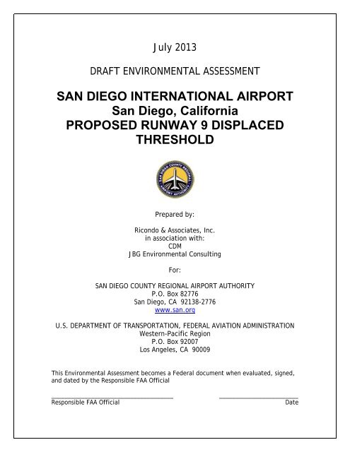
July 2013<br />
DRAFT ENVIRONMENTAL ASSESSMENT<br />
SAN DIEGO INTERNATIONAL AIRPORT<br />
<strong>San</strong> <strong>Diego</strong>, California<br />
PROPOSED RUNWAY 9 DISPLACED<br />
THRESHOLD<br />
Prepared by:<br />
Ricondo & Associates, Inc.<br />
in association with:<br />
CDM<br />
JBG Environmental Consulting<br />
For:<br />
SAN DIEGO COUNTY REGIONAL AIRPORT AUTHORITY<br />
P.O. Box 82776<br />
<strong>San</strong> <strong>Diego</strong>, CA 92138-2776<br />
www.san.org<br />
U.S. DEPARTMENT OF TRANSPORTATION, FEDERAL AVIATION ADMINISTRATION<br />
Western-Pacific Region<br />
P.O. Box 92007<br />
Los Angeles, CA 90009<br />
This Environmental Assessment becomes a Federal document when evaluated, signed,<br />
and dated by the Responsible FAA Official<br />
_____________________________________<br />
Responsible FAA Official<br />
________________________<br />
Date
SAN DIEGO INTERNATIONAL AIRPORT – PROPOSED RUNWAY 9 DISPLACED THRESHOLD<br />
Table of Contents<br />
1. Purpose and Need ................................................................................................................................ 1-1<br />
1.1 Introduction ............................................................................................................................ 1-1<br />
1.2 Background ............................................................................................................................. 1-2<br />
1.3 Critical Design Aircraft ......................................................................................................... 1-11<br />
1.4 Purpose and Need ................................................................................................................ 1-13<br />
1.4.1 Purpose of the Proposed Action ....................................................................................................1-13<br />
1.4.2 Need for the Proposed Action ........................................................................................................1-14<br />
1.4.3 Federal Purpose and Need ...............................................................................................................1-14<br />
1.5 Proposed Action ................................................................................................................... 1-14<br />
1.6 Requested Federal Action .................................................................................................... 1-26<br />
1.7 General Implementation Timeframe .................................................................................. 1-27<br />
2. Alternatives ........................................................................................................................................... 2-1<br />
2.1 Introduction ............................................................................................................................ 2-1<br />
2.2 Screening Analysis of Potential Alternatives ...................................................................... 2-1<br />
2.2.1 Provide Standard CAT I ILS Minimums for Airplane Approach Category D<br />
Aircraft at Existing Displaced Threshold Location ..................................................................... 2-2<br />
2.2.2 Provide Standard CAT I ILS Minimums for Airplane Approach Category D<br />
Aircraft by Relocating Runway 9 Displaced Threshold ............................................................ 2-2<br />
2.2.3 Use of Other <strong>Airport</strong>s ............................................................................................................................ 2-3<br />
2.2.4 No Action Alternative ........................................................................................................................... 2-3<br />
2.3 Alternatives Retained for Analysis and Identification of the Proposed Action .............. 2-4<br />
2.4 Sponsor’s Preferred Alternative ........................................................................................... 2-4<br />
2.5 Federal Laws and Regulations Considered .......................................................................... 2-4<br />
<strong>Draft</strong> <strong>EA</strong><br />
Table of Contents<br />
[i]
SAN DIEGO INTERNATIONAL AIRPORT – PROPOSED RUNWAY 9 DISPLACED THRESHOLD<br />
Table of Contents (continued)<br />
3. Affected Environment ......................................................................................................................... 3-1<br />
3.1 Identification and Description of Study Area ..................................................................... 3-1<br />
3.2 Existing Land Use and Zoning ............................................................................................... 3-7<br />
3.2.1 <strong>Airport</strong> Property Land Uses ................................................................................................................ 3-7<br />
3.2.2 Surrounding Land Uses and Land Use Plans ............................................................................... 3-7<br />
3.2.3 Existing Zoning ......................................................................................................................................3-10<br />
3.3 Noise ...................................................................................................................................... 3-10<br />
3.4 Demographics and Socioeconomic Profile ........................................................................ 3-11<br />
3.5 Natural Environment ............................................................................................................ 3-16<br />
3.5.1 Air Quality ................................................................................................................................................3-16<br />
3.5.2 Water Quality .........................................................................................................................................3-19<br />
3.5.3 Wetlands ..................................................................................................................................................3-21<br />
3.5.4 Floodplains ..............................................................................................................................................3-22<br />
3.5.5 Coastal Areas ..........................................................................................................................................3-22<br />
3.5.6 Biotic Communities ..............................................................................................................................3-25<br />
3.5.7 Endangered and Threatened Species ...........................................................................................3-25<br />
3.6 Public Lands .......................................................................................................................... 3-28<br />
3.7 Historic, Archaeological, Architectural, and Cultural Resources .................................... 3-29<br />
3.7.1 Archaeological Resources .................................................................................................................3-30<br />
3.7.2 Historic, Architectural, and Cultural Resources ........................................................................3-30<br />
3.8 Hazardous Materials and Solid Waste ............................................................................... 3-31<br />
3.8.1 Hazardous Materials............................................................................................................................3-31<br />
3.8.2 Solid Waste .............................................................................................................................................3-34<br />
3.9 Past, Present, and Reasonably Foreseeable Future Actions ............................................ 3-39<br />
4. Environmental Consequences ............................................................................................................ 4-1<br />
4.1 Noise ........................................................................................................................................ 4-2<br />
4.1.1 Methodology ........................................................................................................................................... 4-2<br />
4.1.2 No Action Alternative ........................................................................................................................... 4-3<br />
4.1.3 Proposed Action ..................................................................................................................................... 4-3<br />
<strong>Draft</strong> <strong>EA</strong><br />
Table of Contents<br />
[ii]
SAN DIEGO INTERNATIONAL AIRPORT – PROPOSED RUNWAY 9 DISPLACED THRESHOLD<br />
Table of Contents (continued)<br />
4.2 Compatible Land Use ............................................................................................................. 4-7<br />
4.2.1 Methodology ........................................................................................................................................... 4-7<br />
4.2.2 No Action Alternative ........................................................................................................................... 4-7<br />
4.2.3 Proposed Action ..................................................................................................................................... 4-8<br />
4.2.4 Mitigation Measures ...........................................................................................................................4-12<br />
4.3 Socioeconomic Impacts, Environmental Justice, and Children’s Environmental Health<br />
and Safety Risks .................................................................................................................... 4-12<br />
4.3.1 Methodology .........................................................................................................................................4-12<br />
4.3.2 No Action Alternative .........................................................................................................................4-13<br />
4.3.3 Proposed Action ...................................................................................................................................4-14<br />
4.4 Secondary (Induced) Impacts .............................................................................................. 4-14<br />
4.5 Air Quality ............................................................................................................................. 4-15<br />
4.5.1 Regulatory Standards and Criteria ................................................................................................4-15<br />
4.5.2 Air Quality Analysis ..............................................................................................................................4-16<br />
4.6 Water Quality ........................................................................................................................ 4-19<br />
4.6.1 No Action Alternative .........................................................................................................................4-19<br />
4.6.2 Proposed Action ...................................................................................................................................4-20<br />
4.6.3 Mitigation Measures ...........................................................................................................................4-20<br />
4.7 Wetlands ................................................................................................................................ 4-20<br />
4.7.1 Methodology .........................................................................................................................................4-21<br />
4.7.2 No Action Alternative .........................................................................................................................4-21<br />
4.7.3 Proposed Action ...................................................................................................................................4-21<br />
4.8 Floodplains ............................................................................................................................ 4-22<br />
4.8.1 Methodology .........................................................................................................................................4-22<br />
4.8.2 No Action Alternative .........................................................................................................................4-22<br />
4.8.3 Proposed Action ...................................................................................................................................4-22<br />
4.9 Coastal Resources ................................................................................................................. 4-23<br />
4.9.1 Methodology .........................................................................................................................................4-23<br />
4.9.2 No Action Alternative .........................................................................................................................4-24<br />
4.9.3 Proposed Action ...................................................................................................................................4-24<br />
4.9.4 Mitigation Measures ...........................................................................................................................4-25<br />
<strong>Draft</strong> <strong>EA</strong><br />
Table of Contents<br />
[iii]
SAN DIEGO INTERNATIONAL AIRPORT – PROPOSED RUNWAY 9 DISPLACED THRESHOLD<br />
Table of Contents (continued)<br />
4.10 Fish, Wildlife, and Plants ..................................................................................................... 4-25<br />
4.10.1 Methodology .........................................................................................................................................4-25<br />
4.10.2 No Action Alternative .........................................................................................................................4-25<br />
4.10.3 Proposed Action ...................................................................................................................................4-25<br />
4.11 Department of Transportation Act, Section 4(f)/303(c) Properties ............................... 4-26<br />
4.11.1 Methodology .........................................................................................................................................4-26<br />
4.11.2 No Action Alternative .........................................................................................................................4-27<br />
4.11.3 Proposed Action ...................................................................................................................................4-27<br />
4.12 Historic, Archaeological, Architectural, and Cultural Resources .................................... 4-27<br />
4.12.1 Methodology .........................................................................................................................................4-27<br />
4.12.2 No Action Alternative .........................................................................................................................4-28<br />
4.12.3 Proposed Action ...................................................................................................................................4-28<br />
4.13 Light Emissions and Visual Impacts .................................................................................... 4-28<br />
4.13.1 Methodology .........................................................................................................................................4-29<br />
4.13.2 No Action Alternative .........................................................................................................................4-29<br />
4.13.3 Proposed Action ...................................................................................................................................4-29<br />
4.14 Natural Resources and Energy Supply ............................................................................... 4-29<br />
4.14.1 Methodology .........................................................................................................................................4-29<br />
4.14.2 No Action Alternative .........................................................................................................................4-30<br />
4.14.3 Proposed Action ...................................................................................................................................4-30<br />
4.15 Hazardous Materials, Pollution Prevention, and Solid Waste ........................................ 4-30<br />
4.15.1 No Action Alternative .........................................................................................................................4-31<br />
4.15.2 Proposed Action ...................................................................................................................................4-31<br />
4.15.3 Mitigation Measures ...........................................................................................................................4-31<br />
4.16 Construction Impacts ........................................................................................................... 4-31<br />
4.16.1 Mitigation Measures ...........................................................................................................................4-32<br />
4.17 Cumulative Impacts .............................................................................................................. 4-32<br />
4.17.1 Construction ...........................................................................................................................................4-33<br />
4.18 Other Considerations ........................................................................................................... 4-34<br />
<strong>Draft</strong> <strong>EA</strong><br />
Table of Contents<br />
[iv]
SAN DIEGO INTERNATIONAL AIRPORT – PROPOSED RUNWAY 9 DISPLACED THRESHOLD<br />
Table of Contents (continued)<br />
5. Agency and Public Involvement ........................................................................................................ 5-1<br />
5.1 Public Scoping Meeting ......................................................................................................... 5-1<br />
5.2 Comments and Responses on <strong>Draft</strong> <strong>EA</strong> ................................................................................ 5-1<br />
6. References ............................................................................................................................................. 6-1<br />
7. List of Abbreviations and Acronyms ................................................................................................. 7-1<br />
8. List of Preparers ................................................................................................................................... 8-1<br />
8.1 List of Preparers ...................................................................................................................... 8-1<br />
8.1.1 Principal Federal Aviation Administration Reviewers ............................................................... 8-1<br />
8.1.2 <strong>San</strong> <strong>Diego</strong> County Regional <strong>Airport</strong> Authority ........................................................................... 8-1<br />
8.1.3 Ricondo & Associates, Inc. .................................................................................................................. 8-2<br />
8.1.4 CDM Smith ................................................................................................................................................ 8-3<br />
8.1.5 Harris Miller Miller & Hanson Inc. .................................................................................................... 8-3<br />
8.1.6 JBG Environmental Consulting .......................................................................................................... 8-3<br />
List of Appendices<br />
Appendix A<br />
Appendix B<br />
Appendix C<br />
Appendix D<br />
Agency Coordination<br />
Noise Methodology<br />
Land Use Assurance for <strong>San</strong> <strong>Diego</strong> <strong>International</strong> <strong>Airport</strong><br />
Public Involvement<br />
<strong>Draft</strong> <strong>EA</strong><br />
Table of Contents<br />
[v]
SAN DIEGO INTERNATIONAL AIRPORT – PROPOSED RUNWAY 9 DISPLACED THRESHOLD<br />
List of Tables<br />
Table 1-1 Forecasts of Approach Category D and Airplane Design Group V Aircraft at SDIA ...................1-12<br />
Table 1-2<br />
Approcah Category D and Airplane Design Group V Runway Landing Length<br />
Requirements ..........................................................................................................................................................1-13<br />
Table 1-3 Runway 9 Existing MALSR Stations ................................................................................................................1-21<br />
Table 1-4 Runway 9 Proposed MALSR Stations ............................................................................................................1-22<br />
Table 1-5 Summary Comparison: Existing Conditions vs. Proposed Action ......................................................1-25<br />
Table 2-1 Federal Laws and Statutes Considered ........................................................................................................... 2-5<br />
Table 2-2 Executive Orders Considered ............................................................................................................................. 2-6<br />
Table 2-3 FAA Orders, Advisory Circulars, and Federal Regulations Considered .............................................. 2-7<br />
Table 3-1 Demographic and Socioeconomic Data, 2010 ..........................................................................................3-15<br />
Table 3-2 Economic Data by Census Tract ......................................................................................................................3-16<br />
Table 3-3 Least Tern Nesting at SDIA, 2003-2012 .......................................................................................................3-27<br />
Table 3-4<br />
Table 3-5<br />
Regulations Pertaining to the Management of Hazards and Hazardous Materials in <strong>San</strong><br />
<strong>Diego</strong> County ..........................................................................................................................................................3-33<br />
Sites and Facilities Reported or with the Potential to Contain Hazardous Wastes or<br />
Environmental Contamination in the Vicinity of SDIA ...........................................................................3-37<br />
Table 3-6 Past, Present, and Reasonably Foreseeable Future Actions in the Study Area ............................3-40<br />
Table 4-1 Runway Utilization .................................................................................................................................................. 4-3<br />
<strong>Draft</strong> <strong>EA</strong><br />
Table of Contents<br />
[vi]
SAN DIEGO INTERNATIONAL AIRPORT – PROPOSED RUNWAY 9 DISPLACED THRESHOLD<br />
List of Figures<br />
Figure 1-1 General Location and Vicinity Map .................................................................................................................. 1-3<br />
Figure 1-2 Existing Conditions, Runway 9-27 .................................................................................................................... 1-5<br />
Figure 1-3 Existing Conditions, Runway 9 End .................................................................................................................. 1-9<br />
Figure 1-4 Proposed Action ....................................................................................................................................................1-15<br />
Figure 1-5 Proposed MALSR Reconfiguration .................................................................................................................1-19<br />
Figure 1-6 Comparison of Existing Conditions and Proposed Action ...................................................................1-23<br />
Figure 3-1 Area of Potential Effect ......................................................................................................................................... 3-3<br />
Figure 3-2 Study Area .................................................................................................................................................................. 3-5<br />
Figure 3-3 Census Tracts (2010) ............................................................................................................................................3-13<br />
Figure 3-4 Floodplains ..............................................................................................................................................................3-23<br />
Figure 3-5 California Least Tern Nests, Lindbergh Field, 2003-2011 ......................................................................3-27<br />
Figure 3-6<br />
Sites and Facilities Reported or with the Potential to Contain Hazardous Materials or<br />
Environmental Contamination in the Vicinity of SDIA ...........................................................................3-35<br />
Figure 4-1 Comparison of 2014 CNEL 65 dB Noise Contours, No Action and Proposed Action .................. 4-5<br />
<strong>Draft</strong> <strong>EA</strong><br />
Table of Contents<br />
[vii]
SAN DIEGO INTERNATIONAL AIRPORT – PROPOSED RUNWAY 9 DISPLACED THRESHOLD<br />
THIS PAGE INTENTIONALLY LEFT BLANK<br />
<strong>Draft</strong> <strong>EA</strong><br />
Table of Contents<br />
[viii]
SAN DIEGO INTERNATIONAL AIRPORT – PROPOSED RUNWAY 9 DISPLACED THRESHOLD<br />
1. Purpose and Need<br />
1.1 Introduction<br />
<strong>San</strong> <strong>Diego</strong> <strong>International</strong> <strong>Airport</strong> (SDIA or the <strong>Airport</strong>) served approximately 16.7 million domestic and<br />
international passengers in 2012. 1<br />
SDIA is classified as a large-hub commercial service airport in the National<br />
Plan of Integrated <strong>Airport</strong> Systems (NPIAS). Hub classifications are based on the number of passengers<br />
enplaned at the <strong>Airport</strong>, and a “large hub” classification means that SDIA accommodates at least 1.0 percent<br />
of total U.S. enplaned passengers, ranking it as one of the nation’s busiest airports. 2<br />
The <strong>Airport</strong> is owned and<br />
operated by the <strong>San</strong> <strong>Diego</strong> County Regional <strong>Airport</strong> Authority (SDCRAA).<br />
This Environmental Assessment (<strong>EA</strong>) has been prepared by the SDCRAA (Sponsor) to fulfill federal<br />
requirements for environmental review of an airport development project that requires federal approval<br />
and/or funding, as outlined in Federal Aviation Administration (FAA) Order 1050.1E, Environmental Impacts:<br />
Policies and Procedures 3<br />
and FAA Order 5050.4B, National Environmental Policy Act (NEPA) Implementing<br />
Instructions for <strong>Airport</strong> Actions. 4 In compliance with the National Environmental Policy Act of 1969 (NEPA, 42<br />
United States Code [U.S.C.] 4321-4370h), the FAA must review the potential environmental effects of a<br />
proposed project before taking any action to approve the proposed project.<br />
NEPA requires federal agencies to prepare environmental documentation that discloses to decision-makers<br />
and the interested public a clear, accurate description of potential environmental effects resulting from<br />
proposed federal actions and reasonable alternatives to those actions. Through NEPA, the U.S. Congress<br />
directed federal agencies to integrate environmental factors in their planning and decision-making processes<br />
and to encourage and facilitate public involvement in decisions that affect the quality of the human<br />
environment. Federal agencies are required to consider the environmental effects of a proposed action,<br />
1<br />
2<br />
3<br />
4<br />
Air Service Development Department, <strong>San</strong> <strong>Diego</strong> County Regional <strong>Airport</strong> Authority, Air Traffic Report, 2010 to Present, <strong>San</strong> <strong>Diego</strong><br />
<strong>International</strong> <strong>Airport</strong>, Lindbergh Field, Available at: http://www.san.org/sdia/at_the_airport/education/airport_statistics.aspx (accessed April<br />
19, 2013).<br />
U.S. Department of Transportation, Federal Aviation Administration, Report to Congress: National Plan of Integrated <strong>Airport</strong> Systems<br />
(NPIAS), 2011-2015, September 27, 2010.<br />
U.S. Department of Transportation, Federal Aviation Administration, Order 1050.1E, Environmental Impacts: Policies and Procedures, June<br />
8, 2004, Change 1, effective March 20, 2006.<br />
U.S. Department of Transportation, Federal Aviation Administration, Order 5050.4B, National Environmental Policy Act (NEPA)<br />
Implementing Instructions for <strong>Airport</strong> Actions, effective April 28, 2006.<br />
<strong>Draft</strong> <strong>EA</strong><br />
Purpose and Need<br />
[1-1]
SAN DIEGO INTERNATIONAL AIRPORT – PROPOSED RUNWAY 9 DISPLACED THRESHOLD<br />
alternatives to the proposed action, and a no action alternative (assessing the potential environmental effects<br />
of not undertaking the proposed action).<br />
The SDCRAA is preparing this <strong>EA</strong> on behalf of the FAA in compliance with FAA Orders 1050.1E and 5050.4B to<br />
evaluate the potential environmental impacts of relocating the Runway 9 displaced threshold, which is the<br />
“Proposed Action” evaluated in this <strong>EA</strong>. A displaced threshold is a threshold that is located on a point on the<br />
runway other than the designated beginning of the runway to satisfy approach surface criteria and/or Runway<br />
Safety Area length requirements. The proposed improvement would not affect (increase or decrease) the<br />
number of aircraft operating at SDIA or the routing of aircraft in the air to and from the <strong>Airport</strong>.<br />
The purpose of and need for the Proposed Action are described in this chapter, along with background<br />
information and a description of the Proposed Action.<br />
1.2 Background<br />
The <strong>Airport</strong> is located in the northwest portion of the downtown area within the City of <strong>San</strong> <strong>Diego</strong>. The<br />
existing <strong>Airport</strong> site is severely constrained by its location; it is bounded by North Harbor Drive and <strong>San</strong> <strong>Diego</strong><br />
Bay to the south, the Navy Boat Channel and Liberty Station (mixed-use redevelopment of the former Naval<br />
Training Center) to the west, U.S. Marine Corps Recruit Depot (MCRD) <strong>San</strong> <strong>Diego</strong> to the north, and Pacific<br />
Highway and Interstate 5 to the east. A general location and vicinity map of SDIA is depicted on Figure 1-1.<br />
The <strong>Airport</strong> has one runway, Runway 9-27, that is a total of 9,401 feet in length. Runways are named based on<br />
their compass orientation; a 9 designation means that aircraft landing on or taking off of the runway are<br />
traveling due east or 90 degrees while 27 represents due west or 270 degrees.<br />
The current displaced threshold of Runway 9 is 700 feet. Declared distances are in effect at SDIA to provide<br />
the required Runway Safety Area (RSA) beyond the runway end. The FAA defines declared distances as “the<br />
distances the airport operator declares available and suitable for satisfying an aircraft’s take-off run, take-off<br />
distance, accelerate-stop distance, and landing distance requirements.” 5<br />
Declared distances are also used<br />
where different runway lengths are defined for each direction of operation (e.g., when displaced thresholds<br />
are present). Aircraft operators use these declared distances, along with weather data, aircraft performance<br />
characteristics, and market segments for flight planning, including the determination of payload and range<br />
restrictions. The application of declared distances at a specific airport requires prior FAA approval on a caseby-case<br />
basis. The Take-Off Run Available (TORA), Take-Off Distance Available (TODA), and Accelerate-Stop<br />
Distance Available (ASDA) are used for take-off performance computations. The Landing Distance Available<br />
(LDA) is used for landing performance computations. Figure 1-2, depicts the existing conditions on<br />
Runway 9-27, including the declared distances, TORA, TODA, ASDA, and LDA for Runway 9 and Runway 27.<br />
5<br />
U.S. Department of Transportation, Federal Aviation Administration, Advisory Circular 150/5300-13A, <strong>Airport</strong> Design, September 28, 2012.<br />
Purpose and Need<br />
[1-2]<br />
<strong>Draft</strong> <strong>EA</strong>
<strong>San</strong> <strong>Diego</strong> iNTeRNatiONal AirpORT – pROpOSed Runway 9 Displaced THReSHOld<br />
Orange<br />
CouNTy<br />
RiveRSide cOuNTy<br />
Fallbrook Community Airpark<br />
5<br />
MCB Camp Pendleton<br />
15<br />
Oceanside Municipal <strong>Airport</strong><br />
<strong>San</strong> <strong>Diego</strong> cOuNTy<br />
78<br />
McClellan-Palomar <strong>Airport</strong><br />
5<br />
Ramona <strong>Airport</strong><br />
15<br />
56<br />
McaS Miramar<br />
Montgomery Field<br />
52<br />
Gillespie Field<br />
5<br />
805<br />
8<br />
<strong>San</strong> <strong>Diego</strong> <strong>International</strong> <strong>Airport</strong><br />
163<br />
15<br />
94<br />
NAS North Island<br />
54<br />
805<br />
LegeND<br />
Military Properties<br />
Incorporated Communities<br />
Source: Ricondo & Associates, Inc., January 2013.<br />
PRepaRED BY: Ricondo & Associates, Inc., January 2013.<br />
NOLF Imperial Beach<br />
Brown Field Municipal <strong>Airport</strong><br />
Mexico<br />
Figure I-1<br />
NORTH<br />
Not to scale.<br />
General Location and Vicinity Map<br />
Z:\<strong>San</strong> <strong>Diego</strong>\SAN On-Call\Graphics\SAN Northside <strong>EA</strong> Exhibits\Figure_I-1_LocationMap.indd<br />
<strong>Draft</strong> ea<br />
Purpose and Need
SAN DIEGO INTERNATIONAL AIRPORT – PROPOSED RUNWAY 9 DISPLACED THRESHOLD<br />
THIS PAGE INTENTIONALLY LEFT BLANK<br />
Purpose and Need<br />
[1-4]<br />
<strong>Draft</strong> <strong>EA</strong>
SAN DIEGO INTERNATIONAL AIRPORT – PROPOSED RUNWAY 9 DISPLACED THRESHOLD<br />
THIS PAGE INTENTIONALLY LEFT BLANK<br />
Purpose and Need<br />
[1-6]<br />
<strong>Draft</strong> <strong>EA</strong>
SAN DIEGO INTERNATIONAL AIRPORT – PROPOSED RUNWAY 9 DISPLACED THRESHOLD<br />
The Runway 9 TORA and TODA at SDIA are 9,401 feet long, extending the full length of the runway. The<br />
Runway 9 ASDA also starts at the Runway 9 end, but extends only 8,280 feet to allow for a<br />
full-width 1,000-foot (standard) RSA beyond the ASDA. The Runway 9 LDA starts at the Runway 9 displaced<br />
threshold, and extends 7,580 feet to allow for a standard RSA beyond the LDA.<br />
The Runway 27 TORA, TODA, and ASDA are 9,401 feet long, extending the full length of the runway. An<br />
Engineered Material Arresting System (EMAS) is installed beyond the Runway 27 departure end, and provides<br />
the safety equivalent of a standard RSA. The Runway 27 LDA starts at the Runway 27 displaced threshold, and<br />
extends 7,591 feet to the end of the runway.<br />
Runway 9 is equipped with an instrument landing system (ILS) for Category (CAT) I approaches and a Medium<br />
Intensity Approach Light System with Runway Alignment Indicator Lights (MALSR). This equipment provides<br />
electronic vertical and horizontal guidance to aircraft approaching and landing on this runway using radio<br />
signals and a high-intensity lighting array to enable a safe landing when the visibility is reduced (fog or rain).<br />
There are three categories of ILS, which are characterized with unique decision height (DH) 6<br />
and visibility<br />
minimums: 7<br />
<br />
<br />
<br />
Category I. DH not less than 200 feet and Runway Visual Range (RVR) 8 not less than 1,800 feet;<br />
Category II. DH not less than 100 feet and RVR not less than 1,200 feet;<br />
Category III:<br />
- Category IIIa. No DH and RVR not less than 700 feet;<br />
- Category IIIb. No DH and RVR less than 700 feet but not less than 150 feet; and<br />
- Category IIIc. No DH and no RVR limitation.<br />
These minimums are for the standard categories, and may be reduced with special authorizations. According<br />
to the FAA Terminal Instrument Procedures (TERPS) Order 8260-3B 9 , the maximum glide path angle for aircraft<br />
Approach Category D 10 is 3.1 degrees. Based on the same source, 60 feet is the maximum threshold crossing<br />
height (TCH) 11 requirement for ILS Category I. For Airplane Design Group (ADG) IV 12 which includes Boeing<br />
6<br />
7<br />
8<br />
9<br />
10<br />
11<br />
12<br />
<strong>Draft</strong> <strong>EA</strong><br />
A Decision Height (DH) is the height at which a missed approach must be initiated if the required visual reference to continue the<br />
approach has not been established.<br />
U.S. Department of Transportation, Federal Aviation Administration, Aeronautical Information Manual, Pilot/Controller Glossary, February<br />
9, 2012.<br />
The Runway Visual Range (RVR) is the range over which the pilot of an aircraft on the centerline of a runway can see the runway surface<br />
markings or the lights delineating the runway or identifying its centerline.<br />
U.S. Department of Transportation, Federal Aviation Administration, Order 8260.3B, United States Standard for Terminal Instrument<br />
Procedures (TERPS), Changes 1-25, effective July 7, 1976.<br />
Category D aircraft are aircraft with approach speeds of 141 knots or more but less than 166 knots (FAA, Advisory Circular (AC) 150/5300-<br />
13A, <strong>Airport</strong> Design).<br />
Threshold crossing height (TCH) is the theoretical height above the runway threshold at which an aircraft’s glideslope antenna would be if<br />
the aircraft maintains the trajectory established by the mean ILS glideslope.<br />
ADG IV refers to airplanes with wingspans of at least 118 feet up to but not including 171 feet wingspan or tail height from 45 feet up to<br />
but not including 60 feet (FAA, AC 150/5300-13A, <strong>Airport</strong> Design).<br />
Purpose and Need<br />
[1-7]
SAN DIEGO INTERNATIONAL AIRPORT – PROPOSED RUNWAY 9 DISPLACED THRESHOLD<br />
767, McDonnell-Douglas DC-10, and Airbus A300 aircraft, the minimum TCH is 45 feet and the TCH cannot<br />
exceed 60 feet. 13<br />
A geographic survey was conducted to identify obstructions for the existing approach to Runway 9 and the<br />
proposed displaced threshold relocation for Runway 9. The survey was conducted in early 2012 and<br />
submitted to the FAA for approval. The survey identified 37 obstructions penetrating the current 3.22-degree<br />
glide slope obstacle clearance surface (OCS). The obstructions are located mostly in the Point Loma<br />
neighborhood with a maximum penetration of 14 feet. The obstructions are located on Point Loma High<br />
School, Loma Portal Elementary School, MCRD <strong>San</strong> <strong>Diego</strong> and thirteen private residences. SDCRAA<br />
determined that it was not feasible to clear all of the obstructions associated with the existing 3.22-degree<br />
glide slope OCS. However, because SDCRAA is proposing to decrease the angle of descent to 3.1 degrees<br />
with the proposed displaced threshold, the removal of all the obstructions to the current 3.22-degree glide<br />
slope OCS was not needed; only the ones that would impact the proposed 3.1 degree glide slope OCS. As a<br />
result, every obstruction to the proposed 3.1-degree glide slope OCS was removed by December 2012. . With<br />
the removal of all obstructions to the proposed OCS, the proposed angle of descent for approaching aircraft<br />
can be decreased, therefore reducing the steepness of the approach. As a result, the lower proposed<br />
threshold crossing height would not jeopardize safety of approaching aircraft.<br />
Based on obstructions identified in a National Oceanic and Atmospheric Administration (NOAA) 2004 survey,<br />
the current ILS configuration for Runway 9 supports a decision height 14 of 336 feet, a displaced threshold TCH<br />
of 85 feet, and a 3.22-degree glide slope angle. This configuration has been “grandfathered in” but does not<br />
meet current FAA criteria. The existing Runway 9 CAT I ILS approach is approved under an FAA waiver;<br />
however, the FAA is not granting any new waivers and is highly encouraging airport sponsors to develop<br />
solutions to meet FAA standards. The SDCRAA has studied alternative solutions to bring the Runway 9 ILS<br />
configuration into compliance with FAA criteria and is proposing to relocate the displaced threshold another<br />
300 feet.<br />
The proposed relocation of the displaced threshold by an additional 300 feet would provide a glide slope<br />
angle of 3.1 degrees and a TCH of 55 feet. As a result, since the existing displaced threshold is 700 feet from<br />
the runway end, the proposed displaced threshold would be 1,000 feet from the runway end and the new<br />
landing length associated with the relocated Runway 9 displaced threshold and declared distance would be<br />
shortened to 7,280 feet. This approach would bring the ILS within FAA standards and would also lower the<br />
instrument approach minimums. Relocation of the displaced threshold would require changes to the MALSR,<br />
airfield lighting, and markings. In addition, existing approach procedures for Runway 9 would be modified<br />
and the existing glide slope equipment would be shifted west. Figure 1-3 shows the ILS and associated<br />
navigational aids (navaids) at the end of Runway 9.<br />
13<br />
14<br />
U.S. Department of Transportation, Federal Aviation Administration, Order 8260.3B, United States Standard for Terminal Instrument<br />
Procedures (TERPS), Changes 1-25, effective July 7, 1976, pp. 2-5 and 2-9.<br />
Decision height is the height at which a decision must be made by the pilot during an instrument approach whether to either continue<br />
the approach (for landing) or execute a missed approach.<br />
Purpose and Need<br />
[1-8]<br />
<strong>Draft</strong> <strong>EA</strong>
SAN DIEGO INTERNATIONAL AIRPORT – PROPOSED RUNWAY 9 DISPLACED THRESHOLD<br />
THIS PAGE INTENTIONALLY LEFT BLANK<br />
Purpose and Need<br />
[1-10]<br />
<strong>Draft</strong> <strong>EA</strong>
SAN DIEGO INTERNATIONAL AIRPORT – PROPOSED RUNWAY 9 DISPLACED THRESHOLD<br />
1.3 Critical Design Aircraft<br />
FAA planning guidelines presented in FAA Advisory Circular (AC) 150/5325-4B, Runway Length Requirements<br />
for <strong>Airport</strong> Design, and FAA Order 5090.3C, Field Formulation of the National Plan of Integrated <strong>Airport</strong> Systems<br />
(NPIAS), define a substantial use threshold of 500 or more annual itinerant operations (landings and take-offs)<br />
to identify the critical design aircraft for an airport. The critical design aircraft may be a single aircraft or a<br />
composite of the most demanding characteristics of several aircraft. Design criteria for the critical design<br />
aircraft are contained in FAA AC 150/5300-13A, <strong>Airport</strong> Design. The <strong>Airport</strong> Layout Plan (ALP) 15<br />
for SDIA<br />
identifies the Boeing 787-900 as the critical design aircraft for the <strong>Airport</strong>. The Boeing 787-900 is an<br />
Approach Category D, ADG V 16 aircraft. These two components make up the <strong>Airport</strong> Reference Code (ARC),<br />
which is used to relate airport design criteria with the operational and physical characteristics of the aircraft<br />
intended to use an airport. As a result, the ARC for SDIA is D-V.<br />
While the SDCRAA has identified the Boeing 787-900 as the critical design aircraft for the <strong>Airport</strong>, the Boeing<br />
787-900 is not currently in production. However, the Boeing 787-800, which operates at the <strong>Airport</strong> today, is<br />
also a D-V aircraft. Effective June 1, 2013, JAL (Japan Airlines) now conducts daily operations of the Boeing<br />
787-800 at SDIA. Based on actual operations of the Boeing 787-800 at SDIA through May 31, 2013 and<br />
projections based on airline schedules through the end of 2013, SDCRAA projects 474 operations of the<br />
Boeing 787-800 at SDIA this year. Because this is just below the 500 operations per year FAA threshold for the<br />
critical design aircraft, the SDCRAA examined other Approach Category D and ADG V aircraft operating at the<br />
<strong>Airport</strong> to determine the required runway design characteristics (see Table 1-1 and Table 1-2).<br />
The SDCRAA prepared updated aviation forecasts in 2012 for the proposed <strong>Airport</strong> Development Plan (ADP)<br />
that have been submitted to the FAA for review and approval. 17<br />
Based on these forecasts, passenger airline<br />
Approach Category D and ADG V aircraft operations at SDIA are expected to increase. Table 1-1 provides the<br />
number of aircraft operations by Approach Category D and ADG V aircraft in 2011 and 2012 at SDIA, as well<br />
as projected 2013 and 2021 and 2031 forecast data. As shown in Table 1-1, Approach Category D and ADG V<br />
operations represented 10.8 percent and 12.7 percent of the total operations in 2011 and 2012, respectively.<br />
Approach Category D and ADG V operations are anticipated to increase to 25.0 percent of the total share by<br />
2031.<br />
As part of this study, landing length requirements for the various Approach Category D and ADG V aircraft<br />
forecast to operate at SDIA were evaluated, and are presented in Table 1-2. As shown, the proposed<br />
reduction of LDA of 300 feet on Runway 9 from 7,580 feet to 7,280 feet would not adversely impact Approach<br />
Category D or ADG V aircraft operations at SDIA.<br />
15<br />
16<br />
17<br />
<strong>San</strong> <strong>Diego</strong> County Regional <strong>Airport</strong> Authority, <strong>San</strong> <strong>Diego</strong> <strong>International</strong> <strong>Airport</strong>, <strong>Airport</strong> Layout Plan, June 26, 2009.<br />
ADG V refers to airplanes with wingspans of at least 171 feet up to but not including 214 feet wingspan or tail height from 60 feet up to<br />
but not including 66 feet (FAA, AC 150/5300-13A, <strong>Airport</strong> Design).<br />
LeighFisher, <strong>San</strong> <strong>Diego</strong> County Regional <strong>Airport</strong> Authority, <strong>Airport</strong> Development Plan, <strong>San</strong> <strong>Diego</strong> <strong>International</strong> <strong>Airport</strong>, Technical<br />
Memorandum – Aviation Demand Forecasts, March 2013.<br />
<strong>Draft</strong> <strong>EA</strong><br />
Purpose and Need<br />
[1-11]
SAN DIEGO INTERNATIONAL AIRPORT – PROPOSED RUNWAY 9 DISPLACED THRESHOLD<br />
Table 1-1<br />
Forecasts of Approach Category D and Airplane Design Group V Aircraft at SDIA<br />
ACTUAL DATA<br />
FORECASTS<br />
AIRCRAFT TYPE 2011 2012<br />
2013<br />
(PROJECTED)<br />
2021 2031<br />
Approach Category D Aircraft<br />
Boeing 737-800 16,632 18,536 23,255 29,113 35,277<br />
Boeing 737-900 2,837 2,910 2,811 10,437 19,599<br />
Boeing 757-300 44 24 171 732 825<br />
Boeing 787-800 - 36 474 732 2,476<br />
Airplane Design Group V Aircraft<br />
Airbus A330-200 0 316 579 732 825<br />
Boeing 777-200ER 424 720 818 732 825<br />
Boeing 787-800<br />
See above<br />
TOTAL 19,937 23,614 28,108 42,478 58,177<br />
Share of Total<br />
Operations 10.8% 12.7% 13.5% 20.5% 25.0%<br />
Source: <strong>San</strong> <strong>Diego</strong> <strong>International</strong> <strong>Airport</strong>, Planning and Operations, 2013 (actual operations and 2013 projections based on actual activity through<br />
May 31, 2013); LeighFisher, <strong>San</strong> <strong>Diego</strong> County Regional <strong>Airport</strong> Authority, <strong>Airport</strong> Development Plan, <strong>San</strong> <strong>Diego</strong> <strong>International</strong> <strong>Airport</strong>,<br />
Technical Memorandum – Aviation Demand Forecasts, March 2013 (forecasts).<br />
Prepared by: Ricondo & Associates, Inc., June 2013.<br />
In order to maintain operations at SDIA during poor visibility conditions, a CAT I instrument approach on<br />
Runway 9 needs to be maintained. Because Approach Category D aircraft operating at SDIA have the most<br />
restrictive requirements for ILS minimums, the Approach Category D minimums were utilized to identify the<br />
ILS minimums required at SDIA.<br />
The existing ILS approach to Runway 9 has a visibility minimum of one statute mile. This is based on the<br />
existing 3.22-degree glide slope angle, an 85-foot displaced TCH, and a DH of 336 feet. With the Proposed<br />
Action, the glide slope angle would be reduced to 3.1 degrees (steepest allowed for Category D aircraft), and<br />
the displaced threshold shift would result in a TCH of 55 feet and a DH of 250 feet. Based on these new<br />
parameters and the existence of a MALSR to Runway 9, the ILS Runway 9 visibility minimum could be reduced<br />
to 1/2 statute mile for all aircraft approach categories (standard visibility minimum for precision approach with<br />
MALSR). 18<br />
18<br />
U.S. Department of Transportation, Federal Aviation Administration, Order 8260.3B, United States Standard for Terminal Instrument<br />
Procedures (TERPS), Changes 1-25, effective July 7, 1976, Table 2-2B.<br />
Purpose and Need<br />
[1-12]<br />
<strong>Draft</strong> <strong>EA</strong>
SAN DIEGO INTERNATIONAL AIRPORT – PROPOSED RUNWAY 9 DISPLACED THRESHOLD<br />
Table 1-2<br />
Approach Category D and Airplane Design Group V Runway Landing Length Requirements<br />
REQUIRED LANDING LENGTH (FEET)<br />
AIRCRAFT TYPE MAXIMUM LANDING WEIGHT (LBS) DRY RUNWAY WET RUNWAY<br />
Approach Category D Aircraft<br />
Boeing 737-800 1/ 146,300 5,800 6,700<br />
Boeing 737-900 1/ 146,300 5,950 6,800<br />
Boeing 757-300 1/ 224,000 5,700 6,550<br />
Boeing 787-800 2/ 3/ 380,000 5,500 6,400<br />
Airplane Design Group V Aircraft<br />
Airbus A330-200 4/ 400,000 5,800<br />
Boeing 777-200 5/ 460,000 5,250 6,000<br />
Boeing 787-800 2/ 3/ 380,000 5,500 6,400<br />
NOTES:<br />
1/ ASSUMES FLAPS 30 DEGREES.<br />
2/ JAPAN AIRLINES CURRENTLY OPERATES THE BOEING 787-800 INTO SDIA. ALTHOUGH THE BOEING 787-900 WAS IDENTIFIED AS THE CRITICAL<br />
AIRCRAFT, ITS PERFORMANCE CHARACTERISTICS ARE NOT YET AVAILABLE; AS SUCH, PERFORMANCE IS PROVIDED FOR THE BOEING 787-800 MODEL.<br />
3/ ASSUMES FLAPS 25 DEGREES.<br />
4/ HAWAIIAN AIRLINES OPERATES THE AIRBUS A330-200 INTO SDIA.<br />
5/ BRITISH AIRWAYS AND JAPAN AIRLINES OPERATE THE B777-200 INTO SDIA.<br />
Sources: Various Aircraft Manufacturers <strong>Airport</strong> Planning Manuals; <strong>San</strong> <strong>Diego</strong> <strong>International</strong> <strong>Airport</strong>, Planning and Operations, 2012 (actual<br />
operations); LeighFisher, <strong>San</strong> <strong>Diego</strong> County Regional <strong>Airport</strong> Authority, <strong>Airport</strong> Development Plan, <strong>San</strong> <strong>Diego</strong> <strong>International</strong> <strong>Airport</strong>, Technical<br />
Memorandum – Aviation Demand Forecasts, March 2013 (forecasts).<br />
Prepared by: Ricondo & Associates, Inc., June 2013.<br />
1.4 Purpose and Need<br />
Pursuant to NEPA and FAA Orders 1050.1E and 5050.4B, an <strong>EA</strong> must include a description of the purpose of a<br />
proposed action and why it is needed. Identification of the purpose and need for a proposed action provides<br />
the rationale and forms the foundation for identification of reasonable alternatives that can meet the purpose<br />
for the action and, therefore, address the need or problem. The purpose of and the need for the Proposed<br />
Action are discussed in this section.<br />
1.4.1 PURPOSE OF THE PROPOSED ACTION<br />
As described in Section 1.5, the Proposed Action is the relocation of the Runway 9 displaced threshold. The<br />
purpose of the Proposed Action is to comply with FAA criteria for airplane Approach Category D CAT I<br />
instrument approaches on Runway 9.<br />
<strong>Draft</strong> <strong>EA</strong><br />
Purpose and Need<br />
[1-13]
SAN DIEGO INTERNATIONAL AIRPORT – PROPOSED RUNWAY 9 DISPLACED THRESHOLD<br />
1.4.2 NEED FOR THE PROPOSED ACTION<br />
The need for the Proposed Action is based on the increased and forecast usage of SDIA by airplane Approach<br />
Category D aircraft. Implementation of the Proposed Action is needed for the <strong>Airport</strong> to comply with FAA<br />
standards for CAT I instrument approaches to Runway 9 for Category D aircraft. If the FAA revokes the CAT I<br />
instrument approach waiver granted to SDIA, the <strong>Airport</strong> would have to prohibit operations on Runway 9 by<br />
airplane Approach Category D aircraft during reduced visibility or inclement weather conditions, causing<br />
delays and financial losses to the airlines, passengers, and companies relying on travel and/or the shipment of<br />
goods via SDIA.<br />
An FAA study of the localizer for Runway 9 (located at the east end of the runway) identified that the original<br />
9-count antenna array was rated as “marginal” and should be upgraded. In 2008, the antenna array count was<br />
increased from 9 to 14 and relocated to a new platform behind the blast fence to support the larger antenna;<br />
no changes to the glide slope antenna and landing threshold were made. Current FAA requirements for the<br />
fleet mix utilizing the Runway 9 precision instrument approach at SDIA include a maximum 3.1 degree glide<br />
slope, a decision height of 250 feet, and a maximum threshold crossing height of 60 feet. In order to meet<br />
these requirements, the glide slope antenna needs to be relocated in conjunction with the relocated displaced<br />
threshold.<br />
1.4.3 FEDERAL PURPOSE AND NEED<br />
The FAA’s statutory mission is to ensure the safe and efficient use of navigable airspace in the United States.<br />
The FAA must ensure the Proposed Action does not derogate the safety of aircraft and airport operations at<br />
SDIA. Moreover, it is the policy of the FAA under 49 U.S.C. 47101(a)(6) that airport development projects<br />
provide for the protection and enhancement of natural resources and the quality of the environment of the<br />
United States.<br />
1.5 Proposed Action<br />
Figure 1-4 depicts the Proposed Action which consists of relocating the existing displaced threshold on<br />
Runway 9 from 700 feet to 1,000 feet, which would result in a landing length of 7,280 feet on Runway 9. The<br />
Proposed Action consists of the following elements:<br />
<br />
<br />
<br />
Relocate existing displaced threshold by 300 feet<br />
Relocate runway threshold and MALSR lights<br />
Relocate the glide slope antenna<br />
The Medium Intensity Approach Light System (MALS) portion of the MALSR consists of a threshold light bar<br />
and seven five-light bars located on the extended runway centerline. The light bar stations are typically<br />
spaced 200 feet apart, with a tolerance expressed as “+-feet/-feet”. The first light bar is located 200 feet<br />
(+100 feet/-0 feet) from the runway threshold and the remaining bars at each 200-foot interval (+/- 20 feet)<br />
out to 1,400 feet from the threshold.<br />
Purpose and Need<br />
[1-14]<br />
<strong>Draft</strong> <strong>EA</strong>
SAN DIEGO INTERNATIONAL AIRPORT – PROPOSED RUNWAY 9 DISPLACED THRESHOLD<br />
THIS PAGE INTENTIONALLY LEFT BLANK<br />
Purpose and Need<br />
[1-16]<br />
<strong>Draft</strong> <strong>EA</strong>
SAN DIEGO INTERNATIONAL AIRPORT – PROPOSED RUNWAY 9 DISPLACED THRESHOLD<br />
Two additional five-light bars are located (one on each side of the centerline bar) 1,000 feet from the runway<br />
threshold forming a crossbar 66 feet long. The spacing between individual lights in all bars is approximately<br />
2½ feet. All lights are aimed into the approach to the runway and away from the runway threshold. All lights<br />
in the system are white, except for the green threshold lights. The threshold lights are a row of lights on 10-<br />
foot centers located coincident with and within the runway edge lights near the threshold, and extend across<br />
the runway threshold.<br />
The Runway Alignment Indicator Lights (RAIL) portion of the MALSR consists of five sequenced flashers<br />
located on the extended runway centerline. The first is located 200 feet (+/- 20 feet) beyond the approach<br />
end of the MALS with successive units located at each 200-foot interval (+/- 20 feet) out to 2,400 feet (+100<br />
feet/-0 feet) from the runway threshold. These single white lights flash in sequence toward the threshold at<br />
the rate of twice per second. All lights are aimed into the approach to the runway and away from the runway<br />
threshold. Figure 1-5 shows the existing and proposed MALSR system.<br />
The location of the proposed lighting system stations would be coincident with the existing lighting stations,<br />
with the exception of the last two light stations, farthest from the runway threshold. These last two light<br />
stations would be eliminated. Table 1-3 identifies the existing lighting stations with distances from the<br />
runway threshold, and Table 1-4 identifies the proposed lighting stations if the Proposed Action is<br />
implemented.<br />
<strong>Draft</strong> <strong>EA</strong><br />
Purpose and Need<br />
[1-17]
SAN DIEGO INTERNATIONAL AIRPORT – PROPOSED RUNWAY 9 DISPLACED THRESHOLD<br />
THIS PAGE INTENTIONALLY LEFT BLANK<br />
Purpose and Need<br />
[1-18]<br />
<strong>Draft</strong> <strong>EA</strong>
SAN DIEGO INTERNATIONAL AIRPORT – PROPOSED RUNWAY 9 DISPLACED THRESHOLD<br />
THIS PAGE INTENTIONALLY LEFT BLANK<br />
Purpose and Need<br />
[1-20]<br />
<strong>Draft</strong> <strong>EA</strong>
SAN DIEGO INTERNATIONAL AIRPORT – PROPOSED RUNWAY 9 DISPLACED THRESHOLD<br />
Table 1-3<br />
Runway 9 Existing MALSR Stations<br />
STATION 1<br />
ITEM<br />
LAND/WATER<br />
LOCATION<br />
DESCRIPTION<br />
0+08 threshold lights land ground mount<br />
2+08 5-light bar land ground mount<br />
4+08 5-light bar land ground mount<br />
6+08 5-light bar land ground mount<br />
7+06 2 5-light bar land ground mount<br />
8+96 2 5-light bar land ground mount<br />
11+00 3 x 5-light bar land pole mount<br />
13+00 5-light bar land pole mount<br />
15+00 5-light bar water<br />
17+00 1 flashing light water<br />
19+00 1 flashing light water<br />
21+00 1 flashing light water<br />
23+00 1 flashing light land<br />
25+00 1 flashing light land<br />
pole mount on elevated timber platform supported by two<br />
timber piles<br />
pole mount on elevated timber platform supported by two<br />
timber piles<br />
pole mount on elevated timber platform supported by two<br />
timber piles<br />
pole mount on elevated timber platform supported by two<br />
timber piles<br />
pole mount on elevated timber platform supported by steel<br />
tower<br />
pole mount on elevated timber platform supported by steel<br />
tower<br />
NOTES:<br />
1/ STATIONS REFLECT DISTANCE FROM THE DISPLACED THRESHOLD. STATION 0+08 REFLECTS 8 FEET FROM THRESHOLD. STATION 11+00 REFLECTS<br />
1,100 FEET FROM THE DISPLACED THRESHOLD, AND SO ON.<br />
2/ DISTANCE BETWEEN STATIONS 6+08 AND 7+06 IS NON-STANDARD.<br />
Sources: Volpe National Transportation Systems Center, Final Environmental Assessment, Medium Intensity Approach Lighting System with Runway<br />
Alignment Indicator Lights, <strong>San</strong> <strong>Diego</strong> <strong>International</strong> <strong>Airport</strong>, <strong>San</strong> <strong>Diego</strong> CA, June 2012; <strong>San</strong> <strong>Diego</strong> County Regional <strong>Airport</strong> Authority, <strong>San</strong> <strong>Diego</strong><br />
<strong>International</strong> <strong>Airport</strong> Layout Plan, 2009; Aerial Photography: Google Earth Pro 2012, INEGI 2012; Ricondo & Associates, Inc., March 2012.<br />
Prepared by: Ricondo & Associates, Inc., January 2013.<br />
<strong>Draft</strong> <strong>EA</strong><br />
Purpose and Need<br />
[1-21]
SAN DIEGO INTERNATIONAL AIRPORT – PROPOSED RUNWAY 9 DISPLACED THRESHOLD<br />
Table 1-4<br />
Runway 9 Proposed MALSR Stations<br />
STATION 1<br />
ITEM<br />
LAND/WATER<br />
LOCATION<br />
DESCRIPTION<br />
0+08 threshold lights land ground mount<br />
3+00 5-light bar land ground mount<br />
5+08 5-light bar land ground mount<br />
7+08 5-light bar land ground mount<br />
9+08 2 5-light bar land ground mount<br />
10+06 2 3 x 5-light bar land ground mount<br />
11+96 5-light bar land ground mount<br />
14+00 5-light bar land pole mount<br />
16+00 1 flashing light land pole mount<br />
18+00 1 flashing light water<br />
20+00 1 flashing light water<br />
22+00 1 flashing light water<br />
24+00 1 flashing light water<br />
pole mount on elevated timber platform supported by two<br />
timber piles<br />
pole mount on elevated timber platform supported by two<br />
timber piles<br />
pole mount on elevated timber platform supported by two<br />
timber piles<br />
pole mount on elevated timber platform supported by two<br />
timber piles<br />
NOTES:<br />
1/ STATIONS REFLECT DISTANCE FROM THE RELOCATED RUNWAY DISPLACED THRESHOLD. STATION 0+08 REFLECTS 8 FEET FROM THE RELOCATED<br />
RUNWAY THRESHOLD. STATION 14+00 REFLECTS 1,400 FEET FROM RUNWAY END, AND SO ON.<br />
2/ DISTANCE BETWEEN STATIONS 9+08 AND 10+06 IS NON-STANDARD.<br />
Sources: Volpe National Transportation Systems Center, Final Environmental Assessment, Medium Intensity Approach Lighting System with Runway<br />
Alignment Indicator Lights, <strong>San</strong> <strong>Diego</strong> <strong>International</strong> <strong>Airport</strong>, <strong>San</strong> <strong>Diego</strong> CA, June 2012; <strong>San</strong> <strong>Diego</strong> County Regional <strong>Airport</strong> Authority, <strong>San</strong> <strong>Diego</strong><br />
<strong>International</strong> <strong>Airport</strong> Layout Plan, 2009; Aerial Photography: Google Earth Pro 2012, INEGI 2012; Ricondo & Associates, Inc., March 2012.<br />
Prepared by: Ricondo & Associates, Inc., January 2013.<br />
Figure 1-6 provides a side-by-side comparison of the existing conditions and the Proposed Action. Table 1-5<br />
provides a summary of the existing conditions compared to the Proposed Action.<br />
Purpose and Need<br />
[1-22]<br />
<strong>Draft</strong> <strong>EA</strong>
SAN DIEGO INTERNATIONAL AIRPORT – PROPOSED RUNWAY 9 DISPLACED THRESHOLD<br />
THIS PAGE INTENTIONALLY LEFT BLANK<br />
Purpose and Need<br />
[1-24]<br />
<strong>Draft</strong> <strong>EA</strong>
SAN DIEGO INTERNATIONAL AIRPORT – PROPOSED RUNWAY 9 DISPLACED THRESHOLD<br />
Table 1-5<br />
Summary Comparison: Existing Conditions vs. Proposed Action<br />
ITEM EXISTING CONDITIONS PROPOSED ACTION<br />
Runway 9 Displaced Threshold<br />
700 feet east of Runway 9 end<br />
1,000 feet east of Runway 9 end (relocated<br />
300 feet east)<br />
Runway 9 Threshold Light Bar Active at existing displaced threshold Relocated 300 feet east<br />
Runway 9 Glide Slope Antenna Refer to Figure 1-3<br />
Relocated approximately 135 west as shown<br />
on Figure 1-4<br />
Runway 9 Landing Distance Available 7,580 feet (refer to Figure 1-2) 7,280 feet<br />
Runway 27 Landing Distance Available 7,591 feet (refer to Figure 1-2) 7,591 feet<br />
Runway 9 Take-Off Run/Take-Off Distance<br />
Available<br />
Runway 9 Accelerate-Stop Distance<br />
Available<br />
Runway 27 Take-Off Run/Take-Off<br />
Distance/Accelerate-Stop Distance<br />
Available<br />
9,401 feet (refer to Figure 1-2) 9,401 feet<br />
8,280 feet (refer to Figure 1-2) 8,280 feet<br />
9,401 feet (refer to Figure 1-2) 9,401 feet<br />
MALSR Stations 25+00 and 23+00<br />
(westernmost piers)<br />
Active at 2,500 and 2,300 feet west of the<br />
existing Runway 9 displaced threshold<br />
(refer to Table 1-3 and Figure 1-5)<br />
Decommission and remove (refer to Table 1-<br />
4 and Figure 1-5)<br />
All Other Runway 9 MALSR Stations (Piers) Active (refer to Table 1-3 and Figure 1-5)<br />
Remain active in existing locations (refer to<br />
Table 1-4 and Figure 1-5)<br />
Runway 9 MALSR 5-Light Bars 15+00 and<br />
13+00<br />
Runway 9 MALSR Series of 3, 5-Light Bars<br />
11+00 (Ground-Based)<br />
Active at 1,500 feet and 1,300 feet west of<br />
the existing Runway 9 displaced threshold<br />
Active at 1,100 feet west of the existing<br />
Runway 9 displaced threshold<br />
Relocated east as shown on Figure 1-5<br />
Remain active – northernmost and<br />
southernmost 5 light bars relocated 394 feet<br />
east as shown on Figure 1-5<br />
Runway 9 ILS Approach Visibility Minimum 1 statute mile ½ statute mile<br />
Runway 9 ILS Approach Glide Slope Angle 3.22 degrees 3.1 degrees<br />
Runway 9 ILS Approach TCH 85 feet 55 feet<br />
Runway 9 ILS Approach DH 336 feet 250 feet<br />
Source: Ricondo & Associates, Inc., January 2013.<br />
Prepared by: Ricondo & Associates, Inc., January 2013.<br />
<strong>Draft</strong> <strong>EA</strong><br />
Purpose and Need<br />
[1-25]
SAN DIEGO INTERNATIONAL AIRPORT – PROPOSED RUNWAY 9 DISPLACED THRESHOLD<br />
The FAA has plans to rehabilitate the MALSR lighting station piles that extend into the Navy Boat Channel and<br />
has released a Final Environmental Assessment 19<br />
evaluating potential environmental effects associated with<br />
that work. A Finding of No Significant Impact (FONSI) was issued for the rehabilitation of the MALSR lighting<br />
station piles on June 19, 2012. 20<br />
The changes to the MALSR system that would need to occur due to the<br />
relocated displaced threshold would involve the relocation of some of the MALSR lights but would not result<br />
in the relocation of piles in the Navy Boat Channel. The MALSR lights are positioned based on the landing<br />
threshold; the relocation of the Runway 9 displaced threshold would require the relocation of the MALSR<br />
lights, as depicted on Figure 1-5.<br />
The relocated displaced threshold would also require the relocation of the glide slope antenna. The Runway 9<br />
precision instrument approach would be modified to a 3.1 degree glide slope, a threshold crossing height of<br />
55 feet, and a decision height of 250 feet with a 1/2-mile or greater visibility minimum.<br />
1.6 Requested Federal Action<br />
The federal actions being requested of the FAA by the SDCRAA include:<br />
<br />
<br />
<br />
<br />
<br />
<br />
Unconditional approval of the portion of the ALP that depicts the proposed Runway 9 displaced<br />
threshold project pursuant to 49 U.S.C. § 40103(b), 44718, and 47107(a)(16), and 14 Code of Federal<br />
Regulations (CFR) Part 77, Objects Affecting Navigable Airspace. The ALP depicting the proposed<br />
improvements has been processed by the FAA to determine conformance with FAA design criteria<br />
and implications for Federal grant agreements (refer to 14 CFR Part 16). The FAA has determined that<br />
the Proposed Action, as described in Section 1.5, is consistent with existing airspace utilization and<br />
procedures. The ALP was evaluated under airspace case number 2012-AWP-662-NRA (Appendix A).<br />
Determination of eligibility for federal assistance under the Federal grant-in-aid program authorized<br />
by the <strong>Airport</strong> and Airway Improvement Act of 1982, as amended, and pursuant to 49 U.S.C. 47101 et.<br />
seq.<br />
Establishment of flight procedure modifications pursuant to 14 CFR Part 95, Instrument Flight Rules<br />
(IFR) Altitudes.<br />
Implementation of revised air traffic control procedures below 3,000 feet above ground level.<br />
Processing of airspace changes, installation, and/or relocation of FAA equipment (e.g., Instrument<br />
Landing System, Approach Lighting System, and Runway Status Lights).<br />
Installation, relocation, operation, and maintenance of navigational aids required to support the<br />
Proposed Action by FAA Airway Facilities Division.<br />
19<br />
20<br />
Volpe National Transportation Systems Center, Final Environmental Assessment, Medium Intensity Approach Lighting System with Runway<br />
Alignment Indicator Lights, <strong>San</strong> <strong>Diego</strong> <strong>International</strong> <strong>Airport</strong>, <strong>San</strong> <strong>Diego</strong> CA, June 2012.<br />
U.S. Department of Transportation, Federal Aviation Administration, Air Traffic Organization, Western Service Area. Finding of No<br />
Significant Impact, Medium Intensity Approach Lighting System with Runway Alignment Indicator Lights, <strong>San</strong> <strong>Diego</strong> <strong>International</strong> <strong>Airport</strong>,<br />
<strong>San</strong> <strong>Diego</strong>, California, June 19, 2012.<br />
Purpose and Need<br />
[1-26]<br />
<strong>Draft</strong> <strong>EA</strong>
SAN DIEGO INTERNATIONAL AIRPORT – PROPOSED RUNWAY 9 DISPLACED THRESHOLD<br />
<br />
Approval of the appropriate amendments to the <strong>Airport</strong> Certification Manual pursuant to 14 CFR Part<br />
139 and 49 U.S.C. 44706 and/or approval of an application to use Passenger Facility Charges (PFCs).<br />
Appropriate amendment to air carrier operations specifications pursuant to 49 U.S.C. § 44705.<br />
<br />
<br />
Determination under 49 U.S.C. 44502(b) that the Proposed Action is reasonably necessary for use in<br />
air commerce or in the interest of national defense.<br />
Continued close coordination with the City of <strong>San</strong> <strong>Diego</strong> and appropriate FAA program offices, as<br />
required, to ensure safety during construction pursuant to 14 CFR Part 139, Certification of <strong>Airport</strong>s,<br />
under 49 U.S.C. 44706.<br />
1.7 General Implementation Timeframe<br />
After careful review of the Environmental Assessment, if FAA issues a finding that determines that the<br />
proposed project would result in no significant environmental impacts, then approval of the ALP to allow<br />
construction of the proposed project would be made. Construction of the Proposed Action would occur<br />
within 12 months if a favorable environmental finding is issued.<br />
<strong>Draft</strong> <strong>EA</strong><br />
Purpose and Need<br />
[1-27]
SAN DIEGO INTERNATIONAL AIRPORT – PROPOSED RUNWAY 9 DISPLACED THRESHOLD<br />
THIS PAGE INTENTIONALLY LEFT BLANK<br />
Purpose and Need<br />
[1-28]<br />
<strong>Draft</strong> <strong>EA</strong>
SAN DIEGO INTERNATIONAL AIRPORT – PROPOSED RUNWAY 9 DISPLACED THRESHOLD<br />
2. Alternatives<br />
2.1 Introduction<br />
FAA Orders 1050.1E and 5050.4B set forth FAA policies and procedures to be followed in assessing the<br />
environmental impacts of aviation-related projects in compliance with NEPA and the implementing<br />
regulations (Title 40 CFR Parts 1500-1508) issued by the Council on Environmental Quality (CEQ). These<br />
Orders require a thorough and objective assessment of the Proposed Action, the No Action alternative, and all<br />
“reasonable” alternatives that would achieve the stated purpose and need for the Proposed Action. The<br />
alternatives analysis presented in this chapter of the <strong>EA</strong> is consistent with the requirements of FAA Orders<br />
1050.1E and 5050.4B.<br />
The process followed to identify the range of initial alternatives to be considered and the screening process<br />
used to determine which alternatives would reasonably satisfy the purpose of and need for the Proposed<br />
Action are described in this chapter. Those alternatives that would satisfy the purpose and need for the<br />
Proposed Action were carried forward for analysis of environmental consequences. Lists of applicable federal<br />
laws and regulations considered during the analysis are provided at the end of this chapter.<br />
2.2 Screening Analysis of Potential Alternatives<br />
This section provides a brief description of potential alternatives and discloses if the alternatives will be carried<br />
forward for detailed analysis. Alternatives were considered in three general areas:<br />
<br />
<br />
<br />
Provide standard CAT I ILS minimums for airplane Approach Category D aircraft at existing displaced<br />
threshold location<br />
Provide standard CAT I ILS minimums for airplane Approach Category D aircraft by relocating Runway<br />
9 displaced threshold<br />
Use of Other <strong>Airport</strong>s<br />
<strong>Draft</strong> <strong>EA</strong><br />
Alternatives<br />
[2-1]
SAN DIEGO INTERNATIONAL AIRPORT – PROPOSED RUNWAY 9 DISPLACED THRESHOLD<br />
2.2.1 PROVIDE STANDARD CAT I ILS MINIMUMS FOR AIRPLANE APPROACH CATEGORY D<br />
AIRCRAFT AT EXISTING DISPLACED THRESHOLD LOCATION<br />
The SDCRAA conducted an obstruction survey to determine the number and type of obstructions that would<br />
need to be mitigated in order to meet FAA criteria for a Category D aircraft CAT I instrument approach<br />
procedure on Runway 9. The obstruction survey identified one building penetrating the required TERPS<br />
surfaces that meet FAA criteria for a Category D aircraft CAT I instrument approach procedure on Runway 9 at<br />
the existing runway threshold. Mitigation of this obstruction would require modifying the top eight feet of<br />
the building structure so that it does not penetrate the safety surface. Implementation of this alternative<br />
would involve legal issues as to the extent of SDCRAA’s authority to force the modification of a privatelyowned<br />
structure off-<strong>Airport</strong> and would be costly if the SDCRAA had to purchase the building and relocate its<br />
existing tenants (it should be noted that the FAA does not have authority to affect land use changes off-<br />
<strong>Airport</strong>). Because the building that would require modification is not owned by SDCRAA, and the potential<br />
legal and financial issues associated with mitigating this obstruction are complex, this alternative was<br />
eliminated from further consideration.<br />
2.2.2 PROVIDE STANDARD CAT I ILS MINIMUMS FOR AIRPLANE APPROACH CATEGORY D<br />
AIRCRAFT BY RELOCATING RUNWAY 9 DISPLACED THRESHOLD<br />
The SDCRAA also examined two alternatives for relocating the existing Runway 9 displaced threshold.<br />
Relocation of the displaced threshold farther down the runway provides additional distance for the TERPS<br />
surfaces to clear potential obstructions; however, these alternatives would also shorten the available runway<br />
length for landing aircraft. The SDCRAA desires to maintain, to the extent possible, the maximum runway<br />
length available for aircraft operations at SDIA. Any increase in the amount of displacement would result in<br />
reducing the runway length available for landing, which could affect the payloads and potentially aircraft<br />
types able to utilize Runway 9.<br />
The SDCRAA examined two alternatives for relocating the displaced threshold; Alternative 1 would relocate<br />
the displaced threshold by 300 feet and Alternative 2 would relocate the displaced threshold by 500 feet.<br />
Relocating the displaced threshold by a smaller amount than 300 feet would not meet FAA criteria to maintain<br />
a CAT I instrument approach procedure at SDIA for airplane Approach Category D aircraft, without additional<br />
impacts to structures off-<strong>Airport</strong>, which SDCRAA determined would be cost prohibitive. Thus, the SDCRAA<br />
identified alternatives to relocate the Runway 9 displaced threshold by an additional 300 feet and 500 feet.<br />
The 500-foot alternative was examined in case the 300-foot alternative would be too costly to implement (due<br />
to clearing of obstructions off-<strong>Airport</strong> required to meet the CAT I ILS minimums for airplane Approach<br />
Category D aircraft).<br />
A geographic survey was conducted to identify obstructions for the existing approach to Runway 9 and the<br />
proposed displaced threshold relocation for Runway 9. The survey was conducted in early 2012 and<br />
submitted to the FAA for approval. The survey identified 37 obstructions penetrating the current 3.22-degree<br />
glide slope OCS. The obstructions are located mostly in the Point Loma neighborhood with a maximum<br />
penetration of 14 feet. SDCRAA determined that it was not feasible to clear all of the obstructions associated<br />
with the existing 3.22-degree glide slope OCS. However, because SDCRAA is proposing to decrease the angle<br />
of descent to 3.1 degrees with the proposed displaced threshold, the removal of all the obstructions to the<br />
Alternatives<br />
[2-2]<br />
<strong>Draft</strong> <strong>EA</strong>
SAN DIEGO INTERNATIONAL AIRPORT – PROPOSED RUNWAY 9 DISPLACED THRESHOLD<br />
current 3.22-degree glide slope OCS was not needed; only the ones that would impact the proposed 3.1<br />
degree glide slope OCS. As a result, every obstruction to the proposed 3.1-degree glide slope OCS (based on<br />
an additional 300-foot displaced threshold) was removed by December 2012. Because Alternative 1, the 300-<br />
foot relocated displaced threshold alternative, would meet FAA criteria for providing CAT I ILS minimums for<br />
airplane Approach Category D aircraft on Runway 9, and clearance of the obstructions was feasible, this<br />
alternative was considered to be a reasonable alternative for meeting the purpose and need of the Proposed<br />
Action and was retained for detailed analysis.<br />
It was estimated by SDCRAA that the associated costs for lighting (navaids) and marking changes associated<br />
with Alternative 2 would be $300,000-$400,000 higher than Alternative 1 and would result in an additional<br />
200-foot reduction in runway landing length. Based on this analysis, and because Alternative 1 was<br />
determined to be feasible, Alternative 2, the 500-foot relocated displaced threshold alternative, was<br />
eliminated from further consideration.<br />
2.2.3 USE OF OTHER AIRPORTS<br />
The purpose and need for the proposed improvement are to provide facilities that would meet FAA criteria<br />
and maintain a CAT I precision instrument approach to Runway 9 for Category D aircraft. The proposed<br />
improvement is needed to improve and support existing and future operations that are forecasted to occur at<br />
SDIA; use of other airports for the proposed improvements would not satisfy the purpose and need for this<br />
project.<br />
If the capability of handling CAT I instrument approach procedures for Category D aircraft are lost at SDIA,<br />
flights would either need to be held at the originating location before take-off or placed in a holding pattern<br />
until weather and visibility conditions improve or be diverted to other airports during CAT I weather<br />
conditions. However, the closest airports to SDIA with similar runway lengths able to accommodate the<br />
aircraft fleet serving SDIA are Long Beach <strong>Airport</strong>, LA/Ontario <strong>International</strong> <strong>Airport</strong>, and Los Angeles<br />
<strong>International</strong> <strong>Airport</strong>, all of which are greater than 100 miles away. This would result in inconvenience to<br />
passengers and additional costs to the airlines and aircraft operators.<br />
Brown Field, located 1.5 miles north of the U.S.-Mexico border in the Otay Mesa community of the City of <strong>San</strong><br />
<strong>Diego</strong>, has a nearly 8,000-foot long runway. The SDCRAA examined whether Brown Field would be able to<br />
accommodate commercial service aircraft as part of the 2010 Regional Aviation Strategic Plan (RASP). The<br />
FAA concluded that precision instrument approaches to the primary runway are not feasible due to extremely<br />
high terrain and the location of the Mexican border (sufficient distance does not exist for aircraft to execute<br />
appropriate approach procedures without flying over Mexican airspace which is prohibited in this area due to<br />
aircraft operations at General Abelardo L. Rodriguez <strong>International</strong> <strong>Airport</strong>).<br />
2.2.4 NO ACTION ALTERNATIVE<br />
The No Action alternative would result in no change in location for the existing Runway 9 displaced threshold,<br />
and would result in the potential loss of the Runway 9 CAT I instrument approach procedure for Category D<br />
aircraft, if FAA revokes the waiver currently granted to SDIA. The loss of the CAT I instrument approach to<br />
Runway 9 for Category D aircraft would be detrimental to airline and air cargo operators operating at SDIA<br />
during inclement weather or poor visibility conditions. Due to SDIA’s location along the Pacific coast, it is<br />
<strong>Draft</strong> <strong>EA</strong><br />
Alternatives<br />
[2-3]
SAN DIEGO INTERNATIONAL AIRPORT – PROPOSED RUNWAY 9 DISPLACED THRESHOLD<br />
subject to fog and/or reduced visibility conditions (less than 3 statute miles) 2.83 percent of the time. 1<br />
Loss of<br />
the CAT I instrument approach to Runway 9 for Category D aircraft would prohibit operations on Runway 9<br />
during reduced visibility or inclement weather conditions, causing delays and financial losses to the airlines,<br />
passengers, and companies relying on travel and/or the shipment of goods via SDIA.<br />
2.3 Alternatives Retained for Analysis and Identification of the<br />
Proposed Action<br />
Based on the evaluation of alternatives, two alternatives were retained for evaluation in this <strong>EA</strong>:<br />
<br />
<br />
No Action alternative<br />
300-foot Relocated Runway 9 Displaced Threshold alternative<br />
Of these two alternatives, only the alternative to relocate the Runway 9 displaced threshold by 300 feet meets<br />
the purpose and need identified in Chapter 1; thus, this alternative was identified as the Proposed Action.<br />
Although the No Action alternative would not meet the stated purpose and need for the Proposed Action, it<br />
was retained for analysis in this <strong>EA</strong> to comply with Title 40 CFR 1502.14(d) and FAA Order 1050.1E, which<br />
requires consideration of the No Action alternative. Thus, only the No Action and Proposed Action<br />
alternatives are analyzed in detail in this <strong>EA</strong>.<br />
2.4 Sponsor’s Preferred Alternative<br />
Based on the criteria noted above, the Sponsor selected the Proposed Action identified in Section 1.5 as its<br />
Preferred Alternative. The Proposed Action meets the Purpose and Need, limits the reduction of landing<br />
runway length and has a lesser project cost.<br />
2.5 Federal Laws and Regulations Considered<br />
In accordance with FAA Order 1050.1E, Paragraph 405(d)(4), the relevant federal laws and statutes, executive<br />
orders, and other federal regulations considered during preparation of this <strong>EA</strong> are listed in Table 2-1,<br />
Table 2-2, and Table 2-3, respectively.<br />
1<br />
National Climatic Data Center, SAN Surface Hourly Weather Observations (January 1, 2003 – December 31, 2012), 87,760 total<br />
observations.<br />
Alternatives<br />
[2-4]<br />
<strong>Draft</strong> <strong>EA</strong>
SAN DIEGO INTERNATIONAL AIRPORT – PROPOSED RUNWAY 9 DISPLACED THRESHOLD<br />
Table 2-1<br />
Federal Laws and Statutes Considered<br />
CITATION<br />
National Environmental Policy Act of 1969<br />
Clean Air Act of 1970, as amended<br />
Department of Transportation Act of 1966, Section 4(f)<br />
42 U.S.C. 4321 et seq.<br />
42 U.S.C. 7401 et seq.<br />
49 U.S.C. 303(c)<br />
Vision 100 – Century of Aviation Reauthorization Act of 2003 49 U.S.C. 40101<br />
<strong>Airport</strong> and Airway Improvement Act of 1982, as amended<br />
<strong>Airport</strong> Noise and Capacity Act of 1990<br />
Aviation Safety and Noise Abatement Act of 1979<br />
49 U.S.C. 47101 et seq.<br />
49 U.S.C. 4752 et seq.<br />
49 U.S.C. 47501 et seq.<br />
Aviation Safety and Capacity Expansion Act of 1990 49 U.S.C. App. 2226<br />
Federal Aviation Act of 1958, as amended<br />
Endangered Species Act of 1973<br />
Fish and Wildlife Coordination Act of 1958<br />
Magnuson-Stevens Fishery Conservation and Management Act of 1976, as amended<br />
Comprehensive Environmental Response, Compensation, and Liability Act of 1980, as<br />
amended by the Community Environmental Response Facilitation Act of 1992<br />
Resource Conservation and Recovery Act of 1976, as amended by the Solid Waste Disposal<br />
Act of 1980<br />
National Historic Preservation Act of 1966, as amended<br />
Archaeological and Historic Preservation Act of 1974, as amended<br />
Land and Water Conservation Fund Act of 1965<br />
Federal Water Pollution Control Act of 1972, as amended (commonly referred as the Clean<br />
Water Act)<br />
Rivers and Harbors Act of 1899, Section 10<br />
Farmland Protection Policy Act<br />
Uniform Relocation Assistance and Real Property Acquisition Policies Act of 1970<br />
Wild and Scenic Rivers Act of 1968<br />
Toxic Substances Control Act<br />
Coastal Zone Management Act of 1972<br />
Oil Pollution Control Act of 1990<br />
49 U.S.C. 40101 et seq.<br />
16 U.S.C. 1531 et seq.<br />
16 U.S.C. 661 et seq.<br />
16 U.S.C. 1801 et seq.<br />
42 U.S.C. 6901 et seq.<br />
42 U.S.C. 6901 et seq.<br />
16 U.S.C. 470 et seq.<br />
16 U.S.C. 469 et seq.<br />
16 U.S.C. 4601 et seq.<br />
33 U.S.C. 1251 et seq.<br />
33 U.S.C. 403 et seq.<br />
7 U.S.C. 4201 et seq.<br />
42 U.S.C. 4601 et seq.<br />
16 U.S.C. 1271 et seq.<br />
15 U.S.C. 2601 et seq.<br />
16 U.S.C. 1452 et seq.<br />
33 U.S.C. 2701 et seq.<br />
Source: Ricondo & Associates, Inc., January 2013.<br />
Prepared by: Ricondo & Associates, Inc., January 2013.<br />
<strong>Draft</strong> <strong>EA</strong><br />
Alternatives<br />
[2-5]
SAN DIEGO INTERNATIONAL AIRPORT – PROPOSED RUNWAY 9 DISPLACED THRESHOLD<br />
Table 2-2<br />
Executive Orders Considered<br />
CITATION<br />
Executive Order 11593, Protection and Enhancement of the Cultural Environment 36 Federal Register (FR) 8921<br />
Executive Order 11988, Floodplain Management 43 FR 6030<br />
Executive Order 11990, Protection of Wetlands 42 FR 26961<br />
Executive Order 12898, Federal Actions to Address Environmental Justice in Minority<br />
Populations and Low-Income Populations<br />
Executive Order 13045, Protection of Children from Environmental Health Risks and Safety<br />
Risks<br />
59 FR 7629<br />
62 FR 19883<br />
Source: Ricondo & Associates, Inc., January 2013.<br />
Prepared by: Ricondo & Associates, Inc., January 2013.<br />
Alternatives<br />
[2-6]<br />
<strong>Draft</strong> <strong>EA</strong>
SAN DIEGO INTERNATIONAL AIRPORT – PROPOSED RUNWAY 9 DISPLACED THRESHOLD<br />
Table 2-3<br />
FAA Orders, Advisory Circulars, and Federal Regulations Considered<br />
U.S. Department of Transportation and FAA Orders<br />
U.S. Department of Transportation (DOT), FAA Order 1050.1E: Environmental Impacts: Policies and Procedures<br />
U.S. DOT, FAA Order 5050.4B, National Environmental Policy Act (NEPA) Implementing Instructions for <strong>Airport</strong> Actions<br />
U.S. DOT, Order 5650.2: Floodplain Management and Protection<br />
U.S. DOT, Order 5660.1A: Preservation of the Nation’s Wetlands<br />
U.S. DOT, Order 5680.1: Final Order to Address Environmental Justice in Low-Income and Minority Populations<br />
FAA Advisory Circulars<br />
U.S. DOT, FAA AC 150/5020-1: Noise Control and Compatibility Planning for <strong>Airport</strong>s<br />
U.S. DOT, FAA AC 150/5200-33A: Hazardous Wildlife Attractants on or near <strong>Airport</strong>s<br />
U.S. DOT, FAA AC 36-3H: Estimated Airplane Noise Levels in A-Weighted Decibels<br />
U.S. DOT, FAA AC 150/5300-13A, <strong>Airport</strong> Design<br />
U.S. DOT, FAA AC 150/5370-10A: Standards for Specifying Construction of <strong>Airport</strong>s<br />
Code of Federal Regulations<br />
Title 14 CFR Part 71: Designation of Class A, Class B, Class C, Class D, and Class E Airspace Areas; Airways; Routes; and Reporting<br />
Points<br />
Title 14 CFR Part 77: Objects Affecting Navigable Airspace<br />
Title 14 CFR Part 135: Operating Requirements: Commuter and On-Demand Operations and Rules Governing Persons on Board Such<br />
Aircraft<br />
Title 14 CFR Part 150: <strong>Airport</strong> Noise Compatibility Planning<br />
Title 40 CFR Part 93: Determining Conformity of Federal Actions to State or Federal Implementation Plans, Subpart B<br />
Title 40 CFR Part 122: EPA Administered Permit Programs: The National Pollutant Discharge Elimination System<br />
Title 40 CFR Part 123: State Program Requirements<br />
Title 40 CFR Part 124: Procedures for Decisionmaking<br />
Title 40 CFR Part 172: Hazardous Materials Table, Special Provisions, Hazardous Materials Communications, Emergency Response<br />
Information, and Training Requirements<br />
Title 40 CFR Parts 1500-1508: President’s Council on Environmental Quality<br />
Source: Ricondo & Associates, Inc., January 2013.<br />
Prepared by: Ricondo & Associates, Inc., January 2013.<br />
<strong>Draft</strong> <strong>EA</strong><br />
Alternatives<br />
[2-7]
SAN DIEGO INTERNATIONAL AIRPORT – PROPOSED RUNWAY 9 DISPLACED THRESHOLD<br />
THIS PAGE INTENTIONALLY LEFT BLANK<br />
Alternatives<br />
[2-8]<br />
<strong>Draft</strong> <strong>EA</strong>
SAN DIEGO INTERNATIONAL AIRPORT – PROPOSED RUNWAY 9 DISPLACED THRESHOLD<br />
3. Affected Environment<br />
The affected environment for the proposed relocated displaced threshold project encompasses those areas<br />
that would be directly or indirectly affected by the Proposed Action if it is implemented. 1<br />
This chapter<br />
identifies the potentially affected geographic areas and documents existing conditions within those areas. In<br />
accordance with FAA Orders 1050.1E and 5050.4B, those resources that could potentially be affected by the<br />
Proposed Action are identified herein.<br />
3.1 Identification and Description of Study Area<br />
<strong>San</strong> <strong>Diego</strong> <strong>International</strong> <strong>Airport</strong> is located within the northwest portion of the downtown area within the city<br />
of <strong>San</strong> <strong>Diego</strong>. The <strong>Airport</strong> is uniquely constrained by both natural and man-made boundaries (see<br />
Figure 3-1). The <strong>Airport</strong> is bounded by U.S. Marine Corps Recruit Depot (MCRD) <strong>San</strong> <strong>Diego</strong> to the north,<br />
Pacific Highway and Interstate 5 to the east, North Harbor Drive and <strong>San</strong> <strong>Diego</strong> Bay to the south, and the<br />
Navy Boat Channel and Liberty Station to the west. Further east of the <strong>Airport</strong>, land rises to form the hillsides<br />
of Uptown and Middletown.<br />
Two study areas have been identified for the Sponsor’s Proposed Action. The Area of Potential Effect (APE)<br />
demarks the boundary of physical disturbance for the Sponsor’s Proposed Action and the viable alternatives.<br />
The APE is located on and adjacent to the end of Runway 9, primarily within the existing SDIA property except<br />
for a portion on the western side of the <strong>Airport</strong>; the MALSR system for Runway 9 extends west off of <strong>Airport</strong><br />
property and into the Navy Boat Channel (see Figure 3-1).<br />
An indirect Study Area has been defined to include those areas that could potentially be indirectly impacted<br />
by the Proposed Action and viable alternatives. The indirect Study Area was identified based on the<br />
Community Noise Equivalent Level (CNEL) 65 decibel (dB) noise contour for the <strong>Airport</strong> 2 (see Figure 3-2).<br />
Because the relocation of the Runway 9 displaced threshold may result in a shift of the CNEL 65 dB noise<br />
contour, it was used to delineate the indirect Study Area.<br />
1<br />
2<br />
The Proposed Action would not trigger a federal coastal zone certification of consistency (State of California, California Coastal<br />
Commission, California Coastal Management Program, List of Federal Licenses and Permits Subject to Certification for Consistency).<br />
The 2009 CNEL 65 dB noise contour from the <strong>San</strong> <strong>Diego</strong> <strong>International</strong> <strong>Airport</strong> Part 150 Update, Noise Exposure Maps (August 2009) was<br />
utilized to delineate the indirect Study Area.<br />
<strong>Draft</strong> <strong>EA</strong><br />
Affected Environment<br />
[3-1]
SAN DIEGO INTERNATIONAL AIRPORT – PROPOSED RUNWAY 9 DISPLACED THRESHOLD<br />
THIS PAGE INTENTIONALLY LEFT BLANK<br />
Affected Environment<br />
[3-2]<br />
<strong>Draft</strong> <strong>EA</strong>
SA N DI EG O I NT ERN ATI ON A L AI RP ORT – PROP O SE D RU NWAY 9 DI SP LAC ED TH RES HO LD<br />
Liberty Station<br />
Navy Boat Channel<br />
U.S. Marine Corps<br />
Recruit Depot<br />
<strong>San</strong> <strong>Diego</strong><br />
<strong>International</strong> <strong>Airport</strong><br />
Washington St.<br />
§¨¦ 5<br />
Pacific Highway<br />
Uptown<br />
Sassafras St.<br />
N. Harbor Drive<br />
Laurel St.<br />
Midtown<br />
Harbor Island<br />
U.S. Coast<br />
Guard<br />
LEGEND<br />
§¨¦ 00<br />
<strong>Airport</strong> Property Boundary<br />
Area of Potential Effect<br />
Interstate Highway<br />
<strong>San</strong> <strong>Diego</strong> Bay<br />
SOURCE: <strong>San</strong> <strong>Diego</strong> Geographic Information Source (<strong>San</strong>GIS), March 2013 (aerial photography dated May 2012).<br />
PREPARED BY: Ricondo & Associates, Inc., April 2013.<br />
FIGURE 3-1<br />
[NORTH 0 2,000 ft.<br />
Area of Potential Effect<br />
G:\Projects\<strong>San</strong> <strong>Diego</strong>\<strong>EA</strong>\Displaced Threshold MXD\Figure-III-1-Area_of_Effect-v3-041913-NEW-TEMPLATE.mxd<br />
<strong>Draft</strong> <strong>EA</strong><br />
Affected Environment
SAN DIEGO INTERNATIONAL AIRPORT – PROPOSED RUNWAY 9 DISPLACED THRESHOLD<br />
THIS PAGE INTENTIONALLY LEFT BLANK<br />
Affected Environment<br />
[3-4]<br />
<strong>Draft</strong> <strong>EA</strong>
S A N D I E G O I N T E R N AT IO N A L A I R P O RT – P RO P O S ED R U N WAY 9 D IS P LA C E D T H R E S H O L D<br />
5<br />
Pacific<br />
Ocean<br />
8<br />
805<br />
LEGEND<br />
<strong>Airport</strong> Property Boundary<br />
CNEL 65 dB Noise Contour<br />
and Indirect Study Area<br />
Area of Potential Effect<br />
Liberty Station<br />
Pacific Highway<br />
U.S. Marine Corps<br />
Recruit Depot<br />
<strong>San</strong> <strong>Diego</strong><br />
<strong>International</strong> <strong>Airport</strong><br />
Uptown<br />
Washington St.<br />
Sassafras St.<br />
Midtown<br />
00<br />
Interstate Highway<br />
Spaced Rural Residential<br />
Single Family Detached<br />
N. Harbor Drive<br />
Harbor Island<br />
Laurel St.<br />
Single Family Attached<br />
Multiple Family<br />
Mobile Homes<br />
Mixed Use<br />
Shopping Centers<br />
Spanish<br />
Landing Park<br />
<strong>San</strong> <strong>Diego</strong> Bay<br />
U.S. Coast<br />
Guard<br />
<strong>San</strong> <strong>Diego</strong><br />
Commercial and Office<br />
Industrial<br />
Market St.<br />
Education<br />
Institutions<br />
Transportation, Communications, Utilities<br />
Military<br />
North Island<br />
Naval Air Station<br />
Recreation<br />
Open Space Parks<br />
Undeveloped<br />
Water<br />
SOURCE: Ricondo & Associates, Inc., April 2012, based on GIS datasets received from the City of <strong>San</strong> <strong>Diego</strong>, <strong>San</strong>GIS and SANDAG (datasets were updated based on field surveys conducted in July and November 2011).; HMMH, <strong>San</strong> <strong>Diego</strong> <strong>International</strong> <strong>Airport</strong>, Part 150 Update, Noise Exposure Maps, August 2009; Bing Maps Aerial 2011.<br />
PREPARED BY: Ricondo & Associates, Inc., April 2012.<br />
FIGURE 3-2<br />
NORTH 0 3,400 ft.<br />
Study Area<br />
G:\Projects\<strong>San</strong> <strong>Diego</strong>\<strong>EA</strong>\Displaced Threshold MXD\Figure-III-2-Study_Area-v3--062613-NEW-TEMPLATE.mxd<br />
<strong>Draft</strong> <strong>EA</strong><br />
Affected Environment
SAN DIEGO INTERNATIONAL AIRPORT – PROPOSED RUNWAY 9 DISPLACED THRESHOLD<br />
THIS PAGE INTENTIONALLY LEFT BLANK<br />
Affected Environment<br />
[3-6]<br />
<strong>Draft</strong> <strong>EA</strong>
SAN DIEGO INTERNATIONAL AIRPORT – PROPOSED RUNWAY 9 DISPLACED THRESHOLD<br />
3.2 Existing Land Use and Zoning<br />
This section presents a summary of existing land use plans and policies that affect development in the vicinity<br />
of the <strong>Airport</strong>. Land use plans that apply to the area surrounding the Project site include:<br />
<br />
<br />
<br />
<br />
City of <strong>San</strong> <strong>Diego</strong> General Plan;<br />
City of <strong>San</strong> <strong>Diego</strong> Community and Redevelopment Plans;<br />
Navy Redevelopment/Reuse Plans; and<br />
Port Master Plan (PMP).<br />
3.2.1 AIRPORT PROPERTY LAND USES<br />
SDIA is situated on 661 acres on the north side of <strong>San</strong> <strong>Diego</strong> Bay on State Tidelands. It is the major airport in<br />
<strong>San</strong> <strong>Diego</strong> County that is served directly by commercial air carrier operations. SDIA includes an existing 9,401-<br />
foot runway with associated airfield taxiways and existing air support facilities, including the <strong>Airport</strong> Traffic<br />
Control Tower (ATCT), the Aircraft Rescue and Fire Fighting Station, and general aviation facilities. <strong>Airport</strong><br />
facilities include:<br />
<br />
<br />
<br />
Runway 9-27 and taxiway system<br />
North Side: The north side of Runway 9-27, formerly known as the General Dynamics site, is primarily<br />
used for long-term and short-term parking. It also includes cargo-related business and fixed-base<br />
operator (FBO) facilities for general aviation (GA) aircraft located at the southerly end of the site along<br />
Pacific Highway.<br />
South Side: The south side of Runway 9-27 consists of the existing terminals, gates, and parking areas<br />
on SDIA. Additionally, the south side includes approximately 47 acres of the former Teledyne Ryan<br />
leasehold. Long-term and short-term parking is located along the areas adjacent to North Harbor<br />
Drive.<br />
3.2.2 SURROUNDING LAND USES AND LAND USE PLANS<br />
Land in the vicinity of SDIA is densely developed due to the <strong>Airport</strong>’s proximity within two miles of downtown<br />
<strong>San</strong> <strong>Diego</strong>. The primary land uses immediately surrounding the SDIA site are depicted in Figure 3-2 and<br />
discussed below.<br />
<strong>Draft</strong> <strong>EA</strong><br />
Affected Environment<br />
[3-7]
SAN DIEGO INTERNATIONAL AIRPORT – PROPOSED RUNWAY 9 DISPLACED THRESHOLD<br />
3.2.2.1 North/Northeast of <strong>Airport</strong><br />
MCRD <strong>San</strong> <strong>Diego</strong> comprises 388 acres of land immediately north of and adjacent to the <strong>Airport</strong>, and also<br />
contains 25 buildings listed on the National Register of Historic Places (NRHP). 3<br />
All male U.S. Marine Corps<br />
recruits residing west of the Mississippi River are sent to MCRD <strong>San</strong> <strong>Diego</strong> to complete basic training. MCRD<br />
<strong>San</strong> <strong>Diego</strong> has over 800 civilian employees and over 1,800 permanent military personnel. At any one time,<br />
approximately 4,000 recruits are housed at MCRD. Outdoor use areas adjacent to SDIA include an outdoor<br />
combat skills training area.<br />
A portion of the Midway-Pacific Highway Corridor Community Plan Area (CPA) extends along Pacific Highway<br />
immediately adjacent to the <strong>Airport</strong>. Existing land uses in this area consist primarily of light industrial and<br />
commercial transportation related uses such as long- and short-term parking and car rentals and the<br />
headquarter offices of the <strong>San</strong> <strong>Diego</strong> Unified Port District and the Middletown Palm Avenue Trolley Station.<br />
There are also educational facilities including Dewey Elementary School and St. Charles Borromeo Academy, a<br />
private school, and a U.S. Postal Service facility. 4<br />
3.2.2.2 East of <strong>Airport</strong><br />
The Uptown CPA is located east of the <strong>Airport</strong>, across I-5, immediately north of the downtown Centre City<br />
area. The Uptown CPA is dominated by residential uses with some commercial businesses bordering I-5.<br />
Some of these residences and businesses are located on the western slopes of hills adjacent to I-5,<br />
overlooking SDIA and the Study Area. 5<br />
3.2.2.3 South/Southeast of <strong>Airport</strong><br />
The <strong>San</strong> <strong>Diego</strong> downtown CPA, called the Centre City CPA, is located on the southeast side of SDIA and<br />
comprises approximately 1,500 acres. The Centre City CPA is intended to be the City of <strong>San</strong> <strong>Diego</strong>’s center,<br />
comprised of a financial/commercial core surrounded by well-integrated mixed-use areas, including<br />
residential neighborhoods, offices, open spaces, and commercial uses serving an urban downtown<br />
environment. The Downtown area is divided into eight urban, high-density, mixed-use districts. The district<br />
that is most relevant to the Study Area is the Little Italy District, which is immediately adjacent to the<br />
southeast corner of the <strong>Airport</strong>.<br />
The Little Italy District is a medium-density residential and commercial neighborhood located between Laurel<br />
Street on the north and Ash Street on the south, between Harbor Drive on the west and I-5 and Front Street<br />
on the east. The Little Italy District is a community of diverse uses, with industrial, mixed-use, residential,<br />
commercial, and open space land uses. The District is also home to the County of <strong>San</strong> <strong>Diego</strong> Administration<br />
3<br />
4<br />
5<br />
Marine Corps Recruit Depot, <strong>San</strong> <strong>Diego</strong>, http://www.marines.mil/unit/tecom/mcrdsandiego/Pages/welcome.aspx (accessed: December 12,<br />
2011).<br />
City of <strong>San</strong> <strong>Diego</strong>, Midway Pacific Highway Corridor Community Planning Area, http://www.sandiego.gov/planning/<br />
community/profiles/midwaypacifichwycorridor/plan.shtml (accessed: December 16, 2011).<br />
City of <strong>San</strong> <strong>Diego</strong>, Uptown Community Planning Area, http://www.sandiego.gov/planning/community/profiles/uptown/ (accessed:<br />
December 16, 2011).<br />
Affected Environment<br />
[3-8]<br />
<strong>Draft</strong> <strong>EA</strong>
SAN DIEGO INTERNATIONAL AIRPORT – PROPOSED RUNWAY 9 DISPLACED THRESHOLD<br />
Center on Harbor Drive. 6<br />
Additionally, the portion of the Little Italy District west of the railroad and trolley<br />
tracks, also known as the North Embarcadero Area, has been promoted for redevelopment under the North<br />
Embarcadero Visionary Plan (NEVP).<br />
The North Embarcadero area encompasses the downtown waterfront area bounded by Laurel Street on the<br />
north, Market Street on the south, <strong>San</strong> <strong>Diego</strong> Bay on the west, and the railroad and trolley tracks on the east.<br />
The northern end of the North Embarcadero area borders the southern property boundary of SDIA at Laurel<br />
Street. 7<br />
Existing land uses in the North Embarcadero area include: industrial and warehousing in the northern<br />
end; commercial, recreational, hotel, small-scale retail, and office uses in the central area; and the U.S. Navy<br />
and residential uses at the southern end. 8<br />
Existing land uses surrounding SDIA include: <strong>Airport</strong>-related industrial and commercial uses such as Solar<br />
Turbines and car rental agencies, other commercial businesses, and the County of <strong>San</strong> <strong>Diego</strong> Administration<br />
Center. There are also several public recreation facilities in this area, including viewing and fishing piers along<br />
Harbor Drive, a waterfront promenade, and the Grape Street pier.<br />
North Harbor Drive runs along the southern property line of SDIA. Along the south side of North Harbor<br />
Drive are located the City of <strong>San</strong> <strong>Diego</strong> Metropolitan Sewer Pump Station #2, the U.S. Coast Guard Station, a<br />
rental car return center, the Harbor Police Station, and the Spanish Landing Park. Further to the south is<br />
Harbor Island, which includes hotels, restaurants, marinas, and Harbor Island Park. 9<br />
Spanish Landing Park is an existing park located south of SDIA across North Harbor Drive. This park extends<br />
along the north bank of the Harbor Island West Basin, occupying 11.2 acres of land, and includes a bicycle and<br />
pedestrian path along the shore of <strong>San</strong> <strong>Diego</strong> Bay. The park is developed with picnic tables, restrooms,<br />
parking, and extensive landscaping. Approximately one mile of public access to the shore is provided by this<br />
park. The park has been designated as a California Historical Landmark as it was the site of anchorage for the<br />
supply ships of the Portola-Serra expedition of 1769. 10<br />
6<br />
7<br />
8<br />
9<br />
10<br />
Centre City Development Corporation, Downtown Neighborhoods, http://www.ccdc.com/resources/downtown-neighborhoods.html,<br />
(accessed: December 20, 2011).<br />
Unified Port of <strong>San</strong> <strong>Diego</strong>, North Embarcadero Visionary Plan, Overview and Background, http://www.portofsandiego.org/northembarcadero/1880-overview-and-background.html,<br />
(accessed: December 20, 2011).<br />
North Embarcadero Alliance, North Embarcadero Alliance Visionary Plan, 1998.<br />
City of <strong>San</strong> <strong>Diego</strong>, CityWorks interactive mapping, http://citymaps.sandiego.gov/imf/imf.jsp?site=ciptpub, (accessed: December 20, 2011).<br />
Unified Port of <strong>San</strong> <strong>Diego</strong>, Spanish Landing Park, http://www.portofsandiego.org/spanish-landing-park.html, (accessed: December 20,<br />
2011).<br />
<strong>Draft</strong> <strong>EA</strong><br />
Affected Environment<br />
[3-9]
SAN DIEGO INTERNATIONAL AIRPORT – PROPOSED RUNWAY 9 DISPLACED THRESHOLD<br />
3.2.2.4 West of <strong>Airport</strong><br />
The former Naval Training Center (NTC) property, comprising approximately 541 acres, is located west of the<br />
<strong>Airport</strong> on the west side of the Navy Boat Channel. The NTC site has been redeveloped as Liberty Station.<br />
Uses include residential, commercial, office, recreational, educational, and civic uses. 11<br />
3.2.3 EXISTING ZONING<br />
Zoning for the City of <strong>San</strong> <strong>Diego</strong> is planned and mapped by the Development Services Department of the<br />
City. 12<br />
Generally, zoning in the immediate areas surrounding the <strong>Airport</strong> tend to be commercial or industrial in<br />
use, which is consistent with the current land use for these areas.<br />
Areas to the west of the <strong>Airport</strong> are currently zoned for commercial, residential, and open space uses.<br />
Properties to the east and north of the <strong>Airport</strong> are zoned for commercial, residential, and industrial uses.<br />
South of the <strong>Airport</strong> consists of CPAs that are not designated for specific uses. Within these broad zoning<br />
designations are specific zones with distinct classifications and restrictions. These specific designations vary in<br />
development intensity, the mix of uses, and types of uses allowed.<br />
3.3 Noise<br />
The FAA has developed specific guidance and requirements for the assessment of aircraft noise in order to<br />
comply with NEPA requirements. The methodology to be used in conducting aircraft noise analyses is<br />
established in FAA Order 1050.1E. The FAA has determined that the cumulative noise exposure of individuals<br />
resulting from aircraft noise must be established in terms of the yearly day-night average sound level (DNL)<br />
metric, but accepts the use of the CNEL for aircraft noise evaluations in California. 13<br />
CNEL is the average noise level over a 24-hour period with a 5 dB penalty applied to evening operations (i.e.,<br />
operations between 7 p.m. to 10 p.m.) and a 10 dB penalty applied to nighttime operations (i.e., operations<br />
between 10 p.m. and 7 a.m.). The 5 dB and 10 dB increases during evening and nighttime hours, respectively,<br />
are intended to account for the added intrusiveness of aircraft noise during time periods when ambient noise<br />
due to vehicle traffic and other sources is typically less than during the daytime. CNEL is similar to DNL;<br />
however DNL does not add a 5-dB penalty to evening operations.<br />
11<br />
12<br />
13<br />
City of <strong>San</strong> <strong>Diego</strong>, Naval Training Center Overview, http://www.sandiego.gov/ntc/overview/index.shtml, (accessed: December 20, 2011).<br />
Development Services Department, City of <strong>San</strong> <strong>Diego</strong>, Official Zoning Map, http://www.sandiego.gov/ developmentservices/zoning/zoninggridmap.shtml,<br />
(accessed: December 12, 2011).<br />
The FAA definition of "significance" is specified using the day-night average sound level (DNL) metric. The FAA recognizes the use of the<br />
Community Noise Equivalent Level (CNEL) for aircraft noise evaluations in California. See FAA Order 1050.1E, Appendix A, Section 14 for<br />
FAA’s acceptance of CNEL as a suitable substitute for DNL.<br />
Affected Environment<br />
[3-10]<br />
<strong>Draft</strong> <strong>EA</strong>
SAN DIEGO INTERNATIONAL AIRPORT – PROPOSED RUNWAY 9 DISPLACED THRESHOLD<br />
Noise exposure maps (NEMs) were developed for SDIA as part of the Part 150 Update Study completed in<br />
2009. 14 The CNEL 65 dB noise contour for 2009 is shown on Figure 3-2.<br />
3.4 Demographics and Socioeconomic Profile<br />
Socioeconomics are the activities and resources associated with the everyday human environment, particularly<br />
with population centers, their demographics, and economic activities generated. Executive Order 12898,<br />
Federal Actions to Address Environmental Justice in Minority Populations and Low-Income Populations, was<br />
enacted in 1994 to ensure the fair treatment and meaningful involvement of all people regardless of race,<br />
color, national origin, or income with respect to the development, implementation, and enforcement of<br />
environmental laws, regulations, and policies. Fair treatment means that no groups of people, including racial,<br />
ethnic, or socioeconomic groups, should bear a disproportionate share of the negative environmental<br />
consequences resulting from industrial, municipal, and commercial operations or the execution of federal,<br />
state, tribal, and local programs and policies. Consideration of environmental justice concerns must be given<br />
to populations in the vicinity of a proposed project.<br />
A series of census tracts in the immediate vicinity of the <strong>Airport</strong> have been identified for socioeconomic<br />
analysis. Figure 3-3 depicts these census tracts in relation to the <strong>Airport</strong> property. The tables that follow give<br />
detailed information on the communities surrounding the <strong>Airport</strong>. The indirect Study Area described in<br />
Section 3.1, includes at least portions of the following census tracts: 100, 202, 5800, 5900, 6000, 6100, 6200,<br />
6300, 6500, 6900, and 21400.<br />
The Study Area has a population that is predominantly Caucasian (82 percent), with Asians making up the next<br />
highest ethnic group at 4 percent (see Table 3-1). The Study Area is largely an affluent population, except for<br />
census tract 6500 which has a median household income of $32,721 (see Table 3-2). The remaining census<br />
tracts have median incomes that range from $52,107 to $112,065. Tracts 6200 and 6300, <strong>Airport</strong> and U.S.<br />
Marine Corps lands, do not report median incomes or poverty levels.<br />
14<br />
<strong>San</strong> <strong>Diego</strong> County Regional <strong>Airport</strong> Authority, <strong>San</strong> <strong>Diego</strong> <strong>International</strong> <strong>Airport</strong>, Part 150 Update, Noise Exposure Maps, August 2009.<br />
<strong>Draft</strong> <strong>EA</strong><br />
Affected Environment<br />
[3-11]
SAN DIEGO INTERNATIONAL AIRPORT – PROPOSED RUNWAY 9 DISPLACED THRESHOLD<br />
THIS PAGE INTENTIONALLY LEFT BLANK<br />
Affected Environment<br />
[3-12]<br />
<strong>Draft</strong> <strong>EA</strong>
SA N DI EG O I NT ERN ATI ON A L AI RP ORT – PROP O SE D RU NWAY 9 DI SP LAC ED TH RES HO LD<br />
6900<br />
6802<br />
6600<br />
U.S. Marine Corps<br />
Recruit Depot<br />
6300<br />
6500<br />
100<br />
§¨¦ 5<br />
Washington St.<br />
Uptown<br />
202<br />
400<br />
300<br />
Liberty Station<br />
Sassafras St.<br />
Pacific Highway<br />
21400<br />
Navy Boat Channel<br />
N. Harbor Drive<br />
<strong>San</strong> <strong>Diego</strong><br />
<strong>International</strong> <strong>Airport</strong><br />
6200<br />
6100<br />
Laurel St.<br />
6000<br />
Midtown<br />
5900<br />
LEGEND<br />
<strong>Airport</strong> Property Boundary<br />
Harbor Island<br />
U.S. Coast<br />
Guard<br />
5800<br />
5700<br />
Area of Potential Effect<br />
§¨¦ 00<br />
1234<br />
7100<br />
Interstate Highway<br />
U.S. Census Tract Boudary<br />
U.S. Census Tract<br />
9902<br />
<strong>San</strong> <strong>Diego</strong> Bay<br />
SOURCE: <strong>San</strong> <strong>Diego</strong> Geographic Information Source (<strong>San</strong>GIS), March 2013 (aerial photography dated May 2012); SANDAG; U.S. Department of Commerce, U.S. Census Bureau, Geography Division, TIGER/Line Shapefile 2010.<br />
PREPARED BY: Ricondo & Associates, Inc., April 2013.<br />
5600<br />
5400 5300<br />
FIGURE 3-3<br />
[NORTH 0 2,000 ft.<br />
Census Tracts (2010)<br />
G:\Projects\<strong>San</strong> <strong>Diego</strong>\<strong>EA</strong>\Displaced Threshold MXD\Figure-III-3-2010_Census-041913-NEW-TEMPLATE.mxd<br />
<strong>Draft</strong> <strong>EA</strong><br />
Affected Environment
SAN DIEGO INTERNATIONAL AIRPORT – PROPOSED RUNWAY 9 DISPLACED THRESHOLD<br />
THIS PAGE INTENTIONALLY LEFT BLANK<br />
Affected Environment<br />
[3-14]<br />
<strong>Draft</strong> <strong>EA</strong>
SAN DIEGO INTERNATIONAL AIRPORT – PROPOSED RUNWAY 9 DISPLACED THRESHOLD<br />
Table 3-1 Demographic and Socioeconomic Data, 2010<br />
SAN DIEGO COUNTY CITY OF SAN DIEGO STUDY AR<strong>EA</strong><br />
Total Residents 3,095,313 1,307,402 37,077<br />
Percent Change vs. 2000 10% 7% - 2/<br />
Percent by Ethnicity Group 1/<br />
White 1,981,442 64% 769,971 59% 30,518 82%<br />
Black or African American 158,213 5% 87,949 7% 1,284 3%<br />
Pacific Islander/ Native Hawaiian 15,337 0.5% 5,908 0.5% 92 0.2%<br />
Asian 336,091 11% 207,944 16% 1,623 4%<br />
American Indian and Alaska Native 26,340 1% 7,696 1% 252 1%<br />
Some Other Race 419,465 14% 161,246 12% 1,798 5%<br />
Reporting Two or More Races 158,425 5% 66,688 5% 1,510 4%<br />
Hispanic or Latino 3/<br />
Hispanic or Latino (of any race) 991,348 32% 376,020 29% 5,578 15%<br />
Not Hispanic or Latino 2,103,965 68% 931,382 71% 31,499 85%<br />
Socioeconomic Data 4/<br />
Median Household Income, 2010 62,901 61,962<br />
Persons Below Poverty Level, 2010 7.9% 13.1%<br />
See Table 3-2.<br />
NOTES:<br />
1/ Census 2010 Redistricting Data.<br />
2/ Census tract geographies have changed from 2000 to 2010. No comparison can be made.<br />
3/ According to the U.S. Census Bureau, ““…race and Hispanic origin (also known as ethnicity) are two separate and distinct concepts…Persons who report<br />
themselves as Hispanic can be of any race and are identified as such in our data tables.” For more information, see<br />
www.census.gov/population/hispanic/about/faq.html#Q1 or www.census.gov/population/hispanic/.<br />
4/ 2005-2009 American Community Survey 5 Year Estimates.<br />
Sources: U.S. Census Bureau, American Fact Finder, http://factfinder2.census.gov/faces/nav/jsf/pages/index.xhtml (accessed: January 2, 2013).<br />
Prepared by: Ricondo & Associates, Inc., January 2013.<br />
<strong>Draft</strong> <strong>EA</strong><br />
Affected Environment<br />
[3-15]
SAN DIEGO INTERNATIONAL AIRPORT – PROPOSED RUNWAY 9 DISPLACED THRESHOLD<br />
Table 3-2<br />
Economic Data by Census Tract<br />
CENSUS TRACT MEDIAN HOUSEHOLD INCOME ($) PERCENT PEOPLE BELOW POVERTY LEVEL 2/<br />
100 112,065 6.70%<br />
202 56,563 8.70%<br />
5800 73,777 14%<br />
5900 52,107 12%<br />
6000 60,598 10%<br />
6100 70,234 4%<br />
6200 - 1/ -<br />
6300 - 1/ -<br />
6500 32,721 21%<br />
6900 63,300 11%<br />
21400 80,172 3.8%<br />
NOTES:<br />
1/ Data not available because tract is predominantly U.S. Marine Corps or <strong>Airport</strong> land use.<br />
2/ Poverty level is $10,890 for 1 person and an additional $3,820 for each additional family member in the lower 48 Contiguous U.S. States and Washington,<br />
D.C. U.S. Department of Health & Human Services, 2011.<br />
Source: U.S. Census Bureau, American Community Survey, http://factfinder2.census.gov/faces/nav/jsf/pages/index.xhtml (accessed: January 2, 2013).<br />
Prepared by: Ricondo & Associates, Inc., January 2013.<br />
3.5 Natural Environment<br />
3.5.1 AIR QUALITY<br />
3.5.1.1 Introduction to Air Quality Standards Rules<br />
The federal Clean Air Act (CAA) of 1970, 42 U.S.C. 7401, et seq., as amended, requires that states identify those<br />
areas where the National Ambient Air Quality Standards (NAAQS) are not being met for specific air pollutants.<br />
The U.S. Environmental Protection Agency (EPA) designates such areas as nonattainment areas. A state with<br />
one or more nonattainment areas must prepare a State Implementation Plan (SIP) for each nonattainment<br />
area, detailing the programs and requirements that the state will implement to meet the NAAQS by the<br />
deadlines specified in the Clean Air Act Amendments of 1990 (CAAA), Public Law 101-49. SIPs must address<br />
all pollutants for which the NAAQS are not met.<br />
NAAQS have been established for seven air contaminants or criteria pollutants. These contaminants are:<br />
<br />
Carbon monoxide (CO)<br />
Nitrogen dioxide (NO 2 )<br />
Affected Environment<br />
[3-16]<br />
<strong>Draft</strong> <strong>EA</strong>
SAN DIEGO INTERNATIONAL AIRPORT – PROPOSED RUNWAY 9 DISPLACED THRESHOLD<br />
Ozone (O 3 )<br />
Sulfur dioxide (SO 2 )<br />
<br />
Lead (Pb)<br />
Particulate matter (PM 10 )<br />
Fine particulates (PM 2.5 )<br />
The primary standards were established at levels sufficient to protect public health with a satisfactory margin<br />
of safety. The regulation and management of ambient (i.e., “outdoor”) air quality conditions in <strong>San</strong> <strong>Diego</strong><br />
County is the combined responsibility of federal, state, and local governmental agencies.<br />
On the federal level, the U.S EPA establishes the guiding principles and policies for protecting air quality<br />
conditions throughout the nation, including <strong>San</strong> <strong>Diego</strong> County. Relevant to this assessment, the U.S. EPA is<br />
also responsible for promulgating the NAAQS, the approval of the SIP, and the regulation of aircraft<br />
emissions.<br />
On the state level, the California Air Resources Board (CARB) serves to help ensure that federal air quality<br />
requirements and guidelines are met. CARB also enforces the California Ambient Air Quality Standards<br />
(CAAQS), monitors air quality, and regulates mobile sources of emissions (i.e., on-road and off-road motor<br />
vehicles and equipment).<br />
On the local level, the <strong>San</strong> <strong>Diego</strong> County Air Pollution Control District (SDAPCD) is responsible for<br />
administrating federal and state air quality regulations, permitting of stationary sources of air emissions, and<br />
monitoring of air quality conditions in the County. Together, CARB, the SDAPCD, and the <strong>San</strong> <strong>Diego</strong><br />
Association of Governments (SANDAG) are involved in the preparation and implementation of the SIP for <strong>San</strong><br />
<strong>Diego</strong> County.<br />
Together, CARB and SDAPCD operate 9 permanent ambient air quality monitoring sites scattered throughout<br />
<strong>San</strong> <strong>Diego</strong> County as part of their ongoing state and local air quality monitoring programs. The closest of<br />
these air quality monitoring stations to SDIA is located approximately two miles southeast of the <strong>Airport</strong> in<br />
downtown <strong>San</strong> <strong>Diego</strong>. 15<br />
No air quality monitoring stations are located directly on, or adjacent to, the SDIA.<br />
3.5.1.2 Attainment/Nonattainment Status<br />
The <strong>Airport</strong> is located within <strong>San</strong> <strong>Diego</strong> County, an area designated as a nonattainment area for ozone (8-<br />
hour), and a maintenance area for carbon monoxide. 16<br />
A maintenance area is any area previously designated<br />
15<br />
16<br />
These air monitoring stations are components of the permanent network operated by CARB/SDAPCD in <strong>San</strong> <strong>Diego</strong> County. The locations<br />
are established according to a series of parameters that take into consideration meteorological conditions, emission source(s) locations,<br />
demographics and pollutant characteristics.<br />
U.S. Environmental Protection Agency, Criteria Pollutant Reports, http://www.epa.gov/air/oaqps/greenbk/multipol.html, (accessed: April 9,<br />
2013).<br />
<strong>Draft</strong> <strong>EA</strong><br />
Affected Environment<br />
[3-17]
SAN DIEGO INTERNATIONAL AIRPORT – PROPOSED RUNWAY 9 DISPLACED THRESHOLD<br />
nonattainment but is in transition back to attainment. The CARB designates <strong>San</strong> <strong>Diego</strong> County as<br />
nonattainment for State CAAQS standards for the following criteria pollutants: ozone, particulate matter, and<br />
fine particulate matter. 17<br />
3.5.1.3 Greenhouse Gases and Climate Change<br />
The FAA released a memorandum in January 2012 providing guidance on the consideration and evaluation of<br />
greenhouse gases (GHGs) and climate under NEPA. 18<br />
The guidance supplements FAA Order 1050.1E to<br />
identify climate as a category of potential environmental impact that should be considered in <strong>EA</strong>s and EISs.<br />
According to most international reviews, aviation emissions comprise a small but potentially important<br />
percentage of anthropogenic (human-made) GHGs and other emissions that contribute to global warming.<br />
The Intergovernmental Panel on Climate Change (IPCC) estimates that global aircraft emissions account for<br />
about 3.5 percent of the total quantity of GHGs from human activities. 19<br />
In terms of U.S. contribution, the U.S.<br />
General Accounting Office (GAO) reports that aviation accounts “for about 3 percent of total U.S. greenhouse<br />
gas emissions from human sources” compared with other industrial sources, including the remainder of the<br />
transportation sector (23 percent) and industry (41 percent). 20<br />
The scientific community is developing areas of further study to enable them to more precisely estimate<br />
aviation's effects on the global atmosphere. The FAA is currently leading or participating in several efforts<br />
intended to clarify the role that commercial aviation plays in GHGs and climate change. The most<br />
comprehensive and multi-year program geared towards quantifying climate change effects of aviation is the<br />
Aviation Climate Change Research Initiative (ACCRI) funded by FAA and the National Aeronautics and Space<br />
Administration (NASA).<br />
The ACCRI will reduce key scientific uncertainties in quantifying aviation-related climate impacts and provide<br />
timely scientific input to inform policy-making decisions. FAA also funds Project 12 of the Partnership for Air<br />
Transportation Noise & Emissions Reduction (PARTNER) Center of Excellence research initiative to quantify the<br />
effects of aircraft exhaust and contrails on global and U.S. climate and atmospheric composition. Finally, the<br />
Transportation Research Board’s (TRB) <strong>Airport</strong> Cooperative Research Program (ACRP) Project 02-06 prepared<br />
a guidebook on preparing airport GHG emission inventories.<br />
17<br />
18<br />
19<br />
20<br />
California Air Resources Board, 2011 National Area Designations, http://www.arb.ca.gov/desig/adm/adm.htm, June 2011 (accessed: April<br />
9, 2013).<br />
U.S. Department of Transportation, Federal Aviation Administration, Order 1050.1E, Change 1, Guidance Memo #3, “Considering<br />
Greenhouse Gases and Climate Under the National Environmental Policy Act (NEPA): Interim Guidance.” To: FAA Lines of Business and<br />
Managers with NEPA Responsibilities. From: Julie Marks, Manager, Environmental Policy and Operations, prepared by Thomas W. Cuddy,<br />
January 12, 2012.<br />
IPCC Report as referenced in U.S. General Accounting Office (GAO) Environment: Aviation’s Effects on the Global Atmosphere Are<br />
Potentially Significant and Expected to Grow; GAO/RCED-00-57, February 2000, p. 4.<br />
Ibid, p. 14; GAO cites available EPA data from 1997.<br />
Affected Environment<br />
[3-18]<br />
<strong>Draft</strong> <strong>EA</strong>
SAN DIEGO INTERNATIONAL AIRPORT – PROPOSED RUNWAY 9 DISPLACED THRESHOLD<br />
In a Memorandum of Understanding (MOU) with the Attorney General of the State of California dated May 9,<br />
2008 21 steps were outlined to reduce GHG emissions that might otherwise occur with future growth of air<br />
travel to and from SDIA. The MOU outlined the terms of compliance with specific measures included in<br />
Exhibit A, which included the SDCRAA agreeing to implement:<br />
<br />
<br />
<br />
<br />
<br />
Reduction in Aircraft On-the-Ground-Energy Usage<br />
Reduction of Landside Energy Usage<br />
Use of Green Materials and Sustainable Design<br />
Use of Green Construction Methods and Equipment<br />
Coordination and Encouragement of Tenants to Address GHGs<br />
This memorandum of agreement represents SDIA’s goal of minimizing the potential impacts of GHG on the<br />
environment.<br />
3.5.2 WATER QUALITY<br />
SDIA is generally flat with local minor elevation variations due to landscaping. Elevations across the area<br />
range from approximately 7 to 15 feet above mean sea level (MSL). 22<br />
The APE is situated within the Pueblo<br />
<strong>San</strong> <strong>Diego</strong> Hydrologic Unit (HU) listed in the <strong>San</strong> <strong>Diego</strong> Basin Plan. 23<br />
The average annual precipitation at SDIA<br />
is approximately 12 inches. 24<br />
According to the <strong>San</strong> <strong>Diego</strong> Regional Water Quality Control Board, groundwater flow is assumed to be<br />
southward toward <strong>San</strong> <strong>Diego</strong> Bay. 25<br />
The general hydrologic regime includes: freshwater underflow from the<br />
regional groundwater system toward <strong>San</strong> <strong>Diego</strong> Bay; freshwater recharge from water and wastewater<br />
distribution, collection, and transmission lines; saline water encroachment from the ocean, and potentially<br />
from the larger, deeper storm drains; and brackish to saline native groundwater beneath the artificial fill. The<br />
<strong>San</strong> <strong>Diego</strong> Formation in the area south of SDIA is the principal aquifer that provides groundwater recharge.<br />
Because of SDIA’s proximity to <strong>San</strong> <strong>Diego</strong> Bay, diurnal changes in sea level caused by lunar tides also cause<br />
concurrent changes in the level of groundwater elevations in the near-shore groundwater.<br />
In 2005, prior to transfer of the General Dynamics and Teledyne Ryan properties to the SDCRAA,<br />
approximately 85-90 percent of <strong>Airport</strong> property was impervious area covered by buildings and paved<br />
21<br />
22<br />
23<br />
24<br />
25<br />
<strong>San</strong> <strong>Diego</strong> <strong>Airport</strong> and State of California Justice Department, Memorandum of Understanding, May 9, 2008,<br />
http://www.san.org/documents/airport_authority/MOU_SDCRAA_AG_Master_Plan_2008.pdf (accessed: April 23, 2012).<br />
<strong>San</strong> <strong>Diego</strong> Regional Water Quality Control Board, <strong>San</strong> <strong>Diego</strong> Region, Water Quality Control Plan for the <strong>San</strong> <strong>Diego</strong> Basin, September 8,<br />
1994.<br />
MACTEC, Hydrology Report for Storm Drainage System BMP Program at <strong>San</strong> <strong>Diego</strong> <strong>International</strong> <strong>Airport</strong>, April 2005.<br />
<strong>San</strong> <strong>Diego</strong> County Regional <strong>Airport</strong> Authority, Fiscal-year 2004-2005 Municipal Stormwater Permit Annual Report, January 2006.<br />
<strong>San</strong> <strong>Diego</strong> Regional Water Quality Control Board, <strong>San</strong> <strong>Diego</strong> Region, Water Quality Control Plan for the <strong>San</strong> <strong>Diego</strong> Basin, September 8,<br />
1994.<br />
<strong>Draft</strong> <strong>EA</strong><br />
Affected Environment<br />
[3-19]
SAN DIEGO INTERNATIONAL AIRPORT – PROPOSED RUNWAY 9 DISPLACED THRESHOLD<br />
surfaces. 26<br />
A high percentage of <strong>Airport</strong> property remains impervious and is covered by runways, taxiways,<br />
apron, buildings, and associated facilities. Thus, recharge of the groundwater is limited due to the high<br />
percentage of impervious surface at SDIA.<br />
Surface water in the vicinity of SDIA is dominated by <strong>San</strong> <strong>Diego</strong> Bay to the south and a leg of the bay called<br />
the Navy Boat Channel, which runs north-south just west of the <strong>Airport</strong>. Drainage typically flows in a<br />
southerly direction toward the Bay and in a southwesterly direction toward the Navy Boat Channel. The<br />
largest body of fresh water in proximity to SDIA is the <strong>San</strong> <strong>Diego</strong> River, approximately 1 mile to the north,<br />
which flows in an east-west direction and drains into the Pacific Ocean.<br />
<strong>San</strong> <strong>Diego</strong> Bay is the largest marine and bay estuary in southern California. Depths range from 20 feet at<br />
narrow areas to 40 feet in the northern portion with an average depth of 25 feet. As a working harbor, the<br />
Bay includes recreational boating areas and commercial docks. The Navy Boat Channel formerly was a portion<br />
of the <strong>San</strong> <strong>Diego</strong> River Channel, which was diverted to its present location in the 1800s. The channel<br />
measures approximately 4,922 feet long by 558 feet wide with an average depth of 15 feet.<br />
Portions of <strong>San</strong> <strong>Diego</strong> Bay in the vicinity of SDIA are listed under California Environmental Protection Agency<br />
(Cal-EPA) Section 303(d) list of waters that do not meet, or are not expected to meet by the next listing cycle,<br />
applicable water quality standards for impacts due to coliform bacteria and metals. 27<br />
Of the four identified<br />
Toxic Hot Spots in the <strong>San</strong> <strong>Diego</strong> Bay, the one located between the foot of Grape Street and the foot of Laurel<br />
Street receives stormwater runoff from local urbanized areas of the City of <strong>San</strong> <strong>Diego</strong> as well as SDIA. 28<br />
Rainfall runoff at the <strong>Airport</strong> travels by gravity flow through the network of concrete channels and<br />
underground pipes that comprise the SDIA storm drain conveyance systems. These systems ultimately<br />
discharge runoff directly to <strong>San</strong> <strong>Diego</strong> Bay. Without an adequate stormwater management program, rainfall<br />
runoff on runways, taxiways, and industrial and commercial sites can pick up a multitude of adsorbable and<br />
dissolvable pollutants and potentially transport such pollutants to <strong>San</strong> <strong>Diego</strong> Bay. As further described below,<br />
the SDCRAA has developed and implemented a stormwater management program to prevent or reduce the<br />
discharge of polluted runoff from the <strong>Airport</strong>, in accordance with State and federal water quality requirements.<br />
Pollutants typically found in rainfall runoff samples collected from the airfield surface at SDIA include<br />
sediment, nutrients (e.g., fertilizers), oxygen-demanding substances (e.g., decaying vegetation), bacteria, heavy<br />
metals, synthetic organics (e.g., fuels, oils, solvents, lubricants), pesticides, and other toxic substances. 29<br />
26<br />
27<br />
28<br />
29<br />
MACTEC, Hydrology Report for Storm Drainage System BMP Program at <strong>San</strong> <strong>Diego</strong> <strong>International</strong> <strong>Airport</strong>, April 2005.<br />
State of California, California Environmental Protection Agency, Water Quality Control Policy for Developing California’s Clean Water Act<br />
Section 303(d) List, September 2004.<br />
<strong>San</strong> <strong>Diego</strong> Regional Water Quality Control Board, 2006 CWA Section 303(d) List of Water Quality Limited Segments Requiring TMDLS, 2006.<br />
<strong>San</strong> <strong>Diego</strong> County Regional <strong>Airport</strong> Authority, Storm Water Management Plan, January 2005.<br />
Affected Environment<br />
[3-20]<br />
<strong>Draft</strong> <strong>EA</strong>
SAN DIEGO INTERNATIONAL AIRPORT – PROPOSED RUNWAY 9 DISPLACED THRESHOLD<br />
In addition, rainfall runoff as a potential transport mechanism for pollutants, these same pollutants have the<br />
potential to be transported by “dry weather runoff/dry weather flows”. Any flow in the stormwater<br />
conveyance system during periods of dry weather is considered a dry weather flow. Dry weather flows can<br />
originate from over irrigation of landscaped areas, air conditioning condensation, high groundwater or<br />
groundwater sump pumps, and accidental, improper, or illegal discharges to the stormwater conveyance<br />
system. Common examples of the latter are accidental spills of jet fuel or lavatory waste, or improper vehicle<br />
or pavement washing activities, or illegally disposed used motor oil or antifreeze.<br />
In light of the potential for pollutants to be transported to <strong>San</strong> <strong>Diego</strong> Bay through the stormwater conveyance<br />
system, SDIA is subject to both the State Industrial General Stormwater Permit (National Pollutant Discharge<br />
Elimination System (NPDES) Permit No. CAS000001) and the <strong>San</strong> <strong>Diego</strong> Municipal Stormwater Permit (NPDES<br />
Permit No. CAS0108758). In response to these permit requirements, the SDCRAA has developed and<br />
implemented a stormwater management program to prevent or reduce the discharge of polluted runoff from<br />
SDIA during rain events and during instances of dry weather flow.<br />
Due to poor quality, groundwater underlying SDIA and the former NTC is not used for drinking, irrigation, or<br />
industrial supply purposes. No existing or potential beneficial uses for groundwater are designated in these<br />
areas. According to the <strong>San</strong> <strong>Diego</strong> Basin Plan, groundwater within this Hydrologic Area has been exempted<br />
by the <strong>San</strong> <strong>Diego</strong> Regional Water Quality Control Board (RWQCB) from the municipal use designation under<br />
the terms and conditions of State Board Resolution No. 88-63, “Sources of Drinking Water Policy.”<br />
Groundwater testing at the former NTC indicates that metals and minerals did not exceed total threshold<br />
concentration limits; however, concentrations of chromium, copper, lead, nickel, and zinc exceeded <strong>San</strong> <strong>Diego</strong><br />
RWQCB standards for protection of marine resources in <strong>San</strong> <strong>Diego</strong> Bay. Groundwater exceeding these<br />
standards, removed as part of construction site dewatering activities at SDIA, is subject to NPDES permitting<br />
and would require either discharge into the sanitary sewer system or treatment before discharge into the<br />
Bay. 30<br />
3.5.3 WETLANDS<br />
The U.S. Army Corps of Engineers’ (USACE) Wetland Delineation Manual defines wetland areas that have<br />
positive indicators for hydrophytic vegetation, wetland hydrology, and hydric soils as “areas that are<br />
inundated or saturated by surface or ground water at a frequency and duration sufficient to support, and that<br />
under normal circumstances do support, a prevalence of vegetation typically adapted for life in saturated soil<br />
conditions.” The USACE typically takes jurisdiction over wetlands only when they lie within or adjacent to<br />
navigable waters, or tributaries of such waters where those tributaries bear an ordinary high water mark. An<br />
ordinary high water mark is defined as “that line on the shore established by the fluctuations of water and<br />
indicated by physical characteristics such as a clear, natural line impressed on the bank, shelving, changes in<br />
soil character, destruction of terrestrial vegetation, presence of litter or debris, or other appropriate means<br />
that consider the characteristics of the surrounding areas.”<br />
30<br />
Redevelopment Agency of the City of <strong>San</strong> <strong>Diego</strong>, November 1999.<br />
<strong>Draft</strong> <strong>EA</strong><br />
Affected Environment<br />
[3-21]
SAN DIEGO INTERNATIONAL AIRPORT – PROPOSED RUNWAY 9 DISPLACED THRESHOLD<br />
SDIA is highly developed (e.g., buildings, paved surfaces, ornamental landscaping) and contains few areas with<br />
the potential to support wetlands. Virtually all areas that would be developed under the Proposed Action<br />
consist of bare earth, paved surfaces, structures or ornamental (low habitat value) landscaping. Review was<br />
undertaken for jurisdictional habitats that may fall under Corps jurisdiction pursuant to Section 404 of the<br />
Clean Water Act (33 U.S.C. 1344), wetland and streambed habitats under California Department of Fish and<br />
Game (CDFG) jurisdiction pursuant to Section 1600 of the Fish and Game Code, and wetland habitat under<br />
California Coastal Commission (CCC) jurisdiction pursuant to Section 30121 of the California Coastal Act.<br />
During this review it was determined that there was no habitat that met the criteria for jurisdictional wetlands<br />
per the federal Clean Water Act, California Fish and Game Code, or the California Coastal Act. However, the<br />
Navy Boat Channel is regulated as a “waters of the U.S.” under Section 10 of the Rivers and Harbors Act of<br />
1899.<br />
3.5.4 FLOODPLAINS<br />
Executive Order No. 11988 was enacted in order to avoid, to the extent possible, the long- and short-term<br />
adverse impacts associated with the occupancy and modification of floodplains and to avoid direct and<br />
indirect support of floodplain development wherever there is a practical alternative. The order was issued in<br />
furtherance of NEPA, the National Flood Insurance Act of 1968, and the Flood Disaster Act of 1973.<br />
Floodplains are defined as lowland and flat areas adjoining waters that are subject to a one percent or greater<br />
chance of flooding in any given year, i.e. a 100-year flood event.<br />
A portion of the APE, where the MALSR extends into the Navy Boat Channel, lies within the 100-year flood<br />
zone as delineated by the Federal Emergency Management Agency (FEMA) maps. FEMA Flood Rate Insurance<br />
Map (FIRM) 06073C1881F indicates the floodplains for the APE (Figure 3-4). No other flood zones are<br />
contained within the APE.<br />
3.5.5 COASTAL AR<strong>EA</strong>S<br />
The Coastal Zone Management Act (CZMA) of 1972 ensures effective management, beneficial use, protection<br />
and development of the coastal zone. Coastal Zone Management Programs (CZMPs), prepared by states<br />
according to guidelines issued by the National Oceanic and Atmospheric Administration (NOAA), are<br />
designed to address issues affecting coastal areas. Coastal resources are identified in accordance with the<br />
California Coastal Act of 1976 (“Coastal Act”; California Public Resources Code Sections 30,000 et seq.). This<br />
act, which is consistent with the Federal Coastal Zone Management Act, contains the State’s adopted policies<br />
with regard to the protection of coastal resources. In accordance with the California Coastal Commission, the<br />
only Federal actions for the FAA that would trigger a certification of consistency with the State’s California<br />
Coastal Management Program (CCMP) are the certificates for the operation of new airports. 31<br />
31<br />
State of California, California Coastal Commission, California Coastal Management Program, List of Federal Licenses and Permits Subject to<br />
Certification for Consistency.<br />
Affected Environment<br />
[3-22]<br />
<strong>Draft</strong> <strong>EA</strong>
SA N DI EG O I NT ERN ATI ON A L AI RP ORT – PROP O SE D RU NWAY 9 DI SP LAC ED TH RES HO LD<br />
LEGEND<br />
Area of Potential Effect<br />
SPECIAL FLOOD HAZARD AR<strong>EA</strong>S<br />
INUNDATED BY 100-Y<strong>EA</strong>R FLOOD<br />
Zone A<br />
No base flood elevations determined.<br />
Zone AE<br />
Base flood elevations determined.<br />
Zone X<br />
Areas of 500-year flood; areas<br />
of 100-year flood with average<br />
depths of less than 1 foot or with<br />
drainage areas less than 1 square<br />
mile; and areas protected by levees<br />
from 100-year flood.<br />
SOURCE: Federal Emergency Management Agency, Flood Insurance Rate Maps (06073C1877 F, 06073C1881 F), 1997.<br />
PREPARED BY: Ricondo & Associates, Inc., April 2012.<br />
FIGURE 3-4<br />
[NORTH 0 2,000 ft.<br />
Floodplains<br />
G:\Projects\<strong>San</strong> <strong>Diego</strong>\<strong>EA</strong>\Displaced Threshold MXD\Figure-III-4-FEMA_FIRM_041913-NEW-TEMPLATE.mxd<br />
<strong>Draft</strong> <strong>EA</strong><br />
Affected Environment
SAN DIEGO INTERNATIONAL AIRPORT – PROPOSED RUNWAY 9 DISPLACED THRESHOLD<br />
THIS PAGE INTENTIONALLY LEFT BLANK<br />
Affected Environment<br />
[3-24]<br />
<strong>Draft</strong> <strong>EA</strong>
SAN DIEGO INTERNATIONAL AIRPORT – PROPOSED RUNWAY 9 DISPLACED THRESHOLD<br />
SDIA and the entire APE are within California’s Coastal Zone, as designated by the Coastal Act. There is no<br />
Coastal Commission-certified <strong>Airport</strong> Land Use Plan for SDIA, although the <strong>Airport</strong> and the APE were<br />
encompassed previously by the Coastal Commission-certified PMP. The PMP designates SDIA as <strong>International</strong><br />
<strong>Airport</strong>, Aviation Related Commercial, and Aviation Related Industrial. In general, the <strong>International</strong> <strong>Airport</strong><br />
designation encompasses areas where the Port operated SDIA facilities, the Aviation Related Commercial<br />
designation was applied to commercial operators’ leaseholds (such as the existing FBO in the north area), and<br />
the Aviation Related Industrial designation encompasses the former General Dynamics leasehold (in the<br />
current north area) and the former Teledyne Ryan leasehold. The PMP does envision, among other actions, (1)<br />
addition of an air terminal concourse, and associated aircraft apron areas; and (2) modification of existing<br />
parking and airport roadway improvements. However, it should be noted that SDCRAA does not use the PMP<br />
as a guide to future development of SDIA.<br />
3.5.6 BIOTIC COMMUNITIES<br />
The habitat surrounding and including SDIA supports a limited number of biological resources because much<br />
of the area is already extensively developed. Except as noted below, the entire area within the perimeter of<br />
the SDIA boundaries is developed or disturbed in some manner with no native vegetation existing on the site.<br />
Land cover in the ovals between taxiways, the runway, and roads consists primarily of bare soil and gravel,<br />
with sparse patches of weeds and grass. These patches consist of ruderal species such as Bermuda grass<br />
(Cynodon dactylon), feathergrass (Nassella tenuissima), common tanglehead (Heteropogon contortus), and<br />
curly dock (Rumex crispus).<br />
3.5.7 ENDANGERED AND THR<strong>EA</strong>TENED SPECIES<br />
Coordination with the U.S. Fish and Wildlife Service (USFWS) and the CDFG resulted in the identification of<br />
several listed animal species that are known to occur or have the potential to occur within the APE. SDIA is<br />
used by the California least tern (Sterna antillarum browni, federal and state listed as endangered). The<br />
peregrine falcon (Falco peregrinus anatum, state listed as endangered [federal delisted as endangered]) also<br />
occasionally uses the SDIA area incidentally to its presence in the <strong>San</strong> <strong>Diego</strong> Bay region. The California brown<br />
pelican (Pelecanus occidentalis californicus) uses areas of the <strong>San</strong> <strong>Diego</strong> Bay region as foraging habitat.<br />
A survey conducted in 1979 indicated that a single pair of western snowy plover (Charadrius alexandrinus<br />
nivosus; Pacific coastal population federally listed as threatened) nested at SDIA; however, the 1979<br />
documentation was part of a regional survey and, to date, the western snowy plover has not been recorded as<br />
being present at the <strong>Airport</strong> during subsequent SDIA-specific surveys for biological resources.<br />
The California horned lark (Eremophila alpestris actia; a state species of concern and former federal Category 2<br />
Candidate) is a sensitive species that has decreased in abundance across its entire range, presumably because<br />
<strong>Draft</strong> <strong>EA</strong><br />
Affected Environment<br />
[3-25]
SAN DIEGO INTERNATIONAL AIRPORT – PROPOSED RUNWAY 9 DISPLACED THRESHOLD<br />
of loss of habitat. 32<br />
California horned larks have been eliminated as a nesting species at SDIA. Horned larks<br />
are thought to nest at MCRD <strong>San</strong> <strong>Diego</strong> and are known to nest at Naval Air Station North Island. 33<br />
Of the avian species discussed above, the California least tern, described in more detail below, has been<br />
recorded to use the habitable areas of SDIA during the nesting season.<br />
California Least Tern<br />
California least terns breed from <strong>San</strong> Francisco Bay south to Baja California. In <strong>San</strong> <strong>Diego</strong> County, this species<br />
is a fairly common summer resident from early April to the end of September. 34<br />
Wintering areas are along the<br />
Pacific coast of South America. This small migratory tern nests colonially on undisturbed, sparsely vegetated,<br />
flat areas with loose, sandy substrate adjacent to open water foraging areas. The California least tern is<br />
federally listed as endangered with loss of nesting habitat being the primary cause for the initial decline of the<br />
population of the California subspecies. Few undisturbed beach nesting areas remain and California least<br />
terns are now found in varied habitats ranging from mudflats to airports. Breeding California least terns begin<br />
nesting in mid-May and June. California least terns abandon the nesting colonies by mid-August and migrate<br />
south by mid-September. California least terns exhibit tenacity to the colony site where they first breed<br />
successfully. Prey includes northern anchovy, top smelt, killifish, mosquito fish, shiner, surf perch, and mudflat<br />
gobies.<br />
California least terns have nested at multiple locations at SDIA with the first observations of terns thought to<br />
be nesting at SDIA occurring in 1969. 35<br />
It is likely, given the historic configuration of the <strong>San</strong> <strong>Diego</strong> shoreline<br />
and the tern’s documented use of fill and airports, that nesting occurred at this site prior to 1969. 36<br />
The site<br />
was first monitored for tern nesting in 1970; and, in that year, SDIA supported the third largest colony in the<br />
state. Nesting at the <strong>Airport</strong> has been documented in 28 of the last 36 years. Areas used for nesting by the<br />
California least tern have been monitored annually by the CDFG since 1976. Figure 3-5 depicts California<br />
least tern nesting locations on the <strong>Airport</strong> from 2003 through 2011. There is an annual fluctuation in the<br />
number of least tern nests at SDIA; the cause of this fluctuation is not known. Table 3-3 lists the number of<br />
least tern nests observed at SDIA from 2003 to 2012. It should be noted that some pairs of least terns may<br />
have more than one nest.<br />
32<br />
33<br />
34<br />
35<br />
36<br />
Gallagher, S.R., Atlas of Breeding Birds, Orange County, California, 1997.<br />
CH2M HILL, <strong>San</strong> <strong>Diego</strong> Unified Port District, Environmental Constraints Analysis for <strong>San</strong> <strong>Diego</strong> <strong>International</strong> <strong>Airport</strong> Master Plan 2020,<br />
March 1999.<br />
Unitt, P., <strong>San</strong> <strong>Diego</strong> Society of Natural History, The Birds of <strong>San</strong> <strong>Diego</strong> County, 1984.<br />
Craig, A., Survey of California Least Tern Nesting Sites, California Department of Fish and Game Wildlife Management Branch, 1970.<br />
Craig, A., Survey of California Least Tern Nesting Sites, California Department of Fish and Game Wildlife Management Branch, 1970.<br />
Affected Environment<br />
[3-26]<br />
<strong>Draft</strong> <strong>EA</strong>
SAN DIEGO INTERNATIONAL AIRPORT – PROPOSED RUNWAY 9 DISPLACED THRESHOLD<br />
Figure 3-5 California Least Tern Nests, Lindbergh Field, 2003-2011<br />
NOTE: The four open, gravel ovals (0-1S, 0-2S, 0-3S, and 0-4S) that provide potential nesting habitat for the California Least Tern, and the location of nests<br />
from 2003-2011.<br />
Source: Robert Patton, August 2011.<br />
Prepared by: Hamilton Biological, Inc., August 2011.<br />
Table 3-3 Least Tern Nesting at SDIA, 2003-2012<br />
Y<strong>EA</strong>R<br />
ESTIMATED NUMBER OF<br />
BREEDING PAIRS AT SDIA NUMBER OF NESTS AT SDIA 1/<br />
2003 45-50 53<br />
2004 65-70 76<br />
2005 121-150 157<br />
2006 114 131<br />
2007 120-127 135<br />
2008 122-124 139<br />
2009 136 145<br />
2010 110 116<br />
2011 66-76 78<br />
2012 96 130<br />
Note: 1/<br />
The number of nests is an estimate based on the mean of the estimated annual range of breeding pairs.<br />
Sources: URS Corporation, California Least Tern (Sternula antillarum browni) Status Summary for Lindbergh Field & Former Naval Training Center,<br />
2010; Robert Patton, August 2011; <strong>San</strong> <strong>Diego</strong> <strong>International</strong> <strong>Airport</strong>; http://www.san.org/sdcraa/airport_initiatives/<br />
environmental/sustainability.aspx (accessed: December 13, 2011); <strong>San</strong> <strong>Diego</strong> <strong>International</strong> <strong>Airport</strong>, 2013.<br />
Prepared by: Cooper Ecological Monitoring, Inc., February 2013.<br />
<strong>Draft</strong> <strong>EA</strong><br />
Affected Environment<br />
[3-27]
SAN DIEGO INTERNATIONAL AIRPORT – PROPOSED RUNWAY 9 DISPLACED THRESHOLD<br />
The <strong>Airport</strong> has supported a significant percentage of the State’s least tern nesting population over the last<br />
several years. As depicted on Figure 3-5, least terns have nested at several locations around the <strong>Airport</strong> with<br />
Oval 3 South (denoted on Figure 3-5 as 0-3S) being the area used most consistently. Various projects have<br />
obligated tern management efforts at SDIA and a Biological Opinion (BO) prepared by the USFWS in 1993<br />
requires reasonable and prudent measures for protecting terns at SDIA. 37<br />
The 1993 BO stated a number of<br />
conditions/protective measures, which included, among others, the following:<br />
The FAA and the SDCRAA 38 will maintain in perpetuity Ovals 0-1S, 0-2S, 0-3S, and 0-4S as nesting<br />
habitat for California least tern. The area of each of these respective ovals is 6.2, 2.7, 7.8, and 7.3 acres.<br />
<br />
<br />
<br />
<br />
The FAA and SDCRAA placed tern fledgling nest barriers/fencing around the perimeter of the above<br />
ovals to prevent the movement of fledglings outside these areas onto runways and taxiways. The<br />
fence is inspected and maintained during the breeding season by a qualified tern biologist with the<br />
appropriate endangered species permit issued by the USFWS.<br />
The FAA and SDCRAA provide annual funding for a predator control program; however, no shooting<br />
of tern predators at SDIA is allowed and non-lethal means are preferred.<br />
The FAA and SDCRAA will prepare and maintain in perpetuity a minimum of 6.2 acres of contiguous<br />
supratidal habitat at the Chula Vista Wildlife Reserve in south <strong>San</strong> <strong>Diego</strong> Bay for tern nesting.<br />
The FAA and SDCRAA are responsible for assuring ongoing monitoring of tern populations at SDIA<br />
and at Chula Vista Wildlife Reserve by qualified tern biologist(s).<br />
In addition, the BO specified certain practices for construction crews working on facility improvements,<br />
including educating workers on prohibitions to applying materials, storing equipment, or performing<br />
maintenance near the ovals, constraining ingress and egress routes to specific locations during the nesting<br />
season (greater than 1,200 feet from the ovals), lowering crane booms when not in use, ensuring that trash<br />
would be properly disposed and that workers would not feed potential tern predators in the area.<br />
3.6 Public Lands<br />
Section 4(f) of the DOT Act of 1966, which was recodified and renumbered as Section 303(c), dictates that, for<br />
any program or project undertaken or approved by the U.S. DOT, impacts to the use of any publicly owned<br />
land of a public park; recreation area; or wildlife and waterfowl refuge of national, state, or local significance;<br />
or land from a historic site of national, state, or local significance must be considered. The Act prohibits the<br />
37<br />
38<br />
U.S. Department of the Interior, Fish & Wildlife Service, Ecological Services, Carlsbad Field Office, “Biological Opinion on the Immediate<br />
Action Program, Lindbergh Field Facilities Improvements, <strong>San</strong> <strong>Diego</strong> <strong>International</strong> <strong>Airport</strong>, <strong>San</strong> <strong>Diego</strong>, California,” July 16, 1993.]<br />
The Biological Opinion measures were directed at the Port of <strong>San</strong> <strong>Diego</strong>, not the SDCRAA, because at the time, SDIA was operated by the<br />
Port. Because the responsibilities regarding the least tern have transferred to the SDCRAA, references to the Port of <strong>San</strong> <strong>Diego</strong> have been<br />
revised accordingly.<br />
Affected Environment<br />
[3-28]<br />
<strong>Draft</strong> <strong>EA</strong>
SAN DIEGO INTERNATIONAL AIRPORT – PROPOSED RUNWAY 9 DISPLACED THRESHOLD<br />
use of these properties for transportation purposes unless no prudent and feasible alternative exists and all<br />
efforts have been made to minimize impacts.<br />
There are a number of existing parks and other recreational areas near SDIA, including those maintained by<br />
the Port of <strong>San</strong> <strong>Diego</strong>, as well as the recreational opportunities associated with north <strong>San</strong> <strong>Diego</strong> Bay. Shelter<br />
Island is an artificial island (technically, a peninsula) located approximately one mile southwest of SDIA on Port<br />
Tidelands. Recreational facilities on Shelter Island include Shelter Island Park and paved pedestrian and bike<br />
paths, picnic benches, rest rooms, a boat launch, marinas, a shoreline beach, docking slips, and a public fishing<br />
pier. Shelter Island Park occupies open space around the Friendship Bell Monument and retains access to <strong>San</strong><br />
<strong>Diego</strong> Bay and viewpoints.<br />
Located due south of SDIA, Harbor Island is another artificial island (technically, a peninsula) created on Port<br />
Tidelands. Its recreational resources include Harbor Island Park, which runs along the south side of Harbor<br />
Island, scenic paved pedestrian paths and a bicycle route. Spanish Landing Park is located along north <strong>San</strong><br />
<strong>Diego</strong> Bay, extending east from the Navy’s Anti-submarine Warfare Base to just across from SDIA. This Port of<br />
<strong>San</strong> <strong>Diego</strong>-operated park occupies approximately 11.2 acres, approximately 1.3 acres of which are used for a<br />
paved bicycle and pedestrian path along the scenic shorefront.<br />
As noted previously, the former NTC site has been redeveloped as Liberty Station, which includes<br />
approximately 125 acres of parks and open space along the Navy Boat Channel directly west of SDIA.<br />
3.7 Historic, Archaeological, Architectural, and Cultural Resources<br />
Historic, archaeological, architectural, and cultural resources are prehistoric and historic sites, districts,<br />
structures, artifacts, or any other physical evidence of human activity considered important to a culture,<br />
subculture, or community for scientific, traditional, religious, or other reasons. Numerous laws and regulations<br />
require that possible effects on these resources be considered during the planning and execution of federal<br />
undertakings. These laws and regulations stipulate a process of compliance, define the responsibilities of the<br />
federal agency proposing the actions, and prescribe the relationships among involved agencies. In addition<br />
to NEPA, the primary laws that pertain to the treatment of historic, archaeological, architectural, and cultural<br />
resources during environmental analyses are the National Historic Preservation Act (NHPA, especially Sections<br />
106 and 110), the Archaeological Resources Protection Act, the American Indian Religious Freedom Act, and<br />
the Native American Graves Protection and Repatriation Act.<br />
Section 106 of the NHPA requires that federal agencies consider whether their activities could affect historic<br />
properties that are already listed, determined eligible, or not yet evaluated under the NRHP criteria.<br />
Properties that are either listed in or eligible for listing in the NRHP are provided the same measure of<br />
protection under Section 106. If an undertaking has the potential to affect historic properties, then the federal<br />
agency, in consultation with the State Historic Preservation Officer (SHPO), defines an APE. The APE is defined<br />
in 36 CFR §800.16(d) as “the geographic area or areas within which an undertaking may directly or indirectly<br />
cause alterations in the character or use of historic properties, if any such properties exist.”<br />
<strong>Draft</strong> <strong>EA</strong><br />
Affected Environment<br />
[3-29]
SAN DIEGO INTERNATIONAL AIRPORT – PROPOSED RUNWAY 9 DISPLACED THRESHOLD<br />
Figure 3-1 depicts the APE utilized by the FAA to identify whether any historic properties exist within the area<br />
anticipated to be affected by the Proposed Action. The APE was defined by determining the extent of<br />
construction or alteration of existing structures. The South Coastal Information Center was contacted and<br />
they conducted a records search for the Proposed Action to identify any known historic, archaeological,<br />
architectural, or cultural resources within ½-mile of the APE. The records search identified no archaeological<br />
resources, no California historical landmarks, and no historical resources listed on the NRHP or the California<br />
Register of Historical Resources within the APE. Additionally, the records search found no cultural resources<br />
within the APE (see Appendix A).<br />
3.7.1 ARCHAEOLOGICAL RESOURCES<br />
Seven archaeological sites have been recorded within a ½-mile radius of the SDIA property line, none within<br />
the APE itself. Two of these sites were recorded in the early part of the 20th century and were already quite<br />
disturbed at that time. One site (CA-SDI-53) was described as traces of probable camp sites. The second site<br />
(CA-SDI-54) was described as traces of a refuse heap on a bluff, which washed away as the bluff receded. The<br />
site’s documentation was based on observations of a gully. The only other prehistoric or Native American site<br />
in the vicinity is a light shell scatter that may have been redeposited from SDM-W-291, which Malcolm Rogers<br />
considered to be associated with the ethnohistoric village of Kosoy. The remaining four sites are historic<br />
archaeological sites, which include the Barth Foundry Dump site; two historic artifact scatters from the early<br />
part of the 20th century; and a historic dump used circa 1900-1930.<br />
An archaeological survey report for the <strong>Airport</strong> was completed in February 2006 as part of the California<br />
Environmental Quality Act (CEQA) review for elements of the <strong>Airport</strong> Master Plan. The survey examined the<br />
entire <strong>Airport</strong> property including the former NTC and Teledyne Ryan manufacturing complex, and consisted of<br />
a records search at the South Coastal Information Center, review of archaeological reports for other projects<br />
in the vicinity of SDIA, and a driving tour of the <strong>Airport</strong>. The current topography of the APE has been achieved<br />
through decades of dredging and placement of fill soils in an area of bay and mudflats. In addition, the APE<br />
consists of portions of the existing SDIA and a small portion of the MCRD located west of the <strong>Airport</strong>; the APE<br />
contains no undisturbed ground surface. Based on the information from the Archaeological Survey Report<br />
and the results of the 2011 South Coastal Information Center records search, archaeological resources would<br />
not be anticipated in the APE.<br />
3.7.2 HISTORIC, ARCHITECTURAL, AND CULTURAL RESOURCES<br />
No traditional cultural properties, Native American heritage sites or other culturally important sites or areas<br />
have been identified within the APE. The California Native American Heritage Commission (NAHC) sacred<br />
lands files identified that Native American cultural resources were identified in proximity to the APE. The<br />
NAHC stated that this area is known to contain Native American cultural resources and provided a list of<br />
Native American tribal contacts with which to coordinate. Native American consultation was initiated on<br />
October 4, 2012, and Section 106 consultation was initiated with the State Historic Preservation Officer on<br />
November 13, 2012 (see Appendix A).<br />
A number of historic structures have been recorded within ½-mile of the APE, including buildings at the<br />
former NTC and at MCRD, as well as buildings and structures associated with the Consolidated Aircraft Plant<br />
Affected Environment<br />
[3-30]<br />
<strong>Draft</strong> <strong>EA</strong>
SAN DIEGO INTERNATIONAL AIRPORT – PROPOSED RUNWAY 9 DISPLACED THRESHOLD<br />
No. 1, almost all of which have been removed. In 2011, the NRHP’s database, the California Inventory of<br />
Historic Resources, and California Historical Landmarks were reviewed through a record search obtained from<br />
the South Coastal Information Center at <strong>San</strong> <strong>Diego</strong> State University to determine the presence of previously<br />
identified resources within the APE.<br />
A historic architectural survey report for the <strong>Airport</strong> was completed in May 2006 as part of the CEQA review<br />
for elements of the <strong>Airport</strong> Master Plan. The survey examined the entire <strong>Airport</strong> property including the former<br />
NTC and Teledyne Ryan manufacturing complex. Research was conducted at the archives of the <strong>San</strong> <strong>Diego</strong><br />
Aerospace Museum and the <strong>San</strong> <strong>Diego</strong> Historical Society, to prepare a historical overview that would identify<br />
important themes and contexts against which to evaluate buildings and structures located in the APE. These<br />
included: (1) early airport development, (2) development of the airline industry, (3) development of the aircraft<br />
manufacturing industry at Lindbergh Field, and (4) contributions of Lindbergh Field aircraft manufacturers to<br />
World War II and the early Cold War.<br />
SDCRAA provided dates of construction for buildings and structures in the APE. 39<br />
This information was<br />
augmented by research conducted for the historic background study. All buildings older than 45 years or that<br />
would be 50 years old by 2015 were recorded and assessed for significance as historic resources based on<br />
their potential eligibility for listing on the NRHP, California Register of Historical Resources, or local City of <strong>San</strong><br />
<strong>Diego</strong> Historic Resources Board List. A qualified historian inspected each potentially significant historic<br />
resource within the Study Area and took field notes and photographs. State of California Department of Parks<br />
and Recreation Primary and District, or Building, Structure, and Object Record forms were completed for each<br />
of the buildings evaluated. No existing structures are located within the APE.<br />
3.8 Hazardous Materials and Solid Waste<br />
Four primary laws have been passed governing the handling and disposal of hazardous materials, chemicals,<br />
substances, and wastes. The two statutes most applicable to airport projects are the Resource Conservation<br />
and Recovery Act (RCRA, as amended by the Federal Facilities Compliance Act of 1992) and the<br />
Comprehensive Environmental Response, Compensation, and Liability Act (CERCLA), as amended (also known<br />
as Superfund). RCRA governs the generation, treatment, storage, and disposal of hazardous wastes. CERCLA<br />
provides for cleanup of any release of a hazardous substance (excluding petroleum) in the environment.<br />
3.8.1 HAZARDOUS MATERIALS<br />
Hazardous materials are regulated by a number of federal laws and regulations - most of which are<br />
promulgated by the U.S. EPA. These include the RCRA and CERCLA, as mentioned above, in addition to the<br />
CAA and Clean Water Act (CWA), the Safe Drinking Water Act (SDWA), Hazardous Materials Transportation<br />
Act (HMTA) and the Emergency Planning & Community Right to Know Act (EPCRA). Together, these<br />
39<br />
The APE for the 2006 Historic Architectural Survey included the entire <strong>Airport</strong> property, the former NTC property, and the former Teledyne<br />
Ryan manufacturing complex.<br />
<strong>Draft</strong> <strong>EA</strong><br />
Affected Environment<br />
[3-31]
SAN DIEGO INTERNATIONAL AIRPORT – PROPOSED RUNWAY 9 DISPLACED THRESHOLD<br />
regulations serve as guiding principles governing the storage, use, and transportation of hazardous and other<br />
regulated materials from their time of origin to their ultimate disposal. The recovery and clean-up of<br />
environmental contamination resulting from the accidental or unlawful release of these materials and<br />
substances are also governed by these regulations.<br />
On the state level, the agency with similar authority to the U.S. EPA over hazardous materials is the Cal-EPA.<br />
Specifically, the Cal-EPA Department of Toxic Substances Control (DTSC) is responsible statewide for matters<br />
concerning the use, storage, transport and disposal of hazardous materials. Similarly, the California Integrated<br />
Waste Management Board (CIWMB) is responsible for the management of solid wastes and the Cal-EPA Office<br />
of Environmental Health Hazard Assessment (OEHHA) is involved in the evaluation of risks to public health<br />
and the environment posed by hazardous materials and environmental contamination. Importantly, Cal-EPA<br />
delegates much of the enforcement responsibility for hazardous materials to local governments under the<br />
Certified Unified Program Agency (CUPA) program.<br />
Locally, the <strong>San</strong> <strong>Diego</strong> Department of Environmental Health (DEH) serves as the CUPA and is responsible for<br />
regulating hazardous materials, hazardous wastes, and underground storage tanks (USTs) county-wide. The<br />
<strong>San</strong> <strong>Diego</strong> RWQCB also has jurisdiction over the management of potential sources of surface and<br />
groundwater contamination such as the cleanup of UST and aboveground storage tank (AST) spill sites. The<br />
City of <strong>San</strong> <strong>Diego</strong> Development Services Department is designated as the Local Enforcement Agency (L<strong>EA</strong>) by<br />
the CIWMB and is responsible for enforcing regulations pertaining to solid waste disposal units (i.e., landfills,<br />
old burn dumps, etc.). Finally, the SDAPCD is involved in the assessment of health and environmental hazards<br />
associated with toxic (or hazardous) air pollutants.<br />
A listing of regulations pertaining to the management of hazardous materials and other hazard conditions in<br />
<strong>San</strong> <strong>Diego</strong> are listed in Table 3-4.<br />
Based upon the review of available documents, discussions with SDIA staff and an in-the-field survey of<br />
existing conditions, the types, characteristics, and utilization of hazardous materials and other similarly<br />
regulated substances at SDIA are typical of most metropolitan airports that offer commercial service.<br />
Activities and facilities that involve the use of these materials include the fueling, servicing, and repair of<br />
aircraft, ground support equipment (GSE), and motor vehicles; the operation and maintenance of the airfield,<br />
main terminal complex, and passenger concourses; and a range of other special purposes connected with<br />
commercial aviation (e.g., rental car and air cargo facilities, navigation and air traffic control functions).<br />
By far, the overall largest quantities of substances used at SDIA that are classifiable as hazardous include<br />
aircraft and motor vehicle fuels. These fuels are contained in USTs and ASTs ranging in size from less than 500<br />
to greater than 1,000,000 gallons and are located on <strong>Airport</strong> property or at the adjoining rental car facilities.<br />
The aircraft fuel types predominantly include Jet-A and Av-gas and the motor vehicle fuels include gasoline<br />
and diesel.<br />
Affected Environment<br />
[3-32]<br />
<strong>Draft</strong> <strong>EA</strong>
SAN DIEGO INTERNATIONAL AIRPORT – PROPOSED RUNWAY 9 DISPLACED THRESHOLD<br />
Table 3-4<br />
Regulations Pertaining to the Management of Hazards and Hazardous Materials in <strong>San</strong> <strong>Diego</strong><br />
County<br />
----- FEDERAL -----<br />
<br />
<br />
<br />
<br />
<br />
<br />
<br />
Comprehensive Environmental Response, Compensation, and Liability Act (CERCLA) – Regulation of former<br />
and new waste disposal and spill sites. Established the “Superfund” program and the National Priorities List<br />
(NPL).<br />
Resource Conservation & Recovery Act (RCRA) – Regulation of the generation, transportation, storage,<br />
treatment, and disposal of hazardous materials.<br />
Clean Water Act (CWA) – Regulation of discharges and spills of pollutants (including hazardous materials) to<br />
surface and ground-waters.<br />
Safe Drinking Water Act (SDWA) – Regulation of discharges of pollutants to underground aquifers.<br />
Clean Air Act (CAA) – Regulation of discharges of air emissions (including hazardous air pollutants) to the<br />
ambient (i.e., “outside”) air.<br />
Hazardous Materials Transportation Act (HMTA) – Regulation of the transport of hazardous materials by<br />
motor vehicles, marine vessels, and aircraft.<br />
Emergency Planning & Community Right to Know Act (EPCRA) – Regulation of facilities that use hazardous<br />
materials in quantities that require reporting to emergency response officials.<br />
----- STATE -----<br />
<br />
<br />
<br />
<br />
<br />
Hazardous Materials Release Response Plans & Inventory Act – Requires facilities using hazardous<br />
materials to prepare Hazardous Materials Business Plans.<br />
Hazardous Waste Control Act – Similar to RCRA on the federal level in regulating the generation,<br />
transportation, storage, treatment, and disposal of hazardous materials.<br />
Safe Drinking Water & Toxic Enforcement Act – Similar to the SDWA and CWA on the federal level in<br />
regulating the discharge of contaminants to groundwater.<br />
California Government Code Section 56962.5 – Requires the DTSC to compile and maintain lists of<br />
potentially contaminated sites throughout the State.<br />
Emergency Services Act – Similar to EPCRA on the federal level.<br />
----- LOCAL -----<br />
<br />
SDAPCD Rules 50, 51, and 59 – Requires permits, monitoring plans, and other dust mitigation measures for<br />
large scale construction projects and waste sites.<br />
Source: HNTB Corporation, Final Environmental Assessment, <strong>San</strong> <strong>Diego</strong> <strong>International</strong> <strong>Airport</strong> Master Plan, Near Term Improvements, April 2009.<br />
Prepared by: KBE Environmental Sciences, Inc., 2009.<br />
Other, smaller amounts of petroleum-products (e.g., lubricants and solvents), waste materials (e.g., used oils,<br />
cleaning residues, and spent batteries) and manufactured chemicals (e.g., herbicides, fertilizers, paints, firefighting<br />
foam, de-icing fluids) are used in various locations throughout the <strong>Airport</strong>. These are<br />
<strong>Draft</strong> <strong>EA</strong><br />
Affected Environment<br />
[3-33]
SAN DIEGO INTERNATIONAL AIRPORT – PROPOSED RUNWAY 9 DISPLACED THRESHOLD<br />
characteristically used on a routine basis in support of aircraft, GSE, and motor vehicle maintenance activities<br />
and for a range of other functions to keep the <strong>Airport</strong> operational and meet aviation safety requirements.<br />
The SDCRAA and many of the tenants at SDIA have developed and implemented Stormwater Management<br />
Plans (SWMP) containing Best Management Practices (BMPs) intended to eliminate or reduce the release of<br />
contaminants into the environment. A number of these BMPs pertaining to hazardous materials include<br />
secondary containment and covered storage facilities; procedures and equipment for the clean-up of spills<br />
and accidental releases; training, auditing, and other work practices.<br />
There are also a number of sites and facilities located on, or adjacent to, <strong>Airport</strong> property that are known, or<br />
have the potential, to contain environmental contamination of the soil and/or groundwater. The identification<br />
of these sites is again based upon documents and other sources of information possessed by SDIA staff; an<br />
electronic search of federal, state and local agency databases; and an in-the-field survey of existing<br />
conditions. From this assessment, 15 individual sites (8 on the <strong>Airport</strong> and 7 off the <strong>Airport</strong>) are identified on<br />
Figure 3-6 and discussed in Table 3-5.<br />
Importantly, there are no sites or facilities at SDIA or in the immediate vicinity that are listed on the federal<br />
“Superfund” NPL.<br />
3.8.2 SOLID WASTE<br />
In September 1989, the California Integrated Solid Waste Management Act (also known as Assembly Bill [AB]<br />
939) was enacted into law. The Integrated Waste Management Authority (IWMA) establishes an integrated<br />
system of waste management in California and requires each local jurisdiction to implement a Source<br />
Reduction and Recycling Element (SRRE), Household Hazardous Waste Element (HHWE), and Non-Disposal<br />
Facility Element (NDFE). The IWMA requires that the Siting Element 40<br />
be prepared by the county and<br />
approved by the County Board of Supervisors and a majority of the cities within the county. The IWMA<br />
requires each city in the state to divert at least 50 percent of its solid waste from landfill disposal through<br />
source reduction, recycling, and composting.<br />
40<br />
A Siting Element provides a means for proper planning and management of solid waste formation and land disposal facilities on a<br />
Countywide basis. It offers policies and establishes siting criteria to evaluate sites proposed for development of needed solid waste<br />
transformation and land disposal facilities to effectively serve the public need.<br />
Affected Environment<br />
[3-34]<br />
<strong>Draft</strong> <strong>EA</strong>
SAN DIEGO INT ERNATI ONA L AI RP ORT – PROP OSED RUNWAY 9 DISPL ACED TH RESHOL D<br />
1. Former Naval Training Center (NTC) Inactive Landfill<br />
2. Former Rental Car Facility Fuel Farm<br />
3. Former Lindbergh Field Fuel Farm<br />
4. Former USAir Hangar and Maintenance Facility<br />
5. Former Teledyne-Ryan Facility<br />
6. <strong>Airport</strong> Fuel Farm<br />
7. Former Lindbergh Field Live-Fire Training Facility<br />
8. Former General Dynamics (Lindbergh Field Plant) Facility<br />
9. Jimsair UST<br />
10. Rental Car Facilities<br />
11. Convair Lagoon<br />
12. U.S. Coast Guard Facility<br />
13. Solar Turbines Site<br />
14. Former Rental Car Company<br />
15. U.S. Marine Corps. Recruit Depot<br />
16. Baron-Blakeslee Facility<br />
SOURCE: HNTB Corporation, Final Environmental Assessment, <strong>San</strong> <strong>Diego</strong> <strong>International</strong> <strong>Airport</strong>, Near Term Improvements, April 2009.<br />
PREPARED BY: Ricondo & Associates, Inc., April 2012.<br />
FIGURE 3-6<br />
[NORTH 0 1,300 ft.<br />
G:\Projects\<strong>San</strong> <strong>Diego</strong>\<strong>EA</strong>\Displaced Threshold MXD\Figure-III-6-Haz_Sites_041913-NEW-TEMPLATE.mxd<br />
<strong>Draft</strong> <strong>EA</strong><br />
Sites and Facilities Reported or with the Potential<br />
to Contain Hazardous Materials or Environmental<br />
Contamination in the Vicinity of SDIA<br />
Affected Environment
SAN DIEGO INTERNATIONAL AIRPORT – PROPOSED RUNWAY 9 DISPLACED THRESHOLD<br />
THIS PAGE INTENTIONALLY LEFT BLANK<br />
Affected Environment<br />
[3-36]<br />
<strong>Draft</strong> <strong>EA</strong>
SAN DIEGO INTERNATIONAL AIRPORT – PROPOSED RUNWAY 9 DISPLACED THRESHOLD<br />
Table 3-5 (1 of 2)<br />
Sites and Facilities Reported or with the Potential to Contain Hazardous Wastes or<br />
Environmental Contamination in the Vicinity of SDIA<br />
----- ON AIRPORT PROPERTY -----<br />
SITE NO. NAME LOCATION SUMMARY DESCRIPTION<br />
1. Former NTC Inactive<br />
Landfill<br />
2. Former Rental Car Facility<br />
Fuel Farm<br />
3. Former Lindbergh Field<br />
Fuel Farm<br />
4. Former US Air Hangar<br />
and Maintenance Facility<br />
(Commuter Terminal)<br />
5. Former Teledyne Ryan<br />
Facility<br />
S.W. sector of<br />
airport, N. of<br />
Harbor Dr., E. of<br />
Navy Lagoon and<br />
W. of Term. 2<br />
West.<br />
S.W. sector of<br />
airport, N. of<br />
Harbor Dr. and S.<br />
of Term. 2 West.<br />
S.-central<br />
boundary of<br />
airport, N. of<br />
Harbor Dr. and W.<br />
of the Commuter<br />
Term.<br />
S. central sector of<br />
airport, N. of and<br />
adj. to the<br />
Commuter Term.<br />
S.E. sector of<br />
airport, N. of<br />
Harbor Dr.<br />
52-acre site formerly used by NTC and MCRD from the 1940s to<br />
1971 as a municipal landfill for consumer waste, burn ash, and<br />
construction debris. The landfill site has been remediated and is<br />
currently being redeveloped as part of the Green Build at SDIA.<br />
2-acre site formerly used as a rental car facility and contained<br />
USTs. The buildings and tanks have been removed and the site is<br />
now covered by an asphalt roadway and parking lot. Residual<br />
soil/groundwater contamination remains in place.<br />
5-acre site formerly used until 1995 as a fuel storage facility for<br />
jet fuel, av-gas and motor vehicle fuel. The tanks have been<br />
removed and the site is presently occupied with a one story office<br />
building and adjoining asphalt parking lot. Residual<br />
soil/groundwater contamination remains in place.<br />
4-acre site formally occupied by an aircraft/GSE maintenance<br />
facility. Now covered with asphalt and concrete apron, the<br />
residual soil and groundwater contamination is not reported to<br />
be significant.<br />
Also known as the former Northrop Grumman Corp. and Ryan<br />
Aeronautical Company facility, this 47-acre site is undergoing<br />
remediation.<br />
6. <strong>Airport</strong> Fuel Farm N. central sector<br />
of airport.<br />
Site of the existing <strong>Airport</strong> fuel farm. Contains two 1 milliongallon<br />
aboveground storage tanks for jet fuel. No reported<br />
environmental contamination or significant leaks.<br />
7. Former Lindbergh Field<br />
Live-Fire Training Facility<br />
8. Former General Dynamics<br />
(Lindbergh Field Plant)<br />
Facility<br />
N. central sector<br />
of airport near<br />
Runway 13.<br />
N.E. sector of<br />
airport; S. of<br />
Pacific Hwy.<br />
This 3-acre site was used until 1987 for live-fire training. Now<br />
covered with dirt or asphalt, the extent of residual<br />
soil/groundwater contamination (if any) is unknown.<br />
90-acre site formerly used for manufacturing of aircraft and other<br />
military equipment. Presently vacant and serves as a staging area<br />
for unloading trucks and parking cars. Chemicals of concern<br />
include chlorinated hydrocarbons, petroleum hydrocarbons and<br />
chromium. Designated for “open field” land-uses.<br />
9. Jimsair UST S.E. of Site No. 8 UST associated with an existing FBO.<br />
<strong>Draft</strong> <strong>EA</strong><br />
Affected Environment<br />
[3-37]
SAN DIEGO INTERNATIONAL AIRPORT – PROPOSED RUNWAY 9 DISPLACED THRESHOLD<br />
Table 3-5 (2 of 2)<br />
Sites and Facilities Reported or with the Potential to Contain Hazardous Wastes or<br />
Environmental Contamination in the Vicinity of SDIA<br />
----- OFF AIRPORT PROPERTY -----<br />
SITE NO. NAME LOCATION SUMMARY DESCRIPTION<br />
10. Rental Car Facilities S. of airport<br />
property, S. of<br />
Harbor Dr.<br />
11. Convair Lagoon S. of airport<br />
property, W. of<br />
the U.S. Coast<br />
Guard facility and<br />
S. of Harbor Dr.<br />
12. U.S. Coast Guard Facility S.E. of airport<br />
property, and S. of<br />
Harbor Dr.<br />
13. Solar Turbines Site S.W. of airport<br />
property, N. of<br />
Harbor Dr.<br />
Sites contain USTs for storage of motor vehicle fuel. No reported<br />
soil or groundwater contamination or significant spills.<br />
10-acre shallow embayment, site of stormwater conveyance<br />
system outfall. Evidence of polychlorinated biphenyl (PCB)<br />
contamination in sediments reported in 1979. Sampling indicates<br />
the former Teledyne Ryan Facility is the primary source.<br />
Facility is listed on federal and state lists for hazardous materials<br />
and USTs. No reported soil or groundwater contamination or<br />
significant spills.<br />
Site of former aircraft parts manufacturing facility. Site is listed<br />
on federal and state lists for environmental corrective action.<br />
14. Former Rental Car<br />
Company<br />
15. U.S. Marine Corps Recruit<br />
Depot<br />
S.E. of airport<br />
property, E. of<br />
Runway 27<br />
N.W. of and<br />
adjoining airport<br />
property.<br />
Site of former rental car service facility. Soil and groundwater<br />
contamination reported but is not expected to migrate onto<br />
adjoining properties.<br />
Facility is listed on federal and state lists for hazardous materials<br />
use and USTs. No reported soil or groundwater contamination or<br />
significant spills.<br />
16. Baron-Blakeslee Facility N.E. of airport<br />
between Pacific<br />
Hwy. and I-5.<br />
Chemical use and storage facility listed on state lists for<br />
environmental corrective action.<br />
Source: HNTB Corporation, Final Environmental Assessment, <strong>San</strong> <strong>Diego</strong> <strong>International</strong> <strong>Airport</strong> Master Plan, Near Term Improvements, April 2009.<br />
Prepared by: KBE Environmental Sciences, Inc., 2009.<br />
As described in the County Integrated Waste Management Plan, 41<br />
the system of collection, removal and<br />
disposal of solid waste in the jurisdictions of <strong>San</strong> <strong>Diego</strong> County has evolved from the direct haul of waste to<br />
county or city owned landfills, to a system that integrates waste management alternatives. The current<br />
methods include separate collection of refuse and recyclables, and in certain cases removal of recyclables<br />
from waste at transfer stations. Collections are made by permitted and franchised haulers, which provide<br />
these services, by agreement, for ratepayers. In 2006, <strong>San</strong> <strong>Diego</strong> County was diverting 56 percent of its solid<br />
waste from landfill disposal through source reduction, recycling, and composting. 42<br />
41<br />
42<br />
County of <strong>San</strong> <strong>Diego</strong> Department of Public Works, Solid Waste Planning and Recycling. <strong>San</strong> <strong>Diego</strong> County Integrated Waste Management<br />
Plan, Consisting of: Countywide Summary Plan & Countywide Siting Element, 2005 5-Year Revision, Final. Approved and Adopted by the<br />
Board Of Supervisors January 5, 2005. Approved by the California Integrated Waste Management Board September 20-21, 2005.<br />
County of <strong>San</strong> <strong>Diego</strong> Department of Public Works, Five-Year Review Report of the County Integrated Waste Management Plan for the<br />
County of <strong>San</strong> <strong>Diego</strong>, March 23, 2011.<br />
Affected Environment<br />
[3-38]<br />
<strong>Draft</strong> <strong>EA</strong>
SAN DIEGO INTERNATIONAL AIRPORT – PROPOSED RUNWAY 9 DISPLACED THRESHOLD<br />
There are seven existing landfills in <strong>San</strong> <strong>Diego</strong> County, five accept municipal solid waste and two accept only<br />
military waste. Of the five landfills that accept municipal solid waste, four are privately owned and operated<br />
by Allied Waste Industries, Inc. The fifth, Miramar Landfill, is operated by the City of <strong>San</strong> <strong>Diego</strong> on land owned<br />
by the U.S. Navy.<br />
Solid waste generated in the Study Area is generally collected by private contractors and transported to the<br />
Miramar Landfill. The Miramar Landfill is located at 5180 Convoy Street and is operated by the City’s<br />
Development Services Department, Solid Waste Local Enforcement Agency (under a lease agreement with the<br />
Marine Corps Air Station Miramar). It has a current remaining capacity of approximately 16.5 million cubic<br />
yards. 43 The landfill is expected to operate and accept refuse through the year 2016.<br />
The City of <strong>San</strong> <strong>Diego</strong> has an agreement with Allied, Inc., the owner/operators of Sycamore <strong>San</strong>itary Landfill,<br />
to provide <strong>San</strong> <strong>Diego</strong> preferred customer status if the capacity exists to accept waste after Miramar closes.<br />
Sycamore <strong>San</strong>itary Landfill is located on a 520-acre site and is permitted to receive 3,965 tons of waste for<br />
disposal daily. Sycamore <strong>San</strong>itary Landfill is fully permitted as a Class III landfill and accepts only routine<br />
household and commercial waste. Based on a revised permit for the landfill issued on September 15, 2006,<br />
Sycamore Canyon Landfill is anticipated to be at capacity in the year 2031. 44<br />
3.9 Past, Present, and Reasonably Foreseeable Future Actions<br />
Cumulative impacts to environmental resources result from incremental effects of future actions combined<br />
with other past, present, and planned projects in the area. Cumulative impacts can result from individually<br />
minor, but collectively substantial, actions undertaken over a period of time by various agencies (federal, state,<br />
and local) or individuals. In accordance with NEPA, a discussion of cumulative impacts resulting from projects<br />
that are proposed, under construction, recently completed, or planned for implementation in the near future,<br />
is required. For purposes of this analysis, projects implemented within the last 5 years or proposed to be<br />
implemented within the next 5 years located within 1-mile of the proposed improvements were identified (see<br />
Table 3-6).<br />
43<br />
44<br />
CalRecycle, Facility/Site Summary Details, West Miramar <strong>San</strong>itary Landfill. Available: http://www.calrecycle.ca.gov/SWFacilities/<br />
Directory/37-AA-0020/Detail/ (accessed April 4, 2012).<br />
CalRecycle, Facility/Site Summary Details, Sycamore <strong>San</strong>itary Landfill. Available: http://www.calrecycle.ca.gov/SWFacilities/ Directory/37-<br />
AA-0023/Detail/ (accessed April 4, 2012).<br />
<strong>Draft</strong> <strong>EA</strong><br />
Affected Environment<br />
[3-39]
SAN DIEGO INTERNATIONAL AIRPORT – PROPOSED RUNWAY 9 DISPLACED THRESHOLD<br />
Table 3-6 (1 of 3)<br />
Past, Present, and Reasonably Foreseeable Future Actions in the Study Area<br />
PAST ACTIONS<br />
PROJECT NAME LOCATION DESCRIPTION CURRENT STATUS<br />
Laurel and Kettner Parking<br />
West corner of<br />
Kettner Blvd. & W.<br />
Laurel St.<br />
442,358 square-foot parking structure was<br />
constructed on this 0.85-acre formerly Industrial<br />
Small Lot (IS-1-1) Zone. Mitigated Negative<br />
Declaration issued May 2007 for this project.<br />
Completed.<br />
Date Street Storm Drain<br />
Improvements<br />
Date Street &<br />
Kettner Blvd.<br />
Date Street storm drain improvements completed<br />
by the Centre City Development Corporation in the<br />
area of Kettner Blvd. and India St.<br />
Completed August<br />
2010.<br />
Water and Sewer Pipeline<br />
Projects in Point Loma<br />
Point Loma area<br />
(west of SDIA)<br />
Various sewer and water infrastructure replacement<br />
projects in the Point Loma area.<br />
Completed 2011.<br />
NTC Park<br />
Former Naval<br />
Training Center<br />
46-acre public park with 3-acre eastern shoreline<br />
esplanade area at the formal Naval Training Center.<br />
Completed December<br />
2009.<br />
The Pavilion on Broadway Pier Broadway Pier Port Pavilion on Broadway Pier is a 52,000 squarefoot<br />
multi-use facility that includes a cruise ship<br />
terminal to accommodate 2,600 passengers, a shore<br />
power system, and Leadership in Energy and<br />
Environmental Design (LEED)-certified design.<br />
Completed December<br />
2010.<br />
Veterans Village of <strong>San</strong> <strong>Diego</strong><br />
4141 Pacific<br />
Highway<br />
This project includes a $22 million rehabilitation<br />
center and a range of services to homeless veterans.<br />
Phase I included a 112-bed early treatment facility<br />
and state-of-the-art living and support facilities.<br />
Phase II added an additional 112 beds, a medical<br />
facility, employment center and an administration<br />
building. Phase III added 96 additional beds, a<br />
storage warehouse and 125 parking spaces.<br />
Phase I completed July<br />
2006. Phase II<br />
completed September<br />
2009. Phase III<br />
completed in December<br />
2010.<br />
Expand existing Terminal 2<br />
West with 10 new jet gates<br />
SDIA<br />
Construct an addition to the existing Terminal 2<br />
West that will include approximately 430,100 square<br />
feet of new space, 10 additional aircraft gates, and<br />
approximately 2,250 lineal feet of new and<br />
reconfigured vehicle curb front on two levels and<br />
approximately 1,800 feet of lineal curb front<br />
dedicated to commercial vehicles in a transit plaza.<br />
Under construction<br />
(estimated completion<br />
in 2013).<br />
Construct new aircraft parking<br />
and replacement Remain-<br />
Over-Night aircraft parking<br />
apron<br />
SDIA<br />
This new aircraft parking apron is being constructed<br />
to accommodate up to 10 jet aircraft adjacent to the<br />
new Terminal 2 West taxilane.<br />
Under construction<br />
(estimated completion<br />
in 2013).<br />
Construct new apron and<br />
aircraft taxilane<br />
SDIA<br />
This new aircraft apron pavement will be built<br />
adjacent to and west of the proposed aircraft gates<br />
at Terminal 2 West. It will be used as an aircraft<br />
taxilane for aircraft to taxi between the runway and<br />
the new proposed gates.<br />
Under construction<br />
(estimated completion<br />
in 2013).<br />
Affected Environment<br />
[3-40]<br />
<strong>Draft</strong> <strong>EA</strong>
SAN DIEGO INTERNATIONAL AIRPORT – PROPOSED RUNWAY 9 DISPLACED THRESHOLD<br />
Table 3-6 (2 of 3)<br />
Past, Present, and Reasonably Foreseeable Future Actions in the Study Area<br />
PRESENT ACTIONS<br />
PROJECT NAME LOCATION DESCRIPTION CURRENT STATUS<br />
Pacific Highway Trunk Sewer<br />
Project<br />
Pacific Highway<br />
from Grape St. to<br />
Sassafras St.<br />
Install 496 linear feet of new 30-inch pipe and<br />
manholes on Grape Street from North Harbor Drive<br />
to Pacific Highway. Rehabilitate 4,630 linear feet of<br />
36-inch and 39-inch pipe in Pacific Highway and<br />
associated manholes from Grape Street to Sassafras<br />
Street by slip-lining the pipes with 30-inch HDPE<br />
pipe.<br />
Under construction<br />
(estimated to be<br />
completed in 2013).<br />
Residential Project Block 2E Mission Hills Utilities undergrounding program to underground<br />
30,743 linear ft. of utility lines.<br />
Trenching work<br />
completed in the<br />
summer of 2012. Street<br />
resurfacing estimated to<br />
be complete in 2013.<br />
Shelter Island/America’s Cup<br />
Harbor Redevelopment<br />
Shelter Island<br />
Area<br />
Development plans include three buildings, a 50-slip<br />
marina, a 16,000 sq. ft. park and shoreline<br />
promenade. The marina, park, pedestrian pier and<br />
recreation dock and dining facilities have been<br />
completed under Phase I.<br />
Currently undergoing<br />
Phase II development.<br />
Construct new parking<br />
structure and vehicle<br />
circulation serving Terminal 2<br />
SDIA<br />
New multi-level parking structure accommodating a<br />
departure curb on the second level adjacent to<br />
Terminal 2 to accommodate forecasted growth of<br />
passengers expected by 2015. The structure would<br />
be 5 levels, adding 3,700 new parking spaces, a<br />
departure curb, and a commercial vehicle curb for<br />
shuttles, buses, taxis and shared-ride vans.<br />
Project designed in<br />
2012; construction<br />
estimated to begin<br />
February 2013 and be<br />
completed by 2014.<br />
Rehabilitation of the Existing<br />
SDIA Runway 9 Medium<br />
Intensity Approach Lighting<br />
System with Runway<br />
Alignment Indicator Lights<br />
(MALSR)<br />
SDIA – MALSR<br />
environment and<br />
platforms<br />
(ground- and<br />
water-based) off<br />
the approach end<br />
of Runway 9<br />
Rehabilitation to maintain safety margins at the<br />
<strong>Airport</strong>, particularly during inclement weather, and<br />
to enhance safety of FAA maintenance technicians.<br />
Includes removing 6 timber piles, installing 6 new<br />
piles, replacing wooden platforms with wider<br />
platforms, providing new ladders and guardrails at<br />
the platforms, and replacing submarine<br />
power/control cables.<br />
Rehabilitation started in<br />
2012.<br />
North Embarcadero Port<br />
Master Plan: Grape Street<br />
Block<br />
From Laurel<br />
Street/Harbor<br />
Drive to G Street<br />
Mole Park<br />
Future development of the North Embarcadero<br />
waterfront. Grape Street block features: Mixed use<br />
parking facility that could include a hostel, parking,<br />
retail, restaurant, office and cultural uses.<br />
Master Plan undergoing<br />
amendments,<br />
Environmental Impact<br />
Report (EIR) in progress.<br />
Harbor Drive Pipelines<br />
Replacement Project<br />
Midway/North<br />
Bay and Peninsula<br />
Communities<br />
Planning Areas<br />
This project will replace two sixteen-inch diameter<br />
water mains with new sixteen-inch polyvinyl chloride<br />
(PVC) water mains. It will replace 4.4 miles of cast<br />
iron pipelines that have reached the end of their<br />
useful life. The new PVC water mains will be<br />
installed using open trench construction methods in<br />
public streets and roadways.<br />
Construction began in<br />
summer 2012 and is<br />
estimated to be<br />
completed by summer<br />
2013.<br />
<strong>San</strong> <strong>Diego</strong> County Park<br />
Along North<br />
Harbor Drive<br />
between Ash St.<br />
and Grape St.<br />
This county park will be located along North Harbor<br />
Drive and required the demolition of the J.B. Askew<br />
Building.<br />
Scheduled for<br />
completion in 2013.<br />
<strong>Draft</strong> <strong>EA</strong><br />
Affected Environment<br />
[3-41]
SAN DIEGO INTERNATIONAL AIRPORT – PROPOSED RUNWAY 9 DISPLACED THRESHOLD<br />
Table 3-6 (3 of 3)<br />
Past, Present, and Reasonably Foreseeable Future Actions in the Study Area<br />
FUTURE ACTIONS<br />
PROJECT NAME LOCATION DESCRIPTION CURRENT STATUS<br />
Palm Project<br />
Palm Street &<br />
Pacific Highway<br />
Construct Intermodal facility with public parking,<br />
linkage to Palm Street trolley station, cruise ship<br />
baggage handling facility, bus station, shuttle depot<br />
and 10,000 square feet of retail.<br />
Undergoing design and<br />
environmental review.<br />
Earliest completion<br />
estimated mid-2014.<br />
Demolish the existing general<br />
aviation facilities to improve<br />
airport safety and circulation<br />
on airfield<br />
SDIA<br />
Existing general aviation facilities would be<br />
demolished to accommodate airfield/taxiway<br />
improvements. The removal of subsurface<br />
structures and site remediation, including removal<br />
of existing underground storage tanks, would be<br />
conducted.<br />
Project design and<br />
environmental review in<br />
2012; construction<br />
estimated to begin June<br />
2013 and be completed<br />
by 2014.<br />
Sunroad Harbor Island Hotel<br />
Eastern side of<br />
Harbor Island<br />
A four-story, 175-room hotel and associated<br />
facilities on Harbor Island.<br />
Conceptual plans<br />
approved in June 2011.<br />
Hancock Street Mixed-Use<br />
Project<br />
Hancock St. and<br />
Washington St.<br />
Mixed-use housing project to be redeveloped on<br />
1.26-acre former light industrial site. 53 unit multiuse<br />
facilities planned for construction.<br />
Unknown.<br />
Proposed Northside<br />
Improvements<br />
SDIA Proposed improvements north of Runway 9-27<br />
including future air cargo facilities, general aviation<br />
facilities, a new taxilane, a consolidated rental car<br />
facility, a customer service building, surface parking,<br />
and new roadways.<br />
<strong>Draft</strong> <strong>EA</strong> published May<br />
31, 2013 for a 30-day<br />
review period.<br />
Sources: <strong>San</strong> <strong>Diego</strong> County Regional <strong>Airport</strong> Authority, Final Environmental Assessment-<strong>San</strong> <strong>Diego</strong> <strong>International</strong> <strong>Airport</strong> Master Plan, Near Term<br />
Improvements, 2009; Centre City Development Corporation, http://www.ccdc.com/projects.htmlm, 2011; City of <strong>San</strong> <strong>Diego</strong>, Engineering and<br />
Capital Projects: Featured Projects in Construction, http://www.sandiego.gov/undergrounding/schedule/current.shtml, 2011; City of <strong>San</strong><br />
<strong>Diego</strong>, North Bay Redevelopment Project Area, 2011; Port of <strong>San</strong> <strong>Diego</strong>: Development Projects, http://www.portofsandiego.org, 2011.<br />
Prepared by: Ricondo & Associates, Inc., May 2013.<br />
Affected Environment<br />
[3-42]<br />
<strong>Draft</strong> <strong>EA</strong>
SAN DIEGO INTERNATIONAL AIRPORT – PROPOSED RUNWAY 9 DISPLACED THRESHOLD<br />
4. Environmental Consequences<br />
The potential environmental consequences associated with the No Action and the Proposed Action<br />
alternatives are discussed in this chapter. The environmental categories evaluated, as specified in FAA Order<br />
1050.1E, 1 are as follows:<br />
<br />
<br />
<br />
<br />
<br />
<br />
<br />
<br />
<br />
<br />
<br />
<br />
<br />
<br />
<br />
<br />
<br />
Noise<br />
Compatible Land Use<br />
Socioeconomic Impacts, Environmental Justice, and Children’s Health and Safety Risks<br />
Secondary (Induced) Impacts<br />
Air Quality<br />
Water Quality<br />
Wetlands<br />
Floodplains<br />
Coastal Resources<br />
Fish, Wildlife, and Plants<br />
Department of Transportation Act, Section 4(f)/303(c) Properties<br />
Historic, Archaeological, Architectural, and Cultural Resources<br />
Light Emissions and Visual Impacts<br />
Natural Resources and Energy Supply<br />
Hazardous Materials, Pollution Prevention, and Solid Waste<br />
Construction Impacts<br />
Cumulative Impacts<br />
SDIA is underlain by artificial fill and bay deposits, neither of which is identified in the Soil Candidate Listing<br />
for prime farmland and farmland of statewide importance by the United States Department of Agriculture<br />
1<br />
U.S. Department of Transportation, Federal Aviation Administration, Order 1050.1E, Environmental Impacts: Policies and Procedures,<br />
Change 1, effective March 20, 2006.<br />
<strong>Draft</strong> <strong>EA</strong><br />
Environmental Consequences<br />
[4-1]
SAN DIEGO INTERNATIONAL AIRPORT – PROPOSED RUNWAY 9 DISPLACED THRESHOLD<br />
(USDA). 2<br />
The closest designated farmland to SDIA is unique farmland associated with Miramar Wholesale<br />
Nurseries located over eight miles north of SDIA near the Marine Corps Air Station Miramar. 3<br />
Therefore, the<br />
Proposed Action would not have an impact on prime or unique farmland, or farmland of statewide<br />
importance. According to the Nationwide Rivers Inventory, no rivers federally classified as wild or scenic are<br />
located in <strong>San</strong> <strong>Diego</strong> County. 4<br />
The nearest river designated as wild and scenic is Bautista Creek located in<br />
Riverside County approximately 50 miles northeast of SDIA (Bautista Creek is designated as Recreational). 5<br />
Because there are no designated wild and scenic rivers near SDIA, the Proposed Action would have no impact<br />
on wild and scenic rivers. Thus, farmlands and wild and scenic rivers are not discussed further in this <strong>EA</strong>.<br />
4.1 Noise<br />
FAA Orders 1050.1E and 5050.4B requirements for a noise analysis pertain to evaluating potential increases in<br />
aviation-related noise from a proposed action. The Proposed Action would not affect (increase or decrease)<br />
the number or type of existing aircraft operations at SDIA.<br />
4.1.1 METHODOLOGY<br />
Noise exposure maps (NEMs) for SDIA were completed in 2009 as part of the Part 150 Update. 6 The Part 150<br />
Update generated CNEL contours for existing conditions (2009) and future conditions (2014). For purposes of<br />
this <strong>EA</strong>, the 2014 NEM was used to analyze potential effects of the Proposed Action when compared to the No<br />
Action alternative. Because the Proposed Action would not affect flight tracks or aircraft activity levels, the<br />
analysis focused on the difference in noise exposure due to the relocation of the displaced threshold by 300<br />
feet. The methodology utilized to create the NEM noise contours is described in Appendix B.<br />
The 2014 noise contours were generated based on the low-growth forecasts for SDIA prepared in 2004. 7<br />
A<br />
comparison of those forecasts with forecasts prepared for SDIA in 2012 8 as part of the ADP indicate that the<br />
aircraft activity levels utilized to develop the 2014 NEMs are approximately 15 percent higher than the 2016<br />
forecasted activity level at SDIA. This means that the 2014 aircraft noise contours are based on a higher<br />
2<br />
3<br />
4<br />
5<br />
6<br />
7<br />
8<br />
U.S. Department of Agriculture, Natural Resources Conservation Service, "Soil Candidate Listing for Prime Farmland and Farmland of<br />
Statewide Importance, <strong>San</strong> <strong>Diego</strong> County," Soil Survey of <strong>San</strong> <strong>Diego</strong> Area, California, December 1993.<br />
California Dept. of Conservation, Division of Land Resource Protection, Farmland Mapping and Monitoring Program, “<strong>San</strong> <strong>Diego</strong> County<br />
Important Farmland 2008,” October 2010, ftp://ftp.consrv.ca.gov/pub/dlrp/FMMP/pdf/2008/sdg08_west.pdf (accessed January 21, 2013).<br />
U.S. Department of the Interior, National Parks Service, “Nationwide Rivers Inventory – California Segments,” National Center for<br />
Recreation & Conservation, modified February 27, 2009, www.nps.gov/ncrc/programs/rtca/nri/states/ca.html (accessed: January 2, 2013).<br />
National Wild and Scenic Rivers System, Nationwide Rivers Inventory, “California,” www.rivers.gov/rivers/california.php (accessed: January<br />
2, 2013).<br />
<strong>San</strong> <strong>Diego</strong> County Regional <strong>Airport</strong> Authority, <strong>San</strong> <strong>Diego</strong> <strong>International</strong> <strong>Airport</strong> Part 150 Update, Noise Exposure Maps, August 2009.<br />
SH&E, Inc., <strong>San</strong> <strong>Diego</strong> <strong>International</strong> <strong>Airport</strong> Aviation Activity Forecasts, 2004.<br />
LeighFisher, <strong>San</strong> <strong>Diego</strong> Regional <strong>Airport</strong> Authority, <strong>Airport</strong> Development Plan, <strong>San</strong> <strong>Diego</strong> <strong>International</strong> <strong>Airport</strong>, Technical Memorandum -<br />
Aviation Demand Forecasts, March 2013.<br />
Environmental Consequences<br />
[4-2]<br />
<strong>Draft</strong> <strong>EA</strong>
SAN DIEGO INTERNATIONAL AIRPORT – PROPOSED RUNWAY 9 DISPLACED THRESHOLD<br />
number of annual operations than is now predicted to occur by 2014. However, because the Proposed Action<br />
has no effect on the number or type of aircraft operations at SDIA, nor will it change arrival or departure<br />
routes to the <strong>Airport</strong>, the NEM contours presented in Figure 4-1 provide a reasonable representation of the<br />
noise contours anticipated to be generated by aviation activity at SDIA in the general timeframe of the<br />
Proposed Action.<br />
4.1.2 NO ACTION ALTERNATIVE<br />
The No Action alternative would not affect (increase or decrease) the number of aircraft operations at SDIA or<br />
the routing of aircraft in the air to and from the <strong>Airport</strong>, when compared to the Proposed Action for the same<br />
timeframes. Under the No Action alternative, existing noise levels from aircraft operations would generally<br />
continue, with some change due to the natural growth in aviation activity forecast to occur at the <strong>Airport</strong> with<br />
or without the Proposed Action.<br />
4.1.3 PROPOSED ACTION<br />
The Proposed Action would result in a minor shifting of a portion of the CNEL 65 dB noise contour (see<br />
Figure 4-1). Relocation of the displaced threshold on Runway 9 by 300 feet and reduction of the glide slope<br />
would result in up to an 8-foot shift of the CNEL 65 dB noise contour to the east, but this shift only affects the<br />
western extent of the contour (no change would result for most of the noise contour). Because the prevailing<br />
winds at the <strong>Airport</strong> are from the west, Runway 9 is only utilized for arrivals and departures approximately 5<br />
percent of the year (see Table 4-1). The Proposed Action would not increase or decrease aircraft operations<br />
as compared to the No Action alternative for the same timeframes.<br />
A comparison of the noise contours indicates that the 2014 Proposed Action noise contour would be 0.2 acre<br />
less in size when compared to the 2014 No Action alternative noise contour. As shown in Figure 4-1, the shift<br />
in contour is minor and would result in a minimal decrease in noise exposure. Based on the results of the<br />
noise analysis, there would be no change in population or number of households or other sensitive land uses<br />
exposed to noise levels of CNEL 65 dB or higher when compared to the No Action alternative. Thus, while the<br />
Proposed Action would result in a slight reduction in areas exposed to CNEL 65 dB or higher, no significant<br />
noise impact due to implementation of the Proposed Action would occur.<br />
Table 4-1<br />
Runway Utilization<br />
RUNWAY USE<br />
RUNWAY<br />
Arrivals<br />
Departures<br />
Day Evening Night Day Evening Night<br />
Runway 09 1.36% 1.24% 4.73% .94% 1.13% 0.86%<br />
Runway 27 98.64% 98.76% 95.27% 99.06% 98.87% 99.14%<br />
Total 100% 100% 100% 100% 100% 100%<br />
Source: ANOMS, HMMH<br />
Prepared By: Ricondo & Associates, Inc., March 2013.<br />
<strong>Draft</strong> <strong>EA</strong><br />
Environmental Consequences<br />
[4-3]
SAN DIEGO INTERNATIONAL AIRPORT – PROPOSED RUNWAY 9 DISPLACED THRESHOLD<br />
THIS PAGE INTENTIONALLY LEFT BLANK<br />
Environmental Consequences<br />
[4-4]<br />
<strong>Draft</strong> <strong>EA</strong>
SA N DI EG O I NT ERN ATI ON A L AI RP ORT – PROP O SE D RU NWAY 9 DI SP LAC ED TH RES HO LD<br />
§¨¦ 5<br />
Pacific<br />
Ocean<br />
§¨¦ 8 §¨¦ 805<br />
LEGEND<br />
<strong>Airport</strong> Property Boundary<br />
CNEL 65 dB Noise Contour<br />
No Action<br />
CNEL 65 dB Noise Contour<br />
Proposed Action<br />
Area of Potential Effect<br />
Liberty Station<br />
Pacific Highway<br />
U.S. Marine Corps<br />
Recruit Depot<br />
<strong>San</strong> <strong>Diego</strong><br />
<strong>International</strong> <strong>Airport</strong><br />
Uptown<br />
Washington St.<br />
Sassafras St.<br />
Midtown<br />
§¨¦ 00<br />
Interstate Highway<br />
Spaced Rural Residential<br />
Single Family Detached<br />
N. Harbor Drive<br />
Harbor Island<br />
Laurel St.<br />
[NORTH 0 300 ft.<br />
Single Family Attached<br />
Multiple Family<br />
Mobile Homes<br />
Mixed Use<br />
Shopping Centers<br />
Spanish<br />
Landing Park<br />
<strong>San</strong> <strong>Diego</strong> Bay<br />
U.S. Coast<br />
Guard<br />
<strong>San</strong> <strong>Diego</strong><br />
Commercial and Office<br />
Industrial<br />
Market St.<br />
Education<br />
Institutions<br />
Transportation, Communications, Utilities<br />
Military<br />
North Island<br />
Naval Air Station<br />
Recreation<br />
Open Space Parks<br />
Undeveloped<br />
Water<br />
SOURCE: Ricondo & Associates, Inc., April 2012, based on GIS datasets received from the City of <strong>San</strong> <strong>Diego</strong>, <strong>San</strong>GIS and SANDAG (datasets were updated based on field surveys conducted in July and November 2011).; HMMH, <strong>San</strong> <strong>Diego</strong> <strong>International</strong> <strong>Airport</strong>, Part 150 Update, Noise Exposure Maps, August 2009; Bing Maps Aerial 2011.<br />
PREPARED BY: Ricondo & Associates, Inc., April 2012.<br />
FIGURE 4-1<br />
[NORTH<br />
0 3,400 ft.<br />
Comparison of 2014 CNEL 65 dB Noise Contours<br />
No Action and Proposed Action<br />
G:\Projects\<strong>San</strong> <strong>Diego</strong>\<strong>EA</strong>\Displaced Threshold MXD\Figure-IV-1-Contour-Comparison-2014-NA-PA-041913-NEW-TEMPLATE.mxd<br />
<strong>Draft</strong> <strong>EA</strong><br />
Environmental Consequences
SAN DIEGO INTERNATIONAL AIRPORT – PROPOSED RUNWAY 9 DISPLACED THRESHOLD<br />
THIS PAGE INTENTIONALLY LEFT BLANK<br />
Environmental Consequences<br />
[4-6]<br />
<strong>Draft</strong> <strong>EA</strong>
SAN DIEGO INTERNATIONAL AIRPORT – PROPOSED RUNWAY 9 DISPLACED THRESHOLD<br />
4.2 Compatible Land Use<br />
Impacts to existing and planned land uses in the vicinity of an airport are usually associated with the extent of<br />
aircraft noise impacts related to that airport. As indicated in Section 4.1, Noise, above, the Proposed Action<br />
would result in a minimal decrease in noise exposure, but there would be no change in population or number<br />
of households and only a slight reduction (0.2 acre) of sensitive land uses exposed to noise levels of CNEL 65<br />
dB or higher when compared to the No Action alternative.<br />
This section presents a summary of existing land use plans and policies that affect development of the APE<br />
and surrounding area. Land use plans that apply to the area surrounding the APE include City of <strong>San</strong> <strong>Diego</strong><br />
Community and Redevelopment Plans, Navy Redevelopment/Reuse Plans, and the PMP. The potential land<br />
use impacts of the alternatives are identified in relation to each of the on-site and surrounding land use plans.<br />
4.2.1 METHODOLOGY<br />
This analysis documents the existing onsite and offsite land uses and the surrounding area land use plans and<br />
policies. The offsite land uses consist of the adjacent military facility, nearby communities, and recreation<br />
areas. The relevant offsite land use plans consist of the City of <strong>San</strong> <strong>Diego</strong> General Plan, Community Plans,<br />
Land Development Code, and PMP. Additionally, the analysis is based on a site reconnaissance of the Project<br />
area and the surrounding communities. The significance criteria used in assessing the impact of the Proposed<br />
Action related to land use is provided below.<br />
In accordance with FAA Order 1050.1E, the Proposed Action is compatible with existing and future land uses if<br />
the noise analysis conducted for the Proposed Action concludes that there is no significant impact. The<br />
<strong>Airport</strong> Development Grant Program (49 USC 47101 et seq.) requires that the FAA cannot approve a project,<br />
unless it is consistent with plans (existing at the time the project is approved) of public agencies for<br />
development of the area in which the airport is located 49 USC 47106(a)(10).The Proposed Action is consistent<br />
with plans (existing at the time the project is approved) of public agencies for development of the area in<br />
which the airport is located 49 U.S.C. 47106(a)(10). Documentation is provided within this <strong>EA</strong> to support the<br />
<strong>Airport</strong> sponsor’s assurance under 49 U.S.C. 47107(a)(10) of the 1982 <strong>Airport</strong> Act that appropriate action is<br />
being taken to the extent reasonable to restrict the use of land adjacent to or in the immediate vicinity of the<br />
<strong>Airport</strong> to activities and purposes compatible with normal airport operations (see Appendix C for the Land<br />
Assurance Letter for SDIA).<br />
4.2.2 NO ACTION ALTERNATIVE<br />
Under the No Action alternative, there would be no changes to the existing displaced threshold, associated<br />
lights, or navigational equipment. The No Action alternative would not result in any changes that would cause<br />
a significant noise impact, or defer appropriate action that is being taken to consider and control the use of<br />
land adjacent to or in the immediate vicinity of the <strong>Airport</strong> to activities and purposes compatible with normal<br />
<strong>Airport</strong> operations.<br />
<strong>Draft</strong> <strong>EA</strong><br />
Environmental Consequences<br />
[4-7]
SAN DIEGO INTERNATIONAL AIRPORT – PROPOSED RUNWAY 9 DISPLACED THRESHOLD<br />
4.2.3 PROPOSED ACTION<br />
As described in Section 4.1, Noise, there would be no significant aircraft noise impact for this alternative.<br />
Since its creation in 2003, the SDCRAA has engaged in numerous federal and state measures to assure<br />
compatible land uses surrounding SDIA. These measures have included:<br />
<br />
<br />
<br />
<br />
Part 150 Study. The SDCRAA recently completed a FAR Part 150 Noise Compatibility Program (NCP)<br />
Update for SDIA. The NCP is composed of proposed actions to minimize existing and future aircraft<br />
noise and land use incompatibilities. These actions include noise abatement measures, noise<br />
mitigation or compensation measures, and/or preventative measures. The <strong>Draft</strong> SDIA NCP was<br />
forwarded to FAA for review in June 2010, accepted for review in January 2011, and returned to SDIA<br />
with recommendations effective June 30, 2011. 9<br />
<strong>Airport</strong> Land Use Compatibility Plan. As the <strong>Airport</strong> Land Use Commission for <strong>San</strong> <strong>Diego</strong> County, the<br />
SDCRAA has been in the process of updating the <strong>Airport</strong> Land Use Compatibility Plan (ALUCP) for<br />
SDIA over the last several years. A draft ALUCP for SDIA was released in March 2013.<br />
<strong>Airport</strong> Land Use Commission. SDCRAA also promotes land use compatibility in their role as <strong>San</strong><br />
<strong>Diego</strong> County's <strong>Airport</strong> Land Use Commission. Charged with protecting public health and safety<br />
around the <strong>Airport</strong>, the Commission reviews development projects around SDIA for land use<br />
compatibility and provides recommendations to the City of <strong>San</strong> <strong>Diego</strong>.<br />
State Variance. Since the late 1970s, the owner and operator of SDIA has received multiple variances<br />
to the California Noise Standards from Caltrans that allow SDIA to continue to operate while working<br />
toward compliance with California Noise Standards. 10<br />
A copy of a land use assurance letter in compliance with 49 U.S.C. Section 47107(a)(10) of the <strong>Airport</strong> and<br />
Airway Improvement Act of 1982 is included in Appendix C.<br />
4.2.3.1 Surrounding Land Use Plan and Policies<br />
Port Master Plan/California Coastal Act<br />
The PMP of the Unified Port District of <strong>San</strong> <strong>Diego</strong> serves as the equivalent of the Local Coastal Program for<br />
the lands under the jurisdiction of the Port District per the California Coastal Act. Any actions within the Port<br />
District must comply with the PMP and, since the PMP must comply with and be approved by the Coastal<br />
Commission, would also be in compliance with the California Coastal Act. The PMP no longer governs SDIA,<br />
but does govern a significant portion of the area surrounding SDIA. Because of this, the plans and policies of<br />
the PMP are reviewed here in relation to the Proposed Action. The planning goals of the PMP relevant to<br />
9<br />
10<br />
FAA’s cover letter and Record of Approval is provided on the SDCRAA website at http://www.san.org/documents/airport_noise/part150/<br />
FAA_Part_150_NCP_Letter_of_Approval.pdf.<br />
The variance is available on the SDCRAA website at: http://www.san.org/sdcraa/airport_initiatives/noise/variance.aspx.<br />
Environmental Consequences<br />
[4-8]<br />
<strong>Draft</strong> <strong>EA</strong>
SAN DIEGO INTERNATIONAL AIRPORT – PROPOSED RUNWAY 9 DISPLACED THRESHOLD<br />
Coastal Act compliance and the project, followed by the project consistency analysis for each, include the<br />
following:<br />
<br />
Provide for the present use and enjoyment of the bay and tidelands in such a way as to maintain<br />
options and opportunities for future use and enjoyment.<br />
The Proposed Action consists of adjusting the existing runway threshold and glide slope in order to meet FAA<br />
criteria necessary to maintain existing ILS CAT I approaches to Runway 9 by airplane Approach Category D<br />
aircraft. As such, the Proposed Action would not conflict with the PMP goal to provide for the present use<br />
and enjoyment of the Bay and tidelands area adjacent to and surrounding the APE in such a way as to<br />
maintain options and opportunities for future use and enjoyment.<br />
<br />
The District, as trustee for the people of the State of California, will administer the tidelands to provide<br />
the greatest economic, social, and aesthetic benefits to current and future generations.<br />
The Proposed Action would adjust the existing runway threshold and glide slope to meet FAA criteria for<br />
airplane Approach Category D CAT I instrument approaches on Runway 9. The loss of this ability would have<br />
negative impacts on the region, as landings would not be permitted during poor visibility conditions and<br />
flights would be diverted to nearby airports. Consequently, the Proposed Action would not result in economic<br />
gains but would protect the <strong>San</strong> <strong>Diego</strong> area from economic losses. Additionally, the proposed improvement<br />
would not result in significant adverse aesthetic impacts to surrounding regions (see Section 4.13, Light<br />
Emissions and Visual Impacts). By protecting the local economy and avoiding negative aesthetic impacts, the<br />
Proposed Action would be consistent with the PMP goal to administer the tidelands area adjacent to and<br />
surrounding the APE to provide the greatest economic, social, and aesthetic benefits to present and future<br />
generations.<br />
<br />
District will integrate the tidelands into a functional regional transportation network.<br />
The Proposed Action would not impact or improve the existing surface transportation network, but would<br />
meet FAA criteria necessary to maintain a CAT I precision instrument approach by airplane Approach Category<br />
D aircraft necessary to preserve existing aircraft operations at the <strong>Airport</strong>.<br />
<br />
The District will enhance and maintain the Bay and tidelands as an attractive physical and biological<br />
entity.<br />
Physical attractiveness is not applicable in the case of a runway displaced threshold relocation that does not<br />
involve major construction and has no impact on existing buildings (see Section 4.13, Light Emissions and<br />
Visual Impacts). The relocation of runway lights and navigational aids off-<strong>Airport</strong> would occur at existing<br />
lighting locations and result in the removal of the two lighting stations farthest from the runway end, reducing<br />
off-<strong>Airport</strong> effects. The Proposed Action would be consistent with the PMP goal to enhance and maintain the<br />
Bay and tidelands area adjacent to and surrounding the Study Area as an attractive physical and biological<br />
entity.<br />
<strong>Draft</strong> <strong>EA</strong><br />
Environmental Consequences<br />
[4-9]
SAN DIEGO INTERNATIONAL AIRPORT – PROPOSED RUNWAY 9 DISPLACED THRESHOLD<br />
<br />
The District will ensure physical access to the Bay except as necessary to provide for the safety and<br />
security, or to avoid interference with waterfront activities.<br />
The proposed displaced threshold relocation would occur on the existing runway, on a previously developed<br />
area that is not used as a Bay access point. The relocation of runway lights and navigational aids would occur<br />
at existing lighting locations off-<strong>Airport</strong>; specifically, the MALSR stations in the Navy Boat Channel would<br />
remain in the exact same location, although the equipment mounted on these stations may change.<br />
Therefore, the Proposed Action would be consistent with the PMP goal to ensure physical access to the Bay<br />
except as necessary to provide for the safety and security or to avoid interference with waterfront activities.<br />
<br />
The quality of water in <strong>San</strong> <strong>Diego</strong> Bay will be maintained at such a level as will permit human water<br />
contact activities.<br />
The Proposed Action would not result in significant water quality impacts (see Section 4.6, Water Quality).<br />
Therefore, the Proposed Action would be consistent with the PMP goal to maintain <strong>San</strong> <strong>Diego</strong> Bay water<br />
quality at such a level as will permit human water-contact activities.<br />
<br />
The District will protect, preserve, and enhance natural resources, including natural plant and animal<br />
life in the Bay, as a desirable amenity, an ecological necessity, and a valuable and usable resource.<br />
The proposed displaced threshold relocation would be located on a previously developed area and the<br />
relocation of runway lights and navigational aids off-<strong>Airport</strong> would occur at existing lighting locations and<br />
result in the removal of the two lighting stations farthest from the runway end, reducing off-<strong>Airport</strong> effects.<br />
These actions would not significantly impact any biological resources (see Section 4.10, Fish, Wildlife, and<br />
Plants). Therefore, the Proposed Action would be consistent with the PMP goal to protect, preserve, and<br />
enhance natural resources, including natural plant and animal life in the Bay as a desirable amenity, an<br />
ecological necessity, and a valuable and usable resource.<br />
The above review demonstrates the consistencies of the Proposed Action with many of the PMP goals and<br />
policies. As such, the impacts of the Proposed Action related to the goals and policy of the PMP would not be<br />
significant.<br />
City of <strong>San</strong> <strong>Diego</strong> Land Use Plans and Policies<br />
This section discusses the compatibility of the Proposed Action with the City of <strong>San</strong> <strong>Diego</strong> Land Use Plans and<br />
Policies. More specifically the City’s General Plans, Community and Precise Plans, and Redevelopment Plans<br />
were reviewed.<br />
City of <strong>San</strong> <strong>Diego</strong> General Plan<br />
The proposed improvements would be located on <strong>Airport</strong> property or at existing navigational aid and lighting<br />
locations. These improvements consist of relocating the Runway 9 displaced threshold 300 feet from the<br />
existing displaced threshold and relocation of associated navigational equipment and lighting aids. Current<br />
and historic land uses of the land in the Proposed Action area would continue as they are today.<br />
Environmental Consequences<br />
[4-10]<br />
<strong>Draft</strong> <strong>EA</strong>
SAN DIEGO INTERNATIONAL AIRPORT – PROPOSED RUNWAY 9 DISPLACED THRESHOLD<br />
The proposed improvements off-<strong>Airport</strong> would consist of the changing of navigational equipment and runway<br />
lights at existing lighting locations and result in the removal of the two lighting stations farthest from the<br />
runway end, reducing off-<strong>Airport</strong> effects. As such, there would be no disruption or division of the established<br />
communities. Therefore, the Proposed Action would not cause offsite disruption impacts to the City of <strong>San</strong><br />
<strong>Diego</strong> or its communities.<br />
There would be no significant change in the noise contours to the surrounding communities of the general<br />
plan based on the Proposed Action. As a result there would be no significant impacts to these communities<br />
related to noise (see Section 4.1, Noise).<br />
Naval Training Center (NTC) Precise Plan<br />
Two existing light stations of the Runway 9 MALSR are located in NTC Park on former NTC land, part of the<br />
Liberty Station mixed-use development. These last two light stations are sequenced flashers on the extended<br />
runway centerline. These would be relocated eastwards due to the relocation of the displaced threshold,<br />
resulting in the elimination of these light stations from NTC Park. As a result, the Proposed Action would<br />
improve conditions at NTC Park and be consistent with the NTC Precise Plan.<br />
City of <strong>San</strong> <strong>Diego</strong> Redevelopment Plans<br />
This section discusses the compatibility of the Proposed Action with the City of <strong>San</strong> <strong>Diego</strong> Redevelopment<br />
Plans and Policies.<br />
North Bay Redevelopment Plan<br />
The North Bay Redevelopment Plan is not consistent with the adopted ALUCP. However, the Proposed Action<br />
does not cause the inconsistency with the ALUCP.<br />
NTC Redevelopment/Re-use Plan<br />
Two existing light stations of the Runway 9 MALSR are located in NTC Park on former NTC land, part of the<br />
Liberty Station mixed-use development. These last two light stations are sequenced flashers on the extended<br />
runway centerline. These would be relocated eastwards due to the relocation of the displaced threshold,<br />
resulting in the elimination of these light stations from NTC Park. As a result, the Proposed Action would<br />
improve conditions at NTC Park and be consistent with the NTC Redevelopment/Re-use Plan.<br />
City of <strong>San</strong> <strong>Diego</strong> <strong>Airport</strong> Plans and Policies<br />
This section discusses the compatibility of the Proposed Action with the City of <strong>San</strong> <strong>Diego</strong> <strong>Airport</strong> Plans and<br />
Policies.<br />
City of <strong>San</strong> <strong>Diego</strong> <strong>Airport</strong> Approach Overlay Zone<br />
The proposed improvements would not involve the construction of buildings or structures. As such, the<br />
Proposed Action would not have a significant land use impact.<br />
<strong>Draft</strong> <strong>EA</strong><br />
Environmental Consequences<br />
[4-11]
SAN DIEGO INTERNATIONAL AIRPORT – PROPOSED RUNWAY 9 DISPLACED THRESHOLD<br />
City of <strong>San</strong> <strong>Diego</strong> <strong>Airport</strong> Environs Overlay Zone<br />
Review of the City of <strong>San</strong> <strong>Diego</strong> <strong>Airport</strong> Environs Overlay Zone (AEOZ), which aims to protect the public from<br />
noise or hazards associated with aircraft operations at SDIA, indicates that the Proposed Action would be<br />
consistent with the stated purpose of the AEOZ. The implementation of the proposed improvements would<br />
minimally decrease noise exposure within the Study Area (see Section 4.1, Noise). The noise impact of the<br />
SDIA <strong>Airport</strong> Master Plan, would be less than or equal to the impact assumed in the adopted ALUCP, which is<br />
the standard of review under the AEOZ for projects submitted to the City of <strong>San</strong> <strong>Diego</strong>. As such, this impact<br />
would not be significant.<br />
Existing land uses in the area immediately adjacent to the proposed improvements include Liberty Station (the<br />
former NTC), MCRD <strong>San</strong> <strong>Diego</strong>, and <strong>Airport</strong>-related facilities. The greater area outside the APE is developed<br />
with residential, urban commercial, recreational open space, and military industrial uses.<br />
The Proposed Action would be compatible with the existing terminal buildings, ground transportation and air<br />
support facilities already at SDIA. Therefore, the Proposed Action would not have any significant land use<br />
compatibility impacts.<br />
4.2.4 MITIGATION M<strong>EA</strong>SURES<br />
With no significant land use impacts identified for the alternatives considered, no mitigation measures are<br />
necessary. However, to ensure that land use compatibility is considered for adjacent development, future land<br />
uses surrounding the SDIA shall follow the allowable land uses and policies as defined in the approved ALUCP<br />
and Part 150 Study for SDIA.<br />
4.3 Socioeconomic Impacts, Environmental Justice, and Children’s<br />
Environmental Health and Safety Risks<br />
The Proposed Action and No Action alternatives were evaluated for the potential to result in the relocation of<br />
residences and businesses as well as the potential to alter surface transportation patterns, divide established<br />
communities, disrupt orderly planned development, or create an appreciable change in employment. This<br />
section also addresses the potential for the Proposed Action and No Action alternatives to result in<br />
disproportionately high and adverse human health or environmental effects on minority or low-income<br />
populations or disproportionate health and safety risks to children.<br />
4.3.1 METHODOLOGY<br />
The potential effect of the project alternatives to cause social impacts or community disruption was evaluated<br />
qualitatively. Potential conflicts with Executive Orders addressing Environmental Justice and the Protection of<br />
Children were evaluated based on the requirements of those orders and implementing guidance published by<br />
the federal government.<br />
Environmental Consequences<br />
[4-12]<br />
<strong>Draft</strong> <strong>EA</strong>
SAN DIEGO INTERNATIONAL AIRPORT – PROPOSED RUNWAY 9 DISPLACED THRESHOLD<br />
4.3.1.1 Socioeconomic Impacts<br />
FAA guidance contained within FAA Order 1050.1E (see Appendix A, Section 16) for analysis of socioeconomic<br />
impacts states that the Proposed Action would have a significant population and housing impact if it would:<br />
<br />
<br />
<br />
<br />
<br />
Displace a substantial number of people;<br />
Displace a substantial amount of residential units;<br />
Substantially reduce the levels of service of roads serving the airport and its surrounding<br />
communities;<br />
Create a substantial loss in community tax base; and/or<br />
Induce substantial population growth that would affect the population/housing balance.<br />
Based on these guidelines, an alternative would have a significant socioeconomic impact if its social effects<br />
would lead to substantial, adverse physical changes in the environment.<br />
4.3.1.2 Environmental Justice<br />
Environmental Justice significance was assessed with regard to whether the Proposed Action would conflict<br />
with the requirements of Executive Order 12898 (59 FR 7629 (1994)), “Environmental Justice for Low Income<br />
and Minority Populations.” This Executive Order directs federal agencies “to make achieving environmental<br />
justice part of its mission by identifying and addressing, as appropriate, disproportionately high and adverse<br />
human health or environmental effects of its programs, policies, and activities on minority populations and<br />
low-income populations in the United States.” Based on this guidance, the Proposed Action would have a<br />
significant Environmental Justice impact if it would cause high and adverse human health or environmental<br />
effects that disproportionately affect minority or low-income populations. Section 3.4 provides demographic<br />
information for the Study Area; because there are no concentrations of minority or low-income populations in<br />
the Study Area, no environmental justice impacts would occur.<br />
4.3.1.3 Protection of Children<br />
Impact significance with regard to the protection of children was assessed with regard to whether the<br />
Proposed Action would conflict with the requirements of Executive Order 13045 (62 FR 19883 (1997)),<br />
“Protection of Children from Environmental Health Risks and Safety Risks.” Under this Executive Order, each<br />
federal agency:<br />
(a) shall make it a high priority to identify and assess environmental health risks and safety risks that may<br />
disproportionately affect children; and<br />
(b) shall ensure that its policies, programs, activities, and standards address disproportionate risks to<br />
children that result from environmental health risks or safety risks.<br />
4.3.2 NO ACTION ALTERNATIVE<br />
The No Action alternative does not include any property acquisition or construction and therefore would not<br />
result in the relocation of residences or businesses, alteration of traffic patterns, division of communities,<br />
<strong>Draft</strong> <strong>EA</strong><br />
Environmental Consequences<br />
[4-13]
SAN DIEGO INTERNATIONAL AIRPORT – PROPOSED RUNWAY 9 DISPLACED THRESHOLD<br />
disruption of planned development, or appreciable changes in employment. The quality of life and noise<br />
levels in surrounding areas would not be affected, and no impacts to low-income populations, minority<br />
populations, or impacts to children would occur.<br />
4.3.3 PROPOSED ACTION<br />
The Proposed Action would not include any property acquisition and construction activities would be limited<br />
to changing runway markings and the relocation of existing runway navigational aids and lights. The<br />
Proposed Action would not result in the relocation of residences or businesses, alteration of traffic patterns,<br />
division of communities, disruption of planned development, or appreciable changes in employment. The<br />
quality of life and noise levels in surrounding areas would be minimally decreased, and no impacts to lowincome<br />
populations, minority populations, or impacts to children would occur.<br />
4.4 Secondary (Induced) Impacts<br />
The Proposed Action was evaluated for its potential to impose secondary effects on the surrounding<br />
communities. This includes any shifts in patterns of population movement and growth, the demand for public<br />
services, and changes in business and economic activity that are influenced by airport development.<br />
According to FAA Order 1050.1E, secondary impacts would not normally be significant except where there is<br />
also a significant impact to another category, particularly noise, compatible land use, or social impact.<br />
Because the Proposed Action would not result in impacts exceeding the threshold of significance in any<br />
impact category, secondary impacts would not be expected.<br />
The development of the Proposed Action improvements would occur mostly on existing SDIA property, with<br />
the only notable exception being the relocation of the MALSR lighting stations coincident with existing<br />
lighting stations. As noted in Section 4.3, Socioeconomic Impacts, Environmental Justice, and Children’s<br />
Environmental Health and Safety Risks, there would be no displacement of residences or residents during<br />
construction. Also, the Proposed Action is not expected to induce population growth within the region that<br />
would lead to the demand for new public services or facilities.<br />
There would be no effect on population or public service demand associated with implementation of the No<br />
Action alternative or Proposed Action. The Proposed Action would have no impact on performance objectives<br />
of police protection, fire protection, schools, parks, or other public service facilities. The Proposed Action<br />
would not generate any increase in the number of students or number of park users. The Proposed Action<br />
would not result in additional police or fire protection services compared to existing conditions. Therefore, no<br />
impact to these public services would be anticipated. The Proposed Action would not result in changes in<br />
business or economic activity that are influenced by <strong>Airport</strong> development; thus, no significant secondary<br />
(induced) impacts would result from the Proposed Action.<br />
Environmental Consequences<br />
[4-14]<br />
<strong>Draft</strong> <strong>EA</strong>
SAN DIEGO INTERNATIONAL AIRPORT – PROPOSED RUNWAY 9 DISPLACED THRESHOLD<br />
4.5 Air Quality<br />
The primary sources of guidance for assessing potential air quality effects are FAA Orders 1050.1E and the Air<br />
Quality Procedures for Civilian <strong>Airport</strong>s and Air Force Bases (<strong>Airport</strong> Air Quality Handbook). 11<br />
Typically, an<br />
emissions inventory is prepared for each reasonable alternative, including the No Action alternative.<br />
Additional analyses, including dispersion modeling or roadway intersection hot spot analyses, are not typically<br />
required if the estimated emissions of each criteria pollutant would not exceed thresholds listed in the general<br />
conformity regulations. Information presented in the <strong>Airport</strong> Air Quality Handbook can be used to determine<br />
whether an NAAQS assessment 12<br />
should be performed for a proposed action.<br />
4.5.1 REGULATORY STANDARDS AND CRITERIA<br />
The CAA requires federal agencies to ensure that their actions conform to the appropriate SIP. Conformity is<br />
defined as demonstrating that a project or action conforms to the SIP’s purpose of eliminating or reducing the<br />
severity and number of violations of the NAAQS, and achieving expeditious attainment of such standards.<br />
Federally funded and approved actions at airports are subject to the U.S. EPA’s general conformity regulations.<br />
The U.S. EPA has published a final rule regarding general conformity determinations. 13<br />
The final rule includes<br />
annual emissions thresholds for nonattainment areas and maintenance areas that trigger the need for a<br />
general conformity determination, and defines projects that are generally excluded from general conformity<br />
requirements.<br />
A conformity determination is required if one of the following occurs: (1) the total direct and indirect<br />
pollutant emissions 14 resulting from a project are above de minimis 15 emissions threshold levels specified in the<br />
conformity regulations, or (2) pollutant emissions from the project would be regionally significant (i.e., the<br />
project would contribute 10 percent or more of the region’s total emissions for a criteria pollutant). A<br />
conformity determination is not required if the differences in emissions between the proposed action and the<br />
no action alternative are below the applicable de minimis threshold levels. If a conformity determination is<br />
required, the regulation identifies the approaches for showing that an action/project conforms to the<br />
appropriate SIP.<br />
11<br />
12<br />
13<br />
14<br />
15<br />
U.S. Department of Transportation, Federal Aviation Administration, Air Quality Procedures for Civilian <strong>Airport</strong>s and Air Force Bases, Report<br />
No. FAA-AEE-97-03, Washington, DC, April 1997, including the addendum, Report No. FAA-AEE-04-03, September 2004.<br />
When a Proposed Action could cause or contribute to an exceedance of the NAAQS, pollutant concentrations are estimated for criteria<br />
pollutants of interest through air dispersion modeling. The FAA’s Emissions and Dispersion Modeling System (EDMS) incorporates<br />
algorithms from the U.S. EPA’s AERMOD dispersion model.<br />
U.S. Environmental Protection Agency, 40 Code of Federal Regulations Part 93, Determining Conformity of Federal Actions to State or<br />
Federal Implementation Plans, Subpart B, November 30, 1993, as amended.<br />
Total direct and indirect emissions are the sum of the emissions increases and decreases associated with a proposed project, or the “net”<br />
change in emissions anticipated to occur as a result of the proposed project (40 CFR 93.152).<br />
Emissions are so small as to be negligible or insignificant. If a project/action has de minimis emissions, a conformity determination/<br />
NAAQS assessment pursuant to the Clean Air Act Amendments of 1990 is not required (40 CFR 93.153c).<br />
<strong>Draft</strong> <strong>EA</strong><br />
Environmental Consequences<br />
[4-15]
SAN DIEGO INTERNATIONAL AIRPORT – PROPOSED RUNWAY 9 DISPLACED THRESHOLD<br />
4.5.2 AIR QUALITY ANALYSIS<br />
The Proposed Action involves the relocation of the displaced threshold, navigational aids, and associated<br />
lighting. On July 30, 2007, the FAA published a Notice in the Federal Register specifying projects identified by<br />
the FAA as presumed to conform (“Federal Presumed to Conform Actions under General Conformity,” FR Vol.<br />
72, No. 145). The Notice identified 15 project categories that do not modify or increase airport capacity or<br />
change the operational environment of an airport in such a way as to increase air emissions above de minimis<br />
thresholds. Two project categories, Pavement Markings and Routine Installation and Operation of <strong>Airport</strong><br />
Navigation Aids cover the activities associated with the Proposed Action. The Notice states that: 16<br />
<strong>Airport</strong> sponsors apply paint on paved surfaces, such as runways, taxiways, apron areas, cargo<br />
areas, and parking lots to ensure the safe operation of aircraft during approach and landing and<br />
to provide safe direction for surface vehicles. Most pavement marking projects are considered<br />
routine maintenance activities, qualifying as exempt from the Rule (see Section II, number 2 of<br />
this Notice). These actions are designed to restore and improve painted surfaces that have<br />
deteriorated due to time, use, and weather.<br />
Federal actions that alter airport use through new pavement markings are not routine<br />
maintenance but are presumed to conform if such actions do not increase airport capacity or<br />
introduce a larger class of aircraft at the airport. For example, new runway markings for improved<br />
flight procedures from visual flight rules (VFR) to IFR are presumed to conform if normal traffic<br />
flow is maintained.<br />
The Notice also states: 17<br />
The routine installation, in-kind replacement, and maintenance of navigational aids (e.g., ATCTs,<br />
ILSs, and Approach Light Systems (ALS)) are presumed to conform because these activities will<br />
not generate emissions that exceed de minimis levels. Moreover, emissions generated by<br />
construction equipment and maintenance vehicles used to transport workers and equipment to<br />
communications, navigation, and surveillance (CNS) system sites are negligible considering the<br />
temporary nature of construction and maintenance activities and the limited number of vehicles<br />
involved.<br />
If the installation of new or upgraded navigational aids for improved safety and efficiency also<br />
increases the capacity of the airport or changes the operational environment of the airport, these<br />
CNS activities are not presumed to conform.<br />
16<br />
17<br />
U.S. Department of Transportation, Federal Aviation Administration, Federal Register, “Federal Presumed to Conform Actions under<br />
General Conformity”, FR Vol. 72, No. 145, Section III.1, pg. 41569, July 2007.<br />
U.S. Department of Transportation, Federal Aviation Administration, Federal Register, “Federal Presumed to Conform Actions under<br />
General Conformity”, FR Vol. 72, No. 145, Section III.15, pg. 41578, July 2007.<br />
Environmental Consequences<br />
[4-16]<br />
<strong>Draft</strong> <strong>EA</strong>
SAN DIEGO INTERNATIONAL AIRPORT – PROPOSED RUNWAY 9 DISPLACED THRESHOLD<br />
Because the Proposed Action alternative would not change the capacity of the <strong>Airport</strong> or introduce a larger<br />
class of aircraft at the <strong>Airport</strong>, each of the two elements of the Proposed Action is separately presumed to<br />
conform. FAA has determined that for “combined actions” that include one or more presumed to conform<br />
items/projects, one of the presumed to conform items can be excluded from air quality analysis, but the other<br />
project(s) will have to be evaluated for conformity.<br />
Excluding the relocation of the navigational aids and lighting stations from the air quality analysis, an analysis<br />
of the runway markings element of the Proposed Action was undertaken. <strong>San</strong> <strong>Diego</strong> County is in nonattainment<br />
for the 8-hour ozone standard. It was classified under the former Subpart 1, which was revoked by<br />
the U.S. Circuit Court of Appeals. The U.S. EPA has proposed to reclassify the former Subpart 1 areas; under<br />
the proposed reclassification, <strong>San</strong> <strong>Diego</strong> County would be designated as a moderate non-attainment area for<br />
ozone. 18<br />
The FAA’s presumed to conform Notice 19 states that:<br />
Pollutant emissions due to the paint application process are primarily composed of volatile<br />
organic compounds (VOCs) from the paint, and oxides of nitrogen (NO x ) emitted from the trucks<br />
and application compressors required to prepare the surface and apply the paint. Emissions of<br />
both VOCs and NO x are considered precursors to the development of ozone in the atmosphere.<br />
Therefore, emissions from the application of painted pavement markings pertain most<br />
importantly to ozone nonattainment and maintenance areas.<br />
FAA prepared an analysis identifying the maximum volume of paint that could be applied without equaling or<br />
exceeding the de minimis thresholds for a non-attainment or maintenance area classification. Based on<br />
Table III-1 of the FAA’s presumed to conform notice, over 218,000 gallons of paint would need to be applied<br />
to equal or exceed the de minimis threshold for VOCs and over 10 million gallons of paint would need to be<br />
applied to equal or exceed the de minimis threshold for NOx. The Proposed Action would involve less than<br />
1,000 gallons of paint 20 , a small fraction of the permissible paint quantity to keep the activities in conformance<br />
with de minimis thresholds for ozone precursors. Thus, the Proposed Action is in conformity and no detailed<br />
air quality analysis is required.<br />
18<br />
19<br />
20<br />
U.S. Environmental Protection Agency, Federal Register, “Proposed Rule to Implement the 1997 8-hour Ozone National Ambient Air<br />
Quality Standard: Revision on Subpart 1 Area Reclassification and Anti-Backsliding Provisions Under Former 1-Hour Ozone Standard;<br />
Proposed Deletion of Obsolete 1-Hour Ozone Standard Provision”, Vol. 74, No. 11, January 16, 2009.<br />
U.S. Department of Transportation, Federal Aviation Administration, Federal Register, “Federal Presumed to Conform Actions under<br />
General Conformity”, FR Vol. 72, No. 145, Section III.1, pg. 41569, July 2007.<br />
Ricondo & Associates, Inc., estimated that approximately 1,250 gallons of paint would be required to remark the entire runway; because<br />
the Proposed Action will only affect the Runway 9 end (less than half of the runway), it is estimated that approximately 500-600 gallons of<br />
paint may be required.<br />
<strong>Draft</strong> <strong>EA</strong><br />
Environmental Consequences<br />
[4-17]
SAN DIEGO INTERNATIONAL AIRPORT – PROPOSED RUNWAY 9 DISPLACED THRESHOLD<br />
4.5.2.1 Greenhouse Gases and Climate Change<br />
Greenhouse Gases<br />
Of growing concern is the impact of proposed projects on climate change. Greenhouse gases (GHGs) are<br />
those that trap heat in the earth's atmosphere. Both naturally occurring and anthropogenic (man-made)<br />
GHGs include water vapor (H 2 O), carbon dioxide (CO 2 ), 21 methane (CH 4 ), nitrous oxide (N 2 O), and O 3 . 22<br />
Research has shown that there is a direct link between fuel combustion and GHG emissions. Therefore,<br />
sources that require fuel or power at an airport are the primary sources that would generate GHGs. Aircraft<br />
are probably the most often cited air pollutant source, but they produce the same types of emissions as cars.<br />
Aircraft jet engines, like many other vehicle engines, produce CO 2 , H 2 O, NOx, CO, oxides of sulfur (SOx),<br />
unburned or partially combusted hydrocarbons (also known as VOCs), particulates, and other trace<br />
compounds.<br />
In January 2012, the FAA released a memorandum providing guidance on the consideration and evaluation of<br />
GHGs and climate under NEPA. 23<br />
The guidance supplements FAA Order 1050.1E to identify climate as a<br />
category of potential environmental impact that should be considered in <strong>EA</strong>s and Environmental Impact<br />
Statements (EISs).<br />
Although there are no federal standards for aviation-related GHG emissions, it is well-established that GHG<br />
emissions can affect climate. 24<br />
The CEQ has indicated that climate should be considered in NEPA analyses. As<br />
noted by CEQ, however, "it is not currently useful for the NEPA analysis to attempt to link specific<br />
climatological changes, or the environmental impacts thereof, to the particular project or emissions, as such<br />
direct linkage is difficult to isolate and to understand." 25<br />
Based on FAA data, operations activity at SDIA represents less than two percent of U.S. aviation activity.<br />
Therefore, assuming that GHGs occur in proportion to the level of activity, GHG emissions associated with<br />
existing and future aviation activity at SDIA would continue to be expected to represent far less than 0.003<br />
percent of U.S.-based GHGs. Since the proposed relocation of the Runway 9 displaced threshold by 300 feet<br />
21<br />
22<br />
23<br />
24<br />
25<br />
All GHG inventories measure carbon dioxide emissions, but beyond carbon dioxide different inventories include different GHGs.<br />
Several classes of halogenated substances that contain fluorine, chlorine, or bromine are also GHGs, but they are, for the most part, solely<br />
a product of industrial activities. For example, chlorofluorocarbons (CFCs) and hydrochlorofluorocarbons (HCFCs) are halocarbons that<br />
contain chlorine, while halocarbons that contain bromine are referred to as bromofluorocarbons (i.e., halons) or sulfur (sulfur hexafluoride:<br />
SF6).<br />
U.S. Department of Transportation, Federal Aviation Administration, Order 1050.1E, Change 1, Guidance Memo #3, “Considering<br />
Greenhouse Gases and Climate Under the National Environmental Policy Act (NEPA): Interim Guidance.” To: FAA Lines of Business and<br />
Managers with NEPA Responsibilities. From: Julie Marks, Manager, Environmental Policy and Operations, prepared by Thomas W. Cuddy,<br />
January 12, 2012.<br />
See Massachusetts v. E.P.A., 549 U.S. 497, 508-10, 521-23 (2007).<br />
U.S. Council on Environmental Quality, <strong>Draft</strong> NEPA Guidance on Consideration of the Effects of Climate Change and Greenhouse Gas<br />
Emissions, http://ceq.hss.doe.gov/nepa/regs/Consideration of Effects_of GHG_<strong>Draft</strong>_NEPA_Guidance_FINAL_02182010.pdf, 2010.<br />
Environmental Consequences<br />
[4-18]<br />
<strong>Draft</strong> <strong>EA</strong>
SAN DIEGO INTERNATIONAL AIRPORT – PROPOSED RUNWAY 9 DISPLACED THRESHOLD<br />
would not cause a change in aircraft operations or routes, the Proposed Action would cause no net change in<br />
GHG emissions compared to the No Action alternative.<br />
4.6 Water Quality<br />
In accordance with FAA Order 1050.1E, the sponsor must follow local, state, tribal, or federal ordinances and<br />
regulations to address impacts to the quality of water resources. The CWA provides the authority for the U.S.<br />
EPA to establish water quality standards, control discharges, develop waste treatment management plans and<br />
practices, prevent or minimize the loss of wetlands, protect aquifers and sensitive ecological areas such as a<br />
wetlands area, and regulate other issues concerning water quality.<br />
FAA Order 1050.1E indicates that significant effects on water quality include the following:<br />
<br />
<br />
<br />
Section 1424(e) of the Safe Drinking Water Act requires consultation with the U.S. EPA if the Proposed<br />
Action has the potential to contaminate an aquifer designated by the U.S. EPA as a sole or principal<br />
source of drinking water for the area.<br />
If the Proposed Action would impound, divert, drain, control, or otherwise modify the waters of any<br />
stream or other body of water, the Fish and Wildlife Coordination Act applies.<br />
Exceedances of water quality standards and water quality problems that cannot be avoided or<br />
satisfactorily mitigated would be identified as significant impacts.<br />
The Porter-Cologne Water Quality Control Act is the primary statute covering the quality of waters in<br />
California. The Act sets out specific water quality provisions and discharge requirements regulating the<br />
discharge of waste within any region that could affect the quality of State waters. The <strong>San</strong> <strong>Diego</strong> RWQCB is<br />
the relevant board reviewing actions at SDIA that may affect receiving waters. The <strong>San</strong> <strong>Diego</strong> RWQCB<br />
administers the NPDES permit program in California, pursuant to the federal CWA. 26<br />
4.6.1 NO ACTION ALTERNATIVE<br />
Under the No Action alternative there would be no change to the impervious surface area and, therefore, no<br />
potential for additional impact to aquifer recharge. The No Action alternative would not involve grading;<br />
therefore, there is no potential for downstream erosion or sedimentation or modified drainage patterns.<br />
There is no earthwork associated with the No Action alternative and accordingly no potential for pollution and<br />
contamination impacts nor need for sediment and erosion control. The No Action alternative would not<br />
impact any of the SDIA SWMP provisions.<br />
26<br />
California Environmental Protection Agency, <strong>San</strong> <strong>Diego</strong> Regional Water Quality Control Board, Storm Water Programs and Permits, 2012;<br />
http://www.waterboards.ca.gov/sandiego/water_issues/programs/stormwater/sd_stormwater.shtml (accessed: April 18, 2012).<br />
<strong>Draft</strong> <strong>EA</strong><br />
Environmental Consequences<br />
[4-19]
SAN DIEGO INTERNATIONAL AIRPORT – PROPOSED RUNWAY 9 DISPLACED THRESHOLD<br />
4.6.2 PROPOSED ACTION<br />
The Proposed Action would result in the relocation of the displaced threshold, which entails relocating<br />
pavement markings, relocating the glide slope antenna, and relocating elements of the MALSR. All of these<br />
actions would occur on the airfield on existing paved surfaces or at existing lighting stations; no new<br />
impervious surface would be created and no new lighting stations would be installed.<br />
Under the Proposed Action there would be no change to the impervious surface area and, therefore, no<br />
potential for additional impact to aquifer recharge. The Proposed Action would not involve grading;<br />
therefore, there is no potential for downstream erosion or sedimentation or modified drainage patterns.<br />
There is no earthwork associated with the Proposed Action and accordingly no potential for pollution and<br />
contamination impacts nor need for sediment and erosion control. The Proposed Action would not impact<br />
any of the SDIA SWMP provisions. The Proposed Action would close and remove two MALSR light stations<br />
located on ground to the west of the Navy Boat Channel. The existing cable connecting the MALSR light<br />
station 21+00 in the water to the MALSR light station 23+00 on ground would be abandoned in place. The<br />
existing marine power cable connecting the existing MALSR light stations 21+00 and 23+00 would be left in<br />
place to avoid any adverse impacts to bottom sediments, marine communities, or eel grass. 27<br />
4.6.3 MITIGATION M<strong>EA</strong>SURES<br />
If activities that will disturb the Navy Boat Channel floor are necessary, the FAA will specify the use of turbidity<br />
curtains to deflect and contain sediment within a limited area around the construction site and provide<br />
retention time for particles to fall out of suspension.<br />
4.7 Wetlands<br />
Executive Order 11990 requires federal agencies to minimize the destruction, loss, or degradation of wetlands<br />
resulting from their actions. Section 404 of the CWA, as amended, requires regulation of discharges or fill<br />
matter into waters of the U.S. The USACE has primary responsibility for implementing, permitting and<br />
enforcing the provisions of Section 404. Consultation was initiated with the USACE regarding the proposed<br />
project on November 30, 2012.<br />
Wetlands are defined as those areas that are inundated or saturated by surface or groundwater at a frequency<br />
and duration sufficient to support, and that under normal circumstances do support, a prevalence of<br />
27<br />
As part of Section 7 consultation undertaken as part of the Medium Intensity Approach Lighting System with Runway Alignment Indicator<br />
Lights, <strong>San</strong> <strong>Diego</strong> <strong>International</strong> <strong>Airport</strong>, Final Environmental Assessment, (June 2012), the National Marine Fisheries Service noted that<br />
damage to eelgrass and/or essential fish habitat may occur due to disturbance of the seafloor substrate from the removal/replacement of<br />
cables. To minimize potential disturbance to the seafloor substrate, the FAA agreed to abandon cables in place, to the extent possible.<br />
Environmental Consequences<br />
[4-20]<br />
<strong>Draft</strong> <strong>EA</strong>
SAN DIEGO INTERNATIONAL AIRPORT – PROPOSED RUNWAY 9 DISPLACED THRESHOLD<br />
vegetation typically adapted for life in saturated soil conditions. Wetlands generally include swamps, marshes,<br />
bogs, and similar special aquatic habitats. 28<br />
4.7.1 METHODOLOGY<br />
Recent aerial photographs (1"=150' scale), USGS topographic maps, and the County of <strong>San</strong> <strong>Diego</strong> soil survey<br />
were reviewed to determine the location of potential jurisdictional wetland areas that may be affected by the<br />
project. Jurisdictional wetlands may fall under USACE jurisdiction pursuant to Section 404 of the CWA (33<br />
U.S.C. 1344), wetland and streambed habitats under CDFG jurisdiction pursuant to Section 1600 of the Fish<br />
and Game Code, and wetland habitat under CCC jurisdiction pursuant to Section 30121 of the California<br />
Coastal Act.<br />
The Proposed Action would have a significant impact if it would result in the loss or degradation of wetland<br />
habitat considered jurisdictional under CWA, California Fish and Game Code, or California Coastal Act<br />
regulations.<br />
4.7.2 NO ACTION ALTERNATIVE<br />
The No Action alternative does not include any development on or adjacent to, or that may otherwise<br />
adversely affect, jurisdictional wetlands, including the Navy Boat Channel; therefore, this alternative would<br />
have no impacts to jurisdictional wetlands.<br />
4.7.3 PROPOSED ACTION<br />
The Proposed Action consists of relocating the Runway 9 displaced threshold 300 feet farther from the<br />
existing displaced threshold. This action would also involve the relocation of MALSR lights in the Navy Boat<br />
Channel which is classified as a water of the U.S. However, these lights would be relocated onto existing light<br />
stations and no additional light stations would be required. As shown on Figure 1-5, the 5-light bar at existing<br />
station 15+00 located in the Navy Boat Channel would be replaced by a sequenced flasher (currently at<br />
existing station 23+00 or 25+00). 29<br />
Equipment would be relocated on existing light stations to provide<br />
navigational assistance in relation to the new displaced threshold. Relocation of this equipment would not<br />
result in any impacts to the Navy Boat Channel. Therefore, the Proposed Action would not adversely affect<br />
any jurisdictional wetlands. The USACE concurred on December 27, 2012 that the Proposed Action would not<br />
require a permit under Section 404 of the CWA or Section 10 of the Rivers and Harbor Act (see Appendix A).<br />
As stated in Section 3.5.3, SDIA is highly developed (e.g., buildings, paved surfaces, ornamental landscaping)<br />
and contains few areas with the potential to support wetlands. No habitat that meets the criteria for<br />
jurisdictional wetlands per the federal CWA, California Fish and Game Code, or the California Coastal Act are<br />
28<br />
29<br />
33 CFR 328.3(c), 1996.<br />
Note that the 5-light bar at existing station 13+00 would be replaced by a sequenced flasher currently located at station 23+00 or 25+00.<br />
The MALSR lights would be shifted east along with the relocated displaced threshold so that they are positioned in accordance with FAA<br />
Order JO 6850.2b, Visual Guidance Lighting Systems (August 2010). Also see Figure 1-5 and Tables 1-2 and 1-3 in Chapter 1, Purpose and<br />
Need.<br />
<strong>Draft</strong> <strong>EA</strong><br />
Environmental Consequences<br />
[4-21]
SAN DIEGO INTERNATIONAL AIRPORT – PROPOSED RUNWAY 9 DISPLACED THRESHOLD<br />
present. Under the Proposed Action, no coordination on jurisdictional wetland issues with the CCC would be<br />
required.<br />
4.8 Floodplains<br />
Executive Order No. 11988 was enacted in order to avoid, to the extent possible, the long and short-term<br />
adverse impacts associated with the occupancy and modification of floodplains and to avoid direct and<br />
indirect support of floodplain development wherever there is a practical alternative. The order was issued in<br />
furtherance of NEPA, the National Flood Insurance Act of 1968, and the Flood Disaster Act of 1973.<br />
Floodplains are defined as lowland and flat areas adjoining waters that are subject to a one percent or greater<br />
chance of flooding in any given year, i.e., a 100-year flood event.<br />
4.8.1 METHODOLOGY<br />
Potential floodplain impacts were evaluated by comparing the location of Proposed Action elements with<br />
floodplain mapping prepared by the FEMA. The proposed project or an alternative would cause a significant<br />
floodplain impact if it would impose a flood hazard on other properties, or place development wholly or<br />
partially within a FEMA-mapped 100-year floodplain such that substantial flood hazards would result. Impact<br />
significance also is assessed with regard to Executive Order 11988 (42 FR 26951 (1977)), “Floodplain<br />
Management.” Under this Executive Order, federal agencies must take action to avoid development in the<br />
100-year floodplain unless it is the only practicable alternative; to reduce hazard and risk associated with<br />
floods; to minimize the impact of floods on human safety, health, and welfare; and to restore and preserve the<br />
natural and beneficial value of the base floodplain.<br />
4.8.2 NO ACTION ALTERNATIVE<br />
The No Action alternative does not include any development on or adjacent to the 100-year floodplain;<br />
therefore, this alternative would have no impacts to a 100-year floodplain and there would be no increased<br />
potential for floodplain impacts.<br />
4.8.3 PROPOSED ACTION<br />
As indicated in Section 3.5.4 in Chapter 3, Affected Environment, virtually all of SDIA is mapped as Zone X,<br />
"areas determined to be outside the 500-year floodplain." The portion of the MALSR system that extends into<br />
the Navy Boat Channel is located within the 100-year floodplain. However, the MALSR lights located in the<br />
Navy Boat Channel are located on light stations. The MALSR lights that need to be relocated as part of the<br />
Environmental Consequences<br />
[4-22]<br />
<strong>Draft</strong> <strong>EA</strong>
SAN DIEGO INTERNATIONAL AIRPORT – PROPOSED RUNWAY 9 DISPLACED THRESHOLD<br />
Proposed Action 30<br />
would be relocated onto existing light stations; no fill or new structures would be<br />
constructed in the 100-year floodplain. Thus, the Proposed Action would have no impact on floodplains.<br />
4.9 Coastal Resources<br />
The CZMA of 1972 ensures the effective management, beneficial use, protection, and development of the<br />
coastal zone. CZMPs, prepared by states according to guidelines issued by the NOAA, are designed to<br />
address issues affecting coastal areas.<br />
The Coastal Barriers Resources Act of 1982 prohibits federal financing for development within the Coastal<br />
Barrier Resources System, which consists of undeveloped coastal barriers along the Atlantic and Gulf coasts.<br />
The legislation was amended by the Coastal Barrier Improvement Act of 1990 to include undeveloped coastal<br />
barriers along the shores of the Great Lakes.<br />
4.9.1 METHODOLOGY<br />
The FAA has no specific established thresholds for coastal resources but indicates that a Proposed Action<br />
cannot be approved if a State with an approved coastal zone management program raises an objection unless<br />
other specified actions are taken. Potential significant coastal resources are addressed with regard to<br />
consistency with the California Coastal Act of 1976 (“Coastal Act”; California Public Resources Code Sections<br />
30,000 et seq.). This act, which is consistent with the Federal CZMA, contains the State’s adopted policies with<br />
regard to the protection of coastal resources.<br />
The Proposed Action would have a significant impact to coastal resources if it would be inconsistent with<br />
applicable coastal zone management and planning policies in Chapter 3 of the Coastal Act, including the<br />
following:<br />
1. Development shall not interfere with the public's right of access to the sea where acquired through<br />
use or legislative authorization, including, but not limited to, the use of dry sand and rocky coastal<br />
beaches to the first line of terrestrial vegetation.<br />
2. Upland areas necessary to support coastal recreational uses shall be reserved for such uses, where<br />
feasible.<br />
3. Marine resources shall be maintained, enhanced, and, where feasible, restored.<br />
4. The biological productivity and the quality of coastal waters appropriate to maintain optimum<br />
populations of marine organisms and for the protection of human health shall be maintained and,<br />
where feasible, restored through, among other means, minimizing adverse effects of waste water<br />
30<br />
The MALSR light stations are positioned based on the landing threshold; the relocation of the displaced threshold necessitates that the<br />
MALSR light stations be shifted to the east (see Figure 1-5 and Tables 1-2 and 1-3 in Chapter 1, Purpose and Need).<br />
<strong>Draft</strong> <strong>EA</strong><br />
Environmental Consequences<br />
[4-23]
SAN DIEGO INTERNATIONAL AIRPORT – PROPOSED RUNWAY 9 DISPLACED THRESHOLD<br />
discharges and entrainment, controlling runoff, preventing substantial interference with surface water<br />
flow, encouraging waste water reclamation, maintaining natural vegetation buffer areas that protect<br />
riparian habitats, and minimizing alteration of natural streams.<br />
5. Environmentally sensitive habitat areas shall be protected against any significant disruption of habitat<br />
values, and only uses dependent on those resources shall be allowed within those areas.<br />
6. Development in areas adjacent to environmentally sensitive habitat areas and parks and recreation<br />
areas shall be sited and designed to prevent impacts which would significantly degrade those areas,<br />
and shall be compatible with the continuance of those habitat and recreation areas.<br />
7. The scenic and visual qualities of coastal areas shall be considered and protected as a resource of<br />
public importance. Permitted development shall be sited and designed to protect views to and along<br />
the ocean and scenic coastal areas, to be visually compatible with the character of surrounding areas,<br />
and, where feasible, to restore and enhance visual quality in visually degraded areas.<br />
Note that these are not the only coastal zone management and planning policies contained in Chapter 3 of<br />
the Coastal Act; rather, these are the policies that SDCRAA considers potentially applicable to the Proposed<br />
Action. These policies also are considered in light of Coastal Act guidance that existing developed uses are<br />
essential to the economic and social well-being of the people of California. That is, although the <strong>Airport</strong> is not<br />
a coastal dependent use, it is an existing facility that cannot feasibly be relocated to a non-coastal location.<br />
4.9.2 NO ACTION ALTERNATIVE<br />
Under the No Action alternative, there would be no change in the existing use of coastal resources at SDIA.<br />
Similarly, there would be no proposed <strong>Airport</strong> developments requiring certification and/or approval from the<br />
California Coastal Commission.<br />
4.9.3 PROPOSED ACTION<br />
The Proposed Action would not result in any new development in the coastal area. Additionally, in<br />
accordance with the California Coastal Commission, the Proposed Action is not on a list of Federal actions that<br />
trigger a certification of consistency with the State’s CCMP. As such, the Proposed Action is not subject to a<br />
State coastal zone consistency certification. 31<br />
Construction activities would be limited to the remarking of pavement and the relocation of the glide slope<br />
antenna and some of the MALSR lights. Relocation of the glide slope antenna would occur on existing paved<br />
areas and relocation of the MALSR lights would be coincident with existing light stations. No fill or<br />
construction would occur in the Navy Boat Channel and no impacts to water quality or biotic resources within<br />
the Navy Boat Channel would occur. Construction and maintenance activities would need to be conducted<br />
from boats in the Navy Boat Channel. During this time a minimal impact to boat traffic may occur in the<br />
channel.<br />
31<br />
State of California, California Coastal Commission, California Coastal Management Program, List of Federal Licenses and Permits Subject to<br />
Certification for Consistency.<br />
Environmental Consequences<br />
[4-24]<br />
<strong>Draft</strong> <strong>EA</strong>
SAN DIEGO INTERNATIONAL AIRPORT – PROPOSED RUNWAY 9 DISPLACED THRESHOLD<br />
Because the Proposed Action would be consistent with the planning and land use policies adopted by the<br />
State to protect coastal resources, the Proposed Action would have no significant impacts on coastal<br />
resources.<br />
4.9.4 MITIGATION M<strong>EA</strong>SURES<br />
Due to recreational boating activity in the Navy Boat Channel related to the marina located north of the<br />
MALSR, FAA would require that a notice to mariners be filed with the U.S. Coast Guard and require that<br />
marina management be notified of the estimated start and duration of relocation of the MALSR lights at the<br />
existing light stations located in the Navy Boat Channel.<br />
4.10 Fish, Wildlife, and Plants<br />
This section focuses on the potential for the project alternatives to jeopardize the continued existence of a<br />
listed species or destroy or adversely modify critical habitat.<br />
4.10.1 METHODOLOGY<br />
Impacts to biotic communities and threatened and endangered species were assessed through a review of<br />
previous documents (e.g., least tern nesting records, Biological Opinion [BO]) and assessment of the potential<br />
for SDIA to support vegetation communities/habitat). Because the vast majority of SDIA is developed or<br />
highly disturbed, this effort focused on the Navy Boat Channel.<br />
4.10.2 NO ACTION ALTERNATIVE<br />
Under the No Action alternative, there would be no development near the Navy Boat Channel which contains<br />
sensitive habitat as described below and in Section 3.5.6, Biotic Communities.<br />
4.10.3 PROPOSED ACTION<br />
Based on a review of the information contained in Sections 3.5.7 and 4.10.1, the FAA determined that the<br />
Proposed Action would have no effect on federally listed threatened and endangered species or their habitat.<br />
Consultation was initiated with the USFWS on November 30, 2012. The USFWS contacted FAA staff via<br />
telephone on December 10, 2012, to concur with FAA that the Proposed Action would not adversely affect any<br />
federally endangered species. A copy of the FAA Memorandum of Record of this telephone call has been<br />
included in Appendix A. Additionally, the National Marine Fisheries Service was also consulted on November<br />
30, 2012, to address any essential fish habitat. As indicated in Chapter 3, Affected Environment, the habitat<br />
surrounding and including SDIA supports a limited number of biological resources because much of the area<br />
is already extensively developed. One notable exception is the California least tern nesting areas ("ovals") at<br />
the southeast portion of SDIA. However, the Proposed Action would not impact the least tern ovals since the<br />
Runway 9 displaced threshold is not adjacent to this area and would not produce any significant change in<br />
aircraft traffic, lighting, or vehicular activity around the ovals. No construction or demolition is required to<br />
implement the Proposed Action so no construction trucks or cranes would be required. Additionally, the crew<br />
in charge of the MALSR lights relocation and the runway markings painting would be limited in size. The<br />
<strong>Draft</strong> <strong>EA</strong><br />
Environmental Consequences<br />
[4-25]
SAN DIEGO INTERNATIONAL AIRPORT – PROPOSED RUNWAY 9 DISPLACED THRESHOLD<br />
Proposed Action also includes relocation of some of the existing MALSR lights that extend into the Navy Boat<br />
Channel. However, relocation of these lights would occur onto existing light stations – no fill or construction<br />
would occur in the Navy Boat Channel. Thus, no impact to fish, wildlife, and plants would occur as a result of<br />
the Proposed Action.<br />
4.11 Department of Transportation Act, Section 4(f)/303(c)<br />
Properties<br />
49 U.S.C. Section 303(c), commonly referred to as Section 4(f) of the DOT Act, states that it is federal policy<br />
that special effort should be made to preserve the natural beauty of the countryside and public park and<br />
recreation lands, wildlife and waterfowl refuges, and historic sites. Under Section 4(f), FAA may approve a<br />
program or project requiring the use of publicly owned land of a public park, recreation area, or wildlife and<br />
waterfowl refuge of national, State, or local significance, or land of a historic site of national, State, or local<br />
significance only if: (1) there is no prudent and feasible alternative to using that land; and (2) the program or<br />
project includes all possible planning to minimize harm to the park, recreation area, wildlife and waterfowl<br />
refuge, or historic site resulting from the use.<br />
This analysis also examines whether there would be a change in the use of a recreational park or facility<br />
funded through the Department of the Interior Land and Water Conservation Fund Act of 1965 (L&WCF Act).<br />
If a change from a recreational to a non-recreational use were to occur, it would be considered a "conversion"<br />
under the L&WCF Act. Conversion of parks funded through L&WCF grants is defined by regulations and<br />
guidelines issued by the National Park Service to implement Section 6(f) of the L&WCF Act. Section 6(f)<br />
properties are considered in the same manner as Section 4(f) properties. There are no Section 6(f) properties<br />
on or adjacent to SDIA.<br />
Both direct and indirect adverse impacts to Section 4(f) properties are considered. Direct impacts include any<br />
physical taking of the property. Indirect adverse impacts, such as noise, which conflict with the public use of<br />
Section 4(f) properties or adversely affect the context of historic sites, are considered a constructive use, or<br />
taking of the property, if normal activities of the property are incompatible with FAA guidelines on noise and<br />
land use.<br />
Parks, recreational areas, wildlife refuges, and historic sites are classes of land use which may be noisesensitive<br />
depending upon the specific use of the site. Sites that might be substantially impaired by excessive<br />
noise are amphitheaters, campgrounds, or other areas where a quiet setting is a significant attribute of the<br />
resource.<br />
4.11.1 METHODOLOGY<br />
Existing recreation resources near SDIA were documented through review of applicable plans (e.g., Port of <strong>San</strong><br />
<strong>Diego</strong> PMP) and maps, and through field reconnaissance. According to FAA Order 1050.1E, a significant<br />
impact would occur to Section 4(f) or 6(f) areas “when a proposed action involves more than a minimal<br />
physical use of a section 4(f) property or is deemed a “constructive use” substantially impairing the Section<br />
Environmental Consequences<br />
[4-26]<br />
<strong>Draft</strong> <strong>EA</strong>
SAN DIEGO INTERNATIONAL AIRPORT – PROPOSED RUNWAY 9 DISPLACED THRESHOLD<br />
4(f) property, and mitigation measures do not eliminate or reduce the effects of the use below the threshold<br />
of significance.” As described in Section 4.1, Noise, the Proposed Action would cause a minimal decrease in<br />
off-<strong>Airport</strong> noise levels related to aircraft noise, meaning that there would not be indirect noise impacts at<br />
parks or other recreational areas located under the SDIA flight paths (such as at Balboa Park or Ocean Beach).<br />
Based on these factors, the assessment of recreational resources focused on those resources located in the<br />
immediate vicinity of the <strong>Airport</strong>.<br />
Impacts to historic resources, which are also considered Section 4(f) properties, are addressed in Section 4.12,<br />
Historic, Archaeological, Architectural, and Cultural Resources.<br />
4.11.2 NO ACTION ALTERNATIVE<br />
Under the No Action alternative, there would be no actions at SDIA that would induce growth or otherwise<br />
affect the demand for recreational resources. Accordingly, the No Action alternative would have no effect on<br />
recreational or historic resources.<br />
4.11.3 PROPOSED ACTION<br />
As described in Section 4.1, Noise, and Section 4.16, Construction Impacts, the Proposed Action would not<br />
generate noticeable changes in noise off <strong>Airport</strong> property. Accordingly, there would be no noise-related<br />
effects to the recreational facilities near the <strong>Airport</strong>. Similarly, for the reasons described in Section 4.13, Light<br />
Emissions and Visual Impacts, the Proposed Action would not significantly affect views at Spanish Landing<br />
Park, Harbor Island, or other areas where scenic views contribute substantially to the recreational experience.<br />
As such, the Proposed Action would not have a significant impact on recreational resources. Additionally, the<br />
Proposed Action would result in the removal of the two existing MALSR light stations in NTC Park (part of<br />
Liberty Station). This would be a beneficial effect of the Proposed Action to this park facility.<br />
Impacts to historic resources, which are also considered Section 4(f) resources, resulting from the Proposed<br />
Action, are addressed in Section 4.12, Historic, Archaeological, Architectural, and Cultural Resources, and<br />
would not be significant.<br />
4.12 Historic, Archaeological, Architectural, and Cultural Resources<br />
To comply with the National Historic Preservation Act of 1966 and Archaeological and Historic Preservation<br />
Act of 1974, cultural resources which have the potential to be affected by a Proposed Action must be<br />
identified.<br />
4.12.1 METHODOLOGY<br />
An archaeological survey report for the <strong>Airport</strong> was completed in February 2006 as part of the CEQA review<br />
for elements of the <strong>Airport</strong> Master Plan. The survey examined the entire <strong>Airport</strong> property including the former<br />
NTC and Teledyne Ryan manufacturing complex, and consisted of a records search at the South Coastal<br />
Information Center, review of archaeological reports for other projects in the vicinity of SDIA, and a driving<br />
tour of the <strong>Airport</strong>. In addition, a subsequent 2011 South Coastal Information Center records search was<br />
<strong>Draft</strong> <strong>EA</strong><br />
Environmental Consequences<br />
[4-27]
SAN DIEGO INTERNATIONAL AIRPORT – PROPOSED RUNWAY 9 DISPLACED THRESHOLD<br />
conducted for the Proposed Action. As described in Section 3.7, the current topography of the APE has been<br />
achieved through decades of dredging and placement of fill soils in an area of bay and mudflats. In addition,<br />
the APE consists of portions of the existing SDIA, a small portion of the MCRD <strong>San</strong> <strong>Diego</strong> located west of the<br />
<strong>Airport</strong>, parts of the Navy Boat Channel, and parts of the former NTC (redeveloped as Liberty Station); the APE<br />
contains no undisturbed ground surface. Based on the information from the Archaeological Survey Report<br />
and the results of the 2011 South Coastal Information Center records search, archaeological resources would<br />
not be anticipated in the APE.<br />
4.12.1.1 Cultural Resources<br />
The State NAHC was contacted to request a check of their sacred lands files. That check indicated that no<br />
Native American sacred lands are recorded within or in proximity to the APE. Letters were also sent to the<br />
Native American entities (Bands and individuals) identified by the NAHC as interested parties, in order to<br />
solicit their comments and potential concerns regarding the project.<br />
4.12.2 NO ACTION ALTERNATIVE<br />
Under the No Action alternative, ongoing land uses would continue. There would be no adverse effect to any<br />
historic resources and no adverse effect to archaeological or cultural resources.<br />
4.12.3 PROPOSED ACTION<br />
The Proposed Action would not affect any existing structures and no historic or cultural resources are located<br />
in the APE; thus, the Proposed Action would not cause any adverse effect to historic resources. The Proposed<br />
Action would not involve excavation or earth disturbing activities; thus, no archaeological resources would be<br />
affected. No traditional cultural properties, Native American heritage sites or other culturally important sites<br />
or areas have been identified or are known to exist within the APE; therefore, no impacts to such resources<br />
would occur under the Proposed Action. The FAA submitted a letter to the California SHPO on November 13,<br />
2012, seeking concurrence on the identification of the APE and FAA’s finding that the Proposed Action would<br />
have no effect on historic properties listed or eligible for listing on the NRHP. The California SHPO concurred<br />
with the identification of the APE and FAA’s finding that the Proposed Action would have no effect on historic<br />
properties listed or eligible for listing on the NRHP on December 19, 2012 (see Appendix A).<br />
4.13 Light Emissions and Visual Impacts<br />
The primary sources of light emissions from airports are the FAA required lighting for security, obstruction<br />
clearance, and navigation. An analysis of the impact of light emissions on the surrounding environment is<br />
required when proposed projects include the introduction of new lighting that may affect residential or other<br />
sensitive land uses.<br />
<strong>Airport</strong> improvement activities involving potential disruption of the natural environment or aesthetic integrity<br />
of the area or any activities that may affect sensitive locations such as parks, historic sites, or other public use<br />
areas are relevant visually.<br />
Environmental Consequences<br />
[4-28]<br />
<strong>Draft</strong> <strong>EA</strong>
SAN DIEGO INTERNATIONAL AIRPORT – PROPOSED RUNWAY 9 DISPLACED THRESHOLD<br />
4.13.1 METHODOLOGY<br />
4.13.1.1 Light Emissions<br />
The potential light emission impacts of the Proposed Action were determined by evaluating the current<br />
<strong>Airport</strong> light sources associated with Runway 9 and assessing future lighting effects based on the Proposed<br />
Action.<br />
4.13.1.2 Visual Impacts<br />
The purpose of the aesthetics section is to describe the existing aesthetic conditions of the APE and analyze<br />
the potential impacts of the proposed improvements on its aesthetic character and the aesthetic character of<br />
the surrounding areas as a result of the implementation of the Proposed Action.<br />
4.13.2 NO ACTION ALTERNATIVE<br />
The No Action alternative would not result in any modifications to SDIA facilities; therefore, there would be no<br />
light emissions or aesthetic impacts associated with this alternative.<br />
4.13.3 PROPOSED ACTION<br />
4.13.3.1 Light Emissions<br />
Implementation of the Proposed Action would result in the relocation of MALSR lights but would not result in<br />
additional light emissions. Runway lights and MALSR lights would be shifted 300 feet farther east down the<br />
runway, farther away from residential areas. The implementation of the Proposed Action would not require<br />
earth disturbing activities or construction of new structures that would require new construction or specific<br />
lighting equipment; therefore, it is anticipated that no light emission impacts would occur.<br />
4.13.3.2 Visual Impacts<br />
The Proposed Action would not result in any new structures or visual obstructions, but would result in the<br />
shifting of MALSR lights 300 feet closer to the <strong>Airport</strong> and east along the runway. This would result in the<br />
removal of two light stations located off-<strong>Airport</strong> in NTC Park (in Liberty Station), which would improve the<br />
visual setting of the park. Thus, no adverse visual impacts would result from implementation of the Proposed<br />
Action.<br />
4.14 Natural Resources and Energy Supply<br />
In accordance with Order 1050.1E, the alternatives were examined to identify any resulting measurable effect<br />
on local supplies of energy or natural resources.<br />
4.14.1 METHODOLOGY<br />
FAA Order 1050.1E does not establish any significance thresholds for energy supply or natural resources. The<br />
Order requires the proposed action to be examined to identify any proposed major changes that would have<br />
<strong>Draft</strong> <strong>EA</strong><br />
Environmental Consequences<br />
[4-29]
SAN DIEGO INTERNATIONAL AIRPORT – PROPOSED RUNWAY 9 DISPLACED THRESHOLD<br />
a measurable effect on local supplies of energy or natural resources. However, the Order states that "[t]he use<br />
of natural resources other than for fuel need be examined only if the action involves a need for unusual<br />
materials or those in short supply." The Order further states that "[f]or most actions, changes in energy<br />
demands or other natural resource consumption will not result in significant impacts."<br />
4.14.2 NO ACTION ALTERNATIVE<br />
The No Action alternative would not have any impacts related to energy supply and natural resources.<br />
4.14.3 PROPOSED ACTION<br />
SDIA is underlain by artificial fill and bay deposits and is designated as 'Urban Land' and 'Made Land' by the<br />
U.S. Department of Agriculture. SDIA is not listed as a mineral resource recovery site. As such, SDIA does not<br />
contain a known mineral resource of value to the region or residents of California. The Proposed Action<br />
would have no impact on mineral resources, nor would it require the use of significant energy resources to<br />
implement. Thus, the Proposed Action would not have a significant impact on energy supplies or natural<br />
resources.<br />
4.15 Hazardous Materials, Pollution Prevention, and Solid Waste<br />
This section includes information regarding the potential to generate, disturb or dispose of hazardous<br />
materials, and the potential to generate or dispose of additional solid waste.<br />
Hazardous materials are regulated by a number of federal laws and regulations - most of which are<br />
promulgated by the U.S. EPA. These include RCRA, CERCLA, CAA, CWA, SDWA, HMTA, and EPCRA. Together,<br />
these regulations serve as guiding principles governing the storage, use, and transportation of hazardous and<br />
other regulated materials from their time of origin to their ultimate disposal. The recovery and clean-up of<br />
environmental contamination resulting from the accidental or unlawful release of these materials and<br />
substances are also governed by these regulations.<br />
On the state level, the agency with similar authority to U.S. EPA over hazardous materials is the Cal-EPA.<br />
Specifically, the Cal-EPA DTSC is responsible statewide for matters concerning the use, storage, transport and<br />
disposal of hazardous materials. Similarly, the CIWMB is responsible for the management of solid wastes and<br />
the Cal-EPA OEHHA is involved in the evaluation of risks to public health and the environment posed by<br />
hazardous materials and environmental contamination. Importantly, Cal-EPA delegates much of the<br />
enforcement responsibility for hazardous materials to local governments under the CUPA program.<br />
Locally, the <strong>San</strong> <strong>Diego</strong> DEH serves as the CUPA and is responsible for regulating hazardous materials,<br />
hazardous wastes, and USTs countywide. The California (<strong>San</strong> <strong>Diego</strong> Region) RWQCB also has jurisdiction over<br />
the management of potential sources of surface and groundwater contamination such as the cleanup of UST<br />
and AST spill sites. The City of <strong>San</strong> <strong>Diego</strong> Development Services Department is designated as the L<strong>EA</strong> by the<br />
CIWMB and is responsible for enforcing regulations pertaining to solid waste disposal units (i.e., landfills, old<br />
Environmental Consequences<br />
[4-30]<br />
<strong>Draft</strong> <strong>EA</strong>
SAN DIEGO INTERNATIONAL AIRPORT – PROPOSED RUNWAY 9 DISPLACED THRESHOLD<br />
burn dumps, etc.). Finally, the SDAPCD is involved in the assessment of health and environmental hazards<br />
associated with toxic (or hazardous) air pollutants.<br />
Regarding the generation and disposal of solid waste, in September 1989, the California Integrated Solid<br />
Waste Management Act (also known as Assembly Bill [AB] 939) was enacted into law. The IWMA establishes<br />
an integrated system of waste management in California and requires each local jurisdiction to implement a<br />
SRRE, HHWE, and NDFE. The IWMA requires that the Siting Element be prepared by the county and approved<br />
by the County Board of Supervisors and a majority of the cities within the county. The IWMA requires each<br />
city in the state to divert at least 50 percent of its solid waste from landfill disposal through source reduction,<br />
recycling, and composting.<br />
4.15.1 NO ACTION ALTERNATIVE<br />
The No Action alternative would not involve construction or other subsurface activities that could encounter<br />
hazardous materials or environmental contamination nor would it have any effect on the types or quantities of<br />
hazardous materials currently used at the <strong>Airport</strong>. Adoption of the No Action alternative would not generate<br />
additional solid waste due to construction, demolition, or other operations, and therefore would not have any<br />
impacts on solid waste at SDIA.<br />
4.15.2 PROPOSED ACTION<br />
Implementation of the Proposed Action would not involve the generation, use, or storage of hazardous<br />
materials in quantities or types that are substantially different from those that are currently associated with<br />
the <strong>Airport</strong>. Potential impacts would, therefore, not be significant. There are no other potential hazards to<br />
public safety associated with the Proposed Action as the improvements would not change the overall<br />
operational characteristics of the airfield, impair or interfere with emergency response or evacuation plans, nor<br />
be susceptible to wildland fires. A small amount of solid waste would be generated from the Proposed Action<br />
during implementation, but all waste would be disposed of in accordance with state and local regulations.<br />
The Proposed Action would not involve any new facility development, construction, or demolition. As such,<br />
the Proposed Action would have no significant impacts on the solid waste disposal system.<br />
4.15.3 MITIGATION M<strong>EA</strong>SURES<br />
During the construction process, light bulbs would be reused whenever possible. This effort would reduce<br />
solid waste impacts as a result of the Proposed Action.<br />
4.16 Construction Impacts<br />
Implementation of the Proposed Action would not involve any earth disturbing activities and would require<br />
minimal effort beyond painting new markings on the runway and relocation of the glide slope antenna from<br />
an existing paved area to another existing paved area. Relocation of the MALSR lights would be coincident<br />
with existing MALSR light stations. The foundations for the light piers located on soil to the west of the Navy<br />
Boat Channel, Stations 23+00 and 25+00, are estimated to be approximately four feet on fill material. The<br />
<strong>Draft</strong> <strong>EA</strong><br />
Environmental Consequences<br />
[4-31]
SAN DIEGO INTERNATIONAL AIRPORT – PROPOSED RUNWAY 9 DISPLACED THRESHOLD<br />
removal of these light piers would disturb the fill material to approximately a depth of two to three feet, with<br />
approximately one cubic yard of fill soil. Thus, construction impacts associated with the Proposed Action<br />
would be minor. During construction activities, the MALSR may be out of service for a temporary period. The<br />
potential MALSR service outage may impact aviation activities. Additionally, construction and maintenance<br />
activities would need to be conducted from boats in the Navy Boat Channel, which may temporarily impact<br />
boat traffic in the channel.<br />
4.16.1 MITIGATION M<strong>EA</strong>SURES<br />
Prior to construction, FAA would require that a notice to mariners be filed with the U.S. Coast Guard and that<br />
marina management be notified of the estimated start and duration of relocation of the MALSR lights at the<br />
existing light stations located in the Navy Boat Channel. In the event that the MALSR is out of service for any<br />
period during construction, FAA would issue a notice to airmen and coordinate the temporary shutdown with<br />
FAA air traffic control personnel and SDIA representatives.<br />
The relocation of the MALSR lights would result in a time period where the flasher lights portion of the system<br />
would have to be taken out of service to be relocated to the appropriate light stations. During this period, the<br />
instrument approach capability for the runway would be reduced or eliminated, temporarily restricting IFR<br />
approaches to Runway 9. A “Shutdown Committee” comprised of SDIA and FAA representatives would<br />
coordinate the relocation of the sequenced flasher portion of the MALSR to minimize the amount of time the<br />
flasher light portion of the MALSR would be out of service.<br />
4.17 Cumulative Impacts<br />
Consideration of potential cumulative impacts applies to the impacts resulting from the implementation of<br />
the Proposed Action. The concept of cumulative impacts addresses the potential for individually minor but<br />
collectively significant impacts to occur over time. CEQ Regulations, Section 1508.7, define Cumulative<br />
Impacts as the incremental impact of the action when added to the past, present, and reasonably foreseeable<br />
future actions regardless of the agency (federal or non-federal) undertaking such actions. CEQ Regulations<br />
(Section 1508.25) define the following types of actions that should be considered in assessing cumulative<br />
impacts.<br />
<br />
Connected actions are closely related and should be discussed in the same NEPA document. Actions<br />
are connected if they meet one or more of the following criteria:<br />
- Actions that automatically trigger other actions which may require an EIS.<br />
- Actions that cannot or would not proceed unless other actions are taken previously or<br />
simultaneously.<br />
- Actions that are interdependent parts of a larger action and depend upon that action for their<br />
justification.<br />
Environmental Consequences<br />
[4-32]<br />
<strong>Draft</strong> <strong>EA</strong>
SAN DIEGO INTERNATIONAL AIRPORT – PROPOSED RUNWAY 9 DISPLACED THRESHOLD<br />
<br />
<br />
Cumulative actions, when considered with other proposed actions, have cumulatively significant<br />
impacts and should therefore be discussed in the same NEPA document.<br />
Similar actions that have similarities such as timing or location with other reasonably foreseeable or<br />
proposed projects provide a basis for evaluating their environmental impacts in the same NEPA<br />
document.<br />
4.17.1 CONSTRUCTION<br />
Because the Proposed Action would result in minor construction effects and have no or minimal impact on<br />
other resources and would not result in any new structures, excavation, or change aircraft operations at SDIA,<br />
it would not contribute to any cumulative impacts associated with past, present, or reasonably foreseeable<br />
actions at or near SDIA.<br />
Concurrent with the Proposed Action, several new and ongoing construction projects will contribute to<br />
cumulative impacts. Section 3.9 of this document discusses past, present, and reasonably foreseeable future<br />
actions within and around the APE. Of the projects listed in this section, the following current and future<br />
projects have potential to create incremental impacts along with the Proposed Action.<br />
On <strong>Airport</strong><br />
<br />
<br />
<br />
<br />
<br />
<br />
Expansion of existing Terminal 2 West with 10 new jet gates<br />
Construction of new aircraft parking and replacement of Remain-Over-Night aircraft parking apron<br />
Construction of new apron and aircraft taxilane<br />
Rehabilitation of the Existing SDIA Runway 9 MALSR<br />
Demolition of the existing general aviation facilities to improve airport safety and circulation on the<br />
airfield<br />
Proposed northside improvements<br />
The construction projects on SDIA property are all anticipated to be completed during 2013, with the<br />
exception of the Northside Improvements project, currently undergoing environmental review. While the<br />
Proposed Action would be conducted during the same or overlapping general timeframe, the Proposed<br />
Action itself will have minor construction effects and have a minimal contribution to cumulative impacts within<br />
the APE.<br />
Off <strong>Airport</strong><br />
<br />
<br />
Veterans Village of <strong>San</strong> <strong>Diego</strong><br />
Shelter Island/America’s Cup Harbor Redevelopment<br />
No off-<strong>Airport</strong> projects would be located adjacent or in close proximity to the Proposed Action. The nearest<br />
project to the Proposed Action is the Veterans Village project which is located more than 3,500 feet to the<br />
<strong>Draft</strong> <strong>EA</strong><br />
Environmental Consequences<br />
[4-33]
SAN DIEGO INTERNATIONAL AIRPORT – PROPOSED RUNWAY 9 DISPLACED THRESHOLD<br />
northeast of the Proposed Action. Given the minor impact of the Proposed Action, the cumulative impacts of<br />
off-<strong>Airport</strong> construction and the Proposed Action would be anticipated to have minimal effects.<br />
4.18 Other Considerations<br />
The Proposed Action is not likely to be environmentally controversial and no known organized opposition to<br />
the Proposed Action exists. The Proposed Action is consistent with the plans, goals, and policies of <strong>San</strong> <strong>Diego</strong><br />
County. In addition, the Proposed Action is not likely to directly, indirectly, or cumulatively create a significant<br />
impact on the human environment.<br />
Environmental Consequences<br />
[4-34]<br />
<strong>Draft</strong> <strong>EA</strong>
SAN DIEGO INTERNATIONAL AIRPORT – PROPOSED RUNWAY 9 DISPLACED THRESHOLD<br />
5. Agency and Public Involvement<br />
Public and agency involvement meetings are conducted to ensure that information about the Sponsor’s<br />
Proposed Action is provided to the general public and public agencies. This section discusses the<br />
consultation with the public, interested parties, and public agencies completed to fulfill the requirements of<br />
the NEPA process.<br />
5.1 Public Scoping Meeting<br />
A public scoping meeting was held on November 16, 2011 at the SDCRAA’s offices at SDIA. 1<br />
Presentation<br />
boards describing the proposed project were displayed in the lobby for public review, and <strong>Airport</strong> and<br />
consultant staff were available to describe the project and answer questions. A presentation of the proposed<br />
project was also given. A notice of the scoping meeting was published in the <strong>San</strong> <strong>Diego</strong> Daily Transcript and<br />
the <strong>San</strong> <strong>Diego</strong> Union-Tribune and a total of 5 people attended the scoping meeting.<br />
Only one scoping comment letter on the proposed project was received. The letter was from the City of <strong>San</strong><br />
<strong>Diego</strong> Development Services Department; however, none of the comments contained in the letter were<br />
associated with the proposed relocation of the displaced threshold. Appendix D contains a copy of the<br />
scoping meeting notice, presentation materials, sign-in sheets, and comment letter received.<br />
5.2 Comments and Responses on <strong>Draft</strong> <strong>EA</strong><br />
The <strong>Draft</strong> <strong>EA</strong> will be circulated for a minimum 30 day public review and comment period. During this time,<br />
interested parties, responsible agencies, and the general public will be allowed to review the document and<br />
provide comments on its contents. The Final <strong>EA</strong> will include all comments submitted on the <strong>Draft</strong> <strong>EA</strong> and<br />
responses to these comments.<br />
1<br />
At the time of the scoping meeting, the displaced threshold project was being examined along with a number of other proposed<br />
improvements on the northside of the <strong>Airport</strong>. The displaced threshold project was advanced separately, based on its independent utility<br />
from the northside improvements and the distinct purpose and need specific to the displaced threshold project.<br />
<strong>Draft</strong> <strong>EA</strong><br />
Agency and Public Involvement<br />
[5-1]
SAN DIEGO INTERNATIONAL AIRPORT – PROPOSED RUNWAY 9 DISPLACED THRESHOLD<br />
THIS PAGE INTENTIONALLY LEFT BLANK<br />
Agency and Public Involvement<br />
[5-2]<br />
<strong>Draft</strong> <strong>EA</strong>
SAN DIEGO INTERNATIONAL AIRPORT – PROPOSED RUNWAY 9 DISPLACED THRESHOLD<br />
6. References<br />
6.1 References<br />
33 CFR 328.3(c), 1996.<br />
Air Service Development Department, <strong>San</strong> <strong>Diego</strong> County Regional <strong>Airport</strong> Authority, Air Traffic Report, 2010 to<br />
Present, <strong>San</strong> <strong>Diego</strong> <strong>International</strong> <strong>Airport</strong>, Lindbergh Field, http://www.san.org/sdia/at_the_airport/<br />
education/airport_statistics.aspx (accessed: April 19, 2013).<br />
California Air Resources Board, June 2011. 2011 National Area Designations,<br />
http://www.arb.ca.gov/desig/adm/adm.htm, (accessed: December 12, 2011).<br />
California Environmental Protection Agency, 2012. <strong>San</strong> <strong>Diego</strong> Regional Water Quality Control Board, Storm Water<br />
Programs and Permits, http://www.waterboards.ca.gov/sandiego/water_issues/programs/stormwater/<br />
sd_stormwater.shtml, (accessed: April 23, 2012).<br />
CalRecycle, Facility/Site Summary Details, Sycamore <strong>San</strong>itary Landfill. Available:<br />
http://www.calrecycle.ca.gov/SWFacilities/ Directory/37-AA-0023/Detail/ (accessed April 4, 2012).<br />
CalRecycle, Facility/Site Summary Details, West Miramar <strong>San</strong>itary Landfill. Available:<br />
http://www.calrecycle.ca.gov/SWFacilities/ Directory/37-AA-0020/Detail/ (accessed April 4, 2012).<br />
Centre City Development Corporation, Downtown Neighborhoods, http://www.ccdc.com/resources/downtownneighborhoods.html,<br />
(accessed: December 20, 2011).<br />
Centre City Development Corporation, http://www.ccdc.com/projects.htmlm, 2011.<br />
CH2M HILL, <strong>San</strong> <strong>Diego</strong> Unified Port District, Environmental Constraints Analysis for <strong>San</strong> <strong>Diego</strong> <strong>International</strong> <strong>Airport</strong><br />
Master Plan 2020, March 1999.<br />
City of <strong>San</strong> <strong>Diego</strong>, Centre City Community Planning Area, http://www.sandiego.gov/planning/community/<br />
profiles/centrecity/, (accessed: December 16, 2011).<br />
City of <strong>San</strong> <strong>Diego</strong>, CityWorks interactive mapping, http://citymaps.sandiego.gov/imf/imf.jsp?site=ciptpub,<br />
(accessed: December 20, 2011).<br />
<strong>Draft</strong> <strong>EA</strong><br />
References<br />
[6-1]
SAN DIEGO INTERNATIONAL AIRPORT – PROPOSED RUNWAY 9 DISPLACED THRESHOLD<br />
City of <strong>San</strong> <strong>Diego</strong>, 2011. Engineering and Capital Projects: Featured Projects in Construction,<br />
http://www.sandiego.gov/undergrounding/schedule/current.shtml.<br />
City of <strong>San</strong> <strong>Diego</strong>, Midway Pacific Highway Corridor Community Planning Area,<br />
http://www.sandiego.gov/planning/ community/profiles/midwaypacifichwycorridor/plan.shtml (accessed:<br />
December 16, 2011).<br />
City of <strong>San</strong> <strong>Diego</strong>, Naval Training Center Overview, http://www.sandiego.gov/ntc/overview/index.shtml, (accessed:<br />
December 20, 2011).<br />
City of <strong>San</strong> <strong>Diego</strong>, 2011. North Bay Redevelopment Project Area.<br />
City of <strong>San</strong> <strong>Diego</strong>, Uptown Community Planning Area, http://www.sandiego.gov/planning/community/profiles/<br />
uptown/, (accessed: December 16, 2011).<br />
County of <strong>San</strong> <strong>Diego</strong> Department of Public Works, Five-Year Review Report of the County Integrated Waste<br />
Management Plan for the County of <strong>San</strong> <strong>Diego</strong>, March 23, 2011.<br />
County of <strong>San</strong> <strong>Diego</strong> Department of Public Works, Solid Waste Planning and Recycling. <strong>San</strong> <strong>Diego</strong> County<br />
Integrated Waste Management Plan, Consisting of: Countywide Summary Plan & Countywide Siting Element,<br />
2005 5-Year Revision, Final. Approved and Adopted by the Board Of Supervisors January 5, 2005. Approved<br />
by the California Integrated Waste Management Board September 20-21, 2005.<br />
Craig, A., 1970. Survey of California Least Tern Nesting Sites, California Department of Fish and Game Wildlife<br />
Management Branch.<br />
Development Services Department, City of <strong>San</strong> <strong>Diego</strong>, Official Zoning Map, http://www.sandiego.gov/<br />
development-services/zoning/zoninggridmap.shtml, (accessed: December 12, 2011).<br />
HNTB Corporation, April 2009. Final Environmental Assessment, <strong>San</strong> <strong>Diego</strong> <strong>International</strong> <strong>Airport</strong> Master Plan, Near<br />
Term Improvements.<br />
Gallagher, S.R., 1997. Atlas of Breeding Birds, Orange County, California.<br />
LeighFisher, <strong>San</strong> <strong>Diego</strong> County Regional <strong>Airport</strong> Authority, March 2013. <strong>Airport</strong> Development Plan, <strong>San</strong> <strong>Diego</strong><br />
<strong>International</strong> <strong>Airport</strong>, Technical Memorandum – Aviation Demand Forecasts.<br />
MACTEC, April 2005. Hydrology Report for Storm Drainage System BMP Program at <strong>San</strong> <strong>Diego</strong> <strong>International</strong> <strong>Airport</strong>.<br />
Marine Corps Recruit Depot, <strong>San</strong> <strong>Diego</strong>, http://www.marines.mil/unit/tecom/mcrdsandiego/Pages/ welcome.aspx<br />
(accessed: December 12, 2011).<br />
Massachusetts v. E.P.A., 549 U.S. 497, 508-10, 521-23 (2007).<br />
References<br />
[6-2]<br />
<strong>Draft</strong> <strong>EA</strong>
SAN DIEGO INTERNATIONAL AIRPORT – PROPOSED RUNWAY 9 DISPLACED THRESHOLD<br />
National Wild and Scenic Rivers System, Nationwide Rivers Inventory, “California,” www.rivers.gov/rivers/<br />
california.php, (accessed: August 24, 2012).<br />
National Climatic Data Center, SAN Surface Hourly Weather Observations (January 1, 2003 – December 31, 2012),<br />
87,760 total observations.<br />
North Embarcadero Alliance, 1998. North Embarcadero Alliance Visionary Plan.<br />
Port of <strong>San</strong> <strong>Diego</strong>: Development Projects, 2011. http://www.portofsandiego.org.<br />
Redevelopment Agency of the City of <strong>San</strong> <strong>Diego</strong>, November 1999.<br />
<strong>San</strong> <strong>Diego</strong> <strong>Airport</strong> and State of California Justice Department, May 9, 2008. Memorandum of Understanding: <strong>San</strong><br />
<strong>Diego</strong> <strong>Airport</strong> Project and EIR, http://www.san.org/documents/airport_authority/MOU_SDCRAA_AG_Master_<br />
Plan_2008.pdf, (accessed: April 23, 2012).<br />
<strong>San</strong> <strong>Diego</strong> <strong>International</strong> <strong>Airport</strong>, 2012. Planning and Operations.<br />
<strong>San</strong> <strong>Diego</strong> <strong>International</strong> <strong>Airport</strong>, http://www.san.org/sdcraa/airport_initiatives/ environmental/sustainability.aspx<br />
(accessed: December 13, 2011).<br />
<strong>San</strong> <strong>Diego</strong> County Regional <strong>Airport</strong> Authority, January 2006. Fiscal-year 2004-2005 Municipal Stormwater Permit<br />
Annual Report.<br />
<strong>San</strong> <strong>Diego</strong> County Regional <strong>Airport</strong> Authority, 2009. Final Environmental Assessment-<strong>San</strong> <strong>Diego</strong> <strong>International</strong><br />
<strong>Airport</strong> Master Plan, Near Term Improvements.<br />
<strong>San</strong> <strong>Diego</strong> County Regional <strong>Airport</strong> Authority, June 26, 2009. <strong>San</strong> <strong>Diego</strong> <strong>International</strong> <strong>Airport</strong>, <strong>Airport</strong> Layout Plan.<br />
<strong>San</strong> <strong>Diego</strong> County Regional <strong>Airport</strong> Authority, August 2009. <strong>San</strong> <strong>Diego</strong> <strong>International</strong> <strong>Airport</strong> Part 150 Update,<br />
Noise Exposure Maps.<br />
<strong>San</strong> <strong>Diego</strong> County Regional <strong>Airport</strong> Authority, January 2005. Storm Water Management Plan.<br />
<strong>San</strong> <strong>Diego</strong> Regional Water Quality Control Board, 2006. 2006 CWA Section 303(d) List of Water Quality Limited<br />
Segments Requiring TMDLS.<br />
<strong>San</strong> <strong>Diego</strong> Regional Water Quality Control Board, <strong>San</strong> <strong>Diego</strong> Region, September 8, 1994. Water Quality Control<br />
Plan for the <strong>San</strong> <strong>Diego</strong> Basin.<br />
<strong>San</strong> <strong>Diego</strong> Unified Port District, March 1993. “Biological Assessment Prepared for U.S. Fish and Wildlife Service,”<br />
Immediate Action Program, Lindbergh Field Facilities Improvements (prepared as part of the Final<br />
Environmental Impact Statement (EPA #920344) published in February 1994).<br />
<strong>Draft</strong> <strong>EA</strong><br />
References<br />
[6-3]
SAN DIEGO INTERNATIONAL AIRPORT – PROPOSED RUNWAY 9 DISPLACED THRESHOLD<br />
SH&E, Inc., 2004. <strong>San</strong> <strong>Diego</strong> <strong>International</strong> <strong>Airport</strong> Aviation Activity Forecasts.<br />
State of California, California Coastal Commission, California Coastal Management Program, List of Federal Licenses<br />
and Permits Subject to Certification for Consistency.<br />
State of California, California Environmental Protection Agency, September 2004. Water Quality Control Policy for<br />
Developing California’s Clean Water Act Section 303(d) List.<br />
URS Corporation, 2010. California Least Tern (Sternula antillarum browni) Status Summary for Lindbergh Field &<br />
Former Naval Training Center.<br />
U.S. Census Bureau, American Fact Finder, http://factfinder2.census.gov/faces/nav/jsf/pages/index.xhtml,<br />
(accessed: January 2, 2013).<br />
U.S. Census Bureau, American Community Survey, http://factfinder2.census.gov/faces/nav/jsf/pages/index.xhtml,<br />
(accessed: January 2, 2013).<br />
U.S. Council on Environmental Quality, <strong>Draft</strong> NEPA Guidance on Consideration of the Effects of Climate Change and<br />
Greenhouse Gas Emissions, 2010. http://ceq.hss.doe.gov/nepa/regs/Consideration of Effects_of<br />
GHG_<strong>Draft</strong>_NEPA_Guidance_FINAL_02182010.pdf.<br />
U.S. Department of Agriculture, Natural Resources Conservation Service, December 1973. “Soil Candidate Listing<br />
for Prime Farmland and Farmland of Statewide Importance, <strong>San</strong> <strong>Diego</strong> County,” Soil Survey of <strong>San</strong> <strong>Diego</strong> Area,<br />
California.<br />
U.S. Department of the Interior, National Parks Service, “Nationwide Rivers Inventory – California Segments,”<br />
National Center for Recreation & Conservation, modified February 27, 2009,<br />
www.nps.gov/ncrc/programs/rtca/nri/states/ca.html (accessed: August 22, 2012).<br />
U.S. Department of Transportation, Federal Aviation Administration, February 9, 2012. Aeronautical Information<br />
Manual, Pilot/Controller Glossary.<br />
U.S. Department of Transportation, Federal Aviation Administration, Air Traffic Organization, Western Service Area,<br />
June 19, 2012. Finding of No Significant Impact, Medium Intensity Approach Lighting System with Runway<br />
Alignment Indicator Lights, <strong>San</strong> <strong>Diego</strong> <strong>International</strong> <strong>Airport</strong>, <strong>San</strong> <strong>Diego</strong>, California.<br />
U.S. Department of Transportation, Federal Aviation Administration, January 12, 2012. Order 1050.1E, Change 1,<br />
Guidance Memo #3, “Considering Greenhouse Gases and Climate Under the National Environmental Policy<br />
Act (NEPA): Interim Guidance.” To: FAA Lines of Business and Managers with NEPA Responsibilities. From:<br />
Julie Marks, Manager, Environmental Policy and Operations, prepared by Thomas W. Cuddy.<br />
U.S. Department of Transportation, Federal Aviation Administration, Order 8260.3B, United States Standard for<br />
Terminal Instrument Procedures (TERPS), Changes 1-25, effective July 7, 1976.<br />
U.S. Department of Transportation, Federal Aviation Administration, June 8, 2004. Order 1050.1E, Environmental<br />
Impacts: Policies and Procedures, Change 1, effective March 20, 2006.<br />
References<br />
[6-4]<br />
<strong>Draft</strong> <strong>EA</strong>
SAN DIEGO INTERNATIONAL AIRPORT – PROPOSED RUNWAY 9 DISPLACED THRESHOLD<br />
U.S. Department of Transportation, Federal Aviation Administration, September 2004. Air Quality Procedures for<br />
Civilian <strong>Airport</strong>s and Air Force Bases, Report No. FAA-AEE-97-03, Washington, DC, April 1997, including the<br />
addendum, Report No. FAA-AEE-04-03.<br />
U.S. Department of Transportation, Federal Aviation Administration, April 28, 2006. Order 5050.4B, National<br />
Environmental Policy Act (NEPA) Implementing Instructions for <strong>Airport</strong> Actions.<br />
U.S. Department of Transportation, Federal Aviation Administration, Federal Register, July 2007. Federal Presumed<br />
to Conform Actions under General Conformity, FR Vol. 72, No. 145, Section III.1, pg. 41569.<br />
U.S. Department of Transportation, Federal Aviation Administration, September 27, 2010. Report to Congress:<br />
National Plan of Integrated <strong>Airport</strong> Systems (NPIAS), 2011-2015.<br />
U.S. Department of Transportation, Federal Aviation Administration, September 28, 2012. Advisory Circular<br />
150/5300-13A, <strong>Airport</strong> Design.<br />
U.S. Environmental Protection Agency, Criteria Pollutant Reports, http://www.epa.gov/air/oaqps/greenbk/<br />
multipol.html, (accessed: December 12, 2011).<br />
U.S. Environmental Protection Agency, Federal Register, January 16, 2009. Proposed Rule to Implement the 1997 8-<br />
hour Ozone National Ambient Air Quality Standard: Revision on Subpart 1 Area Reclassification and Anti-<br />
Backsliding Provisions Under Former 1-Hour Ozone Standard; Proposed Deletion of Obsolete 1-Hour Ozone<br />
Standard Provision, Vol. 74, No. 11.<br />
U.S. Environmental Protection Agency, November 30, 1993, as amended. 40 Code of Federal Regulations Part 93,<br />
Determining Conformity of Federal Actions to State or Federal Implementation Plans, Subpart B.<br />
U.S. General Accounting Office, February 2000. Environment: Aviation’s Effects on the Global Atmosphere Are<br />
Potentially Significant and Expected to Grow, GAO/RCED-00-57.<br />
Unified Port of <strong>San</strong> <strong>Diego</strong>, North Embarcadero Visionary Plan, Overview and Background,<br />
http://www.portofsandiego.org/north-embarcadero/1880-overview-and-background.html, (accessed:<br />
December 20, 2011).<br />
Unified Port of <strong>San</strong> <strong>Diego</strong>, Spanish Landing Park, http://www.portofsandiego.org/spanish-landing-park.html,<br />
(accessed: December 20, 2011).<br />
Unitt, P., <strong>San</strong> <strong>Diego</strong> Society of Natural History, 1984. The Birds of <strong>San</strong> <strong>Diego</strong> County.<br />
Volpe National Transportation Systems Center, June 2012. Final Environmental Assessment, Medium Intensity<br />
Approach Lighting System with Runway Alignment Indicator Lights, <strong>San</strong> <strong>Diego</strong> <strong>International</strong> <strong>Airport</strong>, <strong>San</strong> <strong>Diego</strong><br />
CA.<br />
<strong>Draft</strong> <strong>EA</strong><br />
References<br />
[6-5]
SAN DIEGO INTERNATIONAL AIRPORT – PROPOSED RUNWAY 9 DISPLACED THRESHOLD<br />
THIS PAGE INTENTIONALLY LEFT BLANK<br />
References<br />
[6-6]<br />
<strong>Draft</strong> <strong>EA</strong>
SAN DIEGO INTERNATIONAL AIRPORT – PROPOSED RUNWAY 9 DISPLACED THRESHOLD<br />
7. List of Abbreviations and Acronyms<br />
7.1 List of Abbreviations and Acronyms<br />
A<br />
AB – Assembly Bill<br />
B<br />
BMPs – Best Management Practices<br />
AC – Advisory Circular<br />
ACCRI – Aviation Climate Change Research<br />
Initiative<br />
C<br />
BO – Biological Opinion<br />
CAA – Clean Air Act<br />
ACRP – <strong>Airport</strong> Cooperative Research Program<br />
CAAA – Clean Air Act Amendments of 1990<br />
ADG – Airplane Design Group<br />
ADP – Airpport Development Plan<br />
AEOZ – <strong>Airport</strong> Environs Overlay Zone<br />
CAAQS – California Ambient Air Quality<br />
Standards<br />
Cal-EPA – California Environmental Protection<br />
Agency<br />
ALP – <strong>Airport</strong> Layout Plan<br />
CARB – California Air Resources Board<br />
ALS – Approach Light Systems<br />
CAT – Category<br />
ALUCP – <strong>Airport</strong> Land Use Compatibility Plan<br />
CCC – California Coastal Commission<br />
APE – Area of Potential Effect<br />
ARC – <strong>Airport</strong> Reference Code<br />
ASDA – Accelerate-Stop Distance Available<br />
AST – Aboveground Storage Tank<br />
ATCT – <strong>Airport</strong> Traffic Control Tower<br />
CCMP – California Coastal Management<br />
Program<br />
CDFG – California Department of Fish and Game<br />
CEQ – Council on Environmental Quality<br />
CEQA – California Environmental Quality Act<br />
<strong>Draft</strong> <strong>EA</strong><br />
List of Abbreviations and Acronyms<br />
[7-1]
SAN DIEGO INTERNATIONAL AIRPORT – PROPOSED RUNWAY 9 DISPLACED THRESHOLD<br />
CERCLA – Comprehensive Environmental<br />
Response, Compensation, and Liability Act<br />
E<br />
<strong>EA</strong> – Environmental Assessment<br />
CFC – Chlorofluorocarbons<br />
CFR – Code of Federal Regulations<br />
CH 4 – Methane<br />
CIWMB – California Integrated Waste<br />
Management Board<br />
EDMS – Emissions and Dispersion Modeling<br />
System<br />
EIR – Environmental Impact Report<br />
EIS – Environmental Impact Statement<br />
EMAS – Engineered Material Arresting System<br />
CNEL – Community Noise Equivalent Level<br />
EPA – Environmental Protection Agency<br />
CNS – Communications, Navigation and<br />
Surveillance<br />
CO – Carbon Monoxide<br />
CO 2 – Carbon Dioxide<br />
CPA – Community Plan Area<br />
CUPA – Certified Unified Program Agency<br />
F<br />
EPCRA – Emergency Planning & Community<br />
Right to Know Act<br />
FAA – Federal Aviation Administration<br />
FBO – Fixed-Base Operator<br />
FEMA – Federal Emergency Management<br />
Agency<br />
CWA – Clean Water Act<br />
FIRM – Flood Insurance Rate Map<br />
CZMA – Coastal Zone Management Act<br />
FONSI – Finding of No Significant Impact<br />
D<br />
CZMPs – Coastal Zone Management Programs<br />
dB – decibel<br />
G<br />
FR – Federal Register<br />
GA – General Aviation<br />
DEH – Department of Environmental Health<br />
GAO – General Accounting Office<br />
DH – Decision Height<br />
GHG – Greenhouse Gases<br />
DNL – Day-Night Average Sound Level<br />
DOT – Department of Transportation<br />
DTSC – Department of Toxic Substances Control<br />
H<br />
GSE – Ground Support Equipment<br />
H 2 O – Water<br />
List of Abbreviations and Acronyms<br />
[7-2]<br />
<strong>Draft</strong> <strong>EA</strong>
SAN DIEGO INTERNATIONAL AIRPORT – PROPOSED RUNWAY 9 DISPLACED THRESHOLD<br />
I<br />
HCFC – Hydrochlorofluorocarbons<br />
HDPE – High Density Polyethylene<br />
HHWE – Household Hazardous Waste Element<br />
HMTA – Hazardous Materials Transportation Act<br />
HU – Hydrologic Unit<br />
IFR – Instrument Flight Rules<br />
ILS – Instrument Landing System<br />
N<br />
MALSR – Medium Intensity Approach Light<br />
System with Runway Alignment Indicator Lights<br />
MCRD – Marine Corps Recruit Depot<br />
MOU – Memorandum of Understanding<br />
MSL – Mean Sea Level<br />
N 2 O – Nitrous oxide<br />
NAAQS – National Ambient Air Quality<br />
Standards<br />
IPCC – Intergovernmental Panel on Climate<br />
Change<br />
NAHC – California Native American Heritage<br />
Commission<br />
IWMA – Integrated Waste Management<br />
Authority<br />
NASA – National Aeronautics and Space<br />
Administration<br />
J<br />
navaids – Navigational Aids<br />
K<br />
NCP – Noise Compatibility Program<br />
NDFE – Non-Disposal Facility Element<br />
L<br />
L&WCF Act – Land and Water Conservation<br />
Fund Act of 1965<br />
NEM – Noise Exposure Map<br />
NEPA – National Environmental Policy Act<br />
LDA – Landing Distance Available<br />
NEVP – North Embarcadero Visionary Plan<br />
L<strong>EA</strong> – Local Enforcement Agency<br />
NHPA – National Historic Preservation Act<br />
LEED – Leadership in Energy and Environmental<br />
Design<br />
NO 2 – Nitrogen Dioxide<br />
M<br />
NO X – Oxides of Nitrogen<br />
MALS – Medium Intensity Approach Light<br />
System<br />
NOAA – National Oceanic and Atmospheric<br />
Administration<br />
<strong>Draft</strong> <strong>EA</strong><br />
List of Abbreviations and Acronyms<br />
[7-3]
SAN DIEGO INTERNATIONAL AIRPORT – PROPOSED RUNWAY 9 DISPLACED THRESHOLD<br />
NPDES – National Pollutant Discharge<br />
Elimination System<br />
NPIAS – National Plan of Integrated <strong>Airport</strong><br />
Systems<br />
RASP – Regional Aviation Strategic Plan<br />
RCRA – Resource Conservation and Recovery Act<br />
RSA – Runway Safety Area<br />
NPL – National Priorities List<br />
RVR – Runway Visual Range<br />
NRHP – National Register of Historic Places<br />
RWQCB – Regional Water Quality Control Board<br />
O<br />
NTC – Naval Training Center<br />
O 3 – Ozone<br />
OCS – Obstacle Clearance Surface<br />
S<br />
SANDAG – <strong>San</strong> <strong>Diego</strong> Association of<br />
Governments<br />
SDAPCD – <strong>San</strong> <strong>Diego</strong> County Air Pollution<br />
Control District<br />
OEHHA – Cal-EPA Office of Environmental<br />
Health Hazard Assessment<br />
SDCRAA – <strong>San</strong> <strong>Diego</strong> County Regional <strong>Airport</strong><br />
Authority<br />
P<br />
PARTNER – Partnership for Air Transportation<br />
Noise & Emissions Reduction<br />
SDIA – <strong>San</strong> <strong>Diego</strong> <strong>International</strong> <strong>Airport</strong><br />
SDWA – Safe Drinking Water Act<br />
Pb – Lead<br />
SHPO – State Historic Preservation Officer<br />
PCB – Polychlorinated Biphenyl<br />
SIP – State Implementation Plan<br />
PFC – Passenger Facility Charges<br />
SO 2 – Sulfur Dioxide<br />
PM 10 – Particulate Matter<br />
SO X – Oxides of Sulfur<br />
PM 2.5 – Fine Particulates<br />
SRRE – Source Reduction and Recycling Element<br />
PMP – Port Master Plan<br />
SWMP – Stormwater Management Plan<br />
Q<br />
PVC – Polyvinyl Chloride<br />
T<br />
TCH – Threshold Crossing Height<br />
TERPS – Terminal Instrument Procedures<br />
R<br />
RAIL – Runway Alignment Indicator Lights<br />
TODA – Take-Off Distance Available<br />
List of Abbreviations and Acronyms<br />
[7-4]<br />
<strong>Draft</strong> <strong>EA</strong>
SAN DIEGO INTERNATIONAL AIRPORT – PROPOSED RUNWAY 9 DISPLACED THRESHOLD<br />
TORA – Take-Off Run Available<br />
TRB – Transportation Research Board<br />
U<br />
USACE – United States Army Corps of Engineers<br />
U.S.C. – United States Code<br />
USDA – United States Department of Agriculture<br />
USFWS – United States Fish and Wildlife Service<br />
UST – Underground Storage Tank<br />
V<br />
VFR – Visual Flight Rules<br />
VOCs – Volatile Organic Compounds<br />
W<br />
X<br />
Y<br />
Z<br />
<strong>Draft</strong> <strong>EA</strong><br />
List of Abbreviations and Acronyms<br />
[7-5]
SAN DIEGO INTERNATIONAL AIRPORT – PROPOSED RUNWAY 9 DISPLACED THRESHOLD<br />
THIS PAGE INTENTIONALLY LEFT BLANK<br />
List of Abbreviations and Acronyms<br />
[7-6]<br />
<strong>Draft</strong> <strong>EA</strong>
SAN DIEGO INTERNATIONAL AIRPORT – PROPOSED RUNWAY 9 DISPLACED THRESHOLD<br />
8. List of Preparers<br />
8.1 List of Preparers<br />
The following individuals prepared the <strong>EA</strong>. Information provided includes the organizations for which each<br />
individual works, a brief synopsis of their relative experience and qualifications, and their responsibilities in the<br />
preparation of this <strong>EA</strong>.<br />
8.1.1 PRINCIPAL FEDERAL AVIATION ADMINISTRATION REVIEWERS<br />
Western-Pacific Region <strong>Airport</strong>s Division<br />
Los Angeles <strong>Airport</strong>s District Office<br />
15000 Aviation Boulevard, Room 3000<br />
Lawndale, California 90261<br />
Victor Globa, Environmental Protection Specialist, FAA Los Angeles <strong>Airport</strong>s District Office:<br />
B.S., Business Administration. 24 years of experience. Responsible for the FAA review of the<br />
Environmental Assessment and coordination with the California State Historic Preservation Office, Native<br />
American Tribes, U.S. Fish and Wildlife Service, U.S. Army Corps of Engineers and National Marine<br />
Fisheries Service.<br />
8.1.2 SAN DIEGO COUNTY REGIONAL AIRPORT AUTHORITY<br />
Ted Anasis, AICP, Manager, <strong>Airport</strong> Planning<br />
Environmental and Regional Planner with over 20 years of planning and environmental compliance<br />
experience. Sponsor’s contracting project manager. Overall review and coordination with FAA Los<br />
Angeles <strong>Airport</strong>s District Office; SDCRAA divisions; consultant team; and stakeholders.<br />
George Condon, Director, Aviation Operations & Public Safety<br />
Over 25 years of airport operations experience. Responsible for all aviation operations and public safety<br />
programs at <strong>San</strong> <strong>Diego</strong> <strong>International</strong> <strong>Airport</strong>.<br />
<strong>Draft</strong> <strong>EA</strong><br />
List of Preparers<br />
[8-1]
SAN DIEGO INTERNATIONAL AIRPORT – PROPOSED RUNWAY 9 DISPLACED THRESHOLD<br />
Richard Gilb, Manager, Environmental Affairs<br />
Environmental Specialist and Manager with over 20 years of experience. Responsible for environmental<br />
compliance with federal, state and local regulatory requirements for <strong>San</strong> <strong>Diego</strong> <strong>International</strong> <strong>Airport</strong>.<br />
Henry Peters, Manager, Technical Services<br />
Manager of Technical Services in Facilities Development Department with over 25 years of experience.<br />
Management of the <strong>Airport</strong> Layout Plan for <strong>San</strong> <strong>Diego</strong> <strong>International</strong> <strong>Airport</strong>.<br />
Dean Robbins, Manager, Airside Operations<br />
Over 20 years of airport operations experience. Responsible for management of aviation operations and<br />
airfield safety for <strong>San</strong> <strong>Diego</strong> <strong>International</strong> <strong>Airport</strong>.<br />
Lynda Tamura, Staff Assistant, <strong>Airport</strong> Planning<br />
Staff assistant with over 20 years of experience in administrative services and report preparation. Assists<br />
in project administration and management including environmental review documents.<br />
8.1.3 RICONDO & ASSOCIATES, INC.<br />
Stephen D. Culberson, Director<br />
<br />
Qualifications – Over 20 years of experience in airport environmental and planning studies, with significant<br />
experience in preparing and managing environmental assessments and environmental impact statements,<br />
airport master planning projects, and activity forecasts.<br />
<br />
Responsibilities – Project management, NEPA documentation, purpose and need, alternatives, affected<br />
environment, and environmental consequences.<br />
Marine Ladner, Consultant<br />
<br />
Qualifications – Three years of experience in airport planning, navaids, and airspace.<br />
<br />
Responsibilities – NEPA documentation, purpose and need, and alternatives.<br />
Brian Philiben, Consultant<br />
<br />
Qualifications – Over 5 years of environmental consulting, with particular expertise in land-use planning.<br />
<br />
Responsibilities – Responsible for managing documentation and project records.<br />
Casey Venzon, Consultant<br />
<br />
Qualifications – Over 4 years of airport environmental and sustainability consulting experience, with<br />
particular expertise in preparing NEPA documentation and airport sustainability analyses.<br />
List of Preparers<br />
[8-2]<br />
<strong>Draft</strong> <strong>EA</strong>
SAN DIEGO INTERNATIONAL AIRPORT – PROPOSED RUNWAY 9 DISPLACED THRESHOLD<br />
<br />
Responsibilities – Responsible for addressing comments and overall documentation.<br />
8.1.4 CDM SMITH<br />
Anthony J. Skidmore, AICP<br />
<br />
Qualifications – Over 30 years of experience in urban planning and environmental studies, with emphasis<br />
in NEPA and CEQA compliance. Experience includes preparation and review of NEPA documents, ranging<br />
from focused environmental assessments to comprehensive programmatic environmental impact<br />
statements, for numerous airport projects.<br />
<br />
Responsibilities – Assist in preparation and review of NEPA document sections including purpose and<br />
need, alternatives, affected environment, and environmental consequences.<br />
8.1.5 HARRIS MILLER MILLER & HANSON INC.<br />
Robert C. Mentzer, Jr., Principal Consultant<br />
<br />
Qualifications – Over 17 years of experience in airport noise and environmental projects, with significant<br />
experience in modeling for environmental assessments and environmental impact statements, Part 150,<br />
and airport master planning projects. He is also the Product Manager for HMMH’s RealContours TM<br />
product and a member of the INM training team.<br />
Responsibilities – Noise modeling and analysis consistent with the SAN Part 150.<br />
Robert D. Behr<br />
<br />
Qualifications – Over 12 years of experience in airport noise and environmental projects with significant<br />
experience in aircraft noise modeling and analysis for Part 150 and land use planning projects.<br />
Responsibilities – Noise modeling and analysis consistent with the SAN Part 150.<br />
8.1.6 JBG ENVIRONMENTAL CONSULTING<br />
Julie Gaa, Principal<br />
<br />
<br />
Qualifications – Over 24 years of professional environmental consulting experience with an emphasis in<br />
CEQA and NEPA document preparation. Managed and contributed to the preparation of environmental<br />
documents for projects that included airports, light rail transit, wastewater conveyance systems, hazardous<br />
and solid waste treatment facilities, recreational/park facilities, institutional facilities, commercial facilities,<br />
and residential development.<br />
Responsibilities – Assist in preparation and review of NEPA document sections including purpose and<br />
need, alternatives, affected environment, and environmental consequences.<br />
<strong>Draft</strong> <strong>EA</strong><br />
List of Preparers<br />
[8-3]
SAN DIEGO INTERNATIONAL AIRPORT – PROPOSED RUNWAY 9 DISPLACED THRESHOLD<br />
THIS PAGE INTENTIONALLY LEFT BLANK<br />
List of Preparers<br />
[8-4]<br />
<strong>Draft</strong> <strong>EA</strong>
Appendix A<br />
Agency Coordination
SAN DIEGO INTERNATIONAL AIRPORT – PROPOSED RUNWAY 9 DISPLACED THRESHOLD<br />
A. Agency Coordination<br />
This appendix includes correspondence with federal, state, and local agencies concerning the proposed<br />
project. Correspondence includes:<br />
Letter to South Coastal Information Center, <strong>San</strong> <strong>Diego</strong> State University, dated October 25, 2011<br />
Letter to California Native American Heritage Commission, dated October 25, 2011<br />
Letter to California State Historic Preservation Office, dated November 13, 2012<br />
Response from California Office of Historic Preservation dated December 19, 2012<br />
Letter to U.S. Fish & Wildlife Service dated November 30, 2012<br />
Letter to U.S. Army Corps of Engineers dated November 30, 2012<br />
Response from U.S. Army Corps of Engineers dated December 27, 2012<br />
Letter to National Marine Fisheries Service dated November 30, 2012<br />
<strong>Draft</strong> <strong>EA</strong><br />
Appendix A – Agency Coordination<br />
[A-1]
SAN DIEGO INTERNATIONAL AIRPORT – PROPOSED RUNWAY 9 DISPLACED THRESHOLD<br />
THIS PAGE INTENTIONALLY LEFT BLANK<br />
Appendix A – Agency Coordination<br />
[A-2]<br />
<strong>Draft</strong> <strong>EA</strong>
October 25, 2011<br />
VIA E-MAIL<br />
Ms. Jaime Lennox, Coordinator<br />
South Coastal Information Center<br />
<strong>San</strong> <strong>Diego</strong> State University<br />
4283 El Cajon Boulevard, Suite 250<br />
<strong>San</strong> <strong>Diego</strong>, California 92105<br />
RE:<br />
Priority Response Records Search for Northside Improvements<br />
<strong>San</strong> <strong>Diego</strong> <strong>International</strong> <strong>Airport</strong>, <strong>San</strong> <strong>Diego</strong>, <strong>San</strong> <strong>Diego</strong> County, California<br />
Dear Ms. Lennox:<br />
On behalf of the <strong>San</strong> <strong>Diego</strong> County Regional <strong>Airport</strong> Authority, Ricondo & Associates, Inc. (R&A),<br />
is preparing an Environmental Assessment in compliance with the National Environmental Policy<br />
Act (NEPA) and Federal Aviation Administration (FAA) guidance for proposed northside<br />
improvements at the <strong>San</strong> <strong>Diego</strong> <strong>International</strong> <strong>Airport</strong> (<strong>Airport</strong>) in <strong>San</strong> <strong>Diego</strong>, California. The FAA<br />
has requested that we contact the South Coastal Information Center to identify any National Register<br />
sites within or near the proposed work site (within ¼- mile).<br />
The northside improvements are proposed to be constructed primarily on <strong>Airport</strong> property located on<br />
the north and east sides of the <strong>Airport</strong>. The Area of Potential Effect for the proposed project is<br />
shown on the attached U.S. Geological Survey 7.5’ Quadrangle map (Point Loma Quad Map). The<br />
approximate limits of the project, in UTM (Zone 11) coordinates, are:<br />
480574E<br />
483854E<br />
483854E<br />
480574E<br />
3622451N<br />
3622451N<br />
3620790N<br />
3620790N<br />
The <strong>Airport</strong> address is 3225 North Harbor Drive, <strong>San</strong> <strong>Diego</strong>, California. A completed Access<br />
Agreement is also attached to this letter. Due to the fast-track nature of this project, I would like to<br />
request a Priority Response – we agree to pay the 50 percent surcharge associated with a Priority<br />
Response.<br />
20 NORTH CLARK STREET, SUITE 1500, CHICAGO, IL 60602<br />
TEL (312) 606-0611 • FAX (312) 606-0706
Ms. Lennox<br />
South Coastal Information Center<br />
October 25, 2011<br />
Page 2<br />
Please send all correspondence, including invoicing for the cost of the Records Search, to my<br />
attention at the address below. I can also be reached by phone (312.212.8812 – direct line) or via<br />
email (s_culberson@ricondo.com).<br />
Sincerely,<br />
RICONDO & ASSOCIATES, INC.<br />
Stephen D. Culberson<br />
Director<br />
Enclosures<br />
cc: 11140699-06.5<br />
Read File<br />
document2
<strong>San</strong> <strong>Diego</strong> <strong>International</strong> <strong>Airport</strong><br />
Source: U.S. Geological Survey, 1994 (QUAD Map, O32117f2, Point Loma)<br />
Prepared by: Ricondo & Associates, Inc., October 2011.<br />
Area of Potential Effect<br />
Exhibit 1<br />
0 2,000 ft.<br />
Location_of_file.pdf<br />
Area of Potential Effect<br />
October 2011<br />
DRAFT
October 25, 2011<br />
VIA E-MAIL<br />
California Native American Heritage Commission<br />
915 Capitol Mall, Room 364<br />
Sacramento, California 95814<br />
RE:<br />
Environmental Assessment for Northside Improvements<br />
<strong>San</strong> <strong>Diego</strong> <strong>International</strong> <strong>Airport</strong><br />
To whom it may concern:<br />
On behalf of the <strong>San</strong> <strong>Diego</strong> County Regional <strong>Airport</strong> Authority, Ricondo & Associates, Inc. (R&A), is<br />
preparing an Environmental Assessment in compliance with the National Environmental Policy Act<br />
(NEPA) and Federal Aviation Administration (FAA) guidance for proposed northside improvements at<br />
the <strong>San</strong> <strong>Diego</strong> <strong>International</strong> <strong>Airport</strong> (<strong>Airport</strong>) in <strong>San</strong> <strong>Diego</strong>, California. The FAA has requested that we<br />
contact the California Native American Heritage Commission to identify any Native American traditional<br />
cultural properties or land interests in the vicinity of the <strong>Airport</strong> that may be affected by the project.<br />
The northside improvements are proposed to be constructed primarily on <strong>Airport</strong> property located on<br />
the north and east sides of the <strong>Airport</strong>. The Area of Potential Effect for the proposed project is<br />
shown on the attached U.S. Geological Survey 7.5’ Quadrangle map (Point Loma Quad Map). The<br />
approximate limits of the project, in UTM (Zone 11) coordinates, are:<br />
480574E<br />
483854E<br />
483854E<br />
480574E<br />
3622451N<br />
3622451N<br />
3620790N<br />
3620790N<br />
The <strong>San</strong> <strong>Diego</strong> County Regional <strong>Airport</strong> Authority is in the process of developing the <strong>EA</strong>, and plans to<br />
release the draft <strong>EA</strong> for public and agency review in early 2012. The <strong>EA</strong> will document the project’s<br />
purpose and need, the proposed action and alternatives to the proposed action, the affected environment,<br />
and environmental consequences. Could you please search your records and let us know if there are any<br />
Native American traditional cultural properties or land interests in the vicinity of the <strong>San</strong> <strong>Diego</strong><br />
<strong>International</strong> <strong>Airport</strong> that may be affected by the project? If so, please provide contact information for<br />
potentially affected Native American tribes to my attention at the address below. I can also be reached by<br />
phone (312.212.8812 – direct line) or via email (s_culberson@ricondo.com).<br />
Sincerely,<br />
RICONDO & ASSOCIATES, INC.<br />
Stephen Culberson<br />
Director<br />
20 NORTH CLARK STREET, SUITE 1500, CHICAGO, IL 60602<br />
TEL (312) 606-0611 • FAX (312) 606-0706
<strong>San</strong> <strong>Diego</strong> <strong>International</strong> <strong>Airport</strong><br />
Source: U.S. Geological Survey, 1994 (QUAD Map, O32117f2, Point Loma)<br />
Prepared by: Ricondo & Associates, Inc., October 2011.<br />
Area of Potential Effect<br />
Exhibit 1<br />
0 2,000 ft.<br />
Location_of_file.pdf<br />
Area of Potential Effect<br />
October 2011<br />
DRAFT
Appendix B<br />
Noise Methodology
SAN DIEGO INTERNATIONAL AIRPORT – PROPOSED RUNWAY 9 DISPLACED THRESHOLD<br />
B. Noise Methodology<br />
Noise exposure maps (NEMs) for SDIA were completed in 2009 as part of the <strong>San</strong> <strong>Diego</strong> <strong>International</strong> <strong>Airport</strong> Part<br />
150 Update. 1 The Part 150 Update generated CNEL contours for existing conditions (2009) and future conditions<br />
(2014). For purposes of this <strong>EA</strong>, the 2014 NEM was used to analyze potential effects of the Proposed Action when<br />
compared to the No Action alternative. The 2014 noise contours were generated based on the low-growth<br />
forecasts for SDIA prepared in 2004. 2 A comparison of those forecasts with forecasts prepared for SDIA in 2012 3<br />
as part of the <strong>Airport</strong> Development Plan (ADP) indicate that the aircraft activity levels utilized to develop the 2014<br />
NEMs are approximately 15 percent higher than the 2016 forecasted activity level at SDIA. This means that the<br />
2014 aircraft noise contours are based on a higher number of annual operations than is now predicted to occur by<br />
2014. However, because the Proposed Action has no effect on the number or type of aircraft operations at SDIA,<br />
nor will it change arrival or departure routes to the <strong>Airport</strong>, the NEM contours presented for 2014 provide a<br />
reasonable representation of the noise contours anticipated to be generated by aviation activity at SDIA in the<br />
general timeframe of the Proposed Action.<br />
Because the Proposed Action would not affect flight tracks or aircraft activity levels, and due to the minimal usage<br />
of Runway 9 for arrivals and departures, the relocation of the Runway 9 displaced threshold and reduction in glide<br />
slope would have minimal effect on the noise contours (in fact, the 2014 No Action alternative and Proposed<br />
Action alternative noise contours are virtually identical). The methodology utilized to create the NEM noise<br />
contours, described in the <strong>San</strong> <strong>Diego</strong> <strong>International</strong> <strong>Airport</strong> Part 150 Update, Noise Exposure Maps report (pages 41-<br />
55), are reproduced and included in this appendix.<br />
1<br />
2<br />
3<br />
<strong>San</strong> <strong>Diego</strong> County Regional <strong>Airport</strong> Authority, <strong>San</strong> <strong>Diego</strong> <strong>International</strong> <strong>Airport</strong> Part 150 Update, Noise Exposure Maps, August 2009.<br />
SH&E, Inc., <strong>San</strong> <strong>Diego</strong> <strong>International</strong> <strong>Airport</strong> Aviation Activity Forecasts, 2004.<br />
LeighFisher, <strong>San</strong> <strong>Diego</strong> County Regional <strong>Airport</strong> Authority, <strong>Airport</strong> Development Plan, <strong>San</strong> <strong>Diego</strong> <strong>International</strong> <strong>Airport</strong>, Technical<br />
Memorandum - Aviation Demand Forecasts, March 2013.<br />
<strong>Draft</strong> <strong>EA</strong><br />
Appendix B – Noise Methodology<br />
[B-1]
SAN DIEGO INTERNATIONAL AIRPORT – PROPOSED RUNWAY 9 DISPLACED THRESHOLD<br />
THIS PAGE INTENTIONALLY LEFT BLANK<br />
Appendix B – Noise Methodology<br />
[B-2]<br />
<strong>Draft</strong> <strong>EA</strong>
14 CFR Part 150 Update August 2009<br />
<strong>San</strong> <strong>Diego</strong> <strong>International</strong> <strong>Airport</strong> Page 41<br />
5.2 Development of Noise Contours<br />
The CNEL contours for this study were prepared using the most recent release of the FAA’s<br />
Integrated Noise Model (INM), Version 7.0a.<br />
The INM requires inputs in the following categories:<br />
■<br />
■<br />
■<br />
■<br />
■<br />
■<br />
Physical description of the airport layout;<br />
Number and mix of aircraft operations;<br />
Day-evening-night split of operations (by aircraft type);<br />
Runway utilization rates;<br />
Prototypical flight track descriptions; and<br />
Flight track utilization rates.<br />
Contour input was developed using RealContours, a proprietary program that provides greater<br />
detail to the modeling process by improving the precision of modeling individual aircraft flight<br />
tracks and is further described in Section 5.2.5.<br />
5.2.1 <strong>Airport</strong> physical parameters<br />
SAN is located in the City of <strong>San</strong> <strong>Diego</strong>, California. SAN has a single operational runway: Runway<br />
9/27 at 9,401 feet long and 200 feet wide. Runway 9 has a displaced landing threshold of 700 feet.<br />
Runway 27 has a displaced landing threshold of 1,810 feet. The published airport elevation is 17 feet<br />
above mean sea level. The existing SAN airport layout is shown in Figure 5.<br />
Figure 5 Existing SAN <strong>Airport</strong> Layout<br />
Source: FAA, 2008<br />
SAN DIEGO COUNTY REGIONAL AIRPORT AUTHORITY
14 CFR Part 150 Update August 2009<br />
<strong>San</strong> <strong>Diego</strong> <strong>International</strong> <strong>Airport</strong> Page 42<br />
The INM includes an internal database that contains the airport layout, including runway locations,<br />
orientation, start-of-takeoff roll points, runway end elevations, landing thresholds, approach angles,<br />
etc. HMMH verified and corrected, when necessary, the information in the INM database, using the<br />
existing SAN <strong>Airport</strong> Layout Plan (ALP).<br />
5.2.2 Aircraft operations<br />
As a result of a discussion with the FAA ADO, the <strong>Airport</strong> Authority, and HMMH representatives at<br />
the first Noise Technical Advisory Group (NTAG) meeting for this project, it was decided that<br />
calendar year 2007 operations would form the basis for the representative operations of the existing<br />
condition for submittal in 2008.. Radar data for calendar year 2007 (January 1, 2007 through<br />
December 31, 2007) was scaled to the 2007 operations reported by the <strong>Airport</strong> Authority (SAN<br />
activity records). The total number of modeled operations for the base case is 229,486 as shown in<br />
Table 5 along with the Air Traffic Activity Data System (ATADS) and the Air Traffic Control<br />
Tower (ATCT) counts.<br />
Table 5 2007 Aircraft Operations<br />
Source: 2007 FAA Air Traffic Activity Data System (ATADS), FAA TRACON & Tower Counts, <strong>Airport</strong><br />
Authority<br />
Source<br />
Itinerant<br />
Local<br />
AC AT GA MIL GA MIL<br />
Total<br />
FAA ATADS 161,896 54,788 16,644 1,042 1,659 1,545 237,574<br />
Tower Counts 172,057 53,542 13,545 460 * * 239,604<br />
SAN Counts 6 177,404 27,582 24,284 216 * * 229,486<br />
Notes: AC denotes air carrier operations<br />
AT denotes air taxi operations<br />
GA denotes general aviation operations<br />
MIL denotes military operations<br />
* denotes data “not available” – local and itinerant traffic not separated by the source.<br />
Due to the extended time in preparing documentation and obtaining the required approval for userspecified<br />
noise model inputs, the year of submission is 2009. The 12 months of operational data for<br />
calendar year 2008, 221,993, were reviewed and compared to the original 2007 baseline, 229,486 in<br />
accordance with 14 CFR Part 150, Subpart B, §150.21. The major reductions (nearly 7,000<br />
operations) occurred for the Air Taxi and General Aviation categories together. Air Carriers<br />
decreased approximately 600 operations or less than two operations per day. This difference in<br />
operations would not create a significant reduction in noise exposure over existing noncompatible<br />
land uses as the resulting decrease in CNEL is less than 1.5 dB. Based on this review, the operations<br />
and general aircraft fleet mix for 2007 were determined to be representative of the existing condition<br />
operations for the 2009 NEMs submittal.<br />
The 2013 forecast of 251,360 operations provided by SH&E (as a subcontractor to HMMH) utilizes<br />
calendar year 2007 SAN activity records and data from the FAA Aircraft Situation Display to<br />
Industry (ASDI) database as its starting point. Forecast results include an estimate of 2008<br />
operations (reflecting data available for the first two months of the year) as well as a forecast of<br />
operations for the year 2013.<br />
The forecast is generally consistent with the Master Plan forecasts prepared in June 2004.<br />
Specifically, the forecast uses High Scenario 2009-2014 growth rates to project future airline<br />
6 For SAN Counts, the designated categories are slightly different from the FAA (which uses FAAO 7210.3).<br />
The SAN four categories are Commercial Operations, Commuter Operations, General Aviation, &<br />
Military/Governmental.<br />
SAN DIEGO COUNTY REGIONAL AIRPORT AUTHORITY
14 CFR Part 150 Update August 2009<br />
<strong>San</strong> <strong>Diego</strong> <strong>International</strong> <strong>Airport</strong> Page 43<br />
passenger demand, and Low Scenario growth rates to project future general aviation aircraft activity.<br />
As a result, the forecast results are consistent with the economic analysis that provides the<br />
foundation for the Master Plan forecasts. Because factors including the rapid increase in fuel prices<br />
have changed airline operating strategies since 2004, the forecast differs from the Master Plan<br />
forecasts in terms of fleet mix and number of operations. To better reflect recent economic<br />
developments, the Part 150 Update forecast uses North American growth rates from the most recent<br />
Boeing World Air Cargo Forecast as the basis for future air cargo aircraft activity.<br />
A similar review of the forecast data (presented in Appendix I) representing the year of submittal<br />
plus five years determined that, due to the recent reductions in airline capacity, the growth in<br />
operations originally forecast for 2013 is expected to be delayed until 2014. No additional changes<br />
are anticipated in the aircraft fleet mix. Therefore, the operations and general aircraft fleet mix<br />
forecast for 2013 were determined to be representative of the 2014 forecast condition operations for<br />
the 2009 NEMs submittal.<br />
The detailed modeled average daily aircraft operations for 2009 and 2014 are presented in Table 6<br />
and Table 7, respectively.<br />
SAN DIEGO COUNTY REGIONAL AIRPORT AUTHORITY
14 CFR Part 150 Update August 2009<br />
<strong>San</strong> <strong>Diego</strong> <strong>International</strong> <strong>Airport</strong> Page 44<br />
Aircraft<br />
Category<br />
Air Carrier<br />
Table 6 Existing (2009) Modeled Average Daily Aircraft Operations<br />
INM Aircraft<br />
Arrivals<br />
Departures<br />
Type Day Evening Night Day Evening Night<br />
Total<br />
717200 0.9904 0.5849 0.0299 1.5999 0.0027 0.0000 3.2079<br />
727EM2 1.3837 0.0312 0.0139 1.3765 0.0363 0.0151 2.8568<br />
737300 27.1640 7.0452 2.7512 27.9422 7.0718 1.7329 73.7072<br />
7373B2 7.1435 1.5365 1.0091 7.8578 1.3678 0.6642 19.5789<br />
737400 3.2918 0.9684 0.8809 4.3530 0.9302 0.6581 11.0825<br />
737500 3.0311 1.0312 0.3918 3.3413 0.3156 0.7730 8.8839<br />
737700 42.6253 10.2141 5.4501 45.9806 9.6450 3.6350 117.5501<br />
737800 9.6379 2.7943 1.5998 11.1334 1.0148 1.8665 28.0466<br />
737900 1 0.9005 0.0354 0.1252 1.0747 0.0626 0.0082 2.2065<br />
737N17 0.0000 0.0000 0.0033 0.0033 0.0000 0.0000 0.0067<br />
74720B 0.0088 0.0054 0.0061 0.0169 0.0000 0.0033 0.0405<br />
757300 0.0296 0.0054 0.0082 0.0290 0.0000 0.0142 0.0865<br />
757PW 7.2862 3.7504 3.0034 10.5827 0.1343 3.2329 27.9900<br />
757RR 2.1690 1.5774 0.1907 3.1961 0.2275 0.5543 7.9150<br />
767300 1.8229 2.6636 0.7836 3.4772 0.7074 1.0176 10.4723<br />
767400 0.0082 0.0027 0.0000 0.0054 0.0054 0.0000 0.0218<br />
767CF6 0.1067 0.0027 0.5785 0.1040 0.6067 0.0000 1.3985<br />
767JT9 0.0109 0.0000 0.1017 0.0055 0.0790 0.0027 0.1999<br />
A300-622R 1.3413 0.0272 1.0774 0.7265 1.0883 0.6067 4.8674<br />
A310-304 0.5605 0.0054 0.6748 0.0408 0.6802 0.5251 2.4868<br />
A319-131 10.5216 2.6826 1.7140 11.1737 1.6869 2.1140 29.8929<br />
A320-211 3.0255 1.6439 0.2465 4.1189 0.0085 0.7552 9.7985<br />
A320-232 7.5200 5.5987 1.9084 8.5413 2.3613 4.0823 30.0120<br />
A321-232 1.6053 1.4338 0.1306 1.7848 0.8570 0.5170 6.3286<br />
A330-301 0.0027 0.0000 0.0000 0.0000 0.0000 0.0027 0.0054<br />
DC1010 0.1411 0.0000 0.1326 0.1224 0.1297 0.0299 0.5558<br />
DC1030 0.0412 0.0109 0.0470 0.0408 0.0336 0.0054 0.1789<br />
DC870 0.0054 0.0027 0.0000 0.0082 0.0000 0.0000 0.0163<br />
DC93LW 0.0067 0.0000 0.0000 0.0033 0.0033 0.0000 0.0133<br />
DC95HW 0.0027 0.0000 0.0000 0.0027 0.0000 0.0000 0.0054<br />
MD11GE 0.0054 0.0000 0.0000 0.0000 0.0036 0.0009 0.0100<br />
MD11PW 0.0054 0.0000 0.0027 0.0000 0.0073 0.0018 0.0172<br />
MD81 0.0027 0.0000 0.0000 0.0027 0.0000 0.0000 0.0054<br />
MD82 3.3140 0.7772 0.7620 4.3181 0.0354 0.5415 9.7481<br />
MD83 8.9321 1.8918 1.8228 10.0043 0.6774 1.8663 25.1949<br />
MD9025 0.8325 0.0680 0.0163 0.8135 0.0272 0.0707 1.8283<br />
Air Carrier Subtotal 145.4768 46.3911 25.4623 163.7815 29.8070 25.2978 436.2165<br />
Commuter<br />
1900D 0.1932 0.0000 0.0000 0.0109 0.1333 0.0000 0.3374<br />
CL601 2.7173 0.0893 0.0967 2.7042 0.1374 0.0940 5.8389<br />
DHC6 2.7914 0.2985 0.1199 2.5835 0.6774 0.2585 6.7293<br />
DHC8 0.0000 0.0033 0.0000 0.0000 0.0000 0.0000 0.0033<br />
SAN DIEGO COUNTY REGIONAL AIRPORT AUTHORITY
14 CFR Part 150 Update August 2009<br />
<strong>San</strong> <strong>Diego</strong> <strong>International</strong> <strong>Airport</strong> Page 45<br />
Aircraft<br />
Category<br />
INM Aircraft<br />
Arrivals<br />
Departures<br />
Type Day Evening Night Day Evening Night<br />
Total<br />
DHC830 0.0027 0.0000 0.0000 0.0027 0.0000 0.0000 0.0054<br />
EMB120 14.3385 2.4269 0.7128 14.3596 2.8760 0.2394 34.9532<br />
EMB145 9.0369 1.9252 1.5720 9.1733 1.8406 1.5966 25.1447<br />
EMB14L 8.8445 1.7191 0.0950 9.1385 0.7109 0.7119 21.2197<br />
J328 1 0.0300 0.0033 0.0000 0.0200 0.0100 0.0000 0.0633<br />
SF340 9.3077 2.3071 1.4991 8.6546 3.0853 1.3659 26.2197<br />
Commuter Subtotal 47.2623 8.7727 4.0955 46.6473 9.4709 4.2662 120.5150<br />
General<br />
Aviation<br />
B206L 0.1375 0.0000 0.0000 0.1365 0.0000 0.0000 0.2741<br />
BEC58P 0.6360 0.0433 0.0233 0.5395 0.0866 0.0599 1.3886<br />
CIT3 1.1491 0.1496 0.0384 1.1342 0.1018 0.0579 2.6310<br />
CL600 1.1083 0.0974 0.0420 1.1344 0.0878 0.0581 2.5280<br />
CNA172 0.1732 0.0300 0.0233 0.1632 0.0366 0.0433 0.4695<br />
CNA206 0.2364 0.0157 0.0033 0.2250 0.0133 0.0133 0.5071<br />
CNA20T 0.0466 0.0010 0.0000 0.0247 0.0200 0.0000 0.0923<br />
CNA441 0.4928 0.0433 0.0133 0.4762 0.0466 0.0200 1.0923<br />
CNA500 2.5751 0.2526 0.1382 2.6241 0.3043 0.1382 6.0325<br />
CNA55B 0.1106 0.0000 0.0000 0.0524 0.0092 0.0300 0.2023<br />
CNA750 1.7225 0.1932 0.0871 1.8157 0.1425 0.1004 4.0613<br />
DC3 0.0033 0.0000 0.0000 0.0000 0.0033 0.0000 0.0067<br />
FAL20 0.0577 0.0000 0.0000 0.0665 0.0044 0.0033 0.1320<br />
FAL50 0.2164 0.0333 0.0200 0.2531 0.0167 0.0033 0.5428<br />
FAL900 0.2631 0.0366 0.0067 0.2930 0.0133 0.0100 0.6227<br />
GASEPF 2.9315 0.0254 0.0221 2.6564 0.0387 0.3105 5.9846<br />
GASEPV 0.7493 0.0932 0.0167 0.7593 0.1099 0.0500 1.7783<br />
GII 0.0641 0.0321 0.0067 0.0838 0.0083 0.0000 0.1950<br />
GIIB 0.2323 0.0312 0.0200 0.2825 0.0283 0.0100 0.6042<br />
GIV 1.0138 0.1220 0.0553 1.0388 0.0910 0.0653 2.3864<br />
GV 4.5038 0.3231 0.2771 3.9655 1.0545 0.3168 10.4407<br />
IA1125 1.5687 0.2095 0.0705 1.6520 0.1300 0.0938 3.7245<br />
L<strong>EA</strong>R25 0.1199 0.0100 0.0000 0.1247 0.0033 0.0000 0.2579<br />
L<strong>EA</strong>R35 2.7478 0.2468 0.1852 2.8321 0.2698 0.1252 6.4069<br />
MU3001 7.3507 0.7583 0.3599 7.8654 0.6671 0.3403 17.3418<br />
PA28 0.0400 0.0033 0.0000 0.0333 0.0033 0.0000 0.0799<br />
PA31 0.0160 0.0067 0.0033 0.0160 0.0033 0.0033 0.0487<br />
SABR80 0.0000 0.0000 0.0000 0.0085 0.0000 0.0000 0.0085<br />
SA350D 0.1375 0.0000 0.0000 0.1365 0.0000 0.0000 0.2741<br />
SD330 0.8359 0.0733 0.0200 0.8259 0.0866 0.0433 1.8848<br />
General Aviation Subtotal 31.2400 2.8308 1.4323 31.2195 3.3807 1.8963 71.9996<br />
Total 2 223.9791 57.9947 30.9901 241.6483 42.6587 31.4603 628.7311<br />
Notes:<br />
1 737900 and J328 are a user defined aircraft. See Appendices C and E for additional information, project specific<br />
request, and FAA approval.<br />
2 Any discrepancies between the total number of operations from the forecast and the average daily operations are due<br />
to rounding.<br />
SAN DIEGO COUNTY REGIONAL AIRPORT AUTHORITY
14 CFR Part 150 Update August 2009<br />
<strong>San</strong> <strong>Diego</strong> <strong>International</strong> <strong>Airport</strong> Page 46<br />
Aircraft<br />
Category<br />
Air Carrier<br />
Table 7 Forecast (2014) Modeled Average Daily Aircraft Operations<br />
INM Aircraft<br />
Arrivals<br />
Departures<br />
Type Day Evening Night Day Evening Night<br />
Total<br />
717200 0.4395 0.2596 0.0133 0.7099 0.0012 0.0000 1.4234<br />
727EM2 0.0993 0.0037 0.0010 0.0991 0.0033 0.0018 0.2082<br />
737300 19.9661 5.1785 2.0223 20.5400 5.1984 1.2737 54.1789<br />
7373B2 5.2506 1.1294 0.7417 5.7762 1.0055 0.4882 14.3916<br />
737400 2.6411 0.7811 0.7082 3.4962 0.7448 0.5278 8.8992<br />
737500 0.6833 0.2325 0.0883 0.7532 0.0711 0.1743 2.0028<br />
737700 86.3679 20.6980 11.0423 93.1556 19.5483 7.3669 238.1790<br />
737800 19.5122 5.6630 3.2424 22.5350 2.0568 3.7827 56.7920<br />
737900 1 1.6365 0.0643 0.2274 1.9530 0.1137 0.0148 4.0098<br />
737N17 0.0000 0.0000 0.0033 0.0033 0.0000 0.0000 0.0066<br />
74720B 0.0033 0.0000 0.0033 0.0033 0.0000 0.0033 0.0133<br />
757300 0.0263 0.0043 0.0065 0.0251 0.0000 0.0120 0.0743<br />
757PW 5.3607 2.7577 2.2077 7.7827 0.0997 2.3767 20.5852<br />
757RR 1.5957 1.1597 0.1402 2.3505 0.1688 0.4075 5.8225<br />
767300 1.9791 2.7466 0.9024 3.5904 0.8438 1.1158 11.1782<br />
767400 0.0084 0.0028 0.0000 0.0056 0.0056 0.0000 0.0224<br />
767CF6 0.0792 0.0033 0.6934 0.0752 0.7258 0.0000 1.5768<br />
767JT9 0.0081 0.0000 0.1220 0.0040 0.0945 0.0033 0.2318<br />
A300-622R 1.6079 0.0326 1.2915 0.8708 1.3046 0.7273 5.8347<br />
A310-304 0.6718 0.0065 0.8088 0.0489 0.8154 0.6294 2.9809<br />
A319-131 13.5351 3.4358 2.1549 14.2662 2.1453 2.6829 38.2202<br />
A320-211 3.9818 2.1635 0.3244 5.4205 0.0112 0.9938 12.8952<br />
A320-232 9.8968 7.3683 2.5114 11.2405 3.1074 5.3723 39.4968<br />
A321-232 2.1125 1.8870 0.1719 2.3490 1.1279 0.6803 8.3287<br />
A330-301 0.0033 0.0000 0.0000 0.0000 0.0000 0.0033 0.0065<br />
DC1010 0.1691 0.0000 0.1589 0.1468 0.1555 0.0359 0.6662<br />
DC1030 0.0494 0.0130 0.0563 0.0489 0.0402 0.0065 0.2144<br />
DC93LW 0.0066 0.0000 0.0000 0.0033 0.0033 0.0000 0.0133<br />
DC95HW 0.0033 0.0000 0.0000 0.0033 0.0000 0.0000 0.0065<br />
MD11GE 0.0065 0.0000 0.0000 0.0000 0.0043 0.0011 0.0120<br />
MD11PW 0.0065 0.0000 0.0033 0.0000 0.0087 0.0022 0.0207<br />
MD81 0.0033 0.0000 0.0000 0.0033 0.0000 0.0000 0.0065<br />
MD82 0.7077 0.1660 0.1627 0.9224 0.0076 0.1157 2.0821<br />
MD83 1.9073 0.4041 0.3894 2.1361 0.1447 0.3986 5.3802<br />
MD9025 0.1778 0.0145 0.0035 0.1737 0.0058 0.0151 0.3905<br />
Air Carrier Subtotal 180.5040 56.1759 30.2027 200.4921 39.5632 29.2132 536.1512<br />
Commuter<br />
1900D 0.2316 0.0000 0.0000 0.0130 0.1598 0.0000 0.4044<br />
CL601 0.6626 0.0618 0.0448 0.6931 0.0718 0.0421 1.5761<br />
DHC6 2.3290 0.2935 0.1193 2.4407 0.3510 0.2584 5.7919<br />
DHC8 0.0000 0.0033 0.0000 0.0000 0.0000 0.0000 0.0033<br />
DHC830 6.0000 0.0000 0.0000 6.0000 0.0000 0.0000 12.0000<br />
SAN DIEGO COUNTY REGIONAL AIRPORT AUTHORITY
14 CFR Part 150 Update August 2009<br />
<strong>San</strong> <strong>Diego</strong> <strong>International</strong> <strong>Airport</strong> Page 47<br />
Aircraft<br />
Category<br />
INM Aircraft<br />
Arrivals<br />
Departures<br />
Type Day Evening Night Day Evening Night<br />
Total<br />
EMB145 10.8101 2.3129 1.8875 10.9708 2.2070 1.9178 30.1060<br />
EMB14L 10.6310 2.0664 0.1142 10.9841 0.8545 0.8557 25.5059<br />
J328 1 0.0298 0.0033 0.0000 0.0199 0.0099 0.0000 0.0630<br />
Commuter Subtotal 30.6941 4.7411 2.1658 31.1216 3.6540 3.0740 75.4506<br />
General<br />
Aviation<br />
B206L 0.1426 0.0000 0.0000 0.1416 0.0000 0.0000 0.2842<br />
BEC58P 0.6331 0.0431 0.0232 0.5370 0.0862 0.0597 1.3822<br />
CIT3 1.2168 0.1594 0.0404 1.1925 0.1073 0.0621 2.7786<br />
CL600 1.1032 0.0969 0.0418 1.1292 0.0874 0.0578 2.5162<br />
CNA172 0.1724 0.0298 0.0232 0.1624 0.0365 0.0431 0.4674<br />
CNA206 0.2353 0.0156 0.0033 0.2240 0.0133 0.0133 0.5048<br />
CNA20T 0.0464 0.0009 0.0000 0.0246 0.0199 0.0000 0.0919<br />
CNA441 0.4906 0.0431 0.0133 0.4740 0.0464 0.0199 1.0872<br />
CNA500 2.5632 0.2515 0.1375 2.6120 0.3029 0.1375 6.0045<br />
CNA55B 0.1101 0.0000 0.0000 0.0522 0.0092 0.0298 0.2013<br />
CNA750 1.9170 0.2150 0.0969 2.0207 0.1586 0.1117 4.5199<br />
DC3 0.0033 0.0000 0.0000 0.0000 0.0033 0.0000 0.0066<br />
FAL20 0.0576 0.0000 0.0000 0.0663 0.0044 0.0033 0.1316<br />
FAL50 0.2154 0.0331 0.0199 0.2519 0.0166 0.0033 0.5403<br />
FAL900 0.2619 0.0365 0.0066 0.2917 0.0133 0.0099 0.6198<br />
GASEPF 3.3704 0.0262 0.0229 3.0493 0.0395 0.3572 6.8655<br />
GASEPV 0.7458 0.0928 0.0166 0.7557 0.1094 0.0497 1.7700<br />
GII 0.0471 0.0236 0.0049 0.0616 0.0061 0.0000 0.1433<br />
GIIB 0.1707 0.0229 0.0147 0.2076 0.0208 0.0073 0.4442<br />
GIV 1.0091 0.1215 0.0551 1.0340 0.0906 0.0650 2.3753<br />
GV 5.3482 0.3745 0.4437 4.6837 1.2690 0.4892 12.6082<br />
IA1125 1.5614 0.2085 0.0701 1.6443 0.1294 0.0933 3.7071<br />
L<strong>EA</strong>R25 0.0835 0.0070 0.0000 0.0868 0.0023 0.0000 0.1796<br />
L<strong>EA</strong>R35 2.6962 0.2426 0.1823 2.7801 0.2675 0.1237 6.2925<br />
MU3001 8.1617 0.8424 0.3990 8.7283 0.7417 0.3776 19.2508<br />
PA28 0.0398 0.0033 0.0000 0.0331 0.0033 0.0000 0.0796<br />
PA31 0.0165 0.0066 0.0033 0.0165 0.0033 0.0033 0.0496<br />
SABR80 0.0000 0.0000 0.0000 0.0059 0.0000 0.0000 0.0059<br />
SA350D 0.1426 0.0000 0.0000 0.1416 0.0000 0.0000 0.2842<br />
SD330 0.8320 0.0729 0.0199 0.8220 0.0862 0.0431 1.8761<br />
General Aviation Subtotal 33.3939 2.9698 1.6386 33.2308 3.6742 2.1611 77.0683<br />
Total 2 244.5920 63.8869 34.0071 264.8445 46.8914 34.4482 688.6701<br />
Notes:<br />
1 737900 and J328 are a user defined aircraft. See Appendices C and E for additional information, project specific<br />
request, and FAA approval.<br />
2 Any discrepancies between the total number of operations from the forecast and the average daily operations are due<br />
to rounding.<br />
SAN DIEGO COUNTY REGIONAL AIRPORT AUTHORITY
14 CFR Part 150 Update August 2009<br />
<strong>San</strong> <strong>Diego</strong> <strong>International</strong> <strong>Airport</strong> Page 48<br />
5.2.3 Aircraft noise and performance characteristics<br />
Specific noise and performance data must be entered for each aircraft type operating at the airport.<br />
Noise data is included in the form of sound exposure level (SEL – see Appendix B) at a range of<br />
distances (from 200 feet to 25,000 feet) from a particular aircraft with engines at a specific thrust<br />
level. Performance data includes thrust, speed and altitude profiles for takeoff and landing<br />
operations. The INM database contains standard noise and performance data for over one hundred<br />
different fixed wing aircraft types, most of which are civilian aircraft. The program automatically<br />
accesses the applicable noise and performance data for departure and approach operations by those<br />
aircraft.<br />
This study included many different aircraft types. While many aircraft could be modeled by direct<br />
assignments from the standard INM database, many were not in the INM database. For those aircraft<br />
types not in the INM standard database, FAA approved substitutions were used to model the aircraft<br />
with a similar type that was in the database, or a user-defined aircraft was created for that specific<br />
aircraft type. FAA approved substitutions came from the following three sources:<br />
■<br />
■<br />
■<br />
INM Version 7.0a includes the current list of standard FAA substitutions;<br />
SAN Part 150 specific request to the FAA for non-standard substitutions and user-defined<br />
aircraft (request and FAA approval documented in Appendices C, D, and E);<br />
INM 5.0 User’s Guide for pre-approved user defined aircraft, specifically three-engine business<br />
jets.<br />
5.2.4 Runway utilization<br />
The SAN operations database contains a record of each flight detected by passive radar and collected<br />
and retained by ANOM. Each record in the database contains the date and time of flight and the<br />
runway used. From these records, overall runway usage tables for 2009 and 2014 were compiled by<br />
arrival or departure, day or night, and aircraft type. Table 8 presents the runway utilization rates that<br />
HMMH developed for this study.<br />
Table 8 Runway Utilization<br />
Source: ANOMS, HMMH<br />
Runway Use<br />
Runway<br />
Arrivals<br />
Departures<br />
Day Evening Night Day Evening Night<br />
Runway 09 1.36% 1.24% 4.73% .94% 1.13% 0.86%<br />
Runway 27 98.64% 98.76% 95.27% 99.06% 98.87% 99.14%<br />
Total 100% 100% 100% 100% 100% 100%<br />
5.2.5 Flight track geometry<br />
As discussed earlier, RealContours provides increased precision in modeling INM flight tracks.<br />
RealContours uses individual flight tracks taken directly from radar systems rather than relying on<br />
consolidated, representative flight tracks data. This provides the advantage of modeling each aircraft<br />
operation on the specific runway it actually used and at the actual time of day of the arrival or<br />
departure. RealContours then sets up an INM study for each day using INM standard data. Each<br />
day is then modeled in the INM and the results for each day combined and averaged to get the annual<br />
contour.<br />
SAN DIEGO COUNTY REGIONAL AIRPORT AUTHORITY
14 CFR Part 150 Update August 2009<br />
<strong>San</strong> <strong>Diego</strong> <strong>International</strong> <strong>Airport</strong> Page 49<br />
Sample model tracks for Runway 9 and Runway 27 are provided in Figure 6 and Figure 7,<br />
respectively. The Runway 9 flight tracks were recorded on November 30, 2007 and the Runway 27<br />
tracks on August 10, 2007. Due to the incompleteness of the helicopter flight tracks in the radar<br />
data, HMMH produced modeled flight tracks in the conventional INM method by using a sample of<br />
radar data from helicopters to determine predominant flight paths. The resulting modeled flight<br />
tracks for helicopters are shown in Figure 8. A total of 215,099 individual flight tracks were<br />
modeled for the 2009 and 2014 NEMs and 999 of these model tracks are presented in Figure 6 and<br />
Figure 7. No changes to the airfield or airspace are expected within the 5-year time frame for this<br />
project and therefore, no changes to the flight tracks resulted from the 2009 base year to the 2014<br />
forecast year.<br />
The SAN approach angle for Runway 27 is 3.5 degrees. The standard INM7.0a aircraft approach<br />
profiles assume a 3.0-degree approach angle. To compensate for this difference, the FAA approved<br />
the use of an approach grid that applies a noise level correction for the difference in altitude based on<br />
the greater approach angle (Appendices C, D, and E). The approach grid was applied to the<br />
INM7.0a modeled contours to derive both NEMs.<br />
SAN DIEGO COUNTY REGIONAL AIRPORT AUTHORITY
14 CFR Part 150 Update August 2009<br />
<strong>San</strong> <strong>Diego</strong> <strong>International</strong> <strong>Airport</strong> Page 50<br />
This page intentionally left blank<br />
SAN DIEGO COUNTY REGIONAL AIRPORT AUTHORITY
MISSION<br />
B<strong>EA</strong>CH<br />
PACIFIC<br />
B<strong>EA</strong>CH<br />
MISSION BAY<br />
MISSION BAY<br />
PARK<br />
BIRDLAND<br />
§¨¦ 15<br />
SERRA MESA<br />
BAY PARK<br />
§¨¦ 805<br />
LINDA VISTA<br />
§¨¦ 5<br />
OLD TOWN<br />
MORENA<br />
MISSION<br />
VALLEY WEST<br />
§¨¦ 8<br />
UNIVERSITY<br />
HEIGHTS<br />
MISSION<br />
VALLEY <strong>EA</strong>ST<br />
KENSINGTON<br />
ADAMS NORTH<br />
NORMAL<br />
HEIGHTS<br />
Runway 9 Departure and Arrival Tracks<br />
Figure 6<br />
14 CFR Part 150 Update<br />
Departure Flight Track<br />
Arrival Flight Track<br />
<strong>Airport</strong> Property<br />
SAN <strong>Airport</strong> Runways<br />
H:\GIS\USA\CA\302100_<strong>San</strong><strong>Diego</strong>\302100_SAN_Figure_6_RWY9_Flight_Tracks.mxd<br />
P a c i f i c O c e a n<br />
OC<strong>EA</strong>N B<strong>EA</strong>CH<br />
SUNSET<br />
CLIFFS<br />
WOODED AR<strong>EA</strong><br />
LA PLAYA<br />
POINT LOMA<br />
HEIGHTS<br />
UV 209<br />
POINT LOMA<br />
MIDWAY<br />
DISTRICT<br />
UV 209<br />
ROSEVILLE /<br />
FLEET RIDGE<br />
n<br />
S a<br />
D i<br />
e g<br />
o<br />
9<br />
B a<br />
NORTH<br />
ISLAND<br />
y<br />
MISSION<br />
HILLS<br />
CORONADO<br />
UV<br />
UV 75<br />
209<br />
UV 163 UV 15<br />
UV 282 UV 15<br />
UV 75<br />
MIDTOWN<br />
27<br />
HARBORVIEW<br />
LITTLE<br />
ITALY<br />
PARK WEST<br />
HILLCREST<br />
CORE-COLUMBIA<br />
CORTEZ<br />
BALBOA PARK<br />
HORTON<br />
PLAZA<br />
GASLAMP<br />
MARINA<br />
<strong>EA</strong>ST<br />
VILLAGE §¨¦ 5<br />
SHERMAN<br />
HEIGHTS<br />
NORTH PARK<br />
GOLDEN HILL<br />
UV 94<br />
GRANT HILL<br />
BARRIO<br />
LOGAN<br />
BURLINGAME<br />
SOUTH PARK<br />
STOCKTON<br />
LOGAN<br />
HEIGHTS<br />
CORRIDOR<br />
CHEROKEE<br />
POINT<br />
CASTLE<br />
FAIRMONT<br />
PARK<br />
MT HOPE<br />
MOUNTAIN<br />
VIEW<br />
SOUTHCREST<br />
SHELLTOWN<br />
¯K<br />
Hospital<br />
k Schools<br />
;<br />
²W<br />
!(<br />
Roads<br />
Single Family Residential<br />
Multi-Family Residential<br />
Mobile Home Parks<br />
Hotel/Motel, Group Quarters<br />
Commercial<br />
Industrial<br />
Agriculture<br />
Parks<br />
Place of Worship<br />
National Register of Historic Places<br />
Library<br />
College / University<br />
Data Sources: <strong>San</strong> <strong>Diego</strong> <strong>International</strong> <strong>Airport</strong>; <strong>San</strong> <strong>Diego</strong> Association of Governments<br />
(SANDAG); City of <strong>San</strong> <strong>Diego</strong> and County of <strong>San</strong> <strong>Diego</strong> (<strong>San</strong>GIS); Environmental<br />
Systems Research Institute, Inc. (ESRI),<br />
0 4,000 8,000 Feet ©<br />
Æc<br />
River / Stream<br />
Golf Courses<br />
Public Service<br />
Schools<br />
Military Use<br />
Transportation/Communication/<br />
Utilities<br />
Land Under Construction<br />
Vacant and Undeveloped Land<br />
Water
MISSION<br />
B<strong>EA</strong>CH<br />
PACIFIC<br />
B<strong>EA</strong>CH<br />
MISSION BAY<br />
MISSION BAY<br />
PARK<br />
BIRDLAND<br />
§¨¦ 15<br />
SERRA MESA<br />
BAY PARK<br />
§¨¦ 805<br />
LINDA VISTA<br />
§¨¦ 5<br />
OLD TOWN<br />
MORENA<br />
MISSION<br />
VALLEY WEST<br />
§¨¦ 8<br />
UNIVERSITY<br />
HEIGHTS<br />
MISSION<br />
VALLEY <strong>EA</strong>ST<br />
KENSINGTON<br />
ADAMS NORTH<br />
NORMAL<br />
HEIGHTS<br />
Runway 27 Departure and Arrival Tracks<br />
Figure 7<br />
14 CFR Part 150 Update<br />
Departure Flight Track<br />
Arrival Flight Track<br />
<strong>Airport</strong> Property<br />
SAN <strong>Airport</strong> Runways<br />
H:\GIS\USA\CA\302100_<strong>San</strong><strong>Diego</strong>\302100_SAN_Figure_7_RWY27_Flight_Tracks.mxd<br />
P a c i f i c O c e a n<br />
OC<strong>EA</strong>N B<strong>EA</strong>CH<br />
SUNSET<br />
CLIFFS<br />
WOODED AR<strong>EA</strong><br />
LA PLAYA<br />
POINT LOMA<br />
HEIGHTS<br />
UV 209<br />
POINT LOMA<br />
MIDWAY<br />
DISTRICT<br />
UV 209<br />
ROSEVILLE /<br />
FLEET RIDGE<br />
n<br />
S a<br />
D i<br />
e g<br />
o<br />
9<br />
B a<br />
NORTH<br />
ISLAND<br />
y<br />
MISSION<br />
HILLS<br />
CORONADO<br />
UV<br />
UV 75<br />
209<br />
UV 163 UV 15<br />
UV 282 UV 15<br />
UV 75<br />
MIDTOWN<br />
27<br />
HARBORVIEW<br />
LITTLE<br />
ITALY<br />
PARK WEST<br />
HILLCREST<br />
CORE-COLUMBIA<br />
CORTEZ<br />
BALBOA PARK<br />
HORTON<br />
PLAZA<br />
GASLAMP<br />
MARINA<br />
<strong>EA</strong>ST<br />
VILLAGE §¨¦ 5<br />
SHERMAN<br />
HEIGHTS<br />
NORTH PARK<br />
GOLDEN HILL<br />
UV 94<br />
GRANT HILL<br />
BARRIO<br />
LOGAN<br />
BURLINGAME<br />
SOUTH PARK<br />
STOCKTON<br />
LOGAN<br />
HEIGHTS<br />
CORRIDOR<br />
CHEROKEE<br />
POINT<br />
CASTLE<br />
FAIRMONT<br />
PARK<br />
MT HOPE<br />
MOUNTAIN<br />
VIEW<br />
SOUTHCREST<br />
SHELLTOWN<br />
¯K<br />
Hospital<br />
k Schools<br />
;<br />
²W<br />
!(<br />
Roads<br />
Single Family Residential<br />
Multi-Family Residential<br />
Mobile Home Parks<br />
Hotel/Motel, Group Quarters<br />
Commercial<br />
Industrial<br />
Agriculture<br />
Parks<br />
Place of Worship<br />
National Register of Historic Places<br />
Library<br />
College / University<br />
Data Sources: <strong>San</strong> <strong>Diego</strong> <strong>International</strong> <strong>Airport</strong>; <strong>San</strong> <strong>Diego</strong> Association of Governments<br />
(SANDAG); City of <strong>San</strong> <strong>Diego</strong> and County of <strong>San</strong> <strong>Diego</strong> (<strong>San</strong>GIS); Environmental<br />
Systems Research Institute, Inc. (ESRI),<br />
0 4,000 8,000 Feet ©<br />
Æc<br />
River / Stream<br />
Golf Courses<br />
Public Service<br />
Schools<br />
Military Use<br />
Transportation/Communication/<br />
Utilities<br />
Land Under Construction<br />
Vacant and Undeveloped Land<br />
Water
H:\GIS\USA\CA\302100_<strong>San</strong><strong>Diego</strong>\302100_SAN_Figure_8_Helo_Flight_Tracks.mxd<br />
P a c i f i c O c e a n<br />
²W<br />
WOODED AR<strong>EA</strong><br />
!(<br />
PACIFIC<br />
B<strong>EA</strong>CH<br />
DHTC1<br />
AHTC1<br />
AHTC2<br />
S a<br />
n<br />
DHTC2<br />
D i<br />
e g<br />
o<br />
k<br />
²W<br />
BIRDLAND<br />
²W k<br />
²W<br />
²W Æc<br />
§¨¦ 15<br />
SERRA MESA<br />
k ²W<br />
BAY PARK<br />
²W<br />
²W ²W ²W<br />
k<br />
k<br />
§¨¦ 805 Æc<br />
§¨¦ 5<br />
MISSION BAY<br />
²W<br />
LINDA VISTA<br />
k UV 163<br />
²W<br />
²W<br />
!(<br />
²W<br />
²W<br />
²W ; k<br />
k<br />
MISSION<br />
k<br />
VALLEY <strong>EA</strong>ST<br />
KENSINGTON<br />
MORENA kk<br />
MISSION<br />
ADAMS NORTH<br />
B<strong>EA</strong>CH<br />
MISSION BAY<br />
k<br />
PARK<br />
²W<br />
MISSION<br />
²W ²W ²W<br />
²W ²W<br />
²W ²W<br />
VALLEY WEST<br />
k ² k<br />
W<br />
k<br />
²W k<br />
!( §¨¦ 8<br />
UNIVERSITY<br />
NORMAL<br />
HEIGHTS k<br />
HEIGHTS<br />
OLD TOWN<br />
¯K<br />
k²W<br />
!( ¯K<br />
²W<br />
²W<br />
²W<br />
!( !(<br />
k ¯K<br />
k<br />
k<br />
²W<br />
k<br />
²W<br />
¯K<br />
²W<br />
Æc<br />
CORRIDOR k<br />
²W<br />
²W<br />
MISSION<br />
²W<br />
²W<br />
²W<br />
²W k²W<br />
¯K<br />
²W !( ²W<br />
²W<br />
OC<strong>EA</strong>N B<strong>EA</strong>CH<br />
HILLS<br />
²W ²W ²W k<br />
k<br />
²W<br />
²W<br />
k<br />
²W<br />
²W<br />
!(<br />
²W<br />
²W ²W ²W<br />
k<br />
¯K<br />
Æc<br />
k<br />
UV k<br />
²W<br />
²W<br />
²W<br />
²W ²W<br />
k<br />
209<br />
HILLCREST<br />
²W<br />
²W k ²W²W ²W<br />
Æc ²W ²W<br />
!( k<br />
Æc<br />
k<br />
²W<br />
k<br />
²W<br />
CHEROKEE<br />
POINT LOMA POINT LOMA<br />
²W<br />
k<br />
NORTH PARK<br />
POINT<br />
HEIGHTS<br />
²W<br />
²W<br />
!(<br />
!(<br />
k<br />
!(<br />
²W<br />
!( ²W<br />
Æc k k<br />
MIDWAY<br />
MIDTOWN<br />
k<br />
²W<br />
!( !(<br />
!(<br />
²W<br />
DISTRICT<br />
CASTLE<br />
!(<br />
k<br />
k<br />
k<br />
k<br />
k<br />
k!(<br />
²W<br />
²W<br />
k<br />
k<br />
k<br />
k<br />
PARK WEST ²W<br />
k<br />
BURLINGAME<br />
!( ²W ²W<br />
!( !(<br />
!(<br />
!( BALBOA PARK<br />
SUNSET<br />
ROSEVILLE /<br />
!(<br />
CLIFFS<br />
FLEET RIDGE<br />
!(<br />
²W<br />
k<br />
!(<br />
SOUTH PARK<br />
UV<br />
k<br />
²W<br />
²W ²W ¯K<br />
²W<br />
k<br />
k<br />
15<br />
HARBORVIEW<br />
²W<br />
UV 209 ² W<br />
²W<br />
LITTLE k !(<br />
k<br />
²W<br />
ITALY k<br />
CORTEZ<br />
²W ²W<br />
FAIRMONT<br />
k<br />
²W<br />
!(<br />
; k k k<br />
PARK<br />
²W<br />
²W<br />
!(<br />
!( !( k!(<br />
²W ;<br />
k<br />
²W<br />
!(<br />
k<br />
k<br />
²W<br />
!( CORE-COLUMBIA Æc<br />
GOLDEN HILL ²W ²W k<br />
!(<br />
!(<br />
!( !(<br />
²W<br />
!( !( Æc ²W<br />
²W<br />
!(<br />
LA PLAYA<br />
HORTON<br />
!( !(<br />
!(<br />
!( ²W<br />
²W<br />
PLAZA<br />
²W<br />
!(<br />
²W<br />
!(<br />
²W<br />
!( !(<br />
k<br />
UV 94<br />
!(<br />
GASLAMP<br />
MT HOPE<br />
MARINA<br />
²W<br />
²W STOCKTON k<br />
²W<br />
<strong>EA</strong>ST ²W k GRANT HILL k k<br />
VILLAGE §¨¦ 5 !( ²W<br />
²W<br />
²W<br />
MOUNTAIN<br />
SHERMAN<br />
²W<br />
²W<br />
²W<br />
²W ²W ²W<br />
VIEW<br />
HEIGHTS<br />
²W<br />
²W ²W<br />
!(<br />
²W<br />
9<br />
B a<br />
NORTH<br />
ISLAND<br />
y<br />
CORONADO !(<br />
k<br />
UV<br />
²W<br />
²W<br />
UV 75<br />
209 UV 75 ²W k<br />
!(<br />
k²W<br />
k<br />
²W<br />
²W<br />
AHTC3<br />
!(<br />
k<br />
² W<br />
²W<br />
²W<br />
k<br />
²W<br />
UV<br />
²W<br />
²W<br />
k<br />
15<br />
²W<br />
²W<br />
²W<br />
²W<br />
²W<br />
²W<br />
²W<br />
²W ²W ²W<br />
k<br />
²W<br />
k k ²W ²W ²W ²W<br />
²W<br />
UV 282 ²W<br />
k ²W<br />
²W<br />
²W<br />
²W<br />
²W ²W Æc k<br />
²W ²W<br />
²W<br />
²W ²W LOGAN<br />
²W<br />
²W<br />
²W ²W<br />
k ² W<br />
k k ¯K<br />
HEIGHTS<br />
²W ²W<br />
kÆc<br />
27<br />
DHTC3<br />
DHTC4<br />
AHTC5<br />
AHTC4<br />
²W<br />
k<br />
DHTC5<br />
BARRIO<br />
LOGAN<br />
k<br />
SOUTHCREST<br />
²W<br />
²W<br />
SHELLTOWN<br />
Helicopter Departure and Arrival Tracks<br />
Figure 8<br />
¯K<br />
Departure Flight Track<br />
Hospital<br />
k Schools<br />
;<br />
²W<br />
!(<br />
<strong>Airport</strong> Property<br />
Roads<br />
Single Family Residential<br />
Multi-Family Residential<br />
Mobile Home Parks<br />
Hotel/Motel, Group Quarters<br />
Commercial<br />
Industrial<br />
Agriculture<br />
Parks<br />
Place of Worship<br />
National Register of Historic Places<br />
Arrival Flight Track<br />
Library<br />
College / University<br />
Data Sources: <strong>San</strong> <strong>Diego</strong> <strong>International</strong> <strong>Airport</strong>; <strong>San</strong> <strong>Diego</strong> Association of Governments<br />
(SANDAG); City of <strong>San</strong> <strong>Diego</strong> and County of <strong>San</strong> <strong>Diego</strong> (<strong>San</strong>GIS); Environmental<br />
Systems Research Institute, Inc. (ESRI),<br />
0 4,000 8,000 Feet ©<br />
Æc<br />
14 CFR Part 150 Update<br />
SAN <strong>Airport</strong> Runways<br />
River / Stream<br />
Golf Courses<br />
Public Service<br />
Schools<br />
Military Use<br />
Transportation/Communication/<br />
Utilities<br />
Land Under Construction<br />
Vacant and Undeveloped Land<br />
Water
Appendix C<br />
Land Use Assurance for<br />
<strong>San</strong> <strong>Diego</strong> <strong>International</strong> <strong>Airport</strong>
Appendix D<br />
Public Involvement
SAN DIEGO INTERNATIONAL AIRPORT – PROPOSED RUNWAY 9 DISPLACED THRESHOLD<br />
D. Public Involvement<br />
This appendix contains material from the public scoping meeting held on November 16, 2011 at the <strong>San</strong><br />
<strong>Diego</strong> County Regional <strong>Airport</strong> Authority’s offices at <strong>San</strong> <strong>Diego</strong> <strong>International</strong> <strong>Airport</strong>. 1<br />
This appendix contains<br />
copies of:<br />
<br />
<br />
<br />
<br />
<br />
<br />
<br />
<br />
<br />
Scoping Meeting Notice<br />
<strong>San</strong> <strong>Diego</strong> Daily Transcript Notice<br />
<strong>San</strong> <strong>Diego</strong> Union-Tribune Notice<br />
Sign-in Sheets<br />
Presentation<br />
Speaker Cards<br />
Transcript<br />
Comment Log<br />
Comment letter from City of <strong>San</strong> <strong>Diego</strong> Development Services Department<br />
1<br />
At the time of the scoping meeting, the displaced threshold project was being examined along with a number of other proposed<br />
improvements on the northside of the <strong>Airport</strong>. At the request of FAA, the displaced threshold project was advanced separately, based on<br />
its independent utility from the northside improvements and the distinct purpose and need specific to the displaced threshold project.<br />
<strong>Draft</strong> <strong>EA</strong><br />
Appendix D – Public Involvement<br />
[D-1]
SAN DIEGO INTERNATIONAL AIRPORT – PROPOSED RUNWAY 9 DISPLACED THRESHOLD<br />
THIS PAGE INTENTIONALLY LEFT BLANK<br />
Appendix D – Public Involvement<br />
[D-2]<br />
<strong>Draft</strong> <strong>EA</strong>
<strong>San</strong> <strong>Diego</strong> County Regional <strong>Airport</strong> Authority<br />
Mailing Address: P.O. Box 82776, <strong>San</strong> <strong>Diego</strong>, CA 92138-2776<br />
Physical Address: 3225 N. Harbor Drive, <strong>San</strong> <strong>Diego</strong>, CA 92101<br />
www.san.org<br />
NOTICE OF PUBLIC SCOPING MEETING<br />
Wednesday, November 16, 2011 – 6:00 p.m.<br />
<strong>San</strong> <strong>Diego</strong> County Regional <strong>Airport</strong> Authority<br />
Commuter Terminal 3225 North Harbor Drive <strong>San</strong> <strong>Diego</strong>, CA 92101<br />
DRAFT ENVIRONMENTAL ASSESSMENT (<strong>EA</strong>)<br />
SAN DIEGO INTERNATIONAL AIRPORT MASTER PLAN<br />
NORTHSIDE IMPROVEMENTS<br />
PROPOSED ACTION: The <strong>San</strong> <strong>Diego</strong> County Regional <strong>Airport</strong> Authority (SDCRAA)<br />
proposes a number of projects at <strong>San</strong> <strong>Diego</strong> <strong>International</strong> <strong>Airport</strong> (SDIA) which<br />
comprise the Northside Improvements for the SDIA Master Plan. SDCRAA has<br />
identified specific physical improvements to allow the <strong>Airport</strong> to effectively continue its<br />
mission of serving <strong>San</strong> <strong>Diego</strong>’s commercial air transportation needs as forecasted<br />
through 2020. These Northside Improvements include the following projects:<br />
• Consolidated rental car facility<br />
• Air cargo warehouse facilities<br />
• Terminal link roadway<br />
• On-site road and utilities improvements<br />
• Relocate Runway 9 displaced threshold from 700 to 1,000 feet<br />
PURPOSE OF PUBLIC SCOPING MEETING: The meeting will provide an<br />
opportunity for public and agency comment concerning the potential environmental<br />
effects of the Northside Improvements to be identified in the <strong>Draft</strong> <strong>EA</strong>. The public<br />
scoping meeting will consist of a brief overview presentation of the project and the<br />
environmental review process. Attendees will have an opportunity to provide oral and<br />
written comments on the scope and content of the <strong>Draft</strong> <strong>EA</strong>.<br />
INFORMATION REGARDING THE NORTHSIDE IMPROVEMENTS and<br />
ENVIRONMENTAL ASSESSMENT: The <strong>EA</strong> will be prepared in accordance with the<br />
National Environmental Policy Act (NEPA) to examine potential impact categories as<br />
required by Federal Aviation Administration Order 5050.4B. Once prepared, the<br />
<strong>Draft</strong> <strong>EA</strong> will be available for public and agency review and comment at the SDCRAA<br />
website www.san.org under the Environmental Review/CEQA+NEPA webpage.
<strong>San</strong> <strong>Diego</strong> County Regional <strong>Airport</strong> Authority<br />
Mailing Address: P.O. Box 82776, <strong>San</strong> <strong>Diego</strong>, CA 92138-2776<br />
Physical Address: 3225 N. Harbor Drive, <strong>San</strong> <strong>Diego</strong>, CA 92101<br />
www.san.org<br />
SCOPING COMMENTS: Comments should be addressed to the <strong>San</strong> <strong>Diego</strong> County<br />
Regional <strong>Airport</strong> Authority. The deadline for receiving written scoping comments<br />
is December 2, 2011. Comments may be submitted by:<br />
• Mail to the Authority offices at SDCRAA, P.O Box 82776, <strong>San</strong> <strong>Diego</strong>, CA<br />
92138-2776 (these comments must be postmarked by Friday, December 2,<br />
2011).<br />
• E-mail to the Authority offices at planning@san.org. The <strong>Airport</strong> Authority will<br />
accept comments to this notice via e-mail received by 5:00 p.m. on Friday,<br />
December 2, 2011, if the comments: (i) contain less than 2,000 words; and<br />
(ii) the e-mail comments do not contain any attachments. Any comments or<br />
responses to this notice containing more than 2,000 words, or which are<br />
accompanied by any attachments, must be delivered in writing to the address<br />
specified above, or they will not be considered as a valid response to this<br />
notice.<br />
• Delivery to the Authority offices at <strong>San</strong> <strong>Diego</strong> <strong>International</strong> <strong>Airport</strong> or faxed to<br />
(619) 400-2459 by 5:00 p.m. on Friday, December 2, 2011.
WELCOME<br />
Northside Improvements<br />
<strong>San</strong> <strong>Diego</strong> <strong>International</strong> <strong>Airport</strong><br />
Environmental Assessment<br />
Scoping Meeting<br />
November 16, 2011
2<br />
Introductions<br />
• Ted Anasis - SDCRAA<br />
• Stephen Culberson –<br />
Environmental Consultant,<br />
Ricondo & Associates<br />
• Tony Skidmore –<br />
Environmental Consultant,<br />
CDM
3<br />
Overview<br />
1. Purpose of Scoping Meeting<br />
2. Proposed Action<br />
3. Environmental Review Process<br />
4. Federal Actions
4<br />
1. Purpose of Scoping Meeting<br />
Scoping Meeting<br />
• Provide an opportunity for public and<br />
agency comment concerning the<br />
scope of environmental effects to be<br />
analyzed in the proposed Northside<br />
Improvements Environmental<br />
Assessment.
5<br />
2. Proposed Action<br />
<strong>San</strong> <strong>Diego</strong> <strong>International</strong> <strong>Airport</strong> Master Plan<br />
• Approved in May 2008 and includes:<br />
• <strong>Airport</strong> Land Use Plan delineating <strong>Airport</strong> planning boundaries and<br />
designating land uses on <strong>Airport</strong><br />
• <strong>Airport</strong> Implementation Plan identifying specific near-term<br />
improvements<br />
• State Environmental Impact Report (EIR) for Master Plan provided<br />
program-level analysis of <strong>Airport</strong> Land Use Plan and project-level<br />
analysis of <strong>Airport</strong> Implementation Plan<br />
• Federal Environmental Assessment (<strong>EA</strong>) addressed <strong>Airport</strong><br />
Implementation Plan<br />
• Supplemental EIR in 2011 provided project-level analysis of<br />
additional near-term improvements
6<br />
2. Proposed Action<br />
<strong>Airport</strong> Land Use Plan
7<br />
2. Proposed Action<br />
Specific projects to be addressed in Environmental Assessment<br />
• Relocate displaced threshold on Runway 09 from 700 feet to<br />
1,000 feet<br />
• Consolidated rental car facility (CONRAC)<br />
• Air cargo warehouse facilities and central receiving and<br />
distribution center<br />
• Reconfigured parking facilities and general aviation facilities<br />
• Terminal link roadway<br />
• Utility improvements
8<br />
2. Proposed Action<br />
Specific projects to be addressed in Environmental Assessment
2. Proposed Action<br />
Preliminary Purpose and Need for Project<br />
• Purpose of the Project:<br />
• Accommodate air service demand through 2020<br />
• Efficiently utilize existing property and facilities<br />
• Relieve airfield and terminal area congestion<br />
• Need for the Project:<br />
• Meet FAA criteria to maintain CAT I instrument<br />
approach<br />
• Provide general aviation, air cargo, and ground<br />
transportation facilities to meet project demand<br />
through 2020<br />
9
10<br />
3. Environmental Review Process<br />
State Environmental Review Completed<br />
May 2008<br />
<strong>San</strong> <strong>Diego</strong> <strong>International</strong> <strong>Airport</strong> Master Plan<br />
Adopted and Final Program EIR Certified<br />
September 2011 Supplemental EIR for Northside Improvements<br />
Completed, which included an 82 day<br />
agency/public review period.<br />
Final Program EIR for Master Plan and Final<br />
Supplemental EIR for Northside Improvements<br />
available at www.san.org; Environmental<br />
Review/CEQA + NEPA webpage
11<br />
3. Environmental Review Process<br />
Federal Environmental Review<br />
Scoping/<br />
Agency<br />
Coordination<br />
Develop<br />
<strong>Draft</strong> <strong>EA</strong><br />
Agency &<br />
Public<br />
Review<br />
Address<br />
Comments<br />
Develop<br />
Final <strong>EA</strong><br />
FAA Finding<br />
Purpose &<br />
Need<br />
Alternatives<br />
Affected<br />
Environment<br />
Environmental<br />
Consequences
12<br />
Environmental Assessment<br />
Alternatives<br />
• No Action<br />
• Proposed Action<br />
• Alternatives Considered But<br />
Eliminated<br />
• Use of Other <strong>Airport</strong>s<br />
• Other Locations on <strong>Airport</strong>
Environmental Impact<br />
Categories Considered in <strong>EA</strong><br />
13<br />
• Air Quality<br />
• Coastal Resources<br />
• Compatible Land Use<br />
• Construction Impacts<br />
• Cumulative Impacts<br />
• Department of Transportation<br />
Act, Section 4(f)<br />
• Farmland<br />
• Fish, Wildlife, and Plants<br />
• Floodplains and Floodways<br />
• Hazardous Materials, Pollution<br />
Prevention, and Solid Waste<br />
• Historic, Architectural,<br />
Archeological, and Cultural<br />
Resources<br />
• Light Emissions and Visual<br />
Impacts<br />
• Natural Resources and Energy<br />
Supply<br />
• Noise<br />
• Secondary (Induced) Impacts<br />
• Socioeconomic Impacts<br />
• Water Quality<br />
• Wetlands<br />
• Wild and Scenic Rivers
14<br />
Milestones / Next Steps<br />
• Public and Agency Scoping Comments<br />
Due December 2, 2011<br />
• Preparation of <strong>Draft</strong> Environmental<br />
Assessment and Release for 45 Day<br />
Review and Comment Period in January<br />
2012<br />
• Preparation of Final Environmental<br />
Assessment
15<br />
4. Federal Actions<br />
• Approval of <strong>Airport</strong> Layout Plan<br />
• Determination of potential eligibility<br />
for Federal Assistance under Federal<br />
Grant-in-aid program or passenger<br />
facility charges<br />
• Coordination with SDCRAA to<br />
maintain aviation and airfield safety<br />
during construction
16<br />
Scoping Comments Due<br />
December 2, 2011<br />
Mail<br />
<strong>San</strong> <strong>Diego</strong> County Regional <strong>Airport</strong> Authority<br />
Attn: <strong>Airport</strong> Planning Department<br />
P.O. Box 82776<br />
<strong>San</strong> <strong>Diego</strong>, CA 92138-2776<br />
E-mail<br />
planning@san.org<br />
• E-mails must contain less than 2,000 words<br />
• No attachments<br />
Deliver<br />
<strong>San</strong> <strong>Diego</strong> <strong>International</strong> <strong>Airport</strong><br />
Commuter Terminal – Third Floor<br />
3225 North Harbor Drive, <strong>San</strong> <strong>Diego</strong>, CA 92101<br />
Fax<br />
Attn: <strong>Airport</strong> Planning<br />
(619) 400-2459
Comments
In The Matter Of:<br />
SAN DIEGO COUNTY REGIONAL AIRPORT AUTHORITY<br />
SCOPING MEETING NORTHSIDE IMPROVEMENTS<br />
ENVIRONMENTAL ASSESSMENT<br />
___________________________________________________<br />
MEETING, SCOPING<br />
November 16, 2011<br />
___________________________________________________
SAN DIEGO COUNTY REGIONAL AIRPORT AUTHORITY<br />
Page 1<br />
SCOPING MEETING<br />
NORTHSIDE IMPROVEMENTS ENVIRONMENTAL ASSESSMENT<br />
WEDNESDAY, NOVEMBER 16, 2011<br />
6:00 P.M.<br />
REPORTED BY:<br />
KARLA MEYER BAEZ<br />
CSR NO. 4505, RPR-CRR
SCOPING MEETING - 11/16/2011<br />
Page 2<br />
1 Scoping Meeting of the Northside Improvements,<br />
2 reported on behalf of the <strong>San</strong> <strong>Diego</strong> County Regional<br />
3 <strong>Airport</strong> Authority, at the Commuter Terminal, 3225 North<br />
4 Harbor Drive, Third Floor, <strong>San</strong> <strong>Diego</strong>, California,<br />
5 commencing 6:00 p.m., on Wednesday, November 16, 2011,<br />
6 before Karla Meyer Baez, CSR No. 4506.<br />
7<br />
8 APP<strong>EA</strong>RANCES:<br />
9 SAN DIEGO COUNTY REGIONAL AIRPORT AUTHORITY<br />
BY: TED ANASIS, AICP<br />
10 MANAGER AIRPORT PLANNING<br />
3225 North Harbor Drive<br />
11 Third Floor<br />
<strong>San</strong> <strong>Diego</strong>, California 92101<br />
12 T: 619.400.2478<br />
F: 619.400.2459<br />
13 tanasis@san.org<br />
14 RICONDO & ASSOCIATES<br />
BY: STEPHEN D. CULBERSON, DIRECTOR<br />
15 20 North Clark Street, Suite 1500<br />
Chicago, Illinois 60602<br />
16 T: 312.606.0611<br />
F: 312.606.0706<br />
17 s_culberson@ricondo.com<br />
18 CAMP DRESSER & McKEE, INC.<br />
BY: ANTHONY J. SKIDMORE, AICP<br />
19 VICE PRESIDENT<br />
111 Academy, Suite 150<br />
20 Irvine, California 92617<br />
skidmoreaj@cdm.com<br />
21<br />
22 Also present: PUBLIC AUDIENCE<br />
23<br />
24<br />
25<br />
Page 3<br />
1 SAN DIEGO, CALIFORNIA<br />
2 WEDNESDAY, NOVEMBER 26, 2011<br />
3 6:25 P.M.<br />
4 - - -<br />
5 MR. ANASIS: All right. Good evening. Welcome<br />
6 to the Scoping Meeting for the Northside Improvements<br />
7 for <strong>San</strong> <strong>Diego</strong> <strong>International</strong> <strong>Airport</strong>. Thank you for<br />
8 taking time out of your schedule to come to our scoping<br />
9 meeting tonight, and thanks for allowing us to give you<br />
10 some one-on-one description of our airport during our<br />
11 open house format.<br />
12 I'm joined here at the dais -- let me introduce<br />
13 myself first. I'm Ted Anasis. I'm the Manager of<br />
14 <strong>Airport</strong> Planning here at the airport responsible for<br />
15 both master planning efforts for <strong>San</strong> <strong>Diego</strong> <strong>International</strong><br />
16 <strong>Airport</strong>, as well as the environmental review of <strong>Airport</strong><br />
17 Authority projects.<br />
18 I'm joined here at the dais with Stephen<br />
19 Culberson, who is the project director with Ricondo &<br />
20 Associates in the preparation of the Federal<br />
21 environmental review document; and I'm joined on the<br />
22 right by Mr. Tony Skidmore, who is an environmental<br />
23 consultant with Camp Dresser & McKee.<br />
24 The overview of our presentation is to provide<br />
25 a description of the purpose of this meeting, this<br />
Page 4<br />
1 particular scoping meeting.<br />
2 We're also going to describe the proposed<br />
3 action that will be analyzed in the environmental<br />
4 assessment and describe some of the key project<br />
5 components. Then we'll be describing the environmental<br />
6 review process and finally describing the Federal<br />
7 actions that are -- that the FAA may take in regards to<br />
8 this proposed action.<br />
9 So launching into the purpose of the scoping<br />
10 meeting, the scoping meeting provides an opportunity for<br />
11 the public and agencies that are interested to comment<br />
12 regarding the concerns and the scope of the<br />
13 environmental effects to be analyzed in the proposed<br />
14 Northside Improvements Environmental Assessment.<br />
15 We will be describing the basic components of<br />
16 the project tonight, but the primary purpose of this<br />
17 meeting is for us to listen to the comments and areas of<br />
18 concerns that you have regarding this project.<br />
19 We're at the very initial stages of the Federal<br />
20 Environmental Review, and so scoping is an opportunity<br />
21 for you to provide your areas of concern that you would<br />
22 like us to address in the draft environmental<br />
23 assessment.<br />
24 Moving on to describing the proposed action, as<br />
25 a way of background I'm going to describe some of the<br />
Page 5<br />
1 key actions that have been taken over the last<br />
2 essentially five years regarding planning at <strong>San</strong> <strong>Diego</strong><br />
3 <strong>International</strong> <strong>Airport</strong>.<br />
4 In 2008 the first <strong>Airport</strong> Master Plan was<br />
5 adopted for <strong>San</strong> <strong>Diego</strong> <strong>International</strong> <strong>Airport</strong>, and this<br />
6 provided guidance in the form of two plans or planned<br />
7 components to guide how the airport's 661 acres would be<br />
8 utilized.<br />
9 Our first component was an airport land use<br />
10 plan which delineated the airport's planning boundaries<br />
11 and designated land uses on the airport.<br />
12 Another key component was the implementation<br />
13 plan, which identify the specific near-term improvements<br />
14 that would be constructed and operated on <strong>San</strong> <strong>Diego</strong><br />
15 <strong>International</strong> <strong>Airport</strong>.<br />
16 And the key component to that implementation<br />
17 plan was our ten gate expansion of terminal two, which<br />
18 is under construction today.<br />
19 A State Environmental Impact Report for the<br />
20 master plan was prepared, and it provided a program<br />
21 level analysis of the airport land use plan and a<br />
22 project level analysis of the implementation plan. This<br />
23 was certified in 2008, as a companion to the adoption of<br />
24 the master plan.<br />
25 A Federal Environmental Assessment was<br />
2 (Pages 2 to 5)<br />
Merrill Corporation - Los Angeles<br />
Los Angeles - 800-826-0277<br />
www.merrillcorp.com/law
SCOPING MEETING - 11/16/2011<br />
Page 6<br />
1 addressed as part of that master plan in 2009, and more<br />
2 recently a supplemental EIR for the near-term<br />
3 improvements proposed on the Northside was certified in<br />
4 September of this year.<br />
5 All of these environmental documents, the two<br />
6 State EIRs and the 2009 Federal Environmental Assessment<br />
7 are available on the <strong>Airport</strong> Authority's website at<br />
8 www.san.org, and that may be a good source of reference<br />
9 if you're interested in looking at the previous<br />
10 environmental analysis that has been conducted for these<br />
11 improvements. So that is the background of the master<br />
12 plan.<br />
13 Now I'd like to walk you through some of the<br />
14 key components of the proposed action which we are<br />
15 analyzing in this environmental assessment.<br />
16 One key component is our revisions to our<br />
17 <strong>Airport</strong> Land Use Plan. This <strong>Airport</strong> Land Use Plan<br />
18 describes the airport uses or land uses that you find on<br />
19 the airport. It depicts in several colors, essentially,<br />
20 airfield, terminal, ground transportation, and airport<br />
21 support uses.<br />
22 So if you look at the colored blocks on this<br />
23 plan, you see that in gray that depicts our primary<br />
24 airfield system. The terminals and the existing 41<br />
25 gates are being expanded to 51, as are depicted in the<br />
Page 7<br />
1 light purple. Yellow depicts ground transportation.<br />
2 So this is our on airport circulation systems,<br />
3 our parking, and in the future rental car facilities.<br />
4 And then finally <strong>Airport</strong> Support, depicted in<br />
5 orange, depicts and describes the ancillary airport<br />
6 facilities, such as air cargo, general aviation, and<br />
7 support facilities, including our airport control tower,<br />
8 our air rescue fire fighting station, and our fuel farm.<br />
9 The key components of the proposed action for<br />
10 the Northside improvements, I'm actually going to move<br />
11 to the next slide so I can describe; and Brett Caldwell,<br />
12 another airport planner in the planning department, will<br />
13 actually point out some of these key components.<br />
14 The first specific project is the relocation of<br />
15 the displaced threshold on Runway 9, and essentially<br />
16 this is a 300-foot shift in the landing threshold,<br />
17 shifting 300 feet to the east, the threshold at which<br />
18 aircraft will touch down.<br />
19 So essentially aircraft landing will land 300<br />
20 feet further to the east on Runway 9 when they are<br />
21 making an approach from the west.<br />
22 There are no changes to Runway 27, which is the<br />
23 primary runway that is utilized for aircraft that are on<br />
24 approach and departing from the east.<br />
25 Another key component on the Northside is a<br />
Page 8<br />
1 consolidated rental car facility. This is the area<br />
2 depicted in green, and this would be a single structure<br />
3 that would be four stories in height, approximately 52<br />
4 feet, 1.9 million square feet that would accommodate all<br />
5 of the rental car facilities that presently serve the<br />
6 airport, all of the customer service counters,<br />
7 ready-return functions of the rental -- of rental car<br />
8 companies and some storage would be located in this<br />
9 four-story facility.<br />
10 Also in the north we would relocate our general<br />
11 aviation. Right now we have a single fixed base<br />
12 operator that is located in the small facility that will<br />
13 be demolished, and the fixed base operator -- general<br />
14 aviation is essentially unscheduled or private corporate<br />
15 and charter flights that are not on a regular schedule.<br />
16 And so this would be located in the area<br />
17 depicted in orange. This is 12.4 acres that the general<br />
18 aviation would be relocated to. Presently they are on a<br />
19 11.4 acre site.<br />
20 Another component is the air cargo facility.<br />
21 This is an area where our dedicated air cargo would be<br />
22 able to operate and have some warehouse facilities for<br />
23 sortation and parking of cargo vehicles. This is an<br />
24 area that was formerly utilized for remain overnight<br />
25 aircraft parking positions, and so this will allow<br />
Page 9<br />
1 aircraft to park on an apron directly adjacent to the<br />
2 air cargo sortation facilities.<br />
3 Directly to the west we will also be<br />
4 constructing a small centralized receiving and<br />
5 distribution center just to the west of our airport<br />
6 control tower, and this will be an area that all of the<br />
7 deliveries and all of the products that come in on a<br />
8 daily basis to the airport will be delivered to and then<br />
9 consolidated into a box truck with refrigeration and<br />
10 freezer units. This is where all of your fresh food<br />
11 will be delivered to the airport.<br />
12 Finally, we will be reconfiguring our surface<br />
13 parking facilities further to the west, and we'll be<br />
14 constructing an on-airport circulation system to serve<br />
15 the Northside with primary access for all of the new<br />
16 facilities, the CONRAC, the surface, and the general<br />
17 aviation -- excuse me -- surface parking via the<br />
18 Sassafras intersection.<br />
19 Brett, would you mind pointing out Sassafras<br />
20 and Harbor -- excuse me -- Pacific Highway there.<br />
21 And then another key component is the terminal<br />
22 and roadway, which will be an on-airport circulation<br />
23 system now connecting the Northside to the Southside,<br />
24 and this would be utilized primarily by the rental<br />
25 car -- consolidated rental car shuttle bus, as well as<br />
3 (Pages 6 to 9)<br />
Merrill Corporation - Los Angeles<br />
Los Angeles - 800-826-0277<br />
www.merrillcorp.com/law
SCOPING MEETING - 11/16/2011<br />
Page 10<br />
1 the surface parking lot or long-term parking lots'<br />
2 shuttle vehicle.<br />
3 This will remove those vehicle trips, those<br />
4 shuttle trips from the City-dedicated streets and<br />
5 provide a connection from the Northside to the<br />
6 Southside, avoiding the intersections along North Harbor<br />
7 Drive at Laurel and Pacific Highway.<br />
8 So these are the components that are being<br />
9 analyzed as what we call collectively the Northside<br />
10 Improvements.<br />
11 I'd like to recap the primary purpose for these<br />
12 improvements. They are to accommodate air service<br />
13 demand through the planning horizon year of 2020. All<br />
14 of these improvements that are described will be<br />
15 evaluated with the assumption that they will be<br />
16 constructed and begin operations beginning in 2015.<br />
17 And another purpose of this project is to<br />
18 efficiently utilize the airport's property and existing<br />
19 facilities, as well as to also relieve airfield and<br />
20 terminal area congestion, in terms of separating and<br />
21 increasing the separation between some of the aircraft<br />
22 movement areas and general aviation and air cargo.<br />
23 Some other points related to the need for the<br />
24 project are to meet the FAA's criteria to maintain<br />
25 category one instrument approach, or instrument approach<br />
Page 11<br />
1 for aircraft, and also provide general aviation air<br />
2 cargo and ground transportation facilities to meet the<br />
3 project demand through the year 2020.<br />
4 With that, I'll turn it to Steve Culberson, who<br />
5 will describe the Environmental Review process.<br />
6 MR. CULBERSON: As Ted mentioned, the airport<br />
7 adopted a master plan and conducted an EIR on the master<br />
8 plan in 2008. That was a State environmental review<br />
9 process under the California Environmental Quality Act.<br />
10 And then in September of this year they<br />
11 certified a supplemental EIR which examined the proposed<br />
12 Northside Improvement projects; and those documents, as<br />
13 Ted said, are available on the Authority's website.<br />
14 So today this process -- the scope of process<br />
15 is the kick-off for the Federal Environmental Review<br />
16 process under the National Environmental Policy Act.<br />
17 We will be preparing an environmental<br />
18 assessment which will look at the purpose and need for<br />
19 the proposed action, why these projects are needed at<br />
20 the airport, alternatives to the proposed action, and it<br />
21 will describe the affected environment, and it will look<br />
22 at potential environmental effects of implementing the<br />
23 proposed action and any feasible alternatives.<br />
24 The draft <strong>EA</strong> will be released early next year,<br />
25 and it will be released for public and agency review.<br />
Page 12<br />
1 After the comment period is closed, we will look at the<br />
2 comments that have been received, address those<br />
3 comments, go over them with FAA, and develop a final<br />
4 Environmental Assessment; and then FAA will take that<br />
5 final Environmental Assessment and issue a finding on<br />
6 the projects.<br />
7 The preliminary alternatives that have been<br />
8 identified to date are -- besides the proposed action,<br />
9 which Ted has described, include use of other airports<br />
10 or other locations on airports.<br />
11 And NEPA also requires that the FAA consider<br />
12 the no action alternative. The no action will be<br />
13 the -- what the proposed action and other alternatives<br />
14 are compared to to determine the extent of environmental<br />
15 effects.<br />
16 And with that, I'm going to turn it over to<br />
17 Tony, who is going to talk a little bit about some of<br />
18 the environmental effects that will be examined.<br />
19 MR. SKIDMORE: Thank you, Steve.<br />
20 Good evening. The FAA requires that a variety<br />
21 of topics be addressed at an Environmental Assessment.<br />
22 On your screen are the 19 categories of topics<br />
23 or environmental issues that must be addressed in an<br />
24 Environmental Assessment.<br />
25 The document for the proposed action will<br />
Page 13<br />
1 address all of those issues, although some of them, such<br />
2 as farmlands and wild and scenic rivers, the analysis<br />
3 will be limited to simply noting that those resources<br />
4 don't occur at the project site.<br />
5 Other topics, about a half dozen in particular<br />
6 that I'll go over, we'll provide a close look at, such<br />
7 as air quality. The Environmental Assessment will look<br />
8 at the potential impacts to air quality from what are<br />
9 known as criteria polutants, carbon monoxide, nitrogen<br />
10 oxides, things that are regulated by the U.S. EPA.<br />
11 The air quality analysis within the <strong>EA</strong> will<br />
12 also look at greenhouse gases which are becoming an<br />
13 increasingly important issue within environmental<br />
14 documents.<br />
15 The <strong>EA</strong> will look at compatible land uses, and<br />
16 in that regard we'll look at the relationship of the<br />
17 proposed improvements to all of the applicable plans and<br />
18 programs for the airport, as well as for the military.<br />
19 Construction impacts will look at air quality,<br />
20 noise, and traffic impacts associated with construction<br />
21 of the proposed improvements. Cumulative impacts, in<br />
22 addition to the impacts of proposed Northside<br />
23 Improvements, we'll look at the larger picture, what are<br />
24 the collective impacts of all of the master planned<br />
25 improvements, as well as other relevant projects in the<br />
4 (Pages 10 to 13)<br />
Merrill Corporation - Los Angeles<br />
Los Angeles - 800-826-0277<br />
www.merrillcorp.com/law
SCOPING MEETING - 11/16/2011<br />
Page 14<br />
1 local area.<br />
1 process. The FAA will approve the airport layout plan<br />
2 Fish, wildlife and plants. The environmental 2 that will depict all of the airfield and other airport<br />
3 assessment will evaluate potential impacts to the Least 3 improvements. They also -- the FAA prior to providing<br />
4 Tern, a bird that's recognized by the Federal Government 4 any grants will determine eligibility for the <strong>Airport</strong><br />
5 as threatened or listed as threatened; and there are 5 Authority for these improvements, both in Federal grants<br />
6 nesting areas on the airfield at the east end of the 6 and passenger facility charges that are applied to these<br />
7 airfield, and the <strong>EA</strong> will be looking at potential<br />
7 improvements.<br />
8 impacts to those birds and their nesting area that may 8 And, finally, we coordinate with the FAA to<br />
9 occur from implementation of the proposed action. 9 maintain aviation and airfield safety during<br />
10 In terms of noise impacts, as Ted probably 10 construction.<br />
11 described to all of you, as well as just a moment ago, 11 So with that, that concludes our presentation,<br />
12 the proposed action includes a relocation of the landing 12 and I'd like to move into our opportunity for the public<br />
13 threshold for Runway 9; and the noise assessment will 13 or agencies to provide comments.<br />
14 look at the changes in noise exposure with the shifting 14 Let me describe to you how comments can be<br />
15 of that threshold, the different glide slope that would 15 provided. Scoping comments should be -- can be provided<br />
16 occur with that relocation of the displaced threshold. 16 in a number of manners -- or several manners. We have<br />
17 Again, the environmental assessment will look at the 17 provided you with this blue sheet that describes how you<br />
18 change in noise exposure that may result from them. 18 may mail the -- any comments you have to the <strong>Airport</strong><br />
19 Water quality. The environmental assessment 19 Authority. We ask that you postmark them by December<br />
20 will look at the change in the surface area associated 20 2nd.<br />
21 with the proposed improvements and change in the 21 You may email your comments to us. You may<br />
22 polutants that might occur, both in terms of adding new 22 deliver them here to the <strong>Airport</strong> Authority by December<br />
23 uses to an area that may be currently undeveloped, as 23 2nd, or you may fax them to us.<br />
24 well as the implementation of best management practices 24 We've also provided a white sheet,<br />
25 or things that the airport will do to address those 25 eight-and-a-half-by-eleven, that you may utilize to<br />
Page 15<br />
1 potential water quality impacts.<br />
2 Those are just some of the more notable issues.<br />
3 Again, we'll look at all 19 categories within the<br />
4 Environmental Assessment and prepare that within the<br />
5 <strong>Draft</strong> Environmental Assessment.<br />
6 In terms of the milestones and next steps, we<br />
7 will be taking the scoping comments from this evening,<br />
8 as well as those that are provided to the <strong>Airport</strong><br />
9 Authority by December 2nd, look at those, make sure that<br />
10 we're covering those issues as appropriate within the<br />
11 Environmental Assessment.<br />
12 We'll use those in the development of the <strong>Draft</strong><br />
13 Environmental Assessment. That document's anticipated<br />
14 to be released in January of next year and will be<br />
15 released for a 45-day public review and comment period.<br />
16 Based on the written comments we'll receive on<br />
17 the draft <strong>EA</strong>, we'll prepare responses to all of those<br />
18 comments, and that will be integrated into a final<br />
19 Environmental Assessment that the FAA will use in their<br />
20 decision-making process.<br />
21 With that, I'll turn it back over to Ted.<br />
22 MR. ANASIS: Thank you. I'd like to describe<br />
23 the Federal actions that will then be taken after the<br />
24 conclusion of the Environmental Review process and also<br />
25 the -- it necessitates the Federal Environmental review<br />
Page 16<br />
Page 17<br />
1 either take your notes or you may actually fill out your<br />
2 comments directly on that form and leave it with us, or<br />
3 you may mail that in at a later time.<br />
4 And, finally, if you would like to provide<br />
5 comments, that is really one of the key requirements of<br />
6 the Federal Environmental Review process, that we listen<br />
7 to you tonight, that we are here to listen and record<br />
8 the comments or areas of concerns that you may have.<br />
9 We have provided speaker slips. So if you'd<br />
10 like to provide comments, we ask that you just complete<br />
11 one of these yellow forms. And since we have a small<br />
12 turnout tonight, we'll ask that if you come to the dais<br />
13 that you just state your name and provide any of your<br />
14 comments so that Karla, our court reporter, may actually<br />
15 transcribe all of your comments.<br />
16 So with that, I'll invite any members or<br />
17 attendees to come up to the dais, state your name, and<br />
18 we will listen to your comments.<br />
19 MR. KARPINSKI: Okay, I'll go. I didn't fill<br />
20 out a speaker slip, but can I come forward?<br />
21 MR. ANASIS: Please come forward. We'll ask<br />
22 that you complete one after, if you don't mind stating<br />
23 your name. We just want to make sure we have all of the<br />
24 information for you.<br />
25 MR. KARPINSKI: My name is John Karpinski. I'm<br />
5 (Pages 14 to 17)<br />
Merrill Corporation - Los Angeles<br />
Los Angeles - 800-826-0277<br />
www.merrillcorp.com/law
SCOPING MEETING - 11/16/2011<br />
Page 18<br />
1 a native <strong>San</strong> Diegan. I grew up watching this airport<br />
2 grow with its advantages and disadvantages.<br />
3 The issue that I forgot to ask you, Ted, when<br />
4 we were out in the foyer, was what is the negotiations<br />
5 with the Marines for extending Taxiway C to the west so<br />
6 that cargo planes -- I notice there is nine positions of<br />
7 cargo in the Northside, and right now when they land<br />
8 they generally go way past the area where they can turn<br />
9 to the north to turn to the south by Terminal 1 and 2 to<br />
10 taxi back and then cross the runway to the north.<br />
11 Is there any way to maybe do a land swap with<br />
12 MCRD to get our taxiway fully extended, maybe give them<br />
13 some land back in return or something so they don't lose<br />
14 land? That's my comment.<br />
15 MR. ANASIS: All right. Thank you for your<br />
16 comment. I'll be happy to meet with you after this to<br />
17 describe it.<br />
18 A very short response is that this proposed<br />
19 project does not propose any improvements to our taxiway<br />
20 system on the north.<br />
21 With that, any other thoughts or comments or<br />
22 concerns? All right. Well, you have -- oh, I'm sorry.<br />
23 Please come forward.<br />
24 MS. QUINN: A couple, maybe, questions. Julia<br />
25 Quinn.<br />
Page 19<br />
1 MR. ANASIS: Could you speak up?<br />
2 MS. QUINN: My name is Julia Quinn. I'm a<br />
3 resident of Point Loma, long-term resident of Point<br />
4 Loma. A few questions.<br />
5 You said that the purpose of this project, or<br />
6 one of them, is to extend -- accommodate air service<br />
7 demand through 2020. That's a very short window.<br />
8 That's nine years from now, and I don't know how long<br />
9 you anticipate the Environmental Review process and<br />
10 approval process from FAA will take. So I don't know if<br />
11 you can, you know, respond to that comment or that's<br />
12 just -- you want me to put that in writing to the<br />
13 <strong>Airport</strong> Authority?<br />
14 MR. ANASIS: I can provide a short response.<br />
15 The Environmental Review process has been<br />
16 anticipated to take approximately six months. So it<br />
17 will conclude in the spring of 2012.<br />
18 MS. QUINN: Okay. And then how long would<br />
19 construction of these facilities take?<br />
20 MR. ANASIS: It's anticipated and for our<br />
21 analysis purposes in this document we're going to assume<br />
22 that the construction would take approximately two<br />
23 years, with all of the facilities operational in<br />
24 approximately 2015, so about a two-year construction<br />
25 period and operational beginning in 2015.<br />
Page 20<br />
1 MS. QUINN: And why did you select, you know,<br />
2 the date 2020 as, you know --<br />
3 MR. ANASIS: Primarily that's Federal -- the<br />
4 Federal Aviation Administration or FAA guidance that to<br />
5 look at the environmental -- excuse me -- look at the<br />
6 impacts for approximately a five-year period from when<br />
7 operations commence.<br />
8 MS. QUINN: Okay.<br />
9 MR. ANASIS: That being said, we do anticipate<br />
10 that these facilities will operate beyond that; and<br />
11 we've looked at, for example, in our Environmental<br />
12 Review documents, particularly at the State level, the<br />
13 environmental effects through the year 2030.<br />
14 MS. QUINN: Okay. All right. And then the<br />
15 cost of -- the cost of the proposed action?<br />
16 MR. ANASIS: At this time we don't have a cost<br />
17 estimate for these improvements.<br />
18 MS. QUINN: But I know you said that one of the<br />
19 actions or one of the purposes of this <strong>EA</strong> will be for<br />
20 FAA to use for approving grants, but you haven't come up<br />
21 with any kind of cost estimate about what this is going<br />
22 to cost?<br />
23 MR. ANASIS: That's correct.<br />
24 MS. QUINN: Oh, okay. Is that typical, I mean,<br />
25 that you just go forward with the project and don't have<br />
Page 21<br />
1 a cost estimate in mind before you prepare an<br />
2 environmental document?<br />
3 MR. ANASIS: Correct. This is at the very<br />
4 initial stages of the project. We have the conceptual<br />
5 plans for the improvements, but we don't have the<br />
6 specific cost estimates at this time.<br />
7 MS. QUINN: And let's see. Oh, yes. Why<br />
8 didn't you do a joint CEQA NEPA document because that --<br />
9 you know, most agencies do that. It seems to be less<br />
10 painless [verbatim].<br />
11 MR. ANASIS: There are often different<br />
12 approaches and I guess perspectives to how you structure<br />
13 both a Federal and State environmental review.<br />
14 We have found that the State Environmental<br />
15 Review process is a more lengthy one, and we actually<br />
16 always -- we have preceded our Environmental Review with<br />
17 the State process first.<br />
18 So these improvements have been evaluated<br />
19 according to CEQA first. We have -- it allows us to<br />
20 have a little bit more flexibility in terms of the<br />
21 review time.<br />
22 So we had an 82-day public review period for<br />
23 the EIR, and it also helps address some of the -- we<br />
24 were able to address some of the issues at -- in the<br />
25 Federal Environmental Review process with some of the<br />
6 (Pages 18 to 21)<br />
Merrill Corporation - Los Angeles<br />
Los Angeles - 800-826-0277<br />
www.merrillcorp.com/law
SCOPING MEETING - 11/16/2011<br />
Page 22<br />
1 coordinating agencies. This does allow another<br />
2 opportunity, though, at the Federal level for public<br />
3 review and comment on this project.<br />
4 MS. QUINN: All right. Thank you.<br />
5 MR. ANASIS: Great. Well, with that, thank you<br />
6 very much for your time and your thoughtful comments.<br />
7 If you have any additional comments that come<br />
8 up, we would ask that you submit those by December 2nd,<br />
9 and by signing in we will be able to provide notice to<br />
10 you of the availability of the <strong>Draft</strong> Environmental<br />
11 Assessment, and so we will send a notice to you at that<br />
12 time, and it will be available in a hard copy, but -- as<br />
13 well as being posted on our <strong>Airport</strong> Authority website<br />
14 under the Environmental Review page, and we will also<br />
15 make it available on a CD-ROM.<br />
16 So we look forward to your continued interest<br />
17 in the <strong>Airport</strong> Authority and our projects, and thank you<br />
18 very much for coming out this evening.<br />
19 (The hearing was concluded at 6:53 p.m.)<br />
20 - - -<br />
21<br />
22<br />
23<br />
24<br />
25<br />
Page 23<br />
1 STATE OF CALIFORNIA )<br />
2 ) ss.<br />
3 COUNTY OF SAN DIEGO )<br />
4<br />
5<br />
6<br />
7 I, KARLA MEYER BAEZ, CSR NO. 4506, hereby<br />
8 certify that I reported in machine shorthand the<br />
9 proceedings had in the above-entitled cause and that the<br />
10 foregoing transcript is a full, true, and correct<br />
11 transcript to the best of my ability of said proceedings<br />
12 held on November 16, 2011.<br />
13 I further certify that I am not interested in<br />
14 the event of this action.<br />
15 Dated <strong>San</strong> <strong>Diego</strong>, California this 30th day of<br />
16 November, 2011.<br />
17<br />
18<br />
19<br />
20 _______________________________<br />
21 Karla Meyer Baez, CSR No. 4506<br />
22<br />
23<br />
24<br />
25<br />
7 (Pages 22 to 23)<br />
Merrill Corporation - Los Angeles<br />
Los Angeles - 800-826-0277<br />
www.merrillcorp.com/law
SCOPING MEETING - 11/16/2011<br />
Page 1<br />
A<br />
ability 23:11<br />
able 8:22 21:24 22:9<br />
above-entitled 23:9<br />
Academy 2:19<br />
access 9:15<br />
accommodate 8:4<br />
10:12 19:6<br />
acre 8:19<br />
acres 5:7 8:17<br />
Act 11:9,16<br />
action 4:3,8,24 6:14<br />
7:9 11:19,20,23 12:8<br />
12:12,12,13,25 14:9<br />
14:12 20:15 23:14<br />
actions 4:7 5:1 15:23<br />
20:19<br />
adding 14:22<br />
addition 13:22<br />
additional 22:7<br />
address 4:22 12:2 13:1<br />
14:25 21:23,24<br />
addressed 6:1 12:21<br />
12:23<br />
adjacent 9:1<br />
Administration 20:4<br />
adopted 5:5 11:7<br />
adoption 5:23<br />
advantages 18:2<br />
agencies 4:11 16:13<br />
21:9 22:1<br />
agency 11:25<br />
ago 14:11<br />
AICP 2:9,18<br />
air 7:6,8 8:20,21 9:2<br />
10:12,22 11:1 13:7,8<br />
13:11,19 19:6<br />
aircraft 7:18,19,23<br />
8:25 9:1 10:21 11:1<br />
airfield 6:20,24 10:19<br />
14:6,7 16:2,9<br />
airport 1:1 2:3,9,10<br />
3:7,10,14,14,16,16<br />
5:3,4,5,9,11,15,21<br />
6:7,17,17,18,19,20<br />
7:2,4,5,7,12 8:6 9:5,8<br />
9:11 11:6,20 13:18<br />
14:25 15:8 16:1,2,4<br />
16:18,22 18:1 19:13<br />
22:13,17<br />
airports 12:9,10<br />
airport's 5:7,10 10:18<br />
allow 8:25 22:1<br />
allowing 3:9<br />
allows 21:19<br />
alternative 12:12<br />
alternatives 11:20,23<br />
12:7,13<br />
analysis 5:21,22 6:10<br />
13:2,11 19:21<br />
analyzed 4:3,13 10:9<br />
analyzing 6:15<br />
Anasis 2:9 3:5,13<br />
15:22 17:21 18:15<br />
19:1,14,20 20:3,9,16<br />
20:23 21:3,11 22:5<br />
ancillary 7:5<br />
ANTHONY 2:18<br />
anticipate 19:9 20:9<br />
anticipated 15:13<br />
19:16,20<br />
APP<strong>EA</strong>RANCES 2:8<br />
applicable 13:17<br />
applied 16:6<br />
approach 7:21,24<br />
10:25,25<br />
approaches 21:12<br />
appropriate 15:10<br />
approval 19:10<br />
approve 16:1<br />
approving 20:20<br />
approximately 8:3<br />
19:16,22,24 20:6<br />
apron 9:1<br />
area 8:1,16,21,24 9:6<br />
10:20 14:1,8,20,23<br />
18:8<br />
areas 4:17,21 10:22<br />
14:6 17:8<br />
assessment 1:3 4:4,14<br />
4:23 5:25 6:6,15<br />
11:18 12:4,5,21,24<br />
13:7 14:3,13,17,19<br />
15:4,5,11,13,19<br />
22:11<br />
associated 13:20 14:20<br />
Associates 2:14 3:20<br />
assume 19:21<br />
assumption 10:15<br />
attendees 17:17<br />
AUDIENCE 2:22<br />
Authority 1:1 2:3,9<br />
3:17 15:9 16:5,19,22<br />
19:13 22:13,17<br />
Authority's 6:7 11:13<br />
availability 22:10<br />
available 6:7 11:13<br />
22:12,15<br />
aviation 7:6 8:11,14<br />
8:18 9:17 10:22 11:1<br />
16:9 20:4<br />
avoiding 10:6<br />
B<br />
back 15:21 18:10,13<br />
background 4:25 6:11<br />
Baez 1:24 2:6 23:7,21<br />
base 8:11,13<br />
Based 15:16<br />
basic 4:15<br />
basis 9:8<br />
becoming 13:12<br />
beginning 10:16 19:25<br />
behalf 2:2<br />
best 14:24 23:11<br />
beyond 20:10<br />
bird 14:4<br />
birds 14:8<br />
bit 12:17 21:20<br />
blocks 6:22<br />
blue 16:17<br />
boundaries 5:10<br />
box 9:9<br />
Brett 7:11 9:19<br />
bus 9:25<br />
C 18:5<br />
C<br />
Caldwell 7:11<br />
California 2:4,11,20<br />
3:1 11:9 23:1,15<br />
call 10:9<br />
Camp 2:18 3:23<br />
car 7:3 8:1,5,7 9:25,25<br />
carbon 13:9<br />
cargo 7:6 8:20,21,23<br />
9:2 10:22 11:2 18:6<br />
18:7<br />
categories 12:22 15:3<br />
category 10:25<br />
cause 23:9<br />
CD-ROM 22:15<br />
center 9:5<br />
centralized 9:4<br />
CEQA 21:8,19<br />
certified 5:23 6:3<br />
11:11<br />
certify 23:8,13<br />
change 14:18,20,21<br />
changes 7:22 14:14<br />
charges 16:6<br />
charter 8:15<br />
Chicago 2:15<br />
circulation 7:2 9:14<br />
9:22<br />
City-dedicated 10:4<br />
Clark 2:15<br />
close 13:6<br />
closed 12:1<br />
collective 13:24<br />
collectively 10:9<br />
colored 6:22<br />
colors 6:19<br />
come 3:8 9:7 17:12,17<br />
17:20,21 18:23 20:20<br />
22:7<br />
coming 22:18<br />
commence 20:7<br />
commencing 2:5<br />
comment 4:11 12:1<br />
15:15 18:14,16 19:11<br />
22:3<br />
comments 4:17 12:2,3<br />
15:7,16,18 16:13,14<br />
Merrill Corporation - Los Angeles<br />
Los Angeles - 800-826-0277<br />
www.merrillcorp.com/law
SCOPING MEETING - 11/16/2011<br />
Page 2<br />
16:15,18,21 17:2,5,8<br />
17:10,14,15,18 18:21<br />
22:6,7<br />
Commuter 2:3<br />
companies 8:8<br />
companion 5:23<br />
compared 12:14<br />
compatible 13:15<br />
complete 17:10,22<br />
component 5:9,12,16<br />
6:16 7:25 8:20 9:21<br />
components 4:5,15<br />
5:7 6:14 7:9,13 10:8<br />
conceptual 21:4<br />
concern 4:21<br />
concerns 4:12,18 17:8<br />
18:22<br />
conclude 19:17<br />
concluded 22:19<br />
concludes 16:11<br />
conclusion 15:24<br />
conducted 6:10 11:7<br />
congestion 10:20<br />
connecting 9:23<br />
connection 10:5<br />
CONRAC 9:16<br />
consider 12:11<br />
consolidated 8:1 9:9<br />
9:25<br />
constructed 5:14<br />
10:16<br />
constructing 9:4,14<br />
construction 5:18<br />
13:19,20 16:10 19:19<br />
19:22,24<br />
consultant 3:23<br />
continued 22:16<br />
control 7:7 9:6<br />
coordinate 16:8<br />
coordinating 22:1<br />
copy 22:12<br />
corporate 8:14<br />
correct 20:23 21:3<br />
23:10<br />
cost 20:15,15,16,21,22<br />
21:1,6<br />
counters 8:6<br />
County 1:1 2:2,9 23:3<br />
couple 18:24<br />
court 17:14<br />
covering 15:10<br />
criteria 10:24 13:9<br />
cross 18:10<br />
CSR 1:25 2:6 23:7,21<br />
Culberson 2:14 3:19<br />
11:4,6<br />
Cumulative 13:21<br />
currently 14:23<br />
customer 8:6<br />
D<br />
D 2:14<br />
daily 9:8<br />
dais 3:12,18 17:12,17<br />
date 12:8 20:2<br />
Dated 23:15<br />
day 23:15<br />
December 15:9 16:19<br />
16:22 22:8<br />
decision-making<br />
15:20<br />
dedicated 8:21<br />
delineated 5:10<br />
deliver 16:22<br />
delivered 9:8,11<br />
deliveries 9:7<br />
demand 10:13 11:3<br />
19:7<br />
demolished 8:13<br />
departing 7:24<br />
department 7:12<br />
depict 16:2<br />
depicted 6:25 7:4 8:2<br />
8:17<br />
depicts 6:19,23 7:1,5<br />
describe 4:2,4,25 7:11<br />
11:5,21 15:22 16:14<br />
18:17<br />
described 10:14 12:9<br />
14:11<br />
describes 6:18 7:5<br />
16:17<br />
describing 4:5,6,15,24<br />
description 3:10,25<br />
designated 5:11<br />
determine 12:14 16:4<br />
develop 12:3<br />
development 15:12<br />
Diegan 18:1<br />
<strong>Diego</strong> 1:1 2:2,4,9,11<br />
3:1,7,15 5:2,5,14<br />
23:3,15<br />
different 14:15 21:11<br />
directly 9:1,3 17:2<br />
director 2:14 3:19<br />
disadvantages 18:2<br />
displaced 7:15 14:16<br />
distribution 9:5<br />
document 3:21 12:25<br />
19:21 21:2,8<br />
documents 6:5 11:12<br />
13:14 20:12<br />
document's 15:13<br />
dozen 13:5<br />
draft 4:22 11:24 15:5<br />
15:12,17 22:10<br />
Dresser 2:18 3:23<br />
Drive 2:4,10 10:7<br />
E<br />
<strong>EA</strong> 11:24 13:11,15<br />
14:7 15:17 20:19<br />
early 11:24<br />
east 7:17,20,24 14:6<br />
effects 4:13 11:22<br />
12:15,18 20:13<br />
efficiently 10:18<br />
efforts 3:15<br />
eight-and-a-half-by...<br />
16:25<br />
EIR 6:2 11:7,11 21:23<br />
EIRs 6:6<br />
either 17:1<br />
eligibility 16:4<br />
email 16:21<br />
environment 11:21<br />
environmental 1:3<br />
3:16,21,22 4:3,5,13<br />
4:14,20,22 5:19,25<br />
6:5,6,10,15 11:5,8,9<br />
11:15,16,17,22 12:4<br />
12:5,14,18,21,23,24<br />
13:7,13 14:2,17,19<br />
15:4,5,11,13,19,24<br />
15:25 17:6 19:9,15<br />
20:5,11,13 21:2,13<br />
21:14,16,25 22:10,14<br />
EPA 13:10<br />
essentially 5:2 6:19<br />
7:15,19 8:14<br />
estimate 20:17,21 21:1<br />
estimates 21:6<br />
evaluate 14:3<br />
evaluated 10:15 21:18<br />
evening 3:5 12:20 15:7<br />
22:18<br />
event 23:14<br />
examined 11:11 12:18<br />
example 20:11<br />
excuse 9:17,20 20:5<br />
existing 6:24 10:18<br />
expanded 6:25<br />
expansion 5:17<br />
exposure 14:14,18<br />
extend 19:6<br />
extended 18:12<br />
extending 18:5<br />
extent 12:14<br />
F<br />
F 2:12,16<br />
FAA 4:7 12:3,4,11,20<br />
15:19 16:1,3,8 19:10<br />
20:4,20<br />
FAA's 10:24<br />
facilities 7:3,6,7 8:5,22<br />
9:2,13,16 10:19 11:2<br />
19:19,23 20:10<br />
facility 8:1,9,12,20<br />
16:6<br />
farm 7:8<br />
farmlands 13:2<br />
fax 16:23<br />
feasible 11:23<br />
Merrill Corporation - Los Angeles<br />
Los Angeles - 800-826-0277<br />
www.merrillcorp.com/law
SCOPING MEETING - 11/16/2011<br />
Page 3<br />
Federal 3:20 4:6,19<br />
5:25 6:6 11:15 14:4<br />
15:23,25 16:5 17:6<br />
20:3,4 21:13,25 22:2<br />
feet 7:17,20 8:4,4<br />
fighting 7:8<br />
fill 17:1,19<br />
final 12:3,5 15:18<br />
finally 4:6 7:4 9:12<br />
16:8 17:4<br />
find 6:18<br />
finding 12:5<br />
fire 7:8<br />
first 3:13 5:4,9 7:14<br />
21:17,19<br />
Fish 14:2<br />
five 5:2<br />
five-year 20:6<br />
fixed 8:11,13<br />
flexibility 21:20<br />
flights 8:15<br />
Floor 2:4,11<br />
food 9:10<br />
foregoing 23:10<br />
forgot 18:3<br />
form 5:6 17:2<br />
format 3:11<br />
formerly 8:24<br />
forms 17:11<br />
forward 17:20,21<br />
18:23 20:25 22:16<br />
found 21:14<br />
four 8:3<br />
four-story 8:9<br />
foyer 18:4<br />
freezer 9:10<br />
fresh 9:10<br />
fuel 7:8<br />
full 23:10<br />
fully 18:12<br />
functions 8:7<br />
further 7:20 9:13<br />
23:13<br />
future 7:3<br />
G<br />
gases 13:12<br />
gate 5:17<br />
gates 6:25<br />
general 7:6 8:10,13,17<br />
9:16 10:22 11:1<br />
generally 18:8<br />
give 3:9 18:12<br />
glide 14:15<br />
go 12:3 13:6 17:19<br />
18:8 20:25<br />
going 4:2,25 7:10<br />
12:16,17 19:21 20:21<br />
good 3:5 6:8 12:20<br />
Government 14:4<br />
grants 16:4,5 20:20<br />
gray 6:23<br />
Great 22:5<br />
green 8:2<br />
greenhouse 13:12<br />
grew 18:1<br />
ground 6:20 7:1 11:2<br />
grow 18:2<br />
guess 21:12<br />
guidance 5:6 20:4<br />
guide 5:7<br />
H<br />
half 13:5<br />
happy 18:16<br />
Harbor 2:4,10 9:20<br />
10:6<br />
hard 22:12<br />
hearing 22:19<br />
height 8:3<br />
held 23:12<br />
helps 21:23<br />
Highway 9:20 10:7<br />
horizon 10:13<br />
house 3:11<br />
I<br />
identified 12:8<br />
identify 5:13<br />
Illinois 2:15<br />
Impact 5:19<br />
impacts 13:8,19,20,21<br />
13:22,24 14:3,8,10<br />
15:1 20:6<br />
implementation 5:12<br />
5:16,22 14:9,24<br />
implementing 11:22<br />
important 13:13<br />
Improvement 11:12<br />
improvements 1:3 2:1<br />
3:6 4:14 5:13 6:3,11<br />
7:10 10:10,12,14<br />
13:17,21,23,25 14:21<br />
16:3,5,7 18:19 20:17<br />
21:5,18<br />
include 12:9<br />
includes 14:12<br />
including 7:7<br />
increasing 10:21<br />
increasingly 13:13<br />
information 17:24<br />
initial 4:19 21:4<br />
instrument 10:25,25<br />
integrated 15:18<br />
interest 22:16<br />
interested 4:11 6:9<br />
23:13<br />
<strong>International</strong> 3:7,15<br />
5:3,5,15<br />
intersection 9:18<br />
intersections 10:6<br />
introduce 3:12<br />
invite 17:16<br />
Irvine 2:20<br />
issue 12:5 13:13 18:3<br />
issues 12:23 13:1 15:2<br />
15:10 21:24<br />
J<br />
J 2:18<br />
January 15:14<br />
John 17:25<br />
joined 3:12,18,21<br />
joint 21:8<br />
Julia 18:24 19:2<br />
K<br />
Karla 1:24 2:6 17:14<br />
23:7,21<br />
Karpinski 17:19,25,25<br />
key 4:4 5:1,12,16 6:14<br />
6:16 7:9,13,25 9:21<br />
17:5<br />
kick-off 11:15<br />
kind 20:21<br />
know 19:8,10,11 20:1<br />
20:2,18 21:9<br />
known 13:9<br />
L<br />
land 5:9,11,21 6:17,17<br />
6:18 7:19 13:15 18:7<br />
18:11,13,14<br />
landing 7:16,19 14:12<br />
larger 13:23<br />
launching 4:9<br />
Laurel 10:7<br />
layout 16:1<br />
leave 17:2<br />
lengthy 21:15<br />
let's 21:7<br />
level 5:21,22 20:12<br />
22:2<br />
light 7:1<br />
limited 13:3<br />
listed 14:5<br />
listen 4:17 17:6,7,18<br />
little 12:17 21:20<br />
local 14:1<br />
located 8:8,12,16<br />
locations 12:10<br />
Loma 19:3,4<br />
long 19:8,18<br />
long-term 10:1 19:3<br />
look 6:22 11:18,21<br />
12:1 13:6,7,12,15,16<br />
13:19,23 14:14,17,20<br />
15:3,9 20:5,5 22:16<br />
looked 20:11<br />
looking 6:9 14:7<br />
lose 18:13<br />
lot 10:1<br />
lots 10:1<br />
Merrill Corporation - Los Angeles<br />
Los Angeles - 800-826-0277<br />
www.merrillcorp.com/law
SCOPING MEETING - 11/16/2011<br />
Page 4<br />
M<br />
machine 23:8<br />
mail 16:18 17:3<br />
maintain 10:24 16:9<br />
making 7:21<br />
management 14:24<br />
Manager 2:10 3:13<br />
manners 16:16,16<br />
Marines 18:5<br />
master 3:15 5:4,20,24<br />
6:1,11 11:7,7 13:24<br />
McKEE 2:18 3:23<br />
MCRD 18:12<br />
mean 20:24<br />
meet 10:24 11:2 18:16<br />
meeting 1:2 2:1 3:6,9<br />
3:25 4:1,10,10,17<br />
members 17:16<br />
mentioned 11:6<br />
Meyer 1:24 2:6 23:7<br />
23:21<br />
milestones 15:6<br />
military 13:18<br />
million 8:4<br />
mind 9:19 17:22 21:1<br />
moment 14:11<br />
monoxide 13:9<br />
months 19:16<br />
move 7:10 16:12<br />
movement 10:22<br />
Moving 4:24<br />
N<br />
name 17:13,17,23,25<br />
19:2<br />
National 11:16<br />
native 18:1<br />
near-term 5:13 6:2<br />
necessitates 15:25<br />
need 10:23 11:18<br />
needed 11:19<br />
negotiations 18:4<br />
NEPA 12:11 21:8<br />
nesting 14:6,8<br />
new 9:15 14:22<br />
nine 18:6 19:8<br />
nitrogen 13:9<br />
noise 13:20 14:10,13<br />
14:14,18<br />
north 2:3,10,15 8:10<br />
10:6 18:9,10,20<br />
Northside 1:3 2:1 3:6<br />
4:14 6:3 7:10,25<br />
9:15,23 10:5,9 11:12<br />
13:22 18:7<br />
notable 15:2<br />
notes 17:1<br />
notice 18:6 22:9,11<br />
noting 13:3<br />
November 1:9 2:5 3:2<br />
23:12,16<br />
number 16:16<br />
O<br />
occur 13:4 14:9,16,22<br />
oh 18:22 20:24 21:7<br />
okay 17:19 19:18 20:8<br />
20:14,24<br />
one-on-one 3:10<br />
on-airport 9:14,22<br />
open 3:11<br />
operate 8:22 20:10<br />
operated 5:14<br />
operational 19:23,25<br />
operations 10:16 20:7<br />
operator 8:12,13<br />
opportunity 4:10,20<br />
16:12 22:2<br />
orange 7:5 8:17<br />
overnight 8:24<br />
overview 3:24<br />
oxides 13:10<br />
P<br />
Pacific 9:20 10:7<br />
page 22:14<br />
painless 21:10<br />
park 9:1<br />
parking 7:3 8:23,25<br />
9:13,17 10:1,1<br />
part 6:1<br />
particular 4:1 13:5<br />
particularly 20:12<br />
passenger 16:6<br />
period 12:1 15:15<br />
19:25 20:6 21:22<br />
perspectives 21:12<br />
picture 13:23<br />
plan 5:4,10,13,17,20<br />
5:21,22,24 6:1,12,17<br />
6:17,23 11:7,8 16:1<br />
planes 18:6<br />
planned 5:6 13:24<br />
planner 7:12<br />
planning 2:10 3:14,15<br />
5:2,10 7:12 10:13<br />
plans 5:6 13:17 21:5<br />
plants 14:2<br />
Please 17:21 18:23<br />
point 7:13 19:3,3<br />
pointing 9:19<br />
points 10:23<br />
Policy 11:16<br />
polutants 13:9 14:22<br />
positions 8:25 18:6<br />
posted 22:13<br />
postmark 16:19<br />
potential 11:22 13:8<br />
14:3,7 15:1<br />
practices 14:24<br />
preceded 21:16<br />
preliminary 12:7<br />
preparation 3:20<br />
prepare 15:4,17 21:1<br />
prepared 5:20<br />
preparing 11:17<br />
present 2:22<br />
presentation 3:24<br />
16:11<br />
presently 8:5,18<br />
PRESIDENT 2:19<br />
previous 6:9<br />
primarily 9:24 20:3<br />
primary 4:16 6:23<br />
7:23 9:15 10:11<br />
prior 16:3<br />
private 8:14<br />
probably 14:10<br />
proceedings 23:9,11<br />
process 4:6 11:5,9,14<br />
11:14,16 15:20,24<br />
16:1 17:6 19:9,10,15<br />
21:15,17,25<br />
products 9:7<br />
program 5:20<br />
programs 13:18<br />
project 3:19 4:4,16,18<br />
5:22 7:14 10:17,24<br />
11:3 13:4 18:19 19:5<br />
20:25 21:4 22:3<br />
projects 3:17 11:12,19<br />
12:6 13:25 22:17<br />
property 10:18<br />
propose 18:19<br />
proposed 4:2,8,13,24<br />
6:3,14 7:9 11:11,19<br />
11:20,23 12:8,13,25<br />
13:17,21,22 14:9,12<br />
14:21 18:18 20:15<br />
provide 3:24 4:21 10:5<br />
11:1 13:6 16:13 17:4<br />
17:10,13 19:14 22:9<br />
provided 5:6,20 15:8<br />
16:15,15,17,24 17:9<br />
provides 4:10<br />
providing 16:3<br />
public 2:22 4:11 11:25<br />
15:15 16:12 21:22<br />
22:2<br />
purple 7:1<br />
purpose 3:25 4:9,16<br />
10:11,17 11:18 19:5<br />
purposes 19:21 20:19<br />
put 19:12<br />
p.m 1:10 2:5 3:3 22:19<br />
Q<br />
quality 11:9 13:7,8,11<br />
13:19 14:19 15:1<br />
questions 18:24 19:4<br />
Quinn 18:24,25 19:2,2<br />
19:18 20:1,8,14,18<br />
20:24 21:7 22:4<br />
Merrill Corporation - Los Angeles<br />
Los Angeles - 800-826-0277<br />
www.merrillcorp.com/law
SCOPING MEETING - 11/16/2011<br />
Page 5<br />
R<br />
ready-return 8:7<br />
really 17:5<br />
recap 10:11<br />
receive 15:16<br />
received 12:2<br />
receiving 9:4<br />
recognized 14:4<br />
reconfiguring 9:12<br />
record 17:7<br />
reference 6:8<br />
refrigeration 9:9<br />
regard 13:16<br />
regarding 4:12,18 5:2<br />
regards 4:7<br />
Regional 1:1 2:2,9<br />
regular 8:15<br />
regulated 13:10<br />
related 10:23<br />
relationship 13:16<br />
released 11:24,25<br />
15:14,15<br />
relevant 13:25<br />
relieve 10:19<br />
relocate 8:10<br />
relocated 8:18<br />
relocation 7:14 14:12<br />
14:16<br />
remain 8:24<br />
remove 10:3<br />
rental 7:3 8:1,5,7,7<br />
9:24,25<br />
Report 5:19<br />
reported 1:23 2:2 23:8<br />
reporter 17:14<br />
requirements 17:5<br />
requires 12:11,20<br />
rescue 7:8<br />
resident 19:3,3<br />
resources 13:3<br />
respond 19:11<br />
response 18:18 19:14<br />
responses 15:17<br />
responsible 3:14<br />
result 14:18<br />
return 18:13<br />
review 3:16,21 4:6,20<br />
11:5,8,15,25 15:15<br />
15:24,25 17:6 19:9<br />
19:15 20:12 21:13,15<br />
21:16,21,22,25 22:3<br />
22:14<br />
revisions 6:16<br />
Ricondo 2:14 3:19<br />
right 3:5,22 8:11 18:7<br />
18:15,22 20:14 22:4<br />
rivers 13:2<br />
roadway 9:22<br />
RPR-CRR 1:25<br />
runway 7:15,20,22,23<br />
14:13 18:10<br />
S<br />
safety 16:9<br />
<strong>San</strong> 1:1 2:2,4,9,11 3:1<br />
3:7,15 5:2,5,14 18:1<br />
23:3,15<br />
Sassafras 9:18,19<br />
scenic 13:2<br />
schedule 3:8 8:15<br />
scope 4:12 11:14<br />
scoping 1:2 2:1 3:6,8<br />
4:1,9,10,20 15:7<br />
16:15<br />
screen 12:22<br />
see 6:23 21:7<br />
select 20:1<br />
send 22:11<br />
separating 10:20<br />
separation 10:21<br />
September 6:4 11:10<br />
serve 8:5 9:14<br />
service 8:6 10:12 19:6<br />
sheet 16:17,24<br />
shift 7:16<br />
shifting 7:17 14:14<br />
short 18:18 19:7,14<br />
shorthand 23:8<br />
shuttle 9:25 10:2,4<br />
signing 22:9<br />
simply 13:3<br />
single 8:2,11<br />
site 8:19 13:4<br />
six 19:16<br />
Skidmore 2:18 3:22<br />
12:19<br />
skidmoreaj@cdm.c...<br />
2:20<br />
slide 7:11<br />
slip 17:20<br />
slips 17:9<br />
slope 14:15<br />
small 8:12 9:4 17:11<br />
sorry 18:22<br />
sortation 8:23 9:2<br />
source 6:8<br />
south 18:9<br />
Southside 9:23 10:6<br />
speak 19:1<br />
speaker 17:9,20<br />
specific 5:13 7:14 21:6<br />
spring 19:17<br />
square 8:4<br />
ss 23:2<br />
stages 4:19 21:4<br />
state 5:19 6:6 11:8<br />
17:13,17 20:12 21:13<br />
21:14,17 23:1<br />
stating 17:22<br />
station 7:8<br />
Stephen 2:14 3:18<br />
steps 15:6<br />
Steve 11:4 12:19<br />
storage 8:8<br />
stories 8:3<br />
Street 2:15<br />
streets 10:4<br />
structure 8:2 21:12<br />
submit 22:8<br />
Suite 2:15,19<br />
supplemental 6:2<br />
11:11<br />
support 6:21 7:4,7<br />
sure 15:9 17:23<br />
surface 9:12,16,17<br />
10:1 14:20<br />
swap 18:11<br />
system 6:24 9:14,23<br />
18:20<br />
systems 7:2<br />
s_culberson@ricon...<br />
2:17<br />
T<br />
T 2:12,16<br />
take 4:7 12:4 17:1<br />
19:10,16,19,22<br />
taken 5:1 15:23<br />
talk 12:17<br />
tanasis@san.org 2:13<br />
taxi 18:10<br />
taxiway 18:5,12,19<br />
Ted 2:9 3:13 11:6,13<br />
12:9 14:10 15:21<br />
18:3<br />
ten 5:17<br />
terminal 2:3 5:17 6:20<br />
9:21 10:20 18:9<br />
terminals 6:24<br />
terms 10:20 14:10,22<br />
15:6 21:20<br />
Tern 14:4<br />
thank 3:7 12:19 15:22<br />
18:15 22:4,5,17<br />
thanks 3:9<br />
things 13:10 14:25<br />
Third 2:4,11<br />
thoughtful 22:6<br />
thoughts 18:21<br />
threatened 14:5,5<br />
threshold 7:15,16,17<br />
14:13,15,16<br />
time 3:8 17:3 20:16<br />
21:6,21 22:6,12<br />
today 5:18 11:14<br />
tonight 3:9 4:16 17:7<br />
17:12<br />
Tony 3:22 12:17<br />
topics 12:21,22 13:5<br />
touch 7:18<br />
tower 7:7 9:6<br />
traffic 13:20<br />
transcribe 17:15<br />
transcript 23:10,11<br />
Merrill Corporation - Los Angeles<br />
Los Angeles - 800-826-0277<br />
www.merrillcorp.com/law
SCOPING MEETING - 11/16/2011<br />
Page 6<br />
transportation 6:20<br />
7:1 11:2<br />
trips 10:3,4<br />
truck 9:9<br />
true 23:10<br />
turn 11:4 12:16 15:21<br />
18:8,9<br />
turnout 17:12<br />
two 5:6,17 6:5 19:22<br />
two-year 19:24<br />
typical 20:24<br />
U<br />
undeveloped 14:23<br />
units 9:10<br />
unscheduled 8:14<br />
use 5:9,21 6:17,17<br />
12:9 15:12,19 20:20<br />
uses 5:11 6:18,18,21<br />
13:15 14:23<br />
utilize 10:18 16:25<br />
utilized 5:8 7:23 8:24<br />
9:24<br />
U.S 13:10<br />
V<br />
variety 12:20<br />
vehicle 10:2,3<br />
vehicles 8:23<br />
verbatim 21:10<br />
VICE 2:19<br />
W<br />
walk 6:13<br />
want 17:23 19:12<br />
warehouse 8:22<br />
watching 18:1<br />
water 14:19 15:1<br />
way 4:25 18:8,11<br />
website 6:7 11:13<br />
22:13<br />
Wednesday 1:9 2:5<br />
3:2<br />
Welcome 3:5<br />
west 7:21 9:3,5,13<br />
18:5<br />
we'll 4:5 9:13 13:6,16<br />
13:23 15:3,12,16,17<br />
17:12,21<br />
we're 4:2,19 15:10<br />
19:21<br />
we've 16:24 20:11<br />
white 16:24<br />
wild 13:2<br />
wildlife 14:2<br />
window 19:7<br />
writing 19:12<br />
written 15:16<br />
www.san.org 6:8<br />
Y<br />
year 6:4 10:13 11:3,10<br />
11:24 15:14 20:13<br />
years 5:2 19:8,23<br />
yellow 7:1 17:11<br />
1<br />
1 18:9<br />
1.9 8:4<br />
11.4 8:19<br />
111 2:19<br />
12.4 8:17<br />
150 2:19<br />
1500 2:15<br />
16 1:9 2:5 23:12<br />
19 12:22 15:3<br />
2<br />
2 18:9<br />
2nd 15:9 16:20,23<br />
22:8<br />
20 2:15<br />
2008 5:4,23 11:8<br />
2009 6:1,6<br />
2011 1:9 2:5 3:2 23:12<br />
23:16<br />
2012 19:17<br />
2015 10:16 19:24,25<br />
2020 10:13 11:3 19:7<br />
20:2<br />
2030 20:13<br />
26 3:2<br />
27 7:22<br />
3<br />
30th 23:15<br />
300 7:17,19<br />
300-foot 7:16<br />
312.606.0611 2:16<br />
312.606.0706 2:16<br />
3225 2:3,10<br />
4<br />
41 6:24<br />
45-day 15:15<br />
4505 1:25<br />
4506 2:6 23:7,21<br />
51 6:25<br />
52 8:3<br />
5<br />
6<br />
6:00 1:10 2:5<br />
6:25 3:3<br />
6:53 22:19<br />
60602 2:15<br />
619.400.2459 2:12<br />
619.400.2478 2:12<br />
661 5:7<br />
8<br />
82-day 21:22<br />
9<br />
9 7:15,20 14:13<br />
92101 2:11<br />
92617 2:20<br />
Merrill Corporation - Los Angeles<br />
Los Angeles - 800-826-0277<br />
www.merrillcorp.com/law
FEDERAL AGENCIES<br />
No comments received<br />
NOTICE OF PUBLIC SCOPING - DRAFT <strong>EA</strong> FOR AIRPORT MASTER PLAN - NORTHSIDE IMPROVEMENTS<br />
COMMENTS RECEIVED<br />
AGENCY / LETTER SIGNED BY DATE OF LETTER DATE RECEIVED VIA<br />
STATE AGENCIES<br />
No comments received<br />
LOCAL AGENCIES<br />
<strong>San</strong> <strong>Diego</strong> County 11/10/11 11/10/11 In-Person Filing<br />
Office of the County Clerk<br />
(Filing Notice)<br />
1600 Pacific Highway<br />
<strong>San</strong> <strong>Diego</strong>, CA 92101 12/14/11 12/20/11 US Mail<br />
(Filing Notice<br />
Ernest J. Dronenburg, Jr.<br />
removed and<br />
Recorder/County Clerk<br />
returned to agency)<br />
City of <strong>San</strong> <strong>Diego</strong> 12/05/11 12/05/11 E-mail<br />
Development Services<br />
1222 First Avenue, MS 501<br />
<strong>San</strong> <strong>Diego</strong>, CA 92101-4155<br />
Jeffrey Szymanski<br />
Associate Environmental Planner<br />
(619) 446-5324 - phone<br />
jszymanski@sandiego.gov<br />
Ann Gonsalves<br />
Senior Traffic Engineer<br />
(619) 446-5294 - phone<br />
agonsalves@sandiego.gov<br />
Farah Mahzari<br />
Associate Traffic Engineer<br />
(619) 446-5459 - phone<br />
fmahzari@sandiego.gov<br />
Jacquelyn Adams<br />
Solid Waste Inspector III<br />
City of <strong>San</strong> <strong>Diego</strong> L<strong>EA</strong><br />
(619) 533-3695 - phone<br />
jadams@sandiego.gov<br />
ORGANIZATIONS<br />
No comments received<br />
COMMUNITY PLANNING GROUPS<br />
No comments received<br />
INDIVIDUALS<br />
No comments received<br />
0 Notice of Public Scoping Comments Log.xls<br />
Prepared by L. Tamura 12/20/2011 Page 1 of 1