MCAS Miramar Airport Land Use Compatibility Plan - San Diego ...
MCAS Miramar Airport Land Use Compatibility Plan - San Diego ...
MCAS Miramar Airport Land Use Compatibility Plan - San Diego ...

Create successful ePaper yourself
Turn your PDF publications into a flip-book with our unique Google optimized e-Paper software.
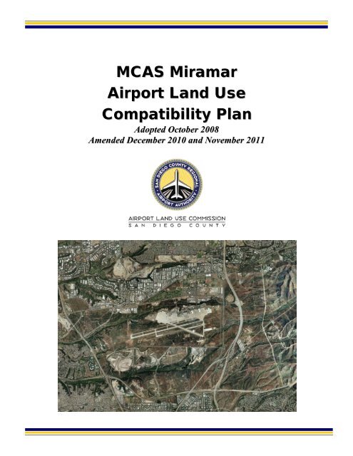
<strong>MCAS</strong> <strong>Miramar</strong><strong>Airport</strong> <strong>Land</strong> <strong>Use</strong><strong>Compatibility</strong> <strong>Plan</strong>Adopted October 2008Amended December 2010 and November 2011
<strong>MCAS</strong> <strong>Miramar</strong><strong>Airport</strong> <strong>Land</strong> <strong>Use</strong><strong>Compatibility</strong> <strong>Plan</strong>Adopted by the<strong>San</strong> <strong>Diego</strong> County<strong>Airport</strong> <strong>Land</strong> <strong>Use</strong> CommissionOctober 2, 2008Prepared by<strong>San</strong>ta Rosa, CaliforniaIn association withHarris Miller Miller & Hanson, Inc.Dudek & Associates, Inc.Technology Associates International Corporation
<strong>San</strong> <strong>Diego</strong> County Regional <strong>Airport</strong> Authority(as of October 2, 2008)Executive Committee MembersAlan D. Bersin, ChairmanRamona Finnila, Vice ChairmanBob WatkinsGeneral MembersBruce R. BolandJack MillerJim DesmondJim PankninCharlene ZettelAnthony K. YoungStaffThella F. BowensPresident/CEOAngela Shafer-PayneVice President, Strategic <strong>Plan</strong>ning and OperationsKeith B. WilschetzDirector, <strong>Airport</strong> System <strong>Plan</strong>ning<strong>San</strong>di SawaManager, <strong>Airport</strong> <strong>Plan</strong>ningBreton K. LobnerGeneral CounselAmy GonzalezDirector of Counsel ServicesLori D. BallanceOutside Legal Counsel
Table of Contents<strong>MCAS</strong> <strong>Miramar</strong>Chapter 1Chapter 2Chapter 3Introduction1.1 Overview of the <strong>Plan</strong> ............................................................................................ 1-11.1.1 Function and Applicability of the <strong>Compatibility</strong> <strong>Plan</strong> ............................ 1-11.1.2 Statutory Requirements ............................................................................... 1-21.1.3 <strong>San</strong> <strong>Diego</strong> County <strong>Airport</strong> <strong>Land</strong> <strong>Use</strong> Commission ................................ 1-31.1.4 Relationship of the ALUC to Local Agencies ......................................... 1-31.2 Policy Framework .................................................................................................. 1-41.2.1 State Laws and Guidelines .......................................................................... 1-41.2.2 Relationship to AICUZ Studies ................................................................. 1-41.2.3 Restrictive <strong>Use</strong> Easements .......................................................................... 1-51.3 Forecasting Methodology ..................................................................................... 1-51.4 <strong>Plan</strong> Implementation ............................................................................................. 1-61.4.1 General <strong>Plan</strong> Consistency ........................................................................... 1-61.4.2 Project Referrals ........................................................................................... 1-61.5 <strong>Plan</strong> Contents ......................................................................................................... 1-7<strong>Airport</strong> <strong>Land</strong> <strong>Use</strong> Commission Policies2.1 Introduction ............................................................................................................ 2-12.2 Definitions .............................................................................................................. 2-22.3 Effective Date ........................................................................................................ 2-52.4 Types of <strong>Airport</strong> Impacts ..................................................................................... 2-82.5 Geographic Scope .................................................................................................. 2-92.6 Types of Actions Reviewed .................................................................................. 2-92.7 General Review Process for <strong>Land</strong> <strong>Use</strong> Actions ..............................................2-112.8 Review Process for General <strong>Plan</strong>s, Specific <strong>Plan</strong>s, ZoningOrdinances, and Building Regulations..............................................................2-132.9 General <strong>Plan</strong> Consistency with <strong>Compatibility</strong> <strong>Plan</strong> ........................................2-142.10 Review Process for Other <strong>Land</strong> <strong>Use</strong> Actions ..................................................2-172.11 Special <strong>Compatibility</strong> Conditions ......................................................................2-18<strong>MCAS</strong> <strong>Miramar</strong> Policies and Maps3.1 Chapter Overview .................................................................................................. 3-13.2 <strong>Compatibility</strong> Zone Delineation .......................................................................... 3-13.2.1 Underlying <strong>Airport</strong> Data ............................................................................. 3-13.2.2 <strong>Compatibility</strong> Factor Policy Maps ............................................................. 3-23.3 Noise <strong>Compatibility</strong> Policies for <strong>MCAS</strong> <strong>Miramar</strong> ............................................ 3-3MIR-1 Noise <strong>Compatibility</strong> Criteria ................................................................... 3-6MIR-1 <strong>Compatibility</strong> Policy Map: Noise ...................................................... ff 3-83.4 Safety <strong>Compatibility</strong> Policies for <strong>MCAS</strong> <strong>Miramar</strong> ............................................ 3-9MIR-2 Safety <strong>Compatibility</strong> Criteria ................................................................3-21MIR-2 <strong>Compatibility</strong> Policy Map: Safety .................................................. ff 3-273.5 Airspace Protection <strong>Compatibility</strong> Policies for <strong>MCAS</strong> <strong>Miramar</strong> ................ 3-28MIR-3 <strong>Compatibility</strong> Policy Map: Airspace Protection ......................... ff 3-31<strong>MCAS</strong> <strong>Miramar</strong> <strong>Land</strong> <strong>Use</strong> <strong>Compatibility</strong> <strong>Plan</strong> (Adopted October 2008 Amended December 2010)i
TABLE OF CONTENTS3.6 Overflight <strong>Compatibility</strong> Policies for <strong>MCAS</strong> <strong>Miramar</strong> ..................................3-32MIR-4 <strong>Compatibility</strong> Policy Map: Overflight ....................................... ff 3-333.7 <strong>Airport</strong> Influence Area Policies for <strong>MCAS</strong> <strong>Miramar</strong> .....................................3-34MIR-5 <strong>Compatibility</strong> Policy Map: <strong>Airport</strong> Influence Area ................. ff 3-35Chapter 4AppendicesBackground Data: <strong>MCAS</strong> <strong>Miramar</strong> Environs4.1 Introduction ............................................................................................................ 4-1ExhibitsMIR-1 <strong>Airport</strong> Features Summary .................................................................. 4-4MIR-2 <strong>Airport</strong> Diagram ................................................................................... 4-5MIR-3 <strong>Airport</strong> Activity Data Summary.......................................................... 4-6MIR-4 Noise Contours - Maximum Mission ................................................ 4-8MIR-5 <strong>Airport</strong> Environs Information ............................................................ 4-9MIR-6 Existing <strong>Land</strong> <strong>Use</strong>s ........................................................................ ff 4-12MIR-7A Adopted County of <strong>San</strong> <strong>Diego</strong> General <strong>Plan</strong> <strong>Land</strong> <strong>Use</strong>s ........ ff 4-12MIR-7B Clairemont Mesa Community <strong>Plan</strong> ............................................. ff 4-12MIR-7C Kearny Mesa Community <strong>Plan</strong> .................................................... ff 4-12MIR-7D Mira Mesa Community <strong>Plan</strong> ........................................................ ff 4-12MIR-7E Scripps <strong>Miramar</strong> Ranch Community <strong>Plan</strong> ................................. ff 4-12MIR-7F Torrey Hills Community <strong>Plan</strong> ...................................................... ff 4-12MIR-7G Torrey Pines Community <strong>Plan</strong> .................................................... ff 4-12MIR-7H University Community <strong>Plan</strong> ......................................................... ff 4-12MIR-8 Aerial Photo .................................................................................... ff 4-12MIR-9 <strong>Compatibility</strong> Data: Noise ........................................................... ff 4-12MIR-10 <strong>Compatibility</strong> Data: Safety .......................................................... ff 4-12MIR-11 <strong>Compatibility</strong> Data: Airspace Protection .................................. ff 4-12MIR-12 <strong>Compatibility</strong> Data: Overflight ................................................... ff 4-12A. State Laws Related to <strong>Airport</strong> <strong>Land</strong> <strong>Use</strong> <strong>Plan</strong>ningB. Federal Aviation Regulations Part 77C. <strong>Airport</strong> <strong>Land</strong> <strong>Use</strong> <strong>Compatibility</strong> ConceptsD. Methods for Determining Concentrations of PeopleE. General <strong>Plan</strong> Consistency ChecklistF. Sample Implementation DocumentsG. On-Line Implementation ToolsH. GlossaryNote: The reference to "ff" means "figure facing," and indicates what page the table, map, exhibit, etc.is most near to, as these items are not individually paginated.ii <strong>MCAS</strong> <strong>Miramar</strong> <strong>Land</strong> <strong>Use</strong> <strong>Compatibility</strong> <strong>Plan</strong> (Adopted October 2008 Amended December 2010)
Chapter 1Introduction<strong>MCAS</strong> <strong>Miramar</strong> <strong>Airport</strong> <strong>Land</strong> <strong>Use</strong> <strong>Compatibility</strong> <strong>Plan</strong>
Chapter 1Introduction1.1 OVERVIEW OF THE PLANThe basic function of airport land use compatibility plans (ALUCPs or compatibility plans) is topromote compatibility between airports and the land uses that surround them to the extent thatthese areas are not already devoted to incompatible uses. With limited exception, California lawrequires preparation of a compatibility plan for each public-use and military airport in the state.Most counties have established an airport land use commission (ALUC), as provided for by law, toprepare compatibility plans for the airports in that county and to review land use plans anddevelopment proposals, as well as certain airport development plans, for consistency with thecompatibility plans. In <strong>San</strong> <strong>Diego</strong> County, the ALUC function rests with the <strong>San</strong> <strong>Diego</strong> CountyRegional <strong>Airport</strong> Authority (SDCRAA), as provided in section 21670.3 of the California PublicUtilities Code.1.1.1 Function and Applicability of the <strong>Compatibility</strong> <strong>Plan</strong>The Marine Corps Air Station (<strong>MCAS</strong>) <strong>Miramar</strong> <strong>Airport</strong> <strong>Land</strong> <strong>Use</strong> <strong>Compatibility</strong> <strong>Plan</strong> (<strong>MCAS</strong><strong>Miramar</strong> ALUCP or <strong>Compatibility</strong> <strong>Plan</strong>) is the fundamental tool used by the SDCRAA, acting inits capacity as the <strong>San</strong> <strong>Diego</strong> County ALUC, in fulfilling its purpose of promoting airport landuse compatibility. Specifically, this <strong>Compatibility</strong> <strong>Plan</strong>: (1) provides for the orderly growth of the<strong>Airport</strong> and the area surrounding the <strong>Airport</strong>; and (2) safeguards the general welfare of theinhabitants within the vicinity of the <strong>Airport</strong> and the public in general. Essentially then, this<strong>Compatibility</strong> <strong>Plan</strong> serves as a tool for use by the ALUC in fulfilling its duty to review land usedevelopment proposals within the airport influence area (AIA) at <strong>MCAS</strong> <strong>Miramar</strong>. In addition, the<strong>Compatibility</strong> <strong>Plan</strong> provides compatibility policies and criteria applicable to local agencies in theirpreparation or amendment of land use plans and ordinances and to landowners in their designof new development.Details regarding the purpose, scope, and applicability of this <strong>Compatibility</strong> <strong>Plan</strong> are set forth inChapter 2. Also included in Chapter 2 are the procedural requirements associated with thecompatibility review of development proposals. These procedures together with thecompatibility criteria, maps, and other policies in Chapter 3 of the <strong>Compatibility</strong> <strong>Plan</strong> comprisethe tools used by the ALUC in conducting reviews of proposed land use development actions.<strong>MCAS</strong> <strong>Miramar</strong> <strong>Airport</strong> <strong>Land</strong> <strong>Use</strong> <strong>Compatibility</strong> <strong>Plan</strong> (Adopted October 2008) 1–1
CHAPTER 1INTRODUCTION<strong>Use</strong> of the <strong>Compatibility</strong> <strong>Plan</strong> is not limited only to the ALUC. As noted above, the compatibilitycriteria must be used by local agencies in their preparation or amendment of land use plans andordinances. The AIA of <strong>MCAS</strong> <strong>Miramar</strong> includes lands within four general land usejurisdictions: the County of <strong>San</strong> <strong>Diego</strong> and the cities of Poway, <strong>San</strong> <strong>Diego</strong>, and <strong>San</strong>tee. Statelaw requires each local agency to modify its general plan and/or land use policy documents andimplementing ordinances to be consistent with the ALUC's compatibility plan, or take specialsteps to overrule the ALUC. Furthermore, this <strong>Compatibility</strong> <strong>Plan</strong> applies not just to the Countyand cities, but to school districts, community college districts, special districts, and other localagencies when these entities consider the siting and design of new facilities or expansion ofexisting ones. Finally, private parties are subject to the provisions of this <strong>Compatibility</strong> <strong>Plan</strong>either directly or as implemented in the plans and zoning of the local agencies.This <strong>Compatibility</strong> <strong>Plan</strong> replaces the ALUCP for <strong>MCAS</strong> <strong>Miramar</strong> that the SDCRAA, acting in itscapacity as the ALUC for <strong>San</strong> <strong>Diego</strong> County, adopted in 2004. This action was taken by theALUC in order to amend the Comprehensive <strong>Land</strong> <strong>Use</strong> <strong>Plan</strong> that the <strong>San</strong> <strong>Diego</strong> CountyAssociation of Governments (SANDAG), which served as the <strong>San</strong> <strong>Diego</strong> County ALUC priorto 2003, originally adopted in 1977 for <strong>MCAS</strong> <strong>Miramar</strong> and last amended in 1992. The 2004amendments involved only minor modifications to the previous policies. As required by statelaw (Pub. Util. Code, §21675(b)), this <strong>Compatibility</strong> <strong>Plan</strong> is consistent with the safety and noisestandards in the Air Installations Compatible <strong>Use</strong> Zones (AICUZ) prepared by the United StatesDepartment of Defense for <strong>MCAS</strong> <strong>Miramar</strong>, dated December 2004, and revised in March 2005.1.1.2 Statutory RequirementsPowers and DutiesRequirements for the creation of ALUCs were first established under the California AeronauticsAct (Pub. Util. Code, §§21670 et seq.) in 1967. (See Appendix A.) Although the law has beenamended numerous times since then, the fundamental purpose of ALUCs, to promote land usecompatibility around airports, has remained unchanged. As expressed in present statutes, theALUC's purpose is:...to protect public health, safety, and welfare by ensuring the orderlyexpansion of airports and the adoption of land use measures that minimizethe public's exposure to excessive noise and safety hazards within areasaround public airports to the extent that these areas are not already devotedto incompatible uses.The statutes give ALUCs the following powers and duties, subject to limitation, by which toaccomplish this objective:To assist local agencies in ensuring compatible land uses in the vicinity of airports to theextent that such land is not already devoted to incompatible uses;To coordinate planning at the state, regional and local levels, so as to provide for theorderly development of air transportation, while at the same time protecting the publichealth, safety and welfare;To prepare and adopt an airport land use compatibility plan; andTo review the plans, regulations, and certain other actions of local agencies and airportoperators for consistency with that compatibility plan.1–2 <strong>MCAS</strong> <strong>Miramar</strong> <strong>Airport</strong> <strong>Land</strong> <strong>Use</strong> <strong>Compatibility</strong> <strong>Plan</strong> (Adopted October 2008)
INTRODUCTION CHAPTER 1LimitationsThe above fundamental purpose notwithstanding, there are important limitations on anALUC's authority. Three important limitations are explicitly written into the law: ALUCs haveno authority over either "existing land uses" (Pub. Util. Code, §21674(a)) or the "operation ofairports" (Pub. Util. Code, §21674(e)). Definitions of existing land use and airport-related use areprovided in Chapter 2. In addition, although ALUCs must prepare compatibility plans formilitary airports, ALUCs have no jurisdiction over federal lands, such as military bases. (Pub.Util. Code, §21675(b).)A fourth, less absolute limitation upon ALUC authority concerns the types of land use actionsthat are subject to ALUC review. The law emphasizes that local general plans are the primarymechanism for implementing the compatibility policies set forth in an ALUC's compatibilityplan. Thus, each local agency that has land within the AIA established in the <strong>MCAS</strong> <strong>Miramar</strong>ALUCP is required to make its general plan (or land use policy documents and implementingordinances) consistent with the ALUCP, or take special steps to overrule the ALUC. Once theALUC has determined that the county or cit(ies) general plan(s) are consistent with theALUCP, or the local agency overrules the ALUC, the ALUC's authority to review projects withinthat jurisdiction is limited. The only actions for which review remains mandatory are theproposed adoption or amendment of general plans, specific plans, zoning ordinances, andbuilding regulations (or other land use policy documents and implementing ordinances)affecting land within the AIA. Submittal of individual projects for ALUC review is voluntary,and ALUC determinations on these projects are recommendations and are not subject to theoverruling provisions associated with mandatory reviews. (Pub. Util. Code, §21676.5(b)).1.1.3 <strong>San</strong> <strong>Diego</strong> County <strong>Airport</strong> <strong>Land</strong> <strong>Use</strong> CommissionAs noted earlier in this chapter, the SDCRAA serves as the ALUC in <strong>San</strong> <strong>Diego</strong> County. TheSDCRAA designation as the <strong>San</strong> <strong>Diego</strong> County ALUC is written into state law. (Pub. Util.Code, §21670.3.) The SDCRAA assumed ALUC duties from SANDAG when the SDCRAAcame into existence on January 1, 2003. SANDAG had served as the <strong>San</strong> <strong>Diego</strong> County ALUCsince December 1970 when the ALUC function was first established.In addition to serving as the County's ALUC, the SDCRAA is the operator of <strong>San</strong> <strong>Diego</strong>International <strong>Airport</strong> (SDIA), the sole major domestic and international airport in the County.Additionally, the SDCRAA is responsible for leading the comprehensive planning effortdirected at meeting the long-term air transportation service demands of the region. Inconnection with this responsibility, the SDCRAA must complete a Regional Aviation Strategic<strong>Plan</strong> by June 30, 2011. The goal of the <strong>Plan</strong> is to improve the performance of all airports within<strong>San</strong> <strong>Diego</strong> County. While these three functions are housed within a single organization, theALUC role is largely independent of the others because, by law, ALUCs have no authority overairport operations.1.1.4 Relationship of the ALUC to Local AgenciesThe fundamental relationship between the <strong>San</strong> <strong>Diego</strong> County ALUC and the local agencies thatmay be affected by this <strong>Compatibility</strong> <strong>Plan</strong> is set forth in the Aeronautics Act. The ALUC does notneed the approval of the county or any city in order to adopt this <strong>Compatibility</strong> <strong>Plan</strong> or to carryout the ALUC project review responsibilities; however, the ALUC must coordinate its activities<strong>MCAS</strong> <strong>Miramar</strong> <strong>Airport</strong> <strong>Land</strong> <strong>Use</strong> <strong>Compatibility</strong> <strong>Plan</strong> (Adopted October 2008) 1–3
CHAPTER 1INTRODUCTIONwith the local agencies. In one particular respect, this coordination is mandatory. State lawrequires "hearing and consultation with the involved agencies" with regard to establishment ofAIA boundaries. (Pub. Util. Code, §21675(c).)Another aspect of the relationship between the ALUC and local agencies concernsimplementation of the <strong>Compatibility</strong> <strong>Plan</strong>. Although the ALUC has the sole authority to adoptthis <strong>Compatibility</strong> <strong>Plan</strong> and to conduct compatibility reviews, the authority and responsibility forimplementing the compatibility policies rests with the local agencies that control land uses withinthe AIA. Actions that these local agencies can take to implement the <strong>Compatibility</strong> <strong>Plan</strong>'s policiesare outlined later in this chapter.1.2 POLICY FRAMEWORKThe policies in Chapter 2 and 3 of this <strong>Compatibility</strong> <strong>Plan</strong> are based upon these primary sources:the Aeronautics Act and other state laws and guidelines, including those in the California <strong>Airport</strong><strong>Land</strong> <strong>Use</strong> <strong>Plan</strong>ning Handbook (Handbook) published by the California Department ofTransportation, Division of Aeronautics (Division of Aeronautics); and the <strong>MCAS</strong> <strong>Miramar</strong> AICUZ,dated December 2004, and revised March 2005.1.2.1 State Laws and GuidelinesMany of the procedures that govern how ALUCs operate are defined by state law. Statutoryprovisions in the Public Utilities Code require ALUC adoption of compatibility plans for eachpublic use and military airport, and establish certain steps to be taken in the plan adoptionprocess. (See Pub. Util. Code, §21675.) The law also dictates the requirements for airport landuse compatibility reviews by the ALUC and the types of actions that local agencies must submitfor a consistency review. (See, e.g., Pub. Util. Code, §§21675.2, 21676, 21676.5.)When preparing compatibility plans for individual airports, ALUCs must be guided by theinformation contained in the Handbook. The Handbook is not regulatory in nature, however, andit does not constitute formal state policy except to the extent that it explicitly refers to statelaws. Rather, its guidance is intended to serve as the starting point for compatibility planningaround individual airports. The policies and maps in this <strong>Compatibility</strong> <strong>Plan</strong> take into account theguidance provided in the current edition of the Handbook, dated January 2002.An additional function of the Handbook is established elsewhere in California state law. ThePublic Resources Code creates a tie between the Handbook and California EnvironmentalQuality Act (CEQA) documents. Specifically, Public Resources Code section 21096 requiresthat lead agencies use the Handbook as "a technical resource" when assessing airport-relatednoise and safety impacts of projects located in the vicinity of airports.The Handbook is available from the Division of Aeronautics.1.2.2 Relationship to AICUZ StudiesFederal regulations require the military services to prepare an AICUZ study for each militaryairfield. The AICUZ Program was established by the Department of Defense (DOD) inresponse to increasing incompatible urban development around military airfields. DODInstruction Number 4165.57 (November 8, 1977) (Basic Instruction) provides the overall1–4 <strong>MCAS</strong> <strong>Miramar</strong> <strong>Airport</strong> <strong>Land</strong> <strong>Use</strong> <strong>Compatibility</strong> <strong>Plan</strong> (Adopted October 2008)
INTRODUCTION CHAPTER 1guidance for the program. Each military service has its own individual guidelines forimplementing the Basic Instruction. The Navy guidelines are defined in OPNAV Instruction11010.36B, AICUZ Program Procedures and Guidelines for Department of the Navy Air Installations,dated December 19, 2002 (OPNAV Instruction). These procedures apply to Marine Corpsairfields as well as to those operated by the Navy.The OPNAV Instruction states that the purpose of the AICUZ Program is "to achievecompatibility between air installations and neighboring communities by:Protecting the health, safety, and welfare of civilians and military personnel byencouraging land use which is compatible with aircraft operations;Protecting Navy and Marine Corps installation investment by safeguarding theinstallation's operational capabilities;Reducing noise impacts caused by aircraft operations while meeting operational, training,and flight safety requirements, both on and in the vicinity of air installations; andInforming the public about the AICUZ program and seeking cooperative efforts tominimize noise and aircraft accident potential impact by promoting compatibledevelopment in the vicinity of military air installations."AICUZ plans prepared for individual military airfields serve as recommendations to local agencies.However, California state law (Pub. Util. Code, §21675(b)) not only requires that ALUCsprepare an ALUCP for each military airport in their jurisdiction, but also that such plan "beconsistent with the safety and noise standards …" in the AICUZ for that airport. Although thecompatibility policies set forth in this <strong>Compatibility</strong> <strong>Plan</strong> for <strong>MCAS</strong> <strong>Miramar</strong> are not identical tothe AICUZ plan for the facility, the noise and safety <strong>Compatibility</strong> <strong>Plan</strong> policies are consistentwith the AICUZ guidance and provide the level of compatibility protection recommended bythe AICUZ.1.2.3 Restrictive <strong>Use</strong> EasementsDuring the 1970s and 1980s, the Department of Navy (DON) acquired restrictive use easements(RUEs) over nearly 400 acres of property in the communities surrounding <strong>MCAS</strong> <strong>Miramar</strong>.These parcels mostly are contained within the primary departure corridors for <strong>MCAS</strong> <strong>Miramar</strong>operations and in the areas to the south around State Route 52, and were determined to beessential in ensuring compatible land use planning within these critical areas. Developmentwithin these parcels must be consistent with the height, lot coverage, land use type restrictions,or related restrictions specified in the RUEs. The RUEs are identified on Map MIR-2, which islocated in Chapter 3 of this <strong>Compatibility</strong> <strong>Plan</strong>.The RUEs are discussed and identified in this <strong>Compatibility</strong> <strong>Plan</strong> for informational purposes andincorporated into this document. The enforcement of the RUEs is the responsibility of theDOD/DON.1.3 FORECASTING METHODOLOGYState law (Pub. Util. Code, §21675(a)) requires that a compatibility plan reflect "the anticipatedgrowth of the airport during at least the next 20 years." For this <strong>Compatibility</strong> <strong>Plan</strong>, theforecasted growth is based upon the projected activity levels indicated in the AICUZ document.<strong>MCAS</strong> <strong>Miramar</strong> <strong>Airport</strong> <strong>Land</strong> <strong>Use</strong> <strong>Compatibility</strong> <strong>Plan</strong> (Adopted October 2008) 1–5
CHAPTER 1INTRODUCTIONAlthough the AICUZ does not specifically assign a year to the projected activity levels, theprojections reflect the maximum activity levels consistent with the currently identified missionof the <strong>Airport</strong>. For compatibility planning purposes, this projection is presumed to representthe requisite 20-year time horizon. If the mission of <strong>MCAS</strong> <strong>Miramar</strong> changes in the future in amanner that would significantly affect the activity levels, the Marine Corps would prepare a newAICUZ and the ALUC would update this <strong>Compatibility</strong> <strong>Plan</strong>, if necessary.A summary of current and projected aircraft operations data from the <strong>MCAS</strong> <strong>Miramar</strong> AICUZis included in Chapter 4 of this <strong>Compatibility</strong> <strong>Plan</strong>. Other background information regarding thebase is presented in that chapter as well.1.4 PLAN IMPLEMENTATION1.4.1 General <strong>Plan</strong> ConsistencyAs noted above, state law requires each local agency having jurisdiction over land uses within anALUC's planning area to modify its general plan and any affected specific plans to be consistentwith the compatibility plan, or to take the steps necessary to overrule the ALUC within 180days of when the ALUC adopts or amends its compatibility plan. The local agency maypropose to overrule the ALUC after a hearing by a two-thirds vote of the local agency's governingbody if it makes specific findings that the local agency's plans are consistent with the intent ofstate airport land use planning statutes. The local agency must provide both the ALUC and theDivision of Aeronautics with a copy of the local agency's proposed decision and findings at least 45days in advance of its decision to overrule the ALUC and must hold a public hearing on theproposed overruling. (Pub. Util. Code, §21676(a)-(b).) If the ALUC and Division of Aeronauticschoose to provide comments to the local agency, they must do so within 30 days of receiving theproposed decision and findings. Any comments received from the ALUC or Division ofAeronautics must be included in the public record of the local agency's final decision to overrule theALUC. (Pub. Util. Code, §§21676, 21676.5, 21677.) (Similar requirements apply to a localagency's decision to overrule the ALUC's consistency determinations concerning individualdevelopment proposals for which ALUC review is mandatory. (Pub. Util. Code, §21676.5(a))and airport master plans (Pub. Util. Code, §21676(c)).)A general plan does not need to be identical with the ALUC's compatibility plan in order to beconsistent with the compatibility plan. To meet the consistency test, a general plan must do twothings:Specifically address compatibility planning issues, either directly or through reference to azoning ordinance or other policy document; andAvoid direct conflicts with compatibility planning criteria.(See Policy 2.9.)1.4.2 Project ReferralsThe types of land use actions for which referral to the ALUC is mandatory include the adoptionof general plans, specific plans, amendments of general or specific plans, or the adoption orapproval of a zoning ordinance, building regulation or other implementing ordinance. Thisrequirement should be indicated in the general plan and other land use policy document or1–6 <strong>MCAS</strong> <strong>Miramar</strong> <strong>Airport</strong> <strong>Land</strong> <strong>Use</strong> <strong>Compatibility</strong> <strong>Plan</strong> (Adopted October 2008)
INTRODUCTION CHAPTER 1implementing ordinance of each affected local agency. Additionally, beginning with when this<strong>Compatibility</strong> <strong>Plan</strong> is adopted by the ALUC and continuing until such time as each affected localagency has made the necessary modifications to its general plan or overruled the ALUC, allsubsequent actions, regulations and permits within the AIA are to be submitted to the ALUCfor review. After the local agency has made its general plan and other land use policy documentsand implementing ordinances consistent with the <strong>Compatibility</strong> <strong>Plan</strong> or overruled the ALUC,submittal of individual subsequent actions, regulations and permits is generally not required, butthe ALUC and the local agency can agree upon continued submittal of certain actions on aninformal basis.1.5 PLAN CONTENTSThis <strong>Compatibility</strong> <strong>Plan</strong> is complete unto itself and is separate and independent fromcompatibility plans adopted by the ALUC for other airports in the County. This <strong>Compatibility</strong><strong>Plan</strong> is organized into four chapters and a set of appendices.Chapters 2 and 3 contain the policies by which the ALUC operates and conducts compatibilityreviews of proposed land use and airport development actions. The policies in Chapter 2 arewritten broadly so as to address overarching compatibility concerns. Detailed compatibilitycriteria and other policies applicable specifically to <strong>MCAS</strong> <strong>Miramar</strong> are set forth in Chapter 3 ofthis document. Chapter 4 presents various background data regarding features, impacts, andenvirons of <strong>MCAS</strong> <strong>Miramar</strong>. Chapter 4 also serves to document the data and assumptionsupon which the compatibility policy maps for the <strong>Airport</strong> are based.Also included in this document are a set of appendices containing a copy of state statutesconcerning ALUCs and other general information pertaining to airport land use compatibilityplanning. Chapter 4, along with the appendices, provide background and other informationused to prepare the policies contained in Chapters 2 and 3.<strong>MCAS</strong> <strong>Miramar</strong> <strong>Airport</strong> <strong>Land</strong> <strong>Use</strong> <strong>Compatibility</strong> <strong>Plan</strong> (Adopted October 2008) 1–7
Chapter 2Basic <strong>Airport</strong> <strong>Land</strong> <strong>Use</strong>Commission Policies<strong>MCAS</strong> <strong>Miramar</strong> <strong>Airport</strong> <strong>Land</strong> <strong>Use</strong> <strong>Compatibility</strong> <strong>Plan</strong>
Chapter 2<strong>Airport</strong> <strong>Land</strong> <strong>Use</strong> CommissionPolicies2.1 INTRODUCTION2.1.1 Purpose: The policies set forth in this chapter and Chapter 3 of this <strong>Compatibility</strong> <strong>Plan</strong> serve twofunctions:(a)To provide the procedures to be used by the SDCRAA, acting in its capacity as theALUC, and affected local agencies for the purpose of fulfilling the airport land usecompatibility review requirements set forth in the Aeronautics Act (Pub. Util. Code,§21670 et seq.). Specifically, these procedures define:(1) The steps to be taken by local agencies including, but not limited to, the County of<strong>San</strong> <strong>Diego</strong>, the cities of Poway, <strong>San</strong> <strong>Diego</strong> and <strong>San</strong>tee, special districts, schooldistricts, and community college districts in submitting certain land usedevelopment plans and other proposed actions to the ALUC for review inaccordance with Policies 2.6.1 and 2.6.2 of this <strong>Compatibility</strong> <strong>Plan</strong>.(2) The process, as set forth in Policies 2.7 through 2.10 of this <strong>Compatibility</strong> <strong>Plan</strong>, tobe used by the ALUC in reviewing the above actions for compliance with thecompatibility criteria set forth in this <strong>Compatibility</strong> <strong>Plan</strong>.(b) To identify compatibility criteria to be utilized by:(1) The ALUC in review of various actions involving land use development withinthe <strong>MCAS</strong> <strong>Miramar</strong> AIA.(2) Local agencies, including, but not limited to the County of <strong>San</strong> <strong>Diego</strong> and the citiesof Poway, <strong>San</strong> <strong>Diego</strong> and <strong>San</strong>tee in modifying their respective general plans,applicable specific plans, and zoning ordinances for consistency with this<strong>Compatibility</strong> <strong>Plan</strong>.2.1.2 Relationship to Chapter 3 Policies: The policies in this chapter address ALUC review proceduresand overarching compatibility considerations. <strong>Compatibility</strong> criteria and other policiesapplicable to <strong>MCAS</strong> <strong>Miramar</strong> are set forth in Chapter 3. For purposes of this <strong>Compatibility</strong> <strong>Plan</strong>,as listed in Policy 2.1.1 above, adherence to the policies of both chapters is required.<strong>MCAS</strong> <strong>Miramar</strong> <strong>Airport</strong> <strong>Land</strong> <strong>Use</strong> <strong>Compatibility</strong> <strong>Plan</strong> (Adopted October 2008 Amended December 2010) 2–1
CHAPTER 2AIRPORT LAND USE COMMISSION POLICIES2.2 DEFINITIONSThe following definitions apply for the purposes of the policies set forth in this document (additionalterms are defined in the Glossary):2.2.1 Accident Potential Zone I (APZ I): APZ I is the area located immediately beyond the Clear Zone.2.2.2 Accident Potential Zone II (APZ II): APZ II is the area located immediately beyond APZ I.2.2.3 Aeronautics Act: Except as otherwise indicated, the article of the California Public Utilities Code,section 21670 et seq., relating to ALUCs.2.2.4 Air Installations Compatible <strong>Use</strong> Zones Study (AICUZ): A land use compatibility plan prepared bythe U.S. Department of Defense for military airfields. AICUZ plans serve as recommendationsto local agencies having jurisdiction over land uses surrounding these facilities.2.2.5 <strong>Airport</strong>: Marine Corps Air Station (<strong>MCAS</strong>) <strong>Miramar</strong>.2.2.6 <strong>Airport</strong> Influence Area (AIA): An area where noise, safety, airspace protection, or overflight maysignificantly affect land uses or necessitate restrictions on those uses as determined by theALUC. The airport influence area constitutes the area within which certain land use actions aresubject to ALUC review to determine consistency with the policies set forth in the <strong>MCAS</strong><strong>Miramar</strong> <strong>Airport</strong> <strong>Land</strong> <strong>Use</strong> <strong>Compatibility</strong> <strong>Plan</strong>. If a property is located within the airport influencearea, a Real Estate Disclosure must be provided in connection with the sale or transfer ofresidential property.2.2.7 <strong>Airport</strong> <strong>Land</strong> <strong>Use</strong> Commission (ALUC): The <strong>San</strong> <strong>Diego</strong> County Regional <strong>Airport</strong> Authority acting in itscapacity as the <strong>San</strong> <strong>Diego</strong> County <strong>Airport</strong> <strong>Land</strong> <strong>Use</strong> Commission.2.2.8 <strong>Airport</strong> <strong>Land</strong> <strong>Use</strong> Commission Staff: The President/Chief Executive Officer (CEO) of the <strong>San</strong><strong>Diego</strong> County Regional <strong>Airport</strong> Authority, or a person designated by the President/CEO.2.2.9 Airspace Protection Area: The area beneath the airspace protection surfaces for the <strong>MCAS</strong> <strong>Miramar</strong>, asdepicted on the <strong>Compatibility</strong> Policy Map: Airspace Protection in Chapter 3.2.2.10 Airspace Protection Surfaces: Imaginary surfaces in the airspace surrounding airports defined inaccordance with criteria set forth in Federal Aviation Regulations Part 77. These surfaces establishthe maximum height that objects on the ground can reach without potentially creatingconstraints or hazards to the use of the airspace by aircraft approaching, departing, ormaneuvering in the vicinity of an airport.2.2.11 Aviation-Related <strong>Use</strong>: Any facility or activity directly associated with the air transportation ofpersons or cargo, or the operation, storage, or maintenance of aircraft at an airport or heliport.Such uses specifically include runways, taxiways, and their associated protection areas as definedby the Federal Aviation Administration, together with aircraft aprons, hangars, fixed baseoperations facilities, terminal buildings, etc.2.2.12 California Building Code (CBC): The CBC is located in Title 24, Part 2, of the California Code ofRegulations and governs general building construction standards.2.2.13 Clear Zone (CZ): The CZ includes areas immediately beyond the ends of military airportrunways. These areas have the greatest potential for occurrence of aircraft accidents and shouldremain undeveloped.2.2.14 Community Noise Equivalent Level (CNEL): The noise metric adopted by the State of Californiafor land use planning purposes, including describing airport noise impacts. This noise metric2–2 <strong>MCAS</strong> <strong>Miramar</strong> <strong>Airport</strong> <strong>Land</strong> <strong>Use</strong> <strong>Compatibility</strong> <strong>Plan</strong> (Adopted October 2008 Amended December 2010)
AIRPORT LAND USE COMMISSION POLICIES CHAPTER 2compensates for the increase in people's sensitivity to noise during nighttime hours. The noiseimpacts typically are depicted by a set of contours, each of which represents points having thesame CNEL value. (See Appendix H and Glossary.)2.2.15 <strong>Compatibility</strong> <strong>Plan</strong>: This document, the <strong>MCAS</strong> <strong>Miramar</strong> <strong>Airport</strong> <strong>Land</strong> <strong>Use</strong> <strong>Compatibility</strong> <strong>Plan</strong>, alsoreferred to as "this <strong>Compatibility</strong> <strong>Plan</strong>."2.2.16 Development by Right: Other than in the Clear Zone, construction of a single-family home,including a second unit as defined by state law, on a legal lot of record if such use is permittedby local land use regulations, and lot line adjustments provided that new developable parcelswould not be created and the resulting density or intensity of the affected property would notexceed the applicable criteria indicated in Table MIR-2. (See Chapter 3 of this <strong>Compatibility</strong> <strong>Plan</strong>for Table MIR-2.) (See also Policy 2.11.4.)2.2.17 Division of Aeronautics: California Department of Transportation, Division of Aeronautics.2.2.18 Existing <strong>Land</strong> <strong>Use</strong>: A project shall be considered an "existing land use" when:(a) A "vested right" is obtained, as follows:(1) A vesting tentative map has been approved pursuant to Government Codesection 66498.1 and has not expired; or(2) A development agreement has been executed pursuant to Government Codesection 65866 and remains in effect; or(3) A valid building permit has been issued, substantial work has been performed,and substantial liabilities have been incurred in good faith reliance on thepermit, pursuant to the California Supreme Court decision in Avco CommunityDevelopers, Inc. v. South Coast Regional Com. (1976) 17 Cal.3d 785, 791, and itsprogeny.(i) A proposed modification to an existing land use that will result in an increasein height, a change of use, or an increase in density or intensity of use whichis not in substantial conformance with the development project entitled bythe local agency shall be subject to this <strong>Compatibility</strong> <strong>Plan</strong>. (See Policy 2.10.4.)(ii) The determination of whether a project meets the criteria of an "existing landuse" shall be made by the local agency and the ALUC.(b) A new occupancy of an existing building, provided the new occupancy remains withinthe same or reduced level of occupancy as the most recent one. A new occupancywhich increases intensity shall not qualify as an existing land use.2.2.19 Federal Aviation Regulations (FAR Part 77): The Part of the Federal Aviation Regulations that dealswith objects affecting navigable airspace in the vicinity of airports. FAR Part 77 establishesstandards for identifying obstructions to navigable airspace, sets forth requirements for noticeto the FAA of certain proposed construction or alteration, and provides for aeronautical studiesof obstructions to determine their effect on the safe and efficient use of airspace. (SeeAppendix B of this <strong>Compatibility</strong> <strong>Plan</strong> for the text of Part 77.)2.2.20 Floor Area Ratio (FAR): The total building square footage (building area) divided by the site sizesquare footage (site area).2.2.21 General <strong>Plan</strong>: For purposes of this <strong>Compatibility</strong> <strong>Plan</strong>, this term shall mean any general plan orspecific plan or amendments thereto, or any zoning ordinance, building regulation or land usepolicy document or implementing ordinance. (See Pub. Util. Code, §21676.)<strong>MCAS</strong> <strong>Miramar</strong> <strong>Airport</strong> <strong>Land</strong> <strong>Use</strong> <strong>Compatibility</strong> <strong>Plan</strong> (Adopted October 2008 Amended December 2010) 2–3
CHAPTER 2AIRPORT LAND USE COMMISSION POLICIES2.2.22 Handbook: California <strong>Airport</strong> <strong>Land</strong> <strong>Use</strong> <strong>Plan</strong>ning Handbook, published by the State of California,Department of Transportation, Division of Aeronautics (January 2002).2.2.23 High Terrain Zone: Areas of land in the vicinity of an airport where the ground lies above anFAR Part 77 surface or less than 35 feet beneath such surface. In addition, any location wherethe ground level reaches to within 100 feet of an instrument approach surface, as defined by theU.S. Standard for Terminal Instrument Procedures. This zone is shown on the airspace protectionpolicy map in Chapter 3, where applicable, based upon surrounding terrain.2.2.24 Infill: Development of vacant or underutilized land within established communities orneighborhoods that are: (a) already served with streets, water, sewer, and other infrastructure;and (b) comprised of existing uses inconsistent with the compatibility criteria set forth in this<strong>Compatibility</strong> <strong>Plan</strong>. (See Policy 2.11.1 for criteria used by local agencies to identify potential infillareas in the Transition Zone for compatibility planning purposes.)2.2.25 Local Agency: For the purposes of this <strong>Compatibility</strong> <strong>Plan</strong>, the County of <strong>San</strong> <strong>Diego</strong>, the cities ofPoway, <strong>San</strong> <strong>Diego</strong>, and <strong>San</strong>tee, or other local governmental entity such as a special district,school district, or community college district having jurisdiction over land uses within the AIA'sboundaries. These entities are subject to the provisions of this <strong>Compatibility</strong> <strong>Plan</strong>; the ALUCdoes not have authority over land use actions of federal agencies.2.2.26 Local <strong>Plan</strong> or Other <strong>Land</strong> <strong>Use</strong> Project/<strong>Plan</strong>: For purposes of this <strong>Compatibility</strong> <strong>Plan</strong>, these terms shallmean any action, regulation or permit. (See Pub. Util. Code, §21676.5.)2.2.27 Nonconforming <strong>Use</strong>: A land use, parcel or building that does not comply with this <strong>Compatibility</strong><strong>Plan</strong>. (See Policies 2.11.2 and 2.11.3 for criteria applicable to land use actions involvingnonconforming uses.)2.2.28 Overflight Notification: An Overflight Notification is a buyer awareness tool that ensures prospectivebuyers of residential land use development near an airport are informed about the airport'spotential impact on the property. An Overflight Notification is recorded in the chain of title of theproperty and indicates that a property may be subject to some of the annoyances orinconveniences associated with proximity to an airport and aircraft operations (for example:noise, vibration, overflights or odors). An Overflight Notification does not convey property rightsfrom the property owner to the airport and does not restrict the height of objects. It simplydocuments the existence of certain conditions which may affect the property. The <strong>Airport</strong> <strong>Land</strong><strong>Use</strong> Commission will require the recording of an Overflight Notification as a condition of projectapproval within portions of the airport influence area where overflights are known to occur.2.2.29 Project; Permit; <strong>Land</strong> <strong>Use</strong> Action; Development Proposal; Project/<strong>Plan</strong>: Terms similar in meaning andall referring to the types of land use matters, either publicly or privately sponsored, that aresubject to the provisions of this <strong>Compatibility</strong> <strong>Plan</strong>. (See definition of Local <strong>Plan</strong>.)2.2.30 Real Estate Disclosure: A Real Estate Disclosure is required by state law as a condition of the sale ofmost residential property if the property is located in the vicinity of an airport and within itsairport influence area. (See Bus. & Prof. Code, §11010; Civ. Code, §§1102.6, 1103.4, 1353.) Thedisclosure notifies the prospective purchaser of potential annoyances or inconveniencesassociated with airport operations prior to completing the purchase.2.2.31 Reconstruction: The rebuilding of an existing nonconforming structure that has been fully orpartially destroyed as a result of a calamity (not planned reconstruction or redevelopment), asdefined by the local agency.2–4 <strong>MCAS</strong> <strong>Miramar</strong> <strong>Airport</strong> <strong>Land</strong> <strong>Use</strong> <strong>Compatibility</strong> <strong>Plan</strong> (Adopted October 2008 Amended December 2010)
AIRPORT LAND USE COMMISSION POLICIES CHAPTER 22.2.32 Redevelopment: Development of a new use (not necessarily a new type of use) to replace anexisting use at a density or intensity that may vary from the existing use. Redevelopment projectsare subject to the provisions of this <strong>Compatibility</strong> <strong>Plan</strong> to the same extent as other forms ofproposed development. (Also see Policy 2.6.2(c).)2.2.33 Restrictive <strong>Use</strong> Easement: Transfers certain property rights from the owner of property to theUnited States Department of Navy (DON). These easements are maintained by the DON as atool to assist in ensuring compatible land use planning in surrounding communities adjacent to<strong>MCAS</strong> <strong>Miramar</strong>.2.2.34 SDCRAA: <strong>San</strong> <strong>Diego</strong> County Regional <strong>Airport</strong> Authority, acting in its capacity as the ALUC for theCounty of <strong>San</strong> <strong>Diego</strong>.2.2.35 Sensitive <strong>Land</strong> <strong>Use</strong>s: <strong>Land</strong> uses for which the associated primary activities, whether indoor oroutdoor, are susceptible to disruption by aircraft operations and require special protection fromhazards, such as potential aircraft accidents, because of, for example, the low effective mobilityof occupancies or the presence of hazardous materials. The most common types of sensitive landuses include, but are not limited to: residential, hospitals, nursing facilities, intermediate carefacilities, educational facilities, outdoor assembly uses, libraries, museums, places of worship,and child-care facilities.2.2.36 Transition Zone (TZ): The Transition Zone is the safety zone located on the perimeter of APZ II.The boundaries of the Transition Zone were created for this <strong>Compatibility</strong> <strong>Plan</strong> using low-altitudefixed-wing aircraft flight track location data presented in the AICUZ. Additional data from themilitary was used to identify locations where these aircraft fly at an altitude of less than 2,000feet above mean sea level (MSL).2.2.37 U.S. Standard for Terminal Instrument Procedures (TERPS): Standardized criteria adopted by theFederal Aviation Administration, U.S. military branches, and the U.S. Coast Guard for use indesigning the airport area and en route instrument flight procedures. The criteria are predicatedon normal aircraft operations for considering obstacle clearance requirements.2.3 EFFECTIVE DATE2.3.1 <strong>Plan</strong> Adoption: The policies in this <strong>Compatibility</strong> <strong>Plan</strong> shall become effective as of the date thatthe ALUC adopts this <strong>Compatibility</strong> <strong>Plan</strong>.(a) The <strong>MCAS</strong> <strong>Miramar</strong> ALUCP adopted by the ALUC in 2004 shall remain in effect untilALUC adoption of this <strong>Compatibility</strong> <strong>Plan</strong>, and shall again become effective if theentirety of this <strong>Compatibility</strong> <strong>Plan</strong> should be invalidated by court action.(b) If any portion of this <strong>Compatibility</strong> <strong>Plan</strong> should be invalidated by court action, it shallnot invalidate the portions of this <strong>Compatibility</strong> <strong>Plan</strong> that are not the subject of thecourt action.(c) Any action to invalidate all or portions of a compatibility plan adopted by the ALUC forany other airport within its jurisdiction shall not invalidate this <strong>Compatibility</strong> <strong>Plan</strong>.2.3.2 Applicability to Projects Not Yet Completed: The compatibility policies, if any, that will be used toperform a consistency review for a proposed project, and any subsequent implementing action(s)associated with that project, shall be determined according to the following, as provided in<strong>MCAS</strong> <strong>Miramar</strong> <strong>Airport</strong> <strong>Land</strong> <strong>Use</strong> <strong>Compatibility</strong> <strong>Plan</strong> (Adopted October 2008 Amended December 2010) 2–5
CHAPTER 2AIRPORT LAND USE COMMISSION POLICIESParagraphs (a) through (e) below. In no instance, however, shall the ALUC apply any<strong>Compatibility</strong> <strong>Plan</strong> rules, regulations, and/or policies to any project, permit or action, or to anysubsequent discretionary or ministerial implementing permit or action for that project, that are inany manner inconsistent with the provisions of Federal Aviation Regulations Part 77, ObjectsAffecting Navigable Airspace, and/or the California <strong>Airport</strong> Noise Regulations (Cal. Code Regs.,tit. 21, §5000 et seq.).(a)(b)General <strong>Plan</strong> Consistent with Prior <strong>Compatibility</strong> <strong>Plan</strong>: A project, and any subsequentimplementing action(s) for that project, that is located within an area in which the localagency has modified its general plan to be consistent with the compatibility plan ineffect prior to approval of this <strong>Compatibility</strong> <strong>Plan</strong>, or within an area in which a localagency has taken the special steps necessary to overrule the prior compatibility plan,shall not be subject to ALUC review under this <strong>Compatibility</strong> <strong>Plan</strong>, provided that thelocal agency:(1) Has deemed the project application to be complete prior to the effective date ofthis <strong>Compatibility</strong> <strong>Plan</strong>;(2) The project is consistent with the local agency's ALUC-approved general plan (orthe local agency has overruled the prior compatibility plan); and(3) The project and/or any subsequent implementing action(s) have not changed ina substantive manner, as determined by the local agency, based on the criteriaprovided in Policy 2.10.4, that potentially would invalidate any original approvalof the project by the local agency and require a subsequent review.General <strong>Plan</strong> Not Consistent with Prior <strong>Compatibility</strong> <strong>Plan</strong>: A project, and/or anysubsequent implementing action(s) for that project, that is located within an area inwhich a local agency has not modified its general plan to be consistent with thecompatibility plan in effect prior to the approval of this <strong>Compatibility</strong> <strong>Plan</strong>, or taken thespecial steps necessary to overrule the prior compatibility plan, that is within the AIA, asdefined in this <strong>Compatibility</strong> <strong>Plan</strong>; and is not an existing land use, as defined in Policy2.2.18, shall be submitted to the ALUC to be reviewed in accordance with thecompatibility plan in effect at the time the application was deemed complete by thelocal agency, except where such application is materially deficient pursuant to Paragraph(1) below, in which case the project shall be reviewed in accordance with thecompatibility plan in effect at the time the application is deemed complete by theALUC, as specifically provided in Paragraphs (2) through (4) below.(1) If an application for a project has been submitted to the local agency and theapplication has been deemed complete by the local agency, the informationcontained in such application may be used to submit a consistency determinationapplication and shall constitute a complete application for purposes of aconsistency review by the ALUC, unless the ALUC determines that theapplication lacks one or more of the components required in Policy 2.7.2.(2) If an application for consistency is determined by the ALUC to be incompletepursuant to Paragraph (1), above, then not later than thirty (30) calendar daysafter the ALUC has received an application for a determination of consistency,the ALUC shall respond in writing as to why the application is not complete andshall immediately transmit the information to the local agency and the projectproponent. The ALUC shall specify those parts of the application which areincomplete and shall indicate the manner in which they can be made complete,2–6 <strong>MCAS</strong> <strong>Miramar</strong> <strong>Airport</strong> <strong>Land</strong> <strong>Use</strong> <strong>Compatibility</strong> <strong>Plan</strong> (Adopted October 2008 Amended December 2010)
AIRPORT LAND USE COMMISSION POLICIES CHAPTER 2(c)(d)(e)including a list and thorough description of the specific information needed tocomplete the application for a determination of consistency.(3) If the written response as to the completeness of the application is not made bythe ALUC within thirty (30) calendar days after receipt of the consistencyapplication, and/or after receipt of any additional information requested, theproject will be evaluated using the ALUCP in effect on the date of expiration ofthe thirty (30) calendar day time limit for determining completeness of theapplication materials submitted.(4) Nothing in this policy precludes a local agency and the ALUC from mutuallyagreeing, with the concurrence of the project owner, to an extension of any timelimit provided by this policy.Subsequent Review of Project(s) Found Consistent: A project previously reviewed by theALUC and found to be consistent with the compatibility plan in effect at the time ofthe project review shall not be subject to further review under a subsequently adoptedcompatibility plan unless the project changes in a substantive manner—as determined bythe local agency or by the ALUC when the ALUC concludes that further review iswarranted based on criteria provided in Policy 2.10.4(b)—that potentially wouldinvalidate the original ALUC consistency findings.(1) Any project requiring subsequent ALUC review will be evaluated using theALUCP in effect at the time the re-application was deemed complete by the localagency, unless the ALUC determines that such re-application lacks one or moreof the components required in Policy 2.7.2, in which case the project will beevaluated in accordance with Policies 2.3.2 (b)(2) through (4), inclusive, above.(2) Any project requiring subsequent ALUC review need not be resubmitted forALUC review if, prior to resubmission, the general plan of the local agency inwhich the project is situated has been reviewed by the ALUC and found to beconsistent with this <strong>Compatibility</strong> <strong>Plan</strong>; and the revised project is consistent withthat ALUC-approved general plan.ALUC Project Review Not Required: A project application which was deemedcomplete by the local agency prior to the effective date of this <strong>Compatibility</strong> <strong>Plan</strong>, andwhich did not require ALUC review because it was located beyond the boundary of theAIA defined by the compatibility plan in place at the time the application was deemedcomplete shall not require subsequent ALUC review under this <strong>Compatibility</strong> <strong>Plan</strong>, unlessthe project changes in a substantive manner (see Policy 2.10.4).Long-Term Project: Except as otherwise provided in Paragraphs (a) through (d) above,a long-term project, such as a master plan, large subdivision with several phases, orfunctionally comparable discretionary permit or action ("original long-term project"),and any subsequent discretionary or ministerial implementing permit or action for thatproject, shall be governed by the compatibility plan in effect at the time the first suchpermit or action for the project was issued by the local agency, provided all of thefollowing exist:(1) The project applicant has obtained from a local agency final approval of theoriginal long-term project prior to the effective date of this <strong>Compatibility</strong> <strong>Plan</strong>;(2) The local agency has obtained a consistency determination for the original longtermproject (for those local agencies where the General <strong>Plan</strong> is not consistentwith compatibility plan);<strong>MCAS</strong> <strong>Miramar</strong> <strong>Airport</strong> <strong>Land</strong> <strong>Use</strong> <strong>Compatibility</strong> <strong>Plan</strong> (Adopted October 2008 Amended December 2010) 2–7
CHAPTER 2AIRPORT LAND USE COMMISSION POLICIES(3) The original long-term project approval(s) remain(s) in effect;(4) Final approval of the original long-term project(s) was (were) obtained not morethan fifteen (15) years prior to the effective date of this <strong>Compatibility</strong> <strong>Plan</strong>;(5) The project applicant has used reasonable good faith efforts in proceeding withthe original long-term project, including without limitation, processing any othergovernmental permits and approvals necessary to implement the originalapproval(s) (such as preparing and processing any subsequent or additionalCEQA documents or resource agency permits), preparing architectural orengineering plans, or constructing infrastructure for the original approval(s), suchas roadways, storm drains, parks, sewer, water or other utilities;(6) The local agency has approved a related implementing permit or action for theoriginal approval(s) within five (5) years prior to the effective date of this<strong>Compatibility</strong> <strong>Plan</strong> or the project applicant has an application on file that hasbeen deemed complete by the local agency for any related implementing permitor action as of the effective date of this <strong>Compatibility</strong> <strong>Plan</strong>; and(7) The original long-term project(s) has/have not changed in a substantive manner,as determined by the local agency or the ALUC (see Policy 2.10.4).2.4 TYPES OF AIRPORT IMPACTS2.4.1 Principal <strong>Compatibility</strong> Concerns: As established by state law (Pub. Util. Code, §21670), the ALUChas the responsibility both "to provide for the orderly development of airports" and "to preventthe creation of new noise and safety problems." ALUC policies thus have the dual objective ofprotecting against constraints on airport expansion and operations that can result fromencroachment of incompatible land uses and minimizing the public's exposure to excessivenoise and safety hazards.(a) In order to meet these objectives, this <strong>Compatibility</strong> <strong>Plan</strong> addresses potential <strong>Airport</strong>compatibility impacts related to four specific airport-related factors/layers:(1) Noise—Exposure to aircraft noise;(2) Safety—<strong>Land</strong> use factors that affect safety both for people on the ground andthe occupants of aircraft;(3) Airspace Protection—Protection of <strong>Airport</strong> airspace; and(4) Overflight—Annoyance and other general concerns related to aircraftoverflights.(b) <strong>Compatibility</strong> policies concerning each of these factors/layers are enumerated inChapter 3. Each factor/layer is addressed separately. Proposed land use developmentactions must comply with the compatibility policies and maps for each compatibilityfactor/layer, as well as all policies in this chapter.2.4.2 Policy Objectives: For each compatibility factor/layer, specific policy objectives are as follows:(a) Noise: The purpose of noise compatibility policies is to avoid establishment of newsensitive land uses and exposure of the users to levels of aircraft noise that can disrupt theactivities involved. The characteristics of the <strong>Airport</strong> and the surrounding communityare taken into account in determining the level of noise deemed acceptable for eachtype of land use.2–8 <strong>MCAS</strong> <strong>Miramar</strong> <strong>Airport</strong> <strong>Land</strong> <strong>Use</strong> <strong>Compatibility</strong> <strong>Plan</strong> (Adopted October 2008 Amended December 2010)
AIRPORT LAND USE COMMISSION POLICIES CHAPTER 2(b)Safety: The purpose of safety compatibility policies is to minimize the risks associatedwith an off-airport aircraft accident or emergency landing. Risks both to people andproperty on the ground in the vicinity of the <strong>Airport</strong> and to people on board the aircraftare considered.(c) Airspace Protection: The purpose of airspace protection compatibility policies is toensure that structures and other uses of the land do not cause hazards to aircraft inflight within the <strong>Airport</strong> vicinity. Hazards to flight include, but are not limited to:(1) Physical obstructions to the navigable airspace;(2) Wildlife hazards, particularly bird strikes; and(3) <strong>Land</strong> use characteristics that create visual or electronic interference with aircraftnavigation or communication.(d) Overflight: The purpose of overflight compatibility policies is to notify people aboutthe presence of overflights near airports so that they can make more informed decisionsregarding acquisition or lease of property in the affected areas. Noise from individualaircraft overflights, especially by comparatively loud aircraft, can be intrusive andannoying in locations beyond the limits of the mapped noise contours. Sensitivity toaircraft overflights varies from one person to another.2.4.3 <strong>Airport</strong> Impacts Not Considered: Other impacts sometimes created by airports (e.g., air pollution;automobile traffic) are not addressed by these compatibility policies and are not subject toALUC review. Also, in accordance with state law (Pub. Util. Code, §21674(e)), neither this<strong>Compatibility</strong> <strong>Plan</strong> nor the ALUC have authority over the operation of the <strong>Airport</strong> (includingwhere and when aircraft fly, airport security, and other such matters).2.5 GEOGRAPHIC SCOPEThe geographic scope of this <strong>Compatibility</strong> <strong>Plan</strong> is established through an AIA delineated as follows:2.5.1 The <strong>MCAS</strong> <strong>Miramar</strong> AIA is established as the area in which current and projected futureairport-related noise, safety, airspace protection, or overflight factors/layers may significantlyaffect land use or necessitate restrictions on that land use.2.5.2 The <strong>MCAS</strong> <strong>Miramar</strong> AIA is divided into two subareas, Review Area 1 and Review Area 2.Review Area 1 encompasses the noise and safety factors/layers. Review Area 2 encompassesthe portions of the overflight and airspace protection factors/layers not encompassed withinReview Area 1. A more detailed description of each of these areas and the basis for theirdelineation is contained in Chapter 3. Requirements for referral of land use actions to the ALUCfor review differ between the two review areas (see Policy 2.6.2).2.6 TYPES OF ACTIONS REVIEWED2.6.1 Actions that Always Require ALUC Review: As required by state law, the following types ofactions shall be referred to the ALUC for determination of consistency with this <strong>Compatibility</strong> <strong>Plan</strong> priorto their approval by the local agency:(a) The adoption or approval of any new general or specific plan, or any amendmentthereto (see Pub. Util. Code, §21676(b)) that affects lands within the AIA and involves:(1) Noise or safety concerns within Review Area 1; or<strong>MCAS</strong> <strong>Miramar</strong> <strong>Airport</strong> <strong>Land</strong> <strong>Use</strong> <strong>Compatibility</strong> <strong>Plan</strong> (Adopted October 2008 Amended December 2010) 2–9
CHAPTER 2AIRPORT LAND USE COMMISSION POLICIES(b)(2) <strong>Land</strong> use actions that have been determined to be a hazard by the FAA inaccordance with Part 77 within Review Areas 1 and 2.The adoption or approval of a zoning ordinance or building regulation (or any otherpolicy document or implementing ordinance), including any proposed change orvariance to any such ordinance or regulation (Pub. Util. Code, §21676(b)) that affectslands within the AIA and involves:(1) Noise or safety concerns within Review Area 1; or(2) <strong>Land</strong> use actions that have been determined to be a hazard by the FAA inaccordance with Part 77 within Review Areas 1 and 2.2.6.2 Other <strong>Land</strong> <strong>Use</strong> Actions Subject to ALUC Review: Other types of land use actions are subject toreview under the following circumstances:(a)(b)Until such time as the ALUC finds that a local agency's general plan or specific plan isconsistent with this <strong>Compatibility</strong> <strong>Plan</strong>, or the local agency has overruled the ALUC'sdetermination of inconsistency, state law allows ALUCs to require that local agenciessubmit all actions, regulations, and permits involving land within an AIA to the ALUCfor review. (Pub. Util. Code, §21676.5(a).) Only those actions that an ALUC elects notto review are exempt from this requirement.(1) Within Review Area 1, all actions, regulations, and permits affecting land use aresubject to ALUC review, except as provided in Section 2.6.3.(2) Within Review Area 2, only the following actions affecting land uses requireALUC review:(i)Any object which has received a final notice of determination from theFAA that the project will constitute a hazard or obstruction to airnavigation, to the extent applicable.(ii) Any proposed object in a High Terrain Zone having a height of greaterthan 35 feet above ground level.(iii) Any project having the potential to create electrical or visual hazards toaircraft in flight, including: electrical interference with radiocommunications or navigational signals; lighting which could be mistakenfor airport lighting; glare or bright lights (including laser lights) in the eyesof pilots of aircraft using the <strong>Airport</strong>; certain colors of neon lights—especially red and white—that can interfere with night vision gogglesused by military pilots; and impaired visibility near the <strong>Airport</strong>. The localagency should coordinate with the Marine Corps in making thisdetermination.(iv) Any project having the potential to cause an increase in the attraction ofbirds or other wildlife that can be hazardous to aircraft operations in thevicinity of the <strong>Airport</strong>. The local agency should coordinate with the airportproprietor in making this determination.After a local agency has revised its general plan or specific plan to be consistent with theALUCP (see Policy 2.9) or has overruled the ALUC, the ALUC no longer has authorityunder state law to require that all actions, regulations, and permits be submitted forreview. However, the ALUC and the local agency can agree that the ALUC shouldcontinue to review and comment upon individual projects. (Pub. Util. Code,§21676.5(b).) Because the ALUC reviews are optional under these circumstances, local2–10 <strong>MCAS</strong> <strong>Miramar</strong> <strong>Airport</strong> <strong>Land</strong> <strong>Use</strong> <strong>Compatibility</strong> <strong>Plan</strong> (Adopted October 2008 Amended December 2010)
AIRPORT LAND USE COMMISSION POLICIES CHAPTER 2(c)agencies are not required to adhere to the overruling process if they elect to approve aproject without incorporating design changes or conditions recommended by the ALUC.Proposed redevelopment of a property for which the existing use is consistent with thegeneral plan and/or specific plan (including a general plan or specific plan that has beenreviewed by the ALUC and found to be consistent with this or a prior compatibilityplan for <strong>MCAS</strong> <strong>Miramar</strong>), but nonconforming with the compatibility criteria set forth inthis <strong>Compatibility</strong> <strong>Plan</strong>, shall be subject to ALUC review. This policy is intended toaddress circumstances that arise when a general or specific plan land use designationdoes not conform to ALUC compatibility criteria, but is deemed consistent with thecompatibility plan because the designation reflects an existing land use. Proposedredevelopment of such lands voids the consistency status and is to be treated as newdevelopment subject to ALUC review even if the proposed use is consistent with thelocal general plan or specific plan. (Also see Policies 2.11.2 and 2.11.3.)2.6.3 <strong>Land</strong> <strong>Use</strong> Actions Subject to Discretionary ALUC Staff Review: ALUC staff has theauthority and discretion to make a consistency determination without formal ALUCreview of the project if the land use action:(a)(b)(c)Is “compatible” with both noise and safety compatibility policies;Has received a final notice of determination from the FAA that the project will notconstitute a hazard or obstruction to air navigation, to the extent applicable; andHas been conditioned by the local agency to require an overflight notification consistent withthe requirements of Policy 3.6.2, to the extent applicable.2.7 GENERAL REVIEW PROCESS FOR LAND USE ACTIONS2.7.1 Timing of Project Submittal: The precise timing of ALUC review of a proposed land use action mayvary depending upon the nature of the specific project.(a) In general, plans and projects should be referred to the ALUC at the earliest reasonablepoint in time so that the ALUC's review can be duly considered by the local agencyprior to formalizing its actions. Depending upon the type of plan or project and thenormal scheduling of meetings, ALUC review can be completed before, after, orconcurrently with review by the local planning commission and other advisory bodies,but must be accomplished before final action by the local agency.(b) Although the most appropriate time for a proposed land use action to be referred to theALUC for review is as soon as possible after an application has been deemed completeby the local agency, the completion of an application with the local agency is notrequired prior to a local agency's referral of a proposed land use action to the ALUCstaff for preliminary review. Rather, the local agency may refer a proposed land useaction with potential policy significance to the ALUC staff for a preliminary review solong as the local agency is able to provide the ALUC with the project submittalinformation for the proposed land use action, as specified and required in Policy 2.7.2of this <strong>Compatibility</strong> <strong>Plan</strong>. Staff review under these circumstances is discretionary, andif completed, is preliminary in nature and not binding on subsequent ALUCdeterminations.<strong>MCAS</strong> <strong>Miramar</strong> <strong>Airport</strong> <strong>Land</strong> <strong>Use</strong> <strong>Compatibility</strong> <strong>Plan</strong> (Adopted October 2008 Amended December 2010) 2–11
CHAPTER 2AIRPORT LAND USE COMMISSION POLICIES2.7.2 Project Submittal Information: A proposed land use action submitted to the ALUC (or to the ALUCstaff) for review that requires a new or amended general plan, specific plan, zoning ordinance, orbuilding regulation in accordance with Policy 2.6.1 or other land use actions in accordance withPolicy 2.6.2 shall include the following information:(a)Property location data (assessor's parcel number, street address, subdivision lotnumber).(b) An accurately scaled map showing the relationship (distance and direction) of theproject site to the <strong>Airport</strong> boundary and runways or the applicable compatibility zones.When available, a digital version of the map should be provided along with a papercopy. The map should not exceed 24 x 36 inches.(c) A description of the existing use(s) of the land in question, including current generalplan and zoning designations, height of structures, maximum intensity limits, floor arearatio, and other applicable information.(d) A description of the proposed use(s) and the type of land use action being sought fromthe local agency (e.g., zoning change, building permit, etc.).(e) For residential uses, the potential or proposed number of dwelling units per acre(excluding any secondary units on a parcel); or, for nonresidential uses, the number ofpeople potentially occupying the total site or portions thereof at any one time, and/orthe proposed floor area ratio and lot coverage of the project.(f) If applicable, a detailed site plan showing ground elevations, the location of structures,open spaces, and water bodies, and the heights of structures and trees above mean sealevel and above ground level; a profile view of proposed features; all relevantinformation provided in connection with the FAR Part 77 submittal; and, whenavailable, a digital version of the drawings should be provided along with the paperversion.(g) Identification of any features that would increase the attraction of birds or cause otherwildlife hazards to aircraft operations on the <strong>Airport</strong> or in its environs.(h) Identification of any characteristics that could create electrical interference, confusing orbright lights, neon lights, glare, smoke, or other electrical or visual hazards to aircraftflight.(i) Any environmental document (initial study, negative declaration, mitigated negativedeclaration, or draft environmental impact report) that has been prepared for theproject.(j) Any staff reports regarding the project that have been presented to local agencydecision makers.(k) Any airspace determination that has been obtained from the Federal AviationAdministration in accordance with Part 77 of the Federal Aviation Regulations ordocumentation that the project does not meet FAA notification requirements.(l) Other relevant information that the ALUC determines is necessary to enable acomprehensive review of the proposal.(m) The project submittal information also shall include any applicable review fees asestablished by the ALUC. (Pub. Util. Code, §21671.5(f).)2–12 <strong>MCAS</strong> <strong>Miramar</strong> <strong>Airport</strong> <strong>Land</strong> <strong>Use</strong> <strong>Compatibility</strong> <strong>Plan</strong> (Adopted October 2008 Amended December 2010)
AIRPORT LAND USE COMMISSION POLICIES CHAPTER 2(n) The documents submitted to the ALUC (or to the ALUC staff) should not exceed 24x36 inches.2.7.3 Public Input: Where applicable, the ALUC shall provide public notice and obtain public input inaccordance with Public Utilities Code section 21675.2(d) before acting on any proposed projectunder consideration.2.8 REVIEW PROCESS FOR GENERAL PLANS, SPECIFIC PLANS,ZONING ORDINANCES, AND BUILDING REGULATIONS2.8.1 Initial ALUC Review of General <strong>Plan</strong> Consistency: In conjunction with adoption or amendment ofthis <strong>Compatibility</strong> <strong>Plan</strong>, the ALUC will coordinate with the local agencies in reviewing the generalplans, specific plans and community plans to determine their consistency with this <strong>Compatibility</strong><strong>Plan</strong>.(a) Within 180 days of the ALUC's adoption or amendment of this <strong>Compatibility</strong> <strong>Plan</strong>,each local agency affected by the plan must amend its general plan and any applicablespecific plan to be consistent with the ALUC's <strong>Compatibility</strong> <strong>Plan</strong> or, alternatively,provide required notice, adopt findings, and overrule the ALUC by two-thirds vote ofthe local agency's governing body in accordance with Public Utilities Code section21676(b) (Gov. Code, §65302.3).(b) Prior to taking action on a proposed general plan or specific plan amendment, the localagency must submit the draft of the general plan or specific plan amendment(s) or otherenabling or implementing ordinance(s) to the ALUC for review and approval.(c) In conjunction with its submittal of a general plan or specific plan amendment(s) orother enabling or implementing ordinance(s) to the ALUC, a local agency must identifyareas that the local agency requests the ALUC to consider as infill in accordance withPolicy 2.11.1, if it wishes to take advantage of the infill policy provisions. The ALUCwill include a determination on the infill as part of its action on the consistency reviewof the general plan and specific plans or other enabling documents.2.8.2 Subsequent Reviews of Related <strong>Land</strong> <strong>Use</strong> Development Proposals: As indicated in Policy 2.6.1, prior totaking action on the adoption or amendment of a general plan or specific plan, or the additionor approval of a zoning ordinance or building regulation, or other enabling or implementingordinance(s) affecting the AIA as defined by this <strong>Compatibility</strong> <strong>Plan</strong>, local agencies must submit theproposed plan, ordinance, or regulation to the ALUC for review. Once the general plan andapplicable specific plans have been made consistent with this <strong>Compatibility</strong> <strong>Plan</strong>, subsequent landuse actions that are consistent with those plans, as well as any related ordinances and regulationspreviously reviewed by the ALUCs are subject to ALUC review only under the conditionsindicated in Policies 2.6.2 and 2.10.4.(a) Copies of the complete text and maps of the proposed plan, ordinance, or regulation oramendment thereto must be submitted, and any supporting material documenting thatthe proposal is consistent with the <strong>Compatibility</strong> <strong>Plan</strong> should be included.(b) If the amendment is required as part of a proposed development project, then theinformation listed in Policy 2.7.2 also shall be included, to the extent applicable.<strong>MCAS</strong> <strong>Miramar</strong> <strong>Airport</strong> <strong>Land</strong> <strong>Use</strong> <strong>Compatibility</strong> <strong>Plan</strong> (Adopted October 2008 Amended December 2010) 2–13
CHAPTER 2AIRPORT LAND USE COMMISSION POLICIES2.8.3 ALUC Action Choices: When reviewing a general plan, specific plan, zoning ordinance, buildingregulation or other enabling or implementing ordinance(s) for consistency with the <strong>Compatibility</strong><strong>Plan</strong>, the ALUC has three choices:(a)(b)(c)Find the plan, ordinance, or regulation consistent with the <strong>Compatibility</strong> <strong>Plan</strong>. (Tomake such a finding with regard to a general plan, the items identified in Policy 2.9 mustbe met.)Find the plan, ordinance, or regulation consistent with the <strong>Compatibility</strong> <strong>Plan</strong>, subjectto conditions and/or modifications that the ALUC may require. Any such conditionsshould be limited in scope, consistent with the provisions of the ALUCP, and describedin a manner that allows compliance to be clearly assessed.Find the plan, ordinance, or regulation inconsistent with the <strong>Compatibility</strong> <strong>Plan</strong>. Inmaking a finding of inconsistency, the ALUC shall note the specific conflicts uponwhich its determination of inconsistency is based.2.8.4 Response Time: The ALUC must respond to a local agency's request for a consistencydetermination on a general plan, specific plan, zoning ordinance, or building regulation within60 days from the date of submittal. (Pub. Util. Code, §21676(d).) However, this responseperiod does not begin until such time as ALUC staff has determined that all informationnecessary for accomplishment of the project review has been submitted to the ALUC.(Handbook at page 4-12.)(a) The 60-day review period may be extended if the submitting local agency agrees inwriting or so states at an ALUC public hearing on the action.(b) The date of submittal is deemed to be the date on which all required projectinformation is received by ALUC and the ALUC determines that the application for aconsistency determination is complete. (See Policy 2.10.2.)(c) If the ALUC fails to make a determination within the time period required or agreedupon, the proposed action shall be deemed consistent with the <strong>Compatibility</strong> <strong>Plan</strong>.(Pub. Util. Code, §21676(d).)(d) Regardless of action or failure to act on the part of the ALUC, the proposed actionmust comply with other applicable local, state, and federal laws and regulations.(e) The submitting local agency shall be notified of the ALUC's action in writing.2.8.5 ALUC Response to Notification of Proposed Overruling: If a local agency proposes to overrule anALUC action regarding a general plan, specific plan, zoning ordinance, or building regulation, itmust provide a copy of the proposed decision and findings to both the ALUC and Division ofAeronautics at least 45 days prior to taking action. The ALUC and Division of Aeronautics thenhave 30 days in which to respond to the local agency with their comments. (Pub. Util. Code,§21676(a)-(b).) The ALUC may authorize the ALUC staff to respond, as appropriate. Thecomments of the Division of Aeronautics and ALUC are advisory, but must be made part of therecord of final decision to overrule the ALUC. (Pub. Util. Code, §§21676, 21676.5.)2.9 GENERAL PLAN CONSISTENCY WITH COMPATIBILITY PLANIn order for a general plan to be considered consistent with this <strong>Compatibility</strong> <strong>Plan</strong>, the following mustbe accomplished (see Appendix E for additional guidance):2–14 <strong>MCAS</strong> <strong>Miramar</strong> <strong>Airport</strong> <strong>Land</strong> <strong>Use</strong> <strong>Compatibility</strong> <strong>Plan</strong> (Adopted October 2008 Amended December 2010)
AIRPORT LAND USE COMMISSION POLICIES CHAPTER 22.9.1 Elimination of Conflicts: No direct conflicts can exist between the two plans.(a)(b)(c)Direct conflicts primarily involve general plan land use designations that do not meetthe density or intensity criteria specified in Chapter 3 of this <strong>Compatibility</strong> <strong>Plan</strong>. Inaddition, conflicts with regard to other policies—height limitations in particular—mayexist.A general plan will not be found inconsistent with the <strong>Compatibility</strong> <strong>Plan</strong> because ofland use designations that reflect existing land uses even if those designations conflictwith the compatibility criteria of this <strong>Compatibility</strong> <strong>Plan</strong>. General plan land usedesignations that reflect the existing uses are exempt from requirements for general planconsistency with the <strong>Compatibility</strong> <strong>Plan</strong>. This exemption derives from state law whichproscribes ALUC authority over existing land uses. However, proposed redevelopmentor other changes to existing land uses are not exempt from compliance withcompatibility policies and are subject to ALUC review in accordance with Policy 2.6.2.To ensure that nonconforming uses do not increase the level of nonconformity, generalplans must include policies setting limitations on expansion and reconstruction ofnonconforming uses located within the AIA consistent with Policies 2.11.2 and 2.11.3.To be consistent with the <strong>Compatibility</strong> <strong>Plan</strong>, a general plan and/or implementingordinance also must include provisions ensuring long-term compliance with thecompatibility criteria. <strong>Compatibility</strong> planning issues can be reflected in a general plan inseveral ways:(1) Incorporate Policies into Existing General <strong>Plan</strong> Elements—One approach ofachieving the necessary planning consistency is to modify existing general planelements. For example, airport land use noise policies could be placed into thenoise element, safety policies could be placed into a safety element, and theprimary compatibility criteria and associated maps in addition to the proceduralpolicies might fit into the land use element. With this approach, direct conflictswould be eliminated and the majority of the mechanisms and proceduresnecessary to ensure compliance with compatibility criteria could be fullyincorporated into the local agency's general plan.(2) Adopt a General <strong>Plan</strong> <strong>Airport</strong> Element—Another approach is to prepare aseparate airport element of the general plan. Such a format may be advantageouswhen the community's general plan also needs to address on <strong>Airport</strong>development and operational issues. Modification of other plan elements toprovide cross-referencing and eliminate conflicts would still be necessary.(3) Adopt <strong>Compatibility</strong> <strong>Plan</strong> as Stand Alone Document—Local agencies could alsosimply adopt as a local policy document the relevant portions of this<strong>Compatibility</strong> <strong>Plan</strong>—specifically, the policies and maps in Chapters 2 and 3.Applicable background information from Chapter 4 could be included as well, ifdesired. Changes to the community's existing general plan would be minimal.Policy reference to the <strong>Compatibility</strong> <strong>Plan</strong> would need to be added and any directland use or other conflicts with compatibility planning criteria would have to beremoved. Limited discussion of compatibility planning issues could be includedin the general plan, but the substance of most compatibility policies wouldappear only in the stand-alone document.(4) Adopt <strong>Airport</strong> Combining District or Overlay Zoning Ordinance—Thisapproach is similar to the stand-alone document except that the local agency<strong>MCAS</strong> <strong>Miramar</strong> <strong>Airport</strong> <strong>Land</strong> <strong>Use</strong> <strong>Compatibility</strong> <strong>Plan</strong> (Adopted October 2008 Amended December 2010) 2–15
CHAPTER 2AIRPORT LAND USE COMMISSION POLICIESwould not explicitly adopt this <strong>Compatibility</strong> <strong>Plan</strong> as policy. Instead, thecompatibility policies would be restructured as an airport combining or overlayzoning ordinance. A combining zone serves as an overlay of standardcommunity-wide land use zones and modifies or limits the uses permitted by theunderlying zone. Flood hazard combining zoning is a common example. Anairport combining zone ordinance can serve as a convenient means of bringingvarious airport compatibility criteria into one place. The airport-related heightlimitzoning that many local agencies have adopted as a means of protectingairport airspace is a form of combining district zoning. Noise and safetycompatibility criteria, together with procedural policies, would need to be addedto create a complete airport compatibility zoning ordinance. Other than wheredirect conflicts need to be eliminated from the local plans, implementation of thecompatibility policies would be accomplished solely through the zoningordinance. Policy reference to airport compatibility in the general plan could beas simple as mentioning support for the airport land use commission and statingthat policy implementation is by means of the combining zone. (An outline oftopics which could be addressed in an airport combining zone is included inAppendix F.)2.9.2 Establishment of Review Process: Local agencies must define the process they will follow whenreviewing proposed land use development within the AIA to ensure that the development willbe consistent with the policies set forth in this <strong>Compatibility</strong> <strong>Plan</strong>.(a) The process established must ensure that the proposed development is consistent orconditionally consistent with the land use or zoning designation indicated in the localagency's general plan, specific plan, zoning ordinance, and/or other developmentregulations that the ALUC previously has found consistent with the compatibility planand that the development's subsequent use or reuse will remain consistent over time.Additionally, consistency with other applicable compatibility criteria—e.g., maximumintensity limits, height limitations or other conditions—must be assessed.(b) The review process may be described either within the land use plans themselves or inimplementing ordinances. Local agencies have the following choices for satisfying thisreview process requirement:(1) Sufficient detail can be included in the general plan and/or referencedimplementing ordinances and regulations to enable the local agency to assesswhether a proposed development fully meets the compatibility criteria specifiedin the applicable compatibility plan. These details should include that thecompatibility criteria be identified and that project review procedures bedescribed;(2) The ALUC's compatibility plan can be adopted by reference. In this case, theproject review procedure must be described in a separate policy document ormemorandum of understanding presented to, and approved by, the ALUC;and/or(3) The general plan can indicate that all land use actions, or a list of action typesagreed to by the ALUC, shall be submitted to the ALUC for review inaccordance with the policies set forth in this <strong>Compatibility</strong> <strong>Plan</strong>.2–16 <strong>MCAS</strong> <strong>Miramar</strong> <strong>Airport</strong> <strong>Land</strong> <strong>Use</strong> <strong>Compatibility</strong> <strong>Plan</strong> (Adopted October 2008 Amended December 2010)
AIRPORT LAND USE COMMISSION POLICIES CHAPTER 22.10 REVIEW PROCESS FOR OTHER LAND USE ACTIONS2.10.1 ALUC Consistency Determinations: When reviewing land use project proposals other than generalplans, specific plans, zoning ordinances, building regulations, or other enabling or implementingordinance(s), the ALUC is required to make one of the following determinations:(a) Find the project consistent with the <strong>Compatibility</strong> <strong>Plan</strong>.(b) Find the project consistent with the <strong>Compatibility</strong> <strong>Plan</strong>, subject to compliance with suchconditions as the ALUC may specify. Any such conditions should be limited in scopeconsistent with the policy provisions of the ALUCP and described in a manner thatallows compliance to be clearly assessed (e.g., require sound attenuation).(c) Find the project inconsistent with the <strong>Compatibility</strong> <strong>Plan</strong>. In making a finding ofinconsistency, the ALUC shall note the specific conflicts upon which the determinationof inconsistency is based.2.10.2 Response Time: In responding to land use actions other than general plans, specific plans, zoningordinances, or building regulations submitted for review, the policy of the ALUC is that:(a) Reviews of projects forwarded to the ALUC for a consistency determination shall becompleted within 60 days of "project submittal," as defined in Paragraph (b) below.This response period does not begin until such time as all information necessary foraccomplishment of the project review has been submitted to the ALUC. (Pub. Util.Code, §21675.2(a) and 21676(d).)(b) The date of "project submittal" shall be the date on which all applicable projectsubmittal information as listed in Policy 2.7.2 is received by the ALUC staff and theALUC staff has determined the application to be complete (see also Policy 2.3.2). Notlater than 30 calendar days after the ALUC has received an application, the ALUC staffshall determine in writing whether the application is complete and shall immediatelytransmit the determination to the local agency. If the written determination ofcompleteness of the application is not made within 30 days after receipt of theapplication, and the application includes a statement that it is an application for aconsistency determination, the application shall be determined complete. Upon receiptof any resubmittal of the application, a new 30-day period shall begin, during which theALUC staff shall determine the completeness of the application. If the application isdetermined not to be complete, the ALUC staff's determination shall specify those partsof the application which are incomplete and shall indicate the manner in which they canbe made complete, including a list and thorough description of the specific informationneeded to complete the application.(c) If the ALUC fails to make a determination within 60 days after ALUC staff hasdetermined the application to be complete, the proposed action shall be deemedconsistent with the <strong>Compatibility</strong> <strong>Plan</strong> unless the local agency agrees to an extension beyond60 days in writing or so states at an ALUC public hearing on the action.(d) Regardless of action or failure to act on the part of the ALUC, the proposed actionmust comply with other applicable local, state, and federal laws and regulations.(e) The submitting agency shall be notified of the ALUC's action in writing.2.10.3 ALUC Response to Notification of Proposed Overruling: If a local agency proposes to overrule anALUC decision regarding a land use action for which ALUC review is mandatory, then the local<strong>MCAS</strong> <strong>Miramar</strong> <strong>Airport</strong> <strong>Land</strong> <strong>Use</strong> <strong>Compatibility</strong> <strong>Plan</strong> (Adopted October 2008 Amended December 2010) 2–17
CHAPTER 2AIRPORT LAND USE COMMISSION POLICIESagency must provide a copy of the proposed decision and findings to both the ALUC andDivision of Aeronautics at least 45 days prior to taking action to overrule. The ALUC and Divisionof Aeronautics then have 30 days in which to respond to the local agency with their writtencomments. (Pub. Util. Code, §21676.5(a).) The ALUC may authorize the ALUC staff torespond as appropriate. The comments of the Division of Aeronautics and ALUC are advisory,but must be made part of the record of final decision to overrule the ALUC.2.10.4 Subsequent Review: Even after a project has been found consistent or conditionally consistent withthe <strong>Compatibility</strong> <strong>Plan</strong>—whether as part of a general plan change, zoning amendment, othermandatory-review action, or as a prior action related to the same project—it may still need to besubmitted for review at subsequent stages of the planning process if any of the following aretrue:(a) At the time of the original ALUC review, the project information available only wassufficient to determine consistency with compatibility criteria at a planning level ofdetail, not at the project design level. For example, the proposed land use designationindicated in a general plan, specific plan, or zoning amendment may have been foundconsistent, but information on site layout, maximum intensity limits, building heights,and other such factors that may also affect the consistency determination for a projectmay not have yet been known.(b) The design of the project subsequently changes in a manner that affects previouslyconsidered compatibility issues and could raise questions as to the validity of the earlierfinding of consistency. Proposed changes warranting a new review may include, but arenot limited to, the following:(1) An increase in the number of dwelling units or intensity of use (more people onthe site);(2) Any cumulative increase in the total building area or lot coverage for nonresidentialuses in excess of 10% of the previous project;(3) An increase in the height of structures which has been deemed a hazard by theFAA; and/or(3) Major site design changes (such as incorporation of clustering or modifications tothe configuration of open land areas proposed for the site).(c) The local agency concludes that further review is warranted.(d) At the time of original ALUC review, conditions are placed on the project that requiresubsequent ALUC review.2.11 SPECIAL COMPATIBILITY CONDITIONS2.11.1 Infill: Where land uses not in conformance with the criteria set forth in this <strong>Compatibility</strong> <strong>Plan</strong>exist at the time of the plan's adoption, infill development of similar land uses may be allowed tooccur in that area even if the proposed new land use is otherwise incompatible within thefactor/layer involved.(a) Except as specifically provided below, all policies provided in this <strong>Compatibility</strong> <strong>Plan</strong>shall apply to infill.(b) Infill is/is not permitted in the following locations.2–18 <strong>MCAS</strong> <strong>Miramar</strong> <strong>Airport</strong> <strong>Land</strong> <strong>Use</strong> <strong>Compatibility</strong> <strong>Plan</strong> (Adopted October 2008 Amended December 2010)
AIRPORT LAND USE COMMISSION POLICIES CHAPTER 2(c)(1) Residential infill development shall not be permitted in the CZ, APZ I, APZ II,or the TZ.(2) Nonresidential infill development shall not be permitted within the CZ, APZ I orAPZ II.(3) Nonresidential infill development shall be permitted in the TZ.(4) Infill is not applicable within Review Area 2 as land uses are not restricted in thisarea other than with respect to height limits and related airspace protectionpolicies.In locations within the TZ, nonresidential development can be considered for infill if itmeets any one of the following criteria.(1) The parcel or parcels on which the project is to be situated is part of an areaidentified by the local agency on a map as appropriate for infill development, thelocal agency has submitted the map to the ALUC for infill identification andprocessing, and the ALUC has concurred with the infill identification. The intentis that all parcels eligible for infill be identified at one time by the local agency.Therefore, this action may take place in conjunction with the process ofamending a general plan for consistency with this <strong>Compatibility</strong> <strong>Plan</strong> or may besubmitted by the local agency for consideration by the ALUC at the time ofinitial adoption of this <strong>Compatibility</strong> <strong>Plan</strong>.(2) The project application submitted by the local agency to the ALUC for aconsistency determination identifies the site as an area appropriate for infilldevelopment and the ALUC concurs with the infill identification. This situationmay apply if a map has not been submitted by the local agency for infillidentification consistent with the requirements of Policy 2.11.1(c)(1), above.(3) The ALUC determines that the parcel is part of an identifiable area of existingdevelopment, and:(i) At least 65% of the identifiable area was developed prior to adoption ofthis <strong>Compatibility</strong> <strong>Plan</strong> with land uses not in conformance with this(ii)<strong>Compatibility</strong> <strong>Plan</strong>;The proposed development of the parcel would not extend theperimeter of the area defined by the surrounding, already developed,incompatible uses;(iii) The proposed development of the parcel would be consistent withzoning regulations governing the existing, already developed,surrounding area; and(iv) The area to be developed cannot previously have been set aside as openland in accordance with the policies contained in this <strong>Compatibility</strong> <strong>Plan</strong>unless replacement open land is provided within the same compatibilityzone.(d) In locations within the TZ that qualify as infill in accordance with the criteria inParagraphs (b) and (c) above, the average maximum intensity limits (the number ofpeople per acre) of the site's proposed use shall not exceed the greater of:(1) The average intensity of all similar uses that lie fully or partially within theboundary of the area identified by the local agency as appropriate for infilldevelopment, as specified in Paragraph (c)(1), above; or<strong>MCAS</strong> <strong>Miramar</strong> <strong>Airport</strong> <strong>Land</strong> <strong>Use</strong> <strong>Compatibility</strong> <strong>Plan</strong> (Adopted October 2008 Amended December 2010) 2–19
CHAPTER 2AIRPORT LAND USE COMMISSION POLICIES(2) The average intensity of all similar existing uses that lie within the TZ and arefully or partially within a distance of 0.25 mile from the boundary of theproposed development; or(3) 110% of the usage intensity permitted in accordance with the criteria provided inTable MIR-2 of this <strong>Compatibility</strong> <strong>Plan</strong>.2.11.2 Nonconforming <strong>Use</strong>s: Existing uses (including a parcel or building) not in conformance with this<strong>Compatibility</strong> <strong>Plan</strong> are subject to the following restrictions:(a) Except as specifically provided below, all policies provided in this <strong>Compatibility</strong> <strong>Plan</strong>shall apply to nonconforming uses.(b) Nonconforming residential uses:(1) A nonconforming single-family residence may be reconstructed (see Policy2.11.3) or expanded in building size provided that the reconstruction orexpansion does not increase the number of dwelling units. For example, abedroom could be added to an existing residence, but an additional dwelling unitcould not be built unless that unit is a secondary dwelling unit as defined by stateand local laws.(2) A new single-family residence may be constructed in accordance with Policy2.11.3.(3) A nonconforming multi-family use may be reconstructed in accordance withPolicy 2.11.3(b), but not expanded in number of dwelling units, floor area of thebuilding, or height of the previously existing building.(4) No ALUC review of these improvements is required.(c) Nonconforming nonresidential uses:(1) A nonconforming nonresidential use may be continued, leased, or sold and thefacilities may be maintained, altered, or reconstructed.(2) Any maintenance, alteration or reconstruction must not result in expansion ofeither the portion of the site or the floor area of the building devoted to thenonconforming use in a manner that would increase the maximum intensitylimits (the number of people per acre) or the floor area ratios to levels abovethose existing at the time of adoption of this <strong>Compatibility</strong> <strong>Plan</strong>.(3) No ALUC review of such changes is required when these conditions are met.(4) Exceptions to the expansion limitation apply with respect to schools, hospitals,and certain other uses. The criteria applicable to these uses are listed in Policy3.4.6 of Chapter 3.(d) ALUC review is required for any proposed expansion of a nonconforming use that wouldincrease the number of dwelling units, increasethe number of people on the site fornonresidential uses, or increase the height of the structure such that it would be deemeda hazard by the FAA.2.11.3 Reconstruction: An existing nonconforming development that has been fully or partiallydestroyed as the result of a calamity or natural disaster (not planned reconstruction or redevelopment)may be rebuilt only under the following conditions:(a) Except as specifically provided below, all policies provided in this <strong>Compatibility</strong> <strong>Plan</strong>shall apply to reconstruction.2–20 <strong>MCAS</strong> <strong>Miramar</strong> <strong>Airport</strong> <strong>Land</strong> <strong>Use</strong> <strong>Compatibility</strong> <strong>Plan</strong> (Adopted October 2008 Amended December 2010)
AIRPORT LAND USE COMMISSION POLICIES CHAPTER 2(b)Nonconforming residential uses may be rebuilt provided that the reconstruction doesnot result either in more dwelling units than existed on the parcel at the time of thedamage or, for multi-family residential uses, an increase in the floor area of the building,or the height of the structure. Addition of a secondary dwelling unit to a single-familyresidence is permitted if in accordance with state law.(c) A nonconforming nonresidential development may be rebuilt provided that thereconstruction does not increase the floor area of the previous structure or result in anincreased intensity of use (i.e., more people per acre).(d) Reconstruction under Paragraphs (b) or (c) above must have a permit deemed completeby the local agency within twenty-four (24) months of the date the damage occurred.(e) Nothing in the above policies is intended to preclude work required for normalmaintenance and repair.2.11.4 Development by Right:(a) Except as specifically provided below, all policies provided in this <strong>Compatibility</strong> <strong>Plan</strong>shall apply to development by right.(b) Nothing in these policies prohibits:(1) Other than in the CZ, construction of a single-family home, including a secondunit as defined by state law, on a legal lot of record if such use is permitted bylocal land use regulations.(2) Construction of other types of uses if local government approvals qualify thedevelopment as an existing land use (see Policy 2.2.18 for definition).(3) Lot line adjustments provided that new developable parcels would not be createdand the resulting density or intensity of the affected property would not exceedthe applicable criteria indicated in the Table MIR-2 of Chapter 3.<strong>MCAS</strong> <strong>Miramar</strong> <strong>Airport</strong> <strong>Land</strong> <strong>Use</strong> <strong>Compatibility</strong> <strong>Plan</strong> (Adopted October 2008 Amended December 2010) 2–21
Chapter 3<strong>MCAS</strong> <strong>Miramar</strong>Policies and Maps<strong>MCAS</strong> <strong>Miramar</strong> <strong>Airport</strong> <strong>Land</strong> <strong>Use</strong> <strong>Compatibility</strong> <strong>Plan</strong>
Chapter 3<strong>MCAS</strong> <strong>Miramar</strong>Policies and Maps3.1 CHAPTER OVERVIEWThe policies and maps presented in this chapter of the <strong>Compatibility</strong> <strong>Plan</strong> function together withthe policies outlined in Chapter 2. The policies in Chapter 2 establish the procedures by whichthe ALUC conducts compatibility reviews of certain proposed land use actions in the AIA for<strong>MCAS</strong> <strong>Miramar</strong>. The policies and maps in this chapter set the compatibility criteria by whichthose reviews are to be conducted.The following portion of this chapter summarizes the physical and operational data about<strong>MCAS</strong> <strong>Miramar</strong> that were relied upon in development of the compatibility policy maps.Specific factors considered in delineation of each map are noted, as well. A more detailedpresentation of the data is included in Chapter 4. The remainder of the chapter contains<strong>MCAS</strong> <strong>Miramar</strong> <strong>Compatibility</strong> <strong>Plan</strong> policies.3.2 COMPATIBILITY ZONE DELINEATION3.2.1 Underlying <strong>Airport</strong> Data> <strong>Airport</strong> Master <strong>Plan</strong> Status: Master plans of the type prepared for civilian airports are notnormally prepared for military airports. However, state law mandates that this <strong>Compatibility</strong> <strong>Plan</strong>be consistent with the safety and noise standards in the AICUZ study prepared by theDepartment of Defense for <strong>MCAS</strong> <strong>Miramar</strong>. (Pub. Util. Code, §21675(b).) The <strong>Compatibility</strong><strong>Plan</strong> for <strong>MCAS</strong> <strong>Miramar</strong> is based upon the AICUZ document dated, December 2004, andrevised in March 2005.> Airfield Configuration: The airfield consists of three runways, one helicopter landing deck strip,and six helipads. Runway 24R is the only runway with precision instrument approachcapabilities. No changes are anticipated in the existing configuration of the airport runways,helipads, or approaches.> <strong>Airport</strong> Activity: As required by state law, potential future effects are to be evaluated withrespect to "the anticipated growth of the airport during at least the next 20 years." (Pub. Util.<strong>MCAS</strong> <strong>Miramar</strong> <strong>Airport</strong> <strong>Land</strong> <strong>Use</strong> <strong>Compatibility</strong> <strong>Plan</strong> (Adopted October 2008 Amended December 2010 and November 2011) 3–1
CHAPTER 3<strong>MCAS</strong> MIRAMAR POLICIES AND MAPSCode, §21675(a).) As a military airfield, the "maximum mission" or other projection of futureaircraft activity as identified in the AICUZ represents the 20-year activity projection for thepurposes of this <strong>Compatibility</strong> <strong>Plan</strong>. The <strong>Compatibility</strong> <strong>Plan</strong> reflects the AICUZ study's maximummission level of 112,242 annual aircraft operations.3.2.2 <strong>Compatibility</strong> Factor Policy MapsAs indicated in Chapter 2, this <strong>Compatibility</strong> <strong>Plan</strong> addresses four types of airport land usecompatibility concerns: noise, safety, airspace protection, and overflight. Each concernrepresents a separate factor/layer for the purposes of assessing the compatibility of proposedland use development. The policies and maps applicable to each factor/layer are found in thischapter. The combination of the four layers determines the boundary of the airport influence area,as depicted on Map MIR-5. (See Bus. & Prof. Code, §11010(b).)Noise ContoursThe noise contours established for the purpose of evaluating the noise compatibility of land usedevelopment in the AIA of <strong>MCAS</strong> <strong>Miramar</strong> are depicted on Map MIR-1. The criteriaapplicable within each zone are identified in Table MIR-1 in this chapter. As required by statelaw (Pub. Util. Code, §21675(b)), the noise contours reflect the noise contours provided in theAICUZ. Aircraft operational data used in the noise contour calculations are summarized inExhibit MIR-3 in Chapter 4.Safety ZonesThe safety zones established for the purpose of evaluating the safety compatibility of land usedevelopment in the AIA of <strong>MCAS</strong> <strong>Miramar</strong> are depicted on Map MIR-2. The criteriaapplicable within each zone are identified in Table MIR-2 in this chapter. The zone boundariesare based upon the CZ, APZ I and APZ II, as contained in the AICUZ. In addition, a TZ isprovided based upon low-altitude fixed-wing aircraft flight track location data presented inFigures 2-2 and 2-3 of the AICUZ. Additional data from the military was used to identifylocations where these aircraft fly at an altitude of less than 2,000 feet above mean sea level(MSL). Helicopter flight tracks are not considered in delineation of the TZ. The most criticalareas of helicopter flight tracks from a safety standpoint are either over base property or overlapthe fixed-wing aircraft tracks. This data is mapped in Exhibit MIR-10 in Chapter 4 of this<strong>Compatibility</strong> <strong>Plan</strong>.Airspace Protection ZonesThe airspace protection zones established for the purpose of evaluating the airspacecompatibility of land use development in the AIA of <strong>MCAS</strong> <strong>Miramar</strong> are depicted on MapMIR-3. The zones represent the imaginary surfaces defined for the <strong>Airport</strong> in accordance withthe Federal Aviation Regulations Part 77 height notification area and airspace protection surfaces.Map MIR-3 reflects the areas that should be protected for the safe use of the airport airspace.Overflight ZonesThe overflight zones established for the purpose of providing aircraft the overflight notificationarea for land uses in the AIA of <strong>MCAS</strong> <strong>Miramar</strong> are depicted on Map MIR-4. The overflight3–2 <strong>MCAS</strong> <strong>Miramar</strong> <strong>Airport</strong> <strong>Land</strong> <strong>Use</strong> <strong>Compatibility</strong> <strong>Plan</strong> (Adopted October 2008 Amended December 2010 and November 2011)
<strong>MCAS</strong> MIRAMAR POLICIES AND MAPS CHAPTER 3notification area applies to locations where fixed-wing aircraft fly at less than 3,000 feet aboveground level (AGL) and/or helicopters fly at less than 1,500 feet AGL. The AGL measurementtakes into account topography.<strong>Airport</strong> Influence AreaIn accordance with guidance from the Handbook, and as defined in the California Business andProfessions Code (section 11010), the <strong>MCAS</strong> <strong>Miramar</strong> AIA is "the area in which current orfuture airport-related noise, overflight, safety, or airspace protection factors may significantlyaffect land uses or necessitate restrictions on those uses." To facilitate implementation andreduce unnecessary referrals of projects to the ALUC, the airport influence area is divided intoReview Area 1 and Review Area 2. The composition of each area is determined as follows:> Review Area 1 consists of locations where noise and/or safety concerns may necessitatelimitations on the types of land uses. Specifically, Review Area 1 encompasses locationsexposed to noise levels of CNEL 60 dB or greater together with all of the safety zonesdepicted on the associated maps in this chapter. Within Review Area 1, all types of landuse actions are to be submitted to the ALUC for review to the extent review is requiredby law. (See Policy 2.6.1.)> Review Area 2 consists of locations beyond Review Area 1 but within the airspaceprotection and/or overflight areas depicted on the associated maps in this chapter. Limitson the heights of structures, particularly in areas of high terrain, are the only restrictionson land uses within Review Area 2. The additional function of this area is to define wherevarious mechanisms to alert prospective property owners about the nearby airport areappropriate. Within Review Area 2, only land use actions for which the height of objectsis an issue are subject to ALUC review. (See Policy 2.6.2(a)(2).)The boundaries of Review Area 1 and Review Area 2 are shown on the AIA map (Map MIR-5)in this chapter. The <strong>MCAS</strong> <strong>Miramar</strong> AIA boundary encompasses lands within the jurisdictionof several local agencies, including the city of <strong>San</strong> <strong>Diego</strong> surrounding the <strong>Airport</strong>, the city of Powayto the north, the city of <strong>San</strong>tee to the east, and the unincorporated lands of <strong>San</strong> <strong>Diego</strong> Countyto the northeast. The AICUZ study area also is shown on the AIA map. The AIA is mostlycontained within the AICUZ study area, but includes some additional land to the northeast.3.3 NOISE COMPATIBILITY POLICIES FOR <strong>MCAS</strong> MIRAMAR3.3.1 Evaluating Acceptable Noise Levels for New Development: The noise compatibility of proposed landuses within the AIA of <strong>MCAS</strong> <strong>Miramar</strong> shall be evaluated in accordance with the policies setforth in this section, including the criteria listed in Table MIR-1 and the noise contours depictedon Map MIR-1. Table MIR-1 shows each listed land use type as being either "incompatible,""conditional," or "compatible" within each noise exposure range. The meaning of these termsdiffers for indoor versus outdoor uses, and is stated in the table.3.3.2 Noise Exposure Levels: For noise compatibility planning purposes around <strong>MCAS</strong> <strong>Miramar</strong>, theALUC shall use the projected noise contours as calculated by the U.S. Marine Corps.Specifically, the noise exposure contours depicted on Map MIR-1 are the contours shown inFigure 3-2 of the AICUZ (revised March 2005).<strong>MCAS</strong> <strong>Miramar</strong> <strong>Airport</strong> <strong>Land</strong> <strong>Use</strong> <strong>Compatibility</strong> <strong>Plan</strong> (Adopted October 2008 Amended December 2010 and November 2011) 3–3
CHAPTER 3<strong>MCAS</strong> MIRAMAR POLICIES AND MAPS3.3.3 Measures of Noise <strong>Compatibility</strong>: The criteria in Table MIR-1 indicate the maximum acceptableairport-related noise levels, measured in terms of CNEL, for residential and variousnonresidential land uses.3.3.4 Factors Considered in Setting Noise <strong>Compatibility</strong> Criteria: The principal factors considered in settingnoise compatibility criteria for <strong>MCAS</strong> <strong>Miramar</strong> are:(a)(b)(c)(d)(e)(f)(g)The noise compatibility recommendations set forth in the AICUZ.The California state law (Pub. Util. Code, §21675(b)) requirement that compatibilityplans for military airports "shall be consistent with the safety and noise standards in theAir Installation Compatible <strong>Use</strong> Zone prepared for that military airport."The ambient noise levels in the community. Ambient noise levels influence thepotential intrusiveness of aircraft noise upon a particular land use and vary greatlybetween rural, suburban, and urban communities. For the purposes of this <strong>Compatibility</strong><strong>Plan</strong>, the communities within the <strong>MCAS</strong> <strong>Miramar</strong> AIA are considered urbancommunities.The extent to which noise would intrude upon and interrupt the activity associated witha particular use.The extent to which the activity itself generates noise.The extent of outdoor activity associated with a particular land use.The extent to which indoor uses associated with a particular land use may be madecompatible with application of sound attenuation in accordance with Policy 3.3.7.3.3.5 Acceptable Noise Levels for Specific Types of <strong>Land</strong> <strong>Use</strong> Development: The threshold for <strong>MCAS</strong> <strong>Miramar</strong>noise impact evaluation is the projected CNEL 60 dB contour. This contour defines the noiseimpact area of <strong>MCAS</strong> <strong>Miramar</strong>. The majority of land uses located outside this noise contourare consistent with the noise compatibility policies of this section. The federal property thatcomprises <strong>MCAS</strong> <strong>Miramar</strong> is not part of the noise impact area subject to the policies of this<strong>Compatibility</strong> <strong>Plan</strong>.(a) The maximum airport-related noise level considered compatible for new residentialdevelopment in the environs of <strong>MCAS</strong> <strong>Miramar</strong> is CNEL 65 dB.(b) The compatibility of new nonresidential development with noise levels generated by the<strong>Airport</strong> is indicated in Table MIR-1.(1) If indicated in Table MIR-1, structures associated with land uses listed as"conditional" must add sound attenuation, as necessary, to meet the interiornoise level standards indicated in the table and in Policy 3.3.7.(2) Certain noise-sensitive outdoor uses are listed as "conditional" in Table MIR-1(see Chapter 2 and Table MIR-1 footnote for definition of sensitive land uses).These uses are likely to be disrupted by aircraft noise events. Caution should beexercised with regard to site selection and design of these uses. Acceptability isdependent upon characteristics of the specific use.(3) <strong>Land</strong> uses not specifically listed shall be evaluated using the criteria for similarlisted uses, as determined by ALUC staff.3–4 <strong>MCAS</strong> <strong>Miramar</strong> <strong>Airport</strong> <strong>Land</strong> <strong>Use</strong> <strong>Compatibility</strong> <strong>Plan</strong> (Adopted October 2008 Amended December 2010 and November 2011)
<strong>MCAS</strong> MIRAMAR POLICIES AND MAPS CHAPTER 33.3.6 Parcels Located Within 2 or More Noise Exposure Contours: Noise contours shall be utilized asfollows in assessing the proposed use of a specific development site.(a)(b)Where no part of the building(s) proposed on the site fall within the higher CNELrange, the criteria for the CNEL range where the proposed building(s) are located shallapply for the purposes of evaluating the compatibility of the proposed uses and fordetermining sound attenuation and other requirements.Where the proposed building(s) fall within multiple CNEL ranges, the criteria for thehighest CNEL range where the proposed building(s) are located shall apply forpurposes of evaluating the compatibility of the proposed use and for the purposes ofdetermining sound attenuation and other requirements.3.3.7 Interior Noise Levels: <strong>Land</strong> uses for which indoor activities may be easily disrupted by noise shallbe required to comply with the interior noise level criteria indicated in Table MIR-1.(a)(b)(c)The airport-related noise contours depicted in Map MIR-1 shall be used in calculatingcompliance with these criteria.(1) The calculations should assume that windows are closed.(2) For the purposes of this <strong>Compatibility</strong> <strong>Plan</strong>, only airport-related noise need beconsidered in determining compliance with the specified interior noise levelcriteria. The California Building Code requires that new hotels, motels,dormitories, apartment houses, and dwellings other than detached single-familyresidences located in areas that exceed CNEL 60 dB provide sound attenuationto ensure interior noise levels are not higher than CNEL 45 dB in any habitableroom. All exterior noise sources are considered in determining compliance withthis state requirement, not just airport noise. Policies of local agencies may extendthis criterion to single-family residences.Where Table MIR-1 indicates that buildings associated with a particular land use mustbe capable of attenuating exterior noise to the specified maximum interior noise level,acoustical data documenting that the structure will be designed to comply with thecriterion shall be provided.Exceptions to the interior noise level criteria in this policy may be allowed whereevidence is provided that the indoor noise generated by the use itself exceeds the listedcriteria.3.3.8 <strong>Airport</strong> Expansion: For civilian airports, state law requires that the ALUC review airport masterplans and certain other plans for airport expansion to determine whether such plans wouldresult in increased impacts on surrounding land uses. The ALUC does not have this authoritywith respect to military airports. Expansion or change of aircraft activity at <strong>MCAS</strong> <strong>Miramar</strong>,including changes that could result in increased noise impacts, is not subject to review by theALUC.<strong>MCAS</strong> <strong>Miramar</strong> <strong>Airport</strong> <strong>Land</strong> <strong>Use</strong> <strong>Compatibility</strong> <strong>Plan</strong> (Adopted October 2008 Amended December 2010 and November 2011) 3–5
CHAPTER 3 <strong>MCAS</strong> MIRAMAR POLICIES AND MAPSTable MIR-1Noise <strong>Compatibility</strong> Criteria<strong>MCAS</strong> <strong>Miramar</strong><strong>Land</strong> <strong>Use</strong> Category 1Exterior Noise Exposure (dB CNEL)Note: Multiple land use categories and compatibility criteria may apply to a project 50–55 55–60 60–65 65–70 70–75 75-80Agricultural and Animal-Relatednature preserves; wildlife preserves;A A A Ahorse stables; livestock breeding or farmingzoos; animal shelters/kennels; interactive nature exhibits A Aagriculture (except residences and livestock);greenhouses; fishingRecreationalchildren-oriented neighborhood parks; playgroundsAcampgrounds; recreational vehicle/motor home parkscommunity parks; regional parks; golf courses;tennis courts; athletic fields; outdoor spectator sports;Afairgrounds; water recreation facilitiesrecreation buildings; gymnasiums; club houses;50 50athletic clubs; dance studiosPublicoutdoor amphitheatres A Achildren’s schools (K-12); day care centers (>14 children) 45libraries 45auditoriums; concert halls; indoor arenas; places of worship45 45adult schools; colleges; universities 2 45 45prisons; reformatories 50public safety facilities (e.g., police, fire stations) 50 5045 45cemeteries; cemetery chapels; mortuariesA AResidential, Lodging, and Careresidential (including single-family, multi-family, and mobilehomes); family day care homes (≤14 children)45extended-stay hotels; retirement homes; assisted living;45hospitals; nursing homes; intermediate care facilitieshotels; motels; other transient lodging 3 45 45Commercial and Industrialoffice buildings; medical clinics; clinical laboratories;50 50radio, television, recording studiosretail sales; eating/drinking establishments;movie theaters; personal serviceswholesale sales; warehouses; mini/other indoor storageindustrial; manufacturing; research & development;auto, marine, other sales & repair services; car washes;gas stations; trucking, transportation terminalsextractive industry; utilities; road, rail rights-of-way;outdoor storage; public works yards; automobile parking;automobile dismantling; solid waste facilities5050B50CSee next page for Interpretation/Comments on above evaluations50CA50C50C50C3–6 <strong>MCAS</strong> <strong>Miramar</strong> <strong>Airport</strong> <strong>Land</strong> <strong>Use</strong> <strong>Compatibility</strong> <strong>Plan</strong> (Adopted October 2008)
<strong>MCAS</strong> MIRAMAR POLICIES AND MAPS CHAPTER 3<strong>Land</strong> <strong>Use</strong> Acceptability4550ABCCompatibleConditionalConditionalIncompatibleInterpretation/CommentsIndoor <strong>Use</strong>s: Standard construction methods will sufficiently attenuate exterior noise toan acceptable indoor community noise equivalent level (CNEL)Outdoor <strong>Use</strong>s: Activities associated with the land use may be carried out with essentiallyno interference from aircraft noiseIndoor <strong>Use</strong>s: Building must be capable of attenuating exterior noise to the indoor CNELindicated by the number; standard construction methods will normally sufficeOutdoor <strong>Use</strong>s: CNEL is acceptable for outdoor activities, although some noise interferencemay occur.Indoor or Outdoor <strong>Use</strong>s:A Caution should be exercised with regard to noise-sensitive outdoor uses; theseuses are likely to be disrupted by aircraft noise events; acceptability is dependentupon characteristics of the specific use 4B Outdoor dining or gathering places incompatible above CNEL 70 dBC Sound attenuation must be provided for associated office, retail, and other noisesensitiveindoor spaces sufficient to reduce exterior noise to an interior maximum ofCNEL 50 dBIndoor <strong>Use</strong>s: Unacceptable noise interference if windows are open; at exposures above65 dB CNEL, extensive mitigation techniques required to make the indoor environmentacceptable for performance of activitiesOutdoor <strong>Use</strong>s: Severe noise interference makes outdoor activities unacceptableNotes1<strong>Land</strong> uses not specifically listed shall be evaluated using the criteria for similar uses.2Applies only to classrooms, offices, and related indoor uses. Laboratory facilities, gymnasiums, outdoor athletic facilities,and other uses to be evaluated as indicated for those land use categories.3Hotels and motels are lodging intended for stays by an individual person of no more than 30 days consecutively andno more than 90 days total per year; facilities for longer stays are in extended-stay hotels category.4Noise-sensitive land uses are ones for which the associated primary activities, whether indoor or outdoor, are susceptibleto disruption by loud noise events. The most common types of noise-sensitive land uses include, but arenot limited to, the following: residences, hospitals, nursing facilities, intermediate care facilities, educational facilities,libraries, museums, concert halls, places of worship, child-care facilities, and certain types of passive recreationalparks and open space.Table MIR-1, continued<strong>MCAS</strong> <strong>Miramar</strong> <strong>Airport</strong> <strong>Land</strong> <strong>Use</strong> <strong>Compatibility</strong> <strong>Plan</strong> (Adopted October 2008) 3–7
<strong>MCAS</strong> MIRAMAR POLICIES AND MAPS CHAPTER 33.4 SAFETY COMPATIBILITY POLICIES FOR <strong>MCAS</strong> MIRAMAR3.4.1 Evaluating Safety <strong>Compatibility</strong> for New Development: The safety compatibility of proposed land useswithin the AIA of <strong>MCAS</strong> <strong>Miramar</strong> shall be evaluated in accordance with the policies set forthin this section, including Table MIR-2 and the safety zones depicted on Map MIR-2. TableMIR-2 shows each listed land use type as being either "incompatible," "conditional," or"compatible" within each safety zone. The meaning of these terms is as follows:(a)(b)(c)Incompatible: The use is not acceptable under any circumstances.Conditional: The use is acceptable if the floor area ratio (FAR) criteria indicated,maximum intensity limits (people/acre) provided at the top of the table, and conditionslisted in the column on the right and further described in the policies in this section aresatisfied. If these conditions are not met, the use is incompatible.Compatible: The use is acceptable without safety-related conditions. Noise, airspaceprotection, and/or overflight limitations may apply.3.4.2 Safety Zones: For safety compatibility planning purposes around <strong>MCAS</strong> <strong>Miramar</strong>, the ALUCuses the safety zones defined in the AICUZ, with an additional zone created using low-altitudefixed-wing aircraft flight track location data, as further described below. Specifically:(a) The CZ, and APZ I and II are identical in location and dimensions to the CZ, APZ I,and APZ II, respectively, as depicted in Figure 4-1 of the AICUZ.(b) The TZ was created using low-altitude fixed-wing aircraft flight track location datapresented in Figures 2-2 and 2-3 of the AICUZ. Additional data from the military wasused to identify locations where these aircraft fly at an altitude of less than 2,000 feetabove MSL. Helicopter flight tracks are not considered in delineation of the TZ. Themost critical areas of helicopter flight tracks from a safety standpoint are either overbase property or overlap the fixed-wing aircraft tracks.3.4.3 Measures of Safety <strong>Compatibility</strong>: To minimize risks to people and property on the ground and topeople on board aircraft, the safety compatibility criteria set limits on:(a) The density of residential development, which is measured in terms of dwelling unitsper acre on the project site. The residential density limitations cannot be equated to themaximum intensity limits for nonresidential uses. Consistent with the Handbookguidelines, a greater degree of protection is warranted for residential uses. (SeeHandbook, page 9-3.)(b) The intensity of nonresidential development measured in terms of the number ofpeople located in areas most susceptible to aircraft accidents (i.e., CZ, APZ I, APZ IIand TZ).(c) Development or expansion of certain risk-sensitive land uses that represent special safetyconcerns regardless of the number of people present.3.4.4 Factors Considered in Setting Safety <strong>Compatibility</strong> Criteria: The principal factors considered in settingcriteria applicable within each safety zone are:(a) Safety compatibility recommendations set forth in Appendix Table 3 of the AICUZ.<strong>MCAS</strong> <strong>Miramar</strong> <strong>Airport</strong> <strong>Land</strong> <strong>Use</strong> <strong>Compatibility</strong> <strong>Plan</strong> (Adopted October 2008 Amended December 2010 and November 2011) 3–9
CHAPTER 3<strong>MCAS</strong> MIRAMAR POLICIES AND MAPS(b)(c)(d)The California state law (Pub. Util. Code, §21675(b)) requirement that compatibilityplans for military airports "shall be consistent with the safety and noise standards in theAir Installation Compatible <strong>Use</strong> Zone prepared for that military airport."The airport proximity within which aircraft accidents near military airports typicallyoccur. The most stringent land use controls apply to the areas with the greatestpotential risks.Characteristics of the fleet mix of the aircraft used at the <strong>Airport</strong> and aircraft operationsat the <strong>Airport</strong>.(1) The low-altitude, high-performance, and tactical maneuvering nature of manyoperations at <strong>MCAS</strong> <strong>Miramar</strong> represents a heightened risk to land uses beneaththe primary flight routes of the base.(2) Helicopter operations pose a smaller risk in that the size of the site that mightbe affected by an accident is relatively small. Helicopters, however, fly routesdifferent from those of fixed-wing aircraft.3.4.5 Residential <strong>Use</strong> Criteria: Criteria applicable to proposed residential development in the vicinity of<strong>MCAS</strong> <strong>Miramar</strong> are as follows.(a) Density, which is measured in terms of dwelling units per acre on the project site, isused to determine the compatibility of residential uses in Table MIR-2.(b) In the CZ and APZ I, new residential uses are incompatible under any circumstancesand should not be permitted by the local agency.(c) In APZ II:(d)(e)(1) Residential uses with a density greater than 2.0 dwelling units per acre areincompatible and should not be permitted by the local agency.(2) Residential uses with a density less than or equal to 2.0 dwelling units per acreare conditionally compatible provided that, if the density exceeds 0.2 dwellingunits per acre, the development is clustered to provide the maximum amount ofopen land.In the TZ:(1) Residential uses with a density greater than 20.0 dwelling units per acre areincompatible and should not be permitted by the local agency.(2) Residential uses with a density of less than or equal to 20.0 dwelling units peracre, but greater than 2.0 dwelling units per acre are conditionally compatibleprovided that the development is clustered so as to provide the maximumamount of open land.(3) Residential uses with a density less than or equal to 2.0 dwelling units per acreare compatible.The following factors shall be taken into account in determining the densities of aproposed residential project:(1) A development area/project may include multiple parcels.3–10 <strong>MCAS</strong> <strong>Miramar</strong> <strong>Airport</strong> <strong>Land</strong> <strong>Use</strong> <strong>Compatibility</strong> <strong>Plan</strong> (Adopted October 2008 Amended December 2010 and November 2011)
<strong>MCAS</strong> MIRAMAR POLICIES AND MAPS CHAPTER 3(2) The maximum allowable residential densities indicated in Table MIR-2 andParagraphs (b) through (d), above, are intended to include any density bonuses,height allowances, or any other bonuses or allowances that local agencies mayprovide for affordable housing developed in accordance with the provisions ofstate and/or local law or regulation. Residential densities or heights greater thanthose indicated in Table MIR-2 are not allowed irrespective of whether theincrease in density or height is provided for affordable housing in connectionwith the jurisdiction's density bonus provisions. Local agencies must take intoaccount any density bonus and any other allowances, including heightallowances, for a development project when determining whether adevelopment project meets the allowable densities indicated in Table MIR-2 andParagraphs (b) through (d) above, and height limits specified in the airspaceprotection policies of this chapter.(3) Secondary or accessory units, as defined by state law, are excluded from densitycalculations.(4) As indicated in Policy 2.11.4(b)(1) of Chapter 2, construction of a single-familyresidential use, including a secondary or accessory unit, as defined by state law,on a legal lot of record is compatible in all safety zones, except the CZ, if suchuse is permitted by local land use regulations.3.4.6 Nonresidential Development Criteria: The criteria in Paragraphs (a), (b) and (c), below apply to mostproposed nonresidential uses. Additional or different criteria apply to the uses described inParagraphs (d) through (i) and Policy 3.4.7. (Concepts associated with these criteria arediscussed in Appendix C.)(a)(b)The term "intensity" is measured in terms of people per acre and is the primaryindicator of the risk exposure of people on the ground in the event of an aircraftaccident. People per acre is used to determine the compatibility of nonresidential uses inTable MIR-2.(1) The maximum intensity limits of proposed nonresidential uses are:= Within CZ: 10 people per acre.= Within APZ I: 25 people per acre.= Within APZ II: 50 people per acre.= Within the TZ: 300 people per acre.(2) Nonresidential land use types listed in Table MIR-2 as "compatible" arepresumed to meet the above maximum intensity limits without constraints onthe use.(3) The maximum intensity limits include all people (e.g., employees;customers/visitors) who may be at the use at any single point in time, whetherindoors or outdoors.(4) Local agencies may make exceptions for special events (e.g., an air show at theairport).Evaluation of the compatibility of proposed nonresidential land uses shall be madeusing the land use types listed in Table MIR-2.<strong>MCAS</strong> <strong>Miramar</strong> <strong>Airport</strong> <strong>Land</strong> <strong>Use</strong> <strong>Compatibility</strong> <strong>Plan</strong> (Adopted October 2008 Amended December 2010 and November 2011) 3–11
CHAPTER 3<strong>MCAS</strong> MIRAMAR POLICIES AND MAPS(c)(d)(1) The nonresidential uses are categorized by general use and the typical occupancyload factor of the use measured in terms of square footage per occupant; theseuse categories are based, in large part, upon the use categories provided in theAICUZ. Occupancy load factor takes into account all occupants of the facilityincluding employees, customers, and others. Also indicated in the table is theCalifornia Building Code (CBC) classification under which each facility is presumedto be constructed.(2) Proposed development for which no land use type is listed in Table MIR-2 shallbe evaluated by ALUC staff using a similar use included on the Table. Theoccupancy load factor of the use not listed in Table MIR-2 and that of thesimilar listed use shall be the primary basis for comparison.For "conditional" uses, the floor area ratio (FAR) is limited, as listed in Table MIR-2.(1) The FAR criteria differ among different uses in recognition of the fact that theoccupancy load factors vary substantially from one land use type to another—alow-intensity warehouse versus a high-intensity restaurant, for example.(Appendix D describes the relationships among maximum intensity limits,occupancy load factor, and FAR.)(2) The measurement of FAR shall be based upon the gross floor area of thebuildings proposed for the project site, excluding parking garages, if any.(3) FAR limitations may be exceeded provided that the project meets the applicablemaximum intensity limits (people/acre)and that, as a condition of projectapproval: (i) the project provides a deed restriction regarding the maximumintensity limits for the project; and (ii) the project meets the applicable local agencyparking requirements consistent with the maximum intensity limits for theproject.Assembly Facilities Criteria: Assembly facilities are uses in which 50 or more people areconcentrated in a confined space. Structural elements of indoor assembly rooms maypartially protect occupants from accidents involving aircraft or helicopters. However,the ability of large numbers of occupants to exit the indoor assembly room is a primarycompatibility consideration. Outdoor assembly facilities do not protect the occupantsfrom accidents involving aircraft or helicopters. Assembly facilities are restricted asfollows:(1) Indoor Major Assembly Rooms (capacity of 1,000 people or more) are notcompatible in any safety zone and should not be permitted by the local agency.(2) Outdoor Major Assembly Facilities (capacity of 1,000 people or more) are notcompatible in any safety zone and should not be permitted by the local agency.(3) Indoor Large Assembly Rooms (capacity of 300 to 999 people) are notcompatible in the CZ or in APZ I or APZ II. In the TZ, these facilities areconditionally compatible, provided that these facilities are limited to a fixedseating capacity of less than 650 people and restricted to a maximum intensity ofno more than 300 people/acre.(4) Outdoor Large Assembly Facilities (capacity of 300 to 999 people) are notcompatible in the CZ, APZ I or APZ II. In the TZ, these facilities areconditionally compatible provided that the facilities are limited to a maximum3–12 <strong>MCAS</strong> <strong>Miramar</strong> <strong>Airport</strong> <strong>Land</strong> <strong>Use</strong> <strong>Compatibility</strong> <strong>Plan</strong> (Adopted October 2008 Amended December 2010 and November 2011)
<strong>MCAS</strong> MIRAMAR POLICIES AND MAPS CHAPTER 3intensity of no more than 300 people per acre and a fixed seating capacity of lessthan 300 people.(5) Indoor Small Assembly Rooms (capacity of 50 to 299 people) are notcompatible in the CZ or APZ I. In APZ II and the TZ, these uses areconditionally compatible provided that they do not exceed the FAR limits asindicated in Table MIR-2 and are restricted to a maximum intensity of 50people/acre in APZ II or 300 people/acre in the TZ.(6) Outdoor Small Assembly Facilities (capacity of 50 to 299 people) are notcompatible in the CZ or APZ I and should not be permitted by the local agency.In APZ II and the TZ, these facilities are conditionally compatible provided thatthe facilities are limited to usage intensities of 50 and 300 people per acre,respectively. In addition, in the TZ, these facilities shall be limited to a fixedseating capacity of less than 300 people.(e) Office, Commercial, Service and Lodging <strong>Use</strong> Criteria: These uses includeeating/drinking establishments, retail shopping centers, office buildings, hotels, motelsand related uses.(1) Eating/Drinking Establishments: Eating and drinking establishments in a freestanding building are:= Not compatible in the CZ, APZ I or APZ II and should not be permittedby the local agency.= Compatible in the TZ.(2) Retail Shopping Centers: New or expanded retail shopping centers containing amixture of uses are:= Not compatible in the CZ or APZ I and should not be permitted by thelocal agency.= Conditionally compatible in APZ II provided that no eating and drinkingestablishments are allowed, and the retail shopping centers are limited to amaximum intensity of no more than 50 people/acre and comply with theFAR limits as indicated in Table MIR-2.= Compatible in the TZ.(3) Low Intensity or Outdoor Oriented Retail or Wholesale Trade or Low HazardStorage <strong>Use</strong>s are:= Not compatible in the CZ and should not be permitted by the localagency.= Conditionally compatible in APZ I and APZ II, provided that theses usescomply with the FAR limits as indicated in Table MIR-2 and limited to amaximum intensity of no more than 25 and 50 people/acre in APZ I andAPZ II, respectively.= Compatible in the TZ.(4) Office Buildings and Miscellaneous Service <strong>Use</strong>s: This category includes, but isnot limited to, professional services (such as doctors), financial and civic uses,and service uses (such as car washes, barbers, animal kennels and print shops).These uses are:<strong>MCAS</strong> <strong>Miramar</strong> <strong>Airport</strong> <strong>Land</strong> <strong>Use</strong> <strong>Compatibility</strong> <strong>Plan</strong> (Adopted October 2008 Amended December 2010 and November 2011) 3–13
CHAPTER 3<strong>MCAS</strong> MIRAMAR POLICIES AND MAPS(f)= Not compatible in the CZ or APZ I and should not be permitted by thelocal agency.= Conditionally compatible in APZ II, provided that these uses comply withthe FAR limits as indicated in Table MIR-2 and limited to a maximumintensity of no more than 50 people/acre.= Compatible in the TZ.(5) Hotels/Motels, Residential Hotels and Bed and Breakfast Establishments are:= Not compatible in the CZ, APZ I or APZ II and should not be permittedby the local agency.= Conditionally compatible in the TZ provided that any Residential Hotelscomply with the FAR limits as indicated in Table MIR-2 and limited to amaximum intensity of no more than 300 people/acre.Industrial, Manufacturing, and Warehouse <strong>Use</strong> Criteria: With respect to themanufacturing uses considered below, such uses are categorized into three groupsaccording to whether their usage intensities and risk levels are high, medium, or low.The listed examples of uses in each category are based upon AICUZ guidance.(1) Processing, manufacturing or storage of bulk quantities of hazardous materials(tank capacity > 10,000 gallons), oil refineries or chemical plants are:= Not compatible in the CZ, APZ I, APZ II or the TZ.(2) High Intensity or Risk Manufacturing <strong>Use</strong>s: These uses include themanufacturing of apparel, fabric and leather products; rubber and plasticproducts; professional scientific and control instruments; photographic andoptical goods; watches and clocks; and chemical products. Such uses are:= Not compatible in the CZ, APZ I or APZ II.= Conditionally compatible in the TZ, provided that the permitting agency:(i) comply with all federal, state and local standards and evaluate the needfor special measures to minimize hazards to nearby people and property ifthe facility is struck by aircraft; (ii) comply with the FAR limits as indicatedin Table MIR-2; and (iii) do not exceed a maximum intensity of 300people/acre.(3) Medium Intensity or Risk Manufacturing <strong>Use</strong>s: These uses include themanufacturing of food products; textile mill products; stone, clay and glassproducts; and metal products. Such uses are:= Not compatible in the CZ or APZ I and should not be permitted by thelocal agency.= Conditionally compatible in APZ II, provided that the uses comply withthe FAR limits as indicated in Table MIR-2 and have a maximum intensityof not more than 50 people/acre.= Compatible in the TZ.(4) Low Intensity or Risk Manufacturing <strong>Use</strong>s: These uses include themanufacturing of lumber and wood products; furniture and fixtures; paperproducts; and printing and publishing. Such uses are:= Not compatible in the CZ and should not be permitted by the local agency.3–14 <strong>MCAS</strong> <strong>Miramar</strong> <strong>Airport</strong> <strong>Land</strong> <strong>Use</strong> <strong>Compatibility</strong> <strong>Plan</strong> (Adopted October 2008 Amended December 2010 and November 2011)
<strong>MCAS</strong> MIRAMAR POLICIES AND MAPS CHAPTER 3(g)= Conditionally compatible in APZ I and APZ II provided that these usescomply with the FAR limits as indicated in Table MIR-2, and are limitedto a maximum intensity limit of not more than 25 to 50 people/acre,respectively.= Compatible in the TZ.(5) Research and Development <strong>Use</strong>s: Research and development uses areconsidered similar to manufacturing uses having medium intensity or risk andshall be evaluated for compatibility in accordance with the criteria in Paragraph(f)(3), above.(6) Other Industrial and Warehouse <strong>Use</strong>s including, but not limited to, auto,aircraft, marine service repair, industrial outdoor storage, warehouses,distribution facilities, gas stations and repair garages are:= Not compatible in CZ and should not be permitted by the local agency.= Conditionally compatible in APZ I and APZ II provided that these usescomply with the FAR limits as indicated in Table MIR-2 and are limited toa maximum intensity of 25 and 50 people/acre in APZ I and APZ II,respectively.= Compatible in the TZ.Educational and Institutional <strong>Use</strong> Criteria: The following land uses represent specialsafety concerns irrespective of the number of people associated with those uses.(1) Children's Schools (grades K–12) and Day Care Centers (facilities with 15 ormore children, as defined in the California Health and Safety Code):= Are not compatible in the CZ, APZ I, or APZ II, and should not bepermitted by the local agency. In addition, acquisition of land for theconstruction of new or the expansion of existing schools and day carecenters is not compatible in the CZ, APZ I, APZ II or TZ, and should notbe permitted by the local agency.= Buildings at existing schools and day care centers that are located withinthe TZ may be modified, replaced, expanded, and/or retrofitted, providedthat any new modification, replacement, expansion or retrofit does notrequire the acquisition of a new site or any land acquisition; does not resultin an increase of capacity of 50 or more people; and the usage of themodified, replaced, expanded, and/or retrofitted children's school or daycare center does not exceed a maximum intensity of 300 people/acre.(2) Family Day Care Homes (14 or fewer children) are:= Not compatible in the CZ, APZ I, or APZ II, and should not bepermitted by the local agency.= Conditionally compatible in the TZ only in conjunction with compatibleresidential land uses.(3) Hospitals, Mental Hospitals, and Other Medical Facilities with OvernightPatients are:= Not compatible in the CZ, APZ I, and APZ II and should not bepermitted by the local agency.<strong>MCAS</strong> <strong>Miramar</strong> <strong>Airport</strong> <strong>Land</strong> <strong>Use</strong> <strong>Compatibility</strong> <strong>Plan</strong> (Adopted October 2008 Amended December 2010 and November 2011) 3–15
CHAPTER 3<strong>MCAS</strong> MIRAMAR POLICIES AND MAPS(h)= Conditionally compatible in the TZ. However, acquisition of land forconstruction of new or expansion of existing hospitals, mental hospitals,and other medical facilities with overnight patients is incompatible andshould not be permitted. Buildings associated with existing uses of thesetypes may be modified, replaced, or expanded, and/or retrofitted if the usedoes not exceed the FAR limit as indicated in Table MIR-2 and are limitedto 300 people/acre.(4) Health Care Centers, Other Medical Facilities and Congregate Care Facilities(except doctors' offices) without Overnight Patients are:= Not compatible in the CZ, APZ I, and APZ II and should not bepermitted by the local agency.= Conditionally compatible in the TZ, provided that the use complies withthe FAR limit as indicated in Table MIR-2 and is limited to a maximumintensity of 300 people/acre.(5) Public Emergency Services Facilities (facilities such as police and fire stations)are:= Not compatible in the CZ, APZ I, or APZ II and should not be permittedby the local agency.= Compatible in the TZ.(6) Public Inmate Facilities (such as prisons and reformatories) are:= Not compatible in the CZ, APZ I, or APZ II and should not be permittedby the local agency.= Conditionally compatible in the TZ. However, acquisition of land forconstruction of new or expansion of existing public inmate facilities isincompatible and should not be permitted by the local agency. Buildingsassociated with existing uses of these types may be modified, replaced, orexpanded, and/or retrofitted if the use does not exceed the FAR limit asindicated in Table MIR-2. Any expansion must meet applicable assemblyfacility criteria as indicated in Policy 3.4.6(d) and be limited to a maximumintensity of 300 people/acre.Transportation, Communication, and Utilities <strong>Use</strong> Criteria: This category includesairport terminals, transportation terminals (rail, bus, marine), truck terminals, smalltransportation hubs (bus stops), aircraft storage, automobile parking structures andsurface lots, street and highway rights-of-way and railroads and public transit lines.(1) <strong>Airport</strong> terminals, transportation terminals and aircraft storage are:= Not compatible in the CZ, APZ I, or APZ II and should not be permittedby the local agency.= Compatible in the TZ.(2) Small transportation hubs, automobile parking structures and surface lots, streetand highway rights-of-way, railroads and public transit lines are:= Not compatible in the CZ and should not be permitted by the local agency.= Compatible in APZ I, APZ II, and the TZ.(3) Power <strong>Plan</strong>ts: This category includes primary power plants and peaker powerplants. These uses are:3–16 <strong>MCAS</strong> <strong>Miramar</strong> <strong>Airport</strong> <strong>Land</strong> <strong>Use</strong> <strong>Compatibility</strong> <strong>Plan</strong> (Adopted October 2008 Amended December 2010 and November 2011)
<strong>MCAS</strong> MIRAMAR POLICIES AND MAPS CHAPTER 3(i)= Not compatible in the CZ and should not be permitted by the localagency.= Conditionally compatible in APZ I, provided that major overhead powerlines are placed underground. In addition, no new sites or landacquisition/expansion of facilities on existing sites is allowed if, afterconsultation with the airport operator, the ALUC determines that thefacility includes petrochemical storage or any uses that generate smoke,heat, or visibility hazards that could interfere with the safety of flight.= Conditionally compatible in APZ II and the TZ, provided that no newsites or land acquisition/expansion of facilities on existing sites is allowedif, after consultation with the airport operator, the ALUC determines thatthe facility includes petrochemical storage or any uses that generate smoke,heat, or visibility hazards that could interfere with the safety of flight.(Peaker plants are compatible in the TZ without restriction.)(4) Electrical Substations are:= Not compatible in the CZ, and should not be permitted by the local agency.= Conditionally compatible in APZ I, provided that major overhead powerlines are placed underground. In addition, no new sites or land acquisitionis allowed; however, the replacement or expansion of facilities on existingsites is allowed.= Conditionally compatible in APZ II, provided that there is no electronicinterference with aircraft.= Compatible in the TZ.(5) Public Emergency Communications Facilities are:= Not compatible in the CZ and should not be permitted by the local agency.= Conditionally compatible in APZ I, APZ II and the TZ provided that nonew sites or acquisition of land for construction of new or expansion ofexisting public emergency communication facilities is allowed. Buildingsassociated with existing uses of these types may be modified, replaced, orexpanded, and/or retrofitted.(6) Cell phone towers and wind turbines are:= Not compatible in the CZ and should not be permitted by the local agency.= Conditionally compatible in APZ I and APZ II provided that there is nouse of frequencies that can interfere with military communications ornavigation frequencies, and provided there are no airspace protectionsurface penetrations.= Compatible in the TZ.Agricultural and Other <strong>Use</strong>s: This category includes agricultural uses, recreational usesand wastewater treatment and related facilities.(1) Agricultural lands and lands with low or no vegetation are:= Conditionally compatible in the CZ, provided the uses comply with DODstandards as specified in OPNAV Instruction 11010.36b and NAVFAC P-80.3.<strong>MCAS</strong> <strong>Miramar</strong> <strong>Airport</strong> <strong>Land</strong> <strong>Use</strong> <strong>Compatibility</strong> <strong>Plan</strong> (Adopted October 2008 Amended December 2010 and November 2011) 3–17
CHAPTER 3<strong>MCAS</strong> MIRAMAR POLICIES AND MAPS= Compatible in APZ I, APZ II and the TZ.(2) Agricultural buildings are:= Not compatible in the CZ and should not be permitted by the local agency.= Conditionally compatible in APZ I provided they comply with the FARand maximum intensity limits in Table MIR-2.= Compatible in APZ II and the TZ.(3) Mining and extraction, golf courses, tennis courts, parks, camp grounds,wastewater treatment and disposal facilities, solid waste transfer facilities andrecycle centers are:= Not compatible in the CZ and should not be permitted by the local agency.= Conditionally compatible in APZ I and APZ II, provided the use complieswith the conditions and maximum intensity limits as provided in TableMIR-2.= Compatible in the TZ.(4) Water including rivers, creeks, canals, wetlands, bays, lakes and reservoirs are:= Conditionally compatible in the CZ, APZ I and APZ II only if the water isnaturally occurring.= Compatible in the TZ.(5) Marinas are:= Not compatible in the CZ and should not be permitted by the local agency.= Conditionally compatibility in APZ I and APZ II, provided that there areno group activities and the maximum intensity limits, as provided in TableMIR-2, are not exceeded.= Compatible in the TZ.(6) Large group recreation and shooting ranges are:= Not compatible in the CZ or APZ I and should not be permitted by thelocal agency.= Conditionally compatible in APZ II, provided that the use does not exceeda maximum intensity of 50 people/acre.= Compatible in the TZ.(7) Memorial parks and cemeteries are:= Not compatible in the CZ and should not be permitted by the localagency.= Conditionally compatible in APZ I and APZ II, provided that no places ofassembly are allowed and the maximum intensity limits, as provided inTable MIR-2, are not exceeded.= Compatible in the TZ.(8) Solid waste disposal facilities (such as landfills and incineration) are:= Not compatible in the CZ, APZ I or APZ II and should not be permittedby the local agency.= Compatible in the TZ.3–18 <strong>MCAS</strong> <strong>Miramar</strong> <strong>Airport</strong> <strong>Land</strong> <strong>Use</strong> <strong>Compatibility</strong> <strong>Plan</strong> (Adopted October 2008 Amended December 2010 and November 2011)
<strong>MCAS</strong> MIRAMAR POLICIES AND MAPS CHAPTER 33.4.7 Mixed-<strong>Use</strong> Development: Where a combination of land use types listed separately in Table MIR-2are proposed for a single project, the following policies apply:(a)(b)(c)Development in which residential uses are proposed to be located in conjunction withnonresidential uses in the same or nearby buildings on the same site must meet bothresidential density and nonresidential intensity criteria. The number of dwelling unitsshall not exceed the residential density limits indicated in Table MIR-2. For thenonresidential component, the intensity shall not exceed the intensity limits in TableMIR-2, based on each nonresidential use’s component proportion of the total project’ssquare footage. For example, if 70% of a project’s total square footage is residential and30% is retail, the maximum allowable FAR for the retail component would be 30% ofthe retail FAR in Table MIR-2. Each component nonresidential use must not exceedthe proportionate FAR limit applicable to each use in order for the use to be allowed aspart of the project.(1) This policy is not intended to apply to projects in which the residentialcomponent is isolated from the nonresidential uses of the site.(2) Mixed-use development shall not be allowed where the residential componentwould be exposed to noise levels above the 65 dB CNEL limit set in the noisecompatibility policies of this chapter.Where proposed development will contain a mixture of the nonresidential uses listedseparately in Table MIR-2, each use must comply with the criteria specified for that use.(1) The FAR for each component use shall be calculated as a proportion of theFAR specified for that use. For example, if 70% of a project’s total squarefootage is office and 30% is retail, the allowable FAR for the office componentwould be 70% of the office FAR in Table MIR-2 and the allowable FAR forthe retail component would be 30% of the retail FAR in Table MIR-2. Eachcomponent use must not exceed the proportionate FAR limit applicable to thatuse in order for the use to be allowed as part of the project.(2) See Policy 3.4.8 with regard to criteria for project sites that occupy two or moresafety zones.<strong>Land</strong> uses for which a FAR limit is listed in Table MIR-2 as a condition for acceptabilityin a particular safety zone may have up to 10% of the total floor area devoted to anancillary use of another type, even a use with a higher occupancy load factor (see Policy3.4.6(b)(1)), provided that the ancillary use is neither:(1) An assembly room having more than 750 square feet of floor area (this criterionis intended to parallel CBC standards) and a capacity of 50 people; nor(2) A K-12 school, day care center, or other risk-sensitive use that is "incompatible"within the safety zone where the primary use is to be located.3.4.8 Parcels Lying within Two or More Safety Zones: For the purposes of evaluating consistency with thecompatibility criteria set forth in Table MIR-2, any parcel that is split by safety zone boundariesshall be considered as if it were multiple parcels divided at the safety zone boundary line.(a) Where no part of the building(s) proposed on the parcel/site fall within the morerestrictive safety zone, the criteria for the safety zone where the proposed building(s) are<strong>MCAS</strong> <strong>Miramar</strong> <strong>Airport</strong> <strong>Land</strong> <strong>Use</strong> <strong>Compatibility</strong> <strong>Plan</strong> (Adopted October 2008 Amended December 2010 and November 2011) 3–19
CHAPTER 3<strong>MCAS</strong> MIRAMAR POLICIES AND MAPS(b)located shall apply for the purposes of evaluating the compatibility of the proposed usesand determining other conditions to be placed upon the proposed project.Where the building(s) proposed on the parcel/site fall within multiple safety zones, thecriteria for the most restrictive safety zone where the building(s) proposed are locatedshall apply for purposes of evaluating the compatibility of the proposed use and fordetermining other conditions to be placed upon the proposed project.3–20 <strong>MCAS</strong> <strong>Miramar</strong> <strong>Airport</strong> <strong>Land</strong> <strong>Use</strong> <strong>Compatibility</strong> <strong>Plan</strong> (Adopted October 2008 Amended December 2010 and November 2011)
CHAPTER 3 <strong>MCAS</strong> MIRAMAR POLICIES AND MAPS<strong>Land</strong> <strong>Use</strong> Types / Typical <strong>Use</strong>s• Multiple land use categories and compatibility criteriamay apply to a project (see Policy 3.4.7)• See Policy 3.4.7(c) for limits on ancillary uses 1Maximum Intensity Limits (People/Acre)• Applicable to nonresidential conditional land usesResidential <strong>Use</strong>sCBCGroup*Residential, ≤0.2 d.u./acre (5+ acre lots) R-3Residential, >0.2, ≤2.0 d.u./acre R-3Residential, >2.0, ≤8.0 d.u./ acre R-3Residential, >8.0, ≤20.0 d.u./acre R-1Residential, >20.0 d.u/acre R-1CZSafety Zone**APZIAPZIITZ10 25 50 300Criteria for Conditional(yellow) <strong>Use</strong>s• Maximum intensity limits apply to all Conditionaluses• Abbreviations below refer to zones in whichcondition specified is applicable• Numbers in yellow cells are Floor Area Ratio(FAR) limitations (see Policy 3.4.6(c) and Endnote4)APZ II: Buildings to be clustered to provide maximumopen land; maximum intensity limit asindicated at top of pageSee Policies 3.4.5(c)(2) and 3.4.5(e)(2)TZ: Buildings to be clustered to provide maximumopen landSee Policies 3.4.5(d)(2) and 3.4.5(e)(2)TZ: Buildings to be clustered to provide maximumopen landSee Policies 3.4.5(d)(2) and 3.4.5(e)(2)Assembly Facilities (≥50 people)Indoor Major Assembly Room (capacity ≥1,000people): major sports arenas, concert halls[approx. 15 s.f./person]Outdoor Major Assembly Facility (capacity ≥1,000people): amphitheaters, stadiums, race tracks, fairgrounds,zoos [approx. 15 s.f./person]Indoor Large Assembly Room (capacity 300 to 999people): sports arenas, theaters, auditoriums, assemblyhalls [approx. 15 s.f./person]Outdoor Large Assembly Facility (capacity 300 to 999people)Indoor Small Assembly Room (capacity 50 to 299people): meeting rooms, dining halls, dance studios,places of worship [approx. 60 s.f./person]Outdoor Small Assembly Facility (capacity 50 to 299people): community swimming pools, group campsOffice, Commercial, Service, and Lodging <strong>Use</strong>sLarge Eating/Drinking Establishments in freestandingbuilding (capacity >300 people) [approx.60 s.f./person]A-1A-4A-2A-4A-3 0.07 0.42A-4A2,A-2.1TZ: No room with fixed seating capacity ≥650people; maximum intensity limit as indicated attop of pageSee Policy 3.4.6(d)(3)TZ: No room with fixed seating capacity ≥300people; maximum intensity limit as indicated attop of page;See Policy 3.4.6(d)(4)APZ II, TZ: FAR limit as indicated; maximumintensity limit as indicated at top of pageSee Policy 3.4.6(d)(5)APZ II: Maximum intensity limit as indicated attop of pageTZ: No fixed seating with capacity ≥300 people;maximum intensity limit as indicated at top ofpageSee Policy 3.4.6(d)(6)Table MIR-2Safety <strong>Compatibility</strong> Criteria<strong>MCAS</strong> <strong>Miramar</strong>3–21 <strong>MCAS</strong> <strong>Miramar</strong> <strong>Airport</strong> <strong>Land</strong> <strong>Use</strong> <strong>Compatibility</strong> <strong>Plan</strong> (Adopted October 2008 and Amended Dec 2010 and Nov 2011)
CHAPTER 3 <strong>MCAS</strong> MIRAMAR POLICIES AND MAPS<strong>Land</strong> <strong>Use</strong> Types / Typical <strong>Use</strong>s• Multiple land use categories and compatibility criteriamay apply to a project (see Policy 3.4.7)• See Policy 3.4.7(c) for limits on ancillary uses 1Maximum Intensity Limits (People/Acre)• Applicable to nonresidential conditional land usesMid-Size Eating/Drinking Establishments in freestandingbldg (capacity 50 to 299 people) [approx.60 s.f./person]Small Eating/Drinking Establishments in free-standingbuilding (capacity 10,000gallons): oil refineries, chemical plants—Table MIR-2, continuedSafety <strong>Compatibility</strong> Criteria<strong>MCAS</strong> <strong>Miramar</strong>3–22 <strong>MCAS</strong> <strong>Miramar</strong> <strong>Airport</strong> <strong>Land</strong> <strong>Use</strong> <strong>Compatibility</strong> <strong>Plan</strong> (Adopted October 2008 and Amended Dec 2010 and Nov 2011)
<strong>MCAS</strong> MIRAMAR POLICIES AND MAPS CHAPTER 3<strong>Land</strong> <strong>Use</strong> Types / Typical <strong>Use</strong>s• Multiple land use categories and compatibility criteriamay apply to a project (see Policy 3.4.7)• See Policy 3.4.7(c) for limits on ancillary uses 1Maximum Intensity Limits (People/Acre)• Applicable to nonresidential conditional land usesCBCGroup*Manufacturing, High Intensity or Risk (flammable,explosive, corrosive, or toxic): apparel, fabric,leather products; rubber, plastic products; professionalscientific & control instruments; photographic, 7H-1, 3, 6,optical goods; watches, clocks; chemical products[approx. 215 s.f./person]Manufacturing, Medium Intensity or Risk (flammable,explosive, corrosive, or toxic): food products; textilemill products; stone, clay, glass products; metalproducts [approx. 300 s.f./person]Manufacturing, Low Intensity or Risk (flammable, explosive,corrosive, or toxic): lumber, wood products;furniture, fixtures; paper products; printing,publishing [approx. 490 s.f./person]Research and Development [approx. 300 s.f./person]Auto, Aircraft, Marine Repair Services[approx. 300 s.f./person]Industrial Outdoor Storage; public works yards, autowrecking yardsWarehouses, Distribution Facilities [approx. 1,000s.f./person]Gas Stations, Repair Garages[approx. 300 s.f./person]F-1, 2H-2CZSafety Zone**APZIAPZIITZ10 25 50 3000.34F-1, 2 0.28 0.56F-1, 2H-20.34H-4 0.17 0.34—S-1, 2 0.57 1.15S-3 0.17 0.341.50Criteria for Conditional(yellow) <strong>Use</strong>s• Maximum intensity limits apply to all Conditionaluses• Abbreviations below refer to zones in whichcondition specified is applicable• Numbers in yellow cells are Floor Area Ratio(FAR) limitations (see Policy 3.4.6(c) and Endnote4)TZ: Permitting agencies must comply with allfederal, state, and local standards and shallevaluate need for special measures to minimizehazards to nearby people and property if facilitystruck by aircraft; not allowed if accident couldescalate to significant loss of air crew or civilianlife; FAR limits as indicated; maximum intensitylimit as indicated at top of pageSee Policy 3.4.6(f)(2)APZ II: FAR limits as indicated; maximum intensitylimit as indicated at top of pageSee Policy 3.4.6(f)(3)APZ I, APZ II: FAR limits as indicated; maximumintensity limit as indicated at top of pageSee Policy 3.4.6(f)(4)APZ II: FAR limits as indicated; maximum intensitylimit as indicated at top of pageSee Policy 3.4.6(f)(5)APZ I, APZ II: FAR limits as indicated; maximumintensity limit as indicated at top of pageSee Policy 3.4.6(f)(6)APZ I, APZ II: No processing or storage of hazardousmaterials; maximum intensity limit asindicated at top of pageSee Policy 3.4.6(f)(6)APZ I, APZ II: No processing or storage of hazardousmaterials; FAR limits as indicated; maximumintensity limit as indicated at top of pageSee Policy 3.4.6(f)(6)APZ I: 40% lot coverageAPZ I, APZ II: FAR limits as indicated; maximumintensity limit as indicated at top of page; fuelstorage must be undergroundSee Policy 3.4.6(f)(6)Educational and Institutional <strong>Use</strong>sColleges and UniversitiesBTZ: Maximum intensity limit as indicated at top ofpageSee Policy 3.4.7(b)Table MIR-2, continuedSafety <strong>Compatibility</strong> Criteria<strong>MCAS</strong> <strong>Miramar</strong><strong>MCAS</strong> <strong>Miramar</strong> <strong>Airport</strong> <strong>Land</strong> <strong>Use</strong> <strong>Compatibility</strong> <strong>Plan</strong> (Adopted October 2008 and Amended Dec 2010 and Nov 2011) 3–23
CHAPTER 3 <strong>MCAS</strong> MIRAMAR POLICIES AND MAPS<strong>Land</strong> <strong>Use</strong> Types / Typical <strong>Use</strong>s• Multiple land use categories and compatibility criteriamay apply to a project (see Policy 3.4.7)• See Policy 3.4.7(c) for limits on ancillary uses 1Maximum Intensity Limits (People/Acre)• Applicable to nonresidential conditional land usesChildren Schools, K – 12Day Care Centers (>14 children)Family Day Care Homes (≤14 children)Hospitals, Mental Hospitals, Other Medical Facilitieswith overnight patients[approx. 240 s.f./ person]Health Care Centers, Other Medical Facilities (exceptdoctors offices) without overnight patients[approx. 240 s.f./ person]Congregate Care Facilities (>5 clients): nursinghomes, assisted living facilities [approx. 100 s.f./person]Public Emergency Services Facilities: police stations(except jails), fire stationsCBCGroup*E-1,E-2I-1.1,E-3I-1.1,E-3I-1.1,I-1.2I-1.1,I-1.2I-1.1,I-2Public Inmate Facilities: prisons, reformatories I-3Transportation, Communications, and Utilities<strong>Airport</strong> TerminalsTransportation Terminals: rail, bus, marineBA-2.1A-2.1Truck Terminals A-3Small Transportation Hubs: bus stops —Aircraft Storage S-5Automobile Parking Structures U-1Automobile Parking Surface Lots —Street, Highway Rights-of-Way —CZSafety Zone**APZIAPZIITZ10 25 50 3001.651.650.69Criteria for Conditional(yellow) <strong>Use</strong>s• Maximum intensity limits apply to all Conditionaluses• Abbreviations below refer to zones in whichcondition specified is applicable• Numbers in yellow cells are Floor Area Ratio(FAR) limitations (see Policy 3.4.6(c) and Endnote4)TZ: No new sites or land acquisition; buildingreplacement/expansion/retrofit allowed for existingschools; expansion limited to ≤50 studentsSee Policy 3.4.6(g)(1)TZ: No new sites or land acquisition; buildingreplacement/expansion/retrofit allowed for existingcenters; expansion limited to ≤50 studentsSee Policy 3.4.6(g)(1)TZ: Allowed in conjunction with compatible residentialland uses; maximum intensity limit asindicated at top of pageSee Policy 3.4.6(g)(2)TZ: No new sites or land acquisition; FAR limit asindicated for expansion of existing facilities; maximumintensity limit as indicated at top of pageSee Policy 3.4.6(g)(3)TZ: FAR limit as indicated; maximum intensitylimit as indicated at top of pageSee Policy 3.4.6(g)(4)TZ: FAR limit as indicated; maximum intensitylimit as indicated at top of pageSee Policy 3.4.6(g)(4)TZ: No new sites or land acquisition; buildingreplacement/expansion allowed for existing facilities;must also meet applicable assembly facilitycriteria; maximum intensity limit as indicated attop of pageSee Policy 3.4.6(g)(6)APZ I, APZ II: Fuel storage must be underground;maximum intensity limit as indicated at top ofpageTable MIR-2, continuedSafety <strong>Compatibility</strong> Criteria<strong>MCAS</strong> <strong>Miramar</strong>3–24 <strong>MCAS</strong> <strong>Miramar</strong> <strong>Airport</strong> <strong>Land</strong> <strong>Use</strong> <strong>Compatibility</strong> <strong>Plan</strong> (Adopted October 2008 and Amended Dec 2010 and Nov 2011)
<strong>MCAS</strong> MIRAMAR POLICIES AND MAPS CHAPTER 3<strong>Land</strong> <strong>Use</strong> Types / Typical <strong>Use</strong>s• Multiple land use categories and compatibility criteriamay apply to a project (see Policy 3.4.7)• See Policy 3.4.7(c) for limits on ancillary uses 1Maximum Intensity Limits (People/Acre)• Applicable to nonresidential conditional land usesCBCGroup*Railroads, Public Transit Lines —Primary Power <strong>Plan</strong>ts —Peaker Power <strong>Plan</strong>ts —Electrical Substations —Public Emergency Communications Facilities —Cell Phone Towers, Wind Turbines U-2CZSafety Zone**APZIAPZIITZ10 25 50 300Criteria for Conditional(yellow) <strong>Use</strong>s• Maximum intensity limits apply to all Conditionaluses• Abbreviations below refer to zones in whichcondition specified is applicable• Numbers in yellow cells are Floor Area Ratio(FAR) limitations (see Policy 3.4.6(c) and Endnote4)APZ I, APZ II, TZ: No new sites or land acquisition/expansionof facilities on existing sites allowedif, after consultation with airport operator,ALUC determines that facility includes petrochemicalstorage or any uses that generatesmoke, heat, or visibility hazards that could interferewith the safety of flight 3APZ I: Major power lines must beunderground 3See Policy 3.4.6(h)(3)APZ I, APZ II: No new sites or land acquisition/expansionof facilities on existing sites allowedif, after consultation with airport operator,ALUC determines that facility includes petrochemicalstorage or any uses that generatesmoke, heat, or visibility hazards that could interferewith the safety of flight 3APZ I: Major power lines must beunderground 3See Policy 3.4.6(h)(3)APZ I: No new sites or land acquisition; replacement/expansionof facilities on existing sitesallowed. Major power lines must beunderground 3APZ II: New substations must not cause electronicinterference with aircraft.See Policy 3.4.6(h)(4)APZ I, APZ II: No new sites or land acquisition;modification, replacement, expansion of facilitieson existing sites allowedSee Policy 3.4.6(h)(5)APZ I, APZ II: No use of frequencies that caninterfere with military communications or navigationfrequencies; no airspace protection surfacepenetrations 3See Policy 3.4.6(h)(6)Agricultural and Other <strong>Use</strong>sAgricultural <strong>Land</strong>s: pasture, rangelands, field crops,grain crops, dry farming, vineyardsAgricultural Buildings: barns, feed lots, stockyards,riding stables [approx. 1,000 s.f./person]Wooded Areas: forests, tree farms, orchards ——U-1 0.57CZ: Subject to DOD standards (as specified inOPNAV Instruction 11010.36b and NAVFAC P-80.3)See Policy 3.4.6(i)(1)APZ I: FAR limit as indicated; maximum intensitylimit as indicated at top of pageSee Policy 3.4.6(i)(2)Table MIR-2, continuedSafety <strong>Compatibility</strong> Criteria<strong>MCAS</strong> <strong>Miramar</strong><strong>MCAS</strong> <strong>Miramar</strong> <strong>Airport</strong> <strong>Land</strong> <strong>Use</strong> <strong>Compatibility</strong> <strong>Plan</strong> (Adopted October 2008 and Amended Dec 2010 and Nov 2011) 3–25
CHAPTER 3 <strong>MCAS</strong> MIRAMAR POLICIES AND MAPS<strong>Land</strong> <strong>Use</strong> Types / Typical <strong>Use</strong>s• Multiple land use categories and compatibility criteriamay apply to a project (see Policy 3.4.7)• See Policy 3.4.7(c) for limits on ancillary uses 1Maximum Intensity Limits (People/Acre)• Applicable to nonresidential conditional land uses<strong>Land</strong>s with Low or No Vegetation: brush lands,deserts, beaches, flood hazard areasCBCGroup*Mining & Extraction —Water: rivers, creeks, canals, wetlands, bays, lakes,reservoirsMarinas —Large Group Recreation: team athletic fields, picnicareasNon-Group Recreation: golf courses, tennis courts,parks, camp groundsShooting Ranges —Memorial Parks, Cemeteries —Wastewater Treatment and Disposal Facilities —Solid Waste Transfer Facilities, Recycle CentersSolid Waste Disposal Facilities: landfills, incineration —————CZSafety Zone**APZIAPZIITZ10 25 50 300Criteria for Conditional(yellow) <strong>Use</strong>s• Maximum intensity limits apply to all Conditionaluses• Abbreviations below refer to zones in whichcondition specified is applicable• Numbers in yellow cells are Floor Area Ratio(FAR) limitations (see Policy 3.4.6(c) and Endnote4)CZ: Subject to DOD standards (as specified inOPNAV Instruction 11010.36b and NAVFAC P-80.3)See Policy 3.4.6(i)(1)APZ I, APZ II: No use of explosives; maximumintensity limit as indicated at top of pageSee Policy 3.4.6(i)(3)CZ, APZ I, APZ II: Only if naturally occurringSee Policy 3.4.6(i)(4)APZ I, APZ II: No group activities; maximumintensity limit as indicated at top of pageSee Policy 3.4.6(i)(5)APZ II: Maximum intensity limit as indicated attop of pageSee Policy 3.4.6(i)(6)APZ I, APZ II: Maximum intensity limits as indicatedat top of pageSee Policy 3.4.6(i)(3)APZ II: Maximum intensity limit as indicated attop of pageSee Policy 3.4.6(i)(6)APZ I, APZ II: No places of assembly; maximumintensity limit as indicated at top of pageSee Policy 3.4.6(i)(7)APZ I, APZ II: No processing or utilization ofhazardous materials; fuel storage must be underground;facilities must be designed and operatedto avoid attracting birds 3See Policy 3.4.6(i)(8)APZ I, APZ II: Facilities must be designed andoperated to avoid attracting birds 3See Policy 3.4.6(i)(8)LegendIncompatible:Conditional:Compatible:<strong>Use</strong> should not be permitted under any circumstances<strong>Use</strong> is acceptable if indicated Floor Area Ratio (FAR), Lot Coverage, and other listed conditions are met<strong>Use</strong> is acceptable without safety-related conditions (noise, airspace protection, and/or overflight limitations may apply)* CBC Group: Refers to building occupancy types established by California Building Code (see Appendix D of this document for listing)** Safety Zone: CZ (Clear Zone)APZ I (Accident Potential Zone I)APZ II (Accident Potential Zone II)TZ (Transition Zone)Table MIR-2, continuedSafety <strong>Compatibility</strong> Criteria<strong>MCAS</strong> <strong>Miramar</strong>3–26 <strong>MCAS</strong> <strong>Miramar</strong> <strong>Airport</strong> <strong>Land</strong> <strong>Use</strong> <strong>Compatibility</strong> <strong>Plan</strong> (Adopted October 2008 and Amended Dec 2010 and Nov 2011)
<strong>MCAS</strong> MIRAMAR POLICIES AND MAPS CHAPTER 3<strong>Land</strong> <strong>Use</strong> Types / Typical <strong>Use</strong>s• Multiple land use categories and compatibility criteriamay apply to a project (see Policy 3.4.7)• See Policy 3.4.7(c) for limits on ancillary uses 1Maximum Intensity Limits (People/Acre)• Applicable to nonresidential conditional land usesNotesCBCGroup*CZSafety Zone**APZIAPZIITZ10 25 50 300Criteria for Conditional(yellow) <strong>Use</strong>s• Maximum intensity limits apply to all Conditionaluses• Abbreviations below refer to zones in whichcondition specified is applicable• Numbers in yellow cells are Floor Area Ratio(FAR) limitations (see Policy 3.4.6(c) and Endnote4)1 Ancillary <strong>Use</strong>s: <strong>Land</strong> use types for which a FAR limit is listed in Table MIR-2 as a condition for acceptability in a particular safety zone may have up to 10% ofthe floor space devoted to an ancillary use of another type, even a use with a higher occupancy load factor, provided that the ancillary use is neither:(a) An assembly room having more than 750 square feet of floor area (this criterion is intended to parallel CBC standards); nor(b) A school, day care center, or other risk-sensitive use that is “incompatible” within the safety zone where the primary use is to be located.2 Hotels and motels are lodging types intended for stays by an individual person of no more than 25 days consecutively and no more than 90 days total per year;facilities for longer stays are in residential hotels category.3 For clarity as well as consistency with AICUZ criteria, the evaluation of land uses herein includes factors that the military considers germane to safe operationof their facilities including, but not limited to, airspace obstructions, bird attractants, and other hazards to flight (land uses that generate smoke, heat, or visibilityhazards that can cause an accident) and factors that put more people at risk should an accident occur.4 FAR limitations may be exceeded provided that the project meets the applicable maximum intensity limits (people / acre) and that, as a condition of projectapproval: (i) the project provides a deed restriction regarding the maximum intensity limits for the project; and (ii) the project meets the applicable parking requirementsconsistent with the maximum intensity limits for the project.Table MIR-2, continuedSafety <strong>Compatibility</strong> Criteria<strong>MCAS</strong> <strong>Miramar</strong><strong>MCAS</strong> <strong>Miramar</strong> <strong>Airport</strong> <strong>Land</strong> <strong>Use</strong> <strong>Compatibility</strong> <strong>Plan</strong> (Adopted October 2008 and Amended Dec 2010 and Nov 2011) 3–27
CHAPTER 3<strong>MCAS</strong> MIRAMAR POLICIES AND MAPS3.5 AIRSPACE PROTECTION COMPATIBILITY POLICIES FOR<strong>MCAS</strong> MIRAMAR3.5.1 Evaluating Airspace Protection <strong>Compatibility</strong> for New Development: The airspace protectioncompatibility of proposed land uses within the AIA of <strong>MCAS</strong> <strong>Miramar</strong> shall be evaluated inaccordance with the policies in this section, including the airspace protection surfaces depicted onMap MIR-3, <strong>Compatibility</strong> Policy Map: Airspace Protection. The policies apply to all of theairport influence area (Review Area 1 and Review Area 2).3.5.2 Airspace Protection Surfaces: For airspace protection compatibility planning purposes around<strong>MCAS</strong> <strong>Miramar</strong>, the ALUC shall use the airspace protection surfaces defined in accordance with thestandards for military airports set forth in Federal Aviation Regulations Part 77 (FAR Part 77).Specifically, the airspace protection compatibility area shall geographically consist of locationswithin the FAR Part 77 primary surface and beneath the approach (to where it intersects theouter horizontal surface), transitional, horizontal, and conical surfaces together with locationswithin the Federal Aviation Administration notification area as described below, excluding thefederally owned lands that comprise <strong>MCAS</strong> <strong>Miramar</strong>. This area and the surfaces that delineateit are depicted on Map MIR-4.(a) The airspace protection surfaces shown on Map MIR-3 are the same as the surfaces shown inFigure 5-1 of the AICUZ. These surfaces, as defined by Subpart C of FAR Part 77,establish the elevations above which any taller object or terrain is deemed to be anairspace obstruction. (See Policy 3.5.5 below and Section 77.28 in Appendix B of this<strong>Compatibility</strong> <strong>Plan</strong> for the text of the FAR Part 77 standards for military airport airspaceprotection surfaces.)(b)In addition to the primary, approach, transitional, horizontal, and conical surfaces, theFAR Part 77 standards for military airports define an outer horizontal surface. Thissurface extends 30,000 feet beyond the limits of the conical surface and a total of 44,500feet (8.4 miles) from the runway and lies at an elevation of 500 feet above the <strong>Airport</strong>elevation. Because the elevation of this surface is more than 200 feet above the groundlevel in most locations and also extends beyond the limits of the FAA notification area,locations beneath the outer horizontal surface that are outside the FAA notification areaare excluded from the <strong>MCAS</strong> <strong>Miramar</strong> airspace protection compatibility area establishedfor this <strong>Compatibility</strong> <strong>Plan</strong>.(c) The FAA notification area is an area within which project proponents must notify theFederal Aviation Administration regarding proposed construction. (See Policy 3.5.4below and FAR Part 77, Subpart B, in Appendix B herein). For <strong>MCAS</strong> <strong>Miramar</strong>, thisarea uses a 100:1 surface that extends 20,000 feet from the runways. For the purposesof this <strong>Compatibility</strong> <strong>Plan</strong>, the area lying within the FAA notification area is consideredpart of the airspace protection compatibility area.3.5.3 Measures of Airspace Protection <strong>Compatibility</strong>: In establishing airspace protection policies, theALUC relies upon regulations enacted by the Federal Aviation Administration and the state ofCalifornia. The ALUC policies are intended to help implement the federal and stateregulations. Specific regulations are referenced in subsequent policies of this section.3–28 <strong>MCAS</strong> <strong>Miramar</strong> <strong>Airport</strong> <strong>Land</strong> <strong>Use</strong> <strong>Compatibility</strong> <strong>Plan</strong> (Adopted October 2008 Amended December 2010 and November 2011)
<strong>MCAS</strong> MIRAMAR POLICIES AND MAPS CHAPTER 3(a)(b)With FAR Part 77, the FAA has well-defined standards by which potential hazards toflight can be assessed. However, the agency has no authority to prevent creation ofsuch hazards. That authority rests with state and local government.State airspace protection standards for the most part mirror those of the FAA. A keydifference is that state law gives the California Department of Transportation, Division ofAeronautics and local agencies the authority to enforce the standards.3.5.4 Requirements for FAA Notification of Proposed Construction: Proponents of a project containingstructures or other objects that may meet the notification criteria or exceed the height standardsdefined in FAR Part 77, Subpart C, as applied to <strong>MCAS</strong> <strong>Miramar</strong> must submit notification ofthe proposal to the Federal Aviation Administration where required by the provisions of FARPart 77, Subpart B, and by the California Public Utilities Code, sections 21658 and 21659.(Notification to the FAA under FAR Part 77, Subpart B, is required even for certain proposedconstruction that does not exceed the height limits allowed by Subpart C of the regulations. SeeAppendix B of this <strong>Compatibility</strong> <strong>Plan</strong> for the complete text of FAR Part 77. The boundaries ofthe FAA notification area for <strong>MCAS</strong> <strong>Miramar</strong> are shown on Map MIR-3.) The FAA willconduct an "aeronautical study" of the object(s) and determine whether the object(s) would beof a height that would constitute a hazard to air navigation. These requirements apply to allobjects including structures, antennas, trees, mobile objects, and temporary objects such asconstruction cranes.(a)(b)(c)Local agencies shall inform project proponents of the FAA notification requirements.Any proposed development project that includes construction of a structure or otherobject and that is required to be submitted to the ALUC for a consistency review inaccordance with Policy 2.6 of Chapter 2 shall include a copy of the completed FAR Part77 notification form to the FAA, if applicable, and of the resulting FAA findings fromits aeronautical study (i.e., notice of determination letter).The requirements for notification to the FAA shall not trigger an airport compatibilityreview of an individual project by the ALUC unless the general plan of the local agencyin which the project is to be located has not been determined by the ALUC to beconsistent with this <strong>Compatibility</strong> <strong>Plan</strong>.3.5.5 ALUC Airspace Obstruction Criteria: The ALUC criteria for determining the acceptability of aproject with respect to height shall be based upon: the standards set forth in FAR Part 77,Subpart C; the United States Standard for Terminal Instrument Procedures (TERPS); and applicableairport design standards published by the Federal Aviation Administration. Additionally, theALUC shall, where an FAA aeronautical study of a proposed object has been required, takeinto account the results of that study.(a)(b)Except as provided in Paragraphs (b) and (c) of this policy, no object, including mobileobject such as a vehicle or temporary object such as construction crane, shall have aheight that would result in penetration of the airspace protection surface depicted for<strong>MCAS</strong> <strong>Miramar</strong> in Map MIR-3, <strong>Compatibility</strong> Policy Map: Airspace Protection. ByFAA definition, any object that penetrates one of these surfaces is deemed an obstruction.Within the primary surface and beneath the approach or transitional surface, objectsshall be limited in height consistent with the airspace protection surfaces defined byFAR Part 77 and TERPs criteria. Elsewhere within the airspace protection area, no<strong>MCAS</strong> <strong>Miramar</strong> <strong>Airport</strong> <strong>Land</strong> <strong>Use</strong> <strong>Compatibility</strong> <strong>Plan</strong> (Adopted October 2008 Amended December 2010 and November 2011) 3–29
CHAPTER 3<strong>MCAS</strong> MIRAMAR POLICIES AND MAPS(c)object shall be limited to a height of less than 35 feet above the ground even if theobject would penetrate FAR Part 77 or TERPs and thus constitute an obstruction.TERPs is evaluated in the AICUZ through the FAR Part 77 process.A proposed object having a height that exceeds the <strong>Airport</strong>'s airspace protection surfaceis compatible with the airspace protection only if all of the following apply:(1) As the result of an aeronautical study, the FAA determines that the object wouldnot be a hazard to air navigation; and(2) FAA or other expert analysis conducted under the auspices of the ALUC or theairport operator concludes that, despite being an airspace obstruction (notnecessarily a hazard), the object that would not cause any of the following:= An increase in the ceiling or visibility minimums of the airport for anexisting or planned instrument procedure (a planned procedure is one thatis formally on file with the FAA);= A diminution of the established operational efficiency and capacity of theairport, such as by causing the usable length of the runway to be reduced;or= Conflict with the visual flight rules (VFR) airspace used for the airporttraffic pattern or en route navigation to and from the airport; and(3) Marking and lighting of the object will be installed as directed by the FAAaeronautical study or the Division of Aeronautics, and in a manner consistentwith FAA standards in effect at the time the construction is proposed (AdvisoryCircular 70/7460-1J, Obstruction Marking and Lighting, or any later guidance);and(4) The land use project/plan complies with all policies of this <strong>Compatibility</strong> <strong>Plan</strong>.3.5.6 Other Flight Hazards: <strong>Land</strong> uses that may cause visual, electronic, or wildlife hazards, particularlybird strike hazards, to aircraft in flight or taking off or landing at the airport shall be allowedwithin the airport influence area only if the uses are consistent with FAA rules and regulations.(a)Specific characteristics to be avoided include:(1) Sources of glare (such as from mirrored or other highly reflective buildings orbuilding features) or bright lights (including search lights and laser lightdisplays);(2) Distracting lights that could be mistaken for airport lights;(3) Certain colors of neon lights—especially red and white—that can interfere withnight vision goggles used by military pilots;(4) Sources of dust, steam, or smoke that may impair pilot visibility;(5) Sources of electrical interference with aircraft communications or navigation;and(6) Any proposed use that creates an increased attraction for wildlife and that isinconsistent with FAA rules and regulations including, but not limited to, FAAOrder 5200.5A, Waste Disposal Sites on or Near <strong>Airport</strong>s, and AdvisoryCircular 150/5200-33, Hazardous Wildlife Attractants On or Near <strong>Airport</strong>s. Of3–30 <strong>MCAS</strong> <strong>Miramar</strong> <strong>Airport</strong> <strong>Land</strong> <strong>Use</strong> <strong>Compatibility</strong> <strong>Plan</strong> (Adopted October 2008 Amended December 2010 and November 2011)
<strong>MCAS</strong> MIRAMAR POLICIES AND MAPS CHAPTER 3(b)particular concern are landfills and certain recreational or agricultural uses thatattract large flocks of birds which pose bird strike hazards to aircraft in flight.To resolve any uncertainties with regard to the significance of the above types of flighthazards, local agencies should consult with FAA and <strong>MCAS</strong> <strong>Miramar</strong>.<strong>MCAS</strong> <strong>Miramar</strong> <strong>Airport</strong> <strong>Land</strong> <strong>Use</strong> <strong>Compatibility</strong> <strong>Plan</strong> (Adopted October 2008 Amended December 2010 and November 2011) 3–31
CHAPTER 3<strong>MCAS</strong> MIRAMAR POLICIES AND MAPS3.6 OVERFLIGHT COMPATIBILITY POLICIES FOR <strong>MCAS</strong> MIRAMAR3.6.1 Overflight <strong>Compatibility</strong> Criteria for New Development: The overflight compatibility of proposed landuses within the AIA of <strong>MCAS</strong> <strong>Miramar</strong> shall be evaluated in accordance with the policies setforth in this section together with the overflight layer depicted on Map MIR-4 of this chapter.The policies apply to all of the airport influence area (Review Area 1 and Review Area 2), exceptthe federal lands that comprise <strong>MCAS</strong> <strong>Miramar</strong>.3.6.2 Overflight Notification: In addition to the Real Estate Disclosure documents required by State law (seePolicy 3.7.2), an Overflight Notification document shall be recorded for any local agency approval ofresidential land use development within the area indicated on Map MIR-4, <strong>Compatibility</strong> PolicyMap: Overflight.(a) The Overflight Notification document shall contain the language indicated in Appendix F.(b)(c)Recordation of an Overflight Notification document is not required for nonresidentialdevelopment.Nothing in this policy is intended to prevent a local land use jurisdiction from adoptingand implementing an expanded form of the overflight notification area or OverflightNotification document.3–32 <strong>MCAS</strong> <strong>Miramar</strong> <strong>Airport</strong> <strong>Land</strong> <strong>Use</strong> <strong>Compatibility</strong> <strong>Plan</strong> (Adopted October 2008 Amended December 2010 and November 2011)
<strong>MCAS</strong> MIRAMAR POLICIES AND MAPS CHAPTER 3This page intentionally blank<strong>MCAS</strong> <strong>Miramar</strong> <strong>Airport</strong> <strong>Land</strong> <strong>Use</strong> <strong>Compatibility</strong> <strong>Plan</strong> (Adopted October 2008 Amended December 2010 and November 2011) 3–33
CHAPTER 3<strong>MCAS</strong> MIRAMAR POLICIES AND MAPS3.7 AIRPORT INFLUENCE AREA POLICIES FOR <strong>MCAS</strong> MIRAMAR3.7.1 Geographic Area: The airport influence area of <strong>MCAS</strong> <strong>Miramar</strong> geographically encompasses alllocations covered by the four individual compatibility factor layers identified in the precedingsections. This composite area is depicted in Map MIR-5. The boundaries of Review Areas 1and 2 as described in Policy 2.5 of Chapter 2 are shown as well. The following real estatetransfer disclosure policy applies to the entire airport influence area.3.7.2 State Law Requirements Regarding Real Estate Disclosure: Effective January 1, 2004, California statestatutes (Bus. & Prof. Code, §11010; Civ. Code, §§1102.6, 1103.4, 1353) require that, as part ofmany residential real estate transactions, information be disclosed regarding whether theproperty is situated within an AIA.(a) These state requirements apply to the sale or lease of newly subdivided lands andcondominium conversions, and to the sale of certain existing residential property.(b) The statutes define an airport influence area as "the area in which current or future airportrelatednoise, overflight, safety, or airspace protection factors may significantly affectland uses or necessitate restrictions on those uses as determined by an airport land usecommission."(1) The airport influence area for the <strong>MCAS</strong> <strong>Miramar</strong> is identified on Map MIR-5.(c)(d)(e)(2) For the purposes of compliance with the state statutes, <strong>San</strong> <strong>Diego</strong> County<strong>Airport</strong> <strong>Land</strong> <strong>Use</strong> Commission policy is that the disclosure requirements shallapply within all of the airport influence area (Review Area 1 and Review Area 2).Where disclosure is required, the state statutes dictate that the following statement shallbe provided:NOTICE OF AIRPORT IN VICINITY: This property is presently located in thevicinity of an airport, within what is known as an airport influence area. For thatreason, the property may be subject to some of the annoyances or inconveniencesassociated with proximity to airport operations (for example: noise, vibration, orodors). Individual sensitivities to those annoyances can vary from person to person.You may wish to consider what airport annoyances, if any, are associated with theproperty before you complete your purchase and determine whether they areacceptable to you.For the purposes of this <strong>Compatibility</strong> <strong>Plan</strong>, the disclosure provisions of state law aredeemed mandatory for new development and shall continue in effect as ALUC policyeven if the state law is revised or rescinded. Also ALUC policy requires that signsproviding the above notice be prominently posted in the real estate sales office and/orother key locations at any new development within the airport influence area (Review Area1 and Review Area 2).Although not required by state law, the recommendation of the ALUC is that the aboveairport proximity disclosure should be provided as part of all real estate transactionsinvolving private property within the AIA (Review Area 1 and Review Area 2),especially any sale, lease, or rental of residential property. Furthermore, the ALUCrecommends that each land use jurisdiction affected by this <strong>Compatibility</strong> <strong>Plan</strong> adopt a3–34 <strong>MCAS</strong> <strong>Miramar</strong> <strong>Airport</strong> <strong>Land</strong> <strong>Use</strong> <strong>Compatibility</strong> <strong>Plan</strong> (Adopted October 2008 Amended December 2010 and November 2011)
<strong>MCAS</strong> MIRAMAR POLICIES AND MAPS CHAPTER 3policy designating these areas as the places where disclosure of airport proximity isrequired under state law or is otherwise appropriate. Although strongly encouraged,adherence to this policy is not mandatory as it applies to existing land uses over which theALUC does not have authority.<strong>MCAS</strong> <strong>Miramar</strong> <strong>Airport</strong> <strong>Land</strong> <strong>Use</strong> <strong>Compatibility</strong> <strong>Plan</strong> (Adopted October 2008 Amended December 2010 and November 2011) 3–35
Chapter 4Background Data:<strong>MCAS</strong> <strong>Miramar</strong>and Environs<strong>MCAS</strong> <strong>Miramar</strong> <strong>Airport</strong> <strong>Land</strong> <strong>Use</strong> <strong>Compatibility</strong> <strong>Plan</strong>
Chapter 4Background Data:<strong>MCAS</strong> <strong>Miramar</strong>and Environs4.1 INTRODUCTION<strong>MCAS</strong> <strong>Miramar</strong> provides aviation and other facilities and services in support of various MarineCorps and Navy operating units. Established as a military base in 1917 and an airfield duringWorld War II, the base has undergone several changes in command among the Army (briefly),then the Navy and Marine Corps. <strong>Miramar</strong> and its facilities have expanded over time as well.Today it encompasses a 36-square mile area situated within the northern part of the city of <strong>San</strong><strong>Diego</strong> and straddling Interstate 15. The freeway divides the base into two functionally distinctareas. The airfield and related aviation and industrial facilities occupy the western portion whilethe eastern side is largely open land used for various training purposes. <strong>MCAS</strong> <strong>Miramar</strong> isdesignated as a master jet facility and serves both fixed and rotary-wing aircraft. It has threerunways, one helicopter landing deck strip, and six helipads.The Marine Corps Air Station <strong>Miramar</strong> Air Installations <strong>Compatibility</strong> <strong>Use</strong> Zones (AICUZ) Update(March 2005) indicates that the maximum presently authorized mission of the airfield is 112,242annual aircraft operations. The majority of fixed-wing aircraft operations are conducted onRunway 24R, the only runway with precision instrument approach capabilities. Helicopteroperations are primarily conducted on either the 1,000-foot long helicopter landing strip or oneof the helipads. As noise abatement measures, fixed and rotary-wing flight routes have beendesigned to follow major rail lines and highways or to remain over base property.Historically, the <strong>Airport</strong> sat far from the urbanized areas of the <strong>San</strong> <strong>Diego</strong> metropolitan area.The last two decades, though, have seen urbanization surround the base. Even so, nearby landuses remain largely compatible with current and foreseeable maximum mission military aircraftoperations.The following exhibits illustrate the compatibility factors which are the basis for the <strong>MCAS</strong><strong>Miramar</strong> compatibility maps included in Chapter 3. MIR-1 and MIR-2, <strong>Airport</strong> Features and <strong>Airport</strong> Diagram — Reflect major features of <strong>MCAS</strong><strong>Miramar</strong>.<strong>MCAS</strong> <strong>Miramar</strong> <strong>Airport</strong> <strong>Land</strong> <strong>Use</strong> <strong>Compatibility</strong> <strong>Plan</strong> (Adopted October 2008) 4–1
CHAPTER 4BACKGROUND DATA: <strong>MCAS</strong> MIRAMAR AND ENVIRONS MIR-3 and MIR-4, <strong>Airport</strong> Activity Data and Noise Contours — Reflect maximum missionaircraft activity data and the resulting noise contours. MIR-5, <strong>Airport</strong> Environs — Contains land use information for the jurisdictions in the vicinityof <strong>MCAS</strong> <strong>Miramar</strong>. MIR-6 and MIR-7A-H, Existing and <strong>Plan</strong>ned <strong>Land</strong> <strong>Use</strong> Information — Graphically depicts theland use designations from each of the local agencies within the airport influence area. MIR-8, <strong>Airport</strong> Aerial — An aerial photo depicting the <strong>Airport</strong> and its environs. MIR-9, <strong>Compatibility</strong> Data: Noise — The mapped noise contours represent the maximummission of 112,242 annual operations, as presented in the AICUZ. These operations consistof approximately 70% fixed-wing aircraft and 30% helicopters. The flight tracks for fixedwingand helicopter traffic patterns also are shown on the map to indicate the approximateareas commonly overflown by aircraft arriving, departing, or engaging in closed-circuit flighttraining at the <strong>Airport</strong>. High terrain zones (penetrations of the FAR Part 77 surfaces) areshown as well. MIR-10, <strong>Compatibility</strong> Data: Safety — Fixed-wing and helicopter traffic patterns are shown inconjunction with the AICUZ CZ, APZ I, and APZ II. The TZ is based upon low-altitudeflight track locations depicted in the AICUZ. MIR-11, <strong>Compatibility</strong> Data: Airspace Protection — The Federal Aviation Regulations Part 77airspace surfaces depict the areas which should be kept free of obstructions. These areasshould be protected for the safe and efficient use of navigable airspace by aircraft.In addition to the primary, approach, transitional, horizontal, and conical surfaces, the FARPart 77 standards for military airports define an outer horizontal surface. Because theelevation of this surface is more than 200 feet above the ground level in most locations andalso extends beyond the limits of where FAA notification of new construction is required,locations beneath the outer horizontal surface that are outside the FAA notification areahave been excluded from the airport influence area (see Policy 3.5.2 in Chapter 3). MIR-12, <strong>Compatibility</strong> Data: Overflight — Two distinct overflight zones are shown; theoverflight notification area and the overflight-related real estate disclosure area. Theoverflight notification area applies to locations where fixed-wing aircraft fly at less than3,000' above ground level and/or helicopters fly at less than 1,500' above ground level. Theoverflight-related real estate disclosure area encompasses areas where aircraft fly at less than5,000' above mean sea level. Areas which are subject to the Overflight Notification documentrequirement also are subject to Real Estate Disclosure documents.4–2 <strong>MCAS</strong> <strong>Miramar</strong> <strong>Airport</strong> <strong>Land</strong> <strong>Use</strong> <strong>Compatibility</strong> <strong>Plan</strong> (Adopted October 2008)
BACKGROUND DATA: <strong>MCAS</strong> MIRAMAR AND ENVIRONS CHAPTER 4This page intentionally blank<strong>MCAS</strong> <strong>Miramar</strong> <strong>Airport</strong> <strong>Land</strong> <strong>Use</strong> <strong>Compatibility</strong> <strong>Plan</strong> (Adopted October 2008) 4–3
CHAPTER 4BACKGROUND DATA: <strong>MCAS</strong> MIRAMAR AND ENVIRONSGENERAL INFORMATION <strong>Airport</strong> Ownership: U.S. Navy Year Opened: 1943 Property Size: 23,000 acres (fee title) <strong>Airport</strong> Classification: Military <strong>Airport</strong> Elevation: 478 ft. MSL (estimated)RUNWAY/TAXIWAY DESIGNRunway 6L-24R Dimensions: 12,000 ft. long, 200 ft. wide Surface Type: Concrete Runway Lighting High Intensity Runway Edge Lights (HIRL) Runway Centerline Lights Runway 24R: Approach Lighting System (ALSF) Primary Taxiways: Full-length parallel taxiway on northRunway 6R-24L Dimensions: 8,000 ft. long, 200 ft. wide Surface Type: Concrete and asphalt Runway Lighting High Intensity Runway Edge Lights (HIRL) Primary Taxiways: Full-length parallel taxiway on northRunway 10-28 Dimensions: 2,800 ft. long, 200 ft. wide Surface Type: Concrete Runway Lighting High Intensity Runway Edge Lights (HIRL) Primary Taxiways: Exit taxiway at east endBUILDING AREA Aircraft Parking Location Building area northeast of airfield Aircraft Parking Capacity: Data not available Other Facilities: Air Traffic Control Tower (ATCT) Services: J5 FuelPLANNED FACILITY IMPROVEMENTS No changes are proposedAPPROACH PROTECTION Clear Zones All Runways: All on base property Approach Obstacles: NoneAIRPORT PLANNING DOCUMENTS Air Installation Compatible <strong>Use</strong> Zone Study Approved 2005 by U.S. Marine CorpsTRAFFIC PATTERNS AND APPROACH PROCEDURES Airplane Traffic Patterns All Runways: Left traffic Instrument Approach Procedures Runway 24R ILS:• Straight-in: ½ mi. visibility, 200 ft. descent height• Straight-in PAR: ¼-mi. visibility, 100 ft. descent ht.• Straight-in LOC/DME: ½-mi. visibility, 600 ft. descentheight• Circling: 1 mi. visibility, 600 ft. descent height Runway 24R TACAN:• Straight-in: ½ mi. visibility, 600 ft. descent height• Circling: 1 mi. visibility, 600 ft. descent height• Straight-in PAR 24R: ¼ mi. visibility; 100 ft. descentheight• Straight-in PAR 24L: ½-mi. visibility; 100 ft. descentheight• Side–Step 24L: 1 mi. visibility; 600 ft. descent height Visual Approach Aids <strong>Airport</strong>: Beacon Runway 6L-24R, 28: Optical <strong>Land</strong>ing System (OLS) Runways 6L-24R, 6R- 24L: PAPI (3.0° angle) Operational Restriction / Noise Abatement Procedures Private use, permission required prior to landing Noise abatement strictly enforced, mandatory proceduresand course rules; all transient aircraft must reviewand sign Noise Abatement form with flight planning 24-hour prior notice for aircraft with hazardous cargo Heavy aircraft landing/takeoff authorized on Runway6L-24R only Extensive general aviation traffic all altitudes, all directionsnear airfield; glider activity near Torrey Pines golfcourse Traffic pattern reduced runway separation standards ineffect U.S. Navy/U.S. Marine Corp aircraft operationson parallel runway 700 ft. apart Multiple practice approach Runway 6L and Runway 6Rnot authorized Runway 10 not available and Runway 28 emergencyuse onlyExhibit MIR–1<strong>Airport</strong> Features Summary<strong>MCAS</strong> <strong>Miramar</strong>4–4 <strong>MCAS</strong> <strong>Miramar</strong> <strong>Airport</strong> <strong>Land</strong> <strong>Use</strong> <strong>Compatibility</strong> <strong>Plan</strong> (Adopted October 2008)
CHAPTER 4 BACKGROUND DATA: <strong>MCAS</strong> MIRAMAR AND ENVIRONSBASED AIRCRAFTCurrentFuture2002 Max MissionFixed Wing AircraftF/A-18A/C/D 126Lockheed KC-130 12Beech UC12/35 3 DataNotHelicoptersAvailableBoeing CH-46 48Sikorsky CH-53E 64Total 253AIRCRAFT OPERATIONSCurrentFuture2002 Max MissionTotalAnnual 101,472 112,242Average Day 278 307Distribution by Aircraft TypeFixed Wing AircraftF/A-18A/C/D 61% 60%Lockheed KC-130 8% 8%Beech UC-35 0.4% 0.4%Raytheon T-34 0.9% 0.9%Raytheon C-12 1% 1%HelicoptersBoeing CH-46 15% 15%Sikorsky CH-53E 11% 12%Transient Helos 2% 2%Distribution by Type of OperationLocal/Closed PatternFixed Wing AircraftF/A-18A/C/D 41%Lockheed KC-130 84%Beech UC-35 7% NoRaytheon T-34 21% ChangeRaytheon C-12 19%HelicoptersBoeing CH-46 54%Sikorsky CH-53E 55%Transient Helos 48%ItinerantFixed Wing AircraftF/A-18A/C/D 59%LockheedKC-130 16%Beech UC-35 93% NoRaytheon T-34 79% ChangeRaytheon C-12 81%HelicoptersCH-46 46%CH-53E 45%Transient Helos 52%Exhibit MIR–3RUNWAY USE DISTRIBUTIONFixed-Wing Aircraft Current FutureTakeoffs/<strong>Land</strong>ings/GCAMax MissionRunway 24R 100%Touch-and-goRunway 24R 50%Runway 24L 50%FCLPRunway 24L 100%Helicopters<strong>Land</strong>ingsRunway 24R 40% NoHelipad 3 60% ChangeTakeoffsRunway 24R 30%Helipad 5 70%Touch-and-goRunway 24R 1%Runway 24L 9%Helipad 1 40%LHD 50%GCARunway 24R 100%TIME OF DAY DISTRIBUTIONDay Evening NightFixed WingF-18<strong>Land</strong>ingsStraight-in 85% 11% 4%Overflight 92% 7% 1%TakeoffsSeawolf (west) 90% 9% 1%Julian (north) 87% 11% 2%Touch-and-go 79% 17% 4%FCLP 55% 29% 16%GCA 49% 45% 6%KC-130<strong>Land</strong>ingsStraight-in 55% 11% 34%Overflight 89% 11% 0%Takeoffs 92% 7% 1%Touch-and-go 67% 25% 8%GCA 93% 7% 0%HelicoptersCH-46<strong>Land</strong>ings 77% 13% 10%Takeoffs 88% 8% 4%Touch-and-goLHD 57% 34% 10%Other facilities 74% 24% 2%GCA 76% 19% 5%CH-53<strong>Land</strong>ings 79% 13% 8%Takeoffs 84% 13% 3%Touch-and-goLHD 64% 24% 12%Other facilities 87% 8% 5%GCA 82% 17% 1%<strong>Airport</strong> Activity Data Summary<strong>MCAS</strong> <strong>Miramar</strong>4–6 <strong>MCAS</strong> <strong>Miramar</strong> <strong>Airport</strong> <strong>Land</strong> <strong>Use</strong> <strong>Compatibility</strong> <strong>Plan</strong> (Adopted October 2008)
BACKGROUND DATA: <strong>MCAS</strong> MIRAMAR AND ENVIRONS CHAPTER 4FLIGHT TRACK USAGEF/A-18 <strong>Land</strong>ings, Runway 24R 50% straight-in (30% north, 15% east, 5% south) 50% overhead (20% east, 15% north, 15% south) Takeoffs, Runway 24R 50% Seawolf (west) 50% Julian (north) Touch-and-go, Runway 24R 100% Left turn (south) GCA , Runway 24R 100% Right turn (north) Touch-and-go, Runway 24L 100% Left turn (south) FCLP Runway 24L 100% Left turn (south)KC-130 <strong>Land</strong>ings, Runway 24R 20% Straight-in (12% north, 6% east, 2% south) 80% Overhead (32% east, 24% north, 24% south) Takeoffs, Runway 24R 43% Seawolf (west) 57% Julian (north) Touch-and-go, Runway 24R 100% Left turn (south) GCA , Runway 24R 100% Right turn (north) Touch-and-go, Runway 24L 100% Left turn (south)Helicopters <strong>Land</strong>ings, Runway 24R/Helipad 3 60% Fairway (West) 15% Beach (West) 15% I-15 (North) 10% Yuma (East) Takeoffs, Runway 24R/Helipad 5 60% Fairway (West) 15% Beach (West) 15% I-15 (North) 10% Yuma (East) Touch-and-go, Runway 24R, 24L, LHD 100% Left turn (south) Touch-and-go, Pad 1 100% Right turn (south) GCA, Runway 24R 100% Right turn (north)Sources: 1) Marine Corps Air Station <strong>Miramar</strong> Air Installations Compatible <strong>Use</strong> Zones (AICUZ) Update (March 2005)2) Aircraft Noise Study for Marine Corps Air Station <strong>Miramar</strong>, CA. Prepared by Wyle Laboratories (November 2004)Exhibit MIR–3, continued<strong>MCAS</strong> <strong>Miramar</strong> <strong>Airport</strong> <strong>Land</strong> <strong>Use</strong> <strong>Compatibility</strong> <strong>Plan</strong> (Adopted October 2008) 4–7
CHAPTER 4BACKGROUND DATA: <strong>MCAS</strong> MIRAMAR AND ENVIRONSThis page intentionally blank4–8 <strong>MCAS</strong> <strong>Miramar</strong> <strong>Airport</strong> <strong>Land</strong> <strong>Use</strong> <strong>Compatibility</strong> <strong>Plan</strong> (Adopted October 2008)
CHAPTER 4BACKGROUND DATA: <strong>MCAS</strong> MIRAMAR AND ENVIRONSAIRPORT SITE Location Northern section of the City of <strong>San</strong> <strong>Diego</strong> Nearby Terrain Generally level terrain, hills to the eastSTATUS OF COMMUNITY PLANS City of <strong>San</strong> <strong>Diego</strong> General <strong>Plan</strong> adopted 1979; draft update 2007 Kearny Mesa Community <strong>Plan</strong> adopted October 1992;updated January 2006 Mira Mesa Comm. <strong>Plan</strong> adopted 1992; updated 2006 Scripps <strong>Miramar</strong> Ranch Community <strong>Plan</strong> adopted 1978;updated 2006 Tierrasanta Community <strong>Plan</strong> adopted July 1992; updatedJanuary 2007 University City Community <strong>Plan</strong> adopted July 1987;updated 2005EXISTING AIRPORT AREA LAND USES General Character Developed to north, south, and west; undeveloped to theeast Runway Approaches West (Runway 6L): Commercial, Communication Utilities/Parking,Industrial (Warehouse/Storage); East (Runway 24R): Commercial, Industrial (Warehouse/Storage), Park/Open Space, Extractive Industry, North (Runway 10): Commercial, Industrial (Warehouse/Storage), Park/Open Space, Extractive Industry South (Runway 28): Transportation/Yards, Park/OpenSpace, Commercial, Industrial (Warehouse/Storage), Institutional,Communication Utilities/ParkingESTABLISHED AIRPORT COMPATIBILITY MEASURES City of <strong>San</strong> <strong>Diego</strong> General <strong>Plan</strong> (2007 Public Review Draft) “Encourage noise-compatible land use within airport influenceareas in accordance with federal and state noisestandards and guidelines” (NE-D.1) “Limit future residential uses within airport influenceareas to the 65 dBA CNEL airport noise contour, exceptfor multiple-unit, mixed-use, and live work residentialuses within the <strong>San</strong> <strong>Diego</strong> International airport influencearea in areas with existing residential uses and where acommunity plan and the <strong>Airport</strong> <strong>Land</strong> <strong>Use</strong> <strong>Compatibility</strong><strong>Plan</strong> allow future residential uses” (NE-D.2) “Discourage outdoor uses in areas where people couldbe exposed to prolonged periods of high aircraft noiselevels greater than the 65 dBA CNEL airport noise contourwhere aircraft operations would expose people toprolonged periods of high noise levels” (NE-D.64)AIRPORT ENVIRONS LAND USE JURISDICTIONS City of <strong>San</strong> <strong>Diego</strong> Base entirely within city limits County of <strong>San</strong> <strong>Diego</strong> Borders the base to the east City of Poway Located northeast of base property City of <strong>San</strong>tee Borders the base to the eastPLANNED AIRPORT AREA LAND USES City of <strong>San</strong> <strong>Diego</strong> North: Residential, Commercial, Industrial, Institutional& Open Space South: Residential, Commercial, Industrial, Institutional& Open Space East: Residential, Commercial, Industrial, Institutional& Open Space West: Residential, Commercial & Public/Semi Public<strong>Land</strong>s “Study single event noise levels in areas exposed to aircraftnoise levels greater than the 60 dBA CNEL airportnoise contour for discretionary development projectswith residential and other noise-sensitive uses.” (NE-D.75) “Encourage civilian and military airport operators, to theextent practical, to monitor aircraft noise, implementnoise-reducing operation measures, and promote pilotawareness of where aircraft noise affects noise-sensitiveland uses” (NE-D.7) City of <strong>San</strong> <strong>Diego</strong> General <strong>Plan</strong> (1979) “Limit building heights and land use intensities beneathairport approach and departure paths” (TE p. 96) City of <strong>San</strong> <strong>Diego</strong> Municipal Code No construction or alteration resulting in permanent encroachmentwithin 50 feet of FAA approach path Proposals to increase dwelling units within the <strong>Airport</strong>Environs Overlay Zone require avigation easementsExhibit MIR–5<strong>Airport</strong> Environs Information<strong>MCAS</strong> <strong>Miramar</strong>4–10 <strong>MCAS</strong> <strong>Miramar</strong> <strong>Airport</strong> <strong>Land</strong> <strong>Use</strong> <strong>Compatibility</strong> <strong>Plan</strong> (Adopted October 2008)
BACKGROUND DATA: <strong>MCAS</strong> MIRAMAR AND ENVIRONS CHAPTER 4 Kearny Mesa Community <strong>Plan</strong> (updated 2006) 60 CNEL - mitigation req’d to reduce interior levels to 45dB. 65 CNEL- residential not suitable. 70 CNEL- officeuses, churches, and indoor arenas not permitted (AE –pg. 102) ”Hotel development should not be located where noiseimpacts exceed 65 decibels or Community NoiseEquivalent Levels (CNEL) without mitigating interiornoise levels to 45 CNEL.” (IE – p. 38) Mira Mesa Community <strong>Plan</strong> (updated 2006) The City shall ensure that all projects under the Navy'sflight pattern are reviewed for conformance with theCLUP for <strong>Miramar</strong> Scripps <strong>Miramar</strong> Ranch Community <strong>Plan</strong> (updated 2006) “Support the reduction or elimination of aircraft andmotor noise and potential safety and environmentalhazards.” (J. – CEE pg. 57) “The U.S. Navy should institute a long-range programfor controlling and reducing noise emanating from <strong>Miramar</strong>Naval Air Station. U.S. Navy cooperation inachieving community goals should be solicited.” (J. –CEE pg. 58) New homes within 60 CNEL should be insulated tomeet CA Noise Insulation Standards (J. – CEE pg.59) Tierrasanta Community <strong>Plan</strong> (updated 2007) All projects should ensure interior noise levels consistentwith State requirements (Tierrasanta Norte pg. 17) University City Community <strong>Plan</strong> (updated February 2008) Only land uses approved prior to SANDAG’s noisestandards - residential units near east edge of SouthUniversity and Torrey Pines Inn (NE pg. 231) “Encourage and where possible assist the Navy in acquisitionof land or easements surrounding NAS <strong>Miramar</strong>to ensure that the land uses are compatible withnoise from airport operations” (SE pg. 235) Take into account aircraft accident potential in theplacement of structures and activities. (SE pg. 240) Provide preservation of appropriate departure corridors(SE pg. 240) Projects should be reviewed for compatibility withCLUP and AICUZ. Height limits on specific uses (i.e.easements) should be considered (SE pg. 244) Encourage easement purchases by the Navy and developmentof a special zone to restrict compatible landuses and densities in the APZ (SE pg. 245).Exhibit MIR-5, continued<strong>MCAS</strong> <strong>Miramar</strong> <strong>Airport</strong> <strong>Land</strong> <strong>Use</strong> <strong>Compatibility</strong> <strong>Plan</strong> (Adopted October 2008) 4–11
CHAPTER 4BACKGROUND DATA: <strong>MCAS</strong> MIRAMAR AND ENVIRONSThis page intentionally blank4–12 <strong>MCAS</strong> <strong>Miramar</strong> <strong>Airport</strong> <strong>Land</strong> <strong>Use</strong> <strong>Compatibility</strong> <strong>Plan</strong> (Adopted October 2008)
Appendices<strong>MCAS</strong> <strong>Miramar</strong> <strong>Airport</strong> <strong>Land</strong> <strong>Use</strong> <strong>Compatibility</strong> <strong>Plan</strong>
A P P E N D I X AState Laws Related to <strong>Airport</strong> <strong>Land</strong> <strong>Use</strong> <strong>Plan</strong>ningTable of Contents(as of January 2008)Public Utilities CodeSections21670 – 21679.5 <strong>Airport</strong> <strong>Land</strong> <strong>Use</strong> Commission ........................................................... A–3(complete article)21402 – 21403 Regulation of Aeronautics .................................................................. A–16(excerpts pertaining to rights of aircraft flight)21655, 21658, 21659 Regulation of Obstructions ................................................................ A–17(excerpts)21661.5, 21664.5 Regulation of <strong>Airport</strong>s ........................................................................ A–19(excerpts pertaining to approval of new airports andairport expansion)Government CodeSections65302.3 Authority for and Scope of General <strong>Plan</strong>s ....................................... A–20(excerpts pertaining to general plansconsistency with airport land use plans)65943 – 65945.7 Application for Development Projects ............................................ A–24(excerpts referenced in State Aeronautics Act)66030 – 66031 Mediation and Resolution of <strong>Land</strong> <strong>Use</strong> Disputes ........................... A–25(excerpts applicable to ALUC decisions)66455.9 School Site Review .............................................................................. A–27(excerpts applicable to ALUCs)Education CodeSections17215 School Facilities, General Provisions ................................................ A–28(excerpts pertaining to Department of Transportationreview of elementary and secondary school sites)81033 Community Colleges, School Sites .................................................... A–30(excerpts pertaining to Department of Transportationreview of community college sites)<strong>MCAS</strong> <strong>Miramar</strong> <strong>Airport</strong> <strong>Land</strong> <strong>Use</strong> <strong>Compatibility</strong> <strong>Plan</strong> (Adopted October 2008) A–1
APPENDIX ASTATE LAWS RELATED TO AIRPORT LAND USE PLANNINGPublic Resources CodeSections21096 California Environmental Quality Act, <strong>Airport</strong> <strong>Plan</strong>ning .............. A–32(excerpts pertaining to projects near airports)Business and Professions CodeSections11010 Regulation of Real Estate Transactions, Subdivided <strong>Land</strong>s .......... A–33(excerpts regarding airport influence area disclosurerequirements)Civil CodeSections1103 – 1103.4 Disclosure of Natural Hazards upon Transfer of ResidentialProperty ........................................................................................ A–341353 Common Interest Developments ..................................................... A–38(excerpts regarding airport influence area disclosurerequirements)Legislative History Summary<strong>Airport</strong> <strong>Land</strong> <strong>Use</strong> Commission Statutes ...................................................................................... A–39A–2 <strong>MCAS</strong> <strong>Miramar</strong> <strong>Airport</strong> <strong>Land</strong> <strong>Use</strong> <strong>Compatibility</strong> <strong>Plan</strong> (Adopted October 2008)
STATE LAWS RELATED TO AIRPORT LAND USE PLANNINGAPPENDIX AAERONAUTICS LAWPUBLIC UTILITIES CODEDivision 9—AviationPart 1—State Aeronautics ActChapter 4—<strong>Airport</strong>s and Air Navigation FacilitiesArticle 3.5—<strong>Airport</strong> <strong>Land</strong> <strong>Use</strong> Commission21670. Creation; Membership; Selection(a) The Legislature hereby finds and declares that:(1) It is in the public interest to provide for the orderly development of each public use airport inthis state and the area surrounding these airports so as to promote the overall goals andobjectives of the California airport noise standards adopted pursuant to Section 21669 and toprevent the creation of new noise and safety problems.(2) It is the purpose of this article to protect public health, safety, and welfare by ensuring theorderly expansion of airports and the adoption of land use measures that minimize thepublic’s exposure to excessive noise and safety hazards within areas around public airports tothe extent that these areas are not already devoted to incompatible uses.(b) In order to achieve the purposes of this article, every county in which there is located an airportwhich is served by a scheduled airline shall establish an airport land use commission. Everycounty, in which there is located an airport which is not served by a scheduled airline, but isoperated for the benefit of the general public, shall establish an airport land use commission,except that the board of supervisors for the county may, after consultation with the appropriateairport operators and affected local entities and after a public hearing, adopt a resolution findingthat there are no noise, public safety, or land use issues affecting any airport in the county whichrequire the creation of a commission and declaring the county exempt from that requirement. Theboard shall, in this event, transmit a copy of the resolution to the Director of Transportation. Forpurposes of this section, “commission” means an airport land use commission. Each commissionshall consist of seven members to be selected as follows:(1) Two representing the cities in the county, appointed by a city selection committee comprisedof the mayors of all the cities within that county, except that if there are any cities contiguousor adjacent to the qualifying airport, at least one representative shall be appointed therefrom.If there are no cities within a county, the number of representatives provided for byparagraphs (2) and (3) shall each be increased by one.(2) Two representing the county, appointed by the board of supervisors.(3) Two having expertise in aviation, appointed by a selection committee comprised of themanagers of all the public airports within that county.(4) One representing the general public, appointed by the other six members of the commission.(c) Public officers, whether elected or appointed, may be appointed and serve as members of thecommission during their terms of public office.<strong>MCAS</strong> <strong>Miramar</strong> <strong>Airport</strong> <strong>Land</strong> <strong>Use</strong> <strong>Compatibility</strong> <strong>Plan</strong> (Adopted October 2008) A–3
APPENDIX ASTATE LAWS RELATED TO AIRPORT LAND USE PLANNING(d) Each member shall promptly appoint a single proxy to represent him or her in commission affairsand to vote on all matters when the member is not in attendance. The proxy shall be designated ina signed written instrument which shall be kept on file at the commission offices, and the proxyshall serve at the pleasure of the appointing member. A vacancy in the office of proxy shall befilled promptly by appointment of a new proxy.(e) A person having an “expertise in aviation” means a person who, by way of education, training,business, experience, vocation, or avocation has acquired and possesses particular knowledge of,and familiarity with, the function, operation, and role of airports, or is an elected official of a localagency which owns or operates an airport.(f) It is the intent of the Legislature to clarify that, for the purposes of this article, that special districts,school districts and community college districts are included among the local agencies that aresubject to airport land use laws and other requirements of this article.21670.1. Action by Designated Body Instead of Commission(a) Notwithstanding any other provision of this article, if the board of supervisors and the cityselection committee of mayors in the county each makes a determination by a majority vote thatproper land use planning can be accomplished through the actions of an appropriately designatedbody, then the body so designated shall assume the planning responsibilities of an airport land usecommission as provided for in this article, and a commission need not be formed in that county.(b) A body designated pursuant to subdivision (a) that does not include among its membership at leasttwo members having expertise in aviation, as defined in subdivision (e) of Section 21670, shall,when acting in the capacity of an airport land use commission, be augmented so that the body, asaugmented, will have at least two members having that expertise. The commission shall beconstituted pursuant to this section on and after March 1, 1988.(c) (1) Notwithstanding subdivisions (a) and (b), and subdivision (b) of Section 21670, if the board ofsupervisors of a county and each affected city in that county each makes a determination thatproper land use planning pursuant to this article can be accomplished pursuant to this subdivision,then a commission need not be formed in that county.(2) If the board of supervisors of a county and each affected city makes a determination thatproper land use planning may be accomplished and a commission is not formed pursuant toparagraph (1) that county and the appropriate affected cities having jurisdiction over anairport, subject to the review and approval by the Division of Aeronautics of the department,shall do all of the following:(A) Adopt processes for the preparation, adoption, and amendment of the airport land usecompatibility plan for each airport that is served by a scheduled airline or operated for thebenefit of the general public.(B) Adopt processes for the notification of the general public, landowners, interested groups,and other public agencies regarding the preparation, adoption, and amendment of theairport land use compatibility plans.(C) Adopt processes for the mediation of disputes arising from the preparation, adoption,and amendment of the airport land use compatibility plans.(D) Adopt processes for the amendment of general and specific plans to be consistent withthe airport land use compatibility plans.A–4 <strong>MCAS</strong> <strong>Miramar</strong> <strong>Airport</strong> <strong>Land</strong> <strong>Use</strong> <strong>Compatibility</strong> <strong>Plan</strong> (Adopted October 2008)
STATE LAWS RELATED TO AIRPORT LAND USE PLANNINGAPPENDIX A(E) Designate the agency that shall be responsible for the preparation, adoption, andamendment of each airport land use compatibility plan.(3) The Division of Aeronautics of the department shall review the processes adopted pursuant toparagraph (2), and shall approve the processes if the division determines that the processes areconsistent with the procedure required by this article and will do all of the following:(A) Result in the preparation, adoption, and implementation of plans within a reasonableamount of time.(B) Rely on the height, use, noise, safety, and density criteria that are compatible with airportoperations, as established by this article, and referred to as the <strong>Airport</strong> <strong>Land</strong> <strong>Use</strong> <strong>Plan</strong>ningHandbook, published by the division, and any applicable federal aviation regulations,including, but not limited to, Part 77 (commencing with Section 77.1) of Title 14 of theCode of Federal Regulations.(C) Provide adequate opportunities for notice to, review of, and comment by the generalpublic, landowners, interested groups, and other public agencies.(4) If the county does not comply with the requirements of paragraph (2) within 120 days, thenthe airport land use compatibility plan and amendments shall not be considered adoptedpursuant to this article and a commission shall be established within 90 days of thedetermination of noncompliance by the division and an airport land use compatibility planshall be adopted pursuant to this article within 90 days of the establishment of thecommission.(d) A commission need not be formed in a county that has contracted for the preparation of airportland use compatibility plans with the Division of Aeronautics under the California Aid to <strong>Airport</strong>Program (Chapter 4 (commencing with Section 4050) of Title 21 of the California Code ofRegulations), Project Ker-VAR 90-1, and that submits all of the following information to theDivision of Aeronautics for review and comment that the county and the cities affected by theairports within the county, as defined by the airport land use compatibility plans:(1) Agree to adopt and implement the airport land use compatibility plans that have beendeveloped under contract.(2) Incorporated the height, use, noise, safety, and density criteria that are compatible with airportoperations as established by this article, and referred to as the <strong>Airport</strong> <strong>Land</strong> <strong>Use</strong> <strong>Plan</strong>ningHandbook, published by the division, and any applicable federal aviation regulations,including, but not limited to, Part 77 (commencing with Section 77.1) of Title 14 of the Codeof Federal Regulations as part of the general and specific plans for the county and for eachaffected city.(3) If the county does not comply with this subdivision on or before May 1, 1995, then acommission shall be established in accordance with this article.(e) (1) A commission need not be formed in a county if all of the following conditions are met:(A) The county has only one public use airport that is owned by a city.(B) (i) The county and the affected city adopt the elements in paragraph (2) of subdivision(d), as part of their general and specific plans for the county and the affected city.(ii) The general and specific plans shall be submitted, upon adoption, to the Division ofAeronautics. If the county and the affected city do not submit the elements specifiedin paragraph (2) of subdivision (d), on or before May 1, 1996, then a commissionshall be established in accordance with this article.<strong>MCAS</strong> <strong>Miramar</strong> <strong>Airport</strong> <strong>Land</strong> <strong>Use</strong> <strong>Compatibility</strong> <strong>Plan</strong> (Adopted October 2008) A–5
APPENDIX ASTATE LAWS RELATED TO AIRPORT LAND USE PLANNING21670.2. Application to Counties Having over 4 Million in Population(a) Sections 21670 and 21670.1 do not apply to the County of Los Angeles. In that county, thecounty regional planning commission has the responsibility for coordinating the airport planningof public agencies within the county. In instances where impasses result relative to this planning,an appeal may be made to the county regional planning commission by any public agency involved.The action taken by the county regional planning commission on such an appeal may be overruledby a four-fifths vote of the governing body of a public agency whose planning led to the appeal.(b) By January 1, 1992, the county regional planning commission shall adopt the airport land usecompatibility plans required pursuant to Section 21675.(c) Sections 21675.1, 21675.2, and 21679.5 do not apply to the County of Los Angeles until January 1,1992. If the airport land use compatibility plans required pursuant to Section 21675 are notadopted by the county regional planning commission by January 1, 1992, Sections 21675.1 and21675.2 shall apply to the County of Los Angeles until the airport land use compatibility plans areadopted.21670.3 <strong>San</strong> <strong>Diego</strong> County(a) Sections 21670 and 21670.1 do not apply to the County of <strong>San</strong> <strong>Diego</strong>. In that county, the <strong>San</strong><strong>Diego</strong> County Regional <strong>Airport</strong> Authority, as established pursuant to Section 170002, shall beresponsible for the preparation, adoption, and amendment of an airport land use compatibility planfor each airport in <strong>San</strong> <strong>Diego</strong> County.(b) The <strong>San</strong> <strong>Diego</strong> County Regional <strong>Airport</strong> Authority shall engage in a public collaborative planningprocess when preparing and updating an airport land use compatibility plan.21670.4. Intercounty <strong>Airport</strong>s(a) As used in this section, “intercounty airport” means any airport bisected by a county line throughits runways, runway protection zones, inner safety zones, inner turning zones, outer safety zones,or sideline safety zones, as defined by the department’s <strong>Airport</strong> <strong>Land</strong> <strong>Use</strong> <strong>Plan</strong>ning Handbook andreferenced in the airport land use compatibility plan formulated under Section 21675.(b) It is the purpose of this section to provide the opportunity to establish a separate airport land usecommission so that an intercounty airport may be served by a single airport land use planningagency, rather than having to look separately to the airport land use commissions of the affectedcounties.(c) In addition to the airport land use commissions created under Section 21670 or the alternativesestablished under Section 21670.1, for their respective counties, the boards of supervisors and cityselection committees for the affected counties, by independent majority vote of each county’s twodelegations, for any intercounty airport, may do either of the following:(1) Establish a single separate airport land use commission for that airport. That commissionshall consist of seven members to be selected as follows:(A) One representing the cities in each of the counties, appointed by that county’s cityselection committee.(B) One representing each of the counties, appointed by the board of supervisors of eachcounty.A–6 <strong>MCAS</strong> <strong>Miramar</strong> <strong>Airport</strong> <strong>Land</strong> <strong>Use</strong> <strong>Compatibility</strong> <strong>Plan</strong> (Adopted October 2008)
STATE LAWS RELATED TO AIRPORT LAND USE PLANNINGAPPENDIX A(C) One from each county having expertise in aviation, appointed by a selection committeecomprised of the managers of all the public airports within that county.(D) One representing the general public, appointed by the other six members of thecommission.(2) In accordance with subdivision (a) or (b) of Section 21670.1, designate an existing appropriateentity as that airport’s land use commission.21671. <strong>Airport</strong>s Owned by a City, District, or CountyIn any county where there is an airport operated for the general public which is owned by a city ordistrict in another county or by another county, one of the representatives provided by paragraph (1) ofsubdivision (b) of Section 21670 shall be appointed by the city selection committee of mayors of thecities of the county in which the owner of that airport is located, and one of the representativesprovided by paragraph (2) subdivision (b) of Section 21670 shall be appointed by the board ofsupervisors of the county in which the owner of that airport is located.21671.5. Term of Office(a) Except for the terms of office of the members of the first commission, the term of office of eachmember shall be four years and until the appointment and qualification of his or her successor.The members of the first commission shall classify themselves by lot so that the term of office ofone member is one year, of two members is two years, of two members is three years, and of twomembers if four years. The body that originally appointed a member whose term has expired shallappoint his or her successor for a full term of four years. Any member may be removed at anytime and without cause by the body appointing that member. The expiration date of the term ofoffice of each member shall be the first Monday in May in the year in which that member’s term isto expire. Any vacancy in the membership of the commission shall be filled for the unexpiredterm by appointment by the body which originally appointed the member whose office hasbecome vacant. The chairperson of the commission shall be selected by the members thereof.(b) Compensation, if any, shall be determined by the board of supervisors.(c) Staff assistance, including the mailing of notices and the keeping of minutes, and necessaryquarters, equipment, and supplies shall be provided by the county. The usual and necessaryexpenses of the commission shall be a county charge.(d) Notwithstanding any other provisions of this article, the commission shall not employ anypersonnel either as employees or independent contractors without the prior approval of the boardof supervisors.(e) The commission shall meet at the call of the commission chairperson or at the request of themajority of the commission members. A majority of the commission members shall constitute aquorum for the transaction of business. No action shall be taken by the commission except by therecorded vote of a majority of the full membership.(f) The commission may establish a schedule of fees necessary to comply with this article. Those feesshall be charged to the proponents of actions, regulations, or permits, shall not exceed theestimated reasonable cost of providing the service, and shall be imposed pursuant to Section 66016of the Government Code. Except as provided in subdivision (g), after June 30, 1991, acommission which has not adopted the airport land use compatibility plan required by Section21675 shall not charge fees pursuant to this subdivision until the commission adopts the plan.<strong>MCAS</strong> <strong>Miramar</strong> <strong>Airport</strong> <strong>Land</strong> <strong>Use</strong> <strong>Compatibility</strong> <strong>Plan</strong> (Adopted October 2008) A–7
APPENDIX ASTATE LAWS RELATED TO AIRPORT LAND USE PLANNING(g) In any county which has undertaken by contract or otherwise completed land use plans for at leastone-half of all public use airports in the county, the commission may continue to charge feesnecessary to comply with this article until June 30, 1992, and, if the land use plans are complete bythat date, may continue charging fees after June 30, 1992. If the airport land use compatibilityplans are not complete by June 30, 1992, the commission shall not charge fees pursuant tosubdivision (f) until the commission adopts the land use plans.21672. Rules and RegulationsEach commission shall adopt rules and regulations with respect to the temporary disqualification of itsmembers from participating in the review or adoption of a proposal because of conflict of interest andwith respect to appointment of substitute members in such cases.21673. Initiation of Proceedings for Creation by Owner of <strong>Airport</strong>In any county not having a commission or a body designated to carry out the responsibilities of acommission, any owner of a public airport may initiate proceedings for the creation of a commission bypresenting a request to the board of supervisors that a commission be created and showing the needtherefore to the satisfaction of the board of supervisors.21674. Powers and DutiesThe commission has the following powers and duties, subject to the limitations upon its jurisdiction setforth in Section 21676:(a) To assist local agencies in ensuring compatible land uses in the vicinity of all new airports and inthe vicinity of existing airports to the extent that the land in the vicinity of those airports is notalready devoted to incompatible uses.(b) To coordinate planning at the state, regional, and local levels so as to provide for the orderly developmentof air transportation, while at the same time protecting the public health, safety, andwelfare.(c) To prepare and adopt an airport land use compatibility plan pursuant to Section 21675.(d) To review the plans, regulations, and other actions of local agencies and airport operators pursuantto Section 21676.(e) The powers of the commission shall in no way be construed to give the commission jurisdictionover the operation of any airport.(f) In order to carry out its responsibilities, the commission may adopt rules and regulations consistentwith this article.21674.5. Training of <strong>Airport</strong> <strong>Land</strong> <strong>Use</strong> Commission’s Staff(a) The Department of Transportation shall develop and implement a program or programs to assistin the training and development of the staff of airport land use commissions, after consulting withairport land use commissions, cities, counties, and other appropriate public entities.A–8 <strong>MCAS</strong> <strong>Miramar</strong> <strong>Airport</strong> <strong>Land</strong> <strong>Use</strong> <strong>Compatibility</strong> <strong>Plan</strong> (Adopted October 2008)
STATE LAWS RELATED TO AIRPORT LAND USE PLANNINGAPPENDIX A(b) The training and development program or programs are intended to assist the staff of airport landuse commissions in addressing high priority needs, and may include, but need not be limited to,the following:(1) The establishment of a process for the development and adoption of airport land usecompatibility plans.(2) The development of criteria for determining the airport influence area.(3) The identification of essential elements which should be included in the airport land usecompatibility plans.(4) Appropriate criteria and procedures for reviewing proposed developments and determiningwhether proposed developments are compatible with the airport use.(5) Any other organizational, operational, procedural, or technical responsibilities and functionsthat the department determines to be appropriate to provide the commission staff and forwhich it determines there is a need for staff training and development.(c) The department may provide training and development programs for airport land commissionstaff pursuant to this section by any means it deems appropriate. Those programs may bepresented in any of the following ways:(1) By offering formal courses or training programs.(2) By sponsoring or assisting in the organization and sponsorship of conferences, seminars, orother similar events.(3) By producing and making available written information.(4) Any other feasible method of providing information and assisting in the training anddevelopment of airport land use commission staff.21674.7. <strong>Airport</strong> <strong>Land</strong> <strong>Use</strong> <strong>Plan</strong>ning Handbook(a) An airport land use commission that formulates, adopts or amends an airport land usecompatibility plan shall be guided by information prepared and updated pursuant to Section21674.5 and referred to as the <strong>Airport</strong> <strong>Land</strong> <strong>Use</strong> <strong>Plan</strong>ning Handbook published by the Division ofAeronautics of the Department of Transportation.(b) It is the intent of the Legislature to discourage incompatible land uses near existing airports.Therefore, prior to granting permits for the renovation or remodeling of an existing building,structure, or facility, and before the construction of a new building, it is the intent of theLegislature that local agencies shall be guided by the height, use, noise, safety, and density criteriathat are compatible with airport operations, as established by this article, and referred to as the<strong>Airport</strong> <strong>Land</strong> <strong>Use</strong> <strong>Plan</strong>ning Handbook, published by the division, and any applicable federalaviation regulations, including, but not limited to, Part 77 (commencing with Section 77.1) of Title14 of the Code of Federal Regulations, to the extent that the criteria has been incorporated intothe plan prepared by a commission pursuant to Section 21675. This subdivision does not limit thejurisdiction of a commission as established by this article. This subdivision does not limit theauthority of local agencies to overrule commission actions or recommendations pursuant toSections 21676, 21676.5, or 21677.<strong>MCAS</strong> <strong>Miramar</strong> <strong>Airport</strong> <strong>Land</strong> <strong>Use</strong> <strong>Compatibility</strong> <strong>Plan</strong> (Adopted October 2008) A–9
APPENDIX ASTATE LAWS RELATED TO AIRPORT LAND USE PLANNING21675. <strong>Land</strong> <strong>Use</strong> <strong>Plan</strong>(a) Each commission shall formulate an airport land use compatibility plan that will provide for theorderly growth of each public airport and the area surrounding the airport within the jurisdiction ofthe commission, and will safeguard the general welfare of the inhabitants within the vicinity of theairport and the public in general. The commission airport land use compatibility plan shall includeand shall be based on a long-range master plan or an airport layout plan, as determined by theDivision of Aeronautics of the Department of Transportation, which reflects the anticipatedgrowth of the airport during at least the next 20 years. In formulating an airport land usecompatibility plan, the commission may develop height restrictions on buildings, specify use ofland, and determine building standards, including soundproofing adjacent to airports, within theplanning area. The airport land use compatibility plan shall be reviewed as often as necessary inorder to accomplish its purposes, but shall not be amended more than once in any calendar year.(b) The commission shall include, within its airport land use compatibility plan formulated pursuant tosubdivision (a), the area within the jurisdiction of the commission surrounding any military airportfor all the purpose specified in subdivision (a). The airport land use compatibility plan shall beconsistent with the safety and noise standards in the Air Installation Compatible <strong>Use</strong> Zoneprepared for that military airport. This subdivision does not give the commission any jurisdictionor authority over the territory or operations of any military airport.(c) The airport influence area boundaries shall be established by the commission after hearing andconsultation with the involved agencies.(d) The commission shall submit to the Division of Aeronautics of the department one copy of theplan and each amendment to the plan.(e) If an airport land use compatibility plan does not include the matters required to be includedpursuant to this article, the Division of Aeronautics of the department shall notify the commissionresponsible for the plan.21675.1. Adoption of <strong>Land</strong> <strong>Use</strong> <strong>Plan</strong>(a) By June 30, 1991, each commission shall adopt the airport land use compatibility plan requiredpursuant to Section 21675, except that any county that has undertaken by contract or otherwisecompleted airport land use compatibility plans for at least one-half of all public use airports in thecounty shall adopt the airport land use compatibility plan on or before June 30, 1992.(b) Until a commission adopts an airport land use compatibility plan, a city or county shall first submitall actions, regulations, and permits within the vicinity of a public airport to the commission forreview and approval. Before the commission approves or disapproves any actions, regulations, orpermits, the commission shall give public notice in the same manner as the city or county isrequired to give for those actions, regulations, or permits. As used in this section, “vicinity” meansland that will be included or reasonably could be included within the airport land use compatibilityplan. If the commission has not designated an airport influence area, then “vicinity” means landwithin two miles of the boundary of a public airport.(c) The commission may approve an action, regulation, or permit if it finds, based on substantialevidence in the record, all of the following:(1) The commission is making substantial progress toward the completion of the airport land usecompatibility plan.A–10 <strong>MCAS</strong> <strong>Miramar</strong> <strong>Airport</strong> <strong>Land</strong> <strong>Use</strong> <strong>Compatibility</strong> <strong>Plan</strong> (Adopted October 2008)
STATE LAWS RELATED TO AIRPORT LAND USE PLANNINGAPPENDIX A(2) There is a reasonable probability that the action, regulation, or permit will be consistent withthe airport land use compatibility plan being prepared by the commission.(3) There is little or no probability of substantial detriment to or interference with the futureadopted airport land use compatibility plan if the action, regulation, or permit is ultimatelyinconsistent with the airport land use compatibility plan.(d) If the commission disapproves an action, regulation, or permit, the commission shall notify the cityor county. The city or county may overrule the commission, by a two-thirds vote of its governingbody, if it makes specific findings that the proposed action, regulation, or permit is consistent withthe purposes of this article, as stated in Section 21670.(e) If a city or county overrules the commission pursuant to subdivision (d), that action shall notrelieve the city or county from further compliance with this article after the commission adopts theairport land use compatibility plan.(f) If a city or county overrules the commission pursuant to subdivision (d) with respect to a publiclyowned airport that the city or county does not operate, the operator of the airport is not liable fordamages to property or personal injury from the city’s or county’s decision to proceed with theaction, regulation, or permit.(g) A commission may adopt rules and regulations that exempt any ministerial permit for single-familydwellings from the requirements of subdivision (b) if it makes the findings required pursuant tosubdivision (c) for the proposed rules and regulations, except that the rules and regulations maynot exempt either of the following:(1) More than two single-family dwellings by the same applicant within a subdivision prior to June30, 1991.(2) Single-family dwellings in a subdivision where 25 percent or more of the parcels areundeveloped.21675.2. Approval or Disapproval of Actions, Regulations, or Permits(a) If a commission fails to act to approve or disapprove any actions, regulations, or permits within 60days of receiving the request pursuant to Section 21675.1, the applicant or his or her representativemay file an action pursuant to Section 1094.5 of the Code of Civil Procedure to compel thecommission to act, and the court shall give the proceedings preference over all other actions orproceedings, except previously filed pending matters of the same character.(b) The action, regulation, or permit shall be deemed approved only if the public notice required bythis subdivision has occurred. If the applicant has provided seven days advance notice to thecommission of the intent to provide public notice pursuant to this subdivision, then, not earlierthan the date of the expiration the time limit established by Section 21675.1, an applicant mayprovide the required public notice. If the applicant chooses to provide public notice, that noticeshall include a description of the proposed action, regulation, or permit substantially similar to thedescriptions which are commonly used in public notices by the commission, the name and addressof the commission, and a statement that the action, regulation, or permit shall be deemed approvedif the commission has not acted within 60 days. If the applicant has provided the public noticespecified in this subdivision, the time limit for action by the commission shall be extended to 60days after the public notice is provided. If the applicant provides notice pursuant to this section,the commission shall refund to the applicant any fees which were collected for providing noticeand which were not used for that purpose.<strong>MCAS</strong> <strong>Miramar</strong> <strong>Airport</strong> <strong>Land</strong> <strong>Use</strong> <strong>Compatibility</strong> <strong>Plan</strong> (Adopted October 2008) A–11
APPENDIX ASTATE LAWS RELATED TO AIRPORT LAND USE PLANNING(c) Failure of an applicant to submit complete or adequate information pursuant to Sections 65943 to65946, inclusive, of the Government Code, may constitute grounds for disapproval of actions,regulations, or permits.(d) Nothing in this section diminishes the commission’s legal responsibility to provide, whereapplicable, public notice and hearing before acting on an action, regulation, or permit.21676. Review of Local General <strong>Plan</strong>s(a) Each local agency whose general plan includes areas covered by an airport land use compatibilityplan shall, by July 1, 1983, submit a copy of its plan or specific plans to the airport land use commission.The commission shall determine by August 31, 1983, whether the plan or plans areconsistent or inconsistent with the airport land use compatibility plan. If the plan or plans areinconsistent with the airport land use compatibility plan, the local agency shall be notified and thatlocal agency shall have another hearing to reconsider its airport land use compatibility plans. Thelocal agency may propose to overrule the commission after the hearing by a two-thirds vote of itsgoverning body if it makes specific findings that the proposed action is consistent with thepurposes of this article stated in Section 21670. At least 45 days prior to the decision to overrulethe commission, the local agency governing body shall provide the commission and the division acopy of the proposed decision and findings. The commission and the division may providecomments to the local agency governing body within 30 days of receiving the proposed decisionand findings. If the commission or the division’s comments are not available within this time limit,the local agency governing body may act without them. The comments by the division or thecommission are advisory to the local agency governing body. The local agency governing bodyshall include comments from the commission and the division in the final record of any finaldecision to overrule the commission, which may only be adopted by a two-thirds vote of thegoverning body.(b) Prior to the amendment of a general plan or specific plan, or the adoption or approval of a zoningordinance or building regulation within the planning boundary established by the airport land usecommission pursuant to Section 21675, the local agency shall first refer the proposed action to thecommission. If the commission determines that the proposed action is inconsistent with thecommission’s plan, the referring agency shall be notified. The local agency may, after a publichearing, propose to overrule the commission by a two-thirds vote of its governing body if it makesspecific findings that the proposed action is consistent with the purposes of this article stated inSection 21670. At least 45 days prior to the decision to overrule the commission, the local agencygoverning body shall provide the commission and the division a copy of the proposed decision andfindings. The commission and the division may provide comments to the local agency governingbody within 30 days of receiving the proposed decision and findings. If the commission or thedivision’s comments are not available within this time limit, the local agency governing body mayact without them. The comments by the division or the commission are advisory to the localagency governing body. The local agency governing body shall include comments from thecommission and the division in the final record of any final decision to overrule the commission,which may only be adopted by a two-thirds vote of the governing body.(c) Each public agency owning any airport within the boundaries of an airport land use compatibilityplan shall, prior to modification of its airport master plan, refer any proposed change to the airportland use commission. If the commission determines that the proposed action is inconsistent withthe commission’s plan, the referring agency shall be notified. The public agency may, after a publichearing, propose to overrule the commission by a two-thirds vote of its governing body if it makesA–12 <strong>MCAS</strong> <strong>Miramar</strong> <strong>Airport</strong> <strong>Land</strong> <strong>Use</strong> <strong>Compatibility</strong> <strong>Plan</strong> (Adopted October 2008)
STATE LAWS RELATED TO AIRPORT LAND USE PLANNINGAPPENDIX Aspecific findings that the proposed action is consistent with the purposes of this article stated inSection 21670. At least 45 days prior to the decision to overrule the commission, the local agencygoverning body shall provide the commission and the division a copy of the proposed decision andfindings. The commission and the division may provide comments to the local agency governingbody within 30 days of receiving the proposed decision and findings. If the commission or thedivision’s comments are not available within this time limit, the local agency governing body mayact without them. The comments by the division or the commission are advisory to the localagency governing body. The local agency governing body shall include comments from thecommission and the division in the final record of any final decision to overrule the commission,which may only be adopted by a two-thirds vote of the governing body.(d) Each commission determination pursuant to subdivision (b) or (c) shall be made within 60 daysfrom the date of referral of the proposed action. If a commission fails to make the determinationwithin that period, the proposed action shall be deemed consistent with the airport land usecompatibility plan.21676.5. Review of Local <strong>Plan</strong>s(a) If the commission finds that a local agency has not revised its general plan or specific plan oroverruled the commission by a two-thirds vote of its governing body after making specific findingsthat the proposed action is consistent with the purposes of this article as stated in Section 21670,the commission may require that the local agency submit all subsequent actions, regulations, andpermits to the commission for review until its general plan or specific plan is revised or the specificfindings are made. If, in the determination of the commission, an action, regulation, or permit ofthe local agency is inconsistent with the airport land use compatibility plan, the local agency shallbe notified and that local agency shall hold a hearing to reconsider its plan. The local agency maypropose to overrule the commission after the hearing by a two-thirds vote of its governing body ifit makes specific findings that the proposed action is consistent with the purposes of this article asstated in Section 21670. At least 45 days prior to the decision to overrule the commission, thelocal agency governing body shall provide the commission and the division a copy of the proposeddecision and findings. The commission and the division may provide comments to the localagency governing body within 30 days of receiving the proposed decision and findings. If thecommission or the division’s comments are not available within this time limit, the local agencygoverning body may act without them. The comments by the division or the commission areadvisory to the local agency governing body. The local agency governing body shall includecomments from the commission and the division in the final record of any final decision tooverrule the commission, which may only be adopted by a two-thirds vote of the governing body.(b) Whenever the local agency has revised its general plan or specific plan or has overruled thecommission pursuant to subdivision (a), the proposed action of the local agency shall not besubject to further commission review, unless the commission and the local agency agree thatindividual projects shall be reviewed by the commission.21677. Marin County Override ProvisionsNotwithstanding the two-thirds vote required by Section 21676, any public agency in the County ofMarin may overrule the Marin County <strong>Airport</strong> <strong>Land</strong> <strong>Use</strong> Commission by a majority vote of itsgoverning body. At least 45 days prior to the decision to overrule the commission, the public agencygoverning body shall provide the commission and the division a copy of the proposed decision andfindings. The commission and the division may provide comments to the public agency governing<strong>MCAS</strong> <strong>Miramar</strong> <strong>Airport</strong> <strong>Land</strong> <strong>Use</strong> <strong>Compatibility</strong> <strong>Plan</strong> (Adopted October 2008) A–13
APPENDIX ASTATE LAWS RELATED TO AIRPORT LAND USE PLANNINGbody within 30 days of receiving the proposed decision and findings. If the commission or thedivision’s comments are not available within this time limit, the public agency governing body may actwithout them. The comments by the division or the commission are advisory to the public governingbody. The public agency governing body shall include comments from the commission and thedivision in the public record of the final decision to overrule the commission, which may be adopted bya majority vote of the governing body.21678. <strong>Airport</strong> Owner’s ImmunityWith respect to a publicly owned airport that a public agency does not operate, if the public agencypursuant to Section 21676 or 21676.5, or 21677 overrules a commission’s action or recommendation,the operator of the airport shall be immune from liability for damages to property or personal injurycaused by or resulting directly or indirectly from the public agency’s decision to overrule thecommission’s action or recommendation.21679. Court Review(a) In any county in which there is no airport land use commission or other body designated toassume the responsibilities of an airport land use commission, or in which the commission orother designated body has not adopted an airport land use compatibility plan, an interested partymay initiate proceedings in a court of competent jurisdiction to postpone the effective date of azoning change, a zoning variance, the issuance of a permit, or the adoption of a regulation by alocal agency, that directly affects the use of land within one mile of the boundary of a publicairport within the county.(b) The court may issue an injunction which postpones the effective date of the zoning change, zoningvariance, permit, or regulation until the governing body of the local agency which took the actiondoes one of the following:(1) In the case of an action that is a legislative act, adopts a resolution declaring that the proposedaction is consistent with the purposes of this article stated in Section 21670.(2) In the case of an action that is not a legislative act, adopts a resolution making findings basedon substantial evidence in the record that the proposed action is consistent with the purposesof this article stated in Section 21670.(3) Rescinds the action.(4) Amends its action to make it consistent with the purposes of this article stated in Section21670, and complies with either paragraph (1) or (2) of this subdivision, whichever isapplicable.(c) The court shall not issue an injunction pursuant to subdivision (b) if the local agency which tookthe action demonstrates that the general plan and any applicable specific plan of the agencyaccomplishes the purposes of an airport land use compatibility plan as provided in Section 21675.(d) An action brought pursuant to subdivision (a) shall be commenced within 30 days of the decisionor within the appropriate time periods set by Section 21167 of the Public Resources Code,whichever is longer.(e) If the governing body of the local agency adopts a resolution pursuant to subdivision (b) withrespect to a publicly owned airport that the local agency does not operate, the operator of theA–14 <strong>MCAS</strong> <strong>Miramar</strong> <strong>Airport</strong> <strong>Land</strong> <strong>Use</strong> <strong>Compatibility</strong> <strong>Plan</strong> (Adopted October 2008)
STATE LAWS RELATED TO AIRPORT LAND USE PLANNINGAPPENDIX Aairport shall be immune from liability for damages to property or personal injury from the localagency’s decision to proceed with the zoning change, zoning variance, permit, or regulation.(f) As used in this section, “interested party” means any owner of land within two miles of theboundary of the airport or any organization with a demonstrated interest in airport safety andefficiency.21679.5. Deferral of Court Review(a) Until June 30, 1991, no action pursuant to Section 21679 to postpone the effective date of azoning change, a zoning variance, the issuance of a permit, or the adoption of a regulation by alocal agency, directly affecting the use of land within one mile of the boundary or a public airport,shall be commenced in any county in which the commission or other designated body has notadopted an airport land use plan, but is making substantial progress toward the completion of theairport land use compatibility plan.(b) If a commission has been prevented from adopting the comprehensive land use plan by June 30,1991, or if the adopted plan could not become effective, because of a lawsuit involving theadoption of the plan, the June 30, 1991 date in subdivision (a) shall be extended by the period oftime during which the lawsuit was pending in a court of competent jurisdiction.(c) Any action pursuant to Section 21679 commenced prior to January 1, 1990, in a county in whichthe commission or other designated body has not adopted an airport land use compatibility plan,but is making substantial progress toward the completion of the airport land use compatibilityplan, which has not proceeded to final judgment, shall be held in abeyance until June 30, 1991. Ifthe commission or other designated body adopts an airport land use compatibility plan on orbefore June 30, 1991, the action shall be dismissed. If the commission or other designated bodydoes not adopt an airport land use plan on or before June 30, 1991, the plaintiff or plaintiffs mayproceed with the action.(d) An action to postpone the effective date of a zoning change, a zoning variance, the issuance of apermit, or the adoption of a regulation by a local agency, directly affecting the use of land withinone mile of the boundary of a public airport for which an airport land use compatibility plan hasnot been adopted by June 30, 1991, shall be commenced within 30 days of June 30, 1991, or within30 days of the decision by the local agency, or within the appropriate time periods set by Section21167 of the Public Resources Code, whichever date is later.<strong>MCAS</strong> <strong>Miramar</strong> <strong>Airport</strong> <strong>Land</strong> <strong>Use</strong> <strong>Compatibility</strong> <strong>Plan</strong> (Adopted October 2008) A–15
APPENDIX ASTATE LAWS RELATED TO AIRPORT LAND USE PLANNINGAERONAUTICS LAWPUBLIC UTILITIES CODEDivision 9, Part 1Chapter 3—Regulation of Aeronautics(excerpts)21402. Ownership; Prohibited <strong>Use</strong> of AirspaceThe ownership of the space above the land and waters of this State is vested in the several owners ofthe surface beneath, subject to the right of flight; provided, that any use of property in conformity withan original zone of approach of an airport shall not be rendered unlawful by reason of a change in suchzone of approach.21403. Lawful Flight; Flight Within <strong>Airport</strong> Approach Zone(a) Flight in aircraft over the land and waters of this state is lawful, unless at altitudes below thoseprescribed by federal authority, or unless conducted so as to be imminently dangerous to personsor property lawfully on the land or water beneath. The landing of an aircraft on the land or watersof another, without his or her consent, is unlawful except in the case of a forced landing orpursuant to Section 21662.1. The owner, lessee, or operator of the aircraft is liable, as provided bylaw, for damages caused by a forced landing.(b) The landing, takeoff, or taxiing of an aircraft on a public freeway, highway, road, or street isunlawful except in the following cases:(1) A forced landing.(2) A landing during a natural disaster or other public emergency if the landing has received priorapproval from the public agency having primary jurisdiction over traffic upon the freeway,highway, road, or street.(3) When the landing, takeoff, or taxiing has received prior approval from the public agencyhaving primary jurisdiction over traffic upon the freeway, highway, road or street.The prosecution bears the burden of proving that none of the exceptions apply to the act which isalleged to be unlawful.(c) The right of flight in aircraft includes the right of safe access to public airports, which includes theright of flight within the zone of approach of any public airport without restriction or hazard. Thezone of approach of an airport shall conform to the specifications of Part 77 of the FederalAviation Regulations of the Federal Aviation Administration, Department of Transportation.A–16 <strong>MCAS</strong> <strong>Miramar</strong> <strong>Airport</strong> <strong>Land</strong> <strong>Use</strong> <strong>Compatibility</strong> <strong>Plan</strong> (Adopted October 2008)
STATE LAWS RELATED TO AIRPORT LAND USE PLANNINGAPPENDIX AAERONAUTICS LAWPUBLIC UTILITIES CODEDivision 9, Part 1Chapter 4—<strong>Airport</strong>s and Air Navigation FacilitiesArticle 2.7—Regulation of Obstructions(excerpts)21655. Proposed Site for Construction of State Building Within Two Miles of <strong>Airport</strong>BoundaryNotwithstanding any other provision of law, if the proposed site of any state building or otherenclosure is within two miles, measured by air line, of that point on an airport runway, or runwayproposed by an airport master plan, which is nearest the site, the state agency or office which proposesto construct the building or other enclosure shall, before acquiring title to property for the new statebuilding or other enclosure site or for an addition to a present site, notify the Department ofTransportation, in writing, of the proposed acquisition. The department shall investigate the proposedsite and, within 30 working days after receipt of the notice, shall submit to the state agency or officewhich proposes to construct the building or other enclosure a written report of the investigation and itsrecommendations concerning acquisition of the site.If the report of the department does not favor acquisition of the site, no state funds shall be expendedfor the acquisition of the new state building or other enclosure site, or the expansion of the present site,or for the construction of the state building or other enclosure, provided that the provisions of thissection shall not affect title to real property once it is acquired.21658. Construction of Utility Pole or Line in Vicinity of Aircraft <strong>Land</strong>ing AreaNo public utility shall construct any pole, pole line, distribution or transmission tower, or tower line, orsubstation structure in the vicinity of the exterior boundary of an aircraft landing area of any airportopen to public use, in a location with respect to the airport and at a height so as to constitute anobstruction to air navigation, as an obstruction is defined in accordance with Part 77 of the FederalAviation Regulations, Federal Aviation Administration, or any corresponding rules or regulations of theFederal Aviation Administration, unless the Federal Aviation Administration has determined that thepole, line, tower, or structure does not constitute a hazard to air navigation. This section shall not applyto existing poles, lines, towers, or structures or to the repair, replacement, or reconstruction thereof ifthe original height is not materially exceeded and this section shall not apply unless just compensationshall have first been paid to the public utility by the owner of any airport for any property or propertyrights which would be taken or damaged hereby.21659. Hazards Near <strong>Airport</strong>s Prohibited(a) No person shall construct or alter any structure or permit any natural growth to grow at a heightwhich exceeds the obstruction standards set forth in the regulations of the Federal AviationAdministration relating to objects affecting navigable airspace contained in Title 14 of the Code of<strong>MCAS</strong> <strong>Miramar</strong> <strong>Airport</strong> <strong>Land</strong> <strong>Use</strong> <strong>Compatibility</strong> <strong>Plan</strong> (Adopted October 2008) A–17
APPENDIX ASTATE LAWS RELATED TO AIRPORT LAND USE PLANNINGFederal Regulations, Part 77, Subpart C, unless a permit allowing the construction, alteration, orgrowth is issued by the department.(b) The permit is not required if the Federal Aviation Administration has determined that theconstruction, alteration, or growth does not constitute a hazard to air navigation or would notcreate an unsafe condition for air navigation. Subdivision (a) does not apply to a pole, pole line,distribution or transmission tower, or tower line or substation of a public utility.(c) Section 21658 is applicable to subdivision (b).A–18 <strong>MCAS</strong> <strong>Miramar</strong> <strong>Airport</strong> <strong>Land</strong> <strong>Use</strong> <strong>Compatibility</strong> <strong>Plan</strong> (Adopted October 2008)
STATE LAWS RELATED TO AIRPORT LAND USE PLANNINGAPPENDIX AAERONAUTICS LAWPUBLIC UTILITIES CODEDivision 9, Part 1, Chapter 4Article 3—Regulation of <strong>Airport</strong>s(excerpts)21661.5. City Council or Board of Supervisors and ALUC Approvals(a) No political subdivision, any of its officers or employees, or any person may submit anyapplication for the construction of a new airport to any local, regional, state, or federal agencyunless the plan for such construction is first approved by the board of supervisors of the county,or the city council of the city, in which the airport is to be located and unless the plan is submittedto the appropriate commission exercising powers pursuant to Article 3.5 (commencing withSection 21670) of Chapter 4 of Part 1 of Division 9, and acted upon by such commission inaccordance with the provisions of such article.(b) A county board of supervisors or a city council may, pursuant to Section 65100 of theGovernment Code, delegate its responsibility under this section for the approval of plan forconstruction of new helicopter landing and takeoff areas, to the county or city planning agency.21664.5. Amended <strong>Airport</strong> Permits; <strong>Airport</strong> Expansion Defined(a) An amended airport permit shall be required for every expansion of an existing airport. Anapplicant for an amended airport permit shall comply with each requirement of this articlepertaining to permits for new airports. The department may by regulation provide for exemptionsfrom the operation of the section pursuant to Section 21661, except that no exemption shall bemade limiting the applicability of subdivision (e) of Section 21666, pertaining to environmentalconsiderations, including the requirement for public hearings in connection therewith.(b) As used in this section, “airport expansion” includes any of the following:(1) The acquisition of runway protection zones, as defined in Federal Aviation AdministrationAdvisory Circular 150/5300-13, clear zones or of any interest in land for the purpose of anyother expansion as set forth in this section.(2) The construction of a new runway.(3) The extension or realignment of an existing runway.(4) Any other expansion of the airport’s physical facilities for the purpose of accomplishing orwhich are related to the purpose of paragraph (1), (2), or (3).(c) This section does not apply to any expansion of an existing airport if the expansion commencedon or prior to the effective date of this section and the expansion met the approval on or prior tothat effective date of each governmental agency that by law required the approval by law.<strong>MCAS</strong> <strong>Miramar</strong> <strong>Airport</strong> <strong>Land</strong> <strong>Use</strong> <strong>Compatibility</strong> <strong>Plan</strong> (Adopted October 2008) A–19
APPENDIX ASTATE LAWS RELATED TO AIRPORT LAND USE PLANNINGPLANNING AND ZONING LAWGOVERNMENT CODETitle 7—<strong>Plan</strong>ning and <strong>Land</strong> <strong>Use</strong>Division 1—<strong>Plan</strong>ning and ZoningChapter 3—Local <strong>Plan</strong>ningArticle 5—Authority for and Scope of General <strong>Plan</strong>s(excerpts)65302.3. General and Applicable Specific <strong>Plan</strong>s; Consistency with <strong>Airport</strong> <strong>Land</strong> <strong>Use</strong> <strong>Plan</strong>s;Amendment; Nonconcurrence Findings(a) The general plan, and any applicable specific plan prepared pursuant to Article 8 (commencingwith Section 65450), shall be consistent with the plan adopted or amended pursuant to Section21675 of the Public Utilities Code.(b) The general plan, and any applicable specific plan, shall be amended, as necessary, within 180 daysof any amendment to the plan required under Section 21675 of the Public Utilities Code.(c) If the legislative body does not concur with any of the provisions of the plan required underSection 21675 of the Public Utilities Code, it may satisfy the provisions of this section by adoptingfindings pursuant to Section 21676 of the Public Utilities Code.(d) In each county where an airport land use commission does not exist, but where there is a militaryairport, the general plan, and any applicable specific plan prepared pursuant to Article 8(commencing with Section 65450), shall be consistent with the safety and noise standards in theAir Installation Compatible <strong>Use</strong> Zone prepared for that military airport.A–20 <strong>MCAS</strong> <strong>Miramar</strong> <strong>Airport</strong> <strong>Land</strong> <strong>Use</strong> <strong>Compatibility</strong> <strong>Plan</strong> (Adopted October 2008)
STATE LAWS RELATED TO AIRPORT LAND USE PLANNINGAPPENDIX APLANNING AND ZONING LAWGOVERNMENT CODETitle 7, Division 1Chapter 4.5—Review and Approval of Development ProjectsArticle 3—Application for Development Projects(excerpts)Note:The following government code sections are referenced in Section 21675.2(c) of the ALUC statutes.65943. Completeness of Application; Determination; Time; Specification of Parts notComplete and Manner of Completion(a) Not later than 30 calendar days after any public agency has received an application for adevelopment project, the agency shall determine in writing whether the application is complete andshall immediately transmit the determination to the applicant for the development project. If thewritten determination is not made within 30 days after receipt of the application, and theapplication includes a statement that it is an application for a development permit, the applicationshall be deemed complete for purposes of this chapter. Upon receipt of any resubmittal of theapplication, a new 30-day period shall begin, during which the public agency shall determine thecompleteness of the application. If the application is determined not to be complete, the agency’sdetermination shall specify those parts of the application which are incomplete and shall indicatethe manner in which they can be made complete, including a list and thorough description of thespecific information needed to complete the application. The applicant shall submit materials tothe public agency in response to the list and description.(b) Not later than 30 calendar days after receipt of the submitted materials, the public agency shalldetermine in writing whether they are complete and shall immediately transmit that determinationto the applicant. If the written determination is not made within that 30-day period, theapplication together with the submitted materials shall be deemed complete for the purposes ofthis chapter.(c) If the application together with the submitted materials are determined not to be completepursuant to subdivision (b), the public agency shall provide a process for the applicant to appealthat decision in writing to the governing body of the agency or, if there is no governing body, tothe director of the agency, as provided by that agency. A city or county shall provide that the rightof appeal is to the governing body or, at their option, the planning commission, or both.There shall be a final written determination by the agency of the appeal not later than 60 calendardays after receipt of the applicant’s written appeal. The fact that an appeal is permitted to both theplanning commission and to the governing body does not extend the 60-day period.Notwithstanding a decision pursuant to subdivision (b) that the application and submittedmaterials are not complete, if the final written determination on the appeal is not made within that60-day period, the application with the submitted materials shall be deemed complete for thepurposes of this chapter.(d) Nothing in this section precludes an applicant and a public agency from mutually agreeing to anextension of any time limit provided by this section.<strong>MCAS</strong> <strong>Miramar</strong> <strong>Airport</strong> <strong>Land</strong> <strong>Use</strong> <strong>Compatibility</strong> <strong>Plan</strong> (Adopted October 2008) A–21
APPENDIX ASTATE LAWS RELATED TO AIRPORT LAND USE PLANNING(e) A public agency may charge applicants a fee not to exceed the amount reasonably necessary toprovide the service required by this section. If a fee is charged pursuant to this section, the feeshall be collected as part of the application fee charged for the development permit.65943.5.(a) Notwithstanding any other provision of this chapter, any appeal pursuant to subdivision (c) ofSection 65943 involving a permit application to a board, office, or department within the CaliforniaEnvironmental Protection Agency shall be made to the Secretary for Environmental Protection.(b) Notwithstanding any other provision of this chapter, any appeal pursuant to subdivision (c) ofSection 65943 involving an application for the issuance of an environmental permit from an environmentalagency shall be made to the Secretary for Environmental Protection under either ofthe following circumstances:(1) The environmental agency has not adopted an appeals process pursuant to subdivision (c) ofSection 65943.(2) The environmental agency declines to accept an appeal for a decision pursuant to subdivision(c) of Section 65943.(c) For purposes of subdivision (b), “environmental permit” has the same meaning as defined inSection 72012 of the Public Resources Code, and “environmental agency” has the same meaningas defined in Section 71011 of the Public Resources Code, except that “environmental agency”does not include the agencies described in subdivisions (c) and (h) of Section 71011 of the PublicResources Code.65944. Acceptance of Application as Complete; Requests for Additional Information;Restrictions; Clarification, Amplification, Correction, etc; Prior to Notice ofNecessary Information(a) After a public agency accepts an application as complete, the agency shall not subsequently requestof an applicant any new or additional information which was not specified in the list preparedpursuant to Section 65940. The agency may, in the course of processing the application, requestthe applicant to clarify, amplify, correct, or otherwise supplement the information required for theapplication.(b) The provisions of subdivision (a) shall not be construed as requiring an applicant to submit withhis or her initial application the entirety of the information which a public agency may require inorder to take final action on the application. Prior to accepting an application, each public agencyshall inform the applicant of any information included in the list prepared pursuant to Section65940 which will subsequently be required from the applicant in order to complete final action onthe application.(c) This section shall not be construed as limiting the ability of a public agency to request and obtaininformation which may be needed in order to comply with the provisions of Division 13(commencing with Section 21000) of the Public Resources Code.(d) (1) After a public agency accepts an application as complete, and if the project applicant hasidentified that the proposed project is located within 1,000 feet of a military installation orwithin special use airspace or beneath a low-level flight path in accordance with Section65940, the public agency shall provide a copy of the complete application to any branch of theA–22 <strong>MCAS</strong> <strong>Miramar</strong> <strong>Airport</strong> <strong>Land</strong> <strong>Use</strong> <strong>Compatibility</strong> <strong>Plan</strong> (Adopted October 2008)
STATE LAWS RELATED TO AIRPORT LAND USE PLANNINGAPPENDIX AUnited States Armed Forces that has provided the Office of <strong>Plan</strong>ning and Research with asingle California mailing address within the state for the delivery of a copy of theseapplications. This subdivision shall apply only to development applications submitted to apublic agency 30 days after the Office of <strong>Plan</strong>ning and Research has notified cities, counties,and cities and counties of the availability of Department of Defense information on theInternet pursuant to subdivision (d) of Section 65940.(2) Except for a project within 1,000 feet of a military installation, the public agency is notrequired to provide a copy of the application if the project is located entirely in an “urbanizedarea.” An urbanized area is any urban location that meets the definition used by the UnitedState Department of Commerce’s Bureau of Census for “urban” and includes locations withcore census block groups containing at least 1,000 people per square mile and surroundingcensus block groups containing at least 500 people per square mile.(e) Upon receipt of a copy of the application as required in subdivision (d), any branch of the UnitedStates Armed Forces may request consultation with the public agency and the project applicant todiscuss the effects of the proposed project on military installations, low-level flight paths, or specialuse airspace, and potential alternatives and mitigation measures.(f) (1) Subdivisions (d), (e), and (f) as these relate to low-level flight paths, special use airspace, andurbanized areas shall not be operative until the United States Department of Defenseprovides electronic maps of low-level flight paths, special use airspace, and militaryinstallations, at a scale and in an electronic format that is acceptable to the Office of <strong>Plan</strong>ningand Research.(2) Within 30 days of a determination by the Office of <strong>Plan</strong>ning and Research that theinformation provided by the Department of Defense is sufficient and in an acceptable scaleand format, the office shall notify cities, counties, and cities and counties of the availability ofthe information on the Internet. Cities, counties, and cities and counties shall comply withsubdivision (d) within 30 days of receiving this notice from the office.65945. Notice of Proposal to Adopt or Amend Certain <strong>Plan</strong>s or Ordinances by City orCounty, Fee; Subscription to Periodically Updated Notice as Alternative, Fee(a) At the time of filing an application for a development permit with a city or county, the city orcounty shall inform the applicant that he or she may make a written request to retrieve notice fromthe city or county of a proposal to adopt or amend any of the following plans or ordinances:(1) A general plan.(2) A specific plan.(3) A zoning ordinance.(4) An ordinance affecting building permits or grading permits.The applicant shall specify, in the written request, the types of proposed action for which notice isrequested. Prior to taking any of those actions, the city or county shall give notice to any applicantwho has requested notice of the type of action proposed and whose development project ispending before the city or county if the city or county determines that the proposal is reasonablyrelated to the applicant’s request for the development permit. Notice shall be given only for thosetypes of actions which the applicant specifies in the request for notification.<strong>MCAS</strong> <strong>Miramar</strong> <strong>Airport</strong> <strong>Land</strong> <strong>Use</strong> <strong>Compatibility</strong> <strong>Plan</strong> (Adopted October 2008) A–23
APPENDIX ASTATE LAWS RELATED TO AIRPORT LAND USE PLANNINGThe city or county may charge the applicant for a development permit, to whom notice is providedpursuant to this subdivision, a reasonable fee not to exceed the actual cost of providing that notice.If a fee is charged pursuant to this subdivision, the fee shall be collected as part of the applicationfee charged for the development permit.(b) As an alternative to the notification procedure prescribed by subdivision (a), a city or county mayinform the applicant at the time of filing an application for a development permit that he or shemay subscribe to a periodically updated notice or set of notices from the city or county which listspending proposals to adopt or amend any of the plans or ordinances specified in subdivision (a),together with the status of the proposal and the date of any hearings thereon which have been set.Only those proposals which are general, as opposed to parcel-specific in nature, and which the cityor county determines are reasonably related to requests for development permits, need be listed inthe notice. No proposals shall be required to be listed until such time as the first public hearingthereon has been set. The notice shall be updated and mailed at least once every six weeks; exceptthat a notice need not be updated and mailed until a change in its contents is required.The city or county may charge the applicant for a development permit, to whom notice is providedpursuant to this subdivision, a reasonable fee not to exceed the actual cost of providing that notice,including the costs of updating the notice, for the length of time the applicant requests to be sentthe notice or notices.65945.3. Notice of Proposal to Adopt or Amend Rules or Regulations Affecting Issuance ofPermits by Local Agency other than City or County; FeeAt the time of filing an application for a development permit with a local agency, other than a city orcounty, the local agency shall inform the applicant that he or she may make a written request to receivenotice of any proposal to adopt or amend a rule or regulation affecting the issuance of developmentpermits.Prior to adopting or amending any such rule or regulation, the local agency shall give notice to anyapplicant who has requested such notice and whose development project is pending before the agencyif the local agency determines that the proposal is reasonably related to the applicant’s request for thedevelopment permit.The local agency may charge the applicant for a development permit, to whom notice is providedpursuant to this section, a reasonable fee not to exceed the actual cost of providing that notice. If a feeis charged pursuant to this section, the fee shall be collected as part of the application fee charged forthe development permit.65945.5. Notice of Proposal to Adopt or Amend Regulation Affecting Issuance of Permitsand Which Implements Statutory Provision by State AgencyAt the time of filing an application for a development permit with a state agency, the state agency shallinform the applicant that he or she may make a written request to receive notice of any proposal toadopt or amend a regulation affecting the issuance of development permits and which implements astatutory provision.Prior to adopting or amending any such regulation, the state agency shall give notice to any applicantwho has requested such notice and whose development project is pending before the state agency if theA–24 <strong>MCAS</strong> <strong>Miramar</strong> <strong>Airport</strong> <strong>Land</strong> <strong>Use</strong> <strong>Compatibility</strong> <strong>Plan</strong> (Adopted October 2008)
STATE LAWS RELATED TO AIRPORT LAND USE PLANNINGAPPENDIX Astate agency determines that the proposal is reasonably related to the applicant’s request for thedevelopment permit.65945.7. Actions, Inactions, or Recommendations Regarding Ordinances, Rules orRegulations; Invalidity or Setting Aside Ground of Error Only if PrejudicialNo action, inaction, or recommendation regarding any ordinance, rule, or regulation subject to thisSection 65945, 65945.3, or 65945.5 by any legislative body, administrative body, or the officials of anystate or local agency shall be held void or invalid or be set aside by any court on the ground of anyerror, irregularity, informality, neglect, or omission (hereinafter called “error”) as to any matterpertaining to notices, records, determinations, publications, or any matters of procedure whatever,unless after an examination of the entire case, including evidence, the court shall be of the opinion thatthe error complained of was prejudicial, and that by reason of such error that party complaining orappealing sustained and suffered substantial injury, and that a different result would have been probableif such error had not occurred or existed. There shall be no presumption that error is prejudicial or thatinjury was done if error is shown.65946. [Replaced by AB2351 Statutes of 1993]<strong>MCAS</strong> <strong>Miramar</strong> <strong>Airport</strong> <strong>Land</strong> <strong>Use</strong> <strong>Compatibility</strong> <strong>Plan</strong> (Adopted October 2008) A–25
APPENDIX ASTATE LAWS RELATED TO AIRPORT LAND USE PLANNINGPLANNING AND ZONING LAWGOVERNMENT CODETitle 7, Division 1Chapter 9.3—Mediation and Resolution of <strong>Land</strong> <strong>Use</strong> Disputes(excerpts)66030.(a) The Legislature finds and declares all of the following:(1) Current law provides that aggrieved agencies, project proponents, and affected residents maybring suit against the land use decisions of state and local governmental agencies. In practicalterms, nearly anyone can sue once a project has been approved.(2) Contention often arises over projects involving local general plans and zoning, redevelopmentplans, the California Environmental Quality Act (Division 13 (commencing with Section21000) of the Public Resources Code), development impact fees, annexations and incorporations,and the Permit Streamlining Act (Chapter 4.5 (commencing with Section65920)).(3) When a public agency approves a development project that is not in accordance with the law,or when the prerogative to bring suit is abused, lawsuits can delay development, adduncertainty and cost to the development process, make housing more expensive, and damageCalifornia’s competitiveness. This litigation begins in the superior court, and often progresseson appeal to the Court of Appeal and the Supreme Court, adding to the workload of thestate’s already overburdened judicial system.(b) It is, therefore, the intent of the Legislature to help litigants resolve their differences by establishingformal mediation processes for land use disputes. In establishing these mediation processes, it isnot the intent of the Legislature to interfere with the ability of litigants to pursue remedies throughthe courts.66031.(a) Notwithstanding any other provision of law, any action brought in the superior court relating toany of the following subjects may be subject to a mediation proceeding conducted pursuant to thischapter:(1) The approval or denial by a public agency of any development project.(2) Any act or decision of a public agency made pursuant to the California Environmental QualityAct (Division 13 (commencing with Section 21000) of the Public Resources Code).(3) The failure of a public agency to meet the time limits specified in Chapter 4.5 (commencingwith Section 65920), commonly known as the Permit Streamlining Act, or in the SubdivisionMap Act (Division 2 (commencing with Section 66410)).(4) Fees determined pursuant to Sections 53080 to 53082, inclusive, or Chapter 4.9 (commencingwith Section 65995).A–26 <strong>MCAS</strong> <strong>Miramar</strong> <strong>Airport</strong> <strong>Land</strong> <strong>Use</strong> <strong>Compatibility</strong> <strong>Plan</strong> (Adopted October 2008)
STATE LAWS RELATED TO AIRPORT LAND USE PLANNINGAPPENDIX A(5) Fees determined pursuant to Chapter 5 (commencing with Section 66000).(6) The adequacy of a general plan or specific plan adopted pursuant to Chapter 3 (commencingwith Section 65100).(7) The validity of any sphere of influence, urban service area, change of organization orreorganization, or any other decision made pursuant to the Cortese-Knox Local GovernmentReorganization Act (Division 3 (commencing with Section 56000) of Title 5).(8) The adoption or amendment of a redevelopment plan pursuant to the CommunityRedevelopment Law (Part 1 (commencing with Section 33000) of Division 24 of the Healthand Safety Code).(9) The validity of any zoning decision made pursuant to Chapter 4 (commencing with Section65800).(10) The validity of any decision made pursuant to Article 3.5 (commencing with Section 21670) ofChapter 4 of Part 1 of Division 9 of the Public Utilities Code.(b) Within five days after the deadline for the respondent or defendant to file its reply to an action, thecourt may invite the parties to consider resolving their dispute by selecting a mutually acceptableperson to serve as a mediator, or an organization or agency to provide a mediator.(c) In selecting a person to serve as a mediator, or an organization or agency to provide a mediator,the parties shall consider the following:(1) The council of governments having jurisdiction in the county where the dispute arose.(2) Any subregional or countywide council of governments in the county where the dispute arose.(3) Any other person with experience or training in mediation including those with experience inland use issues, or any other organization or agency which can provide a person with experienceor training in mediation, including those with experience in land use issues.(d) If the court invites the parties to consider mediation, the parties shall notify the court within 30days if they have selected a mutually acceptable person to serve as a mediator. If the parties havenot selected a mediator within 30 days, the action shall proceed. The court shall not draw anyimplication, favorable or otherwise, from the refusal by a party to accept the invitation by the courtto consider mediation. Nothing in this section shall preclude the parties from using mediation atany other time while the action is pending.<strong>MCAS</strong> <strong>Miramar</strong> <strong>Airport</strong> <strong>Land</strong> <strong>Use</strong> <strong>Compatibility</strong> <strong>Plan</strong> (Adopted October 2008) A–27
APPENDIX ASTATE LAWS RELATED TO AIRPORT LAND USE PLANNINGPLANNING AND ZONING LAWGOVERNMENT CODETitle 7—<strong>Plan</strong>ning and <strong>Land</strong> <strong>Use</strong>Division 2—SubdivisionsChapter 3—ProcedureArticle 3—Review of Tentative Map by Other Agencies(excerpts)66455.9.Whenever there is consideration of an area within a development for a public school site, the advisoryagency shall give the affected districts and the State Department of Education written notice of theproposed site. The written notice shall include the identification of any existing or proposed runwayswithin the distance specified in Section 17215 of the Education Code. If the site is within the distanceof an existing or proposed airport runway as described in Section 17215 of the Education Code, thedepartment shall notify the State Department of Transportation as required by the section and the siteshall be investigated by the State Department of Transportation required by Section 17215.A–28 <strong>MCAS</strong> <strong>Miramar</strong> <strong>Airport</strong> <strong>Land</strong> <strong>Use</strong> <strong>Compatibility</strong> <strong>Plan</strong> (Adopted October 2008)
STATE LAWS RELATED TO AIRPORT LAND USE PLANNINGAPPENDIX AEDUCATION CODETitle 1—General Education Code ProvisionsDivision 1—General Education Code ProvisionsPart 10.5—School FacilitiesChapter 1—School SitesArticle 1—General Provisions(excerpts)17215.(a) In order to promote the safety of pupils, comprehensive community planning, and greatereducational usefulness of school sites, before acquiring title to or leasing property for a new schoolsite, the governing board of each school district, including any district governed by a city board ofeducation or a charter school, shall give the State Department of Education written notice of theproposed acquisition or leasing and shall submit any information required by the StateDepartment of Education if the site is within two miles, measured by air line, of that point on anairport runway or a potential runway included in an airport master plan that is nearest to the site.(b) Upon receipt of the notice required pursuant to subdivision (a), the State Department ofEducation shall notify the Department of Transportation in writing of the proposed acquisition orlease. If the Department of Transportation is no longer in operation, the State Department ofEducation shall, in lieu of notifying the Department of Transportation, notify the United StatesDepartment of Transportation or any other appropriate agency, in writing, of the proposedacquisition for the purpose of obtaining from the department or other agency any information orassistance that it may desire to give.(c) The Department of Transportation shall investigate the proposed site and, within 30 working daysafter receipt of the notice, shall submit to the State Department of Education a written report of itsfindings including recommendations concerning acquisition or lease of the site. As part of theinvestigation, the Department of Transportation shall give notice thereof to the owner andoperator of the airport who shall be granted the opportunity to comment upon the site. TheDepartment of Transportation shall adopt regulations setting forth the criteria by which a site willbe evaluated pursuant to this section.(d) The State Department of Education shall, within 10 days of receiving the Department ofTransportation's report, forward the report to the governing board of the school district or charterschool. The governing board or charter school may not acquire title to or lease the property untilthe report of the Department of Transportation has been received. If the report does not favorthe acquisition or lease of the property for a school site or an addition to a present school site, thegoverning board or charter school may not acquire title to or lease the property. If the report doesfavor the acquisition or lease of the property for a school site or an addition to a present schoolsite, the governing board or charter school shall hold a public hearing on the matter prior toacquiring or leasing the site.(e) If the Department of Transportation’s recommendation does not favor acquisition or lease of theproposed site, state funds or local funds may not be apportioned or expended for the acquisition<strong>MCAS</strong> <strong>Miramar</strong> <strong>Airport</strong> <strong>Land</strong> <strong>Use</strong> <strong>Compatibility</strong> <strong>Plan</strong> (Adopted October 2008) A–29
APPENDIX ASTATE LAWS RELATED TO AIRPORT LAND USE PLANNINGof that site, construction of any school building on that site, or for the expansion of any existingsite to include that site.(f) This section does not apply to sites acquired prior to January 1, 1966, nor to any additions orextensions to those sites.A–30 <strong>MCAS</strong> <strong>Miramar</strong> <strong>Airport</strong> <strong>Land</strong> <strong>Use</strong> <strong>Compatibility</strong> <strong>Plan</strong> (Adopted October 2008)
STATE LAWS RELATED TO AIRPORT LAND USE PLANNINGAPPENDIX AEDUCATION CODETitle 3—Postsecondary EducationDivision 7—Community CollegesPart 49—Community Colleges, Education FacilitiesChapter 1—School SitesArticle 2—School Sites(excerpts)81033. Investigation: Geologic and Soil Engineering Studies; <strong>Airport</strong> in Proximity(c) To promote the safety of students, comprehensive community planning, and greater educationalusefulness of community college sites, the governing board of each community college district, ifthe proposed site is within two miles, measured by air line, of that point on an airport runway, or arunway proposed by an airport master plan, which is nearest the site and excluding them if theproperty is not so located, before acquiring title to property for a new community college site orfor an addition to a present site, shall give the board of governors notice in writing of the proposedacquisition and shall submit any information required by the board of governors.Immediately after receiving notice of the proposed acquisition of property which is within twomiles, measured by air line, of that point on an airport runway, or a runway proposed by an airportmaster plan, which is nearest the site, the board of governors shall notify the Division ofAeronautics of the Department of Transportation, in writing, of the proposed acquisition. TheDivision of Aeronautics shall make an investigation and report to the board of governors within 30working days after receipt of the notice. If the Division of Aeronautics is no longer in operation,the board of governors shall, in lieu of notifying the Division of Aeronautics, notify the FederalAviation Administration or any other appropriate agency, in writing, of the proposed acquisitionfor the purpose of obtaining from the authority or other agency such information or assistance asit may desire to give.The board of governors shall investigate the proposed site and within 35 working days after receiptof the notice shall submit to the governing board a written report and its recommendationsconcerning acquisition of the site. The governing board shall not acquire title to the property untilthe report of the board of governors has been received. If the report does not favor theacquisition of the property for a community college site or an addition to a present communitycollege site, the governing board shall not acquire title to the property until 30 days after thedepartment’s report is received and until the board of governors’ report has been read at a publichearing duly called after 10 days’ notice published once in a newspaper of general circulationwithin the community college district, or if there is no such newspaper, then in a newspaper ofgeneral circulation within the county in which the property is located.(d) If, with respect to a proposed site located within two miles of an operative airport runway, thereport of the board of governors submitted to a community college district governing board undersubdivision (c) does not favor the acquisition of the site on the sole or partial basis of theunfavorable recommendation of the Division of Aeronautics of the Department ofTransportation, no state agency or officer shall grant, apportion, or allow to such communitycollege district for expenditure in connection with that site, any state funds otherwise madeavailable under any state law whatever for a community college site acquisition or college building<strong>MCAS</strong> <strong>Miramar</strong> <strong>Airport</strong> <strong>Land</strong> <strong>Use</strong> <strong>Compatibility</strong> <strong>Plan</strong> (Adopted October 2008) A–31
APPENDIX ASTATE LAWS RELATED TO AIRPORT LAND USE PLANNINGconstruction, or for expansion of existing sites and buildings, and no funds of the communitycollege district or of the county in which the district lies shall be expended for such purposes;provided that provisions of this section shall not be applicable to sites acquired prior to January 1,1966, nor any additions or extensions to such sites.If the recommendations of the Division of Aeronautics are unfavorable, such recommendationsshall not be overruled without the express approval of the board of governors and the StateAllocation Board.A–32 <strong>MCAS</strong> <strong>Miramar</strong> <strong>Airport</strong> <strong>Land</strong> <strong>Use</strong> <strong>Compatibility</strong> <strong>Plan</strong> (Adopted October 2008)
STATE LAWS RELATED TO AIRPORT LAND USE PLANNINGAPPENDIX ACALIFORNIA ENVIRONMENTAL QUALITY ACT STATUTESPUBLIC RESOURCES CODEDivision 13—Environmental QualityChapter 2.6—General(excerpts)21096. <strong>Airport</strong> <strong>Plan</strong>ning(a) If a lead agency prepares an environmental impact report for a project situated within airportcomprehensive land use plan boundaries, or, if a comprehensive land use plan has not beenadopted, for a project within two nautical miles of a public airport or public use airport, the<strong>Airport</strong> <strong>Land</strong> <strong>Use</strong> <strong>Plan</strong>ning Handbook published by the Division of Aeronautics of theDepartment of Transportation, in compliance with Section 21674.5 of the Public Utilities Codeand other documents, shall be utilized as technical resources to assist in the preparation of theenvironmental impact report as the report relates to airport-related safety hazards and noiseproblems.(b) A lead agency shall not adopt a negative declaration for a project described in subdivision (a)unless the lead agency considers whether the project will result in a safety hazard or noise problemfor persons using the airport or for persons residing or working in the project area.<strong>MCAS</strong> <strong>Miramar</strong> <strong>Airport</strong> <strong>Land</strong> <strong>Use</strong> <strong>Compatibility</strong> <strong>Plan</strong> (Adopted October 2008) A–33
APPENDIX ASTATE LAWS RELATED TO AIRPORT LAND USE PLANNINGBUSINESS AND PROFESSIONS CODEDivision 4—Real EstatePart 2—Regulation of TransactionsChapter 1—Subdivided <strong>Land</strong>sArticle 2—Investigation, Regulation and Report(excerpts)11010.(a) Except as otherwise provided pursuant to subdivision (c)or elsewhere in this chapter, any personwho intends to offer subdivided lands within this state for sale or lease shall file with theDepartment of Real Estate an application for a public report consisting of a notice of intentionand a completed questionnaire on a form prepared by the department.(b) The notice of intention shall contain the following information about the subdivided lands and theproposed offering:[Sub-Sections (1) through (12) omitted](13) (A) The location of all existing airports, and of all proposed airports shown on the generalplan of any city or county, located within two statute miles of the subdivision. If theproperty is located within an airport influence area, the following statement shall beincluded in the notice of intention:NOTICE OF AIRPORT IN VICINITYThis property is presently located in the vicinity of an airport, within what is knownas an airport influence area. For that reason, the property may be subject to some ofthe annoyances or inconveniences associated with proximity to airport operations(for example: noise, vibration, or odors). Individual sensitivities to thoseannoyances can vary from person to person. You may wish to consider what airportannoyances, if any, are associated with the property before you complete yourpurchase and determine whether they are acceptable to you.(B) For purposes of this section, an “airport influence area,” also known as an “airportreferral area,” is the area in which current or future airport-related noise, overflight,safety, or airspace protection factors may significantly affect land uses or necessitaterestrictions on those uses as determined by an airport land use commission.A–34 <strong>MCAS</strong> <strong>Miramar</strong> <strong>Airport</strong> <strong>Land</strong> <strong>Use</strong> <strong>Compatibility</strong> <strong>Plan</strong> (Adopted October 2008)
STATE LAWS RELATED TO AIRPORT LAND USE PLANNINGAPPENDIX ACIVIL CODEDivision 2—PropertyPart 4—Acquisition of PropertyTitle 4—TransferChapter 2—Transfer of Real PropertyArticle 1.7—Disclosure of Natural Hazards Upon Transfer of Residential Property(excerpts)1103.(a) Except as provided in Section 1103.1, this article applies to any transfer by sale, exchange,installment land sale contract, as defined in Section 2985, lease with an option to purchase, anyother option to purchase, or ground lease coupled with improvements, of any real propertydescribed in subdivision (c), or residential stock cooperative, improved with or consisting of notless than one nor more than four dwelling units.(b) Except as provided in Section 1103.1, this article shall apply to a resale transaction entered into onor after January 1, 2000, for a manufactured home, as defined in Section 18007 of the Health andSafety Code, that is classified as personal property intended for use as a residence, or amobilehome, as defined in Section 18008 of the Health and Safety Code, that is classified aspersonal property intended for use as a residence, if the real property on which the manufacturedhome or mobilehome is located is real property described in subdivision (c).(c) This article shall apply to the transactions described in subdivisions (a) and (b) only if thetransferor or his or her agent are required by one or more of the following to disclose theproperty’s location within a hazard zone:(1) A person who is acting as an agent for a transferor of real property that is located within aspecial flood hazard area (any type Zone “A” or “V”) designated by the Federal EmergencyManagement Agency, or the transferor if he or she is acting without an agent, shall disclose toany prospective transferee the fact that the property is located within a special flood hazardarea if either:(A) The transferor, or the transferor’s agent, has actual knowledge that the property is withina special flood hazard area.(B) The local jurisdiction has compiled a list, by parcel, of properties that are within thespecial flood hazard area and a notice has been posted at the offices of the countyrecorder, county assessor, and county planning agency that identifies the location of theparcel list.(2) … is located within an area of potential flooding … shall disclose to any prospectivetransferee the fact that the property is located within an area of potential flooding …(3) … is located within a very high fire hazard severity zone, designated pursuant to Section51178 of the Public Resources Code … shall disclose to any prospective transferee the factthat the property is located within a very high fire hazard severity zone and is subject to therequirements of Section 51182 …<strong>MCAS</strong> <strong>Miramar</strong> <strong>Airport</strong> <strong>Land</strong> <strong>Use</strong> <strong>Compatibility</strong> <strong>Plan</strong> (Adopted October 2008) A–35
APPENDIX ASTATE LAWS RELATED TO AIRPORT LAND USE PLANNING(4) … is located within an earthquake fault zone, designated pursuant to Section 2622 of thePublic Resources Code … shall disclose to any prospective transferee the fact that theproperty is located within a delineated earthquake fault zone(5) … is located within a seismic hazard zone, designated pursuant to Section 2696 of the PublicResources Code … shall disclose to any prospective transferee the fact that the property islocated within a seismic hazard zone(6) … is located within a state responsibility area determined by the board, pursuant to Section4125 of the Public Resources Code, shall disclose to any prospective transferee the fact thatthe property is located within a wildland area that may contain substantial forest fire risks andhazards and is subject to the requirements of Section 4291 …(d) Any waiver of the requirements of this article is void as against public policy.1103.1.(a) This article does not apply to the following transfers:(1) Transfers pursuant to court order, including, but not limited to, transfers ordered by a probatecourt in administration of an estate, transfers pursuant to a writ of execution, transfers by anyforeclosure sale, transfers by a trustee in bankruptcy, transfers by eminent domain, andtransfers resulting from a decree for specific performance.(2) Transfers to a mortgagee by a mortgagor or successor in interest who is in default, transfers toa beneficiary of a deed of trust by a trustor or successor in interest who is in default, transfersby any foreclosure sale after default, transfers by any foreclosure sale after default in anobligation secured by a mortgage, transfers by a sale under a power of sale or any foreclosuresale under a decree of foreclosure after default in an obligation secured by a deed of trust orsecured by any other instrument containing a power of sale, or transfers by a mortgagee or abeneficiary under a deed of trust who has acquired the real property at a sale conductedpursuant to a power of sale under a mortgage or deed of trust or a sale pursuant to a decree offoreclosure or has acquired the real property by a deed in lieu of foreclosure.(3) Transfers by a fiduciary in the course of the administration of a decedent’s estate,guardianship, conservatorship, or trust.(4) Transfers from one coowner to one or more other coowners.(5) Transfers made to a spouse, or to a person or persons in the lineal line of consanguinity ofone or more of the transferors.(6) Transfers between spouses resulting from a judgment of dissolution of marriage or of legalseparation of the parties or from a property settlement agreement incidental to that judgment.(7) Transfers by the Controller in the course of administering Chapter 7 (commencing withSection 1500) of Title 10 of Part 3 of the Code of Civil Procedure.(8) Transfers under Chapter 7 (commencing with Section 3691) or Chapter 8 (commencing withSection 3771) of Part 6 of Division 1 of the Revenue and Taxation Code.(9) Transfers or exchanges to or from any governmental entity.A–36 <strong>MCAS</strong> <strong>Miramar</strong> <strong>Airport</strong> <strong>Land</strong> <strong>Use</strong> <strong>Compatibility</strong> <strong>Plan</strong> (Adopted October 2008)
STATE LAWS RELATED TO AIRPORT LAND USE PLANNINGAPPENDIX A(b) Transfers not subject to this article may be subject to other disclosure requirements, includingthose under Sections 8589.3, 8589.4, and 51183.5 of the Government Code and Sections 2621.9,2694, and 4136 of the Public Resources Code. In transfers not subject to this article, agents maymake required disclosures in a separate writing.1103.2.(a) The disclosures required by this article are set forth in, and shall be made on a copy of, thefollowing Natural Hazard Disclosure Statement: [content omitted].(b) If an earthquake fault zone, seismic hazard zone, very high fire hazard severity zone, or wildlandfire area map or accompanying information is not of sufficient accuracy or scale that a reasonableperson can determine if the subject real property is included in a natural hazard area, the transferoror transferor’s agent shall mark “Yes” on the Natural Hazard Disclosure Statement. Thetransferor or transferor’s agent may mark “No” on the Natural Hazard Disclosure Statement if heor she attaches a report prepared pursuant to subdivision (c) of Section 1103.4 that verifies theproperty is not in the hazard zone. Nothing in this subdivision is intended to limit or abridge anyexisting duty of the transferor or the transferor’s agents to exercise reasonable care in making adetermination under this subdivision.[Sub-Sections (c) through (h) omitted][Section 1103.3 omitted]1103.4.(a) Neither the transferor nor any listing or selling agent shall be liable for any error, inaccuracy, oromission of any information delivered pursuant to this article if the error, inaccuracy, or omissionwas not within the personal knowledge of the transferor or the listing or selling agent, and wasbased on information timely provided by public agencies or by other persons providinginformation as specified in subdivision (c) that is required to be disclosed pursuant to this article,and ordinary care was exercised in obtaining and transmitting the information.(b) The delivery of any information required to be disclosed by this article to a prospective transfereeby a public agency or other person providing information required to be disclosed pursuant to thisarticle shall be deemed to comply with the requirements of this article and shall relieve thetransferor or any listing or selling agent of any further duty under this article with respect to thatitem of information.(c) The delivery of a report or opinion prepared by a licensed engineer, land surveyor, geologist, orexpert in natural hazard discovery dealing with matters within the scope of the professional’slicense or expertise, shall be sufficient compliance for application of the exemption provided bysubdivision (a) if the information is provided to the prospective transferee pursuant to a requesttherefor, whether written or oral. In responding to that request, an expert may indicate, in writing,an understanding that the information provided will be used in fulfilling the requirements ofSection 1103.2 and, if so, shall indicate the required disclosures, or parts thereof, to which theinformation being furnished is applicable. Where that statement is furnished, the expert shall notbe responsible for any items of information, or parts thereof, other than those expressly set forthin the statement. In responding to the request, the expert shall determine whether the property iswithin<strong>MCAS</strong> <strong>Miramar</strong> <strong>Airport</strong> <strong>Land</strong> <strong>Use</strong> <strong>Compatibility</strong> <strong>Plan</strong> (Adopted October 2008) A–37
APPENDIX ASTATE LAWS RELATED TO AIRPORT LAND USE PLANNINGan airport influence area as defined in subdivision (b) of Section 11010 of the Business andProfessions Code. If the property is within an airport influence area, the report shall contain thefollowing statement:NOTICE OF AIRPORT IN VICINITYThis property is presently located in the vicinity of an airport, within what is knownas an airport influence area. For that reason, the property may be subject to some ofthe annoyances or inconveniences associated with proximity to airport operations(for example: noise, vibration, or odors). Individual sensitivities to those annoyancescan vary from person to person. You may wish to consider what airport annoyances,if any, are associated with the property before you complete your purchase anddetermine whether they are acceptable to you.[Remainder of Article 1.7 omitted]A–38 <strong>MCAS</strong> <strong>Miramar</strong> <strong>Airport</strong> <strong>Land</strong> <strong>Use</strong> <strong>Compatibility</strong> <strong>Plan</strong> (Adopted October 2008)
STATE LAWS RELATED TO AIRPORT LAND USE PLANNINGAPPENDIX ACIVIL CODEDivision 2, Part 4Title 6—Common Interest Developments(excerpts)1353.(a) (1) A declaration, recorded on or after January 1, 1986, shall contain a legal description of thecommon interest development, and a statement that the common interest development is acommunity apartment project, condominium project, planned development, stockcooperative, or combination thereof. The declaration shall additionally set forth the name ofthe association and the restrictions on the use or enjoyment of any portion of the commoninterest development that are intended to be enforceable equitable servitudes. If the propertyis located within an airport influence area, a declaration, recorded after January 1, 2004, shallcontain the following statement:NOTICE OF AIRPORT IN VICINITYThis property is presently located in the vicinity of an airport, within what is knownas an airport influence area. For that reason, the property may be subject to some ofthe annoyances or inconveniences associated with proximity to airport operations(for example: noise, vibration, or odors). Individual sensitivities to those annoyancescan vary from person to person. You may wish to consider what airport annoyances,if any, are associated with the property before you complete your purchase anddetermine whether they are acceptable to you.(2) For purposes of this section, an “airport influence area,” also known as an “airport referralarea,” is the area in which current or future airport-related noise, overflight, safety, or airspaceprotection factors may significantly affect land uses or necessitate restrictions on those uses asdetermined by an airport land use commission.(3) [Omitted](4) The statement in a declaration acknowledging that a property is located in an airport influencearea does not constitute a title defect, lien, or encumbrance.(b) The declaration may contain any other matters the original signator of the declaration or theowners consider appropriate.<strong>MCAS</strong> <strong>Miramar</strong> <strong>Airport</strong> <strong>Land</strong> <strong>Use</strong> <strong>Compatibility</strong> <strong>Plan</strong> (Adopted October 2008) A–39
APPENDIX ASTATE LAWS RELATED TO AIRPORT LAND USE PLANNINGLEGISLATIVE HISTORY SUMMARYPUBLIC UTILITIES CODESections 21670 et seq.<strong>Airport</strong> <strong>Land</strong> <strong>Use</strong> Commission StatutesAnd Related Statutes1967 Original ALUC statute enacted. Establishment of ALUCs required in each county containing a public airport served by acertificated air carrier. The purpose of ALUCs is indicated as being to make recommendations regarding heightrestrictions on buildings and the use of land surrounding airports.1970 Assembly Bill 1856 (Badham) Chapter 1182, Statutes of 1970—Adds provisions which: Require ALUCs to prepare comprehensive land use plans. Require such plans to include a long-range plan and to reflect the airport’s forecast growthduring the next 20 years. Require ALUC review of airport construction plans (Section 21661.5). Exempt Los Angeles County from the requirement of establishing an ALUC.1971 The function of ALUCs is restated as being to require new construction to conform toDepartment of Aeronautics standards.1973 ALUCs are permitted to establish compatibility plans for military airports.1982 Assembly Bill 2920 (Rogers) Chapter 1041, Statutes of 1982—Adds major changes which: More clearly articulate the purpose of ALUCs. Eliminate reference to “achieve by zoning.” Require consistency between local general and specific plans and airport land usecommission plans; the requirements define the process for attaining consistency, they donot establish standards for consistency. Eliminate the requirement for proposed individual development projects to be referred toan ALUC for review once local general/specific plans are consistent with the ALUC’splan. Require that local agencies make findings of fact before overriding an ALUC decision. Change the vote required for an override from 4/5 to 2/3.1984 Assembly Bill 3551 (Mountjoy) Chapter 1117, Statutes of 1984—Amends the law to: Require ALUCs in all counties having an airport which serves the general public unless acounty and its cities determine an ALUC is not needed. Limit amendments to compatibility plans to once per year. Allow individual projects to continue to be referred to the ALUC by agreement. Extend immunity to airports if an ALUC action is overridden by a local agency notowning the airport.A–40 <strong>MCAS</strong> <strong>Miramar</strong> <strong>Airport</strong> <strong>Land</strong> <strong>Use</strong> <strong>Compatibility</strong> <strong>Plan</strong> (Adopted October 2008)
STATE LAWS RELATED TO AIRPORT LAND USE PLANNINGAPPENDIX A Provide state funding eligibility for preparation of compatibility plans through theRegional Transportation Improvement Program process.1987 Senate Bill 633 (Rogers) Chapter 1018, Statutes of 1987—Makes revisions which: Require that a designated body serving as an ALUC include two members having“expertise in aviation.” Allows an interested party to initiate court proceedings to postpone the effective date of alocal land use action if a compatibility plan has not been adopted. Delete sunset provisions contained in certain clauses of the law. Allows reimbursement forALUC costs in accordance with the Commission on State Mandates.1989 Senate Bill 255 (Bergeson) Chapter 54, Statutes of 1989— Sets a requirement that comprehensive land use plans be completed by June 1991. Establishes a method for compelling ALUCs to act on matters submitted for review. Allows ALUCs to charge fees for review of projects. Suspends any lawsuits that would stop development until the ALUC adopts its plan oruntil June 1, 1991.1989 Senate Bill 235 (Alquist) Chapter 788, Statutes of 1989—Appropriates $3,672,000 for thepayment of claims to counties seeking reimbursement of costs incurred during fiscal years1985-86 through 1989-90 pursuant to state-mandated requirement (Chapter 1117, Statutes of1984) for creation of ALUCs in most counties. This statute was repealed in 1993.1990 Assembly Bill 4164 (Mountjoy) Chapter 1008, Statutes of 1990—Adds section 21674.5requiring the Division of Aeronautics to develop and implement a training program for ALUCstaffs.1990 Assembly Bill 4265 (Clute) Chapter 563, Statutes of 1990—With the concurrence of theDivision of Aeronautics, allows ALUCs to use an airport layout plan, rather than a long-rangeairport master plan, as the basis for preparation of a compatibility plan.1990 Senate Bill 1288 (Beverly) Chapter 54, Statutes of 1990—Amends Section 21670.2 to give LosAngeles County additional time to prepare compatibility plans and meet other provisions ofthe ALUC statutes.1991 Senate Bill 532 (Bergeson) Chapter 140, Statutes of 1991— Allows counties having half of their compatibility plans completed or under preparationby June 30, 1991, an additional year to complete the remainder. Allows ALUCs to continue to charge fees under these circumstances. Fees may be charged only until June 30, 1992, if plans are not completed by then.1993 Senate Bill 443 (Committee on Budget and Fiscal Review) Chapter 59, Statutes of 1993—Amends Section 21670(b) to make the formation of ALUCs permissive rather than mandatoryas of June 30, 1993. (Note: Section 21670.2 which assigns responsibility for coordinating theairport planning of public agencies in Los Angeles County is not affected by this amendment.)1994 Assembly Bill 2831 (Mountjoy) Chapter 644, Statutes of 1994 —Reinstates the language inSection 21670(b) mandating establishment of ALUCs, but also provides for an alternativeairport land use planning process. Lists specific actions which a county and affected citiesmust take in order for such alternative process to receive Caltrans approval. Requires that<strong>MCAS</strong> <strong>Miramar</strong> <strong>Airport</strong> <strong>Land</strong> <strong>Use</strong> <strong>Compatibility</strong> <strong>Plan</strong> (Adopted October 2008) A–41
APPENDIX ASTATE LAWS RELATED TO AIRPORT LAND USE PLANNINGALUCs be guided by information in the Caltrans <strong>Airport</strong> <strong>Land</strong> <strong>Use</strong> <strong>Plan</strong>ning Handbook whenformulating airport land use plans.1994 Senate Bill 1453 (Rogers) Chapter 438, Statutes of 1994—Amends California EnvironmentalQuality Act (CEQA) statutes as applied to preparation of environmental documents affectingprojects in the vicinity of airports. Requires lead agencies to use the <strong>Airport</strong> <strong>Land</strong> <strong>Use</strong> <strong>Plan</strong>ningHandbook as a technical resource when assessing the airport-related noise and safety impacts ofsuch projects.1997 Assembly Bill 1130 (Oller) Chapter 81, Statutes of 1997—Added Section 21670.4 concerningairports whose planning boundary straddles a county line.2000 Senate Bill 1350 (Rainey) Chapter 506, Statutes of 2000—Added Section 21670(f) clarifyingthat special districts are among the local agencies to which airport land use planning laws areintended to apply.2001 Assembly Bill 93 (Wayne) Chapter 946, Statutes of 2001—Added Section 21670.3 regarding<strong>San</strong> <strong>Diego</strong> County Regional <strong>Airport</strong> Authority’s responsibility for airport planning within <strong>San</strong><strong>Diego</strong> County.2002 Assembly Bill 3026 (Committee on Transportation) Chapter 438, Statutes of 2002—Changesthe term “comprehensive land use plan” to “airport land use compatibility plan.”2002 Assembly Bill 2776 (Simitian) Chapter 496, Statutes of 2002—Requires information regardingthe location of a property within an airport influence area be disclosed as part of certain realestate transactions effective January 1, 2004.2002 Senate Bill 1468 (Knight) Chapter 971, Statutes of 2002—Changes ALUC preparation ofairport land use compatibility plans for military airports from optional to required. Requiresthat the plans be consistent with the safety and noise standards in the Air InstallationCompatible <strong>Use</strong> Zone for that airport. Requires that the general plan and any specific plansbe consistent with these standards where there is military airport, but an airport land usecommission does not exist.2003 Assembly Bill 332 (Mullin) Chapter 351, Statutes of 2003—Clarifies that school districts andcommunity college districts are subject to compatibility plans. Requires local public agenciesto notify ALUC and Division of Aeronautics at least 45 days prior to deciding to overrule theALUC.2004 Senate Bill 1223 (Committee on Transportation) Chapter 615, Statutes of 2004—Technicalrevisions eliminating most remaining references to the term “comprehensive land use plan”and replacing it with “airport land use compatibility plan.” Also replaces the terms “planningarea” and “study area” with “airport influence area.”2005 Assembly Bill 1358 (Mullin) Chapter 29, Statutes of 2005—Requires a school district to notifythe Department of Transportation before leasing property for a new school site. Also makesthese provisions applicable to charter schools.A–42 <strong>MCAS</strong> <strong>Miramar</strong> <strong>Airport</strong> <strong>Land</strong> <strong>Use</strong> <strong>Compatibility</strong> <strong>Plan</strong> (Adopted October 2008)
A P P E N D I X BFederal Aviation Regulations Part 77Objects Affecting Navigable AirspaceSubpart AGENERALAmdt. 77-11, Sept. 25, 1989.77.1 Scope.This part:(a) Establishes standards for determining obstructions in navigable airspace;(b) Sets forth the requirements for notice to the Administrator of certain proposed construction oralteration;(c) Provides for aeronautical studies of obstructions to air navigation, to determine their effect on thesafe and efficient use of airspace;(d) Provides for public hearings on the hazardous effect of proposed construction or alteration on airnavigation; and(e) Provides for establishing antenna farm areas.77.2 Definition of Terms.For the purpose of this part:“<strong>Airport</strong> available for public use” means an airport that is open to the general public with or without aprior request to use the airport.“A seaplane base” is considered to be an airport only if its sea lanes are outlined by visual markers.“Nonprecision instrument runway” means a runway having an existing instrument approach procedureutilizing air navigation facilities with only horizontal guidance, or area type navigation equipment, forwhich a straight-in nonprecision instrument approach procedure has been approved, or planned, andfor which no precision approach facilities are planned, or indicated on an FAA planning document ormilitary service military airport planning document.“Precision instrument runway” means a runway having an existing instrument approach procedure utilizingan Instrument <strong>Land</strong>ing System (ILS), or a Precision Approach Radar (PAR). It also means arunway for which a precision approach system is planned and is so indicated by an FAA approved airportlayout plan; a military service approved military airport layout plan; any other FAA planning document,or military service military airport planning document.<strong>MCAS</strong> <strong>Miramar</strong> <strong>Airport</strong> <strong>Land</strong> <strong>Use</strong> <strong>Compatibility</strong> <strong>Plan</strong> (Adopted October 2008) B–1
APPENDIX B FEDERAL AVIATION REGULATIONS PART 77“Utility runway” means a runway that is constructed for and intended to be used by propeller drivenaircraft of 12,500 pounds maximum gross weight and less.“Visual runway” means a runway intended solely for the operation of aircraft using visual approachprocedures, with no straight-in instrument approach procedure and no instrument designation indicatedon an FAA approved airport layout plan, a military service approved military airport layout plan,or by any planning document submitted to the FAA by competent authority.77.3 Standards.(a) The standards established in this part for determining obstructions to air navigation are used by theAdministrator in:(1) Administering the Federal-aid <strong>Airport</strong> Program and the Surplus <strong>Airport</strong> Program;(2) Transferring property of the United States under section 16 of the Federal <strong>Airport</strong> Act;(3) Developing technical standards and guidance in the design and construction of airports; and(4) Imposing requirements for public notice of the construction or alteration of any structurewhere notice will promote air safety.(b) The standards used by the Administrator in the establishment of flight procedures and aircraft operationallimitations are not set forth in this part but are contained in other publications of theAdministrator.77.5 Kinds of Objects Affected.This part applies to:(a) Any object of natural growth, terrain, or permanent or temporary construction or alteration, includingequipment or materials used therein, and apparatus of a permanent or temporary character;and(b) Alteration of any permanent or temporary existing structure by a change in its height (includingappurtenances), or lateral dimensions, including equipment or materials used therein.77.11 Scope.Subpart BNOTICE OF CONSTRUCTION OR ALTERATION(a) This subpart requires each person proposing any kind of construction or alteration described in§77.13(a) to give adequate notice to the Administrator. It specifies the locations and dimensions ofthe construction or alteration for which notice is required and prescribes the form and manner ofthe notice. It also requires supplemental notices 48 hours before the start and upon the completionof certain construction or alteration that was the subject of a notice under §77.13(a).(b) Notices received under this subpart provide a basis for:B–2 <strong>MCAS</strong> <strong>Miramar</strong> <strong>Airport</strong> <strong>Land</strong> <strong>Use</strong> <strong>Compatibility</strong> <strong>Plan</strong> (Adopted October 2008)
FEDERAL AVIATION REGULATIONS PART 77APPENDIX B(1) Evaluating the effect of the construction or alteration on operational procedures and proposedoperational procedures;(2) Determinations of the possible hazardous effect of the proposed construction or alteration onair navigation;(3) Recommendations for identifying the construction or alteration in accordance with the currentFederal Aviation Administration Advisory Circular AC 70/7460-1 entitled “ObstructionMarking and Lighting,” which is available without charge from the Department of Transportation,Distribution Unit, TAD 484.3, Washington, D.C. 20590.(4) Determining other appropriate measures to be applied for continued safety of air navigation;and(5) Charting and other notification to airmen of the construction or alteration.77.13 Construction or Alteration Requiring Notice.(a) Except as provided in §77.15, each sponsor who proposes any of the following construction oralteration shall notify the Administrator in the form and manner prescribed in §77.17:(1) Any construction or alteration of more than 200 feet in height above the ground level at itssite.(2) Any construction or alteration of greater height than an imaginary surface extending outwardand upward at one of the following slopes:(i) 100 to 1 for a horizontal distance of 20,000 feet from the nearest point of the nearestrunway of each airport specified in paragraph (a)(5) of this section with at least one runwaymore than 3,200 feet in actual length, excluding heliports.(ii) 50 to 1 for a horizontal distance of 10,000 feet from the nearest point of the nearest runwayof each airport specified in paragraph (a)(5) of this section with its longest runway nomore than 3,200 feet in actual length, excluding heliports.(iii) 5 to 1 for a horizontal distance of 5,000 feet from the nearest point of the nearest landingand takeoff area of each heliport specified in paragraph (a)(5) of this section.(3) Any highway, railroad, or other traverse way for mobile objects, of a height which, if adjustedupward 17 feet for an Interstate Highway that is part of the National System of Military andInterstate Highways where overcrossings are designed for a minimum of 17 feet vertical distance,15 feet for any other public roadway, 10 feet or the height of the highest mobile objectthat would normally traverse the road, whichever is greater, for a private road, 23 feet for arailroad, and for a waterway or any other traverse way not previously mentioned, an amountequal to the height of the highest mobile object that would normally traverse it, would exceeda standard of paragraph (a) (1) or (2) of this section.(4) When requested by the FAA, any construction or alteration that would be in an instrumentapproach area (defined in the FAA standards governing instrument approach procedures) andavailable information indicates it might exceed a standard of Subpart C of this part.(5) Any construction or alteration on any of the following airports (including heliports):<strong>MCAS</strong> <strong>Miramar</strong> <strong>Airport</strong> <strong>Land</strong> <strong>Use</strong> <strong>Compatibility</strong> <strong>Plan</strong> (Adopted October 2008) B–3
APPENDIX B FEDERAL AVIATION REGULATIONS PART 77(i) An airport that is available for public use and is listed in the <strong>Airport</strong> Directory of the currentAirman’s Information Manual or in either the Alaska or Pacific Airman’s Guide andChart Supplement.(ii) An airport under construction, that is the subject of a notice or proposal on file with theFederal Aviation Administration, and, except for military airports, it is clearly indicatedthat airport will be available for public use.(iii) An airport that is operated by an armed force of the United States.(b) Each sponsor who proposes construction or alteration that is the subject of a notice under paragraph(a) of this section and is advised by an FAA regional office that a supplemental notice is requiredshall submit that notice on a prescribed form to be received by the FAA regional office atleast 48 hours before the start of the construction or alteration.(c) Each sponsor who undertakes construction or alteration that is the subject of a notice under paragraph(a) of this section shall, within 5 days after that construction or alteration reaches its greatestheight, submit a supplemental notice on a prescribed form to the FAA regional office having jurisdictionover the region involved, if -(1) The construction or alteration is more than 200 feet above the surface level of its site; or(2) An FAA regional office advises him that submission of the form is required.77.15 Construction or Alteration Not Requiring Notice.No person is required to notify the Administrator for any of the following construction or alteration:(a) Any object that would be shielded by existing structures of a permanent and substantial characteror by natural terrain or topographic features of equal or greater height, and would be located in thecongested area of a city, town, or settlement where it is evident beyond all reasonable doubt thatthe structure so shielded will not adversely affect safety in air navigation.(b) Any antenna structure of 20 feet or less in height except one that would increase the height ofanother antenna structure.(c) Any air navigation facility, airport visual approach or landing aid, aircraft arresting device, or meteorologicaldevice, of a type approved by the Administrator, or an appropriate military service onmilitary airports, the location and height of which is fixed by its functional purpose.(d) Any construction or alteration for which notice is required by any other FAA regulation.77.17 Form and Time of Notice.(a) Each person who is required to notify the Administrator under §77.13 (a) shall send one executedform set (four copies) of FAA Form 7460-1, Notice of Proposed Construction or Alteration, tothe Manager, Air Traffic Division, FAA Regional Office having jurisdiction over the area withinwhich the construction or alteration will be located. Copies of FAA Form 7460-1 may be obtainedfrom the headquarters of the Federal Aviation Administration and the regional offices.(b) The notice required under §77.13(a) (1) through (4) must be submitted at least 30 days before theearlier of the following dates:B–4 <strong>MCAS</strong> <strong>Miramar</strong> <strong>Airport</strong> <strong>Land</strong> <strong>Use</strong> <strong>Compatibility</strong> <strong>Plan</strong> (Adopted October 2008)
FEDERAL AVIATION REGULATIONS PART 77APPENDIX B(1) The date the proposed construction or alteration is to begin.(2) The date an application for a construction permit is to be filed.However, a notice relating to proposed construction or alteration that is subject to the licensingrequirements of the Federal Communications Act may be sent to FAA at the same time the applicationfor construction is filed with the Federal Communications Commission, or at any time beforethat filing.(c) A proposed structure or an alteration to an existing structure that exceeds 2,000 feet in heightabove the ground will be presumed to be a hazard to air navigation and to result in an inefficientutilization of airspace and the applicant has the burden of overcoming that presumption. Each noticesubmitted under the pertinent provisions of this Part 77 proposing a structure in excess of2,000 feet above ground, or an alteration that will make an existing structure exceed that height,must contain a detailed showing, directed to meeting this burden. Only in exceptional cases, wherethe FAA concludes that a clear and compelling showing has been made that it would not result inan inefficient utilization of the airspace and would not result in a hazard to air navigation, will a determinationof no hazard be issued.(d) In the case of an emergency involving essential public services, public health, or public safety thatrequires immediate construction or alteration, the 30 day requirement in paragraph (b) of this sectiondoes not apply and the notice may be sent by telephone, telegraph, or other expeditiousmeans, with an executed FAA Form 7460-1 submitted within 5 days thereafter. Outside normalbusiness hours, emergency notices by telephone or telegraph may be submitted to the nearest FAAFlight Service Station.(e) Each person who is required to notify the Administrator by paragraph (b) or (c) of §77.13, or both,shall send an executed copy of FAA Form 117-1, Notice of Progress of Construction or Alteration,to the Manager, Air Traffic Division, FAA Regional Office having jurisdiction over the areainvolved.77.19 Acknowledgment of Notice.(a) The FAA acknowledges in writing the receipt of each notice submitted under §77.13(a).(b) If the construction or alteration proposed in a notice is one for which lighting or marking standardsare prescribed in the FAA Advisory Circular AC 70/7460-1, entitled “Obstruction Markingand Lighting,” the acknowledgment contains a statement to that effect and information on howthe structure should be marked and lighted in accordance with the manual.(c) The acknowledgment states that an aeronautical study of the proposed construction or alterationhas resulted in a determination that the construction or alteration:(1) Would not exceed any standard of Subpart C and would not be a hazard to air navigation;(2) Would exceed a standard of Subpart C but would not be a hazard to air navigation; or(3) Would exceed a standard of Subpart C and further aeronautical study is necessary to determinewhether it would be a hazard to air navigation, that the sponsor may request within 30days that further study, and that, pending completion of any further study, it is presumed theconstruction or alteration would be a hazard to air navigation.<strong>MCAS</strong> <strong>Miramar</strong> <strong>Airport</strong> <strong>Land</strong> <strong>Use</strong> <strong>Compatibility</strong> <strong>Plan</strong> (Adopted October 2008) B–5
APPENDIX B FEDERAL AVIATION REGULATIONS PART 7777.21 Scope.Subpart COBSTRUCTION STANDARDS(a) This subpart establishes standards for determining obstructions to air navigation. It applies to existingand proposed manmade objects, objects of natural growth, and terrain. The standards applyto the use of navigable airspace by aircraft and to existing air navigation facilities, such as an air navigationaid, airport, Federal airway, instrument approach or departure procedure, or approved offairway route. Additionally, they apply to a planned facility or use, or a change in an existing facilityor use, if a proposal therefore is on file with the Federal Aviation Administration or an appropriatemilitary service on the date the notice required by §77.13(a) is filed.(b) At those airports having defined runways with specially prepared hard surfaces, the primary surfacefor each such runway extends 200 feet beyond each end of the runway. At those airports havingdefined strips or pathways that are used regularly for the taking off and landing of aircraft and havebeen designated by appropriate authority as runways, but do not have specially prepared hard surfaces,each end of the primary surface for each such runway shall coincide with the correspondingend of the runway. At those airports, excluding seaplane bases, having a defined landing and takeoffarea with no defined pathways for the landing and taking off of aircraft, a determination shallbe made as to which portions of the landing and takeoff area are regularly used as landing and takeoffpathways. Those pathways so determined shall be considered runways and an appropriateprimary surface as defined in §77.25(c) will be considered as being longitudinally centered on eachrunway so determined, and each end of that primary surface shall coincide with the correspondingend of that runway.(c) The standards in this subpart apply to the effect of construction or alteration proposals upon anairport if, at the time of filing of the notice required by §77.13(a), that airport is -(1) Available for public use and is listed in the <strong>Airport</strong> Directory of the current Airman’s InformationManual or in either the Alaska or Pacific Airman’s Guide and Chart Supplement; or(2) A planned or proposed airport or an airport under construction, that is the subject of a noticeor proposal on file with the Federal Aviation Administration, and, except for military airports,it is clearly indicated that that airport will be available for public use; or,(3) An airport that is operated by an armed force of the United States.77.23 Standards for Determining Obstructions.(a) An existing object, including a mobile object, is, and a future object would be, an obstruction to airnavigation if it is of greater height than any of the following heights or surfaces:(1) A height of 500 feet above ground level at the site of the object.(2) A height that is 200 feet above ground level or above the established airport elevation, whicheveris higher, within 3 nautical miles of the established reference point of an airport, excludingheliports, with its longest runway more than 3,200 feet in actual length, and that height increasesin the proportion of 100 feet for each additional nautical mile of distance from the airportup to a maximum of 500 feet.B–6 <strong>MCAS</strong> <strong>Miramar</strong> <strong>Airport</strong> <strong>Land</strong> <strong>Use</strong> <strong>Compatibility</strong> <strong>Plan</strong> (Adopted October 2008)
FEDERAL AVIATION REGULATIONS PART 77APPENDIX B(3) A height within a terminal obstacle clearance area, including an initial approach segment, a departurearea, and a circling approach area, which would result in the vertical distance betweenany point on the object and an established minimum instrument flight altitude within that areaor segment to be less than the required obstacle clearance.(4) A height within an en route obstacle clearance area, including turn and termination areas, of aFederal airway or approved off airway route, that would increase the minimum obstacle clearancealtitude.(5) The surface of a takeoff and landing area of an airport or any imaginary surface establishedunder §77.25, §77.28, or §77.29. However, no part of the takeoff or landing area itself will beconsidered an obstruction.(b) Except for traverse ways on or near an airport with an operative ground traffic control service,furnished by an air traffic control tower or by the airport management and coordinated with the airtraffic control service, the standards of paragraph (a) of this section apply to traverse ways used orto be used for the passage of mobile objects only after the heights of these traverse ways are increasedby:(1) Seventeen feet for an Interstate Highway that is part of the National System of Military andInterstate Highways where overcrossings are designed for a minimum of 17 feet vertical distance.(2) Fifteen feet for any other public roadway.(3) Ten feet or the height of the highest mobile object that would normally traverse the road,whichever is greater, for a private road.(4) Twenty-three feet for a railroad, and,(5) For a waterway or any other traverse way not previously mentioned, an amount equal to theheight of the highest mobile object that would normally traverse it.77.25 Civil <strong>Airport</strong> Imaginary Surfaces.The following civil airport imaginary surfaces are established with relation to the airport and to eachrunway. The size of each such imaginary surface is based on the category of each runway according tothe type of approach available or planned for that runway. The slope and dimensions of the approachsurface applied to each end of a runway are determined by the most precise approach existing orplanned for that runway end.(a) Horizontal surface. A horizontal plane 150 feet above the established airport elevation, the perimeterof which is constructed by swinging arcs of specified radii from the center of each end ofthe primary surface of each runway of each airport and connecting the adjacent arcs by lines tangentto those arcs. The radius of each arc is:(1) 5,000 feet for all runways designated as utility or visual;(2) 10,000 feet for all other runways. The radius of the arc specified for each end of a runway willhave the same arithmetical value. That value will be the highest determined for either end ofthe runway. When a 5,000-foot arc is encompassed by tangents connecting two adjacent<strong>MCAS</strong> <strong>Miramar</strong> <strong>Airport</strong> <strong>Land</strong> <strong>Use</strong> <strong>Compatibility</strong> <strong>Plan</strong> (Adopted October 2008) B–7
APPENDIX B FEDERAL AVIATION REGULATIONS PART 7710,000-foot arcs, the 5,000-foot arc shall be disregarded on the construction of the perimeterof the horizontal surface.(b) Conical surface. A surface extending outward and upward from the periphery of the horizontalsurface at a slope of 20 to 1 for a horizontal distance of 4,000 feet.(c) Primary surface. A surface longitudinally centered on a runway. When the runway has a speciallyprepared hard surface, the primary surface extends 200 feet beyond each end of that runway; butwhen the runway has no specially prepared hard surface, or planned hard surface, the primary surfaceends at each end of that runway. The elevation of any point on the primary surface is thesame as the elevation of the nearest point on the runway centerline. The width of a primary surfaceis:(1) 250 feet for utility runways having only visual approaches.(2) 500 feet for utility runways having nonprecision instrument approaches.(3) For other than utility runways the width is:(i) 500 feet for visual runways having only visual approaches.(ii) 500 feet for nonprecision instrument runways having visibility minimums greater thanthree-fourths statute mile.(iii) 1,000 feet for a nonprecision instrument runway having a nonprecision instrument approachwith visibility minimums as low as three-fourths of a statute mile, and for precisioninstrument runways.The width of the primary surface of a runway will be that width prescribed in this section forthe most precise approach existing or planned for either end of that runway.(d) Approach surface. A surface longitudinally centered on the extended runway centerline and extendingoutward and upward from each end of the primary surface. An approach surface is appliedto each end of each runway based upon the type of approach available or planned for thatrunway end.(1) The inner edge of the approach surface is the same width as the primary surface and it expandsuniformly to a width of:(i) 1,250 feet for that end of a utility runway with only visual approaches;(ii) 1,500 feet for that end of a runway other than a utility runway with only visual approaches;(iii) 2,000 feet for that end of a utility runway with a nonprecision instrument approach;(iv) 3,500 feet for that end of a nonprecision instrument runway other than utility, having visibilityminimums greater than three-fourths of a statute mile;(v) 4,000 feet for that end of a nonprecision instrument runway, other than utility, having anonprecision instrument approach with visibility minimums as low as three-fourths statutemile; and(vi) 16,000 feet for precision instrument runways.B–8 <strong>MCAS</strong> <strong>Miramar</strong> <strong>Airport</strong> <strong>Land</strong> <strong>Use</strong> <strong>Compatibility</strong> <strong>Plan</strong> (Adopted October 2008)
FEDERAL AVIATION REGULATIONS PART 77APPENDIX B(2) The approach surface extends for a horizontal distance of:(i) 5,000 feet at a slope of 20 to 1 for all utility and visual runways;(ii) 10,000 feet at a slope of 34 to 1 for all nonprecision instrument runways other than utility;and,(iii) 10,000 feet at a slope of 50 to 1 with an additional 40,000 feet at a slope of 40 to 1 for allprecision instrument runways.(3) The outer width of an approach surface to an end of a runway will be that width prescribed inthis subsection for the most precise approach existing or planned for that runway end.(e) Transitional surface. These surfaces extend outward and upward at right angles to the runway centerlineand the runway centerline extended at a slope of 7 to 1 from the sides of the primary surfaceand from the sides of the approach surfaces. Transitional surfaces for those portions of theprecision approach surface which project through and beyond the limits of the conical surface, extenda distance of 5,000 feet measured horizontally from the edge of the approach surface and atright angles to the runway centerline.77.27 [Reserved]77.28 Military <strong>Airport</strong> Imaginary Surfaces.(a) Related to airport reference points. These surfaces apply to all military airports. For the purposesof this section a military airport is any airport operated by an armed force of the United States.(1) Inner horizontal surface. A plane is oval in shape at a height of 150 feet above the establishedairfield elevation. The plane is constructed by scribing an arc with a radius of 7,500 feet aboutthe centerline at the end of each runway and interconnecting these arcs with tangents.(2) Conical surface. A surface extending from the periphery of the inner horizontal surface outwardand upward at a slope of 20 to 1 for a horizontal distance of 7,000 feet to a height of 500feet above the established airfield elevation.(3) Outer horizontal surface. A plane, located 500 feet above the established airfield elevation,extending outward from the outer periphery of the conical surface for a horizontal distance of30,000 feet.(b) Related to runways. These surfaces apply to all military airports.(1) Primary surface. A surface located on the ground or water longitudinally centered on eachrunway with the same length as the runway. The width of the primary surface for runways is2,000 feet. However, at established bases where substantial construction has taken place inaccordance with a previous lateral clearance criteria, the 2,000 foot width may be reduced tothe former criteria.(2) Clear zone surface. A surface located on the ground or water at each end of the primary surface,with a length of 1,000 feet and the same width as the primary surface.(3) Approach clearance surface. An inclined plane, symmetrical about the runway centerline extended,beginning 200 feet beyond each end of the primary surface at the centerline elevation<strong>MCAS</strong> <strong>Miramar</strong> <strong>Airport</strong> <strong>Land</strong> <strong>Use</strong> <strong>Compatibility</strong> <strong>Plan</strong> (Adopted October 2008) B–9
APPENDIX B FEDERAL AVIATION REGULATIONS PART 77of the runway end and extending for 50,000 feet. The slope of the approach clearance surfaceis 50 to 1 along the runway centerline extended until it reaches an elevation of 500 feet abovethe established airport elevation. It then continues horizontally at this elevation to a point50,000 feet from the point of beginning. The width of this surface at the runway end is thesame as the primary surface, it flares uniformly, and the width at 50,000 is 16,000 feet.(4) Transitional surfaces. These surfaces connect the primary surfaces, the first 200 feet of theclear zone surfaces, and the approach clearance surfaces to the inner horizontal surface, conicalsurface, outer horizontal surface or other transitional surfaces. The slope of the transitionalsurface is 7 to 1 outward and upward at right angles to the runway centerline.77.29 <strong>Airport</strong> Imaginary Surfaces for Heliports.(a) Heliport primary surface. The area of the primary surface coincides in size and shape with the designatedtakeoff and landing area of a heliport. This surface is a horizontal plane at the elevation ofthe established heliport elevation.(b)Heliport approach surface. The approach surface begins ateach end of the heliport primary surface with the same width as the primary surface, and extendsoutward and upward for a horizontal distance of 4,000 feet where its width is 500 feet. The slopeof the approach surface is 8 to 1 for civil heliports and 10 to 1 for military heliports.(c) Heliport transitional surfaces. These surfaces extend outward and upward from the lateral boundariesof the heliport primary surface and from the approach surfaces at a slope of 2 to 1 for a distanceof 250 feet measured horizontally from the centerline of the primary and approach surfaces.77.31 Scope.Subpart DAERONAUTICAL STUDIES OF EFFECT OFPROPOSED CONSTRUCTION ON NAVIGABLE AIRSPACE(a) This subpart applies to the conduct of aeronautical studies of the effect of proposed constructionor alteration on the use of air navigation facilities or navigable airspace by aircraft. In the aeronauticalstudies, present and future IFR and VFR aeronautical operations and procedures are reviewedand any possible changes in those operations and procedures and in the construction proposal thatwould eliminate or alleviate the conflicting demands are ascertained.(b) The conclusion of a study made under this subpart is normally a determination as to whether thespecific proposal studied would be a hazard to air navigation.77.33 Initiation of Studies.(a) An aeronautical study is conducted by the FAA:(1) Upon the request of the sponsor of any construction or alteration for which a notice is submittedunder Subpart B of this part, unless that construction or alteration would be locatedwithin an antenna farm area established under Subpart F of this part; orB–10 <strong>MCAS</strong> <strong>Miramar</strong> <strong>Airport</strong> <strong>Land</strong> <strong>Use</strong> <strong>Compatibility</strong> <strong>Plan</strong> (Adopted October 2008)
FEDERAL AVIATION REGULATIONS PART 77APPENDIX B(2) Whenever the FAA determines it appropriate.77.35 Aeronautical Studies.(a) The Regional Manager, Air Traffic Division of the region in which the proposed construction oralteration would be located, or his designee, conducts the aeronautical study of the effect of theproposal upon the operation of air navigation facilities and the safe and efficient utilization of thenavigable airspace. This study may include the physical and electromagnetic radiation effect theproposal may have on the operation of an air navigation facility.(b) To the extent considered necessary, the Regional Manager, Air Traffic Division or his designee:(1) Solicits comments from all interested persons;(2) Explores objections to the proposal and attempts to develop recommendations for adjustmentof aviation requirements that would accommodate the proposed construction or alteration;(3) Examines possible revisions of the proposal that would eliminate the exceeding of the standardsin Subpart C of this part; and(4) Convenes a meeting with all interested persons for the purpose of gathering all facts relevantto the effect of the proposed construction or alteration on the safe and efficient utilization ofthe navigable airspace.(c) The Regional Manager, Air Traffic Division or his designee issues a determination as to whetherthe proposed construction or alteration would be a hazard to air navigation and sends copies to allknown interested persons. This determination is final unless a petition for review is granted under§77.37.(d) If the sponsor revises his proposal to eliminate exceeding of the standards of Subpart C of thispart, or withdraws it, the Regional Manager, Air Traffic Division, or his designee, terminates thestudy and notifies all known interested persons.77.37 Discretionary Review.(a) The sponsor of any proposed construction or alteration or any person who stated a substantialaeronautical objection to it in an aeronautical study, or any person who has a substantial aeronauticalobjection to it but was not given an opportunity to state it, may petition the Administrator,within 30 days after issuance of the determination under §77.19 or §77.35 or revision or extensionof the determination under §77.39 (c), for a review of the determination, revision, or extension.This paragraph does not apply to any acknowledgment issued under §77.19 (c) (1).(b) The petition must be in triplicate and contain a full statement of the basis upon which it is made.(c) The Administrator examines each petition and decides whether a review will be made and, if so,whether it will be:(1) A review on the basis of written materials, including study of a report by the Regional Manager,Air Traffic Division of the aeronautical study, briefs, and related submissions by any in-<strong>MCAS</strong> <strong>Miramar</strong> <strong>Airport</strong> <strong>Land</strong> <strong>Use</strong> <strong>Compatibility</strong> <strong>Plan</strong> (Adopted October 2008) B–11
APPENDIX B FEDERAL AVIATION REGULATIONS PART 77terested party, and other relevant facts, with the Administrator affirming, revising, or reversingthe determination issued under §77.19, §77.35 or §77.39 (c); or(2) A review on the basis of a public hearing, conducted in accordance with the procedures prescribedin Subpart E of this part.77.39 Effective Period of Determination of No Hazard.(a) Unless it is otherwise extended, revised, or terminated, each final determination of no hazard madeunder this subpart or Subpart B or E of this part expires 18 months after its effective date, regardlessof whether the proposed construction or alteration has been started, or on the date the proposedconstruction or alteration is abandoned, whichever is earlier.(b) In any case, including a determination to which paragraph (d) of this section applies, where theproposed construction or alteration has not been started during the applicable period by actualstructural work, such as the laying of a foundation, but not including excavation, any interestedperson may, at least 15 days before the date the final determination expires, petition the FAA officialwho issued the determination to:(1) Revise the determination based on new facts that change the basis on which it was made; or(2) Extend its effective period.(c) The FAA official who issued the determination reviews each petition presented under paragraph(b) of this section, and revises, extends, or affirms the determination as indicated by his findings.(d) In any case in which a final determination made under this subpart or Subpart B or E of this partrelates to proposed construction or alteration that may not be started unless the Federal CommunicationsCommission issues an appropriate construction permit, the effective period of each finaldetermination includes -(1) The time required to apply to the Commission for a construction permit, but not more than 6months after the effective date of the determination; and(2) The time necessary for the Commission to process the application except in a case where theAdministrator determines a shorter effective period is required by the circumstances.(e) If the Commission issues a construction permit, the final determination is effective until the dateprescribed for completion of the construction. If the Commission refuses to issue a constructionpermit, the final determination expires on the date of its refusal.B–12 <strong>MCAS</strong> <strong>Miramar</strong> <strong>Airport</strong> <strong>Land</strong> <strong>Use</strong> <strong>Compatibility</strong> <strong>Plan</strong> (Adopted October 2008)
FEDERAL AVIATION REGULATIONS PART 77APPENDIX BSource: Federal Aviation Administration, Order 7400.2F, Procedures for Handling Airspace Matters (effective February 16, 2006)Figure B1Military <strong>Airport</strong> Imaginary Surfaces<strong>MCAS</strong> <strong>Miramar</strong> <strong>Airport</strong> <strong>Land</strong> <strong>Use</strong> <strong>Compatibility</strong> <strong>Plan</strong> (Adopted October 2008) B–13
APPENDIX B FEDERAL AVIATION REGULATIONS PART 77Source: Federal Aviation Administration, Order 7400.2F, Procedures for Handling Airspace Matters (effective February 16, 2006)Figure B2Military <strong>Airport</strong> Imaginary SurfacesB–14 <strong>MCAS</strong> <strong>Miramar</strong> <strong>Airport</strong> <strong>Land</strong> <strong>Use</strong> <strong>Compatibility</strong> <strong>Plan</strong> (Adopted October 2008)
FEDERAL AVIATION REGULATIONS PART 77APPENDIX BSource: Federal Aviation Administration, Order 7400.2F, Procedures for Handling Airspace Matters (effective February 16, 2006)Figure B3Military <strong>Airport</strong> Imaginary Surfaces<strong>MCAS</strong> <strong>Miramar</strong> <strong>Airport</strong> <strong>Land</strong> <strong>Use</strong> <strong>Compatibility</strong> <strong>Plan</strong> (Adopted October 2008) B–15
APPENDIX B FEDERAL AVIATION REGULATIONS PART 77Source: Federal Aviation Administration, Order 7400.2F, Procedures for Handling Airspace Matters (effective February 16, 2006)Figure B4Clear Zone - MilitaryB–16 <strong>MCAS</strong> <strong>Miramar</strong> <strong>Airport</strong> <strong>Land</strong> <strong>Use</strong> <strong>Compatibility</strong> <strong>Plan</strong> (Adopted October 2008)
FEDERAL AVIATION REGULATIONS PART 77APPENDIX BA Notice of Proposed Construction or Alteration (Form 7460-1) must be filed with theFederal Aviation Administration (FAA).If construction or alteration is not located on an airport, you may file electronically (i.e.,e-filing) using the following web-link:https://oeaaa.faa.gov/oeaaaEXT/portal.jspIf construction or alteration is located on an airport, you must file Form 7460-1 via US PostalMail to:Western Pacific RegionHI, CA, NV, AZ, GUWestern-Pacific Regional Office Air Traffic Division, AWP-52015000 Aviation Boulevard Hawthorne, CA 90260Tel: 310-725-6557Form 7460-1 is available online in PDF (printable version, only) or Word format (data may betyped into form).http://forms.faa.gov/forms/faa7460-1.pdfhttp://www.faa.gov/aso/aso500/7460-1n.docFigure B5FAR Part 77 Filing Process<strong>MCAS</strong> <strong>Miramar</strong> <strong>Airport</strong> <strong>Land</strong> <strong>Use</strong> <strong>Compatibility</strong> <strong>Plan</strong> (Adopted October 2008) B–17
APPENDIX B FEDERAL AVIATION REGULATIONS PART 77Figure B6FAR Part 77 NotificationFAA Form 7460B–18 <strong>MCAS</strong> <strong>Miramar</strong> <strong>Airport</strong> <strong>Land</strong> <strong>Use</strong> <strong>Compatibility</strong> <strong>Plan</strong> (Adopted October 2008)
A P P E N D I X C<strong>Airport</strong> <strong>Land</strong> <strong>Use</strong> <strong>Compatibility</strong> ConceptsMilitary <strong>Airport</strong>sINTRODUCTIONThis appendix provides basic information regarding the concepts used to develop the compatibility policiesand maps set forth in Chapters 2 and 3 of this Marine Corps Air Station (<strong>MCAS</strong>) <strong>Miramar</strong> <strong>Land</strong> <strong>Use</strong><strong>Compatibility</strong> <strong>Plan</strong> (ALUCP). As a compatibility plan for a military airport, the approach differs in somerespects from the concepts utilized for civilian airport compatibility plans.Of most direct significance to this plan are the compatibility criteria contained in the March 2005 MarineCorps Air Station <strong>Miramar</strong> Air Installations Compatible <strong>Use</strong> Zones Update (AICUZ), prepared by the Departmentof Defense (DOD). The AICUZ provides the DOD perspective on the land use compatibilitymeasures needed “to protect the public’s health, safety and welfare and to prevent encroachmentfrom degrading the operational capability of military air installations in meeting national security objectives.”As the federal government has no direct authority over local land use planning decisions, theAICUZ is not binding upon the ALUC or land use jurisdictions around the base; Instead, the AICUZmemorializes the DOD's land use planning recommendations to local jurisdictions surround the militarybase.While the AICUZ is not a regulatory document, Public Utilities Code section 21675(b) requires that“the airport land use compatibility plan [prepared by the ALUC] shall be consistent with the safety andnoise standards in the Air Installation Compatible <strong>Use</strong> Zone prepared for that military airport.” Basedupon guidance included in the California <strong>Airport</strong> <strong>Land</strong> <strong>Use</strong> <strong>Plan</strong>ning Handbook (January 2002) published bythe California Division of Aeronautics, “consistent” is interpreted here to mean that the ALUCP doesnot have to be identical to the AICUZ. Rather, it means that the ALUCP must provide at least thesame degree of protection for the public and the airport. While the categorization of land uses and theformat of the compatibility criteria in this ALUCP differ from that of the AICUZ, the two sets of criteriawere carefully compared during the plan's preparation to ensure that the ALUCP provides an equivalentor greater level of protection from land use conflicts than the AICUZ.The second major source of guidance used in preparing this <strong>MCAS</strong> <strong>Miramar</strong> ALUCP is the California<strong>Airport</strong> <strong>Land</strong> <strong>Use</strong> <strong>Plan</strong>ning Handbook (Handbook) noted above. State law requires that airport land usecommissions “be guided by” the information presented in the Handbook. However the Handbook doesnot constitute formal state policy or regulation. Indeed, adjustment of the guidelines to fit the circumstancesof individual airports is recommended by the Handbook. This is particularly true with respect tomilitary airports because of the Public Utilities Code requirement that the ALUCP be consistent withthe AICUZ for that facility.As outlined in the Handbook, the noise and safety compatibility concerns of ALUCs fall into four categories.This <strong>Compatibility</strong> <strong>Plan</strong> refers to these categories as “factors/layers:”<strong>MCAS</strong> <strong>Miramar</strong> <strong>Airport</strong> <strong>Land</strong> <strong>Use</strong> <strong>Compatibility</strong> <strong>Plan</strong> (Adopted October 2008) C–1
APPENDIX CAIRPORT LAND USE COMPATIBILITY CONCEPTS Noise: As defined by cumulative noise exposure contours describing noise from aircraft operationsnear an airport. Safety: From the perspective of minimizing the risks of aircraft accidents beyond the runway environment. Airspace Protection: Accomplished by limits on the height of structures and other objects in the airportvicinity and restrictions on other uses that potentially pose hazards to flight. Overflight: The impacts of routine aircraft flight over a community.The AICUZ provides guidance with regard to each of these factors/layers; although, as explained furtherbelow, the AICUZ only indirectly provides guidance with regards to the overflight factor/layer.Within each of the four factors/layers, the discussion is organized around four topics: <strong>Compatibility</strong> Objective: The objective to be sought by establishment and implementation of thecompatibility policies. Measurement: The scale on which attainment of the objectives can be measured; <strong>Compatibility</strong> Strategies: The types of strategies which, when formulated as compatibility policies,can be used to accomplish the objectives. Basis for Setting Criteria: The factors which should be considered in setting the respective compatibilitycriteria.It is important to emphasize that the ALUCP must be consistent with the noise and safety standardsprovided in the AICUZ. In addition, it is important to emphasize that the Handbook guidance does notsupersede or otherwise take precedence over the policies adopted by the <strong>San</strong> <strong>Diego</strong> County <strong>Airport</strong><strong>Land</strong> <strong>Use</strong> Commission (ALUC) in this <strong>Compatibility</strong> <strong>Plan</strong>. Furthermore, this appendix itself does notconstitute ALUC policy. If the material herein conflicts in any manner with the actual policy languageor maps, the policies and maps prevail.NOISENoise is perhaps the most basic airport land use compatibility concern, and is the most noticeable impactof airports.<strong>Compatibility</strong> ObjectiveThe purpose of noise compatibility policies is to avoid establishment of new noise-sensitive land uses inthe portions of an airport environs that are exposed to significant levels of aircraft noise, taking into accountthe characteristics of the airport and the community surrounding the airport.MeasurementFor the purposes of airport land use compatibility planning, noise generated by the operation of aircraftto, from, and around an airport is primarily measured in terms of the cumulative noise levels of all aircraftoperations. In California, the cumulative noise level metric established by state regulations, includingfor measurement of airport noise, is the Community Noise Equivalent Level (CNEL). Cumula-C–2 <strong>MCAS</strong> <strong>Miramar</strong> <strong>Airport</strong> <strong>Land</strong> <strong>Use</strong> <strong>Compatibility</strong> <strong>Plan</strong> (Adopted October 2008)
AIRPORT LAND USE COMPATIBILITY CONCEPTSAPPENDIX Ctive noise level metrics measure the noise levels of all aircraft operating at an airport on an average day(1/365) of the year. The calculations take into account not only the number of operations of each aircrafttype and the noise levels they produce, but also their distribution geographically (the runways andflight tracks used) and by time of day. To reflect an assumed greater community sensitivity to nighttimeand evening noise, the CNEL metric counts events during these periods as being louder than actuallymeasured.Cumulative noise level metrics provide a single measure of the average sound level in decibels (dB) towhich any point near an airport is exposed over the course of a day. Although the maximum noise levelsproduced by individual aircraft are a major component of the calculations, cumulative noise levelmetrics do not explicitly measure these peak values. Cumulative noise levels are usually illustrated onairport area maps as contour lines connecting points of equal noise exposure. Mapped noise contoursprimarily show areas of significant noise exposures—ones affected by high concentrations of aircrafttakeoffs and landings.For military airports, noise contours are typically calculated using Department of Defense's NOISE-MAP model. Data inputs to this model include: standardized data regarding aircraft performance andnoise levels generated (this data can be adjusted for a particular airport if necessary), and airport-specificdata (including aircraft types and number of operations, time of day of aircraft operations, runwayusage distribution, and the location and usage of flight tracks). <strong>Airport</strong> elevation and surrounding topographicdata also can be entered.For airports with airport traffic control towers, some of these inputs can be obtained from recorded data.Noise monitoring and radar flight tracking data available for airports in metropolitan areas are othersources of valuable information. At most airports, though, the individual input variables must be estimated.This ALUCP uses the exact noise contours presented in the <strong>Miramar</strong> AICUZ. These contours and asummary of the underlying aircraft operational data on which they are based are included in Chapter 4of this <strong>Compatibility</strong> <strong>Plan</strong>.<strong>Compatibility</strong> StrategiesThe basic strategy for achieving noise compatibility in an airport’s vicinity is to limit development ofland uses that are particularly sensitive to noise. The most acceptable land uses are ones that eitherinvolve few people (especially people engaged in noise-sensitive activities) or generate significant noiselevels themselves (such as other transportation facilities or some industrial uses).Generally, California state law provides that residential land uses are incompatible where the noise exposureexceeds 65 dB CNEL. State airport noise regulations, though, explicitly apply only to identified“noise problem airports,” in the context of providing the ability of these airports to operate under anoise variance from the State. In addition, the 65 dB CNEL standard is set with respect to high-activityairports, particularly major air carrier airports in urban locations, where ambient noise levels are generallyhigher than in suburban and rural areas. As discussed below and as provided in the Handbook, a lowerthreshold of incompatibility is often appropriate at certain airports, particularly around airports insuburban or rural locations where the ambient noise levels are lower than those found in more urbanareas.<strong>MCAS</strong> <strong>Miramar</strong> <strong>Airport</strong> <strong>Land</strong> <strong>Use</strong> <strong>Compatibility</strong> <strong>Plan</strong> (Adopted October 2008) C–3
APPENDIX CAIRPORT LAND USE COMPATIBILITY CONCEPTSIn places where the noise exposure is not so severe as to warrant exclusion of new residential development,the ideal strategy is to have very low densities—that is, parcels large enough that the dwelling canbe placed in a less impacted part of the property.In urban areas, however, this strategy is seldom viable. The alternative is to encourage high-density,multi-family residential development with little, if any, outdoor areas, provided that the 65 dB CNELstandard and limitations based upon safety are not exceeded. Compared to single-family subdivisions,ambient noise levels are typically higher in multi-family developments, outdoor living space is less, andsound insulation features can be more easily added to the buildings. All of these factors tend to makeaircraft noise less intrusive.Sound insulation is an important requirement for residential and other noise-sensitive indoor uses inhigh noise areas. The California Building Code requires that sufficient acoustic insulation be providedin any habitable rooms of new hotels, motels, dormitories, and dwellings (other than detached singlefamilyresidences) to assure that aircraft noise is reduced to an interior noise level of 45 dB CNEL orless. To demonstrate compliance with this standard, an acoustical analysis must be done for any residentialstructure proposed to be located where the annual CNEL exceeds 60 dB. This <strong>Compatibility</strong> <strong>Plan</strong>extends the 45 dB CNEL interior noise limit standard to single-family dwellings.Basis for Setting Criteria<strong>Compatibility</strong> criteria related to cumulative noise levels are well-established in federal and state laws andregulations. The California <strong>Airport</strong> Noise Regulations (California Code of Regulations Section 5000 etseq.) states that:“The level of noise acceptable to a reasonable person residing in the vicinity of an airport is establishedas a community noise equivalent level (CNEL) value of 65 dB for purposes of theseregulations. This criterion level has been chosen for reasonable persons residing in urban residentialareas where houses are of typical California construction and may have windows partiallyopen. It has been selected with reference to speech, sleep and community reaction.”No airport declared by a county’s board of supervisors as having a “noise problem” is to operate in amanner that result in incompatible uses being located within the CNEL 65 dB contour. In <strong>San</strong> <strong>Diego</strong>County, only <strong>San</strong> <strong>Diego</strong> International <strong>Airport</strong> has been so designated. Incompatible uses are defined asbeing: residences of all types; public and private schools; hospitals and convalescent homes; and placesof worship. However, these uses are not regarded as incompatible where acoustical insulation necessaryto reduce the interior noise level to CNEL 45 dB has been installed or the airport proprietor hasacquired an avigation easement for aircraft noise.As noted in the regulations, the CNEL 65 dB standard is set with respect to urban areas. For many airportsand many communities, CNEL 65 dB is too high to be considered acceptable to “reasonable persons.”Through a process called “normalization,” adjustments can be made to take into account suchfactors as the background noise levels of the community and previous exposure to particular noisesources. This process suggests, for example, that CNEL 60 dB may be a more suitable criterion forsuburban communities not exposed to significant industrial noise and CNEL 55 dB may be appropriatefor quiet suburban or rural communities remote from industrial noise and truck traffic. On the otherhand, even though exceeding state standards, CNEL 70 dB may be regarded as an acceptable noise exposurein noisy urban residential communities near industrial areas and busy roads.C–4 <strong>MCAS</strong> <strong>Miramar</strong> <strong>Airport</strong> <strong>Land</strong> <strong>Use</strong> <strong>Compatibility</strong> <strong>Plan</strong> (Adopted October 2008)
AIRPORT LAND USE COMPATIBILITY CONCEPTSAPPENDIX CIndustrial activity and transportation noise are undoubtedly two of the most prominent contributors tobackground noise levels in a community. According to a U.S. Environmental Protection Agency (EPA)study however, the variable that correlates best with ambient noise levels across a broad range of communitiesis population density (Population Distribution of the United States as a Function of Outdoor Noise Level,EPA Report No. 550/9-74-009, June 1974). This study established the following formula as a meansof estimating the typical background noise level of a community:DNL EPA = 22 + 10 * log(p)where “p” is the population density measured in people per square statute mile.These factors are central considerations in the noise level criteria for new residential development endorsedby the <strong>San</strong> <strong>Diego</strong> County ALUC and reflected in the policies of this <strong>Compatibility</strong> <strong>Plan</strong>. In general,the ALUC considers CNEL 65 dB to be the maximum normally acceptable noise exposure for newresidential development near airports in urban areas, 60 dB near airports in suburban areas, and 55 dBnear low-activity airports in rural areas. Based upon the above EPA equation, these criteria are a minimumof 5 dB above the predicted ambient noise levels in the respective communities.Similar considerations come into play with respect to establishing maximum acceptable noise exposurefor nonresidential land uses, particularly those that are noise sensitive. For schools, lodging, and othersuch uses, a higher noise exposure may be tolerated in noisy urban communities than in quieter suburbanand rural areas. For uses that are not noise sensitive or which generate their own noise, the maximumacceptable noise exposure levels tend to be the same regardless of ambient noise conditions. Thecriteria listed in Chapter 3 of this <strong>Compatibility</strong> <strong>Plan</strong> are set with these various factors in mind.This <strong>Compatibility</strong> <strong>Plan</strong> takes its guidance regarding noise compatibility in the vicinity of <strong>MCAS</strong> <strong>Miramar</strong>from the AICUZ. The maximum noise exposure considered acceptable for new residential developmentis set at 65 dB CNEL. The acceptable exposure for other land uses is set consistent with thatbaseline.OVERFLIGHTExperience at many airports has shown that noise-related concerns do not stop at the boundary of theoutermost mapped CNEL contours. Many people are sensitive to the frequent presence of aircraftoverhead even at low levels of noise. These reactions can mostly be expressed in the form of annoyance.The Handbook notes that at many airports, particularly air carrier airports, complaints often come fromlocations beyond any of the defined noise contours. In fact, heavily used flight corridors to and frommetropolitan areas are known to generate noise complaints 50 miles or more from the associated airport.The basis for such complaints may be a desire and expectation that outside noise sources not beintrusive—or, in some circumstances, even distinctly audible—above the quiet, natural backgroundnoise level. Elsewhere, especially in locations beneath the traffic patterns of general aviation airports, afear factor also contributes to some individuals’ sensitivity to aircraft overflights.While these impacts may be important community concerns, the question here is whether any land useplanning actions can be taken to avoid or mitigate the impacts or otherwise address the concerns.Commonly, when overflight impacts are under discussion in a community, the focus is on modificationof the flight routes. Indeed, some might argue that overflight impacts should be addressed solelythrough the aviation side of the equation—not only flight route changes, but other modifications to<strong>MCAS</strong> <strong>Miramar</strong> <strong>Airport</strong> <strong>Land</strong> <strong>Use</strong> <strong>Compatibility</strong> <strong>Plan</strong> (Adopted October 2008) C–5
APPENDIX CAIRPORT LAND USE COMPATIBILITY CONCEPTSwhere, when, and how aircraft are operated. Such changes are not always possible because of terrain,aircraft performance capabilities, FAA regulations, and other factors.In any case, though, ALUCs are particularly limited in their ability to deal with overflight concerns.Most significantly, they have no authority over aircraft operations. The most they can do to bringabout changes is to make requests or recommendations. Relatedly, even with regards to land use, theauthority of ALUCs extends only to proposed new development and the delineation of an airport’soverall influence area. The authority and responsibility for implementing the <strong>Compatibility</strong> <strong>Plan</strong>’s policiesand criteria rests with the local governments.These limitations notwithstanding, there are steps which ALUCs can and should take to help minimizeoverflight impacts.<strong>Compatibility</strong> ObjectiveIn an idealistic sense, the compatibility objective with respect to overflight is the same as for noise:avoid new land use development that can disrupt activities and lead to annoyance and complaints.However, given the extensive geographic area over which overflight impacts occur, this objective is unrealisticexcept for areas relatively close to the airport. A more realistic objective of overflight compatibilitypolicies therefore is to help notify people about the presence of overflights near airports so thatthey can make more informed decisions regarding acquisition or lease of property in the affected areas.MeasurementCumulative noise metrics such as CNEL, are well-suited for use in establishing land use compatibilitypolicy criteria and are the only noise metrics for which widely accepted standards have been adopted.However, these metrics are not very helpful in determining the extent of overflight impact areas. Locationswhere overflight concerns may be significant are typically well beyond where noise contours canbe drawn with precision. Flight tracks tend to be quite divergent and noise monitoring data is seldomavailable. Moreover, even if the contours could be drawn precisely, the noise levels they would indicatemay not be much above the ambient noise levels.For the purposes of airport land use compatibility planning, two other forms of noise exposure informationare more useful. One measure is the momentary, maximum sound level (L max ) experienced onthe ground as the aircraft flies over while landing at and taking off from a runway. These noise levelscan be depicted in the form of a noise “footprint” for a variety of general aviation, airline, and militaryaircraft. Each of these footprints is broadly representative of those produced by other aircraft similarto the ones shown. The actual sound level produced by any single aircraft takeoff or landing will varynot only among specific makes and models of aircraft, but also from one operation to another of identicalaircraft.In examining the footprints, two additional points are important to note. One is the importance of theoutermost contour. This noise level -- 65 dBA L max -- is the level at which interference with speech beginsto be significant. <strong>Land</strong> uses anywhere within the noise footprint of a given aircraft would experiencea noise level, even if only briefly, that could be disruptive to outdoor conversation. Indoors,with windows closed, the aircraft noise level would have to be at least 20 dBA louder to present similarimpacts.C–6 <strong>MCAS</strong> <strong>Miramar</strong> <strong>Airport</strong> <strong>Land</strong> <strong>Use</strong> <strong>Compatibility</strong> <strong>Plan</strong> (Adopted October 2008)
AIRPORT LAND USE COMPATIBILITY CONCEPTSAPPENDIX CA second point to note concerns the differences among various aircraft, particularly business jets. Asthe data shows, business jets manufactured in the 1990s are much quieter than those of 10 and 20 yearsearlier. The impacts of the 1990s era jets are similar to those of twin-engine piston aircraft, and jets beingmade in the 2000s are quieter yet. At many general aviation airports, the size of the CNEL contoursis driven by a relatively small number of operations by the older, noisier business jets. These aircraftare gradually disappearing from the nationwide aircraft fleet and will likely be mostly gone within20 years, but at this point in time it is uncertain when they will be completely eliminated.A similar trend has taken place with airline aircraft and comparable transport aircraft used by the military.Tactical military aircraft also have become somewhat quieter, but still remain considerably noisierthan most civilian aircraft. Finally, helicopters produce noise that, while not generally as loud as manyfixed-wing aircraft, is distinctive because of its vibrational character.Another useful source of overflight information is a map of the common flight tracks used by aircraftwhen approaching and departing an airport. Where available, recorded radar data is an ideal source forflight track mapping. Even more revealing is to refine the simple flight track mapping with data such asthe frequency of use and aircraft altitudes. Data of this type is included in the <strong>Miramar</strong> AICUZ and,along with supplemental information provided by the military, was directly relied upon with regard todelineating the area of overflight concern for the purposes of this <strong>Compatibility</strong> <strong>Plan</strong>.<strong>Compatibility</strong> StrategiesAs noted above, the ideal land use compatibility strategy with respect to overflight annoyance is toavoid development of new residential and other noise-sensitive uses in the affected locations. To theextent that this approach is not practical, other strategies need to be explored.The strategy emphasized in this <strong>Compatibility</strong> <strong>Plan</strong> is to help people with above-average sensitivity to aircraftoverflights—people who are highly annoyed by overflights—avoid living in locations where frequentoverflights occur. This strategy involves making people more aware of an airport’s proximity,and its current and potential aircraft noise impacts on the community before they move to the area.This can be accomplished through buyer awareness measures, such as dedication of avigation or overflighteasements, recorded deed notices, and/or real estate disclosure statements.The two specific types of buyer awareness measures included into this <strong>Compatibility</strong> <strong>Plan</strong> for <strong>MCAS</strong> <strong>Miramar</strong>are overflight notifications and real estate disclosure statements. The Overflight Notification, asdescribed in Chapter 3 and Appendix F, is a form of recorded deed notice. Real estate disclosurestatements are a requirement of state law and this plan serves to define the boundaries of where thedisclosure is deemed appropriate.A second strategy is to minimize annoyance in overflight areas by promoting types of land uses thattend to mask or reduce the intrusiveness of aircraft noise. Although this strategy does not directly appearin the overflight policies of this <strong>Compatibility</strong> <strong>Plan</strong>, the objectives of the plan would be well-served iflocal jurisdictions take this concept into consideration in their own planning efforts. To the extent thatresidential land uses must be located in aircraft overflight areas, multi-family residences (because theytend to have comparatively little outdoor living areas, fewer external walls through which aircraft noisecan intrude, and relatively high noise levels of their own) are preferable to single-family dwellings. Particularlyundesirable are “ranchette” style residential areas consisting of large (about an acre on average)lots. Such developments are dense enough to expose many people to overflight noise, yet sufficientlyrural in character that background noise levels are likely to be low.<strong>MCAS</strong> <strong>Miramar</strong> <strong>Airport</strong> <strong>Land</strong> <strong>Use</strong> <strong>Compatibility</strong> <strong>Plan</strong> (Adopted October 2008) C–7
APPENDIX CAIRPORT LAND USE COMPATIBILITY CONCEPTSBasis for Setting CriteriaIn California, the most definitive guidance on where overflight impacts are significant or what actionsshould be taken in response comes from a state law that took effect in January 2004. California statutes(Bus. and Prof. Code, §11010; Civ. Code, §§ 1103, 1353) require most residential real estate transactions,including all involving new subdivisions, to include disclosure that an airport is nearby. The areaencompassed by the disclosure requirements is two miles from the airport or the airport influence areaestablished by the county’s airport land use commission. The law defines the airport influence area as“the area in which current or future airport-related noise, overflight, safety, or airspace protection factorsmay significantly affect land uses or necessitate restrictions on those uses as determined by an airportland use commission.” This <strong>Compatibility</strong> <strong>Plan</strong> requires that the disclosure of airport proximity beapplied to all new development within the airport influence area, and recommends that disclosure beprovided as part of all real estate transactions involving private property, especially any sale, lease, orrental of residential property.In addition to the real estate disclosure requirements, this <strong>Compatibility</strong> <strong>Plan</strong> requires an Overflight Notificationdocument to be recorded for local agency approval of residential land use development withinthe overflight factor/layer. The overflight notification area applies to locations where fixed-wing aircraftfly at less than 3,000 feet above ground level (AGL) and/or helicopters fly at less than 1,500 feetAGL.SAFETYCompared to noise, safety is in many respects a more difficult concern to address in airport land usecompatibility policies. A major reason for this difference is that safety policies address uncertain eventsthat may occur with occasional aircraft operations, whereas noise policies deal with known, more or lesspredictable events which do occur with every aircraft operation. Because aircraft accidents happen infrequentlyand the time, place, and consequences of an individual accident’s occurrence cannot be predicted,the concept of risk is central to the assessment of safety compatibility.<strong>Compatibility</strong> ObjectiveThe overall objective of safety compatibility criteria is to minimize the risks associated with potentialoff-airport aircraft accidents and emergency landings beyond the runway environment. There are twocomponents to this objective: Safety on the Ground: The most fundamental safety compatibility component is to provide for thesafety of people and property on the ground in the event of an aircraft accident near an airport. Safety for Aircraft Occupants: The other important component is to enhance the chances of survivalof the occupants of an aircraft involved in an accident that takes place beyond the immediaterunway environment. This component is primarily viable with respect to small general aviationaircraft, not to larger, faster airline and military aircraft.MeasurementBecause aircraft accidents happen infrequently, measuring the risks associated with their occurrence isdifficult. It is necessary to look beyond an individual airport in order to assemble enough data to beC–8 <strong>MCAS</strong> <strong>Miramar</strong> <strong>Airport</strong> <strong>Land</strong> <strong>Use</strong> <strong>Compatibility</strong> <strong>Plan</strong> (Adopted October 2008)
AIRPORT LAND USE COMPATIBILITY CONCEPTSAPPENDIX Cstatistically valid. It is beyond the intent of this discussion to provide statistical data about aircraft accidents.However, certain aspects of aircraft accidents are necessary to discuss in that they have a directbearing on land use compatibility strategies.From the standpoint of land use planning, two variables determine the degree of risk posed by potentialaircraft accidents: frequency and consequences.Frequency VariableThe frequency variable measures where and when aircraft accidents occur in the vicinity of an airport.More specifically, these two elements can be described as follows: Spatial Element: The spatial element describes where aircraft accidents can be expected to occur.Of all the accidents that take place in the vicinity of airports, what percentage occurs in any givenlocation? Time Element: The time element adds a when variable to the assessment of accident frequency. Inany given location around a particular airport, what is the chance that an accident will occur in aspecified period of time?Of these two elements, the spatial element is the one most meaningfully applied to land use compatibilityplanning around an individual airport. Looking at airports nationwide, enough accidents have occurredto provide useful data regarding where they mostly occur in the environs of airports. Additionally,the relative concentration of accidents in certain parts of the airport environs is a key considerationin the establishment of compatibility criteria applicable within those zones.The U.S. Air Force has compiled data for military aircraft accidents and used it to define basic accidentpotential zones (APZs) for military airport runways. All branches of the military rely upon this analysis.The AICUZ for <strong>MCAS</strong> <strong>Miramar</strong> adjusts the basic APZs to follow the predominant flight corridors andto take into account the altitudes at which aircraft fly along these routes. The AICUZ also utilizes thedata on concentrations of accidents as one of the determinants of the degree of land use developmentrestrictions deemed appropriate within each zone. The ALUC is required to utilize the APZs, as providedin the ALCUZ, for purposes of preparation of the safety zones for the ALUCP.The time element, by way of contrast, is not very useful for land use compatibility planning purposesfor several reasons. First, at any given airport, the number of accidents is, with rare exceptions, too fewto be statistically meaningful in determining where future accidents might occur. Secondly, a calculationof accident frequency over time depends upon the size of the area under consideration—the smallerthe area examined, the less likely it is that an accident will occur in that spot.Consequences VariableThe consequences variable describes what happens when an aircraft accident occurs. Specific measurescan be defined in terms of deaths, injuries, property damage, or other such characteristics. In many respects,the consequences component of aircraft accident risk assessment is a more important variablethan accident frequency. Not only can a single accident cost many lives, it can indirectly force operationalchanges or even airport closure.Relatively little data is available specifically documenting the consequences of aircraft accidents. Exceptwith regard to numbers of deaths or injuries to people on the ground, data on various aspects of aircraftaccidents must be used to infer what the consequences have been. Swath size is one useful piece<strong>MCAS</strong> <strong>Miramar</strong> <strong>Airport</strong> <strong>Land</strong> <strong>Use</strong> <strong>Compatibility</strong> <strong>Plan</strong> (Adopted October 2008) C–9
APPENDIX CAIRPORT LAND USE COMPATIBILITY CONCEPTSof information. It indicates the area over which accident debris is spread. Swath size in turn dependsupon the type of aircraft and the nature of the accident: was the aircraft in controlled flight (an enginefailure for example), but then collided with something on the ground or did a catastrophic event (suchas a mid-air collision or stall-spin) result in the aircraft making an uncontrolled descent? For small generalaviation aircraft, the swath size data suggests that a controlled emergency landing in which the aircraftoccupants have a strong chance of surviving is possible in an area about the size of a football field:75 feet by 300 feet or about 0.5 acre. For larger aircraft, the minimum flight speed is so much higherthat the consequences for people on board and anyone on the ground are likely to be high regardless ofthe land use or terrain characteristics.<strong>Compatibility</strong> StrategiesThe relatively low numbers of deaths and injuries from aircraft accidents is sometimes cited as indicatingthat the risks are low. Clearly, though, the more people occupying the critical areas around airports,the greater the risks are. Aircraft accidents may be rare occurrences, but when they occur, the consequencescan be severe.From a land use compatibility perspective, it is therefore essential to avoid conditions that can lead tocatastrophic results. Basically, the question is: what land use planning measures can be taken to reducethe severity of an aircraft accident if one occurs in a particular location near an airport? Although thereis a significant overlap, specific strategies must consider both components of the safety compatibilityobjective: protecting people and property on the ground; and, primarily for general aviation airports,enhancing safety for aircraft occupants. In each case, the primary strategy is to limit the intensity of use(the number of people concentrated on the site) in locations most susceptible to an off-airport aircraftaccident. This is accomplished by three types of criteria.Density and Intensity LimitationsEstablishment of criteria limiting the maximum number of dwellings or people in areas close to the airportis the most direct method of reducing the potential severity of an aircraft accident. In setting thesecriteria, consideration must be given to the two different forms of aircraft accidents: those in which theaircraft is descending, but is flying and under directional control of the pilot; and those in which the aircraftis out of control as it falls. Comparable military data is not available, but anecdotal informationsuggests that both controlled and uncontrolled types of accidents occur with military aircraft as well.Limits on usage intensity—the number of people per acre—must take into account both types of potentialaircraft accidents. To the extent that accidents and incidents are of the controlled variety, thenallowing high concentrations of people in a small area would be sensible, as long as intervening areasare little populated. However, concentrated populations present a greater risk for severe consequencesin the event of an uncontrolled accident at that location. The policies in Chapter 3 address both ofthese circumstances. Limiting the average usage intensity over a site reduces the risks associated witheither type of accident. In most types of land use development, though, people are not spread equallythroughout the site. To minimize the risks from an uncontrolled accident, certain policies also limit theextent to which people can be concentrated and development can be clustered in any small area.Open <strong>Land</strong> RequirementsCreation of requirements for open land near an airport addresses the objective of enhancing safety forthe occupants of an aircraft forced to make an emergency landing away from a runway. If sufficientlyC–10 <strong>MCAS</strong> <strong>Miramar</strong> <strong>Airport</strong> <strong>Land</strong> <strong>Use</strong> <strong>Compatibility</strong> <strong>Plan</strong> (Adopted October 2008)
AIRPORT LAND USE COMPATIBILITY CONCEPTSAPPENDIX Clarge and clear of obstacles, open land areas can be valuable for light aircraft anywhere near an airport.For large and high-performance aircraft, however, open land has little value for emergency landing purposesand is useful primarily where it is an extension of the clear areas immediately adjoining a runway.This <strong>Compatibility</strong> <strong>Plan</strong> includes open land requirements primarily with respect to residential land uses,echoing criteria in the AICUZ.Highly Risk-Sensitive <strong>Use</strong>sCertain critical types of land uses—particularly schools, hospitals, and other uses in which the mobilityof occupants is effectively limited—should be avoided near the ends of runways and along high-riskflight corridors regardless of the number of people involved. Critical community infrastructure alsoshould be avoided near airports. These types of facilities include power plants, electrical substations,public communications facilities and other facilities, the damage or destruction of which could causesignificant adverse effects to public health and welfare well beyond the immediate vicinity of the facility.Lastly, aboveground storage of large quantities of highly flammable or otherwise hazardous materialsmay pose high risks if involved in an aircraft accident and therefore are generally incompatible close torunway ends.Basis for Setting CriteriaAs with noise contours, risk data by itself does not answer the question of what degree of land use restrictionsshould be established in response to the risks. Although most ALUCs have policies that restrictcertain land use activities in locations beyond the runway protection zones, or clear zones in thecase of military airports, the size of the area in which restrictions are established and the specific restrictionsapplied vary from one county to another.Data useful in defining the geographic extent of airport safety areas was discussed above. To set safetycompatibility criteria applicable within these zones presents the fundamental question of what is safe.Expressed in another way: what is an acceptable risk? In one respect, it may seem ideal to reduce risks toa minimum by prohibiting most types of land use development from areas near airports. However, asaddressed in the Handbook, there are usually costs associated with such high degrees of restrictiveness.In practice, safety criteria are set on a progressive scale with the greatest restrictions established in locationswith the greatest potential for aircraft accidents.For military airports, guidance contained in an AICUZ together with the California state law requiringthat an ALUCP be consistent with the AICUZ for that facility, provides a definitive starting point forestablishing safety zone boundaries and compatibility criteria. This <strong>Compatibility</strong> <strong>Plan</strong> relies directly uponthe guidance contained in the <strong>MCAS</strong> <strong>Miramar</strong> AICUZ. The Clear Zone, APZ I, and APZ II boundariesdepicted in the AICUZ are incorporated outright into the ALUCP. The ALUCP adds a TransitionZone, which is located on the perimeter of APZ II, and which was created using low-altitude fixedwingaircraft flight track location data for the <strong>Airport</strong> provided in the AICUZ. Additional data fromthe military, as provided in the AICUZ, was used to identify locations where these aircraft fly at an altitudeof less than 2,000 feet above mean sea level. The Transition Zone does not consider helicopterflight tracks, as these tracks are either over base property or overlap the fixed-wing aircraft tracks. Finally,the safety compatibility criteria in the ALUCP, while structured differently than found in the AI-CUZ, provide an equivalent or greater degree of protection against incompatible land use developmentas achieved by the AICUZ criteria.<strong>MCAS</strong> <strong>Miramar</strong> <strong>Airport</strong> <strong>Land</strong> <strong>Use</strong> <strong>Compatibility</strong> <strong>Plan</strong> (Adopted October 2008) C–11
APPENDIX CAIRPORT LAND USE COMPATIBILITY CONCEPTSIn addition to the AICUZ, this <strong>Compatibility</strong> <strong>Plan</strong> also utilizes the safety compatibility guidance providedby the state Handbook. In particular, three risk-related variables discussed in the Handbook have beenconsidered. Runway Proximity: In general, the areas of highest risk are closest to the runway ends and secondarilyalong the extended runway centerline. However, many common aircraft flight tracks do notfollow along the runway alignment, particularly on departures. Also, where an aircraft crashesmay not be along the flight path that was intended to be followed. Urban versus Rural Areas: Irrespective of airports, people living in urban areas face different typesof risks than those living in rural areas. The cost of avoiding risks differs between these two settingsas well. The Handbook acknowledges these differences by indicating that usage intensitiescan be higher in heavily developed urban areas compared to partially undeveloped suburban areasor minimally developed rural locations, yet be equivalent in terms of the level of acceptable risk.The <strong>MCAS</strong> <strong>Miramar</strong> environs are urban in character. Existing versus Proposed <strong>Use</strong>s: Another distinction in compatibility policies can be drawn betweenexisting and proposed development. It is reasonable for safety-related policies to be establishedwhich prohibit certain types of new development while considering identical existing developmentto be acceptable. The range of risks can be divided into three levels (see page 9-15 of the Handbook).At the bottom of this scale are negligible and acceptable risks for which no action is necessary.At the top are intolerable risks for which action is necessary regardless of the cost. In betweenare risks that are significant, but tolerable. Whether action should be taken to reduce theserisks depends upon the costs involved. Typically, the cost of removing an incompatible developmentis greater than the cost of avoiding its construction in the first place.Preparation of this <strong>Compatibility</strong> <strong>Plan</strong> relies directly upon the guidance contained in the <strong>MCAS</strong> <strong>Miramar</strong>AICUZ. In addition, this <strong>Compatibility</strong> <strong>Plan</strong> has been guided by the Handbook information. A major efforthas been made in this <strong>Compatibility</strong> <strong>Plan</strong> to adhere to the fundamental objective, as identified in statelaw, of minimizing the public’s exposure to excessive safety hazards within airport environs while notunduly restricting needed land use development, while complying with the statutory mandate that theALUCP be consistent with the noise and safety standards in the AICUZ.AIRSPACE PROTECTIONRelatively few aircraft accidents are caused by land use conditions that are hazards to flight. The potentialexists, however, and protecting against aircraft accident is essential to airport land use safety compatibility.In addition, and importantly, land use conditions that are hazards to flight may impact the continuedviability of airport operations and limit the ability of an airport to operate in the manner identifiedin an AICUZ.<strong>Compatibility</strong> ObjectiveBecause airspace protection is a safety-related factor, its objective can likewise be thought of in terms ofreducing risk. Specifically, the objective is to avoid development of land use conditions that, by posinghazards to flight, can increase the risk or likelihood of aircraft accident. The particular hazards of concerninclude:C–12 <strong>MCAS</strong> <strong>Miramar</strong> <strong>Airport</strong> <strong>Land</strong> <strong>Use</strong> <strong>Compatibility</strong> <strong>Plan</strong> (Adopted October 2008)
AIRPORT LAND USE COMPATIBILITY CONCEPTSAPPENDIX C Airspace obstructions; Wildlife hazards, particularly bird strikes; and <strong>Land</strong> use characteristics that pose other potential hazards to flight by creating visual or electronicinterference with air navigation.This objective (i.e., aircraft accident risk reduction) is best accomplished by policies that (i) place limitson the height of structures and other objects in the airport vicinity, and (ii) restrict other uses that potentiallypose hazards to flight.MeasurementThe measurement of requirements for airspace protection around an airport is a function of several variablesincluding: the dimensions and layout of the runway system; the type of operating procedures establishedfor the airport; and, the performance capabilities of aircraft operated at the airport. Airspace Obstructions: Whether a particular object constitutes an obstruction depends upon twofactors: (i) the height of the object relative to the runway elevation; and (ii) its proximity to theairport. The acceptable height of objects near an airport is most often determined by applicationof the standards for military airports set forth in Federal Aviation Regulations (FAR Part 77), ObjectsAffecting Navigable Airspace. These regulations establish a three-dimensional surface in the airabove an airport. Any object which penetrates this airspace is considered to be an “obstruction”and may affect the aeronautical use of the airspace. Additionally, as described below, the U.S.Standard for Terminal Instrument Procedures (TERPS) also identifies airspace protection surfaces. Althoughthe intended function of the TERPS standards relate to the design of instrument approachand departure procedures, they can be important for airport land use compatibility planning purposeswhere ground elevations near an airport exceed the FAR Part 77 surfaces. As with FARPart 77, the TERPS surfaces include specific criteria for military airports. Wildlife and Other Hazards to Flight: The significance of other potential hazards to flight is principallymeasured in terms of the hazards’ specific characteristics and their distance from the airportand/or its normal traffic patterns.The airspace protection surfaces utilized in this <strong>Compatibility</strong> <strong>Plan</strong> match those contained in the <strong>MCAS</strong><strong>Miramar</strong> AICUZ and are derived from the FAR Part 77 standards for military airports.<strong>Compatibility</strong> Strategies<strong>Compatibility</strong> strategies for the protection of aeronautical airspace are relatively simple and are directlyassociated with individual types of hazards: Airspace Obstructions: Buildings, antennas, other types of structures, and trees should be limited inheight so as not to pose a potential hazard to flight. Wildlife and Other Hazards to Flight: <strong>Land</strong> uses that may create other types of hazards to flight nearan airport should be avoided or modified so as not to include the offending characteristic.<strong>MCAS</strong> <strong>Miramar</strong> <strong>Airport</strong> <strong>Land</strong> <strong>Use</strong> <strong>Compatibility</strong> <strong>Plan</strong> (Adopted October 2008) C–13
APPENDIX CAIRPORT LAND USE COMPATIBILITY CONCEPTSBasis for Setting CriteriaThe criteria for determining airspace obstructions have been long-established in FAR Part 77. Further,the regulation of obstructions under the State Aeronautics Act (Pub. Util. Code, §21659) is based onFAR Part 77 criteria. A shortcoming of FAR Part 77 criteria, however, is that they often are too genericto fit the conditions specific to individual airports. The airspace protection surfaces defined in theseregulations can be either more or less restrictive than appropriate for a particular airport. For example,the surfaces can be less restrictive than needed in instances where an instrument approach procedure orits missed approach segment are not aligned with the runway. FAR Part 77 also does not take into accountinstrument departure procedures which, at some airports, can have critical airspace requirements.Moreover, FAR Part 77 provides no useful guidance as to the acceptable height of objects where theground level already penetrates the airspace surfaces.To define airspace protection surfaces better suited to these situations, reference can be made theTERPS standards. These standards are used for creation of instrument approach and departure procedures.Thus, they exactly match the procedures in effect at an individual airport. Unlike the FAR Part77 surfaces, the elevations of which are set relative to the runway end elevations irrespective of surroundingterrain and obstacles, the TERPS elevations are directly determined by the location and elevationof critical obstacles. By design, neither the ground nor any obstacles can penetrate a TERPS surface.However, construction of a tall object that penetrates a TERPS surface can dictate immediatemodifications to the location and elevation of the surfaces and directly cause minimum flight visibilityand altitudes to be raised or the instrument course to be realigned. In severe instances, obstructionscan force a procedure to be cancelled altogether. A significant downside to use of TERPS surfaces forcompatibility planning purposes is that they are highly complex compared to the relative simplicity ofFAR Part 77 surfaces. Also, the configuration and/or elevations of TERPS surfaces can change notonly in response to new obstacles, but as implementation of new navigational technologies permits additionalor modified instrument procedures to be established at an airport.Among other hazards to flight, bird strikes represent the most widespread concern. The FAA recommendsthat uses known to attract birds (e.g., sanitary landfills) be kept at least 10,000 feet away from anyrunway used by turbine-powered aircraft. More information regarding criteria for avoidance of usesthat can attract wildlife to airports can be found in FAA Advisory Circulars 150/5200-34 and150/5300-33. Similar guidance is contained in the <strong>MCAS</strong> <strong>Miramar</strong> AICUZ.Other flight hazards include land uses that may cause visual or electronic hazards to aircraft in flight ortaking off or landing at the airport. Specific characteristics to be avoided include sources of glare orbright lights, distracting lights that could be mistaken for airport lights, sources of dust, steam, orsmoke that may impair pilot visibility, and sources of electrical interference with aircraft communicationsor navigation. The military is particularly concerned about certain types of lighting that can interferewith use of night-vision goggles.C–14 <strong>MCAS</strong> <strong>Miramar</strong> <strong>Airport</strong> <strong>Land</strong> <strong>Use</strong> <strong>Compatibility</strong> <strong>Plan</strong> (Adopted October 2008)
A P P E N D I X DMethods for Determining Concentrations of PeopleINTRODUCTIONThe underlying safety compatibility criterion employed by the <strong>San</strong> <strong>Diego</strong> County <strong>Airport</strong> <strong>Land</strong> <strong>Use</strong>Commission (ALUC) in this <strong>Compatibility</strong> <strong>Plan</strong> is “usage intensity”—the maximum number of peopleper acre that can be present in a given area at any one time. If a proposed use exceeds the maximumintensity, it is considered incompatible and thus inconsistent with compatibility planning policies. Theusage intensity concept is identified in the California <strong>Airport</strong> <strong>Land</strong> <strong>Use</strong> <strong>Plan</strong>ning Handbook as the measurebest suited for assessment of land use safety compatibility with airports. The Handbook is published bythe California Division of Aeronautics is required under state law to be used as a guide in preparationof airport land use compatibility plans.It is recognized, though, that “people per acre” is not a common measure in other facets of land useplanning. This <strong>Compatibility</strong> <strong>Plan</strong> therefore also utilizes the more common measure of floor area ratio(FAR) as a means of implementing the usage intensity criteria on the local level. This appendix bothprovides guidance on how the usage intensity determination can be made and defines the relationshipsbetween this measure, FAR, and other measures found in land use planning. For a discussion of the rationalefor use of people per acre as a measure of risk exposure, see Appendix C.COUNTING PEOPLEThe most difficult part about calculating a use’s intensity is estimating the number of people expectedto use a particular facility under normal circumstances. All people—not just employees, but also customersand visitors—who may be on the property at a single point in time, whether indoors or outside,must be counted. The only exceptions are for rare special events, such as an air show at an airport, forwhich a facility is not designed and normally not used and for which extra safety precautions can betaken as appropriate.Ideally, the actual number of people for which the facility is designed would be known. For example,the number of seats in a proposed movie theater can be determined with high accuracy once the theatersize is decided. Other buildings, though, may be built as a shell and the eventual number of occupantsnot known until a specific tenant is found. Furthermore, even then, the number of occupants canchange in the future as tenants change. Even greater uncertainty is involved with relatively open usesnot having fixed seating—retail stores or sports parks, for example.Absent clearly measurable occupancy numbers, other sources must be relied upon to estimate thenumber of people in a proposed development.<strong>MCAS</strong> <strong>Miramar</strong> <strong>Airport</strong> <strong>Land</strong> <strong>Use</strong> <strong>Compatibility</strong> <strong>Plan</strong> (Adopted October 2008) D–1
APPENDIX DMETHODS FOR DETERMINING CONCENTRATIONS OF PEOPLESurvey of Similar <strong>Use</strong>sA survey of similar uses already in existence is one option. Gathering data in this manner can be timeconsumingand costly, however. Also, unless the survey sample is sufficiently large and conducted atvarious times, inconsistent numbers may result. Except for uncommon uses for which occupancy levelscannot be estimated through other means, surveys are most appropriate as supplemental information.Maximum OccupancyA second option for estimating the number of people who will be on a site is to rely upon data indicatingthe maximum occupancy of a building measured in terms of occupancy load factor—the number ofsquare feet per occupant. The number of people on the site, assuming limited outdoor or peripheraluses, can be calculated by dividing the total floor area of a proposed use by the occupancy load factor.The challenge of this methodology lies in establishing realistic figures for square feet per occupant. Thenumber varies greatly from one use to another and, for some uses, has changed over time as well.A commonly used source of maximum occupancy data is the standards set in the California BuildingCode (CBC). The chart reproduced as Table D1 indicates the occupancy load factors for various typesof uses. The CBC, though, is intended primarily for purposes of structural design and fire safety andrepresents a legal maximum occupancy in most jurisdictions. A CBC-based methodology consequentlyresults in occupancy numbers that are higher than normal maximum usage in most instances. Thenumbers also are based upon usable floor area and do not take into account corridors, stairs, buildingequipment rooms, and other functions that are part of a building’s gross square footage. Surveys ofactual occupancy load factors conducted by various agencies have indicated that many retail and officeuses are generally occupied at no more than 50% of their maximum occupancy levels, even at the busiesttimes of day. Therefore, the Handbook indicates that the number of people calculated for officeand retail uses can usually be divided in half to reflect the actual occupancy levels before making the finalpeople-per-acre determination. Even with this adjustment, the CBC-based methodology typicallyproduces intensities at the high end of the likely range.Another source of data on square footage per occupant comes from the facility management industry.The data is used to help businesses determine how much building space they need to build or lease andthus tends to be more generous than the CBC standards. The numbers vary not only by the type of facility,as with the CBC, but also by type of industry. The following are selected examples of square footageper employee gathered from a variety of sources. Call centers 150 – 175 Typical offices 180 – 250 Law, finance, real estate offices 300 – 325 Research & development, light industry 300 – 500 Health services 500The numbers above do not take into account the customers who may also be present for certain uses.For retail business, dining establishments, theaters, and other uses where customers outnumber employees,either direct measures of occupancy—the number of seats, for example—or other methodologiesmust be used to estimate the potential number of people on the site.D–2 <strong>MCAS</strong> <strong>Miramar</strong> <strong>Airport</strong> <strong>Land</strong> <strong>Use</strong> <strong>Compatibility</strong> <strong>Plan</strong> (Adopted October 2008)
METHODS FOR DETERMINING CONCENTRATIONS OF PEOPLEAPPENDIX DParking Space RequirementsFor many jurisdictions and a wide variety of uses, the number of people present on a site can be calculatedbased upon the number of automobile parking spaces that are required. Certain limitations andassumptions must be considered when applying this methodology, however. An obvious limitation isthat parking space requirements can be correlated with occupancy numbers only where nearly all usersarrive by private vehicle rather than by public transportation, walking, or other method. Secondly, thejurisdiction needs to have a well-defined parking ordinance that lists parking space requirements for awide range of land uses. For most uses, these requirements are typically stated in terms of the numberof parking spaces that must be provided per 1,000 square feet of gross building size or a similar ratio.Lastly, assumptions must be made with regard to the average number of people who will arrive in eachcar.Both of the critical ratios associated with this methodology—parking spaces to building size and occupantsto vehicles—vary from one jurisdiction to another even for the same types of uses. Research oflocal ordinances and other sources, though, indicates that the following ratios are typical. Parking Space Ratios—These examples of required parking space requirements are typical ofthose found in ordinances adopted by urban and suburban jurisdictions. The numbers are ratios ofspaces required per 1,000 square feet of gross floor area. Gross floor area is normally measured tothe outside surfaces of a building and includes all floor levels as well as stairways, elevators, storage,and mechanical rooms. Small Restaurants 10.0 Medical Offices 4.0 – 5.7 Shopping Centers 4.0 – 5.0 Health Clubs 3.3 – 5.0 Business Professional Offices 3.3 – 4.0 Retail Stores 3.0 – 3.5 Research & Development 2.5 – 4.0 Manufacturing 2.0 – 2.5 Furniture, Building Supply Stores 0.7 – 1.0 Vehicle Occupancy—Data indicating the average number of people occupying each vehicle parkingat a particular business or other land use can be found in various transportation surveys. Thenumbers vary both from one community or region to another and over time, thus current local datais best if available. The following data represent typical vehicle occupancy for different trip purposes. Work 1.05 – 1.2 Education 1.2 – 2.0 Medical 1.5 – 1.7 Shopping 1.5 – 1.8 Dining, Social, Recreational 1.7 – 2.3<strong>MCAS</strong> <strong>Miramar</strong> <strong>Airport</strong> <strong>Land</strong> <strong>Use</strong> <strong>Compatibility</strong> <strong>Plan</strong> (Adopted October 2008) D–3
APPENDIX DMETHODS FOR DETERMINING CONCENTRATIONS OF PEOPLEUSAGE INTENSITY RELATIONSHIP TO OTHER DEVELOPMENT MEASURESCalculating Usage IntensitiesOnce the number of people expected in a particular development—both over the entire site and withinindividual buildings—has been estimated, the usage intensity can be calculated. The criteria in Chapter3 of this <strong>Compatibility</strong> <strong>Plan</strong> are measured in terms of the average intensity over the entire project site.The average intensity is calculated by dividing the total number of people on the site by the site size. A10-acre site expected to be occupied by as many as 1,000 people at a time, thus would have an averageintensity of 100 people per acre. The site size equals the total size of the parcel or parcels to be developed.Having calculated the usage intensities of a proposed development, a comparison can be made with thecriteria set forth in the <strong>Compatibility</strong> <strong>Plan</strong> to determine whether the proposal is consistent or inconsistentwith the policies.Comparison with Floor Area RatioAs noted earlier, usage intensity or people per acre is not a common metric in land use planning. Floorarea ratio or FAR—the gross square footage of the buildings on a site divided by the site size—is amore common measure in land use planning. Some counties and cities adopt explicit FAR limits intheir zoning ordinance or other policies. Those that do not set FAR limits often have other requirementssuch as, a maximum number of floors a building can have, minimum setback distances from theproperty line, and minimum number of parking spaces. These requirements effectively limit the floorarea ratio as well.To facilitate local jurisdiction implementation, the Safety <strong>Compatibility</strong> Criteria table in Chapter 3 hasbeen structured around FAR measures to determine usage intensity limits for many types of nonresidentialland use development. To utilize FAR in this manner, a critical additional piece of informationis necessary to overcome the major shortcoming of FAR as a safety compatibility measure. The problemwith FAR is that it does not directly correlate with risks to people because different types of buildingswith the same FAR can have vastly different numbers of people inside—a low-intensity warehouseversus a high-intensity restaurant, for example. For FAR to be applied as a factor in setting developmentlimitations, assumptions must be made as to how much space each person (employees and others)in the building will occupy. The Safety <strong>Compatibility</strong> Criteria table therefore indicates the assumedoccupancy load factor for various land uses. Mathematically, the relationship between usage intensityand FAR is:FAR = (allowable usage intensity) x (occupancy load factor)43,560where usage intensity is measured in terms of people per acre and occupancy load factor as square feet perperson.The land use types in the Safety <strong>Compatibility</strong> Criteria table are organized in part based upon CBC occupancytype classifications. These classifications are indicated in the table. Table D2 in this appendixbriefly describes each of these classifications. Other land use types, especially ones not associated withbuildings, have been added to the table in order to better cover the range of land use categories thatD–4 <strong>MCAS</strong> <strong>Miramar</strong> <strong>Airport</strong> <strong>Land</strong> <strong>Use</strong> <strong>Compatibility</strong> <strong>Plan</strong> (Adopted October 2008)
METHODS FOR DETERMINING CONCENTRATIONS OF PEOPLEAPPENDIX Dappear in general plans and zoning ordinances. For most of these added land use types, FAR limits arenot applicable.Selection of the usage intensity, occupancy level, and FAR numbers that appear in the Safety <strong>Compatibility</strong>Criteria table was done in an iterative manner that considered each of the components both separatelyand together. Usage intensities were initially set with respect to guidelines provided in the California<strong>Airport</strong> <strong>Land</strong> <strong>Use</strong> <strong>Plan</strong>ning Handbook (see Appendix C). Occupancy levels were derived from theCBC, but were adjusted based upon additional research from both local and national sources in themanner discussed earlier in this appendix. The FAR limits were initially calculated from these othertwo numbers using the formula above.Additionally, research was done to determine the typical FARs of existing development in the vicinityof urban airports in <strong>San</strong> <strong>Diego</strong> County. Extensive data provided by the city of Carlsbad indicates thatmost of the development near McClellan-Palomar <strong>Airport</strong> has an FAR of 0.40 or less (some small parcelsthat are part of larger sites and do not individually include parking have higher FARs). The city ofCarlsbad has no defined maximum FAR, but buildings have a three-story height limit. Parking typicallyis all at ground level. FARs in the city of <strong>San</strong> <strong>Diego</strong> are higher, particularly for more recent development.City of <strong>San</strong> <strong>Diego</strong> staff indicates that the typical FAR for new office and industrial uses in its jurisdictionis 2.0. Table D3 summarizes the usage intensities that correspond to the above FAR data.Comparison with Parking Space RequirementsAs discussed above, many jurisdictions have adopted parking space requirements that vary from oneland use type to another. Factoring in an estimated vehicle occupancy rate for various land uses as describedearlier, the occupancy load factor can be calculated. For example, a typical parking space requirementfor office uses is 4.0 spaces per 1,000 square feet or 1 space per 250 square feet. If each vehicleis assumed to be occupied by 1.1 persons, the equivalent occupancy load factor would be 1 personper 227 square feet. This number falls squarely within the range noted above that was found throughseparate research of norms used by the facility management industry.As an added note, the occupancy load factor of 215 square feet per person indicated in the Safety<strong>Compatibility</strong> Criteria table for office uses is slightly more conservative than the above calculation produces.This means that, for a given usage intensity standard, the FAR limit in the table is slightly morerestrictive than would result from a higher occupancy load factor.<strong>MCAS</strong> <strong>Miramar</strong> <strong>Airport</strong> <strong>Land</strong> <strong>Use</strong> <strong>Compatibility</strong> <strong>Plan</strong> (Adopted October 2008) D–5
APPENDIX DMETHODS FOR DETERMINING CONCENTRATIONS OF PEOPLEMinimum<strong>Use</strong>Square Feet per Occupant1. Aircraft Hangars (no repair) 5002. Auction Rooms 73. Assembly Areas, Concentrated <strong>Use</strong> (without fixed seats) 7AuditoriumsChurches and ChapelsDance FloorsLobby Accessory to Assembly OccupancyLodge RoomsReviewing StandsStadiumsWaiting Areas 34. Assembly Areas, Less Concentrated <strong>Use</strong> 15Conference RoomsDining RoomsDrinking EstablishmentsExhibit RoomsGymnasiumsLoungesStagesGaming 115. Bowling Alley (assume no occupant load for bowling lanes) 46. Children’s Homes and Homes for the Aged 807. Classrooms 208. Congregate Residences 2009. Courtrooms 4010. Dormitories 5011. Dwellings 30012. Exercising Rooms 5013. Garage, Parking 20014. Health-Care Facilities 80Sleeping Rooms 120Treatment Rooms 24015. Hotels and Apartments 20016. Kitchen – Commercial 20017. Library Reading Room 50Stack Areas 10018. Locker Rooms 5019. Malls Varies20. Manufacturing Areas 20021. Mechanical Equipment Room 30022. Nurseries for Children (Daycare) 3523. Offices 10024. School Shops and Vocational Rooms 5025. Skating Rinks 50 on the skating area; 15 on the deck26. Storage and Stock Rooms 30027. Stores – Retail Sales RoomsBasements and Ground Floors 30Upper Floors 6028. Swimming Pools 50 for the pool area; 15 on the deck29. Warehouses 50030. All Others 100Source: California Building Code (2001), Table 10-ATable D1Occupant Load FactorsCalifornia Building CodeD–6 <strong>MCAS</strong> <strong>Miramar</strong> <strong>Airport</strong> <strong>Land</strong> <strong>Use</strong> <strong>Compatibility</strong> <strong>Plan</strong> (Adopted October 2008)
METHODS FOR DETERMINING CONCENTRATIONS OF PEOPLEAPPENDIX DGroupandDivisionA-1CBCSectionDescription of Occupancy 1A building or portion of a building having an assembly room with an occupant load of 1,000 or more and a legitimate stage.A-2 A building or portion of a building having an assembly room with an occupant load of less than 1,000 and a legitimate stage.A-2.1A building or portion of a building having an assembly room with an occupant load of 300 or more without a legitimate stage, including303.1.1 such buildings used for educational purposes and not classed as a Group E or Group B Occupancy.A-3Any building or portion of a building having an assembly room with an occupant load of less than 300 without a legitimate stage, includingsuch buildings used for educational purposes and not classed as a Group E or Group B Occupancy.A-4 Stadiums, reviewing stands and amusement park structures not included within other Group A Occupancies.B 304.1A building or structure, or a portion thereof, for office, professional, or service-type transactions, including storage of records and accounts;eating and drinking establishments with an occupant load of less than 50.E-1Any building used for educational purposes through the 12 th grade by 50 or more persons for more than 12 hours per week or four hours inany one day.E-2305.1 Any building used for educational purposes through the 12 th grade by less than 50 persons for more than 12 hours per week or four hoursin any one day.E-3 Any building or portion thereof used for day-care purposes for more than six persons.F-1Moderate-hazard factory and industrial occupancies include factory and industrial uses not classified as Group F, Division 2 Occupancies.F-2306.1 Low-hazard factory and industrial occupancies include facilities producing noncombustible or nonexplosive materials that during finishing,packing or processing do not involve a significant fire hazard.H-1Occupancies with a quantity of material in the building in excess of those listed in Table 3-D that present a high explosion hazard as listed inSection 307.1.1.Occupancies with a quantity of material in the building in excess of those listed in Table 3-D that present a moderate explosion hazard or aH-2hazard from accelerated burning as listed in Section 307.1.1.307.1Occupancies with a quantity of material in the building in excess of those listed in Table 3-D that present a high fire or physical hazard asH-3listed in Section 307.1.1.H-4 Repair garages not classified as Group S, Division 3 Occupancies.H-5 Aircraft repair hangars not classified as Group S, Division 5 Occupancies and heliports.H-6307.1Semiconductor fabrication facilities and comparable research and development areas when the facilities in which the hazardous productionandmaterials are used, and the aggregate quantity of material is in excess of those listed in Table 3-D or 3-E.307.11H-7 307.1 Occupancies having quantities of materials in excess of those listed in Table 3-E that are health hazards as listed in Section 307.1.1.I-1.1Nurseries for the full-time care of children under the age of six (each accommodating more than five children), hospitals, sanitariums, nursinghomes with nonambulatory patients and similar buildings (each accommodating more than five patients [for SFM] six patients or children).I-1.2 308.1Health-care centers for ambulatory patients receiving outpatient medical care which may render the patient incapable of unassisted selfpreservation(each tenant space accommodating more than five such patients).I-2Nursing homes for ambulatory patients, homes for children six years of age or older (each accommodating more than five persons [forSFM] six patients or children).I-3 Mental hospitals, mental sanitariums, jails, prisons, reformatories and buildings where personal liberties of inmates are similarly restrained.M 309.1A building or structure, or a portion thereof, for the display and sale of merchandise, and involving stocks of goods, wares or merchandise,incidental to such purposes and accessible to the public.R-1Hotels and apartment houses, congregate residences (each accommodating more than 10 persons).R-2.1Residential care facilities for the elderly (each accommodating more than six nonambulatory clients).R-2.2Residential care facilities for the elderly (each accommodating more than six ambulatory clients).R-2.1.1Residential care facilities for the elderly (each accommodating six or less nonambulatory clients).310.1R-2.2.1Residential care facilities for the elderly (each accommodating six or less ambulatory clients).R-2.3Residential-based licensed facilities providing hospice care throughout, accommodating more than six bedridden clients.R-2.3.1Residential-based facilities providing hospice care throughout, accommodating six or less bedridden clients.R-3 Dwellings, lodging houses, congregate residences (each accommodating 10 or fewer persons).S-1Moderate-hazard storage occupancies including buildings or portions of buildings used for storage of combustible materials not classifiedas Group S, Division 2 or Group H Occupancies.S-2 Low-hazard storage occupancies including buildings or portions of buildings used for storage of noncombustible materialsS-3311.1 Repair garages where work is limited to exchange of parts and maintenance not requiring open flame or welding, and parking garages notclassified as Group S, Division 4 Occupancies.S-4 Open parking garages.S-5 Aircraft hangars and helistops.U-1Private garages, carports, sheds and agricultural buildings.312.1U-2 Fences over 6 feet (1829 mm) high, tanks and towers.1For detailed descriptions, see the occupancy definitions in the noted sections of the California Building Code.Table D2Occupancy TypesCalifornia Building Code<strong>MCAS</strong> <strong>Miramar</strong> <strong>Airport</strong> <strong>Land</strong> <strong>Use</strong> <strong>Compatibility</strong> <strong>Plan</strong> (Adopted October 2008) D–7
APPENDIX DMETHODS FOR DETERMINING CONCENTRATIONS OF PEOPLEMedian 90 Percentile Specific SitesExisting Development Intensities(people/acre)AverageAcreSingleAcreAverageAcreSingleAcreAverageAcreSingleAcreMontgomery Field EnvironsIndustrial 39 110 44 152Office 56 290 72 351Retail/Commercial 95 350 174 459<strong>Miramar</strong> EnvironsIndustrial 37 110 45 218Office 63 292 70 321Retail/Commercial 92 350 116 355McClellan-Palomar EnvironsOffice/R&D 70 150 80 250Shopping CentersSingle Story / Surface ParkingFAR = 0.24Two Story / Parking StructureFAR = 0.54100 425212 600Notes Intensities were calculated on the basis of 300 s.f./person for R&D uses, 200 s.f./person for office uses, and125 s.f./person for retail/commercial uses using jurisdiction data on building and parcel sizes; all intensitynumbers are approximate Montgomery Field and <strong>Miramar</strong> environs data from City of <strong>San</strong> <strong>Diego</strong> McClellan-Palomar data from City of CarlsbadTable D3Usage Intensities of Existing Development<strong>San</strong> <strong>Diego</strong> County Urban AreasD–8 <strong>MCAS</strong> <strong>Miramar</strong> <strong>Airport</strong> <strong>Land</strong> <strong>Use</strong> <strong>Compatibility</strong> <strong>Plan</strong> (Adopted October 2008)
A P P E N D I XGeneral <strong>Plan</strong> Consistency ChecklistEThis checklist is intended to assist counties and cities with modifications necessary to make their general plans and other localpolicies consistent with the ALUC’s compatibility plan. It is also designed to facilitate ALUC reviews of these local plans andpolicies. The list will need to be modified to reflect the policies of each individual ALUC and is not intended as a state requirement.COMPATIBILITY CRITERIAGeneral <strong>Plan</strong> DocumentThe following items typically appear directly in a generalplan document. Amendment of the general plan will berequired if there are any conflicts with the compatibility plan. <strong>Land</strong> <strong>Use</strong> Map—No direct conflicts should exist betweenproposed new land uses indicated on a generalplan land use map and the ALUC land use compatibilitycriteria. Residential densities (dwelling units per acre) shouldnot exceed the set limits. Differences between grossand net densities and the potential for secondarydwellings on single parcels (see below) may need tobe taken into account. Proposed nonresidential development needs to beassessed with respect to applicable intensity limits(see below). No new land uses of a type listed as specifically prohibitedshould be shown within affected areas. Noise Element—General plan noise elements typicallyinclude criteria indicating the maximum noise exposurefor which residential development is normally acceptable.This limit must be made consistent with the equivalentcompatibility plan criteria. Note, however, that ageneral plan may establish a different limit with respectto aviation-related noise than for noise from othersources (this may be appropriate in that aviation-relatednoise is often judged to be more objectionable than othertypes of equally loud noises).Zoning or Other Policy DocumentsThe following items need to be reflected either in the generalplan or in a separate policy document such as a combiningzone ordinance. If a separate policy document is adopted,modification of the general plan to achieve consistency withthe compatibility plan may not be required. Modificationswould normally be needed only to eliminate any conflictinglanguage which may be present and to make reference tothe separate policy document. Secondary Dwellings—Detached secondary dwellingson the same parcel should be counted as additionaldwellings for the purposes of density calculations. Thisfactor needs to be reflected in local policies either by adjustingthe maximum allowable densities or by prohibitingsecondary dwellings where their presence wouldconflict with the compatibility criteria. Intensity Limitations on Nonresidential <strong>Use</strong>s—Localpolicies must be established to limit the usage intensitiesof commercial, industrial, and other nonresidential landuses. This can be done by duplication of the performance-orientedcriteria—specifically, the number ofpeople per acre-indicated in the compatibility plan. Alternatively,local jurisdictions may create a detailed list ofland uses which are allowable and/or not allowable withineach compatibility zone. For certain land uses, such alist may need to include limits on building sizes, floorarea ratios, habitable floors, and/or other design parameterswith are equivalent to the usage intensity criteria. Identification of Prohibited <strong>Use</strong>s—<strong>Compatibility</strong> plansmay prohibit day care centers, hospitals, and certainother uses within much of each airport’s influence area.The facilities often are permitted or conditionally permitteduses within many commercial or industrial land usedesignations. Policies need to be established whichpreclude these uses in accordance with the compatibilitycriteria.<strong>MCAS</strong> <strong>Miramar</strong> <strong>Airport</strong> <strong>Land</strong> <strong>Use</strong> <strong>Compatibility</strong> <strong>Plan</strong> (Adopted October 2008) E–1
APPENDIX EGENERAL PLAN CONSISTENCY CHECKLISTZoning or Other Policy Documents, Continued Open <strong>Land</strong> Requirements—<strong>Compatibility</strong> plan requirements,if any, for assuring that a minimum amount ofopen land is preserved for the airport vicinity must be reflectedin local policies. Normally, the locations whichare intended to be maintained as open land would beidentified on a map with the total acreage within eachcompatibility zone indicated. If some of the area includedas open land is private property, then policiesmust be established which assure that the open land willcontinue to exist as the property develops. Policies specifyingthe required characteristics of eligible open landalso must be established. Infill Development—If a compatibility plan contains infillpolicies and a jurisdiction wishes to take advantage ofthem, the lands which meet the qualifications must beshown on a map. Height Limitations and Other Hazards to Flight—Toprotect the airport airspace, limitations must be set onthe height of structures and other objects near airports.These limitations are to be based upon Part 77 of theFederal Aviation Regulations, but may include exceptionsfor objects on high terrain if provided for in thecompatibility plan. Restrictions also must be establishedon other land use characteristics which can cause hazardsto flight (specifically, visual or electronic interferencewith navigation and uses which attract birds). Notethat many jurisdictions have already adopted an airportrelatedhazard and height limit zoning ordinance which,if up to date, will satisfy this consistency requirement. Noise Insulation Requirements—Some compatibilityplans call for certain buildings proposed for constructionwithin high noise-impact areas to demonstrate that theywill contain sufficient sound insulation to reduce aircraftrelatednoise to an acceptable level. These criteria applyto new residences, schools, and certain other buildingscontaining noise-sensitive uses. Local policies must includeparallel criteria. Buyer Awareness Measures—As a condition for approvalof development within certain compatibility zones,some compatibility plans require either dedication of anavigation easement to the airport proprietor or placementon deeds of a notice regarding airport impacts. Ifso, local jurisdiction policies must contain similar requirements.<strong>Compatibility</strong> plans also may encourage,but should not require, local jurisdictions to adopt a policystating that airport proximity and the potential for aircraftoverflights be disclosed as part of real estate transactionsregarding property in the airport influence area. Nonconforming <strong>Use</strong>s and Reconstruction—Local jurisdictionpolicies regarding nonconforming uses andreconstruction must be equivalent to or more restrictivethan those in the compatibility plan, if any.REVIEW PROCEDURESIn addition to incorporation of ALUC compatibility criteria,local jurisdiction implementing documents must specify themanner in whish development proposals will be reviewed forconsistency with the compatibility criteria. Actions Always Required to be Submitted for ALUCReview—State law specifies which types of developmentactions must be submitted for airport land usecommission review. Local policies should either listthese actions or, at a minimum, note the jurisdiction’s intentto comply with the state statute. Other <strong>Land</strong> <strong>Use</strong> Actions Potentially Subject to ALUCReview—In addition to the above actions, compatibilityplan may identify certain major land use actions forwhich referral to the ALUC is dependent upon agreementbetween the jurisdiction and the ALUC. If the jurisdictionfully complies with all of the items in this generalplan consistency check list or has taken the necessarysteps to overrule the ALUC, then referral of the additionalactions is voluntary. On the other hand, a jurisdictionmay elect not to incorporate all of the necessary compatibilitycriteria and review procedures into its own policies.In this case, referral of major land use actions tothe ALUC is mandatory. Local policies should indicatethe jurisdiction’s intentions in this regard. Process for <strong>Compatibility</strong> Reviews by Local Jurisdictions—Ifa jurisdiction chooses to submit only the mandatoryactions for ALUC review, then it must establish apolicy indicating the procedures which will be used toassure that airport compatibility criteria are addressedduring review of other projects. Possibilities include: astandard review procedure checklist which includes referenceto compatibility criteria; use of a geographic informationsystem to identify all parcels within the airportinfluence area; etc. Variance Procedures—Local procedures for granting ofvariances to the zoning ordinance must make certainthat any such variances do not result in a conflict withthe compatibility criteria. Any variance which involvesissues of noise, safety, airspace protection, or overflightcompatibility as addressed in the compatibility plan mustbe referred to the ALUC for review. Enforcement—Policies must be established to assurecompliance with compatibility criteria during the lifetimeof the development. Enforcement procedures are especiallynecessary with regard to limitations on usage intensitiesand the heights of trees. An airport combiningdistrict zoning ordinance is one means of implementingenforcement requirements.Source: California <strong>Airport</strong> <strong>Land</strong> <strong>Use</strong> <strong>Plan</strong>ning Handbook (January 2002)E–2 <strong>MCAS</strong> <strong>Miramar</strong> <strong>Airport</strong> <strong>Land</strong> <strong>Use</strong> <strong>Compatibility</strong> <strong>Plan</strong> (Adopted October 2008)
A P P E N D I X FSample Implementation DocumentsThe responsibility for implementation of the compatibility criteria set forth in the <strong>Compatibility</strong> <strong>Plan</strong> restslargely with the County of <strong>San</strong> <strong>Diego</strong> and affected cities. As described in Appendix E, modification ofgeneral plans and specific plans for consistency with applicable compatibility plans is the major step inthis process. However, not all of the measures necessary for achievement of airport land use compatibilityare necessarily included in general plans and specific plans. Other types of documents also serveto implement the <strong>Compatibility</strong> <strong>Plan</strong> policies. Samples of such implementation documents are includedin this appendix.<strong>Airport</strong> Combining Zone OrdinanceAs noted in Chapter 2 of this document, one option that the affected local jurisdictions can utilize toimplement airport land use compatibility criteria and associated policies is adoption of an airport combiningzone ordinance. An airport combining zone ordinance is a way of collecting various airportrelateddevelopment conditions into one local policy document. Adoption of a combining zone is notrequired, but is suggested as an option. Table F1 describes some of the potential components of anairport combining zone ordinance.Buyer Awareness MeasuresBuyer awareness is an umbrella category for several types of implementation documents all of whichhave the objective of ensuring that prospective buyers of airport area property, particularly residentialproperty, are informed about the airport’s impact on the property. The <strong>Compatibility</strong> <strong>Plan</strong> policies includeeach of these measures. Overflight Notification—An overflight notification informs property owners that the property issubject to aircraft overflight and generation of noise and other impacts. No restrictions on theheights of objects, requirements for marking or lighting of objects, or access to the property forthese purposes are included. An overflight notification serves only as buyer acceptance of overflightconditions. Suggested wording of an overflight notification is included in Table F2. Unlike an avigationeasement, overflight easement, or other type of easement, an overflight notification is not aconveyance of property rights. However, like an easement, an overflight notification is recorded onthe property deed and therefore remains in effect with sale of the property to subsequent owners.Overflight notifications are generally appropriate in areas outside the 60 dB CNEL noise contour,outside Safety Zones, and within areas where the height of structures and other objects would notpose a significant potential of being airspace obstruction hazards. Real Estate Disclosure—A less definitive, but more all-encompassing, form of buyer awarenessmeasure is for the ALUC and local jurisdictions to establish a policy indicating that informationabout and airport’s influence area should be disclosed to prospective buyers of all airport-vicinityproperties prior to transfer of title. The advantage of this type of program is that it applies to previouslyexisting land uses as well as to new development. The requirement for disclosure of infor-<strong>MCAS</strong> <strong>Miramar</strong> <strong>Airport</strong> <strong>Land</strong> <strong>Use</strong> <strong>Compatibility</strong> <strong>Plan</strong> (Adopted October 2008) F–1
APPENDIX FSAMPLE IMPLEMENTATION DOCUMENTSmation about the proximity of an airport has been present in state law for some time, but legislationadopted in 2002 and effective in January 2004 explicitly ties the requirement to the airport influenceareas established by airport land use commissions (see Appendix A for excerpts from sections of theBusiness and Professions Code and Civil Code that define these requirements). With certain exceptions,these statutes require disclosure of a property’s location within an airport influence area underany of the following three circumstances: (1) sale or lease of subdivided lands; (2) sale of commoninterest developments; and (3) sale of residential real property. In each case, the disclosure statementto be used is defined by state law as follows:NOTICE OF AIRPORT IN VICINITYThis property is presently located in the vicinity of an airport, within what isknown as an airport influence area. For that reason, the property may besubject to some of the annoyances or inconveniences associated withproximity to airport operations (for example: noise, vibration, or odors).Individual sensitivities to those annoyances can vary from person to person.You may wish to consider what airport annoyances, if any, are associatedwith the property before you complete your purchase and determine whetherthey are acceptable to you.F–2 <strong>MCAS</strong> <strong>Miramar</strong> <strong>Airport</strong> <strong>Land</strong> <strong>Use</strong> <strong>Compatibility</strong> <strong>Plan</strong> (Adopted October 2008)
SAMPLE IMPLEMENTATION DOCUMENTSAPPENDIX FAn airport compatibility combining zoning ordinance might include some or all of the following components: Airspace Protection—A combining district can establishrestrictions on the height of buildings, antennas, trees,and other objects as necessary to protect the airspaceneeded for operation of the airport. These restrictionsshould be based upon the current version of the FederalAviation Regulations (FAR) Part 77, Objects AffectingNavigable Airspace, Subpart C. Additions or adjustmentto take into account instrument approach (TERPS) surfacesshould be made as necessary. Provisions prohibitingsmoke, glare, bird attractions, and other hazardsto flight should also be included. FAA Notification Requirements—Combining districtsalso can be used to ensure that project developers areinformed about the need for compliance with the notificationrequirements of FAR Part 77. Subpart B of theregulations requires that the proponent of any projectwhich exceeds a specified set of height criteria submit aNotice of Proposed Construction or Alteration (Form7460-1) to the Federal Aviation Administration prior tocommencement of construction. The height criteria associatedwith this notification requirement are lower thanthose spelled out in Part 77, Subpart C, which define airspaceobstructions. The purpose of the notification is todetermine if the proposed construction would constitutea potential hazard or obstruction to flight. Notification isnot required for proposed structures that would beshielded by existing structures or by natural terrain ofequal or greater height, where it is obvious that the proposalwould not adversely affect air safety. State Regulation of Obstructions—State law prohibitsanyone from constructing or altering a structure or alteringa structure or permitting an object of natural growthto exceed the heights established by FAR Part 77, SubpartC, unless the FAA has determined the object wouldor does not constitute a hazard to air navigation (PublicUtilities Code, Section 21659). Additionally, a permitfrom the Department of Transportation is required forany structure taller than 500 feet above the ground unlessthe height is reviewed and approved by the FederalCommunications Commission or the FAA (Section21656). Designation of High Noise-Impact Areas—Californiastate statutes require that multi-family residential structuresin high-noise exposure areas be constructed so asto limit the interior noise to a Community Noise EquivalentLevel of no more than 45 dB. A combining districtcould be used to indicate the locations where specialconstruction techniques may be necessary in order toensure compliance with this requirement. The combiningdistrict also could extend this criterion to singlefamilydwellings. Maximum Densities/Intensities—<strong>Airport</strong> noise andsafety compatibility criteria are frequently expressed interms of dwelling units per acre for residential uses andpeople per acre for other land uses. These standardscan either be directly included in a combining zone orused to modify the underlying land use designations.For residential land uses, the correlation between thecompatibility criteria and land use designations is direct.For other land uses, the method of calculating the intensitylimitations needs to be defined. Alternatively, a matrixcan be established indicating whether each specifictype of land use is compatible with each compatibilityzone. To be useful, the land use categories need to bemore detailed than typically provided by general plan orzoning ordinance land use designations. Open Areas for Emergency <strong>Land</strong>ing of Aircraft—Inmost circumstances in which an accident involving asmall aircraft occurs near an airport, the aircraft is undercontrol as it descends. When forced to make an offairportemergency landing, pilots will usually attempt todo so in the most open areas readily available. To enhancesafety both for people on the ground and the occupantsof the aircraft, airport compatibility plans oftencontain criteria requiring a certain amount of open landnear airports. These criteria are most effectively carriedout by planning at the general or specific plan level, butmay also need to be included in a combining district sothat they will be applied to development of large parcels.Adequate open areas can often be provided by clusteringof development on adjacent land. Areas of Special <strong>Compatibility</strong> Concern—A significantdrawback of standard general plan and zoning ordinanceland use designations is that they can be changed.<strong>Use</strong>s that are currently compatible are not assured ofstaying that way in the future. Designation of areas ofspecial compatibility concern would serve as a reminderthat airport impacts should be carefully considered inany decision to change the existing land use designation.[A legal consideration which supports the value ofthis concept is that down-zoning of a property to a lessintensive use is becoming more difficult. It is much betternot to have inappropriately up-zoned the property inthe first place.] Real Estate Disclosure Policies—The geographic extentand specific language of recommended real estatedisclosure statements can be described in an airportcombining zone ordinance.Source: California <strong>Airport</strong> <strong>Land</strong> <strong>Use</strong> <strong>Plan</strong>ning Handbook (January 2002)Table F1Sample <strong>Airport</strong> Combining Zone Components<strong>MCAS</strong> <strong>Miramar</strong> <strong>Airport</strong> <strong>Land</strong> <strong>Use</strong> <strong>Compatibility</strong> <strong>Plan</strong> (Adopted October 2008) F–3
APPENDIX FSAMPLE IMPLEMENTATION DOCUMENTSOVERFLIGHT NOTIFICATIONThis Overflight Notification concerns the real property situated in the City of_______________________, County <strong>San</strong> <strong>Diego</strong>, State of California, described as____________________________________[APN No.: ____].This Overflight Notification provides notification of the condition of the above described property in recognitionof, and in compliance with, CALIFORNIA BUSINESS & PROFESSIONS CODE Section 11010 andCALIFORNIA CIVIL CODE Sections 1102.6, 1103.4 and 1353, effective January 1, 2004, and related stateand local regulations and consistent with the County of <strong>San</strong> <strong>Diego</strong> <strong>Airport</strong> <strong>Land</strong> <strong>Use</strong> Commission’s policiesfor overflight notification provided in the <strong>Airport</strong> <strong>Land</strong> <strong>Use</strong> <strong>Compatibility</strong> <strong>Plan</strong> for <strong>MCAS</strong> <strong>Miramar</strong><strong>Airport</strong>.NOTICE OF AIRPORT IN VICINITY: This property is located in the vicinity of an airport and within the airportinfluence area. The property may be subject to some of the annoyances or inconveniences associated with proximity to an airportand aircraft operations (for example: noise, vibration, overflights or odors). Individual sensitivities to those annoyancescan vary from person to person. You should consider what airport annoyances, if any, affect the Property before you completeyour purchase and whether they are acceptable to you.The Department of Defense (Department) and Federal Aviation Administration (FAA) share regulatoryauthority over the operation of military aircraft in flight and on the runway and taxiway surfaces at <strong>MCAS</strong><strong>Miramar</strong> <strong>Airport</strong>. The Department and FAA are, therefore, exclusively responsible for airspace and airtraffic management, including ensuring the safe and efficient use of navigable airspace, developing airtraffic rules, assigning the use of airspace and controlling air traffic. Please contact the Department andFAA for more detailed information regarding overflight and airspace protection issues associated with theoperation of military aircraft.The <strong>Airport</strong> Operator, the Department, maintains information regarding hours of operation and other relevantinformation regarding airport operations. Please contact your local airport operator for more detailedinformation regarding airport specific operational issues including hours of operation.This Overflight Notification shall run with the Property and shall be binding upon all parties having or acquiringany right, title or interest in the Property.Effective Date:_________, 2008See ALUCP Policies 2.3 and 3.6 regardingEffective Date/Overflight PoliciesTable F2Sample Overflight NotificationF–4 <strong>MCAS</strong> <strong>Miramar</strong> <strong>Airport</strong> <strong>Land</strong> <strong>Use</strong> <strong>Compatibility</strong> <strong>Plan</strong> (Adopted October 2008)
A P P E N D I XGOn-Line Implementation ToolChapter 3 of this <strong>Airport</strong> <strong>Land</strong> <strong>Use</strong> <strong>Compatibility</strong> <strong>Plan</strong> sets forth the noise, safety, airspace protection, andoverflight criteria by which land use plans and individual development projects are to be evaluated forcompatibility with the airport. To assist with this evaluation, an interactive on-line implementation toolis being created. As of the adoption date of this <strong>Compatibility</strong> <strong>Plan</strong> the tool is not yet available for use,but will be functional as soon as practical.The tool will utilize the mapping and analysis capabilities of geographic information system (GIS) software.<strong>Use</strong>rs will enter specific data about the location and characteristics of a development proposal(for example: parcel number, parcel size, type of use, building height and size, number of residentialdwellings or nonresidential occupants). For most projects, the tool will indicate whether the proposal iscompatible or incompatible with the adopted criteria. Some projects may contain features that make aclear determination of consistency difficult. The tool will flag these projects for individualized evaluationby staff.The implementation tool will be designed to be accessed on-line. For more information please contactthe ALUC staff at 619-400-2400.<strong>MCAS</strong> <strong>Miramar</strong> <strong>Airport</strong> <strong>Land</strong> <strong>Use</strong> <strong>Compatibility</strong> <strong>Plan</strong> (Adopted October 2008) G–1
A P P E N D I X HGlossary of TermsAbove Ground Level (AGL): An elevation datum given in feet above ground level.Accident Potential Zones (APZs): A set of safety-related zones defined by AICUZ studies for areasbeyond the ends of military airport runways. Typically, three types of zones are established: a clearzone closest to the runway end, then APZ I and APZ II. The potential for aircraft accidents and thecorresponding need for land use restrictions are greatest with the clear zone and diminish with increaseddistance from the runway.Air Carriers: The commercial system of air transportation, consisting of the certificated air carriers, airtaxis (including commuters), supplemental air carriers, commercial operators of large aircraft, and airtravel clubs.Air Installation Compatible <strong>Use</strong> Zones (AICUZ): A land use compatible plan prepared by the U.S.Department of Defense for military airfields. AICUZ plans serve as recommendations to local governmentsbodies having jurisdiction over land uses surrounding these facilities.Aircraft Accident: An occurrence incident to flight in which, as a result of the operation of an aircraft,a person (occupant or nonoccupant) receives fatal or serious injury or an aircraft receives substantialdamage. Except as provided below, substantial damage means damage or structural failure that adversely affectsthe structural strength, performance, or flight characteristics of the aircraft, and that would normallyrequire major repair or replacement of the affected component. Engine failure, damage limited to an engine, bent fairings or cowling, dented skin, small punctureholes in the skin or fabric, ground damage to rotor or propeller blades, damage to landing gear,wheels, tires, flaps, engine accessories, brakes, or wingtips are not considered substantial damage.Aircraft Incident: A mishap associated with the operation of an aircraft in which neither fatal or seriousinjuries nor substantial damage to the aircraft occurs.Aircraft Mishap: The collective term for an aircraft accident or an incident.Aircraft Operation: The airborne movement of aircraft at an airport or about an en route fix or atother point where counts can be made. There are two types of operations: local and itinerant. An operationis counted for each landing and each departure, such that a touch-and-go flight is counted as twooperations. (FAA Stats)<strong>Airport</strong>: An area of land or water that is used or intended to be used for the landing and taking off ofaircraft, and includes its buildings and facilities if any. (FAR 1)<strong>Airport</strong> Elevation: The highest point of an airport’s useable runways, measured in feet above meansea level. (AIM)<strong>MCAS</strong> <strong>Miramar</strong> <strong>Airport</strong> <strong>Land</strong> <strong>Use</strong> <strong>Compatibility</strong> <strong>Plan</strong> (Adopted October 2008) H–1
APPENDIX HGLOSSARY OF TERMS<strong>Airport</strong> Influence Area (AIA): An area surrounding an airport designated by an ALUC for the purposeof airport land use compatibility planning conducted in accordance with provisions of the StateAeronautics Act.<strong>Airport</strong> <strong>Land</strong> <strong>Use</strong> Commission (ALUC): A commission authorized under the provisions of CaliforniaPublic Utilities Code, Section 21670 et seq. and established (in any county within which a public-useairport is located) for the purpose of promoting compatibility between airports and the land uses surroundingthem.<strong>Airport</strong> Layout <strong>Plan</strong> (ALP): A scale drawing of existing and proposed airport facilities, their locationon an airport, and the pertinent clearance and dimensional information required to demonstrate conformancewith applicable standards.<strong>Airport</strong> Master <strong>Plan</strong> (AMP): A long-range plan for development of an airport, including descriptionsof the data and analyses on which the plan is based.Ambient Noise Level: The level of noise that is all encompassing within a given environment forwhich a single source cannot be determined. It is usually a composite of sounds from many and variedsources near to and far from the receiver.Approach Protection Easement: A form of easement that both conveys all of the rights of an avigationeasement and sets specified limitations on the type of land uses allowed to be developed on theproperty.Approach Speed: The recommended speed contained in aircraft manuals used by pilots when makingan approach to landing. This speed will vary for different segments of an approach as well as for aircraftweight and configuration. (AIM)Aviation-Related <strong>Use</strong>: Any facility or activity directly associated with the air transportation of personsor cargo or the operation, storage, or maintenance of aircraft at an airport or heliport. Such usesspecifically include runways, taxiways, and their associated protected areas defined by the Federal AviationAdministration, together with aircraft aprons, hangars, fixed base operations, terminal buildings,etc.Avigation Easement: A type of easement that typically conveys the following rights: A right-of-way for free and unobstructed passage of aircraft through the airspace over the propertyat any altitude above a surface specified in the easement (usually set in accordance with FAR Part 77criteria). A right to subject the property to noise, vibrations, fumes, dust, and fuel particle emissions associatedwith normal airport activity. A right to prohibit the erection or growth of any structure, tree, or other object that would enter theacquired airspace. A right-of-entry onto the property, with proper advance notice, for the purpose of removing, marking,or lighting any structure or other object that enters the acquired airspace. A right to prohibit electrical interference, glare, misleading lights, visual impairments, and other hazardsto aircraft flight from being created on the property.H–2 <strong>MCAS</strong> <strong>Miramar</strong> <strong>Airport</strong> <strong>Land</strong> <strong>Use</strong> <strong>Compatibility</strong> <strong>Plan</strong> (Adopted October 2008)
GLOSSARY OF TERMSAPPENDIX HBased Aircraft: Aircraft stationed at an airport on a long-term basis.California Environmental Quality Act (CEQA): Statutes adopted by the state legislature for thepurpose of maintaining a quality environment for the people of the state now and in the future. TheAct establishes a process for state and local agency review of projects, as defined in the implementingguidelines that may adversely affect the environment.Ceiling: Height above the earth’s surface to the lowest layer of clouds or obscuring phenomena.(AIM)Circling Approach/Circle-to-<strong>Land</strong> Maneuver: A maneuver initiated by the pilot to align the aircraftwith a runway for landing when a straight-in landing from an instrument approach is not possible ornot desirable. (AIM)Clear Zone: The military airport equivalent of runway protection zones at civilian airports.Combining District: A zoning district that establishes development standards in areas of special concernover and above the standards applicable to basic underlying zoning districts.Commercial Operator: A person who, for compensation or hire, engages in the carriage by aircraft inair commerce of persons or property, other than as an air carrier. (FAR 1)Community Noise Equivalent Level (CNEL): The noise metric adopted by the State of Californiafor evaluating airport noise. It represents the average daytime noise level during a 24-hour day, measuredin decibels and adjusted to an equivalent level to account for the lower tolerance of people tonoise during evening (7:00 p.m. to 10:00 p.m.) and nighttime (10:00 p.m. to 7:00 a.m.) periods relativeto the daytime period. Evening noise event levels are weighted by a factor of three (+4.77 dB) andnighttime noise event levels are weighted by a factor of ten (+10 dB) prior to averaging. The noise levelsare typically depicted by a set of contours, each of which represents points having the same CNELvalue. (State <strong>Airport</strong> Noise Standards)<strong>Compatibility</strong> <strong>Plan</strong>: As used herein, a plan, usually adopted by an <strong>Airport</strong> <strong>Land</strong> <strong>Use</strong> Commission thatsets forth policies for promoting compatibility between airports and the land uses that surround them.Often referred to as a Comprehensive <strong>Land</strong> <strong>Use</strong> <strong>Plan</strong> (CLUP).Controlled Airspace: Any of several types of airspace within which some or all aircraft may be subjectto air traffic control. (FAR 1)Day-Night Average Sound Level (DNL): The noise metric adopted by the U.S. EnvironmentalProtection Agency for measurement of environmental noise. It represents the average daytime noiselevel during a 24-hour day, measured in decibels and adjusted to account for the lower tolerance ofpeople to noise during nighttime periods. The mathematical symbol is L dn .Decibel (dB): A unit measuring the magnitude of a sound, equal to the logarithm of the ratio of theintensity of the sound to the intensity of an arbitrarily chosen standard sound, specifically a sound justbarely audible to an unimpaired human ear. For environmental noise from aircraft and other transportationsources, an A-weighted sound level (abbreviated dBA) is normally used. The A-weighting scale adjuststhe values of different sound frequencies to approximate the auditory sensitivity of the human ear.Displaced Threshold: A landing threshold that is located at a point on the runway other than thedesignated beginning of the runway (see Threshold). (AIM)<strong>MCAS</strong> <strong>Miramar</strong> <strong>Airport</strong> <strong>Land</strong> <strong>Use</strong> <strong>Compatibility</strong> <strong>Plan</strong> (Adopted October 2008) H–3
APPENDIX HGLOSSARY OF TERMSEasement: A less-than-fee-title transfer of real property rights from the property owner to the holderof the easement.Equivalent Sound Level (L eq ): The level of constant sound that, in the given situation and time period,has the same average sound energy as does a time-varying sound.FAR Part 77: The part of the Federal Aviation Regulations that deals with objects affecting navigable airspacein the vicinity of airports. FAR Part 77 establishes standards for determining obstructions in navigableairspace, sets forth requirements for notice to FAA of certain proposed construction or alteration,and provides for aeronautical studies of obstructions to determine their effect on the safe and efficientuse of airspace.FAR Part 77 Surfaces: Imaginary airspace surfaces established with relation to each runway of an airport.There are five types of surfaces: (1) primary; (2) approach; (3) transitional; (4) horizontal; and (5)conical.Federal Aviation Administration (FAA): The U.S. government agency that is responsible for ensuringthe safe and efficient use of the nation’s airports and airspace.Federal Aviation Regulations (FAR): Regulations formally issued by the FAA to regulate air commerce.Findings: Legally relevant subconclusions that expose a government agency’s mode of analysis offacts, regulations, and policies, and that bridge the analytical gap between raw data and ultimate decision.General Aviation: That portion of civil aviation that encompasses all facets of aviation except air carriers.(FAA Stats)Glide Slope: An electronic signal radiated by a component of an ILS to provide vertical guidance foraircraft during approach and landing.Global Positioning System (GPS): A navigational system that utilizes a network of satellites to determinea positional fix almost anywhere on or above the earth. Developed and operated by the U.S.Department of Defense, GPS has been made available to the civilian sector for surface, marine, andaerial navigational use. For aviation purposes, the current form of GPS guidance provides en routeaerial navigation and selected types of nonprecision instrument approaches. Eventual application ofGPS as the principal system of navigational guidance throughout the world is anticipated.Helipad: A small, designated area, usually with a prepared surface, on a heliport, airport, landing/takeoffarea, apron/ramp, or movement area used for takeoff, landing, or parking of helicopters.(AIM)Heliport: A facility used for operating, basing, housing, and maintaining helicopters. (HAI)Infill: Development that takes place on vacant property largely surrounded by existing development,especially development that is similar in character.Instrument Approach Procedure: A series of predetermined maneuvers for the orderly transfer ofan aircraft under instrument flight conditions from the beginning of the initial approach to a landing orto a point from which a landing may be made visually. It is prescribed and approved for a specific airportby competent authority (refer to Nonprecision Approach Procedure and Precision Approach Procedure).(AIM)H–4 <strong>MCAS</strong> <strong>Miramar</strong> <strong>Airport</strong> <strong>Land</strong> <strong>Use</strong> <strong>Compatibility</strong> <strong>Plan</strong> (Adopted October 2008)
GLOSSARY OF TERMSAPPENDIX HInstrument Flight Rules (IFR): Rules governing the procedures for conducting instrument flight.Generally, IFR applies when meteorological conditions with a ceiling below 1,000 feet and visibility lessthan 3 miles prevail. (AIM)Instrument <strong>Land</strong>ing System (ILS): A precision instrument approach system that normally consistsof the following electronic components and visual aids: (1) Localizer; (2) Glide Slope; (3) Outer Marker;(4) Middle Marker; (5) Approach Lights. (AIM)Instrument Operation: An aircraft operation in accordance with an IFR flight plan or an operationwhere IFR separation between aircraft is provided by a terminal control facility. (FAA ATA)Instrument Runway: A runway equipped with electronic and visual navigation aids for which a precisionor nonprecision approach procedure having straight-in landing minimums has been approved.(AIM)Inverse Condemnation: An action brought by a property owner seeking just compensation for landtaken for a public use against a government or private entity having the power of eminent domain. It isa remedy peculiar to the property owner and is exercisable by that party where it appears that the takerof the property does not intend to bring eminent domain proceedings.<strong>Land</strong> <strong>Use</strong> Density: A measure of the concentration of land use development in an area. Mostly theterm is used with respect to residential development and refers to the number of dwelling units peracre.<strong>Land</strong> <strong>Use</strong> Intensity: A measure of the concentration of nonresidential land use development in anarea. For the purposes of airport land use planning, the term indicates the number of people per acreattracted by the land use.Large Airplane: An airplane of more than 12,500 pounds maximum certificated takeoff weight. (<strong>Airport</strong>Design AC)Localizer (LOC): The component of an ILS that provides course guidance to the runway. (AIM)Mean Sea Level (MSL): An elevation datum given in feet from mean sea level.Minimum Descent Altitude (MDA): The lowest altitude, expressed in feet above mean sea level, towhich descent is authorized on final approach or during circle-to-land maneuvering in execution of astandard instrument approach procedure where no electronic glide slope is provided. (FAR 1)Missed Approach: A maneuver conducted by a pilot when an instrument approach cannot be completedto a landing. (AIM)National Transportation Safety Board (NTSB): The U.S. government agency responsible for investigatingtransportation accidents and incidents.Navigational Aid (Navaid): Any visual or electronic device airborne or on the surface that providespoint-to-point guidance information or position data to aircraft in flight. (AIM)Noise Contours: Continuous lines of equal noise level usually drawn around a noise source, such asan airport or highway. The lines are generally drawn in 5-decibel increments so that they resemble elevationcontours in topographic maps.<strong>MCAS</strong> <strong>Miramar</strong> <strong>Airport</strong> <strong>Land</strong> <strong>Use</strong> <strong>Compatibility</strong> <strong>Plan</strong> (Adopted October 2008) H–5
APPENDIX HGLOSSARY OF TERMSNoise Level Reduction (NLR): A measure used to describe the reduction in sound level from environmentalnoise sources occurring between the outside and the inside of a structure.Noise-Sensitive <strong>Land</strong> <strong>Use</strong>s: <strong>Land</strong> uses for which the associated primary activities, whether indoor oroutdoor, are susceptible to disruption by loud noise events. The most common types of noise sensitiveland uses include, but are not limited to, the following: residential, hospitals, nursing facilities, intermediatecare facilities, educational facilities, libraries, museums, places of worship, child-care facilities, andcertain types of passive recreational parks and open space.Nonconforming <strong>Use</strong>: An existing land use that does not conform to subsequently adopted oramended zoning or other land use development standards.Nonprecision Approach Procedure: A standard instrument approach procedure in which no electronicglide slope is provided. (FAR 1)Nonprecision Instrument Runway: A runway with an approved or planned straight-in instrumentapproach procedure that has no existing or planned precision instrument approach procedure. (<strong>Airport</strong>Design AC)Obstruction: Any object of natural growth, terrain, or permanent or temporary construction or alteration,including equipment or materials used therein, the height of which exceed the standards establishedin Subpart C of Federal Aviation Regulations Part 77, Objects Affecting Navigable Airspace.Overflight: Any distinctly visible and/or audible passage of an aircraft in flight, not necessarily directlyoverhead.Overflight Notification: A buyer awareness tool that ensures prospective buyers of properties nearan airport, particularly residential property, are informed about the airport’s potential impact on theproperty. An overflight notification is recorded in the chain of title of the property and indicates that aproperty may be subject to some of the annoyances or inconveniences associated with proximity to anairport and aircraft operations (for example: noise, vibration, overflights or odors). Unlike an avigationeasement, an overflight notification does not convey property rights from the property owner to the airportand does not restrict the height of objects. It simply documents the existence of certain conditionswhich may affect the property.Overflight Zone: The area(s) where aircraft maneuver to enter or leave the traffic pattern, typicallydefined by the FAR Part 77 horizontal surface.Overlay Zone: See Combining District.Precision Approach Procedure: A standard instrument approach procedure where an electronicglide slope is provided. (FAR 1)Precision Instrument Runway: A runway with an existing or planned precision instrument approachprocedure. (<strong>Airport</strong> Design AC)Review Area: The area around an airport defined by the airport influence area boundary adopted by anairport land use commission within which certain land use proposals are to be referred to the ALUCfor review. The airport influence area may contain multiple review areas with different requirements as toactions to be submitted to the ALUC.H–6 <strong>MCAS</strong> <strong>Miramar</strong> <strong>Airport</strong> <strong>Land</strong> <strong>Use</strong> <strong>Compatibility</strong> <strong>Plan</strong> (Adopted October 2008)
GLOSSARY OF TERMSAPPENDIX HRunway Protection Zone (RPZ): An area off the end of a civilian airport runway used to enhancethe protection of people and property on the ground. This area is equivalent to a clear zone at militaryairports (<strong>Airport</strong> Design AC)Safety Zone: For the purpose of airport land use planning, an area near an airport in which land userestrictions are established to protect the safety of the public from potential aircraft accidents.Single-Event Noise: As used in herein, the noise from an individual aircraft operation or overflight.Small Airplane: An airplane of 12,500 pounds or less maximum certificated takeoff weight. (<strong>Airport</strong>Design AC)Sound Exposure Level (SEL): A time-integrated metric (i.e., continuously summed over a time period)that quantifies the total energy in the A-weighted sound level measured during a transient noiseevent. The time period for this measurement is generally taken to be that between the moments whenthe A-weighted sound level is 10 dB below the maximum.Straight-In Instrument Approach: An instrument approach wherein a final approach is begun withoutfirst having executed a procedure turn; it is not necessarily completed with a straight-in landing ormade to straight-in landing weather minimums. (AIM)Taking: Government appropriation of private land for which compensation must be paid as requiredby the Fifth Amendment of the U.S. Constitution. It is not essential that there be physical seizure orappropriation for a taking to occur, only that the government action directly interferes with or substantiallydisturbs the owner’s right to use and enjoyment of the property.Terminal Instrument Procedures (TERPS): Procedures for instrument approach and departure ofaircraft to and from civil and military airports. There are four types of terminal instrument procedures:precision approach, nonprecision approach, circling, and departure.Threshold: The beginning of that portion of the runway usable for landing (also see Displaced Threshold).(AIM)Touch-and-Go: An operation by an aircraft that lands and departs on a runway without stopping orexiting the runway. (AIM)Traffic Pattern: The traffic flow that is prescribed for aircraft landing at, taxiing on, or taking off froman airport. The components of a typical traffic pattern are upwind leg, crosswind leg, downwind leg,base leg, and final approach. (AIM)Visual Approach: An approach where the pilot must use visual reference to the runway for landingunder VFR conditions.Visual Flight Rules (VFR): Rules that govern the procedures for conducting flight under visual conditions.VFR applies when meteorological conditions are equal to or greater than the specified minimum-generally,a 1,000-foot ceiling and 3-mile visibility.Visual Runway: A runway intended solely for the operation of aircraft using visual approach procedures,with no straight-in instrument approach procedure and no instrument designation indicated onan FAA-approved airport layout plan. (<strong>Airport</strong> Design AC)Zoning: A police power measure, enacted primarily by units of local government, in which the communityis divided into districts or zones within which permitted and special uses are established, as are<strong>MCAS</strong> <strong>Miramar</strong> <strong>Airport</strong> <strong>Land</strong> <strong>Use</strong> <strong>Compatibility</strong> <strong>Plan</strong> (Adopted October 2008) H–7
APPENDIX HGLOSSARY OF TERMSregulations governing lot size, building bulk, placement, and other development standards. Requirementsvary from district to district, but they must be uniform within districts. A zoning ordinance consistsof two parts: the text and a map.Glossary SourcesFAR 1: Federal Aviation Regulations Part 1, Definitions and AbbreviationsAIM: Aeronautical Information Manual<strong>Airport</strong> Design AC: Federal Aviation Administration, <strong>Airport</strong> Design Advisory Circular 150/5300-13CCR: California Code of Regulations, Title 21, Section 3525 et seq., Division of AeronauticsFAA ATA: Federal Aviation Administration, Air Traffic ActivityFAA Stats: Federal Aviation Administration, Statistical Handbook of AviationHAI: Helicopter Association InternationalNTSB: National Transportation Safety BoardH–8 <strong>MCAS</strong> <strong>Miramar</strong> <strong>Airport</strong> <strong>Land</strong> <strong>Use</strong> <strong>Compatibility</strong> <strong>Plan</strong> (Adopted October 2008)