Geophysical data acquisition - OGS
Geophysical data acquisition - OGS
Geophysical data acquisition - OGS

You also want an ePaper? Increase the reach of your titles
YUMPU automatically turns print PDFs into web optimized ePapers that Google loves.
• Offshore gravimetric survey “CERVETERI”. The gravimetric offshore program<br />
in the area covered by the IGM 1:50000 “CERVETERI” sheet was executed for<br />
the “Servizio Geologico Nazionale” with a floor gravimeter Lacoste &<br />
Romberg on the ship N/R VEGA owned by Sopromar. 300 points, with a 1-km<br />
interval between them, have been measured.<br />
• Integrated methodologies at the Doria Cave. This test was carried on to define<br />
the applicability of the ERT, GPR and magnetometry in detecting underground<br />
caves in Karst area.<br />
• High-resolution mono-channel seismic Acque Profonde. The investigated area<br />
comprehended sea/littoral, lagoon and continental/fluvial multiple<br />
environments in the Marano Lagoon. The survey was carried out by the<br />
employment of two high-resolution <strong>acquisition</strong> systems linked to a satellite<br />
positioning system. The first was composed by a Delph monochannel<br />
acquiring system synchronized with a Uniboom high frequency<br />
electrodynamical impulse source. The second by an integrated acquiringenergizing<br />
Chirp-<strong>data</strong>sonic system using a non-impulsive high frequency<br />
source, allowing centimetric resolutions.<br />
• High Resolution Survey in the Barcis Lake. Research project for the “Regione<br />
Friuli Venezia Giulia” with monochannel seismic. A Uniboom energizing<br />
source, a Delph acquiring system and a DGPS positioning system were<br />
mounted on a boat provided by the Barcis municipality.<br />
During this year Salvatore Barbagallo and Giorgio Cova have retired: we would<br />
like to thank them for their work.<br />
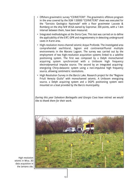
High resolution<br />
seismic in Mica. 3D<br />
<strong>data</strong> <strong>acquisition</strong> in<br />
the Iamiano site.<br />
13