master plan - City of Central
master plan - City of Central
master plan - City of Central

Create successful ePaper yourself
Turn your PDF publications into a flip-book with our unique Google optimized e-Paper software.
DEVELOPMENT CODE IMPLICATIONS<br />
Adoption <strong>of</strong> the proposed Land Use Plan will require adaptations to the existing<br />
development code in several areas. First, the <strong>City</strong> is currently using an interim<br />
Land Use Plan which will be superseded by this <strong>plan</strong> and fi nally sever the <strong>City</strong>’s<br />
dependence upon the East Baton Rouge Parish Horizon Plan for guidance on<br />
land use issues. The <strong>City</strong> has also adopted several sections <strong>of</strong> the East Baton<br />
Rouge Parish Unifi ed Development Code for regulating a variety <strong>of</strong> issues.<br />
Some <strong>of</strong> these will carry over into the <strong>City</strong>’s new code while others will require<br />
changes or adaptations.<br />
Zoning Issues - The <strong>City</strong> is currently considering adoption <strong>of</strong> a revised zoning<br />
ordinance that is crafted to provide the Planning and Zoning Commission with<br />
a great deal <strong>of</strong> latitude in guiding new development that complies with the<br />
expressed vision and goals <strong>of</strong> the community. This proposed Land Use Plan<br />
warrants revisiting several issues in the zoning ordinance.<br />
The Zoning Ordinance and Land Use Plan meshes well on the following uses:<br />
RA- Rural/Agricultual Rural/Agricultual<br />
R1- Single Family Low Density Residential<br />
R2- Single Family Medium Density Residential<br />
R3- Single Family Attached/Multi Family High Density Residential<br />
B1- Neighborhood Business Neighborhood Commercial<br />
B2- General Business General Commercial<br />
ORD - Research and Development Offce/Technology Park<br />
However, the Land Use Plan uses several additional classifi cations that are not<br />
addressed in the ordinance. They include the following:<br />
Conservation Areas , Restricted Greenspace, and Incentive<br />
Greenspace - The primary purpose <strong>of</strong> these three uses is<br />
to provide fl ood plain management for existing and future<br />
development in the <strong>City</strong> <strong>of</strong> <strong>Central</strong>. Taken individually,<br />
Conservation Areas include areas at high risk for deep<br />
inundation during heavy rain events. They also include<br />
fl oodways along the Amite River. The intent <strong>of</strong> the Land Use Plan is that no<br />
new development be permitted in these areas. Restricted Greenspace are<br />
also areas at high risk for inundation within the 100 Year Flood Plain. The intent<br />
<strong>of</strong> the Land Use Plan is that new development be heavily restricted in these<br />
areas to prevent excess fi lling in the fl ood plain. Unless previously developed,<br />
the underlying land use is always Rural/Agricultural permitting the lowest density<br />
development. Consideration should be given to providing density bonuses for<br />
developments that set aside permanent open space in these areas. Incentive<br />
Greenspace areas include corridors highly suitable for development <strong>of</strong> open<br />
space linkages connecting important assets throughout the city. Like the<br />
previous use, the underlying land use is always Rural/Agricultural permitting the<br />
lowest density development, and consideration should be given to providing<br />
density bonuses for developments that set aside permanent open space in<br />
these areas. (see following pages for more on this issue)<br />
A secondary consideration is the preservation <strong>of</strong> undeveloped open space,<br />
value enhancement, the potential for non-automobile linkage between<br />
community assets, and as community “health infrastructure”.<br />
In order to fulfi ll the intent, innovative ordinances may have to be included. One<br />
method <strong>of</strong> protecting the interest <strong>of</strong> property owners while preserving open<br />
space is the establishment <strong>of</strong> a Transfer <strong>of</strong> Development Rights Program. Utilizing<br />
a TDR Program, all three <strong>of</strong> these uses would be considered “TDR Sending Areas”<br />
- where the presumed right to develop this land can be transferred to another<br />
development in a “TDR Receiving Area”. These programs can be complicated<br />
to administer and <strong>of</strong>ten require considerable initial investment to “bank”<br />
development rights if receiving areas are not in great demand.<br />
<strong>City</strong> Center - The primary purpose <strong>of</strong> this use, located near<br />
the center <strong>of</strong> the incorporated area, is to provide for the<br />
development <strong>of</strong> a “downtown” area for the community.<br />
The downtown, a well integrated combination <strong>of</strong> public and<br />
private realm is intended to be developed at much higher<br />
density than the rest <strong>of</strong> the city. The anticipated densities also<br />
go well beyond defi nitions and limits found in the draft code. While the current<br />
practice requiring that developments beyond a certain size be treated as<br />
Planned Unit Developments (PUDs) could conceivably be used to regulate this<br />
area, it may need to be addressed as a separate district with its own guidelines<br />
and requirements. (see following pages for more on this issue)<br />
Schools - Schools are typically provided for in other<br />
classifi cations as a conditional use. Every effort should be<br />
made to locate schools in a manner that compliments<br />
surrounding uses and enhances the integration <strong>of</strong><br />
educational activities with community life - including<br />
economic development, business, and recreation. The issue<br />
<strong>of</strong> walkability is <strong>of</strong>ten discussed when considering school placement. While this is an important<br />
consideration, it does not necessarily mean that schools location should be enslaved by proximity<br />
issues. A more important consideration is providing the means by which students can commute<br />
between home and campus without needing to be bussed or driven. Locating school campuses<br />
along public greenways, bike trails, and roadway corridors designed with pedestrians in mind will<br />
pay greater dividends into the future.<br />
Design Guidelines - To fully implement the direction initiated in this <strong>plan</strong>ning process, it will be<br />
necessary to draft and adopt strict design guidelines for a variety <strong>of</strong> elements. Roadway design,<br />
open space conservation, and the <strong>City</strong> Center concepts are discussed on the following pages as<br />
an introduction to the required guidelines, These along with other issues such as lighting, signage,<br />
landscaping, setbacks, may require further refi nement.<br />
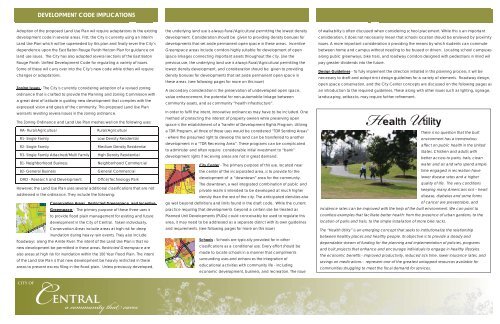
Health Utility<br />
There is no question that the built<br />
environment has a tremendous<br />
affect on public health in the United<br />
States. Children and adults with<br />
better access to parks, trails, clean<br />
water and air and who spend ample<br />
time engaged in recreation have<br />
lower disease rates and a higher<br />
quality <strong>of</strong> life. The very conditions<br />
keeping many Americans sick – heart<br />
disease, diabetes and some forms<br />
<strong>of</strong> cancer are preventable, and<br />
incidence rates can be improved with the help <strong>of</strong> the built environment. We can point to<br />
countless examples that facilitate better health: from the presence <strong>of</strong> urban gardens, to the<br />
location <strong>of</strong> parks and trails, to the simple installation <strong>of</strong> more bike racks.<br />
The “Health Utility” is an emerging concept that seeks to institutionalize the relationship<br />
between healthy places and healthy people. Its objective is to provide a steady and<br />
dependable stream <strong>of</strong> funding for the <strong>plan</strong>ning and implementation <strong>of</strong> policies, programs<br />
and built projects that enhance and encourage individuals to engage in healthy lifestyles.<br />
The economic benefi ts - improved productivity, reduced sick time, lower insurance rates, and<br />
savings on medications - represent one <strong>of</strong> the greatest untapped resources available for<br />
communities struggling to meet the fi scal demand for services.<br />
CITY OF<br />
<strong>Central</strong><br />
a community that cares