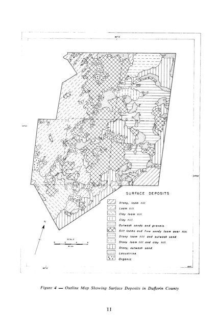
Figure 4 - Outline Map Showing Surface Deposits in Dufferin County 11
Vegetation The natural vegetation found in an area is determined largely by climate <strong>and</strong> sail. Vegetation, in turn, exerts considerable influence on the development of a soil <strong>and</strong> therefore is an important factor in soil formation. The extent to which it influences soil development varies with the type of vegetation. Since vegetation is one of several inter-related soil-forming factors, it is difficult to measure the exact effect that it has on the detailed profile features which are used to make soil type separations. A survey of the vegetation shows, in a general way, what tree associations most commonly occur on some of the more important soils. The most commonly occurring trees are sugar maple, red maple, elm, basswood. yellow birch, red <strong>and</strong> white oak, ironwood, beech, white <strong>and</strong> black ash, aspen, <strong>and</strong> white birch. Conifers grow throughout the county in no great quantity, except in reforested areas, <strong>and</strong> consist of white <strong>and</strong> red pine, white spruce, balsam fir, <strong>and</strong> hemlock. Climate Meteorological stations are located in Dufferin County at Gr<strong>and</strong> Valley, Shelburne <strong>and</strong> Redickville. In the surveyed area, the mean winter temperatures are 19 to 20 degrees F. <strong>and</strong> the mean summer temperatures are 64 to 65 degrees F. The average frost-free period varies from place to place, being 112 days at Gr<strong>and</strong> Valley, 129 days at Shelburne <strong>and</strong> 108 days at Redickville. The growing season is about 189 days duration. The average annual precipitation varies from 30 inches on the east side of the county to 34 inches in the west. Snowfall ranges from 80 to 100 inches also being heaviest on the western side of the county. Heavy snowfall in combination with imperfectly <strong>and</strong> poorly drained soils result in delayed seeding because of prolonged wet soil conditions. Relief <strong>and</strong> Natural Drainage Systems Most of the county consists of gently undulating ground moraine but large continuous areas or rugged relief associated with the kame moraines are found in Mulmur, Mona, <strong>and</strong> the southern part of East Garafraxa Townships. On the west side of the Niagara Escarpment, the l<strong>and</strong> slopes southward from 1,750 feet above sea level in the north to about 1,550 feet above sea level in the south. East of the Escarpment the l<strong>and</strong> slopes mainly to the east but also to the north. In the southeast corner of the county the altitude is 1,250 feet above sea level <strong>and</strong> in the northeast corner it is 850 feet above sea level. Some of the external drainage features within the county are shown in Figure 5. This region forms the watershed from which issue the headwaters of the Gr<strong>and</strong> <strong>and</strong> Nottawasaga River systems. The Gr<strong>and</strong> River, which drains a total area of 2,600 square miles <strong>and</strong> occupies the largest catchment basin in southwestern Ontario, drains the western half of Dufferin County. In the extreme upper reaches there has been little valley cutting. Grades are low <strong>and</strong> deepening of the main valley is restricted by bedrock. Drainage is poorly established on the plain north of Gr<strong>and</strong> Valley; hence swamps are prevalent. From Gr<strong>and</strong> Valley to Elora the valley varies from 60 to 100 feet in depth. The Nottawasaga River system drains the eastern half of Dufferin County. Two if its tributaries, the Pine River <strong>and</strong> the Boyne River, rise in the high plains west of the Niagara Escarpment <strong>and</strong> flow in an easterly direction to join the main river. These <strong>and</strong> a number of smaller tributaries flow down the escarpment in deeply cut rock valleys with gradients often more than 100 feet per mile. The upper branch of the Nottawasaga makes its way from the escarpment through the Hockley valley noted for its rugged scenery <strong>and</strong> challenging ski trails. 12