

Untitled - Agriculture and Agri-Food Canada
Untitled - Agriculture and Agri-Food Canada
Untitled - Agriculture and Agri-Food Canada

You also want an ePaper? Increase the reach of your titles
YUMPU automatically turns print PDFs into web optimized ePapers that Google loves.
SOIL SURVEY<br />
of<br />
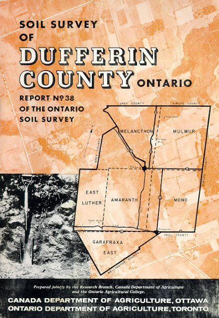
DUFFERIN COUNTY<br />
Ontario<br />
bY<br />
D. W. Hoffman<br />
B. C. Matthews<br />
Ontario <strong>Agri</strong>cultural College<br />
R. E. Wicklund<br />
Soil Research Institute<br />
GUELPH, ONTARIO<br />
1964<br />
REPORT NO. 38 OF THE ONTARIO<br />
SOIL SURVEY<br />
RESEARCH BRANCH,<br />
CANADA DEPARTMENT OF AGRICULTURE<br />
AND THE ONTARIO AGRICULTURAL COLLEGE
ACKNOWLEDGMENTS<br />
The authors wish to express their appreciation for<br />
the advice <strong>and</strong> assistance given by Dr. P. C. Stobbe,<br />
Director of the Soil Research Institute, <strong>Canada</strong> Department<br />
of <strong><strong>Agri</strong>culture</strong>.<br />
The soil map was prepared for lithographing by<br />
the Cartographic section of the Soil Research Institute,<br />
Ottawa.
TABLE<br />
OF CONTENTS<br />
Introduction ,. . . .. . . . . . .. . . . . . . . .. . . . . . . . . . ,,, 6<br />
General Description of the Area ,, . . . . . . Location .._....... . . . . .. 2<br />
Principal Towns . . . . . . 6<br />
Population<br />
.. . . 6<br />
Transportation<br />
.’ . . . . .. . . . .,.... ..,. 8<br />
Geology of the Unherlymg Rocks”:<br />
Surface Deposits \:..: 1 “’ Fi<br />
Vegetation ,.. . . . .. . . . . . . 12<br />
Climate<br />
. . . .. . . . . . .. .<br />
Relief <strong>and</strong> Drainage ,,,.. ,,,, “’ ,,.,, ,,, :;<br />
The Classification <strong>and</strong> Description of the Soils 14<br />
Series, Types, Phases <strong>and</strong> Complexes<br />
16<br />
Soil Catena __, ,,,,...,,__,.,,.., .._... _.,...... ...l1.....<br />
‘I 17<br />
Key to Classification of Wellington County Soils 18<br />
Dumfries Series . 20<br />
Bondhead Series 11: ” ” 21<br />
Guelph Series<br />
. 22<br />
London Series<br />
” .’<br />
Parkhill Series<br />
.... “’ 1: ‘1. :: ;;<br />
Harriston Series .’<br />
25<br />
Harkaway Series 25<br />
Listowel Series<br />
.,_, . ,, .,,,<br />
Wiarton Series ‘I ” ”<br />
2<br />
Huron Series<br />
Perth Series<br />
.. ... iii<br />
Brookston Series ,’ ,. ,, 29<br />
Dunedin Series<br />
Fox Series ,.., ,,...” ,, .: . . . . ,.,,,, ;;<br />
Tioga Series 30<br />
Brady Series<br />
Alliston Series 8<br />
Granby Series 31<br />
Burford Series ,, ,. ,.., .. 1: 32<br />
Brisbane Series<br />
33<br />
Gilford Series 1<br />
‘1’:. ‘.:I 33<br />
Caledon Series ” . . . . . . . . . . 33<br />
Camilla Series<br />
34<br />
Hillsburgh Series ‘.I ” “” ,111.. ,, ” 34<br />
Donnybrook Series 35<br />
Bookton Series<br />
,. . . . . . 36<br />
Wauseon Series<br />
” ”<br />
Dundonald Series ,. “I’ ._<br />
“1. i::<br />
Honeywood Series 37<br />
Embro Series<br />
38<br />
Crombie Series _... :<br />
. . 38<br />
Bennington Series<br />
38<br />
Tavistock Series 1.1. 1<br />
39<br />
Maplewood Series<br />
,.‘: ,::::‘....I.: I..:<br />
Whitfield Series<br />
.::E<br />
Brant Series<br />
Tuscola Series ....::<br />
Colwood Series 42<br />
3
Brantford Series . . . . . . . . . . . . . . . . . . . . . . . . . . . . . . . . . . . . . . . . . .. . . . . . . ... . . . . 42<br />
Beverly Series . ... . . . . . . . . . . . . . . .. . . . . . . . . . . . . . . . . . . . .,.....,......,....,,...........,.<br />
42<br />
Toledo Series . . . . . . . ..__........._.... . . . . .._...._.................................. . . ..___........... _..____., 42<br />
Dumfries-Hillsburgh Complex .. . . . . . . . . . . . . . . . . . . . . . . . . . . . . . . . . . . . 43<br />
Tioga-Bondhead Complex . . . . . . . . . . . . . . . . . . . . . . . . . . . . . . . . . . 43<br />
Osprey-Dunedin Complex . .. ..._...... . . . . . . . ...._...._......................... . . 44<br />
Escarpment . .._ ..._..........,...............,........<br />
,.,.......,........,.........,......,,....,,,....,,,,.... 44<br />
Muck .. . . . . . . . ...__....__..._.............................,,,.....,,,.......,,,,.....,,.....,,.....<br />
44<br />
Peat . . . . . . . . . . . . . . . . . . . . . . . . . . . . . . . . . . . ...__....__.......... 45<br />
<strong>Agri</strong>cultural Methods <strong>and</strong> Management ..____.__,...._..,__...........,, ,, .._.___,._, ,..,,,.,_,,,... _....__ ,.__... 45<br />
Soil Management . . . . ...__ .._...................... . ...__......._................................<br />
45<br />
L<strong>and</strong> Use Capability Classes .,,,,,...._ ____......_..,,,...................,,....... ,.........._..,,........,..... 48<br />
Appendix _. _. . . . ,... ., . . .,. .. . . ,..., ., ., _. 54<br />
Taxonomic Classification, Profile Descriptions <strong>and</strong><br />
Analytical Data . . ..__....... ._...,,,.,,......_.,,,....,,.,,,,,.,...,....<br />
. ..._.....,.,,,,,.....,,,...<br />
..,,,,,,.........,,. 54<br />
Map-Soil Map of Dufferin County in Pocket Back of Report<br />
SOIL SURVEY MAPS AND REPORTS<br />
PUBLISHED BY COUNTIES<br />
Norfolk ,,._... ..,.,_, ,,..,_.... ,......_... . . . . . . .__.,_._._,,,,..._ ..,,...,,. . . . . . . . . . . . . . . . . . . . Map No. 1<br />
E!gin ,,,,,.,...,,...........................................<br />
..I................................................... _............................. Map No. 2<br />
Kent .,.,, . . . . . . . . . . . . . . . . . . . . . . . . . . . . . . . . . . . . . . . . . . . . . . . . . . . . . . . . . . . . . ............... Map No. 3<br />
Haldim<strong>and</strong> ,, ....,,,.........,,,. ,.......,,,.................................,......, . . . . . . . . . . . . . . . . . . . . . . . . . . . Map No. 4<br />
Wcll<strong>and</strong> ....,,,<br />
._..,,...,,,, ,,._,,....,,,_........,.................,....... ..,..._.,....,,,,.,,..,..,.,,..,,,, ..,......,,,........,......... Map No. 5<br />
Middlesex __,,,.._.. . .._....._._,,,,......,.,,.,,..,,......,..........,,,......,.,....,,,,,<br />
,.....,,.................................,..,........ Map No. 6<br />
Carleton ,.......,......,._ .__.,.___,.... ,_._,,..._. . . . ,.,..,.,,..,,,.......,,..,.....,..............................<br />
Report No. 7<br />
Parts of Northwestern Ontario . . . . . . . . .. ..___........._............................................<br />
Report No. 8<br />
Durham ,..., __ ., _.__,.,._ ..._._..._<br />
__.,.. ._....,........,,.....,,....., ,..,,,. __...,,... . . . ..._.......................<br />
Report No. 9<br />
Prince Edward ,.,,_., . .._...........,, ,,,._,,,. .,....,......,,..,_,..., ,,,,..,,.,,,...,._,,...., . . . . . . . . .._............... Report No. 10<br />
Essex . . .._... .,.._.................,...,,,..........,,.... . . . . . . . . . . . . . . . . . . . . . . . . . . . . . .. . . . . . . . . . . . Report No. 11<br />
Grenville ,. _,,,_, _.._........__,..._ _...___........................................................................<br />
. . . . . . . . . . . . Report No. 12<br />
Huron .,,. ,..,.___..,,........,,.. . . . . . . . . . . . . . . . . . . . . . . . . . . . . . . . . . . . . . . . . . . . . . . . . . . . . . . Report No. 13<br />
Dundas .,,,,. .,,,,,,..,.,._. ,..,,,.,.....,.. ,......,.,._,,,,...,..........,,,.,., .,..,..,. . ....__..................................,,.,..<br />
Report No. 14<br />
Perth .._. . . . . . . . . . . . . . . . . . . . ~ . . . . . ..._........................ . . . . . . . . . . . . . . .. . . . . . . . . . . . Report No. 15<br />
Bruce ..,,,. . . . . . . . . . . . . . . . . . . . . . . . . . . . . . . . . . . . . . . . . . . . . . . . . . . . . . . . . . . . ...............<br />
Report No. 16<br />
Grey _..,,,, _,,,..,,...._..,,,,_,,.......,,.....,..,....,,,,,.....,,.......,,....,.....,.,.,...........,......,........,................,,,,......<br />
Report No. 17<br />
Peel _,..,.,,, ,..,..... .,,,,,,,.....,,,_.,,,,.,,,..,,,,.,.,.,,,,..,.,.............,.,,......,.,,.....,.......... . . . . . . . . . . . . . . . . Report No. 18<br />
York .,._...,,___,,,, _....... . . . . . ...,,. . . . . . . . . . . . . . . . . . . . . . . . .. . . . . . . .. . Report No. 19<br />
Stormont . .._......,,,,,......... ,,.,.,.,,,,.,.,,.........,.,................,,.. . . .._................. . . . . . . . . . . . . . . . . Report No. 20<br />
New Liskeard - Englehart Area ,,..... ..._........._..,,,,, ,,...,............. . . . .._............ Report No. 21<br />
Lambton ..,.. . . . . . . ..._.........,.,.,,.,,,,.......,..........................,,,..........................<br />
. . . . . . . . . . . . Report No. 22<br />
Ontario ,,,._,,. ,..,,,,,. .._,,,,,, ,...,,,,,..,.......,,.........<br />
...,,......__..................................... . . . . . Report NO. 23<br />
Glengarry ., .,,..,,,_._,,,<br />
._.,,,.__..,.. .,..... _.,,_.,._,,,.___..,,..__.......... . . . . . . . . . . . . Report No. 24<br />
Victoria ..__ .,,,_..,,, . . . . . ..___...........................................................................................................<br />
Report No. 25<br />
Manitoulin .,____..._ ,,,.....,....,...__,,.,____,,..,................,...... . . . . . . .. . . . . . . . . . . . . . . . . . . . Report No. 26<br />
Hastings ..,,.,.,,...,.,,...,,...,,,...,.,,,,,,.,.,,...,,....,,.................................,................................................<br />
Report No. 27<br />
Oxford ,, ,,.,.,_,.._..,,,.<br />
..,,..,,......._.,,.,..,,,,,.,,..,,, . . . . . . . . . . . . . . . . . . . . . . .. . . . . . . . . . . . . . . Report No. 28<br />
Srmcoe ._,,,.,,,,<br />
,....__.,......, ,,,.........,,,,,, ,..,._,., ,..,........__......... . . . . . . . . . . . . . . . . . . . . . . . . . . ...Report No. 29<br />
Soil Associations of Ontario ,,,,..,..,.,,......................,,,,,............................<br />
. . . . . . . . . . . Report No. 30<br />
Parry Sound .___.._.._......,,......,, . . ...__.....,.,_.......,,.......,,......,,.............<br />
. . . . . . . . . . . . . . . . . . . . . Report No. 31<br />
Prescott <strong>and</strong> Russell ,,,.,,,,,,..,,,......,,,..,,.,,.....,,,.........,......,,.. . . .. . . . . . . . . . . . . . . . . Report No. 33<br />
Lincoln ,,,_,.,,,,,.....,,,,....,<br />
,,,_.........,,.......,,.......,............. ._. . . . . . . .. . .. . . . . . . . . Report No. 34<br />
Wellington ,, . ,,.,..... ,._,..,,, ,...................,.................................................................................<br />
Report No. 35<br />
Lennox <strong>and</strong> Addington . . . . . . . . . . . . . .,,..........<br />
.,..................,,.......................................<br />
Report No. 36<br />
4
1<br />
/<br />
Figure I - Outline Map of Ontario Showing Location of Duflerin County<br />
5
SOIL SURVEY REPORT<br />
OF DUFFERIN COUNTY,<br />
Ontario<br />
bY<br />
D. W. Hoffman, R. E. Wicklund, <strong>and</strong> B. C. Matthews<br />
INTRODUCTION<br />
The survey of the soils of Dufferin County was conducted in 1958 <strong>and</strong> the<br />
final checking <strong>and</strong> correlation was completed in 1961. The objective of the survey<br />
was to classify <strong>and</strong> describe the soils <strong>and</strong> to prepare a map showing the location<br />
<strong>and</strong> area of the different soil types. The results of the survey are presented in this<br />
report <strong>and</strong> on the accompanying soil map.<br />
There is considerable variation in the soils in the county. The relief varies<br />
from depressional to very hilly <strong>and</strong>, except for a few small areas near the top of<br />
the Niagara Escarpment, the soil deposits are deep. Almost all of the soils in the<br />
county can be cultivated although they usually require some improvement. Such<br />
improvements may consist of fertilizer applications, installation of drains, irrigation,<br />
practices to reduce erosion, or stone removal.<br />
Mixed farming <strong>and</strong> livestock raising are most common <strong>and</strong> the sale of agricultural<br />
products from cattle, chickens, swine <strong>and</strong> sheep provide a large part of the<br />
farm income. The county is not well known for the production of a wide range of<br />
cash crops. However, large acreages of potatoes are grown in the vicinity of Honeyw*ood<br />
<strong>and</strong> Redickville <strong>and</strong> flax is an important crop in a few places.<br />
This report deals with the origin <strong>and</strong> natural characteristics of the soils as<br />
well as their capabilities <strong>and</strong> limitations for agricultural use. Each soil type is described<br />
in detail <strong>and</strong> its location is shown on the soil map.<br />
A section on soil management <strong>and</strong> a rating of the soils according to their<br />
suitability for various crops is included in the report. Sources of additional information<br />
with regard to crops <strong>and</strong> fertilizer practices are listed.<br />
GENERAL DESCRIPTION OF THE AREA<br />
Location<br />
Dufferin County is bounded on the west by Wellington <strong>and</strong> Grey Counties,<br />
on the south by Wellington <strong>and</strong> Peel, on the east by Simcoe <strong>and</strong> on the north by<br />
Simcoe <strong>and</strong> Grey Counties.<br />
The total l<strong>and</strong> area is 356,400 acres (557 square miles) of which 309,992<br />
acres (84 per cent) is occupied farm l<strong>and</strong>.<br />
Principal Towns<br />
Orangeville with a population of close to 4,000 <strong>and</strong> situated on the Peel-Dufferin<br />
County boundary is the county seat. The office of the <strong>Agri</strong>cultural Representative<br />
is located there as are the offices of those concerned with the municipal government.<br />
The two villages in the county are Shelburne (pop. 1300) twelve miles north<br />
of Orangeville <strong>and</strong> Gr<strong>and</strong> Valley (pop. 655) eleven miles west of Orangeville.<br />
Population<br />
In 1961 according to the Census of <strong>Canada</strong>, the total population of Dufferin<br />
County was 15,569. Approximately 67 per cent (10,437) of the people were rural<br />
dwellers but only 53 per cent lived on farms.<br />
The trend in population from 1871 to 1956 is shown in Table 1. From 1891<br />
to 1941 there was a loss in population <strong>and</strong> over this fifty-year period more than<br />
8,000 people left the county. However, there was a slight growth in population<br />
from 1941 to 1956 but most of this occurred in the urban centres.<br />
6
GREY COUNTY I<br />
I SIMCOE COUNTY<br />
71<br />
i 1<br />
PEEL<br />
COUNTY<br />
GARAFRAXA<br />
-_-- Township boundaries<br />
Figure 2 - Townships, Principal To~vns, Highways <strong>and</strong> Railways in Dufierin County
TABLE 1<br />
TREND IN TOTAL POPULATION<br />
Year Popluation Year Popluation<br />
1871 ,,.,,,,,,,,. ._.,..,,.__.._. . . . .. 16,689 1921 .. . .. .. . . . . ,,. 15,415<br />
1881 .,,.,.,...... _. .._..,..._........ . . .. 22,084<br />
1931 .._... . ...._.............................,,..<br />
14,892<br />
1891 .__._, ..,,.,.,.,,,,, ,.,., ..__.. 22,332 1941 . ..._....................<br />
14,075<br />
1901 .,,..,_.._,,.,_,,,,,,<br />
. 21,036 1951 . . . . . . . . . . . . . . . . . . . . . . . . . . .,,. 14,566<br />
1911 ,,,,..,,, ,...__ 17,740 1961 . ..t.._............. _..,,. 15,569<br />
Transportation<br />
Good roads <strong>and</strong> railways traverse the county, connecting it with the main<br />
marketing centres in the Province. All of the highways, except No. 89 highway<br />
which links Shelburne <strong>and</strong> Alliston, pass through Orangeville. Highway No. 10<br />
joining Owen Sound <strong>and</strong> Toronto <strong>and</strong> Highway No. 24 running from Collingwood<br />
to Guelph pass through the middle of the county in a north-south direction. From<br />
east to west in the southern part of the County is Highway 9. In addition to these<br />
highways there is a good network of county <strong>and</strong> township roads.<br />
Rail service is provided by the Canadian Pacific Railway which has two lines<br />
passing through Orangeville, one leading west via Arthur <strong>and</strong> the other going<br />
north through Shelburne.<br />
Geology of the Underlying Rocks<br />
This portion of Ontario has been subjected to repeated glaciations <strong>and</strong> the<br />
rock is covered by glacial drift that varies from a few inches to several hundred<br />
feet in thickness. The soils have developed directly from the deposits of drift <strong>and</strong><br />
the extent to which the underlying bedrock has contributed to the composition of<br />
the soils is difficult to assess.<br />
Dufferin County is underlain by sedimentary strata of Ordovician <strong>and</strong> Silurian<br />
ages (Figure 3). The line of contact between the Ordovician <strong>and</strong> Silurian rocks is<br />
well defined by the Niagara Escarpment. The Ordovician rocks lie to the east <strong>and</strong><br />
the Silurian rocks to the west of the Escarpment. Of the Silurian rocks the uppermost<br />
strata consist of dolomite, shale <strong>and</strong> s<strong>and</strong>stone of the Medina formation.<br />
These rocks are underlain by gray <strong>and</strong> buff dolomites of the Lockport <strong>and</strong> Guelph<br />
formations. These three formations are the only ones of Silurian age occurring in<br />
the county.<br />
Only the upper formations of the Ordovician age occur in the area. Uppermost<br />
<strong>and</strong> adjacent to the Escarpment are the reddish shales of the Queenston formation.<br />
Below this formation lie the grayish shales of the Dundas <strong>and</strong> Meaford formations.<br />
These latter formations occupy but a small part of the underlying rocks on the<br />
eastern side of the county.<br />
Surface Deposits<br />
The unconsolidated surface deposits in Dufferin County are of glacial origin<br />
<strong>and</strong> are the parent material from which the soils have developed. The variations<br />
that occur in texture, relief <strong>and</strong> drainage of soils are a result of differences in the<br />
nature of these deposits as described in Table 2 <strong>and</strong> distributed as shown in<br />
Figure 4.<br />
The surface deposits are commonly referred to as till, outwash, kame, esker,<br />
deltaic, <strong>and</strong> lacustrine which denote the mode of deposition <strong>and</strong>, to some extent,<br />
the textural composition of the deposit. Glacial till is non-sorted material, a mixture<br />
of broken rock fragments <strong>and</strong> soil particles that range in size from s<strong>and</strong> to<br />
clay. Glacial till covers a large part of Dufferin County.<br />
Gently undulating till plains cover most of Amaranth, East Garafraxa, East<br />
Luther <strong>and</strong> Melancthon Townships. The main part of this area is a fluted till plain<br />
bounded on the east by moraines. Most of the area has a surficial deposit of silt,<br />
8
I<br />
- ---- i<br />
00.15<br />
OYP !<br />
- -.--<br />
Figure 3 - Outline Map Showing Rock Formations in Duferin County<br />
9
probably windblown <strong>and</strong> comparable to the much more abundant “loess” of the<br />
Mississippi valley. The silt covering is thinnest near the west side of the county<br />
<strong>and</strong> is thickest (4 to 5 feet) in the area between Shelburne <strong>and</strong> Honeywood. Although<br />
the till is usually loam in texture, fairly large areas of clay loam till occur<br />
in East Garafraxa Township <strong>and</strong> some areas of clay till are found near the Escarpment<br />
northeast of Shelburne.<br />
A part of the Port Huron morainic system forms the core of the region included<br />
in most of Mulmur <strong>and</strong> Mono Townships. This region consists mainly of<br />
kame moraines which are very hilly, <strong>and</strong> stony. The moraines are a complex mixture<br />
consisting largely of s<strong>and</strong>s <strong>and</strong> gravel materials, but with clay till, coarse,<br />
stony, s<strong>and</strong>y loam till <strong>and</strong> loam till, often covered by two or three feet of silt or fine<br />
s<strong>and</strong>y loam, in association with the s<strong>and</strong> <strong>and</strong> gravel.<br />
Between the hills of the moraines there are valleys or spillways in which<br />
the soil materials are mainly gravel often covered by three or four feet of fine<br />
s<strong>and</strong>. Although isolated deposits of these materials occur throughout the county,<br />
the principal areas of such materials are north of Orangeville <strong>and</strong> in the Gr<strong>and</strong><br />
River valley. Small areas of outwash s<strong>and</strong> occur in various sections of the county.<br />
Eskers which are gravel deposits in the form of long, narrow, winding ridges also<br />
occur in some parts of the area. Two or three good examples may be found east<br />
<strong>and</strong> north of Shelburne.<br />
L,acustrine deposits are sorted fine textured materials laid down in still or<br />
very slowly moving waters. The lacustrine deposits in Dufferin County are probably<br />
due to local ponding as they are comparatively small <strong>and</strong> occur mainly in the low<br />
areas between the hills.<br />
Swamps are common in low lying areas where the water has been impounded.<br />
In such places organic materials have accumulated. Organic deposits are scattered<br />
throughout the county, the largest of which is the Luther Marsh.<br />
TABLE 2<br />
SURFACE DEPOSITS OCCURRING IN DUFFERIN COUNTY<br />
1. GLACIAL TILL:<br />
Ground Moraine Generally unsorted material. Topography is characterized by a<br />
succession of low knolls <strong>and</strong> depressions. Textures are loam to<br />
clay loam - contains stones <strong>and</strong> boulders.<br />
Terminal Moraine .Often modified or resorted materials, s<strong>and</strong>y loam to loam, more<br />
stones than in ground moraine. Topography is rough to hilly.<br />
Drumlin .,,.,.,,..._..<br />
,,,.... .._,..,....<br />
Elongated hill, long axis in the direction of ice advance, materials<br />
usually unsorted, loam to clay loam with stones <strong>and</strong> boulders.<br />
2. GLACIO-FLUVIAL:<br />
Outwash Plain ._... S<strong>and</strong>y <strong>and</strong> gravelly materials, cobbly but boulder-free occurring<br />
on a nearly level plain; a few enclosed depressions <strong>and</strong> incised<br />
ravines.<br />
Kame ,.<br />
.._.... ,. . . . ..,,.... Small hill of s<strong>and</strong> <strong>and</strong> gravel -<br />
stones <strong>and</strong> boulders.<br />
may contain resorted till; some<br />
3. LACUSTRINE . . ..,,.,..... Clays, silts <strong>and</strong> s<strong>and</strong>s laid down in glacial lakes. Topography is<br />
usually very gently sloping, although moderately steep slopes encountered<br />
in some areas. Stones are few to absent except in areas<br />
where thin lacustrial deposits are underlain with till.<br />
4. RECENT ALLUVIAL Post-Glacial deposits of s<strong>and</strong>s, silts <strong>and</strong> clays along streams,<br />
meadows, slough <strong>and</strong> marshes. Also includes mucks <strong>and</strong> peats.<br />
Soils are immature; topography is nearly level to depressional.<br />
Stones are rare.<br />
10
Figure 4 - Outline Map Showing Surface Deposits in Dufferin County<br />
11
Vegetation<br />
The natural vegetation found in an area is determined largely by climate <strong>and</strong><br />
sail. Vegetation, in turn, exerts considerable influence on the development of a<br />
soil <strong>and</strong> therefore is an important factor in soil formation. The extent to which it<br />
influences soil development varies with the type of vegetation.<br />
Since vegetation is one of several inter-related soil-forming factors, it is difficult<br />
to measure the exact effect that it has on the detailed profile features which<br />
are used to make soil type separations. A survey of the vegetation shows, in a<br />
general way, what tree associations most commonly occur on some of the more<br />
important soils.<br />
The most commonly occurring trees are sugar maple, red maple, elm, basswood.<br />
yellow birch, red <strong>and</strong> white oak, ironwood, beech, white <strong>and</strong> black ash,<br />
aspen, <strong>and</strong> white birch. Conifers grow throughout the county in no great quantity,<br />
except in reforested areas, <strong>and</strong> consist of white <strong>and</strong> red pine, white spruce, balsam<br />
fir, <strong>and</strong> hemlock.<br />
Climate<br />
Meteorological stations are located in Dufferin County at Gr<strong>and</strong> Valley, Shelburne<br />
<strong>and</strong> Redickville. In the surveyed area, the mean winter temperatures are 19<br />
to 20 degrees F. <strong>and</strong> the mean summer temperatures are 64 to 65 degrees F. The<br />
average frost-free period varies from place to place, being 112 days at Gr<strong>and</strong><br />
Valley, 129 days at Shelburne <strong>and</strong> 108 days at Redickville. The growing season is<br />
about 189 days duration.<br />
The average annual precipitation varies from 30 inches on the east side of<br />
the county to 34 inches in the west. Snowfall ranges from 80 to 100 inches also<br />
being heaviest on the western side of the county. Heavy snowfall in combination<br />
with imperfectly <strong>and</strong> poorly drained soils result in delayed seeding because of<br />
prolonged wet soil conditions.<br />
Relief <strong>and</strong> Natural Drainage Systems<br />
Most of the county consists of gently undulating ground moraine but large<br />
continuous areas or rugged relief associated with the kame moraines are found in<br />
Mulmur, Mona, <strong>and</strong> the southern part of East Garafraxa Townships.<br />
On the west side of the Niagara Escarpment, the l<strong>and</strong> slopes southward from<br />
1,750 feet above sea level in the north to about 1,550 feet above sea level in the<br />
south. East of the Escarpment the l<strong>and</strong> slopes mainly to the east but also to the<br />
north. In the southeast corner of the county the altitude is 1,250 feet above sea<br />
level <strong>and</strong> in the northeast corner it is 850 feet above sea level.<br />
Some of the external drainage features within the county are shown in Figure<br />
5. This region forms the watershed from which issue the headwaters of the Gr<strong>and</strong><br />
<strong>and</strong> Nottawasaga River systems. The Gr<strong>and</strong> River, which drains a total area of<br />
2,600 square miles <strong>and</strong> occupies the largest catchment basin in southwestern Ontario,<br />
drains the western half of Dufferin County. In the extreme upper reaches<br />
there has been little valley cutting. Grades are low <strong>and</strong> deepening of the main valley<br />
is restricted by bedrock. Drainage is poorly established on the plain north of Gr<strong>and</strong><br />
Valley; hence swamps are prevalent. From Gr<strong>and</strong> Valley to Elora the valley varies<br />
from 60 to 100 feet in depth.<br />
The Nottawasaga River system drains the eastern half of Dufferin County.<br />
Two if its tributaries, the Pine River <strong>and</strong> the Boyne River, rise in the high plains<br />
west of the Niagara Escarpment <strong>and</strong> flow in an easterly direction to join the main<br />
river. These <strong>and</strong> a number of smaller tributaries flow down the escarpment in<br />
deeply cut rock valleys with gradients often more than 100 feet per mile. The<br />
upper branch of the Nottawasaga makes its way from the escarpment through<br />
the Hockley valley noted for its rugged scenery <strong>and</strong> challenging ski trails.<br />
12
i<br />
I<br />
1<br />
Figure 5 - Outline Map Showing Drainage System of Duflerin County<br />
13
THE CLASSIFICATION AND DESCRIPTION OF THE SOILS<br />
The surface geological deposits previously described are the parent materials<br />
from which the soils of the county have developed. Several different kinds of soil<br />
occur as a result of the differences in the parent materials as well as the differences<br />
in drainage <strong>and</strong> in vegetation.<br />
A vertical cut through soil to a depth of three feet exposes a sequence of<br />
layers (horizons) that differ in color, texture, structure or thickness. This sequence<br />
of horizons is called the soil profile. The different layers of the soil are often referred<br />
to as surface soil, subsurface soil, subsoil <strong>and</strong> parent material. However, it<br />
is convenient to use the specific pedological terms A horizon, B horizon, <strong>and</strong> C<br />
horizon. Subdivisions within each major horizon are shown by lower case suffixes.<br />
Definitions of the major horizons <strong>and</strong> the lower case suffixes are given in a glossary<br />
at the back of this report.<br />
The A horizon is the surface horizon <strong>and</strong> in many soils can be subdivided into<br />
Ah <strong>and</strong> Ae. The Ah horizon contains the largest amounts of organic matter <strong>and</strong> is<br />
underlain by the Ae, a horizon from which clay <strong>and</strong> bases, especially calcium, have<br />
been leached by percolating rainwater. Some of the materials leached from the Ae<br />
accumulate in the B horizon. The B horizon is often finer in texture <strong>and</strong> more<br />
compact as a result of the...accumulation of clay <strong>and</strong> other fine materials carried<br />
down from the A horizon. Underlying the B horizon is the C horizon, i.e. parent<br />
material which may be unaltered or only slightly altered by the soil-forming processes.<br />
Poorly drained soils, in which the ground water table is near the surface for<br />
an appreciable part of the year, are gleyed. The “gley” horizon is bluish gray,<br />
brownish gray or gray with brownish splotches <strong>and</strong> contains iron concretions.<br />
Soils are classified on the basis of kind of horizons which constitute the soil<br />
profiles. Forty-three soil series were recognized <strong>and</strong> mapped in the county. The<br />
soil series differ from one another in one or more of the following features of the<br />
soil profile - number, color, thickness, texture, structure or chemical composition<br />
of the horizons, drainage, or depth to bedrock. Variations in stoniness <strong>and</strong> slope<br />
within a series were also shown on the soil map.<br />
Some soil series, however, have certain features in common. These form<br />
Great Groups. The Great Groups in Dufferin County are Brown Forest, Grey-<br />
Brown Podzolic, Podzol, Dark Grey Gleysolic <strong>and</strong> Organic. An idealized description<br />
of a soil profile characteristic of each Great Group is given below.<br />
The Brown Forest soils occur on highly calcareous materials. These soils<br />
have a dark brown surface. (Ah) horizon high in organic matter with a neutral or<br />
mildly alkaline reaction. The Ah horizon which is about 4 inches thick is underlain<br />
by a brown B horizon containing some concentration of sesquioxides <strong>and</strong> occasionally<br />
a concentration of clay. In general, the B horizon is uniformly brown down<br />
to the parent material at 18 inches. The base saturation of all horizons is 100<br />
per cent.<br />
The Grey-Brown Podzolic soils have a dark grayish brown Ah horizon, 3<br />
inches thick <strong>and</strong> relatively high in organic matter, underlain by a yellowish brown<br />
Ae horizon that becomes lighter in color with depth. The B horizon is brown <strong>and</strong><br />
finer in texture than other horizons in the profile. It contains accumulations of<br />
clay <strong>and</strong> sesquioxides. The calcareous parent material occurs at 20 to 30 inches.<br />
14
Soils of the Brown Forest Great Group have shallow profiles<br />
<strong>and</strong> a brownish color in the subsoil.<br />
The Podzol soils have an organic (0) horizon, 1 to 2 inches thick, underlain<br />
by a gray or white Ae horizon, 1 to 2 inches thick. The B horizon is reddish brown<br />
<strong>and</strong> contains concentrations or sesquioxides or organic matter or both <strong>and</strong> is<br />
usually divisible on the basis of color difference into two sub-horizons. Most of<br />
the Podzols in the county have an additional B horizon containing an accumulation<br />
of clay as well as sesquioxides. This B horizon occurs at depths of 24 to 36 inches<br />
<strong>and</strong> is similar to the B horizon of the Grey-Brown Podzolic soils.<br />
Many of the soils of Dufferin County have developed under poorly drained<br />
conditions <strong>and</strong> therefore are classified in Dark Grey Gleysolic <strong>and</strong> Organic Great<br />
Groups.<br />
The Dark Grey Gleysolic soils have a very dark gray Ah horizon generally 7<br />
to 8 inches thick <strong>and</strong> high in organic matter. The Ah horizon is underlain by a dark<br />
15
Grey-Brown Podzolic Soil Profile<br />
gray to grayish brown “gley” horizon with yellow <strong>and</strong> orange mottling. The parent<br />
material occurs immediately below the gley horizon.<br />
The Organic soils have a layer of organic matter accumulation more than 12<br />
inches thick. This layer is underlain by a strongly gleyed mineral soil or rock. The<br />
surface layer varies with the type of vegetation from which the organic matter was<br />
fermed <strong>and</strong> on the degree of decomposition of the organic material.<br />
Series, Types <strong>and</strong> Complexes<br />
The units by which soils are mapped <strong>and</strong> described are designated as series,<br />
types <strong>and</strong> phases. The principal mapping unit is the series which may consist of<br />
two or more types or phases. All soils included in a series are relatively similar in<br />
their profile development <strong>and</strong> in their management requirements. A soil series may<br />
be subdivided into soil types on the basis of the texture of the surface soil. The<br />
16
A Dark Grey Gleysolic Profile<br />
full name of the soil type is a combination of the series name <strong>and</strong> the surface texture,<br />
for example, Guelph loam.<br />
Soil complexes are mapping units that are a combination of two or more<br />
soil types. A soil complex is used as a mapping unit where two or more soil types<br />
occur in such an intricate pattern that they cannot be delineated separately on<br />
the map. In naming each complex, the names of the dominant soil types are used.<br />
The characteristics of each type are the same as in the areas in which they occur<br />
alone.<br />
Soil Catena<br />
Soil series developed on similar parent material but differing in characteristics<br />
of the profile above the parent material due to differences in drainage comprise a<br />
soil catena. The soil catenas of Dufferin County are shown in Table 3.<br />
17
TABLE 3<br />
CATENARY RELATIONSHIP OF DUFFERIN COUNTY SOILS<br />
Catena Members<br />
Catena Name -.-~<br />
Drainage<br />
___-~_____ ~.- Good Imperfect Poor -<br />
Bennington . Bennington Tavistock<br />
Maplewood<br />
Brant<br />
.___,,.. _.. ,_., Brant<br />
Tuscolo<br />
Colwood<br />
Brantford : .’ _.. ‘:I’: Brantford<br />
Beverly<br />
Toledo<br />
Bondhead _.<br />
Bondhead<br />
Guerin”’<br />
Lyons *<br />
Bookton :<br />
Bookton<br />
Berrien*<br />
Wauseon<br />
Burford . . ,._ ..__.,. Burford Brisbane Gilford<br />
Caledon<br />
Caledon<br />
Camilla<br />
Donnybrodk ” ” Donnybrook<br />
Dumfries Dumfries Killean*’<br />
Lily*<br />
Dundonald<br />
Dundonald<br />
Edenvale”<br />
Dunedin ... . .. . . . Dunedin Craigleith”<br />
Morley*<br />
Fox _.___..<br />
.,_.._....__.__.....,...... Fox Brady Granby<br />
Guelph .,... ,._.,,..._...,..,....... Guelph London Parkhill<br />
Harriston .. ... . . .. ... . . . . . Harriston Listowel Parkhill<br />
Harkaway . .. . . . .. . . . . . Harkaway Wiarton Parkhill<br />
Hillsburgh ._.... _.._, ..._........,....... Hillsburgh<br />
Honeywood __.__,..._,,.,.._.,. ,,..,.,,.... Honeywood Embro Crombie<br />
Huron<br />
Huron Perth Brookston<br />
Schomberg ::I’ .._. _.... Schomberg” Smithfield Simcoe*<br />
Tioga<br />
._.. Tioga Alliston<br />
Granby<br />
Whitfield “’ ._<br />
Whitfield<br />
*These soils have not been mapped in Dufferin County.<br />
SOIL KEY<br />
A. Soil Developed on Glacial Till<br />
I. Stony, calcareous loam parent material<br />
(a) Well drained<br />
1. Dumfries loam (G.B.P.)<br />
II. Gray, calcareous s<strong>and</strong>y loam parent material<br />
(a) Well drained<br />
1. Bond head s<strong>and</strong>y loam (G .B.P.)<br />
III. Pale brown calcareous loam parent material<br />
(a) Well drained<br />
1. Guelph loam (G.B.P.)<br />
(b) Imperfectly drained<br />
1. London loam (G.B.P.)<br />
(c) Poorly drained<br />
1. Parkhill loam (D.G.G.)<br />
IV. Yellowish brown, calcareous loam parent material<br />
(a) Well drained<br />
1. Harriston loam (G.B.P.)<br />
2. Harriston silt loam (G.B.P.)<br />
3. Harkaway loam (B.F.)<br />
(b) Imperfectly drained<br />
1. Listowel loam (G.B.P.)<br />
2. Listowel silt loam (G.B.P.)<br />
3. Wiarton loam (B.F.)<br />
V. Calcareous clay loam parent material<br />
(a) Well drained<br />
1. Huron loam (G.B.P.)<br />
. 2. Huron silt loam (G.B.P.)<br />
(b) Imperfectly drained<br />
1. Perth loam (G.B.P.)<br />
2. Perth silt loam (G.B.P.)<br />
(c) Poorly drained<br />
Brookston loam (D.G.G.)<br />
:: Brookston silt loam (D.G.G.)<br />
VI. Calcareous clay parent material<br />
(a) Well drained<br />
1. Dunedin clay<br />
18<br />
2,800<br />
400<br />
3,500<br />
2,100<br />
18,500<br />
17,300<br />
3,800<br />
5,200<br />
12,900<br />
1,700<br />
2,900<br />
13,800<br />
1,700<br />
3,800<br />
700<br />
900<br />
100<br />
7.200
B. Soils Developed on Outwash<br />
1. Calcareous s<strong>and</strong> parent material<br />
(a) Well drained<br />
1. Fox s<strong>and</strong>y loam (G.B.P.)<br />
2. Tioga loamy s<strong>and</strong> (P)<br />
3. Tioga fine s<strong>and</strong>y loam (P)<br />
(b) Imperfectly drained<br />
1. Brady s<strong>and</strong>y loam (G.B.P.)<br />
2. Alliston s<strong>and</strong>y loam (P)<br />
(c) Poorly drained<br />
1. Granby s<strong>and</strong>y loam (D.G.G.)<br />
II. Loam material overlying gravel<br />
(a) Well drained<br />
1. Burford loam (G.B.P.)<br />
(b) Imperfectly drained<br />
Brisbane loam (G.B.P.)<br />
(c) boorly drained<br />
1. Gilford loam (D.G.G.)<br />
III. Fine s<strong>and</strong>y loam material overlying gravel<br />
(a) Well drained<br />
1. Caledon s<strong>and</strong>y loam (G.B.P.)<br />
2. Caledon fine s<strong>and</strong>y loam (G.B.P.)<br />
(b) Imperfectly drained<br />
1. Camilla fine s<strong>and</strong>y loam (G.B.P.)<br />
2. Camilla silt loam (G.B.P.)<br />
IV. Calcareous fine s<strong>and</strong> parent material<br />
(a) Well drained<br />
1. Hillsburgh fine s<strong>and</strong>y loam (G.B.P.)<br />
2. Hillsburgh s<strong>and</strong>y loam (G.B.P.)<br />
V. Coarse gravel in kames <strong>and</strong> eskers<br />
(a) Well drained<br />
1. Donnybrook s<strong>and</strong>y loam (G.B.P.)<br />
VI. Medium s<strong>and</strong> material overlying clay<br />
(a) Well drained<br />
1. Bookton s<strong>and</strong>y loam (G.B.P.)<br />
(b) Poorly drained<br />
1. Wauseon s<strong>and</strong>y loam (D.G.G.)<br />
VII. Medium s<strong>and</strong> material overlying loam till<br />
(a) Well drained<br />
1. Dundonald s<strong>and</strong>y loam (G.B.P.)<br />
c. Soils Developed from Loess or Alluvium.<br />
1. Fine s<strong>and</strong>y loam <strong>and</strong> silt loam material overlying loam till<br />
(a) Well drained<br />
1. Honeywood silt loam (G.B.P.)<br />
2. Honeywood fine s<strong>and</strong>y loam (G.B.P.)<br />
(b) Imperfectly drained<br />
1. Embro silt loam (G.B.P.)<br />
2. Embro fine s<strong>and</strong>y loam (G.B.P.)<br />
(c) Poorly drained<br />
1. Crombie silt loam (D.G.G.)<br />
2. Crombie fine s<strong>and</strong>y loam (D.G.G.)<br />
11. Fine S<strong>and</strong>y loam <strong>and</strong> silt loam material overlying clay loam till.<br />
(a)<br />
Well drained<br />
Bennington silt loam (G.B.P.)<br />
:: Bennington fine s<strong>and</strong>y loam (G.B.P.)<br />
(b) Imperfectly drained<br />
1. Tavistock silt loam (G.B.P.)<br />
2. Tavistock fine s<strong>and</strong>y loam (G.B.P.)<br />
(c) Poorly drained<br />
1. Maplewood fine s<strong>and</strong>y loam (D.G.G.)<br />
III. Fine s<strong>and</strong>y loam overlying limestone bedrock.<br />
(a)<br />
Well drained<br />
1. Whitfield fine s<strong>and</strong>y loam (G.B.P.)<br />
19<br />
900<br />
3,800<br />
1,000<br />
1,400<br />
400<br />
3,300<br />
7,400<br />
500<br />
1,100<br />
6,300<br />
14,900<br />
400<br />
800<br />
11,000<br />
18,600<br />
2,300<br />
1,400<br />
200<br />
400<br />
33,100<br />
12,100<br />
1,800<br />
3,900<br />
4,900<br />
300<br />
1,300<br />
9,500<br />
4,300<br />
1,200<br />
1,400<br />
600
D. Soils Developed on Lacustrine Deposits.<br />
I. Calcareous, fine s<strong>and</strong>y loam <strong>and</strong> silt loam parent materials.<br />
(a) Well drained<br />
1. Brant fine s<strong>and</strong>y loam (G.B.P.)<br />
(b) Imperfectly drained<br />
1. Tuscola silt loam (G.B.P.)<br />
2. Tuscola fine s<strong>and</strong>y loam (G.B.P.)<br />
(c) Poorly drained<br />
1. Colwood silt loam (D.G.G.)<br />
2. Colwood fine s<strong>and</strong>y loam (D.G.G.)<br />
II. Calcareous silty clay loam <strong>and</strong> clay loam parent materials.<br />
(a) Well drained<br />
1. Brantford silt loam (G.B.P.)<br />
(b) Imperfectly drained<br />
1. Beverly silt loam (G.B.P.)<br />
(c) Poorly drained<br />
1. Toledo clay loam (D.G.G.)<br />
2. Toledo silty clay loam (D.G.G.)<br />
Soil Complexes<br />
Miscellaneous<br />
1. Dumfries loam - Hillsburgh fine s<strong>and</strong>y loam<br />
2. Dumfries loam - Hillsburgh s<strong>and</strong>y loam<br />
3. Tioga loamy s<strong>and</strong> - Bondhead loam<br />
4. Tioga loamy s<strong>and</strong> - Bondhead s<strong>and</strong>y loam<br />
5. Osprey loam - Dunedin clay<br />
1. Escarpment<br />
2. Muck<br />
3. Peat<br />
GREAT GROUPS<br />
- Brown Forest G.B.P. - Grey-Brown Podzolic<br />
E.2.G . - Dark Grey Gleysolic P. - Podzol<br />
1,700<br />
1,200<br />
100<br />
900<br />
5.500<br />
600<br />
1,000<br />
1,000<br />
500<br />
7,300<br />
24,100<br />
17,700<br />
800<br />
8,400<br />
800<br />
3 1,100<br />
2,500<br />
DUMFRIES SERIES<br />
The Dumfries soils, which occur mainly in Mono Township, have developed<br />
from stony calcareous loamy soil material largely derived from limestone. Free<br />
carbonates can be found at depths of 18 to 24 inches except in places of severe<br />
erosion where they occur in the surface soil.<br />
The topography is hilly; slopes are steep, irregular <strong>and</strong> short; depressions or<br />
“potholes” are common. Water runs rapidly off the steep slopes or readily percolates<br />
through the stony materials; hence the Dumfries soils are well drained. However,<br />
within the areas shown on the soil map as Dumfries soil there are often areas<br />
of poorly drained soils in depressions too small to be delineated. These potholes<br />
contain water during a large part of the year, cannot be easily drained <strong>and</strong> therefore<br />
are not arable.<br />
Surface erosion has occurred on most of the cultivated slopes. Indeed, the<br />
soil loss has been so great on many of the knolls that the whole profile has been<br />
removed <strong>and</strong> the light gray parent materials are exposed. Stones <strong>and</strong> boulders are<br />
numerous both on the surface <strong>and</strong> throughout the soil mass.<br />
The Dumfries soil is classed as Grey-Brown Podzolic, having a dark gray<br />
s<strong>and</strong>y loam or loam Ah horizon, a yellowish brown Ae horizon which becomes<br />
lighter in color with depth <strong>and</strong> a dark brown B horizon which contains more clay<br />
than any other horizon in the profile. Although this is the general appearance of<br />
the soil profile, one or more of the horizons may have been removed by erosion.<br />
In addition there is considerable variation from place to place in the thickness of<br />
the horizons <strong>and</strong> the number of stones in the Dumfries soils.<br />
Most of the Dumfries soil areas have been cleared <strong>and</strong> are used for livestock<br />
20
Hills <strong>and</strong> Rough Surface Areas in the Dumfries Series<br />
raising <strong>and</strong> dairying. Because of steep slopes <strong>and</strong> excessive stoniness somewhat less<br />
than 30 per cent of the l<strong>and</strong> is used for cultivated crops, chiefly spring grain, winter<br />
wheat, silage corn <strong>and</strong> mixed hay. Pastures <strong>and</strong> woodlots make up the remaining<br />
70 per cent. Pastures on the Dumfries soils are often weedy <strong>and</strong> thin.<br />
Pasture improvement on the smoother slopes <strong>and</strong> reforestation of the steep<br />
areas are the keys to better l<strong>and</strong> use in the Dumfries area. Hardwoods, especially<br />
sugar maple <strong>and</strong> beech, do grow well. More attention could be paid to the wildlife<br />
potential in areas occupied by the Dumfries soils.<br />
BONDHEAD SERIES<br />
The Bondhead soils occupy a small area in the southeast corner adjacent to<br />
the Simcoe County boundary. Slopes are gentle (erosion hazard is slight) <strong>and</strong> there<br />
are few stones to interfere with cultivation.<br />
The soils are well drained <strong>and</strong> belong to the Grey-Brown Podzolic great group.<br />
The surface soil is dark grayish brown loam or s<strong>and</strong>y loam, moderately high in<br />
organic matter. A brown Ae horizon which becomes lighter in color with depth<br />
underlies the surface layer. This is followed by a dark brown Bt horizon which contains<br />
more clay than the layers above <strong>and</strong> below it. The parent material is a<br />
calcareous, gray s<strong>and</strong>y loam till derived mainly from a limestone <strong>and</strong> it occurs at<br />
a depth of approximately 24 inches.<br />
Dairying <strong>and</strong> livestock raising are the major farm enterprises on the Bondhead<br />
soils. The main crops grown are mixed grains, oats, winter wheat, hay pasture <strong>and</strong><br />
silage corn. Yields are above the provincial average but could be increased by<br />
applying more commercial fertilizers.<br />
21
A Guelph loam profile<br />
GUELPH SERIES<br />
The Guelph soils occur on the gently rolling hills in the vicinity of Orangeville.<br />
The soil parent material is gray-brown calcareous loam till derived from gray <strong>and</strong><br />
brown limestones of the underlying rock strata. Although the till does not contain<br />
a large number of stones it is commonly gravelly.<br />
In general there are very few field stones or boulders. The soils are well drained<br />
both internally <strong>and</strong> externally but retain adequate amounts of moisture for the<br />
needs of agricultural crops.<br />
The surface soil is dark grayish brown loam, moderately high in organic<br />
matter. Below the surface layer is a brown Ae1 horizon which grades to the Ae2<br />
horizon which is lighter in color. The Bt horizon is dark brown to dark yellowish<br />
brown containing more clay than the layers above or below it. The depth of soil<br />
to the unaltered parent material is approximately 24 inches except where water<br />
erosion has removed the upper portion of the soil. The Guelph soils are classified<br />
in the Grey-Brown Podzolic great group.<br />
The Guelph loam soils are among the best agricultural soils in the province.<br />
Dairying <strong>and</strong> livestock raising have been the major farm enterprises on the Guelph<br />
soils. The main crops grown are pasture, hay, mixed grains, oats, winter wheat <strong>and</strong><br />
silage corn. Yields of most crops are well above the provincial average but could<br />
be economically increased by applying commercial fertilizers at somewhat higher<br />
rates than are currently used.<br />
22
A hay crop on London loam<br />
LONDON SERIES<br />
The London soils occur in association with the Guelph Series. They are imperfectly<br />
drained soils on gently undulating upl<strong>and</strong> areas where surface runoff is<br />
slow <strong>and</strong> internal drainage is moderate. The material from which these soils have<br />
been derived is the same as that of the Guelph series <strong>and</strong> they therefore have the<br />
same potential for agricultural production if they are artificially drained.<br />
The dark colored loam surface horizon is commonly one or two inches thicker<br />
than the same horizon in Guelph soils, <strong>and</strong> one or two per cent higher in organic<br />
matter content. The average organic matter content for cultivated surface soils is<br />
over five per cent. The layers below the surface are duller in color than those of the<br />
Guelph soils <strong>and</strong> are not as easy to differentiate. Mottles or blotches of orange <strong>and</strong><br />
yellow colours appear in the subsoil <strong>and</strong> in the parent material, indicating that the<br />
water table is high at certain periods of the year. The accumulation of clay in the<br />
subsoil (Bt) horizon is not as great as it is in that of the Guelph soils.<br />
The London soils are capable of producing arable crops <strong>and</strong> good pastures in<br />
support of mixed farming, livestock raising or dairying. The high water table delays<br />
seeding operations in the spring, may adversely affect the growth of alfalfa, or<br />
reduce the yield of winter wheat by winter-killing. However, when artificially<br />
drained the London soils have a higher potential than the Guelph soils, mainly<br />
because of their smoother topography; a factor contributing to easier management.<br />
PARKHILL SERIES<br />
These poorly drained soils cover 18,500 acres in the county <strong>and</strong> occur in<br />
depressions in association with the Guelph, London, Harriston, Listowel, Hark-<br />
23
A Parkhill loam profile<br />
away, <strong>and</strong> Wiarton soil series. Although these soils are wet for the major part of<br />
the year, there are periods, generally late in the summer, when they are free from<br />
excess water.<br />
In contrast to the associated upl<strong>and</strong> soils, the Parkhill soils have a much<br />
darker <strong>and</strong> thicker surface soil. The black organic matter from the decaying leaves,<br />
stems <strong>and</strong> roots of plants tends to accumulate <strong>and</strong> becomes mixed with the mineral<br />
soil by worms <strong>and</strong> by cultivation, to produce a thick, black surface soil. Some of<br />
the dark surface has also resulted from the accumulation of surface soil carried<br />
down the adjacent slopes by water.<br />
In the Parkhill soils the surface layer is underlain by two gray layers that<br />
differ from each other in intensity of color <strong>and</strong> in structure. Usually the upper<br />
layer is darker gray than the layer below it. However, in some places the upper<br />
layer is the lighter gray. The subsoil layers may be distinctly yellowish where these<br />
soils occur in association with the Harriston, Listowel, Harkaway, <strong>and</strong> Wiarton<br />
soils due to the yellowish brown of the parent materials. The subsoil layers are<br />
profusely mottled.<br />
The surface soil is generally neutral; the subsoil becomes more alkaline with<br />
depth. Free carbonates are commonly present at 24 inches or less.<br />
The Parkhill soils are often too wet for regular cultivation <strong>and</strong> therefore are<br />
used for pasture <strong>and</strong> hay crops. These soils may be included with the regular cropl<strong>and</strong><br />
if they are artificially drained. Artificial drainage may be difficult to install<br />
because of the lack of a suitable outlet.<br />
24
HARRISTON<br />
SERIES<br />
Except for two large areas in the vicinity of Orangeville the Harriston soils<br />
occur mainly in Melancthon, Luther <strong>and</strong> Amaranth Townships. They occur on<br />
moderately to gently rolling topography <strong>and</strong> are well drained. The soil parent<br />
material is a calcareous loam till that has been derived from soft yellowish brown<br />
limestones that form the underlying rock strata. Except for the occasional stone<br />
on the surface, the upper part of the soil profile is stonefree. The limestones weather<br />
<strong>and</strong> disintegrate readily <strong>and</strong> those that remain occur mainly in the lower subsoil<br />
<strong>and</strong> in the parent material. When rubbed between the fingers, the weathered<br />
surface of these stones crumbles to a soft flour consisting mainly of particles of<br />
silt size. Although most of the soils are loam the silt content is rarely below 45 per<br />
cent, in contrast to the Guelph soils in which the silt content is commonly below<br />
45 per cent.<br />
The Harriston soils have the same number <strong>and</strong> sequence of layers as the<br />
Guelph soils <strong>and</strong> therefore are included in the same great group - Grey-Brown<br />
Podzolic. However, they differ from the Guelph soils in color, composition of the<br />
parent materials, <strong>and</strong> to a lesser extent texture <strong>and</strong> stoniness. The most striking<br />
feature is the pale yellowish brown color <strong>and</strong> the presence of the soft limestones in<br />
the parent materials. The yellowish cast is a feature of the whole profile.<br />
These are among the best agricultural soils in Southern Ontario <strong>and</strong> the only<br />
h<strong>and</strong>icap to cultivation is the frequency <strong>and</strong> steepness of the slopes. Where little<br />
or no erosion has taken place the depth of soil to unaltered parent material is approximately<br />
24 inches. The surface soil is slightly acid in reaction <strong>and</strong> is easily<br />
worked.<br />
On the Harriston soils livestock raising <strong>and</strong> dairying are the common farm<br />
enterprises. Hay, pasture, mixed grains <strong>and</strong> oats are the main crops grown. Winter<br />
wheat, barley, silage corn <strong>and</strong> turnips are important crops on some farms. Without<br />
fertilizer the average yield of oats is about 60 bushels per acre while that of hay is<br />
about two tons per acre. These yields can be increased profitably by using fertjlizer.<br />
LISTOWEL<br />
SERIES<br />
Imperfectly drained soils that have developed from the same parent material<br />
as the Harriston series are classified as the Listowel series. The Listowel soils occur<br />
on gently undulating upl<strong>and</strong> areas where surface runoff is slow <strong>and</strong> internal<br />
drainage is moderate.<br />
These soils remain saturated for a portion of the year <strong>and</strong> mottles or blotches<br />
of yellow <strong>and</strong> orange are present in the subsoil. The over-all colors of the subsoil<br />
layers are somewhat duller than those of the same layers in the well drained soils.<br />
The Listowel soils have a dark colored silt loam surface horizon which has<br />
an average organic matter content of over five per cent. This surface soil is underlain<br />
by a light yellowish brown mottled Ae horizon which rests on a mottled brown<br />
Bt horizon. Although the Bt horizon contains more clay than the layer above the<br />
clay accumulation is not as great as it is in the Bt horizon of well drained soils.<br />
Calcareous parent material occurs at an avearge depth of 20 inches.<br />
These soils support mixed farming <strong>and</strong> livestock enterprise. Cereal grains,<br />
hay <strong>and</strong> pasture are the main crops grown; winter wheat is grown but yields may<br />
be reduced by winterkilling. Silage corn is also grown, yields averaging 14 tons<br />
per acre.<br />
HARKAWAY SERIES<br />
The Harkaway soils occur in the northern part of Melancthon Township.<br />
They are developed from light yellowish brown loam till, which is derived from<br />
limestone.
The Harkaway loam is well drained. Water runs rapidly off the rolling slopes<br />
<strong>and</strong> the portion that enters the soil percolates readily through the porous soil<br />
materials. In the uncultivated state the soil has a relatively deep, dark colored<br />
surface layer but in cultivated fields much of it has been lost by erosion <strong>and</strong> the<br />
underlying lighter colored material is exposed particularly on the steeper slopes.<br />
As the finer materials are removed by erosion, the surface layer becomes more<br />
stony.<br />
The soil profile has some of the characteristics of both the Brown Forest <strong>and</strong><br />
Grey-Brown Podzolic soils. The Ae horizon of the Grey-Brown Podzolic soil is<br />
often lacking but a fairly well developed textural Bt horizon is nearly always<br />
present. The thin solum is also one of the distinguishing characteristics of this soil<br />
compared with soils of similar texture in other parts of the province. The soil profile<br />
has a very dark brown Ah horizon that rests on an olive-brown B horizon. The<br />
B horizon becomes somewhat darker in color with depth <strong>and</strong> contains more clay<br />
than the layers above or below it. The parent material occurs at depths of 12 to 18<br />
inches. The profile is moderately stony <strong>and</strong> may be calcareous throughout.<br />
This soil is used for growing oats, mixed grains, hay <strong>and</strong> pasture. The surface<br />
soil is friable, possesses a granular structure <strong>and</strong> is easy to cultivate as long as the<br />
stones do not interfere. Mixed farming with the main income being dervied from<br />
livestock is the chief type of farming on the Harkaway soils. Good drainage <strong>and</strong><br />
high lime content make this soil especially suitable for alfalfa.<br />
WIARTON<br />
SERIES<br />
Wiarton soils which occur chiefly in Melancthon Township have developed<br />
from a pale yellow, calcareous loam till containing a comparatively large amount of<br />
silt. The topography is gently undulating. Because the slopes are gentle, soil losses<br />
due to erosion are slight.<br />
Very little water runoff occurs <strong>and</strong>, in addition, water percolates slowly<br />
through the soil since the till is somewhat compacted. As a result these soils are<br />
imperfectly drained. Stones are common both on the surface <strong>and</strong> throughout the<br />
soil profile but usually do not occur in sufficient numbers to interfere seriously with<br />
cultivation.<br />
The Wiarton series is the imperfectly drained member of the Harkaway<br />
catena. The profile of the Wiarton soil is typically Brown Forest with a very dark<br />
brown, slightly alkaline Ah horizon. The Ah horizon rests on a light olive-brown,<br />
mottled B horizon which contains little or no accumulation of clay. This horizon is<br />
usually calcareous <strong>and</strong> is underlain by pale yellow to yellowish brown till at a<br />
depth of about 14 inches.<br />
All of these soils are cleared except for a few areas. The soils usually support<br />
dairying <strong>and</strong> general farming, but, because they tend to be somewhat cold <strong>and</strong> wet,<br />
hay <strong>and</strong> pasture are the main crops grown. Oats, mixed grains <strong>and</strong> silage corn are<br />
grown in some areas <strong>and</strong> yields are good in dry years. Wiarton soils could be made<br />
more reliable for crop production if tile drains were installed to remove the excess<br />
water.<br />
HURON<br />
SERIES<br />
Huron soils are found extensively in the northern part of Garafraxa <strong>and</strong> the<br />
southern part of Luther Township.<br />
The soil parent material is grayish brown calcareous clay or silty clay loam<br />
composition. The topography is generally gently rolling with steep slopes occurring<br />
along the sides of the larger creeks <strong>and</strong> rivers. Slopes are short <strong>and</strong> irregular. The<br />
Iluron soils are moderately well drained.<br />
The surface soil is usually loam in texture; hence in some areas Huron soils<br />
have a thin silt loam surface deposit. The surface horizon is underlain by a yellow-<br />
26
A Huron Loam Profile<br />
ish brown clay loam Ae horizon that becomes very pale brown to light gray when<br />
the soil is dry. This horizon is not as thick as it is in the coarser textured soils nor<br />
is it as easily subdivided into two layers on the basis of color. The browner upper<br />
part of this horizon is either thin or entirely lacking. A dark brown blocky Bt<br />
horizon containing more clay than the layers above occurs below the Ae horizon.<br />
The blocky aggregates <strong>and</strong> their natural fracture lines probably make the soil more<br />
permeable than would be expected in clay or clay loam materials. The Huron soils<br />
belong to the Grey-Brown Podzolic Great Group of soils. The soil profile is well<br />
developed <strong>and</strong> has an average thickness of 20 inches.<br />
Most of these soils have been cleared for farming. Hay, pasture <strong>and</strong> cereal<br />
grains are the principal crops <strong>and</strong> for these the Huron soils rank among the best<br />
in the county. They are easy to cultivate except when the upper loamy horizons<br />
have eroded away, leaving the clayey subsoil. In general the farm economy is<br />
based on beef cattle <strong>and</strong> hogs, with dairying being important in some areas. Corn<br />
for silage is grown on many farms; winter wheat is often the main cash crop.<br />
Crop yields are high except where the sticky brown clay or grayish parent material<br />
has been exposed.<br />
27
A Perth Loam Profile<br />
PERTH SERIES<br />
The Perth soils which occur in association with the Huron soils have the<br />
same grayish brown calcareous clay parent materials but are imperfectly drained.<br />
They occupy the lower slopes of hills <strong>and</strong> large portions of gently undulating ground<br />
moraine. The Perth soils usually have sufficient slope to permit some of the surface<br />
water to drain away, but much of the rainfall enters the soil. Because the underlying<br />
materials are fine textured, the movement of soil water through the soil is slow.<br />
The Perth soils have a Grey-Brown Podzolic type of profile but are somewhat<br />
thinner in profile depths than the better drained soils, The depth of the profile to<br />
parent material ranges from 13 to 18 inches, The surface soil is thicker <strong>and</strong> darker<br />
than that of the Huron soil but has the same textural range, loam to silt loam. The<br />
subsoil horizons are similar to those of the Huron except for the presence of mottled<br />
colors <strong>and</strong> a much thinner subsoil horizon, In some locations the thin gray subsoil<br />
layer has been mixed with the surface layer by cultivation <strong>and</strong> is no longer evident.<br />
These soils are ideal for the production of cultivated hay <strong>and</strong> cereal crops.<br />
However, for certain crops, especially alfalfa, they need artificial drainage. Tile<br />
drains are installed in some areas of Perth soils <strong>and</strong> each year more are being laid.<br />
Drainage outlets are readily available in the municipal ditches. The high moisture<br />
content of these soils at certain times of the year probably has advantages as well<br />
as disadvantages. Half of the cultivated acreage is used for seeded hay <strong>and</strong> improved<br />
pasture. For these crops moisture reserves are important during the dry<br />
period of the year from July through August. During the years when the spring<br />
rainfall is heavy, these soils become wet <strong>and</strong> sticky <strong>and</strong> seeding is delayed.<br />
28
BROOKSTON SERIES<br />
The Brookston soils have developed from clay loam till similar to that of the<br />
Huron <strong>and</strong> Perth soils but under poor drainage in level to depressional areas.<br />
The Brookston soils have a dark loam or silt loam surface layer high in<br />
organic matter content, of friable granular structure <strong>and</strong> neutral reaction. Underlying<br />
the surface layer is a gray mottled horizon which may be subdivided into two<br />
layers on the basis of slight differences in color <strong>and</strong> structure <strong>and</strong> rests on the<br />
calcareous parent material which, in Dufferin County, usually occurs at depths of<br />
1S to 24 inches.<br />
The surface soil varies from loam to silt loam, in contrast to the Brookston<br />
soils mapped in some other counties, particularly Essex <strong>and</strong> Lambton, where surface<br />
soil is dominantly clay <strong>and</strong> clay loam. The reaction is neutral on the surface<br />
<strong>and</strong> becomes more alkaline with depth.<br />
Because Brookston soil areas in Dufferin County are mainly small, scattered <strong>and</strong><br />
wet, many of them are not cleared. If cleared, the Brookston soils are used chiefly<br />
for pasture. In southwestern counties where Brookston soils occur in larger blocks<br />
drainage has been improved; they are used for grain, corn, soybeans, burley tobacco<br />
<strong>and</strong> canning crops.<br />
In Dufferin County drainage improvement on the Brookston soils is difficult<br />
to implement since the areas in which they occur are catch basins for runoff water<br />
from adjacent slopes; few outlets are available.<br />
DUNEDIN SERIES<br />
The soils of the Dunedin series occur around the Niargara Escarpment in<br />
Mulmur Township. Only 7,200 acres of these soils could be shown on the soil map.<br />
The remaining acreage is included m the Osprey-Dunedin complex, which is<br />
discussed later in this report.<br />
The face of the escarpment in Nottawasaga <strong>and</strong> Mulmur Townships where<br />
the Dunedin soils occur is comparatively steep, rising in some places 400 feet in<br />
less than half a mile. Because of many deep gullies <strong>and</strong> stream beds, the topography<br />
is rugged <strong>and</strong> the slopes are short <strong>and</strong> steep. The Dunedin soils have developed<br />
from dark reddish brown till materials containing over 60 per cent of<br />
clay. They are very slowly permeable to water, <strong>and</strong> therefore internal drainage is<br />
very slow. External drainage over the steep slopes is, of course, very rapid.<br />
The profile of the Dunedin soil has features of both Grey-Brown Podzolic <strong>and</strong><br />
Erown Forest soils. The solum is thin as in Brown Forest soils but the Bt horizon<br />
common to the Grey-Brown Podzolic soils always occurs. The soil has a dark<br />
brown clay Ah horizon about four inches thick which may rest on a reddish brown<br />
Ae horizon or a B horizon. The B horizon, underlying the Ae (if present) is slightly<br />
darker but has the same blocky structure as the Ae. The B horizon contains more<br />
clay than the Ae. The calcareous parent material occurs at an average depth of<br />
about 14 inches.<br />
Because of the steep slopes <strong>and</strong> the clay texture most of these soils should be<br />
considered non-agricultural. However, there are a few areas, especially northwest of<br />
Mansfield, where the topography is moderately rolling; hence l<strong>and</strong> can be used for<br />
crops, usually grasses <strong>and</strong> clovers.<br />
FOX SERIES<br />
The Fox soils occur in only a few small areas widely scattered throughout the<br />
county, a typical area of Fox s<strong>and</strong>y loam being located around Peepabun.<br />
The soil parent material is calcareous s<strong>and</strong>, deposited as glacial outwash, <strong>and</strong><br />
in most cases is found beside present-day streams. Although the deposits are dominantly<br />
medium s<strong>and</strong>, fine s<strong>and</strong>s <strong>and</strong> course s<strong>and</strong>s <strong>and</strong> even gravel sometimes<br />
occur as strata with the medium s<strong>and</strong>s. In general the Fox soils have a gently<br />
undulating topography with smooth slopes. Steep slopes may also occur near the<br />
29
anks of some of the streams where these soils are found. Internal drainage is<br />
rapid because of the open nature of these s<strong>and</strong>y materials.<br />
The Fox soils in Dufferin County have well expressed Grey-Brown Podzolic<br />
characteristics. The surface horizon is thin, very dark grayish brown, slightly acid<br />
<strong>and</strong> rests on yellowish brown subsurface Ae horizon that may vary from 5 to 30<br />
inches in thickness over a distance of a few feet. The dark brown B horizon although<br />
its thickness is relatively uniform is irregular or wavy. Because the B<br />
horizon contains the highest clay content of the horizons in the profile it also<br />
has the highest moisture holding capacity. It is possible that the amount of moisture<br />
available to the growing plant is dependent on the proximity of this textural horizon<br />
to the surface. The closer the horizon is to the surface, the more moisture is available<br />
for plant use.<br />
The Fox soils in Dufferin County are used mainly for growing hay <strong>and</strong> pasture<br />
crops, although winter wheat, oats, mixed grains <strong>and</strong> silage corn can be grown. Low<br />
water holding capacity <strong>and</strong> a low natural fertility restrict crop production. Productivity<br />
can be increased considerably by applying commercial fertilizer.<br />
TIOGA SERIES<br />
Soils of the Tioga series which occur along parts of the eastern boundary of<br />
Dufferin have developed on calcareous outwash s<strong>and</strong>s <strong>and</strong> are usually stonefree.<br />
In general, the topography is gently undulating <strong>and</strong> slopes are long <strong>and</strong> smooth.<br />
The Tioga soils are well drained <strong>and</strong> have a low moisture holding capacity.<br />
The profile has the characteristics of Podzol soils with evidence of Grey-Brown<br />
Podzolic development occurring in the lower part, i.e. a thin, weakly developed B<br />
horizon that contains more clay than the layers above or below it. The Tioga<br />
profile has a very dark, grayish brown Ah horizon about one inch thick which rests<br />
on a light gray to white Ae horizon. The Ae horizon is thin <strong>and</strong> strongly acid. It is<br />
underlain by a yellowish brown Bhf horizon which becomes lighter in color with<br />
depth. This layer rests on the thin, brown wavy Bt horizon. Usually this Bt horizon<br />
occurs at depths of 36 to 48 inches but, because of its wavy nature, it may be<br />
found at any depth between 18 inches <strong>and</strong> 72 inches. It is commonly two inches<br />
thick but may also be four inches thick or consist of numerous str<strong>and</strong>s of l/2 to 1%<br />
inch thickness separated by lighter colored s<strong>and</strong>y material. Pale brown calcareous<br />
s<strong>and</strong> parent material usually occurs immediately below the Bt horizon.<br />
The Tioga soils are low in natural fertility <strong>and</strong> have a low moisture holding<br />
capacity but they warm up early in the spring <strong>and</strong> are easily worked. When adequately<br />
fertilized <strong>and</strong> watered these soils produce high yields of cash crops such<br />
as fruits, vegetables, <strong>and</strong> tobacco. In Dufferin County, however, much of the Tioga<br />
Soil is in pasture, often weedy <strong>and</strong> sparse.<br />
BRADY SERIES<br />
The Brady soils are imperfectly drained soils developed from calcareous s<strong>and</strong><br />
deposits similar to those from which the Fox soils developed. They occupy smooth,<br />
nearly level areas.<br />
The horizons of the soil profile have a more uniform thickness than those of<br />
the Fox soils, <strong>and</strong> have mottled colors. The Ah horizon is dark gray-brown or black,<br />
underlain by a thin light grayish brown Ae horizon. The B horizon is yellowish<br />
brown <strong>and</strong> has only slightly greater clay content than that of the other horizons<br />
of the profile. Occasionally a cemented “pan” layer is present. Carbonates are<br />
present at an average depth of 18 inches.<br />
The surface soil is very dark grayish brown or black <strong>and</strong> is about six inches<br />
thick. The soil reaction is neutral in the surface soil <strong>and</strong> only slightly acid in the<br />
subsurface horizon. Occasionally the lower subsoil horizons are cemented to form<br />
a pan which is generally discontinuous.<br />
Most areas of Brady soil have been cleared <strong>and</strong> are being cultivated. They are<br />
easily worked but are lacking in natural fertility.<br />
30
A Granby S<strong>and</strong>y Loam Profile<br />
ALLISTON SERIES<br />
The Alliston soils are imperfectly drained soils associated with the Tioga soils<br />
<strong>and</strong> commonly occupy the more level parts of the s<strong>and</strong>y outwash plain near the<br />
Pine River.<br />
The profile of the Alliston soils is similar to that of the Tioga soils but is<br />
mottled in the upper part. The profile has a thin black Ah horizon underlain by a<br />
light gray Ae horizon. The Ae horizon rests on a yellowish brown, mottled Bhf<br />
horizon which becomes lighter in color with depth <strong>and</strong> is underlain by another<br />
slightly darker, mottled Bt horizon at a depth of about 30 inches which contains<br />
more clay than the layers above or below it. Pale brown, calcareous s<strong>and</strong> parent<br />
material occurs at a depth of about 32 inches.<br />
Although the Alliston soils have an agricultural potential in Dufferin County<br />
they are presently under trees.<br />
GRANBY SERIES<br />
The Granby soils are the poorly drained associates of the Fox <strong>and</strong> Tioga soils<br />
but they also occur in depressional areas in association with soils developed on<br />
glacial till. The Granby soils have developed from calcareous outwash s<strong>and</strong>. Since<br />
they occur in depressions, the soils are saturated with water for the greater part<br />
of the year.<br />
The soil profile is typically Dark Grey Gleysolic. In the uncultivated state an<br />
8-inch surface horizon high in organic matter is always present. Under cultivation<br />
this dark surface soil becomes mixed with the underlying horizon, resulting in a<br />
31
thicker surface layer. The subsoil horizon is strongly mottled, gray, <strong>and</strong> in some<br />
instances can be differentiated into two layers differing in darkness of gray color<br />
<strong>and</strong> intensity of mottling. The calcareous s<strong>and</strong> is generally present at about 18<br />
inches.<br />
The Granby soils are rarely cultivated but are covered by small bushes <strong>and</strong><br />
trees. The trees have little economic value except where there are large<br />
numbers of white cedar which may be marketed as posts <strong>and</strong> poles. When cleared<br />
the Granby soils are used as pasture or grazing l<strong>and</strong>.<br />
BURFORD SERIES<br />
The Burford soils are well drained, consisting of loamy material overlying<br />
gravel. The gravel was deposited by glacial meltwaters, the most extensive deposits<br />
being on the terraces that border the Pine River. The deposits are stratified. The<br />
materials vary in size from fine s<strong>and</strong> to cobbles <strong>and</strong> where these deposits occur<br />
adjacent to the stony gravel of the Donnybrook soils, some strata of large stones<br />
may be found.<br />
The topography is gently undulating except along the edges of the terraces<br />
where slopes are often steep. Gravel, stones, <strong>and</strong> cobbles occur on the soil surface<br />
<strong>and</strong> within the soil profile but they usually do not interfere with cultivation.<br />
The Burford soils are classified as Grey-Brown Podzolic <strong>and</strong> have a very<br />
dark grayish brown surface soil about four inches thick. Immediately below the<br />
surface is a yellowish brown Ae horizon which is thin <strong>and</strong> slightly acid. As in<br />
many Grey-Brown Podzolic soils, this horizon is browner in the upper portion than<br />
in the lower. However, in cultivated fields the brown layer is often absent <strong>and</strong> the<br />
horizon is a uniform color. The B horizon is always located immediately above<br />
the calcareous gravel. It is dark brown <strong>and</strong> contains a considerable concentration of<br />
translocated clay. The depth of the profile to the underlying gravel varies from<br />
12 to 30 inches.<br />
The Burford soils are used for spring grains, winter wheat, hay, pasture <strong>and</strong><br />
silage corn. They are suitable for orchards <strong>and</strong> certain canning crops but are not<br />
being used for these crops to any great extent. The underlying gravel is suitable<br />
for road construction <strong>and</strong> as building material. Because of the open nature of the<br />
Burford soils, moisture deficiencies exist during every growing season. The Burford<br />
soils also have a low to medium content of the essential plant nutrients.<br />
Stratified Gravel Underlying the Burford Loam Profile<br />
32
BRISBANE SERIES<br />
The Brisbane soils are imperfectly drained. They have developed on<br />
similar to those of the Burford soils <strong>and</strong> occur in association with them. materials<br />
The Brisbane soils have level topography <strong>and</strong> slow external drainage. Internal<br />
drainage is also slow because of the presence of a high water table. The surface<br />
soil is very dark gray to black <strong>and</strong> commonly contains more than five per cent<br />
organic matter. The Ae <strong>and</strong> B horizons are mottled. The B horizon is not as well<br />
developed nor as wavy as in the Burford soils. The depth to the calcareous gravel<br />
is fairly uniform, being an average of 18 inches.<br />
The Brisbane soils are not intensively cultivated but are used mostly for pasture<br />
or grazing l<strong>and</strong>s. Certain areas are used for growing spring grain <strong>and</strong> occasionally<br />
some corn is grown for fodder. However, many farmers avoid using these soils<br />
in their rotation because of the excess moisture which often delays seeding.<br />
GILFORD SERIES<br />
The Gilford soils are found on outwash materials in depressional areas in<br />
association with Burford <strong>and</strong> Brisbane soils.<br />
These soils are water-saturated except during the later part of the summer.<br />
However, even at its lowest level the water table is often within six to eight feet<br />
of the surface. This wet condition gives rise to the thick black surface soil of high<br />
organic matter content that is typical of most of the poorly drained soils in<br />
Southern Ontario.<br />
The soil profile has a black surface layer about eight inches thick underlain<br />
by strongly mottled, gray subsoil horizons. The subsoil horizons often contain<br />
lenses of silt <strong>and</strong> clay. The lower of the two subsoil layers may be more mottled<br />
than the layer above it. Calcareous gravel usually occurs at 24 inches.<br />
Gilford soils are essentially non-arable soils but in some cases can be used as<br />
pasture l<strong>and</strong>. The majority of these soils are covered with bush that provides<br />
excellent cover for wildlife.<br />
CALEDON SERIES<br />
The Caledon soils are well drained <strong>and</strong> have developed on gravelly materials<br />
that are similar to those of the Burford soils. However, the materials overlying the<br />
gravel are stonefree fine s<strong>and</strong>s.<br />
Caledon soils occur principally in Mulmur <strong>and</strong> Mono Townships on gently<br />
undulating l<strong>and</strong>scapes where external drainage is moderate <strong>and</strong> internal drainage<br />
is rapid. Slopes are long <strong>and</strong> smooth in contrast to the short, steep slopes of the<br />
Caledon soils in Peel County.<br />
Grey-Brown Podzolic soil characteristics are well expressed in the Caledon<br />
soils. The surface soil is very dark grayish brown about three inches thick in<br />
uncultivated areas. On being cultivated a part of the subsurface is mixed with the<br />
surface to form a thicker <strong>and</strong> lighter surface layer. The Ae horizon is about 24<br />
inches thick, the yellowish brown color becoming lighter with depth. The Bt<br />
horizon is dark brown <strong>and</strong> is located immediately above the calcareous gravel. The<br />
thickness of the profile is remarkably uniform at 36 to 40 inches. Gravel <strong>and</strong><br />
cobblestones occur only in the subsoil. Except for the occasional field stone on the<br />
surface, the remainder of the soil profile is stonefree.<br />
The Caledon soils are similar to the Burford soils for crop production.<br />
33
Mixed Farming on Caledon Fine S<strong>and</strong>y Loam<br />
CAMILLA SERIES<br />
The Camilla soils are imperfectly drained <strong>and</strong> occur in association with the<br />
Caledon soils mainly in the area a few miles north of Waldemar.<br />
These soils have level topography <strong>and</strong> their external drainage is slow. Internal<br />
drainage is slow because of the presence of a high water table or an impermeable<br />
layer. The surface soil is a very dark gray or black fine s<strong>and</strong>y loam or silt loam<br />
which commonly contains five to eight per cent organic matter.<br />
The Camilla soils classified as Grey-Brown Podzolic have profile features similar<br />
to the Caledon series except that the subsoil horizons are mottled <strong>and</strong> the B<br />
horizon is not as pronounced as in the Caledon. The depth to calcareous gravel is<br />
fairly uniform, being an average of 26 inches.<br />
The Camilla soils are not intensively cultivated but are used mostly for pasture<br />
or grazing l<strong>and</strong>s. Certain areas are used for growing spring grain but most farmers<br />
avoid using these soils for arable crops because excess moisture often delays<br />
seeding.<br />
HILLSBURGH SERIES<br />
The Hillsburgh soils are well drained soils in the southern end of Dufferin<br />
County developed from s<strong>and</strong>y soil materials on rough topography. The steepest<br />
slopes are those north of Orton but knobby hills are general. Although<br />
slopes are commonly short <strong>and</strong> irregular there are some places where they are long<br />
<strong>and</strong> smooth. These soils have developed from fine s<strong>and</strong>s which are intermixed with<br />
<strong>and</strong> overlie the coarse, stony till of the Dumfries soils. In most instances the till<br />
occurs at such a depth that it has little or no effect on soil development. These<br />
34
Gully Erosion on Hillsburgh Soils<br />
soils are very susceptible to wind erosion; small stones often appear at the surface<br />
in areas where soil loss has been severe. Both external <strong>and</strong> internal drainages are<br />
rapid<br />
Ṫhe soil profile has the characteristics of the Grey-Brown Podzolic Great<br />
Group. The surface soil consists of a thin dark brown fine s<strong>and</strong>y loam or s<strong>and</strong>y<br />
loam. The development of the B horizon is irregular <strong>and</strong> the great variability in the<br />
thickness of the Ae horizon gives this profile an appearance much like that of the<br />
Fox soils.<br />
Many soil areas shown on the soil map contain small inclusions of other soils.<br />
These small areas are not delineated because of their size. This situation is particularly<br />
true of soils such as the Hillsburgh that are developed on kame moraines.<br />
Each area of Hillsburgh soil shown on the map includes some Donnybrook, Brant<br />
or Granby soils. In every case, however, these soils make up less than 15 per cent<br />
of the area.<br />
The Hillsburgh soils are excellent potato soils except on the steeper slopes<br />
which are droughty <strong>and</strong> erosive. Beef cattle <strong>and</strong> hogs constitute the main animal<br />
production on these soils. Hay <strong>and</strong> pasture occupy a large part of the farm acreage.<br />
Cereal grains <strong>and</strong> fodder corn are also grown.<br />
The steep slopes <strong>and</strong> the knobby hills are usually not cultivated. Some of<br />
these areas are covered by grass <strong>and</strong> others have been reforested. However, erosion<br />
even on some of the grassed areas indicates need for further reforestation.<br />
DONNYBROOK SERIES<br />
The Donnybrook soils are gravelly soils occurring in hills <strong>and</strong> ridges that are<br />
more specifically designated as kames <strong>and</strong> eskers. One of the best examples of an<br />
esker on which Donnybrook soils have developed is two miles north of Jessopville.<br />
Other eskers cross the plain east of Corbetton. Although these soils do not occur<br />
in large continuous blocks, but are small <strong>and</strong> scattered through the county, they<br />
occupy a total of 2,300 acres.<br />
The topography is hilly <strong>and</strong> slopes are steep. The soil materials consist of<br />
35
stratified s<strong>and</strong>s <strong>and</strong> gravels mixed with stones. As may be expected with coarse<br />
materials having steep slopes, both external <strong>and</strong> internal drainage is rapid; crops<br />
frequently suffer from the lack of moisture.<br />
The soil profile is thin, rarely exceeding 12 or 18 inches. The Donnybrook<br />
soils are classified as Grey-Brown Podzolic. A dark grayish brown surface horizon<br />
about three inches thick <strong>and</strong> a yellowish brown Ae horizon overlie the dark brown<br />
B horizon. When seen in cross section the lower boundary of the B horizon occurs<br />
as tongues extending into the underlying calcareous gravel. All horizons of the<br />
profile are very stony.<br />
These soils are non-arable <strong>and</strong> where the deposits are not being taken for<br />
road materials they are covered by trees or grass. When they occur near the stream<br />
terraces of the Burford <strong>and</strong> Caledon series, eskeroid deposits are not so highly<br />
regarded as a source of gravel.<br />
BOOKTON SERIES<br />
The Bookton soils are developed from well drained s<strong>and</strong>s overlying calcareous<br />
clay on gently rolling topography.<br />
These soils are characteristic of the Grey-Brown Podzolic Great Group.<br />
The s<strong>and</strong> usually is between 18 <strong>and</strong> 30 inches deep over the clay. The profile has<br />
a dark gray Ah horizon about three inches thick. It rests on a yellowish brown<br />
Ae horizon which is usually quite thick - about 20 inches. The Ae horizon becomes<br />
lighter in color with depth <strong>and</strong> rests on a somewhat darker colored Bt<br />
horizon. The Bt contains more clay than the layers above it although it is a s<strong>and</strong>y<br />
loam texture. In some places the Bt has developed in the clay materials <strong>and</strong> only<br />
the A horizons are formed in the s<strong>and</strong>. The underlying clay is light brownish gray<br />
<strong>and</strong> calcareous.<br />
In Dufferin County the Bookton soils are used chiefly for hay, pasture <strong>and</strong><br />
cereal grains. The Bookton soils are stonefree, early <strong>and</strong> easy to work.<br />
WAUSEON SERIES<br />
The soils of the Wauseon series are the poorly drained members of the Bookton<br />
catena <strong>and</strong> are usually found in depressional areas where shallow deposits of<br />
s<strong>and</strong> overlie calcareous clay at 18 to 30 inches.<br />
These soils occupy the slightly depressional areas surrounded by more rolling<br />
soils <strong>and</strong> are therefore the catch basins for the water <strong>and</strong> eroded soil that runs<br />
down from the adjoining slopes. These soils being saturated with water for a large<br />
part of the year have a deep, dark surface layer. The subsoil is a gray <strong>and</strong> mottled<br />
<strong>and</strong> lacks the horizon development characteristic of the better drained soils. These<br />
soils are classified as Dark Grey Gleysolic. The profile has a very dark brown to<br />
black Ah horizon about eight inches thick which is underlain by a mottled, grayish<br />
Bg horizon. The Bg horizon shows no evidence of clay accumulation <strong>and</strong> rests on<br />
calcareous clay. The clay occurs at depths of 18 to 30 inches.<br />
Under their present drainage conditions, Wauseon soils do not produce satisfactory<br />
yields of most farm crops. When cleared, Wauseon soils are used for<br />
pasture. However many areas remain in woodl<strong>and</strong>. Drainage improvement is<br />
problematical because of difficulty in finding drainage outlets. These soils should<br />
remain as pasture or woodl<strong>and</strong>.<br />
DUNDONALD SERIES<br />
The Dundonald soils are developed in s<strong>and</strong>y outwash materials overlaying<br />
calcareous loam or s<strong>and</strong>y loam till. They are well drained <strong>and</strong> have gently to<br />
moderately rolling topography. The soil development is characteristic of the Grey-<br />
Brown Podzolic Great Group. The profile has a dark grayish brown Ah horizon<br />
about three inches thick which rests on a yellowish brown Ae horizon. The Ae<br />
horizon is medium acid in reaction <strong>and</strong> becomes lighter in colour with depth. Below<br />
the Ae is a brown Bt horizon which contains more clay than the layers above it.<br />
36
A Wauseon S<strong>and</strong>y Loam Profile<br />
The Bt horizon usually rests directly on gray calcareous loam or s<strong>and</strong>y loam till.<br />
There is considerable variation in the depth of the s<strong>and</strong>y overburden which ranges<br />
from 18 to 34 inches.<br />
Most of the l<strong>and</strong> has been cleared except for woodlots in which beech <strong>and</strong><br />
maple are the dominant species. These soils are used chiefly for mixed farming <strong>and</strong><br />
such crops as oats, mixed grains, hay <strong>and</strong> pasture are the main ones grown.<br />
HONEYWOOD SERIES<br />
The Honeywood soils are found in most of the townships in the county but<br />
occur chiefly through the central portion from Honeywood to Orangeville. The<br />
largest continuous area is located between Honeywood <strong>and</strong> Shelburne. These soils<br />
occupy 45,200 acres — almost 13 per cent of the total county area.<br />
The Honeywood soils are well drained <strong>and</strong> have developed in wind-deposited<br />
silt loam or fine s<strong>and</strong>y loam materials which are underlain by calcareous loam till<br />
at two to four feet. The till appears to be similar to that of the Harriston soils. The<br />
materials overlying the till are remarkably uniform, maintaining an average thickness<br />
of three feet even where the topography is rough <strong>and</strong> short steep slopes prevail.<br />
In general, the silty overburden is thicker on the eastern side of the county.<br />
These soils occur principally on gently undulating topography except for<br />
steeper slopes in an area south of Stanton. The soil surface is usually stonefree but<br />
ice-rafted boulders are numerous in a few fields. External drainage is moderate <strong>and</strong><br />
internal drainage is medium.<br />
37
Grey-Brown Podzolic characteristics are well expressed in the Honeywood<br />
soils. The surface soil is a very dark grayish brown silt loam or fine s<strong>and</strong>y loam<br />
about four inches thick in uncultivated areas. On being cultivated part of the subsurface<br />
is mixed with the surface to form a thicker, lighter colored surface layer.<br />
The Ae horizons are about 30 inches thick, their yellowish brown color becoming<br />
lighter with depth. The Bt horizon is dark brown <strong>and</strong> is located immediately above<br />
the calcareous loam till. Stones occur only in the till.<br />
The Honeywood soils are among the best agricultural soils in Southern Ontario<br />
<strong>and</strong> are capbale of producing all crops adapted to the area. In Dufferin County<br />
these soils are used mainly for livestock raising, dairying <strong>and</strong> potato growing.<br />
Cereal grains, hay, pasture <strong>and</strong> some silage corn are grown. Large acreages of<br />
potatoes are grown in the region around Redickville <strong>and</strong> Honeywood.<br />
The surface soil is friable, easily worked <strong>and</strong> contains a good reserve of plant<br />
nutrients. These soils drain rapidly <strong>and</strong> have a sufficiently high moisture holding<br />
capacity to supply plants with moisture even during the dry period of the year.<br />
EMBRO SERIES<br />
Embro soils are imperfectly drained <strong>and</strong> occur on gently undulating topography.<br />
The soil material is similar to that from which the Honeywood soils developed,<br />
i.e. about three feet of silt loam or fine s<strong>and</strong>y loam materials overlying<br />
calcareous, loam till.<br />
The Embro soil is Grey-Brown Podzolic <strong>and</strong> the profile is like that of the<br />
Honeywood except for the mottling <strong>and</strong> somewhat duller colors in the Ae <strong>and</strong> Bt<br />
horizons. The surface <strong>and</strong> Ae horizons are silt loam or fine s<strong>and</strong>y loam but the Bt<br />
horizon is a silty clay loam. The calcareous loam till occurs at an average depth<br />
of 24 inches.<br />
The Embro soils are used mainly for the production of hay <strong>and</strong> pasture. Some<br />
grains are grown when spring seeding is not delayed by excess moisture.<br />
CROMBIE SERIES<br />
The Crombie series includes the poorly drained soils that have developed<br />
from soil materials that in better drained positions have given rise to the Honeywood<br />
<strong>and</strong> Embro. These soils are found in the depressions associated with the more<br />
rolling Honeywood soils. As in the case of the Embro soils the materials are winddepo&ed<br />
<strong>and</strong> of silt loam or fine s<strong>and</strong>y loam texture.<br />
The soils are classified as Dark Grey Gleysolic. The surface soil is black silt<br />
loam or fine s<strong>and</strong>y loam about eight inches thick. The subsurface horizon is grayish<br />
brown <strong>and</strong> mottled, indicating that the water table is high during most of the year.<br />
The underlying horizon is light grayish brown, strongly mottled <strong>and</strong> usually has a<br />
coarser structure than the horizon above. The depth to the calcareous loam till is<br />
about 20 inches.<br />
The agricultural utilization of these soils is limited because of poor drainage.<br />
At present they are used chiefly for pasture.<br />
BENNINGTON SERIES<br />
The Bennington soils are similar to the Honeywood soils except that the till<br />
underlying the wind-deposited silt loam <strong>and</strong> fine s<strong>and</strong>y loam is clay loam much like<br />
the till of the Huron soils. Like the Honeywood soils these are well drained <strong>and</strong><br />
have developed in wind-deposited silt loam or fine s<strong>and</strong>y loam. The underlying till,<br />
however, is clay loam <strong>and</strong> appears to be of similar composition to that of the<br />
Huron soils.<br />
The Bennington soils are found chiefly in Amaranth <strong>and</strong> East Luther Townships<br />
<strong>and</strong> occupy 10,000 acres or about three per cent of the county. The largest<br />
areas occur in the vicinity of Black’s Corners.<br />
The Bennington soils occur on gently rolling l<strong>and</strong>scapes. The surface soil is<br />
stonefree <strong>and</strong> is easily worked. External drainage is moderate <strong>and</strong> internal drainage<br />
is medium.<br />
38
A Bennington Silt Loam Profile<br />
Grey-Brown Podzolic characteristics are well expressed in the Bennington<br />
soils. The surface soil is dark gray silt loam or fine s<strong>and</strong>y loam about four inches<br />
thick in uncultivated areas. On cultivation a part of the subsurface is mixed with<br />
the surface to form a thicker, slightly browner surface layer. The Ae horizons are<br />
about 20 inches thick, their yellowish brown color becoming lighter in depth. A<br />
horizon which has characteristics of both the A <strong>and</strong> B horizons underlies the Ae<br />
horizons. This is about 10 inches thick, light brown in color <strong>and</strong> is called the A/B<br />
horizon. The Bt horizon is dark brown, contains more clay than any other horizon<br />
in the solum <strong>and</strong> is located immediately above the clay loam till. The till is calcareous<br />
<strong>and</strong> occurs at a depth of about 32 inches.<br />
The Bennington soils are used chiefly for livestock raising <strong>and</strong> dairying.<br />
Cereal grains, hay <strong>and</strong> pasture are the main crops grown <strong>and</strong> yields are high<br />
where soil fertility is maintained.<br />
TAVISTOCK SERIES<br />
The Tavistock soils, imperfectly drained associates of the Bennington soils,<br />
occur on gently undulating areas where surface runoff is low <strong>and</strong> permeability<br />
is slow. The material from which these soils have been derived is the same as that<br />
of the Bennington series.<br />
39
The profile of the Tavistock soil is similar to that of the Bennington except<br />
that the horizons are not as well developed <strong>and</strong> the soil colors are somewhat duller.<br />
Like the Bennington, the A <strong>and</strong> B horizons of the Tavistock soils have developed<br />
in silt loam or fine s<strong>and</strong>y loam materials <strong>and</strong> are underlain by calcareous clay loam<br />
till. The wind-deposited materials are about 24 inches deep, somewhat less than<br />
that of the Bennington soils. The imperfect drainage is indicated by mottles or<br />
blotches of orange <strong>and</strong> red colors in the subsoil horizons. The Tavistock soil profiles<br />
are relatively uniform, the thickness, color <strong>and</strong> structure of the horizons being<br />
almost the same wherever these soils occur. These soils are classified as Grey-<br />
Brown Podzolic.<br />
Most of the Tavistock soils are cleared <strong>and</strong> used for hay, cereal grains <strong>and</strong><br />
pasture. Seeding operations may be delayed in the spring by an excess of water.<br />
MAPLEWOOD SERIES<br />
Like the Tavistock soils the Maplewood soils are developed from the same<br />
materials as the Bennington soils <strong>and</strong> usually occur in association with them. The<br />
Maplewood soils occur in depressional areas where water tends to accumulate <strong>and</strong><br />
the soils remain wet for most of the year.<br />
Like many poorly drained soils the Maplewood soil has a very dark gray or<br />
black surface about eight inches thick. Below the surface is a gray layer which<br />
becomes lighter in color <strong>and</strong> coarser in structure with depth. This gray layer is<br />
mottled but the mottles are concentrated in a zone immediately above the clay<br />
lcam till.<br />
The Maplewood soils are stonefree <strong>and</strong> easily worked but because of their<br />
wetness are not usually cultivated. They are used for pasture. A much wider range<br />
of crops could be grown if these soils were drained.<br />
WHITFIELD SERIES<br />
The Whitfield soil is mapped in just four locations - one just north of<br />
Camilla, two others about two miles east of Whitfield <strong>and</strong> one east of Orangeville.<br />
It is developed in wind-deposited fine s<strong>and</strong>y loam which is underlain by limestone<br />
bedrock at depths of 24 to 30 inches. In other words the Whitfield soil is similar<br />
to the Honeywood <strong>and</strong> Bennington soils except that the underlying deposit is rock<br />
rather than loam or clay loam till.<br />
It is a Grey-Brown Podzolic soil having a very dark gray surface horizon about<br />
four inches thick which is underlain by Ae <strong>and</strong> Bt horizons. The Ae is yellowish<br />
brown <strong>and</strong> becomes lighter in color with depth. The Bt horizon is dark brown,<br />
contains more clay than any of the other horizons in the profile, <strong>and</strong> rests directly<br />
on limestone bedrock.<br />
The Whitfield soil is well drained <strong>and</strong> occurs on gently undulating l<strong>and</strong>scapes.<br />
Although it tends to be more droughty than the Honeywood or Bennington soils,<br />
it is used for the same purposes. Cereal grains, hay <strong>and</strong> pasture are the main crops<br />
grown for a livestock enterprise.<br />
BRANT SERIES<br />
The Brant soils are well drained soils developed from calcareous water-laid<br />
fine s<strong>and</strong>s <strong>and</strong> silt, The soil materials are often warved <strong>and</strong> consist of alternate<br />
layers of silt loam <strong>and</strong> fine s<strong>and</strong>. The topography is gently rolling. Both external<br />
<strong>and</strong> internal drainages are moderate.<br />
The soil profile has the characteristics of the Grey-Brown Podzolic Great<br />
Group. The surface soil is very dark grayish brown about five inches thick in uncultivated<br />
locations. The Ae horizons are yellowish brown <strong>and</strong> show some variation<br />
in thickness because of the wavy nature of the Bt horizon. A dark brown<br />
color, well expressed blocky structure, <strong>and</strong> concentration of clay make the subsoil<br />
(Bt horizon) easy to identify. This horizon is ordinarily 10 inches thick. The over-all<br />
thickness of the profile varies from 24 to 30 inches.<br />
40
A Colwood Silt Loam Profile<br />
The Brant soils are susceptible to erosion but soil losses have usually not<br />
been large. However, a complete soil cover is desirable all seasons of the year,<br />
particularly during the fall <strong>and</strong> spring. These soils are capable of producing all<br />
crops suitable to the area. Oats, barley <strong>and</strong> silage corn are grown but since livestock<br />
raising <strong>and</strong> dairying are the principal enterprises, much of the l<strong>and</strong> is used<br />
for growing cultivated hay <strong>and</strong> pasture.<br />
TUSCOLA SERIES<br />
The Tuscola soils are imperfectly drained soils developed from materials<br />
similar to those of the Brant soils. They occur on gently undulating topography.<br />
The topographic position of these soils suggests that they represent temporary lacustrine<br />
basins since they do not occur is association with other lacustrine deposits<br />
but rather with morainic deposits. The composition of the soil material <strong>and</strong> its<br />
origin is assumed to be the same as that which produced the Brant soils. The difference<br />
between the two series is primarily that of drainage <strong>and</strong> topography.<br />
The soil profile is like that of the Brant soils except for the presence of mottling<br />
<strong>and</strong> somewhat duller colors in the Ae <strong>and</strong> B horizons. The surface <strong>and</strong> Ae horizons<br />
are silt loam or fine s<strong>and</strong>y loam but are underlain by a silty clay loam layer. The<br />
calcareous parent material occurs at 20 to 24 inches.<br />
The Tuscola soils are used mainly for the production of hay <strong>and</strong> pasture.<br />
Some grains <strong>and</strong> silage corn are grown when spring seeding is not delayed by<br />
excess moisture.<br />
41
COLWOOD SERIES<br />
The Colwood series includes the poorly drained soils that have developed<br />
from the same soil materials that in better drained positions have given rise to<br />
Brant <strong>and</strong> Tuscola.<br />
These soils are found in the depressions between the hills <strong>and</strong> drumlins of the<br />
morainic areas. The poorly drained depressions act as catch basins for excess<br />
runoff water <strong>and</strong> also as reservoirs for eroded surface soil carried down from the<br />
adiacent slopes. As in the case of the Tuscola soils, Colwood soil materials are<br />
alluvial fine s<strong>and</strong>y loam <strong>and</strong> silt loam.<br />
The soils are classified as Dark Grey Gleysolic. The surface soil is black<br />
silt loam or fine s<strong>and</strong>y loam about six inches thick. The sub-surface horizon is grayish<br />
brown <strong>and</strong> mottled, indicating that the water table is high during most of the<br />
year. The underlying horizon is also grayish brown but may have a coarser structure.<br />
The depth to the underlying calcareous materials is about 24 inches.<br />
The agricultural utilization of these soils is limited <strong>and</strong> any use made of them<br />
will depend on the ease with which they can be drained. At present they are used<br />
chiefly for pasture.<br />
BRANTFORD SERIES<br />
The Brantford soils are well drained soils developed from clay loams or silty<br />
clay loams of lacustrine origin. The soil materials are sometimes varved, consisting<br />
of alternate layers of silt loam <strong>and</strong> clay loam both of which are calcareous. The<br />
topography is gently rolling <strong>and</strong> external <strong>and</strong> internal drainage is moderate.<br />
The soil profile is characteristic of the Grey-Brown Podzolic Great Group.<br />
The surface soil is very dark brown about four inches thick in uncultivated locations.<br />
The Ae horizons are yellowish brown <strong>and</strong> are underlain by a dark brown<br />
Bt horizon which has a well expressed blocky structure <strong>and</strong> concentration of clay.<br />
The over-all thickness of the profile varies from 24 to 30 inches.<br />
The Brantford soils are susceptible to erosion but soil losses have not been<br />
large up to the present time. However, a complete soil cover is desirable all seasons<br />
of the year, particularly during fall <strong>and</strong> spring. These soils are used for livestock<br />
raising <strong>and</strong> dairying. Cereal grains, hay <strong>and</strong> pasture are the main crops grown.<br />
BEVERLY SERIES<br />
The Beverly soils are the imperfectly drained members of the Brantford<br />
catena. The composition of the soil material <strong>and</strong> its origin is assumed to be the<br />
same as that from which the Brantford soils developed.<br />
The Beverly is a Grey-Brown Podzolic soil. The profile is like that of the<br />
Brantford series except for the presence of mottling <strong>and</strong> somewhat duller colors<br />
in the Ae <strong>and</strong> Bt horizons. The surface <strong>and</strong> Ae horizons are a silt loam but are<br />
underlain by a silty clay loam layer. The calcareous parent material occurs at 18 to<br />
24 inches.<br />
The Beverly soils are used mainly for hay <strong>and</strong> for pasture. Some grains are<br />
grown when spring seeding is not delayed by excess moisture.<br />
TOLEDO SERIES<br />
The poorly drained Toledo soils occur in level <strong>and</strong> depressional areas. The<br />
soil material is silty clay loam to clay loam of lacustrine origin. In some places it<br />
consists of alternate b<strong>and</strong>s of brownish clay loam <strong>and</strong> grayish silt loam.<br />
These soils are classified as Dark Grey Gleysolic. The surface soil is black<br />
<strong>and</strong> has a high content of organic matter. The subsoil horizon is divisible into two<br />
horizons on the basis of color. The upper portion is usually darker than the lower<br />
portion <strong>and</strong> contains less mottling. The soil is neutral to slightly alkaline through<br />
out the profile but becomes more alkaline at a depth of about 30 inches, where free<br />
carbonates are present.<br />
Many of the small areas where these soils occur are covered with trees, mainly<br />
elm. Cleared areas are used chiefly for pasture.<br />
42
A Toledo Clay Loam Profile<br />
DUMFRIES - HILLSBURGH COMPLEX<br />
The Dumfries-Hillsburgh complex comprises Dumfries series <strong>and</strong> the Hillsburgh<br />
series combined in one mapping unit. These two series have been described<br />
previously in this report <strong>and</strong> were differentiated on the basis of texture, stoniness<br />
<strong>and</strong> composition of the parent material. The Dumfries soils are stony loams developed<br />
from coarse stony till whereas the Hillsburgh soils are stonefree, fine<br />
s<strong>and</strong>y loams <strong>and</strong> s<strong>and</strong>y loams developed from alluvial fine s<strong>and</strong>s.<br />
Although these soils series can be recognized as separate entities, each individual<br />
covers such a small area that the soil boundaries cannot be plotted on a<br />
map of scale one inch equals one mile.<br />
The Dumfries soils occupy about 60 per cent of the l<strong>and</strong> included in the<br />
complex, <strong>and</strong> the Hillsburgh about 30 per cent. The remaining 10 per cent is made<br />
up of small amounts of Brady, Dunedin, Brisbane <strong>and</strong> Gilford soils.<br />
In general, slopes are much too steep to cultivate <strong>and</strong> the soils are used<br />
mainly for rough pasture. However, some grains <strong>and</strong> hay are grown on the more<br />
gently rolling l<strong>and</strong>s where stones do not interfere with cultivation.<br />
TIOGA-BONDHEAD COMPLEX<br />
The Tioga-Bondhead complex is hilly <strong>and</strong> slopes are commonly short <strong>and</strong><br />
steep. Most of the complex is composed of the s<strong>and</strong>y Tioga soil with many small<br />
areas of Bondhead soils scattered through it. In general, the Tioga soils comprise<br />
43
70 per cent <strong>and</strong> the Bondhead soils 25 per cent of the complex. The remaining 5<br />
per cent is made up of small amounts of Alliston, Granby, Wauseon <strong>and</strong> Muck<br />
soils.<br />
Steep slopes <strong>and</strong> high erodibility make cultivation impractical over most of<br />
the complex. As a result much of it is forested or is being reforested. However,<br />
some of the more gently sloping areas are being used for pasture <strong>and</strong> hay crops.<br />
OSPREY - DUNEDIN COMPLEX<br />
In Osprey-Dunedin complex, the Osprey soil occurs on the tops of the hills<br />
<strong>and</strong> the Dunedin soil is found on the slopes below. Most of the complex, about 65<br />
per cent, is composed of Osprey loam. The rest is made up of Dunedin clay <strong>and</strong> a<br />
few pockets of Muck.<br />
Because of the extremely rough topography <strong>and</strong> stoniness this complex is mainly<br />
non-agricultural. The slopes are highly susceptible to erosion <strong>and</strong> often too steep<br />
for most farm implements. During the pioneer stages of settlement, steep slopes<br />
that should have remained in forest were ploughed <strong>and</strong> cropped <strong>and</strong> as a result<br />
much of the l<strong>and</strong> has been badly gullied. Most of it is now under sod, but even<br />
under permanent pasture, the steeper fields suffer from erosion. There are, of<br />
course, gentler slopes or teraces which are favorable for agriculture.<br />
The farmer in these areas must decide which l<strong>and</strong>s are to be forested, which<br />
shall be kept almost continuously in sod, <strong>and</strong> which may be cultivated. Because of<br />
their great scenic value, the use of parts of the areas for parkl<strong>and</strong> should be carefully<br />
considered.<br />
ESCARPMENT<br />
There are two areas in the vicinity of Mono Mills which consist of steep limestone<br />
ridges with very little soil cover. These have been called escarpments. The<br />
more or less vertical bank of limestone <strong>and</strong> the lack of soil make these areas unsuited<br />
to agriculture.<br />
MUCK<br />
Soils that have been classed as Muck consist of organic deposits that have accumulated<br />
in shallow lakes, ponds or wet, undrained depressions. These soils differ<br />
from the soil series previously described in that they are derived from decayed<br />
plant remains.<br />
These plant remains are well decomposed. The deposits consist of black, soft<br />
<strong>and</strong> fluffy organic material, together with a few coarse particles of woody fragments<br />
from trees. The black material is derived from sedges <strong>and</strong> grasses, <strong>and</strong> from the<br />
leaf litter that is deposited annually by the deciduous trees.<br />
Muck soil is common in undrained depressions in which organic materials accumulate.<br />
Muck is most likely to develop in areas that are water-saturated for the<br />
entire year. Such locations are common in this glaciated region in both upl<strong>and</strong><br />
areas <strong>and</strong> along the me<strong>and</strong>ering stream channels or old glaciated spillways. The<br />
depth of the Muck varies from a few inches to several feet. In general the depths<br />
of the deposits in Dufferin County exceed five feet.<br />
Organic soil do not have profile development like that which is found in mineral<br />
soils but they do have visible layers. These layers can be differentiated on the<br />
basis of their composition, <strong>and</strong> on the degree of decomposition of the organic<br />
materials. These soils are neutral in reaction throughout the profile.<br />
In other counties, areas such as the Holl<strong>and</strong> Marsh, Thedford Marsh, Erieau<br />
Marsh <strong>and</strong> the Alfred Bog have been developed for the production of vegetable<br />
crops. In Dufferin County no such development has taken place. The principal deterrents<br />
to bog development are high cost, small size of many of the areas, <strong>and</strong> the<br />
competition for markets from established areas in more or less the same region.<br />
At present most of the Muck areas in the county are covered with trees <strong>and</strong> under-<br />
44
ush. Before these areas are cleared, drained, <strong>and</strong> fertilized for agricultural production,<br />
careful consideration should be given to the effect such development would<br />
have on the water table levels <strong>and</strong> on wildlife.<br />
PEAT<br />
The Peat soils consist of organic deposits that have accumulated in shallow<br />
lakes, ponds or wet undrained depressions. Peat is not as well decomposed as Muck.<br />
It is brown <strong>and</strong> very fibrous. The roots, mosses <strong>and</strong> wood fragments that make up<br />
the deposit retain their struchure. One large area of Peat covering 2,500 acres<br />
occurs in the county <strong>and</strong> forms a part of the Luther swamp.<br />
With modern methods the Peat soils of Southern Ontario would make good<br />
market garden l<strong>and</strong>s. The factors that restrict their development for agriculture are<br />
cold climates, high cost of development <strong>and</strong> a surplus of produce.<br />
AGRICULTURAL METHODS AND MANAGEMENT<br />
Adverse soil conditions in some large areas in the county <strong>and</strong> a cool, snowy<br />
climate limit the growing of a wide variety of crops. The most common field crops<br />
consist of hay, mixed grains <strong>and</strong> oats. The acreages of these <strong>and</strong> other field crops<br />
grown in 1961, as reported in the Census of <strong>Canada</strong>, are shown in Table 4.<br />
TABLE 4<br />
ACREAGES OF FIELD CROPS BY TOWNSHIP (1961 CENSUS)<br />
Mixed<br />
Township Hay Grain<br />
Amaranth .._.. 12,092 10,072<br />
Garafraxa E. ,.. 7,807 7,329<br />
Luther E. 7,953 7,65 1<br />
Melancthon 14,068 12,219<br />
Mono ....:... 9,572 5,352<br />
Mulmur 8,901 6,356<br />
- ~<br />
TOTAL 60.393 48.979<br />
Flax<br />
Ensilage<br />
Oats Wheat Potatoes Seed Barley Corn<br />
2,488 334 4:; 1,234 407 245<br />
2,00 1 189 110 177 572<br />
1,112 157 1 804 314 289<br />
3,493 439 1,276 333 356<br />
3,980 1,167 459 - 246 3:;<br />
3,762 1,526 730 37 346 218<br />
-- ~ ~<br />
~ -<br />
16.836 3.813 2,963 2,518 1,846 1,722<br />
The large acreages of hay, mixed grains <strong>and</strong> oats are necessary to provide<br />
feed for the many livestock in the county. The comparatively low wheat acreage is<br />
likely due to the cool climate <strong>and</strong> high moisture content of many of the soils which<br />
may cause winterkilling.<br />
Livestock raising <strong>and</strong> mixed farming are the main farm enterprises but dairying<br />
prevails in the areas close to large centres of population. The census figures<br />
show - 62,000 cattle, 10,500 sheep, 36,000 pigs <strong>and</strong> 500,000 chickens in the<br />
county. Of the cattle on the farm only 20 per cent are kept for milking purposes.<br />
With one acre in every 78 acres of improved l<strong>and</strong> being used for growing potatoes,<br />
Dufferin County is the second highest producer of this crop.<br />
SOIL MANAGEMENT<br />
The term soil management refers to the various practices that are used or<br />
recommended for the growing of agricultural crops. These practices vary with different<br />
soils <strong>and</strong> with different crops <strong>and</strong> the farmer learns through experience the<br />
kind of practices that give the best results. Whatever the limitations of the soil of<br />
a particular farm may be, the central objective of soil management is to develop<br />
<strong>and</strong> maintain a proper relationship between the plant <strong>and</strong> the soil on which it grows.<br />
Success in the growing of crops depends, therefore, on the farmer knowing<br />
two sets of factors: the requirements of the different crops he can grow <strong>and</strong> the<br />
characteristics of the soil on his farm. Almost any kind of soil can be modified by<br />
management to grow any climatically adapted plant if one is willing to pay the cost.<br />
Successful farmers attempt to fit their cropping program to the capability of<br />
the soils.<br />
45
As mentioned in previous pages, most soils consist of a sequence of definite<br />
lavers or horizons, one above the other. These horizons collectively are called the<br />
soil profile. In examining soils, the main things to observe are depth, texture, structme,<br />
drainage <strong>and</strong> nutrients.<br />
DEPTH<br />
The soils of Dufferin County, in general, have sufficient depth to provide<br />
space for the development of plant roots <strong>and</strong> the storage of water for normal crop<br />
production. Although growing plant roots may extend several feet into the soil, it<br />
is ordinarily considered that a depth of three feet is all that cultivated plants require.<br />
This factor becomes serious only in those areas where the soil is thin over<br />
bedrock, or where it varies from an inch or two to a depth of one foot. Such soils<br />
can provide only a small space for roots <strong>and</strong> the storage of water. During much of<br />
the growing season, therefore, these soils cannot support the plant with the moisture<br />
it needs for normal growth. These soils are also too shallow for normal cultivation.<br />
It is estimated that 0.2 per cent of Dufferin County consists of shallow soils.<br />
These are being used as pasture l<strong>and</strong> <strong>and</strong> woodlots. The amount of l<strong>and</strong> involved<br />
is so small that it has no effect on agricultural production in the county <strong>and</strong> therefore<br />
no useful purpose can be served by attempting to develop it for agriculture.<br />
TEXTURE<br />
This term refers to the relative proportions of s<strong>and</strong>, silt <strong>and</strong> clay that make up<br />
the soil material. The texture in most soils changes from horizon to horizon <strong>and</strong><br />
abrupt changes often occur when one kind of deposit overlies another. In many<br />
of the soil series described, the B horizon contains more clay than the soil above<br />
or below it.<br />
The s<strong>and</strong> class of soil has only a small amount of silt <strong>and</strong> clay. With increasing<br />
amounts of clay, the principal textural classes are loamy s<strong>and</strong>, s<strong>and</strong>y loam,<br />
loam, silt loam, clay loam <strong>and</strong> clay. The classes can be distinguished by squeezing<br />
a moist sample between the fingers. The s<strong>and</strong>s are harsh <strong>and</strong> gritty <strong>and</strong> the particles<br />
scarcely hold together. At the other extreme, clay can be rolled into a smooth,<br />
sticky ball.<br />
In general, soils of intermediate texture such as s<strong>and</strong>y loams, loams <strong>and</strong> silt<br />
loams are easiest to h<strong>and</strong>le. S<strong>and</strong>s <strong>and</strong> loamy s<strong>and</strong>s are open <strong>and</strong> water drains<br />
readily through them, so they hold rather small quantities of water <strong>and</strong> are said to<br />
be droughty soils. However, their water holding capacity can be increased to some<br />
extent by adding liberal amounts of barnyard manure or other forms of organic<br />
material. Clays, on the other h<strong>and</strong>, tend to become hard <strong>and</strong> stick together in clods<br />
unless they are h<strong>and</strong>led carefully.<br />
STRUCTURE<br />
The individual soil particles - s<strong>and</strong>, silt or clay - form various kinds of<br />
aggregates which make up the soil structure. The ideal structures are those which<br />
are small <strong>and</strong> soft, such as granular or crumb.<br />
Organic matter, that is the dead portions of plant materials, is an important<br />
factor in soil aggregation.<br />
In s<strong>and</strong>y soils, each grain of s<strong>and</strong> is often by itself. Clayey soils on the other<br />
h<strong>and</strong>. if deficient in organic matter, become cloddy if plowed when wet. Hardpans<br />
can form in loams <strong>and</strong> even s<strong>and</strong>s when some cementing material is present to hold<br />
the particles together. Wherever they occur within the depth of normal rooting of<br />
plants, such hard, cloddy soils must be reworked to make them granular or blocky.<br />
It is not enough to break up massive clods. Organic matter must be added, as is<br />
done by the addition of barnyard manure or the plowing down of green manure, in<br />
46
order that fragments will not flow back together into masses when they are wet<br />
again.<br />
DRAINAGE<br />
Poorly drained soils are relatively unproductive. It is possible for grass crops<br />
to survive <strong>and</strong> frequently flourish under extremely wet conditions but most cultivated<br />
plants cannot remain long in soils that are saturated with water.<br />
The drainage of the soil depends upon topography <strong>and</strong> permeability. Inadequate<br />
drainage most often occurs in areas of level or depressional topography<br />
but may also occur on undulating areas where slowly permeable materials<br />
exist. Often there is little evidence in the surface soil alone of poor drainage beneath.<br />
The conditions of soil drainage are indicated fairly reliably by color of the<br />
subsoil. Bright, uniform brown or yellow subsoil indicates fairly good drainage, but<br />
gray <strong>and</strong> mottled subsoil indicates poor drainage.<br />
A summary of the drainage condition of the soils in Dufferin County is given<br />
in the following Table 5.<br />
TABLE 5<br />
DRAINAGE OF DUFFERIN COUNTY SOILS<br />
Drainage Class Acreage Per Cent of Total Area<br />
Good 24 1,700 68.0<br />
Imperfect 4 1,200 11.6<br />
Poor 38,600 10.9<br />
Very Poor 33,600 9.5<br />
Thirty-two per cent of the l<strong>and</strong> is inadequately drained. The method of drainage<br />
improvement must be determined for each individual field. Where open ditches<br />
<strong>and</strong> high crowns may be satisfactory for one field, tile drainage may be essential for<br />
another. In all cases, the cost of installation <strong>and</strong> maintenance of a drainage system<br />
in relation to the price of the crop produced should be considered.<br />
NUTRIENTS<br />
One of the most important conditions required for good plant growth is that<br />
there be a balance of plant nutrients in the soil. All plants take at least 12 essential<br />
elements from the soil. The elements most commonly deficient are nitrogent, phosphorus<br />
<strong>and</strong> potassium. These are the elements contained in mixed fertilizers. Calcium<br />
<strong>and</strong> mapesium are included in liming materials <strong>and</strong> small amounts are usually<br />
present in mixed fertilizers. The other elements used in lesser amounts <strong>and</strong> usually<br />
adequate in most soils are sulphur, iron, boron, manganese, copper, zinc, <strong>and</strong><br />
molybdenum.<br />
The inorganic or mineral fraction makes up the bulk of most soils. It is derived<br />
from rocks of various kinds <strong>and</strong> their degradation products. The nutrient supplying<br />
power of the larger particles - that is the s<strong>and</strong> <strong>and</strong> silt - are quite different from<br />
those of the fine particles or clay fraction. Since the nutrient elements are held in<br />
the soil mainly by the finer particles, clay textured soils are commonly considered to<br />
have a higher nutrient supply than coarser textured soils.<br />
In order to estimate the amounts of fertilizer that it is necessary to apply to<br />
achieve a balance of plant nutrients in the soil, several things need to be determined:<br />
the nutrients already in the soil, plus those normally added in manure;<br />
the general requirements of the plants to be grown; <strong>and</strong> the amounts of the nutrients<br />
contained in the various fertilizer materials available for use. A soil test provides a<br />
sound basis for selecting the most profitable fertilizer treatment.<br />
47
CAPABILITY GROUPINGS OF DUFFERIN COUNTY SOILS<br />
The capability classification is an interpretive grouping that shows, in a general<br />
way what the capabilities of the soils are for crop production. There are seven soil<br />
capability classes. In Class 1 are the soils that have few limitations, the widest range<br />
of use <strong>and</strong> the least risk of damage when they are used for agriculture. The soils in<br />
the other classes have progressively greater natural limitations.<br />
Soils in Classes 1, 2 <strong>and</strong> 3 are suitable for sustained production of common<br />
field crops, soils in Class 4 are marginal for arable agriculture, soils in Classes 5 <strong>and</strong><br />
6 are capable of use for permanent pasture, while soils in Class 7 are unsuitable for<br />
arable agriculture or permanent pasture. Soil areas in all classes may be suited for<br />
forestry, wildlife, recreational <strong>and</strong> engineering purposes.<br />
The subclasses indicate major kinds of limitations within classes. Five different<br />
subclasses have been recognized in Dufferin County. The subclass is shown by adding<br />
a letter e, p, s, t, or w to the class numeral, for example 2e. The letter e indicates<br />
that the main limitation is risk of erosion, p indicates that stones are sufficiently<br />
numerous to significantly increase the difficulty of tillage, planting <strong>and</strong> harvesting;<br />
s indicates soils having limitations of low fertility difficult to correct, low water<br />
holding capacity or poor structure; t indicates soils in which topography is a limitation<br />
to agricultural use <strong>and</strong> w indicates that excess water in the soil will interfere<br />
with plant growth, cultivation or harvesting.<br />
In Class 1 there are no subclasses because the soils of this class have few or<br />
no limitations. Within most of the classes there can be up to five subclasses.<br />
The soils of the county can be grouped into classes <strong>and</strong> subclasses as follows.<br />
Class 1<br />
The soils grouped in Class 1 are gently undulating <strong>and</strong> very gently rolling tine<br />
s<strong>and</strong>y loams, loams, <strong>and</strong> silt loams. These soils are easy to work. They are permeable<br />
to water <strong>and</strong> air <strong>and</strong> have a moderate capacity to hold moisture that plants<br />
can use. Their surface soils are slightly acid to neutral <strong>and</strong> have a moderate supply<br />
of nutrients.<br />
The soils are:<br />
Brantford silt loam, 0 to 5% slopes<br />
Bennington fine s<strong>and</strong>y loam, 0 to 5% slopes<br />
Bennington silt loam, 0 to 5% slopes<br />
Bondhead s<strong>and</strong>y loam, 0 to 5% slopes<br />
Brant fine s<strong>and</strong>y loam, 0 to 5% slopes<br />
Camilla fine s<strong>and</strong>y loam<br />
Camilla silt loam<br />
Embro fine s<strong>and</strong>y loam<br />
Embro silt loam<br />
Guelph loam, 0 to 5% slopes<br />
Harkaway loam, 0 to 5% slopes<br />
Harriston loam, 0 to 5% slopes<br />
Harriston silt loam, 0 to 5% slopes<br />
Honeywood fine s<strong>and</strong>y loam<br />
Honeywood silt loam<br />
Huron loam, 0 to 5% slopes<br />
Huron silt loam, 0 to 5% slopes<br />
Listowel loam<br />
Listowel silt loam<br />
London loam<br />
Perth loam<br />
48
LAND USE CAPABILITY<br />
Sixty per cent of the area is class t.<br />
/ Forty per cent is class 3 <strong>and</strong> has a wetness hazard.1<br />
Figure 6 - Outline Map Showing the Distribution of the L<strong>and</strong> Use Capability Classes<br />
49
Perth silt loam<br />
Smithfield silt loam<br />
Tavistock fine s<strong>and</strong>y loam<br />
Tavistock silt loam<br />
Tuscola fine s<strong>and</strong>y loam<br />
Tuscola silt loam.<br />
These soils are well suited for all of the crops generally grown in the county.<br />
They can be tilled regularly without great risk of erosion. Fertilizer should be applied<br />
regularly to maintain soil fertility. The amounts <strong>and</strong> analyses of fertilizers<br />
needed should be determined by soil tests.<br />
Class 2<br />
Subclass 2e<br />
The soils in this subclass are deep, well drained, moderately rolling fme s<strong>and</strong>y<br />
loams, loams <strong>and</strong> silt loams. The soils have good structure <strong>and</strong> are permeable to<br />
water <strong>and</strong> air. They have a moderate capacity to hold soil moisture <strong>and</strong> have a<br />
medium supply of plant nutrients.<br />
The soils are:<br />
Brantford silt loam, 6 to 9% slopes<br />
Bennington fine s<strong>and</strong>y loam, 6 to 9% slopes<br />
Bennington silt loam, 6 to 9% slopes<br />
Bondhead loam, 6 to 9% slopes<br />
&ant fine s<strong>and</strong>y loam, 6 to 9% slopes<br />
Harriston loam, 6 to 9% slopes<br />
Harriston silt loam, 6 to 9% slopes<br />
Guelph loam, 6 to 9% slopes<br />
Huron loam, 6 to 9% slopes<br />
Huron silt loam, 6 to 9% slopes.<br />
These soils are suitable for almost all general farm crops <strong>and</strong> pasture. They<br />
are susceptible to erosion which can be controlled by strip crops or growing crops<br />
which provide adequate cover.<br />
Subclass 2s<br />
Subclass 2s consists of gently undulating, well drained soils having s<strong>and</strong>y surface<br />
layers or gravelly materials at depths of two or three feet. These soils have a<br />
low moisture holding capacity <strong>and</strong> a medium to low natural fertility.<br />
The soils are:<br />
Burford loam<br />
Bookton s<strong>and</strong>y loam<br />
Caledon s<strong>and</strong>y loam<br />
Caledon fine s<strong>and</strong>y loam<br />
Dundonald s<strong>and</strong>y loam<br />
Fox s<strong>and</strong>y loam.<br />
Although these soils are suitable for general farm crops, they become dry<br />
during the latter part of the growing season <strong>and</strong> irrigation is required to maintain<br />
adequate crop yields. Their organic matter content is low <strong>and</strong> applications of barnyard<br />
manure or the use of green manure crops are required to maintain soil structure.<br />
Fertilizers should be applied regularly in amounts determined by soil tests.<br />
50
Subclass 2w<br />
Poorly drained <strong>and</strong> imperfectly drained fine s<strong>and</strong>y loams, loams, silt loams,<br />
silty clay loams <strong>and</strong> clay loams have been grouped in this subclass. These soils occur<br />
on nearly level to gently undulating topography <strong>and</strong> have a medium to high natural<br />
fertility.<br />
Included in this subclass are:<br />
Brookston loam<br />
Brookston silt loam<br />
Beverly silt loam<br />
Colwood fine s<strong>and</strong>y loam<br />
Colwood silt loam<br />
Maplewood fine s<strong>and</strong>y loam<br />
Toledo clay loam<br />
Toledo silty clay loam<br />
Wiarton loam.<br />
At present these soils are used chiefly for hay <strong>and</strong> pasture crops because little<br />
artificial drainage has been installed. However, excess water can be drained by tile<br />
CI ditches <strong>and</strong> a greater variety of crops can be grown where drainage is improved.<br />
Once drainage is improved it is important that soil fertility be maintained by<br />
additions of fertilizer <strong>and</strong> organic matter. The high organic matter content of these<br />
soils decreases rapidly under better drainage <strong>and</strong> soil structure deteriorates. Poor<br />
structure, especially in clayey soils, decreases the effectiveness of tile drains.<br />
Therefore, maintenance of the organic matter content is of some importance.<br />
Subclass 3s<br />
Well drained <strong>and</strong> imperfectly drained soils developed from s<strong>and</strong>s or gravels are<br />
grouped in Subclass 3s. Some of these soils are wet for part of the growing season<br />
<strong>and</strong> others are too dry. They are low in natural fertility <strong>and</strong> fertilizer that is added<br />
will easily leach through the coarse soil materials.<br />
The following soils are included in this subclass:<br />
Alliston s<strong>and</strong>y loam<br />
Brisbane loam<br />
Brady s<strong>and</strong>y loam<br />
Hillsburgh s<strong>and</strong>y loam, 0 to 5% slopes<br />
Tioga fine s<strong>and</strong>y loam<br />
Whitfield fine s<strong>and</strong>y loam<br />
The Whitfield fine s<strong>and</strong>y loam tends to be droughty because of the proximity of<br />
the bedrock to the surface. The s<strong>and</strong>y surface soils of the Hillsburgh s<strong>and</strong>y loam<br />
<strong>and</strong> Tioga fine s<strong>and</strong>y loam do not hold much moisture <strong>and</strong> are low in organic matter<br />
<strong>and</strong> soil drifting is common.<br />
In Dufferin County these soils are used for general farm crops. Climatical<br />
adapted special crops might be grown where these soils have been improved.<br />
The most serious limitation on these soils is lack of fertility. In addition the<br />
Alliston, Brisbane, <strong>and</strong> Brady require some draining to make them more reliable.<br />
Irrigation is a requirement of the remaining soils of the subclass.<br />
Subclass 3w<br />
Subclass 3w consists of poorly drained fine s<strong>and</strong>y loams, loams <strong>and</strong> silt loams<br />
on nearly level topography. These soils have a high water table <strong>and</strong> are saturated<br />
most of the year. Little has been done to improve drainage except for ditching.<br />
The ditches occur at widely spaced intervals <strong>and</strong> are often filled with brush <strong>and</strong><br />
grass which lowers their efficiency. These soils have a medium fertility.<br />
51
Only three soils have been grouped in Subclass 3w. These are:<br />
Crombie fine s<strong>and</strong>y loam<br />
Crombie silt loam<br />
Parkhill loam.<br />
Undrained areas of these soils are used mainly for hay <strong>and</strong> pasture but a<br />
greater variety of crops can be grown when drainage is improved. Tile may be<br />
di!hcult to install in some places, because of the stones in the soil materials.<br />
Subclass 3p<br />
Well drained silt loam <strong>and</strong> fine s<strong>and</strong>y loam soils with gently undulating slopes<br />
are included in Subclass 3p. The two soils in this subclass are:<br />
Iioneywood silt loam, stoniness 2.<br />
Caledon fine s<strong>and</strong>y loam, stoniness 2.<br />
These soils have a surface cover of ice-rafted boulders which occur in sufficient<br />
numbers to interfere with cultivation. Once the surface stones are removed<br />
cultivation is no longer difficult. Stone disposal presents a problem. In most instances<br />
the stones are piled in fence rows or in the corners of the field. Shrubs <strong>and</strong><br />
trees soon grow up in these areas <strong>and</strong> in a few years a substantial amount of l<strong>and</strong><br />
is lost to agriculture. However, these wide, stony fence rows, with their trees <strong>and</strong><br />
shrubs help to provide cover <strong>and</strong> food for the wildlife in the district.<br />
Fields from which the stones have been removed are used for such crops as<br />
oats, barley, mixed grains, hay, pasture, <strong>and</strong> silage corn.<br />
Subclass 3e<br />
Subclass 3e consists of well drained silt loam <strong>and</strong> fine s<strong>and</strong>y loam soils which<br />
are very susceptible to wind <strong>and</strong> water erosion. The soils in the subclass are:<br />
Honeywood silt loam, 10 to 15 % slopes<br />
Caledon fine s<strong>and</strong>y loam, 6 to 9% slopes.<br />
These are moderately <strong>and</strong> steeply rolling soils. Since the Caledon is s<strong>and</strong>y it<br />
soaks up rainfall readily but the moisture soon percolates through the underlying<br />
gravel. It is low in fertility <strong>and</strong> organic matter <strong>and</strong> blows easily.<br />
These soils are best suited to general farm crops, especially hay <strong>and</strong> pasture.<br />
Soil losses can be reduced by strip cropping or contour tillage.<br />
Subclass 4s<br />
Moderately rolling, well drained coarse <strong>and</strong> very fine textured soils are in this<br />
subclass. These soils are:<br />
Dunedin clay, 6 to 9% slopes<br />
Hillsburgh fine s<strong>and</strong>y loam, 6 to 9% slopes<br />
Hillsburgh s<strong>and</strong>y loam, 6 to 9% slopes<br />
Tioga loamy s<strong>and</strong><br />
Dumfries-Hillsburgh complex, 6 to 9% slopes.<br />
Management problems on the Dunedin clay are different from those of the<br />
other soils of the subclass. The clay content of the surface soil is high <strong>and</strong> the organic<br />
matter content is low. Consequently’ soil structure is poor <strong>and</strong> the soil is<br />
difficult to work. In addition, the Dunedin clay is only slightly permeable <strong>and</strong> runoff<br />
of rainfall is rapid, causing severe losses of topsoil wherever the surface is without<br />
cover. This soil is best suited to hay <strong>and</strong> pasture.<br />
The other soils in this subclass are of a s<strong>and</strong>y nature. They have a low natural<br />
fertility. low organic matter content, low moisture holding capacity <strong>and</strong> tend to<br />
blow easily. These soils are suitable for limited production of general farm crops<br />
<strong>and</strong> could be used for certain cash crops if irrigated, heavily fertilized, <strong>and</strong> protected<br />
from wind erosion.<br />
52
Subclass 4w<br />
Subclass 4w consists of level <strong>and</strong> depressional loams <strong>and</strong> s<strong>and</strong>y loams that<br />
are very wet. The water table is very close to the surface most of the year <strong>and</strong> rarely<br />
goes below five feet at any time. In a few cultivated areas drainage has been somewhat<br />
improved by ditches. The surface soils are neutral to slightly alkaline in reaction<br />
<strong>and</strong> have a high organic matter content. The soils in the subclass are:<br />
Gilford loam<br />
Cranby s<strong>and</strong>y loam<br />
Wauseon s<strong>and</strong>y loam.<br />
If drained, these soils are suitable for most farm crops but in their present<br />
state, cleared areas are used for pasture. Most areas are forested with white cedar<br />
<strong>and</strong> willow.<br />
Subclass 5t<br />
The well drained soils occuring on steeply rolling topography have been<br />
grouped in this subclass. These soils are sometimes severely eroded. Included in<br />
the subclass are:<br />
Hillsburgh fine s<strong>and</strong>y loam, 10 to 15% slopes<br />
Hillsburgh s<strong>and</strong>y loam, 10 to 15% slopes<br />
Dumfries-Hillsburgh complex, 10 to 15 % slopes<br />
Honeywood fine s<strong>and</strong>y loam, 16 to 30% slopes<br />
Dunedin clay, 10 to 15 % slopes<br />
Osprey-Dunedin complex, 10 to 15% slopes.<br />
Because of steep slopes <strong>and</strong> the danger of erosion these soils cannot be cultivated<br />
regularly. Hence when used for agriculture they are best suited to pasture<br />
crops. Pasture yields can be increased <strong>and</strong> the better varieties of grasses <strong>and</strong><br />
legumes maintained when fertilizers are added. Carrying capacity can also be increased<br />
on fields which have been irrigated.<br />
Subclass 6t<br />
The soils in this subclass have characteristics similar to those in Subclass 5t<br />
except that they are steeper <strong>and</strong> stonier. The soils included in the subclass are:<br />
Donnybrook s<strong>and</strong>y loam<br />
Dumfries loam<br />
Hillsburgh fine s<strong>and</strong>y loam, 16 to 30% slopes<br />
Hillsburgh s<strong>and</strong>y loam, 16 to 30% slopes<br />
Dumfries-Hillsburgh complex, 16 to 30% slopes<br />
Osprey-Dunedin complex, 16 to 30% slopes<br />
Tioga-Bondhead complex, 16 to 30% slopes.<br />
Very steep slopes prevent the use of most farm machinery on these soils. In<br />
addition stones seriously interfere with cultivation on the Dumfries, Donnybrook,<br />
<strong>and</strong> Osprey soils.<br />
These soils provide a certain amount of grazing but should also be considered<br />
for forest <strong>and</strong> wildlife uses.<br />
Subclass 7t<br />
The rough hilly soils of Dufferin County have been grouped in Subclass 7t.<br />
These soils are:<br />
Dumfries-Hillsburgh complex, slopes over 30%<br />
Dunedin clay, slopes over 30%<br />
Osprey-Dunedin complex, slopes over 30%.<br />
These soils are too steep <strong>and</strong> the erosion hazard is too severe for agriculture.<br />
Alternative uses such as forestry, recreation <strong>and</strong> wildlife should be considered<br />
for them.<br />
53
APPENDIX<br />
Taxonomic Classification, Profile Descriptions <strong>and</strong> Analytical Data<br />
Location:<br />
Parent Material:<br />
Classification:<br />
Description:<br />
Ah<br />
Ae<br />
Bhfgl<br />
Bhfg2<br />
Bt<br />
C<br />
Location:<br />
Parent Material:<br />
Classification:<br />
Description:<br />
Ah<br />
Ael<br />
Ae2<br />
BA<br />
Bt<br />
IIC<br />
Location:<br />
Parent Material:<br />
Classification:<br />
ALLISTON SERIES<br />
Concession VIII, Lot 16, Mulmur Township<br />
Pale brown to gray, calcareous s<strong>and</strong><br />
Order - Podzolic<br />
Great Group - Podzol<br />
Sub Group - Gleyed Bisequa Podzol<br />
Family - Alliston<br />
-0 to 1 inch s<strong>and</strong>y loam, black (lOYR2/ 1); fine crumb structure;<br />
very friable consistency; stonefree; pH 5.4.<br />
- 1 to 3 inches; loamy s<strong>and</strong>; light gray (lOYR6/ 1); single<br />
grain; loose; stonefree; pH 5.0.<br />
-3 to 10 inches loamy s<strong>and</strong>; light yellowish brown (lOYR6/4);<br />
mottled; single grain; loose; stonefree; pH 5.6.<br />
- 19 to 3 1 inches loamy s<strong>and</strong>; brownish yellow (lOYR6/6);<br />
very mottled; single grain; loose; stonefree; pH 6.4.<br />
-3 1 to 33 inches s<strong>and</strong>y loam; yellowish brown (lOYR5/4);<br />
very mottled; weak medium nuciform; very friable; stonefree;<br />
pH 7.0.<br />
-S<strong>and</strong>; pale brown (lOYR6/3); mottled; single grain; loose;<br />
stonefree; calcareous; pH 8.2.<br />
BENNINGTON SERIES<br />
Concession II, Lot 29, Adjala Township<br />
Non-calcareous fine s<strong>and</strong>y loam or silt loam underlain by<br />
clay till or clay<br />
Order - Podzolic<br />
Great Group - Grey-Brown Podzolic<br />
Sub Group - Brunisolic Grey-Brown Podzolic<br />
Family - Honeywood<br />
-0 to 3 inches fine s<strong>and</strong>y loam; dark gray (lOYR4/ 1); medium<br />
crumb structure; very friable consistency; stonefree; pH 6.6.<br />
-3 to 12 inches fine s<strong>and</strong>y loam; yellowish brown (lOYR5/6);<br />
medium crumb; very friable; stonefree; pH 6.6.<br />
- 12 to 17 inches fine loamy s<strong>and</strong>; light yellowish brown<br />
(lOYR6/4); single grain; loose; stonefree; pH 6.0.<br />
-17 to 29 inches fine loamy s<strong>and</strong>; light brown (7.5YR6/4);<br />
very weak fine nuciform; very friable, stonefree; pH 6.4.<br />
-29 to 32 inches fine s<strong>and</strong>y loam; dark brown (7.5YR4/4);<br />
medium nuciform; firm; stonefree; pH 7.2.<br />
-Clay, grayish brown (lOYR5/2); coarse blocky; very hard<br />
when dry; very plastic when wet; stonefree; calcareous;<br />
pH 7.9.<br />
BEVERLY SERIES<br />
Concession VII, Lot 12, Amaranth Township<br />
Lacustrine silty clay loam<br />
Order - Podzolic<br />
Great Group - Grey-Brown Podzolic<br />
Sub Group - Gleyed Grey-Brown Podzolic<br />
Family - Beverly<br />
54
Description:<br />
Ah<br />
A%<br />
Bt<br />
C<br />
-0 to 6 inches silt loam; very dark gray; (lOYR3/ 1); medium<br />
granular structure; friable consistency; stonefree; pH 6.8.<br />
-6 to 10 inches silt loam; brownish yellow (lOYR6/6); mottled;<br />
medium granular; friable; stonefree; pH 6.6.<br />
-10 to 18 inches silty clay loam; yellowish brown (lOYR5/4);<br />
mottled; medium subangular blocky; firm; stonefree; pH 7.0.<br />
-Silty clay loam; pale brown (lOYR6/3); medium blocky;<br />
firm; stonefree; calcareous; pH 7.8.<br />
Location:<br />
Parent Material:<br />
Classification:<br />
Description:<br />
Ah<br />
Ael<br />
Ae2<br />
Bt<br />
C<br />
BONDHEAD<br />
SERIES<br />
Concession VIII, Lot 17, Mono Township<br />
Light gray, calcareous s<strong>and</strong>y loam or loam till<br />
Order - Podzolic<br />
Great Group - Grey-Brown Podzolic<br />
Sub Group - Brunisolic Grey-Brown Podzolic<br />
Family - Guelph<br />
-0 to 3 inches loam; very dark grayish brown (lOYR3/2); fine<br />
granular structure; friable consistency; moderately stony;<br />
pH 6.5.<br />
-3 to 18 inches loam; yellowish brown (lOYR5/6); weak fine<br />
granular; firm; slightly stony; pH 6.2.<br />
-18 to 23 inches s<strong>and</strong>y loam; light gray (lOYR7/2); weak<br />
fine granular; firm; slightly stony; pH 5.9.<br />
-23 to 3 1 inches loam; dark brown (lOYR4/3); medium nuciform;<br />
plastic; slightly stony; pH 6.6.<br />
-Loam till; light gray (lOYR7/2); prismatic, hard; moderately<br />
stony; calcareous; pH 7.8.<br />
Location:<br />
Parent Material:<br />
Classification:<br />
Description:<br />
Ah<br />
Ael<br />
Ae2<br />
Bt<br />
IIC<br />
BOOKTON<br />
SERIES<br />
Concession VII, Lot 32, Mulmur Township<br />
Non-calcareous s<strong>and</strong> underlain by calcareous clay or silty<br />
clay loam<br />
Order - Podzolic<br />
Great Group - Grey-Brown Podzolic<br />
Sub Group - Brunisolic Grey-Brown Podzolic<br />
Family - Bookton<br />
-0 to 5 inches s<strong>and</strong>y loam; dark grey (lOYR4/ 1); fine crumb<br />
structure; very friable consistency; stonefree; pH 6.1.<br />
-5 to 15 inches loamy s<strong>and</strong>; yellowish brown (lOYR5/6);<br />
single grain; loose; stonefree; pH 5.5.<br />
-15 to 25 inches loamy s<strong>and</strong>; brownish yellow (lOYR6/6);<br />
single grain; loose; stonefree; pH 6.0.<br />
-25 to 28 inches s<strong>and</strong>y loam; yellowish brown (lOYR5/4);<br />
very weak medium nuciform; very friable; stonefree; pH 6.5.<br />
-Clay; light brownish gray (lOYR6/2); coarse blocky; very<br />
hard when dry; plastic when wet; calcareous; pH 7.8.<br />
55
Location:<br />
Parent Material:<br />
Classification:<br />
Description:<br />
Ah<br />
A%<br />
Btg<br />
Bmg<br />
C<br />
Location:<br />
Parent Material:<br />
Classification:<br />
Description:<br />
Ah<br />
Ael<br />
Ae2<br />
Bt<br />
C<br />
Location:<br />
Parent Material:<br />
Classification:<br />
Description:<br />
Ah<br />
Ael<br />
BRADY<br />
SERIES<br />
Concession V, Lot 15, Amaranth Township<br />
Calcareous medium s<strong>and</strong><br />
Order - Podzolic<br />
Great Group - Grey-Brown Podzolic<br />
Sub Group - Gleyed Grey-Brown Podzolic<br />
Family - Brady<br />
-0 to 5 inches s<strong>and</strong>y loam; very dark grayish brown<br />
(lOYR3/2); medium crumb structure; very friable consistency;<br />
stonefree; pH 7.0.<br />
-5 to 9 inches loamy s<strong>and</strong>; pale brown (lOYR6/3); mottled;<br />
single grain; loose; stonefree; pH 6.8.<br />
-9 to 14 inches s<strong>and</strong>y loam; yellowish brown (lOYR5/8);<br />
mottled; weak medium subangular blocky; very friable;<br />
stonefree; pH 7.0.<br />
-14 to 22 inches loamy s<strong>and</strong>; brownish yellow (lOYR6/6);<br />
mottled; single grain; loose; stonefree; pH 7.3.<br />
-S<strong>and</strong>; light yellowish brown (lOYR6/4); single grain; loose;<br />
stonefree; calcareous; pH 7.6.<br />
BRANT<br />
SERIES<br />
Concession IX, Lot 7, East Garafraxa Township<br />
Calcareous alluvial fine s<strong>and</strong> <strong>and</strong> silt loam<br />
Order - Podzolic<br />
Great Group - Grey-Brown Podzolic<br />
Sub Group - Brunisolic Grey-Brown Podzolic<br />
Family - Honeywood<br />
-0 to 4 inches fine s<strong>and</strong>y loam; dark grayish brown<br />
(1 OYR4/2); medium granular structure; friable consistency;<br />
stonefree; pH 6.6.<br />
-4 to 15 inches fine s<strong>and</strong>y loam; yellowish brown (lOYR5/6);<br />
weak medium crumb; very friable; stonefree; pH 6.6.<br />
-15 to 23 inches fine s<strong>and</strong>y loam; light yellowish brown<br />
(lOYR6/4); weak fine crumb; very friable; stonefree; pH 6.3.<br />
-23 to 28 inches loam; dark brown (7.5YR4/4); medium subangular<br />
blocky; firm; stonefree; pH 7.0.<br />
-Varved fine s<strong>and</strong> <strong>and</strong> silt loam; light brown (7.5YR6/4);<br />
soft; calcareous; stonefree; pH 7.8.<br />
BRANTFORD<br />
SERIES<br />
Concession VU, Lot 11, Amaranth<br />
Lacustrine silty clay loam<br />
Township<br />
Order - Podzolic<br />
Great Group - Grey-Brown Podzolic<br />
Sub Group - Brunisolic Grey-Brown Podzolic<br />
Family - Brantford<br />
-0 to 3 inches silt loam; very dark brown (lOYR2/2); medium<br />
granular structure; friable consistency; stonefree; pH 7.0.<br />
-3 to 17 inches silt loam; yellowish brown (lOYR5/4); fine<br />
subangular blocky; friable; stonefree; pH 6.7.<br />
56
Ae2<br />
Bt<br />
C<br />
Location:<br />
Parent Material:<br />
Classification:<br />
Description:<br />
Ah<br />
A%<br />
Bt<br />
IIC<br />
Location:<br />
Parent Material:<br />
Classification:<br />
Description:<br />
Ah<br />
Bmgl<br />
Bmg2<br />
C<br />
- 17 to 19 inches loam; brown (lOYR5/3); medium granular:<br />
friable; stonefree; pH 6.7.<br />
- 19 to 33 inches silty clay loam; very dark; grayish brown<br />
(lOYR3/2); coarse subangular blocky; hard when dry; plastic<br />
when wet; stonefree; pH 7.0.<br />
--Silty clay loam; brown (lOYR5/3); medium blocky; firm;<br />
stonefree; calcareous; pH 7.6.<br />
BRISBANE SERIES<br />
Concession VIIl, Lot 11, Amaranth Township<br />
Loam overlying coarse gravel<br />
Order - Podzolic<br />
Great Group - Grey-Brown Podzolic<br />
Sub Group - Gleyed Grey-Brown Podzolic<br />
Family - Brisbane<br />
-0 to 5 inches loam; very dark brown (lOYR2/2); mottled;<br />
fine granular structure; friable consistency; few cobbles;<br />
pH 7.0.<br />
-j to 7 inches loam; yellowish brown (lOYR5/8); mottled;<br />
medium granular; friable; few cobbles; pH 7.0.<br />
-7 to 19 inches gravelly loam; yellowish brown (lOYR5/4);<br />
mottled; medium subangular blocky; friable; few cobbles;<br />
pH 7.2.<br />
--Gravel; light yellowish brown (2.5YR6/4); single grain;<br />
loose; calcareous; pH 7.8.<br />
BROOKSTON SERIES<br />
Concession IX, Lot 24, East Garafraxa Township<br />
Calcareous clay loam till<br />
Order - Gleysolic<br />
Great Group - Dark Grey Gleysolic<br />
Sub Group - Orthic Dark Grey Gleysolic<br />
Family - Brookston<br />
-0 to 6 inches loam; black (lOYR2/ 1); medium granular<br />
structure; friable consistency; few stones; pH 6.8.<br />
-3 to 10 inches loam; grayish brown (2.5Y5/2); mottled;<br />
mottles light olive brown (2.5Y5/6); coarse subangular<br />
blocky; firm; stonefree; pH 7.0.<br />
-- IO to 27 inches clay loam; light brownish gray (2.5Y6/2);<br />
strongly mottled; mottles olive-yellow (2.5Y6/8); coarse<br />
blocky; plastic; few stones; pH 7.2.<br />
-Clay loam till; gray (lOYR6/1); coarse blocky; plastic; few<br />
stones; calcareous; pH 7.6.<br />
Township<br />
tiarafraxa W.<br />
Mmto<br />
Maryborough<br />
Peel<br />
TABLE 6<br />
ANALYSES OF SURFACE SAMPLES - BROOKSTON SERIES<br />
Location<br />
Concession<br />
Lot<br />
S<strong>and</strong><br />
Silt<br />
70 70<br />
Clay<br />
70<br />
Organic<br />
Matter<br />
PH %<br />
25E 37.2 44.4 18.4<br />
VI’I’ 27 37.2 50.8 12.0 76:: 76::<br />
XVII XIV 15 3 31.6 35.0 49.2 50.0 18.4 15.8 2 58::<br />
57
Location:<br />
Parent Material:<br />
Classification:<br />
Ah<br />
Ael<br />
Ae2<br />
Bt<br />
IIC<br />
BURFORD SERIES<br />
Concession XIV, Lot 20, East Luther Township<br />
Loam overlying coarse gravel<br />
Order - Podzolic<br />
Great Group - Grey-Brown Podzolic<br />
Sub Group - Brunisolic Grey-Brown Podzolic<br />
Family - Burford<br />
-0 to 4 inches loam; very dark grayish brown (lOYR3/2);<br />
fine granular structure; friable consistency; moderately cobbly;<br />
pH 6.8.<br />
-4 to 7 inches loam; brown (lOYR5/3); medium granular;<br />
friable; few cobbles; pH 6.6.<br />
-7 to 12 inches loam; light yellowish brown (lOYR6/4); weak<br />
medium granular; friable; few cobbles; pH 6.8.<br />
-12 to 19 inches clay loam; dark brown (7.5YR4/4); medium;<br />
subangular blocky; friable; moderately cobbly; pH 7.2.<br />
-Gravel; light yellowish brown (lOYR6/4); single grain;<br />
loose; calcareous; pH 7.8.<br />
Township<br />
Arthur Erin<br />
Puslinch<br />
TABLE 7<br />
ANALYSES OF SURFACE SAMPLES - BURFORD SERIES<br />
Organic<br />
Location S<strong>and</strong> Silt Clay Matter<br />
Concession Lot % % % PH %<br />
XI f: 182NNE 40.6 35.8 48.2 42.6 16.0 16.8 6.6 7.2 2:<br />
II 21 5 36.6 35.6 44.4 42.6 20.4 20.8 3 ;:i<br />
Location:<br />
Parent Material:<br />
Classification:<br />
Description:<br />
Ah<br />
A%<br />
Btg<br />
IIC<br />
Location:<br />
Parent Material:<br />
Classification:<br />
CAMILLA SERIES<br />
Concession III W, Lot 8, Mono Township<br />
Silt loam or fine s<strong>and</strong>y loam materials over outwash gravel.<br />
Order - Podzolic<br />
Great Group - Grey-Brown Podzolic<br />
Sub Group - Gleyed Grey-Brown Podzolic<br />
Family - Brisbane<br />
-0 to 5 inches fine s<strong>and</strong>y loam; very dark grayish brown<br />
(lOYR3/2); medium crumb structure; friable consistency;<br />
stonefree; pH 6.7.<br />
-5 to 17 inches fine s<strong>and</strong>y loam; brownish yellow (lOYR6/4);<br />
mottled; medium granular; very friable; stonefree; pH 6.7.<br />
-17 to 24 inches loam; yellowish brown (lOYR5/4); mottled;<br />
medium subangular blocky; firm, stonefree; pH 7.2.<br />
-Gravel; light brownish gray (lOYR6/2); single grain; loose;<br />
calcareous; pH 7.6.<br />
CALEDON SERIES<br />
Concession I E, Lot A, Mono Township<br />
Fine s<strong>and</strong>y loam over outwash gravel<br />
Order - Podzolic<br />
Great Group - Grey-Brown Podzolic<br />
Sub Group - Brunisolic Grey-Brown Podzolic<br />
Family - Burford<br />
58
Description:<br />
Ah<br />
Ael<br />
Ae2<br />
Bt<br />
IIC<br />
Location:<br />
Parent Material:<br />
Classification:<br />
Pescription:<br />
Ah<br />
Bmgl<br />
Bmg2<br />
C<br />
Location:<br />
Parent Material:<br />
Classification:<br />
Description:<br />
Ah<br />
Bmgl<br />
Bmg2<br />
IIC<br />
Location:<br />
Parent Material:<br />
Classification:<br />
-0 to 4 inches fine s<strong>and</strong>y loam; very dark grayish browE<br />
(1 OYR3/2); fine crumb structure; very friable consistency;<br />
stonefree; pH 6.7.<br />
-4 to 15 inches fine s<strong>and</strong>y loam; yellowish brown (lOYR5/4);<br />
weak fine subangular blocky; very friable; stonefree; pH 6.4.<br />
-15 to 28 inches fine loamy s<strong>and</strong>; light yellowish brown<br />
(lOYR6/4); single grain; loose; stonefree; pH 6.6.<br />
-28 to 36 inches fine s<strong>and</strong>y loam; dark yellowish brown<br />
(lOYR4/4); medium subangular blocky; friable; pH 7.0.<br />
-Gravel; pale brown (lOYR6/3; single grain; loose; calcareous;<br />
pH 7.8.<br />
COLWOOD SERIES<br />
Concession IV W, Lot 1, Melancthon Township<br />
Lacustrine s<strong>and</strong>s <strong>and</strong> silts<br />
Order - Gleysolic<br />
Great Group - Dark Grey Gleysolic<br />
Sub Group - Orthic Dark Grey Gleysolic<br />
Family - Colwood<br />
-0 to 6 inches fine s<strong>and</strong>y loam; black (lOYR2/ 1); medium<br />
crumb structure; friable consistency; stonefree; pH 7.0.<br />
-6 to 15 inches fine s<strong>and</strong>y loam; grayish brown (lOYR5/2);<br />
mottled; medium subangular blocky; friable; stonefree; pH<br />
7.1.<br />
-15 to 22 inches fine s<strong>and</strong>y loam; gray (lOYR6/ 1); strongly<br />
mottled; coarse subangular blocky; friable; stonefree; pH 7.2,<br />
-Varved fine s<strong>and</strong> <strong>and</strong> silt loam; pale brown (lOYR6/3); calcareous;<br />
stonefree; pH 7.6.<br />
CROMBIE SERIES<br />
Concession II W, Lot 7, Melancthon Township<br />
Loess or alluvium over loam till<br />
Order - Gleysolic<br />
Great Group - Dark Grey Gleysolic<br />
Sub Group - Orthic Dark Grey Gleysolic<br />
Family - Colwood<br />
-0 to 6 inches silt loam; black (lOYR2/ 1); medium granular<br />
structure; friable consistency; stonefree; pH 7.1.<br />
-6 to 11 inches silt loam; grayish brown (2.5Y5/2); mottled;<br />
medium subangular blocky; firm; stonefree; pH 7.2.<br />
-11 to 2 1 inches silt loam; light brownish gray (lOYR6/2);<br />
strongly mottled; mottles olive-yellow (2.5Y6/8); coarse<br />
subangular blocky; firm; stonefree; pH 7.2.<br />
-Loam till; light brown (7.5YR6/4); medium subangular<br />
blocky; hard; moderately stony; calcareous; pH 7.6.<br />
DONNYBROOK SERIES<br />
Concession IX E, Lot 22, Melancthon Township<br />
Esker <strong>and</strong> kame gravel<br />
Order - Podzolic<br />
Great Group - Grey-Brown Podzolic<br />
Sub Group - Brunisolic Grey-Brown Podzolic<br />
Family - Dumfries<br />
59
Description:<br />
Ah<br />
Ael<br />
Ae2<br />
Bt<br />
C<br />
-0 to 3 inches gravelly s<strong>and</strong>y loam; dark grayish brown<br />
(lOYR4/2); fine crumb structure; loose consistency; moderately<br />
stony; pH 7.0.<br />
-3 to 8 inches gravelly s<strong>and</strong>y loam; yellowish brown (lOYR-<br />
5/4); weak medium granular; loose; very stony; pH 6.8.<br />
-3 to 10 inches gravelly loamy s<strong>and</strong>; light yellowish brown<br />
(lOYR6/4); singie grain; loose; pH 7.0.<br />
- 10 to 14 inches gravelly s<strong>and</strong>y loam; brown (lOYR5/3); fine<br />
subangular blocky; loose; very stony; pH 7.4.<br />
-Coarse gravel; pale brown (1 OYR6/3); single grain; loose;<br />
calcareous; very stony; pH 7.8.<br />
Location:<br />
Parent Material:<br />
Classification:<br />
Description:<br />
Ah<br />
Ael<br />
Ae2<br />
Bt<br />
C<br />
Location:<br />
Parent Material:<br />
Classification:<br />
Description:<br />
Ah<br />
Ael<br />
Ae2<br />
Bt<br />
IIC<br />
DUMFRIES<br />
SERIES<br />
Concession V, Lot 3, Mono Township<br />
Stony, loam till<br />
Order - Podzoiic<br />
Great Group - Grey-Brown Podzolic<br />
Sub Group - Brunisolic Grey-Brown Podzolic<br />
Family - Dumfries<br />
-0 to 4 inches loam; dark grayish brown (lOYR4/2); fine<br />
crumb structure; friable consistency; very stony; pH 6.9.<br />
-4 to 10 inches loam; yellowish brown (lOYR5/4); fine<br />
crumb; friable; moderately stony; pH 6.6.<br />
- 10 to 15 inches loam; pale brown (lOYR6/3); fine crumb;<br />
friable; very stony; pH 6.6.<br />
- 15 to 23 inches clay loam; dark brown (lOYR3/4); medium<br />
subangular blocky; firm; very stony; pH 7.2.<br />
-S<strong>and</strong>y loam till; pale brown (lOYR6/3); weak medium subangular<br />
blocky; excessively stony; calcareous; pH 7.8.<br />
DUNDONALD<br />
SERIES<br />
Concession VII, Lot 29, East Luther Township<br />
Non-calcareous s<strong>and</strong> underlain by gray, calcareous loam<br />
Order - Podzolic<br />
Great Group - Grey-Brown Podzolic<br />
Sub Group - Brunisolic Grey-Brown Podzolic<br />
Family - Bookton<br />
-0 to 3 inches s<strong>and</strong>y loam; dark grayish brown (2.5‘114/2);<br />
fine crumb structure; very friable; stonefree; pH 6.2.<br />
-3 to 9 inches s<strong>and</strong>y loam; yellowish brown (lOYR5/4); single<br />
grain; loose; stonefree; pH 6.0.<br />
-9 to 16 inches loamy s<strong>and</strong>; yellowish brown (lOYR5/6);<br />
single grain; loose; stonefree; pH 5.7.<br />
- 16 to 24 inches s<strong>and</strong>y loam; brown (lOYR5/3); very weak<br />
medium nuciform; very friable; stonefree; pH 6.2.<br />
-Loam till; gray (1 OYR6/ 1); fine prismatic; hard; calcareous;<br />
pH 8.0.<br />
60
Location:<br />
Parent Material:<br />
Classification:<br />
Description:<br />
Ah<br />
Bm<br />
Btj<br />
C<br />
Location:<br />
Parent Material:<br />
Classification:<br />
Ljescription:<br />
Ah<br />
A%<br />
Btg<br />
IIC<br />
Location:<br />
Parent Material:<br />
Classification:<br />
Description:<br />
Ah<br />
Ael<br />
Ae2<br />
DUNEDIN<br />
SERIES<br />
Concession V, Lot 13, Mulmur Township<br />
Clay till<br />
Order - Brunisolic<br />
Great Group - Brown Forest<br />
Sub Group - Degraded Brown Forest<br />
Family - Saugeen<br />
-0 to 4 inches clay; dark brown (7.5YR3/2); fine nuciform<br />
structure; hard consistency when dry, very plastic when wet;<br />
slightly stony; pH 6.7.<br />
-4 to 7 inches clay; reddish brown (5YR5/3); coarse blocky;<br />
very hard when dry, very plastic when wet; slightly stony;<br />
pH 6.8.<br />
-7 to 14 inches clay; reddish brown (5YR4/3); coarse blocky<br />
to massive; very hard when dry, very plastic when wet; pH<br />
7.0.<br />
-Clay till; dark reddish brown (5YR3/4); massive; very hard<br />
when dry, very plastic when wet; calcareous; pH 7.8.<br />
EMBRO<br />
SERIES<br />
Concession II W, Lot 11, Mono Township<br />
Loess or alluvium over loam till<br />
Order - Podzolic<br />
Great Group - Grey-Brown Podzolic<br />
Sub Group - Gleyed Grey-Brown Podzolic<br />
Family - Tuscola<br />
-0 to 6 inches silt loam; very dark grayish brown (lOYR3/2);<br />
medium granular structure; friable consistency; stonefree; pH<br />
6.9.<br />
-6 to 13 inches silt loam; light yellowish brown (lOYR6/4);<br />
mottled; medium granular; friable; stonefree; pH 6.8.<br />
-13 to 22 inches silty clay loam; brown (7.5YR5/4); mottled;<br />
medium subangular blocky; firm; stonefree; pH 7.2.<br />
-Loam till; light brown (7.5YR6/4); medium subangular<br />
blocky; hard; moderately stony; calcareous; pH 7.6.<br />
FOX SERIES<br />
Concession X, Lot 1, East Garafraxa Township<br />
Outwash S<strong>and</strong><br />
Order - Podzolic<br />
Great Group - Grey-Brown Podzolic<br />
Sub Group - Brunisolic Grey-Brown Podzolic<br />
Family - Fox<br />
-0 to 4 inches s<strong>and</strong>y loam; very dark grayish brown (2.5Y-<br />
3/2); weak medium crumb structure; very friable consistency;<br />
stonefree; pH 6.4.<br />
-4 to 20 inches loamy s<strong>and</strong>; yellowish red (5YR5/6); single<br />
grain; loose; stonefree; pH 6.2.<br />
-20 to 27 inches loamy s<strong>and</strong>; light reddish brown (5YR6/4);<br />
single grain; loose; stonefree; pH 6.0.<br />
61
Bt<br />
C<br />
Location:<br />
Parent Material:<br />
Classification:<br />
Description:<br />
Ah<br />
Bmgl<br />
Bmg2<br />
IIC<br />
-26 to 32 inches s<strong>and</strong>y loam; dark brown (lOYR4/3); weak<br />
medium subangular blocky; very friable; stonefree; pH 6.8,<br />
-S<strong>and</strong>; pale brown (1 OYR6/‘3); single grain; loose; stonefree;<br />
calcareous; pH 7.6.<br />
GILFORD<br />
SERIES<br />
Concession XV, Lot 1, East Garafraxa Township<br />
Loam over outwash gravel<br />
Order - Gleysolic<br />
Great Group - Dark Grey Gleysolic<br />
Sub Group - Orthic Dark Grey Gleysolic<br />
Family - Lyons<br />
-0 to 8 inches loam; black (lOYR2/ 1); medium granular<br />
structure; friable consistency; slightly stony; pH 7.3.<br />
-8 to 16 inches loam; grayish brown (lOYR5/2); mottled;<br />
coarse subangular blocky; friable; slightly cobbly; pH 7.3.<br />
-16 to 26 inches loam; light brownish gray (lOYR6/2);<br />
strongly mottled; mottles brownish yellow (lOYR6/6); massive;<br />
friable; cobbly; pH 7.3.<br />
-Gravel; pale brown (lOYR6/3); single grain; loose; calcareous;<br />
pH 7.5.<br />
TABLE 8<br />
ANALYSES OF GILFORD LOAM<br />
Organic<br />
Horizon 70 70 70 PH 70 70 70<br />
- _____- -~<br />
S<strong>and</strong> Silt Clay Matter Total P Loss on Ignition<br />
Ah 47.6 36.8 15.6 7.3 7.9 36.4 14.4<br />
Bmgl 34.0 43.4 22.6 7.3 4.6 24.2 8.8<br />
Bmg2 33.2 43.6 23.2 7.3 2.2 20.1 8.3<br />
IIC 67.6 27.8 4.6 7.5 0.4 9.4 20.8<br />
Location:<br />
Parent Material:<br />
Classification:<br />
Description:<br />
Ah<br />
Bmgl<br />
Bmg2<br />
C<br />
Location:<br />
Parent Material:<br />
GRANBY SERIES<br />
Concession VII, Lot 16, Amaranth Township<br />
Outwash s<strong>and</strong><br />
Order - Gleysolic<br />
Great Group - Dark Grey Gleysolic<br />
Sub Group - Orthic Dark Grey Gleysolic<br />
Family - Granby<br />
-0 to 7 inches s<strong>and</strong>y loam; black (lOYR2/ 1); medium crumb<br />
structure; very friable consistency; stonefree; pH 7.2.<br />
-7 to 13 inches s<strong>and</strong>y loam; dark gray (lOYR4/ 1); mottled;<br />
weak meduim crumb; loose; stonefree; pH 7.2.<br />
- 13 to 25 inches loamy s<strong>and</strong>; gray (lOYR6/ 1); mottled; single<br />
grain; loose; stonefree; pH 7.4.<br />
-S<strong>and</strong>; light brownish gray (lOYR6/2); single grain; loose;<br />
stonefree; calcareous; pH 7.6.<br />
GUELPH SERIES<br />
Concession A, Lot 3, East Garafraxa Township<br />
Calcareous loam till<br />
62
Classification:<br />
Dew-iption:<br />
Ah<br />
Ael<br />
Ae2<br />
Bt<br />
C<br />
Order - Podzolic<br />
Great Group - Grey-Brown Podzolic<br />
Sub Group - Brunisolic Grey-Brown Podzolic<br />
Family - Guelph<br />
-0 to 5 inches loam; very dark brown (lOYR2/2); fine granular<br />
structure; friable consistency; slightly stony; pH 6.8.<br />
-5 to 12 inches loam; brown (lOYR5/3); medium granular;<br />
friable; slightly stony; pH 6.6.<br />
-12 to 16 inches loam; pale brown (lOYR6/3); fine granular;<br />
friable; slightly stony; pH 6.7.<br />
-16 to 23 inches loam; dark brown (lOYR4/3); medium subangular<br />
blocky; friable; moderately stony; pH 7.0.<br />
-Loam till; grayish brown (lOYR5/2); coarse subangular<br />
blocky; hard; moderately stony; pH 7.5.<br />
Location:<br />
Parent Material:<br />
Classification:<br />
Description:<br />
Ah<br />
Bm<br />
Btj<br />
C<br />
HARKAWAY<br />
SERIES<br />
Concession VII W, Lot 2 1, Melancthon Township<br />
Loam till<br />
Order - Brunisolic<br />
Great Group - Brown Forest<br />
Sub Group - Degraded Brown Forest<br />
Family - Otonabee<br />
-0 to 5 inches loam; very dark brown (lOYR2/2); fine granular<br />
structure; friable consistency; moderately stony; pH 7.0.<br />
-5 to 9 inches loam; light olive-brown (2SY5/4); medium<br />
nuciform; friable; moderately stony; pH 7.2.<br />
-9 to 14 inches loam; olive-brown (2.5Y4/4); medium nuciform;<br />
friable; moderately stony; pH 7.6.<br />
-Loam till; light yellowish brown (lOYR6/4); prismatic; hard;<br />
moderately stony; pH 8.0.<br />
Location:<br />
Parent Material:<br />
Classification:<br />
Description:<br />
Ah<br />
Ael<br />
Ae2<br />
Bt<br />
C<br />
HARRISTON<br />
SERIES<br />
Concession VIII, Lot 12, Amaranth Township<br />
Loam till<br />
Order - Podzolic<br />
Great Group - Grey-Brown Podzolic<br />
Sub Group - Brunisolic Grey-Brown Podzolic<br />
Family - Guelph<br />
-0 to 5 inches loam; very dark grayish brown (lOYR3/2);<br />
medium granular structure; friable consistency; slightly<br />
stony; pH 6.8.<br />
-5 to 13 inches loam; brown (7.5Y5/4); medium granular;<br />
friable; stonefree; pH 6.5.<br />
-13 to 19 inches loam; light yellowish brown (2.5Y6/4); weak<br />
fine platy; soft; stonefree; pH 6.7.<br />
-19 to 28 inches loam; olive-brown (2.5Y4/4); medium subangular<br />
blocky; friable; stonefree; pH 7.0.<br />
-Loam till; light yellowish brown (2.5Y6/4); medium subangular<br />
blocky; hard; slightly stony; calcareous; pH 7.6.<br />
63
Location:<br />
Parent Material:<br />
Classification:<br />
Description:<br />
Ah<br />
Ael<br />
Ae2<br />
Bt<br />
C<br />
HILLSBURG<br />
SERIES<br />
Concession IX, Lot 6, East Garafraxa Township<br />
Outwash fine s<strong>and</strong><br />
Order - Podzolic<br />
Great Group - Grey-Brown Podzolic<br />
Sub Group - Brunisolic Grey-Brown Podzolic<br />
Family - Pontypool<br />
-0 to 3 inches fine s<strong>and</strong>y loam; dark brown (lOYR3/3); fine<br />
crumb structure; very friable consistency; stonefree; pH 6.6.<br />
-3 to 10 inches fine loamy s<strong>and</strong>; dark yellowish brown<br />
(lOYR4/4); weak meduim crumb; loose; stonefree; pH 6.3.<br />
- 10 to 18 inches fine s<strong>and</strong>; light yellowish brown (lOYR6/4);<br />
single grain; loose; stonefree; pH 6.3.<br />
-18 to 25 inches fine s<strong>and</strong>y loam; yellowish red (5YR4/8);<br />
weak medium subangular blocky; very friable; stonefree; pH<br />
7.1.<br />
-Fine s<strong>and</strong>; light yellowish brown (lOYR6/4); single grain;<br />
loose; occasional stones; pH 7.5.<br />
Location:<br />
Parent Material:<br />
Classification:<br />
Description:<br />
Ah<br />
Ael<br />
Ae2<br />
Ae3<br />
Bt<br />
IIC<br />
HONEYWOOD<br />
SERIES<br />
Concession III E, Lot 20, Melancthon Township<br />
Loess or alluvium over loam till<br />
Order - Podzolic<br />
Great Group - Grey-Brown Podzolic<br />
Sub Group - Brunisolic Grey-Brown Podzolic<br />
Family - Honeywood<br />
-0 to 3 inches silt loan; dark gray (lOYR4/ 1); medium granular<br />
structure; friable consistency; stonefree; pH 6.6.<br />
-3 to 12 inches silt loam; yellowish brown (lOYR5/6); fine<br />
granular; friable; stonefree; pH 6.6.<br />
-12 to 17 inches fine s<strong>and</strong>y loam; light yellowish brown; weak<br />
fine crumb; very friable; stonefree; pH 6.0.<br />
-17 to 29 inches fine s<strong>and</strong>y loam; light brown (7.5YR6/4);<br />
weak fine crumb; very friable; stonefree; pH 6.4.<br />
-29 to 37 inches silt loam; dark brown (7.5YR4/4); medium<br />
subangular blocky; firm; stonefree; pH 7.2.<br />
-Loam till; light brown (7.5YR6/4); medium blocky; hard;<br />
moderately stony; calcareous; pH 7.8.<br />
Location:<br />
Parent Material:<br />
Classification:<br />
Description:<br />
Ah<br />
HURON<br />
SERIES<br />
Concession X, Lot 11, East Garafraxa Township<br />
Clay loam till<br />
Order - Podzolic<br />
Great Group - Grey-Brown Podzolic<br />
Sub Group - Orthic Grey-Brown Podzolic<br />
Family - Huron<br />
-0 to 5 inches loam; very dark grayish brown (lOYR3/2);<br />
medium granular structure; friable consistency; stonefree;<br />
pH 6.9.<br />
64
Ael<br />
Ae2<br />
BA<br />
Bt<br />
C<br />
-____.-<br />
Township<br />
Amaranth<br />
E. Garafraxa<br />
E. Garafraxa<br />
E. Garafraxa<br />
E. Luther<br />
Location:<br />
Parent Material:<br />
Classification:<br />
Dewription:<br />
Ah<br />
Aeg<br />
Btg<br />
C<br />
Location:<br />
Parent Material:<br />
Classification:<br />
Description:<br />
Ah<br />
A%<br />
Bt g<br />
C<br />
-5 to 7 inches loam; pale brown (lOYR6/3); medium granular;<br />
friable; slightly stony; pH 6.9.<br />
--7 to 12 inches loam; very pale brown (lOYR7/3); coarse<br />
granular; friable; slightly stony; pH 6.7.<br />
-12 to 17 inches clay loam; light gray (lOYR7/2); coating on<br />
dark grayish brown (lOYR4/2) aggregates; medium subangular<br />
blocky; hard; slightly stony; pH 7.0.<br />
-17 to 23 inches clay; dark brown (lOYR3/4); medium<br />
blocky; very hard; moderately stony; pH 7.3.<br />
-Clay loam till; brown (lOYR5/3); medium subangular<br />
blocky; very hard; moderately stony; calcareous; pH 7.8.<br />
TABLE 9<br />
ANALYSES OF SURFACE SAMPLES - HURON SERIES<br />
Location<br />
Organic<br />
S<strong>and</strong> Silt Clay Matter<br />
Concession Lot 70 70 70 PH 70<br />
III 8 44.2 44.2 -13.6 ;:6” 50<br />
X 10 26.2 52.6 21.2<br />
4:6<br />
18 26.0 44.4 29.6<br />
x::: :: 33.6 47.2 19.2 E 2-i<br />
I<br />
31.0 48.6 20.4 7:7 4:4<br />
LISTOWEL SERIES<br />
Concession V, Lot 3, Amaranth Township<br />
Loam <strong>and</strong> silt loam till<br />
Order - Podzolic<br />
Great Group - Grey-Brown Podzolic<br />
Sub Group - Gleyed Grey-Brown Podzolic<br />
Family - London<br />
-0 to 6 inches loam; very dark brown (lOYR2/2); medium<br />
granular structure; friable consistency; stonefree; pH 7.0.<br />
-6 to 14 inches loam; yellowish brown (lOYR5/8); mottled;<br />
weak subangular blocky; soft, stonefree; pH 6.8.<br />
-14 to 24 inches loam; yellowish brown (lOYR5/4); mottled;<br />
coarse subangular blocky; firm; stonefree; pH 7.3.<br />
-Loam till; light yellowish brown (lOYR6/4); medium subangular<br />
blocky; hard; few stones; calcareous; pH 7.8.<br />
LONDON SERIES<br />
Concession I, Lot 19, East Luther Township<br />
Loam till<br />
Order - Podzolic<br />
Great Group - Grey-Brown Podzolic<br />
Sub Group - Gleyed Grey-Brown Podzolic<br />
Family - London<br />
-0 to 6 inches loam; very dark grayish brown (lOYR3/2);<br />
medium granular structure; friable consistency; slightly<br />
stony; pH 6.9.<br />
-6 to 11 inches loam; yellowish brown (lOYR5/6); mottled;<br />
weak fine subangular blocky; friable, slightly stony; pH 7.3.<br />
-11 to 19 inches loam; yellowish brown (lOYR5/4); mottled;<br />
medium blocky; friable; slightly stony; pH 7.5.<br />
-Loam till; grayish brown (lOYR5/2); medium subangular<br />
blocky; compact; moderately stony; calcareous; pH 8.0.<br />
65
Location:<br />
Parent Material:<br />
Classification:<br />
Description:<br />
Ah<br />
Bmgl<br />
Bmg2<br />
IIC<br />
Location:<br />
Parent Material:<br />
Classification:<br />
Description:<br />
Ah<br />
Bm<br />
Btj<br />
C<br />
Location:<br />
Parent Material:<br />
Classification:<br />
Description:<br />
Ah<br />
Bmgl<br />
Bmg2<br />
C<br />
MAPLEWOOD SERIES<br />
Concession X, Lot 8, Amaranth Township<br />
Loess or alluvium over clay loam till<br />
Order -<br />
Great Group -<br />
Gleysolic<br />
Dark Grey Gleysolic<br />
Sub Group - Orthic Dark Grey Gleysolic<br />
Family - Colwood<br />
-0 to 7 inches fine s<strong>and</strong>y loam; very dark gray (lOYR3/ 1);<br />
medium granular structure; friable; stonefree; pH 7.0.<br />
-7 to 14 inches fine s<strong>and</strong>y loam; gray (lOYR5/ 1); mottled;<br />
weak medium subangular blocky; friable; stonefree; pH 7.0.<br />
- 14 to 23 inches fine s<strong>and</strong>y loam; gray (lOYR6/ 1); strongly<br />
mottled; mottles brownish yellow (lOYR6/6); weak coarse<br />
subangular blocky; friable; stonefree; pH 7.2.<br />
-Clay loam till; grayish brown (lOYR5/2); coarse blocky;<br />
hard; slightly stony; calcareous; pH 7.8.<br />
OSPREY SERIES<br />
Concession V, Lot 15, Orillia Township<br />
Coarse, stony, pale brown, calcareous loam till<br />
Order - Brunisolic<br />
Great Group - Brown Forest<br />
Sub Group - Degraded Brown Forest<br />
Family - Osprey<br />
-0 to 3 inches loam; very dark brown (lOYR2/2); medium<br />
granular structure; friable consistency; very stony; pH 7.0.<br />
-3 to 8 inches loam; dark yellowish brown (lOYR4/4; weak<br />
medium nuciform; friable; moderately stony; pH 6.8.<br />
-8 to 16 inches loam; dark brown (1 OYR4/3); medium nuciform;<br />
friable; very stony; pH 7.4.<br />
-Loam till; pale brown (lOYR6/3); weak prismatic; friable;<br />
very stony; calcareous; pH 8.0.<br />
PARKHILL SERIES<br />
Concession XIV, Lot 30, East Luther Township<br />
Loam till<br />
Order - Gleysolic<br />
Great Group - Dark Grey Gleysolic<br />
Sub Group - Orthic Dark Grey Gleysolic<br />
Family - Lyons<br />
-0 to 7 inches loam; very dark brown (lOYR2/2); medium<br />
granular structure; friable consistency; stonefree; pH 6.9.<br />
-7 to 14 inches loam; light olive-brown (2SY5/6); strongly<br />
mottled; mottles olive-yellow (2.5Y6/8); medium subangular<br />
blocky; friable; slightly stony; pH 7.3.<br />
-14 to 27 inches loam; light brownish gray (2.5Y6/2); strongly<br />
mottled; mottles yellowish brown (lOYR5/8); coarse<br />
blocky; friable; slightly stony; pH 7.5.<br />
-Loam till; light brownish gray (lOYR6/2); strong brown<br />
(7.5YR5/8) mottles; weak medium blocky; hard; slightly<br />
stony; calacareous; pH 7.8.<br />
66
TABLE 10<br />
ANALYSES OF PROFILE SAMPLES - PARKHILL SERIES<br />
Location<br />
Organic<br />
__- S<strong>and</strong> Silt Clay Matter<br />
Township Concession Lot Horizon 70 70 % PH 70<br />
E. Luther XIV 30 Ah 24.8 49.4 25.8 6.9 10.8<br />
Bmgl 45.0 44.8 10.2 7.4 1.2<br />
Bmg2 39.8 47.9 12.3 7.5 0.7<br />
c 36.5 48.7 14.8 7.6 0.7<br />
E. Luther XIII 30 Ah 32.4 44.3 23.3 7.0 8.1<br />
Bmg 45.5 36.9 17.6 7.4 3.2<br />
C 36.2 48.8 15.0 7.5 0.4<br />
Location:<br />
Parent Material:<br />
Classification:<br />
Description:<br />
Ah<br />
Aeg<br />
Btgl<br />
Btg2<br />
C<br />
PERTH<br />
SERIES<br />
Concession III, Lot 2 1, East Luther Township<br />
Clay loam till<br />
Order - Podzolic<br />
Great Group - Grey-Brown Podzolic<br />
Sub Group - Gleyed Grey-Brown Podzolic<br />
Family - Perth<br />
-0 to 6 inches loam; very dark brown (lOYR2/2); coarse<br />
granular structure; friable consistency; stonefree; pH 6.8.<br />
-6 to 9 inches loam; yellowish brown (lOYR5/4); mottled;<br />
fine subangular blocky; friable; stonefree; pH 7.0.<br />
-9 to 11 inches clay loam; dark grayish brown (lOYR4/2);<br />
mottled; medium subangular blocky; hard; slightly stony;<br />
pH 7.1.<br />
-11 to 22 inches clay loam; dark brown (lOYR4/3); mottled;<br />
medium blocky; hard; slightly stony; pH 7.3.<br />
-Clay loam till; grayish brown (lOYR5/2); medium blocky;<br />
hard; slightly stony; calcareous; pH 8.0.<br />
Location:<br />
Parent Material:<br />
Classification:<br />
SMITHFIELD<br />
SERIES<br />
Concession I W, Lot 32, Mulmur<br />
Lacustrine<br />
silty clay loam<br />
Township<br />
Order - Podzolic<br />
Great Group - Grey-Brown Podzolic<br />
Sub Group - Gleyed Grey-Brown Podzolic<br />
Family - Perth<br />
67
Description:<br />
Ah<br />
A%<br />
Btg<br />
C<br />
-0 to 5 inches silty clay loam; very dark gray (lOYR3/ 1);<br />
medium granular structure; friable consistency; stonefree;<br />
pH 7.0.<br />
-5 to 8 inches silty clay loam; light yellowish brown (lOYR-<br />
6/4); mottled; weak fine platy; friable; stonefree; pH 6.5.<br />
-8 to 19 inches silty clay; brown (lOYR5/3); mottled; coarse<br />
blocky; hard when dry; plastic when wet; stonefree; calcareous;<br />
pH 7.4.<br />
-Silt loam <strong>and</strong> clay varves; clay grayish brown (lOYR5/2);<br />
silt loam; light gray (1OY R7/2); hard when dry, plastic when<br />
wet; stonefree; calcareous; pH 8.2.<br />
Location:<br />
Parent Material:<br />
Classification:<br />
Description:<br />
AP<br />
A%<br />
Btg<br />
IIC<br />
TAVISTOCK<br />
SERIES<br />
Concession V, Lot 12, Amaranth<br />
Loess or alluvium<br />
over clay loam till<br />
Township<br />
Order - Podzolic<br />
Great Group - Grey-Brown Podzolic<br />
Sub Group - Gleyed Grey-Brown Podzolic<br />
Family - Tuscola<br />
-0 to 7 inches silt loam; very dark grayish brown (lOYR3/2);<br />
medium granular structure; friable consistency; stonefree;<br />
pH 6.7.<br />
-7 to 12 inches silt loam; light yellowish brown (lOYR6/4);<br />
mottled; medium granular; friable; stonefree; pH 6.5.<br />
-12 to 23 inches silty clay loam; yellowish brown (lOYR5/4);<br />
mottled; medium subangular blocky; firm; stonefree; pH 7.0.<br />
-Clay loam till; grayish brown (lOYR5/2); coarse blocky;<br />
hard; slightly stony; calcareous; pH 7.8.<br />
Location:<br />
Parent Material:<br />
Classification:<br />
Description:<br />
Ah<br />
Ae<br />
TIOGA<br />
SERIES<br />
Concession VII, Lot 7, Mulmur<br />
Outwash s<strong>and</strong><br />
Order - Podzolic<br />
Great Group - Podzol<br />
Sub Group - Bisequa Podzol<br />
Family - Tioga<br />
Township<br />
-0 to 1 inch ioamy s<strong>and</strong>; very dark grayish brown (lOYR3/2);<br />
fine crumb structure; very friable consistency; stonefree; pH<br />
6.0.<br />
-1 to 2 inches loamy s<strong>and</strong>; light gray (10YR 6/ 1); single<br />
grain; loose; stonefree; pH 4.6.<br />
68
Bhfl<br />
Bhf2<br />
Bt<br />
C<br />
-2 to 17 inches loamy s<strong>and</strong>; yellowish brown (lOYR5/4);<br />
very weak medium nuciform; very friable; stonefree; pH 5.9.<br />
- 17 to 35 inches loamy s<strong>and</strong>; yellowish brown (1 OYR5/8);<br />
very weak medium nuciform; very friable; stonefree; pH 6.5.<br />
-35 to 37 inches s<strong>and</strong>y loam; brown (lOYR5/3); weak medium<br />
nuciform; very friable; stonefree; pH 7.5.<br />
-S<strong>and</strong>; pale brown (lOYR6/3); single grain; loose; stonefree;<br />
calcareous; pH 8.4.<br />
Location:<br />
Parent Material:<br />
Classification:<br />
Description:<br />
Ah<br />
Bmgl<br />
Bmg2<br />
C<br />
TOLEDO<br />
SERIES<br />
Concession X, Lot 10, East Garafraxa Township<br />
Lacustrine silty clay loam<br />
Order - Gleysolic<br />
Great Group - Dark Grey Gleysolic<br />
Sub Group - Orthic Dark Grey Gleysolic<br />
Family - Brookston<br />
-0 to 6 inches silty clay loam; black (lOYR2/ 1); medium<br />
granular structure; friable consistency; stonefree; pH 6.6.<br />
-6 to 11 inches silty clay loam; very dark grayish brown<br />
(2.5Y 3 /2); mottled; coarse subangular blocky; firm; stonefree;<br />
pH 7.0.<br />
-11 to 17 inches silty clay loam; grayish brown (2.5Y5/2);<br />
strongly mottled; mottles light olive-brown (2.5’115/6); coarse<br />
blocky; plastic; stonefree; pH 7.1.<br />
-Silty clay loam; grayish brown (2.5Y6/2) with olive-yellow<br />
(2.5Y6/8) mottles; massive; plastic; stonefree; calcareous;<br />
pH 7.6.<br />
Location:<br />
Parent Material:<br />
Classification:<br />
Description:<br />
Ah<br />
Aeg<br />
m<br />
C<br />
TUSCOLA<br />
SERIES<br />
Concession XVI, Lot 2, East Garafraxa Township<br />
Lacustrine s<strong>and</strong>s <strong>and</strong> silts<br />
Order - Podzolic<br />
Great Group - Grey-Brown Podzolic<br />
Sub Group - Gleyed Grey-Brown Podzolic<br />
Family - Tuscola<br />
-0 to 5 inches silt loam; very dark brown (lOYR2/2); medium<br />
granular structure; friable consistency; stonefree; pH 6.8.<br />
-5 to 13 inches silt loam; light olive-brown (2.5Y5/4); mottled;<br />
weak fine platy; soft; stonefree; pH 6.8.<br />
-13 to 19 inches silt loam; olive-brown (2.5Y4/4); mottled;<br />
medium subangular blocky; friable; stonefree; pH 7.2.<br />
-Varved fine s<strong>and</strong> <strong>and</strong> silt loam; light brown (7.5YR6/4);<br />
soft; calcareous; stonefree; pH 7.9.<br />
Location:<br />
Parent Material:<br />
WAUSEON<br />
SERIES<br />
Concession C, Lot 2, East Garafraxa Township<br />
Non-calcareous s<strong>and</strong> underlain by calcareous clay or silty<br />
clay loam<br />
69
Classification:<br />
Description:<br />
Ah<br />
Bmg<br />
IIC<br />
Order - Gleysolic<br />
Great Group - Dark Grey Gleysolic<br />
Sub Group - Orthic Dark Grey Gleysolic<br />
Family - Granby<br />
-0 to 8 inches s<strong>and</strong>y loam; very dark brown (lOYR2/2); fine<br />
crumb structure; very friable consistency; stonefree; pH 7.0.<br />
-8 to 19 inches s<strong>and</strong>y loam; light brownish gray (lOYR6/2);<br />
mottled; single grain, loose; stonefree; pH 7.2.<br />
-Clay, pale brown (lOYR6/3); coarse blocky; very hard when<br />
dry, plastic when wet; stonefree; calcareous; pH 7.9.<br />
Location:<br />
Parent Material:<br />
Classification:<br />
nescription:<br />
Ah<br />
Ael<br />
Ae2<br />
Bt<br />
IIC<br />
WHITFIELD<br />
SERIES<br />
Concession I W, Lot 11, Mulmur<br />
Loess or alluvium<br />
over bedrock<br />
Township<br />
Order - Podzolic<br />
Great Group - Grey-Brown Podzolic<br />
Sub Group - Brunisolic Grey-Brown Podzolic<br />
Family - Honeywood<br />
-0 to 4 inches fine s<strong>and</strong>y loam; very dark gray (lOYR3/ 1);<br />
medium crumb structure; friable consistency; stonefree; pH<br />
6.6.<br />
-4 to 11 inches fine s<strong>and</strong>y loam; yellowish brown (lOYR5/6);<br />
fine crumb, very friable; stonefree; pH 6.5.<br />
-11 to 16 inches fine loamy s<strong>and</strong>; light yellowish brown<br />
(lOYR6/4); weak fine crumb; very friable; stonefree; pH 6.2.<br />
-16 to 26 inches loam; dark brown (7SY4/4); medium subangular<br />
blocky; friable; stonefree; pH 7.2.<br />
-Limestone bedrock.<br />
Location:<br />
Parent Material:<br />
Classification:<br />
Description:<br />
Ah<br />
Bmg<br />
C<br />
WIARTON<br />
SERIES<br />
Concession VIII W, Lot 2 1, Melancthon Township<br />
Loam till<br />
Order - Brunisolic<br />
Great Group - Brown Forest<br />
Sub Group - Gleyed Brown Forest<br />
Family - Matilda<br />
-0 to 5 inches loam; very dark brown (lOYR2/2); medium<br />
granular structure; friable consistency; slightly stony; pH 7.2.<br />
-5 to 12 inches loam; light olive-brown (2.5Y5/4); mottled;<br />
medium nuciform; firm; slightly calcareous; pH 7.5.<br />
-Loam till; light yellowish brown (lOYR6/4); prismatic; hard;<br />
slightly stony; calcareous; pH 8.0.<br />
70
GLOSSARY<br />
Aggregate (soil)-A single mass or cluster of many soil particles, held together<br />
in a prism, granule, cube or other form.<br />
Calcareous material-Material containing a large amount of calcium<br />
It effervesces visibly when treated with hydrochloric acid.<br />
carbonate.<br />
Cation exchange capacity -A measure of the adsorptive capacity of soil for cations<br />
(hydrogen plus bases), or the amount of cations that can be absorbed by a<br />
stated amount of soil, usually expressed as milli-equivalents per 100 grams of<br />
dry soil. A soil with a fairly high cation exchange capacity is usually preferred<br />
for agriculture to one with a low exchange capacity because it will retain<br />
more plant nutrients <strong>and</strong> be less subject to leaching or exhaustion.<br />
Consistency (soil)-The degree of mutual attraction of the particles in the whole<br />
soil mass, or their resistance to separation or deformation. Consistency is<br />
described by such general terms as loose or open; slightly, moderately or very<br />
compact; friable; plastic; sticky; soft; firm; hard <strong>and</strong> cemented.<br />
Drift-Material of any sort deposited in one place after movement from another<br />
by natural forces. Glacial drift includes all glacial deposits, whether stratified<br />
or unstratified.<br />
L?rumZin-A narrow, often spoon-shaped, hill formed as part of a ground moraine.<br />
There is usually an abrupt slope at the end facing the source of ice <strong>and</strong> a<br />
gentle slope in the direction to which the ice moved.<br />
Dzrne-A<br />
mount or ridge of loose s<strong>and</strong> piled by the wind.<br />
Erosion-The wearing away of the l<strong>and</strong> surface by water, wind or other forces,<br />
including human activities. It includes sheet, rill <strong>and</strong> gully erosion of soils.<br />
Friable-Easily crushed between thumb <strong>and</strong> forefinger, <strong>and</strong> nonplastic.<br />
Gley-A soil in which the material has been modified by a reduction process<br />
brought about by saturation with water for long periods in the presence of<br />
organic matter.<br />
Horizon-A more or less horizontal layer in the soil<br />
derived from the soil building process.<br />
profile having characteristics<br />
Hrrmus-The well-decomposed, more or less stable part of the soil organic matter.<br />
Kame-The deposit of a stream that flowed between a glacier <strong>and</strong> a valley side.<br />
After the ice retreated the kame remained as a terrace-like deposit.<br />
Lacustrine materials-sediments deposited in lakes.<br />
Leaching-The removal of constituents from th= soil by percolating water.<br />
71
Mottled-Irregularly marked with spots of different colors. Mottling of soils usually<br />
indicates poor aeration <strong>and</strong> lack of adequate drainage.<br />
Muck-Dark-colored, decomposed organic material that has accumulated in damp<br />
areas. Muck has a higher mineral content than peat, <strong>and</strong> the bulk of the plant<br />
remains are decomposed beyond recognition.<br />
Farent Material-Geological<br />
material from which a soil is derived.<br />
Peat-Undecomposed to partly decomposed organic material with recognizable<br />
plant remains. Peat accumulates in bogs <strong>and</strong> seepage areas under very moist<br />
conditions.<br />
Permeability -The quality or state of a soil or of any horizon in the soil profile<br />
that permits passage of water or air to all parts of the mass.<br />
kercolation-Downward movement of water through the soil, specially the downward<br />
flow of water in saturated or nearly saturated soil.<br />
pH-A logarithmic designation of the relative acidity or alkalinity of soil or other<br />
materials. A pH of 7.0 indicates the neutral condition. Higher values indicate<br />
alkalinity <strong>and</strong> lower ones acidity.<br />
Plant Nutrients-The elements taken in by the plant, essential to its growth <strong>and</strong><br />
used by it in the elaboration of its food <strong>and</strong> tissue. These include nitrogen,<br />
phosphorus, potassium, calcium, magnesium, sulphur, iron, manganese, copper,<br />
boron <strong>and</strong> perhaps others obtained from the soil; <strong>and</strong> carbon, hydrogen<br />
<strong>and</strong> oxygen obtained chiefly from air <strong>and</strong> water.<br />
Flnstic-Capable of being molded or modeled without rupture when moist.<br />
Relief-The elevations of inequalities of the l<strong>and</strong> surface when considered collectively.<br />
Minor surface configurations are called microrelief. See topographic<br />
classes.<br />
Soil profile-A vertical section of a soil that extends through the A <strong>and</strong> B horizons<br />
<strong>and</strong> the C horizon or the parent material.<br />
Soil separates-<br />
The particle sizes on which textural classes of soil are based.<br />
These are as follows :<br />
Diameter in millimeters<br />
Very coarse s<strong>and</strong> ., _... .,.__ 2.0 to 1.0<br />
Coarse s<strong>and</strong> ,. .__ .._., 1.0 to 0.5<br />
Medium s<strong>and</strong> . . . 0.5 to 0.25<br />
Fine s<strong>and</strong> ,. . . . 0.25 to 0.10<br />
Very fine s<strong>and</strong> 0.10 to 0.05<br />
Silt .., . .,.. __ _. . 0.05 to 0.002<br />
Clay . . ,............ ..,....... Below-O.002<br />
72
S<strong>and</strong>s are further separated according to the occurence of different-sized s<strong>and</strong><br />
frsctions. Medium <strong>and</strong> coarse s<strong>and</strong>s may contain over 25 per cent coarse s<strong>and</strong> but<br />
not over 50 per cent fine s<strong>and</strong>s. Fine <strong>and</strong> very fine s<strong>and</strong>s must contain over 50<br />
per cent of the respective s<strong>and</strong> fractions.<br />
Soil Structure-The morphology of the aggregates of the soil particles. The following<br />
types are mentioned in this report.<br />
Blocky-Blocklike, with sharp, angular corners.<br />
Crumb-Porous <strong>and</strong> granular.<br />
Granular-More or less rounded, with no smooth faces <strong>and</strong> edges, relatively<br />
non-porous.<br />
Massive--In large cohesive masses, almost amorphous or structureless,<br />
with irregular cleavage faces.<br />
Single-grained-Each grain by itself, as in s<strong>and</strong>.<br />
SubanguZar blocky-with mixed rounded <strong>and</strong> flattened faces <strong>and</strong> many<br />
rounded vertices.<br />
Solurn-The upper, weathered part of the soil, in which the processes of soil formation<br />
take place. The A <strong>and</strong> B horizons.<br />
Stratified materials-Geological<br />
layers.<br />
materials<br />
compos =d of or arranged in strata or<br />
Submarginal soils -Soils that are unsuitable for a given purpose.<br />
Texture-The<br />
percentages of s<strong>and</strong>, silt <strong>and</strong> clay in a soil determine its texture.<br />
Till-An unsorted mixture of stones, gravels, s<strong>and</strong>, silt <strong>and</strong> clay transported by<br />
glaciers <strong>and</strong> deposited during the melting <strong>and</strong> recession of the ice.<br />
Topographic<br />
shape.<br />
Classes-Groupings of l<strong>and</strong>scape according to percent slope <strong>and</strong><br />
A. Regular Surface B. Irregular or Rough Surface Slope<br />
A0<br />
Al<br />
A2<br />
A3<br />
A4<br />
A5<br />
A6<br />
A7<br />
Smooth depressional BO<br />
Smooth level<br />
Bl<br />
Smooth very gently B2<br />
undulating<br />
Smooth gently undulating B3<br />
Smooth moderately rolling B4<br />
Smooth steeply rolling B5<br />
Smooth very steeply rollingB6<br />
Smooth hilly<br />
B7<br />
Hummocky depressional 0%<br />
Irregular level 0 to 0.5%<br />
Irregular very gently undulating 0.5 to 2%<br />
Irregular gently undulating 2 to 5%<br />
Irregular moderately rolling 6to9%<br />
Irregular steeply rolling 10 to 15%<br />
Irregular very steeply rolling 16 to 30%<br />
Irregular hilly over 30%<br />
Carves-Annual layers of sediment generally found in glacial lake deposits. Varves<br />
consist of two thin layers of differing composition, one laid down in summer,<br />
the other in winter when the lake is frozen over. The winter layer is thinner,<br />
darker-colored <strong>and</strong> of finer texture than the summer layer.<br />
Writer table-The<br />
with water.<br />
upper limit of the soil or underlying material that is saturated<br />
Weathering-The physical <strong>and</strong> chemical<br />
<strong>and</strong> minerals.<br />
disintegration <strong>and</strong> decomposition of rocks<br />
73
Organic Horizons<br />
HORIZON<br />
DESIGNATIONS<br />
L -The 0 (organic) horizon designation is to be dropped <strong>and</strong> replaced<br />
with: An organic layer characterized by the accumulation of organic<br />
matter in which the original structures are definable.<br />
F -An organic layer characterized by the accumulation of partly decomposed<br />
organic matter. The original structures are discernible with<br />
difficulty. Fungi mycelia often present.<br />
H -<br />
-An organic layer characterized by an accumulation of decomposed<br />
organic matter in which the original structures are undefinable.<br />
Note<br />
1 -----If it is not possible or advisable to subdivide the organic layer it may<br />
be referred to as L-H or other combinations.<br />
Note 2 -it may be desirable to use lower case suffixes to differentiate kinds<br />
of organic material. However, none is suggested in this report.<br />
Master Mineral<br />
Horizons<br />
A -A mineral horizon or horizons formed at or near the surface in the<br />
zone of maximum removal of materials in solution <strong>and</strong> suspension<br />
<strong>and</strong>/or maximum in situ accumulation of organic matter. It includes:<br />
(1) horizons in which organic matter<br />
of biological activity (Ah);<br />
has accumulated<br />
as a result<br />
(2) horizons that have been eluviated of clay, iron, aluminum,<br />
<strong>and</strong>/or organic matter (Ae);<br />
(3 ) horizons dominated by 1 <strong>and</strong> 2 above but transitional to underlying<br />
B or C (AB or A <strong>and</strong> B);<br />
(4) horizons markedly disturbed by cultivation or pasture (Ap).<br />
B --A mineral horizon or horizons characterized by one or more of the<br />
following:<br />
(1) an enrichment (exclusive of dolomite or salts more soluble in<br />
water) in silicate clay, iron, aluminum, <strong>and</strong>/or illuvial organic<br />
matter (Bt, Bf, Bh, Bfh);<br />
(2) a prismatic or columnar structure which exhibits pronounced<br />
coatings or stainings <strong>and</strong> characterized by the presence of significant<br />
amounts or exchangeable sodium <strong>and</strong>/or magnesium (Bn);<br />
(3) an alteration by hydrolysis or oxidation to give a change in<br />
color <strong>and</strong>/or structure <strong>and</strong> does not meet the requirements of<br />
(1) <strong>and</strong> (2) above (Bm);<br />
C -A mineral horizon or horizons comparatively unaffected by the<br />
pedogenic processes operative in A <strong>and</strong> B, excepting (1) the process<br />
of gleying, <strong>and</strong> (2) the accumulation of dolomite <strong>and</strong> salts more<br />
soluble in water (Ck, Cs, Cg <strong>and</strong> C).<br />
74
Lower Case SufTixes<br />
-A cemented (irreversible) pedogenic horizon.<br />
--A<br />
horizon with secondary carbonate enrichment.<br />
--Cemented (irreversible) pedogenic concretions.<br />
--A horizon characterized by the removal of clay, iron, aluminum or<br />
organic matter. Lighter in color by one unit of value or chroma<br />
when dry than the layer below (eluviated).<br />
-A horizon enriched with hydrated iron (fe). It has a chroma of three<br />
or more <strong>and</strong> is redder than the horizon above or below.<br />
-A horizon characterized by reduction <strong>and</strong> gray colors; often mottled<br />
(gley). Weak gleying as indicated by mottling is shown by gj.<br />
-A horizon enriched with organic matter. When used with A it must<br />
show at least one Munsell unit of value darker than the layer immediately<br />
below (humus). When used as the only suffix to B (Bh)<br />
this horizon must contain 10 per cent or more of organic matter.<br />
-A horizon whose characteristics are weakly expressed. It must be<br />
used with some other suffix.<br />
-Presence of carbonate as indicated by visible effervesence with dilute<br />
HCl (kalk).<br />
-A horizon slightly altered by hydrolysis, oxidation <strong>and</strong>/or solution<br />
to give a change in color <strong>and</strong>/or structure (mellowed).<br />
-A horizon with distinctive morphological <strong>and</strong> physical characteristics<br />
as shown by black or dark colorations or coatings on the surface of<br />
the peds <strong>and</strong> characterized by prismatic or columnar structure hard<br />
to very hard consistency when dry. It contains more than 12% exchangeable<br />
sodium or more than 50% exchangeable sodium plus<br />
magnesium (natrium) .<br />
---A layer disturbed by man’s activities i.e. by cultivation <strong>and</strong>/or<br />
pasturing. To be used only with A.<br />
--4 horizon with secondary enrichment of salts more soluble than<br />
carbonates.<br />
--A horizon with salts including gypsum which may be detected as<br />
crystals or veins, or as surface crusts of salt crystals, or by distressed<br />
crop growth, or presence of salt tolerant plants (salt).<br />
---A horizon enriched with silicate clay (ton).<br />
-A permanently frozen layer (zero).<br />
Note: Lithologic changes are indicated by Roman Numeral prefixed (I to be assumed).<br />
e.g. Ah, Ae, IIBt 1, IIIC.<br />
75


