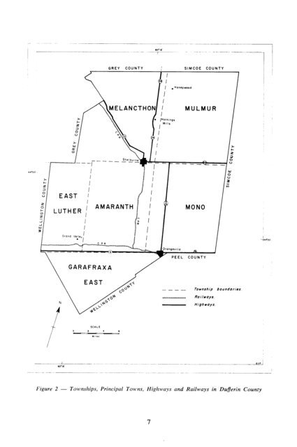
GREY COUNTY I I SIMCOE COUNTY 71 i 1 PEEL COUNTY GARAFRAXA -_-- Township boundaries Figure 2 - Townships, Principal To~vns, Highways <strong>and</strong> Railways in Dufierin County
TABLE 1 TREND IN TOTAL POPULATION Year Popluation Year Popluation 1871 ,,.,,,,,,,,. ._.,..,,.__.._. . . . .. 16,689 1921 .. . .. .. . . . . ,,. 15,415 1881 .,,.,.,...... _. .._..,..._........ . . .. 22,084 1931 .._... . ...._.............................,,.. 14,892 1891 .__._, ..,,.,.,.,,,,, ,.,., ..__.. 22,332 1941 . ..._.................... 14,075 1901 .,,..,_.._,,.,_,,,,,, . 21,036 1951 . . . . . . . . . . . . . . . . . . . . . . . . . . .,,. 14,566 1911 ,,,,..,,, ,...__ 17,740 1961 . ..t.._............. _..,,. 15,569 Transportation Good roads <strong>and</strong> railways traverse the county, connecting it with the main marketing centres in the Province. All of the highways, except No. 89 highway which links Shelburne <strong>and</strong> Alliston, pass through Orangeville. Highway No. 10 joining Owen Sound <strong>and</strong> Toronto <strong>and</strong> Highway No. 24 running from Collingwood to Guelph pass through the middle of the county in a north-south direction. From east to west in the southern part of the County is Highway 9. In addition to these highways there is a good network of county <strong>and</strong> township roads. Rail service is provided by the Canadian Pacific Railway which has two lines passing through Orangeville, one leading west via Arthur <strong>and</strong> the other going north through Shelburne. Geology of the Underlying Rocks This portion of Ontario has been subjected to repeated glaciations <strong>and</strong> the rock is covered by glacial drift that varies from a few inches to several hundred feet in thickness. The soils have developed directly from the deposits of drift <strong>and</strong> the extent to which the underlying bedrock has contributed to the composition of the soils is difficult to assess. Dufferin County is underlain by sedimentary strata of Ordovician <strong>and</strong> Silurian ages (Figure 3). The line of contact between the Ordovician <strong>and</strong> Silurian rocks is well defined by the Niagara Escarpment. The Ordovician rocks lie to the east <strong>and</strong> the Silurian rocks to the west of the Escarpment. Of the Silurian rocks the uppermost strata consist of dolomite, shale <strong>and</strong> s<strong>and</strong>stone of the Medina formation. These rocks are underlain by gray <strong>and</strong> buff dolomites of the Lockport <strong>and</strong> Guelph formations. These three formations are the only ones of Silurian age occurring in the county. Only the upper formations of the Ordovician age occur in the area. Uppermost <strong>and</strong> adjacent to the Escarpment are the reddish shales of the Queenston formation. Below this formation lie the grayish shales of the Dundas <strong>and</strong> Meaford formations. These latter formations occupy but a small part of the underlying rocks on the eastern side of the county. Surface Deposits The unconsolidated surface deposits in Dufferin County are of glacial origin <strong>and</strong> are the parent material from which the soils have developed. The variations that occur in texture, relief <strong>and</strong> drainage of soils are a result of differences in the nature of these deposits as described in Table 2 <strong>and</strong> distributed as shown in Figure 4. The surface deposits are commonly referred to as till, outwash, kame, esker, deltaic, <strong>and</strong> lacustrine which denote the mode of deposition <strong>and</strong>, to some extent, the textural composition of the deposit. Glacial till is non-sorted material, a mixture of broken rock fragments <strong>and</strong> soil particles that range in size from s<strong>and</strong> to clay. Glacial till covers a large part of Dufferin County. Gently undulating till plains cover most of Amaranth, East Garafraxa, East Luther <strong>and</strong> Melancthon Townships. The main part of this area is a fluted till plain bounded on the east by moraines. Most of the area has a surficial deposit of silt, 8