

Hannington - Basingstoke and Deane Borough Council
Hannington - Basingstoke and Deane Borough Council
Hannington - Basingstoke and Deane Borough Council

Create successful ePaper yourself
Turn your PDF publications into a flip-book with our unique Google optimized e-Paper software.
Conservation Area Appraisal<br />
Conservation Area Appraisal<br />
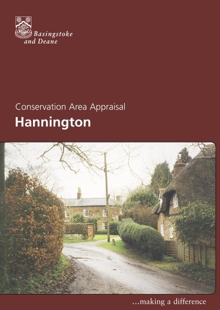
<strong>Hannington</strong><br />
…making a <strong>Hannington</strong> difference
Conservation Area Appraisal<br />
Introduction<br />
The <strong>Hannington</strong> Conservation Area was designated in 1992 by<br />
<strong>Basingstoke</strong> <strong>and</strong> <strong>Deane</strong> <strong>Borough</strong> <strong>Council</strong> in recognition of the special<br />
architectural <strong>and</strong> historic interest of the village.<br />
Having designated the Conservation Area, the Local Authority has a<br />
statutory duty to ensure that those elements that form its particular<br />
character or appearance should be preserved or enhanced, especially<br />
when considering planning applications.<br />
All Saints’ Church <strong>and</strong> Church Cottage<br />
It is therefore necessary to define <strong>and</strong> analyse those qualities or elements<br />
that contribute to, or detract from, the special interest of the area <strong>and</strong><br />
to assess how they combine to justify its designation as a Conservation<br />
Area. Such factors can include:<br />
• its historic development;<br />
• the contribution of individual or groups of buildings to the<br />
streetscene <strong>and</strong> the spaces that surround them; <strong>and</strong><br />
• the relationship of the built environment with the l<strong>and</strong>scape.<br />
Pixie Cottage <strong>and</strong> <strong>Hannington</strong><br />
House, Ibworth Lane<br />
They can also include the less tangible senses <strong>and</strong> experiences such<br />
as noise or smells, which can play a key part in forming the distinctive<br />
character of an area.<br />
The Appraisal takes the form of written text <strong>and</strong> an Appraisal plan. In<br />
both respects every effort has been made to include or analyse those<br />
elements key to the special character of the area. Where buildings,<br />
structures or features have not been specifically highlighted it does<br />
not necessarily follow that they are of no visual or historic value to the<br />
Conservation Area. The document is intended to be an overall framework<br />
<strong>and</strong> guide within which decisions can be made on a site-specific basis.<br />
This Appraisal of the <strong>Hannington</strong> Conservation Area follows its review in<br />
2003 by <strong>Basingstoke</strong> <strong>and</strong> <strong>Deane</strong> <strong>Borough</strong> <strong>Council</strong> <strong>and</strong> explains what its<br />
designation means for those who live <strong>and</strong> work in the area.<br />
This document was adopted as Supplementary Planning Guidance by the<br />
<strong>Borough</strong> of <strong>Basingstoke</strong> <strong>and</strong> <strong>Deane</strong> on 17 July 2003 <strong>and</strong> complements<br />
the policies of the <strong>Borough</strong> Local Plan (review).<br />
It has been subject to consultation with <strong>Council</strong>lors, the Parish <strong>Council</strong><br />
<strong>and</strong> local amenity groups. A full list of consultees, copies of their<br />
responses, <strong>and</strong> details of the <strong>Council</strong>’s consideration of the issues<br />
raised during the consultation period are available for inspection, by<br />
appointment, at the Civic Offices, during normal office hours.<br />
2<br />
<strong>Hannington</strong>
Conservation Area Appraisal<br />
Location <strong>and</strong> Population<br />
<strong>Hannington</strong> lies between <strong>Basingstoke</strong> <strong>and</strong> Newbury. It is situated<br />
on top of the Hampshire Downs, <strong>and</strong> is in the North Wessex Area of<br />
Outst<strong>and</strong>ing Natural Beauty. In every direction, the l<strong>and</strong>scape falls away<br />
sharply from the village, with the Test Valley to the south <strong>and</strong> the Thames<br />
Basin to the north. The village of <strong>Hannington</strong> is isolated within the<br />
l<strong>and</strong>scape, the nearest settlement of any size is Kingsclere, three miles<br />
away. Wolverton, the nearest village, is separated from <strong>Hannington</strong> by<br />
about two miles of open countryside. The Conservation Area boundary<br />
includes all but the most southern area of the village of <strong>Hannington</strong>.<br />
The population of the village in 1998 was approximately 220, of which<br />
approximately 160 lived within the boundaries of the Conservation Area<br />
(projection based on the Hampshire County <strong>Council</strong> Planning Department<br />
Small Area Population Forecasts 1995).<br />
Yew Tree Cottage<br />
Historic Development<br />
Settlement Origins<br />
The word <strong>Hannington</strong> originates from ‘Haningtun’ meaning the ‘farm of<br />
Hana’. At the time of the Domesday Survey, the manor of <strong>Hannington</strong><br />
was held by the Bishop of Winchester. In 1284, John of Pontioise, Bishop<br />
of Winchester, gave the manor to the Prior <strong>and</strong> Convent of St Swithun,<br />
<strong>and</strong> it became part of the manor of Manydown. <strong>Hannington</strong> remained<br />
in the ownership of the convent until it was granted to the Dean <strong>and</strong><br />
Chapter of Winchester by Henry VIII.<br />
In the mid 17th century, the manor was sold into lay h<strong>and</strong>s. Two manors<br />
evolved out of Manydown - the manor of <strong>Hannington</strong> Lancelevy, <strong>and</strong> the<br />
manor of <strong>Hannington</strong>. The former fell within the parish of Kingsclere,<br />
<strong>and</strong> the latter became a parish in its own right. The divide fell along the<br />
southern boundary of the church. As a consequence, until the 1890s,<br />
parts of the village were within Kingsclere Parish.<br />
View east from Ibworth Lane<br />
Manor Farm Barn<br />
Settlement Development<br />
The village has developed as an irregular cluster of buildings around a<br />
central village green, with later linear growth following the road to the<br />
north <strong>and</strong> south.<br />
The church on the western side of the present day green appears to<br />
have been sited on a larger green, that originally extended as far as the<br />
manor. There are farms on three sides of the church, Manor Farm is to<br />
the west, Dicker’s Farm to the north <strong>and</strong> <strong>Hannington</strong> Farm to the south.<br />
The part of the settlement east of the green, on both sides of the road,<br />
is an area of irregularly shaped plots with cottages. Along the eastern<br />
side of the north/south road is an area of the village with a continuous<br />
<strong>Hannington</strong> 3
Conservation Area Appraisal<br />
rear boundary. At the northern end of the settlement, the road divides in<br />
front of the Old Rectory.<br />
The exact pattern of historic development of <strong>Hannington</strong> is uncertain.<br />
However, it is likely that from Saxon times, All Saints’ Church formed a<br />
focus for settlement. This relationship has changed little to the present<br />
day, <strong>and</strong> is a key characteristic of the village.<br />
The development of <strong>Hannington</strong> <strong>and</strong> the surrounding area is inherently<br />
associated with farming <strong>and</strong>, in particular, the rearing of sheep for wool.<br />
Bertha’s Cottage<br />
By the mid 19th century, the 1840 Tithe map illustrates the development<br />
of the village in two parts. The main focus still centred on the Green<br />
<strong>and</strong> Ibworth Lane - a secondary, <strong>and</strong> looser cluster of buildings to the<br />
north around the road junction, <strong>and</strong> separated from the first by fields.<br />
This arrangement of buildings, <strong>and</strong> the lanes running through <strong>and</strong> into<br />
the village, form the present day settlement pattern, with only minor<br />
alterations <strong>and</strong> infill. In addition, most of the field boundaries in the<br />
Conservation Area, recorded on the Tithe map <strong>and</strong> the 19th century<br />
Ordnance Survey map, still exist, despite modern agriculture practices.<br />
The survival of farmhouses, farm workers’ cottages, barns <strong>and</strong> small<br />
fields is fundamental to the special interest <strong>and</strong> distinctive historic<br />
character of <strong>Hannington</strong> as a small hill top agricultural settlement. More<br />
important is their relationship to each other, <strong>and</strong> to the surrounding<br />
countryside. This rural character is reinforced by the less tangible, but<br />
equally important, survival of village traditions <strong>and</strong> events such as the<br />
Annual Fayre <strong>and</strong> the hunt kennels.<br />
An Appraisal of the Conservation Area<br />
An Overview<br />
The Appraisal plan identifies those buildings, views, <strong>and</strong> key features<br />
considered essential to the special character or appearance of the<br />
Conservation Area. In addition to listed buildings it also includes unlisted<br />
buildings of particular individual or group value, which are indicated on<br />
the Appraisal plan as notable. This is not to undermine the value of other<br />
unmarked buildings or structures that reflect the historic development of<br />
the village without detracting from its special qualities.<br />
Individual hedgerows have not been included on the Appraisal plan.<br />
However, their contribution to the character of the Conservation Area<br />
should not be underestimated <strong>and</strong> their significance is implicit in the<br />
Appraisal.<br />
4<br />
<strong>Hannington</strong>
Conservation Area Appraisal<br />
The special architectural <strong>and</strong> historic interest of <strong>Hannington</strong> is derived<br />
from a mix of individual buildings of intrinsic architectural or historic<br />
interest. Their arrangement to each other <strong>and</strong> to key spaces in the<br />
village is also significant. In addition, the open qualities of the village<br />
are reinforced by significant views out to the open countryside. These<br />
penetrate the streetscape <strong>and</strong> combine to create a Conservation Area of<br />
significant visual interest, <strong>and</strong> strongly defined character.<br />
Built Form<br />
Thirteen buildings or structures in the village of <strong>Hannington</strong> are included<br />
on the Statutory List of Buildings of Special Architectural or Historic<br />
Interest, most are of local importance (Grade II) but All Saints’ Church is<br />
listed as being of national importance (Grade I).<br />
The Village Green from Ibworth Lane<br />
Principally of brick <strong>and</strong>/or timber-frame construction, the majority of<br />
the listed buildings date from the 17th ,18th <strong>and</strong> early 19th centuries.<br />
However, Tan-y-Bryn Cottage (dated by dendrochronology to 1360)<br />
<strong>and</strong> All Saints’ Church are notably earlier. Although subject to minor<br />
alterations or extensions, most buildings retain their original form<br />
<strong>and</strong> appearance. For example, the ordered, symmetrical 18th century<br />
elevations of Manor Farm <strong>and</strong> Dickers Farm are characteristic of their<br />
period. Bertha’s Cottage <strong>and</strong> Pixie Cottage reflect their earlier 17th<br />
century date <strong>and</strong> associated vernacular building traditions, most notable<br />
are their sweeping thatched roofs <strong>and</strong> exposed timber-frames. The listed<br />
buildings are located at key visual points in the streetscene, <strong>and</strong> make a<br />
significant contribution to the special qualities of the Conservation Area.<br />
Little Dickers<br />
The villagescape, however, comprises a number of unlisted buildings,<br />
mainly dating from the 19th century. These are predominantly<br />
constructed of vernacular materials, namely brick <strong>and</strong> clay tile, <strong>and</strong><br />
strongly reinforce the distinctive spatial qualities <strong>and</strong> visual interest of the<br />
village.<br />
The juxtaposition of views <strong>and</strong> sense of place created by the grouping<br />
of several notable buildings around the Village Green are particularly<br />
distinctive characteristics of <strong>Hannington</strong>.<br />
<strong>Hannington</strong> 5
Conservation Area Appraisal<br />
Key Individual Buildings <strong>and</strong> Groups of<br />
Buildings<br />
The particular character of the <strong>Hannington</strong> is derived as much from the<br />
contribution made by the relationship of buildings to each other, <strong>and</strong> the<br />
spaces that surround them, as the intrinsic qualities of individual historic<br />
buildings.<br />
Tan-y-Bryn Cottage<br />
Although physically <strong>and</strong> visually linked, the buildings form three groups.<br />
These are the well-spaced cluster centred around the church <strong>and</strong><br />
green, the short linear grouping along Ibworth Lane, <strong>and</strong> the irregular<br />
arrangement forming the northern focus of the settlement.<br />
The first of these groups comprise a number of substantial buildings<br />
each significant in its own right. The group as a whole serves to define<br />
the village green as a visually enclosed space. This character contrasts<br />
with the immediacy of the open countryside, apparent to the west <strong>and</strong><br />
south. The distinctive arrangement of the buildings, <strong>and</strong> the spaces<br />
between them, affords opportunities for the appreciation of the buildings<br />
<strong>and</strong> their settings from a variety of vantage points. This is particularly<br />
noticable with All Saints’ Church <strong>and</strong> Church Cottage.<br />
All Saints’ Church, north elevation<br />
Church Cottage<br />
The church dates from the 11th century with 12th, 13th, 14th, 15th<br />
<strong>and</strong> 19th century alterations. In Saxon times, a building with an aisleless<br />
nave <strong>and</strong> chancel stood on this site. The present nave is mainly Norman,<br />
with some remaining elements of earlier Saxon fabric. The south aisle<br />
was added before 1200, <strong>and</strong> the chancel rebuilt in the 15th century.<br />
In the 19th century, the nave <strong>and</strong> aisle were lengthened, <strong>and</strong> a north<br />
porch <strong>and</strong> bell turret were added. The church is constructed of flint<br />
walling with stone dressings <strong>and</strong> a tile roof with a small broach spire<br />
covered in shingles. There are two interesting examples of modern<br />
church windows, designed <strong>and</strong> engraved by Laurence Whistler. In the<br />
south aisle, the window is in memory of William Whistler, a local farmer.<br />
It depicts the scythe of time rising up to point to a sheaf of corn. The<br />
second, on the south side of the chancel, is in remembrance of Rose<br />
Hodson, <strong>and</strong> depicts the house, built in 1793, where she lived for 22<br />
years.<br />
Although set back from the main village green, <strong>and</strong> partially screened<br />
by Church Cottage in views from the east, the church dominates the<br />
spaces <strong>and</strong> surrounding buildings. Its spire is a significant l<strong>and</strong>mark.<br />
The long vista to the church <strong>and</strong> spire from Ibworth Lane, <strong>and</strong> the view<br />
of the north elevation from Manor Farm, are particularly notable. They<br />
make an important contribution to the visual interest of the Conservation<br />
Area. Also of special interest is the way in which Church Cottage, Manor<br />
Farm, <strong>and</strong> the long range of outbuildings at <strong>Hannington</strong> Farm define the<br />
churchyard <strong>and</strong> provide the setting to the church.<br />
6<br />
<strong>Hannington</strong>
Conservation Area Appraisal<br />
In the immediate vicinity of the church are Manor Farmhouse <strong>and</strong> barns,<br />
<strong>Hannington</strong> Farm (<strong>and</strong> associated outbuildings) <strong>and</strong> Dickers Farmhouse.<br />
Manor Farmhouse (Grade II) dates from the early 18th century, <strong>and</strong> has a<br />
symmetrical north façade <strong>and</strong> red brick walling in Flemish bond. Situated<br />
directly to the west of the church, the west gable end <strong>and</strong> substantial<br />
clay tile roof slopes are prominent features in views across the village<br />
green.<br />
To the north of this building is a large contemporary five-bay timberframe<br />
barn with aisles. The timber-frame is integrated into a brick plinth<br />
wall, <strong>and</strong> the building is weatherboarded. Originally thatched, the<br />
barn now has a corrugated tin roof. This is a dominant building, which<br />
reinforces the rural qualities of the Conservation Area.<br />
Manor Farmhouse<br />
Dickers Farmhouse (Grade II) dates from the 18th century, with 20th<br />
century alterations. It has a symmetrical arrangement of sash windows<br />
around a central entrance door. Constructed of red brick in Flemish<br />
bond, it has rubbed flat arches over the window openings <strong>and</strong> a hipped<br />
clay tile roof.<br />
To the south of the church is the <strong>Hannington</strong> Farm complex of buildings,<br />
which include a large 18th century barn <strong>and</strong> 19th century granary (both<br />
Grade II listed). These form a strong group, <strong>and</strong> reinforce the essential<br />
farming tradition of the Conservation Area. They also help define the<br />
southern edge of the village green <strong>and</strong> the setting to the church. The<br />
change in levels between the churchyard <strong>and</strong> farmyard is not only of<br />
historic significance, but affords important views west <strong>and</strong> south west to<br />
the surrounding countryside.<br />
View south-westwards<br />
from the churchyard<br />
Church Cottage, originally a symmetrical pair of 19th century cottages,<br />
is of simple vernacular appearance. It is of key streetscape significance,<br />
given its central location between the village green <strong>and</strong> the church. The<br />
polychromatic brick <strong>and</strong> flint rear elevation is also important. This forms<br />
the context to the church <strong>and</strong> prominent in views from the churchyard<br />
eastwards towards the village.<br />
Completing the group (together with a modern development of five<br />
houses on the southern perimeter) that defines the village green are two<br />
buildings, fronting the main road. Lark Hill dates from the 20th century<br />
<strong>and</strong> complements the vernacular scale <strong>and</strong> materials of the group. Rose<br />
Cottage is a single-storey brick structure, with some exposed timberframing<br />
in the north gable. Dominant lateral chimneystacks <strong>and</strong> three<br />
full dormers punctuate the steep roof. Situated at a key position in the<br />
Conservation Area it serves to define the south-easterly limited of the<br />
enclosed village green. A notable building of particular streetscape merit,<br />
its front elevation also forms a focal point in the long vista from the<br />
south, this is due to its location at the apex of a bend in the road. The<br />
<strong>Hannington</strong> 7
Conservation Area Appraisal<br />
slight angle of the elevation deflects the view to suggest further interest<br />
beyond.<br />
Immediately to the rear of Rose Cottage is a long weatherboard <strong>and</strong><br />
thatch outbuilding. The large roof slope is emphasised by the low eaves.<br />
The two buildings form a distinctive feature in views from all directions.<br />
Rose Cottage<br />
Two unusual listed structures are also located in this central focus on the<br />
village. The late 19th century lych-gate to the church is constructed of<br />
a timber-frame with flanking stone walls. The roof, steeply pitched <strong>and</strong><br />
hipped, has a red clay tile covering, <strong>and</strong> a short ridge surmounted by a<br />
wrought-iron cross. The double gate is timber, decorated with cusped<br />
panels. Opposite this lych-gate, on the village green, is a timber-framed<br />
well head, dated 1897. This was built to commemorate the diamond<br />
jubilee of Queen Victoria, <strong>and</strong> has a pyramidal roof, covered with<br />
red clay tiles. The four timber posts rest on chamfered stone blocks,<br />
surrounding a blue brick floor. These two structures are prominent <strong>and</strong><br />
distinctive features that enhance the special character of the village <strong>and</strong><br />
Conservation Area.<br />
To the east of the village green is Tan-y-Bryn Cottage, a two bay ‘cruck’<br />
timber-frame with red brick infilling <strong>and</strong> half hipped thatch roof, which is<br />
the oldest cruck frame cottage in Hampshire.<br />
<strong>Hannington</strong> House<br />
Church Cottage from the west<br />
The second group of important historic buildings is located along<br />
Ibworth Lane. They are of varied architectural form <strong>and</strong> period, situated<br />
in large but irregular plots. This creates a sense of semi-rural character,<br />
emphasised by the views eastwards along the lane from St<strong>and</strong>en House<br />
into open countryside.<br />
<strong>Hannington</strong> House (Grade II), dates from the early 19th century. A wellmannered<br />
building of intended status, it is of brick construction <strong>and</strong><br />
ordered fenestration in the main south elevation. Bertha’s Cottage (Grade<br />
II) lies at the eastern entrance to the Conservation Area. It dates from the<br />
17th century with later alterations, <strong>and</strong> is a small timber-framed building<br />
with a steep thatched roof <strong>and</strong> eyebrow dormers. Pixie Cottage (Grade<br />
II) is situated at the ‘dogleg’ in the road. It is also a small timber-framed<br />
building with thatched roof <strong>and</strong> dormers. Its position in the streetscene is<br />
prominent, particularly terminating views eastwards along Ibworth Lane.<br />
This important group also includes St<strong>and</strong>en House <strong>and</strong> Stoney Hall which<br />
are clearly visible from the village green. They provide an important<br />
historic context <strong>and</strong> setting to the listed buildings along Ibworth Lane, on<br />
the edge of the village.<br />
The third group of buildings is irregular in arrangement, following the<br />
road to the north. Apart from the Old Rectory, the buildings differ from<br />
those to the south by way of their smaller scale, informal character <strong>and</strong><br />
more compact arrangement. Most date from the 19th century. There is,<br />
8<br />
<strong>Hannington</strong>
Conservation Area Appraisal<br />
however, a small cluster of older cottages on the eastern side of the main<br />
road that have a cohesive appearance <strong>and</strong> historic character.<br />
Dicker’s Cottage (Grade II) dates from the 18th century. It is a two-storey<br />
red brick thatched cottage, with distinctive eyebrow dormers. Yew<br />
Tree House (Grade II) is also a red brick, one-storey cottage with some<br />
exposed framing <strong>and</strong> brick nogging, but with a tile roof. The cladding<br />
of the building in the 18th century hides an earlier structure. Adjoining<br />
these buildings are the timber-framed <strong>and</strong> brick Honeypot Cottage <strong>and</strong><br />
Meadham Cottage.<br />
The Old Rectory dates from the early <strong>and</strong> mid 19th century <strong>and</strong> is a twostorey,<br />
painted brick building set back from the road <strong>and</strong> in a mature<br />
l<strong>and</strong>scape setting. The hipped slate roof is glimpsed through the trees. To<br />
the north-west is a small timber-clad cart shed, which defines the limit of<br />
the settlement.<br />
Dickers Farm Cottage (background)<br />
<strong>and</strong> Yew Tree Cottage<br />
On the eastern side of the main road is Abbotts Thatch. Its flank is<br />
prominent in views along the main road from the south. Others in<br />
this irregular, but complementary, vernacular grouping include the Old<br />
School, the School House, Plum Tree Cottage, Lintells <strong>and</strong> Old Post<br />
Cottage.<br />
To the north-east of the village, the gable end <strong>and</strong> lateral chimneystack<br />
of Old Walls punctuate the lane in views from the south. The adjoining<br />
19th century chapel retains its original form <strong>and</strong> design.<br />
View northwards through the village<br />
To the south of the historic core of the settlement are The Vine Inn<br />
public house <strong>and</strong> South Lodge, both of vernacular architectural interest.<br />
They contribute in creating the transition between village edge, modern<br />
development, <strong>and</strong> the historic village core.<br />
The Character <strong>and</strong> Importance of Public<br />
<strong>and</strong> Private Spaces<br />
The open spaces in this Conservation Area are extremely important,<br />
as they help to define the development of the village. In <strong>Hannington</strong>,<br />
many important views, <strong>and</strong> settings to buildings, are derived from the<br />
relationship between the buildings <strong>and</strong> key open spaces.<br />
The fields within <strong>and</strong> surrounding the Conservation Area are visible<br />
throughout the village, <strong>and</strong> provide extensive views out to the<br />
surrounding open countryside. The fields to the south-west, north-east<br />
<strong>and</strong> west of the village have traditional names <strong>and</strong> are described on<br />
the Award to the Tithe Map as Parsonage Piece, Barn Meadow, King’s<br />
Meadow <strong>and</strong> Village Meadow. To the north-east is Michael’s Field, now<br />
used as the village recreation ground, an important community facility.<br />
<strong>Hannington</strong> 9
Conservation Area Appraisal<br />
The most prominent open space in <strong>Hannington</strong> is the village green.<br />
This open area is essential to the character <strong>and</strong> appearance of the<br />
Conservation Area. It demonstrates the historic development of the<br />
village, <strong>and</strong> is an historic focus for the community. Adjoining the village<br />
green is the churchyard, which possesses a distinctive, intimate character.<br />
The substantial gardens to many properties contribute to the open<br />
character of the Conservation Area. These provide important settings to<br />
the buildings, <strong>and</strong> enable views through to the countryside beyond. The<br />
garden to Stoney Hall, for example, affords views of the outbuilding to<br />
the rear of Rose Cottage.<br />
The Old Rectory cart shed <strong>and</strong> view<br />
north-westwards out of the village<br />
Mature trees are scattered around the Conservation Area, both singly <strong>and</strong><br />
in small coppices, reflecting the character of the surrounding Downl<strong>and</strong><br />
l<strong>and</strong>scape. The verges to the lanes are generally hedge-lined <strong>and</strong> dense,<br />
with ‘hedgerow trees’, providing a verdant <strong>and</strong> intimate quality.<br />
Other Features of Architectural or Historic<br />
Interest<br />
Brick walls define <strong>and</strong> contain several historic curtilages, <strong>and</strong> contribute<br />
to the texture <strong>and</strong> grain of the Conservation Area. A number of older<br />
brick walls survive, including the garden walls to St<strong>and</strong>en House, Stoney<br />
Hall, <strong>and</strong> <strong>Hannington</strong> House. A length of cast iron railing forms part of<br />
the boundary of the garden to the Old Rectory.<br />
Building Materials<br />
The prevalent traditional building materials are thatch, red clay tile<br />
roofing (<strong>and</strong> some slate), timber-frame with brick infill; red brick <strong>and</strong><br />
flint with brick or stone dressings. Casement windows are common on<br />
vernacular buildings, <strong>and</strong> sash windows on the more formal <strong>and</strong> polite<br />
buildings.<br />
Given the domestic scale <strong>and</strong> simple vernacular architecture of the<br />
buildings in the Conservation Area, historic joinery (such as sash or<br />
casement windows, doors <strong>and</strong> door hoods) are often the features that<br />
define the appearance of properties. Although some buildings have been<br />
modernised, the use <strong>and</strong> overall effect of inappropriate replacement<br />
windows <strong>and</strong> doors is limited.<br />
10<br />
<strong>Hannington</strong>
Conservation Area Appraisal<br />
The Setting of the Conservation Area<br />
The village is surrounded by countryside with a substantial part of<br />
the Conservation Area consisting of open fields <strong>and</strong> other spaces.<br />
<strong>Hannington</strong> is the only hill-top downl<strong>and</strong> village in the <strong>Borough</strong>. No<br />
other village has such extensive, all round views of its Conservation Area.<br />
The sense of isolation is heightened by the views that exist from, or near<br />
to, the boundaries of the Conservation Area. Every major settlement in<br />
the <strong>Borough</strong>, including <strong>Basingstoke</strong>, Oakley, Tadley, Kingsclere, Overton<br />
<strong>and</strong> Whitchurch, is partly visible. Further afield, it is possible to see<br />
Reading <strong>and</strong> the Didcot Power Station in Oxfordshire to the north; the<br />
hills on the Wiltshire side of Stockbridge, <strong>and</strong> the Test Valley to the south.<br />
View south-eastwards out of the village<br />
Immediately outside the Conservation Area is one of the most<br />
undeveloped areas of downl<strong>and</strong> in the <strong>Borough</strong>. The downl<strong>and</strong> <strong>and</strong> the<br />
village are historically integral.<br />
Areas of Archaeological Significance<br />
Every settlement contains within it archaeological evidence of its origins<br />
<strong>and</strong> development, of the economy <strong>and</strong> industry of the community <strong>and</strong> of<br />
the lives <strong>and</strong> lifestyles of past inhabitants.<br />
It is in the areas of High Archaeological Potential (AHAP) that it is most<br />
likely that such archaeological remains will be encountered.<br />
The Village Green, Rose Cottage<br />
<strong>and</strong> Lark Hill<br />
Where a development is proposed, the impact that it might have on<br />
these remains is a material consideration within the planning process.<br />
This may occasionally result in the need for archaeological recording in<br />
the case of some developments.<br />
An AHAP covers the area containing the church <strong>and</strong> the three farms, the<br />
adjacent village green, <strong>and</strong> the principal area of 19th century occupation<br />
of the village to the east.<br />
The areas alongside the roads to the north <strong>and</strong> east, as well as the<br />
eastern side of the road to the south, are regarded as an Area of<br />
Archaeological Potential (AAP). Settlement had taken place in these<br />
areas by at least the 17th century. The shape of some of the vacant plots<br />
suggests there may have been more development in these areas than is<br />
now apparent.<br />
<strong>Hannington</strong> 11
Conservation Area Appraisal<br />
Conservation Area Planning Controls<br />
The following controls apply within the Conservation Area in addition to<br />
normal planning controls:<br />
• Conservation Area Consent is normally required for the demolition of<br />
buildings or structures over a certain size within a Conservation Area.<br />
• The <strong>Council</strong> must be given six weeks notice of any intention<br />
to undertake works to, cut down or uproot any trees over a certain<br />
size in the Conservation Area.<br />
St<strong>and</strong>en House<br />
View northwards to the Village Green with<br />
The Vine Public House <strong>and</strong> ‘K6’ telephone box<br />
• Planning applications which, in the opinion of the <strong>Borough</strong> <strong>Council</strong>,<br />
would affect the special character of the Conservation Area must be<br />
advertised <strong>and</strong> the opportunity given for public comment. This may<br />
include proposals outside the Conservation Area which nevertheless<br />
affect its setting.<br />
Statutory policies relating to Conservation Areas <strong>and</strong> listed buildings<br />
are set out in the adopted <strong>Basingstoke</strong> <strong>and</strong> <strong>Deane</strong> <strong>Borough</strong> Local Plan.<br />
These policies reflect the statutory duty on the Local Planning Authority<br />
to have regard to the preservation of historic buildings or their setting,<br />
<strong>and</strong> to the enhancement of areas designated as being of special interest.<br />
These policies seek to ensure that particular attention will be paid to<br />
the scale, height, form, materials <strong>and</strong> detailing of proposals including<br />
boundary treatments <strong>and</strong> other features of note. In order to consider the<br />
implications of development <strong>and</strong> given the detail required, the <strong>Borough</strong><br />
<strong>Council</strong> will normally require proposals within the Conservation Area<br />
to be submitted in the form of a full, <strong>and</strong> not outline, application. The<br />
<strong>Borough</strong> <strong>Council</strong>’s Conservation Officers are available for advice <strong>and</strong><br />
information on all matters relating to development proposals in the<br />
Conservation Area.<br />
Grants<br />
The <strong>Borough</strong> <strong>Council</strong> provides grants for various types of work. These<br />
include Historic Buildings Grants, Environment <strong>and</strong> Regeneration Grants,<br />
<strong>and</strong> Village <strong>and</strong> Community Hall Grants. Leaflets are available explaining<br />
the purpose <strong>and</strong> criteria for each grant <strong>and</strong> an approach to the <strong>Council</strong> is<br />
recommended for further information on any grant.<br />
Courtesy of Hampshire County <strong>Council</strong><br />
12<br />
<strong>Hannington</strong>
Conservation Area Appraisal - <strong>Hannington</strong> late 19th Century OS Map<br />
<strong>Hannington</strong><br />
13
Conservation Area Appraisal - Tithe Map of <strong>Hannington</strong><br />
14<br />
<strong>Hannington</strong>
Conservation Area Appraisal - Archaeological Map of <strong>Hannington</strong><br />
Courtesy of Hampshire County <strong>Council</strong><br />
<strong>Hannington</strong> 15
Conservation Area Appraisal<br />
<strong>Hannington</strong><br />
…making a difference<br />
<strong>Basingstoke</strong> <strong>and</strong> <strong>Deane</strong> <strong>Borough</strong> <strong>Council</strong><br />
Civic Offices London Road <strong>Basingstoke</strong> Hants RG21 4AH<br />
Telephone 01256 844844 Fax 01256 845200<br />
www.basingstoke.gov.uk<br />
Produced by Graphics/Corporate Information Division April 2004<br />
4768


