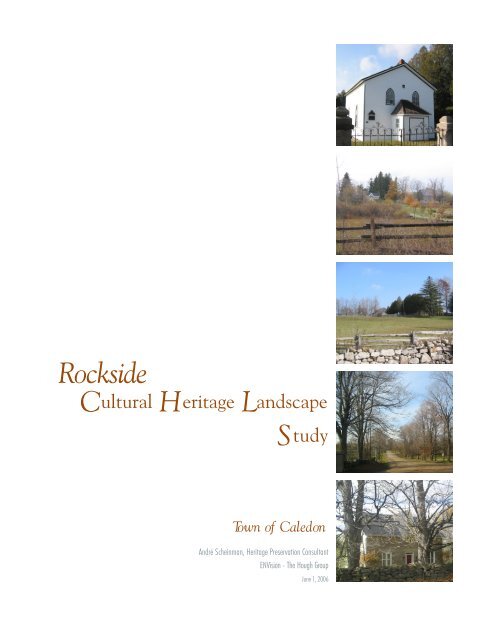
Rockside Cultural Heritage Landscape Study - Town of Caledon
Rockside Cultural Heritage Landscape Study - Town of Caledon
Rockside Cultural Heritage Landscape Study - Town of Caledon

You also want an ePaper? Increase the reach of your titles
YUMPU automatically turns print PDFs into web optimized ePapers that Google loves.
<strong>Rockside</strong><br />
<strong>Cultural</strong> <strong>Heritage</strong> <strong>Landscape</strong><br />
<strong>Study</strong><br />
<strong>Town</strong> <strong>of</strong> <strong>Caledon</strong><br />
André Scheinman, <strong>Heritage</strong> Preservation Consultant<br />
ENVision - The Hough Group<br />
June 1, 2006
<strong>Rockside</strong> <strong>Cultural</strong> <strong>Heritage</strong> <strong>Landscape</strong> <strong>Study</strong><br />
<strong>Town</strong> <strong>of</strong> <strong>Caledon</strong><br />
ROCKSIDE<br />
CULTURAL HERITAGE LANDSCAPE STUDY<br />
<strong>Town</strong> <strong>of</strong> <strong>Caledon</strong><br />
TABLE OF CONTENTS<br />
1.0 INTRODUCTION p. 2<br />
<strong>Study</strong> process p. 5<br />
2.0 HISTORICAL CONTEXT p. 6<br />
3.0 INVENTORY p. 9<br />
Physiographic description p. 9<br />
Processes p. 10<br />
Elements p. 19<br />
Site Context p. 28<br />
4.0 SIGNIFICANCE p. 30<br />
Statement <strong>of</strong> Significance p. 31<br />
Character Defining Elements p. 32<br />
5.0 INTEGRITY p. 39<br />
6.0 BOUNDARIES/BUFFERS p. 44<br />
7.0 CONCLUSIONS AND RECOMMENDATIONS p. 44<br />
LIST OF SOURCES p. 47<br />
APPENDIX: BUILT HERITAGE INVENTORY<br />
1
<strong>Rockside</strong> <strong>Cultural</strong> <strong>Heritage</strong> <strong>Landscape</strong> <strong>Study</strong><br />
<strong>Town</strong> <strong>of</strong> <strong>Caledon</strong><br />
1.0 INTRODUCTION<br />
The <strong>Town</strong> <strong>of</strong> <strong>Caledon</strong> Official Plan contains policies pertaining to cultural heritage<br />
conservation, including <strong>Cultural</strong> <strong>Heritage</strong> <strong>Landscape</strong>s (CHLs). Of particular interest to<br />
the <strong>Town</strong> is the identification <strong>of</strong> cultural heritage landscapes in rural areas. This is an<br />
emerging planning issue in Southern Ontario and at present, less well understood than the<br />
conservation <strong>of</strong> built heritage.<br />
In 2002, the <strong>Town</strong> commissioned a study <strong>of</strong> Criteria for the Identification <strong>of</strong> <strong>Cultural</strong><br />
<strong>Heritage</strong> <strong>Landscape</strong>s to establish guidelines for identifying and evaluating candidate<br />
CHLs. The study explored the historical context and themes specific to <strong>Caledon</strong>,<br />
proposed an evaluation process and criteria, and identified a number <strong>of</strong> candidate cultural<br />
heritage landscapes.<br />
As one <strong>of</strong> the <strong>Town</strong>’s earliest settled areas, <strong>Rockside</strong>, located in the southwest corner <strong>of</strong><br />
the former <strong>Town</strong>ship <strong>of</strong> <strong>Caledon</strong>, is one such Candidate CHL. In 2003, the <strong>Town</strong><br />
commissioned the <strong>Rockside</strong> <strong>Cultural</strong> <strong>Heritage</strong> <strong>Landscape</strong> <strong>Study</strong> to determine whether the<br />
area meets the established criteria for potential designation as a CHL. The <strong>Rockside</strong> study<br />
area (illustrated on Figure 1 following) is generally defined by Olde Base Line Road 1 on<br />
the south, Winston Churchill Boulevard on the west, The Grange Sideroad on the north,<br />
and the Niagara Escarpment on the east. As CHLs do not necessarily follow political or<br />
linear boundaries, the study area was not strictly confined to these roads.<br />
The essential consideration in confirming the presence <strong>of</strong> a CHL is identifying its<br />
association with the major themes (contexts) which have shaped the area, and confirming<br />
the existence <strong>of</strong> heritage features which maintain the connection between these themes<br />
and the existing place. The identification and preservation <strong>of</strong> CHLs is a relatively new<br />
initiative in Canada but is potentially <strong>of</strong> great importance in ensuring that the significant<br />
heritage features, their inter-relationships, and the messages which they convey, will be<br />
known to future generations.<br />
<strong>Cultural</strong> heritage landscapes have been recognized, and conservation measures<br />
established in the United States and internationally, for some time. As early as 1962 the<br />
United Nations Educational, Scientific and <strong>Cultural</strong> Organization (UNESCO), established<br />
the concept <strong>of</strong> cultural heritage landscapes through its adoption <strong>of</strong> a “Recommendation<br />
Concerning the Safeguarding <strong>of</strong> the Beauty and Character <strong>of</strong> <strong>Landscape</strong>s and Sites. The<br />
recommendation pertained to the “preservation and, where possible, the restoration <strong>of</strong><br />
the aspect <strong>of</strong> natural, rural and urban landscapes and sites, whether natural or manmade,<br />
which have a cultural or aesthetic interest or form typical natural surroundings.”<br />
In 1992 the UNESCO World <strong>Heritage</strong> Convention, Operational Guidelines for inclusion<br />
<strong>of</strong> sites on the World <strong>Heritage</strong> List were updated by the World <strong>Heritage</strong> Committee to<br />
include cultural landscapes. The Guidelines define cultural heritage landscapes as<br />
1 For ease <strong>of</strong> reference current road names are used. Where needed to describe or make reference to the historic<br />
condition the former numbered Line or Sideroad is identified following.<br />
2
<strong>Rockside</strong> <strong>Cultural</strong> <strong>Heritage</strong> <strong>Landscape</strong> <strong>Study</strong><br />
<strong>Town</strong> <strong>of</strong> <strong>Caledon</strong><br />
“illustrative <strong>of</strong> the evolution <strong>of</strong> human society and settlement over time, under the<br />
influence <strong>of</strong> the physical constraints and/or opportunities presented by their natural<br />
environment and <strong>of</strong> successive social, economic and cultural forces, both external and<br />
internal. For the purpose <strong>of</strong> identifying and classifying cultural landscapes UNESCO<br />
uses three categories: designed landscapes, evolved landscapes, and associative<br />
landscapes.<br />
The definition, categorization <strong>of</strong> cultural heritage landscapes, and the guidelines for their<br />
identification set out by UNESCO have been widely used as the basis for defining<br />
cultural heritage landscapes by national organizations including Parks Canada, and the<br />
U.S. National Park Service – National Register <strong>of</strong> Historic Places.<br />
In Ontario, Section 2.6.1 <strong>of</strong> the Provincial Policy Statement (2005), pursuant to Section 3<br />
<strong>of</strong> the Planning Act, states: “Significant built heritage resources and significant cultural<br />
heritage landscapes shall be conserved”.<br />
In the PPS, a cultural heritage landscape is defined as:<br />
“a defined geographical area <strong>of</strong> heritage significance which has been modified by human<br />
activities and is valued by a community. It involves a grouping(s) <strong>of</strong> individual heritage<br />
features such as structures, spaces, archaeological sites and natural elements, which<br />
together form a significant type <strong>of</strong> heritage form, distinctive from that <strong>of</strong> its constituent<br />
elements or parts. Examples may include, but are not limited to, heritage conservation<br />
districts designated under the Ontario <strong>Heritage</strong> Act; and villages, parks, gardens,<br />
battlefields, mainstreets and neighbourhoods, cemeteries, trailways and industrial<br />
complexes <strong>of</strong> cultural heritage value”.<br />
Significant in regard to cultural heritage and archaeology, is defined in the PPS as<br />
meaning “resources that are valued for the important contribution they make to our<br />
understanding <strong>of</strong> the history <strong>of</strong> a place, an event, or a people”.<br />
Within the Region <strong>of</strong> Peel Official Plan, objectives for Rural Areas (Section 5.4.6)<br />
include: “to preserve and enhance the distinct character, cultural attributes and historical<br />
heritage <strong>of</strong> the rural area”. The Regional Official Plan (5.4.6.2.1 Policies (f) further<br />
directs the <strong>Town</strong> <strong>of</strong> <strong>Caledon</strong> to “review development proposals in the rural area” based<br />
on a series <strong>of</strong> parameters including:<br />
• “the impact on the existing rural character and landscape <strong>of</strong> the rural area” and,<br />
• “the potential impact on the character and heritage <strong>of</strong> the rural area”.<br />
As already noted, the <strong>Town</strong> <strong>of</strong> <strong>Caledon</strong> Official Plan contains more detailed policies,<br />
which call for the inventory and conservation <strong>of</strong> CHLs. Prior to the inventory <strong>of</strong> CHLs, a<br />
development proponent is responsible for identifying CHLs and recommending methods<br />
for their conservation.<br />
3
<strong>Town</strong> <strong>of</strong> Orangeville<br />
Mono Mills<br />
<strong>Caledon</strong> Village<br />
<strong>Study</strong><br />
Area<br />
Belfountain<br />
<strong>Caledon</strong> East<br />
Inglewood<br />
<strong>Town</strong> <strong>of</strong> Halton Hills<br />
Cheltenham<br />
<strong>Town</strong> <strong>of</strong> <strong>Caledon</strong><br />
Bolton<br />
City <strong>of</strong> Vaughan<br />
City <strong>of</strong> Brampton<br />
Figure 1<br />
<strong>Study</strong> Area
<strong>Rockside</strong> <strong>Cultural</strong> <strong>Heritage</strong> <strong>Landscape</strong> <strong>Study</strong><br />
<strong>Town</strong> <strong>of</strong> <strong>Caledon</strong><br />
<strong>Study</strong> Process<br />
The purpose <strong>of</strong> this <strong>Study</strong> was to examine the <strong>Rockside</strong> <strong>Study</strong> Area in the manner<br />
prescribed in the Criteria for the Identification <strong>of</strong> <strong>Cultural</strong> <strong>Heritage</strong> <strong>Landscape</strong>s in<br />
<strong>Caledon</strong> (adopted by the <strong>Town</strong> <strong>of</strong> <strong>Caledon</strong> October 20, 2003) in order to determine<br />
whether the area, in whole, or in part, should be recommended for recognition as a CHL.<br />
In general the process involved a review <strong>of</strong> the evolution <strong>of</strong> settlement in the area in the<br />
context <strong>of</strong> the overall historic themes <strong>of</strong> <strong>Caledon</strong> (as identified in the Criteria). This was<br />
accompanied by field investigations to determine the existing built and landscape<br />
elements that together constitute the character <strong>of</strong> the area and to assess the extent to<br />
which these elements still reflect the key historic themes central to its development.<br />
It should be noted that while the full study area was visited several times, with few<br />
exceptions examination <strong>of</strong> individual properties had to take place from the road<br />
augmented by reference to air photos.<br />
The study process included the following key tasks:<br />
Task 1 - Inventory<br />
• Review <strong>of</strong> relevant background documents and reports and secondary sources such as<br />
local history books;<br />
• Additional archival research <strong>of</strong> historical data, settlement patterns, land ownership in the<br />
area;<br />
• Interviews with local residents to provide input into the historical context, and valued<br />
heritage features <strong>of</strong> the area;<br />
• Definition <strong>of</strong> a study area for the candidate CHL;<br />
• Detailed survey <strong>of</strong> the area for inventory purposes (as defined by the Criteria for the<br />
Identification <strong>of</strong> <strong>Cultural</strong> <strong>Heritage</strong> <strong>Landscape</strong>s). The inventory noted the presence and<br />
condition <strong>of</strong> built heritage features and landscape characteristics, natural features, other<br />
character defining elements, and potential boundaries demarcations.<br />
Task 2 - Evaluation<br />
• Determination <strong>of</strong> significance <strong>of</strong> the <strong>Rockside</strong> Candidate CHL using the information<br />
obtained during the inventory, and application <strong>of</strong> criteria for evaluating cultural heritage<br />
landscapes (as defined in the <strong>Town</strong> <strong>of</strong> <strong>Caledon</strong>: Criteria for the Identification <strong>of</strong> <strong>Cultural</strong><br />
<strong>Heritage</strong> <strong>Landscape</strong>s);<br />
• Confirmation <strong>of</strong> the study area’s eligibility as a CHL;<br />
• Refinement and confirmation <strong>of</strong> the CHL boundaries;<br />
• Recommendations for proceeding with conservation measures.<br />
Task 3 - <strong>Cultural</strong> <strong>Heritage</strong> <strong>Landscape</strong> Evaluation Report<br />
• Preparation <strong>of</strong> a CHL Evaluation Report in accordance with the <strong>Town</strong> <strong>of</strong> <strong>Caledon</strong>:<br />
Criteria for the Identification <strong>of</strong> <strong>Cultural</strong> <strong>Heritage</strong> <strong>Landscape</strong>s, documenting: Historical<br />
Contexts; Inventory (including representative photos, maps and graphics); Statement <strong>of</strong><br />
Significance; Integrity; Boundaries; and Recommendations.<br />
5
<strong>Rockside</strong> <strong>Cultural</strong> <strong>Heritage</strong> <strong>Landscape</strong> <strong>Study</strong><br />
<strong>Town</strong> <strong>of</strong> <strong>Caledon</strong><br />
2.0 HISTORICAL CONTEXT<br />
The earliest settlers in <strong>Caledon</strong> <strong>Town</strong>ship were a group <strong>of</strong> Scots originating from the<br />
counties <strong>of</strong> Renfrewshire and Argyllshire in Scotland, an area west <strong>of</strong> Glasgow and<br />
including a number <strong>of</strong> the Islands, the westernmost being Islay. John MacDonald and his<br />
extended family reached the southwest corner <strong>of</strong> the <strong>Town</strong>ship in June 1820, just after<br />
the completion <strong>of</strong> the original survey. They were followed over the next few years by<br />
other family members and countrymen.<br />
It is this group <strong>of</strong> families, largely in place on the land by 1825, opening up a particularly<br />
rugged wilderness for settlement, which has come to be known in local lore as the<br />
<strong>Rockside</strong> Pioneers (the area being named <strong>Rockside</strong>, after a village on the Island <strong>of</strong> Islay).<br />
Though on historical maps <strong>Caledon</strong>’s <strong>Rockside</strong> once identified a tiny crossroads hamlet<br />
formed at the corner <strong>of</strong> Base Line Road (Olde Base Line Road) and Shaw’s Creek Road<br />
(Fifth Line West), in fact locally, and to the pioneers themselves, it was always<br />
understood to refer to the broader area settled by this group <strong>of</strong> pioneers. This continues<br />
to be true though the hamlet itself has long since disappeared.<br />
This area, comprising the southwestern corner <strong>of</strong> the original <strong>Caledon</strong> <strong>Town</strong>ship<br />
consisting mainly <strong>of</strong> Lots 1-6 in Concessions 3 – 6 WHS and the uppermost lots (Lots<br />
33-34) in the original Chinguacousy <strong>Town</strong>ship, is thus considered an excellent candidate<br />
organically evolved CHL for its direct association with the major <strong>Caledon</strong> themes <strong>of</strong><br />
Survey and Pioneer Settlement and Early Subsistence Farming.<br />
Figure 2, following, illustrates <strong>Rockside</strong> and surrounding area in 1859. (source:<br />
Tremaine’s Map <strong>of</strong> the County <strong>of</strong> Peel, Canada West. Toronto: C.R. and G.M. Tremaine,<br />
1859)<br />
Figure 3, following, illustrates <strong>Rockside</strong> and surrounding area in 1877. (source:<br />
Illustrated Historical Atlas <strong>of</strong> the County <strong>of</strong> Peel, Walker and Miles, 1877)<br />
6
Figure 2<br />
<strong>Rockside</strong> Area in 1859<br />
Source: Tremaine Map, 1859
Figure 3<br />
<strong>Rockside</strong> Area in 1877<br />
Source: Historical Atlas <strong>of</strong> Peel County, published by Walker & Miles 1877
<strong>Rockside</strong> <strong>Cultural</strong> <strong>Heritage</strong> <strong>Landscape</strong> <strong>Study</strong><br />
<strong>Town</strong> <strong>of</strong> <strong>Caledon</strong><br />
3.0 INVENTORY<br />
1. Physiographic Description<br />
The <strong>Rockside</strong> study area is located in the southwest quadrant <strong>of</strong> the <strong>Town</strong>, its boundaries<br />
generally comprised <strong>of</strong> Olde Base Line Road on the south, Winston Churchill Boulevard<br />
on the west, The Grange Sideroad on the north and the Niagara Escarpment on the east.<br />
Lands within the study area lie to the southwest <strong>of</strong> the Oak Ridges Moraine, and north<br />
and west <strong>of</strong> the Niagara Escarpment, on the rolling uplands <strong>of</strong> the Paris Moraine. This<br />
moraine, which extends westward<br />
into Erin <strong>Town</strong>ship, is comprised<br />
<strong>of</strong> sandy till and kame deposits<br />
deposited by a glacial retreat<br />
approximately 14,000 to 5,000<br />
years ago. These glacial deposits<br />
have created a hummocky terrain<br />
characterized by stony soils, and<br />
numerous wet depressions, which<br />
are underlain by the limestone<br />
bedrock.<br />
Characteristic rolling terrain <strong>of</strong> the <strong>Rockside</strong> area<br />
Within the study area, a drumlin<br />
is visible north <strong>of</strong> Olde Base Line<br />
Road and east <strong>of</strong> Winston<br />
Churchill Boulevard, just north <strong>of</strong><br />
the Rockfort farm complex.<br />
In the southeast corner <strong>of</strong> the study area (just west <strong>of</strong> Chinguacousy Road and north <strong>of</strong><br />
Olde Base Line Road) is an interesting physiographic feature know as the Cheltenham (or<br />
<strong>Caledon</strong>) Badlands. Considered one <strong>of</strong> the best examples <strong>of</strong> “Badland topography” in<br />
Ontario, the 36.6 ha. site is designated a<br />
provincial Area <strong>of</strong> Natural and Scientific<br />
Interest (ANSI), and has been acquired by the<br />
Ontario <strong>Heritage</strong> Foundation.<br />
The site’s origins date to the early part <strong>of</strong> the<br />
20th century when extensive land clearing and<br />
livestock grazing caused the loss <strong>of</strong> topsoil and<br />
erosion <strong>of</strong> the underlying red shale, leaving the<br />
hummocky terrain and exposed trenched<br />
gullies seen today.<br />
The Badlands’ unique characteristics and the<br />
spectacular views to the south afforded by its<br />
View to Badlands and Olde Base Line Road<br />
9
<strong>Rockside</strong> <strong>Cultural</strong> <strong>Heritage</strong> <strong>Landscape</strong> <strong>Study</strong><br />
<strong>Town</strong> <strong>of</strong> <strong>Caledon</strong><br />
location on the edge <strong>of</strong> the Escarpment, annually draw thousands <strong>of</strong> students and casual<br />
visitors.<br />
The study area includes several minor tributaries <strong>of</strong> the Credit River, which, combined<br />
with the mineral soils and irregular terrain, give rise to the cedar swamps which are<br />
characteristic <strong>of</strong> the area.<br />
To the south <strong>of</strong> the study area, below Olde Base Line Road is the <strong>Caledon</strong> Mountain<br />
Slope Forest, a diverse area <strong>of</strong> extensive bedrock plain forests, with wetlands in the<br />
depressions, including a peatland swamp and associated fen, as well as deeper-soiled<br />
forest stands, talus slopes and small cliffs. The area is designated an Area <strong>of</strong> Natural and<br />
Scientific Interest and includes the <strong>Caledon</strong> Mountain Wetland Complex.<br />
2. Processes<br />
Land Uses and Activities<br />
The <strong>Rockside</strong> area was settled as farmland despite the rocky nature <strong>of</strong> the terrain. Heavily<br />
forested, stones and boulders at grade, rock outcrops and lack <strong>of</strong> soil cover all<br />
characterized most <strong>of</strong> the properties on which the <strong>Rockside</strong> Pioneers (RP) came to settle.<br />
For many this was not so different from the rough terrain <strong>of</strong> western Scotland. However,<br />
the combination <strong>of</strong> the rough nature <strong>of</strong> the landscape and, initially, the lack <strong>of</strong> frontier<br />
skills on the part <strong>of</strong> the immigrants, made the beginnings <strong>of</strong> settlement very difficult. As<br />
documented by Robert Crichton, son <strong>of</strong> RP John Crichton, in his memoir, many <strong>of</strong> the<br />
Scottish settlers were completely unfamiliar with the use <strong>of</strong> the axe, the basic tool <strong>of</strong><br />
pioneer survival 2 . Land clearing, firewood chopping and house building were dependent<br />
on its skilled use. Still, necessity and the early arrival in the area <strong>of</strong> several families<br />
skilled in backwoods living, including: Michael Baker, Frederick Frank, Aaron Teeter,<br />
James Hunter and James McLaren, led to quick learning and adjustment to the<br />
requirements <strong>of</strong> frontier life 3 .<br />
In general terms then the area followed the agricultural evolution <strong>of</strong> most <strong>of</strong> central<br />
Upper Canada in the first half <strong>of</strong> the 19 th century but typically more slowly due to the<br />
poor quality <strong>of</strong> the farmland and distance from markets. Thus the period <strong>of</strong> land clearing<br />
and subsistence farming was long compared to that <strong>of</strong> the farms <strong>of</strong> the Peel Plain to the<br />
south and, with few exceptions, the farms were never as prosperous as those even a few<br />
miles to the south and east. However, as elsewhere wheat was the main crop until c.1860,<br />
as is reflected in the proliferation in the area <strong>of</strong> the three-bay ‘English Barn’, a barn type<br />
developed specifically for the winnowing and storage <strong>of</strong> grain.<br />
The Reciprocity Treaty with the U.S.A. (1854-65) and the arrival <strong>of</strong> the railway in the<br />
mid 19 th century encouraged farmers to diversify, including an increase in livestock for<br />
both dairy and beef production. This <strong>of</strong>ten led to the raising <strong>of</strong> the original timber frame<br />
2 Robert Crichton, The <strong>Rockside</strong> Pioneers. (Cheltenham: Boston Mills Press, 1977) Chapter 3 (no page numbers).<br />
3 Ibid. Chapter 7.<br />
10
<strong>Rockside</strong> <strong>Cultural</strong> <strong>Heritage</strong> <strong>Landscape</strong> <strong>Study</strong><br />
<strong>Town</strong> <strong>of</strong> <strong>Caledon</strong><br />
barn to allow for a stone storey below for the housing <strong>of</strong> livestock. Most <strong>of</strong> the area’s<br />
surviving barns show this modification. On the larger farms, such as those <strong>of</strong> Alex<br />
McLaren, John Kirkwood and David Kirkwood, second and sometimes third barns were<br />
added for specialized functions (e.g. stable). The 1871 Census Return noted that John<br />
Kirkwood (Lot 1 Concession 6 WHS) owned 200 acres <strong>of</strong> land, one house and four barns<br />
or stables as well as various carriages, and farm vehicles and equipment that included two<br />
fanning mills and a horse rake. The principal livestock were sheep and swine 4 . His was,<br />
for the area, a particularly prosperous farm.<br />
Other crops <strong>of</strong> some importance in the<br />
area through the mid 19 th century were<br />
peas, oats, potatoes and turnips 5 . The<br />
area was blessed with a large number<br />
<strong>of</strong> sugar maple stands and the<br />
production <strong>of</strong> maple sugar at a number<br />
<strong>of</strong> locations continued well into the 20 th<br />
century (e.g. Rockfort farmstead, Lot 1,<br />
Concession 6 WHS, Inventory #28) 6 .<br />
The 1877 Atlas <strong>of</strong> Peel County map<br />
shows that many <strong>of</strong> the properties had<br />
small orchards.<br />
Remnant orchard at property on Shaw’s Creek Road Other than agriculture some small scale<br />
‘industrial’ activities were undertaken,<br />
such as lime-burning as depicted on the 1877 map along Olde Base Line Road (traces <strong>of</strong><br />
which can still be seen) and stone quarrying, which was largely confined to personal use<br />
for house and/or barn construction e.g. the Frank property (Lot 5 Concession 4 WHS,<br />
Inventory #15) and Rockfort farmstead (Lot 1, Concession 6 WHS, Inventory #28).<br />
As with many marginal agricultural areas employment for the <strong>Rockside</strong> Pioneers <strong>of</strong>ten<br />
had to be found elsewhere to supplement farm income. In the early years this meant<br />
having to go quite far afield to the quarries near Kingston 7 or providing labour for the<br />
construction <strong>of</strong> the Erie Canal. 8 With the development <strong>of</strong> the quarries along the Niagara<br />
Escarpment in the Credit River valley c.1865, including those at nearby Inglewood,<br />
supplemental work could readily be found within the area. As well, provisioning <strong>of</strong> the<br />
substantial workforce for these local quarries provided a ready market for local farmers.<br />
In recent times the farms <strong>of</strong> the area have not been able to compete with larger holdings<br />
elsewhere and agricultural production, with a few exceptions (e.g. the Westerveld hog<br />
farm on Winston Churchill Boulevard (Lot 2 W½, Concession 6 WHS, Inventory #29)),<br />
4 Unterman McPhail and Cuming Associates (UMCA). Rockfort Quarry Site Documentation Report prepared for James<br />
Dick Construction, August 1998, p.6.<br />
5 1860 Agricultural Census for <strong>Caledon</strong>.<br />
6 Interview with Rod and Lorraine Symmes.<br />
7 Robert Crichton, The <strong>Rockside</strong> Pioneers. (Cheltenham: Boston Mills Press, 1977) Chapter 8 (no page numbers).<br />
8 Ibid., Chapter 4.<br />
11
<strong>Rockside</strong> <strong>Cultural</strong> <strong>Heritage</strong> <strong>Landscape</strong> <strong>Study</strong><br />
<strong>Town</strong> <strong>of</strong> <strong>Caledon</strong><br />
has virtually ceased. Today many <strong>of</strong> the properties are hobby farms, and, along<br />
Creditview Road, horse farms dominate. Hart House Farm (Inventory #2), affiliated with<br />
the University <strong>of</strong> Toronto since the early 20 th century (originally the Patterson farm), is<br />
located deep into the interior <strong>of</strong> Lot 3 Concession 3 WHS. Directly south <strong>of</strong> Hart House<br />
Farm along Creditview Road is the <strong>Caledon</strong> Riding and Hunt Club. Fox hunting began in<br />
the area with Major Kindersley at Rockfort farmstead (Inventory #28)at the corner <strong>of</strong><br />
Olde Base Line Road and Winston Churchill Boulevard, where the fox pens are still in<br />
evidence.<br />
A tiny hamlet, which came to<br />
be known as <strong>Rockside</strong>,<br />
developed around the<br />
intersection <strong>of</strong> Olde Base Line<br />
Road (the original <strong>Town</strong>ship<br />
Baseline) with Shaw’s Creek<br />
Road (Fifth Line West) to the<br />
north and the slightly <strong>of</strong>fset<br />
<strong>Rockside</strong> Road to the south (a<br />
commemorative name for<br />
Fifth Line West in<br />
Chinguacousy <strong>Town</strong>ship).<br />
A small creek crosses Olde<br />
Major Kindersley and hounds, Rockfort farmstead, 1963<br />
Base Line Road at this point,<br />
but there is no evidence <strong>of</strong> a<br />
mill, <strong>of</strong>ten the catalyst <strong>of</strong> settlement, ever having occupied this site. By the mid-19 th<br />
century a small commercial node had developed, catering to some <strong>of</strong> the basic needs <strong>of</strong><br />
the farming community.<br />
In 1859 this included a blacksmith’s shop, inn, store and a shoe store operated by John<br />
McLeod, described on the Tremaine Map as ‘a general merchant and boot and shoe<br />
maker.’<br />
In 1877 this same array <strong>of</strong> commercial establishments remained intact 9 but a Temperance<br />
Hall had replaced the inn, indicative <strong>of</strong> the influence <strong>of</strong> the temperance movement across<br />
the Province at that time 10 . However, as the larger villages and towns <strong>of</strong> the region<br />
became more accessible to the <strong>Rockside</strong> folk (particularly with the advent <strong>of</strong> the<br />
automobile), this commercial core gradually disappeared, until virtually no trace (‘above<br />
ground’) remains. Despite this, the name continues to be shown on maps to the present<br />
day, confirming that the identity <strong>of</strong> the area rests on much more than the transient hamlet.<br />
The <strong>Rockside</strong> area was not generally the site <strong>of</strong> dramatic historic events on the grand<br />
scale, though certainly affected and influenced by them. However, the exception was, as<br />
9 Peel County Atlas, 1877.<br />
10 Robert Crichton, The <strong>Rockside</strong> Pioneers. (Cheltenham: Boston Mills Press, 1977) Chapter 9 (no page numbers).<br />
12
<strong>Rockside</strong> <strong>Cultural</strong> <strong>Heritage</strong> <strong>Landscape</strong> <strong>Study</strong><br />
<strong>Town</strong> <strong>of</strong> <strong>Caledon</strong><br />
for a number <strong>of</strong> small, disaffected farming communities in the orbit <strong>of</strong> York (Toronto),<br />
the Rebellion <strong>of</strong> 1837. When William Lyon Mackenzie was in flight after the battle <strong>of</strong><br />
Montgomery’s Tavern, he and fourteen followers are said to have been hidden for two<br />
weeks in a cave on the John MacDonald Jr. farm (Lot 1 E½ Concession 4 WHS,<br />
Inventory #7), kept alive by MacDonald’s wife who smuggled food to them despite the<br />
nearby presence <strong>of</strong> government troops 11 .<br />
The other site associated with the broader<br />
issues <strong>of</strong> the time was the Grange<br />
(McLaren’s Castle), the baronial Scottish<br />
castle built by Alex McLaren (Lot 5 E½<br />
Concession 4 WHS, Inventory #1) and<br />
completed in 1864.<br />
McLaren’s Castle (W.I. Collection, photo courtesy<br />
<strong>of</strong> the McLaren family)<br />
The building itself, with its grand scale,<br />
meticulous stone detailing and prominent<br />
view, became a landmark, known well<br />
beyond the area. McLaren himself was<br />
involved in local politics both formally as<br />
Reeve <strong>of</strong> the <strong>Town</strong>ship but also as the<br />
catalyst behind the forming <strong>of</strong> ‘the<br />
Grangers’, the first united farmers’ group<br />
which met in the attic <strong>of</strong> the Castle 12 .<br />
Patterns <strong>of</strong> Spatial Organization<br />
Survey<br />
The survey <strong>of</strong> <strong>Caledon</strong> <strong>Town</strong>ship was completed in 1819 by Samuel Rykman and was<br />
one <strong>of</strong> the first to be undertaken using the double-front system. In this system the<br />
common unit <strong>of</strong> concession is the half-lot <strong>of</strong> 100 acres with each half <strong>of</strong> the 200 acre lot<br />
fronting on a different concession line road. These half lots are almost square.<br />
Concessions run essentially north-south in this region (actually northwest). At every five<br />
lots there is an allowance for a Sideroad.<br />
In <strong>Caledon</strong> <strong>Town</strong>ship, concessions were numbered east and west from Hurontario Street<br />
(now Highway 10) with a number <strong>of</strong> the west concession roads unable to be run across<br />
the edge <strong>of</strong> the Niagara Escarpment. The earliest <strong>of</strong> the <strong>Rockside</strong> Pioneers were granted<br />
50 acres <strong>of</strong> land with the other 50 acres <strong>of</strong> the half-lot potentially held in reserve for the<br />
settler until such time as all settlement duties had been performed and a small fee paid 13 .<br />
The nature <strong>of</strong> the double front survey described above and the original granting <strong>of</strong> land as<br />
50 acre (1/4 lot) parcels have had a lasting effect on the pattern <strong>of</strong> settlement in <strong>Rockside</strong>.<br />
11 Berniece Trimble, Belfountain” Caves, Castles and Quarries. (Erin: Herrington Printing, 1975) p.28<br />
12 Ibid. p23-27.<br />
13 Robert Crichton, The <strong>Rockside</strong> Pioneers. (Cheltenham: Boston Mills Press, 1977) Chapter 2 (no page numbers).<br />
13
<strong>Rockside</strong> <strong>Cultural</strong> <strong>Heritage</strong> <strong>Landscape</strong> <strong>Study</strong><br />
<strong>Town</strong> <strong>of</strong> <strong>Caledon</strong><br />
While many early settlers did go on to obtain their ‘reserve lot’ (the other 50 acres), in a<br />
number <strong>of</strong> cases the second 50 acres ended up in different hands such as with John<br />
Crichton and Hugh McLaren 14 . This established relatively dense settlement in some parts<br />
<strong>of</strong> <strong>Rockside</strong>, as can be seen on both the Tremaine and the County Atlas maps, and<br />
constrained the growth <strong>of</strong> certain holdings. (Dense here refers to the potential for two<br />
completely separate farmsteads on the same 100 acres fronting the concession roads).<br />
In association with the influences on<br />
settlement patterns described above,<br />
natural features played a key role in<br />
the siting <strong>of</strong> houses and barns and<br />
indeed in the definition <strong>of</strong> the<br />
community itself, being effectively<br />
bounded on the east by the spine <strong>of</strong> the<br />
Escarpment. The curving <strong>of</strong> this<br />
‘spine’ also created the unique<br />
configuration <strong>of</strong> Creditview Road<br />
which could not go through to meet<br />
Olde Base Line Road in its surveyed<br />
alignment, but rather had to extend<br />
west into Lot 1 Concession 4 WHS<br />
Farm pond and regenerating woodland<br />
before turning south. The location <strong>of</strong><br />
the MacDonald cemetery at the inside<br />
corner <strong>of</strong> this realignment is one <strong>of</strong> the distinctive features <strong>of</strong> the area. Other key natural<br />
determinants <strong>of</strong> settlement form were the system <strong>of</strong> springs (desired by the settlers) and<br />
creeks (running southwest through the western half <strong>of</strong> the area), the presence <strong>of</strong> cedar<br />
swamps, particularly through Lot 5 Concession 5 WHS, and the characteristic ‘rockiness’<br />
<strong>of</strong> the land, which inspired the area’s name.<br />
Most farmsteads were situated within<br />
sight <strong>of</strong> the concession road, though<br />
typically down a lane well back from<br />
the road itself. The front part <strong>of</strong> the lot<br />
generally was cleared for domestic<br />
and/or agricultural activity while the<br />
rear <strong>of</strong> the lot was <strong>of</strong>ten left in bush for<br />
timber, firewood and maple sugaring.<br />
With the double-front system, this<br />
meant that the heart <strong>of</strong> the 200 acre lot<br />
could remain quite wild. Properties and<br />
fields within properties were<br />
demarcated with a variety <strong>of</strong> fence<br />
types, including snake rail and cedar<br />
rail, and, most distinctively, the stone<br />
Traditional cedar rail fence on Winston Churchill Blvd<br />
14 Ibid.<br />
14
and shingle type discussed in more detail in following sections.<br />
<strong>Rockside</strong> <strong>Cultural</strong> <strong>Heritage</strong> <strong>Landscape</strong> <strong>Study</strong><br />
<strong>Town</strong> <strong>of</strong> <strong>Caledon</strong><br />
The original pattern <strong>of</strong> settlement established by the land survey and local topographic<br />
imperatives is still dominant, but over the last fifty years has begun to be eroded. Initially,<br />
lot severances led to the building <strong>of</strong> suburban type housing (e.g. bungalows infilling<br />
between the original homes and <strong>of</strong>ten much closer to the road than the original buildings)<br />
and to increased building along the sideroads. More recently estate development has<br />
transformed certain areas (e.g. west side <strong>of</strong> Shaw’s Creek Road) where the lots, though<br />
large by urban standards, still create a density <strong>of</strong> development, which was not part <strong>of</strong> the<br />
original settlement pattern.<br />
More promising for the retention <strong>of</strong> heritage character is the recent tendency to build<br />
‘hideaways’ down long lanes, hidden from the road. Several recent period home<br />
reconstructions appear to have taken into account the traditional setback from the road<br />
and orientation <strong>of</strong> dwellings as well as period vernacular architecture.<br />
In other areas derelict farms and old fields have begun to regenerate, substantially<br />
increasing the ‘bush’ component <strong>of</strong> parts <strong>of</strong> the area.<br />
<strong>Cultural</strong> Traditions<br />
Settlement<br />
A number <strong>of</strong> the early settlers, who have come to be known as the <strong>Rockside</strong> Pioneer,s<br />
arrived in Canada together after sailing out <strong>of</strong> Greenock, Scotland on the Young Norval.<br />
Others, also mostly Scots from the area to the west <strong>of</strong> Glasgow, arrived separately. The<br />
earliest group was led by John MacDonald 15 , who had served in North America during<br />
the War <strong>of</strong> 1812, and was 56 years <strong>of</strong> age when he emigrated. He became known as the<br />
‘Patriarch’, as his band included many <strong>of</strong> his ten children, two <strong>of</strong> whom were already<br />
married and had children <strong>of</strong> their own 16 . In his memoirs Robert Crichton notes that the<br />
group, being large, requested land together and, while plenty <strong>of</strong> land was still available in<br />
the near townships <strong>of</strong> Toronto, Chinguacousy and Esquesing, were duped by the<br />
Commissioner <strong>of</strong> Crown lands, and “forced to penetrate upwards <strong>of</strong> thirty miles into the<br />
almost unbroken wilderness” arriving in June, 1820 17 . The MacDonald clan and their<br />
traveling companions were truly the first settlers into the area <strong>of</strong> what was then, the<br />
frontier.<br />
John MacDonald took his property on Lot 1 W½ Concession 6 WHS (on the southwest<br />
corner <strong>of</strong> Winston Church Boulevard, Inventory #28) while son-in-law William<br />
Kirkwood took the lot directly to the north (Lot 2 W½Concession 6, Inventory #29). This<br />
15 MacDonald was also spelled McDonald, as indicated in such sources as the 1877 Atlas <strong>of</strong> Peel County , and the<br />
historic plaque at the family cemetery. This is not uncommon for the time period, however, on the MacDonald family<br />
gravestones, the name is generally spelled this way.<br />
16 Berniece Trimble, Belfountain Caves, Castles and Quarries. (Erin: Herrington Printing, 1975), p.13.<br />
17 Robert Crichton, The <strong>Rockside</strong> Pioneers. (Cheltenham: Boston Mills Press, 1977) Chapter 2 (no page numbers).<br />
15
<strong>Rockside</strong> <strong>Cultural</strong> <strong>Heritage</strong> <strong>Landscape</strong> <strong>Study</strong><br />
<strong>Town</strong> <strong>of</strong> <strong>Caledon</strong><br />
group hailed from Renfrewshire (MacDonald from the village <strong>of</strong> Lockwinnoch,<br />
Kirkwood from Carisemple Estate near Horwood) 18 .<br />
Also traveling aboard the Young Norval was John Crichton, a teacher from Paisley,<br />
Argyllshire, who after a time in eastern Ontario, made his way to west <strong>Caledon</strong> <strong>Town</strong>ship<br />
following the MacDonald clan whom he had met on the boat. At the land agency he<br />
selected the 50 acres constituting the north half <strong>of</strong> Lot 4 W ½ Concession 5 WHS while a<br />
fellow Scotsman, behind him in line at the agency, Hugh McLaren, selected the 50 acres<br />
directly to the south. At the time both no doubt thought <strong>of</strong> 50 acres as a great deal <strong>of</strong> land<br />
and took comfort in relative proximity but later, with growing families, would wish that<br />
they had been able to obtain their reserve land option.<br />
Among the earliest settlers to the area was James McLaren who had originally emigrated<br />
to Canada in 1802. He moved to <strong>Caledon</strong> in 1820 with his wife Mary McNabb (also<br />
originally from Argyleshire), apparently lured by the hilly, scenic qualities <strong>of</strong> the<br />
landscape, unusual criteria for the time. He seems to have received and/or purchased<br />
substantial holdings, which included Lot 5 E½ Concession 4 WHS; Lot 5 Concession 3<br />
WHS; and Lot 4 Concession 3 WHS 19 .<br />
Alex Patullo <strong>of</strong> Glasgow arrived in the fall <strong>of</strong> 1820 and was followed by his son, James,<br />
in 1823. Alex settled on Lot 2 E½ Concession 6 WHS, beside William Kirkwood, and<br />
James on Lot 5 W½ Concession 4 WHS 20 .<br />
Among other early settlers <strong>of</strong> Scottish origin was Daniel McLaughlin, who provided a<br />
portion <strong>of</strong> his property Lot 3 E½ Concession 5 WHS for the church and original log<br />
school. He also owned the north quarter <strong>of</strong> the same lot 21 .<br />
Others who arrived in these first years <strong>of</strong> settlement included James Hunter, who was<br />
raised in Nova Scotia (Lot 3 Concession 6 WHS); Michael Baker from Pennsylvania (just<br />
north <strong>of</strong> The Grange Sideroad) and Frederick Frank, also from Pennsylvania (Lot 4,<br />
Concession 4 WHS). These settlers brought already well-honed pioneering skills and thus<br />
could act as tutors to the community <strong>of</strong> recent immigrants.<br />
James Davidson, originally <strong>of</strong> Ireland, had settled on Lot 3 Concession 3 WHS by<br />
1827 22 .<br />
Thus the nature <strong>of</strong> the <strong>Rockside</strong> community was rooted in Scotland, in the region to the<br />
west <strong>of</strong> Glasgow, particularly Renfrewshire and Argyllshire, including the islands. The<br />
descendants <strong>of</strong> these first families intermarried and spread out over the remaining lots in<br />
this corner <strong>of</strong> <strong>Caledon</strong>, spilling over the Base Line into Chinguacousy to the south and<br />
over the <strong>Town</strong>ship line into Erin in the west, and forming the essential character <strong>of</strong> the<br />
18 Berniece Trimble, Belfountain” Caves, Castles and Quarries. (Erin: Herrington Printing, 1975), p.16.<br />
19 Belfountain-<strong>Rockside</strong> Women’s Institute, Tweedsmuir History.<br />
20 Ibid.<br />
21 Ibid.<br />
22 Ibid.<br />
16
Community<br />
<strong>Rockside</strong> <strong>Cultural</strong> <strong>Heritage</strong> <strong>Landscape</strong> <strong>Study</strong><br />
<strong>Town</strong> <strong>of</strong> <strong>Caledon</strong><br />
community to well into the 20 th century. Gaelic continued to be spoken here until<br />
World War 1 23 . This area, which came to be known as <strong>Rockside</strong> (also a hamlet on the<br />
Island <strong>of</strong> Islay), has always been identified with those first settlers who locally achieved<br />
notoriety as the <strong>Rockside</strong> Pioneers.<br />
The Scots who settled <strong>Rockside</strong> were almost all <strong>of</strong> Presbyterian background and many,<br />
notably the former teacher, John Crichton, carried with them as well a belief in the<br />
importance <strong>of</strong> education. By the early 1830s a log building had been erected to act as a<br />
school and church following the organization <strong>of</strong> the Presbyterian congregation <strong>of</strong> West<br />
<strong>Caledon</strong> in 1831. It appears to have been located on the east side <strong>of</strong> Mississauga Road in<br />
close proximity to the extant c. 1890 stone schoolhouse. Prior to that time services had<br />
been held at the home <strong>of</strong> John Macdonald. With the formal establishment <strong>of</strong> a<br />
Presbyterian congregation Duncan Macmillan, a minister, who like many <strong>of</strong> his new<br />
flock, also was from Argyllshire and could preach in Gaelic as well as English, was<br />
inducted.<br />
In 1835 a plot was procured from Daniel McLachlan for the construction <strong>of</strong> a church and<br />
for use as a burying ground. In 1837 the timber framed ‘White Church’ (later the Melville<br />
Church, <strong>Rockside</strong>) was built by Daniel McMillan <strong>of</strong> Erin and served the community until<br />
1964 24 . The church has undergone restoration in recent years, and is being used for<br />
special events such as weddings.<br />
The cemetery contains the monuments <strong>of</strong><br />
many <strong>of</strong> the <strong>Rockside</strong> Pioneers dating<br />
back to the earliest burials in the<br />
community, and including much <strong>of</strong> the<br />
Kirkwood family. It is still being used for<br />
interments. The site has become the focus<br />
for reunions <strong>of</strong> former <strong>Rockside</strong>rs.<br />
The other church within the community<br />
stood at Greenlaw Corners (now<br />
Mississauga Road and The Grange<br />
Sideroad) and was known as the Union or<br />
Congregational Church. While it Melville Church and Cemetery<br />
originally also had a burying ground and<br />
parsonage, by 1900 it had fallen into disuse with many <strong>of</strong> the members joining the<br />
Melville Church. Greenlaw also appears to have included a smithy and Temperance Hall<br />
c. 1875.<br />
23 Interview with Lorraine and Rod Symmes.<br />
24 Berniece Trimble, Belfountain Caves, Castles and Quarries. (Erin: Herrington Printing, 1975),pp.103-107.<br />
17
<strong>Rockside</strong> <strong>Cultural</strong> <strong>Heritage</strong> <strong>Landscape</strong> <strong>Study</strong><br />
<strong>Town</strong> <strong>of</strong> <strong>Caledon</strong><br />
Nothing above ground remains <strong>of</strong> these<br />
buildings. However, the Greenlaw<br />
Corners Congregational church site<br />
remains as a pioneer cemetery with a<br />
number <strong>of</strong> the headstones having been<br />
reclaimed and set in two rows at the rear<br />
<strong>of</strong> the lot.<br />
Greenlaw Corners Pioneer Cemetery<br />
An extremely important and prominent<br />
burying ground is the MacDonald family<br />
cemetery at Lot 2 E½ Concession 4<br />
WHS, Creditview Road (Inventory #6)on<br />
the property originally settled by John<br />
MacDonald (son <strong>of</strong> the ‘Patriarch’).<br />
John Jr. had initially settled in Kingston with his wife, Jean Smith, to work as a foreman<br />
in the quarries, but moved into the <strong>Rockside</strong> area around 1825 25 .It is here that John<br />
MacDonald ‘the Patriarch’ (d. 1840) and his wife Margaret McDonald (d. 1845) are laid<br />
to rest.<br />
Surrounded by the characteristic dry-laid<br />
stone wall <strong>of</strong> the <strong>Rockside</strong> area, with an<br />
iron gate, and shaded by mature trees, it<br />
continues to be a well maintained, almost<br />
prototypical 19 th century burying ground.<br />
The installation <strong>of</strong> a post <strong>of</strong>fice within a<br />
rural area conferred recognition <strong>of</strong> that area<br />
as an identifiable entity. The <strong>Rockside</strong> post<br />
<strong>of</strong>fice was established at the property <strong>of</strong><br />
David Kirkwood (Lot 2 W½ Concession 6<br />
WHS, Inventory #29), the Kirkwood<br />
homestead, by 1861. It remained until 1876<br />
when it was transferred to the Rockfort<br />
farmstead, home <strong>of</strong> his older brother John,<br />
on the property directly to the south (originally home <strong>of</strong> John MacDonald).<br />
MacDonald family cemetery, Creditview Road<br />
The post <strong>of</strong>fice remained at the Rockfort farmstead until 1913 26 . By 1877 the Grange,<br />
castle-like home <strong>of</strong> Alexander McLaren, provided a second post <strong>of</strong>fice in the area.<br />
However, it was the post <strong>of</strong>fice at the southwest corner <strong>of</strong> the <strong>Town</strong>ship that was always<br />
known as <strong>Rockside</strong>.<br />
25 Ibid. p. 37.<br />
26 Unterman McPhail and Cuming Associates (UMCA). Rockfort Quarry Site Documentation Report prepared for James<br />
Dick Construction, August 1998.<br />
18
<strong>Rockside</strong> <strong>Cultural</strong> <strong>Heritage</strong> <strong>Landscape</strong> <strong>Study</strong><br />
<strong>Town</strong> <strong>of</strong> <strong>Caledon</strong><br />
The location <strong>of</strong> the original school on Mississauga Road has already been noted. Prior to<br />
1860 a second, frame schoolhouse was built at the northeast corner <strong>of</strong> James Hunter’s 50<br />
acre lot (Lot 3 E½ Concession 6 WHS). This building, with a raised teacher’s dias, seems<br />
to have served the community for a long period. 27 Shown at this location on the 1859<br />
Tremaine Map and the 1877 County<br />
Atlas map, it was finally superseded by<br />
the fine stone schoolhouse on<br />
Mississauga Road in 1890 (Inventory<br />
#14). The stone school, built apparently<br />
in close proximity to the original log<br />
school, operated until 1963. It now<br />
makes a very impressive private home.<br />
As in many closely knit rural<br />
communities, neighbours assisted each<br />
other in the larger tasks which confronted<br />
them, <strong>of</strong>ten imbuing the activity with the<br />
air <strong>of</strong> celebration. Local barn raisings,<br />
quilting bees and maple sugaring are all<br />
documented as having continued well<br />
into the 20 th century.<br />
Barn raising at Maple Hill Farm<br />
Photo credit: Belfountain” Caves, Castles and Quarries<br />
3. Elements<br />
Circulation Networks<br />
Circulation through the area continues to be along the historic concession roads and<br />
sideroads, which, with the exception <strong>of</strong> Mississauga Road, essentially retain much <strong>of</strong><br />
their original character. While Mississauga Road and Olde Base Line Road are paved, the<br />
other roads in the study area remain as gravel roads. Chinguacousy Road at the eastern<br />
edge <strong>of</strong> the study area still dead-ends at the Escarpment and Creditview Road retains its<br />
historic re-orientation westward at Lot 1, forming a picturesque corner for the<br />
MacDonald cemetery. The curve <strong>of</strong> the Escarpment, and the rolling terrain that lent itself<br />
to the formation <strong>of</strong> the Badlands, also creates the roller coaster effect <strong>of</strong> Olde Base Line<br />
Road, eastward from this point. The Grange Sideroad, while narrow and winding<br />
between Winston Churchill Boulevard and Chinguacousy Road, becomes tortuous where<br />
it breaches the Escarpment and has always been impassable under certain conditions (it is<br />
closed during the winter months). Olde Base Line Road thus is the key road for east/west<br />
movement through the area.<br />
Boundary Demarcations<br />
The clearest area boundary is at the east, formed by the eastern edge <strong>of</strong> the Escarpment.<br />
<strong>Rockside</strong> nestles up to this natural feature, which curls around it to the southeast and<br />
27 Berniece Trimble, Belfountain Caves, Castles and Quarries. (Erin: Herrington Printing, 1975),pp.118-119.<br />
19
<strong>Rockside</strong> <strong>Cultural</strong> <strong>Heritage</strong> <strong>Landscape</strong> <strong>Study</strong><br />
<strong>Town</strong> <strong>of</strong> <strong>Caledon</strong><br />
serves as a physical barrier between this area and other parts <strong>of</strong> the former <strong>Caledon</strong> and<br />
Chinguacousy townships. This isolation has imbued <strong>Rockside</strong> with its own unique sense<br />
<strong>of</strong> being a distinct community.<br />
Less clear are the political boundaries. The <strong>Town</strong>line or Winston Churchill Boulevard<br />
separates <strong>Caledon</strong> from Erin as Olde Base Line Road divides the former <strong>Caledon</strong><br />
<strong>Town</strong>ship from Chinguacousy <strong>Town</strong>ship. As well, there is little question that the north<br />
side <strong>of</strong> The Grange Sideroad was very much a part <strong>of</strong> the <strong>Rockside</strong> world as is indicated<br />
by the headstones at the Greenlaw Corners cemetery. The actual boundary <strong>of</strong> <strong>Rockside</strong> is<br />
s<strong>of</strong>t in these areas, certainly continuing west a concession into Erin <strong>Town</strong>ship, several<br />
lots south to Ballinafad Road and at least one lot north <strong>of</strong> The Grange Sideroad. Beyond<br />
that point, to the north, Belfountain would have exerted greater influence.<br />
Vegetation Related to Land Use<br />
Since the clearing <strong>of</strong> land was a necessity <strong>of</strong> life in the settlement <strong>of</strong> the townships, there<br />
is little original vegetation remaining from the historic period <strong>of</strong> <strong>Rockside</strong>. Due to the<br />
necessary scale and competitiveness <strong>of</strong> modern farming, agriculture, always marginal in<br />
this rocky landscape, has all but disappeared, and many fields are returning to a vegetated<br />
state through natural succession. Much <strong>of</strong><br />
these regenerating areas comprise wetloving<br />
species, such as cedar and<br />
dogwoods that would have naturally<br />
occurred along the streambanks and in the<br />
low-lying depressions, accompanied by<br />
balsam poplar, cottonwood, basswood,<br />
birch and other early successional species.<br />
Mature trees along Grange Road, east <strong>of</strong><br />
Mississauga Road<br />
Air photo interpretation shows some<br />
remaining areas <strong>of</strong> mature woodlot, likely<br />
associated with the woodlots and sugar<br />
bushes <strong>of</strong> the 19 th century farms, as well as<br />
extensive conifer plantations. More<br />
extensive forested areas can be seen in<br />
association with the Escarpment edge, although previously disturbed through the various<br />
quarrying operations that took place during the late 19 th and early 20 th centuries.<br />
Regrettably, as in the rest <strong>of</strong> <strong>Caledon</strong> and Southern Ontario in general, there are few<br />
heritage trees remaining in the <strong>Rockside</strong> study area. Generally the remaining heritage<br />
trees are sugar maple, although a few oak were noted along Creditview Road.<br />
20
<strong>Heritage</strong> trees are typically found along the road<br />
frontages <strong>of</strong> the heritage farms (refer to Figures<br />
5,6,7), and lining the farm lanes. Due to the overall<br />
age and condition <strong>of</strong> these heritage trees,<br />
intervention will be required to ensure preservation,<br />
and their future is made uncertain by the continued<br />
threat <strong>of</strong> Regional road widening. Many mature trees<br />
are now contained within regenerating fencerows<br />
and forested areas, making the formal tree lines less<br />
distinct. More limited in this area, but still present,<br />
are windbreaks <strong>of</strong> Norway spruce or cedar adjacent<br />
to the building clusters.<br />
<strong>Rockside</strong> <strong>Cultural</strong> <strong>Heritage</strong> <strong>Landscape</strong> <strong>Study</strong><br />
<strong>Town</strong> <strong>of</strong> <strong>Caledon</strong><br />
Although numerous and frequently large orchards<br />
are shown on the 1877 County Atlas map, there was<br />
no evidence <strong>of</strong> maintained orchards observed during<br />
the windshield survey undertaken for this study.<br />
Some remnant orchard areas and ‘escaped’ apple<br />
Typical tree-lined farm lane<br />
trees can be seen in the regenerating areas and in<br />
hedgerows. Closer observation <strong>of</strong> individual heritage properties would likely reveal the<br />
remains <strong>of</strong> former orchards (as seen at the Rockfort farmstead, Inventory #28).<br />
Buildings, Structures and Objects<br />
(Note: See ‘Community’ for discussion <strong>of</strong> Churches, Schools, Cemeteries)<br />
Dwellings<br />
The time consuming rigours <strong>of</strong> land clearing and the necessity <strong>of</strong> establishing some<br />
subsistence crops meant that settlers had to initially construct very rudimentary wood<br />
shanties in which to live. Crichton notes that this group <strong>of</strong> Scots had no background as<br />
woodsmen, increasing the difficulty <strong>of</strong> initial settlement and suggesting that their original<br />
structures would have been particularly basic. However, quite early on, the Scots were<br />
augmented by other settlers, transplanted from Pennsylvania and Nova Scotia, who<br />
transmitted their well-honed pioneer skills to the general community.<br />
While the most obviously notable heritage homes in the area are <strong>of</strong> stone or brick, by far<br />
the greatest number <strong>of</strong> farm houses were originally modest one or 1 ½ storey log or frame<br />
dwellings. Of the 14 structures documented in the area in the 1851 census, six were log,<br />
six were frame and two were <strong>of</strong> stone. Of interest is that the stone structures belong to<br />
John Kirkwood and James McLaren respectively. Both Kirkwood and James’ son, Alex<br />
McLaren, eventually built the most substantial stone dwellings in the <strong>Rockside</strong> area.<br />
Because <strong>of</strong> all the timber available and the relative ease <strong>of</strong> erection, wood structures were<br />
the overwhelming choice as the settler’s first permanent house. Given the marginal nature<br />
<strong>of</strong> farming for many in the area, these houses remained the family domicile until at least<br />
the late 19 th century. Brick was not commonly used in <strong>Rockside</strong> until c.1880.<br />
21
<strong>Rockside</strong> <strong>Cultural</strong> <strong>Heritage</strong> <strong>Landscape</strong> <strong>Study</strong><br />
<strong>Town</strong> <strong>of</strong> <strong>Caledon</strong><br />
There are several reasons for the lack <strong>of</strong> obvious surviving examples <strong>of</strong> these early frame<br />
and log homes including: the inherent transience <strong>of</strong> the material, i.e., subject to decay and<br />
fire; their finally being superseded by masonry dwellings; their being renovated and<br />
covered in later siding obscuring their early origins and, there being a greater tendency<br />
for ‘new owners’ to demolish rather than gentrify/restore these modest buildings. This is<br />
one <strong>of</strong> the reasons why the Westerveld farmhouse (Lot W½ Concession 6, Inventory<br />
#29), clearly at its root a very early frame building and likely the original William<br />
Kirkwood home (see below), is so significant. It may well be the last and/or best<br />
preserved <strong>of</strong> that first generation <strong>of</strong> <strong>Rockside</strong> Pioneer homes, and is associated with one<br />
<strong>of</strong> the key families. Other important remaining early timber homes include: the<br />
reasonably well preserved 1 ½ storey center-gabled, shiplap sided dwelling on Lot 3<br />
Concession 5 WHS facing Shaw’s Creek Road and associated originally with the<br />
McArthur family; the Teeter house on the north side <strong>of</strong> The Grange Sideroad; and the<br />
Thomas Foster House, across from the Melville Schoolhouse. The Thomas Foster House,<br />
although much changed with new siding, window treatment and additions, is still the<br />
residence <strong>of</strong> a Foster descendant. There are several other frame structures, which may be<br />
quite early, but if so have been significantly changed and/or are in very poor condition.<br />
Typically most <strong>of</strong> the early dwellings, including those <strong>of</strong> stone, were three bays (door<br />
flanked by a window on each side), originally one or 1 ½ storey with a medium pitched<br />
gabled ro<strong>of</strong>, relying on the end gable windows to light the second floor, and a chimney(s)<br />
at the end wall. The dimensions were not much beyond that <strong>of</strong> the classic pioneer log<br />
home (18’ x 24’). Usually this comprised four or five rooms on the ground floor<br />
(depending on whether a hall was included). Earliest additions would include a kitchen<br />
‘tail’, a center gable with window to light the upstairs hall and a porch or verandah. The<br />
stair at the Westerveld House was found to have been built around a floor to ceiling<br />
newel at the enclosed chimney corner. The full height newel is a medieval form<br />
(precursor to the modern spiral stair) and its location in the Westerveld House is as was<br />
<strong>of</strong>ten found in early log dwellings. It is <strong>of</strong>ten difficult to distinguish between the early<br />
frame and log houses as typically both were covered with some form <strong>of</strong> siding.<br />
The Westerveld House exhibits other features that were probably typical <strong>of</strong> the earliest<br />
permanent homes, such as the exposed second storey floor beams with tongue and groove<br />
floor boards above as the ceiling <strong>of</strong> the main storey. The beam edges were beaded as a<br />
decorative touch.<br />
While log and frame were the predominant house types for the first half <strong>of</strong> the 19 th<br />
century, it is clear that a stone house was considered more desirable and, if a <strong>Rockside</strong><br />
family could, they did eventually build in this material. Indeed, the material, largely<br />
sandstone and dolostone, was abundant. It harked back to the traditional construction <strong>of</strong><br />
their homeland, and a number in the community had experience working with it. John<br />
MacDonald Jr., son <strong>of</strong> the ‘Patriarch’, is documented as having worked as a foreman in<br />
the quarries <strong>of</strong> Kingston upon the family’s arrival in Upper Canada, and many <strong>of</strong> the<br />
<strong>Rockside</strong> men were known to have worked there and in the construction <strong>of</strong> the Erie Canal<br />
to supplement their farm income. Later in the century <strong>of</strong> course, many would work from<br />
22
<strong>Rockside</strong> <strong>Cultural</strong> <strong>Heritage</strong> <strong>Landscape</strong> <strong>Study</strong><br />
<strong>Town</strong> <strong>of</strong> <strong>Caledon</strong><br />
time to time at the growing number <strong>of</strong> quarries located along the Escarpment edge near<br />
the Credit River.<br />
As noted earlier, the only two stone homes in the area in 1851 were those <strong>of</strong> John<br />
Kirkwood (Lot 1W½ Concession 6 WHS) and James McLaren respectively. At present,<br />
<strong>of</strong> the 30 houses surveyed and<br />
considered to date to pre World War II,<br />
eleven are stone and most were<br />
constructed between 1870 and 1900.<br />
The Alex McArthur House (Lot 2 E½<br />
Concession 6 WHS, Inventory #18))<br />
would appear to be typical <strong>of</strong> those<br />
constructed prior to 1870 in being the<br />
standard three bays with a Gothic<br />
center gable laid up in roughly squared<br />
dolostone, probably found on the<br />
property itself, with slab type lintels.<br />
Less typical are the paired casement<br />
windows at each front opening.<br />
‘Stonehouse’ on Shaw’s Creek Road (Alex McArthur<br />
House)<br />
Alex McLaren’s building <strong>of</strong> his<br />
‘Castle’, the Grange, planned and built<br />
over approximately 10 years and finally completed in 1864, was a watershed for stone<br />
construction in the area. The quantity and quality <strong>of</strong> stone he required acted as a catalyst<br />
to the development <strong>of</strong> the Inglewood area quarries. Furthermore, to realize his dream he<br />
brought in particularly accomplished masons and fine stone carvers. His ‘Norman’ castle,<br />
apparently based on an actual Perthshire castle, had little connection to the local<br />
vernacular tradition but the high quality<br />
<strong>of</strong> cut stone detailing introduced by<br />
McLaren appears to have influenced the<br />
major renovations undertaken by John<br />
Kirkwood c.1876 and the home <strong>of</strong><br />
Archibald Frank (Lot 4 W½ Concession<br />
4 WHS, Inventory #15), 1886. The Frank<br />
family case is instructive as they lived in<br />
their original log home (presumably<br />
dating to c.1830) until they finally built a<br />
large stone residence surmounted by a<br />
belvedere. The log structure survives on<br />
the Frank property adjacent to the stone<br />
house.<br />
Log house at Lot 5 W1/2 Concession 4 WHS<br />
Indeed, several other log buildings survive adjacent to their successor buildings,<br />
including on the lot directly to the north <strong>of</strong> the historic Frank property, which has Patullo<br />
and Kirkwood associations, and Lot 2 W½ Concession 3 WHS (Inventory #5) noted as<br />
Thomas Davidson’s property on both the 1859 and 1877 maps.<br />
23
<strong>Rockside</strong> <strong>Cultural</strong> <strong>Heritage</strong> <strong>Landscape</strong> <strong>Study</strong><br />
<strong>Town</strong> <strong>of</strong> <strong>Caledon</strong><br />
Despite its popularity throughout Peel, brick came late as a building material to the<br />
<strong>Rockside</strong> area and never was as prevalent as elsewhere in the region. Most examples<br />
follow the typical vernacular three bay treatment discussed above, e.g. Hart House Farm,<br />
and are <strong>of</strong> the red brick with buff detailing so characteristic <strong>of</strong> the broader area. The most<br />
articulated example would be ‘Maple Hill Farms’ (Lot 2 W½ Concession 5 WHS,<br />
Inventory #19) constructed in 1890 for Daniel Robert Macdonald, great grandson <strong>of</strong> the<br />
‘Patriarch’, on property which had been in the family since 1834 and remained in<br />
Macdonald possession until c.1960. The two-storey home at Maple Hill Farms combines<br />
stone (window hoods) and buff brick (decorative string course) detailing with the red<br />
brick. An ‘L’ plan with bay windows and dormers, it comprised fifteen rooms when built.<br />
It superceded a more typical five room brick house which had replaced the original log<br />
dwelling 28 .<br />
Barns/Outbuildings<br />
Once again the earliest barns were undoubtedly rough log structures, none <strong>of</strong> which are<br />
known to have survived. As elsewhere they would have been quickly superseded by<br />
heavy timber frame structures. The earliest frame barn in the area is associated with<br />
Aaron Teeter, who settled on The Grange Sideroad c.1822 29 and is shown on the 1877<br />
map as occupying the southwest corner <strong>of</strong> Lot 6 W½ Concession 5 WHS. An early<br />
timber frame barn remains on this lot<br />
today. Indeed the associated house,<br />
now covered with insulbrick and<br />
somewhat deteriorated with one<br />
window opening altered, still gives<br />
many indications that it is a very early<br />
frame dwelling. The barn is typical <strong>of</strong><br />
most that survive today, essentially a<br />
modified ‘English Barn’.<br />
The English Barn, as the name<br />
suggests, has its origins in 17 th century<br />
Britain. This barn type is also known as<br />
a three bay barn due to its internal<br />
Typical barn <strong>of</strong> the <strong>Rockside</strong> area<br />
division into three functional areas,<br />
essentially two mows and a threshing floor under a medium pitched gable ro<strong>of</strong>. The<br />
classic version <strong>of</strong> this type <strong>of</strong> barn never had a livestock function but was solely designed<br />
for the storage and processing <strong>of</strong> wheat. Hand threshing was undertaken in the central<br />
space. Unthreshed grain was stored in one side bay, and during the fall and winter<br />
threshed by hand using a flail on the central threshing floor. The threshed grain and straw<br />
were separately stored on the other side in the opposite bay, the grain in built-in bins. The<br />
28 Berniece Trimble, Belfountain Caves, Castles and Quarries. (Erin: Herrington Printing, 1975),pp.37-39.<br />
29 Ibid. p.37.<br />
24
<strong>Rockside</strong> <strong>Cultural</strong> <strong>Heritage</strong> <strong>Landscape</strong> <strong>Study</strong><br />
<strong>Town</strong> <strong>of</strong> <strong>Caledon</strong><br />
back doors could have been opened along with the front to winnow grain by the creation<br />
<strong>of</strong> natural drafts.<br />
Wheat was the first ‘cash’ crop <strong>of</strong> Upper Canada and the ‘three bay barn’, well known to<br />
the settlers, was a natural choice for the typical early farmstead. However, as agriculture<br />
became more diversified and more focused on livestock, many <strong>of</strong> these timber structures<br />
were raised and an extended stone foundation built below to house the animals. As part <strong>of</strong><br />
the Rockfort barn complex there is a three bay timber frame barn with stone storey<br />
below, which has a datestone <strong>of</strong> 1865 in the stonework, presumably the date <strong>of</strong> the new<br />
foundation (the timber frame is clearly much earlier). Of course, barns built after the mid<br />
19 th century were built with this two-storey treatment.<br />
While the great majority <strong>of</strong> the barns in the <strong>Rockside</strong> area are timber with a stone lower<br />
storey, there are also several full stone barns constructed <strong>of</strong> the dolostone and sandstone<br />
found and/or quarried right on the farm sites. These include the small barn at Hart House<br />
farm; the Rockfort stone barn with its flared ventilation slits (ventilation was key to the<br />
storage <strong>of</strong> grain due to the possibility <strong>of</strong> spontaneous combustion), and datestone <strong>of</strong> 1864;<br />
and, the stone barn at the Westerveld farm complex.<br />
Barns built in the last quarter <strong>of</strong> the 19 th century and early 20 th century were <strong>of</strong>ten built<br />
with gambrel ro<strong>of</strong>s, and a number <strong>of</strong> earlier barns were renovated to that ro<strong>of</strong> form. The<br />
gambrel ro<strong>of</strong> had the advantage <strong>of</strong> increased l<strong>of</strong>t capacity for hay storage (e.g. the large<br />
barn on the Frank property and the barn associated with ‘Stonehouse’).<br />
It has been suggested that the northeast stone barn at the former Westerveld Farm was<br />
originally a drive shed 30 . This is also probably the original function <strong>of</strong> the long stone<br />
building which forms a part <strong>of</strong> the Frank barn complex, though given the length <strong>of</strong> the<br />
building it probably was the stables as well. Other surviving outbuildings <strong>of</strong> note are the<br />
stone sheds on the Rockfort and Westerveld properties, the former <strong>of</strong> apparently early<br />
origin while the latter dated with a datestone to 1891. However, it is likely that others<br />
would be revealed in a detailed study <strong>of</strong> other surviving farm complexes. Milk houses,<br />
springhouses, forge barns, and smokehouses were likely common and several may yet be<br />
identified.<br />
It is known that maple sugaring was a favourite seasonal activity and sugar shacks are<br />
still to be found at the key area sugar bushes, such as the current Symmes property (just<br />
south <strong>of</strong> Olde Base Line Road in former Chinguacousy <strong>Town</strong>ship). Many <strong>of</strong> the<br />
properties had springs which became a main source <strong>of</strong> drinking water, cooling and for<br />
watering livestock. The springs were an important feature <strong>of</strong> the Rockfort farmstead.<br />
(See Figure 5 and Appendix: Built <strong>Heritage</strong> Inventory for complete list <strong>of</strong> <strong>Heritage</strong><br />
Structures).<br />
30 Unterman McPhail and Cuming Associates (UMCA). ‘Rockfort Quarry Site Documentation Report’ prepared for<br />
James Dick Construction, August 1998.<br />
25
<strong>Rockside</strong> <strong>Cultural</strong> <strong>Heritage</strong> <strong>Landscape</strong> <strong>Study</strong><br />
<strong>Town</strong> <strong>of</strong> <strong>Caledon</strong><br />
Farmsteads<br />
The farm complexes that typify the <strong>Rockside</strong> area may be characterized as follows:<br />
Buildings are set well back from the<br />
road with the house located on a rise<br />
reached by a tree-lined lane. The drive<br />
continues to the rear <strong>of</strong> the house<br />
dividing the rear <strong>of</strong> the domestic yard<br />
from the farm buildings and then<br />
continues to the modified three-bay<br />
barn.<br />
Although a single barn was common,<br />
many <strong>of</strong> the properties exhibit barn<br />
complexes that have evolved to deal<br />
with expanded capacity and diversified<br />
usage, such as at the Westerveld and<br />
Rockfort properties.<br />
Typical farmstead (Winston Churchill Boulevard)<br />
The typical farmstead is bounded by dry stone and/or wood fences, the most distinctive<br />
<strong>of</strong> which is the carefully laid dry stone wall set to a slight ‘batter’ from base to top,<br />
shimmed with cedar shingles at regular<br />
intervals at the coursing to maintain<br />
consistent level, and capped.<br />
The stone fence at Lot 5 W½<br />
Concession 4 WHS (Inventory #16) on<br />
Mississauga Road is an example <strong>of</strong> a<br />
restored and well preserved section <strong>of</strong><br />
this type <strong>of</strong> fence. Referred to as the<br />
Patullo-McDiarmid-Simmonds Stone<br />
Fence, it was designated in 1993 under<br />
Part IV <strong>of</strong> the Ontario <strong>Heritage</strong> Act.<br />
Patullo-McDiarmid-Simmond stone fence,<br />
Lot 5 Concession 4 WHS<br />
This fence type, which thus far appears to be unique to this area <strong>of</strong> <strong>Caledon</strong>, can be found<br />
at the following locations:<br />
• on the Rockfort farmstead at Winston Churchill Boulevard and Olde Base Line<br />
Road (the original MacDonald land grant);<br />
26
<strong>Rockside</strong> <strong>Cultural</strong> <strong>Heritage</strong> <strong>Landscape</strong> <strong>Study</strong><br />
<strong>Town</strong> <strong>of</strong> <strong>Caledon</strong><br />
• on the east side <strong>of</strong> Mississauga Road just south <strong>of</strong> Grange Road (Lot 5 W½<br />
Concession 4 WHS, shown as Jas. Kirkwood in 1877, and a later Patullo<br />
property);<br />
• on the west side <strong>of</strong> Shaw’s Creek Road, at the corner <strong>of</strong> Olde Base Line Road<br />
(Lot 1 E½ Concession 6 WHS, part <strong>of</strong> the original John MacDonald land holding,<br />
according to Crichton’s memoirs);<br />
• on the east side <strong>of</strong> Shaw’s Creek Road (Lot 2 W½ Concession 5 WHS, which is<br />
shown as Jas. MacDonald on the 1877 Atlas map); and<br />
• around the MacDonald cemetery (which is shown as owned by Daniel<br />
MacDonald on the 1877 Atlas map).<br />
Other early typical fence types in the<br />
area include stone pile fences<br />
(essentially out <strong>of</strong> stone rubble and<br />
not really laid) associated with land<br />
clearing, cedar rail fences (mostly<br />
rebuilt) and a combination where the<br />
stone ‘piles’ are surmounted with a<br />
cedar rail fence. Along Creditview<br />
Road the most prevalent fencing is<br />
the board fence associated with the<br />
horse farms. Each fence type imparts<br />
a particular visual rhythm to the<br />
landscape.<br />
Figures 5,6,7 illustrate the type and<br />
location <strong>of</strong> historic fences and<br />
fencerows found in the <strong>Rockside</strong> study area. Given that the documentation was<br />
undertaken through a windshield survey and air photo interpretation, it is not expected<br />
that this inventory is complete and there are likely many other fences internal to the<br />
properties shown, as well as others that may not have visible heritage components. The<br />
Rockfort farmstead, which was surveyed in detail through a previous study, is an<br />
example <strong>of</strong> how extensive the field fencing was on some <strong>of</strong> the properties (Refer to<br />
Figure 5. Source <strong>of</strong> detailed information on the Rockfort farmstead: <strong>Cultural</strong> <strong>Heritage</strong><br />
<strong>Landscape</strong> Assessment: Rockfort Quarry Site, Dillon Consulting Limited, October 1999).<br />
Settlement Clusters<br />
<strong>Rockside</strong> stone fence with cedar shims at the<br />
MacDonald family cemetery<br />
Nothing remains <strong>of</strong> the one node <strong>of</strong> settlement within the study area, that being the<br />
hamlet <strong>of</strong> <strong>Rockside</strong> itself. Shown on historic maps as including a smithy, store and Inn by<br />
1859, and a smithy, store and Temperance Hotel by 1877, it had clearly developed to<br />
serve this rather isolated area. However, with the advent <strong>of</strong> better roads and later the<br />
common use <strong>of</strong> the automobile, residents could readily travel to larger centers where a<br />
greater variety <strong>of</strong> products and services were available.<br />
27
<strong>Rockside</strong> <strong>Cultural</strong> <strong>Heritage</strong> <strong>Landscape</strong> <strong>Study</strong><br />
<strong>Town</strong> <strong>of</strong> <strong>Caledon</strong><br />
Archaeological Sites<br />
There has been no systematic archaeological survey <strong>of</strong> the study area. Archaeological<br />
investigation at the Rockfort and Westerveld properties, undertaken as part <strong>of</strong> the James Dick<br />
quarry application, found five prehistoric archaeological find spots (yielding isolated<br />
artifacts) but no larger site and/or encampment related archaeological activities 31 . Local lore<br />
has it that there was an Indian encampment on the Frank property when they took possession<br />
in 1827 and that many prehistoric artifacts (including some related to maple sugaring) have<br />
been found on the Frank property during ploughing 32 . Apparently many artifacts were also<br />
found during the Sharp ownership <strong>of</strong> Tweed Airigh (Winston Churchill Boulevard at The<br />
Grange Sideroad). Where springs and creeks are present and along the rim and base <strong>of</strong> the<br />
Escarpment, the potential for prehistoric campsites must be considered relatively high.<br />
There is clearly a high potential for historic archaeological resources throughout the study<br />
area, with the highest potential related to the earliest settled lots which have remained<br />
relatively undisturbed (including the Rockfort and Westerveld properties). Archaeology<br />
could still possibly reveal much about the location <strong>of</strong> the structures at the hamlet <strong>of</strong> <strong>Rockside</strong><br />
and <strong>of</strong> the original church/school across from Melville Church.<br />
4. Site Context<br />
<strong>Cultural</strong> landscapes draw their character from human interaction with the natural features <strong>of</strong><br />
an area, which are interdependent on one another and which may extend well beyond the<br />
boundaries <strong>of</strong> the historic area. The rolling moraine on which <strong>Rockside</strong> is situated lies nestled<br />
against the curve <strong>of</strong> the forested Escarpment and defines this area’s perimeter on the east and<br />
the south. Beyond the Escarpment, the land descends sharply to the valley <strong>of</strong> the Credit<br />
River. The confluence <strong>of</strong> these features influenced an industrialized form <strong>of</strong> development in<br />
the former mill/quarry towns <strong>of</strong> Terra Cotta, Inglewood and Cheltenham, which is<br />
distinctively different from that <strong>of</strong> the <strong>Rockside</strong> area.<br />
Immediately to the north and west <strong>of</strong> <strong>Rockside</strong>, the physical differences are less distinct. The<br />
lobe <strong>of</strong> the moraine extends north to the Belfountain area where it again meets the<br />
Escarpment and Credit River, and to the west, well into Wellington County. Through this<br />
area, the moraine uplands give rise to similar topography and vegetation, making the physical<br />
aspects <strong>of</strong> the <strong>Rockside</strong> boundaries less distinct in this direction.<br />
The edge <strong>of</strong> the Escarpment <strong>of</strong>fers dramatic views over the farmlands <strong>of</strong> the Peel Plain.<br />
Views internal to the <strong>Rockside</strong> area are generally local rather than long range, and terminate<br />
with the crest <strong>of</strong> a hill or a woodland edge. The rolling land affords scenic vantage points<br />
along many <strong>of</strong> the unimproved north-south roads, although with the increase in successional<br />
vegetation many <strong>of</strong> these views will have changed from the latter half <strong>of</strong> the 19 th century<br />
when much <strong>of</strong> the land was in agriculture.<br />
31 York North Archaeological Services, ‘A Stage I-II Archaeological/<strong>Heritage</strong> Assessment <strong>of</strong> the Proposed Rockfort<br />
Quarry Site, August 1977.pp.37-39.<br />
32 Berniece Trimble, Belfountain Caves, Castles and Quarries. (Erin: Herrington Printing, 1975),p. 35.<br />
28
<strong>Rockside</strong> <strong>Cultural</strong> <strong>Heritage</strong> <strong>Landscape</strong> <strong>Study</strong><br />
<strong>Town</strong> <strong>of</strong> <strong>Caledon</strong><br />
4.0 SIGNIFICANCE<br />
While any landscape upon which humankind has left their imprint is a ‘cultural<br />
landscape’, only those cultural landscapes that have a deep connection with the history <strong>of</strong><br />
the area can be identified as cultural heritage landscapes. As defined within the <strong>Town</strong> <strong>of</strong><br />
<strong>Caledon</strong> Criteria for the Identification <strong>of</strong> <strong>Cultural</strong> <strong>Heritage</strong> <strong>Landscape</strong>s, to be considered<br />
significant from a heritage perspective it must be demonstrated that the candidate CHL<br />
meets one or more <strong>of</strong> the following criteria 33 :<br />
For Organically Evolved <strong>Landscape</strong>s and Associative <strong>Cultural</strong> <strong>Landscape</strong>s<br />
A. Is associated with events that made significant contributions to the broad patterns <strong>of</strong><br />
history (at any level - local, regional, national, etc.) i.e., strong association with<br />
central themes; or,<br />
B. Is closely associated with the lives <strong>of</strong> individuals and/or families who are<br />
considered significant to the history <strong>of</strong> the area; or,<br />
C. Embodies the distinctive characteristics <strong>of</strong> a particular settlement pattern or lifeway<br />
whether derived from ethnic background, imposed by the landscape, was the<br />
practice <strong>of</strong> a specific historic period or a combination <strong>of</strong> the above; or,<br />
D. Manifests a particularly close and harmonious long-standing relationship between<br />
the natural and domestic landscape; or,<br />
E. Has yielded or is likely to yield information important to prehistory or history; or,<br />
F. Is strongly associated with the cultural and/or spiritual traditions <strong>of</strong> First Nations or<br />
any other ethnic and/or religious group.<br />
In light <strong>of</strong> the findings <strong>of</strong> the <strong>Rockside</strong> Candidate <strong>Cultural</strong> <strong>Heritage</strong> <strong>Landscape</strong><br />
<strong>Study</strong>, the <strong>Rockside</strong> Candidate CHL is considered to be <strong>of</strong> heritage significance<br />
under several categories, particularly ‘A’, ‘B’ and ‘C’ (see criteria above).<br />
Category ‘A’<br />
• Earliest settlement in <strong>Caledon</strong> <strong>Town</strong>ship hence the <strong>Rockside</strong> Pioneers;<br />
• Sheltering <strong>of</strong> Mackenzie during his flight following the failed rebellion;<br />
• Establishment <strong>of</strong> the Grangers’ – first farmers’ union.<br />
Category ‘B’<br />
• John MacDonald – ‘patriarch’ <strong>of</strong> the original settlers from the Young Norval.<br />
33 Andre Scheinman, ENVision The Hough Group, ‘<strong>Town</strong> <strong>of</strong> <strong>Caledon</strong>: Criteria for the Identification <strong>of</strong> <strong>Cultural</strong> <strong>Heritage</strong><br />
<strong>Landscape</strong>s’. September 2003. p. 19.<br />
29
<strong>Rockside</strong> <strong>Cultural</strong> <strong>Heritage</strong> <strong>Landscape</strong> <strong>Study</strong><br />
<strong>Town</strong> <strong>of</strong> <strong>Caledon</strong><br />
• William Kirkwood – son-in-law <strong>of</strong> the patriarch and father <strong>of</strong>:<br />
• David Kirkwood, first postmaster <strong>of</strong> <strong>Rockside</strong> and,<br />
• John Kirkwood, postmaster, successful farmer, influential personage who built the<br />
Rockfort farmstead, one <strong>of</strong> the first stone homes in the area;<br />
• James McLaren – arrived in the area around the time <strong>of</strong> John MacDonald but from<br />
elsewhere in Canada and father <strong>of</strong>:<br />
• Alex McLaren for whom the Grange, an area landmark visited by many notable<br />
contemporaries, was built and founder <strong>of</strong> the Grangers.<br />
Category ‘C’<br />
• The <strong>Rockside</strong> area still manifests the original settlement <strong>of</strong> western Scots, largely<br />
Presbyterian, into lands which almost equalled the rocky ruggedness <strong>of</strong> their homeland,<br />
within the lot divisions <strong>of</strong> the double front survey system.<br />
Statement <strong>of</strong> Significance<br />
The area still known as <strong>Rockside</strong>, the southwest corner <strong>of</strong> the former <strong>Caledon</strong> <strong>Town</strong>ship,<br />
was the first area <strong>of</strong> <strong>Caledon</strong> <strong>Town</strong>ship to be settled. The ‘Patriarch’, John MacDonald,<br />
brought his extended family, including son-in-law William Kirkwood, from<br />
Renfrewshire, Scotland to the heavily forested and rocky lands between the surveyed<br />
<strong>Town</strong>ship Line on the west and the dolostone spine <strong>of</strong> the Escarpment in June 1820, not<br />
long after the completion <strong>of</strong> the original <strong>Town</strong>ship survey. They were joined shortly<br />
thereafter mostly by countrymen (including the Crichtons who had made the Atlantic<br />
crossing with them on the Young Norval ) from Renfrewshire and neighbouring<br />
Argyllshire, but also several families such as that <strong>of</strong> James McLaren, who had been in<br />
North America for one or more generations and thus were able to promulgate the<br />
necessary backwoods survival skills within this largely inexperienced pioneer<br />
community. It is this group <strong>of</strong> families, largely in place on the land by 1825, opening up a<br />
particularly rugged wilderness for settlement, who have come to be known in local lore<br />
as the <strong>Rockside</strong> Pioneers.<br />
This community, largely made up <strong>of</strong> clans from the west <strong>of</strong> Scotland and initially<br />
topographically isolated from the eastern section <strong>of</strong> the <strong>Town</strong>ship by the spine <strong>of</strong> the<br />
Escarpment, developed into an internally coherent and distinct entity. Offspring <strong>of</strong> the<br />
original settlers married into each other’s families and quickly filled the remaining lots<br />
within the area. John Kirkwood established the finest farm in the area on the lot <strong>of</strong> his<br />
grandfather, the Patriarch, John MacDonald, while James McLaren’s son, Alex,<br />
constructed the locale’s most distinctive residence and founded the Grange movement.<br />
Given the difficult living conditions it is little wonder that <strong>Rockside</strong> was very sympathetic<br />
to the Mackenzie cause and apparently Mackenzie was given extended shelter in a cave<br />
on the John MacDonald Jr. farm during his flight from Toronto. While <strong>Rockside</strong> evolved<br />
along with the rest <strong>of</strong> the region, cultural traditions were maintained in that Gaelic was<br />
still being spoken up until World War I. This coherence was manifested in the consistent<br />
forms and materials <strong>of</strong> buildings, walls and fences and the lay-out <strong>of</strong> farmsteads overlaid<br />
on the primary land pattern established by the original double front survey and the<br />
Escarpment.<br />
30
<strong>Rockside</strong> <strong>Cultural</strong> <strong>Heritage</strong> <strong>Landscape</strong> <strong>Study</strong><br />
<strong>Town</strong> <strong>of</strong> <strong>Caledon</strong><br />
This cultural heritage is still clearly manifest in a mosaic <strong>of</strong> features, the character<br />
defining elements <strong>of</strong> the area. Furthermore, the most significant <strong>of</strong> these elements, the<br />
‘touchstones’ <strong>of</strong> the <strong>Rockside</strong> identity such as the Melville Church, the MacDonald<br />
Cemetery, Rockfort farmstead and the Westerveld farmhouse, remain in place and<br />
continue to evoke the <strong>Rockside</strong> Pioneers.<br />
Character Defining Elements<br />
Buildings and Structures<br />
(Refer to Figure 4 for locations, and additional photos in Appendix: Built <strong>Heritage</strong><br />
Inventory).<br />
The Rockfort Farmstead (Lot 1 W½ Concession 6 WHS) Inv. #28<br />
The Rockfort farmstead is the birthplace <strong>of</strong> <strong>Caledon</strong> <strong>Town</strong>ship, as it was the original land<br />
grant to John MacDonald, ‘Patriarch’ <strong>of</strong> the <strong>Rockside</strong> Pioneers. Later owned by John<br />
Kirkwood, the Patriarch’s grandson who built one <strong>of</strong> the first stone houses in the area on<br />
the property and developed much <strong>of</strong> the extensive barn complex still present today,<br />
including an early timber frame barn raised on a stone foundation in 1865 and a c.1864<br />
stone barn with ventilation slits. The c.1850s house, virtually rebuilt in 1876, is one <strong>of</strong> the<br />
finest stone houses in the area. With the house, barn complex, stone fences (including<br />
sections <strong>of</strong> the area’s unique stone fence type incorporating cedar shims), woodlot<br />
(including vestigial sugar bush), vestigial quarry and lime kiln, orchard and spring, this is<br />
one <strong>of</strong> the most intact, and certainly the most historically significant, farmsteads in the<br />
area.<br />
The Westerveld Farmstead (Lot 2 W½ Concession 6 WHS) Inv. #29<br />
The current Westerveld hog farm, originally the pioneer property <strong>of</strong> John MacDonald’s<br />
son-in-law, William Kirkwood, was settled at the same time as the Rockfort farmstead.<br />
William Kirkwood’s younger son,<br />
David, came into ownership <strong>of</strong><br />
the property in 1857 and was<br />
<strong>Rockside</strong>’s first postmaster. The<br />
house on the property, though<br />
now covered in vinyl siding and<br />
with an addition at the front,<br />
appears to be the original family<br />
homestead. It still retains the<br />
exposed beamed ceiling and<br />
boxed winder stair around the<br />
fireplace, characteristic <strong>of</strong> the<br />
area’s earliest homes (c.1830). As<br />
one <strong>of</strong> the earliest surviving<br />
Stone ‘dairyhouse’ at Westerveld<br />
31
<strong>Rockside</strong> <strong>Cultural</strong> <strong>Heritage</strong> <strong>Landscape</strong> <strong>Study</strong><br />
<strong>Town</strong> <strong>of</strong> <strong>Caledon</strong><br />
homes with features that have been lost elsewhere, and likely built by William Kirkwood,<br />
it is a very significant structure.<br />
The barn complex is extensive, including a stone barn built into grade, a timber frame<br />
barn on stone foundation, stone carriage house and a small stone building set closer to the<br />
house than the barns, which may have been a smokehouse or dairy. The stonework on<br />
this ancillary building exhibits the same rough slab lintels as seen on the Alex McArthur<br />
House (Lot 2 E½ Concession 6 WHS).<br />
The Melville Church and Cemetery (Lot 3 E½ Concession 6 WHS) Inv. #13<br />
Known originally as the ‘White Church’, this heavy timber frame building was the focus<br />
<strong>of</strong> <strong>Rockside</strong> life from 1837 until 1964, when its congregation disbanded. It is perhaps the<br />
most tangible symbol <strong>of</strong> that community. The cemetery is the largest in the immediate<br />
area and contains the headstones <strong>of</strong> many <strong>of</strong> the <strong>Rockside</strong> Pioneer families. The<br />
restoration <strong>of</strong> the building using fund-raising is indicative <strong>of</strong> its important place in local<br />
memory.<br />
Melville Church and Cemetery<br />
The MacDonald Cemetery (Lot 1 E½ Concession 4 WHS) Inv. #6<br />
Located on Creditview Road, on what<br />
was originally John MacDonald Jr.’s<br />
property, this family burying ground is<br />
the equivalent <strong>of</strong> a <strong>Rockside</strong> Pioneer<br />
shrine. Maintained by the MacDonald<br />
family descendants, it includes the graves<br />
<strong>of</strong> other <strong>Rockside</strong> Pioneers who were<br />
members <strong>of</strong> the extended family, and is<br />
enclosed by the characteristic <strong>Rockside</strong><br />
stone fence.<br />
‘<strong>Rockside</strong>’ stone fence with cedar shims at<br />
MacDonald cemetery<br />
32
<strong>Rockside</strong> <strong>Cultural</strong> <strong>Heritage</strong> <strong>Landscape</strong> <strong>Study</strong><br />
<strong>Town</strong> <strong>of</strong> <strong>Caledon</strong><br />
Lots 4,5 Concession 4 W½ WHS Inv. #14,15,16<br />
Patullo/Kirkwood farmstead Lot 5 Concession 4<br />
WHS<br />
The grouping <strong>of</strong> the 1890 stone<br />
schoolhouse with the Frank property to<br />
the north and the Patullo/Kirkwood<br />
property at the sideroad corner<br />
represents a particularly rich<br />
concentration <strong>of</strong> features and historic<br />
associations. Both farmsteads still<br />
retain original log dwellings as well as<br />
the current stone homes built later in<br />
the 19 th century, with the Frank house<br />
distinguished by a belvedere. They both<br />
retain outbuilding complexes including<br />
large main barns and, at the Frank<br />
property, a stone stable.<br />
The characteristic stone fence with wood shims runs along the roadside property line <strong>of</strong><br />
the Frank and Patullo/Kirkwood properties, with the latter section considered the best<br />
extant example <strong>of</strong> this unique fencing type (though partially rebuilt).<br />
Not only is the former stone school one<br />
<strong>of</strong> the finest buildings <strong>of</strong> <strong>Rockside</strong>, but<br />
it appears that the property was also the<br />
site <strong>of</strong> the community’s original log<br />
school/church. This cluster can also be<br />
considered to include the Melville<br />
Church c.1837, discussed above.<br />
1890 Stone Schoolhouse, Mississauga Road<br />
The ‘Grange’ (Lot 5 E½ Concession 4 WHS) Inv. #1<br />
Built for Alex McLaren, son <strong>of</strong> <strong>Rockside</strong> Pioneer James McLaren, ‘the Grange’ at its<br />
completion in 1864 was one <strong>of</strong> the wonders <strong>of</strong> the region. Designed to closely imitate a<br />
Perthshire castle and constructed <strong>of</strong> local stone, it was a key factor in the opening up <strong>of</strong><br />
the important quarries at Inglewood and the increase in stone structures in the area.<br />
Within it, McLaren entertained some <strong>of</strong> the important men <strong>of</strong> the era and it was at ‘the<br />
castle’ that he helped form the first united farmers group, the ‘Grangers’. For a time a<br />
post <strong>of</strong>fice was maintained on the premises. Though much denigrated by fires in the<br />
33
<strong>Rockside</strong> <strong>Cultural</strong> <strong>Heritage</strong> <strong>Landscape</strong> <strong>Study</strong><br />
<strong>Town</strong> <strong>of</strong> <strong>Caledon</strong><br />
1960s and altered through several renovations, it still remains an impressive structure, its<br />
historic reputation such that it still is noted on maps.<br />
Stonehouse’ (Lot 2 E½ Concession 6 WHS) Inv.#18<br />
This house, associated with Alex McArthur, is the best example <strong>of</strong> the area’s typical three<br />
bay, one and half storey, gabled cottage with center gable executed in stone. It has the<br />
irregular stone slab lintels <strong>of</strong> the<br />
vernacular stonework in the area <strong>of</strong> the<br />
1860s, and was certainly built after<br />
1851 when McArthur was assessed for<br />
a log house. The house with its kitchen<br />
‘tail’, the mature trees, stone fence at<br />
the road and large barn and pond to the<br />
north together present a particularly<br />
picturesque ensemble. The beginnings<br />
<strong>of</strong> the pond can be seen on the 1877<br />
Atlas map as a spring which was also<br />
the source for the creek that still runs<br />
across Olde Base Line Road.<br />
‘Stonehouse’<br />
‘Maple Hill’ Farms (Lot 2 W½ Concession 5 WHS) Inv.#19<br />
This property remained in the MacDonald family until 1955 when it was sold to the<br />
Graveleys (the current owner.) Daniel MacDonald, son <strong>of</strong> the ‘Patriarch’, came from<br />
Scotland in 1834 and settled on this lot. It was his son, James MacDonald, who<br />
developed the property and his grandson who replaced the modest brick house in 1891<br />
with a fifteen room, highly detailed brick ‘L’ plan dwelling with bays and dormers that<br />
incorporated stone quoins and window arches and patterned stringcourses ‘picked out’ in<br />
buff brick. The longevity and evolution <strong>of</strong> the MacDonald family on the land in <strong>Rockside</strong><br />
is reflected in this property.<br />
Maple Hill Farm<br />
34
<strong>Rockside</strong> <strong>Cultural</strong> <strong>Heritage</strong> <strong>Landscape</strong> <strong>Study</strong><br />
<strong>Town</strong> <strong>of</strong> <strong>Caledon</strong><br />
Fences and Walls (refer to Figures 5,6,7)<br />
The <strong>Rockside</strong> area includes many fences and walls<br />
typical to the Southern Ontario rural landscape,<br />
including cedar rail and stone fences. However the<br />
characteristic <strong>Rockside</strong> fence, a carefully laid dry<br />
stone wall with slight ‘batter’ from base to top, and<br />
shimmed with cedar shingles is thought to be unique.<br />
This wall was noted on several properties with former<br />
association to the MacDonalds and their extended<br />
family, including the designated Patullo-McDiarmid-<br />
Simmonds Stone Fence.<br />
Stone fence at Tweed Airigh Farm,<br />
Winston Churchill Boulevard<br />
Vegetation<br />
Cedar Rail Fence<br />
More typical structures include:<br />
- ‘Rubble’ stone fences <strong>of</strong> collected<br />
fieldstone, some topped with intact<br />
or remnant sections <strong>of</strong> cedar rail<br />
fence<br />
- Mortared stone walls and/or<br />
gateposts (e.g. Rockfort Farm,<br />
Melville Church)<br />
- Cedar rail fences, both straight rail<br />
and snake rail (many appear rebuilt<br />
with original material<br />
Historic vegetation types and patterns <strong>of</strong> use<br />
in the study area include:<br />
- Remnant tree-lined roadways<br />
- Hedgerows, windbreaks and tree-lined<br />
farm laneways<br />
- Remnant orchards (example on Rockfort<br />
Farm)<br />
- Remnant sugar bush (example on<br />
Rockfort Farm<br />
- Field patterns as delineated by the layout<br />
<strong>of</strong> stone walls, and hedgerows<br />
<strong>Heritage</strong> trees and Patullo-<br />
McDermid-Simmonds stone fence,<br />
Mississauga Road<br />
35
<strong>Rockside</strong> <strong>Cultural</strong> <strong>Heritage</strong> <strong>Landscape</strong> <strong>Study</strong><br />
<strong>Town</strong> <strong>of</strong> <strong>Caledon</strong><br />
Historic Lime Kilns and Pits<br />
In additions to the use <strong>of</strong> collected stones for fences and walls many <strong>Rockside</strong> settlers took<br />
advantage <strong>of</strong> the stony, escarpment location and extracted stone for personal building use.<br />
The remains <strong>of</strong> these pits can be found in several locations and include:<br />
- Former historic lime kilns (refer to Figure 5)<br />
- Small historic personal-use quarries used to extract stone for building (example<br />
on Rockfort Farm)<br />
Natural Features<br />
Key natural features in the area include:<br />
- Niagara Escarpment natural areas<br />
- The Badlands. Although outside <strong>of</strong><br />
the <strong>Rockside</strong> CHL, this is an<br />
important adjacent cultural heritage<br />
landscape feature, located on Olde<br />
Base Line Road.<br />
- Drumlin located mid-concession<br />
between Winston Churchill<br />
Boulevard and Shaw’s Creek Road<br />
- Streams, wetlands & natural springs<br />
View to drumlin east side Winston Churchill<br />
Roads (refer to Figures 5,6,7)<br />
Many <strong>of</strong> the roads in the <strong>Rockside</strong> area remain in a rural pr<strong>of</strong>ile (i.e. two-lane, unpaved),<br />
with several that retain historic curves and alignments, and tree-lined sections.<br />
Olde Base Line Road<br />
Although paved, Olde Base Line Road<br />
retains its rolling topography, tree lined<br />
edges, and views to the south as it<br />
ascends the Escarpment.<br />
Shaw’s Creek Road<br />
Narrow, hilly, with pastoral views to the<br />
east and long views extending southward.<br />
36
The Grange Sideroad<br />
<strong>Rockside</strong> <strong>Cultural</strong> <strong>Heritage</strong> <strong>Landscape</strong> <strong>Study</strong><br />
<strong>Town</strong> <strong>of</strong> <strong>Caledon</strong><br />
Unpaved through much <strong>of</strong> the study area,<br />
The Grange Sideroad retains its original<br />
narrow pr<strong>of</strong>ile, curves and rolling<br />
topography. There is a significant stretch <strong>of</strong><br />
heritage trees east <strong>of</strong> Mississauga Road. The<br />
road is closed in winter from Creditview<br />
Road to the base <strong>of</strong> the Escarpment, due to<br />
unmaintained and hazardous conditions.<br />
Winston Churchill Boulevard<br />
Wider than other roads in the study area,<br />
Winston Churchill Boulevard remains<br />
unpaved and retains some mature tree rows.<br />
Long views to the south and to the drumlin<br />
on Lot 2 W½ Concession 6 WHS are<br />
prominent from the high point found midconcession,<br />
north <strong>of</strong> Olde Base Line Road.<br />
Creditview Road<br />
Creditview Road is narrow, hilly and<br />
wooded with long range views to the south<br />
at The Grange Sideroad. Just north <strong>of</strong> Olde<br />
Base Line Road, the road maintains its<br />
historic curve necessitated by the<br />
topography <strong>of</strong> the Escarpment.<br />
37
<strong>Rockside</strong> <strong>Cultural</strong> <strong>Heritage</strong> <strong>Landscape</strong> <strong>Study</strong><br />
<strong>Town</strong> <strong>of</strong> <strong>Caledon</strong><br />
5.0 INTEGRITY<br />
All landscapes change and evolve so it is really the extent and nature <strong>of</strong> such change that<br />
determines whether the heritage character <strong>of</strong> a cultural landscape remains identifiable and<br />
generally intact. In the <strong>Rockside</strong> area, always a marginal farming community and in close<br />
proximity to the GTA, it was almost inevitable that a number <strong>of</strong> the original lots would<br />
be subdivided for more residences and that former farms would become hobby and horse<br />
farms, and this is what has indeed occurred.<br />
The process <strong>of</strong> modern (since 1960) residential development is evident in parts <strong>of</strong><br />
<strong>Rockside</strong>, including the middle lots along Winston Churchill Boulevard; Lots 3 and 4,<br />
west side <strong>of</strong> Shaw’s Creek Road and the south section <strong>of</strong> Mississauga Road. A number <strong>of</strong><br />
horse farms are now located along Creditview Road, with their characteristic board<br />
fences establishing their own rhythm across that uneven terrain.<br />
Still, many <strong>of</strong> the large recent ‘estate’ homes <strong>of</strong>f The Grange Sideroad and along<br />
Creditview, for example, are set far down treed lanes and not visible from the road while<br />
others, such as several along Shaw’s Creek Road, have opted to build in a manner<br />
intended to replicate the local vernacular, including traditional setback, treed lane and<br />
fencing. While this kind <strong>of</strong> development still has an impact on the integrity <strong>of</strong> local<br />
heritage character, it is relatively subtle compared to more obvious and broader kinds <strong>of</strong><br />
approaches.<br />
Most important though, is that despite the inroads <strong>of</strong> this modern residential<br />
development, as <strong>of</strong> this time the original settlement pattern is still readily discernible and<br />
the landscape still remains predominantly one <strong>of</strong> heritage farmsteads. The tapestry <strong>of</strong><br />
farmhouses, outbuilding complexes, fences, windrows, hedgerows, woodlots etc. set<br />
along the original concession roads and sideroads and nestled into the bend <strong>of</strong> the<br />
Escarpment to the east remains generally visually intact, albeit slightly torn in a few<br />
places. It is true that many farm fields have become ‘old fields’ regenerating back to a<br />
bush condition, but this is a relatively benign form <strong>of</strong> change.<br />
Furthermore the key places <strong>of</strong> the area, which are the ‘touchstones’ <strong>of</strong> the <strong>Rockside</strong><br />
identity, such as Melville Church, the MacDonald Cemetery, Rockfort farmstead (the<br />
birthplace <strong>of</strong> the community) and stone schoolhouse, remain in place and continue to<br />
evoke the <strong>Rockside</strong> Pioneers.<br />
Lastly the ‘concept’ <strong>of</strong> <strong>Rockside</strong> and the <strong>Rockside</strong> Pioneers is not something developed<br />
by current historians or cultural tourism specialists, but rather has always been a part <strong>of</strong><br />
local lore in understanding the beginnings <strong>of</strong> settlement in <strong>Caledon</strong> <strong>Town</strong>ship.<br />
It is thus considered that the area exhibits overall integrity, particularly in the<br />
relationship <strong>of</strong> key elements, i.e. the themes <strong>of</strong> which the area is representative, and from<br />
which the areas derives its significance, can be understood and appreciated.<br />
The <strong>Rockside</strong> area <strong>of</strong> the <strong>Town</strong> <strong>of</strong> <strong>Caledon</strong> is thus deserving <strong>of</strong> identification as a<br />
<strong>Cultural</strong> <strong>Heritage</strong> <strong>Landscape</strong> (CHL).<br />
38
<strong>Rockside</strong> <strong>Cultural</strong> <strong>Heritage</strong> <strong>Landscape</strong> <strong>Study</strong><br />
<strong>Town</strong> <strong>of</strong> <strong>Caledon</strong><br />
6.0 BOUNDARIES/BUFFERS<br />
The study has shown that families <strong>of</strong> the <strong>Rockside</strong> Pioneers clearly spread across the<br />
<strong>Caledon</strong> <strong>Town</strong>ship boundaries into Erin and Chinguacousy townships and also had a<br />
notable influence on the development <strong>of</strong> the area around Belfountain. However, it is also<br />
clear that the community that was known as <strong>Rockside</strong> was indeed concentrated within the<br />
study area boundaries and continues to be particularly associated with that area, i.e., the<br />
area generally bounded by the Escarpment to the east; Winston Churchill Boulevard (and<br />
likely at least one lot further) to the west; one lot to the north <strong>of</strong> the Grange Sideroad; and<br />
Ballinafad Road and <strong>Rockside</strong> Road to the south.<br />
Of course the lots directly across from these roads have always had a particularly close<br />
(virtually seamless) relationship with that <strong>of</strong> the study area, both historically and visually,<br />
and must be considered to be included, although the west side <strong>of</strong> Winston Churchill<br />
Boulevard is another municipal jurisdiction.<br />
7.0 CONCLUSIONS AND RECOMMENDATIONS<br />
In keeping with the policies <strong>of</strong> the PPS and the Regional Official Plan, the <strong>Town</strong> <strong>of</strong><br />
<strong>Caledon</strong> has adopted Official Plan policies that call for the inventory and conservation <strong>of</strong><br />
CHLs on a town-wide basis. The study Criteria for the Identification <strong>of</strong> <strong>Cultural</strong> <strong>Heritage</strong><br />
<strong>Landscape</strong>s establishes guidelines for identifying and evaluating candidate CHLs, and<br />
identified a number <strong>of</strong> them based on <strong>Caledon</strong>’s historical themes. This study received<br />
Council adoption in October 2003.<br />
<strong>Rockside</strong>, as defined through this study, meets the criteria for recognition as a <strong>Cultural</strong><br />
<strong>Heritage</strong> <strong>Landscape</strong> (CHL). Confirming its status as a CHL is not the concluding step,<br />
however, and further measures are required to formalize this recognition. Under the<br />
<strong>Caledon</strong> Official Plan, a CHL is recognized through an Official Plan Amendment, which<br />
will include policies to ensure conservation <strong>of</strong> a particular CHL by, among other things,<br />
determining appropriate land use within the CHL.<br />
Prior to the completion <strong>of</strong> the inventory <strong>of</strong> candidate CHLs required by the <strong>Caledon</strong><br />
Official Plan, CHLs are required, in accordance with Section 3.2.3.4.1, to be identified by<br />
a development proponent.<br />
Change is integral to a cultural heritage landscape, resulting from both natural processes<br />
and human activities. To be considered as a CHL, the dynamic qualities, as seen in<br />
changes to vegetation or alterations to buildings, are tempered by a continuum made up<br />
<strong>of</strong> the defining character elements, which are retained over time. Conservation measures<br />
must emphasize the preservation and continuity <strong>of</strong> these elements, while acknowledging<br />
and allowing for change.<br />
43
<strong>Rockside</strong> <strong>Cultural</strong> <strong>Heritage</strong> <strong>Landscape</strong> <strong>Study</strong><br />
<strong>Town</strong> <strong>of</strong> <strong>Caledon</strong><br />
To maintain the integrity <strong>of</strong> a CHL, specific guidelines will need to be developed to<br />
address land use change, new and infill building construction and development. The<br />
guidelines should address such issues as:<br />
• preserving heritage buildings and features within a sympathetic context, including<br />
establishing appropriate buffers;<br />
• appropriateness <strong>of</strong> density, scale, location, placement, form and materials for new<br />
or infill buildings and additions;<br />
• land use changes and development.<br />
Additionally, guidelines will need to be developed pertaining to:<br />
• preservation <strong>of</strong> views, viewsheds, and the scenic context;<br />
• protection <strong>of</strong> historic and vernacular landscape features;<br />
• maintenance <strong>of</strong> long-standing uses that contribute to the character and integrity <strong>of</strong><br />
the area; and,<br />
• protection and enhancement <strong>of</strong> natural features.<br />
The heritage nature and character <strong>of</strong> the <strong>Rockside</strong> area is varied, with some areas<br />
exhibiting a much higher degree <strong>of</strong> integrity than others (refer to summary included in<br />
Character Defining Elements). Although conserving the integrity <strong>of</strong> the overall CHL will<br />
be a primary objective, the character defining elements are most sensitive to change and<br />
alteration, and represent areas <strong>of</strong> the highest priority for conservation measures.<br />
Although change is acknowledged as part <strong>of</strong> the continuum <strong>of</strong> a cultural heritage<br />
landscape, the findings <strong>of</strong> this study are such that it can be clearly stated at this time that<br />
urbanization, significant landform changes, major road widening and re-grading,<br />
quarrying, and other land-use alterations that are visually or physically intrusive, are<br />
significant threats to the integrity <strong>of</strong> the <strong>Rockside</strong> CHL, and must be avoided.<br />
The development and application <strong>of</strong> guidelines should recognize the varying degrees <strong>of</strong><br />
sensitivity across the CHL, and recommend an appropriate level <strong>of</strong> conservation or<br />
management, based on the significance <strong>of</strong> a particular site, its location, visibility, and its<br />
contribution to the overall integrity <strong>of</strong> the CHL.<br />
Two documents which might be consulted in the development <strong>of</strong> guidelines to address<br />
CHLs are:<br />
Standards for the Conservation <strong>of</strong> Historic Places in Canada: Guidelines for<br />
Archaeological Sites, <strong>Landscape</strong>s, Buildings and Engineering Works’. Parks Canada. The<br />
document includes sections that address all component parts <strong>of</strong> a landscape including<br />
Landform: Land Patterns: Spatial Organization: Vegetation and Viewsheds, and the<br />
relationships between landscapes and archaeological sites, buildings or engineering<br />
works.<br />
44
<strong>Rockside</strong> <strong>Cultural</strong> <strong>Heritage</strong> <strong>Landscape</strong> <strong>Study</strong><br />
<strong>Town</strong> <strong>of</strong> <strong>Caledon</strong><br />
Secretary <strong>of</strong> the Interior's Standards for the Treatment <strong>of</strong> Historic Properties with<br />
Guidelines for the Treatment <strong>of</strong> <strong>Cultural</strong> <strong>Landscape</strong>s. Charles A. Birnbaum, FASLA, and<br />
Chris- Capella Peters, Editors., as developed by the US National Parks Service.<br />
The principles and approaches embodied in these standards are useful, however, the<br />
development <strong>of</strong> ‘<strong>Caledon</strong> specific’ guidelines will be needed to address both the unique<br />
qualities <strong>of</strong> its CHLs and the pressures facing them.<br />
The input <strong>of</strong> residents living within, and adjacent to, the <strong>Rockside</strong> area will be important<br />
in identifying the locations <strong>of</strong> additional heritage features not visible from the road, and<br />
in formulating an appropriate response to their protection for the long term.<br />
With respect to those areas under the jurisdiction <strong>of</strong> the Niagara Escarpment Plan, the<br />
interests and policies <strong>of</strong> the Niagara Escarpment Commission will also need to be<br />
addressed.<br />
45
<strong>Rockside</strong> <strong>Cultural</strong> <strong>Heritage</strong> <strong>Landscape</strong> <strong>Study</strong><br />
<strong>Town</strong> <strong>of</strong> <strong>Caledon</strong><br />
LIST OF SOURCES<br />
Books<br />
Crichton, Robert. The <strong>Rockside</strong> Pioneers. Cheltenham: Boston Mills Press, 1977.<br />
Gagan, David. ‘Hopeful Travellers’: Families, Land and Social Change in<br />
Mid-Victorian Peel County. Toronto: University <strong>of</strong> Toronto Press, 1981.<br />
Historical Atlas <strong>of</strong> County <strong>of</strong> Peel. Toronto: (originally) Walker and Miles, 1877.<br />
Ross, Nicola. <strong>Caledon</strong>. Erin: Boston Mills Press, 1999.<br />
Roulston, Pauline J. Place Names <strong>of</strong> Peel: Past and Present Cheltenham:<br />
Boston Mills Press, 1978.<br />
Trimble, Berniece. “Belfountain” Caves, Castles and Quarries. (Erin: Herrington Printing, 1975)<br />
Articles, Reports, and Unpublished Manuscripts<br />
Belfountain-<strong>Rockside</strong> Women’s Institute, Tweedsmuir History<br />
Dillon Consulting Limited. <strong>Cultural</strong> <strong>Heritage</strong> <strong>Landscape</strong> Assessment Report: Rockfort Quarry<br />
Site, <strong>Town</strong> <strong>of</strong> <strong>Caledon</strong>. October 22, 1999<br />
Historica Research Limited, McClelland Designs, Archaeological Services.<br />
‘<strong>Cultural</strong> <strong>Heritage</strong> <strong>Study</strong> <strong>of</strong> the <strong>Town</strong> <strong>of</strong> <strong>Caledon</strong>’, 1993.<br />
York North Archaeological Services, ‘A Stage I-II Archaeological/<strong>Heritage</strong> Assessment <strong>of</strong> the<br />
Proposed Rockfort Quarry Site, August 1977.<br />
Unterman McPhail and Cuming Associates (UMCA). ‘Rockfort Quarry Site Documentation<br />
Report’ prepared for James Dick Construction, August 1998.<br />
Unterman McPhail Associates (UMA). ‘Rockfort Quarry Site Interior Documentation’ prepared<br />
for James Dick Construction, November 1999.<br />
1860 Agricultural Census for <strong>Caledon</strong>.<br />
1851 Census for <strong>Caledon</strong> <strong>Town</strong>ship, Region <strong>of</strong> Peel Archives<br />
Ministry <strong>of</strong> Culture Ontario <strong>Heritage</strong> Properties Database (www.hpd.mcl.gov.on.ca)<br />
46
<strong>Rockside</strong> <strong>Cultural</strong> <strong>Heritage</strong> <strong>Landscape</strong> <strong>Study</strong><br />
<strong>Town</strong> <strong>of</strong> <strong>Caledon</strong><br />
Maps<br />
Tremaine’s Map <strong>of</strong> the County <strong>of</strong> Peel, Canada West. Toronto:<br />
C.R. and G.M. Tremaine, 1859.<br />
Department <strong>of</strong> Militia and Defence, Topographic Series, 1919.<br />
<strong>Town</strong> <strong>of</strong> <strong>Caledon</strong> 1:10,000 Base Mapping, Ministry <strong>of</strong> Natural Resources, 1984.<br />
<strong>Town</strong> <strong>of</strong> <strong>Caledon</strong> Composite Mapping, <strong>Town</strong> <strong>of</strong> <strong>Caledon</strong> Planning Department<br />
Data Sources: Parcel Fabric: Teranet September 2002<br />
Ortho-Imagery: May 2001, First Base Solutions<br />
Contours: 1990<br />
<strong>Town</strong> <strong>of</strong> <strong>Caledon</strong> Air Photography, May 2001. Data Sources: Ortho-Imagery: May 2001, First<br />
Base Solutions.<br />
Oral History<br />
Meeting with long standing residents: Jane and Rod Symmes; Lorraine Symmes; Audrey<br />
Symmes; Alan Kirkwood; James Douglas; Richard Paterak.<br />
Interview with Lorraine Symmes; Rod Symmes and Lynn Dole<br />
47
APPENDIX: BUILT HERITAGE INVENTORY<br />
(Refer to Figure 4 for locations <strong>of</strong> built heritage features)<br />
<strong>Rockside</strong> <strong>Cultural</strong> <strong>Heritage</strong> <strong>Landscape</strong> <strong>Study</strong><br />
<strong>Town</strong> <strong>of</strong> <strong>Caledon</strong><br />
Photo Credits: Andre Scheinman <strong>Heritage</strong> Preservation Consultant or ENVision – The Hough Group, unless otherwise noted.<br />
1. The ‘Grange’ (McLaren’s Castle), Lot 5 E½ Concession 4 WHS<br />
Built for Alex McLaren, son <strong>of</strong> <strong>Rockside</strong> Pioneer James McLaren, ‘the Grange’ at its completion<br />
in 1864 was one <strong>of</strong> the wonders <strong>of</strong> the region. Designed to closely imitate a Perthshire Castle and<br />
constructed <strong>of</strong> local stone it was a key factor in the opening up <strong>of</strong> the important quarries at<br />
Inglewood and the increase in stone structures in the area. Within it, McLaren entertained some<br />
<strong>of</strong> the important men <strong>of</strong> the era and it was at ‘the castle’ that he helped form the first united<br />
farmers group, the ‘Grangers’. For a time a post <strong>of</strong>fice was maintained on the premises. Though<br />
much denigrated by a series <strong>of</strong> fires in the 1960s and incorporated into several renovations it still<br />
remains an impressive structure, its historic reputation such that it still is noted on maps.<br />
2. Hart House Farm, Lot 3 E½ Concession 3 WHS<br />
With the presence <strong>of</strong> the Escarpment to the east, James Patterson appears to have had a ‘right <strong>of</strong><br />
way’ over the James Davidson property to access this dwelling built deep within the lot, as<br />
shown on the 1859 Tremaine map. As it currently stands the farm complex includes a three bay,<br />
brick farmhouse with buff brick detailing and a small stone barn and shed with the slab lintels <strong>of</strong><br />
early area masonry. The farm was donated to the University <strong>of</strong> Toronto in the 1960s. A plaque<br />
commemorates Eric Andersen, farm caretaker 1980-1995’ and the further inscription ‘All Things<br />
Are One.’<br />
A-1
<strong>Rockside</strong> <strong>Cultural</strong> <strong>Heritage</strong> <strong>Landscape</strong> <strong>Study</strong><br />
<strong>Town</strong> <strong>of</strong> <strong>Caledon</strong><br />
3. Riding and Hunt Club, Lot 2 W½ Concession 3 WHS<br />
At the end <strong>of</strong> this deep lane at the edge <strong>of</strong> Escarpment can be found the remains <strong>of</strong> a stone house<br />
on the property, originally associated with <strong>Rockside</strong> Pioneer James Patterson.<br />
NO PHOTO AVAILABLE<br />
4. Abandoned cottage c.1940, Lot 2 W½ Concession 3 WHS<br />
NO PHOTO AVAILABLE<br />
5. Thomas Davidson Farm Complex, Lot 2 W½ Concession 3 WHS<br />
A fine grouping <strong>of</strong> structures including original log house, later stone house with center gable<br />
and kitchen ‘tail’, and a large frame barn. The house has a pilastered main entrance. A dry<br />
stonewall extends along the lane with mature trees behind. The property is shown as belonging to<br />
<strong>Rockside</strong> Pioneer James Davidson’s eldest son on the 1859 and 1877 maps, with a dwelling<br />
(probably the log house) indicated by 1859.<br />
A-2
<strong>Rockside</strong> <strong>Cultural</strong> <strong>Heritage</strong> <strong>Landscape</strong> <strong>Study</strong><br />
<strong>Town</strong> <strong>of</strong> <strong>Caledon</strong><br />
6. The MacDonald Cemetery, Lot 1 E½ Concession 4 WHS<br />
Occupying the inside corner <strong>of</strong> the bend on Creditview Road (Third Line) where the road<br />
conforms to the curve <strong>of</strong> the Escarpment is the MacDonald family burying ground (including the<br />
extended family). Located on what was originally John MacDonald Jr.’s property it is the<br />
equivalent <strong>of</strong> a <strong>Rockside</strong> Pioneer shrine. It is surrounded with the characteristic stone fence with<br />
wood shims and shaded by mature trees. It continues to be well tended by family members.<br />
7. John MacDonald Jr. Property, Lot 1 E½ Concession 4 WHS<br />
Frame residence, now associated with a horse farm, which may incorporate aspects <strong>of</strong> David<br />
MacDonald’s c.1877 residence.<br />
A-3
8. ‘Tower House’, Lot 1 E½ Concession 4 WHS<br />
Unique modern frame dwelling with viewing tower.<br />
<strong>Rockside</strong> <strong>Cultural</strong> <strong>Heritage</strong> <strong>Landscape</strong> <strong>Study</strong><br />
<strong>Town</strong> <strong>of</strong> <strong>Caledon</strong><br />
9. Alex MacDonald Property, Lot 1 E½ Concession 4 WHS<br />
C. 1920 frame house on property owned by MacDonald in 1877.<br />
10. ‘Tin’ Shingled Barn, Lot 1 E½ Concession 4 WHS<br />
Shed or small stable covered in tin-plate shingles pre-dating the other existing outbuildings on<br />
the former MacDonald property.<br />
A-4
<strong>Rockside</strong> <strong>Cultural</strong> <strong>Heritage</strong> <strong>Landscape</strong> <strong>Study</strong><br />
<strong>Town</strong> <strong>of</strong> <strong>Caledon</strong><br />
11. David MacDonald (1877) Property, Lot 1 E½ Concession 4 WHS<br />
Center gabled frame house with porch and large barn complex.<br />
12. Derelict Barn, Lot 3 E½ Concession 5 WHS<br />
Long tree-lined drive leads to this example <strong>of</strong> an early ‘English’ barn raised on a stone<br />
foundation. Unused, it is now deteriorating significantly. Possibly associated with Alex<br />
McLaughlin.<br />
13. The Melville Church and Cemetery, Lot 3 E½ Concession 5 WHS<br />
Known originally as the White Church, this heavy timber frame building was the focus <strong>of</strong><br />
<strong>Rockside</strong> life from its construction in 1837 until the congregation disbanded in 1964 and is<br />
perhaps the most tangible symbol <strong>of</strong> that community. The cemetery is the largest in the<br />
A-5
<strong>Rockside</strong> <strong>Cultural</strong> <strong>Heritage</strong> <strong>Landscape</strong> <strong>Study</strong><br />
<strong>Town</strong> <strong>of</strong> <strong>Caledon</strong><br />
immediate area and contains the headstones <strong>of</strong> many <strong>of</strong> the <strong>Rockside</strong> Pioneer families. The<br />
ongoing fund-raising campaign for the building’s restoration is indicative <strong>of</strong> its important place<br />
in local memory.<br />
14/15/16 Lots 4,5 W½ Concession 5 WHS<br />
This grouping <strong>of</strong> the 1890 Stone Schoolhouse (#14) with the Frank property to the north (#15)<br />
and the Patullo/Kirkwood property at the sideroad corner (#16) represents a particularly rich<br />
concentration <strong>of</strong> features and historic associations. Not only is the former stone schoolhouse one<br />
<strong>of</strong> the finest buildings <strong>of</strong> <strong>Rockside</strong>, but it appears that the property was also the site <strong>of</strong> the<br />
original log school/church. This ‘cluster’ can also be considered to include the Melville Church,<br />
#14 #15<br />
discussed above.<br />
A-6
<strong>Rockside</strong> <strong>Cultural</strong> <strong>Heritage</strong> <strong>Landscape</strong> <strong>Study</strong><br />
<strong>Town</strong> <strong>of</strong> <strong>Caledon</strong><br />
Both the farmsteads still retain original log dwellings as well as the current stone homes built<br />
later in the 19 th century with the Frank house distinguished by a belvedere. They both retain<br />
outbuilding complexes including large main barns and, at the Frank property, a stone stable.<br />
Native artifacts have been found on the Frank property.<br />
#15<br />
#16<br />
#16<br />
The characteristic stone fence with wood shims runs along the roadside property line <strong>of</strong> the<br />
Frank and Patullo/Kirkwood properties with the latter section considered the best extant example<br />
<strong>of</strong> this unique fencing type (though partially rebuilt).<br />
A-7
<strong>Rockside</strong> <strong>Cultural</strong> <strong>Heritage</strong> <strong>Landscape</strong> <strong>Study</strong><br />
<strong>Town</strong> <strong>of</strong> <strong>Caledon</strong><br />
17. Teeter Farmstead, Lot 6 W½ Concession 5 WHS<br />
Aaron Teeter arrived in <strong>Caledon</strong> in 1822. He reputedly built the earliest timber frame barn in the<br />
area. An early ‘English’ frame barn now raised on a stone foundation remains on the property as<br />
well as a 1 ½ storey frame house now covered with insulbrick which could also be quite early.<br />
18. ‘Stonehouse’, Lot 2 E½ Concession 6 WHS<br />
This house, associated with Alex McArthur, is the best example <strong>of</strong> the area’s typical three bay, 1<br />
½ storey, gabled cottage with center gable executed in stone. It has the irregular stone slab lintels<br />
<strong>of</strong> the vernacular stonework <strong>of</strong> c.1860 in the area but was certainly built after 1851 when<br />
McArthur was assessed for a log house. The house with its kitchen ‘tail’ shaded by mature trees,<br />
stone fence at the road and large barn and pond to the north together present a particularly<br />
picturesque ensemble. The beginnings <strong>of</strong> the pond can be seen on the 1877 Atlas map as a<br />
spring, which was also the source for the creek that still runs across Olde Base Line Road.<br />
A-8
<strong>Rockside</strong> <strong>Cultural</strong> <strong>Heritage</strong> <strong>Landscape</strong> <strong>Study</strong><br />
<strong>Town</strong> <strong>of</strong> <strong>Caledon</strong><br />
19. ‘Maple Hill’ Farms, Lot 2 W½ Concession 5 WHS<br />
This property remained in the MacDonald family until 1955 when it was sold to the Graveleys<br />
(the current owner.) Daniel MacDonald, son <strong>of</strong> the ‘Patriarch’, came from Scotland in 1834 and<br />
settled on this lot. It was his son, James MacDonald, who developed the property and his<br />
grandson who replaced the modest brick house in 1891 with a fifteen room highly detailed brick<br />
‘L’ plan dwelling with bays and dormers which incorporated stone quoins and window arches,<br />
and patterned stringcourses ‘picked out’ in buff brick. The longevity and evolution <strong>of</strong> the<br />
MacDonald family on the land in <strong>Rockside</strong> is reflected in this property.<br />
20. Duncan McArthur Farmstead, Lot 3 W½ Concession 5 WHS<br />
Three bay 1 ½ storey frame house with center gable typical <strong>of</strong> the area with an ‘L’ shaped<br />
verandah along the front and the south. A frame driveshed also remains.<br />
A-9
21. Frame Structure, Lot 3 E½ Concession 6 WHS<br />
<strong>Rockside</strong> <strong>Cultural</strong> <strong>Heritage</strong> <strong>Landscape</strong> <strong>Study</strong><br />
<strong>Town</strong> <strong>of</strong> <strong>Caledon</strong><br />
Small frame dwelling, substantially altered, and covered with insulbrick, but possibly with early<br />
structure at the core. Lot is associated with the <strong>Rockside</strong> Pioneer Hunters.<br />
NO PHOTO AVAILABLE<br />
22/23. McLaren Farmstead, Lot 4 W½ Concession 5 WHS<br />
Fine ‘L’ plan, 2 storey brick dwelling c.1875 with center gable and a porch set within the ‘L’.<br />
The building exhibits a high degree <strong>of</strong> buff brick decoration including window arches, quoins<br />
and stringcourses. An old frame barn (#23) seems also to be associated with the property.<br />
A-10
24. Sharp Farmstead, Lot 5 W½ Concession 6 WHS<br />
<strong>Rockside</strong> <strong>Cultural</strong> <strong>Heritage</strong> <strong>Landscape</strong> <strong>Study</strong><br />
<strong>Town</strong> <strong>of</strong> <strong>Caledon</strong><br />
One <strong>of</strong> the finest surviving farmsteads in <strong>Rockside</strong>, the property was developed by the Sharp<br />
family following their arrival in 1859. The log house built by previous owners was replaced with<br />
a roughcast dwelling and then in 1880, the extant substantial ‘L’ plan, multi-gabled, red brick<br />
structure with buff brick detailing, was constructed. The current large frame barn dates to 1875<br />
and apparently replaced a ‘plankwall’ barn. James Sharp established an award-winning herd <strong>of</strong><br />
Aberdeen Angus cattle. The tree-lined drive with cedar fence and the stone fence along the<br />
property line were established during the Sharp occupation. Christened ‘Tweedhill’ by the<br />
Sharps, it still carries the sign ‘Tweed Airigh’ and appears to be a working cattle farm. Between<br />
1882-1923, many native artifacts, consistent with a hunting occupation, were found on the<br />
property.<br />
25/26/30. Erin <strong>Heritage</strong> Properties, E½ Concession 11 Erin <strong>Town</strong>ship<br />
Located just across the <strong>Town</strong> line in Erin <strong>Town</strong>ship, these fine stone dwellings/farmsteads are<br />
certainly important to the visual integrity <strong>of</strong> the cultural landscape along Winston Churchill<br />
Boulevard, and, <strong>of</strong> course, are closely tied historically to the <strong>Rockside</strong> Pioneer families.<br />
#25 is a three bay, center gable stone house with massive end chimneys constructed c.1860. A<br />
large frame barn on a stone foundation also survives on the property.<br />
#25<br />
A-11
<strong>Rockside</strong> <strong>Cultural</strong> <strong>Heritage</strong> <strong>Landscape</strong> <strong>Study</strong><br />
<strong>Town</strong> <strong>of</strong> <strong>Caledon</strong><br />
#26 is a side gabled, 1 ½ storey stone house<br />
with end chimneys and ‘kitchen tail’ at the<br />
rear. A large frame barn also remains, and<br />
both the house and the barn are reached via<br />
a long tree-lined drive.<br />
#26<br />
#30 is less typical <strong>of</strong> the area being a full 2<br />
storey, hipped ro<strong>of</strong> stone house, built to be<br />
crowned with a ‘widows’ walk’.<br />
#30<br />
27. Chinguacousy <strong>Heritage</strong> Property, Lot 34 W½ Concession 6 WHS<br />
The ties between the early settlers at the former <strong>Caledon</strong> and Chinguacousy <strong>Town</strong>ship borders<br />
was very close. In 1877 this property belonged to Alex McArthur who also had important<br />
holdings in <strong>Caledon</strong>. The red brick, side gabled house has a center gable over a projecting center<br />
bay. It is a tall 1½ storey and may have once had a verandah. The house sits on a terrace edged<br />
with a stone retaining wall. A coniferous tree row runs along the road while a deciduous<br />
windrow extends along the lane.<br />
(see photos following)<br />
A-12
<strong>Rockside</strong> <strong>Cultural</strong> <strong>Heritage</strong> <strong>Landscape</strong> <strong>Study</strong><br />
<strong>Town</strong> <strong>of</strong> <strong>Caledon</strong><br />
28. The Rockfort Farmstead, Lot 1 W½ Concession 6 WHS<br />
This property was the birthplace <strong>of</strong> <strong>Caledon</strong>,<br />
as it was the original land grant to John<br />
MacDonald, ‘Patriarch’ <strong>of</strong> the <strong>Rockside</strong><br />
Pioneers. It was later owned by John<br />
Kirkwood, the Patriarch’s grandson, who built<br />
one <strong>of</strong> the first stone houses in the area on the<br />
property and developed much <strong>of</strong> the extensive<br />
barn complex still present today, including an<br />
early timber frame barn raised on a stone<br />
foundation in 1865 and a c. 1864 stone barn<br />
with ventilation slits.<br />
A-13
<strong>Rockside</strong> <strong>Cultural</strong> <strong>Heritage</strong> <strong>Landscape</strong> <strong>Study</strong><br />
<strong>Town</strong> <strong>of</strong> <strong>Caledon</strong><br />
The c. 1850s house, virtually rebuilt in 1876 is one <strong>of</strong> the finest stone houses in the area. With<br />
the house, barn complex, stone fences (including sections <strong>of</strong> the unique stone fence laid with<br />
cedar shims), woodlot (and vestigial sugar bush), vestigial quarry and lime kiln, orchard and<br />
spring, this is one <strong>of</strong> the most intact, and most historically significant farmstead in the area.<br />
29. The Westerveld Farmstead, Lot 2 W ½ Concession 6<br />
The current Westerveld hog farm was originally the pioneer property John Macdonald’s son-inlaw,<br />
William Kirkwood, and was settled at the same time as Rockfort. William Kirkwood’s<br />
younger son, David, came into ownership <strong>of</strong> the property in 1857 and was <strong>Rockside</strong>’s first<br />
postmaster. The house on the property, though now covered in vinyl siding and with an addition<br />
at the front, appears to be, at its core, the original family homestead which still retains the<br />
exposed beamed ceiling and boxed winder stair around the fireplace characteristic <strong>of</strong> the earliest<br />
permanent homes in the area (c.1830). As one <strong>of</strong> the earliest surviving homes, likely built by<br />
William Kirkwood, and with features that have been lost elsewhere, it is a very significant<br />
structure.<br />
All photos this page: Rockfort Quarry Site Interior Documentation<br />
Unterman McPhail Associates, November 1999<br />
A-14
<strong>Rockside</strong> <strong>Cultural</strong> <strong>Heritage</strong> <strong>Landscape</strong> <strong>Study</strong><br />
<strong>Town</strong> <strong>of</strong> <strong>Caledon</strong><br />
The Westerveld barn complex is extensive, including a stone barn built into grade, a timber<br />
frame barn on a stone foundation, a stone carriage house and a small stone building set closer to<br />
the house than the barns which may have been a smokehouse or dairy. The stonework <strong>of</strong> this<br />
latter building exhibits the same rough slab lintels as the Alex McArthur House (Lot 2 E ½<br />
Concession 6).<br />
30. (see Cluster # 25/26/30 above)<br />
31. Small frame dwelling, Lot 2 W ½ Concession 6 WHS<br />
This building appears to be relatively recent but could possibly, at root, have vestiges <strong>of</strong> an early<br />
structure. The lot is the original property <strong>of</strong> <strong>Rockside</strong> Pioneer John Hunter.<br />
32. Abandoned Barn, Lot 3 E ½ Concession 6 WHS<br />
Relatively large gabled frame barn, now unused.<br />
33. Frame Dwelling, Lot 1 W ½ Concession 5 WHS<br />
Unique (for the area) multi-gabled, ‘Arts and Crafts’ influenced frame structure finished with<br />
wood shingles appearing to date c. 1915 with frame drive shed as well. This lot was associated<br />
with the Inn at the hamlet <strong>of</strong> <strong>Rockside</strong>, and the existing dwelling is said to have incorporated<br />
some architectural artifacts from that ‘by-gone’ structure.<br />
A-15
<strong>Rockside</strong> <strong>Cultural</strong> <strong>Heritage</strong> <strong>Landscape</strong> <strong>Study</strong><br />
<strong>Town</strong> <strong>of</strong> <strong>Caledon</strong><br />
34. McEachern House, Lot 5 W ½ Concession 5 WHS<br />
Relatively early stone house <strong>of</strong> the typical three bay, 1 ½ storey with center gable type but set<br />
facing south overlooking a pond. The building has the ‘slab’ lintels found at ‘Stonehouse’ and<br />
the barn at Hart House farm.<br />
35. Foster House, Lot 3 W ½ Concession 4 WHS<br />
Though much changed, this is the original Thomas Foster frame house built between 1859 and<br />
1877 and still being occupied by Foster descendants.<br />
NO PHOTO AVAILABLE<br />
36. Andrew McLaren House, Lot 5 E ½ Concession 3 WHS<br />
Andrew McLaren was the second son <strong>of</strong> <strong>Rockside</strong> Pioneer James McLaren. He built his stone<br />
house at the brow <strong>of</strong> the Escarpment on the section <strong>of</strong> the large property on which the original<br />
McLaren homestead had been built.<br />
NO PHOTO AVAILABLE<br />
A-16