Fremantle Port Inner Harbour and Channel ... - Fremantle Ports
Fremantle Port Inner Harbour and Channel ... - Fremantle Ports
Fremantle Port Inner Harbour and Channel ... - Fremantle Ports
Create successful ePaper yourself
Turn your PDF publications into a flip-book with our unique Google optimized e-Paper software.
1. Introduction<br />
1.1. Scope of this WQMP<br />
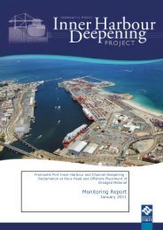
This Water Quality Monitoring Program (WQMP) has been prepared for <strong>Fremantle</strong> <strong>Port</strong>s <strong>Inner</strong><br />
<strong>Harbour</strong> <strong>and</strong> <strong>Channel</strong> Deepening Project (the ‘Project’), in accordance with Condition 6 of<br />
Ministerial Statement 801 – Marine Water <strong>and</strong> Sediment Quality (W.A. Minister for<br />
Environment, 18 th August 2009; Appendix A) <strong>and</strong> will be implemented to:<br />
1. Achieve the environmental quality objectives (EQOs) for the protection of Projectrelevant<br />
Environmental Values (EVs), as defined in Perth’s Coastal Waters:<br />
Environmental Values <strong>and</strong> Objectives (EPA 2000) <strong>and</strong> also applied to the Swan River<br />
Estuary (Section 2);<br />
2. Provide a map defining the levels of Ecological Protection that will apply for the<br />
duration of Project implementation (Section 2);<br />
3. Provide environmental quality indicators <strong>and</strong> associated ‘trigger’ levels or targets,<br />
based on ANZECC & ARMCANZ (2000a) <strong>and</strong> EPA (2005a) (amongst other relevant<br />
guideline reference sources), for assessing the performance of managing discharges to<br />
meet relevant EQOs (Section 4);<br />
4. Specify appropriate management <strong>and</strong> mitigation measures to be applied if monitoring<br />
demonstrates that the environmental quality ‘trigger’ levels are exceeded (Section 5);<br />
<strong>and</strong>,<br />
5. Employ protocols <strong>and</strong> schedules for reporting performance against the EQOs using the<br />
environmental quality ‘trigger’ levels for discharges (Sections 3 to 7).<br />
1.2. Project Description<br />
The Project involves the dredging of approximately 3.1 million m 3 of consolidated <strong>and</strong><br />
unconsolidated material <strong>and</strong> its disposal at an offshore spoil disposal area (Gage Roads) or its<br />
reuse in l<strong>and</strong> reclamation at Rous Head. Dredging will be undertaken to deepen the Deep<br />
Water <strong>Channel</strong>, Entrance <strong>Channel</strong> <strong>and</strong> <strong>Inner</strong> <strong>Harbour</strong> (Figure 2.1) to allow 14 m draft ships to<br />
utilise the <strong>Fremantle</strong> <strong>Inner</strong> <strong>Harbour</strong>. An area of seabed at Rous Head will also be reclaimed<br />
using dredged material (Figure 2.1). A combination of a Trailing Suction Hopper Dredge<br />
(TSHD) <strong>and</strong> a Cutter Suction Dredge (CSD) will be used.<br />
The key elements of the Project are provided in Table 1.1. For a full description of the<br />
Project, including a detailed Project schedule, please refer to the Dredge Spoil <strong>and</strong> Disposal<br />
Management Plan (DSDMP, <strong>Fremantle</strong> <strong>Port</strong>s, 2009).<br />
Table 1.1 Key elements of the Project<br />
Component<br />
Description<br />
Construction of a seawall around the<br />
reclamation area<br />
• 20 weeks (prior to the dredging programme). This component of<br />
the works will be managed under the CEMP <strong>and</strong> therefore is only<br />
made reference to in the DSDMP <strong>and</strong> is not considered further.<br />
Duration of Dredging • 26 weeks.<br />
Deepening of <strong>Fremantle</strong> <strong>Port</strong> <strong>Inner</strong><br />
<strong>Harbour</strong><br />
• Dredging to a declared depth of RL -15.0 m Low Water Mark<br />
<strong>Fremantle</strong> (LWMF);<br />
• Removal of approximately 0.9 million m 3 of dredged material.<br />
Deepening of the Entrance <strong>Channel</strong> • Dredging to declared depths between RL -16.1 m <strong>and</strong> RL -16.8<br />
m (LWMF);<br />
• Removal of approximately 1.1 million m 3 of dredged material.<br />
Deepening of Deep Water <strong>Channel</strong> • Dredging to declared depths between RL -16.5 m <strong>and</strong> RL -18.0<br />
m (LWMF) within an area up to 169 ha;<br />
• Removal of approximately 1.1 million m 3 of dredge material.<br />
Rous Head Reclamation Area • Placement of approximately 1.6 million m 3 dredged material for<br />
reclamation of an area of 27 ha of seabed (Stage 3);<br />
• Construction of a protective seawall 1000 m long.<br />
Proposed Offshore Spoil Disposal<br />
area<br />
• Placement of approximately 1.5 million m 3 of dredged material<br />
within an area of approximately 150 ha (1.5 km 2 ) located north<br />
of Gage Roads.<br />
Oceanica: <strong>Fremantle</strong> <strong>Port</strong>s: <strong>Inner</strong> <strong>Harbour</strong> <strong>and</strong> <strong>Channel</strong> Deepening - Water Quality Monitoring Program 1


