2010 Sustainable Streets Index - NYC.gov
2010 Sustainable Streets Index - NYC.gov
2010 Sustainable Streets Index - NYC.gov

Create successful ePaper yourself
Turn your PDF publications into a flip-book with our unique Google optimized e-Paper software.
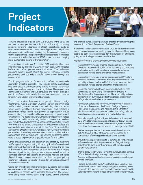
Project<br />
Indicators<br />
To fulfill provisions of Local Law 23 of 2008 (Intro 199), this<br />
section reports performance indicators for major roadway<br />
projects involving “changes in street operations, such as<br />
lane reapportionments, lane reconfigurations, significant<br />
adjustments in traffic and parking regulations and changes in<br />
traffic signal timing.” The performance indicators are formulated<br />
to assess the effectiveness of DOT projects in encouraging<br />
more sustainable means of transportation.<br />
This section reports on 11 major DOT projects that were<br />
implemented by the end of 2009. In each case, DOT collected<br />
before and after performance indicators. The indicators<br />
measure safety, usage levels for motor vehicles, cyclists,<br />
pedestrians and bus riders, and/or travel times through the<br />
project area.<br />
The 11 projects selected for evaluation reflect the multimodal<br />
character of DOT’s projects. They include safety; pedestrian,<br />
bus and bicycle enhancements; traffic calming; congestion<br />
reduction; and parking and truck regulation. The projects are<br />
distributed throughout the five boroughs, and reflect a range of<br />
conditions from the dense Manhattan core to streets in low-rise<br />
Brooklyn and Staten Island neighborhoods.<br />
The projects also illustrate a range of different design<br />
treatments. Along Gerritsen Avenue, safety improvements,<br />
traffic calming measures such as reducing the number of<br />
travel lanes, simplifying turning movements, and installing a<br />
pedestrian refuge island have proven to significantly reduce<br />
crashes along the corridor while not causing congestion with<br />
fewer lanes. The Jackson Avenue/Pulaski Bridge project helped<br />
transform an old industrial neighborhood to meet the needs of<br />
new residential development for safe pedestrian routes through<br />
the area and to public transportation. Pedestrian safety and<br />
connectivity was also paramount to the Park Circle and Allen<br />
Street/Pike Street projects. Changes at Park Circle provide safe<br />
pedestrian, bike and equestrian routes to and from the park and<br />
surrounding area. At Allen and Pike <strong>Streets</strong>, pedestrian plazas<br />
were created to provide an enjoyable space for the public.<br />
Other projects improve the operation of a street by modifying<br />
traffic signal timing or phasing. On Amboy Road in Staten Island,<br />
DOT changed the timing of the signals to improve traffic flow.<br />
In Brooklyn at the intersection of Bay Parkway and Cropsey<br />
Avenue, signal timing changes were implemented to reduce<br />
conflicts between pedestrians and vehicles making left turns.<br />
Signal timing changes were also completed to give priority<br />
treatment to buses turning left from 34th Street onto Seventh<br />
Avenue in Manhattan.<br />
Goals can often be accomplished simply by adding streetscape<br />
enhancements. On West Houston Street, benches, trees and<br />
a landscaped median were installed throughout the project<br />
area along with historic-style lamp posts, tinted sidewalks<br />
<strong>Sustainable</strong> <strong>Streets</strong> <strong>Index</strong> <strong>2010</strong><br />
and granite curbs. A new park was created by simplifying the<br />
intersection at Sixth Avenue and Bedford Street.<br />
In the PARK Smart pilot in Park Slope, DOT adjusted meter rates<br />
to encourage turnover of parking spaces, thus enabling more<br />
people to park in a given space for the purpose of shopping,<br />
going to medical appointments and the like.<br />
Highlights from the project performance indicators are:<br />
• Injuries from vehicular crashes decreased by 48% along<br />
Gerritsen Avenue in Brooklyn after narrowing the roadway<br />
and implementing left-turn bays, a painted median, a<br />
pedestrian refuge island and other improvements.<br />
• Injuries from vehicular crashes decreased by 24% along<br />
Houston Street in Manhattan after implementation of lane<br />
reconfigurations, dedicated left-turn bays, new medians,<br />
pedestrian refuge islands and other improvements.<br />
• Injuries to motor vehicle occupants and bicyclists both<br />
decreased by 35% along Allen and Pike <strong>Streets</strong> in<br />
Manhattan after implementation of lane reconfigurations,<br />
dedicated left-turn bays, pedestrian plazas, pedestrian<br />
refuge islands and other improvements.<br />
• Pedestrian safety and connectivity improved in the area<br />
of Jackson Avenue and the Pulaski Bridge in Queens,<br />
Park Circle in Brooklyn, and Allen and Pike <strong>Streets</strong> in<br />
Manhattan, with installation of pedestrian refuge islands,<br />
signal-protected crosswalks and related changes.<br />
• Bus ridership along 34th Street in Manhattan increased<br />
by 3-6% after implementation of bus countdown clocks<br />
and related improvements to bus service, even as other<br />
crosstown bus routes experienced an average drop of 5%.<br />
• Delivery companies’ vehicles saw travel times improve<br />
130% from a pilot of off-hour deliveries, based on a<br />
comparison of evening and midday travel speeds.<br />
• Travel times improved by up to 2 minutes on Amboy Road<br />
in Staten Island, after implementation of signal timing<br />
adjustments, lane reconfigurations, left-turn bays and<br />
other improvements.<br />
• Traffic delay fell by 70% for northbound vehicles coming<br />
off the Pulaski Bridge making a right onto Jackson<br />
Avenue in Queens after lane reconfigurations and signal<br />
timing changes.<br />
• Parking duration fell by 20% in Park Slope, Brooklyn due<br />
to the PARK Smart peak rate pricing pilot, enabling more<br />
drivers to find metered spaces and reducing overall traffic<br />
volumes on the neighborhood’s main commercial avenues.<br />
25