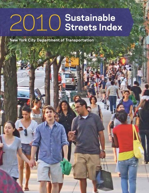
2010 Sustainable Streets Index - NYC.gov
2010 Sustainable Streets Index - NYC.gov
2010 Sustainable Streets Index - NYC.gov

Create successful ePaper yourself
Turn your PDF publications into a flip-book with our unique Google optimized e-Paper software.
<strong>2010</strong> <strong>Sustainable</strong><br />
<strong>Streets</strong> <strong>Index</strong><br />
New York City Department of Transportation
30%<br />
reduction in<br />
traffic fatalities<br />
in New York City<br />
from 2000 to<br />
<strong>2010</strong>.<br />
Source: <strong>NYC</strong>DOT<br />
10%<br />
growth in bus<br />
and subway<br />
ridership in New<br />
York City from<br />
2000 to <strong>2010</strong>.<br />
Source: <strong>NYC</strong> Transit<br />
262%<br />
increase in<br />
commuter<br />
cycling in New<br />
York City from<br />
2000 to <strong>2010</strong>.<br />
Source: <strong>NYC</strong>DOT
5%<br />
reduction in<br />
motor vehicle<br />
registrations in<br />
New York City<br />
from 2000 to<br />
<strong>2010</strong>.<br />
Source: NYS Dept. of Motor Vehicles<br />
2.4%<br />
decline in<br />
citywide traffic<br />
volumes from<br />
2000 to 2009.<br />
Source: <strong>NYC</strong>DOT<br />
520k<br />
adult New<br />
Yorkers bike at<br />
least several<br />
times a month.<br />
Source: <strong>NYC</strong> Dept. of Health
Contents<br />
7 Letter from the Commissioner<br />
8 Executive Summary<br />
10 Traffic and Transit Trends<br />
16 Manhattan Traffic Speeds<br />
20 Neighborhood Travel Profiles<br />
24 Project Indicators<br />
26 Safety<br />
50 Transit Mobility Improvements<br />
54 Congestion Reduction<br />
66 Parking<br />
Appendix<br />
70 Traffic and Transit Trends<br />
72 Methodology for Crash Data
6<br />
<strong>Sustainable</strong> <strong>Streets</strong> <strong>Index</strong> <strong>2010</strong>
Letter from the Commissioner<br />
Dear New York City Council Members and fellow New Yorkers:<br />
Welcome to the <strong>2010</strong> <strong>Sustainable</strong> <strong>Streets</strong> <strong>Index</strong>. The <strong>Index</strong> represents <strong>NYC</strong>DOT’s abiding<br />
commitment to the people of New York City to report annually on transportation conditions,<br />
trends and changes that affect both daily life and the City’s long-term health. Additionally,<br />
it reviews the performance of a set of DOT street improvement projects implemented in<br />
recent years.<br />
Continual evaluation of trends, data and performance is essential to 21st Century<br />
<strong>gov</strong>ernance, planning and democracy. For example, early editions of the <strong>Index</strong> highlighted<br />
the unparalleled role of public transit in absorbing travel demand during the City’s population<br />
and economic expansion during the 1990s and 2000s. This year, we note that 80% of<br />
new housing units built in the city in the past decade are within walking distance of a<br />
subway station or Select Bus Service stop. These findings both point to higher demand for<br />
transit in the future, and challenge Albany to resolve the problem of transit funding. Strong<br />
patronage of new Select Bus routes provides a counterpoint to our finding that citywide<br />
bus ridership is shrinking, underscoring the importance of continued innovation and new<br />
models of service.<br />
This third edition of the <strong>Index</strong> also adds a compilation of travel surveys from neighborhoods<br />
around the Five Boroughs. They demonstrate that the City’s rich array of transportation<br />
choices is not confined to the Manhattan business district, but is without question a citywide<br />
fact of life. In particular, the findings spotlight New York as one of the world’s preeminent<br />
walking cities. Local trips on foot are as prevalent on Fordham Road and in Astoria<br />
as they are in Union Square. Pedestrian safety and connectivity feature prominently in all<br />
of DOT’s work on city streets, including several of the projects we review in detail in this<br />
report’s Project Indicators section.<br />
The range of projects we examine this year reflects the many dimensions of travel in the<br />
city, as well as the Bloomberg Administration’s efforts to deliver increased performance<br />
from a wide variety of transportation assets. From measures to improve bus speeds and<br />
collaboration with businesses to reduce delivery delays, to the addition of greenery and<br />
more space for pedestrians in a variety of streetscape settings, <strong>NYC</strong>DOT is striving to<br />
meet the challenges of a growing, 21st Century New York.<br />
The <strong>Sustainable</strong> <strong>Streets</strong> <strong>Index</strong> provides <strong>NYC</strong>DOT and all of the stakeholders in the City’s<br />
transportation system with up to date information and insight into the workings, challenges<br />
and successes of travel in New York City, at both city-wide and local scales. Its essential<br />
feedback allows for ongoing update and refinement of the City’s policies and priorities.<br />
Sincerely,<br />
Janette Sadik-Khan<br />
Commissioner<br />
<strong>Sustainable</strong> <strong>Streets</strong> <strong>Index</strong> <strong>2010</strong><br />
7
Executive<br />
Summary<br />
Traffic and transit indicators were significantly affected by<br />
the economic recession and resumption of job growth that<br />
occurred in New York City over the past two-plus years. Initially,<br />
transit ridership fell sharply due to job losses, budget cuts<br />
and increased fares, while traffic levels edged upward. As the<br />
city’s economy began to emerge from the recession in <strong>2010</strong>,<br />
however, subway (though not bus) ridership began to increase<br />
while traffic levels flattened out. The key trends, based on<br />
comprehensive data available for 2009 and the more limited<br />
data available for <strong>2010</strong>, are:<br />
• Subway and bus ridership fell 2.5% citywide from 2008<br />
to 2009. The declines were more severe for transit<br />
ridership into the Manhattan Central Business District<br />
(CBD – defined as 60th Street to the Battery), which<br />
experienced more rapid job losses than did the city as a<br />
whole; CBD-bound transit ridership fell 5.7% in 2009.<br />
• Traffic levels increased 0.3% citywide and 1.1% for<br />
traffic entering the Manhattan CBD from 2008 to 2009.<br />
• Subway ridership began to grow in the spring of <strong>2010</strong><br />
and finished with a 1.5% increase for the year as a whole,<br />
while bus ridership declined throughout <strong>2010</strong>.<br />
• Citywide traffic levels were not significantly changed in<br />
<strong>2010</strong> compared with 2009, based on traffic data from<br />
tolled bridges and tunnels and New York City Department<br />
of Transportation (DOT) traffic counts at a randomly<br />
selected sample of locations throughout the city. (Note<br />
that CBD-bound traffic and transit data are not yet<br />
available for <strong>2010</strong>.)<br />
• The one consistent trend involved bike riding, which<br />
continued a pattern of rapid increases. Commuter cycling<br />
increased 26% from 2008 to 2009, and an additional<br />
13% from 2009 to <strong>2010</strong>.<br />
The available data for <strong>2010</strong> thus suggest that New York<br />
City may be positioned to resume the trends seen during the<br />
economic expansion of the last decade. From 2003 until the<br />
2008 recession, New York City experienced a period of fully<br />
transit-centered economic and population growth in which<br />
non-auto modes absorbed all the growth of travel in the city.<br />
Vehicle traffic levels declined slightly while subway and bus<br />
ridership rose 12% from 2003 to 2008 and commuter<br />
cycling increased 79%. These trends were consistent with the<br />
transportation and sustainability goals of encouraging mass<br />
transit, walking, cycling and ferries established in Pla<strong>NYC</strong>, the<br />
City’s sustainability plan for 2030, and <strong>Sustainable</strong> <strong>Streets</strong>,<br />
DOT’s strategic plan.<br />
Looking beyond the recession, sustainable modes of<br />
transportation will likely absorb increased travel generated by<br />
economic and population growth – but only if the City and the<br />
Metropolitan Transit Authority (MTA) commit the resources to<br />
support these modes. The importance of investing in transit<br />
and other transportation improvements is illustrated by the<br />
two bright spots in the overall picture in the last several years.<br />
First, while the bus system as a whole was losing ridership,<br />
new Select Bus Services (SBS) in the Bronx and Manhattan<br />
attracted increased bus ridership. In a similar vein, continued<br />
expansion of the bike network spurred large increases in cycling<br />
both into the Manhattan core, and in other areas of the city.<br />
The good news looking ahead is that the City and the MTA are<br />
continuing to innovate in these areas. DOT and the MTA are<br />
continuing the roll-out of SBS routes and developing plans<br />
for improved transit service to LaGuardia Airport, the only<br />
major airport in the region without rapid transit access. DOT<br />
continues to expand the bike network and is exploring a bike<br />
share system that would make cycling a more convenient<br />
option for point-to-point trips.<br />
These initiatives will be further supported by patterns in<br />
population growth in the city. Over the last decade, 80% of new<br />
housing units were built within walking distance of a subway<br />
station or SBS route, focusing population growth in transitoriented<br />
areas of the city. Increases in population are thus likely<br />
to continue to lead to increased use of sustainable modes of<br />
transit, biking and walking.<br />
The big if, however, lies in the area of overall bus and subway<br />
service. Given continued State budget shortfalls and pressures<br />
on the MTA budget, it is unclear whether the recent pattern of<br />
MTA service cuts and fare increases can be broken. In addition,<br />
the current MTA Capital Program remains only partially funded.<br />
Without firmer financing of the city’s transit system, the gains<br />
of the past decade are clearly at risk.<br />
This third annual <strong>Sustainable</strong> <strong>Streets</strong> <strong>Index</strong> reviews transit and<br />
transportation trends in New York City, reports CBD traffic<br />
speeds based on taxi Global Positioning System (GPS) data<br />
and reports performance indicators for eleven major roadway<br />
projects involving changes in street operations. A new section to<br />
the report profiles transportation patterns at the neighborhood<br />
level. Based on field interviewing in eight neighborhoods, the<br />
neighborhood-level data show that overwhelmingly, most<br />
people shopping, going to restaurants, running errands and<br />
going to and from their homes have traveled to the neighborhood<br />
by walking or transit:<br />
8<br />
<strong>Sustainable</strong> <strong>Streets</strong> <strong>Index</strong> <strong>2010</strong>
• In six diverse neighborhoods (from the Bronx, Brooklyn,<br />
Manhattan and Queens) 85-93% of people arrived by<br />
transit, biking or walking.<br />
• In two neighborhoods (Astoria, Queens and New Dorp,<br />
Staten Island), 60-77% of people arrived by transit,<br />
biking or walking.<br />
These results underscore the value of strengthening transit,<br />
biking and walking to address mobility, environmental quality<br />
and quality of life goals.<br />
The neighborhood-level section also shows the broad-based<br />
and increasing role that cycling plays in the city’s transportation<br />
system:<br />
• 520,000 adult New Yorkers bike at least several<br />
times a month.<br />
• On key bike routes in Manhattan, bike riders comprise up<br />
to one-third of those using the street for transportation<br />
– for example, 37% of those traveling on Prince Street<br />
in the evening rush period and 32% of those traveling on<br />
East 10th Street.<br />
• Installation of improved bike lanes and protected bike<br />
paths led to 46% to 268% growth in bike volumes,<br />
helping to fuel the overall growth in biking in the city.<br />
Examples are the 69% increase on Ninth Avenue in<br />
Manhattan, 97% increase on Kent Avenue in Brooklyn and<br />
268% increase on Rockaway Boulevard in Queens.<br />
Highlights from the taxi GPS and project-specific performance<br />
indicators sections are:<br />
• Traffic speeds in the Manhattan CBD improved by 6%<br />
between the fall of 2008 and fall of 2009, and then<br />
leveled off in <strong>2010</strong>.<br />
• Bus ridership on 34th Street in Manhattan increased by<br />
3-6% after implementation of bus countdown clocks<br />
and related improvements to bus service, even as other<br />
crosstown bus routes experienced an average drop of 5%.<br />
• Injuries from vehicular crashes decreased by 48% along<br />
Gerritsen Avenue in Brooklyn after narrowing the roadway<br />
and implementing left-turn bays, a painted median, a<br />
pedestrian refuge island and other improvements.<br />
• Injuries from vehicular crashes decreased by 24% along<br />
Houston Street in Manhattan after implementation of lane<br />
reconfigurations, dedicated left-turn bays, new medians,<br />
pedestrian refuge islands and other improvements.<br />
• Injuries to motor vehicle occupants and bicyclists both<br />
decreased by 35% along Allen and Pike <strong>Streets</strong> in<br />
Manhattan after implementation of lane reconfigurations,<br />
dedicated left-turn bays, pedestrian plazas, pedestrian<br />
refuge islands and other improvements.<br />
• Delivery companies’ vehicles saw travel times improve<br />
130% from a pilot of off-hour deliveries, based on a<br />
comparison of evening and midday travel speeds.<br />
• Traffic delay fell by 70% for northbound vehicles<br />
coming off the Pulaski Bridge turning right onto Jackson<br />
Avenue in Queens after lane reconfigurations and signal<br />
timing changes.<br />
• Parking duration fell by 20% in Park Slope, Brooklyn due<br />
to the PARK Smart peak rate pricing pilot, enabling more<br />
drivers to find metered spaces and reducing overall traffic<br />
volumes on the neighborhood’s main commercial avenues.<br />
These results underscore the value of<br />
strengthening transit, biking and walking<br />
to address mobility, environmental<br />
quality and quality of life goals.<br />
<strong>Sustainable</strong> <strong>Streets</strong> <strong>Index</strong> <strong>2010</strong><br />
9
Traffic and<br />
Transit Trends<br />
In recent years, New York City travel patterns have been<br />
marked by generally flat traffic growth and increasing<br />
transit ridership and cycling. Concurrently, the city’s<br />
population and employment have grown. However, the<br />
economic recession beginning in 2008 and continuing into<br />
<strong>2010</strong> resulted in employment losses and related shifting<br />
travel patterns during 2009.<br />
Employment in New York City rose by 7.3% from 2003<br />
to 2008, but then declined by 2.7% in 2009 as a whole,<br />
and 3.6% from fall 2008 to fall 2009. Among the five<br />
boroughs, employment in Manhattan was down the most<br />
in 2009, by 4.8% from 2008, after five straight years of<br />
growth. Employment in the outer boroughs was a mix of<br />
positive, negative, and no growth. The Bronx was up while<br />
Queens and Staten Island were down, and Brooklyn was<br />
flat. The city’s population climbed slightly by 0.3% in 2009.<br />
Travel costs such as gasoline prices, tolls and transit fares<br />
also underwent noticeable changes in 2009. After reaching<br />
an all-time high of over $4 per gallon in mid-2008, gasoline<br />
prices fell to an average of $2.36 in 2009. Even with a<br />
modest price rebound in late 2009, on average the year’s<br />
gasoline prices were at the lowest level since 2005.<br />
While gasoline prices were down, MTA Bridges & Tunnels<br />
tolls increased, affecting tolled crossings within the five<br />
boroughs. Following an approximately 11% increase for<br />
cash tolls for passenger vehicles on major crossings in<br />
March 2008, there was an additional 10% increase in<br />
July 2009 to $5.50. Hudson River tolls remained at levels<br />
set in 2008.<br />
In June 2009 the transit fares for single rides, the bonus<br />
fare and the 30-Day Unlimited pass increased. The single<br />
ride fare increased by 12.5% from $2.00 to $2.25 while<br />
the 30-Day Unlimited pass – first introduced in 1998 –<br />
increased by 9.9% from $81.00 to $89.00. The pay-perride<br />
bonus still provided an additional ride with a 15%<br />
bonus, however with a minimum purchase of $8.00 instead<br />
of $7.00. Additionally, with the single ride base fare increase<br />
the average bonus fare climbed from $1.74 to $1.96.<br />
Traffic<br />
Citywide traffic increased slightly by 0.3% but overall still<br />
remained 1.7% below 2007 levels. Citywide travel levels<br />
are down by just over 3% since 2003.<br />
Like employment, traffic volumes have been more volatile<br />
for vehicles entering the CBD than for non-CBD traffic.<br />
CBD-bound traffic, which had declined from 2004 to<br />
2008, ticked upward by 1.1% in 2009, but is still 2.7%<br />
below 2007 levels. Traffic increases ranged from 1%-2%<br />
for the 60th Street and Brooklyn Sectors and 4.8% for<br />
Queens, while traffic from New Jersey dropped by nearly<br />
6%. Furthermore, crossing 60th Street into the CBD,<br />
traffic increases were observed along the periphery, east<br />
of Park Avenue and west of Eighth Avenue. Traffic levels in<br />
the core of Manhattan – which is better served by transit –<br />
were generally down.<br />
Traffic volumes outside the CBD were generally flat<br />
between 2008 and 2009 with an observed increase of<br />
only 0.2%. The Citywide Traffic <strong>Index</strong> – a new collection of<br />
Citywide traffic volumes are 1.7%<br />
below 2007 levels.<br />
10<br />
<strong>Sustainable</strong> <strong>Streets</strong> <strong>Index</strong> <strong>2010</strong>
• 2.5% decline in bus and<br />
subway ridership in 2009,<br />
but remained higher than<br />
2007 level.<br />
• 9.5% increase in bus and<br />
subway ridership since<br />
2003.<br />
• 0.3% increase in weekday<br />
traffic volumes in 2009,<br />
but still below 2007 level.<br />
• 3.1% decline in<br />
weekday traffic volumes<br />
since 2003.<br />
Citywide Transit and Traffic<br />
(Traffic indexed to 1993/Transit indexed to 1990)<br />
150<br />
140<br />
130<br />
120<br />
110<br />
100<br />
90<br />
80<br />
Citywide Traffic and Transit<br />
Transit<br />
Traffic<br />
70<br />
1990 91 92 93 94 95 96 97 98 99 2000 01 02 03 04 05 06 07 08 09<br />
Year<br />
• 26% increase in bicycle<br />
commuting into the<br />
Manhattan core from 2008<br />
to 2009.<br />
• Additional 13% increase<br />
in bicycle commuting from<br />
2009 to <strong>2010</strong>.<br />
• 154% increase in bicycle<br />
commuting since 2003.<br />
Bicycle Commuting (<strong>Index</strong>ed to 1990)<br />
550<br />
500<br />
450<br />
400<br />
350<br />
300<br />
Bicycle Commuting (<strong>Index</strong>ed to 1990)<br />
250<br />
200<br />
150<br />
100<br />
50<br />
1990 91 92 93 94 95 96 97 98 99 2000 01 02 03 04 05 06 07 08 09 10<br />
Year<br />
<strong>Sustainable</strong> <strong>Streets</strong> <strong>Index</strong> <strong>2010</strong><br />
11
traffic counts in the four outer boroughs – showed a generally<br />
flat trend, mirroring the other counts that monitor non-CBD<br />
traffic. Some river crossings had declines with the largest<br />
decreases observed at the Bronx-Queens boundary, due to<br />
on-going roadwork on the Bronx-Whitestone Bridge (down<br />
3.4%) and the Throgs Neck Bridge (down 6.1%).<br />
Transit<br />
Due to a combination of the economic recession and<br />
employment losses and, to some extent, increased fares and<br />
lower gas prices, gains in transit ridership during previous<br />
years were reversed in 2009. Transit ridership decreased<br />
2.5% in 2009 compared with 2008, with both subway and<br />
bus ridership numbers falling. Reduced ridership was likely<br />
not due to service changes, which were minor in 2009 for<br />
MTA New York City Transit (<strong>NYC</strong>T) bus routes and subways.<br />
Preliminary subway ridership data through October <strong>2010</strong><br />
show a rebound of 1-2% from the 2009 figures, though<br />
not back to 2008 levels. Local bus ridership continues to<br />
decline across all boroughs, although Queens figures are<br />
approximately flat from 2009 led by growth along routes<br />
that the MTA took over from private operators several<br />
years ago. Significant service modifications and cuts for<br />
bus routes and subway lines were put into effect during the<br />
summer of <strong>2010</strong>, and the fare was increased at the very end<br />
of <strong>2010</strong>. The complete <strong>2010</strong> data and 2011 ridership data<br />
will be needed to determine the impacts of the service cuts<br />
and fare increase.<br />
As with job losses and traffic levels, transit ridership into<br />
the CBD was more affected by the recession than was the<br />
case with citywide ridership. Transit ridership into the CBD<br />
declined by 5.7% in 2009 to a level observed between 2006<br />
and 2007. CBD-bound transit ridership from all four sectors<br />
was down, especially for the 60th Street crossing, which<br />
declined by approximately 9% to a pre-2006 level. Transit<br />
ridership from Queens and Brooklyn were each down about<br />
5%, and just under 1% crossing the Hudson River from New<br />
Jersey. CBD-bound ridership was up 2.5% from Staten Island<br />
due to gains on the ferry.<br />
In the outer boroughs and Manhattan north of 60th Street,<br />
bus ridership was down 2% overall from 2008 to 2009.<br />
Queens, Brooklyn, and Staten Island local bus ridership<br />
were down by a similar percentage, while the Bronx and<br />
upper Manhattan were each down by about 1.5%. However,<br />
the 2009 bus ridership outside the CBD still remained up<br />
1.2% from 2007.<br />
Due to the recession and fare increases,<br />
transit ridership decreased 2.5% in 2009<br />
compared with 2008, with both subway<br />
and bus ridership numbers falling.<br />
12<br />
<strong>Sustainable</strong> <strong>Streets</strong> <strong>Index</strong> <strong>2010</strong>
Traffic and Transit into the CBD<br />
• 5.7% decline in transit<br />
(bus and subway)<br />
ridership in 2009.<br />
• 8.1% increase in transit<br />
ridership since 2003.<br />
• 1.1% increase in traffic<br />
volumes into the CBD in<br />
2009, but remained lower<br />
than 2007 level.<br />
• 5.9% decrease in traffic<br />
volumes since 2003.<br />
Transit and Traffic into the CBD (<strong>Index</strong>ed to 1990)<br />
150<br />
140<br />
130<br />
120<br />
110<br />
100<br />
90<br />
Transit<br />
Traffic<br />
80<br />
70<br />
1990 91 92 93 94 95 96 97 98 99 2000 01 02 03 04 05 06 07 08 09<br />
Year<br />
• 2.0% decrease in bus<br />
ridership outside the CBD<br />
in 2009, but still above the<br />
2007 level.<br />
• 7.6% increase in bus<br />
ridership outside the CBD<br />
since 2003.<br />
• 0.2% increase in traffic<br />
volumes outside the CBD<br />
in 2009.<br />
• 2.4% decrease in traffic<br />
volumes since 2003.<br />
Transit and Traffic Outside the CBD<br />
(Traffic indexed to 1993/Transit indexed to 1998)<br />
150<br />
140<br />
130<br />
120<br />
110<br />
100<br />
90<br />
Traffic and Transit Outside the CBD<br />
Transit (Bus Only)<br />
Traffic<br />
80<br />
70<br />
1990 91 92 93 94 95 96 97 98 99 2000 01 02 03 04 05 06 07 08 09<br />
Year<br />
Note: Borough-level bus ridership is not available prior to 1998. Subway ridership is not shown because data for<br />
subway trips made exclusively outside the CBD cannot be separated from data for trips beginning or ending inside<br />
the CBD. Note that a large majority of subway trips that TRAFFIC begin outside TRANSIT the Manhattan CBD are CBD-bound.<br />
<strong>Sustainable</strong> <strong>Streets</strong> <strong>Index</strong> <strong>2010</strong><br />
13
Regional<br />
Transportation<br />
System<br />
MTA/<strong>NYC</strong>T Fares<br />
$2.50<br />
$2.40<br />
$2.30<br />
$2.20<br />
$2.10<br />
$2.00<br />
$1.90<br />
$1.80<br />
$1.70<br />
$1.60<br />
$1.50<br />
$1.40<br />
$1.30<br />
$1.20<br />
$1.10<br />
MTA/<strong>NYC</strong>T Single Ride Base Fare and "Bonus" Fare<br />
Base Fare<br />
Base Fare<br />
(Inflation-adjusted)<br />
Bonus Fare<br />
$1.00<br />
1990 91 92 93 94 95 96 97 98 99 2000 01 02 03 04 05 06 07 08 09 10 10<br />
(Jan.)<br />
(Nov.)<br />
(Jan.)<br />
(May)<br />
(Mar.) (Jun.) (Dec.<br />
Year<br />
30th)<br />
MTA/<strong>NYC</strong>T 30-Day Unlimited Pass<br />
MTA/<strong>NYC</strong>T 30-Day Unlimited Pass<br />
$125<br />
$120<br />
$115<br />
$110<br />
$105<br />
$100<br />
$95<br />
$90<br />
$85<br />
$80<br />
$75<br />
$70<br />
$65<br />
$60<br />
$55<br />
$50<br />
1990 91 92 93 94 95 96 97 98<br />
(Jul.)<br />
Fare<br />
(Inflation-adjusted)<br />
99 2000 01 02 03<br />
(May)<br />
Year<br />
04 05<br />
(Feb.)<br />
30-Day Unlimited<br />
Fare<br />
06 07 08 09<br />
(Mar.) (Jun.)<br />
10 10<br />
(Dec.<br />
30th)<br />
Timeline<br />
1992 1993 1994 1995 1996 1997 1998 1999 2000 2001<br />
New direct<br />
bus service<br />
between<br />
Manhattan<br />
and LaGuardia<br />
Airport<br />
DOT launches the Red<br />
Light Program which takes<br />
pictures of the license<br />
plates of vehicles that run<br />
red lights<br />
E-ZPass introduced in New<br />
York City<br />
<strong>NYC</strong> Transit’s bus fleet<br />
becomes 100 percent<br />
accessible to customers<br />
with disabilities<br />
NJ Transit<br />
opens Kearny<br />
Connection,<br />
beginning<br />
Midtown<br />
Direct service<br />
E-ZPass accepted at all<br />
regional crossings<br />
Full integration of<br />
MetroCard on Subway<br />
and Bus System & Free<br />
transfers<br />
1-day, 7-day, 30-day<br />
and Bonus MetroCards<br />
introduced<br />
<strong>NYC</strong> Transit introduces<br />
hybrid-electric buses<br />
First<br />
MetroCard<br />
vending<br />
machines<br />
introduced<br />
Articulated buses begin<br />
service in Manhattan. They<br />
have 22 more seats than<br />
standard buses and can<br />
carry almost twice as many<br />
customers<br />
63rd Street Tunnel opens to<br />
Qns. Blvd. IND Service<br />
Travel restrictions<br />
implemented post-9/11 on<br />
major roadways (Single-<br />
Occupant Vehicle Ban, No<br />
Commercial Vehicles)<br />
14<br />
<strong>Sustainable</strong> <strong>Streets</strong> <strong>Index</strong> <strong>2010</strong>
MTA Bridges & Tunnels Passenger Car Toll<br />
(Major Facilities)<br />
MTA Bridges & Tunnels Passenger Car Toll<br />
Average Gas Prices (All Grades)<br />
Average Gas Price<br />
$7.00<br />
$6.50<br />
$6.00<br />
$4.00<br />
$3.50<br />
$5.50<br />
$5.00<br />
$4.50<br />
Cash<br />
(Inflation-adjusted)<br />
$3.00<br />
$2.50<br />
$4.00<br />
$3.50<br />
$3.00<br />
Cash<br />
$2.00<br />
$1.50<br />
Average Gas Price<br />
(Inflation-adjusted)<br />
$2.50<br />
$2.00<br />
1990 91 92 93<br />
(Jan.)<br />
94 95 96<br />
(Mar.)<br />
E-ZPass<br />
97 98 99 2000 01 02 03<br />
(May)<br />
Year<br />
04 05<br />
(Mar.)<br />
06 07 08 09<br />
(Mar.) (Jul.)<br />
10<br />
10<br />
(Dec.<br />
30th)<br />
$1.00<br />
Average Gas Price<br />
$0.50<br />
1990 91 92 93 94 95 96 97 98 99 2000 01 02 03 04 05 06 07 08 09 10<br />
Year<br />
Port Authority of New York & New Jersey Passenger Car Toll<br />
(Major Facilities)<br />
Port Authority of NY & NJ Passenger Car Toll<br />
Average Taxi Fare<br />
Average Taxi Fare<br />
$8.50<br />
$8.00<br />
$7.50<br />
$7.00<br />
$6.50<br />
$6.00<br />
$5.50<br />
$5.00<br />
$4.50<br />
$4.00<br />
$3.50<br />
$3.00<br />
$2.50<br />
1990 91<br />
(Apr.)<br />
E-ZPass<br />
92 93 94 95 96 97 98 99 2000 01<br />
(Mar.)<br />
Year<br />
Cash<br />
(Inflation-adjusted)<br />
Cash<br />
E-ZPass Peak<br />
E-ZPass Off-Peak<br />
02 03 04 05 06 07 08<br />
(Mar.)<br />
09<br />
10<br />
$11.00<br />
$10.50<br />
$10.00<br />
$9.50<br />
$9.00<br />
$8.50<br />
$8.00<br />
$7.50<br />
$7.00<br />
$6.50<br />
$6.00<br />
$5.50<br />
$5.00<br />
$4.50<br />
1990 91 92 93 94 95 96<br />
(Mar.)<br />
Average Fare<br />
(Inflation-adjusted)<br />
97 98 99 2000 01 02 03 04<br />
(May)<br />
Year<br />
Average Fare<br />
05 06<br />
(Nov.)<br />
07 08 09<br />
(Nov.)<br />
10<br />
2002 2003 2004 2005 2006 2007 2008<br />
2009 <strong>2010</strong><br />
All city curbs<br />
are ADAcompliant<br />
Opening of Secaucus<br />
Junction in December<br />
PATH service restored<br />
to Lower Manhattan<br />
in November<br />
JFK AirTrain begins service<br />
Central Park High-Occupant<br />
Vehicle (HOV) restriction<br />
introduced in November<br />
on West Drive<br />
Full subway service<br />
restored on the<br />
Manhattan Bridge<br />
Manhattan Bridge<br />
peak hour HOV<br />
lane put in place<br />
Select Bus Service debuts<br />
on Fordham Road, Bronx,<br />
and 34th Street Bus<br />
Priority, Manhattan<br />
DOT completes<br />
implementation<br />
of 200 miles<br />
of bike lanes in<br />
three years<br />
DOT creates<br />
pedestrian<br />
plazas in<br />
Herald Square<br />
and Times<br />
Square<br />
Select Bus Service begins<br />
on 1st and 2nd Avenues<br />
in Manhattan<br />
MTA eliminates service on<br />
2 subway lines<br />
and 37 bus routes<br />
<strong>Sustainable</strong> <strong>Streets</strong> <strong>Index</strong> <strong>2010</strong><br />
15
Manhattan<br />
Traffic Speeds<br />
Weekday CBD<br />
Taxi Speeds from<br />
8 a.m. - 6 p.m.<br />
10<br />
9<br />
8<br />
7<br />
Speed (m.p.h.)<br />
6<br />
5<br />
4<br />
3<br />
2<br />
1<br />
0<br />
2008<br />
2009<br />
<strong>2010</strong><br />
2008<br />
2009<br />
<strong>2010</strong><br />
2008<br />
2009<br />
<strong>2010</strong><br />
2007<br />
2008<br />
2009<br />
<strong>2010</strong><br />
2007<br />
2008<br />
2009<br />
<strong>2010</strong><br />
Jan - Mar Apr - June Jul - Aug Sept - Oct Nov - Dec<br />
Speed Trends<br />
Methodology<br />
All yellow taxicabs are equipped<br />
with GPS devices which create<br />
electronic trip sheets for all<br />
customer-carrying taxi trips 24<br />
hours a day, seven days a week.<br />
The data includes time and location<br />
of trip origin and trip destination,<br />
time elapsed, distance traveled,<br />
and fare. The system records<br />
approximately 13 million trips per<br />
month. DOT receives the taxi GPS<br />
data from the Taxi and Limousine<br />
Commission (TLC) in order to study<br />
travel patterns and analyze vehicle<br />
traffic speeds to support agency<br />
policymaking and operations. DOT<br />
has usable data from fall 2007 to<br />
the present.<br />
Findings<br />
The taxi GPS dataset provides the first comprehensive view of network-wide traffic<br />
speeds in Manhattan. The taxi speed data are based on the distance and duration of the<br />
entire trip for customer-carrying taxi rides. Speeds reflect both time in motion and time<br />
spent stopped in traffic or at red lights. The data can be used to track shifts in traffic speeds<br />
across time (from year to year, from day to day, or from hour to hour within the typical day),<br />
and for trips in different geographic areas. Findings from the data include:<br />
• Traffic speeds in the Manhattan CBD improved by 6% between the fall of 2008 and<br />
fall of 2009<br />
• Speeds leveled off in <strong>2010</strong><br />
• Weekday speeds average 9.3 mph for CBD trips between 8 a.m. and 6 p.m. in <strong>2010</strong><br />
• Speeds during January, February and March are on average 5% faster compared to<br />
the rest of the year<br />
• January is the fastest month and December is the slowest<br />
• One-third of the top 100 fastest days are in January, February and March<br />
16<br />
<strong>Sustainable</strong> <strong>Streets</strong> <strong>Index</strong> <strong>2010</strong>
Daytime Traffic Speeds:<br />
Weekdays (9 a.m. - 4 p.m.)<br />
Lincoln Tunnel<br />
Queensboro Bridge<br />
Midtown Tunnel<br />
Holland Tunnel<br />
Battery Tunnel<br />
Brooklyn Bridge<br />
Manhattan Bridge<br />
Williamsburg Bridge<br />
Average Speed (MPH)<br />
Taxi data not availa<br />
Average Speed (short taxi 7.5 or trips) below<br />
7.5 - 8.5<br />
7.5 m.p.h. or below<br />
8.5 - 9.0<br />
7.5 - 8.5 m.p.h.<br />
9.0 - 9.5<br />
8.5 - 9.0 m.p.h.<br />
9.5 - 10.5<br />
9.0 - 9.5 m.p.h.<br />
10.5 - 15.0<br />
9.5 - 10.5 m.p.h.<br />
10.5 - 15.0 m.p.h.<br />
Taxi data not available<br />
Daytime Traffic Speeds<br />
Methodology<br />
The data shown in the map are based on GPS data for shortdistance<br />
trips (up to a half mile) from typical weekdays (excluding<br />
major holidays) between 9 a.m. and 4 p.m. between November<br />
2009 and October <strong>2010</strong>. Speeds are calculated for small zones<br />
using the median speed for taxi trips in each zone. Data reflect<br />
these average zonal speeds, not speeds for individual streets.<br />
Zones with insufficient number of taxi trips are not included.<br />
Findings<br />
• Daytime speeds are slowest in Midtown and Lower<br />
Manhattan; these areas also have the largest amount of taxi<br />
pickups and drop offs<br />
• Speeds are somewhat similar to Midtown on the west side up<br />
to about 76th Street and up to 86th Street on the east side<br />
• The average speed for short distance trips on the<br />
map is 6.8 m.p.h.<br />
<strong>Sustainable</strong> <strong>Streets</strong> <strong>Index</strong> <strong>2010</strong><br />
17
Manhattan Traffic Speeds Day By Day<br />
JANUARY<br />
S M T W T F S<br />
1 2<br />
3 4 5 6 7 8 9<br />
10 11 12 13 14 15 16<br />
17 18 19 20 21 22 23<br />
24 25 26 27 28 29 30<br />
31<br />
APRIL<br />
S M T W T F S<br />
1 2 3<br />
4 5 6 7 8 9 10<br />
11 12 13 14 15 16 17<br />
18 19 20 21 22 23 24<br />
25 26 27 28 29 30<br />
JULY<br />
S M T W T F S<br />
1 2 3<br />
4 5 6 7 8 9 10<br />
11 12 13 14 15 16 17<br />
18 19 20 21 22 23 24<br />
25 26 27 28 29 30 31<br />
FEBRUARY<br />
S M T W T F S<br />
1 2 3 4 5 6<br />
7 8 9 10 11 12 13<br />
14 15 16 17 18 19 20<br />
21 22 23 24 25 26 27<br />
28<br />
MAY<br />
S M T W T F S<br />
1<br />
2 3 4 5 6 7 8<br />
9 10 11 12 13 14 15<br />
16 17 18 19 20 21 22<br />
23 24 25 26 27 28 29<br />
30 31<br />
AUGUST<br />
S M T W T F S<br />
1 2 3 4 5 6 7<br />
8 9 10 11 12 13 14<br />
15 16 17 18 19 20 21<br />
22 23 24 25 26 27 28<br />
29 30 31<br />
OCTOBER<br />
S M T W T F S<br />
1 2<br />
3 4 5 6 7 8 9<br />
10 11 12 13 14 15 16<br />
17 18 19 20 21 22 23<br />
24 25 26 27 28 29 30<br />
31<br />
NOVEMBER<br />
S M T W T F S<br />
1 2 3 4 5 6<br />
7 8 9 10 11 12 13<br />
14 15 16 17 18 19 20<br />
21 22 23 24 25 26 27<br />
28 29 30<br />
18<br />
<strong>Sustainable</strong> <strong>Streets</strong> <strong>Index</strong> <strong>2010</strong>
MARCH<br />
S M T W T F S<br />
1 2 3 4 5 6<br />
7 8 9 10 11 12 13<br />
14 15 16 17 18 19 20<br />
21 22 23 24 25 26 27<br />
28 29 30 31<br />
JUNE<br />
S M T W T F S<br />
1 2 3 4 5<br />
6 7 8 9 10 11 12<br />
13 14 15 16 17 18 19<br />
20 21 22 23 24 25 26<br />
27 28 29 30<br />
SEPTEMBER<br />
S M T W T F S<br />
1 2 3 4<br />
5 6 7 8 9 10 11<br />
12 13 14 15 16 17 18<br />
19 20 21 22 23 24 25<br />
26 27 28 29 30<br />
This calendar shows average daily speeds in the<br />
Manhattan CBD, 6 a.m. to 6 p.m.<br />
Key:<br />
The 25 fastest days (average speed between<br />
14.2 m.p.h. and 12.0 m.p.h.). Most occur on<br />
major holidays or on Sundays in January or July.<br />
The next 75 fastest days (average daily speed<br />
between 12.0 and 10.8 m.p.h.). Most occur<br />
on weekends, or immediately before or after<br />
holidays, especially early in the year.<br />
Between the 100 fastest days and 100 slowest<br />
days are the 165 days with average daily speeds<br />
between 10.8 and 9.6 m.p.h. Most are weekdays,<br />
though most Saturdays in the last quarter of the<br />
year also fall into this group.<br />
The next 75 slowest days (9.6 to 9.1 m.p.h.).<br />
Most are mid-week weekdays scattered<br />
throughout the year, with visible blocks in the<br />
spring and late in the year.<br />
The 25 slowest days (9.1 to 6.4 m.p.h.).<br />
Most occur in the latter part of the year and all<br />
are weekdays. The heaviest concentration are<br />
in late September during the United Nations<br />
General Assembly, and in December.<br />
Fastest Day<br />
• 2008: Sunday, June 1 (15.1 m.p.h.)<br />
• 2009: Thursday, January 1 (13.9 m.p.h.)<br />
• <strong>2010</strong>: Sunday, July 4 (14.2 m.p.h.)<br />
Fastest Non-Holiday Weekday<br />
• 2008: Friday, May 11 (12.4 m.p.h.)<br />
• 2009: Monday, September 28 (11.9 m.p.h.)<br />
• <strong>2010</strong>: Monday, January 4 (11.8 m.p.h.)<br />
Slowest Day<br />
• 2008: Wednesday, September 24 (7.0 m.p.h.)<br />
• 2009: Monday, December 21 (8.0 m.p.h.)<br />
• <strong>2010</strong>: Wednesday, December 29 (6.4 m.p.h.)<br />
DECEMBER<br />
S M T W T F S<br />
1 2 3 4<br />
5 6 7 8 9 10 11<br />
12 13 14 15 16 17 18<br />
19 20 21 22 23 24 25<br />
26 27 28 29 30 31<br />
<strong>2010</strong> Holidays<br />
January New Year’s Day (1)<br />
Martin Luther King Jr. Day (18)<br />
February President’s Day (15)<br />
April Easter Sunday (4)<br />
May Memorial Day (31)<br />
July Independence Day Observed (5)<br />
September Labor Day (6)<br />
October Columbus Day (11)<br />
November Veteran’s Day (11)<br />
Thanksgiving (25)<br />
December Christmas Day (25)<br />
<strong>Sustainable</strong> <strong>Streets</strong> <strong>Index</strong> <strong>2010</strong><br />
19
Neighborhood Travel Profiles<br />
GLM - Broadway: Mode<br />
GLM - Broadway: Mode<br />
Jackson Heights: Mode<br />
SUBWAY<br />
OTHER 9%<br />
BUS 4%<br />
OTHER OTHER 9% 1%<br />
LIVE HERE<br />
18%<br />
LIVE HERE LIVE HERE 59%<br />
18%<br />
BUS & SUBWAY 5%<br />
VISIT FAMILY/<br />
18%<br />
A substantial majority FRIEND 2% of people interviewed<br />
SUBWAY<br />
SUBWAY 42%<br />
WORK 18%<br />
SUBWAY WALK 32% 42% BUS 4%<br />
AUTO 6% OTHER 1%<br />
BUSINESS/<br />
18%<br />
WORK 18%<br />
WALK 32%<br />
TAXI/CAR<br />
SERVICE 2%<br />
LIVE HERE 59%<br />
WALK BUS 65% & SUBWAY 5%<br />
VISIT FAMILY/<br />
SHOPPING<br />
FRIEND SERVICE 2% 1%<br />
MEDICAL 1%<br />
SIGHTSEEING<br />
SIGHTSEEING<br />
25%<br />
in eight 35%<br />
AUTO 6%<br />
diverse neighborhoods SHOPPING arrived by<br />
BIKE 1% BUSINESS/<br />
RESTAURANT 35% 4% SHOPPING<br />
14%<br />
TAXI/CAR<br />
SERVICE 2%<br />
WALK 65%<br />
SHOPPING<br />
14%<br />
SERVICE 1%<br />
MEDICAL 1%<br />
BIKE 1%<br />
25%<br />
WORK 6%<br />
BIKE 1%<br />
walking BIKE 1% or BUS 7% transit.<br />
RESTAURANT 4%<br />
TAXI/CAR<br />
BUS 7%<br />
TAXI/CAR SERVICE 4%<br />
COMMUTER RAIL 9%<br />
THEATRE 5%<br />
SERVICE 4%<br />
COMMUTER AUTO 6% RAIL 9%<br />
THEATRE<br />
WORK<br />
5%<br />
6%<br />
AUTO 6%<br />
Park Slope PARK Smart Pilot Program User Survey– November 2009<br />
Upper East Side PARK Smart Pilot Program User Survey – November <strong>2010</strong><br />
Upper East Side PARK Smart Pilot Program User Survey – November <strong>2010</strong><br />
Upper Park East Slope: Side: Mode Mode<br />
Upper Park East Slope: Side: Purpose Purpose<br />
Upper East Side: Mode<br />
Park Slope PARK Smart Upper Pilot Program East Side: User Purpose Survey– November 2009<br />
How did you get here<br />
Park Slope: Mode OTHER 1%<br />
BUS & SUBWAY 2%<br />
BUS 3%<br />
Jackson Heights Intercept GLM Surve - Broadway: y – September Purpose 2009<br />
GLM - Broadway: Purpose<br />
What brought you<br />
OTHER 1% SUBWAY<br />
VISIT FAMILY/FRIEND 2% OTHER 7%<br />
OTHER 1%<br />
9%<br />
AUTO<br />
VISIT FAMILY/FRIEND 2% OTHER 1% 7%<br />
LIVE HERE<br />
BUS & SUBWAY 2% 15%<br />
OTHER 1% BUS 3%<br />
SUBWAY 20%<br />
VISIT BUSINESS/ FAMILY/<br />
59%<br />
SUBWAY SUBWAY 20%<br />
BUSINESS/ FRIEND SERVICE 1% 5%<br />
9%<br />
AUTO<br />
SERVICE 5%<br />
BIKE 2% OTHER 1%<br />
MEDICAL BUSINESS/ LIVE HERE<br />
15%<br />
7%<br />
WALK 39%<br />
BUS 19%<br />
LIVE HERE 44%<br />
MEDICAL 7%<br />
WALK 39%<br />
BUS 19%<br />
WALK 68%<br />
VISIT FAMILY/<br />
SERVICE 4% 59%<br />
LIVE HERE 44%<br />
FRIEND 1%<br />
WORK<br />
RESTAURANT<br />
RESTAURANT<br />
MEDICAL 2%<br />
18%<br />
2%<br />
BIKE 2%<br />
BUSINESS/ 2%<br />
RESTAURANT 3%<br />
WALK 68%<br />
SERVICE 4%<br />
SHOPPING 8%<br />
WORK 24%<br />
AUTO<br />
BUS & SHOPPING 8%<br />
SHOPPING WORK WORK 11% 24%<br />
MEDICAL 2%<br />
AUTO<br />
BUS &<br />
11% SUBWAY 6%<br />
SCHOOL 1%<br />
18%<br />
11% SUBWAY 6%<br />
SCHOOL 1%<br />
SCHOOL 1%<br />
RESTAURANT 3%<br />
TAXI/CAR<br />
TAXI/CAR<br />
SHOPPING 11%<br />
SERVICE 4%<br />
SERVICE 4%<br />
Montague Street, Brooklyn Heights SCHOOL Intercept 1% Survey between Court and Hicks Sts – December 2008<br />
Montague Street, Brooklyn Heights Intercept Survey between Court Union and Hicks Square Sts – West December Intercept 2008 Survey – June <strong>2010</strong><br />
Union Square: Purpose<br />
Montague St, Brooklyn Heights: Mode<br />
Montague St, Brooklyn Heights: Purpose<br />
Montague St, Brooklyn Heights: Union Mode Square: Mode<br />
Montague St, Brooklyn Heights: Purpose<br />
Union Square West Intercept LIVE HERE Survey 6% – June <strong>2010</strong><br />
Union Square: Purpose<br />
OTHER 5%<br />
OTHER Union 2% Square: Mode<br />
WALK 44%<br />
WALK 34%<br />
How OTHER 2% did you get here<br />
SUBWAY 35%<br />
WALK WALK 44% 34%<br />
SUBWAY 35%<br />
BUS 3%<br />
SUBWAY 49%<br />
BUS &<br />
SUBWAY 4%<br />
SUBWAY 49%<br />
BUS 3%<br />
BUS &<br />
SUBWAY 4%<br />
Park Slope: Purpose<br />
What VISIT brought FAMILY/ you<br />
OTHER 5%<br />
VISIT FAMILY/ FRIEND 1%<br />
FRIEND 1%<br />
OTHER 11%<br />
LIVE HERE 6%<br />
BUSINESS/ LIVE HERE 21%<br />
BUSINESS/ SERVICE CINEMA 7% 1%<br />
SERVICE 7%<br />
MEDICAL 5%<br />
MEDICAL OTHER 5% 11%<br />
WORK<br />
12%<br />
WORK 18%<br />
RESTAURANT<br />
21%<br />
WORK<br />
LIVE HERE 12% 21%<br />
SHOPPING 31%<br />
RESTAURANT SHOPPING 31%<br />
21% SHOPPING 49%<br />
WORK 18% OTHER 11%<br />
CINEMA 1%<br />
SHOPPING 49%<br />
BIKE 2%<br />
AUTO 10%<br />
SCHOOL 2%<br />
TAXI/CAR SERVICE 2%<br />
AUTO 10%<br />
SCHOOL 2%<br />
TAXI/CAR SERVICE 2%<br />
BUS 4%<br />
TAXI/CAR<br />
COMMUTER RAIL 2%<br />
SERVICE 5%<br />
BIKE 2%<br />
AUTO 4%<br />
NOTES:<br />
ES:<br />
BUS 4%<br />
Steinway Street, Astoria Intercept between Survey 31 st and 35 th Avs – December 2008<br />
* TAXI/CAR No specific trip purpose<br />
COMMUTER RAIL 2%<br />
specific trip SERVICE purpose 5%<br />
AUTO 4% Steinway St, Astoria: Mode<br />
Steinway St, Astoria: Purpose<br />
Steinway Street, Astoria Intercept between Survey 31 st and 35 th Avs – December 2008<br />
How did you get here<br />
RESTAURANT<br />
CINEMA 1%<br />
10%<br />
RESTAURANT<br />
10%<br />
What brought you<br />
Steinway St, Astoria: Mode<br />
Steinway St, Astoria: Purpose SCHOOL 2%<br />
OTHER 2%<br />
OTHER 3%<br />
OTHER 2%<br />
WORK<br />
OTHER 3%<br />
VISIT FAMILY/<br />
VISIT FAMILY/<br />
10%<br />
FRIEND<br />
SUBWAY 27%<br />
SCHOOL<br />
4%<br />
LIVE HERE<br />
RAILWAY<br />
2%<br />
FRIEND 4%<br />
LIVE HERE<br />
18%<br />
RAILWAY<br />
16%<br />
LIVE 18% HERE<br />
16%<br />
WALK<br />
19%<br />
WALK 33%<br />
BUS<br />
WORK<br />
SHOPPING WORK 49%<br />
10%<br />
BUSINESS/<br />
WALK<br />
21% BUS<br />
17%<br />
WORK<br />
BUS 9%<br />
BUSINESS/<br />
18%<br />
SUBWAY 27%<br />
SERVICE 15%<br />
21%<br />
17%<br />
18%<br />
LIVE<br />
SERVICE<br />
HERE<br />
15%<br />
BUS &<br />
19%<br />
WALK 33%<br />
BUS &<br />
RAILWAY 3%<br />
SHOPPING 49%<br />
BUS 9% RAILWAY 3%<br />
SCHOOL<br />
BUS &<br />
MEDICAL OTHER 7% 6% SCHOOL<br />
AUTO 22%<br />
15%<br />
SUBWAY 6% MEDICAL 7%<br />
VISIT FAMILY/FRIEND 2% 15%<br />
AUTO 39%<br />
AUTO 39%<br />
BIKE 2%<br />
BUSINESS/SERVICE 5%<br />
TAXI/CAR BUS &<br />
OTHER 6%<br />
MEDICAL 4% RESTAURANT 3%<br />
AUTO SERVICE 22% 1%<br />
RESTAURANT 9%<br />
TAXI/CAR SUBWAY 6%<br />
VISIT FAMILY/FRIEND RESTAURANT 2% 9%<br />
TAXI/CAR BIKE 2%<br />
SHOPPING 12%<br />
SERVICE 1%<br />
BUSINESS/SERVICE 5% SHOPPING 12%<br />
SERVICE 1%<br />
TAXI/CAR<br />
MEDICAL 4% RESTAURANT 3%<br />
SERVICE 1%<br />
OTHER 11%<br />
CINEMA 1%<br />
Upper East Side<br />
Union Square<br />
New Dorp<br />
Brooklyn Heights<br />
20<br />
Park Slope<br />
<strong>Sustainable</strong> <strong>Streets</strong> <strong>Index</strong> <strong>2010</strong>
OTHER 5%<br />
OTHER 1%<br />
OTHER 2%<br />
VISIT OTHER FAMILY/ 5%<br />
OTHER 1%<br />
THER 2%<br />
VISIT FAMILY/<br />
FRIEND 1%<br />
FRIEND 1%<br />
LIVE HERE 21%<br />
SUBWAY<br />
BUSINESS/ LIVE HERE 21%<br />
SUBWAY<br />
BUS 4%<br />
OTHER BUSINESS/ 1%<br />
18%<br />
BUS 4%<br />
OTHER SERVICE 1% 7%<br />
SUBWAY 35%<br />
LIVE HERE 59%<br />
18% BUS & SUBWAY 5%<br />
VISIT SERVICE FAMILY/ 7%<br />
SUBWAY 35%<br />
LIVE HERE 59%<br />
BUS & SUBWAY 5%<br />
VISIT<br />
MEDICAL<br />
FRIEND 2%<br />
FAMILY/<br />
5%<br />
MEDICAL 5%<br />
WALK WORK 39% 18%<br />
FRIEND 2%<br />
WORK 18%<br />
WALK 44% AUTO 6%<br />
BUSINESS/<br />
WALK 44%<br />
RESTAURANT<br />
AUTO 6%<br />
BUSINESS/<br />
WALK 65%<br />
TAXI/CAR<br />
SERVICE RESTAURANT 2% 10%<br />
WALK 68%<br />
BUS 3%<br />
WALK 65%<br />
TAXI/CAR<br />
10%<br />
SERVICE SHOPPING 2%<br />
BUS 3% SERVICE 1%<br />
MEDICAL 1%<br />
25% SHOPPING SHOPPING 31%<br />
BUS & SERVICE 1%<br />
BUS &<br />
MEDICAL SHOPPING 1% 31% 25%<br />
BIKE 1% SUBWAY 4% RESTAURANT 4%<br />
SUBWAY 4% BIKE 1%<br />
RESTAURANT 4%<br />
DOT staff conducted intercept surveys at eight locations for<br />
BUS & SUBWAY 2%<br />
OTHER 1% BUS & 3% SUBWAY 2%<br />
BUS 3% SUBWAY 20%<br />
VISIT FAMILY/FRIEND 2% BUSINESS/<br />
OTHER 7%<br />
various projects between December 2008 and March 2011.<br />
SUBWAY<br />
SERVICE 5%<br />
SUBWAY<br />
SUBWAY While 20% 9%<br />
AUTO<br />
each survey was completed BUSINESS/<br />
9%<br />
AUTO<br />
for different OTHER 1%<br />
15%<br />
OTHER 1% types of LIVE DOT HERE<br />
MEDICAL 7% LIVE HERE<br />
WALK<br />
15%<br />
BUS 19%<br />
SERVICE 5%<br />
39%<br />
VISIT FAMILY/<br />
59%<br />
projects such as Select Bus Service VISIT FAMILY/<br />
59%<br />
and PARK Smart, all the<br />
MEDICAL FRIEND 7% 1% RESTAURANT<br />
FRIEND 1%<br />
BUS 19%<br />
2%<br />
LIVE HERE 44%<br />
surveys were designed BIKE 2% to better understand people’s travel<br />
BIKE 2%<br />
BUSINESS/<br />
BUSINESS/<br />
RESTAURANT<br />
WALK 68%<br />
SERVICE 4%<br />
SERVICE<br />
behavior. The surveys were<br />
BUS &<br />
conducted 2% 4%<br />
in areas SHOPPING with 8% a WORK high<br />
AUTO<br />
WORK<br />
MEDICAL 2%<br />
SUBWAY 6% MEDICAL 2%<br />
SCHOOL 1%<br />
18%<br />
concentration of shopping 11%<br />
WORK 24% 18%<br />
and SHOPPING during 8% peak shopping times on<br />
AUTO<br />
BUS &<br />
RESTAURANT 3%<br />
RESTAURANT 3%<br />
weekdays 11%<br />
TAXI/CAR<br />
and SUBWAY weekends. 6%<br />
SCHOOL 1%<br />
For all eight surveys, SHOPPING 11% respondents were<br />
SERVICE 4%<br />
SHOPPING 11%<br />
SCHOOL 1%<br />
asked how they got to the area and their reason SCHOOL for 1% making the trip.<br />
The survey results indicate that 85-93% of respondents walked,<br />
Union Square West Intercept Sur<br />
S:<br />
Union Square Union West Square: Intercept Purpose Survey – J<br />
Park Slope PARK Smart Pilot Program User Survey– November rode 2009 a bicycle or used public transportation Union Square: to get Purpose to their<br />
ecific trip purpose<br />
Park Slope PARK Smart Pilot Program User Survey– November 2009<br />
rpose<br />
Union Square:<br />
Union Square:<br />
destination Mode<br />
Mode<br />
Park Slope: Mode<br />
Park Slope: Purpose<br />
except in Astoria and New Dorp where the figures were<br />
LIVE HERE 6%<br />
How<br />
Park<br />
did<br />
Slope:<br />
you<br />
Mode<br />
get here What brought you<br />
Park Slope: Purpose<br />
LIVE HERE 6%<br />
77% and 60%, respectively. Auto and taxi use accounted for only<br />
WORK<br />
BUS & SUBWAY 2%<br />
7-15% of trips except in Astoria (23%) and OTHER New 11% Dorp WORK (40%). The<br />
OTHER 1% BUS 3% OTHER 11%<br />
12%<br />
BUS & SUBWAY 2%<br />
12%<br />
OTHER 1% BUS 3% OTHER 2%<br />
SUBWAY OTHER 3%<br />
OTHER 2%<br />
trip purposes for over 60% of respondents CINEMA were 1% shopping, live here<br />
OTHER 3%<br />
9%<br />
SUBWAY AUTO<br />
9%<br />
AUTO<br />
OTHER 1%<br />
VISIT FAMILY/<br />
CINEMA 1%<br />
15%<br />
VISIT FAMILY/<br />
LIVE HERE<br />
FRIEND OTHER 4%<br />
LIVE HERE<br />
LIVE HERE and work except for the New Dorp neighborhood in Staten Island.<br />
RAILWAY<br />
1%<br />
15%<br />
VISIT FAMILY/ FRIEND 4%<br />
LIVE HERE 59% 18%<br />
RAILWAY<br />
VISIT FAMILY/<br />
59%<br />
SUBWAY 49%<br />
16%<br />
18%<br />
WALK 34% SUBWAY 49%<br />
FRIEND 1%<br />
RESTAURANT<br />
16%<br />
WALK 34% Forty-eight percent of respondents were on RESTAURANT New Dorp Lane to shop<br />
WALK<br />
BUS<br />
FRIEND 1%<br />
WORK<br />
21% SHOPPING 49%<br />
WALK<br />
21%<br />
BIKE 2%<br />
BUSINESS/<br />
SHOPPING 49%<br />
21%<br />
BUS<br />
BUSINESS/ WORK<br />
17%<br />
BUSINESS/<br />
18%<br />
21%<br />
17%<br />
BIKE 2%<br />
BUSINESS/ SERVICE 15%<br />
or work or because they lived in the neighborhood, 15% were there<br />
WALK 68%<br />
SERVICE 4%<br />
18%<br />
SERVICE 15%<br />
WALK 68%<br />
BUS &<br />
SERVICE 4% WORK<br />
BUS &<br />
MEDICAL 2%<br />
18%<br />
WORK for school and 15% were taking care of personal business such<br />
RAILWAY 3%<br />
RAILWAY 3%<br />
MEDICAL 2%<br />
18% SCHOOL<br />
RESTAURANT 3% MEDICAL 7% SCHOOL<br />
as going to the bank or library. The category “live here” represents<br />
MEDICAL 7% RESTAURANT 3%<br />
15%<br />
BIKE 2%<br />
SHOPPING 11%<br />
15%<br />
AUTO 39%<br />
BIKE 2%<br />
SHOPPING 11%<br />
survey respondents BUS 4% that live in the survey neighborhood but did not<br />
AUTO 39%<br />
BUS 4%<br />
SCHOOL 1%<br />
TAXI/CAR<br />
SCHOOL 1% TAXI/CAR<br />
COMMUTER RAIL 2%<br />
SERVICE<br />
have<br />
5%<br />
COMMUTER a specific RAIL 2% trip purpose. The survey conducted along Fordham<br />
RESTAURANT 9%<br />
SERVICE 5%<br />
TAXI/CAR<br />
RESTAURANT 9%<br />
AUTO 4%<br />
CAR<br />
SHOPPING 12% AUTO Road 4%<br />
SERVICE 1%<br />
did not have a “live here” category for respondents to select.<br />
SHOPPING 12%<br />
Steinway<br />
Steinway<br />
Street, Astoria<br />
Street,<br />
Intercept<br />
Astoria Intercept<br />
between Survey<br />
between Survey<br />
31 st and<br />
31<br />
35 st th and<br />
Avs<br />
35<br />
– Decem<br />
th CE 1%<br />
Avs<br />
Union Square West Intercept Survey – June <strong>2010</strong><br />
<strong>Sustainable</strong> <strong>Streets</strong> <strong>Index</strong> <strong>2010</strong><br />
Union Square: Union Purpose Square West Intercept Survey – June <strong>2010</strong><br />
21<br />
Union Square: Mode<br />
Union Square: Mode<br />
Fordham<br />
LIVE HERE 6%<br />
<strong>NYC</strong>DOT Surveys<br />
<strong>NYC</strong>DOT Surveys<br />
Fordham Road Intercept Survey at Grand Union Concourse, Square Jerome West Interce Av and<br />
Union Square West<br />
Union<br />
Intercept<br />
Square:<br />
Fordham Survey<br />
Purpose<br />
Road: P–<br />
Fordham Fordham Road Road: Intercept Mode Survey at Grand Concourse, Jerome Union Square: Av and Purpose Webster Av – Decem<br />
Union Square: Mode<br />
Union How Square: did Mode<br />
Fordham Road: Purpose<br />
you get here What brought you LIVE HERE 6%<br />
Fordham Road: Mode<br />
LIVE HERE 6%<br />
OTHER 8%<br />
WORK WOR<br />
OTHER TRANSFER 11% 2%<br />
OTHER 8%<br />
WORK 12%<br />
SUBWAY<br />
OTHER 11% VISIT WORK FAMILY/ 22% 12%<br />
19%<br />
TRANSFER 2% CINEMA FRIEND 1% 7%<br />
SUBWAY<br />
WALK 28%<br />
VISIT CINEMA FAMILY/ 1%<br />
19%<br />
BUSINESS/<br />
SUBWAY 49%<br />
FRIEND 7%<br />
WALK 34%<br />
SERVICE RESTAURANT<br />
3%<br />
WALK 28% SUBWAY 49%<br />
WALK 34%<br />
SCHOOL<br />
BUS 42%<br />
BUSINESS/ RESTAURANT 21%<br />
MEDICAL 7%<br />
SERVICE 3%<br />
10%<br />
SHOPPING 4<br />
21% SHOPPING 49% SHOPPING<br />
BUS 42%<br />
AUTO<br />
MEDICAL 7%<br />
8%<br />
SHOPPING 41%<br />
TAXI/CAR<br />
AUTO SERVICE 1%<br />
8%<br />
TAXI/CAR<br />
BIKE 2%<br />
COMMUTER RAIL 2%<br />
SERVICE 1% BIKE 2%<br />
BUS 4%<br />
TAXI/CAR BUS 4%<br />
COMMUTER RAIL 2% COMMUTER RAIL 2%<br />
TAXI/CAR SERVICE COMMUTER 5% RAIL 2%<br />
SERVICE 5%<br />
AUTO 4%<br />
AUTO 4%<br />
Steinway Street, Greenwich Astoria Village Intercept PARK between Survey Smart Pilot 31 st and Progra 35<br />
Steinway Street, Astoria Intercept between Survey 31 st and 35 th Avs – Dec<br />
Greenwich Village: Mode Greenwich Village PARK Smart Pilot Program User Greenwich SurveVillage:<br />
y – Mar<br />
Steinway St, Astoria: Mode<br />
Steinway St, Astoria: Purpo<br />
Steinway St, Astoria: Mode<br />
Steinway St, Astoria: Purpose<br />
Greenwich Village: Mode<br />
Greenwich Village: Purpose<br />
OTHER 1%<br />
WORK 6% TAXI/CAR<br />
SERVICE WORK 4% 6%<br />
How did you get here<br />
OTHER 1%<br />
SUBWAY SUBWAY 27% 35%<br />
SUBWAY 27%<br />
SUBWAY WALK 33% 35%<br />
WALK 33%<br />
WALK 46% BUS 9%<br />
BUS 9%<br />
WALK 46%<br />
BUS 2%<br />
BIKE 2%<br />
TAXI/CAR<br />
SERVICE 1%<br />
AUTO 22%<br />
BIKE 2%<br />
TAXI/CAR<br />
SERVICE 1%<br />
Union Square: Purpose Steinway<br />
Steinway<br />
St, Astoria:<br />
St, Astoria:<br />
Mode<br />
Mode<br />
BUS AUTO &<br />
AUTO BUS 22% &<br />
BUS & SUBWAY 8% 6%<br />
SUBWAY 3%<br />
SUBWAY 6%<br />
BIKE 2%<br />
GLM - Broadway: Mode<br />
SCHOOL 2%<br />
SCHOOL<br />
OTHER<br />
2%<br />
9%<br />
VISIT FAMILY/ WORK<br />
OTHER 9% WORK FRIEND 7% 10%<br />
VISIT FAMILY/<br />
10%<br />
BUSINESS/ LIVE HERE<br />
FRIEND 7%<br />
LIVE HERE SERVICE 19% 5%<br />
BUSINESS/<br />
BUS 2% SERVICE 5%<br />
BUS<br />
MEDICAL<br />
&<br />
1%<br />
SUBWAY 3%<br />
TAXI/CAR<br />
SERVICE 4%<br />
LIVE HERE 39% SHOPPING 4<br />
19% MEDICAL 1% SHOPPING RESTAURANT 49%<br />
10%<br />
RESTAURANT<br />
10%<br />
OTHER 6% WORK<br />
SHOPPING<br />
14%<br />
OTHER 6% SHOPPING<br />
VISIT FAMILY/FRIEND 2%<br />
13%<br />
14%<br />
VISIT FAMILY/FRIEND BUSINESS/SERVICE 2%<br />
5%<br />
BUSINESS/SERVICE 5% MEDICAL 4% RESTAURANT<br />
SCH<br />
MEDICAL 4% RESTAURANT 3%<br />
SCHOOL 2%<br />
LIV<br />
Green Light for Midtown Intercept Su<br />
Green Light for Midtown Intercept SurveyalongBroadway– GLM - Broadway: M<br />
Jackson<br />
Jackson<br />
Heights<br />
Heights<br />
Intercept<br />
Intercept<br />
Surve y – Septe<br />
y P<br />
LIVE H<br />
OTHER 9%<br />
18<br />
LIVE HERE<br />
SUBWAY SUBWAY 42%<br />
18%<br />
SUBWAY<br />
BUS 4%<br />
OTHER 1%<br />
WALK 18% BUS 32% 4%<br />
OTHER 1%<br />
LIVE HERE 59%<br />
18%<br />
SUBWAY 42%<br />
BUS & SUBWAY 5%<br />
VISIT FAMILY/<br />
LIVE HERE 59%<br />
BUS & SUBWAY 5%<br />
VISIT FAMILY/<br />
SIGHTSEEING<br />
WALK 32%<br />
FRIEND 2%<br />
WORK 18%<br />
FRIEND 2%<br />
35%<br />
AUTO 6%<br />
BUSINESS/<br />
S<br />
AUTO 6%<br />
BUSINESS/ SIGHTSEEING<br />
TAXI/CAR<br />
SERVICE 2%<br />
WALK 65%<br />
TAXI/CAR<br />
SERVICE 2%<br />
35% SHOPPING<br />
WALK 65%<br />
SHOPPING<br />
SERVICE 1%<br />
SHOPPING<br />
BIKE 1%<br />
SERVICE 1%<br />
MEDICAL 1%<br />
MEDICAL 1%<br />
25%<br />
25%<br />
14%<br />
BIKE 1%<br />
RESTAURANT 4%<br />
Astoria<br />
BUS 7%<br />
BIKE 1%<br />
TAXI/CAR BIKE 1%<br />
RESTAURANT 4%<br />
SERVICE 4%<br />
COMMUTER RAIL 9%<br />
THEATR<br />
AUTO BUS 7%<br />
TAXI/CAR<br />
6%<br />
WORK 6%<br />
WORK 6%<br />
SERVICE 4%<br />
COMMUTER RAIL 9%<br />
THEATRE 5%<br />
Jackson Heights<br />
AUTO 6%<br />
Upper East Side PARK Smart Pilot Program<br />
Upper East Side: Mode<br />
Upper East Side: P<br />
Upper East Side Park PARK Slope Smart PARK Pilot Smart Program Pilot User Program Survey User – Novem<br />
Montague Street, Brooklyn Heights Intercept Survey between Court and Hicks Sts – December 2008<br />
Park Slope PARK Smart Pilot Program User Survey–<br />
Survey<br />
Novem<br />
Montague Street, Brooklyn Heights Intercept Jackson Survey Heights between Court Intercept and Surve Hicks Sts y –– December September Upper East 2008 2009 Side: Mode<br />
Upper East Side: Purpose<br />
Jackson Heights Intercept Surve y – September 2009<br />
Montague St, Brooklyn Heights: Mode<br />
Montague St, Brooklyn Heights: Park Purpose Slope:<br />
Park<br />
Mode<br />
Slope: Mode<br />
Park Slope:<br />
Park<br />
Purpose<br />
Slope: Purpose<br />
ague Jackson St, Brooklyn Heights: Heights: Mode Mode<br />
Montague St, Brooklyn Heights: Purpose<br />
Jackson Heights: Mode<br />
OTHER 1%<br />
VISIT FAMILY/FRIEND 2% OTHER 7%<br />
How did you get here<br />
TAXI/CAR SERVICE 2%<br />
I/CAR SERVICE 2%<br />
AUTO 10%<br />
AUTO 10%<br />
SCHOOL 2%<br />
What brought you<br />
SCHOOL 2%<br />
BIKE 2%<br />
AUTO<br />
8%<br />
TAXI/CAR<br />
SERVICE 4%<br />
GLM - Broadway: Jackson Mode<br />
Jackson Heights:<br />
Heights:<br />
Mode<br />
Mode<br />
How did you get here<br />
SCHOOL 1%<br />
SCHOOL 1%<br />
What brought you<br />
GLM - Broadway: Purpose<br />
What brought you<br />
OTHER 9%<br />
L<br />
WORK 2<br />
Steinway<br />
Steinway<br />
St, Astoria:<br />
St, Astoria:<br />
Purpose<br />
Purpose
2005-2009<br />
¸<br />
Neighborhood Travel Profiles: Bicycle Facts<br />
Regular Bike Riders<br />
Number of adult residents who bike<br />
several times a month or more (includes<br />
0%-1%<br />
commuting, errands and recreational)<br />
1%-2%<br />
< 12,000<br />
12,000–25,000<br />
Airports<br />
25,000–42,000<br />
Airports<br />
Data not available<br />
Source: 2009 <strong>NYC</strong> Community Health Survey<br />
Staten Island Staten Staten Island Island<br />
Manhattan Manhattan<br />
Brooklyn<br />
Source: American Community Survey, 2005-2009<br />
Source: <strong>NYC</strong> Community Health Survey<br />
Bicycle Facts<br />
▫▫<br />
2%-16%<br />
520,000 <strong>NYC</strong> adults are regular bike riders<br />
Manhattan<br />
The Bronx<br />
Brooklyn<br />
The Bronx<br />
Queens<br />
Queens<br />
0 2.5 5 10 Miles<br />
0 2.5 5 10 Miles<br />
▫▫<br />
Brooklyn<br />
The Bronx<br />
Queens<br />
Cycling increases after installation of bike lanes:<br />
▫▫<br />
Commuter cycling has doubled since 2006<br />
▫▫<br />
In the evening rush hour, cyclists are:<br />
• 37% of traffic on Prince Street (Mn)<br />
• 32% of traffic on East 10th Street (Mn)<br />
• 26% of traffic on Bleecker Street (Mn)<br />
• 22% of traffic on Hoyt Street (Bk)<br />
• 12% of traffic on Prospect Park West (Bk)<br />
• Kent Avenue (Bk) 97% increase<br />
• Grand Street (Mn) 56% increase<br />
• 9th Avenue (Mn) 69% increase<br />
• Prospect Park West (Bk) 199% increase<br />
• Vernon Avenue (Qn) 46% increase<br />
• Rockaway Boulevard (Qn) 268% increase<br />
• 28th Street (Qn) 77% increase<br />
• Smith Street (Bk) 46% increase<br />
• Manhattan Avenue (Bk) 66% increase<br />
22<br />
<strong>Sustainable</strong> <strong>Streets</strong> <strong>Index</strong> <strong>2010</strong>
Percent of Workers who Commute by Bicycle, by Census Tract<br />
Percent of Workers who Commute 2005-2009 by Bicycle, by Census Tract<br />
Bike Commuters 2005-2009<br />
Percent of Workers who Commute by<br />
Bicycle by Census Tract 2005-2009<br />
¸<br />
¸<br />
0%-1%<br />
0%-1%<br />
1%-2%<br />
1%-2%<br />
2%-16%<br />
2%-16%<br />
Airports<br />
Airports<br />
Manhattan<br />
Manhattan<br />
The Bronx<br />
The Bronx<br />
Source: U.S. Census Bureau, American<br />
Community Survey, 2005-2009<br />
Queens<br />
Queens<br />
Brooklyn<br />
Brooklyn<br />
Staten Island<br />
Staten Island<br />
Source: American Community Survey, 2005-2009<br />
urce: American Community Survey, 2005-2009<br />
“Regular Bike Riders” data covers all <strong>NYC</strong> adults, and all trip purposes.<br />
0 2.5 5 10 Miles<br />
0 2.5 5 10 Miles<br />
“Bike Commuters” data covers workers who report bicycling as their “usual” mode of travel to work for the week prior to<br />
the survey. It excludes workers who bike to work a few times a week as well as non-commuter trips (e.g., shopping, leisure,<br />
personal appointments), which comprise 82% of all trip-making.<br />
520,000 <strong>NYC</strong> adults ride a bike at least<br />
several times a month.<br />
<strong>Sustainable</strong> <strong>Streets</strong> <strong>Index</strong> <strong>2010</strong><br />
23
Safety, Pedestrian &<br />
Bicycle Improvements<br />
1. Gerritsen Avenue<br />
2. West Houston Street<br />
3. Allen and Pike <strong>Streets</strong><br />
6<br />
4. Jackson Avenue<br />
5. Park Circle<br />
6. Allerton Avenue<br />
Transit Mobility Improvements<br />
7. 34th Street Bus Priority<br />
Congestion Reduction<br />
8. Belt Parkway Access/Egress Improvements<br />
9. Amboy Road<br />
10. Off-Hour Deliveries*<br />
2<br />
7<br />
4<br />
Parking<br />
3<br />
11. PARK Smart - Park Slope Pilot<br />
11<br />
5<br />
9<br />
8<br />
10 *<br />
1<br />
* Citywide<br />
24<br />
<strong>Sustainable</strong> <strong>Streets</strong> <strong>Index</strong> <strong>2010</strong>
Project<br />
Indicators<br />
To fulfill provisions of Local Law 23 of 2008 (Intro 199), this<br />
section reports performance indicators for major roadway<br />
projects involving “changes in street operations, such as<br />
lane reapportionments, lane reconfigurations, significant<br />
adjustments in traffic and parking regulations and changes in<br />
traffic signal timing.” The performance indicators are formulated<br />
to assess the effectiveness of DOT projects in encouraging<br />
more sustainable means of transportation.<br />
This section reports on 11 major DOT projects that were<br />
implemented by the end of 2009. In each case, DOT collected<br />
before and after performance indicators. The indicators<br />
measure safety, usage levels for motor vehicles, cyclists,<br />
pedestrians and bus riders, and/or travel times through the<br />
project area.<br />
The 11 projects selected for evaluation reflect the multimodal<br />
character of DOT’s projects. They include safety; pedestrian,<br />
bus and bicycle enhancements; traffic calming; congestion<br />
reduction; and parking and truck regulation. The projects are<br />
distributed throughout the five boroughs, and reflect a range of<br />
conditions from the dense Manhattan core to streets in low-rise<br />
Brooklyn and Staten Island neighborhoods.<br />
The projects also illustrate a range of different design<br />
treatments. Along Gerritsen Avenue, safety improvements,<br />
traffic calming measures such as reducing the number of<br />
travel lanes, simplifying turning movements, and installing a<br />
pedestrian refuge island have proven to significantly reduce<br />
crashes along the corridor while not causing congestion with<br />
fewer lanes. The Jackson Avenue/Pulaski Bridge project helped<br />
transform an old industrial neighborhood to meet the needs of<br />
new residential development for safe pedestrian routes through<br />
the area and to public transportation. Pedestrian safety and<br />
connectivity was also paramount to the Park Circle and Allen<br />
Street/Pike Street projects. Changes at Park Circle provide safe<br />
pedestrian, bike and equestrian routes to and from the park and<br />
surrounding area. At Allen and Pike <strong>Streets</strong>, pedestrian plazas<br />
were created to provide an enjoyable space for the public.<br />
Other projects improve the operation of a street by modifying<br />
traffic signal timing or phasing. On Amboy Road in Staten Island,<br />
DOT changed the timing of the signals to improve traffic flow.<br />
In Brooklyn at the intersection of Bay Parkway and Cropsey<br />
Avenue, signal timing changes were implemented to reduce<br />
conflicts between pedestrians and vehicles making left turns.<br />
Signal timing changes were also completed to give priority<br />
treatment to buses turning left from 34th Street onto Seventh<br />
Avenue in Manhattan.<br />
Goals can often be accomplished simply by adding streetscape<br />
enhancements. On West Houston Street, benches, trees and<br />
a landscaped median were installed throughout the project<br />
area along with historic-style lamp posts, tinted sidewalks<br />
<strong>Sustainable</strong> <strong>Streets</strong> <strong>Index</strong> <strong>2010</strong><br />
and granite curbs. A new park was created by simplifying the<br />
intersection at Sixth Avenue and Bedford Street.<br />
In the PARK Smart pilot in Park Slope, DOT adjusted meter rates<br />
to encourage turnover of parking spaces, thus enabling more<br />
people to park in a given space for the purpose of shopping,<br />
going to medical appointments and the like.<br />
Highlights from the project performance indicators are:<br />
• Injuries from vehicular crashes decreased by 48% along<br />
Gerritsen Avenue in Brooklyn after narrowing the roadway<br />
and implementing left-turn bays, a painted median, a<br />
pedestrian refuge island and other improvements.<br />
• Injuries from vehicular crashes decreased by 24% along<br />
Houston Street in Manhattan after implementation of lane<br />
reconfigurations, dedicated left-turn bays, new medians,<br />
pedestrian refuge islands and other improvements.<br />
• Injuries to motor vehicle occupants and bicyclists both<br />
decreased by 35% along Allen and Pike <strong>Streets</strong> in<br />
Manhattan after implementation of lane reconfigurations,<br />
dedicated left-turn bays, pedestrian plazas, pedestrian<br />
refuge islands and other improvements.<br />
• Pedestrian safety and connectivity improved in the area<br />
of Jackson Avenue and the Pulaski Bridge in Queens,<br />
Park Circle in Brooklyn, and Allen and Pike <strong>Streets</strong> in<br />
Manhattan, with installation of pedestrian refuge islands,<br />
signal-protected crosswalks and related changes.<br />
• Bus ridership along 34th Street in Manhattan increased<br />
by 3-6% after implementation of bus countdown clocks<br />
and related improvements to bus service, even as other<br />
crosstown bus routes experienced an average drop of 5%.<br />
• Delivery companies’ vehicles saw travel times improve<br />
130% from a pilot of off-hour deliveries, based on a<br />
comparison of evening and midday travel speeds.<br />
• Travel times improved by up to 2 minutes on Amboy Road<br />
in Staten Island, after implementation of signal timing<br />
adjustments, lane reconfigurations, left-turn bays and<br />
other improvements.<br />
• Traffic delay fell by 70% for northbound vehicles coming<br />
off the Pulaski Bridge making a right onto Jackson<br />
Avenue in Queens after lane reconfigurations and signal<br />
timing changes.<br />
• Parking duration fell by 20% in Park Slope, Brooklyn due<br />
to the PARK Smart peak rate pricing pilot, enabling more<br />
drivers to find metered spaces and reducing overall traffic<br />
volumes on the neighborhood’s main commercial avenues.<br />
25
Gerritsen<br />
Avenue<br />
26<br />
<strong>Sustainable</strong> <strong>Streets</strong> <strong>Index</strong> <strong>2010</strong>
Purpose<br />
• Reduce excessive vehicle speeds<br />
Brooklyn<br />
• Improve pedestrian and driver safety<br />
Outreach<br />
Area of detail<br />
AV P<br />
• DOT studied potential safety<br />
improvements in response to community<br />
concerns<br />
• DOT met with the Brooklyn Community<br />
Board 15 Transportation Committee<br />
(CB15) and elected officials in July 2009<br />
to present a safety and traffic calming<br />
proposal<br />
• DOT presented plans to CB15 and<br />
elected officials in October 2009 and<br />
received feedback<br />
E 29 ST<br />
E 28 ST<br />
NOSTRAND AV<br />
AV R<br />
E 31 ST<br />
MADISON PL<br />
QUENTIN RD<br />
E 32 ST<br />
FILLMORE AV<br />
AV R<br />
E 37 ST<br />
E 36 ST<br />
E 35 ST<br />
E 34 ST<br />
E 33 ST<br />
AV T<br />
AV S<br />
E 38 ST<br />
RYDER ST<br />
• DOT modified the plans based on<br />
community input<br />
Approach<br />
AV S<br />
AV S<br />
• Narrowed the roadway from two<br />
moving lanes to one moving lane in<br />
each direction from Nostrand Avenue<br />
to Avenue W<br />
• Installed a painted median and left-turn<br />
bays at key intersections<br />
BEDFORD AV<br />
E 26 ST<br />
E 27 ST<br />
AV T<br />
FORD ST<br />
STUART ST<br />
GERRITSEN AV<br />
AV U<br />
NOSTRAND AV<br />
BROWN ST<br />
HARING ST<br />
E 24 ST<br />
• Installed turn lanes at the Gerritsen<br />
Avenue and Avenue U intersection and<br />
the Gerritsen Avenue and Knapp Street<br />
intersection to improve safety and to<br />
reduce traffic delay<br />
• Installed a pedestrian refuge island<br />
at the Gerritsen Avenue and Avenue U<br />
intersection to improve safety<br />
for pedestrians<br />
Results<br />
OCEAN AV<br />
AV V<br />
E 21 ST<br />
E 22 ST<br />
E 23 ST<br />
AV V<br />
BATCHELDER ST<br />
KNAPP ST<br />
BRIGHAM ST<br />
BRAGG ST<br />
COYLE ST<br />
WHITNEY AV<br />
FANE CT<br />
AV W<br />
ALLEN AV<br />
BURNETT ST<br />
BIJOU AV<br />
AV X<br />
ASTER CT<br />
BEVY CT<br />
CELESTE CT<br />
• 48% reduction in total crashes involving<br />
injuries along Gerritsen Avenue from<br />
Nostrand Avenue to Whitney Avenue<br />
• Percentage of vehicles traveling over<br />
the speed limit decreased by 30%<br />
along northbound Gerritsen Avenue<br />
and by 10% along southbound<br />
Gerritsen Avenue<br />
• Fewer lanes have not caused congestion<br />
AV X<br />
3/10 mile<br />
AV Y<br />
DICTUM CT<br />
EBONY CT<br />
HAZEL CT<br />
IRA CT<br />
JOVAL CT<br />
Gerritsen Avenue parallels Marine Park in the southeastern, Brooklyn<br />
neighborhood of Gerritsen Beach. The corridor is served by the B31 bus<br />
and the BM4 express bus. Gerritsen Avenue is predominantly residential in<br />
character with small pockets of commercial areas and schools.<br />
FLO<br />
27
Gerritsen Avenue<br />
Gerritsen Avenue is a wide roadway, approximately sixty<br />
feet, with two moving lanes and parking in each direction.<br />
In 2005, DOT implemented safety improvements along<br />
Gerritsen Avenue, from Avenue W to the southern<br />
terminus of the roadway at the edge of Plumb Beach<br />
Channel. The improvements in this southern section of<br />
Gerritsen Avenue consisted of roadway narrowing from<br />
two lanes to one lane in each direction and installing a<br />
painted median. The improvements resulted in a 10%<br />
decrease in speed which brought the daily average<br />
speed for vehicles traveling in both directions under the<br />
30 m.p.h. speed limit.<br />
The community and elected officials voiced their concern<br />
to DOT over safety issues along the northern and central<br />
sections of Gerritsen Avenue, specifically at and around<br />
the Avenue U intersection. As a result of these concerns,<br />
DOT collected speeds, traffic volumes and crash data<br />
along Gerritsen Avenue between Nostrand Avenue and<br />
Avenue W. DOT recorded a high incidence of speeding,<br />
especially in the residential area north of Avenue U<br />
where vehicles were traveling 45 m.p.h. on the 30-m.p.h.<br />
roadway. The corridor was also found to have excess<br />
traffic capacity based on the traffic volumes collected.<br />
As a result of the findings, DOT began to develop safety<br />
improvements for Gerritsen Avenue from Nostrand<br />
Avenue to Avenue W.<br />
DOT presented the project plans to CB15 in October<br />
2009. The board suggested removing bike lanes from<br />
the corridor. DOT made the modifications recommended<br />
by the board. Project implementation was completed in<br />
November 2009.<br />
In order to calm traffic and improve pedestrian and driver<br />
safety, DOT narrowed Gerritsen Avenue to one moving<br />
lane in each direction and installed a wide center median<br />
along with left-turn bays at key intersections. Most<br />
segments along the corridor experienced a decrease<br />
in speed due to the traffic calming improvements. The<br />
percentage of drivers traveling above the speed limit on<br />
northbound Gerritsen Avenue decreased from 37% to<br />
7%. Along southbound Gerritsen Avenue, the incidence<br />
of speeding decreased from 26% to 16%.<br />
Weekday traffic volumes were virtually unchanged for<br />
morning peak traffic in both directions. There was a<br />
small decrease of 8-9% for the evening peak hour traffic<br />
in both directions, most likely due to seasonal variation.<br />
However, the decrease in traffic volumes shows that<br />
removing one lane maintained capacity for existing<br />
traffic levels.<br />
The project also included modifications to the<br />
intersections on Gerritsen Avenue at Avenue U and<br />
Knapp Street to improve safety and reduce traffic delay.<br />
The improvements at the Gerritsen Avenue and Avenue<br />
U intersection included installing a left-turn lane on<br />
westbound Avenue U and southbound Gerritsen Avenue<br />
as well as installing a pedestrian refuge island on the<br />
south-side crosswalk along with bollards and trees.<br />
DOT provided a southbound right-turn lane on Gerritsen<br />
Avenue approaching Knapp Street and added green time<br />
to the signal for these right-turning vehicles.<br />
The total number of crashes involving injuries along<br />
Gerritsen Avenue from Nostrand Avenue to Whitney<br />
Avenue decreased by 48% from an average of 16.7<br />
28<br />
A pedestrian refuge island was installed in the south crosswalk<br />
at the intersection of Gerritsen Avenue and Avenue U to<br />
improve safety for pedestrians.<br />
Traffic calming and safety measures applied on Gerritsen<br />
Avenue included the narrowing of the roadway from two lanes<br />
in each direction to one and the addition of painted center<br />
medians and left-turn bays.<br />
<strong>Sustainable</strong> <strong>Streets</strong> <strong>Index</strong> <strong>2010</strong>
The total number of crashes involving injuries along<br />
Gerritsen Avenue from Nostrand Avenue to Whitney<br />
Avenue decreased by 48%, a statistically significant<br />
reduction in crashes.<br />
per year during the three years prior to implementation to<br />
an annual rate of 8.7 since the project was completed. This<br />
decline represents a statistically significant reduction in<br />
crashes (for crash analysis methodology, see page 72). In<br />
addition, the total number of crashes involving injuries is<br />
lower than any of the 10 prior years.<br />
The safety improvements along Gerritsen Avenue have<br />
benefited pedestrians and drivers by providing traffic calming<br />
measures, simplifying turning movements, and installing a<br />
pedestrian refuge island while not causing congestion with<br />
fewer lanes.<br />
Southbound Gerritsen Avenue Traffic Volumes<br />
At Avenue U (average vehicles per hour)<br />
Northbound Gerritsen Avenue Traffic Volumes<br />
At Avenue U (average vehicles per hour)<br />
Time Before After % Change<br />
7 - 10 a.m. 509 514 1%<br />
4 - 7 p.m. 642 593 -8%<br />
Daily 379 380 0%<br />
Before data collected in February 2009. After data collected in November<br />
<strong>2010</strong>. Volumes shown in average vehicles per hour.<br />
Time Before After % Change<br />
7 - 10 a.m. 425 426 0%<br />
4 - 7 p.m. 512 467 -9%<br />
Daily 299 291 -3%<br />
Before data collected in February 2009. After data collected in November<br />
<strong>2010</strong>. Volumes shown in average vehicles per hour.<br />
Gerritsen Avenue Average Traffic Speeds (in m.p.h.)<br />
Avenue U to Knapp Street<br />
Crashes with Injuries along Gerritsen Avenue<br />
Nostrand Avenue to Whitney Avenue<br />
Before* (three previous years)<br />
After<br />
Total Crashes with Injuries 17 16 17 8.7<br />
Before After % Change<br />
Northbound 29.5 22.9 -22%<br />
Southbound 26.1 25.9 -1%<br />
Data collected between 3:40-4:00 p.m. on a weekday. Before data collected in<br />
February 2009 and after data collected in May <strong>2010</strong>.<br />
Number of Crashes with Injuries to:<br />
Motor Vehicle Occupants 14 10 11 6.5<br />
Pedestrians 2 6 6 1.1<br />
Bicyclists 1 0 0 1.1<br />
*Before columns show the crash history for each of the three years immediately<br />
prior to project implementation. After column shows number of crashes since<br />
implementation (through October <strong>2010</strong>) at annual rate. See page 72 for further<br />
information on crash data source and analysis methodology. The sum of the<br />
three specific categories may not equal “Total Crashes with Injuries” because<br />
some crashes involved injuries in multiple categories.<br />
<strong>Sustainable</strong> <strong>Streets</strong> <strong>Index</strong> <strong>2010</strong><br />
Percentage of Vehicles Over the Speed Limit on Gerritsen Avenue<br />
Avenue U to Knapp Street<br />
Before After % Change<br />
Northbound 37% 7% -30%<br />
Southbound 26% 16% -10%<br />
Data collected between 3:40-4:00 p.m. on a weekday. Before data collected in<br />
February 2009 and after data collected in May <strong>2010</strong>.<br />
29
WEST ST<br />
West Houston<br />
Street<br />
30<br />
<strong>Sustainable</strong> <strong>Streets</strong> <strong>Index</strong> <strong>2010</strong>
Purpose<br />
• Improve pedestrian and motorist safety<br />
• Simplify complex intersections<br />
• Enhance streetscape<br />
Outreach<br />
Manhattan<br />
• Project recommendations developed from NYU-<br />
Wagner Graduate School of Public Service report in<br />
late 1990’s<br />
• DOT and Department of Design and Construction<br />
(DDC) met with the Transportation Committees<br />
of Manhattan’s Community Boards 2 and 3<br />
(CB2 and CB3) from 2001 to 2004 to present<br />
project plans, receive feedback, and to address<br />
community concerns<br />
• CB2 passed resolution in support of project in June 2004<br />
• Construction began in August 2005 and finished in<br />
June 2009<br />
Approach<br />
• Installed pedestrian refuge islands, pedestrian<br />
ramps, bell bollards and corner extensions to<br />
improve pedestrian safety<br />
• Built raised, widened, landscaped median along<br />
Houston Street from Sixth Avenue to Broadway<br />
to allow for inclusion of left-turn bays to reduce<br />
crashes and to discourage mid-block crossings<br />
by pedestrians<br />
• Widened sidewalks on the south side of Houston<br />
Street from Varick Street to West Broadway<br />
• Created Bedford Triangle Park by eliminating<br />
slip road at Houston Street and Bedford<br />
Street intersection<br />
• Installed benches and trees throughout the project area<br />
• Selected amenities and materials to enhance the<br />
historic characteristics of the project area<br />
BETHUNE ST<br />
WASHINGTON ST<br />
BARROW ST<br />
MORTON ST<br />
BANK ST<br />
CHRISTOPHER ST<br />
WEST ST<br />
LEROY ST<br />
8 AV<br />
CLARKSON ST<br />
HUDSON ST<br />
KING ST<br />
HOLLAND TUNNEL<br />
BANK ST<br />
PERRY ST<br />
7 AV S<br />
W 4 ST<br />
CHRISTOPHER ST<br />
CHARLTON ST<br />
4/10 mile<br />
GROVE ST<br />
VARICK ST<br />
CHARLES ST<br />
BEDFORD ST<br />
SIXTH AVE<br />
GREENWICH AV<br />
WAVERLY PL<br />
W WASHINGTON PL<br />
JONES ST<br />
CORNELIA ST<br />
MINETTA LA<br />
MAC DOUGAL ST<br />
THOMPSON ST<br />
W 3 ST<br />
Results<br />
• 24% reduction in total crashes involving injuries<br />
along Houston Street from West Street to Bowery<br />
• Travel times decreased by as much as three and<br />
half minutes during the weekday afternoon peak in<br />
the westbound direction and increased by as much<br />
as one minute and twenty-four seconds during the<br />
weekday afternoon peak in the eastbound direction<br />
• Fewer lanes have not caused congestion<br />
• Improved street aesthetics through landscaping and<br />
use of historical materials<br />
W 11 ST<br />
W 10 ST<br />
5 AV<br />
Houston Street is a major east-west corridor connecting the<br />
FDR Drive to West Street (West Side Highway) in Manhattan<br />
and is used by motorists to access the Holland Tunnel via Varick<br />
Street. Houston Street passes through several neighborhoods<br />
such as SoHo, Greenwich Village and the East Village. Each<br />
neighborhood has its own unique style and history while all are<br />
popular destinations for shopping, eating and nightlife.<br />
SULLIVAN ST<br />
W BROADWAY<br />
Area of detail<br />
W 9 ST<br />
W 8 ST<br />
W HOUSTON ST<br />
PRINCE ST<br />
W 12 ST<br />
WASHINGTON SQ N<br />
WASHINGTON SQ S<br />
LA GUARDIA PL<br />
WASHINGTON ME<br />
BLEECKER ST<br />
BROADWAY<br />
E 11 ST<br />
E 9 ST<br />
E 8 ST<br />
WASHINGTON PL<br />
GREENE ST<br />
W 4 ST<br />
JERSEY ST<br />
UNIVERSITY PL<br />
LAFAYETTE ST<br />
E 13 ST<br />
E 12 ST<br />
E 10 ST<br />
ASTOR PL<br />
BOWERY<br />
4 AV<br />
31<br />
E 14 ST<br />
E 2 ST<br />
E 1 ST<br />
E 15<br />
E 11 ST<br />
3 A<br />
WANAMAKER PL E 9 S<br />
E 7 ST<br />
E HOUSTON ST
West Houston Street<br />
Houston Street is one of Manhattan’s busiest crosstown<br />
roadways. Between West Street and Sixth Avenue,<br />
Houston Street is one-way westbound with two lanes and<br />
parking along most blocks. The rest of Houston Street<br />
is bidirectional with three travel lanes in each direction<br />
separated by a median. Parking is also permitted on most<br />
blocks. In partnership with the DDC, DOT reconstructed<br />
Houston Street from West Street to Bowery. The<br />
reconstruction included transportation improvements,<br />
utility upgrades and landscape enhancements.<br />
The planning process for reconstructing Houston Street<br />
extended over a decade and involved significant community<br />
outreach and participation. Recommendations from<br />
the planning study were published by the NYU-Wagner<br />
Graduate School of Public Service in the late 1990’s and<br />
were incorporated into the design and reconstruction<br />
of Houston Street. Community outreach for the design<br />
portion of the project began in July 2001 and culminated in<br />
June 2004 with CB2 passing a resolution in support of the<br />
project. DOT and DDC met with CB2 and CB3 many times<br />
to present project plans, address community concerns and<br />
receive feedback. In September 2002; DOT and DDC met<br />
with CB2 to discuss a new park planned at the intersection<br />
of Bedford Street and Houston Street, and follow-up<br />
meetings were held in February and August 2003. The<br />
New York City Landmarks Preservation Commission also<br />
provided input to the project since historic districts are<br />
located within the project limits. Construction for the<br />
project began in August 2005 with a phased approach<br />
that finished in June 2009.<br />
The roadway geometry of Houston Street underwent<br />
significant transformations. The number of moving lanes<br />
was changed from three to two along eastbound Houston<br />
Street between Sixth Avenue and West Broadway to<br />
accommodate wider medians and wider sidewalks on<br />
the south side of Houston Street. DOT removed parking<br />
along westbound Houston Street from Bedford Street to<br />
Varick Street to provide an additional moving lane and<br />
widened sidewalks on the south side of Houston Street.<br />
Prior to reconstruction, there was a significant number<br />
of rear-end crashes to vehicles waiting to make a left<br />
turn from Houston Street. As a result, a raised, widened<br />
median was built along Houston Street between Sixth<br />
Avenue and Broadway to allow for the inclusion of<br />
left-turn bays. The median also improves safety for<br />
pedestrians by discouraging mid-block crossings and<br />
provided an opportunity for landscaping.<br />
Bedford Triangle Park was created at the intersection<br />
of Houston Street and Bedford Street to improve<br />
the aesthetics and safety of the intersection. The<br />
intersection, which also crosses Sixth Avenue, was<br />
simplified by eliminating the one-way slip road between<br />
Bedford Street and Houston Street. The new park<br />
includes historic-style lamp posts, tinted sidewalks, and<br />
granite curbs. These historic amenities are also located<br />
throughout the project area.<br />
Other safety improvements included the installation<br />
of pedestrian refuge islands, bell bollards, pedestrian<br />
ramps, and neck-downs. Pedestrian refuge islands were<br />
created by extending the median into crosswalks. Bell<br />
bollards were added at each pedestrian refuge island<br />
to block vehicles from entering the pedestrian area.<br />
Ramps were installed at corners throughout the project<br />
area to improve mobility for older pedestrians and those<br />
using strollers or wheelchairs. Neck-downs (or corner<br />
extensions) were implemented along the project corridor<br />
to shorten pedestrian crosswalk distances and to slow<br />
motorists turning onto side-streets.<br />
Enhancements along the corridor included the installation<br />
of benches in each pedestrian refuge area and extensive<br />
landscaping in the medians. Seventy-four trees were<br />
planted within the project area to green the corridor and<br />
improve the street aesthetics.<br />
Before and after traffic volumes were collected at several<br />
locations along Houston Street in both directions. The<br />
before and after volume comparison may be influenced<br />
by several factors such as changes in land use and travel<br />
patterns over the years of construction along Houston<br />
Street or the new construction ongoing along the eastern<br />
section of Houston Street. The additional westbound<br />
lane between Bedford Street and Varick Street did not<br />
induce more vehicular volume as that particular section<br />
saw a decrease or no change in volumes during all time<br />
periods except the morning peak. The roadway capacity<br />
was reduced along eastbound Houston Street between<br />
32<br />
Typical safety improvements along Houston Street included<br />
the installation of pedestrian refuge islands, bell bollards,<br />
pedestrian ramps, and left-turn bays.<br />
Bedford Triangle Park was created at the intersection of<br />
Houston Street and Bedford Street and includes historic<br />
amenities such as lamp posts, tinted sidewalks, and<br />
granite curbs.<br />
<strong>Sustainable</strong> <strong>Streets</strong> <strong>Index</strong> <strong>2010</strong>
The total number of crashes involving injuries<br />
along Houston Street from West Street to Bowery<br />
decreased by 24%, a statistically significant<br />
reduction in crashes.<br />
Thompson Street and West Broadway yet volumes were<br />
down during all peak periods in this section. And thus, the<br />
removal of one travel lane did not create congestion.<br />
Travel time runs were completed along the corridor in<br />
both directions before and after project implementation.<br />
Westbound travel times improved in the morning and<br />
afternoon peak periods. Travel time savings in the afternoon<br />
peak period were more than three and a half minutes. Travel<br />
times during the westbound weekday evening and weekend<br />
afternoon peak periods increased by over one minute and<br />
by 21 seconds, respectively. In the eastbound direction,<br />
travel times increased during the weekday peak periods<br />
and decreased during the weekend afternoon peak period.<br />
The increase in travel time was not due to the reduction<br />
of capacity as the volumes in this section decreased. The<br />
increase was most likely due to construction.<br />
June 2009 were not included in the analysis because it<br />
coincided with the construction period. The total number of<br />
crashes involving injuries along Houston Street from West<br />
Street to Bowery decreased by 24% from an average of<br />
84.3 per year during the three years prior to construction<br />
to an annual rate of 63.8 since the project was completed.<br />
This decline represents a statistically significant reduction<br />
in crashes (for crash analysis methodology, see page 72).<br />
In addition, the annualized crash rate after implementation<br />
was lower than the number of crashes in any of the seven<br />
prior years.<br />
The eastern section of Houston Street from Bowery to<br />
the FDR Drive is currently undergoing reconstruction as<br />
a DOT/DDC capital project. Project completion is scheduled<br />
for 2013.<br />
The crash analysis for the reconstruction of Houston Street<br />
includes the three years before construction began – July<br />
2002 to June 2005. Crash data from July 2005 through<br />
Eastbound Houston Street Average Peak Period Travel Times<br />
Sixth Avenue to Bowery<br />
Before After Change % Change<br />
Weekday 7-10 a.m. 03:24 03:44 00:20 10%<br />
Weekday 12-2 p.m. 03:43 05:07 01:24 38%<br />
Crashes with Injuries along Houston Street<br />
West Street to Bowery<br />
<strong>Sustainable</strong> <strong>Streets</strong> <strong>Index</strong> <strong>2010</strong><br />
Before* (three previous years)<br />
After<br />
Total Crashes with Injuries 107 77 69 63.8<br />
Number of Crashes with Injuries to:<br />
Motor Vehicle Occupants 63 36 33 30.8<br />
Pedestrians 27 29 20 24<br />
Bicyclists 19 12 17 11.3<br />
*Before columns show the crash history for each of the three years immediately<br />
prior to project construction. After column shows number of crashes since<br />
implementation (through October <strong>2010</strong>) at annual rate. See page 72 for further<br />
information on crash data source and analysis methodology. The sum of the<br />
three specific categories may not equal “Total Crashes with Injuries” because<br />
some crashes involved injuries in multiple categories.<br />
Weekday 4-7 p.m. 04:13 05:03 00:50 20%<br />
Saturday 11 a.m.-2 p.m. 07:47 06:23 -01:24 -18%<br />
Before data collected in October 2004. After data collected in November <strong>2010</strong>.<br />
Times shown in minutes, seconds.<br />
Westbound Houston Street Average Peak Period Travel Times<br />
Bowery to West Street<br />
Before After Change % Change<br />
Weekday 7-10 a.m. 08:52 08:34 -00:18 -3%<br />
Weekday 12-2 p.m. 11:00 07:28 -03:32 -32%<br />
Weekday 4-7 p.m. 08:28 09:45 01:17 15%<br />
Saturday 11 a.m.-2 p.m. 08:40 09:01 00:21 4%<br />
Before data collected in October 2004. After data collected in November <strong>2010</strong>.<br />
Times shown in minutes, seconds.<br />
33
Allen and<br />
Pike <strong>Streets</strong><br />
34<br />
<strong>Sustainable</strong> <strong>Streets</strong> <strong>Index</strong> <strong>2010</strong>
Purpose<br />
• Improve safety for pedestrians, drivers and cyclists<br />
• Expand and connect pedestrian mall spaces<br />
• Enhance and improve bicycle connections<br />
• Enhance streetscape<br />
Outreach<br />
• The community initiated and participated in design workshops<br />
that called upon DOT and the New York City Department of Parks<br />
and Recreation (Parks) to transform Allen and Pike <strong>Streets</strong> into a<br />
pedestrian-friendly boulevard<br />
• DOT presented plans to the Manhattan Community Board 3<br />
Transportation Committee (CB3) in February 2009<br />
• DOT met with CB3 in March 2009 to address questions and<br />
concerns and received support for the plans along with specific<br />
recommendations from CB3<br />
• DOT modified plans based on community input and presented the<br />
final plan to CB3 in April 2009<br />
• DOT distributed notices regarding project implementation to<br />
community businesses and residences in August 2009<br />
• DOT updated CB3 on project progress in September 2009<br />
Approach<br />
• Narrowed the roadway from three moving lanes to two<br />
moving lanes in each direction<br />
• Installed left-turn bays and added a dedicated signal phase<br />
for vehicles turning left<br />
• Created pedestrian plazas and widened malls<br />
• Installed new crosswalks to connect pedestrian malls<br />
• Relocated bicycle lane from right-side curb to left-side curb<br />
next to mall; provided nine-foot buffer between bicycle lane<br />
and travel lanes; provided connection to East River Greenway<br />
Results<br />
• 35% reduction in both motor vehicle crashes and bicycle<br />
crashes involving injuries along Allen and Pike <strong>Streets</strong> from<br />
Houston Street to South Street<br />
• Daily traffic volumes decreased by 18% for northbound and<br />
23% for southbound traffic<br />
• Bike ridership increased by 43% in the northbound direction<br />
and by 60% in the southbound direction from 7 a.m. – 7 p.m.<br />
BROADWAY<br />
SPRING ST<br />
LAFAYETTE ST<br />
BAXTER ST<br />
CROSBY ST<br />
CENTRE ST<br />
PRINCE ST<br />
MULBERRY ST<br />
HESTER ST<br />
MOTT ST<br />
CANAL ST<br />
ELIZABETH ST<br />
BAYARD ST<br />
MOSCO ST<br />
WORTH ST<br />
BROOME ST<br />
PELL ST<br />
ST JAMES PL<br />
OLIVER ST<br />
BOWERY<br />
DIVISION ST<br />
CATHERINE ST<br />
UNNAMED ST<br />
ALLEY<br />
NO NAME<br />
CHRYSTIE ST<br />
2 AV<br />
FORSYTH ST<br />
MARKET ST<br />
ELDRIDGE ST<br />
MADISON ST<br />
E 1 ST<br />
PIKE ST<br />
MONROE ST<br />
WATER ST<br />
E HOUSTON ST<br />
BROOME ST<br />
ALLEN ST<br />
MN BR APPR<br />
ORCHARD ST<br />
LUDLOW ST<br />
GRAND ST<br />
HESTER ST<br />
HENRY ST<br />
ESSEX ST<br />
E BROADWAY<br />
PIKE ST<br />
NO NAME<br />
3/10 mile<br />
AV A<br />
Manhattan<br />
E HOUSTON ST<br />
NORFOLK ST<br />
RUTGERS ST<br />
SOUTH ST<br />
STANTON ST<br />
Area of detail<br />
JEFFERSON ST<br />
SUFFOLK ST<br />
CLINTON ST<br />
F D R DR<br />
AV B<br />
E<br />
CHERRY S<br />
Allen and Pike <strong>Streets</strong> run north and south from Houston<br />
Street to South Street at the East River waterfront<br />
in Manhattan. Located in the Lower East Side and<br />
Chinatown, the corridor has a diverse mix of people<br />
and businesses and a long history as home to various<br />
immigrant groups.<br />
<strong>Sustainable</strong> <strong>Streets</strong> <strong>Index</strong> <strong>2010</strong><br />
35
Allen and Pike <strong>Streets</strong><br />
Members of the Lower East Side and Chinatown<br />
communities contacted DOT about the need for<br />
pedestrian and traffic safety changes in the area and the<br />
opportunity to create a landscaped promenade to the<br />
waterfront along Allen and Pike <strong>Streets</strong>. Allen Street and<br />
Pike Street had concrete malls separating northbound<br />
and southbound traffic, a legacy from demolition of the<br />
Second Avenue elevated train line and several blocks of<br />
tenement housing, a stark contrast to the park space<br />
between Chrystie and Forsyth <strong>Streets</strong> to the west.<br />
The Allen and Pike Street malls were underutilized<br />
and presented an opportunity to significantly improve<br />
pedestrian access and safety in both Chinatown and the<br />
Lower East Side.<br />
In response to requests from the Lower East Side BID and<br />
community organizations, DOT began to look for specific<br />
areas of improvement along the corridor. Although few<br />
neighborhood residents own cars, the area is a major<br />
conduit for vehicular traffic due to the proximity of the<br />
Williamsburg and Manhattan Bridges. Both bridges also<br />
attract many cyclists, though the existing bicycle lanes<br />
on Allen and Pike <strong>Streets</strong> were frequently blocked by<br />
double-parked vehicles and delivery trucks.<br />
The northern portion of the project area has a<br />
concentration of restaurants and stores while the land<br />
uses in the southern area of the project are a mix of retail<br />
and residential. The street configuration was three lanes<br />
in each direction plus bicycle and parking lanes on both<br />
sides, divided by malls that are 20 or more feet wide.<br />
Due to the wide roadway, vehicles would weave through<br />
the three lanes and make unpredictable movements. The<br />
road width also made for longer crosswalks. Another<br />
safety issue resulted when left-turning vehicles queued<br />
between the malls blocking traffic and pedestrians.<br />
DOT met with CB3 to outline the project plans in February<br />
2009, and started a dialogue that continued in the<br />
following months. In March, DOT addressed questions<br />
and concerns and the committee voted to support<br />
the overall project. DOT modified the plans based on<br />
community feedback and presented the changes to<br />
CB3 in April. In August DOT distributed notifications of<br />
the project and its implementation to local businesses<br />
and residences along the entire corridor.<br />
DOT removed a travel lane in each direction, narrowing<br />
the roadway from three lanes in each direction to two.<br />
The bicycle lane was relocated from the curb adjacent<br />
to parking to the interior space next to the mall. A<br />
nine-foot buffer was installed between the bicycle<br />
lane and the travel lanes to protect cyclists. The newly<br />
protected bicycle lane provides a connection to the<br />
East River Greenway and adds 1.9 miles to the City’s<br />
bicycle network.<br />
Left-turn bays and dedicated left-turn signal phases were<br />
added to separate left-turning vehicles from pedestrians<br />
and cyclists. Crosswalks were installed between malls<br />
where cross streets remain open to traffic. At four cross<br />
streets with low traffic volumes, pedestrian plazas were<br />
created along the corridor by connecting the malls. The<br />
pavement at the plazas was colored to differentiate the<br />
space from the roadway. Planters, additional signage<br />
and flexible bollards were also installed to help reduce<br />
driver confusion and keep vehicles out of the new plazas.<br />
Plants and benches were added at each plaza to enhance<br />
the new public spaces.<br />
36<br />
A bird’s eye view of the project showing the new bicycle lane, buffer<br />
space and a pedestrian plaza created by connecting the malls.<br />
Safety for cyclists was improved by moving the bike lane next<br />
to the mall and providing a nine-foot buffer between the bike<br />
lane and vehicle travel lanes.<br />
<strong>Sustainable</strong> <strong>Streets</strong> <strong>Index</strong> <strong>2010</strong>
Injuries from vehicular crashes and bicycle crashes<br />
along Allen and Pike <strong>Streets</strong> both decreased by 35%,<br />
a statistically significant reduction in crashes.<br />
Vehicular volumes decreased for all time periods in both<br />
northbound and southbound directions. Daily northbound<br />
volumes decreased by 18% and southbound volumes<br />
declined by 23%. Bike volumes increased on this corridor in<br />
response to the protected bike lane. From 7 a.m. to 7 p.m.,<br />
bike volumes increased by 43% for the northbound direction<br />
and 60% in the southbound direction.<br />
The number of crashes involving injuries to motor vehicle<br />
occupants decreased by 35% from an average of 22.7<br />
crashes per year during the three years prior to implementation<br />
to an annual rate of 14.7 since the project was completed.<br />
This decline represents a statistically significant reduction<br />
in crashes. In addition, the annualized crash rate involving<br />
injuries to motor vehicle occupants after implementation was<br />
lower than the number of crashes in any of the 10 prior years<br />
(for crash analysis methodology, see page 72).<br />
In the three years prior to implementation there was an<br />
average of 12.3 crashes per year involving injuries to<br />
bicyclists. Since the project was completed, that number has<br />
been reduced by 35% to an annual rate of eight crashes, a<br />
statistically significant reduction.<br />
This project demonstrates how relatively inexpensive<br />
materials and infrastructure such as signals, pavement<br />
markings and planters have vastly improved pedestrian and<br />
bicycle access and safety. The project area today provides<br />
inviting and safe public spaces and a welcoming connection<br />
to the East River Greenway. The mall construction has begun<br />
at the south end of the project between Henry Street and<br />
South Street. When funding has been secured the temporary<br />
treatments will be built with permanent materials and<br />
landscaping along the entire project corridor.<br />
Bike Volumes on Allen Street<br />
Grand Street to Hester Street<br />
Before After % Change<br />
Northbound 309 443 43%<br />
Southbound 199 318 60%<br />
Before data collected in June 2009. After data collected in August <strong>2010</strong>.<br />
Volumes shown are for time period 7 a.m.-7 p.m. on a weekday.<br />
Crashes with Injuries along Allen and Pike <strong>Streets</strong><br />
Houston Street to South Street<br />
Before* (three previous years)<br />
After<br />
Total Crashes with Injuries 56 53 45 45.3<br />
Number of Crashes with Injuries to:<br />
Motor Vehicle Occupants 25 23 20 14.7<br />
Pedestrians 22 15 14 22.7<br />
Bicyclists 11 15 11 8<br />
One of the new pedestrian plazas located at Hester Street.<br />
Plants and benches were added at each plaza to enhance the<br />
new public space.<br />
<strong>Sustainable</strong> <strong>Streets</strong> <strong>Index</strong> <strong>2010</strong><br />
*Before columns show the crash history for each of the three years immediately<br />
prior to project implementation. After column shows number of crashes since<br />
implementation (through October <strong>2010</strong>) at annual rate. See page 72 for further<br />
information on crash data source and analysis methodology. The sum of the<br />
three specific categories may not equal “Total Crashes with Injuries” because<br />
some crashes involved injuries in multiple categories.<br />
37
Jackson Avenue/<br />
Pulaski Bridge<br />
38<br />
<strong>Sustainable</strong> <strong>Streets</strong> <strong>Index</strong> <strong>2010</strong>
Purpose<br />
• Provide safer pedestrian crossings<br />
• Improve pedestrian access between bus stops and subway<br />
entrance and new apartment buildings<br />
• Reduce crashes<br />
• Reduce traffic congestion and improve intersection operation<br />
• Enhance the streetscape<br />
Outreach<br />
• DOT studied potential safety improvements for the area in<br />
response to community and developers’ concerns<br />
• DOT presented proposed changes to the Queens Community<br />
Board 2 Transportation Committee (CB2) in January 2009 and<br />
received feedback<br />
• DOT made adjustments to the plan and received support from<br />
CB2 in March 2009<br />
Approach<br />
VERNON BLVD<br />
47 AV<br />
47 RD<br />
48 AV<br />
49 AV<br />
Manhattan<br />
Queens<br />
Area of detail<br />
11 ST<br />
11 ST<br />
JACKSON AV<br />
49 AV<br />
• Installed new signal-protected crosswalk at the foot of the<br />
Pulaski Bridge, as well as new and expanded pedestrian<br />
refuge islands<br />
• Reconfigured and retimed the intersections of Pulaski Bridge/<br />
Jackson Avenue/11th Street and 11th Street/49th Avenue<br />
• Landscaped new/expanded refuge islands for aesthetic and<br />
sustainability purposes<br />
Results<br />
50 AV<br />
11 ST<br />
PULASKI BR<br />
PULASKI BR<br />
11 ST<br />
11 PL<br />
51 AV<br />
• Improved pedestrian safety and connectivity – no pedestrian or<br />
bicyclist injuries since implementation (17+ months)<br />
• Reduced delay for traffic traveling from Pulaski Bridge to<br />
eastbound Jackson Avenue by 70%<br />
QUEENS MIDTOWN TUN<br />
1/10 mile<br />
QUEENS MIDTOWN TUN<br />
• Landscaped refuge areas added for safety, aesthetic quality and<br />
sustainability<br />
53 AV<br />
Located at the foot of the Pulaski Bridge in<br />
Long Island City, the intersection of Jackson<br />
Avenue and 11th Street is a key intersection,<br />
serving motorists travelling to and from major<br />
roadways in the City and providing a direct<br />
connection between Queens and Brooklyn via<br />
the Pulaski Bridge. The area is served by the<br />
#7 local and express subway trains and the<br />
B62 bus line, and is a major transfer point<br />
between these two modes. The area was<br />
recently rezoned to include residential highrise<br />
buildings and is experiencing growth as<br />
are surrounding neighborhoods.<br />
11 ST<br />
<strong>Sustainable</strong> <strong>Streets</strong> <strong>Index</strong> <strong>2010</strong><br />
39
Jackson Avenue/Pulaski Bridge<br />
The intersection of Jackson Avenue and 11th Street<br />
at the Pulaski Bridge is a major connection between<br />
the boroughs of Queens and Brooklyn. The design and<br />
operation of streets at this intersection, a relic from<br />
Long Island City’s manufacturing origins, were in need<br />
of a substantial update. This Queens neighborhood was<br />
recently rezoned to attract residential high-rise buildings,<br />
and the Brooklyn neighborhood of Greenpoint - just south<br />
of Pulaski Bridge – has also experienced significant<br />
growth in recent years. With the resulting increase in<br />
pedestrian activity, the importance of configuring the<br />
intersection to function for all users and modes has been<br />
highlighted by local residents and businesses.<br />
Safety concerns regarding this intersection were raised<br />
by the community and residential developers. As a result<br />
of these concerns, DOT presented plans to CB2 in<br />
January 2009. DOT received feedback from the board<br />
and after DOT modified the plan, CB2 supported the<br />
project in March 2009.<br />
One of the key changes made at the intersection of<br />
Jackson Avenue and the Pulaski Bridge was the addition<br />
of a crosswalk at the base of the bridge and a pedestrian<br />
signal phase to make the intersection safer and more<br />
inviting for pedestrians. The crosswalk connects a busy<br />
B62 bus stop on one side with a subway station for the<br />
#7 line on the other. In building this crosswalk, DOT also<br />
added two refuge islands, expanded an existing one, and<br />
added a signal phase dedicated solely for pedestrians<br />
to cross. This set of improvements replaced a long and<br />
difficult pedestrian crossing with three shorter and safer<br />
crossing segments. Other crosswalks were improved by<br />
upgrading crosswalk markings. Several refuge islands<br />
were planted with trees to improve the landscape, adding<br />
to the creation of a sustainable and welcoming gateway<br />
between the boroughs.<br />
Pedestrian changes at the intersection were accompanied<br />
by changes in the traffic patterns as well. Previously<br />
right turns from Pulaski Bridge onto Jackson Avenue<br />
were being made from both sides of a concrete island;<br />
the new configuration designates that only vehicles in<br />
the two lanes to the right of the expanded refuge island<br />
can make this turn. By isolating this two-lane channel for<br />
right turns only, a separate signal phase was dedicated<br />
to these turns allowing pedestrians to cross conflict free<br />
in the east crosswalk. It also ensures that vehicles move<br />
through the intersection in a more predictable manner,<br />
thus enhancing safety for all.<br />
These changes produced a 70% reduction in delay for<br />
a turning movement which had previously experienced<br />
excessive delays – the northbound right turn in the<br />
morning peak hour from Pulaski Bridge to Jackson<br />
Avenue. As a result of this improvement, travel times<br />
for vehicles making this turn from the Pulaski Bridge<br />
and traveling eastbound along Jackson Avenue to 47th<br />
Avenue decreased by 32 seconds, a decrease of 20%.<br />
Another modification completed as part of this project<br />
was the lane realignment at the base of the Pulaski Bridge<br />
for both directions of travel. The right-most northbound<br />
lane on the bridge was striped as a right-turn only lane<br />
and directs vehicles to the 11th Street service road and<br />
the channelized right-turn lanes at the Jackson Avenue<br />
approach. The merging point for southbound vehicles<br />
accessing the bridge was eliminated by removing one<br />
lane at the entry point from 11th Street so the 49th<br />
Avenue slip ramp can access the bridge with a dedicated<br />
lane. These changes were made to improve safety<br />
by delineating vehicular movements and to provide<br />
additional space for the new pedestrian refuge islands.<br />
In making these changes, delays for all approaches at<br />
the Jackson Avenue and 11th Street intersection were<br />
kept within acceptable levels.<br />
On westbound Jackson Avenue, an additional left-turn<br />
lane was installed to accommodate heavy left-turn<br />
volumes from Jackson Avenue onto the Pulaski Bridge<br />
via 11th Street. The westbound left-turn signal phase<br />
was also paired with the northbound right-turn phase<br />
detailed above, as the two could be paired together to<br />
efficiently operate the intersection. The necessary road<br />
space for the additional westbound left-turn lane was<br />
obtained by removing several on-street parking spaces,<br />
a move supported by CB2. After the changes were<br />
implemented, travel time for westbound vehicles on<br />
Jackson Avenue declined by 29% in the morning peak<br />
and 23% in the evening peak.<br />
40<br />
An expanded, landscaped refuge island/median was added at<br />
the southwest corner of Jackson Avenue and 11th Street to<br />
improve safety for motorists and pedestrians and to enhance<br />
the streetscape.<br />
The new crosswalk at the base of the Pulaski Bridge makes<br />
the intersection safer and more inviting for pedestrians and<br />
provides a safe connection between the B62 bus stop and the<br />
#7 subway station.<br />
<strong>Sustainable</strong> <strong>Streets</strong> <strong>Index</strong> <strong>2010</strong>
Pedestrian safety and connectivity improved at<br />
Jackson Avenue and the Pulaski Bridge with the<br />
installation of signal-protected crosswalks, pedestrian<br />
refuge islands and upgraded crosswalk markings.<br />
Other traffic changes included converting 49th Avenue from a<br />
two-way to a one-way eastbound street from the intersection<br />
of the Pulaski Bridge exit and the 11th Street service road to<br />
11th Place. This modification eliminates vehicular conflict<br />
since all traffic from the service road is directed onto 49th<br />
Avenue instead of merging with bridge traffic to make a right<br />
turn at Jackson Avenue. Also, the left turn from southbound<br />
11th Street to eastbound Jackson Avenue was prohibited,<br />
as a more efficient route was already available by using 47th<br />
Road two blocks to the north.<br />
Following the project’s completion and observation during<br />
the summer of 2009, minor adjustments were made to<br />
several signals and markings. The overall changes have<br />
improved pedestrian safety and connectivity, supported<br />
new economic development and residential growth,<br />
clarified paths and movements for motorists, and expanded<br />
landscaped area of the intersection.<br />
Analysis of the New York City Police Department (NYPD)<br />
crash data shows there were no statistically significant<br />
changes in the number of crashes involving injuries in the<br />
project area, although crash rates after implementation<br />
were lower than the average for the three prior years. In<br />
17 months since changes were installed, there have been<br />
no bicycle or pedestrian injuries, compared with 18 such<br />
injuries in the 10 years prior.<br />
Crashes with Injuries at Jackson Avenue and Pulaski Bridge<br />
Before* (three previous years)<br />
After<br />
Total Crashes with Injuries 9 6 5 5.6<br />
Number of Crashes with Injuries to:<br />
Motor Vehicle Occupants 8 4 5 5.6<br />
Pedestrians 0 1 0 0<br />
Bicyclists 1 1 0 0<br />
Vehicles at the foot of the Pulaski Bridge can only turn right<br />
from the designated right-turn lanes.<br />
*Before columns show the crash history for each of the three years immediately<br />
prior to project implementation. After column shows number of crashes since<br />
implementation (through October <strong>2010</strong>) at annual rate. See page 72 for further<br />
information on crash data source and analysis methodology. The sum of the<br />
three specific categories may not equal “Total Crashes with Injuries” because<br />
some crashes involved injuries in multiple categories.<br />
<strong>Sustainable</strong> <strong>Streets</strong> <strong>Index</strong> <strong>2010</strong><br />
41
Park Circle<br />
42<br />
<strong>Sustainable</strong> <strong>Streets</strong> <strong>Index</strong> <strong>2010</strong>
Purpose<br />
• Calm traffic and reduce driver confusion<br />
TERRACE PL<br />
18 ST<br />
SEELEY ST<br />
• Provide safer pedestrian, bicyclist and equestrian crossings<br />
• Expand pedestrian and bicycle network<br />
• Enhance the streetscape<br />
Outreach<br />
PROSPECT AV<br />
VANDERBILT ST<br />
REEVE PL<br />
PROSPECT PARK SW<br />
W LAKE DR<br />
Brooklyn<br />
Area of detail<br />
PRE EB EXIT 5<br />
• Brought to DOT’s attention by Stable Brooklyn, a neighborhood<br />
community group<br />
• DOT held a design workshop in February 2009 for the<br />
Transportation Committees of Brooklyn’s Community Boards 7, 12<br />
and 14 (CB7, CB12 and CB14)<br />
• DOT presented plans addressing community goals and concerns to<br />
CB7, CB12 and CB14 in June 2009 and received support from all<br />
the boards for the project; CB7 passed a resolution unanimously in<br />
favor of the improvements<br />
• DOT conducted a project walk-through for the public after<br />
implementation to refine the project improvements<br />
Approach<br />
GREENWOOD AV<br />
E 3 ST<br />
E 4 ST<br />
PROSPECT EXWY<br />
FT HAMILTON PKWY<br />
ALLEY<br />
PRE WB EN OCEAN PKWY<br />
• Installed new signage and pavement markings for motorists<br />
• Reconfigured intersections to calm traffic<br />
• Installed new crosswalks and added pedestrian refuge islands<br />
• Installed two new signals and relocated two signals to provide shorter<br />
pedestrian crossings across Prospect Park Southwest and the Ocean<br />
Parkway and Fort Hamilton/Ocean Parkway access ramps<br />
• Installed a protected bridle path<br />
• Installed a new bicycle path around the circle and along Fort<br />
Hamilton Parkway and completed a bicycle connection to the<br />
existing Ocean Parkway Greenway<br />
Results<br />
CATON AV<br />
E 5 ST<br />
SHERMAN ST<br />
E 7 ST<br />
PRE WB EXIT 5<br />
PRE EB EN OCEAN PKWY<br />
OCEAN PKWY<br />
OCEAN PKWY<br />
OCEAN PKWY EGRESS<br />
FT HAMILTON/OCEAN PKWY ACCESS<br />
OCEAN PKWY<br />
PARK CIR<br />
CATON PL<br />
E 7 ST<br />
CONEY ISLAND AV<br />
E 8 ST<br />
FRIEL PL<br />
S LAKE DR<br />
E 8 ST<br />
PARKSIDE A<br />
PROSPECT EXWY<br />
OCEAN PKWY<br />
• Reduced driver confusion and calmed traffic through signage, signal<br />
and geometry changes<br />
• Travel times decreased for all directions during the morning and<br />
evening peaks except trips entering the circle from the northbound<br />
approach at Coney Island Avenue<br />
• Outer ring of circle made fully accessible to pedestrians with safe<br />
and short crosswalks<br />
• Improved bicycle connectivity<br />
• Added significant landscaping around the circle to visually knit the<br />
neighborhoods together and improved neighborhood appearance by<br />
transforming the ‘expressway’ look of the Ocean Parkway and Fort<br />
Hamilton/Ocean Parkway access ramps to a ‘city street’ look<br />
E 2 ST<br />
1/10 mile<br />
Park Circle is located at the southernmost<br />
entrance to Prospect Park in Brooklyn. The<br />
traffic circle provides access to the park, major<br />
arterials, and Ocean Parkway and Fort Hamilton<br />
Parkway. It is a unique location with a myriad<br />
of users ranging from motorists to pedestrians<br />
and cyclists, and equestrians. Besides the park,<br />
most of the land uses around Park Circle are<br />
residential.<br />
<strong>Sustainable</strong> <strong>Streets</strong> <strong>Index</strong> <strong>2010</strong><br />
43
Park Circle<br />
Park Circle is a high-volume, five-legged traffic<br />
circle located in the Windsor Terrace and Kensington<br />
neighborhoods of Brooklyn. Park Circle is an historic<br />
landmark. This grand entrance to Prospect Park was<br />
designed by the famous architect Stanford White and is<br />
flanked by the Horse Tamers, bronze sculptures designed<br />
by Brooklyn artist Frederic MacMonnies in 1889.<br />
Park Circle is also noted as the terminus of the oldest<br />
greenway in the United States, the Ocean Parkway<br />
Greenway which was designed by Olmsted and Vaux and<br />
opened in 1895.<br />
Stable Brooklyn, a neighborhood community group<br />
also representing the needs of Kensington Stables,<br />
the only remaining horse stable serving Prospect Park,<br />
brought safety and access concerns at Park Circle to<br />
DOT’s attention. In February 2009, DOT held a design<br />
workshop for the public and CB7, CB12 and CB14.<br />
After a short presentation of DOT’s operational tools,<br />
participants gathered around tables with existing plans<br />
and markers. Each table assigned a representative<br />
to report at the end of the meeting their most urgent<br />
problems and hopes for Park Circle. DOT used the<br />
input from the workshop to help develop the project<br />
improvements. DOT held another public workshop in<br />
June 2009 to present a summary of the issues along<br />
with recommended improvements. This workshop gave<br />
the community the opportunity to comment on and refine<br />
the recommendations. The project received support from<br />
all three community boards and CB7 passed a resolution<br />
unanimously in favor of the improvements. In addition<br />
to the workshops and presentations, DOT conducted a<br />
project walk-through for the public in November 2009 to<br />
refine the project improvements.<br />
In order to address the community’s concerns regarding<br />
the lack of safe connectivity around the circle and to the<br />
park, DOT constructed a protected bridle path and bike<br />
path around Park Circle. DOT added bike paths on Fort<br />
Hamilton Parkway and along Ocean Parkway to provide<br />
a connection to the Ocean Parkway Greenway. DOT also<br />
installed new crosswalks: one across the access ramp<br />
to Ocean Parkway; one across the Fort Hamilton/Ocean<br />
Parkway access ramp; and one from the inner part of the<br />
circle to a pedestrian refuge island at Parkside Avenue.<br />
Other changes made at the Ocean Parkway and Fort<br />
Hamilton/Ocean Parkway access ramps included the<br />
transformation of unused roadbed through landscaping<br />
and markings, the installation of two new signals just<br />
prior to the circle exit, the addition of landscaped<br />
pedestrian refuge islands, and the relocation of large<br />
highway overhead gantry signs to a nearby bridge.<br />
These changes made the intersections safer by<br />
shortening the crosswalks for pedestrians, decreased<br />
driver confusion by delineating the road space, and<br />
enhanced the streetscape.<br />
Driver confusion and speeding were two vehicular issues<br />
identified by the community and DOT throughout the Park<br />
Circle study area. DOT added new signage and pavement<br />
markings to help reduce driver confusion. Signal timings<br />
were adjusted around the circle to improve flow and wide<br />
entry and exit curves were redesigned to calm traffic.<br />
The park exit at Prospect Park Southwest was closed<br />
and relocated to South Lake Drive. The existing signals<br />
at Prospect Park Southwest were relocated closer to the<br />
circle and a new signal was added at South Lake Drive for<br />
vehicles exiting the park. The intersection reconfiguration<br />
at Prospect Park Southwest made it possible to shorten<br />
the crossing distance for pedestrians.<br />
Travel time runs were completed for each movement<br />
around the circle before and after project implementation.<br />
The average travel times are based on the direction that<br />
the drivers enter the circle and were calculated for the<br />
morning peak (7:30-8:30 a.m.) and the evening peak<br />
(4:30-5:30 p.m.). All average travel times decreased<br />
or had little change for both time periods except for<br />
44<br />
The park exit for vehicles was relocated from this location at<br />
Prospect Park Southwest to South Lake Drive.<br />
A protected bridle path was constructed around Park Circle to<br />
provide a safe route for equestrians accessing Prospect Park.<br />
<strong>Sustainable</strong> <strong>Streets</strong> <strong>Index</strong> <strong>2010</strong>
Pedestrian safety and connectivity improved at Park<br />
Circle with the installation of pedestrian refuge islands,<br />
signal-protected crosswalks and related changes.<br />
drivers entering the circle in the northbound direction from<br />
Coney Island Avenue. Travel times improved the most in<br />
the evening peak for westbound drivers; drivers entering<br />
the circle from Parkside Avenue saved 37 seconds. Drivers<br />
entering the circle from the southbound direction at<br />
Prospect Park Southwest experienced a decrease in travel<br />
time of 31 seconds in the morning peak and 20 seconds in<br />
the evening peak.<br />
DOT examined crash data from the NYPD for the period before<br />
and after project implementation. The intersections around<br />
Park Circle have not seen significant changes in the overall<br />
number of crashes, nor in the number of crashes involving<br />
injuries to pedestrians. The number of crashes involving<br />
injuries to pedestrians after implementation is lower than the<br />
average for the three prior years. This location does not see a<br />
high volume of pedestrians so the sample size for pedestrian<br />
injuries is small. It is hoped that the changes will encourage<br />
more residents to enjoy walking between neighborhoods and<br />
through Park Circle in the future.<br />
The overall safety and access for pedestrians, cyclists,<br />
drivers and equestrians was improved. This project provides<br />
the only horse path on New York City streets and enhances<br />
the street aesthetics for all users of this multi-modal area.<br />
Park Circle Average Peak Hour Travel Times<br />
Direction of Travel<br />
Time<br />
Period<br />
Before After Change % Change<br />
Northbound<br />
Southbound<br />
Westbound<br />
Eastbound<br />
AM 00:47 01:09 00:22 46%<br />
PM 00:55 01:25 00:30 53%<br />
AM 01:53 01:22 -00:31 -28%<br />
PM 01:49 01:29 -00:20 -18%<br />
AM 01:18 01:19 00:01 2%<br />
PM 01:48 01:11 -00:37 -34%<br />
AM 01:54 01:38 -00:16 -14%<br />
PM 02:01 02:01 00:00 0%<br />
Before data collected in May 2008. After data collected in June <strong>2010</strong>. All data<br />
collected weekdays between 7:30-8:30 a.m. and 4:30-5:30 p.m. Time shown<br />
in minutes, seconds.<br />
Crashes with Injuries at Park Circle<br />
Before* (three previous years)<br />
After<br />
Total Crashes with Injuries 7 7 3 6.5<br />
Number of Crashes with Injuries to:<br />
Motor Vehicle Occupants 4 5 1 4.4<br />
Pedestrians 0 0 2 0<br />
Bicyclists 3 2 0 2.2<br />
A bicycle lane was added on Fort Hamilton Parkway to expand the<br />
bicycle network and provide connections to existing bicycle lanes to<br />
the west of Prospect Park.<br />
<strong>Sustainable</strong> <strong>Streets</strong> <strong>Index</strong> <strong>2010</strong><br />
*Before columns show the crash history for each of the three years immediately<br />
prior to project implementation. After column shows number of crashes since<br />
implementation (through October <strong>2010</strong>) at annual rate. See page 72 for further<br />
information on crash data source and analysis methodology. The sum of the<br />
three specific categories may not equal “Total Crashes with Injuries” because<br />
some crashes involved injuries in multiple categories.<br />
45
E 211 ST<br />
H<br />
Allerton Avenue<br />
46<br />
<strong>Sustainable</strong> <strong>Streets</strong> <strong>Index</strong> <strong>2010</strong>
Purpose<br />
• Reduce excessive vehicle speeds<br />
• Provide safer pedestrian crossings<br />
• Enhance the streetscape<br />
• Improve bicycle connections<br />
Outreach<br />
• DOT identified the need for safety improvements as part of the Pelham<br />
Gardens Safe <strong>Streets</strong> for Seniors (SFSS) project<br />
• DOT presented plans to the Bronx Community Board 11 Transportation<br />
Committee (CB11) and local elected officials in June 2009 and<br />
received feedback<br />
• DOT presented the modified plans to CB11 and local elected officials in July<br />
2009 and received support for the plan<br />
• DOT distributed flyers along Allerton Avenue immediately before<br />
implementation to provide project information and to notify the community of<br />
the upcoming improvements<br />
Approach<br />
Bronx<br />
Queens<br />
Area of detail<br />
PERRY AV<br />
ULL AV<br />
NO NAME<br />
DECATUR AV<br />
• Narrowed the roadway from two moving lanes to one moving lane in each<br />
direction from East Gun Hill Road to Boston Road<br />
• Installed a wide center, painted median<br />
• Installed pedestrian refuge islands and left-turn bays at key intersections<br />
• Installed a new bike lane from Boston Road to Kingsland Avenue in<br />
both directions<br />
• Intersection improvements at Bronx Park East and Allerton Avenue to reduce<br />
traffic delay and improve flow<br />
BRONX RIVER PKWY<br />
Results<br />
E 217 ST<br />
E 216 ST<br />
• Vehicles traveling over the speed limit decreased by 7% along eastbound<br />
Allerton Avenue and by 4% along westbound Allerton Avenue<br />
• Shorter pedestrian crossing distances<br />
• Greened the corridor<br />
• Bicycle connectivity improved and ridership increased by over 25%<br />
WEBSTER AV<br />
BRONX BLVD<br />
OLINVILLE AV<br />
WILLETT AV<br />
DUNCOMB AV<br />
ROSEWOOD ST<br />
E 214 ST<br />
E 213 ST<br />
E 211 ST<br />
E 218 ST<br />
E 215 ST<br />
TILDEN ST<br />
MAGENTA ST<br />
BARTHOLDI ST<br />
S OAK DR<br />
BURKE AV<br />
E 219 ST<br />
E 214 ST<br />
E 213 ST<br />
E 212 ST<br />
E 211 ST<br />
DUNCAN ST<br />
E 218 ST<br />
E 215 ST<br />
HERING AV<br />
OAKLEY ST<br />
NEEDHAM AV<br />
HICKS ST<br />
PEARSALL AV<br />
EASTCHESTER RD<br />
CORSA AV<br />
FENTON AV<br />
SEYMOUR AV<br />
FISH AV<br />
WILSON AV<br />
MICKLE AV<br />
E 222 ST<br />
TILLOTSON AV<br />
GIVAN AV<br />
GRACE AV<br />
Allerton Avenue is an east-west<br />
corridor located in the Pelham<br />
Gardens and Bronxwood<br />
neighborhoods of the Bronx. East<br />
of Laconia Avenue is predominantly<br />
residential while to the west, the<br />
corridor has more commercial<br />
shopping areas. At the west end of<br />
the project is Bronx Park, home of<br />
the New York Botanical Garden and<br />
the Bronx Zoo.<br />
ALLEY<br />
SEXTON PL<br />
ELY AV<br />
SEXTON PL<br />
HAMMERSLEY AV<br />
ALLEY<br />
ALLEY<br />
WICKHAM AV<br />
BRUNER AV<br />
BAYCHESTER AV<br />
EDSON A<br />
FISH AV FISH AV<br />
ARNOW AV<br />
BOSTON RD<br />
LACONIA AV<br />
HERING AV<br />
ALLERTON AV<br />
TENBROECK AV<br />
THROOP AV<br />
STEDMAN PL<br />
E GUN HILL RD<br />
BRONX RIVER PKWY<br />
WHITE PLAINS RD<br />
BRONX PARK E<br />
CRUGER AV<br />
BARKER AV<br />
KINGSLAND AV<br />
WESTERVELT AV<br />
DR. KAZIMIROFF BLVD<br />
SEYMOUR AV<br />
YOUNG AV<br />
WILSON AV<br />
YATES AV<br />
BOUCK AV<br />
MACE AV<br />
1 mile<br />
<strong>Sustainable</strong> <strong>Streets</strong> <strong>Index</strong> <strong>2010</strong><br />
47
Allerton Avenue<br />
Early in 2009, DOT started the Pelham Gardens<br />
SSFS project to address pedestrian issues for senior<br />
citizens along Allerton Avenue from Fish Avenue to<br />
Eastchester Road and along portions of Eastchester<br />
Road. During the course of the project, DOT identified<br />
a high incidence of speeding along Allerton Avenue and<br />
in spring 2009, began a separate safety study along a<br />
larger portion of Allerton Avenue. The Allerton Avenue<br />
project extended from Boston Road to East Gun Hill<br />
Road and also examined the intersection of Allerton<br />
Avenue and Bronx Park East.<br />
The project area is mostly residential. Allerton Avenue<br />
is a wide roadway, approximately sixty feet, with two<br />
moving lanes and parking in each direction. Based on<br />
observations and data collected by DOT, the roadway<br />
had excess traffic capacity, a high incidence of speeding<br />
and long crossing distances for pedestrians. Additionally,<br />
heavy turn volumes typically occurred at the Allerton<br />
Avenue intersection with Bronx Park East, and large<br />
queues were observed at the Bronx River Parkway exit<br />
ramp and at Dr. Kazimiroff Boulevard.<br />
DOT began outreach with the community through<br />
the Pelham Gardens SSFS project. DOT presented<br />
the project plans to CB11 and elected officials in<br />
June 2009. The board suggested removing the<br />
commercial section of Allerton Avenue from Boston<br />
Road to Barker Avenue from the study. DOT made the<br />
modifications recommended by the board and in July<br />
2009, returned to meet with the board and elected<br />
officials. After presenting the updated plan, DOT<br />
received support for the project from the board and<br />
elected officials. Project implementation began at the<br />
end of July 2009 and was completed in mid-August.<br />
Prior to implementation, DOT distributed flyers to the<br />
community to provide project information regarding<br />
the upcoming implementation and improvements.<br />
In order to calm traffic and improve pedestrian safety,<br />
DOT narrowed Allerton Avenue to one moving lane in<br />
each direction and installed a wide center median along<br />
with pedestrian refuge islands at key intersections and<br />
left-turn bays at signalized intersections. Most segments<br />
along the corridor experienced a decrease in speed due<br />
to the traffic calming improvements. The percentage<br />
of drivers traveling above the speed limit on eastbound<br />
Allerton Avenue between Hering Avenue and Tenbroeck<br />
Avenue decreased from 64% to 57%. Along the same<br />
segment of westbound Allerton Avenue, there are also<br />
fewer drivers speeding now that the project has been<br />
implemented. The number of drivers speeding decreased<br />
from 62% to 58%.<br />
Weekday traffic volumes were virtually unchanged for<br />
westbound traffic. There was a small increase of 9%<br />
in the eastbound daily vehicle volumes, most likely due<br />
to seasonal variation. However, the small increase in<br />
traffic volumes shows that removing one lane maintained<br />
capacity for existing traffic levels.<br />
48<br />
Refuge islands and a landscaped median provide safer<br />
crossings and improve the streetscape along Allerton Avenue.<br />
Traffic calming measures applied on Allerton Avenue included<br />
the narrowing of the roadway from two lanes in each direction<br />
to one and the addition of painted center medians.<br />
<strong>Sustainable</strong> <strong>Streets</strong> <strong>Index</strong> <strong>2010</strong>
DOT installed a bike lane from Boston Road to Kingsland<br />
Avenue in both directions. The bike lane provides a<br />
connection to the Bronx River Greenway. Bike volumes along<br />
Allerton Avenue increased by more than 25% for weekdays<br />
and weekends.<br />
The project also included modifications to the intersection of<br />
Bronx Park East and Allerton Avenue to reduce traffic delay<br />
and improve flow. The improvements included widening<br />
the exit ramp from one to two lanes to reduce queuing on<br />
the Bronx River Parkway; providing more green time to Dr.<br />
Kazimiroff Boulevard; and providing a right-turn lane for<br />
southbound Bronx Park East.<br />
Analysis of the NYPD crash data shows there were no<br />
statistically significant changes in the number of crashes<br />
involving injuries on Allerton Avenue in the project area,<br />
although crash rates for pedestrians and bicyclists after<br />
implementation were lower than the average for the<br />
three prior years.<br />
In addition to calming traffic, providing safer crossings and<br />
facilitating bike travel along the corridor, the improvements<br />
along Allerton Avenue enhanced the street aesthetics<br />
through the use of green pedestrian refuge islands and<br />
created a more attractive street environment for all users.<br />
Bike Volumes on Allerton Avenue<br />
Westervelt Avenue to Kingsland Avenue<br />
Before After % Change<br />
Weekday 47 59 26%<br />
Weekend 62 79 27%<br />
Daily 390 376 -4%<br />
Before data collected in June 2009. After data collected in July <strong>2010</strong>. Volumes<br />
shown are for time period 7 a.m.-7 p.m..<br />
Allerton Avenue Average Traffic Speeds (in m.p.h.)<br />
Tenbroeck Avenue to Hering Avenue<br />
Crashes with Injuries along Allerton Avenue<br />
Boston Road to East Gun Hill Road and Bronx Park East<br />
Before* (three previous years)<br />
After<br />
Total Crashes with Injuries 44 36 34 36<br />
Number of Crashes with Injuries to:<br />
Before After % Change<br />
Eastbound 32.0 31.4 -2%<br />
Westbound 31.8 31.6 -1%<br />
Data collected between 12-12:30 p.m. on a weekday. Before data collected in<br />
April 2009. After data collected in September 2009.<br />
Motor Vehicle Occupants 31 24 23 26.6<br />
Pedestrians 10 7 11 6.9<br />
Bicyclists 3 5 1 2.6<br />
*Before columns show the crash history for each of the three years immediately<br />
prior to project implementation. After column shows number of crashes since<br />
implementation (through October <strong>2010</strong>) at annual rate. See page 72 for further<br />
information on crash data source and analysis methodology. The sum of the<br />
three specific categories may not equal “Total Crashes with Injuries” because<br />
some crashes involved injuries in multiple categories.<br />
<strong>Sustainable</strong> <strong>Streets</strong> <strong>Index</strong> <strong>2010</strong><br />
Percentage of Vehicles Over the Speed Limit on Allerton Avenue<br />
Tenbroeck Avenue to Hering Avenue<br />
Before After Change<br />
Eastbound 64% 57% -7%<br />
Westbound 62% 58% -4%<br />
Data collected between 12-12:30 p.m. on a weekday. Before data collected in<br />
April 2009. After data collected in September 2009.<br />
49
NO NAME<br />
DYER AV<br />
9 AV<br />
34th Street<br />
Bus Priority<br />
W 40 ST<br />
AV OF THE AMERICAS<br />
W 34 ST<br />
BROADWAY<br />
11 AV<br />
10 AV<br />
8 AV<br />
W 31 ST<br />
7 AV
ALLEY<br />
Purpose<br />
• Improve travel times for bus riders<br />
• Improve customer service information for bus riders<br />
• Test bus lane enforcement and signal priority technology prior to largescale<br />
implementation<br />
Outreach<br />
• DOT presented plans to the Transportation Committees of Manhattan’s Community<br />
Boards 4, 5, and 6 (CB4, 5, and 6) and held public workshops and open houses in<br />
spring 2008 for initial phase of project<br />
• Outreach for the next project phase includes community advisory committee formed<br />
for this project, community boards in the project area and residents and businesses<br />
Approach<br />
• Provided real time bus arrival information at eight locations on 34th Street<br />
• Installed left-turn signal priority for buses on 34th Street at Seventh Avenue<br />
• Implemented video camera enforcement for bus lane violations by medallion<br />
taxi drivers<br />
Results<br />
• Bus ridership increased on M16 and M34 routes, while other crosstown bus routes<br />
experienced ridership declines<br />
• Demonstrated feasibility of signal priority system and improved safety for buses<br />
using the system<br />
• Successfully tested and operated camera enforcement technology and adjudicated<br />
violations by taxi drivers; State Legislature subsequently authorized use of camera<br />
enforcement for all vehicles<br />
• Total number of crashes involving injuries to motor vehicle occupants lower than any<br />
of the 10 prior years<br />
34th Street is a major east-west corridor in Manhattan. Some of the most popular destinations in<br />
E 38 ST<br />
the city including Penn Station, Madison Square Garden, NYU Medical Center, the Empire State<br />
Building, Herald Square and the Javits Center are located on or near 34th Street. These attractions<br />
and connections contribute to the high volumes E 37 of ST people and vehicles that travel to, and along, this<br />
street every day.<br />
QN MDTWN TUNNEL<br />
W 35 ST<br />
Area of detail<br />
E 34 ST<br />
5 AV<br />
PARK AV<br />
LEXINGTON AV<br />
3 AV<br />
2 AV<br />
1/5 mile<br />
1 AV<br />
F D R DR<br />
Manhattan<br />
51
34th Street Bus Priority<br />
DOT together with the MTA are implementing street and<br />
bus service improvements on 34th Street to make bus<br />
service faster, more reliable and more attractive in this<br />
growing corridor under the agencies’ joint SBS initiative.<br />
The 34th Street SBS project corridor extends for two<br />
miles from the East River/34th Street ferry terminal<br />
to Twelfth Avenue. It is served by crosstown M16 and<br />
M34 bus routes, which together carry over 17,000<br />
passengers per day, and is also used by commuter buses<br />
that carry over 16,000 passengers per day. During rushhour,<br />
over 100 transit buses an hour currently traverse<br />
34th Street, and hundreds of additional tour buses use<br />
the street over the course of the day.<br />
In September 2008, DOT implemented the first stage of<br />
the 34th Street SBS. This initial work included curbside<br />
lanes painted in bright terra cotta red with high visibility<br />
overhead signage. It also included restriping the street<br />
to create wider lanes between Third Avenue and Ninth<br />
Avenue and new left-turn lanes. Outreach for the initial<br />
phase included presentations to CB4, 5, and 6 and<br />
public open houses. This initial phase led to improved bus<br />
travel times for the 33,000 bus riders using the street,<br />
as reported in the 2008 <strong>Sustainable</strong> <strong>Streets</strong> <strong>Index</strong>.<br />
Further enhancements were made in late 2008 and<br />
2009 to improve travel times and customer service<br />
information. These included left turn signal priority,<br />
camera enforcement of bus lane violations by taxis and<br />
real-time bus arrival information. DOT continues outreach<br />
efforts with CB4, 5, and 6; the community advisory<br />
committee specifically created for this project; the 34th<br />
Street Partnership, the local Business Improvement<br />
District (BID); and other businesses and residents.<br />
was activated at 34th Street and Seventh Avenue which<br />
gives buses an exclusive signal phase to turn left onto<br />
southbound Seventh Avenue. This change provided a<br />
safer turn for buses at this busy intersection. Additionally,<br />
this allowed DOT to test the use of this technology and<br />
evaluate it for potential use at other specific locations.<br />
In order to address the issue of vehicles blocking the bus<br />
lane, DOT began a pilot program in February 2009 to<br />
enforce bus lane violations by taxi drivers. New York City<br />
traffic rules provide that vehicles (including taxis) are<br />
permitted to enter a bus lane only to make the next right<br />
turn or to expeditiously pick-up or drop-off passengers.<br />
DOT and TLC developed a program to use video evidence<br />
of a violation for TLC to issue a summons to the taxi<br />
medallion owner, who under TLC rules is responsible for<br />
violations committed using their licensed taxicabs. DOT<br />
submitted images to TLC to show video evidence of a<br />
violation, along with an affidavit from the video reviewer.<br />
TLC then issued a summons based on the images. TLC<br />
summonses were adjudicated before TLC administrative<br />
law judges. Medallion owners found to be in violation<br />
are subject to a $150 fine. This method of camera<br />
enforcement is permissible under the TLC adjudicatory<br />
process and did not require legislative approval. The first<br />
violations were sent to TLC in May 2009 and hearings<br />
began in August 2009.<br />
During the pilot, DOT tested various cameras along the<br />
corridor. This technical testing time allowed DOT to select<br />
and implement the best possible video enforcement<br />
technology for bus lane violations. The full operation of<br />
the system for the purpose of issuing TLC summonses<br />
began in April <strong>2010</strong>.<br />
In November 2008, DOT and the MTA began testing<br />
technology and management systems to enable the use<br />
of a bus-only signal priority system. Devices with radiofrequency<br />
identification (RFID) emitters were installed in<br />
buses departing from several different bus depots on the<br />
M4 and Q32 routes, and an RFID reader was installed<br />
on 34th Street to recognize an approaching bus. After<br />
a successful testing period, a turn-signal priority system<br />
In June <strong>2010</strong>, New York State enacted legislation<br />
enabling camera enforcement for all vehicles, on all SBS<br />
routes in New York City. DOT and MTA have installed<br />
bus lane enforcement cameras along 34th Street and<br />
elsewhere, which automate the enforcement process by<br />
issuing violation notices to all vehicles that illegally drive<br />
or park in the bus lane.<br />
52<br />
A left-turn signal priority system was activated at 34th Street<br />
and Seventh Avenue which gives buses an exclusive signal phase<br />
to turn left onto southbound Seventh Avenue making it safer for<br />
buses turning at this busy intersection.<br />
Electronic signs displaying real-time bus arrival information<br />
were installed at eight bus stops on 34th Street to improve<br />
customer service information.<br />
<strong>Sustainable</strong> <strong>Streets</strong> <strong>Index</strong> <strong>2010</strong>
Bus ridership increased on 34th Street by 3-6% after<br />
implementation of bus countdown clocks and related<br />
improvements to bus service, even as other crosstown<br />
bus routes experienced an average drop of 5%.<br />
To improve customer service information, electronic signs<br />
displaying real-time bus arrival information were installed<br />
at eight bus stops on 34th Street in August 2009. The<br />
signs show the projected number of minutes until the next<br />
three buses arrive. The eight locations with real-time bus<br />
information are: westbound at First Avenue, Second Avenue,<br />
Third Avenue and Lexington Avenue and eastbound at Park<br />
Avenue, Eighth Avenue, Ninth Avenue and Tenth Avenue. The<br />
information is also available on the MTA website, and can<br />
be accessed on mobile devices at http://bustime.mta.info/<br />
bustime/home.jsp.<br />
The number of crashes involving injuries to motor vehicle<br />
occupants for the two years after implementation is lower<br />
than the 10 prior years, although the change was not<br />
statistically significant based on two years of “after” data (for<br />
crash analysis methodology, see page 72).<br />
DOT is investigating the feasibility of implementing the final<br />
stage of the 34th Street SBS by 2012. DOT is consulting<br />
extensively with a community advisory committee formed for<br />
this project, the three community boards and area residents<br />
and businesses in the planning and design of this project.<br />
Since the bus arrival signs were installed, ridership along<br />
the corridor has increased 3% during the weekday and 6%<br />
on weekends, substantially better performance than other<br />
crosstown routes. By comparison, crosstown routes on 14th,<br />
23rd, 42nd and 57th <strong>Streets</strong> showed an average ridership<br />
loss of 4% on weekdays and 6% on weekends.<br />
Crashes with Injuries along 34th Street<br />
River to River<br />
<strong>Sustainable</strong> <strong>Streets</strong> <strong>Index</strong> <strong>2010</strong><br />
Before* (three previous years) After1 After2<br />
Total Crashes with Injuries 166 154 149 135 150<br />
Number of Crashes with Injuries to:<br />
Motor Vehicle Occupants 76 82 60 58 55<br />
Pedestrians 72 56 72 58 75<br />
Bicyclists 18 18 20 21 21<br />
*Before columns show the crash history for each of the three years immediately<br />
prior to project implementation. After column shows number of crashes since<br />
implementation (through October <strong>2010</strong>) at annual rate. See page 72 for further<br />
information on crash data source and analysis methodology. The sum of the<br />
three specific categories may not equal “Total Crashes with Injuries” because<br />
some crashes involved injuries in multiple categories.<br />
Crosstown Bus Ridership<br />
34th St (M34+M16)<br />
Other Crosstown Buses (M14,<br />
M23, M42, M57 and M31)<br />
Day Before After % Change<br />
Weekday 17,156 17,753 3%<br />
Weekend 13,211 13,968 6%<br />
Weekday 91,027 86,959 -4%<br />
Weekend 86,398 80,988 -6%<br />
Real time information implemented in August 2009. Before data includes<br />
ridership from August 2008 - July 2009. After data includes ridership from<br />
August 2009 - July <strong>2010</strong>.<br />
53
Belt Parkway Access/<br />
Egress Improvements<br />
54<br />
<strong>Sustainable</strong> <strong>Streets</strong> <strong>Index</strong> <strong>2010</strong>
Purpose<br />
20 AV<br />
BAY 25 ST<br />
BAY 26 ST<br />
Brooklyn<br />
• Reduce traffic congestion and delays<br />
• Improve traffic operations<br />
• Improve pedestrian and motorist safety<br />
Outreach<br />
21 AV<br />
BAY 28 ST<br />
BAY 29 ST<br />
Area of detail<br />
• Project recommendations developed from the Coney Island/<br />
Gravesend <strong>Sustainable</strong> Development Transportation Study<br />
• DOT presented plans to the Brooklyn Community Board<br />
11 Transportation Committee (CB11) in May 2009 and<br />
received feedback<br />
20 LA<br />
21 DR<br />
BAY PKWY<br />
• DOT presented the modified plans to CB11 in June 2009 and<br />
received support for the plan<br />
Approach<br />
SHORE PKWY<br />
CROPSEY AV<br />
• Provided additional southbound lane on Bay Parkway<br />
designated for westbound Belt Parkway vehicles by removing<br />
concrete median along Bay Parkway between Cropsey Avenue<br />
and Belt Parkway<br />
• Reconfigured the Belt Parkway westbound exit ramp to increase<br />
capacity for vehicles exiting the parkway<br />
• Adjusted signal timing at the intersection of Bay Parkway and<br />
Cropsey Avenue and restriped the westbound approach on<br />
Cropsey Avenue to provide a second left-turn lane<br />
Results<br />
BELT PKWY<br />
BEP EB EXIT 5<br />
BELT PKWY WB ENT<br />
BELT PKWY<br />
BELT PKWY WB EXIT<br />
• Southbound Bay Parkway can accommodate 34% more through<br />
traffic and 37% more traffic turning right onto westbound Belt<br />
Parkway during the morning peak period due to the additional<br />
southbound lane<br />
• Number of crashes involving injuries to pedestrians and motor<br />
vehicles lower than the average for the three prior years<br />
1/10 mile<br />
The Belt Parkway is an east-west six-lane<br />
parkway that provides access to Brooklyn,<br />
Staten Island, Queens and Long Island as<br />
well as John F. Kennedy International Airport.<br />
Bay Parkway is a major north-south arterial in<br />
southwest Brooklyn that connects to the Belt<br />
Parkway near Caesar’s Bay Shopping Center.<br />
<strong>Sustainable</strong> <strong>Streets</strong> <strong>Index</strong> <strong>2010</strong><br />
55
Belt Parkway Access/ Egress Improvements<br />
Coney Island is one of New York City’s major summer<br />
destinations that attracts millions of visitors each year. It<br />
is home to the amusement park, Luna Park; the New York<br />
Aquarium; the MCU Baseball Park where the Brooklyn<br />
Cyclones play; and Nathan’s, home of the famous hot dog.<br />
Coney Island is the world’s most iconic urban amusement<br />
park. Once a vital and thriving community, the area now<br />
contains large vacant lots, lacks basic retail shops and<br />
services such as grocery stores and restaurants, and<br />
has a high unemployment rate.<br />
Coney Island and several other communities such<br />
as Brighton Beach and Gravesend in southwestern<br />
Brooklyn are undergoing revitalization. DOT and other<br />
City agencies including New York City Economic<br />
Development Corporation, Parks, Housing Preservation<br />
and Development, and Department of City Planning are<br />
working with the community to bring jobs, housing, retail,<br />
services and amenities to the area through commercial,<br />
residential and recreational development. DOT has been<br />
upgrading and enhancing roadway features in many<br />
locations in southwestern Brooklyn as described in the<br />
Coney Island/Gravesend <strong>Sustainable</strong> Development<br />
Transportation Study, a multimodal transportation and<br />
planning study. The recommendations developed in this<br />
study included short-term and long-term improvements<br />
at over thirty locations in the area to improve traffic<br />
operations and safety.<br />
One area where DOT completed improvements is located<br />
along Bay Parkway between Cropsey Avenue and the<br />
Belt Parkway. Bay Parkway south of Cropsey Avenue<br />
provides access to and egress from the Belt Parkway.<br />
Just south of the Belt Parkway, Bay Parkway connects to<br />
Caesar’s Bay Shopping Center, a major retail destination<br />
in the area. Along the west side of Bay Parkway from<br />
Cropsey Avenue to the south where Bay Parkway ends,<br />
is Bensonhurst Park. A residential area begins just north<br />
of the westbound Belt Parkway exit ramp.<br />
The project improvements along Bay Parkway were<br />
developed from the Coney Island/Gravesend <strong>Sustainable</strong><br />
Development Transportation Study. DOT presented the<br />
project plans to CB11 in May 2009. DOT incorporated<br />
feedback from CB11 into the plans. In June 2009, DOT<br />
presented the modified plans to CB11 and received<br />
support for the plan. Project implementation began in<br />
September 2009 and was completed in October 2009.<br />
The Bay Parkway roadway configuration provided<br />
two southbound and three northbound lanes between<br />
Cropsey Avenue and the Belt Parkway westbound<br />
entrance and exit ramps. The volume of vehicles<br />
traveling southbound on Bay Parkway to access<br />
westbound Belt Parkway was much larger than the<br />
roadway capacity allowed. As a result of the inadequate<br />
capacity, queues on southbound Bay Parkway extended<br />
beyond Cropsey Avenue. To alleviate the congestion,<br />
DOT created an additional lane on southbound Bay<br />
Parkway by removing the raised, concrete median<br />
on Bay Parkway between Cropsey Avenue and the<br />
westbound Belt Parkway ramps. The underutilized<br />
crosswalk across Bay Parkway at the westbound Belt<br />
Parkway ramps was also removed to make way for<br />
the additional lane and to improve traffic operations<br />
at the Belt Parkway intersections with Bay Parkway.<br />
The additional southbound lane is designated only for<br />
motorists needing to access westbound Belt Parkway.<br />
The Belt Parkway westbound exit ramp was reconfigured<br />
to increase capacity for vehicles exiting the parkway.<br />
The size of the island was reduced to create two rightturn<br />
and two left-turn lanes where there previously was<br />
one lane for each turning movement. Both the right-turn<br />
and left-turn movements are now signalized. Prior to this<br />
project, only the left-turn was signalized. New crosswalks<br />
were painted at the ramp approach with Bay Parkway.<br />
The intersection of Bay Parkway and Cropsey Avenue is<br />
congested with heavy vehicular traffic during the peak<br />
hours and throughout the day because both roadways<br />
are major arterials in the area and because of the<br />
proximity to the Belt Parkway. The westbound approach<br />
on Cropsey Avenue was restriped to provide a second<br />
left-turn lane which was previously a second through<br />
56<br />
An additional southbound lane designated for westbound<br />
Belt Parkway vehicles was added on Bay Parkway to improve<br />
traffic operations.<br />
The Belt Parkway westbound exit ramp at Bay Parkway<br />
was reconfigured to increase capacity for vehicles exiting<br />
the parkway.<br />
<strong>Sustainable</strong> <strong>Streets</strong> <strong>Index</strong> <strong>2010</strong>
Southbound Bay Parkway can accommodate<br />
34% more through traffic and 37% more traffic<br />
turning right onto westbound Belt Parkway<br />
during the morning peak period due to the<br />
additional southbound lane.<br />
lane. Signal timing changes were implemented to reduce<br />
conflicts between pedestrians and vehicles making left turns<br />
from westbound Cropsey Avenue.<br />
Turning movement counts were collected in the study area<br />
before and after project implementation at the intersection<br />
of Bay Parkway and the westbound Belt Parkway ramps. The<br />
largest changes in traffic flow were due to the additional<br />
southbound lane on Bay Parkway. The improvement did not<br />
induce more traffic but rather the additional capacity allowed<br />
more vehicles to be counted because they were not stuck in<br />
queues. Southbound Bay Parkway can accommodate 34%<br />
more through traffic and 37% more traffic turning right onto<br />
westbound Belt Parkway during the morning peak period<br />
due to the additional southbound lane. The operations at<br />
the intersection of Bay Parkway and Cropsey Avenue also<br />
improved since traffic no longer spills back from the Belt<br />
Parkway ramps.<br />
Analysis of NYPD crash data shows there were no statistically<br />
significant changes in the number of crashes involving<br />
injuries on Bay Parkway in the project area. The number of<br />
crashes involving injuries to pedestrians and motor vehicles<br />
after implementation was lower than the average for the<br />
three prior years.<br />
The improvements focused on providing additional capacity<br />
and relieving conflicts while maintaining a safe roadway for<br />
vehicles and pedestrians alike.<br />
Westbound Belt Parkway Ramps and Bay Parkway Intersection<br />
Traffic Volumes (average vehicles per hour)<br />
Location Time Before After % Change<br />
Crashes with Injuries on Bay Parkway<br />
Cropsey Avenue to Westbound Belt Parkway Exit and Entrance<br />
Northbound<br />
Through Traffic<br />
on Bay Parkway<br />
8-9 a.m. 477 536 12%<br />
1-2 p.m. 633 610 -4%<br />
5-6 p.m. 852 732 -14%<br />
Before* (three previous years)<br />
After<br />
Total Crashes with Injuries 24 10 18 17<br />
Number of Crashes with Injuries to:<br />
Motor Vehicle Occupants 13 2 13 9<br />
Pedestrians 10 7 4 4<br />
Bicyclists 1 1 1 4<br />
*Before columns show the crash history for each of the three years immediately<br />
prior to project implementation. After column shows number of crashes since<br />
implementation (through October <strong>2010</strong>) at annual rate. See page 72 for further<br />
information on crash data source and analysis methodology. The sum of the<br />
three specific categories may not equal “Total Crashes with Injuries” because<br />
some crashes involved injuries in multiple categories.<br />
Southbound<br />
Through Traffic on<br />
Bay Parkway<br />
Southbound Bay<br />
Parkway Traffic<br />
Turning Right to<br />
Belt Parkway<br />
Westbound<br />
Traffic Exiting the<br />
Belt Parkway<br />
8-9 a.m. 647 870 34%<br />
1-2 p.m. 739 714 -3%<br />
5-6 p.m. 799 879 10%<br />
8-9 a.m. 546 746 37%<br />
1-2 p.m. 491 404 -18%<br />
5-6 p.m. 600 638 6%<br />
8-9 a.m. 599 667 11%<br />
1-2 p.m. 709 650 -8%<br />
5-6 p.m. 895 646 -28%<br />
Before data collected in August 2008. After data collected in November <strong>2010</strong>.<br />
All data collected on weekdays.<br />
<strong>Sustainable</strong> <strong>Streets</strong> <strong>Index</strong> <strong>2010</strong><br />
57
Amboy Road<br />
58<br />
<strong>Sustainable</strong> <strong>Streets</strong> <strong>Index</strong> <strong>2010</strong>
Purpose<br />
Staten<br />
Island<br />
• Reduce traffic congestion<br />
• Improve mobility and safety for all users of the street system<br />
• Improve air quality<br />
Outreach<br />
• DOT presented plans to the Staten Island Community<br />
Board 3 Transportation Committee (CB3) in February<br />
2008 and received feedback<br />
• DOT conducted community walk-through and drivethrough<br />
with CB3 in June 2008<br />
• DOT presented revised plans to CB3 in May 2009 and<br />
received support for the plan<br />
• DOT installed short-term improvements July 2009<br />
• DOT presented results of short-term improvements<br />
and modifications to long-term plans to CB3 in<br />
October 2009<br />
Approach<br />
• Adjusted signal timing along corridor<br />
• Installed left-turn bays at key intersections<br />
• Rerouted S54 bus to eliminate left turns from Amboy<br />
Road to reduce congestion<br />
• Reconfigured intersection at Richmond Avenue and<br />
Amboy Road<br />
• Realigned traffic lanes on Richmond Avenue<br />
from Serrell Avenue to Sylia Street to match<br />
adjoining segments<br />
• Constructed channelized right-turn lane at Amboy<br />
Road and Nelson Avenue<br />
• Added, removed and relocated parking spaces<br />
Results<br />
• Eastbound travel times decreased by more than two<br />
minutes during the weekday afternoon, weekday evening<br />
and weekend midday peak periods; travel time decreased<br />
by 45 seconds during the morning peak period<br />
• Westbound travel times decreased throughout all peak<br />
periods by as much as 45 seconds in the morning peak<br />
and by as little as 9 seconds in the evening peak<br />
• Weekday traffic volumes were virtually unchanged<br />
along the Amboy Road corridor<br />
• Number of crashes involving injuries to motor vehicle<br />
occupants and pedestrians lower than the average for<br />
the three prior years<br />
Area of detail<br />
Amboy Road traverses Staten Island’s southeastern<br />
quadrant. Most of Amboy Road has narrow, winding single<br />
lanes in each direction. The study area’s land use is primarily<br />
residential with pockets of commercial businesses and retail<br />
establishments. Amboy Road parallels Hylan Boulevard and<br />
the Staten Island Railway. The three-mile project corridor runs<br />
through the Annadale, Eltingville, Great Kills, and Bay Terrace<br />
neighborhoods. The corridor also serves as a local truck route.<br />
ARMSTRONG AV<br />
SERRELL AV<br />
ARTHUR KILL RD<br />
SYLVIA ST<br />
AMBOY RD<br />
1 mile<br />
GIFFORDS LA<br />
RICHMOND AV<br />
NOLAN AV<br />
CLARKE AV<br />
OAKDALE ST<br />
BROWER CT<br />
BROWN AV<br />
LINDENWOOD RD<br />
FAWN LA<br />
AMBOY RD<br />
NELSON AV<br />
GUYON AV<br />
<strong>Sustainable</strong> <strong>Streets</strong> <strong>Index</strong> <strong>2010</strong><br />
ARDEN AV<br />
PRESTON AV<br />
59
Amboy Road<br />
In 2008, DOT began the Congested Corridors Study<br />
to reduce traffic congestion and improve air quality<br />
across the five boroughs. One of the five pilot locations<br />
was Amboy Road in Staten Island, from Guyon Avenue<br />
to Arden Avenue. The Congested Corridors Study<br />
is a Pla<strong>NYC</strong> initiative, funded through the federal<br />
Congestion Mitigation and Air Quality Improvement<br />
(CMAQ) program. The studies are one avenue in<br />
which DOT carries out the City policy accommodating<br />
the needs of all street users including motorists,<br />
pedestrians, bicyclists, and transit users.<br />
Much of the congestion that results on Amboy Road<br />
is due to the single-lane operation in each direction.<br />
Vehicles frequently queue behind slow moving vehicles,<br />
turning vehicles, and buses, thus causing congestion.<br />
Congestion is also experienced at intersections where<br />
vehicle volumes are much larger than the capacity of<br />
the intersection. Parking availability was also a concern<br />
in the project area. Parking is permitted along certain<br />
sections of the corridor; however, parking maneuvers<br />
can impact traffic flow.<br />
In February 2008, DOT met with CB3 to present project<br />
plans and received feedback from the board. In June<br />
2008, DOT conducted a walk-through and drive-through<br />
with CB3 to see and hear firsthand the issues along the<br />
corridor. DOT presented revised plans to CB3 in May<br />
2009 and received support for the project. DOT installed<br />
the short-term improvements in July 2009. In October<br />
2009, DOT presented the monitoring results of the<br />
short-term improvements and presented the modified<br />
long-term improvements to CB3.<br />
Short-term improvements included signal timing<br />
adjustments throughout the corridor to improve traffic<br />
flow. Left-turn bays were installed along Amboy Road<br />
at the intersections of Waimer Place/Preston Avenue,<br />
Lindenwood Road, and Nolan Avenue. DOT constructed<br />
a channelized right-turn lane for eastbound Amboy Road<br />
traffic at Nelson Avenue. Channelization was installed to<br />
help calm traffic and make the movement more noticeable<br />
to pedestrians and other motorists, and therefore safer.<br />
The intersection of Amboy Road and Richmond Avenue<br />
was reconfigured to reduce congestion and improve<br />
safety. DOT prohibited northbound left turns from<br />
Richmond Avenue onto Amboy Road and converted<br />
the lane into a through-only lane. Signal time that was<br />
originally used for northbound left turns was reallocated<br />
to a new phase for left-turning vehicles from eastbound<br />
and westbound Amboy Road. Vehicles which are now<br />
unable to make the northbound left turn onto Amboy<br />
Road from Richmond Avenue can access westbound<br />
Amboy Road via Oakdale Street and Arden Avenue. Leftturn<br />
bays were added at the intersection of Oakdale<br />
Street and Richmond Avenue to accommodate the<br />
rerouted vehicles. Parking spaces had to be removed<br />
along Richmond Avenue to accommodate the turn bays,<br />
but DOT is considering replacing the lost spaces along<br />
Oakdale Street.<br />
DOT made several other changes in the area of the<br />
Richmond Avenue and Amboy Road intersection. The two<br />
northbound bus stops along Richmond Avenue just north<br />
of Amboy Road were combined and relocated closer to<br />
the nearby Staten Island Railway entrance. Metered<br />
parking spaces were removed on northbound Richmond<br />
Avenue to provide space for the relocated bus stop<br />
and to decrease friction with the travel lanes. Metered<br />
parking spaces were added on side streets throughout<br />
the area creating a net increase of 19 parking spaces.<br />
Just north of the intersection, the lanes on Richmond<br />
Avenue between Sylvia Street and Serrell Avenue were<br />
realigned from two southbound and one northbound lane<br />
to one southbound and two northbound lanes to match<br />
the lane arrangement on the rest of Richmond Avenue.<br />
DOT worked with the MTA to reroute the S54 bus in<br />
order to reduce congestion caused by left-turning buses<br />
at the Amboy Road intersections at Giffords Lane for<br />
northbound buses and Nelson Avenue for southbound<br />
buses. The S54 travels between Giffords Lane and<br />
Nelson Avenue on Brower Court instead of Amboy Road.<br />
One bus stop was removed and three new bus stops<br />
were added to accommodate the route change.<br />
Travel time runs were completed before and after project<br />
implementation. Travel times have decreased along the<br />
corridor in both directions. In the eastbound direction<br />
during the morning peak period, travel times dropped by<br />
approximately 45 seconds and decreased even further<br />
to a savings of more than two minutes during the midday,<br />
60<br />
A channelized right-turn lane was constructed at Nelson<br />
Avenue for eastbound Amboy Road traffic to help calm traffic.<br />
Northbound left turns are prohibited from Richmond Avenue<br />
onto Amboy Road to reduce congestion and improve safety.<br />
<strong>Sustainable</strong> <strong>Streets</strong> <strong>Index</strong> <strong>2010</strong>
Travel times improved by up to 2 minutes on<br />
Amboy Road, after implementation of signal timing<br />
adjustments, lane reconfigurations, left-turn bays<br />
and other improvements.<br />
evening and weekend peak periods. Westbound travel times<br />
were reduced throughout all periods as well, though less<br />
significantly in the evening peak period.<br />
Weekday traffic volumes were virtually unchanged for<br />
eastbound and westbound traffic along Amboy Road.<br />
Volumes on Richmond Avenue just north and south of<br />
Amboy Road were also relatively unchanged after project<br />
implementation. There was a small decrease of 7% in the<br />
northbound vehicle volumes which may be due to seasonal<br />
variation or the rerouting of northbound left-turning traffic at<br />
Amboy Road.<br />
Analysis of the NYPD crash data shows that there were<br />
no significant changes in the number of crashes involving<br />
injuries along Amboy Road in the project section. The number<br />
of crashes involving injuries to motor vehicle occupants and<br />
pedestrians after implementation was lower than the average<br />
for the three prior years.<br />
Further improvements will be made as the long-term<br />
changes are implemented. Pedestrian improvements will be<br />
completed at the Amboy Road/Fawn Lane intersection. The<br />
Amboy Road intersections at Arden Avenue, Clarke Avenue<br />
and Guyon Avenue will be reconstructed to improve traffic<br />
flow and safety.<br />
Eastbound Amboy Road Travel Times<br />
Arden Avenue to Clarke Avenue<br />
Before After Change % Change<br />
Weekday 7-10 a.m. 10:27 09:43 -00:44 7%<br />
Weekday 12-2 p.m. 11:24 09:17 -02:08 19%<br />
Weekday 4-7 p.m. 11:51 09:32 -02:19 20%<br />
Weekend 11 a.m.-2 p.m. 12:32 09:39 -02:53 23%<br />
Before data collected in April 2007. After data collected in October 2009.<br />
Times shown in minutes, seconds.<br />
Westbound Amboy Road Travel Times<br />
Clarke Avenue to Arden Avenue<br />
Before After Change % Change<br />
Weekday 7-10 a.m. 10:18 09:32 -00:46 7%<br />
Weekday 12-2 p.m. 10:47 09:45 -01:02 10%<br />
Weekday 4-7 p.m. 09:45 09:36 -00:09 2%<br />
Crashes with Injuries along Amboy Road<br />
Weekend 11 a.m.-2 p.m. 10:34 10:11 -00:22 4%<br />
Before data collected in April 2007. After data collected in October 2009.<br />
Times shown in minutes, seconds.<br />
Before* (three previous years)<br />
After<br />
Total Crashes with Injuries 4 9 16 8.8<br />
<strong>Sustainable</strong> <strong>Streets</strong> <strong>Index</strong> <strong>2010</strong><br />
Number of Crashes with Injuries to:<br />
Motor Vehicle Occupants 4 7 10 6.4<br />
Pedestrians 0 2 5 1.6<br />
Bicyclists 0 0 1 0.8<br />
*Before columns show the crash history for each of the three years immediately<br />
prior to project implementation. After column shows number of crashes since<br />
implementation (through October <strong>2010</strong>) at annual rate. See page 72 for further<br />
information on crash data source and analysis methodology. The sum of the<br />
three specific categories may not equal “Total Crashes with Injuries” because<br />
some crashes involved injuries in multiple categories.<br />
Note: Crash data was analyzed for the six intersections where improvements<br />
were implemented: Preston Avenue/Waimer Place, Richmond Avenue,<br />
Lindenwood Road, Nolan Avenue, Nelson Avenue, and Giffords Lane.<br />
Daily Weekday Traffic Volumes (average vehicles per hour)<br />
Roadway Segment Before After % Change<br />
Amboy Road from Arden Avenue to<br />
Clarke Avenue<br />
Amboy Road from Clarke Avenue to<br />
Arden Avenue<br />
Richmond Avenue from Lyndale Lane<br />
to Amboy Road<br />
Richmond Avenue from Mosely<br />
Avenue to Amboy Road<br />
1,460 1,423 -3%<br />
1,823 1,717 -6%<br />
441 409 -7%<br />
325 307 -6%<br />
Before data collected in May 2007. After data collected in November <strong>2010</strong>.<br />
61
Off-Hour Deliveries<br />
62<br />
<strong>Sustainable</strong> <strong>Streets</strong> <strong>Index</strong> <strong>2010</strong>
Purpose<br />
Results<br />
• Demonstrate feasibility and benefits of off-hour<br />
deliveries (OHD) under New York City conditions<br />
• Reduce truck traffic from city streets during<br />
congested daytime hours<br />
• Improve business operations of participating<br />
vendors and receiving businesses<br />
• Improve air quality<br />
Outreach<br />
• DOT participated in outreach meetings with<br />
trucking industry representatives, New York State<br />
Department of Transportation (NYSDOT), the Port<br />
Authority of New York and New Jersey (PANYNJ),<br />
the New York Metropolitan Transportation Council<br />
(NYMTC) and the research team in June and<br />
December 2009<br />
• DOT served as the lead coordinating agency for<br />
the pilot and worked with the trucking industry to<br />
provide education on the OHD pilot program<br />
• DOT met with industry advisory groups to better<br />
understand carriers’ and receivers’ concerns related<br />
to shifting to OHD<br />
• DOT met with public agencies to help facilitate the<br />
development of the pilot program<br />
Approach<br />
• Median speeds for deliveries from customer to<br />
customer in Manhattan were 50% higher during<br />
off-hours than the morning period (8-10 a.m.) and<br />
130% higher than the midday period (10 a.m. – 4<br />
p.m.) and evening period (4-10 p.m.)<br />
• Median service times in the off-hours were as low<br />
as 25 minutes for one delivery whereas median<br />
service times from 7 a.m.- 4 p.m. all exceed one<br />
hour for one delivery<br />
• No parking fines reported during pilot, reduced from<br />
frequent costs of about $1,000 per month per truck<br />
• Drivers overwhelmingly supported OHD, citing<br />
ease of delivery, reduced congestion, and lower<br />
stress levels<br />
• Restaurant receivers preferred having products<br />
waiting for them in the morning rather than<br />
anticipating the arrival during the day and found<br />
that OHD improved staff productivity since food<br />
preparation was not delayed by late daytime deliveries<br />
!<br />
!<br />
!<br />
!<br />
• Identified and approached industry leaders who<br />
could help recruit companies to participate in pilot<br />
• Selected industry partners for the pilot representing<br />
retail, food stores, restaurants and carriers<br />
• Stimulated OHD interest through financial<br />
incentives for carriers and receivers<br />
• Facilitated unassisted delivery systems to minimize<br />
off-hour staffing needs of receiving businesses<br />
• Monitored progress of OHD with GPS-enabled cell phones<br />
• Recognized pilot participants and launched an<br />
outreach campaign to expand OHD<br />
• Interviewed receivers and carriers after the pilot<br />
to document their experience and gauge their<br />
willingness to continue operating in the off-hours<br />
!<br />
!<br />
!<br />
!<br />
!<br />
! !<br />
!<br />
!<br />
!<br />
!<br />
!<br />
!<br />
! !<br />
! !<br />
!<br />
!<br />
!<br />
!<br />
! !<br />
!<br />
!<br />
!<br />
!<br />
<strong>Sustainable</strong> <strong>Streets</strong> <strong>Index</strong> <strong>2010</strong><br />
63
Off-Hour Deliveries<br />
Trucks and commercial vehicles are critical to the<br />
economic vitality of New York City, as they account for<br />
the vast majority of freight movement into and within the<br />
city. Due to congestion on the city’s streets and highways,<br />
combined with the volume of freight movement, trucks<br />
and commercial vehicles both significantly contribute<br />
to traffic congestion and experience higher costs as<br />
a result of wasted time, missed deliveries and parking<br />
tickets. These costs are passed on to receivers and<br />
ultimately raise the cost of doing business and cost of<br />
living in the city.<br />
The concept of OHD, in which goods are delivered in the<br />
evening or early morning hours rather than during the<br />
business day, presents an opportunity to address the<br />
issues of costs, congestion and air quality. Implementing<br />
an OHD program, however, presents many difficulties,<br />
including rescheduling work shifts, providing a means for<br />
businesses to receive deliveries when they may not have<br />
employees on duty, and overall coordination between<br />
carriers and receivers.<br />
The OHD pilot originated in a request from the New York<br />
City Chapter of Supply Chain Management Professionals<br />
to the NYSDOT in 2002. NYSDOT issued a Request<br />
for Proposals and selected, Rensselaer Polytechnic<br />
Institute (RPI) to research the potential for OHD in New<br />
York City. RPI’s research led to a focus on food and retail<br />
deliveries in Manhattan. A consortium of RPI, Rutgers<br />
University, the Rudin Center at New York University,<br />
and ALK Technologies Incorporated received funding<br />
from the U.S. Department of Transportation in March<br />
2007 via their Commercial Remote Sensing and Spatial<br />
Information Technology Applications Program. DOT<br />
served as the lead coordinating agency for the pilot and<br />
worked with the trucking industry to provide education<br />
on the OHD program and to reduce participation barriers<br />
in the pilot.<br />
This project team brought together advisory groups of<br />
industry and public agencies to facilitate development<br />
of an OHD pilot. An Industrial Advisory Group helped<br />
the project team better understand carriers’ and<br />
receivers’ concerns related to shifting to OHD, while<br />
a Technical Advisory Group of public agencies advised<br />
on policy obstacles and opportunities related to the<br />
proposed pilot. DOT participated in outreach meetings<br />
with trucking industry representatives, NYSDOT,<br />
PANYNJ, NYMTC and the research team in June and<br />
December 2009 where the policy implications of the<br />
pilot and its possible effects on current truck traffic<br />
were explored further.<br />
The pilot program was a pioneering opportunity to test<br />
OHD in a real-life, complex urban setting. Recognizing<br />
the setup costs of the pilot, as well as the changes<br />
required to their daily business operations, DOT<br />
recruited businesses to voluntarily receive OHD through<br />
the use of financial incentives. This is a departure from<br />
previous studies which charged carriers more to deliver<br />
during regular hours, and highlights the critical role<br />
that receivers play in making OHD possible. DOT also<br />
identified and enlisted industry leaders to help encourage<br />
businesses to participate.<br />
Off-hour deliveries in the pilot occurred between 7 p.m.<br />
and 6 a.m. OHD was facilitated for some companies by<br />
the use of unassisted delivery systems – thus minimizing<br />
evening staff needed by the receiving businesses. In<br />
unassisted deliveries, drivers are provided a key to<br />
the storage (or walk-in refrigerator) area of a business.<br />
Double doors, delivery lockers, or container/storage<br />
pods can also be deployed in unassisted systems. Some<br />
retail receivers did not use the unassisted delivery<br />
option because they were concerned about theft of<br />
their merchandise. These receivers had staff stay late to<br />
accept the deliveries.<br />
In the end, 25 receiver businesses and eight carriers<br />
participated in the pilot study. Each participated for<br />
a minimum of one month between October 2009 and<br />
January <strong>2010</strong> with some making a policy change to shift<br />
to OHD. Gotham Bistro, located in the Times Square<br />
area, has continued to receive their deliveries between<br />
4 a.m. and 5 a.m. even though the pilot has ended. The<br />
managers at Just Salad, preferred the reliability of OHD<br />
and have made it a policy for their largest carriers to<br />
deliver to their six locations in the off-hours.<br />
64<br />
Making a day-time delivery on 3rd Avenue at 39th Street<br />
in Manhattan.<br />
Making an off-hour delivery at the same location on 3rd Avenue<br />
and 39th Street.<br />
<strong>Sustainable</strong> <strong>Streets</strong> <strong>Index</strong> <strong>2010</strong>
Delivery companies’ vehicles saw travel times improve<br />
130% from a pilot of off-hour deliveries, based on a<br />
comparison of evening and midday travel speeds.<br />
Participating carriers were supplied with GPS enabled<br />
smartphones and navigation software, which were configured<br />
to only require a single button push from the drivers. The<br />
smartphones were then able to log GPS position, speed, date<br />
and time every three seconds, safely and distraction-free<br />
to the driver. In select cases where companies already had<br />
GPS equipment and systems in place, they opted to share<br />
this existing data with the project team, which supplemented<br />
data from the smartphones for some companies and replaced<br />
it for others.<br />
Travel speeds from customer to customer and service<br />
times (time spent doing a delivery) of participating carriers<br />
improved during the pilot’s off-hours period when compared<br />
with previous pre-pilot measurements. The median speed<br />
for deliveries from customer to customer in Manhattan was<br />
50% higher during off-hours than the morning period (8-10<br />
a.m.) and 130% higher than the midday period (10 a.m. –<br />
4 p.m.) and the evening period (4-10 p.m.). The pilot also<br />
demonstrated that service times were significantly reduced<br />
during the off-hours. Median service times in the morning<br />
and afternoon exceeded an hour for one delivery, reaching<br />
median service times of one hour and 48 minutes between<br />
10 a.m. and noon. Median service times in the off-hours<br />
were as low as 25 minutes for one delivery. Trucks typically<br />
make six deliveries on a tour. If a delivery truck saves 30<br />
minutes at each of the six deliveries that represents a<br />
savings of three hours.<br />
Feedback from participants was largely positive. Several<br />
participants have considered maintaining or expanding their<br />
OHD programs, even without a financial incentive. Carriers<br />
noted that among benefits of OHD, they were able to reduce<br />
costs by decreasing the amount of parking tickets, as well<br />
as maintain a smaller fleet due to more balanced day/night<br />
operations. Truck drivers viewed the pilot favorably, reporting<br />
faster travel speeds, less congestion, more available parking<br />
and lower stress levels. Receiving businesses cited that<br />
fewer deliveries during normal hours allowed them to spend<br />
time focusing on their clients rather than waiting for and<br />
processing deliveries.<br />
In light of the small scale pilot’s success, DOT is currently<br />
working with RPI to develop an expanded pilot scope, as<br />
well as a refinement of the economic benefits model for<br />
OHD. Meanwhile, DOT is continuing to support existing<br />
participants and assist new participants. The project team<br />
has also highlighted an opportunity in reaching out to<br />
large traffic generators, such as Grand Central Terminal<br />
and Madison Square Garden, for participation in the pilot.<br />
DOT is also considering a formal recognition program to<br />
acknowledge companies which have voluntarily tested OHD<br />
and thus taken steps towards promoting sustainability.<br />
Customer to Customer Median Speeds (in m.p.h.) in<br />
Manhattan by Time Of Day<br />
Time of Day Speed % Change in Speed<br />
Compared to Off-Hours<br />
All Day (24 hours) 3.3 109%<br />
AM Period (8 a.m. - 10 a.m.) 4.6 50%<br />
MidDay Period (10 a.m. - 4 p.m.) 3.0 130%<br />
PM Period (4 p.m. - 10 p.m.) 3.0 130%<br />
Off-Hours (10 p.m. - 8 a.m.)* 6.9 -<br />
Large deliveries such as this one for a grocery store, may require a<br />
lot of sidewalk space.<br />
Data collected from November 2009 - January <strong>2010</strong>.<br />
*Note: Peak traffic periods occur later and last longer in Manhattan<br />
compared to the rest of the city. Off-hours for Manhattan were found to<br />
occur from 10 p.m. - 8 a.m.<br />
<strong>Sustainable</strong> <strong>Streets</strong> <strong>Index</strong> <strong>2010</strong><br />
65
PARK Smart-<br />
Park Slope Pilot<br />
66<br />
<strong>Sustainable</strong> <strong>Streets</strong> <strong>Index</strong> <strong>2010</strong>
Purpose<br />
• Increase turnover and availability of on-street parking spaces<br />
• Reduce congestion, emissions and double-parking from<br />
motorists looking for available parking<br />
• Implement associated curbside management strategies<br />
including installation of Muni-Meters, additional meters and<br />
delivery windows<br />
Outreach<br />
HAMILTON AV<br />
HOYT ST<br />
4 ST<br />
6 ST<br />
2 AV<br />
19 ST<br />
DOUGLASS ST<br />
DE GRAW ST<br />
SACKETT ST<br />
BOND ST<br />
5 ST<br />
NO NAME<br />
• Engaged the Brooklyn Community Board 6 Transportation<br />
Committee (CB6) and stakeholder groups in meetings during<br />
planning stages of the pilot<br />
• Presented to merchant and civic groups in March-<br />
April 2009<br />
• Discussed delivery needs with local merchants in May 2009<br />
• Presented 1-month “snapshot” review of results with<br />
stakeholders in July 2009<br />
• Presented 6-month evaluation in March <strong>2010</strong> and<br />
year-over-year results in June <strong>2010</strong> to CB6 and<br />
stakeholder groups<br />
• In October <strong>2010</strong>, CB6 voted to support making the<br />
program permanent including an expansion of PARK<br />
Smart area that doubles the size of original pilot area and<br />
expansion in the hours the peak rate applies<br />
Approach<br />
PRESIDENT ST<br />
• Increased parking rate during peak period (12 p.m. – 4 p.m.)<br />
to $1.50/hour (was previously $0.50/hour)<br />
• Collected before and after data on parking duration,<br />
turnover, availability, as well as double-parking and illegal<br />
parking to assess pilot’s impact<br />
• Collected feedback and parking use data from surveys of<br />
merchants, parkers and passersby<br />
• Conducted public outreach with community stakeholders<br />
before, during and after the pilot<br />
• Peak rate extended to 7 p.m. based on analysis<br />
indicating high parking demand into early evening and<br />
community support<br />
Results<br />
18 ST<br />
PROSPECT AV<br />
• 20% reduction in average parking duration during peak hours<br />
• 18% increase in number of unique vehicles, reflecting the<br />
higher turnover<br />
• Occupancy of metered spaces showed little change due<br />
to already saturated levels of demand and few off-street<br />
parking options<br />
1 ST<br />
2 ST<br />
17 ST<br />
2 ST<br />
Area of detail<br />
NEVINS ST<br />
3 AV<br />
5 AV<br />
12 ST<br />
13 ST<br />
14 ST<br />
15 ST<br />
BUTLER ST<br />
WHITWELL PL<br />
SACKETT ST<br />
DENTON PL<br />
4 AV<br />
9 ST<br />
10 ST<br />
11 ST<br />
BALTIC ST<br />
4 AV<br />
3 ST<br />
WARREN ST<br />
UNION ST<br />
CARROLL ST<br />
ST MARK'S PL<br />
6 ST<br />
DE GRAW ST<br />
6 AV<br />
PRESIDENT ST<br />
1 ST<br />
Brooklyn<br />
5 ST<br />
7 AV<br />
1/2 mile<br />
GARFIELD PL<br />
2 ST<br />
4 ST<br />
8 ST<br />
STERLING PL<br />
LINCOLN PL<br />
BERKELEY PL<br />
7 ST<br />
FLATBUSH AV<br />
ST JOHN'S PL<br />
POLHEMUS PL<br />
FISKE PL<br />
DEAN ST<br />
CARLTON AV<br />
BERGEN ST<br />
8 AV<br />
PROSPECT PARK W<br />
WEST DR<br />
Park Slope is a neighborhood in Brooklyn known for<br />
its historic brownstones and top-rated restaurants,<br />
bars and shops. The two main commercial corridors<br />
are located on Fifth Avenue and Seventh Avenue<br />
while the side streets are mostly residential. Park<br />
Slope has excellent public transportation with access<br />
to six bus routes and 11 different subway lines. Park<br />
Slope is adjacent to Prospect Park. The Brooklyn<br />
Museum, the Botanic Garden and Zoo are all within<br />
walking distance.<br />
GRAND ARMY PLZ<br />
<strong>Sustainable</strong> <strong>Streets</strong> <strong>Index</strong> <strong>2010</strong><br />
67
PARK Smart - Park Slope Pilot<br />
Curbside lanes in retail and commercial districts<br />
have myriad uses, including parking, commercial<br />
deliveries, bus lanes, bus stops, and bike lanes, as<br />
well as sometimes being used for traffic flow. In<br />
many retail districts, the potential uses of curb space<br />
far exceed the actual amount of space available.<br />
It is thus important to carefully manage the use<br />
of curb space so as to maximize its value to the<br />
community. Inefficient use of curb space can lead to<br />
unnecessary traffic and congestion as drivers search<br />
for an available space; double-parking by drivers<br />
and commercial vehicles; and potentially economic<br />
losses to local businesses as customers choose to<br />
patronize businesses in more accessible areas.<br />
DOT has developed a toolbox of strategies for<br />
making the best use of curbside space. Key among<br />
these strategies is peak rate parking pricing.<br />
Peak rate pricing has proven to be an effective<br />
strategy in areas with an intense demand for onstreet<br />
parking that exceeds the physical number<br />
of spaces. A peak rate encourages drivers to park<br />
no longer than necessary, and thus frees up space<br />
for other drivers. Increasing the overall availability<br />
of spaces can produce less double-parking and<br />
cruising for spots, improving the safety and overall<br />
flow of traffic on the street.<br />
DOT began its PARK Smart peak rate parking pilot<br />
program in 2008 with Greenwich Village, Manhattan,<br />
as the first pilot area. (Results were reported in<br />
the 2009 <strong>Sustainable</strong> <strong>Streets</strong> <strong>Index</strong> report.) DOT<br />
began planning for the second pilot, in the Park<br />
Slope neighborhood of Brooklyn in January 2009.<br />
DOT worked closely with community residents and<br />
businesses to plan, implement and evaluate the Park<br />
Slope PARK Smart pilot. Key stakeholders in this<br />
process were CB6, the Park Slope Civic Council, the<br />
Fifth Avenue BID, Park Slope Merchants Association<br />
and Park Slope Neighbors (a group of residents).<br />
The Park Slope pilot focused on Fifth Avenue and<br />
Seventh Avenue, the two main commercial corridors<br />
in the neighborhood. Community outreach and<br />
education has been a priority in DOT’s approach, given<br />
that parking pricing tends to be controversial and is<br />
often met with public skepticism. DOT also undertook<br />
a comprehensive evaluation program that included<br />
parking and traffic data collection and surveyed<br />
drivers, merchants, and shoppers to fully document<br />
program impacts. (The monitoring program is funded<br />
by a grant from the Federal Highway Administration’s<br />
Value Pricing Pilot Program.)<br />
The pilot area included all metered parking spaces<br />
on Fifth Avenue from Sackett Street to 3rd Street,<br />
and on Seventh Avenue from Lincoln Place to 6th<br />
Street. Within the pilot area, the parking rate was<br />
increased to $1.50/hour during the peak time period<br />
(noon to 4 p.m.), while remaining at $0.75/hour (the<br />
standard rate for outerborough areas) at all other<br />
times that meters were in effect. (Note that rates<br />
at non-Manhattan meters were increased from<br />
$0.50 to $0.75/hour as part of a city-wide parking<br />
adjustment at the same time that the pilot began.)<br />
The pilot ran for six months from May 2009 through<br />
November 2009.<br />
Based on discussions with community stakeholders,<br />
several additional strategies were deployed as part<br />
of the pilot. DOT also installed multi-space meters,<br />
which accept credit and debit cards as well as coins,<br />
throughout the pilot area to replace coin-operated<br />
meters. DOT also converted several blocks from<br />
residential to metered parking along Fifth Avenue<br />
and installed additional curb space and time for<br />
vehicles making deliveries to local businesses at<br />
two locations.<br />
Results showed that turnover increased, resulting in<br />
a 20% reduction in parking duration between April<br />
2009 and April <strong>2010</strong>. Consistent with the higher<br />
turnover, 18% more vehicles were able to find legal<br />
metered spaces in April <strong>2010</strong> as compared to the<br />
pre-implementation level a year earlier. While some<br />
community members were concerned that the higher<br />
rates would lead to fewer people patronizing local<br />
establishments, in fact, more potential customers<br />
were able to park on the affected blocks.<br />
68<br />
PARK Smart enables more drivers to find metered spaces by<br />
raising parking meter rates during the peak period.<br />
Occupancy rates for metered parking were very<br />
high prior to implementation of peak rates: 91% on<br />
Seventh Avenue and 82% on Fifth Avenue during the<br />
noon to 4 p.m. peak, with occupancies near 100%<br />
at many specific times. Occupancy rates measured<br />
six months and 12 months after implementation<br />
found essentially the same occupancy levels as preimplementation.<br />
This result appears to be due to the<br />
saturated level of demand for parking and limited<br />
off-street parking options.<br />
<strong>Sustainable</strong> <strong>Streets</strong> <strong>Index</strong> <strong>2010</strong>
Parking duration fell by 20% in Park Slope due to<br />
the PARK Smart peak rate pricing pilot, enabling<br />
more drivers to find metered spaces and reducing<br />
overall traffic volumes on the neighborhood’s main<br />
commercial avenues.<br />
Of local merchants surveyed, 66% reported that the<br />
PARK Smart program had either a neutral, positive,<br />
or no effect on their business. Concerns among other<br />
merchants included customers hurrying through the<br />
store, and customers asking merchants to make change<br />
for the meters (the survey was conducted prior to<br />
installation of Muni-Meters, which accept credit and<br />
debit cards).<br />
Traffic volumes declined by 7% post-implementation<br />
compared with pre-implementation traffic levels. This<br />
decline may be at least partly due to drivers finding a<br />
parking space somewhat more quickly after vehicle<br />
turnover increased.<br />
In October <strong>2010</strong>, CB6 voted to support PARK Smart<br />
as a permanent program. CB6 also voted to support<br />
expanding PARK Smart rates to the rest of Fifth and<br />
Seventh Avenues, and to 9th Street, thus more than<br />
doubling the geographic area of the program, and to<br />
extend the hours of the peak rate to include the late<br />
afternoon and early evening hours, which also show high<br />
levels of parking demand. The peak rate will thus cover<br />
noon to 7 p.m. These changes will be implemented in<br />
spring 2011.<br />
Overall, the Park Slope pilot showed substantial<br />
progress toward PARK Smart program goals in the<br />
increased turnover at metered spaces, larger number<br />
of drivers able to find an available space and reduction<br />
in traffic volumes. At the same time, the pilot showed<br />
the difficulty of achieving measurable improvements in<br />
parking space availability in conditions of high demand<br />
for on-street parking combined with high sensitivity<br />
among key stakeholders with increased rates.<br />
A third PARK Smart pilot is in progress on the Upper East<br />
Side of Manhattan, and other possible areas throughout<br />
the city are under consideration for future pilots.<br />
PARK Smart Park Slope Pilot Program - Results<br />
April ‘09 June ‘09 November ‘09 April ‘10 % Change<br />
Occupancy (Vehicles parked in legal spaces / total capacity legal spaces)<br />
5th Avenue 82% 82% 86% 82% 0%<br />
7th Avenue 91% 89% 90% 92% 1%<br />
Overall 87% 86% 88% 87% 0%<br />
Duration (Peak Period noon to 4 p.m., Weekend and Weekday)<br />
5th Avenue 1:10 0:58 0:59 0:58 -17%<br />
7th Avenue 1:11 0:58 1:06 0:55 -23%<br />
Overall 1:11 0:58 1:03 0:57 -20%<br />
Daily Unique vehicles (Average, Weekend and Weekday)<br />
5th Avenue 501 523 543 585 17%<br />
7th Avenue 1,127 1,254 1,254 1,332 18%<br />
Overall 1,628 1,777 1,797 1,917 18%<br />
Base data collected in April 2009. Two-month snapshot collected in June<br />
2009. Seven-month snapshot collected in November 2009. One-year snapshot<br />
collected in April <strong>2010</strong>.<br />
<strong>Sustainable</strong> <strong>Streets</strong> <strong>Index</strong> <strong>2010</strong><br />
69
Appendix: Traffic and Transit Trends<br />
Citywide trends<br />
(All data in thousands)<br />
Year<br />
New York City<br />
population<br />
New York City<br />
employment<br />
Citywide<br />
traffic *<br />
Transit<br />
ridership **<br />
1990 7,336 3,564 5,206<br />
1991 7,375 3,373 5,047<br />
1992 7,429 3,280 4,977<br />
1993 7,506 3,289 4,066 5,086<br />
1994 7,570 3,320 4,089 5,236<br />
1995 7,633 3,337 4,137 5,259<br />
1996 7,698 3,367 4,186 5,187<br />
1997 7,773 3,440 4,286 5,424<br />
1998 7,858 3,527 4,401 5,893<br />
1999 7,948 3,619 4,503 6,335<br />
2000 8,018 3,718 4,528 6,737<br />
2001 8,071 3,689 4,423 6,921<br />
2002 8,094 3,581 4,495 6,979<br />
2003 8,144 3,531 4,559 6,801<br />
2004 8,184 3,549 4,581 6,919<br />
2005 8,214 3,602 4,534 7,069<br />
2006 8,251 3,666 4,516 7,205<br />
2007 8,275 3,745 4,497 7,401<br />
2008 8,364 3,790 4,405 7,638<br />
2009 8,392 3,687 4,419 7,446<br />
* Sum of all daily weekday traffic volumes at Borough and City boundaries<br />
** Sum of average daily boardings on <strong>NYC</strong>T subways and buses, MTA Bus<br />
Co. local routes, and privately operated local buses<br />
Daily vehicle traffic into the CBD, by sector of entry<br />
(All data in thousands)<br />
Year New Jersey 60 th Street Queens Brooklyn<br />
1990 101 349 104 206<br />
1991 98 357 104 200<br />
Travel into the CBD<br />
(All data in thousands)<br />
Year<br />
Ferry<br />
ridership<br />
in <strong>NYC</strong><br />
Daily vehicles<br />
entering the<br />
CBD<br />
Daily transit<br />
riders entering<br />
the CBD<br />
CBD commuter<br />
cycling*<br />
1990 87 760 2,174 3.3<br />
1991 84 759 2,154 3.6<br />
1992 81 776 2,127 4.3<br />
1993 81 761 2,157 4.5<br />
1994 82 754 2,206 4.9<br />
1995 82 771 2,210 5.2<br />
1996 84 776 2,237 5.6<br />
1997 84 808 2,249 5.2<br />
1998 85 835 2,294 5.1<br />
1999 103 843 2,431 4.7<br />
2000 85 824 2,517 4.8<br />
2001 689 2,390 4.9<br />
2002 129 785 2,441 6.0<br />
2003 119 810 2,392 6.9<br />
2004 102 814 2,454 7.4<br />
2005 100 798 2,472 7.7<br />
2006 97 794 2,566 8.4<br />
2007 101 783 2,683 9.3<br />
2008 105 754 2,743 12.3<br />
2009 105 762 2,586 15.5<br />
* This figure is for cyclists entering and leaving the Manhattan core at the East<br />
River bridges, Hudson River Greenway at 50th Street, and on the Staten Island<br />
Ferry, weekdays from 7 a.m. to 7 p.m. The values for 1990 until 2006 are based<br />
on a three year rolling average; the value for 2007 is the average of 3 counts taken<br />
in May, August and September of that year; the values for 2008 and 2009 are the<br />
average of 10 counts taken between April and October.<br />
Daily transit riders into the CBD, by sector of entry<br />
(All data in thousands)<br />
Year New Jersey 60 th Street Queens Brooklyn<br />
1990 264 754 521 598<br />
1991 257 764 522 579<br />
1992 101 382 108 185<br />
1993 102 370 107 182<br />
1994 104 358 107 185<br />
1995 104 361 117 189<br />
1996 100 375 119 182<br />
1997 101 377 131 199<br />
1998 102 389 138 206<br />
1999 112 393 135 203<br />
2000 105 387 131 201<br />
2001 60 369 127 133<br />
2002 97 377 133 178<br />
2003 103 383 139 185<br />
2004 102 384 133 195<br />
2005 101 377 133 187<br />
2006 103 364 141 186<br />
2007 102 353 136 192<br />
2008 101 341 132 180<br />
2009 95 346 138 183<br />
1992 250 747 503 594<br />
1993 254 755 515 601<br />
1994 272 790 521 593<br />
1995 269 800 525 587<br />
1996 283 799 525 601<br />
1997 299 785 534 601<br />
1998 292 795 552 624<br />
1999 312 866 571 645<br />
2000 332 877 596 682<br />
2001 325 843 553 668<br />
2002 335 869 559 645<br />
2003 333 857 526 647<br />
2004 350 864 535 674<br />
2005 356 876 553 656<br />
2006 372 911 557 695<br />
2007 390 926 597 738<br />
2008 388 977 596 746<br />
2009 385 889 565 711<br />
70<br />
<strong>Sustainable</strong> <strong>Streets</strong> <strong>Index</strong> <strong>2010</strong>
Travel outside the CBD<br />
(All data in thousands)<br />
Daily vehicle traffic outside the CBD, two-way vehicle<br />
volumes at borough or city boundaries (All data in thousands)<br />
Year Daily vehicle traffic outside the CBD * Daily bus ridership **<br />
1990<br />
1991<br />
1992<br />
1993 3,305<br />
1994 3,335<br />
1995 3,366<br />
1996 3,410<br />
1997 3,478<br />
1998 3,566 1,749<br />
1999 3,660 1,883<br />
2000 3,704 1,983<br />
2001 3,734 2,080<br />
2002 3,710 2,131<br />
2003 3,749 2,062<br />
2004 3,767 2,077<br />
2005 3,736 2,115<br />
2006 3,722 2,160<br />
2007 3,714 2,192<br />
2008 3,651 2,262<br />
2009 3,657 2,218<br />
* Sum of all daily traffic volumes at borough and city boundaries, excluding<br />
volumes at points entering the Manhattan CBD.<br />
** Sum of all average daily boardings on local bus routes operated by <strong>NYC</strong>T, MTA<br />
Bus Co., and private operators. During years for which complete data are only<br />
available for <strong>NYC</strong>T local routes (2002-2005), private and MTA Bus Co. local<br />
route data are estimates.<br />
Year<br />
Nassau-<br />
Queens<br />
The Bronx-<br />
Manhattan<br />
1990 540<br />
The Bronx-<br />
Queens *<br />
Verrazano<br />
Narrows<br />
Bridge<br />
1991<br />
1992 537 272 183<br />
1993 892 542 266 178<br />
1994 897 526 274 181<br />
1995 893 522 277 185<br />
1996 896 531 273 185<br />
1997 907 547 272 183<br />
1998 920 560 286 195<br />
1999 947 563 291 195<br />
2000 940 579 295 203<br />
2001 947 569 294 219<br />
2002 944 552 300 212<br />
2003 969 550 299 206<br />
2004 966 552 312 206<br />
2005 959 561 297 194<br />
2006 935 557 309 207<br />
2007 952 558 304 201<br />
2008 952 539 309 204<br />
2009 956 544 299 202<br />
* Sum of two-way daily traffic on the Throgs Neck, Bronx-Whitestone, and<br />
Triboro Bridge (Bronx toll plaza only)<br />
Daily bus ridership outside the CBD, by borough*<br />
(All data in thousands)<br />
Daily vehicle traffic outside the CBD, two-way vehicle<br />
volumes at borough or city boundaries (All data in thousands)<br />
Year<br />
Upper<br />
Manhattan **<br />
The Bronx Queens Brooklyn<br />
Staten<br />
Island<br />
1990<br />
1991<br />
1992<br />
1993<br />
1994<br />
1995<br />
1996<br />
1997<br />
1998 96 453 515 602 83<br />
1999 109 483 556 648 89<br />
2000 116 505 589 680 93<br />
2001 122 528 614 721 96<br />
2002 128 535 623 749 96<br />
2003 126 515 599 728 93<br />
2004 131 523 593 737 93<br />
2005 132 529 620 741 94<br />
2006 130 543 647 744 96<br />
2007 130 545 685 736 97<br />
2008 130 567 725 740 100<br />
2009 128 558 710 723 98<br />
* Average daily boardings on <strong>NYC</strong>T, MTA Bus Co., and private local bus routes.<br />
** Includes data only from routes that operate exclusively north of 60th Street in Manhattan.<br />
Year<br />
George<br />
Washington<br />
Bridge<br />
1990 273<br />
Westchester-<br />
The Bronx<br />
Staten Island-<br />
New Jersey<br />
Queens-<br />
Brooklyn<br />
1991<br />
1992 268 145<br />
1993 261 506 141 519<br />
1994 260 516 144 537<br />
1995 266 532 144 547<br />
1996 275 548 147 554<br />
1997 282 555 152 580<br />
1998 297 566 157 587<br />
1999 318 584 167 595<br />
2000 318 591 165 614<br />
2001 309 607 177 612<br />
2002 311 620 179 592<br />
2003 319 620 175 612<br />
2004 315 627 174 615<br />
2005 304 633 172 615<br />
2006 312 625 176 601<br />
2007 291 636 170 601<br />
2008 293 599 166 590<br />
2009 290 609 166 592<br />
<strong>Sustainable</strong> <strong>Streets</strong> <strong>Index</strong> <strong>2010</strong><br />
71
Appendix: Methodology for Crash Data<br />
Crash (accident) data reported in the Project Indicators<br />
section is derived from accident reports filed with<br />
NYPD. Accident reports are primarily completed by<br />
police officers at the scene although they may also be<br />
filed by private citizens, generally those involved in the<br />
accident. Information from crash reports is entered<br />
into an NYPD database. The NYPD database includes<br />
the location, time, and number of injuries in all crashes<br />
reported to the NYPD. No distinctions of severity are<br />
made among the reported injuries. “Non-reportable”<br />
crashes, which by definition involve no personal injuries<br />
and property damage of less than $1,000, are included<br />
in the NYPD database. There is also no distinction<br />
between intersection and midblock crashes, so data on<br />
all the crashes along a corridor may include midblock<br />
crashes on the adjacent perpendicular blocks, thereby<br />
slightly overestimating the total number of crashes on<br />
the corridor. Before-and-after analyses of NYPD crash<br />
data is considered reliable since the same methodology<br />
is used for all data.<br />
The tables in the Project Indicators section show the<br />
number of crashes in each of the three years prior to<br />
project implementation and after implementation. The<br />
“after” data is generally for 12 to 18 months, up through<br />
October <strong>2010</strong>. “After” data is reported at an annual rate.<br />
List of Abbreviations<br />
BID<br />
CB<br />
CBD<br />
CMAQ<br />
DDC<br />
DOT<br />
GPS<br />
HOV<br />
MTA<br />
<strong>NYC</strong>T<br />
NYMTC<br />
NYPD<br />
NYSDOT<br />
OHD<br />
PANYNJ<br />
Parks<br />
RFID<br />
RPI<br />
SBS<br />
SSFS<br />
TLC<br />
Business Improvement District<br />
Community Board<br />
Central Business District<br />
Congestion Mitigation and Air Quality Improvement<br />
New York City Department of Design and Construction<br />
New York City Department of Transportation<br />
Global Positioning System<br />
High-Occupant Vehicle<br />
Metropolitan Transportation Authority<br />
New York City Transit<br />
New York Metropolitan Transportation Council<br />
New York City Police Department<br />
New York State Department of Transportation<br />
Off-Hour Deliveries<br />
Port Authority of New York and New Jersey<br />
New York City Department of Parks and Recreation<br />
Radio-Frequency Identification<br />
Rensselaer Polytechnic Institute<br />
Select Bus Service<br />
Safe <strong>Streets</strong> for Seniors<br />
New York City Taxi and Limousine Commission<br />
In analyzing crash data, DOT took account of the annual<br />
variability in crashes over the 10 years prior to project<br />
implementation, and trends in the number of crashes<br />
citywide. The result of the analysis shows whether<br />
differences between the pre- and post-implementation<br />
crash rates are statistically significant, using a 90%<br />
level of confidence. The text notes where statistically<br />
significant changes occur.<br />
The analysis of crash data comprises an initial<br />
assessment of project impacts. A more definitive analysis<br />
requires several years of post-implementation data to<br />
determine whether a significant change in the crash<br />
rate occurred after implementation. Note that in many<br />
cases, the post-implementation rate based on about one<br />
year of data is not statistically significant, but would be<br />
statistically significant if the post-implementation crash<br />
rate is sustained over several years.<br />
72<br />
<strong>Sustainable</strong> <strong>Streets</strong> <strong>Index</strong> <strong>2010</strong>
New York City<br />
Department of<br />
Transportation<br />
Janette Sadik-Khan<br />
Commissioner<br />
Bruce Schaller<br />
Deputy Commissioner<br />
Planning and Sustainability<br />
This report was developed by the New York City Department of Transportation’s<br />
Division of Planning and Sustainability. Deputy Commissioner Bruce Schaller<br />
directed the project team which consisted of Sophia Choi, Mike Marsico, Catherine<br />
Matera, Cyrus Naheedy, and Andrew Weeks. Ben Killen and David Moidel of Creative<br />
Services are responsible for all the graphic elements and general production of the<br />
<strong>2010</strong> <strong>Sustainable</strong> <strong>Streets</strong> <strong>Index</strong>.<br />
In addition, the following DOT officials and staff members provided content and<br />
input in the creation of this document:<br />
Michael Amabile, Hanan Bashjawish, Eric Beaton, Joshua Benson, Seth Berman,<br />
Jetal Bhakta, Tom Cocola, Ann Marie Doherty, John Fassari, Kate Fillin-Yeh, Mike<br />
Flynn, Margaret Forgione, Jon Graham, Michael Griffith, Greg Haas, Nina Haiman,<br />
Dalila Hall, Stacey Hodge, Seth Hostetter, Terra Ishee, Naomi Iwasaki, Michael<br />
Johnson, John Karras, Inessa Lipsky, Hayes Lord, Tom Maguire, Wanda Matos,<br />
Maura McCarthy, Constance Moran, Margaret Newman, Willa Ng, Jon Orcutt,<br />
Joseph Palmieri, Stephen Pinkus, Hillary Poole, Asheque Rahman, Naim Rasheed,<br />
Amir Rasty, Matthew Roe, Ryan Russo, Daniel Scorse, Carren Simpson, Gerard<br />
Soffian, Seth Solomonow, David Stein, Keri Tyler, Milorad Ubiparip, Randy Wade,<br />
Andrew Watanabe, David Woloch, and Ellen Zielinski. Marie Jean-Louis, Carmen<br />
Loke, Timothy Lynch and Ming Wong from DDC and Jose Holguin-Veras and Matt<br />
Brom from RPI provided input into the document as well.<br />
Finally, regional agencies compiled and provided DOT with many of the data sets used<br />
in this report. They include MTA New York City Transit, MTA Bridges and Tunnels,<br />
the Port Authority of New York and New Jersey, the New York State Department<br />
of Transportation, the New York City Department of City Planning, the New York<br />
City Department of Health and Mental Hygiene, and the New York Metropolitan<br />
Transportation Council.<br />
Photography Credits:<br />
All images property of New York City Department of Transportation unless<br />
otherwise noted.<br />
Printed on Recycled Paper<br />
New York City Department of Transportation<br />
<strong>Sustainable</strong> <strong>Streets</strong> <strong>Index</strong> <strong>2010</strong><br />
73
up to93%<br />
of people in eight<br />
shopping and<br />
entertainment<br />
districts arrived<br />
by bus, subway,<br />
walking or biking.<br />
Source: <strong>NYC</strong>DOT<br />
3-6%<br />
increase in bus<br />
ridership on<br />
the M34 after<br />
implementation<br />
of bus countdown<br />
clocks and<br />
related<br />
improvements in<br />
bus service.<br />
Source: <strong>NYC</strong>DOT<br />
48%<br />
reduction in<br />
total crashes<br />
involving injuries<br />
along Gerritsen<br />
Avenue from<br />
Nostrand Avenue<br />
to Whitney<br />
Avenue.<br />
Source: <strong>NYC</strong>DOT
130%<br />
reduction of<br />
travel times<br />
for delivery<br />
companies<br />
participating<br />
in off-hours<br />
delivery pilot.<br />
Source: <strong>NYC</strong>DOT<br />
70%<br />
reduction in<br />
delay for vehicles<br />
exiting the<br />
Pulaski Bridge<br />
in Queens<br />
after lane<br />
reconfigurations<br />
and signal timing<br />
changes.<br />
Source: <strong>NYC</strong>DOT<br />
20%<br />
reduction in<br />
parking duration<br />
as result of peakrate<br />
pricing pilot<br />
in Park Slope,<br />
Brooklyn<br />
Source: <strong>NYC</strong>DOT