2010 Sustainable Streets Index - NYC.gov
2010 Sustainable Streets Index - NYC.gov
2010 Sustainable Streets Index - NYC.gov

Create successful ePaper yourself
Turn your PDF publications into a flip-book with our unique Google optimized e-Paper software.
Purpose<br />
• Reduce excessive vehicle speeds<br />
• Provide safer pedestrian crossings<br />
• Enhance the streetscape<br />
• Improve bicycle connections<br />
Outreach<br />
• DOT identified the need for safety improvements as part of the Pelham<br />
Gardens Safe <strong>Streets</strong> for Seniors (SFSS) project<br />
• DOT presented plans to the Bronx Community Board 11 Transportation<br />
Committee (CB11) and local elected officials in June 2009 and<br />
received feedback<br />
• DOT presented the modified plans to CB11 and local elected officials in July<br />
2009 and received support for the plan<br />
• DOT distributed flyers along Allerton Avenue immediately before<br />
implementation to provide project information and to notify the community of<br />
the upcoming improvements<br />
Approach<br />
Bronx<br />
Queens<br />
Area of detail<br />
PERRY AV<br />
ULL AV<br />
NO NAME<br />
DECATUR AV<br />
• Narrowed the roadway from two moving lanes to one moving lane in each<br />
direction from East Gun Hill Road to Boston Road<br />
• Installed a wide center, painted median<br />
• Installed pedestrian refuge islands and left-turn bays at key intersections<br />
• Installed a new bike lane from Boston Road to Kingsland Avenue in<br />
both directions<br />
• Intersection improvements at Bronx Park East and Allerton Avenue to reduce<br />
traffic delay and improve flow<br />
BRONX RIVER PKWY<br />
Results<br />
E 217 ST<br />
E 216 ST<br />
• Vehicles traveling over the speed limit decreased by 7% along eastbound<br />
Allerton Avenue and by 4% along westbound Allerton Avenue<br />
• Shorter pedestrian crossing distances<br />
• Greened the corridor<br />
• Bicycle connectivity improved and ridership increased by over 25%<br />
WEBSTER AV<br />
BRONX BLVD<br />
OLINVILLE AV<br />
WILLETT AV<br />
DUNCOMB AV<br />
ROSEWOOD ST<br />
E 214 ST<br />
E 213 ST<br />
E 211 ST<br />
E 218 ST<br />
E 215 ST<br />
TILDEN ST<br />
MAGENTA ST<br />
BARTHOLDI ST<br />
S OAK DR<br />
BURKE AV<br />
E 219 ST<br />
E 214 ST<br />
E 213 ST<br />
E 212 ST<br />
E 211 ST<br />
DUNCAN ST<br />
E 218 ST<br />
E 215 ST<br />
HERING AV<br />
OAKLEY ST<br />
NEEDHAM AV<br />
HICKS ST<br />
PEARSALL AV<br />
EASTCHESTER RD<br />
CORSA AV<br />
FENTON AV<br />
SEYMOUR AV<br />
FISH AV<br />
WILSON AV<br />
MICKLE AV<br />
E 222 ST<br />
TILLOTSON AV<br />
GIVAN AV<br />
GRACE AV<br />
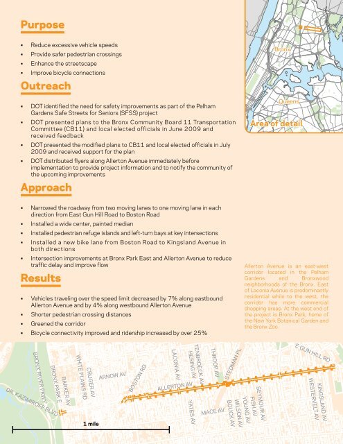
Allerton Avenue is an east-west<br />
corridor located in the Pelham<br />
Gardens and Bronxwood<br />
neighborhoods of the Bronx. East<br />
of Laconia Avenue is predominantly<br />
residential while to the west, the<br />
corridor has more commercial<br />
shopping areas. At the west end of<br />
the project is Bronx Park, home of<br />
the New York Botanical Garden and<br />
the Bronx Zoo.<br />
ALLEY<br />
SEXTON PL<br />
ELY AV<br />
SEXTON PL<br />
HAMMERSLEY AV<br />
ALLEY<br />
ALLEY<br />
WICKHAM AV<br />
BRUNER AV<br />
BAYCHESTER AV<br />
EDSON A<br />
FISH AV FISH AV<br />
ARNOW AV<br />
BOSTON RD<br />
LACONIA AV<br />
HERING AV<br />
ALLERTON AV<br />
TENBROECK AV<br />
THROOP AV<br />
STEDMAN PL<br />
E GUN HILL RD<br />
BRONX RIVER PKWY<br />
WHITE PLAINS RD<br />
BRONX PARK E<br />
CRUGER AV<br />
BARKER AV<br />
KINGSLAND AV<br />
WESTERVELT AV<br />
DR. KAZIMIROFF BLVD<br />
SEYMOUR AV<br />
YOUNG AV<br />
WILSON AV<br />
YATES AV<br />
BOUCK AV<br />
MACE AV<br />
1 mile<br />
<strong>Sustainable</strong> <strong>Streets</strong> <strong>Index</strong> <strong>2010</strong><br />
47