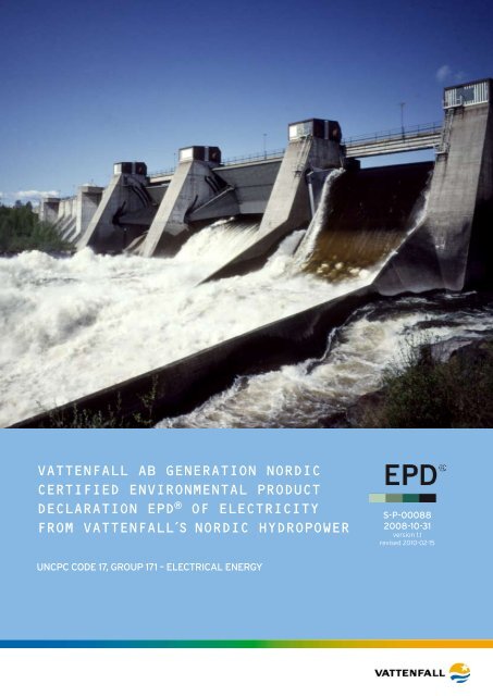
Vattenfall aB GeneRatIOn nORDIC CeRtIfIeD enVIROnmental ...
Vattenfall aB GeneRatIOn nORDIC CeRtIfIeD enVIROnmental ...
Vattenfall aB GeneRatIOn nORDIC CeRtIfIeD enVIROnmental ...

You also want an ePaper? Increase the reach of your titles
YUMPU automatically turns print PDFs into web optimized ePapers that Google loves.
<strong>Vattenfall</strong> AB GENERATION NORDIC<br />
Certified Environmental Product<br />
Declaration EPD ® of electricity<br />
from vattenfall´s Nordic Hydropower<br />
S-P-00088<br />
2008-10-31<br />
version 1.1<br />
revised 2010-02-15<br />
UNCPC Code 17, Group 171 – Electrical energy<br />
© <strong>Vattenfall</strong> AB Generation Nordic 2008
Summary<br />
ProduCER<br />
<strong>Vattenfall</strong> AB Vattenkraft is responsible for <strong>Vattenfall</strong> AB Nordic´s hydropower generation in<br />
the Nordic countries. <strong>Vattenfall</strong> AB Vattenkraft is part of <strong>Vattenfall</strong> AB, SE-162 87 Stockholm,<br />
Sweden. Phone: +46 8 739 50 00; www.vattenfall.se and www.vattenfall.com. <strong>Vattenfall</strong> AB<br />
Vattenkraft implements a certified quality, work environment and environmental management<br />
system designated KAM. This system is based on the standards ISO 9001:2000,<br />
AFS 2001:1, och ISO 14001:2004).<br />
ProduCt och deClared UNIt<br />
Electricity belongs to the product category UNCPC Code 17, Group 171 – Electrical Energy.<br />
<strong>Vattenfall</strong> AB Generation Nordic owns or has majority share in about 60 large-scale hydropower<br />
stations in the Nordic countries and about 50 small-scale stations. These stations<br />
have a total installed capacity of 8,7 GW and the average annual electricity generation is<br />
31,3 TWh. Several reservoirs enable the generation to follow the load curve, and electricity<br />
can be delivered without backup sources. The declared unit 1 kWh of electricity generated<br />
and thereafter distributed to an industrial customer connected to the 70/130 kV network.<br />
THE EPD ® SYSTEm<br />
The EPD ® system managed by the International EPD Consortium (IEC) is based on ISO 14025,<br />
Type III environmental declarations. The relevant governing documents in hierarchical order<br />
are: PCR-CPC17, General Programme Instructions for an international EPD ® system for environmental<br />
product declaration (GPI, 2008), ISO 14025, ISO 14040, ISO 14044.<br />
Environmental Performance – based on LCA<br />
See chapter 3 in the complete EPD ® documentation.<br />
System boundaries<br />
The EPD ® describes the Core process, i.e. the generation of electricity in <strong>Vattenfall</strong>’s Nordic<br />
hydropower stations, Upstream process comprising production of auxiliary supplies, and<br />
Downstream process including distribution of electricity. The Core process - infrastructure<br />
is included i.e. construction of power stations, dams and waterways. Decommissioning<br />
has not been included but the technical lifetime has been set at a level that provides<br />
for complete replacement of the power station through reinvestments. Technical lifetime<br />
for machinery in power stations has been set to 60 years and for buildings, dams and waterways<br />
100 years. Construction and decommissioning of infrastructure in Downstream<br />
process have been included. The use of electricity at the consumer has been excluded.<br />
Hydropower stations, majority and wholly owned by <strong>Vattenfall</strong> AB Generation Nordic, have<br />
been selected for the study to be representative regarding location, physical geography<br />
regions, and type and size of station. The stations are located in different so called river<br />
regions. The selected stations have a third of <strong>Vattenfall</strong>’s installed capacity and generate<br />
a third of <strong>Vattenfall</strong>’s hydro-electricity.<br />
Environmental information<br />
A short summary of compiled data per kWh electricity is presented below. The results are<br />
presented for following lifecycle modules.<br />
Upstream process<br />
Core process<br />
Core process – infrastructure<br />
Downstream process<br />
Downstream process<br />
– infrastructure<br />
Production of oils, chemicals and fuels for vehicles and reserve power.<br />
Operation of power plant, i.e. emissions from inspection trips, emissions of oil<br />
to water and ground, incineration or deposit of operational waste.<br />
Construction and reinvestments in machinery , dams and waterways.<br />
Operation of electricity networks, i.e. emissions from inspection trips,<br />
production and emissions of oils. Extra generation in <strong>Vattenfall</strong>’s<br />
hydropower plants to compensate for losses in the networks.<br />
Construction of national grid and distribution networks.<br />
© <strong>Vattenfall</strong> AB Generation Nordic 2008
SUmmary<br />
Distribution of electricity implies losses, which must be compensated for by increased<br />
generation, in this study through generation in <strong>Vattenfall</strong>’s Nordic hydropower. The losses<br />
are different for different types of customers and often higher in the countryside. The loss<br />
to an average large industrial customer connected to the 70/130 kV network amounts to<br />
3 %. The average loss to a household customer in Sweden varies between 8–9 %.<br />
Resource use<br />
ECOPROFIle<br />
Input<br />
Resource use<br />
Unit/<br />
kWh<br />
Upstream<br />
process<br />
Total<br />
generated<br />
Coreprocess<br />
Coreprocess<br />
- infrastructure<br />
Downstream<br />
process 2<br />
Downstream<br />
process<br />
- infrastructure<br />
Total<br />
distributed<br />
Copper in ore g 6,1 . 10 -7 4,6 . 10 -8 4,2 . 10 -3 4,2 . 10 -3 1,3 . 10 -4 6,8 . 10 -3 1,1 . 10 -2<br />
Electricity use in the power plant 1 kWh 3,2 . 10 -3 3,2 . 10 -3 9,6 . 10 -5 3,3 . 10 -3<br />
Fossil energy resources kWh 6,3 . 10 -5 3,4 . 10 -6 3,1 . 10 -3 3,2 . 10 -3 3,2 . 10 -4 5,0 . 10 -3 8,5 . 10 -3<br />
Gravel, stone, and sand g 2,9 . 10 -9 2,9 . 10 -10 36 36 1,1 5,7 . 10 -7 37<br />
Iron in ore g 5,5 . 10 -5 8,6 . 10 -6 4,9 . 10 -1 4,9 . 10 -1 1,5 . 10 -2 6,4 . 10 -1 1,1<br />
Potential energy of water through<br />
hydro turbines<br />
kWh 1,1 3,4 -2 1,2<br />
Renewable fuel kWh 4,6 . 10 -13 5,0 . 10 -14 9,2 . 10 -6 9,2 . 10 -6 2,8 . 10 -7 1,1 . 10 -10 9,5 . 10 -6<br />
Soil, morain g 21 21 6,2 . 10 -1 21<br />
Water use g 5,6 . 10 -2 7,3 . 10 -3 13 13 5,8 . 10 -1 16 30<br />
Input of material from the technosphere<br />
(agglomeration of app.<br />
30 substances)<br />
g 2,5 . 10 -5 1,3 . 10 -6 3,9 . 10 -4 4,2 . 10 -4 1,0 . 10 -4 3,0 . 10 -4 8,2 . 10 -4<br />
Emissions<br />
ECOPROFIle<br />
Output<br />
Pollutant emissions<br />
Greenhouse gases<br />
Ozone-depleting gases<br />
Unit/<br />
kWh<br />
g CO 2 eq.<br />
(100 y)<br />
g CFC-11 eq.<br />
(20 y)<br />
Acidifying substances g SO 2<br />
-<br />
eq.<br />
Gases contributing to the<br />
formation of ground-level ozone<br />
g ethene<br />
eq.<br />
Eutrophying substances g PO<br />
3- 4<br />
eq.<br />
Emissions of toxic and other substances<br />
to air, ground, and water<br />
Total<br />
generated<br />
Upstreamprocess<br />
Coreprocess<br />
Coreprocess<br />
- infrastructure<br />
Downstream<br />
process 2<br />
Downstream<br />
process<br />
- infrastructure<br />
Total<br />
distributed<br />
2,9 . 10 -3 2,0 . 10 -2 4,5 4,5 2,7 . 10 -1 1,2 6,0<br />
1,5 . 10 -9 4,2 . 10 -10 3,1 . 10 -8 3,3 . 10 -8 7,6 . 10 -9 3,8 . 10 -8 7,8 . 10 -8<br />
2,6 . 10 -5 1,8 . 10 -5 4,5 . 10 -3 4,6 . 10 -3 2,8 . 10 -4 4,9 . 10 -3 9,8 . 10 -3<br />
1,7 . 10 -5 6,3 . 10 -6 8,1 . 10 -4 8,4 . 10 -4 8,6 . 10 -5 1,1 . 10 -3 2,0 . 10 -3<br />
2,3 . 10 -6 8,0 . 10 -6 4,9 . 10 -2 4,9 . 10 -2 1,5 . 10 -3 8,5 . 10 -4 5,1 . 10 -2<br />
Particulate matter to air (PM) g 2,1 . 10 -6 2,8 . 10 -6 1,0 . 10 -3 1,1 . 10 -3 4,4 . 10 -5 6,4 . 10 -3 7,5 . 10 -3<br />
Polyaromatic hydrocarbons (PAH) g 2,6 . 10 -10 3,0 . 10 -11 9,2 . 10 -8 9,2 . 10 -8 3,5 . 10 -9 1,6 . 10 -6 1,7 . 10 -6<br />
C-14 to air kBq 1,5 . 10 -8 1,8 . 10 -9 3,1 . 10 -6 3,1 . 10 -6 1,3 . 10 -7 4,5 . 10 -6 7,7 . 10 -6<br />
Kr-85 to air kBq 6,2 . 10 -9 6,7 . 10 -10 1,7 . 10 -7 1,7 . 10 -7 2,2 . 10 -8 1,2 . 10 -6 1,4 . 10 -6<br />
Rn-222 to air kBq 2,8 . 10 -4 3,2 . 10 -5 5,9 . 10 -2 5,9 . 10 -2 2,5 . 10 -3 8,2 . 10 -2 1,4 . 10 -1<br />
1 Environmental impact from this electricity use is included in the results.<br />
2 Includes the extra electricity generation in <strong>Vattenfall</strong>´s Nordic hydropower plants necessary to compensate<br />
for distribution losses in the networks.<br />
© <strong>Vattenfall</strong> AB Generation Nordic 2008
Summary<br />
Resource use and emissions emanating from waste treatment through incineration or<br />
deposition are included in the Ecoprofile, i.e. no crediting has been performed.<br />
Conclusions of the LCA<br />
The major environmental impact is attributable to construction and reinvestment of power<br />
stations and dams. Operation contributes approximately 1 %.<br />
ADDITIONAL ENVIRONMENTAL INFORMATION<br />
Land use and impact on biodiversity<br />
<strong>Vattenfall</strong>´s Biotope Method 2005 is used to quantify impacts on biodiversity as a direct<br />
consequence of the utilisation of land and water for economic activities. Affected areas are<br />
categorised into Critical Biotope, Rare Biotope, General Biotope, and Technotope.<br />
The 14 studied power stations, with their respective storage reservoirs, together occupy<br />
and area of 74 850 hectares. The main part of this area, 70 320 hectares, constitutes reservoirs.<br />
The table below shows the aggregated change of biotope categories caused by the<br />
construction of the 14 stations. The specific values in the table give a rough approximation<br />
of the direct biotope changes caused by <strong>Vattenfall</strong>’s Nordic hydropower. Data should be<br />
interpreted based on the whole chapter on land use and biodiversity. See chapter 4.1 in the<br />
complete EPD ® documentation.<br />
Category Biotope change (ha) Change per kWh electricity<br />
(m 2 /kWh electricity)<br />
Critical biotope -30 000 –3 . 10 -4<br />
Rare biotope -20 000 –2 . 10 -4<br />
General biotope 30 000 3 . 10 -4<br />
Technotope 20 000 2 . 10 -4<br />
Environmental risk assessment<br />
The conclusion is that over a longer period of time, the emissions due to undesired events<br />
are considerably smaller than those emanating from operation under normal circumstances<br />
except for emissions of gasified copper. See chapter 4.3 of the complete EPD ®<br />
documentation.<br />
Noise<br />
The most notable noise outdoors is the sound from water running through above-ground<br />
power stations. The noise levels are however lower than before development.<br />
© <strong>Vattenfall</strong> AB Generation Nordic 2008
Content<br />
1 Introduction 1<br />
1.1 Declared Product 1<br />
1.2 The Declaration and the EPD ® System 1<br />
1.3 <strong>Vattenfall</strong>, LCA, and EPD ® 2<br />
2 Producer and product 3<br />
2.1 <strong>Vattenfall</strong> AB Nordic 3<br />
2.2 <strong>Vattenfall</strong> AB Vattenkraft 3<br />
2.3 Selected Electricity Power Plants 3<br />
2.4 Electricity Transmission and Distribution 6<br />
3 Environmental Performance BASED ON LCA 7<br />
3.1 Background 7<br />
3.2 System Boundaries, Allocation, and Data Sources 7<br />
3.2.1 System boundaries 7<br />
3.2.2 Life time 8<br />
3.2.3 Allocation 8<br />
3.2.4 Ecoprofile 8<br />
3.3 Environmental Information – based on LCA 10<br />
3.3.1 Ecoprofile quality 12<br />
3.3.2 Resource use 14<br />
3.3.3 Pollutant emissions 14<br />
3.3.4 Waste and material subject to recycling 20<br />
3.3.5 Dominance analysis and conclusions 21<br />
3.3.6 Differences vs. earlier versions of EPD ® s 22<br />
4 Additional Environmental Information 24<br />
4.1 Land Use and Impact on Biodiversity 24<br />
4.1.1 The Biotope Method 24<br />
4.1.2 Background 25<br />
4.1.3 Results 26<br />
4.2 Land and Water Use 27<br />
4.2.1 Description of the land use in the river areas 27<br />
4.2.2 Land use of Core process, Upstream and Downstream processes –<br />
classification according to Corine 35<br />
4.2.3 Land use of Downstream process – distribution of electricity 36<br />
4.3 Environmental Risk Assessment 36<br />
4.3.1 Method 36<br />
4.3.2 System boundaries 37<br />
4.3.3 Summary of risks 37<br />
4.3.4 Natural phenomena 38<br />
4.3.5 Transportation, general 38<br />
4.3.6 Construction of plants and facilities 38<br />
4.3.7 Operation of power stations 39<br />
4.3.8 Large water flows and dam safety 39<br />
4.3.9 Results and comparison with emissions under normal conditions 40<br />
4.3.10 ERM (Enterprise Risk Management) 41<br />
4.4 EMF 41<br />
4.5 Noise 42<br />
5 Information frOM THE CertifiCATION BODY AND MANDATORY information 43<br />
5.1 Information from the Certification Body 43<br />
5.2 Mandatory Statements 43<br />
5.2.1 General 43<br />
5.2.2 Omissions of life cycle stages 43<br />
5.2.3 Means of obtaining explanatory materials 43<br />
5.2.4 Information on verification 43<br />
6 Links AND references 44<br />
© <strong>Vattenfall</strong> AB Generation Nordic 2008
1 INtroduction<br />
1.1 Declared Product<br />
This document constitutes the certified Environmental Product Declaration EPD ® of electricity<br />
generated in <strong>Vattenfall</strong> AB Generation Nordic´s (below called <strong>Vattenfall</strong>) hydropower<br />
stations in the Nordic countries. Electricity belongs to the product category UNCPC<br />
code 17, Group 171 – Electrical energy.<br />
The declared product is 1 kWh electricity generated and thereafter distributed<br />
to a customer connected to the 70/130 kV network.<br />
Some of the power stations are constructed for the provision of capacity as well as electricity<br />
enabling concurrence with the fluctuations in electricity consumption. Due to annual<br />
reservoirs, the delivery of electricity is relatively evenly distributed throughout the<br />
year, requiring no other forms of electricity generation.<br />
1.2 The Declaration and the EPD ® system<br />
Environmental Product Declaration is recognised as a vehicle for the industry for the<br />
communication of environmental impact of products and services.<br />
This Environmental Product Declaration is an EPD ® in accordance with the system administered<br />
by the International EPD Consortium (IEC, www.environdec.com). EPD ® is an<br />
international application of ISO 14025, Type III environmental declarations. The EPD ® system<br />
and its applications are described in General Programme Instructions.<br />
The hierarchic structure of the fundamental documents for the EPD ® system is:<br />
• Product Category Rules, PCR-CPC17 (Product Category Rules, PCR, for preparing an Environmental<br />
Product Declaration, EPD ® , for Electricity, Steam, and Hot and Cold Water Generation<br />
and Distribution)<br />
• General Programme Instructions for environmental product declaration EPD<br />
• ISO 14025 on Type III environmental declarations<br />
• ISO 14040 and 14044 on Life Cycle Assessments (LCA)<br />
This EPD ® contains an environmental performance declaration based on a life cycle assessment.<br />
Additional environmental information is presented in accordance with the PCR:<br />
• Information on land use:<br />
- an assessment of impact on biodiversity based on The Biotope Method,<br />
(Kyläkorpi et al, 2005)<br />
- a categorisation of land use according to Corine Land Cover Classes,<br />
land occupation, time periods, and exploitative activities<br />
- a description of visual impacts (see appendix Technology and Environment)<br />
- qualitative description of potential impacts on indigenous people and their<br />
traditional activities (see appendix Technology and Environment)<br />
• An Environmental Risk Assessment (ERA) of the potential emissions that may result from<br />
abnormal incidents and that have an impact on the environment or are toxic to humans.<br />
• Electromagnetic fields, a description of measures to keep fields low and some information<br />
on limits and recommendations by different bodies.<br />
• Noise<br />
© <strong>Vattenfall</strong> AB Generation Nordic 2008<br />
1
1 INTRODUCTION<br />
1.3 <strong>Vattenfall</strong>, LCA, and EPD ®<br />
<strong>Vattenfall</strong> has employed LCA since 1993 and has accumulated competence and experience<br />
in this field. The additional development through the EPD ® enhances the ability to objectively<br />
inform about the complex environmental issues associated with generation of electricity<br />
and heat.<br />
There are multiple reasons to declare the environmental performance of electricity, most<br />
significantly:<br />
• Electricity is used in the manufacturing of virtually every product. Information regarding<br />
resource use in electricity generation is central to LCA of other products. This has<br />
generated an increased interest in the market for this type of information primarily<br />
because users need certified and modular life cycle data, as input to their own EPD ®<br />
or LCA.<br />
• EPD ® provides a basis for professional procurement, in the private as well as in the<br />
public sector, in permitting comparisons of different power sources, heat production<br />
technologies, and different producers. This creates an incentive for producers to reduce<br />
their use of resources and the impact on the environment caused by their systems.<br />
• EPD ® is an effective instrument in the continuing environmental efforts within <strong>Vattenfall</strong>,<br />
the objective being constant improvement.<br />
• The Directive 2003/54/EC requires member states to introduce systems for customer<br />
information regarding the origin of the electricity and, at a minimum, figures on CO 2 and<br />
radioactive waste. The information given in an EPD ® is verified and exceeds the requirements<br />
in the Directive.<br />
The environmental impact of hydropower differs considerably from that of other forms<br />
of electricity generation, as it often is direct and tangible. As an economic activity, hydropower<br />
generation can be described as a land use based activity, similar to agriculture or<br />
forestry. This differs considerably from e.g. generation using fossil fuels, where environmental<br />
impact is diffuse and thus more difficult to grasp.<br />
Questions concerning this EPD ® should be directed to Caroline Setterwall, <strong>Vattenfall</strong> AB<br />
Generation Nordic, SE-162 87 Stockholm, Sweden,<br />
telephone +46 8 739 5000, (caroline.setterwall@vattenfall.com).<br />
For additional information about <strong>Vattenfall</strong>, please visit our web site at www.vattenfall.com.<br />
© <strong>Vattenfall</strong> AB Generation Nordic 2008<br />
2
2 PRODUCER AND PRODUCT<br />
2.1 <strong>Vattenfall</strong> AB Nordic<br />
<strong>Vattenfall</strong> AB Nordic is part of <strong>Vattenfall</strong> AB, which is the fifth largest electricity producer and<br />
the largest heat producer in Europe. Group sales amount to 144 billion SEK (2007, ~15 billion<br />
EUR). <strong>Vattenfall</strong>’s vision is to be a leading European energy company.<br />
The business group <strong>Vattenfall</strong> AB Nordic comprises the following:<br />
• Generation Nordic generates about 90 TWh electricity and 6 TWh district heat in majority-owned<br />
plants. The main generation units are seven nuclear reactors and more<br />
than 100 hydropower stations as well as five fossil-fuelled base-load plants and more<br />
than 500 wind turbines. Moreover there are fossil-fuelled reserve power plants. Generated<br />
electricity is sold to NordPool (www.nordpool.com).<br />
• Distribution Nordic distributes electricity to 1,3 million customers in Sweden and Finland.<br />
• Sales Nordic sells electricity and energy related services.<br />
• Heat Nordic owns and operates heat-producing plants in the Nordic and Baltic countries,<br />
and sells district heat.<br />
• Services provides consulting and contract work within the energy, infrastructure and industry<br />
sectors.<br />
2.2 <strong>Vattenfall</strong> AB Vattenkraft<br />
<strong>Vattenfall</strong> AB Vattenkraft is accountable for <strong>Vattenfall</strong> AB Generation Nordic’s generation<br />
of hydro power including generating plants, annual reservoirs, and short-term reservoirs.<br />
<strong>Vattenfall</strong> AB Vattenkraft is part of <strong>Vattenfall</strong> AB, SE-162 87 Stockholm, Sweden. The technical<br />
and environmental aspects of hydropower are presented in appendix “Technology and<br />
Environment”.<br />
Questions regarding <strong>Vattenfall</strong> AB Vattenkraft should be directed to Richard Holmgren,<br />
SE-971 77 Luleå, Sweden, telephone +46 (0)920-77175, (richard.holmgren@vattenfall.com).<br />
<strong>Vattenfall</strong> AB Vattenkraft implements an environmental management system in accordance<br />
with ISO 14001 since 1999. Since 2000, <strong>Vattenfall</strong> AB Vattenkraft implements a certified<br />
quality, work environment and environmental management system designated KAM. This<br />
system is based on the standards ISO 9001:2000, AFS 2001:1, and ISO 14001:2004.<br />
Questions regarding <strong>Vattenfall</strong> AB Vattenkraft and KAM should be directed to Sören Ek,<br />
<strong>Vattenfall</strong> AB Vattenkraft, Björkvägen 19, SE-960 30 Vuollerim, Sweden,<br />
telephone +46 (0)976 77918 (soren.ek@vattenfall.com).<br />
2.3 Selected Power Plants<br />
Sites selected for this EPD ® are majority- (or wholly) owned by <strong>Vattenfall</strong> AB, and are representative<br />
of <strong>Vattenfall</strong>’s Nordic hydropower stations with respect to geographic setting,<br />
physical geography, type of station, and size. The large-scale hydroelectric sites are arranged<br />
into so called river regions. Small-scale hydropower is assessed separately.<br />
“Vattendragsutredningen 1996 (SOU 1996:155)” divided Sweden into 13 so-called hydrogeographical<br />
regions, five of which are in Northern Sweden and eight in Southern Sweden<br />
(south of river Dalälven). Region definitions are based on physical geography, climate, geology,<br />
topography, flora and fauna. Northern Sweden exhibits a rather homogenous north<br />
to south gradient making logical subdivision difficult. SOU 1996:155 attempted to arrive at<br />
subdivisions of equal size. This has been adhered to, but for practical reasons some subdivisions<br />
are combined, resulting in fewer regions, but nevertheless similar in size.<br />
River regions in Sweden Regions according to SOU 1996:155<br />
Norra Norrland 1, 2<br />
Mellannorrland 3, 4<br />
Södra Norrland 5<br />
Västsverige 8<br />
© <strong>Vattenfall</strong> AB Generation Nordic 2008<br />
3
2 PRODUCER AND PRODUCT<br />
<strong>Vattenfall</strong> has no large-scale hydropower in the remaining regions described in SOU 1996:155.<br />
It is reasonable to aggregate regions 1 and 2 because of considerable similarity of geology<br />
and topography. The flora also exhibits similarities, and both regions have several northerly<br />
species that are absent further south.<br />
Regions 3 and 4 exhibit corresponding similarities. Region 5 must be treated separately<br />
because it constitutes the so-called “limes norrlandicus”. This region is unique because<br />
it harbors several northerly and southerly species, and it consists entirely of the river<br />
Dalälven.<br />
Small-scale hydropower in Sweden represents less than 1 % of <strong>Vattenfall</strong>’s hydropower<br />
and is located in several watercourses, mainly south of river Dalälven. The division between<br />
large-scale and small-scale hydropower is organizational and the capacity of the<br />
small-scale plants vary between 0,2–5,4 MW. One station is considered.<br />
<strong>Vattenfall</strong>’s hydropower in Finland is located in the Finnish Lake District in the central and<br />
eastern part of the country. Most of the electricity is generated in the eastern part. The<br />
capacity of the 10 Finnish plants varies between 2–84 MW, and they are all considered<br />
large-scale according to the Finnish definition (small-scale
2 PRODUCER AND PRODUCT<br />
Seitevare<br />
Harsprånget<br />
Stalon<br />
Juktan<br />
Umluspen<br />
Porsi<br />
Boden<br />
Stornorrfors<br />
FINLAND<br />
Pamilo<br />
Bergeforsen<br />
SWEDEN<br />
Älvkarleby<br />
Upperud<br />
Olidan<br />
Hojum<br />
The map shows selected hydropower power stations in Sweden and Finland.<br />
© <strong>Vattenfall</strong> AB Generation Nordic 2008<br />
5
2 PRODUCER AND PRODUCT<br />
2.4 Electricity Transmission and Distribution<br />
The power network comprises transmission and distribution systems consisting of numerous<br />
lines, cables, transformers, and switchgears. The national grid voltage is transformed<br />
to lower voltages for distribution over distribution networks and local networks to consumers.<br />
Large customers, e.g. many industries, are frequently connected to the high or medium<br />
voltage distribution network (10–130 kV), while small users such as single households<br />
are connected at 0,4 kV to low voltage local networks.<br />
Transmission and distribution losses depend on several factors, such as distance, load,<br />
feed voltage, and user connection voltage. In the diagram below the average distribution<br />
losses are shown. To an industrial customer connected to 70/130 kV the average distribution<br />
loss is 3 % if the power station feeds the national grid. The loss to a household<br />
customer in the countryside amounts to app. 9 %.<br />
National grid 220/400 kV<br />
Regional grid 70/130 kV<br />
Local network, urban 70/130 kV<br />
Local network, rural 10-40 kV<br />
Local network, urban 10-50 kV<br />
Local network, rural 0,4 kV<br />
Local network, urban 0,4 kV<br />
0 1 2 3 4 5 6 7 8 9<br />
% of electricity generated<br />
Average distribution losses at different voltages in Sweden accumulated from the national grid.<br />
Source: <strong>Vattenfall</strong> AB<br />
© <strong>Vattenfall</strong> AB Generation Nordic 2008<br />
6
3 Environmental performance<br />
BASED on LCA<br />
3.1 Background<br />
This EPD ® is based on a LCA on <strong>Vattenfall</strong>’s hydropower in the Nordic countries during the<br />
reference year 2007. The declared unit is 1 kWh net electricity generated and thereafter distributed<br />
to a customer connected to the 70/130 kV network. Resource consumption, emissions,<br />
and waste amounts in conjunction with construction, operation and reinvestments of<br />
power stations and dams have been inventoried. Decommissioning is excluded because of<br />
the improbability of that scenario. The reinvestment rate has been set at a level that provides<br />
for complete replacement of the power station during its lifetime, i.e. a fully functioning<br />
power station will exit the system at the end of the assumed lifetime. This results in greater<br />
environmental impact in the LCI than the alternative of including decommissioning. The level<br />
of uncertainty in the description of the impact on biotopes is reduced, because we avoid<br />
speculative assessments of how possible/desirable a return to unregulated flows would be,<br />
and of the process of re-colonization from unaffected biotopes to affected ones.<br />
3.2 System Boundaries, Allocation and Data Sources<br />
3.2.1 System boundaries<br />
The figure below is a simplified process tree with system boundaries for the LCA for electricity<br />
generated in <strong>Vattenfall</strong>’s Nordic hydropower stations and distributed to the consumer.<br />
Production of<br />
construction<br />
materials<br />
Production of<br />
raw materials<br />
trp<br />
trp<br />
trp<br />
Construction<br />
of suppliers<br />
factories<br />
Construction<br />
and<br />
reinvestment in<br />
dams etc.<br />
Manufacturing<br />
of turbine and<br />
generator<br />
Manufacturing<br />
of other<br />
components<br />
Construction of<br />
power networks<br />
Upstream process<br />
Production of operation<br />
chemicals, oils and other<br />
auxiliaries for operation<br />
of hydropower plants<br />
CORE process<br />
Power plant<br />
Downstream process<br />
Losses in transmission/<br />
distribution systems and<br />
maintenance<br />
1 kWh el<br />
Decommissioning<br />
of<br />
suppliers<br />
factories<br />
Scrapped<br />
reinvested<br />
material<br />
Operational<br />
waste<br />
Decommissioning<br />
of power<br />
networks<br />
trp trp trp trp trp trp<br />
Waste to<br />
landfill<br />
Waste to<br />
recycling<br />
Waste to<br />
incineration<br />
Legend<br />
Core process<br />
Core process – infrastructure<br />
Upstream process<br />
Upstream process – infrastructure<br />
Downstream process<br />
Downstream process – infrastructure<br />
Not included in the analysis<br />
Simplified process tree with system boundaries for life cycle inventory of <strong>Vattenfall</strong>´s<br />
hydropower. Trp means transportation.<br />
© <strong>Vattenfall</strong> AB Generation Nordic 2008<br />
7
3 Environmental performance based on lca<br />
The lifecycle is divided in following modules:<br />
The Core process comprises operation of the hydropower stations and handling/treatment<br />
of operational waste.<br />
The Core process - infrastructure includes construction and reinvestment of power stations<br />
and dams (100 % of material and components are replaced during the lifetime),<br />
decommissioning is excluded.<br />
Upstream process – production of operational chemicals includes the production of operational<br />
chemicals, oil fuel for reserve power, and fuel for vehicles.<br />
Upstream process - infrastructure comprises construction and decommissioning of factories<br />
for production of operational chemicals and fuels. Environmental data used come<br />
from the database ecoinvent, where data for construction is aggregated with data on the<br />
production processes. Hence environmental impact for upstream infrastructure is not<br />
reported separately.<br />
Downstream process – distribution of electricity comprise operation of electricity networks,<br />
inspection trips, and the extra electricity generation, which is necessary to compensate<br />
for distribution losses.<br />
Downstream process - infrastructure comprises construction and decommissioning of<br />
electricity networks.<br />
Excluded from the lifecycle:<br />
• Impacts due to potential accidents, breakdowns, and leakages (included in Additional<br />
Environmental Information, chapter 4.3 Environmental Risk Assessment).<br />
• Further treatment of scrapped material that has been transported to recycling plant.<br />
• Impacts of land use apart from emissions from inundated land (included in Additional<br />
Environmental Information, chapter 4.1 Land Use and Impacts on Biodiversity).<br />
3.2.2 Lifetime<br />
Based on the assumption that power stations and dams are replaced once during their<br />
lifetime the following technical lifetime have been used: 60 years for machinery and 100<br />
years for dams, power houses and waterways.<br />
3.2.3 Allocation<br />
The main function of studied systems is the generation of electricity, but they also serve as<br />
components in the control of the Swedish generation system. In addition, water levels are<br />
controlled e.g. in order to prevent floods. The river systems are also used for fishing and<br />
recreational purposes. Despite the additional uses all environmental impact is allocated to<br />
electricity generation.<br />
3.2.4 Ecoprofile<br />
The Ecoprofile is composed of LCA results for generation and distribution.<br />
The results for generation (Core process, including infrastructure and upstream processes)<br />
of <strong>Vattenfall</strong>’s electricity from Nordic hydropower have been compiled as follows:<br />
• Environmental impact is calculated for each individual station, and divided by its total generation<br />
• Environmental impact from individual stations is weighted according to <strong>Vattenfall</strong>’s share of<br />
electricity generated in the river.<br />
• Environmental impacts from rivers are aggregated into river regions, and weighted according<br />
to electricity generated.<br />
• River regions and small-scale power are aggregated and weighted according to electricity<br />
generated.<br />
© <strong>Vattenfall</strong> AB Generation Nordic 2008<br />
8
3 Environmental performance BASEd on LCA<br />
The results for distribution (Downstream process) of generated electricity have been<br />
compiled as follows:<br />
• Environmental impact from operation of electricity networks has been inventoried<br />
and divided by the total amount of electricity distributed in that specific network.<br />
• The length (km) of different distribution networks has been inventoried and multiplied<br />
by the environmental impact for construction per km and divided by the total<br />
amount of electricity distributed in the specific network<br />
• Environmental impact from distribution losses of 3 % has been calculated through<br />
multiplication of total environmental impact of generation above with 0,03.<br />
<strong>Vattenfall</strong>´s Hydropower in the Nordic Countries<br />
31,3 TWh<br />
48,0 %<br />
Norra Norrland<br />
2,5 %<br />
Södra Norrland<br />
5,1 %<br />
Västsverige<br />
1,2 %<br />
Östra Finland<br />
0,8 %<br />
Small-scale hydro<br />
42,4 %<br />
Mellannorrland<br />
Repr. by<br />
4 sites<br />
Lule älv<br />
Repr. by<br />
1 site<br />
Dalälven<br />
Repr. by<br />
2 sites<br />
Göta älv<br />
Repr. by<br />
1 site<br />
Vuoksi<br />
Repr. by<br />
1 site<br />
Upperudsälven<br />
Repr. by<br />
5 sites<br />
Ume älv<br />
Seitevare<br />
Älvkarleby<br />
Olidan<br />
Pamilo<br />
Upperud<br />
Juktan<br />
Porsi<br />
Hojum<br />
Umluspen<br />
Harsprånget<br />
Stornorrfors<br />
Ångermanälven<br />
Boden<br />
Stalon<br />
Indalsälven<br />
Bergeforsen<br />
The diagram shows the method of weighting environmental impact from selected sites<br />
to one Ecoprofile for electricity from <strong>Vattenfall</strong>’s hydropower in the Nordic countries<br />
(also table in chapter 2.3).<br />
© <strong>Vattenfall</strong> AB Generation Nordic 2008<br />
9
3 Environmental performance BASEd on LCA<br />
3.3 Environmental information – based on LCA<br />
The assessment results are summarised in the Ecoprofile below and commented in the<br />
chapters 3.3.1–3.3.8.<br />
• For Upstream process, Core process, Core process- infrastructure, and<br />
Total generated the numbers are expressed per 1 kWh generated electricity.<br />
• For Downstream process, Downstream process - infrastructure, and Total distributed<br />
the numbers are expressed per 1 kWh electricity delivered to a customer connected<br />
to the 70/130 kV nework (distribution loss, 3 % of generated electricity).<br />
Distribution losses vary depending on what voltage level the customer is connected to.<br />
These are described in chapter 2.4 Electricity Transmission and Distribution.<br />
ECOPROFIle<br />
Input<br />
Resource use<br />
Non-renewable material resources<br />
Aluminium in ore<br />
Basalt<br />
Bentonite<br />
Chromium in ore<br />
Copper in ore<br />
Dolomite<br />
Feldspar<br />
Fluorspar<br />
Gravel, stone and sand<br />
Gypsum<br />
Iron in ore<br />
Lead in ore<br />
Limestone<br />
Magnesium in ore<br />
Manganese in ore<br />
Molybdenum in ore<br />
Nickel in ore<br />
Olivine<br />
Salt<br />
Soil, moraine<br />
Sulphur<br />
Tin in ore<br />
Titanium dioxide<br />
Zinc in ore<br />
Zirconium in sand<br />
Unit/<br />
kWh<br />
g<br />
g<br />
g<br />
g<br />
g<br />
g<br />
g<br />
g<br />
g<br />
g<br />
g<br />
g<br />
g<br />
g<br />
g<br />
g<br />
g<br />
g<br />
g<br />
g<br />
g<br />
g<br />
g<br />
g<br />
g<br />
Upstream<br />
process<br />
© <strong>Vattenfall</strong> AB Generation Nordic 2008<br />
Core<br />
process<br />
10<br />
Coreprocess<br />
- infrastructure<br />
Total<br />
generated<br />
Downstream<br />
process 1<br />
Downstream<br />
process<br />
- infrastructure<br />
Total<br />
distributed<br />
6,8 . 10 -7<br />
2,3 . 10 -7<br />
2,1 . 10 -6<br />
4,0 . 10 -7<br />
6,1 . 10 -7<br />
1,3 . 10 -7<br />
2,3 . 10 -13<br />
1,0 . 10 -6<br />
2,9 . 10 -9<br />
3,8 . 10 -10<br />
5,5 . 10 -5<br />
1,7 . 10 -8<br />
4,9 . 10 -8<br />
7,3 . 10 -7<br />
7,0 . 10 -8<br />
8,3 . 10 -8<br />
1,5 . 10 -6<br />
2,8 . 10 -11<br />
3,6 . 10 -6<br />
1,6 . 10 -9<br />
1,6 . 10 -9<br />
2,5 . 10 -7<br />
2,5 . 10 -7<br />
4,9 . 10 -11 6,7 . 10 -8<br />
1,6 . 10 -8<br />
1,8 . 10 -7<br />
6,2 . 10 -8<br />
4,6 . 10 -8<br />
2,0 . 10 -8<br />
2,0 . 10 -14<br />
3,9 . 10 -8<br />
2,9 . 10 -10<br />
4,5 . 10 -11<br />
8,6 . 10 -6<br />
3,9 . 10 -9<br />
5,5 . 10 -8<br />
1,3 . 10 -7<br />
6,7 . 10 -9<br />
7,6 . 10 -9<br />
2,1 . 10 -7<br />
2,1 . 10 -12<br />
3,1 . 10 -5<br />
1,7 . 10 -10<br />
1,3 . 10 -10<br />
1,5 . 10 -7<br />
1,8 . 10 -8<br />
3,3 . 10 -12 1,2 . 10 -3<br />
1,2 . 10 -4<br />
7,2 . 10 -5<br />
2,5 . 10 -3<br />
4,2 . 10 -3<br />
5,8 . 10 -3<br />
1,8 . 10 -10<br />
2,3 . 10 -5<br />
36<br />
4,6 . 10 -8<br />
4,9 . 10 -1<br />
5,3 . 10 -4<br />
4,0 . 10 -4<br />
1,9 . 10 -4<br />
3,7 . 10 -4<br />
4,5 . 10 -4<br />
1,7 . 10 -3<br />
6,3 . 10 -9<br />
2,1 . 10 -3<br />
21<br />
1,4 . 10 -5<br />
2,7 . 10 -7<br />
1,2 . 10 -5<br />
9,2 . 10 -4<br />
1,7 . 10 -9 1,2 . 10 -3<br />
1,2 . 10 -4<br />
7,4 . 10 -5<br />
2,5 . 10 -3<br />
4,2 . 10 -3<br />
5,8 . 10 -3<br />
1,8 . 10 -10<br />
2,4 . 10 -5<br />
36<br />
4,6 . 10 -8<br />
4,9 . 10 -1<br />
5,3 . 10 -4<br />
4,0 . 10 -4<br />
1,9 . 10 -4<br />
3,7 . 10 -4<br />
4,5 . 10 -4<br />
1,7 . 10 -3<br />
6,3 . 10 -9<br />
2,1 . 10 -3<br />
21<br />
1,4 . 10 -5<br />
2,7 . 10 -7<br />
1,3 . 10 -5<br />
9,2 . 10 -4<br />
1,7 . 10 -9 3,8 . 10 -5<br />
4,1 . 10 -6<br />
9,2 . 10 -6<br />
7,6 . 10 -5<br />
1,3 . 10 -4<br />
1,7 . 10 -4<br />
5,6 . 10 -12<br />
2,2 . 10 -6<br />
1,1<br />
3,1 . 10 -9<br />
1,5 . 10 -2<br />
1,6 . 10 -5<br />
1,2 . 10 -5<br />
7,6 . 10 -6<br />
1,1 . 10 -5<br />
1,4 . 10 -5<br />
5,3 . 10 -5<br />
3,9 . 10 -10<br />
7,6 . 10 -5<br />
6,2 . 10 -1<br />
4,2 . 10 -7<br />
9,0 . 10 -9<br />
1,3 . 10 -6<br />
2,8 . 10 -5<br />
7,4 . 10 -11 1,8 . 10 -2<br />
7,7 . 10 -5<br />
7,8 . 10 -3<br />
1,6 . 10 -4<br />
6,8 . 10 -3<br />
1,5 . 10 -3<br />
1,1 . 10 -9<br />
1,0 . 10 -4<br />
5,7 . 10 -7<br />
3,3 . 10 -7<br />
6,4 . 10 -1<br />
3,0 . 10 -4<br />
2,9 . 10 -4<br />
1,9 . 10 -4<br />
2,0 . 10 -5<br />
1,2 . 10 -4<br />
6,0 . 10 -3<br />
2,4 . 10 -9<br />
4,2 . 10 -3<br />
5,1 . 10 -7<br />
4,5 . 10 -7<br />
3,1 . 10 -5<br />
2,1 . 10 -4<br />
1,1 . 10 -9 1,9 . 10 -2<br />
2,0 . 10 -4<br />
7,9 . 10 -3<br />
2,8 . 10 -3<br />
1,1 . 10 -2<br />
7,4 . 10 -3<br />
1,3 . 10 -9<br />
1,3 . 10 -4<br />
37<br />
3,8 . 10 -7<br />
1,1<br />
8,5 . 10 -4<br />
7,0 . 10 -4<br />
3,9 . 10 -4<br />
4,0 . 10 -4<br />
5,9 . 10 -4<br />
7,7 . 10 -3<br />
9,2 . 10 -9<br />
6,4 . 10 -3<br />
21<br />
1,5 . 10 -5<br />
7,2 . 10 -7<br />
4,5 . 10 -5<br />
1,2 . 10 -3<br />
2,9 . 10 -9<br />
Renewable material resources<br />
Wood g 1,5 . 10 -1 1,5 . 10 -1 4,5 . 10 -3 1,5 . 10 -1<br />
Non-renewable energy resources<br />
Crude oil (resource)<br />
Hard coal (resource)<br />
Lignite (resource)<br />
Natural gas (resource)<br />
Peat (resource)<br />
Uranium (resource)<br />
Renewable energy resources<br />
Biomass<br />
Potential energy through<br />
hydropower plant 2<br />
Electricity use in the power<br />
station<br />
Water use<br />
Ground water<br />
Sea water<br />
Water, specified natural origin<br />
Water, unspecified origin<br />
Use of recycled material<br />
Aluminium<br />
Copper<br />
Steel<br />
Input of material from the technosphere<br />
(agglomeration of app.<br />
30 substances)<br />
g<br />
g<br />
g<br />
g<br />
g<br />
g<br />
g<br />
kWh<br />
kWh<br />
g<br />
g<br />
g<br />
g<br />
g<br />
g<br />
g<br />
g<br />
4,9 . 10 -3<br />
1,6 . 10 -4<br />
2,1 . 10 -4<br />
2,8 . 10 -4<br />
9,1 . 10 -9<br />
8,7 . 10 -9 2,4 . 10 -4<br />
2,1 . 10 -5<br />
2,2 . 10 -5<br />
2,6 . 10 -5<br />
1,9 . 10 -9<br />
9,9 . 10 -10 7,2 . 10 -2<br />
2,3 . 10 -1<br />
3,5 . 10 -2<br />
3,5 . 10 -2<br />
6,5 . 10 -4<br />
1,1 . 10 -5 7,7 . 10 -2<br />
2,3 . 10 -1<br />
3,6 . 10 -2<br />
3,5 . 10 -2<br />
6,5 . 10 -4<br />
1,1 . 10 -5 2,0 . 10 -2<br />
7,4 . 10 -3<br />
1,7 . 10 -3<br />
1,9 . 10 -3<br />
1,9 . 10 -5<br />
3,5 . 10 -7 5,4 . 10 -2<br />
5,3 . 10 -1<br />
5,5 . 10 -2<br />
2,9 . 10 -2<br />
2,2 . 10 -6<br />
2,5 . 10 -6 1,5 . 10 -1<br />
7,7 . 10 -1<br />
9,2 . 10 -2<br />
6,6 . 10 -2<br />
6,7 . 10 -4<br />
1,4 . 10 -5<br />
2,3 . 10 -3 2,3 . 10 -3 6,8 . 10 -5 2,6 . 10 -8 2,3 . 10 -3<br />
1,1 . 10 -10 1,2 . 10 -11<br />
3,2 . 10 -3 3,2 . 10 -3 9,6 . 10 -5 3,3 . 10 -3<br />
1,1<br />
1,2<br />
1,2 . 10 -3<br />
2,1 . 10 -3<br />
7,4 . 10 -6<br />
5,3 . 10 -2 1,3 . 10 -4<br />
1,5 . 10 -4<br />
6,5 . 10 -6<br />
7,0 . 10 -3 8,3 . 10 -1<br />
1,8 . 10 -1<br />
2,3 . 10 -3<br />
12<br />
8,4 . 10 -1<br />
1,8 . 10 -1<br />
2,3 . 10 -3<br />
12<br />
2,9 . 10 -2<br />
1,3 . 9,3 . 10 -1<br />
10 -2<br />
9,2 . 1,9 . 10 -1<br />
10 -5<br />
5,4 . 2,1 . 10 -3<br />
10 -1 15<br />
1,8<br />
3,8 . 10 -1<br />
4,5 . 10 -3<br />
28<br />
2,0 . 10 -5 2,0 . 10 -5 6,0 . 10 -7<br />
2,1 . 10 -5<br />
6,1 . 10 -2 6,1 . 10 -2 1,8 . 10 -3 6,3 . 10 -2<br />
5,7 . 10 -3 5,7 . 10 -3 1,7 . 10 -4<br />
5,9 . 10 -3<br />
2,5 . 10 -5 1,3 . 10 -6 3,9 . 10 -4 4,2 . 10 -4 1,0 . 10 -4 3,0 . 10 -4 8,2 . 10 -4<br />
1<br />
Includes the extra generation in <strong>Vattenfall</strong>´s hydropower stations, which compensates for distribution losses<br />
in the networks.<br />
2<br />
This electricity is assumed to be generated in the hydropower stations and the environmental impact is<br />
included since the amount was substracted from the reference flow.
3 Environmental performance BASEd on LCA<br />
ECOPROFIlE<br />
Output<br />
Pollutant emissions<br />
Greenhouse gases<br />
Ozone-depleting potential<br />
Unit/kWh<br />
g CO 2 eq.-<br />
(100 y)<br />
g CFC-11<br />
eq. (20 y)<br />
Upstream<br />
process<br />
Core<br />
process<br />
Total<br />
generated<br />
Core<br />
process<br />
- infrastructure<br />
Downstream<br />
process 1<br />
Downstream<br />
process<br />
- infrastructure<br />
Total<br />
distributed<br />
2,9 . 10 -3 2,0 . 10 -2 4,5 4,5 2,7 . 10 -1 1,2 6,0<br />
1,5 . 10 -9 4,2 . 10 -10 3,1 . 10 -8 3,3 . 10 -8 7,6 . 10 -9 3,8 . 10 -8 7,8 . 10 -8<br />
Acidifying potential g SO 2 eq. 2,6 . 10 -5 1,8 . 10 -5 4,5 . 10 -3 4,6 . 10 -3 2,8 . 10 -4 4,9 . 10 -3 9,8 . 10 -3<br />
Photochem. ozone creation<br />
potential<br />
g ethene<br />
eq.<br />
Eutrophication potential g PO<br />
3- 4<br />
eq.<br />
Emissions contributiong to given<br />
emission categories<br />
Ammonia to air<br />
Butane<br />
Carbon dioxide 2<br />
Carbon monoxide<br />
Carbon tetra chloride<br />
COD<br />
Ethene<br />
Halon 1211<br />
Halon 1301<br />
HCFC-22<br />
Hexane<br />
Hydrocarbons unspecified<br />
Hydrogen chloride<br />
Hydrogen fluoride<br />
Hydrogen sulphide<br />
Methane<br />
Nitrogen oxides<br />
Nitrous oxide<br />
NMVOC (unspecified)<br />
Pentane<br />
Phosphor<br />
Sulphur dioxide<br />
Sulphur hexafluoride<br />
Sulphuric acid<br />
VOC (unspecified)<br />
Xylene<br />
Emissions of toxic and other substances<br />
to air, water and ground<br />
Ammonia<br />
Arsenic<br />
Carbon dioxide (biotic) 3<br />
Dioxine to air<br />
Lead<br />
Oil to ground<br />
Oil to water<br />
Particles to air<br />
Polyaromatic hydrocarbons<br />
C-14 to air<br />
Kr-85 to air<br />
Rn-222 to air<br />
Deposition of phosphor in<br />
river sediment<br />
g<br />
g<br />
g<br />
g<br />
g<br />
g<br />
g<br />
g<br />
g<br />
g<br />
g<br />
g<br />
g<br />
g<br />
g<br />
g<br />
g<br />
g<br />
g<br />
g<br />
g<br />
g<br />
g<br />
g<br />
g<br />
g<br />
g<br />
g<br />
g<br />
g<br />
g<br />
g<br />
g<br />
g<br />
g<br />
kBq<br />
kBq<br />
kBq<br />
g<br />
1,7 . 10 -5 6,3 . 10 -6 8,1 . 10 -4 8,4 . 10 -4 8,6 . 10 -5 1,1 . 10 -3 2,0 . 10 -3<br />
2,3 . 10 -6 8,0 . 10 -6 4,9 . 10 -2 4,9 . 10 -2 1,5 . 10 -3 8,5 . 10 -4 5,1 . 10 -2<br />
4,9 . 10 -8<br />
2,9 . 10 -7<br />
2,6 . 10 -3<br />
3,8 . 10 -6<br />
3,2 . 10 -12<br />
6,8 . 10 -5<br />
1,2 . 10 -7<br />
7,1 . 10 -12<br />
1,7 . 10 -10<br />
2,8 . 10 -11<br />
1,5 . 10 -7<br />
3,9 . 10 -7<br />
5,9 . 10 -8<br />
1,0 . 10 -8<br />
5,7 . 10 -9<br />
9,1 . 10 -6<br />
8,6 . 10 -6<br />
4,7 . 10 -8<br />
1,4 . 10 -5<br />
3,6 . 10 -7<br />
9,2 . 10 -9<br />
2,1 . 10 -5<br />
1,6 . 10 -9<br />
1,2 . 10 -12<br />
1,0 . 10 -7 6,4 . 10 -8<br />
1,5 . 10 -8<br />
1,3 . 10 -2<br />
7,7 . 10 -5<br />
1,8 . 10 -12<br />
1,1 . 10 -4<br />
8,4 . 10 -9<br />
1,1 . 10 -12<br />
8,5 . 10 -12<br />
4,2 . 10 -12<br />
7,0 . 10 -9<br />
7,4 . 10 -6<br />
6,2 . 10 -9<br />
1,2 . 10 -9<br />
1,7 . 10 -7<br />
6,9 . 10 -7<br />
3,3 . 10 -5<br />
7,9 . 10 -8<br />
6,8 . 10 -7<br />
1,8 . 10 -8<br />
5,6 . 10 -9<br />
1,2 . 10 -6<br />
3,1 . 10 -7<br />
8,1 . 10 -14<br />
1,8 . 10 -9 3,8 . 10 -5<br />
4,0 . 10 -6<br />
4,5<br />
8,8 . 10 -3<br />
1,7 . 10 -10<br />
2,3<br />
5,6 . 10 -6<br />
1,2 . 10 -9<br />
1,8 . 10 -9<br />
5,2 . 10 -9<br />
1,8 . 10 -6<br />
1,9 . 10 -4<br />
2,4 . 10 -5<br />
2,1 . 10 -6<br />
2,2 . 10 -5<br />
6,8 . 10 -4<br />
4,3 . 10 -3<br />
7,6 . 10 -5<br />
2,3 . 10 -4<br />
6,1 . 10 -6<br />
8,6 . 10 -7<br />
2,7 . 10 -3<br />
4,0 . 10 -8<br />
5,1 . 10 -5<br />
1,7 . 10 -5<br />
9,4 . 10 -7 3,8 . 10 -5<br />
4,3 . 10 -6<br />
4,5<br />
8,8 . 10 -3<br />
1,8 . 10 -10<br />
2,3<br />
5,7 . 10 -6<br />
1,2 . 10 -9<br />
2,0 . 10 -9<br />
5,2 . 10 -9<br />
1,9 . 10 -6<br />
2,0 . 10 -4<br />
2,4 . 10 -5<br />
2,1 . 10 -6<br />
2,2 . 10 -5<br />
6,9 . 10 -4<br />
4,4 . 10 -3<br />
7,6 . 10 -5<br />
2,4 . 10 -4<br />
6,5 . 10 -6<br />
8,8 . 10 -7<br />
2,7 . 10 -3<br />
3,5 . 10 -7<br />
5,1 . 10 -5<br />
1,7 . 10 -5<br />
1,0 . 10 -6 4,8 . 10 -6<br />
1,2 . 10 -6<br />
1,9 . 10 -1<br />
7,7 . 10 -4<br />
1,8 . 10 -11<br />
3,4 . 10 -4<br />
5,7 . 10 -7<br />
5,0 . 10 -11<br />
6,7 . 10 -10<br />
2,1 . 10 -10<br />
6,4 . 10 -7<br />
5,3 . 10 -5<br />
9,1 . 10 -7<br />
9,1 . 10 -8<br />
6,7 . 10 -7<br />
5,3 . 10 -5<br />
2,5 . 10 -4<br />
2,4 . 10 -6<br />
2,7 . 10 -5<br />
1,5 . 10 -6<br />
6,0 . 10 -8<br />
1,6 . 10 -4<br />
3,5 . 10 -6<br />
1,5 . 10 -6<br />
5,1 . 10 -7<br />
7,1 . 10 -7 8,8 . 10 -5<br />
4,1 . 10 -6<br />
1,1<br />
1,7 . 10 -2<br />
1,7 . 10 -9<br />
2,4 . 10 -3<br />
1,0 . 10 -5<br />
1,4 . 10 -9<br />
2,1 . 10 -9<br />
5,5 . 10 -9<br />
2,0 . 10 -6<br />
7,7 . 10 -5<br />
4,7 . 10 -5<br />
1,7 . 10 -5<br />
1,7 . 10 -5<br />
3,2 . 10 -3<br />
2,5 . 10 -3<br />
1,3 . 10 -5<br />
2,8 . 10 -4<br />
5,5 . 10 -6<br />
7,5 . 10 -7<br />
3,4 . 10 -3<br />
3,4 . 10 -7<br />
2,8 . 10 -11<br />
1,8 . 10 -6 1,3 . 10 -4<br />
9,6 . 10 -6<br />
5,7<br />
2,7 . 10 -2<br />
1,9 . 10 -9<br />
2,3<br />
1,7 . 10 -5<br />
2,6 . 10 -9<br />
4,8 . 10 -9<br />
1,1 . 10 -8<br />
4,6 . 10 -6<br />
3,2 . 10 -4<br />
7,2 . 10 -5<br />
1,9 . 10 -5<br />
3,9 . 10 -5<br />
4,0 . 10 -3<br />
7,1 . 10 -3<br />
9,2 . 10 -5<br />
5,5 . 10 -4<br />
1,4 . 10 -5<br />
1,7 . 10 -6<br />
6,3 . 10 -3<br />
4,2 . 10 -6<br />
5,2 . 10 -5<br />
1,7 . 10 -5<br />
3,6 . 10 -6<br />
7,5 . 10 -8<br />
1,3 . 10 -9<br />
5,1 . 10 -8<br />
3,7 . 10 -9<br />
2,2 . 10 -5<br />
2,1 . 10 -5<br />
2,1 . 10 -6<br />
2,6 . 10 -10<br />
1,5 . 10 -8<br />
6,2 . 10 -9<br />
2,8 . 10 -4 6,7 . 10 -8<br />
5,5 . 10 -9<br />
7,8 . 10 -7<br />
1,3 . 10 -6<br />
2,2 . 10 -5<br />
4,1 . 10 -5<br />
2,8 . 10 -6<br />
3,0 . 10 -11<br />
1,8 . 10 -9<br />
6,7 . 10 -10<br />
3,2 . 10 -5 5,6 . 10 -5<br />
2,7 . 10 -7<br />
1,2 . 10 -4<br />
7,3 . 10 -12<br />
6,4 . 10 -6<br />
2,3 . 10 -4<br />
2,2 . 10 -4<br />
1,0 . 10 -3<br />
9,2 . 10 -8<br />
3,1 . 10 -6<br />
1,7 . 10 -7<br />
5,9 . 10 -2<br />
1,4 . 10 -3 5,6 . 10 -5<br />
2,8 . 10 -7<br />
1,2 . 10 -4<br />
7,3 . 10 -12<br />
7,7 . 10 -6<br />
2,7 . 10 -4<br />
2,8 . 10 -4<br />
1,1 . 10 -3<br />
9,2 . 10 -8<br />
3,1 . 10 -6<br />
1,7 . 10 -7<br />
5,9 . 10 -2<br />
1,4 . 10 -3 1,9 . 10 -6<br />
6,1 . 10 -7<br />
3,8 . 10 -6<br />
2,2 . 10 -13<br />
2,6 . 10 -6<br />
9,0 . 10 -5<br />
8,6 . 10 -5<br />
4,4 . 10 -5<br />
3,5 . 10 -9<br />
1,3 . 10 -7<br />
2,2 . 10 -8<br />
2,5 . 10 -3<br />
4,2 . 10 -5 9,3 . 10 -5<br />
2,9 . 10 -6<br />
1,4 . 10 -3<br />
7,7 . 10 -6<br />
1,9 . 10 -4<br />
1,9 . 10 -4<br />
6,4 . 10 -3<br />
1,6 . 10 -6<br />
4,5 . 10 -6<br />
1,2 . 10 -6<br />
1,5 . 10 -4<br />
3,8 . 10 -6<br />
1,5 . 10 -3<br />
7,5 . 10 -12<br />
1,8 . 10 -5<br />
5,5 . 10 -4<br />
5,5 . 10 -4<br />
7,5 . 10 -3<br />
1,7 . 10 -6<br />
7,7 . 10 -6<br />
8,2 . 10 -2<br />
1,4 . 10 -6<br />
1,4 . 10 -1<br />
1,4 . 10 -3<br />
1<br />
Includes the extra generation in <strong>Vattenfall</strong>´s hydropower stations, which compensates for distribution losses<br />
in the networks.<br />
2 Emissions due to inundation of land are included under Core process - infrastructure.<br />
3 Carbon dioxide emissions from combustion of biomass.<br />
NOTE! The summed up values in the Ecoprofile do not always comply fully with the sum of the individual<br />
values due to rounding.<br />
© <strong>Vattenfall</strong> AB Generation Nordic 2008<br />
11
3 Environmental performance BASEd on LCA<br />
ECOPROFIlE<br />
Output<br />
Other information<br />
Hazardous waste, non fuel<br />
related<br />
1<br />
Includes the extra generation in <strong>Vattenfall</strong>´s hydropower stations, which compensates for distribution losses<br />
in the networks.<br />
Unit/<br />
kWh<br />
Upstream<br />
process<br />
Core<br />
process<br />
Total<br />
generated<br />
Core<br />
process<br />
- infrastructure<br />
Downstream<br />
process 1<br />
Downstream<br />
process<br />
- infrastructure<br />
All wastes have been followed to the grave, i.e. resource use and emissions emnating from<br />
waste treatment through incineration or deposition are included in the Ecoprofile; no crediting<br />
has been performed. Selected generic data do not include information on waste<br />
amounts since these have been followed to the grave, except for the necessary amount of<br />
storage volumes for radioactive wastes in final repositories.<br />
3.3.1 Ecoprofile quality<br />
In the Ecoprofile the result is given with two value digits. It should be noted that data<br />
quality does not always motivate two significant digits.<br />
3.3.1.1 Emission categories, the 1 % rule<br />
General Programme Instructions require that
3 Environmental performance BASEd on LCA<br />
The conclusion is that the flows excluded from Core process and Upstream process contribute<br />
less than 1 % to reported emission categories.<br />
Downstream process<br />
Downstream process comprises construction, operation and dismantling of the power<br />
networks as well as the distribution losses in terms of the extra generation necessary as<br />
compensation.<br />
No data gaps have been reported in the documentation of the selected generic data used<br />
for construction and dismantling of the networks.<br />
Operational data represent the conditions in the <strong>Vattenfall</strong> power network in the late nineties<br />
and comprise fuels and emissions from clearing of power lanes, and from transportation<br />
during maintenance and inspections, consumption of oils, and specific emissions from<br />
pylons. There are more underground cables and less overhead power lines today and the<br />
latter require more maintenance for example in connection with clearing of power lanes and<br />
repair related to storms. Hence used data for operation of the networks are conservative.<br />
For included processes (excluding gravel, sand, soil, water, and energy resources) all resource<br />
flows from nature aggregate to app. 1,0 g/kWh electricity. The sum of all identified<br />
flows not tracked from the cradle is 95 %<br />
Ozone-depleting gases >95 %<br />
Acidifying substances >95 %<br />
Substances contributing to ground-level ozone >95 %<br />
Eutrophying substances >95 %<br />
© <strong>Vattenfall</strong> AB Generation Nordic 2008<br />
13
3 Environmental performance BASEd on LCA<br />
CO 2 g/kWh<br />
5,0<br />
4,5<br />
4,0<br />
3,5<br />
3,0<br />
2,5<br />
2,0<br />
1,5<br />
1,0<br />
0,5<br />
0<br />
Upstream process<br />
Core process<br />
CO 2 emissions, total of 5,7 g/kWh<br />
(Core process 0,013 g/kWh)<br />
Core process –<br />
infrastructure<br />
Downstream process<br />
Downstream process –<br />
infrastructure<br />
Downstream –<br />
distribution losses<br />
The green portion of the core process infrastructure illustrates the emissions due to<br />
inundation of land. The blue portion illustrates the CO 2 emissions of fossil origin.<br />
NO X emissions, total of 0,0071 g/kWh<br />
(Core process 0,000033 g/kWh)<br />
0,0045<br />
0,0040<br />
0,0035<br />
0,0030<br />
g NO X /kWh<br />
0,0025<br />
0,0020<br />
0,0015<br />
0,0010<br />
0,0005<br />
0<br />
Upstream process<br />
Core process<br />
Core process –<br />
infrastructure<br />
Downstream process<br />
Downstream process –<br />
infrastructure<br />
Downstream –<br />
distribution losses<br />
© <strong>Vattenfall</strong> AB Generation Nordic 2008<br />
15
3 Environmental performance BASEd on LCA<br />
0,0040<br />
0,0035<br />
0,0030<br />
SO 2 emissions, total of 0,0063 g/kWh<br />
(Core process 0,0000012 g/kWh)<br />
SO 2 g/kWh<br />
0,0025<br />
0,0020<br />
0,0015<br />
0,0010<br />
0,0005<br />
0<br />
Upstream process<br />
Core process<br />
Core process –<br />
infrastructure<br />
Downstream process<br />
Downstream process –<br />
infrastructure<br />
Downstream –<br />
distribution losses<br />
3.3.3.2 Emissions of greenhouse gases<br />
4,5<br />
4,0<br />
3,5<br />
Emissions of greenhouse gases, total of 6,0 g CO 2 -eq./kWh<br />
(Core process 0,020 g CO 2 -eq./kWh)<br />
g CO 2 -eq./kWh<br />
3,0<br />
2,5<br />
2,0<br />
1,5<br />
1,0<br />
0,5<br />
0,0<br />
Upstream process<br />
Core process<br />
Core process –<br />
infrastructure<br />
Downstream process<br />
Downstream process –<br />
infrastructure<br />
Downstream –<br />
distribution losses<br />
The green portion of the core process infrastructure illustrates the emissions due to inundation<br />
of land. Emissions of greenhouse gases with system boundaries corresponding<br />
to the Greenhouse Gas Protocol Scope 1, i.e. the part of the lifecycle where <strong>Vattenfall</strong><br />
has management control is 0,018 g CO 2 /kWh.<br />
Carbon dioxide is the dominating greenhouse gas, contributing 96 %.<br />
Core process: About 0,39 % of the total emissions, emanating mainly from inspection<br />
trips during operation and incineration of operational waste.<br />
Core process – infrastructure: Emissions of CO 2 from inundated land contributes 52 %.<br />
Damming causes inundated land to release organic matter, which is decomposed to CO 2<br />
when subjected to oxygen in the water. Because the reservoirs are deep and the climate<br />
cool, no methane is formed. The new biomass generated in the water consumes CO 2 .<br />
The net effect, i.e. emissions due to decomposing of organic matter minus the binding in<br />
© <strong>Vattenfall</strong> AB Generation Nordic 2008<br />
16
3 Environmental performance BASEd on LCA<br />
biomass is calculated and reported for the lifetime of 100 years (for reservoirs), and distributed<br />
over electricity generation in the same amount of time.<br />
Concrete production, groundwork and transportation in conjunction with construction<br />
and reinvestments in dams, waterways and powerhouses cause app. 17 % of the greenhouse<br />
gas emissions and construction and reinvestment of machinery about 8 %.<br />
Downstream process contribute less than 1 %, caused by inspection trips.<br />
Downstream process – infrastructure contribute app. 20 % of total greenhouse gas<br />
emissions.<br />
Downstream – distribution losses contribute 3 %.<br />
3.3.3.3 Emissions of ozone-depleting substances<br />
The use of ozone depleting coolants has been phased out from all <strong>Vattenfall</strong>’s hydropower<br />
stations and the emissions from the Core process are related to the incineration of operational<br />
waste.<br />
The main lifecycle emissions (46 %) emanate during construction of power networks,<br />
downstream process – infrastructure. Manufacturing of advanced components such as<br />
generators and turbines contribute app. 8 %. Remaining emissions occur during electricity<br />
generation, production of mould wood, oils and explosives and during incineration of<br />
mould wood and waste oil.<br />
These emissions are probably overestimated, because the applied selected generic data<br />
on electricity generation and production of materials and fuels are a couple of years<br />
old and ozone-depleting substances have been and are being phased out throughout the<br />
western world.<br />
4,0 . 10 -8<br />
Emissions av ozone-depleting gases,<br />
total of 7,8.10 -8 g CFC-11-eq./kWh<br />
(Core process 4,2.10 -10 g CFC-11-eq./kWh)<br />
3,5 . 10 -8<br />
g CFC-11-eq./kWh<br />
3,0 . 10 -8<br />
2,5 . 10 -8<br />
2,0 . 10 -8<br />
1,5 . 10 -8<br />
1,0 . 10 -8<br />
0,5 . 10 -8 0<br />
Upstream process<br />
Core process<br />
Core process –<br />
infrastructure<br />
Downstream process<br />
Downstream process –<br />
infrastructure<br />
Downstream –<br />
distribution losses<br />
3.3.3.4 Emissions of acidifying substances<br />
Emissions of NO X and SO 2 are the main contributors to acidification, accounting for app.<br />
42 % and app. 54 %, respectively. Emissions occur mainly during construction of power<br />
stations, dams and distribution networks.<br />
© <strong>Vattenfall</strong> AB Generation Nordic 2008<br />
17
3 Environmental performance BASEd on LCA<br />
0,006<br />
Emissions of acidifying substances, total of 0,0098 g SO 2 -eq./kWh<br />
(Core process 0,00018 g SO 2 -eq./kWh)<br />
0,005<br />
g SO 2 -eq./kWh<br />
0,004<br />
0,003<br />
0,002<br />
0,001<br />
0<br />
Upstream process<br />
Core process<br />
Core process –<br />
infrastructure<br />
Downstream process<br />
Downstream process –<br />
infrastructure<br />
Downstream –<br />
distribution losses<br />
3.3.3.5 Emissions of substances potentially contributing to ground-level ozone<br />
In the presence of nitrogen oxides and sunlight various types of hydrocarbons in the air may<br />
give rise to photochemical oxidants, primarily ozone. The main contribution is related to<br />
the construction of power networks, app. 57 %. Other large contributions are related to the<br />
Core process - infrastructure, app. 39 %, where the production of steel dominates.<br />
0,0012<br />
Emissions of substances contributing to ground-level ozone,<br />
total of 0,0020 g ethene-eq./kWh<br />
(Core process 0,0000063 g ethene-eq./kWh)<br />
0,0010<br />
g ethene-eq./kWh<br />
0,0008<br />
0,0006<br />
0,0004<br />
0,0002<br />
0<br />
Upstream process<br />
Core process<br />
Core process –<br />
infrastructure<br />
Downstream process<br />
Downstream process –<br />
infrastructure<br />
Downstream –<br />
distribution losses<br />
© <strong>Vattenfall</strong> AB Generation Nordic 2008<br />
18
3 Environmental performance BASEd on LCA<br />
3.3.3.6 Emissions of eutrophying substances<br />
Oxygen consuming and nutrifying substances (cause of eutrophication) are primarily formed<br />
in conjunction with inundation, as the carbon released from the inundated soils react<br />
with the oxygen in the water. Inundation also leads to the release of nutrients. Phosphorous<br />
and nitrogen are nutrients that influence the production of plant life both on land and in<br />
water. In freshwater, phosphorous is the substance that limits production, while nitrogen<br />
is the limiting substance in the sea. Regulation causes an increase in the sedimentation<br />
of phosphorous, thus making it inaccessible to the flora and fauna. Retention exceeds<br />
release, i.e. regulated rivers contain less phosphor than natural rivers, and this negative<br />
emission of phosphor has been included in the calculations.<br />
Other contributions come from NO X emissions related to manufacturing of materials and<br />
to transportation.<br />
COD (organic matter from inundated land) 100 %<br />
Phosphorous emissions minus phosphorous retention -2 %<br />
NO x emissions 2 %<br />
0,06<br />
Emissions of eutrophying substances, total of 0,051 g PO 4 3- -eq./kWh<br />
(Core process 0,0000080 g PO 4 3- -eq./kWh)<br />
0,05<br />
g PO 4<br />
3- -eq./kWh<br />
0,04<br />
0,03<br />
0,02<br />
0,01<br />
0<br />
Upstream process<br />
Core process<br />
Core process –<br />
infrastructure<br />
Downstream process<br />
Downstream process –<br />
infrastructure<br />
Downstream –<br />
distribution losses<br />
The green portion of the Core process - infrastructure illustrates the emissions due to<br />
inundation of land.<br />
3.3.3.7 Emissions contributing to given emission categories (chapters 3.3.5.2–3.3.5.6)<br />
The 22 parameters given under this heading in the Ecoprofile constitute 99–100 % of<br />
the emissions contributing to the reported emission categories: greenhouse gases,<br />
ozone-depleting substances, acidifying substances, substances contributing to the<br />
formation of ground level ozone, and eutrophying substances.<br />
3.3.5.8 Emissions of toxic and other substances to air, water, and ground<br />
Arsenic, lead, dioxins, polyaromatic hydrocarbons, and oil to water and ground, are toxic<br />
substances which are reported as inventory results in the Ecoprofile, as are emissions of<br />
particulate matter and radioactive isotopes required by PCR-CPC17. These emissions are<br />
relatively speaking, limited and occur above all in conjunction with mining and processing<br />
of metals, production of cement, incineration, and electricity generation. App. 9 % of the<br />
emissions of oil to water emanate from the hydropower stations whereas the main part<br />
occurs during oil extraction and fuel production. The hydropower stations cause 4 % of<br />
oil spills to ground and oil extraction causes the remainder.<br />
© <strong>Vattenfall</strong> AB Generation Nordic 2008<br />
19
3 Environmental performance BASEd on LCA<br />
Minor, long-term leakages of oil from turbines are difficult to detect. These emissions are<br />
very small in relation to the amount of electricity generated, at most 0,1 μl/kWh. Seitevare,<br />
has one of the lowest discharges (58 m 3 /s) of the selected stations and an assumed<br />
oil seepage of 100 litres during a month results in a mean amount of oil in the water of<br />
0,00000007 %. The emissions applied in the calculations are estimated by the operating<br />
staff based on experiences of machinery/equipment in 2007.<br />
Additional emissions occur from salt impregnated power poles (no new salt impregnated<br />
poles are set up today) and cables that cause small emissions of heavy metals. As an example<br />
salt impregnated poles emit arsenic, and galvanised steel emits zinc and cadmium.<br />
Older cables can emit some lead. Such emissions are, however, quite local, within 0,2<br />
metres of source.<br />
Emissions of particulate matter emanate mainly from production of metals (mining) and<br />
digging (as during construction of distribution systems) but also from combustion of fuels.<br />
Half of the dust particles have a size of >10 μ, 29 % are medium sized, and 11 % are<br />
fine particles
3 Environmental performance BASEd on LCA<br />
The Core process produces three categories of waste, hazardous waste, waste to recycling,<br />
and waste to incineration. Hazardous waste comprises oil residues, fluorescent tubes etc.<br />
Waste to recycling consists mainly of batteries and waste to incineration is mainly oil.<br />
A number of different kinds of waste are reported for the Core process – infrastructure<br />
but the amounts have gaps since used selected generic data do not include waste amounts<br />
as all waste treatment processes are included i.e. have been followed to the grave. Reported<br />
hazardous waste consists mainly of filter dust and chemicals from subcontractors’<br />
processes. Waste to recycling consists of metal scrap emanating from the manufacturing<br />
of generators and turbines and from scrapped components, which are assumed to be<br />
stripped down and recycled to 90 %. Other waste to recycling consists of batteries, plastic<br />
and chemicals. Waste to landfill emanate from suppliers’ processes and from scrapped<br />
components. Stone and gravel are the deposited excess amounts that could not be used<br />
in the construction of power stations, waterways, and dams.<br />
Upstream process is calculated with selected generic data where waste flows are not reported<br />
since the impact from treatment is included as resource use emissions.<br />
Construction of power networks in the Downstream process has been calculated with<br />
selected generic data where waste flows are not reported. Reported wastes mainly arise<br />
during the extra electricity generation compensating for distribution losses.<br />
3.3.4.1 Inputs and outputs not tracked from cradle or to grave<br />
Some minor inflows have not been tracked from the cradle due to lacking data. The effect<br />
is an underestimation of environmental impact; also see chapter 3.3.1.1 regarding the 1 %<br />
rule. By-products are not followed to the grave, and no environmental impact has been<br />
allocated to such by-products. The effect is an overestimation of environmental impact.<br />
3.3.4.2 Other<br />
In wintertime, closed dam gates must be sealed or heated in order to prevent icing. Bark<br />
mixed with various types of silt and soil, sometimes with the addition of rags or strips of<br />
plastic are used as sealant. The sealant is not included due to the small volumes involved<br />
(ca. 1 cubic meter per turbine per year).<br />
3.3.5 Dominance analysis and conclusions<br />
Contributions to studied emission categories are distributed over the lifecycle as follows.<br />
Upstream<br />
process<br />
Core<br />
process<br />
Core<br />
process<br />
- infrastructure<br />
Downstream<br />
process<br />
Downstream<br />
process<br />
- infrastructure<br />
Distribution<br />
losses<br />
Greenhouse gases 1 % 4 % 1 83 % 1 3 % 6 % 3 % 100 %<br />
Ozon-depleting gases 39 % 10 % 16 % 14 % 19 % 2 % 100 %<br />
Acidifying substances 6 % 2 % 64 % 2 % 25 % 2 % 100 %<br />
Total<br />
Substances contributing<br />
to ground-level ozone<br />
7 % 9 % 54 % 4 % 24 % 2 % 100 %<br />
Eutrophying substances 0 % 0 % 2 96 % 2 0 % 1 % 3 % 100 %<br />
1<br />
55 % emanate from inundation.<br />
2<br />
>99 % emanate from inundation<br />
Inundation in reservoirs dominates regarding the emissions of greenhouse gases and<br />
eutrophying substances. If the facilities were to be used beyond the assumed 100 years,<br />
the emission per generated kWh would decrease since there would be same amount of<br />
carbon in inundated land but a larger amount of kWh generated.<br />
© <strong>Vattenfall</strong> AB Generation Nordic 2008<br />
21
3 Environmental performance BASEd on LCA<br />
Small-scale hydropower stations are generally so called run-of-river stations, i.e. they<br />
have no reservoir. Small-scale hydropower is mainly located south of the river Dalälven<br />
in watercourses that have streaming water all year round, i.e. a reservoir is not required<br />
to maintain relatively constant generation. One of the selected power stations, Upperud,<br />
is a small-scale power station. The absence of reservoirs means that no emissions from<br />
inundated land occur. The net effect is considerably lower emissions of greenhouse gases<br />
and eutrophying substances than for a station with a reservoir. Environmental impact<br />
per kWh due to construction, reinvestment, and operation is consistently higher from<br />
the selected small-scale hydropower station than from average large-scale hydropower<br />
stations. Investment cost per MW and Ecoprofile go hand-in-hand.<br />
3.3.6 Differences vs. previous EPD ® s<br />
There are several differences between this EPD ® and previous EPD ® s for <strong>Vattenfall</strong>’s hydropower.<br />
In the table below a comparison between the results of this EPD ® and the EPD ® for<br />
<strong>Vattenfall</strong>’s hydropower, certified 2005 and the weighted results for the EPD ® s for the<br />
rivers Ume älv and Lule älv, certified 2000 and 2002, is shown. Distribution of electricity<br />
is included in this EPD ® but has been excluded here to make the values comparable with<br />
the earlier EPDs.<br />
Emissions of<br />
Unit<br />
<strong>Vattenfall</strong>´s<br />
Nordic hydropower<br />
2008<br />
(incl. distribution)<br />
<strong>Vattenfall</strong>´s<br />
Nordic hydropower<br />
2005<br />
(excl. distribution)<br />
Weighted results<br />
for EPD<br />
Ume älv 2000 and<br />
Lule älv 2002<br />
(excl. distribution)<br />
Greenhouse gases g CO 2 -q. 4,5 4,2 4,9<br />
Ozone-depleting<br />
gases<br />
Acidifying<br />
substances<br />
Gases contributing<br />
to the formation of<br />
ground-level ozone<br />
Eutrophying<br />
substances<br />
g CFC-11-q. 3,3 . 10 -8 3,8 . 10 -8 9,0 . 10 -9<br />
g SO 2 -eq. (Mol H + ) 4,6 . 10 -3 9,8 . 10 -3 (3,1 . 10 -4 ) 4,5 . 10 -3 (1,4 . 10 -4 )<br />
g ethene-eq. 8,4 . 10 -4 6,6 . 10 -4 4,7 . 10 -4<br />
g PO 4 3- -eq. (g O 2 ) 4,9 . 10 -2 4,6 . 10 -2 (2,1) 5,9 . 10 -2 (2,7)<br />
Oil to water g 2,5 . 10 -4 5,0 . 10 -5 5,0 . 10 -5<br />
Oil to water from<br />
core process alone<br />
g 4,1 . 10 -5 4,2 . 10 -5 4,2 . 10 -5<br />
The main contributions to the emission categories in the table above are cause in the construction<br />
phase of the hydropower stations. Operation causes small emissions. Used selected generic<br />
data for production of electricity, material, and fuels, have been updated between the EPD ® s.<br />
Newer data tend to have tend to have fewer data gaps resulting in a higher impact.<br />
Another trend is that newer data mirror newer processes that actually have a lower environmental<br />
impact, like for instance the copper industry, which considerably has reduced<br />
its sulphur emissions.<br />
Concerning emissions of oil to water in the Core process, the hydropower stations, a<br />
weak positive trend can be seen since 2005. Systematic environmental efforts have been<br />
made: improved supervision systems, investments in new technology containing smaller<br />
quantity of oils, installation of oil separation etc. The comparison with the weighted value<br />
from 2003 limps since that EPD ® only comprises the rivers Ume älv and Lule älv.<br />
Following comparison concerns the difference between the two latest EPD ® s: EPD ® for<br />
<strong>Vattenfall</strong>´s Nordic hydropower 2005 and the EPD ® in case. The latter EPD ® has been<br />
carried out according to a later PCR with changed regulations.<br />
© <strong>Vattenfall</strong> AB Generation Nordic 2008<br />
22
3 Environmental performance BASEd on LCA<br />
Selected generic data have been updated. These are in general more complete than earlier data,<br />
which results in higher environmental impact, not for emissions of carbon dioxide, sulphur dioxide,<br />
and nitrogen oxides, but e.g. for emissions of sulphur hexa fluoride or emissions to water.<br />
The international copper industry has delivered new data for copper manufacturing. The<br />
industry has improved its environmental performance and among other things reduced<br />
its emissions of sulphur dioxide with app. 95 % by using scrubber technology but have<br />
increased its COD emissions with 10 %.<br />
Constructions and reinvestments in the power network have been considered in the calculations<br />
presented in this EPD ® . This results in a larger environmental impact than earlier. The<br />
characterisation factors used for aggregation of different emissions to emission categories<br />
have been updated. In general, the environmental input of the emissions has increased. for<br />
example, the global warming potential of methane has increased from 21 to 23.<br />
© <strong>Vattenfall</strong> AB Generation Nordic 2008<br />
23
4 Additional environmental<br />
information<br />
4.1 Land Use and Impact on Biodiversity<br />
4.1.1 The Biotope Method<br />
The Biotope Method 2005 (Kyläkorpi et al., 2005) is a systematic procedure developed<br />
by <strong>Vattenfall</strong> for the quantification of impact on biodiversity following the exploitation of<br />
land and water. It is based on comparisons of the extent of various types of biotope before<br />
and after project development. According to the Biotope Method before is the situation<br />
before the start of the construction work and after is a selected time when the biotope<br />
has stabilised in relation to the new conditions. The fundamental assumption is that the<br />
changes in biodiversity, which are caused by the utilisation of land and water, are reflected<br />
in losses and gains of the various types of biotope. Affected areas are identified, measured<br />
and characterised based on biological value.<br />
The Biotope Method 2005 considers impacts on biodiversity that can be directly related<br />
to a specific activity. Indirect or derived impacts, e.g. fragmentation 1 and barrier effects 2<br />
are outside the scope of the method.<br />
Biotopes are divided into the following categories:<br />
• Critical Biotope, CB – A critical biotope is an area, which by its structure, species content,<br />
history and physical environment has very high significance for flora and fauna.<br />
It harbours, or can be expected to harbour red-listed species.<br />
• Rare Biotope, RB – Biotope, which differs from its surroundings through high species<br />
richness or the existence of regionally rare species or key features.<br />
• General Biotope, GB – Other biotopes, i.e. those that cannot be assigned to any of the<br />
other categories.<br />
• Technotope, T – Areas without preconditions for biological production (e.g. hard-made<br />
surfaces and buildings).<br />
The quality of the results depends on the quantity and quality of the underlying data.<br />
The method is designed to result in a higher reported impact if input data is of lower<br />
quality (no biotope inventory on site + meagre data as for the rest = higher impact). If<br />
there is a lack of information, various tools such as area-specific standard charts and<br />
assignation keys may be used. The highest quality level is A, and the lowest is C5. The<br />
highest quality level justifies three significant digits whereas the lowest levels should<br />
only be reported with one significant digit.<br />
The figure below represents the changes in categories between the Before and the After<br />
situations in principle.<br />
Before<br />
Critical<br />
Biotope<br />
Rare<br />
Biotope<br />
General<br />
Biotope<br />
Technotope<br />
After<br />
1<br />
Fragmentation impacts may occur when a large area/biotope is subdivided into smaller<br />
units. This may create a situation where certain species have insufficiently large continuous<br />
areas, even though the total area remains satisfactory.<br />
2<br />
Barrier effects may occur when a physical barrier (e.g. a railway, transmission line corridor<br />
or road) prohibits contact between sub-populations. This may lead to insufficient<br />
genetic exchange between sub-populations.<br />
© <strong>Vattenfall</strong> AB Generation Nordic 2008 24
4 Additional environmental information<br />
4.1.2 Background<br />
As basis for this section there is a separate report in Swedish called ”Applikation av Biotopmetoden<br />
2005, Bilaga till <strong>Vattenfall</strong> AB Nordens certifierade miljövarudeklaration EPD<br />
för el från <strong>Vattenfall</strong>s vattenkraft i Norden” which can be ordered from <strong>Vattenfall</strong>.<br />
The 14 selected hydropower stations occupy an area of in total 74 850 hectares, predominantly<br />
river-, lake, and annual reservoirs, which amount to 70 320 hectares. This reservoir<br />
area constitutes 38 % of <strong>Vattenfall</strong>’s total reservoir area and the 14 stations generate 31<br />
% of <strong>Vattenfall</strong>’s hydro electricity. This means that selected hydropower stations have<br />
more reservoir area than <strong>Vattenfall</strong> average.<br />
Lule älv Ume älv Ångermanälven<br />
Indalsälven Dalälven Göta älv Upperudsälven<br />
Vuoksi<br />
Pamilo<br />
Total area (ha) 10 352 29 514 6 874 1 980 195 381 91 25 470 74 850<br />
% of total area 13,8 39,4 9,2 2,6 0,3 0,5 0,1 34,0 100<br />
Land use in studied rivers.<br />
It is important to note that studies of individual power stations do not provide a comprehensive<br />
picture of ecological effects in a river. It would be misleading to relate biotope changes to the<br />
electricity generated at a single power station. This would be to the disadvantage of stations with<br />
annual reservoirs, and to the advantage of stations with no or short-term reservoirs. Therefore,<br />
ecological effects for entire catchments should be quantified from a representative selection of<br />
power stations. Norra Norrland is represented by stations in the river Lule älv. Mellannorrland is<br />
represented by stations in the rivers Ume älv, Ångermanälven, and Indalsälven. Södra Norrland<br />
and Västsverige are represented by stations in the rivers Dalälven and Göta älv respectively.<br />
4.1.3 Results<br />
The land use and quality levels used at the various stations are specified in the table below.<br />
River region River Stations Area, ha Quality level<br />
Norra Norrland<br />
Mellannorrland<br />
Lule älv<br />
Ume älv<br />
Seitevare 8 484 B2<br />
Harsprånget 258 C1<br />
Porsi 1 307 C2<br />
Boden 303 C5<br />
Juktan 9 433 B2<br />
Umluspen 18 774 C5<br />
Stornorrfors 1 306 C2<br />
Ångermanälven Stalon 6 874 C2<br />
Indalsälven Bergeforsen 1 980 C2<br />
Södra Norrland Dalälven Älvkarleby 195 C2<br />
Västsverige<br />
Göta älv<br />
Olidan<br />
Hojum<br />
Östra Finland Vuoksi Pamilo 25 470 C2<br />
Small scale<br />
hydropower<br />
Upperudsälven Upperud 91 A<br />
The approach is to achieve the highest possible quality level with a reasonable effort. Several<br />
stations have posed a problem because pre-exploitation data is missing due to lack of aerial<br />
photographs and inventories, particularly for stations built in the 1950´ies and earlier. The large<br />
proportion of quality level C2 reflects this. Note that biotope impact is overestimated when characterisation<br />
keys are applied in quality level C. The table below shows land use per quality level:<br />
381<br />
C2<br />
C2<br />
Total<br />
Quality level A B1 B2 B3 C1 C2 C3 C4 C5 Total<br />
Total area (ha) 91 - 17 917 - 258 35 507 - - 19 077 74 850<br />
% of total area 0,1 - 23,9 - 0,3 50,1 - - 25,5 100<br />
© <strong>Vattenfall</strong> AB Generation Nordic 2008 25
4 Additional environmental information<br />
The table below shows land use per application:<br />
Lule älv<br />
Ume älv<br />
Ångermanälven<br />
Indalsälven Dalälven Göta älv<br />
Upperudsälven<br />
Vuoksi<br />
Pamilo<br />
Dam 74 25 0,5 5,3 0,9 0,3 0,2 1 0,2 107<br />
Reservoir 9 761 27 119 6 000 1 850 150 350 90 25 000 70 320<br />
Dry river beds 71 482 74 4,0 2,4 99 731<br />
Distribution<br />
plant<br />
Buildings<br />
(permanent)<br />
incl. roads<br />
6,0 5,6 0,5 1,0 0,4 0,4 14<br />
75 68 5,5 4,0 4,8 1,2 0,3 159<br />
Tailrace 34 39 0,2 6,7 0,1 2,2 82<br />
Quarries 55 10 1,0 66<br />
Deposit 39 149 22 8,1 218<br />
Buildings<br />
(temporary)<br />
39 14 53<br />
Other 198 1 602 772 119 27 20 0,9 367 3 106<br />
Total area (ha) 10 350 29 515 6 875 1 980 195 380 91 25 470 74 850<br />
1<br />
Dam area includes buildings.<br />
Total<br />
(ha)<br />
Biotope category areas related to the electricity generation in the respective river region<br />
are given below:<br />
River region<br />
Norra Norrland<br />
(Quality levels:<br />
B2, C1, C2 och C5)<br />
mellannorrland<br />
(Quality levels:<br />
B2, C2 och C5)<br />
Södra Norrland<br />
(Quality level: C2)<br />
Västsverige<br />
(Quality level: C2)<br />
Östra Finland<br />
(Quality level: C2)<br />
Category<br />
Area<br />
BEFORE<br />
(ha)<br />
Area<br />
AFTER<br />
(ha)<br />
Biotope<br />
change<br />
(ha)<br />
Change per<br />
kWh electricity<br />
(ha/kWh el)<br />
Critical biotope 5 797 0 -5 797 -128,3 . 10 -6<br />
Rare biotope 983 1,6 -983 -21,7 . 10 -6<br />
General biotope 3 571 3 454 -117 -2,6 . 10 -6<br />
Technotope 0 6 896 6 898 152,6 . 10 -6<br />
Critical biotope 12 201 331 -11 870 -379,7 . 10 -6<br />
Rare biotope 11 953 5 190 -6 763 -216,3 . 10 -6<br />
General biotope 14 214 20 884 6 670 213,4 . 10 -6<br />
Technotope 0 11 962 11 962 382,7 . 10 -6<br />
Critical biotope 78 5 -73 -14,3 . 10 -6<br />
Rare biotope 78 0 -78 -15,3 . 10 -6<br />
general biotope 40 175 135 26,5 . 10 -6<br />
Technotope 0 14 14 2,7 . 10 -6<br />
Critical biotope 153 0 -153 -1 530,0 . 10 -6<br />
Rare biotope 153 0,3 -153 -1 527,0 . 10 -6<br />
general biotope 76 371 295 2 950,0 . 10 -6<br />
Technotope 0 9 9 0,9 . 10 -6<br />
Critical biotope 10 188 197 -9 991 -3 902,7 . 10 -6<br />
Rare biotope 10 188 0 -10 188 -3 979,7 . 10 -6<br />
general biotope 5 094 25 160 20 066 7 838,3 . 10 -6<br />
Technotope 0 113 113 44,1 . 10 -6<br />
© <strong>Vattenfall</strong> AB Generation Nordic 2008 26
4 Additional environmental information0<br />
The table below is a condensation of biodiversity impact for the 14 selected power stations<br />
related to electricity generation over 100 years.<br />
The Biotope Method requires that the digit accuracy of the results mirror the uncertainty<br />
in underlying data. The site with the lowest quality level decides the digit accuracy in the<br />
aggregated result. In this case 76 % of the sites were studied with quality level C and consequently<br />
the aggregated result can be presented with one value digit accuracy.<br />
The aggregated biotope change at the 14 selected sites is a considerable but necessary simplification.<br />
The specific values in the table are nonetheless indicative of ecological effects of<br />
<strong>Vattenfall</strong>’s Nordic hydropower. The results should be interpreted based on the whole of this<br />
section.<br />
Category<br />
Biotope change<br />
(ha)<br />
Change per kWh electricity<br />
(m 2 /kWh el)<br />
Critical biotope -30 000 -3 . 10 -4<br />
Rare biotope -20 000 -2 . 10 -4<br />
General biotope 30 000 3 . 10 -4<br />
Technotope 20 000 2 . 10 -4<br />
4.2 Land and Water Use<br />
4.2.1 Description of land use in the river regions<br />
The following is a description of land and water exploitation in the different river regions<br />
caused by the selected stations.<br />
4.2.1.1 Norra Norrland<br />
In the river region Norra Norrland four stations have been studied in the river Lule älv.<br />
River region Norra Norrland is characterised by vast water reservoirs and a large annual<br />
average hydropower generation. The four stations exploit 14 % of the total land and water<br />
area that is exploited by the 14 selected stations and they contribute app. 47 % to the<br />
annual average generation.<br />
River Lule älv<br />
Area and biotope data have been compiled for and presented in previous EPD. The average<br />
annual generation data has however been updated.<br />
Seitevare, Tjaktjajaure (qualitiy level B2)<br />
The Tjaktjajaure annual reservoir at Seitevare represents more than 75 % of the area occupied<br />
by the four stations. Biotope classification before exploitation is largely based on<br />
aerial photographs. Biotope characterization is based on an area-specific standard list,<br />
and 60 % of the area harboured among other the following critical biotopes: streaming<br />
water, rapids, oxbow lakes, backwaters, and riverine grasslands.<br />
Post-exploitation condition assessment is based on actual biological data, and shows that<br />
78 % of the area constitutes technotope and that the remainder is general biotope. No<br />
critical biotope remains. The reservoir, one of five gravel pits, a water-filled quarry, and an<br />
area where buildings have been dismantled are characterised as general biotope.<br />
The maps below show biotope categories for Seitevare power station and the eastern<br />
part of Tjaktjajaure annual reservoir before and after exploitation.<br />
© <strong>Vattenfall</strong> AB Generation Nordic 2008<br />
27
4 Additional environmental information<br />
0 5 km<br />
N<br />
Critical biotope<br />
Rare biotope<br />
General biotope<br />
Östra Seitevare – Tjaktajaure, categories Before.<br />
0 5 km<br />
N<br />
79,5 % Technotope<br />
20,5 % General biotope<br />
Critical biotope<br />
Rare biotope<br />
General biotope<br />
Technotope<br />
Östra Seitevare – Tjaktajaure, categories After.<br />
© <strong>Vattenfall</strong> AB Generation Nordic 2008<br />
28
4 Additional environmental information<br />
Harsprånget (quality level C1)<br />
Biotope classification and characterisation before exploitation are based on aerial photographs,<br />
data inventories, descriptions in <strong>Vattenfall</strong>’s archives, and on documentation brought<br />
before the Vattendomstolen (Water Court). Critical biotope (streaming water and rapids)<br />
constituted 25 % of used area, whereas the remainder was general biotope. After exploitation<br />
conditions have not been inventoried, and a characterization key has been applied.<br />
Before exploitation data showed the presence of a number of red-listed species such as<br />
the moss Cinclidotus fontinaloides, the lichen Everina divaricata, and Calypso bulbosa.<br />
The existence of these species after exploitation is unknown and consequently a characterisation<br />
key was applied. General biotope is assigned to areas where no technotope is<br />
registered.<br />
Porsi (quality level C2)<br />
Before exploitation data from the area around Porsi power station is nonexistent, and a<br />
characterisation key has been applied.<br />
Assessment of after exploitation conditions is based on inventoried biological data and<br />
shows that app. 82 % of the area constitutes general biotope, while the slope of the dam<br />
(0,2 % of the area), after recently performed dam safety measures, is technotope. The<br />
slope used to harbour the red-listed moonwort species Botrychium matricariifolum and<br />
Botrychium multifidum was identified as a mix of rare and critical biotopes at the time. Before<br />
the dam was reinforced, the richest parts of the slope were dug up and transplanted<br />
to a nearby location, where the development of the red-listed species is being monitored.<br />
This new area constitutes critical biotope, because of the occurence of the moonwort species.<br />
The remaining area constitutes technotope, particularly in the reservoir drawdown<br />
zone, but also on dumps and built-up areas.<br />
Boden (quality level C5)<br />
Characterisation keys have been applied to before and after exploitation conditions at the<br />
Boden power station. The reservoir, built-up areas and spillways without vegetation are<br />
characterised as technotope, but constitute merely 1 % of the area. Virtually all the area<br />
related to Boden power station after exploitation is general biotope.<br />
4.2.1.2 Mellannorrland<br />
In the river region Mellannorrland four stations have been studied in the rivers Ume älv,<br />
Indalsälven, and Ångermanälven. River region Mellannorrland is characterised by vast<br />
water reservoirs and a large annual average hydropower generation. The four stations<br />
exploit 51 % of the total land and water area that is exploited by the 14 selected stations<br />
and they contribute app. 32 % to the annual average generation.<br />
River Ume älv<br />
Area and biotope data has been compiled for and presented in previous EPD. Input data<br />
regarding the dam at Umluspen power station as well as the average annual generation<br />
data has however been updated.<br />
Juktan (quality level B2)<br />
There is poor historical data from the area around the power station at Juktan, and an<br />
area-specific standard list has been applied to before exploitation conditions. The inundated<br />
area (predominantly coniferous forest on moraine) was characterised by Svenska Naturskyddsföreningen<br />
(1960) as having “meager vegetation”. With the exception of agricultural<br />
areas, the inundated area was a general biotope.<br />
The streaming water in the river Juktån is characterised as critical biotope both before<br />
and after exploitation. More than 40 % of critical biotopes remain after exploitation, but<br />
rare biotopes are nonexistent. Approximately 4 % of both critical and rare biotopes before<br />
exploitation have become general biotope or technotope after exploitation.<br />
During the timber-floating period Juktån underwent substantial river training that resulted<br />
in a canal-like bottom structure in large parts of the river, which in turn had negative<br />
impact on fish and other organisms. In addition, important reproduction areas for fish,<br />
e.g. by/side-runs were closed off by levees and similar constructions.<br />
© <strong>Vattenfall</strong> AB Generation Nordic 2008<br />
29
4 Additional environmental information<br />
In conjunction with the retrial of the regulation permits in the early 1990’s, <strong>Vattenfall</strong> implemented<br />
extensive restoration of biotopes, amounting to 144 ha (55 %) of streaming water in Juktån.<br />
In addition, 14,6 ha (almost 6 %) new biologically important area was created, mainly by opening<br />
previously closed off by/side-runs, etc. There are now vital populations of grayling and trout.<br />
Conclusions:<br />
• Despite reduced average annual discharge, the critical biotope area (i.e. the area covered by<br />
water during winter conditions) has only been marginally reduced.<br />
• As a result of biotope restoration, Juktån now provides improved conditions for biological life<br />
compared to the timber-floating period.<br />
• Reopening of previously closed off waterways has created important reproduction areas for fish.<br />
Umluspen (quality level C5)<br />
Historical data from the area around the power station at Umluspen is nonexistent, and a<br />
characterization key has been applied to before exploitation conditions. It is assumed that<br />
the area harboured 40 % critical biotope, 40 % rare biotope, and 20 % general biotope.<br />
A characterization key has been applied to the after exploitation conditions as well. Land<br />
and water areas after exploitation have been assumed to be 31 % technotope and 69 %<br />
general biotope.<br />
Stornorrfors (quality level C2)<br />
Historical data from the area around the power station at Stornorrfors is insufficient, and<br />
a characterisation key has been applied to before exploitation conditions. Characterisation<br />
of after exploitation conditions is based on data from fieldwork and literature.<br />
Technotopes existed even before Stornorrfors was constructed because of three older<br />
smaller power stations in the same area. The present reservoir inundated the older Norrfors<br />
reservoir drawdown zones, which were thus converted from technotope to general<br />
biotope. There was also a spillway within the area, which is now inundated upstream the<br />
present one. The reservoir and the stretch of the river with an ecological flow were influenced<br />
by timber-floating and fishing operations prior to the construction of Stornorrfors.<br />
One part of the river stretch is characterised as critical biotope today, and harbours migrating<br />
red-listed wild salmon. <strong>Vattenfall</strong> has implemented activities to facilitate fish migration.<br />
There remain 5,4 % critical biotopes and 2 % rare biotopes after exploitation.<br />
The following map show biotopes and biotope categories at Stornorrfors power station<br />
after exploitation.<br />
© <strong>Vattenfall</strong> AB Generation Nordic 2008<br />
30
4 Additional environmental information<br />
Biotopes<br />
Mixed forest<br />
Grass<br />
Agricultural land<br />
Slow-floating water<br />
Slow-floating water (lake with red-listed species)<br />
River stretch with ecological flow<br />
Buildings and paved areas<br />
Dam<br />
Deposit<br />
Distribution<br />
Roads<br />
0 500 1000 m<br />
N<br />
Stornorrfors, biotopes After.<br />
Spillway dam<br />
Biotope categories<br />
Critical biotope (CB)<br />
General biotope (GB)<br />
Technotope (T)<br />
Headrace canal<br />
0 500 1000 m<br />
Tailrace canal<br />
N<br />
Stornorrfors, biotope categories After.<br />
© <strong>Vattenfall</strong> AB Generation Nordic 2008<br />
31
4 Additional environmental information<br />
River Indalsälven: Bergeforsen (quality level C2)<br />
Historical data from the area around the power station at Bergeforsen is insufficient, and a<br />
characterization key has been applied to before exploitation conditions. Characterisation<br />
of after exploitation conditions is based on data from fieldwork and literature. Streaming<br />
water downstream the power station, 6 %, is characterised as rare biotope because this<br />
stretch harbours rich fish fauna and various key elements such as sand banks. No critical<br />
biotope is identified after exploitation, and the share of technotope is app. 55 %.<br />
River Ångermanälven: Stalon (quality level C2)<br />
The power station Stalon is located in the upper section of the river Ångermanälven, more<br />
specifically in the branch named Åseleälven. The station is underground and utilizes the<br />
height of fall of 199 meters between the lakes Kultsjön and Malgomaj.<br />
Historical data from the area around the power station at Stalon is insufficient, and a characterisation<br />
key has been applied to before exploitation conditions. Characterisation of after exploitation<br />
conditions is based on data from fieldwork and literature. Streaming water is characterised<br />
as rare biotope because of the trout population. The small lakes along river Kultsjöån, and<br />
the reservoir Kultsjön harbour vigorous populations of trout and char. More than 70 % of the<br />
exploited area is characterised as rare biotopes and the remainder as technotope.<br />
4.2.1.3 Södra Norrland<br />
Älvkarleby power station in river Dalälven has been selected in the river region Södra Norrland<br />
and it occupies app. 0,3 % of the total land and water area that is exploited by the 14 selected<br />
stations, whereas it contributes app. 5,3 % to average annual generation.<br />
River Dalälven: Älvkarleby (quality level C2)<br />
Historical data from the area around the power station at Älvkarleby is insufficient. It was was<br />
built in the beginning of the 20th century. Aerial photographs and biotope inventories from<br />
the before exploitation period are nonexistent, and a characterisation key has been applied.<br />
Characterisation of after exploitation conditions is based on biological data from fieldwork<br />
and literature. Kungsådran represents 3 % of the area and harbours migrating salmon, and is<br />
characterised as critical biotope. <strong>Vattenfall</strong> has implemented extensive activities to improve<br />
conditions for fish. Recreational fishing waters in Älvkarleby are among the best in Sweden<br />
for salmon and trout. No rare biotope is identified after exploitation, and 90 % is registered<br />
as general biotope.<br />
4.2.1.4 Västsverige<br />
In the river region Västsverige the stations Olidan/Hojum in the river Göta älv have been<br />
studied. The two stations occupy 0,5 % of the total land and water area that is exploited by<br />
the 14 selected stations and they contribute app. 13 % to the annual average generation.<br />
Göta älv: Olidan/Hojum (quality level C2)<br />
Historical data from the area around the power stations at Olidan/Hojum is insufficient.<br />
The first station was built in the beginning of the 20th century. Old maps reveal that the<br />
area was home to industrial operations, which caused extensive technotopes in the before<br />
exploitation period. Aerial photographs and inventories from the before exploitation<br />
period are nonexistent, and a characterisation key has been applied to before exploitation<br />
conditions. Characterisation of after exploitation conditions is based on data from<br />
fieldwork and literature. No critical biotopes and/or red-listed species exist within system<br />
boundaries, merely general biotopes.<br />
4.2.1.5 Östra Finland<br />
Pamilo power station in river Vuoksi has been selected for the river region Östra Finland.<br />
The river region Östra Finland is characterised by vast reservoirs and relatively low average<br />
annual generation. The Pamilo station exploit 34 % of the total land and water area<br />
that is exploited by the 14 selected stations and it contributes app. 3 % to the annual<br />
average generation.<br />
© <strong>Vattenfall</strong> AB Generation Nordic 2008<br />
32
4 Additional environmental information<br />
River Vuoksi: Pamilo (quality level C2)<br />
Pamilo is located in the catchment area of river Vuoksi, which runs up northeast of Pamilo<br />
in Russia and discharges into lake Ladoga, also in Russia. The catchment area comprises<br />
74 890 square kilometres, of which 6 390 upstream and 68 500 downstream.<br />
Historical data from the area around the power station at Pamilo is insufficient. Aerial<br />
photographs exist, inventoried data is nonexistent for the before exploitation period, i.e.<br />
before 1955, and a characterisation key has been applied. Characterisation of after exploitation<br />
conditions is based on data from inventory and fieldwork. The river Koitajoki<br />
represents 1 % of the area and harbours the red-listed (freshwater) Saima-salmon (Salmo<br />
salar saimaensis), and is characterised as critical biotope. The main part of the area is<br />
general biotope.<br />
4.2.1.6 Small-scale hydropower<br />
River Upperudsälven: Upperud (quality level A)<br />
Upperud power station in river Upperudsälven has been selected as an example of small-scale<br />
hydropower stations.<br />
The Upperud station occupies app. 0,1 % of the total land and water area that is exploited by<br />
the 14 selected stations and it contributes app. 0.1 % of average annual generation.<br />
<strong>Vattenfall</strong> acquired the site and constructed the present power station in the 1980’ies. Before<br />
that hydropower had been used in Upperud for at least 300 years. Biotope classification and<br />
characterisation before construction of the present station are based on aerial photographs<br />
and inventories. Characterisation of after exploitation conditions is based on data from inventories<br />
and fieldwork. The new station has not caused any major change in biotopes. Almost all<br />
biotope is critical.<br />
The reservoir Upperudshöljen harbours red-listed species freshwater crayfish (Astacus astacus<br />
L.) and a fish species (Cobitis taenia L.). <strong>Vattenfall</strong> implemented activities to improve<br />
biotopes in conjunction with the construction.<br />
The maps below show biotope categories at Upperud power station before and after exploitation.<br />
© <strong>Vattenfall</strong> AB Generation Nordic 2008 33
4 Additional environmental information<br />
Critical biotope (CB)<br />
General biotope (GB)<br />
T (75 %) and GB (25 %)<br />
Technotope (T)<br />
N<br />
0 50 m<br />
Upperud, categories Before.<br />
Critical biotope (CB)<br />
General biotope (GB)<br />
Technotope (T)<br />
0 50 m<br />
N<br />
Upperud, categories After.<br />
© <strong>Vattenfall</strong> AB Generation Nordic 2008 34
4 Additional environmental information<br />
4.2.2 Land use of Core process, Upstream and Downstream processes<br />
– classification according to Corine<br />
Land use before and after exploitation<br />
A classification according to Corine Land Cover Classes has been made (http://terrestrial.<br />
eionet.europa.eu/CLC2000/classes). Occupied areas are expressed in hectares.<br />
In the before situation it is not possible to classify the occupied areas in artificial areas,<br />
agricultural areas, forested areas, wetlands, and water bodies for the power stations Porsi,<br />
Boden, Umluspen, Stornorrforsen, Stalon, Bergeforsen, Älvkarleby, Olidan, Hojum, and<br />
Pamilo due to lack of data. Hence classification is not possible for 75 % of the total area<br />
occupied by the 14 selected power stations.<br />
In the after situation necessary data for Corine classification is missing for the power<br />
stations Harsprånget and Boden corresponding to 4 % of the total area occupied by the<br />
14 selected power stations.<br />
The large difference regarding the possibilities to classify the areas according to Corine<br />
between the before and after situation, is caused by the lack of available knowledge regarding<br />
the circumstances before the stations were built. For Harsprånget and Boden an<br />
assignation key has been used in the after situation for the area that is not artificial.<br />
Before (ha)<br />
After (ha)<br />
Artificial surfaces 483 1 430<br />
Agricultural areas 230 3<br />
Forests and semi natural areas 7 847 121<br />
Wetland 1 499 0,3<br />
Water bodies 8 148 70 320<br />
Unspecified 1 56 649 2 982<br />
TOTAL 74 850 74 850<br />
1<br />
For power stations with quality level C1, C2 and C5 complete data is missing.<br />
Occupied areas (hectare) in the Before and After situation in accordance with the Corine<br />
Land cover Classes.<br />
Time of area occupation<br />
<strong>Vattenfall</strong>’s hydropower reservoirs are assumed to have a technical lifetime of 100 years.<br />
Continuous reinvestments ensure further use and no deconstruction is assumed.<br />
Description of exploitative activities on occupied area<br />
The table is a compilation of the areas occupied by the 14 studied hydropower stations.<br />
© <strong>Vattenfall</strong> AB Generation Nordic 2008 35
4 Additional environmental information<br />
Total (ha) Percent (%)<br />
Dam 107 0,1<br />
Reservoir 70 320 93,9<br />
Dry river beds 731 1,0<br />
Distribution plants 14 0,0<br />
Buildings (permanent) incl. roads 159 0,2<br />
Tailrace 82 0,1<br />
Quarries 66 0,1<br />
Deposits 218 0,3<br />
Buildings (temporary) 53 0,1<br />
Other 3 106 4,1<br />
TOTAL (ha) 74 856 100<br />
4.2.3 Land use in Downstream process – distribution of electricity<br />
The power grid also has an impact on biodiversity, but no quantitative results from application<br />
of the Biotope method are included in this study from the distribution stage and no<br />
classification of occupied areas according to Corine has been made.<br />
Lanes are regularly cleared creating possible habitats for species normally inhabiting meadows<br />
and pastures. In addition lanes constitute border zones, which are generally considered<br />
more bio-diverse than homogenous areas. Wider lanes may constitute barriers that<br />
may cause fragmentation for some woodland species. In a cultivated landscape the lanes<br />
do not have any particular impact on biodiversity, positive or negative.<br />
4.3 Environmental Risk Assessment<br />
4.3.1 Method<br />
In this EPD ® , risk is identified as the probability of an unwanted event multiplied by the consequence<br />
of the event. We illustrate this with an example regarding everyday use of an automobile:<br />
Assume that the probability of an accident where you receive minor injuries, petrol leaks out<br />
and the car needs repair is 0,5 in 10 000 km. This is multiplied by the consequences:<br />
• Euro 200 is lost due to repair costs and an increased insurance premium<br />
• 20 litres of gasoline leak into a ditch<br />
• 10 days of convalescence<br />
The risk is thus quantifiable as Euro 10 and 1 litre of spilled gasoline and 0.5 days convalescence<br />
per 1 000 km of driving.<br />
The risk over time is constant, meaning that the risk does not increase after 10 or 100<br />
driven kilometres. Every time you drive the risk per kilometre is the same.<br />
An environmental risk assessment is carried out in accordance with certain routines in<br />
order to ensure good quality. The following is a description of the procedure after the<br />
boundaries have been set and other methodological decisions have been made. Good<br />
general knowledge of, in this case, hydropower plants is a prerequisite.<br />
The first step is to acquire background data and material that describe the plant, such as<br />
design drawings, pictures, lists of the chemicals present, etc. A preliminary list of conceivable<br />
accident scenarios is compiled.<br />
The next step is a visit to the site to verify that reality matches the picture that emerged<br />
from background data and material. Operation and maintenance staff are interviewed to<br />
check whether further scenarios can be identified and to get an overall, rough assessment<br />
of the consequences and probabilities involved.<br />
© <strong>Vattenfall</strong> AB Generation Nordic 2008 36
4 Additional environmental information<br />
A more detailed analysis of the consequences is carried out on the basis of the existing<br />
material. Historical material is reviewed in order to assess probabilities. If historical<br />
events are nonexistent, which may be the case regarding infrequent events, other sources<br />
are sought.<br />
Once all this has been done and the facts are compiled, the material is referred to and<br />
examined by persons with different backgrounds and experience, partly to identify any<br />
potential accidents that may have been overlooked, and partly to verify the assessments<br />
made.<br />
Probability forecasts are, by nature, always impaired by uncertainties. The degree of uncertainty<br />
is greatest for infrequent events, and for events caused by human error. Assessments<br />
of potential consequences may also be uncertain, e.g. it is difficult to quantify the<br />
content of flue gases in uncontrolled combustion.<br />
The values presented here should therefore be considered only as indicative of the order<br />
of magnitude of various emissions.<br />
4.3.2 System boundaries<br />
The environmental risk assessment comprises accidents in conjunction with:<br />
• The construction of dams and power stations<br />
• The manufacturing of large components for power stations<br />
• The transportation of material required for construction and operation<br />
• Operation, including maintenance<br />
Neither demolition of dams or power stations, nor environmental risks associated with<br />
sabotage or wars are included.<br />
An exceptional emission or accident may cause demand for more raw materials to replace<br />
what has been lost or to rebuild the plant, which in turn leads to new emissions. This<br />
has not been taken into account.<br />
Automobile accidents during travel to and from work have not been included.<br />
Chapter 4.3.9 below presents quantification of some emissions to air and water caused<br />
by accidents during the life cycle, and a comparison is made with emission levels during<br />
normal operation. Possible accident scenarios are described in chapters 4.3.3-4.3.8.<br />
4.3.3 Summary of risks<br />
The environmental risk assessment shows the potentially environmentally damaging emissions<br />
that may result from undesired events. Emissions in conjunction with accidents and<br />
breakdowns are generally small, in terms of total emissions as well as per generated kWh.<br />
Allocated over an extended period, only emissions of SF 6 , oil, diesel fuel, gasoline, and to a<br />
certain extent gasified copper, reach the same levels as emissions during normal operating<br />
conditions.<br />
The largest single potential emission is that of oil to the river from a breakdown in the hub<br />
of a Kaplan turbine (installed at 50 % of selected stations). The reason being that this type<br />
of turbine is equipped with hydraulically adjustable blades, which is not the case for Francis<br />
or Pelton turbines.<br />
Local environmental impact may result if a car or tractor is involved in an accident and fuel<br />
is discharged into a small watercourse. A major dam break has not been assessed in detail.<br />
This is a very low probability event, but it would have major consequences in the river valleys<br />
and vicinity.<br />
© <strong>Vattenfall</strong> AB Generation Nordic 2008 37
4 Additional environmental information<br />
4.3.4 Natural phenomena<br />
The Swedish climate and associated natural phenomena are benign by international standards,<br />
but events relating to thunder and lightning, icing, and other ice phenomena are<br />
included in the statistics used.<br />
4.3.5 Transportation, general<br />
Large quantities of material are transported in conjunction with construction of power stations<br />
and particularly dams. This includes rock, soil and, cement but also deliveries of turbines,<br />
generators, batteries, etc. Transportation is on-road, off-road, and to a certain extent by<br />
sea. In the operating phase, inspection trips are made by car and snow clearing by tractor.<br />
Fuel may leak or ignite because of an accident, in which case lubrication/hydraulic oils,<br />
cables or cargo (e.g. lead batteries) also may catch fire. Every power station/dam probably<br />
has a stationary diesel fuel tank, which may spring a leak.<br />
The probability of truck accidents is expressed as accidents per kilometre, while dumper<br />
and tractor accidents are expressed per operating hour. The consequences are often personal<br />
injuries (including those suffered by a third party), and environmentally damaging<br />
emissions. Local environmental impact may result from fuel leaks, e.g., in or near a catchment<br />
area or watercourse with sensitive flora and fauna.<br />
4.3.6 Construction of plants and facilities<br />
4.3.6.1 Reservoirs and dams<br />
Accidents related to transportation and blasting (see above) have been identified as the<br />
only accidents of significance for the environment during construction of reservoirs and<br />
dams. Emissions would primarily consist of the spillage/leakage of oil/diesel fuel.<br />
4.3.6.2 Power station<br />
The construction of power stations involves large quantities of material and environmental<br />
impact may result from spillage of oils, solvents, etc. Handling of solid materials such<br />
as concrete, building materials, etc. causes negligible environmental impact. The quantities<br />
of solvent releases are small, as is the probability of this occurring, and such emissions<br />
are disregarded. Oil spills do occur, but the quantities are small on each occasion.<br />
4.3.6.3 Tunnels<br />
Construction of tunnels and provision of fill for the dam requires blasting. Blasting accidents<br />
may occur resulting in slides blocking the tunnel or landing in the wrong place. It is<br />
highly improbable that such events cause negative environmental impact.<br />
Tunnel construction involves sealing, normally with various types of mortar, but in exceptional<br />
cases synthetic compounds (epoxy and polyurethane foam) are used as well. Water<br />
may transport residue from these injection compounds. They would be very dilute and<br />
neither acute nor long-term toxic environmental impacts are anticipated. Personal injuries<br />
or environmental damage may occur when using these injection compounds but this is not<br />
considered here.<br />
4.3.6.4 Manufacturing of components<br />
One generator manufacturer has provided information about handling of oils and chemicals<br />
in conjunction with manufacturing and delivery of generators and transformers. The<br />
quantity of chemicals used in the manufacturing and delivery of a generator is reported<br />
to be in the range of 100–400 kg. No chemicals have ever leaked out, and there have been<br />
no serious fire.<br />
Fires in manufacturing facilities for generators, turbines, transformers, or batteries are<br />
excluded, partly because such events have a low probability, and partly because the potential<br />
environmental impact is very small.<br />
© <strong>Vattenfall</strong> AB Generation Nordic 2008 38
4 Additional environmental information<br />
4.3.7 Operation of power stations<br />
4.3.7.1 Breakdowns, fires and spillage<br />
The relevant breakdowns in power stations that cause emissions to the surroundings are<br />
mainly damage to control systems, bearings, switches, etc. that result in leakage of oil or<br />
to emission of pyrolysis products.<br />
The hub of a Kaplan turbine may break down. This would result in turbine oil leaking into<br />
the river because this type of turbine is equipped with hydraulically adjustable blades,<br />
which is not the case for Francis or Pelton turbines. In case of a total breakdown, all the oil<br />
in the system could leak out. For Porsi, this would mean app. 50 cubic meters of oil, and<br />
for Boden app. 12 cubic meters. The implementation of high-pressure systems will lead to<br />
decreased quantities of oil in control systems.<br />
A fire could be initiated by a grounding fault or short-circuit in a generator, local power<br />
system, transformer, switchgear, etc., and would lead primarily to emissions of CO 2 . Burning<br />
insulation, cables, or chemicals would cause more toxic emissions.<br />
Electric arcing causes pyrolysis products from oils as well as from metals (Cu, Al).<br />
4.3.7.2 SF 6<br />
SF 6 is a gas frequently used as electric insulation, for example in switches, and it has a<br />
high GWP-factor. There are SF 6 -insulated switches in 11 of the selected power stations,<br />
and there are SF 6 -insulated cable conduits at two power stations. Emission of SF 6 may be<br />
caused by breakdowns of switches or in the case of fire.<br />
4.3.8 Large water flows and dam safety<br />
The Swedish power industry is carrying out extensive work around dam safety. Dams are<br />
continually being improved in order to cope with more extreme water flows, and safety<br />
risks are systematically eliminated. Methods for measuring and detecting beginning damage<br />
to dams, as well as the causes of such damage, are being developed. According<br />
to current estimates by the power industry, the probability of a significant dam break is<br />
around 0,00001 per year.<br />
The geological/geographical characteristics of watercourses change continually, and the<br />
extent depends on the quantity of water. A dam break would cause very high discharges<br />
and in narrow parts of a river, the channel could be stripped clean and large blocks of rock<br />
might be torn loose. Banks would be eroded, trees undermined and torn loose, and the<br />
material carried along by the water could form logjams damming the water. As a result,<br />
the river might try to find new paths. In flat areas, a lot of fine material could be deposited<br />
in meter thick layers on top of the original ground. Saturated and eroded banks could<br />
continue to collapse even after the discharge returned to normal levels.<br />
Once the composition of soils and landforms has been altered, there will be no return to<br />
original conditions. The water may be deeper or shallower. New, different varieties of vegetation<br />
more suited to the new water and nutrient conditions will establish themselves<br />
and re-population will begin immediately.<br />
The effects of a dam break are similar to those of natural extreme floods. Apart from damage<br />
to nature, man-made objects such as buildings etc. are also destroyed. People may<br />
also be injured or drown. Human activity often takes place closer to developed, regulated<br />
rivers than near natural rivers, because the water level varies less. Extreme water flows<br />
in natural rivers are normally not sudden, and there is time to get people to safety, and to<br />
move hazardous substances that may otherwise be carried away by the water. In the case<br />
of a dam failure, however, there is much less time to issue a warning, and the consequences<br />
will be greater.<br />
© <strong>Vattenfall</strong> AB Generation Nordic 2008 39
4 Additional environmental information<br />
Events in conjunction with a dam break on the river Lule älv could be fierce, especially if<br />
it happened in the upper parts of the catchment, as the quantity of water involved would<br />
be huge. E.g. a dam break at Tjaktjajaure (upstream from Seitevare) would cause an enormous<br />
flood wave to sweep down the length of the river all the way to the coast. Such a<br />
flood wave would probably damage other dams in its path. The event would be limited in<br />
terms of time and would continue for up to a week.<br />
Variations in water levels resulting from variations in precipitation are not considered as<br />
environmental risk in this context because increased precipitation does not constitute<br />
“undesired event” as defined in this context.<br />
4.3.9 Results and comparison with emissions under normal conditions<br />
The table below summarises the potential emissions identified in the environmental risk<br />
assessment, and the events that provide the predominant contribution to these emissions.<br />
Emissions, less than 0.1 kg per year and power station, are not presented.<br />
In order to get an idea of whether these emission levels are small or large, a comparison<br />
is also made with the emissions that occur under normal operating conditions.<br />
In the column Lifecycle emissions under normal conditions the LCA results from generation<br />
of electricity is shown, i.e. distribution is not included.<br />
Dominating events<br />
causing emissions of<br />
respective substance<br />
Fire in turbine,<br />
transformer, breaker<br />
and emission from<br />
carbon dioxide<br />
extinguishing<br />
Breakdown of magnetic<br />
transformer or breaker<br />
(arc), cable fire<br />
Breakdown of breaker,<br />
leakage or fire in breaker<br />
Turbine breakdown,<br />
breaker breakdown,<br />
control system leakage<br />
Substance<br />
to air<br />
Substance<br />
to ground or<br />
water<br />
Potential emissions<br />
due to<br />
accidents in the<br />
Core process<br />
Potential<br />
emissions<br />
caused by<br />
accidents during<br />
construction<br />
of the<br />
Core process<br />
- infrastructure<br />
Lifecycle<br />
emissions under<br />
normal conditions<br />
(excluding<br />
distribution of<br />
electricity)<br />
g/kWh g/kWh g/kWh<br />
Carbon dioxide 10 -5 10 -7 4,4<br />
Carbon<br />
monoxide<br />
Sulphur<br />
dioxide<br />
10 -7 0 8,8 . 10 -3<br />
10 -6 10 -6 2,5 . 10 -3<br />
Dust 10 -7 10 -7 1,0 . 10 -3<br />
Gasified<br />
copper<br />
10 -6 0 2,5 . 10 -7<br />
SF 6 10 -6 0 3,4 . 10 -7<br />
Oil/diesel/<br />
petrol<br />
10 -4 10 -5 5,0 . 10 -4<br />
Emissions to air, ground, and water in conjunction with accidents at selected hydropower<br />
stations, compared to normal operation (LCI emissions).<br />
This comparison shows that, allocated over a long period of time, emissions related to accidents<br />
and breakdowns are smaller than emissions occurring under normal conditions,<br />
except for emissions of gasified copper. Lifecycle emissions of SF 6 , oil, diesel fuel, and<br />
petrol are about one tenth of emissions occurring under normal operating conditions.<br />
Another conclusion is that emission levels in conjunction with accidents and breakdowns<br />
are generally small in terms of total quantity as well as per generated kWh.<br />
Emissions might also occur due to accidents or breakdowns in the electricity distribution<br />
system. These risks have however not been quantified.<br />
It should be pointed out that there are uncertainties in the assessment of the probability of various<br />
breakdown scenarios, but these are not large enough to impair the conclusions above.<br />
© <strong>Vattenfall</strong> AB Generation Nordic 2008 40
4 Additional environmental information<br />
4.3.10 ERM (Enterprise Risk Management)<br />
In addition to the risk assessment method described above which <strong>Vattenfall</strong> has applied<br />
in EPD context since 1999, the risks have been studied with a method that <strong>Vattenfall</strong> has<br />
decided to use in general for risk management. The method is called Enterprise Risk Management<br />
(ERM) and <strong>Vattenfall</strong> has developed an application suitable for its operations.<br />
ERM describes all risks in economical terms, which the EPD doesn’t. The basic method<br />
is the same though and especially with respect to the quantification of risks. The largest<br />
emissions caused by undesired events in <strong>Vattenfall</strong>’s hydropower are listed below:<br />
Substance<br />
Emissions per average year, kg/year<br />
Oil/diesel/petrol 800<br />
Carbon dioxide 100<br />
Sulphur hexafluoride SF 6 10<br />
Other emissions are small in comparison.<br />
The emissions in the table above come from a lot of different events but some of these<br />
dominate. More than 50 % are caused by three typical events.<br />
The method of quantification is central to the application of ERM in <strong>Vattenfall</strong>. For each<br />
identified risk event three scenarios are created with different levels of probability. Scenario<br />
number 1 is expected to occur every second year, number 2 every tenth year, and<br />
number 3 once in one hundred years. Based on this distribution the ”95-percentile” is<br />
calculated pointing out what can be expected to happen once in twenty years, which is<br />
now the basis for <strong>Vattenfall</strong>’s general risk reporting.<br />
The risk assessment is focused on the three dominating types of events:<br />
• Turbine breakdown with oil emissions<br />
• Fire in Kaplan turbine with emissions of CO 2<br />
• SF 6 breaker breakdown<br />
In a later stage also minor emissions might be assessed. The result of the assessment<br />
can be described as expected releases per year for all <strong>Vattenfall</strong>’s hydropower stations<br />
(Sweden) as average value, median value or as distributions. Note that the numbers in the<br />
table below represent a larger amount of plants than other results in this EPD ® .<br />
Median value<br />
(50-percentile)<br />
10-years value<br />
(90-percentile)<br />
100-years value<br />
(99-percentile)<br />
Oil app. 0 9 000 kg 20 000 kg<br />
CO 2 app. 0 app. 0 kg 20 000 kg<br />
SF 6 app. 0 1 kg 40 kg<br />
This means that most years (less than every second year) there are no emissions of these<br />
substances due to accidents or breakdowns. The emissions occur infrequently, oil app.<br />
once in 10 years and CO 2 app. once in 100 years. Most of the years (less than every second<br />
year) there are no emissions of SF 6 , but there is a small emission every tenth year and a<br />
large emission once in 100 years.<br />
4.4 EMF<br />
EMF (Electromagnetic Fields, or for power frequency, Electric and Magnetic Fields) appear<br />
in the vicinity of all electrical equipment and power lines. There are no binding limits<br />
regarding exposure to EMF.<br />
© <strong>Vattenfall</strong> AB Generation Nordic 2008 41
4 Additional environmental information<br />
The International Commission on Non-Ionising Radiation Protection (ICNIRP), an independent<br />
body consisting of international experts, has however published recommendations 1<br />
regarding acute health problems. The recommendations are based on knowledge about<br />
acute health problems due to changing magnetic fields and propose a limit of 500 μT for<br />
working environment and for the general public a limit of 100 μT at 50 Hz. The EU Council<br />
of Ministers recommends a restriction of exposure to electro-magnetic fields in accordance<br />
with the ICNIRP:s recommendations.<br />
According to ICNIRP available research results on lesions due to long-range exposure, for<br />
example raised risk of cancer, do not suffice to establish limits.<br />
<strong>Vattenfall</strong> follows the precautionary principle, which implies reducing fields that deviate<br />
considerably from normality in each specific case. <strong>Vattenfall</strong> follows ICNIRP’s, WHO’s and<br />
OECD’s work and recommendations in the area.<br />
4.5 Noise<br />
Sound propagation depends on several factors such as medium, frequency, amplitude,<br />
temperature, humidity, wind, and geography. Consequently noise levels from one and the<br />
same source may vary from day to day. It also means that two identical sources of noise<br />
in different locations may give rise to completely different noise levels and propagation<br />
patterns and may be experienced differently.<br />
The most distinguishing outdoor noise from hydropower generation is the sound of streaming<br />
water at above ground stations. These sound levels are, however, lower than preregulation<br />
and more often than not considered pleasant.<br />
Noise levels from transformers are generally moderate (45–60 dB), but the frequencies<br />
are low (80 dB), which under unfavourable conditions can be disturbing at distances<br />
of up to 1 km. At Porjus, levels of 92 dB(A) 2 have been measured at 1 meter, and of<br />
42 dB(A) 2 at 800 meters from the transformer.<br />
Power lines over 70 kV may give rise to noise (corona noise). Sound levels are moderate -<br />
45 dB(A) 2 at 25 meters decreasing rapidly.<br />
1<br />
Guidelines for Limiting Exposure to Time-Varying Electric, Magnetic, and Electromagnetic Fields<br />
(up to 300 GHz), Health Physics Vol. 74, No 4, pp 494-522, 1998.<br />
2<br />
dB(A) indicates that a standard method of measurement has been used where the value has been<br />
corrected with respect to the sensitivity of the human ear at different frequencies.<br />
© <strong>Vattenfall</strong> AB Generation Nordic 2008 42
5 Information from the CERTIFICATION<br />
BODY and mandatory statements<br />
5.1 Information from the Certification Body<br />
The certification of the environmental product declaration, EPD ® , of electricity from<br />
<strong>Vattenfall</strong>’s Nordic Hydropower has been carried out by Bureau Veritas Certification, which<br />
confirms that the product fulfils relevant process- and product-related laws and regulations.<br />
The EPD ® has been made in accordance with General Programme Instructions for an<br />
environmental product declaration, EPD, published by International EPD Consortium (IEC)<br />
and PCR-CPC17, Product Category Rules (PCR) for preparing an Environmental Product<br />
Declaration (EPD ® ) for Electricity, Steam, and Hot and Cold Water Generation and Distribution).<br />
Bureau Veritas Certification has been accredited by SWEDAC, the Swedish Board for<br />
Accreditation and Conformity Assessment, to certify Environmental Product Declarations,<br />
EPD ® . This certification is valid until October 31st, 2011.<br />
5.2 Mandatory Statements<br />
5.2.1 General<br />
To be noted: EPDs from different EPD programmes may not be comparable.<br />
5.2.2 Omissions of life cycle stages<br />
The use stage of produced electricity has been omitted in accordance with the PCR since<br />
the use of electricity fulfills various functions in different contexts.<br />
5.2.3 Means of obtaining explanatory materials<br />
ISO 14025 prescribes that explanatory material must be available if the EPD ® is communicated<br />
to final customers. This EPD ® is aimed for industrial customers and not meant for<br />
B2C (=business to consumer) communication.<br />
5.2.4 Information on verification<br />
EPD programme:<br />
The EPD ® system is managed by International EPD Consortium (IEC), www.environdec.com<br />
Product Category Rules:<br />
PCR-CPC17<br />
PCR review, was conducted by:<br />
Sven-Olof Ryding, International EPD Consortium (IEC), www.environdec.com<br />
Independent verification of the declaration and data, according to ISO 14025:<br />
□ Internal<br />
□ x External<br />
Third party verifier:<br />
Bureau Veritas Certification<br />
© <strong>Vattenfall</strong> AB Generation Nordic 2008 43
6 Links and references<br />
www.vattenfall.se<br />
www.vattenfall.com<br />
www.environdec.com (The International EPD Consortium (IEC), EPD ® s, and PCRs (PCR-CPC17),<br />
and General Programme Instructions GPI, 2007)<br />
The following reports support this EPD ® . They can be read and downloaded at<br />
www.environdec.com if you have Adobe Acrobat Reader installed:<br />
Hydropower – Technology and Environment<br />
Description of selected plants (in Swedish only, Beskrivning av valda anläggningar)<br />
The Biotope Method 2005<br />
Contact <strong>Vattenfall</strong> for the following report:<br />
Application of the Biotope Method 2005, Appendix to <strong>Vattenfall</strong> AB Generation Nordic Certified<br />
Environmental Product Declaration EPD ® of Electricity from <strong>Vattenfall</strong>’s Nordic Hydropower.<br />
Data for production of steel has been retrieved from IISI: www.worldsteel.org/lca@iisi.be.<br />
Data for production of copper and semi fabrication: Life Cycle Assessment of Copper<br />
Products 2005, Deutsches Kupferinstitut, funded by the global copper industry, coordinated<br />
by the European Copper Institute (ECI).<br />
Generic data mainly stem from the database ecoinvent (2007).<br />
© <strong>Vattenfall</strong> AB Generation Nordic 2008 44