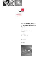
Dingee Reservoir Final Seismic Report - East Bay Municipal Utility ...
Dingee Reservoir Final Seismic Report - East Bay Municipal Utility ...
Dingee Reservoir Final Seismic Report - East Bay Municipal Utility ...
- No tags were found...

Create successful ePaper yourself
Turn your PDF publications into a flip-book with our unique Google optimized e-Paper software.
856 Seaview Drive PACIFIC ENGINEERING and ANALYSIS<br />
El Cerrito, CA 94530<br />
(510) 528-2821<br />
Fax 528-2135<br />
pacificengineering@juno.com<br />
August 1, 2008<br />
Dona Mann, C.E.<br />
Senior Engineer<br />
Alan Kropp & Associates<br />
2140 Shattuck Ave.,<br />
Berkeley, CA 94704<br />
RE: DINGEE Project<br />
Dear Miss Mann,<br />
Following your request we have developed a horizontal component deterministic design response<br />
spectrum (5% damped) at the 84 th percentile and three spectrally matched time histories for<br />
embankment analyses at the <strong>Dingee</strong> Dam. The <strong>Dingee</strong> <strong>Reservoir</strong> is located in Piedmont, California<br />
(37.8295 o , -122.2176) 0.3 km west of the Hayward fault and over 20 km east of the San Andreas fault.<br />
To assess controlling earthquake sources, since the <strong>Dingee</strong> Dam is quite small with an average height of<br />
about 20 ft, the deaggregation of the recent USGS National Hazard Maps was examined at peak<br />
acceleration (e.g. about 30 Hz) as well as 1.0 Hz.<br />
This frequency range was taken to cover the<br />
frequency range of dominant response of the dam and clearly showed the Hayward fault as the<br />
controlling source. The deterministic MCE is considered to rupture the entire Hayward - Rogers Creek<br />
system with a magnitude of M 7.25 (Hanks and Bakun, 2002).<br />
<strong>Dingee</strong> Dam rests on a few feet of native soils overlying sandstone bedrock. For the planned analyses<br />
of the embankment, ground motions were computed for a soft rock outcrop site. Based on an analysis<br />
of values at rock sites which have recorded strong ground motions, a typical V<br />
S<br />
(30m) value for soft<br />
rock is about 600m/sec (Silva et al., 1999). While measured shear-wave velocities at the site were not<br />
available, nearby Estates Dam, about 0.25 km (800 ft) southeast from <strong>Dingee</strong> Dam, had suspension log<br />
profiles from two boreholes that penetrate into shallow bedrock (URS, 2006). Based on these<br />
suspension surveys, depth to 1 km/sec material is estimated to occur at about 5m (15 ft) at the <strong>Dingee</strong><br />
Dam site.<br />
1