Summary of General Submissions - SLEP - NSW Government
Summary of General Submissions - SLEP - NSW Government
Summary of General Submissions - SLEP - NSW Government
- No tags were found...

Create successful ePaper yourself
Turn your PDF publications into a flip-book with our unique Google optimized e-Paper software.
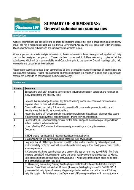
SUMMARY OF SUBMISSIONS:<br />
<strong>General</strong> submission summaries<br />
Introduction<br />
‘<strong>General</strong>’ submissions are considered to be those submissions that are not from a group such as a community<br />
group, are not a rezoning request, are not from a <strong>Government</strong> Agency and are not a form letter or petition.<br />
These other types are submissions are summarised in separate tables.<br />
Where a person has made multiple submissions, theses submissions have been grouped together and only<br />
one number assigned per person. These numbers correspond to folders containing copies <strong>of</strong> all the<br />
submissions which will be made available to all Councillors prior to the series <strong>of</strong> Council meetings being held<br />
to consider the outcomes <strong>of</strong> the exhibition.<br />
Please note submissions have been summarised as best as possible given the number <strong>of</strong> submissions and<br />
the resources available. Please keep enquiries on these summaries to a minimum to allow staff to continue to<br />
prepare the reports to be considered at the Council meetings.<br />
Summaries<br />
Number <strong>Summary</strong><br />
1 Supports the draft LEP in respect to the uses <strong>of</strong> industrial land and in particular, the retention <strong>of</strong><br />
bulky goods retail and ancillary retail.<br />
Believes that any change to cut out any form <strong>of</strong> retailing in industrial zones will have a serious<br />
negative effect on their industrial business.<br />
2 Object to Pointer road being R5 zone - increased traffic, narrow dangerous, threat to rural<br />
lifestyle leave Pointer Rd as agricultural land.<br />
3 requesting zoning <strong>of</strong> Yerriyong (main rd 92 adjacent Albatross Naval Base) allow for wide scope<br />
including food and beverage, accommodation, driving training, motorsport,<br />
4 Supports the LEP, important step forward for the area. Supports the rezoning <strong>of</strong> Jaspers Brush<br />
airfield to allow it to be developed.<br />
5 Likes: effort by SCC to consult with community via meetings and drop in sessions.<br />
Concerns:<br />
1. HOB should not exceed 8.5 metres throughout the Shoalhaven.<br />
2. All Shoalhaven rate payers should be notified <strong>of</strong> their new zonings.<br />
6 Requests that all <strong>of</strong> Berringer Lake be zoned W1 – the land is bounded by national park and<br />
environmentally protected land with minimal development. Any further development could create<br />
adverse pressure.<br />
1. Caravan parks have been included as a permissible use on rural land zoned RU2. The State<br />
template does NOT include caravan parks and other nearby government areas such as Kiama,<br />
Eurobodalla and Bega do not allow caravan parks. I would urge that caravan parks be deleted<br />
as a permissible use from RU2 land.<br />
2. Maintaining the existing 2 storey building height restriction for the whole district is <strong>of</strong> major<br />
concern. Council has included an 11 metre (4 storeys) building height into the Draft <strong>SLEP</strong>. A<br />
guarantee that height plans for every village are protected and secured at the current 2 storey<br />
height is sought. As I understand the Department <strong>of</strong> Planning considers an R1 zoning (general<br />
1
DRAFT <strong>SLEP</strong> 2009 – SUMMARIES OF GENERAL SUBMISSIONS<br />
Number <strong>Summary</strong><br />
residential) should apply to North Bendalong, I would support the current Council’s Draft<br />
recommendation to zone North Bendalong R2 in line with its neighbouring villages.<br />
3. The Crown land on the eastern side <strong>of</strong> Inyadda Drive and the southern side <strong>of</strong> Bendalong<br />
Road is zoned Rural Landscape RU2 which permits many uses including caravan parks. The<br />
area has already been mapped as having high biodiversity and scenic values as well as serving<br />
as a major east-west habitat corridor from the coast to Conjola National Park. I would urge that<br />
this area be protected and further development limited with an E2 zoning – Environmental<br />
Conservation.<br />
4. The planned shops at Manyana have been zoned B2 (Local Centre). This provides for a<br />
range <strong>of</strong> uses that would service a much wider catchment than a B1 – Neighbourhood Centre.<br />
B1 zoning is more appropriate.<br />
Disapprove <strong>of</strong> Manyana Shop development, all facilities from retail, medical, small business and<br />
entertainment are only a short distance away at Milton and Ulladulla.<br />
7 Supports 'air transport facilities' at Jaspers Brush, there are not many <strong>of</strong> these facilities and they<br />
bring visitors and revenue.<br />
8 Administrative transfer has limited public input to the preparation <strong>of</strong> the draft LEP.<br />
Concerned that 1(c) land has been zoned R5 because <strong>of</strong> loss <strong>of</strong> protection from further<br />
subdivision - recommends Council adopt zones RU4 and E4 and zone 1(c) land either RU4 or E4<br />
depending on their current land use, minimum lot sizes and proximity to land <strong>of</strong> high conservation<br />
value.<br />
Concerned with development <strong>of</strong> flood prone land in RU1 and RU2 zones - recommends Council<br />
add a new subclause 7.8(5) "for the avoidance <strong>of</strong> doubt the following land uses are prohibited in<br />
flood prone land: tourist and visitor accommodation, caravan parks, air transport facilities, cellar<br />
doors, crematoria, mining, <strong>of</strong>fensive industries and veterinary hospitals".<br />
Concerned with caravan parks and mobile homes in RU2 zoning - recommends Council remove<br />
caravan park as a use permissible in RU2 zone.<br />
Concerned with lot sizes in Huntingdale Park (DCP 70). Lot 6 DP 1115338 is designated min lot<br />
size 2000 m² in DCP 70 however it mapped 500 m² lot sizes in draft LEP.<br />
RU4 to be used in rural areas to avoid the alienation <strong>of</strong> small rural holdings suitable for<br />
agriculture and generating employment opportunities.<br />
Recommend R1 objective "To identify land suitable for future urban expansion" be deleted - as<br />
this could pre-empt consideration <strong>of</strong> the rezoning process when land is to be released.<br />
Recommend B4 objectives that restrict competition should be removed.<br />
Special Use zones - any reclassification <strong>of</strong> SP zones should be re-exhibited.<br />
E4 zones should be used where dwelling are permitted in environmentally sensitive areas.<br />
The compression <strong>of</strong> zones has resulted in additional land uses being permitted or appear to be<br />
inappropriate with the objectives <strong>of</strong> the specific zone - Recommends a number <strong>of</strong> changes to<br />
permitted uses in zones.R1 <strong>General</strong> Residential -<br />
The following should be deleted-<br />
• Boat repair facilities (noisy business activity, not compatible)<br />
• Helipads (noisy activity, not compatible)<br />
• Home industries (light industry not compatible)<br />
• Registered clubs (not compatible due to noise and traffic, use R3)<br />
• Tourist and visitor accommodation (not compatible due to noise and traffic, use SP3 or R3)<br />
• Veterinary hospital (not compatible due to noise, use R3 or B zones).<br />
R2 Low Density Residential –<br />
The following should be deleted-<br />
• Dual occupancy (prohibited in zones 2(a2) and 2(a3) in LEP1985 (not compatible with R2 ”Low<br />
Density” residential)<br />
• Emergency service facilities (not compatible due to noise and traffic).<br />
2
DRAFT <strong>SLEP</strong> 2009 – SUMMARIES OF GENERAL SUBMISSIONS<br />
Number<br />
<strong>Summary</strong><br />
B1 to B7 Business –<br />
The following should be deleted. Any developments not specified in 2 or 4 and list all permitted<br />
uses (for clarity).<br />
Concerned that E1, E2 and E3 zones do not comply with requirements <strong>of</strong> the South Coast<br />
Regional Conservation Plan prepared by DECC as they do not identify possible indicative or<br />
verified regional corridors.<br />
Concerned that environmental corridors that cross open paddocks are not mapped as they are<br />
usually zoned Rural.<br />
Permitted rural land uses have the potential to block flora and fauna corridors.<br />
Recommends Council insert in Section 1.2 the aim "protect and enhance environmental and<br />
riparian corridors" and map on the NRB layer, environmental corridors across open and forested<br />
land.<br />
Recommends Council insert a Biodiversity Clause to reject DAs affected by any NRB overlay.<br />
Biodiversity clauses are extremely pro development with an unacceptable level <strong>of</strong> environmental<br />
protection.<br />
DP&I amended Biodiversity clauses in recent SI are even more pro development.<br />
Recommends Council view different clauses that have been adapted from SI and provide<br />
stronger protection.<br />
Concerned that Clause 7.5.4 assumes consent would be granted, should read "before granting<br />
or refusing consent."<br />
Biodiversity clause is restrictive and does not provide qualitative indicators for judgement on an<br />
applications capacity to maintain biodiversity - there is no requirement for consideration <strong>of</strong><br />
alternatives and amelioration.<br />
Recommends the deletion <strong>of</strong> a number <strong>of</strong> uses in the E2 zone - significant threats to<br />
conservation values.<br />
Recommends that 3(h) and 4(e) not mapped into E3. Because 3(h) and 4(e) are included in the<br />
E3 it consequently permits too many land uses.<br />
Height <strong>of</strong> Buildings Recommendations:<br />
- Clause 4.3 - delete clause 4.3 (2) and insert new clause "the height <strong>of</strong> any building on any land<br />
is not to exceed the maximum height shown for the land on the Height <strong>of</strong> Buildings Map"<br />
- Map all land in the Shoalhaven on the HOB maps and set heights in accordance with current<br />
DCPs and if no DCPs apply, map the height in accordance with the current practice.<br />
HOB from LEP 1985 to draft LEP has increased - clause 33 in LEP 1985. Concerned that height<br />
in draft LEP will mean 3 or 4 storeys and does not reflect administrative changeover.<br />
Heights set in DCP are more difficult to control heights set in the LEP.<br />
9 Objects to proposed LEP changes which would allow increased use <strong>of</strong> the airstrip at Jaspers<br />
Brush.<br />
3
DRAFT <strong>SLEP</strong> 2009 – SUMMARIES OF GENERAL SUBMISSIONS<br />
Number <strong>Summary</strong><br />
Believes that it would be a negative for tourism.<br />
10 Congratulates Council on past and present realistic and practical zoning for industrial areas.<br />
Trusts that Council will not be persuaded to stop any form <strong>of</strong> retailing in existing industrial areas<br />
11 Issues 1. Clause 4.3 <strong>of</strong> the Draft <strong>SLEP</strong>2009 … increased max building increased to 11m.<br />
Recommendations 1.<br />
- Remove the “optional” statement from Clause 4.3 … 11 metres except where.<br />
- Map all zones (HOB and FSR) in Huskisson and the Shoalhaven to reflect existing maximum<br />
heights and FSR whether they are set by site specific DCP or generic DCP or convention /<br />
precedence for Huskisson or other <strong>of</strong> the coastal and rural villages.<br />
- There should be no heights mapped above 8.5 meters, except for those already mapped for<br />
Huskisson, Ulladulla and the Civic Precinct <strong>of</strong> Nowra, until Council has explicitly defined its<br />
“strategic centres” and engaged the community to include their aspirations and concerns in any<br />
final decision.<br />
Objects that Council have increased the maximum height <strong>of</strong> buildings across the Shoalhaven<br />
through the inclusion <strong>of</strong> "11m except where" into Clause 4.3 <strong>of</strong> the draft <strong>SLEP</strong> 2009.<br />
Under <strong>SLEP</strong>1985, Council does have the right to give consent for construction up to 11 m, this<br />
currently requires a decision at a full meeting <strong>of</strong> Council. A DA requiring building height greater<br />
than 2 Stories will need to be submitted, initially to the Development Committee at which time the<br />
community have the opportunity to scrutinise and make submissions.<br />
Recommends the removal <strong>of</strong> "and desired future character <strong>of</strong> a" from the objectives for both<br />
Clause 4.3 (Height <strong>of</strong> Buildings) and Clause 4.4 (Floor Space Ratio).<br />
Believes that Clause 4.3 (a) can only be interpreted as a warning that there is an unstated plan<br />
for dramatic changes in certain parts <strong>of</strong> the Shoalhaven. Once the Draft <strong>SLEP</strong> 2009 has been<br />
approved such statements if they persist will provide Council a legal right to make changes<br />
irrespective <strong>of</strong> community outcry.<br />
It is clear that the previous Council over stepped the “ground rules” that were the basis for an<br />
Administrative Change Over. My hope is that the current elected Councillors will not persist with<br />
the cynical ploy to isolate the community while making indelible changes to the future <strong>of</strong> the<br />
Shoalhaven without due process and substantive Community Engagement.<br />
Recommendation:<br />
- That Council persist with its “intention” to Map R2 and RU5 zones and also height limits in site<br />
specific DCP’s<br />
- That Council amend this motion, in conjunction with the removal <strong>of</strong> the “optional” statement<br />
from Clause 4.3 … 11 metres except where … and map all zones (HOB and FSR) in Huskisson<br />
and the Shoalhaven to reflect existing maximum heights and FSR whether they are set by site<br />
specific DCP or generic DCP or convention / precedence for Huskisson or other <strong>of</strong> the coastal<br />
and rural villages.<br />
- There should be no heights mapped above 8.5 meters, except for those already mapped for<br />
4
DRAFT <strong>SLEP</strong> 2009 – SUMMARIES OF GENERAL SUBMISSIONS<br />
Number<br />
<strong>Summary</strong><br />
Huskisson, Ulladulla and the Civic Precinct <strong>of</strong> Nowra, until Council has explicitly defined its<br />
“strategic centres” and engaged the community to include their aspirations and concerns in any<br />
final decision.<br />
Concerned that Council's intention to map R2 and RU5 zones as well as site specific DCPs will<br />
mean that this leaves many areas unmapped including R1 <strong>General</strong> Residential which includes<br />
single dwellings and medium density, R3 Medium Density Residential, R5 large lot residential, all<br />
Business zones, Rural zones, Public Recreation areas and Environmental zones, all <strong>of</strong> which<br />
can have developments to 11metres.<br />
Believes this limited mapping will result in ad hoc changes to the character <strong>of</strong> many streets and<br />
areas <strong>of</strong> the Shoalhaven and lead to uncertainty for landowners and developers.<br />
The DP&I has suggested the three dimensional diagrams can be used in DCPs to control height.<br />
However, neither Council nor DP&I have been able to demonstrate how this can be done. The<br />
DP&I also suggest the use <strong>of</strong> storeys to control height, but this would also require specifying<br />
ceiling heights etc. and would severely restrict architectural design.<br />
Shoalhaven’s DCPs are “performance based” and allow for “acceptable solutions”. On many<br />
occasions Council staff has indicated that DCPs should only be treated as a guide to allow for<br />
flexibility. Whilst this may be satisfactory for minor design matters, height is so crucial to fabric<br />
and character <strong>of</strong> an area that it cannot be left to chance.<br />
Believes that 1(g) zoned land at the end <strong>of</strong> Currambene St should be E2 instead <strong>of</strong> B4 as per<br />
equivalent flood prone land 200 metres to the north as approved by Crown Lands.<br />
- The general area zoned B4 along Berry Street adjacent to the Murdoch Street – DCP99<br />
development area is not suitable for development due to the incidence <strong>of</strong> endangered flora and<br />
fauna and the potential <strong>of</strong> flooding and high risk <strong>of</strong> bush fires. It is unreasonable and deceptive<br />
that this Crown land be proposed as suitable for mixed development.<br />
Objection to 1(g) land - Flood prone land located at the 'extension' to Currambene St has been<br />
put into B4 mixed development rather than E2 Environmental Conservation.<br />
Consequence <strong>of</strong> this:<br />
- Inclusion <strong>of</strong> flood prone land in B4 (mixed development) zone is very misleading to a developer<br />
as the land will impose extreme cost penalties.<br />
- Similar land 200 metres to the north has been zoned E2 as part <strong>of</strong> a Crown lands assessment,<br />
this land at the southern end <strong>of</strong> Currambene street should also be zoned E2.<br />
The lots, zoned 6(c) along Berry Street are a buffer separating the 2(a1) = R2 low density<br />
residential zone from high risk bush fire prone land.<br />
Objection to the 6(c) recreational land:<br />
There is correspondence with the Council Senior Planner responsible for the Draft <strong>SLEP</strong>2009<br />
acknowledging that the zoning <strong>of</strong> the two lots into the B4 zone was incorrect – Berry Street<br />
Zone Change Template clearly and succinctly states that the equivalent for the existing 6(c) zone<br />
is RE1 (public recreation). Please have the error corrected. It is totally unreasonable to remove<br />
public recreation land in favour <strong>of</strong> high rise developments . Currently the land, zoned 6(c), is<br />
Crown land.<br />
Concerned with inappropriate increase in land use in the R2 low density residential zone.<br />
5
DRAFT <strong>SLEP</strong> 2009 – SUMMARIES OF GENERAL SUBMISSIONS<br />
Number<br />
<strong>Summary</strong><br />
Land use for most zones has been broadened to the point <strong>of</strong> totally obscuring the DP&I<br />
Objectives for the zone.<br />
This can only be interpreted as a desperate means to gain maximum flexibility to react to any<br />
opportunistic development proposal due to the total lack <strong>of</strong> vision for the future <strong>of</strong> the Shoalhaven<br />
or a vision that would be totally contrary to the community’s aspirations. The solution is simple<br />
and relies on Community Engagement as a means <strong>of</strong> planning for the future.<br />
It is essential for the future development <strong>of</strong> the Shoalhaven and retention <strong>of</strong> this natural asset is<br />
not lost through desperate decisions to develop at any cost.<br />
It is not reasonable to use the premise that a previous “spot zoning” somewhere in the<br />
Shoalhaven has approved a specific land use … as a justification for the same land use to be<br />
included in the new zone and applied to the whole Shoalhaven.<br />
Recommendation:<br />
1. Recognising that the new zones are a compilation <strong>of</strong> a number <strong>of</strong> existing zones, that in all<br />
new zones, the land uses inserted by Shoalhaven City Council be removed from the particular<br />
zone if they were:<br />
- previously prohibited, or<br />
- not previously stated as a permitted land use in one <strong>of</strong> the existing zones.<br />
2. That Council be instructed to carry out Community Engagement to collaborate with the<br />
community in determining the most appropriate land uses for each zone.<br />
Believes the following land use categories in the 2(a1) + 2(a4) zones are contrary to the<br />
objectives set by DP&I:<br />
iv. Exhibition homes and Exhibition Villages (not previously a permitted use)<br />
v. Home industry and Home industries (not previously a permitted use)<br />
vi. Boat repair facilities, boat launching ramps, boat sheds, jetties (not previously a permitted<br />
use)<br />
vii. SEWERAGE SYSTEMS (not previously a permitted use)<br />
viii. Emergency service facilities (not previously a permitted use)<br />
ix. Building identification signs, Business identification signs (not previously a permitted use).<br />
In general the number <strong>of</strong> permissible land uses has increased quite significantly, those listed<br />
above are inappropriate in an Administrative Changeover on the basis that they were (not<br />
previously a stated permitted use). As well they will significantly reduce the residential amenity<br />
sought by families.<br />
Concerned with inappropriate increase in land use in the R3 medium density residential zone.<br />
Recommendation;<br />
6
DRAFT <strong>SLEP</strong> 2009 – SUMMARIES OF GENERAL SUBMISSIONS<br />
Number<br />
<strong>Summary</strong><br />
1. Recognising that the new zones are a compilation <strong>of</strong> a number <strong>of</strong> existing zones, that in all<br />
new zones, the land uses inserted by Shoalhaven City Council be removed from the particular<br />
zone if they were:<br />
- previously prohibited, or<br />
- not previously stated as a permitted land use in one <strong>of</strong> the existing zones.<br />
2. Remove all land uses that are not subservient to a family life style in a medium density<br />
residential area located in a small rural or coastal environment.<br />
It is not reasonable to use the premise that a previous “spot zoning” somewhere in the<br />
Shoalhaven has approved a specific land use as a justification for the same land use to be<br />
included in the new zone and applied to the whole Shoalhaven.<br />
There is little land zoned R3 in the Shoalhaven.<br />
The combined impact <strong>of</strong> any change in land use plus an increase <strong>of</strong> max height from 8.5m to<br />
11m in this zone will have the greatest detrimental impact on small rural and coastal villages<br />
adversely impacting tourism through over-development. This is especially the situation for<br />
Huskisson.<br />
The following Land Use categories in the R3 zone have been added to existing permitted uses<br />
and are contrary to the Objectives as set by DP&I:<br />
- Dual Occupancies (not previously a permitted use)<br />
- Hostels & Residential Flat buildings (not previously a permitted use)<br />
- Shop Top Housing … (not previously a permitted use) …. Neighbourhood Shops are a<br />
mandated use, however Shop Top housing creates a gross impost on the surrounding area<br />
- TOURIST & Visitor Accommodation. (previously a prohibited land use)<br />
- Home industry and Home industries (not previously a permitted use)<br />
- SEWERAGE SYSTEMS (not previously a permitted use)<br />
- Registered Clubs (not previously a permitted use) a source <strong>of</strong> noise inappropriate to a<br />
residential area<br />
- Veterinary hospitals (not previously a permitted use), a source <strong>of</strong> noise inappropriate to a<br />
residential area<br />
- Water Supply Systems (not previously a permitted use)<br />
- Boat Repair facilities, boat launching ramps, boat sheds, jetties (not previously a permitted use)<br />
- Building & Business Identification signs (not previously a permitted use)<br />
The imposition <strong>of</strong> Hostels, Residential Flat buildings, Shop Top Housing, Tourist & Visitor<br />
7
DRAFT <strong>SLEP</strong> 2009 – SUMMARIES OF GENERAL SUBMISSIONS<br />
Number<br />
<strong>Summary</strong><br />
Accommodation, Sewerage systems, Registered Clubs, Veterinary Hospitals, Water Supply<br />
systems, Boat Repair facilities, boat launching ramps, boat sheds, jetties are totally anathema to<br />
a medium density residential zone in a small rural or coastal community<br />
Concerned with loss <strong>of</strong> neighbourhood shops at Vincentia.<br />
Recommendation:<br />
- The Vincentia Village shops are a vital community resource and no rezoning to B4 should be<br />
considered until a detailed Town Plan has been prepared for Vincentia and discussed with all<br />
landowners and the community.<br />
- It follows that on a “best fit” basis, the existing 3(c) neighbourhood zone should be translated<br />
into B1 Neighbourhood Centre<br />
- It seems incongruous that in a time <strong>of</strong> encouraged “energy efficiency” that the populations <strong>of</strong><br />
Woollamia, Huskisson, Hyams Beach, Erowal Bay and Vincentia will be forced to drive up to<br />
12km simply to reach a retail centre that previously was available in Vincentia … and for whose<br />
benefit, not for any <strong>of</strong> these communities.<br />
Concerned that “best fit” is not the case with existing Vincentia (Burton Street) shops and the<br />
surrounding land which has all been rezoned B4 Business Mixed Use.<br />
If it had been a best fit, The 3(c) Business, Neighbourhood would have been rezoned B1<br />
Neighbourhood Centre not B4 Business Mixed<br />
Use and the 2(c) Residential Living Area rezoned to R1 <strong>General</strong> Residential not B4 Business<br />
Mixed Use.<br />
Apparently the request for this rezoning came from the largest business landowner on the block.<br />
There are 3 other owners <strong>of</strong> land zoned 3(c) and there are 23 blocks <strong>of</strong> land zoned 2(c). We are<br />
not aware that any <strong>of</strong> the other landowners were consulted and certainly the community were not<br />
consulted about this rezoning.<br />
The shopping centre in Vincentia should have been zoned B1, Neighbourhood Shops, instead<br />
the area has been zoned B4 significantly benefiting the major landowner.<br />
- This is but one <strong>of</strong> a number <strong>of</strong> re-zonings that the previous Council has included in the Draft<br />
<strong>SLEP</strong>2009. In including a number <strong>of</strong> one-<strong>of</strong>f re-zonings, Councillors have precluded community<br />
scrutiny and “given direction” to provide significant benefit to individuals.<br />
Height <strong>of</strong> Buildings in the B1 and B2 zones should be restricted to 8.5 meters until SCC has<br />
submitted any proposed change for Community Engagement to ascertain the real impact <strong>of</strong> their<br />
proposal<br />
It is also unreasonable to penalise the shop keepers, effectively forcing them out <strong>of</strong> business<br />
through the inclusion <strong>of</strong> the Objective “To ensure that retail uses do not compete with the<br />
commercial core” as required under B4, especially as the beneficiary has chosen to sell the rezoned<br />
shopping centre land.<br />
2(c) residential area adjacent to the Vincentia Neighbourhood Shops should be translated into<br />
R2 low density residential in line with the development that has already taken place.<br />
Concerned with inappropriate increase in land use in the RU2 rural zone.<br />
Recommendation;<br />
8
DRAFT <strong>SLEP</strong> 2009 – SUMMARIES OF GENERAL SUBMISSIONS<br />
Number<br />
<strong>Summary</strong><br />
1. Recognising that the new zones, RU2 is a direct replacement for the existing 1(d) zone, that<br />
the land uses inserted by Shoalhaven City Council be removed from the particular zone if they<br />
were:<br />
- previously prohibited, or<br />
- not previously stated as a permitted land use in one <strong>of</strong> the existing zones.<br />
That Council be instructed to carry out Community Engagement to collaborate with the<br />
community in determining the most appropriate land uses for each zone.<br />
It is not reasonable to use the premise … that a previous “spot zoning” somewhere in the<br />
Shoalhaven has approved a specific land use … as a justification for the same land use to be<br />
included in the new zone and applied to the whole Shoalhaven<br />
Remove Caravan Parks as a land use in the RU2 zone.<br />
- This is unacceptable in many rural landscape areas and should be withdrawn until the<br />
completion <strong>of</strong> the review <strong>of</strong> SEP21 (State Environmental Planning Policy-Caravan Parks) and<br />
SEP36 (State Environmental Planning Policy-Manufactured Homes Estates) is completed by the<br />
<strong>NSW</strong> <strong>Government</strong>. Kiama has not included Caravan Parks in RU2 in their LEP.<br />
Remove AIR TRANSPORT FACILITIES, especially as they will adversely affect residential<br />
amenity and the small coastal village character <strong>of</strong> Huskisson and other coastal and rural villages.<br />
Believes the following Land Use categories have been added to existing permitted uses and are<br />
inconsistent with the Objectives as set by DP&I:<br />
i. previously a prohibited land use<br />
i. Group Homes<br />
ii. Offensive Industries<br />
iii. Hazardous Industries … 1(d) prohibits Industries<br />
iv. Extractive Industries<br />
c. not previously a stated permitted use<br />
i. Hazardous Industries<br />
ii. Boat Repair facilities, boat launching ramps, boat sheds, jetties, marinas, moorings<br />
iii. AIR TRANSPORT FACILITIES<br />
iv. Tourist & Visitor Accommodation … including caravan parks<br />
v. Entertainment facilities, Markets,<br />
vi. Food and Drink Premises<br />
One consequence <strong>of</strong> the compression <strong>of</strong> allowable zonings and expansion <strong>of</strong> permitted land<br />
uses in specific zones is that Caravan parks (and mobile homes) are allowed in areas zoned<br />
as RU2 Rural Landscape. This land use is unacceptable in many rural landscape areas and<br />
9
DRAFT <strong>SLEP</strong> 2009 – SUMMARIES OF GENERAL SUBMISSIONS<br />
Number <strong>Summary</strong><br />
should be withdrawn until the completion <strong>of</strong> the review <strong>of</strong> SEP21 (State Environmental Planning<br />
Policy-Caravan Parks) and SEP36 (State Environmental Planning Policy-Manufactured Homes<br />
Estates) is completed by the <strong>NSW</strong> <strong>Government</strong>. Kiama has not included Caravan Parks in RU2<br />
in their LEP.<br />
12 61 Crams Road North<br />
Likes that cleared land is zoned for residential<br />
Concerned with rezoning lf land around Crams Rd North Nowra, has E2 land which has tighter<br />
controls and can do less. Concerned about impact <strong>of</strong> traffic on Crams Rd.<br />
Would like to be able to subdivide some 600m2 blocks from the font <strong>of</strong> property<br />
13 Likes E2 zoning over part <strong>of</strong> the Lake Wollumboola catchment.<br />
Concerned with the political nature <strong>of</strong> some <strong>of</strong> the decisions surrounding environmental issues.<br />
Need to extend the E2 zone on all <strong>of</strong> Lake Wollumboola Catchment.<br />
14 Concerned that not all the recommendations in the South Coast Regional Strategy have been<br />
implemented, particularly for Culburra Beach area.<br />
Environment Zone Recommendations<br />
E2 Environment Conversation “Environment Protection Works” and “Environment Facilities” be<br />
the only uses which should be permitted. Other proposed uses, e.g. “dwelling houses” are not<br />
consistent with the objective <strong>of</strong> obtaining national park-equivalent values and not consistent with<br />
SCRS and ESD principals. Existing dwelling houses are permitted. E2 zones in Bega,<br />
Eurobodalla and Kiama LEPs do not permit new dwellings. We should follow suit.<br />
“E 2 zoning should apply to the south east part <strong>of</strong> the Lake Wollumboola catchment and the<br />
Kinghorn Point area.”<br />
“The northern shore <strong>of</strong> Lake Wollumboola should be zoned E 2 zoning including SEPP 14<br />
Wetland No 365 as well as the foreshore reserve and Lot 1 East Crescent, to protect the Lake<br />
shore, the Endangered Ecological Communities and Threatened species habitat.”<br />
“High Conservation value parts <strong>of</strong> the lower Crookhaven River catchment should be protected<br />
through E 2 Environment Conservation zoning, with “limited” residential zoning, such as an E 4<br />
Environmental Living zone located in cleared and disturbed areas only.”<br />
“Private land in the Lake catchment outside the existing developed area <strong>of</strong> Culburra Beach-<br />
Orient Point should be zoned “E 2 Environment Conservation” including the Long Bow Point area<br />
south <strong>of</strong> Culburra Rd, areas north <strong>of</strong> Culburra Rd as well as areas west and south east <strong>of</strong> the<br />
Lake.<br />
North Bendalong and Bendalong Crown Land to west should be rezoned E1 because <strong>of</strong><br />
contiguous relationship with Conjola National Park.<br />
One Tree Bay, St George Basin should have E2 zoning.<br />
Heritage Estates should be rezoned to E2 consistent with verified values and Australian<br />
<strong>Government</strong> Environment Minister’s decision not to allow rezoning for residential development.<br />
RU2 zoning is not ecologically sustainable.<br />
Kinghorn Point-Warrain Beach-Lake Wollumboola catchment should be zoned E2. This HCV<br />
area is identified under the Department <strong>of</strong> Planning Coastal Lands Protection Scheme as<br />
“protection essential”.<br />
E2 zoning for Lake Wollumboola catchment outside existing developed areas <strong>of</strong> Culburra Beach<br />
and Jervis Bay National Park, SCRS zoning is E1, but as there is no agreement to acquire this<br />
land, an E2 zoning should be made.<br />
10
DRAFT <strong>SLEP</strong> 2009 – SUMMARIES OF GENERAL SUBMISSIONS<br />
Number<br />
<strong>Summary</strong><br />
All Crown Lands should have E 1 and 2 zoning on sites identified in the South Coast Regional<br />
Conservation Plan Map 17.<br />
“Limited” R 2 zoning as well as E zoning, subject to further studies, not R 1 residential for much<br />
<strong>of</strong> the lower Crookhaven River Catchment.<br />
Coastal Zone Protection (5.5) and Jervis Bay Regional Environment Plan (7.15) clauses must be<br />
retained.<br />
Tree Preservation Clause. Clause 5.9<br />
The existing SCC Tree Preservation Order Clause 5.9 should apply to all zones in the <strong>SLEP</strong>. The<br />
Native Vegetation Act applies to rural zoned land. The clause (5.9) should apply to all zones in<br />
the <strong>SLEP</strong>, existing SCC Tree preservation Order. Native Vegetation Act applies to rural zoned<br />
land.<br />
Biodiversity (7.5) and Water (7.6). These clauses apply to development applications in areas<br />
mapped as Natural Resource Sensitivity Biodiversity Areas. They assume developments would<br />
be approved, merely requiring a consent authority to “consider” potential impacts, rather than<br />
establishing that values would be maintained. Cleared land in habitat corridors should be<br />
covered by Biodiversity mapping to foster corridor regeneration and connectivity. Riparian Zone<br />
widths <strong>of</strong> 50 metres each side <strong>of</strong> water courses, be inserted in to all zones <strong>of</strong> the <strong>SLEP</strong>.<br />
Habitat corridors and Riparian zones.<br />
There should be expansion <strong>of</strong> Habitat Corridors shown on the Biodiversity Map. Community land<br />
gazetted as “Natural Areas, Bushland” in accordance with the Local <strong>Government</strong> Act, be zoned<br />
E2. e.g. foreshore reserves.<br />
E 4 Environmental Living. This zone should be included in the <strong>SLEP</strong> to allow for low impact<br />
residential development. Some rural areas should be reconsidered for E 4 zoning. Jerberra<br />
Estates are proposed for part- E 4 zoning outside <strong>SLEP</strong> process<br />
E3 Environmental Management. “Dwelling Houses”, “Environmental Protection Works”,<br />
“Environmental Facilities” and “Home Industries” be the required permitted uses. SCC has added<br />
lists <strong>of</strong> uses likely to adversely impact on HCV areas. Such uses are not consistent with the<br />
SCRS and ESD principles. Therefore limit additional uses to “Visitor information centre,” “Homebased<br />
child care,” “roads,” “Home based business.” Other “Tourist and Visitor accommodation”<br />
definition uses are not consistent with the zone objective, and should be removed.<br />
15 Concerned that Clause 13(d) Subdivision <strong>of</strong> dwelling houses – multiple occupancy from the<br />
current LEP has not been included in the draft LEP.<br />
Has multiple occupancy and have not subdivided and may wish to.<br />
16 The proposed change to height <strong>of</strong> buildings to 11 metres in residential and rural areas is too high<br />
and should remain at 8.5 metres; this would conform with the 'Administrative Changeover' which<br />
was adopted by council. The maximum height <strong>of</strong> 8.5m should be confirmed on a Height <strong>of</strong><br />
Buildings map and conform with existing DCP's.<br />
Concerned with the height map for Huskisson - shows heights that are 3 metres higher.<br />
Clause 4.3.1 (a) the words "desired future character <strong>of</strong> a" should be removed from this<br />
statement so that it reads "to ensure that buildings are compatible with the height, bulk, and scale<br />
<strong>of</strong> the existing locality". These words have no place in this sentence as it is unclear who decides<br />
the desired future character.<br />
Public Recreation land zoned 6(c) along Berry Street Huskisson is Crown land and should NOT<br />
be seconded for private development and is also a buffer separating the 2(a1) = R2 low density<br />
residential zone from high risk bush fire prone land. This land should be zoned RE1 not B4.<br />
11
DRAFT <strong>SLEP</strong> 2009 – SUMMARIES OF GENERAL SUBMISSIONS<br />
Number<br />
<strong>Summary</strong><br />
· Flood prone land 1(g) located at the ‘extension’ to Currambene Street Huskisson should be<br />
zoned E2 Environmental Conservation not B4 Mixed Development. This land is similar to land<br />
200m to the north behind Waddell Street which has been zoned E2 as part <strong>of</strong> a Crown lands<br />
assessment.<br />
Land previously zoned 3(g) along Berry Street and Murdoch Street Huskisson has been zoned<br />
B4 when it should be E2 or RE1 as it contains protected species and is a very high fire risk.<br />
The 'Heritage Estate' located between Naval College Road, Erowal Bay Road and The Wool<br />
Road has been zoned RU2 Rural landscape instead <strong>of</strong> E2 Environmental Conservation. This<br />
land is a habitat corridor and should be protected as such.<br />
Changed land uses in a number <strong>of</strong> zones are not in accord with existing uses (considering<br />
council adopted an Administrative Changeover process) or with the objectives for the zone.<br />
RU2 Rural Landscape<br />
The following Land Use categories have been added to existing permitted uses and are<br />
inconsistent with the Objectives as set by DP&I:<br />
1. previously a prohibited land use<br />
- Group Homes<br />
- Offensive Industries<br />
- Hazardous Industries<br />
- Extractive Industries<br />
2. not previously a permitted use<br />
- Hazardous Industries<br />
- Boat repair facilities, boat launching ramps, boat sheds, jetties, marinas, moorings<br />
- AIR TRANSPORT FACILITIES<br />
- Tourist & Visitor Accommodation including caravan parks<br />
- Entertainment facilities, Markets,<br />
- Food and Drink Premises<br />
As council is aware there has been recent inappropriate excavation <strong>of</strong> an old and informal<br />
landing strip just to the west <strong>of</strong> Huskisson. If Airport Facilities are permitted to be developed on<br />
this site it would be to detrimental to the peace and quiet <strong>of</strong> the coastal village community.<br />
All land uses as listed above that were previously stated as prohibited or NOT stated as<br />
permissible and all land uses that are not subservient to rural activities and primary production<br />
where there is potential for food production and rural employment should be removed.<br />
R2 Low Density Residential<br />
The following Land Use categories have been added to existing permitted uses and are contrary<br />
to the Objectives as set by DP&I:<br />
12
DRAFT <strong>SLEP</strong> 2009 – SUMMARIES OF GENERAL SUBMISSIONS<br />
Number<br />
<strong>Summary</strong><br />
- Exhibition homes and Exhibition Villages<br />
- Home businesses and Home industries<br />
- Boat repair facilities, boat launching ramps, boat sheds, jetties<br />
- SEWERAGE SYSTEMS<br />
- Emergency service facilities<br />
- Building identification signs, Business identification signs<br />
These land uses are not subservient to a family life style in a low density residential area and are<br />
inappropriate in an Administrative Changeover on the basis that they were not previously a<br />
permitted use and should therefore be removed.<br />
R3 Medium Density Residential<br />
The following Land Use categories have been added to existing permitted uses and are contrary<br />
to the Objectives as set by DP&I:<br />
- Dual Occupancies<br />
- Hostels & Residential Flat buildings<br />
- Shop Top Housing<br />
- TOURIST & Visitor Accommodation<br />
- Home industry and Home industries<br />
- SEWERAGE SYSTEMS<br />
- Registered Clubs (a source <strong>of</strong> noise inappropriate to a residential area)<br />
- Veterinary hospitals (a source <strong>of</strong> noise inappropriate to a residential area)<br />
- Water Supply Systems<br />
- Boat Repair facilities, boat launching ramps, boat sheds, jetties<br />
- Building & Business Identification signs<br />
These land uses are not subservient to a family life style in a medium density residential area<br />
located in a small rural or coastal environment and are inappropriate in an Administrative<br />
Changeover on the basis that they were not previously a permitted use and should therefore be<br />
removed.<br />
RE1 Public Recreation<br />
An objective <strong>of</strong> this zone is "to enable land to be used for public open space or recreational<br />
13
DRAFT <strong>SLEP</strong> 2009 – SUMMARIES OF GENERAL SUBMISSIONS<br />
Number<br />
<strong>Summary</strong><br />
purposes" but the following Land Use categories have been added to existing permitted uses and<br />
are contrary to this objective:<br />
- Caravan parks<br />
- Entertainment facilities<br />
- Function centres<br />
- Restaurants<br />
- Child care centres<br />
This land should be used for public recreation not commercial ventures and therefore these land<br />
uses should be removed from this zone.<br />
E2 Environmental Conservation<br />
The following Land Use categories have been added to existing permitted uses and are not<br />
compatible with the Objectives as set by DP&I:<br />
- Aquaculture<br />
- Bed and Breakfast Accommodation<br />
- Dwelling houses<br />
- Home business<br />
- Home industries<br />
These land uses are inappropriate in conserving the environment and should be removed.<br />
17 Objects to air transport facilities in RU1<br />
18 Is a landowner within an area affected by the removal <strong>of</strong> lot averaging and advises that he is not<br />
inclined towards future subdivision <strong>of</strong> his land.<br />
19 Concerned with the rezoning <strong>of</strong> his property at Greenwell Point from industrial to residential.<br />
20 Submission - regarding Lot 412 DP 1144627, Lot 4 DP 834440 and Lot 22 DP 717323, Scott<br />
St/Discovery Pl Shoalhaven Heads.<br />
Thanks Council for fixing anomalies in the zoning <strong>of</strong> this area and incorporating changes into the<br />
draft LEP documentation.<br />
<strong>General</strong>ly supportive <strong>of</strong> proposed changes.<br />
Further anomalies identified on the properties include:<br />
Lot 412 DP 1144627:<br />
- believes draft <strong>SLEP</strong> provides a satisfactory area for construction <strong>of</strong> dwellings on lots 549, 550,<br />
551, 552 and 556b.<br />
14
DRAFT <strong>SLEP</strong> 2009 – SUMMARIES OF GENERAL SUBMISSIONS<br />
Number<br />
<strong>Summary</strong><br />
- concerned that draft <strong>SLEP</strong> proposes a small amount <strong>of</strong> R2 zoned land on proposed Lot 557,<br />
however this is part <strong>of</strong> the site that is flood affected and the flood free part <strong>of</strong> the site is zoned<br />
RU2. Approved and constructed flood free building envelope on Lot 557 is still located in the<br />
proposed RU2 zoning making approval <strong>of</strong> a dwelling both problematic and risky for future<br />
purchasers.<br />
- concerned that the R2 zone land is extremely close to the existing sewerage pumping station, is<br />
low lying and would therefore need to be filled to accommodate a future dwelling. Under the<br />
current proposed zoning - the existing fill mound would not be able to be utilised meaning the<br />
completed work to the site under SF5021 is wasted.<br />
- Recommends Council modify the boundary between the R2 and RU2 zones to capture the<br />
location <strong>of</strong> the existing earthen flood free mound on proposed Lot 557 (see fig. 1 in submission<br />
for map).<br />
- Concerned with min lot size map over Lot 412 DP 1144627 - recommends Council modify the<br />
boundary between the 40HA and the 500m2 minimum lot sizes areas to replicate the final zoning<br />
boundary when gazetted as outlined above (Mapping error added to 'matters for consideration'<br />
database).<br />
- Recommends Council remove significant portions <strong>of</strong> the area shown as being sensitive on the<br />
biodiversity map back to the proposed zoning line as there is no biodiversity value in those areas.<br />
- Believes the flood free mound as required by Council under SF5021 on the area <strong>of</strong> proposed<br />
Lot 557 should not be hatched as being flood prone.<br />
Lot 4 DP 834440:<br />
- Recommends Council modify the boundary between the R2 and RU2 zones to capture the<br />
location <strong>of</strong> the existing elevated area on the eastern portion <strong>of</strong> this lot - loss <strong>of</strong> small triangular<br />
piece <strong>of</strong> land that is currently zoned 2(a1) will be "down-zoned" to RU2 land under the draft LEP.<br />
Loss <strong>of</strong> residential land is acknowledged and accepted as long as the proposed zoning on the<br />
area near Scott St is converted to R2 zoning as recommended.<br />
- Believes site can be elevated to between RL 2.70m and RL2.9m AHD which is close to the 100<br />
year flood level, allowing a dwelling to be constructed on this lot.<br />
- Recommends Council modify the boundary between the R2 and RU2 zones to capture the<br />
location <strong>of</strong> the existing elevated area on the eastern portion <strong>of</strong> this lot.<br />
- Recommends Council modify the boundary between the 40HA and 500m2 min lot size area to<br />
replicate the final zoning boundary as previously requested.<br />
Lot 22 DP 717323 Wells Place - R1 zoning and min 500m2 lot size is supported<br />
21 Submission -regarding Lot 17 DP 814920, 1170 Illaroo Rd, Tapitallee.<br />
Supports R5 zoning.<br />
Supports minimum lot size <strong>of</strong> 1HA.<br />
15
DRAFT <strong>SLEP</strong> 2009 – SUMMARIES OF GENERAL SUBMISSIONS<br />
Number<br />
<strong>Summary</strong><br />
Supports removal <strong>of</strong> maximum lot yield provisions as it will provide a far more flexible subdivision<br />
arrangement for land in this area.<br />
Believes this property is suitable to be subdivided into 2 lots both being in excess 1HA without<br />
significant environmental impact (see fig. 3 for proposed 2 lot subdivision layout).<br />
22 Submission Lot 582 DP 1048099 Supports R5 zone.<br />
Supports minimum lot area <strong>of</strong> 1ha.<br />
Supports removal <strong>of</strong> 1(g) flood liable as this was clearly incorrect.<br />
Believes land can be subdivided into two lots.<br />
23 Concerned that minimum lot sizes for the Huntingdale Park development in Berry in the draft<br />
LEP are not consistent with those set through DCP 70.<br />
24 Concerned that serviced apartments are prohibited in the R1 zone. This doesn't encourage<br />
growth to the area to sustain roads, amenities and tourism.<br />
25 Supports the draft LEP, particularly the inclusion <strong>of</strong> 'air transport facilities' in the RU1 zone. The<br />
region lacks an airfield that can be used for training and recreational flying, would greatly<br />
enhance the region.<br />
Concerned with action groups distorting the facts and believes the complaints to be unjustified.<br />
26 Is a pr<strong>of</strong>essional in the aerospace industry, believes recreational aviation is very important in<br />
growing future talent for the industry.<br />
Jaspers Brush is a low cost entry for pilots and engineers and fosters interest.<br />
In Shoalhaven's interest to continue to expand recreation aviation for tourism and for the future <strong>of</strong><br />
the industry.<br />
27 1. Mapping issue -<br />
a) Part <strong>of</strong> Lot 270 DP 1001660 has RU5 zoning but lot size minimum <strong>of</strong> 40ha. Requested that<br />
the anomaly be rectified.<br />
Sheet NRB_046 shows thin strips <strong>of</strong> land at rear <strong>of</strong> 5 and 6 Beach Glade Pl, along the sides <strong>of</strong><br />
35 and 39 Malibu Dr and side <strong>of</strong> 25 North Haven Ave and rear <strong>of</strong> 4 & 5 Sunbird Place which<br />
share boundaries with Lot 270 and depict Significant vegetation and habitat corridors. Objection<br />
to this on the basis that there is no evidence that the land has these qualities represented on the<br />
map.<br />
Questioning appropriateness <strong>of</strong> E2 Zone. Requested that the E2 zoning on subject land be<br />
treated as a deferred matter, to enable a proper researched approach to the issues affecting the<br />
land, possibly a rezoning. study completed by Dominic Fanning<br />
numerous concerns with the land regarding stormwater / flooding etc. This has been referred to<br />
appropriate department.<br />
28 Killarney (east <strong>of</strong> Evans and prior St Lake Conjola Lot 372 DP1125806) is RU5 which would be<br />
overdevelopment should be E3<br />
29 In relation to the E2 Environmental Conservation zone:<br />
I support the inclusion <strong>of</strong> home businesses and home industries as developments permitted with<br />
consent. However, it is surprising that home occupations are prohibited in E2 zone whereas in<br />
other zones, innocuous home occupations are permitted without consent. That should also be<br />
the case for the E2 - permit home occupations without consent.<br />
In relation to the B2 Local Centre zone:<br />
Shop top housing - with the change to the standard instrument removing the previous wording ‘or<br />
otherwise attached to’ there needs to be new residential accommodation land uses added to the<br />
table for this zone. Otherwise we have the ridiculous situation where it is OK for someone to live<br />
above a shop but not in a room out the back <strong>of</strong> a shop. Because <strong>of</strong> this silly definition change by<br />
16
DRAFT <strong>SLEP</strong> 2009 – SUMMARIES OF GENERAL SUBMISSIONS<br />
Number<br />
<strong>Summary</strong><br />
the state government it’s now not obvious which type <strong>of</strong> residential accommodation should be<br />
included but there has to be a way to allow this kind <strong>of</strong> development on the ground floor.<br />
It seems contradictory that signage is prohibited but building identification signs and business<br />
identification signs, which are included in the definition <strong>of</strong> signage in the dictionary, can be<br />
permitted with consent. I suggest removing signage from the list <strong>of</strong> prohibited developments in<br />
B2 zone.<br />
The only food and drink premises mentioned for this zone is restaurants (permitted with<br />
consent). Where does that leave pubs, take away, cafes, milk bars I think they should all be<br />
permissible in this zone so I suggest replacing restaurants with the higher level food and drink<br />
premises in developments permitted with consent. But then why include this category at all given<br />
that they are retail premises (to be replaced by commercial premises) Which is already<br />
included in the draft zoning table as permissible with consent<br />
I suggest light industry (or general industry) would also be an appropriate use in the zone. For<br />
example, there is currently at least one business in Berry that (with appropriate approvals)<br />
processes food products on site that are not for immediate consumption and operate a retail<br />
outlet for their product. If they decided to change location in the same zone they probably don’t<br />
meet the definition <strong>of</strong> food and drink premises because it’s not for immediate consumption. But it<br />
is an appropriate land use. Other cases like this would no doubt exist. The development<br />
application process would sort out inappropriate light industrial uses in the zone.<br />
In relation to the RU1 Primary Production Zone:<br />
It is extremely inappropriate that air transport facilities are included in permissible developments<br />
in this zone. This is a very significant change in land use zoning for very large areas <strong>of</strong> land<br />
where air transport facilities are prohibited under the current LEP. It does not relate in any<br />
positive way to the objectives for the zone. It is hard to imagine how development <strong>of</strong> an airport<br />
could be consistent with the objectives for the zone. I suggest removing air transport facilities<br />
from the zone.<br />
I think it would be appropriate to include airstrips since they are used by primary producers for<br />
carrying on their livelihood<br />
30 Concerned with the rezoning <strong>of</strong> an area on Pointer Road to R5 with minimum lot size <strong>of</strong> 1ha.<br />
Area is bushfire prone, roads not adequate, lifestyle will be detrimentally affected.<br />
31 Concerned that there is no infrastructure zoning <strong>of</strong> a future educational establishment in<br />
Worrigee.<br />
Concerned that there is not park like setting in Worrigee.<br />
32 RE1 in Golden Hill Avenue Shoalhaven Heads should be rezoned to residential land to enable a<br />
more suitable use for the town.<br />
33 Support rezone <strong>of</strong> Mathews St Shoalhaven head for the purpose <strong>of</strong> selling the land.<br />
34 Lot 73 DP257068 Cnr McIntosh and Staple Street -The prohibition <strong>of</strong> residential dwelling houses<br />
on this land will allow for beachside and river holiday tourist character <strong>of</strong> the town. Change SP3 -<br />
Tourist zone allocation to RE1 and include a sunset clause for the existing dwellings/owners or<br />
whether to remove 'dwelling houses' from the list <strong>of</strong> building permitted with consent.<br />
35 Objects to the inclusion <strong>of</strong> '<strong>of</strong>fensive industries' as a permitted land use for any land within<br />
Shoalhaven Heads.<br />
Requests that a local clause be included in the LEP and DCP that development consent must not<br />
be granted for '<strong>of</strong>fensive industries'.<br />
36 Concerned with R1 zoning inappropriate for Currarong, destruction <strong>of</strong> the natural qualities.<br />
37 Request height <strong>of</strong> buildings foreshore area in Vincentia be 6 to 7.5 for other areas 8.5metres<br />
17
DRAFT <strong>SLEP</strong> 2009 – SUMMARIES OF GENERAL SUBMISSIONS<br />
Number<br />
<strong>Summary</strong><br />
The B4 zoning Burton Street shops, be changed to B1.<br />
Before any land use changes a comprehensive town plan be prepared for Vincentia.<br />
38 Supports heritage classification <strong>of</strong> Berry village.<br />
No airport at Jaspers brush<br />
Concerned with allowance <strong>of</strong> building heights in villages should be 2 storeys.<br />
39 Would like St Peter's Anglican Church at Scott St, Shoalhaven Heads removed from the heritage<br />
schedule. Church was originally the library/hay shed <strong>of</strong> the Coolangatta Estate.<br />
It has been removed from original location and much <strong>of</strong> the building has been altered.<br />
40 Taylors Lane Cambewarra - going from Rural 1(a) to R1.<br />
Concerned with lack <strong>of</strong> rural lifestyle blocks, buffer <strong>of</strong> larger blocks between residential and rural<br />
blocks.<br />
Concerned about restrictions <strong>of</strong> chooks and farm animals and rate increases due to rezoning.<br />
Concerned the draft goes beyond stated aims and existing rights reassurances.<br />
41 Concerned with mixed use zone <strong>of</strong> the Burton St shopping centre - it will allow for the destruction<br />
<strong>of</strong> current shopping centre to be turned into flats or other high rise structures.<br />
Concerned that Council is obviously pandering to large business deals without regard for the<br />
local community - the centre <strong>of</strong> Vincentia is being pushed out to Lot 177 DP 1123782 to become<br />
a blight on the scenic beauty <strong>of</strong> the entire Jervis Bay region.<br />
42 Objects to any proposed change <strong>of</strong> zoning at Culburra Beach that would prevent the<br />
development <strong>of</strong> the proposed golf course, high school and residential development.<br />
43 Objects to the rezoning <strong>of</strong> Jaspers Brush area for 'air transport facilities.<br />
44 Bannisters, 191 Mitchell Parade, Mollymook<br />
It is noted that the development at 191 Mitchell Pde, Mollymook is proposed to be zoned B4<br />
Mixed Use, replacing the current zoning <strong>of</strong> Business 3(g). The alternative zone option would be<br />
SP3 Tourist.<br />
The ‘<strong>General</strong> Intent’ <strong>of</strong> the SP3 Tourist Zone is stated to be “where a variety <strong>of</strong> tourist-orientated<br />
Land uses are to be permitted, and included uses such as tourist and visitor accommodation and<br />
function centres.” This would be an accurate description <strong>of</strong> the current use <strong>of</strong> this site.<br />
The broader definition <strong>of</strong> a B4 Mixed Use zone ‘where a range <strong>of</strong> land uses are encouraged,<br />
including retail, employment, residential, community and other uses’ would appear to provide the<br />
option <strong>of</strong> further development for this facility.<br />
45 We are concerned about the possible rezoning <strong>of</strong> land west <strong>of</strong> Bangalee Rd Tapitallee. Our main<br />
concern lies in the fact that high density housing could be constructed in the area which is now<br />
semi-rural, peaceful and full <strong>of</strong> wildlife.<br />
Reasoning : vehicle numbers impacting on Illaroo Road, effect on the traffic crossing the bridge<br />
in the morning, threat to wildlife and bushfire danger. High density housing would also affect the<br />
value <strong>of</strong> properties already in this area, and possibly an increase in crime.<br />
46 Objects to zoning <strong>of</strong> Bomaderry Creek Bushland - operates the Bamarang Bush Retreat and<br />
many visitors visit the Creek bushland , with the zoning <strong>of</strong> SP2 and R1 would like E1<br />
47 Concerned with the rezoning <strong>of</strong> Rural 1(c) land.<br />
R5 zone allows twice as many activities.<br />
18
DRAFT <strong>SLEP</strong> 2009 – SUMMARIES OF GENERAL SUBMISSIONS<br />
Number<br />
<strong>Summary</strong><br />
Requests that 1(c) be moved to RU4 Primary Production Small Lots or E4 Environmental Living.<br />
Believes a loss <strong>of</strong> agricultural land will result.<br />
Requests that the reference to 11m in clause 4.3(2) be removed and that height <strong>of</strong> building maps<br />
be inserted to cover all areas and these maps should reflect the DCPs that apply and if no DCP<br />
applies, the existing form and scale <strong>of</strong> buildings in the area.<br />
48 I think it is most important that the proposed 8.5 metre height limit for residential areas be<br />
adopted.<br />
I also support the proposed 8 metre height limit for the Ulladulla South Harbour precinct, and the<br />
8-10 metre height limit in the Ulladulla South Business Precinct which was listed in your table<br />
outlining the areas that are proposed to be mapped on the height <strong>of</strong> buildings map.<br />
49 I would like our area (Bimbimbie Ave, Bangalee) to be subdivided into min 1000sqm lots.<br />
50 Objects to the change <strong>of</strong> land at 391 Yalwal Road, Mundamia from rural to residential (part <strong>of</strong><br />
Cabbage Tree Lane URA).<br />
The creek floods and is concerned that increased rates will force her <strong>of</strong>f her land.<br />
51 Objects to Air transport Facilities in LEP zones<br />
52 I am writing to express my very strong OBJECTION to the transfer <strong>of</strong> Rural Zone 1(c) to<br />
Residential Zone R5 as shown in the LEP2009 Draft<br />
My property in Kangaroo Valley is currently classified as 1(c)(Rural Lifestyle) zone and has been<br />
a small rural lot for almost 120 years. It is surrounded by agricultural land in both (current LEP<br />
1985) 1a and 1c zones.<br />
Reasoning –<br />
· Objective a) <strong>of</strong> the 1(c) zone – “to provide for a range <strong>of</strong> rural lifestyles suited to each area as<br />
an alternative to urban and village development forms, and servicing levels” – this is why people<br />
like myself bought property in these areas!<br />
· The revised objectives all allow future subdivision under R5 Large Lot Residential<br />
· Despite the Ground Rules established by Council that it would “not revisit rural residential<br />
rezoning other than deferred zones, this is a position <strong>of</strong> the Department <strong>of</strong> Planning and is<br />
reinforced in the Draft Regional Strategy -” the proposal is in direct conflict with this position<br />
· Under the LEP Ground Rules established by Council “There will be no major addition <strong>of</strong><br />
residential/ commercial/business zoned land unless it is already identified in Structure Plans (eg<br />
Nowra Bomaderry) or similar. (My emphasis)<br />
· Land in 1(c) zone provides a buffer against village expansion – see DCP 66<br />
· Land in 1(c) zone provides a buffer between environmental zones and agriculture<br />
· Land in 1(c) zone provides a buffer between the Village and major agriculture<br />
· The proposed zone R5 does not “foster” agriculture whereas 1(c) had as its objective “To foster<br />
agricultural use <strong>of</strong> prime crop and pasture land and provide for other small scale uses compatible<br />
with sustaining a rural lifestyle and an adequate level <strong>of</strong> amenity in the zone” (Small scale uses<br />
19
DRAFT <strong>SLEP</strong> 2009 – SUMMARIES OF GENERAL SUBMISSIONS<br />
Number<br />
<strong>Summary</strong><br />
currently in operation –or available as options for the future – include B&B, home activities) (My<br />
emphasis)<br />
· The proposed zone R5 eliminates agriculture as an acceptable use – there is currently beef<br />
production; a plant nursery; small scale poultry raising uses in the Kangaroo Valley 1(c) area.<br />
· The proposed R5 zone would in the future (with residential subdivision being the likely<br />
outcome) create “strip” development along Moss Vale Road – in contravention <strong>of</strong> DCP66<br />
· Objective c) <strong>of</strong> the 1(c) Zone refers to its importance in sustaining “a high level <strong>of</strong> landscape<br />
quality” – should lot averaging or future subdivision be allowed this would destroy the “landscape<br />
quality” <strong>of</strong> the area and in particular the approach to the Village – also contrary to DCP66<br />
· The proposed R5 zone will not be in compliance with the South Coast Regional Strategy which<br />
states that “Local Environment Plans will include appropriate provisions to protect coastal towns<br />
and villages such as Kangaroo Valley, Berry etc….” and “The aim will be to protect conservation<br />
values, Aboriginal cultural values and visual character, and reinforce their economic value for<br />
tourism”. Tourism is Kangaroo Valley’s lifeblood and MUST be protected.<br />
There is no way on earth that this proposal represents “best fit” or an “Administrative<br />
changeover”.<br />
Changing a rural lifestyle zone to a residential zone is utterly unacceptable, and will set this area<br />
up for future neighbourhood disputes as existing property owners with established “rights” are<br />
confronted by new comers who object to those rights. (For example -my partner and I have a<br />
wooden toy manufacturing home activity which creates noise with power tools – with no<br />
neighbours within hearing this does not represent any problem currently.)<br />
I have had conversations with Council staff about this proposed residential zone and the answers<br />
represent a “decide and defend” viewpoint – answers that ignore the current LEP1985 objectives.<br />
Surely before any zone changes as major as this there should have been community<br />
consultation to hear residents’ views Consultation is NOT talking to the community AFTER the<br />
Draft document is out!!!!!! And what guarantees do we have that Council will talk to us AFTER<br />
the exhibition period<br />
In meetings with staff I asked why 1(c) did not become RU4, (in its original form in the Template).<br />
I have also discussed this with the Environmental Defenders Office and they were appalled that<br />
Council was not using this zone since it is designed to separate major agriculture from villages<br />
and towns and prevent disputes over noise, smell etc.<br />
Consideration should be given to looking at the RU6 Transition zone<br />
Its objectives-<br />
“To protect and maintain land that provides a transition between rural and other land uses <strong>of</strong><br />
varying intensities or environmental sensitivities” and<br />
‘To minimise conflict between land uses within the zone and land uses within adjoining zones”.<br />
Unfortunately Council has to date chosen not to use this zone. With appropriate land use tables<br />
this zone would solve the 1(c) problem as it exists in Kangaroo Valley and elsewhere in<br />
Shoalhaven.<br />
53 Objections:<br />
20
DRAFT <strong>SLEP</strong> 2009 – SUMMARIES OF GENERAL SUBMISSIONS<br />
Number <strong>Summary</strong><br />
1. failure to comply with Administrative Change over<br />
2. Does not support 11m limit, and all HOB should be mapped across the Shoalhaven.<br />
3. The changeover has greatly increased permissible land uses in most zones.<br />
54 Bomaderry Creek Bushland<br />
R1 zoning fronting Illaroo Rd and front West Cambewarra Rd. These are important areas <strong>of</strong><br />
biodiversity threatened flora and fauna.<br />
SP2 zoning for preferred route north Nowra link road<br />
Both areas should be rezoned E2 to protect valuable environmental qualities <strong>of</strong> bushland<br />
55 The <strong>SLEP</strong> maps that Hyams Beach is mainly zoned R2 Low Density Residential, apart from a<br />
subdivision near the southern perimeter. At present, Hyams Beach houses are one or two<br />
storeys in height and allowing building heights <strong>of</strong> 11 metres will result in 3 storey houses which<br />
will completely change the character and amenity <strong>of</strong> the village.<br />
We support the Height <strong>of</strong> Building Map be changed to include a maximum building height <strong>of</strong> 8.5<br />
metres in the proposed R2 Low Density Residential and RU5 Village zones across the City and<br />
ask that Council favourably consider this amendment.<br />
56 Would like 107 Bollarang Road, Wandandian to be zoned RU4 to allow continued use for<br />
grazing.<br />
57 Requests removal <strong>of</strong> 'air transport facilities' from the RU1 zone.<br />
Concerned about potential impacts from acid sulphate soils should Jaspers Brush airfield extend<br />
the present use.<br />
58 Objects to the proposed changes to the industrial zones.<br />
Questions the need to change the existing procedures.<br />
59 Objects to Clause 7.3 - Short Term Accommodation<br />
Request the clause end the exemption from development application and require residences to<br />
comply with a new urban tourism DCP as a condition <strong>of</strong> operations.<br />
Alternatively tourism facilities approved to operate before the 2006 LEP amendment, to be<br />
permitted to receive reciprocal development advantages such as <strong>of</strong>fering permanent<br />
accommodation.<br />
The 25% allowance in Clause 7.4 for those in SP3 and B4 zones is an inadequate percentage.<br />
Request that all tourism facilities approved prior to 2006 should be included in Local Clauses<br />
Map and the clause itself amended by renaming subclause (3) as (4) and inserting a new<br />
subclause (3) (see submission for wording).<br />
If further limitation is needed then it could be made to apply only to those facilities which exercise<br />
their right to community title subdivision under 4.2A(2)<br />
60 Objects to IN4 zoning <strong>of</strong> property for oyster farm, the zone allows other industries that may<br />
compromise their operation and compliance with <strong>NSW</strong> Food Authority also IN4 does not permit<br />
agriculture therefore prefer E2 where aquaculture is permissible.<br />
61 Only the areas previously designated as sensitive coastal in SEPP 77 should be zoned 7(a)<br />
62 Likes the introduction <strong>of</strong> lot averaging - is flexible and provides opportunities to subdivide to suit<br />
the local area and environmental characteristics<br />
21
DRAFT <strong>SLEP</strong> 2009 – SUMMARIES OF GENERAL SUBMISSIONS<br />
Number<br />
<strong>Summary</strong><br />
Environmentally sensitive land and agricultural land can be protected alongside land used for<br />
residential portions<br />
R5 caters for all potential land users/owners to live in a small rural setting without the tight<br />
restrictions <strong>of</strong> the current 1(c) zoning<br />
Concerned with:<br />
Council to confirm the following:-<br />
The R5 there is an allowance for the keeping <strong>of</strong> a few horses cattle and chickens as household<br />
animals<br />
The R5 will allow opportunities for the removal <strong>of</strong> trees as required for the erection <strong>of</strong> dwellings<br />
sheds etc.<br />
63 Email regarding the subdivision <strong>of</strong> Berry United Church - the draft proposes SP2 zone, it is likely<br />
it will be included in R2 Low Density Residential zone given the development approved on the<br />
site.<br />
64 Does not want this LEP to adopted at all.<br />
It will deny the development <strong>of</strong> an 18 hole golf course at Culburra Beach.<br />
There are already enough areas <strong>of</strong> environmental protection.<br />
Further limits the development <strong>of</strong> community assets.<br />
65 Supports this draft LEP<br />
66 What I like<br />
the simplification <strong>of</strong> zonings greater flexibility<br />
what I am concerned with<br />
Need to allow appropriate zoning for proposed Callala Bay Marina<br />
67 Lot 1752 DP 28785 1310 Naval College Rd Vincentia<br />
Likes the proposed zoning RU2<br />
Concerned with the allowable services within the RU2 zone<br />
The requirements for sewer connection could be restrictive across other allowable uses.<br />
68 Berry - Zonings, Lot Sizes and Land Uses in Huntingdale Park (DCP 70)In particular part <strong>of</strong> Lot 6<br />
DP1115338 was designated with some lots <strong>of</strong> a minimum lot size <strong>of</strong> 2000 square metres and<br />
some open space around water course we request that council change zonings and lot sizes in<br />
the Huntingdale Park development to match those in DCP 70.<br />
69 Concern with the change <strong>of</strong> a parcel <strong>of</strong> Crown land at Albatross Road, South Nowra from 6(a) to<br />
IN1<br />
70 Strongly objects to change from 1(c) to R5 residential with a new HOB <strong>of</strong> 11m.<br />
Why does Council implement such changes without local consultation with it's ratepayers<br />
22
DRAFT <strong>SLEP</strong> 2009 – SUMMARIES OF GENERAL SUBMISSIONS<br />
Number <strong>Summary</strong><br />
71 Development in Flood Prone Land in RU1 and RU2 Zones<br />
Land zoned as 1(g) Flood Liable in LEP 1985 has been moved into RU1 and RU2 zones. This<br />
will allow development with consent <strong>of</strong> a number <strong>of</strong> land uses which were not listed in the old<br />
1(g) zone and which are considered incompatible with sustainable flood prone land use. These<br />
include tourist and visitor accommodation, caravan parks (RU2 only), air transport facilities, cellar<br />
door, crematorium, mining, <strong>of</strong>fensive industries and veterinary hospitals. All these land uses are<br />
not appropriate on flood prone land due to their potential to cause pollution and environmental<br />
degradation.<br />
It seems that the airfield at Jaspers Brush is a development that has been allowed to carry on for<br />
many years without consent, but with the knowledge, <strong>of</strong> Council.<br />
Add a new point (5) in Clause 7.8 “for the avoidance <strong>of</strong> doubt the following land uses are<br />
prohibited in flood prone land: tourist and visitor accommodation, caravan parks, air transport<br />
facilities, cellar door, crematoria, mining, <strong>of</strong>fensive industries and veterinary hospitals.”<br />
Stronger protection than provided in Clause 7.8 (4) is needed.<br />
72 Huskisson information session was enlightening and positive experience.<br />
Concerned with the proposed zoning for Vincentia Shopping Centre.<br />
Believes that B4 is not an appropriate zone as this could lead to changes and the demise <strong>of</strong> the<br />
shopping centre, would like to see a more appropriate zone.<br />
Objects to Height limits and business zoning covering Burton Street in Vincentia.<br />
Understood the zoning <strong>of</strong> the Vincentia shopping area and surrounds included that Council's<br />
draft followed comments from one <strong>of</strong> the land holders. Council has now advised that this is<br />
incorrect and that it was comments from a previous owner. Therefore as this person or company<br />
has no vested interest in the shopping area, their comments should be excluded and Council<br />
should only consider comments from people who have an interest, including residents.<br />
73 Requests that 'air transport facilities' be removed from RU1 & RU2 and be replaced with<br />
'airstrips' with restrictions on use, which is consistent with an agricultural use <strong>of</strong> the land.<br />
74 Likes the high standard <strong>of</strong> the draft LEP.<br />
75 Lot 5 DP 830709 Lake Conjola Entrance Rd<br />
Strongly supports the inclusion <strong>of</strong> lot averaging in the Draft <strong>SLEP</strong>. Have a subdivision proposal<br />
that is on hold due to the draft and require the lot averaging or an alternative to proceed, they<br />
have undertaken all the studies and have mapped the sensitive areas.<br />
76 Objects to air transport facilities in the LEP, because <strong>of</strong> pollution ruining this rare peaceful<br />
paradise forever, very detrimental disastrous change to the area.<br />
77 Happy that their properties (Douglas Street & Wilson Ave) are proposed to be rezoned R3.<br />
Suggest their property at 66 Kalandar Street, Nowra also be rezoned to medium density.<br />
78 Is in full support <strong>of</strong> the LEP<br />
79 Does not believe Crams Rd should be changed to residential or environment sensitive - it cannot<br />
be both and should remain rural.<br />
Building heights should remain at 8.5m the State standard.<br />
Lot sizes should not be reduced.<br />
80 Objects to the inclusion <strong>of</strong> 'air transport facilities' in the RU1 zone.<br />
81 Objects to URA Bangalee West - New Living Area.<br />
Tapitallee and Bangalee should be maintained as larger blocks.<br />
82 Objects to changes affecting Kangaroo Valley area<br />
Changes from 1(c) to R5.<br />
23
DRAFT <strong>SLEP</strong> 2009 – SUMMARIES OF GENERAL SUBMISSIONS<br />
Number<br />
<strong>Summary</strong><br />
Reasoning: increase land tax base, people move to KV to live in a rural community.<br />
Cannot include KV in the 'wide structure' and include this area in the same zone for the whole <strong>of</strong><br />
the Shoalhaven area.<br />
Proposed changes should be discussed at Public meetings and not be decided by the Council,<br />
imparting their personal interests behind closed doors, with no minutes or attendance records<br />
being kept, and not available to the general public. This is more like the systems used in the<br />
Communists states and not Australia, who knows what pressures are brought to bare or<br />
inducements paid by interested parties.<br />
At present Lot size is 2 Hectare, unless previously established as smaller, we believe that with<br />
this change from Rural to Residential it will make it easy for the Council to reduce the lot size in<br />
the future. This is not acceptable.<br />
Concerned with following affecting Kangaroo Valley<br />
Height <strong>of</strong> Buildings<br />
Strongly object to this new height <strong>of</strong> 11 metres 3-4 storey high for all zones in Shoalhaven<br />
especially Kangaroo Valley.<br />
This is in direct conflict with the previous LEP 1985.<br />
An owner or developer would be able to build a 3-4 storey building without full council approval,<br />
this is madness.<br />
A rural area such as Kangaroo Valley does not want 3-4 storey buildings, what stops an owner,<br />
developer converting to apartments<br />
We do not want another Shellharbour in our beautiful Valley.<br />
Any proposed changes as important as these should be discussed at a Public Meeting.<br />
83 Would like to have junction court retained and concerned that the general public who use this<br />
space will be denied it.<br />
84 Likes that the area surrounding Berringer Lake is proposed to be zoned E2.<br />
Likes the E2 zoning on the east side <strong>of</strong> Berringer Lake and the headland at North Bendalong<br />
being zoned E3.<br />
Concerned Berringer Village being RU5 not R2 because the Berringer Lake and the 16<br />
landowners need to be protected from the facilities and services outlined in RU5.<br />
Concerned Berringer lake being partly zoned W2 when it should have been all zoned W1. The<br />
sand bar at the entrance to Lake Conjola means that the lake is not fully tidal and even small<br />
boats have difficulty in crossing this bar. The W2 zoning could destroy this pristine lake.<br />
Should be no caravan parks in rural land zoned RU2.<br />
The height level should be 8.5 metres and not 11 metres in Bendalong, Manyana, Cunjurong<br />
Point and Berringer areas.<br />
Green Island should be zoned E2 giving it a stronger protection than E3.<br />
The Goodsell graves and homestead site on Kylor land should be heritage listed as is plays an<br />
important part in the local history.<br />
During the fires <strong>of</strong> 2001/2002 Berringer residents were evacuated twice and having fought the<br />
fires with RFS, I believe the crown land, Lots 1 to 8 at Berringer Village should be listed APZ.<br />
To make the findings transparent the submissions should be listed.<br />
85 Concerned with the lack <strong>of</strong> future residential land at Culburra Beach and Callala Bay area.<br />
24
DRAFT <strong>SLEP</strong> 2009 – SUMMARIES OF GENERAL SUBMISSIONS<br />
Number<br />
<strong>Summary</strong><br />
There is an urgent need for future residential to provide for permanent residential (as opposed to<br />
holiday/investment) to support businesses in the area.<br />
Supports the rezoning <strong>of</strong> Lot 1033 DP 11893, The Marina, Culburra Beach, from 2(a1) to RE1.<br />
Planning Reasons:<br />
- Protect the natural vegetation on the sand dune.<br />
- Protect the land and stop development on this land.<br />
- Allow the community to enjoy the lot for years to come.<br />
86 Concerned with the proposed change <strong>of</strong> 28 Osborne Street and surrounding properties from<br />
Commercial 3(b) to R3 Medium Density Residential.<br />
Will decrease the value <strong>of</strong> the property and other affected properties.<br />
Have substantially altered the building to make it suitable for business purposes as per the DA<br />
for the current use making it unsuitable for residential use.<br />
Properties in this location provide valuable pr<strong>of</strong>essional suites outside <strong>of</strong> CBD where parking is<br />
an issue.<br />
87 1(c) zones to be zoned as RU4 Small Rural Holdings.<br />
The rezoning <strong>of</strong> 1c zones to R5 zone is inappropriate for the following reasons:<br />
In response to a public hearing in November 2001 by the then Commissioner Kevin Cleland,<br />
Council issued Draft Local Environment Plan (LP321) dealing with lot densities and minimum<br />
size lots in nominated areas zoned Rural 1(c). This was a very comprehensive document which<br />
was formulated after extensive discussions with members <strong>of</strong> the community, State and Local<br />
<strong>Government</strong>s.<br />
On 8th January, 2002, Council resolved to adopt the draft plan as exhibited and seek its gazettal.<br />
<strong>SLEP</strong> 1985 Amendment No 185 included Clause 9 referring to Milton – Little Forest Road.<br />
Clause 9, specifically stated the following objectives:<br />
Bushfire<br />
To recognise the potential for periodical bushfire in the locality particularly the western part <strong>of</strong> the<br />
area adjoining State Forest and to insure that adequate protection measures are provided.<br />
Lifestyle and Rural Character<br />
To provide opportunities for a non-agricultural lifestyle at low density north <strong>of</strong> Little Forest Road<br />
and high densities south <strong>of</strong> Little Forest Road.<br />
To retain the wooded character <strong>of</strong> the area.<br />
To prevent ribbon development along Little Forest Road.<br />
Catchment Management<br />
· To retain as much vegetation cover as possible and avoid development on steep slopes so as<br />
25
DRAFT <strong>SLEP</strong> 2009 – SUMMARIES OF GENERAL SUBMISSIONS<br />
Number<br />
<strong>Summary</strong><br />
to minimise erosion potential.<br />
Performance Criteria<br />
To ensure that no lot created is less than one hectare in acre and the overall density <strong>of</strong> lots<br />
created from each holding is no greater than 1 lot per 10 hectares <strong>of</strong> land or part <strong>of</strong> 10 hectares<br />
<strong>of</strong> land north <strong>of</strong> Little Forest Road, and 3 lots per 10 hectares <strong>of</strong> land or part <strong>of</strong> 10 hectares <strong>of</strong><br />
land south <strong>of</strong> Little Forest Road.<br />
Development does not occur on land with slope in excess <strong>of</strong> 20% (1:5)<br />
Rates will increase with new valuations.<br />
The buffer between residential zones and major farming operations will be lost. This was an<br />
important function <strong>of</strong> the 1(c) zones and was one <strong>of</strong> the four objectives <strong>of</strong> the zone in the 1985<br />
LEP.<br />
If the land is rezoned as R5 this will make future subdivisions <strong>of</strong> that land easy compared with<br />
requiring State <strong>Government</strong> approval for having rural zones changed.<br />
There does already exists a dangerous traffic intersection at the corner <strong>of</strong> Little Forest Road and<br />
Princes Highway. This danger will increase with smaller subdivisions and more traffic<br />
entering/leaving the Highway.<br />
My submission therefore calls for:<br />
1(c) zones to be zoned as RU4 Small Rural Holdings.<br />
The specific objectives and lot sizes as set out in LEP 1985 should be included in the LEP 2009<br />
for the areas <strong>of</strong> Little Forest which is currently zoned 1(c).<br />
Any future development applications take into account the Strategic Planning considerations as<br />
described in the LEP 1985 regarding water run<strong>of</strong>f to creeks leading to sensitive water bodies<br />
such as Yackingarrah and Croobyah Creeks and ultimately Narrawallee Inlet. It is also important<br />
to consider natural vegetation and riparian corridors.<br />
88 Objects to proposed rezoning <strong>of</strong> 191 Mitchell Parade, Mollymook from 3(g) to B4. It is on pristine<br />
headland within a low density residential area with an existing tourist facility. Should be zoned<br />
SP3<br />
Object to the 11 metre height <strong>of</strong> building, R2 should be 8.2m<br />
89 1(c) land at Tapitallee/Bugong changing to R5 - the soil classification map boundaries is<br />
completely unworkable.<br />
Feels there is a lack <strong>of</strong> local consultation in LEP and DCP.<br />
Disappointed with subdivision potential and inability for concessional allotments.<br />
<strong>SLEP</strong> does not address bush fire prevention.<br />
Need to establish DCP as soon as possible.<br />
90 Objects to Jasper Brush airstrip and the inclusion <strong>of</strong> Air Transport Facilities.<br />
91 Kangaroo Valley building height limits removed.<br />
<strong>SLEP</strong> 2009 undoes the building height protection provided by DCP66 by introducing a general<br />
default maximum height limit <strong>of</strong> 11 metres.<br />
DCP66 height limits should be acknowledged and maintained in the new <strong>SLEP</strong> 2009.<br />
Supports the submission by the Kangaroo Valley Community Association.<br />
26
DRAFT <strong>SLEP</strong> 2009 – SUMMARIES OF GENERAL SUBMISSIONS<br />
Number<br />
<strong>Summary</strong><br />
Objects - Kangaroo Valley. Changes from rural zones to residential zone.<br />
This general change goes well beyond the claimed “best fit solution.” Major zone changes<br />
should be argued on their particular merits at the time the changes are proposed, and community<br />
consultation should be a part <strong>of</strong> the decision-making process.<br />
The unused zonse RU4 and also E4 should be utilised to better accommodate land currently<br />
zoned as 1(c).<br />
Supports the submission by the Kangaroo Valley Community Association.<br />
Concerned with the process <strong>of</strong> drafting <strong>SLEP</strong>2009.<br />
It was stated in the report to Council <strong>of</strong> 22nd July 2008 that directions given to Council staff by<br />
Councillors meant that the intended “best fit” approach could not be implemented when preparing<br />
new land use tables. Understand that the influencing Councillors subsequently declared a conflict<br />
<strong>of</strong> interest but the directions given remain reflected in the new documents.<br />
Why is Council continuing to argue that <strong>SLEP</strong>2009 is a “best fit”, administrative changeover<br />
This situation is very worrying and suggests that the process <strong>of</strong> drafting the new LEP was<br />
fundamentally flawed.<br />
Council chose to delete a number <strong>of</strong> zones that were available in the DP&I template. This could<br />
only contribute towards making the intended “best fit” solution harder to achieve. Were these<br />
deletions made to facilitate deliberate departures from a “best fit” solution<br />
Supports the submission by the Kangaroo Valley Community Association<br />
92 Concerned with height limits - Foreshore properties should remain at 6m so that they don't block<br />
views.<br />
93 1) There should be no allowance for helipads in small rural village<br />
2) The height <strong>of</strong> generally 11 m for buildings should be reversed back to generally 2 storeys or<br />
the equivalent in metres.<br />
Private zone changes for rural land to become residential should come before the public<br />
94 Objects to the change in environmental zone categories from 10 to 3<br />
Consequently 11 metre height limits, <strong>of</strong>fensive industries, air transport facilities, recreational<br />
facilities, entertainment facilities and development with fencing which can block environmental<br />
corridors are permissible in areas which they previously were not.<br />
Objects to 1(c) land being zoned R5 - very short sighted to change prime rural land to residential<br />
land.<br />
Council’s process is flawed and not best fit.<br />
Objects to 11 metre height limit in residential areas should be 2 storeys.<br />
95 Supports the R2 zoning for North Bendalong.<br />
Supports the E3 zoning for the headland at North Bendalong (Allawah Cabins).<br />
Crown Land on the eastern side <strong>of</strong> Inyadda Drive and the southern side <strong>of</strong> Bendalong Road<br />
should not be zoned to include caravan parks.<br />
96 Strongly opposed to the altering <strong>of</strong> the zoning to take 'air transport facilities' out <strong>of</strong> the RU1 zone.<br />
Requests that aircraft noise is limited to protect ecology and peaceful amenity <strong>of</strong> Berry.<br />
97 Requests that 'air transport facilities' be removed as permitted with consent from the RU1 zone.<br />
27
DRAFT <strong>SLEP</strong> 2009 – SUMMARIES OF GENERAL SUBMISSIONS<br />
Number<br />
<strong>Summary</strong><br />
Requests that Council limits all future aircraft noise and protects our creeks and rivers from acid<br />
sulphate soils.<br />
98 Likes the clarity <strong>of</strong> zonings, restrictions and environmental issues brought together into one<br />
document.<br />
Will the LEP show all permissible uses not just prohibited.<br />
Would like moderate height limits that are clearly set for all zones and these should not be<br />
subject to deals or exceptions.<br />
There is a need for balanced future expansion <strong>of</strong> Callala Bay Village to the west.<br />
99 Warrah Road, Bangalee<br />
Likes that they are close to the urban area and to infrastructure, power, water, sewerage and<br />
public transport.<br />
100 Concerned with clause 7.3 short Term Accommodation.<br />
All short term accommodation should be assessed as a business and require development<br />
consent.<br />
Having some regulation <strong>of</strong> available accommodation would ensure that good quality<br />
accommodation is provided and tourists will come back to the area.<br />
101 Would like the RU4 zone added to the draft LEP and applied to 72 Bollerang Road, Wandandian.<br />
Strongly objects to the removal <strong>of</strong> Rural 1(c) and its replacement with the R5 Large Lot<br />
Residential zone which is not suited to the Wandandian area.<br />
102 Objects to increase in building height <strong>of</strong> building in Vincentia foreshore and existing shopping<br />
centre<br />
Objects to existing Vincentia shopping centre being able to compete with the new development.<br />
103 Can see nothing to like in the proposed LEP giving rural landowners the zoning for a commercial<br />
airport. Concerned with pollution - carbon, acid sulphate soils and noise. Extra noise not good<br />
for tourism as it despoils the quiet <strong>of</strong> the countryside.<br />
Requests that Council adopt zones and E4 in LEP 2009 and move land previously zoned as 1(c)<br />
Rural Lifestyle in LEP1985 into these zones depending on their current land use, minimum lot<br />
sizes and proximity to land <strong>of</strong> high conservation value.<br />
Much <strong>of</strong> this land is suitable for small scale agricultural use, and this creates much-needed jobs<br />
in the Berry area. One <strong>of</strong> the reasons why tourists and visitors come to Berry is to enjoy these<br />
rural vistas, as well as buy the wine or other products.<br />
Without the E4 zone, there are far too many land uses are “permitted with consent” in both E3<br />
and E2.<br />
This has been exacerbated by State planning requiring Council to condense 8 existing E zones<br />
into 3. The land uses in any <strong>of</strong> the new E zones must be at least as stringent as the most<br />
stringent current LEP zone mapped to that new zone.<br />
104 Supports rezoning <strong>of</strong> existing 2(a1) residential land to R2 Low Density Residential at North<br />
Bendalong.<br />
Recommends that existing 2(a1) land at Berringer Lake be zoned R2 in line with other villages in<br />
the area and not the RU5 zone proposed.<br />
Recommends that caravan parks be removed as a permissible future use on RU2 land in line<br />
with the original State Template and in line with surrounding shires such as Kiama, Eurobodalla<br />
28
DRAFT <strong>SLEP</strong> 2009 – SUMMARIES OF GENERAL SUBMISSIONS<br />
Number<br />
<strong>Summary</strong><br />
and Bega.<br />
Recommends that a Height restriction <strong>of</strong> 8.5 metres (two storey) to all future development<br />
throughout the City.<br />
Recommends that all <strong>of</strong> Berringer Lake be zoned W1, to provide for greater environmental<br />
protection for the lake.<br />
Recommends that Lot 129 DP 205240 – 71 Sunset Strip Manyana – be rezoned RE1 in line with<br />
existing zoning. This appears to be an oversight by Council.<br />
Recommends that Crown Lands, Lot 488 DP 1091918 – Lot 429 DP 955923 – Lot 7051 DP<br />
1101639, proposed to be rezoned RU2 should be zoned E2, to protect these high biodiversity<br />
sites from future possible incompatible development.<br />
Recommends that the commercial site at the corner <strong>of</strong> Curvers and Inyadda Drives( Kylor land)<br />
should be zoned B1 instead <strong>of</strong> the B2 zone proposed, so that it is compatible with the<br />
surrounding residential areas.<br />
Recommends that existing building lines in relation to the Kylor land be included in the relative<br />
DCP currently under review and that the LEP be note accordingly.<br />
Supports the zoning <strong>of</strong> the remaining Kylor land (other than the above commercial lot) as<br />
proposed, with any rezoning other than as shown to be treated as a separate LEP process,<br />
which would then include the effect on Sewerage/Infrastructure/Social Issues/Environment etc.<br />
Recommends Council re-exhibit the final draft document showing Council approved changes and<br />
Standard Instrument changes.<br />
105 Requests removal <strong>of</strong> 'air transport facilities' from the RU1 zone to prevent a commercial airport<br />
on rural land.<br />
Would like Council to act to limit future aircraft noise and protect our creeks and rivers from acid<br />
sulphate soils.<br />
106 Height <strong>of</strong> Buildings - objects to 11 metres as out <strong>of</strong> character for Shoalhaven - put a default 8.5<br />
metres and map areas for greater heights (Nowra/Bomaderry, Ulladulla & Huskisson).<br />
It is appropriate for areas zoned R2 to be mapped. Existing height and floor space ratios and<br />
minimum lot sizes contained in the relevant DCP should form part <strong>of</strong> the LEP.<br />
RU1 & RU2<br />
Too many permitted with consent - need to delete<br />
Air transport facilities, boat repair facilities, business identification signs, crematoria, caravan<br />
parks, depots, dual occupancies, entertainment facility, food and drink premises, funeral homes,<br />
hazardous industries, home industries, marinas, <strong>of</strong>fensive industries, recreational facilities<br />
(major), vet hospitals and water recreation structures.<br />
With all these uses farm land would be affected by roads, access signs, pollution.<br />
RU2 be changed to E2 to protect rural areas.<br />
RE1<br />
The additional permitted uses (other than kiosks, recreation areas and roads) would derogate<br />
from the purpose <strong>of</strong> a reserve.<br />
Crown Land western side <strong>of</strong> Currarong should be zoned E2.<br />
1) Its environment values are appropriately reflected<br />
2) A vegetative buffer is retained screening the village <strong>of</strong> Currarong.<br />
29
DRAFT <strong>SLEP</strong> 2009 – SUMMARIES OF GENERAL SUBMISSIONS<br />
Number<br />
<strong>Summary</strong><br />
3) Dwellings are not placed in a high bushfire risk area.<br />
4) Urban interface pressure on nearby E1 land is not increased.<br />
5) Peel Street does not become a traffic thoroughfare.<br />
Currarong Shops - maximum height should be 8.5m, to be in keeping with village feel, the<br />
surrounding streetscape is 2 storeys etc<br />
E3 zoning <strong>of</strong> areas being Currarong fire station and club - E3 zoning should be changed to E2 to<br />
be more appropriate for land <strong>of</strong> such high conservation value.<br />
107 Currarong village should be zoned R2. It is inappropriate to allow a default height <strong>of</strong> buildings to<br />
a maximum <strong>of</strong> 11 metres. The situation should remain as per Clause 33 <strong>of</strong> the 1985 LEP, which<br />
in Currarong has resulted in buildings built to a height <strong>of</strong> no more than 8.5 metres (maximum <strong>of</strong><br />
two storeys).<br />
Supports the Progress Association submission.<br />
Areas zoned R1 in the draft <strong>SLEP</strong> at the south end <strong>of</strong> Peel Street, and between the southern lots<br />
<strong>of</strong> Kinghorn Street and Nowra Road, Currarong form an important environmental corridor -<br />
rezone to E2.<br />
RU2 zone adjoining National Park and Defence land should be E2 and 8.5m height limit.<br />
108 Concerned with the possible restriction <strong>of</strong> retail sales in industrial zones.<br />
Bulky goods and ancillary retailing are currently allowed in industrial areas.<br />
Current business requires large truck movements on a regular basis, requires<br />
Requests as a minimum the retention <strong>of</strong> the present zonings proposed.<br />
Should be allowing more enterprise type development in industrial areas.<br />
109 Objects to replacement <strong>of</strong> 1(c) with R5. Would prefer the inclusion <strong>of</strong> RU4 in <strong>SLEP</strong> 2009 to<br />
replace the 1(c) zone.<br />
110 Objects to replacement <strong>of</strong> 1(c) with R5. Would prefer the inclusion <strong>of</strong> RU4 in <strong>SLEP</strong> 2009 to<br />
replace the 1(c) zone.<br />
111 Objects to replacement <strong>of</strong> 1(c) with R5. Would prefer the inclusion <strong>of</strong> RU4 in <strong>SLEP</strong> 2009 to<br />
replace the 1(c) zone.<br />
112 Supports the inclusion <strong>of</strong> 'air transport facilities' in the RU1 zone.<br />
113 Objects to zoning <strong>of</strong> river banks on the Shoalhaven River as Public Recreation (RE1).<br />
Concerned this will not provide adequate environmental protection <strong>of</strong> these areas and requests<br />
river banks be rezoned to E3 Environmental Management.<br />
114 Owns property in Quinns Lane, South Nowra.<br />
Concerned with the possible restriction <strong>of</strong> retail sales in industrial zones.<br />
115 Rural land should not be re-zoned for development.<br />
The community needs more schools, not housing.<br />
Average lot size should not be reduced.<br />
Building heights should remain at 8.5m.<br />
30
DRAFT <strong>SLEP</strong> 2009 – SUMMARIES OF GENERAL SUBMISSIONS<br />
Number<br />
<strong>Summary</strong><br />
Opposed to the rezoning <strong>of</strong> the Crams Road area from rural to residential and environmental<br />
conservation.<br />
Believes Crams Road is a special place requiring recognition and protection and that is should<br />
be zoned rural.<br />
116 Supports the rezoning <strong>of</strong> part <strong>of</strong> 49 Hockeys Lane, Cambewarra to R1 and RU1 for future<br />
development.<br />
117 Objects to the fact that the changeover from the 1985 LEP to <strong>SLEP</strong> 2009 is not a “best-fit<br />
transfer” as was the intention.<br />
Concerned about the process with which <strong>SLEP</strong> 2009 was drawn up and strongly believes the<br />
LEP should be re-written to include community input.<br />
Objects to 10 environmental zones going into three as it will allow previously prohibited<br />
development.<br />
Particularly objects to no E4 zone.<br />
Strongly objects to increase <strong>of</strong> HOB from 8.5 to 11m.<br />
118 Concerned about the zoning <strong>of</strong> Lot14 DP 1045217 and subdivision on North side <strong>of</strong> Edendale St,<br />
Woollamia and the capacity that this has for a large development to impact on the environment in<br />
that region.<br />
Requests that all <strong>of</strong> Lot 14 DP 1045217 be zoned as “Sensitive Area-Habitat Corridor” and<br />
“Sensitive Area-Significant Vegetation”.<br />
119 The lot averaging is flexible and provides opportunities to sub-divide into lot sizes less than 2<br />
hectares.<br />
Environmentally sensitive land and agricultural land can be protected alongside land used for<br />
residential.<br />
R5 caters for all potential land users/owners to live in a small rural setting without the restrictions<br />
<strong>of</strong> the 1(c) zoning.<br />
Would like the Council to confirm the following;<br />
Within R5 is it possible to keep Horses, Cattle, poultry and domestic pets<br />
The R5 will permit the removal <strong>of</strong> vegetation required for the erection <strong>of</strong> dwellings on individual<br />
lots as required.<br />
120 Didn't receive a letter from Council on the LEP and none <strong>of</strong> her neighbours or friends did either.<br />
Objects to the rezoning <strong>of</strong> the Vincentia shops as it will spoil the low key accessible lifestyle that<br />
appeals to visitors and residents.<br />
Requests that a town plan for Vincentia be drawn up in consultation with the community.<br />
Requests that height limits remain the same.<br />
Would like a timeframe imposed for completion <strong>of</strong> building works<br />
Requests that the land adjacent to Moona Moona Creek be preserved and purchased by<br />
National Parks.<br />
121 Kangaroo Valley covered by SEPP (drinking water)<br />
Zone 1(g) - all additional uses permitted in the Ru1 zone should be disallowed.<br />
Zone 1(b) protects village from ribbon development along Moss Vale Rd - all additional uses<br />
permitted in the RU1 zone should be disallowed.<br />
31
DRAFT <strong>SLEP</strong> 2009 – SUMMARIES OF GENERAL SUBMISSIONS<br />
Number<br />
<strong>Summary</strong><br />
DCP 66 specifies a building height <strong>of</strong> 5 metres (one storey) on the river side <strong>of</strong> Moss Vale Road,<br />
Kangaroo Valley and 8 metres (2 storeys) on the other side <strong>of</strong> the road. Buildings <strong>of</strong> 11 metres<br />
would destroy the heritage streetscape.<br />
The National Trust has designated Kangaroo Valley as a rural landscape <strong>of</strong> high heritage<br />
value. Wish to conserve it, not wreck it with all the additional uses permitted in zone RU1 in draft<br />
LEP 2009. Some areas <strong>of</strong> the City <strong>of</strong> Shoalhaven may be ripe for more intensive development:<br />
KV is not one <strong>of</strong> them.<br />
Zone 7(e) protects escarpments as potential rock-wallaby habitat from nearly all development,<br />
which new zones E2 and E3 do not. Zone 7(e) should be extended to include a 100-metre buffer<br />
both above and below the escarpments to reinforce important wildlife corridors and<br />
biodiversity. All additional land uses in E2 and E3 should be disallowed. Why not use E4,<br />
permitted by the DP&I template, with rigorously applied limits to development<br />
Zones 7(d1) and 7(d2) are valuable restraints to development in Kangaroo Valley for scenic<br />
protection. Additional development uses should be disallowed there too.<br />
The South Coast Regional Strategy is a good guide to scenic protection.<br />
Supports Kangaroo Valley Community Association submission.<br />
122 Heritage Estates - Concerned with ecological link <strong>of</strong> areas being maintained through the zoning.<br />
W1 for Worrowing Waterway, associated Crown land reserve and EEC Council owned proportion<br />
appears appropriate, however if the anticipated inclusion <strong>of</strong> adjacent lands in the JB National<br />
Park eventuates then zoning status will need to be reconsidered.<br />
The RE1 is inappropriate and should be changed to E2.<br />
EEC portion - RE1 inappropriate and needs to be changed to E2<br />
Heritage Estate RU2 - zoning does not reflect the tenure, history, character and status <strong>of</strong> this<br />
site. Appropriate zoning would be E2 integrating with the recommended zonings for the crown<br />
land reserve and EEC block.<br />
Erowal Bay foreshore areas - requires an E2 zone – critical ecology environments.<br />
R2 - wording for objectives should be changed to read:<br />
Objectives <strong>of</strong> zone<br />
• To provide for the housing needs <strong>of</strong> the community within a low density residential environment.<br />
• To enable other land uses that provide facilities or services to meet the day-to-day needs <strong>of</strong><br />
residents. And<br />
* To enable other land uses that provide vegetated land throughout low-density residential areas<br />
that support existing habitat corridors and give continuing support for the many native (flora and<br />
fauna) species still coexisting within the above zone (R2) and to meet the peace <strong>of</strong> mind/needs<br />
<strong>of</strong> residents living in and appreciating the special values <strong>of</strong> the Shoalhaven.<br />
Permitted Uses (with consent) in R2 –<br />
Should not be permitted:<br />
Exhibition homes and villages –<br />
32
DRAFT <strong>SLEP</strong> 2009 – SUMMARIES OF GENERAL SUBMISSIONS<br />
Number<br />
<strong>Summary</strong><br />
Home Business –<br />
Boat repair facilities –<br />
Boat launching ramps –<br />
Boat shed – jetties –<br />
Emergency Service facilities –<br />
Buildings and Business signs –<br />
Height <strong>of</strong> Buildings Clause 4.3<br />
Supports the height limit <strong>of</strong> 8.5 metres in R2 and RU5 zones.<br />
Supports the height limit <strong>of</strong> 8 metres in St Georges Basin Development Control Plan (DCP17).<br />
Supports the height limit <strong>of</strong> 7.5 metres on foreshore residential lots.<br />
8.5 metre height <strong>of</strong> buildings should be on all Residential zones.<br />
Do NOT support 11 metres for HOB in most areas.<br />
RE1 – Public Recreation: The following reserves require E2 zoning, and placement on<br />
biodiversity overlay:<br />
- Blue Wrens Retreat, Island Point road, St Georges Basin<br />
- Tasman Rd Reserve, Tasman Road, St Georges Basin<br />
- Garden and Sepulchre Islands at St Georges Basin<br />
- Pelican Point at St Georges Basin<br />
- Tallyan Point, Basin View<br />
The following public reserves require E2 zoning:<br />
- Firetail Creek, Loralyn Ave/Cammeray Drive, St Georges Basin<br />
- Redhead Point Reserve, Greville Ave, Sanctuary Point<br />
- Boobook Reserve, Sanctuary Point Rd<br />
- Unnamed reserve Edmund St, Sanctuary Point<br />
- Gurumbi Creek Nature Reserve, Wrights Beach<br />
- Wrights Beach Bushland Reserve, Wrights Beach<br />
Natural Resource Sensitivity – Water maps<br />
Supports the inclusion <strong>of</strong> this map.<br />
33
DRAFT <strong>SLEP</strong> 2009 – SUMMARIES OF GENERAL SUBMISSIONS<br />
Number<br />
<strong>Summary</strong><br />
Worrowing Waterway and the associated Crown Land Reserve: reserve system bordering<br />
Worrowing Waterway be zoned E2 Environmental Conservation<br />
The land bordering Worrowing Waterway is zoned RE1. The importance <strong>of</strong> this waterway is not<br />
reflected in the zoning <strong>of</strong> the adjacent reserve area. The reserve running down Worrowing<br />
Waterway is shown to from part <strong>of</strong> a “Habitat Corridor’ and one area identified as “Sensitive Area<br />
– Significant Vegetation’ on the biodiversity mapping.<br />
RU1 Rural Zone: Land fronted by The Old Wool Rd & St Georges Basin bypass is to be zoned<br />
RU1 but is not included in the biodiversity overlay map. This is inconsistent with the RU1 land<br />
adjacent and opposite the by-pass road. The Biodiversity overlay map should be altered to show<br />
the conservation value <strong>of</strong> this land that assist in forming part <strong>of</strong> a corridor and supplies<br />
connectivity to bushland in surrounding areas.<br />
Part <strong>of</strong> the Heritage listed Old Wool Rd passes through this RU1 land – a buffer is required that<br />
would further ensure greater protection.<br />
Preservation <strong>of</strong> trees or vegetation (Clause 5.9): Land presently covered by the Native<br />
Vegetation Act in the <strong>SLEP</strong> 2009 will not be covered by Council’s current Tree Preservation<br />
Order (TPO).<br />
Council’s existing Tree Preservation Order (TPO) must have citywide coverage; and shown in<br />
the <strong>SLEP</strong> 2009. The Native Vegetation Act allows substantial clearing not appropriate for high<br />
conservation value areas so additional measures must be taken.<br />
One Tree Bay: requires E2 zoning to truly reflect its high conservation values and is given the<br />
protection required.<br />
SP3 Tourist – Island Point Rd, St Georges Basin: Should be changed to R2 low density<br />
residential to reflect the adjoining property zonings and to reflect the character <strong>of</strong> this area.<br />
B4 Mixed Use – Island Point Rd, St Georges Basin: The height <strong>of</strong> buildings on the northern<br />
parcel should not be above 8.5 consistent with other zones in this vicinity. This area should be<br />
zone R2 low density and the HOB on the most southern parcel should not be above 7.5 as<br />
recommended for Foreshore properties.<br />
RU5 Village - Bream Beach: Should be zoned R2 and have height limit <strong>of</strong> 8.5 metres.<br />
Wrights Beach - E3 zoning remove from its ’Uses Permitted with consent’.<br />
Zone W (Waterways):<br />
This sensitive and unique waterway <strong>of</strong> St Georges Basin should be rezoned as W1 to reflect its<br />
high ecological and environmental values.<br />
Aquaculture: Natural water-based aquaculture zoning should be removed from W1, W2 and W3.<br />
Support Bomaderry Creek Bushland E1 zoning<br />
R1 and SP2 zonings should be changed to E2 -significant bushland biodiversity.<br />
R2 - wording should read:<br />
Objectives <strong>of</strong> the zone<br />
- to provide for housing needs <strong>of</strong> the community within a low density residential environment.<br />
- To enable other land uses that provide facilities or services to meet the day to day needs <strong>of</strong><br />
residents and<br />
- to enable other land uses that provide vegetate land throughout low density residential areas<br />
that support existing habitat corridors and give continuing support for the many native (flora and<br />
34
DRAFT <strong>SLEP</strong> 2009 – SUMMARIES OF GENERAL SUBMISSIONS<br />
Number<br />
<strong>Summary</strong><br />
fauna) species still coexisting within the above zone (R2) and to meet the peace <strong>of</strong> mind/needs<br />
<strong>of</strong> residents living in and appreciating the special values <strong>of</strong> the Shoalhaven.<br />
Permitted uses (with consent) in R2<br />
not previously permitted and should not be permitted.<br />
Exhibition homes and villages - not appropriate in low density<br />
Home business - not appropriate<br />
boat repair facilities not appropriate should be industrial zone<br />
boat launching ramps - not appropriate (foreshore R1)<br />
boat shed jetties not appropriate (foreshore R1)<br />
Emergency service facilities these have already been defined around villages.<br />
buildings and business signs - local forum and community members have been lobbying for<br />
many years for signage to be decreased.<br />
While admitting some signs are necessary it would not be appropriate for Building and Business<br />
signs to be permitted in R2 to spoil scenic view.<br />
Height <strong>of</strong> buildings Clause 4.3.<br />
Supports 8.5 for R2 and RU5.<br />
Supports 8 metres St Georges Basin (DCP17).<br />
Supports 7.5 for foreshore lots.<br />
Believes 8.5 metres height <strong>of</strong> building in all residential zones.<br />
Does not support 11 metres in most areas.<br />
RE1 the following reserves require E2 zoning and placement on biodiversity overlay map:<br />
- Blue wrens Retreat, Island Point Rd, St Georges Basin<br />
- Tasman Rd Reserve, Tasman Rd, St Georges Basin<br />
- Garden and Sepulchre Islands, St Georges Basin<br />
- Pelican Point, St Georges Basin<br />
- Tallyan Point, Basin View.<br />
The following requires E2 zoning<br />
35
DRAFT <strong>SLEP</strong> 2009 – SUMMARIES OF GENERAL SUBMISSIONS<br />
Number<br />
<strong>Summary</strong><br />
-Firetail Creek, Loralyn Ave/Cammeray Drive, St Georges Basin<br />
- Redhead Point Reserve, Greville Ave, Sancturay Point.<br />
- Boobook Reserve, Sanctuary Point Rd, Sanctuary Point<br />
- Unnamed reserve Edmund St, Sanctuary Points<br />
- Gurumbi Creek Nature Reserve, Wrights Beach<br />
- Wrights beach bushland reserve, Wrights Beach<br />
Natural Resource Sensitivity - Water maps<br />
Supports inclusion <strong>of</strong> these NRS areas given their high conservation value for supporting<br />
wonderful wetland areas<br />
Worrowing Waterway and association Crown land reserve should be zoned E2 to reflect<br />
environmental status and value.<br />
RU1 land fronted by Old Wool Rd and St Georges Basin by pass zoned RU1 but not included in<br />
biodiversity overlay map. This is inconsistent with the RU1 land adjacent and opposite the<br />
bypass road. The biodiversity overlay map should be altered to show the conservation value <strong>of</strong><br />
this land that assist in forming part <strong>of</strong> a corridor and supplies connectivity to bushland in<br />
surrounding area. Part <strong>of</strong> the heritage listed Old Wool Rd passes through this RU1 land - a<br />
buffer is required that would further ensure greater protection.<br />
Preservation <strong>of</strong> trees or vegetation (Clause 5.9)<br />
Land presently covered by the Native Veg Act will be covered by Council’s current tree<br />
preservation order and this needs to be reflected in the LEP.<br />
One tree Bay needs E2 zoning to protect.<br />
SP3 tourist - Island Point Rd, St Georges Basin be changed to R2 to reflect adjoining property<br />
zoning<br />
B4 mixed use - Island Point Rd, St Georges Basin<br />
Should be R2 and height <strong>of</strong> building on most southern parcel not above 7.5m. Northern parcel<br />
should not be above 8.5m<br />
Wrights Beach should be zoned E3.<br />
E3 zoning remove from its 'uses permitted with consent'.<br />
St Georges Basin waterway should be W1 to reflect its high ecological and environmental values.<br />
Aquaculture should be removed from W1 and W2 and W3 zones.<br />
36
DRAFT <strong>SLEP</strong> 2009 – SUMMARIES OF GENERAL SUBMISSIONS<br />
Number <strong>Summary</strong><br />
123 Zoning <strong>of</strong> Heritage Estates<br />
Supports the W1 Natural Waterway zoning <strong>of</strong> the estuarine section <strong>of</strong> Worrowing Waterway<br />
associated with Erowal Bay.<br />
The RE1 zoning <strong>of</strong> the Crown land frontage <strong>of</strong> the Worrowing Waterway and the Council owned<br />
EEC portion (Lot 1 DP 625153) is inappropriate and should be changed to E2.<br />
The zoning <strong>of</strong> remainder <strong>of</strong> Heritage Estates should be reconsidered - the RU2 Rural landscape<br />
zone is not appropriate given the status <strong>of</strong> the land.<br />
The floodplain foreshore <strong>of</strong> Erowal Bay should be changed from RE1 Public Recreation to E2 as<br />
they are environmentally constrained and have limited use for public recreation.<br />
The floodplain forest adjacent to Cockrow Creek should be changed from RU2 to E2 as it is a<br />
valuable remnant <strong>of</strong> floodplain forest.<br />
124 Query regarding keeping <strong>of</strong> livestock in the R5 zone at Wandandian.<br />
Concerned about the change <strong>of</strong> zone at Wandandian to R5 and the removal <strong>of</strong> agriculture as this<br />
is likely to lead to increased development and loss <strong>of</strong> the current rural feel.<br />
Infrastructure not available to support increased densities.<br />
Baffled by level <strong>of</strong> community consultation.<br />
125 Likes the rezoning <strong>of</strong> the Moss Vale Rd South URA.<br />
Concerned with:<br />
1. The difference in width <strong>of</strong> the E3 zoning along Moss Vale Rd either side <strong>of</strong> the proposed<br />
Western Bypass <strong>of</strong> Nowra.<br />
2. Narrow strip <strong>of</strong> proposed RU1 land wedged between Taylor / Evison and Bernie Regan<br />
Sports Fields land is unsatisfactory especially in relation to access after the Western Bypass is<br />
constructed.<br />
126 Lot 162 DP 751273 Bugong Road, Bugong - is proposed for educational purposes. Currently<br />
1(d), the proposed RU2 will not permit, suggests RU1 zone.<br />
127 Requests that Council remove 'air transport facilities' from the RU1 zone and replace it with<br />
'private airstrip - strictly limited usage'.<br />
Concerned that changes to building heights may allow dwellings to be more than two storeys.<br />
128 Approves <strong>of</strong> the draft LEP in all areas especially the zones for Culburra Beach. Council needs to<br />
congratulated on this document. Culburra Beach needs to have more development, housing, and<br />
this LEP will allow this to happen.<br />
129 Accepts the SP2 zoning <strong>of</strong> 77 Princess Street, Berry provided that it is identified on the Land<br />
Reservation Acquisition map to be acquired by Council and that Clause 5.1 is amended to<br />
provide <strong>of</strong> acquisition <strong>of</strong> land zoned SP2 by Council.<br />
130 Requests that the Crams Road URA be released in the earlier stages <strong>of</strong> land release due to its<br />
reduce size and relatively minor impact and that work proceed on the relevant DCP documents.<br />
131 Concerned with the omission <strong>of</strong> bulky goods retailing from the IN1 zone and request that it be<br />
included.<br />
As an investor in industrial land, long term planning was based on bulky goods retailing being an<br />
option.<br />
37
DRAFT <strong>SLEP</strong> 2009 – SUMMARIES OF GENERAL SUBMISSIONS<br />
Number <strong>Summary</strong><br />
132 Objects to the draft <strong>SLEP</strong> 2009.<br />
Strongly objects to any change to <strong>SLEP</strong> 1985.<br />
Concerned with the B4 zoning and 13m maximum height for the bushland bounded by<br />
Currambene St, Berry St and Moona St, Huskisson.<br />
Requests that it be zoned E2 Environmental Conservation or RE1 Public Recreation as it<br />
contains wetlands, is flood prone and bush fire prone.<br />
Concerned with the proposed R3 zoning <strong>of</strong> the area bound by Currambene, Keppel and Berry<br />
Streets and the Moona Moona Creek bushland, Huskisson.<br />
The height should be mapped at 8.5m for this site.<br />
Recommends the following permitted uses be deleted from R3 zone:<br />
Hotels and motels, hostels and residential flats, shop top housing, registered clubs, veterinary<br />
hospitals, boat repair facilities and boat sheds and home based childcare.<br />
There is insufficient criteria currently available on which to assess the 'conflict with the residential<br />
environment' - concerned that track record <strong>of</strong> Council, the suspicion is that such judgement<br />
primarily will rest in the hands <strong>of</strong> future development applications.<br />
Concerned with who decides whether, and the extent to which there is 'conflict with the<br />
residential environment'.<br />
Concerned that uses such as hotels and motels, hostels and residential flats, shop top housing,<br />
registered clubs, veterinary hospitals, boat repair facilities, boat launching ramps, boat sheds,<br />
and home based childcare will conflict with the 'residential environment'.<br />
The broadened range <strong>of</strong> uses not permitted does not conform to Council's notional concept <strong>of</strong><br />
'administrative' transfer from <strong>SLEP</strong> 1985.<br />
Concerned that the broadened range <strong>of</strong> draft permitted uses and the max height <strong>of</strong> 11m would in<br />
effect turn R3 zone into higher density tourism and visitor facilities, but with some light industrial<br />
elements, i.e. boat sheds and boat repair.<br />
Concerned that an administrative transfer has not occurred - it is a re-zoning to more intensive,<br />
higher impact uses which comes at the expense <strong>of</strong> the residential amenity and community<br />
cohesion for existing property owners in draft R3 zones.<br />
133 Supports inclusion <strong>of</strong> 'air transport facilities' in the RU1 zone.<br />
It will provide Shoalhaven with more opportunities for recreational aviation and flight training as<br />
well as bringing tourists to the area.<br />
Supports inclusion <strong>of</strong> 'air transport facilities' in the RU1 zone.<br />
It will provide Shoalhaven with more opportunities for recreational aviation and flight training as<br />
well as bringing tourists to the area.<br />
134 Landowner supports the intended minimum allotment size <strong>of</strong> 1 ha on 1260B Navel College Road,<br />
Worrowing Heights.<br />
Enables a dwelling to be constructed on the site and relocation <strong>of</strong> the existing landscaping<br />
38
DRAFT <strong>SLEP</strong> 2009 – SUMMARIES OF GENERAL SUBMISSIONS<br />
Number <strong>Summary</strong><br />
business to a more suitable site.<br />
135 Subject property: "Hell Hole" Blackbutt Range Rd, Tomerong (Portions 45, 58, 66, 102, 108 and<br />
159).<br />
Objects to location <strong>of</strong> watercourse category one within the property - correct location detailed in<br />
submission.<br />
Requests Council modify its mapping to reflect the true location <strong>of</strong> this watercourse so does not<br />
restrict or impede future development <strong>of</strong> this existing extractive operation.<br />
Requests Council modify NRB layer to reflect the location <strong>of</strong> the existing and proposed extractive<br />
operations so that these provisions do not unnecessarily restrict or impede future development <strong>of</strong><br />
this extractive operation and its associated resource.<br />
Subject property: 18 Jellicoe Street, Lot 28 DP 19407, South Nowra.<br />
Requests Council modify its mapping to remove this identified watercourse from the "sensitive<br />
area-water" mapping as it applies to the subject site.<br />
Subject property: "Green Orchid Subdivision" Lot 121 DP 1119449, Old Southern Rd, South<br />
Nowra.<br />
Approved subdivision will result in clearing <strong>of</strong> vegetation across the site. Future residential<br />
development would be frustrated by the biodiversity objectives.<br />
Requests Council remove the "Sensitive area - significant vegetation" mapping from the site.<br />
136 Fix anomaly at 15 Field Street, Huskisson to allow B2 over the whole site, to enable part <strong>of</strong> the<br />
site to be used as a proposed Terminal facility associated with tourist charter enterprise or utilise<br />
the provisions <strong>of</strong> Clause 2.5 to enable the subject land to be used for additional purposes -<br />
terminal facility, tourist serviced apartments and associated <strong>of</strong>f street parking.<br />
137 Requests for 13m building height limit Lots 1 and 6 DP1082382 Island Point Road, St Georges<br />
Basin.<br />
138 Lot 2 DP 827370 23 Rock Hill Road (Shoalhaven Riverside Sanctuary)<br />
Requests extension to the permissible uses in E3 to include recreation facility (outdoor) they are<br />
currently in negotiation to operate a tree top adventure walk.<br />
139 Concerned with the impact <strong>of</strong> the IN4 zone will have on the proposed Ulladulla Harbour<br />
redevelopment as a number <strong>of</strong> the proposed uses will become prohibited under IN4.<br />
Requests that the IN4 zone include the same objectives as the B2 zone - to provide a range <strong>of</strong><br />
retail, business, entertainment and community uses that serve the needs <strong>of</strong> people who live in,<br />
work in, and visit the local area.<br />
In particular permit retail premises with consent. Current zoning allows a mix <strong>of</strong> uses but the<br />
proposed does not.<br />
140 Natural Resource Sensitivity - Biodiversity<br />
Lot 14 DP 1045217, Edendale St, Woollamia needs to have Sensitive Area - Habitat corridor and<br />
Sensitive Area - significant vegetation overlay.<br />
All adjoining lots have overlay, there are several vulnerable listed native animals 7 vulnerable<br />
fauna species.<br />
39
DRAFT <strong>SLEP</strong> 2009 – SUMMARIES OF GENERAL SUBMISSIONS<br />
Number<br />
<strong>Summary</strong><br />
Aboriginal heritage<br />
Lot 7309 DP 1153643 Lot 1 DP 510429 eastern end Edendale St East have heritage zoning due<br />
to Aboriginal Middens.<br />
Natural resource Sensitivity Water<br />
Requests the tidal estuary that flows under Edendale St and Woollamia Rd be identified on the<br />
Natural Resources Sensitivity - Water map.<br />
This tidal estuary is vital in releasing water from the Woollamia Wetlands into Currambene<br />
Creek.<br />
- It is a natural water way that is full <strong>of</strong> marine life including mangroves, crabs, prawn and<br />
fish hatchlings and birdlife including the Azure Kingfisher,<br />
- this land is identified as Floodway.<br />
- the removal <strong>of</strong> large areas <strong>of</strong> vegetation on a floodway is known to exacerbate flooding which<br />
will have a detrimental effect on the existing residents.<br />
- Increased water diversion into the tidal tributary will intensify the risk to current residents.<br />
Edendale St Woollamia<br />
Requests rezoning <strong>of</strong> Lot 14 DP 1045217, also known as the northern side <strong>of</strong> Edendale St<br />
Woollamia. Requests rezoning to RU2 Rural Landscape in alignment with the block it was<br />
originally subdivided <strong>of</strong>f and the surrounding environment.<br />
Being zoned village there is provision for an increase in the number <strong>of</strong> houses allowed resulting<br />
in doubling the village population. This would completely change the amenity and living<br />
environment for the residents <strong>of</strong> Woollamia.<br />
The block is a floodway and is therefore inappropriate to build on.<br />
The block should be identified as Sensitive Area- Habitat Corridor’ and ‘Sensitive Area-<br />
Significant Vegetation’ due to its environmental diversity and habitat to species listed as<br />
vulnerable.<br />
The block is significant old growth mature coastal forest, possibly Endangered Ecological<br />
Community.<br />
141 Objects to area used for oyster farming in Greenwell Point being rezoned from 7(a)(Ecology) to<br />
IN4 Working Water front. Requests it is zoned to E2 Environmental Conservation.<br />
Zone excludes oyster farming activities from the site as agriculture is one <strong>of</strong> the land uses<br />
prohibited in the IN4 Working Waterfront.<br />
A change to the zoning <strong>of</strong> this site to IN4 contradicts <strong>SLEP</strong> 2009 draft Part 1 Preliminary 1.2<br />
Aims <strong>of</strong> Plan.<br />
Surrounding land and adjoining mangrove and river frontages are zoned E2. Also partially within<br />
SEPP 14 areas.<br />
40
DRAFT <strong>SLEP</strong> 2009 – SUMMARIES OF GENERAL SUBMISSIONS<br />
Number<br />
<strong>Summary</strong><br />
The depuration canal is an excavation not a waterfront. Only waterfrontage is at northern edge<br />
the Crookhaven River. None <strong>of</strong> the 20 oyster depot blocks at the site have direct access to the<br />
river along this northern boundary only via the depuration canal.<br />
SEPP 62 "Sustainable Aquaculture" requires that suitable areas be provided for aquaculture<br />
activities including land sites.<br />
142 Supports the <strong>SLEP</strong> Review Group’s submission, the Kangaroo Valley Tourist Association and KV<br />
Community Groups submissions.<br />
143 Any DA submitted under the old LEP should be assessed under the old LEP not the new LEP.<br />
144 Requests that 'air transport facilities' be removed as permitted with consent from the RU1 zone.<br />
145 Crown land at Kinghorn Rd, Currarong Rd, Peel Street and Nowra Road, Currarong should be<br />
rezoned from R1 to E2, to protect flora and fauna, due to flooding etc.<br />
146 Concerned that DCP 70 principles in Huntingdale Park, Berry have not been reflected in the draft<br />
LEP.<br />
Concerned that Lot 6 DP 1115338 has designated minimum lot size <strong>of</strong> 2000m2 and has not been<br />
reflected in draft LEP.<br />
Change is not consistent with the principle <strong>of</strong> "best fit" administrative changeover adopted for the<br />
draft LEP.<br />
Requests Council change zonings and lot sizes in Huntingdale Park Development to match those<br />
in DCP 70.<br />
Objects to R1 and SP2 zoning for Bomaderry Creek Bushland should be E2.<br />
Objects to 1(c) land going to R5<br />
A <strong>NSW</strong> <strong>Government</strong> Commission <strong>of</strong> Enquiry in 2001 into 1(c) Rural Lifestyle Zonings gave these<br />
lots protection from further subdivision beyond the minimum lot size specified in LEP 1985 and a<br />
limit on the number <strong>of</strong> lots in for each geographical area.<br />
1(c) land at Beach Rd and Agars Lane suitable for agricultural use should be RU4.<br />
1(c) Bundewallah Rd should be E4 to protect its conservation value<br />
Requests that Council move land currently zoned as Rural Lifestyle 1(c) in LEP 1985 into RU4<br />
Primary Production Small Lots or E4 Environmental Living.<br />
147 Objects to the inclusion <strong>of</strong> 'air transport facilities' in the RU1 zone.<br />
148 Opposed to the proposed RU1 zoning which would give land owners the potential to utilise their<br />
land as a commercial airport.<br />
Lives at the Grange Retirement Village, believes an airport would destroy the peace and quiet<br />
and have the potential to destroy the ecology <strong>of</strong> the area.<br />
149 Likes:<br />
- that Council is going to let each lot owner nominate rural or R5 zoning.<br />
- supports R5 zone on property, however neighbours have agriculture so shouldn't be R5 zoning.<br />
Concerned that:<br />
41
DRAFT <strong>SLEP</strong> 2009 – SUMMARIES OF GENERAL SUBMISSIONS<br />
Number <strong>Summary</strong><br />
- Council staff and Councillors are unaware <strong>of</strong> the implications <strong>of</strong> the new LEP and Council staff<br />
do not fully understand draft LEP.<br />
150 Wishes to register interest in portion 468 at North Bendalong in the parish <strong>of</strong> Conjola west <strong>of</strong> the<br />
subdivision at North Bendalong. Opposes the rezoning <strong>of</strong> this land as it opposes the <strong>NSW</strong><br />
governments sensitive urban review panel recommendations for this piece <strong>of</strong> land. Believes it’s<br />
in all parties’ best interest to consider the recommendations <strong>of</strong> this panels work.<br />
151 Concerned with the zoning <strong>of</strong> 89 Windley Road, Wandandian, would like it to be zoned RU2<br />
instead <strong>of</strong> R5 as R5 doesn't allow extensive agriculture. If the property can't be RU2 would like<br />
RU4.<br />
152 Is a suitable area for residential use as it is close to existing urban areas, it has availability to<br />
services and infrastructure, and it has no apparent environmental constraints to development.<br />
Warrah Rd Bangalee (part <strong>of</strong> Crams Road URA) is suitable for residential use, it’s close to<br />
existing urban areas, it has availability <strong>of</strong> services and infrastructure.<br />
Requests that the Crams Road URA be released in the earlier stages <strong>of</strong> land release due to its<br />
reduced size and relatively minor impact and that work proceed on the relevant DCP documents.<br />
153 Attachment is in a file format not supported by Council so we cannot read submission - file called<br />
Huntingdale Park. emailed submitter to resubmit the submission with no response.<br />
154 Kylor Land - Corner <strong>of</strong> Inyadda Dr and Curvers Dr, Manyana - 30m building line must be included<br />
in the Citywide DCP and the intention to include the building should be noted in the draft LEP.<br />
E3 Zoned Land - Lot 204 DP 755923 (Por 204) Lot 106 DP 755923 (Por 106) and part <strong>of</strong> Lot<br />
1070 DP 836591) - objection to additional permitted uses that would not have been allowed<br />
under RE2.<br />
Recommends that Schedule 3. 7. (3) be included to prohibit the following land uses: Animal<br />
Boarding Facilities, Aquaculture, Dual Occupancy Attached, Dwelling Houses, Group Homes,<br />
Home Based Childcare, Home Business, Home Industry, Home Occupation, Cellar Door<br />
Premises, Roadside Stalls, Research Stations, Forestry.<br />
Recommends Council adhere to its 2008 resolution not to consider any rezoning <strong>of</strong> the Kylor<br />
land as part <strong>of</strong> the LEP process and that any request to rezone their land would be considered as<br />
a separate process.<br />
Any further requests from Kylor to rezone land must consider Native Vegetation Act, sewerage,<br />
infrastructure, environment and social issues.<br />
Objects to B2 zoning <strong>of</strong> Lot 1 DP 1161638 - additional number <strong>of</strong> uses would not be compatible<br />
with the character <strong>of</strong> the surrounding residential environment. Recommends B1 zoning be<br />
applied to this land.<br />
Recommends Council removes 'pubs' as a permitted use on E3 Kylor land from Schedule 1. 7.<br />
(2).<br />
155 Requests for additional permitted uses on behalf <strong>of</strong> landowner, 66 Plunkett Street Nowra.<br />
Schedule 1 for commercial <strong>of</strong>fices or pr<strong>of</strong>essional consulting rooms, this is aligned with adjoining<br />
land uses in the B4 zone<br />
156 Believes draft proposal (R5 zone) is utterly ridiculous and not consistent with the Australian way<br />
<strong>of</strong> life.<br />
Would like RU4 from the Standard LEP instrument put into the Shoalhaven draft LEP.<br />
Concerned with removal <strong>of</strong> 1(c) zone to be replaced with R5 zone.<br />
Enjoy lifestyle and established property and will do everything possible to retain it in its present<br />
situation.<br />
157 Supports inclusion <strong>of</strong> 'air transport facilities' in the RU1 zone. Shoalhaven marketed as a tourism<br />
42
DRAFT <strong>SLEP</strong> 2009 – SUMMARIES OF GENERAL SUBMISSIONS<br />
Number <strong>Summary</strong><br />
hotspot but is lacking in recreational facilities. The inclusion <strong>of</strong> 'air transport facilities' in the RU1<br />
zone will provide more opportunities for recreational aviation and flight training and more tourist<br />
dollars.<br />
158 Concerns - that buildings do not go above 8m in height.<br />
159 Currarong<br />
In order to protect the village from future unwanted intrusions we would strongly request the<br />
council to make the following amendments to the DLEP;-<br />
Building heights for the village <strong>of</strong> Currarong should be mapped.<br />
Existing heights and floor space ratios on current development control plans should form part <strong>of</strong><br />
the DLEP<br />
Remove the optional height from 4.3(2)<br />
Reinsert the previous 1985 clause which referred to 2 storeys.<br />
Insert 8.5 metres in lieu <strong>of</strong> 11 metres in Clause 4.3(2)<br />
The area behind Kinghorn St, Currarong currently 2(c) be zoned E2 in line with crown land<br />
assessment. Clause ‘2D’ in the ‘Aims <strong>of</strong> Plan’ states that the plan aims – “To protect scenic and<br />
Landscape qualities, places, cultural and heritage value and amenities and character <strong>of</strong><br />
settlements and coastal and rural areas”,we request the proposed areas behind Kinghorn Street<br />
currently zoned 2(C) be re-zoned to E2. According to the Crown Land Assessment <strong>of</strong> Currarong<br />
1999, page 24; the land contains High Conservation Value (HCV) areas, “significant vegetation”<br />
and “habitat corridors” as well as low flood zones , bush fire protection zone (10 metres from<br />
Kinghorn Rd roadway to woodland), possible acid sulphate soils and joins a site to the south<br />
which is “poorly drained and under 2.5 metre flood level which makes the site moderately<br />
susceptible to flooding during periods <strong>of</strong> high rainfall”<br />
160 R2 Low Density Residential<br />
Change objectives to reflect the unique nature <strong>of</strong> Shoalhaven<br />
Add<br />
Enabling other land uses that provide vegetated land throughout low density residential areas<br />
that support existing habitat corridors and give continuing support for the many native (flora and<br />
fauna) species still coexisting within the above zone (R2) and to meet the peace <strong>of</strong> mind-needs<br />
<strong>of</strong> residents/visitors living in/visiting and appreciating the special values <strong>of</strong> the Shoalhaven.<br />
Height <strong>of</strong> buildings Clause 4.3<br />
The lack <strong>of</strong> definite height is unacceptable, cannot rely on DCP, there should not be 11metres<br />
Support the following:<br />
8.5 in R2 and RU5 all residential zones<br />
8 metres in St Georges Basin (DCP17)<br />
7.5 foreshore residential lots.<br />
43
DRAFT <strong>SLEP</strong> 2009 – SUMMARIES OF GENERAL SUBMISSIONS<br />
Number<br />
<strong>Summary</strong><br />
RE1 - Public Recreation<br />
Concerned with the permitted with consent as they do not follow the objectives <strong>of</strong> the zone<br />
All reserves across the city 'natural bushland' foreshore, escarpment watercourse wetland should<br />
be E2 and included on the biodiversity mapping overlay<br />
Blue Wrens Retreat Island Point Rd St Georges Basin requires E2 and biodiversity mapping.<br />
Natural Resource Sensitivity - Water Maps<br />
Supports the inclusion <strong>of</strong> these sensitivity areas.<br />
Tasman Rd Reserve St Georges Basin, Firetail Creek Loryalyn Avenue St Georges Basin,<br />
Redhead Point Reserve, Boobook Reserve (Sanctuary Point) Unnamed reserve Edmund St<br />
Sanctuary Point , Gurumbi Creek Nature Reserve (Wrights Beach), Wrights Beach Bushland<br />
Reserve, Garden and Sepulchre Islands St Georges Basin, Pelican Point St Georges Basin,<br />
Tallyan Point Basin View, requires E2 zoning and biodiversity mapping.<br />
Worrowing Waterway and associated Crown land reserve should be zoned E2 to truly reflect<br />
environmental status and value.<br />
RU1 zone<br />
The Old Wool Rd and SGB By pass to be zoned RU1 but is not included in biodiversity overlay<br />
map this is inconsistent with RU1 land adjacent. The biodiversity overlay map needs altering.<br />
Preservation <strong>of</strong> trees or vegetation (clause 5.9)<br />
Amendment to Clause to ensure that Tree Preservation Order is applied to all zones.<br />
Heritage<br />
The Old Wool Road is shown on heritage mapping at St Georges Basin but not included in the<br />
draft this needs amendment.<br />
Lot 10 DP 25769 - 41 Tasman Rd<br />
Recommends that the well situated in Tasman Rd Reserve be placed on heritage list and<br />
mapped accordingly.<br />
There is a significant stand <strong>of</strong> old growth trees on the reserve so the whole reserve should be<br />
heritage listed and mapped accordingly.<br />
Heritage Estates<br />
The RU2 zoning is inappropriate with the history <strong>of</strong> the site should be E2 zoning.<br />
Could be a special case provision within <strong>SLEP</strong>.<br />
Huskisson Anglican Church<br />
Concerned the church is not heritage listed - should include as heritage listing and mapped as a<br />
local and regionally significant heritage area.<br />
One Tree Bay<br />
Recommends that one Tree Bay site is zoned E2 to reflect its high conservation values.<br />
SP3 Tourist zoning - Island Point Rd St Georges Basin<br />
44
DRAFT <strong>SLEP</strong> 2009 – SUMMARIES OF GENERAL SUBMISSIONS<br />
Number<br />
<strong>Summary</strong><br />
Concerned with uses permitted with consent therefore the land lots zoned SP3 should be<br />
changed to R2 to reflect adjoining property zonings and the character <strong>of</strong> St Georges Basin.<br />
Bream Beach<br />
Is a small village surrounded by E1 I would recommend be zoned R2 and HOB 8.5 metres<br />
St Georges Basin - zoned W2 recreational Waterway<br />
This has high conservation values and must be protected, should be zoned W1 to reflect this<br />
E2 and E3 zones should not allow aquaculture<br />
Natural water based aquaculture should be removed from W1 W2 and W3 zoning it is not<br />
appropriate.<br />
Bomaderry Creek Bushland (Princes Highway, Illaroo Rd, West Cambewarra Rd, objects to the<br />
R1 and SP2 zones.<br />
Supports the West Cambewarra Rd option for link road<br />
Vincentia Neighbourhood Shopping Centre<br />
Should be B1 and HOB for B1 and B2 should be restricted to 8.5 metres.<br />
161 Concerned that there are no height limits in place for Currarong, believes that the current 8.5<br />
metre height limit has been omitted.<br />
162 Very concerned as she has heard that the zoning changes at Wandandian would mean that they<br />
wouldn't be able to keep their horses and chooks.<br />
Would like none <strong>of</strong> these changes to occur with any rezoning <strong>of</strong> the area.<br />
163 The RU1 zone should not permit air transport facilities, community facilities, depots,<br />
entertainment facilities, food and drink premises, <strong>of</strong>fensive industries, recreation facilities (indoor,<br />
major and outdoor) tourist and visitor accommodation.<br />
Caravan parks (mobile homes) should be removed from RU2.<br />
In the E2 and E3 zone the uses are too broad.<br />
Requests that the <strong>SLEP</strong> 2009 be re-exhibited after alterations are made.<br />
Air Transport Facilities - unacceptable in RU1 Zoning– a commercially run airport at Jaspers<br />
Brush will take advantage <strong>of</strong> this – such an airport is not required or desirable in this location.<br />
There are 2 industrial-strength airports within 20 minutes <strong>of</strong> Jaspers Brush. Airports used for<br />
commercial use should have their own zoning.<br />
Community Facilities, Depots, Entertainment Facilities, Food and Drink Premises – these<br />
categories are all too broad for the RU1 zoning.<br />
Offensive Industries – unacceptable in RU1 zoning - these are industries which pollute, including<br />
noise pollution. Surely not desirable to have polluters adjacent to our food producers.<br />
Recreation Facilities – these categories are too broad for the RU1 zoning - these include motor<br />
racing tracks, paintball, go-cart tracks, rifle ranges or any other outdoor recreation e.g. another<br />
Jamberoo These sorts <strong>of</strong> activities should have special zoning.<br />
Tourist and Visitor Accommodation – again too broad for RU1 zoning – <strong>of</strong> course one cabin per<br />
so many hectares or farm stays would be acceptable but not large tourist developments such as<br />
guesthouses etc.<br />
Flora and Fauna Corridors – “Aims <strong>of</strong> the Plan” in section 1.2 should be changed to stress more<br />
protection <strong>of</strong> environmental and riparian corridors on all land. Corridors should be identified on<br />
the <strong>SLEP</strong> Biodiversity Overlay. A clause should be added to reject DAs that would block a<br />
corridor shown on the overlay.<br />
Weak Biodiversity clauses – Clause 7.5.4 assumes consent always would be granted. “Before<br />
granting consent” should be inserted here. And there are no measures to help assess impacts –<br />
45
DRAFT <strong>SLEP</strong> 2009 – SUMMARIES OF GENERAL SUBMISSIONS<br />
Number <strong>Summary</strong><br />
this whole area should be strengthened.<br />
164 Specifically I object to proposed zonings in relation to:<br />
1. Parts <strong>of</strong> the lower Crookhaven catchment: R 1 residential zoning as proposed to most <strong>of</strong> the<br />
Crookhaven River catchment west <strong>of</strong> Culburra Beach would have detrimental effects upon the<br />
shore and wetlands. It is also not consistent with the SCRS which specified that this area would<br />
be suitable for only "limited" residential development. This is a sensitive environment, <strong>of</strong> high<br />
conservation value. As such, these parts <strong>of</strong> the Crookhaven River catchment should be better<br />
protected through E 2 Environment Conservation zoning, with "limited" residential zoning, such<br />
as an E 4 Environmental Living zoning in already cleared and disturbed areas only.<br />
2. The Crookhaven headland: The RE1 proposed zoning is inappropriate. It does not take into<br />
account (a) the nature <strong>of</strong> the natural landscape there which includes an Endangered Ecological<br />
Community (b) the dictates <strong>of</strong> the Local <strong>Government</strong> Act in terms <strong>of</strong> its status as a "Natural Area"<br />
under that Act and (c) the management objectives <strong>of</strong> Council's own Generic Community Land<br />
Plan <strong>of</strong> Management: Natural Areas (SCC July, 2001). RE1 would allow for incompatible uses -<br />
indeed abuses <strong>of</strong> the land. Clearly a zoning <strong>of</strong> RE2 is what should apply to this "landmark" area.<br />
3. Zoning that has been proposed for parts <strong>of</strong> the catchment <strong>of</strong> Lake Wollumboola. This<br />
catchment is a magnificent natural asset, and maintaining the natural condition <strong>of</strong> this catchment<br />
is critical for ensuring that the water quality <strong>of</strong> the Lake is not compromised, nor consequently<br />
this as habitat for the wildlife that utilise it. In relation to this catchment, specifically, the following<br />
should apply - and not as proposed in the <strong>SLEP</strong><br />
(i) - E2 zoning should apply to the south east part <strong>of</strong> the Lake Wollumboola catchment and the<br />
Kinghorn Point area. This is mainly private land, with public land at Kinghorn Point, and it adjoins<br />
Jervis Bay National Park.<br />
(ii) E 2 zoning should apply to the northern shoreline <strong>of</strong> Lake Wollumboola, encompassing<br />
Sheepwash Creek, SEPP 14 Wetland 365, the foreshore reserve and Lot 1 East Crescent. This<br />
is necessary to protect the shoreline <strong>of</strong> the Lake, and the Threatened species and Endangered<br />
Ecological Communities that occur there. The only area to which R E 1 Public Recreation should<br />
apply is the actual Lakeside Park Picnic area.<br />
(iii) E 2 zoning should apply to all private land in the Lake Wollumboola catchment outside the<br />
existing developed area <strong>of</strong> Culburra Beach-Orient Point. It should be noted that this includes the<br />
Long Bow Point area south <strong>of</strong> Culburra Rd., areas north <strong>of</strong> Culburra Rd., as well as areas west<br />
and south east <strong>of</strong> Lake Wollumboola. It is time that protection certainty into the future is provided<br />
for the catchment <strong>of</strong> Lake Wollumboola. The proposal for a Golf Course is completely at odds<br />
with the environmental sustainability <strong>of</strong> the area, and the zoning category that would allow such a<br />
thing is clearly inappropriate.<br />
4. Proposed revised height limits in the <strong>SLEP</strong> (<strong>of</strong> 11m and 8.5 m) as they would apply to the<br />
Culburra Beach-Orient Point urban areas. This would be extremely detrimental to the character<br />
<strong>of</strong> these urban areas. Height limits for the Culburra Beach-Orient Point urban areas should<br />
remain (at the maximum) at the existing levels <strong>of</strong> 2 storeys, and a lesser height <strong>of</strong> 6-7.5 m along<br />
the dunes at Culburra Beach, and these levels should be part <strong>of</strong> the <strong>SLEP</strong> as a statutory<br />
requirement, not as part <strong>of</strong> any individual DCP, which can be challenged in the courts.<br />
5. Additional 'uses' added to the Standard uses in the Environmental zonings categories. The<br />
extent to which these additional 'uses' have been added is <strong>of</strong> concern as this effectively serves to<br />
undermine the environmental protection objectives contained in the E2 and E3 zones. This is<br />
particularly concerning as it would apply to the catchment <strong>of</strong> Lake Wollumboola, as it would<br />
undermine the very protection <strong>of</strong> biodiversity values being sought, by allowing clearing for<br />
development.<br />
165 Supports the introduction <strong>of</strong> RU4 Primary Production in the draft <strong>SLEP</strong> 2009.<br />
46
DRAFT <strong>SLEP</strong> 2009 – SUMMARIES OF GENERAL SUBMISSIONS<br />
Number <strong>Summary</strong><br />
Concerned with change <strong>of</strong> 1(c) rural zone to R5 residential zone.<br />
166 Objects to land (551B Sussex Inlet Rd, Sussex Inlet) being zoned RU4 - not able to use the<br />
property for the purpose it was purchased.<br />
167 Likes that the draft LEP will retain the areas character.<br />
Concerned that CCB groups did not ask for opinion on issues that would affect property at<br />
Berringer Lake.<br />
168 Hyams Beach<br />
Need special maps for Hyams Beach to fit with local village requirements.<br />
Zone R2 , third dot point - remove the word primarily. Delete dual occupancies from permitted<br />
with consent<br />
4.1(1)(a) delete words 'or historic' to ensure the 500sqm is adhered to.<br />
Heights 4.3 need height <strong>of</strong> building map for Hyams at 6 - 7.5m foreshore and 8.5m for rest<br />
remove from 4.3(1)(a) 'and desired future character’.<br />
Floor space ratio<br />
Hyams Beach should have FSR map so no increase in the ratio which currently applies.<br />
169 Concerns with the following:<br />
- proposed prohibition <strong>of</strong> bulky goods retail in IN2 zoning<br />
- premises was purchased on the basis <strong>of</strong> bulky goods zoning this will end up in court<br />
- future livelihood as a manufacturer is threatened if submitter can't sell goods made on the<br />
premises<br />
- as an employer <strong>of</strong> local people, will not be looking to expand his business.<br />
170 Concerned with the R1 zoned land at Currarong as it allows 3 storeys which is not in keeping<br />
with remainder zoned R2 with 8.5m height.<br />
R1 zoned area at Currarong is environmentally sensitive and swampy.<br />
171 Concerned with rezoning <strong>of</strong> 1(c) zones to R5 zones.<br />
Concerned that Council had only amended the LEP1985 on 21 April 2002 with the specific<br />
objectives and lot sizes but not some <strong>of</strong> the key elements as described in Commissioner<br />
Cleland's Report.<br />
Requests that 1(c) zones be zoned RU4 Rural Small Holdings.<br />
Requests that specific objectives and lot sizes set out in draft LP321 be included in the <strong>SLEP</strong><br />
2009 for all areas currently zoned 1(c).<br />
Requests that any future DAs take into account the strategic planning considerations described<br />
in the draft LP321, especially regarding riparian corridors, natural vegetation and water quality<br />
run <strong>of</strong>f into creeks leading to sensitive water bodies downstream.<br />
172 1. This document cannot be regarded as a best fit changeover. The process employed could<br />
best be described as flawed. The LEP should be revisited and this time the contents should be<br />
fully negotiated with the community.<br />
2. The new maximum height level <strong>of</strong> 11 m which is applicable over the whole <strong>of</strong> the Shoalhaven<br />
is totally unacceptable. Building heights should be determined by the existing DCPs. A maximum<br />
47
DRAFT <strong>SLEP</strong> 2009 – SUMMARIES OF GENERAL SUBMISSIONS<br />
Number <strong>Summary</strong><br />
height level <strong>of</strong> 11 m would destroy the existing aesthetic <strong>of</strong> Kangaroo Valley. DCP 66 provides<br />
excellent guidelines for development within the village. These should be enshrined in the new<br />
LEP.<br />
3. The proposed change <strong>of</strong> the 1(c) zone to the new R5 will mean that there is no longer a<br />
buffer between the agricultural zoned land and the residential zoned land. It would appear that<br />
once the buffer zone is eliminated that it will be possible for residential subdivision to take place.<br />
4. All zones have greatly enlarged Land Use Tables. Many <strong>of</strong> these new uses would appear to<br />
be inappropriate and should certainly have been discussed with the community prior to their<br />
inclusion. This will mean that areas now zoned RU1, instead <strong>of</strong> being agricultural lands, may be<br />
used for a range <strong>of</strong> totally inappropriate works and industries.<br />
5. For the Council to simply prepare such a document shows an arrogance and total disregard<br />
for community feeling. Years <strong>of</strong> effort went into producing DCP 66 for Kangaroo Valley. This<br />
document was almost universally approved. I'm simply stunned that council did not take into<br />
account adequately the major findings enshrined in that document.<br />
Council should now abandon the new LEP and immediately commence negotiations with various<br />
community groups to produce a new and improved LEP which will protect the heritage and<br />
potential <strong>of</strong> the whole <strong>of</strong> the Shoalhaven.<br />
173 Requests that all zones in Currarong have a maximum height limit <strong>of</strong> 8.5m.<br />
Requests that no zonings in Currarong allow medium density and that there be no dual<br />
occupancy on land less than 500m2.<br />
174 Recognises that there are valuable environmental protection dimensions to this draft and the<br />
mapping <strong>of</strong> significant vegetation and habitat corridors is a critical part <strong>of</strong> this.<br />
However concerned that the draft <strong>SLEP</strong> 2009 fails to adequately maintain, much less enhance<br />
protections, in the ‘changeover’. Further, I believe the draft LEP does not give sufficient regard to<br />
the statutory requirements established by the Environment Planning and Assessment Act (1979)<br />
and the need to be consistent with the South Coast Regional Strategy (SCRS). This also<br />
includes a lack <strong>of</strong> regard for important guidelines and criteria provided by the Local <strong>Government</strong><br />
Act (1993) and its principles <strong>of</strong> Ecologically Sustainable Development (ESD), and the South<br />
Coast Regional Conservation Plan (SCRCP).<br />
Concerned with impacts <strong>of</strong> climate change such as sea level rise, changing intensity <strong>of</strong> weather<br />
patterns and sea surges.<br />
Believes the E zone objectives themselves are good - however collapsing the E zones is a<br />
significant loss <strong>of</strong> flexibility and capacity to protect environmental and heritage values. So many<br />
additional developments may be permitted in E2 and E3 that are so clearly incompatible with the<br />
conservation values inherent in the objectives.<br />
Recommends:<br />
-The number <strong>of</strong> future developments that may be permitted in E2 and E3 zones, needs to be<br />
reduced in order to be consistent with the objectives <strong>of</strong> the zone and the intention <strong>of</strong> the South<br />
Coast Sensitive Urban Lands Review and the South Coast Regional Strategy.<br />
The E4 ‘Environmental Living’ zone should be reinstated.<br />
-Permitted developments in W2 'Recreational Waterways' should be reduced to only<br />
‘Environmental Facilities’, ‘Environmental Protection Works’, ‘Recreational Areas’ and ‘Boat<br />
Launching Ramps’.<br />
Concerned that biodiversity objective is relatively weak - looked at other LEP Biodiversity clauses<br />
including Bega, Kiama, Temora and Albury and believes that Shoalhaven could do so much<br />
48
DRAFT <strong>SLEP</strong> 2009 – SUMMARIES OF GENERAL SUBMISSIONS<br />
Number<br />
<strong>Summary</strong><br />
better.<br />
Recommends:<br />
- The objective needs to include the words; “The objective <strong>of</strong> this clause is to protect, maintain<br />
and improve...” The objective should ensure that significant constructs captured in the terms,<br />
"threatened species", "habitat corridor" and endangered ecological communities" are included in<br />
the sub clauses <strong>of</strong> the objective<br />
- The consent authority should be fully satisfied that there is no significant adverse impact on<br />
biodiversity on the land where development is proposed<br />
- The role <strong>of</strong> connectivity <strong>of</strong> the vegetation as significant habitat corridor both locally and<br />
regionally, should be addressed in the clause<br />
- Proposed developments need to fully identify measures to minimise or mitigate any possible<br />
adverse impacts on biodiversity.<br />
Concerned with draft <strong>SLEP</strong> 2009 zoning <strong>of</strong> Swan Lake as W2.<br />
Recommends:<br />
- The current <strong>SLEP</strong> draft W1 zoning for approximately two thirds <strong>of</strong> Swan Lake should remain.<br />
- The estuarine channel from the bridge on Springs Rd Cudmirrah south east to the Swan Lake<br />
entrance (currently W2) should be rezoned W1’Natural Waterways’ (See Map LZN_037).<br />
- The current RE1 ‘Public Recreation’ zoning to the east <strong>of</strong> Swan Lake between Springs Road<br />
and Cudmirrah Beach that extends north <strong>of</strong> the Swan Lake estuarine channel should be zoned<br />
E2 ‘Environmental Conservation’ (See Map LZN_037).<br />
- The current E3 ‘Environmental Management’ zoning <strong>of</strong> land immediately to the north <strong>of</strong> the<br />
Swanhaven village (Map LZN-037) should be zoned E2.<br />
- These recommendations need to be read in conjunction with the recommendations (above) on<br />
permitted uses for E2 and E3 zones.<br />
Recommends that the E2 recommendation <strong>of</strong> the Sensitive Urban Lands Panel re Badgee<br />
Lagoon should be adopted in the <strong>SLEP</strong> (2009), as currently endorsed by the draft <strong>SLEP</strong> 2009.<br />
175 Objects to additional uses such as hazardous and <strong>of</strong>fensive industries permitted in the RU1<br />
zone.<br />
Concerned that there is no protection against an industrial estate being set up in the RU1 zone.<br />
Requests better protection for the rural landscape can be retained.<br />
Objects to the inclusion <strong>of</strong> 'air transport facilities' in the RU1 & RU2 zone - Council should find an<br />
alternative method within the airstrip category.<br />
Objects to the objectives added by Council in the RU1 and RU2 zone - contradicts SI Template<br />
objectives.<br />
There is no difference between RU1 and RU2 permissible uses - why did Council not discard<br />
zone RU2<br />
Concerned that the 1(e) zone has been incorporated into RU1 zone.<br />
The 1(e) zone was previously small in area - transfer to RU1 zone means that uses permitted in<br />
49
DRAFT <strong>SLEP</strong> 2009 – SUMMARIES OF GENERAL SUBMISSIONS<br />
Number<br />
<strong>Summary</strong><br />
1(e) change permitted uses in all rural land.<br />
1(e) should be dealt with the same as 1(g) by mapping the old 1(e) land.<br />
Request the additional 30 non primary activities permitted in rural zones be restricted to protect<br />
the landscape character <strong>of</strong> the rural land.<br />
Objection to HOB change from 2 storeys to 11m - change is not best fit.<br />
Recommends Council map existing DCPs height limits in HOB map and the remaining land be<br />
mapped as 8m height limit.<br />
Concerned with the increase in allowable development types - particularly RU1 and RU2.<br />
Kiama Council has fewer development types permitted in rural zones to retain the rural<br />
character.<br />
176 The one size fits all development consents would likely ruin the physical and social amenities <strong>of</strong><br />
all communities.<br />
Objects to the 11metre building height.<br />
Strongly urges a rewrite with community input.<br />
10 environmental zones into 3 leads to unsuitable developments,<br />
177 Made comment regard community usage <strong>of</strong> land in Bugdong locality<br />
Land divided by public roads should be able to utilise the roads as land holdings.<br />
178 Objects to the flood levels on the Bunnerong Investments property at Sanctuary Point - believes<br />
they are excessive and based upon a false interpretation <strong>of</strong> the Ministers Direction - this land has<br />
been filled to and above the 100 year ARI flood level.<br />
Lot 2864-2871 DP 238913 are not below the 100 Year ARI flood level <strong>of</strong> 2.4m AHD - requests<br />
planning impediments for these lands be removed.<br />
Lot 113 DP 1123551 is generally not below the 100 year ARI flood level <strong>of</strong> 2.4m AHD - requests<br />
planning impediments for this land be removed.<br />
Believes the flood planning area is not in accordance with the Ministers Direction 15 issued as an<br />
advice under s117.<br />
Believes the LEP 1985 map warning about the level data should be added to the 2009 LEP map.<br />
Objects to the zoning for Flinders Estate and South Nowra - concerned that vested interests are<br />
influencing the zoning <strong>of</strong> these areas to the continuing detriment <strong>of</strong> the Nowra CBD.<br />
Objects to the zones as they stand and believes the permitted uses <strong>of</strong> land at Flinders and South<br />
Nowra need to thoroughly re-examined.<br />
Concerned with the including <strong>of</strong> retailing in industrial zones IN1 and IN2 at Flinders Estate and<br />
South Nowra.<br />
Council have allowed significant levels <strong>of</strong> retailing in industrial areas at South Nowra, contrary to<br />
principal objectives <strong>of</strong> the zone.<br />
Concerned with the use <strong>of</strong> "any development not specified in Item 2 and 4" - this is<br />
unsatisfactory and requires the use <strong>of</strong> matrix which is also unsatisfactory and does not form part<br />
50
DRAFT <strong>SLEP</strong> 2009 – SUMMARIES OF GENERAL SUBMISSIONS<br />
Number<br />
<strong>Summary</strong><br />
<strong>of</strong> the LEP.<br />
Removal <strong>of</strong> schedules as contained in the 1985 LEP has created uncertainty.<br />
Concerned that Bulky goods are not permitted with consent in IN2 zone, however are permitted<br />
in matrix.<br />
Advice <strong>of</strong> Department <strong>of</strong> Planning 31/1/11 remains a valid criticism <strong>of</strong> Council (that is wishing to<br />
permit bulky goods and business premises in IN1 zones - Council should desist from this aim.<br />
Recommends that Flinders Estate and surrounding area should be zoned with any retailing<br />
prohibited (except the listed small scale convenience stores/facilities and outlets for goods<br />
manufactured on site (as defined in the draft <strong>SLEP</strong> 2009).<br />
Concerned with Business Parks and <strong>General</strong> Industrial areas -permitted uses hazardous and<br />
heavy industries are incompatible with retail uses.<br />
Noted that the Department requires the LEP to be changed from the Nowra CBD being called<br />
"commercial core" to "local retail centre" - believes no qualification applies in the zone (IN1)<br />
general industry where "bulky goods are permitted and a number <strong>of</strong> retail outlets have been<br />
allowed which stretch the term "bulky goods" - it is alleged that a clothing retailer outlet has<br />
moved from the CBD to the industrial area in the past year for example.<br />
Concerned that B5 sweeps aside any pretence about retail activity and would most likely allow<br />
large retail.<br />
Believes the objective <strong>of</strong> the B5 zone "do not compete with the local retail centre" would most<br />
likely be challengeable under Federal legislation for competition policy.<br />
Believes this zone may suit some vested interest but it is not in the interest <strong>of</strong> the long term<br />
viability <strong>of</strong> the Nowra CBD - It is not in Council's or the community's interest to do anything that<br />
detracts from the CBD. The Department have made that clear by dint <strong>of</strong> the provisions they have<br />
demanded.<br />
Concerned that Council's flood mapping is above the requirement set by the <strong>NSW</strong> State<br />
<strong>Government</strong> policy for a Flood Planning Level as contained the s117 PS07-003 which states<br />
1:100 year ARI is to be the Flood Planning Level for residential development. Direction 15 also<br />
states "(4) A draft LEP must no impose flood related development controls above the residential<br />
flood planning level for residential development on land".<br />
Concerned that Sanctuary Point flood plan obviously sets a much higher standard than 1%.<br />
Concerned that the lower Shoalhaven flood planning levels are incorrect.<br />
Bunnerong Investments property at Sanctuary Point<br />
Believes Council failed to include private land in the land reservation acquisition map.<br />
Believe Council originally <strong>of</strong>fered to acquire the land 10 years ago, the Council say they no<br />
longer wish to acquire it.<br />
Section 94 contributions plan 1993 - 2005 Section 149 Certificate - Project 03 AREC 0001 Land<br />
51
DRAFT <strong>SLEP</strong> 2009 – SUMMARIES OF GENERAL SUBMISSIONS<br />
Number<br />
<strong>Summary</strong><br />
identified for all/part acquisition to provide active recreational facilities in this area.<br />
31.15ha in Lot 1151 DP 1159783 ought to be acquired by Council as proposed and notified .<br />
Believes Council has used an approach which is an abuse <strong>of</strong> the planning processes by not<br />
zoning the land identified by the 1993 Section 94 Contributions Plan as 6(d) Open Space for<br />
future acquisition.<br />
Believes the land is eminently suitable for playing/sports grounds and in addition Council have a<br />
responsibility to deal with the water pollution flowing into Bunnerong's land.<br />
Concerned with the water flows unimpeded and untreated into St Georges Basin.<br />
Objects to Riverview Estate (including 40 Riverview Rd - Lot 32 DP 209295) being mapped as<br />
Natural Resource Sensitivity Map.<br />
Believes this is illogical giving consideration to the LEP clause 7.9. Believes that the land is not<br />
affected by soil resources, diversity or stability.<br />
Requests Council remove the Natural Resource Sensitivity Map.<br />
Concerned that Council have failed to make provisions for Bunnerong Investments land at<br />
Sanctuary Point currently and for a long time being used for public recreation.<br />
Requests that immediate steps be taken to amend the Land Reservation Acquisition Map to<br />
represent and recognise the true status <strong>of</strong> land regardless <strong>of</strong> any other matter.<br />
The land owned by Bunnerong Investments along the foreshore - between the boat ramp to Palm<br />
Beach is fully utilised by the public for access to and for public recreation purposes.<br />
Nowra CBD and other business zones lack clear recognition <strong>of</strong> the importance <strong>of</strong> the CBD and<br />
clear support for shop top housing. In summary, the Clause 3 allowances should be consistent.<br />
The definition <strong>of</strong> shop top housing should include residential flat buildings. I am also concerned<br />
that the prohibition on ‘dwellings’ and ‘residential flat buildings’ is some business zones might be<br />
interpreted in a way that inhibits residential development<br />
Objects to Acid sulphate soils at Sanctuary point - the maps ASS-61 shows likelihood <strong>of</strong> acid<br />
sulphate soils - in fact there is evidence to the contrary (attach mapping by Webb McKeown).<br />
Remove acid sulphate soils from DP 1159783<br />
Objects to Acid Sulphate Soils at Riverview Rd Estate requests land be removed from mapping<br />
179 Objects to 'air transport facilities' being permissible in the RU1 zone.<br />
Council must protect our rural areas.<br />
180 Concerned about the possible restriction on retails sales in industrial zones (retail, bulky goods<br />
and ancillary retail). Need to free up land uses for industrial areas.<br />
181 Supports the rezoning <strong>of</strong> her property at 40 Mt Scanzi Road, Kangaroo Valley from Rural 1(a) to<br />
R5 Large Lot Residential for the level areas and E2 Environmental Conservation for the steep<br />
creek areas.<br />
This is consistent with the zoning <strong>of</strong> neighbouring properties and will greatly assist with property,<br />
creek and environmental management.<br />
182 Likes the zoning for Lot 135 McMahons Road North Nowra - concerned with clearing <strong>of</strong> bush on<br />
escarpment in relation to rezoning (Not LEP issue).<br />
52
DRAFT <strong>SLEP</strong> 2009 – SUMMARIES OF GENERAL SUBMISSIONS<br />
Number<br />
<strong>Summary</strong><br />
Likes planning for the bypass <strong>of</strong> Nowra<br />
Concerned with the service corridor has already been encroached on near Golden Cane Ave,<br />
Karana Drive, Moondara Drive.<br />
Strongly objects to rezoning <strong>of</strong> Crams Rd Urban release area.<br />
Specific concerns with 30, 66 and 122 Crams Rd.<br />
Particularly extent <strong>of</strong> biodiversity studies.<br />
Without the E4 zone then too many land uses are 'permitted with consent' in both E3 and E2.<br />
This is exacerbated by standard instrument having limited number <strong>of</strong> environmental zones.<br />
Recommends the following:<br />
Section 1.2 Aims - Insert new Aim in section 1.2. as follows:- “to ensure that development is<br />
ecologically sustainable, consistent with the principles <strong>of</strong> Ecologically Sustainable Development<br />
and taking into account the impacts <strong>of</strong> climate change and sea level rise.”<br />
E4 zone (Environmental Living) - to maintain consistency across the south coast, zone E4 must<br />
be utilised within the Shoalhaven LEP. We submit that zone 7(d1) be reassigned to<br />
E4. Additionally other areas <strong>of</strong> environmental significance currently NOT zoned Environmental<br />
protection should be included in E4, for example certain areas zones R5. It would NOT be<br />
appropriate to reduce the zoning <strong>of</strong> E2 and E3 zones in the current draft LEP. We would further<br />
submit that we believe Caravan Parks would NOT be an appropriate land use for E4 zone.<br />
E2 zone is for very high conservation, that is, including old growth forests, significant wildlife,<br />
wetland or riparian corridors, coastal foreshores, escarpment, etc.<br />
E3 Zone recommendation:-<br />
Reassign zone 7(d1) to E4.<br />
“E” Zones general background:-<br />
The purpose: South Coast Regional Conservation Plan 8.4.2 p49 states that these zones should<br />
be generally consistent across the 3 local government areas on the south coast.<br />
The legislative background:- Section 117(2) Ministerial Directive 2.1 Environmental Protection<br />
Zones (4) states:- “A planning proposal that applies to land within an environment protection<br />
zone or land otherwise identified for environment protection purposes in a LEP must not reduce<br />
the environmental protection standards that apply to the land (including by modifying<br />
development standards that apply to the land).”<br />
E2 Land in Crams Road (currently rural 1 (d)) on the Draft LEP for instance should be rezoned<br />
E4 Environmental Living or RU2 Rural Landscape – people already live here and run their<br />
business from home and it doesn’t affect the environment – what are we supposed to do if you<br />
rezone our land and won’t let us earn our living….. You are not taking into account the human<br />
cost <strong>of</strong> what the LEP will mean to an average family just trying to get by!<br />
Concerned with the environmental impacts <strong>of</strong> the Crams Road URA.<br />
183 Demands that Council remove 'air transport facilities' from the LEP.<br />
53
DRAFT <strong>SLEP</strong> 2009 – SUMMARIES OF GENERAL SUBMISSIONS<br />
Number <strong>Summary</strong><br />
Concerned that Berry could have an airport at Jaspers Brush which would reduce quality <strong>of</strong> life<br />
due to noise pollution.<br />
184 83 Little Valley Way Milton - concerned about smaller acreages complaining about noise smell <strong>of</strong><br />
cattle etc. Traffic issues, impact <strong>of</strong> building on wildlife<br />
185 On behalf <strong>of</strong> Kylor Pty Ltd<br />
Believe no greater development controls should be applied to our client’s land without the<br />
opportunity to review a prior environmental study. In this case (E3 zone), no justification has<br />
been provided for the greater restrictions proposed.<br />
Requests removal <strong>of</strong> the prohibition <strong>of</strong> hotels in the E3 zone;<br />
Requests removal <strong>of</strong> any references to land being ‘sensitive’ due to ‘biodiversity’ vegetation’ or<br />
‘habitats’.<br />
Requests no changes to the current land use tables for the Residential 2(a2) and 2(c) zones in<br />
the proposed Residential zones.<br />
186 Strongly objected to the planned re-zoning in the draft plan set out by council.<br />
<strong>General</strong> residential zoning (R1) has been applied to two parts <strong>of</strong> the Bush land at North Nowra ,<br />
one fronting Illaroo Road and the other fronting West Cambewarra Road. These are significant<br />
parts <strong>of</strong> the Bush land biodiversity and contain a number <strong>of</strong> threatened plant and animal species.<br />
Their development will also have significant impacts on the amenity <strong>of</strong> nearby residents and will<br />
generate a significant increase in road traffic.<br />
All future plans for this area should include an increased buffer zone to protect what we have, as<br />
our increased desire to penetrate pollute and destroy our valuable environment seems to be our<br />
mind set.<br />
187 Supports inclusion <strong>of</strong> 'air transport facilities' in the RU1 zone. Shoalhaven marketed as a tourism<br />
hotspot but is lacking in recreational facilities. The inclusion <strong>of</strong> 'air transport facilities' in the RU1<br />
zone will provide more opportunities for recreational aviation and flight training and more tourist<br />
dollars.<br />
188 Objects to medium density zoning <strong>of</strong> area bordered by Lyrebird Drive and Hawthorn Avenue,<br />
Nowra. The area from Hawthorn Avenue in front <strong>of</strong> Graham lodge and extending to the Graham<br />
Burial ground be left as open space to provide line <strong>of</strong> sight from the lodge, they are significant<br />
part <strong>of</strong> history.<br />
189 Height <strong>of</strong> the Building Clause 4.3 Objective 1 (a).<br />
Objects to the Draft <strong>SLEP</strong> 2009 11 metres height maximum for Hyams Beach (and any<br />
community that does not have a Height <strong>of</strong> Building Map).<br />
Hyams Beach currently has one and two storey houses and changing the height limit to 11<br />
metres will completely change the character <strong>of</strong> the village. It should remain as 8.5 metres (7.5<br />
metres foreshore) in compliance with the South Coast Regional Strategy (Section 10, Cultural<br />
Heritage, page 33).<br />
In addition Hyams Beach should have an individual Height <strong>of</strong> Building Map to ensure that height<br />
and floor space ratios apply now and in the future.<br />
Inappropriate Land Uses in the proposed R1 zone at Hyams Beach.<br />
Objects to the R1 zoning for Hyams Beach. It is not appropriate as it would allow over<br />
54
DRAFT <strong>SLEP</strong> 2009 – SUMMARIES OF GENERAL SUBMISSIONS<br />
Number<br />
<strong>Summary</strong><br />
development in an area which is environmentally sensitive with insufficient street access and<br />
parking availability.<br />
RU2 Zoning Illowra Lane<br />
A rural zoning is not appropriate for this area as it is a small parcel <strong>of</strong> land which contains a road<br />
and residential properties.<br />
Dual Occupancy<br />
Objects to Dual Occupancy for Hyams Beach which is not currently permitted.<br />
The proposed allowance for detached dual occupancy with R2 zoning is not appropriate for<br />
Hyams Beach. This zoning appears not to be an administrative change and is thus contrary to<br />
the rules for developing a Draft LEP. A ‘one size fits all’ should not be applied to Hyams Beach<br />
and other coastal communities.<br />
R3 Zoning Lister Court Area.<br />
This allows potential intensification <strong>of</strong> development in this area and would be out <strong>of</strong> character for<br />
Hyams Beach.<br />
Heritage Estates Naval College Road<br />
The proposed RU2 zoning is wrong. The area is the subject <strong>of</strong> a Federal <strong>Government</strong><br />
Environmental Act decision.<br />
The Shoalhaven Draft LEP 2009 does not comply with the South Coast Regional Strategy.<br />
Shoalhaven is a major tourist attraction and any changes which adversely affect Its unique<br />
environment whether coastal, rural or urban should not even be contemplated.<br />
Hyams Beach is one <strong>of</strong> the unique coastal communities in the Shoalhaven. It is a small area<br />
surrounded by sea and bush with a unique character not compatible with inappropriate<br />
development. Other small communities are equally at risk with the ‘one size fits all’ approach.<br />
Shoalhaven is a large and diverse area with some 40 residential locations from cities to towns,<br />
villages and hamlets. It has a rich variety <strong>of</strong> urban and rural settlements. A ‘one size fits all’<br />
planning approach is an ineffective way to maintain and improve the unique Australian identity <strong>of</strong><br />
the Shoalhaven area.<br />
190 Need to change clause 4.2(5) – make Rural Workers dwellings permissible in RU1<br />
Impact: primary producers will be less able to employ quality workers, experience increased<br />
levels <strong>of</strong> theft and vandalism and are likely to loss more stock during calving. These contribute to<br />
a decrease in income and viability <strong>of</strong> farms.<br />
Need to allow detached dual occupancies on RU1 and E3<br />
Impact families are less likely to be able to support each other or raise additional income to<br />
enable them to remain on rural properties.<br />
Proposed resolution: where dual occupancy(attached) is permitted, this be change to include<br />
dual occupancy (detached)<br />
55
DRAFT <strong>SLEP</strong> 2009 – SUMMARIES OF GENERAL SUBMISSIONS<br />
Number<br />
<strong>Summary</strong><br />
Believes that the number <strong>of</strong> uses currently permitted under Rural 1(a) are being reduced under<br />
the draft LEP.<br />
Requests that all areas currently zoned Rural 1(a) be zoned as RU1 and the land uses available<br />
in 1(a) be retained.<br />
Permit landowners to request an RU2 or E3 if they wish.<br />
191 Concerned that 4 storey buildings will be allowed throughout Shoalhaven.<br />
Wants Council to stipulate the areas where Shoalhaven will be advantaged by 11m, possibly in<br />
commercial areas but not anywhere that anyone wants to.<br />
Believes that Council are hoping to reduce the average land size down to 500m2 per block in the<br />
whole <strong>of</strong> Shoalhaven like what has occurred at Bayswood.<br />
The average block size should stay at 700m2.<br />
Concerned with Council allowing new subdivisions in North Nowra without considering the impact<br />
<strong>of</strong> additional traffic in North Nowra and on the Highway or addressing the need for improved<br />
infrastructure in Nowra.<br />
Concerned with the Crams Road URA and the impacts <strong>of</strong> putting residential development next to<br />
environmental conservation areas.<br />
Concerned with the inequity <strong>of</strong> a small number <strong>of</strong> landowners being able to subdivide while the<br />
surrounding landowners are unable to.<br />
Has heard that land near Farrar Drive / Halcot Ave, North Nowra which used to be a rubbish tip is<br />
being zoned for residential, concerned that people will be housed on toxic land.<br />
Comment regarding maintenance <strong>of</strong> council reserves/parks - not LEP related.<br />
Concerned that rural land in Kangaroo Valley will be rezoned as residential.<br />
Concerned that rural land at Berry will be rezoned to residential.<br />
Relates to reduced numbers <strong>of</strong> new homes being built - not LEP related<br />
Concerned that there was a letter from <strong>NSW</strong> government telling Council to start the exhibition<br />
ASAP but it was only release in June for comment with 15 weeks for the community to have their<br />
say.<br />
Believes that no one has any idea about it.<br />
Concerned with Crams Road URA.<br />
Threatened Biodiversity document has pages missing.<br />
Wants to know why all local landowners didn't get notified <strong>of</strong> the exhibition <strong>of</strong> the draft LEP<br />
(submitter does not own land in Shoalhaven).<br />
Objects to Crams Road URA.<br />
Concerned with the environmental impacts <strong>of</strong> Crams Road URA, particularly as endangered<br />
species where identified in the area through the Threatened Biodiversity Assessment.<br />
Opposed to the rezoning <strong>of</strong> the Crams Road area from rural to residential and environmental<br />
conservation.<br />
Believes Crams Road is a special place requiring recognition and protection and that is should<br />
be zoned rural.<br />
Concerned with Council giving in principle support to a landowner request to amend the<br />
proposed zonings for part <strong>of</strong> the Crams Road URA before the plan has even been released to<br />
the public<br />
56
DRAFT <strong>SLEP</strong> 2009 – SUMMARIES OF GENERAL SUBMISSIONS<br />
Number<br />
<strong>Summary</strong><br />
urban zoning should not be permitted in Crams Road due to south coast regional conservation<br />
plan stating limiting development due to constraints<br />
Concerned with proposed clearing for subdivisions in North Nowra (Coconut Drive, Flacon Cres,<br />
Halcot Ave, Sutherland Drive, Pitt Street), Tapitalee and Cabbage Tree Land, believes these<br />
should be environmental conservation if parts <strong>of</strong> Crams Road are.<br />
Concerned that a lot <strong>of</strong> rural land in the Nowra area is being environmental conservation that<br />
should stay as rural.<br />
Are the proposed subdivisions in the Shoalhaven going to be in line with the <strong>NSW</strong> Housing<br />
Code It states most councils have building heights capped at 8.5 metres. Why does<br />
Shoalhaven want to have this capped at 11 metres<br />
Concerned that schools, hospitals, churches and the public sites are zoned for residential -<br />
changes mean that Department <strong>of</strong> Education could slice <strong>of</strong>f a school's playing field and sell it to a<br />
development without having to go through the public process <strong>of</strong> rezoning the land.<br />
Council's "exception to best fit document" in regards to 'proposed roads' states that proposed<br />
roads cannot be shown on the Draft LEP.<br />
However, notes North Nowra link road shown.<br />
Concerned with endangered species along this route and feels should be rezoned for<br />
environmental conservation.<br />
Has a Floodplain Risk Management Plan been done for the Nth Nowra Link Rd<br />
This area should be zoned as a flood zone as in the 1970's the water was up around the cliff<br />
tops.<br />
Concerned - Land owner <strong>of</strong> Crams Road, North Nowra had to undertake Bushfire and Flora &<br />
Fauna studies as part <strong>of</strong> a DA. Not an LEP issue.<br />
Crams Road being zoned as environment conservation - E 2 Environment Conservation.<br />
“Environment Protection works” and “Environmental Facilities” are the only uses which should<br />
be permitted. Other proposed uses eg “dwellings houses,” are not consistent with the objective <strong>of</strong><br />
maintaining national park-equivalent values and not consistent with South Coast Regional<br />
Strategy (SCRS) and Ecologically Sustainable Development (ESD).<br />
Objects to the first two draft “Aims,” which place development before environment protection and<br />
conservation.<br />
This approach is inconsistent with the SCRS and Ecologically Sustainable Development (ESD)<br />
principles ie biodiversity conservation, intergenerational equity and the precautionary principle.<br />
Recommends words for Aims 1 and 2 such as, “to protect and conserve the natural features and<br />
biodiversity <strong>of</strong> the environment” and “to ensure that development is ecologically sustainable,<br />
taking the impacts <strong>of</strong> global warming into account.”<br />
Environment Zone recommendations.<br />
E3 Environmental Management. “Dwelling Houses,” “Environmental Protection Works,”<br />
“Environmental Facilities” and “Home industries” are the required permitted uses. Council has<br />
added lists <strong>of</strong> uses likely to adversely impact on HCV areas. Such uses are not consistent with<br />
the South Coast Regional Strategy (SCRS) and Ecologically Sustainable Development (ESD)<br />
principles. Therefore limit additional uses to “Visitor information centre,” “Home-based child<br />
care,” “roads,” “Home based business.” Other “Tourist and Visitor accommodation” definition<br />
57
DRAFT <strong>SLEP</strong> 2009 – SUMMARIES OF GENERAL SUBMISSIONS<br />
Number<br />
<strong>Summary</strong><br />
uses are not consistent with the zone objective.<br />
Environment Zone recommendations.<br />
E 4 Environmental Living. This zone should be included in the <strong>SLEP</strong> to allow for low impact<br />
residential development. Some rural areas should be reconsidered for E 4 zoning.<br />
W Zones. Water zones W1 and 2 also appear to include multiple uses inconsistent with<br />
conserve and maintain objectives. Object to “Sewerage Systems.” Other uses with adverse<br />
environmental impacts should be reviewed.<br />
Habitat corridors and Riparian zones.<br />
Community land that is gazetted as “Natural Areas. Bushland” in accordance with the Local<br />
<strong>Government</strong> Act, should be zoned E 2 e.g. some foreshore reserves.<br />
Objects to Biodiversity (7.5) and Water clauses (7.6). These clauses apply to development<br />
applications in areas mapped as Natural Resource Sensitivity Biodiversity Areas. They assume<br />
developments would be approved, merely requiring a consent authority to “consider” potential<br />
impacts, rather than establishing that values would be maintained.<br />
Cleared land in habitat corridors should be covered by Biodiversity mapping to foster corridor<br />
regeneration and connectivity.<br />
Supports Riparian Zone widths <strong>of</strong> 50 metres each side <strong>of</strong> water courses.<br />
Wants Clause 5.9 Tree Preservation Clause to apply to all land in <strong>SLEP</strong>.<br />
Supports inclusion <strong>of</strong> clauses:<br />
Coastal zone protection (5.5)<br />
Jervis Bay Regional Environment Plan (7.15)<br />
Supports E1 and E2 zonings on sites identified in the South coast Regional Conservation Plan<br />
Map 17.<br />
Supports E2 zoning Lake Wollumboola (on Office <strong>of</strong> Environment and Heritage advice), SCRS<br />
zoning is E1 but there is no agreement to acquire.<br />
Does not support R1 Residential for lower Crookhaven river catchment support limited R2 and E<br />
zoning.<br />
Supports E2 zoning Kinghorn Point - Warrain Beach-Lake Wollumboola not E3.<br />
Rezone Heritage Estates E2.<br />
One Tree Bay, St Georges Basin support E2 zoning<br />
North Bendalong and Bendalong Crown land to west -rezone E1.<br />
Enquiring about native veg removal and prosecution - not relevant to LEP.<br />
The urban subdivision proposed for Crams Road, North Nowra and Cabbage Tree Lane, Nowra<br />
and large Nowra bypass road would not comply with the South Coast Regional Conservation<br />
Plan.<br />
Land should be allowed to be zoned as rural throughout the Shoalhaven, instead <strong>of</strong> zoning it as<br />
Environment Conservation. In particular, Crams Road, North Nowra & Cabbage Tree Lane,<br />
Nowra. The native Veg Act currently protects this land.<br />
In the South Coast Regional Conservation Plan the Conservation objectives for the South Coast<br />
Region have not been met with the proposed Urban zoning <strong>of</strong> Crams Road, North Nowra and<br />
Cabbage Tree Lane, Nowra as the areas are not being improved or maintained by knocking<br />
down trees and threatening the homes <strong>of</strong> endangered wildlife.<br />
Cabbage Tree Lane, Nowra & Crams Road, North Nowra should not be made into residential<br />
housing, they should remain rural to protect the endangered fauna.<br />
Crams Road, North Nowra is not listed in the "Endangered ecological communities within or<br />
overlapping the South Coast Region" in the South Coast Regional Conservation Plan. And<br />
58
DRAFT <strong>SLEP</strong> 2009 – SUMMARIES OF GENERAL SUBMISSIONS<br />
Number<br />
<strong>Summary</strong><br />
should therefore not be listed as "Environment Conservation".<br />
Concerned that without the use <strong>of</strong> E4 zone, there are far too many land uses "permitted with<br />
consent" in both E3 and E2.<br />
Request 7(d1) zone be reassigned to E4.<br />
If habitat is already living on land that has a house, then it should be zoned as E4 Environmental<br />
Living. E.g. Crams Road, North Nowra. They shouldn't be zoned as if they are almost a National<br />
Park.<br />
Concerned that biodiversity clause 7.5.4 assumes that consent would be granted.<br />
Clause 7.5.4 a)-c) does not provide any qualitative or quantitative indicators to assess as the<br />
basis for making judgements regarding the capacity <strong>of</strong> an application to "maintain biodiversity".<br />
Other South Coast Councils have adapted the clauses and improved them.<br />
Recommends Council insert two new aims in part 1.2 as follows:<br />
“to conserve, maintain and improve biodiversity and ecosystem functions including habitat,<br />
environmental and riparian corridors,” and “to ensure that development is ecologically<br />
sustainable, consistent with the principles <strong>of</strong> Ecologically Sustainable Development and taking<br />
into account the impacts <strong>of</strong> climate change and sea level rise.”<br />
Recommends Council Identify environmental/habitat corridors to be defined by Southern Rivers<br />
Catchment Management Authority end to end both across open land and vegetated/rehabilitated<br />
land on the Biodiversity Overlay, so that Council Planners can take their presence into account.<br />
Recommends Council Amend the Biodiversity clause section 7.5 to reject DA's that would block<br />
wildlife movement through the habitat corridors as shown on the Overlay.<br />
Concerned that corridors are not mapped across open paddocks which are usually zoned rural<br />
and a number <strong>of</strong> rural land uses have the potential to block the corridor to the passage <strong>of</strong> Flora<br />
and Fauna. For Example, Air Transport Facilities, Offensive Industries, Crematoria and Water<br />
Supply Systems. Without Council mapping the corridors end to end on an overlay there is no<br />
access for those planners vetting DA's to ensure that the corridors are not blocked.<br />
Believes the alignment <strong>of</strong> habitat corridors should be consistent with that outlined in the Illawarra<br />
Biodiversity Strategy so that they match the Shoalhaven/Kiama boundary.<br />
Supports Council using Southern Rivers Catchment Management Authority mapping in the draft<br />
<strong>SLEP</strong> Biodiversity overlay.<br />
Recommends that identified significant vegetation within 200m <strong>of</strong> identified corridors should be<br />
considered part <strong>of</strong> the corridor to ensure connectivity between those important remnants are<br />
maintained.<br />
Concerned with 1(c) land changing to R5 and also the E2 and E3 zones in <strong>SLEP</strong> 2009.<br />
The procedural integrity issue is that there is a significant difference between how the new LEP<br />
treats land that was previously zoned as Rural 1(c) compared to how it is treated in the current<br />
LEP. The new LEP has been drafted on the basis <strong>of</strong> a “best fit” administrative transfer but this<br />
has not been followed in the case <strong>of</strong> Rural 1(c) land. Land currently protected by a rural zoning<br />
59
DRAFT <strong>SLEP</strong> 2009 – SUMMARIES OF GENERAL SUBMISSIONS<br />
Number<br />
<strong>Summary</strong><br />
should remain in a rural zoning in the new LEP.<br />
Concerned that grouping Rural (1c) with 2(a2) and 2(a3) into R5 Large Lot Residential and R1<br />
and R2 Residential there is significant potential to see ad hoc residential development Rural 1(c)<br />
land.<br />
Concerned that rezoning Rural 1(c) land to E2 and E3 will result in the alienation <strong>of</strong> agricultural<br />
land in this way - this is not in the interest <strong>of</strong> the community and will impact on the amenity <strong>of</strong> our<br />
lifestyle in the Shoalhaven.<br />
Concerned that the limitation on the number <strong>of</strong> lots in Schedule 13 <strong>of</strong> LEP 1985 has been lost in<br />
draft <strong>SLEP</strong> 2009 - particularly Beach Rd, Agars Lane, Crams Road and Cabbage Tree Lane.<br />
Believes Bundewallah Rd is used for small scale agriculture and needs the protection <strong>of</strong> an<br />
agriculture zoning such as RU4.<br />
Land currently zoned as Rural Lifestyle 1(c), such as that in the upper sections <strong>of</strong> Bundewallah<br />
Road Berry, Crams Road North Nowra, Cabbage Tree Lane Nowra Hill, George Evans Road<br />
West Nowra are adjacent to land that is to be Zoned E2 and E3 and are <strong>of</strong> high conservation<br />
value. This land needs the protection <strong>of</strong> an Environmental Protection zone (E4). All <strong>of</strong> these lots<br />
<strong>of</strong> land should be zoned as E4 if there is an existing dwelling.<br />
Concerned that Lot Size Averaging as currently practiced in the Shoalhaven will result in further<br />
subdivision and loss <strong>of</strong> amenity in these valuable areas.<br />
Recommends that Council moves land currently zoned as Rural Lifestyle 1(c) in LEP 1985 into<br />
RU4 Primary Production Small Lots or E4 Environmental Living as Outlined DP&I Practice Note<br />
PN11-002.<br />
Concerned with height <strong>of</strong> buildings in draft <strong>SLEP</strong>.<br />
Concerned that administrative transfer has not been followed in the case <strong>of</strong> Height <strong>of</strong> Buildings.<br />
Concerned that the change <strong>of</strong> building heights in the new LEP will allow ad hoc development<br />
which is not consistent with a strategic framework or consistent with the form and scale <strong>of</strong><br />
existing buildings in the area.<br />
Recommends that the reference to 11 metres in clause 4.3(2) be removed and that height <strong>of</strong><br />
building maps be inserted to cover all areas and these maps should reflect the DCPs that apply<br />
and if no DCP applies the map should reflect the existing form and scale <strong>of</strong> buildings in the area.<br />
Concerned that minimum lot sizes for the Huntingdale Park development in Berry in the draft<br />
LEP are not consistent with those set through DCP 70.<br />
Believes that Council has reduced average lot size to 500m2 and this is not suitable for the<br />
Shoalhaven and is not 'best fit'.<br />
Lot sizes should gradually increase as you get further from town and there should be mixed<br />
development including some medium density, some large lot residential, some open space and<br />
some rural land.<br />
Concerned that Rural 1(g) land has been moved into RU1 & RU2 as this will allow additional<br />
development which is incompatible with sustainable flood prone land use.<br />
60
DRAFT <strong>SLEP</strong> 2009 – SUMMARIES OF GENERAL SUBMISSIONS<br />
Number<br />
<strong>Summary</strong><br />
Requests that Council add a new point (5) in Clause 7.8 “For the avoidance <strong>of</strong> doubt the<br />
following land uses are prohibited in flood prone land: tourist and visitor accommodation, caravan<br />
parks, air transport facilities, cellar door, crematoria, mining, <strong>of</strong>fensive industries and veterinary<br />
hospitals.”<br />
Concerned with the inclusion <strong>of</strong> 'caravan parks' in the RU2 zoning. This should be removed until<br />
the completion <strong>of</strong> the review <strong>of</strong> SEP21 (State Environmental Planning Policy-Caravan Parks) and<br />
SEP36 (State Environmental Planning Policy-Manufactured Homes Estates) is completed by the<br />
<strong>NSW</strong> <strong>Government</strong>. Kiama has not included Caravan Parks in RU2 in their LEP<br />
Concerned with the proposed range <strong>of</strong> allowable uses for areas zoned as urban - residential.<br />
Clubs, hotels, motels, hostels, hospitals, vet clinics, serviced apartments, etc should not be<br />
allowed in residential zones. These are residential environments (not zoned for business) and<br />
should be treated as such.<br />
Objects to the proposed R1 & SP2 zonings on the Draft LEP in the Bomaderry Creek bushland<br />
and also the location on Pitt Street, Crams Road, McMahons Road, River Ridge.<br />
Two thirds <strong>of</strong> those making submissions opposed the Pitt Street-Narang Road option when it was<br />
on display in February 2012. The West Cambewarra Road option was the preferred by majority<br />
<strong>of</strong> submissions.<br />
Residential - R1 delete objective “To identify land suitable for future urban expansion” as this<br />
could pre-empt consideration <strong>of</strong> the rezoning process when land is to be released.<br />
Business - B4 contains an objective restricting competition, this should be removed.<br />
Special Use Zones - Fact Sheet 11 comments that zones presently shown as SP are likely to be<br />
reclassified before <strong>SLEP</strong>2009 is finalise. <strong>SLEP</strong>2009 should be re-exhibited after such changes<br />
have been made.<br />
Environmental – E4 to be used for housing in environmentally sensitive areas where dwellings<br />
are to be permitted.<br />
R1 <strong>General</strong> Residential -<br />
Delete-<br />
• Boat repair facilities (noisy business activity, not compatible)<br />
• Helipads (noisy activity, not compatible)<br />
• Home industries (light industry not compatible)<br />
• Registered clubs (not compatible due to noise and traffic, use R3)<br />
• Tourist and visitor accommodation (not compatible due to noise and traffic, use SP3 or R3)<br />
• Veterinary hospital (not compatible due to noise, use B zones)<br />
R2 Low Density Residential –<br />
Delete-<br />
• Dual occupancy (prohibited in zones 2(a2) and 2(a3) in LEP1985 and not compatible with R2<br />
”Low Density” residential).<br />
• Emergency service facilities (not compatible due to noise and traffic).<br />
B1 to B7 Business –<br />
Delete - Any developments not specified in 2 or 4 and list all permitted uses (for clarity).<br />
B2 Local Centre -<br />
Delete – Residential care facilities (should be adjacent not part <strong>of</strong> shopping centre)<br />
B3, 4, 5 and 7 –<br />
Delete - Crematorium (inappropriate) and add - Mortuaries (appropriate)<br />
61
DRAFT <strong>SLEP</strong> 2009 – SUMMARIES OF GENERAL SUBMISSIONS<br />
Number<br />
<strong>Summary</strong><br />
RE1 Public Recreation –<br />
Delete –<br />
• Agriculture (incompatible with passive recreation)<br />
• Caravan parks (incompatible with passive recreation)<br />
• Child care centres (cannot meet objectives)<br />
• Entertainment facility (potentially large buildings and noise, incompatible with passive<br />
recreation, use B zones)<br />
• Function centres (potentially large buildings and noise, incompatible with passive recreation,<br />
use SP3 or B zones) Recreation facilities (indoor) (potentially large buildings incompatible with<br />
passive recreation, use B zones)<br />
• Restaurants (too intensive and incompatible with passive recreation, but kiosks are allowed)<br />
Requests that Council creates Height <strong>of</strong> Buildings maps for all land in Shoalhaven and set<br />
heights in accordance with current site specific DCPs or for other areas in accordance with whole<br />
<strong>of</strong> Shoalhaven DCPs or if no DCPs apply to the lot or building thereon, in accordance with<br />
current practise.<br />
Concerned with Crams Rd North Nowra rezoning.<br />
Concerned that 4 unnamed creeks and vegetation in proposed rezoning area.<br />
Council have ignored that particular land owners have cleared their lots ready for residential<br />
housing - land owners should be fined, not rewarded by making them millionaires.<br />
Council is punishing law abiding land owners by zoning their rural land E2 and E3.<br />
Recommends all land in Crams Rd zoned 1(d) should be zoned RU2.<br />
Based on Council's report identifying Crams Rd area as part <strong>of</strong> Shoalhaven River catchment and<br />
bushland with high conservation value and the area adjoin an important wildlife corridor along the<br />
Shoalhaven River - why would this area <strong>of</strong> rural land be proposed for residential subdivision and<br />
also proposed Nowra bypass road.<br />
Concerned that Council ignored it's own research <strong>of</strong> threatened species and proposes to rezone<br />
it residential.<br />
Believes every new residential block must have a flora and fauna report and bushfire report.<br />
Believes all <strong>of</strong> Crams Rd, North Nowra land should not be zoned residential and should be zoned<br />
RU2.<br />
Concerned that a lot <strong>of</strong> land throughout the Shoalhaven is being rezoned - this land should be<br />
zoned as a "best fit" to RU2 Rural Landscape.<br />
Concern with the draft <strong>SLEP</strong> complying with the <strong>NSW</strong>'s State government goals and plans as<br />
outlined in the <strong>NSW</strong> 2021 website.<br />
Some <strong>of</strong> the points to look into would be -<br />
- Protect our natural environment<br />
- Increase opportunities for people to look after their own neighbourhoods and environments<br />
- Make it easier for people to be involved in their communities<br />
62
DRAFT <strong>SLEP</strong> 2009 – SUMMARIES OF GENERAL SUBMISSIONS<br />
Number<br />
<strong>Summary</strong><br />
- Ensure <strong>NSW</strong> is ready to deal with major emergencies and natural disasters - Bushfires<br />
Does not see much in the State government document about being so pro-housing development<br />
as Shoalhaven City Council appears to be in the Draft LEP.<br />
Knocking down dense bushland throughout the Shoalhaven to make way for residential housing<br />
is not meeting the aim to "Protect our natural environment" or "Increase opportunities for people<br />
to look after their own neighbourhoods and environments".<br />
The way that council have zoned land right next door to<br />
each other as E2 Environment Conservation and <strong>General</strong> Residential is sure to create animosity<br />
in neighbourhoods. There will be no community spirit - Council do not seem to care about<br />
knocking down trees or the environment on this rural land<br />
While one home is made to go broke because they can’t run their business or have a few cows<br />
on E2 land, the other will be raking in the dollars as they are able to subdivide their land to<br />
hundreds <strong>of</strong> residential R1 & R2 lots. Neighbours will not want to talk to each other, it will cause<br />
feuds and possibly increased crime rates. The Draft LEP will not "Make it easier for people to be<br />
involved in their communities"<br />
Council hasn't even identified that rural land they are hoping to zone as residential in the Draft<br />
LEP is very prone to bushfires - this is very irresponsible. This is not "Ensuring <strong>NSW</strong> is ready to<br />
deal with major emergencies and natural disasters"<br />
192 Considers the regional services corridor (western bypass <strong>of</strong> Nowra) to be inappropriately located.<br />
Requests changes to the minimum lot size map and zone boundary.<br />
193 Objects to Ulladulla CBD HoB map overlay. Considers the maximum HoB too high as it will<br />
obstruct views, create wind tunnels, and remove the charm <strong>of</strong> coastal village.<br />
194 Objects to changes to proposed Nowra western bypass. Further community consultation on this<br />
matter is required.<br />
195 States that the objectives <strong>of</strong> LEP 2009 include “to protect the scenic landscape qualities places<br />
<strong>of</strong> cultural and heritage value and amenity and character.... Council must be careful to ensure<br />
these values are fully considered.<br />
HoB - Allowing 11 metre buildings as the default building height would erode the<br />
abovementioned values over time. A more appropriate approach would be to map any<br />
commercial centres where higher buildings may be justified (as with Nowra /Bomaderry, Ulladulla<br />
and Huskisson CBDs) and apply a default building height limit <strong>of</strong> 8.5 metres to remaining areas.<br />
R2 zoning - It is appropriate for areas zoned R2 to be mapped. Existing height and floor space<br />
ratios and minimum lot sizes contained in the relevant DCPs should form part <strong>of</strong> the LEP to<br />
ensure future developments comply with appropriate restrictions, for the reasons outlines above.<br />
RU1 Primary Production and RU2 Rural Landscape zoning - The uses proposed in these two<br />
rural zones (with consent) have been very substantially expanded. The following new uses are<br />
not appropriate for RU1 or for RU2 rural landscape land should be deleted: Air transport facilities,<br />
Boat repair facilities, Business identification signs, crematoria, caravan parks, depots, dual<br />
occupancies, entertainment facilities, food and drink premises, funeral homes, hazardous<br />
industries, home industries, marinas, Offensive industries, recreation facilities (major), v et<br />
hospitals and water recreation structures.<br />
To protect existing rural areas from development and prevent further reduction <strong>of</strong> native wildlife<br />
habitat that would be inevitable with any <strong>of</strong> the proposed new uses for RU2 land, submits the<br />
RU2 zones should be changed to E2.<br />
63
DRAFT <strong>SLEP</strong> 2009 – SUMMARIES OF GENERAL SUBMISSIONS<br />
Number<br />
<strong>Summary</strong><br />
RE1 Public Recreation zones - The new zone RE1 Public Recreation also allows a much<br />
broader range <strong>of</strong> uses for open space zones. Currently only kiosks, recreation areas and roads<br />
are permitted. The new RE1 allows:<br />
Building identification signs, car parks, caravan parks, tourism boating facilities, child care<br />
centres, community facilities, entertainment facilities, function centres, helipads, recreation<br />
facilities (indoor),recreation facilities (major), restaurants, sewerage systems, water recreation<br />
structures and water supply systems. These uses are inappropriate for areas designated as<br />
reserves and would derogate from the purpose <strong>of</strong> a reserve. To allow private interests to develop<br />
and pr<strong>of</strong>it from such areas contradicts the nature <strong>of</strong> a public reserve. Developments such as<br />
entertainment facilities and restaurants create problems <strong>of</strong> noise, rubbish and vermin, ugly<br />
signage, waste disposal, toilet facilities, removal <strong>of</strong> vegetation for buildings and hard<br />
landscaping, removal <strong>of</strong> habitat, carbon and other pollution from emissions, heating and air<br />
conditioning and a raft <strong>of</strong> other issues.<br />
R1 general residential zoning behind Kinghorn St and Peel St, Currarong - These areas should<br />
be zoned E2 because <strong>of</strong> their high conservation values. R1 residential zoning, with its wide<br />
range <strong>of</strong> uses, is inappropriate considering the characteristics <strong>of</strong> the area.<br />
Currarong Shops - B1 Neighbourhood Centre - The maximum height <strong>of</strong> buildings for the<br />
Currarong shops should be 8.5m. This could be noted in the Height <strong>of</strong> Buildings map. This area<br />
is currently zoned residential although it has been used for shops for some time. It would be<br />
inappropriate to allow development over 8.5m given:<br />
<br />
<br />
<br />
<br />
the surrounding streetscape is limited to two storeys in all directions and three storey<br />
buildings would change the amenity <strong>of</strong> the town;<br />
the unique village-like feel <strong>of</strong> Currarong would change;<br />
the area that the shops currently occupy is very small; and<br />
the area is adjacent to a public park and picnic area <strong>of</strong> special beauty with extensive sea<br />
vistas across the foreshore reserve.<br />
E3 zoning <strong>of</strong> areas behind Currarong fire station and club - An E3 zoning for the land behind<br />
Currarong fire station and the club could allow inappropriate use <strong>of</strong> land that has high<br />
conservation value. A more suitable zoning for this land is E2 Environmental Conservation.<br />
196 Objects to the inclusion <strong>of</strong> ‘air transport facilities’ in the RU1 zone, for following reasons:<br />
No strategic basis for airports in most <strong>of</strong> the rural areas.<br />
This supports an airfield that has developed illegally.<br />
Many areas in Shoalhaven are flood liable and acid sulphate soils not suitable for air<br />
transport facilities.<br />
Supports an airfield on a site that is not suitable.<br />
Jaspers Bush impacts on the amenity <strong>of</strong> the area.<br />
Provides no limit to the scale <strong>of</strong> potential air transport facilities.<br />
197 Strongly objects to the removal <strong>of</strong> the 2(c) zoning from part <strong>of</strong> the subject land. This part <strong>of</strong> the<br />
land currently zoned 2(c) should have a residential, not RU2, zoning.<br />
198 Concerned with the 11m height limit and the increase in heights in Huskisson from DCP54.<br />
Concerned with the B4 zoning <strong>of</strong> the land owned by Huskisson RSL - full development <strong>of</strong> this site<br />
will significantly reduce the visual appeal <strong>of</strong> Huskisson.<br />
Appears that large sections <strong>of</strong> residential land in Huskisson are zoned R1, R3 & B4 with 11m<br />
height limits.<br />
Requests that:<br />
64
DRAFT <strong>SLEP</strong> 2009 – SUMMARIES OF GENERAL SUBMISSIONS<br />
Number<br />
<strong>Summary</strong><br />
1. Remove the following words in the Objectives for both Clause 4.3 and Clause 4.4<br />
• ‘and desired future character <strong>of</strong> a’<br />
2. Remove the “optional” statement from Clause 4.3<br />
• ‘11 metres except where’<br />
3. Building heights for all zones in the Shoalhaven to be clearly and ONLY stated on Maps<br />
a) Map all zones (HOB and FSR) in the Shoalhaven to reflect existing maximum heights<br />
and FSR whether they are set by site specific DCP or generic DCP or convention /<br />
precedence for the specific zone or village.<br />
4. HOB in Owen Street Huskisson;<br />
a. Reduce the Max Height in HOB Map for Huskisson CBD, to levels in DCP54. Bonus<br />
height for Lot Consolidation to be applied as a Storey in the City Wide DCP, NOT in the<br />
LEP.<br />
I. Reduce the max building height on the north side <strong>of</strong> Owen Street to 10 meters<br />
ii. Reduce the max building height on the south side <strong>of</strong> Owen Street to 13 meters<br />
b. Reference to the landholdings <strong>of</strong> the RSL, specifically, lot DP 571682, the block<br />
currently known as the “RSL Car Park”. The HOB Map states a maximum height <strong>of</strong> 13<br />
meters whereas DCP54 limits construction height to 10 meters. DCP54 also sets<br />
conditions <strong>of</strong> setbacks to preserve the view <strong>of</strong> Currambene Creek from the corner o9f<br />
Owen & Currambene Streets, the iconic signature <strong>of</strong> Huskisson<br />
c. Use the City Wide DCP as a means to award an additional Storey for lot<br />
consolidation.<br />
5. Remove the land uses inserted by Shoalhaven City Council, that were previously<br />
prohibited or not previously stated as a permitted land use in one <strong>of</strong> the existing zones<br />
6. That Council be instructed to carry out Community Engagement to collaborate with the<br />
community in determining the most appropriate land uses for each zone<br />
7. Remove all land uses in the R3 zone that were previously stated as prohibited or NOT<br />
stated as permissible<br />
8. Remove all land uses that are not subservient to a family life style in a medium density<br />
residential area located in a small rural or coastal environment<br />
9. It is not reasonable to use the premise … that a previous “spot zoning” somewhere in<br />
the Shoalhaven has approved a specific land use … as a justification for the same land<br />
use to be included in the new zone and applied to the whole Shoalhaven<br />
65
DRAFT <strong>SLEP</strong> 2009 – SUMMARIES OF GENERAL SUBMISSIONS<br />
Number<br />
<strong>Summary</strong><br />
10. Change the 6(c) zoned land <strong>of</strong>f Berry St from B4 to RE1.<br />
11. 1(g) flood prone land at the end <strong>of</strong> Currambene St should be E2 .. NOT B4 .. as per<br />
equivalent flood prone land 200 meters to the north as approved by Crown Lands<br />
12. Concerned with the removal <strong>of</strong> the Huskisson bypass.<br />
13. Concerned that every piece <strong>of</strong> residential land bordering the eastern side <strong>of</strong> the town,<br />
i.e. the foreshore, with the exception <strong>of</strong> the land which is directly behind the Shoalhaven<br />
holiday Parks, has also been zoned B4.<br />
199 Objects to the RU1 zoning <strong>of</strong> land around Jaspers Brush. No positives for people who live<br />
around this area.<br />
200 Objects to replacement <strong>of</strong> 1(c) Rural Lifestyle zone with R5 Large Lot Residential. Would prefer<br />
the inclusion <strong>of</strong> RU4 Primary Production zone in <strong>SLEP</strong> 2009 to replace 1(c) zone.<br />
201 Objects to building height exceeding 8.5 metres as this is not in character. Ulladulla must retain<br />
its character, with no shaded pathways due to high rise building. Objects to agricultural land<br />
being subdivided into 5 and 10 acre lots.<br />
202 Objects to Vincentia shops being zoned B4 restricting future retail uses and prohibiting dwellings.<br />
Recommend a comprehensive town plan be prepared for Vincentia in consultation with<br />
community.<br />
203 Supports possibility <strong>of</strong> subdividing acreage and lot averaging being included in the draft LEP<br />
204 Request that Wason St, Milton precinct becomes a Heritage Conservation Area as it contains<br />
several houses <strong>of</strong> heritage significance.<br />
205 Objects to the HoB.<br />
Supports the Kangaroo Valley Community Association submission regarding height <strong>of</strong> building,<br />
changes from rural to residential, not best fit<br />
DCP66 has for 10 years been effective in maintain the rural character <strong>of</strong> the village.<br />
Changing Rural 1(c) to R5 not considered best fit, would be better to RU4 and E4.<br />
Entire plan not considered best fit therefore should delete a number <strong>of</strong> zones from the template<br />
as the process is flawed.<br />
206 Concerned that a lot <strong>of</strong> areas are being sterilised as park and environmental protection.<br />
Requests that Council does not rob future generations <strong>of</strong> areas for residential.<br />
207 Objection to zone change from 7(a) to IN4 for following reasons:<br />
<br />
<br />
<br />
<br />
This is an extremely environmentally sensitive wetland that is currently cared for.<br />
Introducing industry to this sensitive area would be to the demise <strong>of</strong> the current oyster<br />
industry located at this site.<br />
The channel is very shallow (less than 1m at low tide) and unsuitable for larger craft.<br />
Retaining an environmental protection zone is the only way that the Greenwell Point<br />
Oyster Industry can continue to exist and grow thus contributing to the economy <strong>of</strong><br />
Greenwell Point and the Shoalhaven as a whole.<br />
208 Concerned proposed zoning will not allow grazing now and in the future .<br />
209 Supports the following in relation to subject land:<br />
66
DRAFT <strong>SLEP</strong> 2009 – SUMMARIES OF GENERAL SUBMISSIONS<br />
Number <strong>Summary</strong><br />
1. Zoning - R2 (Low Density residential)<br />
2. Maximum building height – 11.0 metres<br />
3. Maximum floor space ratio – N/A<br />
4. Dual Occupancy – permitted (either attached or detached)<br />
210 Support proposed zoning <strong>of</strong> subject land.<br />
211 Support - R2 zoning for Cunjurong Point, Manyana and Bendalong<br />
Change - Berringer Village to zone R2 and not RU5<br />
Support - Nth Bendalong Village being zoned R2<br />
Delete - Caravan Parks as a use form the rural land zoned RU2<br />
Retain - 2 storey building heights throughout the District, especially Kylor land<br />
Alter - All Berringer Lake to zone W1 and part W2<br />
Support - Nth Bendalong headland being zoned E3<br />
Change - Crown Land zoning at corner <strong>of</strong> Inyadda Drive and Bendalong Rd to E2<br />
Change - Crown Land zoning for Green Island to E2<br />
Include - Goodsell grave site (Kylor land) on heritage listing and heritage overlay map for<br />
Manyana<br />
Change - Manyana shops form B2 to B1 zoning.<br />
212 Objects to the inclusion <strong>of</strong> 'air transport facilities' in the RU1 zone. Will destroy amenity, real<br />
estate values, local jobs and ecology. Supports an air transport facility at Albatross.<br />
213 Objects to the blanket height <strong>of</strong> 11m. 11m heights will significantly change the character <strong>of</strong><br />
Huskisson and Shoalhaven.<br />
Objects to exhibition homes and exhibition villages, home industry and home industries, boat<br />
repair facilities, boat launching ramps, boat sheds, jetties, sewerage systems, emergency service<br />
facilities, building identification signs, business identification signs as permissible uses in the R2<br />
zone, believes that these were not previously permitted uses and are not appropriate for a low<br />
density residential area.<br />
Objects to the insertion <strong>of</strong> an objective into Cl.4.3 using the words “and desired future character<br />
<strong>of</strong> a…"<br />
Believes that such a statement is a corollary with the increased maximum height and arbitrary<br />
dismissal <strong>of</strong> height controls in existing DCP’s;<br />
Objects to changed land uses in R3 medium density residential zones that are not in accord with<br />
existing uses and not in accord with the objectives for the zone set by the Department <strong>of</strong><br />
Planning and Infrastructure.<br />
Requests that hostels, residential flat buildings, shop top housing, tourist & visitor<br />
accommodation, sewerage systems, registered clubs, veterinary hospitals, water supply<br />
67
DRAFT <strong>SLEP</strong> 2009 – SUMMARIES OF GENERAL SUBMISSIONS<br />
Number<br />
<strong>Summary</strong><br />
systems, boat repair facilities, boat launching ramps, boat sheds, jetties be removed from the R3<br />
zone.<br />
Objects to Council's intention to only map the R2 & RU5 zones and requests that Council maps<br />
all zones in Shoalhaven at heights and FSRs that conform to existing DCPs.<br />
Objects to the loss <strong>of</strong> public recreation land along Berry Street, Huskisson, which is currently<br />
zoned 6(c).<br />
Object to increased land uses in RU2 rural landscape zone to allow airport facilities.<br />
Requests removal <strong>of</strong> all land uses that were previously stated as prohibited or not stated as<br />
permissible and remove all land uses that are not appropriate for rural activities and primary<br />
production where the potential for food production and rural employment a reality.<br />
214 Concerned that there is a possibility <strong>of</strong> more caravan parks in the area. The State template does<br />
not include caravan parks and nor does Kiama to the north and Eurobodalla Councils to the<br />
south. Requests that Shoalhaven Council does the same and that caravan parks be deleted as a<br />
permissible use from RU2 land.<br />
215 Concerned with the removal <strong>of</strong> the 10ha minimum lot size for Rural 1(c) land for land that is<br />
prime crop and pasture land, requests that current prime crop and pasture land zoned 1(c) be<br />
zoned RU2 with a minimum lot size <strong>of</strong> 10ha.<br />
216 Expresses support to include 'air transport facilities' in the RU1 zone. Shoalhaven marketed as a<br />
tourism hotspot but is lacking in recreational facilities. The inclusion <strong>of</strong> 'air transport facilities' in<br />
the RU1 zone will provide more opportunities for recreational aviation and flight training.<br />
217 Concerned that land zoned Rural 1(c) has been moved into R5 Large Lot Residential as this<br />
could risk the alienation <strong>of</strong> valuable agricultural land and turn substantial areas <strong>of</strong> rural land into<br />
Shellharbour style residential developments.<br />
Believes that Council should be using the RU4 and E4 zones.<br />
Concerned that Rural 1(g) has been moved into RU1 & RU2 zones which will allow a number <strong>of</strong><br />
additional land uses.<br />
Requests that 'caravan parks' and 'air transport facilities' be removed from the rural zones.<br />
Believes that the Council's approach for developing the draft LEP with limited public input has<br />
resulted in the compression <strong>of</strong> land uses into too few zones and the inclusion <strong>of</strong> inappropriate<br />
uses in these zones.<br />
Requests that the draft LEP be re-exhibited after changes have been made to allow adequate<br />
community consultation.<br />
218 Believes that reference to a 40Ha block <strong>of</strong> rural land as a viable entity and thus should have<br />
restrictions placed thereon is out <strong>of</strong> date. Even if convict labour was available one still needed to<br />
house them. Some 1acre/40 Ha blocks could not produce enough to feed the goannas let alone<br />
a family.<br />
Objects to the proposed height <strong>of</strong> 11 metres <strong>of</strong> buildings in Kangaroo Valley in particular. The<br />
Shoalhaven is not an homogeneous mass.<br />
219 Supports the proposal to map maximum height <strong>of</strong> buildings in R2 and RU5 to 8.5m<br />
68
DRAFT <strong>SLEP</strong> 2009 – SUMMARIES OF GENERAL SUBMISSIONS<br />
Number <strong>Summary</strong><br />
Supports the restriction <strong>of</strong> building to a minimum in and around the Harbour<br />
220 Completely supports the inclusion <strong>of</strong> 'air transport facilities' in the RU1 zone. The flying club at<br />
Jaspers Brush is a wonderful activity for local and a unique tourist attraction. Concerned with<br />
misleading statements made by the Berry Airport Action Group, particularly the implications that<br />
commercial airport on the scale <strong>of</strong> Wollongong or Bankstown will result from the LEP.<br />
221 Likes being able to make a submission online.<br />
Objects to land behind 18 Kinghorn Road, Currarong being zoned R1. Believes that the land is<br />
not suitable for housing given its swampy nature and should be zoned E2 or E3.<br />
Is concerned that the biodiversity layer conditions are not strong enough for future development.<br />
222 Supports Kangaroo Valley Progress Association recommendations<br />
Objects to 11metre height as this is not in character.<br />
Concerned with RU zones - permitting development in flood prone lands and additional land uses<br />
permissible inappropriate (48 uses). Buffer zones between existing rural and residential areas<br />
need to be maintained. The land uses and zonings will erode DCP66<br />
223 Support - R2 zoning for Cunjurong Point, Manyana and Bendalong and 8.5m height limit for R2<br />
Change - Berringer Village to zone R2 and not RU5<br />
Support - Nth Bendalong Village being zoned R2<br />
Delete - Caravan Parks as a use form the rural land zoned RU2<br />
Retain - 2 storey building heights throughout the District, especially Kylor land<br />
Alter - All Beringer Lake to zone W1 and part W2<br />
Support - Nth Bendalong headland being zoned E3<br />
Change - Crown Land zoning at corner <strong>of</strong> Inyadda Drive and Bendalong Rd to E2<br />
Change - Crown Land zoning for Green Island to E2<br />
Include - Goodsell grave site (Kylor land) on heritage listing and heritage overlay map for<br />
Manyana<br />
Change - Manyana shops form B2 to B1 zoning.<br />
224 Re-zoning 1(c) to R5 will cause more friction than already exists between rural land holders and<br />
those doing subdivisions. There should be a buffer between rural zones and high density R5<br />
zones. If 1(c) has to be changed it should be to RU4 zoning (small rural holding).<br />
<strong>SLEP</strong> 2009 shows no consideration for the years <strong>of</strong> discussion, effort and consultation between<br />
community and council or the findings <strong>of</strong> Commissioner Cleland making the whole process <strong>of</strong><br />
asking for the public’s input to be a farce.<br />
225 Recently purchased property within Vincentia.<br />
Objects to B4 zoning <strong>of</strong> Vincentia neighbourhood shops - existing zone should be retained and<br />
69
DRAFT <strong>SLEP</strong> 2009 – SUMMARIES OF GENERAL SUBMISSIONS<br />
Number<br />
<strong>Summary</strong><br />
proposed zone will increase rents and push out existing small operators.<br />
Bayswood Shopping Centre should be supplementary to existing shops.<br />
226 Height <strong>of</strong> building for Huskisson current height limits are adequate as stated by 68% <strong>of</strong><br />
respondents to DCP54<br />
In particular no bonus floor for consolidation <strong>of</strong> lots<br />
height limits <strong>of</strong> 13m and 16m north and south side Owen street from current 10-13m<br />
Height limits for R3 should remain 8.5<br />
Land to south west <strong>of</strong> Huskisson CBD 1g land should be E2 or RE1<br />
land south <strong>of</strong> bowling club should asset protection zone E2<br />
land adjacent Moona Street should be E2 or RE1 as it has protected species and fire risk<br />
227 Objection to Bangalee Road West URA lot sizes.<br />
Recommends lot sizes over 4000m2.<br />
500m2 lot sizes are not in keeping with the area and there are effluent disposal issues.<br />
Council has not provided advice on what exactly is proposed.<br />
Asks Council to hold a public meeting <strong>of</strong> Tapitallee residents before 14/10/11 or delay<br />
submission period until public meeting held.<br />
228 Biodiversity 7.5 (4) and Water 7.6 (5) are very weak and need strengthening. Provides no<br />
protection to biodiversity and water resources need to be rewritten to enable refusal.<br />
229 Objects to Standard Instrument for following reasons:<br />
One size fits all<br />
Councils approach and lack <strong>of</strong> vision<br />
Community consultation process<br />
Lack <strong>of</strong> consistency with councils strategies<br />
Zoning <strong>of</strong> CBD Nowra and Ulladulla in particular impacts from shop top housing in<br />
residential zones and bulky retailing<br />
<strong>SLEP</strong> impacts on Historic Residential Environment <strong>of</strong> Nowra<br />
<strong>SLEP</strong> impacts on Villages and towns<br />
230 Objects to any change at Berringer Lake. Supports the Red Head Villages Association<br />
recommendation for this area to be rezoned E2.<br />
231 Opposed to rezoning <strong>of</strong> property zoning from 1(c) to R5 and the accompanying restrictions as to<br />
the use <strong>of</strong> property.<br />
Restrictions are at odds with the use <strong>of</strong> property.<br />
Concerned that proposed changes would significantly impact a large number <strong>of</strong> families in the<br />
Shoalhaven in terms <strong>of</strong> lifestyle, recreation and employment opportunities.<br />
Believes that RU4 zoning is far more appropriate for the area - it is paramount that the rural<br />
70
DRAFT <strong>SLEP</strong> 2009 – SUMMARIES OF GENERAL SUBMISSIONS<br />
Number <strong>Summary</strong><br />
lifestyle be maintained.<br />
232 Proposed zoning will detrimentally affect business, wants current zoning maintained.<br />
233 Concerned that the Dept <strong>of</strong> Planning are endeavouring to convince Council to remove bulky<br />
goods retailing as a permissible use in some <strong>of</strong> the industrial zones.<br />
Investments have been made and development occurred based on bulky goods retailing being<br />
permissible<br />
Should bulky goods retailing be removed from the industrial zones, Council should change some<br />
<strong>of</strong> the zoning <strong>of</strong> Flinders Estate to the B5 zone that applies along the Highway in South Nowra.<br />
In support <strong>of</strong> large lot residential allotments not rural residential (Native Veg Act)<br />
234 Concerned with the zones IN1 and IN2 and the possible advantages retailers in these zones<br />
would have over retailers in the CBD due to discounted rents.<br />
Has already happen in this area with some businesses in the bulky goods zone being more like<br />
general retail.<br />
Believe that the new LEP should be used as a tool to reinvigorate the Nowra CBD.<br />
235 Objects to R1 and SP2 proposed zonings in Bomaderry Creek bushland should be E2 to protect<br />
environmental values <strong>of</strong> the bushland, supports the West Cambewarra Rd option link road<br />
236 Should protect habitat corridors Mollymook, Narrawallee, Milton Burrill Lake and Kings Point.<br />
Requests reconsideration <strong>of</strong> Narrawallee plans that increase density and Council should retain<br />
green zones, waterways and agricultural land.<br />
237 Supports the RU1 zoning <strong>of</strong> Jaspers Brush Airfield.<br />
238 Recommendation - E2 Environment Conservation: “Environment Protection works” and<br />
“Environmental Facilities” are the only uses which should be permitted.<br />
Recommendation - E3 Environmental Management: “Dwelling Houses,” “Environmental<br />
Protection Works,” “Environmental Facilities” and “Home industries” should be the only permitted<br />
uses.<br />
Recommendation - E4 Environmental Living : This zone should be included in the <strong>SLEP</strong> to allow<br />
for low impact residential development.<br />
Recommendation - Rural Zone RU2: Delete ‘caravan parks’ as a permissible use. Determine<br />
impact <strong>of</strong> revised SEPP 21 and 36 to determine where best to locate this potential use.<br />
Recommendation - Water Zone W1: Delete ‘sewerage treatment plants’.<br />
2.1 Height <strong>of</strong> Buildings (HOB – Clause 4.3) & Floor Space ratio (FSR – Clause 4.4)<br />
Recommendation - all zones (HOB and FSR) in the Shoalhaven LGA to reflect existing<br />
maximum heights whether they are set by Development Control Plan (DCP) or by<br />
convention/precedence. Remove the “optional” height from Clause 4.3.<br />
Recommendation - The current draft <strong>SLEP</strong> biodiversity clause (7.5) should be removed and<br />
replaced with the following text:<br />
7.5 Biodiversity (local)<br />
71
DRAFT <strong>SLEP</strong> 2009 – SUMMARIES OF GENERAL SUBMISSIONS<br />
Number<br />
<strong>Summary</strong><br />
1. The objective <strong>of</strong> this clause is to maintain terrestrial and aquatic biodiversity, including:<br />
protecting biodiversity <strong>of</strong> native flora and fauna, and<br />
protecting the ecological processes necessary for their continued existence, and<br />
encouraging the recovery <strong>of</strong> native flora and fauna and their habitats.<br />
Preserving open passage for wildlife along habitat and riparian corridors.<br />
2. This clause applies to development on land:<br />
identified as a Sensitive Area Significant Vegetation or Vegetated Habitat Corridor on the<br />
Shoalhaven Local Environment Plan 2009 Natural Resources Sensitivity-Biodiversity Map, and<br />
identified as a Sensitive Area on the Shoalhaven Local Environment Plan 2009 Natural<br />
Resources Sensitivity- Water Map, and<br />
situated within 50 m <strong>of</strong> the bank (measured horizontally from the top <strong>of</strong> the bank <strong>of</strong> a natural<br />
water body on land identified above in 2(b).<br />
3. Development consent must not be granted to development on land to which this clause<br />
applies unless the consent authority is satisfied that no significant adverse impact on<br />
maintenance <strong>of</strong> biodiversity values on the land has been demonstrated, including:<br />
any potential adverse impact on any <strong>of</strong> the following:<br />
native ecological communities, especially Endangered Ecological Communities, their condition,<br />
local significance and whether they should be substantially retained, and<br />
locally significant species <strong>of</strong> native flora and fauna, especially Threatened Species, and<br />
any potential to fragment, disturb or diminish the biodiversity values, and<br />
the condition, role and connectivity <strong>of</strong> the vegetation as part <strong>of</strong> a locally and regionally significant<br />
habitat corridor.<br />
that feasible alternatives have been considered.<br />
that the development must be designed, sited and managed to avoid any potential adverse<br />
environmental impact, or<br />
if a potential adverse impact cannot be avoided and feasible alternatives have been taken into<br />
account the development must:<br />
minimise disturbance to the existing structure and species composition <strong>of</strong> native vegetation<br />
communities and<br />
allow native fauna and flora to feed, breed, disperse, colonise or migrate without impediment<br />
from fencing or other structures whether seasonally or nomadically.<br />
72
DRAFT <strong>SLEP</strong> 2009 – SUMMARIES OF GENERAL SUBMISSIONS<br />
Number<br />
<strong>Summary</strong><br />
minimise and mitigate any residual adverse impact by maximising the regeneration and<br />
revegetation <strong>of</strong> degraded lands including use <strong>of</strong> local species.<br />
4. Any application to develop land that is subject to these clauses must demonstrate how these<br />
requirements are to be achieved by submitting evidence to show that the objectives at 7.5.1 a-d<br />
would be achieved.<br />
5. If these conditions are not met the application should be refused.<br />
2.3 Amend the Tree Preservation Clause (5.9)<br />
Recommendation - That the same coverage to land use zones as the existing Shoalhaven City<br />
Council Tree Preservation Order is maintained in the <strong>SLEP</strong>, including consideration <strong>of</strong> the<br />
following options;<br />
adoption <strong>of</strong> the existing Tree Preservation Order, or<br />
adoption <strong>of</strong> amendments to optional Clause 5.9 “Preservation <strong>of</strong> trees or vegetation” to ensure<br />
that it applies to all zones covered by the Tree Preservation Order, or<br />
adoption <strong>of</strong> the optional Clause 5.9 “Preservation <strong>of</strong> trees or vegetation” with the addition <strong>of</strong><br />
clause 5.9.9 included in the Standard Instrument version <strong>of</strong> 5.9 issued on 13th July 2011,<br />
together with inclusion <strong>of</strong> the RU2 Rural Landscape zone.<br />
Part 3 - Site-Specific Recommendations<br />
3.1 One Tree Bay, St Georges Basin<br />
Recommended zoning : E2<br />
Draft <strong>SLEP</strong> zoning : E2 on St Georges Basin shore, RU2 for remainder <strong>of</strong> the site.<br />
3.2 Badgee Lagoon<br />
Recommended zoning : E2<br />
Draft <strong>SLEP</strong> zoning : E2/RU2<br />
3.3 Cudmirrah Berrara<br />
Recommended zoning : E2 for land parcel and W1 zoning for all Swan Lake waters<br />
Draft <strong>SLEP</strong> zoning : E2 for land parcel and W1 and W2 for Swan Lake. This site is part <strong>of</strong> the<br />
catchment <strong>of</strong> Swan Lake, identified in the South Coast Regional Strategy as a Significant and<br />
Vulnerable coastal lake<br />
3.4 Swanhaven<br />
Recommended zoning : E2<br />
73
DRAFT <strong>SLEP</strong> 2009 – SUMMARIES OF GENERAL SUBMISSIONS<br />
Number<br />
<strong>Summary</strong><br />
Draft <strong>SLEP</strong> zoning : E3<br />
Rationale<br />
The E3 zoning on the Crown Land parcel immediately north <strong>of</strong> the present Swanhaven Village<br />
boundary shown on map LZN-037 should be amended to E2 in order to reflect its importance as<br />
a buffer between the village and Conjola National Park,<br />
3.5 Cudmirrah Dunes<br />
Recommended zoning : E1 or E2<br />
Draft <strong>SLEP</strong> zoning : RE1 ‘Public Recreation’<br />
Rationale<br />
Land to the east <strong>of</strong> Swan Lake between its shoreline and Cudmirrah Beach, including important<br />
sand-dunes featuring the highest dunes on the south coast, is currently proposed to be zoned<br />
RE1 ‘Public Recreation’ (See Map LZN_037)<br />
239 HoB:<br />
<br />
<br />
Clause 4.3 - delete clause 4.3 (2) and insert new clause "the height <strong>of</strong> any building on<br />
any land is not to exceed the maximum height shown for the land on the Height <strong>of</strong><br />
Buildings Map"<br />
Map all land in the Shoalhaven on the HOB maps and set heights in accordance with<br />
current DCPs and if no DCPs apply, map the height in accordance with the current<br />
practice.<br />
HOB from LEP 1985 to draft LEP has increased - clause 33 in LEP 1985. Concerned that height<br />
in draft LEP will mean 3 or 4 storeys and does not reflect administrative changeover.<br />
All <strong>of</strong> the Shoalhaven should be mapped with HOB in addition to the proposed HOB changed<br />
resolved by Council.<br />
Heights set in DCP are more difficult to control heights set in the LEP.<br />
Albury, Eurobodalla, Kiama, Shellharbour, Wingecarribee, Wollongong, Wagga Wagga Councils<br />
are mapped with no overall height limit set by a clause.<br />
240 Concerned with 4 storey buildings being built in Nowra and the reduction in suburb property land<br />
size.<br />
Concerned with rezoning rural land to suburban and potential lose <strong>of</strong> country lifestyle.<br />
241 Objects to 'air transport facilities' in the RU1 zone. Real estate values would drop, environment<br />
would suffer.<br />
242 Supports the rezoning <strong>of</strong> subject land to light industrial.<br />
243 Object to R5 zoning for all sixteen 1c zones - these should be zoned RU4. in line with public<br />
hearing Commissioner Cleland - Lot Density and Minimum Lot size in these areas and to Draft a<br />
Local Environment plan (LP321)<br />
244 Huntingdale Park - lot sizes - want to retain existing lot size 1000m2 - proposed 500m2 is too<br />
small for outskirts <strong>of</strong> berry they fought hard to get the 1000m2<br />
Rural lifestyle land - 1c land to go to E4 or RU4<br />
74
DRAFT <strong>SLEP</strong> 2009 – SUMMARIES OF GENERAL SUBMISSIONS<br />
Number <strong>Summary</strong><br />
HoB - not be 11metres mapped as per DCPs if no DCO to respect the existing form and scale <strong>of</strong><br />
buildings<br />
245 Concerned with the zoning <strong>of</strong> land to the rear <strong>of</strong> property which is actually underwater. Would<br />
like the new LEP to recognise that the strip <strong>of</strong> land is underwater and has been for a long time.<br />
6(c) or RE1 is not appropriate.<br />
246 Concerned with the 1(c) Tapitallee being replaced with R5 which will significantly increase<br />
development potential. In <strong>SLEP</strong>85 it stated "To foster agricultural use <strong>of</strong> prime crop and pasture<br />
land fragment to 10ha (or greater)" this should be included in the <strong>SLEP</strong>09. I would support the<br />
suggestion made by <strong>NSW</strong> planning to move the whole (or selected areas) <strong>of</strong> the 1(c) zones into<br />
an E4 zone with the density (or average lot size) and minimum lot sizes together with<br />
environmental protection as stated in the draft LEP.<br />
I support the mapping <strong>of</strong> a biodiversity layer and believe this has been comprehensive. The<br />
biodiversity layer should be extended to cover all RE1 land where it is gazetted under the Local<br />
<strong>Government</strong> Act as ‘Natural Bushland’. Cleared land in habitat corridors should be covered by<br />
Biodiversity mapping to foster corridor regeneration and connectivity<br />
The definition <strong>of</strong> “bank” in (2c) should be clarified to ensure that clause is consistent with the<br />
“natural water body” definition, which covers lake, lagoon and estuary. At 7. (5) “bank” is defined<br />
as “the limit <strong>of</strong> the bed <strong>of</strong> a river.” (2c) states that “land situated within 50 m <strong>of</strong> a bank <strong>of</strong> a natural<br />
water body,” is defined as bank <strong>of</strong> a river. Accordingly the clause may not apply to the bank <strong>of</strong> an<br />
estuary or coastal lake. Conversely as the definition <strong>of</strong> “natural water body” in the definitions<br />
section <strong>of</strong> the draft <strong>SLEP</strong> includes “lake, lagoon and estuary,” it is suggested that this clause be<br />
consistent with the definition and be consistent with the distance from the bank.<br />
Scenic Protection 7.7<br />
I support the inclusion <strong>of</strong> 7.7. The scenic beauty <strong>of</strong> the Shoalhaven is fundamental to resident<br />
amenity and our tourist industry. I would like to see this clause strengthened by:<br />
3c) Ensure the number, type and location <strong>of</strong> existing trees and shrubs retained will maintain<br />
scenic amenity <strong>of</strong> the site and that landscaping will be required to enhance the scenic amenity.<br />
a) Ensure the siting <strong>of</strong> the proposed buildings will maintain scenic amenity <strong>of</strong> the site<br />
b) Landscaping maybe required to enhance the scenic amenity <strong>of</strong> the site.<br />
c) Scenic protection should include areas within the Cambewarra and other<br />
escarpments<br />
I understand that it is the intent <strong>of</strong> Council to include maps in the final <strong>SLEP</strong>. These maps are<br />
essential for the <strong>SLEP</strong> to be acceptable. I support 8.5m height limits in R2 and RU5 zones. I<br />
support 7.5m limit on foreshore residential lots and the 8m limit in DCP 17. Without height maps<br />
being included in the final document the community cannot be certain that these limits will be<br />
enforced. Council must include height maps for this document to be supported and embraced by<br />
the community<br />
• Heritage Estate<br />
75
DRAFT <strong>SLEP</strong> 2009 – SUMMARIES OF GENERAL SUBMISSIONS<br />
Number<br />
<strong>Summary</strong><br />
The area <strong>of</strong> reference here is well known and recognized within Federal, state and local<br />
government circles. The provisions <strong>of</strong> the Commonwealth Environment Protection<br />
Biodiversity & Conservation Act were invoked in March 2009 to effectively prevent any<br />
development <strong>of</strong> a residential-urban nature. The bulk <strong>of</strong> the Heritage Estate lands have developed<br />
a status, especially in terms <strong>of</strong> the Commonwealth EPBC Act, which is not truly reflected in the<br />
RU2-Rural Landscape Zoning. The provisions <strong>of</strong> the RU2 zone are inappropriate and at odds<br />
with the contemporary nature and status <strong>of</strong> the Heritage Estate environment. It is not an<br />
administrative change over based on recent resolutions. I suggest that Heritage Estates area is<br />
zoned as E2 to reflect the recent decision made about the future management <strong>of</strong> this land.<br />
• Bomaderry Creek<br />
Objects to the urban zoning (R1) and request that it be changed to E2 and to object to the link<br />
road zoning (SP2) through the middle <strong>of</strong> the Bushland.<br />
247 Is concerned about the conversion <strong>of</strong> the 4B Light Industrial zoning to the new IN2 zone.<br />
Believes that Shoalhaven light industrial communities are struggling due to limited market size<br />
and the current economic climate. As a result, many light industrial small businesses rely on a<br />
retail component to supplement income.<br />
Their business is primarily repairing power tools but relies on additional sales <strong>of</strong> retailing <strong>of</strong><br />
related products. Is concerned that their business will no longer be a permissible use in the IN2<br />
zone.<br />
The removal <strong>of</strong> bulky goods is <strong>of</strong> concern as the larger blocks <strong>of</strong> the proposed IN2 zone lend<br />
themselves to the retailing <strong>of</strong> bulky goods.<br />
Propose that IN2 zoning, provides the following:<br />
<br />
<br />
<br />
A provision for retailing <strong>of</strong> bulky goods (and perhaps electrical goods)<br />
A provision for “other uses” that are ancillary to the primary industry purpose<br />
Objective (bullet point 4) be changed to include meeting the day to day needs <strong>of</strong> light<br />
industrial businesses.<br />
Is also concerned that State <strong>Government</strong> who is far removed from the local area is making<br />
decisions that impact on the local community.<br />
248 Concerned that there is no change to building entitlements on farms, why not 25 or 40 acres<br />
rather than 100 acres.<br />
Believes that concessional allotments should be brought back to enable Sydney people to buy<br />
weekenders on smaller rural parcels instead <strong>of</strong> forcing them to buy 100acres and then not farm<br />
it. Small concessional lots would help farmers stay on their land.<br />
249 Object to air transport facilities in RU1 - there no limit to scale <strong>of</strong> development, air transport<br />
affects a wide selection <strong>of</strong> community.<br />
250 Strongly support intention to maintain the general village amenity with an R2 zoning for<br />
Manyana, Bendalong and Cunjurong Point.<br />
Concerned / objects to Berringer land provisionally zoned RU5 due to the mix <strong>of</strong> permissible<br />
uses and the coastal and environmental sensitivity <strong>of</strong> the area and strongly requests zoning be<br />
changed to R2.<br />
76
DRAFT <strong>SLEP</strong> 2009 – SUMMARIES OF GENERAL SUBMISSIONS<br />
Number<br />
<strong>Summary</strong><br />
Suggests following could be permitted with consent only at Berringer and not in any <strong>of</strong> the<br />
neighbouring villages. boat repair facilities, car parks, caravan parks, cemeteries, depots ,<br />
entertainment facilities, function centres, helipads, hostels, landscape and gardening supplies,<br />
<strong>of</strong>fice premises, recreational facilities (indoor major and outdoor), registered clubs, service<br />
stations, timber and building supplies, vehicle body repairs, veterinary hospital, water recreation<br />
structures.<br />
251 Council is being too green. More housing is required, there is a real lack <strong>of</strong> rental housing.<br />
E2 & E1 stop progress.<br />
Especially in the Culburra Beach area.<br />
252 Likes to be able to retain the potential for a subdivision <strong>of</strong> our land, if we so desire which is<br />
currently zoned 1(c).<br />
253 Further to my submission requesting the deletion <strong>of</strong> “Air Transport Facilities” as a permitted use<br />
with approval on RU1 and RU2 zoned land in draft <strong>SLEP</strong>2009, l suggest use <strong>of</strong> "Airstrip"<br />
definition. I would request that this alternative be given due consideration.<br />
254 Viewed copy <strong>of</strong> draft Plan at Bay and Basin Leisure Centre but could not see what future plans<br />
are very clearly and left a lot to be desired.<br />
Did not appear to be any future planning for residential, industrial, tourism, sport, transport<br />
(particularly road works), water and sewerage and drainage - believes these need to be<br />
addressed together with planning the environment to take the Shoalhaven forward for at least the<br />
next 50 years so that all ghastly mistakes made previously are not repeated.<br />
255 Concerned with zoning changes and 11m Height limit for Vincentia Burton Street shops.<br />
Residents deserve to be properly consulted.<br />
256 Are not in favour <strong>of</strong> high density multi storey units being able to be built in low density areas and<br />
think the maximum height <strong>of</strong> buildings should be 8.5m.<br />
257 Supports the zoning <strong>of</strong> Manyana/Cunjurong Point/Bendalong, North Bendalong and North<br />
Bendalong Headland.<br />
Difficult to comment on the draft LEP as presented due to the changes proposed after exhibition.<br />
Recommends the following changes to the draft LEP document:<br />
<br />
<br />
<br />
<br />
<br />
<br />
Council follow DP&I Direction 5 (Standard Instrument 13/6/2011) that “ only the following<br />
types <strong>of</strong> development may be included in the Land Use Tables “ etc.<br />
Council amend land use tables to read "Any other development as listed in the land use<br />
table on page not specified in item 2 or 3".<br />
List <strong>of</strong> group terms should be included in the draft LEP.<br />
When a development in a group term is permissible and other developments within the<br />
term are prohibited these individual development types should be listed separately as<br />
prohibited - and same should apply where a development is prohibited.<br />
Remove pub developments from group term food and drink premises - should be stand<br />
alone development.<br />
Document should include an example on how to use lot details to access the overlay<br />
maps, then being referred to land use tables covering the required zone etc.<br />
Concerned with business zones and permissible use being "any development not specified in<br />
77
DRAFT <strong>SLEP</strong> 2009 – SUMMARIES OF GENERAL SUBMISSIONS<br />
Number<br />
<strong>Summary</strong><br />
item 2 or 4" - submission recommends a number <strong>of</strong> ways to resolve.<br />
HOB should be restricted to 8.5m citywide other than growth areas identified in South Coast<br />
Regional Strategy - where 8.5m could apply to residential/business zone land and 11m (or a<br />
height applicable to the DCP) could apply to tourist developments.<br />
Recommends 'caravan parks' as a permissible use on RU2 zone - Planning Reason: to<br />
overcome possibility <strong>of</strong> unwanted "quasi" residential development such as recent Land and<br />
Environment Court approved development along Inyadda Dr, Manyana.<br />
Recommends Council place a moratorium on the approval on any Caravan Park Development in<br />
the City until the Department <strong>of</strong> Planning & Infrastructure complete a reform <strong>of</strong> the regulation for<br />
development and operations <strong>of</strong> caravan parks, camping grounds and Manufactured Home<br />
Estates including the possibility <strong>of</strong> introducing a requirement for "site compatibility certificates".<br />
Concerned with zone change from R2 to RU5 zone at Berringer Lake - sensitive area adjacent to<br />
lake and any future development should be <strong>of</strong> a low density nature to protect the lake. Requests<br />
land be zoned R2 in line with all other villages in the area in line with the LEP template.<br />
Crown Land southern side <strong>of</strong> Bendalong Rd - Recommends Crown land be zoned E2 so that the<br />
lots are protected from future incompatible uses.<br />
Goodsell graves on Kylor Land (portion 107). Requests land is included on the draft LEP heritage<br />
list and included on the heritage map to recognise Mr Barrett's grandparent’s graves on the<br />
property.<br />
Recommends Berringer Lake be zoned W1.<br />
Recommends Council re exhibit the draft LEP following consideration <strong>of</strong> submissions received<br />
before submitting draft LEP to Department <strong>of</strong> Planning and Infrastructure.<br />
258 Objects to subject land being zoned RU4.<br />
Purchased the land wanting agriculture and aquaculture and without this ability this will impacts<br />
on sale <strong>of</strong> property<br />
259 Request rezoning <strong>of</strong> properties north on the highway between Church St and Gordon St<br />
commercial because:<br />
<br />
<br />
<br />
<br />
There will in the next decade be a shortage <strong>of</strong> commercial properties in Milton<br />
With the influx <strong>of</strong> retirees into the area there will be demand for health and related<br />
services that should be close to the hospital.<br />
There are only 7 residential properties in this 150 metre stretch <strong>of</strong> highway. Two <strong>of</strong> these<br />
properties have commercial usage due to heritage incentives. Several <strong>of</strong> the remaining<br />
properties have home activities. In this precinct there is already a bakery, Milton Hospital<br />
and the Cancer Care centre.<br />
The properties on the Southern side <strong>of</strong> the highway in the same precinct are all zoned<br />
commercial.<br />
260 Concerned with Clause 7.3 re. holiday accommodation. Should be some form <strong>of</strong> registration <strong>of</strong><br />
rental accommodation and whether they comply with councils regulations.<br />
261 Wanted advice on the application <strong>of</strong> Clause 5.9 Preservation <strong>of</strong> trees and vegetation.<br />
78
DRAFT <strong>SLEP</strong> 2009 – SUMMARIES OF GENERAL SUBMISSIONS<br />
Number<br />
<strong>Summary</strong><br />
Concerned over the location <strong>of</strong> some <strong>of</strong> some <strong>of</strong> the habitat corridors.<br />
Concerned with the condensing <strong>of</strong> the environmental protection clauses. Would like E2 to be<br />
more restrictive and the use <strong>of</strong> E4.<br />
Concerned that the removal <strong>of</strong> weed species that are not declared noxious weeds is prohibited<br />
under the draft LEP.<br />
Concerned that minimum lot sizes for the Huntingdale Park development in Berry in the draft<br />
LEP are not consistent with those set through DCP 70.<br />
Requests that the reference to 11m in clause 4.3(2) be removed and that height <strong>of</strong> building maps<br />
be inserted to cover all areas and that these maps reflect the DCPs that apply or if none apply,<br />
maps should reflect the existing form and scale <strong>of</strong> buildings in the area.<br />
1. E4 zone (Environmental Living) - to be utilised within Shoalhaven LEP.<br />
2. Request that zone 7(d1) be reassigned to E4.<br />
3. Other areas <strong>of</strong> environmental significance currently NOT zoned Environmental protection<br />
should be included in E4, for example certain areas zones R5.<br />
4. It would NOT be appropriate to reduce the zoning <strong>of</strong> E2 and E3 zones in the current draft<br />
LEP.<br />
5. Caravan Parks would NOT be an appropriate land use for E4 zone.<br />
6. Recommend the following land uses be deleted from E2<br />
'Home Businesses'<br />
Reasoning - Clause 5.4(3) only specifies urban, R5, RU1, RU2 and RU5 zones,<br />
it is clear that State Planning does not intend Home Businesses in high<br />
conservation Environmental zones. Since there is inadequate definition <strong>of</strong> 'home<br />
activities' in zone 7(c) and 7(e), then a like for like upgrade is inappropriate.<br />
'Home Industries'<br />
Reasoning - LEP practise Note PN09-002 states Industries to be prohibited, this<br />
should include Home Industries.<br />
'Recreation Areas'<br />
Reasoning - this definition is too broad to be allowed on an E2 zone – eg a<br />
paintball skirmish field/football field/children’s playground – delete as<br />
inappropriate or replace with "recreational areas that are passive, or assist in the<br />
promoting and interpreting the areas ecological values” per previous E (7a)<br />
<br />
uses.<br />
'Research stations'<br />
Reasoning - too broad for E2 zone but could be permitted in E3 such a research<br />
station could involve too many multiple buildings for education, training,<br />
administration and accommodation – delete and handle if necessary with a spot<br />
rezoning.<br />
'Sewerage system' -<br />
Reasoning - includes a full on STP so must not be allowed in E2 if required then<br />
a spot rezoning would be most appropriate – delete<br />
<br />
'Water Recreation Structures'<br />
Reasoning - prohibited on all corresponding zones in current LEP.<br />
The list <strong>of</strong> additional land uses above those mandated by <strong>NSW</strong> State Planning Authority, are<br />
79
DRAFT <strong>SLEP</strong> 2009 – SUMMARIES OF GENERAL SUBMISSIONS<br />
Number<br />
<strong>Summary</strong><br />
significant threats to E2 conservation values. Council could delete all additional land uses<br />
referring to Section 117(2) Directive 1.2 referred to below, or could hold to arguments based on<br />
principle, evidence and existing policy (i.e. South Coast Regional Strategy directive above not to<br />
reduce or modify standards) and delete only the land uses listed above.<br />
Delete the following from E3:-<br />
'Animal Boarding' or 'Training establishments'<br />
reasoning - inappropriate and prohibited on all corresponding zones in current<br />
LEP mapped to E3<br />
'Boat repair facilities'<br />
Reasoning - inappropriate and prohibited on all corresponding zones in current<br />
LEP mapped to E3, and cannot meet objective <strong>of</strong> protecting water quality and<br />
ecological values<br />
'Charter and Tourism boating facilities'<br />
Reasoning - potential to pollute cannot meet objective <strong>of</strong> protecting water quality<br />
'Forestry'<br />
Reasoning - this does not set limits on the species being grown, so could<br />
include invasive species such as Radiata Pine which would negate the objective<br />
to preserve ecological values It is noted, however, forestry was permitted in 7<br />
(f3) “Foreshores protection”, but the reason is unclear.<br />
'Group Homes'<br />
Reasoning - inappropriate and prohibited on all corresponding zones in current<br />
LEP mapped to E3<br />
'Markets'<br />
Reasoning - cannot meet objective <strong>of</strong> protecting and restoring E3 areas<br />
'Recreation Areas'<br />
Reasoning - this definition is too broad to be allowed on and E3 zone – eg a<br />
football field/children’s playground – inappropriate in protecting ecological<br />
values or replace with “recreational areas that are passive, or assist in the<br />
promoting and interpreting the areas ecological values” per previous E uses.<br />
'Research Stations' –<br />
Reasoning - Very significant infrastructure requirement, hence does not meet<br />
objectives, amend to “Environmental Research Stations” - effectively a new<br />
definition. If not possible, then delete, and deal with as a spot rezoning<br />
‘Secondary dwellings’<br />
Reasoning - only where previously erected 4.3 does not make this clear.<br />
'Sewerage systems'<br />
Reasoning - includes a full sewerage treatment plant which cannot meet<br />
objective <strong>of</strong> protecting and restoring E3 areas so must not be allowed. Resolve<br />
the need if necessary through spot rezoning.<br />
One Tree Bay, St Georges Basin - request to be rezoned E2, to be consistent with Conjola<br />
National Park west <strong>of</strong> the site. RU2 is not consistent with the site values.<br />
Recommendation 1. Community Land gazetted as “Natural<br />
Areas” under the Local <strong>Government</strong> Act should be zoned E2.<br />
Recommendation 2. The Water Clause 7.6 provided by the Department <strong>of</strong> Planning and<br />
Infrastructure should be revised to ensure that the development application procedures applying<br />
to areas covered by the clause are rigorous and would maintain biodiversity values and<br />
80
DRAFT <strong>SLEP</strong> 2009 – SUMMARIES OF GENERAL SUBMISSIONS<br />
Number<br />
<strong>Summary</strong><br />
ecosystem functions. The Clause should incorporate assessment criteria as follows, and the<br />
Australian and New Zealand Guidelines for Fresh and Marine Water Quality 2000 consistent with<br />
COAG decisions.<br />
The Assessment criteria should include:<br />
<br />
<br />
Any substantial and measurable adverse change in the hydrological regime eg volume,<br />
timing, duration and frequency <strong>of</strong> ground and surface water flows.<br />
- maintenance <strong>of</strong> the habitat and lifecycle <strong>of</strong> species dependent on the water body,<br />
including aquatic vegetation, and fauna such as birds, invertebrate fauna and fish<br />
species.<br />
Substantial and measurable changes in the water quality ie level <strong>of</strong> salinity, pollutants, or<br />
nutrients or water temperature that may adversely impact on water body biodiversity,<br />
ecological integrity, social amenity or human health and the potential for invasive<br />
species.<br />
Recommendation 3. That the appropriateness <strong>of</strong> the proposed Water zones and associated uses<br />
as they have been applied to particular coastal lakes be reviewed.<br />
Recommendation 4. That the proposed Coastal Zone Protection clause be retained in the <strong>SLEP</strong><br />
together with the details and background information from the Jervis Bay Regional Environment<br />
Plan being included in the Generic Shoalhaven DCP.<br />
Recommendation 5. That the <strong>SLEP</strong> include a clause to prohibit development in “Sensitive<br />
Coastal Locations” within 100 m <strong>of</strong> the bank <strong>of</strong> a Coastal Lake etc as defined in Schedule 1 <strong>of</strong><br />
SEPP 71.<br />
Recommendation 6. That the same coverage to land use zones as the existing Shoalhaven City<br />
Council Tree Preservation Order is maintained in the <strong>SLEP</strong>, including consideration <strong>of</strong> the<br />
following options;<br />
adoption <strong>of</strong> the existing Tree Preservation Order, or<br />
adoption <strong>of</strong> amendments to optional Clause 5.9 “Preservation <strong>of</strong> trees or vegetation” to<br />
<br />
ensure that it applies to all zones covered by the Tree Preservation Order, or<br />
adoption <strong>of</strong> the optional Clause 5.9 “Preservation <strong>of</strong> trees or vegetation” with the addition<br />
<strong>of</strong> clause 5.9.9 included in the Standard Instrument version <strong>of</strong> 5.9 issued on 13th July<br />
2011, together with inclusion <strong>of</strong> the RU 2 Rural Landscape zone.<br />
Recommendation 7. The proposed zoning <strong>of</strong> B2 Lands Crown lands identified on Map 17<br />
“Specified Land <strong>of</strong> high conservation value” in the South Coast Regional Conservation Plan as<br />
B2 lands, should be zoned “E 1 National Park/Nature Reserve in the <strong>SLEP</strong> with “other Crown<br />
lands to be considered,” zoned either E 1 or E 2 in accordance with advice from the Office <strong>of</strong><br />
Environment and Heritage.<br />
Recommendation 8. That <strong>SLEP</strong> 2009 part 7.9 Land (local) subclause 4 be strengthened as<br />
recommended for parts 7.5 and 7.6. This clause must include objective measures for Council<br />
planners to evaluate development applications.<br />
262 Supports inclusion <strong>of</strong> 'air transport facilities' in the RU1 zone. Shoalhaven marketed as a tourism<br />
hotspot but is lacking in recreational facilities. The inclusion <strong>of</strong> 'air transport facilities' in the RU1<br />
zone will provide more opportunities for recreational aviation and flight training and more tourist<br />
dollars.<br />
263 RU1 should only include 'airstrip' not 'air transport facilities'.<br />
81
DRAFT <strong>SLEP</strong> 2009 – SUMMARIES OF GENERAL SUBMISSIONS<br />
Number <strong>Summary</strong><br />
Low flying aircraft impact on amenity.<br />
Commercial aircraft facilities should not be allowed in rural zones.<br />
264 Concerned that parts <strong>of</strong> Osborne and North Streets are proposed to be rezoned from commercial<br />
to residential. Devalue property, car park in bridge road ideal for business premises<br />
265 Object to IN4 at Greenwell Point, this prohibits agriculture which includes aquaculture and I run<br />
an oyster business.<br />
E2 would allow aquaculture.<br />
Businesses other than oyster farming (allowable in the proposed zone eg. boat repair) would<br />
compromise water quality and the purpose built depuration canal.<br />
266 Objects to the width <strong>of</strong> the bypass corridor gone from 60 to 200 metres what about protection <strong>of</strong><br />
flora and fauna<br />
267 Request undeveloped area around Lake Wollumboola be classified as E2<br />
Reasoning:<br />
Lake is listed as wetland <strong>of</strong> national importance.<br />
E2 zone will allow maintaining the area as equivalent to Nat Park values<br />
Fragile environment needs protecting<br />
Sheep Water Creek provides a buffer between the residential area and the lake and<br />
should remain untouched<br />
Possible impact <strong>of</strong> future SLR for the area has not been considered.<br />
268 Concerned with the proposed change <strong>of</strong> 20 Osborne Street and surrounding properties from<br />
Commercial 3(b) to R3 Medium Density Residential.<br />
Will decrease the value <strong>of</strong> the property and other affected properties.<br />
Have substantially altered the building to make it suitable for business purposes as per the DA<br />
for the current use making it unsuitable for residential use.<br />
Properties in this location provide valuable pr<strong>of</strong>essional suites outside <strong>of</strong> CBD where parking is<br />
an issue.<br />
269 Would like property to remain the same zoning.<br />
Concerned that developers have attempted to have it rezoned to subdivide and develop - do not<br />
want to see this.<br />
270 Concerned with the default building height <strong>of</strong> 11m across Shoalhaven and requests Council<br />
provide a height and floor space ratio map for every area <strong>of</strong> the City.<br />
Requests that foreshore land in Vincentia be set at 7.5 metres and the remainder <strong>of</strong> the village at<br />
8.5 metres.<br />
These limits must be in the LEP not left to the less enforceable and subjective DCPs.<br />
Concerned with the proposed B4 zoning for the Burton St, Vincentia shops and surrounds,<br />
believes this only benefits its current owner who has now placed it on the market.<br />
Concerned with the lack <strong>of</strong> the E4 zone.<br />
No objection to some <strong>of</strong> the variations in land uses which may come from the mismatching <strong>of</strong><br />
zones, feels that much closer consultation with community groups is needed to identify and then<br />
82
DRAFT <strong>SLEP</strong> 2009 – SUMMARIES OF GENERAL SUBMISSIONS<br />
Number <strong>Summary</strong><br />
clarify where there are major alterations. Believes this should have taken place prior to this LEP<br />
with advertising and consultation for each single change.<br />
271 Waterway located on the eastern side <strong>of</strong> Thurgate Oval and extending along southern side <strong>of</strong><br />
Tarrawarra St Bomaderry is incorrect.<br />
The natural watercourse which feeds into the original swamp starts in the vicinity <strong>of</strong> Brinawarr<br />
Street. He believes it is a drainage system not a natural watercourse.<br />
272 This submission is in the interest <strong>of</strong> accommodating productive and feasible rural enterprise that<br />
is readily able to compete with other regional areas, simply by maintaining similar RU1 zoning<br />
provisions to other regional LGAs. Consequently, this submission is in the interest <strong>of</strong> all land<br />
zoned RU1 in the Shoalhaven LGA (not only in respect <strong>of</strong> ‘Pig Island’).<br />
These are listed as follows (as defined under the ‘standard instrument’ draft plan):<br />
<br />
<br />
<br />
<br />
<br />
<br />
<br />
animal boarding or training establishment means a building or place used for the<br />
breeding, boarding, training, keeping or caring <strong>of</strong> animals for commercial purposes<br />
(other than for the agistment <strong>of</strong> horses), and includes any associated riding school or<br />
ancillary veterinary hospital.<br />
caravan park means land (including a camping ground) on which caravans (or caravans<br />
and other moveable dwellings) are, or are to be, installed or placed.<br />
camping ground means an area <strong>of</strong> land that has access to communal amenities and on<br />
which campervans or tents, annexes or other similar portable and lightweight temporary<br />
shelters are, or are to be, installed, erected or placed for short term use, but does not<br />
include a caravan park.<br />
earthworks means excavation or filling.<br />
flood mitigation work means work designed and constructed for the express purpose <strong>of</strong><br />
mitigating flood impacts. It involves changing the characteristics <strong>of</strong> flood behaviour to<br />
alter the level, location, volume, speed or timing <strong>of</strong> flood waters to mitigate flood impacts.<br />
Types <strong>of</strong> works may include excavation, construction or enlargement <strong>of</strong> any fill, wall, or<br />
levee that will alter riverine flood behaviour, local overland flooding, or tidal action so as<br />
to mitigate flood impacts.<br />
rural worker’s dwelling means a building or place that is additional to a dwelling houseon<br />
the same lot and that is used predominantly as a place <strong>of</strong> residence by persons<br />
employed, whether on a long-term or short-term basis, for the purpose <strong>of</strong> agriculture or a<br />
rural industry on that land.<br />
secondary dwelling means a self-contained dwelling that:<br />
(a) is established in conjunction with another dwelling (the principal dwelling), and<br />
(b) is on the same lot <strong>of</strong> land as the principal dwelling, and<br />
(c) is located within, or is attached to, or is separate from, the principal dwelling.<br />
Note. See clause 5.4 for controls relating to the total floor area <strong>of</strong> secondary dwellings.<br />
Extract <strong>of</strong> cl. 5.4<br />
(9) Secondary dwellings<br />
If development for the purposes <strong>of</strong> a secondary dwelling is permitted under this<br />
Plan, the total floor area <strong>of</strong> the dwelling (excluding any area used for parking)<br />
must not exceed whichever <strong>of</strong> the following is the greater:<br />
83
DRAFT <strong>SLEP</strong> 2009 – SUMMARIES OF GENERAL SUBMISSIONS<br />
Number<br />
<strong>Summary</strong><br />
(a) 60 square metres,<br />
(b) 60% <strong>of</strong> the total floor area <strong>of</strong> the principal dwelling.<br />
SEPP Affordable Rental Housing notes:<br />
Schedule 1, Development standards for secondary dwellings<br />
4 Maximum floor area for principal and secondary dwelling<br />
1. The floor area <strong>of</strong> a secondary dwelling must not be more than 60 square metres<br />
or, if a greater floor area is permitted in respect <strong>of</strong> a secondary dwelling on the<br />
land under another environmental planning instrument, that greater floor area.<br />
viticulture means the cultivation <strong>of</strong> grapes for use in the commercial<br />
production <strong>of</strong> fresh or dried fruit or wine.<br />
water storage facility means a dam, weir or reservoir for the collection<br />
and storage <strong>of</strong> water, and includes associated monitoring or gauging<br />
equipment.<br />
The inclusion <strong>of</strong> these defined activities is consistent with established planning practice, and<br />
examples <strong>of</strong> permissibility within RU1 zones in other LGAs is provided by way <strong>of</strong> background in<br />
Attachment A.<br />
To ensure the draft Shoalhaven LEP does not artificially limit otherwise feasible rural enterprise<br />
(including complimentary income sources) as a consequence <strong>of</strong> default zone prohibitions, we<br />
submit that each <strong>of</strong> these uses also be included as permissible with consent for the RU1 Primary<br />
Production Zone within the Shoalhaven draft LEP 2009.<br />
273 Objects to the proposed changes to from residential to environmental on the land to the west and<br />
south west <strong>of</strong> the village <strong>of</strong> Culburra Beach.<br />
Believes majority <strong>of</strong> the community feel that all these developments are necessary to enable<br />
Culburra Beach to survive and be a prosperous village well into the future.<br />
Land should be available for future expansion <strong>of</strong> our area not more national parks.<br />
274 Supports the R2 zoning for Cunjurong Point, Manyana and Bendalong.<br />
Believes that North Bendalong should be R2 as well.<br />
Requests that Council retains the current 2 storey height limit.<br />
Supports the E3 zoning <strong>of</strong> North Bendalong Headland.<br />
Requests that Green Island be E2 rather than E3.<br />
Requests that 'caravan parks' be removed from the RU2 zone.<br />
Requests that the Manyana shops be B1 rather than B2.<br />
275 Endorses submission <strong>of</strong> Lake Wollumboola Protection Association.<br />
Recommendations:<br />
Lake Wollumboola and its catchment should be protected with surety as it supports<br />
several threatened ecological communities and for these to be sustainable they need to<br />
be zoned E2. This should apply to all private land around Lake Wollumboola. Much <strong>of</strong> it<br />
was determined by the South Coast Regional Strategy to be E1 by purchase but as this<br />
seems now unlikely E2 should apply all around so as to maintain high value native<br />
vegetation which provides the habitat corridor identified by South Coast Regional<br />
84
DRAFT <strong>SLEP</strong> 2009 – SUMMARIES OF GENERAL SUBMISSIONS<br />
Number<br />
<strong>Summary</strong><br />
Conservation Plan. It will also give some surety <strong>of</strong> ongoing protection.<br />
The northern shore <strong>of</strong> Lake Wollumboola should also be zoned E2 including SEPP14<br />
Wetland No 365, the foreshore reserve and Lot 1 East Crescent.<br />
E2 zoning should apply also to the southwest <strong>of</strong> Lake Wollumboola catchment and the<br />
Kinghorn Point area as this has high conservation and Aboriginal cultural values as<br />
identified by the Office <strong>of</strong> Environment and Heritage. It remains one <strong>of</strong> a few undisturbed<br />
costal/dunal systems and forms part <strong>of</strong> the wildlife corridor.<br />
E2 zoned area should not have ‘additional uses’ as this will compromise the high level<br />
protection E2 purports to provide. The Precautionary Principle is a great tool and by<br />
limiting E2 zoned areas to ‘Environmental Protection Works’ and ‘Environmental<br />
Facilities’ the onus <strong>of</strong> ‘additional use’ remains on the developer rather than on the<br />
environment. This should certainly apply to the proposed golf course at Long Bow Point<br />
which is inconsistent with the South Coast Regional Strategy.<br />
E3 Environmental Management is not sufficient protection for this area.<br />
The coastal forest and wetland <strong>of</strong> the Crookhaven River catchment should also be<br />
protected by E2 zoning with limited residential development allowed, for e.g. E4. This<br />
area was identified by the South Coast Regional Conservation Plan as part <strong>of</strong> the<br />
regionally significant wildlife corridor. This area is also culturally significant for local<br />
Jerrinja community.<br />
Building heights should remain at current levels 6-7.5m for coast dunes and a 2 storey<br />
limit for the rest <strong>of</strong> the Culburra Beach - Orient Point areas. 11m is too high as it would<br />
allow for 4 storey buildings. Believes this would destroy the village atmosphere and<br />
compromise amenity and views.<br />
Would like to see some regulation regarding the tendency <strong>of</strong> many modern housing designs to<br />
block <strong>of</strong>f all ‘through view’ by which I mean high solid gates fences which prevent passers by any<br />
casual view <strong>of</strong> vistas which belong to all.<br />
I would like to see the environment receive higher priority above development throughout this<br />
new document.<br />
I fully appreciate the value <strong>of</strong> LEPs and congratulate you on most aspects. Please give<br />
environmental matters a higher priority with surer safeguards particularly for Lake Wollumboola<br />
and Crookhaven River catchments. They require the same level <strong>of</strong> protection as Jervis Bay.<br />
Without a healthy environmental protection system in place the whole area will become degraded<br />
leading to loss <strong>of</strong> amenity and loss <strong>of</strong> economic, social and cultural benefits.<br />
276 Lot 129 is owned by Shoalhaven City Council and is therefore public land. The Lot is classified<br />
as "Community Land" and categorised as "Natural Area - Foreshore" under the Local<br />
<strong>Government</strong> Act, 1993. There is an anomaly should be zoned RE1 not R2.<br />
The land was resumed by Council in 1976 for the purpose <strong>of</strong> providing access to the waterfront<br />
reserve.<br />
It is also a natural corridor and habitat for a variety <strong>of</strong> native animals including wallabies,<br />
echidnas, possums, bandicoots and an abundance <strong>of</strong> bird life and should be kept in its natural<br />
state.<br />
277 Objects to the change <strong>of</strong> height <strong>of</strong> buildings, rezoning <strong>of</strong> commercial and residential areas for<br />
Huskisson.<br />
Concerned that these changes will disrupt the native environs <strong>of</strong> Huskisson.<br />
85
DRAFT <strong>SLEP</strong> 2009 – SUMMARIES OF GENERAL SUBMISSIONS<br />
Number<br />
<strong>Summary</strong><br />
Concerned that the remaining historical Huskisson cottages are not protected in the LEP.<br />
Requests that Huskisson be mapped in consultation with the community, having access to<br />
appropriate models <strong>of</strong> other similar communities to enable Council to provide appropriate zoning<br />
protection for the community and environs in accordance with Council's obligations.<br />
278 We disagree with the B4 zoning <strong>of</strong> the present Vincentia shopping centre and feel that it should<br />
be B1 instead. This centre should not be restricted by the B4 provision that it must not be allowed<br />
to compete with the District Centre. Many tourists and local residents enjoy the more relaxed<br />
shopping and dining etc. away from a large shopping centre. If the area is rezoned B4 and<br />
serviced apartments are allowed (to take advantage <strong>of</strong> the views <strong>of</strong>fered) and the 11M HOB limit<br />
eventuates we can foresee large scale development <strong>of</strong> this type and the gradual buying up <strong>of</strong> the<br />
few detached dwellings with a massive increase in local traffic density<br />
Re the HOB maps we feel that there should be an 8.5M height limit imposed except for foreshore<br />
blocks which should be 7.5M maximum. An 11M limit would be out <strong>of</strong> step with the character <strong>of</strong><br />
the area. It would possibly cause friction and even legal claims if somebody’s expensive solar<br />
power generating or water heating system was compromised by a new dwelling or a building<br />
modification next door.<br />
The RE1 zones seem to have permitted with consent clauses that are inappropriate in a lot <strong>of</strong><br />
situations and therefore should be <strong>of</strong>fered greater protection by including them in a different<br />
zoning or removing some possible uses from the RE1 zone.<br />
279 Objects to the inclusion <strong>of</strong> 'air transport facilities' in the RU1 & RU2 zones and requests that<br />
Council makes it prohibited in these two zones<br />
280 Concerned that the LEP may change the lifestyle <strong>of</strong> the Shoalhaven villages and does not<br />
believe that the changes to height limits are warranted or needed.<br />
Does not support mapped height <strong>of</strong> 7.5m in foreshore areas, present limit <strong>of</strong> 6m is fine, other<br />
than extreme building designs.<br />
11m height limit in seaside villages is not required - might be suitable in Nowra or Berry township<br />
areas.<br />
Believes that motel or hotels should not be permissible in R1 zoning.<br />
281 Concerned with zoning lot sizes and land uses in Huntingdale Park. DCP 70 was designated<br />
some lots <strong>of</strong> minimum lot size <strong>of</strong> 2000 square metres open space around water course, this is<br />
not in Draft <strong>SLEP</strong><br />
Objects to air transport facility in RU1 zone at odds with the intent <strong>of</strong> the zone<br />
282 Objects to the inclusion <strong>of</strong> 'air transport facilities' in the RU1 zone. Any demand for airfields<br />
should be handled through the normal rezoning process.<br />
283 Do not want North Bendalong to increase beyond its current size.<br />
284 Clause 4.3 - Delete reference to 11m and map all land in accordance with DCPs or if no DCPs<br />
apply to the lot, map the height in accordance with the current practice.<br />
HOB building map for Currarong should be 8.5m to reflect Clause 33 <strong>of</strong> <strong>SLEP</strong> 1985.<br />
HOB for map should be 8.5m for B1 zone.<br />
86
DRAFT <strong>SLEP</strong> 2009 – SUMMARIES OF GENERAL SUBMISSIONS<br />
Number<br />
<strong>Summary</strong><br />
Supports Council resolution to map 8.5m height in R2 zone.<br />
R1 zone in inconsistent with the rest <strong>of</strong> the village.<br />
Crown Land Lot 120 DP 823244 zoned R1 is a continuous line <strong>of</strong> vegetation along Currarong Rd<br />
and provides a buffer adding to the aesthetic value <strong>of</strong> the village - Also contains habitat corridors,<br />
has low flood zones, provides bushfire protection, contains possible acid sulphate soils and<br />
adjoining site is poorly drained under 2.5m flood level according to Crown Land Assessment. Is<br />
not suitable for urban development - outcome would be at odds with Clause 1.2 (2) (d) and<br />
Clause 7.15.<br />
285 Bomaderry Creek Bushland some is zoned R1 and should be E2 as it is community land and<br />
environmental resource.<br />
286 An R2 zoning and 2 storey height limit must be applied in North Bendalong to reduce any further<br />
over-development <strong>of</strong> this hamlet.<br />
The headland at North Bendalong should also be protected by the application <strong>of</strong> an E3 zoning.<br />
I wholeheartedly support the R2 zoning for Manyana, Cunjurong Point, the Berringer Lake hamlet<br />
and Bendalong.<br />
The height <strong>of</strong> buildings in these areas should be limited to 2 storeys (8.5m) in keeping with the<br />
current low density nature <strong>of</strong> these villages.<br />
I recommend an E2 zoning for the land east <strong>of</strong> Inyadda Drive and south <strong>of</strong> Bendalong Road.<br />
Green Island should be zoned E2 to preserve its isolated and pristine environment.<br />
The Goodsell graves in Manyana should be heritage listed. There is so little historical<br />
preservation in this area.<br />
Caravan parks should not be permissible in the RU2 rural land zoning category.<br />
The entirety <strong>of</strong> Berringer Lake should be zoned W1.<br />
287 Concerned with any changes to current LEP which is excellent if council would adhere to it –<br />
questions why 2 group homes were approved on Rural 1(d) land at Nowra Hill<br />
288 R1 zoning <strong>of</strong> land between Kinghorne Rd and Currarong Rd and on land bordered by Peel Street<br />
Currarong Road and Nowra Road this land is low lying subject to flooding.<br />
Objects to 11metre height limit at Currarong not in keeping with village character.<br />
Zoning <strong>of</strong> R1 southern side <strong>of</strong> Kinghorne Rd Currarong. Request it be rezoned to E2<br />
Reasoning:<br />
1. High conservation and biodiversity area<br />
2. Natural habitat for birds, mammals and frogs<br />
3. Low lying, flood prone, sulphate acidic soils<br />
4. Visually attractive entrance to Currarong village<br />
5. No economic, social or cultural benefit to the village.<br />
No more empty residences.<br />
Concerned with the R1 zoning between Kinghorne Road and Currarong Road, Currarong.<br />
87
DRAFT <strong>SLEP</strong> 2009 – SUMMARIES OF GENERAL SUBMISSIONS<br />
Number <strong>Summary</strong><br />
Requests that Council rezones it to E2 - it is natural habitat, high biodiversity, bushfire and flood<br />
buffer zone and visually attractive as an entrance to Currarong Village.<br />
289 Objects to the inclusion <strong>of</strong> ‘air transport facilities’ in the RU1 zone.<br />
No strategic basis for airports in most <strong>of</strong> the rural areas.<br />
Supports an airfield that has developed illegally.<br />
Supports an airfield on a site that is not suitable.<br />
Jaspers Bush impacts on the amenity <strong>of</strong> the area.<br />
Provides no limit to the scale <strong>of</strong> potential air transport facilities.<br />
Supports the National Trust <strong>of</strong> Australia's nomination <strong>of</strong> Berry Township Urban Conservation<br />
Area for inclusion in the draft LEP 2009 Schedule <strong>of</strong> Heritage Conservation Areas.<br />
The qualities that make Berry a special place require recognition and protection through heritage<br />
listing.<br />
Requests that the reference to 11m in clause 4.3(2) be removed and that height <strong>of</strong> building maps<br />
be inserted to cover all areas and these maps should reflect the DCPs that apply and if no DCP<br />
applies, the existing form and scale <strong>of</strong> buildings in the area.<br />
RU4 Primary Production Small Lots and E4 Environmental Living be adopted as outlined in LEP<br />
Practice Note PN11-002 in LEP 2009 and move land previously zoned as 1(c) Rural Lifestyle in<br />
LEP 1985 into these zones depending on their current land use, minimum lot sizes and proximity<br />
to land <strong>of</strong> high conservation value.<br />
This is not consistent with the principle <strong>of</strong> “best fit” administrative changeover adopted for the<br />
new LEP and we request that council change zonings and lot sizes in the Huntingdale Park<br />
development to match those in DCP 70.<br />
290 Vincentia<br />
Requests that the limit on height <strong>of</strong> buildings in Vincentia for foreshore land be set at 7.5 metres<br />
and for all other land at 8.5 metres and that this shown on the Height <strong>of</strong> Buildings map.<br />
Requests that the Burton Street shops in Vincentia be changed from the proposed B4 to a like for<br />
like basis<br />
Requests that a comprehensive Town Plan be prepared for Vincentia in consultation with land<br />
owners and the community to consider the long range effects <strong>of</strong> the new developments at the<br />
crossroads.<br />
Lack <strong>of</strong> retail competition will not benefit local residents.<br />
Businesses that impact on the Marine Park should be excluded from operating in the area.<br />
291 Comments - Found website was particularly welcome and useful, especially the updates, Fact<br />
sheets and various map overlays all readily accessible and made it easy to find information and<br />
compare with LEP 1985.<br />
88
DRAFT <strong>SLEP</strong> 2009 – SUMMARIES OF GENERAL SUBMISSIONS<br />
Number<br />
<strong>Summary</strong><br />
Recommendations:<br />
1. Marlin Hotel site, Princes Highway Ulladulla - recommended that the site<br />
identified as the 'Marlin Hotel Tourist Accommodation Sub precinct' in DCP 56 is<br />
zoned SP3 not B3.<br />
Floor Space Ratio is not included in mapping <strong>of</strong> the Marline Hotel Tourist<br />
Accommodation Sub precinct.<br />
2. Bannisters Resort, Mitchell Pde, Mollymook.<br />
The zoning for this site is amended from B4 to SP3 in order to protect the tourist<br />
nature <strong>of</strong> the existing development and the low key amenity <strong>of</strong> the residential<br />
neighbourhood.<br />
3. Land in Maisie Williams Drive Mollymook.<br />
The zoning on this site is be amended from RE2 to E2 which would allow limited<br />
and appropriate development.<br />
4. Land in Maisie Williams Drive Mollymook.<br />
The B4 portion <strong>of</strong> this site is zoned R3, subject to a height limit <strong>of</strong> 10m or 3<br />
storeys, subject to a FSR <strong>of</strong> 1:0:1 such as DCP 56 and a buffer is created<br />
between any apartment developments and housing in Huntingdale Dr as it has<br />
been identified as a habitat corridor.<br />
5. Ulladulla High School, South Street Ulladulla<br />
Council consult with landowners to have part <strong>of</strong> their site zoned RE1 or the local<br />
Biodiversity Clause applied to the land.<br />
6. Land on Princes Highway, Burrill Lake<br />
This site be zoned B1 neighbourhood shops rather than SP3.<br />
7. 3(g) zoned land on Corner Princes Hwy and Dolphin Point Rd, Burrill Lake.<br />
That the B4 zoning be reviewed and SP3 would be more appropriate. Also a<br />
height limit <strong>of</strong> 8.5 be applied.<br />
8. <strong>General</strong> Zoning Recommendations.<br />
Adopt RU4 for 1c land.<br />
That <strong>SLEP</strong> include RU4 and RU6 as stated in DOP Practice Notes<br />
That lots west <strong>of</strong> proposed Ulladulla bypass and land previously zoned<br />
1c between Milton and Narrawallee now zoned R5 be zoned RU4 and<br />
RU6.<br />
Some areas should be considered E4 that are currently undeveloped<br />
and largely uncleared areas proposed to be future residential R1. this<br />
would enable each small village area to retain its own identity and be<br />
protected with a buffer zone.<br />
9. Building Heights<br />
Request that HOB maps are prepared for all R2 and R3 zones, foreshores, and<br />
site specific DCPs. Council must formalise the intention to map low density res<br />
and rural village areas restricting heights to 8.5 metres.<br />
Part (2) <strong>of</strong> Clause 4.3 be amended to read "the height <strong>of</strong> a building on any land<br />
89
DRAFT <strong>SLEP</strong> 2009 – SUMMARIES OF GENERAL SUBMISSIONS<br />
Number<br />
<strong>Summary</strong><br />
is not to exceed 10 m or 3 storeys except where the maximum height is shown<br />
for the land on the HOB map.<br />
Council must update new heights and FSR's as per DCP 56.5<br />
10. Request that all submissions be made public and the public be invited to the<br />
Councillors briefing on the outcomes and submissions on the <strong>SLEP</strong>.<br />
Recommended that all proposed changes from submissions be placed on<br />
exhibition for a period <strong>of</strong> 4 weeks.<br />
292 Objects to R5 zone<br />
Wants no small subdivision in Wandandian. Wants to keep village rural without too many<br />
people.<br />
293 The presentation given at Callala Beach was very informative.<br />
Concerned that there is no further development earmarked for Callala, more residential land is<br />
needed for the future <strong>of</strong> the area and ensure the shops are sustainable.<br />
Concerned that there is no discussion <strong>of</strong> development on the water in Jervis Bay - Jervis Bay<br />
desperately needs a marina. Callala Bay should be assessed.<br />
294 Objects to replacement <strong>of</strong> 1C Rural Lifestyle with R5 Large Lot residential. Would prefer the<br />
inclusion <strong>of</strong> RU4 Primary Production zone in <strong>SLEP</strong> 2009 to replace 1C zone.<br />
295 Strongly object to 'air transport facilities' being permissible in the RU1 zone.<br />
Council should be supporting the tourist industry that relies on the tourists who come here for<br />
peace and quiet not aircraft noise.<br />
296 Objects to proposed 11 metres HOB.<br />
Recommendation:<br />
Clause 4.3(2) and replace with "the height <strong>of</strong> a building on any land is not to exceed the<br />
maximum height shown for the land on the Height <strong>of</strong> Buildings Map"<br />
and<br />
Include in <strong>SLEP</strong> 2009 HOB maps for all land in the Shoalhaven and set heights in accordance<br />
with current site specific DCPS or other areas in accordance with whole <strong>of</strong> Shoalhaven DCP's or<br />
if no DCP's apply to the lot or building thereon, in accordance with current practice.<br />
Reasoning:<br />
1. Questions Administrative transfer "best fit" process with HOB's<br />
2. Intention to amend HOB map - Limited mapping will result in ad hoc changes to the<br />
character <strong>of</strong> many streets and areas <strong>of</strong> the S'haven and lead to uncertainty for land<br />
owners and developers.<br />
3. Use <strong>of</strong> DCPs to control HOB - Neither Council nor DP&I can demonstrate control height<br />
below that set by the legal document LEP. DCP's are not an effective alternative to<br />
mapping all land and avoiding uncertainty for land owners and developers.<br />
4. Other Councils - has listed other council examples wording in clause 4.3 and use <strong>of</strong> HOB<br />
maps for comparison.<br />
297 Objection to URA - Bangalee Road West.<br />
90
DRAFT <strong>SLEP</strong> 2009 – SUMMARIES OF GENERAL SUBMISSIONS<br />
Number<br />
<strong>Summary</strong><br />
Inappropriate for the area and inconsistent with other instruments.<br />
NBSP goals should be delivered in draft <strong>SLEP</strong> i.e. to cater for large lot/low density housing that is<br />
consistent with the surrounding urban area (i.e. minimum lot size on acre) and be sensitive to the<br />
ecological values in the area.<br />
A buffer should exist between the proposed development and the surrounding vegetation.<br />
Lot sizes are inconsistent with surrounding areas, NBSP Area 3 strategic direction (pg 17) and<br />
draft LEP clause 4.1 objective "subdivision is compatible with… the pattern and character <strong>of</strong> an<br />
area".<br />
Objection to high density housing in context <strong>of</strong> environment, recommends that the URA be zoned<br />
R5 to ensure the existing low density rural living character can be extended.<br />
Inconsistency with URA area in NBSP map and draft LEP zone map - area has been extended.<br />
The adopted and approved NBSP has not been incorporated directly into the draft LEP -<br />
significant changes have been made in the process.<br />
Sensitive Area - Habitat Corridor area along Bangalee Rd would be difficult to retain with the new<br />
development.<br />
NRB layer affects the URA area - Habitat corridors would be compromised by development <strong>of</strong><br />
living area.<br />
Bushfire prone areas - Biodiversity land should not be compromised by clearing for APZs.<br />
Native habitat and vegetation would be exacerbated by the introductions <strong>of</strong> weeds and exotic<br />
plants in the planned development - no buffer zone between proposed development and habitat<br />
corridor.<br />
Increase in houses would result in increased dogs and cats which would be a significant threat<br />
on local protected fauna - <strong>SLEP</strong> "Urban edge biodiversity issues" refers to this.<br />
Water Courses run through and near to the URA - concerned that additional run-<strong>of</strong>f from<br />
additional houses with fertilisers, insecticides etc. could affect the water quality <strong>of</strong> nearby<br />
streams.<br />
Objection to Sch 1.7 additional permitted uses - inconsistent with local area and the model LEP<br />
template.<br />
298 Objects to Vincentia shops being zoned B4 restricting future retail uses and prohibiting dwellings.<br />
Recommend a comprehensive town plan be prepared for Vincentia in consultation with<br />
community.<br />
299 Concerned with the inclusion <strong>of</strong> 'air transport facilities' in the RU1 zone as it will , requests that<br />
Council removes it and only allows for airstrips for agricultural use.<br />
Moved to Shoalhaven for a quiet country retirement.<br />
300 Remove optional height clause form <strong>SLEP</strong> and adopt a city wide standard <strong>of</strong> 8.5m as per<br />
91
DRAFT <strong>SLEP</strong> 2009 – SUMMARIES OF GENERAL SUBMISSIONS<br />
Number<br />
<strong>Summary</strong><br />
previous LEP.<br />
Rezone Berringer to R2 (consistent with Manyana and Cunjurong Pt).<br />
Rezone Berringer Lake to W1.<br />
301 Support Currarong Progress Associations submission, Opposed to undeveloped crown land on<br />
western side <strong>of</strong> Currarong being R1 should be E2.<br />
302 Supports the LEP in full.<br />
303 Concerned that the plan appears to have ignored previous Hyams Beach community concerns<br />
and submissions.<br />
It fails to appreciate the natural topography <strong>of</strong> the village or the community desires for<br />
sympathetic development. The rezoning <strong>of</strong> parts <strong>of</strong> the village, particularly R3 – medium densityappears<br />
to be based on previous zoning distinctions rather than a review <strong>of</strong> the effects <strong>of</strong><br />
previous zoning <strong>of</strong> the village. The council established height codes will not ensure that the<br />
village character <strong>of</strong> Hyams Beach is maintained. It is unacceptable that the height is set at 11m<br />
for all blocks. The height <strong>of</strong> buildings the earlier <strong>SLEP</strong> 1985 equated to 8.5m or 2 storeys. This is<br />
more appropriate for residential blocks other those on the foreshore.<br />
There are numerous other concerning clauses in the <strong>SLEP</strong>2009 relating to rezoning <strong>of</strong> land use.<br />
We feel that the <strong>SLEP</strong>2009 places small villages, such as Hyams Beach, at risk <strong>of</strong><br />
unsympathetic development and therefore the degradation <strong>of</strong> the village ambience.<br />
304 Concerns include:<br />
1. The increase in max heights in all zones change height limits in all DCP's without<br />
community consultation.<br />
remove the optional statement from Clause 4.3 (11 metres except where stated<br />
otherwise)<br />
remove the following words in the objective "and desired future character <strong>of</strong> a"<br />
2. Bonus additional 3m height in Owen St Huskisson not be in LEP but covered by Citywide<br />
DCP.<br />
Reduce the max height in HOB map for Huskisson CBD to levels in DCP 54.<br />
Bonus height for lot consolidation be applied as a story in the Citywide DCP not<br />
in LEP.<br />
3. Loss <strong>of</strong> Public Recreation land 6c zoned to B4 Mixed Development whereas the<br />
equivalent zone is RE1<br />
4. Increased land uses in RU1 and RU2 to allow airport facilities. Feels Navy air-traffic is<br />
enough and no need for local airport.<br />
5. SP2 area on Currambene St and Bowen St not be zoned SP2 due to grave sites there<br />
making it a significant site in Huskisson giving the town a small village feel.<br />
6. Strongly objects to 13 and 16 m HOB on Owen St, believes this would have a negative<br />
impact in Huskisson. Huskisson the gateway to Jervis Bay, people regarding as a<br />
beautiful village and a nice country feel. If people are seeking a large built up area with<br />
92
DRAFT <strong>SLEP</strong> 2009 – SUMMARIES OF GENERAL SUBMISSIONS<br />
Number <strong>Summary</strong><br />
high-rises to have home or holiday, should not look to Huskisson. Huskisson and Berry<br />
still very heritage in their look, keep it that way.<br />
305 Objects to 11m height for Kangaroo Valley - as Harry Sawkins said in 1981: don’t kill the goose<br />
which lays the golden eggs by overdeveloping.<br />
306 Jervis Bay Baptist church - object to the biodiversity overlay as it is restrictive and detrimental.<br />
Request they be reviewed and removed.<br />
307 1. Building height limits equivalent to what currently exist should be maintained -2 storeys<br />
for Culburra Beach and 6-7.5 m along the dunes at Culburra beach. This will maintain<br />
the coastal village character.<br />
2. Private land in the lake catchment outside the existing developed land should be zoned<br />
E2 environment conservation. This includes the Long Bow Point area south <strong>of</strong> Culburra<br />
Rd, areas north <strong>of</strong> Culburra Beach and areas west and south <strong>of</strong> the lake. This is<br />
consistent with the South Coast Regional Strategy decision that the area west <strong>of</strong><br />
Culburra Beach on both sides <strong>of</strong> Culburra Road should be zoned National park.<br />
Uses in E2 zoned areas should be limited to Environmental Protection works and<br />
Environmental Facilities.<br />
3. The Draft <strong>SLEP</strong> and the West Culburra Development application are in conflict with The<br />
South Coast Regional Strategy which specified limited residential development only in<br />
this area.<br />
High conservation parts <strong>of</strong> the lower Crookhaven River catchment should be zoned E2.<br />
4. The northern shore <strong>of</strong> Lake Wollumboola should be zoned E2 zoning to protect the lake<br />
shore, threatened species habitat and endangered ecological communities. This should<br />
include Lot 1 East crescent.<br />
5. The south east part <strong>of</strong> the Lake Wollumboola catchment and the Kinghorn Point area<br />
should be zoned E2.<br />
This area has high Aboriginal cultural value and is one <strong>of</strong> the few areas on the <strong>NSW</strong><br />
coast undisturbed by development.<br />
I strongly object to the downgrading in the draft <strong>SLEP</strong> <strong>of</strong> the decisions <strong>of</strong> the South<br />
Coast Regional Strategy.<br />
Land in my community is <strong>of</strong> high conservation value and provides a habitat corridor for<br />
species.<br />
308 Thinks 1(c) land should be zoned RU4 and/or E4 to allow for small scale agriculture. R5 would<br />
allow for urban subdivision.<br />
309 "Natural Resources Sensitivity – Biodiversity Maps 048 and 054." These two maps include two<br />
Sensitive Area coded areas – 1 Significant vegetation and 2- Habitat corridors.<br />
RTA are proposing two fauna crossings these Gembrook lane and East <strong>of</strong> Junction <strong>of</strong> Tindalls<br />
lane. There are existing culverts carrying watercourses at these points.<br />
I submit that the significant vegetation adjacent to these underpasses should be included in the<br />
<strong>SLEP</strong> Natural Resources Sensitivity – Biodiversity Maps 048 and 054. The vegetation on the<br />
93
DRAFT <strong>SLEP</strong> 2009 – SUMMARIES OF GENERAL SUBMISSIONS<br />
Number <strong>Summary</strong><br />
North side <strong>of</strong> the new alignment is significant forest.<br />
310 Strongly opposes the insertion <strong>of</strong> 'air transport facilities' as a permitted use under the RU1 zone.<br />
311 Objection to zoning <strong>of</strong> land in Greens Road Greenwell Point to IN4 Working Waterfront.<br />
Reasoning:<br />
Will allow other industries that can cause potential hazards to the water way.<br />
Agriculture is a prohibited use in IN4.<br />
Impact on tourism<br />
Requests a meeting with Council and Oyster farmers to obtain more information.<br />
312 Supports the rezoning <strong>of</strong> subject land from 2(a1) to RE1.<br />
Planning Reasons:<br />
Protect the natural vegetation on the sand dune.<br />
Protect the land and stop development on this land.<br />
Allow the community to enjoy the lot for years to come.<br />
313 Likes the R1 zoning on Bells Lane this is not productive farming land<br />
314 Objection to short term rental accommodation due to neighbours holiday letting properties<br />
creating nuisance.<br />
315 Concerned with high density housing proposed which is not in line with the area.<br />
Currently a rural area with bushland and 1 acre blocks.<br />
200 house blocks <strong>of</strong> an urban size is out <strong>of</strong> character for Tapitallee.<br />
The traffic impact, Noise impact, environmental impact.<br />
316 Requests that the limit on height <strong>of</strong> buildings in Vincentia for foreshore land be set at 7.5 metres<br />
and for all other land at 8.5 metres and that this shown on the Height <strong>of</strong> Buildings map.<br />
Requests that the Burton Street shops in Vincentia be changed from the proposed B4 to a like for<br />
like basis.<br />
Requests that a Town Plan be prepared for Vincentia via personal consultation with the<br />
community to consider the long range effects <strong>of</strong> the new developments at the crossroads.<br />
317 Concerned with the Rural 1(c) zone at Tapitallee going to R5 and the removal <strong>of</strong> lot density<br />
restrictions.<br />
Believes that this will encourage landowners to subdivide or sell to developers, leading to a<br />
reduction in small agriculture and impacting on the environment.<br />
318 Do not support lot averaging, would like another method <strong>of</strong> achieving the same outcome without<br />
the flexibility that lot averaging gives to Council<br />
Concerned with Height <strong>of</strong> Buildings request the 11m be removed and have maps for all areas<br />
that reflect DCP if no DCP the map should reflect the existing scale <strong>of</strong> buildings.<br />
Object to the 1c southern side <strong>of</strong> Bundewallah Rd Berry being R5 due to potential increase in<br />
development, adverse impact on scenic valley they are environmentally sensitive and fragile - 1c<br />
should be E4<br />
319 Object to the 11metres in rural areas. Kangaroo Valley fought hard for DCP66. Supports<br />
Kangaroo Valley Community Association submission.<br />
320 Objects to the 500m2 minimum lot size for Bangalee West URA.<br />
94
DRAFT <strong>SLEP</strong> 2009 – SUMMARIES OF GENERAL SUBMISSIONS<br />
Number <strong>Summary</strong><br />
Requests a R5 zoning with 1 acre minimum lot size. Concerned about affect on the environment.<br />
Not in line with NBSP<br />
321 Objects to R3 zoning. Requests it be changed to RE1. Land bounded by Parson St to the South<br />
and Deering Street to the north which backs onto houses in Boree Street to the west and RE1 in<br />
the east this block is located between RE1 and bushland request the R3 be rezoned to RE1 to<br />
match the blocks on its eastern boundary.<br />
322 Objects to the 11m height limit, should be left at 8.5m. 112 South Street Ulladulla, the block could<br />
not cope with extra traffic parking power. Will affect natural amphitheatre.<br />
323 Concerned with industrial zonings and deletion and restriction <strong>of</strong> retail sales (retail, bulky goods<br />
and ancillary retail).<br />
324 Concerns:<br />
1. HOB. Objects to 11m. Supports 8.5m in R2 and RU5 and 7.5 in foreshore areas.<br />
Believes Max height limit should be no more than 10m.<br />
2. Reserves zoned RE1 that are gazetted as 'natural bushland' should be E2. Specifically<br />
Edmund St Reserve, Boobook Reserve and Redhead Point Reserve Sanctuary Point.<br />
3. Heritage Estates zoned E2.<br />
4. Vincentia Shopping Centre - Object to proposed zoning. Residential section should be<br />
R1 without an increase in building heights and the business shopping centre should be<br />
B1.<br />
325 Concerned with proposed Bangalee West URA, particularly the small lot size and the zone which<br />
allows medium density. Out <strong>of</strong> character with surrounding area and there is no infrastructure.<br />
R2 is an appropriate zone for URA and surround area. Questioned whether existing area may<br />
be able to subdivide further if sewer and water provided.<br />
326 Supports R2 zoning in Manyana, Cunjurong Point, Bendalong and North Bendalong.<br />
Believes all residential zoning in the area including Berringer and Kylor should be R2.<br />
Concerned that Berringer RU5 zoning is inappropriate as it is not similar to Kangaroo Valley,<br />
Woollamia and Bawley Point.<br />
Believes that building heights should be maintained at 2 storeys for the whole district.<br />
Concerned with B2 zoning <strong>of</strong> Manyana shops - should be B1 not be zoned B2 and liked to<br />
Vincentia and Berry.<br />
Recommends Council zone Manyana shops B1 zone.<br />
Requests Council remove 'caravan parks' as a permissible use in the RU2 zone.<br />
Requests Green Island be zoned E2 similar to other islands in Lake Conjola.<br />
Concerned with building setbacks and visual effect for the street.<br />
Supports E3 zoning at the headland <strong>of</strong> North Bendalong - it requires appropriate protection.<br />
327 Concerned with any change that would affect the proposed golf course at Culburra Beach.<br />
328 Draft LEP is not a best fit.<br />
10 environmental zones to 3 means previously prohibited uses can occur. Object to the failure to<br />
use E4 zone -<br />
95
DRAFT <strong>SLEP</strong> 2009 – SUMMARIES OF GENERAL SUBMISSIONS<br />
Number<br />
<strong>Summary</strong><br />
Housing has never been appropriate in all zones.<br />
Building height <strong>of</strong> 11metres in special scenic escarpment coastal and foreshore areas is<br />
destructive, there should have been community input.<br />
329 Objects to and request for answers regarding the following:<br />
1. Building height limits in various areas including Kangaroo Valley, Cambewarra and in<br />
particular Huskisson/Vincentia, height limits <strong>of</strong> 11,13 and 16 metres in contrast with the<br />
majority <strong>of</strong> the residents.<br />
2. Zoning in Huskisson (B4) in particular areas covered by DCP99 (there is flood prone<br />
land should be E2, two lots <strong>of</strong> public recreation should be RE1).<br />
3. Rezoning <strong>of</strong> Industrial land to residential in Greenwell Point inconsistent with<br />
employment lands strategy.<br />
4. Zoning <strong>of</strong> Culburra Urban Expansion Area - councillors gave direction to remove<br />
residential areas south <strong>of</strong> Culburra road.<br />
5. Zoning <strong>of</strong> S'haven Heads Bowling Club land.<br />
6. Zoning Airfield Jaspers Brush.<br />
7. Provision <strong>of</strong> appropriate commercial zone (generally) to designate existing uses where<br />
identified.<br />
330 Support the SP3 zoning <strong>of</strong> subject caravan park - need to allow motel on the site. Concerned<br />
with future upgrading <strong>of</strong> the Shoalhaven River bridge and its uncertainty.<br />
331 Objection to the 11 metre height limit for Hyams Beach and in particular Lister Crt.<br />
Height limits in this village should remain unchanged and that should be confirmed on a Height <strong>of</strong><br />
Buildings map.<br />
332 Supports inclusion <strong>of</strong> 'air transport facilities' in the RU1 zone. Shoalhaven marketed as a tourism<br />
hotspot but is lacking in recreational facilities. The inclusion <strong>of</strong> 'air transport facilities' in the RU1<br />
zone will provide more opportunities for recreational aviation and flight training and more tourist<br />
dollars.<br />
333 The subject property is proposed to be changed from Business 3(b) to R3 Medium Density<br />
Residential. This will make the current use <strong>of</strong> the site as an <strong>of</strong>fice a prohibited use. This will<br />
impact on future use <strong>of</strong> the site and the value <strong>of</strong> the land. He requests that his property and the<br />
two adjoining properties retain a business use.<br />
334 I recommend that Council remove the land use “Air Transport Facilities” from RU1 and RU2<br />
zones and substitute “Airstrip” as the appropriate alternative thus allowing some flexibility for<br />
private aviation use in rural zones as is commonly accepted.<br />
Making “Air Transport Facilities” a permissible land use in RU1 zone:<br />
Has no evident concrete strategic basis at this time.<br />
Threatens too much land and too many residents because it is an <strong>of</strong>fensive use.<br />
Provides no limits to the scale <strong>of</strong> potential air transport developments.<br />
335 Concerned about:<br />
No golf course for Culburra affect the sensitive waterway<br />
No marina in Callala or Jervis Bay, effect whale watching<br />
Should encourage cycling tourism.<br />
Need to protect the natural treasures<br />
336 Concerned that the hard work that went into DCP 66 has been lost through the draft LEP.<br />
1. Zone 1(g) (LEP 1985) protects flood-prone land in the environs <strong>of</strong> KV village from<br />
inappropriate development such as housing, hotels and heliports. Development should<br />
96
DRAFT <strong>SLEP</strong> 2009 – SUMMARIES OF GENERAL SUBMISSIONS<br />
Number <strong>Summary</strong><br />
be restricted to non-intensive agriculture acceptable to SCA without adverse impact on<br />
water quality. All additional uses permitted in the new RU1 zone should be disallowed.<br />
2. Zone 1(b) (LEP 1985) protects KV village and environs from ribbon development along<br />
Moss Vale Road.<br />
All additional uses permitted in the new RU1 zone should be disallowed.<br />
3. DCP 66 specifies a building height <strong>of</strong> 5 metres (one storey) on the river side <strong>of</strong> Moss<br />
Vale Road and 8 metres (2 storeys) on the other side <strong>of</strong> the road. Buildings <strong>of</strong> 11 metres<br />
would destroy the heritage KV streetscape.<br />
4. The National Trust has designated KV as a rural landscape <strong>of</strong> high heritage value. We<br />
wish to conserve it, not wreck it with all the additional uses permitted in zone RU1 in<br />
draft LEP 2009. Please disallow them.<br />
5. Zone 7(e) (LEP 1985) protects escarpments as potential rock-wallaby habitat from nearly<br />
all development, which new zones E2 and E3 do not. Zone 7e should be extended to<br />
include a 100-metre buffer both above and below the escarpments to reinforce important<br />
wildlife corridors and biodiversity. All additional land uses in E2 and E3 should be<br />
disallowed. Why not use zone E4, permitted by the DP&I template, with rigorously<br />
applied limits to development<br />
6. Zones 7(d1) and 7(d2) (LEP 1985) are valuable restraints to development in KV for<br />
scenic protection. Additional development uses should be disallowed there too.<br />
7. We fully support the submission by KV Community Association Inc.<br />
337 Concerned with the amalgamation <strong>of</strong> the current Rural zones 1(a), 1(b), 1(e) and 1(g) into the<br />
new RU1 Primary Production zone.<br />
The current zones clearly defined what uses are permissible<br />
where the more liberal RU1 zoning means that rural land that would have been used exclusively<br />
for agriculture would now be zoned for a number <strong>of</strong> possible future uses which may not be<br />
compatible with surrounding properties. While DA approval is required, the new RU1 zoning<br />
could make permission for unsuitable future developments in rural areas more difficult for Council<br />
to deny.<br />
Congratulate council on excellent website.<br />
Request changing the zoning <strong>of</strong> a Council Reserve on Lot 7 DP 606051 from RE1 to E3. The<br />
objectives <strong>of</strong> RE1 do not provide sufficient environmental protection to this sensitive and fragile<br />
riverbank and I also consider there is a planning anomaly.<br />
Request changing the zoning <strong>of</strong> a rural property Lot 6 DP 606051 from RU1/RU2 to E3. (As a<br />
minimum, request the RU2 zone be changed to E3). RU1/2 provides insufficient environmental<br />
protection <strong>of</strong> this property which joins E3 properties.<br />
The perceived speculative advantage given to the owner <strong>of</strong> Lot 6 DP 606051 if the proposed<br />
RE1 <strong>of</strong> Lot 7 and RU1/ RU2 zonings <strong>of</strong> Lot 6 are approved.<br />
Request the deletion <strong>of</strong> caravan parks from Zone RU2 as this is not in keeping with maintaining<br />
the rural landscape and compatible land uses objectives.<br />
Express my overall concern about the wide range <strong>of</strong> activities now allowed in rural zones RU1<br />
and RU2 in rural zones.<br />
Request that the maximum heights <strong>of</strong> buildings remain at 8m and not increased to 11m.<br />
97
DRAFT <strong>SLEP</strong> 2009 – SUMMARIES OF GENERAL SUBMISSIONS<br />
Number<br />
<strong>Summary</strong><br />
Council Reserve at Lot 7 DP 606051 and Lot 3 DP 589582<br />
The creation <strong>of</strong> a new RE1 zone in this area is a major rezoning and is at odds with many<br />
residential and environmental features <strong>of</strong> the surrounding properties.<br />
The objectives <strong>of</strong> E3 provides for vastly improved stability, water quality, ecological values and<br />
visual amenity <strong>of</strong> this unstable riverbank area given that the remainder <strong>of</strong> the Reserve has been<br />
zoned E3.<br />
The current Council Reserve is a continuous Reserve in front <strong>of</strong> Lots 4 & 5 DP589582 and Lot 6<br />
DP 606051. Lots 4, 5 & 6 are residential properties.<br />
I understand the current zoning <strong>of</strong> the Reserve at Lot 7 is 7d(1) and 1(a) for Lot 3. I understand<br />
that Lots 6 & 7 DP 606051 was the last subdivision in this area. Lots 3,4,5,6 and 7 are all part <strong>of</strong><br />
a scenic section <strong>of</strong> the Shoalhaven River and the river banks along this section <strong>of</strong> the river are<br />
susceptible to erosion and flooding. I consider that the proposed RE1 zoning <strong>of</strong> Lot 7 <strong>of</strong> the<br />
Reserve is an anomaly for the following reasons:<br />
The fine silt river bank on Lot 7 as well as the bank on Lot 3 in front <strong>of</strong> Lot 5 are similar<br />
and are very unstable. The removal <strong>of</strong> bank vegetation for farming as well as boating<br />
activity over the years has caused continuous erosion, particularly during major floods.<br />
Flooding <strong>of</strong> Lot 7 and part <strong>of</strong> Lot 3 in front <strong>of</strong> Lot 5 has occurred during previous flooding<br />
events. Indeed, previous floods have covered most <strong>of</strong> Lot 6 and water has been near<br />
the house on Lot 5.<br />
The river bank <strong>of</strong> Lot 3 in front <strong>of</strong> Lot 4 is the only bank with good bank stability, is not as<br />
flood prone and <strong>of</strong>fers a solid shale base for the construction <strong>of</strong> water recreation<br />
structures. If Council was serious about establishing a public river recreation reserve,<br />
this would be a more suitable location from a river stability point-<strong>of</strong>-view and damage to<br />
any water recreational structures during flooding could be minimised, particularly if<br />
constructed along the main water pipe reserve, which is not flood prone.<br />
<br />
<br />
No public road access is available to this Reserve.<br />
The Reserve and surrounding properties are located in an environmental and scenic<br />
sensitive area and the establishment <strong>of</strong> a RE1 reserve with the potential to have<br />
extensive recreational facilities would have a substantial impact on the scenic,<br />
environmental and amenity values <strong>of</strong> the area.<br />
Except for Lot 7 DP 606051, all other Shoalhaven River Reserves are currently zoned 6(a) Open<br />
Space.<br />
Lot 6 DP 606051<br />
Given that Lot 6:<br />
Is a residential property in a sensitive environmental location.<br />
Backs onto E3 and half <strong>of</strong> the property has native vegetation.<br />
Has a designation <strong>of</strong> “Sensitive area-habitat corridors”.<br />
The impact <strong>of</strong> any major development would have a substantial impact on neighbouring<br />
residential properties.<br />
Request that Lot 6:<br />
98
DRAFT <strong>SLEP</strong> 2009 – SUMMARIES OF GENERAL SUBMISSIONS<br />
Number<br />
<strong>Summary</strong><br />
Draft zone RU2 is re-zoned E3.<br />
Draft zone RU1 is re-zoned E3.<br />
Perceived Speculative Advantage<br />
In isolation, the rezoning <strong>of</strong> Lot 6 & 7 DP 606051 could be considered an anomaly. Also, over<br />
the years camping has become a common event on the Reserve during holiday seasons as well<br />
as the construction <strong>of</strong> boating ramps.<br />
When the range <strong>of</strong> recreational developments now allowed in the RU1 & 2 zones as well as the<br />
RE1 zone are taken into account, leads to the perception that these re-zonings would be to the<br />
benefit <strong>of</strong> the land owner <strong>of</strong> Lot 6 for future tourist accommodation and boating activities and is<br />
therefore considered speculative.<br />
RU1 and RU2 Zones -One <strong>of</strong> the objectives <strong>of</strong> RU1 is:<br />
To minimise conflict between land uses within the zone and land uses within adjoining zones”<br />
One <strong>of</strong> the objectives <strong>of</strong> RU2 is:<br />
To maintain the rural landscape character <strong>of</strong> the land”.<br />
Unfortunately the range <strong>of</strong> allowable developments will make achieving these objectives very<br />
difficult.<br />
Building Heights<br />
According to paragraph 4.3, the default height <strong>of</strong> buildings is 11m except where identified. There<br />
are very few areas where less than 11m is prescribed. I would request Council to adopt the<br />
heights in the current DCPs with a maximum default height <strong>of</strong> approximately 8 metres.<br />
E3 zones<br />
Request that “Secondary dwellings” be allowed for the construction <strong>of</strong> granny style<br />
separate accommodation.<br />
Lodge my concern about the typographical error where “Secondary dwellings” is shown<br />
as “Permitted with Consent” in the E3 zoning where in fact, this is not allowed.<br />
Request that boat launching ramps be allowed to complement the other boating facilities allowed<br />
in this zone.<br />
338 Object to high density zoning over Bangalee Road West Urban Release area, low density should<br />
be appropriate due to traffic, access issues locality values and environmental impacts.<br />
339 Applaud the foresight shown in providing an opportunity for all residents to make comment<br />
I agree with zoning <strong>of</strong> subject land on Bendalong Road, Lake Berringer.<br />
I am concerned with any possible changes to land use zoning in relation to vacant crown land<br />
both to the west and north <strong>of</strong> our property, I am concerned with high rise over development.<br />
340 Objects to the inclusion <strong>of</strong> 'air transport facilities' as a permissible use in the RU1 zone.<br />
Potential to impact on lifestyle and property values.<br />
99
DRAFT <strong>SLEP</strong> 2009 – SUMMARIES OF GENERAL SUBMISSIONS<br />
Number<br />
<strong>Summary</strong><br />
Inconsistent with objectives for RU1 zones.<br />
Other areas are more appropriate e.g. RU2 zoned areas, HMAS Albatross<br />
Unfairly legitimises operations at Jaspers Brush Air Strip.<br />
Contrary to Council's Strategic Vision.<br />
Objection to inappropriate development permitted with consent on flood liable land.<br />
Permitted uses in draft LEP are not 'best fit'.<br />
Uses prohibited in 1(g) are now permissible in RU1 and RU2 such as Tourist and Visitor<br />
Accommodation, Caravan Parks (RU2), Offensive Industries, Air Transport Facilities, Cellar<br />
Door, Crematorium, Mining and Veterinary Hospitals.<br />
Recommends that stronger protection than Clause 7.8(4) - Insert Clause 7.8(5) "The following<br />
land uses are prohibited in flood liable land: tourist and visitor accommodation, caravan parks<br />
(RU2 only), <strong>of</strong>fensive industries, air transport facilities, cellar door, crematorium, mining,<br />
veterinary hospitals".<br />
341 The re-zoning on Elizabeth Drive, Vincentia and surrounding area within the current retail area.<br />
This area should remain retail and not changed to residential. Woolworths should not have the<br />
power to be able to alter or affect other retail outlets in the vicinity.<br />
If the zoning is altered to residential the retail area may be replaced with residential units up to 11<br />
metres high, the Council needs to make up and release height maps <strong>of</strong> the shire.<br />
Concerned with 11 m HOB. The Council needs to make up and release height maps <strong>of</strong> the<br />
whole Shoalhaven.<br />
342 I do not support the following clauses in the draft <strong>SLEP</strong> and would like them changed or deleted<br />
so the intention <strong>of</strong> the South Coast Regional Strategy to protect Hyams Beach can be achieved.<br />
Create an individual Map for the Height <strong>of</strong> Buildings and Floor Space Ratio for Hyams Beach.<br />
Set the height <strong>of</strong> building map for all zones in the village at 8.5m except for the foreshore land,<br />
set this at 7.5m. This will guarantee compliance with the South Coast Regional Strategy (section<br />
10, Cultural Heritage, page 33) and ensure the character <strong>of</strong> this village is protected from<br />
overdevelopment.<br />
Height <strong>of</strong> Building Clause 4.3 Objective 1(a) Delete ‘desired future character <strong>of</strong> a locality’ in this<br />
objective and replace with ‘to ensure that buildings are compatible with the height, bulk, and<br />
scale <strong>of</strong> the existing character <strong>of</strong> a locality’. This will ensure that Hyams Beach village will<br />
remain a unique village in the Shoalhaven and continue to be a place for tourism promotion.<br />
Delete Clause 4.3 Height <strong>of</strong> buildings (2) and replace the clause with: the height <strong>of</strong> building on<br />
any land is not to exceed the maximum height shown for the land on the Height <strong>of</strong> Building Map<br />
for Hyams Beach. Hyams Beach does not have a height <strong>of</strong> building map; therefore, all blocks are<br />
set at 11m in the draft <strong>SLEP</strong>2009. This is totally unacceptable and does not comply with the<br />
intent <strong>of</strong> the South Coast Regional Strategy.<br />
Inappropriate land zone in Hyams Beach. The R1 zone is Hyams Beach is inappropriate for the<br />
100
DRAFT <strong>SLEP</strong> 2009 – SUMMARIES OF GENERAL SUBMISSIONS<br />
Number<br />
<strong>Summary</strong><br />
village and should be rezoned to R2. The land use for R1, such as shop top housing, residential<br />
flat buildings and Motels and Hotels would be contrary to the character <strong>of</strong> Hyams Beach and if<br />
this zone remains in the LEP in Hyams Beach there is always a future prospect <strong>of</strong> such a<br />
development occurring. Although this land has heritage status, this does not protect further<br />
inappropriate development. In the <strong>SLEP</strong>2009, 2c land was rezoned to R2 in other areas,<br />
therefore, a rezoning to R2 in Hyams Beach would be consistent with such a spot rezoning.<br />
RU2 – this section <strong>of</strong> land should be rezoned SP1 as it is inappropriate to have a rural zone in<br />
this location -Illowra Lane road and surrounds.<br />
Inappropriate land use in zones.<br />
Deleted detached dual occupancy in the R2 in Hyams Beach. This land use has the potential to<br />
change the existing character <strong>of</strong> the village. Previously detached dual occupancy was not<br />
permissible in Hyams Beach therefore this is not an administrative changeover, which was one <strong>of</strong><br />
the ground rules for developing the draft <strong>SLEP</strong><br />
Subdivision<br />
I do not support the following subdivision clauses. These clauses allow for small lot subdivisions,<br />
which will change our village completely.<br />
Delete: Clause 4 1. 1a. To ensure that subdivision is compatible with and reinforces the<br />
predominant or historic subdivision pattern and character <strong>of</strong> an area. To date we have had<br />
subdivision <strong>of</strong> land that falls below the minimum lot size, which is the mandatory requirement for<br />
subdivision. Therefore, this clause provides for more subdivision below the minimum lot size.<br />
4.1 1c. Delete this clause to ensure the lot sizes and dimensions are able to accommodate<br />
development consistent with relevant development controls’. Subdivision should be clearly stated<br />
in the LEP and not in DCP’s. It has been proven in the Land and Environment Court that the<br />
Shoalhaven City DCP for subdivision does not have any development control due to the<br />
performance criteria and possible solutions. Subdivision statements must be in the LEP, not in a<br />
DCP. This objective as well as 4.1 1a will allow subdivision in Hyams Beach, which is<br />
unacceptable and does not comply with the character statement in the South Coast Regional<br />
Strategy.<br />
I support the Council’s intention to set a height <strong>of</strong> building for the R2 zone at 8.5 m for land that is<br />
not a foreshore block and the 6-7.5m for land on the foreshore. This intention should be included<br />
in the final draft LEP before it is adopted by Council.<br />
Inappropriate zone for the Heritage Estates: I do not support the RU2 zone for the Heritage<br />
Estates. This parcel <strong>of</strong> land has been the subject <strong>of</strong> a Federal <strong>Government</strong> Environmental<br />
Assessment Act decision and it should be rezoned to E2 and given the protection this unique<br />
parcel <strong>of</strong> land deserves.<br />
343 Concern - Only a very small portion <strong>of</strong> the subject property is RU1, the rest is RU2.<br />
Did anyone look at the land We have a cattle stud and our valley which adjoins our neighbour<br />
(whose land is RU1) is primary production land. We do not understand why more <strong>of</strong> our land is<br />
not RU1. Is RU1 and RU2 rated for council rate purposes the same<br />
344 1. SP2 has been applied to a strip <strong>of</strong> land running through the middle <strong>of</strong> the Bomaderry<br />
Creek Bushland and is obviously still council’s preferred option for the North Nowra Link<br />
101
DRAFT <strong>SLEP</strong> 2009 – SUMMARIES OF GENERAL SUBMISSIONS<br />
Number<br />
<strong>Summary</strong><br />
Road despite the vast majority <strong>of</strong> submissions made last February opposing this route<br />
and, instead, supporting the West Cambewarra option. As has been stated before,<br />
cutting through the bushland would inevitably cause disruption to the area and<br />
particularly the local fauna.<br />
2. R1 (general residential) has been applied to two parts <strong>of</strong> land fronting West Cambewarra<br />
Road and Illaroo Road. This would be a shame as there is little enough natural bushland<br />
left in the area<br />
345 Development in Flood Prone Land in RU1 and RU2 Zones<br />
Land zoned as 1(g) Flood Liable in LEP 1985 has been moved into RU1 and RU2 zones in <strong>SLEP</strong><br />
2009. This will allow development with consent <strong>of</strong> a number <strong>of</strong> land uses which were not listed<br />
as allowed in the old 1(g) zoned land and which are considered incompatible with sustainable<br />
flood prone land use.<br />
I ask that to <strong>SLEP</strong> 2009 add a new point (5) in Clause 7.8 “for the avoidance <strong>of</strong> doubt the<br />
following land uses are prohibited in flood prone land: tourist and visitor accommodation, caravan<br />
parks, air transport facilities, cellar door, crematoria, mining, <strong>of</strong>fensive industries and vet<br />
hospitals.”<br />
346 Objects to any proposed change <strong>of</strong> zoning at Culburra Beach that would prevent the<br />
development <strong>of</strong> the proposed golf course, high school and residential development.<br />
347 What I like:<br />
The new LEP is consistent with the current LEP<br />
The current LEP has worked well for a long period <strong>of</strong> time<br />
The LEP allows for some controlled development and has discretion for the up and down<br />
nature <strong>of</strong> farming.<br />
It allows for some tourism development and growth which is crucial for farms that are<br />
marginally viable.<br />
What I am concerned with:<br />
In the Bellawongarah/Berry Mountain area there is a lobby group called MOOT trying to<br />
influence the LEP and DCP for their own concerns.<br />
348 Objection to Burton Street shops zone B4 - not a 'best fit' transfer.<br />
B4 zoning would enforce the decline <strong>of</strong> the village shops.<br />
Concerned that residential flat building development similar to Huskisson will occur.<br />
Requests Council to amend the zoning <strong>of</strong> the shopping precinct to B1 and R1 for the surrounding<br />
residential area.<br />
Objection to 11m height <strong>of</strong> buildings.<br />
Recommends R1, R2 and B1 zone should be mapped at 8.5m and 7.5m in foreshore areas.<br />
Requests Council include appropriate HOB mapping for Vincentia residential and business<br />
zones.<br />
349 Land at the end <strong>of</strong> Peel St (west <strong>of</strong> Currarong Village) - the land be zoned E2 to protect and<br />
maintain integrity <strong>of</strong> the wetland.<br />
102
DRAFT <strong>SLEP</strong> 2009 – SUMMARIES OF GENERAL SUBMISSIONS<br />
Number <strong>Summary</strong><br />
The land sandwiched between Currarong Rd and the rear <strong>of</strong> properties fronting Kinghorn St be<br />
zoned either E2 to preserve the current benefits or R2 to ensure any possible development<br />
meets the same standards as that proposed for the rest <strong>of</strong> the residential area <strong>of</strong> Currarong.<br />
350 Would like it to remain in the beautiful state it is. It is a natural barrier from the main road into<br />
town. R1 - E2 zoning (Kinghorn Rd Currarong).<br />
351 Supports the submission made by the Kangaroo Valley Community Association, oppose the<br />
HOB and allowance for helipads.<br />
352 Object to the potential for development to occur in certain environmentally sensitive areas <strong>of</strong><br />
Callala Beach, made possible by Council’s proposed inclusion <strong>of</strong> a wide range <strong>of</strong> development<br />
types in ‘E2 – Environmental Conservation’ zones in the Draft Shoalhaven Local Environmental<br />
Plan 2009 (Draft <strong>SLEP</strong> 2009, p25)<br />
I strongly urge Council to provide definitive protective measures in the <strong>SLEP</strong> 2009 to ensure that<br />
development does not occur in the environmentally sensitive areas zoned ‘E2 – Environmental<br />
Conservation’ at Callala Beach (an area that I am familiar with) and indeed for all such similar<br />
areas under its jurisdiction that exist in the Shoalhaven region.<br />
In the case <strong>of</strong> Callala Beach, there are two parcels <strong>of</strong> land immediately behind the residential lots<br />
on Queen Mary Street that have been zoned as ‘E2 – Environmental Conservation’ areas.<br />
These areas are bound by Jervis Bay National Park and incorporate both sensitive vegetation<br />
and a sensitive waterway/wetland area, which have been identified on various maps included<br />
with the Draft <strong>SLEP</strong> 2009. The majority <strong>of</strong> permitted development types identified, including but<br />
not limited to bed and breakfast accommodation, dwelling houses, home businesses, home<br />
industries and roads, are wholly inappropriate for these particular vulnerable bushland areas and<br />
would be at odds with the stated objectives <strong>of</strong> the zone, all <strong>of</strong> which I note relate solely to<br />
conservation and protection <strong>of</strong> significant environmental values (Draft <strong>SLEP</strong> 2009, p24, refer<br />
below).<br />
The application <strong>of</strong> ‘E2 – Environmental Conservation’ zones in the Draft <strong>SLEP</strong> 2009 is very broad<br />
and provides no distinction between areas <strong>of</strong> different character and areas that have different<br />
levels <strong>of</strong> environmental sensitivity. For example, a large portion <strong>of</strong> the ‘E2 – Environmental<br />
Conservation’ zone shown at Callala Bay comprises subdivided lots that have already been<br />
developed, largely for residential purposes. This area has a vastly different character and<br />
environmental qualities to the bushland areas <strong>of</strong> Callala Beach, however this is not recognised in<br />
the Draft <strong>SLEP</strong> 2009. Clearly, the proposed types <strong>of</strong> permissible development currently<br />
proposed for ‘E2 – Environmental Conservation’ zones are more appropriate in areas where<br />
development already exists as it would not necessarily pose a threat to its existing character or<br />
significant values. The same cannot be said for the environmentally sensitive pockets <strong>of</strong> land<br />
behind Queen Mary Street.<br />
353 Believes the area is near dead and it will be completely destroyed once the new LEP is<br />
approved.<br />
354 Wants subject land to be zoned at RU2 instead <strong>of</strong> R5 as concerned about being able to do<br />
extensive agriculture in R5, run a cattle business and grow trees.<br />
Found the facts on the new LEP limited. Concerned that have not received adequate information<br />
and found the website difficult to navigate.<br />
355 Objection to Bomaderry Princes Highway upgrade SP2 infrastructure zoning - Left in left out exit<br />
from Abernethy's Lane access to Princes Highway. Would like existing access left and right exit<br />
maintained due to family medical conditions.<br />
356 Supports addition <strong>of</strong> RU4 Primary Production lots from the standard instrument to the draft <strong>SLEP</strong><br />
103
DRAFT <strong>SLEP</strong> 2009 – SUMMARIES OF GENERAL SUBMISSIONS<br />
Number<br />
<strong>Summary</strong><br />
2009.<br />
Strongly object to the change <strong>of</strong> 1(c) rural zone to R5 residential zone as it is not suited to<br />
requirements.<br />
357 Believes that the low rise character <strong>of</strong> Currarong should be maintained by limiting building<br />
heights at 8.5m for the whole village including the business zone.<br />
Supports the inclusion <strong>of</strong> wildlife corridors for Currarong. Does not support 2c zoning for land<br />
parallel to Kinghorn Rd area 5(c) old school should be maintained for low rise residential not<br />
commercial.<br />
358 Would like 'air transport facilities' removed from the RU1 zone. Against expanding Jaspers Brush<br />
359 Recommendation 1 - The E3 zone is reduced in size to a maximum <strong>of</strong> 70m and a preferred 50m<br />
along the Moss Vale Road frontage <strong>of</strong> my property.<br />
Recommendation 2 - the reduced E3 zone is amended to an RU6 transition zone or large lot<br />
residential zone.<br />
Recommendation 3 - the visual protection areas shown on Mpa NRS-019 and zones on Map<br />
LZN-019 are aligned in accordance with the stated requirement for 50 to a maximum <strong>of</strong> 70m area<br />
for visual buffer.<br />
Recommendation 4 - Council considers flexibility in the location <strong>of</strong> this traffic access point into<br />
the new residential area and remove SP zone locking the location or moves the location <strong>of</strong> the<br />
SP zone a safe distance along main road.<br />
360 Objection to Changing Rural zone to Residential – moving rural 1c zone to residential R5 zone.<br />
This move is not an “administrative change over” or “best fit”.<br />
The change is not supported by <strong>SLEP</strong>2009 Review Group & Kangaroo Valley Community<br />
Association Inc.<br />
This claim is supported by Council’s choice <strong>of</strong> zones and with the statement in the new R5 zone<br />
“Objectives <strong>of</strong> Zone”…”To ensure that large residential allotments do not hinder the proper and<br />
orderly development <strong>of</strong> urban areas in the future”. In the LEP (1985), one <strong>of</strong> the main criteria <strong>of</strong><br />
the 1c zone sets conditions directly in opposition to this. Not a best fit.<br />
This claim is supported by Council’s continued attempts to gain approval for “lot averaging” in the<br />
zone.<br />
The proposed change denies small farm operations in the future or medium size farm operations<br />
if amalgamations took place.<br />
There would be conflict with existing businesses “home activities” or future businesses which can<br />
employ 2 people in addition to the property owners – a job loss situation.<br />
The change spoils the rural aspect <strong>of</strong> present and future B&B establishments.<br />
Removes the buffer zone between primary production zones and residential zones.<br />
Removes the buffer between primary production and environmental zones<br />
104
DRAFT <strong>SLEP</strong> 2009 – SUMMARIES OF GENERAL SUBMISSIONS<br />
Number<br />
<strong>Summary</strong><br />
There is a loss <strong>of</strong> agricultural classed land.<br />
It is in conflict with some DCPs<br />
It would be impossible in 13 weeks to familiarise oneself with this complicated document and<br />
respond to all the objectionable clauses, conditions and modifications contained therein. Only<br />
through collaborative responses have some <strong>of</strong> these been addressed.<br />
I fully support the <strong>SLEP</strong>2009 Review Group submission by Council’s own Community<br />
Consultative Bodies and many other organisations.<br />
In addition I support the submission by Kangaroo Valley Community Association Inc.<br />
My own submission has been emailed to Council with copies to Planning at Wollongong and<br />
Sydney.<br />
Objection : Problems Specific to Kangaroo Valley<br />
The following should be considered –<br />
Remove “helipads” from the village zone<br />
Main and arterial road protection has been lost. This was an important visual and development<br />
consideration.<br />
Noting on the drawings and in the documents the Sydney Catchment SEPP<br />
Restricting Air transport facilities in RU1 when applied to amalgamated old 1g (Flood prone land).<br />
This can be provided in the LEP2009 Part 7 (Additional Local Provisions item 7.8 Flood Planning<br />
Land).<br />
This should be applied to all flood prone land due to pollution possibilities, flood risks and<br />
deviation <strong>of</strong> flood flows.<br />
The Shoalhaven River should be mapped from the Bendeela Power Station to the Dam as the<br />
River Bed and surrounding land is afforded special protection and is owned by the State.<br />
Objection : Failure to implement Administrative change over (best fit)<br />
Should have been undertaken without Councillor interference.<br />
Objection to selections from Dictionary for “Permissible uses.”<br />
Using the DP&I Dictionary <strong>of</strong> terms expanded the permissible developments in many zones - this<br />
did not represent “best fit”.<br />
This should have been excluded in a “best fit” situation eg- helipads; air transport facilities;<br />
<strong>of</strong>fensive industries.<br />
105
DRAFT <strong>SLEP</strong> 2009 – SUMMARIES OF GENERAL SUBMISSIONS<br />
Number<br />
<strong>Summary</strong><br />
A full investigation with the community’s participation, into the loss <strong>of</strong> residents’ rights must be<br />
undertaken.<br />
Objection to One-<strong>of</strong>f Zone changes (called “minor”) not best fit, no justification or community<br />
consultation.<br />
Objection to One-<strong>of</strong>f zone change Kangaroo Valley (lot 1 DP 596037) no community<br />
consultation. Should be done under gateway process not in line with DCP 66.<br />
Objection to Reducing Zones Used from the state government’s Template.<br />
Template was not made available to the public.<br />
Not using all zones available as needed in our large diversified Shire.<br />
Reduction in established strength/contrast in remaining zones.<br />
Failure to use all zones or advise community that others existed (RU4, RU6, E4 for example)<br />
prevented a “best fit” and was “deceitful”.<br />
Objection to Height <strong>of</strong> Buildings at 11 metres.<br />
Breaks Administrative change over promised to public.<br />
Does not follow Ground Rules set by Council.<br />
Does not honour LEP1985 statement/control that heights limited to “2 storeys”.<br />
The 2 storey height was enforced many times in past.<br />
Imposing 11 metres –in point 4.3- and then an additional 2 metre optional in point 5.6 on all<br />
zones.<br />
Ignores established DCP height controls.<br />
Ignores inferred height in non specific DCP.<br />
Telling those who inquired that the 11 metre height must be used because it was set in the<br />
Illawarra Regional Plan – when it clearly is not.<br />
No other Council, even those which opened up their LEPs and worked with their communities<br />
used this ploy. This is “deceitful”.<br />
361 Objects to the changing <strong>of</strong> Rural 1(c) to R5 Large Lot Residential zoning. Would like RU4 to be<br />
introduced into the draft LEP and used for subject land on Bollerand Road, Wandandian.<br />
362 Concerned with proposed changes to Jaspers Brush airfield, it would be wrong to allow any<br />
further air traffic to use this facility. Increases risk <strong>of</strong> accidents occurring.<br />
Concerned with environmental impact on water courses.<br />
363 The height <strong>of</strong> buildings should be restricted to 8.5m (or equivalent two stories) within the villages<br />
<strong>of</strong> Lake Conjola, Killarney, Conjola Park, Fishermans Paradise and adjacent lands.<br />
106
DRAFT <strong>SLEP</strong> 2009 – SUMMARIES OF GENERAL SUBMISSIONS<br />
Number<br />
<strong>Summary</strong><br />
I have a concern with the proposed “R5 Large Lot Residential‟ areas at Conjola Park. If this<br />
height limit cannot be achieved by the means stated above, consideration should be given to rezoning<br />
these areas “RU5 Village‟ with protection for their existing lot sizes.<br />
The property known as “Killarney‟ (east <strong>of</strong> Evans and Prior Streets Lake Conjola, Lot 372 DP<br />
1125806) is currently proposed to be zoned “RU5 Village‟ which allows for minimum 500m2 lots.<br />
This zoning allows for overdevelopment <strong>of</strong> a sensitive land. Should be E3 with 8.5m minimum lot<br />
size 1ha to protect sensitive vegetation and landscape quality.<br />
RE1 along lake edge (30m) to return land to public and provide environmental protection.<br />
Green Island E3 is inappropriate E2 zoning should apply.<br />
Should be four E zones in line with <strong>SLEP</strong> review group argument.<br />
<strong>General</strong>ly there are too many allowable activities in each zone, particularly “RU5 Village‟<br />
Given the “High Sensitivity‟ and “Significant Protection‟ ratings given to the Conjola/Berringer<br />
system by the Coastal Lakes Inquiry I do not consider that a ‟W2‟ zoning is appropriate for any<br />
part <strong>of</strong> the water body. A “W1‟ zoning should apply<br />
The <strong>SLEP</strong> as presented does not meet DP&I requirements as set out in the South Coast<br />
Regional Strategy for protection in the LEP <strong>of</strong> the character <strong>of</strong> coastal and other villages (Section<br />
117(2) Direction 5.1- Implementation <strong>of</strong> Regional Strategies). Supports <strong>SLEP</strong> review Group<br />
submission<br />
364 1. Concern with SP2 zoning <strong>of</strong> Bomaderry Creek Bushland for North Nowra link Road.<br />
Supports the West Cambewarra Option, believes result in less environmental impact.<br />
2. Concern R1 applied to two parts <strong>of</strong> land fronting West Cambewarra Rd and Illaroo Rd.<br />
Believes natural bushland should be retained.<br />
365 Supports the rezoning <strong>of</strong> subject land from 2(a1) to RE1.<br />
Planning Reasons:<br />
Protect the natural vegetation on the sand dune.<br />
Protect the land and stop development on this land.<br />
Allow the community to enjoy the lot for years to come.<br />
366 Support - R2 zoning for Cunjurong Point, Manyana and Bendalong<br />
Change - Berringer Village to zone R2 and not RU5<br />
Support - Nth Bendalong Village being zoned R2<br />
Delete - Caravan Parks as a use form the rural land zoned RU2<br />
Retain - 2 storey building heights throughout the District, especially Kylor land<br />
Alter - All Beringer Lake to zone W1 and part W2<br />
Support - Nth Bendalong headland being zoned E3<br />
107
DRAFT <strong>SLEP</strong> 2009 – SUMMARIES OF GENERAL SUBMISSIONS<br />
Number<br />
<strong>Summary</strong><br />
Change - Crown Land zoning at corner <strong>of</strong> Inyadda Drive and Bendalong Rd to E2<br />
Change - Crown Land zoning for Green Island to E2<br />
Include - Goodsell grave site (Kylor land) on heritage listing and heritage overlay map for<br />
Manyana<br />
Change - Manyana shops form B2 to B1 zoning.<br />
367 Concerned with<br />
Will agricultural use be permitted on small lots R5<br />
Lack <strong>of</strong> clarity in Council descriptions leaving ratepayers without ability to make submissions<br />
I object to the lack <strong>of</strong> information about rates variation on each zone<br />
I object to the uncertainty <strong>of</strong> valuation or change there<strong>of</strong> to our lands<br />
I object to the friction and uncertainty this has cause in the community.<br />
368 Likes:<br />
Draft LEP will retain Berringer Lake's current status.<br />
No entitlements/amenities will be removed.<br />
Concerned that CCB 'RHVA' has misrepresented the residents <strong>of</strong> Berringer Lake through their<br />
recommendations for the area.<br />
369 Opposition to rezoning <strong>of</strong> subject land in North Nowra from 1(d) to E2<br />
Recommendation:<br />
Clause 4.3:<br />
Delete – “the height <strong>of</strong> a building on any land is not to exceed 11 metres except when the<br />
maximum height is shown for the land on the Height <strong>of</strong> Buildings Map”<br />
Insert - “the height <strong>of</strong> a building on any land is not to exceed the maximum height shown for the<br />
land on the Height <strong>of</strong> Buildings Map”<br />
Include in <strong>SLEP</strong>2009 Height <strong>of</strong> Buildings Maps for all land in the Shoalhaven and set heights in<br />
accordance with current site specific DCPs or for other areas in accordance with whole <strong>of</strong><br />
Shoalhaven DCPs or if no DCPs apply to the lot or building thereon, in accordance with current<br />
practise.<br />
370 Requests removal <strong>of</strong> 'air transport facilities' from the RU1 zone - concerned that Berry will lose its<br />
charm as a quiet rural town.<br />
371 Owns two lots that are proposed to be zoned E1 - National Parks has advised that they do not<br />
wish to acquire the land. Request that land be rezoned to allow the construction <strong>of</strong> a dwelling.<br />
372 Concerned that part <strong>of</strong> her block is zoned E2. It has been underwater for 3 years while Lake<br />
Durras has been closed but is now above water as the Lake has been open. Has no vegetation<br />
and has been grazed in the past.<br />
373 Requesting 1(c3) zoning objectives and permitted uses be maintained to undertake horticulture<br />
and agriculture, believed RU4 could meet this requirement but was unable to locate definition<br />
108
DRAFT <strong>SLEP</strong> 2009 – SUMMARIES OF GENERAL SUBMISSIONS<br />
Number <strong>Summary</strong><br />
374 Some parts <strong>of</strong> <strong>SLEP</strong> are contradiction with preserving these values and maintaining proper<br />
implementation <strong>of</strong> South Coast Regional Strategy.<br />
Therefore I take a liberty and ask for certain parts <strong>of</strong> Draft <strong>SLEP</strong> 2009 to be reassessed,<br />
removed and changed.<br />
Environmental Zones:<br />
E2 zone - there should not be any consents permitted in this area since proposed uses e.g.<br />
dwelling houses , tourist facilities etc. - are not consistent with the objective <strong>of</strong> maintaining<br />
National Park equivalent and SCRS & ESD guidelines. According to Eurobodalla and Kiama LEP<br />
- this zoning does not permit new dwellings and this ruling should apply to E2 zone in<br />
Shoalhaven.<br />
E2 zone should be recognized as an area <strong>of</strong> environment conservation, environment protection<br />
works and environmental facilities.<br />
E4 Zone, for "Environmental Living" should be included in <strong>SLEP</strong> where certain low impact<br />
residential development be allowed.<br />
"Paper Estates" : So called "Paper Estates" dealt at this stage outside <strong>SLEP</strong> should be one<br />
example where this type <strong>of</strong> restricted low impact residential development be allowed . "Jerbera<br />
Estate" is the prominent example where this restrictions should take place.<br />
"Heritage Estate" as such is covered by Federal <strong>Government</strong> Legislation - to not allow rezoning<br />
for residential development.<br />
I am astounded by a Shoalhaven Council proposed land classification as RU1 and a fact <strong>of</strong><br />
ignoring existing legislation.<br />
"Heritage Estate" should never be included in this category.<br />
E2 zoning should be applied at the beginning <strong>of</strong> the Draft LEP.<br />
Therefore I believe that proposed zoning to be changed to E2.<br />
Shoalhaven Council is currently seeking funding under the Australian <strong>Government</strong> "Caring for<br />
your Country" program to purchase the site for a further inclusion into Jervis Bay National Park<br />
which is necessary for a survival <strong>of</strong> different forms <strong>of</strong> threatened species and biodiversity <strong>of</strong> both<br />
Parks - Jervis Bay and Booderee. Therefore I see a reclassification <strong>of</strong> "Heritage Estate" as a<br />
must.<br />
"One Tree Bay" land proposed zoning as E2 seems appropriate on the condition that my earlier<br />
objections in proposed consents for E-2zones be removed. Or the area be reclassified , since<br />
any land clearing due to implementing consents be inappropriate and massive water quality<br />
degradation will take place.<br />
"Comberton Grange" - proposed zoning RU2 and E3.<br />
In my opinion zoning should be changed to E2 (Environmental Conservation) to the eastern part<br />
at least.<br />
Jervis Bay Regional Environment Plan and SEPP 14 Wetlands states that water quality <strong>of</strong><br />
109
DRAFT <strong>SLEP</strong> 2009 – SUMMARIES OF GENERAL SUBMISSIONS<br />
Number<br />
<strong>Summary</strong><br />
Currambine Creek (main tributary) <strong>of</strong> Jervis Bay that forms now Jervis Bay Marine Park needs to<br />
be protected. The Minister at the time when rejecting amendment to JBREP to allow a<br />
development stated :<br />
'the development was likely to significantly affect water quality...was in conflict with the water<br />
quality for proposed Marine Reserve ( future JB Marine Park )<br />
...was likely to result in degradation <strong>of</strong> a SEPP 14 wetland ... valuable fauna, bird life and fish<br />
habitat would be threatened ....<br />
...and a precedent will be set."<br />
<strong>SLEP</strong> draft identifies parts <strong>of</strong> Comberton Grange as a habitat corridor and a significant<br />
vegetation which links coastal Jervis Bay National Park to the west.<br />
This area is also recognized by <strong>SLEP</strong> as an Aboriginal Heritage site - present along Currambine<br />
Creek.<br />
Therefore proposed zoning is totally inappropriate and changes have to be implemented.<br />
Please note: South Coast Sensitive Urban Lands Review also recommends protection <strong>of</strong> this<br />
site.<br />
I believe that part 3A Development Application for residential and tourist development on this site<br />
was ill conceived, in conflict with abovementioned recommendations, proximity <strong>of</strong> Marine and<br />
national Parks as well as doubtful employment<br />
opportunity figures presented as a part <strong>of</strong> the project.<br />
"Lake Wollumboola" and it's catchment presents a high conservation values <strong>of</strong> national<br />
significance.<br />
"Ramsar" status should be proclaimed for the Lake.<br />
Lake Wollumboola catchment should be zoned E1 (outside existing development area) but since<br />
there is no agreement to acquire new E-2 zone ( environment conservation, environment<br />
protection works ) should be implemented.<br />
Crookhaven River lower catchment should be revisited to perform further studies.<br />
Kinghorn Point, Warrain Beach should also be classified as a new E2 zoning and should not be<br />
downgraded.<br />
We need to remember that those areas have been identified as a "protection essential" by the<br />
Department <strong>of</strong> Planning Coastal Laws Protection Scheme.<br />
Huskisson, Vincentia, Bay and Basin area.<br />
Some proposed changes to the residential areas are far fetched, undemocratic and in conflict<br />
with ecologically sustainable development.<br />
110
DRAFT <strong>SLEP</strong> 2009 – SUMMARIES OF GENERAL SUBMISSIONS<br />
Number<br />
<strong>Summary</strong><br />
Proposed changes <strong>of</strong> building heights in the villages as well as minimizing building block sizes<br />
without any prior community consultation is disputable and in a lot <strong>of</strong> cases without merits as<br />
well. Contrary to opinions <strong>of</strong> majority Councillors - this villages should not be expanded with 11 &<br />
13 meters high block <strong>of</strong> units, townhouses etc. on a very small block <strong>of</strong> land.<br />
According to surveys and information's gathered by local groups -families with moderate income<br />
frequent this area.<br />
They want to spend their holidays outdoors, on the beaches in the local parks . Those people<br />
favour Shoalhaven for it's unspoiled beaches,<br />
National Parks, relatively quiet villages where there are plenty possibilities to admire local flora<br />
and fauna.<br />
All this vital factors contribute to popularity <strong>of</strong> Jervis Bay area.<br />
All <strong>of</strong> this will be lost if Shoalhaven Council will be able to go ahead with it's current proposal.<br />
Instead <strong>of</strong> green villages with plenty <strong>of</strong> native vegetation and native trees left we will have a<br />
Concrete Jungle instead. In Huskisson case an area <strong>of</strong> only 1 square kilometre.<br />
The existing tree preservation principles should be revisited and further strengthened. We as a<br />
residents cannot allow to destroy our biggest assets in form <strong>of</strong> what's attracts tourists to the area.<br />
Jervis Bay as a water body is not the only reason for visitors. It is a whole package.<br />
Somehow local Councillors cannot see that and they want to create a "mini Gold Coast" instead.<br />
They were also concerned <strong>of</strong> losing values <strong>of</strong> their existing houses. All those issues, despite<br />
promises were ignored.<br />
Therefore increased building height for this villages should not be undertaken, overshadowing,<br />
overcrowding<br />
Individual Sydney Councils follow recommendations for every development to be ecologically<br />
sustainable consistent with the principles <strong>of</strong> ecologically sustainable development.<br />
375 Likes:<br />
That Council has left the area unchanged under draft LEP.<br />
That no facilities or current entitlements will be removed.<br />
RU5 zoning propose is best suited.<br />
Concerned that residents are being misrepresented by minority groups with their own agendas.<br />
376 Objects to the draft LEP due to:<br />
Restrictions on enjoyment <strong>of</strong> land.<br />
The possibility <strong>of</strong> the golf course being rejected.<br />
Leaving vulnerable to bushfire.<br />
There is enough land already protected environmentally.<br />
377 Would like to see 'air transport facilities' removed from the RU1 zoning. Even a small airport<br />
would destroy peace and quiet and devalue their property.<br />
378 Request that 'air transport facilities' be removed from RU1 zone.<br />
111
DRAFT <strong>SLEP</strong> 2009 – SUMMARIES OF GENERAL SUBMISSIONS<br />
Number <strong>Summary</strong><br />
Appreciate need for some farmers to have personal airstrip but do not want commercial use.<br />
379 Fully supports the R2 zoning for North Bendalong.<br />
Requests that two storey building heights be retained for the whole Bendalong/Manyana district.<br />
Supports the E3 zoning <strong>of</strong> the headland at Nth Bendalong.<br />
380 Objects to current approach to HoB<br />
HoB should be set at 6-7.5 foreshore and 8.5 for all other<br />
The B4 zoning for Burton St shop should be B1. Need comprehensive consultation rezoning<br />
Burton St shops and residential flats in Vincentia.<br />
Vincentia should be mapped separately from Shoalhaven demographics, as it is vastly different.<br />
381 Likes nothing about the new LEP for current 1c zoning<br />
R5 is totally un Australian they bought in 1c to have animals stock and poultry and want to keep<br />
them.<br />
382 Has an approved subdivision which requires the dedication <strong>of</strong> 7.25 ha to Council where the LEP<br />
shows 36.15 ha.<br />
Would like the LEP to be amended to show only the land that is required in the consent for<br />
dedication.<br />
383 Bomaderry Creek Bushland<br />
Concerned with<br />
1. The SP2 zoning that has been applied to the strip <strong>of</strong> land through the middle <strong>of</strong> the park.<br />
2. The R1 zoning that has been applied to one part <strong>of</strong> bushland fronting Illaroo Rd and the<br />
other fronting west Cambewarra Rd should be changed E2.<br />
I like the environmental conservation area in Bangalee<br />
I am concerned with: the road stated to go straight through Bomaderry Regional Park with<br />
threatened species issues.<br />
384 Supports Council’s intention to set a height <strong>of</strong> building for the R2 zone at 8.5 m for land that is<br />
not a foreshore block and the 6-7.5m for land on the foreshore. This intention should be included<br />
in the final draft LEP before it is adopted by Council.<br />
Requests that “detached dual occupancy” be deleted from the permitted land use within the R2<br />
zone in Hyams Beach. This land use has the potential to change the existing character <strong>of</strong> Hyams<br />
Beach village. Dual occupancy is not consistent with Low Density Residential/R2 zoning, and if it<br />
approved in Hyams Beach it will adversely impact on residential amenity because it allows<br />
Exceptions to The Minimum lot sizes for dual occupancies and multi-dwelling housing (Clause<br />
4.1A) and subdivisions <strong>of</strong> lots to 350m2, which is inconsistent with low-density housing zoned for<br />
R2.<br />
Requests that “caravan parks, agriculture, childcare centres, entertainment facilities, function<br />
centres, helipads and restaurants” be deleted from the list <strong>of</strong> uses permitted for RE1-zoned land<br />
throughout the City <strong>of</strong> Shoalhaven.<br />
Concerned that these land uses do not comply with the objectives for the zone. For example, a<br />
caravan park on public open space does not fit with the definition in the dictionary for the term<br />
‘recreation area’.<br />
112
DRAFT <strong>SLEP</strong> 2009 – SUMMARIES OF GENERAL SUBMISSIONS<br />
Number<br />
<strong>Summary</strong><br />
Requests that “B & B, Dwelling houses, Home businesses and industries, Sewerage systems<br />
and agriculture” be deleted from the permitted uses <strong>of</strong> E2-zoned land. This is a conservation<br />
zone that is one-step down from the E1 National Park zone. This zone is the most significant<br />
environmental zone that the Council controls. The inclusion <strong>of</strong> these forms <strong>of</strong> land use are<br />
incompatible with the objectives for the zone.<br />
Requests that the phrase ‘and desired future’ be deleted from Clause 4.3 Objective 1(a), so it will<br />
read: ‘to ensure that buildings are compatible with the height, bulk, and scale <strong>of</strong> the existing<br />
character <strong>of</strong> a locality’. “Desired future” is too loose a term to use in a Council document that is<br />
planning our region. Such vague terms are too easily manipulated and raise more questions<br />
about ‘exactly who’s desired future’ and ‘what period <strong>of</strong> time are we referring to’ The use terms<br />
like “desired future” that are open to interpretation, will ultimately lose the Council it’s control <strong>of</strong><br />
planning within the Shoalhaven as developers could rely on the ruling <strong>of</strong> the Land and<br />
Environmental Court to make the final assessment and as a consequence, the character <strong>of</strong> a<br />
locality could be devastated. The LEP should clearly define the existing character <strong>of</strong> Hyams<br />
Beach village. Maintaining the existing character <strong>of</strong> Hyams Beach village will help achieve one<br />
<strong>of</strong> the aims <strong>of</strong> the draft Plan, namely, to ‘protect …the amenity and character <strong>of</strong> settlements’ (Part<br />
1, 1.2 Aims <strong>of</strong> the Plan (2) (d)).<br />
Concerned with 11 metre height limit. Believes this is totally unacceptable and it does not comply<br />
with the intent <strong>of</strong> the South Coast Regional Strategy.<br />
Delete Clause 4.3 Height <strong>of</strong> buildings (2) and replacewith "the height <strong>of</strong> building on any land is<br />
not to exceed the maximum height shown for the land on the Height <strong>of</strong> Building Map for Hyams<br />
Beach. And that a special height <strong>of</strong> building map be created for Hyams Beach.<br />
Requests 8.5m height limit be mapped for all zones in the village and foreshore be mapped at<br />
7.5m. To comply with South Coast Regional Strategy (pg. 33 - Cultural Heritage), protect from<br />
overdevelopment and to ensure that Objective 4.3.1(b) is met.<br />
Delete 'desired future' in Objective Clause 4.4 (Floor Space Ratios) Objective 1(a) and replace<br />
with: ‘to ensure that buildings are compatible with the bulk and scale <strong>of</strong> the existing character <strong>of</strong> a<br />
locality’. Concerned that 'desired future' is vague and allows for a subjective assessment to be<br />
made in the future.<br />
Maintaining the existing character <strong>of</strong> Hyams beach village will help achieve one <strong>of</strong> the aims <strong>of</strong> the<br />
draft Plan, namely to ‘protect …the amenity and character <strong>of</strong> settlements’ (Part 1, 1.2 Aims <strong>of</strong> the<br />
Plan (2) (d)).<br />
Concerned that Hyams Beach does not have a Floor Space Ratio map.<br />
Requests that Floor Space Ratio be entered into the draft <strong>SLEP</strong> before approval for a<br />
comprehensive and legal framework.<br />
Concerned that the objective which Council is proposed to add in Part 4.1(1)(a) is inconsistent<br />
with the R2 zone minimum lot size <strong>of</strong> 500sqm - delete the words "or historic" so the objective<br />
reads "to ensure that subdivision is compatible with and reinforces the predominant pattern and<br />
character <strong>of</strong> an area".<br />
113
DRAFT <strong>SLEP</strong> 2009 – SUMMARIES OF GENERAL SUBMISSIONS<br />
Number<br />
<strong>Summary</strong><br />
Delete clause 4 1. 1a. Concerned with previous subdivision <strong>of</strong> land that falls below minimum lot<br />
size e.g. "Allowrie" in Silver Strand and "The Boathouse" in Cyrus Street. These are precursors<br />
to applying part 4.1A(2)(a) to subdividing the land to blocks <strong>of</strong> no less than 350sqm.<br />
Consequently, Council will have difficulty in preventing such developments because the Land<br />
and Environment Court may well overrule any Council objection. The recent overruling <strong>of</strong><br />
Council’s rejection <strong>of</strong> the DA for 20 Bayview St is a case in point.<br />
Delete clause 4.1 1c. - Subdivision should be clearly stated in the LEP and not in DCP's.<br />
Concerned that it has been proven in the Land and Environment Court that the Shoalhaven City<br />
DCP for subdivision does not have any development control due to the performance criteria and<br />
possible solutions.<br />
This objective as well as 4.1 1a will allow subdivision in Hyams Beach, which is unacceptable<br />
and does not comply with the character statement in the South Coast Regional Strategy.<br />
385 LEP 25yrs old should not have been an administrative change over should <strong>of</strong> done community<br />
consultation.<br />
386 ISSUES OF SPECIFIC CONCERN FOR KANGAROO VALLEY – Objections<br />
1. Additional permitted 1g land 1b, now RU1 2e village now RU5– should be removed<br />
2. HOB <strong>of</strong> 11 metres – Contrary to DCP 66 Kangaroo Valley & Environs South Coast<br />
Regional strategy and landscape heritage classification<br />
3. Zone 1c (LEP 1985) – being moved from rural to residential, eliminates many existing<br />
uses, future uses Destroys prime crop and pasture lands Eliminates employment<br />
(agriculture, home activities etc) if further subdivision is sought under the new urban<br />
classification<br />
4. Reduction in Environmental zones from 10 to 3<br />
5. Loss <strong>of</strong> protection for habitat,water catchment area, scenic values, escarpment<br />
6. Additional housing permitted. This is particularly devastating for Kangaroo Valley.<br />
Further the HOB provisions for new and modified residences, would further destroy the<br />
visual environmental attributes <strong>of</strong> the Valley in a compromised position.<br />
7. There is a distinct gap in the mapping for areas surrounding Kangaroo Valley:<br />
The Valley/village is known for its visual, environmental and natural attributes<br />
and these are well documented.<br />
<br />
<br />
<br />
For example heritage landscape<br />
Special notation in the South Coast Regional Strategy (Page 33) stating that<br />
“Local environmental plans will include appropriate provisions to protect coastal<br />
towns and villages such as Kangaroo Valley…” and “Along with associated<br />
natural and cultural landscapes and curtilages”…….”the aim will be to protect<br />
conservation values and visual character and reinforce their economic value for<br />
tourism”<br />
Does not meet DCP 66 KV and Environs<br />
These special conditions- Natural Resource Sensitivity – “Biodiversity” / Natural<br />
Resource Sensitivity “Scenic Protection” / Natural Resource Sensitivity “Lands” -<br />
have been ignored entirely. They should be opened up and discussed with the<br />
community.<br />
8. Does not feel community consultation was done.<br />
387 Object to retail sales being restricted or omitted from industrial zones. There is limited space<br />
with CBD for growth <strong>of</strong> business that fit retail, bulky goods and ancillary retail.<br />
114
DRAFT <strong>SLEP</strong> 2009 – SUMMARIES OF GENERAL SUBMISSIONS<br />
Number <strong>Summary</strong><br />
388 Comments on erection <strong>of</strong> dwelling houses and subdivision in Woollamia - No comment on Draft<br />
<strong>SLEP</strong>09<br />
Subject land in Woollamia - I request that the entire block be recognised as having ‘Sensitive<br />
Area- Habitat Corridor’ and ‘Sensitive Area- Significant Vegetation’ Zoning/ identification. It has<br />
vulnerable flora and fauna and land around has sensitive area habitat<br />
NATURAL RESOURCE SENSITIVITY- WATER WOOLLAMIA I request that the tidal estuary<br />
that flows under Edendale St and Woollamia road be identified on the Natural Resources<br />
Sensitivity- Water Map. This tidal estuary is vital in releasing water from the Woollamia<br />
Wetlands into Currambene Creek<br />
<br />
<br />
<br />
<br />
<br />
It is a natural water way that is full <strong>of</strong> marine life including mangroves, crabs, prawn and<br />
fish hatchlings and birdlife including the Azure Kingfisher,<br />
This land is identified as Floodway<br />
The removal <strong>of</strong> large areas <strong>of</strong> vegetation on a floodway is known to exacerbate flooding<br />
which will have a detrimental effect on the existing residents.<br />
Increased water diversion into the tidal tributary will intensify the risk to current residents<br />
There is no information on how the clearing <strong>of</strong> this large section <strong>of</strong> land will impact on<br />
flood storage and behaviour.<br />
Requests subject land and land on the northern side <strong>of</strong> Edendale St Woollamia not be Zoned<br />
Village but RU2 Rural Landscape in alignment with the block it was originally subdivided <strong>of</strong>f and<br />
the surrounding environment.<br />
Being Zoned Village there is provision for an increase in the number <strong>of</strong> houses allowed the land<br />
is floodway, sensitive area habitat and vegetated EEC and adjacent to Aboriginal heritage.<br />
389 Requests that 'air transport facilities' be removed from the RU1 zoning and that Council take<br />
steps to limit future aircraft noise around Berry and to protect the ecology <strong>of</strong> the rivers, creeks<br />
and wetlands.<br />
390 Concerned with the heights in DCP 56 at the time <strong>of</strong> finalising draft LEP 2009 will be brought into<br />
the LEP through “height mapping”. , this submission has been lodged to request that the revised<br />
heights can be included in the LEP should the LEP finalisation precede the DCP 56 amendment<br />
foreshadowed in Minute No 10.971<br />
391 Objects to the movement <strong>of</strong> land previously zoned as Rural into a Residential Zone.<br />
Need a buffer between rural and residential, There is a logical reason for rural land remaining as<br />
Rural Lifestyle.<br />
Objection - Development on Flood Prone Land in RU1 and RU2 Zones.<br />
The permitted uses such as industries are not appropriate.<br />
Objection to change in HOB.<br />
Permitting <strong>of</strong> buildings to be as high as 11 metres (four storeys with a flat ro<strong>of</strong>) would allow them<br />
to tower over and diminish the heritage shops and houses in Kangaroo Valley<br />
When these issues have been reconsidered I would expect a second review period to look at the<br />
changes to the current <strong>SLEP</strong>2009.<br />
Object to lack <strong>of</strong> adequate environmental corridors across open land and forested land on the<br />
Biodiversity Overlay and the potential for approval <strong>of</strong> DAs that would block any wildlife corridor as<br />
115
DRAFT <strong>SLEP</strong> 2009 – SUMMARIES OF GENERAL SUBMISSIONS<br />
Number<br />
<strong>Summary</strong><br />
shown on that overlay.<br />
392 The height <strong>of</strong> buildings in Vincentia remain unchanged with foreshore land being set at 6 to 7.5<br />
metres and for all other land at 8.5 metres and that this be confirmed in the new LEP<br />
(<strong>SLEP</strong>2009) with a Height <strong>of</strong> Buildings map;<br />
1. That the new B4 zoning for the Burton Street shops be rejected and Neighbourhood<br />
Centre (B1 zone) with existing retail operations being allowed to continue; and<br />
2. Before any land use changes are implemented, a comprehensive Town Plan is prepared<br />
for Vincentia in consultation with landowners and the community.<br />
In addition, the bonus additional 3 metre height in Owen Street Huskisson should not be in the<br />
LEP but covered by City Wide DCP. while the maximum Height in the Height <strong>of</strong> Buildings map for<br />
Huskisson CBD should be reduced to levels in DCP54.<br />
393 Berringer Village zoned RU5 does not seem fitting.<br />
Believe W2 for Berringer lake is appropriate.<br />
394 Concerned with the land zoned R1 bounded by the road entering Currarong and Kinghorne<br />
Street and Peel Street should be RE1. It is currently bush and shown on the biodiversity overlay.<br />
Concerned with traffic impacts <strong>of</strong> extension to Worrigee St accessed from the main road.<br />
Concerned with the land zoned RU2 at the rear <strong>of</strong> the fire station, would like land to be zoned<br />
RE1 to protect bushland from development if the current zone and minimum lot size is not<br />
sufficient.<br />
Requests that the maximum height <strong>of</strong> buildings be limited to 8.5m.<br />
395 1. Considers that the Draft LEP is not a 'best fit' change over from the 1985<br />
LEP. Consequently believes the process <strong>of</strong> developing the draft LEP 2009 has been<br />
flawed and should restart with full community input.<br />
2. Objects to maximum height <strong>of</strong> 11 metres over the whole Shoalhaven. For a “best fit”<br />
application the entire city should be mapped with Height <strong>of</strong> Buildings maps, based on<br />
current Development Control Plans (DCPs) or the 1985 LEP height <strong>of</strong> 2 storey (or metre<br />
equivalent.) The current proposal <strong>of</strong> Council is not consistent with Kangaroo Valley’s<br />
DCP 66.<br />
3. In direct opposition to the Ground Rules that no agricultural land was to be changed to<br />
residential, the draft LEP is changing the 1c Zone (rural , small farming) to the new R5 -<br />
large lot residential. The 1c Zone was meant to be the buffer between the primary<br />
agricultural zone and the residential (village) zone. There was a category that 1C could<br />
have logically transferred to – RU4, and I urge Council to amend the Draft LEP to reflect<br />
this.<br />
4. All zones have greatly expanded Land Use Tables. This was to be expected with the<br />
reduction in number <strong>of</strong> zones, however many <strong>of</strong> the new uses are not appropriate for<br />
some zones– for example RU1 land – the primary agricultural zone now allows air<br />
transport facilities; <strong>of</strong>fensive industries.<br />
Arterial & Main Road Protection Zone absorbed into the RU1 (Primary Production) zone<br />
and is therefore encumbered with many additional “allowable developments”.<br />
The 1g (Flood zone) absorbed into RU1 zone with similar problems with 47 allowable<br />
development types on agricultural land.<br />
116
DRAFT <strong>SLEP</strong> 2009 – SUMMARIES OF GENERAL SUBMISSIONS<br />
Number<br />
<strong>Summary</strong><br />
5. There were 8 environmental zones in LEP1985. Now there are just 3. This has resulted<br />
in many previously prohibited developments being allowed into sensitive areas. I<br />
consider that Council should also use E4 to accommodate some <strong>of</strong> these uses. I believe<br />
a logical best fit with the existing LEP would be:<br />
<br />
<br />
<br />
7(a) and 7(e) go into new E2 (the highest level <strong>of</strong> environmental protection<br />
outside E1)<br />
7 (c), 7(d1) and 7(d2) go into new E3<br />
7 (f1), 7(f2) and 7(f3) go into new E4<br />
The current objectives and permitted and prohibited activities should be transferred to<br />
the respective new E zonings.<br />
6. Zoning (R1) has been applied to parts <strong>of</strong> the Bomaderry Creek Bushland. These are<br />
significant parts <strong>of</strong> the Bushland biodiversity and contain a number <strong>of</strong> threatened plant<br />
and animal species. Development will also have significant impacts on the amenity <strong>of</strong><br />
nearby residents and will generate a significant increase in road traffic.<br />
SP2 has been applied to a strip <strong>of</strong> land passing through the middle <strong>of</strong> the Bushland<br />
which is Council's preferred route for the North Nowra Link Road. This zoning is preemptive,<br />
as the matter has not yet been resolved and must include consideration <strong>of</strong> the<br />
two other route options. The State <strong>Government</strong> has not yet given the link road issue its<br />
consideration and may very well approve one <strong>of</strong> the options not favoured by Council.<br />
These R1 and the SP2 zonings should be changed to E2 zoning in order to protect the<br />
very important environmental values <strong>of</strong> the Bushland and to avoid unnecessary and<br />
unacceptable impacts on the amenity <strong>of</strong> adjacent residents.<br />
396 Wants to subdivide land in their ownership to 1 X 20 acre and 2 X 15 acres properties.<br />
397 Land at Crams Road has been zoned as SP2, E2 and RU2. Suggests if these zones are<br />
implemented in <strong>SLEP</strong> that the subject land in McMahons Rd, North Nowra be immediately<br />
acquired.<br />
398 Supports E2 zoning along the Currambene Creek edge <strong>of</strong> the parcel <strong>of</strong> land for Comberton<br />
Grange development. Affords some environmental conservation and protection.<br />
Concerned with activities that are allowed in E2 zoning which do not match the objective <strong>of</strong><br />
conservation, including:<br />
aquaculture and in particular, natural water-based aquaculture, dwelling houses, bed and<br />
breakfast accommodation, home business, emergency services facilities, research station, roads<br />
or any <strong>of</strong> the sewerage systems. All are incompatible with conservation and protection <strong>of</strong> high<br />
water quality. For some time now I, along with other Huskisson community members, have<br />
been asking for a whole <strong>of</strong> village plan to be done for Huskisson.<br />
Concerned that some <strong>of</strong> the draft LEP reflects a desire for increased residents and visitors rather<br />
than considered planning for a sensible number so that businesses thrive, locals are not<br />
overwhelmed and visitors continue to come.<br />
That proportion <strong>of</strong> Huskisson Village that is proposed to be zoned R3, medium density<br />
residential, was previously given as 2b2, a height limit <strong>of</strong> 8.5m. It is now can be 11 m. While I<br />
agree<br />
that some areas need to have increased density rather than<br />
117
DRAFT <strong>SLEP</strong> 2009 – SUMMARIES OF GENERAL SUBMISSIONS<br />
Number<br />
<strong>Summary</strong><br />
opening up other green field sites, this has the potential to<br />
make Huskisson a very dense and high village, out <strong>of</strong> proportion<br />
with its very confined footprint.<br />
Believes that some R3 areas could be allowed 11m and some 8.5m, with the greater height away<br />
from the water.<br />
Huskisson CBD heights should remain at the currently accepted DCP 54 heights.<br />
Concerned with the proposed B4 area at the southern end <strong>of</strong> the village and bounded by Berry,<br />
Burrill, Murdoch, Moona and Currambene Street. Believes 10 metre height limit is more<br />
acceptable and that the part <strong>of</strong> land previously zoned for public recreation should return to that<br />
zoning. Also believes an Endangered Ecological Community was said to be contained in that<br />
area.<br />
Concerned with Woollamia area - habitat corridors over the years have been eaten into and are<br />
now no longer contiguous. We need to preserve small important pieces and lot 14 DP 1045217,<br />
Subdivision on North side <strong>of</strong> Edendale St is one. It needs to be recognised as a sensitive area<br />
habitat corridor with significant vegetation and zoned to give the appropriate environmental<br />
protection.<br />
As a riparian corridor and vital link to the wetlands behind the village it must be identified for the<br />
information <strong>of</strong> all those who live/potentially wish to live in the area.<br />
At the eastern end <strong>of</strong> subject land there needs to be a heritage zoning to protect the Aboriginal<br />
middens there.<br />
Concerned with Burton St shops, Vincentia mixed use zoning.<br />
Believes there will be a need for neighbourhood facilities at the Burton St site once the large<br />
shopping centre at Vincentia cross roads is built.<br />
Burton St site should not change to a mixed use zoning as gradually it will become dwellings and<br />
change the community hub to just another set <strong>of</strong> residential units.<br />
There is the potential here to use the site for community activities that add to the well-being <strong>of</strong> a<br />
community such as a better community meeting place/hall.<br />
399 Likes the workshops and information provided by SCC staff.<br />
1. E2 is overloaded. When the South Coast Sensitive Urban Land Review recommended<br />
a number <strong>of</strong> land parcels for E2, this decision was with a view <strong>of</strong> environmental<br />
conservation per the <strong>NSW</strong> Legislation for E2. The SCC vision <strong>of</strong> land use in E2 is<br />
contrary to this recommendation and needs to be revisited. The value <strong>of</strong> virtually NO<br />
LAND USE on certain land parcels is lost in the <strong>SLEP</strong> as presented.<br />
Manyana and Bendalong have E2 zones that are compromised by the land use<br />
possibilities in the <strong>SLEP</strong>.<br />
2. Green Island in Manyana, is poorly protected by the current E3 designation and would<br />
be more appropriately zoned E2 as are the other islands in Lake Conjola that do not<br />
118
DRAFT <strong>SLEP</strong> 2009 – SUMMARIES OF GENERAL SUBMISSIONS<br />
Number<br />
<strong>Summary</strong><br />
have housing.<br />
3. I agree with RHVA that Crown Land next to Kylor Land is more appropriately zoned E2.<br />
4. I support the RHVA recommendation for changing the Manyana Business Centre from<br />
B2 to B1. In this circumstance, the ‘like for like’ zone exchange does not hold to the<br />
zone objectives for what is intended to be a neighbourhood centre.<br />
5. Protection <strong>of</strong> the Lake Conjola at Berringer Lake catchment is discussed by SC<br />
Sensitive Land Review in the decision for E2 land usage <strong>of</strong> the Berringer Crown Land.<br />
The village <strong>of</strong> Berringer Lake similarly needs a higher level <strong>of</strong> conservation such as R2<br />
and most importantly that the waterway that borders the National Park is more<br />
appropriately rezoned to W1.<br />
6. Kylor land will loose certain elements <strong>of</strong> the existing LEP. I<br />
support the RHVA recommendations for a height standard <strong>of</strong> 11 metres. The 30 metre<br />
building line has existed and should be<br />
retained to protect the privacy <strong>of</strong> the bordering land owners.<br />
400 1. Concerned with the SP2 road zoning through Bomaderry Creek Regional Park. Objects<br />
to the R1 zoning and the SP2 zoning and request that they be zoned E2. Will impact on<br />
the environmental and recreational values <strong>of</strong> the park and the link road will not effectively<br />
deal with the traffic problems in North Nowra.<br />
2. Objects the use <strong>of</strong> 'air transport facilities' in place <strong>of</strong> 'airstrips' in rural areas.<br />
401 In relation to Hyams Beach.<br />
Clause 4.3 Objective 1a - request that the words "desired future character <strong>of</strong> a locality" be<br />
deleted as this is a subjective judgement and the timescale is not defined. New buildings should<br />
be assessed against the existing chararter <strong>of</strong> the area so that the village atmosphere <strong>of</strong> Hyams<br />
Beach is retained.<br />
Clause 4.3.2. I strongly support the inclusion <strong>of</strong> a Height <strong>of</strong> Building Map for Hyams Beach be<br />
limited to 8.5 metres except for foreshore land that should be restricted to 6.5 to 7 metres.<br />
I strongly object to my land, and that surrounding me being zoned as R1. It would be more<br />
appropriate for the land to be zoned R2 with dual occupancy deleted from permitted land uses.<br />
402 Concerned that subject land in Erowal Bay has been amalgamated with Council owned land and<br />
classified as Rural Landscape. (Agricultural land i.e. 40hectares). We cannot see the justification<br />
in the properties under RU2 classification.<br />
This land was classified as 1(g) Flood Liable and has been changed and as well as the rate<br />
notices.<br />
On looking at the map there are a number <strong>of</strong> properties in Erowal Bay that have been reduced to<br />
a minimum <strong>of</strong> 500m2 and not the original land size ie 1000m2 to 1200m2.<br />
403 Objects to the proposed rezoning <strong>of</strong> our property from 1(a1) Residential to the new zoning R3<br />
Medium Density Residential.<br />
I object to the proposed R3 Medium Density zoning on the following grounds;<br />
The proposed re-zoning <strong>of</strong> the land facing Illaroo Road between the round-a-bout and Phillip<br />
119
DRAFT <strong>SLEP</strong> 2009 – SUMMARIES OF GENERAL SUBMISSIONS<br />
Number<br />
<strong>Summary</strong><br />
Drive makes no sense and would ruin the amenity and lifestyle <strong>of</strong> all living along this section, with<br />
increased traffic and entry and exit issues, lack <strong>of</strong> services and facilities.<br />
The proposed medium density zoning being applied to our property and those surrounding us is<br />
a re-zoning <strong>of</strong> our land and not a ‘best fit’ transfer in accordance with the ‘standard instrument or<br />
template’.<br />
404 Recreational Use <strong>of</strong> former Waste Disposal Land North Nowra.<br />
Urge Council and the DP&I to finalise zoning <strong>of</strong> this land and its associated access for dedicated<br />
recreational purposes to develop into a sports park ie velodrome.<br />
405 Objects to the zoning <strong>of</strong> Killarney for subdivision, would lose recreational area and visually<br />
unacceptable.<br />
406 I wish to object to the proposed inclusion <strong>of</strong> “Air Transport Facilities” even permissible with<br />
consent in rural zones – as replacement to airstrip facilities allowed under the present LEP.<br />
Refer to the Model Code <strong>of</strong> Conduct for local Councils in <strong>NSW</strong> - and its Key Requirements<br />
principles in particular designed to protect the interests <strong>of</strong> the greater community, who are at risk<br />
should this word change be permitted.<br />
Additionally the impact <strong>of</strong> noise from any increase in air traffic will also have a detrimental effect<br />
on the community <strong>of</strong> Berry.<br />
407 Objects to the inclusion <strong>of</strong> ‘air transport facilities’ in the RU1 zone.<br />
No strategic basis for airports in most <strong>of</strong> the rural areas.<br />
Supports an airfield that has developed illegally.<br />
Supports an airfield on a site that is not suitable.<br />
Jaspers Bush impacts on the amenity <strong>of</strong> the area.<br />
Provides no limit to the scale <strong>of</strong> potential air transport facilities.<br />
408 Concerned that:<br />
Ambience <strong>of</strong> property will vanish<br />
Pointer Rd issues - not LEP related<br />
Much <strong>of</strong> area proposed R5 is unsuitable for housing.<br />
Exclusion zone around piggery not considered.<br />
Wildlife habitat will be destroyed.<br />
409 Likes that detached dual occupancies are proposed to be permissible in the zones deferred from<br />
the Rural Plan (to be R5).<br />
410 Objects to "heliports", "air transport facility" and "airport" as a use in zones where permitted with<br />
consent.<br />
Request that the Land Use Tables in draft LEP be reviewed and make "heliports", "air transport<br />
facility" and "airport" prohibited in all zones except in the SP zones where those uses are<br />
nominated as being permissible with consent.<br />
411 Objects to zoning <strong>of</strong> area used for Oyster farming at Greenwell Point from 7(a) Ecology to IN4<br />
working waterfront based on environmental significance.<br />
412 Proposed R5 zone on Pointer Rd concerned that destructive <strong>of</strong> fauna and flora increase <strong>of</strong> traffic<br />
want land to RU2<br />
413 Supports the zoning <strong>of</strong> the majority <strong>of</strong> the Shoalhaven Starches site as IN1 <strong>General</strong> Industrial<br />
120
DRAFT <strong>SLEP</strong> 2009 – SUMMARIES OF GENERAL SUBMISSIONS<br />
Number <strong>Summary</strong><br />
414 Likes the current lot averaging for Tapitallee that permits 4 lots per 10 ha and current limit <strong>of</strong> 86<br />
lots.<br />
Concerned with:<br />
Increased population density;<br />
Increased traffic and damage to Illaroo Road;<br />
Adverse environmental impacts; and<br />
Increased no. <strong>of</strong> people at risk from bushfire.<br />
415 Objects to the following:<br />
1. HOB - would like HOB to be 8.5 except for foreshore land.<br />
2. R1 zone at Hyams Beach - would like it to be R2<br />
3. Exhibition homes, res flat buildings and shop top housing in R3 zones<br />
4. Section <strong>of</strong> RU2 land in Hyams - would like to be zoned to SP1.<br />
5. Subdivision Clause 4.1a - would like this to be deleted as clause provides for more<br />
subdivision below the minimum lot size.<br />
6. RU2 zone for the Heritage estates. - would like it to be rezoned E2<br />
416 Currarong<br />
1. Kinghorn Rd and Currarong Rd proposed R1 to be rezoned to E2.<br />
Reasoning - unsuitable based on environmental constraints and Crown Land<br />
Assessment <strong>of</strong> Currarong 1999<br />
417 Concerned with 'caravan parks' being permitted in the RU2 zone as this allows for manufactured<br />
home estates in rural areas.<br />
Concerned with the 11m height limit. Requests that this be changed to a two storey (8.5m) with<br />
consent required for anything over that.<br />
Green Island should be changed from E3 to E2.<br />
Manyana shops should should be changed from B2 to B1.<br />
Berringer Village should be zoned R2 not RU5.<br />
Berringer Lake should be zoned all W1.<br />
Crown land on the eastern side <strong>of</strong> Inyadda Drive and the southern side <strong>of</strong> Bendalong Rd should<br />
be changed from RU2 to E2.<br />
Pleased that Manyana, Cunjurong Point, North Bendalong and Bendalong are zoned R2.<br />
Pleased that the headland at North Bendalong is zoned E3.<br />
418 Concerned with the lack <strong>of</strong> height mapping, particularly in R2, RU5 & Foreshore zones. Thinks<br />
that it is essential that the height limit in these areas to be stipulated at 8.5m.<br />
Concerned with the “closed” briefings given to councillors by staff, before they give final<br />
consideration to the form <strong>of</strong> any changes to the Local Environment Plan. This is such an<br />
important planning instrument and has the potential to greatly impact on the lives <strong>of</strong> the residents<br />
that it seems that the observers should be welcomed by all levels <strong>of</strong> council.<br />
121
DRAFT <strong>SLEP</strong> 2009 – SUMMARIES OF GENERAL SUBMISSIONS<br />
Number<br />
<strong>Summary</strong><br />
The complexity <strong>of</strong> the LEP has made it very difficult for many people to get a good understanding<br />
<strong>of</strong> all the issues which could effect our lives. Believes council has done a good job <strong>of</strong> ensuring<br />
that information about this document has been available to the community but it would have been<br />
a lot better if the document had been made simpler in the first place.<br />
419 Objects to an easement subject land that has changed to E2 this area is a dirt road and requests<br />
it be zoned RU2 like the rest <strong>of</strong> the lot.<br />
Due to the environmental significance <strong>of</strong> subject land in Woollamia, requests that the entire block<br />
up to the roadway is recognised as having ‘Sensitive Area- Habitat Corridor’ and ‘Sensitive Area-<br />
Significant Vegetation’ Zoning/ identification.<br />
Request subject land in Edendale St Woollamia not be zoned village should be RU2<br />
The block should be identified as sensitive area habitat corridor and significant vegetation - it has<br />
tidal tributary<br />
420 I am in favour <strong>of</strong> an RU4 zoning without consent on subject land.<br />
I am concerned about over development In Wandandian, land is not suitable for residential<br />
development.<br />
421 Appreciates constraints <strong>of</strong> the Template provided by <strong>NSW</strong> State <strong>Government</strong>.<br />
Serious concerns with the inherent flexibility, generality and vagueness <strong>of</strong> the Draft LEP as it<br />
currently stands.<br />
Requests that height <strong>of</strong> buildings in Lake Conjola and Fisherman's Paradise should be restricted<br />
to 8.5m (equivalent 2 stories) within our entire CCB catchment area.<br />
Concerned that the proposed ‘R5 Large Lot Residential’ areas at Conjola Park with a potential<br />
height limit <strong>of</strong> 11 metres, is totally out <strong>of</strong> keeping with the rural values <strong>of</strong> the area. Re-zoning<br />
these areas to ‘RU5 Village’ would address the height limit with the proviso that their current lot<br />
size is protected.<br />
Concerned with min 500m2 lot size mapped over Crown Land South <strong>of</strong> Evans Street, between<br />
Evans St and Lake Conjola Entrance Rd, zoned ‘RU5’ Village in the Draft LEP. The property<br />
known as ‘Killarney’ (east <strong>of</strong> Evans and Prior Streets, Lot 372 DP 1125806) is also currently<br />
proposed to be zoned ‘RU5 Village’ and includes Lake Edge Land. This zoning has the potential<br />
to allow gross over-development <strong>of</strong> this environmentally sensitive land.<br />
Concerned with min lot size <strong>of</strong> 500m2 proposed for area South <strong>of</strong> Evans St up to Lake Conjola<br />
Entrance Rd as would compromise the scenic values <strong>of</strong> this area and the known habitat and<br />
feeding ground <strong>of</strong> the Glossy Black Cockatoo .<br />
The entire area South <strong>of</strong> Evans St and along the upper reaches <strong>of</strong> ‘Killarney’ on the Northern<br />
side <strong>of</strong> the road) should be ‘E3’ and 8.5m height limit should apply and min lot size <strong>of</strong> 1ha.<br />
Recommends that if any future titles <strong>of</strong> the property known as 'Killarney' occur, the lake edge<br />
should be zoned RE1 to return this foreshore to the public domain and maintain environmental<br />
protection for marine life. The RE1 zone will also take in to consideration planning for future sea<br />
and water level rises.<br />
122
DRAFT <strong>SLEP</strong> 2009 – SUMMARIES OF GENERAL SUBMISSIONS<br />
Number<br />
<strong>Summary</strong><br />
Maintaining a height limit <strong>of</strong> 8.5m.<br />
Concerned with E3 zoning <strong>of</strong> Green Island, should be zoned E2 like other islands within Lake<br />
Conjola.<br />
Supports <strong>SLEP</strong> Review Group paper on "E" zone.<br />
Concerned with too many allowable uses in each zone, particularly the RU5 village zone - given<br />
the considerable environmental issues currently facing the lake (one example being the long<br />
term existence and proliferation <strong>of</strong> Caulerpa Taxifolia). Activities have potential to conflict with the<br />
zone objectives, environmental values and Village amenity and characteristics.<br />
Would be willing to devote time and energy to an analysis <strong>of</strong> what constitutes a safe, reasonable<br />
and environmentally cautious approach to ‘allowable activities’ and would welcome that dialogue<br />
with SCC representatives.<br />
Concerned with W2 zoning - allows inappropriate uses such as boat repairs, marinas, or water<br />
recreation structures. The ‘High Sensitivity’ and ‘Significant Protection’ ratings <strong>of</strong> the Lake<br />
Conjola/Berringer system by the Coastal Lakes Inquiry is not congruent with a ‘W2’ zoning for<br />
any part <strong>of</strong> the water body.<br />
W1 zoning should apply to entire Lake Conjola waterways.<br />
Any potential DCP should be referenced with in the LEP to provide additional legal standing in<br />
case <strong>of</strong> challenges to future DCP based planning decisions. LEP and DCP controls should be<br />
complimentary.<br />
9. It is vital that the character <strong>of</strong> coastal and other villages (Section 117(2) Direction 5.1-<br />
Implementation <strong>of</strong> Regional Strategies) is maintained as a highly valued characteristic <strong>of</strong> the<br />
Shoalhaven.<br />
Supports submissions by <strong>SLEP</strong> Review Group and Red Head Villages Association.<br />
422 Requests that Council protects the rural areas by prohibiting 'air transport facilities' in the RU1<br />
zone.<br />
Any increase in air traffic will destroy the amenity.<br />
423 Believes that the draft LEP will completely change the future character <strong>of</strong> Vincentia and that this<br />
is being done without detailed community consultation.<br />
Requests that:<br />
1. The limit on height <strong>of</strong> buildings in Vincentia for foreshore land be set at 7.5 metres and<br />
for all other land at 8.5 metres and that this be confirmed in the new LEP with a Height <strong>of</strong><br />
Buildings map.<br />
2. That the B4 zoning for the Burton Street shops be rejected and the area be rezoned on<br />
a like for like basis.<br />
3. That a comprehensive Town Plan be prepared for Vincentia in consultation with the<br />
community to consider the long range effects <strong>of</strong> the new developments at the crossroads<br />
and how the services needed and the character <strong>of</strong> the village can be maintained and<br />
enhance.<br />
123
DRAFT <strong>SLEP</strong> 2009 – SUMMARIES OF GENERAL SUBMISSIONS<br />
Number <strong>Summary</strong><br />
424 Objects to B4 for Burton St shops Vincentia not a like for like as B4 allows for tourist not retail<br />
should be B1.<br />
R1 behind Vincentia High School (Lot 1 DP 270528) should be RU2 like around this site – it is in<br />
the middle <strong>of</strong> bushland with no access to services.<br />
R1 height <strong>of</strong> building should be 8.5 need community consultation about such changes. There is<br />
no indication how the conditional allowance <strong>of</strong> 7.5 HOB foreshore will be dealt with.<br />
Little justification for 1ha min lot size on Naval College Road, creates an unfair precedent for<br />
other RU2 properties the existing use is prohibited.<br />
425 Concerned Council is considering lifting building height restrictions in Currarong. Increase in<br />
height is inappropriate for character <strong>of</strong> village.<br />
426 Objects to the inclusion <strong>of</strong> ‘air transport facilities’ in the RU1 zone.<br />
Concerned that rural neighbourhood will be destroyed by commercial type air transport traffic.<br />
No strategic basis for airports in most <strong>of</strong> the rural areas.<br />
Land available for airport developments has significantly increased.<br />
Supports existing small scale club at Jaspers Brush Airfield - with no further expansion for<br />
commercial parachute operation or commercial aviation expansion.<br />
Supports small scale flying clubs and airstrips for farmers around the Shoalhaven.<br />
Too much flexibility for future aviation uses at Jaspers brush and other areas.<br />
Provides no limit to the scale <strong>of</strong> potential air transport facilities.<br />
427 What I like<br />
<br />
<br />
That Hyams Beach is mostly zoned R2, low density residential. We hope this will help<br />
to reinforce and maintain the current character <strong>of</strong> the village.<br />
The council's intention to set a building height for the R2 zone <strong>of</strong> 8.5 m for land that is<br />
not foreshore and 6-7.5 m for land that is on the foreshore.<br />
What I am concerned with :<br />
<br />
<br />
<br />
<br />
The R1 zone in Hyams beach is inappropriate and would be better zoned R2. The R1<br />
zone includes uses such as residential flat buildings, shop top housing and<br />
Motels/Hotels which are contrary to the character <strong>of</strong> Hyams Beach.<br />
The inclusion <strong>of</strong> uses such as agriculture, caravan parks, child care centres,<br />
entertainment facilities, function centres and helipads in the RE1 zone throughout the<br />
Shoalhaven area. These developments compromise the objectives <strong>of</strong> public open space.<br />
Subdivision clauses which allow small lots to be subdivided so that the resulting lots are<br />
below the minimum lot size. This will change the character <strong>of</strong> Hyams Beach and other<br />
coastal villages.<br />
That coastal villages in the Shoalhaven be protected from overdevelopment which will<br />
impact upon the natural environment which is so special and vital for tourism promotion.<br />
428 I do not want Council to approve buildings in the residential area <strong>of</strong> Ulladulla/Mollymook above<br />
8m.<br />
429 Concerned that Crams Road is to be rezoned - land should be retained as rural zoning.<br />
Opposed to the rezoning <strong>of</strong> the Crams Road area from rural to residential and environmental<br />
conservation.<br />
124
DRAFT <strong>SLEP</strong> 2009 – SUMMARIES OF GENERAL SUBMISSIONS<br />
Number <strong>Summary</strong><br />
Believes Crams Road is a special place requiring recognition and protection and that is should<br />
be zoned rural.<br />
430 Requests that:<br />
<br />
<br />
Council not reduce the opportunity existing upon original purchase <strong>of</strong> the subject land<br />
within the parameters <strong>of</strong> <strong>SLEP</strong> 1985. Believes that the Rezoning <strong>of</strong> land from 7d1/Ec3 to<br />
E2 will prevent future tourist accommodation in non flood prone, limited historical fire<br />
path area. Blocks in close proximity - Snappy Gums and the Dunes have some<br />
environment and are fully developed to capacity for tourism - the Springs Road<br />
SwanHaven.<br />
Council should allow for ecotourism to be permissible within this zone due to its proximity<br />
to key tourist areas and will be an improvement to the land.<br />
431. Concerned that the 30m building line that runs parallel to the northern side <strong>of</strong> Curvers Drive,<br />
Manyana has been removed. Request Council reinstate the building line on the zoning maps.<br />
Objects to zoning <strong>of</strong> land on the Corner <strong>of</strong> Bendalong Rd and Inyadda Dr Bendalong going to<br />
RU2. Believes zoning should be E2 based on high ecological values <strong>of</strong> the site<br />
Compels Council to rezone this land E2 in recognition <strong>of</strong> its ecological significance and also<br />
because <strong>of</strong> its environmental compatibility with the surrounding land uses including the National<br />
Park.<br />
Clause 4.3 Height <strong>of</strong> buildings states that the height <strong>of</strong> a building is not to exceed 11m. This<br />
height limit is totally absurd and unacceptable in residential areas.<br />
432. Objects to replacement <strong>of</strong> 1(c) Rural Lifestyle with R5 Large Lot residential. Prefers the inclusion<br />
<strong>of</strong> RU4 Primary Production zone in <strong>SLEP</strong> 2009 to replace 1(c) zone.<br />
433. Likes that a number <strong>of</strong> deferred amendments and zones are being tidied up in the new LEP.<br />
Concerned with the possibility <strong>of</strong> a higher concentration <strong>of</strong> population at the western end <strong>of</strong><br />
Pointer Rd. Would like to see a wider access road.<br />
Would like to have the ability to sub-divide the<br />
property (173 Pointer Rd, Yatte Yattah) in the next 10 to 15 years. The RU2 zoning that has been<br />
given to lot doesn't really fit that well as in the definitions the minimum size is 40ha while there<br />
are a number <strong>of</strong> blocks well below this size within the zoning.<br />
434. Likes:<br />
- that the draft LEP allows for diversity in the community.<br />
- that Council has completed an administrative transfer - current zonings are adequate and work<br />
well.<br />
- supports E2 zoning <strong>of</strong> Lot 482 DP823199 at Cunjurong Point.<br />
Concerned that misinformed people are objecting to the LEP when they don't fully understand<br />
the administrative changeover.<br />
435. Concerned that 'dwelling-houses and dwellings attached to and used in conjunction with any<br />
purpose specified in this Item' has not be carried over from the current 3(d) zone into the B2<br />
zone.<br />
436. Concern with wording <strong>of</strong> the Aims <strong>of</strong> the D<strong>SLEP</strong> 2009; believe they should be written to improve<br />
environmental degradation.<br />
The wording should read:<br />
(a) to conserve, maintain and improve biodiversity and ecosystem functions<br />
125
DRAFT <strong>SLEP</strong> 2009 – SUMMARIES OF GENERAL SUBMISSIONS<br />
Number<br />
<strong>Summary</strong><br />
(b)to ensure that development is ecologically sustainable and consistent with those principles,<br />
taking into account the impact <strong>of</strong> climate change and sea level rise.<br />
E2 Zones<br />
Agrees with the objectives but requests that the word 'supply' be removed from 'water supply<br />
catchments' so that is applies to all Shoalhaven waterways.<br />
Requests that the following uses be deleted as permissible uses:<br />
Aquaculture - Bed & Breakfast – dwelling houses – emergency service facilities – home<br />
businesses – home industries – recreation areas – research stations – roads – sewage systems<br />
– water recreation structures and water supply systems.<br />
Supports ‘Environment Protection Works’ & ‘Environment Facilities’ as uses Permitted with<br />
Consent.<br />
E3 zone<br />
Requests the following uses be deleted as permissible uses:<br />
Animal boarding, Aquaculture – Boat repair facilities – Boat sheds – Cellar door premises –<br />
Charter and tourisms boating facilities – Dual occupancies (attached) Emergency services<br />
facilities – Extensive agriculture – Forestry – Group homes – helipads – Home-based child care –<br />
Home business – Kiosks – markets – Recreation areas – Research stations- Roads – Roadside<br />
stalls – Secondary dwellings – Sewerage systems – Tourist and visitor accommodation – Water<br />
recreation facilities – Water supply systems<br />
Aquaculture (in E2 and E3 zones and ‘Permitted with Consent’) is a totally inappropriate use for<br />
environmental zones.<br />
Significant Vegetation and Habitat corridors outside E Zones<br />
Concerned that cleared land within habitat corridors are not shown on the biodiversity overlay -<br />
can be revegetated to foster corridor regeneration and connectivity.<br />
7.5 Biodiversity (local)<br />
The wording in this section does not adequately address the objective and would not give the<br />
protection required.<br />
Recommendation: The wording should be changed to read:<br />
The objective <strong>of</strong> the clause is to maintain or improve terrestrial and aquatic biodiversity including:<br />
Protecting the biological diversity <strong>of</strong> native flora and fauna<br />
Supports other objectives.<br />
(2) a) Identified as a Sensitive area on the Shoalhaven Local Environmental Plan 2009 Natural<br />
Resource Sensitivity – Biodiversity Map, or<br />
b) Identified as a Sensitive area on the Shoalhaven Local Environment Plan 2009 Natural<br />
Resource Sensitivity – Water Map and<br />
126
DRAFT <strong>SLEP</strong> 2009 – SUMMARIES OF GENERAL SUBMISSIONS<br />
Number<br />
<strong>Summary</strong><br />
c) Situated within 50m <strong>of</strong> the bank (measured horizontally from the top <strong>of</strong> the bank <strong>of</strong> a<br />
natural water body on land identified in (b) and to include lakes, lagoons and estuaries<br />
There is no inclusion in this section for estuaries or coastal lakes – This should be clarified to<br />
ensure protection for all waterways across the city. The definition <strong>of</strong> a natural water body given in<br />
the <strong>SLEP</strong> includes lakes, lagoon & estuary so should be reflected in this Clause.<br />
And<br />
(3) Development Consent must not be granted to development on land to which this clause<br />
applies unless the consent authority is satisfied that no significant adverse impact on maintaining<br />
biodiversity values on the land has been demonstrated, including:<br />
(i)<br />
(a) a native ecological community especially Endangered Ecological Communities, their condition<br />
and local significance<br />
(b) a locally or regionally significant species <strong>of</strong> flora, fauna or habitat,<br />
and<br />
- any potential to fragment, disturb or diminish the biodiversity values and<br />
- the condition and role <strong>of</strong> the vegetation as a locally and regionally significant habitat<br />
corridor or has habitat elements providing connectivity<br />
- any wetland reserve<br />
(ii) That feasible alternatives have been considered<br />
(iii) That the development must be designed sited and managed to avoid any potential adverse<br />
environmental impact or,<br />
(iv) If a potential impact cannot be avoided and feasible alternatives have been taken into<br />
account the development must:<br />
(a) Minimise disturbance to the existing structure and species composition on native<br />
vegetation communities and<br />
(b) Allow native fauna to feed, breed, disperse, colonise or migrate.<br />
c) Mitigate any residual adverse impact by maximising the regeneration and revegetation <strong>of</strong><br />
degraded lands including with local species.<br />
Before granting consent to development on which this clause applies the consent authority must<br />
be satisfied that:<br />
-The development is sited, designed and managed to avoid any potential adverse<br />
127
DRAFT <strong>SLEP</strong> 2009 – SUMMARIES OF GENERAL SUBMISSIONS<br />
Number<br />
<strong>Summary</strong><br />
impacts and<br />
-The developer must give evidence <strong>of</strong> how these requirements are to be achieved with<br />
assessments submitted with any application to develop land that is subject to these<br />
clauses.<br />
-The developer be required to mitigate any residual impact through restoration <strong>of</strong> existing<br />
disturbed or modified areas on the site.<br />
If these conditions are not met the application should be refused.<br />
The width should be 50m from the bank. This is consistent with the widths endorsed in the South<br />
Coast Regional Conservation Plan (6.4 Riparian Zone).<br />
R2 Low density Residential<br />
Supports 8.5m height limit for R2 and for St Georges Basin Business Centre (DCP 17).<br />
Requests that the zone objectives be changed to include:<br />
To enable other land uses that provide vegetated land throughout low-density residential areas<br />
that support existing habitat corridors and give continuing support for the many native (flora and<br />
fauna) species still coexisting within the above zone (R2) and to meet the peace <strong>of</strong> mind- needs<br />
<strong>of</strong> residents living in and appreciating the special values <strong>of</strong> the Shoalhaven.<br />
Permitted Uses (with consent) in R2 –<br />
Not previously permitted and should not be permitted:<br />
- Exhibition homes and villages<br />
- Home Business<br />
- Boat repair facilities<br />
- Boat launching ramps<br />
- Boat shed<br />
- jetties<br />
- Emergency Service facilities<br />
- Buildings and Business signs<br />
Height <strong>of</strong> Buildings Clause 4.3<br />
Concerned there is no definite HOB within the LEP.<br />
Height maps should be included to ensure the final document reflects the heights and that these<br />
will be enforced. There should not be a height limit <strong>of</strong> 11 metres.<br />
Support the height limit <strong>of</strong> 8.5 metres in R2 and RU5 zones<br />
Support height limit <strong>of</strong> 8 metres in St Georges Basin Development Control Plan (DCP17)<br />
Support the height limit <strong>of</strong> 7.5 metres on foreshore residential lots<br />
Requests a 8.5 metre height <strong>of</strong> buildings for all Residential zones<br />
128
DRAFT <strong>SLEP</strong> 2009 – SUMMARIES OF GENERAL SUBMISSIONS<br />
Number<br />
<strong>Summary</strong><br />
RE1 – Public Recreation<br />
Questions the proposed uses ‘Permitted with Consent” and believe they do not follow the<br />
Objectives <strong>of</strong> this zone<br />
Concerned with Agriculture – boat repairs facilities; boat sheds; building identification signs; car<br />
parks; caravan parks; charter and tourism boating facilities; child care centres; community<br />
facilities; emergency services facilities; entertainment facilities; function centres; helipads;<br />
information and education facilities; recreation facilities (indoor) and (major); Restaurants;<br />
sewage systems and water recreation facilities do not fit with many <strong>of</strong> the reserves across the<br />
city.<br />
Does not reflect the high conservation value <strong>of</strong> some <strong>of</strong> the reserves within the City and<br />
specifically in the Bay & Basin.<br />
Requests that all reserves across the city gazetted as ‘Natural Bushland should automatically<br />
receive an E2 zoning and included on the biodiversity mapping overlay.<br />
Reserves known to retain flora and fauna species and are <strong>of</strong> high conservation value but not<br />
gazetted as ‘Natural Bushland’ should receive an E2 - Environmental Protection zoning to reflect<br />
their true biodiversity value. See list below:<br />
1. Blue Wrens Retreat – Island Point Rd, St Georges Basin<br />
2. Tasman Rd Reserve - Tasman Rd, St Georges Basin<br />
3. Firetail Creek - Loralyn Ave/Cammeray Drive, St Georges Basin<br />
4. Redhead Point Reserve - Greville Ave, Sanctuary Point<br />
5. Boobook Reserve - Sanctuary Point Rd, Sanctuary Point<br />
6. Unnamed reserve Edmund St, Sanctuary Point<br />
7. Gurumbi Creek Nature Reserve - Wrights Beach<br />
8. Wrights Beach Bushland Reserve - Wrights Beach<br />
9. Garden and Sepulchre Islands - St Georges Basin<br />
10. Pelican Point - St Georges Basin<br />
11. Tallyan Point - Basin View<br />
Natural Resource Sensitivity – Water maps<br />
Supports inclusion <strong>of</strong> these NRS areas given their high conservation value for supporting<br />
wonderful wetland areas with their biodiversity <strong>of</strong> high conservation vegetation that give special<br />
habitat for birds, wildlife, marine creatures and marine vegetation.<br />
Worrowing Waterway and the associated Crown Land Reserve.<br />
129
DRAFT <strong>SLEP</strong> 2009 – SUMMARIES OF GENERAL SUBMISSIONS<br />
Number<br />
<strong>Summary</strong><br />
Requests the reserve system bordering Worrowing Waterway be zoned E2 Environmental<br />
Conservation to reflect its environmental status and value.<br />
RU1 Rural Zone<br />
Requests the land fronted by The Old Wool Rd and St Georges Basin By Pass that is to be<br />
zoned RU1 be included on the biodiversity overlay map.<br />
Preservation <strong>of</strong> trees or vegetation (Clause 5.9)<br />
Requests that the <strong>SLEP</strong> 2009 adopt an amendment to Clause 5.9 to ensure that Council’s Tree<br />
Preservation Order is applied to all zones across the City to ensure the best protection for<br />
vegetated areas.<br />
Heritage – The Old Wool Rd<br />
Concerned that the (Old) Wool Rd is shown on Heritage mapping at St Georges Basin but not<br />
included in the Heritage list in the draft LEP. This needs to be amended. Specifically <strong>of</strong> concern<br />
is the section running from Island Point Rd heading east to The Wool Rd.<br />
Heritage - Lot 110 DP25769 – 41 Tasman Rd, St Georges Basin<br />
Requests that the well situated in Tasman Rd Reserve be placed on the draft LEP Heritage List<br />
and mapped accordingly as the site <strong>of</strong> the original home <strong>of</strong> Cyril Blacket, well- known architect<br />
who built the home in 1885 (Tasman House). Nothing <strong>of</strong> the house remains but the well.<br />
There is a significant stand <strong>of</strong> old growth trees on the reserve so it would be appropriate to place<br />
the whole reserve on the <strong>SLEP</strong> Heritage List and mapped accordingly.<br />
Heritage - Huskisson Anglican Church<br />
Concerned that this item has been removed from Heritage Listing and concern for the future use<br />
<strong>of</strong> this property that holds the historic church with possible destruction <strong>of</strong> the significant and<br />
important trees on the church property and/or loss <strong>of</strong> the important burial plots on the same land.<br />
Requests that the Huskisson Anglican Church be included on the draft LEP Heritage Listing and<br />
included on the Heritage Map as a local and regionally significant Heritage Area.<br />
Heritage Estates EEC site<br />
Concerned that an EEC that forms part <strong>of</strong> Heritage Estate on Council owned land is proposed to<br />
be zoned RE1. Requests that the site be placed in E2 zoning to reflect the important<br />
environmental attributes.<br />
Requests that the Heritage Estates be zone E2 Environmental Conservation – to reflect its high<br />
environmental value and finally the protection required. This should include the Worrowing<br />
Waterway reserve area now zoned RE1 (Public recreation).<br />
One Tree Bay<br />
The site plays an important role in the ongoing health <strong>of</strong> the sensitive waterway <strong>of</strong> St Georges<br />
Basin. Requests it be zoned E2 to truly reflect its high conservation values and gives the<br />
protection required.<br />
SP3 Tourist – Island Point Rd, St Georges Basin<br />
130
DRAFT <strong>SLEP</strong> 2009 – SUMMARIES OF GENERAL SUBMISSIONS<br />
Number<br />
<strong>Summary</strong><br />
Concerned with Uses Permitted with Consent for the SP3 zone.<br />
Requests that the lots be changed to R2 low density residential to reflect the adjoining property<br />
zonings and to reflect the character <strong>of</strong> this area <strong>of</strong> St Georges Basin.<br />
B4 Mixed Use – Island Point Rd, St Georges Basin<br />
Concerned with the B4 zonings and the height <strong>of</strong> buildings. Requests that the height <strong>of</strong> buildings<br />
on the northern parcel should not be above 8.5m, and be zoned R2 low density.<br />
RU5 Village - Bream Beach<br />
Requests that it be zoned R2 Low Density Residential and supports the height limit <strong>of</strong> 8.5<br />
metres.<br />
Wrights Beach zoned E3<br />
Is a small village surrounded by National Parks (Jervis Bay and Booderee). It has two Council<br />
managed reserves visited by Threatened fauna species. Must be zoned to reflect its high<br />
environmental biodiversity values.<br />
Requests that the following ’Uses Permitted with consent’ be removed from the E3 zone:<br />
- Animal boarding<br />
- Aquaculture<br />
– Boat repair facilities<br />
– Boat sheds<br />
– Cellar door premises<br />
– Charter and tourisms boating facilities<br />
– Dual occupancies (attached)<br />
- Emergency services facilities<br />
– Extensive agriculture<br />
– Forestry<br />
– Group homes<br />
– helipads<br />
– Home-based child care<br />
– Home business<br />
– Kiosks<br />
– markets<br />
– Recreation areas<br />
– Research stations<br />
- Roads<br />
– Roadside stalls<br />
– Secondary dwellings<br />
– Sewerage systems<br />
– Tourist and visitor accommodation<br />
– Water recreation facilities<br />
– Water supply systems<br />
Zone W (Waterways)<br />
Concerned that the sensitive waterway <strong>of</strong> St Georges Basin has been zoned W2 Recreational<br />
Waterway - it is a unique waterway and has high conservation values that must be protected.<br />
Should be rezoned in <strong>SLEP</strong> 2009 as W1 - Natural waterway - to reflect its high ecological and<br />
131
DRAFT <strong>SLEP</strong> 2009 – SUMMARIES OF GENERAL SUBMISSIONS<br />
Number<br />
<strong>Summary</strong><br />
environmental values.<br />
Aquaculture<br />
Aquaculture (in W1 Natural Waterways and W2 Recreational Waterways zones and ‘Permitted<br />
with Consent’) is a totally inappropriate use for environmental zones.<br />
Natural water-based aquaculture zoning should be removed from W1 Natural Waterway and W2<br />
Recreational Waterway and W3 Working waterways.<br />
Bomaderry Creek<br />
Concerned that parts have been zoned R1 <strong>General</strong> Residential. This zone covers two parts <strong>of</strong><br />
high biodiversity bushland that contains a number <strong>of</strong> Threatened Flora and Fauna species. This<br />
is an important part <strong>of</strong> the bushland and does not reflect its true value. Requests that it be zoned<br />
E2.<br />
Agrees with the E1 National Park and Reserves zoning and agree with the E2 (without uses as<br />
suggested previously for E2 Environmental conservation).<br />
Strongly disagrees with the R1 zonings for the vacant Crown land fronting Illaroo Rd and<br />
Council’s land fronting West Cambewarra as it is totally inappropriate.<br />
Strongly disagrees with the SP2 zoning (road) as the Link Rd decision has not been determined.<br />
Requests the removal <strong>of</strong> the SP2 (road) zoning and replaced with E2.<br />
437. Opposed to Bangalee West URA and proposed 500m2 minimum lot size. Requests that it be<br />
zoned R5.<br />
Inconsistent with character <strong>of</strong> the area.<br />
Cost <strong>of</strong> infrastructure is too great, could be better used elsewhere.<br />
438. Biodiversity map covers southeast corner <strong>of</strong> E720 Princes Highway, Yatte Yattah - believes this<br />
is incorrect.<br />
439. Opposed to any increase in building heights, this will destroy the character <strong>of</strong> towns in the area.<br />
Tourist visitation rates are based on our beautiful unspoilt environment and low density, low rise<br />
development; should retain current two storey height limit.<br />
Objects to any changes to subdivide prime rural land into smaller lots, particularly where this<br />
makes the land unviable for farming.<br />
440. Concerned with Clause 4.3 objective that includes “and desired future character <strong>of</strong> a”<br />
Request that the following words in the Objective “and desired future character <strong>of</strong> a” are<br />
removed.<br />
Request that Council engages the stakeholders in Huskisson to create a Master Plan rather than<br />
permit developers to grab sections <strong>of</strong> the village to be “banked” for future pr<strong>of</strong>it.<br />
Department <strong>of</strong> Regional Development showed that the success <strong>of</strong> Huskisson as a tourist<br />
destination is its village charm. Reasons given for visiting Huskisson reflected diversion from<br />
overdeveloped areas elsewhere.<br />
Residents want a level <strong>of</strong> certainty about the height <strong>of</strong> buildings.<br />
Request that Council modify its “intention” and Map all zones at heights and FSR that conform to<br />
132
DRAFT <strong>SLEP</strong> 2009 – SUMMARIES OF GENERAL SUBMISSIONS<br />
Number<br />
<strong>Summary</strong><br />
existing site specific DCP or generic DCP or convention / precedence for the specific zone or<br />
village.<br />
Council should be required to clearly explain its “strategic centres”, beyond the three that have<br />
already been mapped and engage the community to gain agreement before these strategies and<br />
any increases in building heights are included.<br />
Council treats us like second class citizens. Rights are second to those <strong>of</strong> developers and<br />
lifestyle is under threat by the greed <strong>of</strong> people who do not live here and will only stay long<br />
enough to make big pr<strong>of</strong>its and leave.<br />
Objects to the HOB Maps for Huskisson CBD which have been increased by 3 meters over the<br />
maximum heights set by DCP54.<br />
Has automatically awarded the bonus heights through the increase <strong>of</strong> maximum heights by 3<br />
meters over those set by DCP54. Concerned that the other requirement in the DCP won’t apply<br />
as they are not in the LEP.<br />
Reduce the Max Height in Huskisson CBD, to levels in DCP54. Bonus height for Lot<br />
Consolidation to be applied as a Storey in the City Wide DCP, NOT in the LEP.<br />
Concerned with the loss <strong>of</strong> Public Recreation land along Berry Street, Huskisson currently zoned<br />
6(c), transferred to B4 mixed Development. The correct and equivalent zone is RE1. Much <strong>of</strong><br />
this area is below the 1/100 year flood area and other areas adjoin threatened ecological<br />
community areas and are extreme fire zone areas.<br />
Flood Prone land zoned 1(g) at the ‘extension’ to Currambene Street has been zoned B4 mixed<br />
Development. It should be E2 Environmental Conservation similar to land 200 meters to the<br />
north zoned E2 as part <strong>of</strong> a Crown lands assessment.<br />
Concerned with changed land uses in R3 medium density residential zones NOT in accord with<br />
existing stated uses and not in accord with the objectives for the zone.<br />
Hostels, Residential Flat buildings, Shop Top Housing, Tourist & Visitor Accommodation,<br />
Sewerage systems, Registered Clubs, Veterinary Hospitals, Water Supply systems, Boat Repair<br />
facilities, boat launching ramps, boat sheds, jetties are totally unsuitable in a medium density<br />
residential zone in a small rural or coastal community<br />
Combined impact <strong>of</strong> any change in land use plus an increase <strong>of</strong> max height from 8.5m to 11m in<br />
this zone will have a huge impact and adversely impacting tourism through over-development.<br />
The new uses include:<br />
- Dual Occupancies<br />
- Hostels & Residential Flat buildings<br />
- Shop Top Housing<br />
- Neighbourhood Shops are a mandated use, however Shop Top housing creates a gross<br />
impost on the surrounding area<br />
- Tourist & Visitor Accommodation<br />
- Home industry and Home industries<br />
- Sewerage Systems<br />
- Registered Clubs - a source <strong>of</strong> noise inappropriate to a residential area<br />
- Veterinary hospitals - a source <strong>of</strong> noise inappropriate to a residential area<br />
- Water Supply Systems<br />
- Boat Repair facilities,<br />
- boat launching ramps,<br />
133
DRAFT <strong>SLEP</strong> 2009 – SUMMARIES OF GENERAL SUBMISSIONS<br />
Number<br />
<strong>Summary</strong><br />
- boat sheds,<br />
- jetties<br />
- Building & Business Identification signs<br />
Concerned that Council have increased the maximum height <strong>of</strong> buildings across Shoalhaven<br />
through the inclusion <strong>of</strong> “11 metres except where” into Clause 4.3 <strong>of</strong> the Draft <strong>SLEP</strong>2009<br />
The default height for the vast majority <strong>of</strong> the Shoalhaven at 11 metres or 3 to 4 storeys. This<br />
compares with the default height in <strong>SLEP</strong>1985 <strong>of</strong> 2 storeys say 6 to 8.5 metres.<br />
Request that Council map all zones (HOB and FSR) in Huskisson to reflect existing maximum<br />
heights and FSR whether they are set by site specific DCP or generic DCP or convention /<br />
precedence for Huskisson.<br />
Concerned with the compression <strong>of</strong> allowable zonings and expansion <strong>of</strong> permitted land uses in<br />
specific zones, particularly Caravan parks (and mobile homes) and air transport facilities being<br />
allowed in areas zoned as RU2 Rural Landscape.<br />
Kiama has not included Caravan Parks in RU2 in their LEP<br />
The following Land Use categories have been added to existing permitted uses and are<br />
inconsistent with the Objectives set by DoP:<br />
previously a prohibited land use<br />
Group Homes<br />
Offensive Industries<br />
Hazardous Industries<br />
Extractive Industries<br />
Not previously a permitted use<br />
Hazardous Industries<br />
Boat Repair facilities, boat launching ramps, boat sheds, jetties, marinas, moorings<br />
AIR TRANSPORT FACILITIES<br />
Tourist & Visitor Accommodation … incl caravan parks<br />
Entertainment facilities, Markets,<br />
Food and Drink Premises<br />
Request that Council be instructed to carry out Community Engagement to collaborate with the<br />
community in determining the most appropriate land uses for each zone.<br />
Concerned with increased Land Uses allowed in RU5 Village zone<br />
The following Land Use categories have been added to existing permitted uses and are<br />
inconsistent with the Objectives set by DoP and were previously not permitted in the 2(e) zone:<br />
- Dual Occupancy (detached)<br />
- Attached dwellings<br />
- Boarding Houses<br />
- Group Homes<br />
- Hostels…<br />
- Residential flat buildings<br />
- TOURIST & Visitor Accommodation.<br />
- Caravan parks<br />
- Exhibition homes<br />
134
DRAFT <strong>SLEP</strong> 2009 – SUMMARIES OF GENERAL SUBMISSIONS<br />
Number<br />
<strong>Summary</strong><br />
- Function centres<br />
- Home industries<br />
- Home Activity<br />
- Air Transport facilities, incl Helipad<br />
- Sewerage Systems<br />
Concerned with the zoning <strong>of</strong> the existing Vincentia (Burton Street) shops and the surrounding<br />
land as B4 Business Mixed Use contrary to the best fit approach.<br />
Rezoning came from the largest business landowner on the block. There are 3 other owners <strong>of</strong><br />
land zoned 3(c) and 23 blocks <strong>of</strong> land zoned 2(c). We are not aware that any <strong>of</strong> the other<br />
landowners were consulted and certainly the community were not consulted about this rezoning.<br />
Request that no rezoning to B4 should be considered until a detailed Town Plan has been<br />
prepared for Vincentia and discussed with all landowners and the community.<br />
Request that on a “best fit” basis, the existing 3(c) business zone should be translated into B1<br />
Neighbourhood Centre and that the height <strong>of</strong> Buildings restricted to 8.5 metres<br />
The 2(c) residential area adjacent to the Vincentia Neighbourhood Shops should be R2 low<br />
density residential.<br />
Unreasonable to penalise the shop keepers, effectively forcing them out <strong>of</strong> business through the<br />
inclusion <strong>of</strong> the Objective “To ensure that retail uses do not compete with the commercial core”<br />
as required under B4.<br />
441. Height <strong>of</strong> building up to four storeys will devalue homes.<br />
Concerned with changes to lot sizes, currently average block 700sqm and this will change to<br />
500sqm.<br />
Also concerned with nine new subdivision in North Nowra, roads can’t take it and infrastructure<br />
issues.<br />
Concerned that Crams Road is to be rezoned - land should be rural only. Zoning half residential<br />
and the other half environmental conservation is a contradiction.<br />
442. Strongly objects to the changing <strong>of</strong> the zoning in residential areas from 2(c) to the new zoning as<br />
some blocks have been brought for commercial building for the super funding <strong>of</strong> peoples<br />
pensions. They have paid a premium for the blocks and now you want to rezone them to a<br />
decreased zoning which will be a lesser value for their properties.<br />
443. Strongly opposed to the LEP.<br />
Believes Council plans to remove the shops on Burton Street would be an inconvenience, loss <strong>of</strong><br />
independence for many <strong>of</strong> the elderly, increase need to use cars, totally change the face <strong>of</strong><br />
Vincentia.<br />
No confidence that the rezoning <strong>of</strong> the Burton Street shops to B4 will be restricted to mixed<br />
businesses, but more likely multi-storey apartments.<br />
A beneficial improvement to the local area would be to add a library, perhaps adjacent to the Bay<br />
& Basin Leisure centre, allowing a multi-use space as well as full library facility.<br />
Requests that:<br />
1.The limit on height <strong>of</strong> buildings in Vincentia for foreshore land be set at 7.5 metres and for all<br />
other land at 8.5 metres and that this be confirmed in the new LEP (<strong>SLEP</strong>2009) with a Height <strong>of</strong><br />
Buildings map;<br />
135
DRAFT <strong>SLEP</strong> 2009 – SUMMARIES OF GENERAL SUBMISSIONS<br />
Number<br />
<strong>Summary</strong><br />
2.That the new B4 zoning for the Burton Street shops requested by a developer be rejected and<br />
the area be rezoned on a like for like basis with existing retail activities being allowed to continue;<br />
and<br />
3.A comprehensive Town Plan be prepared for Vincentia in consultation with land owners and<br />
the community to consider the long range effects <strong>of</strong> the new developments at the crossroads.<br />
Congratulates Council on the improvement <strong>of</strong> our path extensions & improvement along<br />
Collingwood beach.<br />
444. Urges Council to engage in more community consultation regarding the new LEP for Kangaroo<br />
Valley. The 'best fit' approach taken by the council/government in this instance is sadly lacking<br />
and opens the door for extremely unsuitable development in one <strong>of</strong> Australia's premier tourist<br />
and bio-diverse valleys.<br />
Objects to new maximum height <strong>of</strong> 11 metres over the whole Shoalhaven. For a “best fit”<br />
application the entire city should be mapped with Height <strong>of</strong> Buildings maps, based on current<br />
Development Control Plans (DCPs) or the 1985 LEP height <strong>of</strong> 2 storey (or metre equivalent.) The<br />
current position <strong>of</strong> Council would destroy KV’s DCP 66.<br />
Object to 1(c) zone (rural, small farming) to the new R5 - the 1(c) Zone is a buffer between the<br />
primary agricultural zone and the residential (village) zone. This change will affect a large<br />
number <strong>of</strong> KV residents and the wider Shoalhaven. There was a category that 1(c) could have<br />
logically transferred to – RU4, but Council chose not to use that zone. There is evidence also that<br />
Council will seek subdivision <strong>of</strong> all R5 land in the future. This too breaches DCP66.<br />
All zones have greatly expanded Land Use Tables. This was to be expected with the reduction in<br />
number <strong>of</strong> zones, however many <strong>of</strong> the new uses should have been put to the community prior to<br />
their inclusion – for example RU1 land – the primary agricultural zone now allows air transport<br />
facilities; <strong>of</strong>fensive industries; etc.<br />
Kangaroo Valley has a very strong DCP developed with extensive community consultation that<br />
has until now protected our valley and kept it beautiful, scenic and environmentally sustainable.<br />
We urge you to make sure DCP 66 is incorporated into the new LEP.<br />
The new LEP as it stands means:<br />
1(b)(Arterial & Main Road Protection) Zone is now absorbed into the RU1 Primary Production<br />
zone and is therefore encumbered with many additional “allowable developments”. This breaks<br />
DCP66.<br />
The 1(g)(Flood zone) is also absorbed into RU1 zone with similar problems with 47 allowable<br />
development types on agricultural land. Surely development in flood prone land is not the best<br />
idea after this year <strong>of</strong> Queensland & <strong>NSW</strong> floods Again – breaks DCP66.<br />
The 2(e)(Village) zone will now allow helipads – is this wise or desirable in small rural villages.<br />
Also breaches DCP66.<br />
The “environmental zones “– previously 10 now crammed into 3 - have resulted in less protection<br />
for the previous Scenic, Special Scenic, Water Catchment and Escarpment zones, and<br />
remember allows 11 metre high developments!<br />
One-<strong>of</strong>f zone changes are used all over Shoalhaven at Council’s discretion with the justification<br />
<strong>of</strong> the Ground Rule relating to “Minor rezoning matters and anomalies”. There is one in KV village<br />
136
DRAFT <strong>SLEP</strong> 2009 – SUMMARIES OF GENERAL SUBMISSIONS<br />
Number <strong>Summary</strong><br />
on land with current zoning the same as that Colys tried to have rezoned – surely the same<br />
conditions should apply. Any private zone changes allowing rural land to become residential<br />
should come before the public after the LEP is finalised and not slipped into this complicated<br />
document.<br />
445. RU5 zoning for Killarney (east <strong>of</strong> Evans and Prior Street Lake Conjola, Lot 372 DP 1125806) is<br />
inappropriate and would not suit the character <strong>of</strong> the upper lake region.<br />
Request it be rezoned to E3. The land bordering the lake edge <strong>of</strong> Killarney be RE1 with a view<br />
to being returned to public access.<br />
446. The document does not include concept <strong>of</strong> 'ecological sustainability' which should underlie the<br />
instrument.<br />
The bio-diversity provisions are weak and should be more adequately addressed including<br />
application <strong>of</strong> biodiversity protection in E2.<br />
11 metre maximum height <strong>of</strong> buildings is inappropriate eg not in line with DCP66.<br />
Contrary to ground rules no rural to go to residential, Rural 1(c) has gone to R5. Believes it<br />
should be RU4.<br />
The land use table is greatly expanded, community input is required.<br />
Some specific concerns are:<br />
The 1(b)(Arterial & Main Road Protection) Zone is now merged with the RU1 Primary Production<br />
zone and is therefore subject to many additional “allowable developments”. This appears<br />
inconsistent with DCP66.<br />
The 1(g)(Flood zone) is also absorbed into RU1 zone with similar problems with 47 allowable<br />
development types on agricultural land. Development in flood prone land is a significant concern<br />
and may be contrary to DCP66.<br />
The 2(e)(Village) zone will now allow helipads. This may be unnecessary and inappropriate for<br />
small rural villages, and again, likely to breach DCP66.<br />
The reduction <strong>of</strong> “environmental zones “ from 3 from 10 under the previous arrangements, may<br />
mean less protection for the previous Scenic, Special Scenic, Water Catchment and Escarpment<br />
zones, and may be subject to 11 metre high developments, which may be clearly inappropriate.<br />
One-<strong>of</strong>f zone changes may be applied across the Shoalhaven at Council’s discretion under the<br />
Ground Rule relating to “Minor rezoning matters and anomalies”. Any private zone changes<br />
allowing rural land to become residential should come before the public after the LEP is finalised.<br />
447. Objects to elements <strong>of</strong> the proposed LEP and its potential impact. Support the Aims <strong>of</strong> the LEP<br />
as expressed in Part 1.2 <strong>of</strong> the Plan.<br />
Urges Council to strongly to consider the economic value <strong>of</strong> what is the most unaffected low<br />
density coastal environment within reach <strong>of</strong> Sydney. There is absolutely no doubt that these<br />
characteristics will bring rewards to the whole region if they are promoted, maintained and<br />
protected.<br />
Specific objections relevant to proposals in Currarong:<br />
1. Zoning <strong>of</strong> Crown Land<br />
Objects to the proposed zoning <strong>of</strong> that Crown land that fringes the western side <strong>of</strong> Currarong as<br />
R1. It is inconsistent with adjacent built zonings (R2). Urges Council to zone that land<br />
137
DRAFT <strong>SLEP</strong> 2009 – SUMMARIES OF GENERAL SUBMISSIONS<br />
Number <strong>Summary</strong><br />
appropriately to E2 as it acts as a buffer to the main road traffic, is prone to bushfire and<br />
connects to the extensive wetlands adjacent to the built areas. The Department <strong>of</strong> Land and<br />
Water Conservation judged it to be unsuitable for development because <strong>of</strong> its poor drainage and<br />
possible acid sulphate soils.<br />
2. Height <strong>of</strong> Buildings<br />
Request that Council mandate and map a 2 storey limit for Currarong including the residences in<br />
the village, shops in the village and areas not developed on the fringes <strong>of</strong> the village. The<br />
economic value <strong>of</strong> Currarong property relates in part to its low visual impact and scale.<br />
3. Environmental Areas<br />
Urges Council to zone the land on the fringes <strong>of</strong> Currarong proposed to be zoned RU2 or E3 as<br />
E2 so as to avoid the loss <strong>of</strong> economic value imposed by the addition <strong>of</strong> commercial and<br />
industrial activities in what is a low key residential village in a pristine environmental setting<br />
4. Currarong Shops<br />
Urges Council to adopt a two storey height limit throughout Currarong and specifically to the<br />
business zoning <strong>of</strong> the village shops.<br />
448. Requests removal <strong>of</strong> 'air transport facilities' from the RU1 zoned to prevent a commercial airport<br />
on rural land.<br />
Would like Council to limit future aircraft noise and protect our creeks and rivers from acid sulfate<br />
soils.<br />
449. Concerned that Council wish to rezone (SP2) a 30-metre wide road through Bomaderry Regional<br />
Park as it is such a valuable, bio-diverse sanctuary and recreational area.<br />
Also concerned with the proposal to introduce further residential development (R1) in three<br />
parcels immediately adjacent to the Regional Park. Will not only detract from its appeal from a<br />
recreational standpoint but also weaken the park's ability to function as an ecological reservoir.<br />
Council should work with State government to confirm the boundaries <strong>of</strong> the Bomaderry Creek<br />
Regional Park. The biological gem that is the Park will be in walking distance from the core <strong>of</strong> the<br />
residential areas <strong>of</strong> Nowra, a feature almost unique in <strong>NSW</strong>, and continue to become a centre for<br />
visitation from far and wide.<br />
450. Objects to the proposed inclusion <strong>of</strong> “Air Transport Facilities” as permissible with consent in rural<br />
zones.<br />
Given the requirements <strong>of</strong> the Model Code <strong>of</strong> Conduct for local Councils in <strong>NSW</strong>, and given the<br />
known aviation interests <strong>of</strong> at least one councillor - along with earlier questionably illegal actions<br />
<strong>of</strong> aviation interest group(s) within the region - (whose development actions were previously<br />
quashed because <strong>of</strong> public reaction), it is difficult to see how Council could justify the inclusion <strong>of</strong><br />
“Air Transport Facilities” in the LEP Proposal. Allowing such change will result in severe and<br />
adverse impact on the interests and amenity <strong>of</strong> the greater community.<br />
The proposed change would compromise community interests by allowing introduction <strong>of</strong> an<br />
“<strong>of</strong>fensive noise industry”, over a large residential area.<br />
By allowing such a change, Council will potentially expose its-self to negligence <strong>of</strong> community<br />
interest and its duty <strong>of</strong> care to the community, since it will be enabling an industry, previously<br />
publically rejected, and over which it then has no subsequent control <strong>of</strong> air noise, activities or<br />
development.<br />
451. 1. Support the R2 zone for Nth Bendalong. The overall amenity <strong>of</strong> this small village site would be<br />
best protected by that zone.<br />
138
DRAFT <strong>SLEP</strong> 2009 – SUMMARIES OF GENERAL SUBMISSIONS<br />
Number<br />
<strong>Summary</strong><br />
2. Manyana, Cunjurong Point and Bendalong have all been zoned R2 - Low density residential.<br />
Supports the proposal to limit the height <strong>of</strong> buildings in this zone to 8.5m (2 storeys).<br />
3. Berringer Village is provisionally zoned RU5 Village. By way <strong>of</strong> comparison villages throughout<br />
the City having this zone include Kangaroo Valley, Woollamia and Bawley Point. These villages<br />
are on a vastly different scale to Berringer. An R2 zoning - low density residential - consistent<br />
with the surrounding villages is strongly recommended.<br />
4. Caravan parks have been included as permissible use on rural land zoned RU2. Caravan<br />
parks should be deleted as a permissible use from RU2 land. The old LEP also permitted<br />
‘caravan parks’ but this resulted in the Land and Environment Court permitting a permanent<br />
manufactured home estate development on rural land west <strong>of</strong> Inyadda Drive. There are other<br />
pockets <strong>of</strong> RU2 zoned land which represent a similar problem (see Point No 8 ).The State<br />
template does NOT include ‘caravan parks’ and other surrounding government areas such as<br />
Kiama, Eurobodalla and Bega do not allow caravan parks.<br />
5. Two storey building heights should be retained for the whole District. Council has included an<br />
11m (4 storeys) building height into the Draft <strong>SLEP</strong>; it states that heights for R2 and RU5 will be<br />
determined at 8.5m (2 storeys) but this might only be addressed after the exhibition period. For<br />
all zones comprising Kylor land this would mean that an 11m building height would apply. The<br />
current LEP restricts development to a 2 storey limit with Council consent being required for<br />
anything over that. The general practice for this area has been 2 storeys (including the Manyana<br />
Shops). The general amenity <strong>of</strong> the village would be adversely affected should an 11 m building<br />
height be allowed.<br />
6. All <strong>of</strong> Berringer Lake should be zoned W1 in order to provide greater environmental protection<br />
for this Lake. This lake is essentially bounded by National Park and environmentally protected<br />
land around its perimeter with minimal development in the catchment area (Berringer Village,<br />
Rustic Caravan Park and Berringer Cottages). A W1 zoning exists to protect “‘natural waterways”<br />
for their ecological and scenic values as well as protecting them from the adverse effects <strong>of</strong><br />
development.<br />
7. The Headland at Nth Bendalong (Allawah Cabins) is proposed to be zoned E3 –<br />
Environmental Management. Strongly supports the E3 zoning.<br />
8. The Crown land located on the eastern side <strong>of</strong> Inyadda Drive and the southern side <strong>of</strong><br />
Bendalong Road is zoned Rural landscape RU2 which permits many uses including caravan<br />
parks. This area has also been mapped as having high biodiversity and scenic values as well as<br />
serving as a major east-west habitat corridor from the coast to Conjola NP. In order to protect<br />
this area and limit further possible development through to Bendalong Rd an E2 zoning should<br />
be recommended.<br />
9. Green Island needs stronger protection and should be zoned E2. It is Crown land and is<br />
proposed to be zoned E3 – Environmental Management. This iconic island has no buildings on it<br />
and has good coastal biodiversity qualities. Other islands within Lake Conjola, some having<br />
structures on them, have been zoned E2 – Environmental Conservation.<br />
10. The Goodsell graves are located on Kylor land. These graves play an important part in our<br />
local history; Manyana was previously known as Goodsells’ Farm and much <strong>of</strong> the land<br />
surrounding Red Head was owned by this family. The grave site has been maintained voluntarily<br />
by local residents but to safeguard its future, the site should be included on the heritage list<br />
(Schedule 5 <strong>of</strong> <strong>SLEP</strong>2009) and incorporated into the heritage overlay map.<br />
11. The Manyana shops should be zoned B1 not the current B2 Local Centre zone which<br />
provides for a range <strong>of</strong> retail, business, entertainment and community functions that service a<br />
wider catchment than a Neighbourhood Centre. B1 – Neighbourhood Centres - are typically<br />
small scale retail and business premises such as Mollymook and Bawley Point shops. The<br />
Manyana shops should be zoned B1 so that any future development is compatible with the<br />
surrounding residential areas.<br />
139
DRAFT <strong>SLEP</strong> 2009 – SUMMARIES OF GENERAL SUBMISSIONS<br />
Number <strong>Summary</strong><br />
452. Hyams Beach<br />
1) Support intention to set R2 height at 8.5 and 6-7.5metres for foreshore land.<br />
2) An individual Height <strong>of</strong> Buildings plan for Hyams Beach should be created which limits building<br />
height in the village to 8.5m for all zones except the foreshore which should be limited to 7.5m.<br />
3) Concerned that the Height <strong>of</strong> Building objective refers to the 'desired future character <strong>of</strong> a<br />
locality' and support changing the word 'future' to 'existing'.<br />
1) Heritage Estate should be zoned E2 in line with Federal <strong>Government</strong> decision.<br />
2) The reserve between Cyrus Street and the beach zoned RE1 should exclude caravan parks,<br />
childcare centres, entertainment facilities, function centres, helipads and restaurants; they are<br />
not compatible with heritage status <strong>of</strong> Hyams Beach.<br />
3) Shop top housing residential flat buildings, motels and hotels would be contrary to Hyams<br />
Beach village character therefore R1 is inappropriate should be zoned R2 .<br />
4) R2 in Hyams beach should not allow detached dual occupancy – previously it was not<br />
permitted in Hyams Beach.<br />
1) Do not support subdivision clauses as they allow for small lot subdivisions<br />
2) Lot sizes should be detailed in LEP not the DCP.<br />
453. Objects to ‘Air Transport Facility’ as a blanket permitted use in RU1 zone.<br />
454. Supports the inclusion <strong>of</strong> 'air transport facilities' in the RU1 zone.<br />
455. Objects to prohibiting camping ground, where it is now permissible in 7(f1) zone. Requests<br />
camping grounds be permissible in E3 zone. Or the approved development be an additional use<br />
in the land use Clause 2.5.<br />
Requests that Clause 4.1 be amended to retain the potential to vary the 40 hectare standard<br />
currently provided by LEP 85 clause 11(3).<br />
456. Supports the National Trust <strong>of</strong> Australia's nomination <strong>of</strong> Berry Township Urban Conservation<br />
Area for inclusion in the draft LEP 2009 Schedule <strong>of</strong> Heritage Conservation Areas.<br />
The qualities that make Berry a special place require recognition and protection through heritage<br />
listing.<br />
Concerned with Height <strong>of</strong> Buildings, request that clause 4.3(2) be removed and height <strong>of</strong> building<br />
maps be inserted to cover all areas and reflect DCPs and if no DCP should reflect existing form<br />
and scale <strong>of</strong> Berry, no more than 2 storeys.<br />
457. Concerned that Council plans to restrict bulky goods and hardware in the industrial zones.<br />
Council should encourage this type <strong>of</strong> retail in industrial zones as they are more suited to the<br />
handling and sales <strong>of</strong> bulky goods.<br />
458. Objects to zoning <strong>of</strong> Lot 7309 DP 1148878 Yerriyong and Lot 7313 DP 11543421 North Nowra<br />
that will prohibit motorsport activities.<br />
Supports the proposal for a motorsport facility on the Yerriyong site, good for tourism, and<br />
potential for additional workshops etc in neighbouring industrial zones.<br />
North Nowra site is an ideal opportunity for the holding <strong>of</strong> motorkhanas.<br />
Motorsports <strong>of</strong>f the public streets works wonders for driver behaviour. The club is supportive <strong>of</strong><br />
keep speed <strong>of</strong>f the street objective.<br />
459. Acknowledges there are some good changes.<br />
Requests that all private land in the Lake Wollumboola catchment outside the developed areas<br />
be zoned E2 including Long Bow Point consistent with OEH. Believe proposed zonings and<br />
uses will destroy natural values and areas.<br />
Northern shore <strong>of</strong> Lake Wollumboola should be zoned E2, inc SEPP 14 Wetland and Lot 1 East<br />
140
DRAFT <strong>SLEP</strong> 2009 – SUMMARIES OF GENERAL SUBMISSIONS<br />
Number <strong>Summary</strong><br />
Crescent instead <strong>of</strong> RE1.<br />
E2 should be applied to Lake Wollumboola and Kinghorn Point.<br />
HOB be 2 storey only and 6 to 7.5 m along dunes at Culburra Beach.<br />
E2 should be applied to HCV parts <strong>of</strong> the Crookhaven catchment.<br />
Objects to RE1 zoning for Crookhaven Headland<br />
Objects to added uses to Standard Instrument mandated uses for E2 and E3 zones.<br />
460. Request that the reference to 11 metres in clause 4.3(2) be removed and insist that Height <strong>of</strong><br />
Buildings Maps be prepared for all areas and that these maps should reflect the DCP’s that apply<br />
and if no DCP’s exist the maps should reflect the existing form and scale <strong>of</strong> buildings in the area.<br />
461. Concerned that the <strong>SLEP</strong> gives greater importance to development than conservation <strong>of</strong> the<br />
environment.<br />
An example <strong>of</strong> inappropriate zoning creating problems for the community, Council and the<br />
developer is the 24 lot subdivision at Lot 1 East Crescent, Culburra Beach with current zonings <strong>of</strong><br />
2(d) and 6(b). Lot 1 must be protected under E2 due to its identification on the Biodiversity map<br />
as a sensitive area significant vegetation/habitat corridor. I understand that Part 3 Exempt and<br />
Complying Development means that a development is not complying if it is identified as an<br />
endangered ecological community (EEC) – Lot 1 is comprised <strong>of</strong> EEC bangalay sand forest, is<br />
environmentally sensitive land due to its close proximity to Lake Wollumboola (a part <strong>of</strong> Jervis<br />
Bay National Park), Sheepwash Creek and within 100m <strong>of</strong> SEPP14 wetland no 365.<br />
Lake Wollumboola catchment should be zoned E2 (except for the existing residential area) – just<br />
as it is for the nearby Curley’s Bay/Crookhaven River shoreline.<br />
Support E2 private conservation zoning for Long Bow Point and the 5(c) zoned part <strong>of</strong> the<br />
catchment even though it is not consistent with the recommendation <strong>of</strong> South Coast Regional<br />
Strategy (SCRS), ie E1 national park.<br />
Object to the addition <strong>of</strong> permitted development in the E2 zone (such as dwelling houses). Apart<br />
from the standard LEP option <strong>of</strong> environmental protection works, support activities that would be<br />
allowed in an E1 zone, such as walking tracks, an interpretive centre. All other options must be<br />
deleted to ensure proper and genuine protection <strong>of</strong> high conservation value (HCV) private land<br />
which realistically has the same conservation value as the nearby Jervis Bay National Park.<br />
Concerned with development application for a golf course on Long Bow Point. This DA must be<br />
rejected on the basis <strong>of</strong> recommendations from inquiries and investigations over the years<br />
relating to potential detrimental impacts on Lake Wollumboola and destruction <strong>of</strong> HCV habitat<br />
and threatened species in its catchment.<br />
Do not support the IN1 industrial, RE1 recreational and RU2 rural zonings in the catchment due<br />
to the likelihood <strong>of</strong> development having negative impact on Lake Wollumboola and on the<br />
viability <strong>of</strong> identified habitat linkages. Considering the number <strong>of</strong> uses council has added to these<br />
zones it would constitute a serious downgrade <strong>of</strong> the E1 National Park recommendation in the<br />
SCRS and the <strong>SLEP</strong> recommendation <strong>of</strong> E2 for the lake catchment.<br />
Support the E2 zoning <strong>of</strong> SEPP14 wetland no 365 on the northern shore <strong>of</strong> the lake. Adjoining<br />
land should also be included, ie. Lot 1 East Crescent, Sheepwash Creek and the public reserves<br />
to complete and protect the habitat linkage around the lake.<br />
Support the expansion <strong>of</strong> habitat corridors as shown on the Biodiversity map. It is vitally<br />
important to protect vegetated interconnecting areas as habitat corridors and as a buffer between<br />
our waterways and existing built up areas. It is just as important to protect cleared land to allow<br />
for regeneration <strong>of</strong> native vegetation to reconnect patches <strong>of</strong> habitat.<br />
Concerned with the E3 zone for Kinghorne Point. Permitted activities are totally out <strong>of</strong> step with<br />
the objectives and the area deserves better protection with an unmodified E2 zone.<br />
The additional Clause 7.4 would allow for permanent residential occupation <strong>of</strong> tourist<br />
accommodation. It’s another case <strong>of</strong> turning a zone designed for a specific purpose into yet<br />
another residential area. This should not be allowed as it is not the purpose <strong>of</strong> the zone as stated<br />
141
DRAFT <strong>SLEP</strong> 2009 – SUMMARIES OF GENERAL SUBMISSIONS<br />
Number <strong>Summary</strong><br />
in the existing LEP for related activities.<br />
The added Biodiversity (local) clauses 7.5 (4b&c) and Water 7.6 (5b&c) assume that<br />
development will be approved even if the development causes an adverse impact. Development<br />
that is likely to impact on wetlands and waterways should not even be considered. Unsustainable<br />
and damaging development will undermine the objectives <strong>of</strong> these clauses.<br />
Additional Clause 7.6 (b) Water (local) should protect riparian vegetation to 100m (not 50m) <strong>of</strong> a<br />
bank <strong>of</strong> a river, creek or lake consistent with SEPP71.<br />
Concerned that Tree Preservation clause 5.9 suggests that only certain trees will be retained on<br />
a development site, particularly on sites identified as a habitat link or corridor. Biodiversity cannot<br />
be sustained if preservation <strong>of</strong> habitat is selective. Should retain the existing Tree Preservation<br />
Order and apply it to all zones.<br />
The height limit proposed in the <strong>SLEP</strong> could result in 11m buildings on Lot 1 East Crescent and<br />
the proposed West Culburra development. Building height limits should be the same as currently<br />
exists. They should apply to all zones in the Culburra Beach and surrounding urban areas<br />
including Lake Wollumboola and Crookhaven catchments and Kinghorne Point.<br />
462. Concerned that the proposed larger lots (2000 sq m) on the Kylor land will be changed to smaller<br />
residential lots. Requests that the appropriate zoning be placed on this land to the west <strong>of</strong> the<br />
“tourist development” to ensure that these lots are the larger sized lots.<br />
Request the 30 metre buffer zone between the houses on Curvers Drive and the Kylor land be<br />
on the Plan. Additionally, to retain the visual amenity <strong>of</strong> this small village I request a buffer<br />
between the Kylor land and the road in (which is immediately to the west).<br />
463. 163 River Rd, Sussex Inlet<br />
Denial <strong>of</strong> normal family use & development <strong>of</strong> the above property, family owned for around 50<br />
years.<br />
Denial &/or minimisation <strong>of</strong> existing rights use under state environmental planning policy No1.<br />
(SEPP1).<br />
The overly restrictive conforming use & mixed use.<br />
Please make an exceptional variation & exclude the above property from its<br />
commercial/business designation & revert it to a more general/domestic/family classification.<br />
464. Supports the proposed business zone for the Sourdough Bakery site in Berry.<br />
Believes we should be supporting and encouraging business like this that encourage tourism and<br />
raise the pr<strong>of</strong>ile <strong>of</strong> the area.<br />
465. Objects to proposed zoning for 'air transport facilities'<br />
Objects to 2/3 storey buildings under the 11 metre height limit.<br />
466. Objects to proposed R1 zone <strong>of</strong> URA - Bangalee Road West.<br />
Objects to high density housing. The pocket <strong>of</strong> high density house at Bangalee Road West is<br />
inappropriate. The removal <strong>of</strong> trees, extra public transport, multi storey buildings etc. would<br />
destroy the area.<br />
467. Likes - the use <strong>of</strong> my land as I see right<br />
Concerns - Bureaucracy limiting my lifestyle<br />
468. Bomaderry Creek Bushland - concerned proposed zoning will not protect what certainly is a "rare<br />
& precious natural gem <strong>of</strong> Shoalhaven.<br />
469. It is a good idea to include building heights in the LEP.<br />
142
DRAFT <strong>SLEP</strong> 2009 – SUMMARIES OF GENERAL SUBMISSIONS<br />
Number<br />
<strong>Summary</strong><br />
The low rise character <strong>of</strong> Currarong should be maintained by limiting building heights at 8.5m for<br />
the whole village including the business zone.<br />
Supports the inclusion <strong>of</strong> wildlife corridors for Currarong.<br />
470. Concerned with the change in the nature <strong>of</strong> Huskisson/Vincentia from a “sleepy holiday village<br />
area” and requests that:<br />
1. The limit on height <strong>of</strong> buildings in Vincentia for foreshore land be set at 7.5 metres and for all<br />
other land at 8.5 metres and that this be confirmed in the new LEP (<strong>SLEP</strong> 2009) with a Height <strong>of</strong><br />
Buildings map.<br />
2. The new B4 zoning for the Burton St shops requested by a developer be rejected and the<br />
area be rezoned on a like for like basis with existing retail activities be allowed to continue.<br />
3. A comprehensive Town Plan be prepared for Vincentia in consultation with land owners and<br />
the community to consider the long range effects <strong>of</strong> the new developments at the crossroads.<br />
471. 1. The proposed allowable heights <strong>of</strong> buildings on the foreshore in Huskisson are too high to suit<br />
a beach area and Shoalhaven in general. It is unacceptable to devalue the properties <strong>of</strong> those<br />
owners who have property either having views blocked or shadowed by these dramatically<br />
increased building heights.<br />
2. The draft indicates that some more stringent restrictions will be applied in some locations.<br />
One example given is Hyams Beach but this should be written in the document before approval<br />
is given.<br />
472. Jerberra Estate - would like to be able to build on the land bought 20 years ago - believes that 2<br />
1/4 acres is big enough for a dwelling and the environment.<br />
473. (1) Concerned that the residential areas are not all mapped for building heights.<br />
Support 8.5 metre height <strong>of</strong> buildings in R2 and R5 but believe this should be the same for all<br />
residential areas across the city.<br />
While there are sure to be instances when a height should exceed 8.5 metres, there should be a<br />
limit set that is not 11 metres. Possible a 3 storey would be acceptable in Nowra CBD.<br />
Also support the 7.5 metre height <strong>of</strong> building limit for Foreshore properties.<br />
(2) Reserve system presently zoned RE1 public recreation.<br />
Coordinate Basin Bushcare group and manage four local reserves that have high conservation<br />
value and should receive greater protection than that <strong>of</strong> RE1 zone.<br />
While the reserves are community assets and used by the community – they are for passive use<br />
only, well vegetated, supply habitat and connectivity to other reserves in the nearby area, link<br />
with vegetation on RU2 zoned rural properties and should be shown on biodiversity mapping<br />
The uses “Permitted with consent” are not applicable to these reserves that are listed below:<br />
(i) Blue Wrens Retreat – Island Point Rd, St Georges Basin – part <strong>of</strong> which is the Heritage listed<br />
Old Wool Rd. This is a retreat for small birds and there are still sugar gliders inhabiting this area.<br />
Feathertail gliders have been found not too far away.<br />
The reserve is vegetated with some stands <strong>of</strong> remnant eucalypts, casuarinas and shrubs.<br />
143
DRAFT <strong>SLEP</strong> 2009 – SUMMARIES OF GENERAL SUBMISSIONS<br />
Number<br />
<strong>Summary</strong><br />
(ii) Tasman Rd Reserve – Tasman Rd, St Georges Basin<br />
This small reserve holds a marvellous stand <strong>of</strong> Spotted gum also maintained by Basin Bushcare<br />
members to ensure it will support local birds and wildlife. The reserve plays a connective role for<br />
wildlife movements. There has been Sugar gliders found in this reserve, Feathertail gliders close<br />
by and noted that native bird visitation has increased since management commenced by Basin<br />
Bushcare group. E2 zoning will ensure ongoing support and habitat for birds and wildlife in the<br />
local suburban area.<br />
(iii) Firetail Creek – Loralyn Ave/Cammeray Drive – St Georges Basin<br />
This important high conservation value reserve is known to support an Endangered Ecological<br />
Community (EEC).<br />
This reserve plays a role in linking vegetation existing on The Wool Lane (surrounding the<br />
sporting fields) and some foreshore vegetation that forms part <strong>of</strong> an unmarked habitat corridor<br />
and maintains biodiversity in the urban situation.<br />
Most <strong>of</strong> this important reserve is wetland and can never be used for ‘public recreation’ except for<br />
a small walking track section to the east.<br />
Recommendation: That these four reserves be zoned E2 Environmental Protection in the<br />
<strong>SLEP</strong>2009 and included on the biodiversity mapping.<br />
(3) Natural Bushland and Foreshore reserves<br />
The RE1 Public recreation zoning doesn’t reflect the true values <strong>of</strong> some <strong>of</strong> the reserves across<br />
the city.<br />
The reserves gazetted as ‘Natural Bushland’ are not shown on the <strong>SLEP</strong>2009.<br />
These reserves hold a special place in our environment they are remnant bushland parcels<br />
across the city and need to be protected. Natural Bushland reserves link habitat corridors,<br />
contain habitat for bird and wildlife species as well as flora species that should not be lost.<br />
Foreshore reserves also hold a special place in the local area as they also supply a connecting<br />
link for bird and wildlife species and most contain remnant native species. The vegetation is vital<br />
in preventing erosion around the foreshore and need to be fully protected. Most <strong>of</strong> these<br />
foreshore reserves in the St Georges Basin area are managed by Bushcare volunteers under the<br />
guidance <strong>of</strong> Council.<br />
Request that those reserves gazetted as ‘Natural Bushland’ and those reserves known as<br />
‘Foreshore’ be zoned in the <strong>SLEP</strong>2009 as E2 Environmental Protection to ensure the greatest<br />
protection for these wonderful environmental assets.<br />
(4) Heritage Estate.<br />
Reserve has an Ecologically Endangered Community, has Threatened flora and fauna species,<br />
maintains the health <strong>of</strong> the sensitive waterway <strong>of</strong> St Georges Basin all points recognised with<br />
Council’s caring for Country’ grant application to finally submit this site into the National Park<br />
system.<br />
144
DRAFT <strong>SLEP</strong> 2009 – SUMMARIES OF GENERAL SUBMISSIONS<br />
Number<br />
<strong>Summary</strong><br />
I request that Heritage Estate be zoned E2 in the <strong>SLEP</strong>2009 to truly reflect the high conservation<br />
values proven for this site.<br />
I also request that the Worrowing Waterway reserve system be zoned E2 to also reflect its value<br />
to assist in maintaining the biodiversity and high conservation value <strong>of</strong> the Heritage Estate. The<br />
reserves cannot be utilised with the ‘Uses’ proposed.<br />
St Georges Basin – zoned W2 Recreational Waterway<br />
Is a unique waterway and has high conservation values that must be protected.<br />
It is reported as being unique and not typical <strong>of</strong> south coast lakes and lagoons and has a diverse<br />
and abundant ecological system maintaining eighteen (18) SEPP14 wetlands (saltwater and<br />
freshwater marshes).<br />
The Basin catchment is known to contain at least 12 Endangered animal species and a large<br />
amount <strong>of</strong> Threatened flora species.<br />
This sensitive waterway is listed on the Directory <strong>of</strong> Wetlands <strong>of</strong> National Importance and<br />
provides habitat for migratory birds. There are known birds listed as Threatened Species<br />
inhabiting areas <strong>of</strong> this waterway at the moment being monitored by NPWS.<br />
St Georges Basin has a natural vegetation catchment <strong>of</strong> 83% with ‘high’ conservation values and<br />
this natural catchment is one <strong>of</strong> the main reasons the sensitive waterway <strong>of</strong> St Georges Basin is<br />
recognised as having those ‘high’ conservation values.<br />
Recommendation: St Georges Basin should be zoned as W1- Natural waterway.<br />
474. Objects to proposed zoning for 'air transport facilities'.<br />
Objects to 2/3 storey buildings under the 11 metre height limit.<br />
475. Concerned with the height limit on the Marlin Hotel in Ulladulla. It should be the same as<br />
adjoining properties to ensure that this heritage listed building to be kept and maintained through<br />
the ability to develop the existing land around the property to bring tourism and jobs to the centre<br />
<strong>of</strong> town and to make the Marlin Hotel a historic icon.<br />
476. Objects to the 11 metre building heights and requests the 'optional' statement in clause 4.3<br />
removed and remove from the objective 'and desired future character <strong>of</strong> a …'<br />
Requests Council commits to a map building height for all zones to reflect maximum heights and<br />
FSR in DCP<br />
The bonus additional 3 metre height in Owen Street, Huskisson should not be in LEP but in DCP.<br />
Rural 1(c) should not be R5, R5 should be limited to 2(a2) and 2(a3) should be RU4 or E4.<br />
The 6(c) land <strong>of</strong>f Berry Street is zoned incorrectly; it should be RE1.<br />
Flood prone land at end <strong>of</strong> Currambene street should be E2.<br />
Does not believe there is enough protection <strong>of</strong> the natural environment which is Huskisson’s<br />
heritage.<br />
The land uses in R2 and R3 are not in accord with existing objectives. Additional permissible<br />
uses added.<br />
Does not want RU1 and RU2 to have air transport facility as a permissible use.<br />
145
DRAFT <strong>SLEP</strong> 2009 – SUMMARIES OF GENERAL SUBMISSIONS<br />
Number <strong>Summary</strong><br />
477. The proposed <strong>SLEP</strong> 2009 aims to divide the Wool Road between B4 and RE1, and <strong>of</strong><br />
considerable concern is that RE1 prohibits Health Consulting Rooms and Service Facilities (<br />
although Medical Consulting Rooms are provided for by the infrastructure SEPP), and prohibits<br />
<strong>of</strong>fice premises. This will impact upon any expansion and provision <strong>of</strong> other <strong>of</strong>fice space to other<br />
non-dental/health pr<strong>of</strong>essionals.<br />
Removal <strong>of</strong> the existing development right will impact the saleability <strong>of</strong> ongoing commercial<br />
interests.<br />
Amendment Request:<br />
That the North side <strong>of</strong> the Wool Road, between Beach Street and Elizabeth Drive, be allowed to<br />
include pr<strong>of</strong>essional <strong>of</strong>fices, health consulting and service facilities as permitted uses.<br />
No reason why both sides <strong>of</strong> the Wool Road, between Beach Street and Elizabeth Drive, should<br />
not be zoned B4, as a lot <strong>of</strong> pr<strong>of</strong>essionals have gravitated to this area over a number <strong>of</strong> years<br />
and will continue to do so, and as Council is trying to limit the impact <strong>of</strong> the development at the<br />
Crossroads on the Mall, wouldn’t this make much more sense rather than restricting usage<br />
478. Objects to the change at 25 The Wool Road, Vincentia which prohibits <strong>of</strong>fice premises, health<br />
consulting rooms and services facilities and that existing development rights are being removed.<br />
479. Likes the rural environment - what is left on top <strong>of</strong> Nowra Hill should be preserved as large<br />
agricultural rural holdings without rezoning to allow for cluster housing, subdivision or group<br />
homes.<br />
Concerned with RU2 allowing more than one group home (The William Campbell College).<br />
480. Height <strong>of</strong> Building<br />
4.3(2) states 11m is not to be exceeded except where the max height is shown for the land on<br />
the Height <strong>of</strong> Building Map. Hyams Beach does not have a height <strong>of</strong> building map. I support the<br />
council's intention to set the building height for the R2 zone at 8.5m and for land on the foreshore<br />
at 6-7.5m (as it is now) but this should be included in the final draft <strong>SLEP</strong> to make sure it occurs.<br />
All foreshore blocks should have this restriction to avoid high rise buildings and let everyone<br />
enjoy the foreshore without shadowing.<br />
481. Supports E2 zoning <strong>of</strong> higher and very steep or pristine escarpment, where it adjoins E1 zoning<br />
to act as buffer.<br />
Concerned with the E2 zoning <strong>of</strong> lower and developed areas <strong>of</strong> escarpment adjoining RU1 or E3<br />
- should be E3 or E4.<br />
Aims <strong>of</strong> Plan 2 (a): This aim focuses on the economy <strong>of</strong> the Shoalhaven; however here is little<br />
evidence within the document to support this aim. We therefore recommend that a clear<br />
statement be added to the Draft LEP that demonstrates the aim 2(a) will be achieved.<br />
Land Use Table: - on any holding Existing and permissible usages are to continue under the new<br />
LEP as permissible uses.<br />
RU1 & RU2 : remove Air Transport Facilities from ‘permitted with consent’.<br />
R2: agree, A more appropriate minimum lot size <strong>of</strong> 600sqm should be applied. Where the<br />
community has expressed a firm desire for a lower height limit this should be observed.<br />
R3: Where the community has expressed a firm desire for a lower height limit this should be<br />
observed.<br />
E2 and E3: Peased to see that sensitive land is zoned as E2 Environmental Protection and E3<br />
Environmental Management, but most <strong>of</strong> the mapped E2 zoning is substantially used land that<br />
146
DRAFT <strong>SLEP</strong> 2009 – SUMMARIES OF GENERAL SUBMISSIONS<br />
Number<br />
<strong>Summary</strong><br />
not too long ago was Rural 1(a) or the new RU1 equivalent and should be drafted and mapped<br />
as E3 zonings. This flags to landowners and developers the constraints they will have to consider<br />
in proposing developments for the land. Rather than preventing cart blanch development.<br />
The economy <strong>of</strong> the Council cannot withstand such an approach to development <strong>of</strong> the area.<br />
Although rural landholders may complain that the Draft LEP impinges on their rights to farm their<br />
land, evidence presents a different picture <strong>of</strong> the realities <strong>of</strong> land use in the Shire. Rural land use<br />
is that 91% <strong>of</strong> rural land is NOT primarily used for agricultural purposes. But used for tourism in<br />
one way or another, hence the E3 zone is the zone that reflects that and not E2. E2 is mainly for<br />
untouched undisturbed areas and should not be represented in a widespread blanket as it has<br />
been.<br />
Concerned about limited number <strong>of</strong> E zones compared to the existing plan 1985 LEP. E2 should<br />
be E3 and E4 And allow smaller holdings <strong>of</strong> 2- 4 ha for ease <strong>of</strong> management and care.<br />
Subdivisions or community title should be allowed.<br />
4.2A Should include E2 as well<br />
4.2A (2) Strata plan and community title development. We suggest that it should be allowed .<br />
Part 5.3 Development near zone boundaries, the relevant distance should be increased and or<br />
include a formula determining it that takes the area <strong>of</strong> the holding and similar useable permissible<br />
areas within the holding. Eg. 20m is ok for residential or industrial areas where area <strong>of</strong> holding is<br />
say 1000m2 that could represent 50% <strong>of</strong> the area. But unfairly it does not work that way for 40ha<br />
properties.<br />
Hence it should be based on a proportional basis <strong>of</strong> say 50%.<br />
Part 5.4 Bed and breakfast 5 bedrooms should be brought on par to farm stay 7 bedrooms<br />
Part 6.15 Building Height - see real benefit in supporting these height limits as firm direction to<br />
halt coastal urban sprawl.<br />
482. Objects to rezoning <strong>of</strong> Vincentia shops.<br />
Supports the Vincentia Ratepayers and Residents association submission.<br />
Need a comprehensive town plan prepared for Vincentia in consultation with community.<br />
483. Berringer Lake is a small village consisting <strong>of</strong> 14 homes, it is a pristine lake and should be<br />
protected against any development that could destroy or have any adverse effect on the lake.<br />
It is not suitable for RU5 zoning and services are already suffering with current population -<br />
concerned with increase <strong>of</strong> industrial noise and pollution, fire risk and/or chemical explosion.<br />
Area is definitely not suitable for industrial or caravan parks.<br />
Industrial zoning does not belong near waterways or homes.<br />
484. Supports 8.5m as the maximum building height for the R2 and RU5 zones, not 11m.<br />
485. Concerned with the inclusion <strong>of</strong> retail in industrial areas as this will impact on Nowra CBD.<br />
486. Objects to changes from residential to environmental on land to the west and south west <strong>of</strong> the<br />
village <strong>of</strong> Culburra Beach<br />
487. The Environmental and Water Zones<br />
- The number <strong>of</strong> future developments that may be permitted in E2 and E3 zones, needs to be<br />
reduced in order to be consistent with the objectives <strong>of</strong> the zone and the intention <strong>of</strong> the South<br />
Coast Sensitive Urban Lands Review and the South Coast Regional Strategy.<br />
- The E4 ‘Environmental Living’ zone should be reinstated<br />
147
DRAFT <strong>SLEP</strong> 2009 – SUMMARIES OF GENERAL SUBMISSIONS<br />
Number <strong>Summary</strong><br />
- Permitted developments in W2 'Recreational Waterways' should be reduced to only<br />
‘Environmental Facilities’, ‘Environmental Protection Works’, ‘Recreational Areas’ and ‘Boat<br />
Launching Ramps’.<br />
The Biodiversity Clause Recommendations:<br />
- The objective needs to include the words; “The objective <strong>of</strong> this clause is to protect, maintain<br />
and improve...” The objective should ensure that significant constructs captured in the terms,<br />
"threatened species", "habitat corridor" and endangered ecological communities" are included in<br />
the sub clauses <strong>of</strong> the objective.<br />
- the consent authority should be fully satisfied that there is no significant adverse impact on<br />
biodiversity on the land where development is proposed.<br />
-the role <strong>of</strong> connectivity <strong>of</strong> the vegetation as significant habitat corridor both locally and<br />
regionally, should be addressed in the clause.<br />
- proposed developments need to fully identify measures to minimise or mitigate any possible<br />
adverse impacts on biodiversity.<br />
Swan Lake / Cudmirrah-Berrara-Swanhaven<br />
The current <strong>SLEP</strong> draft W1 zoning for approximately two thirds <strong>of</strong> Swan Lake should remain.<br />
The estuarine channel from the bridge on Springs Rd Cudmirrah south east to the Swan Lake<br />
entrance (currently W2) should be rezoned W1’Natural Waterways’.<br />
The current RE1 ‘Public Recreation’ zoning to the east <strong>of</strong> Swan Lake between Springs Road and<br />
Cudmirrah Beach that extends north <strong>of</strong> the Swan Lake estuarine channel should be zoned E2<br />
‘Environmental Conservation’.<br />
The current E3 Environmental Management zoning <strong>of</strong> land immediately to the north <strong>of</strong> the<br />
Swanhaven village should be zoned E2.<br />
The E2 recommendation <strong>of</strong> the Sensitive Urban Lands Panel re Badgee Lagoon should be<br />
adopted in the <strong>SLEP</strong> (2009), as currently endorsed by the draft <strong>SLEP</strong> 2009.<br />
488. Vital to have a 8.5 metre height limit for R2 and RU5.<br />
Requests that the height <strong>of</strong> all buildings around the Ulladulla Harbour are kept to a minimum.<br />
Requests a change in the R3 zoned area bounded in the South by Parson Street north by<br />
Deering Street and West by rear <strong>of</strong> dwellings in Woorree Place should be reconsidered as the<br />
R3 would allow for registered club, motel, hostel and exhibition homes.<br />
489. Supports:<br />
- R2 zoning for Cunjurong Point, Manyana and Bendalong<br />
- North Bendalong headland zoned E3<br />
- North Bendalong village zoned R2<br />
Requests that caravan parks be deleted as a use from rural land zoned RU2.<br />
- The 8.5 metre height should apply everywhere including Kylor land.<br />
- Larger lot sizes (2000 sq m) on the Kylor land should definitely not be changed to smaller lots.<br />
- 30 metre buffer should be placed between the Kylor development and Curvers Drive houses.<br />
- Buffer along the western border <strong>of</strong> the Kylor land and along the road in should also be put in to<br />
retain the village amenity.<br />
- Manyana shops should be zoned B1 and not B2.<br />
Why have the submissions not been placed on the website as has previously happened.<br />
490. Requests that the reference to 11m in clause 4.3(2) be removed and that height <strong>of</strong> building maps<br />
be inserted to cover all areas and these maps should reflect the DCPs that apply and if no DCP<br />
applies, the existing form and scale <strong>of</strong> buildings in the area.<br />
491. Major changes to the building heights allowed could destroy Currarong.<br />
New housing (any height) adjacent to Kinghorn Rd & Peel St Currarong will destroy huge<br />
population <strong>of</strong> frogs.<br />
492. Objects to the proposed inclusion <strong>of</strong> “Air Transport Facilities” as permissible with consent in rural<br />
zones – as replacement to airstrip facilities allowed under the present LEP.<br />
148
DRAFT <strong>SLEP</strong> 2009 – SUMMARIES OF GENERAL SUBMISSIONS<br />
Number<br />
<strong>Summary</strong><br />
The proposed change could compromise the interests <strong>of</strong> the community by allowing introduction<br />
<strong>of</strong> an “<strong>of</strong>fensive industry”, creating high noise levels over a large residential area, particularly in<br />
the northern Shoalhaven and Berry region, an area presently noted for its rural charm and<br />
relative peace.<br />
By allowing such a change, Council will potentially become negligent <strong>of</strong> community interest and<br />
its duty <strong>of</strong> care to the community, since it will be enabling an industry, previously publicly<br />
rejected, over which it then has no control <strong>of</strong> air noise, activities or development.<br />
493. Supports R2 zoning <strong>of</strong> North Bendalong village not an R1 zoning.<br />
494. Under the current 1 (c) zone, Agriculture is permissible with consent. Under the proposed R5<br />
zone it is not. This does not appear reasonable based on the original objectives <strong>of</strong> the rural<br />
lifestyle blocks.<br />
Perhaps if they are over a certain size, say 4ha, then extensive agriculture should be permissible<br />
with consent.<br />
Under the current 1(d) zone, Forestry is permissible without consent. In the new RU2 zone,<br />
Forestry will require consent.<br />
I am assured by Council <strong>of</strong>ficers this is not the intent and RU2 should be amended to include<br />
Forestry as being permissible without consent.<br />
Under the existing zones 1(a),1(b),1(d) and 1(d), Agriculture is permissible without consent,<br />
which includes farm dams and associated earthworks relating to agriculture.<br />
Under the proposed zones RU1 and RU2, earthworks require consent. I believe there are<br />
adequate State <strong>Government</strong> controls on agricultural land covering acceptable earthworks, ie.Soil<br />
Conservation and water conservation legislation. Earthworks in conjunction with Extensive<br />
Agriculture should remain a State <strong>Government</strong> issue and should be permissible without consent<br />
in the LEP.<br />
Objects to the decision to drop the deferred 1(c) zone area on Pointer Rd Yatte Yattah.<br />
Whether council has the resources now to fully investigate the merits <strong>of</strong> rezoning the area from<br />
deferred 1(c) to 1(c), should not jeopardise their ability to do it sometime in the future as<br />
intended. This must be the intention for the other reclassified deferred 1(c) areas.<br />
The land has at least been identified for 12 years as having potential. All residents, new or old<br />
have known or should have known <strong>of</strong> its zoning status. This should mitigate one <strong>of</strong> the main<br />
impediments to future developments, identifying potentially suitable areas.<br />
495. Objects that houses are to be allowed in all environmental zones and can be built to 11 metres<br />
when the previous height was 2 storey (8-8.5metres).<br />
This is especially outrageous and short-sighted for a place like Kangaroo Valley.<br />
This is not a best fit transfer should be rewritten with community input.<br />
Objects to loss <strong>of</strong> E4 and controls that previously protected the Shoalhaven. Requests a review<br />
<strong>of</strong> all environmental zones. Concerned that 10 environmental zones have been reduced to just 3<br />
as this allows for many previously prohibited developments in sensitive areas.<br />
496. Would like RU4 zone from the Standard Instrument introduced on our property. Strongly objects<br />
to R5 zoning.<br />
497. Objects to the B4 zoning at Murdoch St, Moona St, Burrill St, Moona Moona Creek, Huskisson -<br />
requests that it be R2.<br />
149
DRAFT <strong>SLEP</strong> 2009 – SUMMARIES OF GENERAL SUBMISSIONS<br />
Number<br />
<strong>Summary</strong><br />
Objects to the B4 zones at Tappalla Ave and Jervis Street; Duncan Street, Nowra Street and<br />
Fegan Steet; Beach Street, Nowra Street and Winnema Lane and request that they be zoned<br />
either R1 or R2. The range <strong>of</strong> uses allowed in the B4 zone could destroy the amenity <strong>of</strong> the<br />
Huskisson area by creating a high rise barrier separating the Bay from the rest <strong>of</strong> Huskisson.<br />
Increases in height limits in all zones should not be allowed and existing height limits should be<br />
maintained.<br />
498. Congratulates Council on the level <strong>of</strong> access to view the draft LEP.<br />
Supports the zoning <strong>of</strong> the section <strong>of</strong> land west <strong>of</strong> Waddell Street, Huskisson as E2 as it is flood<br />
prone and provides a buffer to national park.<br />
Endorse the vision in Council's Vision 2020 in the Community Strategic Plan and ask Council to<br />
be mindful <strong>of</strong> these goals in their decision making.<br />
Concerned that there are many instances where the draft LEP is not a best fit transfer.<br />
Objects to the proposed 11m height limit (up to 4 storeys) unless otherwise mapped. Believes<br />
that the currently height limit is 8.5m.<br />
Requests that the height <strong>of</strong> buildings in Huskisson and across all zones in Shoalhaven reflect<br />
existing maximum height <strong>of</strong> buildings and floor space ratios whether they are set DCPs or<br />
conventions for the specific zone or village and that these be mapped.<br />
Objects to the 3m bonus height in Owen St, Huskisson being shown in the draft LEP. Believes<br />
that this will mean that developments don't have to comply with the lot consolidation required in<br />
the DCP.<br />
Concerned that land currently zoned 6(c) along Berry St, Huskisson is proposed to be zoned B4<br />
Mix Use. Requests that this be RE1.<br />
Concerned that the B4 zone along Berry St has been extended to the southern edge <strong>of</strong> Moona<br />
Street and incorporates flood prone land and land identified on the Biodiversity map as<br />
'significant vegetation'. Requests that the flood prone section be zoned E2 and that Council<br />
considers rezoning this section to either E2 or E3.<br />
There have been a number <strong>of</strong> changes to permitted land uses which are contrary to current<br />
permitted land uses.<br />
R3 now permits hostels, residential flat buildings, shop top housing, sewerage systems,<br />
registered clubs, veterinary hospitals, water supply systems, boat repair facilities, boat launching<br />
ramps, boat sheds, jetties, building and business identification signs, tourist and visitor<br />
accommodation, serviced apartments and bed and breakfasts. Concerned that these are at odds<br />
with the objectives <strong>of</strong> the zone and requests their removal.<br />
R2 now permits exhibition homes and villages, home industries, boat repair facilities, boat<br />
launching ramps, boat sheds, jetties, sewerage systems, emergency services facilities, building<br />
and business identification.<br />
Objects to the objective added to the R2 zone 'to provide an environment for detached housing<br />
and to ensure that other development is compatible with that environment', this essentially<br />
removes low density residential for the land use zones.<br />
Requests that dual occupancies, building and business signs, emergency services facilities and<br />
150
DRAFT <strong>SLEP</strong> 2009 – SUMMARIES OF GENERAL SUBMISSIONS<br />
Number<br />
<strong>Summary</strong><br />
home industries be prohibited.<br />
Concerned with additional uses in the RU2 zone, these changes will allow the development <strong>of</strong><br />
airport facilities to the west <strong>of</strong> Huskisson which is undesirable as it adds noise and pollution and<br />
air travel is least environmentally responsible.<br />
Requests removal <strong>of</strong> 'caravan parks' as permissible in the RU1 until the completion <strong>of</strong> the review<br />
<strong>of</strong> SEPP 21 Caravan Parks & SEPP 36 Manufacture Home Estates.<br />
Primary production land zoned 1(c) should not be included in R5 Large Lot Residential, this<br />
should be limited to 2(a2) and 2(a3). Primary production land could be RU4 or E4.<br />
Suggests Sydney Street beyond Bowen Street, Huskisson is removed from the map as is it<br />
confusing as it is not formed.<br />
Believes changes in the draft LEP have been made without community consultation or a<br />
masterplan for densification.<br />
Did not buy in Huskisson to be surrounded by high rise buildings.<br />
499. Buildings outside the commercial area <strong>of</strong> Ulladulla should be restricted to around 8m in height.<br />
Was most upset when there were restrictions place on the play fields at Ulladulla due to the<br />
presence <strong>of</strong> burrowing frogs. Aware <strong>of</strong> the need to be environmentally aware but this putting<br />
frogs above humans is going too far.<br />
500. Requests that RU1 not be applied around Berry so that a commercial airport cannot be built at<br />
Jaspers Brush.<br />
Berry is noise free and peaceful, continuous aircraft noise would be a disaster for residents.<br />
There are two large retirement complexes in Berry that would be badly affected.<br />
501. Requests that the Burton Street shops in Vincentia be changed from the proposed B4 to a like for<br />
like basis.<br />
Requests that a comprehensive Town Plan be prepared for Vincentia in consultation with land<br />
owners and the community to consider the long range effects <strong>of</strong> the new developments at the<br />
crossroads.<br />
Concerned that other landowners were not advised <strong>of</strong> the rezoning and this was a request from<br />
the largest business landowner on the block.<br />
Not convinced that the Vincentia Village shops will need to be developed after the Vincentia<br />
District Centre is built - needs to be considered urgently undercover <strong>of</strong> <strong>SLEP</strong>2009 for the<br />
following reasons:<br />
- The Vincentia District Centre (VDC) has been approved but construction has not started and it<br />
is unlikely to be open for business until late 2013 at the earliest;<br />
- It will take some time to determine what existing businesses in Burton Street can compete with<br />
the VDC and number <strong>of</strong> vacant premises resulting;<br />
- The existing tenancies at Burton Street are unlikely to expire for 3 years, or with options,<br />
perhaps longer;<br />
- There are many controversial issues to consider under <strong>SLEP</strong>2009 and this rezoning which has<br />
far reaching consequences will not be given the importance it deserves;<br />
151
DRAFT <strong>SLEP</strong> 2009 – SUMMARIES OF GENERAL SUBMISSIONS<br />
Number<br />
<strong>Summary</strong><br />
- There has been no community consultation.<br />
Concerned that the two principal current uses <strong>of</strong> the area, retail and dwellings will be restricted or<br />
no longer be allowed under a B4 zoning.<br />
Concerned that similar residential flats or serviced apartments in Huskisson will be developed at<br />
Vincentia.<br />
Concerned that the development <strong>of</strong> a high rise enclave in the centre <strong>of</strong> Vincentia would be<br />
completely out <strong>of</strong> character with Vincentia and the needs <strong>of</strong> the community.<br />
Concerned that the effect on landowners in the adjacent R1 zone <strong>of</strong> rezoning the shops has not<br />
been considered by Council.<br />
Concerned that 11m height limit is unacceptable.<br />
Concerned that the approach taken by Council in respect <strong>of</strong> Height <strong>of</strong> Buildings (HOB) is not the<br />
“best fit”. It differs from the approach taken by neighbouring Councils and as proposed will create<br />
uncertainty for landowners and developers and completely changes the character <strong>of</strong> Vincentia.<br />
Delete Clause 4.3 (1) objective a)<br />
Delete Clause 4.3 (2) and replace with "the height <strong>of</strong> building on any land is not to exceed the<br />
maximum height shown for the land on the Height <strong>of</strong> Buildings map" and map all land in<br />
Vincentia showing heights <strong>of</strong> no greater than 8.5metres.<br />
Expects Council to honour its intention to map R2 and RU5 zones 8.5m height limit in Height <strong>of</strong><br />
Buildings maps, however is concerned that this leaves many areas unmapped.<br />
Requests the following uses be deleted from R1 zone:<br />
Boat repair facilities (noisy business activity, use B, IN or W zone)<br />
Home industries (light industry not compatible with residential)<br />
Registered clubs (not compatible, noise and traffic, use R3, B or RE2)<br />
Tourist and visitor accommodation (not compatible due to noise and traffic, use SP3 or R3)<br />
Veterinary hospital (not compatible due to noise, use R3 or B zones)<br />
Delete objective <strong>of</strong> R1 Zone "to identify land suitable for future expansion" as this could preexempt<br />
consideration <strong>of</strong> the appropriate zoning when land is to be released.<br />
Requests the following uses are deleted from R2 zone:<br />
Dual occupancy (now allowed in R1 and R3, not compatible with R2 ”Low Density” residential,<br />
an oxymoron.)<br />
Emergency service facilities (not compatible due to noise and traffic)<br />
152
DRAFT <strong>SLEP</strong> 2009 – SUMMARIES OF GENERAL SUBMISSIONS<br />
Number<br />
<strong>Summary</strong><br />
Home industries (light industry not compatible with residential)<br />
Requests the following uses are deleted from B2 zone:<br />
Residential care facilities (should be adjacent not part <strong>of</strong> shopping centre).<br />
Requests the following changes to B4 zone:<br />
Delete - Crematorium (inappropriate)<br />
Add - Mortuaries (appropriate)<br />
Requests the following uses be deleted from RE1 zone:<br />
Agriculture (incompatible with passive recreation)<br />
Caravan parks (incompatible with passive recreation)<br />
Child care centres (cannot meet objectives)<br />
Entertainment facility (potentially large buildings and noise, incompatible with passive recreation,<br />
use B zones)<br />
Function centres (potentially large buildings and noise, incompatible with passive recreation, use<br />
SP3 or B zones)<br />
Recreation facilities (indoor) (potentially large buildings e.g. squash courts and incompatible with<br />
passive recreation, use B zones)<br />
Restaurants (too intensive and incompatible with passive recreation, but kiosks are allowed)<br />
Requests the following uses be deleted from E2 zone:<br />
Aquaculture (cannot meet objectives)<br />
Bed and breakfast accommodation (if appropriate zone land E4)<br />
Dwelling houses (if appropriate zone land E4)<br />
Home businesses (if appropriate zone land E4)<br />
Home industries (if appropriate zone land E4)<br />
Submits that E4 is the appropriate zone to be used where housing is allowed instead <strong>of</strong> E2.<br />
Concerned with Clause 4 - any changes made to the DP&I approval as this land is incorporated<br />
in <strong>SLEP</strong>2009 must be re-exhibited for public comment.<br />
Concerned with Clause 4.1A - the R2 zone in Vincentia should be excluded from clause 4.1A.<br />
Concerned with Clause 4.4 - for clarity and to provide certainty for landowners all lots should<br />
have a FSR shown on the FSR map.<br />
The appropriate zoning for the Heritage Estate is E2.<br />
502. Supports Council’s resolution with respect to HOB for the R2 and RU5 zones.<br />
The maximum HOB for all development land zones in Currarong should be 8.5 metres.<br />
153
DRAFT <strong>SLEP</strong> 2009 – SUMMARIES OF GENERAL SUBMISSIONS<br />
Number<br />
<strong>Summary</strong><br />
Clause 4.3 – part (2) change to read<br />
"the height <strong>of</strong> a building on any land is not to exceed the maximum height shown for the land on<br />
the Height <strong>of</strong> Buildings Map"<br />
Map heights for all land in Shoalhaven to in accordance with current site specific DCP’s or for<br />
other areas in accordance with whole <strong>of</strong> Shoalhaven DCP’s or if no DCP’s apply to the lot or<br />
building thereon, in accordance with current practice.<br />
Proposed R1 Zones - Currarong<br />
For the reasons in the Crown Lands Assessment <strong>of</strong> Currarong dated 1999, it is suggested that<br />
both proposed R1 zoned sections in Currarong should be zoned E2.<br />
Proposed RU2 Zone – Currarong<br />
This zone should be E2 with a further recommendation that it become part <strong>of</strong> the greater National<br />
Park E1 zone, subject to the Crown Lands concurrence.<br />
Proposed E3 Zone – East <strong>of</strong> Fishery Rd Currarong<br />
This zone should be E2 with a further recommendation that it become part <strong>of</strong> the greater National<br />
Park E1 zone, subject to the Crown Lands concurrence.<br />
Proposed B1 Zone – Shops at Currarong<br />
Zoning is appropriate for this area.<br />
The HOB limit in this area should be a maximum <strong>of</strong> 8.5 metres to conform with the current and<br />
expected future surrounding built environment. This would also conform to the “objectives” <strong>of</strong> the<br />
zone as per the DLEP document page 15.<br />
Boarding houses, hotel and or motel accommodation should be deleted from the permitted with<br />
consent listing locally.<br />
R2 Zone – Currarong<br />
The administrative changeover from the 1985 LEP to R2 is agreed.<br />
Land in this zone should have a maximum HOB <strong>of</strong> 8.5 metres<br />
Dual occupancies in this zone should have a minimum lot size <strong>of</strong> 500sqms and no less.<br />
503. Support the inclusion <strong>of</strong> home businesses and home industries as permitted with consent.<br />
Concerned that home occupations are prohibited in E2 zone whereas in other zones, innocuous<br />
home occupations are permitted without consent. That should also be the case for the E2 -<br />
permit home occupations without consent<br />
B2 Local Centre zone:<br />
Shop top housing - with the change to the standard instrument removing the previous wording ‘or<br />
otherwise attached to’ there needs to be new residential accommodation land uses added to the<br />
table for this zone.<br />
In relation to the B2 Local Centre zone:<br />
It seems contradictory that signage is prohibited but that building identification signs and<br />
business identification signs, which are included in the definition <strong>of</strong> signage in the dictionary, can<br />
154
DRAFT <strong>SLEP</strong> 2009 – SUMMARIES OF GENERAL SUBMISSIONS<br />
Number <strong>Summary</strong><br />
be permitted with consent. I suggest removing signage from the list <strong>of</strong> prohibited developments in<br />
B2 zone.<br />
B2 Local Centre zone:<br />
The only food and drink premises mentioned for this zone is restaurants (permitted with consent).<br />
Where does that leave pubs, take away, cafes, milk bars I think they should all be permissible in<br />
this zone so I suggest replacing restaurants with the higher level food and drink premises in<br />
developments permitted with consent. But then why include this category at all given that they<br />
are retail premises (to be replaced by commercial premises) which is already included in the<br />
draft zoning table as permissible with consent<br />
B2 Local Centre zone:<br />
Light industry (or general industry) would also be an appropriate use in the zone. For example,<br />
there is currently at least one business in Berry that (with appropriate approvals) processes food<br />
products on site that are not for immediate consumption and operate a retail outlet for their<br />
product<br />
RU1 Primary Production Zone:<br />
It is extremely inappropriate that air transport facilities are included in permissible developments<br />
in this zone. This is a very significant change in land use zoning for very large areas <strong>of</strong> land<br />
where air transport facilities are prohibited under the current LEP.<br />
504. Supports the E1 proposed zoning <strong>of</strong> the Bomaderry Creek Regional Park and to object to the R1<br />
and SP2 proposed zonings.<br />
Council should consider changing these to E2 zonings in order to protect the very important<br />
environmental values <strong>of</strong> the Bushland and to avoid unnecessary and unacceptable impacts on<br />
the amenity <strong>of</strong> adjacent residents.<br />
The proposed North Nowra Link Road should be built using the West Cambewarra Road parallel<br />
route option, rather than cut a path through the Regional Park. Further residential development<br />
proposed in the draft plan along Illaroo Road and West Cambewarra Road is not appropriate<br />
given its impact on the biodiversity <strong>of</strong> the Bushland & increased traffic.<br />
505. RU1 Primary Production<br />
Objectives<br />
Remove second part <strong>of</strong> added objective “for economic extraction <strong>of</strong> hard rock, mineral sand or<br />
gravel resources”<br />
Permitted with Consent<br />
Delete:<br />
air transport facilities, boat repair facilities, crematoria, entertainment facilities, food and drink<br />
premises, <strong>of</strong>fensive industries, places <strong>of</strong> public worship, recreation facilities (indoor, outdoor and<br />
major), water recreation structures, Tourist and visitor accommodation but insert B&B, Farm<br />
stays, Backpackers,<br />
All <strong>of</strong> these uses are inconsistent with the zone objectives and will only lead to possible losses <strong>of</strong><br />
high quality agricultural land.<br />
RU2 Rural Landscape<br />
Objectives<br />
155
DRAFT <strong>SLEP</strong> 2009 – SUMMARIES OF GENERAL SUBMISSIONS<br />
Number<br />
<strong>Summary</strong><br />
Direct from the SI – no change<br />
Permitted with Consent<br />
Delete:<br />
air transport facilities, boat repair facilities, caravan parks, entertainment facilities, food and drink<br />
premises, freight transport facilities, funeral homes, group homes, markets, <strong>of</strong>fensive industries,<br />
places <strong>of</strong> worship, recreational areas (indoor, outdoor, major) water recreation structures, Tourist<br />
and visitor accommodation but insert B&B, Backpackers, Farm stays<br />
Most <strong>of</strong> the above are inconsistent use <strong>of</strong> rural lands, many <strong>of</strong> which were rezoned from 1(a) to<br />
1(d) under a very poorly administered City–wide change several years ago. The need to<br />
conserve our precious rural assets will be lost if such uses are permitted, in particular:<br />
Caravan Parks: The inclusion <strong>of</strong> caravan parks in rural landscapes is highly dangerous. L&EC<br />
result for Manyana meant that a 75 lot permanent caravan park – a de-facto manufactured home<br />
estate subdivision – was permitted. In short the current wording <strong>of</strong> SEPP 21 (caravan parks) and<br />
SEPP 36 (Manufactured homes) needs to be reviewed. DP&I has undertaken to do so this year<br />
and Council should await the results before burdening the landscape with unplanned<br />
subdivisions..<br />
Offensive Industries, especially noise producing, should not be incorporated into rural land use.<br />
Such industries have a rightful place in industrial zones but not rural ones. Although this use was<br />
permitted under the 1985LEP there is no need to slavishly follow poor planning decisions that<br />
were made in the past.<br />
RU3 Forestry<br />
Objectives<br />
Delete added objective, ”to encourage recreational use <strong>of</strong> forest resources where such use is<br />
compatible with timber production”.<br />
Forestry, like NPs, can exercise its right to create the equivalent <strong>of</strong> State Recreational Areas; it is<br />
not a primary aim for forestry.<br />
Permitted with Consent<br />
No changes<br />
RU4 Rural Small Holdings<br />
Objectives<br />
No change<br />
Permitted with Consent<br />
Add agriculture, aquaculture, B&B accommodation.<br />
156
DRAFT <strong>SLEP</strong> 2009 – SUMMARIES OF GENERAL SUBMISSIONS<br />
Number<br />
<strong>Summary</strong><br />
Council has failed to use this zoning. There is a clear conflict <strong>of</strong> intention when residential zones<br />
are substituted for rural zones; in this instance the transition from rural 1(c) zones to R5.. This is<br />
exploitation <strong>of</strong> useful rural small holdings that act as important ‘buffers“ between agricultural<br />
lands RU1 and RU2 and more dense residential areas. Expectations for residents in residential<br />
zones are usually very different to those landholders having a rural orientation and as such this<br />
will lead to inevitable conflicts between land holders – the very reason why RU4 was part <strong>of</strong> the<br />
SI.<br />
Council has made it clear that it will rezone R5 lands to R2 if the State <strong>Government</strong> determines<br />
that the NVA will apply to R5 zones. This will create a totally new dimension for unrestrained<br />
development; this would clearly be spot rezoning on a massive scale and could never be<br />
countenanced under the umbrella <strong>of</strong> an “administrative transfer”.<br />
RU5 Village<br />
Objectives<br />
From the SI - no change<br />
Permitted with Consent<br />
Delete:<br />
Caravan parks, tourist and visitor accommodation and insert instead Hotel and Motel<br />
accommodation, B&B, Backpackers<br />
506. Enjoys hobby farming lifestyle without the need to gain DA consent.<br />
Objects to R5 zoning, restrictions will reduce value <strong>of</strong> property.<br />
Supports RU4 zoning so future owners can continue to rural living without applying for<br />
development consent.<br />
507. Concerned with some <strong>of</strong> the proposed zonings, particularly in the Culburra Beach-Orient Point<br />
area and believes they are inconsistencies in the <strong>SLEP</strong> with decisions <strong>of</strong> the South Coast<br />
Regional Strategy (SCRS).<br />
(A). Crookhaven headland zoning - believes the RE1 proposed zoning to be inappropriate. It is<br />
not consistent with Council's own Generic Community Land Plan <strong>of</strong> Management: Natural Areas<br />
(SCC July, 2001). It fails to take into account the nature <strong>of</strong> the natural landscape. Headland<br />
vegetation includes an EEC. It is Crown land under Council's administration, there is a<br />
requirement under the Local <strong>Government</strong> Act in terms <strong>of</strong> its status as a "Natural Area" for it to be<br />
managed for its natural assets/biodiversity, and not primarily for recreation/public use as would<br />
be the case with an E1 zoning. A RE1 zoning would allow for incompatible uses - including<br />
clearing and other unsuitable activities<br />
Recommendation (A) A zoning <strong>of</strong> RE2 should apply to this significant (in a natural and<br />
cultural/heritage sense) headland area, with special requirements applying to the curtilage <strong>of</strong> the<br />
historic lighthouse building.<br />
(B).Parts <strong>of</strong> the lower Crookhaven catchment - a R1 residential zoning as proposed for most <strong>of</strong><br />
the Crookhaven River catchment west <strong>of</strong> Culburra Beach would have detrimental effects upon<br />
the shore and wetlands, water quality, and the wildlife associated. Proposed zoning is also not<br />
consistent with the SCRS decisions which specifies that this area would be suitable for only<br />
"limited" residential development. This is a sensitive environment, and is <strong>of</strong> high conservation<br />
157
DRAFT <strong>SLEP</strong> 2009 – SUMMARIES OF GENERAL SUBMISSIONS<br />
Number<br />
<strong>Summary</strong><br />
value and this should be recognised in the zoning applicable.<br />
Recommendation (B): These parts <strong>of</strong> the Crookhaven Rv. catchment, should be better protected<br />
through E2 Environment Conservation zoning, with "limited" residential zoning, such as an E4<br />
Environmental Living zoning in already cleared and disturbed areas only.<br />
(C) Zoning proposed for parts <strong>of</strong> the catchment <strong>of</strong> Lake Wollumboola - concerned will not protect<br />
the catchment <strong>of</strong> this magnificent lake. The importance <strong>of</strong> maintaining the natural condition <strong>of</strong> this<br />
catchment cannot be stressed too much. This is vital for ensuring that the water quality <strong>of</strong> the<br />
Lake is not compromised, nor consequently this as habitat for the wildlife that utilise it (eg. roost,<br />
feed and breed within it).<br />
Recommendations (C) 1. E2 zoning must apply to the south east part <strong>of</strong> the Lake Wollumboola<br />
catchment and the Kinghorn Point area. It is noted that this is mainly private land, with public<br />
land at Kinghorn Point, and it adjoins Jervis Bay National Park. Private land with high<br />
conservation values and /or contiguous with such land (as in this case) also needs to be<br />
appropriately zoned for environmental protection. No further clearing or development should be<br />
allowed to occur in this area.<br />
(C) 2. E2 zoning should apply to the northern shoreline <strong>of</strong> Lake Wollumboola, encompassing<br />
Sheepwash Creek, SEPP 14 Wetland 365, the foreshore reserve and Lot 1 East Crescent. This<br />
is necessary to protect the shoreline <strong>of</strong> the Lake, and the Threatened Species and Endangered<br />
Ecological Communities that occur along there. The only area to which R E 1 Public Recreation<br />
zoning would be appropriate in any way is the actual Lakeside Park Picnic area itself.<br />
(C) 3. E 2 zoning should apply to all private land in the Lake Wollumboola catchment outside the<br />
existing developed area <strong>of</strong> Culburra Beach-Orient Point. It should be noted that this includes the<br />
Long Bow Point area south <strong>of</strong> Culburra Rd., (which has been the subject <strong>of</strong> a state government<br />
Commission <strong>of</strong> Inquiry); areas north <strong>of</strong> Culburra Rd., as well as areas west and south east <strong>of</strong><br />
Lake Wollumboola. The catchment <strong>of</strong> Lake Wollumboola needs better protection and an<br />
appropriate zoning under the <strong>SLEP</strong> should ensure this. Developments such as the recently<br />
mooted 18 hole golf course are not appropriate for this catchment area.<br />
(D). Opposed to the proposed revised building height limits (i.e. an increase to 11m and 8.5 m),<br />
particularly as these would apply to the Culburra Beach-Orient Point urban areas, and its village<br />
character. These new height limits would be a blight on these urban areas and lead to<br />
overdevelopment.<br />
Recommendation (D): Height limits for the Culburra Beach-Orient Point urban areas must<br />
remain (at the maximum) at the existing levels <strong>of</strong> 2 storeys, and a lesser height <strong>of</strong> 6-7.5 m along<br />
the dunes at Culburra Beach. Further, these levels must form part <strong>of</strong> the <strong>SLEP</strong> i.e., as a statutory<br />
requirement, and importantly not be left to definition in individual DCPs. Such DCPs could be<br />
legally challenged leading to unacceptable heights in areas <strong>of</strong> the urban landscape, especially<br />
where it interfaces with natural landscapes (e.g. along dune areas).<br />
(E) The additional 'uses' added to the Standard uses in the Environmental zonings categories are<br />
<strong>of</strong> great concern, they have an undermining role in relation to the very objectives <strong>of</strong> any<br />
environmental zoning ie the E 2 and E 3 zonings. These additional 'uses' would allow for a<br />
multitude <strong>of</strong> incompatible uses within the catchments <strong>of</strong> Lake Wollumboola and the Crookhaven<br />
River. This would include clearing for development. These additional uses should be reviewed<br />
and amended, to ensure the biodiversity values <strong>of</strong> the Lake and River and their catchments are<br />
protected.<br />
508. Concerned the LEP is not really an administrative transfer, that political decisions have been<br />
made such as allowing dwellings in all environmental zones when 7(d2) and 7(f2) do not allow<br />
dwellings.<br />
158
DRAFT <strong>SLEP</strong> 2009 – SUMMARIES OF GENERAL SUBMISSIONS<br />
Number <strong>Summary</strong><br />
Believes the community should have been consulted straight away not that the end <strong>of</strong> the<br />
process.<br />
Concerned that E4 hasn't been used.<br />
Believes that clause 33 in <strong>SLEP</strong> 1985 sets a maximum height <strong>of</strong> two storeys and concerned with<br />
the 11m height limit in the draft LEP.<br />
<strong>SLEP</strong>2009 is a disappointment. Requests that environmental provisions, at least, be thoroughly<br />
reviewed in an open, transparent process which disavows any possibility <strong>of</strong> policy decisions<br />
being smuggled in through an allegedly administrative exercise.<br />
509. Objects to the B4 zoning <strong>of</strong> Bannisters Resort – it is currently 3(g) and is proposed to be B4.<br />
Feels SP3 would be more appropriate given the current development and residential nature <strong>of</strong><br />
the surrounding area.<br />
510. Concerned with houses being built higher than 8.5m including the potential for three storey<br />
blocks <strong>of</strong> flats in the R2 zone.<br />
Requests that the R2 Low Density Residential zone height be kept at 8.5m not 11m.<br />
511. Objects to any increase in maximum building heights under the proposed LEP.<br />
512. Liked interactive exhibition format and the clear directions on how to comment.<br />
Concerned with the repeal <strong>of</strong> Jervis Bay REP and Illawarra REP 1 and lack <strong>of</strong> REP to<br />
encapsulate their intent in the new LEP.<br />
Object to Clause 7.5 - does not ensure ecologically sustainable development in Biodiversity map<br />
areas. It is too weak and subjective to be effective. It will not protect the critical habitat corridors<br />
and sensitive vegetation in its current form. Clause 7.5.3 and 7.5.4 are particularly <strong>of</strong>fensive to<br />
the aims <strong>of</strong> the <strong>SLEP</strong> and dismissive <strong>of</strong> the legacy <strong>of</strong> the REPs<br />
where the only requirement <strong>of</strong> Council is to "consider impacts".<br />
It must be strengthened by DAs demonstrating a non-significant impact, by application <strong>of</strong> the<br />
Tree Preservation Order in the key areas, by the outlawing <strong>of</strong> application RAMAs in habitat<br />
corridors. If these cannot be achieved the only reasonable outcome is to apply E2 zoning to<br />
habitat corridors and sensitive vegetation corridors <strong>of</strong> the Jervis Bay REP.<br />
Objects to a lack <strong>of</strong> transport corridor options for bypassing or through-passing Nowra CBD other<br />
than the lazy western bypass option that will result in a huge environmental and social impact.<br />
That impact could be reduced and economic gains made from an internal bypass, but this has<br />
not been addressed in the LEP. A significant internal bypass within Nowra is possible and<br />
shown to work economically socially and environmentally in other regional centres.<br />
513. Concerned with ‘bulky goods retailing’ and stand alone commercial ‘<strong>of</strong>fice premises’ being<br />
permitted in IN1 and IN2 zones as this will lead to a decline in retailing and pr<strong>of</strong>essional <strong>of</strong>fices in<br />
the CBD.<br />
<strong>NSW</strong> Planning has raised concern with the allowance <strong>of</strong> such uses.<br />
The LEP should be used as a tool to reinvigorate the CBD.<br />
514. Likes the subdivision restrictions associated with RU4 zone as they don’t affect me; would rather<br />
be zoned rural than RU5.<br />
Concerned with agricultural and environmental restrictions associated with RU5 zoning<br />
Doesn’t want residential restrictions.<br />
515. Likes the way height limits and floor ratios are managed in Ulladulla at this time.<br />
Concerned with high rise in R2 areas <strong>of</strong> the Ulladulla CBD. The maximum height limit above the<br />
159
DRAFT <strong>SLEP</strong> 2009 – SUMMARIES OF GENERAL SUBMISSIONS<br />
Number<br />
<strong>Summary</strong><br />
natural ground level should be set at 8.5 meters and enforced.<br />
Believes that future councils should not be able to approve a development, which exceeds a<br />
height <strong>of</strong> 8.5 meters, even if so called special circumstances exist at the time.<br />
516. Supports the zoning <strong>of</strong> 35 The Marina, Culburra Beach as RE1.<br />
517. Would like the heights in the vicinity <strong>of</strong> Seaview St in Mollymook to remain at 8.5m.<br />
Supports Council's intention to lower the maximum height from 11m to 8.5m.<br />
518. Concerned with 'stand alone commercial <strong>of</strong>fices and bulky goods retailing in industrial zones as it<br />
weakens Nowra CBD<br />
Inconsistent with State <strong>Government</strong> Policy.<br />
Important to work towards a virile, strong central CBD.<br />
519. Supports B4 zone for Lot 1 DP 741946 Cnr Burton Street and Elizabeth Drive in Vincentia -<br />
particularly residential apartments above ground floor to increase surveillance <strong>of</strong> existing centre.<br />
Supportive <strong>of</strong> B4 zone objectives.<br />
Requests Council include Tourist and Visitor Accommodation as a permitted use in the B4 zone.<br />
Recommends that site be mapped as building height <strong>of</strong> 11m and FSR <strong>of</strong> 1:1.2.<br />
520. Point No 1<br />
Manyana, Cunjurong Point and Bendalong have all been zoned R2 - Low density residential.<br />
This is the ‘best fit’ from the previous LEP and is suited to maintaining the village amenity.<br />
Council also proposes to limit height <strong>of</strong> buildings in this zone to 8.5m (2 storeys) which should<br />
also be supported.<br />
Point No 2<br />
Berringer Village is provisionally zoned RU5 Village. This zone permits a mix <strong>of</strong> residential, retail<br />
and other business uses. By way <strong>of</strong> comparison villages throughout the City having this zone<br />
include Kangaroo Valley, Woollamia and Bawley Point. These villages are on a vastly different<br />
scaler. An R2 zoning - low density residential - consistent with the surrounding villages is<br />
strongly recommended.<br />
Point No 3<br />
Nth Bendalong is tentatively zoned R2 which should be supported. However, Department <strong>of</strong><br />
Planning considers that an R1 zoning (general residential) should apply. This provides for higher<br />
density housing and is subject to an 11m (4 storeys) building height. The overall amenity <strong>of</strong> this<br />
small village would be best protected by an R2 zone.<br />
Point No 7<br />
Nth Bendalong Headland (Allawah Cabins) is proposed to be zoned E3 – Environmental<br />
Management. This zone aims at protecting, managing and restoring areas that have special<br />
ecological, scientific, cultural and aesthetic values. This is a good decision as the ‘equivalent<br />
transfer zone’ would not provide sufficient environmental protection for this iconic headland. The<br />
E3 zoning should be strongly supported.<br />
Point No 8<br />
160
DRAFT <strong>SLEP</strong> 2009 – SUMMARIES OF GENERAL SUBMISSIONS<br />
Number<br />
<strong>Summary</strong><br />
Crown land located on the eastern side <strong>of</strong> Inyadda Drive and the southern side <strong>of</strong> Bendalong<br />
Road is zoned RU2 which permits many uses including caravan parks. This area has also been<br />
mapped as having high biodiversity and scenic values as well as serving as a major east-west<br />
habitat corridor from the coast to Conjola NP. In order to protect this area and to limit further<br />
possible development through to Bendalong Rd an E2 zoning – Environmental Conservation –<br />
should be recommended.<br />
Point No 9<br />
Green Island is Crown land and is proposed to be zoned E3 – Environmental Management. This<br />
iconic island has no buildings on it and has good coastal biodiversity qualities. Other islands<br />
within Lake Conjola, some having structures on them, have been zoned E2 – Environmental<br />
Conservation. Stronger protection for Green Island is warranted - zone E2.<br />
521. Supports intention to map building heights at 8.5m in R2 zone and foreshore blocks at 6-7.5m.<br />
Concerned with the effects <strong>of</strong> a blanket zoning which can affect small villages like Hyams Beach.<br />
Recommends that an individual map for height <strong>of</strong> buildings, FSR, and land uses should be<br />
created for Hyams Beach.<br />
R1 zone in Hyams Beach is inappropriate and could allow residential flat buildings, Motels and<br />
Hotels which would be contrary to the character <strong>of</strong> the village.<br />
RE1 zones should not allow caravan parks, agriculture, childcare centres, entertainment<br />
facilities, function centres, helipads and restaurants throughout the Shoalhaven area.<br />
E2 zones should not include B&Bs, dwelling houses, home businesses and industry, sewerage<br />
systems and agriculture.<br />
522. Concerned that ‘bulky goods retailing’ isn’t permissible in the IN1 zone and request Bulk Good<br />
Retail be included in IN1.<br />
523. Objects to B4 zoning for Vincentia shops as this will take away their shopping centre and would<br />
impact on the community centre.<br />
Objects to height <strong>of</strong> building - wants foreshore to be 7.5m and all other heights 8.5m.<br />
524. Requests that the Natural Resource Sensitivity <strong>of</strong> the adjacent land be extended to include Lot<br />
14, DP 1045217 in Edendale St Woollamia.<br />
The recognised zonings as stated in the <strong>SLEP</strong> on Lot 14 – “Sensitive Area – Habitat Corridor”<br />
and “Sensitive Area – Significant Vegetation”, are the same as on adjacent lots, yet the NRB<br />
map in the <strong>SLEP</strong> does not show this.<br />
Correct this anomaly, and amend <strong>SLEP</strong> maps to show this.<br />
Lot 14 is just as important to the Woollamia village environment as adjacent lots, and should<br />
therefore be included in this category.<br />
Resident <strong>of</strong> a heritage listed property – Strathroy - 759 Woollamia Rd, Woollamia, idenified an<br />
anomaly in the Draft <strong>SLEP</strong>.<br />
In Schedule 5 property is numbered 1523, however on the Heritage Map it is noted as 1522.<br />
Similarly for item 1522 in Schedule 5 which is noted as 1521 on the map. Maybe there is a<br />
sequencing error somewhere<br />
Request that the essential existing watercourse which traverses between the Woollamia<br />
wetlands, under Woollamia Rd and Edendale Street, to Currambene Creek, should be identified<br />
on the Natural Resources Sensitivity – Water map.<br />
This is a natural watercourse (not a drainage easement or man made course), and is essential<br />
for the healthy maintenance <strong>of</strong> the Woollamia wetlands; it houses a great diversity <strong>of</strong> natural bird<br />
161
DRAFT <strong>SLEP</strong> 2009 – SUMMARIES OF GENERAL SUBMISSIONS<br />
Number <strong>Summary</strong><br />
and marine life, including mangroves, crabs, prawns, juvenile fish and birdlife.<br />
525. Likes private quiet natural bush surrounds flora/fauna bird life, rural type life style yet close<br />
enough to town for all necessary service. Prefer current <strong>SLEP</strong><br />
Concerned with disturbance <strong>of</strong> vegetation and animal habitat, loss <strong>of</strong> privacy, higher noise levels,<br />
increased traffic flows possible higher bush fire risk as only one road servicing area (Tapitallee).<br />
Limited services eg council, RFS, Telstra, integral.<br />
526. Concerned with the location for the Western Bypass on the subject land - Lot 4 DP 268209 Moss<br />
Vale Road. It should revert to the original location (as per the Nowra Bomaderry Structure Plan)<br />
indicated with notations that allow for temporary zoning and the possible abandonment <strong>of</strong> the<br />
Western Bypass project.<br />
Concerned that the current location is based on a political decision rather than an engineering<br />
one and that the RTA have not been involved in making the decision.<br />
Objects to the E3 setback <strong>of</strong> 100 metres along the 1km <strong>of</strong> frontage <strong>of</strong> the subject land to Moss<br />
Vale Road. Requests that the 100m setback and the 250 metre set back form the apex at the<br />
boundary with Abernethys land in the NW corner <strong>of</strong> the property should be reduced to be<br />
consistent with the 30 metre set back identified from Bell Lane to the crossover <strong>of</strong> the Western<br />
By Pass<br />
Concerned with the location <strong>of</strong> the Educational Establishment SP2 and the RE1 on the subject<br />
land. The land use proposed for this section <strong>of</strong> the subject land is hampered by inadequate<br />
access and the location <strong>of</strong> a large dam on the property which will be incorporated as a major<br />
feature in the proposed development <strong>of</strong> the subject land.<br />
Believes that the proposed area <strong>of</strong> SP2 Educational Establishment on the southern side <strong>of</strong> Moss<br />
Vale Road is a better location as can co-locate a primary and secondary school.<br />
Concerned that the triangle <strong>of</strong> land in the south east corner that the land that is isolated by the<br />
proposed western by pass and believes it should allow for higher density development or<br />
commercial development.<br />
527. Wants Currarong to be R2 so height <strong>of</strong> building will not be more than 8.5metres.<br />
528. Has viewed the plan, especially Bundewallah Road at Berry and has no objections.<br />
529. Would like Council to keep rural zoning on properties and small acreage lots so as to keep rural<br />
lifestyle.<br />
Supports zoning to RU4 Rural Production Small Lots.<br />
Concerned with over development <strong>of</strong> small acre lots and large lots being broken up for residential<br />
housing and loss <strong>of</strong> rural aspect.<br />
Concerned that horses, cattle or any other animals can no longer be kept and unable to continue<br />
general farming.<br />
530. Supports the B4 zoning <strong>of</strong> the Riverhaven Motel site at Scenic Drive, Nowra as it is an ideal site<br />
for future tourist accommodation and associated facilities to enhance the appeal <strong>of</strong> the riverfront.<br />
Seeks Council's co-operation in relation to future developments.<br />
531. 1. State <strong>Government</strong> was trying to give residents and developers a more certain<br />
planning environment. This would be a major advantage.<br />
2. Council have NOT honoured this objective, nor the intent <strong>of</strong> the Department. Rather the<br />
document has dozens <strong>of</strong> potential uses in RU1 and E2 which are in clear conflict with the zones<br />
objectives.<br />
162
DRAFT <strong>SLEP</strong> 2009 – SUMMARIES OF GENERAL SUBMISSIONS<br />
Number<br />
<strong>Summary</strong><br />
3. Whilst these uses require council approval, we think this is a costly and upsetting outcome<br />
which helps neither the developer nor existing residents.<br />
4. This approach is very costly. Consuming large amounts <strong>of</strong> staff time dealing with proposals<br />
which should not see the light <strong>of</strong> day; rather than spending time improving the quality <strong>of</strong><br />
proposals that would be approved.<br />
5. Most <strong>of</strong> RU1 zone on “Berry Mountain”, should be rezoned to RU2; the objectives <strong>of</strong> which are<br />
better suited to the landscape on the mountain.<br />
6. E2 should be highly protected. To allow all sorts <strong>of</strong> development with permission makes a<br />
mockery <strong>of</strong> a zone designed to protect existing environment. This zone should allow NO<br />
development as State <strong>Government</strong> intended.<br />
7. If there are E2 areas where development would be appropriate then zone them E3.<br />
Think Council (not staff) have wasted a once in 20 year opportunity to lock down planning for<br />
Shoalhaven. We call on council to action the State <strong>Government</strong> intent by removing the “wiggle<br />
room” in <strong>SLEP</strong> 2009.<br />
1. State <strong>Government</strong> was trying to give residents and developers a more certain<br />
planning environment. This would be a major advantage.<br />
2. Council have NOT honoured this objective, nor the intent <strong>of</strong> the Department.<br />
3. Came to Berry for its vibrant community which requires a careful blend <strong>of</strong> development for<br />
growth and retention <strong>of</strong> the characteristics <strong>of</strong> a small country town.<br />
4. The country town feel is secured by village type development, extensive rural land and<br />
beautiful escapements.<br />
5. Surprised to see some <strong>of</strong> the potential uses Council thinks may be appropriate on land<br />
surrounding Berry. These should be removed.<br />
6. Very surprised to see a height limit <strong>of</strong> 11M in <strong>SLEP</strong> 2009 and think this is completely<br />
inappropriate.<br />
a. Also have a flat in Sydney and the 3 story block <strong>of</strong> flats is not 11M high!!!<br />
b. If we wanted to live in a densely built environment then frankly we would take our development<br />
dollars and go back to Sydney.<br />
c. While we accept that the DCP for Berry will not allow this, the DCP is not as strong legally as<br />
the <strong>SLEP</strong>; so why create the problem.<br />
Think Council (not staff) have wasted a once in 20 year opportunity to lock down planning for<br />
Shoalhaven. We call on council to action the State <strong>Government</strong> intent by removing the “wiggle<br />
room” in <strong>SLEP</strong> 2009.<br />
532. Objects to the inclusion <strong>of</strong> 'air transport facilities' in the RU1 zone.<br />
533. Concerned with R1 zones in Currarong and the potential to allow housing estates <strong>of</strong> medium<br />
density - the natural bushland and old growth Eucalyptus Botyroids (Bangalay) supports a large<br />
163
DRAFT <strong>SLEP</strong> 2009 – SUMMARIES OF GENERAL SUBMISSIONS<br />
Number<br />
<strong>Summary</strong><br />
amount <strong>of</strong> native birds, marsupials and mammals.<br />
Believes the R1 portion <strong>of</strong> land should be zoned E2.<br />
534. Objects to no environmental value being placed on Edendale St, Woollamia.<br />
Edendale St is a sanctuary and corridor for native species.<br />
Consideration should be given to flora and fauna, potential flood hazards and recognise<br />
Edendale Creek.<br />
535. Concern with change from 1(c) zoning to R5 and not being properly informed on the true purpose<br />
<strong>of</strong> the change impacting on rates and property value.<br />
536. Supports views <strong>of</strong> Vincentia Residents and Ratepayers Association. Opposed to the proposed<br />
increase in the height <strong>of</strong> buildings.<br />
Concerned with the impact <strong>of</strong> the LEP on the Burton St shops at Vincentia .<br />
537. Opposes an 11 metre height limit for dwellings.<br />
No R1 zoning anywhere in Currarong<br />
No R1 or R2 on Kinghorn Rd and Peel Street, rezone it to E2 due to wetlands/flooding<br />
conservation and biodiversity, high fire, no infrastructure. Believes it to be a nature corridor and<br />
not suitable for an expansion to Currarong Village.<br />
538. Supports the rezoning <strong>of</strong> 35 The Marina, Culburra Beach from 2(a1) to RE1.<br />
Planning Reasons:<br />
- Protect the natural vegetation on the sand dune.<br />
- Protect the land and stop development on this land.<br />
- Allow the community to enjoy the lot for years to come.<br />
539. Objects to 11 metres height <strong>of</strong> building plus the increase in heights from DCP 54 for B2 zone in<br />
Huskisson. Significant height increases in R1 and R3 Land along foreshore B4 is concerning due<br />
to potential for development.<br />
Recommendation re HOB across Shoalhaven;<br />
1. Remove the following words in the Objectives for both Clause 4.3 and Clause 4.4 ‘and desired<br />
future character <strong>of</strong> a’<br />
2. Remove the “optional” statement from Clause 4.3 ‘11 metres except where’<br />
3. Building heights for all zones in Shoalhaven to be clearly and ONLY stated on Maps<br />
a) Map all zones (HOB and FSR) in Shoalhaven to reflect existing maximum heights and FSR<br />
whether they are set by site specific DCP or generic DCP or convention / precedence for the<br />
specific zone or village.<br />
b) No other heights are to be Mapped for zones until the Council conforms with DoP<br />
requirements and declares its “strategic centres” and enters into serious Community<br />
Engagement to establish a plan that brings stability and sustainability for the future <strong>of</strong><br />
Shoalhaven.<br />
c) Council should not rely on the City Wide DCP to control heights. There is no evidence to<br />
164
DRAFT <strong>SLEP</strong> 2009 – SUMMARIES OF GENERAL SUBMISSIONS<br />
Number<br />
<strong>Summary</strong><br />
support the proposal that 3 dimensional envelopes are a viable option. All heights must be<br />
mapped and in meters.<br />
4. Recommendation re HOB in Owen Street Huskisson;<br />
a. Reduce the Max Height in HOB Map for Huskisson CBD, to levels in DCP54.<br />
Bonus height for Lot Consolidation to be applied as a Storey in the City Wide DCP, NOT in the<br />
LEP.<br />
i. Reduce the max building height on the north side <strong>of</strong> Owen Street to 10 meters.<br />
ii. Reduce the max building height on the south side <strong>of</strong> Owen Street to 13 meters.<br />
b. Reference to the landholdings <strong>of</strong> the RSL, specifically, the block currently known as the “RSL<br />
Car Park”. The HOB Map states a maximum height <strong>of</strong> 13 meters whereas DCP54 limits<br />
construction height to 10 meters. DCP54 also sets conditions <strong>of</strong> set backs to preserve the view <strong>of</strong><br />
Currambene Creek from the corner <strong>of</strong> Owen & Currambene Streets, the iconic signature <strong>of</strong><br />
Huskisson.<br />
c. Use the City Wide DCP as a means to award an additional Storey for lot consolidation. The<br />
alternative <strong>of</strong> increasing the heights in the <strong>SLEP</strong>2009 will be the subject <strong>of</strong> a Land and<br />
Environment court challenge …with a very high likelihood <strong>of</strong> the court finding in favour <strong>of</strong> the<br />
<strong>SLEP</strong>2009 over the DCP.<br />
1. Recognising that the new zones are a compilation <strong>of</strong> a number <strong>of</strong> existing zones, that in all<br />
new zones, the land uses inserted by Council,<br />
a. that were previously prohibited .. OR …<br />
b. not previously stated as a permitted land use in one <strong>of</strong> the existing zones.<br />
are removed from the particular new zone.<br />
c. Council be instructed to carry out Community Engagement to collaborate with the community<br />
in determining the most appropriate land uses for each zone.<br />
2. Remove all land uses in the R3 zone that were previously stated as prohibited or NOT stated<br />
as permissible. Remove all land uses that are not subservient to a family life style in a medium<br />
density residential area located in a small rural or coastal environment.<br />
3. It is not reasonable to use the premise … that a previous “spot zoning” somewhere in<br />
Shoalhaven has approved a specific land use … as a justification for the same land use to be<br />
included in the new zone and applied to the whole Shoalhaven.<br />
The 6(c) zoned land <strong>of</strong>f Berry St is incorrectly zoned B4, it should be RE1. Correct the zoning<br />
error.<br />
The 1(g) flood prone land at the end <strong>of</strong> Currambene St should be E2 .. NOT B4 .. as per<br />
equivalent flood prone land 200 meters to the north as approved by Crown Lands.<br />
Concerned with residential land bordering eastern side <strong>of</strong> town along the foreshore is zoned B4<br />
which may result in high rise medium density along the foreshore which will detract from the<br />
165
DRAFT <strong>SLEP</strong> 2009 – SUMMARIES OF GENERAL SUBMISSIONS<br />
Number<br />
<strong>Summary</strong><br />
visual amenity <strong>of</strong> the area.<br />
Concerned with the following changes to the R3 & R2 zones:<br />
R3 now permits hostels, residential flat buildings, shop top housing, sewerage systems,<br />
registered clubs, veterinary hospitals, water supply systems, boat repair facilities, boat launching<br />
ramps, boat sheds, jetties, building and business identification signs, tourist and visitor<br />
accommodation, serviced apartments and bed and breakfasts. Concerned that these are at odds<br />
with the objectives <strong>of</strong> the zone and requests removal.<br />
R2 now permits exhibition homes and villages, home industries, boat repair facilities, boat<br />
launching ramps, boat sheds, jetties, sewerage systems, emergency services facilities, building<br />
and business identification.<br />
540. Strongly supports the proposed zonings <strong>of</strong> North Bendalong as R2 - Low Density Residential -<br />
consistent with the proposed R2 zoning for the neighbouring Bendalong, Manyana and<br />
Cunjurong Point.<br />
Opposes any proposal to zone North Bendalong R1 - concerned with increased density and an<br />
11m building height. Requests the retention <strong>of</strong> 2 storey building heights.<br />
Strongly supports the zoning <strong>of</strong> North Bendalong Headland E3 - Environmental Management -<br />
supports protection and restoration <strong>of</strong> this pristine and iconic headland.<br />
Requests Caravan Parks be deleted from the RU2 zone - Inconsistent with other Councils such<br />
as Kiama, Eurobodalla and Bega and has the potential to destroy important tracks <strong>of</strong> land such<br />
as that located on the eastern side <strong>of</strong> Inyadda Drive and the southern side <strong>of</strong> Bendalong Rd.<br />
Recommends Green Island be protection with a E3 zone - beautiful, environmentally sensitive<br />
piece <strong>of</strong> Crown Land and deserves protection stronger than proposed E2 zoning.<br />
Believes Manyana shops should be zoned B1 to allow small scale retail and business premises<br />
such as Mollymook and Bawley Point shops with the district rather than B2 zoning.<br />
541. Concerned there is no horticulture so no gardening will exist.<br />
Waterways fenced means native wildlife have no access<br />
Land rates higher.<br />
Working rural to residential no more hobby farming.<br />
No individual sustainable living, relying on commercial farming only will have bigger impact on<br />
land.<br />
542. Concerned that some <strong>of</strong> the crown land on Thomson Street, Sussex Inlet has been rezoned as<br />
residential. The township <strong>of</strong> Sussex Inlet is zoned as 'flood zone' and any increase in the number<br />
<strong>of</strong> houses in the catchment area that drains through Sussex Inlet, will increase the frequency and<br />
severity <strong>of</strong> future floods.<br />
543. RU1 and RU2 zones should not include 'air transport facilities' but merely 'airstrip'.<br />
Airstrips are required for agricultural uses and are usually in<strong>of</strong>fensive.<br />
'Air transport facilities' can include a domestic airport with flights each day.<br />
Agricultural land would be depreciated by an airport which would damage the land and the<br />
amenity.<br />
544. Concerned with the proposed change in the height <strong>of</strong> buildings from 8.5m to 11 m.<br />
Concerned with the rezoning <strong>of</strong> the current retail area on Elizabeth Drive, Vincentia. Objects to<br />
this area being rezoned to residential and believes it should remain retail.<br />
Believes that a change in zone will mean the retail area may be replaced with residential units up<br />
166
DRAFT <strong>SLEP</strong> 2009 – SUMMARIES OF GENERAL SUBMISSIONS<br />
Number <strong>Summary</strong><br />
to 11m.<br />
545. Matrix is very easy to use.<br />
Concerned that existing uses at 7 Alaska St, Cunjurong Point (service station, takeaway and<br />
general store) are not permissible under the proposed zoning <strong>of</strong> R2.<br />
What the requirements are for dual occupancies under the new LEP for this location.<br />
546. Objects to a blanket 11metre height limit; it is out <strong>of</strong> character with the majority <strong>of</strong> Shoalhaven.<br />
Supports the KV Community Association and Berry Alliance recommendations in relation to<br />
heights.<br />
Supports KV Community Association and Berry Alliance submission<br />
Concerned with RU zones:<br />
- permitting development on flood prone lands and<br />
- additional land uses permissible that are inappropriate<br />
Buffer zones are needed between existing rural and residential areas<br />
The new zoning and the land uses will erode DCP66 which is designed to maintain and protect<br />
the village nature <strong>of</strong> Kangaroo Valley.<br />
547. Objects to zoning <strong>of</strong> Bomaderry Creek bushland. The bushland is significant and should be<br />
zoned E2 not SP2 and R1.<br />
The proposed plans will have a major negative impact on the integrity and viability <strong>of</strong> the<br />
bushland as an urban natural resource.<br />
548. Concerned with proposed zoning <strong>of</strong> land between Currarong Rd and Kinghorne Rd, Currarong.<br />
If land is zoned residential it should be the same as the majority <strong>of</strong> land in the village.<br />
Disagrees with any proposal to raise the present limit on building heights.<br />
549. Concerned with sensitive habitat corridor and significant vegetation mapped on 1252 Naval<br />
College Rd, Worrowing Heights (Lot 1743 DP 28785)<br />
The corridor is no longer, considering the development around the block. What is the significant<br />
vegetation<br />
Requests that it be removed from the block <strong>of</strong> land.<br />
550. Requests an E2 zoning for Bomaderry Creek Bushland.<br />
551. Objects to Clause 4.3 Height <strong>of</strong> Buildings.<br />
Objects to Objective 1(a) “to ensure that buildings are compatible with the height, bulk and scale<br />
<strong>of</strong> the existing and desired future character <strong>of</strong> a locality”<br />
Request that the words “and desired future” in this objective be deleted so the clause would read<br />
‘to ensure that buildings are compatible with the height, bulk, and scale <strong>of</strong> the existing character<br />
<strong>of</strong> a locality’. This will ensure the character <strong>of</strong> Hyams Beach village will be retained and the<br />
intention <strong>of</strong> the South Coast Regional Strategy will be honoured.<br />
Objects to Clause 4.3 (2) “The height <strong>of</strong> a building on any land is not to exceed 11 metres except<br />
where the maximum height is shown for the land on the Height <strong>of</strong> Buildings Map.”<br />
167
DRAFT <strong>SLEP</strong> 2009 – SUMMARIES OF GENERAL SUBMISSIONS<br />
Number<br />
<strong>Summary</strong><br />
This should be replaced with a clause such as “the height <strong>of</strong> building on any land is not to exceed<br />
the maximum height shown for the land on the Height <strong>of</strong> Building Map.”<br />
Request Hyams Beach Mapped so that all zones in the village are set at 8.5m except for the<br />
foreshore land, which should be set at 7.5m.<br />
Objects to an R1 zone in Hyams Beach.<br />
The R1 zoning opens up future potential to build hotels, motels, apartments, etc. The properties<br />
in Cyrus Street that are zoned R1 should changed to R2. The R2 zone would be more<br />
appropriate in Hyams Beach and a rezoning change would be consistent with other 2(c)<br />
rezonings that have occurred in the <strong>SLEP</strong>2009.<br />
R2 - Low Density Residential<br />
Objects to detached dual occupancy. Previously detached dual occupancy was not permissible<br />
in Hyams Beach and this inclusion has the potential to change the existing character <strong>of</strong> the<br />
village. Delete detached dual-occupancy from the R2 zone.<br />
R3 – Medium Density Residential<br />
Delete exhibition homes and villages, residential flat buildings, shop top housing, tourist and<br />
visitor accommodation and dual occupancy in this zone. These forms <strong>of</strong> accommodation were<br />
not permitted previously and do not fit with the residential nature <strong>of</strong> this zone in Hyams Beach or<br />
any other village in Shoalhaven.<br />
RE1 Public Recreation<br />
Delete caravan parks, childcare centres, entertainment facilities, function centres, helipads,<br />
aquaculture and restaurants in the RE1 zone throughout the City. The inclusion <strong>of</strong> these land<br />
uses does not comply with the objectives for the zone.<br />
E2 Environmental Conservation<br />
Delete B & B, Dwelling houses, Home businesses and industries from this zone. This zone is the<br />
most significant conservation zone outside <strong>of</strong> the E1 zone and should have controls that protect<br />
the uniqueness <strong>of</strong> the area. The inclusion <strong>of</strong> these forms <strong>of</strong> land use is incompatible with the<br />
objectives for the zone, the South Coast Regional Strategy and Environmentally Sensitive<br />
Development principles.<br />
552. Remove land uses from zones in which they will fail to satisfy objectives.<br />
Change wording under prohibited from “Any other development not specified in item 2 or 3” to<br />
“Any other development not in keeping with objectives” (or <strong>of</strong> similar intent to this phrase) and<br />
under Permitted with Consent in all zones where it is included, remove “Any development not<br />
specified in items 2 or 4.”<br />
- Rezone Marlin site, Ulladulla from B3 to SP3 as per DCP56 amendment 5 intent for the site to<br />
be predominantly for tourists. (ref. Clause 2.1.3 Marlin Hotel Tourist Accommodation Sub<br />
Precinct).<br />
- Rezone Bannisters Resort, Mitchell Parade Mollymook from B4 to SP3. Previous zoning was<br />
3(g) which converts to either B4 Mixed Use or SP3Tourist. SP3 is the appropriate zone.<br />
Bannisters is obviously a tourist facility. B4 allows for much denser and more varied use,<br />
incompatible with the surrounding scenic, low density residential neighbourhood which needs to<br />
be protected<br />
- In B3 add shop top housing to permitted with consent (this being in an objective warrants<br />
specific listing)<br />
- In B4 remove Tourist and visitor accommodation from Prohibited list. Seems surprising that<br />
tourist and visitor accommodation is prohibited in B4 Mixed Use. The land around Ulladulla<br />
Harbour is zoned Mixed Use under DCP56 amendment 5 and certainly proposed developments<br />
168
DRAFT <strong>SLEP</strong> 2009 – SUMMARIES OF GENERAL SUBMISSIONS<br />
Number<br />
<strong>Summary</strong><br />
there are looking at having tourist and visitor accommodation. A close check <strong>of</strong> permitted uses<br />
reveals that 4 <strong>of</strong> the 5 uses listed under the group term Tourist and Visitor Accommodation are<br />
listed as permitted. The exception is Farm stay accommodation so it would seem more helpful<br />
and clearer to list this as prohibited rather than Tourist and Visitor accommodation as prohibited.<br />
- Remove Caravan parks from RU2 Rural Landscape.<br />
Caravan parks are permitted in a total <strong>of</strong> 5 land zones, only one <strong>of</strong> which is (partially) mandated<br />
by the SI. Use is totally out <strong>of</strong> keeping with the objectives <strong>of</strong> the zone and are not permitted in<br />
RU2 under the SI. Adjoining coastal Council <strong>of</strong> Kiama has not included this use under RU2. It<br />
should be withdrawn pending completion <strong>of</strong> the review <strong>of</strong> SEPP 21 (State Environmental<br />
Planning Policy – Caravan Parks) and SEPP 36 (State Environmental Planning Policy-<br />
Manufactured Homes Estates) by the <strong>NSW</strong> government.<br />
Allow agriculture in zone R5 Large Lot Residential or Transfer 1(c) to RU4 Primary Production<br />
Small Lots or E4 Environmental Living.<br />
Include RU4 Primary Production Small Lots zone.<br />
Include E4 Environmental Living zone - will provide greater flexibility for council whilst making a<br />
better environmental protection statement for lands assesses as E2/E3<br />
Include Zone RU6 Transitional.<br />
What happens if existing use is no longer permitted under the new zoning Can an owner sell<br />
land with existing use or does this use lapse with sale <strong>of</strong> land This has implications for property<br />
values.<br />
Restrict permitted uses in E2 to Environmental protection and Environmental facilities.<br />
Permitted development in E2 is far too broad to fit into the objectives for this zone which focuses<br />
strongly on protection and restoration <strong>of</strong> our fragile and highly significant environmental features.<br />
The SI allowed only Environmental protection in the permitted list; all others were added by<br />
Council. Uses such as “dwelling house” are not consistent with the objective <strong>of</strong> maintaining<br />
national-park equivalent values and not consistent with SCRS and ESD principles. Existing<br />
dwelling houses are permitted but new ones should not be (new dwellings are not permitted by<br />
Bega, Eurobodalla and Kiama LEPs in E2 zones.) By limiting use in the highly sensitive E2 zone<br />
the natural beauty which is a magnet for tourists will be retained and we will be acting<br />
responsibly towards future generations.<br />
Areas where a broader range <strong>of</strong> uses is required (whilst maintaining environmental protection)<br />
may be more appropriately zoned E3 Environmental Management.<br />
Restrict permitted uses in E3 Environmental Management zone.<br />
Uses should be restricted to Home occupations, Dwelling houses, Environmental Protection<br />
works and Home industries, together with Environmental facilities, Dual occupancies (attached),<br />
Visitor Information Centre and Roads in addition to the Standard permitted uses.<br />
The wide range <strong>of</strong> additional uses proposed will impact on these two environmental protection<br />
zones and undermine the intent <strong>of</strong> the South Coast Sensitive Urban Lands Review and the South<br />
Coast Regional Strategy.<br />
Concern with mapping <strong>of</strong> coastal risk areas and associated clauses 5.5 and 7.11. I fully support<br />
objectives 1(a) and (b) in clause 5.5I submit that there should be an explanatory statement on<br />
the Natural Resource Sensitivity – Land Map and in the associated clause that this mapping is<br />
subject to review/confirmation.<br />
Objects to the Height <strong>of</strong> building provisions<br />
169
DRAFT <strong>SLEP</strong> 2009 – SUMMARIES OF GENERAL SUBMISSIONS<br />
Number<br />
<strong>Summary</strong><br />
Clause 4.3 should not be optional.<br />
Clause 4.3 should be amended to read:<br />
Height <strong>of</strong> buildings<br />
1. the objectives <strong>of</strong> this clause are as follows<br />
(a) to ensure that buildings are compatible with the height, bulk and scale <strong>of</strong> the existing and<br />
desired future character <strong>of</strong> a location (as decided upon in a community engagement process)<br />
Remaining text for 4.3 (1) be as printed<br />
2 Map a maximum height <strong>of</strong> 8.5 for Environment protection zone E2<br />
3. Formalise the intention to map low density residential and rural village areas, restricting height<br />
to 8.5metres and to detail the existing site specific building heights that are set in existing DCPs<br />
and incorporate these site specific DCP height limits in LEP 2009 "height <strong>of</strong> buildings' maps and<br />
include them in the plan as part <strong>of</strong> its finalisation.<br />
Aims <strong>of</strong> Plan<br />
Instead <strong>of</strong> (a) to encourage economic.... It should be (f) 'to protect social well being and<br />
community through the implementation <strong>of</strong> appropriate economic and environmental management<br />
strategies. Be (a) and current (a) could become (c).<br />
Floor space Ratio<br />
FSR is set in DCP 56 the ones in LEP are from Amendment 4 <strong>of</strong> the DCP not Amendment 5 and<br />
need to be updated.<br />
All additional R3, B4, B3 and SP3 zones as well as areas subject to DCPs which include FSR<br />
should be mapped.<br />
Zoning <strong>of</strong> infrastructure<br />
Do not support the D&PI stand on giving infrastructure same zone as adjoining properties this<br />
could see loss <strong>of</strong> infrastructure. Need to address each site carefully prior to rezoning to adjacent<br />
zone.<br />
There should be a brief re-exhibition period <strong>of</strong> 4 weeks.<br />
553. Hyams Beach concerns<br />
Objects to:<br />
1. HOB - wording <strong>of</strong> Clause 4.3 Objective 1(a) – “desired future character <strong>of</strong> a locality”. The<br />
wording "existing character" should be included in the wording.<br />
2. HOB - Clause 4.3 Objective (2) – Objects to an 11 m HOB and requests that HOB be mapped<br />
at 8.5 and 7.5 for Hyams beach.<br />
Inappropriate zoning <strong>of</strong> the cabins at Whalers Cottage locale. Object to R1 zone, request zoning<br />
<strong>of</strong> R2.<br />
Inappropriate land use in zones.<br />
170
DRAFT <strong>SLEP</strong> 2009 – SUMMARIES OF GENERAL SUBMISSIONS<br />
Number<br />
<strong>Summary</strong><br />
- R2 - Dual Occupancy<br />
- R3 - exhibition homes and villages, residential flat buildings, shop top housing, tourist and<br />
visitor accommodation<br />
- RE1 - caravan parks, agriculture, childcare centres, entertainment facilities, function centres,<br />
helipads and restaurants<br />
Subdivision into small lots. - Objects to 350m2 min lot size for Hyams Beach.<br />
554. Objects to:<br />
11 metre height limit for Hyams Beach and in particular Lister Crt<br />
Height limits in this village should remain unchanged and that should be confirmed on a Height <strong>of</strong><br />
Buildings map.<br />
555. Strongly objects to 'air transport facilities' in the RU1 zone. Such facilities have no place in the<br />
rural environment as they would impact on amenity and create noise and visual pollution.<br />
556. Supports full retail zoning including sale <strong>of</strong> food for the South Nowra industrial area.<br />
- landholders would like to recoup losses from the South Coast Correctional Centre<br />
- Manufacturing capabilities are being decimated.<br />
557. Private land in the Lake catchment outside the existing developed area <strong>of</strong> Culburra Beach-Orient<br />
Point should be zoned E2 Environment Conservation including the Long Bow Point area south <strong>of</strong><br />
Culburra Rd, areas north <strong>of</strong> Culburra Rd as well as areas west and south east <strong>of</strong> the Lake.<br />
High Conservation value parts <strong>of</strong> the lower Crookhaven River catchment should be protected<br />
through E2 Environment Conservation zoning, with “limited” residential zoning, such as an E4<br />
Environmental Living zone located in cleared and disturbed areas only.<br />
The northern shore <strong>of</strong> Lake Wollumboola should be zoned E2 zoning including SEPP 14 Wetland<br />
No 365 as well as the foreshore reserve and Lot 1 East Crescent, to protect the Lake shore, the<br />
EEC and Threatened species habitat.<br />
E2 zoning should apply to the south east part <strong>of</strong> the Lake Wollumboola catchment and the<br />
Kinghorn Point area.<br />
The existing character <strong>of</strong> Culburra Beach and Orient Point and the surrounding areas should be<br />
maintained by setting building height limits in the <strong>SLEP</strong> equivalent to what currently exists. These<br />
height limits should apply to all zones in the Culburra Beach and Orient Point urban areas as well<br />
as the surrounding Lake Wollumboola, Crookhaven catchment and Kinghorn Point areas.<br />
558. Edendale Street – North side – Lot 14 DP 1045217 - this area <strong>of</strong> Sclerophyll forest is zoned for<br />
development – it contains important habitat for Yellow Bellied Gliders – currently listed as<br />
Vulnerable in <strong>NSW</strong>. The site is also occasional habitat for Glossy Black Cockatoos. This area<br />
should be zoned as E2 and clearing not permitted.<br />
Tongue <strong>of</strong> land Zoned RU2 at the northeast end <strong>of</strong> Sunnyside Avenue - land is environmentally<br />
sensitive and is important tidal wetland <strong>of</strong> Currambene Creek and Jervis Bay. It should be zoned<br />
E2.<br />
Tidal Tributary <strong>of</strong> Currambene Creek at Edendale Street - this should be included on the Natural<br />
Resources Sensitivity Water map as a tidal stream and protected from development by retaining<br />
an appropriate buffer zone <strong>of</strong> 40 metres <strong>of</strong> natural vegetation.<br />
Heritage Estates - unsuitable for development and should be zoned E2 Environmental<br />
Conservation.<br />
Supports R2 zoning for Cunjurong Point, Manyana and Bendalong.<br />
171
DRAFT <strong>SLEP</strong> 2009 – SUMMARIES OF GENERAL SUBMISSIONS<br />
Number <strong>Summary</strong><br />
Supports Nth Bendalong Village being zoned R2.<br />
Supports Nth Bendalong Headland being zoned E3.<br />
Change Berringer Village to zone R2 and not RU5<br />
Delete caravan parks from rural land zoned RU2.<br />
Alter Berringer Lake to zone W1 and part W2.<br />
Retain 2 storey building heights throughout the District, especially Kylor land.<br />
Change Crown Land zoning at corner <strong>of</strong> Inyadda Drive and Bendalong Rd to E2.<br />
Change Crown Land zoning for Green Island to E2.<br />
Include Goodsell grave site (Kylor land) on heritage listing and heritage overlay map for<br />
Manyana.<br />
Change Manyana shops form B2 to B1 zoning.<br />
559. Objects to 40 hectare minimum lot size in greater Tomerong area up to village boundary, within<br />
2km radius the minimum lot size should be 2 hectares (efficient land use).<br />
There should be no further residential development within 5 kilometres from the seashore<br />
because <strong>of</strong> rising sea levels and beach erosion. The foreshore should be left for sensitive tourist<br />
day trip development, with residential development located 10km from seashore.<br />
560. Likes being given the opportunity to have opinions heard.<br />
Concerns: Building Heights being raised from 8.5 metres to 11 metres in our area. Most <strong>of</strong> the<br />
dwellings are single story and 11 metre buildings would destroy the ambience which attracted us<br />
to purchase in this environmentally sensitive area. If some <strong>of</strong> the older dwellings were<br />
redeveloped to 11 metres we could lose our sunlight.<br />
Also concerned that proposed traffic changes would re-route traffic down Sydney Road and<br />
along Currambene Street in Huskisson which would then become a major thoroughfare with<br />
increased traffic noise.<br />
561. Requests height <strong>of</strong> buildings in Vincentia remain unchanged with foreshore land being 6 to<br />
7.5metre and all other land 8.5metres.<br />
Requests that the B4 zoning for Burton Street Shops at Vincentia be changed to B1.<br />
562. Concerned with:<br />
Changing village boundaries<br />
Disrupt native wildlife<br />
Height codes<br />
R1-E2 Zone<br />
563. Requests that the reference to 11m in clause 4.3(2) be removed and that height <strong>of</strong> building maps<br />
be inserted to cover all areas and these maps should reflect the DCPs that apply and if no DCP<br />
applies, the existing form and scale <strong>of</strong> buildings in the area.<br />
564. Opposes 'air transport facilities' in the RU1 zone. Considers it to be totally inconsistent with<br />
agricultural use and leaves the door open for any farm in the Shoalhaven with an approved DA to<br />
establish a commercial airport.<br />
565. Objects to the rezoning <strong>of</strong> rural land at Taylors Lane, Cambewarra to residential (Moss Vale<br />
Road South URA). Believes that we shouldn't be planning for future demand, let future<br />
generations decide for themselves. Concerned that it will destroy the amenity <strong>of</strong> the area.<br />
566. Supports the detailed submission <strong>of</strong> the Lake Wollumboola Protection Association and ask that<br />
Council further extend E2 zones <strong>of</strong> the areas in <strong>SLEP</strong> 2009 so that the forests, sand hills, wildlife<br />
172
DRAFT <strong>SLEP</strong> 2009 – SUMMARIES OF GENERAL SUBMISSIONS<br />
Number<br />
<strong>Summary</strong><br />
and water supply that are essential parts <strong>of</strong> the lake’s system are kept in their undeveloped<br />
state.<br />
Concerned with the protection <strong>of</strong> Lake Wollumboola and its catchment as a unique ecosystem.<br />
To maintain the lake and its diverse natural features and species and its beauty, the whole <strong>of</strong> the<br />
catchment must be protected.<br />
While we support the proposed E2 zoning (in lieu <strong>of</strong> E1 zoning which seems unachievable) on<br />
Longbow Point i, this E2 zone must be extended to include the whole <strong>of</strong> the catchment as<br />
recommended in the South Coast Regional Strategy. Several government reviews have<br />
recommended complete protection <strong>of</strong> the area.<br />
Development in the region should occur in existing urban areas with their established services.<br />
567. Issues with HOB unclear and challengeable.<br />
Requests HOB maps for all residential and business zones and that Council formalises its<br />
intention to map low density and rural village to 8.5metres.<br />
Requests a zone 50-60 metres from bank <strong>of</strong> Millard Creek to protect the riparian corridor.<br />
568. Object to zoning <strong>of</strong> Bomaderry Creek Bushland as R1 and SP2, need to change to E2 to protect<br />
this environmental and recreational bushland.<br />
569. Objects to Schedule 8 Fair Trading Option <strong>of</strong> LEP 1985 not being incorporated into <strong>SLEP</strong> 2009.<br />
Lots 9 & 33 DP 794398 Garrads Lane, Milton are currently listed in this schedule in <strong>SLEP</strong> 1985<br />
but no allowance has been made for them in <strong>SLEP</strong> 2009.<br />
Would like to discuss enabling the 'fair trading' provisions to remain or to incorporate similar<br />
provisions in <strong>SLEP</strong> 2009<br />
Requests that Council not include Clause 4.1 Minimum Subdivision Lot size in the LEP or any set<br />
lot size such as the current 40ha minimum and instead use a merit based system to determine<br />
subdivision sizes.<br />
Objects to the non inclusion <strong>of</strong> lot averaging clause, which allows for flexibility in subdivisions,<br />
while still protecting sensitive lands.<br />
570. Supports the proposed R5 zoning at 50 Mortimer Rd, Falls Creek.<br />
571. There is an anomaly in the heritage map in relation to property A15 Princes Highway, Berry. This<br />
cottage is part <strong>of</strong> Pulman conservation area which is not reflected in the mapping<br />
The description <strong>of</strong> the property on the heritage schedule also needs to be changed to 'Constable<br />
Cottage' not Wynderie.<br />
572. Objects to the 11m maximum height <strong>of</strong> buildings as it is not in keeping with desired character, not<br />
done in consultation with the community.<br />
Concerned that the increase in Height on Owen Street is not in line with DCP54 - need to keep<br />
DCP54 heights<br />
Concerned with the loss <strong>of</strong> recreational land along Berry Street Huskisson which has been zoned<br />
B4 not RE1.<br />
573. Would like subdivision in keeping with current lot averaging.<br />
574. Support the proposed zoning in the South Nowra area and the inclusion <strong>of</strong> bulky goods and<br />
ancillary retail.<br />
Oppose moves by CBD parties to restrict bulky and ancillary retail in South Nowra.<br />
173
DRAFT <strong>SLEP</strong> 2009 – SUMMARIES OF GENERAL SUBMISSIONS<br />
Number <strong>Summary</strong><br />
575. Likes:<br />
- that Council has left the area unchanged under draft LEP - current LEP works and allows<br />
different diverse villages within community.<br />
- that no facilities or current entitlements will be removed.<br />
576. Objects to RU5 zoning for Berringer, should be R2, all surrounding towns are R2 which we<br />
support.<br />
R2 for villages with a 2 storey height limit.<br />
Caravan Parks need to be removed from RU2<br />
Object to B2 zoning <strong>of</strong> commercial area in Manyana. B1 would ensure small scale development<br />
more suited to village.<br />
Support North Bendalong as E3, but feel Green Island and Crown Land east <strong>of</strong> Inyadda Drive<br />
and South <strong>of</strong> the Bendalong Road should also be E3 for biodiversity and scenic values.<br />
577. 1. Supports R2 zoning for Cunjurong Point, Manyana and Bendalong and the height limit <strong>of</strong> 8.5m<br />
proposed for the R2 zone.<br />
2. Requests that Berringer Village be zoned R2 and not RU5.<br />
3. Supports Nth Bendalong Village being zoned R2.<br />
4. Requests deletion <strong>of</strong> Caravan Parks as a use from the RU2 zone<br />
5. Requests 2 storey building heights throughout the District, especially Kylor land.<br />
6. Requests that Berringer Lake be zoned W1.<br />
7. Strongly supports Nth Bendalong headland being zoned E3.<br />
8. Requests that Crown Land at corner <strong>of</strong> Inyadda Drive and Bendalong Rd be zoned E2.<br />
9. Requests that Crown Land - Green Island be zoned E2.<br />
10. Requests that the Goodsell grave site located on Kylor land be added to the heritage listing<br />
and overlay map for Manyana.<br />
11. Requests that Manyana shops be changed from B2 to B1.<br />
578. Concerned with the possible restriction <strong>of</strong> retail sales in industrial zones.<br />
Bulky goods and ancillary retailing are currently allowed in industrial areas.<br />
Requests as a minimum the retention <strong>of</strong> the present zonings proposed.<br />
Should be allowing more enterprise type development in industrial areas.<br />
Supports the submission made by the Vincentia Ratepayers and Residents Association.<br />
579. Supports the Vincentia Ratepayers association in regard to rezoning the village shops and the<br />
need for community consultation prior to rezoning.<br />
Concerned with increased building height <strong>of</strong> 11m and request this be reduced to 7.5m.<br />
Concerned with proposed added land use in general residential zone such as 'boat repair<br />
facilities, registered clubs, and other items as stated in the plan.<br />
Requests that a comprehensive town plan be prepared for Vincentia in keeping with its village<br />
character.<br />
580. Objects to any proposed change <strong>of</strong> zoning at Culburra Beach that would prevent the<br />
development <strong>of</strong> the proposed golf course, high school and residential development.<br />
581. Thanks the Council for the opportunity to make a submission and the work staff has done in<br />
producing and disseminating the <strong>SLEP</strong>.<br />
Concerned that it is not an administrative transfer and believe that it is disingenuous <strong>of</strong> Council to<br />
continue to purport this notion.<br />
Believes that Aim (2) (a) is not appropriate and should be addressed in other planning<br />
instruments and that placing this aim at the top <strong>of</strong> the list <strong>of</strong> aims reveals the real intentions and<br />
174
DRAFT <strong>SLEP</strong> 2009 – SUMMARIES OF GENERAL SUBMISSIONS<br />
Number <strong>Summary</strong><br />
mind set <strong>of</strong> Council.<br />
Concerned that there has been no indication <strong>of</strong> how Council will deal with submissions, believes<br />
that there needs to be a transparent framework which is understood by the community.<br />
Concerned that 'caravan parks' are permitted in the RU2 zone. 'Caravan parks' in rural<br />
landscapes is highly dangerous as it can result in defacto manufactured home estates.<br />
Supports the decision to zone North Bendalong headland as E3.<br />
Requests that Manyana shops be B1 not B2.<br />
Requests the removal <strong>of</strong> the second part <strong>of</strong> the added objective in the RU1 zone “for economic<br />
extraction <strong>of</strong> hard rock, mineral sand or gravel resources" as this exacerbates the possible use <strong>of</strong><br />
prime crop and pasture land for coal seam gas extraction for example.<br />
Request that air transport facilities, boat repair facilities, crematoria, entertainment facilities, food<br />
and drink premises, <strong>of</strong>fensive industries, places <strong>of</strong> public worship, recreation facilities (indoor,<br />
outdoor and major), water recreation structures, Tourist and visitor accommodation but insert<br />
B&B, Farm stays, Backpackers be removed as permitted with consent from the RU1 zone.<br />
Requests that air transport facilities, boat repair facilities, caravan parks, entertainment facilities,<br />
food and drink premises, freight transport facilities, funeral homes, group homes, markets,<br />
<strong>of</strong>fensive industries, places <strong>of</strong> worship, recreational areas (indoor, outdoor, major) water<br />
recreation structures, Tourist and visitor accommodation but insert B&B, Backpackers, Farm<br />
stays be removed from the RU2 zone<br />
Delete added objective in the RU3, ”to encourage recreational use <strong>of</strong> forest resources where<br />
such use is compatible with timber production” as it is not a primary aim for forestry.<br />
Concerned that Council hasn't used the RU4 zone and concerned that the R5 zone has been<br />
used for Rural 1(c) land.<br />
Delete Caravan parks, tourist and visitor accommodation and insert instead Hotel and Motel<br />
accommodation, B&B, Backpackers from the RU5 zone.<br />
Believes that Shoalhaven’s greatest assets are its natural ones and that these should be<br />
protected.<br />
582. Very opposed to the inclusion <strong>of</strong> 'air transport facilities' and demands that Council removes them<br />
from the LEP.<br />
583. Property address / area and map reference: 1178 Comerong Island, Road Numbaa<br />
Thanks Council for the considerable efforts in ensuring community engagement, participation<br />
and input into the Draft <strong>SLEP</strong> 2009 and for the meticulous attention to the principles <strong>of</strong> “best-fit<br />
transfer” <strong>of</strong> <strong>SLEP</strong> 1985 to the Draft <strong>SLEP</strong> 2009.<br />
Concerned with the wording <strong>of</strong> clause 2 <strong>of</strong> Schedule 1 Additional permitted use. The exact<br />
wording <strong>of</strong> enabling clause 39 as promulgated in January 1987:<br />
“Boat building and repairs, the excavation <strong>of</strong> boat mooring facilities and the erection <strong>of</strong> buildings<br />
ancillary thereto, Lot 2 DP 1077521, Comerong Island Road, Numbaa (formerly Lot 21 DP<br />
659549 and prior to that part Lot 21 DP 2813)”<br />
Must be used rather than the proposed wording <strong>of</strong>:<br />
“development for the purposes <strong>of</strong> boat repair facilities and moorings”<br />
The wording <strong>of</strong> these two clauses (the existing and the proposed) is significantly different and<br />
removes significant existing rights as currently contained in clause 39 from the subject land.<br />
Please contact prior to the finalisation <strong>of</strong> clause 2 <strong>of</strong> Schedule 1 Additional Permitted Use <strong>of</strong> Draft<br />
175
DRAFT <strong>SLEP</strong> 2009 – SUMMARIES OF GENERAL SUBMISSIONS<br />
Number <strong>Summary</strong><br />
<strong>SLEP</strong> 2009.<br />
584. Request 1(c) Bundwellah Rd be RU2 to retain the 10ha minimum<br />
The adjoining land Lot 6 DP1093641 would be reclassified from rural to residential (Rural Zone<br />
1(c) to Large Lot Residential (R5), despite the fact that it is currently listed as Agricultural Land<br />
Class 3. The minimum lot size for subdivisions would change from 10 Ha to 1 Ha.<br />
585. What I like We like the proposed bypass roads that will relieve traffic congestion in central<br />
Nowra.<br />
Strongly disagree with the proposal to re-zone land from R1 <strong>General</strong> Residential to R3 Medium<br />
Density Residential along Berry Street, Nowra.<br />
We bought our house in this street because it features attractive classic country houses and<br />
gardens. They are a relatively small number <strong>of</strong> the properties in the precinct that represent the<br />
earliest period in Nowra’s history. The loss <strong>of</strong> these properties to ‘Progress’ would strip away<br />
more <strong>of</strong> the soul that this city desperately needs.<br />
For the reasons given above we do not believe that Council’s<br />
objective, to ‘…maintain or enhance the residential amenity <strong>of</strong> the street’, can be met if the<br />
proposed rezoning <strong>of</strong> Berry Street to R3 Medium Density Residential is permitted.<br />
The areas proposed in the LEP for rezoning within central Nowra appear to have been selected<br />
randomly – we could not find the rationale for the ‘on-ground’ selection stated anywhere in the<br />
document. For instance, as discussed above we consider the rezoning along Berry Street to be<br />
short-sighted, and particularly the illogical nomination <strong>of</strong> the isolated ‘finger’ <strong>of</strong> rezoning that<br />
extends between Douglas and Jervis Streets.<br />
Surprised that the LEP does not refer to Nowra and nearby coastal towns having the real<br />
potential to be linked by a network <strong>of</strong> cycle routes that would be a great attraction in the growing<br />
active tourism market, thereby boosting the local economy. These cycle paths would also serve<br />
as beneficial health and transport facilities for residents.<br />
586. All residential in Currarong be zoned R2 Low density residential the proposed changes not in line<br />
with Clause 1.2(d)<br />
587. Objects to rezoning <strong>of</strong> land around Berringer Lake.<br />
Concerned as the Real Estate Agent - a business owner in Ulladulla exchanged on a large parcel<br />
<strong>of</strong> land just before this change <strong>of</strong> zoning was announced.<br />
Would like an answer why Berringer Lake has been rezoned.<br />
588. Questions reasoning for Objectives, Land uses and 'best fit transfer' in regards to R3 zone.<br />
Concludes:<br />
The permitted uses, in combination with the draft elevation <strong>of</strong> height limit to 3 to 4 storeys , i.e.<br />
default max height 11m, would in effect turn draft R3 medium density residential - into higher<br />
density tourism and visitor facilities, but with some light industrial elements, i.e. boat sheds and<br />
boat repair.<br />
Believes is not an administrative transfer, but a re-zoning to more intensive, higher impact uses,<br />
and therefore conflicts with the intent <strong>of</strong> the ‘best fit’ transfer process.<br />
Many <strong>of</strong> the draft permitted uses within draft R3 zones are inappropriate to the objectives <strong>of</strong> the<br />
draft zone. They not in accordance with existing uses.<br />
176
DRAFT <strong>SLEP</strong> 2009 – SUMMARIES OF GENERAL SUBMISSIONS<br />
Number<br />
<strong>Summary</strong><br />
The following draft permitted uses should be deleted from draft R3 zones:<br />
¨ hotels and motels<br />
¨ hostels and residential flats<br />
¨ shop top housing<br />
¨ registered clubs<br />
¨ veterinary hospitals<br />
¨ boat repair facilities and boat sheds<br />
¨ home based childcare<br />
Insufficient criteria are currently available on which to assess the ‘conflict with the residential<br />
environment’.<br />
Objects to draft B4 Mixed Use draft zone used for bushland area bounded by Currambene St<br />
(Powerline) - Berry Street - Burrill Street and Moona Street Huskisson. This area should receive<br />
an E2 and/or RE1 zoning.<br />
Reasoning: This area was included in a separate study during 2010 -2011, DCP 99 but Council<br />
indicated during the course <strong>of</strong> that study that they thought it was more suitable for environmental<br />
zoning, i.e. unsuited to development (bushfire and flood prone). This stance now appears to have<br />
been reversed in the exhibited draft <strong>SLEP</strong> 2009, which shows draft Mixed Use B4 with 13m<br />
height limit.<br />
The area in Huskisson bounded by Currambene - Keppel - Berry Streets - and the Moona Moona<br />
Ck bushland, draft zoned R3 Medium Density, should be height mapped to 8.5m or two storeys,<br />
in conformity with the surrounding R2 residential lots.<br />
All adjacent Councils (Eurobodalla, Kiama, Shellharbour, Wollongong) on the south coast have<br />
height mapped their areas. Why has Council so far avoided height mapping<br />
Concern with HOB map for Huskisson as per DCP 54 being mapped at maximum height <strong>of</strong> 13m<br />
and 16m on Owen Street to include bonus storey awarded for consolidation <strong>of</strong> lots. Believes<br />
HOB map should show 10m and 13m so it doesn’t give impression that additional storey is<br />
automatic to any development.<br />
Building Heights set on existing Development Control Plans have been arbitrarily changed<br />
without community consultation:<br />
Remove the statement ’..11 metres except where..’ from Clause 4.3 <strong>of</strong> the draft <strong>SLEP</strong> 2009.<br />
Substitute ‘..in conformity with existing and generic DCP, or height maps prepared in conformity<br />
with these..’<br />
All lots in the city should be height mapped in conformity with existing site specific DCP (eg DCP<br />
54 and DCP 56), and generic DCPs (eg DCP 71, DCP 91).<br />
Requests removal <strong>of</strong> land uses from the RU2 zone that aren't subservient to rural activities and<br />
primary production where the potential for food protection and rural employment is a reality.<br />
Requests the removal <strong>of</strong> 'air transport facilities' and 'hazardous industries' from the draft RU2<br />
177
DRAFT <strong>SLEP</strong> 2009 – SUMMARIES OF GENERAL SUBMISSIONS<br />
Number<br />
<strong>Summary</strong><br />
zones.<br />
Concerned that a weekend tourist airport facility near Huskisson would be detrimental to the<br />
amenity <strong>of</strong> the Jervis Bay.<br />
Concerned that land uses previously prohibited are permitted in RU2 - these uses include: group<br />
homes, <strong>of</strong>fensive industries, hazardous industries, extractive industries, boat repair facilities, boat<br />
launching ramps, boat sheds, jetties, marinas, moorings, air transport facilities, tourist & visitor<br />
accommodation including caravan parks, entertainment facilities, markets, food and drink<br />
premises.<br />
Concerned that the recent inappropriate clearing and surface works (Council issued a stop work<br />
order) on an old informal landing strip west <strong>of</strong> Huskisson could be permitted and would create a<br />
nuisance that would be to the ultimate detriment <strong>of</strong> the coastal village community and the many<br />
visitors.<br />
589. Concerned with the impact <strong>of</strong> the Western Bypass on North Nowra. Will result in significant<br />
noise, pollution and traffic impacts.<br />
590. Oyster business located at 19/170 Greens Rd, Greenwell Point.<br />
Concerned with change <strong>of</strong> zoning from environmental protection to working waterfront.<br />
Reason: Concerned that contaminants such as anti foul and fibre glass dust in the water <strong>of</strong> the<br />
shallow and fragile canal where water for depuration and other farming activities is very<br />
concerning. This will greatly impact ability to comply with and adhere to the standards relating to<br />
pollution as set buy the food authority as a result this will render my business unviable.<br />
591. Praises use <strong>of</strong> maps and website. Submission has a number <strong>of</strong> objections and support.<br />
Concerns with - Administrative change as legislated by the State LEP Instrument and ‘best fit’<br />
direction - additional permitted land uses and the addition <strong>of</strong> some zones and limited<br />
environmental zones.<br />
Supports Shoalhaven LEP Review Group’s recommendations:<br />
The LEP should be returned to Council with instructions that a proper Community Engagement<br />
be carried out to enable community input and aspirations to structure the ultimate document.<br />
Alternatively, the LEP be changed in line with controls in existing DCP’s and /or in line with the<br />
detail included in the following submissions or as the majority <strong>of</strong> submissions provided by the<br />
Shoalhaven community would request.<br />
Fishermans Paradise Estuary Lake Conjola<br />
The Estuary in Fishermans Paradise is zoned W2. The permitted uses for this zone would leave<br />
this important breeding and habitat necessary for a healthy lake wide open to further destruction.<br />
The silt and sludge from farm, chemical run <strong>of</strong>f from village and surrounding dairy farms, animal<br />
faecal matter, storm water and septic seepages has already made this part <strong>of</strong> the lake black and<br />
disgusting. It needs restoration and protection, not further destruction with the W2 land uses<br />
permitted.<br />
Rezone to W1 and surrounding land to E2. Stormwater needs addressing, curbing and guttering<br />
and water catchment drains that make use <strong>of</strong> modern technology and knowledge.<br />
178
DRAFT <strong>SLEP</strong> 2009 – SUMMARIES OF GENERAL SUBMISSIONS<br />
Number<br />
<strong>Summary</strong><br />
Run <strong>of</strong>f into the lake and zones that deal with this growing problem. It is already contributing to<br />
the death <strong>of</strong> a previously healthy, sustainable lake system.<br />
Green Island is zoned inappropriately, recommend E2 or National Parks .<br />
Lake Conjola Waterway<br />
Concerned that the W2 zone is potentially destructive and damaging for the lake that sustains<br />
the tourist industry in this region. Boat refilling, repairs etc can be done in Ulladulla. These<br />
business would take away the character and beauty and hence the attraction <strong>of</strong> the lake. I<br />
support submission by Lake Conjola Lake Care Community Consultative Body. Should be W1,<br />
not W2.<br />
Village zone to RU5 is not in the spirit <strong>of</strong> best fit.<br />
To protect to appeal and unique character <strong>of</strong> village zones will be compromised by the<br />
permission <strong>of</strong> saw mills, depots, junk yards, water recreation structures and smash repairs, etc.<br />
Prohibited uses:<br />
Rural tourist facilities, surf life saving facilities, drive in take away food shops, brothels, abattoirs,<br />
animal establishments including large chicken shed farms, saw mills, junk yards, water<br />
recreation structures, <strong>of</strong>fensive and hazardous industries, water system structures, sewage<br />
systems, drive in banks, stock and sale yards, liquid fuel depots, mines, <strong>of</strong>fensive and hazardous<br />
industries, recreation vehicle areas, restricted premises<br />
Permit with consent<br />
Farm stay with clauses, retail shops with restrictions, cabins and small scale tourist operations,<br />
creative industry pursuits with clauses, development that is ecologically sound, not charter boats,<br />
marina’s, etc<br />
RU5 concerns<br />
RU5 has land use proposals that could potentially destroy the character and the ecological and<br />
environmental values that make rural villages attractive and sustainable places to live and work.<br />
As a home based worker, the bird life, native animals, healthy air and peaceful space is<br />
necessary for existence. I am not alone. In Fishermans Paradise, there are people who have<br />
chosen to live here and need to live in an environment like a small village for psychological and<br />
physical health reasons as well as an environment that is conducive to home based work, such<br />
as writing, Art, Music, backyard chickens, growing vegetables and plants.<br />
Recommend<br />
The proposed permitted land uses are not in keeping with these objectives and would impact on<br />
the sustainable natural resource attraction <strong>of</strong> the bird life in particular. Helipads, Water<br />
Recreation Structures, junk yards, saw mills, transport depots, Major tourism developments<br />
including charter boat structures, timber and building supplies, sewer systems, businesses<br />
Identification signs, residential flats and smash repair shops would destroy the value <strong>of</strong> the<br />
village and these should be repealed or village rezoned with residential and business zones.<br />
E2 zones<br />
Additions to these zones are incongruent with the objectives <strong>of</strong> environmental protection. While<br />
the environment protection zones are all we have, it is not enough for protection as the SI has set<br />
179
DRAFT <strong>SLEP</strong> 2009 – SUMMARIES OF GENERAL SUBMISSIONS<br />
Number<br />
<strong>Summary</strong><br />
out.<br />
To save time and money for those who put in DAs as permitted with consent, then court actions<br />
to stop it as it compromises the objectives <strong>of</strong> environmental protection zones.<br />
Environment and biodiversity are our most sustainable and necessary natural resources in the<br />
Shoalhaven and E2 zones should be protecting these.<br />
All additions to land use table be removed.<br />
E3 zones<br />
E3 zone may be the best fit for foreshore protection; however, additions to land use in E3 are not<br />
appropriate for Environmental Management. The term transition is <strong>of</strong> great concern, and E3 in<br />
transition to anything goes.<br />
Coastal Protection zones<br />
Lake and estuary, salt marsh, wetlands, natural flood plains, mangroves should all be zoned as<br />
E2.<br />
All foreshores including coast and lake should be protected under E2 and E3 with clauses.<br />
Coastal and foreshore zones be submitted to government as a need in our shire and all shires.<br />
Alternatively, the Zone required for no disturbance have its own zone clause to prevent further<br />
destruction as has happened at Burrill Lake, with mown areas called recreation being permitted,<br />
which is illegal and not based in modern knowledge.<br />
E4 zones should be used throughout the City.<br />
RU1, RU2 and RU3 should have clauses to allow with provisions, for rural holiday cabins and<br />
farm stay accommodation as per the Farm and Nature Tourism project. (Byron Bay LEP)<br />
Fishermans Paradise and Lake Conjola<br />
Lot 119779 is zoned inappropriately – the RU2 should be E2 as it is a vital wildlife habitat area<br />
and right next door to residential living. With RU2 permitting hazardous and <strong>of</strong>fensive industries,<br />
mining and all sorts <strong>of</strong> other inappropriate land use permitted where people are living next door.<br />
For example a smelly chicken farm or a quarry would render the adjoining housing hazardous to<br />
health for human, bird and wildlife.<br />
Concerned about the zones for all lots that are near and adjoining this residential village as the<br />
land uses permitted in the proposed zones compromise the objectives <strong>of</strong> a small rural village<br />
where the value <strong>of</strong> the village is the absence <strong>of</strong> billboards, destructive, extractive, noisy and<br />
<strong>of</strong>fensive industries in an area <strong>of</strong> high ecological significance.<br />
Requests that the trees and native veg that lines Fishermans Paradise Road and the adjoining<br />
Alma Ave, which have ecologically important purposes for the bird life in this village be zoned as<br />
E2.<br />
Appreciates Council may have all the additional land uses permitted for the sake <strong>of</strong> ease for<br />
development and planning, however, would argue that it is too hard for communities to keep<br />
abreast <strong>of</strong> the DA’s that will eventually come through.<br />
The character <strong>of</strong> the village zones and rural landscape that adjoin these mostly residential areas,<br />
the lakes, remnants <strong>of</strong> native vegetation that provide the habitat for many species <strong>of</strong> birds,<br />
reptiles and mammals as well as aquatic life is what makes this a nice place to live and work and<br />
180
DRAFT <strong>SLEP</strong> 2009 – SUMMARIES OF GENERAL SUBMISSIONS<br />
Number<br />
<strong>Summary</strong><br />
holiday.<br />
These natural and sustainable resources must be protected in law and preserved for our future in<br />
tourism, eco native veg tourism, bird watching and gourmet food production to name a few. The<br />
creative industries are also low impact on the environment and would do well in this area for<br />
years to come.<br />
No provisions in the zones for climate change and sea level rises and zones according to<br />
predictions in changes in rainfall either. Future needs to move away from shorelines and lake<br />
edges are already problems in some parts and it appears the SI has not planned for these new<br />
issues.<br />
The SI is inadequate and the omission <strong>of</strong> a specific coastal zone to provide for the management<br />
<strong>of</strong> infrastructure both private and public as well as biodiversity is gravely lacking.<br />
I would recommend to LEP be linked in law with the DCP to include the biodiversity conservation<br />
strategies, with special lots zoned as E2 and HCV and the balance RU2.<br />
RU1, RU2 and RU3 could have a clause to allow, with provisions, rural holiday cabins and farm<br />
stay accommodation as per the farm and nature tourism project.<br />
Wildlife corridors connecting native Veg remnants should be justified by a Biodiversity<br />
Conservation Strategy and in E3.<br />
An LES should be linked to the LEP to justify the zonings contained in the draft.<br />
592. Would like the current zoning to remain, doesn't see any reason for this change, it is a total waste<br />
<strong>of</strong> time and money.<br />
Concerned with increase <strong>of</strong> rates if made urban.<br />
Loss for people wanting to subdivide their land.<br />
593. Requests removal <strong>of</strong> 'air transport facilities' from RU1.<br />
594. 1. Land behind Kinghorn Rd, Currarong is swamp and flood prone.<br />
2. Peel St land also swamp and very high fire risk.<br />
3. No benefit at all to our village - the visual aspect driving in should be park land.<br />
4. Currarong Rd will never handle the traffic it is bad enough now when the tourists come in at<br />
Christmas and Easter.<br />
595. Concerned with the minimum lot size <strong>of</strong> 40ha for their property as the current LEP allows<br />
subdivision to 10ha (lot averaging). Would like these provisions carried over into the draft LEP.<br />
596. Supports the rezoning <strong>of</strong> their land at 179 Worrigee Road, Nowra to enable subdivision for 1ha<br />
blocks.<br />
597. Objects to airport at Jaspers Brush and the air traffic over Berry<br />
598. The Rustic Caravan Park - 990 Bendalong Road, Berringer Lake<br />
We are concerned with over development. We permit pets - any change to neighbouring Crown<br />
land could affect our business.<br />
181
DRAFT <strong>SLEP</strong> 2009 – SUMMARIES OF GENERAL SUBMISSIONS<br />
Number <strong>Summary</strong><br />
We support the RU2 zoning for our property.<br />
599. Supports the rezoning <strong>of</strong> Lot 1033 DP 11893 (35 The Marina, Culburra Beach) from 2(a1) to<br />
RE1.<br />
Planning Reasons:<br />
- Protect the natural vegetation on the sand dune.<br />
- Protect the land and stop development on this land.<br />
- Allow the community to enjoy the lot for years to come.<br />
600. Lot 11 DP 1149684, Settlers Way, Mollymook<br />
Concerned that:<br />
1) an area with natural waterways is being considered to be changed into a residential zone (or<br />
worse in future)<br />
2) an area which is currently zoned as a conservation area is being considered to be zoned to be<br />
developed. Is council going to allow all the beautiful natural feature <strong>of</strong> the Settlers Way Nature<br />
Reserve to be bulldozed down. How selfish to the bush and the residents who's houses would<br />
otherwise be facing this lovely reserve.<br />
3) Is NOT this area a significant wildlife corridor and conservation area It should be kept as<br />
such. Does every available piece <strong>of</strong> land have to be developed for financial pr<strong>of</strong>it There are<br />
blocks across the street from this reserve yet to be purchased. Do we need more<br />
4) Didn't move to this lovely natural estate to live alongside two proposed development areas<br />
(the other being Lot 621 DP 804355, Mollymook) where the natural environment we moved to be<br />
near is going to be removed.<br />
This area should remain zoned E2 !<br />
601. Objects to Clause 4.3 Objective 1(a) - 'future character <strong>of</strong> a locality' should be existing character<br />
instead.<br />
Objects to the 11metre limit, should be 8.5m especially for Hyams Beach.<br />
602. Concerned with restricting retaining in industrial zones, as it will restrict use <strong>of</strong> my industrial<br />
holding and artificially enhance the value <strong>of</strong> land holdings located in CBD.<br />
603. Believes that the development <strong>of</strong> South Nowra complements the CBD and strengthens its<br />
position as a regional shopping centre.<br />
Shouldn't restrict bulky goods retailing in industrial areas.<br />
604. Strongly object to the change to 11 metres maximum height from the present maximum <strong>of</strong> 2<br />
storeys above ground level without consent <strong>of</strong> Council.<br />
The 11 metre standard would allow inappropriate development in towns and villages.<br />
It could also cause friction between neighbours in established communities due to<br />
overshadowing, loss <strong>of</strong> privacy, rendering solar installations ineffective and other unforeseen<br />
effects.<br />
182
DRAFT <strong>SLEP</strong> 2009 – SUMMARIES OF GENERAL SUBMISSIONS<br />
Number<br />
<strong>Summary</strong><br />
Requests that the reference to 11 metres in clause 4.3(2) be removed and insist that the Height<br />
<strong>of</strong> Buildings Maps be prepared for all areas and that these maps should reflect the DCPs that<br />
apply and if no DCPs exist the maps should reflect the existing form and scale <strong>of</strong> buildings in the<br />
area.<br />
605. In conformity with the precautionary principle, requests that as much <strong>of</strong> the private undeveloped<br />
land as possible, around Lake Wollumboola and Crookhaven River and their catchments, should<br />
be zoned “E2 Environmental Conservation”.<br />
Requests that the two E3 areas around the Lake (one SE centred around Kinghorn Point and the<br />
other at the proposed golf course site at Long Bow Point) be rezoned as E2 – as well as Lot 1<br />
East Crescent, SEPP 14 Wetland No 365 and the foreshore reserve on the northern shore.<br />
Concerned with the R1 zone in this location – about the density <strong>of</strong> development and the degree<br />
<strong>of</strong> clearing <strong>of</strong> the extant native bushland permitted under the R1 zoning.<br />
606. Requests in relation to the Huskisson Beach Moona Moona Creek Reserve and in accordance<br />
with the Plan <strong>of</strong> Management adopted by Council in 2004 that:<br />
a) change reservation <strong>of</strong> the Crown reserves containing the Endangered " Sydney coastal<br />
estuary swamp forest complex" to "environmental protection "<br />
b) apply to formally close unmade section <strong>of</strong> Fegen Street (Burrill St) and include in proposed<br />
reserve for environmental protection.<br />
c) consider rezoning the wetlands area 7(a) (Environment Protection "A" (Ecology) zone ) in the<br />
future review <strong>of</strong> the Shoalhaven LEP 1985.<br />
607. Supports the rezoning <strong>of</strong> Lot 1033 DP 11893 (35 The Marina, Culburra Beach) from 2(a1) to<br />
RE1.<br />
Planning Reasons:<br />
- Protect the natural vegetation on the sand dune.<br />
- Protect the land and stop development on this land.<br />
- Allow the community to enjoy the lot for years to come.<br />
608. Supports inclusion <strong>of</strong> 'air transport facilities' in the RU1 zone. Shoalhaven marketed as a<br />
tourism hotspot but is lacking in recreational facilities. The inclusion <strong>of</strong> 'air transport facilities' will<br />
provide more opportunities for recreational aviation and flight training and more tourist dollars.<br />
609. Supports the R2 zoning for Manyana, Cunjurung Point and Bendalong.<br />
North Bendalong does not need 4 story height therefore I support an R2 zoning otherwise the<br />
special character <strong>of</strong> the area would be spoilt.<br />
Supports the zoning E3 for North Bendalong Headland .<br />
Supports a change to Berringer Village to R2 zoning to keep low density feeling.<br />
Objects to caravan parks on land zoned RU2.<br />
A two story building limit for the whole area should be the limit. This will keep help to keep the<br />
character <strong>of</strong> the area.<br />
For greater environmental protection a W1 zoning for Lake Berringer should be included.<br />
Green island should stay free <strong>of</strong> any building therefore a zoning <strong>of</strong> E3 Is warranted.<br />
183
DRAFT <strong>SLEP</strong> 2009 – SUMMARIES OF GENERAL SUBMISSIONS<br />
Number <strong>Summary</strong><br />
Manyana shops should be zoned B1<br />
610. Supports inclusion <strong>of</strong> 'air transport facilities' in the RU1 zone. Shoalhaven marketed as a tourism<br />
hotspot but is lacking in recreational facilities. The inclusion <strong>of</strong> 'air transport facilities' will provide<br />
more opportunities for recreational aviation and flight training and more tourist dollars.<br />
611. Strongly objects to the proposed RU1 zoning and requests the removal <strong>of</strong> 'air transport facilities'<br />
from the RU1 zoning to limit aircraft noise and to protect our creeks and rivers from sulfate soils.<br />
612. Objection to RU2 is no airport for Huskisson.<br />
613. Requests that Berringer Lake be zoned to R2 in common with surrounding villages and remove<br />
all reference to RU5 zoning.<br />
614. Requests the removal <strong>of</strong> 'air transport facilities' from the RU1 zone.<br />
615. Council's "best fit" transfer <strong>of</strong> the LEP 1985 to the draft <strong>SLEP</strong> 2009 is in breach to the rules<br />
approved by Council in 2006. Change from 1(c) to R5 breaches the rule that no agricultural land<br />
would be rezoned as residential.<br />
Max height <strong>of</strong> 11m is inappropriate for Kangaroo Valley and would override DCP66.<br />
Concerned with reduction <strong>of</strong> environmental zones.<br />
Council chose not to consult with the local community before preparing draft LEP.<br />
616. Strongly objects to <strong>SLEP</strong> 2009 and the way it was produced without full public consultation with<br />
the communities in the areas affected by the changes. We know some other councils such as<br />
Kiama Council did so.<br />
Object to the short period <strong>of</strong> time for public submissions in response to the plan. For something<br />
<strong>of</strong> such major importance we feel the process needs to begin again with wide consultation for the<br />
best outcome for everyone concerned.<br />
617. Likes:<br />
The availability to subdivide into two hectare lots.<br />
To live in a small rural area without the tight restrictions currently observed.<br />
The relaxation <strong>of</strong> environmental impact studies regarding house and buildings.<br />
The ability to have a few cattle, horses, chickens, etc.<br />
The reduction <strong>of</strong> tree removal for fire buffer zones for dwellings, sheds, etc.<br />
618. Concerned with the possible restriction <strong>of</strong> retail sales in industrial zones.<br />
619. Objects to replacement <strong>of</strong> 1(c) Rural Lifestyle with R5 Large Lot residential. Would prefer the<br />
inclusion <strong>of</strong> RU4 Primary Production zone in <strong>SLEP</strong> 2009 to replace 1C zone.<br />
620. Residents do not know what Council is trying to achieve because the finer details are in the nonexistent<br />
DCPs.<br />
Tourist Accommodation should be included in the R5 zone.<br />
Definitions are very restrictive and unimaginative - no consideration for new forms <strong>of</strong> tourism<br />
suitable for R5 zone.<br />
No detail on energy requirements for residents.<br />
Sensitive Area - Habitat Corridor on property is incorrect - Photos provided.<br />
Watercourse (Cat 2) is incorrect - watercourse does not exist and others only run during flooding<br />
rains.<br />
Map shows dam on property but doesn't show dams on neighbours properties.<br />
Council has made a sloppy attempt to create watercourses from a crude contour map.<br />
Council is going to try and severely restrict activities in areas <strong>of</strong> biodiversity and water courses.<br />
Concerned at the minimum lot sizes <strong>of</strong> 1ha on one side <strong>of</strong> Illaroo Rd and 10ha on other side and<br />
draft LEP maps min 1ha lot sizes.<br />
621. Objects to the proposed rezoning <strong>of</strong> 2(a1) land to R3 at Illaroo Rd North Nowra due to:<br />
184
DRAFT <strong>SLEP</strong> 2009 – SUMMARIES OF GENERAL SUBMISSIONS<br />
Number<br />
<strong>Summary</strong><br />
- traffic<br />
- lack <strong>of</strong> facilities/services<br />
- existing shopping facilities not able to expand<br />
- not a best fit<br />
622. Strongly supports the R2 zoning for Manyana, Cunjurong Point and Bendalong and also support<br />
limiting the height <strong>of</strong> buildings to 8.5m.<br />
Strongly supports North Bendalong being zoned R2.<br />
Strongly supports the E3 zoning for the North Bendalong headland.<br />
Requests all <strong>of</strong> Berringer Lake be zoned W1 to protect it from inappropriate development.<br />
Strongly opposes the RU5 Village zoning for Berringer Village and recommend this be changed<br />
to R2. This village is far too small for this inappropriate zoning.<br />
I request that “caravan parks” be deleted as a permissible use from RU2 land. Neighbouring<br />
councils do not allow caravan parks in this zoning.<br />
Would like the 2 storey building height <strong>of</strong> 8.5m retained for the whole district, especially for Kylor<br />
land.<br />
Would like to change the zoning <strong>of</strong> the land at the corner <strong>of</strong> Inyadda Dr and Bendalong Rd to E2,<br />
to preserve the habitat corridor.<br />
Would like the Goodsell graves on the Kylor land preserved by placement on Council’s heritage<br />
list and included in the heritage overlay map.<br />
Would like to change the zoning <strong>of</strong> Green Island to E2 to further protect its environment.<br />
Requests that the Manyana shops be zoned B1 to keep future development appropriate to the<br />
surrounding area.<br />
623. Objects to the proposed zoning dealing with Bomaderry Creek bushland i.e. R1 and SP2.<br />
Request that Council considers the zonings to be to E2 in order to protect the environmental<br />
values <strong>of</strong> the bush land and avoid unacceptable impact on the amenity to the adjacent residents.<br />
The area adjacent to Lake Wollumboola should remain non-residential and non-developed to<br />
preserve the bushland ecosystem and the waters <strong>of</strong> Lake Wollumboola.<br />
The area on the Northern side where the proposed development is sited should be zoned nonresidential<br />
to protect Koori lands and Curley Bay.<br />
I object to a Golf course and residential development. The objections are both environmentally<br />
and sociologically based.<br />
624. Land behind Kinghorn Rd (Currarong) is low lying wet and swamp land and flood prone.<br />
Land at Peel St swamp land and very high fire risk.<br />
Cannot see any befits to Currarong only more empty houses.<br />
Currarong Rd cannot handle traffic at the moment.<br />
625. Objects to the R5 zoning (246 Pointer Rd Yatte Yattah).<br />
Operates a bee farm - development around them may not like bees.<br />
Buffer around the Piggery is 655 GHD advised should be 955 and therefore the R5 could not be<br />
developed <strong>NSW</strong> Ag advised should be 1.5km.<br />
185
DRAFT <strong>SLEP</strong> 2009 – SUMMARIES OF GENERAL SUBMISSIONS<br />
Number<br />
<strong>Summary</strong><br />
Other comments not LEP related regarded vegetation, habitat corridors/road conditions.<br />
Requesting the R5 be changed to RU2.<br />
626. Likes the RU4 zone, roadside stalls, hobby farms, agriculture and orchards in the Sussex Inlet<br />
area and diversity <strong>of</strong> use.<br />
Concerned with the R5 zone as it is too restrictive on usage, excludes interest for tourism and<br />
spreads residential too far.<br />
627. 67 Hosking Ct, Sussex Inlet<br />
Questions the need to change the zoning <strong>of</strong> the land.<br />
Land only purchased in 2001 we are concerned and object to the rezoning as it will impose<br />
further conditions to those already existing and they in turn will diminish existing rights and uses<br />
<strong>of</strong> land.<br />
We have created our family home on this land we did not expect that it would be rezoned after all<br />
the studies carried out prior to the subdivision<br />
Concerned with the accurate mapping <strong>of</strong> land ie habitat corridor, flood free area.<br />
Lot 1 DP 554118 The Springs Road, Swanhaven - concerned with zoning, 7(d1)/E3 is<br />
appropriate for this land, rezoning will prevent tourism in a unique environment.<br />
Why the need and ulterior motive for changing the zoning<br />
628. Liked Council's community meetings on the zonings and the golf course.<br />
Concerned with any reduction in zoning protection around Lake Wollumboola which is such a<br />
precious haven and sensitive body <strong>of</strong> water for the birdlife which flocks to it.<br />
Believes E2 zoning on the west side <strong>of</strong> Lake Wollumboola should be retained to ensure a golf<br />
course does not leave destruction long into the future - any recreational use on this area should<br />
not involve the removal <strong>of</strong> large areas <strong>of</strong> trees and ground works which could contaminate the<br />
lake.<br />
Concerned that there is no buffer zone near Currarong Rd on the lake's edge where allotments<br />
are proposed to go to the water's edge.<br />
Concerned that housing bordering National Parks will pose a problem when trail bike riders<br />
cannot be kept from destroying natural bushland.<br />
629. Land Use Table Amendments<br />
Recommendation<br />
E2 Environment Conservation : “Environment Protection works” and “Environmental Facilities”<br />
are the only uses which should be permitted.<br />
Recommendation<br />
E3 Environmental Management : “Dwelling Houses,” “Environmental Protection Works,”<br />
“Environmental Facilities” and “Home industries” should be the only permitted uses.<br />
186
DRAFT <strong>SLEP</strong> 2009 – SUMMARIES OF GENERAL SUBMISSIONS<br />
Number<br />
<strong>Summary</strong><br />
Recommendation<br />
E4 Environmental Living: This zone should be included in the <strong>SLEP</strong> to allow for low impact<br />
residential development.<br />
Rural Zone RU2: Delete ‘caravan parks’ as a permissible use. Determine impact <strong>of</strong> revised<br />
SEPP 21 and 36 to determine where best to locate this potential use.<br />
Recommendation<br />
Water Zone W1: Delete ‘sewerage treatment plants’.<br />
Height <strong>of</strong> Buildings (Clause 4.3) & Floor Space ratio (Clause 4.4)<br />
Map all zones (HOB and FSR) in the Shoalhaven LGA to reflect existing maximum heights<br />
whether they are set by Development Control Plan (DCP) or by convention/precedence. This will<br />
enable Council to succinctly declare its “strategic centres” and plans for the future <strong>of</strong> the City;<br />
and<br />
Remove the “optional” height from Clause 4.3.<br />
Amend the Current Biodiversity Clause (7.5)<br />
The current clause should be removed and replaced with the following text :<br />
7.5 Biodiversity (local)<br />
1. The objective <strong>of</strong> this clause is to maintain terrestrial and aquatic biodiversity, including:<br />
protecting biodiversity <strong>of</strong> native flora and fauna, and<br />
protecting the ecological processes necessary for their continued existence, and<br />
encouraging the recovery <strong>of</strong> native flora and fauna and their habitats.<br />
preserving open passage for wildlife along habitat and riparian corridors.<br />
2. This clause applies to development on land:<br />
identified as a Sensitive Area Significant Vegetation or Vegetated Habitat Corridor on the<br />
Shoalhaven Local Environment Plan 2009 Natural Resources Sensitivity-Biodiversity Map, and<br />
identified as a Sensitive Area on the Shoalhaven Local Environment Plan 2009 Natural<br />
Resources Sensitivity- Water Map, and situated within 50 m <strong>of</strong> the bank (measured horizontally<br />
from the top <strong>of</strong> the bank <strong>of</strong> a natural water body on land identified above in 2(b).<br />
3. Development consent must not be granted to development on land to which this clause<br />
applies unless the consent authority is satisfied that no significant adverse impact on<br />
maintenance <strong>of</strong> biodiversity values on the land has been demonstrated, including:<br />
any potential adverse impact on any <strong>of</strong> the following:<br />
native ecological communities, especially Endangered Ecological Communities, their condition,<br />
local significance and whether they should be substantially retained, and<br />
locally significant species <strong>of</strong> native flora and fauna, especially Threatened Species, and<br />
187
DRAFT <strong>SLEP</strong> 2009 – SUMMARIES OF GENERAL SUBMISSIONS<br />
Number<br />
<strong>Summary</strong><br />
any potential to fragment, disturb or diminish the biodiversity values, and<br />
the condition, role and connectivity <strong>of</strong> the vegetation as part <strong>of</strong> a locally and regionally significant<br />
habitat corridor.<br />
that feasible alternatives have been considered.<br />
that the development must be designed, sited and managed to avoid any potential adverse<br />
environmental impact, or<br />
if a potential adverse impact cannot be avoided and feasible alternatives have been taken into<br />
account the development must:<br />
minimise disturbance to the existing structure and species composition <strong>of</strong> native vegetation<br />
communities and<br />
allow native fauna and flora to feed, breed, disperse, colonise or migrate without impediment<br />
from fencing or other structures whether seasonally or nomadically.<br />
minimise and mitigate any residual adverse impact by maximising the regeneration and<br />
revegetation <strong>of</strong> degraded lands including use <strong>of</strong> local species.<br />
4. Any application to develop land that is subject to these clauses must demonstrate how these<br />
requirements are to be achieved by submitting evidence to show that the objectives at 7.5.1 a-d<br />
would be achieved.<br />
5. If these conditions are not met the application should be refused.<br />
Amend the Tree Preservation Clause (5.9)<br />
That the same coverage to land use zones as the existing Tree Preservation Order is maintained<br />
in the <strong>SLEP</strong>, including consideration <strong>of</strong> the following options;<br />
adoption <strong>of</strong> the existing Tree Preservation Order, or<br />
adoption <strong>of</strong> amendments to optional Clause 5.9 “Preservation <strong>of</strong> trees or vegetation” to ensure<br />
that it applies to all zones covered by the Tree Preservation Order, or<br />
adoption <strong>of</strong> the optional Clause 5.9 “Preservation <strong>of</strong> trees or vegetation” with the addition <strong>of</strong><br />
clause 5.9.9, together with inclusion <strong>of</strong> the RU2 Rural Landscape zone.<br />
Option c} would mean that trees and other native vegetation would be preserved on land zoned<br />
RU2, R5, E2, E3 and E4. All these except for RU2 are included in clause 5.9.9 in the revised<br />
version.<br />
Site-Specific Recommendations<br />
One Tree Bay, St Georges Basin<br />
Recommended zoning : E2<br />
Badgee Lagoon<br />
188
DRAFT <strong>SLEP</strong> 2009 – SUMMARIES OF GENERAL SUBMISSIONS<br />
Number<br />
<strong>Summary</strong><br />
Recommended zoning : E2<br />
Cudmirrah Berrara<br />
Recommended zoning : E2 for land parcel and W1 zoning for all Swan Lake waters<br />
Swanhaven<br />
Recommended zoning : E2<br />
Cudmirrah Dunes<br />
Recommended zoning : E1 or E2<br />
630. Concerned about proposed re-zonings for housing development <strong>of</strong> Culburra West and a golf<br />
course.<br />
I strongly object to re-zoning <strong>of</strong> areas surrounding Culburra Beach, Lake Wollumboola and Orient<br />
Point and present recommendations below:<br />
Private land in the Lake catchment outside the existing developed area <strong>of</strong> Culburra Beach-Orient<br />
Point should be zoned “E 2 Environment Conservation” including the Long Bow Point area south<br />
<strong>of</strong> Culburra Rd, areas north <strong>of</strong> Culburra Rd as well as areas west and south east <strong>of</strong> the Lake.<br />
Uses in the E 2 zoned areas should be limited to ‘Environmental Protection Works’ and<br />
‘Environmental Facilities.<br />
E2 zoning for Long Bow Point should be extended to all undeveloped parts <strong>of</strong> the Lake<br />
catchment in private ownership.<br />
High Conservation value parts <strong>of</strong> the lower Crookhaven River catchment should be protected<br />
through E2 Environment Conservation zoning, with “limited” residential zoning, such as an E4<br />
Environmental Living zone located in cleared and disturbed areas only.<br />
The northern shore <strong>of</strong> Lake Wollumboola should be zoned E2 including SEPP 14 Wetland No<br />
365 as well as the foreshore reserve and Lot 1 East Crescent, to protect the Lake shore, the<br />
Endangered Ecological Communities and Threatened species habitat.<br />
E2 zoning should apply to the south east part <strong>of</strong> the Lake Wollumboola catchment and the<br />
Kinghorn Point area.<br />
The existing character <strong>of</strong> Culburra Beach and Orient Point and the surrounding areas should be<br />
maintained by setting building height limits in the <strong>SLEP</strong> equivalent to what currently exists. These<br />
height limits should apply to all zones in the Culburra Beach and Orient Point urban areas as well<br />
as the surrounding Lake Wollumboola, Crookhaven catchment and Kinghorn Point areas.<br />
631. Concerns with restricting retail uses in Industrial zones and impact on Nowra's growth.<br />
Need for consultation with business owners in industrial zones.<br />
632. E2 - “Environment Protection works” and “Environmental Facilities” are the only uses which<br />
should be permitted.<br />
Other proposed uses (e.g. dwelling houses/sewerage systems/bed and breakfast<br />
accommodation, etc) are not consistent with the objective <strong>of</strong> maintaining national park-equivalent<br />
values and not consistent with the South Coast Regional Strategy (SCRS) and ecologically<br />
189
DRAFT <strong>SLEP</strong> 2009 – SUMMARIES OF GENERAL SUBMISSIONS<br />
Number<br />
<strong>Summary</strong><br />
sustainable development (ESD). While existing dwelling houses are permitted, the E2 zones in<br />
Bega, Eurobodalla and Kiama LEPs do not permit new dwellings.<br />
E3 - “Dwelling Houses,” “Environmental Protection Works,” “Environmental Facilities” and “Home<br />
industries” should be the only permitted uses.<br />
Council has added many uses likely to adversely impact on High Conservation Value (HCV)<br />
areas. Such uses are not consistent with the SCRS and ESD principles. Therefore additional<br />
uses should be limited to “Visitor information centre,” “Home-based child care”, ”roads,” and<br />
“Home based business.” Other “Tourist and Visitor accommodation” definition uses are not<br />
consistent with the stated zone objective.<br />
E4 Environmental Living: This zone should be included in the <strong>SLEP</strong> to allow for low impact<br />
residential development.<br />
RU2 : Delete ‘caravan parks’ as a permissible use. Determine impact <strong>of</strong> revised SEPP 21 and<br />
36 to determine where best to locate this potential use.<br />
W1 : Delete ‘sewerage treatment plants’.<br />
The zone has been specified where the general intent is to protect ecological and scenic values<br />
and where low impact uses do not have an adverse effect on the natural value <strong>of</strong> waterways.<br />
The inclusion <strong>of</strong> Sewerage Treatment Plants in this zone is at odds with the zone objectives.<br />
They are <strong>of</strong> high impact and have the potential to damage waterways should accidental spills or<br />
breakdowns occur. Water zones W1 and W2 also appear to include multiple uses inconsistent<br />
with “conserve and maintain” objectives. Other uses with adverse environmental impacts should<br />
be reviewed.<br />
Height <strong>of</strong> Buildings (Clause 4.3) & Floor Space ratio (Clause 4.4)<br />
Map all zones (HOB and FSR) in the Shoalhaven LGA to reflect existing maximum heights<br />
whether they are set by Development Control Plan (DCP) or by convention/precedence. This will<br />
enable Council to succinctly declare its “strategic centres” and plans for the future <strong>of</strong> the City;<br />
and<br />
Remove the “optional” height from Clause 4.3.<br />
Amend the Current Biodiversity Clause (7.5)<br />
The current clause (7.5) should be removed and replaced with the following text :<br />
7.5 Biodiversity (local)<br />
1. The objective <strong>of</strong> this clause is to maintain terrestrial and aquatic biodiversity, including:<br />
protecting biodiversity <strong>of</strong> native flora and fauna, and<br />
protecting the ecological processes necessary for their continued existence, and<br />
encouraging the recovery <strong>of</strong> native flora and fauna and their habitats.<br />
preserving open passage for wildlife along habitat and riparian corridors.<br />
2. This clause applies to development on land:<br />
190
DRAFT <strong>SLEP</strong> 2009 – SUMMARIES OF GENERAL SUBMISSIONS<br />
Number<br />
<strong>Summary</strong><br />
identified as a Sensitive Area Significant Vegetation or Vegetated Habitat Corridor on the<br />
Shoalhaven Local Environment Plan 2009 Natural Resources Sensitivity-Biodiversity Map, and<br />
identified as a Sensitive Area on the Shoalhaven Local Environment Plan 2009 Natural<br />
Resources Sensitivity- Water Map, and<br />
situated within 50 m <strong>of</strong> the bank (measured horizontally from the top <strong>of</strong> the bank <strong>of</strong> a natural<br />
water body on land identified above in 2(b).<br />
3. Development consent must not be granted to development on land to which this clause<br />
applies unless the consent authority is satisfied that no significant adverse impact on<br />
maintenance <strong>of</strong> biodiversity values on the land has been demonstrated, including:<br />
any potential adverse impact on any <strong>of</strong> the following:<br />
native ecological communities, especially Endangered Ecological Communities, their condition,<br />
local significance and whether they should be substantially retained, and<br />
locally significant species <strong>of</strong> native flora and fauna, especially Threatened Species, and<br />
any potential to fragment, disturb or diminish the biodiversity values, and<br />
the condition, role and connectivity <strong>of</strong> the vegetation as part <strong>of</strong> a locally and regionally significant<br />
habitat corridor.<br />
that feasible alternatives have been considered.<br />
that the development must be designed, sited and managed to avoid any potential adverse<br />
environmental impact, or<br />
if a potential adverse impact cannot be avoided and feasible alternatives have been taken into<br />
account the development must:<br />
minimise disturbance to the existing structure and species composition <strong>of</strong> native vegetation<br />
communities and<br />
allow native fauna and flora to feed, breed, disperse, colonise or migrate without impediment<br />
from fencing or other structures whether seasonally or nomadically.<br />
minimise and mitigate any residual adverse impact by maximising the regeneration and<br />
revegetation <strong>of</strong> degraded lands including use <strong>of</strong> local species.<br />
4. Any application to develop land that is subject to these clauses must demonstrate how these<br />
requirements are to be achieved by submitting evidence to show that the objectives at 7.5.1 a-d<br />
would be achieved.<br />
5. If these conditions are not met the application should be refused.<br />
The purpose <strong>of</strong> biodiversity clauses (7.5) is to provide the basis for assessing development<br />
applications in areas covered by the Natural Resource Sensitivity Biodiversity NRB Overlay Map,<br />
191
DRAFT <strong>SLEP</strong> 2009 – SUMMARIES OF GENERAL SUBMISSIONS<br />
Number<br />
<strong>Summary</strong><br />
including corridors and significant vegetation, as distinct from areas in the E zones. It is not the<br />
intention to impact on development submissions that would not breach the Native Vegetation Act<br />
(NVA), but is intended to protect on an ongoing basis the integrity <strong>of</strong> remnant vegetation and<br />
areas being revegetated as part <strong>of</strong> corridors programs. Typically the latter is supported with<br />
public monies and the outcomes <strong>of</strong> these programs must not be negated by adverse<br />
developments. Revegetated areas would be classed as protected vegetation by the NVA and<br />
should be reflected as such in the Shoalhaven LEP for ease <strong>of</strong> development assessment.<br />
The problem:-<br />
Clause 7.5.4 assumes that consent would be granted. Subsections a-c deal with avoiding<br />
adverse impacts and where can’t avoid, minimise, and where can’t minimise, best minimise! As<br />
indicated previously this section does not provide any qualitative or quantitative indicators to<br />
assess as the basis for making judgements regarding the capacity <strong>of</strong> an application to “maintain<br />
biodiversity.” Moreover, there is no requirement for consideration <strong>of</strong> alternatives and<br />
amelioration.<br />
However from our enquiries we have established that different South Coast Councils have<br />
adapted the clauses and improved on them.<br />
The legislative requirement:- The South Coast Regional Conservation Plan's (SCRCP) objective<br />
is to guide South Coast councils in achieving biodiversity outcomes through instruments such as<br />
LEP's (ref. 1.2 page 1). The principles to apply to biodiversity (2.3 page 4 <strong>of</strong> the Plan) are to<br />
improve or maintain by avoiding losses to biodiversity, where unachievable to mitigate against<br />
adverse impacts, and as a last resort to compensate for unavoidable losses by applying <strong>of</strong>fsets<br />
in priority locations identified in the SCRCP. Reference 50m in 2 c) above is to SCRCP section<br />
6.4 riparian corridors page 39.<br />
Clause 3 a) 2. is to apply to locally as well as regionally significant species <strong>of</strong> flora and fauna and<br />
habitat and habitat elements providing connectivity consistent with the Department <strong>of</strong><br />
Environment and Climate Change “Threatened Species Assessment Guidelines, Assessment <strong>of</strong><br />
Significance” under section 5 (a) <strong>of</strong> the Environment Planning and Assessment Act 1979. These<br />
guidelines involve assessment <strong>of</strong> local significance, as opposed to regional significance because<br />
<strong>of</strong> the longterm cumulative loss <strong>of</strong> biodiversity at all levels arising mainly from the accumulation<br />
<strong>of</strong> losses and depletions <strong>of</strong> populations at a local level.<br />
Amend the Tree Preservation Clause (5.9)<br />
That the same coverage to land use zones as the existing Shoalhaven City Council Tree<br />
Preservation Order is maintained in the <strong>SLEP</strong>, including consideration <strong>of</strong> the following options;<br />
adoption <strong>of</strong> the existing Tree Preservation Order, or<br />
adoption <strong>of</strong> amendments to optional Clause 5.9 “Preservation <strong>of</strong> trees or vegetation” to ensure<br />
that it applies to all zones covered by the Tree Preservation Order, or<br />
adoption <strong>of</strong> the optional Clause 5.9 “Preservation <strong>of</strong> trees or vegetation” with the addition <strong>of</strong><br />
clause 5.9.9 included in the Standard Instrument issued on 13th July 2011, together with<br />
inclusion <strong>of</strong> the RU2 Rural Landscape zone.<br />
Option c} would mean that trees and other native vegetation would be preserved on land zoned<br />
192
DRAFT <strong>SLEP</strong> 2009 – SUMMARIES OF GENERAL SUBMISSIONS<br />
Number<br />
<strong>Summary</strong><br />
RU2, R5, E2, E3 and E4. All these except for RU2 are included in clause 5.9.9 in the revised<br />
version.<br />
Concerned with the RU1 and RU2 zones, particularly the combining <strong>of</strong> zones. Consider the<br />
changes go beyond a 'best fit transfer'.<br />
Request that:<br />
1. That the second part <strong>of</strong> proposed additional objective for RU1 ie “for economic extraction <strong>of</strong><br />
hard rock, mineral sand or gravel resources” be removed as it is not an administrative change<br />
from the previous LEP and is not consistent with Department <strong>of</strong> Planning recommended<br />
objectives.<br />
2. Remove Offensive industries from list <strong>of</strong> Permitted with consent uses as totally inconsistent<br />
with its explicit status as Prohibited in the prior LEP.<br />
3. Remove from the RU1 zone:<br />
Air Transport Facilities<br />
Crematoria<br />
Entertainment Facilities (in conjunction with tourist accommodation)<br />
Food and drink premises<br />
Group Homes<br />
Recreation Facilities (major) proposed Permitted with Consent uses which are not consistent<br />
with Zoning Objectives and are additional to the uses proposed in the DoP template. Should a<br />
full commercial airport be planned for the Shoalhaven we think it most appropriate that Ministerial<br />
approval be required to over-ride the LEP in this instance.<br />
4. Remove from the RU2 zone:<br />
Offensive Industries<br />
Extractive Industries<br />
Hazardous Industries … (Note 1(d) prohibits all Industries other than rural)<br />
which were Prohibited under the previous LEP and are additional to the DoP template.<br />
5. Remove from the RU2 zone:<br />
Air Transport Facilities<br />
Crematoria<br />
Entertainment Facilities (in conjunction with tourist accommodation)<br />
Food and drink premises<br />
193
DRAFT <strong>SLEP</strong> 2009 – SUMMARIES OF GENERAL SUBMISSIONS<br />
Number<br />
<strong>Summary</strong><br />
Funeral homes<br />
Freight Transport Facilities<br />
Group Homes<br />
Marinas<br />
which are not consistent with Zoning Objectives and DoP template. Should a full commercial<br />
airport be planned for the Shoalhaven we think it most appropriate that Ministerial approval be<br />
required to over-ride the LEP in this instance<br />
Supports the National Trust <strong>of</strong> Australia's nomination <strong>of</strong> Berry Township Urban Conservation<br />
Area for inclusion in the draft LEP 2009 Schedule <strong>of</strong> Heritage Conservation Areas.<br />
The qualities that make Berry a special place require recognition and protection through heritage<br />
listing.<br />
One Tree Bay, St Georges Basin<br />
Recommended zoning : E2<br />
Draft <strong>SLEP</strong> zoning : E2 on St Georges Basin shore, RU2 for remainder <strong>of</strong> the site.<br />
The site known as One Tree Bay is located in the isolated south west catchment <strong>of</strong> St. Georges<br />
Basin. Rezoning this site as E2 Environment Conservation is consistent with its high<br />
conservation values, which are equivalent to the adjoining Conjola National Park west <strong>of</strong> the site.<br />
The current Rural zoning is not consistent with these national park-equivalent values. While the<br />
proposed RU2 zone may represent a best fit to the existing zoning, it is not consistent with the<br />
inherent site values.<br />
The site is mainly undisturbed coastal forest <strong>of</strong> high conservation value with vegetation<br />
communities including Blackbutt Turpentine Tall Forest, Blackbutt Scribbly Gum Forest, Scribbly<br />
Gum Casuarina Forest/Woodland and Scribbly Gum Bloodwood Woodland. St. Georges Basin is<br />
a wetland <strong>of</strong> National Importance and in this part is poorly flushed.<br />
The area is identified in the South Coast Regional Conservation Plan as a regionally significant<br />
habitat corridor. A Part 3A development application for a new town <strong>of</strong> 5,000 people is under<br />
consideration. Any development <strong>of</strong> this site is <strong>of</strong> major concern, due to impacts on site, habitat<br />
corridor and water quality values, whether or not it proceeds under the current zoning and<br />
associated lot sizes or under the proposed zonings for the Part 3A application.<br />
Badgee Lagoon<br />
Recommended zoning : E2<br />
Draft <strong>SLEP</strong> zoning : E2/RU2<br />
Badgee Lagoon and its SEPP 14 wetlands are considered to form a highly sensitive<br />
environment. The proposed E2 zoning abutting the shoreline <strong>of</strong> Badgee Lagoon is supported,<br />
and is consistent with the recommendations <strong>of</strong> the South Coast Sensitive Urban lands Review<br />
and the South Coast Regional Strategy.<br />
194
DRAFT <strong>SLEP</strong> 2009 – SUMMARIES OF GENERAL SUBMISSIONS<br />
Number<br />
<strong>Summary</strong><br />
Consideration should also be given to further extending the proposed E2 zoning into the<br />
surrounding RU2 zone to the north west <strong>of</strong> Badgee Lagoon based on the findings <strong>of</strong> the Local<br />
Environment Study endorsed by Council on 16th August 2011, which indicated that much <strong>of</strong> the<br />
land north west <strong>of</strong> Badgee Lagoon was suitable for conservation purposes.<br />
Cudmirrah Berrara<br />
Recommended zoning : E2 for land parcel and W1 zoning for all Swan Lake waters<br />
Draft <strong>SLEP</strong> zoning : E2 for land parcel and W1 and W2 for Swan Lake<br />
Rationale<br />
This site is part <strong>of</strong> the catchment <strong>of</strong> Swan Lake, identified in the South Coast Regional Strategy<br />
as a Significant and Vulnerable coastal lake. The catchment supports threatened salt marsh<br />
plants, SEPP 14 wetlands and Endangered Ecological communities as well as threatened<br />
species including the Green and Golden Bell Frog. Much <strong>of</strong> the catchment is included in the<br />
Conjola National Park.<br />
The recommendations <strong>of</strong> the South Coast Sensitive Urban Lands Review adopted in the South<br />
Coast Regional Strategy indicate that the majority <strong>of</strong> the Cudmirrah Berrara site is unsuitable for<br />
development because <strong>of</strong> the potential adverse impacts on the ecology <strong>of</strong> Swan Lake from urban<br />
run-<strong>of</strong>f and the existence <strong>of</strong> Endangered Ecological Communities. It should rezoned as E2<br />
Environment Conservation in the draft <strong>SLEP</strong>.<br />
The <strong>SLEP</strong> recommendation for E2 zoning is therefore supported.<br />
The draft <strong>SLEP</strong> recommendation regarding zoning <strong>of</strong> parts <strong>of</strong> Swan Lake as W2 needs to be<br />
modified to W1 in the estuarine channel from the Springs Rd Bridge to the ocean entrance as<br />
this part <strong>of</strong> Swan Lake is only suitable for passive recreational use such as canoes and kayaks.<br />
The residual area <strong>of</strong> W2 zoning is also <strong>of</strong> concern because the range <strong>of</strong> permitted development<br />
uses and activities (such as marinas, sewerage systems, boat repair facilities, aquaculture and<br />
restaurants) would pollute the Lake, degrade the ecology and lead to a reduction in species,<br />
including threatened species.<br />
Swanhaven<br />
Recommended zoning : E2<br />
Draft <strong>SLEP</strong> zoning : E3<br />
The E3 zoning on the Crown Land parcel immediately north <strong>of</strong> the present Swanhaven Village<br />
boundary should be amended to E2 in order to reflect its importance as a buffer between the<br />
village and Conjola National Park, its proximity to the shore <strong>of</strong> Swan Lake and its susceptibility to<br />
erosion. This zoning would be consistent with a Crown Lands assessment <strong>of</strong> the site carried out<br />
in 2004.<br />
Cudmirrah Dunes<br />
Recommended zoning : E1 or E2<br />
Draft <strong>SLEP</strong> zoning : RE1 ‘Public Recreation’<br />
195
DRAFT <strong>SLEP</strong> 2009 – SUMMARIES OF GENERAL SUBMISSIONS<br />
Number<br />
<strong>Summary</strong><br />
Land to the east <strong>of</strong> Swan Lake between its shoreline and Cudmirrah Beach, including important<br />
sand-dunes featuring the highest dunes on the south coast, is currently proposed to be zoned<br />
RE1 ‘Public Recreation’. This is unsuitable given the area includes important Endangered<br />
Ecological Communities such as Bangalay Sand Forest, and Coastal Saltmarsh associated with<br />
a wetland, and is contiguous with large areas <strong>of</strong> high conservation value Conjola National Park.<br />
The Cudmirrah Dunes area should ideally incorporated within Conjola National Park (i.e. E1<br />
zoning), or at the least should be rezoned E2 ‘Environmental Conservation’.<br />
633. Concerned about the amount <strong>of</strong> E2 and E1 areas declared. Not good for development and<br />
residential at Culburra Beach. Shoalhaven needs more housing and especially at Culburra<br />
Beach.<br />
634. Rezone R1 to E2. Concerned with more empty houses in Currarong. Peel Street is high fire risk<br />
635. Currarong<br />
Objects to 11m height in B1 zone at Currarong - not in character.<br />
Objects to the R1 zone at Kinghorne & Peel St 11 metres not in character should be E2<br />
Proposed RU2 - this area should be E2 due to high conservation and biodiversity value.<br />
636. Objects to R5 zoning<br />
Would like Council to include RU4 in the LEP allowing land owners to continue grazing stock on<br />
small blocks.<br />
637. Believes the current planning policy is outdated and unfair to rural landowners. Would like to see<br />
reasonable subdivision to provide income. Concerned that a managers cottage is not even<br />
permitted. Believes a rezoning is long overdue.<br />
638. Requests that the land south <strong>of</strong> Kinghorne Road, Currarong be rezoned from R1 to E2 to leave it<br />
in its natural state for residents, visitors and wildlife to enjoy.<br />
639. Likes the environmental and heritage listings provisions.<br />
Likes the height and floor space ratio for Ulladulla CBD (although notes some <strong>of</strong> height limits in<br />
Princes Hwy & Wason Street higher than agreed to in most recently adopted DCP56)<br />
Concerned with the R2 residential zoning - should be 8.5 metres no higher.<br />
640. Height <strong>of</strong> Buildings - considers existing heights should be maintained, does not like the 'one size<br />
fits all' B4 13 metres. These would disrupt views and change the character <strong>of</strong> the area.<br />
Proposed changes in R2 and R3 residential zones are not in accord with existing uses.<br />
RE1 zones allows commercial operations such as caravan parks, child care centres and function<br />
centres is in conflict with the objectives.<br />
E2 zone allowing bed and breakfasts and dwelling houses is inappropriate.<br />
E3 allow dual occupancy helipads and group homes in inappropriate<br />
The increased land uses in RU1 And RU2 to allow for airport facilities would be detrimental to<br />
amenity <strong>of</strong> Jervis Bay.<br />
Need comprehensive town plan developed for Huskisson<br />
641. Like R2 zoning for Cunjurong Point, Manyana and Bendalong<br />
Like R2 for North Bendalong not R1 as this would allow for 11m<br />
Support North Bendalong headland being zoned E3<br />
Like the height limit <strong>of</strong> 8.5 in village zones<br />
Oppose the RU5 for Berringer - insufficient infrastructure and effect on environment.<br />
Remove 'Caravan parks' from RU2 land<br />
Should retain 2 storey building heights in the entire district<br />
All Berringer Lake should be zoned W1 to provide greater environmental protection.<br />
196
DRAFT <strong>SLEP</strong> 2009 – SUMMARIES OF GENERAL SUBMISSIONS<br />
Number <strong>Summary</strong><br />
Want E2 zoning on Crown land eastern side <strong>of</strong> Inyadda Drive and Southern side <strong>of</strong> Bendalong<br />
Rd from RU2 - for biodiversity and scenic values.<br />
Change Green Island from E3 to E2 to give greater environmental controls.<br />
Change Manyana shops from B2 to B2 to make development compatible with surrounding area.<br />
642. Concerned with the 'scare mongering' being done by the Berry Airport Action Group and the<br />
inaccuracies in their flier on the Jasper Brush airfield and in the Berry Town Crier in September.<br />
The publications claim that that Jaspers Brush will become another Albion Park or Bankstown<br />
which is not feasible for a number <strong>of</strong> reasons.<br />
643. Supports the R5 zoning for Lot 4 DP 1129204 1020 Illaroo Rd West Cambewarra<br />
644. Lot 1 DP860791, 92 Albatross Road, South Nowra.<br />
It is presently zoned Open Space 6(c), it is designated in the draft LEP as SP2 - Emergency<br />
Services which is not exactly appropriate for the proposed mixed use.<br />
645. Concerns with 'best fit approach' process. Believes it was an unacceptable process that denied<br />
the community input as it was developed.<br />
Concerns with <strong>SLEP</strong> overiding DCP 66 Kangaroo Valley<br />
1. The proposed new 11 metre height limit raising the existing 2 storey limit in the existing LEP.<br />
2. R5 replacing 1(c) suggests RU4 would have been a more appropriate transfer.<br />
3. Fitting current 10 Environmental Zones into 3 - lessened protection<br />
4. expanded Land Use Tables in zones causing huge community concern, for example 2(e)<br />
allowing helipads; RU1 enables development on flood prone land; RU1 (primary agricultural)<br />
allows “<strong>of</strong>fensive industries”, air transport facilities (much broader than a mere air strip for crop<br />
spraying)<br />
5. Inclusion <strong>of</strong> numerous one-<strong>of</strong>f and unexplained changes to zoning, enabling proposed<br />
developments that have been on the table for some time to slip quietly through. Although<br />
described as “Minor rezoning matters and anomalies” at least one in Kangaroo Valley village<br />
replicates a proposed zone change that was bitterly opposed by the community when proposed<br />
for the Colys development. Such a zone change should have been brought before the<br />
community in an open way, not slipped into a complex document.<br />
6. Requests draft not proceed in its current form; and a substantial review/ rewrite <strong>of</strong> it to take<br />
account <strong>of</strong> the manifest issues raised here and by others.<br />
7. supports issues raised in submissions from KV Community Association<br />
646. Objects to the rezoning <strong>of</strong> the two 6(c) areas <strong>of</strong> land adjacent to Berry St, Huskisson (Lot 7037<br />
DP 1094569) - believes it should be rezoned RE1 which is the equivalent zone in line with the<br />
"Administrative Changeover". Was advised at a community meeting last year that were no plans<br />
to rezone these two areas - when questioned about the change on the map during the<br />
presentation, it was indicated that it was an oversight.<br />
It is unfair and rude to remove public recreation land and include it in a mixed development zone<br />
which will only benefit developers.<br />
Objects to 1(g) land at the end <strong>of</strong> Currambene St has been put into zone B4 - mixed<br />
development. This is inconsistent with 1(g) land to the north in Sydney St is recommended to be<br />
zoned E2.<br />
This land is unsuitable to be zoned B4 because:<br />
- it is flood prone<br />
197
DRAFT <strong>SLEP</strong> 2009 – SUMMARIES OF GENERAL SUBMISSIONS<br />
Number<br />
<strong>Summary</strong><br />
- it is also in a high risk bushfire area<br />
- it is adjacent to the areas that are environmentally sensitive area<br />
- if the 1(g) land to the north in Sydney St is recommended to be rezoned E2 then why should<br />
this 1(g) land be rezoned B4-mixed development<br />
Concerned with height <strong>of</strong> buildings - Cl 4.3(a) <strong>of</strong> the draft <strong>SLEP</strong> 2009 objectives - who is going to<br />
decide what the desired future character <strong>of</strong> a locality should be - this statement in a) above<br />
could open the way for unwanted changes to the character <strong>of</strong> some Shoalhaven's unique coastal<br />
villages without due regard for community views on the character <strong>of</strong> a locality.<br />
Concerned that part <strong>of</strong> Huskisson's unique character and charm are the older style 1950's single<br />
storey dwellings, many <strong>of</strong> which have been restored/renovated in keeping with the overall<br />
character and charm <strong>of</strong> the village - wishes not to see this area destroyed by someone's idea <strong>of</strong><br />
the future character <strong>of</strong> Huskisson meaning masses <strong>of</strong> multi storey buildings.<br />
647. Objects to the 11m rule for blocks in coastal villages such as Hyams Beach. I understand that<br />
Hyams Beach does not have a height <strong>of</strong> building map and if all blocks are subjected to the 11m It<br />
would destroy the character <strong>of</strong> the village. I think it should be left as it is and set at 8.5m other<br />
than for land on the foreshore 6-7.5m which is the councils intention for R2 and must be Included<br />
in the final draft <strong>of</strong> the <strong>SLEP</strong> for areas such as these.<br />
Objects to dual occupancy in areas such as Hyams Beach and other coastal villages in the<br />
Shoalhaven where over development means more stress on environmentally sensitive areas<br />
Especially Jervis Bay if it to remain the pristine location it is and world renown.<br />
648. Concerned that Council is proposing to allow 'air transport facilities' in the RU1 & RU2 zones.<br />
This will lead to intensified use <strong>of</strong> both airfields in Shoalhaven with enormous impacts.<br />
Any 'air transport facilities' in rural zoned should subject to a rezoning process.<br />
Requests that 'air transport facilities' be removed from the RU1 & RU2 zones and replaced with<br />
'airstrips' with restrictions on use.<br />
649. Likes: the surrounding land <strong>of</strong> Berringer is environmentally protected.<br />
Concerned that Berringer Lake being changed from residential to RU5. Why has Berringer been<br />
singled out Does council have an agenda with this I believe Berringer should be zoned R2 as<br />
the other villages in the area are.<br />
The waterways <strong>of</strong> Berringer Lake should all be W1. Berringer Lake is a pristine lake and should<br />
remain that way. If industries permitted under W2 were to occur, the lake would suffer.<br />
There is no infrastructure to support the types <strong>of</strong> facilities permitted in RU5 and W2. There is no<br />
kerb and guttering, storm water does not get away and sewer is by grinder pump.<br />
Height <strong>of</strong> 11 metres for buildings throughout Shoalhaven, I believe to be too high. A limit <strong>of</strong> 8<br />
metres would be more like it.<br />
650. Concern with RU1 - allowing Air Transport Facilities as a permissible use. Issues with best fit as<br />
air traffic facilities are prohibited in 1(g).<br />
Believes air transport facilities are catered for in Shoalhaven i.e. Albatross.<br />
Would allow expansion and intensification <strong>of</strong> the (currently illegal) use <strong>of</strong> the airstrip at Jaspers<br />
198
DRAFT <strong>SLEP</strong> 2009 – SUMMARIES OF GENERAL SUBMISSIONS<br />
Number<br />
<strong>Summary</strong><br />
Brush.<br />
Request further extensive period for public consultation after Council has received submissions.<br />
651. Supports a 8.5m height limit for Currarong<br />
652. Requests that R1 zoned areas have a height restriction <strong>of</strong> 8.5m and two storeys.<br />
R1 zoned land at Currarong should be zoned RE1 or if it remains residential, should be R2 with a<br />
8.5m height limit and a maximum <strong>of</strong> one or two storeys.<br />
653. Enjoys using own property to produce and sell adding to my income meet cost <strong>of</strong> living. This<br />
property is for farming not lifestyle.<br />
Concerned that the change <strong>of</strong> zoning can not be a good change for working farm as it could<br />
cause property value to decrease and income to stop - concerned that they will have to move.<br />
654. Concerned with the NRS - Biodiversity map showing 'significant' vegetation' over 114 Myola<br />
Road, Myola as approximately 50% <strong>of</strong> the property has been cleared and replaced with cut<br />
flower production, roads, house, sheds, shade houses, fencing and bush fire protection zones<br />
and a further 35% has had the understorey vegetation removed. Has provided photographs <strong>of</strong><br />
property to support objection.<br />
655. Objects to proposed subdivisions SF10230, SF9821 and west <strong>of</strong> Bangalee Rd (<strong>SLEP</strong> 2009).<br />
Concerned with inadequate and rundown infrastructure and services which are insufficient for the<br />
current population size <strong>of</strong> the North Nowra, Illaroo Rd, Cambewarra and Tapitallee precincts.<br />
656. Wishes to pay tribute to the helpful website and staff members.<br />
“Airstrips” replace “Air Transport Facilities” in the “permitted with consent” in RU1 and RU2<br />
zones, there being a significant difference in the level <strong>of</strong> activity and its effect on surrounding<br />
properties between the two. The designation “Air transport facilities” should not be used in the<br />
<strong>SLEP</strong> 2009.<br />
The items in red, added by Council, be removed from both E2 and E3 in order to respect the<br />
stated objectives <strong>of</strong> these two important zones E4 Environmental Living be used as the zoning<br />
for rural lifestyle and rural living in corridors in heritage conservation areas.<br />
Green belts around rural and coastal villages<br />
R5 areas between Agars Lane and Beach Road and on the subdivision known as Campbells<br />
Run be rezoned from R5 to E4 Environmental living<br />
South Coast Regional Conservation Plan Identification <strong>of</strong> a Corridor in the Berry Area - E2, E3 or<br />
E4 zonings should be applied to land in the corridor area.<br />
More use be made <strong>of</strong> the E3 and E4 zonings in the area designated as the Berry Corridor and in<br />
the area Designated as the Berry Heritage Landscape.<br />
Landscape altering varieties such as Leylandia should be banned in ecologically sensitive and<br />
scenic protection zones<br />
There should be provision for promoting environmental and biodiversity values through<br />
recommending that local varieties be planted.<br />
657. Concerned with a proposed road closure at 47 Marine Parade, Callala Bay.<br />
658. Requests removal <strong>of</strong> 'air transport facilities' from the RU1 zoning.<br />
Limit aircraft noise and protect our creeks from contamination.<br />
199
DRAFT <strong>SLEP</strong> 2009 – SUMMARIES OF GENERAL SUBMISSIONS<br />
Number <strong>Summary</strong><br />
Stop this intrusion in a tourist area.<br />
659. Wings <strong>of</strong> Life with raises funds and awareness for the Royal Flying Doctors Service and to<br />
inspire youth in aviation.<br />
Strongly recommends that 'air transport facilities' be included in the RU1 zone.<br />
Airfields like Jaspers Bruch are fundamental in contributing to our future aviators and providing<br />
recreational facilities.<br />
660. Objects to Clause 7.3 Short term accommodation which allows for short term rentals <strong>of</strong> private<br />
dwellings without consent as he believes since it was originally introduced in 2006 it has had a<br />
detrimental effect on accommodation providing tourist facilities that have had to get development<br />
consent.<br />
Requests that Council corrects this flaw in the plan or alternatively allow genuine short-term<br />
accommodation providers to provide permanent accommodation. Submits that Clause 7.4<br />
should be amended as follows:<br />
a) incorporate all tourism facilities that were approved prior to June 2006 regardless <strong>of</strong> their<br />
current zoning on the Local Clauses 7.4 map;<br />
b) Delete the words 'and zoned SP3 or B4 Mixed Use…' in Clause 7.4(2) or completely reword;<br />
c) Add a subclause to subclause 2(c) to state "Providing the facility was approved prior to 16th<br />
June 2006, then not more than 75% <strong>of</strong> the units within the facility may be uses for permanent<br />
residential accommodation".<br />
Also believes that DCP 63 should be amended to allow for larger cabins to enable operators to<br />
meet AAA Tourism 4.5 start ratings.<br />
Concerned that wildlife corridor now covers a larger area <strong>of</strong> property at 21 Pritchard Ave,<br />
Woollamia.<br />
661. Supports the exclusion <strong>of</strong> lot averaging from <strong>SLEP</strong> 2009 specifically in the Termeil Area.<br />
Reasoning - Areas defined in Termeil are close to transport, shops and fuel. No fire hazard and<br />
land is not prime agricultural land. Would like the opportunity to subdivide as property getting too<br />
much to manage.<br />
662. Proposed SP2 Road. Should be located East <strong>of</strong> existing bridge. Plenty <strong>of</strong> existing vacant land to<br />
construct a major by pass to South Nowra.<br />
663. Objects to the B2 Local Centre zoning for Milton, believes that it is a downgrade from the current<br />
Business 3(a) and should be B3 Commercial Core.<br />
664. Objects to Lot 23 DP 755965, 142 Blackbutt Range Road, Tomerong being identified on the<br />
Biodiversity overlay as 'Habitat Corridor'. The western half <strong>of</strong> the site is mainly cleared and used<br />
for farming. The current 'land <strong>of</strong> ecological sensitivity' hatching over the land means that many<br />
agricultural uses that would otherwise not require consent need a development application.<br />
Requests that the 'habitat corridor' be removed from the biodiversity overlay for the site and also<br />
<strong>of</strong>f the surrounding 1(c3) zoned area.<br />
665. Requesting min lot size for rural Parcel stage 1A Twynam Land to be 2ha to allow for flexibility.<br />
666. Gurumbi Creek Nature Reserve, Wrights Beach Bushland Reserve, Eastern side <strong>of</strong> Erowal Bay<br />
zone RE1 change to E2<br />
Heritage Estate RU2 change to E2<br />
200
DRAFT <strong>SLEP</strong> 2009 – SUMMARIES OF GENERAL SUBMISSIONS<br />
Number <strong>Summary</strong><br />
Foreshore area between Bream Beach Caravan park and Wrights Beach SP3 change to E2<br />
Wrights Beach Village RU5 change to R2<br />
All natural bushland areas should be included in the biodiversity mapping to allow habitat<br />
corridors and wildlife sanctuaries.<br />
667. Sinclair Road , Falls Creek<br />
Requests that their current Rural 1(c) zoned land be zoned RU4.<br />
668. Suggests that 71 Sunset Strip, Manyana should be zoned the same as the adjoining Waterfront<br />
Reserve – RE1 Public Recreation instead <strong>of</strong> R2 Low Density Residential as it is Council land<br />
that is classified as "Community Land", categorised as "Natural Area”.<br />
669. Gardner Road, Falls Creek<br />
Requests their land be RU4 it fits with the lifestyle and requirements that they sought when the<br />
property was purchased.<br />
670. Pointer Rd, Yatte Yattah<br />
The 2 ha parcel should be rezoned from R5 to RU2 or RU4 to allow for the continued commercial<br />
keeping bees on the site. Concerned that the R5 zone would result in more subdivision and<br />
more neighbours who may object to bee keeping operations.<br />
671. 102 Gypsy Point Rd Bangalee<br />
The current rural zoned portion <strong>of</strong> the 17.29 ha should be changed from E3 to RU2 consistent<br />
with the ‘best fit transfer’ from <strong>SLEP</strong> 1985. The E3 zone removes the possibility <strong>of</strong> the landowner<br />
undertaking agriculture on the site in the future should he wish to.<br />
672. Amend Clause 4.3 “Height <strong>of</strong> buildings” to include an additional subclause (3) to read:<br />
(3) Notwithstanding subclause (2) ancillary structures such as silos, ventilation stacks and the<br />
like required for the efficient operation <strong>of</strong> industrial activities are permitted up to a maximum<br />
height <strong>of</strong> 22 metres.<br />
50 BTU Road, Nowra Hill<br />
Include the 37 ha rural zoned site in Schedule 1 Additional Permitted Uses to allow ‘sawmills and<br />
log processing works’ and ‘forestry’ to ensure the ongoing use and possible future expansion <strong>of</strong><br />
the existing forestry and sawmill operation.<br />
‘Sawmill and log processing works’ are permissible in the RU2 zone but not in the SP2 zone.<br />
Requests that Council defer adoption and gazettal <strong>of</strong> the environmental constraints layers NRS –<br />
Biodiversity and NRS – Water that affect a number <strong>of</strong> their sites.<br />
They are based on desktop reviews and there is no conclusive methodology, justification or<br />
explanation <strong>of</strong> the basis or material used in informing the mapping.<br />
Requests a meeting to discuss NRS – Biodiversity overlay.<br />
673. Requests that the maximum height <strong>of</strong> buildings for the medium density site at Worrigee (Lot 1 DP<br />
1130415, Isa Road, Worrigee) be 12m and the FSR be 0.75:1.<br />
674. Terara Road, Terara (Pig Island)<br />
Request one <strong>of</strong> the following changes:<br />
1. Amend Schedule 1 to enable ‘eco-tourist facilities’ (as defined) specifically on this land. This<br />
removes any unintended implications <strong>of</strong> eco tourist facilities uses applied to Rural zones in other<br />
areas <strong>of</strong> the LGA; or<br />
2. Amend the provisions <strong>of</strong> the RU1 Zone to allow eco-tourist facilities as a supplementary land<br />
use.<br />
675. The 60 ha subject site that makes up the majority <strong>of</strong> the proposed Bangalee West URA. Request<br />
that:<br />
201
DRAFT <strong>SLEP</strong> 2009 – SUMMARIES OF GENERAL SUBMISSIONS<br />
Number <strong>Summary</strong><br />
1. The minimum lot size be greater than 500m 2 to be more consistent with adjoining large lot<br />
residential development (700 – 1000m 2 ).<br />
2. Additional areas <strong>of</strong> the subject site outside the currently proposed URA be considered for<br />
rezoning to R1 based on detailed ecological work they have had completed.<br />
3. The phasing <strong>of</strong> the URA be brought forward, together with the provision <strong>of</strong> waste water<br />
infrastructure, to enable release <strong>of</strong> the land to meet demand for land north <strong>of</strong> the River for at<br />
least 5 years.<br />
676. Warrah Rd, Tapitallee<br />
Request that additional areas <strong>of</strong> the subject 73.68ha site outside the currently proposed URA be<br />
considered for rezoning to R1 based on detailed ecological work they have had completed.<br />
202