Newry and Mourne District Council
Newry and Mourne District Council
Newry and Mourne District Council

You also want an ePaper? Increase the reach of your titles
YUMPU automatically turns print PDFs into web optimized ePapers that Google loves.
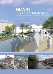
<strong>Newry</strong> City Centre Strategic Development Framework March 2004<br />
1.0 INTRODUCTION<br />
1.1 Brief<br />
Ferguson McIlveen LLP was commissioned by <strong>Newry</strong> <strong>and</strong> <strong>Mourne</strong> <strong>District</strong> <strong>Council</strong> in June 2003 to<br />
prepare a Strategic Development Framework (SDF) for <strong>Newry</strong> City Centre. During the course of<br />
the study the consultants reported to a steering group comprising representatives from <strong>Newry</strong> <strong>and</strong><br />
<strong>Mourne</strong> <strong>District</strong> <strong>Council</strong>, DOE Planning Service, the Department of Social Development <strong>and</strong> the<br />
City Centre Manager. A public consultation exercise formed a large part of the plan preparation<br />
process. Consultations were held with local businesses, community groups, the general public <strong>and</strong><br />
statutory bodies.<br />
The brief sought the following:<br />
- identification of opportunity sites;<br />
- proposals to regenerate the canal <strong>and</strong> the river;<br />
- identification of funding sources <strong>and</strong> delivery mechanisms;<br />
- examination of retail provision;<br />
- regeneration of certain parts of the city centre;<br />
- improved linkages round the city centre;<br />
- proposals for an integrated transport system;<br />
- proposals for an urban environment that encourages events;<br />
- proposals for city centre living;<br />
- actions <strong>and</strong> proposals should focus on peace <strong>and</strong> reconciliation.<br />
1.2 Background <strong>and</strong> History of <strong>Newry</strong><br />
<strong>Newry</strong> is located approximately 5 miles north of the border with the Republic; development has<br />
been constrained by its setting within a long narrow rocky valley. In the 16 th century the town was<br />
shown to have 3 parts. The East contained the Abbey <strong>and</strong> the castle of the Bagnall family, the Middle,<br />
within the town walls, was made of merchants housing <strong>and</strong> finally, the West where non-town people<br />
lived in humble dwellings along the road to Tyrone.<br />
In 1730 work began on the <strong>Newry</strong> Canal stretching the 18 miles from Lough Neagh to the coast at<br />
Warrenpoint. This was the first major canal in the British Isles <strong>and</strong> a huge industrial achievement for<br />
the local men who built it. The town was given further sea access through the construction of the<br />
<strong>Newry</strong> Ship Canal in 1767, from <strong>Newry</strong> to Fathom. A series of 4 quays were created within the<br />
town: Merchants Quay, Canal Quay, Buttercrane Quay <strong>and</strong> Sugar Isl<strong>and</strong>, along which many large<br />
warehouses developed.<br />
During the 1860’s <strong>and</strong> 70’s <strong>Newry</strong> was in its prime. Recognised as a well-built granite town with a<br />
regular street pattern <strong>and</strong> uniform stone <strong>and</strong> slate housing. The construction of Albert Basin in 1850<br />
meant that <strong>Newry</strong> was able to accommodate an increased volume of cargo shipping <strong>and</strong> the main<br />
industries to benefit from this were those concentrated along the canal. These ranged from corn <strong>and</strong><br />
flourmills, tan <strong>and</strong> linen yards to a brewery <strong>and</strong> distillery <strong>and</strong> iron <strong>and</strong> brass foundries. At this time<br />
<strong>Newry</strong> had 5 markets, providing revenue for the local council to supply regular water <strong>and</strong> light to<br />
the town.<br />
The growth of the railway network led to the closure of the inl<strong>and</strong> canal. In the absence of a direct<br />
rail link to the town <strong>and</strong> port <strong>and</strong> a lack of investment <strong>and</strong> ability to adapt to modern shipping<br />
st<strong>and</strong>ards resulted in the town’s gradual decline in the late 1800’s. Despite this change in fortunes,<br />
Hill Street, the main thoroughfare, <strong>and</strong> the town centre has changed very little over the years.<br />
<strong>Newry</strong> has had a turbulent history, however, today it is an important regional town <strong>and</strong> service<br />
centre for the surrounding rural area. Recently it has had a significant growth in population, which<br />
reached 29,500 in 1998, <strong>and</strong> the retail sector, capitalising on its gateway position between Belfast<br />
<strong>and</strong> Dublin.<br />
1.3 Policy Context<br />
a. Regional Development Strategy 2025<br />
<strong>Newry</strong> is recognised by the Regional Development Strategy 2025 as a major gateway to the North<br />
<strong>and</strong> a Main Hub. Its strategic location in the Belfast-Dublin Development Corridor <strong>and</strong> TENS Route,<br />
with access by road <strong>and</strong> rail adds to the town's growth potential.<br />
<strong>Newry</strong> is located along The Eastern Seaboard Corridor, illustrated by the Regional Development<br />
Strategy. This corridor facilitates the potential to provide high speed, high quality <strong>and</strong> high capacity<br />
road <strong>and</strong> rail links between Belfast <strong>and</strong> Dublin <strong>and</strong> onward towards Warrenpoint, Larne <strong>and</strong><br />
Rosslare, for both freight <strong>and</strong> people in this important North-South route. This corridor provides a<br />
Londonderry to Dublin link through connection with The Northern Corridor, which primarily links the<br />
Belfast Metropolitan Area to Londonderry. The Rural West of the province is also linked to the<br />
transport network by The South Western Corridor, providing important cross-border linkages. TRAN<br />
2.2: Strengthen the regional rail system, illustrates that the Strategy is keen to promote the regional rail<br />
system, developing further commuter services linking the whole of the province. Located within the<br />
Slieve Gullion area, convenient to Carlingford Lough, there is further opportunity to develop<br />
Ferguson McIlveen in association with Mentor <strong>and</strong> Scott Wilson Page No. 1