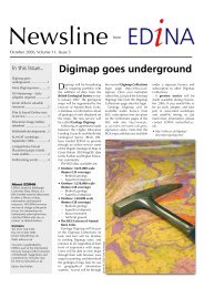
User Guide - Digimap
User Guide - Digimap
User Guide - Digimap

You also want an ePaper? Increase the reach of your titles
YUMPU automatically turns print PDFs into web optimized ePapers that Google loves.
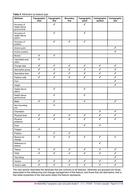
Table 4: Attribution by feature type<br />
Attribute<br />
Accuracy of<br />
height above<br />
ground level<br />
Accuracy of<br />
height above<br />
datum<br />
Accuracy of<br />
position<br />
Anchor point<br />
Anchor position<br />
Topographic<br />
area<br />
Topographic<br />
line<br />
Broken <br />
Calculated area<br />
value<br />
<br />
<br />
<br />
Boundary<br />
line<br />
Topographic<br />
point<br />
<br />
<br />
<br />
Cartographic<br />
symbol<br />
Cartographic<br />
text<br />
Change date <br />
Descriptive group <br />
Descriptive term <br />
Feature code <br />
Font<br />
Height<br />
Height above<br />
datum<br />
Height above<br />
ground level<br />
<br />
<br />
Make <br />
Non-bounding<br />
line<br />
<br />
Orientation <br />
Physical level <br />
Physical<br />
presence<br />
<br />
Point <br />
Polygon<br />
<br />
Polyline <br />
Reason for<br />
change<br />
Reference to<br />
feature<br />
<br />
Theme <br />
TOID <br />
Text string<br />
Version <br />
Version date <br />
The next section describes the attributes that are common to all features. Attributes are grouped into those<br />
associated to the referencing and change management of the feature, and those that are descriptive, that is<br />
that detail properties of the real-world object the feature represents.<br />
<br />
<br />
<br />
<br />
<br />
<br />
<br />
<br />
OS MasterMap Topography Layer user guide chapter 5 v1.3 – 07/2007 © Crown copyright Page 42 of 140