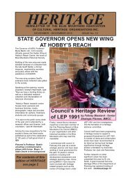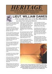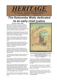
Newsletter No - Blue Mountains Association of Cultural Heritage ...
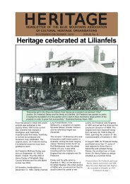
Newsletter No - Blue Mountains Association of Cultural Heritage ...
Newsletter No - Blue Mountains Association of Cultural Heritage ...

Create successful ePaper yourself
Turn your PDF publications into a flip-book with our unique Google optimized e-Paper software.
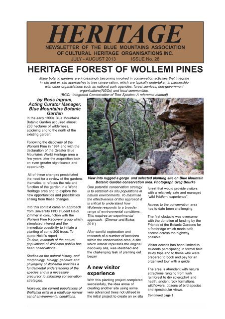
HERITAGE<br />
NEWSLETTER OF THE BLUE MOUNTAINS ASSOCIATION<br />
OF CULTURAL HERITAGE ORGANISATIONS INC.<br />
JULY - AUGUST 2013 ISSUE <strong>No</strong>. 28<br />
HERITAGE FOREST OF WOLLEMI PINES<br />
Many botanic gardens are increasingly becoming involved in conservation activities that integrate<br />
in situ and ex situ approaches to tree conservation, which are typically undertaken in partnership<br />
with other organisiations such as national park agencies, forest services, non-government<br />
organisations(NGOs) and local communities.<br />
(BGCI- Integrated Conservation <strong>of</strong> Tree Species: A reference manual)<br />
by Ross Ingram,<br />
Acting Curator Manager,<br />
<strong>Blue</strong> <strong>Mountains</strong> Botanic<br />
Garden<br />
In the early 1990s <strong>Blue</strong> <strong>Mountains</strong><br />
Botanic Garden acquired almost<br />
200 hectares <strong>of</strong> wilderness,<br />
adjoining and to the north <strong>of</strong> the<br />
existing garden.<br />
Following the discovery <strong>of</strong> the<br />
Wollemi Pine in 1994 and with the<br />
declaration <strong>of</strong> the Greater <strong>Blue</strong><br />
<strong>Mountains</strong> World <strong>Heritage</strong> area a<br />
few years later the acquisition took<br />
on even greater significance and<br />
opportunity.<br />
All <strong>of</strong> these changes precipitated<br />
the need for a review <strong>of</strong> the gardens<br />
thematics to refocus the role and<br />
function <strong>of</strong> the garden in a World<br />
<strong>Heritage</strong> area and to explore the<br />
new opportunities and possibilities<br />
arising from these changes.<br />
Into this context came an approach<br />
from University PhD student Heidi<br />
Zimmer in conjunction with the<br />
Wollemi Pine Recovery group which<br />
stimulated interest and the<br />
immediate possibility to initiate a<br />
planting <strong>of</strong> some 200 trees. To<br />
quote Heidi’s report –<br />
To date, research <strong>of</strong> the natural<br />
populations <strong>of</strong> Wollemia nobilis has<br />
been observational.<br />
Studies on the natural history, and<br />
morphology, biology, genetics and<br />
phylogeny <strong>of</strong> Wollemia provides a<br />
fundamental understanding <strong>of</strong> the<br />
species and is a necessary<br />
precursor to informing conservation<br />
strategies.<br />
However, the current populations <strong>of</strong><br />
Wollemia exist in a relatively narrow<br />
set <strong>of</strong> environmental conditions.<br />
View into rugged a gorge and selected planting site on <strong>Blue</strong> Mountain<br />
Botanic Garden conservation area. Photograph Greg Bourke<br />
One potential conservation strategy<br />
is to establish ex situ populations in<br />
natural environments. To maximise<br />
the effectiveness <strong>of</strong> this approach it<br />
is critical to understand how<br />
Wollemia responds to a broader<br />
range <strong>of</strong> environmental conditions.<br />
This requires an experimental<br />
approach. (Zimmer and Baker,<br />
2011)<br />
After careful exploration and<br />
research <strong>of</strong> a number <strong>of</strong> locations<br />
within the conservation area, a site<br />
which almost replicates the original<br />
discovery site, was identified and<br />
the challenging task <strong>of</strong> planting out<br />
began<br />
A new visitor<br />
experience<br />
With this planting project completed<br />
successfully, the idea arose <strong>of</strong><br />
creating another site using some<br />
very advanced trees not utilised in<br />
the initial project to create an ex situ<br />
forest that would provide visitors<br />
with a relatively safe and managed<br />
“wild Wollemi experience”.<br />
Access to the conservation area<br />
has to date been challenging.<br />
The first obstacle was overcome<br />
with the donation <strong>of</strong> funding by the<br />
Friends <strong>of</strong> the Botanic Gardens for<br />
a footbridge which made safe<br />
access across the highway<br />
possible.<br />
Visitor access has been limited to<br />
students participating in formal field<br />
study trips and to those who were<br />
prepared to book and pay for an<br />
organised tour with a guide.<br />
The area is abundant with natural<br />
attractions ranging from lush<br />
rainforest to dry sclerophyll and<br />
heath, ancient rock formations,<br />
wildflowers, dozens <strong>of</strong> bird species<br />
and spectacular views.<br />
Continued page 3<br />
HERITAGE 1<br />
July - August 2013
Contents.........<br />
HERITAGE<br />
July - August 2013<br />
*P1 <strong>Heritage</strong> Forest <strong>of</strong> Wollemi<br />
Pines by Ross Ingram<br />
*P2 Sealing <strong>of</strong> Cox’s Rd is<br />
heritage vandalism by local<br />
government by John Leary<br />
*P4 ‘Crossing <strong>of</strong> the <strong>Blue</strong><br />
<strong>Mountains</strong>’ an outstanding<br />
exhibition by Jean Winston<br />
*P7 Council were set to destroy<br />
heritage integrity <strong>of</strong> Cox’s<br />
Rd, Woodford by Jan<br />
Koperberg and John Leary<br />
*P8 Devotion - Sir Joseph and<br />
Dame Mary Cook<br />
*P9 Alice in Wonderland by<br />
John Low,<br />
*P9 Longtime series<br />
*P10 Sydney Rock - on the Ways<br />
to the West<br />
*P11 RAHS Conference in<br />
Katoomba<br />
*P12 Lithgow migration and<br />
settlement study<br />
*P13 Capt Cook’s pistol fetches<br />
$220,000<br />
*P14 History at your fingertips<br />
*P14 Polar trek made to measure<br />
*P14 Plans to bring water into<br />
the museum<br />
*P14 Aboriginal heritage grant<br />
for Kandos Museum<br />
*P15 Cronje the brumby brigand<br />
*P16 New Aboriginal heritage<br />
tour at <strong>Blue</strong> <strong>Mountains</strong><br />
Botanic Garden, Mt Tomah<br />
*P17 “The biggest Estate on<br />
Earth: how Aborigines<br />
made Australia” -a critique<br />
by Andy Macqueen<br />
*P22 Focus on the George<br />
Evans story<br />
*P22 The sex lives <strong>of</strong> Australia ---<br />
a historical reflection<br />
*P22 Walk to the Cattle Rustlers’<br />
Yards<br />
*P24 Lynn Collins will facilitate<br />
museums workshop<br />
*P24 Across the <strong>Blue</strong> <strong>Mountains</strong><br />
*P25 Western Crossings<br />
*P26 Ancient Syrian sites<br />
imperilled by war<br />
Plans by <strong>Blue</strong> Mountain City<br />
Council to apply bitumen over the<br />
unsealed parts <strong>of</strong> Old Bathurst<br />
Road (Cox’s Road), Woodford<br />
impregnating with tar, a road<br />
constructed <strong>of</strong> and on<br />
sandstone,198-years ago; can at<br />
least be considered cavalier and at<br />
worst sheer heritage vandalism.<br />
When one considers the wealth <strong>of</strong><br />
misinformation that councillors and<br />
senior staff spread, suggesting<br />
that this roadway had no heritage<br />
significance and that ‘there is no<br />
heritage listing at either local or<br />
state level’, it is well time that<br />
someone should look at council’s<br />
flow <strong>of</strong> information both within the<br />
organisation and to the ratepayers<br />
and residents <strong>of</strong> this city.<br />
It has been claimed by several<br />
descendants <strong>of</strong> the explorers that<br />
pressure was brought upon them<br />
not to alert the media. as it might<br />
affect the success <strong>of</strong> the<br />
celebrations.<br />
It is certain that every member <strong>of</strong><br />
<strong>Blue</strong> <strong>Mountains</strong> City Council’s<br />
heritage advisory committee was<br />
aware <strong>of</strong> the listings and the<br />
heritage significance <strong>of</strong> this road<br />
construction had council or its<br />
senior staff taken the trouble to<br />
consult with this body.<br />
The simple fact is that the Cox’s<br />
Road is listed on the State<br />
<strong>Heritage</strong> Inventory and in council’s<br />
Local Environment Plan 1991.<br />
At council’s ordinary meeting <strong>of</strong><br />
June 4, 2013 some councillors<br />
appeared to be in complete denial<br />
about these facts.They could not<br />
or did not want to understand, that<br />
the heritage value is in the road<br />
construction itself, not in some<br />
cast-<strong>of</strong>f shoe from Cox’s horse or a<br />
broken clay pipe dropped by one<br />
<strong>of</strong> his convicts.<br />
There is a legal requirement on<br />
council to take note <strong>of</strong> this item in<br />
the SHI and LEP 1991 and<br />
certainly a moral obligation to<br />
future generations.<br />
An opinion from the editor.......<br />
Sealing <strong>of</strong> Cox’s Rd is<br />
heritage vandalism by<br />
local government<br />
It is ironical, at the present time as<br />
we commemorate and celebrate the<br />
bicentenary <strong>of</strong> the Western<br />
Crossings 2013-2015, that this<br />
work which if it goes ahead will<br />
ultimately destroy one <strong>of</strong> the<br />
earliest colonial road-lines which<br />
allowed the starving settlement at<br />
Sydney to expand and open up the<br />
golden west <strong>of</strong> NSW.<br />
It is almost like a Bacchanalian<br />
celebration <strong>of</strong> ancient Greece<br />
where after the festivities there<br />
followed a drunken orgy <strong>of</strong> crimes<br />
and conspiracies. Here in the <strong>Blue</strong><br />
<strong>Mountains</strong>, after the<br />
commemoration and celebrations<br />
<strong>of</strong> the achievements <strong>of</strong> the three<br />
feted explorers, an orgy <strong>of</strong><br />
destruction <strong>of</strong> one <strong>of</strong> the only major<br />
heritage structures remaining from<br />
that period will follow.<br />
Many who live in this rustic setting<br />
would prefer it to remain an<br />
unsealed road unattractive to the<br />
hoons likely to see it as a route to a<br />
bush rubbish tip or worse. The<br />
concerns <strong>of</strong> local residents need to<br />
be taken into account. The most<br />
serious concern is drainage after<br />
summer storms. Sealing the road<br />
on its own will only make the<br />
drainage problem faster and more<br />
destructive. The drainage concerns<br />
can and should be addressed<br />
without having to seal the road.<br />
Council will now wait on an<br />
archaeological report before taking<br />
further steps to seal the road; but<br />
until councillors accept that<br />
heritage is just more than a word to<br />
which they pay lip service, the<br />
future <strong>of</strong> heritage conservation in<br />
the <strong>Blue</strong> <strong>Mountains</strong> will sound very<br />
hollow. With a little innovative<br />
thought by council, Cox’s Road<br />
could be equal to Old Great <strong>No</strong>rth<br />
Road - World <strong>Heritage</strong> walk which<br />
features a historic convict-built,<br />
some in chains, road overlooking<br />
the Hawkesbury River, in Dharug<br />
National Park.<br />
John Leary, OAM -<br />
President, <strong>Blue</strong> <strong>Mountains</strong><br />
<strong>Association</strong> <strong>of</strong> <strong>Cultural</strong> <strong>Heritage</strong><br />
Organisations Inc.<br />
HERITAGE 2<br />
July - August 2013
A wilderness walk plunging into a Wollemi gorge<br />
Continued from page 1<br />
Here was the opportunity to <strong>of</strong>fer a<br />
truly unique visitor experience by<br />
creating a varied wilderness walk<br />
with the chance to experience<br />
rainforest, open woodland and<br />
wildflowers, cliff edges, a magic<br />
Angophora forest and then finally<br />
plunging into a Wollemi gorge.<br />
However, this is more than just<br />
about providing visitors with a<br />
pleasant, relatively safe ”emersion”<br />
in wilderness.<br />
The botanic garden <strong>of</strong> the 21 st<br />
century has a role and a<br />
responsibility to address much more<br />
than simply providing visitors with<br />
pleasant experiences and<br />
displaying collections <strong>of</strong> plants in<br />
well organised high standard<br />
horticultural displays.<br />
Here is the chance to interpret and<br />
explain conservation, the nature<br />
and importance <strong>of</strong> biodiversity,<br />
habitat, the relationship between<br />
people and plants and the<br />
understanding <strong>of</strong> place - in a<br />
botanic garden managed<br />
wilderness.<br />
<strong>Blue</strong> <strong>Mountains</strong> Botanic Garden<br />
natural area staff have begun<br />
systematically surveying the area<br />
so that we have a good idea <strong>of</strong> what<br />
the area has to <strong>of</strong>fer and what<br />
responsibilities we have in<br />
managing the site.<br />
Tracks have been created and<br />
some preliminary guided walks<br />
have been laid out.<br />
A circular walk<br />
through a variety<br />
<strong>of</strong> ecosystems<br />
and features and<br />
across different<br />
terrains will lead<br />
walkers to the<br />
Wollemi grove<br />
which nests in a<br />
moist gully<br />
beneath<br />
sandstone cliffs.<br />
The proposed<br />
boardwalk will<br />
minimize the<br />
impact <strong>of</strong> walkers,<br />
avoid erosion<br />
problems and<br />
enable intimate<br />
contact with the<br />
trees and<br />
associated<br />
vegetation.<br />
Unfortunately the<br />
conservation area<br />
is difficult terrain<br />
and access will be<br />
limited to relatively<br />
fit and able<br />
persons.<br />
At least two hours<br />
will be needed to<br />
fully enjoy the walk and the country<br />
is quite steep in places.<br />
Because it is a heritage and<br />
conservation area, the proposal is<br />
to not intrude unnecessarily and for<br />
the infrastructure to be as<br />
unobtrusive as possible.<br />
Approval was sought and received<br />
and work has started.<br />
The project will need to attract<br />
substantial sponsorship as it will be<br />
necessary to construct a lengthy<br />
boardwalk to provide access.<br />
The boardwalk will reduce the<br />
impact <strong>of</strong> visitors on the fragile site<br />
and provide means to maintain the<br />
highest standard <strong>of</strong> hygiene. (The<br />
disease Phytopthora is carried on<br />
footwear).<br />
Wildfire and disease represent the<br />
two big threats to a project such as<br />
this.<br />
Research scientist Heidi Zimmer (right) and<br />
horticulturist Chris Crottey take a break during<br />
“operation plantout”. Photograph : Greg Bourke<br />
successful hazard reduction<br />
exercise to help manage the threat<br />
<strong>of</strong> wildfire.<br />
Part <strong>of</strong> the ongoing management<br />
plan for the site is that such<br />
exercises will need to be conducted<br />
at regular intervals as determined<br />
and recommended by ecologists to<br />
both ensure the integrity <strong>of</strong> the<br />
natural ecosystems and to protect<br />
the Wollemi plantings into the<br />
future.<br />
Horticulturists planting out and<br />
recording details. Photograph:<br />
Greg Bourke<br />
Recently, in collaboration with the<br />
Botanic Gardens Trust, the Rural<br />
Fire Service conducted a very<br />
Wollemi nobillis<br />
HERITAGE 3<br />
July - August 2013
‘Crossing <strong>of</strong> the <strong>Blue</strong> <strong>Mountains</strong>’ an<br />
outstanding exhibition at Mt Victoria<br />
A remarkable<br />
and<br />
innovative<br />
engagement<br />
with the<br />
community<br />
“There has been plenty <strong>of</strong> opportunity for celebratory activities and<br />
some <strong>of</strong> them have been memorable, such as the <strong>Blue</strong> Wave crossing<br />
re-enactment by John Sullivan and descendants <strong>of</strong> the three explorers,<br />
the spectacular flyover <strong>of</strong> aircraft and the mass circulation <strong>of</strong> the<br />
commemorative holey dollar to schoolchildren to name but a few.<br />
“There has however, been few enduring things which have so far come<br />
from the three-year commemoration <strong>of</strong> the bicentenary <strong>of</strong> the ‘western<br />
crossing’ other than the foundation proposed by Dr David Blaxland and<br />
the splendid activities centred around the Hartley Valley.<br />
“To its great credit the Mt Victoria Historical Society has produced<br />
another enduring legacy, which will have immense value for many years<br />
to come — the outstanding exhibition created at Mt Victoria museum in<br />
a newly dedicated Crossings Room.<br />
“<strong>No</strong>t only has the concept and energy <strong>of</strong> Marcia Osterberg-Olsen, herself <strong>of</strong> descendant <strong>of</strong> some <strong>of</strong> our<br />
earliest pioneers been harnessed, to curate this commemorative exhibit; but it has also seen the<br />
engagement by this historical society with a much wider community including Rotarians, volunteers,<br />
pr<strong>of</strong>essional and business people as well several generous donors.<br />
“Other groups could well learn from this successful engagement with the community for the preservation<br />
and presentation <strong>of</strong> our heritage.<br />
“This exhibition is as well presented and as pr<strong>of</strong>essionally created to equal those displays found in many<br />
<strong>of</strong> larger state owned museums.<br />
“In this article, president <strong>of</strong> the Mt Victoria and District Historical Society, Mrs Jean Winston outlines the<br />
work involved to create this exhibition. Congratulations to all concerned.” John Leary, OAM – president,<br />
<strong>Blue</strong> <strong>Mountains</strong> <strong>Association</strong> <strong>of</strong> <strong>Cultural</strong> <strong>Heritage</strong> Organisations Inc<br />
An outstanding exhibition, to<br />
commemorate the bicentenary <strong>of</strong><br />
the ‘Crossing <strong>of</strong> the <strong>Blue</strong> <strong>Mountains</strong>’<br />
has been created at the Mount<br />
Victoria Museum.<br />
The concept and execution <strong>of</strong> the<br />
exhibition were driven by the<br />
determination <strong>of</strong> Marcia Osterberg-<br />
Olsen whose family were pioneers<br />
in the Little Hartley district.<br />
There were many pitfalls to be<br />
overcome before the display could<br />
be mounted, including renovations<br />
and painting <strong>of</strong> the designated<br />
room.<br />
This was done by members <strong>of</strong> the<br />
historical society.<br />
Money was limited and an<br />
application for a grant from<br />
Museums and Galleries NSW had<br />
been declined.<br />
The Blackheath Rotary Club<br />
generously <strong>of</strong>fered financial and<br />
physical support to get the<br />
exhibition under way.<br />
One Rotarian sent a letter to local<br />
residents asking for financial<br />
support and a Katoomba Rotarian<br />
erected a false wall in the exhibition<br />
room.<br />
These efforts were gratefully<br />
received by the Mount Victoria and<br />
District Historical Society which<br />
managed the exhibition.<br />
Marcia said that she wanted a ‘wow’<br />
factor for the exhibit.<br />
Continued page 5<br />
A graphic designer and Blackheath<br />
Rotarian, Clive Jones <strong>of</strong> Red Egg<br />
Design <strong>of</strong>fered his skills free <strong>of</strong><br />
charge, as did his wife Gabrielle.<br />
A clever illusion: a real table and glassware in front <strong>of</strong> the graphic <strong>of</strong><br />
Governor and Mrs Macquarie drawn by Clive Jones.<br />
HERITAGE 4<br />
July - August 2013
A chronology<br />
<strong>of</strong> the<br />
crossings<br />
Cotinued from page 4<br />
This was to be achieved through<br />
artifacts, tools <strong>of</strong> trade, stories, line<br />
drawings, pictures and<br />
photographs.<br />
Her idea was to show the<br />
chronology <strong>of</strong> the crossings <strong>of</strong> the<br />
<strong>Blue</strong> <strong>Mountains</strong> starting with the<br />
Aborigines and ending with the<br />
journey by Governor and Mrs.<br />
Macquarie to Bathurst in 1815.<br />
The three local Aboriginal tribes,<br />
Gundungurra, Darug and Wiradjuri<br />
had been crossing the <strong>Blue</strong><br />
<strong>Mountains</strong> and the Great Dividing<br />
Range for centuries carrying chert<br />
and mudstone to make tools.<br />
Examples <strong>of</strong> these objects found in<br />
the Hartley area are on display.<br />
The routes <strong>of</strong> four earlier attempts<br />
to cross the mountains are<br />
depicted, those <strong>of</strong> Bass, a ship’s<br />
surgeon, Everingham, a convict,<br />
Barrallier, a Royal Navy surveyor<br />
and Caley a botanist.<br />
<strong>No</strong>ne were successful and Caley<br />
was amazed when he heard it had<br />
been done. He is depicted sitting at<br />
home in England, with a parrot on<br />
his shoulder, a virtual recluse.<br />
Large panels <strong>of</strong> text give<br />
information on the explorers,<br />
surveyors, road makers and on the<br />
governor and Mrs. Macquarie.<br />
The display gives extensive<br />
biographical notes on each <strong>of</strong> the<br />
men up to the time that they<br />
crossed the mountains. Blaxland<br />
aged 35, Lawson 39 and Wentworth<br />
23 set out in 1813.<br />
They got as far as Mount Blaxland,<br />
further west from Mount York where<br />
they stood and overlooked the<br />
western plains.<br />
A copy <strong>of</strong> Gregory Blaxland’s diary<br />
written, very legibly, on May 28,<br />
1813 at Mount York is on display<br />
and really connects the viewer with<br />
the explorers.<br />
To progress each day, they<br />
struggled through dense bush and<br />
had to go ahead to reconnoitre a<br />
route ahead <strong>of</strong> the main group,<br />
blazing trees as they went, and then<br />
went back to bring the horses.<br />
Grass for the horses had to be cut<br />
where available and carried,<br />
increasing their loads to about<br />
100kg each.<br />
The party encountered one group <strong>of</strong><br />
Aboriginal women and children who<br />
were frightened at first but when<br />
interest was shown in the children<br />
they all relaxed.<br />
It was reported that both the women<br />
were blind in the right eye.<br />
Surveyor Evans, who was thirty<br />
three years old, was asked to make<br />
a route suitable for horses and<br />
stock. He took enough stores for a<br />
two months period.<br />
One <strong>of</strong> his tools <strong>of</strong> trade was a<br />
circumferentor which is a surveyor’s<br />
compass, an earlier version <strong>of</strong> the<br />
theodolite.<br />
The Land and Property Information<br />
Service at Bathurst has kindly lent a<br />
circumferentor to the society. The<br />
instrument measures horizontal<br />
angles. The east and west points on<br />
the face <strong>of</strong> the instrument are<br />
reversed from the normal way.<br />
The road maker William Cox, aged<br />
fifty one later built a road <strong>of</strong> 101.5<br />
miles on Evans route.<br />
Details are given <strong>of</strong> the equipment<br />
used and some examples are on<br />
display: gunpowder, block and<br />
tackle, crowbars, sledge hammers,<br />
axes, two man cross-cut saws,<br />
picks and shovels.<br />
The method <strong>of</strong> sawing used in a<br />
two man pit saw was for a saw pit to<br />
be dug to about 2.5metres deep<br />
and 1.5 metres wide.<br />
Poles were placed across the pit<br />
and the log to be sawn was placed<br />
on the poles.<br />
The bottom man stood in the pit and<br />
the top man or senior sawyer<br />
balanced on the log above and<br />
guided the saw in making the cut.<br />
English artist John Lewin who<br />
travelled with Macquarie’s party to<br />
Bathurst in 1815 painted scenes<br />
along the way.<br />
A huge reproduction <strong>of</strong> his<br />
watercolour painting ‘Spring Wood’<br />
stands in a commanding position on<br />
the false wall at the end <strong>of</strong> the<br />
room.<br />
Line drawings <strong>of</strong> Governor<br />
Macquarie and Mrs Macquarie,<br />
sitting like ghosts in the scene, are<br />
superimposed on it.<br />
In front <strong>of</strong> the figures is an actual<br />
table with a lamp, a decanter, wine<br />
glasses and a pack <strong>of</strong> cards put<br />
ready for the evening game <strong>of</strong><br />
whist.<br />
Beyond the Spring Wood scene is a<br />
beautiful chiaroscuro screen named<br />
‘Eucalypt’ which was made by<br />
Marcia’s daughter Vashti Gonda<br />
and donated by Creative<br />
Powerhouse Pty Ltd. It is a work <strong>of</strong><br />
art in itself.<br />
The following panels depict and<br />
describe Governor and Mrs.<br />
Macquarie.<br />
It was noted that Macquarie like<br />
other governors before him had<br />
given orders that all colonists make<br />
every effort to live in friendship with<br />
the Aboriginal people.<br />
On Thursday May 4, 1815<br />
Macquarie’s expedition reached the<br />
Bathurst Plains where the town <strong>of</strong><br />
Bathurst was proclaimed.<br />
Continued on page 6<br />
HERITAGE 5<br />
July - August 2013
...a beautiful<br />
chiaroscuro<br />
screen named<br />
‘Eucalypt’...<br />
Continued from page 5<br />
The final small picture shows how<br />
the colour <strong>of</strong> their clothes<br />
delineated the status <strong>of</strong> the<br />
wearers.<br />
A society member assisted Marcia<br />
by doing research for the text.<br />
A Hartley man gave money for the<br />
installation <strong>of</strong> the lighting system.<br />
Numerous other people have<br />
assisted in preparing this exhibition<br />
and I apologise to any whom I have<br />
omitted.<br />
The Mount Victoria and District<br />
Historical Society is immensely<br />
pleased with the final display and is<br />
most appreciative <strong>of</strong> the creative<br />
ability and determination shown by<br />
Marcia Osterberg-Olsen in seeing<br />
the project through to the finish.<br />
Pictured is the chiaroscuro screen named ‘Eucalypt’ made in<br />
aluminium by Vashti Gonda and donated by<br />
Creative Powerhouse Pty Ltd.<br />
Woodford Academy seeks grant for schools<br />
program based on service in World War 1<br />
DURING the First World War, up to<br />
48 graduates from the Woodford<br />
Academy enlisted in the First AIF.<br />
They served in a variety <strong>of</strong><br />
capacities. Two are known to have<br />
been killed in action and one was<br />
awarded the Military Medal.<br />
The study <strong>of</strong> the Academy’s records<br />
<strong>of</strong> all these veterans has not yet<br />
been undertaken.<br />
These men and their experiences<br />
can now be seen as a mini-study <strong>of</strong><br />
the times and experiences <strong>of</strong> men<br />
who served in that war.<br />
There is a large collection <strong>of</strong><br />
unprocessed recourses and records<br />
that contains information about<br />
these men and their school<br />
experience. This includes<br />
photographs, school records, fees<br />
paid, family contacts and the like.<br />
The military records <strong>of</strong> these men<br />
are freely available from the<br />
National Australian Archives.<br />
Their unit records are freely<br />
available from the Australian War<br />
Memorial in Canberra.<br />
Woodford Academy management<br />
committee has submitted an<br />
application for funding from the<br />
Australian Government’s<br />
Department <strong>of</strong> Veteran Affairs<br />
ANZAC Centenary grants program.<br />
The funding would be used to<br />
develop the recourses that exist at<br />
the Academy that deal with these<br />
boys and the period 1910-1918 and<br />
to add their military records to<br />
create a teaching and learning<br />
recourse for schools in the <strong>Blue</strong><br />
<strong>Mountains</strong>.<br />
Through the study <strong>of</strong> this history the<br />
BLUE<br />
MOUNTAINS<br />
HISTORY<br />
CONFERENCE<br />
IN 2014<br />
SUCCESS <strong>of</strong> the 2012 History<br />
Conference organised by BMACHO<br />
has spurred the committee into<br />
staging another in May 2014.<br />
Three venues are currently being<br />
considered and in the meantime, a<br />
number <strong>of</strong> eminent historians are<br />
being approached to be speakers.<br />
A good number <strong>of</strong> people<br />
interested in heritage and history<br />
attended the day long conference<br />
last October and at least this<br />
number is expected to register for<br />
the May 2014 event.<br />
All who attended last years<br />
conference will be contacted and<br />
invited to next year’s function.<br />
Further details will be announced in<br />
coming weeks and will appear on<br />
BMACHO’s website<br />
www.bluemountainsheritage.com<br />
Woodford Academy would like to<br />
contribute to the understanding <strong>of</strong><br />
Australian school students about<br />
the social and political situation<br />
under which these particular men<br />
lived and enlisted and to see how<br />
this might have been affected by<br />
their First World War experience.<br />
Descendants wearing service<br />
medals including a Military Cross<br />
<strong>of</strong> former students <strong>of</strong> Woodford<br />
Academy at the 2006<br />
Remembrance Day unveiling <strong>of</strong> a<br />
restored honour roll.<br />
Photograph John Leary, OAM<br />
HERITAGE 6<br />
July - August 2013
Council were set to destroy heritage<br />
integrity <strong>of</strong> Cox’s Road, Woodford<br />
by Jan Koperberg and John Leary --- photographs by Patsy Moppett taken on June 7, 2013<br />
BLUE MOUNTAINS City Council<br />
has damaged some <strong>of</strong> Australia’s<br />
oldest road construction when it<br />
graded Old Bathurst Road (Cox’s<br />
Road), Woodford.<br />
A number <strong>of</strong> local residents became<br />
alarmed, as were members <strong>of</strong><br />
BMACHO and other heritage and<br />
historical societies on the<br />
<strong>Mountains</strong>, that the <strong>Blue</strong> <strong>Mountains</strong><br />
City Council had graded the<br />
Woodford stretch <strong>of</strong> Bathurst Road<br />
(Cox’s Road), ready for sealing.<br />
Council had earlier decided to<br />
include this heritage carriageway,<br />
as part <strong>of</strong> a project to seal presently<br />
unsealed roads on the mountains.<br />
People with knowledge <strong>of</strong> the road’s<br />
heritage approached a number <strong>of</strong><br />
councillors who had been publicly<br />
stating there was no heritage value<br />
in the roadway.<br />
This particular section <strong>of</strong> Old<br />
Bathurst Road is listed on the NSW<br />
<strong>Heritage</strong> Branch Inventory, as ‘LD<br />
019: Remnants <strong>of</strong> Cox’s Road’.<br />
This listing covers Old Bathurst<br />
Road and Taylor Road, Woodford.<br />
It is one <strong>of</strong> the earliest colonial-era<br />
road-lines surviving in Australia.<br />
The 1814 road is tangible evidence<br />
<strong>of</strong> the development <strong>of</strong> the colony at<br />
Sydney and the expansion <strong>of</strong> white<br />
settlement into western NSW.<br />
This was originally listed in LEP<br />
1991 and was updated in January,<br />
2005, the study being done in 2003<br />
by Dr Siobhan Lavelle and Dr Ian<br />
Jack.<br />
When council became aware <strong>of</strong> the<br />
concerns by historians and others<br />
<strong>of</strong> the road’s heritage status, a site<br />
inspection took place with the<br />
attendance <strong>of</strong> several councillors,<br />
council senior staff, council’s<br />
heritage advisor, a representative <strong>of</strong><br />
Roads and Maritime Services who<br />
had considerable knowledge about<br />
this road, and local residents.<br />
To council staff’s credit, when they<br />
became aware <strong>of</strong> the heritage<br />
listings, the sealing <strong>of</strong> the road was<br />
delayed.<br />
Stone wall is evidence <strong>of</strong> 1820s improvements to the original Cox’s<br />
Road over which council had planned to seal with bitumen.<br />
Following protests to council by<br />
people with heritage knowledge,<br />
and after grading <strong>of</strong> the road had<br />
been finished and machinery<br />
brought in for sealing, a report by<br />
staff was presented to council.<br />
Some damage to the original<br />
roadwork was done to the<br />
construction <strong>of</strong> the 198-year old<br />
heritage road.<br />
The staff report stated: ’ …there is<br />
no heritage listing at either local or<br />
state level’.<br />
This is clearly untrue as it is listed in<br />
the State <strong>Heritage</strong> Inventory and<br />
also in council’s own LEP 1991.<br />
It is understood a report drawing<br />
attention to the road’s heritage<br />
status was not made available to<br />
councillors for the council meeting<br />
<strong>of</strong> June 4, 2013.<br />
A number <strong>of</strong> people for the sealing<br />
and against the sealing, attended<br />
the <strong>Blue</strong> <strong>Mountains</strong> City Council<br />
meeting on Tuesday June 4, 2013.<br />
Three people were allowed to speak<br />
in favour and three against. Those<br />
who spoke against the sealing <strong>of</strong><br />
the road were John Leary, OAM,<br />
president <strong>of</strong> <strong>Blue</strong> <strong>Mountains</strong><br />
<strong>Association</strong> <strong>of</strong> <strong>Cultural</strong> <strong>Heritage</strong><br />
Organisations Inc, Ian Harman,<br />
chairman, Woodford Academy<br />
management committee and Jan<br />
Koperberg, secretary, BMACHO.<br />
Those residents in favour <strong>of</strong> sealing<br />
this rural road cited dust and<br />
stormwater run-<strong>of</strong>f problems.<br />
<strong>No</strong>t all residents are in favour <strong>of</strong> the<br />
road being sealed and some are<br />
concerned that it will increase traffic<br />
movements to a property where an<br />
allegedly unauthorised commercial<br />
activity is taking place.<br />
Cr Geordie Williamson, a Woodford<br />
resident, was the only councillor to<br />
speak in favour <strong>of</strong> retaining Old<br />
Bathurst Road as an unsealed road.<br />
At the time HERITAGE was<br />
published on-line, council was<br />
seeking advice from an<br />
archaeologist.<br />
View <strong>of</strong> the graded road to the<br />
south near the stone wall Cox’s<br />
Road foundations<br />
HERITAGE 7<br />
July - August 2013
Devotion – Sir Joseph and Dame Mary Cook<br />
An exhibition celebrating Lithgow’s Prime Minister<br />
AN EXHIBITION celebrating the lives and achievements <strong>of</strong><br />
Sir Joseph and Dame Mary Cook is on display at Eskbank<br />
House and Museum until October 7, 2013 having been<br />
<strong>of</strong>ficially opened earlier this month.<br />
“Lithgow is very proud to have its own Prime Minister in Sir<br />
Joseph Cook,” said Lithgow City Council Mayor Maree<br />
Statham. ”It is also very special to see, in this exhibition, the<br />
bond between Sir Joseph and Dame Mary and how they<br />
were able to achieve so much together.”<br />
The couple moved to Lithgow in 1886 and Sir Joseph worked<br />
in the Vale <strong>of</strong> Clwydd Colliery as he studied and worked his<br />
way up through the unions and into politics.<br />
He was a minister in the first federal government, became<br />
prime minister in 1913, was high commissioner in London<br />
and knighted in 1918.<br />
As well as being beside him every step <strong>of</strong> his career, Dame<br />
Mary was heavily involved in the Red Cross and was made a<br />
Dame in the Order <strong>of</strong> the British Empire in 1925 for this work.<br />
This exhibition focuses on the lives <strong>of</strong> Sir Joseph and Dame<br />
Mary and their devotion to politics, the community and family.<br />
As well as stories and images, several items from the<br />
couple, not exhibited before, will be on display, such as a<br />
lovely reference written by Dame Mary for one <strong>of</strong> her maids<br />
and the original letter from Her<br />
Majesty’s Privy Council to Sir<br />
Joseph Cook <strong>of</strong>fering him the<br />
position <strong>of</strong> Australian High<br />
Commissioner in England.<br />
The exhibition was <strong>of</strong>ficially opened<br />
by Mayor Statham followed by talks<br />
from Hartley Cook (great grandson<br />
<strong>of</strong> Sir Joseph and Dame Mary),<br />
Cassandra Coleman (a member <strong>of</strong><br />
the Sir Joseph Cook<br />
Commemorative Group) and<br />
curators Miriam Scott and Wendy<br />
Hawkes.<br />
Joseph Cook photographed at the<br />
time he was post master general.<br />
During Sir Joe’s time as high commissioner in London both Sir Joe<br />
and Dame Mary were very active in promoting Australia’s interests in<br />
Great Britain. In these photographs Dame Mary is <strong>of</strong>ficially<br />
commissioning the first Australian amphibian flying boat “The<br />
Seagull” in 1926. Sir Joe then took a flight in the plane. The bottom<br />
image is Dame Mary wishing him well and the top is a very relieved<br />
kiss when he landed safely. A photograph album gifted to the Cooks<br />
by the Supermarine Aviation Works Ltd. is in the National Australian<br />
Archives and is a beautifully told story <strong>of</strong> the occasion. (Photographs<br />
from the National Australian Archives M3613)<br />
HERITAGE 8<br />
July - August 2013
WHEN THE ENGLISH aristocracy<br />
visited the <strong>Blue</strong> <strong>Mountains</strong>, as they<br />
regularly did, the unfamiliar<br />
pleasures <strong>of</strong> the landscape <strong>of</strong>ten<br />
seduced them into relaxing the<br />
normal formalities <strong>of</strong> their class.<br />
Even the future Queen Mary and<br />
her ladies took to the swings at<br />
Leura Cascades in 1901 and<br />
wandered the bush paths for longer<br />
than they should.<br />
ALICE IN WONDERLAND<br />
by John Low, OAM - Loal historian<br />
Almost a decade earlier, following a<br />
visit to Jenolan Caves in January<br />
1893, Alice, Duchess <strong>of</strong><br />
Buckingham and Chandos, alighted<br />
at the Carrington Hotel with her<br />
friend Hilda.<br />
Having roughed it at smaller<br />
accommodation houses, they<br />
settled in to the comfort <strong>of</strong> the grand<br />
hotel, a panoramic view from their<br />
verandah and their dinner table<br />
“covered with flowers”.<br />
The following day Sir Frederick<br />
Darley <strong>of</strong> ‘Lilianfels’ took them to<br />
Wentworth Falls and the Three<br />
Sisters and despite the heat and<br />
flies they were not deterred from<br />
accepting an invitation the next<br />
morning for “a grand picnic<br />
expedition” to Govetts Leap.<br />
Coach driver Harry Peckman, their<br />
guide for the day, was a man well<br />
versed in the art <strong>of</strong> introducing the<br />
aristocracy to the informalities <strong>of</strong> the<br />
bush.<br />
Bushman, poet and raconteur, it<br />
was he who had taken Lord and<br />
Lady Carrington by horse across<br />
the Six Foot Track in 1887 and<br />
introduced them to the camaraderie<br />
<strong>of</strong> the camp fire and the delights <strong>of</strong><br />
billy tea.<br />
“Oh, such a beautiful, wonderful<br />
place!” exclaimed Alice on arrival at<br />
the Leap, the amphitheatre <strong>of</strong> cliffs<br />
intersected with dashing waterfalls<br />
(her words) becoming the<br />
background against which the<br />
‘theatre’ <strong>of</strong> the picnic played out.<br />
Both director and performer,<br />
Peckman always ensured that his<br />
guests were part <strong>of</strong> the action.<br />
It began with a story, a skeleton<br />
found in the thick bush in the depths<br />
<strong>of</strong> the valley, a lost soul who’d<br />
wandered from his friends and died<br />
“bewildered in the endless scrub<br />
and forest”.<br />
Then a lesson in fire-making and<br />
the baking <strong>of</strong> potatoes, followed by<br />
a warning about snakes and a<br />
careful study <strong>of</strong> the ground to<br />
ensure no serpents would spoil their<br />
“excellent repast”.<br />
After lunch and an exciting<br />
scramble down to the edge <strong>of</strong> the<br />
precipice, “throwing stones to see if<br />
we could hear them fall”, it was time<br />
for the ritual <strong>of</strong> ‘billy tea’ and the<br />
climactic flourish <strong>of</strong> the guide’s own<br />
poetry.<br />
His ‘Laughing Jackass’, a humorous<br />
verse and prose piece that included<br />
a reputedly faultless imitation <strong>of</strong> a<br />
Kookaburra, brought the picnic to a<br />
suitably colourful conclusion.<br />
But the drama had not yet ended!<br />
Nature still had a few lines <strong>of</strong> her<br />
own to deliver.<br />
“On the way home”, Alice reported,<br />
“we were caught in a tremendous<br />
A 19th century picnic at Govett’s Leap<br />
KURRAJONG Comleroy Historical<br />
Society will hold its annual general<br />
meeting on Monday, September 23<br />
when the guest speaker will be<br />
Lesley Jane Abrahams.<br />
Lesley will share local history from<br />
the “Longtime Series” by Hesba<br />
thunderstorm, and got well soaked<br />
– hailstones like peas ... and sheets<br />
<strong>of</strong> rain.<br />
It rains like a water-spout here when<br />
it once begins.<br />
Some <strong>of</strong> the ladies were so<br />
frightened that they took refuge in a<br />
house, but most <strong>of</strong> us drove on and<br />
braved the elements”.<br />
An outing with Harry was invariably<br />
a memorable experience!<br />
Authors note: A copy <strong>of</strong> Alice’s<br />
letters, Glimpses <strong>of</strong> Four<br />
Continents, written during her world<br />
tour and published in London in<br />
1894, is held in the Local Studies<br />
Section at Springwood Library.<br />
Also, copies <strong>of</strong> Jim Smith and John<br />
Low’s book on Harry Peckham, The<br />
Prince <strong>of</strong> Whips, are still available<br />
at the give-away price <strong>of</strong> $5!<br />
This article was first published in<br />
Hut News <strong>of</strong> the <strong>Blue</strong> <strong>Mountains</strong><br />
Conservation Spociety, Issue 298,<br />
<strong>No</strong>vember 2012.<br />
Longtime series<br />
Hungerford Brinsmead and other<br />
interesting research.<br />
The meeting will be held at the<br />
Kurrajong Community Centre,<br />
McMahon Park, Kurrajong.<br />
HERITAGE 9<br />
July - August 2013
Sydney Rock - On the Ways to the West<br />
SYDNEY ROCK is a striking<br />
sandstone outcrop some six metres<br />
high beside the Great Western<br />
Highway and the recently realigned<br />
railway on the eastern approaches<br />
to Lawson.<br />
It is listed on the State <strong>Heritage</strong><br />
Inventory and recent highway<br />
construction and railway deviations<br />
have left it more isolated and best<br />
approached from Somers Street.<br />
On its irregular top surface it has<br />
weathered into a small-scale lunar<br />
landscape.<br />
Beside the highway, the west side<br />
<strong>of</strong> the rock has been chipped away,<br />
probably as a result <strong>of</strong> highway<br />
widening.<br />
Historic notes forming part <strong>of</strong> the<br />
State <strong>Heritage</strong> Inventory listing<br />
state: ‘Sydney Rock was a<br />
significant landmark at the northeastern<br />
approaches to nineteenthcentury<br />
Lawson.<br />
‘In 1903 it was damaged by<br />
‘vandals who had begun to blast it<br />
out for road metal’: the four drillholes<br />
evident at the north end <strong>of</strong> the<br />
outcrop today are probably the work<br />
<strong>of</strong> these ‘vandals’.<br />
‘The breaking-up <strong>of</strong> the rock was<br />
stopped in 1903 by the brisk<br />
intervention <strong>of</strong> John Geggie, the<br />
store-keeper and honorary<br />
secretary <strong>of</strong> both the Lawson<br />
Progress Committee and the<br />
Reserves Trust.<br />
‘The damage to the lower part <strong>of</strong> the<br />
rock adjacent to the highway is<br />
Eugene Stockton at the playground which he shared with butterflies.<br />
likely to be the result <strong>of</strong> roadworks highway. Brian Fox in his <strong>Blue</strong><br />
later in the twentieth century. <strong>Mountains</strong> Geographical Dictionary<br />
records its recognition as early as<br />
1882. 2.<br />
‘Sydney Rock was a popular picnic<br />
area, with a commanding view down<br />
to Sydney before the regrowth <strong>of</strong><br />
the bush.<br />
‘It was a vantage point from which<br />
local people during World War II<br />
would go to watch searchlights<br />
probing the skys over Sydney or in<br />
peace-time fireworks displays on<br />
[Sydney] Harbour.’<br />
‘It also gave its name to a<br />
refreshment house opposite on the<br />
highway, known as the Sydney<br />
Rock Cafe long before Hard Rock<br />
Cafes were invented.’ 1.<br />
Sydney Rock was long recognised<br />
as a prominent landmark along the<br />
<strong>No</strong>w a book Sydney Rock - On the<br />
Ways to the West, published by<br />
<strong>Blue</strong> Mountain Education and<br />
Research Trust and edited by<br />
Lawson’s, Father Eugene Stockton<br />
has been released. Father Stockton<br />
may be contacted on(02) 47 591818<br />
“Sydney Rock loomed large across<br />
the highway from my childhood<br />
home,” recalls Eugene.<br />
“In the 1940s we kids clambered<br />
over the Rock imagining ourselves<br />
as early explorers who first crossed<br />
the <strong>Blue</strong> <strong>Mountains</strong>.<br />
“Parties <strong>of</strong>ten enjoyed picnics on<br />
the Rock, savouring the far distant<br />
views and the mountains breezes.<br />
“During World War 2 one watched<br />
the searchlights waving across the<br />
Sydney horizon and the fireworks at<br />
war’s end.<br />
In those years petrol rationing<br />
severely limited traffic on the<br />
highway, but since then increasingly<br />
heavy traffic has virtually closed<br />
access to the Rock and tree growth<br />
has hidden it from the view <strong>of</strong><br />
passing motorists.<br />
Continued page 11<br />
Pictured is Sydney Rock some years ago.<br />
HERITAGE 10<br />
July - August 2013
Western<br />
most<br />
outcrop <strong>of</strong><br />
Hawkesbury<br />
sandstone<br />
Continued from page 10<br />
“<strong>No</strong>w with the completion <strong>of</strong> the<br />
roadworks in 2012, Sydney Rock<br />
can be restored to public<br />
enjoyment, while the old railway<br />
cutting left partly unfilled allows<br />
inspection <strong>of</strong> the sandstone<br />
stratagraphy and <strong>of</strong> the pick marks<br />
<strong>of</strong> the rock cutters (1867 and 1902)<br />
“The rock brings together the<br />
history <strong>of</strong> the road and railway,<br />
geology and botany – and even<br />
mating butterflies!!,” according to<br />
Father Stockton.<br />
Greg McNally an engineering<br />
geologist and chartered engineer<br />
believes that Sydney Rock is the<br />
westernmost outcrop <strong>of</strong><br />
Hawkesbury sandstone in the <strong>Blue</strong><br />
<strong>Mountains</strong>.<br />
“With the 2013 realignment <strong>of</strong> the<br />
road and railway, the now<br />
abandoned and partly backfilled<br />
railway cutting on its southern<br />
flank exposes contact between the<br />
Hawkesbury sandstone and the<br />
underlying Narrabeen group rocks<br />
“The cutting is significant because<br />
it contains the only identified<br />
Hawkesbury sandstone/Narrabeen<br />
contact in the area, though other<br />
occurrences could be present in<br />
local gullies and road cuttings,”<br />
Greg McNally has said.<br />
Sydney Rock overlooked a<br />
precious pocket <strong>of</strong> bushland,<br />
according to Hazelbrook’s Chris<br />
Whiteman a horticulturist for the<br />
Commonwealth Agriculture,<br />
Fisheries and Forestry who is<br />
particularly interested in the<br />
preservation <strong>of</strong> the mid-<strong>Blue</strong><br />
<strong>Mountains</strong> heathland and has<br />
completed botanical surveys <strong>of</strong><br />
this area.<br />
In 2007, this pocket <strong>of</strong> about 1.25<br />
hectares was surveyed by<br />
botanists Judy and Peter Smith,<br />
who found this small area,<br />
Cross bedding in sandstone on southern face <strong>of</strong> the cutting,<br />
beneath the third (steel) bridge.<br />
supported a rich mix <strong>of</strong> plant<br />
communities and species, some <strong>of</strong><br />
special conservation significance<br />
and interest.<br />
The Smiths recorded 118 species<br />
across 47 plant families in the<br />
course <strong>of</strong> a brief survey, noting<br />
that further species, particularly<br />
grasses and orchids, could well be<br />
revealed in future searches.<br />
Three Aboriginal sites have been<br />
recorded in the neighbourhood,<br />
including rock shelters with<br />
deposit, axe grinding grooves and<br />
rock engravings<br />
The rock itself shows no sign <strong>of</strong><br />
Aboriginal activities.<br />
However, Father Stockton<br />
considers, to Gundungurra people<br />
travelling along the main ridge,<br />
Sydney Rock could well have<br />
served as marker turning north<br />
along this ridge. 3.<br />
Copies <strong>of</strong> Sydney Rock - on the<br />
Ways to the West are available<br />
direct from the publisher at $15 a<br />
copy plus postage and handling.<br />
For more information about this<br />
publication, telephone Eugene<br />
Stockton, <strong>Blue</strong> Mountain<br />
Education and Research Trust<br />
(02) 4759 1034 or e-mail:<br />
olon@tpg.com.au<br />
End notes<br />
1.<br />
NSW Environment & <strong>Heritage</strong><br />
State <strong>Heritage</strong> Inventory 25 Feb<br />
2000, Ld 009 Sydney Rock<br />
2.<br />
Fox, B. 2001 <strong>Blue</strong> <strong>Mountains</strong><br />
Geographical Dictionary (2nd<br />
Edition)<br />
3.<br />
Stockton, E. 2009 <strong>Blue</strong> <strong>Mountains</strong><br />
Dreaming. The Aboriginal <strong>Heritage</strong><br />
(2nd Edition).<br />
RAHS Conference in Katoomba<br />
The annual RAHS Conference will<br />
be held this year at Katoomba<br />
RSL.<br />
It will begin on Friday afternoon,<br />
<strong>No</strong>vember 1, with a visit to State<br />
Records.<br />
This will be followed by a Meet<br />
and Greet pre-dinner drinks and<br />
‘nibblies’ at Hobby’s Reach.<br />
Tarella will be open for those who<br />
would like to see through the<br />
cottage.<br />
The Conference whose theme is<br />
The Great Divide - From Here to<br />
There will be held on Saturday and<br />
Sunday, <strong>No</strong>vember 2-3.<br />
Details <strong>of</strong> the speakers and their<br />
topics have not yet been released.<br />
For more details visit the RAHS<br />
website.<br />
HERITAGE 11<br />
July - August 2013
Lithgow migration and settlement study<br />
LITHGOW CITY Council has<br />
entered a partnership with the<br />
Powerhouse Museum’s NSW<br />
Migration <strong>Heritage</strong> Centre to<br />
undertake a Lithgow Region<br />
Migration and Settlement Thematic<br />
Study.<br />
This scholarly research and<br />
resulting history will involve the<br />
research and production <strong>of</strong> a<br />
community history through<br />
researching and uncovering the<br />
hidden story <strong>of</strong> all the waves <strong>of</strong><br />
migration and settlement to the<br />
Lithgow City Council area, with a<br />
focus <strong>of</strong> industrial and family<br />
history.<br />
The history will research from first<br />
European settlement to the present.<br />
It will encompass Anglo-Celtic<br />
migrations (with reference to<br />
particular diaspora) and contact<br />
history with Aboriginal Australians,<br />
including the shared labour<br />
histories on farms and in local<br />
industries.<br />
• The early pastoral economy,<br />
including settlement patterns<br />
and the use <strong>of</strong> convict labour.<br />
• Coal, oil shale, minerals<br />
processing, electricity<br />
generation and munitions<br />
industries, and their workers.<br />
• The impact <strong>of</strong> the railway<br />
coming to Lithgow<br />
• Manufacturing industry,<br />
including the linen mills and<br />
more recently, Berlei.<br />
• Hostels for contractual and<br />
migrant labour, including<br />
Lithgow and Wallerawang.<br />
• Social groups, friendly<br />
societies, worker<br />
organisations and religious<br />
practice.<br />
• The experience and impact<br />
<strong>of</strong> migrant women and<br />
children.<br />
• The influence <strong>of</strong> migrant<br />
groups on political activism<br />
and ideas. Employmentdriven<br />
settlement patterns<br />
and subsequent living<br />
A wonderful image <strong>of</strong> coalminers from the Lithgow Valley Colliery<br />
taken in the 1880s. Research by Ray Christison indicates these men<br />
came from <strong>No</strong>rthumberland and Durham, Shropshire, Staffordshire<br />
and Cornwall. Some came to Lithgow via the goldfields, the Turon,<br />
Bendigo, Ballarat or California. A substantial proportion <strong>of</strong> the early<br />
miners were Methodists and Free Methodists. (Lithgow Regional<br />
Library 42439)<br />
conditions such as housing<br />
supply.<br />
• 19 th Century Chinese<br />
migration.<br />
• Post Second World War<br />
refugees<br />
• Recent, ie within past 20<br />
years, migration including<br />
refugees.<br />
• The impact <strong>of</strong> the White<br />
Australia immigration policy<br />
and its abolition.<br />
Research for the project will<br />
concentrate on the Lithgow City<br />
Council area including Lithgow,<br />
Wallerawang, Hartley, Portland and<br />
surrounding districts.<br />
Among other groups <strong>Blue</strong><br />
<strong>Mountains</strong> <strong>Association</strong> <strong>of</strong> <strong>Cultural</strong><br />
<strong>Heritage</strong> Organisations Inc<br />
(BMACHO) is to be consulted<br />
during the project. Other groups<br />
who will be asked for participation in<br />
the project are the Eskbank House<br />
and Museum, The City <strong>of</strong> Greater<br />
Lithgow Mining Museum Inc,<br />
Lithgow Small Arms Museum Inc,<br />
Lithgow and District Family<br />
Historical Society; (all four groups<br />
are members <strong>of</strong> BMACHO),<br />
National Parks & Wildlife Service,<br />
and Office <strong>of</strong> Environment &<br />
<strong>Heritage</strong>.<br />
An illustrated history is to be the<br />
outcome <strong>of</strong> the first three stages <strong>of</strong><br />
the project.<br />
The history will focus on key places<br />
and industries – including places <strong>of</strong><br />
work, recreation, religion and<br />
business – that will help tell the<br />
story <strong>of</strong> the region and its distinctive<br />
migration and settlement history,<br />
township by township.<br />
The history will include an oral<br />
history component to access the<br />
knowledge <strong>of</strong> elderly former<br />
migrants or people with<br />
recollections that will assist the<br />
project. This is a priority as many<br />
post-World War Two former<br />
migrants are aging and frail.<br />
Lithgow City Council is currently<br />
seeking an experienced consultant<br />
with pr<strong>of</strong>essional historian<br />
qualifications to under take stage<br />
one <strong>of</strong> this study project.<br />
The project is scheduled to be<br />
completed by May 31, 2014.<br />
HERITAGE 12<br />
July - August 2013
Capt Cook’s pistol fetches $220,000<br />
A RARE PIECE <strong>of</strong> Australian history<br />
has gone under the hammer,<br />
netting a small but tidy pr<strong>of</strong>it for its<br />
seller.<br />
A pistol belonging to Captain James<br />
Cook handed down through the<br />
family for many generations, was<br />
sold at auction in Melbourne earlier<br />
this year for almost $220,000.<br />
For a man who had such a pr<strong>of</strong>ound<br />
effect on the European colonisation<br />
<strong>of</strong> Australia, there is remarkably<br />
very little physical evidence <strong>of</strong><br />
Captain James Cook or his<br />
personal possessions.<br />
Had he failed to make landfall in<br />
1770, Australia might have become<br />
a Portuguese, Dutch or Spanish<br />
dependency.<br />
While his legacy looms large in<br />
Australia’s collective<br />
consciousness, only Cook’s pistol<br />
remains as the one key link to his<br />
life and relationship with Australia.<br />
If not for the efforts <strong>of</strong> former<br />
Melbourne Lord Mayor, Grand Prix<br />
impresario and philanthropist, Ron<br />
Walker AC CBE, even this would<br />
have stayed well away from our<br />
reach.<br />
Mr Walker purchased the pistol in<br />
2003 from the descendants <strong>of</strong> Cook<br />
at an auction in Edinburgh,<br />
Scotland.<br />
It had been willed to the family by<br />
Cook and remained in their<br />
possession for more than two<br />
centuries.<br />
<strong>No</strong>w, almost 250 years after his<br />
death in Hawaii, the early 18th<br />
century Continental Flintlock holster<br />
pistol was <strong>of</strong>fered for sale by Leski<br />
Auctions <strong>of</strong> Melbourne under<br />
instructions from Mr Walker.<br />
“There is a wealth <strong>of</strong> memorabilia<br />
available that is associated with the<br />
icons <strong>of</strong> Australia, be it Bradman,<br />
the Kelly Gang, Phar Lap, Kingsford<br />
Smith or Mawson,” says Charles<br />
Leski.<br />
“Yet James Cook, arguably the most<br />
significant <strong>of</strong> that group in terms <strong>of</strong><br />
his impact on Australia as a nation,<br />
has left us virtually nothing.<br />
This pistol is therefore the one<br />
tangible link to him personally.<br />
“We can confidently argue that he<br />
has left his DNA on this, something<br />
that can’t be said for the anchor <strong>of</strong><br />
the HMB Endeavour which is<br />
located at the James Cook<br />
Historical Museum in Cooktown or<br />
the ship’s cannon which is located<br />
at the Australian National Maritime<br />
Museum in Canberra.”<br />
The lock <strong>of</strong> the pistol is signed<br />
“Corbau-A-Maastricht”, a reference<br />
to its Dutch gunmaker, Godefroi<br />
Corbau Le Jeune.<br />
It features a plain 13 bore barrel,<br />
brass fore-sight, spurred brass<br />
pommel, brass trigger guard,<br />
replacement ramrod and pipe, and<br />
pale fruitwood full stock with carved<br />
shell behind tang. The barrel is<br />
31cm long.<br />
Polar trek made to measure<br />
WHEN SIR DOUGLAS Mawson led<br />
his epic scientific expedition to<br />
Antarctica, cutting edge technology<br />
meant being able to send daily<br />
wireless messages back to<br />
Australia.<br />
A century on, Chris Turney’s six<br />
week scientific expedition will use a<br />
modern mix <strong>of</strong> Twitter, You Tube,<br />
live streaming video conferences<br />
and blog sites.<br />
Surveying tools such as the clunkey<br />
theodolite, used by Mawson’s men,<br />
will be replaced by a drone that will<br />
scan the icy continent to collect<br />
data to create “bird’s eye” film in<br />
3D.<br />
The drone will map areas <strong>of</strong> several<br />
square kilometres in a matter <strong>of</strong><br />
hours, with an accuracy rate within<br />
10 centimetres. In Mawson’s day<br />
this would have taken days or<br />
weeks.<br />
But despite differences in<br />
technology, the trips a century apart<br />
are motivated by the same thing: a<br />
sense <strong>of</strong> scientific curiosity.<br />
“It’s still very much science-driven,<br />
climate scientist Pr<strong>of</strong>essor Turney<br />
said <strong>of</strong> the privately funded $1.5<br />
million voyage which leaves Hobart<br />
on <strong>No</strong>vember 25.<br />
Pr<strong>of</strong>essor Turney said the<br />
information collected by Mawson<br />
and his team between 1911 and<br />
1914 would be a valuable<br />
comparative resource for modern<br />
scientists.<br />
“They generated a vast amount <strong>of</strong><br />
data and things like the saltiness <strong>of</strong><br />
the water is today a very useful<br />
measure <strong>of</strong> how much the ice is<br />
melting.”<br />
Pr<strong>of</strong>essor Turney and University<br />
colleague Chris Fog will be among<br />
20 scientists, oceanographers and<br />
ornithologists and even a tree ring<br />
expert, to trace the steps <strong>of</strong> Mawson<br />
The first part <strong>of</strong> the trip will<br />
concentrate on the sub-Antarctic<br />
islands down to 50 degree latitude.<br />
Bridie Smith, science reporter, The<br />
Sydney Morning Herald<br />
On his fifth trip to the Antarctic<br />
Sir Douglas Mawson,<br />
HERITAGE 13<br />
July - August 2013
History at your fingertips<br />
Aboriginal<br />
heritage grant<br />
for Kandos<br />
Museum<br />
THE KANDOS Museum has<br />
received a $12,000 Aboriginal<br />
heritage grant to enable it to<br />
develop a Dabee Travelling<br />
<strong>Cultural</strong> History exhibition in<br />
partnership with the Aboriginal<br />
people <strong>of</strong> Kandos.<br />
A NEW WEBSITE full <strong>of</strong> <strong>Blue</strong><br />
<strong>Mountains</strong> historical photographs<br />
and publications has been launched<br />
by the Royal Australian Historical<br />
Society.<br />
The website was developed<br />
following a grant from the NSW<br />
Department <strong>of</strong> Premier and Cabinet<br />
to mark the bicentenary <strong>of</strong> the first<br />
crossing.<br />
This fantastic collection <strong>of</strong> material is<br />
available for everyone to explore for<br />
themselves,” said RAHS<br />
Plans to bring water into museum<br />
THE AUSTRALIAN National<br />
Maritime Museum will turn to the<br />
private sector to try and realise a<br />
major revamp <strong>of</strong> its exhibition<br />
space.<br />
Its director, Kevin Sumption, has set<br />
out plans to ‘bring water into the<br />
museum’ by building exhibits that<br />
reach out to its 14 floating vessels<br />
in Darling Harbour.<br />
Plans to float HMAS Onslow<br />
inside museum<br />
president, Dr Anne-Maree Whitaker.<br />
Website: www.rahs.org.au.westerncrossing/<br />
There are over 300 photographs<br />
and six historical publications<br />
included and these will be added to<br />
in coming months.<br />
Pictured from the website is: The<br />
great wall <strong>of</strong> the old Mt Victoria<br />
Pass constructed by the chain gang<br />
in 1832 when forming the old<br />
Bathurst Road. Courtesy RAHS –<br />
The Frank Walker Collection<br />
The museum will seek to complete<br />
the first stage — a new pavilion to<br />
tell the story <strong>of</strong> its submarine,<br />
HMAS Onslow, and destroyer<br />
HMAS Vampire — in time for the<br />
ANZAC centenary in 2015.<br />
More than 8 million people have<br />
visited since the Maritime Museum<br />
opened in 1991.<br />
Government has said that the $8<br />
million to $10 million required for<br />
the project over a six to 8 year cycle<br />
would need to come substantially<br />
from commercial partnerships,<br />
grants or foundations.<br />
Later stages not yet costed, include<br />
a new exhibit to complement the<br />
museum’s replicas <strong>of</strong> the HMS<br />
Endeavour and a maritime<br />
archaeological centre where visitors<br />
could don a wetsuit and step into<br />
the harbour to explore wrecks<br />
already owned by the museum.<br />
Leesha McKenny, The Sydney<br />
Morning Herald<br />
“The grant will help us with site<br />
identification, the building <strong>of</strong> the<br />
travelling exhibition on the<br />
Dabee people and the creation<br />
<strong>of</strong> a small introductory exhibition<br />
at the Kandos Museum, Colin<br />
Jones curator at the museum<br />
said. “The project is about<br />
recognising family ancestors <strong>of</strong><br />
the Dabee people.<br />
“The exhibition itself will identify<br />
individual north-eastern Wiradjuri<br />
people and their ancestors who<br />
contributed to the creation on<br />
Kandos and the culture in the<br />
region today,” Mr Jones said.<br />
Lyn Syme, Native Title cultural<br />
heritage <strong>of</strong>ficer at Moorlarben<br />
Coal was instrumental in getting<br />
the exhibition <strong>of</strong>f the ground.<br />
Ms Syme put forward the initial<br />
$12,000 and it was with that<br />
money the Kandos museum was<br />
able to apply for the “dollar-fordollar”<br />
Aboriginal heritage grant.<br />
The exhibition will travel around<br />
to schools, other museums and<br />
cultural centres in order to<br />
educate people on the<br />
significance <strong>of</strong> the Dabee people<br />
in the local area.<br />
“In the local area, many people<br />
are under the incorrect<br />
assumption there are no more<br />
Dabee people remaining in the<br />
district,” Ms Syme said.<br />
The exhibition will include<br />
photographs, stories and artifacts<br />
and will also include information<br />
about the descendants <strong>of</strong> these<br />
Dabee ancestors who were a<br />
large community in the Kandos<br />
area. Laueren Stanford<br />
HERITAGE 14<br />
July - August 2013
CRONJE, THE BRUMBY BRIGAND<br />
by John Low, OAM –<br />
Local historian<br />
PIET CRONJE was a Boer General,<br />
rough <strong>of</strong> manner, ruthless,<br />
courageous and a thorn in the side<br />
<strong>of</strong> the British in South Africa.<br />
At the same time in the vicinity <strong>of</strong><br />
Jenolan, in the mountainous back<br />
country <strong>of</strong> the Cox and its<br />
tributaries, a brumby stallion was<br />
causing similar disruption among<br />
the European settlers.<br />
Life in this isolated part <strong>of</strong> the <strong>Blue</strong><br />
<strong>Mountains</strong> demanded a tough<br />
resilience from its inhabitants.<br />
They were skilled bushmen and<br />
expert horsemen, every bit as<br />
daring as the Snowy River men.<br />
They recognised in the wild stallion<br />
the characteristics <strong>of</strong> the Boer<br />
Cronje and bestowed that name<br />
upon him with genuine, if grudging,<br />
respect.<br />
The story <strong>of</strong> Cronje is documented<br />
in that splendid book,<br />
Cullenbenbong; by Bernard O’Reilly<br />
whose family settled at Long<br />
Swamp in the second half <strong>of</strong> the<br />
nineteenth century.<br />
At the feet <strong>of</strong> his father and the<br />
older men, young Bernard (born<br />
It is claimed “...on one occasion Cronje hurdled to freedom over two<br />
mounted men.”<br />
1903) absorbed the stories <strong>of</strong> the by drought, gradually reduced the<br />
wild brumbies sweeping down from numbers <strong>of</strong> the marauding horde.<br />
the mountains at night, killing tame<br />
horses and making <strong>of</strong>f with the<br />
mares to replenish their breeding<br />
stock.<br />
He learned <strong>of</strong> the brumby runners,<br />
those men <strong>of</strong> “reckless courage and<br />
riding ability” who fought these<br />
depredations with their skills in<br />
pursuit and capture and the use <strong>of</strong><br />
assorted firearms and who, aided<br />
By the end <strong>of</strong> the century one<br />
dominant stallion remained, the last<br />
<strong>of</strong> a “long rebel line”, a magnificent<br />
horse, “a brigand and a killer” but so<br />
coveted by the mountain horsemen<br />
that they set upon a reckless<br />
determination to capture him.<br />
Drives were organised and<br />
strategies planned, issuing in<br />
dramatic displays <strong>of</strong> skill and<br />
courage, near success, injury and<br />
even death, but always failure.<br />
Cronje was equal to the challenge,<br />
usually with a surprise in reserve.<br />
He out-ran them, charged through<br />
lines <strong>of</strong> shouting, stockwhip<br />
wielding riders, ran pursuers into<br />
wombat holes (a rider “spinning<br />
along the ground like a football”),<br />
crashed out <strong>of</strong> timber enclosures<br />
and on one occasion hurdled to<br />
freedom over two mounted men.<br />
On the gently-swelling ridge in the fork <strong>of</strong> two creeks stands a house –<br />
the type <strong>of</strong> house which has disappeared from the Australian scene<br />
along with the generation who built it. It is <strong>of</strong> slabs silvered by the<br />
weather; it has a thatched ro<strong>of</strong> and a great stone chimney, and like<br />
nearly every other pioneer home it faces the north-east.’ Bernard<br />
O’Reilly’s Cullenbenbong still stands today in Kanimbla Valley, the<br />
quintessential slab hut. Photograph courtesy <strong>of</strong> Ian Jack<br />
The climax came when Cronje,<br />
cornered at the edge <strong>of</strong> a precipice,<br />
leapt “in a beautiful arc and<br />
disappeared into the blue air”,<br />
traversed a landslide prone scree<br />
slope and in a “thrilling wild-horse<br />
run” escaped to the bottom <strong>of</strong> the<br />
gorge, leaving only “the ring <strong>of</strong> his<br />
hooves and the clatter <strong>of</strong> the rocks<br />
he took with him”.<br />
Continued page 16<br />
HERITAGE 15<br />
July - August 2013
New Aboriginal heritage tour at the <strong>Blue</strong><br />
<strong>Mountains</strong> Botanic Garden, Mt Tomah<br />
AN AUTHENTIC new Aboriginal tour<br />
focusing on the Indigenous use <strong>of</strong><br />
plants was launched at the <strong>Blue</strong><br />
<strong>Mountains</strong> Botanic Garden recently.<br />
The Aboriginal heritage tour<br />
provides visitors with a unique<br />
opportunity to experience the<br />
culture and plant resources <strong>of</strong> the<br />
Indigenous people <strong>of</strong> the Greater<br />
<strong>Blue</strong> <strong>Mountains</strong> World <strong>Heritage</strong><br />
Area, led by an expert Aboriginal<br />
guide.<br />
Brenden Moore, Aboriginal<br />
horticulturalist at the Garden who<br />
has developed and will be leading<br />
the tour says: “The Aboriginal<br />
heritage tour <strong>of</strong>fers an opportunity<br />
for visitors to learn about the rich<br />
heritage and culture <strong>of</strong> the<br />
Aboriginal people <strong>of</strong> the region.<br />
“Although this was thought to be an<br />
impassable mountain range by early<br />
Europeans, Mount Tomah and the<br />
surrounding Greater <strong>Blue</strong><br />
<strong>Mountains</strong> World <strong>Heritage</strong> Area<br />
provided important trade routes for<br />
Aboriginal people.<br />
“With a diverse array <strong>of</strong> flora and<br />
fauna, ample fresh water, rock<br />
shelters and views to the coast, it<br />
was a safe haven for many local<br />
Aboriginal people for thousands <strong>of</strong><br />
years.”<br />
The one and a half hour walking<br />
tour takes visitors around the<br />
Garden highlighting plants that were<br />
traditionally used by Aboriginal<br />
people for food, medicine or tools.<br />
The tour concludes with a<br />
didgeridoo performance by<br />
Brenden.<br />
Bush tucker can be arranged if<br />
booked in advance.<br />
The tour is available on request but<br />
bookings are essential.<br />
To view Brenden talking about the<br />
Aboriginal heritage tour<br />
visit: www.youtube.com/user/<br />
BotanicGardensTV .<br />
Tour details<br />
When: Book anytime.<br />
<strong>No</strong> minimum fee on Fridays tour<br />
runs 10 am - 11.30 am.<br />
All tours must be pre-booked at<br />
least 24hours ahead.<br />
Aboriginal tour guide, Brenden Moore playing the didgiridoo at Mt<br />
Tomah. Photograph by Michelle Leer.<br />
Cost: $36.50 pp. $275 minimum<br />
tour cost (except Friday 10 am -<br />
11.30 am). $16.50 student/child.<br />
Friends and Foundation discount on<br />
request.<br />
Continued from page 15<br />
That was enough and the pursuit <strong>of</strong><br />
Cronje came to an end.<br />
It’s a great story, even if perhaps<br />
grown a little more colourful in the<br />
telling.<br />
The isolated life <strong>of</strong> men and women,<br />
thrown back so <strong>of</strong>ten on their own<br />
ingenuity, fosters a rich tradition <strong>of</strong><br />
legend and story.<br />
Cronje<br />
Bush Tucker is available at an extra<br />
charge, at the end <strong>of</strong> the tour if prebooked.<br />
For further details telephone<br />
(02) 45 67 3000 or e-mail:<br />
tomah@rbgsyd.nsw.gov.au<br />
Apparently, Cronje escaped the<br />
devastating bushfire <strong>of</strong> 1904-1905<br />
and was last seen, still wild and<br />
free, years later in the ranges at the<br />
head <strong>of</strong> the Kowmung River.<br />
If you look at your map you will find<br />
him remembered in Cronje<br />
Mountain, Cronje Ridge and Cronje<br />
Gully.<br />
This article was first published in<br />
Hut News <strong>of</strong> the <strong>Blue</strong> <strong>Mountains</strong><br />
Conservation Society.<br />
HERITAGE 16<br />
July - August 2013
“The Biggest Estate on Earth: how Aborigines<br />
made Australia”<br />
by Bill Gammage, 2011<br />
A <strong>Blue</strong> <strong>Mountains</strong> critique<br />
IN HIS BOOK “The Biggest Estate<br />
on Earth”, Bill Gammage seeks to<br />
demonstrate, particularly through<br />
historical artworks and writings, that<br />
virtually every inch <strong>of</strong> Australia was<br />
managed by Aboriginal people by<br />
the systematic and scientific use <strong>of</strong><br />
fire.<br />
He discounts the role <strong>of</strong> natural<br />
wildfire arising from lightning<br />
ignitions. (Gammage 2011)<br />
Whether or not all aspects <strong>of</strong> his<br />
thesis are beyond challenge, his<br />
book is important in highlighting the<br />
significance <strong>of</strong> the traditional<br />
Aboriginal custodial role.<br />
Gammage draws from a number <strong>of</strong><br />
the journals <strong>of</strong> early <strong>Blue</strong> <strong>Mountains</strong><br />
explorers and surveyors, using<br />
them to provide examples <strong>of</strong> the<br />
sorts <strong>of</strong> landscape management in<br />
which the traditional custodians<br />
engaged.<br />
As a person familiar with the early<br />
journals and the country they<br />
concern, the writer was naturally<br />
interested to examine the<br />
references which Gammage relies<br />
on. These are all addressed below:<br />
Firstly, on pages 72, 188 and 207<br />
Gammage refers to two locations<br />
mentioned in the journal <strong>of</strong><br />
Surveyor George Evans on<br />
<strong>No</strong>vember 30 and December<br />
17, 1813, to support<br />
ideas concerning manufactured<br />
clearings in the <strong>Blue</strong> <strong>Mountains</strong>.<br />
by Andy Macqueen<br />
Govett’s observation that the<br />
mountain summits were “clothed<br />
with grass, which circumstance,<br />
considering the barrenness and<br />
excessive sterility which pervades<br />
all the connecting ridges, and that<br />
region <strong>of</strong> the mountains, is certainly<br />
very extraordinary … In general …<br />
the ranges are covered with short<br />
timber and scrub.” (Govett 1977,<br />
pp3,4) Govett was referring to the<br />
basalt-capped Mounts Hay, Banks<br />
and Tomah.<br />
However, he was working in the<br />
area in 1831, by which time there<br />
had been European impacts.<br />
As Govett himself explains in the<br />
same piece, the top <strong>of</strong> Mount Hay<br />
had been totally cleared <strong>of</strong> all but<br />
one tree for survey purposes<br />
(Figure 1), while the eastern side <strong>of</strong><br />
Mount Tomah “has been cleared<br />
and cultivated, and a large house<br />
and buildings have been erected”.<br />
Govett describes the vegetation<br />
elsewhere on Tomah in similar<br />
terms to George Caley, who back in<br />
1804 wrote that “The brush seems<br />
to occupy the whole <strong>of</strong> the summit,<br />
as well as most <strong>of</strong> the other parts ...<br />
The part which was void <strong>of</strong> brush<br />
was thickly covered with timber”.<br />
(Andrews 1984, pp61-2)<br />
Thirdly, on page 207 Gammage<br />
cites the “small piece <strong>of</strong> ground,<br />
which was destitute <strong>of</strong> trees, and no<br />
herbaceous brush” mentioned by<br />
George Caley, as evidence <strong>of</strong> a<br />
clearing created by Aboriginal<br />
people. (Andrews 1984, p71)<br />
The place concerned is not really<br />
“above the Grose Valley”, as<br />
Gammage suggests, but on the<br />
west flank <strong>of</strong> Mount Tomah South,<br />
traversed by Caley on <strong>No</strong>vember<br />
13, 1804.<br />
Continue page 18<br />
Unfortunately, neither location is in<br />
the <strong>Blue</strong> <strong>Mountains</strong>. The former<br />
date relates to the Fish River<br />
country, as Evans observed it from<br />
the Great Dividing Range near<br />
Cheetham, while the latter relates<br />
to a place on the Macquarie River<br />
30 kilometres north-west <strong>of</strong><br />
Bathurst. Both are today<br />
represented by farmlands.<br />
(Weatherburn 1966)<br />
Secondly, on page 7 Gammage<br />
points out Surveyor William<br />
Figure 1: William Govett’s “View <strong>of</strong> the gullies <strong>of</strong> the Grose River from<br />
a cataract named Govett’s Leap” (National Library n/a.pican3364840_v).<br />
The mountain on the right is the basalt-capped Mount<br />
Hay, one <strong>of</strong> Govett’s “extraordinary” features. As shown by the<br />
drawing, it had been cleared <strong>of</strong> all but one tree for survey purposes.<br />
HERITAGE 17<br />
July - August 2013
The hardest<br />
day <strong>of</strong> Caley’s<br />
remarkable<br />
expedition<br />
Cotinued from page 17<br />
That day was one <strong>of</strong> the hardest <strong>of</strong><br />
Caley’s remarkable expedition,<br />
involving scrub so thick that in<br />
places they could “scarce force a<br />
passage”.<br />
His reason for remarking on this<br />
spot was that it <strong>of</strong>fered respite from<br />
the scrub and a view <strong>of</strong> the terrain<br />
ahead, including Mount Bell.<br />
His precise route is impossible to<br />
determine, but there is no doubt<br />
that for a time he sidled above the<br />
sandstone rim <strong>of</strong> the mountain<br />
(below the basalt) and in doing so<br />
would have encountered some <strong>of</strong><br />
the natural swamps and small bare<br />
rock areas to be found there today.<br />
There is a bare rock area some 15<br />
metres across about 850 metres<br />
south-west <strong>of</strong> Tomah South Trig<br />
which appears to fit all the<br />
necessary requirements with<br />
regards to Caley’s account, and<br />
there are probably others.<br />
Fourthly, on page 207 Gammage<br />
mentions the “about two thousand<br />
acres <strong>of</strong> land Clear <strong>of</strong> trees”<br />
described by Blaxland (and others)<br />
in 1813, as further evidence <strong>of</strong><br />
Aboriginal clearing. (Richards 1979,<br />
p71)<br />
Again the location is wrong: the<br />
place is not “north <strong>of</strong> Katoomba”.<br />
It is the northern part <strong>of</strong> Kings<br />
Tableland, a windswept place with<br />
shallow sandstone and stony soil,<br />
typical <strong>of</strong> many natural heaths on<br />
the plateau <strong>of</strong> the upper <strong>Blue</strong><br />
<strong>Mountains</strong>. (Figure 2)<br />
Today it is mostly characterised by<br />
heath species <strong>of</strong> banksia and<br />
casuarina, whereas the early<br />
descriptions indicate a<br />
predominance <strong>of</strong> “coarse grass”.<br />
It is therefore apparent that the area<br />
had been subjected to more fire in<br />
the years prior to 1813 than it has<br />
been today.<br />
To that extent, it may be relevant to<br />
Gammage’s thesis, though it should<br />
be understood that today’s low fire<br />
frequency is largely due to the fact<br />
that authorities actively prevent fire<br />
there. Baker (1997, p67) has<br />
suggested that “it is possible that<br />
this heath was kept in a low state by<br />
fire management perhaps to partly<br />
allow for ease <strong>of</strong> movement through<br />
the area which is known for its<br />
Aboriginal occupation and industrial<br />
sites”.<br />
That hypothesis relies on an<br />
assumption, perhaps not an<br />
unreasonable one given the place’s<br />
accessibility and views, that the<br />
sites at Kings Tableland were more<br />
significant than the hundreds <strong>of</strong><br />
other known sites, many <strong>of</strong> which<br />
are situated in shelters in scrubby,<br />
wooded areas.<br />
Fifthly, on page 159, Gammage<br />
quotes selectively from Evan’s<br />
account <strong>of</strong> a fire on the <strong>Blue</strong><br />
<strong>Mountains</strong> in January 1814,<br />
concluding that it was an example<br />
<strong>of</strong> a cool summer burn by Aboriginal<br />
people because Evans “walked<br />
close behind the flames.<br />
He could not have done so behind<br />
any <strong>of</strong> Australia’s recent big fires”.<br />
This interpretation does not stand<br />
scrutiny, and it is worthwhile to<br />
reproduce Evans’ complete<br />
description:<br />
3 Jan [near Katoomba]: The<br />
mountains have been fired;<br />
had we been on them we<br />
could not have escaped; the<br />
Flames rage with violence<br />
through thick underwood,<br />
which they are covered with.<br />
Bad travelling the stick <strong>of</strong> the<br />
Bushes here are worse than if<br />
their leaves had not been<br />
consumed; they catch my<br />
Chain which makes the<br />
measuring very fatiguing; also<br />
tears our clothes to pieces,<br />
and makes us appear as<br />
Natives from black dust <strong>of</strong>f<br />
them. The Marks in the Trees<br />
are burnt out; therefore am<br />
obliged to go over them again;<br />
Our Horses now want Grass;<br />
the herbage in this spacious<br />
Valley [Jamison Creek] is<br />
destroyed; we cut some sweet<br />
Rushes for them that grow on<br />
the edge <strong>of</strong> a stream <strong>of</strong> Water<br />
which runs through it.<br />
distance, 4 Miles.<br />
4 Jan: The <strong>Mountains</strong> are as<br />
yesterday; fired in all<br />
directions; at 11 o’Clock I was<br />
upon the high hill: all objects<br />
Eastward are obscured by<br />
thick smoke; We stopped<br />
where there was feed for the<br />
Horses and Water. [Lawson<br />
vicinity] distance, 5¼ Miles<br />
Figure 2: The open heath country <strong>of</strong> Kings Tableland is extensive but<br />
not unique. It is associated with exposed and shallow rock, as is this<br />
open area on the Mount Hay Range. The grooves prove that the<br />
people clearly lingered there, but whether they fire-managed the place<br />
comprehensively is speculative. A. Macqueen 1996.<br />
5 Jan: Still in thick Brush; the<br />
leaves <strong>of</strong> it are burnt. The<br />
weather is disagreeably warm<br />
and boisterous, which has<br />
been the case for the last 3<br />
days. … distance, 4½ Miles<br />
[stopping in Linden vicinity]<br />
Continued page 19<br />
HERITAGE 18<br />
July - August 2013
6 Jan: The fires have been in<br />
my favour, otherwise it would<br />
be impossible to measure; the<br />
flames have consumed the<br />
foliage from the highest Trees.<br />
The Ridges continue as usual<br />
until the latter part <strong>of</strong> my<br />
journey which is Forest Land<br />
[Springwood] for ½ a Mile; the<br />
timber on it is chiefly l<strong>of</strong>ty<br />
stringy Bark and Oaks; there<br />
are small patches <strong>of</strong> grass left<br />
that the fire missed. …<br />
distance, 5¼ Miles<br />
7 Jan: The Forest land<br />
continues a Mile farther;<br />
afterwards the brushy Ridge<br />
commences again, the thickest<br />
<strong>of</strong> it consumed, which I<br />
consider fortunate, had it not I<br />
should be obliged to have<br />
given <strong>of</strong>f measuring; at the end<br />
<strong>of</strong> today’s Journey is a Lagoon<br />
<strong>of</strong> good Water, with tolerable<br />
grass round the edge <strong>of</strong> it.<br />
[Glenbrook Lagoon] distance,<br />
5¾ Miles. (Mackaness 1965,<br />
pp30-31)<br />
This was an extensive fire, ranging<br />
at least 36 kilometres in a west-east<br />
line and apparently well to the south<br />
and north.<br />
It occurred in the heat <strong>of</strong> summer,<br />
and burnt through the thick scrub <strong>of</strong><br />
which Evans, and Blaxland, Lawson<br />
and Wentworth, had previously<br />
complained.<br />
On December 29, when still in the<br />
Hartley Valley, Evans had<br />
commented that “The Natives<br />
seem to be numerous; there are<br />
fires in many parts not far from us”.<br />
This statement, together with his<br />
opening words on January 3, seems<br />
to imply that he thought Aboriginal<br />
people were responsible for the fire.<br />
However, it is not clear whether he<br />
thought they did it deliberately, and<br />
he makes no comment on why they<br />
might have lit it or whether they<br />
were managing it in any way.<br />
Given the extensive thick scrub<br />
which Blaxland and Evans<br />
previously reported, and the “warm<br />
and boisterous” weather, it is hard<br />
to imagine that the fire could have<br />
been anything other than intense.<br />
Gammage proposes it was a cool<br />
fire because Evans was able to<br />
walk close behind it.<br />
However, Evans does not say that<br />
he walked close behind it. He may<br />
have been several days behind the<br />
flames.<br />
Perhaps Gammage interprets the<br />
present-tense clause “the Flames<br />
rage with violence through thick<br />
underwood” to mean that Evans<br />
was witnessing those flames,<br />
whereas Evans may only have been<br />
making a general statement about<br />
the character <strong>of</strong> fire in scrub.<br />
Incidentally, Evans’ “forest land”<br />
with its “small patches <strong>of</strong> grass that<br />
the fire has missed”, was situated<br />
on the rich Wianamatta Shale<br />
around Springwood and<br />
Faulconbridge—an area noted by<br />
Blaxland for its open grassy nature.<br />
That is the only part <strong>of</strong> the entire<br />
<strong>Blue</strong> <strong>Mountains</strong> Ridge between<br />
Lapstone and Mount York not<br />
characterised by soils derived from<br />
the sandstones and interbedded<br />
claystones <strong>of</strong> the Triassic series.<br />
Baker (1997, pp67-68) noted the<br />
evidence for Aboriginal burning in<br />
that vicinity and along the<br />
associated Hawkesbury Ridge.<br />
(Figure 3)<br />
The large summer fire that Evans<br />
encountered was not unique in<br />
early accounts.<br />
Caley’s men accidentally started a<br />
<strong>No</strong>vember bushfire when lighting<br />
their campfire during his 1804<br />
expedition.<br />
He described the subsequent<br />
inferno which raged across the hills,<br />
causing trees to fall with the sound<br />
<strong>of</strong> gunfire. (Did not Aboriginal<br />
campfires ever similarly escape?)<br />
Francis Barrallier observed what<br />
appeared to be a large wildfire in<br />
the southern <strong>Blue</strong> <strong>Mountains</strong> in<br />
December 1802, while William Parr<br />
encountered an enormous fire in<br />
the Wollemi in <strong>No</strong>vember 1817.<br />
These are discussed in Macqueen<br />
(2004, ch4).<br />
Sixthly, and finally, on page 197<br />
Gammage raises matters from John<br />
Wilson’s 1798 expeditions.<br />
These were not in the <strong>Blue</strong><br />
<strong>Mountains</strong> as we now generally<br />
understand them, but as he<br />
traversed rugged country <strong>of</strong> similar<br />
Continued page 20<br />
His description <strong>of</strong> the fire seems<br />
quite consistent with what one might<br />
expect from an uncontrolled<br />
summer wildfire sweeping across<br />
the <strong>Blue</strong> <strong>Mountains</strong> today:<br />
shrubbery reduced to blackened<br />
sticks, with the leaves on the<br />
highest trees being consumed in<br />
places.<br />
Figure 3: John Lewin’s depiction <strong>of</strong> Macquarie’s 1815 party at<br />
Springwood (NSW State Library). This was the grassy forest land<br />
which Evans (and Blaxland, Lawson and Wentworth before him)<br />
remarked on. It corresponds to the rich shale-derived soils <strong>of</strong> the area<br />
which contrast with those <strong>of</strong> the surrounding sandstone country.<br />
HERITAGE 19<br />
July - August 2013
These were not<br />
in the <strong>Blue</strong><br />
<strong>Mountains</strong><br />
Continued from page 19<br />
geology, and because the accounts<br />
are some <strong>of</strong> the earliest <strong>of</strong> any<br />
value, it is relevant to consider the<br />
matters raised. Gammage states<br />
that on his first expedition Wilson<br />
reached the Wingecarribee-<br />
Wollondilly junction northwest<br />
<strong>of</strong> Berrima. In what is now<br />
mostly dense forest, they<br />
crossed “fine open country, but<br />
very mountainous”, grass<br />
meadows, thinly timbered<br />
plains. And scrub and vine<br />
brushes, including Bargo<br />
Brush, soon notorious for poor<br />
soil, stringybark, and tangles<br />
<strong>of</strong> scrub and fallen timber.<br />
This interpretation relies on<br />
Cambage (1920) and Chisholm<br />
(1955).<br />
Subsequent analyses by Andrews<br />
(1990) and Brownscombe (2004),<br />
and also by the writer<br />
(unpublished), discount that view.<br />
The terminus <strong>of</strong> the first expedition<br />
was almost certainly in the Berrima-<br />
Bong Bong area, which now<br />
features open farming country.<br />
The particular “fine open country,<br />
but very mountainous” country<br />
mentioned in the above quote was<br />
actually encountered on January<br />
27, 1798 when the party appears to<br />
have been travelling up the long<br />
ramp which forms the watershed<br />
between the Bargo River and the<br />
Nepean system.<br />
The surface geology for much <strong>of</strong> the<br />
way consists <strong>of</strong> Wianamatta Shales<br />
and would, if burnt frequently, have<br />
produced open grassy forest (as at<br />
Springwood).<br />
Much <strong>of</strong> the area, such as around<br />
Yerrinbool, is now occupied by<br />
small farms, not scrub.<br />
Gammage further states (still page<br />
197):<br />
In March 1798 Wilson led<br />
another party to Mt Towrang<br />
east <strong>of</strong> Goulburn… He found<br />
Figure 4: Rural scene near Berrima. This is the country crossed by<br />
John Wilson on March 19, 1798, which Gammage states is “thick <strong>of</strong><br />
timber” today. A. Macqueen 2011<br />
“a most beautiful country,<br />
being nothing but fine large<br />
meadows with pools <strong>of</strong> water<br />
in them; fine green hills, but<br />
very thin <strong>of</strong> timber.” They are<br />
thick <strong>of</strong> timber now.<br />
The “most beautiful country, being<br />
nothing but fine large meadows …”<br />
was nowhere near the party’s Mount<br />
Towrang terminus.<br />
It was reported by the diarist on<br />
March 19, 1798 just south <strong>of</strong><br />
Berrima, in today’s aforementioned<br />
open farmlands. It is certainly not<br />
“thick <strong>of</strong> timber” today. (Figure 4)<br />
To conclude. The archaeological<br />
record tells us that the sandstone<br />
terrain <strong>of</strong> the <strong>Blue</strong> <strong>Mountains</strong> was <strong>of</strong><br />
great cultural significance to the<br />
traditional owners.<br />
However, the pattern, frequency<br />
and purpose <strong>of</strong> their occupation or<br />
visits is not well understood.<br />
(Attenbrow 2009)<br />
<strong>No</strong>r is the nature <strong>of</strong> their burning<br />
practices.<br />
However, it can be said with<br />
reasonable certainty, based on the<br />
early historical accounts and on the<br />
botanical evidence, that most <strong>of</strong> the<br />
sandstone country was covered in<br />
the scrubby vegetation that we still<br />
see today, rather than the open<br />
grassy woodlands that many<br />
imagine. (Macqueen 2004, ch4;<br />
Benson & Redpath 1997)<br />
This is not inconsistent with<br />
Gammage’s thesis. He<br />
acknowledges that “people burnt<br />
the most useful land most and the<br />
most sterile or sensitive land<br />
perhaps not for generations”, and<br />
that they might only have burnt dry<br />
ridges “every 15-25 years”.<br />
(Gammage, pp162, 165)<br />
However, if dry ridge country <strong>of</strong> the<br />
<strong>Blue</strong> <strong>Mountains</strong> were left alone for<br />
such periods one would expect that<br />
fire from lightning ignitions,<br />
accidental ignitions, or escaped<br />
fires, would attain more<br />
significance.<br />
This would be consistent with<br />
palaeoenvironmental research<br />
which suggests that the frequency<br />
and intensity <strong>of</strong> fire on the <strong>Blue</strong><br />
<strong>Mountains</strong> mainly reflected the<br />
climate. (Mooney & Martin 2009)<br />
Setting those questions aside, it is<br />
unfortunate that Gammage’s above<br />
acknowledgement is relatively<br />
hidden in the book.<br />
By the manner in which he presents<br />
examples from the <strong>Blue</strong> <strong>Mountains</strong><br />
historical record, he implicitly invites<br />
the reader to think that attention<br />
would have been given to all the<br />
mountains on a detailed and<br />
frequent basis.<br />
However, from the above discussion<br />
one is entitled to conclude that the<br />
pieces <strong>of</strong> evidence cited have not<br />
been properly examined with<br />
respect to their context or<br />
relevance.<br />
Continued page 21<br />
HERITAGE 20<br />
July - August 2013
‘…systematic<br />
and scientific<br />
use <strong>of</strong> fire…’<br />
Continued from page 20<br />
In terms <strong>of</strong> their usefulness in<br />
supporting Gammage’s thesis that<br />
all <strong>of</strong> the country was managed by<br />
the systematic and scientific use <strong>of</strong><br />
fire, they are variously not<br />
applicable to the <strong>Mountains</strong>,<br />
misleading or doubtful.<br />
While the cited evidence suggests<br />
that part <strong>of</strong> Kings Tableland and<br />
places on the Nepean Ramp may<br />
have been burnt frequently to<br />
promote open landscape, such<br />
practice can simply be associated<br />
with the particular geological<br />
environments to be found there, in<br />
the same way that frequent burning<br />
may have been applied to the<br />
Wianamatta Shale country at<br />
Springwood, the alluvial flats <strong>of</strong> the<br />
Burragorang and other large incised<br />
valleys, the alluvial flats <strong>of</strong> Putty<br />
and Mellong, the volcanic diatremes<br />
and the upland swamps. (Figure 5)<br />
Those examples say nothing about<br />
traditional management on the vast<br />
area <strong>of</strong> rugged sandstone country<br />
with its scrubby woodland.<br />
It is not intended to deny that the<br />
traditional owners managed their<br />
country throughout the <strong>Blue</strong><br />
<strong>Mountains</strong>.<br />
However, the evidence educed by<br />
Gammage is unhelpful in<br />
understanding the nature <strong>of</strong> that<br />
management.<br />
The writer<br />
Andy Macqueen has spent many<br />
years analysing <strong>Blue</strong> <strong>Mountains</strong><br />
explorers’ accounts and following in<br />
their footsteps.<br />
He has also been closely involved<br />
in the survey <strong>of</strong> remote Aboriginal<br />
cultural sites.<br />
His knowledge <strong>of</strong> fire in the<br />
mountains derives from<br />
observations as a bushwalker, and<br />
wide reading and briefings in the<br />
course <strong>of</strong> his 18 years on the<br />
NPWS Regional Advisory<br />
Committee.<br />
He is not a fire ecologist, but neither<br />
is Bill Gammage.<br />
Figure 5: The explorers came across many natural clearings<br />
associated with swamps, such as this one (Burralow Swamp)<br />
encountered by Caley in 1804. Elsewhere on his journey Caley<br />
described the same scrubby vegetation that we see today.<br />
A. Macqueen 1996<br />
References<br />
Andrews, Alan E.J. (ed.) (1984) The<br />
Devil’s Wilderness: George Caley’s<br />
Journey to Mount Banks 1804. Blubber<br />
Head Press. Hobart. 1984.<br />
Andrews, Alan E.J. (ed.) (1990) “Mount<br />
Hunter and Beyond: with Hunter, Bass,<br />
Tench, Wilson, Barrallier, Caley, King,<br />
and Macquarie, 1790-1815.” JRAHS vol.<br />
76, 1990.<br />
Attenbrow V. (2009) The Mountain<br />
Darug. In: Stockton E. & Merriman J.<br />
(ed.) (2009)<br />
Baker, Margaret (1997) ‘Fire and the<br />
Pre-European <strong>Cultural</strong> Landscape <strong>of</strong> the<br />
Hawkesbury-Nepean Catchment.’ In<br />
Science and Technology in the<br />
Environmental Management <strong>of</strong> the<br />
Hawkesbury-Nepean Catchment,<br />
Proceedings. Geographic Society <strong>of</strong><br />
NSW Conference Papers, <strong>No</strong>. 14.<br />
Benson J.S. & Redpath P.A. (1997) “The<br />
nature <strong>of</strong> pre-European native<br />
vegetation in south-eastern Australia: a<br />
critique <strong>of</strong> Ryan, D.G. and Starr, B.J.<br />
(1995) The Australian Landscape –<br />
Observations <strong>of</strong> Explorers and Early<br />
Settlers.” Cunninghamia 5(2)<br />
Brownscombe, Ross (ed.) (2004) On<br />
Suspect Terrain: Journals <strong>of</strong> Exploration<br />
in the <strong>Blue</strong> <strong>Mountains</strong> 1795-1820.<br />
Forever Wild Press. 2004.<br />
Cambage, Richard H., (1920)<br />
“Exploration Beyond the Upper Nepean<br />
in 1798”, JRAHS vol. 6, 1920.<br />
Chisholm, Alec H. (1955) “How and<br />
when the lyrebird was discovered”, Emu<br />
55, 1955, 1-15.<br />
Gammage, Bill (2011) The Biggest<br />
Estate on Earth: how Aborigines made<br />
Australia. Allen & Unwin, 2011.<br />
Govett W.R. (1977) Sketches <strong>of</strong> New<br />
South Wales : written and illustrated for<br />
the Saturday magazine in 1836-37.<br />
Renard. Melbourne.<br />
Mackaness, George (ed.) (1965)<br />
Fourteen Journeys Over The <strong>Blue</strong><br />
<strong>Mountains</strong> <strong>of</strong> New South Wales 1813-<br />
1841. Horwitz-Grahame. Sydney. 1965.<br />
Macqueen, Andy (2004) Somewhat<br />
perilous: the journeys <strong>of</strong> Singleton, Parr,<br />
Howe, Myles and Blaxland in the<br />
<strong>No</strong>rthern <strong>Blue</strong> <strong>Mountains</strong>. Andy<br />
Macqueen, Wentworth Falls. 2004.<br />
Mooney S.D. & Martin H.A. (2009)<br />
Environmental Conditions in the Past in<br />
the <strong>Blue</strong> <strong>Mountains</strong>. In: Stockon E. &<br />
Merriman J. (ed.) (2009)<br />
Richards, Joanna A. (ed.) (1979)<br />
Blaxland—Lawson—Wentworth 1813.<br />
Blubber Head Press. Hobart. 1979.<br />
Weatherburn, Alan K. (1966) George<br />
William Evans: explorer. Angus and<br />
Robertson. 1966<br />
Holey dollars - a great<br />
memento <strong>of</strong> the bicentennary<br />
<strong>of</strong> the <strong>Blue</strong> <strong>Mountains</strong><br />
crossing celebrations<br />
sponsorship@bicentenary.com.au<br />
or telephone (02) 4757 1425.<br />
HERITAGE 21<br />
July - August 2013
Focus on the George Evans story<br />
FOCUS WILL be on the George<br />
William Evans story, explorer,<br />
surveyor and artist seconded by<br />
Governor Macquarie to survey the<br />
newly found route over the <strong>Blue</strong><br />
<strong>Mountains</strong> in late 1813 when<br />
Associate Pr<strong>of</strong>essor, Ian Jack<br />
speaks at the mid-year dinner <strong>of</strong><br />
Kurrajong-Comleroy Historical<br />
Society.<br />
The dinner will be held at Loxley<br />
circa 1833, on Bellbird Hill<br />
Kurrajong on Friday evening, July<br />
26.<br />
The cost is $55 per person and<br />
bookings should be made with<br />
Suzanne Smith on 4567 7410 by<br />
July 19.<br />
George Evans lived in the<br />
Hawkesbury area, near the present<br />
day RAAF base.<br />
Along with Surveyor Meehan, Evans<br />
assisted in the survey <strong>of</strong> the five<br />
Macquarie Towns.<br />
He was the man who did the allimportant<br />
surveying and mapping <strong>of</strong><br />
the route blazed by Blaxland,<br />
Wentworth and Lawson.<br />
They had turned back at Hartley<br />
Valley, but the surveyor went much<br />
further west and created his own<br />
route to what became Bathurst.<br />
THE SEX LIVES OF AUSTRALIANS:<br />
A HISTORICAL REFLECTION<br />
(and other topics)<br />
For those interested in topical<br />
history beyond the <strong>Blue</strong><br />
<strong>Mountains</strong>, the Blackheath History<br />
Forum will be hosting the first <strong>of</strong><br />
its 2013 lectures on Saturday<br />
August 3.<br />
The speaker will be Frank<br />
Bongiorno, author <strong>of</strong> the recent<br />
book “The Sex Lives <strong>of</strong><br />
Australians: A History”.<br />
Evans’s house, 1806-1810, front. Photograph, Ian Jack 1989<br />
The surveyor, in short, was also an<br />
explorer, and the first European to<br />
stand on the Bathurst Plains.<br />
George William Evans was a welleducated<br />
Englishman, who came to<br />
New South Wales via the Cape <strong>of</strong><br />
Good Hope.<br />
He had eloped to Cape Town in<br />
1798 with a fifteen-year old bride<br />
and moved on to Sydney in 1802,<br />
where he was soon appointed<br />
Acting Surveyor-General while<br />
Charles Grimes was in Britain.<br />
Evans’s story is not, however, a<br />
simple one <strong>of</strong> colonial success.<br />
He was dismissed for some<br />
unspecified fraud in 1805 and went<br />
The History Forum will be held<br />
every second Saturday until<br />
October 26, at 4pm at the<br />
Blackheath Public School hall.<br />
Anyone is welcome. Entry is just $5.<br />
For more information on this year’s<br />
program visit<br />
www.blackheathhistoryforum.org.au<br />
to live on the quite large<br />
Hawkesbury farm which he had<br />
been granted in trust for his two<br />
infant daughters in 1804.<br />
Evans’s 519 acres was immediately<br />
adjacent to the 200 acres held by<br />
the young children <strong>of</strong> William Cox.<br />
This is half-way between Windsor<br />
and Richmond: the present<br />
Richmond Air Base.<br />
The association <strong>of</strong> Evans and Cox<br />
did not begin with the planning <strong>of</strong><br />
the western road, but had begun a<br />
decade earlier, with an unexpected<br />
intimacy.<br />
Both the Cox and Evans farms were<br />
largely rich arable land on the<br />
Hawkesbury River flood-plain, with<br />
a small strip <strong>of</strong> high land at the<br />
south end, adjacent to the common.<br />
The two farms, looked towards the<br />
river with the <strong>Blue</strong> <strong>Mountains</strong><br />
evocatively in the distance.<br />
When the rains come in earnest, all<br />
that lowland as far as the <strong>Blue</strong><br />
<strong>Mountains</strong> can be under water, even<br />
today. Cox prudently built his<br />
house, Clarendon, on the strip <strong>of</strong><br />
high land. 1<br />
Reference<br />
1.<br />
Jack, RI. In an Australia Day 2013<br />
address to the Royal Australian<br />
Historical Society.<br />
Walk to the Cattle Rustlers’ Yards<br />
with members <strong>of</strong> Glenbrook & District Historical Society on Saturday 10 August<br />
For information Doug Knowles 4751 3275 or Tim Miers 47439 2384<br />
HERITAGE 22<br />
July - August 2013
Lynn Collins to facilitate<br />
museums workshop<br />
THERE ARE still some vacancies<br />
for those wishing to register for the<br />
Museums Workshop being<br />
sponsored by <strong>Blue</strong> <strong>Mountains</strong><br />
<strong>Association</strong> <strong>of</strong> <strong>Cultural</strong> <strong>Heritage</strong><br />
Organisations Inc. on Saturday, July<br />
20.<br />
The workshop is to be held at the<br />
Mt Victoria & District Historical<br />
Society’s Museum, Station Street,<br />
Mt Victoria and will commence at<br />
10am and finish at about 3pm.<br />
This workshop will be facilitated by<br />
Lynn Collins,(pictured at right) the<br />
BMCC Museums & Galleries<br />
Adviser.<br />
Lunch will be provided by<br />
BMACHO, at the <strong>Blue</strong> <strong>Mountains</strong><br />
Manor House, Montgomery Street,<br />
Mt Victoria.<br />
The objectives <strong>of</strong> the meeting is for<br />
members <strong>of</strong> other societies/<br />
organisations to exchange<br />
information, and to identify possible<br />
joint ventures, for instance -<br />
• skill based workshops (eg<br />
interpretation/display<br />
techniques, collection<br />
management issues,<br />
marketing)<br />
• combined displays and<br />
promotions, linking with<br />
tourism industries<br />
• research and publishing<br />
opportunities<br />
• collection development<br />
• the feasibility <strong>of</strong> wellappointed,<br />
shared storage<br />
• building numbers and<br />
users<br />
• succession planning and<br />
support<br />
• making best uses <strong>of</strong> all<br />
resources in the <strong>Mountains</strong><br />
and beyond<br />
Each participant is asked to come to<br />
the workshop with three issues<br />
presently concerning their group<br />
and/or where your society/<br />
organisation is/will be in five years’<br />
time.<br />
RSVP to Jan Koperberg by email:<br />
j.koperberg@bigpond.com or by<br />
phoning 02 4751 5834 (if<br />
unanswered, please leave a<br />
message).<br />
Across the <strong>Blue</strong><br />
<strong>Mountains</strong> ... the new<br />
CD by<br />
Jim Low<br />
Jim Low is a singer/songwriter and author. He presented<br />
some <strong>of</strong> his songs and observations <strong>of</strong> the region at last<br />
year’s <strong>Blue</strong> <strong>Mountains</strong> History conference produced by<br />
BMACHO<br />
Across the <strong>Blue</strong> <strong>Mountains</strong> is his latest CD released on<br />
Undercover Music’s Rouseabout label and it contains 18<br />
songs about the area and its history.<br />
Many <strong>of</strong> Jim’s songs have been inspired by the <strong>Blue</strong><br />
<strong>Mountains</strong> where he lives.<br />
The human impact has made the <strong>Mountains</strong> rich in<br />
history.<br />
Jim has captured some <strong>of</strong> it in his music with songs about<br />
exploration (Cayley, Evans, Blaxland, Lawson and<br />
Wentworth) road and rail building (Cox and Whitton),<br />
travellers (Mrs Elizabeth Hawkins) and bushfires.<br />
Also included are songs in response to the natural beauty<br />
<strong>of</strong> the landscape.<br />
Along with the CD there is a website which is also called<br />
Across the <strong>Blue</strong> <strong>Mountains</strong>. It can be found at: http://<br />
acrossthebluemountains.com.au<br />
As well as links to the songs, it contains articles and<br />
resources pertaining to the <strong>Mountains</strong> and the Crossing.<br />
The CD is available from the website, selected <strong>Blue</strong><br />
<strong>Mountains</strong> outlets and digitally on iTunes.<br />
HERITAGE 23<br />
July - August 2013
Western crossing commemoration 2013-15<br />
great ideas - thoughts - just being talked about or it’s really going to happen!<br />
Coins still<br />
available<br />
More than 14,000 school students<br />
and teachers throughout the area<br />
have received a set <strong>of</strong><br />
commemmorative coins as part <strong>of</strong><br />
Businesses Supporting the<br />
Bicentenary co-founder Scenic<br />
World owner Philip Hammon’s<br />
lasting legacy <strong>of</strong> the <strong>Blue</strong> <strong>Mountains</strong><br />
Crossings Bicentenary 2013-2015.<br />
The holey dollars will be a reminder<br />
<strong>of</strong> the first recognised European<br />
crossing <strong>of</strong> the <strong>Blue</strong> <strong>Mountains</strong> by<br />
explorers Gregory Blaxland, William<br />
Lawson and William Charles<br />
Wentworth in 1813.<br />
Mr Hammon personally underwrote<br />
the cost <strong>of</strong> the holey dollars. which<br />
he and descendants <strong>of</strong> the<br />
explorers, presented to students at<br />
special school assemblies.<br />
Each holey dollar accompanied by<br />
an inspirational message to<br />
students from NSW Governor Her<br />
Excellency Pr<strong>of</strong>essor Marie Bashir.<br />
The coins are also available to<br />
individual members <strong>of</strong> the<br />
community at $10 plus postage.<br />
Orders for 6 or more are free <strong>of</strong><br />
postage.<br />
All enquiries to<br />
sponsorship@bicenteary.com.au or<br />
telephone (02) 4757 1425.<br />
Festival <strong>of</strong> Walking<br />
The bicentenary Festival <strong>of</strong> Walking<br />
will be launched in The Gully,<br />
Katoomba in conjunction with the<br />
Gully Traditional Owners,<br />
Gundungurra <strong>Heritage</strong> <strong>Association</strong>,<br />
National Parks & Wildlife Service<br />
and <strong>Blue</strong> <strong>Mountains</strong>, Lithgow and<br />
Oberon Tourism at 9am on<br />
Saturday, October 9, 2013.<br />
Activities will include: self guided<br />
interpretive walks, indigenous<br />
gallery exhibition, bush tucker,<br />
cultural performances and launches<br />
<strong>of</strong> Aboriginal <strong>Cultural</strong> Experience<br />
Guide, iconic Six Villages Walk and<br />
the latest bush trackers guides for<br />
children.<br />
Aboriginal insight in crossings<br />
walk<br />
A Gundungurra Ancestral Pathways<br />
Walk will take place in the <strong>Blue</strong><br />
<strong>Mountains</strong> later this year as part <strong>of</strong><br />
the bicentenary commemorations.<br />
Participants will walk from west to<br />
east following the Aboriginal<br />
pathways.<br />
The walk which is expected to take<br />
place in October will make use <strong>of</strong><br />
the traditional and post-contact<br />
Aboriginal pathways and cover 67<br />
kilometres <strong>of</strong> country in seven days<br />
and six nights.<br />
The <strong>of</strong>ficial Crossings website says<br />
the walk “affirms the ongoing<br />
presence <strong>of</strong> Aboriginal people in the<br />
The crossing <strong>of</strong> the <strong>Blue</strong><br />
<strong>Mountains</strong> was significant for the<br />
development <strong>of</strong> inland Australia. In<br />
the same year that a route was<br />
found, the explorer Evans mapped<br />
the way to the plains which he<br />
named the Bathurst Plains.<br />
Bathurst Regional Council is<br />
looking forward to acknowledging<br />
the importance <strong>of</strong> the first crossing<br />
in opening up <strong>of</strong> the towns <strong>of</strong><br />
inland Australia. Between 2013<br />
and 2015 a series <strong>of</strong> events and<br />
activities will be developed to<br />
follow on from the celebrations<br />
and re-enactment <strong>of</strong> the success<br />
<strong>of</strong> the first explorers.<br />
We look forward to history buffs<br />
and tourists retracing the steps <strong>of</strong><br />
those brave men who made that<br />
first crossing and the subsequent<br />
road builders. We have already<br />
welcomed surveyors to come to<br />
Bathurst to recreate and replicate<br />
the original surveys using old and<br />
modern techniques.<br />
The first Sunday in May is called<br />
Proclamation Day in Bathurst<br />
which marks the date when the<br />
<strong>Mountains</strong>, connected to and<br />
walking their country, looking after it<br />
and uttilising it for cultural purposes.<br />
It recognises the ongoing stories<br />
and beliefs that account for<br />
Country.”<br />
The walk is also open to “non-<br />
Aboriginal people to participate and<br />
experience the <strong>Blue</strong> <strong>Mountains</strong> from<br />
a different perspective”.<br />
Participants will experience firsthand<br />
Aboriginal cultural heritage<br />
and tradional sites <strong>of</strong> the<br />
<strong>Mountains</strong>, the website states.<br />
Bathurst looks to 2015<br />
proclamation celebrations<br />
Monica<br />
Morse<br />
first flag was raised, the site <strong>of</strong> a<br />
new town to be called Bathurst was<br />
proclaimed and the first divine<br />
service was held west <strong>of</strong> the <strong>Blue</strong><br />
<strong>Mountains</strong>. The flag staff which was<br />
erected on May 7, 1815 remained in<br />
place until the 1850s and served as<br />
the survey point for all exploration<br />
inland.<br />
I am sure that the energy and<br />
enthusiasm which have been<br />
generated by the interest in the<br />
early crossing <strong>of</strong> the <strong>Blue</strong><br />
<strong>Mountains</strong> will continue until 2015<br />
when we plan to have many<br />
celebrations to mark the history <strong>of</strong><br />
Australia’s first inland settlement.<br />
CLR MONICA MORSE<br />
Mayor <strong>of</strong> Bathurst<br />
HERITAGE 24<br />
July - August 2013
Ancient Syrian sites<br />
imperilled by war<br />
Across much <strong>of</strong> Syria, the country’s archaeological<br />
heritage is imperilled by war, facing threats ranging from<br />
bombing and bullets to opportunistic digging by treasure<br />
hunters who take advantage <strong>of</strong> the power vacuum to<br />
prowl the country with spades and shovels,<br />
Ebla has been celebrated for insights it <strong>of</strong>fers into early<br />
Syrian civilisation. <strong>No</strong>w it is a prime example <strong>of</strong> the<br />
scores, if not hundreds, <strong>of</strong> archaelogical sites <strong>of</strong>ten built<br />
and inhabited millenniums back, because <strong>of</strong> their<br />
military value, puts them at risk as they are once more<br />
put to military use.<br />
In the 1960s and 70s Ebla became well known among<br />
archaeologists when the city-state’s long-buried<br />
archives <strong>of</strong> more than 16000 stone tablets were<br />
discovered. Elba was the most important kingdom in the<br />
era <strong>of</strong> 3000BC.<br />
Translated from cuneiform script, these tablets have<br />
shed light on life in a city from another time<br />
First settled more than 5000 years ago, Ebla became a<br />
fortified walled city whose residents traded olive oil and<br />
beer across Mesopotamia. Destroyed about 2200BC it<br />
flourished anew centuries later and was then destroyed<br />
again.<br />
BLUE MOUNTAINS ASSOCIATION OF CULTURAL<br />
HERITAGE ORGANISATIONS INC.<br />
REGISTERED OFFICE 1/19 Stypandra Place,<br />
Springwood, 2777 (02) 4751 5834<br />
E-mail: committee@bluemountainsheritage.com.au or<br />
j.koperberg@bigpond.com<br />
Website: www.bluemountainsheritage.com<br />
ABN 53 994 839 952<br />
THE ORGANISATION <strong>Blue</strong> <strong>Mountains</strong> <strong>Association</strong> <strong>of</strong><br />
<strong>Cultural</strong> Organisations Inc. (BMACHO) was established<br />
in April 2006 following a unanimous response to a<br />
proposal from Pr<strong>of</strong>essor Barrie Reynolds at the 2004<br />
<strong>Blue</strong> <strong>Mountains</strong> Local History Conference which sought<br />
from <strong>Blue</strong> <strong>Mountains</strong> City Council the creation <strong>of</strong> a<br />
cultural heritage strategy for the city.<br />
BMACHO in its constitution uses the definition: “<strong>Cultural</strong><br />
heritage is all aspects <strong>of</strong> life <strong>of</strong> the peoples <strong>of</strong> the <strong>Blue</strong><br />
<strong>Mountains</strong> which was later changed to cover Lithgow and<br />
the villages along the Bell’s Line <strong>of</strong> Roads. It therefore<br />
involves the recording, preserving and interpreting <strong>of</strong><br />
information in whatever form: documents, objects,<br />
recorded memories as well as buildings and sites.”<br />
The objectives <strong>of</strong> the organisation are:<br />
i. To raise public consciousness <strong>of</strong><br />
the value <strong>of</strong> cultural heritage.<br />
ii. To encourage and assist cultural<br />
heritage activities <strong>of</strong> member organisations.<br />
iii. To initiate and support cultural<br />
heritage activities not already covered by<br />
member organisations. One <strong>of</strong> the aims <strong>of</strong> BMACHO is<br />
to bring the various bodies into closer contact, to<br />
encourage them to work more closely together and to<br />
provide a combined voice on matters <strong>of</strong> importance<br />
within the heritage sector.<br />
AFFILIATIONS BMACHO is a member <strong>of</strong> the Royal<br />
Australian Historical Society Inc.<br />
HERITAGE BMACHO’s <strong>of</strong>ficial newsletter is edited<br />
by John Leary, OAM.<br />
<strong>Blue</strong> <strong>Mountains</strong> History Journal is edited by<br />
Dr Peter Rickwood.<br />
Part <strong>of</strong> the excavated city <strong>of</strong> Ebla<br />
The latest disruption came after war began in 2011.<br />
Once the rebels pushed the army back and into nearby<br />
garrisons, the outcrop which is Ebla made it ideal for<br />
spotting government planes that in turn the MiG and<br />
Sukhoi jets have repeatedly bombed on towns that<br />
have fallen from Assad’s control<br />
Maamoun Abdul-Karim, who leads the Directorate-<br />
General <strong>of</strong> Antiquities and Museums in Syria, has<br />
appealed to combatants on both sides to avoid using<br />
ancient sites for military purposes, and to protect the<br />
ruins from vandals, looters and thieves.<br />
“A whole civilisation belonging to all humanity is being<br />
destroyed,” he says. New York Times<br />
MEMBERSHIP The following organisations are members <strong>of</strong><br />
BMACHO: <strong>Blue</strong> <strong>Mountains</strong> Botanic Garden, Mount Tomah,<br />
<strong>Blue</strong> <strong>Mountains</strong> City Library, <strong>Blue</strong> <strong>Mountains</strong> <strong>Cultural</strong> <strong>Heritage</strong><br />
Centre, <strong>Blue</strong> Mountain Education and Research Trust, <strong>Blue</strong><br />
<strong>Mountains</strong> Historical Society Inc., <strong>Blue</strong> <strong>Mountains</strong> Family<br />
History Society Inc., <strong>Blue</strong> <strong>Mountains</strong> World <strong>Heritage</strong> Institute,<br />
Eskbank Rail <strong>Heritage</strong> Centre, Everglades Historic House &<br />
Gardens, Friends <strong>of</strong> <strong>No</strong>rman Lindsay Gallery, Glenbrook &<br />
District Historical Society Inc., Hartley Valley District Progress<br />
<strong>Association</strong>, Kurrajong-Comleroy Historical Society Inc,<br />
Lithgow and District Family History Society Inc., Lithgow<br />
Mining Museum Inc., Lithgow Regional Library – Local<br />
Studies, Lithgow Small Arms Factory Museum Inc, Mt Victoria<br />
and District Historical Society Inc., Mt Wilson and Mt Irvine<br />
Historical Society Inc. (including Turkish Bath Museum),<br />
Mudgee Historical Society Inc., National Trust <strong>of</strong> Australia<br />
(NSW) - <strong>Blue</strong> <strong>Mountains</strong> Branch, National Trust <strong>of</strong> Australia<br />
(NSW) - Lithgow Branch, Scenic World – <strong>Blue</strong> <strong>Mountains</strong><br />
Limited, Springwood & District Historical Society Inc.,<br />
Springwood Historians Inc., Transport Signal and<br />
Communication Museum Inc., The Darnell Collection Pty Ltd,<br />
Valley Heights Locomotive Depot and Museum, Woodford<br />
Academy Management Committe, Zig Zag Railway Co-op Ltd.<br />
The following are individual members: Ray Christison,<br />
Associate Pr<strong>of</strong>essor Ian Jack, Joan Kent, John Leary OAM,<br />
John Low OAM, Ian Milliss, Patsy Moppett, Pr<strong>of</strong>essor Barrie<br />
Reynolds, Dr Peter Rickwood and Dr Peter Stanbury OAM.<br />
COMMITTEE The committee for 2013-14 is: John Leary,<br />
OAM (president), Ian Jack (vice president), Jan Koperberg<br />
(secretary), Kevin Frappell, Wendy Hawkes, Doug Knowles,<br />
Dick Morony (public <strong>of</strong>ficer),Scott Pollock and Jean Winston.<br />
DISCLAIMER Views and opinions expressed in<br />
HERITAGE originate from many sources and contributors.<br />
Every effort is taken to ensure accuracy <strong>of</strong> material. Content<br />
does not necessarily represent or reflect the views and<br />
opinions <strong>of</strong> BMACHO, its committee or members. If errors are<br />
found feedback is most welcome.<br />
HERITAGE 25<br />
July - August 2013