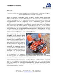
Accuracy and Precision of Hydroacoustic Estimates ... - BioSonics, Inc
Accuracy and Precision of Hydroacoustic Estimates ... - BioSonics, Inc
Accuracy and Precision of Hydroacoustic Estimates ... - BioSonics, Inc

Create successful ePaper yourself
Turn your PDF publications into a flip-book with our unique Google optimized e-Paper software.
INTRODUCTION<br />
Submersed aquatic vegetation provides<br />
critical habitat for numerous Minnesota fish<br />
species <strong>and</strong> is an integral component <strong>of</strong> fish<br />
community integrity (Valley et al. 2004;<br />
Drake <strong>and</strong> Valley 2005). The cumulative effects<br />
<strong>of</strong> lakeshore <strong>and</strong> watershed development<br />
has had negative effects on fish communities<br />
in the upper Midwest (Christensen et al. 1996;<br />
Jennings et al. 1999; Radomski <strong>and</strong> Goeman<br />
2001; Drake <strong>and</strong> Valley 2005). Unfortunately,<br />
habitat assessment techniques have lagged<br />
behind impacts occurring to lake habitats,<br />
<strong>and</strong> spatially explicit quantitative data on the<br />
distribution <strong>of</strong> aquatic vegetation in lakes is<br />
lacking. <strong>Hydroacoustic</strong>s coupled with differentially<br />
corrected GPS, analyzed in a GIS<br />
represents a promising new tool in the acquisition<br />
<strong>of</strong> important habitat data (Valley et al.<br />
2005).<br />
<strong>Hydroacoustic</strong>s has been an effective<br />
tool for assessing the abundance <strong>of</strong> submersed<br />
aquatic vegetation for some time (Maceina<br />
<strong>and</strong> Shireman 1980; Duarte 1987; Thomas et<br />
al. 1990). However, until the advent <strong>of</strong> global<br />
positioning systems (GPS) in the 1990s, our<br />
abilities to map the distribution <strong>of</strong> vegetation<br />
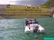
was greatly limited. Sabol <strong>and</strong> Melton (1995)<br />
describe an automated hydroacoustic system<br />
coupled with GPS to estimate bottom depth,<br />
vegetation cover, <strong>and</strong> vegetation height at<br />
numerous georeferenced locations. This system<br />
(a <strong>BioSonics</strong> <strong>Inc</strong>. digital echosounder,<br />
GPS, <strong>and</strong> bottom/plant detection algorithm)<br />
was originally termed the Submersed Aquatic<br />
Vegetation Early Warning System (SAVEWS;<br />
Sabol <strong>and</strong> Melton 1995). Tests on the performance<br />
<strong>of</strong> this system <strong>and</strong> algorithm have<br />
been performed in some hard bottom riverine<br />
<strong>and</strong> estuarine systems, <strong>and</strong> demonstrated high<br />
precision <strong>and</strong> accuracy in those environments<br />
(Sabol <strong>and</strong> Johnston 2001; Sabol et al.<br />
2002a,b).<br />
<strong>BioSonics</strong> <strong>Inc</strong>. has a Cooperative Research<br />
<strong>and</strong> Development Agreement with the<br />
Corps <strong>of</strong> Engineers for development <strong>and</strong> distribution<br />
<strong>of</strong> the patented vegetation detection<br />
algorithm marketed under the trade name<br />
EcoSAV ® . Using characteristics <strong>of</strong> the acoustic<br />
signal, EcoSAV uses a multi-step algorithm<br />
with user-defined parameter settings to determine<br />
depth, plant presence, plant absence, <strong>and</strong><br />
plant height (<strong>BioSonics</strong> <strong>Inc</strong>. 2002). EcoSAV<br />
1.2 processes <strong>BioSonics</strong> echosounder files <strong>and</strong><br />
creates an ASCII text file with records for<br />
every GPS report (recorded every 2 seconds).<br />
Each <strong>of</strong> these records includes a collection <strong>of</strong><br />
pings (number dependent on user-defined ping<br />
rates) where vegetation attributes are averaged<br />
between GPS reports (<strong>BioSonics</strong> <strong>Inc</strong>. 2002).<br />
Evaluating multiple pings per data record is<br />
critical for confidently identifying bottom in<br />
dense plants, where signal can periodically be<br />
attenuated in the plant canopy (Sabol <strong>and</strong><br />
Johnstone 2001).<br />
Because this system holds promise for<br />
assessing <strong>and</strong> mapping vegetated habitats (i.e.,<br />
a window to see littoral zones as l<strong>and</strong>scapes;<br />
Wiens 2002), we tested the performance <strong>of</strong><br />
<strong>BioSonics</strong> echosounders <strong>and</strong> EcoSAV in two<br />
Minnesota lakes. This involved a ground-truth<br />
experiment <strong>and</strong> a comparison <strong>of</strong> repeated wholelake<br />
surveys. First, we compared divermeasured<br />
depth <strong>and</strong> plant height with Eco-<br />
SAV-estimated depth <strong>and</strong> plant height for a<br />
variety <strong>of</strong> individual plant species (henceforth<br />
referred to as “fixed-point experiments”). Our<br />
analysis differs from that by Sabol et al.<br />
(2002) because we evaluate precision <strong>of</strong> estimates<br />
for single plants rather than comparing<br />
average signal returns with average field<br />
measurements. This alternative approach is<br />
necessary because EcoSAV uses a collection <strong>of</strong><br />
single plant measures, averaged between GPS<br />
records, in its reports <strong>of</strong> plant height. We<br />
sought to quantify the error going into these<br />
average measures.<br />
In addition, we evaluated the repeatability<br />
<strong>of</strong> whole-lake surveys. This is important<br />
to quantify because plant habitats in<br />
Minnesota lakes are highly diverse, <strong>and</strong> boat<br />
navigation error precludes sample transects<br />
from being precisely where intended. Local<br />
variability in plant height may affect the robustness<br />
<strong>of</strong> these surveys to boat navigation<br />
error. We assessed local- <strong>and</strong> lake-wide effects<br />
<strong>of</strong> sampling error by repeating three surveys<br />
on two lakes with methods described by<br />
Valley et al. (2005; henceforth referred to as<br />
“whole-lake surveys”). We quantified navigation<br />
<strong>and</strong> location error, the accuracy <strong>and</strong> precision<br />
<strong>of</strong> biovolume maps, <strong>and</strong> the repeatability<br />
<strong>of</strong> survey results.<br />
2