Aerial and Acoustic Surveys for Mackerel - BioSonics, Inc
Aerial and Acoustic Surveys for Mackerel - BioSonics, Inc
Aerial and Acoustic Surveys for Mackerel - BioSonics, Inc

Create successful ePaper yourself
Turn your PDF publications into a flip-book with our unique Google optimized e-Paper software.
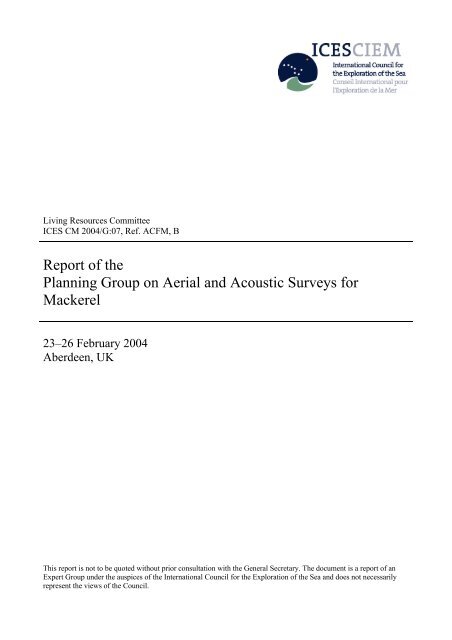
Living Resources Committee<br />
ICES CM 2004/G:07, Ref. ACFM, B<br />
Report of the<br />
Planning Group on <strong>Aerial</strong> <strong>and</strong> <strong>Acoustic</strong> <strong>Surveys</strong> <strong>for</strong><br />
<strong>Mackerel</strong><br />
23–26 February 2004<br />
Aberdeen, UK<br />
This report is not to be quoted without prior consultation with the General Secretary. The document is a report of an<br />
Expert Group under the auspices of the International Council <strong>for</strong> the Exploration of the Sea <strong>and</strong> does not necessarily<br />
represent the views of the Council.
International Council <strong>for</strong> the Exploration of the Sea<br />
Conseil International pour l’Exploration de la Mer<br />
Palægade 2–4 DK–1261 Copenhagen K Denmark<br />
Telephone + 45 33 15 42 25 · Telefax +45 33 93 42 15<br />
www.ices.dk · info@ices.dk
TABLE OF CONTENTS<br />
Section<br />
Page<br />
1 INTRODUCTION...................................................................................................................................................... 1<br />
1.1 Terms of Reference......................................................................................................................................... 1<br />
1.2 Participants...................................................................................................................................................... 1<br />
1.3 Background in<strong>for</strong>mation ................................................................................................................................. 1<br />
2 MACKEREL TARGET STRENGTH ....................................................................................................................... 2<br />
3 THE SIMFAMI PROJECT (TOR H)......................................................................................................................... 4<br />
3.1 SIMFAMI project progress............................................................................................................................. 4<br />
3.2 IMR mackerel identification algorithm........................................................................................................... 5<br />
3.3 FRS mackerel identification algorithm ........................................................................................................... 6<br />
4 ACOUSTIC SURVEY PROCEDURES (TOR A, J) ................................................................................................. 7<br />
5 SURVEYS IN THE NORWEGIAN SEA (TOR A, B, E, F)..................................................................................... 7<br />
5.1 <strong>Surveys</strong> in 2003............................................................................................................................................... 7<br />
5.1.1 Russian aerial survey ........................................................................................................................ 7<br />
5.1.2 Russian trawl-acoustic survey......................................................................................................... 10<br />
5.1.3 Norwegian trawl survey.................................................................................................................. 12<br />
5.2 <strong>Aerial</strong> survey in 2004.................................................................................................................................... 13<br />
6 ACOUSTIC SURVEYS IN THE NORTH SEA - SHETLAND AREA (TOR A, C, D, E) .................................... 15<br />
6.1 <strong>Acoustic</strong> surveys <strong>for</strong> mackerel in autumn 2003 ............................................................................................ 15<br />
6.1.1 Norwegian survey ........................................................................................................................... 15<br />
6.1.2 Scottish survey................................................................................................................................ 16<br />
6.1.3 Intercalibration................................................................................................................................ 21<br />
6.1.4 Combined estimate.......................................................................................................................... 21<br />
6.2 <strong>Acoustic</strong> surveys <strong>for</strong> mackerel in autumn 2004 ............................................................................................ 22<br />
7 SURVEYS IN THE SOUTHERN AREA (TOR A, G) ........................................................................................... 23<br />
8 INFORMATION FROM OTHERS SURVEYS (TOR I) ........................................................................................ 23<br />
8.1 International atlanto-sc<strong>and</strong>ian herring survey in the Norwegian Sea............................................................ 23<br />
8.2 International blue whiting surveys west of the British Isles.......................................................................... 23<br />
8.3 The Norwegian post-smolt/mackerel survey in the Norwegian Sea ............................................................. 23<br />
9 INTEGRATED MACKEREL SURVEY IN 2004–2005 (TOR I)........................................................................... 24<br />
10 RECOMMENDATIONS ......................................................................................................................................... 25<br />
11 WORKING DOCUMENTS..................................................................................................................................... 27<br />
12 REFERENCES......................................................................................................................................................... 27<br />
ANNEX 1: LIST OF PARTICIPANTS............................................................................................................................ 28<br />
@#<br />
i
1 INTRODUCTION<br />
1.1 Terms of Reference<br />
The Planning Group on <strong>Aerial</strong> <strong>and</strong> <strong>Acoustic</strong> <strong>Surveys</strong> <strong>for</strong> <strong>Mackerel</strong> [PGAAM] (Chair E. Shamray, Russia) met in<br />
Aberdeen, Scotl<strong>and</strong> UK from 23–26 February 2004. The terms of reference <strong>and</strong> sections of the report in which the<br />
answers are provided, are as follows:<br />
Item ToR 2004 Section<br />
a) coordinate the timing <strong>and</strong> area allocation <strong>and</strong> methodologies <strong>for</strong> acoustic <strong>and</strong> aerial surveys <strong>for</strong><br />
mackerel in the NEA;<br />
4, 5, 6<br />
& 7<br />
b) collate <strong>and</strong> evaluate the data collected by the aerial surveys, fishing- <strong>and</strong> research vessels in the 5<br />
Norwegian Sea during the summer <strong>and</strong> autumn of 2003;<br />
c) coordinate acoustic surveys within the North Sea-Shetl<strong>and</strong> area to ensure full coverage <strong>and</strong> 6<br />
appropriate areas <strong>and</strong> timing;<br />
d) combine the October-November 2003 survey data of abundance <strong>and</strong> distribution of mackerel 6<br />
within the North Sea-Shetl<strong>and</strong> area;<br />
e) identify participants to contribute to the aerial surveys <strong>for</strong> mackerel in the Norwegian Sea <strong>and</strong> 5<br />
coordinate collaboration between vessels;<br />
f) combine the summer 2003 aerial survey data with vessels data of distribution of mackerel in the 5<br />
Norwegian Sea;<br />
g) seek survey time <strong>for</strong> northward extension of acoustic surveys in ICES Subareas VIII <strong>and</strong> IX; 7<br />
h) consider the latest findings from the SIMFAMI project; 3<br />
i) identify surveys which are not targeted at mackerel, but which may have potential use <strong>for</strong> the 8, 9<br />
estimation of mackerel distribution <strong>and</strong> abundance;<br />
j) develop protocols <strong>and</strong> criteria to ensure st<strong>and</strong>ardisation of all sampling tools <strong>and</strong> survey gears. 4<br />
1.2 Participants<br />
A complete list of the participants can be found in Annex 1 of this report.<br />
1.3 Background in<strong>for</strong>mation<br />
<strong>Mackerel</strong> are widely distributed in the North-East Atlantic. Examination of the time series of commercial mackerel<br />
catches taken from 1977–2003 reveal that mackerel is caught from the Iberian Peninsula in southern Europe up to<br />
around 73° N in the north. The distribution of catches is likely to vary from year to year due to environmental factors,<br />
stock size, <strong>and</strong> quota limitations <strong>for</strong> the participating nations. The distribution of commercial catches by quarter that is<br />
described in detail annually in the WGMHSA report should there<strong>for</strong>e be interpreted with caution: <strong>for</strong> example, some<br />
countries cannot fish in the different national EEZs or they have quota limitations. The commercial data are, there<strong>for</strong>e,<br />
indicative only of the wide area where mackerel are caught in the Northeast Atlantic, <strong>and</strong> the quarterly changes in the<br />
distribution of the fishery.<br />
Various research surveys by different countries have verified that there is an even wider distribution of mackerel than<br />
that indicated by the commercial fisheries.<br />
The assessment of the NEA mackerel stock complex is currently dependent on a single fishery independent estimate of<br />
biomass, derived from the ICES Triennial <strong>Mackerel</strong> <strong>and</strong> Horse <strong>Mackerel</strong> Egg <strong>Surveys</strong>. This is only available once every<br />
three years <strong>and</strong> makes the assessment increasingly insecure with elapsed time since the last survey. The results from the<br />
egg surveys also take a significant time to prepare (almost 1 year). While it is prohibitively expensive to carry out more<br />
frequent egg surveys, it may be possible to use other survey methods to provide data in the intermediate years.<br />
At the same time, a number of different surveys have been carried out by a number of countries in recent years. All<br />
surveys have the potential to deliver in<strong>for</strong>mation on the distribution <strong>and</strong> abundance of mackerel. However, the surveys<br />
cover only part of the known distribution area <strong>and</strong> consequently have not been able to deliver a valid stock estimate or<br />
complete distribution map. The aim of this Planning Group is to identify the deficiencies in area <strong>and</strong> timing of these<br />
surveys <strong>and</strong> to remedy these deficiencies.<br />
The PGAAM met to coordinate vessels from appropriate countries which can collaborate with the Russian aerial<br />
surveys in the Norwegian Sea, to coordinate Scottish <strong>and</strong> Norwegian acoustic surveys in the Viking Bank area, to<br />
coordinate Spanish, Portuguese <strong>and</strong> French acoustic surveys, <strong>and</strong> to utilize the findings of the EU SIMFAMI project to<br />
provide tools to identify mackerel echo-traces.<br />
PGAAM Report 2004 1
The main objectives of PGAAM are to provide distributions of mackerel <strong>and</strong> biomass/number indices that may be used<br />
by WGMHSA in future assessments. Furthermore, it aims to collate in<strong>for</strong>mation on the hydrographic <strong>and</strong> planktonic<br />
conditions of the Norwegian Sea <strong>and</strong> adjacent waters <strong>and</strong> to describe how feeding <strong>and</strong> migration of mackerel are<br />
influenced by this.<br />
During the PGAAM meetings it was possible to group surveys (excluding triennial egg survey) as follows:<br />
Geographical Area Time ICES area EEZ Present Status<br />
Norwegian Sea June-August IIa, IIb, Vb, Va Norwegian, Jan-Mayen, Coordinated<br />
Faroese, Icel<strong>and</strong>ic,<br />
International water<br />
North Sea-Shetl<strong>and</strong> October-November IVa, Norwegian, Great Britain, Coordinated<br />
area<br />
Western area March-May VIIj, VIIb, VIIc, VIa Irish, Great Britain Non-targeting on<br />
mackerel but provide<br />
all kind of samples<br />
Southern area February-April VIII, IXa Portuguese, Spanish, French Unknown from 2004<br />
North Sea IVb, IVc EU Expect in future<br />
Irish <strong>and</strong> Celtic Seas VIIa,d,e,f,g,h EU Expect in future<br />
It will be noted that surveys on atlanto-sc<strong>and</strong>ian herring in the Norwegian Sea <strong>and</strong> on blue whiting west off the British<br />
Isles coordinated by the PGSPFN (PGNAPES from 2004) also provide mackerel distributions <strong>and</strong> biological samples.<br />
Detailed results of the coordinated surveys in 2003 were evaluated at the 2004 PGAAM meeting <strong>and</strong> are presented in<br />
this report. The purpose of the report is to provide a short summary of the surveys <strong>and</strong> their findings: some results of<br />
PGAAM work are subject to further analyses <strong>and</strong> will be reported to the WGMHSA in September 2004.<br />
2 MACKEREL TARGET STRENGTH<br />
TS of mackerel were measured in Norway recently. The measurements were done at the frequencies 38 kHz <strong>and</strong> 120<br />
kHz through the target-tracking method, <strong>and</strong> assuming that the TS of mackerel follows the “20log(L) + B” relation,<br />
which means that the dominating backscattering mechanism is proportional to an area. TS could not be measured at 200<br />
kHz with the target-tracking method since the 200 kHz-system was not split-beam. Most fish possess swim-bladder, <strong>and</strong><br />
<strong>for</strong> these the TS depends on the square of the length of the swim-bladder within the region the TS is used <strong>and</strong> measured.<br />
<strong>Mackerel</strong> do not possess a swim bladder. As a result, they are poor reflectors of sound <strong>and</strong> have low target strength (TS)<br />
at 38 kHz. The measurements of backscatter <strong>for</strong> caged mackerel showed:<br />
TS = 20 log10(Length(in cm)) – 86.0 at the acoustic frequency 38kHz.<br />
This TS relation is based on measurements on a freely swimming mackerel of weight 555 g <strong>and</strong> total length of 34 cm,<br />
which give TS = -55.4 ± 0.4 within 95% confidence interval. (See 2nd Annual Progress report of the SIMFAMI project,<br />
Contract number Q5RS-2001–02054 in press).<br />
The backscattering mechanisms of mackerel are still not completely understood, although some TS modelling have<br />
been done in Norway in cooperation with Pol<strong>and</strong> (presented at the FAST WG in Bergen in 2003 <strong>and</strong> at the 27th<br />
Sc<strong>and</strong>inavian Symposium of Physical <strong>Acoustic</strong>s). According to the intuitive model illustrated in Figure 2.1 below, <strong>and</strong><br />
to provisional modelling studies, there are indications that <strong>for</strong> single-sized mackerel, a “jump frequency” exists<br />
somewhere between 100 <strong>and</strong> 200 kHz, where the TS may increase rapidly. The exact frequency will depend on the size<br />
of the mackerel, but was not revealed by the modelling studies. The frequency dependency of backscattering from<br />
mackerel has been measured at several occasions, but until 2003 none of these could confirm if 200 kHz is at the upper<br />
plateau in Figure 2.1. The intuitive model of backscatter from mackerel illustrated in Figure 2.1 below was developed<br />
prior to the measurements of backscatter from captured mackerel. During those measurements, however, the only<br />
acoustic frequency available above 200 kHz was at 710 kHz, but the calibration of the 710 kHz echo-sounder system<br />
was very difficult, the measurements were very noisy, <strong>and</strong> the measurements were there<strong>for</strong>e in total not trustworthy.<br />
The most recent measurements of the frequency dependency of backscatter from mackerel were done from RV “G. O.<br />
Sars” after the modelling work was known. The acoustic frequencies of the echo-sounder systems of RV “G. O. Sars”<br />
were requested to cover the frequency range 18–400 kHz <strong>and</strong> were there<strong>for</strong>e able to take into account the intuitive<br />
model <strong>and</strong> the provisional modelling results.<br />
2<br />
PGAAM Report 2004
Measurements of the relative frequency response, r(f), of mackerel at sea <strong>and</strong> measurements of r(f) <strong>for</strong> captured<br />
mackerel confirms this (Table 2.1). The backscattering model <strong>and</strong> the measurements of r(f) in Table 2.1 indicates that a<br />
stable TS relation following the “20log(L) + B” relation can probably be calculated at 38 or (even better) at 70 kHz<br />
(flesh only(?)) or at 200 <strong>and</strong> possibly 364 kHz (flesh <strong>and</strong> bone(?)), while at 120 kHz should be avoided since it seem to<br />
be close to the “jump frequency”. Backscatter at 18 kHz is too dependent on the size of the mackerel to be usable. Note<br />
that the measurements at 364 kHz that were done from RV “G. O. Sars” (3) in October 2003 have a large uncertainty.<br />
The calibration showed an asymmetric beam, <strong>and</strong> since the GPT (i.e., the electronic unit processing the signals) of the<br />
EK60 was later proved to operate properly, this is an indication that the wideb<strong>and</strong> (30%) transducer resonant at 400 kHz<br />
was not per<strong>for</strong>ming optimally together with the 364 kHz GPT. The confirmation that the backscatter of mackerel at 200<br />
kHz is at the upper plateau of the curve in Figure 2.1 is there<strong>for</strong>e not fully confirmed. There has not been measured TS<br />
of mackerel at 200 kHz, so TS at 200 kHz can at best preliminary be said to be approximately 6 dB higher than at<br />
38kHz, i.e., TS=20log(L)-80 at 200kHz.<br />
Modelling <strong>and</strong> measurements indicate that 200 kHz is a better frequency to integrate on than 38 kHz. However, until a<br />
TS relation has been measured at 200kHz directly, <strong>and</strong> until it has been re-confirmed that 200kHz is of the plateau of<br />
Figure 2.1 (e.g., during the Norwegian 2004 mackerel survey), it is still recommended to continue using the traditional<br />
TS at 38 kHz, integrating at a threshold of –82 dB. In 2002, PGAAM recommended that the common TS/L relationship,<br />
at the agreed integrating frequency (38 kHz) should be:<br />
TS = 20 log10(Length(in cm))– 84.9 (Edwards et al. 1984)<br />
Table 2.1. Measurements of r(f) <strong>for</strong> increasing average size of Atlantic mackerel.<br />
GROUP<br />
Weight Length Fat<br />
[g] [cm] [%]<br />
r(18) r(38) r(70) r(120) r(200) r(364)<br />
Cage N 2 255 ± 80 32 ± 2.5 15±7 1.5 1.0 0.8 1.3 4.1<br />
<strong>Surveys</strong> 1 330 ±120 34 ± 5.0 1.4 1.0 1.1 1.1 – 2.0 4.1 3.6<br />
Cage F 2 385 ± 80 33 ± 2.0 30±5 1.5 1.0 0.8 1.6 4.3<br />
Cage SFF 2 665 ± 75 38 ± 2.5 37±3 1.3 1.0 1.0 2.0 4.0<br />
Total 1.3±0.4 1.0 1.0±0.1 1.0 – 2.0 4.2±1.0 3.6±1.4<br />
1<br />
<strong>Surveys</strong> of RV “G. O. Sars” (2) in 99–02, RV “G. O. Sars” (3) in 2003. EK500 99–02, EK60 02–03.<br />
2 Measured in Austevoll, Norway with Simrad EK500.<br />
PGAAM Report 2004 3
(f)<br />
σ/σ ref<br />
Level could change<br />
”Jump frequency” could change<br />
Level could change<br />
18 38 70 120 200 364<br />
Size<br />
Frequency [kHz]<br />
Figure 2.1. Intuitive model of backscatter from mackerel.<br />
3 THE SIMFAMI PROJECT (TOR H)<br />
3.1 SIMFAMI project progress<br />
SIMFAMI (Species Identification Methods from <strong>Acoustic</strong> Multi-frequency In<strong>for</strong>mation) is a three-year project, which<br />
started in January 2002, <strong>and</strong> is funded by the European Commission. The project aims to apply modern multi-frequency<br />
acoustic techniques, in addition to the single-frequency methods available previously, to establish methods <strong>for</strong> acoustic<br />
identification of echo traces that are applicable to routine survey procedures. A website <strong>for</strong> the project has more details<br />
(http://simfami.marlab.ac.uk).<br />
The SIMFAMI database is now up <strong>and</strong> running on an internet based server <strong>and</strong> <strong>for</strong>ms a library of gound-truthed<br />
echograms. A total of 386 echograms have been submitted with 560 images <strong>and</strong> the associated species composition.<br />
The database has undergone various incarnations <strong>and</strong> is now in what most participants consider to be a very effective<br />
useable <strong>for</strong>m. Methods <strong>for</strong> the collection of acoustic data have been updated with a view to providing useful programs<br />
<strong>for</strong> the community at large (e.g., in the case of noise reduction). The acoustic data are stored at host institutes <strong>and</strong> are<br />
accessible through an ftp site or on request. There have, however, been un<strong>for</strong>eseen problems with the transfer of data<br />
between partners due to the lack of a st<strong>and</strong>ard data exchange <strong>for</strong>mat <strong>for</strong> acoustic data (HAC <strong>for</strong>mat).<br />
The identification of plankton has proceeded better than expected given the range of frequencies employed. The suite of<br />
algorithms developed in the project have produced some encouraging results, which indicate that a number of categories<br />
corresponding to many species can be isolated. In this regard the project has gone beyond what was expected: rather<br />
than just a filter out separate plankton, it is looking likely that the filter will also classify types of plankton. The<br />
algorithms have been incorporated into an extensive computer program which not only utilises a suite of models, but is<br />
of a framework that is easily adapted to include more models. The algorithms will be tested in the final year <strong>and</strong> there<br />
an extensive data set of ground-truthed plankton hauls has been built up.<br />
4<br />
PGAAM Report 2004
Equally good progress has been made with the identification of fish without swim-bladders (see Sections 3.2 <strong>and</strong> 3.3<br />
below). A number of algorithm development approaches have been pursued: one incorporating many frequencies as<br />
part of a frequency response based algorithm <strong>and</strong> one based on a triple frequency dB difference algorithm. Both have<br />
now been applied to mackerel. Two participants have conducted dedicated research cruises to target mackerel <strong>and</strong> there<br />
is, there<strong>for</strong>e, a large dataset which is available to verify these algorithms in year three.<br />
It seems as though the frequency dependence of fish with swim-bladders is likely to be too invariant at most frequencies<br />
(38–200 kHz) to be able to develop an algorithm <strong>for</strong> the differentiation amongst these species. Ef<strong>for</strong>ts will there<strong>for</strong>e be<br />
concentrated on less common lower frequencies (12–18 kHz) which have shown to be possibly useful <strong>for</strong> size<br />
discrimination. Ef<strong>for</strong>t will also be put into analysis of extracted parameters at any one frequency to assist in the<br />
identification process.<br />
At each step of algorithm development <strong>for</strong> a particular species, combinations of algorithms have been considered. In<br />
some cases, e.g., mackerel, the algorithms are part of a suite which aims to identify other targets also. In combination<br />
with noise <strong>and</strong> plankton filters, there are good prospects <strong>for</strong> providing algorithms which encompass many aspects of the<br />
identification process.<br />
3.2 IMR mackerel identification algorithm<br />
Korneliussen described the essence of the algorithm used by Norway in a Working Document of the 2003 PGAAM<br />
report. The algorithm is illustrated in Figure 3.2.1 below. The main acoustic feature used by the algorithm is the relative<br />
frequency response, r(f), defined as r(f)≡s v (f)/s v (38kHz), where s v is the overall volume backscattering coefficient; f is<br />
the acoustic frequency; s v (38kHz) is s v at 38 kHz. The algorithm is supported by modelling illustrated in Figure 3.2.1,<br />
<strong>and</strong> by measurements of r(f) in Table 2.1 through several years, measurement situations <strong>and</strong> size classes of mackerel.<br />
The average r(f) from Table 2.1 are repeated below:<br />
GROUP r(18) r(38) r(70) r(120) r(200) r(364)<br />
Total 1.3±0.4 1.0 1.0±0.1 1.0 – 2.0 4.2±1.0 3.6±1.4<br />
Echo<br />
sounder<br />
Original data<br />
Corrected<br />
<strong>for</strong> noise<br />
Requirement evolution:<br />
* <strong>Acoustic</strong><br />
requirements<br />
reduced<br />
* Clustering<br />
requirements<br />
strengthened<br />
Multi-frequency data-points<br />
Data-point (black)<br />
smoothed with<br />
”shifted” weights<br />
Any target ?<br />
Stage-1<br />
categorisation<br />
Stage-2<br />
categorisation<br />
Final stage<br />
categorisation<br />
Result matrix evolution<br />
N<br />
N<br />
N<br />
N<br />
N<br />
N<br />
N<br />
N<br />
C<br />
N<br />
N<br />
N<br />
N<br />
C<br />
C<br />
N<br />
N<br />
N<br />
N<br />
C<br />
C<br />
C<br />
N<br />
N<br />
A<br />
N<br />
N<br />
A<br />
N<br />
N<br />
C<br />
A<br />
A<br />
N<br />
N<br />
C<br />
C<br />
C<br />
N<br />
N<br />
A<br />
A<br />
A<br />
N<br />
N<br />
A<br />
A<br />
A<br />
A<br />
N<br />
N<br />
A<br />
A<br />
A<br />
A<br />
N<br />
N<br />
C<br />
B<br />
A<br />
A<br />
B<br />
B<br />
A<br />
A<br />
A<br />
A<br />
B<br />
B<br />
B<br />
B<br />
B<br />
A<br />
A<br />
D<br />
D<br />
B<br />
B<br />
A<br />
D<br />
B<br />
A<br />
A<br />
D<br />
D<br />
D<br />
B<br />
“No target”<br />
result matrix<br />
Result matrix 1<br />
Still uncategorised<br />
Category “B”<br />
Category “C”<br />
Result matrix 2<br />
Final result<br />
categorisation<br />
matrix<br />
Figure 3.2.1. (From PGAAM report 2003). Data flow through the categorisation system. (See Figure 3.2.2. <strong>for</strong> detailed<br />
data flow through the categorisation system.)<br />
The smoothed multi-frequency data-points are used to discriminate between the target classes. If the default weights are<br />
used on data with 0.3 m vertical resolution, the smoothed point is generated from the indicated 15 points with the filter<br />
weights reduced from 0.18 in the centre to 0.025 in the corners. In Stage-1 categorisation, strong model-based or<br />
PGAAM Report 2004 5
empirical requirements must be fulfilled by a multi-frequency data-point in order to put the corresponding volume<br />
segment into one of the specific acoustic target categories. The requirements on the data-point become weaker <strong>for</strong> each<br />
of the categorisation stages that follow but results from the previous categorisation stage are also used as new input.<br />
The implementation of the algorithm applied prior to the 2003 PGAAM report used r{18kHz}: r{38kHz}: r{120kHz}:<br />
r{200kHz}= { 1.0: 1.0: 1.0: 1.0 } <strong>and</strong> 35% uncertainty of r(f) at each frequency as the starting relation of the Stage-1<br />
categorization. (Or alternatively ∆r(f) f≠38kHz =50% if ∆r(38kHz) is set to 0%). The summarized results of r(f) above show<br />
that frequency dependent ∆r(f) should be used. Such new frequency dependent ∆r(f) are now being implemented <strong>and</strong><br />
tested at IMR in a 6-frequency identification algorithm.<br />
<strong>Mackerel</strong>: 8 kg<br />
Herring: 14 kg<br />
Pearlside: 0.7 kg<br />
Saithe: 7 kg<br />
Total: 34 kg<br />
<strong>Mackerel</strong>: 11 kg<br />
Herring: 120 kg<br />
Pearlside: 0.05 kg<br />
Saithe: 8 kg<br />
Total: 140 kg<br />
<strong>Mackerel</strong>: 100 kg<br />
Herring: 2 kg<br />
Pearlside: 0.7 kg<br />
Saithe: 10 kg<br />
Total: 110 kg<br />
Pearlside<br />
b) Recognised acoustic categories (colour coded)<br />
Herring+plankton<br />
<strong>Mackerel</strong><br />
<strong>Mackerel</strong>+plankton<br />
a) 200 kHz echogram c) 200 kHz – mackerel only (all pings)<br />
Figure 3.2.2. <strong>Acoustic</strong> categories identified by the IMR algorithms. Figure (a) shows the noise-corrected 200 kHz<br />
echogram <strong>and</strong> the result of the catches of the multiple open-close trawl system used to catch mackerel. Each bag of the<br />
trawl sample is illustrated by polygons. Figure (b) shows all acoustic categories identified by the algorithms used.<br />
Figure (c) shows a 200 kHz echogram <strong>for</strong> all available pings where only mackerel is retained <strong>and</strong> all other categories re<br />
removed.<br />
3.3 FRS mackerel identification algorithm<br />
FRS are in the process of refining their multifrequency algorithm <strong>for</strong> the identification of mackerel echo traces.<br />
Currently this consists of two str<strong>and</strong>s. In the first str<strong>and</strong> a three-frequency plankton filter using data collected at 38, 120<br />
<strong>and</strong> 200 kHz is applied. This is then enhanced to obtain an echogram of ‘fish school c<strong>and</strong>idates’; these c<strong>and</strong>idates are<br />
then examined in str<strong>and</strong> two to determine whether or not they may be identified as mackerel. The second str<strong>and</strong> is the<br />
mackerel identification algorithm which uses a dB difference between 38 <strong>and</strong> 200 kHz data (38 minus 200 kHz) on a<br />
pixel by pixel basis. The colour coded dB difference echogram (blue <strong>for</strong> negative values; yellow <strong>for</strong> zero; red <strong>for</strong><br />
positive) is then subject to a threshold (currently –6 dB) to extract only negative values. Some image processing is then<br />
applied to enhance <strong>and</strong> smooth the echo traces <strong>and</strong> to filter out small spurious marks. A positive mask of values greater<br />
than threshold is then enhanced <strong>and</strong> subtracted from the negative values. The final processed image is then used as a<br />
mask on the original 38 kHz data to isolate echo-traces as potential c<strong>and</strong>idates <strong>for</strong> mackerel. The final selection is based<br />
on a user operator confirmation of potential mackerel c<strong>and</strong>idates from this mask with the other echograms in<br />
synchronized view. A preliminary analysis of the algorithm indicates that it behaves in a similar manner to an<br />
experienced operator (see Section 6.1.2).<br />
6<br />
PGAAM Report 2004
4 ACOUSTIC SURVEY PROCEDURES (TOR A, J)<br />
Protocols <strong>and</strong> criteria to ensure st<strong>and</strong>ardization of all sampling tools <strong>and</strong> survey gears.<br />
The acoustic surveys carried out under the auspices of this Planning Group are still under development <strong>and</strong> many of the<br />
tools <strong>and</strong> protocols are subject to improvements. The planning group feels that this is, there<strong>for</strong>e, not the appropriate<br />
time <strong>for</strong> the setting of st<strong>and</strong>ards. This is particularly the case <strong>for</strong> methods of echogram scrutiny <strong>and</strong> pre-processing of<br />
the acoustic data. Survey designs are planned following the paradigm of herring acoustic in the North Sea, but with<br />
modifications <strong>for</strong> the specific circumstances in particular areas <strong>and</strong> seasons. Until protocols, specifically <strong>for</strong> mackerel<br />
acoustic surveys are fully researched <strong>and</strong> validated, cruise leaders are advised to use the general rules set out in the<br />
”Manual <strong>for</strong> herring acoustic surveys in ICES divisions III, IV <strong>and</strong> VIa” (Annex I of the 2003 PGAAM report (Anon.<br />
2003c)). Where the procedures <strong>for</strong> mackerel surveys deviate significantly the text includes areas in bold <strong>and</strong> underline<br />
giving advice in these cases.<br />
The group advised all PGAAM participants to examine this document over the coming year with a view to updating its<br />
contents at the next meeting. This manual <strong>and</strong> modifications are intended <strong>for</strong> use in new or existing acoustic surveys<br />
specifically targeted on mackerel, <strong>and</strong> carried out under the auspices of this Planning Group. For other surveys, where<br />
mackerel is a secondary objective, the manual <strong>and</strong> modifications should be regarded as advisory only. The manual is<br />
attached as Annex I in the 2003 PGAAM report.<br />
5 SURVEYS IN THE NORWEGIAN SEA (TOR A, B, E, F)<br />
5.1 <strong>Surveys</strong> in 2003<br />
5.1.1 Russian aerial survey<br />
Russian aerial surveys in the Norwegian Sea in the summer 2003 were carried out according to plans discussed at the<br />
2003 PGAAM meeting.<br />
As in previous years aerial surveys carried out onboard the research aircraft Antonov-26 (An-26) “Arktika” using<br />
remote sensing equipment (Anon. 2002, 2003a; Zabavnikov et al. 1997). In summer 2003 airborne research surveys<br />
were carried out from 12 July – 2 August in the Norwegian Sea (Figure 5.1.1.1). During this time more than 10 flights<br />
were conducted.<br />
PGAAM Report 2004 7
Figure 5.1.1.1. Flights tracks of Russian research aircraft “Arktika” in summer 2003.<br />
8<br />
PGAAM Report 2004
In 2003 airborne research were continued with up grated hardware <strong>and</strong> software of Russian polarizable aviation LIDAR<br />
(PAL-1). This research allowed <strong>for</strong> the development of LIDAR methods to study mackerel. As a result, in 2003 the<br />
identification <strong>and</strong> interpretation of mackerel schools was made more efficient, <strong>and</strong> reliable, culminating in improved<br />
“Lidarograms”, which include visualization <strong>and</strong> post-processing, <strong>and</strong> in the near real time (Figure 5.1.1.2). This<br />
technology requires further development <strong>and</strong> improvement.<br />
During the airborne surveys of summer 2003, 96 pelagic fish schools, interpreted as mackerel, were detected using<br />
LIDAR A map of mackerel distribution, based on LIDAR data <strong>and</strong> visual observations is presented on Figure 5.1.1.3.<br />
Figure 5.1.1.2. Example of “Lidarograms” made by Russian research aircraft “Arktika”.<br />
Figure 5.1.1.3. Distribution of mackerel carried out by Russian research aircraft “Arktika” (gray – blue whiting).<br />
PGAAM Report 2004 9
The results of airborne research have indicated that most feeding mackerel schools were detected in the southern part of<br />
the aerial survey area (Northern area of Faroese EEZ, South-West area of Norwegian EEZ); on the border between the<br />
Norwegian EEZ <strong>and</strong> International Water between 64°–67°N; <strong>and</strong> close to the Greenwich meridian between 66°-68°N.<br />
This results correlate well with data from the Norwegian <strong>and</strong> Russian trawl surveys in July 2003.Many pelagic fish<br />
schools were also detected in the South-West part of International waters, where vessel trawls discovered blue whiting<br />
schools.<br />
A scientist from Icel<strong>and</strong>ic Institute of Marine Research participated in the aerial surveys of the Eastern part of Icel<strong>and</strong>ic<br />
EEZ to study feeding mackerel migration.<br />
Joint research exercises were conducted between “Arktika”, <strong>and</strong> the Russian RV “Smolensk” <strong>and</strong> Norwegian FV<br />
“Kings Bay”. These exercises were carried out in the same positions or part thereof as 3 or more aircraft flights over the<br />
vessels tracks.<br />
Joint research exercises were carried out by “Arktika” - RV “Smolensk” <strong>and</strong> “Arktika” - FV “Kings Bay” in July 16<br />
<strong>and</strong> 23 respectively (Figure 5.1.1.4.). A good correlation between aircraft remote sensing data <strong>and</strong> vessels (in situ) data<br />
was obtained comparing of oceanographic data (SST, depth of picnocline, transparency <strong>and</strong> sub-surface plankton<br />
concentration) <strong>and</strong> mackerel schools.<br />
As part of the research described above new data on the distribution of feeding mackerel <strong>and</strong> migration patterns, was<br />
obtained, including LIDAR data.<br />
Figure 5.1.1.4. Intercalibrations between Russian aircraft <strong>and</strong> Russian RV “Smolensk” <strong>and</strong> Norwegian FV “Kings Bay”<br />
in July 2003.<br />
5.1.2 Russian trawl-acoustic survey<br />
The Russian trawl-acoustic survey in the open part of Norwegian Sea took place from 8 – 17 June 2003 with the RV<br />
“Smolensk”. Approximately 38200 n.mi 2 were covered. Echo integration was carried out using a Simrad EK500<br />
scientific echo-sounder with 38 kHz (split beam). Data collection <strong>and</strong> post-processing was done by means of FAMAS<br />
program, which is functionally similar to post- processing software BI500. Survey tracks, trawl <strong>and</strong> hydrographic<br />
stations are shown on Figure 5.1.2.1. Trawl stations carried out by RV “Smolensk” included 30-minutes tow duration<br />
with pelagic trawl with opening 50 x 50 meters.<br />
10<br />
PGAAM Report 2004
In June, mackerel stock distribution was governed by hydrological conditions in the region (Figure 5.1.2.2). Small<br />
schools were found at depths 10 to 25 m in Eastern <strong>and</strong> South-Eastern part of the research area. Temperature of the<br />
water in above areas was higher than 9°C. In the Western part of the research area, where isothermal line of 9°C was<br />
very close to the surface, echograms from echo-sounder, showed no or very small number of mackerel schools.<br />
Measured Nautical Area Scattering Coefficients (S A ) <strong>for</strong> 5 mile intervals varied from 1 to 30 (m 2 /nmi 2 ). Maximal<br />
mackerel schools were registered in position 65°45’N, 4°W. Low NASCs resulted from the fact that most of the fish<br />
avoided the vessel. There<strong>for</strong>e, acoustic estimation of mackerel was not calculated.<br />
The trawl method was used <strong>for</strong> estimating the biomass <strong>and</strong> distribution of mackerel schools. During the survey, the<br />
vessel made a total of 31 trawl hauls. Mean length of fish <strong>and</strong> mean weight of mackerel were 36.06 cm, 526 g<br />
accordingly. A preliminary result gave a biomass estimate of 720 000 tones.<br />
During the survey, the RV “Smolensk” worked in conjunction with the research aircraft under the joint program (see<br />
above).<br />
69°<br />
108 109 110<br />
148 149 150 151<br />
68°<br />
113<br />
155<br />
112<br />
154<br />
153<br />
111<br />
152<br />
114 115 116117<br />
156 157 158 159 160 161 162 163 164 165 166<br />
67°<br />
173<br />
172<br />
121<br />
171<br />
170<br />
120<br />
169<br />
119<br />
168<br />
118<br />
167<br />
122 123 124 125<br />
174 175 176 177 178<br />
129<br />
128<br />
127<br />
126<br />
66°<br />
184<br />
183<br />
182<br />
181<br />
180<br />
179<br />
130 131 132 133<br />
185 186 187 188 189 190 191 192 193<br />
135<br />
134<br />
197<br />
136<br />
196<br />
195<br />
194<br />
65°<br />
137 138<br />
198 199<br />
- CTD<br />
- Ï åë. òðàë<br />
64°<br />
-8° -6° -4° -2° 0° 2° 4°<br />
Figure 5.1.2.1. Survey tracks, trawl <strong>and</strong> hydrographic stations RV “Smolensk”.<br />
PGAAM Report 2004 11
69°<br />
68°<br />
67°<br />
200<br />
66°<br />
100<br />
25<br />
5<br />
65°<br />
1<br />
0<br />
64°<br />
-8° -6° -4° -2° 0° 2° 4°<br />
Figure 5.1.2.2. Distribution of mackerel as a result of a trawl survey by RV “Smolensk” (t/n.mi 2 ).<br />
5.1.3 Norwegian trawl survey<br />
During 15–30 July two Norwegian commercial purse seiners, “Endre Dyrøy” <strong>and</strong> “Kings Bay” carried out a trawl<br />
survey at prefixed stations. “Endre Dyrøy” started in the south <strong>and</strong> worked northwards while “Kings Bay” started in the<br />
north <strong>and</strong> worked southwards. Both vessels trawled the surface layer (the upper 40 m) at each station <strong>for</strong> 30 minutes.<br />
The distributions of catches are given in Figure 5.1.3.1. The largest catches were taken in the southern area, while the<br />
catch rates in the international zone were relatively low. The largest mackerel were caught in the Jan Mayen area.<br />
12<br />
PGAAM Report 2004
Figure 5.1.3.1. Distribution of mackerel catches given as kg/nautical mile, obtained by “Endre Dyrøy” <strong>and</strong> “Kings<br />
Bay”.<br />
5.2 <strong>Aerial</strong> survey in 2004<br />
Russia plans to carry out surveys of feeding mackerel onboard the research aircraft An-26 “Arktika” <strong>and</strong> research<br />
vessels of in the Norwegian Sea as in previous years during July-August 2004 (Figure 5.2.1.a). Russia plans to cover the<br />
same area as in 2003 with about 120 flight hours during the period late June – early August. The main part of research<br />
flights will be carried out in International waters <strong>and</strong> nearby areas of different national EEZ. However airborne research<br />
period <strong>and</strong> area may be altered depending on development of oceanographic, meteorological <strong>and</strong> hydrobiological<br />
processes in the Norwegian Sea <strong>and</strong> closest area of the North Atlantic.<br />
Norway will also per<strong>for</strong>m aerial surveys in 2004 with a new LIDAR. This will be done in cooperation with the Russian<br />
survey <strong>and</strong> two Norwegian fishing vessels. The fishing vessels will work the gridlines as given in Figure 5.2.1 during<br />
15–30 July. The aeroplane with the LIDAR will cover the same gridlines during 8–10 days when the two vessels are<br />
working in the area. The vessels will trawl in the surface layer as indicated in Figure 5.2.1.b<br />
Detailed plans <strong>for</strong> the joint airborne remote sensing <strong>and</strong> vessels surveys between Russia <strong>and</strong> Norway will be exchanged<br />
by correspondence <strong>and</strong> agreed be<strong>for</strong>e July. The Russian <strong>and</strong> Norwegian contact persons <strong>for</strong> the joint research will be<br />
Vladimir Zabavnikov (ltei@pinro.ru copy inter@pinro.ru) <strong>and</strong> Eirik Tenningen (eirik.tenningen@imr.no) respectively.<br />
The Russian aerial surveys will, if possible, be assisted by a Faroese commercial vessel working in the EEZ the last<br />
week of July or first week of August. Aspects <strong>and</strong> possibilities of this cooperation will be agreed by correspondence in<br />
spring 2004. The Faroese contact person is Jan Arge Jacobsen (janarge@frs.fo).<br />
The Russian aerial surveys in the end of July – beginning of August 2003 will probably also co-operate with Icel<strong>and</strong>ic<br />
Marine Research Institute on pelagic fish stock distribution <strong>and</strong> abundance in the western area.<br />
PGAAM Report 2004 13
Figure 5.2.1.a. The planned survey area <strong>for</strong> the Russian aircraft <strong>and</strong> trawl survey 15–30 July 2004.<br />
Figure 5.2.1.b. The planned survey grid <strong>for</strong> the Norwegian LIDAR <strong>and</strong> trawl survey 15–30 July 2004.<br />
14<br />
PGAAM Report 2004
6 ACOUSTIC SURVEYS IN THE NORTH SEA - SHETLAND AREA (TOR A, C, D, E)<br />
6.1 <strong>Acoustic</strong> surveys <strong>for</strong> mackerel in autumn 2003<br />
6.1.1 Norwegian survey<br />
The Norwegian acoustic survey in the North Sea took place from 16 October to 6 November with the new RV “G. O.<br />
Sars”. The area covered <strong>and</strong> the cruise track is shown in Figure 6.1.1. In the first part of the survey, the cruise track was<br />
interlaced with that of Scottish RV “Scotia” (2°–4°E <strong>and</strong> 59°30’N – 61°30’N). This was followed by an intercalibration<br />
along one of the cruise lines. The remaining parts of the survey covered a somewhat larger area, from the western parts<br />
of the Norwegian trench to 2°W <strong>and</strong> from 59°30’N – 61°50’N, also covering the first part a second time.<br />
The overall design of the survey was similar to that in previous years (1996, 1997, 1999, 2000, 2001, <strong>and</strong> 2002).<br />
Although the new vessel should be capable of trawling at 5 – 6 knots, we had to trawl at less than 4 knots due to poor<br />
quality of the trawls. There<strong>for</strong>e the mackerel might not be representatively caught <strong>and</strong> the mean length obtained from<br />
the samples of the mackerel might be an underestimate.<br />
The identification of mackerel was largely based on the frequency response <strong>and</strong> the target strength used was 20logL -<br />
84.9. The first coverage resulted in a biomass estimate of 224 000 tonnes <strong>and</strong> the second in an estimate of 583 000<br />
tonnes. The two coverages gave a combined estimate of 581 000 tonnes. The biomass estimates, the mean length, <strong>and</strong><br />
mean weight are shown in Table 6.1.1. The registrations are outlined in Figure 6.1.1. Most of the mackerel was found<br />
from the western part of the Norwegian trench <strong>and</strong> 30 – 50 nautical miles further to the west. The mackerel was found<br />
at greater depths this year than in previous years.<br />
Table 6.1.1. <strong>Mackerel</strong> mean length, mean weight, <strong>and</strong> estimated biomass.<br />
Coverage No Mean length [cm] Mean weight [g]<br />
Estimated biomass<br />
(10 3 tonnes)<br />
1 33.0 296 224<br />
2 33.0 296 583<br />
Combined 33.0 296 581<br />
62N<br />
<strong>Mackerel</strong> distribution October 2003 - Related to 100 m depth temperatures<br />
s A 38 kHz<br />
5 nmi means<br />
1-5<br />
5-10<br />
61<br />
10-20<br />
Shetl<strong>and</strong><br />
4<br />
20-50<br />
50-100<br />
100-200<br />
60<br />
3<br />
2<br />
200-1000<br />
1<br />
59<br />
200 nmi economy<br />
200 m<br />
2W 1 0 1 2 3 4 5<br />
6E<br />
Figure 6.1.1. Grid lines <strong>and</strong> registrations of mackerel in the Norwegian survey with RV “G. O. Sars” related to the<br />
temperature distribution at 100m.<br />
PGAAM Report 2004 15
6.1.2 Scottish survey<br />
The survey<br />
The vessel left Aberdeen on 4 October <strong>and</strong> proceeded to Scapa Flow where calibration of the four transducers was<br />
carried out. Passage was then made through areas thought to contain mackerel (close to the 200 m contour) to confirm<br />
the location of high intensity strata <strong>for</strong> the survey. The first fishing trawl was carried out during this prospective passage<br />
route on 6 October. The survey commenced on 7 October at 02:15 at approximately 61°48’N 001°54’E. Transects<br />
progressed southward along lines of latitude, at spacings of 15 or 7.5 nautical miles (n.mi.) as planned; although<br />
transect design was altered slightly due to delays from gale <strong>for</strong>ce winds. The vessel docked into Lerwick harbour on 12<br />
October <strong>for</strong> 24 hours to enable a change of personnel <strong>and</strong> to give staff their rest day in line with working time<br />
directives. The survey resumed at 06:05 on 13 October. On 17 October the vessel headed back into Lerwick to pick up a<br />
pump <strong>for</strong> the third engine to enable fishing with the larger (PT170) net. The opportunity was taken to carry out a second<br />
calibration of all four frequencies in S<strong>and</strong>wick Bay. On 18 October, the vessel rendezvoused with the Norwegian RV<br />
“G. O. Sars” as planned <strong>and</strong> the two ships carried out an interlaced survey in the area close to the 200 m contour:<br />
transect spacing <strong>for</strong> each vessel was 15 n.mi. giving a combined spacing of 7.5 n.mi. At the end of this, the two vessels<br />
undertook an intercalibration exercise starting at 18:20 on 20 October. This lasted <strong>for</strong> approximately 3 hours (30 n.mi.)<br />
with each vessel taking the lead alternatively on two occasions. The intercalibration was completed at 21:40 <strong>and</strong> the<br />
vessels then broke off to continue their respective surveys. RV “Scotia” completed its survey shortly afterwards at<br />
23:25 on 20 October. The vessel returned to Aberdeen on the morning of 22 October.<br />
Results<br />
The survey was completed <strong>and</strong>, despite encountering some poor weather, only a small amount of time was lost due to<br />
weather. The total mileage surveyed was approximately 2450 n.mi. A total of approximately 70 GB of acoustic data<br />
was archived <strong>and</strong> copied to DVD; this corresponds to 981 acoustic log intervals of 15 minutes duration. Calibrations<br />
were carried out of the four acoustic frequencies (18, 38, 120 <strong>and</strong> 200 kHz): calibration accuracy of the principal<br />
integration frequency (38 kHz) was within 0.05 dB (ICES recommends accuracy to be within 0.5 dB). Echo traces from<br />
mackerel were distinguished on the basis of the difference in acoustic return between the 38 <strong>and</strong> 200 kHz frequencies,<br />
using the latest version of the FRS mackerel identification algorithm, which was displayed in real time (assisting the<br />
direction of ground truth trawl hauls).<br />
As expected, most of the mackerel were detected close to the border between EU <strong>and</strong> Norwegian waters, towards the<br />
east of the survey area around Viking Bank. Ground truth identification of the mackerel echo traces proved far more<br />
successful than in the previous (2002) survey: both the PT170 <strong>and</strong> PT160 (with the larger doors) were able to catch<br />
large quantities of mackerel. Of the 19 trawl hauls carried out, mackerel were caught in 15, giving a raised total of 16<br />
569 kg. On two occasions, echo traces thought to be mackerel were fished on with rod <strong>and</strong> line <strong>for</strong> comparative<br />
purposes – these were logged as separate biological samples. 4732 mackerel were measured <strong>for</strong> length <strong>and</strong> 797<br />
mackerel were sampled <strong>for</strong> weight, sex, maturity <strong>and</strong> otoliths. The length distribution <strong>and</strong> age length key are given in<br />
Figure 6.1.2.2 <strong>and</strong> Table 6.1.2.1 respectively. The age length key reflects the current perception of the stock’s age<br />
structure, with a strong 1999 year class <strong>and</strong> a weak 2000 year class.<br />
Other fish caught include herring (3816 lengths measured from a raised total of 17 246 kg), saithe (118 lengths),<br />
haddock (31 lengths), silversides <strong>and</strong> a variety of small gadoids. No cod were caught. Some hydrographic data were<br />
obtained from the deployment of a CTD unit: a total of 12 casts were taken. Overall, the survey proved very<br />
satisfactory. Considerable numbers of large mackerel schools were detected, <strong>and</strong> most of these were successfully<br />
ground truthed with pelagic trawls. The mackerel were contained within the survey area. The interlaced survey <strong>and</strong><br />
intercalibration with the “G. O. Sars” was carried out successfully.<br />
Survey estimates<br />
<strong>Acoustic</strong> data were averaged in 15 minute equivalent distance sampling units (EDSUs) which, at a survey speed of 10<br />
knots, represented 2.5 n.mi. per EDSU (Figure 6.1.2.3). The data were then analysed according to st<strong>and</strong>ard acoustic<br />
survey procedures using the Marine Laboratory Integrator Analysis Package (MILAP). This software uses a rectangular<br />
grid based averaging method incorporating all trawl data <strong>for</strong> lengths <strong>and</strong> age to produce an abundance estimate in<br />
number <strong>and</strong> biomass by age.<br />
16<br />
PGAAM Report 2004
62°<br />
489<br />
61°<br />
508<br />
492<br />
491<br />
507<br />
493<br />
506<br />
495<br />
499<br />
497 498<br />
496<br />
60°<br />
494<br />
500<br />
488<br />
503<br />
502<br />
501<br />
505<br />
59°<br />
-2° -1° 0° 1° 2° 3° 4° 5°<br />
Figure 6.1.2.1. Cruise track of RV “Scotia’s” October 2003 mackerel acoustic survey. Triangles indicate positions of<br />
trawls (catches of mackerel are filled triangles; catches with no mackerel are open triangles; labels are trawl number).<br />
At the PGAAM meeting four options <strong>for</strong> analysing the survey were presented to the group based on the identification<br />
process. All options used some <strong>for</strong>m of multifrequency identification process based on implementation of the FRS<br />
mackerel identification algorithm (see Section 3.2). The four options were as follows:<br />
1) Original. In this case, the identification was based on last year’s algorithm which was mostly down to user based<br />
confirmation of potential mackerel schools. Some editing of school boundaries was carried out.<br />
2) Schools. In this case the 10 largest values obtained from the original analysis (above) were re-scrutinised. The<br />
manual editing of school boundaries was removed. All parts of any school that were shown to contain significant<br />
quantities of mackerel according to the algorithm were then taken as mackerel. Any schools that had a mixture of<br />
signals (indicating the presence of herring <strong>for</strong> example) would, there<strong>for</strong>e, be taken purely as mackerel if the most<br />
prevalent signal (in school area) was mackerel.<br />
3) Manual. In this case the 10 largest values obtained from the original analysis (above) were re-scrutinised by<br />
members of the PGAAM group. School boundaries were redrawn <strong>and</strong> in the case of mixed schools – all of those<br />
areas thought to contain herring, <strong>for</strong> example, were taken out. The definition was based on examination of dB<br />
differences (all mainly positive areas removed).<br />
4) Auto. In this case the 10 largest values obtained from the original analysis (above) were subject to the current FRS<br />
mackerel identification algorithm. This differs from last year (<strong>and</strong> there<strong>for</strong>e the ‘original’ analysis above) in two<br />
main respects: 1) a threshold of –6 dB is used to distinguish mackerel (< –6 dB difference at 38–200 kHz) – this is<br />
PGAAM Report 2004 17
ased on the findings of the SIMFAMI project; <strong>and</strong> 2) that a positive mask of smoothed target areas greater than –<br />
6 dB is applied to remove areas which may contain herring <strong>for</strong> example.<br />
50<br />
40<br />
30<br />
n<br />
20<br />
10<br />
S03/507 0<br />
S03/498<br />
Trawl number S03/488<br />
1<br />
4<br />
7<br />
10<br />
13<br />
16<br />
19<br />
22<br />
Length (cm)<br />
S03/488<br />
S03/491<br />
S03/492<br />
S03/493<br />
S03/494<br />
S03/496<br />
S03/498<br />
S03/500<br />
S03/501<br />
S03/502<br />
S03/505<br />
S03/506<br />
S03/507<br />
Figure 6.1.2.2. Length distributions of mackerel caught during the Scottish acoustic survey October 2003.<br />
Table 6.1.2.1. Age length key <strong>for</strong> mackerel from trawl samples taken during the Scottish acoustic survey in October<br />
2003.<br />
Length (cm) 1 2 3 4 5 6 7 8 9 10 11 12 13 14 15 16 Gr<strong>and</strong> Total<br />
25 2 2<br />
26 25 25<br />
27 46 46<br />
28 57 2 59<br />
29 54 4 58<br />
30 31 18 49<br />
31 7 44 5 3 1 60<br />
32 39 7 10 4 60<br />
33 1 33 7 21 2 1 65<br />
34 24 12 20 4 2 1 1 64<br />
35 12 11 19 11 4 1 1 59<br />
36 4 5 20 11 6 2 2 50<br />
37 1 13 19 9 6 1 49<br />
38 1 11 6 9 4 7 2 40<br />
39 1 6 6 6 7 4 4 1 1 36<br />
40 1 1 3 6 2 4 4 5 1 1 1 1 30<br />
41 1 3 5 2 3 4 4 1 1 24<br />
42 3 2 1 3 4 1 14<br />
43 1 2 1 4<br />
44 1 1 2<br />
46 1 1<br />
Gr<strong>and</strong> Total 223 180 50 119 67 44 25 30 14 16 9 12 1 4 2 1 797<br />
18<br />
PGAAM Report 2004
An assessment of biomass was carried out <strong>for</strong> all four options <strong>for</strong> the whole Scottish survey, albeit only considering the<br />
largest 10 EDSU values <strong>for</strong> options 2–4. The NASCs from these 10 EDSUs accounted <strong>for</strong> 70% of the total NASC <strong>for</strong><br />
the survey.<br />
The target strength to length relationship used was that recommended by the planning group: TS = 20log10L-84.9 dB<br />
per individual. The mackerel data from the trawl hauls were used to divide the area into three strata based on length<br />
distributions <strong>and</strong> geographic criteria. The three regions were: a large group in deeper water to the east of the region<br />
(mean length 35.5 cm); a smaller group in inshore <strong>and</strong> south-central waters (mean length 29.9 cm); <strong>and</strong> a medium sized<br />
group in northern inshore areas (mean length 32.6 cm).<br />
The different EDSU NASCs derived from the four options are given in Figure 6.1.2.2. The survey estimates were as<br />
follows:<br />
Biomass (t)<br />
Numbers (millions)<br />
1 original 1,501,000 3,808<br />
2 schools 1,803,000 4,606<br />
3 manual 1,159,000 2,917<br />
4 auto 1,084,000 2,745<br />
The trends depicted here were expected. The ‘schools’ option (2) assumes that each school that is detected with a<br />
significant proportion of mackerel is composed entirely of mackerel. This option, there<strong>for</strong>e, assumes that there were no<br />
herring in the school <strong>and</strong> so when herring were present, the NASC was larger than <strong>for</strong> option (1). In all cases, the NASC<br />
<strong>for</strong> option (2) was approximately equal to or greater than option (1) <strong>and</strong> the biomass estimate was 20% larger. Clearly<br />
option (2) is not viable: it was conducted to illustrate the danger of allocating mixed schools to mackerel when they<br />
might contain herring <strong>and</strong> hence overestimate the biomass of mackerel. The somewhat surprising but altogether<br />
pleasing result is that options (3) <strong>and</strong> (4) were very similar. This indicates that the current version of the algorithm<br />
(‘auto’ option 4) per<strong>for</strong>ms in a similar way to an experienced operator (manual option 3). If anything, the ‘auto’<br />
algorithm was more conservative than the manual option. It remains to be seen of course if full implementation of the<br />
algorithm <strong>for</strong> the whole survey would give similar results: this will be tested in due course. Both options (3) <strong>and</strong> (4)<br />
rendered smaller abundances than the original option (1). This was because option (1) was a preliminary estimate <strong>and</strong><br />
the scrutiny was carried out prior to appreciation of the extent to which mackerel <strong>and</strong> herring occur within the same<br />
echo trace. The next step is to run a full implementation of the auto option (3) by applying the algorithm to the whole<br />
survey. This will be prepared in advance of the mackerel assessment working group.<br />
For the purposes of this report the best estimate of mackerel in the area is option 4. The detailed results, including an<br />
age breakdown are given Table 6.1.2.2. The distribution of NASC values is given in Figure 6.1.2.4.<br />
Table 6.1.2.2. Final results of the Scottish survey October 2003. Numbers are in millions of fish, length in cm, weight in<br />
g <strong>and</strong> biomass in thous<strong>and</strong>s of tonnes.<br />
Age Number Mean length Mean weight Biomass<br />
1 713.22 28.26 239.84 171.06<br />
2 886.71 32.38 377.66 334.88<br />
3 233.69 33.76 434.32 101.50<br />
4 467.05 34.31 459.48 214.58<br />
5 186.29 35.32 507.22 94.49<br />
6 96.47 36.59 569.86 54.97<br />
7 45.55 37.66 626.23 28.53<br />
8 46.38 37.92 645.49 29.94<br />
9 20.62 39.41 726.62 14.99<br />
10 18.10 39.68 745.23 13.49<br />
11 10.38 40.72 809.69 8.41<br />
12 12.31 40.97 827.37 10.19<br />
13 1.53 40.00 761.18 1.17<br />
14 4.08 41.32 854.92 3.49<br />
15 1.71 41.39 855.13 1.46<br />
16 0.77 44.00 1049.16 0.81<br />
Total 2,744.84 32.48 394.90 1,083.94<br />
PGAAM Report 2004 19
NASC (m2.nm-2)<br />
1600<br />
1400<br />
1200<br />
1000<br />
800<br />
600<br />
400<br />
200<br />
0<br />
1 2 3 4 5 6 7 8 9 10<br />
EDSU<br />
test1 original<br />
test2 schools<br />
test3 manual<br />
test4 auto<br />
Figure 6.1.2.3. Plots of the Nautical Area Scattering Coefficients (NASCs) obtained using the four scrutiny options<br />
described in the text <strong>for</strong> the 10 Equivalent Distance Sampling Units (EDSUs) with the largest NASC values in the<br />
survey.<br />
62°<br />
61°<br />
60°<br />
59°<br />
-2° -1° 0° 1° 2° 3° 4° 5°<br />
Figure 6.1.2.4. Map of the northern North Sea <strong>and</strong> a post plot of the distribution of mackerel. Circle size proportional to<br />
NASC attributed to mackerel in a 2.5 n.mi. EDSU, from the Scottish acoustic survey in October 2003; on a square root<br />
scale relative to a maximum value of 1189 m 2 .nmi .-2 .<br />
20<br />
PGAAM Report 2004
6.1.3 Intercalibration<br />
An intercalibration between RV “Scotia” <strong>and</strong> RV “G.O. Sars” was carried out on 20 October 2003. The results of this<br />
exercise are still to be fully analysed. Provisional analyses suggest, however, that the systems are working<br />
comparatively well (Figure 6.1.3.1). The mean NASC values attributed to mackerel from both ships were quite similar<br />
as seen from the figure: 2.4 m 2 .nmi .-2 <strong>for</strong> the RV “Scotia” <strong>and</strong> 1.1 m 2 .nmi .-2 <strong>for</strong> the RV “G. O. Sars” II. A more<br />
comprehensive analysis of the data will be prepared ahead of WGMHSA. This will be separated into an analysis of (1)<br />
system per<strong>for</strong>mance, which requires integrals of the whole water column (i.e., without any scrutiny); <strong>and</strong> (2), of the<br />
scrutiny process.<br />
61.4°<br />
61.4°<br />
61.3°<br />
61.3°<br />
1.0° 1.3° 1.5° 1.8° 2.0° 2.3° 2.5°<br />
Figure 6.1.3.1. Post plot of the distribution of mackerel during the intercalibration between RV “G. O. Sars” <strong>and</strong> RV<br />
“Scotia”. Circle size proportional to NASC attributed to mackerel: red circles = “G. O. Sars”; blue = “Scotia”. Scaled<br />
on a square root scale relative to a maximum value of 40 m 2 .nmi. -2 .<br />
6.1.4 Combined estimate<br />
The surveys in the northern North Sea, carried out by Norway <strong>and</strong> Scotl<strong>and</strong>, were coordinated to allow <strong>for</strong> a combined<br />
estimate of mackerel abundance in the main area of abundance close to the 200 m contour in the central northern North<br />
Sea. This area, with expected high densities of mackerel was surveyed by both vessels using an interlaced parallel<br />
transect design. After this, an intercalibration was carried out to assess the per<strong>for</strong>mance of each vessels acoustic system<br />
<strong>and</strong> to evaluate any differences in scrutinising. After the intercalibration the Scottish vessel finished its activities, whilst<br />
the Norwegians carried out a second survey of the whole area (see Section 6.1.). Analysis of the data would, there<strong>for</strong>e,<br />
provide three abundance estimates: one complete area coverage from Scotl<strong>and</strong> (Section 6.1.2 above); <strong>and</strong> restricted area<br />
survey covering the area occupied by the higher densities; <strong>and</strong> another complete area coverage carried out by the<br />
Norwegians. The combined estimate was calculated using a simple area based averaging method: the mean NASC was<br />
calculated from the survey NASCs <strong>and</strong> converted to fish density using the mean length in the surveyed area from the<br />
first Scottish survey (33.34 cm). This fish density was then raised to the area bound by the overlapping survey<br />
(5,322 n.mi. 2 ).<br />
The abundance estimates <strong>for</strong> the combined survey were:<br />
Biomass<br />
Numbers<br />
(t)<br />
(millions)<br />
Scotl<strong>and</strong> 491,638 1,318<br />
Norway 635,263 1,701<br />
Combined 553,148 1,482<br />
The distribution of NASCs from the two surveys is given in Figure 6.1.4.1. The distribution indicates that mackerel<br />
were once again aligned along the western shallow edge of the 200 m contour. There is however, some cause <strong>for</strong><br />
concern with regard to the variability of the estimates. Although the whole area was not surveyed in the combined<br />
survey, the estimates are half the size of the conservative “auto” estimate of the Scottish survey (see Section 6.1.2<br />
above). The survey carried out by Norway immediately afterwards also indicates a low estimate (Section 6.1.1).<br />
Reasons <strong>for</strong> this remain subject to a closer analysis of the Scottish survey <strong>and</strong> will be examined ahead of the mackerel<br />
assessment working group.<br />
PGAAM Report 2004 21
62°<br />
61°<br />
60°<br />
59°<br />
-2° -1° 0° 1° 2° 3° 4° 5°<br />
Figure 6.1.4.1. Map of the northern North Sea <strong>and</strong> a post plot of the distribution of mackerel. Circle size proportional to<br />
NASC attributed to mackerel, from the combined acoustic survey in October 2003: red circles = “G. O. Sars”; blue<br />
circles = “Scotia”; on a square root scale relative to a maximum value of 964 m 2 .nmi .-2 .<br />
6.2 <strong>Acoustic</strong> surveys <strong>for</strong> mackerel in autumn 2004<br />
In 2004, Norway (RV “G. O. Sars”) <strong>and</strong> Scotl<strong>and</strong> (RV “Scotia”) will conduct a coordinated survey <strong>for</strong> mackerel in the<br />
North Sea.<br />
From 23 October, RV “Scotia” <strong>and</strong> “G. O. Sars” will carry out an interlaced stratified survey containing the whole area.<br />
The survey will be designed in a similar manner to 2003 (see Figure 6.1.2.1). The inter transect distance, specific<br />
stratification <strong>and</strong> rendezvous location will be planned in the interim period <strong>and</strong> agreed by correspondence prior to 30<br />
September 2004. The area of stratification will be based on the previous two years survey results, but will be finally<br />
decided once local knowledge of the location of the main concentrations of mackerel has been obtained from the<br />
fishery. The two vessels will inter-calibrate at an appropriate time.<br />
Country/Vessel Dates Area Cruise leader<br />
Scotl<strong>and</strong><br />
“Scotia”<br />
21.10–7.11 Viking Bank, northern <strong>and</strong><br />
central part of IVa<br />
Paul Fern<strong>and</strong>es<br />
fern<strong>and</strong>espg@marlab.ac.uk<br />
Norway<br />
“G. O. Sars”<br />
18.10–10.11 Northern <strong>and</strong> central part of<br />
IVa<br />
Rolf J Korneliussen rolf@imr.no<br />
22<br />
PGAAM Report 2004
7 SURVEYS IN THE SOUTHERN AREA (TOR A, G)<br />
Southern area (ICES Divisions VIII <strong>and</strong> IX) is routinely covered in spring by Portugal <strong>and</strong> Spain <strong>and</strong> surveys have been<br />
coordinated since 1997 (Anon 1997). France also undertook surveys in spring covering the French plateau. Since 1998,<br />
survey design <strong>and</strong> strategies are the same <strong>for</strong> the whole area (Anon. 1998).<br />
The Planning Group <strong>for</strong> <strong>Acoustic</strong> <strong>Surveys</strong> in ICES Sub-Areas VIII <strong>and</strong> IX was active until 1999. In 2000 <strong>and</strong> 2001 the<br />
acoustic surveys in these areas were coordinated under the DG XIV Project PELASSES. The main objective of this<br />
project was concerned with the acoustic estimation of the sardine <strong>and</strong> anchovy populations <strong>and</strong> to map the distribution<br />
of the main pelagic fish species in southern NEA waters. Survey strategies were updated with the inclusion of new<br />
sample procedures.<br />
The surveys cover large parts of the continental shelf in these waters. Even if the surveys are targeted at sardine <strong>and</strong><br />
anchovy, they can also provide in<strong>for</strong>mation <strong>and</strong> data on mackerel.<br />
This project finished in 2002 <strong>and</strong> the surveys in the Southern areas have not been coordinated since 2003.<br />
Un<strong>for</strong>tunately nobody from France, Portugal or Spain attended this meeting <strong>and</strong> no in<strong>for</strong>mation about these surveys was<br />
given to PGAAM 2004.<br />
PGAAM strongly recommends that France, Spain <strong>and</strong> Portugal, coordinates the acoustic surveys in the<br />
Southern area <strong>and</strong> provides in<strong>for</strong>mation to PGAAM.<br />
8 INFORMATION FROM OTHERS SURVEYS (TOR I)<br />
The first PGAAM meeting presented a list of surveys in the North-East Atlantic not targeted at mackerel, but with<br />
potential to collect mackerel data to provide indices of mackerel abundance (Anon. 2002). Some surveys followed these<br />
recommendations <strong>and</strong> collected data <strong>and</strong> passed them to this planning group. Some of these results are presented below.<br />
8.1 International atlanto-sc<strong>and</strong>ian herring survey in the Norwegian Sea<br />
Since 1995, the Faroes, Icel<strong>and</strong>, Norway, Russia, <strong>and</strong> the EU (since 1997 except 2002 <strong>and</strong> 2003), have coordinated their<br />
survey ef<strong>for</strong>t on spring-spawning herring in the Norwegian Sea. The coordination of the surveys has enhanced the<br />
possibilities to assess abundances <strong>and</strong> distributions of the other pelagic fish species than herring. The surveys have also<br />
provided in<strong>for</strong>mation about general biology <strong>and</strong> fish behaviour in relation to the physical <strong>and</strong> biological environment.<br />
These international surveys are coordinated by PGSPFN (Anon. 2003b) <strong>and</strong> have provided oceanographic data as well<br />
as in<strong>for</strong>mation about the distribution <strong>and</strong> abundance of pelagic fish species in late winter, spring <strong>and</strong> summer.<br />
In 2004 the PGSPFN has been replaced by PGNAPES which will also coordinate the blue whiting surveys.<br />
8.2 International blue whiting surveys west of the British Isles<br />
Annual Russian-Norwegian surveys to estimate total <strong>and</strong> spawning biomasses of blue whiting have been carried out<br />
since 1983. The surveys are carried out during March-April in the deeper waters of the Faroese zone <strong>and</strong> in the shelf<br />
edge <strong>and</strong> bank areas west of The British Isles. These surveys might also be used <strong>for</strong> collecting biological data <strong>and</strong><br />
provide estimates of mackerel abundance. To do this the present survey area has to be extended into shallower waters.<br />
In addition to Norway <strong>and</strong> Russia, also EU plans to join the survey in 2004 with one vessel from Irel<strong>and</strong> <strong>and</strong> one from<br />
the Netherl<strong>and</strong>s. With this increase in ef<strong>for</strong>t it might be possible to include some mackerel investigations. PGAAM<br />
there<strong>for</strong>e recommends that these investigations should also be targeting mackerel.<br />
8.3 The Norwegian post-smolt/mackerel survey in the Norwegian Sea<br />
During the period 17 June-7 July 2004 a combined salmon–mackerel trawl survey was carried out with the R/V “Johan<br />
Hjort” in the parts of the Norwegian <strong>and</strong> international zone of the Norwegian Sea. This is the period when the mackerel<br />
migrate into the Norwegian Sea <strong>and</strong> the period when the trawl fishery <strong>for</strong> mackerel starts in the international zone. The<br />
area covered was approximately 62º – 69º N <strong>and</strong> 0º – 7º E. The pelagic trawl applied was the same as last year, the<br />
“Salmon Trawl” that is specially designed to catch fast swimming fish species in the surface layer (the upper 13–15 m).<br />
<strong>Mackerel</strong> were caught throughout the area. The mackerel appeared as in previous years in a mix with salmon (postsmolt)<br />
in most parts of the area (Figure 8.3).<br />
PGAAM Report 2004 23
Figure 8.3. Catch rates of mackerel given as numbers per 30 min surface trawling by RV “Johan Hjort” during 17 June–<br />
7 July 2004.<br />
9 INTEGRATED MACKEREL SURVEY IN 2004–2005 (TOR I)<br />
The PGAAM 2003 (Anon. 2003c) suggested that 2004 could be the year of Integrated <strong>Mackerel</strong> <strong>Surveys</strong>. As mentioned<br />
earlier a lot of surveys are able to provide data on mackerel distribution <strong>and</strong> biological in<strong>for</strong>mation. The 2004 ICES<br />
triennial mackerel egg survey that is coordinated by the WGMEGS will cover the area from the Gulf of Cadiz to the<br />
24<br />
PGAAM Report 2004
Shetl<strong>and</strong> Isl<strong>and</strong>s. In addition to this there are a large number of other coordinated surveys (herring, blue whiting, IBTS<br />
etc.), which can provide data on mackerel. The PGAAM suggests that mackerel data should be collected during these<br />
surveys. Data from these surveys are collated <strong>and</strong> published by different ICES Working Groups. Data concerning<br />
mackerel should be passed to PGAAM.<br />
The proposal has been discussed with the Chairs of WGMHSA, WGMEGS, PGAAM, PGSPFN <strong>and</strong> PGHERS, <strong>and</strong> all<br />
support the idea.<br />
Relevant surveys in 2004 are listed in Section 9 of the 2003 PGAAM report, <strong>and</strong> relevant WGMEGS, PGSPFN <strong>and</strong><br />
PGHERS reports.<br />
Most of these surveys are scheduled to take place later in 2004 <strong>and</strong> the results from above mentioned surveys will be<br />
passed to PGAAM by the relevant ICES working groups.<br />
PGAAM will combine <strong>and</strong> present these data to WGMHSA in 2005.<br />
10 RECOMMENDATIONS<br />
The Planning Group on <strong>Aerial</strong> <strong>and</strong> <strong>Acoustic</strong> <strong>Surveys</strong> <strong>for</strong> <strong>Mackerel</strong> [PGAAM] (Chair to be announced) will meet in<br />
2005, in conjunction with WGMEGS, at a venue to be decided, to:<br />
a) co-ordinate the timing <strong>and</strong> area allocation <strong>and</strong> methodologies <strong>for</strong> acoustic <strong>and</strong> aerial surveys <strong>for</strong> mackerel in the<br />
north east Atlantic;<br />
b) collate <strong>and</strong> evaluate the data collected by the aerial surveys, fishing, <strong>and</strong> research vessels in the Norwegian Sea<br />
during the summer <strong>and</strong> autumn of 2004;<br />
c) co-ordinate acoustic surveys in the northern North Sea – Shetl<strong>and</strong> area to ensure full coverage <strong>and</strong> appropriate<br />
areas <strong>and</strong> timing;<br />
d) combine the 2004 survey data to determine the abundance <strong>and</strong> distribution of mackerel within the North Sea -<br />
Shetl<strong>and</strong> area;<br />
e) identify participants to contribute to the aerial surveys <strong>for</strong> mackerel in the Norwegian Sea <strong>and</strong> coordinate<br />
collaboration between vessels;<br />
f) combine the summer 2004 aerial survey data with vessel data to determine the distribution of mackerel in the<br />
Norwegian Sea;<br />
g) seek survey time <strong>for</strong> northward extension of acoustic surveys in ICES Subareas VIII <strong>and</strong> IX;<br />
h) consider the latest findings from the SIMFAMI project;<br />
i) identify surveys which are not targeted at mackerel, but which may have potential use <strong>for</strong> the estimation of<br />
mackerel distribution <strong>and</strong> abundance;<br />
j) maintain protocols <strong>and</strong> criteria to ensure st<strong>and</strong>ardisation of all sampling tools <strong>and</strong> survey gears.<br />
PGAAM will report by (to be decided 2004) <strong>for</strong> the attention of the Living Resources Committee, ACFM, <strong>and</strong> the<br />
Fisheries Technology Committee.<br />
Supporting In<strong>for</strong>mation<br />
Priority:<br />
Scientific Justification <strong>and</strong><br />
Relation to Action Plan<br />
The PG is aimed at providing stock abundance estimates <strong>and</strong> distribution data <strong>for</strong> the<br />
mackerel stock assessment. The mackerel surveys are currently uncoordinated <strong>and</strong><br />
cover only parts of the spatio-temporal distribution of the stock, <strong>and</strong> require coordination<br />
<strong>and</strong> collaboration.<br />
This work is related to the following goals <strong>and</strong> specific subheads:<br />
a): 1.11 b): 1.2.2 c): 1.11 d): 1.2.2 e): 1.11 f): 1.2.2 g): 1.11 h): 1.13.4 i): 1.11 j): 1.11,<br />
1.13<br />
The assessment of NE Atlantic mackerel is currently dependent on a single fishery<br />
independent estimate of biomass, derived from the ICES Triennial <strong>Mackerel</strong> <strong>and</strong> Horse<br />
<strong>Mackerel</strong> Egg <strong>Surveys</strong>. This estimate is only available once every three years <strong>and</strong><br />
makes the assessment increasingly insecure with elapsed time since the last survey.<br />
There<strong>for</strong>e there is an urgent requirement <strong>for</strong> the development of other independent<br />
stock estimates, particularly in the intervening years,<br />
A collection of acoustic <strong>and</strong> aerial surveys has been carried out by a number of<br />
PGAAM Report 2004 25
Resource Requirements<br />
Participants<br />
Secretariat Facilities<br />
Financial<br />
Linkages to Advisory<br />
Committees<br />
Linkages to other<br />
Committees or groups<br />
countries in recent years. However in all cases these cover only part of the known<br />
distribution area <strong>and</strong> consequently cannot deliver a valid stock estimate or complete<br />
distribution map. The aim of this planning group is to identify the deficiencies in area<br />
<strong>and</strong> timing of these surveys <strong>and</strong> to remedy these deficiencies. In the case of the aerial<br />
surveys this will initially involve optimising the coverage of the survey by involving<br />
vessels from different nations to provide the baseline biological data. In the longer<br />
term it is hoped that other countries could supplement the aerial component directly.<br />
For the acoustic surveys in the north, there is a need to identify the optimum spatiotemporal<br />
window <strong>for</strong> such surveys, <strong>and</strong> to coordinate the surveys from participating<br />
countries. For the southern surveys, the main requirements are to st<strong>and</strong>ardise survey<br />
practice <strong>for</strong> estimating mackerel biomass, <strong>and</strong> to extend the already substantial<br />
coverage of these surveys to the full distribution area. Currently there are Scottish <strong>and</strong><br />
Norwegian surveys in the Viking Bank <strong>and</strong> Spanish, Portuguese <strong>and</strong> French surveys in<br />
Divisions VIII <strong>and</strong> IX.<br />
ToR h) A new EU project (SIMFAMI) on acoustic species identification using multi<br />
frequency methods has been approved <strong>and</strong> will start shortly. This project is intended to<br />
produce guidance on target strength to length relationships <strong>for</strong> this, <strong>and</strong> other, species<br />
<strong>and</strong> to develop multi-frequency methods <strong>for</strong> species ID <strong>and</strong> biomass estimation. The<br />
PG will be ideally placed to st<strong>and</strong>ardise <strong>and</strong> implement these findings.<br />
ToR j) The group will identify existing procedures to ensure that the sampling gear <strong>and</strong><br />
any instrumentation used to monitor its per<strong>for</strong>mance are constructed, maintained <strong>and</strong><br />
used in a consistent <strong>and</strong> st<strong>and</strong>ardized manner. Where necessary, procedures <strong>and</strong><br />
protocols should be established <strong>for</strong> intercalibration to take into account plat<strong>for</strong>m <strong>and</strong><br />
sampling tools-survey gear differences<br />
None specific as this is ongoing if uncoordinated work<br />
The planning group will require members from the acoustic <strong>and</strong> aerial surveys already<br />
underway <strong>and</strong> from those institutes which can provide additional survey ef<strong>for</strong>t.<br />
None<br />
None<br />
ACFM<br />
WGMHSA, WGMEGS, WGFAST, WGSPFN, RMC<br />
Linkages to other<br />
organisations<br />
EU projects SIMFAMI, PELASSES<br />
NEAFC<br />
Cost Share ICES 100%<br />
The PGAAM recommends that during acoustic surveys <strong>for</strong> mackerel the Target Strength to length relationship TS=20<br />
log L-84.9 dB should be used, integrating at an acoustic frequency of 38 kHz with a –82 dB threshold. Multi-frequency<br />
acoustic data should be collected wherever possible <strong>and</strong> should include at least 38 <strong>and</strong> 200 kHz.<br />
The PGAAM advises all participants to examine “Manual <strong>for</strong> herring acoustic surveys in ICES divisions III, IV <strong>and</strong><br />
VIa” (PGAAM report 2003, Annex I) with a view to updating this <strong>for</strong> use in new or existing acoustic surveys<br />
specifically targeted on mackerel.<br />
The PGAAM recommends that wherever possible, data should be collected from surveys not targeted on mackerel, to<br />
assess their potential <strong>for</strong> the estimation of mackerel abundance, distribution <strong>and</strong> to provide biological samples of<br />
mackerel.<br />
The PGAAM recommends that a review be conducted of databases <strong>and</strong> data <strong>for</strong>mat exchanges utilised during herring<br />
<strong>and</strong> blue whiting surveys with a view to use similar tools <strong>for</strong> mackerel surveys (PGSPFN report 2003, Appendix 2).<br />
The PGAAM recommends that when feasible, members from this group should meet with those from PGNEPS to<br />
discuss common problems.<br />
26<br />
PGAAM Report 2004
The PGAAM recommends that acoustic surveys <strong>for</strong> mackerel in the western approaches of the northeast Atlantic should<br />
be carried out in 2005.<br />
The PGAAM strongly recommends that France, Spain <strong>and</strong> Portugal, coordinate acoustic surveys in the Southern area<br />
(ICES Sub-Areas VIII <strong>and</strong> IX) <strong>and</strong> provide in<strong>for</strong>mation to PGAAM.<br />
The PGAAM recommends Evgeny Shamray (Russia) to be Chair <strong>for</strong> the next 3 years.<br />
11 WORKING DOCUMENTS<br />
Gavrilov, E. N. Study on mackerel schools finding <strong>and</strong> assessment in the international waters of the Norwegian Sea<br />
during summer 2003. Document available from: Evgeny Gavrilov, Knipovich Polar Research Institute of Marine<br />
Fisheries <strong>and</strong> Oceanography (PINRO), 6 Knipovich Street, 183763, Murmansk, Russia. E-mail: gavrilov@pinro.ru<br />
Korneliussen, R. J. An algorithm used to separate acoustic categories by the use of the relative frequency response <strong>and</strong><br />
clustering. Document available from: Rolf Korneliussen, Institute of Marine Research, P.O. Box 1870, Nordnes 5817,<br />
Bergen, Norway. E-mail: rolf@imr.no<br />
Zabavnikov, V., Shamray, E., Lisovsy, A., Iversen, S. A. <strong>and</strong> Tenningen, E. Results of joint Russian <strong>and</strong> Norwegian<br />
complex investigations on feeding mackerel in the Norwegian Sea during July 2003. Document available from:<br />
Vladimir Zabavnikov, Knipovich Polar Research Institute of Marine Fisheries <strong>and</strong> Oceanography (PINRO), 6<br />
Knipovich Street, 183763, Murmansk, Russia. E-mail: ltei@pinro.ru<br />
12 REFERENCES<br />
Anon. 1997. Report of the Planning Group <strong>for</strong> Sardine <strong>Acoustic</strong> surveys in ICES Sub-Areas VIII <strong>and</strong> IX. Lisbon, 27–28<br />
January 1997. ICES CM 1997/H:1.<br />
Anon, 1998. Report of the Planning Group <strong>for</strong> <strong>Acoustic</strong> <strong>Surveys</strong> in ICES Sub-Areas VIII <strong>and</strong> IX. Coruña, 30–31<br />
January 1998. ICES CM 1998/G:2.<br />
Anon. 2002. Report of the Working Group on the Assessment of <strong>Mackerel</strong>, Horse <strong>Mackerel</strong>, Sardine <strong>and</strong> Anchovy.<br />
ICES CM 2001/ACFM:06.<br />
Anon. 2003a. Report of the Working Group on the Assessment of <strong>Mackerel</strong>, Horse <strong>Mackerel</strong>, Sardine <strong>and</strong> Anchovy.<br />
ICES CM 2002/ACFM:06.<br />
Anon. 2003b. Report of the Planning Group on <strong>Surveys</strong> on Pelagic Fish in the Norwegian Sea. ICES CM 2003/D:10.<br />
Anon. 2003c. Report of the Planning Group on <strong>Aerial</strong> <strong>and</strong> <strong>Acoustic</strong> <strong>Surveys</strong> <strong>for</strong> <strong>Mackerel</strong>. ICES CM 2003/G:06.<br />
Edwards, J. I., F. Armstrong, et al. (1984). Herring, mackerel <strong>and</strong> sprat target strength experiments with behavioural<br />
observations. ICES CM 1984/B:34. 21 pp.<br />
Zabavnikov V.B, Chernook V.I., Rodin A.V. 1997. Marine flying laboratory An-26 “Arktika”. In: Proceedings of the<br />
3d International Airborne Remote Sensing Conference <strong>and</strong> Exhibition. – Copenhagen, Denmark. 1997, 3: 415–<br />
418.<br />
PGAAM Report 2004 27
ANNEX 1: LIST OF PARTICIPANTS<br />
PLANNING GROUP ON AERIAL AND ACOUSTIC SURVEYS FOR MACKEREL<br />
Eric Armstrong<br />
(Observer)<br />
23–26 February 2004<br />
Fisheries Research Services Marine Laboratory, Aberdeen, Scotl<strong>and</strong>, UK<br />
NAME ADDRESS TELEPHONE FAX E-MAIL<br />
FRS Marine Laboratory +44 1224 +44 1224 Armstronge@marlab.ac.uk<br />
P.O. Box 101<br />
295403 295511<br />
Victoria Road<br />
Aberdeen AB11 9DB<br />
Scotl<strong>and</strong>, U.K.<br />
Craig Davis<br />
(Observer)<br />
Paul Fern<strong>and</strong>es<br />
Evgeny Gavrilov<br />
Svein A. Iversen<br />
Rolf Korneliussen<br />
Evgeny Shamray<br />
(Chair)<br />
Eirik Tenningen<br />
(Non-member)<br />
Vladimir<br />
Zabavnikov<br />
FRS Marine Laboratory<br />
P.O. Box 101<br />
Victoria Road<br />
Aberdeen AB11 9DB<br />
Scotl<strong>and</strong>, U.K.<br />
FRS Marine Laboratory<br />
P.O. Box 101<br />
Victoria Road<br />
Aberdeen AB11 9DB<br />
Scotl<strong>and</strong>, U.K.<br />
PINRO<br />
6, Knipovich Street<br />
183763 Murmansk<br />
Russia<br />
Institute of Marine<br />
Research<br />
P.O. Box 1870 Nordnes<br />
5817 Bergen<br />
Norway<br />
Institute of Marine<br />
Research<br />
P.O. Box 1870<br />
Nordnes 5817<br />
Bergen, Norway<br />
PINRO<br />
6, Knipovich Street<br />
183763 Murmansk<br />
Russia<br />
Institute of Marine<br />
Research<br />
P.O. Box 1870<br />
Nordnes 5817<br />
Bergen, Norway<br />
PINRO<br />
6, Knipovich Street<br />
183763 Murmansk<br />
Russia<br />
+44 1224<br />
295397<br />
+44 1224<br />
295403<br />
+7 8152 47 49<br />
63<br />
+44 1224<br />
295511<br />
+44 1224<br />
295511<br />
Daviscg@marlab.ac.uk<br />
Fern<strong>and</strong>espg@marlab.ac.uk<br />
+47 78 91 05 18 gavrilov@pinro.ru<br />
+47 55 23 84 07 +47 55 23 85 55 svein.iversen@imr.no<br />
+47 55 23 84 19 +47 55 23 85 55 rolf@imr.no<br />
+7 8152 47 49<br />
63<br />
+47 78 91 05 18 shamray@pinro.ru <strong>and</strong><br />
inter@pinro.ru<br />
+47 55 23 84 19 +47 55 23 85 55 eirikt@imr.no<br />
+7 8152 47 25<br />
72<br />
+47 78 91 05 18 ltei@pinro.ru<br />
28<br />
PGAAM Report 2004