Mapping Potential Lake Sturgeon Habitat in the ... - BioSonics, Inc
Mapping Potential Lake Sturgeon Habitat in the ... - BioSonics, Inc
Mapping Potential Lake Sturgeon Habitat in the ... - BioSonics, Inc

Create successful ePaper yourself
Turn your PDF publications into a flip-book with our unique Google optimized e-Paper software.
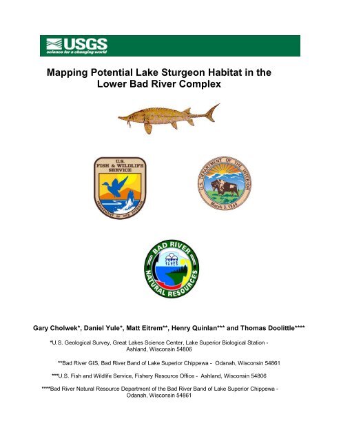
<strong>Mapp<strong>in</strong>g</strong> <strong>Potential</strong> <strong>Lake</strong> <strong>Sturgeon</strong> <strong>Habitat</strong> <strong>in</strong> <strong>the</strong>Lower Bad River ComplexGary Cholwek*, Daniel Yule*, Matt Eitrem**, Henry Qu<strong>in</strong>lan*** and Thomas Doolittle*****U.S. Geological Survey, Great <strong>Lake</strong>s Science Center, <strong>Lake</strong> Superior Biological Station -Ashland, Wiscons<strong>in</strong> 54806**Bad River GIS, Bad River Band of <strong>Lake</strong> Superior Chippewa - Odanah, Wiscons<strong>in</strong> 54861***U.S. Fish and Wildlife Service, Fishery Resource Office - Ashland, Wiscons<strong>in</strong> 54806****Bad River Natural Resource Department of <strong>the</strong> Bad River Band of <strong>Lake</strong> Superior Chippewa -Odanah, Wiscons<strong>in</strong> 54861
AbstractTo assist <strong>in</strong> identify<strong>in</strong>g potential lake sturgeon (Acipenser fulvescens) habitat <strong>in</strong> <strong>the</strong> lower BadRiver complex, we used a digital sonar system comb<strong>in</strong>ed with a global position<strong>in</strong>g system toprovide georeferenced data, and specialized sonar, bottom typ<strong>in</strong>g, GIS and statistical softwareto acoustically map bottom substrate types, locations and bathymetry. Ground truth data weredeveloped from both petite Ponar bottom samples and associated acoustic data which wereprocessed with bottom typ<strong>in</strong>g software. These data were used to produce substrate models <strong>in</strong>statistical software with a recursive partition<strong>in</strong>g method. Models were applied to survey data toclassify it <strong>in</strong>to substrate categories. Data were imported <strong>in</strong>to GIS software to produce substratemaps. The lower Bad River had clay predom<strong>in</strong>at<strong>in</strong>g at 45.82% (30.01 ha) of <strong>the</strong> total area(65.49 ha), followed by sand/clay at 32.07% (21.00 ha) and sand at 22.11% (14.48 ha). Theopen lake portion had sand/silt predom<strong>in</strong>at<strong>in</strong>g at 75.74% (575.09 ha) of <strong>the</strong> total area (759.30ha), followed by sand at 19.94% (151.40 ha), coarse sand/ medium pebbles at 2.33% (17.73ha), clay at 1.94% (14.70 ha), and cobble /boulder at 0.05% (0.38 ha).Key Words: lake sturgeon habitat, sonar, bottom substrate mapp<strong>in</strong>g, bathymetry, GISIntroduction<strong>Lake</strong> sturgeon (Acipenser fulvescens) is a species of concern <strong>in</strong> <strong>the</strong> Great <strong>Lake</strong>s region. Onceabundant throughout <strong>the</strong> Great <strong>Lake</strong>s bas<strong>in</strong>, lake sturgeon populations began to decl<strong>in</strong>edramatically <strong>in</strong> <strong>the</strong> 1860’s first from over harvest and later from man-<strong>in</strong>duced environmentalchanges such as dams and pollution. The Bad River supports one of only two self-susta<strong>in</strong><strong>in</strong>gspawn<strong>in</strong>g populations rema<strong>in</strong><strong>in</strong>g <strong>in</strong> <strong>the</strong> U.S. waters of <strong>Lake</strong> Superior. Runn<strong>in</strong>g through <strong>the</strong> BadRiver reservation of <strong>the</strong> <strong>Lake</strong> Superior Chippewa Tribe, <strong>the</strong> Bad River and its tributaries dra<strong>in</strong>approximately 1,554,000 ha of land and provide more than 629 km of cold and cool waterhabitat. The most valued fisheries are for walleye (Sander vitreum) and lake sturgeon, with <strong>the</strong>river support<strong>in</strong>g spawn<strong>in</strong>g runs of both species (Elias 2001).In <strong>the</strong> summer of 2000, <strong>the</strong> Great <strong>Lake</strong>s Trust Fund (GLTF) held a workshop to determ<strong>in</strong>e <strong>the</strong>assessment and research needs to restore lake sturgeon <strong>in</strong> <strong>the</strong> Great <strong>Lake</strong>s. Workshopparticipants identified as research priorities a need to sufficiently understand habitat constra<strong>in</strong>tson <strong>the</strong> lifecycle of lake sturgeon and its role <strong>in</strong> regulat<strong>in</strong>g lake sturgeon population structure. Toaddress <strong>in</strong>formation needs, <strong>the</strong> GLTF recommended study<strong>in</strong>g <strong>the</strong> habitat requirements of all lifestages of lake sturgeon <strong>in</strong> an <strong>in</strong>dividual system. The Bad River Band of <strong>the</strong> <strong>Lake</strong> SuperiorChippewa, <strong>the</strong> U.S. Fish and Wildlife Service-Ashland FRO (USFWS) and <strong>the</strong> Great <strong>Lake</strong>sIndian Fish and Wildlife Commission (GLIFWC) recommended <strong>the</strong> Bad River serve as a modelriver to beg<strong>in</strong> answer<strong>in</strong>g research priorities. A proposal for such a project under <strong>the</strong> USFWSadm<strong>in</strong>istered 2002 Great <strong>Lake</strong>s Fish and Wildlife Restoration Act was submitted and awarded.This report summarizes our efforts us<strong>in</strong>g acoustic techniques to map <strong>the</strong> lower Bad River and2
adjacent <strong>Lake</strong> Superior (hereafter <strong>the</strong> lower Bad River complex) habitats.A number of acoustic mapp<strong>in</strong>g studies have been conducted on <strong>the</strong> upper Great <strong>Lake</strong>s.Hydroacoustic methods were used to exam<strong>in</strong>e lake trout spawn<strong>in</strong>g reefs <strong>in</strong> <strong>Lake</strong> Michigan(Edsall et al. 1989) and <strong>in</strong> <strong>Lake</strong> Huron (Edsall et al. 1992). The United States GeologicalSurvey’s <strong>Lake</strong> Superior Biological Station has been <strong>in</strong>strumental <strong>in</strong> develop<strong>in</strong>g and apply<strong>in</strong>gacoustic techniques to map habitat for a number of species and locations, <strong>in</strong>clud<strong>in</strong>g lake troutspawn<strong>in</strong>g habitat <strong>in</strong> M<strong>in</strong>nesota’s near shore waters of <strong>Lake</strong> Superior (Richards and Bonde1999), larval sea lamprey habitat <strong>in</strong> <strong>Lake</strong> Superior’s Batchawana Bay (Fodale et al. 2003), andlake whitefish spawn<strong>in</strong>g habitat <strong>in</strong> <strong>the</strong> De Tour area of upper <strong>Lake</strong> Huron (Cholwek et al. 2001).S<strong>in</strong>ce <strong>the</strong>se previous studies were f<strong>in</strong>alized, acoustic hardware and software, GlobalPosition<strong>in</strong>g Systems (GPS) and Geographical Information Systems (GIS) technologies have allprogressed at rapid rates. The goal of <strong>the</strong> current study was to <strong>in</strong>tegrate <strong>the</strong>se advancementsto develop maps of potential habitats del<strong>in</strong>eated by substrates and bathymetry <strong>in</strong> <strong>the</strong> lower BadRiver complex.Objectives• Map and quantify tributary and near shore habitat <strong>in</strong> <strong>the</strong> lower reaches of <strong>the</strong> Bad River.• Survey juvenile lake sturgeon and develop a relational model of <strong>the</strong>ir habitat use. Thisobjective was to be met with data previously collected by <strong>the</strong> USFWS.• Provide habitat data that will contribute to more effective sea lamprey control.Prior to this survey, detailed substrate maps of <strong>the</strong> lower Bad River complex, sufficient foridentify<strong>in</strong>g potential lake sturgeon habitats were nonexistent and only bathymetric po<strong>in</strong>t dataexisted. This survey was designed to provide a more complete understand<strong>in</strong>g of <strong>the</strong> bottomcharacteristics (as determ<strong>in</strong>ed by surficial substrate types, <strong>the</strong>ir quantities, locations anddepths) to assist <strong>in</strong> identify<strong>in</strong>g and quantify<strong>in</strong>g potential lake sturgeon habitat. It is expected thatthis <strong>in</strong>formation can be used for a variety of o<strong>the</strong>r purposes.Report FormatThis report describes our effort to collect data dur<strong>in</strong>g <strong>the</strong> fall of 2004 to develop a GIS databaseto generate accurate maps of substrate classes and bathymetry of <strong>the</strong> lower Bad Rivercomplex. The Methods describe how data were collected and processed. Survey results anda brief discussion of habitats available to lake sturgeon are presented <strong>in</strong> <strong>the</strong> Results andDiscussion. The people who assisted this project are listed <strong>in</strong> <strong>the</strong> Acknowledgments section.Citations are <strong>in</strong> <strong>the</strong> Literature Cited section.The accompany<strong>in</strong>g CD-ROM conta<strong>in</strong>s a complete electronic copy of this report, <strong>the</strong> processed3
data suitable for import<strong>in</strong>g <strong>in</strong>to GIS, maps produced from this data, and GIS metadata files.Also <strong>in</strong>cluded is <strong>the</strong> Power Po<strong>in</strong>t presentation of this study delivered at <strong>the</strong> March 2005 Upper<strong>Lake</strong>s Meet<strong>in</strong>g held <strong>in</strong> Ypsilanti, Michigan, sponsored by <strong>the</strong> Great <strong>Lake</strong>s Fishery Commission.MethodsSurvey Design - The surveyed portion of <strong>the</strong> lower Bad River was 9.6 km <strong>in</strong> length (Figure 1) andextended roughly 0.8 km upriver from <strong>the</strong> White and Bad rivers confluence to <strong>the</strong> Bad River mouthat <strong>Lake</strong> Superior. Boat speed dur<strong>in</strong>g <strong>the</strong> river survey averaged ≈ 4.2 km per hour (≈ 1.2 m persecond). Depths surveyed ranged from 1 m to 10.8 m. From Government Land<strong>in</strong>g (Figure 1) to<strong>the</strong> fur<strong>the</strong>st po<strong>in</strong>t surveyed upriver, three transects were surveyed: one mid-river and one as closeas feasible to each bank. From Government Land<strong>in</strong>g to <strong>the</strong> Bad River mouth, five transects weresurveyed: one mid-river, one as close as feasible to each bank, and one half way between eachbank and <strong>the</strong> mid-river transect.In <strong>Lake</strong> Superior, we established 32 parallel transects, oriented perpendicular to <strong>the</strong> shorel<strong>in</strong>e.Initial transects were spaced at 200 m <strong>in</strong>tervals and covered 1.6 km of shorel<strong>in</strong>e on both sidesof <strong>the</strong> Bad River mouth. Sampl<strong>in</strong>g occurred from roughly 100 m to 150 m from shore out to 2km <strong>in</strong> <strong>the</strong> open lake. In <strong>the</strong> field, return<strong>in</strong>g acoustic signals were strik<strong>in</strong>gly homogenous, so wedecided to survey fewer transects spaced fur<strong>the</strong>r apart. With <strong>the</strong> <strong>in</strong>fluence of w<strong>in</strong>d, transectswere separated by roughly 225 m to 300 m. Boat speed averaged ≈ 8 km per hour (≈2.2 m persecond). Depths along <strong>the</strong> lake transects ranged from 1.7 m to 18.3 m.Instrumentation - A Biosonics DT-X digital hydroacoustic system (Biosonics, <strong>Inc</strong>., Seattle,Wash<strong>in</strong>gton) was employed to map bottom substrates. Acoustic data were displayed, recordedand monitored <strong>in</strong> real time on a notebook computer with Biosonics Visual Acquisition softwareversion 5.0.4. Dur<strong>in</strong>g <strong>the</strong> lower Bad River survey, we collected data by fast multiplex<strong>in</strong>g a 120 kHz6 0 transducer and a 208 kHz 10 0 transducer mounted on a tow fish 1.2 m <strong>in</strong> length. The tow fishwas so deployed to keep <strong>the</strong> transducer faces at a depth of .25 m. Data were collected on bothchannels at one p<strong>in</strong>g per second with a 0.4 ms pulse duration. Signals exceed<strong>in</strong>g a - 80 decibel(dB) on-axis mark threshold were digitized and cont<strong>in</strong>ually stored to a laptop computer. Only<strong>the</strong>120 kHz transducer was used for <strong>the</strong> <strong>Lake</strong> Superior survey. We previously collected<strong>in</strong>formation to classify lake substrates with this transducer dur<strong>in</strong>g our spr<strong>in</strong>g 2004 lake wide foragefish cruise of <strong>Lake</strong> Superior. A differentially corrected Ashtec BR2G GPS receiver/antenna systemprovided survey position<strong>in</strong>g data with sub-meter accuracy. Geographical coord<strong>in</strong>ates of vesselposition were embedded <strong>in</strong> <strong>the</strong> acoustic data files.Substrate Classification - To classify substrates of <strong>the</strong>se areas we applied <strong>the</strong> RoxAnn method(Chivers et al. 1990) as described previously by Cholwek et al. (2000). The RoxAnn devicemeasures E1 (first echo) and E2 (second echo) values as voltage read<strong>in</strong>gs across <strong>the</strong> echosounder transducer leads. These correspond to <strong>the</strong> bottom roughness and hardness,respectively. The general approach is to collect E1 and E2 values at sites (i.e., ground truthsites) with known substrates to develop a classification model for prediction of substrates atunknown sites based upon measured E1 and E2 values. Measurements of E1 and E2 valuesgenerated by <strong>the</strong> Biosonics DT-X system were ga<strong>the</strong>red from computer files with <strong>BioSonics</strong>4
Visual Bottom Typ<strong>in</strong>g (VBT) software version 1.9. Parameters used to track bottom depths andmeasure E1 and E2 values dur<strong>in</strong>g data playback <strong>in</strong> VBT are presented <strong>in</strong> Appendix A.After complet<strong>in</strong>g <strong>the</strong> survey, <strong>the</strong> Bad River acoustic data echograms were exam<strong>in</strong>ed with Echoviewsoftware version 3.10 (SonarData Pty Ltd., Tasmania, Australia). Sixteen ground truth sites werechosen based on <strong>the</strong>ir color-coded echograms <strong>in</strong>dicat<strong>in</strong>g bottoms with unique substrates worthy ofrevisit<strong>in</strong>g. We returned to <strong>the</strong>se sites and collected E1 and E2 samples (an average of tencontiguous p<strong>in</strong>gs constituted a sample) while anchored to ma<strong>in</strong>ta<strong>in</strong> a fixed boat position for 2 to 5m<strong>in</strong>utes. Simultaneous with <strong>the</strong> acoustic data collection, substrates were sampled with a petitePonar dredge as close as feasible to <strong>the</strong> transducer (with<strong>in</strong> <strong>the</strong> acoustic footpr<strong>in</strong>t or very near to it).The dredge samples were exam<strong>in</strong>ed for gra<strong>in</strong> diameter and classified to <strong>the</strong> geometric graduatedscale for clastic sediments formulated by Wentworth (1922) and modified by Edsall et al (1992).Research has shown E1 and E2 measurements can vary over contiguous p<strong>in</strong>gs even at a fixedsite with a homogenous substrate. To account for this p<strong>in</strong>g-to-p<strong>in</strong>g variability, contiguous E1 andE2 samples are usually averaged over a small number of p<strong>in</strong>gs. Substrates were predicted afteraverag<strong>in</strong>g 5 contiguous p<strong>in</strong>gs <strong>in</strong> <strong>the</strong> Bad River and 20 contiguous p<strong>in</strong>gs <strong>in</strong> <strong>Lake</strong> Superior. Wechose to average 20 p<strong>in</strong>gs <strong>in</strong> <strong>the</strong> lake portion of this study because this number of samples hadbeen averaged <strong>in</strong> <strong>the</strong> earlier development of <strong>the</strong> <strong>Lake</strong> Superior substrate classification model.A statistical technique called recursive partition<strong>in</strong>g (i.e. decision tree analysis) was used to develop<strong>the</strong> substrate classification models. Equal numbers of averaged E1 and E2 pairs for each substratetype were plotted toge<strong>the</strong>r us<strong>in</strong>g JMP 5.1 statistical software (SAS Institute, <strong>Inc</strong>., Cary, NorthCarol<strong>in</strong>a). The recursive partition<strong>in</strong>g platform calculated mean E1 and E2 mean values for eachsubstrate type, and <strong>the</strong> derived cutt<strong>in</strong>g values that most significantly separated <strong>the</strong> means basedon exam<strong>in</strong><strong>in</strong>g <strong>the</strong> sums of squares, due to <strong>the</strong> mean differences. The plot was split <strong>in</strong>to leaves (i.e.trees) and <strong>the</strong> probability of each substrate type <strong>in</strong> each leaf was calculated. The lower Bad Rivermodel was developed from 107 randomly selected ground truth data pairs of each substratetype and 100 randomly selected data pairs of each substrate type were held out to test <strong>the</strong>model. The classification model was <strong>the</strong>n applied to predict substrate types based on measuredE1 and E2 values along our survey path. An identical approach was used to classify <strong>the</strong> lakeportion of our survey. The <strong>Lake</strong> Superior model was developed from twenty-five randomlyselected ground truth data pairs (E1, E2) of each substrate type and twenty-five randomlyselected data pairs of each substrate type were held out to test <strong>the</strong> model.Development of GIS layers- The resultant po<strong>in</strong>t data for bathymetry and substrates were used toproduce GIS layers. The respective classification models for both <strong>the</strong> open lake and lowerportion of <strong>the</strong> Bad River were applied to <strong>the</strong> E1 and E2 pairs measured for each area, andsubstrates along each area’s survey path were classified. This data was <strong>the</strong>n imported <strong>in</strong>toArcGIS version 9.0 software (ESRI, <strong>Inc</strong>., Redlands, California). The po<strong>in</strong>t data were processedwith <strong>the</strong> Spatial Analyst extension of ArcGIS to create surface grids of substrate types andbathymetry for both <strong>the</strong> river and open lake areas.River survey GIS layers - River data po<strong>in</strong>ts were filtered to omit duplicate locations prior toGIS analysis. River features were digitized off 1992 DOQs (Digital Orthographic Quadrangles)5
and select 2004 geo-referenced aerial photography conta<strong>in</strong><strong>in</strong>g all po<strong>in</strong>t data. Automatedbackground po<strong>in</strong>t data were created every 5 m along Bad River polygons to facilitate spatialanalysis of raster <strong>in</strong>terpolation. Spatial analysis was performed on po<strong>in</strong>t data to create rastergrids for both substrate and depth data. The ord<strong>in</strong>ary Krig<strong>in</strong>g method was used with a sphericalsemi-variogram model for <strong>the</strong> analysis of both substrate and depth data. A variable searchradius was used for <strong>the</strong> sample po<strong>in</strong>ts with a maximum distance of 35 m, twelve po<strong>in</strong>ts wereused for substrate and three po<strong>in</strong>ts for depth. The substrate grid was re-classed to <strong>in</strong>tegervalues and converted vector l<strong>in</strong>es to produce polygon data for <strong>the</strong> three substrate classes. Thetotal area of each substrate type for <strong>the</strong> lower Bad River was <strong>the</strong>n calculated us<strong>in</strong>g <strong>the</strong><strong>in</strong>terpolated surface. Depth grids were processed at a 1 m pixel resolution and a 3 m pixelresolution. One meter <strong>in</strong>terval contours were processed from <strong>the</strong> 3 m pixel resolution grid toproduce smoo<strong>the</strong>r vector l<strong>in</strong>es.<strong>Lake</strong> survey GIS layers - Prior to GIS analysis, lake data po<strong>in</strong>ts were filtered to omit duplicatelocations. The lake shore features were digitized off 1992 DOQs and a150 m buffer of datapo<strong>in</strong>ts was created to def<strong>in</strong>e <strong>the</strong> analysis study area and conta<strong>in</strong> all po<strong>in</strong>t data. Automatedbackground po<strong>in</strong>t data were created every 10 m about <strong>the</strong> study area to facilitate spatialanalysis of raster <strong>in</strong>terpolation. Spatial analysis was performed on po<strong>in</strong>t data with <strong>the</strong> <strong>in</strong>versedistance weight<strong>in</strong>g <strong>in</strong>terpolation method, to create raster grids for both substrate and depth.For substrate, a power of four with a variable search radius of twenty-four po<strong>in</strong>ts was applied.For depth, a power of two with a variable search radius of twelve po<strong>in</strong>ts was applied. A 3 mpixel resolution substrate <strong>in</strong>teger value grid was created and converted to vector l<strong>in</strong>es toproduce <strong>the</strong> five substrate classes. A 5 m pixel resolution grid was processed for depth toproduce 1m <strong>in</strong>terval contours. Analysis <strong>in</strong> GIS provided <strong>the</strong> total area of each substrate typefor <strong>the</strong> open lake.ResultsThree of <strong>the</strong> sixteen river ground truth sites were elim<strong>in</strong>ated due to ei<strong>the</strong>r an <strong>in</strong>ability to anchor<strong>the</strong> boat to ma<strong>in</strong>ta<strong>in</strong> position or <strong>in</strong>conclusive Ponar grab results. After review<strong>in</strong>g <strong>the</strong> rema<strong>in</strong><strong>in</strong>gthirteen E1 and E2 ground truth data files and associated petite Ponar samples, we identifiedthree categories of substrates <strong>in</strong> <strong>the</strong> lower Bad River Figure 2: A) clay (very densely packedwith f<strong>in</strong>e particles between 1/2048 mm to 1/256 mm diameters, B) sand (1/16 mm to 1/4 mm,and C) a mixture of sand and clay.The 208 kHz transducer signals from <strong>the</strong> river survey provided <strong>the</strong> greatest contrast <strong>in</strong> E1 andE2 values over <strong>the</strong>se substrate classes, so we did not process <strong>the</strong> 120 kHz signals fur<strong>the</strong>r.From <strong>the</strong> E1 and E2 ground truth data for <strong>the</strong> three substrate categories, samples total<strong>in</strong>g 107for each substrate type were used <strong>in</strong> <strong>the</strong> recursive partition<strong>in</strong>g statistical procedure, <strong>the</strong> resultsof which are shown <strong>in</strong> Figure 3. The plot was split <strong>in</strong>to four leaves and <strong>the</strong> proportion of eachsubstrate type <strong>in</strong> each leaf is displayed. After test<strong>in</strong>g, this model was used to predictsubstrates (based on <strong>the</strong> highest probability) at Bad River locations with measured E1 and E2values. The model classification success (Table 1) was high for both clay and sand substrate6
categories (>90% of known substrates were classified correctly), but lower (42%) for <strong>the</strong> mixedsand/clay category.A similar classification model (Figure 4) was developed for <strong>the</strong> 120 kHz 6 0 transducer fromground truth samples collected from fifteen sites around <strong>the</strong> perimeter of <strong>Lake</strong> Superior dur<strong>in</strong>g <strong>the</strong>spr<strong>in</strong>g of 2004. Five substrate categories <strong>in</strong> <strong>the</strong> open water areas of <strong>Lake</strong> Superior wereidentified: clay (particles between 1/2048 mm and 1/256 mm diameter), sand/silt (1/256 mm to1/8 mm), sand (1/16 mm to 1.5 mm), coarse sand/medium pebbles (0.5 mm to 10 mm) andcobble/boulder (64 mm to > 256 mm). The model classification success (Table 2) was 100%for clay and 72% for sand/silt and 70% for sand, 64% for coarse sand/pebbles and 84 % forcobbles/boulders. O<strong>the</strong>r acoustic substrate mapp<strong>in</strong>g studies have found it more difficult todiscrim<strong>in</strong>ate between harder substrate categories, and heterogeneous substrate categoriesversus homogeneous substrate categories (Cholwek et al. 2000 and Cholwek et al. 2001).From GIS analysis of <strong>the</strong> classified and <strong>in</strong>terpolated survey data, <strong>the</strong> lower Bad River had claypredom<strong>in</strong>at<strong>in</strong>g at 45.82% (30.01 ha) of <strong>the</strong> total area (65.49 ha), followed by sand/clay at32.07% (21.00 ha) and sand at 22.11% (14.48 ha). The open lake portion had sand/siltpredom<strong>in</strong>at<strong>in</strong>g at 75.74% (575.09 ha) of <strong>the</strong> total area (759.30 ha), followed by sand at19.94% (151.40 ha), coarse sand/ medium pebbles at 2.33% (17.73 ha), clay at 1.94% (14.70ha), and cobble /boulder at 0.05% (0.38 ha).Examples of mapped bathymetric and substrate data for an area of <strong>the</strong> lower Bad River areshown <strong>in</strong> Figures 5 and 6, respectively. <strong>Lake</strong> Superior bathymetric and substrate GIS layersoffshore of <strong>the</strong> Bad River mouth are presented <strong>in</strong> Figures 7 and 8, respectively.DiscussionThis survey produced a classified geo-referenced substrate and bathymetric po<strong>in</strong>t data set fromwhich GIS layers were created. The distribution of substrates <strong>in</strong> <strong>the</strong> lower Bad River complexreflects both <strong>the</strong> area’s geology, and <strong>the</strong> erosion, transport and deposition processes it isexposed to. The upland portion of <strong>the</strong> lower Bad River has lacustr<strong>in</strong>e red clay banks extend<strong>in</strong>gfrom <strong>the</strong> bottom to just above <strong>the</strong> waterl<strong>in</strong>e and a considerable sandy soil overburden. Bothcontribute to <strong>the</strong> river’s sediment load dur<strong>in</strong>g higher water events. The <strong>in</strong>ner bends of <strong>the</strong> riverhave lower velocities that allow sand to settle out, form<strong>in</strong>g bars that extend out from <strong>the</strong> banktowards <strong>the</strong> mid-channel. The outer bends have <strong>in</strong>creased water velocities, result<strong>in</strong>g <strong>in</strong> greaterscour<strong>in</strong>g, leav<strong>in</strong>g only <strong>the</strong> underly<strong>in</strong>g dense red clay and creat<strong>in</strong>g <strong>the</strong> greater depths of <strong>the</strong>river’s thalweg. Backwater areas and depressions form catchments that collect f<strong>in</strong>e substrates.In <strong>the</strong>se areas sand/clay mixtures tend to predom<strong>in</strong>ate. Outside <strong>the</strong> river mouth <strong>in</strong> <strong>the</strong> openwater of <strong>Lake</strong> Superior, long shore currents transport f<strong>in</strong>e sediments consist<strong>in</strong>g primarily ofsand with some silt. A large, shallow (< 1 m <strong>in</strong> depth) sand bar exists a short distance from <strong>the</strong>mouth and runs parallel to <strong>the</strong> shorel<strong>in</strong>e for some distance (see Figure 1). Cobbles/boulderswere found <strong>in</strong> one small area on <strong>the</strong> lakeside of this sand bar <strong>in</strong> deeper water. Clay was found<strong>in</strong> sporadic, scattered patches through <strong>the</strong> shallower survey area and is likely an underly<strong>in</strong>gmaterial exposed by ice scour. The coarse sand/medium pebbles were nearly all found <strong>in</strong> <strong>the</strong>7
deepest areas far<strong>the</strong>st from shore.S<strong>in</strong>ce <strong>the</strong> lower Bad River complex is an active and dynamic system subject to seasonalchanges from storm events and ice scour, it is important to understand our survey resultsrepresent but a snapshot <strong>in</strong> time and may be subject to future change. However, over <strong>the</strong> nearterm, basic processes of erosion and deposition, parent materials and landscape featuresrema<strong>in</strong> relatively constant and will likely ma<strong>in</strong>ta<strong>in</strong> <strong>the</strong> substrate categories and bottom featuresfound <strong>in</strong> our survey, albeit <strong>in</strong> possibly different locations and quantities over time. It might beimportant to resurvey <strong>the</strong> lower Bad River complex (or at least check each sample site withpetite Ponar grabs) to co<strong>in</strong>cide with future lake sturgeon sampl<strong>in</strong>g to <strong>in</strong>sure it occurs oncorrectly identified substrate.Peake (1999) demonstrated that hatchery reared juvenile lake sturgeon preferred sandsubstrate over <strong>the</strong> rougher and harder gravel and rock substrates <strong>in</strong> tanks, and this preferencecont<strong>in</strong>ued <strong>in</strong> larger adult lake sturgeon but was less pronounced. Peake (1999) did not studyjuvenile preferences for softer and smoo<strong>the</strong>r substrates like clay. Kemp<strong>in</strong>ger (1996) found thatdur<strong>in</strong>g <strong>the</strong> first summer of <strong>the</strong>ir life, age 0 lake sturgeon <strong>in</strong> <strong>the</strong> Wolf River, Wiscons<strong>in</strong> werecaptured on flat bottom with coarse sand and pea size pebbles <strong>in</strong> water with a detectablecurrent and less than 0.75 m deep. They were never captured on f<strong>in</strong>e detritus and <strong>the</strong> substratewas always devoid of rooted vegetation. Kemp<strong>in</strong>ger (1996) hypo<strong>the</strong>sized that <strong>the</strong> age 0 lakesturgeon moved downstream <strong>in</strong>to deeper water <strong>in</strong> <strong>the</strong> fall, but did not fall sample for sturgeon <strong>in</strong><strong>the</strong>se locations. Given that <strong>the</strong>se studies suggest juvenile lake sturgeon prefer shallow depthswith sandy bottoms it is likely <strong>the</strong> <strong>in</strong>ner bends of <strong>the</strong> lower Bad River could be important habitatfor <strong>the</strong>m.Although <strong>the</strong> driv<strong>in</strong>g force beh<strong>in</strong>d this project was to map potential lake sturgeon habitat,substrate maps might also <strong>in</strong>dicate areas suitable for larval sea lamprey and this <strong>in</strong>formationmay lend itself to more effective sea lamprey control. Schleen et al. (1996) reported <strong>the</strong> BadRiver accounts for 20% to 30% of <strong>Lake</strong> Superior’s entire sea lamprey production. Sea lampreylarvae burrow <strong>in</strong> <strong>the</strong> river bottom. The clay/sand mixture category found <strong>in</strong> <strong>the</strong> lower Bad Rivercomplex is soft enough to burrow <strong>in</strong> and has a gelat<strong>in</strong>ous consistency that can hold <strong>the</strong> shapeof a burrow and could be <strong>in</strong>habited by larval sea lamprey. Know<strong>in</strong>g <strong>the</strong> location of this sand/claymaterial could help effectively target larval sea lamprey habitats for treatment. However, it is notcerta<strong>in</strong> that larval sea lamprey make use of <strong>the</strong>se substrates <strong>in</strong> <strong>the</strong> lower Bad River.O<strong>the</strong>r species are known to favor this sand/clay mixture, such as burrow<strong>in</strong>g mayflies -Hexegenia spp. (a sturgeon prey item) and some native mussels. Dur<strong>in</strong>g our ground truthsampl<strong>in</strong>g with a petite Ponar, we collected several Eastern elliptio (Elliptio complanata)specimens (Figure 9) <strong>in</strong> a backwater area near <strong>the</strong> Bad River mouth (Figure 1) with a bottomcomprised largely of this clay/sand substrate mixture. This mussel species has yellow perch asa known larval stage host, and is also thought to parasitize lake sturgeon.Hydroacoustic survey methods we employed were quite rapid. The field survey and groundtruth work took three people four work<strong>in</strong>g days. An additional work week was required to postprocess data to <strong>the</strong> po<strong>in</strong>t it was ready for importation <strong>in</strong>to GIS. GIS data preparation, map8
production and analysis took one skilled GIS specialist two days. Report writ<strong>in</strong>g and figurepreparation took one person seven days. Resurvey<strong>in</strong>g <strong>the</strong> lower Bad River would be evenquicker s<strong>in</strong>ce a substrate classification model now exists. This model can be used to rapidly f<strong>in</strong>dand verify areas of substrate for determ<strong>in</strong><strong>in</strong>g sampl<strong>in</strong>g sites for lake sturgeon (or o<strong>the</strong>r species).This field data collection technique was not effective <strong>in</strong> waters less than 1 m <strong>in</strong> depth due to <strong>the</strong>transducer near field effect. For navigable rivers with depths greater than 1m, this method canreadily be applied to classify and map bottom substrates. S<strong>in</strong>ce acoustic echograms are largelyunaffected by turbidity, <strong>the</strong> methods we employed would be very effective <strong>in</strong> rivers with lowvisibility that prohibit visual bottom substrate typ<strong>in</strong>g.The lower Bad River is known to conta<strong>in</strong> both large and small woody debris which we did not<strong>in</strong>clude as a substrate category. Areas with large visible snags, logs or pil<strong>in</strong>gs were notnavigable and not subject to our hydroacoustic survey. The three ground truth sites that failedto produce a petite Ponar sample could have been woody debris (or possibly some o<strong>the</strong>rmaterial difficult to sample with this method). We attempted to identify this substrate with a dropvideo camera equipped with <strong>in</strong>fra-red lights, but results were unsatisfactory. It is possible anadditional or different light source may have improved <strong>the</strong> camera’s performance. However, anyimprovement might be <strong>in</strong>sufficient to dist<strong>in</strong>guish substrate material due to <strong>the</strong> river’s highturbidity, which would tend to back scatter any light source and thus prevent it from enhanc<strong>in</strong>gvisibility. Woody debris, if located and found to possess unique acoustic properties, could easilybe mapped after reclassify<strong>in</strong>g <strong>the</strong> data set. Areas with large or small woody debris might besignificant habitat for various lake sturgeon life stages, but are not represented <strong>in</strong> our survey.Over <strong>the</strong> last several years, USFWS-Ashland FRO has sampled for lake sturgeon with bottomtrawls <strong>in</strong> <strong>the</strong> Bad River. The study proposal called for us<strong>in</strong>g this georeferenced data set todevelop a relational model of lake sturgeon habitat use. After complet<strong>in</strong>g <strong>the</strong> mapp<strong>in</strong>g work, weare conv<strong>in</strong>ced <strong>the</strong> fish samples were collected on too coarse of a scale to say much aboutspecific habitat use. Now that GIS bathymetric and substrate layers have been f<strong>in</strong>alized, we feel<strong>the</strong> stage has been set to characterize lake sturgeon habitat preference. <strong>Habitat</strong> use could bemeasured through a telemetry study and possibly a graduate student funded to carry out thisresearch. The bathymetry and substrate layers can also be used to develop a stratified randombottom trawl survey design to better describe potentially important habitat(s).AcknowledgementsThis project was funded <strong>in</strong> 2002 by <strong>the</strong> USFWS adm<strong>in</strong>istered Great <strong>Lake</strong>s Fish and WildlifeRestoration Act. Johnathon Pyatskowit (of <strong>the</strong> USFWS Ashland Fishery Resource Office)skillfully piloted <strong>the</strong> R/V Coaster dur<strong>in</strong>g prelim<strong>in</strong>ary fieldwork <strong>in</strong> <strong>the</strong> fall of 2003. Lori Evrard ofUSGS did <strong>the</strong> same for one November day <strong>in</strong> 2003, all <strong>the</strong> survey<strong>in</strong>g dur<strong>in</strong>g <strong>the</strong> fall of 2004,and took <strong>the</strong> digital photographs used <strong>in</strong> Figures 2 and 8. E.J. Isaac (USGS) plotted <strong>the</strong>offshore transects <strong>in</strong> <strong>the</strong> Capta<strong>in</strong> Voyager navigation software. Seth Moore (USGS) assistedone field day <strong>in</strong> 2003. Glen Miller (USFWS Ashland Fishery Resource Office) provided expertidentification of <strong>the</strong> eastern elliptio mussels found dur<strong>in</strong>g <strong>the</strong> survey. We thank Dr. Jason9
Stockwell for his excellent and helpful review of this manuscript. Mike Fodale (USFWS), Dr.Dawn Dittman (USGS) and Dr. Bruce Manny (USGS) all provided timely reviews that greatlyimproved this report. Last and most importantly, we thank <strong>the</strong> Bad River Band of <strong>Lake</strong> SuperiorChippewa Indians for <strong>the</strong>ir co-operation and <strong>the</strong> privilege of work<strong>in</strong>g on <strong>the</strong>ir unique andbeautiful river.Literature CitedChivers, R., N. Emerson, and D. Burns. 1990. New acoustic process<strong>in</strong>g for underwaysurvey<strong>in</strong>g. Hydrographic Journal 56:9-17.Cholwek, G., J. Bonde, X. Li, C. Richards, and K. Y<strong>in</strong>. 2000. Process<strong>in</strong>g RoxAnn sonar data toimprove its categorization of lake bed surficial substrates. Journal of Mar<strong>in</strong>e GeophysicalResearches 21:409-421.Cholwek,G., O. Gorman, and P. Meysembourg. 2001. Chart<strong>in</strong>g lake whitefish spawn<strong>in</strong>g habitatof <strong>the</strong> DeTour area of upper <strong>Lake</strong> Huron. Report to <strong>the</strong> Chippewa-Ottawa Resource Agency(CORA).Edsall, T.A., T.P. Poe, R.T. Nester, and C.L. Brown. 1989. Side-scan sonar mapp<strong>in</strong>g of laketrout spawn<strong>in</strong>g habitat <strong>in</strong> nor<strong>the</strong>rn <strong>Lake</strong> Michigan. North American Journal of FisheriesManagement 9:269-279.Edsall, T.A., C.L. Brown, G. W. Kennedy, and T. P. Poe. 1992. <strong>Lake</strong> trout spawn<strong>in</strong>g habitat <strong>in</strong><strong>the</strong> Six Fathom Bank-Yankee Reef lake trout sanctuary, <strong>Lake</strong> Huron. Journal of Great <strong>Lake</strong>sResearch 18:70-90.Elias, J. (Editor). 2001. Bad River Band of <strong>Lake</strong> Superior Tribe of Chippewa Indians IntegratedResources Management Plan. Bad River Band of <strong>Lake</strong> Superior Tribe of Chippewa Indians,Odanah, Wiscons<strong>in</strong>.Fodale, M., C. Bronte, R. Bergstedt, D. Cuddy, and J. Adams. 2003. Classification of lentichabitat for sea lamprey (Petromyzon mar<strong>in</strong>us) larvae us<strong>in</strong>g a remote seabed classificationdevice. Journal of Great <strong>Lake</strong>s Research Vol. 29, Supplement 1: 190-203.Kemp<strong>in</strong>ger, J. 1996. <strong>Habitat</strong>, growth, and food of young lake sturgeons <strong>in</strong> <strong>the</strong> <strong>Lake</strong> W<strong>in</strong>nebagosystem, Wiscons<strong>in</strong>. North American Journal of Fisheries Management. 16:102-114.Peake, S. 1999. Substrate preferences of juvenile hatchery-reared lake sturgeon, Acipenserfulvescens. Environmental Biology of Fishes 56:367-374.Richards, C. and J. Bonde. 1999. <strong>Mapp<strong>in</strong>g</strong> lake trout spawn<strong>in</strong>g habitat along M<strong>in</strong>nesota’s northshore. NRRI Technical Report No. NRRI/TR-99-01. Natural Resources Research Institute,University of M<strong>in</strong>nesota-Duluth.10
Schleen, L., R. Young, and G. Klar. 1996. Integrated Management of Sea Lampreys <strong>in</strong> <strong>the</strong>Great <strong>Lake</strong>s 1995. 1996 Annual Report to Great <strong>Lake</strong>s Fishery Commission. Great <strong>Lake</strong>sFishery Commission, Ann Arbor, Michigan.Wentworth, C. 1922. A scale of grade and class terms for clastic sediments. Journal ofGeology 30:377-392.Table 1. Substrate Model Test<strong>in</strong>g for Lower Bad River Ground Truth SitesPredicted Substrate Type Based on Measured E1 & E2 ValuesActual Substrate Types No. of Samples Clay Sand/Clay SandClay 100 92 5 3Sand/Clay 100 28 42 30Sand 100 0 10 90Table 2. Substrate Model Test<strong>in</strong>g for Open <strong>Lake</strong> Ground Truth SitesPredicted Substrate TypeBased on Measured E1 & E2 ValuesActual No. ofCoarse Cobble/Clay Sand/Silt SandSubstrate Types SamplesSand/Pebbles BouldersClay 25 25 0 0 0 0Sand/Silt 25 0 18 7 0 0Sand 25 0 0 19 5 1Coarse Sand/Pebbles 25 0 0 0 16 9Cobble/Boulders 25 0 0 0 4 2111
Figure 1. A digitized USGS aerial photograph of <strong>the</strong> portion of <strong>the</strong> lowerBad River acoustically sampled (labeled with landmark locations).A)12
B)C)Figure 2. Photographs of <strong>the</strong> three substrate types encountered at ground truth sites:A) clay, B) sand, and C) a mixture of sand and clay.Photograph credits- Lori Evrard (USGS).13
0.0010.00090.00080.0007Sand/Clay 0.73Sand 0.27Sand 0.82Sand/Clay 0.18Roughness (E1)0.00060.00050.00040.00030.00020.0001sandsand/clayclaySand/Clay 0.89Sand 0.1100.0000 0.0100 0.0200 0.0300 0.0400 0.0500 0.0600Hardness (E2)Clay 0.79Sand/Clay 0.19Sand 0.02Figure 3.Classification model for lower Bad River substrates14
0.005000.00400Roughness (E1)0.003000.00200Cobble/boulder 0.71Coarse sand/mediumpebbles 0.29claysand/siltsandcoarse sand/medium pebblescobble/boulderSand 0.72Sand/silt 0.21 0.00100Coarse sand/mediumpebbles 0.070.000000.000 0.010 0.020 0.030 0.040 0.050E2 < 0.0000074 = 1.0 ClayHardness (E2)E2 > 0.0000074 = 0.95 Sand/silt0.05 SandCoarse sand/mediumpebbles 0.7Cobble/boulder 0.15Sand 0.15Figure 4. Classification model for <strong>Lake</strong> Superior substrates15
Figure 5.Example show<strong>in</strong>g mapped bathymetry <strong>in</strong> <strong>the</strong> lower Bad River.Overlaid on DOQ (Digital Orthographic Quadrangle scannedfrom a digitized USGS aerial photograph of <strong>the</strong> area).16
Figure 6.Example show<strong>in</strong>g mapped substrate types <strong>in</strong> <strong>the</strong> lower Bad River.Overlaid on DOQ (Digital Orthographic Quadrangle scannedfrom a digitized USGS aerial photograph of <strong>the</strong> area).17
Figure 7. Example show<strong>in</strong>g mapped bathymetry <strong>in</strong> <strong>Lake</strong> Superior near<strong>the</strong> Bad River mouth. Overlaid on DOQ (Digital OrthographicQuadrangles scanned from a digitized USGS aerial photographof <strong>the</strong> area).18
Figure 8. Example show<strong>in</strong>g mapped substrate types <strong>in</strong> <strong>Lake</strong> Superior near<strong>the</strong> Bad River mouth. Data overlaid on DOQ (Digital OrthographicQuadrangles scanned from a digitized USGS aerial photograph of<strong>the</strong> area).19
Figure 9. Eastern elliptio (Elliptio complanata) collected by petite Ponar grab <strong>in</strong>a backwater area near <strong>the</strong> Bad River mouth (see Figure 1 for location).Photograph credit- Lori Evrard (USGS).20
Appendix A.VBT Post-process<strong>in</strong>g ParametersVBT Options <strong>Lake</strong> Survey River SurveyBottom W<strong>in</strong>dow Sett<strong>in</strong>gsFirst Bottom First Part 16 samples 16 samplesFirst Bottom Second Part 96 samples 48 samplesSediment W<strong>in</strong>dow 96 samples 50 samplesSecond Bottom W<strong>in</strong>dow 200 samples 96 samplesPulse Length 16 samples 16 samplesBottom Tracker Sett<strong>in</strong>gsPeak Threshold -52 dB -45 and -60 dB*Peak Width 5 samples 5 samplesBottom Detection Threshold -69 dB -70 dBBlank<strong>in</strong>g Zone 1 sample 1 sampleAlarm Limit 8 samples 8 samplesTrack<strong>in</strong>g W<strong>in</strong>dow 66 samples 66 samplesPulse Width 16 samples 16 samplesTracker Doma<strong>in</strong> 20logR 20logRReport PropertiesP<strong>in</strong>gs <strong>in</strong> Report 5 20Energy Percentage [%] 75 75* A -60dB peak threshold was used to improve bottom track<strong>in</strong>g for selected shallow areaswith softer substrates.21