ICAO Abbreviations and Codes
ICAO Abbreviations and Codes
ICAO Abbreviations and Codes

Create successful ePaper yourself
Turn your PDF publications into a flip-book with our unique Google optimized e-Paper software.
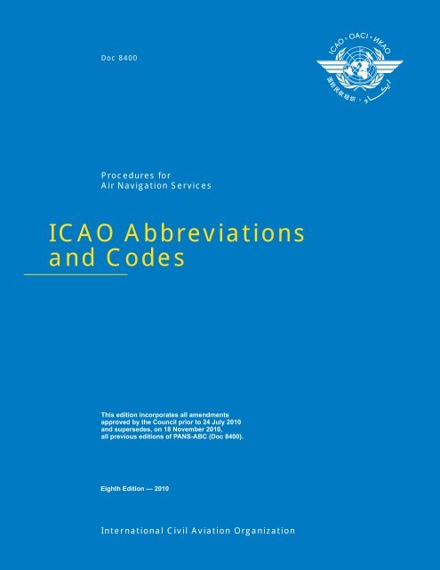
Doc 8400<br />
Procedures for<br />
Air Navigation Services<br />
<strong>ICAO</strong> <strong>Abbreviations</strong><br />
<strong>and</strong> <strong>Codes</strong><br />
This edition incorporates all amendments<br />
approved by the Council prior to 24 July 2010<br />
<strong>and</strong> supersedes, on 18 November 2010,<br />
all previous editions of PANS-ABC (Doc 8400).<br />
Eighth Edition — 2010<br />
International Civil Aviation Organization
Doc 8400<br />
Procedures for<br />
Air Navigation Services<br />
<strong>ICAO</strong> <strong>Abbreviations</strong><br />
<strong>and</strong> <strong>Codes</strong><br />
________________________________<br />
This edition incorporates all amendments<br />
approved by the Council prior to 24 July 2010<br />
<strong>and</strong> supersedes, on 18 November 2010,<br />
all previous editions of PANS-ABC (Doc 8400).<br />
Eighth Edition — 2010<br />
International Civil Aviation Organization
Published in separate English, French, Russian <strong>and</strong> Spanish editions by the<br />
INTERNATIONAL CIVIL AVIATION ORGANIZATION<br />
999 University Street, Montréal, Quebec, Canada H3C 5H7<br />
For ordering information <strong>and</strong> for a complete listing of sales agents<br />
<strong>and</strong> booksellers, please go to the <strong>ICAO</strong> website at www.icao.int<br />
First edition,1964.<br />
Seventh edition, 2007.<br />
Eighth edition, 2010.<br />
Doc 8400, Procedures for Air Navigation Services —<br />
<strong>ICAO</strong> <strong>Abbreviations</strong> <strong>and</strong> <strong>Codes</strong><br />
Order Number: 8400<br />
ISBN 978-92-9231-626-6<br />
© <strong>ICAO</strong> 2010<br />
All rights reserved. No part of this publication may be reproduced, stored in a<br />
retrieval system or transmitted in any form or by any means, without prior<br />
permission in writing from the International Civil Aviation Organization.
AMENDMENTS<br />
Amendments are announced in the supplements to the Catalogue of <strong>ICAO</strong><br />
Publications; the Catalogue <strong>and</strong> its supplements are available on the <strong>ICAO</strong> website<br />
at www.icao.int. The space below is provided to keep a record of such amendments.<br />
RECORD OF AMENDMENTS AND CORRIGENDA<br />
AMENDMENTS<br />
CORRIGENDA<br />
No.<br />
Date<br />
applicable<br />
Date<br />
entered<br />
Entered<br />
by<br />
No.<br />
Date<br />
of issue<br />
Date<br />
entered<br />
Entered<br />
by<br />
1-30 Incorporated in this Edition.<br />
(iii)
TABLE OF CONTENTS<br />
Page<br />
Foreword ..............................................................................................................................................................................<br />
(v)<br />
<strong>Abbreviations</strong><br />
Decode ......................................................................................................................................................................... 1-1<br />
Encode .......................................................................................................................................................................... 1-17<br />
<strong>Abbreviations</strong> for identifying Aeronautical Fixed Service (AFS) Messages<br />
Encode .......................................................................................................................................................................... 2-1<br />
<strong>Abbreviations</strong> <strong>and</strong> Terms to be transmitted as spoken words when used in Radiotelephony<br />
Decode ......................................................................................................................................................................... 3-1<br />
Encode .......................................................................................................................................................................... 3-3<br />
<strong>Abbreviations</strong> <strong>and</strong> Terms to be transmitted using the individual letters in non-phonetic form when<br />
used in Radiotelephony<br />
Decode ......................................................................................................................................................................... 4-1<br />
Encode .......................................................................................................................................................................... 4-3<br />
Designation of typical Radiocommunication Emissions...................................................................................................... 5-1<br />
Signal Reporting <strong>Codes</strong> ....................................................................................................................................................... 6-1<br />
The NOTAM Code<br />
Preface .......................................................................................................................................................................... 7-1<br />
Decode<br />
Second <strong>and</strong> Third Letters ......................................................................................................................................... 7-7<br />
Fourth <strong>and</strong> Fifth Letters ............................................................................................................................................ 7-12<br />
Encode<br />
Second <strong>and</strong> Third Letters ......................................................................................................................................... 7-15<br />
Fourth <strong>and</strong> Fifth Letters ............................................................................................................................................ 7-18<br />
___________________<br />
(v) 18/11/10
FOREWORD<br />
1. Introduction<br />
This document contains abbreviations <strong>and</strong> codes approved by the Council of <strong>ICAO</strong> for worldwide use in the international<br />
aeronautical telecommunication service <strong>and</strong> in aeronautical information documents, as appropriate, uniform abbreviated<br />
phraseology for use in pre-flight information bulletins <strong>and</strong> ATS data link communications, with the status of Procedures for Air<br />
Navigation Services (in abbreviated form the PANS-ABC).<br />
This document is the outgrowth of study by the Air Navigation Commission in consultation with States in the matter of<br />
controlling <strong>and</strong> coordinating abbreviations <strong>and</strong> codes. It brings together all abbreviations <strong>and</strong> codes for use in aircraft<br />
operations with the following exceptions:<br />
a) Designators for Aircraft Operating Agencies, Aeronautical Authorities <strong>and</strong> Services promulgated in Doc 8585.<br />
b) Data designators <strong>and</strong> geographical designators for meteorological bulletins given in the Manual of Aeronautical<br />
Meteorological Practice (Doc 8896).<br />
c) Aeronautical meteorological codes given in the Manual of Aeronautical Meteorological Practice.<br />
d) Additional abbreviations for restricted use in aeronautical information services (AIS) documents given in the<br />
Aeronautical Information Services Manual (Doc 8126).<br />
e) Location Indicators given in Doc 7910.<br />
f) Aircraft Type Designators given in Doc 8643.<br />
Table A shows the origin of each edition of the PANS-ABC issued since 1964 <strong>and</strong> subsequent amendments thereto,<br />
together with a list of the principal subjects involved, the dates on which the amendments were approved by the Council <strong>and</strong><br />
the dates on which they became applicable.<br />
2. Principles for formulation of abbreviations<br />
The principles applied in the formulation of <strong>ICAO</strong> abbreviations are:<br />
a) that allocation of more than one signification to a single abbreviation should be avoided except where it can be<br />
reasonably determined that no instances of misinterpretation would arise;<br />
b) that allocation of more than one abbreviation to the same signification should be avoided even though a different use<br />
is prescribed;<br />
c) that abbreviations should make use of the root word or words <strong>and</strong> should be derived from words common to the<br />
working languages except that where it is impracticable to apply this principle to best advantage, the abbreviation<br />
should follow the English text;<br />
d) that the use of a singular or plural form for the signification of an abbreviation should be selected on the basis of the<br />
more common use;<br />
(vii) 18/11/10
(viii)<br />
<strong>ICAO</strong> <strong>Abbreviations</strong> <strong>and</strong> <strong>Codes</strong> (PANS-ABC)<br />
e) that an abbreviation may represent grammatical variants of the basic signification where such application can be<br />
made without risk of confusion <strong>and</strong> the desired grammatical form can be determined from the context of the<br />
message.<br />
With respect to the latter principle, several variants are given for a number of abbreviations where it might not be<br />
obvious that the variant is appropriate or acceptable.<br />
3. Specifications governing the use of abbreviations<br />
Specifications governing the use of abbreviations <strong>and</strong> codes are contained in the following <strong>ICAO</strong> Annexes <strong>and</strong> PANS:<br />
a) use of abbreviations in the aeronautical information service: 3.6.4 of Annex 15;<br />
b) use of the NOTAM Code: 5.2 of Annex 15;<br />
c) use of abbreviations <strong>and</strong> codes in the international aeronautical telecommunications service: 3.7 of Annex 10,<br />
Volume II;<br />
d) use of abbreviations on aeronautical charts: 2.3.3 <strong>and</strong> 2.9 of Annex 4;<br />
e) use of abbreviations in plain language meteorological messages: Chapters 3, 4, 6 <strong>and</strong> 7, Appendices 1, 2 <strong>and</strong> 5 <strong>and</strong><br />
Attachment A of Annex 3;<br />
f) use of abbreviations in air-reports: 4.12 of Chapter 4 <strong>and</strong> Appendix 1 of PANS-ATM (Doc 4444);<br />
g) use of abbreviations <strong>and</strong> designators in flight plans <strong>and</strong> other air traffic services messages: Chapters 11 <strong>and</strong> 16 <strong>and</strong><br />
Appendices 2, 3, 5 <strong>and</strong> 6 of PANS-ATM (Doc 4444).<br />
4. Status<br />
The Procedures for Air Navigation Services (PANS) do not have the same status as the St<strong>and</strong>ards <strong>and</strong> Recommended<br />
Practices. While the latter are adopted by Council in pursuance of Article 37 of the Convention on International Civil<br />
Aviation, subject to the full procedure of Article 90, the PANS are approved by the President of the Council on behalf of the<br />
Council <strong>and</strong> recommended to Contracting States for worldwide application.<br />
5. Implementation<br />
The implementation of <strong>ICAO</strong> St<strong>and</strong>ards, Recommended Practices <strong>and</strong> Procedures is the responsibility of Contracting States;<br />
they are applied in actual operations only after, <strong>and</strong> in so far as States have enforced them. However, with a view to<br />
facilitating their processing towards implementation by States, this document has been prepared in a manner which will<br />
permit direct use by operational personnel.<br />
6. Notification of Differences<br />
The PANS do not carry the status afforded to St<strong>and</strong>ards adopted by the Council as Annexes to the Convention <strong>and</strong>, therefore,<br />
do not come within the obligation imposed by Article 38 of the Convention to notify differences in the event of nonimplementation.<br />
18/11/10
Foreword<br />
(ix)<br />
The attention of States is, however, drawn to the provision in Annex 15 related to the publication in Aeronautical<br />
Information Publications of a list of abbreviations <strong>and</strong> their respective significations used by the State in its Aeronautical<br />
Information Publications <strong>and</strong> in the dissemination of aeronautical information. Differences from <strong>ICAO</strong> abbreviations or their<br />
significations should be identified.<br />
7. Editorial presentation<br />
For encoding purposes the abbreviations given in this document are divided among a “general” <strong>and</strong> several specialized<br />
categories. For the convenience of the user, there is some duplication among these categories. Nevertheless, it may be<br />
necessary to draw on the “general” category of abbreviations when composing messages using one of the specialized<br />
categories.<br />
Certain Q Code signals which through constant use have attained plain language status have been placed with their plain<br />
language significations in the portion of this document which contains the “general” category abbreviations.<br />
Throughout the document, decode material is printed on white paper, encode material on green paper.<br />
Any errors, omissions or discrepancies should be brought to the attention of the Secretary General of <strong>ICAO</strong>,<br />
999 University Street, Montréal, Quebec, Canada H3C 5H7.<br />
Table A.<br />
Amendments to the PANS-ABC<br />
Amendment Source(s) Subject(s)<br />
Approved<br />
Applicable<br />
1st Edition (1964)<br />
Air Navigation<br />
Commission<br />
Study on the control <strong>and</strong> coordination of abbreviations <strong>and</strong> codes. 18 March 1964<br />
1 November 1964<br />
Amendment 1<br />
MET/OPS Meeting<br />
(1964); Fifth Meeting<br />
of the Panel of<br />
Teletypewriter<br />
Specialists (1963)<br />
Editorial <strong>and</strong> consequential amendments emanating from Amendment 44 to<br />
Annex 10, Amendment 9 to PANS-MET <strong>and</strong> Amendment 7 to PANS-RAC;<br />
addition <strong>and</strong> modification of meteorological abbreviations; amendment of<br />
abbreviations used on the AFTN.<br />
7 June 1965<br />
10 March 1966<br />
Amendment 2 <strong>ICAO</strong> Secretariat Consequential <strong>and</strong> editorial changes to the Foreword emanating from Air<br />
Navigation Commission <strong>and</strong> Council action on various regulatory <strong>and</strong> service<br />
documents.<br />
25 August 1966<br />
2nd Edition<br />
(1967)<br />
(includes<br />
Amendment 3)<br />
AIS/MAP<br />
Divisional Meeting<br />
(1966)<br />
Various changes to abbreviations <strong>and</strong> codes to reflect current operational<br />
requirements <strong>and</strong> practices.<br />
13 June 1967<br />
8 February 1968<br />
Amendment 4<br />
Air Navigation<br />
Commission<br />
Consequential changes to abbreviations used for air traffic purposes<br />
emanating from Amendment 2 to the Eighth Edition of Doc 4444<br />
(PANS-RAC).<br />
4 April 1968<br />
4 April 1968<br />
Amendment 5<br />
Air Navigation<br />
Commission<br />
Consequential changes to abbreviations used for plain language meteorology<br />
messages, emanating from Amendment 14 to Doc 7605 (PANS-MET).<br />
28 June 1968<br />
9 January 1969<br />
Amendment 6<br />
Air Navigation<br />
Commission<br />
Changes arising from Assembly Resolution A16-19 <strong>and</strong> Amendment 54 to<br />
Annex 3.<br />
23 January 1969<br />
18 September 1969<br />
18/11/10
(x)<br />
<strong>ICAO</strong> <strong>Abbreviations</strong> <strong>and</strong> <strong>Codes</strong> (PANS-ABC)<br />
Amendment Source(s) Subject(s)<br />
Approved<br />
Applicable<br />
3rd Edition<br />
(1971)<br />
(includes<br />
Amendments 7<br />
<strong>and</strong> 8)<br />
Air Navigation<br />
Commission<br />
Study of NOTAM composition resulting in exp<strong>and</strong>ed use of abbreviations <strong>and</strong><br />
codes in NOTAM Class I; changes in abbreviations emanating from revised<br />
aeronautical meteorological figure codes introduced by WMO; changes<br />
introduced as a result of clarification of air traffic control terms contained in<br />
<strong>ICAO</strong> regulatory documents.<br />
19 March 1971<br />
6 January 1972<br />
Amendment 9<br />
Air Navigation<br />
Commission<br />
Consequential changes emanating from Amendment 1 to the Tenth Edition of<br />
Doc 4444 (PANS-RAC).<br />
24 March 1972<br />
7 December 1972<br />
Amendment 10<br />
Air Navigation<br />
Commission;<br />
Third Meeting<br />
of the Obstacle<br />
Clearance Panel (1971)<br />
Consequential amendments to abbreviations <strong>and</strong> their significations (QFE <strong>and</strong><br />
QNH); changes to meteorological abbreviations introduced by WMO.<br />
21 March 1973<br />
16 August 1973<br />
Amendment 11<br />
Amendment 12<br />
Air Navigation<br />
Commission;<br />
Seventh Air<br />
Navigation<br />
Conference<br />
(1972)<br />
Air Navigation<br />
Commission<br />
Addition of abbreviations RNAV <strong>and</strong> STAR; deletion of abbreviation SIA. 29 May 1973<br />
23 May 1974<br />
Inclusion of additional abbreviations for use in the NOTAM Code. 11 December 1974<br />
9 October 1975<br />
Amendment 13<br />
Air Navigation<br />
Commission;<br />
Eighth Air<br />
Navigation<br />
Conference (1974)<br />
Additions, deletions <strong>and</strong> changes in significations of abbreviations mainly<br />
emanating from amendments to Annex 3.<br />
8 December 1975<br />
12 August 1976<br />
Amendment 14<br />
Air Navigation<br />
Commission;<br />
Ninth Air<br />
Navigation Conference<br />
(1976)<br />
Addition of abbreviations COP, INOP, MRP, RPS <strong>and</strong> WPT; change in<br />
signification of abbreviation ACP as a consequence of Amendment 30 to<br />
Annex 14.<br />
9 December 1977<br />
10 August 1978<br />
Amendment 15<br />
Air Navigation<br />
Commission<br />
Additions <strong>and</strong> changes in signification of abbreviations. 26 February 1979<br />
29 November 1979<br />
Amendment 16<br />
Air Navigation<br />
Commission<br />
Additions, deletions <strong>and</strong> changes in signification of abbreviations emanating<br />
from a study of abbreviations in common use in States’ aeronautical<br />
information publications.<br />
11 March 1981<br />
26 November 1981<br />
Amendment 17<br />
Air Navigation<br />
Commission<br />
Extensive amendment of abbreviations <strong>and</strong> codes emanating from a proposal<br />
submitted by the United Kingdom.<br />
14 December 1981<br />
9 June 1983<br />
Amendment 18<br />
Air Navigation<br />
Commission<br />
Extensive addition of abbreviations <strong>and</strong> codes consequential to a study of the<br />
revision of the NOTAM Code; addition of abbreviations used in<br />
Doc 8168 (PANS-OPS).<br />
11 June 1982<br />
9 June 1983<br />
Amendment 19<br />
Air Navigation<br />
Commission; Third<br />
Meeting of the ATS<br />
Data Acquisition,<br />
Processing <strong>and</strong> Transfer<br />
(ADAPT) Panel (1981)<br />
Consequential changes emanating from Amendments 64 <strong>and</strong> 65 to<br />
Annex 3, Amendment 14 to Annex 5, Recommendations 1/5 <strong>and</strong> 3/1 of<br />
ADAPT/3, <strong>and</strong> a new ITU method of designating radio emissions.<br />
15 March 1985<br />
21 November 1985<br />
18/11/10
Foreword<br />
(xi)<br />
Amendment Source(s) Subject(s)<br />
Approved<br />
Applicable<br />
4th Edition<br />
(1989) (includes<br />
Amendment 20)<br />
Air Navigation<br />
Commission<br />
Additions, changes <strong>and</strong> deletions of abbreviations <strong>and</strong> codes to reflect the<br />
current operational requirements <strong>and</strong> practices; introduction of new sections<br />
for abbreviations used in radiotelephony in a spoken form (Decode, Encode)<br />
<strong>and</strong> for the Procedure signals used in aeronautical telecommunication service<br />
(Decode); consequential <strong>and</strong> editorial amendments.<br />
24 February 1989<br />
16 November 1989<br />
Amendment 21<br />
Air Navigation<br />
Commission;<br />
Communications/<br />
Meteorology/<br />
Operations<br />
(COM/MET/OPS)<br />
Divisional Meeting<br />
(1990)<br />
Additions, changes <strong>and</strong> deletions of abbreviations <strong>and</strong> codes to reflect the<br />
current operational requirements <strong>and</strong> practices; consequential amendments<br />
arising from Amendment 69 to Annex 3, Amendment 13 to Annex 5,<br />
Amendment 39 to Annex 14, Amendment 27 to Annex 15 <strong>and</strong> Amendment 13<br />
to PANS-OPS.<br />
2 December 1992<br />
1 July 1993<br />
Amendment 22<br />
Air Navigation<br />
Commission<br />
Consequential changes emanating from:<br />
Amendment 70 to Annex 3<br />
Amendment 69 to Annex 10<br />
Amendment 15 to Annex 12<br />
Amendment 28 to Annex 15<br />
Amendment 7 to PANS-OPS, Volume I.<br />
30 November 1995<br />
7 November 1996<br />
5th Edition (1999)<br />
(includes<br />
Amendment 23)<br />
AIS/MAP Divisional<br />
Meeting (1998);<br />
Air Navigation<br />
Commission<br />
Extensive amendments emanating from the AIS/MAP Divisional Meeting<br />
(1998) <strong>and</strong> the Air Navigation Commission, including additions, changes <strong>and</strong><br />
deletions of abbreviations; addition <strong>and</strong> deletion of abbreviations <strong>and</strong> terms<br />
transmitted as spoken words; addition of abbreviations <strong>and</strong> terms transmitted<br />
using the individual letters in non-phonetic form; addition of a NOTAM Code<br />
for controller-pilot data link communications <strong>and</strong> automatic dependent<br />
surveillance; deletion of Procedure Signals for use in the International<br />
Aeronautical Telecommunication Service (Decode <strong>and</strong> Encode); deletion of<br />
the Q-Code (Preface, Decode <strong>and</strong> Encode).<br />
26 February 1999<br />
4 November 1999<br />
Amendment 24<br />
Amendment 25<br />
Air Navigation<br />
Commission<br />
Air Navigation<br />
Commission<br />
Consequential changes emanating from Amendment 71 to Annex 3. 9 June 2000<br />
2 November 2000<br />
Consequential changes emanating from Amendment 72 to Annex 3. 10 July 2002<br />
28 November 2002<br />
Amendment 26<br />
Conclusion 40/51 b) of<br />
the European Air<br />
Navigation Planning<br />
Group (EANPG) <strong>and</strong><br />
the Secretariat<br />
Consequential changes emanating from Amendment 32 to Annex 15. 23 July 2003<br />
27 November 2003<br />
Sixth Edition (2004)<br />
(includes<br />
Amendment 27)<br />
Global Navigation<br />
Satellite System Panel<br />
(GNSSP/4); MET<br />
Divisional Meeting<br />
(2002); Air Navigation<br />
Commission<br />
New abbreviations <strong>and</strong> updated specifications for the NOTAM Code related<br />
to GNSS; <strong>and</strong> consequential changes emanating from Amendment 73 to<br />
Annex 3, Amendment 53 to Annex 4 <strong>and</strong> Amendments 13 <strong>and</strong> 12 to the<br />
PANS-OPS, Volumes I <strong>and</strong> II, respectively.<br />
6 May 2004<br />
25 November 2004<br />
Seventh Edition<br />
(2007) (includes<br />
Amendment 28)<br />
Fourteenth Meeting of<br />
the Obstacle Clearance<br />
Panel (OCP/14); Air<br />
Navigation<br />
Commission; <strong>and</strong> the<br />
Secretariat<br />
New abbreviations related to updated provisions in the PANS-OPS; the use of<br />
ADS-B, ADS-C <strong>and</strong> RCP in the provision of air traffic services; consequential<br />
changes emanating from Amendment 74 to Annex 3 <strong>and</strong> Amendment 34 to<br />
Annex 15; <strong>and</strong> editorial amendments.<br />
3 August 2007<br />
22 November 2007<br />
18/11/10
(xii)<br />
<strong>ICAO</strong> <strong>Abbreviations</strong> <strong>and</strong> <strong>Codes</strong> (PANS-ABC)<br />
Amendment Source(s) Subject(s)<br />
Approved<br />
Applicable<br />
Amendment 29<br />
First working group of<br />
the whole meeting of<br />
the Instrument Flight<br />
Procedures Panel<br />
(IFPP/WG/WHL/1);<br />
Secretariat, with the<br />
assistance of the<br />
Required Navigation<br />
Performance <strong>and</strong><br />
Special Operational<br />
Requirements Study<br />
Group (RNPSORSG),<br />
concerning PBN<br />
terminology<br />
New abbreviations related to updated provisions in the PANS-OPS with<br />
regard to the performance-based navigation (PBN) concept <strong>and</strong> ground-based<br />
augmentation system (GBAS) l<strong>and</strong>ing system.<br />
7 October 2008<br />
20 November 2008<br />
Eighth Edition<br />
(2010) (includes<br />
Amendment 30)<br />
Ninth meeting of the<br />
Operations Panel<br />
Working Group of the<br />
Whole (OPSP/WG-<br />
WHL/9); sixth meeting<br />
of the Operations Panel<br />
(OPSP/6); <strong>and</strong> the<br />
Secretariat with the<br />
assistance of the<br />
Aeronautical<br />
Information<br />
Management Study<br />
Group (AIS-AIMSG/1),<br />
International Airways<br />
Volcano Watch<br />
Operations Group<br />
(IAVWOPSG/4),<br />
Meteorological<br />
Warnings Study Group<br />
(METWSG/2), <strong>and</strong><br />
Aerodrome<br />
Meteorological<br />
Observation <strong>and</strong><br />
Forecast Study Group<br />
(AMOFSG/7).<br />
New abbreviations related to cockpit displays, unmanned aircraft, volcanic<br />
ash information provided by volcanic ash advisory centres (VAAC), the<br />
elimination of routine voice reports, completion of tropical cyclone advisories<br />
in graphical format <strong>and</strong> the use of data link for meteorological information,<br />
aerodrome observations <strong>and</strong> forecasts. Update of the NOTAM code.<br />
23 July 2010<br />
18 November 2010<br />
______________________<br />
18/11/10
ABBREVIATIONS<br />
DECODE<br />
A<br />
A<br />
AAA<br />
A/A<br />
AAD<br />
AAIM<br />
AAL<br />
ABI<br />
ABM<br />
ABN<br />
ABT<br />
ABV<br />
AC<br />
ACARS†<br />
ACAS†<br />
ACC‡<br />
ACCID<br />
ACFT<br />
ACK<br />
ACL<br />
ACN<br />
ACP<br />
ACPT<br />
ACT<br />
AD<br />
ADA<br />
ADC<br />
ADDN<br />
ADF‡<br />
ADIZ†<br />
ADJ<br />
ADO<br />
Amber<br />
(or AAB, AAC . . . etc., in sequence)<br />
Amended meteorological message<br />
(message type designator)<br />
Air-to-air<br />
Assigned altitude deviation<br />
Aircraft autonomous integrity<br />
monitoring<br />
Above aerodrome level<br />
Advance boundary information<br />
Abeam<br />
Aerodrome beacon<br />
About<br />
Above<br />
Altocumulus<br />
(to be pronounced “AY-CARS”)<br />
Aircraft communication<br />
addressing <strong>and</strong> reporting system<br />
Airborne collision avoidance system<br />
Area control centre or area control<br />
Notification of an aircraft accident<br />
Aircraft<br />
Acknowledge<br />
Altimeter check location<br />
Aircraft classification number<br />
Acceptance (message type designator)<br />
Accept or accepted<br />
Active or activated or activity<br />
Aerodrome<br />
Advisory area<br />
Aerodrome chart<br />
Addition or additional<br />
Automatic direction-finding<br />
equipment<br />
(to be pronounced “AY-DIZ”) Air<br />
defence identification zone<br />
Adjacent<br />
Aerodrome office (specify service)<br />
ADR<br />
ADS*<br />
ADS-B‡<br />
ADS-C‡<br />
ADSU<br />
ADVS<br />
ADZ<br />
AES<br />
AFIL<br />
AFIS<br />
AFM<br />
AFS<br />
AFT . . .<br />
AFTN‡<br />
A/G<br />
AGA<br />
AGL<br />
AGN<br />
AIC<br />
AIDC<br />
AIP<br />
AIRAC<br />
AIREP†<br />
AIRMET†<br />
AIS<br />
ALA<br />
Advisory route<br />
The address (when this abbreviation is<br />
used to request a repetition, the<br />
question mark (IMI) precedes the<br />
abbreviation, e.g. IMI ADS) (to be<br />
used in AFS as a procedure signal)<br />
Automatic dependent surveillance<br />
— broadcast<br />
Automatic dependent surveillance<br />
— contract<br />
Automatic dependent surveillance unit<br />
Advisory service<br />
Advise<br />
Aircraft earth station<br />
Flight plan filed in the air<br />
Aerodrome flight information service<br />
Yes or affirm or affirmative or that is<br />
correct<br />
Aeronautical fixed service<br />
After . . . (time or place)<br />
Aeronautical fixed telecommunication<br />
network<br />
Air-to-ground<br />
Aerodromes, air routes <strong>and</strong> ground<br />
aids<br />
Above ground level<br />
Again<br />
Aeronautical information circular<br />
Air traffic services interfacility data<br />
communications<br />
Aeronautical information publication<br />
Aeronautical information regulation<br />
<strong>and</strong> control<br />
Air-report<br />
Information concerning en-route<br />
weather phenomena which may<br />
affect the safety of low-level<br />
aircraft operations<br />
Aeronautical information services<br />
Alighting area<br />
___________________<br />
† When radiotelephony is used, the abbreviations <strong>and</strong> terms are transmitted as spoken words.<br />
‡ When radiotelephony is used, the abbreviations <strong>and</strong> terms are transmitted using the individual letters in non-phonetic form.<br />
* Signal is also available for use in communicating with stations of the maritime mobile service.<br />
# Signal for use in the teletypewriter service only.<br />
1-1 18/11/10
1-2 <strong>ICAO</strong> <strong>Abbreviations</strong> <strong>and</strong> <strong>Codes</strong> (PANS-ABC)<br />
ALERFA† Alert phase<br />
ALR<br />
Alerting (message type designator)<br />
ALRS<br />
Alerting service<br />
ALS<br />
Approach lighting system<br />
ALT<br />
Altitude<br />
ALTN<br />
Alternate or alternating (light<br />
alternates in colour)<br />
ALTN<br />
Alternate (aerodrome)<br />
AMA<br />
Area minimum altitude<br />
AMD<br />
Amend or amended (used to indicate<br />
amended meteorological message;<br />
message type designator)<br />
AMDT<br />
Amendment (AIP Amendment)<br />
AMS<br />
Aeronautical mobile service<br />
AMSL<br />
Above mean sea level<br />
AMSS<br />
Aeronautical mobile satellite service<br />
ANC . . . Aeronautical chart — 1:500 000<br />
(followed by name/title)<br />
ANCS . . . Aeronautical navigation chart — small<br />
scale (followed by name/title <strong>and</strong><br />
scale)<br />
ANS<br />
Answer<br />
AOC . . . Aerodrome obstacle chart (followed by<br />
type <strong>and</strong> name/title)<br />
AP<br />
Airport<br />
APAPI† (to be pronounced “AY-PAPI”)<br />
Abbreviated precision approach<br />
path indicator<br />
APCH<br />
Approach<br />
APDC . . . Aircraft parking/docking chart<br />
(followed by name/title)<br />
APN<br />
Apron<br />
APP<br />
Approach control office or approach<br />
control or approach control service<br />
APR<br />
April<br />
APRX<br />
Approximate or approximately<br />
APSG<br />
After passing<br />
APV<br />
Approve or approved or approval<br />
ARC<br />
Area chart<br />
ARNG<br />
Arrange<br />
ARO<br />
Air traffic services reporting office<br />
ARP<br />
Aerodrome reference point<br />
ARP<br />
Air-report (message type designator)<br />
ARQ<br />
Automatic error correction<br />
ARR<br />
Arrival (message type designator)<br />
ARR<br />
Arrive or arrival<br />
ARS<br />
ARST<br />
AS<br />
ASC<br />
ASDA<br />
ASE<br />
ASHTAM<br />
ASPH<br />
AT . . .<br />
ATA‡<br />
ATC‡<br />
ATCSMAC. . .<br />
ATD‡<br />
ATFM<br />
ATIS†<br />
ATM<br />
ATN<br />
ATP . . .<br />
ATS<br />
ATTN<br />
AT-VASIS†<br />
ATZ<br />
AUG<br />
AUTH<br />
AUW<br />
AUX<br />
AVBL<br />
AVG<br />
AVGAS†<br />
AWTA<br />
AWY<br />
AZM<br />
Special air-report (message type<br />
designator)<br />
Arresting (specify (part of) aircraft<br />
arresting equipment)<br />
Altostratus<br />
Ascend to or ascending to<br />
Accelerate-stop distance available<br />
Altimetry system error<br />
Special series NOTAM notifying, by<br />
means of a specific format, change<br />
in activity of a volcano, a volcanic<br />
eruption <strong>and</strong>/or volcanic ash cloud<br />
that is of significance to aircraft<br />
operations<br />
Asphalt<br />
At (followed by time at which weather<br />
change is forecast to occur)<br />
Actual time of arrival<br />
Air traffic control (in general)<br />
Air traffic control surveillance<br />
minimum altitude chart (followed<br />
by name/title)<br />
Actual time of departure<br />
Air traffic flow management<br />
Automatic terminal information<br />
service<br />
Air traffic management<br />
Aeronautical telecommunication<br />
network<br />
At . . . (time or place)<br />
Air traffic services<br />
Attention<br />
(to be pronounced “AY-TEE-VASIS”)<br />
Abbreviated T visual approach<br />
slope indicator system<br />
Aerodrome traffic zone<br />
August<br />
Authorized or authorization<br />
All up weight<br />
Auxiliary<br />
Available or availability<br />
Average<br />
Aviation gasoline<br />
Advise at what time able<br />
Airway<br />
Azimuth<br />
___________________<br />
† When radiotelephony is used, the abbreviations <strong>and</strong> terms are transmitted as spoken words.<br />
‡ When radiotelephony is used, the abbreviations <strong>and</strong> terms are transmitted using the individual letters in non-phonetic form.<br />
* Signal is also available for use in communicating with stations of the maritime mobile service.<br />
# Signal for use in the teletypewriter service only.<br />
18/11/10
<strong>Abbreviations</strong> — Decode 1-3<br />
B<br />
B<br />
Blue<br />
BA<br />
Braking action<br />
BARO-VNAV† (to be pronounced “BAA-RO-VEE-<br />
NAV”) Barometric vertical<br />
navigation<br />
BASE†<br />
Cloud base<br />
BCFG<br />
Fog patches<br />
BCN<br />
Beacon (aeronautical ground light)<br />
BCST<br />
Broadcast<br />
BDRY<br />
Boundary<br />
BECMG Becoming<br />
BFR<br />
Before<br />
BKN<br />
Broken<br />
BL . . .<br />
Blowing (followed by DU = dust, SA<br />
= s<strong>and</strong> or SN = snow)<br />
BLDG<br />
Building<br />
BLO<br />
Below clouds<br />
BLW . . . Below . . .<br />
BOMB<br />
Bombing<br />
BR<br />
Mist<br />
BRF<br />
Short (used to indicate the type of<br />
approach desired or required)<br />
BRG<br />
Bearing<br />
BRKG<br />
Braking<br />
BS<br />
Commercial broadcasting station<br />
BTL<br />
Between layers<br />
BTN<br />
Between<br />
BUFR<br />
Binary universal form for the<br />
representation of meteorological<br />
data<br />
C<br />
. . . C Centre (preceded by runway<br />
designation number to identify a<br />
parallel runway)<br />
C<br />
Degrees Celsius (Centigrade)<br />
CA<br />
Course to an altitude<br />
CAT<br />
Category<br />
CAT<br />
Clear air turbulence<br />
CAVOK† (to be pronounced “KAV-OH-KAY”)<br />
Visibility, cloud <strong>and</strong> present<br />
weather better than prescribed<br />
values or conditions<br />
CB‡<br />
(to be pronounced “CEE BEE”)<br />
Cumulonimbus<br />
CC<br />
Cirrocumulus<br />
CCA<br />
(or CCB, CCC . . . etc., in sequence)<br />
Corrected meteorological message<br />
(message type designator)<br />
CD<br />
C<strong>and</strong>ela<br />
CDN<br />
Coordination (message type<br />
designator)<br />
CF Change frequency to . . .<br />
CF<br />
Course to a fix<br />
CFM*<br />
Confirm or I confirm (to be used in<br />
AFS as a procedure signal)<br />
CGL<br />
Circling guidance light(s)<br />
CH<br />
CH#<br />
CHEM<br />
CHG<br />
CI<br />
CIDIN†<br />
CIT<br />
CIV<br />
CK<br />
CL<br />
CLA<br />
CLBR<br />
CLD<br />
CLG<br />
CLIMB-OUT<br />
CLR<br />
CLRD<br />
CLSD<br />
CM<br />
CMB<br />
Channel<br />
This is a channel-continuity-check of<br />
transmission to permit comparison<br />
of your record of channelsequence<br />
numbers of messages<br />
received on the channel (to be used<br />
in AFS as a procedure signal)<br />
Chemical<br />
Modification (message type<br />
designator)<br />
Cirrus<br />
Common <strong>ICAO</strong> data interchange<br />
network<br />
Near or over large towns<br />
Civil<br />
Check<br />
Centre line<br />
Clear type of ice formation<br />
Calibration<br />
Cloud<br />
Calling<br />
Climb-out area<br />
Clear(s) or cleared to . . . or clearance<br />
Runway(s) cleared (used in<br />
METAR/SPECI)<br />
Close or closed or closing<br />
Centimetre<br />
Climb to or climbing to<br />
___________________<br />
† When radiotelephony is used, the abbreviations <strong>and</strong> terms are transmitted as spoken words.<br />
‡ When radiotelephony is used, the abbreviations <strong>and</strong> terms are transmitted using the individual letters in non-phonetic form.<br />
* Signal is also available for use in communicating with stations of the maritime mobile service.<br />
# Signal for use in the teletypewriter service only.<br />
18/11/10
1-4 <strong>ICAO</strong> <strong>Abbreviations</strong> <strong>and</strong> <strong>Codes</strong> (PANS-ABC)<br />
CMPL<br />
CNL<br />
CNL<br />
CNS<br />
COM<br />
CONC<br />
COND<br />
CONS<br />
CONST<br />
CONT<br />
COOR<br />
COORD<br />
COP<br />
COR<br />
COT<br />
COV<br />
CPDLC‡<br />
CPL<br />
CRC<br />
CRM<br />
CRZ<br />
CS<br />
CS<br />
CTA<br />
CTAM<br />
CTC<br />
CTL<br />
CTN<br />
CTR<br />
CU<br />
CUF<br />
CUST<br />
CVR<br />
CW<br />
CWY<br />
Completion or completed or complete<br />
Cancel or cancelled<br />
Flight plan cancellation (message type<br />
designator)<br />
Communications, navigation <strong>and</strong><br />
surveillance<br />
Communications<br />
Concrete<br />
Condition<br />
Continuous<br />
Construction or constructed<br />
Continue(s) or continued<br />
Coordinate or coordination<br />
Coordinates<br />
Change-over point<br />
Correct or correction or corrected<br />
(used to indicate corrected<br />
meteorological message; message<br />
type designator)<br />
At the coast<br />
Cover or covered or covering<br />
Controller-pilot data link<br />
communications<br />
Current flight plan (message type<br />
designator)<br />
Cyclic redundancy check<br />
Collision risk model<br />
Cruise<br />
Call sign<br />
Cirrostratus<br />
Control area<br />
Climb to <strong>and</strong> maintain<br />
Contact<br />
Control<br />
Caution<br />
Control zone<br />
Cumulus<br />
Cumuliform<br />
Customs<br />
Cockpit voice recorder<br />
Continuous wave<br />
Clearway<br />
D<br />
D<br />
D . . .<br />
DA<br />
D-ATIS†<br />
DCD<br />
DCKG<br />
DCP<br />
DCPC<br />
DCS<br />
DCT<br />
DE*<br />
DEC<br />
DEG<br />
DEP<br />
DEP<br />
DEPO<br />
DER<br />
DES<br />
DEST<br />
DETRESFA†<br />
DEV<br />
DF<br />
DFDR<br />
DFTI<br />
DH<br />
DIF<br />
DIST<br />
DIV<br />
DLA<br />
DLA<br />
DLIC<br />
DLY<br />
DME‡<br />
DNG<br />
DOM<br />
DP<br />
Downward (tendency in RVR during<br />
previous 10 minutes)<br />
Danger area (followed by<br />
identification)<br />
Decision altitude<br />
(to be pronounced “DEE-ATIS”) Data<br />
link automatic terminal<br />
information service<br />
Double channel duplex<br />
Docking<br />
Datum crossing point<br />
Direct controller-pilot<br />
communications<br />
Double channel simplex<br />
Direct (in relation to flight plan<br />
clearances <strong>and</strong> type of approach)<br />
From (used to precede the call sign of<br />
the calling station) (to be used in<br />
AFS as a procedure signal)<br />
December<br />
Degrees<br />
Depart or departure<br />
Departure (message type designator)<br />
Deposition<br />
Departure end of the runway<br />
Descend to or descending to<br />
Destination<br />
Distress phase<br />
Deviation or deviating<br />
Direction finding<br />
Digital flight data recorder<br />
Distance from touchdown indicator<br />
Decision height<br />
Diffuse<br />
Distance<br />
Divert or diverting<br />
Delay or delayed<br />
Delay (message type designator)<br />
Data link initiation capability<br />
Daily<br />
Distance measuring equipment<br />
Danger or dangerous<br />
Domestic<br />
Dew point temperature<br />
___________________<br />
† When radiotelephony is used, the abbreviations <strong>and</strong> terms are transmitted as spoken words.<br />
‡ When radiotelephony is used, the abbreviations <strong>and</strong> terms are transmitted using the individual letters in non-phonetic form.<br />
* Signal is also available for use in communicating with stations of the maritime mobile service.<br />
# Signal for use in the teletypewriter service only.<br />
18/11/10
<strong>Abbreviations</strong> — Decode 1-5<br />
DPT<br />
DR<br />
DR . . .<br />
DRG<br />
DS<br />
DSB<br />
DTAM<br />
DTG<br />
DTHR<br />
DTRT<br />
DTW<br />
DU<br />
DUC<br />
DUPE#<br />
DUR<br />
D-VOLMET<br />
DVOR<br />
DW<br />
DZ<br />
E<br />
E<br />
EAT<br />
EB<br />
EDA<br />
EEE#<br />
EET<br />
EFC<br />
EFIS†<br />
EGNOS†<br />
EHF<br />
ELBA†<br />
ELEV<br />
ELR<br />
ELT<br />
EM<br />
Depth<br />
Dead reckoning<br />
Low drifting (followed by DU = dust,<br />
SA = s<strong>and</strong> or SN = snow)<br />
During<br />
Duststorm<br />
Double sideb<strong>and</strong><br />
Descend to <strong>and</strong> maintain<br />
Date-time group<br />
Displaced runway threshold<br />
Deteriorate or deteriorating<br />
Dual t<strong>and</strong>em wheels<br />
Dust<br />
Dense upper cloud<br />
This is a duplicate message (to be used<br />
in AFS as a procedure signal)<br />
Duration<br />
Data link VOLMET<br />
Doppler VOR<br />
Dual wheels<br />
Drizzle<br />
East or eastern longitude<br />
Expected approach time<br />
Eastbound<br />
Elevation differential area<br />
Error (to be used in AFS as a<br />
procedure signal)<br />
Estimated elapsed time<br />
Expect further clearance<br />
(to be pronounced “EE-FIS”)<br />
Electronic flight instrument system<br />
(to be pronounced “EGG-NOS”)<br />
European geostationary navigation<br />
overlay service<br />
Extremely high frequency [30 000 to<br />
300 000 MHz]<br />
Emergency location beacon — aircraft<br />
Elevation<br />
Extra long range<br />
Emergency locator transmitter<br />
Emission<br />
EMBD<br />
EMERG<br />
END<br />
ENE<br />
ENG<br />
ENR<br />
ENRC . . .<br />
EOBT<br />
EQPT<br />
ER*<br />
ESE<br />
EST<br />
ETA*‡<br />
ETD‡<br />
ETO<br />
EUR RODEX<br />
EV<br />
EVS<br />
EXC<br />
EXER<br />
EXP<br />
EXTD<br />
F<br />
F<br />
FA<br />
FAC<br />
FAF<br />
FAL<br />
FAP<br />
FAS<br />
FATO<br />
FAX<br />
FBL<br />
Embedded in a layer (to indicate<br />
cumulonimbus embedded in layers<br />
of other clouds)<br />
Emergency<br />
Stop-end (related to RVR)<br />
East-north-east<br />
Engine<br />
En route<br />
Enroute chart (followed by name/title)<br />
Estimated off-block time<br />
Equipment<br />
Here . . . or herewith<br />
East-south-east<br />
Estimate or estimated or estimation<br />
(message type designator)<br />
Estimated time of arrival or estimating<br />
arrival<br />
Estimated time of departure or<br />
estimating departure<br />
Estimated time over significant point<br />
European regional OPMET data<br />
exchange<br />
Every<br />
Enhanced vision system<br />
Except<br />
Exercises or exercising or to exercise<br />
Expect or expected or expecting<br />
Extend or extending<br />
Fixed<br />
Course from a fix to an altitude<br />
Facilities<br />
Final approach fix<br />
Facilitation of international air<br />
transport<br />
Final approach point<br />
Final approach segment<br />
Final approach <strong>and</strong> take-off area<br />
Facsimile transmission<br />
Light (used to indicate the intensity of<br />
weather phenomena, interference<br />
or static reports, e.g. FBL RA =<br />
light rain)<br />
___________________<br />
† When radiotelephony is used, the abbreviations <strong>and</strong> terms are transmitted as spoken words.<br />
‡ When radiotelephony is used, the abbreviations <strong>and</strong> terms are transmitted using the individual letters in non-phonetic form.<br />
* Signal is also available for use in communicating with stations of the maritime mobile service.<br />
# Signal for use in the teletypewriter service only.<br />
18/11/10
1-6 <strong>ICAO</strong> <strong>Abbreviations</strong> <strong>and</strong> <strong>Codes</strong> (PANS-ABC)<br />
FC<br />
FCST<br />
FCT<br />
FDPS<br />
FEB<br />
FEW<br />
FG<br />
FIC<br />
FIR‡<br />
FIS<br />
FISA<br />
FL<br />
FLD<br />
FLG<br />
FLR<br />
FLT<br />
FLTCK<br />
FLUC<br />
FLW<br />
FLY<br />
FM<br />
FM<br />
FM . . .<br />
FMC<br />
FMS‡<br />
FMU<br />
FNA<br />
FPAP<br />
FPL<br />
FPM<br />
FPR<br />
FR<br />
FREQ<br />
FRI<br />
FRNG<br />
FRONT†<br />
FROST†<br />
FRQ<br />
FSL<br />
FSS<br />
FST<br />
Funnel cloud (tornado or water spout)<br />
Forecast<br />
Friction coefficient<br />
Flight data processing system<br />
February<br />
Few<br />
Fog<br />
Flight information centre<br />
Flight information region<br />
Flight information service<br />
Automated flight information service<br />
Flight level<br />
Field<br />
Flashing<br />
Flares<br />
Flight<br />
Flight check<br />
Fluctuating or fluctuation or<br />
fluctuated<br />
Follow(s) or following<br />
Fly or flying<br />
Course from a fix to manual<br />
termination (used in navigation<br />
database coding)<br />
From<br />
From (followed by time weather<br />
change is forecast to begin)<br />
Flight management computer<br />
Flight management system<br />
Flow management unit<br />
Final approach<br />
Flight path alignment point<br />
Filed flight plan (message type<br />
designator)<br />
Feet per minute<br />
Flight plan route<br />
Fuel remaining<br />
Frequency<br />
Friday<br />
Firing<br />
Front (relating to weather)<br />
Frost (used in aerodrome warnings)<br />
Frequent<br />
Full stop l<strong>and</strong>ing<br />
Flight service station<br />
First<br />
FT<br />
FTE<br />
FTP<br />
FTT<br />
FU<br />
FZ<br />
FZDZ<br />
FZFG<br />
FZRA<br />
G<br />
G<br />
G . . .<br />
GA<br />
G/A<br />
G/A/G<br />
GAGAN†<br />
GAIN<br />
GAMET<br />
GARP<br />
GBAS†<br />
GCA‡<br />
GEN<br />
GEO<br />
GES<br />
GLD<br />
GLONASS†<br />
GLS‡<br />
GMC . . .<br />
GND<br />
GNDCK<br />
GNSS‡<br />
GP<br />
GPA<br />
Feet (dimensional unit)<br />
Flight technical error<br />
Fictitious threshold point<br />
Flight technical tolerance<br />
Smoke<br />
Freezing<br />
Freezing drizzle<br />
Freezing fog<br />
Freezing rain<br />
Green<br />
Variations from the mean wind speed<br />
(gusts) (followed by figures in<br />
METAR/SPECI <strong>and</strong> TAF)<br />
Go ahead, resume sending (to be used<br />
in AFS as a procedure signal)<br />
Ground-to-air<br />
Ground-to-air <strong>and</strong> air-to-ground<br />
GPS <strong>and</strong> geostationary earth orbit<br />
augmented navigation<br />
Airspeed or headwind gain<br />
Area forecast for low-level flights<br />
GBAS azimuth reference point<br />
(to be pronounced “GEE-BAS”)<br />
Ground-based augmentation<br />
system<br />
Ground controlled approach system or<br />
ground controlled approach<br />
General<br />
Geographic or true<br />
Ground earth station<br />
Glider<br />
(to be pronounced “GLO-NAS”)<br />
Global orbiting navigation satellite<br />
system<br />
GBAS l<strong>and</strong>ing system<br />
Ground movement chart (followed by<br />
name/title)<br />
Ground<br />
Ground check<br />
Global navigation satellite system<br />
Glide path<br />
Glide path angle<br />
___________________<br />
† When radiotelephony is used, the abbreviations <strong>and</strong> terms are transmitted as spoken words.<br />
‡ When radiotelephony is used, the abbreviations <strong>and</strong> terms are transmitted using the individual letters in non-phonetic form.<br />
* Signal is also available for use in communicating with stations of the maritime mobile service.<br />
# Signal for use in the teletypewriter service only.<br />
18/11/10
<strong>Abbreviations</strong> — Decode 1-7<br />
GPIP<br />
GPS‡<br />
GPWS‡<br />
GR<br />
GRAS†<br />
GRASS<br />
GRIB<br />
GRVL<br />
GS<br />
GS<br />
GUND<br />
H<br />
H<br />
H24<br />
HA<br />
HAPI<br />
HBN<br />
HDF<br />
HDG<br />
HEL<br />
HF‡<br />
HF<br />
HGT<br />
HJ<br />
HLDG<br />
HM<br />
HN<br />
HO<br />
HOL<br />
HOSP<br />
HPA<br />
HR<br />
HS<br />
HUD<br />
HURCN<br />
Glide path intercept point<br />
Global positioning system<br />
Ground proximity warning system<br />
Hail<br />
(to be pronounced “GRASS”) Groundbased<br />
regional augmentation<br />
system<br />
Grass l<strong>and</strong>ing area<br />
Processed meteorological data in the<br />
form of grid point values<br />
expressed in binary form<br />
(meteorological code)<br />
Gravel<br />
Ground speed<br />
Small hail <strong>and</strong>/or snow pellets<br />
Geoid undulation<br />
High pressure area or the centre of high<br />
pressure<br />
Continuous day <strong>and</strong> night service<br />
Holding/racetrack to an altitude<br />
Helicopter approach path indicator<br />
Hazard beacon<br />
High frequency direction-finding station<br />
Heading<br />
Helicopter<br />
High frequency [3 000 to 30 000 kHz]<br />
Holding/racetrack to a fix<br />
Height or height above<br />
Sunrise to sunset<br />
Holding<br />
Holding/racetrack to a manual termination<br />
Sunset to sunrise<br />
Service available to meet operational<br />
requirements<br />
Holiday<br />
Hospital aircraft<br />
Hectopascal<br />
Hours<br />
Service available during hours of<br />
scheduled operations<br />
Head-up display<br />
Hurricane<br />
HVDF<br />
HVY<br />
HVY<br />
HX<br />
HYR<br />
HZ<br />
HZ<br />
I<br />
IAC . . .<br />
IAF<br />
IAO<br />
IAP<br />
IAR<br />
IAS<br />
IBN<br />
IC<br />
ICE<br />
ID<br />
IDENT†<br />
IF<br />
IFF<br />
IFR‡<br />
IGA<br />
ILS‡<br />
IM<br />
IMC‡<br />
IMG<br />
IMI*<br />
IMPR<br />
IMT<br />
INA<br />
INBD<br />
INC<br />
INCERFA†<br />
INFO†<br />
INOP<br />
High <strong>and</strong> very high frequency directionfinding<br />
stations (at the same location)<br />
Heavy<br />
Heavy (used to indicate the intensity of<br />
weather phenomena, e.g. HVY RA =<br />
heavy rain)<br />
No specific working hours<br />
Higher<br />
Haze<br />
Hertz (cycle per second)<br />
Instrument approach chart (followed by<br />
name/title)<br />
Initial approach fix<br />
In <strong>and</strong> out of clouds<br />
Instrument approach procedure<br />
Intersection of air routes<br />
Indicated airspeed<br />
Identification beacon<br />
Ice crystals (very small ice crystals in<br />
suspension, also known as diamond<br />
dust)<br />
Icing<br />
Identifier or identify<br />
Identification<br />
Intermediate approach fix<br />
Identification friend/foe<br />
Instrument flight rules<br />
International general aviation<br />
Instrument l<strong>and</strong>ing system<br />
Inner marker<br />
Instrument meteorological conditions<br />
Immigration<br />
Interrogation sign (question mark) (to be<br />
used in AFS as a procedure signal)<br />
Improve or improving<br />
Immediate or immediately<br />
Initial approach<br />
Inbound<br />
In cloud<br />
Uncertainty phase<br />
Information<br />
Inoperative<br />
___________________<br />
† When radiotelephony is used, the abbreviations <strong>and</strong> terms are transmitted as spoken words.<br />
‡ When radiotelephony is used, the abbreviations <strong>and</strong> terms are transmitted using the individual letters in non-phonetic form.<br />
* Signal is also available for use in communicating with stations of the maritime mobile service.<br />
# Signal for use in the teletypewriter service only.<br />
18/11/10
1-8 <strong>ICAO</strong> <strong>Abbreviations</strong> <strong>and</strong> <strong>Codes</strong> (PANS-ABC)<br />
INP<br />
INPR<br />
INS<br />
INSTL<br />
INSTR<br />
INT<br />
INTL<br />
INTRG<br />
INTRP<br />
INTSF<br />
INTST<br />
IR<br />
IRS<br />
ISA<br />
ISB<br />
ISOL<br />
J<br />
JAN<br />
JTST<br />
JUL<br />
JUN<br />
K<br />
KG<br />
KHZ<br />
KIAS<br />
KM<br />
KMH<br />
KPA<br />
KT<br />
KW<br />
L<br />
If not possible<br />
In progress<br />
Inertial navigation system<br />
Install or installed or installation<br />
Instrument<br />
Intersection<br />
International<br />
Interrogator<br />
Interrupt or interruption or interrupted<br />
Intensify or intensifying<br />
Intensity<br />
Ice on runway<br />
Inertial reference system<br />
International st<strong>and</strong>ard atmosphere<br />
Independent sideb<strong>and</strong><br />
Isolated<br />
January<br />
Jet stream<br />
July<br />
June<br />
Kilograms<br />
Kilohertz<br />
Knots indicated airspeed<br />
Kilometres<br />
Kilometres per hour<br />
Kilopascal<br />
Knots<br />
Kilowatts<br />
. . . L Left (preceded by runway designation<br />
number to identify a parallel runway)<br />
L<br />
Locator (see LM, LO)<br />
L<br />
Low pressure area or the centre of low<br />
pressure<br />
LAM<br />
LAN<br />
LAT<br />
LCA<br />
LDA<br />
LDAH<br />
LDG<br />
LDI<br />
LEN<br />
LF<br />
LGT<br />
LGTD<br />
LIH<br />
LIL<br />
LIM<br />
LINE<br />
LM<br />
LMT<br />
LNAV†<br />
LNG<br />
LO<br />
LOC<br />
LONG<br />
LORAN†<br />
LOSS<br />
LPV<br />
Logical acknowledgement (message type<br />
designator)<br />
Inl<strong>and</strong><br />
Latitude<br />
Local or locally or location or located<br />
L<strong>and</strong>ing distance available<br />
L<strong>and</strong>ing distance available, helicopter<br />
L<strong>and</strong>ing<br />
L<strong>and</strong>ing direction indicator<br />
Length<br />
Low frequency [30 to 300 kHz]<br />
Light or lighting<br />
Lighted<br />
Light intensity high<br />
Light intensity low<br />
Light intensity medium<br />
Line (used in SIGMET)<br />
Locator, middle<br />
Local mean time<br />
(to be pronounced “EL-NAV”) Lateral<br />
navigation<br />
Long (used to indicate the type of<br />
approach desired or required)<br />
Locator, outer<br />
Localizer<br />
Longitude<br />
LORAN (long range air navigation<br />
system)<br />
Airspeed or headwind loss<br />
Localizer performance with vertical<br />
guidance<br />
LR The last message received by me was . . .<br />
(to be used in AFS as a procedure<br />
signal)<br />
LRG<br />
LS<br />
LTD<br />
LTP<br />
LTT<br />
LV<br />
LVE<br />
LVL<br />
LVP<br />
LYR<br />
Long range<br />
The last message sent by me was . . . or<br />
Last message was . . . (to be used in<br />
AFS as a procedure signal)<br />
Limited<br />
L<strong>and</strong>ing threshold point<br />
L<strong>and</strong>line teletypewriter<br />
Light <strong>and</strong> variable (relating to wind)<br />
Leave or leaving<br />
Level<br />
Low visibility procedures<br />
Layer or layered<br />
___________________<br />
† When radiotelephony is used, the abbreviations <strong>and</strong> terms are transmitted as spoken words.<br />
‡ When radiotelephony is used, the abbreviations <strong>and</strong> terms are transmitted using the individual letters in non-phonetic form.<br />
* Signal is also available for use in communicating with stations of the maritime mobile service.<br />
# Signal for use in the teletypewriter service only.<br />
18/11/10
<strong>Abbreviations</strong> — Decode 1-9<br />
M<br />
. . . M Metres (preceded by figures)<br />
M . . . Mach number (followed by figures)<br />
M . . . Minimum value of runway visual range<br />
(followed by figures in<br />
METAR/SPECI)<br />
MAA Maximum authorized altitude<br />
MAG Magnetic<br />
MAHF Missed approach holding fix<br />
MAINT Maintenance<br />
MAP Aeronautical maps <strong>and</strong> charts<br />
MAPT Missed approach point<br />
MAR At sea<br />
MAR March<br />
MAS Manual Al simplex<br />
MATF Missed approach turning fix<br />
MAX Maximum<br />
MAY May<br />
MBST Microburst<br />
MCA Minimum crossing altitude<br />
MCW Modulated continuous wave<br />
MDA Minimum descent altitude<br />
MDF Medium frequency direction-finding<br />
station<br />
MDH Minimum descent height<br />
MEA Minimum en-route altitude<br />
MEHT Minimum eye height over threshold (for<br />
visual approach slope indicator<br />
systems)<br />
MET† Meteorological or meteorology<br />
METAR† Aerodrome routine meteorological report<br />
(in meteorological code)<br />
MET<br />
REPORT Local routine meteorological report (in<br />
abbreviated plain language)<br />
MF<br />
Medium frequency [300 to 3 000 kHz]<br />
MHDF Medium <strong>and</strong> high frequency directionfinding<br />
stations (at the same location)<br />
MHVDF Medium, high <strong>and</strong> very high frequency<br />
direction-finding stations (at the same<br />
location)<br />
MHZ Megahertz<br />
MID Mid-point (related to RVR)<br />
MIFG Shallow fog<br />
MIL Military<br />
MIN*<br />
MIS<br />
MKR<br />
MLS‡<br />
MM<br />
MNM<br />
MNPS<br />
MNT<br />
MNTN<br />
MOA<br />
MOC<br />
MOCA<br />
MOD<br />
MON<br />
MON<br />
MOPS†<br />
MOV<br />
MPS<br />
MRA<br />
MRG<br />
MRP<br />
MS<br />
MSA<br />
MSAS†<br />
MSAW<br />
MSG<br />
MSL<br />
MSR#<br />
MSSR<br />
MT<br />
MTU<br />
MTW<br />
MVDF<br />
Minutes<br />
Missing . . . (transmission identification)<br />
(to be used in AFS as a procedure<br />
signal)<br />
Marker radio beacon<br />
Microwave l<strong>and</strong>ing system<br />
Middle marker<br />
Minimum<br />
Minimum navigation performance<br />
specifications<br />
Monitor or monitoring or monitored<br />
Maintain<br />
Military operating area<br />
Minimum obstacle clearance (required)<br />
Minimum obstacle clearance altitude<br />
Moderate (used to indicate the intensity of<br />
weather phenomena, interference or<br />
static reports, e.g. MODRA =<br />
moderate rain)<br />
Above mountains<br />
Monday<br />
Minimum operational performance<br />
st<strong>and</strong>ards<br />
Move or moving or movement<br />
Metres per second<br />
Minimum reception altitude<br />
Medium range<br />
ATS/MET reporting point<br />
Minus<br />
Minimum sector altitude<br />
(to be pronounced “EM-SAS”) Multifunctional<br />
transport satellite (MTSAT)<br />
satellite-based augmentation system<br />
Minimum safe altitude warning<br />
Message<br />
Mean sea level<br />
Message . . . (transmission identification)<br />
has been misrouted (to be used in AFS<br />
as a procedure signal)<br />
Monopulse secondary surveillance radar<br />
Mountain<br />
Metric units<br />
Mountain waves<br />
Medium <strong>and</strong> very high frequency<br />
direction- finding stations (at the same<br />
location)<br />
___________________<br />
† When radiotelephony is used, the abbreviations <strong>and</strong> terms are transmitted as spoken words.<br />
‡ When radiotelephony is used, the abbreviations <strong>and</strong> terms are transmitted using the individual letters in non-phonetic form.<br />
* Signal is also available for use in communicating with stations of the maritime mobile service.<br />
# Signal for use in the teletypewriter service only.<br />
18/11/10
1-10 <strong>ICAO</strong> <strong>Abbreviations</strong> <strong>and</strong> <strong>Codes</strong> (PANS-ABC)<br />
MWO<br />
MX<br />
N<br />
N<br />
N<br />
NADP<br />
NASC†<br />
NAT<br />
NAV<br />
NB<br />
NBFR<br />
NC<br />
NCD<br />
NDB‡<br />
NDV<br />
NE<br />
NEB<br />
NEG<br />
NGT<br />
NIL*†<br />
NM<br />
NML<br />
NN<br />
NNE<br />
NNW<br />
NO<br />
NOF<br />
NOSIG†<br />
Meteorological watch office<br />
Mixed type of ice formation (white <strong>and</strong><br />
clear)<br />
No distinct tendency (in RVR during<br />
previous 10 minutes)<br />
North or northern latitude<br />
Noise abatement departure procedure<br />
National AIS system centre<br />
North Atlantic<br />
Navigation<br />
Northbound<br />
Not before<br />
No change<br />
No cloud detected (used in automated<br />
METAR/SPECI)<br />
Non-directional radio beacon<br />
No directional variations available (used in<br />
automated METAR/SPECI)<br />
North-east<br />
North-eastbound<br />
No or negative or permission not granted<br />
or that is not correct<br />
Night<br />
None or I have nothing to send to you<br />
Nautical miles<br />
Normal<br />
No name, unnamed<br />
North-north-east<br />
North-north-west<br />
No (negative) (to be used in AFS as a<br />
procedure signal)<br />
International NOTAM office<br />
No significant change (used in trend-type<br />
l<strong>and</strong>ing forecasts)<br />
NOTAM†<br />
NOV<br />
NOZ‡<br />
NPA<br />
NR<br />
NRH<br />
NS<br />
NSC<br />
NSE<br />
NSW<br />
NTL<br />
NTZ‡<br />
NW<br />
NWB<br />
NXT<br />
O<br />
OAC<br />
OAS<br />
OBS<br />
OBSC<br />
OBST<br />
OCA<br />
OCA<br />
OCC<br />
OCH<br />
OCNL<br />
OCS<br />
OCT<br />
OFZ<br />
OGN<br />
OHD<br />
OIS<br />
OK*<br />
A notice distributed by means of<br />
telecommuni-cation containing<br />
information concerning the<br />
establishment, condition or change in<br />
any aeronautical facility, service,<br />
procedure or hazard, the timely<br />
knowledge of which is essential to<br />
personnel concerned with flight<br />
operations<br />
November<br />
Normal operating zone<br />
Non-precision approach<br />
Number<br />
No reply heard<br />
Nimbostratus<br />
Nil significant cloud<br />
Navigation system error<br />
Nil significant weather<br />
National<br />
No transgression zone<br />
North-west<br />
North-westbound<br />
Next<br />
Oceanic area control centre<br />
Obstacle assessment surface<br />
Observe or observed or observation<br />
Obscure or obscured or obscuring<br />
Obstacle<br />
Obstacle clearance altitude<br />
Oceanic control area<br />
Occulting (light)<br />
Obstacle clearance height<br />
Occasional or occasionally<br />
Obstacle clearance surface<br />
October<br />
Obstacle free zone<br />
Originate (to be used in AFS as a<br />
procedure signal)<br />
Overhead<br />
Obstacle identification surface<br />
We agree or It is correct (to be used in<br />
AFS as a procedure signal)<br />
___________________<br />
† When radiotelephony is used, the abbreviations <strong>and</strong> terms are transmitted as spoken words.<br />
‡ When radiotelephony is used, the abbreviations <strong>and</strong> terms are transmitted using the individual letters in non-phonetic form.<br />
* Signal is also available for use in communicating with stations of the maritime mobile service.<br />
# Signal for use in the teletypewriter service only.<br />
18/11/10
<strong>Abbreviations</strong> — Decode 1-11<br />
OLDI†<br />
OM<br />
OPA<br />
OPC<br />
OPMET†<br />
OPN<br />
OPR<br />
OPS†<br />
O/R<br />
ORD<br />
OSV<br />
OTP<br />
OTS<br />
OUBD<br />
OVC<br />
P<br />
P . . .<br />
P . . .<br />
PA<br />
PALS<br />
PANS<br />
PAPI†<br />
PAR‡<br />
PARL<br />
PATC . . .<br />
PAX<br />
PBN<br />
PCD<br />
PCL<br />
PCN<br />
PDC‡<br />
PDG<br />
PER<br />
PERM<br />
PIB<br />
PJE<br />
PL<br />
PLA<br />
On-line data interchange<br />
Outer marker<br />
Opaque, white type of ice formation<br />
Control indicated is operational control<br />
Operational meteorological (information)<br />
Open or opening or opened<br />
Operator or operate or operative or<br />
operating or operational<br />
Operations<br />
On request<br />
Order<br />
Ocean station vessel<br />
On top<br />
Organized track system<br />
Outbound<br />
Overcast<br />
Maximum value of wind speed or runway<br />
visual range (followed by figures in<br />
METAR/SPECI <strong>and</strong> TAF)<br />
Prohibited area (followed by identification)<br />
Precision approach<br />
Precision approach lighting system<br />
(specify category)<br />
Procedures for air navigation services<br />
Precision approach path indicator<br />
Precision approach radar<br />
Parallel<br />
Precision approach terrain chart (followed<br />
by name/title)<br />
Passenger(s)<br />
Performance-based navigation<br />
Proceed or proceeding<br />
Pilot-controlled lighting<br />
Pavement classification number<br />
Pre-departure clearance<br />
Procedure design gradient<br />
Performance<br />
Permanent<br />
Pre-flight information bulletin<br />
Parachute jumping exercise<br />
Ice pellets<br />
Practice low approach<br />
PLN<br />
PLVL<br />
PN<br />
PNR<br />
PO<br />
POB<br />
POSS<br />
PPI<br />
PPR<br />
PPSN<br />
PRFG<br />
PRI<br />
PRKG<br />
PROB†<br />
PROC<br />
PROV<br />
PRP<br />
PS<br />
PSG<br />
PSN<br />
PSP<br />
PSR‡<br />
PSYS<br />
PTN<br />
PTS<br />
PWR<br />
Q<br />
QD<br />
QDM‡<br />
QDR<br />
QFE‡<br />
QFU<br />
QGE<br />
QJH<br />
Flight plan<br />
Present level<br />
Prior notice required<br />
Point of no return<br />
Dust/s<strong>and</strong> whirls (dust devils)<br />
Persons on board<br />
Possible<br />
Plan position indicator<br />
Prior permission required<br />
Present position<br />
Aerodrome partially covered by fog<br />
Primary<br />
Parking<br />
Probability<br />
Procedure<br />
Provisional<br />
Point-in-space reference point<br />
Plus<br />
Passing<br />
Position<br />
Pierced steel plank<br />
Primary surveillance radar<br />
Pressure system(s)<br />
Procedure turn<br />
Polar track structure<br />
Power<br />
Do you intend to ask me for a series of<br />
bearings? or I intend to ask you for a<br />
series of bearings (to be used in<br />
radiotelegraphy as a Q Code)<br />
Magnetic heading (zero wind)<br />
Magnetic bearing<br />
Atmospheric pressure at aerodrome<br />
elevation (or at runway threshold)<br />
Magnetic orientation of runway<br />
What is my distance to your station? or<br />
Your distance to my station is<br />
(distance figures <strong>and</strong> units) (to be used<br />
in radiotelegraphy as a Q Code)<br />
Shall I run my test tape/a test sentence? or<br />
Run your test tape/a test sentence (to<br />
be used in AFS as a Q Code)<br />
___________________<br />
† When radiotelephony is used, the abbreviations <strong>and</strong> terms are transmitted as spoken words.<br />
‡ When radiotelephony is used, the abbreviations <strong>and</strong> terms are transmitted using the individual letters in non-phonetic form.<br />
* Signal is also available for use in communicating with stations of the maritime mobile service.<br />
# Signal for use in the teletypewriter service only.<br />
18/11/10
1-12 <strong>ICAO</strong> <strong>Abbreviations</strong> <strong>and</strong> <strong>Codes</strong> (PANS-ABC)<br />
QNH‡<br />
QSP<br />
QTA<br />
QTE<br />
QTF<br />
QUAD<br />
QUJ<br />
R<br />
Altimeter sub-scale setting to obtain<br />
elevation when on the ground<br />
Will you relay to . . . free of charge? or I<br />
will relay to . . . free of charge (to be<br />
used in AFS as a Q Code)<br />
Shall I cancel telegram number . . .? or<br />
Cancel telegram number . . . (to be<br />
used in AFS as a Q Code)<br />
True bearing<br />
Will you give me the position of my<br />
station according to the bearings taken<br />
by the D/F stations which you control?<br />
or The position of your station<br />
according to the bearings taken by the<br />
D/F stations that I control was . . .<br />
latitude . . . longitude (or other<br />
indication of position), class . . . at . . .<br />
hours (to be used in radiotelegraphy as<br />
a Q Code)<br />
Quadrant<br />
Will you indicate the TRUE track to reach<br />
you? or The TRUE track to reach me<br />
is . . . degrees at . . . hours (to be used<br />
in radiotelegraphy as a Q Code)<br />
. . . R Right (preceded by runway designation<br />
number to identify a parallel runway)<br />
R<br />
Rate of turn<br />
R<br />
Red<br />
R . . . Restricted area (followed by identification)<br />
R . . . Runway (followed by figures in<br />
METAR/SPECI)<br />
R* Received (acknowledgement of receipt) (to<br />
be used in AFS as a procedure signal)<br />
RA<br />
Rain<br />
RA<br />
Resolution advisory<br />
RAC Rules of the air <strong>and</strong> air traffic services<br />
RAG Ragged<br />
RAG Runway arresting gear<br />
RAI<br />
Runway alignment indicator<br />
RAIM† Receiver autonomous integrity monitoring<br />
RASC† Regional AIS system centre<br />
RASS Remote altimeter setting source<br />
RB<br />
Rescue boat<br />
RCA Reach cruising altitude<br />
RCC Rescue coordination centre<br />
RCF Radiocommunication failure (message<br />
type designator)<br />
RCH Reach or reaching<br />
RCL Runway centre line<br />
RCLL Runway centre line light(s)<br />
RCLR Recleared<br />
RCP‡ Required communication performance<br />
RDH Reference datum height<br />
RDL Radial<br />
RDO Radio<br />
RE<br />
Recent (used to qualify weather<br />
phenomena, e.g. RERA = recent rain)<br />
REC Receive or receiver<br />
REDL Runway edge light(s)<br />
REF Reference to . . . or refer to . . .<br />
REG Registration<br />
RENL Runway end light(s)<br />
REP Report or reporting or reporting point<br />
REQ Request or requested<br />
RERTE Re-route<br />
RESA Runway end safety area<br />
RF<br />
Constant radius arc to a fix<br />
RG<br />
Range (lights)<br />
RHC Right-h<strong>and</strong> circuit<br />
RIF<br />
Reclearance in flight<br />
RIME† Rime (used in aerodrome warnings)<br />
RITE Right (direction of turn)<br />
RL<br />
Report leaving<br />
RLA Relay to<br />
RLCE Request level change en route<br />
RLLS Runway lead-in lighting system<br />
RLNA Request level not available<br />
RMK Remark<br />
RNAV† (to be pronounced “AR-NAV”) Area<br />
navigation<br />
RNG Radio range<br />
RNP‡ Required navigation performance<br />
ROBEX† Regional OPMET bulletin exchange<br />
(scheme)<br />
ROC Rate of climb<br />
ROD Rate of descent<br />
RON Receiving only<br />
RPDS Reference path data selector<br />
___________________<br />
† When radiotelephony is used, the abbreviations <strong>and</strong> terms are transmitted as spoken words.<br />
‡ When radiotelephony is used, the abbreviations <strong>and</strong> terms are transmitted using the individual letters in non-phonetic form.<br />
* Signal is also available for use in communicating with stations of the maritime mobile service.<br />
# Signal for use in the teletypewriter service only.<br />
18/11/10
<strong>Abbreviations</strong> — Decode 1-13<br />
RPI‡<br />
RPL<br />
RPLC<br />
RPS<br />
RPT*<br />
RQ*<br />
RQMNTS<br />
RQP<br />
RQS<br />
RR<br />
RRA<br />
RSC<br />
RSCD<br />
RSP<br />
RSR<br />
RSS<br />
RTD<br />
RTE<br />
RTF<br />
RTG<br />
RTHL<br />
RTN<br />
RTODAH<br />
RTS<br />
RTT<br />
RTZL<br />
RUT<br />
RV<br />
RVR‡<br />
RVSM‡<br />
RWY<br />
Radar position indicator<br />
Repetitive flight plan<br />
Replace or replaced<br />
Radar position symbol<br />
Repeat or I repeat (to be used in AFS as a<br />
procedure signal)<br />
Request (to be used in AFS as a procedure<br />
signal)<br />
Requirements<br />
Request flight plan (message type<br />
designator)<br />
Request supplementary flight plan<br />
(message type designator)<br />
Report reaching<br />
(or RRB, RRC . . . etc., in sequence)<br />
Delayed meteorological message<br />
(message type designator)<br />
Rescue sub-centre<br />
Runway surface condition<br />
Responder beacon<br />
En-route surveillance radar<br />
Root sum square<br />
Delayed (used to indicate delayed<br />
meteorological message; message type<br />
designator)<br />
Route<br />
Radiotelephone<br />
Radiotelegraph<br />
Runway threshold light(s)<br />
Return or returned or returning<br />
Rejected take-off distance available,<br />
helicopter<br />
Return to service<br />
Radioteletypewriter<br />
Runway touchdown zone light(s)<br />
St<strong>and</strong>ard regional route transmitting<br />
frequencies<br />
Rescue vessel<br />
Runway visual range<br />
Reduced vertical separation minimum<br />
(300 m (1 000 ft)) between FL 290 <strong>and</strong><br />
FL 410<br />
Runway<br />
S<br />
S<br />
South or southern latitude<br />
S . . . State of the sea (followed by figures in<br />
METAR/SPECI)<br />
SA<br />
S<strong>and</strong><br />
SALS Simple approach lighting system<br />
SAN Sanitary<br />
SAP As soon as possible<br />
SAR Search <strong>and</strong> rescue<br />
SARPS St<strong>and</strong>ards <strong>and</strong> Recommended Practices<br />
[<strong>ICAO</strong>]<br />
SAT Saturday<br />
SATCOM† Satellite communication<br />
SB<br />
Southbound<br />
SBAS† (to be pronounced “ESS-BAS”)<br />
Satellite-based augmentation system<br />
SC<br />
Stratocumulus<br />
SCT Scattered<br />
SD<br />
St<strong>and</strong>ard deviation<br />
SDBY St<strong>and</strong> by<br />
SDF Step down fix<br />
SE<br />
South-east<br />
SEA Sea (used in connection with sea-surface<br />
temperature <strong>and</strong> state of the sea)<br />
SEB South-eastbound<br />
SEC Seconds<br />
SECN Section<br />
SECT Sector<br />
SELCAL† Selective calling system<br />
SEP<br />
September<br />
SER Service or servicing or served<br />
SEV Severe (used e.g. to qualify icing <strong>and</strong><br />
turbulence reports)<br />
SFC Surface<br />
SG<br />
Snow grains<br />
SGL Signal<br />
SH . . . Shower (followed by RA = rain, SN =<br />
snow, PL = ice pellets, GR = hail, GS<br />
= small hail <strong>and</strong>/or snow pellets or<br />
combinations thereof, e.g. SHRASN =<br />
showers of rain <strong>and</strong> snow)<br />
SHF Super high frequency [3 000 to 30 000<br />
MHz]<br />
SI<br />
International system of units<br />
SID† St<strong>and</strong>ard instrument departure<br />
___________________<br />
† When radiotelephony is used, the abbreviations <strong>and</strong> terms are transmitted as spoken words.<br />
‡ When radiotelephony is used, the abbreviations <strong>and</strong> terms are transmitted using the individual letters in non-phonetic form.<br />
* Signal is also available for use in communicating with stations of the maritime mobile service.<br />
# Signal for use in the teletypewriter service only.<br />
18/11/10
1-14 <strong>ICAO</strong> <strong>Abbreviations</strong> <strong>and</strong> <strong>Codes</strong> (PANS-ABC)<br />
SIF<br />
SIG<br />
SIGMET†<br />
SIMUL<br />
SIWL<br />
SKED<br />
SLP<br />
SLW<br />
SMC<br />
SMR<br />
SN<br />
SNOCLO<br />
SNOWTAM†<br />
SOC<br />
SPECI†<br />
SPECIAL†<br />
SPI<br />
SPL<br />
SPOC<br />
SPOT†<br />
SQ<br />
SQL<br />
SR<br />
SRA<br />
SRE<br />
SRG<br />
SRR<br />
SRY<br />
SS<br />
SS<br />
SSB<br />
SSE<br />
SSR‡<br />
SST<br />
Selective identification feature<br />
Significant<br />
Information concerning en-route weather<br />
phenomena which may affect the<br />
safety of aircraft operations<br />
Simultaneous or simultaneously<br />
Single isolated wheel load<br />
Schedule or scheduled<br />
Speed limiting point<br />
Slow<br />
Surface movement control<br />
Surface movement radar<br />
Snow<br />
Aerodrome closed due to snow (used in<br />
METAR/SPECI)<br />
Special series NOTAM notifying the<br />
presence or removal of hazardous<br />
conditions due to snow, ice, slush or<br />
st<strong>and</strong>ing water associated with snow,<br />
slush <strong>and</strong> ice on the movement area,<br />
by means of a specific format<br />
Start of climb<br />
Aerodrome special meteorological report<br />
(in meteorological code)<br />
Local special meteorological report<br />
(in abbreviated plain language)<br />
Special position indicator<br />
Supplementary flight plan (message type<br />
designator)<br />
SAR point of contact<br />
Spot wind<br />
Squall<br />
Squall line<br />
Sunrise<br />
Surveillance radar approach<br />
Surveillance radar element of precision<br />
approach radar system<br />
Short range<br />
Search <strong>and</strong> rescue region<br />
Secondary<br />
S<strong>and</strong>storm<br />
Sunset<br />
Single sideb<strong>and</strong><br />
South-south-east<br />
Secondary surveillance radar<br />
Supersonic transport<br />
SSW<br />
ST<br />
STA<br />
STAR†<br />
STD<br />
STF<br />
STN<br />
STNR<br />
STOL<br />
STS<br />
STWL<br />
SUBJ<br />
SUN<br />
SUP<br />
SUPPS<br />
SVC<br />
SVCBL<br />
SW<br />
SWB<br />
SWY<br />
T<br />
South-south-west<br />
Stratus<br />
Straight-in approach<br />
St<strong>and</strong>ard instrument arrival<br />
St<strong>and</strong>ard<br />
Stratiform<br />
Station<br />
Stationary<br />
Short take-off <strong>and</strong> l<strong>and</strong>ing<br />
Status<br />
Stopway light(s)<br />
Subject to<br />
Sunday<br />
Supplement (AIP Supplement)<br />
Regional supplementary procedures<br />
Service message<br />
Serviceable<br />
South-west<br />
South-westbound<br />
Stopway<br />
T<br />
Temperature<br />
. . . T True (preceded by a bearing to indicate<br />
reference to True North)<br />
TA<br />
Traffic advisory<br />
TA<br />
Transition altitude<br />
TAA Terminal arrival altitude<br />
TACAN† UHF tactical air navigation aid<br />
TAF† Aerodrome forecast (in meteorological<br />
code)<br />
TA/H Turn at an altitude/height<br />
TAIL† Tail wind<br />
TAR Terminal area surveillance radar<br />
TAS True airspeed<br />
TAX Taxiing or taxi<br />
TC<br />
Tropical cyclone<br />
TCAC Tropical cyclone advisory centre<br />
TCAS RA† (to be pronounced “TEE-CAS-AR-AY”)<br />
Traffic alert <strong>and</strong> collision avoidance<br />
system resolution advisory<br />
TCH Threshold crossing height<br />
TCU Towering cumulus<br />
TDO Tornado<br />
___________________<br />
† When radiotelephony is used, the abbreviations <strong>and</strong> terms are transmitted as spoken words.<br />
‡ When radiotelephony is used, the abbreviations <strong>and</strong> terms are transmitted using the individual letters in non-phonetic form.<br />
* Signal is also available for use in communicating with stations of the maritime mobile service.<br />
# Signal for use in the teletypewriter service only.<br />
18/11/10
<strong>Abbreviations</strong> — Decode 1-15<br />
TDZ<br />
TECR<br />
TEL<br />
TEMPO†<br />
TF<br />
TFC<br />
TGL<br />
TGS<br />
THR<br />
THRU<br />
THU<br />
TIBA†<br />
TIL†<br />
TIP<br />
TKOF<br />
TL . . .<br />
TLOF<br />
TMA‡<br />
TN . . .<br />
TNA<br />
TNH<br />
TO . . .<br />
TOC<br />
TODA<br />
TODAH<br />
TOP†<br />
TORA<br />
TOX<br />
TP<br />
TR<br />
TRA<br />
TRANS<br />
TREND†<br />
TRL<br />
TROP<br />
TS<br />
Touchdown zone<br />
Technical reason<br />
Telephone<br />
Temporary or temporarily<br />
Track to fix<br />
Traffic<br />
Touch-<strong>and</strong>-go l<strong>and</strong>ing<br />
Taxiing guidance system<br />
Threshold<br />
Through<br />
Thursday<br />
Traffic information broadcast by aircraft<br />
Until<br />
Until past . . . (place)<br />
Take-off<br />
Till (followed by time by which weather<br />
change is forecast to end)<br />
Touchdown <strong>and</strong> lift-off area<br />
Terminal control area<br />
Minimum temperature (followed by<br />
figures in TAF)<br />
Turn altitude<br />
Turn height<br />
To . . . (place)<br />
Top of climb<br />
Take-off distance available<br />
Take-off distance available, helicopter<br />
Cloud top<br />
Take-off run available<br />
Toxic<br />
Turning point<br />
Track<br />
Temporary reserved airspace<br />
Transmits or transmitter<br />
Trend forecast<br />
Transition level<br />
Tropopause<br />
Thunderstorm (in aerodrome reports <strong>and</strong><br />
forecasts, TS used alone means<br />
thunder heard but no precipitation at<br />
the aerodrome)<br />
TS . . .<br />
TSUNAMI†<br />
TT<br />
TUE<br />
TURB<br />
T-VASIS†<br />
TVOR<br />
TWR<br />
TWY<br />
TWYL<br />
TX . . .<br />
TXT*<br />
TYP<br />
TYPH<br />
U<br />
Thunderstorm (followed by RA = rain,<br />
SN = snow, PL = ice pellets, GR =<br />
hail, GS = small hail <strong>and</strong>/or snow<br />
pellets or combinations thereof, e.g.<br />
TSRASN = thunderstorm with rain <strong>and</strong><br />
snow)<br />
Tsunami (used in aerodrome warnings)<br />
Teletypewriter<br />
Tuesday<br />
Turbulence<br />
(to be pronounced “TEE-VASIS”) T visual<br />
approach slope indicator system<br />
Terminal VOR<br />
Aerodrome control tower or aerodrome<br />
control<br />
Taxiway<br />
Taxiway-link<br />
Maximum temperature (followed by<br />
figures in TAF)<br />
Text (when the abbreviation is used to<br />
request a repetition, the question mark<br />
(IMI) precedes the abbreviation, e.g.<br />
IMI TXT) (to be used in AFS as a<br />
procedure signal)<br />
Type of aircraft<br />
Typhoon<br />
U<br />
Upward (tendency in RVR during previous<br />
10 minutes)<br />
UA<br />
Unmanned aircraft<br />
UAB . . . Until advised by . . .<br />
UAC Upper area control centre<br />
UAR Upper air route<br />
UAS Unmanned aircraft system<br />
UDF Ultra high frequency direction-finding<br />
station<br />
UFN Until further notice<br />
UHDT Unable higher due traffic<br />
UHF‡ Ultra high frequency [300 to 3 000 MHz]<br />
UIC<br />
Upper information centre<br />
UIR‡ Upper flight information region<br />
ULR Ultra long range<br />
UNA Unable<br />
___________________<br />
† When radiotelephony is used, the abbreviations <strong>and</strong> terms are transmitted as spoken words.<br />
‡ When radiotelephony is used, the abbreviations <strong>and</strong> terms are transmitted using the individual letters in non-phonetic form.<br />
* Signal is also available for use in communicating with stations of the maritime mobile service.<br />
# Signal for use in the teletypewriter service only.<br />
18/11/10
1-16 <strong>ICAO</strong> <strong>Abbreviations</strong> <strong>and</strong> <strong>Codes</strong> (PANS-ABC)<br />
UNAP<br />
UNL<br />
UNREL<br />
UP<br />
U/S<br />
UTA<br />
UTC‡<br />
V<br />
Unable to approve<br />
Unlimited<br />
Unreliable<br />
Unidentified precipitation (used in<br />
automated METAR/SPECI)<br />
Unserviceable<br />
Upper control area<br />
Coordinated Universal Time<br />
. . . V . . . Variations from the mean wind direction<br />
(preceded <strong>and</strong> followed by figures in<br />
METAR/SPECI, e.g. 350V070)<br />
VA<br />
Heading to an altitude<br />
VA<br />
Volcanic ash<br />
VAAC Volcanic ash advisory centre<br />
VAC . . . Visual approach chart (followed by<br />
name/title)<br />
VAL In valleys<br />
VAN Runway control van<br />
VAR Magnetic variation<br />
VAR Visual-aural radio range<br />
VASIS<br />
VC . . .<br />
VCY<br />
VDF<br />
VER<br />
VFR‡<br />
VHF‡<br />
VI<br />
VIP‡<br />
VIS<br />
VLF<br />
VLR<br />
VM<br />
VMC‡<br />
Visual approach slope indicator systems<br />
Vicinity of the aerodrome (followed by<br />
FG = fog, FC = funnel cloud,<br />
SH = shower, PO = dust/s<strong>and</strong> whirls,<br />
BLDU = blowing dust, BLSA =<br />
blowing s<strong>and</strong>, BLSN = blowing snow,<br />
DS = duststorm, SS = s<strong>and</strong>storm,<br />
TS = thunderstorm or VA = volcanic<br />
ash, e.g. VCFG = vicinity fog)<br />
Vicinity<br />
Very high frequency direction-finding<br />
station<br />
Vertical<br />
Visual flight rules<br />
Very high frequency [30 to 300 MHz]<br />
Heading to an intercept<br />
Very important person<br />
Visibility<br />
Very low frequency [3 to 30 kHz]<br />
Very long range<br />
Heading to a manual termination<br />
Visual meteorological conditions<br />
VNAV†<br />
VOLMET†<br />
VOR‡<br />
VORTAC†<br />
VOT<br />
VPA<br />
VPT<br />
VRB<br />
VSA<br />
VSP<br />
VTF<br />
VTOL<br />
VV . . .<br />
W<br />
(to be pronounced “VEE-NAV”) Vertical<br />
navigation<br />
Meteorological information for aircraft in<br />
flight<br />
VHF omnidirectional radio range<br />
VOR <strong>and</strong> TACAN combination<br />
VOR airborne equipment test facility<br />
Vertical path angle<br />
Visual manoeuvre with prescribed track<br />
Variable<br />
By visual reference to the ground<br />
Vertical speed<br />
Vector to final<br />
Vertical take-off <strong>and</strong> l<strong>and</strong>ing<br />
Vertical visibility (followed by figures in<br />
METAR/SPECI <strong>and</strong> TAF)<br />
W<br />
West or western longitude<br />
W<br />
White<br />
W . . . Sea-surface temperature (followed by<br />
figures in METAR/SPECI)<br />
WAAS† Wide area augmentation system<br />
WAC. . . World Aeronautical Chart — <strong>ICAO</strong><br />
1:1 000 000 (followed by name/title)<br />
WAFC World area forecast centre<br />
WB<br />
Westbound<br />
WBAR Wing bar lights<br />
WDI Wind direction indicator<br />
WDSPR Widespread<br />
WED Wednesday<br />
WEF With effect from or effective from<br />
WGS-84 World Geodetic System — 1984<br />
WI<br />
Within<br />
WID Width or wide<br />
WIE With immediate effect or effective<br />
immediately<br />
WILCO† Will comply<br />
WIND Wind<br />
WIP Work in progress<br />
WKN Weaken or weakening<br />
WNW West-north-west<br />
WO<br />
Without<br />
WPT Way-point<br />
___________________<br />
† When radiotelephony is used, the abbreviations <strong>and</strong> terms are transmitted as spoken words.<br />
‡ When radiotelephony is used, the abbreviations <strong>and</strong> terms are transmitted using the individual letters in non-phonetic form.<br />
* Signal is also available for use in communicating with stations of the maritime mobile service.<br />
# Signal for use in the teletypewriter service only.<br />
18/11/10
<strong>Abbreviations</strong> — Decode 1-17<br />
WRNG<br />
WS<br />
WSPD<br />
WSW<br />
WT<br />
WTSPT<br />
WWW<br />
WX<br />
Warning<br />
Wind shear<br />
Wind speed<br />
West-south-west<br />
Weight<br />
Waterspout<br />
Worldwide web<br />
Weather<br />
Y<br />
Y<br />
YCZ<br />
YES*<br />
YR<br />
Yellow<br />
Yellow caution zone (runway lighting)<br />
Yes (affirmative) (to be used in AFS as a<br />
procedure signal)<br />
Your<br />
X<br />
X<br />
XBAR<br />
XNG<br />
XS<br />
Cross<br />
Crossbar (of approach lighting system)<br />
Crossing<br />
Atmospherics<br />
Z<br />
Z<br />
Coordinated Universal Time (in<br />
meteorological messages)<br />
___________________<br />
___________________<br />
† When radiotelephony is used, the abbreviations <strong>and</strong> terms are transmitted as spoken words.<br />
‡ When radiotelephony is used, the abbreviations <strong>and</strong> terms are transmitted using the individual letters in non-phonetic form.<br />
* Signal is also available for use in communicating with stations of the maritime mobile service.<br />
# Signal for use in the teletypewriter service only.<br />
18/11/10
ABBREVIATIONS<br />
ENCODE<br />
A<br />
Abbreviated precision approach path<br />
indicator (to be pronounced<br />
“AY-PAPI”)<br />
Abbreviated T visual approach slope<br />
indicator system (to be pronounced<br />
“AY-TEE-VASIS”)<br />
Abeam<br />
About<br />
Above<br />
Above aerodrome level<br />
Above ground level<br />
Above mean sea level<br />
Above mountains<br />
Accelerate-stop distance available<br />
Accept or accepted<br />
Acceptance (message type designator)<br />
Acknowledge<br />
Active or activated or activity<br />
Actual time of arrival<br />
Actual time of departure<br />
Addition or additional<br />
Adjacent<br />
Advance boundary information<br />
Advise<br />
Advise at what time able<br />
Advisory area<br />
Advisory route<br />
Advisory service<br />
Aerodrome<br />
Aerodrome beacon<br />
Aerodrome chart<br />
Aerodrome closed due to snow (used in<br />
METAR/SPECI)<br />
Aerodrome control tower or aerodrome<br />
control<br />
Aerodrome flight information service<br />
APAPI†<br />
AT-VASIS†<br />
ABM<br />
ABT<br />
ABV<br />
AAL<br />
AGL<br />
AMSL<br />
MON<br />
ASDA<br />
ACPT<br />
ACP<br />
ACK<br />
ACT<br />
ATA‡<br />
ATD‡<br />
ADDN<br />
ADJ<br />
ABI<br />
ADZ<br />
AWTA<br />
ADA<br />
ADR<br />
ADVS<br />
AD<br />
ABN<br />
ADC<br />
SNOCLO<br />
TWR<br />
AFIS<br />
Aerodrome forecast (in meteorological<br />
code)<br />
TAF†<br />
Aerodrome obstacle chart (followed by<br />
type <strong>and</strong> name/title) AOC . . .<br />
Aerodrome office (specify service) ADO<br />
Aerodrome partially covered by fog PRFG<br />
Aerodrome reference point<br />
ARP<br />
Aerodrome routine meteorological report<br />
(in meteorological code)<br />
METAR†<br />
Aerodrome special meteorological report<br />
(in meteorological code)<br />
SPECI†<br />
Aerodromes, air routes <strong>and</strong> ground aids AGA<br />
Aerodrome traffic zone<br />
ATZ<br />
Aeronautical chart — 1:500 000<br />
(followed by name/title) ANC . . .<br />
Aeronautical fixed service<br />
AFS<br />
Aeronautical fixed telecommunication<br />
network<br />
AFTN‡<br />
Aeronautical information circular AIC<br />
Aeronautical information publication AIP<br />
Aeronautical information regulation <strong>and</strong><br />
control<br />
AIRAC<br />
Aeronautical information services AIS<br />
Aeronautical maps <strong>and</strong> charts<br />
MAP<br />
Aeronautical mobile satellite service AMSS<br />
Aeronautical mobile service<br />
AMS<br />
Aeronautical navigation chart — small<br />
scale (followed by name/title <strong>and</strong><br />
scale) ANCS . . .<br />
Aeronautical telecommunication network ATN<br />
After . . . (time or place) AFT . . .<br />
After passing<br />
APSG<br />
Again<br />
AGN<br />
Airborne collision avoidance system ACAS†<br />
Aircraft<br />
ACFT<br />
Aircraft accident, notification of ACCID<br />
Aircraft autonomous integrity monitoring AAIM<br />
Aircraft classification number<br />
ACN<br />
___________________<br />
† When radiotelephony is used, the abbreviations <strong>and</strong> terms are transmitted as spoken words.<br />
‡ When radiotelephony is used, the abbreviations <strong>and</strong> terms are transmitted using the individual letters in non-phonetic form.<br />
* Signal is also available for use in communicating with stations of the maritime mobile service.<br />
# Signal for use in the teletypewriter service only.<br />
1-19 18/11/10
1-20 <strong>ICAO</strong> <strong>Abbreviations</strong> <strong>and</strong> <strong>Codes</strong> (PANS-ABC)<br />
Aircraft communication addressing <strong>and</strong><br />
reporting system (to be pronounced<br />
“AY-CARS”)<br />
ACARS†<br />
Aircraft earth station<br />
AES<br />
Aircraft parking/docking chart (followed<br />
by name/title) APDC . . .<br />
Air defence identification zone (to be<br />
pronounced “AY-DIZ”)<br />
ADIZ†<br />
Airport<br />
AP<br />
Air-report<br />
AIREP†<br />
Air-report (message type designator) ARP<br />
Airspeed or headwind gain<br />
GAIN<br />
Airspeed or headwind loss<br />
LOSS<br />
Air-to-air<br />
A/A<br />
Air-to-ground<br />
A/G<br />
Air traffic control (in general)<br />
ATC‡<br />
Air traffic control surveillance minimum<br />
altitude chart (followed by name/title) ATCSMAC . . .<br />
Air traffic flow management<br />
ATFM<br />
Air traffic management<br />
ATM<br />
Air traffic services<br />
ATS<br />
Air traffic services interfacility data<br />
communications<br />
AIDC<br />
Air traffic services reporting office ARO<br />
Airway<br />
AWY<br />
Alert phase<br />
ALERFA†<br />
Alerting (message type designator) ALR<br />
Alerting service<br />
ALRS<br />
Alighting area<br />
ALA<br />
All up weight<br />
AUW<br />
Alternate or alternating (light alternates<br />
in colour)<br />
ALTN<br />
Alternate (aerodrome)<br />
ALTN<br />
Altimeter check location<br />
ACL<br />
Altimeter sub-scale setting to obtain<br />
elevation when on the ground QNH‡<br />
Altimetry system error<br />
ASE<br />
Altitude<br />
ALT<br />
Altocumulus<br />
AC<br />
Altostratus<br />
AS<br />
Amber<br />
A<br />
Amend or amended (used to indicate<br />
amended meteorological message;<br />
message type designator)<br />
AMD<br />
Amended meteorological message<br />
(message type designator)<br />
AAA (or AAB,<br />
AAC . . . etc., in<br />
sequence)<br />
AMDT<br />
ANS<br />
APCH<br />
Amendment (AIP Amendment)<br />
Answer<br />
Approach<br />
Approach control office or approach<br />
control or approach control service APP<br />
Approach lighting system<br />
ALS<br />
Approve or approved or approval APV<br />
Approximate or approximately APRX<br />
April<br />
APR<br />
Apron<br />
APN<br />
Area chart<br />
ARC<br />
Area control centre or area control ACC‡<br />
Area forecast for low-level flights GAMET<br />
Area minimum altitude<br />
AMA<br />
Area navigation (to be pronounced<br />
“AR-NAV”)<br />
RNAV†<br />
Arrange<br />
ARNG<br />
Arresting (specify (part of) aircraft<br />
arresting equipment)<br />
ARST<br />
Arrival (message type designator) ARR<br />
Arrive or arrival<br />
ARR<br />
Ascend to or ascending to<br />
ASC<br />
Asphalt<br />
ASPH<br />
Assigned altitude deviation<br />
AAD<br />
As soon as possible<br />
SAP<br />
At (followed by time at which weather<br />
change is forecast to occur) AT . . .<br />
At . . . (time or place) ATP . . .<br />
Atmospheric pressure at aerodrome<br />
elevation (or at runway threshold)<br />
Atmospherics<br />
At sea<br />
ATS/MET reporting point<br />
Attention<br />
At the coast<br />
August<br />
Authorized or authorization<br />
Automated flight information service<br />
Automatic dependent surveillance —<br />
broadcast<br />
Automatic dependent surveillanc —<br />
contract<br />
Automatic dependent surveillance unit<br />
QFE‡<br />
XS<br />
MAR<br />
MRP<br />
ATTN<br />
COT<br />
AUG<br />
AUTH<br />
FISA<br />
ADS-B‡<br />
ADS-C‡<br />
ADSU<br />
___________________<br />
† When radiotelephony is used, the abbreviations <strong>and</strong> terms are transmitted as spoken words.<br />
‡ When radiotelephony is used, the abbreviations <strong>and</strong> terms are transmitted using the individual letters in non-phonetic form.<br />
* Signal is also available for use in communicating with stations of the maritime mobile service.<br />
# Signal for use in the teletypewriter service only.<br />
18/11/10
<strong>Abbreviations</strong> — Encode 1-21<br />
Automatic direction-finding equipment<br />
Automatic error correction<br />
Automatic terminal information service<br />
Auxiliary<br />
Available or availability<br />
Average<br />
Aviation gasoline<br />
Aerodrome meteorological report<br />
(in meteorological code)<br />
Aerodrome special meteorological report<br />
(in meteorological code)<br />
Azimuth<br />
B<br />
ADF‡<br />
ARQ<br />
ATIS†<br />
AUX<br />
AVBL<br />
AVG<br />
AVGAS†<br />
METAR†<br />
SPECI†<br />
AZM<br />
Barometric vertical navigation (to be BARO-VNAV†<br />
pronounced “BAA-RO-VEE-NAV”)<br />
Beacon (aeronautical ground light) BCN<br />
Bearing<br />
BRG<br />
Becoming<br />
BECMG<br />
Before<br />
BFR<br />
Below . . . BLW . . .<br />
Below clouds<br />
BLO<br />
Between<br />
BTN<br />
Between layers<br />
BTL<br />
Binary universal form for the<br />
representation of meteorological data BUFR<br />
Blowing (followed by DU = dust, SA =<br />
s<strong>and</strong> or SN = snow) BL . . .<br />
Blue<br />
B<br />
Bombing<br />
BOMB<br />
Boundary<br />
BDRY<br />
Braking<br />
BRKG<br />
Braking action<br />
BA<br />
Broadcast<br />
BCST<br />
Broadcasting station, commercial BS<br />
Broken<br />
BKN<br />
Building<br />
BLDG<br />
By visual reference to the ground VSA<br />
C<br />
Calibration<br />
Call sign<br />
CLBR<br />
CS<br />
Calling<br />
CLG<br />
Cancel or cancelled<br />
CNL<br />
C<strong>and</strong>ela<br />
CD<br />
Category<br />
CAT<br />
Caution<br />
CTN<br />
Celsius (Centigrade), Degrees<br />
C<br />
Centimetre<br />
CM<br />
Centre (preceded by runway designation<br />
number to identify a parallel runway) . . . C<br />
Centre line<br />
CL<br />
Change frequency to . . .<br />
CF<br />
Change-over point<br />
COP<br />
Channel<br />
CH<br />
Check<br />
CK<br />
Chemical<br />
CHEM<br />
Circling guidance light(s)<br />
CGL<br />
Cirrocumulus<br />
CC<br />
Cirrostratus<br />
CS<br />
Cirrus<br />
CI<br />
Civil<br />
CIV<br />
Clear air turbulence<br />
CAT<br />
Clear(s) or cleared to . . . or clearance CLR<br />
Clear type of ice formation<br />
CLA<br />
Clearway<br />
CWY<br />
Climb-out area<br />
CLIMB-OUT<br />
Climb to or climbing to<br />
CMB<br />
Climb to <strong>and</strong> maintain<br />
CTAM<br />
Close or closed or closing<br />
CLSD<br />
Cloud<br />
CLD<br />
Cloud base<br />
BASE†<br />
Cloud top<br />
TOP†<br />
Cockpit voice recorder<br />
CVR<br />
Collision risk model<br />
CRM<br />
Completion or completed or complete CMPL<br />
Commercial broadcasting station BS<br />
Common <strong>ICAO</strong> data interchange<br />
network<br />
CIDIN†<br />
Communications<br />
COM<br />
Communications, navigation <strong>and</strong><br />
surveillance<br />
CNS<br />
Concrete<br />
CONC<br />
Condition<br />
COND<br />
Confirm or I confirm (to be used in AFS<br />
as a procedure signal)<br />
CFM*<br />
Constant radius arc to a fix<br />
RF<br />
Construction or constructed<br />
CONST<br />
___________________<br />
† When radiotelephony is used, the abbreviations <strong>and</strong> terms are transmitted as spoken words.<br />
‡ When radiotelephony is used, the abbreviations <strong>and</strong> terms are transmitted using the individual letters in non-phonetic form.<br />
* Signal is also available for use in communicating with stations of the maritime mobile service.<br />
# Signal for use in the teletypewriter service only.<br />
18/11/10
1-22 <strong>ICAO</strong> <strong>Abbreviations</strong> <strong>and</strong> <strong>Codes</strong> (PANS-ABC)<br />
Contact<br />
Continue(s) or continued<br />
Continuous<br />
Continuous day <strong>and</strong> night service<br />
Continuous wave<br />
Control<br />
Control area<br />
Control indicated is operational control<br />
Controller-pilot data link<br />
communications<br />
Control zone<br />
Coordinate or coordination<br />
Coordinated Universal Time<br />
Coordinated Universal Time<br />
(in meteorological messages)<br />
Coordinates<br />
Coordination (message type designator)<br />
Correct or correction or corrected (used<br />
to indicate corrected meteorological<br />
message; message type designator)<br />
Corrected meteorological message<br />
(message type designator)<br />
Course from a fix to an altitude<br />
Course from a fix to manual termination<br />
(used in navigation database coding)<br />
Course to a fix<br />
Course to an altitude<br />
Cover or covered or covering<br />
Cross<br />
Crossbar (of approach lighting system)<br />
Crossing<br />
Cruise<br />
Cumuliform<br />
Cumulonimbus (to be pronounced<br />
“CEE BEE”)<br />
Cumulus<br />
Current flight plan (message type<br />
designator)<br />
Customs<br />
Cyclic redundancy check<br />
CTC<br />
CONT<br />
CONS<br />
H24<br />
CW<br />
CTL<br />
CTA<br />
OPC<br />
CPDLC‡<br />
CTR<br />
COOR<br />
UTC‡<br />
Z<br />
COORD<br />
CDN<br />
COR<br />
CCA (or CCB,<br />
CCC . . . etc., in<br />
sequence)<br />
FA<br />
FM<br />
CF<br />
CA<br />
COV<br />
X<br />
XBAR<br />
XNG<br />
CRZ<br />
CUF<br />
CB‡<br />
CU<br />
CPL<br />
CUST<br />
CRC<br />
D<br />
Daily<br />
DLY<br />
Danger or dangerous<br />
DNG<br />
Danger area (followed by identification) D . . .<br />
Data link automatic terminal information<br />
service (to be pronounced “DEE-<br />
ATIS”)<br />
D-ATIS†<br />
Data link initiation capability<br />
DLIC<br />
Data link VOLMET<br />
D-VOLMET<br />
Date-time group<br />
DTG<br />
Datum crossing point<br />
DCP<br />
Dead reckoning<br />
DR<br />
December<br />
DEC<br />
Decision altitude<br />
DA<br />
Decision height<br />
DH<br />
Degrees<br />
DEG<br />
Degrees Celsius (Centigrade)<br />
C<br />
Delay (message type designator) DLA<br />
Delay or delayed<br />
DLA<br />
Delayed (used to indicate delayed<br />
meteorological message; message<br />
type designator)<br />
RTD<br />
Delayed meteorological message<br />
(message type designator)<br />
RRA (or RRB,<br />
RRC . . . etc., in<br />
sequence)<br />
Dense upper cloud<br />
DUC<br />
Depart or departure<br />
DEP<br />
Departure (message type designator) DEP<br />
Departure end of the runway<br />
DER<br />
Deposition<br />
DEPO<br />
Depth<br />
DPT<br />
Descend to or descending to<br />
DES<br />
Descend to <strong>and</strong> maintain<br />
DTAM<br />
Destination<br />
DEST<br />
Deteriorate or deteriorating<br />
DTRT<br />
Deviation or deviating<br />
DEV<br />
Dew point temperature<br />
DP<br />
Diffuse<br />
DIF<br />
Digital flight data recorder<br />
DFDR<br />
Direct (in relation to flight plan<br />
clearances <strong>and</strong> type of approach) DCT<br />
Direct controller-pilot communications DCPC<br />
Direction finding<br />
DF<br />
Displaced runway threshold<br />
DTHR<br />
Distance<br />
DIST<br />
___________________<br />
† When radiotelephony is used, the abbreviations <strong>and</strong> terms are transmitted as spoken words.<br />
‡ When radiotelephony is used, the abbreviations <strong>and</strong> terms are transmitted using the individual letters in non-phonetic form.<br />
* Signal is also available for use in communicating with stations of the maritime mobile service.<br />
# Signal for use in the teletypewriter service only.<br />
18/11/10
<strong>Abbreviations</strong> — Encode 1-23<br />
Distance from touchdown indicator<br />
Distance measuring equipment<br />
Distress phase<br />
Divert or diverting<br />
Docking<br />
Domestic<br />
Doppler VOR<br />
Double channel duplex<br />
Double channel simplex<br />
Double sideb<strong>and</strong><br />
Downward (tendency in RVR during<br />
previous 10 minutes)<br />
Do you intend to ask me for a series of<br />
bearings? or I intend to ask you for a<br />
series of bearings (to be used in<br />
radiotelegraphy as a Q Code)<br />
Drizzle<br />
Dual t<strong>and</strong>em wheels<br />
Dual wheels<br />
Duration<br />
During<br />
Dust<br />
Dust/s<strong>and</strong> whirls (dust devils)<br />
Duststorm<br />
E<br />
East or eastern longitude<br />
Eastbound<br />
East-north-east<br />
East-south-east<br />
Effective from or with effect from<br />
Effective immediately or with immediate<br />
effect<br />
Electronic flight instrument system (to be<br />
pronounced “EE-FIS”)<br />
Elevation<br />
Elevation differential area<br />
Embedded in a layer (to indicate<br />
cumulonimbus embedded in layers<br />
of other clouds)<br />
Emergency<br />
Emergency location beacon — aircraft<br />
Emergency locator transmitter<br />
Emission<br />
DFTI<br />
DME‡<br />
DETRESFA†<br />
DIV<br />
DCKG<br />
DOM<br />
DVOR<br />
DCD<br />
DCS<br />
DSB<br />
D<br />
QDL<br />
DZ<br />
DTW<br />
DW<br />
DUR<br />
DRG<br />
DU<br />
PO<br />
DS<br />
E<br />
EB<br />
ENE<br />
ESE<br />
WEF<br />
WIE<br />
EFIS†<br />
ELEV<br />
EDA<br />
EMBD<br />
EMERG<br />
ELBA†<br />
ELT<br />
EM<br />
Engine<br />
ENG<br />
Enhanced vision system<br />
EVS<br />
En route<br />
ENR<br />
Enroute chart (followed by name/title) ENRC . . .<br />
En-route surveillance radar<br />
RSR<br />
Equipment<br />
EQPT<br />
Error (to be used in AFS as a procedure<br />
signal)<br />
EEE#<br />
Estimate or estimated or estimation<br />
(message type designator)<br />
EST<br />
Estimated elapsed time<br />
EET<br />
Estimated off-block time<br />
EOBT<br />
Estimated time of arrival or estimating<br />
arrival<br />
ETA*‡<br />
Estimated time of departure or estimating<br />
departure<br />
ETD‡<br />
Estimated time over significant point ETO<br />
European geostationary navigation<br />
overlay service (to be pronounced<br />
“EGG-NOS”)<br />
EGNOS†<br />
European regional OPMET data<br />
exchange<br />
EUR RODEX<br />
Every<br />
EV<br />
Except<br />
EXC<br />
Exercises or exercising or to exercise EXER<br />
Expect or expected or expecting EXP<br />
Expect further clearance<br />
EFC<br />
Expected approach time<br />
EAT<br />
Extend or extending<br />
EXTD<br />
Extra long range<br />
ELR<br />
Extremely high frequency [30 000 to EHF<br />
300 000 MHz]<br />
F<br />
Facilitation of international air transport<br />
Facilities<br />
Facsimile transmission<br />
February<br />
Feet (dimensional unit)<br />
Feet per minute<br />
Few<br />
Fictitious threshold point<br />
Field<br />
FAL<br />
FAC<br />
FAX<br />
FEB<br />
FT<br />
FPM<br />
FEW<br />
FTP<br />
FLD<br />
___________________<br />
† When radiotelephony is used, the abbreviations <strong>and</strong> terms are transmitted as spoken words.<br />
‡ When radiotelephony is used, the abbreviations <strong>and</strong> terms are transmitted using the individual letters in non-phonetic form.<br />
* Signal is also available for use in communicating with stations of the maritime mobile service.<br />
# Signal for use in the teletypewriter service only.<br />
18/11/10
1-24 <strong>ICAO</strong> <strong>Abbreviations</strong> <strong>and</strong> <strong>Codes</strong> (PANS-ABC)<br />
Filed flight plan (message type<br />
designator)<br />
Final approach<br />
Final approach <strong>and</strong> take-off area<br />
Final approach fix<br />
Final approach point<br />
Final approach segment<br />
Firing<br />
First<br />
Fixed<br />
Flares<br />
Flashing<br />
Flight<br />
Flight check<br />
Flight data processing system<br />
Flight information centre<br />
Flight information region<br />
Flight information service<br />
Flight level<br />
Flight management computer<br />
Flight management system<br />
Flight path alignment point<br />
Flight plan<br />
Flight plan cancellation (message type<br />
designator)<br />
Flight plan filed in the air<br />
Flight plan route<br />
Flight service station<br />
Flight technical error<br />
Flight technical tolerance<br />
Flow management unit<br />
Fluctuating or fluctuation or fluctuated<br />
Fly or flying<br />
Fog<br />
Fog patches<br />
Follow(s) or following<br />
Forecast<br />
Freezing<br />
Freezing drizzle<br />
Freezing fog<br />
Freezing rain<br />
Frequency<br />
Frequent<br />
Friction coefficient<br />
Friday<br />
From<br />
FPL<br />
FNA<br />
FATO<br />
FAF<br />
FAP<br />
FAS<br />
FRNG<br />
FST<br />
F<br />
FLR<br />
FLG<br />
FLT<br />
FLTCK<br />
FDPS<br />
FIC<br />
FIR‡<br />
FIS<br />
FL<br />
FMC<br />
FMS‡<br />
FPAP<br />
PLN<br />
CNL<br />
AFIL<br />
FPR<br />
FSS<br />
FTE<br />
FTT<br />
FMU<br />
FLUC<br />
FLY<br />
FG<br />
BCFG<br />
FLW<br />
FCST<br />
FZ<br />
FZDZ<br />
FZFG<br />
FZRA<br />
FREQ<br />
FRQ<br />
FCT<br />
FRI<br />
FM<br />
From (followed by time weather change<br />
is forecast to begin) FM . . .<br />
From (used to precede the call sign of the<br />
calling station) (to be used in AFS as<br />
a procedure signal)<br />
DE*<br />
Front (relating to weather)<br />
FRONT†<br />
Frost (used in aerodrome warnings) FROST†<br />
Fuel remaining<br />
FR<br />
Full stop l<strong>and</strong>ing<br />
FSL<br />
Funnel cloud (tornado or water spout) FC<br />
G<br />
GBAS azimuth reference point GARP<br />
GBAS l<strong>and</strong>ing system<br />
GLS‡<br />
General<br />
GEN<br />
Geographic or true<br />
GEO<br />
Geoid undulation<br />
GUND<br />
Glide path<br />
GP<br />
Glide path angle<br />
GPA<br />
Glide path intercept point<br />
GPIP<br />
Glider<br />
GLD<br />
Global navigation satellite system GNSS‡<br />
Global orbiting navigation satellite<br />
system (to be pronounced “GLO-<br />
NAS”)<br />
GLONASS†<br />
Global positioning system<br />
GPS‡<br />
Go ahead, resume sending (to be used in<br />
AFS as a procedure signal) GA<br />
GPS <strong>and</strong> geostationary earth orbit<br />
augmented navigation<br />
GAGAN†<br />
Grass l<strong>and</strong>ing area<br />
GRASS<br />
Gravel<br />
GRVL<br />
Green<br />
G<br />
Ground<br />
GND<br />
Ground-based augmentation system<br />
(to be pronounced “GEE-BAS”) GBAS†<br />
Ground-based regional augmentation<br />
system (to be pronounced “GRASS”) GRAS†<br />
Ground — by visual reference to the VSA<br />
Ground check<br />
GNDCK<br />
Ground controlled approach system or<br />
ground controlled approach GCA‡<br />
Ground earth station<br />
GES<br />
___________________<br />
† When radiotelephony is used, the abbreviations <strong>and</strong> terms are transmitted as spoken words.<br />
‡ When radiotelephony is used, the abbreviations <strong>and</strong> terms are transmitted using the individual letters in non-phonetic form.<br />
* Signal is also available for use in communicating with stations of the maritime mobile service.<br />
# Signal for use in the teletypewriter service only.<br />
18/11/10
<strong>Abbreviations</strong> — Encode 1-25<br />
Ground movement chart (followed by<br />
name/title) GMC . . .<br />
Ground proximity warning system GPWS‡<br />
Ground speed<br />
GS<br />
Ground-to-air<br />
G/A<br />
Ground-to-air <strong>and</strong> air-to-ground G/A/G<br />
H<br />
Hail<br />
GR<br />
Hazard beacon<br />
HBN<br />
Haze<br />
HZ<br />
Heading<br />
HDG<br />
Heading to a manual termination VM<br />
Heading to an altitude<br />
VA<br />
Heading to an intercept<br />
VI<br />
Head-up display<br />
HUD<br />
Heavy<br />
HVY<br />
Heavy (used to indicate the intensity of<br />
weather phenomena, e.g. heavy<br />
rain = HVY RA)<br />
HVY<br />
Hectopascal<br />
HPA<br />
Height or height above<br />
HGT<br />
Helicopter<br />
HEL<br />
Helicopter approach path indicator HAPI<br />
Here . . . or herewith<br />
ER*<br />
Hertz (cycle per second)<br />
HZ<br />
High <strong>and</strong> very high frequency directionfinding<br />
stations (at the same location) HVDF<br />
High frequency [3 000 to 30 000 kHz] HF‡<br />
High frequency direction-finding station HDF<br />
High pressure area or the centre of high<br />
pressure<br />
H<br />
Higher<br />
HYR<br />
Holding<br />
HLDG<br />
Holding/racetrack to a fix<br />
HF<br />
Holding/racetrack to a manual<br />
termination<br />
HM<br />
Holding/racetrack to an altitude HA<br />
Holiday<br />
HOL<br />
Hospital aircraft<br />
HOSP<br />
Hours<br />
HR<br />
Hurricane<br />
HURCN<br />
I<br />
I have nothing to send to you or none NIL*†<br />
Ice crystals (very small ice crystals in<br />
suspension, also known as diamond<br />
dust)<br />
IC<br />
Ice on runway<br />
IR<br />
Ice pellets<br />
PL<br />
Icing<br />
ICE<br />
Identification<br />
IDENT†<br />
Identification beacon<br />
IBN<br />
Identification friend/foe<br />
IFF<br />
Identifier or identify<br />
ID<br />
If not possible<br />
INP<br />
Immediate or immediately<br />
IMT<br />
Immigration<br />
IMG<br />
Improve or improving<br />
IMPR<br />
In <strong>and</strong> out of clouds<br />
IAO<br />
In cloud<br />
INC<br />
Inbound<br />
INBD<br />
Independent sideb<strong>and</strong><br />
ISB<br />
Indicated airspeed<br />
IAS<br />
Indicator for maximum temperature (used<br />
in the TAF code form)<br />
TX<br />
Inertial navigation system<br />
INS<br />
Inertial reference system<br />
IRS<br />
Information<br />
INFO†<br />
Information concerning en-route weather<br />
phenomena which may affect the<br />
safety of aircraft operations SIGMET†<br />
Information concerning en-route weather<br />
phenomena which may affect the<br />
safety of low-level aircraft operations AIRMET†<br />
Initial approach<br />
INA<br />
Initial approach fix<br />
IAF<br />
Inl<strong>and</strong><br />
LAN<br />
Inner marker<br />
IM<br />
Inoperative<br />
INOP<br />
In progress<br />
INPR<br />
Install or installed or installation INSTL<br />
Instrument<br />
INSTR<br />
Instrument approach chart (followed by<br />
name/title) IAC . . .<br />
Instrument approach procedure IAP<br />
Instrument flight rules<br />
IFR‡<br />
Instrument l<strong>and</strong>ing system<br />
ILS‡<br />
___________________<br />
† When radiotelephony is used, the abbreviations <strong>and</strong> terms are transmitted as spoken words.<br />
‡ When radiotelephony is used, the abbreviations <strong>and</strong> terms are transmitted using the individual letters in non-phonetic form.<br />
* Signal is also available for use in communicating with stations of the maritime mobile service.<br />
# Signal for use in the teletypewriter service only.<br />
18/11/10
1-26 <strong>ICAO</strong> <strong>Abbreviations</strong> <strong>and</strong> <strong>Codes</strong> (PANS-ABC)<br />
Instrument meteorological conditions<br />
Intensify or intensifying<br />
Intensity<br />
Intermediate approach fix<br />
International<br />
International general aviation<br />
International NOTAM office<br />
International st<strong>and</strong>ard atmosphere<br />
International system of units<br />
Interrogation sign (question mark)<br />
(to be used in AFS as a procedure<br />
signal)<br />
Interrogator<br />
Interrupt or interruption or interrupted<br />
Intersection<br />
Intersection of air routes<br />
In valleys<br />
Isolated<br />
J<br />
January<br />
Jet stream<br />
July<br />
June<br />
K<br />
Kilograms<br />
Kilohertz<br />
Kilometres<br />
Kilometres per hour<br />
Kilopascal<br />
Kilowatts<br />
Knots<br />
Knots indicated airspeed<br />
L<br />
L<strong>and</strong>ing<br />
L<strong>and</strong>ing direction indicator<br />
L<strong>and</strong>ing distance available<br />
L<strong>and</strong>ing distance available, helicopter<br />
IMC‡<br />
INTSF<br />
INTST<br />
IF<br />
INTL<br />
IGA<br />
NOF<br />
ISA<br />
SI<br />
IMI*<br />
INTRG<br />
INTRP<br />
INT<br />
IAR<br />
VAL<br />
ISOL<br />
JAN<br />
JTST<br />
JUL<br />
JUN<br />
KG<br />
KHZ<br />
KM<br />
KMH<br />
KPA<br />
KW<br />
KT<br />
KIAS<br />
LDG<br />
LDI<br />
LDA<br />
LDAH<br />
L<strong>and</strong>ing threshold point<br />
LTP<br />
L<strong>and</strong>line teletypewriter<br />
LTT<br />
Lateral navigation (to be pronounced<br />
“EL-NAV”)<br />
LNAV†<br />
Latitude<br />
LAT<br />
Layer or layered<br />
LYR<br />
Leave or leaving<br />
LVE<br />
Left (preceded by runway designation<br />
number to identify a parallel runway) . . . L<br />
Length<br />
LEN<br />
Level<br />
LVL<br />
Light (used to indicate the intensity of<br />
weather phenomena, interference or<br />
static reports, e.g. light rain = FBL<br />
RA)<br />
FBL<br />
Light or lighting<br />
LGT<br />
Light <strong>and</strong> variable (relating to wind) LV<br />
Light intensity high<br />
LIH<br />
Light intensity low<br />
LIL<br />
Light intensity medium<br />
LIM<br />
Lighted<br />
LGTD<br />
Limited<br />
LTD<br />
Line (used in SIGMET)<br />
LINE<br />
Local or locally or location or located LCA<br />
Local mean time<br />
LMT<br />
Local routine meteorological report<br />
(in abbreviated plain language) MET REPORT<br />
Local special meteorological report<br />
(in abbreviated plain language) SPECIAL†<br />
Localizer<br />
LOC<br />
Localizer performance with vertical<br />
guidance<br />
LPV<br />
Locator<br />
L<br />
Locator, middle<br />
LM<br />
Locator, outer<br />
LO<br />
Logical acknowledgement (message type<br />
designator)<br />
LAM<br />
Long (used to indicate the type of<br />
approach desired or required) LNG<br />
Longitude<br />
LONG<br />
Long range<br />
LRG<br />
LORAN (long range air navigation<br />
system)<br />
LORAN†<br />
Low drifting (followed by DU = dust,<br />
SA = s<strong>and</strong> or SN = snow) DR . . .<br />
Low frequency [30 to 300 kHz] LF<br />
___________________<br />
† When radiotelephony is used, the abbreviations <strong>and</strong> terms are transmitted as spoken words.<br />
‡ When radiotelephony is used, the abbreviations <strong>and</strong> terms are transmitted using the individual letters in non-phonetic form.<br />
* Signal is also available for use in communicating with stations of the maritime mobile service.<br />
# Signal for use in the teletypewriter service only.<br />
18/11/10
<strong>Abbreviations</strong> — Encode 1-27<br />
Low pressure area or the centre of low<br />
pressure<br />
Low visibility procedures<br />
M<br />
L<br />
LVP<br />
Mach number (followed by figures) M . . .<br />
Magnetic<br />
MAG<br />
Magnetic bearing<br />
QDR<br />
Magnetic heading (zero wind)<br />
QDM‡<br />
Magnetic orientation of runway QFU<br />
Magnetic variation<br />
VAR<br />
Maintain<br />
MNTN<br />
Maintenance<br />
MAINT<br />
Manual A1 simplex<br />
MAS<br />
March<br />
MAR<br />
Marker radio beacon<br />
MKR<br />
Maximum<br />
MAX<br />
Maximum authorized altitude<br />
MAA<br />
Maximum tempterature (followed by<br />
figures in TAF) TX . . .<br />
Maximum value of wind speed or runway<br />
visual range (followed by figures in<br />
METAR/SPECI <strong>and</strong> TAF) P . . .<br />
May<br />
MAY<br />
Mean sea level<br />
MSL<br />
Medium <strong>and</strong> high frequency directionfinding<br />
stations (at the same location) MHDF<br />
Medium <strong>and</strong> very high frequency<br />
direction-finding stations<br />
(at the same location)<br />
MVDF<br />
Medium frequency [300 to 3 000 kHz] MF<br />
Medium frequency direction-finding<br />
station<br />
MDF<br />
Medium, high <strong>and</strong> very high frequency<br />
direction-finding stations (at the same<br />
location)<br />
MHVDF<br />
Medium range<br />
MRG<br />
Megahertz<br />
MHZ<br />
Message<br />
MSG<br />
Message . . . (transmission identification)<br />
has been misrouted (to be used in<br />
AFS as a procedure signal) MSR#<br />
Meteorological or meteorology MET†<br />
Meteorological information for aircraft in<br />
flight<br />
VOLMET†<br />
Meteorological watch office<br />
MWO<br />
Metres (preceded by figures)<br />
. . . M<br />
Metres per second<br />
MPS<br />
Metric units<br />
MTU<br />
Microburst<br />
MBST<br />
Microwave l<strong>and</strong>ing system<br />
MLS‡<br />
Middle marker<br />
MM<br />
Mid-point (related to RVR)<br />
MID<br />
Military<br />
MIL<br />
Military operating area<br />
MOA<br />
Minimum<br />
MNM<br />
Minimum crossing altitude<br />
MCA<br />
Minimum descent altitude<br />
MDA<br />
Minimum descent height<br />
MDH<br />
Minimum en-route altitude<br />
MEA<br />
Minimum eye height over threshold (for<br />
visual approach slope indicator<br />
systems)<br />
MEHT<br />
Minimum navigation performance<br />
specifications<br />
MNPS<br />
Minimum obstacle clearance (required) MOC<br />
Minimum obstacle clearance altitude MOCA<br />
Minimum operational performance<br />
st<strong>and</strong>ards<br />
MOPS†<br />
Minimum reception altitude<br />
MRA<br />
Minimum safe altitude warning MSAW<br />
Minimum sector altitude<br />
MSA<br />
Minimum temperature (followed by<br />
figures in TAF) TN . . .<br />
Minimum value of runway visual range<br />
(followed by figures in<br />
METAR/SPECI) M . . .<br />
Minus<br />
MS<br />
Minutes<br />
MIN*<br />
Missed approach holding fix<br />
MAHF<br />
Missed approach point<br />
MAPT<br />
Missed approach turning fix<br />
MATF<br />
Missing . . . (transmission identification)<br />
(to be used in AFS as a procedure<br />
signal)<br />
MIS<br />
Mist<br />
BR<br />
Mixed type of ice formation (white <strong>and</strong><br />
clear)<br />
MX<br />
___________________<br />
† When radiotelephony is used, the abbreviations <strong>and</strong> terms are transmitted as spoken words.<br />
‡ When radiotelephony is used, the abbreviations <strong>and</strong> terms are transmitted using the individual letters in non-phonetic form.<br />
* Signal is also available for use in communicating with stations of the maritime mobile service.<br />
# Signal for use in the teletypewriter service only.<br />
18/11/10
1-28 <strong>ICAO</strong> <strong>Abbreviations</strong> <strong>and</strong> <strong>Codes</strong> (PANS-ABC)<br />
Moderate (used to indicate the intensity<br />
of weather phenomena, interference<br />
or static reports, e.g. moderate<br />
rain = MODRA)<br />
Modification (message type designator)<br />
Modulated continuous wave<br />
Monday<br />
Monitor or monitoring or monitored<br />
Monopulse secondary surveillance radar<br />
Mountain<br />
Mountain waves<br />
Move or moving or movement<br />
Multi-functional transport satellite<br />
(MTSAT) satellite-based<br />
augmentation system (to be<br />
pronounced “EM-SAS”)<br />
N<br />
National<br />
National AIS system centre<br />
Nautical miles<br />
Navigation<br />
Navigation system error<br />
Near or over large towns<br />
Next<br />
Night<br />
Nil significant cloud<br />
Nil significant weather<br />
Nimbostratus<br />
No or negative or permission not granted<br />
or that is not correct<br />
No change<br />
No cloud detected (used in automated<br />
METAR/SPECI)<br />
No directional variations available (used<br />
in automated METAR/SPECI)<br />
No distinct tendency (in RVR during<br />
previous 10 minutes)<br />
No (negative) (to be used in AFS as a<br />
procedure signal)<br />
No name, unnamed<br />
No reply heard<br />
No significant change (used in trend-type<br />
l<strong>and</strong>ing forecasts)<br />
MOD<br />
CHG<br />
MCW<br />
MON<br />
MNT<br />
MSSR<br />
MT<br />
MTW<br />
MOV<br />
MSAS†<br />
NTL<br />
NASC†<br />
NM<br />
NAV<br />
NSE<br />
CIT<br />
NXT<br />
NGT<br />
NSC<br />
NSW<br />
NS<br />
NEG<br />
NC<br />
NCD<br />
NDV<br />
N<br />
NO<br />
NN<br />
NRH<br />
NOSIG†<br />
No specific working hours<br />
No transgression zone<br />
Noise abatement departure procedure<br />
Non-directional radio beacon<br />
Non-precision approach<br />
None or I have nothing to send to you<br />
Normal<br />
Normal operating zone<br />
North or northern latitude<br />
North Atlantic<br />
Northbound<br />
North-east<br />
North-eastbound<br />
North-north-east<br />
North-north-west<br />
North-west<br />
North-westbound<br />
Not before<br />
Notice distributed by means of<br />
telecommunication containing<br />
information concerning the<br />
establishment, condition or change<br />
in any aeronautical facility, service,<br />
procedure or hazard, the timely<br />
knowledge of which is essential to<br />
personnel concerned with flight<br />
operations<br />
Notification of an aircraft accident<br />
November<br />
Number<br />
O<br />
Obscure or obscured or obscuring<br />
Observe or observed or observation<br />
Obstacle<br />
Obstacle assessment surface<br />
Obstacle clearance altitude<br />
Obstacle clearance height<br />
Obstacle clearance surface<br />
Obstacle free zone<br />
Obstacle identification surface<br />
Occasional or occasionally<br />
Occulting (light)<br />
Ocean station vessel<br />
HX<br />
NTZ‡<br />
NADP<br />
NDB‡<br />
NPA<br />
NIL*†<br />
NML<br />
NOZ‡<br />
N<br />
NAT<br />
NB<br />
NE<br />
NEB<br />
NNE<br />
NNW<br />
NW<br />
NWB<br />
NBFR<br />
NOTAM†<br />
ACCID<br />
NOV<br />
NR<br />
OBSC<br />
OBS<br />
OBST<br />
OAS<br />
OCA<br />
OCH<br />
OCS<br />
OFZ<br />
OIS<br />
OCNL<br />
OCC<br />
OSV<br />
___________________<br />
† When radiotelephony is used, the abbreviations <strong>and</strong> terms are transmitted as spoken words.<br />
‡ When radiotelephony is used, the abbreviations <strong>and</strong> terms are transmitted using the individual letters in non-phonetic form.<br />
* Signal is also available for use in communicating with stations of the maritime mobile service.<br />
# Signal for use in the teletypewriter service only.<br />
18/11/10
<strong>Abbreviations</strong> — Encode 1-29<br />
Oceanic area control centre<br />
OAC<br />
Oceanic control area<br />
OCA<br />
October<br />
OCT<br />
On-line data interchange<br />
OLDI†<br />
On request<br />
O/R<br />
On top<br />
OTP<br />
Opaque, white type of ice formation OPA<br />
Open or opening or opened<br />
OPN<br />
Operations<br />
OPS†<br />
Operator or operate or operative<br />
or operating or operational<br />
OPR<br />
Operational control is the control<br />
indicated<br />
OPC<br />
Operational meteorological (information) OPMET†<br />
Order<br />
ORD<br />
Organized track system<br />
OTS<br />
Originate (to be used in AFS as a<br />
procedure signal)<br />
OGN<br />
Outbound<br />
OUBD<br />
Outer marker<br />
OM<br />
Overcast<br />
OVC<br />
Overhead<br />
OHD<br />
P<br />
Parachute jumping exercise<br />
PJE<br />
Parallel<br />
PARL<br />
Parking<br />
PRKG<br />
Passenger(s)<br />
PAX<br />
Passing<br />
PSG<br />
Pavement classification number PCN<br />
Performance<br />
PER<br />
Performance-based navigation<br />
PBN<br />
Permanent<br />
PERM<br />
Persons on board<br />
POB<br />
Pierced steel plank<br />
PSP<br />
Pilot-controlled lighting<br />
PCL<br />
Plan position indicator<br />
PPI<br />
Plus<br />
PS<br />
Point-in-space reference point<br />
PRP<br />
Point of no return<br />
PNR<br />
Polar track structure<br />
PTS<br />
Position<br />
PSN<br />
Possible<br />
POSS<br />
Power<br />
PWR<br />
Practice low approach<br />
PLA<br />
Precision approach<br />
PA<br />
Precision approach lighting system<br />
(specify category)<br />
PALS<br />
Precision approach path indicator PAPI†<br />
Precision approach radar<br />
PAR‡<br />
Precision approach terrain chart (followed<br />
by name/title) PATC . . .<br />
Pre-departure clearance<br />
PDC‡<br />
Preflight information bulletin<br />
PIB<br />
Present level<br />
PLVL<br />
Present position<br />
PPSN<br />
Pressure system(s)<br />
PSYS<br />
Primary<br />
PRI<br />
Primary surveillance radar<br />
PSR‡<br />
Prior notice required<br />
PN<br />
Prior permission required<br />
PPR<br />
Probability<br />
PROB†<br />
Procedure<br />
PROC<br />
Procedure design gradient<br />
PDG<br />
Procedure turn<br />
PTN<br />
Procedures for air navigation services PANS<br />
Proceed or proceeding<br />
PCD<br />
Processed meteorological data in the<br />
form of grid point values expressed in<br />
binary form (meteorological code) GRIB<br />
Prohibited area (followed by<br />
identification) P . . .<br />
Provisional<br />
PROV<br />
Q<br />
Quadrant<br />
R<br />
Radar position indicator<br />
Radar position symbol<br />
Radial<br />
Radio<br />
Radio range<br />
Radiocommunication failure (message<br />
type designator)<br />
Radiotelegraph<br />
QUAD<br />
RPI‡<br />
RPS<br />
RDL<br />
RDO<br />
RNG<br />
RCF<br />
RTG<br />
___________________<br />
† When radiotelephony is used, the abbreviations <strong>and</strong> terms are transmitted as spoken words.<br />
‡ When radiotelephony is used, the abbreviations <strong>and</strong> terms are transmitted using the individual letters in non-phonetic form.<br />
* Signal is also available for use in communicating with stations of the maritime mobile service.<br />
# Signal for use in the teletypewriter service only.<br />
18/11/10
1-30 <strong>ICAO</strong> <strong>Abbreviations</strong> <strong>and</strong> <strong>Codes</strong> (PANS-ABC)<br />
Radiotelephone<br />
RTF<br />
Radioteletypewriter<br />
RTT<br />
Ragged<br />
RAG<br />
Rain<br />
RA<br />
Range (lights)<br />
RG<br />
Rate of climb<br />
ROC<br />
Rate of descent<br />
ROD<br />
Rate of turn<br />
R<br />
Reach or reaching<br />
RCH<br />
Reach cruising altitude<br />
RCA<br />
Receive or receiver<br />
REC<br />
Received (acknowledgement of receipt)<br />
(to be used in AFS as a procedure<br />
signal) R*<br />
Receiver autonomous integrity<br />
monitoring<br />
RAIM†<br />
Receiving only<br />
RON<br />
Recent (used to qualify weather<br />
phenomena, e.g. recent rain = RERA) RE<br />
Reclearance in flight<br />
RIF<br />
Recleared<br />
RCLR<br />
Red<br />
R<br />
Reduced vertical separation minimum<br />
(300 m (1 000 ft)) between FL 290<br />
<strong>and</strong> FL 410<br />
RVSM‡<br />
Reference datum height<br />
RDH<br />
Reference path data selector<br />
RPDS<br />
Reference to . . . or refer to . . .<br />
REF<br />
Regional AIS system centre<br />
RASC†<br />
Regional OPMET bulletin exchange<br />
(scheme)<br />
ROBEX†<br />
Regional supplementary procedures SUPPS<br />
Registration<br />
REG<br />
Rejected take-off distance available,<br />
helicopter<br />
RTODAH<br />
Relay to<br />
RLA<br />
Remark<br />
RMK<br />
Remote altimeter setting source RASS<br />
Repeat or I repeat (to be used in AFS as a<br />
procedure signal)<br />
RPT*<br />
Repetitive flight plan<br />
RPL<br />
Replace or replaced<br />
RPLC<br />
Report or reporting or reporting point REP<br />
Report leaving<br />
RL<br />
Report reaching<br />
RR<br />
Request or requested<br />
REQ<br />
Request (to be used in AFS as a<br />
procedure signal)<br />
RQ*<br />
Request flight plan (message type<br />
designator)<br />
RQP<br />
Request level change en route<br />
RLCE<br />
Request supplementary flight plan<br />
(message type designator)<br />
RQS<br />
Requested level not available<br />
RLNA<br />
Required communication performance RCP‡<br />
Required navigation performance RNP‡<br />
Requirements<br />
RQMNTS<br />
Re-route<br />
RERTE<br />
Rescue boat<br />
RB<br />
Rescue coordination centre<br />
RCC<br />
Rescue sub-centre<br />
RSC<br />
Rescue vessel<br />
RV<br />
Resolution advisory<br />
RA<br />
Responder beacon<br />
RSP<br />
Restricted area (followed by<br />
identification) R . . .<br />
Return or returned or returning RTN<br />
Return to service<br />
RTS<br />
Right (direction of turn)<br />
RITE<br />
Right (preceded by runway designation<br />
number to identify a parallel runway) . . . R<br />
Right-h<strong>and</strong> circuit<br />
RHC<br />
Rime (used in aerodrome warnings) RIME†<br />
Root sum square<br />
RSS<br />
Route<br />
RTE<br />
Rules of the air <strong>and</strong> air traffic services RAC<br />
Runway<br />
RWY<br />
Runway (followed by figures in<br />
METAR/SPECI) R . . .<br />
Runway alignment indicator<br />
RAI<br />
Runway arresting gear<br />
RAG<br />
Runway centre line<br />
RCL<br />
Runway centre line light(s)<br />
RCLL<br />
Runway(s) cleared (used in<br />
METAR/SPECI)<br />
CLRD<br />
Runway control van<br />
VAN<br />
Runway edge light(s)<br />
REDL<br />
Runway end light(s)<br />
RENL<br />
Runway end safety area<br />
RESA<br />
Runway lead-in lighting system RLLS<br />
Runway surface condition<br />
RSCD<br />
Runway threshold light(s)<br />
RTHL<br />
___________________<br />
† When radiotelephony is used, the abbreviations <strong>and</strong> terms are transmitted as spoken words.<br />
‡ When radiotelephony is used, the abbreviations <strong>and</strong> terms are transmitted using the individual letters in non-phonetic form.<br />
* Signal is also available for use in communicating with stations of the maritime mobile service.<br />
# Signal for use in the teletypewriter service only.<br />
18/11/10
<strong>Abbreviations</strong> — Encode 1-31<br />
Runway touchdown zone light(s)<br />
Runway visual range<br />
S<br />
RTZL<br />
RVR‡<br />
S<strong>and</strong><br />
SA<br />
S<strong>and</strong>storm<br />
SS<br />
Sanitary<br />
SAN<br />
SAR point of contact<br />
SPOC<br />
Satellite-based augmentation system (to<br />
be pronounced “ESS-BAS”) SBAS†<br />
Satellite communication<br />
SATCOM†<br />
Saturday<br />
SAT<br />
Scattered<br />
SCT<br />
Schedule or scheduled<br />
SKED<br />
Sea (used in connection with sea-surface<br />
temperature <strong>and</strong> state of sea) SEA<br />
Sea-surface temperature (followed by<br />
figures in METAR/SPECI) W . . .<br />
Search <strong>and</strong> rescue<br />
SAR<br />
Search <strong>and</strong> rescue region<br />
SRR<br />
Secondary<br />
SRY<br />
Secondary surveillance radar<br />
SSR‡<br />
Seconds<br />
SEC<br />
Section<br />
SECN<br />
Sector<br />
SECT<br />
Selective calling system<br />
SELCAL†<br />
Selective identification feature<br />
SIF<br />
September<br />
SEP<br />
Service or servicing or served<br />
SER<br />
Service available during hours of<br />
scheduled operation<br />
HS<br />
Service available to meet operational<br />
requirements<br />
HO<br />
Service message<br />
SVC<br />
Serviceable<br />
SVCBL<br />
Severe (e.g. used to qualify icing <strong>and</strong><br />
turbulence reports)<br />
SEV<br />
Shall I cancel telegram number . . .? or<br />
Cancel telegram number . . . (to be<br />
used in AFS as a Q Code)<br />
QTA<br />
Shall I run my test tape/a test sentence?<br />
or Run your test tape/a test sentence<br />
(to be used in AFS as a Q Code) QJH<br />
Shallow fog<br />
MIFG<br />
Short (used to indicate the type of<br />
approach desired or required) BRF<br />
Short range<br />
SRG<br />
Short take-off <strong>and</strong> l<strong>and</strong>ing<br />
STOL<br />
Shower (followed by RA = rain, SN =<br />
snow, PL = ice pellets, GR = hail, GS<br />
= small hail <strong>and</strong>/or snow pellets or<br />
combinations thereof, e.g. SHRASN =<br />
showers of rain <strong>and</strong> snow) SH . . .<br />
Signal<br />
SGL<br />
Significant<br />
SIG<br />
Simple approach lighting system SALS<br />
Simultaneous or simultaneously SIMUL<br />
Single isolated wheel load<br />
SIWL<br />
Single sideb<strong>and</strong><br />
SSB<br />
Slow<br />
SLW<br />
Small hail <strong>and</strong>/or snow pellets<br />
GS<br />
Smoke<br />
FU<br />
Snow<br />
SN<br />
Snow grains<br />
SG<br />
South or southern latitude<br />
S<br />
Southbound<br />
SB<br />
South-east<br />
SE<br />
South-eastbound<br />
SEB<br />
South-south-east<br />
SSE<br />
South-south-west<br />
SSW<br />
South-west<br />
SW<br />
South-westbound<br />
SWB<br />
Special air-report (message type<br />
designator)<br />
ARS<br />
Special position indicator<br />
SPI<br />
Special series of NOTAM notifying, by<br />
means of a specific format, change in<br />
activity of a volcano, a volcanic<br />
eruption <strong>and</strong>/or volcanic ash cloud<br />
that is of significance to aircraft<br />
operations<br />
ASHTAM<br />
Special series NOTAM notifying the<br />
presence or removal of hazardous<br />
conditions due to snow, ice, slush or<br />
st<strong>and</strong>ing water associated with snow,<br />
slush <strong>and</strong> ice on the movement area,<br />
by means of a specific format SNOWTAM†<br />
Speed limiting point<br />
SLP<br />
Spot wind<br />
SPOT†<br />
Squall<br />
SQ<br />
___________________<br />
† When radiotelephony is used, the abbreviations <strong>and</strong> terms are transmitted as spoken words.<br />
‡ When radiotelephony is used, the abbreviations <strong>and</strong> terms are transmitted using the individual letters in non-phonetic form.<br />
* Signal is also available for use in communicating with stations of the maritime mobile service.<br />
# Signal for use in the teletypewriter service only.<br />
18/11/10
1-32 <strong>ICAO</strong> <strong>Abbreviations</strong> <strong>and</strong> <strong>Codes</strong> (PANS-ABC)<br />
Squall line<br />
SQL<br />
St<strong>and</strong> by<br />
SDBY<br />
St<strong>and</strong>ard<br />
STD<br />
St<strong>and</strong>ard deviation<br />
SD<br />
St<strong>and</strong>ard instrument arrival<br />
STAR†<br />
St<strong>and</strong>ard instrument departure<br />
SID†<br />
St<strong>and</strong>ard regional route transmitting<br />
frequencies<br />
RUT<br />
St<strong>and</strong>ards <strong>and</strong> Recommended Practices<br />
[<strong>ICAO</strong>]<br />
SARPS<br />
Start of climb<br />
SOC<br />
State of the sea (followed by figures in<br />
METAR/SPECI) S . . .<br />
Station<br />
STN<br />
Stationary<br />
STNR<br />
Status<br />
STS<br />
Step down fix<br />
SDF<br />
Stop-end (related to RVR)<br />
END<br />
Stopway<br />
SWY<br />
Stopway light(s)<br />
STWL<br />
Straight-in approach<br />
STA<br />
Stratiform<br />
STF<br />
Stratocumulus<br />
SC<br />
Stratus<br />
ST<br />
Subject to<br />
SUBJ<br />
Sunday<br />
SUN<br />
Sunrise<br />
SR<br />
Sunrise to sunset<br />
HJ<br />
Sunset<br />
SS<br />
Sunset to sunrise<br />
HN<br />
Super high frequency [3 000 to<br />
30 000 MHz] SHF<br />
Supersonic transport<br />
SST<br />
Supplement (AIP Supplement)<br />
SUP<br />
Supplementary flight plan (message type<br />
designator)<br />
SPL<br />
Surface<br />
SFC<br />
Surface movement control<br />
SMC<br />
Surface movement radar<br />
SMR<br />
Surveillance radar approach<br />
SRA<br />
Surveillance radar element of precision<br />
approach radar system<br />
SRE<br />
T<br />
Tail wind<br />
Take-off<br />
Take-off distance available<br />
Take-off distance available, helicopter<br />
Take-off run available<br />
Taxiing or taxi<br />
Taxiing guidance system<br />
Taxiway<br />
Taxiway-link<br />
Technical reason<br />
Telephone<br />
Teletypewriter<br />
Temperature<br />
Temporary or temporarily<br />
Temporary reserved airspace<br />
Terminal area surveillance radar<br />
Terminal arrival altitude<br />
Terminal control area<br />
Terminal VOR<br />
Text (when the abbreviation is used to<br />
request a repetition, the question<br />
mark (IMI) precedes the<br />
abbreviation, e.g. IMI TXT) (to be<br />
used in AFS as a procedure signal)<br />
The address (when this abbreviation is<br />
used to request a repetition, the<br />
question mark (IMI) precedes the<br />
abbreviation, e.g. IMI ADS) (to be<br />
used in AFS as a procedure signal)<br />
The last message received by me was . . .<br />
(to be used in AFS as a procedure<br />
signal)<br />
The last message sent by me was . . . or<br />
Last message was . . . (to be used in<br />
AFS as a procedure signal)<br />
This is a channel-continuity-check of<br />
transmission to permit comparison of<br />
your record of channel-sequence<br />
numbers of messages received on the<br />
channel (to be used in AFS as a<br />
procedure signal)<br />
This is a duplicate message (to be used in<br />
AFS as a procedure signal)<br />
Threshold<br />
TAIL†<br />
TKOF<br />
TODA<br />
TODAH<br />
TORA<br />
TAX<br />
TGS<br />
TWY<br />
TWYL<br />
TECR<br />
TEL<br />
TT<br />
T<br />
TEMPO†<br />
TRA<br />
TAR<br />
TAA<br />
TMA‡<br />
TVOR<br />
TXT*<br />
ADS*<br />
LR<br />
LS<br />
CH#<br />
DUPE#<br />
THR<br />
___________________<br />
† When radiotelephony is used, the abbreviations <strong>and</strong> terms are transmitted as spoken words.<br />
‡ When radiotelephony is used, the abbreviations <strong>and</strong> terms are transmitted using the individual letters in non-phonetic form.<br />
* Signal is also available for use in communicating with stations of the maritime mobile service.<br />
# Signal for use in the teletypewriter service only.<br />
18/11/10
<strong>Abbreviations</strong> — Encode 1-33<br />
Threshold crossing height<br />
TCH<br />
Through<br />
THRU<br />
Thunderstorm (in aerodrome reports <strong>and</strong><br />
forecasts, TS used alone means<br />
thunder heard but no precipitation at<br />
the aerodrome)<br />
TS<br />
Thunderstorm (followed by RA = rain,<br />
SN = snow, PL = ice pellets, GR =<br />
hail, GS = small hail <strong>and</strong>/or snow<br />
pellets or combinations thereof, e.g.<br />
TSRASN = thunderstorm with rain<br />
<strong>and</strong> snow) TS . . .<br />
Thursday<br />
THU<br />
Till (followed by time by which weather<br />
change is forecast to end) TL . . .<br />
To . . . (place) TO . . .<br />
Top of climb<br />
TOC<br />
Tornado<br />
TDO<br />
Touch-<strong>and</strong>-go l<strong>and</strong>ing<br />
TGL<br />
Touchdown <strong>and</strong> lift-off area<br />
TLOF<br />
Touchdown zone<br />
TDZ<br />
Towering cumulus<br />
TCU<br />
Toxic<br />
TOX<br />
Track<br />
TR<br />
Track to fix<br />
TF<br />
Traffic<br />
TFC<br />
Traffic advisory<br />
TA<br />
Traffic alert <strong>and</strong> collision avoidance<br />
system resolution advistory (to be<br />
pronounced “TEE-CAS-AR-AY”) TCAS RA†<br />
Traffic information broadcast by aircraft TIBA†<br />
Transition altitude<br />
TA<br />
Transition level<br />
TRL<br />
Transmits or transmitter<br />
TRANS<br />
Trend forecast<br />
TREND†<br />
Tropical cyclone<br />
TC<br />
Tropical cyclone advisory centre TCAC<br />
Tropopause<br />
TROP<br />
True (preceded by a bearing to indicate<br />
reference to True North)<br />
. . . T<br />
True airspeed<br />
TAS<br />
True bearing<br />
QTE<br />
Tsunami (used in aerodrome warnings) TSUNAMI†<br />
Tuesday<br />
TUE<br />
Turbulence<br />
TURB<br />
Turn altitude<br />
TNA<br />
Turn at an altitude/height<br />
Turn height<br />
Turning point<br />
T visual approach slope indicator system<br />
(to be pronounced “TEE-VASIS”)<br />
Type of aircraft<br />
Typhoon<br />
U<br />
TA/H<br />
TNH<br />
TP<br />
T-VASIS†<br />
TYP<br />
TYPH<br />
UHF tactical air navigation aid<br />
TACAN†<br />
Ultra high frequency [300 to 3 000 MHz] UHF‡<br />
Ultra high frequency direction-finding<br />
station<br />
UDF<br />
Ultra long range<br />
ULR<br />
Unable<br />
UNA<br />
Unable higher due traffic<br />
UHDT<br />
Unable to approve<br />
UNAP<br />
Uncertainty phase<br />
INCERFA†<br />
Unidentified precipitation (used in<br />
automated METAR/SPECI) UP<br />
Unlimited<br />
UNL<br />
Unmanned aircraft<br />
UA<br />
Unmanned aircraft system<br />
UAS<br />
Unreliable<br />
UNREL<br />
Unserviceable<br />
U/S<br />
Until<br />
TIL†<br />
Until advised by . . . UAB . . .<br />
Until further notice<br />
UFN<br />
Until past . . . (place)<br />
TIP<br />
Upper air route<br />
UAR<br />
Upper area control centre<br />
UAC<br />
Upper control area<br />
UTA<br />
Upper flight information region UIR‡<br />
Upper information centre<br />
UIC<br />
Upward (tendency in RVR during<br />
previous 10 minutes)<br />
U<br />
V<br />
Variable<br />
VRB<br />
Variations from the mean wind direction<br />
(preceded <strong>and</strong> followed by figures in<br />
METAR/SPECI, e.g. 350V070) . . . V . . .<br />
___________________<br />
† When radiotelephony is used, the abbreviations <strong>and</strong> terms are transmitted as spoken words.<br />
‡ When radiotelephony is used, the abbreviations <strong>and</strong> terms are transmitted using the individual letters in non-phonetic form.<br />
* Signal is also available for use in communicating with stations of the maritime mobile service.<br />
# Signal for use in the teletypewriter service only.<br />
18/11/10
1-34 <strong>ICAO</strong> <strong>Abbreviations</strong> <strong>and</strong> <strong>Codes</strong> (PANS-ABC)<br />
Variations from the mean wind speed<br />
(gusts) (followed by figures in<br />
METAR/SPECI <strong>and</strong> TAF) G . . .<br />
Vector to final<br />
VTF<br />
Vertical<br />
VER<br />
Vertical navigation (to be pronounced<br />
“VEE-NAV”)<br />
VNAV†<br />
Vertical path angle<br />
VPA<br />
Vertical speed<br />
VSP<br />
Vertical take-off <strong>and</strong> l<strong>and</strong>ing<br />
VTOL<br />
Vertical visibility (followed by figures in<br />
METAR/SPECI <strong>and</strong> TAF) VV . . .<br />
Very high frequency [30 to 300 MHz] VHF‡<br />
Very high frequency direction-finding<br />
station<br />
VDF<br />
Very important person<br />
VIP‡<br />
Very long range<br />
VLR<br />
Very low frequency [3 to 30 kHz] VLF<br />
VHF omnidirectional radio range VOR‡<br />
Vicinity<br />
VCY<br />
Vicinity of the aerodrome (followed by<br />
FG = fog, FC = funnel cloud,<br />
SH = shower, PO = dust/s<strong>and</strong> whirls,<br />
BLDU = blowing dust, BLSA =<br />
blowing s<strong>and</strong>, BLSN = blowing snow,<br />
DS = duststorm, SS = s<strong>and</strong>storm,<br />
TS = thunderstorm or VA = volcanic<br />
ash, e.g. VCFG = vicinity) VC . . .<br />
Visibility<br />
VIS<br />
Visibility, cloud <strong>and</strong> present weather<br />
better than prescribed values or<br />
conditions (to be pronounced<br />
“KAV-OH-KAY”)<br />
CAVOK†<br />
Visual approach chart (followed by<br />
name/title) VAC . . .<br />
Visual approach slope indicator systems VASIS<br />
Visual-aural radio range<br />
VAR<br />
Visual flight rules<br />
VFR‡<br />
Visual manoeuvre with prescribed track VPT<br />
Visual meteorological conditions VMC‡<br />
Visual reference to the ground, by VSA<br />
Volcanic ash<br />
VA<br />
Volcanic ash advisory centre<br />
VAAC<br />
VOR airborne equipment test facility VOT<br />
VOR <strong>and</strong> TACAN combination VORTAC†<br />
W<br />
Warning<br />
WRNG<br />
Waterspout<br />
WTSPT<br />
Way-point<br />
WPT<br />
We agree or It is correct (to be used in<br />
AFS as a procedure signal) OK*<br />
Weaken or weakening<br />
WKN<br />
Weather<br />
WX<br />
Wednesday<br />
WED<br />
Weight<br />
WT<br />
West or western longitude<br />
W<br />
Westbound<br />
WB<br />
West-north-west<br />
WNW<br />
West-south-west<br />
WSW<br />
What is my distance to your station? or<br />
Your distance to my station is<br />
(distance figures <strong>and</strong> units) (to be<br />
used in radiotelegraphy as a Q Code) QGE<br />
White<br />
W<br />
White type of ice formation, opaque OPA<br />
Wide area augmentation system WAAS†<br />
Widespread<br />
WDSPR<br />
Width or wide<br />
WID<br />
Will comply<br />
WILCO†<br />
Will you give me the position of my<br />
station according to the bearings<br />
taken by the D/F stations which you<br />
control? or The position of your<br />
station according to the bearings<br />
taken by the D/F stations that I<br />
control was . . . latitude . . . longitude<br />
(or other indication of position), class<br />
. . . at . . . hours (to be used in<br />
radiotelegraphy as a Q Code) QTF<br />
Will you indicate the TRUE track to<br />
reach you? or The TRUE track to<br />
reach me is . . . degrees at . . . hours<br />
(to be used in radiotelegraphy as a Q<br />
Code)<br />
QUJ<br />
Will you relay to . . . free of charge? or I<br />
will relay to . . . free of charge (to be<br />
used in AFS as a Q Code)<br />
QSP<br />
Wind<br />
WIND<br />
Wind direction indicator<br />
WDI<br />
Wind shear<br />
WS<br />
___________________<br />
† When radiotelephony is used, the abbreviations <strong>and</strong> terms are transmitted as spoken words.<br />
‡ When radiotelephony is used, the abbreviations <strong>and</strong> terms are transmitted using the individual letters in non-phonetic form.<br />
* Signal is also available for use in communicating with stations of the maritime mobile service.<br />
# Signal for use in the teletypewriter service only.<br />
18/11/10
<strong>Abbreviations</strong> — Encode 1-35<br />
Wind speed<br />
WSPD<br />
Wing bar lights<br />
WBAR<br />
With effect from or effective from WEF<br />
With immediate effect or effective WIE<br />
immediately<br />
Within<br />
WI<br />
Without<br />
WO<br />
Work in progress<br />
WIP<br />
World Aeronautical Chart — <strong>ICAO</strong><br />
1:1 000 000 (followed by name/title) WAC . . .<br />
World area forecast centre<br />
WAFC<br />
World Geodetic System — 1984<br />
Worldwide web<br />
Y<br />
Yellow<br />
Yellow caution zone (runway lighting)<br />
Yes or affirm or affirmative or that is<br />
correct<br />
Yes (affirmative) (to be used in AFS as a<br />
procedure signal)<br />
Your<br />
WGS-84<br />
WWW<br />
Y<br />
YCZ<br />
AFM<br />
YES*<br />
YR<br />
___________________<br />
___________________<br />
† When radiotelephony is used, the abbreviations <strong>and</strong> terms are transmitted as spoken words.<br />
‡ When radiotelephony is used, the abbreviations <strong>and</strong> terms are transmitted using the individual letters in non-phonetic form.<br />
* Signal is also available for use in communicating with stations of the maritime mobile service.<br />
# Signal for use in the teletypewriter service only.<br />
18/11/10
ABBREVIATIONS FOR IDENTIFYING<br />
AERONAUTICAL FIXED SERVICE (AFS) MESSAGES<br />
<strong>Abbreviations</strong> for use as the first word of the text of a message<br />
ENCODE<br />
Aircraft Accident Notification Messages<br />
Meteorological Messages<br />
Notification of an aircraft accident<br />
Air Traffic Services Messages<br />
Acceptance<br />
Alerting<br />
Arrival<br />
Coordination<br />
Current flight plan<br />
Delay<br />
Departure<br />
Estimate<br />
Filed flight plan<br />
Flight plan cancellation<br />
Logical acknowledgement<br />
Modification<br />
Radio communication failure<br />
Request flight plan<br />
Request supplementary flight plan<br />
Supplementary flight plan<br />
ACCID<br />
ACP<br />
ALR<br />
ARR<br />
CDN<br />
CPL<br />
DLA<br />
DEP<br />
EST<br />
FPL<br />
CNL<br />
LAM<br />
CHG<br />
RCF<br />
RQP<br />
RQS<br />
SPL<br />
Data designators for meteorological<br />
bulletins are given in the Manual<br />
of Aeronautical Meteorological<br />
Practice (Doc 8896)<br />
Other messages<br />
Notice distributed by means of telecommunication<br />
containing information<br />
concerning the establishment,<br />
condition or change in any<br />
aeronautical facility, service,<br />
procedure or hazard, the timely<br />
knowledge of which is essential to<br />
personnel concerned with flight<br />
operations<br />
Special series NOTAM notifying the<br />
presence or removal of hazardous<br />
conditions due to snow, ice, slush or<br />
st<strong>and</strong>ing water associated with snow,<br />
slush <strong>and</strong> ice on the movement area,<br />
by means of a specific format<br />
Service message (to be used by AFS<br />
stations only)<br />
NOTAM<br />
SNOWTAM<br />
SVC<br />
___________________<br />
2-1 18/11/10
ABBREVIATIONS AND TERMS TO BE TRANSMITTED AS SPOKEN<br />
WORDS WHEN USED IN RADIOTELEPHONY<br />
DECODE<br />
ACARS<br />
ACAS<br />
ADIZ<br />
AIREP<br />
AIRMET<br />
ALERFA<br />
APAPI<br />
ATIS<br />
AT-VASIS<br />
AVGAS<br />
BARO-VNAV<br />
BASE<br />
CAVOK<br />
CIDIN<br />
D-ATIS<br />
DETRESFA<br />
EFIS<br />
EGNOS<br />
ELBA<br />
(to be pronounced “AY-CARS”) Aircraft<br />
communication addressing <strong>and</strong><br />
reporting system<br />
Airborne collision avoidance system<br />
(to be pronounced “AY-DIZ”) Air<br />
defence identification zone<br />
Air-report<br />
Information concerning en-route weather<br />
phenomena which may affect the<br />
safety of low-level aircraft operations<br />
Alert phase<br />
(to be pronounced “AY-PAPI”)<br />
Abbreviated precision approach path<br />
indicator<br />
Automatic terminal information service<br />
(to be pronounced “AY-TEE-VASIS”)<br />
Abbreviated T visual approach slope<br />
indicator system<br />
Aviation gasoline<br />
(to be pronounced “BAA-RO-VEE-<br />
NAV”) Barometric vertical navigation<br />
Cloud base<br />
(to be pronounced “KAV-OH-KAY”)<br />
Visibility, cloud <strong>and</strong> present weather<br />
better than prescribed values or<br />
conditions<br />
Common <strong>ICAO</strong> data interchange network<br />
(to be pronounced “DEE-ATIS”) Data<br />
link automatic terminal information<br />
service<br />
Distress phase<br />
(to be pronounced “EE-FIS”) Electronic<br />
flight instrument system<br />
(to be pronounced “EGG-NOS”)<br />
European geostationary navigation<br />
overlay service<br />
Emergency location beacon — aircraft<br />
GAGAN<br />
GBAS<br />
GLONASS<br />
GRAS<br />
IDENT<br />
INCERFA<br />
INFO<br />
LNAV<br />
LORAN<br />
MET<br />
METAR<br />
MOPS<br />
MSAS<br />
NASC<br />
NIL<br />
NOSIG<br />
NOTAM<br />
GPS <strong>and</strong> geostationary earth orbit<br />
augmented navigation<br />
(to be pronounced “GEE-BAS”) Groundbased<br />
augmentation system<br />
(to be pronounced “GLO-NAS”) Global<br />
orbiting navigation satellite system<br />
(to be pronounced “GRASS”) Groundbased<br />
regional augmentation system<br />
Identification<br />
Uncertainty phase<br />
Information<br />
(to be pronounced “EL-NAV”) Lateral<br />
navigation<br />
LORAN (long range air navigation<br />
system)<br />
Meteorological or meteorology<br />
Aviation routine weather report (in<br />
aeronautical meteorological code)<br />
Minimum operational performance<br />
st<strong>and</strong>ards<br />
(to be pronounced “EM-SAS”) Multifunctional<br />
transport satellite<br />
(MTSAT) satellite-based<br />
augmentation system<br />
National AIS system centre<br />
None or I have nothing to send you<br />
No significant change (used in trend-type<br />
l<strong>and</strong>ing forecast)<br />
A notice distributed by means of<br />
telecommunication containing<br />
information concerning the<br />
establishment, conditions or change<br />
in any aeronautical facility, service,<br />
procedure or hazard, the timely<br />
knowledge of which is essential to<br />
personnel concerned with flight<br />
operations<br />
FRONT<br />
FROST<br />
Front (relating to weather)<br />
Frost (used in aerodrome warnings)<br />
OLDI<br />
OPMET<br />
On-line data interchange<br />
Operational meteorological (information)<br />
3-1 18/11/10
3-2 <strong>ICAO</strong> <strong>Abbreviations</strong> <strong>and</strong> <strong>Codes</strong> (PANS-ABC)<br />
OPS<br />
PAPI<br />
PROB<br />
Operations<br />
Precision approach path indicator<br />
Probability<br />
SPECIAL<br />
SPOT<br />
STAR<br />
Special meteorological report (in<br />
abbreviated plain language)<br />
Spot wind<br />
St<strong>and</strong>ard instrument arrival<br />
RAIM<br />
RASC<br />
RIME<br />
RNAV<br />
ROBEX<br />
SATCOM<br />
SBAS<br />
SELCAL<br />
SID<br />
SIGMET<br />
SNOWTAM<br />
SPECI<br />
Receiver autonomous integrity<br />
monitoring<br />
Regional AIS system centre<br />
Rime (used in aerodrome warnings)<br />
(to be pronounced “AR-NAV”) Area<br />
navigation<br />
Regional OPMET bulletin exchange<br />
(scheme)<br />
Satellite communication<br />
(to be prounounced “ESS-BAS”)<br />
Satellite-based augmentation system<br />
Selective calling system<br />
St<strong>and</strong>ard instrument departure<br />
Information concerning en-route weather<br />
phenomena which may affect the<br />
safety of aircraft operations<br />
A special series NOTAM notifying the<br />
presence or removal of hazardous<br />
conditions due to snow, ice, slush or<br />
st<strong>and</strong>ing water associated with snow,<br />
slush <strong>and</strong> ice on the movement area,<br />
by means of a specific format<br />
Aviation selected special weather report<br />
(in aeronautical meteorological code)<br />
TACAN<br />
TAF<br />
TAIL<br />
TCAS RA<br />
TEMPO<br />
TIBA<br />
TIL<br />
TOP<br />
TREND<br />
TSUNAMI<br />
T-VASIS<br />
VNAV<br />
VOLMET<br />
VORTAC<br />
WAAS<br />
WILCO<br />
UHF tactical air navigation system<br />
Aerodrome forecast<br />
Tail wind<br />
(to be pronounced “TEE-CAS-AR-AY”)<br />
Traffic alert <strong>and</strong> collision avoidance<br />
system resolution advisory<br />
Temporary or temporarily<br />
Traffic information broadcast by aircraft<br />
Until<br />
Cloud top<br />
Trend forecast<br />
Tsunami (used in aerodrome warnings)<br />
(to be pronounced “TEE–VASIS”)<br />
T visual approach slope indicator<br />
system<br />
(to be pronounced “VEE-NAV”) Vertical<br />
navigation<br />
Meteorological information for aircraft in<br />
flight<br />
VOR <strong>and</strong> TACAN combination<br />
Wide area augmentation system<br />
Will comply<br />
___________________<br />
18/11/10
ABBREVIATIONS AND TERMS TO BE TRANSMITTED AS SPOKEN<br />
WORDS WHEN USED IN RADIOTELEPHONY<br />
ENCODE<br />
Abbreviated precision approach path<br />
indicator (to be pronounced “AY-<br />
PAPI”)<br />
Abbreviated T visual approach slope<br />
indicator system (to be pronounced<br />
“AY-TEE-VASIS”)<br />
Aerodrome forecast<br />
Airborne collision avoidance system<br />
Aircraft communication addressing <strong>and</strong><br />
reporting system (to be pronounced<br />
“AY-CARS”)<br />
Air defence identification zone (to be<br />
pronounced ‘‘AY-DIZ”)<br />
Air-report<br />
Alert phase<br />
Area navigation (to be pronounced<br />
“AR-NAV”)<br />
Automatic terminal information service<br />
Aviation gasoline<br />
Aviation routine weather report (in<br />
aeronautical meteorological code)<br />
Aviation selected special weather report<br />
(in aeronautical meteorological<br />
code)<br />
Barometric vertical navigation (to be<br />
pronounced “BAA-RO-VEE-NAV”)<br />
Cloud base<br />
Cloud top<br />
Common <strong>ICAO</strong> data interchange<br />
network<br />
Data link automatic terminal<br />
information service (to be<br />
pronounced “DEE-ATIS”)<br />
Distress phase<br />
APAPI<br />
AT-VASIS<br />
TAF<br />
ACAS<br />
ACARS<br />
ADIZ<br />
AIREP<br />
ALERFA<br />
RNAV<br />
ATIS<br />
AVGAS<br />
METAR<br />
SPECI<br />
BARO-VNAV<br />
BASE<br />
TOP<br />
CIDIN<br />
D-ATIS<br />
DETRESFA<br />
Front (relating to weather)<br />
Frost (used in aerodrome warnings)<br />
Global orbiting navigation satellite<br />
system (to be pronounced “GLO-<br />
NAS”)<br />
GPS <strong>and</strong> geostationary earth orbit<br />
augmented navigation<br />
Ground-based augmentation system<br />
(to be pronounced “GEE-BAS”)<br />
Ground-based regional augmentation system<br />
(to be pronounced “GRASS”)<br />
Identification<br />
Information<br />
Information concerning en-route<br />
weather phenomena which may<br />
affect the safety of aircraft<br />
operations<br />
Information concerning en-route<br />
weather phenomena which may<br />
affect the safety of low-level aircraft<br />
operations<br />
Lateral navigation (to be pronounced<br />
“EL-NAV”)<br />
LORAN (long range air navigation<br />
system)<br />
Meteorological or meteorology<br />
Meteorological information for aircraft<br />
in flight<br />
Minimum operational performance<br />
st<strong>and</strong>ards<br />
Multi-functional transport satellite<br />
(MTSAT) satellite-based augmentation<br />
system (to be pronounced “EM-SAS”)<br />
FRONT<br />
FROST<br />
GLONASS<br />
GAGAN<br />
GBAS<br />
GRAS<br />
IDENT<br />
INFO<br />
SIGMET<br />
AIRMET<br />
LNAV<br />
LORAN<br />
MET<br />
VOLMET<br />
MOPS<br />
MSAS<br />
Electronic flight instrument system<br />
(to be pronounced “EE-FIS”)<br />
Emergency location beacon — aircraft<br />
European geostationary navigation<br />
overlay service (to be pronounced<br />
“EGG-NOS”)<br />
EFIS<br />
ELBA<br />
EGNOS<br />
National AIS system centre<br />
None or I have nothing to send you<br />
No significant change (used in trendtype<br />
l<strong>and</strong>ing forecast)<br />
NASC<br />
NIL<br />
NOSIG<br />
3-3 18/11/10
3-4 <strong>ICAO</strong> <strong>Abbreviations</strong> <strong>and</strong> <strong>Codes</strong> (PANS-ABC)<br />
Notice distributed by means of telecommunication<br />
containing information<br />
concerning the establishment,<br />
conditions or change in any<br />
aeronautical facility, service,<br />
procedure or hazard, the timely<br />
knowledge of which is essential to<br />
personnel concerned with flight<br />
operations<br />
On-line data interchange<br />
Operational meteorological<br />
(information)<br />
Operations<br />
Precision approach path indicator<br />
Probability<br />
Receiver autonomous integrity<br />
monitoring<br />
Regional AIS system centre<br />
Regional OPMET bulletin exchange<br />
(scheme)<br />
Rime (used in aerodrome warnings)<br />
Satellite-based augmentation system (to be<br />
pronounced “ESS-BAS”)<br />
Satellite communication<br />
Selective calling system<br />
Special meteorological report (in<br />
abbreviated plain language)<br />
Special series NOTAM notifying the<br />
presence or removal of hazardous<br />
conditions due to snow, ice, slush or<br />
st<strong>and</strong>ing water associated with<br />
snow, slush <strong>and</strong> ice on the<br />
movement area, by means of a<br />
specific format<br />
NOTAM<br />
OLDI<br />
OPMET<br />
OPS<br />
PAPI<br />
PROB<br />
RAIM<br />
RASC<br />
ROBEX<br />
RIME<br />
SBAS<br />
SATCOM<br />
SELCAL<br />
SPECIAL<br />
SNOWTAM<br />
Spot wind<br />
St<strong>and</strong>ard instrument arrival<br />
St<strong>and</strong>ard instrument departure<br />
SPOT<br />
STAR<br />
SID<br />
Tail wind<br />
TAIL<br />
Temporary or temporarily<br />
TEMPO<br />
Traffic alert <strong>and</strong> collision avoidance TCAS RA<br />
system resolution advisory (to be<br />
pronounced “TEE-CAS-AR-AY”)<br />
Traffic information broadcast by TIBA<br />
aircraft<br />
Trend forecast<br />
TREND<br />
Tsunami (used in aerodrome warnings) TSUNAMI<br />
T visual approach slope indicator T-VASIS<br />
system (to be pronounced “TEE–<br />
VASIS”)<br />
UHF tactical air navigation system<br />
Uncertainty phase<br />
Until<br />
Vertical navigation (to be pronounced<br />
“VEE-NAV”)<br />
Visibility, cloud <strong>and</strong> present weather<br />
better than prescribed values or<br />
conditions (to be pronounced<br />
‘‘KAV-OH-KAY’’)<br />
VOR <strong>and</strong> TACAN combination<br />
Wide area augmentation system<br />
Will comply<br />
TACAN<br />
INCERFA<br />
TIL<br />
VNAV<br />
CAVOK<br />
VORTAC<br />
WAAS<br />
WILCO<br />
___________________<br />
18/11/10
ABBREVIATIONS AND TERMS TO BE TRANSMITTED USING<br />
THE INDIVIDUAL LETTERS IN NON-PHONETIC FORM<br />
WHEN USED IN RADIOTELEPHONY<br />
DECODE<br />
ACC Area control centre or area control<br />
ADF Automatic direction-finding equipment<br />
ADS-B Automatic dependent surveillance —<br />
broadcast<br />
ADS-C Automatic dependent surveillance —<br />
contract<br />
AFTN Aeronautical fixed telecommunication<br />
network<br />
ATA Actual time of arrival<br />
ATC Air traffic control (in general)<br />
ATD Actual time of departure<br />
CB<br />
CPDLC<br />
(to be pronounced “CEE BEE”)<br />
Cumulonimbus<br />
Controller-pilot data link communications<br />
MLS<br />
NDB<br />
NOZ<br />
NTZ<br />
PAR<br />
PDC<br />
PSR<br />
QDM<br />
QFE<br />
QNH<br />
Microwave l<strong>and</strong>ing system<br />
Non-directional radio beacon<br />
Normal operating zone<br />
No transgression zone<br />
Precision approach radar<br />
Pre-departure clearance<br />
Primary surveillance radar<br />
Magnetic heading (zero wind)<br />
Atmospheric pressure at aerodrome<br />
elevation (or at runway threshold)<br />
Altimeter sub-scale setting to obtain<br />
elevation when on the ground<br />
DME<br />
ETA<br />
ETD<br />
FIR<br />
FMS<br />
Distance measuring equipment<br />
Estimated time of arrival or estimating<br />
arrival<br />
Estimated time of departure or estimating<br />
departure<br />
Flight information region<br />
Flight management system<br />
RCP<br />
RNP<br />
RPI<br />
RVR<br />
RVSM<br />
SSR<br />
Required communication performance<br />
Required navigation performance<br />
Radar position indicator<br />
Runway visual range<br />
Reduced vertical separation minimum<br />
(300 m (1 000 ft)) between FL 290<br />
<strong>and</strong> FL 410<br />
Secondary surveillance radar<br />
GCA<br />
GLS<br />
GNSS<br />
GPS<br />
GPWS<br />
HF<br />
IFR<br />
ILS<br />
IMC<br />
Ground controlled approach system or<br />
ground controlled approach<br />
GBAS l<strong>and</strong>ing system<br />
Global navigation satellite system<br />
Global positioning system<br />
Ground proximity warning system<br />
High frequency [3 000 to 30 000 KHz]<br />
Instrument flight rules<br />
Instrument l<strong>and</strong>ing system<br />
Instrument meteorological conditions<br />
TMA<br />
UHF<br />
UIR<br />
UTC<br />
VFR<br />
VHF<br />
VIP<br />
VMC<br />
VOR<br />
Terminal control area<br />
Ultra high frequency [300 to 3 000 MHz]<br />
Upper flight information region<br />
Coordinated universal time<br />
Visual flight rules<br />
Very high frequency [30 to 300 MHz]<br />
Very important person<br />
Visual meteorological conditions<br />
VHF omnidirectional radio range<br />
___________________<br />
4-1 18/11/10
ABBREVIATIONS AND TERMS TO BE TRANSMITTED USING<br />
THE INDIVIDUAL LETTERS IN NON-PHONETIC FORM<br />
WHEN USED IN RADIOTELEPHONY<br />
ENCODE<br />
Actual time of arrival<br />
Actual time of departure<br />
Aeronautical fixed telecommunication<br />
network<br />
Air traffic control (in general)<br />
Altimeter sub-scale setting to obtain<br />
elevation when on the ground<br />
Area control centre or area control<br />
Atmospheric pressure at aerodrome<br />
elevation (or at runway threshold)<br />
Automatic dependent surveillance —<br />
broadcast<br />
Automatic dependent surveillance —<br />
contract<br />
Automatic direction-finding equipment<br />
Controller-pilot data link communications<br />
Coordinated universal time<br />
Cumulonimbus (to be pronounced<br />
“CEE BEE”)<br />
Distance measuring equipment<br />
Estimated time of arrival or estimating<br />
arrival<br />
Estimated time of departure or estimating<br />
departure<br />
Flight information region<br />
Flight management system<br />
GBAS l<strong>and</strong>ing system<br />
Global navigation satellite system<br />
Global positioning system<br />
Ground controlled approach system or<br />
ground controlled approach<br />
Ground proximity warning system<br />
ATA<br />
ATD<br />
AFTN<br />
ATC<br />
QNH<br />
ACC<br />
QFE<br />
ADS-B<br />
ADS-C<br />
ADF<br />
CPDLC<br />
UTC<br />
CB<br />
DME<br />
ETA<br />
ETD<br />
FIR<br />
FMS<br />
GLS<br />
GNSS<br />
GPS<br />
GCA<br />
GPWS<br />
High frequency [3 000 to 30 000 KHz]<br />
Instrument flight rules<br />
Instrument l<strong>and</strong>ing system<br />
Instrument meteorological conditions<br />
Magnetic heading (zero wind)<br />
Microwave l<strong>and</strong>ing system<br />
No transgression zone<br />
Non-directional radio beacon<br />
Normal operating zone<br />
Precision approach radar<br />
Pre-departure clearance<br />
Primary surveillance radar<br />
Radar position indicator<br />
Reduced vertical separation minimum<br />
(300 m (1 000 ft)) between FL 290<br />
<strong>and</strong> FL 410<br />
Required communication performance<br />
Required navigation performance<br />
Runway visual range<br />
Secondary surveillance radar<br />
Terminal control area<br />
Ultra high frequency [300 to 3 000 MHz]<br />
Upper flight information region<br />
Very high frequency [30 to 300 MHz]<br />
Very important person<br />
VHF omnidirectional radio range<br />
Visual flight rules<br />
Visual meteorological conditions<br />
HF<br />
IFR<br />
ILS<br />
IMC<br />
QDM<br />
MLS<br />
NTZ<br />
NDB<br />
NOZ<br />
PAR<br />
PDC<br />
PSR<br />
RPI<br />
RVSM<br />
RCP<br />
RNP<br />
RVR<br />
SSR<br />
TMA<br />
UHF<br />
UIR<br />
VHF<br />
VIP<br />
VOR<br />
VFR<br />
VMC<br />
___________________<br />
4-3 18/11/10
DESIGNATION OF TYPICAL RADIOCOMMUNICATION EMISSIONS<br />
Type of modulation<br />
of main carrier Type of transmission Supplementary characteristics<br />
Abbreviation<br />
None Continuous wave — NON<br />
Amplitude modulation<br />
Telegraphy without the use of a modulating audio frequency (by<br />
on-off keying)<br />
Telegraphy by the on-off keying of an amplitude-modulating audio<br />
frequency or audio frequencies, or by the on-off keying of the<br />
modulated emission (special case; an unkeyed emission amplitude<br />
modulated)<br />
— A1A<br />
— A2A<br />
Telephony Double sideb<strong>and</strong> A3A<br />
Single sideb<strong>and</strong>, reduced carrier<br />
Single sideb<strong>and</strong>, full carrier<br />
Single sideb<strong>and</strong>, suppressed carrier<br />
Two independent sideb<strong>and</strong>s containing<br />
quantized or digital information<br />
Two independent sideb<strong>and</strong>s containing<br />
analogue information<br />
R3E<br />
H3E<br />
J3E<br />
B7E<br />
B8E<br />
Facsimile (by sub-carrier frequency modulation) — A4<br />
Single sideb<strong>and</strong>, reduced carrier<br />
Single sideb<strong>and</strong>, suppressed carrier<br />
R3C<br />
J3C<br />
Television Vestigial sideb<strong>and</strong> C3F<br />
Multichannel voice-frequency telegraphy Single sideb<strong>and</strong>, reduced carrier R7B<br />
Cases not covered by the above, e.g. a combination of telephony<br />
<strong>and</strong> telegraphy<br />
Two independent sideb<strong>and</strong>s<br />
B9W<br />
Frequency (or phase)<br />
modulation<br />
Telegraphy by frequency shift keying without the use of a<br />
modulating audio frequency: one of two frequencies being emitted<br />
at any instant<br />
Telegraphy by the on-off keying of a frequency modulating audio<br />
frequency or by the on-off keying of a frequency modulated<br />
emission (special case: an unkeyed emission, frequency<br />
modulated)<br />
— F1A<br />
— F2A<br />
Telephony — F3E<br />
Facsimile by direct frequency modulation of the carrier — F1C<br />
Television — F3F<br />
5-1 18/11/10
5-2 <strong>ICAO</strong> <strong>Abbreviations</strong> <strong>and</strong> <strong>Codes</strong> (PANS-ABC)<br />
Type of modulation<br />
of main carrier Type of transmission Supplementary characteristics<br />
Abbreviation<br />
Four-frequency diplex telegraphy — F7B<br />
Pulse modulation<br />
A pulsed carrier without any modulation intended to carry<br />
information (e.g. radar)<br />
Telegraphy by the on-off keying of a pulsed carrier without the use<br />
of a modulating audio frequency<br />
— P0N<br />
— P1D<br />
Note.— Emissions where the main character is directly modulated by a signal which has been coded into quantized form (e.g. pulse code modulation)<br />
should be designated by the appropriate emission under Amplitude or Frequency modulation, above.<br />
Cases not covered by the above in which the main carrier is pulse<br />
modulated<br />
WXX<br />
Note.— For additional assistance, see ITU Radio Regulations, Appendix 1 <strong>and</strong> Recommendation ITU-R SM.1138.<br />
___________________<br />
18/11/10
SIGNAL REPORTING CODES<br />
<strong>Codes</strong> for use in the international aeronautical telecommunication service<br />
for the preparation of messages relating to monitoring, propagation<br />
disturbance <strong>and</strong> radio interference reports<br />
Introduction<br />
1. A signal report shall consist of the code word SINPO or SINPFEMO followed by a five- or eight-figure group<br />
respectively rating the five or eight characteristics of the signal code.<br />
2. The letter X shall be used instead of a numeral for characteristics not rated.<br />
3. Although the code word SINPFEMO is intended for telephony, either code word may be used for telegraphy or<br />
telephony as may be desired.<br />
SINPO Signal Reporting Code<br />
S I N P O<br />
Rating<br />
scale<br />
Signal<br />
strength<br />
Interference<br />
(QRM)<br />
Degrading effect of<br />
Noise<br />
(QRN)<br />
Propagation<br />
disturbance<br />
Overall<br />
readability<br />
(QRK)<br />
5 Excellent Nil Nil Nil Excellent<br />
4 Good Slight Slight Slight Good<br />
3 Fair Moderate Moderate Moderate Fair<br />
2 Poor Severe Severe Severe Poor<br />
1 Barely audible Extreme Extreme Extreme Unusable<br />
SINPFEMO Signal Reporting Code<br />
S I N P F E M O<br />
Degrading effect of<br />
Modulation<br />
Rating<br />
scale<br />
Signal<br />
strength<br />
Interference<br />
(QRM)<br />
Noise<br />
(QRN)<br />
Propagation Frequency<br />
disturbance of fading Quality Depth<br />
Overall<br />
rating<br />
5 Excellent Nil Nil Nil Nil Excellent Maximum Excellent<br />
4 Good Slight Slight Slight Slow Good Good Good<br />
3 Fair Moderate Moderate Moderate Moderate Fair Fair Fair<br />
2 Poor Severe Severe Severe Fast Poor Poor or Nil Poor<br />
1 Barely audible Extreme Extreme Extreme Very fast Very poor Continuously<br />
overmodulated<br />
Unusable<br />
___________________<br />
6-1 18/11/10
THE NOTAM CODE<br />
PREFACE<br />
(See 5.2.2 <strong>and</strong> Appendix 6 of Annex 15)<br />
1. Introduction<br />
The NOTAM Code is provided to enable the coding of information regarding the establishment, condition or change of radio<br />
aids, aerodromes <strong>and</strong> lighting facilities, dangers to aircraft, or search <strong>and</strong> rescue facilities. The NOTAM Code is a<br />
comprehensive description of information contained in NOTAM. It serves as an important criterion for storage <strong>and</strong> retrieval<br />
of information, as well as for deciding whether an item is of operational significance or not. It also establishes the relevance<br />
of the NOTAM to the various types of flight operations <strong>and</strong> determines whether it must therefore be part of a pre-flight<br />
information bulletin. In addition, it assists in specifying those items which are subject to immediate notification processes.<br />
The NOTAM Code also st<strong>and</strong>ardizes the presentation of the related plain-language text required at Item E) of the NOTAM<br />
Format as contained in Appendix 6 of Annex 15. Thus, the NOTAM Code is the basis for determination of the qualifiers<br />
TRAFFIC, PURPOSE <strong>and</strong> SCOPE used in Q (Qualifiers) line <strong>and</strong> the related text to appear in Item E) of the NOTAM<br />
Format.<br />
2. Procedures<br />
The transmission of NOTAM over the international aeronautical telecommunication service is governed by the appropriate<br />
sections of Annex 10, Volume II, <strong>and</strong> Annex 15. The former contains information on the acceptability of <strong>and</strong> priority to be<br />
accorded to NOTAM for transmission over the aeronautical fixed service (AFS), the latter full instructions on the textual<br />
format <strong>and</strong> contents of NOTAM.<br />
General<br />
3. Composition<br />
3.1 All NOTAM Code groups contain a total of five (5) letters. The first letter of the code group is always the letter Q<br />
to indicate that it is a code abbreviation for use in the composition of NOTAM. The letter Q has been chosen to avoid conflict<br />
with any assigned radio call sign.<br />
3.2 The second <strong>and</strong> third letters identify the subject reported upon <strong>and</strong> the fourth <strong>and</strong> fifth letters denote its status of<br />
operation. The code identifying the subject or denoting its status of operation is, whenever possible, self-evident. Where more<br />
than one subject could be identified by the same self-evident code, the most important subject is chosen.<br />
3.3 If the subject of the NOTAM is not listed in the NOTAM Code, insert “XX” as the second <strong>and</strong> third letters.<br />
3.4 If the condition of the subject is not listed in the NOTAM Code, insert “XX” as the fourth <strong>and</strong> fifth letters.<br />
3.5 When a NOTAM is issued containing a checklist of valid NOTAM, use KKKK as the second, third, fourth <strong>and</strong> fifth<br />
letters. When a NOTAM containing operationally significant information is issued in accordance with Appendix 4 <strong>and</strong><br />
Chapter 6 of Annex 15 <strong>and</strong> when it is used to announce the existence of AIRAC AIP amendments or supplements (trigger<br />
NOTAM), insert “TT” as the fourth <strong>and</strong> fifth letters.<br />
7-1 18/11/10
7-2 <strong>ICAO</strong> <strong>Abbreviations</strong> <strong>and</strong> <strong>Codes</strong> (PANS-ABC)<br />
Classification by subject (second <strong>and</strong> third letters)<br />
3.6 Facilities, services <strong>and</strong> other information which require coding have been classified by subject into sections <strong>and</strong><br />
subsections. The second letter of the code group, which may be any letter of the alphabet except Q, indicates the subject<br />
subsections as follows:<br />
AGA (Aerodromes)<br />
. . . . . LIGHTING facilities — L<br />
. . . . . MOVEMENT <strong>and</strong> l<strong>and</strong>ing area — M<br />
. . . . . FACILITIES <strong>and</strong> services — F<br />
ATM (Air Traffic Management)<br />
. . . . . AIRSPACE organization — A<br />
. . . . . air traffic <strong>and</strong> VOLMET SERVICES — S<br />
. . . . . air traffic PROCEDURES — P<br />
CNS (Communications, Navigation <strong>and</strong> Surveillance)<br />
. . . . . COMMUNICATION <strong>and</strong> radar facilities — C<br />
. . . . . INSTRUMENT <strong>and</strong> microwave l<strong>and</strong>ing systems — I<br />
. . . . . GNSS services — G<br />
. . . . . terminal <strong>and</strong> en-route NAVIGATION facilities — N<br />
Navigation Warnings<br />
. . . . . airspace RESTRICTIONS — R<br />
. . . . . WARNINGS — W<br />
Other Information<br />
. . . . . OTHER information — O<br />
Classification by status (fourth <strong>and</strong> fifth letters)<br />
3.7 The fourth letter of the code group, which may be any letter of the alphabet except Q, indicates status subsections<br />
as follows:<br />
A<br />
C<br />
H<br />
L<br />
XX<br />
AVAILABILITY<br />
CHANGES<br />
HAZARD conditions<br />
LIMITATIONS<br />
Other<br />
18/11/10
The NOTAM Code — Preface 7-3<br />
3.8 The following fourth <strong>and</strong> fifth letters of the NOTAM Code should be used in NOTAM cancellations:<br />
AK:<br />
AL:<br />
AO:<br />
CC:<br />
XX:<br />
RESUMED NORMAL OPERATION<br />
OPERATIVE (OR REOPERATIVE) SUBJECT TO PREVIOUSLY PUBLISHED LIMITATIONS/CONDITIONS<br />
OPERATIONAL<br />
COMPLETED<br />
PLAIN LANGUAGE<br />
4. Significations/uniform abbreviated phraseology<br />
The significations/approved uniform abbreviated phraseology assigned to NOTAM Code groups, as required for use in<br />
Item E) of the NOTAM Format (Annex 15, Appendix 6), are to be amplified or completed where necessary by the addition of<br />
appropriate location indicators, name of station, geographical coordinates, abbreviations, frequencies, call signs, figures <strong>and</strong><br />
plain language. <strong>ICAO</strong> abbreviations are to be used in preference to plain language wherever possible. In order to facilitate the<br />
dissemination of NOTAM by reducing the transmission time over telecommunication channels, eliminate translation <strong>and</strong><br />
provide a suitable pre-flight information bulletin entry, the approved uniform abbreviated phraseology assigned to each<br />
signification of a two-letter combination in the NOTAM Code — Decode part is to be used in preference to significations<br />
wherever possible.<br />
Note.— In addition, to meet certain requirements, a State may wish to provide a translation of the approved uniform<br />
phraseology in another language.<br />
5. Text in parentheses<br />
The information necessary to complete a signification/uniform abbreviated phraseology, as indicated between parentheses,<br />
shall be given as applicable.<br />
6. Amplification of significations/uniform abbreviated phraseology<br />
The following is applicable to amplification of significations/uniform abbreviated phraseology:<br />
a) amplifications relating to significations/uniform abbreviated phraseology of the second <strong>and</strong> third letters (subject of the<br />
NOTAM) must precede signification/uniform abbreviated phraseology of the NOTAM Code;<br />
b) amplifications relating to significations/uniform abbreviated phraseology of the fourth <strong>and</strong> fifth letters (status of<br />
operation) must follow signification/uniform abbreviated phraseology of the NOTAM Code.<br />
Examples (as applicable to Item E) of the NOTAM Format)<br />
a) The touchdown zone lights of RWY 27 are not available due to power failure.<br />
E) RWY 27 RTZL NOT AVBL DUE PWR FAILURE<br />
18/11/10
7-4 <strong>ICAO</strong> <strong>Abbreviations</strong> <strong>and</strong> <strong>Codes</strong> (PANS-ABC)<br />
b) The taxiway edge lights of taxiway B are obscured by snow.<br />
E) TWY B EDGE LGT OBSCURED BY SN<br />
c) On the strip of RWY 09/27 snow banks to a height of 15 ft exist.<br />
E) RWY 09/27 STRIP SN BANKS HGT 15 FT<br />
d) The minimum sector altitude in the sector 90° to 180° inbound VOR ident DOM changed to 3 600 ft MSL.<br />
E) 90 TO 180 DEG INBD VOR DOM MSA CHANGED 3 600 FT MSL<br />
7. Use of NOTAM Code groups<br />
7.1 Five-letter NOTAM Code groups are to be used in conjunction with the NOTAM Format (Annex 15, 5.2.1, 5.3.2<br />
<strong>and</strong> Appendix 6). They also constitute the basis for determination of the qualifiers Traffic, Purpose <strong>and</strong> Scope. Both NOTAM<br />
Code groups <strong>and</strong> NOTAM qualifiers are to be inserted in Q (Qualifiers) line of the NOTAM Format.<br />
Note.— The most commonly used NOTAM Code groups <strong>and</strong> their respective relation with the qualifiers Traffic, Purpose<br />
<strong>and</strong> Scope are presented in the NOTAM Selection Criteria tables (Doc 8126 — Aeronautical Information Services Manual,<br />
Attachment to Appendix C).<br />
7.2 Five-letter NOTAM Code groups are formed in the following manner:<br />
FIRST LETTER<br />
The letter Q (see 3.1).<br />
SECOND AND THIRD LETTERS<br />
The appropriate combination of two letters selected from the “Second <strong>and</strong> Third Letters” section of the NOTAM Code to<br />
identify the facility, service or danger to aircraft being reported upon. (See 3.3, 3.5 <strong>and</strong> 3.6.)<br />
FOURTH AND FIFTH LETTERS<br />
The appropriate combination of two letters selected from the “Fourth <strong>and</strong> Fifth Letters” section of the NOTAM Code to<br />
denote the status of operation of the facility, service or danger to aircraft reported upon. (See 3.4, 3.5 <strong>and</strong> 3.7.)<br />
Examples<br />
Note.— In the examples of NOTAM below, the letters Q to G inclusive, each followed by a closing parenthesis, identify<br />
an item in the NOTAM Format (Annex 15, Appendix 6).<br />
a) The distance measuring equipment (DME), at Paris/Orly, will not be available from the 31st day of March 1992 at<br />
2359 UTC until the 1st day of April 1992 at 0600 UTC.<br />
18/11/10
The NOTAM Code — Preface 7-5<br />
NOTAM:<br />
Q) LFFF/QNDAU/IV/BO/AE/ . . .<br />
A) LFPO B) 9203312359 C) 9204010600<br />
E) DME NOT AVBL<br />
Meaning of NOTAM:<br />
Item Q):<br />
— LFFF: <strong>ICAO</strong> location indicator identifying Paris FIR in which the facility reported on is located;<br />
— QNDAU: The letter “Q” identifies the five-letter code group as the NOTAM Code group. Second <strong>and</strong> third letters<br />
“ND” identifying “distance measuring equipment” <strong>and</strong> fourth <strong>and</strong> fifth letters “AU” denoting that the facility is “not<br />
available”;<br />
— IV: Letters identifying that the information affects both IFR <strong>and</strong> VFR traffic;<br />
— BO: Letters identifying that NOTAM is selected for pre-flight information bulletins entry <strong>and</strong> that it is operationally<br />
significant information for IFR flights;<br />
— AE: Letters identifying that facility is serving a dual purpose as terminal <strong>and</strong> en-route aid.<br />
Item A):<br />
— LFPO: <strong>ICAO</strong> location indicator identifying Paris/Orly, the location of the facility being reported on.<br />
Item B):<br />
— 9203312359: Date/time group of the beginning of the period of validity in which the facility is not available.<br />
Item C):<br />
— 9204010600: Date/time group of the end of the period of validity in which the facility is not available.<br />
Item E):<br />
— DME NOT AVBL: Plain-language entry using <strong>ICAO</strong> abbreviations.<br />
b) With immediate effect, the VHF omnidirectional radio range on frequency 116.9 MHz at New York/La Guardia will be<br />
out of service until approximately the 13th day of November 1992 at 0900 UTC.<br />
NOTAM:<br />
Q) KZWY/QNVAS/IV/BO/AE/ . . .<br />
A) KLGA B) 9211020615 C) 9211130900 EST<br />
E) 116.9 MHZ VOR U/S<br />
Note.— In the above example, the amplification (i.e. VOR frequency 116.9 MHz) relating to the second <strong>and</strong> third letters<br />
precedes the NOTAM Code signification.<br />
18/11/10
7-6 <strong>ICAO</strong> <strong>Abbreviations</strong> <strong>and</strong> <strong>Codes</strong> (PANS-ABC)<br />
c) Runway 30 at Stockholm/Bromma is permanently closed for VFR operations.<br />
NOTAM:<br />
Q) ESOS/QMRLV/V/NB/A/ . . .<br />
A) ESSB B) 9210221430 C) PERM<br />
E) RWY 30 CLSD TO VFR OPS<br />
d) The VHF omnidirectional radio range on frequency 116.30 MHz station VOZICE in PRAHA FIR will be out of service<br />
from the 10th day of November 1992 at 0800 UTC until the 13th day of November 1992 at 0900 UTC.<br />
NOTAM:<br />
Q) LKAA/QNVAS/IV/BO/E/ . . .<br />
A) LKAA B) 9211100800 C) 9211130900<br />
E) VOZ 116.30 MHZ VOR U/S<br />
Note.— In the above example, the amplification (i.e. station identification VOZ <strong>and</strong> VOR frequency 116.30 MHz)<br />
relating to the second <strong>and</strong> third letters precedes the NOTAM Code signification.<br />
e) In the Montreal FIR, gunfiring will take place on the 21st day of February 1993 from 0800 UTC until 1100 UTC within<br />
an area of 10 NM radius around the location 45°37´ North, 74°00´ West from the surface up to an altitude of 6 100 m<br />
(20 000 ft) MSL.<br />
NOTAM:<br />
Q) CZUL/QWMLW/IV/BO/W/000/200/4537N07400W010<br />
A) CZUL B) 9302210800 C) 9302211100<br />
E) GUN FRNG WILL TAKE PLACE RADIUS 10 NM AROUND 4537N07400W<br />
F) SFC G) 6100 M (20000 FT) MSL<br />
___________________<br />
18/11/10
THE NOTAM CODE — DECODE<br />
Code<br />
AGA<br />
Lighting facilities (L)<br />
SECOND AND THIRD LETTERS<br />
Signification<br />
Uniform abbreviated<br />
phraseology<br />
LA Approach lighting system (specify runway <strong>and</strong> type) als<br />
LB Aerodrome beacon abn<br />
LC Runway centre line lights (specify runway) rcll<br />
LD L<strong>and</strong>ing direction indicator lights ldi lgt<br />
LE Runway edge lights (specify runway) redl<br />
LF Sequenced flashing lights (specify runway) sequenced flg lgt<br />
LG Pilot-controlled lighting pcl<br />
LH High intensity runway lights (specify runway) high intst rwy lgt<br />
LI Runway end identifier lights (specify runway) rwy end id lgt<br />
LJ Runway alignment indicator lights (specify runway) rai lgt<br />
LK Category II components of approach lighting system (specify runway) cat II components als<br />
LL Low intensity runway lights (specify runway) low intst rwy lgt<br />
LM Medium intensity runway lights (specify runway) medium intst rwy lgt<br />
LP Precision approach path indicator (specify runway) papi<br />
LR All l<strong>and</strong>ing area lighting facilities ldg area lgt fac<br />
LS Stopway lights (specify runway) stwl<br />
LT Threshold lights (specify runway) thr lgt<br />
LU Helicopter approach path indicator hapi<br />
LV Visual approach slope indicator system (specify type <strong>and</strong> runway) vasis<br />
LW Heliport lighting heliport lgt<br />
LX Taxiway centre line lights (specify taxiway) twy cl lgt<br />
LY Taxiway edge lights (specify taxiway) twy edge lgt<br />
LZ Runway touchdown zone lights (specify runway) rtzl<br />
AGA<br />
Movement <strong>and</strong> l<strong>and</strong>ing area (M)<br />
MA Movement area mov area<br />
MB Bearing strength (specify part of l<strong>and</strong>ing area or movement area) bearing strength<br />
MC Clearway (specify runway) cwy<br />
MD Declared distances (specify runway) declared dist<br />
MG Taxiing guidance system tgs<br />
MH Runway arresting gear (specify runway) rag<br />
MK Parking area prkg area<br />
MM Daylight markings (specify threshold, centre line, etc.) day markings<br />
MN Apron apron<br />
MO Stopbar (specify taxiway) stopbar<br />
MP Aircraft st<strong>and</strong>s (specify) acft st<strong>and</strong><br />
MR Runway (specify runway) rwy<br />
MS Stopway (specify runway) swy<br />
MT Threshold (specify runway) thr<br />
7-7 18/11/10
7-8 <strong>ICAO</strong> <strong>Abbreviations</strong> <strong>and</strong> <strong>Codes</strong> (PANS-ABC)<br />
Code<br />
Signification<br />
Uniform abbreviated<br />
phraseology<br />
MU Runway turning bay (specify runway) rwy turning bay<br />
MW Strip/shoulder (specify runway) strip/shoulder<br />
MX Taxiway(s) (specify) twy<br />
MY Rapid exit taxiway (specify) rapid exit twy<br />
AGA<br />
Facilities <strong>and</strong> services (F)<br />
FA Aerodrome ad<br />
FB Friction measuring device (specify type) friction measuring device<br />
FC Ceiling measurement equipment ceiling measurement eqpt<br />
FD Docking system (specify AGNIS, BOLDS, etc.) dckg system<br />
FE Oxygen (specify type) oxygen<br />
FF Firefighting <strong>and</strong> rescue fire <strong>and</strong> rescue<br />
FG Ground movement control gnd mov ctl<br />
FH Helicopter alighting area/platform hel alighting area<br />
FI Aircraft de-icing (specify) acft de-ice<br />
FJ Oils (specify type) oil<br />
FL L<strong>and</strong>ing direction indicator ldi<br />
FM Meteorological service (specify type) met<br />
FO Fog dispersal system fg dispersal<br />
FP Heliport heliport<br />
FS Snow removal equipment sn removal eqpt<br />
FT Transmissometer (specify runway <strong>and</strong>, where applicable, designator(s) of transmissometer<br />
transmissometer(s))<br />
FU Fuel availability fuel avbl<br />
FW Wind direction indicator wdi<br />
FZ Customs/immigration cust/immigration<br />
ATM<br />
Airspace organization (A)<br />
AA Minimum altitude (specify en-route/crossing/safe) mnm alt<br />
AC Control zone ctr<br />
AD Air defence identification zone adiz<br />
AE Control area cta<br />
AF Flight information region fir<br />
AH Upper control area uta<br />
AL Minimum usable flight level mnm usable fl<br />
AN Area navigation route rnav rte<br />
AO Oceanic control area oca<br />
AP Reporting point (specify name or coded designator) rep<br />
AR ATS route (specify) ats rte<br />
AT Terminal control area tma<br />
AU Upper flight information region uir<br />
AV Upper advisory area uda<br />
AX Significant point sig<br />
AZ Aerodrome traffic zone atz<br />
18/11/10
The NOTAM Code — Decode 7-9<br />
Code<br />
ATM<br />
Air traffic <strong>and</strong> VOLMET services (S)<br />
Signification<br />
Uniform abbreviated<br />
phraseology<br />
SA Automatic terminal information service atis<br />
SB ATS reporting office aro<br />
SC Area control centre acc<br />
SE Flight information service fis<br />
SF Aerodrome flight information service afis<br />
SL Flow control centre flow ctl centre<br />
SO Oceanic area control centre oac<br />
SP Approach control service app<br />
SS Flight service station fss<br />
ST Aerodrome control tower twr<br />
SU Upper area control centre uac<br />
SV VOLMET broadcast volmet<br />
SY Upper advisory service (specify) upper advisory ser<br />
ATM<br />
Air traffic procedures (P)<br />
PA St<strong>and</strong>ard instrument arrival (specify route designator) star<br />
PB St<strong>and</strong>ard VFR arrival std vfr arr<br />
PC Contingency procedures contingency proc<br />
PD St<strong>and</strong>ard instrument departure (specify route designator) sid<br />
PE St<strong>and</strong>ard VFR departure std vfr dep<br />
PF Flow control procedure flow ctl proc<br />
PH Holding procedure hldg proc<br />
PI Instrument approach procedure (specify type <strong>and</strong> runway) instr apch proc<br />
PK VFR approach procedure vfr apch proc<br />
PL Flight plan processing, filing <strong>and</strong> related contingency fpl<br />
PM Aerodrome operating minima (specify procedure <strong>and</strong> amended minimum) opr minima<br />
PN Noise operating restrictions noise opr restrictions<br />
PO Obstacle clearance altitude <strong>and</strong> height (specify procedure) oca och<br />
PR Radio failure procedure rdo failure proc<br />
PT Transition altitude or transition level (specify) ta/trl<br />
PU Missed approach procedure (specify runway) missed apch proc<br />
PX Minimum holding altitude (specify fix) mnm hldg alt<br />
PZ ADIZ procedure adiz proc<br />
CNS<br />
Communications <strong>and</strong> surveillance facilities (C)<br />
CA Air/ground facility (specify service <strong>and</strong> frequency) a/g fac<br />
CB Automatic dependent surveillance — broadcast (details) ads-b<br />
CC Automatic dependent surveillance — contract (details) ads-c<br />
CD Controller-pilot data link communications (details) cpdlc<br />
CE En-route surveillance radar rsr<br />
CG Ground controlled approach system gca<br />
CL Selective calling system selcal<br />
CM Surface movement radar smr<br />
18/11/10
7-10 <strong>ICAO</strong> <strong>Abbreviations</strong> <strong>and</strong> <strong>Codes</strong> (PANS-ABC)<br />
Code<br />
Signification<br />
Uniform abbreviated<br />
phraseology<br />
CP Precision approach radar (specify runway) par<br />
CR Surveillance radar element of precision approach radar system<br />
sre<br />
(specify wavelength)<br />
CS Secondary surveillance radar ssr<br />
CT Terminal area surveillance radar tar<br />
CNS<br />
Instrument <strong>and</strong> microwave l<strong>and</strong>ing systems (I)<br />
IC Instrument l<strong>and</strong>ing system (specify runway) ils<br />
ID DME associated with ILS ils dme<br />
IG Glide path (ILS) (specify runway) ils gp<br />
II Inner marker (ILS) (specify runway) ils im<br />
IL Localizer (ILS) (specify runway) ils llz<br />
IM Middle marker (ILS) (specify runway) ils mm<br />
IN Localizer (not associated with ILS) llz<br />
IO Outer marker (ILS) (specify runway) ils om<br />
IS ILS Category I (specify runway) ils cat I<br />
IT ILS Category II (specify runway) ils cat II<br />
IU ILS Category III (specify runway) ils cat III<br />
IW Microwave l<strong>and</strong>ing system (specify runway) mls<br />
IX Locator, outer (ILS) (specify runway) ils lo<br />
IY Locator, middle (ILS) (specify runway) ils lm<br />
CNS<br />
GNSS services (G)<br />
GA GNSS airfield-specific operations (specify operation) gnss airfield<br />
GW GNSS area-wide operations (specify operation) gnss area<br />
CNS<br />
Terminal <strong>and</strong> en-route navigation facilities (N)<br />
NA All radio navigation facilities (except . . .) all rdo nav fac<br />
NB Non-directional radio beacon ndb<br />
NC DECCA decca<br />
ND Distance measuring equipment dme<br />
NF Fan marker fan mkr<br />
NL Locator (specify identification) 1<br />
NM VOR/DME vor/dme<br />
NN TACAN tacan<br />
NO OMEGA omega<br />
NT VORTAC vortac<br />
NV VOR vor<br />
NX Direction-finding station (specify type <strong>and</strong> frequency) df<br />
18/11/10
The NOTAM Code — Decode 7-11<br />
Code<br />
Navigation Warnings<br />
Airspace restrictions (R)<br />
Signification<br />
Uniform abbreviated<br />
phraseology<br />
RA Airspace reservation (specify) airspace reservation<br />
RD Danger area (specify) . . d . .<br />
RM Military operating area moa<br />
RO Overflying of . . . (specify) overflying<br />
RP Prohibited area (specify ) . . p . .<br />
RR Restricted area . . r . .<br />
RT Temporary restricted area (specify area) tempo restricted area<br />
Navigation Warnings<br />
Warnings (W)<br />
WA Air display air display<br />
WB Aerobatics aerobatics<br />
WC Captive balloon or kite captive balloon/kite<br />
WD Demolition of explosives demolition of explosives<br />
WE Exercises (specify) exer<br />
WF Air refuelling air refuelling<br />
WG Glider flying gld fly<br />
WH Blasting blasting<br />
WJ Banner/target towing banner/target towing<br />
WL Ascent of free balloon ascent of free balloon<br />
WM Missile, gun or rocket firing missile/gun/rocket/frng<br />
WP Parachute jumping exercise, paragliding or hang gliding pje/paragliding/hang gliding<br />
WR Radioactive materials or toxic chemicals (specify) radioactive materials/toxic<br />
chemicals<br />
WS Burning or blowing gas burning/blowing gas<br />
WT Mass movement of aircraft mass mov of acft<br />
WU Unmanned aircraft ua<br />
WV Formation flight formation flt<br />
WW Significant volcanic activity significant volcanic act<br />
WY Aerial survey aerial survey<br />
WZ Model flying model fly<br />
Other Information (O)<br />
OA Aeronautical information service ais<br />
OB Obstacle (specify details) obst<br />
OE Aircraft entry requirements acft entry rqmnts<br />
OL Obstacle lights on . . . (specify) obst lgt<br />
OR Rescue coordination centre rcc<br />
18/11/10
THE NOTAM CODE — DECODE<br />
FOURTH AND FIFTH LETTERS<br />
Code<br />
Availability (A)<br />
Signification<br />
Uniform abbreviated<br />
phraseology<br />
AC Withdrawn for maintenance withdrawn maint<br />
AD Available for daylight operation avbl day ops<br />
AF Flight checked <strong>and</strong> found reliable fltck okay<br />
AG Operating but ground checked only, awaiting flight check opr but gnd ck only, awaiting fltck<br />
AH Hours of service are now . . . (specify) hr ser<br />
AK Resumed normal operation okay<br />
AL Operative (or reoperative) subject to previously published limitations/ opr subj previous cond<br />
conditions<br />
AM Military operations only mil ops only<br />
AN Available for night operation avbl ngt ops<br />
AO Operational opr<br />
AP Available, prior permission required avbl, ppr<br />
AR Available on request avbl o/r<br />
AS Unserviceable u/s<br />
AU Not available (specify reason if appropriate) not avbl<br />
AW Completely withdrawn withdrawn<br />
AX Previously promulgated shutdown has been cancelled promulgated shutdown cnl<br />
Changes (C)<br />
CA Activated act<br />
CC Completed cmpl<br />
CD Deactivated deactivated<br />
CE Erected erected<br />
CF Operating frequency(ies) changed to opr freq changed to<br />
CG Downgraded to downgraded to<br />
CH Changed changed<br />
CI Identification or radio call sign changed to ident/rdo call sign changed to<br />
CL Realigned realigned<br />
CM Displaced displaced<br />
CN Cancelled cnl<br />
CO Operating opr<br />
CP Operating on reduced power opr reduced pwr<br />
CR Temporarily replaced by tempo rplcd by<br />
CS Installed instl<br />
CT On test, do not use on test, do not use<br />
18/11/10 7-12
The NOTAM Code — Decode 7-13<br />
Code<br />
Hazard Conditions (H)<br />
Signification<br />
Uniform abbreviated<br />
phraseology<br />
HA Braking action is . . .<br />
1) Poor<br />
2) Medium/Poor<br />
3) Medium<br />
4) Medium/Good<br />
5) Good ba is...<br />
HB Friction coefficient is . . . (specify friction measuring device used) friction coefficient is<br />
HC Covered by compacted snow to a depth of cov compacted sn depth<br />
HD Covered by dry snow to a depth of cov dry sn depth<br />
HE Covered by water to a depth of cov water depth<br />
HF Totally free of snow <strong>and</strong> ice free of sn <strong>and</strong> ice<br />
HG Grass cutting in progress grass cutting inpr<br />
HH Hazard due to (specify) hazard due<br />
HI Covered by ice cov ice<br />
HJ Launch planned . . . (specify balloon flight identification or project code name, launch plan<br />
launch site, planned period of launch(es) — date/time, expected climb<br />
direction, estimated time to pass 18 000 m (60 000 ft), or reaching cruise<br />
level if at or below 18 000 m (60 000 ft), together with estimated location)<br />
HK Bird migration in progress (specify direction) bird migration inpr<br />
HL Snow clearance completed sn clr cmpl<br />
HM Marked by marked by<br />
HN Covered by wet snow or slush to a depth of cov wet sn/slush depth<br />
HO Obscured by snow obscured by sn<br />
HP Snow clearance in progress sn clr inpr<br />
HQ Operation cancelled . . . (specify balloon flight identification or project code opr cnl<br />
name)<br />
HR St<strong>and</strong>ing water st<strong>and</strong>ing water<br />
HS S<strong>and</strong>ing in progress s<strong>and</strong>ing inpr<br />
HT Approach according to signal area only apch according signal<br />
HU Launch in progress . . . (specify balloon flight identification or project code launch inpr<br />
name, launch site, date/time of launch(es), estimated time passing 18 000 m<br />
(60 000 ft), or reaching cruising level if at or below 18 000 m (60 000 ft),<br />
together with estimated location, estimated date/time of termination of the<br />
flight <strong>and</strong> planned location of ground contact, when applicable)<br />
HV Work completed work cmpl<br />
HW Work in progress wip<br />
HX Concentration of birds bird concentration<br />
HY Snow banks exist (specify height) sn banks hgt<br />
HZ Covered by frozen ruts <strong>and</strong> ridges cov frozen ruts <strong>and</strong> ridges<br />
18/11/10
7-14 <strong>ICAO</strong> <strong>Abbreviations</strong> <strong>and</strong> <strong>Codes</strong> (PANS-ABC)<br />
Code<br />
Limitations (L)<br />
Signification<br />
Uniform abbreviated<br />
phraseology<br />
LA Operating on auxiliary power supply opr aux pwr<br />
LB Reserved for aircraft based therein reserved for acft based therein<br />
LC Closed clsd<br />
LD Unsafe unsafe<br />
LE Operating without auxiliary power supply opr aux wo pwr<br />
LF Interference from interference fm<br />
LG Operating without identification opr wo ident<br />
LH Unserviceable for aircraft heavier than u/s acft heavier than<br />
LI Closed to IFR operations clsd ifr ops<br />
LK Operating as a fixed light opr as f lgt<br />
LL Usable for length of . . . <strong>and</strong> width of . . . usable len.../wid...<br />
LN Closed to all night operations clsd to all ngt ops<br />
LP Prohibited to prohibited to<br />
LR Aircraft restricted to runways <strong>and</strong> taxiways acft restricted to rwy <strong>and</strong> twy<br />
LS Subject to interruption subj intrp<br />
LT Limited to ltd to<br />
LV Closed to VFR operations clsd vfr ops<br />
LW Will take place will take place<br />
LX Operating but caution advised due to opr but ctn advised due to<br />
Other (XX)<br />
XX<br />
Plain language<br />
___________________<br />
18/11/10
THE NOTAM CODE — ENCODE<br />
SECOND AND THIRD LETTERS<br />
Signification<br />
Code<br />
Signification<br />
Code<br />
AGA<br />
Lighting facilities (L)<br />
Aerodrome beacon<br />
LB<br />
All l<strong>and</strong>ing area lighting facilities<br />
LR<br />
Approach lighting system (specify runway <strong>and</strong> LA<br />
type)<br />
Category II components of approach lighting LK<br />
system (specify runway)<br />
Helicopter approach path indicator<br />
LU<br />
Heliport lighting<br />
LW<br />
High intensity runway lights (specify runway) LH<br />
L<strong>and</strong>ing direction indicator lights<br />
LD<br />
Low intensity runway lights (specify runway) LL<br />
Medium intensity runway lights (specify runway) LM<br />
Pilot-controlled lighting<br />
LG<br />
Precision approach path<br />
LP<br />
indicator (specify runway)<br />
Runway alignment indicator lights<br />
LJ<br />
(specify runway)<br />
Runway centre line lights (specify runway) LC<br />
Runway edge lights (specify runway)<br />
LE<br />
Runway end identifier lights (specify runway) LI<br />
Runway touchdown zone lights (specify runway) LZ<br />
Sequenced flashing lights (specify runway) LF<br />
Stopway lights (specify runway)<br />
LS<br />
Taxiway centre line lights (specify taxiway) LX<br />
Taxiway edge lights (specify taxiway)<br />
LY<br />
Threshold lights (specify runway)<br />
LT<br />
Visual approach slope indicator system (specify LV<br />
type <strong>and</strong> runway)<br />
AGA<br />
Movement <strong>and</strong> l<strong>and</strong>ing area (M)<br />
Aircraft st<strong>and</strong>s (specify)<br />
Apron<br />
Bearing strength (specify part of l<strong>and</strong>ing area or<br />
movement area)<br />
Clearway (specify runway)<br />
Daylight markings (specify threshold,<br />
centre line, etc.)<br />
Declared distances (specify runway)<br />
MP<br />
MN<br />
MB<br />
MC<br />
MM<br />
MD<br />
Movement area<br />
Parking area<br />
Rapid exit taxiway (specify)<br />
Runway (specify runway)<br />
Runway arresting gear (specify runway)<br />
Runway turning bay (specify runway)<br />
Stopbar (specify taxiway)<br />
Stopway (specify runway)<br />
Strip/shoulder (specify runway)<br />
Taxiing guidance system<br />
Taxiway(s) (specify)<br />
Threshold (specify runway)<br />
AGA<br />
Facilities <strong>and</strong> services (F)<br />
Aerodrome<br />
Aircraft de-icing (specify)<br />
Ceiling measurement equipment<br />
Customs/immigration<br />
Docking system (specify AGNIS, BOLDS, etc.)<br />
Firefighting <strong>and</strong> rescue<br />
Fog dispersal system<br />
Friction measuring device (specify type)<br />
Fuel availability<br />
Ground movement control<br />
Helicopter alighting area/platform<br />
Heliport<br />
L<strong>and</strong>ing direction indicator<br />
Meteorological service (specify type)<br />
Oils (specify type)<br />
Oxygen (specify type)<br />
Snow removal equipment<br />
Transmissometer (specify runway <strong>and</strong>, where<br />
applicable, designator(s) of<br />
transmissometer(s))<br />
Wind direction indicator<br />
ATM<br />
Airspace organization (A)<br />
Aerodrome traffic zone<br />
Air defence identification zone<br />
MA<br />
MK<br />
MY<br />
MR<br />
MH<br />
MU<br />
MO<br />
MS<br />
MW<br />
MG<br />
MX<br />
MT<br />
FA<br />
FI<br />
FC<br />
FZ<br />
FD<br />
FF<br />
FO<br />
FB<br />
FU<br />
FG<br />
FH<br />
FP<br />
FL<br />
FM<br />
FJ<br />
FE<br />
FS<br />
FT<br />
FW<br />
AZ<br />
AD<br />
7-15 18/11/10
7-16 <strong>ICAO</strong> <strong>Abbreviations</strong> <strong>and</strong> <strong>Codes</strong> (PANS-ABC)<br />
Signification<br />
Code<br />
Signification<br />
Code<br />
Area navigation route<br />
ATS route (specify)<br />
Control area<br />
Control zone<br />
Flight information region<br />
Minimum altitude (specify enroute/crossing/safe)<br />
Minimum usable flight level<br />
Oceanic control area<br />
Reporting point (specify name or coded<br />
designator)<br />
Significant point<br />
Terminal control area<br />
Upper advisory area<br />
Upper control area<br />
Upper flight information region<br />
ATM<br />
Air traffic <strong>and</strong> VOLMET services (S)<br />
Aerodrome control tower<br />
Aerodrome flight information service<br />
Approach control service<br />
Area control centre<br />
ATS reporting office<br />
Automatic terminal information service<br />
Flight information service<br />
Flight service station<br />
Flow control centre<br />
Oceanic area control centre<br />
Upper advisory service (specify)<br />
Upper area control centre<br />
VOLMET broadcast<br />
AN<br />
AR<br />
AE<br />
AC<br />
AF<br />
AA<br />
AL<br />
AO<br />
AP<br />
AX<br />
AT<br />
AV<br />
AH<br />
AU<br />
ST<br />
SF<br />
SP<br />
SC<br />
SB<br />
SA<br />
SE<br />
SS<br />
SL<br />
SO<br />
SY<br />
SU<br />
SV<br />
Noise operating restrictions<br />
Obstacle clearance altitude <strong>and</strong> height<br />
(specify procedure)<br />
Radio failure procedure<br />
St<strong>and</strong>ard instrument arrival<br />
(specify route designator)<br />
St<strong>and</strong>ard instrument departure<br />
(specify route designator)<br />
St<strong>and</strong>ard VFR arrival<br />
St<strong>and</strong>ard VFR departure<br />
Transition altitude or transition level (specify)<br />
VFR approach procedure<br />
CNS<br />
Communications <strong>and</strong> surveillance facilities (C)<br />
Air/ground facility (specify service <strong>and</strong><br />
frequency)<br />
Automatic dependent surveillance — broadcast<br />
(details)<br />
Automatic dependent surveillance — contract<br />
(details)<br />
Controller-pilot data link communications<br />
(details)<br />
En-route surveillance radar<br />
Ground controlled approach system<br />
Precision approach radar (specify runway)<br />
Secondary surveillance radar<br />
Selective calling system<br />
Surface movement radar<br />
Surveillance radar element of precision approach<br />
radar system (specify wavelength)<br />
Terminal area surveillance radar<br />
PN<br />
PO<br />
PR<br />
PA<br />
PD<br />
PB<br />
PE<br />
PT<br />
PK<br />
CA<br />
CB<br />
CC<br />
CD<br />
CE<br />
CG<br />
CP<br />
CS<br />
CL<br />
CM<br />
CR<br />
CT<br />
ATM<br />
Air traffic procedures (P)<br />
CNS<br />
GNSS services (G)<br />
ADIZ procedure<br />
Aerodrome operating minima (specify procedure<br />
<strong>and</strong> amended minimum)<br />
Contingency procedures<br />
Flight plan processing, filing <strong>and</strong> related<br />
contingency<br />
Flow control procedure<br />
Holding procedure<br />
Instrument approach procedure (specify type <strong>and</strong><br />
runway)<br />
Minimum holding altitude (specify fix)<br />
Missed approach procedure (specify runway)<br />
PZ<br />
PM<br />
PC<br />
PL<br />
PF<br />
PH<br />
PI<br />
PX<br />
PU<br />
GNSS airfield-specific operations<br />
(specify operation)<br />
GNSS area-wide operations (specify operation)<br />
GA<br />
GW<br />
18/11/10
The NOTAM Code — Encode 7-17<br />
Signification<br />
Code<br />
Signification<br />
Code<br />
CNS<br />
Instrument <strong>and</strong> microwave l<strong>and</strong>ing systems (I)<br />
DME associated with ILS<br />
Glide path (ILS) (specify runway)<br />
ILS Category I (specify runway)<br />
ILS Category II (specify runway)<br />
ILS Category III (specify runway)<br />
Inner marker (ILS) (specify runway)<br />
Instrument l<strong>and</strong>ing system (specify runway)<br />
Localizer (ILS) (specify runway)<br />
Localizer (not associated with ILS)<br />
Locator, middle (ILS) (specify runway)<br />
Locator, outer (ILS) (specify runway)<br />
Microwave l<strong>and</strong>ing system (specify runway)<br />
Middle marker (ILS) (specify runway)<br />
Outer marker (ILS) (specify runway)<br />
CNS<br />
Terminal <strong>and</strong> en-route navigation facilities (N)<br />
All radio navigation facilities (except . . .)<br />
DECCA<br />
Direction-finding station (specify type <strong>and</strong><br />
frequency)<br />
Distance measuring equipment<br />
Fan marker<br />
Locator (specify identification)<br />
Non-directional radio beacon<br />
OMEGA<br />
VOR<br />
VOR/DME<br />
VORTAC<br />
TACAN<br />
Navigation Warnings<br />
Airspace restrictions (R)<br />
Airspace reservation (specify)<br />
Danger area (specify)<br />
Military operating area<br />
ID<br />
IG<br />
IS<br />
IT<br />
IU<br />
II<br />
IC<br />
IL<br />
IN<br />
IY<br />
IX<br />
IW<br />
IM<br />
IO<br />
NA<br />
NC<br />
NX<br />
ND<br />
NF<br />
NL<br />
NB<br />
NO<br />
NV<br />
NM<br />
NT<br />
NN<br />
RA<br />
RD<br />
RM<br />
Overflying of . . . (specify)<br />
Prohibited area (specify)<br />
Restricted area<br />
Temporary restricted area (specify area)<br />
Navigation Warnings<br />
Warnings (W)<br />
Aerial survey<br />
Aerobatics<br />
Air display<br />
Air refuelling<br />
Ascent of free balloon<br />
Banner/target towing<br />
Blasting<br />
Burning or blowing gas<br />
Captive balloon or kite<br />
Demolition of explosives<br />
Exercises (specify)<br />
Formation flight<br />
Glider flying<br />
Mass movement of aircraft<br />
Missile, gun or rocket firing<br />
Model flying<br />
Parachute jumping exercise, paragliding or hang<br />
gliding<br />
Radioactive materials or toxic chemicals<br />
(specify)<br />
Significant volcanic activity<br />
Unmanned aircraft<br />
Other Information (O)<br />
Aeronautical information service<br />
Aircraft entry requirements<br />
Obstacle (specify details)<br />
Obstacle lights on . . . (specify)<br />
Rescue coordination centre<br />
RO<br />
RP<br />
RR<br />
RT<br />
WY<br />
WB<br />
WA<br />
WF<br />
WL<br />
WJ<br />
WH<br />
WS<br />
WC<br />
WD<br />
WE<br />
WV<br />
WG<br />
WT<br />
WM<br />
WZ<br />
WP<br />
WR<br />
WW<br />
WU<br />
OA<br />
OE<br />
OB<br />
OL<br />
OR<br />
___________________<br />
18/11/10
THE NOTAM CODE — ENCODE<br />
FOURTH AND FIFTH LETTERS<br />
Signification<br />
Code<br />
Signification<br />
Code<br />
Availability (A)<br />
Available for daylight operation<br />
Available for night operation<br />
Available on request<br />
Available, prior permission required<br />
Completely withdrawn<br />
Flight checked <strong>and</strong> found reliable<br />
Hours of service are now . . . (specify)<br />
Military operations only<br />
Not available (specify reason if appropriate)<br />
Operating but ground checked only, awaiting<br />
flight check<br />
Operational<br />
Operative (or reoperative) subject to previously<br />
published limitations/conditions<br />
Previously promulgated shutdown has been<br />
cancelled<br />
Resumed normal operation<br />
Unserviceable<br />
Withdrawn for maintenance<br />
Changes (C)<br />
Activated<br />
Cancelled<br />
Changed<br />
Completed<br />
Deactivated<br />
Displaced<br />
Downgraded to<br />
Erected<br />
Identification or radio call sign changed to<br />
Installed<br />
On test, do not use<br />
Operating<br />
Operating frequency(ies) changed to<br />
Operating on reduced power<br />
Realigned<br />
Temporarily replaced by<br />
AD<br />
AN<br />
AR<br />
AP<br />
AW<br />
AF<br />
AH<br />
AM<br />
AU<br />
AG<br />
AO<br />
AL<br />
AX<br />
AK<br />
AS<br />
AC<br />
CA<br />
CN<br />
CH<br />
CC<br />
CD<br />
CM<br />
CG<br />
CE<br />
CI<br />
CS<br />
CT<br />
CO<br />
CF<br />
CP<br />
CL<br />
CR<br />
Hazard Conditions (H)<br />
Approach according to signal area only HT<br />
Bird migration in progress (specify direction) HK<br />
Braking action is . . .<br />
HA<br />
1) Poor<br />
2) Medium/Poor<br />
3) Medium<br />
4) Medium/Good<br />
5) Good<br />
Concentration of birds<br />
HX<br />
Covered by compacted snow to a depth of HC<br />
Covered by dry snow to a depth of<br />
HD<br />
Covered by frozen ruts <strong>and</strong> ridges<br />
HZ<br />
Covered by ice<br />
HI<br />
Covered by water to a depth of<br />
HE<br />
Covered by wet snow or slush to a depth of HN<br />
Friction coefficient is . . . (specify friction HB<br />
measuring device used)<br />
Grass cutting in progress<br />
HG<br />
Hazard due to (specify)<br />
HH<br />
Launch in progress . . . (specify balloon flight HU<br />
identification or project code name, launch<br />
site, date/time of launch(es), estimated time<br />
passing 18 000 m (60 000 ft), or reaching<br />
cruising level if at or below 18 000 m<br />
(60 000 ft), together with estimated<br />
location, estimated date/time of termination<br />
of the flight <strong>and</strong> planned location of ground<br />
contact, when applicable)<br />
Launch planned . . . (specify balloon flight HJ<br />
identification or project code name, launch<br />
site, planned period of launch(es) —<br />
date/time, expected climb direction,<br />
estimated time to pass 18 000 m (60 000 ft),<br />
or reaching cruising level if at or below<br />
18 000 m (60 000 ft), together with<br />
estimated location)<br />
Marked by<br />
HM<br />
Obscured by snow<br />
HO<br />
Operation cancelled . . . (specify balloon flight HQ<br />
identification or project code name)<br />
S<strong>and</strong>ing in progress<br />
HS<br />
18/11/10 7-18
The NOTAM Code — Encode 7-19<br />
Signification<br />
Code<br />
Signification<br />
Code<br />
Snow banks exist (specify height)<br />
Snow clearance completed<br />
Snow clearance in progress<br />
St<strong>and</strong>ing water<br />
Totally free of snow <strong>and</strong> ice<br />
Work completed<br />
Work in progress<br />
Limitations (L)<br />
Aircraft restricted to runways <strong>and</strong> taxiways<br />
Closed<br />
Closed to all night operations<br />
Closed to IFR operations<br />
Closed to VFR operations<br />
Interference from<br />
Limited to<br />
HY<br />
HL<br />
HP<br />
HR<br />
HF<br />
HV<br />
HW<br />
LR<br />
LC<br />
LN<br />
LI<br />
LV<br />
LF<br />
LT<br />
Operating as a fixed light<br />
Operating but caution advised due to<br />
Operating on auxiliary power supply<br />
Operating without auxiliary power supply<br />
Operating without identification<br />
Prohibited to<br />
Reserved for aircraft based therein<br />
Subject to interruption<br />
Unsafe<br />
Unserviceable for aircraft heavier than<br />
Usable for length of . . . <strong>and</strong> width of . . .<br />
Will take place<br />
Other (XX)<br />
Plain language<br />
LK<br />
LX<br />
LA<br />
LE<br />
LG<br />
LP<br />
LB<br />
LS<br />
LD<br />
LH<br />
LL<br />
LW<br />
XX<br />
— END —<br />
18/11/10