Siting Study - Boardman to Hemingway Transmission Line Project
Siting Study - Boardman to Hemingway Transmission Line Project
Siting Study - Boardman to Hemingway Transmission Line Project

You also want an ePaper? Increase the reach of your titles
YUMPU automatically turns print PDFs into web optimized ePapers that Google loves.
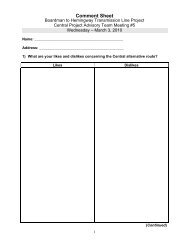
<strong>Siting</strong> <strong>Study</strong><br />
<strong>Boardman</strong> <strong>to</strong> <strong>Hemingway</strong> <strong>Transmission</strong> <strong>Line</strong> <strong>Project</strong><br />
3.4.1 Western Route<br />
The Western Route exits the proposed Grassland Substation <strong>to</strong> the south, heads west for about 6 miles,<br />
and then turns south crossing the western part of Morrow County, continuing southwest across Grant,<br />
Harney, Malheur, and Owyhee Counties <strong>to</strong> the <strong>Hemingway</strong> Substation. Table D-15 in Appendix D shows<br />
that, of the three remaining routes for further consideration, the Western Route is the shortest by about 7<br />
<strong>to</strong> 24 miles and crosses the least private and most public land; however, it parallels the least amount of<br />
existing utility and transportation corridors (46 miles) and would require the most new ROW (229 miles).<br />
Although the shortest alternative, the Western Route crosses about 117.1 miles of what has been<br />
designated as high difficulty construction conditions, 51.8 miles and 17.8 miles more than the Eastern and<br />
Central Routes, respectively. Compared <strong>to</strong> the Central and Eastern Routes in permitting difficulty, this<br />
alternative requires the most new corridor, parallels the least utility corridor, crosses over 30 more special<br />
status streams, requires over 1,750 acres of clearing, and would cross about 45 miles through the Malheur<br />
and Umatilla National Forests. Overall, the Western Route has 47.1 miles of high permitting difficulty,<br />
compared <strong>to</strong> 43.7 for the Eastern Route and 64.8 for the Central Route as shown in Table 3.4-2.<br />
3.4.2 Central Route<br />
The Central Route also exits the proposed Grassland Substation <strong>to</strong> the west and then proceeds south.<br />
However, as this route passes <strong>to</strong> the south of the <strong>Boardman</strong> Grasslands Conservation Area it angles <strong>to</strong> the<br />
east across Morrow and Umatilla Counties and then through the designated utility corridor in the<br />
Wallowa-Whitman National Forest. This alternative then turns southeast through Union County and along<br />
the west side of the Baker Valley in Baker County. It continues southeast through Malheur and Owyhee<br />
Counties in<strong>to</strong> the new <strong>Hemingway</strong> Substation.<br />
This alternative route is about 7 miles longer than the Western Route and 17 miles shorter than the<br />
Eastern Route. It parallels more existing utility and transportation corridor than the Western Route, but<br />
53 miles less than the Eastern Route and it requires 5 miles less new corridor than the Western Route and<br />
36 more miles of new corridor than the Eastern Route.<br />
The Central Route crosses about 56 miles of slopes over 25 percent and would require clearing of<br />
approximately 1,760 acres about the same as the Western Route and significantly more than the Eastern<br />
Route. The evaluation of construction difficulty shows that the Central Route traverses 22.3 fewer miles<br />
of high construction difficulty than the Western Route and 33.1 more miles than the Eastern Route. Much<br />
of this difficulty would happen along the west side of the Baker Valley.<br />
Significant permitting concerns include the 30 miles through the Wallowa-Whitman National Forests,<br />
potential visibility of the line on the west side of Baker Valley, 224 miles of new corridor, and about<br />
1,760 acres of clearing. As shown on Table 3.4-2, this alternative route crosses more miles of high<br />
permitting difficulty than the Eastern or Western Routes.<br />
3.4.3 Eastern Route<br />
The Eastern Route is similar <strong>to</strong> the Central Route except that it exits the proposed Grassland Substation <strong>to</strong><br />
the north and east around the <strong>Boardman</strong> Bombing Range and then proceeds southeastward. It joins the<br />
Central Route at the Morrow/Umatilla County line about 2 miles east of Four Corners. The two<br />
alternatives continue <strong>to</strong>gether <strong>to</strong> the southeast end of the Wallowa-Whitman utility corridor. At this point<br />
the Eastern Route proceeds <strong>to</strong> the southeast across Union County and then in<strong>to</strong> the Baker County<br />
following the east side of the Baker Valley. The Eastern Route rejoins the Central Route in northern<br />
August 2010 3-96