a kayak - Wavelength Paddling Magazine
a kayak - Wavelength Paddling Magazine
a kayak - Wavelength Paddling Magazine

You also want an ePaper? Increase the reach of your titles
YUMPU automatically turns print PDFs into web optimized ePapers that Google loves.
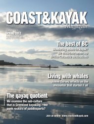
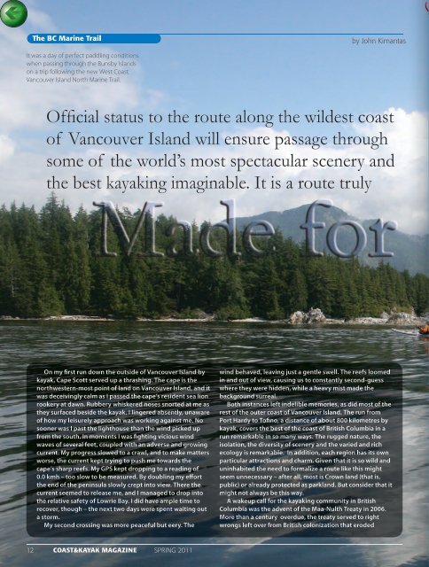
The BC Marine Trail<br />
by John Kimantas<br />
It was a day of perfect paddling conditions<br />
when passing through the Bunsby Islands<br />
on a trip following the new West Coast<br />
Vancouver Island North Marine Trail.<br />
Official status to the route along the wildest coast<br />
of Vancouver Island will ensure passage through<br />
some of the world’s most spectacular scenery and<br />
the best <strong>kayak</strong>ing imaginable. It is a route truly<br />
On my first run down the outside of Vancouver Island by<br />
<strong>kayak</strong>, Cape Scott served up a thrashing. The cape is the<br />
northwestern-most point of land on Vancouver Island, and it<br />
was deceivingly calm as I passed the cape’s resident sea lion<br />
rookery at dawn. Rubbery whiskered noses snorted at me as<br />
they surfaced beside the <strong>kayak</strong>. I lingered absently, unaware<br />
of how my leisurely approach was working against me. No<br />
sooner was I past the lighthouse than the wind picked up<br />
from the south. In moments I was fighting vicious wind<br />
waves of several feet, coupled with an adverse and growing<br />
current. My progress slowed to a crawl, and to make matters<br />
worse, the current kept trying to push me towards the<br />
cape’s sharp reefs. My GPS kept dropping to a reading of<br />
0.0 kmh – too slow to be measured. By doubling my effort<br />
the end of the peninsula slowly crept into view. There the<br />
current seemed to release me, and I managed to drop into<br />
the relative safety of Lowrie Bay. I did have ample time to<br />
recover, though – the next two days were spent waiting out<br />
a storm.<br />
My second crossing was more peaceful but eery. The<br />
wind behaved, leaving just a gentle swell. The reefs loomed<br />
in and out of view, causing us to constantly second-guess<br />
where they were hidden, while a heavy mist made the<br />
background surreal.<br />
Both instances left indelible memories, as did most of the<br />
rest of the outer coast of Vancouver Island. The run from<br />
Port Hardy to Tofino, a distance of about 800 kilometres by<br />
<strong>kayak</strong>, covers the best of the coast of British Columbia in a<br />
run remarkable in so many ways. The rugged nature, the<br />
isolation, the diversity of scenery and the varied and rich<br />
ecology is remarkable. In addition, each region has its own<br />
particular attractions and charm. Given that it is so wild and<br />
uninhabited the need to formalize a route like this might<br />
seem unnecessary – after all, most is Crown land (that is,<br />
public) or already protected as parkland. But consider that it<br />
might not always be this way.<br />
A wakeup call for the <strong>kayak</strong>ing community in British<br />
Columbia was the advent of the Maa-Nulth Treaty in 2006.<br />
More than a century overdue, the treaty served to right<br />
wrongs left over from British colonization that eroded<br />
12 COAST&KAYAK MAGAZINE SPRING 2011