a kayak - Wavelength Paddling Magazine
a kayak - Wavelength Paddling Magazine
a kayak - Wavelength Paddling Magazine

Create successful ePaper yourself
Turn your PDF publications into a flip-book with our unique Google optimized e-Paper software.
WaveLength<br />
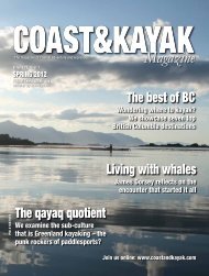
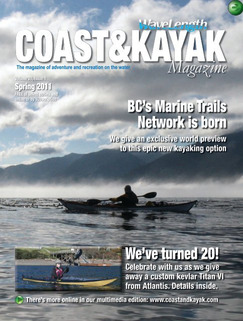
COAST&KAYAK<br />
The magazine of adventure and recreation on the water<br />
Volume 21, Issue 1<br />
Spring 2011<br />
FREE at select outlets and<br />
online or by subscription<br />
<strong>Magazine</strong><br />
BC’s Marine Trails<br />
Network is born<br />
We give an exclusive world preview<br />
to this epic new <strong>kayak</strong>ing option<br />
We’ve turned 20!<br />
Celebrate with us as we give<br />
away a custom kevlar Titan VI<br />
from Atlantis. Details inside.<br />
There’s more online in our multimedia edition: www.coastand<strong>kayak</strong>.com
WEEKLY AND SPECIAL<br />
EVENTS THIS SUMMER<br />
• Every Wednesday, Women on Water<br />
Women only evening paddle with discounted rentals<br />
• May 15, 2011, Tour De Indian Arm Kayak and SUP Race<br />
Come join in fun and test your skills<br />
• June 25, 2011, Stand Up Paddle Board Demo Day<br />
Check out what the new boards have to offer<br />
Deep Cove Outdoors is now located at:<br />
352 Lynn Ave, North Vancouver 5min from 2nd Narrows Bridge<br />
Deep Cove Canoe & Kayak<br />
deepcove<strong>kayak</strong>.com / 604.929.2268<br />
Rentals • Lessons • Programs • Courses • Events<br />
2 COAST&KAYAK MAGAZINE SPRING 2011
This issue’s features:<br />
8 With this paddle, I thee wed<br />
A honeymoon well off the bridal path<br />
12 Made for adventure<br />
Introducing the BC Marine Trail<br />
16 Leg one: The North Island<br />
20 Leg two: Brooks/Kyuquot<br />
24 Leg three: Nootka<br />
30 Leg four: Clayoquot<br />
42 Pick a <strong>kayak</strong>, any <strong>kayak</strong><br />
What to consider when buying<br />
44 Ibis, the ancient seabird<br />
Wildlife<br />
8<br />
36<br />
44<br />
Regular items:<br />
6 News<br />
34 Tours and Services<br />
38 Kayaks<br />
Necky Looksha Elite,<br />
Atlantis Titan VI,<br />
Delta 20T<br />
43 Instruction Directory<br />
46 Skillset<br />
by Alex Matthews<br />
48 Paddle Meals<br />
by Hilary Masson<br />
50 Kayak-friendly<br />
Accommodation<br />
52 Fishing Angles<br />
by Dan Armitage<br />
Contents<br />
THE ORIGINAL BRITISH SEA KAYAK<br />
www.valleysea<strong>kayak</strong>s.com<br />
SPRING 2011 COAST&KAYAK MAGAZINE 3
The First Word<br />
Spring 2011 Volume 21, Number 1<br />
PM No. 41687515<br />
Editor John Kimantas<br />
Advertising Sales Brent Daniel<br />
Copy Editing Darrell Bellaart<br />
Cover Photo:<br />
Surveying sites for the BC<br />
Marine Trails Network meant<br />
long hours of paddling by<br />
volunteers. BCMTNA president<br />
Stephanie Meinke crosses<br />
toward Brooks Peninsula on one<br />
such trip to survey Heater Point.<br />
Photo by Stephan Meinke.<br />
COAST&KAYAK MAGAZINE is an independent magazine<br />
available free at hundreds of print distribution sites (paddling<br />
shops, outdoor stores, paddling clubs, marinas, events, etc.),<br />
and globally on the web. Also available by paid subscription.<br />
Articles, photos, events, news are all welcome.<br />
Find back issues, articles, events, writers guidelines and<br />
advertising information online at coastand<strong>kayak</strong>.com<br />
SUBSCRIBE<br />
$20 for 1 year – 4 issues<br />
$35 for 2 years – 8 issues<br />
While Coast&Kayak <strong>Magazine</strong> is made available<br />
free, subscriptions ensure the magazine is delivered<br />
to your home and that you will never miss an issue.<br />
To subscribe, visit<br />
www.coastand<strong>kayak</strong>.com/Subscribe.html<br />
or call 1-866-984-6437.<br />
Advertising rates and submission guidelines<br />
available at www.coastand<strong>kayak</strong>.com<br />
ISSUE AD DEADLINE DISTRIBUTION<br />
Spring 2011 Feb. 4 March 1<br />
Summer 2011 April 15 May 16<br />
Fall 2011 July 1 Aug. 1<br />
Winter 2011 Oct. 1 Nov. 1<br />
A product of:<br />
Wild Coast Publishing<br />
#6 10 Commercial St.<br />
Nanaimo, B.C., Canada, V9R 5G2<br />
Ph: 1-866-984-6437 • Fax: 1-866-654-1937<br />
Email: <strong>kayak</strong>@coastand<strong>kayak</strong>.com<br />
Website: www.coastand<strong>kayak</strong>.com<br />
© 2010. Copyright is retained on all material (text, photos and graphics) in this magazine.<br />
No reproduction is allowed of any material in any form, print or electronic, for any purpose,<br />
except with the permission of Wild Coast Publishing.<br />
Some elements in maps in this magazine are reproduced with<br />
the permission of Natural Resources Canada 2010, courtesy<br />
of the Atlas of Canada. Also, our thanks to Geobase for some<br />
elements that may appear on Coast&Kayak maps.<br />
by John Kimantas<br />
What’s in a name? I guess I’ll find out<br />
Is it fitting or a cop-out to rename a magazine on its 20th birthday? Or is that<br />
a betrayal to history and tradition? Either way <strong>Wavelength</strong> <strong>Magazine</strong> is officially<br />
Coast&Kayak <strong>Magazine</strong> now, though I expect unofficially it will be <strong>Wavelength</strong> forever<br />
in many people’s minds.<br />
Don’t get me wrong. <strong>Wavelength</strong> is a great name. Too good a name, actually. It’s<br />
so good that there are multiple other <strong>Wavelength</strong> <strong>Magazine</strong>s out there. There is:<br />
<strong>Wavelength</strong> <strong>Magazine</strong>, the weekly live music series and monthly<br />
zine based in Toronto; <strong>Wavelength</strong> <strong>Magazine</strong>, the official<br />
publication of the Association of Public Safety Communications<br />
Officials (APCO) in Canada; <strong>Wavelength</strong> <strong>Magazine</strong> focusing on<br />
news and advances in radiation therapy, information management<br />
and neuroscience; and most troubling of all, <strong>Wavelength</strong><br />
<strong>Magazine</strong>, the UK surfing magazine. Woe be the subscriber<br />
who contacts me wondering where their next issue is and what<br />
happened to the free flip-flops they were promised. All I can do<br />
is point them in the general direction of England.<br />
This wouldn’t be a problem say 20 years ago, when <strong>Wavelength</strong> was first conjured<br />
up out there on Gabriola Island (with thanks to Alan and Peter and the rest for<br />
creating such a fantastic legacy). Today <strong>Wavelength</strong> runs into a problem that couldn’t<br />
have been anticipated 20 years ago – the electronic media. So much depends now on<br />
Google, and if you punch in <strong>Wavelength</strong> most of the 12.6 million or so search results<br />
will invariably involve Blue Tooth technology or similar (in case you were wondering,<br />
a wavelength is the spatial period of the wave or the distance over which the wave’s<br />
shape repeats. Not particularly poetic by definition.) Not to mention that if you go to<br />
the Official <strong>Wavelength</strong> <strong>Magazine</strong> Facebook Page, it’s not us. It’s those Brit surfers.<br />
So I hope Coast&Kayak is distinct enough. I think it summarizes us nicely, since<br />
I like to think our focus extends beyond paddlers to anyone who loves the coast, so<br />
emphasizing that aspect isn’t a bad thing – though I’m sure many will appreciate the<br />
irony that the lead article in this magazine has no coast at all and more rafts than<br />
<strong>kayak</strong>s. My rebuttal is we are all about inclusion. Canoeists, paddleboarders, surf skiers,<br />
surf <strong>kayak</strong>ers – in fact, anyone who loves exploring by water – you’re all welcome here.<br />
If I owe anyone an apology I think it’s Canoe and Kayak, as we now share the same<br />
initials (C&K <strong>Magazine</strong>), but I’m sure the world is big enough for the two of us. At<br />
least it’s less crowded than the <strong>Wavelength</strong> <strong>Magazine</strong> world.<br />
But to put minds at ease, the name is the only real change. The rest is a constant<br />
evolution, such as our multimedia online edition (please visit if you haven’t seen it<br />
yet), our rejigged website (the online Kayak Buyer’s Guide is awesome now), and other<br />
advances. So here’s to looking back at our history, and ahead to a great next 20 years!<br />
- John Kimantas<br />
We put aside paddles to hike the<br />
Nootka Trail. Get details on this<br />
magnificent route on page 26.<br />
Coast&Kayak <strong>Magazine</strong> is dedicated to making self-propelled<br />
coastal exploration fun and accessible. Safety and travel<br />
information is provided to augment pre-existing safety and<br />
knowledge. A safety course and proper equipment are advised<br />
before any exploration on water. See a list of paddling instruction<br />
locations at www.coastand<strong>kayak</strong>.com<br />
4 COAST&KAYAK MAGAZINE SPRING 2011
SPRING 2011 COAST&KAYAK MAGAZINE 5
News<br />
Summer 2011: it’s made for going around in circles<br />
Setting the speed record for<br />
circumnavigating Vancouver Island may<br />
be for the elite, but enough other circle<br />
adventures are set for 2011 to keep paddlers<br />
occupied in everything from competitive<br />
hauls to free-spirited fun runs.<br />
Back again is the Alert Bay 360, set this<br />
year for July 31 to coincide with the BC<br />
Day long weekend. It will feature a race<br />
around Malcolm Island (off Port McNeill<br />
on northern Vancouver Island). Plus the<br />
community gets involved with a Big House<br />
celebration, seafood buffet and First<br />
Nations cultural dance performances.<br />
The only catch: registration is being<br />
limited to 200 participants this year.<br />
Registration will take place online soon at<br />
www.alertbay360.com.<br />
Back for its 11th year is the Round<br />
Bowen Island Challenge. Well situated for<br />
Vancouver and Greater Seattle paddlers, the<br />
race is set for Sunday, June 26 and features<br />
a tough 35-kilometer slog around the Howe<br />
Sound island north of Vancouver. Visit<br />
roundbowenchallenge.com.<br />
Bound to entail less competition, the<br />
Gabriola 360 Fun Race takes place for<br />
its second year on Sunday, Aug. 21. The<br />
first year race organizers Silva Bay Kayak<br />
Adventures attracted 26 participants. Visit<br />
www.silvabayakaking.com.<br />
For more summer events, visit<br />
www.coastand<strong>kayak</strong>.com/events.html<br />
Clayoquot at risk – again<br />
With plans already in the works for open<br />
pit mining of the iconic Catface Range in<br />
Clayoquot Sound, a new threat is being<br />
faced by Flores Island as logging company<br />
Iisaak is looking to build roads into an area<br />
it signed an agreement in 1999 to preserve<br />
from logging. The Wilderness Committee<br />
is launching an email petition to halt the<br />
logging. Visit wildernesscommittee.org to<br />
add your voice.<br />
Meanwhile, Coast&Kayak columnist<br />
Dan Lewis and partner Bonny Glambeck<br />
will be touring British Columbia coastal<br />
communities this spring with a presentation<br />
called ‘Secrets of Clayoquot Sound’.<br />
Bonny Glambeck photo<br />
The Catface Range from Dick and Jane<br />
Beach. See page 30.<br />
The seasoned naturalists and expedition<br />
paddlers will share stories about their<br />
adventures at home in Clayoquot Sound<br />
backed by wildlife and landscape shots<br />
from some of BC’s leading outdoor<br />
photographers.<br />
The show will cover the natural beauty<br />
and splendor of the Clayoquot Sound<br />
UNESCO Biosphere Reserve, the ecology<br />
of the region’s ancient rainforests and<br />
threats to that ecology including fish farms,<br />
logging and the open-pit mine proposal.<br />
For dates and details visit the Friends of<br />
Clayoquot Sound website at www.focs.ca.<br />
My Arctic Tern 14 is the<br />
most versatile and most fun<br />
of eleven boats I own.<br />
Ginni Callahan, Kayaking Guide<br />
FOLDING KAYAKS THAT TRAVEL THE WORLD<br />
dream in colour<br />
Designed by experience, built by you. At 32 pounds,<br />
Ginni says ‘Fourteen’ feels like she weighs nothing at all!<br />
Visit us in Port Townsend, Washington 360.385.6143<br />
www.pygmy boats.com<br />
top rated· ultra-light· rugged· high performance<br />
FEATHERCRAFT.COM / MADE IN CANADA / PADDLED WORLDWIDE<br />
6 COAST&KAYAK MAGAZINE SPRING 2011
News<br />
One new website address.<br />
All the <strong>kayak</strong>ing<br />
information you’ll ever need.<br />
• Back issues of magazines.<br />
• Kayak Buyer’s Guide.<br />
• Gear Buyer’s Guide.<br />
• Kayaking skills information.<br />
• Boat building information.<br />
• And much, much more.<br />
www.coastand<strong>kayak</strong>.com<br />
When you’ve reached the edge<br />
of your world, ours begins<br />
Explore...<br />
Island lifestyle, adventure tours,<br />
unspoiled beauty, wildlife sightseeing,<br />
spectacular storm watching, fishing<br />
and <strong>kayak</strong>ing, Haida Gwaii Culture,<br />
diverse cultural heritage, surfing and<br />
beach walks<br />
Sandspit | Queen Charlotte | Skidegate | Tlell | Port Clements | Masset | Old Massett<br />
See what exists<br />
outside of<br />
cell coverage.<br />
Visit us at necky<strong>kayak</strong>s.com<br />
Get the free mobile app<br />
Get the free mobile app at<br />
at http://gettag.mobi<br />
http:/ / gettag.mobi<br />
Join our community<br />
SPRING 2011 COAST&KAYAK MAGAZINE 7<br />
JOP-032 Necky Kayaks Half Page Ad • <strong>Wavelength</strong> <strong>Magazine</strong> • 7.125” x 4.6875”• hammerquist.net sydney@hammerquist.net 425.285.3363
Destinations<br />
by Nikki Rekman / photos by Mark Klein<br />
With this paddle<br />
I thee wed<br />
This isn’t every girl’s<br />
dream honeymoon.But<br />
could it start a trend?<br />
8 COAST&KAYAK MAGAZINE SPRING 2011
The Grand Canyon<br />
A paddling honeymoon – I certainly did not have dreams<br />
of this as a little girl, I can assure you, but then again there<br />
are a few of those dreams that thankfully were never<br />
fulfilled.<br />
When Mark and I finally decided we were going to take<br />
the plunge into matrimony I figured there would be nothing<br />
traditional about our wedding. Heck, I was just thankful<br />
we were finally getting to this point. But to my delight<br />
and surprise this is the story of a paddling adventure that<br />
exceeded a little girl’s expectations.<br />
On Oct. 9. 2010 Mark and I were married. It was everything<br />
I had hoped for and much more – not a huge affair but one<br />
that was representative of who Mark and I are, shared of<br />
course with the important people in our lives. But Mark had<br />
his own idea of how to celebrate our life-long commitment –<br />
a paddle down the Grand Canyon for our honeymoon.<br />
Here is where the adventure begins. On October 11 we<br />
left our home near Vancouver, BC, and headed south to<br />
Flagstaff, Arizona, where we were to meet up with the crew<br />
from Canyon Explorations/Expeditions for a 15-day paddle<br />
down the Colorado. Also on the trip was our friend Lynne<br />
from Western Canoeing and Kayaking in Abbotsford, BC. So<br />
there we were, the three of us, at the put-in at Lee’s Ferry<br />
on the north shore of the Colorado. There was definitely the<br />
excitement of exploring a new river. And not just any river,<br />
but one that winds its way through the bottom of one of<br />
the most remarkable geological features on the planet: the<br />
Grand Canyon.<br />
Over the course of the first few days it was amazing to<br />
me how we lost our inhibitions with the total strangers we<br />
had only just met and ultimately became our own little river<br />
tribe. Picture the girls going upstream to pee and the boys<br />
going downstream – on the Colorado to adequately handle<br />
the number of people that visit each year you pee in the<br />
river and haul everything else out in sealed ammo boxes<br />
(also referred to as “the “groover” for the grooves left in<br />
your behind from the boxes before some river guide genius<br />
thought of using a toilet seat).<br />
I wasn’t sure at first how it would be unwinding all the<br />
craziness of the wedding and end-of-season work for me<br />
(I’m a sales representative in the paddling industry). It was<br />
work – the paddling, the river life, all the people and the<br />
weather – but the 225 miles were some of the most amazing<br />
paddling days I have ever experienced.<br />
I had never been on the water for that many consecutive<br />
days and had certainly never planned a trip where you had<br />
to take down camp every morning and set it all up again<br />
later in the day. However, you get into a routine and it is very<br />
much a part of your experience of being on the river. Finding<br />
just the right spot to quickly set up your tent for the night<br />
(remember we were paddling in October, so the days were<br />
shorter) became something to look forward to – a type of<br />
nesting, really. Ah, I love it.<br />
Evenings were spent cooking, visiting with fellow<br />
paddlers, debriefing the day and planning the next. Did I say<br />
there was some work involved? I love the river life. Crawling<br />
into the tent, feeling certain that your sleeping mat was four<br />
inches thick and not 1.5 inches because you could feel the<br />
relaxation in every muscle in your body as you lay down.<br />
The river is most certainly a good analogy for married<br />
life. It winds and meanders and with its mighty flow makes<br />
many of the rough spots smooth – over time. Mark is my<br />
best friend and our most significant meeting place is the<br />
out of doors and particularly paddling. Some might think<br />
a paddling honeymoon could be the beginning of the end<br />
(we heard from one guide a story of a couple that decided to<br />
get divorced on a trip at about the half-way point). Mark and<br />
I fared much better. We work stuff out better on the river<br />
than we do at home. I think this is mostly because things<br />
are simplified on the water. You need to make so many<br />
miles, eat, sleep and with those objectives we each know<br />
what we have to do to get those things done successfully.<br />
We established our roles on paddling trips many years ago.<br />
At home we call these departments. Mine, for example, is<br />
cooking and his is dishes.<br />
u<br />
SPRING 2011 COAST&KAYAK MAGAZINE 9
Destinations<br />
We paddled the river at<br />
8,000 cubic feet per second<br />
(CFS – think 8,000 basketballs<br />
passing by you each second –<br />
isn’t that a visual!) and during<br />
the summer months the river<br />
is typically at about 20-22,000<br />
CFS. The features of the river<br />
at 8,000 CFS are more exposed<br />
because of the lower flow.<br />
This allowed us to paddle the<br />
inflatable <strong>kayak</strong>s with greater<br />
success, which essentially<br />
means less swimming. In addition to the<br />
two inflatable <strong>kayak</strong>s, we had five oar boats<br />
and one paddle boat. I had never paddled<br />
in water as big as this and it was thrilling –<br />
and at one point frightening – after being<br />
eaten by a huge hole at Horn Creek rapid.<br />
How happy was I to eventually pop-up<br />
downstream only to see the big eyes of my<br />
betrothed saying, “I’m glad that’s over.”<br />
The highlight of the trip in terms of the<br />
river for me was successfully running Lava<br />
Falls, the largest rapid on the river, with<br />
multiple features and must-do moves. Mark<br />
and I, having demonstrated some degree<br />
of competence while sitting<br />
comfortably in our drysuits,<br />
were honored on the one<br />
hand, but also quite petrified<br />
that we were selected to be in<br />
the front of the paddleboat<br />
to run Lava. We had an<br />
opportunity to scout before<br />
we ran and looking down<br />
from our vantage point I was<br />
pretty sure I was going to<br />
either puke or cry. That thing<br />
was big (even at 8,000 CFS)!<br />
I was not the only one with anxiety. The<br />
entire day before and that morning we were<br />
all praying that we wouldn’t have an out-ofboat<br />
experience. And it was important for<br />
the guides too, as this was their last trip of<br />
the season and they too seemed eager to<br />
end on a high note.<br />
As it turned out no one swam Lava Falls<br />
– the river had mercy on us this particular<br />
day. The next stop was Tequila Beach for<br />
a night of celebrating with some liquid<br />
libation which our guides’ called a “bucket<br />
of stupid” (need I say more).<br />
I would be remiss if I did not tell you<br />
story and images by John Kimantas<br />
that the canyon is more than just the river.<br />
The geology is mind-boggling and touching<br />
rocks that are over a billion years old,<br />
well, that’s pretty impressive. The hiking is<br />
incredible in the side canyons and although<br />
I am not much of a hiker I was so glad<br />
that I did them because those tucked-away<br />
places that you can’t see from the river were<br />
gorgeous.<br />
Many people have gone before us on this<br />
amazing river. Some are famous, like John<br />
Wesley Powell, and some infamous, like<br />
Bert Loepper, and their stories and others<br />
were such an important part of our own<br />
journey down the river. If you get a chance<br />
to visit this magical place, you won’t regret<br />
the time it took or the money it cost – we<br />
sure don’t and more specifically a paddling<br />
honeymoon is one that you will never forget<br />
because who does that?<br />
In the words of a paddlesports colleague,<br />
what a fitting trip as Mark and I start on our<br />
grand journey together.<br />
<<br />
Nikki enjoys sharing paddling adventures<br />
with her husband, Mark, and is a sales rep in<br />
the canoeing & <strong>kayak</strong>ing industry.<br />
Get it at<br />
ecomarine<br />
Avocet LV<br />
Performance <strong>kayak</strong>s<br />
from the UK<br />
604-689-7575<br />
sales@ecomarine.com<br />
10 COAST&KAYAK MAGAZINE SPRING 2011<br />
Spring 2011.indd 1<br />
2/3/2011 3:06:21 PM
The Grand Canyon<br />
A gentle moment along the Grand<br />
Canyon. Click online for a slideshow.<br />
SPRING 2011 COAST&KAYAK MAGAZINE 11
The BC Marine Trail<br />
by John Kimantas<br />
It was a day of perfect paddling conditions<br />
when passing through the Bunsby Islands<br />
on a trip following the new West Coast<br />
Vancouver Island North Marine Trail.<br />
Official status to the route along the wildest coast<br />
of Vancouver Island will ensure passage through<br />
some of the world’s most spectacular scenery and<br />
the best <strong>kayak</strong>ing imaginable. It is a route truly<br />
On my first run down the outside of Vancouver Island by<br />
<strong>kayak</strong>, Cape Scott served up a thrashing. The cape is the<br />
northwestern-most point of land on Vancouver Island, and it<br />
was deceivingly calm as I passed the cape’s resident sea lion<br />
rookery at dawn. Rubbery whiskered noses snorted at me as<br />
they surfaced beside the <strong>kayak</strong>. I lingered absently, unaware<br />
of how my leisurely approach was working against me. No<br />
sooner was I past the lighthouse than the wind picked up<br />
from the south. In moments I was fighting vicious wind<br />
waves of several feet, coupled with an adverse and growing<br />
current. My progress slowed to a crawl, and to make matters<br />
worse, the current kept trying to push me towards the<br />
cape’s sharp reefs. My GPS kept dropping to a reading of<br />
0.0 kmh – too slow to be measured. By doubling my effort<br />
the end of the peninsula slowly crept into view. There the<br />
current seemed to release me, and I managed to drop into<br />
the relative safety of Lowrie Bay. I did have ample time to<br />
recover, though – the next two days were spent waiting out<br />
a storm.<br />
My second crossing was more peaceful but eery. The<br />
wind behaved, leaving just a gentle swell. The reefs loomed<br />
in and out of view, causing us to constantly second-guess<br />
where they were hidden, while a heavy mist made the<br />
background surreal.<br />
Both instances left indelible memories, as did most of the<br />
rest of the outer coast of Vancouver Island. The run from<br />
Port Hardy to Tofino, a distance of about 800 kilometres by<br />
<strong>kayak</strong>, covers the best of the coast of British Columbia in a<br />
run remarkable in so many ways. The rugged nature, the<br />
isolation, the diversity of scenery and the varied and rich<br />
ecology is remarkable. In addition, each region has its own<br />
particular attractions and charm. Given that it is so wild and<br />
uninhabited the need to formalize a route like this might<br />
seem unnecessary – after all, most is Crown land (that is,<br />
public) or already protected as parkland. But consider that it<br />
might not always be this way.<br />
A wakeup call for the <strong>kayak</strong>ing community in British<br />
Columbia was the advent of the Maa-Nulth Treaty in 2006.<br />
More than a century overdue, the treaty served to right<br />
wrongs left over from British colonization that eroded<br />
12 COAST&KAYAK MAGAZINE SPRING 2011
Port Hardy<br />
The WCVIN section<br />
This issue: We take you on a journey<br />
through the rugged new West Coast<br />
Vancouver Island North Marine Trails from<br />
Port Hardy to Tofino.<br />
Next issue: Hopping serene islands<br />
along the new Gulf Islands Marine<br />
Trail Network.<br />
Tofino<br />
aboriginal rights without legal resolution. The Maa-Nulth<br />
Treaty was British Columbia’s first coastal treaty, and so<br />
provided a glimpse for the future of how coastal native<br />
communities will be transformed.<br />
Not surprising, the treaty grants additional land, but in<br />
contrast to previous treaty lands the Maa-nulth lands are<br />
fee simple: that is, essentially private property that can be<br />
bought and sold. And not surprisingly, many of the parcels<br />
picked out in the treaty are among the most heavily used<br />
coastal recreation areas, such as Spring Island in the Mission<br />
Group off Kyuquot Sound, and Toquart Bay, the main launch<br />
point for <strong>kayak</strong>ers heading to the popular Broken Group<br />
Islands.<br />
In response to this and other changes along the coast,<br />
paddling clubs across British Columbia united in 2007 to<br />
begin the process of creating a marine trail composed of<br />
launch sites, campsites and safe havens to allow travel by<br />
paddle along the entire BC coast for generations to come. The<br />
result, when complete, will be the largest marine trail in the<br />
world. What followed was a lengthy process by volunteers<br />
of nine paddling clubs in identifying sites, visiting them,<br />
working with the government and consulting with First<br />
Nations interests to push forward the goal.<br />
With enough of the preliminary work out of the way, the<br />
government has agreed to lift the veil of quiet behind-thescenes<br />
work and announce support for the full trail while<br />
officially opening the first two portions: the West Coast<br />
Vancouver Island North section from Port Hardy to Tofino<br />
and the Gulf Islands Trail Network between Victoria and<br />
Nanaimo on Vancouver Island. The official announcement<br />
will be made at the Vancouver Island Paddlefest in May, along<br />
with a ceremonial group paddle through a portion of the Gulf<br />
Islands route to celebrate the occasion. It may well be the<br />
most historic paddle in the history of British Columbia.<br />
The changes for <strong>kayak</strong>ers will initially be largely invisible,<br />
as site development isn’t part of the equation. At least, not<br />
yet. What does change, though, is the designation of the land<br />
itself. Once a marine trail site, the designation trumps other<br />
possible proposed uses such as fish farms and resorts.<br />
In other words, the trail is here to stay.<br />
u<br />
SPRING 2011 COAST&KAYAK MAGAZINE 13
The BC Marine Trail<br />
For the West Coast<br />
Vancouver Island North<br />
section, currently 147<br />
marine trail sites are on<br />
the table (including access<br />
points, overnight locations<br />
and picnic sites where<br />
<strong>kayak</strong>ers can visit but not<br />
stay.) How many will end<br />
up officially on the trail is<br />
still an unknown, as some<br />
considerations have yet to<br />
be resolved. For instance,<br />
many key <strong>kayak</strong>ing campsites<br />
in areas such as the Bunsby<br />
Islands won’t be part of<br />
the initial inventory, if at<br />
all, because they are located<br />
in the Checleset Bay Ecological Reserve,<br />
which restricts foreshore access by the<br />
public. The ban on access has always been<br />
in place; it has just never been enforced.<br />
Cultural sensitivity for First Nations is<br />
another issue. Government representatives<br />
working with the planning group, the<br />
BC Marine Trails Network Association<br />
(BCMTNA), have been approaching First<br />
Nations representatives to work together<br />
in designating appropriate sites for the<br />
trail, but issues such as historic use (for<br />
instance, camping on a former village site)<br />
mean some sites are still in limbo or may be<br />
dropped.<br />
The first two sections to be unveiled<br />
are just the first of the many legs that will<br />
eventually join to allow travel by paddle<br />
John Kimantas photo<br />
Kayaks on the beach at Apple Islets before<br />
crossing Brooks Peninsula.<br />
down the entire BC coast from Washington<br />
State to Alaska. While some areas, such as<br />
the Discovery Islands north of Campbell<br />
River (the cluster that includes Quadra and<br />
Cortes islands), are fairly complete, other<br />
regions such as the North and Central BC<br />
coast are more complex. The huge area to<br />
be covered, the distance from home bases<br />
(in terms of BCMTNA volunteers being<br />
able to “groundproof ” potential sites),<br />
cultural issues and even the province’s<br />
recent creation of vast parcels of newly<br />
protected areas are all factors that will slow<br />
the trail’s completion.<br />
That’s the long-term problem. In the<br />
short-term, even trail<br />
portions will help create<br />
a network of known and<br />
reliable camping locations,<br />
removing the question of<br />
where to stay at the end<br />
of the day – a traditional<br />
hurdle for treks along<br />
the BC coast in both<br />
populated and isolated<br />
sections.<br />
While the trail<br />
announcement is a huge<br />
step forward, the process<br />
won’t end even once all<br />
the trail components<br />
are announced. The<br />
BCMTNA expects to<br />
continue to play a key role in searching<br />
for and lobbying for new sites in the years<br />
ahead, as well as working on a public<br />
education and trail advocacy component.<br />
There may also be a need for campsite<br />
development as wilderness areas become<br />
better used and begin to require services.<br />
What follows is an introductory look at<br />
the West Coast Vancouver Island North<br />
trail section. Because this is a preview in<br />
advance of formal designation, some sites<br />
mentioned may not make the official end<br />
list. In addition, a multitude of other sites<br />
remain on the BCMTNA “dream list,” not<br />
yet publicly released but with hopes for<br />
future inclusion. Others will follow on the<br />
list shortly as paddling in British Columbia<br />
enters an exciting new era.<br />
14 COAST&KAYAK MAGAZINE SPRING 2011
The WCVIN section<br />
<strong>Paddling</strong> is invigorating.<br />
It feeds my spirit. It renews my mind, body<br />
and soul. It’s a chance to get away from<br />
deadlines, construction noise and cell phones.<br />
<strong>Paddling</strong> is bliss.<br />
- Ashley<br />
Ashley - <strong>kayak</strong>er, snowboarder and photographer, exploring<br />
rock formations off the Oregon Coast. ©Mike Hood/NRS<br />
What does paddling mean to you?<br />
Share your thoughts at nrsweb.com/share<br />
800-635-5202<br />
SPRING 2011 COAST&KAYAK MAGAZINE 15
The BC Marine Trail<br />
Cape Sutil, the northernmost point on<br />
Vancouver Island, offers an exceptional<br />
<strong>kayak</strong>ing beach. The area can also be<br />
hiked now via the new North Coast Trail.<br />
16 COAST&KAYAK MAGAZINE SPRING 2011
The North Island<br />
Welcome to the end of the world. Officially it’s only the<br />
northern end of Vancouver Island, but when you paddle west<br />
past Cape Sutil, the northernmost point on Vancouver Island, you<br />
pass a magical point where civilization has tried to encroach, but<br />
nature continually reclaims. Many ruins are testimony to nature’s<br />
dominance here, which you can feel like the morning mist.<br />
The majority of the coast in this region is within Cape Scott<br />
Provincial Park. While the West Coast Vancouver Island North<br />
Marine Trail will formalize marine access, foot access went through<br />
a similar unveiling in 2008 when the long-awaited North Coast<br />
Trail was officially opened. The extension of the Cape Scott Trail<br />
allows hiking over the entire north end of Vancouver Island from<br />
Shushartie Bay to the old Cape Scott Trail trailhead at San Josef<br />
Bay. This opened foot access to vast stretches such as Shuttleworth<br />
Bight and Cape Sutil previously limited to access by <strong>kayak</strong>s and<br />
small boats. But don’t worry about overcrowding. There’s more<br />
than enough beach for everyone, and this area has some great<br />
stretches of sand – an unexpected amount, actually, given the fact<br />
this area has a reputation for a rocky, storm-ridden coast.<br />
Crossing Cape Scott by paddle is an exercise in bravery, planning<br />
and discretion, with (knock on wood) some luck thrown in for good<br />
measure. If all goes well you gain the privilege of being among the<br />
few who have successfully transited one of the most notoriously<br />
tricky points on the British Columbia coast. South of Cape Scott<br />
can be equally problematic. Troubling southerly winds, storms and<br />
numerous offshore rocks can make this relatively short stretch of<br />
water daunting. But as in all things coastal, timed right you are likely<br />
to find yourself immersed in a world populated not by stormy seas<br />
but by sea lions, sea otters, grey whales and humpbacks.<br />
A new circuit growing more popular is a circle route from Port<br />
Hardy and around North Vancouver Island and back through<br />
Quatsino Sound. By making arrangements with tour operators in<br />
Port Hardy you can be picked up in Coal Harbour and returned to<br />
your vehicle – a convenient ending to a great adventure. u<br />
Laura Cr.<br />
9 (hike-in only)<br />
Cape Scott<br />
9 9 Nissen Bight<br />
Nels Bight<br />
9<br />
Guise<br />
3 Bay<br />
Lowrie<br />
North Coast<br />
9 Bay<br />
Trail trailhead<br />
F (San Josef)<br />
9<br />
y 9<br />
San Josef Bay<br />
9 Cape Palmerston<br />
9 Raft Cove<br />
Hope I.<br />
2 Nahwitti Bar<br />
Jepther Pt.<br />
9 Cape Sutil 9<br />
Skinner Cr. (hike-in only)<br />
Nahwitti River 9 9<br />
9<br />
9<br />
F<br />
Shuttleworth Bight<br />
North Coast<br />
Trail trailhead<br />
(Shushartie Bay)<br />
´ y Holberg<br />
Map legend<br />
Nigei I.<br />
9 Designated marine trail campsite<br />
9 Non-marine trail campsite<br />
y Launch site<br />
F Trailhead ´ Community/services<br />
Park, reserve or conservation area<br />
Route of 2009 Coast&Kayak trip<br />
3 2009 Coast&Kayak trip campsites<br />
Please note: these maps show most key<br />
established campsites along the WCVIN<br />
route even if not designated as part of the<br />
marine trail. These sites may be candidate<br />
sites in the process of being formalized.<br />
Some established sites that are under<br />
discussions with interested parties (such as<br />
BC Parks or First Nations) have been omitted<br />
from the maps.<br />
Deserters/Walker Group<br />
9 Loquillilla Cove<br />
Harlequin Bay<br />
Balaclava Island booms 9<br />
9 God’s Pocket<br />
9 1 9 Bell Island<br />
Nolan Pt.<br />
(Balaclava I.)<br />
Goletas Channel<br />
Songhees Cr. 9<br />
Goodnuff Beach 9<br />
Hardy<br />
´ Bay<br />
Port Hardy y<br />
To find tour operators, water taxis<br />
and service providers for areas<br />
covered by this trail, see page<br />
34-35 and watch for the<br />
logo.<br />
WCVIN<br />
y Coal Harbour<br />
Rupert Arm<br />
Beaver<br />
Harbour<br />
y<br />
9Topknot Pt.<br />
´ 9Winter Harbour<br />
y<br />
4<br />
9 Grant Bay<br />
9 Hunt Its.<br />
Ahwhichaolta<br />
Inlet<br />
y<br />
Quatsino Narrows<br />
Quatsino •<br />
Quatsino<br />
Provincial Ildstad Is. 9 9 Drake I<br />
Park<br />
Quatsino Sound<br />
Varney Bay<br />
To Port Hardy<br />
Marble River 9<br />
(drive-in only)<br />
Mahatta River<br />
Quatsino Entrance<br />
(drive-in only) 9 Route to<br />
Gooding Cove<br />
Side Bay<br />
9<br />
y<br />
9<br />
9 Rowley Reefs (two Port Alice<br />
SPRING<br />
sites) and Blue<br />
2011<br />
Cod Islet<br />
COAST&KAYAK MAGAZINE 17<br />
Map continues south on page 21<br />
y<br />
5<br />
´
The BC Marine Trail<br />
u Trail guide preview: the North Island<br />
The North Island isn’t just one adventure<br />
opportunity. It’s a dozen. Take your pick<br />
from idyllic island clusters near launches<br />
and pavement to remote and rarely visited<br />
beaches. Just be sure to match your skill<br />
level to your intentions.<br />
Access Points: If you follow the Island<br />
Highway north of Victoria you’ll run out<br />
of blacktop at Port Hardy, about 500 km<br />
north (308 miles). This is the logical starting<br />
point for most North Island adventures,<br />
though if you turn west just before Port<br />
Hardy’s downtown you’ll follow a rough<br />
logging road for 60 km that ends at San<br />
Josef Bay and the Cape Scott Trail trailhead.<br />
A Western Forest Product campsite offers<br />
a boat ramp into the San Josef River,<br />
best navigated at high tide. Other options<br />
exist within Quatsino Sound at places like<br />
Coal Harbour and Port Alice, though they<br />
The north Island by foot<br />
For decades Vancouver Island’s most<br />
famous hike has been the West Coast<br />
Trail, a rugged multi-day route between<br />
Bamfield and Port Renfrew near the south<br />
end of the island. But it has become a<br />
victim of its own success, popular to the<br />
point reservations are now necessary.<br />
A new rival for any hiker’s “mustdo”<br />
list is the North Coast Trail, which<br />
opened in 2008. It adds 35 kilometers to<br />
the Cape Scott Trail for a total hike of<br />
48 kilometers – less than the West Coat<br />
Trail’s 78 km, but no less imposing for all<br />
the challenges hikers will endure.<br />
It is easy to consider the North<br />
Coast Trail the equivalent of the West<br />
Coast Trail 20 years ago before it was<br />
discovered: undeveloped, rough and<br />
tumble and the wild challenge one<br />
would hope to experience in so remote a<br />
location. Don’t expect the myriad of trail<br />
aids that many believe have spoiled the<br />
West Coast Trail.<br />
Travel is difficult from the outset. The<br />
trailhead at Shushartie Bay requires boat<br />
access, usually a water taxi from Port<br />
Hardy. From there it’s a difficult hike<br />
overland to Skinner Creek, and from there<br />
are less convenient to the best <strong>kayak</strong>ing<br />
locations of the outer coast. Winter<br />
Harbour offers fairly quick access to great<br />
paddling at the expense of a rough logging<br />
road. Bring a spare, or better yet, two.<br />
Short trip options: Good day paddle<br />
and weekend trips out of Port Hardy<br />
include all the nearby islands, which are<br />
numerious. The most accessible are in<br />
Beaver Harbour just east of Hardy Bay.<br />
God’s Pocket Provincial Park offers<br />
weekend adventures or longer trips spent<br />
exploring nearby islands, with the caveat<br />
that winds, tides and traffic are high here,<br />
particularly in Goletas Channel, which must<br />
be crossed. Other destinations in Quatsino<br />
Sound offer sheltered paddling, such as<br />
idyllic Varney Bay and the mouth of Marble<br />
River. Winter Harbour is an ideal gateway<br />
for terrific scenery in Quatsino Entrance.<br />
the trail gets even more difficult, with the<br />
toughest area surrounding Cape Sutil.<br />
Once near Shuttleworth Bight the trail<br />
levels and becomes mostly an idyllic beach<br />
hike westward. Trials along the way will<br />
include self-propelled cable cars (bring<br />
gloves), routes blocked at certain tide levels<br />
(bring patience) and the almost inevitable<br />
black bear encounter (bring spray). Add<br />
one last inevitable feature – rain – and<br />
your North Coast Trail adventure will be<br />
complete (bring a rain jacket).<br />
Should you find it daunting you can always<br />
stay away from open water and explore<br />
Ahwhichaolta Inlet instead.<br />
Moderate trip options: Several weeks<br />
can be spent exploring the God’s Pocket<br />
area, with side trips to the Deserters/Walker<br />
Groups and the two larger islands off Port<br />
Hardy: Nigei and Hope islands. Going as<br />
far as Jepther Point or, with the necessary<br />
expertise, Cape Sutil, is recommended. Or<br />
by launching from San Josef you can reach<br />
Guise Bay and other nearby attractions,<br />
including Cape Scott (should conditions<br />
allow; if not, San Josef Bay has lots to offer,<br />
with beautiful beaches, sea caves, sea stacks<br />
and even a trail to the top of Mount St.<br />
Patrick for panoramic views of the area).<br />
From Winter Harbour trips to Kwakiutl<br />
Point are highly rewarding (see the next leg<br />
for details of that area).<br />
Heading west toward Christensen Point<br />
on the new North Coast Trail, another<br />
spectacular way to experience the<br />
grandeur of northern Vancouver Island.<br />
Hikers should allow six days to<br />
complete the trail, though it can be<br />
done more quickly. An extra day spent<br />
reaching the lighthouse at Cape Scott<br />
is worthwhile. For more information,<br />
a detailed article can be viewed in<br />
the Spring 2008 issue of Wild Coast<br />
<strong>Magazine</strong> (find a copy at Coast&Kayak’s<br />
online magazine carousel). You can also<br />
purchase a detailed North Coast Trail<br />
route map, available at outdoor stores or<br />
online at www.coastand<strong>kayak</strong>.com.<br />
18 COAST&KAYAK MAGAZINE SPRING 2011
The North Island<br />
Nearing Cape Scott in the fog. A video<br />
of this eery crossing can be viewed in<br />
the multimedia online version<br />
at www.coastand<strong>kayak</strong>.com.<br />
Quatsino Entrance is the biggest<br />
benefactor of new sites in this region,<br />
with established places like Raft Cove<br />
and Hunt Islets getting the tentative nod,<br />
while new sites have been inventoried<br />
near Rowley Reefs and the north entrance<br />
(with a brilliant new find at a place dubbed<br />
Quatsino Caves Beach, where the sea caves<br />
make great exploring).<br />
Only about half the sites in this region<br />
are listed. The remainder have yet to be<br />
given the official okay.<br />
Advanced trips: The waters in this<br />
area tend to be among the most advanced<br />
anywhere, with difficulties such as Nahwitti<br />
Bar and Cape Scott awaiting any run of<br />
this region. Either despite these features<br />
or because of them, a circle route growing<br />
in popularity is from Port Hardy around<br />
Cape Scott into Quatsino Sound to exit<br />
at Coal Harbour. The advantage is a very<br />
short return trip back to your vehicle at<br />
Port Hardy. Plan two weeks allowing for<br />
foul weather days at key crossings; any<br />
leftover time can be spent exploring the<br />
myriad attractions of Quatsino Entrance<br />
before the run back to Coal Harbour. Due<br />
to prevailing weather an anti-clockwise run<br />
is best. If transportation logistics allow it,<br />
variations can include ending at San Josef,<br />
Winter Harbour or continuing down the<br />
coast for a partial or complete run of the<br />
whole trail. (A solution in these situations is<br />
two vehicles for the group, with one parked<br />
at each trailhead. Otherwise options such as<br />
the shuttle bus to the Cape Scott trailhead<br />
may suit. Local operators may also have<br />
solutions – contact the tour operators and<br />
water taxi services listed starting page 34.)<br />
New BC Marine Trail sites: Veterans<br />
of this area may be disappointed to see<br />
few if any unknown sites added to the<br />
inventory, and quite a few missing. But<br />
there is progress. Sites on Vancouver<br />
Island at Songhees Creek and a protected<br />
cove dubbed Goodnuff Beach are now<br />
protected, as well as Nolan Point and the<br />
booms across Goletas Channel on Balaklava<br />
Island. Not much can change along the<br />
north shore, as it is already within Cape<br />
Scott Provincial Park, but all established<br />
sites at places like Nissen Bight, Nels Bight<br />
and Cape Sutil can now be considered<br />
marine trail sites as well.<br />
SPRING 2011 COAST&KAYAK MAGAZINE 19
The BC Marine Trail<br />
Stephan Meinke photo<br />
The tufted puffins won me over, but<br />
it was the humpback that made the<br />
greatest impression.<br />
During my first pass through this<br />
area back in 2003 I left Klaskish Inlet<br />
well before dawn to make good time<br />
around Brooks Peninsula while I had a<br />
favorable weather forecast in advance<br />
of a storm. It was dead calm as the sun<br />
rose, and the only sound for hours was<br />
the splish of my paddle and thousands<br />
of tiny jumping fish that kept me<br />
company. The fish may have been a<br />
warning of what was to come, because<br />
in what seemed a monstrous parody a<br />
humpback whale breached the water<br />
in front of me, close enough so I could<br />
see the individual ventral grooves, and<br />
crashed down in an explosive landing.<br />
This was the start of a parade of<br />
wildlife that day. The stars were the<br />
hundreds of colorful tufted puffins<br />
flying past in businesslike fashion,<br />
then crash-landing in an ungainly ball<br />
of sprayed water. Eight years later, I<br />
still rank this as my single best day<br />
of <strong>kayak</strong>ing. At one point two grey<br />
whales surfaced in front of me, side<br />
by side, so close to my <strong>kayak</strong> I couldn’t<br />
have fit my fingers between the closest<br />
and my <strong>kayak</strong>. There they were, two<br />
whales stacked together in front of my<br />
<strong>kayak</strong>. If only my film camera hadn’t<br />
run out!<br />
Brooks Peninsula may seem a<br />
distant and imposing stretch of land,<br />
BCMTNA president Stephanie Meinke<br />
pauses to take in the scenery during an<br />
early morning crossing to Heater Point.<br />
20 COAST&KAYAKMAGAZINE SPRING 2011
5<br />
Kwakiutl Pt. 9<br />
9<br />
Side Bay y<br />
9<br />
Lawn Pt. (three sites)<br />
Map continues north on page 17<br />
Heater Pt. 9<br />
9 y Klaskino Inlet<br />
Klaskino Anchorage<br />
Brooks/Kyuquot<br />
Side Bay<br />
Cape Cook<br />
Solander Island<br />
9 9<br />
Big Bunsby Park Beach<br />
9 9<br />
Klaskish Inlet<br />
East Creek<br />
Muqin/ Brooks<br />
Peninsula<br />
Provincial Park<br />
9 Marks Creek Estuary<br />
9 Crab Apple Islets<br />
6<br />
9 Nasparti Pocket Beach<br />
Brooks Peninsula<br />
9 Columbia Cove<br />
Jackobson Pt. 7<br />
Big Bunsby Island<br />
9 Nordstrum Cr.<br />
9<br />
9 Black Sand Beach<br />
Clark Pt.<br />
Bunsby Islands<br />
Checleset Bay<br />
Ecological Reserve<br />
British Cr.<br />
Trail Cr. 9<br />
9<br />
Kyuquot Sound<br />
Tahsish-Kwoi<br />
Provincial Park<br />
y<br />
Artlish<br />
River<br />
y<br />
Fair<br />
Harbour<br />
9South Spring I.<br />
8-9<br />
Mission Group Islands<br />
Union I.<br />
9<br />
Amai<br />
Inlet<br />
9 Rugged Point Provincial Park<br />
Map continues south on page 25<br />
and indeed it does have a well-earned reputation as a stormy<br />
and dangerous location (the last <strong>kayak</strong>ing fatality was in<br />
2008, while five fishermen were lost in Side Bay in 2010). But<br />
access to both the north and south sides of the peninsula<br />
mean the best features can be enjoyed without the danger of<br />
a full-fledged crossing. Popular <strong>kayak</strong>ing destinations are the<br />
Mission Group Islands near the entrance to Kyuquot Sound<br />
to the south, or the Bunsby Islands which lie closer to Brooks<br />
Peninsula. Both are notably excluded from the current list of<br />
marine trail sites – the Bunsby Islands due to the ecological<br />
status of the archipelago’s foreshore, which precludes public<br />
access (an oddity that has been ignored by both visitors and<br />
reserve officials for decades).<br />
Another world awaits exploration to the north of the<br />
peninsula. Arriving here from Quatsino Sound means passing<br />
the rugged and exposed shores of Lawn Point Provincial<br />
Park, which offers several inviting camping options as well as<br />
fantastic reef-strewn shores. Inside Side Bay are more island<br />
clusters, beaches and inlets to be explored. A trip to Solander<br />
Island, a major seabird sanctuary, is recommended if<br />
conditions allow. Don’t worry, you won’t bother the seabirds.<br />
The island is surrounded by inaccessible cliffs.<br />
Several spectacular beaches are located near Jackobson<br />
Point. Long established as campsites, they run the same<br />
difficulty as the Bunsbys in that the foreshore is within the<br />
Checleset Bay Ecological Reserve. So they’re off the marine<br />
trail list and within that grey area that is a bit of a parody of<br />
the no-trace camping slogan: sneak in, sneak out.<br />
That and First Nations considerations have kept most of<br />
the stretch between south Brooks Peninsula and Kyuquot<br />
Sound unmarked for designated marine trail sites. While<br />
recreational use is likely to continue to be enjoyed, official<br />
designation is still a question mark and a major quandary for<br />
marine trail proponents.<br />
SPRING 2011 COAST&KAYAK MAGAZINE 21
The BC Marine Trail<br />
u Trail guide preview: Brooks/Kyuquot<br />
While seemingly too wild and<br />
inaccessible for a casual visit, many <strong>kayak</strong>ers<br />
enjoy serene visits by taking a water taxi.<br />
This, for instance, cuts down the length of<br />
the trip from the launch site at Fair Harbour<br />
or Artlish River, which would otherwise<br />
require one day out and one day back by<br />
paddle. Add another day of paddling each<br />
way if your goal is the Bunsby Islands.<br />
Water taxis are harder to come by if your<br />
goal is the north end of Brooks Peninsula.<br />
Luckily water access is a bit simpler as<br />
paddling to some key locations will take a<br />
few hours, not days.<br />
Access Points: For south Brooks<br />
Peninsula, two key access points exist<br />
in Kyuquot Sound. Both are within the<br />
auspices of the Kyuquot/Checleset as a<br />
result of the Maa-nulth Treaty. Public access<br />
remains unchanged, however.<br />
For visitors to the north side of Brooks<br />
Peninsula, two points provide handy access<br />
to the water, though transit requires a<br />
lengthy drive over tough and active logging<br />
roads. Expect white knuckles. Side Bay<br />
provides the most direct access, with the<br />
advantage of being on an extremely scenic<br />
beach, while Klaskino Inlet has a small and<br />
very rough boat launch with limited parking.<br />
It is also possible to reach the Side Bay<br />
area from the Quatsino Sound launches<br />
such as Winter Harbour.<br />
Short or moderate trip options:<br />
Almost any trip here should involve several<br />
days, but it is worth the investment. While<br />
water taxis will cut the travel time to your<br />
base camp, a week is still recommended and<br />
you won’t regret the time. For self-directed<br />
trips, a launch from Fair Harbour makes<br />
Rugged Point a great and easy destination,<br />
with the Mission Group a slightly more<br />
advanced option.<br />
To the north, both Side Bay and<br />
Klaskino Inlet make Heater Point a<br />
wonderful destination, or any of the other<br />
campsite options from Lawn Point to Apple<br />
Islets. Weather permitting a day trip to<br />
Solander Island is exceptional.<br />
Advanced trip options: The prize,<br />
of course, is a transit of Brooks Peninsula,<br />
usually run from north to south to take<br />
advantage of good weather (that being the<br />
prevailing northwesterly).<br />
New BC Marine Trail sites: This<br />
region is problematic as the foreshore<br />
along the south peninsula including the<br />
Bunsby Islands is in Checleset Ecological<br />
Reserve. Because of this the foreshore<br />
is barred from public access (the islands<br />
themselves are not). The ecological reserve<br />
was created in 1981 to protect sea otters<br />
that were reintroduced here. They are now<br />
flourishing, but the current strategy remains<br />
to direct recreational use away from the<br />
islands towards Big Bunsby Provincial<br />
Park, which was created to serve the<br />
recreational needs. Unfortunately, camping<br />
is at a premium on the island, and the two<br />
inventoried sites surveyed by the BC Marine<br />
Trails Network Association are less than<br />
ideal. Also off the list are many Mission<br />
Group sites (with the notable exception of<br />
South Spring Island, which remains outside<br />
the Maa-nulth Treaty lands). In other words,<br />
this area still has much to be done.<br />
22 COAST&KAYAK MAGAZINE SPRING 2011
Brooks/Kyuquot<br />
Buy online and save!<br />
Mistral<br />
Chinook<br />
Squamish 4” 24” 89 30 oz.<br />
Available lengths: 210-245 cm. in 5 cm. increments.<br />
Squamish<br />
The three Nimbus Quill paddles – the Mistral, Chinook and Squamish –<br />
are designed for very relaxing day paddles. Ideal for people who have<br />
experienced shoulder injuries in the past but want to continue paddling.<br />
They are very easy on your body but still capable of moving a large boat<br />
at a good rate of speed. Most of our Quills are being sold in the longer<br />
lengths for a lower stroke angle. These blades are available in fibreglass,<br />
basalt, or lightweight basalt/carbon.<br />
Click here online to save:<br />
Blade (at 220 cm) Width Length Sq. inch Weight<br />
Mistral 5.5” 24” 115 32 oz.<br />
Chinook 4.5” 24” 95 31 oz.<br />
Price 1 or 2 pc. 4 piece<br />
Fibreglass $230 207 $285 256<br />
Basalt $250 225 $305 274<br />
Basalt/carbon $300 270 --<br />
Carbon $345 310 --<br />
Freight: $20 Canada, $35 US<br />
Sale prices available only at www.coastand<strong>kayak</strong>.com/nimbuspaddles/<br />
SPRING 2011 COAST&KAYAK MAGAZINE 23
Rugged Pt. 9<br />
The BC Marine Trail<br />
Map continues north on page 21<br />
Jurrasic Pt.<br />
Tatchu Pt. 9<br />
Yellow Bluff<br />
There’s a magical sense of history in Nootka<br />
Sound, highlighted by the quaint little church at<br />
Yuquot. Step into the foyer and you’ll see stained<br />
glass windows donated by the Spanish government<br />
to commemorate Spain’s role here that included the<br />
only Spanish military fort in Canada. Step inside the<br />
church and you’ll see some fantastic totems.<br />
You can visit here by paddle, of course, through<br />
relatively protected waters. Advanced <strong>kayak</strong>ers will<br />
relish the outer shores of Nootka Island, the largest<br />
island off the Vancouver Island coast. For those who<br />
wish to see this spectacular coast but prefer land,<br />
there is the Nootka Trail, one of the lesser known<br />
major coastal hikes, which runs the shore from Louie<br />
Bay to Yuquot, with a few tough headlands between<br />
beaches thrown in for good measure.<br />
Similar to most other regions, Nootka Sound<br />
offers numerous access points to a diverse range of<br />
attractions, which vary from the storm-thrashed reefs<br />
of Nuchatlitz Provincial Park to the more protected<br />
waters of the Spanish Pilot Group.<br />
One of the great features of this area is the<br />
greater range of options available, from cottage<br />
accommodation in Nuchatlitz or water taxis from<br />
Zeballos or Tahsis to regular scheduled freight and<br />
boat passenger runs from Gold River to Yuquot and<br />
beyond. Getting here need not be a hardship, though<br />
paddling brings the greatest rewards.<br />
Kayaking past Rosa Island in Nuchatlitz<br />
Provincial Park, with Catala Island,<br />
Tatchu Point and the rugged outer<br />
coast in the distance. Inset: a totem<br />
in the quaint Yuquot church.<br />
u Trail guide preview: Nootka Sound and island<br />
Access points: The main recreational hub for central<br />
Nootka Sound is Cougar Creek, a recreational campground<br />
and boat launch that is seasonally very busy. Fees apply.<br />
Gold River is too distant along Muchalat Inlet for quick trips,<br />
but is the base for the freight and passenger service Uchuck<br />
III for transport into the sound and beyond. Access to the<br />
north is possible from either Tahsis or Zeballos. Both are<br />
popular and convenient gateways to Nuchatlitz or Catala<br />
Island, with water taxis available at both communities. A<br />
popular launch point for self-directed trips is the bridge<br />
between Little Espinosa and Espinosa Inlets.<br />
Short trips: From Cougar Creek a journey up Hisnit or<br />
Tlupana inlets is a great introduction to the mountain<br />
scenery of the area, particularly the cliffs of Perpendicular<br />
Bluff in Tlupana. The area has several resorts that cater<br />
mainly to fishing groups but will likely accommodate<br />
<strong>kayak</strong>ers. This enables base trips in the vicinity of the<br />
Spanish Pilot Group. Inflow and outflow winds can actually<br />
aid day trips – ride the outflows in the morning and the<br />
inflows in the afternoon, if conditions are favorable. Of<br />
course, beware variations and best to plan to travel early<br />
before the day’s winds rise.<br />
Moderate trips: The Spanish Pilot Group and Bligh Island<br />
offer an option away from the open ocean swell, with limited<br />
24 COAST&KAYAK MAGAZINE SPRING 2011
´ y Zeballos<br />
y 9<br />
Little Espinosa Inlet<br />
´<br />
Tahsis<br />
y<br />
9 Lord Waterfall<br />
9 Catala Island (two sites) 9 Garden Pt.<br />
Saltery Bay 9<br />
9<br />
Nuchatlitz<br />
10 Provincial Park<br />
Belmont Pt.<br />
Santiago Cr.<br />
9<br />
9<br />
9 Benson Pt.<br />
Nuchatlitz Inlet<br />
Oldham Beach<br />
9 9<br />
Louie Bay<br />
NOOTKA<br />
F F ISLAND<br />
9 Third Beach<br />
Strange I.<br />
Strange I. NOOTKA SOUND<br />
9<br />
Bligh Island<br />
9 Calvin Falls<br />
Marvinas Bay 9<br />
9 Provincial Park<br />
11<br />
9<br />
Vernaci Island 9 9 Charlie’s Beach<br />
Beano Creek (hike-in only)<br />
9<br />
Espinosa Inlet<br />
Tahsis Inlet<br />
Tlupana Inlet<br />
y<br />
9 Cougar Cr.<br />
Muchalat Inlet<br />
Nootka<br />
Gold River<br />
y<br />
9<br />
9<br />
9<br />
Callicum Cr. Yuquot<br />
F<br />
Maquinna Pt. East 9<br />
12<br />
9 Burdwood Bay<br />
9<br />
Escalante Pt. (two sites)<br />
Escalante Island<br />
Barcester Bay<br />
9<br />
13<br />
Hesquiat Peninsula<br />
Map continues south<br />
on page 31<br />
camping opportunities. A day trip to Yuquot is highly<br />
recommended. To the north, Nuchatlitz Provincial Park<br />
and Catala Provincial Park are both <strong>kayak</strong>ing magnets for<br />
obvious reasons – great camping, scenery and opportunities<br />
to explore reefs, sea caves and the many other features. A<br />
scenic highlight is Nuchatlitz Inlet. See it before it is logged!<br />
It is a treasure.<br />
Advanced trips: The outer coast north of Tatchu Point<br />
offers a rugged getaway, if conditions allow. Tatchu Point<br />
can be treacherous, but the rewards of the beaches near<br />
Jurassic Point are substantial. A circumnavigation of Nootka<br />
Island is an adventure for veteran paddlers, with the outside<br />
of Nootka Island a definite highlight. Pick either sweeping<br />
beaches like those near Calvin Falls or pocket beaches<br />
like those at Callicum Creek for campsites. Note the inside<br />
passage through Tahsis Inlet is prone to wind funneling,<br />
which can slow a trip considerably.<br />
New BC Marine Trail sites: Nootka Sound is likely to<br />
evolve as issues are resolved, such as cultural sensitivity<br />
keeping locations in Nuchatlitz Provincial Park – Nootka’s<br />
most popular <strong>kayak</strong>ing destination – off the official list<br />
while consultations continue. Until then, the omission of the<br />
region constitutes a key missing component of the trail.<br />
Most of the confirmed sites in Nootka already exist by<br />
way of provincial parks (Catala Island and Bligh Island, for<br />
instance). But there are also notable new additions, with<br />
Strange Island, Marvinas Bay, Saltery Bay and Lord Waterfall<br />
newly minted as campsites – great new areas to check out.<br />
SPRING 2011 COAST&KAYAK MAGAZINE 25<br />
SPRING 2011 COAST&KAYAK MAGAZINE 25
The BC Marine Trail<br />
Nootka Trail: covering outer Nootka Island by foot<br />
Kayaking the outside of Nootka<br />
Island is a great adventure, but it’s not<br />
for everyone, as the water is wild and the<br />
risks potentially high. But the same great<br />
shoreline can be experienced by foot –<br />
if you take the time to overcome a few<br />
logistical hurdles.<br />
The Nootka Trail is a world-class<br />
wilderness experience by any standard. It<br />
meanders the outer shore southward from<br />
Louie Bay then east to cover the two most<br />
spectacular sides of Vancouver Island’s<br />
largest offshore island. The tradeoff is<br />
logistics. Being on an island, the Nootka<br />
Trail requires transit of some sort to<br />
both arrive and depart. This is usually<br />
handled by a charter flight into Louie<br />
Bay’s lagoon then timing the journey’s<br />
end to leave via the Uchuck III from the<br />
dock at Yuquot (something that must be<br />
timed with care, as the Uchuck only visits<br />
twice a week). A more flexible option is<br />
water taxi, available from Tahsis (Tahtsa<br />
Dive Charters) or Zeballos (Zeballos<br />
Expeditions). Since water taxis can’t pass<br />
the shallow lagoon entrance, the arrival is<br />
a bit more circuitous, requiring a low-tide<br />
jaunt along the shore of Louie Bay then<br />
a climb over rocky shore till Third Beach,<br />
the traditional first stop of a hike. Those<br />
dropped by plane will have a simpler<br />
time crossing from the lagoon, only a<br />
Pausing at a rugged pocket beach near Maquinna Point. Places like these wont’ be seen<br />
close up from a <strong>kayak</strong>, making both journeys remarkably different – and worthwhile.<br />
short distance to Third Beach. From<br />
there the hike is mostly along the beach –<br />
sometimes on sand, but mostly pebbles,<br />
cobble or even rocks. At Maquinna Point<br />
the trail heads overland again, offering<br />
access points to some caves and pocket<br />
beaches. The rocky clambor ends near a<br />
tidal channel for a lagoon that can make<br />
crossings extremely wet at higher tides.<br />
The trail ends with an easy beach walk<br />
to Yuquot and the docks at Friendly<br />
Cove. Note that Yuquot is a Mowachaht<br />
First Nation reserve and a fee is charged<br />
for access (currently at $45 per person),<br />
payable on arrival at an office on the far<br />
end of the heritage church.<br />
A highlight is always Calvin Falls, a<br />
waterfall set in the midst of the longest<br />
sand beach on the island. This is usually<br />
the second campsite of the trip after<br />
Third Beach. Overall the trail takes<br />
four relatively leisurely days. Longer is<br />
recommended to linger at some of the<br />
more scenic locations.<br />
26 COAST&KAYAK MAGAZINE SPRING 2011
Nootka<br />
<br />
<br />
<br />
<br />
<br />
<br />
<br />
<br />
<br />
<br />
<br />
<br />
<br />
<br />
<br />
<br />
<br />
<br />
<br />
<br />
<br />
<br />
<br />
<br />
<br />
<br />
<br />
<br />
<br />
<br />
<br />
<br />
<br />
<br />
<br />
11sp_paddlefest.pdf 1 2/8/2011 9:47:43 AM<br />
Canada’s Premier West Coast<br />
Paddlesports Event<br />
• Workshops And Demos<br />
• Cardboard Kayak Race<br />
C<br />
M<br />
Y<br />
CM<br />
MY<br />
2011<br />
• Boat & Equipment Trials<br />
• Demonstrations<br />
• Kids Kayaking<br />
• Kayak Harbour Tours<br />
CY<br />
CMY<br />
K<br />
At Transfer Beach MAY 14 & 15<br />
LADYSMITH VANCOUVER ISLAND, BC<br />
info: 250-245-4096 www.PADDLEFEST.bc.ca<br />
• Tradeshow Displays<br />
• Boat Try-outs<br />
FREE<br />
TRADE SHOW<br />
Sponsored by:<br />
WaveLength<br />
MAGAZINE<br />
SPRING 2011 COAST&KAYAK MAGAZINE 27
We’re celebrating<br />
20 years!<br />
And we’re giving you the birthday presents.<br />
In our online edition, click here<br />
to read Vol. 1, Issue 1<br />
Introducing our grand prize,<br />
courtesy Atlantis Kayaks:<br />
The Atlantis Titan VI<br />
Coast and Kayak <strong>Magazine</strong> is proud to offer our readers<br />
the chance to paddle home this custom Atlantis Titan VI.<br />
Hand-crafted on Vancouver Island, it features a clear gelcoat<br />
hull and a two-tone black and grey fade paint scheme on<br />
the deck. The custom layup is reinforced kevlar, making for<br />
a light yet strong frame perfect for a quick outing or, thanks<br />
to the ample storage volume, a long-distance expedition.<br />
You can read more about this <strong>kayak</strong> on page 39, or click the<br />
green button online for a video demonstration of the <strong>kayak</strong><br />
in action.<br />
28 COAST&KAYAK MAGAZINE SPRING 2011
Prizes available through this edition:<br />
Win in March: Win in April: Win in May:<br />
Suspenz Boat Stand<br />
The new Boat Stand from Suspenz is<br />
compact, lightweight and portable. See<br />
page 36 for details.<br />
Kayaking rec maps<br />
The Wild Coast Recreation Map and Trip<br />
Planner series includes the Broken Group<br />
Islands, Clayoquot Sound, Discovery<br />
Islands, the Gulf Islands, Broughton<br />
Archipelago and the North Coast. The<br />
complete set will be a treasured resource<br />
for anyone who <strong>kayak</strong>s the BC coast, and<br />
those who like to dream.<br />
RapidUp Sail<br />
Turn your <strong>kayak</strong> into a sailboat<br />
with this durable, fast and efficient<br />
<strong>kayak</strong>ing accessory. We have it here at<br />
Coast&Kayak, we’ll be testing it for a<br />
future article, then sending it to a lucky<br />
winner. The RapidUp Sail’s curved frame<br />
mounts to the deck of the <strong>kayak</strong> and can<br />
be deployed or stowed on the fly.<br />
Here’s how to win:<br />
No purchase is necessary. Here are the steps.<br />
1. Subscribe to Coast&Kayak <strong>Magazine</strong> online. It’s free. This<br />
will entitle you to notification of upcoming magazines and a<br />
quick link to read us free online.<br />
2. Find the link embedded in the online magazine. It’s not<br />
hard: just click on the green dots. One will bring up the link.<br />
Follow it, then fill out the entry form and click to submit. That’s<br />
it!<br />
Why make it an online contest? Well, we’re adding content<br />
and features to our online edition that you won’t find in print,<br />
and we want to introduce you to the extra value. Plus we have<br />
been an online magazine since about 1996, and have a strong<br />
internet following. Not everyone can get a print copy, but<br />
everyone can read us online, so this is a way to be able to say<br />
thanks to all our readers. Good luck and here’s to the next 20<br />
years!<br />
The small print: All collected email addresses are confidential and will only be used for online subscription notification and/or contest entries. No information will be<br />
given to a third party at any time for any reason. Contest void where prohibited by law. Geographic location may restrict delivery to some winners. While every effort<br />
will be made to ship free to the winner, in some locations freight costs will have to be borne by the winner.<br />
SPRING 2011 COAST&KAYAK MAGAZINE 29
The BC Marine Trail<br />
Map continues north on page 25<br />
Boat Basin (3 sites) 9<br />
9 Barcester Bay<br />
Hesquiat Harbour<br />
13<br />
Hesquiat Trail<br />
F<br />
Hesquiat Peninsula<br />
Provincial Park<br />
Clayoquot Sound is the most accessible of the regions of the<br />
West Coast Vancouver Island North marine trail, but don’t hold<br />
that against it. The bustling little surf, resort and tourist trap of<br />
Tofino, blessed by paved highway access (tumultuous as it is), is<br />
the obligatory starting point, but once on water you are quickly<br />
immersed in wilderness. Turn right at the <strong>kayak</strong> launch (yes,<br />
Tofino actually has a designated <strong>kayak</strong> launch), and head into some<br />
brilliantly mountainous passages that run between Vancouver and<br />
Meares islands, or any number of smaller islands that dot the region<br />
for a journey through protected waters. Turn left from Tofino<br />
(that’s west, by the way) and head out towards incredible open<br />
ocean, storm-battered, reef-strewn shoreline and sprawling beaches<br />
that mark Vargas Island and other smaller camping options. Head<br />
straight north and leave everything behind, either taking the easier<br />
waters on the inland of Flores Island to reach the pristine beauty of<br />
Shelter Inlet or take the outer waters of Flores where the humpback<br />
and grey whales frolic year-round.<br />
Head far enough and reach Hot Springs Cove, a renowned<br />
attraction with a heated mineral spring that feeds a rocky channel<br />
set just above the waterline for a perfect soak. Water taxis and<br />
floatplanes feed a steady supply of tourists, though, and make the<br />
shore of Maquinna Provincial Park toward Hesquiat Harbour a<br />
better wilderness option for <strong>kayak</strong>ers.<br />
Several remote trails offer opportunities for land access, from<br />
the short, pleasant and civilized Big Cedar Trail on Meares Island<br />
to the wild mountain climb of the Wild Side Trail on Flores Island.<br />
For the most adventurous, there’s the rarely visited beach walk of<br />
Hesquiat Peninsula. Take your pick of hikes and/or paddles to<br />
suit your ambitions and interests. There’s always something for the<br />
adventurous spirit in Clayoquot Sound.<br />
Access points: Tofino is the only town that borders the<br />
waters of Clayoquot Sound, making it the de facto starting<br />
point for almost any trip into this region. The <strong>kayak</strong> launch<br />
is located next to the main government dock off First Street.<br />
Parking is available nearby, though a fee may apply. One<br />
alternative is within Pacific Rim National Park at Grice Bay,<br />
but parking is restricted overnight at the launch. Water taxis<br />
cater mainly to the tourist trade here, not <strong>kayak</strong>s, though<br />
<strong>kayak</strong>ers may be accommodated by some service providers.<br />
A regular and reasonably priced passenger shuttle runs to<br />
Ahousat on Flores Island, solving access for hikers of the<br />
Wild Side Trail.<br />
Short trips: A traditional beginner’s adventure from<br />
Tofino is Lemmens Inlet set in Meares Island. It avoids the<br />
currents on all but the short crossing of Duffin Passage. A<br />
visit can be combined with hikes of either the Big Cedar<br />
Trail or an ascent of Lone Cone for spectacular views of the<br />
sound.<br />
Moderate trips: Vargas Island is a great destination for<br />
intermediate paddlers. Though channels can have strong<br />
currents near Tofino, an easy route is on the inside via<br />
Maurus Channel to Dick and Jane Beach on the northwest<br />
corner of the island, or any number of secondary campsites<br />
on Vargas or nearby islands. A more demanding route<br />
is south of the island to spectacular Ahous Bay, noting<br />
the water around the La Croix Group can be tricky.<br />
A circumnavigation of Meares Island is a moderately<br />
ambitious agenda through mostly protected and serene<br />
passages with a few currents to watch along the way.<br />
Advanced trips: Kayakers willing to brave a bit of swell<br />
on exposed water can reach Whitesand Cove on Flores<br />
Island, while veterans will enjoy the achievement of reaching<br />
Hesquiat Peninsula. The trip to Cow Bay can be a long<br />
weekend adventure (done as a Coast&Kayak <strong>Magazine</strong><br />
trip in late September 2008, pictured here), but a week is<br />
recommended. If Hesquiat Peninsula is too ambitious, Shelter<br />
Inlet is scenic with waterfalls and reef-strewn side channels to<br />
explore. While Hot Springs Cove is a worthwhile destination,<br />
crowds can be an annoyance during peak hours. Consider<br />
Hesquiat Harbour the better goal.<br />
New BC Marine Trail sites: There are no designated sites<br />
for this region yet as the marine trail process works its way<br />
south. The sites shown here are already established, and will<br />
hopefully compose the backbone of this leg of the trail.<br />
30 COAST&KAYAK MAGAZINE SPRING 2011
Sydney Inlet<br />
Provincial Park<br />
Strathcona<br />
Provincial Park<br />
Clayoquot Sound<br />
Maquinna<br />
Provincial Park<br />
Hot 9 Fee campground<br />
Springs<br />
Cove<br />
Shelter Inlet<br />
Sulphur Passage<br />
Provincial Park<br />
9 Obstruction Island<br />
F Bedwell Valley Trail<br />
Millar Channel<br />
9 Mate Islands<br />
Flores Island<br />
Herbert Inlet<br />
F Wild Side Trail<br />
Halfmoon Bay<br />
Ahousat<br />
9 9<br />
Catface<br />
Cow Bay<br />
Range<br />
Whitesand Cove<br />
9 Saranac Island<br />
9 Whaler Islets<br />
9 Robert Pt.<br />
Dick & Jane Beach 9<br />
9<br />
Miltie’s Beach<br />
14 Vargas I.<br />
Blunden Island and Islet<br />
Rassier Beach<br />
Kirshaw Islets 9<br />
9<br />
9<br />
Ahous Bay 9<br />
Meares I.<br />
La Croix Group<br />
Medallion Beach 9<br />
Maurus Channel<br />
TOFINO y<br />
end<br />
Lemmens Inlet<br />
Bedwell Sound<br />
Heelboom Bay9<br />
F Big Tree Trail<br />
Tofino Inlet<br />
Grice Bay y<br />
SPRING 2011 COAST&KAYAK MAGAZINE 31
The BC Marine Trail<br />
u Trail guide preview: how to run the whole WCVIN<br />
It was, in a word, a slog. I can find no<br />
better way to describe the run friend Carey<br />
Lockwood and I took down the yet-to-exist<br />
WCVIN in late August 2009. We battled<br />
our way down to Tofino against strong<br />
southerlies for most of the 15 days. My<br />
favorite coastal scenery was viewed mostly<br />
from a distance of a kilometer or more<br />
offshore to avoid the danger of high swell<br />
on hidden rocks. (We didn’t know at the<br />
time, but the unseasonal swell was residual<br />
from a storm off Hawaii).<br />
Regardless, it was a great adventure, with<br />
a few good days of serene paddling in the<br />
mix, particularly around the Bunsby Islands.<br />
Paddler Carey Lockwood slogs past Cape<br />
Cook on the outside of Brooks Peninsula.<br />
Websites:<br />
• The official BC Marine Trails Networks Association website<br />
is www.bcmarinetrails.org. Visit for updated route information,<br />
membership details and news bulletins.<br />
• coastand<strong>kayak</strong>.com has detailed information by region<br />
for the entire BC coast, along with maps and a directory of<br />
archived magazine articles for each area. Visit<br />
www.coastand<strong>kayak</strong>.com/PaddleBC.html. Find information by map<br />
location on www.planet<strong>kayak</strong>.net.<br />
Guide books:<br />
The Wild Coast, Vol. 1 by John Kimantas (Whitecap, 2005 and<br />
2011): Specific <strong>kayak</strong>ing information location by location. Much<br />
of the information presented here is drawn from the Wild Coast<br />
Many of the photos that accompany the<br />
BC Marine Trail preview are from that<br />
trip. Photography was limited, though,<br />
during the battles, such as around Escalante<br />
Point, the south end of Nootka Island and<br />
Hesquiat Peninsula, when our endurance<br />
was put to the limit. (I tried to videotape the<br />
waves crashing at Estevan Point. It was not<br />
terribly successful, with a Youtube version<br />
getting one response so far – a thumbs<br />
down. So much for that effort.)<br />
While a run is recommended for<br />
confident veteran paddlers, the trail has<br />
enough access points that portions can be<br />
enjoyed in smaller, less imposing trips. But<br />
if you do run it, plan on three weeks to fully<br />
enjoy your time on the water. There will be<br />
places you will want to linger. Trust me!<br />
- John Kimantas<br />
u Where to go for more BC Marine Trails information<br />
knowledge base (John is the Wild Coast author and Coast&Kayak<br />
editor). Updated for 2011 and available soon. One of a series of<br />
Wild Coast guides covering <strong>kayak</strong>ing the entire coast of British<br />
Columbia. Order online at www.coastand<strong>kayak</strong>.com<br />
Sea Kayak Around Vancouver Island by Doug Alderson (Rocky<br />
Mountain Books, 2004). A handy pocket guide for the greater goal<br />
of circumnavigating the island. One of a series of books by Rocky<br />
Mountain Books on <strong>kayak</strong>ing regions of the island.<br />
Tours and services:<br />
Our Tour Directory begins page 34. We’ve marked tour<br />
operators and service providers who operate within the area of<br />
the West Coast Vancouver Island North section of the trail with a<br />
“WCVIN” designation.<br />
32 COAST&KAYAK MAGAZINE SPRING 2011
SALES * RENTALS * INSTRUCTION * DAY TOURS<br />
ComoxValleyKayaks.com<br />
Need a new <strong>kayak</strong> ?<br />
Or maybe a PFD ?<br />
We’d love to help you out . . .<br />
Comox Valley Kayaks & Canoes<br />
by the water in Courtenay , Vancouver Island, BC<br />
1-888-545-5595<br />
“ WE ARE A PADDLING SHOP ”<br />
SPRING 2011 COAST&KAYAK MAGAZINE 33
Tour/Service Directory<br />
Tours and Services: British Columbia<br />
WCVIN<br />
By Adam Bolonsky<br />
Designates West Coast Vancouver Island North Marine Trail service provider<br />
WCVIN<br />
WCVIN<br />
Paddle with sea otters<br />
Kayak transport between Zeballos and Nootka Island,<br />
Nuchatlitz Park and Friendly Cove. Kayak rentals.<br />
CEDARS INN rooms and restaurant in a historic<br />
Zeballos lodge. Good food, friendly service.<br />
Phone: 1-866-222-2235<br />
Web: www. zeballosexpeditions.com<br />
Email: info@zeballosexpeditions.com<br />
WCVIN<br />
WCVIN<br />
Nootka transport and rentals<br />
Experience the best <strong>kayak</strong>ing in the Pacific Northwest<br />
from Tahsis, B.C. in the heart of Nootka Sound. Kayak<br />
rentals and transport to Nuchatlitz Park, Yuquot<br />
(Friendly Cove), Bligh Island Marine Park and beyond.<br />
Phone: 1-866-934-6365<br />
Website: www.tahtsadivecharters.com<br />
Email: dive@tahtsadivecharters.com<br />
Tours and Services: Tropical<br />
WCVIN<br />
WCVIN<br />
Wilderness Sea Kayaking<br />
Vancouver Island Kayaking Tours and Wilderness<br />
Retreat. Guided ecotourism adventures in remote<br />
Kyuquot, the Bunsby Islands, and Brooks Peninsula.<br />
Unmatched base camp, spectacular <strong>kayak</strong>ing, diverse<br />
wildlife, and First Nations cultural interactions.<br />
Phone: 1.800.665.3040 or 250.338.2511<br />
Web: www.westcoastexpeditions.com<br />
Email: info@westcoastexpeditions.com<br />
WCVIN<br />
Odyssey Kayaking<br />
BC Ferries port; Gateway to Northern and Central<br />
BC Coast destinations. Sales, Rentals, Lessons, Trip<br />
planning. 8625 Shipley Street (across from the Post<br />
Office) Port Hardy.<br />
Phone: 250-949-7392 or cell 250-230-8318<br />
Email: odyssey@island.net<br />
Web: www.odyssey<strong>kayak</strong>ing.com<br />
WCVIN<br />
Tofino’s Kayak Centre<br />
Tofino’s <strong>kayak</strong>ing centre providing daily sea <strong>kayak</strong><br />
tours and <strong>kayak</strong> rentals since 1988. Pick up books and<br />
supplies for the West Coast lifestyle. Enjoy espresso on<br />
our waterfront deck.<br />
Phone: 1-800-TOFINO-4 (1-800-863-4664)<br />
Web: www.tofinosea<strong>kayak</strong>ing.com<br />
Email: info@tofinosea<strong>kayak</strong>ing.com<br />
Tours and Services: East Canada<br />
1-888-652-5268<br />
.CA<br />
MADAWASKA KANU CENTRE<br />
Located near Algonquin Park, Ontario. Offers personal instruction<br />
from beginner to expert levels. Weekend and 5-day courses.<br />
Tours and Services: Alaska<br />
Kayak Transport Co.<br />
A Mothership Serving SE Alaska. Kayaking from<br />
the comforts of a mothership for a week. <strong>Paddling</strong><br />
our boats and exploring fantastic scenery and wildlife.<br />
Eating fresh caught Alaskan seafood. How good does<br />
it get?!<br />
Email: staff@<strong>kayak</strong>transport.com<br />
Web: www.<strong>kayak</strong>transport.com<br />
Phone: (206) 719-0976<br />
Tours and Services: Yukon<br />
Kanoe People Ltd.<br />
Explore Yukon's great rivers and lakes! Rentals, sales,<br />
guided tours and logistic services. Cabin rentals<br />
summer and winter on the scenic Lake Laberge.<br />
Outfitting on the Yukon for over 35 years.<br />
Web: www.kanoepeople.com<br />
Email: info@kanoepeople.com<br />
Phone: 867-668-4899<br />
Tours and Services: Europe<br />
Natura Viva: Sea <strong>kayak</strong> Finland<br />
Enjoy the unique Finnish coastline and the Baltic<br />
Sea archipelago, or the lake country labyrinth of<br />
waterways. Day trips, multi-day guided tours, selfguided<br />
tours and <strong>kayak</strong> rentals are all available. All our<br />
guides are trained professionals and our equipment is<br />
top of the line.<br />
Web: www.sea<strong>kayak</strong>finland.com<br />
Email: info@naturaviva.fi<br />
Phone: +358 50 376 8585<br />
34 COAST&KAYAK MAGAZINE SPRING 2011
Tour/Service Directory<br />
Eco Adventures & Education since 1991<br />
Eclectic itineraries in the Spectacular Gulf Islands<br />
Kayaking Day Tours, Expeditions,<br />
Youth Camps & Guides Courses<br />
Two Kayak friendly accommodations<br />
on Salt Spring Island<br />
1 888 529-2567 • 250 537 2553 • www.islandescapades.com<br />
Lund Kayak Tours & Rentals<br />
Kayak tours, lessons, rentals & marine delivery.<br />
Desolation Sound, Mitlenatch Island, Copeland Islands<br />
marine parks. Personalized service, stunning scenery,<br />
fascinating history, delicious organic lunches. Family /<br />
child friendly programs.<br />
Phone: 1.888.552.5558 OR 604.483.7900<br />
Web: www.terracentricadventures.com<br />
Email: fun@terracentricadventures.com<br />
Tours and Services: Haida Gwaii<br />
Kayak Desolation Sound<br />
Rent <strong>kayak</strong>s from waterfront locations in Lund or<br />
Okeover Inlet. Try the Famous Aquarium Kayak Tour or<br />
snorkel at Urchin Alley. All-inclusive multi-day trips into<br />
Desolation & Mountains.<br />
Phone: Toll free 1-866-617-4444<br />
Web: www.bcsea<strong>kayak</strong>.com<br />
Email: info@bcsea<strong>kayak</strong>.com<br />
WCVIN<br />
Gabriola Sea Kayaking<br />
Kayaking adventures in the Broken Group, Clayoquot<br />
Sound , Broughton Archipelago, Kyuquot Sound ,<br />
Nootka Island and the Gulf Islands. Unforgettable<br />
paddling and great people since 1995. See you on<br />
the water!<br />
Phone: 250-247-0189<br />
Web: www.<strong>kayak</strong>toursbc.com<br />
Wilderness Adventures for Women<br />
Kayak beautiful Vancouver Island, spectacular<br />
mountain vistas, old growth rainforests, amazing<br />
wildlife, rentals, lessons and tours, open year round.<br />
Women’s Transformative Journey by Kayak.<br />
All Women - All Fun!!<br />
Phone: 250.755.6702, toll free 1.866.955.6702<br />
Web: www.adventuress.ca<br />
Email: Jan@adventuress.ca<br />
Kayak Haida Gwaii<br />
Among the world's top paddling destinations, Gwaii<br />
Haanas is an awe-inspiring oasis of wilderness at the<br />
southern tip of Haida Gwaii. Local outfitter providing<br />
guided multi-day <strong>kayak</strong> adventures since 2000.<br />
Web: www.gc<strong>kayak</strong>ing.com<br />
Email: paddle@gc<strong>kayak</strong>ing.com<br />
Phone: 250-559-4682<br />
SPRING 2011 COAST&KAYAK MAGAZINE 35
New Gear<br />
Maui Surf Co.<br />
Touring Whitewater Recreational<br />
If you are a <strong>kayak</strong>er forever on the<br />
lookout for versatile <strong>kayak</strong>ing footwear,<br />
Maui Surf Company has unveiled the<br />
Cirrus, a shoe that combines the sleekness<br />
and comfort of an athletic shoe and the<br />
Cascade Creek<br />
ventilation and draining ability of a water<br />
shoe. As you can imagine for a company<br />
based out of Hawaii, the shoe is best used<br />
in warm weather (60F and above). Which<br />
counts out the last six months here in the<br />
Pacific Northwest. Maybe a version with fur<br />
lining is next. www.mauisurfcompany.com<br />
Wild Coast<br />
This innovative little company from<br />
Huntington, New York, adds to its lineup<br />
in 2011 with the YakCatcher, a clip-on rod<br />
holder for <strong>kayak</strong>s and canoes. Part-time<br />
<strong>kayak</strong> fishermen and women will appreciate<br />
there are no holes to drill, no tools needed,<br />
it is fully adjustable and quick to install and<br />
remove. No need for stories now about the<br />
one that got away. www.cascadecreek.com.<br />
First released in 2005, The Wild Coast<br />
Vol. 1 set a new standard for <strong>kayak</strong>ing guide<br />
books for the British Columbia coast. It<br />
returns in 2011 with new and updated<br />
information in its second edition, mirroring<br />
the area covered by the new West Coast<br />
Vancouver Island North Marine Trail. It<br />
and an updated BC Coastal Recreation<br />
Atlas Vol. 1 will be released this spring.<br />
Order direct at www.coastand<strong>kayak</strong>.com.<br />
Crystal -X<br />
P r o u d l y C a n a d i a n<br />
36 COAST&KAYAK MAGAZINE SPRING 2011
New Gear<br />
KayakPro<br />
If you’re like us here in the Pacific Northwest, your<br />
paddling muscles gather as much dust each winter as your<br />
paddle. For recreational paddlers this may not be a huge<br />
issue, but for <strong>kayak</strong> racers, it’s a tragedy. Enter KayakPro with<br />
the Multistroke designed for dragon boat athletes, outrigger,<br />
sit-and-switch and pro canoe athletes. The machine replicates<br />
the resistance and on-the-water feel of an actual boat by<br />
careful attention to blade entry, the relationship between the<br />
forces on the shaft and the top guiding hand. Plus you can<br />
select the ergometer particular to your sport.<br />
Dustpan not included.<br />
www.<strong>kayak</strong>pro.com<br />
New Portable<br />
Boat Stands<br />
For Kayaks, Canoes, SUP’s<br />
TM<br />
Suspenz.com 866.787.7369<br />
Suspenz Storage Racks<br />
Suspenz arrived a few years back with<br />
their high-quality distinctive yellow storage<br />
racks. They’ve now expanded their line with<br />
a new compact, lightweight and portable 24-<br />
inch boat stand. Use it for washing, repairs<br />
or storage. The four-leg sturdy aluminum<br />
core stand is stable on flat or uneven ground<br />
and uses UV-resistant webbing to protect<br />
the hull from damage and scratches. Two<br />
stands per kit fit into a mesh bag with carry<br />
handles. www.suspenz.com<br />
Water<br />
Ventures<br />
British<br />
Columbia<br />
Coast<br />
Recreation<br />
Maps<br />
original outdoor maps<br />
specialized for sea <strong>kayak</strong>ing<br />
DVD video guides<br />
(available later in 2011)<br />
www.CoastalWatersGroup.com<br />
NEW<br />
over 30 titles<br />
Baja<br />
Mexico<br />
NEW<br />
SPRING 2011 COAST&KAYAK MAGAZINE 37
Kayaks<br />
Click here online for<br />
a video presentation.<br />
Gary Doran, a Victoria, BC-based<br />
<strong>kayak</strong>ing instructor, puts the new<br />
Looksha Elite through the paces.<br />
A new Elite option<br />
Necky has expanded its cornerstone<br />
Looksha series in 2011 with a new Elite<br />
model that will be of interest to <strong>kayak</strong>ers<br />
looking for a high-end performance model<br />
with a rudder and touring capacity.<br />
The combination makes the Elite a<br />
highly versatile model with a bit more<br />
emphasis on performance than the popular<br />
Looksha 17 but without having to resort<br />
to the more Brit-boat style of the Chatham<br />
series. The Elite trims down the Looksha 17<br />
by 1.75 inches for a nimble 22-inch width,<br />
aiding speed, tracking and performance with<br />
some trade-off in stability for beginners.<br />
For comfort an aggressively-styled raised<br />
foredeck aids leg room and thigh bracing<br />
while performance paddlers will appreciate<br />
Necky Looksha Elite specs<br />
Length Beam Depth Cockpit Total storage Weight<br />
17’ 22" 12.5" 32"L x 16"W 201 litres 52/47 lbs<br />
Hull Chine Design: Base model Options Control<br />
ShallowV Med/Full Swede form Fibreglass Carbon Rudder<br />
the low rear deck for ease of rolling.<br />
The Elite shaves six inches off the<br />
Looksha 17 Composite’s length, arriving<br />
at just 17 feet, but still with good storage<br />
capacity (Necky managed to fit in thirteen<br />
15-liter dry bags; we didn’t have enough<br />
bags to try this, so we’ll take their word).<br />
Rudder pedals are SmartTrack that<br />
utilize toe control and a easy-lift locking<br />
adjustment that is simple to use on the fly.<br />
The seat is Necky’s durable molded foam<br />
with an adjustable back band. The moulded<br />
seat won’t retain water and includes the<br />
option of placing support under the foam<br />
to raise the legs to offer sciatic nerve relief<br />
and other comfort benefits.<br />
The Elite comes in both fiberglass and<br />
carbon options, and weighs in at 52 pounds;<br />
the carbon option shaves five pounds off<br />
that for a remarkably light tourer.<br />
38 COAST&KAYAK MAGAZINE SPRING 2011
Kayaks<br />
Click here online for<br />
a video presentation.<br />
Secure Your Next Adventure<br />
Cable Locks for Your Kayak<br />
Testing our custom Titan VI<br />
in cold water at Maple Bay.<br />
Setting loose a Titan<br />
If the name Titan VI evokes images of a<br />
big and beefy <strong>kayak</strong>, you’re only partly right.<br />
The beef is there – it measures in at 18’3”,<br />
making it best enjoyed by paddlers 5’5” and<br />
above – but otherwise Atlantis’s flagship<br />
touring <strong>kayak</strong> is simply what an all-purpose<br />
touring <strong>kayak</strong> should be: well-rounded for<br />
features and performance.<br />
Where Atlantis did push the envelope<br />
is in the production details. If you opt for<br />
the kevlar layup you are looking at one of<br />
the true high-end handmade <strong>kayak</strong>s. Add a<br />
custom fade paint theme on the deck and<br />
clear gelcoat on the hull and you are looking<br />
at a one-of-a-kind boat in a world of mass<br />
production. Such was our test sample,<br />
and the one we’ll be giving away courtesy<br />
Atlantis Kayaks (see the giveaway details<br />
page 28-29).<br />
Made on Vancouver Island, the Titan<br />
VI is a typical West Coast cruiser – a<br />
good clean design for ocean waters with a<br />
relatively soft chine, a good stable 24” width<br />
and a rudder for easy control. Nothing<br />
radical and no surprises. Those looking<br />
for carefully thought out details will find<br />
many things to like on the VI, such as the<br />
polypropelene rope for the rudder line that<br />
won’t hold salt water, no drill holes in the<br />
deck for the seat and a stretch point in the<br />
deck lines held taut by the handle.<br />
While small points to mention, it’s the<br />
myriad of these and other thoughtful design<br />
points that make the Titan VI interesting.<br />
Those looking for versatility and comfort<br />
in the seating will find six straps on the<br />
backband and a sliding seat for that exact<br />
perfect fit. Those who appreciate seeing<br />
the Kevlar web in the design will enjoy the<br />
clearcoat hull – kid gloves sold separately.<br />
Lasso Security Cables<br />
are simply the strongest,<br />
easiest and most effective<br />
theft deterrent available<br />
for your <strong>kayak</strong>.<br />
www.lassosecuritycables.com<br />
707-498-9905<br />
www.bc<strong>kayak</strong>s.com<br />
(250)391-03331 nwca@shaw.ca<br />
Atlantis Titan VI specs<br />
Length Beam Depth Cockpit Total storage Weight<br />
18’3” 24" 13" 31"L x 17"W 392 litres 58/52 lbs<br />
Hull Chine Design: Base model Options Control<br />
ShallowV Soft Fishform Fibreglass Kevlar Rudder<br />
outrigger<br />
canoe egrometer<br />
by<br />
“Paddle to<br />
your heart’s<br />
content”<br />
+1 914 740 5055<br />
KayakPro.com<br />
SPRING 2011 COAST&KAYAK MAGAZINE 39
Kayaks<br />
Seeing double with Delta<br />
You have to be in the right situation to<br />
fully benefit from a double <strong>kayak</strong>.<br />
First, you have to love the person you<br />
paddle with more than the independence<br />
of <strong>kayak</strong>ing a single (doubles aren’t called<br />
“divorce boats” for nothing).<br />
Then you have to have the space to<br />
store it and the brawn to move it, as many<br />
doubles can weight in at more than 100<br />
pounds.<br />
If you have the necessary Zen and<br />
Herculean credentials to be still in the market<br />
for a tandem, then the Delta 20T comes with<br />
one huge advantage off the mark: it weighs<br />
in at just 82 pounds, considerably less than<br />
many other doubles that may tempt you.<br />
It does this while still managing a spacious<br />
central hatch, providing a luxurious 716 litres<br />
of storage in three compartments – enough<br />
to make this a bona fide candidate for that<br />
dream trip to Alaska.<br />
If your interests are closer to home and<br />
family, the 20T has another nice touch. The<br />
central compartment doubles as a third<br />
passenger compartment – nothing new for<br />
large doubles – but with a curved bulkhead<br />
Delta 20T specs<br />
Length Beam Depth Cockpit Total storage Weight<br />
19’6” 26.5" 14" 32.5"L x 18"W 716 litres 82 lbs<br />
Hull Chine Design: Base model Options Control<br />
ShallowV Hard Symmetrical Thermoform -- Rudder<br />
to provide added extra leg room for a child<br />
without having to lengthen the boat. What<br />
you lose is space alongside the seat in the<br />
forward cockpit, an area not likely to be<br />
missed. The result keeps the 20T under 20<br />
feet in length.<br />
One unlikely facet of the 20T is the<br />
Browse <strong>kayak</strong>s online.<br />
Our online Kayak Buyer’s Guide lists hundreds of<br />
<strong>kayak</strong>s by make, model, length and type. Browse<br />
multiple categories, view photos, read specifications<br />
and quick-link directly to the manufacturer’s website.<br />
Your dream <strong>kayak</strong> awaits!<br />
www.coastand<strong>kayak</strong>.com<br />
ability to talk about performance. The hull is<br />
ShallowV with a hard chine and considerable<br />
rocker, meaning it’s a good candidate for<br />
surf, rock gardens and “play” areas that most<br />
traditional doubles tend to avoid. Edge in<br />
tandem, turn on a dime. Skilled <strong>kayak</strong>ers<br />
willing to give up independence (if there are<br />
such people) will be drawn to the 20T like<br />
beach flies to intertidal kelp.<br />
Like so many boats these days, the<br />
Delta 20T’s features are well thought out.<br />
For instance, the seat is easily removed,<br />
doubling as a camp seat for extra comfort.<br />
The construction of the 20T is<br />
thermoform – an ABS base with an acrylic<br />
cap that provides both impact and UV<br />
resistance. Is it better than fiberglass?<br />
We won’t wade into that debate! But it is<br />
definitely more affordable.<br />
40 COAST&KAYAK MAGAZINE SPRING 2011
C L O T H I N G • F O O T W E A R • O U T D O O R G E A R • K AYA K S • C A N O E S • S U P • I N S T R U C T I O N • R E N T A L S • T O U R S<br />
Getting You Out There<br />
Since 1981<br />
1824 Store Street<br />
Victoria, BC V8T 4R4<br />
(250) 381-4233<br />
“Getting You Out There”<br />
A SIMPLE CONCEPT<br />
...KNOWLEGABLE FRIENDLY STAFF<br />
...TOP QUALITY PRODUCTS<br />
www.oceanriver.com<br />
ON-LINE SALES,<br />
GUIDED TOURS<br />
AND INSTRUCTION<br />
SPRING 2011 COAST&KAYAK MAGAZINE 41<br />
C L O T H I N G • F O O T W E A R • O U T D O O R G E A R • K AYA K S • C A N O E S • S U P • I N S T R U C T I O N • R E N T A L S • T O U R S
Starting Out<br />
A<br />
KAYAK is one of the best<br />
recreational investments anyone<br />
can make. But the initial outlay<br />
of cash and choices you have for those<br />
dollars can seem daunting. So how to pick<br />
the correct one? Here are some points to<br />
consider, courtesy of Chris Ladner, the<br />
owner of Ecomarine on Granville Island<br />
in Vancouver, a consultant to thousands of<br />
<strong>kayak</strong> buyers over the years.<br />
1. Know what you’re buying your<br />
<strong>kayak</strong> for.<br />
This sounds obvious, but it’s not. “You<br />
need to be thinking not just what you<br />
imagine what the <strong>kayak</strong> could be used for,<br />
but what you intend to use it for further<br />
down the road,” says Chris.<br />
Here’s where a crystal ball might come<br />
in handy. You may imagine tours of distant<br />
shores in Alaska, but in reality if all you will<br />
be doing is lake paddling from your cottage,<br />
a recreational boat will suffice. Here’s the<br />
general types and the purpose they’ll serve.<br />
Recreational boats: These boats are<br />
ideal for an hour or two in the bay, and<br />
work equally well from the deck of a yacht,<br />
motorboats or a summer cottage. These<br />
boats are generally shorter – 9.5 to 12 feet<br />
in length – and can have a range of options<br />
and material styles that dictate the cost. One<br />
important consideration is buoyancy. Look<br />
for a hatch and bulkhead that will ensure<br />
the boat won’t sink if swamped. If there is<br />
no bulkhead, you’ll need to install flotation<br />
bags before your trip.<br />
Day trip boats: These are longer<br />
recreational boats starting at about 14 feet,<br />
resulting in more glide, speed and efficiency.<br />
One consideration is the boats may be<br />
narrower, which aids performance but<br />
means less stability.<br />
Touring boats: If you’re looking for<br />
When buying,<br />
a game plan<br />
helps. Here are<br />
some hints on<br />
how to navigate<br />
the options.<br />
Click here in the online edition for a<br />
video on how to buy a <strong>kayak</strong>.<br />
more than just day trips you’re looking at<br />
boats longer than 14 feet to manage the<br />
storage demands and sea conditions you’ll<br />
meet. Most touring boats are in the general<br />
range of about 17 feet in length, making<br />
them faster, more efficient and capable of<br />
hauling gear – often several week’s worth,<br />
if need be.<br />
Other options: Kayaks can serve very<br />
particular purposes, such as the racing<br />
<strong>kayak</strong>s, which are very long but also very<br />
narrow; or fishing <strong>kayak</strong>s, which are usually<br />
sit-on-top, extra wide for stability and have<br />
lots of features specifically designed for<br />
fishing.<br />
2. Set your budget.<br />
The initial investment may seem large,<br />
especially for the high-end boats, but keep<br />
in mind after the purchase there are few<br />
incidentals such as lift tickets or launching<br />
fees (at least not yet). In addition, <strong>kayak</strong>s<br />
hold their value and won’t need replacing<br />
for years, possibly decades – if ever.<br />
Naturally, you need not spend much<br />
if budget is a consideration. Recreational<br />
boats can be the least expensive, but still<br />
with a vast range depending on the features<br />
and construction. The addage applies: you<br />
get what you pay for.<br />
3. Think about the features and<br />
benefits you want.<br />
There are lots of different things<br />
you can get for your <strong>kayak</strong>, and a good<br />
first place to look is the hatches. The<br />
arrangements and styles vary by model,<br />
but a popular style is the two-piece with<br />
a neoprene cover below the strapped-on<br />
hatch. A style proven seaworthy is the onepiece<br />
rubber hatch, usually available as an<br />
oval that simply pulls off around a lip then<br />
pushes back on again.<br />
The trick is matching the features you<br />
want with the style of <strong>kayak</strong>. For instance,<br />
rubber hatches may not be an option for<br />
the style of recreation boat you’re seeking.<br />
The control device is another key<br />
consideration. A rudder controlled through<br />
cables attached to foot pedals is a popular<br />
configuration and allows for easy steering.<br />
An alternative is a skeg, a fin that pops<br />
down to add stability in wind and waves.<br />
This requires the additional skill of learning<br />
how to use a paddle blade to turn the boat.<br />
The cross-section of your hull should<br />
also be part of your evaluation. The<br />
rounder the hull the faster it’s going to be,<br />
but at the cost of stability. A flatter bottom<br />
and defined keel will enhance stability and<br />
(with the keel) tracking.<br />
Also, consider the amount of rocker in<br />
the hull – that is, curvature in the shape.<br />
“The more rocker you have, the easier it<br />
is for the boat to turn, but the deeper the<br />
boat sits in the water so the slower it’s going<br />
to be,” says Chris. “So the tradeoff is lots<br />
of tracking means straight-line, fast speed<br />
and efficiency but harder to turn, and the<br />
42 COAST&KAYAK MAGAZINE SPRING 2011
y Chris Ladner and Coast&Kayak <strong>Magazine</strong><br />
How to buy a <strong>kayak</strong><br />
more rocker means easier to maneuver in<br />
rough weather but slower.”<br />
The construction type will be another<br />
key factor in choosing a <strong>kayak</strong>, which in<br />
large part is affected by budget. Plastic<br />
(polyethelene) is the most economical, quite<br />
tough and rugged but it’s a bit slower in the<br />
Instruction/Education<br />
water and can get gouged, as it is a softer<br />
material. Thermoform is a middle-of-theroad<br />
option. It has the ruggedness of the<br />
softer plastic but the characteristics of the<br />
fiberglass for speed.<br />
Higher in price are the fiberglass and<br />
finally kevlar options. These are considered<br />
the highest performing type of <strong>kayak</strong>, and<br />
also good for weight and durability.<br />
<<br />
Thanks to Ecomarine owner Chris Ladner for<br />
sharing his expertise for this article. You can<br />
visit the store online at www.ecomarine.com.<br />
w w w. n i c . b c . c a<br />
Kayak Academy (Seattle)<br />
Experience IS Necessary! Since 1991, the Kayak<br />
Academy has been providing the best sea <strong>kayak</strong><br />
experience you can get. Count on us for all your<br />
paddling gear.<br />
Phone: 206.527.1825 or toll-free 866.306.1825<br />
Web: www.<strong>kayak</strong>academy.com<br />
Email: info@<strong>kayak</strong>academy.com<br />
Sometimes it’s a<br />
fine line between<br />
work & play.<br />
North Island College offers certificate and<br />
diploma programs in Adventure Tourism<br />
that can start you on the path to a job<br />
doing what you really love.<br />
Call 1-888-293-3177 to speak with a<br />
Student Advisor or visit www.nic.bc.ca<br />
W H E R E D O Y O U WA N T T O G O ?<br />
Hooksum Outdoor School<br />
West Coast Outdoor Leadership Training. Quality<br />
skills training and Hesquiaht traditional knowledge<br />
for those pursuing a career or employment in the<br />
outdoors. Certification courses include: Paddle Canada<br />
Sea Kayaking Levels I & II, Introduction to Kayaking-<br />
Instructors Course, Advanced Wilderness First Aid,<br />
Lifesaving, BOAT & ROC(M). Visiting Kayak & Hiking<br />
Groups: Base your Hesquiaht Harbour adventures from<br />
our Longhouse. Meals and overnight stays available.<br />
Phone: 250.670.1120<br />
Web: www.hooksumschool.com<br />
Email: info@hooksumschool.com<br />
SPRING 2011 COAST&KAYAK MAGAZINE 43
Wildlife for <strong>kayak</strong>ers<br />
by James Dorsey<br />
FOR THOSE OF US who love<br />
to paddle coastal waters, there<br />
is a feathery companion whose<br />
historical link to coastal man may date<br />
back further than any other seabird.<br />
The ibis is a wading bird, often<br />
mistaken for a heron. It frequents coastal<br />
shallows, lagoons, marshes and bay, and its<br />
historic connections with humans can be<br />
traced all the way back to the bible.<br />
They are of the family Threskiornithidae,<br />
(order Ciconiiformes) and their name is<br />
believed to be Greek, borrowed from the<br />
ancient Egyptian “HIB.” There are about<br />
30 known species and 13 separate genus<br />
of this varied and curious creature.<br />
I have often glided silently by them<br />
in the marshy wetlands of Southern<br />
California where I live, and also in the<br />
mangroves of Baja, Mexico, where I<br />
frequently paddle. They walk along nobly<br />
as they use their long curved beak that<br />
they often bury up to their eyes to probe<br />
in the mud for mollusks, crustaceans, and<br />
small fish.<br />
They are found in warm latitudes<br />
throughout the world with some of<br />
them migrating to warmer climates in<br />
wintertime. They can stand two and a<br />
half feet (75 cm) in height on their long<br />
legs, and vary in color and plumage<br />
depending on the particular species. All are<br />
identifiable by the orange beak. Because<br />
of the beak’s unique curved shape and<br />
strength, the ibis will also probe into grass<br />
to find worms, helping to aerate the soil as<br />
it feeds.<br />
They nest either on the ground or in<br />
short bushes near the coast, building homes<br />
of small tree limbs. The female will lay<br />
three to five green or blue eggs often with<br />
brown speckles. They are social within their<br />
species and often nest colonially with both<br />
male and female caring for the eggs and<br />
newborn hatchlings. They feed their young<br />
small fish, frogs, and sometimes human<br />
detritus that both male and female collect.<br />
During mating they are known to make<br />
grunts and croaking noises, but other than<br />
that are usually silent. When hunting they<br />
can draft low over the water looking for<br />
prey, riding the thermal currents just off<br />
the caps of waves. While rooting along in<br />
shallows they will usually be found in pairs,<br />
one standing watch while the other hunts.<br />
Among the species, the glossy ibis is<br />
found throughout the lower eastern United<br />
States and as far as Europe and Australia,<br />
while the white face and white ibis are only<br />
found in the Americas. The scarlet ibis,<br />
bright red or pink as its name implies, is<br />
native to South America where it is often<br />
hunted for its bright plumage. Because it was<br />
so devastatingly hunted there, the scarlet ibis<br />
was introduced to the United States in the<br />
1960s in hopes of maintaining the species<br />
and it is now doing well there. It is still the<br />
national bird of Trinidad and Tobago.<br />
44 COAST&KAYAK MAGAZINE SPRING 2011
The ancient ibis<br />
The sacred ibis, the largest of them all, is found in coastal Africa,<br />
usually south of the Sahara, but is no longer seen in Egypt where it<br />
was once worshipped as sacred.<br />
In the Birecik region of Turkey, near Mount Ararat, where<br />
Noah’s ark supposedly<br />
came to rest after the great<br />
flood, local legend claims<br />
the northern bald ibis to<br />
be the first bird released<br />
by Noah as a symbol of<br />
fertility, and because of<br />
this strong local belief, it allowed that particular bird to thrive in<br />
that region long after it became extinct across the rest of Europe.<br />
In ancient Egypt, the god Thoth, symbol of wisdom and<br />
knowledge, was often depicted as a man with the head of an ibis.<br />
Throughout Egypt there are murals and statues of the ibis, and<br />
at the city of Hermopolis the birds were specifically bred for<br />
sacrifices. In Saqqara, home of the famous step pyramid south of<br />
Giza, a building known as the Serapeum was used to bury bulls<br />
worshipped by a religious cult, and in it is confines the mummified<br />
remains of one and a half million ibises was uncovered along with<br />
thousands of mummified falcons.<br />
In the southern United States, local folk claim the ibis is the<br />
last animal to take cover at the approach of a hurricane and the<br />
first to reappear after the storm. Because of this the mascot of the<br />
University of Miami is an American white ibis.<br />
They are magnificent to watch in flight as they crane their<br />
elegant necks forward while extending their long legs straight<br />
out to the rear. On a recent paddle in Mexico I was privileged to<br />
watch dozens of white ibis soaring low over the water, riding the<br />
thermals while spotting baitfish, then landing all around my boat<br />
to feast as I sat there, silently marveling at their quiet beauty. For<br />
at least a thousand years the <strong>kayak</strong> has been one of mankind’s<br />
steadiest forms of coastal transport and the ibis was there long<br />
before.<br />
<<br />
You can follow James Dorsey’s work at his website, www.<br />
jamesdorsey.com. You can also read past articles by Dorsey in this<br />
series on seabirds at www.coastand<strong>kayak</strong>.com/Articles_wildlife.html<br />
Kayak Repair & Refit<br />
Andrea<br />
Morrison<br />
Meet Blackline’s <strong>kayak</strong><br />
specialist – eight years<br />
of manufacturing and<br />
repair experience.<br />
• Component Replacements<br />
• Gel Coat Refinishing<br />
2072 Henry Avenue West<br />
Sidney, BC. (250) 654-0052<br />
• Keel Line Rebuilds<br />
• Structural Repairs<br />
Vancouver Island South<br />
• Retail<br />
• Rentals<br />
• Courses<br />
• Repairs<br />
• Mail Order<br />
• Tours<br />
Free shipping on<br />
orders over $100*<br />
*excludes oversize items<br />
such as paddles, <strong>kayak</strong>s,<br />
canoes etc.<br />
Mention this ad<br />
and save the GST<br />
on any full price item!<br />
Calgary<br />
#300 – 8435 Bowfort Rd, NW Calgary, AB, T3B 2V2<br />
E: paddler@aquabatics.com / P: 877 440 9283<br />
www.paddlealberta.com<br />
SPRING 2011 COAST&KAYAK MAGAZINE 45
Skillset<br />
By Alex Matthews<br />
1 2<br />
3<br />
Set your course dead ahead? No!<br />
IN SOME SITUATIONS, one<br />
very useful strategy for navigation is<br />
to deliberately aim away from your<br />
intended target. While this may initially<br />
seem counterintuitive, intentionally “aiming<br />
off ” can be the most reliable way of<br />
finding your way to your destination.<br />
Let’s say that you are making a crossing<br />
to a small campsite. From your starting<br />
point, the far shore appears very uniform<br />
in geography and there are no distinctive<br />
landmarks to denote your intended<br />
campsite’s location.<br />
Knowing the campsite’s position on your<br />
chart, you can set a compass course directly<br />
to it. But if you should fail to pick out the<br />
site by the time you reach the far shore,<br />
you won’t know which way to turn (right or<br />
left) in order to reach it. The site might be<br />
very close by on your right, but if you guess<br />
incorrectly and turn left instead, you will<br />
waste a lot of time before doubling back<br />
and finally locating the elusive campsite.<br />
A better strategy is to intentionally aim<br />
off to one side or the other of your target.<br />
That way you are guaranteed to know<br />
Aim off<br />
How aiming away from your target<br />
can get you there more reliably<br />
which way to turn in order to locate your<br />
goal.<br />
1<br />
Working with the chart, aim off<br />
to a point that is a predetermined<br />
distance from your final destination. Pick,<br />
for example, to cross to a point half a<br />
nautical mile to the right of the campsite.<br />
If, like most paddlers, you cruise at about<br />
3 knots, then it will take you about 10<br />
minutes to cover that half nautical mile.<br />
Your new plan then, is to paddle<br />
across the channel, hit the far shore, turn<br />
left and paddle along the shoreline for<br />
approximately 10 minutes. This should put<br />
you very close to the campsite.<br />
In this scenario the shoreline is serving<br />
as both a “backstop” and as a “handrail”<br />
that will guide you to your goal. It’s also<br />
worth noting that this strategy works just as<br />
well in dense fog or at night.<br />
2<br />
In another scenario we might use the<br />
same strategy but with a particular<br />
emphasis on the backstop and handrail<br />
aspects. Imagine this time that we are<br />
crossing to a far point of a distant island<br />
completely enveloped in fog. If we set a<br />
46 COAST&KAYAK MAGAZINE SPRING 2011
Aiming off<br />
compass course aimed directly at the point,<br />
any minor drift to the right will result in<br />
missing the island altogether. Aiming off<br />
to the left at the bulk of the landmass<br />
precludes passing by the point, and instead<br />
sets us up with a backstop and a useful<br />
handrail that will guide us safely to the<br />
point.<br />
When navigating, a backstop is not<br />
necessarily a physical barrier. When we<br />
calculate a distance and the time we require<br />
to cover it, we are using time as a very<br />
effective backstop.<br />
3<br />
In a final example, the paddler<br />
embarks on a crossing to a long<br />
narrow island lost in fog. Rather than<br />
attempting to hit the narrow point directly,<br />
the <strong>kayak</strong>er instead uses time as a backstop.<br />
Working from the chart, he establishes a<br />
position past the point (in this case let’s say<br />
3 nautical miles), and some distance off of<br />
the left coast of the island (let’s say half<br />
a nautical mile). Since the <strong>kayak</strong>er cruises<br />
at 3 knots, the plan is to paddle for one<br />
hour, make a 90-degree right-hand turn<br />
off his original course, and then paddle<br />
for 10 minutes to bring him to the island’s<br />
shoreline. From there he knows to turn<br />
right and handrail his way along the coast to<br />
the point and his campsite.<br />
When aiming off, it’s obviously of<br />
primary importance to have done all the<br />
chart and compass work before setting<br />
forth. Because compass courses and<br />
paddling times for each leg of a journey can<br />
easily get jumbled, it’s best to write them<br />
down. I’ve found myself second-guessing<br />
my memory in thick fog more than once.<br />
Some like to write directly on charts, while<br />
others will record courses and times on<br />
their foredecks with a wax pencil.<br />
<<br />
Alex Matthews is the author of “Sea Kayaking<br />
Rough Waters” available at<br />
www.helipress.com. More of Alex’s Skillset<br />
articles plus other skills columns can be read<br />
online at on our Skills page at<br />
www.coastand<strong>kayak</strong>.com/Articles_skills.html<br />
Now you can comment.<br />
All new online magazine articles now have a feedback<br />
form. Add your two paddle stroke’s worth.<br />
www.coastand<strong>kayak</strong>.com<br />
NEW<br />
BOREALDESIGN.COM<br />
THREE<br />
SIZES<br />
TWO CHOICES<br />
OF MATERIAL<br />
POLYETHYLENE<br />
COMPOSITE<br />
Kayak availability may vary depending on time.<br />
Please contact your BORÉALDESIGN dealer for more information.<br />
SPRING 2011 COAST&KAYAK MAGAZINE 47<br />
photo: M. Scriver
Paddle Meals<br />
by Hilary Masson<br />
Recipes with a sting<br />
Natural plants can<br />
add flare to your<br />
cooking, with a<br />
surprising option<br />
being a good-old<br />
patch of nettles<br />
ONE MEMORABLE<br />
springtime <strong>kayak</strong> trip I<br />
discovered some good<br />
stinging nettle habitat in and around<br />
the Flat Top Islands south of<br />
Gabriola Island. My good friend is<br />
an endangered species biologist, and<br />
we set off in our <strong>kayak</strong>s to explore<br />
around the Gulf Islands looking for<br />
great blue heron nests. <strong>Paddling</strong> to a<br />
known heron rookery we got out of<br />
our boats for a closer look with the<br />
spotting scope in order to count the<br />
number of fluffy squawking chicks.<br />
Herons typically nest inland from their<br />
shoreline feeding habitat in large Douglas fir<br />
or broadleaf maple trees, seeking protection<br />
from their main predator, bald eagles. Upon<br />
nearing a big fir tree we found a phenomenal<br />
patch of nettle thriving on nitrogen-enriched<br />
soil from the heron poop. This meant that<br />
we couldn’t approach too close to the nests<br />
in fear of being stung by the big patch of<br />
nettle. Most of the nest sites we visited<br />
around the Gulf Islands had similar patches<br />
of nettle growing underneath the large trees.<br />
Great protection!<br />
The spring is an ideal time to not only<br />
get out on the water to enjoy the wildlife<br />
but also to harvest edible plants. When<br />
paddling this spring, try collecting some<br />
native plants to add local flair to your<br />
camp cooking. This is the best season<br />
for collecting many edible plants such as<br />
dandelion, fiddleheads and nettle. These<br />
can all add nutrition and flavor to your<br />
meals, but our local nettle has to be my<br />
An exploration of the Flat Top Islands near<br />
Gabriola can be made more interesting if you<br />
keep your eyes open for edibles.<br />
personal favorite. Stinging nettle is a<br />
‘super food’ providing the highest plant<br />
source of iron. Nettle also contains other<br />
minerals such as calcium, magnesium,<br />
silicon, sulphur, copper, chromium, zinc,<br />
cobalt, potassium and phosphorus as well<br />
as high amounts of vitamins A, C, D, E,<br />
and K. This ‘super food’ was previously<br />
used to prevent and treat scurvy (which<br />
I’m sure is a big concern for all you sea<br />
<strong>kayak</strong>ers during long expeditions). Some<br />
may be surprised to learn that nettle is<br />
not only nutritious but also flavorful. First<br />
Nations had many uses for our common<br />
nettle, including drying and processing the<br />
strong and silky fibers to make twine, rope<br />
and fishing nets. Nettle can be dried and<br />
stored for a flavorful tea, picked fresh and<br />
substituted in any recipe that calls for<br />
greens such as spinach, Swiss chard<br />
or kale.<br />
Nettle thrives in the rich moist<br />
soils of shaded fields, clearings,<br />
along streams and, as noted, under<br />
great blue heron nests. The young<br />
shoots spring up in early April,<br />
and the leaves can be collected<br />
throughout the summer. To identify<br />
this plant look at the stems. They<br />
are ribbed with fine spines and can<br />
grow up to 1.8 meters tall. The<br />
leaves are coarsely toothed and grow<br />
in opposite pairs, covered with fine<br />
stinging hairs. Each leaf can grow to<br />
be an average of 10 cm long.<br />
Another way to identify this<br />
plant is to look for the tassels of<br />
very small greenish flowers that<br />
hang from the leaf nodes. When<br />
the hairs on nettle leaves contact<br />
your skin, a small amount of formic<br />
acid is injected, creating a powerful<br />
stinging sensation which can last<br />
several hours; hence the name.<br />
Avoid stinging by wearing gloves,<br />
or cover your hands with a plastic bag<br />
while harvesting the leaves. Once dried or<br />
blanched in boiling water for one minute,<br />
the sting is completely removed.<br />
Kayakers Camp Tip:<br />
A small and flexible cooler on a trip<br />
is a benefit, even if its effectiveness<br />
only lasts the first few days. It is great<br />
for providing fresh food menu options.<br />
Frozen meats, frozen seafood, frozen<br />
sauces (like the pesto, page 50) and<br />
dairy products can be kept for use in<br />
the early days of an expedition. After<br />
the freezer pack thaws, normally by day<br />
three, and the items in the cooler have<br />
been eaten, simply collapse the cooler<br />
and store it in your hatch. Enjoy more<br />
creative and elaborate meals. Go for<br />
it, be the gourmet on your next <strong>kayak</strong><br />
adventure.<br />
48 COAST&KAYAK MAGAZINE SPRING 2011
Nettle Recipes<br />
Try a tasty nettle tart, but spinach works as well<br />
Nettle Tart Pastry:<br />
• 1-1/4 cups flour<br />
• 1/4 teaspoon salt<br />
• 1/2 cup butter, cut into pieces<br />
(Try freezing the butter and<br />
packing it in a cooler bag to use<br />
within the first few days of your<br />
trip. The cooler butter creates a<br />
better texture for the pastry.)<br />
• 1/3 cup cool water (Put the water<br />
bottle in the ocean to cool below<br />
air temperature. The colder the<br />
water, the more flaky and light the<br />
pastry.)<br />
Mix the flour and salt in a large<br />
bowl, add the butter pieces and<br />
pinch with your fingers to make<br />
a crumb texture, then slowly add the<br />
water. Don’t mix the dough too much;<br />
the desired flaky texture of the tart pastry<br />
comes from the butter crumbs. Divide into<br />
two discs and set aside in the shade for 10<br />
minutes while making the tart topping.<br />
This pastry recipe is quick and works<br />
wonderfully with any toppings you can<br />
imagine. Another of my favorite savory<br />
tarts is blue cheese, pear and walnut. Or<br />
try a sweet tart for desert with fruits and<br />
nuts.<br />
Nettle Tart:<br />
• 1 disc pastry<br />
• 2 tablespoons olive oil<br />
• 2 cloves garlic, finely chopped<br />
• 3 cups nettle, blanched in boiling water<br />
for one minute, then chopped<br />
• ½ cup parmesan cheese,<br />
grated<br />
• 1 egg, lightly beaten<br />
• 1 tablespoon sesame seeds<br />
• 1 tablespoon dried oregano<br />
• zest of one lemon<br />
• salt and pepper to taste<br />
Roll one of the pastry discs to<br />
the size of your Outback Oven<br />
or Dutch Oven (use a water<br />
bottle dusted with flour instead<br />
of a rolling pin while camping).<br />
In a frying pan add olive oil<br />
and garlic, stir in your blanched<br />
nettle leaves, parmesan cheese,<br />
and egg. Remove from heat,<br />
season with salt and pepper. Grease<br />
Outback Oven pan with butter or oil, then<br />
place rolled pastry in pan and spread<br />
nettle topping evenly over pastry. Sprinkle<br />
the sesame seeds and lemon zest on top<br />
and bake for 20 minutes. Slice tart and<br />
enjoy! Try substituting spinach for nettle in<br />
this fun and savory tart recipe.<br />
SPRING 2011 COAST&KAYAK MAGAZINE 49
Paddle Meals<br />
Stinging nettle pesto: try packing ahead<br />
• 6 cups fresh nettle, blanched in boiling<br />
water for one minute, drained then finely<br />
chopped<br />
• 3 garlic cloves, finely chopped<br />
• 2 shallots, finely chopped<br />
• ½ cup parmesan cheese<br />
• ¼ cup pine nuts<br />
• ¼ cup almonds (substitute walnuts,<br />
cashews, hazelnuts, pistachios)<br />
• 1/3 cup olive oil<br />
• 2 tablespoons lemon juice<br />
• salt and pepper to taste<br />
Place the blanched nettle, garlic,<br />
shallots, parmesan cheese and lemon<br />
juice in a hand- crank blender (my<br />
favorite kitchen tool) and mix until a<br />
smooth consistency. Chop the nuts finely<br />
on a cutting board or use a rock to crush<br />
them, kind of like a mortar and pestle.<br />
Blend in the nuts, then slowly stir in the<br />
olive oil. Finish by seasoning with salt and<br />
pepper. This can be tossed with pasta,<br />
spread on crackers, wraps, sandwiches<br />
or pizza, and is fabulous as sauce for<br />
your freshly caught salmon grilled over a<br />
beach fire!<br />
Consider preparing nettle pesto<br />
before you go camping, and save by<br />
home canning or freezing. I like to freeze<br />
the pesto in a small container and pack it<br />
into my small portable cooler to use on<br />
day three or four of a <strong>kayak</strong> tour.<br />
Kayak-Friendly<br />
Paddle in and paddle out<br />
Deluxe beachfront house by the wharf. Two-bedroom<br />
luxury cottage, floor-to-ceiling windows, living<br />
room with gas fireplace, full kitchen, two bathrooms<br />
including jetted tub, wrap-around deck, bbq.<br />
Phone: 250-285-2042<br />
Web: www.capemudgeresort.bc.ca<br />
Email: info@capemudgeresort.bc.ca<br />
Luxurious<br />
Waterfront<br />
Lodge, Cabins<br />
& Platform Tents<br />
• Kayak/Yoga Retreats • Wildlife & Bird Watching<br />
• Family & Group Holidays • Clubs • Meetings<br />
50 COAST&KAYAK MAGAZINE SPRING 2011
Substitute nettle in this Japanese salad<br />
Nettle Recipes<br />
Gomae Salad<br />
• 7 cups nettle (ordinarily<br />
spinach or kale)<br />
• 1 tablespoon salt<br />
Blanch nettle in boiling<br />
water until tender, drain and<br />
cool.<br />
Sesame Dressing<br />
• 1 tablespoon tahini (sesame<br />
butter)<br />
• 1 teaspoon spicy peanut<br />
sauce<br />
• 1 teaspoon tamari (soy sauce)<br />
• 1 teaspoon sesame oil (or<br />
substitute olive oil)<br />
• 5 tablespoons sesame seeds,<br />
roasted on hot frying pan,<br />
sprinkled on top of salad<br />
This Japanese steamed<br />
spinach salad with sesame<br />
dressing is a great recipe to try<br />
with stinging nettle. It is the<br />
ultimate recipe because it is<br />
so easy. Just steam the nettle,<br />
make a quick dressing, and<br />
roast some sesame seeds to<br />
sprinkle on top. Easy, tasty and<br />
healthy, this nettle recipe that<br />
is a great side salad for when<br />
you make sushi with freshly<br />
caught (from your <strong>kayak</strong>)<br />
salmon.<br />
Accommodation<br />
WCVIN<br />
Designates West Coast Vancouver Island North Marine Trail service provider<br />
Explore the BC coast by day,<br />
enjoy luxury by night<br />
at locations that cater to <strong>kayak</strong>s<br />
WCVIN<br />
WCVIN<br />
SPRING 2011 COAST&KAYAK MAGAZINE 51
Fishing Angles<br />
Thinking tackle? Think big<br />
A <strong>kayak</strong> fishing<br />
professional shares<br />
his thoughts on the<br />
best tackle for the job<br />
If you already own a rod and reel<br />
and simply wish to fish from your <strong>kayak</strong><br />
occasionally, there is no reason to go<br />
out and buy new tackle. If you have a<br />
serviceable rod and reel with which you are<br />
comfortable fishing from a boat deck or<br />
shore, chances are the rig will be fine for<br />
fishing from your <strong>kayak</strong>. Use the money you<br />
save from buying a new rod or reel to go<br />
towards a good rod holder and a leash to<br />
secure what’s already in hand, then go fish!<br />
On the other hand, if you find yourself<br />
absolutely hooked by the fishing angle, or<br />
simply want to give yourself the best shot<br />
at success as you learn to fish from your<br />
favorite paddle craft, you might want to<br />
consider purchasing tackle made specifically<br />
for use from a <strong>kayak</strong>.<br />
Whether you prefer to use spinning, baitcasting,<br />
spin-casting or fly tackle, you can<br />
stick with the common reels when fishing<br />
from a <strong>kayak</strong>; it is the rod that differs from<br />
the traditional in paddle-fishing tackle.<br />
“It’s all about length,” says Craig Kivi, a<br />
<strong>kayak</strong> fishing guide who started producing his<br />
own line of rods when he couldn’t find tackle<br />
to his liking. “Spinning and casting rods used<br />
from a <strong>kayak</strong> need to be at least seven feet<br />
Craig Kivi at work.<br />
long, on up to about nine feet. Fly rods should<br />
start at nine feet and go up from there.”<br />
According to Craig, rods used for<br />
fishing from <strong>kayak</strong>s need to be longer than<br />
conventional ones for two reasons: “The<br />
primary reason is the casting advantage<br />
offered by the longer rod. The angler is<br />
seated in a low position relative to the water<br />
and the extra leverage offered by a longer<br />
rod makes for longer, easier casting.<br />
“The other advantage of a long rod<br />
comes when fighting a fish,” says Craig.<br />
“The longer rod allows you the length and<br />
leverage required to work a fish around<br />
the boat; the rod needs to be long enough<br />
to clear the bow and the stern if the fish<br />
makes a run or dives under the <strong>kayak</strong>.”<br />
The grips on <strong>kayak</strong> fishing rods are<br />
different from the traditional as well. Craig<br />
prefers them to be longer than found on<br />
most fishing rods.<br />
“Too long a butt end (the grip below the<br />
reel seat) will get in your way and jab the<br />
angler in the stomach; too short a butt and<br />
the rig will be hard to cast with two hands,<br />
which is helpful when casting from a seated<br />
position,” he says. Craig recommends 10-<br />
inch butt ends for both casting and spinning<br />
rods in most situations.<br />
The fore-grip (the cork or foam area<br />
above the reel seat) can be longer on <strong>kayak</strong><br />
rods used in cold conditions, but otherwise<br />
they are much the same as found on<br />
traditional rods.<br />
“When your hands are wet and cold, it’s<br />
way more comfortable to wrap your fingers<br />
around foam or cork than having them<br />
against fiberglass or graphite.”<br />
As for hardware, Craig says the best <strong>kayak</strong><br />
fishing rods feature premium-quality guides<br />
with super-slick inserts to allow line to flow<br />
freely when casting. He also recommends<br />
single foot guides on rods where weight is an<br />
issue. Ditto all-graphite rod construction to<br />
keep weight low and sensitivity high.<br />
For line, Kivi provides his <strong>kayak</strong> fishing<br />
clients with rigs spooled with premium<br />
monofilament line for the casting attribute.<br />
When clear water conditions require it, he<br />
will rig a leader of fluorocarbon.<br />
And as any angler who has done much<br />
casting from a low-to-the-water, seated<br />
position knows: size and distance matter.<br />
<<br />
Dan Armitage is a boating, fishing and<br />
travel writer based in the Midwest. He is<br />
a licensed (USCG Master) captain, hosts a<br />
syndicated radio show, and presents <strong>kayak</strong><br />
fishing seminars at boat shows.<br />
Craig Kivi is the owner of Michigan’s<br />
Golden Drake Outdoors.<br />
Inflatable Kayaks<br />
The revolutionary Airis Inflatable Kayak,<br />
is rigid and stable, yet lightweight and<br />
compact. Every Airis <strong>kayak</strong> rolls up to stow<br />
inside its own custom designed backpack.<br />
Find Airis Kayaks at:<br />
Harbour Chandler<br />
52 Esplanade<br />
Nanaimo BC V9R 4Y7<br />
(250) 753-2425<br />
52 COAST&KAYAK MAGAZINE SPRING 2011
SPRING 2011 COAST&KAYAK MAGAZINE 53
Vignettes<br />
We’ve had fun paddling on recent Coast&Kayak<br />
<strong>Magazine</strong> trips. Well, mostly we’ve had fun. Here are a few<br />
memorable images we’ve accumulated on recent outings.<br />
u<br />
Is this a case of the <strong>kayak</strong>ing natives growing restless or<br />
an affliction to which Greenland paddling enthusiasts<br />
are prone? We’re not sure, and perhaps it’s best if we<br />
never find out. Photographed during a lighter moment<br />
during the difficult task of dressing for protection from<br />
the sun at Cape Sutil on north Vancouver Island.<br />
u<br />
Greenland paddlers gone wild<br />
The cutest bilge sludge ever<br />
Occasionally the oddest things can be found washed<br />
up in the bottom of your <strong>kayak</strong>’s cockpit. In this case<br />
it was Julianne Chetcuti (occasionally referred to as<br />
Jujube), the newest member of the Coast&Kayak team.<br />
who joined us for a three-generation family paddle in<br />
our tester Seaward Passat (proving it is indeed a <strong>kayak</strong><br />
suitable for the whole family) with mom Brandie who<br />
joined us from her home in the Yukon. Bet the copies of<br />
this issue that we mail to Kanoe People in Whitehorse<br />
won’t last long!<br />
u u<br />
The latest in beach fashionware<br />
How to protect the perfect urchin shell that you<br />
find on day one of a five-day trip? Simple – braid it<br />
into your hair! The odd thing is that the other hikers<br />
we encountered on the Nootka Trail never once<br />
commented. Perhaps they didn’t notice? Or maybe it<br />
looked so natural it appeared a regular hiking/fashion<br />
accessory. Or more probable, they were scared to ask.<br />
Navigation hazards gone wild<br />
Here’s a tragic example of what happens when a bad<br />
idea catches on. Or perhaps there’s a very odd and<br />
highly selective magnetic pull to this old piling that<br />
sits in Newcastle Channel near Nanaimo, BC. We’ll be<br />
keeping an eye open, no doubt, to see exactly how this<br />
marker becomes populated.<br />
u Advertising directory<br />
Accommodation:<br />
Kayak Friendly Accommodation.........50-51<br />
Associations:<br />
BC Marine Trails Network Assoc................. 27<br />
Sea Kayak Guides Alliance of BC................. 43<br />
Destinations:<br />
Gwaii Hanaas Provincial Park Reserve.....56<br />
Haida Gwaii / Gohaidagwaii.com.................7<br />
Quadraislandtourism.ca....................................19<br />
Directories:<br />
Instruction/Education....................................... 43<br />
Kayak Friendly Accommodation................50<br />
Tours and Services...............................................34<br />
Events:<br />
Vancouver Island Paddlefest......................... 27<br />
Kayak Manufacturers:<br />
Advanced Elements...........................................38<br />
Atlantis.........................................................................11<br />
BorealDesign........................................................... 47<br />
Delta................................................................................5<br />
Feathercraft................................................................6<br />
Klepper....................................................................... 14<br />
Necky Kayaks.............................................................7<br />
Nimbus....................................................................... 26<br />
Orca Boats................................................................38<br />
Peregrine Kayaks..................................................23<br />
Pygmy............................................................................6<br />
Seaward..................................................................... 49<br />
Valley...............................................................................3<br />
Waters Dancing Boat Kit Company.......... 45<br />
Gear Manufacturers:<br />
Blue Water Kayak Works................................... 37<br />
Cascade Creek....................................................... 37<br />
Coastal Waters....................................................... 37<br />
Danuu Canoe & Kayak Covers...................... 37<br />
H20 Paddles.............................................................36<br />
KayakPro.................................................................... 39<br />
Lasso Security Cables........................................ 39<br />
Natural West Coast Adventure Gear........ 39<br />
Nimbus Paddles....................................................23<br />
NRS.................................................................................15<br />
Seals Sprayskirts....................................................22<br />
Solo Rescue Assist...............................................36<br />
Suspenz Storage Racks..................................... 37<br />
Instruction:<br />
Instruction/Education Directory................ 43<br />
North Island College.......................................... 43<br />
Sea Kayak Guides Alliance of BC................. 43<br />
Vancouver Island University.......................... 43<br />
Repairs:<br />
Blackline Marine.................................................... 45<br />
Retail Outlets/Dealers:<br />
Aardvark’s.................................................................. 32<br />
Alberni Outpost.................................................... 55<br />
Alder Creek Kayak & Canoe........................... 39<br />
Aquabatics............................................................... 45<br />
Comox Valley Kayaks......................................... 33<br />
Deep Cove Outdoors...........................................2<br />
Ecomarine................................................................. 10<br />
Harbour Chandler................................................ 52<br />
Hook 1 Kayak Fishing Gear............................. 52<br />
OceanRiver Sports................................................41<br />
Western Canoeing & Kayaking.......................2<br />
Valhalla Pure Outfitters..................................... 53<br />
Tours:<br />
Baja Kayak Adventure Tours..........................40<br />
Coast Mountain Expeditions.........................19<br />
Gulf Islands Kayaking..........................................19<br />
Tofino Sea Kayaking........................................... 32<br />
Tours and Services Directory.................34-35<br />
54 COAST&KAYAK MAGAZINE SPRING 2011
SPRING 2011 COAST&KAYAK MAGAZINE 55
Gwaii Haanas National Park Reserve,<br />
National Marine Conservation Area<br />
Reserve and Haida Heritage Site<br />
parkscanada.gc.ca<br />
Réserve de parc national, Réserve d’aire<br />
marine nationale de conservation,<br />
et site du patrimoine haïda Gwaii Haanas<br />
parcscanada.gc.ca<br />
ExploreÊtheÊnewÊGwaiiÊHaanas.<br />
Real.ÊInspiring.<br />
RedŽcouvrezÊGwaiiÊHaanas.<br />
ÊÊ Unique.ÊVraiment.<br />
GwaiiÊHaanasÊisÊnowÊtheÊworldÕsÊ<br />
firstÊareaÊprotectedÊfromÊmountainÊ<br />
top to deep sea.<br />
The Haida have had a connection with these islands and<br />
surrounding waters for more than 12,000 years. They managed<br />
and cared for this place according to the belief that everything<br />
is connected to everything else – people, plants, animals, land,<br />
sea and air. Now Parks Canada and the Council of the Haida<br />
Nation manage the land and sea together as one entity.<br />
Gwaii Haanas invites you to explore this amazing place.<br />
GwaiiÊHaanasÊestÊleÊpremierÊendroitÊauÊ<br />
mondeʈÊêtreÊprotŽgŽÊduÊsommetÊdesÊ<br />
montagnesÊauxÊprofondeursÊdeÊlaÊmer.ÊÊ<br />
Les Haïdas ont des liens enracinés dans ces îles et les eaux<br />
environnantes depuis plus de 12 000 ans. Ils ont pris soin<br />
de cet endroit selon le principe que tout est interrelié – les<br />
gens, les plantes, les animaux, la terre, la mer et l’air.<br />
Aujourd’hui, Parcs Canada et le Conseil de la nation haïda<br />
gèrent ensemble la terre et la mer, en tant qu’une seule entité.<br />
Gwaii Haanas vous invite à découvrir cet endroit magnifique.<br />
1-877-559-8818ÊÊÊÊÊÊÊÊÊÊÊÊÊÊÊÊÊÊÊÊÊÊÊÊ<br />
HAIDA NATION