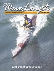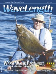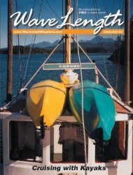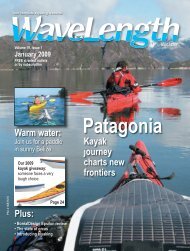
a kayak - Wavelength Paddling Magazine
a kayak - Wavelength Paddling Magazine
a kayak - Wavelength Paddling Magazine

Create successful ePaper yourself
Turn your PDF publications into a flip-book with our unique Google optimized e-Paper software.
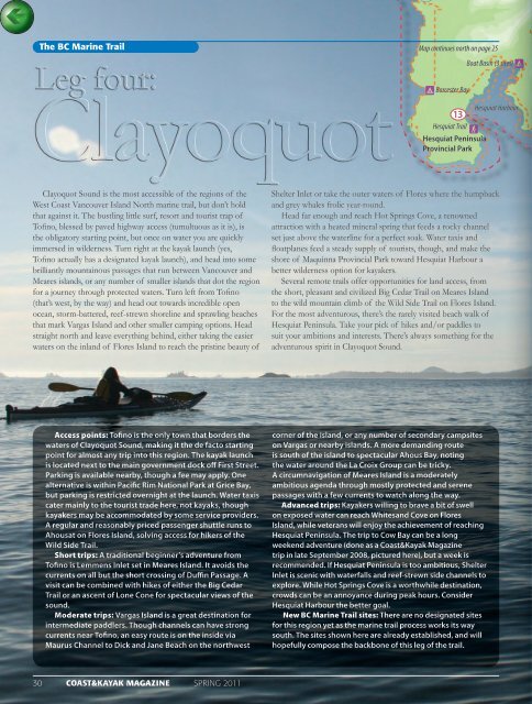
The BC Marine Trail<br />
Map continues north on page 25<br />
Boat Basin (3 sites) 9<br />
9 Barcester Bay<br />
Hesquiat Harbour<br />
13<br />
Hesquiat Trail<br />
F<br />
Hesquiat Peninsula<br />
Provincial Park<br />
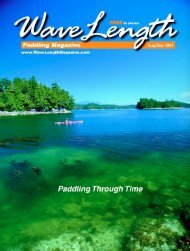
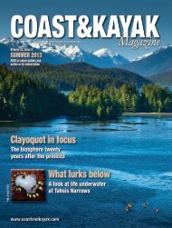
Clayoquot Sound is the most accessible of the regions of the<br />
West Coast Vancouver Island North marine trail, but don’t hold<br />
that against it. The bustling little surf, resort and tourist trap of<br />
Tofino, blessed by paved highway access (tumultuous as it is), is<br />
the obligatory starting point, but once on water you are quickly<br />
immersed in wilderness. Turn right at the <strong>kayak</strong> launch (yes,<br />
Tofino actually has a designated <strong>kayak</strong> launch), and head into some<br />
brilliantly mountainous passages that run between Vancouver and<br />
Meares islands, or any number of smaller islands that dot the region<br />
for a journey through protected waters. Turn left from Tofino<br />
(that’s west, by the way) and head out towards incredible open<br />
ocean, storm-battered, reef-strewn shoreline and sprawling beaches<br />
that mark Vargas Island and other smaller camping options. Head<br />
straight north and leave everything behind, either taking the easier<br />
waters on the inland of Flores Island to reach the pristine beauty of<br />
Shelter Inlet or take the outer waters of Flores where the humpback<br />
and grey whales frolic year-round.<br />
Head far enough and reach Hot Springs Cove, a renowned<br />
attraction with a heated mineral spring that feeds a rocky channel<br />
set just above the waterline for a perfect soak. Water taxis and<br />
floatplanes feed a steady supply of tourists, though, and make the<br />
shore of Maquinna Provincial Park toward Hesquiat Harbour a<br />
better wilderness option for <strong>kayak</strong>ers.<br />
Several remote trails offer opportunities for land access, from<br />
the short, pleasant and civilized Big Cedar Trail on Meares Island<br />
to the wild mountain climb of the Wild Side Trail on Flores Island.<br />
For the most adventurous, there’s the rarely visited beach walk of<br />
Hesquiat Peninsula. Take your pick of hikes and/or paddles to<br />
suit your ambitions and interests. There’s always something for the<br />
adventurous spirit in Clayoquot Sound.<br />
Access points: Tofino is the only town that borders the<br />
waters of Clayoquot Sound, making it the de facto starting<br />
point for almost any trip into this region. The <strong>kayak</strong> launch<br />
is located next to the main government dock off First Street.<br />
Parking is available nearby, though a fee may apply. One<br />
alternative is within Pacific Rim National Park at Grice Bay,<br />
but parking is restricted overnight at the launch. Water taxis<br />
cater mainly to the tourist trade here, not <strong>kayak</strong>s, though<br />
<strong>kayak</strong>ers may be accommodated by some service providers.<br />
A regular and reasonably priced passenger shuttle runs to<br />
Ahousat on Flores Island, solving access for hikers of the<br />
Wild Side Trail.<br />
Short trips: A traditional beginner’s adventure from<br />
Tofino is Lemmens Inlet set in Meares Island. It avoids the<br />
currents on all but the short crossing of Duffin Passage. A<br />
visit can be combined with hikes of either the Big Cedar<br />
Trail or an ascent of Lone Cone for spectacular views of the<br />
sound.<br />
Moderate trips: Vargas Island is a great destination for<br />
intermediate paddlers. Though channels can have strong<br />
currents near Tofino, an easy route is on the inside via<br />
Maurus Channel to Dick and Jane Beach on the northwest<br />
corner of the island, or any number of secondary campsites<br />
on Vargas or nearby islands. A more demanding route<br />
is south of the island to spectacular Ahous Bay, noting<br />
the water around the La Croix Group can be tricky.<br />
A circumnavigation of Meares Island is a moderately<br />
ambitious agenda through mostly protected and serene<br />
passages with a few currents to watch along the way.<br />
Advanced trips: Kayakers willing to brave a bit of swell<br />
on exposed water can reach Whitesand Cove on Flores<br />
Island, while veterans will enjoy the achievement of reaching<br />
Hesquiat Peninsula. The trip to Cow Bay can be a long<br />
weekend adventure (done as a Coast&Kayak <strong>Magazine</strong><br />
trip in late September 2008, pictured here), but a week is<br />
recommended. If Hesquiat Peninsula is too ambitious, Shelter<br />
Inlet is scenic with waterfalls and reef-strewn side channels to<br />
explore. While Hot Springs Cove is a worthwhile destination,<br />
crowds can be an annoyance during peak hours. Consider<br />
Hesquiat Harbour the better goal.<br />
New BC Marine Trail sites: There are no designated sites<br />
for this region yet as the marine trail process works its way<br />
south. The sites shown here are already established, and will<br />
hopefully compose the backbone of this leg of the trail.<br />
30 COAST&KAYAK MAGAZINE SPRING 2011