Nkamouna Project Environmental & Social Assessment Executive ...
Nkamouna Project Environmental & Social Assessment Executive ...
Nkamouna Project Environmental & Social Assessment Executive ...

You also want an ePaper? Increase the reach of your titles
YUMPU automatically turns print PDFs into web optimized ePapers that Google loves.
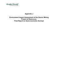
Geovic Cameroon PLC<strong>Nkamouna</strong> <strong>Project</strong><strong>Environmental</strong> and <strong>Social</strong> <strong>Assessment</strong><strong>Executive</strong> SummaryPrepared for:Geovic Cameroon PLCRue 1,793BP 11555 Yaoundé, CameroonTelephone: + 237 22 21 4518Facsimile: +237 22 21 1802www.geovic.comPrepared by:Knight Piésold and Co.1580 Lincoln Street, Suite 1000Denver, Colorado 80203-1512 USATelephone: (303) 629-8788Facsimile: (303) 629-8789E-mail: denver@knightpiesold.comRainbow Environment ConsultB.P. 30137Yaoundé –Tsinga, CameroonTelephone :+ 237 22 21 51 58 / 99 25 93 83KP <strong>Project</strong> No. DV302.00009.13April 30, 2011
Geovic Cameroon PLC<strong>Nkamouna</strong> <strong>Project</strong><strong>Environmental</strong> and <strong>Social</strong> <strong>Assessment</strong><strong>Executive</strong> SummaryApril 30, 2011prepared for:Geovic Cameroon PLCRue 1,793BP 11555 Yaoundé, CameroonTelephone: +237 22 21 4518Facsimile: +237 22 21 1802prepared by:Knight Piésold and Co.1580 Lincoln Street, Suite 1000Denver, Colorado 80203-1512 USATelephone: (303) 629-8788Facsimile: (303) 629-8789E-mail: denver@knightpiesold.comKP <strong>Project</strong> No. DV302.00009.13KP Doc. No. DV-11-0272Rev. No. Date Description Knight Piésold Client0 April 30, 2011 Issued in Final Jaye Pickarts Roger Kouokam
Geovic Cameroon PLC<strong>Nkamouna</strong> <strong>Project</strong><strong>Environmental</strong> and <strong>Social</strong> <strong>Assessment</strong><strong>Executive</strong> SummaryTable of ContentsPageGeovic Corporate CommitmentGeovic Community Development PolicyCC-1CC-2Corporate Commitment ................................................................................................ 1<strong>Environmental</strong>, <strong>Social</strong>, Health and Safety Policy ....................................................... 2Community Development Policy.................................................................................. 2Section 1.0 - Introduction .......................................................................................... 1-11.1 Limitations and Disclaimer ............................................................................................................ 1-31.2 Contributors and Contacts ............................................................................................................ 1-3Section 2.0 - <strong>Environmental</strong> and <strong>Social</strong> Impact <strong>Assessment</strong> ................................. 2-12.1 Background ................................................................................................................................... 2-12.2 Regulatory Framework .................................................................................................................. 2-12.3 <strong>Project</strong> Description ........................................................................................................................ 2-32.3.1 Management ..................................................................................................................... 2-32.3.2 Mine Plan .......................................................................................................................... 2-42.3.3 Open Pit (Panel) Development ......................................................................................... 2-42.3.4 Tailings and Glauber Salt Storage Facilities ..................................................................... 2-42.3.5 Tailings Management ....................................................................................................... 2-52.3.6 Mineral Processing ........................................................................................................... 2-52.3.7 Other Facilities .................................................................................................................. 2-62.3.8 Closure Phase .................................................................................................................. 2-62.4 <strong>Environmental</strong> Baseline Conditions .............................................................................................. 2-72.5 <strong>Social</strong> Baselines ............................................................................................................................ 2-92.6 <strong>Project</strong> Impacts and Mitigation .................................................................................................... 2-102.7 Cumulative Impacts ..................................................................................................................... 2-112.8 Alternatives ................................................................................................................................. 2-12Section 3.0 - <strong>Environmental</strong> and <strong>Social</strong> Action Plan ............................................... 3-13.1 Management ................................................................................................................................. 3-13.2 Mitigation ....................................................................................................................................... 3-23.2.1 Reclamation ...................................................................................................................... 3-23.2.2 Biodiversity Conservation ................................................................................................. 3-33.2.3 Water Supply Assurance .................................................................................................. 3-3<strong>Executive</strong> Summary, Rev 0i
3.2.4 Sustainable Community Developments............................................................................3-43.3 Monitoring .....................................................................................................................................3-43.4 Transparency ................................................................................................................................3-53.5 Cost and Implementation ..............................................................................................................3-5Section 4.0 - ESAP Component Plans ......................................................................4-14.1 Waste Management Plan..............................................................................................................4-14.2 Emergency Response and Contingency Plan ..............................................................................4-14.3 Occupational Health and Safety Plan ...........................................................................................4-14.4 Water Monitoring Plan...................................................................................................................4-24.5 Mine Reclamation and Closure Plan.............................................................................................4-24.6 Erosion and Sediment Control Plan..............................................................................................4-24.7 Biodiversity Management Plan .....................................................................................................4-24.8 Community Development Plan .....................................................................................................4-34.9 The Baka Indigenous People Plan................................................................................................4-34.10 Stakeholder Engagement Plan .....................................................................................................4-3Section 5.0 - Conclusions..........................................................................................5-1Section 6.0 - Acronyms and Abbreviations .............................................................6-1Table 2.1Table 2.2Table 3.1Table 3.2TablesShort-term Impacts, Mitigation Measures and Residual Impacts of Mining OperationsAlternative Analysis SummaryList and Schedule of the Operational Engineering, <strong>Environmental</strong> and <strong>Social</strong> MonitoringProgramCost and Implementation ScheduleFigure 1.1Figure 1.2Figure 3.1Figure 3.2Figure 3.3FiguresGeneral Location MapGeneral Facilities Layout PlanGeovic Cameroon PLC Organizational ChartMining Operations Organizational StructureProcess Plant Operating Organizational StructureG:\302\00009.13\Deliverables\Reports Specs\ExecSummary\Text\ESText.doc<strong>Executive</strong> Summary, Rev 0ii
<strong>Environmental</strong>, <strong>Social</strong>, Health and Safety PolicyThe <strong>Environmental</strong>, <strong>Social</strong>, Health and Safety Policy commits to long-term protection of environmentalquality, human health, and safety by providing sufficient financial support for environmental and socialprograms, educating and training employees on these programs, and multi-directional communicationwith the surrounding communities and other interested stakeholders.Community Development PolicyGeoCam is committed to sustainable development and social responsibility. By this, GeoCam means thatits long-term welfare is directly related to the welfare of the people and communities in the areas where itoperates. In the end, these are the people who should be the main beneficiaries of GeoCam’s activities.GeoCam expects to leave behind the capacity for a better future for the host populations. Thiscommitment encompasses the following values:• Treating all parties with equity and respect.• Promoting transparent business relationships.• Building trust through partnerships with stakeholders.• Understanding and respecting the rights of indigenous peoples to retain their culture, identity, customs,and traditions.• Developing self reliability through compassionate education and training.• Demonstrating creativity, integrity, and excellence in all endeavors.<strong>Executive</strong> Summary, Rev 0CC-2
Geovic Cameroon PLC<strong>Nkamouna</strong> <strong>Project</strong><strong>Environmental</strong> and <strong>Social</strong> <strong>Assessment</strong><strong>Executive</strong> SummarySection 1.0 - IntroductionThe <strong>Nkamouna</strong> <strong>Project</strong> (the <strong>Project</strong>) is a proposed cobalt-nickel-manganese mine with ahydrometallurgical plant and related infrastructure located in the Haut-Nyong Division of the EastProvince of Cameroon (Figure 1.1). The <strong>Project</strong> is located about 400 road kilometers (km) from thecapital city of Yaoundé, and 640 km from the port city of Douala. Lomié, the nearest sizeable town andthe administrative headquarters of the district, is located about 26 km south-southwest of the <strong>Project</strong>The <strong>Project</strong> sponsor is Geovic Cameroon PLC (GeoCam). GeoCam is a Cameroon corporation with itsshareholding represented 60.5 percent by Geovic Ltd. and 39.5 percent by the National InvestmentCorporation of Cameroon (SNI). Geovic Ltd. is incorporated under the laws of the Cayman Islands and iswholly owned by Geovic Mining Corp. Geovic Mining Corp. is a Delaware USA corporation with itsheadquarters in Denver, Colorado and is publicly traded in Canada on the Toronto Stock Exchange (TSX:GMC) and in the United States on the Over the Counter Bulletin Board (OTCBB: GVCM). SNI is a Stateownedcorporation established to mobilize and channel national savings and other financial resourcestoward the financing of economic and social investment operations in the industrial, agricultural,commercial, and financial sectors. SNI holds 20 percent of the GeoCam shareholding and representsfour individual Cameroonian shareholders who hold the remaining 19.5 percent. The ShareholderAgreement between Geovic Ltd. and SNI was concluded on April 9, 2007.The primary objective of the <strong>Project</strong> is to design, construct, and operate the cobalt, nickel and manganeseproduction facilities with due consideration for the economic, social, and environmental risks of the<strong>Project</strong> and with a strong commitment to the sustainable development of the communities affected by the<strong>Project</strong>. All activities will be confined within the Mine Permit boundary, where GeoCam has the sole rightto develop up to 1,250 hectares (ha) of land within the 1,645 ha permit boundary. GeoCam expects toconfine its activities and conduct concurrent reclamation so as to limit the area affected by the <strong>Project</strong>within the permit boundary to not more than approximately 720 ha at any given time.Two products will be produced for commercial sale: cobalt-nickel sulfide precipitate (MSP) andmanganese carbonate products. GeoCam envisages production rates during the mining years(years 1 to 11) ramping up to about 15,000 metric tonnes per year (tpy) of MSP and 65,000 tpy ofmanganese carbonate. Cobalt and nickel derived from the MSP will be about 6,100 tpy and 3,200 tpy,respectively. These production rates will gradually drop off during the processing-only phase from years12 to 24 after the mining phase is completed if additional resources are not identified during that time tosupplement the existing resource base. Over the life of the project as it is currently defined, some105,000 metric t of cobalt, 75,000 t of nickel, and 535,000 t of manganese will be produced over the 24-year project life (Figure 1.2).An ESA is required by Cameroonian law, and is also a requirement for funding from international lendinginstitutions. An ESA for the <strong>Project</strong> was originally completed in 2007 and approved by the Ministry ofEnvironment (MINEF). Since approval of the ESA, GeoCam has been diligently moving the <strong>Project</strong>forward toward construction. However, a number of <strong>Project</strong> elements have been modified and optimizedsince the time the ESA was approved in 2007. Consequently, a document was prepared to incorporatethese changes entitled the Geovic Cameroon PLC, <strong>Nkamouna</strong> <strong>Project</strong>, <strong>Environmental</strong> and <strong>Social</strong><strong>Assessment</strong> 2010 Update dated March 31, 2010.<strong>Executive</strong> Summary, Rev 01-1
GeoCam received a letter from the Ministry of Environment and Protection of Nature (MINEP) datedSeptember 3, 2010 stating that the ESA 2010 Update report provides an appropriate demonstration thatthe <strong>Project</strong> continues to move forward and therefore remains in conformity with the regulatoryrequirements. However, the MINEP requested that GeoCam consolidate the 2007 ESA, the ESA 2010Update, and any other <strong>Project</strong> modifications into a single document.As part of a bankable feasibility study and as requested by the MINEP, GeoCam commissioned this<strong>Environmental</strong> and <strong>Social</strong> <strong>Assessment</strong> (ESA) to consolidate and update the <strong>Project</strong> modifications. ThisESA documents the specific health, safety, social, and environmental programs that GeoCam willimplement with commencement of construction and mining activities at the same time providing theassurances that sufficient provision for those programs has been allocated in the <strong>Project</strong> financialanalyses. <strong>Environmental</strong> baseline information establishes the basis against which <strong>Project</strong> impacts can becompared. The baseline data used in the development of the ESA is based on site-specific fieldreconnaissance carried out in March 2011 and June 2010 by Knight Piésold and Co. (Knight Piésold),and between May and August 2004 by Rainbow Environment Consult. These investigationscomplemented the information presented in the Preliminary <strong>Environmental</strong> <strong>Assessment</strong> prepared byURS-Woodward Clyde in 2001, and data collected by GeoCam at its exploration camps. The ESAfeedback meetings in April 2006 have been incorporated into the study. In addition, the review of datafrom studies recently carried out in the area, including consultation for the development of the BMP or theIndigenous Peoples Plan (IPP), the review of internal GeoCam reports, and consultation with local NGOswere incorporated into this update to the ESA. The <strong>Project</strong> ESA comprises three main documents:• <strong>Executive</strong> Summary – The <strong>Executive</strong> Summary presents a concise overview of the significant findings,recommendations, and actions contained in each of the volumes of the ESA.• Volume 1 – <strong>Environmental</strong> and <strong>Social</strong> Impact <strong>Assessment</strong> (ESIA) – The ESIA identifies the regulatoryframework under which the <strong>Project</strong> will operate and describes GeoCam’s development and operatingplans. It also documents the current site conditions, identifies engineering and environmental systemsthat will be used to control environmental and social impacts, and identifies the <strong>Project</strong> effects andresidual impacts on environmental resources and on the social milieu. It addresses the cumulativeimpacts of <strong>Project</strong> development and also evaluates plausible alternatives.• Volume 2 – <strong>Environmental</strong> and <strong>Social</strong> Action Plan (ESAP) – The ESAP comprises the framework for the<strong>Project</strong> social and environmental management systems. It contains goals, requirements,implementation procedures, and schedules for the environmental and social programs at the mine. Italso includes component environmental and social management system plans for those environmentaland social programs. The component plans of the ESAP are the following:− Waste Management Plan− Emergency Response and Contingency Plan (ERCP)− Mine Reclamation and Closure Plan (MRCP)− Erosion and Sediment Control Plan (ESCP)− Water Monitoring Plan− Occupational Health and Safety Plan (OHSP)− BMP− Stakeholder Engagement Plan (SEP)− Community Development Plan (CDP)− Baka IPPThese documents present what GeoCam believes is the necessary level of environmental and socialresponsibility for this project. The Volume 2 reports are living documents that will be updated from time totime to reflect the current situation and knowledge base for the <strong>Project</strong>. Effective implementation of these<strong>Executive</strong> Summary, Rev 01-2
Section 2.0 - <strong>Environmental</strong> and <strong>Social</strong> Impact <strong>Assessment</strong>The ESIA contains the regulatory framework under which the ESA was carried out and a description ofthe project in its geographic, ecological, social, and temporal context. It includes baseline data describingthe relevant physical, biological, and historical conditions and the environmental effects associated withproject implementation. Mitigation measures needed to control those effects to acceptable levels arepresented as well as an assessment of the reasonably foreseeable cumulative impacts of the project. Italso analyzes plausible alternatives, including the “no project” alternative2.1 BackgroundThe cobalt-nickel occurrences in the Lomié area were discovered in a United Nations DevelopmentProgram (UNDP) funded program between 1981 and 1988. This program concentrated on <strong>Nkamouna</strong>which was the most accessible of the mineral occurrences in the area due to access by logging roads.Geovic first considered exploration for metals in the East Province in 1986. In 1989, the Ministry ofMines, Energy, and Water expressed their interest in having Geovic explore for nickel; however, Geovicmanagement did not pursue investigation any further due to low nickel prices and because there was nomention of cobalt by the Ministry. In 1993/1994 Geovic sampled the nickel occurrence and obtained highcobalt values in the assays (0.25 percent cobalt) which prompted the incorporation of Geovic, Ltd. in late1994 in Oregon, USA (Buckovic, 2003).In early 1995, GeoCam was incorporated. In mid-1995 GeoCam began evaluating a 19,600 km 2prospecting permit by digging shallow hand-excavated pits on hand cleared profiles. Approximately1,200 pits, with average depths of 5 meters (m), were excavated in this phase of work.In January 1999, GeoCam was awarded a 4,876 square kilometer (km 2 ) exploration permit. Results ofcontinued exploration including air-core sampling, bulk sampling and environmental baseline studiesencouraged GeoCam to apply in 2001 for a Mining Convention and Permit that would give the companyexclusive rights to develop the cobalt and nickel deposits over a 25-year primary term. On August 1,2002, the Republic of Cameroon and GeoCam signed the Mining Convention assigning the mining rights,and on April 11, 2003, the President of Cameroon issued the Mine Permit allowing the company to moveforward with its <strong>Project</strong> development initiatives.The Mine Permit area is a 1,645-km 2 , 18-sided polygon that includes seven main areas of mineralization:<strong>Nkamouna</strong>, Mada, Rapodjombo, North Mang, South Mang, Messea, and Kondong as shown on Figure1.1. Land within the Mine Permit area is designated as “multiple use” evergreen forest that has beenreserved exclusively for mineral exploitation. The Mining Permit gives GeoCam exclusive authorization todevelop up to 1,250-km 2 of mineralized area within the defined polygon. GeoCam’s immediate plan is todevelop the <strong>Nkamouna</strong> and Mada deposits using open pit mining, physical beneficiation, and agitatedleaching to recover the cobalt and nickel values. The other deposits will be considered for developmentas part of GeoCam’s longer-range plans.The <strong>Project</strong> is expected to contribute approximately US$ 726,000,000 in tax revenues over the life of theproject. The <strong>Project</strong> will directly employ over 700 people with annual salaries amounting to approximatelyUS$17,000,000.2.2 Regulatory FrameworkThe policy, administrative, and legal framework applicable to prospecting, exploring, and miningoperations includes site-specific, national, and international regulations and guidelines as well asinternational conventions to which Cameroon is signatory. GeoCam has voluntarily agreed to applyinternational standards and the Mining Convention stipulates that World Bank Group standards and<strong>Executive</strong> Summary, Rev 02-1
guidelines be applied to its operations at <strong>Nkamouna</strong>, although GeoCam does not currently intend to seekfinancing from the International Finance Corporation (IFC). However, as capital development costs willexceed US$50 million, lending institutions will apply the Equator Principles when considering financing forthe project. The environmental and social policies and guidelines of the IFC have therefore been factoredinto the development of the ESA.The specific regulatory framework for this project includes:• Cameroon Laws and Regulations:− Law No. 85/009 Relating to Expropriation of Land− Law No. 96/12 Relating to <strong>Environmental</strong> Management− The Mining Code of 16 April 2001− Law No. 94/01 Relating to Forestry and Wildlife Regulation− Law No. 89/027 Relating to Toxic and Hazardous Materials− Law No. 98/005 Relating to Water− Law No. 98/015 Relating to Hazardous Facilities− Law No. 92/007 Relating to Labor Code• Site-Specific Agreements:− The Mining Convention of 1 August 2002− Terms of Reference for the ESA agreed by the State− The Mining Permit of 11 April 2003• International Conventions:− Treaty of the Central African Forest Commission on the Management of Forest Ecosystems(COMIFAC, 2005)− Agreement for the Dja/Odzala-Minkébé Tri-National Conservation (Cameroon, Gabon, Congo),(2004)− Yaoundé Declaration for forest conservation and sustainable forest management (1999)− United Nations Convention to Combat Desertification (Paris, 1994)− Convention on Biological Diversity (Rio de Janeiro, 1992)− Framework Convention on Climate Change (New York, 1992) and the Kyoto Protocol (1997)− Bamako Convention on the Ban of the Import into Africa and the Control of Trans-boundaryMovements and Management of Hazardous Wastes within Africa (1991)− Convention for the Protection of the Ozone Layer (Vienna, 1985) including the Montreal Protocol onSubstances that deplete the Ozone Layer (1987) and its London (1990) and Copenhagen (1992)amendments− Basel Convention on the Control of Trans-boundary Movements of Hazardous Wastes and theirDisposal (1989)− International Tropical Timber Agreement (1983)− Accord for cooperation and consultation among central African states relating to wildlifeconservation (Libreville, 1983)− Bonn Convention on the Conservation of Migratory Species (Bonn Convention, 1979)− Convention on International Trade of Endangered Fauna and Flora Species (Washington, 1973)− UNESCO Convention concerning the Protection of World Cultural and Natural Heritage (1972)<strong>Executive</strong> Summary, Rev 02-2
− African Convention on the Conservation of Nature and Natural Resources (Algiers 1968)• Lending Institution Policies and Guidelines:−Equator Principles− Stakeholder engagement: A Good Practice Handbook for Companies Doing Business in EmergingMarkets (2007)− Investing in People: Sustaining Communities through Improved Business Practice (2000);− World Bank <strong>Environmental</strong>, Health and Safety General Guidelines (2007)− World Bank <strong>Environmental</strong>, Health and Safety Guidelines: Mining (2007)− IFC Performance Standards on <strong>Social</strong> and <strong>Environmental</strong> Sustainability and Guidance Notes(2006)− Operational Policies (OPs), Operational Policy Notes (OPNs), and Operational Directives (ODs)including Operational Policy OP 4.01 – <strong>Environmental</strong> <strong>Assessment</strong>; OP 4.04 – Natural Habitats; OD4.10 – Indigenous Peoples; OP 4.37 – Safety of Dams; and OPN 11.03 – Cultural Property.Numeric compliance targets are identified in some of the Cameroon laws and regulations and lendinginstitution policies and guidelines, and some are simply set by generally accepted international miningpractices. It is noted that some of these limits are legally enforceable while others are established asguidelines that allow due consideration for site-specific conditions. The numeric limits establish the basisagainst which GeoCam’s environmental performance will be measured. <strong>Project</strong> monitoring programs andthe processes for environmental and social performance evaluation have been developed with referencesto specific action levels and compliance targets.2.3 <strong>Project</strong> DescriptionMining will involve surface extraction methods using a fleet of conventional earth-moving equipment.Mining will proceed with the excavation of contiguous panels approximately 15 m deep. The panels willbe backfilled with mine overburden allowing for concurrent reclamation of these areas followingcompletion of each mine panel.Ore processing initially involves beneficiation, or physical upgrading (PUG). In the PUG, ore is becrushed, scrubbed, and sized to separate the low-grade fines tailings waste from a high-grade, coarseconcentrate. The coarse material is washed of fine particulates and dewatered before advancing to theleaching circuit.The PUG and leach plant tailings will be disposed of in dedicated, conventional tailings storage facilitiesin the headwaters of Napene Creek (the PUG and counter-current decantation [CCD] Tailings StorageFacilities [TSFs]), located immediately north of the plant site. Glauber Salt crystals produced as abyproduct of water treatment will be bagged and stacked on an engineered, lined pad north of the TSFs.GeoCam has received a Letter of Interest for the potential sale of Glauber Salt. An agreement for thesale and removal from site of Glauber Salt is planned to be established by year 4 of operations.The following discussion presents an overview of the mining through tailings storage and reclamationprocesses at <strong>Nkamouna</strong>.2.3.1 ManagementThe <strong>Project</strong> sponsor is Geovic Cameroon PLC (GeoCam), and the Managing Director of GeoCam isultimately responsible for all activities associated with the <strong>Project</strong>. The Health, Safety, <strong>Social</strong>, and<strong>Environmental</strong> (HSSE) Manager is responsible for all environmental and social program monitoring,reporting and performance and reports to the Deputy General Manager of Operations and then to theGeneral Manager. The General Manager will collaborate with the HSSE Manager and staff at all levels to<strong>Executive</strong> Summary, Rev 02-3
meet the goals of pollution prevention, controlling emergency situations, waste minimization, and effectivecommunity communications.2.3.2 Mine PlanThe two ore types, breccia and ferralite, are targeted for PUG and will be mined at approximately 10,000to 20,000 t/d using small excavators and articulated dump trucks (ADTs). Both breccia and ferralite willbe transported from the pit face to run-of-mine (ROM) stockpiles located near the plant site in <strong>Nkamouna</strong>.Waste is removed through the use of bulldozers and side-casting of waste rehandle with long boomexcavators.Preproduction mining will take place in the Stage 1 TSF area to remove and stockpile nearly one milliontonnes of economic grade ore while using most of the overburden for building the tailings embankments.Average annual mining rates over the first 11 years are 6.55 Mt/y of ore stockpiled and 21 Mt/y of wasterelocated (not including waste rehandling) with a strip ratio of 3.22:1.Initial major equipment includes tracked hydraulic excavators (2.5 m 3 to 6.0 m 3 ), wheel loaders (6 m 3 ),dozers (D9 class) and 40-t articulated trucks to cope with tropical conditions in a lateritic environment.2.3.3 Open Pit (Panel) DevelopmentA modified open cast strip mining procedure has been designed to take advantage of relatively shallowore depth spread over a large area. The mine method is developed by creating cuts or panelsapproximately 5 to 30 m deep by 30 m wide and generally from 200 m to 1,000 m long within the orereserve outlines. The mine panels are oriented with their long axes along the site topography contourand developed in an upgradient direction.As dozer operation relocates waste, ore is exposed for detailed grade control analysis and liberationthrough excavators and ADT transport to designated stockpiles. The overburden relocated by bulldozersor through rehandling will be re-graded in preparation for reclamation.2.3.4 Tailings and Glauber Salt Storage FacilitiesThe PUG and CCD tailings storage facilities will be built within the Napene Creek drainage basin andimmediately to its north. The PUG TSF will comprise four embankment sections built during Stages 1 – 4.The West Dam, built to a height of approximately 85 m in Stage 4, will be built across Napene Creekwhere the creek currently exits the TSF site flowing westerly to the Edjé River. At the end of Stage 4, theembankments will form one embankment enclosing the upper Napene Creek basin. The CCD TSF willbe formed by embankments built during Stages 1 – 4 to form two, four-sided cells to the north of the PUGTSF. These two cells and the PUG TSF share embankments between them. CCD Cell 1 and 2embankments will range from approximately 15 to 36 m high, with final crest elevations of 735 and 748 m,respectively. The CCD cells will have geocomposite liners along the inside embankment slopes andbasin floors. The basin floors will also be covered with an underdrainage collection system and protectivelayer.The design of the PUG TSF embankments provides for zoned earthfill structures, and the design of theCCD embankments provides for homogeneous earthfill structures. Construction of the embankments isbased on the use of on-site materials.The Glauber Salt pad will temporarily store up to four years of Glauber Salt production (0.83 million metricdry tones), until the point that GeoCam begins its removal from the facility and project site. The GlauberSalt pad will be built to the north of the CCD TSF on relatively flat ground. It will be stage-built in fourseparate cells, each with the ability to store one year of Glauber Salt production. At build-out, it will coveran area of approximately 215,000 square meters (approximately 550 by 400 m). Each yearly cell willhave a geocomposite liner along its bottom that will be covered with a secondary protective fill layer<strong>Executive</strong> Summary, Rev 02-4
containing an underdrain system. Low perimeter berms will preclude run-on onto the Glauber Salt pad.Perimeter channels within each cell will collect precipitation and convey it to a stormwater collection pondoutside of the Glauber Salt pad.2.3.5 Tailings ManagementThe TSFs will contain the PUG and CCD tailings and associated water produced over the 24-yr mine life.The PUG TSF tailings deposition provides for deposition of the tailings from individual drop bars (openpipe discharges) strategically located around the PUG TSF perimeter. The TSF will be systematicallyfilled to form a tailings slope of approximately 0.25 percent from north to south in the facility. This willmaintain the decant pond in the southern portion of the facility. The tailings will be flocculated beforedeposition to improve sedimentation and decant development rates of the clayey tailings.The CCD TSF tailings deposition also provides for deposition from individual drop bars strategicallylocated around the CCD TSF cell perimeters. Tailings will be progressively deposited from the northernand eastern limits of the two cells to form tailings slope/beach slopes of approximately 0.5 percent to thesouthwest corners of the cells where the decant structures and underdrain collection sumps will belocated. The decant ponds in the facilities are expected to cover significant portions of each cell.The Glauber Salt will be placed into lined bulk bags at the process plant. The bags will be transported tothe GS Pad, where they will be placed, stacked, and periodically covered with plastic sheeting. It isanticipated that precipitation onto the GS Pad that contacts spilled Glauber Salt will not require watertreatment before release to the environment.2.3.6 Mineral ProcessingOre processing initially involves beneficiation, or PUG. In the PUG, ore is be crushed, scrubbed, andsized to separate the low-grade fine tailings waste from a high-grade, coarse concentrate. The coarsematerial is washed of fine particulates and dewatered before advancing to the leaching circuit. The PUGPlant has been designed to treat 8,500 tpd of ore, based on a 16-hour-per-day operating schedule.High-grade concentrate will be conveyed to the adjacent Leach Plant which will consist of a grinding mill,agitated leach tanks, thickeners, and a leach and recovery circuit. The material will go through severalstages of clarification, purification, and the CCD circuit that will dissolve specific metals into pregnant andbarren solutions. The acidic impregnated solution is separated and neutralized, causing the metals toprecipitate. The barren slurry is sent though three purification circuits to remove residual cobalt, nickel,and aluminum before the manganese carbonate precipitation circuit. Manganese carbonate will beprecipitated by the addition of soda ash.A Glauber Salt recovery circuit will be installed to treat solution from the sodium sulfate rich water pond toremove sodium sulfate as Glauber Salt (sodium sulfate decahydrate). The generated solids will bestored, bagged and transported to the Glauber Salt Pad north of the TSFs where the bags will be stackedand stored in a lined facility. GeoCam has contacted potential vendors to put in place a purchaseagreement to sell and ship off site the Glauber Salt product. The mother liquor will be used for soda ashmake-up, and excess solution will be pumped to a discharge buffer pond prior to controlled discharge tothe Edjé River.Most of the mineral process steps do not generate a waste by any definition. Instead, the processequipment is designed for a specific function in a series of physical and chemical steps to recover valuesfrom the <strong>Nkamouna</strong> ore and reject gangue minerals and other impurities at the appropriate stage in theprocess. Additionally, in the above mentioned processes and areas, scrubbers will be installed to captureemissions from vent gases in the leach and sulfide areas.Tailings management and storage was previously described in Sections 2.3.4 and 2.3.5.<strong>Executive</strong> Summary, Rev 02-5
2.3.7 Other FacilitiesOther facilities required for the <strong>Project</strong> include roads, power lines, water supply, sewage disposalsystems, communications, a construction camp, and permanent housing. Public roads will be used toprovide access to and supply the <strong>Project</strong>. The water and power systems will be provided and maintainedexpressly by and for GeoCam operations. Communications services at the <strong>Project</strong> site will comprise a fullrange of telecommunication systems including satellite telephones, on site radio communication, andtelevision. The existing Kongo exploration camp will be upgraded and expanded for use during theconstruction period to accommodate the mining department until the construction camp and permanentvillage accommodation is available.2.3.8 Closure PhaseThe objective of the mine reclamation and closure program is to return mined lands to forest/wildlifehabitat following the cessation of mining. Facilities that are not needed to support post-closure will bereclaimed. Mine reclamation and closure details are provided in the MRCP (Volume 2). The mine panels,roads, waste facilities, stockpiles quarries, tailings facilities (PUG TSF and CCD TSF), Glauber Saltstorage pad, process, and storm water retention ponds, and structures are all considered in the <strong>Project</strong>closure plan.As mining advances, concurrent reclamation of the mine panels will involve stabilizing the panel surfaceand establishing a vegetative cover. Backfilling will be carried out so that the resulting surface slopesfrom the upgradient to downgradient sides of the mined panels to blend in with the existing topography. Alayer of topsoil will be spread if necessary, followed with the establishment of vegetation on the gentlysloping surface.At closure, roads will be ripped to loosen the compacted soil. Once ripped, roads will be regraded toblend with the local topography, limit erosion, and promote natural drainage.The closure of the waste facilities will include a soil cover that is approximately 500 mm thick that will beshaped to promote drainage of surface runoff. Soil covers will be revegetated using hydro-seeding,fertilizers and amendments.As mining is completed, each stockpile will be reclaimed when it is no longer needed for ore storage. Theground will be ripped and scarified, graded and contoured and a thin layer of topsoil will be spread ifnecessary. Vegetation will be established by hydro-seeding and the planting of trees and shrubs.All equipment will be removed or salvaged from the serpentinite quarries. Access into the quarries will beblocked by installation of a rock and an earthwork berm or a fence around the perimeter of each quarry toa height of 3 m. The diversion of surface water upstream of the quarries will be maintained post-closureto decrease the inflows to the quarries.Reclamation of the PUG TSF will be initiated during the last months of deposition. Prior to surfacereclamation, the PUG TSF will be drained of excess water and the material will be stabilized. Due to thematerial properties of the fine PUG tailings, a binding material and/or growth media may be required toincrease material stabilization and expedite plant growth. A permanent closure channel has beenconceptually designed for construction at the PUG TSF south dam to receive surface runoff from thestored tailings.The two CCD tailings facilities will be operated sequentially, each for approximately 10 years. When CCDTailings Facility 1 reaches capacity, tailings will be deposited to CCD Tailings Facility 2 and CCD TailingsFacility 1 will be decommissioned and reclaimed. The facility will be provided with an engineered cover toreduce long-term infiltration. Seepage from the facility that exceeds water quality discharge standards willrequire treatment prior to discharge until the seepage rate or quality reaches an acceptable level. The<strong>Executive</strong> Summary, Rev 02-6
CCD leach tailings must also be stabilized physically, possibly using a binding agent to enable surfacereclamation. Once the CCD leach tailings surface is physically stabilized, synthetic geogrid will be placedto further increase the bearing capacity of the tailings. The facility will then be revegetated by hydroseedingthat will include fertilizer, mulch and other amendments to establish successful vegetation.At closure, the GS Pad underdrainage system will be disposed of including cutting and removing pipingand removing filter aggregate and geotextile. The soil protective layer will be removed such that the GSpad liner can be cut, removed, and disposed of. Compacted surfaces will be ripped and scarified toloosen soil and reduce surface runoff and sediment transport. The surface disturbance will berevegetated by hydro-seeding with inclusion of fertilizer or mulch to establish successful vegetation.Pond liners will be cut and removed and ponds will be backfilled to prevent ponding of water. Disturbedareas will be graded and contoured to match the surrounding topography. Pond areas will then berevegetated by hydro-seeding with inclusion of fertilizer, mulch, and other amendments to establishsuccessful vegetation. Trees and shrubs from the greenhouse/nursery will also be planted to supplementrevegetation.Closure of the site will include the decommissioning, demolition, relocation, or disposal of the PUG andLeach Plants and ancillary facilities, including process and fresh water pipelines. Remaining facilitiesafter relocating plant and equipment will be demolished and removed at the end of mining and productionoperations. The plant area will be ripped, scarified, graded, and revegetated by hydro-seeding toestablish successful vegetation.Closure and post-closure monitoring and control programs for vegetation and air quality will be conductedfor a period of five years after closure has been completed. Closure and post-closure monitoring andcontrol programs for water quality will also be conducted for a period of 10 years. In the event thatdeficiencies in vegetation establishment, air quality, or water quality are identified, appropriate mitigationmeasures will be taken to correct these deficiencies.2.4 <strong>Environmental</strong> Baseline Conditions<strong>Environmental</strong> baseline studies were conducted to document the existing conditions within the <strong>Project</strong>area. The baseline data is based on field reconnaissance carried out in March 2011, June 2010, andbetween May and July 2004; environmental conditions cited in the Preliminary <strong>Environmental</strong><strong>Assessment</strong> carried out by URS in 2001; field sampling including water sampling conducted from 2004 to2010; and other references as cited. The baseline conditions were characterized in order to establish abasis against which project impacts could be compared. The baseline studies include climate, air quality,noise, topography, geology, soils, surface water and groundwater, biology, and cultural resources.The <strong>Nkamouna</strong> area lies on the limit of the tropical wet and tropical wet and dry climatic zones. Typically,the <strong>Nkamouna</strong> area has two dry seasons and two wet seasons. The heaviest precipitation occurs duringthe major and minor wet seasons with a combined 68 percent of the total yearly rainfall. Rainfall is lowestduring the months of January and December in the middle of the long, dry season. Highest temperatureswere recorded during the months January, February, and April and lowest temperatures during the longdry season of January. Average humidity is the highest immediately preceding and during the major wetseason and the average wind speed is 4.2 m/sec, and the predominant wind direction is from the south.Few air emission sources exist locally other than “slash-and-burn” gardening methods used by localvillagers. Other sources of emissions are dust from mechanical logging equipment, trucks, and theburning of wood off-products. Additionally, principal aerosols (CO 2 , SO 2 , and CO) are associated with theburning of diesel fuel from motorized vehicles and logging equipment within the province.As the project area is currently undeveloped, sound levels are low and attributable to logging trucks andGeoCam’s exploration activities. Noise levels in the area are low due to the thick vegetation screens andlocal topographic relief.<strong>Executive</strong> Summary, Rev 02-7
The topography in the <strong>Nkamouna</strong> area comprises an ancient, undulating peneplain incised by the localstreams and rivers. Elevations vary between approximately 600 and 770 mamsl and low ground isgenerally subject to flooding, and flat ground at low elevations will often contain swampy ground.Early Proterozoic meta-sedimentary schists, located within a tectonic setting intermediate between theArchean Congo Craton to the south and the Central African Mobile Belt, underlie the <strong>Project</strong> area.Locally, a series of ultrabasic intrusive complexes were emplaced and then altered to serpentinite bodies.The serpentinites contain relatively low, but significant quantities of cobalt and nickel and are the sourcerocks for the high-grade cobalt laterite deposits. The cobalt-nickel-manganese deposits are hosted inancestral soil horizons that overlie the metal-bearing serpentinites. The laterite profile in the project areavaries significantly depending on parent rock composition, geomorphology, groundwater conditions, andother variables influencing the lateritization process.The region around <strong>Nkamouna</strong> is dominated by rolling upland plateau and slope areas underlain by thicklaterite soils, and highly incised lowland areas dominated by headward eroding creeks, streams and theBoumba, Edjé, Bom, Bak, and Dja Rivers. The soil formations are dominated by infertile lateritic soils,which are very mature when compared to most soils that typify recently incised drainage systems. As aresult of extensive lateritization of the Precambrian rocks, cobalt and nickel-bearing latosol (lateritic soils)has formed over the serpentinites. Where local stream erosion has stripped the laterites, clay-rich soilspredominate. The most suitable soils for plant growth are found on the local flood plains and in morerecently eroded valley areas away from the nickel laterite terrains.Baseline characterization of water at the <strong>Nkamouna</strong> project includes delineating the occurrence anddetermining the quality of both groundwater and surface water near the mine site. The knowledgepresented in the ESIA is what is known to date and part of growing knowledge base at the <strong>Nkamouna</strong>site. The groundwater conceptual model for shallow groundwater flow developed by Geovic Cameroonpresented that the nickel-cobalt bearing laterite forms the uppermost aquifer. The underlying clayeysaprolites and upper serpentinites serve as perching aquitards that are underlain by typically lowpermeability serpentinite basement rock. Also, to a large extent the water table reflects the surfacetopography. The groundwater is a circum-neutral, magnesium bicarbonate water of generally goodquality. Surface water stream depths and flow were considered in the small tributaries of the Edjé Riverand Congo Drainage basin located in the <strong>Nkamouna</strong> area. Baseline evaluation of the surface waterquality indicated that background concentrations of aluminum and coliform commonly exceed WHOguidelines. Occasional exceedances of WHO guidelines were also observed for iron and nickel in surfacewater analyses. In all samples analyzed, fecal coliform concentrations were reported above WHOguidelines. The surface water in the project area is circum-neutral and low conductivity; however, pHoccasionally fell below 6.5 (the WHO operational guideline). Dissolved oxygen (DO) levels frequently didnot meet the recommended criterion for the protection of aquatic life.Field studies were completed to identify endangered, threatened, or protected species of flora and faunapresent in the <strong>Nkamouna</strong> area. A detailed flora survey was carried out in June 2004 and an inventorydescribing the structural data collection, floral diversity, family abundance, wild fruits and aromatic plants,and medicinal plants and cane was completed. The vegetation surveys show that the forest in the<strong>Nkamouna</strong> area has a high diversity, which is a characteristic of Cameroon's forests. The inventoriedplants, including those with medicinal uses are freely available in the areas surrounding the <strong>Nkamouna</strong>site and in East Cameroon. Of the 196 identified species in the <strong>Nkamouna</strong> area one (Autranellacongolensis) is listed by the IUCN as critically endangered, five (Diospyros crassiflora,Gossweilerodendron balsamiferum, Pericopsis elata, Swartzia fistuloides, and Tieghemella Africana) arelisted as endangered, fifteen are listed as vulnerable of which two (Diospyros spp. and Baillonellatoxisperma) are declared rare and protected species in Cameroon. Field studies for the mammalian faunawere conducted in early June 2004 and the aquatic fauna studies were carried out in mid-July 2004.Invertebrates, fish, amphibians and reptiles, birds, and mammals were inventoried for the fauna baselinestudy. Endangered fauna species that are present within the <strong>Nkamouna</strong> area are the gorilla, chimpanzee,and crowned guenon. The Dja Biosphere Reserve, located 26 km southwest of the project site, is a<strong>Executive</strong> Summary, Rev 02-8
major preserve (IUCN Class IV) for various wildlife species including gorillas and elephants. Hunting isreported to be widespread in the reserve and the <strong>Nkamouna</strong> area provides habitat for a variety of speciesthat are not identified for special protection statute under national laws or international treaties.No major archaeological/cultural heritage sites are identified in the <strong>Project</strong> area. Cultural resources asthey relate to the social structure of the populations in the area are discussed in Section 2.5.2.5 <strong>Social</strong> Baselines<strong>Social</strong> baseline studies document the existing social and economic conditions in the area between Lomiéand Mpane Kobera (about 30 km either side of the <strong>Project</strong> site with particular emphasis on the threeclosest villages – Kongo, Ngola and Ngola Baka). These baselines were also established to define abasis against which <strong>Project</strong> impacts could be measured. Information in the baseline was gatheredthrough field investigations performed by a team led by a qualified sociologist specialized in ruraleconomics and participatory diagnosis in Cameroon. The team included a political anthropologistspecialized in the pygmy populations of Cameroon. Field data were collected in 2004 by this team andupdated in 2011 by Rainbow Environment Consult and included background information ondemographics, social and political organization, natural resource management, livelihood systems andemployment opportunities, social services and infrastructure, public health, vulnerable and disadvantagedgroups, indigenous peoples, and cultural property.The <strong>Project</strong> area is included within the Lomié Subdivision. The population of the Lomié Subdivision isestimated at 19,000 inhabitants according to the 2005 general population census carried out inCameroon. The Bantu (80 percent) and the minority Baka (19 percent) are the main ethnic groups in theregion. The remaining 1 percent of the population encompasses small numbers of Bamiléké, Boulou,Kaka, Mpoubieng and Ngoumba.In the vicinity of the GeoCam Land Lease, in the <strong>Project</strong> area, and along the Pohempoum-Pan KoberaCorridor, there are 12 Baka villages and 13 Bantu villages, for a total of 25 villages. The number ofinhabitants in each of these villages range from 45 to 650 persons and the total population was isestimated at 4,266 inhabitants in 2004. In 2011, this number is estimated at 5,850 inhabitants whenapplying the growth rate of 2.7 percent in this region. A recent estimation made by INADES and GeoCamin 2011 has shown that there are approximately 2,500 inhabitants in the 12 Baka villages or 43 percent ofall inhabitants living along the Pan Kobera CorridorTwenty-four major African language groups are identified within Cameroon. French and English are theofficial national languages; however, the use of French is more widespread. Bantu is the main vernacularspoken in the <strong>Nkamouna</strong> area.The predominant religions are indigenous and Christian beliefs. Islam is a minor religion in the area.Cameroon has a hierarchical system of government combining both traditional and official authorities tomaintain law and order. Sub-Prefects, appointed by the Minister of Territorial Administration, administerthe subdivisions. The Sub-Prefect is the link between the central government and the people in thesubdivision and chiefdoms. Traditional authorities in the Pohempoum I-Mpane Kobera corridor includethird-degree chiefdoms under the authority of the second-degree chiefdoms of Pohempoum II andZoulabot I. Their role is to assist the Sub-Prefect and local authorities in running the district bymaintaining law and order, collecting taxes, and ensuring the implementation of administrative directives.At the village level, social and political organization is a function of the identity of the two main ethnicgroups in the area, the Bantu and the Baka. Bantu villages consist of several lineage segments made upof family groups each with a family head or elder. Family groups comprise several families each of whichforms a household, the basic social unit. Political power is age-based and is exercised by the elders ofeach lineage segment and the village chief, who are involved in both administration and conflictresolution.<strong>Executive</strong> Summary, Rev 02-9
<strong>Social</strong> organization among the Baka is based on the family, the lineage, the sub-clan, and the clan.Clans, represented by totem names and symbols, are governed by sets of rules and include taboos onconsumption of totem animals and marriage within a clan and by collective responsibility. Politicalorganization is age-based but is underlain by traditional beliefs in fetishes, local gods, and the affirmationof the power of women.Land in Cameroon falls in one of three categories: the State domain, the national domain, or privateproperty. However, customary land rights remain the de facto form of land tenure. In the Bantu villages,households can obtain agricultural land subject to ensuring that no one else has a prior claim to the landand with authorization by the village chief and/or council. Land over which there are no individual claimsis considered communal.Traditionally, the Baka do not own land directly, but each clan has right to a geographical area (huntingground). In the 1970s, the government introduced a policy of settling the Baka in villages. However, theyhave yet to be formally recognized by either the state or their Bantu neighbors.Slash and burn agriculture is the predominant land use in the area with both subsistence and cash cropsbeing grown. Owing to the lack of transport to markets, produce is generally sold in front of thehousehold. Hunting is the major protein supply for the local population. All species, including IUCN-listedspecies and species protected by Cameroon law, are hunted. Non-timber forest products (NTFPs) areharvested for their food, medicinal, and other use values. Fishing is also carried out in the local streamsusing hooks, basket traps, static traps, and rods.An integrated health center at Zoulabot I, which is in poor condition, provides public health care in the<strong>Nkamouna</strong> area. The local population dominantly relies on traditional remedies as the clinic at theBosquet mission and the hospital in Lomié are too distant. The Lomié hospital dates from the Germancolonial era and is in need of renovation. This hospital has been supported many times by GeoAid sinceits establishment in the area. Support has included the provision of an ambulance, drugs, and othersanitary equipment.The baseline inventory documented that the most common health problems are malaria, sexuallytransmitted diseases including HIV/AIDS, diarrhea, waterborne stomach intestinal parasites, hernia, andtuberculosis.Housing in the <strong>Project</strong> area mostly comprises traditional structures. None of the villages has access tothe national power grid, running water, or sewage disposal. While road transportation exists in the area,most local residents do not have access to motorized vehicles and therefore travel on foot.2.6 <strong>Project</strong> Impacts and MitigationMining projects inherently affect environmental and social resource values. The ESIA includes adiscussion of the potential environmental and social impacts associated with the development of the<strong>Project</strong> and presents the mitigation measures that are needed to prevent or minimize those impacts.<strong>Environmental</strong> and social impacts were analyzed by overlying the project development plan (constitution,operational and closure phases) onto the existing baseline conditions. After identification of the potentialimpacts associated with the proposed operations, mitigation measures were designed to prevent orminimize those impacts to acceptable levels. An impact ranking was developed for no mitigation, shorttermwith mitigation, and long-term (residual) with mitigation.<strong>Project</strong> impacts and associated mitigation measures are presented in Table 2.1. The ESIA identifiednumerous potential environmental and social impacts including floral and fauna, air quality, and waterquality. Each of the impacts and mitigation measures presented in Table 2.1 are discussed in the ESIAand are considered to be the most significant in terms of the future success of the <strong>Project</strong>.<strong>Executive</strong> Summary, Rev 02-10
As set forth in the ESIA, proposed mitigation measures would require specific actions to ensure theirimplementation and monitoring to document their performance. These actions are further developed inthe ESAP (Section 4) and discussed in Section 3.2.2.7 Cumulative ImpactsPerformance Standard 1, <strong>Social</strong> and <strong>Environmental</strong> <strong>Assessment</strong> and Management Systems, requiresthat the risks and cumulative impacts be analyzed in terms of the <strong>Project</strong>'s area of influence. Past,existing, and future projects that have taken place or will take place within the <strong>Project</strong> area are basic toestablishing the spatial and temporal limits for cumulative impact analysis. Developments included in theanalysis must be realistically defined and described in order to establish a sensible analysis.Past activities in the area have been confined to commercial logging in which valuable timber specieswith a minimum diameter of 80 cm at breast height were selectively harvested.The current <strong>Project</strong> plan will result in the disturbance of approximately 720 ha at any given time. Ten to12 km 2 will be impacted over the projected mine life of 24 years. Concurrent reclamation of mined outareas to forest/wildlife habitat means that at the end of mining at 11 years, the <strong>Project</strong> area will comprisenumerous areas of reestablished forest at different stages of development.Reasonably foreseeable future impacts are associated with the development of the Mada deposit locatedto the north of the <strong>Nkamouna</strong> deposit and the other deposits in the mine permit that may be producedover the next 100 to 200 years.Development of the Mada and other deposits is expected to be subject to the same regulatory authorityas the current mining project and will be strongly linked with the current project.Mine development at Mada would entail the same actions as are currently undertaken for the current<strong>Project</strong>. Ore would be mined by standard open pit mining techniques using conventional miningequipment. Ore will then be trucked to the PUG Plant before being processed in the Leach Plant.Development plans for the remaining deposits have not been drawn up but will likely involve the samemining, treatment, and reclamation processes as at <strong>Nkamouna</strong>. The probable order of development willbe Rapodjombo, Mang North, Mang South, Messea, and, finally, Kondong. New processing facilities willhave to be constructed for exploitation of these deposits mainly due to long transport distances to the<strong>Nkamouna</strong> Plants. Current estimates indicate that development of these deposits will impact a further 300km 2 over several decades.Perhaps the most significant cumulative impact of adding the other deposits to the current <strong>Project</strong> plan isthe extension of the mine life on the order of 100 years. This will result in prolonged employment for themine work force and will continue GeoCam’s contributions to sustainable economic and communitydevelopment initiatives in the local communities.To enssure that the cumulative impacts of the development of all the deposits in the mining permit areadequately analyzed and that suitable plans are developed and implemented to mitigate their impact toacceptable levels, GeoCam will prepare:• ESIAs for each of the remaining six deposits that are in full conformance with GeoCam’s <strong>Environmental</strong>,Health and Safety, and <strong>Social</strong> Policy and Cameroon legislation. The <strong>Assessment</strong> will include baselinedata describing the relevant physical, biological and historical conditions and the environmental effectsassociated with project implementation. Mitigation measures needed to control those effects toacceptable levels will be included, as well as a more detailed analysis of the cumulative impacts and anevaluation of feasible alternatives. It will also include an ESAP that presents the environmentalmanagement, mitigation, monitoring and institutional measures to be taken during project<strong>Executive</strong> Summary, Rev 02-11
implementation and operation and the specific actions that are required to reduce adverseenvironmental and social effects to acceptable levels.• Effective MRCPs that describe the general program for stabilizing and re-vegetating disturbed areasand which will reclaim project disturbances to forest/wildlife habitat. Specific procedures will beestablished in the Plan based on past successes and lessons learned from the reclamation experiencegained from the <strong>Project</strong> actions.• CDP for the villages in the vicinity of the new developments that fully comply with GeoCam’sCommunity Development Policy. The Plans will present the actions that will be undertaken to furthercommunity development opportunities in the area and will include ongoing and effective publicconsultation programs as a key component of these Plans. The Plans will identify specific programinitiatives and consider key stakeholders as members of a Public Liaison Committee to identify,prioritize, and implement those initiatives.• Indigenous Peoples Plans for the Baka villages in the vicinity of the new developments that fully complywith GeoCam’s Community Development Policy. The Plans will present the actions that will beundertaken to specifically engage the indigenous population to ensure that its communities are able tobenefit in sustainable long-term development in conjunction with the <strong>Project</strong>.• Plans to accommodate any influx of workers seeking employment at the new mines, if required.• Biodiversity Management Plans for the conservation of the rich biodiversity of the area. The Plans willpresent actions for the reforestation/reclamation of disturbed lands. They will also assist in the planning,design, implementation, and long-term management and monitoring of conservation areas in aparticipatory approach with government agencies, appropriate NGOs, and affected stakeholders(logging companies, local communities).2.8 AlternativesAlternatives analyses are conducted to evaluate the various siting, mining, and processing optionsrelative to their direct and indirect effects on environmental and social circumstances. Siting options inmining operations are constrained by the physical location of the deposit and do not allow development ofdifferent scenarios. The options considered for the alternatives analysis are all plausible and feasibleoptions, which could be acceptable for development of the <strong>Project</strong>.Each alternative was evaluated using identical criteria, weighting factors, and ranking in a quantitativematrix analysis. The evaluation criteria are as follows: overall protection of human health and theenvironment, compliance with regulatory criteria and established guidelines, climate impact, air qualityimpact, surface water impact, groundwater impact, flora impact, fauna impact, constructability, andcost/economics. The evaluation criteria were then weighted as follows: ‘1’ was considered as notsignificant, ‘2’ was considered as moderately important, ‘3’ was considered very important, and ‘4’ wasconsidered as “fatal flaw”. The overall alternative rankings were compiled by summing the products ofthe weighting factor and corresponding ranking for each criteria. The lowest overall score indicates themost favorable alternative.The alternatives analysis studies the two main options: the Current <strong>Project</strong> Plan and the No ActionAlternative. The No Action Alternative has been included to represent a baseline from which to measurethe other alternatives. The adoption of the No Action Alternative would leave the <strong>Nkamouna</strong> area in itscurrent condition with no further mine-related developmental activities by GeoCam. The land that hasalready been disturbed by exploration related activities would be expected to recover rapidly as pastexperience has shown in the <strong>Nkamouna</strong> area. However, the No Action Alternative means that the areawould forgo any financial and other socio-economic benefits that would accrue from the development ofthe project, including improvements in health care in the area.Alternatives analyzed for the current <strong>Project</strong> plan include extraction processing, tailings disposal, GlauberSalt storage, refining processing, power generation, reclamation, water supply, and transportation route<strong>Executive</strong> Summary, Rev 02-12
alternatives. The preferred alternative (lowest overall score) was selected in all cases except for powergeneration and water supply. The Combined Heat and Power and Diesel Power alternatives can only beseparated on the basis of their cost score. GeoCam plans to use Diesel Power generation alternativedue to its easier construction and lower potential impacts on local fauna. The Well field option and theWater extracted from Edjé River plus water from the TSF option both received the same score. TheWater extracted from the Edjé River option is favored as it reduces the risk for social conflict between themine and downstream users of surface waters.Table 2.2 summarizes the key differences between these alternatives.<strong>Executive</strong> Summary, Rev 02-13
Section 3.0 - <strong>Environmental</strong> and <strong>Social</strong> Action PlanThe ESAP for the <strong>Project</strong> defines the management, mitigation, monitoring, and institutional measures toeliminate, offset, or reduce the environmental and social impacts of the project to acceptable levels. TheESAP defines specific actions that GeoCam will undertake to implement these measures and todocument their environmental and social performance. It has been prepared in accordance withapplicable laws and regulatory requirements of the Government of Cameroon as well as the variousenvironmental and social policies and guidelines established by the IFC.3.1 ManagementThe proposed environmental and social programs aim to continually improve GeoCam’s workplaceperformance, maintain an open dialogue with the community and other interested stakeholders, and limitthe direct dependence of the local economy on the <strong>Project</strong>. GeoCam will implement two key policiesestablished at the highest levels in the organization. These policies establish the framework for howGeoCam will conduct its business in the <strong>Project</strong> area. These policies, along with the corporatecommitment and identification of specific implementation goals, are presented on the opening pages ofthis <strong>Executive</strong> Summary. GeoCam’s key social policies may be summarized as follows:• <strong>Environmental</strong>, <strong>Social</strong>, Health, and Safety Policy – to conduct business in a responsible mannerdesigned to protect and develop our employees, the environment, and the surrounding communities.• Community Development Policy – to make sustainable contributions to the physical and economicdevelopment of proximate communities and to limit their economic dependence on GeoCam’soperations.The management of health, safety, social, and environmental programs is critical to the successfulimplementation of mitigation measures that prevent or minimize project impacts. The <strong>Project</strong> will beadministered through a management system that includes corporate oversight, site management, localemployees, and contractors (Figures 3.1 though 3.3). The GeoCam Board of Directors (BoD) andexecutive management will appoint experienced managers for key positions at the <strong>Project</strong>. Thesemanagers will be responsible for:• Meeting or exceeding the goals established in the Policy statements.• Complying with local, national, international, and financial lending institution laws, regulations, policies,and guidelines, as appropriate.• Ensuring that the required environmental and social management activities are implemented andmaintained.• Reporting on the effectiveness of such activities to executive management and the GeoCam BoD forreview and corrective action as necessary.The General Manager is responsible for all employees and activities at the <strong>Project</strong>. The HSSE Manageris responsible for the planning, design, development, implementation, monitoring, and reporting of allenvironmental, health, safety, and community development programs for the <strong>Project</strong>.GeoCam, in consultation with stakeholders, will define, prioritize, select, and implement projects as wellas manage, administer, and disburse funds for community development initiatives. The HSSE Managerwill have responsibility for managing the social program logistics. In addition, the HSSE Manager willhave responsibility for implementing the community development initiatives at the local level andmonitoring the success of these programs through the public consultation process.<strong>Executive</strong> Summary, Rev 03-1
The ESAP assigns a significant amount of responsibility to the HSSE Manager. GeoCam will support thisresponsibility by budgeting for sufficient staff to administer the health, safety, social, and environmentaland community development program implementation. This staff includes a Community Liaison Officer(CLO) who will be a key player in the success of public consultation and community developmentprograms.GeoCam employees will periodically receive general health, safety, environmental, and social awarenesstraining that emphasizes each employee’s responsibility for complying with the environmental and sociallaws, regulations, commitments, and policies and guidelines. In addition, GeoCam employees willreceive safety training in programs such as hazard recognition, first aid and cardiopulmonaryresuscitation (CPR), emergency response procedures, job-specific health hazards, environmental, andlegal and regulatory requirements applicable to the <strong>Project</strong>.3.2 MitigationGeoCam has integrated preventative engineering and mitigation strategies with respect to potentialenvironmental and social impacts into <strong>Project</strong> development plans since inception of the explorationprogram. Mining and production related facilities will be designed using proven technologies and withdue consideration of best practice methods to reduce potential environmental effects. A range ofalternatives have already been considered and analyzed in order to optimize health, safety,environmental, social, and economic performance of the <strong>Nkamouna</strong> project. The ESIA has identifiedseveral potential environmental and social impacts that may result from mining operations and themitigation needed to reduce the impacts to acceptable levels. Mitigation measures discussed in theESAP may be broadly categorized as reclamation, biodiversity conservation, water supply assurance,and sustainable community development.3.2.1 ReclamationDevelopment of the <strong>Project</strong> will impact between approximately ten and 12 km 2 of forest over a 24-yearmine life. Natural forest resources in the mine area will not be available to the local populations duringoperations. However, as presented in the MRCP, GeoCam plans to concurrently rehabilitate disturbedareas to forest/wildlife habitat, thereby limiting total annual land disturbance to approximately 720 ha andnew annual land disturbance to approximately 60 ha.The concepts presented in the MRCP are designed to reclaim site disturbances to forest/wildlife habitat toenhance sources of high value timber forest products. The details of these programs will be furtherdeveloped as mining starts, reclamation programs are established, and on-the-ground techniques aredemonstrated. Public consultation and stakeholder inputs will also be important for establishing final landuse plans.The MRCP is based on the following general objectives:• Limit the area of land disturbance.• Progressively reclaim disturbed land when no longer needed to support the <strong>Project</strong>.• Optimize project activities to minimize the necessity for post-closure maintenance and monitoring.• After mine closure- salvage buildings, equipment, or materials for which an end use has been identifiedand remove those without value.• Consult with local stakeholders to identify reclamation options which present opportunities for improvednatural resource values or agricultural purposes.• Restore disturbed land to conditions of similar or acceptable natural resource values as existed beforeproject development.<strong>Executive</strong> Summary, Rev 03-2
• Develop sustainable community and income diversification programs during operations to mitigate thepotential social and economic effects of the mine closure.The current reclamation plan is to revegetate mined out areas proactively and tailings repositories withhigh-value native species, both in terms of non-timber forest products (NTFP) used by local residents andnutritional value to wildlife. Should it be necessary, soil amendments and fertilizers will be used toprovide a productive plant growth medium. Species selection will be accomplished in consultation withlocal residents and Cameroon-based companies and organizations with prior experience in revegetation.The MRCP is based on the current level of biophysical information, mine planning, and developmentdetail. It also relies on stakeholder inputs in the post-mining land use decision-making process. As the<strong>Project</strong> advances, the plan will be revisited and refined to reflect changes in mine development, operatingplans, environmental conditions, and public inputs. It is the responsibility of the HSSE Manager tooversee the effective implementation of reclamation programs, to evaluate the performance of the variousreclamation initiatives, to improve reclamation procedures over time with an aim toward increasedproductivity and optimum end-use, and to provide the required updates to the MRCP.It is the responsibility of the HSSE Manager to oversee the effective implementation of reclamationprograms, to evaluate the performance of the various reclamation initiatives, to improve reclamationprocedures over time with an aim toward increased productivity, and to provide the required updates tothe MRCP.3.2.2 Biodiversity ConservationThe cumulative impacts of mining by GeoCam will be mitigated by reclamation. However, as it will not bepossible to reconstitute the forest as it presently exists, GeoCam will implement additional measuresaimed at mitigating habitat degradation and potential loss of biodiversity. GeoCam will strongly supportprotection and management of reclaimed areas and the forests adjacent to the <strong>Nkamouna</strong> site throughpartnerships with stakeholders in these domains. GeoCam developed a BMP that guides thedevelopment and management of biodiversity conservation initiatives.GeoCam will also contribute to biodiversity conservation by supporting government agencies andappropriate NGOs to participate in the planning, design, implementation, and long-term management andmonitoring of conservation areas as well as the management and improvement of critical habitat forgorillas and other important fauna species.The reclamation area management program, including coordination, preparation, administration, andliaison with stakeholders, will be the responsibility of the HSSE Manager.3.2.3 Water Supply AssuranceMany of the local villages in the mine area extract their drinking water supplies from shallow groundwatersources. The <strong>Project</strong> will extract supply water from the Edjé River, and the PUG TSF will allow storage ofwater for use in the process to reduce the need to withdraw water from the Edjé River during prolongeddry periods.Process water and tailings decant water is due to be recycled during operations. The CCD TSFs areprovided with a synthetic liner and underdrainage collection system and will be covered with a syntheticliner at closure. In addition, CCD tailings storage pond water will be treated prior to discharge to theenvironment.Owing to the distance separating <strong>Nkamouna</strong> from the nearest communities, the mitigated potential forimpacts on water quality and supply is considered to be low. However, surface water and groundwaterwill be monitored, as well as local drinking water supplies, on a regular basis and additional mitigationmeasures will be implemented if necessary.<strong>Executive</strong> Summary, Rev 03-3
The HSSE Manager is responsible for implementing the monitoring program described in Section 3.3 aswell as the public consultation program. The HSSE Manager will be responsible for analyzing,interpreting, evaluating trends, identifying inconsistencies and, if problems or concerns with the data exist,developing additional mitigation measures. The HSSE Manager is responsible for identifying whenmitigation measures are needed through monitoring, and the Mining Operations Manager is responsiblefor physically implementing those mitigation measures.3.2.4 Sustainable Community DevelopmentsThe social impact analysis suggests that project development, operation, and closure will affect localcommunities and the region as a whole. Positive effects of the project include direct and indirect financialbenefits, increased and more diversified economic activity, improved medical services in the area,possible establishment of fisheries providing a supplementary source of dietary protein, improvement inemployee and community skill sets and education, and reduced isolation of the region. Principal negativeimpacts include the potential for food supply shortages, risk of contamination of water, increased trafficand risk of accidents, influx of people looking for work (pressure on natural resources and conflict withexisting residents), and introduction and spread of certain diseases due to foreign staff and products.Mitigation measures to limit the potential negative impacts and enhance positive effects include:• Maintaining effective and ongoing public consultation.• Providing land lease payments for use and loss of land.• Implementing effective economic diversification models and alternative income strategies.• Controlling the likely influx of job seekers to the area.• Reclaiming the mine disturbances to enhance biodiversity.• Providing employee and community skills training and education programs.• Implementing sustainable community development initiatives.The HSSE Manager is responsible for implementing mitigation programs regarding communitydevelopment. The HSSE Manager will work closely with the Manager of External Affairs and the CLO onmatters pertaining to sustainable community development.3.3 MonitoringTable 2.1 summarizes the impacts and mitigation measures and recommends the implementation ofmonitoring programs that will document the ongoing environmental, social and occupational health andsafety conditions for the <strong>Project</strong>. The specific monitoring programs are summarized in Table 3.1. Thesemonitoring programs will provide information for the further refinement of mitigation strategies. Based onthe environmental and social effects that were predicted and the mitigation measures that are identified toreduce those impacts to acceptable levels, certain monitoring must be conducted in order to demonstratethat project components will function within the limits of the ESA. If the conditions identified throughmonitoring are outside established limits, then additional impact evaluation and mitigation programs maybe required.The monitoring programs are intended to track the performance of the various project components andmitigative systems. When these programs are implemented at the site, they will provide the data andinformation needed to identify, anticipate, and further mitigate the changing environmental and socialconditions at the site over time. The specific programs are summarized in Table 3.1 and will generallyinclude:• Continued monitoring of climate, air, and water.<strong>Executive</strong> Summary, Rev 03-4
• Construction monitoring of contractors, embankments, and facility siting.• Monitoring of the commissioning of facilities.• Operational monitoring of embankments, tailings production, and engineered control systems.• Continued monitoring for climate, air, water, waste characteristics, reclamation success, communitydevelopment programs and the health and safety of employees.The HSSE Manager is responsible for implementing the monitoring programs and maintaining records.Annual reports will be prepared that document the project monitoring program and conformance of theresults with the environmental and social conditions and predictions made in the ESA. The HSSEManager will also collaborate with the government authorities and project lenders to arrange for externalaudits of the company’s environmental and social program performance on an as-needed basis.3.4 TransparencyTransparency of the health, safety, social, and environmental aspects of the <strong>Project</strong> is important inmaintaining public confidence. The CDP, SEP, and IPP are important tools for disseminating informationand demonstrating transparency to project stakeholders. GeoCam will proactively solicit input from localcommunities and other interested stakeholders through the effective implementation of its stakeholderengagement plan.In addition, the annual report will disclose significant environmental, health and safety, and socialincidents that occurred during the reporting period and will reconcile the performance of monitoringprograms, compliance issues, and anything that may be considered important to understanding theactivities and performance of these programs. This report will be distributed to government agencies,project lenders, and interested stakeholders and may be posted on the company web site. The generalinformation contained in the annual report will also be articulated to the public through its annual publicconsultation meeting and its more frequent local village engagement programs.3.5 Cost and ImplementationA cost and implementation schedule has been developed so that mitigation programs occur at theappropriate times and to ensure that adequate resources are allocated to mitigation and monitoringprograms (Table 3.2). The ESAP will be integrated into the overall project planning, scheduling, andbudget decisions to help ensure that adequate levels of funding and supervision are allocated to eachprogram. Reclamation and closure activities will also be integrated into overall project development fromthe early phases of project start-up through final mine closure. Proper planning throughout the mine lifewill help to further mitigate potential environmental impacts and reduce potential long-term remediationcosts.<strong>Executive</strong> Summary, Rev 03-5
Section 4.0 - ESAP Component PlansThe ESAP incorporates a number of documents for developing, managing, and reclaiming the mine.These component plans are described in the following sections and include:• Waste Management Plan• ERCP• OHSP• Water Monitoring Plan• MRCP• ESCP• BMP• CDP• IPP• SEP4.1 Waste Management PlanThe Waste Management Plan details the handling, storing, and disposing of wastes that are generated by<strong>Project</strong> activities, including the mining operations, PUG Plant, Leach Plant, workshop, offices, PUGtailings storage facility (TSF), CCD TSFs, Glauber Salt Pad, and other facilities. The Waste ManagementPlan also addresses the management of wastes designated for special handling including hazardous,medical, and emergency response wastes and sewage as well as the minimization of waste throughcomposting and recycling programs. The Waste Management Plan may require updating as the <strong>Project</strong>progresses to reflect site-specific conditions. The HSSE Manager, in collaboration with the GeneralManager, Mining Operations Manager, Chief Medical Officer, and Plant Operations and MetallurgyManager, will be responsible for updating, finalizing, and carrying out the actions defined in the WasteManagement Plan.4.2 Emergency Response and Contingency PlanThe ERCP outlines the process for responding to on-site emergencies, including accidental spills andreleases, fires, explosions and medical emergencies. It is designed to minimize employee exposure torisk and injury and limit potential impacts to the environment in emergency situations. The ERCPidentifies training programs for emergency recognition and prevention, methods and procedures foralerting on-site employees, resources for medical and emergency treatments, and procedures forcontainment and clean-up of accidental spills. The General Manager, in collaboration with the HSSEManager, Plant Operations and Metallurgy Manager, and the Chief Medical Officer, will be responsible forthe management, implementation, and information dissemination called for in the ERCP.4.3 Occupational Health and Safety PlanThis OHSP describe procedures, systems, and equipment specific to occupational health and safetymanagement at the <strong>Project</strong>. Included in the OHSP are details regarding education and awarenessthrough employee orientations, safety meetings, and trainings. The Plan includes general safety practicesfor housekeeping and working in remote and adverse conditions.The OHSP outlines the proper procedures for dealing with hazardous materials, emergencies, and therequirements for reporting any incidents. The Plan also outlines a medical monitoring employee health<strong>Executive</strong> Summary, Rev 04-1
program which will document a worker’s exposure and medical conditions throughout the life of theproject.4.4 Water Monitoring PlanThe Water Monitoring Plan provides the sampling and analysis plan and quality assurance plan forcontinued collection of surface and groundwater data to further characterize the hydrological andhydrogeological environment within the <strong>Project</strong> area. The surface water sampling and analysis includesmonitoring both water quality and flows upstream and downstream of <strong>Project</strong> activities to assure that theflow and quality of the water are not adversely impacted and are suitable for downstream use. Thegroundwater sampling and analysis plan is to determine aquifer characteristics and water quality toassess and mitigate potential impacts, if needed, during the development, operation, and closure of the<strong>Project</strong>. Finally, the Water Monitoring Plan outlines the quality control assurances that must be followedto ensure the data is collected accurately.4.5 Mine Reclamation and Closure PlanThe MRCP outlines the general program for stabilizing and revegetating the <strong>Project</strong>. Concurrent with andfollowing cessation of mine operations, disturbed areas will be reclaimed to a forest/wildlife habitat postminingland use.Procedures have been established in the MRCP for closure activities, including site demolition anddisposal, site grading, reestablishing drainage channels, and providing for runoff and sediment control.Reclamation procedures include soil placement, seedbed preparation, seeding and planting, soilamendments, and monitoring of revegetation success.Reclamation elements are described for each major project component that exists at the site or that willbe developed as part of the current project plan based on the general strategies defined for closure andreclamation. Each of these is described in sufficient detail as to understand the cost elements that havegone into the <strong>Project</strong> reclamation budget. Based on the current land disturbance and planned projectexpansion, this budget has been estimated at between US$39.3 and 42 million.A number of GeoCam staff will be involved in closure and reclamation activities, but all reclamation andclosure activities, including planning, design, implementation, monitoring and reporting, will be under theresponsible charge of the HSSE Manager.4.6 Erosion and Sediment Control PlanThe ESCP details the structures and procedures that will be implemented to reduce the production andtransport of sediment from land disturbance related to mining activities. Design and sediment controlgoals were identified and developed in the ESCP. These goals were kept in mind when sizing thesediment control structures, and channels and culverts, and designing the sediment trap, waste fillstockpile, and mine cut boxes.The ESCP provides specific controls and design for the plant site, ore stockpiles, haul and access roads,mine box cut panels, and waste fill stockpiles. Diversion and collection channels, rock check damsediment traps, culverts, and sediment pond structure designs are presented in the ESCP. Schedulingand sequencing of construction activities, concurrent reclamation, revegetation, and site grading tocontrol runoff are important elements of the overall ESCP.4.7 Biodiversity Management PlanThe objective of the BMP is to support conservation through the implementation of practical operationalmethods and conservation program management. Based on consultations relating to the ESIA, programs<strong>Executive</strong> Summary, Rev 04-2
were identified for implementation to help conserve the biodiversity of the <strong>Project</strong> area. The BMPsummarizes the potential impacts from the <strong>Project</strong> and outlines corresponding mitigation measures.The BMP presents environmental education as a means to engage local stakeholders and further theircommitments to sustainable development. GeoCam will be responsible for implementation of theprograms identified as part of its biodiversity conservation programs. However, collaboration with otherstakeholders, including governmental authorities and logging companies, will be necessary for thesuccessful implementation of mitigation measures.4.8 Community Development PlanThe CDP presents the actions GeoCam will take to ensure the local communities do not becomedependent on the mining economy, but rather have an enhanced, sustainable economy following mineclosure. GeoCam will further community development opportunities in the area by making investments toimprove infrastructure, education, health care, and other economic programs (e.g., agro-forestry and fishfarmingprograms) to promote sustainability.An effective public consultation program is a key component to the CDP. The CDP identifies programinitiatives and considers key stakeholders as members of a Public Liaison Committee (PLC) to prioritizeand implement those initiatives. The HSSE Manager is responsible for collecting stakeholder inputthrough public consultation, planning, development, implementation, and monitoring of the communitydevelopment programs.It is noted that in addition to the community development initiatives that will be implemented in the minearea under this CDP and future CDPs, GeoCam is committed to employee training programs that willprovide valuable, marketable job skills to local residents.4.9 The Baka Indigenous People PlanThe IPP recognizes the importance of contributing to the sustainable self-development of localpopulations including the Baka indigenous people in the <strong>Project</strong> zone. The Baka people represent aminority indigenous population that could be potentially disadvantaged in concurrence with thedevelopment of the <strong>Project</strong>. A number of Baka communities in the vicinity of the <strong>Project</strong>, NGOs, and localauthorities were consulted in developing this IPP. The Baka social organization, culture, relationshipswith other ethnic groups, economy, and access to basic services is discussed in the IPP. There arepotential impacts to food security, health, social and environmental quality, and land conflicts to the Bakapeople from deforestation.The IPP identifies the needs associated with the preservation of the socio-economic and cultural identityof the Baka people. A number of potential program have been identified in order to meet the needs of theBaka people. The programs focus on forest resources, economic autonomy, living conditions, and socialposition.The IPP is implemented by GeoCam under the responsibility of the HSSE Department of GeoCam. TheHSSE Manager and the CLO plan and monitor activities derived from the IPP. Additionally, the PLCplays an advisory role, selects projects for funding consideration by GeoCam, and monitors the <strong>Project</strong>sto be implemented.4.10 Stakeholder Engagement PlanThe SEP describes how GeoCam will collect and disseminate information to people who are interestedand/or affected by the <strong>Project</strong>. The SEP establishes the basis for how GeoCam will conduct its businesswith the community, and, if implemented as presented, will ensure transparency in the <strong>Project</strong> activities asthey may affect the health, safety, and environment.<strong>Executive</strong> Summary, Rev 04-3
The SEP provides identification of key stakeholders of the <strong>Project</strong> and description of how GeoCam willdisclose and gather stakeholder input on information about the <strong>Project</strong>. The SEP also provides agrievance mechanism for stakeholders to raise issues with GeoCam. Complaints submitted both writtenor orally follow the same process for resolution. The complaint is recorded, distributed to the appropriateGeoCam employee, and then a resolution is recorded. If there are multiple complaints regarding a similarissue then additional attention may be required. All grievances are regularly reported to the GeoCamManagement team.Public concerns, comments, and perceptions identified through stakeholder engagement will beintegrated into future revisions of the ESAP and other documents.<strong>Executive</strong> Summary, Rev 04-4
Section 5.0 - ConclusionsThis <strong>Executive</strong> Summary presents the results of the <strong>Project</strong> ESA and identifies the specific actionsrequired to assure that the health, safety, social, and environmental program performances are in linewith international mining best practice.The ESIA has identified several potential environmental and social impacts for which the mitigationmeasures may be broadly categorized as reclamation of disturbed land to forest/wildlife habitat,protecting and enhancing biodiversity, protecting air quality, ensuring adequate water supplies, andeconomic diversification and sustainable community development. The ESAP has defined the specificactions that must occur to implement these mitigation measures and who is responsible for theirimplementation. It also defines specific monitoring programs aimed at documenting the implementationand adequacy of control systems and mitigation measures and the reporting that is required to assuretransparency.With the effective implementation of the mitigation measures and monitoring programs defined herein andwith periodic updates to the ESAP and selected component plans, GeoCam can prevent or minimize its<strong>Project</strong> impacts.<strong>Executive</strong> Summary, Rev 05-1
Section 6.0 - Acronyms and AbbreviationsADTBMPBoDCCDCDPCLOCPRDOESAESAPESCPESIAGeoCamhaHSSEIFCIPPkmkm 2Knight PiésoldMINEFMINEPMRCPMSPMSPNGONTFPsOHSPOTCBB<strong>Project</strong>PUGROMSEPSNIttpyTSFTSXUNDParticulated dump truckBiodiversity Management PlanBoard of Directorscounter-current decantationCommunity Development PlanCommunity Liaison Officercardiopulmonary resuscitationDissolved oxygen<strong>Environmental</strong> and <strong>Social</strong> <strong>Assessment</strong><strong>Environmental</strong> and <strong>Social</strong> Action PlanErosion and Sediment Control Plan<strong>Environmental</strong> and <strong>Social</strong> Impact <strong>Assessment</strong>Geovic Cameroon PLChectaresHealth, Safety, <strong>Social</strong>, and <strong>Environmental</strong>International Finance CorporationIndigenous Peoples Plankilometerssquare kilometerKnight Piésold and Co.Ministry of EnvironmentMinistry of Environment and Protection of NatureMine Reclamation and Closure Plancobalt-nickel sulfide precipitatemetersnon-government organizationsNon-timber forest productsOccupational Health and Safety PlanOver the Counter Bulletin Board<strong>Nkamouna</strong> <strong>Project</strong>physical upgradingrun-of-mineStakeholder Engagement PlanNational Investment Corporation of Cameroontonnestonnes per yeartailings storage facilityToronto Stock ExchangeUnited Nations Development Program<strong>Executive</strong> Summary, Rev 06-1
Tables
SignificanceNeg Ranking Pos Neg Ranking Pos Neg Ranking Pos SpecificSection Impacted resourceCause of ImpactPrimary ReceptorControl MeasuresShort Term Short Term Long termMonitoringw/o Mitigation w/ Mitigation w/ MitigationRequired?H M L I L M H H M L I L M H H M L I L M H6.4.1 Climate Warming Land surface Revegetation No6.4.2.1,Air quality <strong>Project</strong> emissions Residents/Employees Equipment emission controls6.4.2.2YesEmissions control monitoring6.4.2.3 Air quality Fugitive emissions Global Revegetation/road watering/speed No6.4.2.4 Air quality Odors Residents Waste Management Planning Yes Emissions control monitoring6.4.3 Noise <strong>Project</strong> activities Residents Speed limits Yes Safety inspections6.4.3 Noise <strong>Project</strong> activities Employees Protective Hearing Equipment Yes Safety inspections6.4.4 Topography/land form Open Pits/waste storage Land surface Reclamation, grading, shaping No6.4.5 Visual resources Open Pits/waste storage Residents Reclamation/revegetation No6.4.6.1 Geology Construction/mining Geologic structure None No6.4.6.2 Geology Geochemical Characteristics Land/surface waterTable 2.1Geovic Cameroon PLCNkamaouna <strong>Project</strong><strong>Environmental</strong> and <strong>Social</strong> <strong>Assessment</strong><strong>Executive</strong> SummaryShort-term Impacts, Mitigation Measures and Residual Impacts of Mining OperationsLined facilities/Monitoring/Water management andtreatmentYesMonitoring Program (Definedin ESAP)Waste characterization,Groundwater and surface watermonitoring6.4.7.1 Soils Mining/construction Topsoil Salvage/stockpile/Reuse No6.4.7.2 Soils Erosion Surface water Sediment Control Structures Yes6.4.8.1 Groundwater Drawdown Groundwater Monitoring Yes Groundwater monitoring6.4.8.2 Groundwater Contamination Water qualityLined facilities/Monitoring/Water management andtreatment Yes Groundwater monitoring6.4.9.1 Surface Water Abstraction Surface waterReservoir storage/Monitoring/No abstraction in dryseason Yes Surface Water monitoring6.4.9.2 Surface Water Contamination Water qualityLined facilities/Monitoring/Water management andtreatment Yes Surface Water monitoring6.4.10 Flora Mining/plant construction Flora communities Reclamation Yes Biodiversity monitoring6.4.10 Flora Mining/plant construction Sensitive flora habitats Support to Dja reserve Yes Biodiversity monitoring6.4.10 Flora Invasive species Flora communities Reclamation Yes Invasive species control6.4.11.1 Fauna Mining/plant construction Loss of habitat Support to Dja reserve No6.4.11.2 Fauna Increased hunting/mortalities Fauna species Restrictions/speed limits No6.4.11.3 Fauna Pest species Disease vectors Education/control/inspection No6.4.12 Traffic Traffic Residents/Fauna species Routing/Training/Speed limits No6.4.13.1 Region Income Direct employment <strong>Project</strong> Labor Force None No6.4.13.2 Region Income Land pressure Residents Support programs Yes <strong>Social</strong> monitoring6.4.13.3 Region Income Forest resources Residents Reclamation No6.4.13.4 Region Income Indirect employment Local Labor Force None No6.4.14 Region Population In-migration Residents Support programs No6.4.15 Region Population Public and occupational health and safety Residents/Employees Education/engineering controls/Operating ProceduresNo6.4.16 Embankment Safety Failure Residents/surface water Engineering design/Care and maintenance Yes Physical inspection6.4.18 Cultural Property <strong>Project</strong> activities Residents Education/salvage NoH - High; M= moderate; L = low; I = InsignificantG:\302\00009.13\Deliverables\Reports Specs\ExecSummary\Rev0\Tables\Table2_1, 2_1 1 of 1 April 2011
Table 2.2Geovic Cameroon PLC<strong>Nkamouna</strong> <strong>Project</strong><strong>Environmental</strong> and <strong>Social</strong> <strong>Assessment</strong><strong>Executive</strong> SummaryAlternative Analysis SummaryExtraction AlternativesCriteriaCriteria WeightingAgitation Leach with SONo Action2 Gas Agitation Leach withHeap LeachFactoras Reductant Pyrite as ReductantRank Weighted Rank RankWeightedWeightedWeightedRankRankRankRankRankOverall protection of human health and the environment 4 3 12 3 12 2 8 2 8Compliance with IFC Performance Standards 4 1 4 1 4 1 4 1 4Climate 4 1 4 2 8 1 4 1 4Air Quality 3 1 3 1 3 1 3 1 3Surface Water Resources 3 1 3 2 6 1 3 1 3Groundwater Resources 3 1 3 3 9 2 6 2 6Flora 2 1 2 2 4 1 2 1 2Fauna 2 1 2 1 2 1 2 1 2Constructability 2 1 2 2 4 1 2 1 2Cost 2 1 2 3 6 3 6 2 4TOTAL WEIGHTED RANK 37 58 40 38Notes:- Descriptions of the Alternative Options are presented in Section 8.0- Criteria weighting factors: 1 = considered as not significant; 2 = considered as moderately important; 3 = considered very important, and 4 = considered as critical.- Option Ranking: 1 = indicates the option meets or exceeds the criteria; 2 = indicates the option slightly compromises the criteria; 3 = indicates significant compromise of the criteria,and 4 = indicates the option does not meet the criteria.- Cost ranked by highest = 4, medium = 3, moderate = 2, lowest = 1.- Fresh and recycled water are parts of an integrated system- Lowest score indicates the most favorable option.G:\302\00009.13\Deliverables\Reports Specs\ExecSummary\Rev0\Tables\Table2_2, 2_2 Page 1 of 4 April 2011
Table 2.2Geovic Cameroon PLC<strong>Nkamouna</strong> <strong>Project</strong><strong>Environmental</strong> and <strong>Social</strong> <strong>Assessment</strong><strong>Executive</strong> SummaryAlternative Analysis SummaryTailings Disposal AlternativesGlauber Salt Disposal AlternativesCriteriaCriteria Weighting Conventional Co-mingled Conventional SeparatedTemporary On-siteMine Pit Tailings DisposalFactor Tailings Storage Facility Tailings Storage FacilitiesStorage and SaleOn-site DisposalRankWeightedWeightedWeightedRankRank Weighted Rank RankRankRankRankRank Weighted RankOverall protection of human health and the environment 4 1 4 1 4 2 8 2 8 2 8Compliance with IFC Performance Standards 4 1 4 1 4 1 4 1 4 2 8Climate 4 2 8 2 8 2 8 2 8 1 4Air Quality 3 2 6 2 6 2 6 2 6 1 3Surface Water Resources 3 2 6 2 6 3 9 2 6 2 6Groundwater Resources 3 2 6 2 6 2 6 1 3 2 6Flora 2 2 4 2 4 2 4 2 4 2 4Fauna 2 2 4 2 4 2 4 3 6 2 4Constructability 2 2 4 1 2 3 6 2 4 3 6Cost 2 3 6 2 4 3 6 1 2 4 8TOTAL WEIGHTED RANK 52 48 61 51 57Notes:- Descriptions of the Alternative Options are presented in Section 8.0- Criteria weighting factors: 1 = considered as not significant; 2 = considered as moderately important; 3 = considered very important, and 4 = considered as critical.- Option Ranking: 1 = indicates the option meets or exceeds the criteria; 2 = indicates the option slightly compromises the criteria; 3 = indicates significant compromise of the criteria,and 4 = indicates the option does not meet the criteria.- Cost ranked by highest = 4, medium = 3, moderate = 2, lowest = 1.- Fresh and recycled water are parts of an integrated system- Lowest score indicates the most favorable option.G:\302\00009.13\Deliverables\Reports Specs\ExecSummary\Rev0\Tables\Table2_2, 2_2 Page 2 of 4 April 2011
Table 2.2Geovic Cameroon PLC<strong>Nkamouna</strong> <strong>Project</strong><strong>Environmental</strong> and <strong>Social</strong> <strong>Assessment</strong><strong>Executive</strong> SummaryAlternative Analysis SummaryRefinery AlternativesPower Generation AlternativesCriteriaCriteria Weighting Refinery with Cyanex Refinery with Cyanex No Refinery, Production of Diesel Power Combined Heat and PowerFactor301272 Intermediate Cobalt-Nickel Generation Generation (Wood Fueled)Hydropower GenerationRankWeightedWeightedWeightedRankRank Weighted Rank RankRankRankRankRank Weighted Rank Rank Weighted RankOverall protection of human health and the environment 4 2 8 2 8 2 8 2 8 2 8 2 8Compliance with IFC Performance Standards 4 1 4 1 4 1 4 1 4 1 4 2 8Climate 4 1 4 1 4 1 4 2 8 2 8 1 4Air Quality 3 2 6 2 6 1 3 2 6 2 6 1 3Surface Water Resources 3 1 3 1 3 1 3 1 3 1 3 2 6Groundwater Resources 3 1 3 1 3 1 3 1 3 1 3 1 3Flora 2 1 2 1 2 1 2 1 2 2 4 1 2Fauna 2 1 2 1 2 1 2 1 2 1 2 1 2Constructability 2 3 6 2 4 2 4 1 2 2 4 4 8Cost 2 4 8 4 8 2 4 4 8 1 2 4 8TOTAL WEIGHTED RANK 46 44 37 46 44 52Notes:- Descriptions of the Alternative Options are presented in Section 8.0- Criteria weighting factors: 1 = considered as not significant; 2 = considered as moderately important; 3 = considered very important, and 4 = considered as critical.- Option Ranking: 1 = indicates the option meets or exceeds the criteria; 2 = indicates the option slightly compromises the criteria; 3 = indicates significant compromise of the criteria,and 4 = indicates the option does not meet the criteria.- Cost ranked by highest = 4, medium = 3, moderate = 2, lowest = 1.- Fresh and recycled water are parts of an integrated system- Lowest score indicates the most favorable option.G:\302\00009.13\Deliverables\Reports Specs\ExecSummary\Rev0\Tables\Table2_2, 2_2 Page 3 of 4 April 2011
Table 2.2Geovic Cameroon PLC<strong>Nkamouna</strong> <strong>Project</strong><strong>Environmental</strong> and <strong>Social</strong> <strong>Assessment</strong><strong>Executive</strong> SummaryAlternative Analysis SummaryReclamation AlternativesWater Supply AlternativesTransport Route AlternativesCriteriaCriteria WeightingAgriculturalWell Field Plus Water Water AbstractedForest/Wildlife HabitatWell FieldFactorProductionfrom Tailings from the Edjé RiverPass Through Lomié Bypass LomiéRankWeightedWeightedWeightedWeightedWeightedWeightedWeightedRankRankRankRankRankRankRankRankRankRankRankRankRankOverall protection of human health and the environment 4 1 4 1 4 2 8 2 8 2 8 3 12 2 8Compliance with IFC Performance Standards 4 1 4 1 4 1 4 1 4 1 4 2 8 1 4Climate 4 1 4 1 4 1 4 1 4 1 4 1 4 1 4Air Quality 3 1 3 1 3 1 3 1 3 1 3 2 6 1 3Surface Water Resources 3 1 3 1 3 2 3 1 3 1 3 1 3 1 3Groundwater Resources 3 1 3 1 3 3 9 2 6 1 3 1 3 1 3Flora 2 1 2 2 4 1 2 2 4 2 4 1 2 1 2Fauna 2 1 2 2 4 1 2 2 4 2 4 1 2 1 2Constructability 2 1 2 1 2 1 2 1 2 1 2 1 2 1 2Cost 2 1 2 1 2 1 2 2 4 2 4 1 2 1 2TOTAL WEIGHTED RANK 29 33 39 42 39 44 33Notes:- Descriptions of the Alternative Options are presented in Section 8.0- Criteria weighting factors: 1 = considered as not significant; 2 = considered as moderately important; 3 = considered very important, and 4 = considered as critical.- Option Ranking: 1 = indicates the option meets or exceeds the criteria; 2 = indicates the option slightly compromises the criteria; 3 = indicates significant compromise ofand 4 = indicates the option does not meet the criteria.- Cost ranked by highest = 4, medium = 3, moderate = 2, lowest = 1.- Fresh and recycled water are parts of an integrated system- Lowest score indicates the most favorable option.G:\302\00009.13\Deliverables\Reports Specs\ExecSummary\Rev0\Tables\Table2_2, 2_2 Page 4 of 4 April 2011
Table 3.1Geovic Cameroon PLC<strong>Nkamouna</strong> <strong>Project</strong><strong>Environmental</strong> and <strong>Social</strong> <strong>Assessment</strong><strong>Executive</strong> SummaryList and Schedule of the Operational Engineering, <strong>Environmental</strong> and <strong>Social</strong> Monitoring ProgramSectionin ESAPMedia Location Monitoring Activity Frequency3.14 Historic Resources Site disturbances4.4.1 Embankment Tailings storage facilities4.4.1 Embankment Tailings storage facilities4.4.2.1 Waste characteristics Pug tails4.4.2.1 Waste characteristics Pug tails4.4.2.1 Waste characteristics Pug tails4.4.2.1 Waste characteristics CCD tails4.4.2.1 Waste characteristics CCD tails4.4.2.1 Waste characteristics CCD tails4.4.2.1 Waste characteristics Overburden4.4.2.1 Waste characteristics Overburden4.4.2.1 Waste characteristics Overburden4.4 Operational monitoring <strong>Project</strong> site4.5.1 Meteorology <strong>Project</strong> site4.5.1 Meteorology Mada, RapadjomboNo regular monitoring required.Procedure included for chance findsPhysical condition, instrumentationreadingsInspection by qualified geotechnicalengineer (end of each wet season)Collect sample for composite, decantwater and test field parameters, drysolid and storeComposite quarterly sample andanalyze for Acid-base accountingComposite annual sample and analyzefor presence of asbestos mineralsCollect sample for composite, decantwater and test field parameters, drysolid and storeComposite quarterly sample andanalyze for Acid-base accountingComposite annual sample and analyzefor presence of asbestos mineralsCollect sample for composite, dry solidand storeComposite quarterly sample andanalyze for Acid-base accountingComposite annual sample and analyzefor presence of asbestos mineralsReport on-site activities on foreman'sreportRainfall, temperature, humidity,evaporation, wind speed and directionRainfall, temperature, humidity,evaporation, wind speed and directionNot applicableMonthlyBi-annuallyMonthlyQuarterlyAnnuallyMonthlyQuarterlyAnnuallyMonthlyQuarterlyAnnuallyDailyDailyDaily4.5.2 Airborne particulate Leach plant Collect 24 hour sample Weekly4.5.2 Airborne particulate Southern permit boundary Collect 24 hour sample Weekly4.5.3 Noise Leach Plant Not required Not applicable4.5.4.1 Surface water Surface water monitoring location Field parameters and flow Bi-monthly4.5.4.1 Surface water Surface water monitoring location Chemistry QuarterlyWater level and field indicator4.5.4.2 Groundwater Groundwater monitoring locationsparametersBi-monthly4.5.4.2 Groundwater Groundwater monitoring locations Chemistry Quarterly4.5.5 Biodiversity Conservation areas4.5.6 Reclamation <strong>Project</strong> site4.6.1 Community DevelopmenPlace of investment4.6.24.6.3Indigenous PeoplesDevelopmentStakeholderEngagementPlace of investmentPlace of engagement4.6.4 Worker Health Geocam clinic/hospitalDefined in Biodiversity ManagementNot applicablePlan<strong>Assessment</strong> for productivity (end ofeach wet season and each dry season) Quadri-annually<strong>Project</strong> status and performance;conformity with stated goals; reconcile Annuallyactual costs with budgeted costs<strong>Project</strong> status and performance;conformity with stated goals; reconcile Annuallyactual costs with budgeted costsIdentify potential grievances that mayWeeklyarise in neighboring communitiesPhysical examination at start ofemployment and at termination of Not applicableemployment4.6.4 Worker Health Geocam clinic/hospital Annual examination AnnuallyG:\302\00009.13\Deliverables\Reports Specs\ExecSummary\Tables\Table3_1.xls, Table3_1 Page 1 of 1 April 2011
Table 3.2Geovic Cameroon PLC<strong>Nkamouna</strong> <strong>Project</strong><strong>Environmental</strong> and <strong>Social</strong> <strong>Assessment</strong><strong>Executive</strong> SummaryCost and Implementation ScheduleDocument Responsible Person Description ReportingCDPHealth, Safety, <strong>Social</strong>,and <strong>Environmental</strong>ManagerCommunity Development Plan (CDP): Update planas as shift from construction to operational phaseInternal documents available uponrequest. Consultation and discussionwith NGOs and local communities.Timing ofImplementationAfter completionof constructionEstimated Costs(US$ x 1000)ProvisionRecurrent(annual)20 2ESAPHealth, Safety, <strong>Social</strong>,and <strong>Environmental</strong>ManagerSafety and environmental training programsInternal documents available uponrequestDuring year 1 ofoperations50 10WMPHealth, Safety, <strong>Social</strong>,and <strong>Environmental</strong>ManagerWaste Management Plan (WMP): Develop adetailed plan as shift from construction tooperational phaseSubmit Plan to Government Agenciesand Lenders for review and approvalFirst anniversaryof the start ofproduction30 2ESAPHealth, Safety, <strong>Social</strong>,and <strong>Environmental</strong>Manager<strong>Environmental</strong> and <strong>Social</strong> Action Plan (ESAP):update plan to reflect as-built conditions at the endof constructionSubmit Plan to Government Agenciesand Lenders for review and approvalDuring year 1 ofoperations25 5ERCPHealth, Safety, <strong>Social</strong>,and <strong>Environmental</strong>ManagerEmergency Response and Contingency Plan(ERCP): Update plan with staff input to reflectoperational phase conditions, equipment andmaterialsSubmit Plan to Government Agenciesand Lenders for review and approvalAfter completionof construction20 2ESCPHealth, Safety, <strong>Social</strong>,and <strong>Environmental</strong>ManagerErosion and Sediment Control Plan (ESCP):Update plan as shift from construction to operationSubmit Plan to Government Agenciesand Lenders for review and approvalAfter completionof construction15 5MRCPHealth, Safety, <strong>Social</strong>,and <strong>Environmental</strong>ManagerMine Reclamation and Closure Plan (MRCP):Develop detailed plan as shift from construction tooperationSubmit Plan to Government Agenciesand Lenders for review and approval.Consultation and discussion withNGOs and local communities.Annually afterthe start ofproduction25 10SEPHealth, Safety, <strong>Social</strong>,and <strong>Environmental</strong>ManagerStakeholder Engagment Plan (SEP): Update planas shift from construction to operational phaseInternal documents available uponrequest. Consultation and discussionwith NGOs and local communities.After completionof construction15 2IPPHealth, Safety, <strong>Social</strong>,and <strong>Environmental</strong>ManagerThe Baka Indigenous Peoples Plan (IPP): Updateplan as as shift from construction to operationalphaseInternal documents available uponrequest. Consultation and discussionwith NGOs and local communities.After completionof construction20 2BMPHealth, Safety, <strong>Social</strong>,and <strong>Environmental</strong>ManagerBiodiversity Management Plan (BMP):Update plan as shift from construction to operationSubmit Plan to Government Agenciesand Lenders for review and approvalAfter completionof construction15 2ESAP Chief medical Officer Prepare Exposure Control Plan for Medical WasteESAP General Manager Independent follow-up auditsInternal document will be available forreviewSubmit to Government Agencies andLenders for review and approvalPrior to firstanniversary ofthe start ofproductionEnd of year 1 ofcommercialoperations10 250 30ESAPHealth, Safety, <strong>Social</strong>,and <strong>Environmental</strong>ManagerMonitoring programsIncluded in annual reportOngoing perTable X.X ofESAP100ESAPHealth, Safety, <strong>Social</strong>,and <strong>Environmental</strong>ManagerAnnual monitoring reportSubmit to Government Agencies andLenders for review and approvalAnnually 25G:\302\00009.13\Deliverables\Reports Specs\ExecSummary\Rev0\Tables\Table3_2.xls, table3_2 Page 1 of 1 April 2011
Figures
CLIENTPROJECTTITLEGEOVIC CAMEROON PLCNKAMOUNA PROJECTEXECUTIVE SUMMARYGENERAL LOCATION MAPDESIGNED BYDRAWN BYLOCATION PROJECT NUMBER FIGURE NUMBER REVISIONDV302 009-131.1 0G:\302\00009.13\Deliverables\Reports Specs\ExecSummary\Rev0\Figures\[Figure1_1.xls]ACTIVITY CODEN/AXREF NUMBERN/A
Company Organizational StructureOpérationsAdministrationOutsourcedGeovic Cameroon Board ofDirectorsGeneral ManagerDeputy GeneralManager/OperationsDeputy GeneralManager/AdministrationExec. Asst. (1)Admin. Asst. (2)Receptionist (2)Driver (3)Manager"Mining Operations"Manager"Plant Operations &Metallurgy"Manager"Health, <strong>Social</strong>, Safety, and<strong>Environmental</strong>"Manager"Human Resources &Facilities"Manager "Finance"Manager "Procurementand Logistics"Manager "CampAdministration"SecurityManagement accountabilitiesSee "Mining Operations"Organization ChartSee " Operations &Metallurgy" OrganizationChartHyg. & Occup. Health Off. (2)Sr Safety & Train. Officer (1)Sr HR Officer (2)HR Officer (3)Chief Accountant (1)Accountants (3)Procurement Officer (4)Expeditors (2)Camp Manager (1)Driver (12)Safety & Training Officer (8) Payroll Officer (6)<strong>Environmental</strong> Engineer (1) Travel Co ordinator (2)Accounts Clerks (8)Warehouse Manager (2)Warehouse Officer (8)Camp Cleaning Staff (14)Camp Laundry & Services(12)Environ. Technicians (2)Local recruitment Off (4)Warehouse Labour (8)Camp ground care(gardens) (4)Emergency ServicesTransport Supervisor (1)Truck Drivers (4)Camp Handymen (2)Community Liaison Officer (1)Lead Driver (2)Forklift Drivers (4)Camp Catering (14)CLO's Assitant (1) Driver (3)Doctor (1)Nurse (6)CLIENTGEOVIC CAMEROON PLCPROJECTTITLENKAMOUNA PROJECTEXECUTIVE SUMMARYGEOVIC CAMEROON PLC ORGANIZATION CHARTDESIGNED BYDRAWN BYLOCATION PROJECT NUMBER FIGURE NUMBER REVISIONDV302 009-13 3.1 0G:\302\00009.13\Deliverables\Reports Specs\ExecSummary\Rev0\Figures\[Figure3_1.xls]ACTIVITY CODE N/A XREF NUMBERN/A
Mining Operations Organizational StructureManager "MiningOperations"Admin Assist (2)Receptionist (2)Equipment OperatorsMine MaintenanceEngineering & GeologyMine/ExplorationLaboratoryManagement accountabilitiesLoader Operator (20) Maintenance Superint. (1)Manager of Mine Sces (1)Chief Chemist (1)Dozer Operator (10)Truck Driver (36)Equipment Operator (11)Mine Superintendant (1)Mine Shift Foremen (3)Maintenance Foreman (3)Mgr. of Geo. & Explor. (1) Associate Chemist (4)Senior Mine Engineer (1) Sample Prepa. Operator (10)Mine Engineer (1) Laboratory Technician (12)Light vehicle Mechanics (2)Senior Geologist (1) Helper (10)Heavy Equip Mechanic (2) Geologist (3)Welder (2)Mine Surveyor (2)Electrician (Auto/Local) (2)Surveyor helper (8)Tire Man (6)Grade control Technician (8)Service, Fuel, Lube Man (6)Labourer (4)Maintenance Planner (1)General Labourer (12)CLIENTPROJECTTITLEDESIGNED BYDRAWN BYGEOVIC CAMEROON PLCNKAMOUNA PROJECTEXECUTIVE SUMMARYMINING OPERATIONS ORGANIZATIONAL STRUCTURELOCATION PROJECT NUMBER FIGURE NUMBER REVISIONDV302 009-133.2 0G:\302\00009.13\Deliverables\Reports Specs\ExecSummary\Rev0\Figures\[Figure3_2.xls]ACTIVITY CODE N/A XREF NUMBERN/A
Process Plant Operating Organizational StructureManager "Process PlantOperating"Admin Assist (4)Receptionist (2)PUG PlantLeach & RecoveryAcid & ReagentsTSF & PipelinesMetallurgicalPlant MaintenanceManagement accountabilitiesPUG Plant Superint. (1)Shift Foreman (4)Acid & Reagent Superint (1)Shift Foreman (4)Metallurgical Superint. (1)Mettalurgical PlantSuperintendent (1)Shift Foreman (3)Sr Operator (3)Shit Foreman (4)Sr Operator (4)Mettalurgist (3)Plant Maintenance Mgr (1)Sr Operators (2)Operator (21)Sr Operator (4)Helper (12)QC Manager (1)Gen. Engin. Supervisor (1)Operator (14)Helper (48)Operator (24)Chief Chemist (1)Mechanical Engineer (1)Helper (16)Helper (28)Chemist (4)Electrical Engineer (1)Associate Chemist (4)<strong>Project</strong> Engineer (1)Sample Supervisor (1)Maintenance Planner (2)Operator (4)Mettalurgical Technician (4)Helper (4)Assist. Maint. Planner (1)Buildings Maint. Foreman (1)Crane Driver (2)Rigger (2)Fitter (6)Boiler Maker (4)Electrician (4)Instrumentation Technician (2)Assist. InstrumentationTechnician (3)Plumber (1)Maintenance Helper (28)Plumber (1)Carpenter (2)Electrican/Air conditioning (1)IT Technician (3)Communications technician (2)CLIENTPROJECTTITLEGEOVIC CAMEROON PLCNKAMOUNA PROJECTEXECUTIVE SUMMARYPROCESS PLANT OPERATING ORGANIZATIONALSTRUCTUREG:\302\00009.13\Deliverables\Reports Specs\ExecSummary\Rev0\Figures\[Figure3_3.xls]ACTIVITY CODE N/A XREF NUMBER N/ADESIGNED BYDRAWN BYLOCATION PROJECT NUMBER FIGURE NUMBER REVISIONDV302 009-13 3.3 0