Design & Construction Specifications - Town of Kernersville
Design & Construction Specifications - Town of Kernersville
Design & Construction Specifications - Town of Kernersville

Create successful ePaper yourself
Turn your PDF publications into a flip-book with our unique Google optimized e-Paper software.
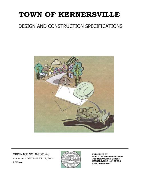
TOWN OF KERNERSVILLEDESIGN AND CONSTRUCTION SPECIFICATIONSORDINACE NO. 0-2001-48ADOPTED DECEMBER 13, 2001REV No.PUBLISHED BY:PUBLIC WORKS DEPARTMENT720 MCKAUGHAN STREETKERNERSVILLE, NC 27284(336) 996-6916
PREFACEThis document is intended to establish design and construction requirements for thepreparation and submittal <strong>of</strong> Infrastructure Improvement plans for subdivision and otherland development projects within the <strong>Town</strong> <strong>of</strong> <strong>Kernersville</strong> and its ExtraterritorialJurisdiction (ETJ). The designing engineer on any project should use judgment andexperience to determine any additional information that may be necessary for review.The <strong>Town</strong> <strong>of</strong> <strong>Kernersville</strong> Public Works Department will use these standards, as well assound engineering principles, to review the detailed engineering drawings. All engineersare encouraged to use these standards in the preliminary layout <strong>of</strong> any development tominimize revisions.The standards set forth herein apply to all development within the <strong>Town</strong> <strong>of</strong> <strong>Kernersville</strong>and all development within the Extraterritorial Jurisdiction (ETJ) <strong>of</strong> the <strong>Town</strong>. Thestandards may also apply to development outside the ETJ in cases where, NCDOT andthe <strong>Town</strong> <strong>of</strong> <strong>Kernersville</strong> agree that it would be advantageous for development to beconstructed under these standards.It is recommended that any individual using this document contact the Public WorksDepartment annually for revised versions. Updates shall be reprinted in their entirety.Updates will not be sent out in loose-leaf form.
TABLE OF CONTENTSITEMPAGE NUMBERDefinitions 3-9<strong>Design</strong> Standards 10-45<strong>Construction</strong> Standards/Inspections 46-59Standard Drawings 60-82Permits 83-90Watershed 91-105Bonding 106-108TND 109-114
DEFINITIONS AS USED HEREINGeneral Definitions:Bond - A type <strong>of</strong> surety that guarantees payment and/or performance, and insuresagainst a financial lose.< Performance Bond - A bond in which the surety company has an obligation tothe <strong>Town</strong> for any additional cost to complete a given project due to thedeveloper’s or owner=s failure to properly complete the bonded work. ALetter <strong>of</strong> Credit from FDIC insured bank, with a branch in North Carolina, orcash deposit may serve as a performance bond when bonding infrastructureimprovements for the <strong>Town</strong> <strong>of</strong> <strong>Kernersville</strong>.< Cash Bond - Performance surety in which cash is deposited with the <strong>Town</strong> <strong>of</strong><strong>Kernersville</strong> and held in lieu <strong>of</strong> a performance bond until the bonded work iscompleted.Borrow - Fill material (Soil), which is required for on-site construction and is obtainedfrom <strong>of</strong>f-site locations.Certificate <strong>of</strong> Occupancy - A permit issued by the Inspections Department, settingforth that a building or structure, complies with the Building Code, its use complieswith the zoning ordinance, and that the same may be used for the purposes statedtherein.Contractor - Individual or firm under contract with another to perform an agreedupon task.DEHNR - The NC Department <strong>of</strong> Environment, Health and Natural Resources.EAL Pavement Schedule - A pavement schedule based on an 18-Kip Equal AxleLoad.Easement - A grant <strong>of</strong> one or more <strong>of</strong> the property rights for a specific purpose bythe property owner to, or for the use by, the public, a corporation, or other entity.< Access Easement - A permanent easement, which grants the right to thePublic or specified party to access and/or cross private property.< Drainage Easement - A permanent easement, which grants the right <strong>of</strong> waterdrainage to pass in open channels or enclosed structures, the same does notobligate the <strong>Town</strong> to maintain any storm water devices, pipes, or openchannels within the easement.
Drainage Maintenance Easement - A permanent easement, which grants tothe <strong>Town</strong> the right to conduct pipe maintenance repairs, alter the typicaldrainage channel section and/or pr<strong>of</strong>ile in order to improve water flow, thesame does not obligate the <strong>Town</strong> to maintain any storm water devices, pipes,or open channels within the easement.< Pedestrian Access Easement - A permanent easement dedicated to thepublic to facilitate pedestrian access to adjacent streets and properties.< Sidewalk Easement - A permanent easement, which grants the right for apublic sidewalk to be placed and maintained thereon.< Sight Easement - A permanent easement, which grants the <strong>Town</strong>, the right tomaintain an unobstructed view across properties primarily located at streetintersections, driveways and sharp horizontal curves in the roadway. (Thesame does not obligate the <strong>Town</strong> to Maintain such).< Slope Easement - A permanent easement, which restricts the degree <strong>of</strong>slope on property and upon which slope cannot be increased.< Temporary <strong>Construction</strong> Easement - A temporary easement ,which grantsthe right for the <strong>Town</strong>, NCDOT or other public utility provider to encroachupon the temporary construction easement while making improvements topublic infrastructure and/or public utilities.< Utility Easement - A permanent easement, which grants to the <strong>Town</strong> andother public utility providers the right to install and thereafter maintain anyand all utilities including, but not limited to; water lines, sewer lines, stormsewer lines, electrical power lines, communication lines, natural gas lines,and cable television systems.< Utility Easement (Private) - A permanent easement, which grants the right toinstall and maintain a private utility across private property. A Private UtilityEasement can be granted to an individual, a utility company, a propertyowners association or to owners <strong>of</strong> a specified parcel <strong>of</strong> land.Engineer - A person licensed to practice engineering in the State <strong>of</strong> North Carolina.Erosion - The wearing away <strong>of</strong> land surface by the action <strong>of</strong> wind, water, gravity, orany combination there<strong>of</strong>.
Fee “In Lieu <strong>of</strong> Infrastructure Improvements” - A non-refundable payment to the<strong>Town</strong> to compensate for needed and/or required infrastructure improvements thatmay be used in the future by the <strong>Town</strong> to make such infrastructure improvementsadjacent to the subject development.Formal Streetside Parking – Parallel or angle parking which is adjacent to andcontiguous with the travelway <strong>of</strong> the street and anticipated to occur on a frequentbasis.Grade, Finished - The final elevation <strong>of</strong> the ground surface after development.Grading - One <strong>of</strong> two (2) types <strong>of</strong> grading, rough or fine.Ground Cover - Any natural vegetative growth, masonry, paving, riprap or othermaterial, which renders the soil surface stable against accelerated erosion.Informal Streetside Parking – Parallel parking on a street where parking isanticipated to be on an occasional basis.Inspector - The <strong>Construction</strong> Services Supervisor, <strong>Construction</strong> Inspector, or otherrepresentative duly authorized by the Public Works Director to inspect public andprivate infrastructure improvements.Plans - The approved plans, pr<strong>of</strong>iles, standard details, supplemental plans, andworking drawings, which show the location, dimensions, and details <strong>of</strong> the work tobe preformed.< Erosion Control Plan - An erosion and sedimentation control plan.< Sketch Plan - A rough sketch map <strong>of</strong> a proposed subdivision or site, showingstreets, lots, and any other information <strong>of</strong> sufficient accuracy to be used fordiscussion by owner, developer and/or staff, <strong>of</strong> the street system and theproposed development pattern.< Plat - A map <strong>of</strong> a surveyed parcel <strong>of</strong> land which is intended to be, or hasbeen, recorded in the <strong>of</strong>fice <strong>of</strong> the Register <strong>of</strong> Deeds.< Final Plat - The final map <strong>of</strong> all or a portion <strong>of</strong> a subdivision or site, showingthe boundaries and location <strong>of</strong> lots, streets, easements and all otherrequirements <strong>of</strong> Subdivision Regulations.< Preliminary Plat - A map indicating the proposed layout <strong>of</strong> a subdivision orsite showing lots, streets, easements, and other requirements <strong>of</strong> SubdivisionRegulations.
Stabilizing Vegetation - Any vegetation that protects the soil against erosion.Standard <strong>Specifications</strong> – A general term referring to all provisions and requirementscontained herein entitled "Roadway <strong>Design</strong> and <strong>Construction</strong> <strong>Specifications</strong>" andany subsequent addendums or revision thereto.Street - A vehicular travelway, which provides a means <strong>of</strong> access and travel. Theterm street may include road, avenue, place, way, drive, lane, boulevard, highway,and any facility principally designed for vehicular traffic.< Collector & Sub-Collector Street - A public street which penetrates variousland use classifications and/or serves an area <strong>of</strong> aprox. 20-acres or more,and whose primary function is to collect traffic from other streets andfunneling it to other collector streets or thoroughfares.< Commercial Street - A public street, which serves traffic generated by landuses, which are primarily commercial.< Half/Partial Street - A half/partial street is that portion <strong>of</strong> right-<strong>of</strong>-way neededto facilitate half a portion <strong>of</strong> a future street, primarily used along propertylines.< Industrial Cul-de-Sac Street - A public street, which serves abutting industrialland, uses and terminates in a turnaround and originating at an intersectionwith another street, but not having any other streets intersecting with thisstreet classification segment. The maximum length <strong>of</strong> an industrial Cul-desacstreet allowed is 1,200 feet measured from its intersecting center pointwith another street to the center <strong>of</strong> the cul-de-sac.< Industrial Street - A public street, which serves traffic generated by land uses,which are primarily industrial.< Marginal Access Street - Marginal Access Streets are designed to provideprimary or secondary access to properties in which the other streetclassifications are deemed inappropriate.< Private Drive - A vehicular travelway, centered within a public accesseasement, which serves parking lots for two (2) or more principal buildings ina multi-family housing development or other non-single-family residentialdevelopment. An individual entity or property owners association shallmaintain private Drives. Street side parking spaces, (parallel and angle), isallowed on Private Drives. Parallel and angle parking spaces shall bedesigned per the UDO and shall not protrude into the primary travelway.
Private Street - A vehicular travelway, centered within a common area strip,permitted in developments where mandatory property owner associationsexist. Private streets shall undergo the same approval process and meet thesame design and construction standards as public streets. Private Streetsare not encouraged; however, may be permitted for unique situations, suchas, gated communities. Formal streetside parking spaces are not allowed onprivate streets.< Public Street - A vehicular travelway within a dedicated and recorded publicright-<strong>of</strong>-way.< Residential Cul-de-Sac Street - A public street, which serves abuttingresidential land, uses and terminates in a turnaround and originating at anintersection with another street, but not having any other streets intersectingwith this street classification segment. The maximum length <strong>of</strong> an residentialCul-de-sac street allowed is 1,200 feet measured from its intersecting centerpoint with another street to the center <strong>of</strong> the cul-de-sac.< Residential Street - A public street whose primary function is to serveresidential land use.< Stub Street - A street, which runs to a property line <strong>of</strong> adjacent property andis intended to continue into adjacent property at such time as the adjacentproperty is developed.< Thoroughfare, Minor - A public street which serves as a primary traffic artery<strong>of</strong> the urban area, serving the major centers <strong>of</strong> activity and carrying trafficbetween such centers at moderate speeds.< Thoroughfare, Major - A public street or highway whose primary function is tocarry large volumes <strong>of</strong> traffic safely and expediently through an urban area.Subgrade - That portion <strong>of</strong> the roadbed prepared as a foundation for the pavementstructure.Substantially Completed - Work has progressed to the point that, in the opinion <strong>of</strong>the Public Works Director, it is sufficiently completed in accordance with theapproved plans and specifications that the improved area can be utilized for itsintended purposes.Surveyor - A person licensed to practice surveying in the State <strong>of</strong> North Carolina.Thoroughfare - An existing or proposed freeway/expressway, major thoroughfare, orminor thoroughfare as shown on the Thoroughfare Plan.
Thoroughfare, Major - A public street or highway whose primary function is tocarry large volumes <strong>of</strong> traffic safely and expediently through an urban area.< Thoroughfare, Minor - A public street which serves as a primary traffic artery<strong>of</strong> the urban area, serving the major centers <strong>of</strong> activity and carrying trafficbetween such centers at moderate speeds.Unified Development Ordinance (UDO) – The compilation <strong>of</strong> regulations that affectland use, including the Zoning Ordinance, the Environmental Ordinance, and theSubdivision Ordinance/Regulations.Utilities - Facilities <strong>of</strong> an agency which, provide the general public with electricity,gas, oil, water, sewage, communications, or rail transportation.Wetlands - Areas inundated or saturated by surface or ground water at a frequencyand duration sufficient to support and, under normal circumstances, do support aprevalence <strong>of</strong> vegetation typically adapted for life in saturated soil conditions.Wetlands generally include swamps, marshes, bogs and similar areas as delineatedby the US Army Corp <strong>of</strong> Engineers or certified pr<strong>of</strong>essional in the field <strong>of</strong>environmental engineering as approved by the US Army Corp <strong>of</strong> Engineers.Abbreviations:AASHTOANSIAPWAASTMAWWABCCFSDEDMEEPETJAmerican Association <strong>of</strong> State Highway and TransportationOfficialsAmerican National Standards InstituteAmerican Public Works AssociationAmerican Society <strong>of</strong> Testing and MaterialsAmerican Water Works AssociationBack <strong>of</strong> CurbCubic Feet per SecondDrainage EasementDrainage Maintenance EasementEdge <strong>of</strong> PavementExtra Territorial Jurisdiction
FFIDMSLMUTCDNCDEHNRNCDEMNCDOTNECODP.C.PEppmpsiP.T.P.V.C.P.V.T.Q maxQ minRLSSCSTOKUDOFace to FaceInternal DiameterMean Sea LevelManual on Uniform Traffic Control DevicesNorth Carolina Department <strong>of</strong> Environment,Health & Natural ResourcesNorth Carolina Division <strong>of</strong> Environmental ManagementNorth Carolina Department <strong>of</strong> TransportationNational Electric CodeOutside DiameterPoint <strong>of</strong> CurvaturePr<strong>of</strong>essional Engineerparts per millionpounds per square inchPoint <strong>of</strong> TangencyPoint <strong>of</strong> Curvature on Vertical CurvePoint <strong>of</strong> Tangency on Vertical Curvemaximum dischargeminimum dischargeRegistered Land SurveyorSoil Conservation Service<strong>Town</strong> <strong>of</strong> <strong>Kernersville</strong>Unified Development Ordinance
STREETDESIGN STANDARDSGENERAL:For approval <strong>of</strong> street design, a North Carolina Registered Pr<strong>of</strong>essional Engineer mustseal all construction plans and revisions submitted to the Engineering Division <strong>of</strong> thePublic Works Department, with the exception that the <strong>Town</strong> will accept for approval,street designs sealed by a North Carolina Registered Pr<strong>of</strong>essional Land Surveyor inthose circumstances allowed by North Carolina General Statutes. A digital copy indrawing file (*.dwg) format <strong>of</strong> the “Record Drawing” <strong>of</strong> the development must besubmitted before final acceptance and maintenance <strong>of</strong> any streets and storm drainagesystems. The digital files must be tied to the State Plane Coordinate System using two<strong>Town</strong> <strong>of</strong> <strong>Kernersville</strong> or NCGS Monuments.All proposed public streets shall be designed to become part <strong>of</strong> the overall street systemand be identified as such on all adopted plans. All streets and roads shall align withother designated roadways for continuity in the <strong>Town</strong>'s street system.All single family residential subdivisions shall be accessed by public streets exceptthose wherein private streets have been approved in accordance with the provision <strong>of</strong>the Unified Development Ordinance (UDO).Dedication <strong>of</strong> additional right-<strong>of</strong>-ways, easements, construction <strong>of</strong> turn-lanes, roadwaywidening, or other improvements to existing public streets upon which the propertyfronts or which provide access to new developments may be required as provided for inthe UDO. In some cases the proposed development may be adjacent to roadways,utilities, drainage systems, etc. in which, a large scale infrastructure improvementproject may be needed. In such cases, the <strong>Town</strong> may elect to collect a fee "In-lieu-<strong>of</strong>Infrastructure Improvements" to be used on a larger scale improvement project adjacentto the development. This process is encouraged on high volume roads where smallpiecemeal improvements may result in poor construction methods, ride quality, andexcessive inconvenience to the motoring public.CORRELATION, INTERPRETATION AND ORDER OF PRECEDENCE:If there be any conflicting term or requirements between this manual and the UDO theUDO shall govern.The latest revision <strong>of</strong> the "NCDOT Standard <strong>Specifications</strong> for Roads and Structures"and the "NCDOT <strong>Design</strong> Manual" shall apply to all roadway and storm drainageconstruction unless otherwise specified herein this manual.
SURETIES OR IMPROVEMENT GUARANTEES:Prior to the recording <strong>of</strong> any plat, all improvements required by this Manual and theUDO shall be completed or the remaining improvements secured by a surety approvedand accepted by the <strong>Town</strong> Manager; the surety shall be a performance bond providedby a certified surety company authorized to issue bonds in North Carolina; anIrrevocable Letter <strong>of</strong> Credit provided from a bank insured by the FDIC; or cash. If thesurety is a guarantee other than cash, the Letter <strong>of</strong> Credit or bonding instrument mustbe readily convertible into cash, payable to the <strong>Town</strong> <strong>of</strong> <strong>Kernersville</strong> at face value uponthe <strong>Town</strong>'s request. Prior to recording the Plat, the developer shall contact the PlanningDepartment and request an estimate for bonding purposes. If any work has beencompleted and paid for prior to recording the plat, the developer shall providedocumentation that work-to-date has been paid in full.Refer to Appendix 4 for the administrative procedures regarding the submittal <strong>of</strong>sureties.In no case shall the duration <strong>of</strong> the financial guarantee exceed two (2) years, unlesssaid guarantee is extended with the consent <strong>of</strong> the <strong>Town</strong> Manager.All developments whose public improvements are not completed and accepted thirty(30) days prior to the expiration <strong>of</strong> the financial guarantee shall be considered in default.Upon default, the surety company or financial institution holding the escrow accountshall pay to the <strong>Town</strong>, all or any portion <strong>of</strong> the bond or escrow amount deemednecessary by the <strong>Town</strong> to complete all or any portion <strong>of</strong> the required improvements,including administration cost incurred by the <strong>Town</strong>. The <strong>Town</strong> shall complete theproject, or a portion there<strong>of</strong>, using the guaranteed funds. The <strong>Town</strong> shall return anyfunds not spent in completing the improvements.Default on a project does not release the developer from the liability he has or may haveincurred during the performance <strong>of</strong> work prior to the default or the responsibility forpayment <strong>of</strong> items that may exceed the current surety being held by the <strong>Town</strong>.See Horizontal Street <strong>Design</strong> for bonding <strong>of</strong> improvements to property lines whereexisting topography prevents construction without encroachment on others.DEDICATION AND ACCEPTANCE:A. Right-<strong>of</strong>-Ways and EasementsThe recordation <strong>of</strong> a properly executed final plat constitutes dedication to the<strong>Town</strong> the right-<strong>of</strong>-ways <strong>of</strong> each public street and all easements as proposed onthe final plat. The approval and recordation <strong>of</strong> a final plat does not constituteacceptance <strong>of</strong> maintenance responsibility within such right-<strong>of</strong>-way or easement.Improvements within such right-<strong>of</strong>-way or easements, such as street paving,drainage facilities or sidewalks may be accepted for maintenance by the PublicWorks Director after a final inspection has been conducted and approved by
the Public Works Department, and all items <strong>of</strong> construction have beensatisfactorily completed.B. Half/Partial-StreetsHalf/Partial Streets, i.e. right-<strong>of</strong>-way <strong>of</strong> one-half <strong>of</strong> the standard or requiredwidth <strong>of</strong> a street or a portion there<strong>of</strong>, shall not be designed except whereessential to the reasonable development <strong>of</strong> the subdivision and adjacent land.The right-<strong>of</strong>-way for Half/Partial Street shall be dedicated to facilitate a futurestreet and so noted on the final plat. The Developer shall post a cash bondwith the <strong>Town</strong>, sufficient to construct one-half the cost <strong>of</strong> the street for thatportion which is situated within the subject development.ROADWAY DESIGN:At a minimum all streets shall be designed and constructed to <strong>Town</strong> <strong>of</strong> <strong>Kernersville</strong>Standard <strong>Specifications</strong> and Detailed Drawings contained in this manual. NCDOTstandards shall be used on all existing state roads, extensions <strong>of</strong> existing state roads,roads to be maintained by NCDOT, or any item <strong>of</strong> construction that is not covered in thismanual.A. Street Classifications and Classification CriteriaThe Public Works Director shall make final determination <strong>of</strong> the classification <strong>of</strong>streets in a proposed development.Primary <strong>Design</strong> Concerns:Residential Street and Residential Cul-de-SacThe primary design concerns are directed toward fostering a safeenvironment to the residential community and convenience to the motoringpublic. Emphasis is placed on providing adequate stopping site distance atintersections, driveway accesses and horizontal and vertical curves.The maximum length <strong>of</strong> an individual cul-de-sac street allowed is 1200 feetmeasured from the intersecting centerline from another street to the center<strong>of</strong> the turnaround. Circular turnarounds are recommended as permanentturnarounds; however, permanent “T” turnarounds may be considered whenthe existing topography prohibits construction <strong>of</strong> a circular turnaround.Bulb-turns and eye-brows are not recommended; however, they may beallowed on cul-de-sac streets and short internal residential streets whichbegin at a Residential Collector or Sub-collector and terminate on the sameor adjoining street forming a short loop less than 1200 feet long, measuredfrom intersecting centerlines.
Collector, Sub-Collector and Commercial StreetThe primary design concerns are directed toward fostering a safeenvironment for the adjacent land users and convenience to the motoringpublic. Emphasis is placed on site distance at intersections, drivewayaccesses, and horizontal and vertical curves. Emphasis is also placed onthe ease <strong>of</strong> ingress and egress at intersections with higher classificationstreets.Marginal Access StreetMarginal Access Streets are designed to provide primary or secondaryaccess to properties in which the other street classifications are deemedinappropriate. <strong>Design</strong> shall accommodate the vehicle type and quantityexpected to use the facility. The Public Works Director will determine theright-<strong>of</strong>-way width, roadway section, street width, and design criteria basedon the surrounding land use, character <strong>of</strong> the terrain, utility locations,structure locations, and environmental constraints.Industrial Street and Industrial Cul-de-sacThe primary design concerns are directed toward fostering a safeenvironment to the adjacent land users and convenience to the motoringpublic. Emphasis is placed on providing adequate stopping site distance atintersections, driveway accesses, and horizontal and vertical curves.Emphasis is also placed on providing adequate turning radius, tapers,storage lanes and structural integrity <strong>of</strong> the street.The maximum length <strong>of</strong> an individual cul-de-sac street allowed is 1200 feetmeasured from the intersecting centerline from another street to the center<strong>of</strong> the turnaround. Circular turnarounds are recommended as permanentturnarounds; however, permanent “T” turnarounds designed to facilitate theturning movement <strong>of</strong> a tractor pulling a 48’ trailer may be considered whenthe existing topography prohibits construction <strong>of</strong> a circular turnaround.Major and Minor ThoroughfaresThe primary design concerns are directed toward fostering a safe andconvenient environment for through traffic motorist. Emphasis is placed onalignment, spacing and full service access to street classifications ascollectors or higher. Emphasis is also placed on providing adequate turningradius, tapers, storage lanes, structural integrity and compliance to the<strong>Town</strong>s thoroughfare plan.
Private StreetAlthough not encouraged by the <strong>Town</strong>, private streets may be permitted incertain developments, including gated communitiesEstablishment <strong>of</strong> a Property Owner's Association is required in order tomaintain any private streets permitted in a development. A document settingforth declaration <strong>of</strong> covenants, conditions, and restrictions governing theProperty Owners’ Association and the property within a development shalladequately address planning, management and funding <strong>of</strong> both routinemaintenance and non-routine maintenance <strong>of</strong> private streets. At the time <strong>of</strong>preliminary plan submittal, the developer shall submit the proposeddeclarations for review and approval by the <strong>Town</strong>, and ultimate recordation.Any and all proposed private streets shall be clearly shown as such on allpreliminary subdivision plans submitted to the <strong>Town</strong> and all permittedprivate streets shall be clearly shown as such on final plats. All approvedprivate streets shall be centered within a common area strip having aminimum width <strong>of</strong> fifty (50) feet. An approved driveway permit from the<strong>Town</strong> or NCDOT (whichever is applicable) is required for all approvedprivate streets connecting with public streets.All private streets shall proceed through the same submittal, approval andinspection process that public streets undergo; however, inspection <strong>of</strong>construction shall be performed by a private engineering/consulting firm (atthe developers expense) with all inspection reports, testing and survey datasubmitted to the <strong>Town</strong> at the completion <strong>of</strong> project. Documentation shallinclude verification that all improvements have been installed in accordancewith the <strong>Construction</strong> Drawings and <strong>Specifications</strong>. The <strong>Town</strong> shall retainany and all Bonds previously placed with/submitted to the <strong>Town</strong> until allrequired documents are submitted, reviewed and approved.The minimum street design standards for all private streets shall be thesame as those approved as minimum design for public streets asreferenced in the Roadway <strong>Design</strong> Table found in the <strong>Construction</strong> Detailssection <strong>of</strong> this manual. For any private street determined by the <strong>Town</strong> PublicWorks Department as serving significant truck traffic within the foreseeablefuture, the developer shall submit a pavement design based on an 18-KipEAL design criteria to the Public Works Department for review and approvalAll private streets will have a thirty (30) inch curb and gutter section, either astandard curb and gutter or valley type curb and gutter as detailed in thisdocument. Private streets shall not be designed, constructed or striped toaccommodate Formal Street side Parking.Unless otherwise approved by the Public Works Department, utilitystructures shall not encroach or penetrate the asphalt surface course.
Private DrivePrivate drives may be allowed in certain developments in accordance withthe Unified Development Ordinance.Private drives may be used in developments to provide access to parkinglot(s) for two (2) or more principal buildings in a group housing (apartments,townhouses, condominiums, etc) or other non single-family residentialdevelopment.Private drives shall be centered within an public access easement orCOMMON AREA STRIP and shall be shown as such on all preliminaryplans and final plats.The minimum design standards are as follows:Public Access Easement/Common Area 30’Min. Pavement Width EP-EP 22’Min. Aggregate Base Course 8”Min. Asphalt Surface Course 2”Ribbon Pavement is acceptable for private drives.Note: Prior to recordation <strong>of</strong> a final plat, the developer shall furnish acertification sealed by an engineer that the sub-grade and base coursepassed a pro<strong>of</strong> roll in accordance with the <strong>Construction</strong> Standards <strong>of</strong> thisManuel.All private drives, connecting with public or private streets, require anapproved driveway application from the <strong>Town</strong> or NCDOT, whichever isapplicable.B. T-Shaped TurnaroundsPermanent T-shaped turnarounds shall be built in accordance with the<strong>Construction</strong> Standards <strong>of</strong> this manual and utilized only when topographyprohibits the construction <strong>of</strong> a circular turn-a-round.In cases where a street is to be built to the adjoining property lines, and saidstreet is be extended in the near future, or said street is less than 300’ from thenearest adjoining street, a modified T-shaped turnaround may be used inaccordance with the <strong>Construction</strong> Standards <strong>of</strong> this manual.Turnarounds are not required for stub streets less than 300’ from the nearestintersecting street.
C. Horizontal Street <strong>Design</strong>AlignmentAll streets shall conform to the <strong>Town</strong>'s adopted Street Alignment Plan(s)when applicable or shall be designed and located in proper relation toexisting and proposed streets; topography; natural features as streams andtrees; public convenience and safety; and to the <strong>Town</strong>’s Development Plan.Collector streets and thoroughfares shall be as directional as possible butconsistent with topography and preserving developed properties andcommunity values.The arrangements <strong>of</strong> streets shall make provisions for the continuation <strong>of</strong>existing streets and utilities in adjoining subdivisions. When a newsubdivision adjoins undeveloped land, or the subdivision is to be built insections, streets, including stubs, and accompanying utilities shall beconstructed to the property lines <strong>of</strong> the undeveloped land. The street andutility extensions must be designed and constructed in a manner that will notcause hardship to owners <strong>of</strong> adjoining property when they attempt todevelop their land and provide convenient access and utility services to it.If a street cannot be constructed to the property line due to minor cuts andfills which would be necessary on the adjacent property, the Public WorksDirector may determine that the last fifteen (15) feet <strong>of</strong> roadway need not beconstructed. However, in cases where the accessing street cannot beconstructed to the property line due to major cuts and fill; the Developershall post a cash bond to the <strong>Town</strong> for construction <strong>of</strong> the roadway andutilities to the property line.The design <strong>of</strong> streets shall conform to the curve controls as outlined in thismanual and design table. Streets that are multi-lane and/or divided willrequire special design review.Compound horizontal curves with the same direction <strong>of</strong> curvature shall havethe radius <strong>of</strong> the flatter circular arc no more than one and one half (1-1/2)times the radius <strong>of</strong> the sharper circular arc.IntersectionsStreets shall intersect each other at right angles whenever possible. Theminimum desirable intersection angle is eighty (80) degrees. Streetsclassified as collectors or higher shall not intersect any other street at lessthan eighty (80) degrees. In unusual situations, streets classified in theresidential category may intersect streets classified as collectors or lower ata minimum angle <strong>of</strong> seventy (70) degrees.
SuperelevationSuperelevation is to be used on all thoroughfares and in some casessuperelevation may be required for certain collector streets. Superelevationshall conform to NCDOT and AASHTO standards for superelevation design.TapersTapers shall be used as necessary in street design. Approach tapers areused to shift lanes laterally. The following equations shall be used asapplicable.L = WS for posted speeds <strong>of</strong> 45 mph and greater;L = WS 2 / 60 for posted speeds <strong>of</strong> 40 mph or less;L = Length in feetS = Speed in miles per hourW = Lateral <strong>of</strong>fsets in feet(L:W)Turn lane tapers shall be at least 15:1 for posted speeds <strong>of</strong> 45 miles perhour and more. The minimum turn lane taper allowed for streets posted lessthan 45 miles per hour is 8:1. Symmetrical reverse curve tapers arerecommended for non-thoroughfare streets. Storage lengths for the turnlanes shall be calculated using an acceptable method and approved by thePublic Works Department.Plans for all widening shall include instructions to saw and remove the toptwo (2) inches <strong>of</strong> existing pavement a minimum <strong>of</strong> twelve (12) inches fromthe edge, or as directed by the Public Works Department, and place newpavement over the existing base.GuardrailGuardrail shall be installed when determined necessary by the Public WorksDepartment.Islands and MediansConcrete traffic islands designed to direct turning movements areacceptable and shall be constructed and placed as per NCDOT standardspecifications.D. Vertical <strong>Design</strong>Street grades shall be established with respect to existing topography to avoidexcessive grading and the removal <strong>of</strong> existing trees and vegetation whenever
practical. The vertical curve controls found in the <strong>Design</strong> Table shall befollowed at all times.E. GeometricRadiiA minimum radius <strong>of</strong> thirty (30) feet to the back <strong>of</strong> curb shall be requiredwhere residential streets intersect.A minimum radius <strong>of</strong> forty-five (45) feet with four (4) foot <strong>of</strong>fsets and 15:1tapers are required where industrial streets and thoroughfares intersect.Driveway <strong>Design</strong> Criteria and PermitsA driveway permit is required for all driveways, streets or turnouts accessingPublic Streets. A driveway inspection is required prior to pouring concreteor placing asphalt. Once the driveway location has been approved by thePublic Works Department, and concrete forms set, the Public WorksDepartment must be notified for an inspection (996-6916). Failure to requesta driveway inspection and failure to comply with the specifications maynecessitate removal and replacement <strong>of</strong> the driveway apron by the propertyowner and/or responsible party. See Detail Drawings for driveway apronspecifications.Residential driveways shall be 10-14 feet wide and shall conform to thedetail drawings in this manual for concrete driveway aprons. A widerdriveway may be considered in cases where a wide driveway is needed toaccess a double car garage or similar facility.Residential driveways located on corner lots were Sub-collector and lowerclassification streets intersect shall be located a minimum distance <strong>of</strong> ten(15’) feet from the point <strong>of</strong> tangency <strong>of</strong> the curb radii <strong>of</strong> the intersectingstreet.Street type turnouts may be considered when the anticipated driveway ADTis greater than 500 vehicles or when access by larger trucks must beaccommodated. Street type driveways shall have a minimum width <strong>of</strong>twenty-four (24) feet. Any curb and gutter used will be in addition to twentyfour(24) foot minimum pavement width.Driveways that are unpaved shall have a minimum seven (7) foot concreteapron measured from the back <strong>of</strong> the curb and gutter.The number <strong>of</strong> street and driveway connections permitted serving a singleproperty frontage or commercial development shall be the minimumdeemed necessary by the <strong>Town</strong> for reasonable service to the property
without undue impairment <strong>of</strong> safety, convenience, and utility <strong>of</strong> the roadway.Normally, not more than one driveway shall be permitted for any singleproperty frontage. The arrangement <strong>of</strong> driveways should be related toadjacent driveways and nearby street intersections to avoid conflictingturning movements.Curb and GutterCurb and gutter shall be required on all public maintained streets, whichhave public water & sewer available to the site. The standard 2'-6" concretecurb and gutter and concrete valley gutter are acceptable. See DetailDrawings.Ribbon Paved StreetsIn developments where the <strong>Town</strong> determines that public sewer is notavailable and cannot be made available within a reasonable time frame,ribbon paved streets may be considered.SidewalksSidewalks shall be installed at the time <strong>of</strong> roadway construction or installedin phases as approved by the Public Works Department.The minimum thickness <strong>of</strong> concrete sidewalks shall be four (4) inches,designed to reach a 28-day compressive strength <strong>of</strong> 3000 psi. At locationswhere a driveway crosses a sidewalk, a six (6) inch depth is required.Where required, sidewalks shall be three (3) feet behind the back <strong>of</strong> curbwith a minimum width <strong>of</strong> five (5) feet. The Board may require a widersidewalk and/or grass strip in developments were a substantial amount <strong>of</strong>pedestrian or vehicular traffic is anticipated.Where sidewalks and/or greenways intersect any section <strong>of</strong> curb and gutter,wheel chair ramps are required.F. Pavement <strong>Design</strong>.Pavement design for all streets other than the thoroughfare streets shall be inaccordance with the <strong>Design</strong> Table in this manual. An engineered pavementdesign will be required for approval by the Public Works Director for allthoroughfares in accordance with these specifications. The pavement designand traffic analysis shall be signed and sealed by a Registered North CarolinaPr<strong>of</strong>essional Engineer. Pavement design shall be based on subgradeconditions, a twenty (20) year design life and projected traffic loading on an 18-kip EAL basis.
G. BridgeStructures, which are to span streams, shall be designed for hydraulicrequirements in accordance with this manual. Plans shall be submitted to thePublic Works Department for review and approval.All public or private bridges shall be designed to withstand HS-20 highwayloading unless otherwise approved by the Public Works Department and shallbe properly signed and sealed by a North Carolina Pr<strong>of</strong>essional Engineer.H. Roadway DamsIt is the policy <strong>of</strong> the <strong>Town</strong> <strong>of</strong> <strong>Kernersville</strong> to discourage the location <strong>of</strong>roadways on dams. In those cases, where a definite advantage may be gainedor a substantial savings in funds may be realized, the utilization <strong>of</strong> a dam for aroadway may be considered.Where it is determined that a dam will be utilized as a roadway, the followingcriteria must be met:1. When applicable, the dam must have certification from the NCDepartment <strong>of</strong> Natural Resources and Community Developmentpursuant to the "Dam Safety Law <strong>of</strong> 1967" (as amended by the GeneralAssembly <strong>of</strong> 1977).2. All pertinent data regarding the design <strong>of</strong> the embankment as animpoundment structure must be presented to the Public WorksDepartment for review.3. The top cross-section dimension must be the roadway section widthrequired (from right <strong>of</strong> way line to right <strong>of</strong> way line) for the facility plus aminimum <strong>of</strong> four (4) feet on each side.4. Guardrail will be provided on both sides <strong>of</strong> the roadway.5. Spillway will be designed to provide two (2) feet <strong>of</strong> freeboard for anestimated 100-year design frequency outflow as a minimum.6. A means <strong>of</strong> draining the lake completely will be provided.<strong>Design</strong> acceptance or approval by the <strong>Town</strong> is limited to the use <strong>of</strong> the dam asa roadway and is in no way intended as approval <strong>of</strong> the embankment as animpoundment structure.Responsibility incurred by the <strong>Town</strong> <strong>of</strong> <strong>Kernersville</strong> when a section <strong>of</strong> roadwaycrossing a dam is accepted as a part <strong>of</strong> the <strong>Town</strong>'s maintenance system islimited to maintenance <strong>of</strong> the roadway proper for vehicular traffic only.
Responsibility for the impoundment, any damage that may result there from,and maintenance <strong>of</strong> the dam or appurtenances as may be required to preserveits integrity as a water impoundment structure, shall remain with the owner <strong>of</strong>the impoundment.Structures should be designed and plans sealed by a Registered Pr<strong>of</strong>essionalEngineer.STREET NAMES:Proposed streets, which are obviously in alignment with other streets, shall bear theassigned name <strong>of</strong> the existing streets. In no case shall the name for a proposed streetduplicate or be phonetically similar to an existing street name in Forsyth County,irrespective <strong>of</strong> the use <strong>of</strong> the suffix street, avenue, boulevard, drive, place, court, etc.Street names for all new subdivisions shall be approved by the Winston-Salem/ForsythCounty Planning Department.STREET TRAFFIC CONTROL SIGNS:The owner/developer shall pay for all signs required for a development as per theadopted fee schedule prior to recording the final plat. The Public Works Departmentshall install signs once the fine grading has been satisfactory completed behind thecurb.SIGHT DISTANCE:Sight distance shall mean the length <strong>of</strong> roadway visible to the driver traveling along theroadway or waiting to enter or cross the roadway. The sight triangle shall include boththe horizontal and vertical plane. A 10' x 70' horizontal sight triangle shall be located atall street intersections and multi-family and non-residential driveway intersections.The <strong>Town</strong> shall review all proposed development plans, including site, subdivision,landscape plans, infrastructure plans and sign plans for compliance with theserequirements. All new development within the <strong>Town</strong>'s ETJ shall meet theserequirements as a part <strong>of</strong> the plan approval process.Some objects located within sight distance or sight triangle areas may not significantlyobstruct the required visibility <strong>of</strong> the driver. The driver may be able to see over, underor around some objects within sight distance areas. Objects that may be allowed withinsight distance areas include fire hydrants, utility poles, and utility cabinets less than 2-feet high, and traffic control devices that are located to minimize visual obstruction.Other objects twelve (12) inches in diameter and smaller, such as utility poles, lightpoles and sign posts, may be allowed within sight distance areas if located individuallyor in combination so as to not substantially restrict the driver's view. The determination<strong>of</strong> what objects, if any, may be located within sight distance areas shall be made by thePublic Works Department.
A. Intersection Sight DistanceIn order for vehicles to safely maneuver into or through an intersection,sufficient sight distance must be provided so as to avoid collisions. Intersectionsight distance is measured from a driver's eye 3.5 feet high to an object 4.25feet high as measured from the pavement surface.The amount <strong>of</strong> sight distance required at an intersection depends on the type <strong>of</strong>traffic control at the intersection and the speeds <strong>of</strong> the vehicles.1. Stop Sign ControlAt approaches to intersections that are controlled by stop signs or atdriveways where the driver is required to stop before entering the street,the driver must have an unobstructed view <strong>of</strong> the entire intersection andadequate sight distance for any <strong>of</strong> the various vehicular movementsallowed upon departure <strong>of</strong> the intersection. These movements mayinclude crossing the street, turning left or turning right onto the street.An obstruction to the driver's view shall not be located within the sighttriangles as defined herein to permit adequate view <strong>of</strong> the intersection.In addition, there shall be no sight obstructions located in the triangularareas shown in Figures 1 through 4 to allow for safe departure throughthe intersection. The measurement <strong>of</strong> intersection sight distance isalong the centerline <strong>of</strong> the appropriate lane <strong>of</strong> the roadway and ismeasured from an eye height <strong>of</strong> 3.5 feet above the surface <strong>of</strong> theroadway to an object 4.25 feet above the surface <strong>of</strong> the roadway. Thelocation <strong>of</strong> the driver's eye (d1) is dependent on the classification <strong>of</strong> theintersecting streets. For all intersections where the through street is athoroughfare, the driver's eye location shall be 15 feet back from theface <strong>of</strong> curb extended through the intersection, or the edge <strong>of</strong> pavementif there is no curb. At all intersections where the through street is a localor collector street, and for driveways, the driver's eye shall be locatedten (10 feet behind the face <strong>of</strong> curb extended, or the edge <strong>of</strong> pavement ifthere is no curb. The sight distance lengths d2 and d3 shown in Figures1 through 3 for left or right turns onto the through street are dependenton the design speed <strong>of</strong> the roadway and are presented in Table 3-1.Figure 4 shows the measurement method for determining the sight linefor left turns from the through street. Table 3-2 gives the minimum sightdistance for this movement across one, two, or three lanes (d1).
OperatingTable 3.1Intersection Sight Distance for Stop Signand Traffic Signal Controlled IntersectionsMinimum Intersection20 23025 30030 38035 47040 57545 70050 84555 99060 1150Source: AASHTO Green Book, 1990.
Operating Speed(MPH)Table 3.2Minimum Sight Distance forLeft Turn from Through StreetMinimum Left turn Sight Distance (Feet)1-Lane 2-Lanes 3-Lanes20 180 200 22025 230 250 27530 280 300 33035 320 350 38540 370 400 44045 420 450 50050 470 500 55055 550 550 61060 650 650 670Source: AASHTO Green Book, 1990.B. Stopping Sight DistanceAt a minimum, stopping sight distance must be available to the driver at alllocations along roadways. Stopping sight distance applies to horizontal as wellas vertical alignments. Stopping sight distance on horizontal curves ismeasured along the centerline <strong>of</strong> the inside lane around the curve and the line<strong>of</strong> sight is a straight line between two points on the centerline <strong>of</strong> the lane. Onvertical curves, stopping sight distance is measured on a straight line betweenthe driver's eye and an object on the roadway surface. The height <strong>of</strong> the driver'seye shall be measured at 3.5 feet above the roadway surface and the objectshall be 0.5 feet above the roadway surface. Figures 5 and 6 illustratemeasurement <strong>of</strong> stopping sight distance horizontally and vertically, respectively.A more detailed explanation <strong>of</strong> the measurement <strong>of</strong> stopping sight distance isincluded in A Policy on Geometric <strong>Design</strong> <strong>of</strong> Highways and Streets, 1990(AASHTO Green Book). The minimum stopping sight distance required isbased on wet pavements and depends on the design speed and grade <strong>of</strong> theroadway. Table 3-3 presents minimum stopping sight distances for variousdesign speeds on level terrain. Table 3-4 presents factors for adjusting length<strong>of</strong> stopping sight distance for grades.
Table 3.3Minimum Stopping Sight Distance For Level ConditionsOperating Speed(MPH)Minimum IntersectionSight Distance (Feet)10 4515 7520 12525 15030 20035 25040 32545 40050 47555 550
60 650Source: AASHTO Green Book, 1990.<strong>Design</strong>Speed(MPH)Table 3.4Adjustment Factors for Stopping Sight Distance on GradesIncrease for DowngradesCorrection in StoppingSight Distance (Feet)Decrease for Upgrades *Correction in StoppingSight Distance (Feet)3% 6% 9% 3% 6% 9%20 0 5 10 0 5 525 5 15 20 0 5 1030 10 20 30 5 10 2035 15 30 50 5 15 2540 20 40 70 10 20 3045 25 55 95 15 25 3550 30 70 120 20 30 4055 40 90 N/A 25 40 N/A
60 50 110 N/A 30 50 N/A* Assumed speed is lower than the design speed since vehicles normally travel ata slower speed on an upgrade.Source: AASHTO Green Book, 1990.
<strong>Design</strong> CriteriaRoadway <strong>Design</strong> TableRes.StreetResidentialCul-De-SacStreetCollector /Sub-Col.Street 1MarginalAccessStreet 2IndustrialStreetIndustrial CommercialCul-De- Street 3Sac StreetROW width (ft) 50 50 60 / 50 30 - 60 60 50 45/50Min. Cul-de-Sac ROW Radius(ft)Min. Cul-De-Sac Radius F-F orV-V (ft)N/A 55 N/A N/A N/A 60 N/AN/A 45 N/A N/A N/A 50 N/AUtility Easement - Each Side (ft) 10 5 5 / 10 5 - 10 5 10 5Street Width F-F or V-V (ft) 28 4 26 37 - 40 /30 - 3726 - 40 40 37 37Min. <strong>Design</strong> Speed (mph) 30 25 35 / 30 25 - 40 40 30 35Min. Center Line Radius withnormal crown => normal crown(2%)225 150 400 / 250 225- 400 400 300 250Max. Grade (%) 5 10 10 7 7 7 7 7Min. Grade (%) 1 1 1 1 1 1 1Aggregate Base Course (in.) 8 8 8 8 - 10 10 10 8H-Binder or Approved alternate 2 2 3 / 2 2 - 5 6 4 6 3 2-3I-2 or I-1 Surface Course 1.5 1.5 1.5 1.5 2 2 1.5Tangent Length in ReverseCurves (ft)Min. Tangent Length atIntersectionAllowable Storm Water Spreadto Centerline <strong>of</strong> Street.30 10 50 / 40 50 100 100 3030 7 20 7 60 / 40 40 100 60 301/3 1/3 1/3 1/3 1/3 1/3 1/31) The <strong>Town</strong> shall determine collector classification.2) The Public Works Director shall determine the required street section and ROW width (seedetailed drawings) based on the maintenance and utility requirements to serve the adjacentdevelopment (s).3) Commercial Cul-de-sacs shall use the same design as Commercial Street w/ 175 radius.4) When residential streets intersect with thoroughfares, the street width shall be widened to a min.<strong>of</strong> 36’ starting @ the point <strong>of</strong> tangency with the intersecting radius for a distance <strong>of</strong> 60’, thentapering back to the street width as outlined above.5) Grades for 60’ each way from an intersection should not exceed 4%; however, steeper grades forthe first 60’ may be considered in extenuating circumstances for residential streets intersectingother residential streets.6) For streets in heavy industrial areas and other areas where the estimated ADT and estimatedpercentage <strong>of</strong> trucks is high, the Public Works Director shall determine the required amount <strong>of</strong> H-Binder based on an 18-kip EAL design.7) Tangent length shall be a minimum <strong>of</strong> 40-feet when approaching a collector or greater streetclassification.
STORM DRAINAGE DESIGN REQUIREMENTS:The following is a list <strong>of</strong> requirements for storm drainage plans and for storm drainagelines that will eventually be maintained by the <strong>Town</strong> <strong>of</strong> <strong>Kernersville</strong>. See Appendix IVfor additional information.A. General:1. The Rational Method is used by the <strong>Town</strong> <strong>of</strong> <strong>Kernersville</strong> fordetermining storm drainage run<strong>of</strong>f for areas under two hundred (200)acres. For areas over two hundred (200) acres, the <strong>Town</strong> uses theSCS method.2. Grading permits covering sedimentation and erosion control measuresmust be obtained before any grading or land-disturbing activity cancommence.3. Storm drainage systems shall be designed to convey a minimum ten(10) year design storm.4. Culverts on major streams shall be designed as follows:Drainage Area<strong>Design</strong> Storm0-150 Acres 25-Year150-400 Acres 50-YearOver 400 Acres100-Year5. Storm drainage lines within right-<strong>of</strong>-ways along residential streets andresidential cul-de-sacs shall be RCP; or smooth wall HDPE pipe forlines less than 36-inches in diameter. Storm drainage lines within allother right-<strong>of</strong> ways shall be RCP. ACP will be considered for culverts66-inches or larger in diameter.6. Pipe inlets and culvert situations are to be checked for inlet and outletheadwater control so as to insure that headwater will not encroach onuphill adjacent property or create a hazard to existing and futuredevelopment.7. Spacing <strong>of</strong> storm drainage inlets must control water so that inletcapacity and gutter spread design criteria are not exceeded in a designstorm event.8. Minimum size for storm drainage pipe is fifteen (15) inches in diameter,twelve (12) inch diameter pipe may be used in unique circumstancesas approved by the Public Works Department.9. Minimum storm drainage pipe grade is 1.0%.
10. Maximum storm drainage pipe grade is 10.0%. Steeper grades may beconsidered at outlets and other substantial grade changes.11. Minimum grade for tail-ditching is 1.0%.12. Manholes are required at changes in grade, changes in alignment, andat intersection <strong>of</strong> drainage pipe.13. A concrete grout invert slide is required in all drainage boxes andmanholes.14. Recommended manhole drops:a) Change in alignment 0 degrees to 45 degrees, 0.10 ft.b) Change in alignment greater than 45 degrees, 0.20 ft.c) Change in pipe size, match inverts.d) Reverse flow conditions in a storm sewer system created by a tie-inat a structure will not be allowed unless a manhole drop equal to thediameter <strong>of</strong> the outgoing pipe is provided.15. End walls or flared-end sections, plus an appropriate energy dissipaterwill be required at the release point <strong>of</strong> all pipe systems. Open endedpipes are acceptable where flow rates are low and erosion can becontrolled with proper outlet protection.B. Drainage for Subdivisions and Other Developments:1. Site drainage will be required to tie into existing storm drainage systemwhere possible.2. The following must be included on Site Drainage Plans:a) Location <strong>of</strong> inlets, manholes, pipe lines.b) Clearly defined lines delineating areas drained to each inlet.c) Existing and proposed contour lines shall be extended a minimum <strong>of</strong>two hundred (200) feet beyond the project limits.d) Ditches, swales, pipes, and drainage easements which are adjacentto the proposed project.e) Drainage calculations.3. Minimum Drainage Easement widths, where required:Closed system15" - 30" pipe = 15 feet36" - 60" pipe = 20 feet66" - 96" pipe = 30 feet
Open ChannelUp to 10cfs Q 50 =10 feet10-20cfs Q 50 = 15 feet20-40cfs Q 50 = 20 feet40-60cfs Q 50 = 30 feetOver 60cfs Q 50 = TBD based on Channel Cross SectionDrainage easement widths may need to be wider based on channelcross section.4. No more the .5cfs Q 10 will be allowed to flow out driveway entrances intostreets except in residential subdivisions.5. Not more than one (1) acre can drain into the street at a singleconcentrated pointTRAFFIC CONTROL DEVICES:The <strong>Town</strong> will not allow the obstruction <strong>of</strong> any public street, private street or fire laneunless otherwise stipulated by the Governing <strong>Town</strong> Council. This requirement is inaccordance with the 1992 edition <strong>of</strong> the North Carolina State Fire Prevention Code. Thereference to an "obstruction" shall include parking, speed bumps or any other devicesthat may obstruct the free passage <strong>of</strong> emergency vehicles.All traffic control devices must be shown and approved as a part <strong>of</strong> a site plan prior toinstallation and must be in conformance with the <strong>Town</strong> Standard <strong>Specifications</strong>. Thetraffic control devices and all related signs and pavement markings shall be maintainedby the owner as a part <strong>of</strong> the approval <strong>of</strong> the plan. Traffic control devices shall includerumble strips, raised pavement markers, pavement undulations (speed bumps).Pedestrian CrossingsAll locations, which are designated for pedestrian traffic crossings, shall bedesignated as a crosswalk with pavement marking and signage in accordancewith MUTCD.All pedestrian crossings must be approved by the Public Works Department priorto installation.PLAN SUBMISSION REQUIREMENTS:A. Review Process for <strong>Construction</strong> Drawings:1. When plans are submitted to the <strong>Town</strong> <strong>of</strong> <strong>Kernersville</strong>, they shall beaccompanied by a cover letter (or note) stating:a) The project name
) Contact person and phone numberc) The reason they are being submittedFailure to identify the project and the reason it is being submitted willcause delay in the plan review process.2. For first time submittal <strong>of</strong> construction drawings, four (4) complete boundsets <strong>of</strong> prints are submitted to the Public Works Department. Prints arelogged in and distributed as follows:a) One (2) set to the Public Works Dept.-Engineering Division.b) One (1) set to the Public Works Director.c) One (1) set to the <strong>Construction</strong> Services Supervisor.3. Submit drawings to the City-County Utility Commission and otheragencies if requiring a plan review.4. The Public Works Department-Engineering Division and <strong>Construction</strong>Services Supervisor will review plans and return comments to theSubmitting Engineer.5. The Submitting Engineer will need to re-submit drawings until allcomments for "Roadway", "Drainage", "Water", and "Sewer" have beenaddressed.6. Once approved by all agencies involved, four (4) sets, (1- reproducibleand 3- blue lines), <strong>of</strong> approved drawings with all appropriate signaturesmust be submitted to the Engineering Division <strong>of</strong> Public Works. Printsare logged in, reviewed, stamped “Approved for <strong>Construction</strong>”, signedand distributed as follows:a) One (1) set <strong>of</strong> reproducible on file in the Engineering Division.b) One (1) set <strong>of</strong> blue-lines on file with the Public Works Director.c) One (1) set <strong>of</strong> blue lines for the <strong>Construction</strong> Services Manager.d) One (1) set <strong>of</strong> reproducible will be stamped and returned to theSubmitting Engineer.B. <strong>Construction</strong> Drawings "Approved for <strong>Construction</strong>":1. All approved drawings must have the following stamp <strong>of</strong> approval oneach sheet.
<strong>Town</strong> <strong>of</strong> <strong>Kernersville</strong>Public Works DepartmentAPPROVED FOR CONSTRUCTIONContact the <strong>Town</strong>'s <strong>Construction</strong> Services Supv.@ (336) 996-6916 prior to Beginning Any Work.Signed:_______________________________<strong>Town</strong> EngineerDate:_________________________________
C. Revisions to Approved Plans:1. Any revisions (including any revised phasing) made to construction plansthat have been approved will void the approved plans and must be resubmittedthrough the review process for approval.2. All revisions must be "hi-lighted" on all copies each time they aresubmitted. Any revisions not "hi-lighted" will not be reviewed.D. Record Drawings:1. After the water, sewer, storm drainage and roadway improvements havebeen constructed, and prior to final acceptance, a "Record Drawing"must be submitted.2. A “Record Drawing” shall be marked as such and the <strong>Construction</strong>Services Supervisor will inspect the job site to verify accuracy <strong>of</strong> the"Record Drawing". If errors are found, the drawing must be correctedand re-submitted.3. A “Record Drawing” should include the following:a. Distances should scale within five (5) feet along with correctedstations shown on plan and pr<strong>of</strong>ile view.b. All installed pipe sizes, pipe materials and pipe locations shall beindicated.c. Water and sewer connections shall be shown in plan view.d. On the plan view, show stations on all water line valves, tees, bends,hydrants, etc. (Example: Sta. 10+45 8" Gate Valve).e. Label all valves on the plan view.f. “Record Drawing” stations for all sanitary sewer manholes shall beshown on plan view and pr<strong>of</strong>ile view (Example: MH Sta. 3+01.59).g. Pr<strong>of</strong>ile view for sanitary sewer shall have “Record Drawing” depthsfor manholes.h. “Record Drawing” manhole invert elevations for all incoming andoutgoing lines shall be shown in pr<strong>of</strong>ile view.i. “Record Drawing” grades shall be shown in pr<strong>of</strong>ile view with gradescarried out two decimal places (Example: 2.68%).j. Changes in horizontal alignment <strong>of</strong> water, sewer and storm drainagelines shall be shown in plan view.k. “Record Drawing” grades, inverts and locations <strong>of</strong> all storm drainagestructures (storm lines, catch basins, yard inlets, etc.) shall be shownin plan and/ or pr<strong>of</strong>ile view.l. Remove "Proposed" from all manholes, pipes, etc.
4. Once the Public Works Department has verified the “Record Drawing” tobe accurate, the Submitting Engineer must submit the following:a) One (1) set <strong>of</strong> mylar “Record Drawing” .b) Two (2) sets <strong>of</strong> paper “Record Drawing”.c) One (1) digital (computer disk) copy <strong>of</strong> “Record Drawing” and one (1)digital copy <strong>of</strong> the final plat. Note: Project must be submitted on onedisk. Use a zip disk or CD if necessary.
<strong>Design</strong> Drawing RequirementsPlans submitted that do not meet these requirements may be rejected.Four (4) sets <strong>of</strong> all plans should be submitted to the Engineering Division <strong>of</strong> the PublicWorks Department. Once all revisions have been made, one (1) reproducible mylar set<strong>of</strong> drawings must be provided by the Owner/Developer for all approving agencies tosign. Once all signatures are obtained, submit two (2) mylars and two (2) blue-linecopies to the Engineering Division <strong>of</strong> the Public Works Department for an "Approved for<strong>Construction</strong>" stamp. One (1) stamped mylar will be returned to the submittingengineer._____ 1. Plan and pr<strong>of</strong>ile sheets and/or plan sheets shall be 24" x 36". 18" x 24"sheets are acceptable for very small projects._____ 2. Scale on plan view shall be 1" = 40'; scale on pr<strong>of</strong>ile view shall be 1" = 40'horizontally and 1" = 4' vertically using a grid showing 1' intervals._____ 3._____ 4._____ 5._____ 6._____ 7._____ 8.Cover sheet shall be 1" = 100' with a location map in the upper right-handcorner. Cover sheet shall include the entire plan view <strong>of</strong> the projectincluding lot numbers and street names.All elevations shall be given in relation to mean sea level; elevations inpr<strong>of</strong>ile view shall be labeled in 10' intervals on the heavy lines.Cover sheet shall include name, telephone number and address <strong>of</strong> ownerand developer and any other responsible persons overseeing the project.Benchmark elevations and locations shall be shown on plan view.Plan view shall have a north arrow on each drawing with arrow pointing inthe upper 180 o <strong>of</strong> the sheet.Each drawing shall have the following information in the title block: Streetor project title, limits, horizontal and vertical scales, original date, revisiondate, drawing number, checked by and drawn by. Recommendedplacement is in lower right-hand corner. See sample approval signatureand title block in detail drawings._____ 9. The Engineer's seal shall be stamped to the left <strong>of</strong> the title block._____ 10. Approval signature block shall be located in lower right-hand corner <strong>of</strong>each sheet.
_____ 11. Plan view shall show all property lines and lot frontages. Existing propertyirons shall be labeled "E.I.P." Right-<strong>of</strong>-way lines shall be dimensioned andlabeled "R/W" with sources defined._____ 12. Existing centerline pr<strong>of</strong>ile shall be shown for a minimum <strong>of</strong> 300 feet fromthe end <strong>of</strong> proposed streets._____ 13. All tax block numbers, lot numbers, driveways and parking lots shall beshown on plan view. Houses, building numbers and property owners shallbe shown on existing property. Existing and proposed buildings shall beshown._____ 14. Plan view shall show all actual street names, state road numbers shall beshown, if applicable. Plan view should also indicate whether street isasphalt, concrete, gravel or dirt. Proposed street widths will bedimensioned face-to-face and labeled in plan view._____ 15. Proposed street widths will be dimensioned face-to-face and labeled inplan view. Right-<strong>of</strong>-ways and all easements shall be properlydimensioned._____ 16. Entrance medians and cul-de-sac islands are not acceptable on publicright-<strong>of</strong>-way._____ 17. Plan view shall show proposed and existing curb and gutter, stormsewers, drainage structures, driveway pipes, water mains, sanitary sewermains, etc. All available elevations shall be shown on the pr<strong>of</strong>ile view.Direction <strong>of</strong> flow shall be shown on plan view for all sanitary and stormsewers._____ 18. Existing utility lines shall be shown and labeled on plan view by dashedlines. Proposed mains shall be shown by solid lines._____ 19. Label all proposed and existing lines on plan view and pr<strong>of</strong>ile view withsize and pipe material._____ 20. Pr<strong>of</strong>ile view shall show existing right and left 30-foot <strong>of</strong>fset centerlineelevations and centerline elevations as well as proposed centerline.Pr<strong>of</strong>ile shall be projected straight down from plan view when possible._____ 21. Stations shall be labeled every 100' on plan view and pr<strong>of</strong>ile view.Stations shall be labeled on plan view along survey baseline.
_____ 22. Match lines between sheets shall be shown (Ex: See Sheet 3 <strong>of</strong> 10).Project additional 50’ beyond match line for plan and pr<strong>of</strong>iles._____ 23. Existing water meter boxes and sewer cleanouts shall be shown on the planview and labeled as "Exist. W. Conn." and "Exist. S. Conn."_____ 24. 100-year flood plain elevations shall be shown on all plans and pr<strong>of</strong>iles whereapplicable._____ 25. Rip-rap size and locations and creek relocations shall be shown on plan view._____ 26. Existing paved roads shall be bored. Steel encasement pipe shall be shownon the plan view and pr<strong>of</strong>ile view, including size and wall thickness._____ 27. Complete vertical and horizontal street curve data shall be shown on plans.This information shall include, but is not limited to: intersection radii, verticalcurve length, PVI, PVC and PVT Station and elevation, low point/high pointstation and elevation, horizontal curve length, tangent, centerline radius, anddelta._____ 28. Actual field measurements will be used to illustrate all existing data, asdescribe herewith.
Subdivision Utility Information SheetAddendum 1Complete and submit to the Public Works Department during the project design phase.Subdivision: _________________________ Phase: _____Section:_____Owner(s): ___________________________________________________________Project Manager/Key Contact: ___________________________________________Address: ___________________________________________________________Office #: ___________ Fax #: ____________ Emergency #: _________________Home#: ___________ Mobile #: _________ Pager #: __________<strong>Design</strong>ing Engineer: ___________________________________________________Office #: ___________ Fax #: ____________Utilities that will be installed in subdivision:Check the boxes that apply and a "?" mark in the blank if you do not know the information requested.Q Power Company: ______________ Electrical Engineer: ________________Q Gas Company: ___PNG_______ Contact: ________________________Q Water Contractor: ______________ Contact: ________________________Q Sewer Contractor: ______________ Contact: ________________________Q Phone Company: ______________ Contact: ________________________Q Cable Company: _Time Warner___ Contact: ________________________Q Street Lighting - (Standard Wood Poles with HPS fixtures)There is no charge for standard wood pole lighting.Q Street Lighting - (Decorative Poles and fixtures)See Decorative Street Lighting Procedures for decorative information. Developer is responsible for allcoordination <strong>of</strong> utilities including street light wiring.Roadway Contractor: __________________________________________________Office #: ___________ Fax #: ____________ Emergency #: ___________________Reproducible Form
CONSTRUCTION/INSPECTION STANDARDSGENERAL:<strong>Construction</strong> shall not begin until the following applicable items have been obtained;1. <strong>Construction</strong> Drawing approvals2. Watershed permit3. Utility Installation approvals4. Grading permit (NCDEHNR)5. NCDOT Encroachment Agreement6. Driveway Permit(s)7. <strong>Town</strong> <strong>of</strong> <strong>Kernersville</strong> UDO approval.Failure to adhere to these preliminary requirements as well as the requirementscontained in this section titled CONSTRUCTION/INSPECTION STANDARDS shallconstitute an immediate issuance <strong>of</strong> a "Stop Work Order" from the Public WorksDirector. Penalty <strong>of</strong> continuation <strong>of</strong> work after a "Stop Work Order" has been issued is$200.00/calendar day.SUBDIVISION CONSTRUCTION PROCEDURES:A. Beginning <strong>Construction</strong>:1. Clearing and grubbing operations may begin whileconstruction drawings are being approved. An erosioncontrol permit must be obtained from the NCDEHNR prior toany land disturbing activities over one (1) acre in size.2. Contractors shall have "Approved" plans on the job site priorto beginning any work other than clearing and grubbing.3. Any work done without proper inspection will be subject tobeing uncovered or removed as required to fully verifycompliance with the "Approved" plans, specifications, andproper construction practices.B. Notification for Inspections:1. It is the responsibility <strong>of</strong> the contractor to notify the PublicWorks Department before each work phase begins. Failureto notify the Public Works Department for an inspection mayresult in the need to uncover completed work. The <strong>Town</strong>reserves the right to deny final acceptance <strong>of</strong> streets and
storm drainage systems where developers failed to constructas per the standards in this manual and/or fail to makerepairs as directed by the Inspector.2. Notification should be made two (2) days in advance. Ifadvance notice is not possible, call between 7:00 a.m. and8:00 a.m. to schedule an inspection.3. For an inspection, call the Public Works Department-<strong>Construction</strong> Services Section at (336) 996-6916.4. Failure to properly notify will result in work being uncoveredor removed as required to fully verify compliance with the"Approved" plans, specifications, and proper constructionpractices. Work that cannot be uncovered will result in anextended warranty being given to the <strong>Town</strong> to cover thisitem, up to 5 years.C. Schedule <strong>of</strong> Inspections1. Rough Grade Inspections - Periodic rough grade inspectionswill be conducted by the Inspector. The developer/ownershall immediately notify the Public Works Department upondiscovery <strong>of</strong> unsuitable soils such as, alluvial material,gumbo, underground springs, old fill material such asstumps, trees, top soil, trash, etc.2. Storm Drainage Inspections - Periodic storm drainageinstallation inspections will be conducted by the Inspector toinsure approved materials are being used and theinstallation conforms to the standards found in this manualand the NCDOT Standard <strong>Specifications</strong>. Thedeveloper/owner shall notify the Public Works Departmentbefore storm drainage work is scheduled to begin.3. Subgrade Pro<strong>of</strong> Roll - Within forty-eight (48) hours <strong>of</strong> baseplacement, the subgrade shall be pro<strong>of</strong> rolled by a loadedtandem dump truck provided by the developer/owner underinspection <strong>of</strong> the Public Works Department. Thedeveloper/owner shall notify the Public Works Departmentbefore the pro<strong>of</strong> roll to set up an appointment with theInspector. If rain occurs between the pro<strong>of</strong> roll and prior to
ase placement, another pro<strong>of</strong> roll may be required. It isthe responsibility <strong>of</strong> developer/owner to make corrections tothe subgrade when sections <strong>of</strong> the roadway fail the pro<strong>of</strong> rolltest.4. Curb & Gutter Placement Inspection - Periodic curb andgutter placement inspections will be conducted by theInspector to insure approved materials are being used andthe installation conforms to the standards found in thismanual and the NCDOT Standard <strong>Specifications</strong>. Thedeveloper/owner shall notify the Public Works Departmentbefore curb and gutter placement is scheduled to begin. Noconcrete will be placed until the forms and subgrade havebeen approved by the Inspector.5. Roadway ABC Stone Base Pro<strong>of</strong> Roll - The ABC stone basewill be pro<strong>of</strong> rolled by a loaded tandem dump truck providedby the developer/owner under inspection <strong>of</strong> the Public WorksDepartment. The developer/owner shall notify the PublicWorks Department before the pro<strong>of</strong> roll to set up anappointment with the Inspector. It is the responsibility <strong>of</strong>developer/owner to make corrections to the ABC stone baseand/or subgrade when sections <strong>of</strong> the roadway fail the pro<strong>of</strong>roll test.6. Plant Mix Asphalt Placement and Density Inspections -Periodic asphalt placement inspections will be conducted bythe Inspector to insure approved materials are being usedand the installation conforms to the standards found in thismanual and the NCDOT Standard <strong>Specifications</strong>. Thedeveloper/owner shall notify the Public Works Departmentbefore asphalt placement is scheduled to begin. TheInspector may require another ABC pro<strong>of</strong> roll if it has beenlonger than 72-hours since the last pro<strong>of</strong> roll, significantrainfall event, or base has been damaged.7. Sidewalk Placement Inspections - Periodic sidewalkplacement inspections will be conducted by the Inspector toinsure approved materials are being used and theinstallation conforms to the standards found in this manualand the NCDOT Standard <strong>Specifications</strong>. Thedeveloper/owner shall notify the Public Works Departmentbefore sidewalk placement is scheduled to begin. No
concrete will be placed until the forms and subgrade havebeen approved by the Inspector. Refer to Appendix 1 & 2 foradditional information.8. Final Inspection - Prior to roadway maintenance acceptanceby the <strong>Town</strong> <strong>of</strong> <strong>Kernersville</strong> a final inspection must beconducted. All “Record Drawing” requirements and punchlist items must be completed, and a one (1) year warrantystatement must be signed by the developer/owner for allimprovements in the right-<strong>of</strong>-way and easements.D. Order <strong>of</strong> <strong>Construction</strong>:The Public Works Department has the responsibility to control theorder <strong>of</strong> construction phases, check the materials used, and todetermine the acceptability <strong>of</strong> construction operations relative torecognized standards and specifications. Unless specificallyrequested by the developer or their engineer and approved by thePublic Works Department, this order <strong>of</strong> operations will be followed.1. Obtain grading and erosion control permit from the LandQuality Section <strong>of</strong> the NCDEHNR.2. Install all erosion control measures and devices beforeclearing site, if possible.3. Clearing and grubbing.4. Install any remaining erosion control measures and devicesthat could not be installed prior to site clearing.5. Rough grading and gravity sewer (sanitary and stormdrainage) installations.6. Install erosion control devices around all storm water inlets.7. Install water mains, hydrants and services. All water andsewer construction is Inspected by the City-County UtilitiesCommission.8. Install electrical conduits for power services and streetlights.
9. Place stone base for curb and gutter.10. Install curb and gutter.11. Fine grade and place remaining stone base.12. Install Asphalt binder course.13. Install Concrete Sidewalk14. Seed all street shoulders within fourteen (14) days afterplacement <strong>of</strong> asphalt binder.15. Seed all areas outside construction limits, sewer outfall,water line right- <strong>of</strong>-ways, and cut/fill slopes within thirty (30) workingdays after grading work has been completed.16. Inspect and maintain all erosion control measures anddevices after each rain and for the duration <strong>of</strong> construction.17. Stabilize all areas not covered above, within thirty (30)working days after work has been completed.18. Install Asphalt wearing surface.19. Set electrical transformers, complete wiring and install streetlights.20. Final clean up. Remove erosion control devices and seedonce disturbed areas have been stabilized.21. Final inspection by <strong>Construction</strong> Services Supervisor.E. General <strong>Construction</strong> Requirements:1. Each phase <strong>of</strong> the work will be satisfactorily completed asshown on the "Approved" plans before the next phase will beallowed to begin, except those items <strong>of</strong> work that may beperformed concurrently.2. Should construction be discontinued during the winter, theentire project will be re-evaluated in the spring. All
F. Street <strong>Construction</strong>necessary corrections to prior work will be made at that timeand the project can proceed to the next phase.3. Following the completion <strong>of</strong> all work items, the developerand/or their engineer will inspect the project for compliancewith the construction drawings. At this point, shoulders shallbe graded to typical section, all utility adjustments shall bemade, and all underground lines shall be free <strong>of</strong> silt debris.4. After the developer and/or their engineer have inspected thedevelopment and verified that any needed corrections havebeen made, the Public Works Department shall be contactedto schedule a final inspection. If the project is not accepted,the Public Works Department will provide the developer ortheir representative with a checklist <strong>of</strong> corrections (punchlist).5. Once a final inspection has been conducted, the developerwill be required to sign a one (1) year warranty on allroadway and storm drainage improvements.1. Grading - All organic material must be removed aminimum <strong>of</strong> three (3)-feet below the stone base course.Clearing debris and top soil shall not be used as roadbed fillmaterial. Unsuitable soils such as, alluvial materials, andold fill material such as stumps; trees, topsoil, trash, etc.shall not be used as structural fill regardless <strong>of</strong> depth belowfinished grade. Base material shall not be placed on aroadway until the storm sewer, subgrade, utilities, and allappurtenances have been inspected, approved and meet<strong>Town</strong> <strong>of</strong> <strong>Kernersville</strong> and NCDOT Standard <strong>Specifications</strong>.Fill material shall be compacted to 95% <strong>of</strong> standard proctor.The last two (2) feet <strong>of</strong> material must be compacted to 98%<strong>of</strong> standard proctor. The Inspector may require thedeveloper/owner to provide field density testing <strong>of</strong> thesubgrade soils from a certified testing laboratory. The soilslaboratory shall perform sufficient proctors to evaluate thecompaction characteristics <strong>of</strong> various soils used in theroadbed.
2. Storm Drainage - A watertight system shall be installed toprevent joint and collar leakage using approved materials inaccordance with the NCDOT Standard <strong>Specifications</strong>.Reinforced Concrete Pipe used with joint sealant are theonly approved storm drainage pipe material to be used in theright-<strong>of</strong>-way. Alternative materials may be considered instorm drainage easements where unusual situations exist.Manholes shall be watertight with a concrete invert poured inthe bottom. Modular brick and pre-cast manholes and boxesare acceptable however cinder block and brick are notacceptable materials for storm drainage structures. Grates,hoods, rings and covers shall be traffic bearing in capacityand set in 3000 psi concrete collars. Extreme care shouldbe taken to prevent migration <strong>of</strong> water around grates andhoods.Backfill in ditches and around drainage structures shall beclean compacted fill. Backfill material shall be compacted to95% <strong>of</strong> standard proctor. The last two (2) feet <strong>of</strong> materialmust be compacted to 98% <strong>of</strong> standard proctor. All roadwayditches will be pro<strong>of</strong> rolled prior to base placement.3. Base Material & Placement - Compacted ABC stone shall beused as base material. See Roadway <strong>Design</strong> &<strong>Construction</strong> Table for details. Compaction shall be 98%standard proctor. The Inspector may require thedeveloper/owner to provide field density testing <strong>of</strong> the basematerial from a certified testing laboratory.4. Curb & Gutter - Curb and gutter shall be 3000 psi curb andgutter mix placed on a minimum <strong>of</strong> four (4) inches <strong>of</strong>compacted ABC stone. Curing compound shall be used onall curb and gutter. An expansion joint shall be placed everyfifty (50) feet and control joints shall be every ten (10) feet.Expansion joints shall also be placed five (5) feet on bothsides <strong>of</strong> curb inlets and any other rigid structure which mightbe cast in the curb and gutter. No concrete will be placeduntil the forms and subgrade have been approved by theInspector.5. Plant Mix Asphalt - Binder and surface course shall be
compacted to 98% <strong>of</strong> a 70-blow Marshall Density Test. Ajob mix formula will be required prior to any paving. An H-Binder course or other asphalt pavement that is to be pavedover must be tacked per the NCDOT Standards<strong>Specifications</strong>. A breakdown, intermediate and pneumaticwheel finish roller shall be used for the surface course. ThePublic Works Department may require a Marshall DensityTest and field test every 500 feet. Asphalt placement,temperature and material properties shall meet the NCDOT<strong>Specifications</strong>.6. Sidewalks - Sidewalks shall be five (5) feet wide, placedthree (3) feet behind the curb, unless otherwise approved.The surface <strong>of</strong> sidewalks shall be finished to grade andcross section with a float, hand toweled smooth and finishedwith a medium broom finish. Sidewalks shall be constructedusing 3000 psi concrete with control joints every five (5) feet.Expansion joints shall be every fifty (50) feet. See DetailDrawings. No concrete will be placed until the forms andsubgrade have been approved by the Inspector.7. Miscellaneous - Backfill, seeding and mulching, adjustments,cleanup, etc. shall be complete prior to final acceptance.8. Utilities - Utility locations will be approved by the <strong>Town</strong> andutility installations will be under the inspection <strong>of</strong> theappropriate utility company. All ditches will be pro<strong>of</strong> rolledprior to base placement.G. <strong>Construction</strong> Services Supervisor (CSS) Status1. General - The <strong>Construction</strong> Services Supervisor; (herebyreferred to as CSS) is the <strong>Town</strong>’s primary representative andis responsible for insuring that all work in subdivisions andpublic R.O.W. is constructed in accordance with theapproved construction drawings, this manual and theNCDOT Standard <strong>Specifications</strong>. The CSS will insure thatthe above is accomplished through supervision <strong>of</strong> the<strong>Construction</strong> Inspectors and communications with thedeveloper/contractor. The CSS is also the chief liaisonbetween the developer and other Public Works Officials. Theauthorities and limitations <strong>of</strong> the CSS are set forth below:
2. Authoritya. The CSS has all the same authorities as listed for the<strong>Construction</strong> Inspector.b. The CSS also has the authority to request anydocuments needed to show pro<strong>of</strong> <strong>of</strong> payment toContractors and Sub-Contractors or material suppliersfor the verification <strong>of</strong> bonding amounts.c. The CSS also has the authority to order thedeveloper/contractor (at their cost) to performsurveys, materials testing or other engineeringinspections as may be required to insure that thestandards in this manual, NCDOT Standard<strong>Specifications</strong> and/or Manufacturers guidelines areadhered to.d. CSS also has the authority to interpret theconstruction drawings, specifications andmanufacturers guidelines and make changes asneeded.3. Limitationsa. The CSS may not approve or disapprove anychanges in the scope <strong>of</strong> work as approved by theBoard <strong>of</strong> Aldermen.b. The CSS may not specify the contractor’s means andmethods <strong>of</strong> construction; however, he may makerecommendations. If the Contractor’s means andmethods are producing work that does not meet thestandards <strong>of</strong> this Manual, the CSS or Inspector willnotify the contractor that he/she must change toconform to these requirements.c. The CSS is not responsible for the safety programsinstituted by the contractor or required by theOccupational Safety and Health Act.d. The CSS is not responsible for the enforcement <strong>of</strong> the
Sedimentation Control Act; however, he/she mayinform the contractor when in violation. If contractordoes not remedy the violation, the CSS may contactthe NCDEHNR, Land Quality Section for a formalinspection.H. <strong>Construction</strong> Inspector’s Status1. General - The <strong>Construction</strong> Inspector is the <strong>Town</strong>’s primaryresident representative and is responsible for insuring that allwork is constructed in accordance with the approvedconstruction drawings, this manual and the NCDOT<strong>Specifications</strong>. The Inspector will insure that the above isaccomplished through visual inspections, surveys, materialstesting and communications with the developer and/orcontractor. The Inspector is also responsible for maintaininga written record <strong>of</strong> daily progress to be filed with thepermanent project records. The authorities and limitations <strong>of</strong>the Inspector are set forth below:2. Authoritya. The Inspector has the authority to reject materials andworkmanship that do not meet the requirements <strong>of</strong>this manual, NCDOT Standards (if applicable), shopdrawings, manufacturer’s specifications and theconstruction drawings. The Developer/Contractor willuncover or safe-up any item <strong>of</strong> work that the Inspectorwishes to see.b. The Inspector has the authority to maintain a writtenrecord <strong>of</strong> daily events and to photograph any item <strong>of</strong>work.c. The Inspector has the authority to temporarily stopconstruction for any item <strong>of</strong> work if materials testingmust be performed, an inspection conducted or if theitem does not meet the requirements <strong>of</strong> the plans andspecifications. All work may be temporarily stopped ifthe Inspector observes a life-threatening hazard tohimself, the contractor’s forces or the general public.
3. Limitationsa. The Inspector may not approve or disapprove anychanges in the scope <strong>of</strong> work or issue any fieldorders.b. The Inspector may not specify the contractor’s meansand methods <strong>of</strong> construction; however, he/she maymake recommendations. If the Contractor’s meansand methods are producing work that does not meetthe standards <strong>of</strong> this Manual, the Inspector will notifythe contractor that he/she must change to conform tothese requirements.c. The Inspector is not responsible for the safetyprograms instituted by the contractor or required bythe Occupational Safety and Health Act.d. The Inspector is not responsible for the enforcement<strong>of</strong> the Sedimentation Control Act; however, he/shemay inform the contractor when in violation. Ifcontractor does not remedy the violation, theInspector will inform the <strong>Construction</strong> ServicesManager.MATERIALS:All materials most meet the requirements <strong>of</strong> theNCDOT Standard <strong>Specifications</strong> for Roads andBridges.
A NEW ORDINANCE SECTION 16-19 OF THE CODE OF ORDINANCESOF THE TOWN OF KERNERSVILLE REQUIRING THATNEW SIDEWALK CONSTRUCTION BE IN A PROPER WORKMANLIKECONDITION PRIOR TO ISSUANCE OF A CERTIFICATE OF OCCUPANCYWHEREAS, the Board <strong>of</strong> Aldermen and/or the Ordinances, Rules, andRegulations <strong>of</strong> the <strong>Town</strong> <strong>of</strong> <strong>Kernersville</strong> periodically require that sidewalks be placedupon property being developed with residential and commercial structures; andWHEREAS, it appears to the Board <strong>of</strong> Aldermen that <strong>of</strong>ten times, prior to theissuance <strong>of</strong> a Certificate <strong>of</strong> Occupancy for the newly constructed residential/commercialstructure, there has been damage done to adjacent sidewalks during the course <strong>of</strong>construction; andWHEREAS, it is only reasonable that the <strong>Town</strong> <strong>of</strong> <strong>Kernersville</strong> should accept, forfuture maintenance, only those sidewalks which are properly installed in a goodworkmanlike manner; andWHEREAS, it is in the best interest <strong>of</strong> the health, safety, and welfare <strong>of</strong> thecitizens <strong>of</strong> the <strong>Town</strong> <strong>of</strong> <strong>Kernersville</strong> that all sidewalks be and remain in a propercondition;NOW, THEREFORE, BE IT HEREBY ORDAINED BY THE BOARD OFALDERMEN OF THE TOWN OF KERNERSVILLE that the <strong>Town</strong> Code <strong>of</strong> Ordinancesbe and are hereby amended to provide:“Section 16-19 Proper Condition <strong>of</strong> Sidewalks.(a) Every person or entity who/which constructs any newresidential/commercial structure within the <strong>Town</strong> <strong>of</strong> <strong>Kernersville</strong>,pursuant to requirement(s) <strong>of</strong> the Board <strong>of</strong> Aldermen, Ordinance(s), the<strong>Town</strong> <strong>of</strong> <strong>Kernersville</strong> Public Works Department DevelopmentGuidelines for <strong>Design</strong> and <strong>Construction</strong> and is required to install asidewalk adjacent thereto, shall do so in a proper workmanlike manneraccording to such requirement(s) <strong>of</strong> the Board <strong>of</strong> Aldermen,Ordinance(s), and/or the <strong>Town</strong> <strong>of</strong> <strong>Kernersville</strong> Public WorksDepartment Development Guidelines for <strong>Design</strong> and <strong>Construction</strong>;(b)The Head <strong>of</strong> the <strong>Town</strong> <strong>of</strong> <strong>Kernersville</strong> Inspection Division or his/herdesignee shall inspect each sidewalk adjacent to such new residential/commercial structure where a sidewalk is a requirement <strong>of</strong> the Board
(c)(d)<strong>of</strong> Aldermen, the Ordinance(s), and/or the <strong>Town</strong> <strong>of</strong> <strong>Kernersville</strong> PublicWorks Department Development Guidelines for <strong>Design</strong> and<strong>Construction</strong> and the Building Inspections Division <strong>of</strong> the FireDepartment shall not issue a “Certificate <strong>of</strong> Occupancy” (“CO”) or“Building Final” approval for the structure until such required sidewalkis in a proper workmanlike condition free <strong>of</strong> any visual damage, or untila cash bond has been placed with the <strong>Town</strong> in accordance with theestimate <strong>of</strong> repair/construction by the <strong>Town</strong> <strong>of</strong> <strong>Kernersville</strong> PublicWorks Division;The owner and/or future occupant <strong>of</strong> the residential/commercialstructure subject to this Ordinance shall place the required sidewalk ina proper workmanlike condition, free <strong>of</strong> any visual damage, prior to theissuance <strong>of</strong> a Certificate <strong>of</strong> Occupancy;Every person(s) or entity(s) who/which own property upon whichthere is situate a driveway connection, any portion <strong>of</strong> whichencompasses a portion <strong>of</strong> or all <strong>of</strong> the sidewalk adjacent to saidproperty, shall keep that portion <strong>of</strong> the said driveway connection in aproper and safe condition for pedestrian travel and shall repair/replaceany such sidewalk which becomes damaged.This Ordinance shall be effective upon its date <strong>of</strong> adoption by the Board <strong>of</strong>Aldermen this ______ day <strong>of</strong> ____________________, 2000.<strong>Town</strong> <strong>of</strong> <strong>Kernersville</strong>__________________________MayorAttested to:<strong>Town</strong> ClerkAddendum 2
SIDEWALK INSPECTION PROCEDUREPurpose: To ensure that new sidewalks installed in the <strong>Town</strong> limits <strong>of</strong> <strong>Kernersville</strong> arein a proper workman condition prior to the issuance <strong>of</strong> a Certificate <strong>of</strong> Occupancy (CO).Time <strong>of</strong> Inspection: The sidewalk inspection will be conducted at the end <strong>of</strong> the COinspection process prior to the issuance <strong>of</strong> a Certificate <strong>of</strong> Occupancy.Inspection Procedure: The Head <strong>of</strong> the <strong>Town</strong> <strong>of</strong> <strong>Kernersville</strong> Inspection Division orhis/her designee shall conduct the inspection. The inspector shall examine the sidewalkfor damage such as cracks, missing pieces, etc. If no damage is observed, thesidewalk will be passed. If damage is observed, the sidewalk will fail.Failure <strong>of</strong> CO: If a sidewalk has been failed during an inspection, the Certificate <strong>of</strong>Occupancy will be denied until such repairs have been made to the satisfaction <strong>of</strong> thePublic Works Department.Referral <strong>of</strong> Failure: The inspection ticket with the location <strong>of</strong> failure will be faxed to the<strong>Town</strong> <strong>of</strong> <strong>Kernersville</strong> Public Works Department. The Public Works Department willdetermine the disposition <strong>of</strong> the failure.Notification <strong>of</strong> Abatement <strong>of</strong> Failure: Once the requirements <strong>of</strong> abatement by thePublic Works Department have been met by the owner and/or future occupant, thePublic Works Department shall notify the Inspection Services Division by faxing theinspection ticket with a statement <strong>of</strong> the abatement. Upon receiving the disposition <strong>of</strong>the failure, the Inspection Services Division shall issue a CO for the Occupancy.
STANDARD DRAWINGSTABLE OF CONTENTSItem DescriptionDrawing No.<strong>Construction</strong> Entrance 210Permanent “T” Turnaround 307Cul-de-Sac 3102’-6” Standard Curb & Gutter 311Method for removal <strong>of</strong> existing Curb & Gutter 312Method for ending <strong>of</strong> Curb & Gutter 313Standard 5’ Concrete Sidewalk 316Tree Lined Residential St. Typical Section 317Utility Corridor, Tree Lined Residential Street 31828’ Residential St. Typical Section 32130’ Residential St. Typical Section 321A37’ Residential St. Typical Section 321B28’ Utility Corridor, Residential Street 32230’ Utility Corridor, Residential Street 322A37’ Utility Corridor, Residential Street 322BAsphalt Pavement Patch 325Grate Configuration 326Standard Widening Detail, Curb & Gutter 327Standard Widening Detail, Ribbon Pavement 333Transition Detail for Curb & Gutter 334Standard Residential Driveway Apron 335Flared Return Residential Driveway Apron 336Residential Driveway Apron, Valley Curb & Gutter 3372’-6” Valley Curb & Gutter 338Bollard Detail 900Dumpster Pad 901
PROCEDURE FOR THE COMPLETION<strong>of</strong>“ENCROACHMENT PERMIT”Permit Required:When Developer, Contractor, Utility Company or otherGovernment Agency proposes work <strong>of</strong> any natureother than routine maintenance in the <strong>Town</strong> <strong>of</strong><strong>Kernersville</strong> Right-Of-Way.Permit Obtained: Contact Public Works Department @ (336)996-6916for a blank copy or copy from these specifications.Permit Submitted:Public Works DepartmentAttn: <strong>Construction</strong> Services SupervisorPO Drawer 728<strong>Kernersville</strong>, NC 27285Procedures:Step 1- Obtain copy <strong>of</strong> permit and complete all requiredsections.Note: Please pay special attention to the attachment thatdetails what must be included in the Encroachment request.Accurate drawings and notes will aid in the processing time<strong>of</strong> your request.Step 2- Submit permit to the above address.Step 3 - <strong>Construction</strong> Services will review and processrequest within 5 days <strong>of</strong> receipt. Additional requirementsmay be attached to the permit after review and dependingupon the situation and/or location <strong>of</strong> proposed work.Step 4 - Approved permit will be mailed to permittee with abill for $100.00 or letter stating why permit request wasdenied.Coordination:If Permitee requires assistance or additional information,please contact the:<strong>Construction</strong> Services SupervisorPublic Works Department(336) 996-6916
TOWN OF KERNERSVILLEDEPARTMENT OF PUBLIC WORKSENCROACHMENT PERMITDATE:_________________________APPLICATION FOR PERMIT TO ENCROACH ON PUBLIC RIGHT OF WAYS_APPLICANT____________________________________________________________ADDRESS_____________________________________________________________________LOCATION OF WORK ___________________________________________________DESCRIPTION OF WORK ________________________________________________DATE WORK WILL START _______________________________________________ESTIMATED COMLETION DATE ___________________________________________A. GENERAL REQUIREMENTS:Applicant hereby agrees to the following conditions:1. The Public Works Department will be given written notice at least five (5)working days prior to the actual start <strong>of</strong> work.2. Call ULOCO for underground utility locates and/or contact all appropriateutility companies individually prior to the beginning <strong>of</strong> construction.3. Mail delivery shall not be interrupted as a result <strong>of</strong> the installation.Temporary facilities shall be made to accommodate mail delivery. Mailboxesshall be replaced equal or superior to that condition which existed prior toconstruction.4. Install and maintain the utility in such safe and proper condition that it will notinterfere with or endanger travel upon said highway, nor obstruct norinterfere with the proper maintenance there<strong>of</strong>.5. Pavement and sidewalk replacement shall be completed as soon aspossible after backfilling and tamping operations and in ALL cases asphaltpavement cuts shall be replaced within three (3) calendar days aftercompletion has been achieved.6. All driveways shall be bored when possible or replaced to a quality equal to,or superior to, that prior to construction. The Public Works Department mustapprove any open cuts on a street or driveway.7. Drainage shall not be impeded at any time. Drainage structures damagedduring installation shall be replaced.8. Any shrubbery or landscaping affected by the installation shall be replacedto the satisfaction <strong>of</strong> the Public Works Department.9. It shall be the sole responsibility <strong>of</strong> the Applicant to maintain all pavementcuts for a period <strong>of</strong> one year.
10. In the event the Applicant does not make the required repairs in the timestipulated, or does not maintain the area prior to repairs in an acceptablemanner, then <strong>Town</strong> personnel will maintain and/or repair such cuts andinvoice the Applicant for actual costs plus 50%.11. Applicant will provide during construction and any subsequent maintenanceproper signs, signal lights, flagmen and other warning devices for theprotection <strong>of</strong> traffic in conformance with the latest Manual on Uniform TrafficControl Devices for Streets and Highways and Amendments orSupplements thereto.12. If at any time the <strong>Town</strong> <strong>of</strong> <strong>Kernersville</strong> shall require the removal <strong>of</strong> orchanges in the location <strong>of</strong> the said facilities, that the Applicant binds himself,his successors and assigns, to promptly remove or alter the said facilities, inorder to conform to the said requirement, without any cost to the <strong>Town</strong> <strong>of</strong><strong>Kernersville</strong>.13. The Applicant will exercise every reasonable precaution during constructionand maintenance to prevent eroding <strong>of</strong> soil; silting or pollution <strong>of</strong> rivers,streams, lakes, reservoirs, other water impoundments, ground surfaces orother property; or pollution <strong>of</strong> the air.14. There shall be compliance with applicable rules and regulations <strong>of</strong> the NorthCarolina Division <strong>of</strong> Environmental Management, North CarolinaSedimentation Control Commission, and with ordinances and regulations <strong>of</strong>various counties municipalities and other <strong>of</strong>ficial agencies relating topollution prevention and control.15. When any installation or maintenance operation disturbs the ground surfaceand the existing ground cover, Applicant agrees to remove and replace thesod or otherwise re-establish the grass cover to meet the satisfaction <strong>of</strong> thePublic Works Department.16. Applicant will have available at the construction site, at all times duringconstruction, a copy <strong>of</strong> this agreement showing evidence <strong>of</strong> approval by the<strong>Town</strong> <strong>of</strong> <strong>Kernersville</strong>. The <strong>Town</strong> <strong>of</strong> <strong>Kernersville</strong> reserves the right to stop allwork unless evidence <strong>of</strong> approval can be shown.17. That in the case <strong>of</strong> noncompliance with the terms <strong>of</strong> this agreement by theApplicant, the <strong>Town</strong> <strong>of</strong> <strong>Kernersville</strong> reserves the right to stop all work untilthe facility has been brought into compliance or removed from the right <strong>of</strong>way at no cost to the <strong>Town</strong> <strong>of</strong> <strong>Kernersville</strong>.18. That it is agreed by both parties that this agreement shall become void ifactual construction <strong>of</strong> the work contemplated herein is not begun within six(6) months from the date or authorization by the <strong>Town</strong> <strong>of</strong> <strong>Kernersville</strong> unlesswritten waiver is secured by the Public Works Director from the <strong>Town</strong> <strong>of</strong><strong>Kernersville</strong>.
B. CONSTRUCTION REQUIREMENTS:1. The roadway structural integrity must be protected at all times.2. Minimum vertical clearances <strong>of</strong> overhead wires and cables above allroadways must conform to clearances set out in the National Electric SafetyCode.3. All areas <strong>of</strong> construction shall be backfilled and tamped to achieve a density<strong>of</strong> at least 95% density and 100% in the last 12".4. All pavement shall be removed by cutting on a straight line with verticaledges.5. Utility cut repair shall be according to the attached detail.6. An as-built drawing will be required if the utility is installed in a differentlocation than originally requested.7. All construction and installation shall conform to the latest OSHA standards.8. Street signs shall be properly replaced as necessary.Applicant hereby agrees to indemnify and save harmless the <strong>Town</strong> <strong>of</strong> <strong>Kernersville</strong> from:All damages and claims for damage that may arise by reason <strong>of</strong> the installation andmaintenance <strong>of</strong> this utility; and b) all damages to this utility and claims for such damagesthat may occur while the <strong>Town</strong> <strong>of</strong> <strong>Kernersville</strong> or it's contractors are maintaining andinstalling streets and/or utilities owned by the <strong>Town</strong> <strong>of</strong> <strong>Kernersville</strong>.The Public Works Director, through the <strong>Construction</strong> Services Supervisor, or hisauthorized agent, shall have the authority to inspect any construction and at any time todetermine proper compliance with <strong>Town</strong> standards.The <strong>Town</strong> <strong>of</strong> <strong>Kernersville</strong> does not guarantee the right-<strong>of</strong>-way on this road, nor will it beresponsible for any claim for damages brought by any property owner by reason <strong>of</strong> theinstallation.AGENT FOR APPLICANT_______________________________
ATTACHMENTPermit To Encroach On Public Right-Of-Ways:This agreement must be accompanied, in the form <strong>of</strong> an attachment, by plans ordrawings illustrating the following applicable information:1. All roadways and ramps.2. Right <strong>of</strong> way lines and where applicable, the control <strong>of</strong> access lines.3. Location <strong>of</strong> the existing and/or proposed encroachment.4. Length, size and type <strong>of</strong> encroachment.5. Method <strong>of</strong> installation.6. Dimensions <strong>of</strong> the distance from the encroachment to edge <strong>of</strong> pavement,shoulders, structures, etc.7. Location by highway survey station number. If station number cannot be obtainedlocation should be shown by distance from some identifiable point, such as abridge, road, intersection, etc.8. Drainage structures or bridges if affected by encroachment (show vertical andhorizontal dimensions from encroachment to nearest part <strong>of</strong> structure).9. On underground utilities, the depth <strong>of</strong> bury under all traveled lanes, shoulders,ditches, sidewalks, etc.10. Length, size and type <strong>of</strong> encasement where required.11. On underground crossings, notation as to method <strong>of</strong> crossing - boring and jacking,open cut, etc. - individual approval must be granted.REPRODUCIBLE FORM
DATE:_______________________________TOWN OF KERNERSVILLEAPPLICATION FOR DRIVEWAY PERMITPROPERTY IDENTIFICATION: TAX BLOCK____________, TAX LOT____________;LOCATION OF PROPERTY (ADDRESS):______________________________________DRIVEWAY WIDTH (1)_____FT. (2)_____FT. (3)_____FT. (4)_____FT.1) I, the undersigned property owner, request permission to construct the driveway(s) on publicright-<strong>of</strong>-way at the above location.2) I agree to construct and maintain the driveway(s) in conformance with the current " <strong>Town</strong> <strong>of</strong><strong>Kernersville</strong> <strong>Design</strong> and <strong>Construction</strong> <strong>Specifications</strong> Manual" on file with the TOWN OFKERNERSVILLE ENGINEERING DEPARTMENT.3) I agree to construct and maintain all driveway(s) in a safe manner so as not to interfere with orendanger the traveling public.4) I agree that no signs or objects will be placed on or over the public right-<strong>of</strong>-way.5) I agree that the driveway(s) will be constructed as shown on the attached sheet.6) I agree that if any future improvements to the street become necessary, the portion <strong>of</strong> driveway(s)located in public right-<strong>of</strong>-way will be considered the property <strong>of</strong> the TOWN OF KERNERSVILLE, andI will not be entitled to reimbursement or have any claim for present expenditures for drivewayconstruction.7) I agree that this permit becomes void if construction <strong>of</strong> the driveway(s) is not completed within six (6)months from the date it was issued.8) I agree that this permit will be on site during construction.******************************************************************************PROPERTY OWNERNAME:______________________________SIGNATURE:_________________________ADDRESS:________________________________________________________________TELEPHONE NO.:_____________________APPLICANTNAME:_____________________________SIGNATURE________________________ADDRESS:______________________________________________________________TELEPHONE NO.:____________________******************************************************************************APPROVED:_________________________________ ______________________ ___________________SIGNATURE TITLE DATECOMMENTS:______________________________________________________________________________________________________________________________________________________________________________________________________________________________Contact <strong>Construction</strong> Services Section, Public Works Department (996-6916), for inspection, prior to any finalconstruction.Inspected By:Signature Title DateREPRODUCIBLE FORM
PROCEDURE FOR THE COMPLETION<strong>of</strong>“DRIVEWAY PERMIT”Permit Required:Permit Obtained:Permit Submitted:When Developer or Contractor proposes theinstallation <strong>of</strong> a driveway that will connect to the publicstreet system.Contact Public Works Department, Engineering Div @(336)996-5505 or copy from these specifications.Public Works DepartmentAttn: Engineering DivisionPO Drawer 728<strong>Kernersville</strong>, NC 27285Procedures:Step 1- Obtain copy <strong>of</strong> permit and complete all requiredsections.Step 2- Submit permit to the above address.Step 3 - <strong>Town</strong> Engineer will review and process requestwithin 5 days <strong>of</strong> receipt. Additional requirements may beattached to the permit after review and depending upon thesituation or location <strong>of</strong> proposed driveway.Step 4 - Approved permit will be mailed to permittee with abill for $20.00 or letter stating why permit request wasdenied.Coordination:If Permitee requires assistance or additional information,please contact the:Public Works DepartmentEngineering Division(336) 992-0304
<strong>Town</strong> <strong>of</strong> <strong>Kernersville</strong>Public Works DepartmentDUMPSTER PAD INSPECTION REQUESTFAX TRANSMITTAL: 996-4059TO:FROM:David L. Hamlin, Solid Waste SuperintendentEddie R. Rominger, Solid Waste Supervisor______________________________________________Office Phone:Mobile Phone:Contractor______________________________DATE: _______________________________SUBJ: Dumpster Location/Pad InspectionsLocation:___________________________________Please check which inspection you are requesting and fax to 996-4059.9 The four (4) corners <strong>of</strong> our proposed dumpster pad are staked. Please come by oursite to approve the pad location and discuss construction specifications, minimumaccess requirements, and screening.9 Concrete forms are set and we are ready for a sub-slab inspection. Please come byand inspect.9 The dumpster pad has been poured and all screening including fencing, if required,has been installed. Please come by for a final inspection.Failure to request any <strong>of</strong> the above three (3) inspections may result inreconstruction or relocation <strong>of</strong> the pad at owners and/or contractors expense.If you have any problems sending this fax, please call 996-6916.REPRODUCIBLE FORM
Date:_______________, 20__TO:Russell RadfordWatershed Administrator<strong>Town</strong> <strong>of</strong> <strong>Kernersville</strong>FROM: ______________________________Owner <strong>of</strong> Subject PropertySUBJECT PROPERTY: Approximate Acreage:____________________Tax Block(s):__________ Lots(s):__________Deed Book Reference: Book:___________, Page:__________The undersigned being the owner, or agent <strong>of</strong> owner, <strong>of</strong> the above-stated property hereby requeststhe Watershed Administrator to make a determination regarding Common Law Vesting in the development <strong>of</strong>said property.Pursuant to such request for determination, the undersigned submits herewith, in affidavit form, thefacts to date surrounding ownership and development, which the undersigned believes entitles the owner <strong>of</strong>said subject property to a determination that the owner (undersigned) is vested by common law fordevelopment purposes outside the purview <strong>of</strong> the current <strong>Town</strong> <strong>of</strong> <strong>Kernersville</strong> Watershed Ordinance.The undersigned recognizes that information that should be made a part <strong>of</strong> the accompanying affidavitincludes date(s) <strong>of</strong> purchase; specific types <strong>of</strong> development, with dates and costs <strong>of</strong> development(accompanied by checks, receipts, or other appropriate evidence <strong>of</strong> payments); a description <strong>of</strong> how costsincurred in the development apply to each distinct portion, or phase, <strong>of</strong> the development; any written or draftedplans, with date(s) whether or not submitted to any regulatory agency <strong>of</strong> the State, County, or <strong>Town</strong> <strong>of</strong><strong>Kernersville</strong> staff, agency or Board. The undersigned acknowledges that such affidavit may include all suchother explanations as owner feels will assist the Watershed Administrator in making determination as toCommon Law Vesting and the same is contained in the attached affidavit and accompanying documentation.Submitted the day and year first above written by:__________________________________Owner, or__________________________________Agent for:__________________________________REPRODUCIBLE FORM
Watershed Permit Application - Low Density ResidentialSite Plan Review by Watershed AdministratorDate Submitted:____________________Filing Fee $ _______________________Name <strong>of</strong> Subdivision: ________________________________________________________________________________Location <strong>of</strong> Subdivision: ______________________________________________________________________________Name and Classification <strong>of</strong> Watershed: __________________________________________________________________Street Address <strong>of</strong> Property: ___________________________________________________________________________Tax Block(s): ____________ Lot(s): ____________________ Lot <strong>of</strong> Record: _____________________Contractor Name: ___________________________________________________________________________________Address: __________________________________________________________________________________________Phone: ___________________________________________________________________________________________Name <strong>of</strong> Property Owner: _____________________________________________________________________________Address: __________________________________________________________________________________________Phone: ___________________________________________________________________________________________Name and Address <strong>of</strong> Engineer, Surveyor, Landscape Architect, or person preparing plans:_____________________________________________________________________________________________________________________________________________________________________________________________________________________________________________________________________________________________________Phone: ___________________________________________________________________________________________SITE PLANSAt a scale <strong>of</strong> not less than one (1) inch equals 100 feet indicating: the name <strong>of</strong> the engineer, surveyor, or landscape architectwith registration seal, or person responsible for the plan; north arrow; scale; date; total area, stated in acres, <strong>of</strong> the land to bedeveloped._____ Property lines with bearings and distances <strong>of</strong> the land to be developed;_____ Stream buffer access, streams, drainageways, floodways and floodway fringe areas within 100' <strong>of</strong> the subject property._____ Erosion and Sedimentation Control Plan, and/or Engineered Stormwater Control Plan. (2 copies) Required if morethan 20,000 sf is to be graded._____ All existing streets, utilities, drainage, right-<strong>of</strong>-ways, easements or other dedications to the use <strong>of</strong> public or other withdimensions indicated.SITE DATATotal site acreage: _________________________________________________________________________________sfExisting structures and impervious areas: _______________________________________________________________sfTotal undeveloped site acreage: _______________________________________________________________________sfTotal acreage <strong>of</strong> impervious area proposed: _____________________________________________________________sfPercentage <strong>of</strong> impervious area proposed: _______________________________________________________________%Streets: Public__________Private__________Utilities: Water: Public__________ Private__________Sewer: Public__________ Private__________Other: ____________________________________Note:Filing this application form gives the <strong>Town</strong> permission to enter property for inspections.
Watershed Permit Application - Existing DevelopmentResidential, Commercial, IndustrialSite Plan Review by Watershed AdministratorDate Submitted:____________________Filing Fee $ _______________________Name <strong>of</strong> Development: _______________________________________________________________________________Location <strong>of</strong> Development: ______________________________________________________________________________Name and Classification <strong>of</strong> Watershed: __________________________________________________________________Street Address <strong>of</strong> Property: ___________________________________________________________________________Tax Block(s): ____________ Lot(s): _______________ Existing Development: ____________________Contractor Name: ___________________________________________________________________________________Address: __________________________________________________________________________________________Phone: ___________________________________________________________________________________________Name <strong>of</strong> Property Owner: _____________________________________________________________________________Address: __________________________________________________________________________________________Phone: ___________________________________________________________________________________________Name and Address <strong>of</strong> Engineer, Surveyor, Landscape Architect, or person preparing plans:_____________________________________________________________________________________________________________________________________________________________________________________________________________________________________________________________________________________________________Phone: ___________________________________________________________________________________________SITE PLANSAt a scale <strong>of</strong> not less than one (1) inch equals 100 feet indicating: the name <strong>of</strong> the engineer, surveyor, or landscape architectwith registration seal, or person responsible for the plan; north arrow; scale; date; total area, stated in acres, <strong>of</strong> the land to bedeveloped._____ Property lines with bearings and distances <strong>of</strong> the land to be developed;_____ Stream buffer access, streams, drainageways, floodways and floodway fringe areas within 100' <strong>of</strong> the subject property._____ Erosion and Sedimentation Control Plan, and/or Engineered Stormwater Control Plan. (2 copies) Required if morethan 20,000 sf is to be graded._____ All existing streets, utilities, drainage, right-<strong>of</strong>-ways, easements or other dedications to the use <strong>of</strong> public or other withdimensions indicated.SITE DATATotal site acreage: _________________________________________________________________________________sfExisting structures and impervious areas: _______________________________________________________________sfTotal undeveloped site acreage: _______________________________________________________________________sfTotal acreage <strong>of</strong> impervious area proposed: _____________________________________________________________sfPercentage <strong>of</strong> impervious area proposed: _______________________________________________________________%Streets: Public__________Private__________Utilities: Water: Public__________ Private__________Sewer: Public__________ Private__________Other: ____________________________________Note:Filing this application form gives the <strong>Town</strong> permission to enter property for inspections._____________________________________Watershed AdministratorDate:___________________________________REPRODUCIBLE FORM (Form P7)
Watershed Permit - High DensitySite Plan Review by Watershed AdministratorDate Submitted:____________________Tax Block(s): ___________________Lot(s): ___________________Filing Fee $ _______________________Name <strong>of</strong> Development: _______________________________________________________________________________Location <strong>of</strong> Development: ______________________________________________________________________________Address <strong>of</strong> Development: ______________________________________________________________________________Name and Classification <strong>of</strong> Watershed: __________________________________________________________________Name and Address <strong>of</strong> Contact Person: ____________________________________________________________________Phone: _____________________________________________________________________________________________Name <strong>of</strong> Property Owner: _____________________________________________________________________________Is the Owner the Developer? Yes __________ No __________Name and Address <strong>of</strong> Engineer or Landscape Architect:_____________________________________________________________________________________________________________________________________________________________________________________________________________________________________________________________________________________________________Phone: ___________________________________________________________________________________________Acreage: ____________________Streets: Public__________Number <strong>of</strong> Units/Lots: ________________________________________________Private__________Utilities: Water: Public__________ Private__________Sewer: Public__________ Private__________Other: ____________________________________SITE DATATotal site acreage: _________________________________________________________________________________sfExisting structures and impervious areas: _______________________________________________________________sfTotal undeveloped site acreage: _______________________________________________________________________sfTotal acreage <strong>of</strong> impervious area proposed: _____________________________________________________________sfPercentage <strong>of</strong> impervious area proposed: _______________________________________________________________%Note:Filing this application form gives the <strong>Town</strong> permission to enter property for inspections.PART II:1. _______ Five (5) copies <strong>of</strong> site plan. At a scale <strong>of</strong> not less than one (1) inch equals 100 feet indicating :2. _______ Property lines with bearings and distances <strong>of</strong> the land to be developed; names <strong>of</strong> the owners <strong>of</strong> all adjacentland;3. _______ Site Data. Total acreage to be developed. Total acreage <strong>of</strong> impervious area proposed. Percentage <strong>of</strong> builtuponarea proposed.4. _______ Drainage System. Proposed facilities, including location, dimensions, and calculations for open channels,storm sewers, culverts, detention ponds, and any other drainage features.5. _______ Topographic contours at an interval <strong>of</strong> four (4) feet, showing existing and proposed contours.6. _______ Stream buffer access, streams, drainways, floodways and floodway fringe areas within 200' <strong>of</strong> the subjectproperty.(Form P5)7. _______ All existing right-<strong>of</strong>-ways, easements or other dedication to the use <strong>of</strong> public or others with widths. All existing
structures and built-upon areas, including parking, expressed in square feet, with surface treatmentsindicated.8. _______ All proposed right-<strong>of</strong>-ways, easements, parks, playgrounds and other areas proposed to be dedicated to publicor common use, or designed for such use; including finished elevations on all streets and stub streets.9. _______ Proposed lot lines, dimensions <strong>of</strong> lots. Lot number and total number <strong>of</strong> lots, and proposed use <strong>of</strong> land.10. _______ Location and right-<strong>of</strong>-way widths <strong>of</strong> all streets; water and sewer lines.11. _______ The legend <strong>of</strong> the development plat shall contain the name <strong>of</strong> the owner(s) <strong>of</strong> the property and <strong>of</strong> theauthorized agent, if any; the name <strong>of</strong> the engineer or landscape architect with registration seal, responsible forthe plan; north arrow; scale; date; total area, stated in acres, <strong>of</strong> the land to be developed.12. _______ Engineered stormwater control structure. Including location, dimension, and calculations for:A. Total stormwater run<strong>of</strong>f from design storm, both for pre-development and post-developmentconditions.B. Location, dimensions, and calculations for open channels and storm drainage system, includingchannel linings for design storm.C. Plans, calculations, and specifications for wet detention ponds.13. _______ Vicinity map at a scale <strong>of</strong> not less than one (1) inch to 1000 feet showing the relation <strong>of</strong> the property toadjoining property and to all streets, roads, and existing drainageways within 200 feet <strong>of</strong> any part <strong>of</strong> theproperty to be developed.14. _______ Where the plan for subdivision includes a lake or pond <strong>of</strong> one (1) acre or more in size, existing or proposed,the plan shall show the location <strong>of</strong> dams, spillways or other structures and the location and extent <strong>of</strong>inundation at full reservoir. The plan shall be accompanied by a pr<strong>of</strong>ile <strong>of</strong> the proposed dam structure(s)including all appurtenances thereto;15. _______ Erosion and Sedimentation Control Plan. (2 copies) Confirmation <strong>of</strong> approval by City/County InspectionsDepartment, if required.REPRODUCIBLE FORM (Form P5)
NORTH CAROLINA )) DEED OF EASEMENTFORSYTH COUNTY )THIS EASEMENT made this the ______ day <strong>of</strong> ____________, 20___, by and between_______________________________________________,and_______________________________________, Parties <strong>of</strong> the First Part, and the TOWN OFKERNERSVILLE, Party <strong>of</strong> the Second Part;W I T N E S S E T H:WHEREAS, the Parties <strong>of</strong> the First Part are owners <strong>of</strong> certain real property located in<strong>Kernersville</strong> <strong>Town</strong>ship, Forsyth County, North Carolina; and whereas, the said Parties <strong>of</strong> the First Partnow desires to convey a thirty foot (30') access easement to the Party <strong>of</strong> the Second Part in accordwith the requirements <strong>of</strong> the Watershed Ordinance <strong>of</strong> the <strong>Town</strong> <strong>of</strong> <strong>Kernersville</strong> (Section 15.8-1), andWHEREAS, the purpose <strong>of</strong> the easement is to provide the <strong>Town</strong> <strong>of</strong> <strong>Kernersville</strong> with access toall storm water control devices located on the property <strong>of</strong> the parties <strong>of</strong> the first part;NOW, THEREFORE, the said Parties <strong>of</strong> the First Part for and in consideration <strong>of</strong> the sum <strong>of</strong> TenDollars and other valuable considerations to them paid including the agreement contained herein, dohereby give, grant and convey unto the Party <strong>of</strong> the Second Part, their heirs and assigns, a perpetualright and easement for the purpose <strong>of</strong> ingress and egress over property more particularly described asfollows:TO HAVE and to hold said right and easement to them, the said Party <strong>of</strong> the Second Part, theirheirs and assigns forever; it being agreed that the right and easement hereby granted is appurtenantto and runs with the land now owned by the Party <strong>of</strong> the Second Part and hereinabove referred to.The exact route <strong>of</strong> the easement may be selected by the <strong>Town</strong> <strong>of</strong> <strong>Kernersville</strong>. The <strong>Town</strong>agrees to access the property over established driveways whenever possible. If no establisheddriveway exists, the <strong>Town</strong> may select such route as may be necessary to construct, maintain, serviceor inspect all storm water control devices located on the property or otherwise enforce the provisions<strong>of</strong> the Watershed Ordinance. The <strong>Town</strong> shall have no obligation to repair, replace or maintain anyportion <strong>of</strong> the property subject to the easement. The Parties <strong>of</strong> the First Part shall hold the <strong>Town</strong> <strong>of</strong><strong>Kernersville</strong> safe and harmless and shall indemnify the <strong>Town</strong> against any and all claims for damagesarising from this grant <strong>of</strong> easement or occurring on said easement. The <strong>Town</strong> shall have no obligationto repair any damage occasioned by its exercise <strong>of</strong> this grant <strong>of</strong> easement.This agreement between the parties shall be binding upon the heirs, assigns and successors<strong>of</strong> all parties hereto.IN TESTIMONY WHEREOF, the said Parties <strong>of</strong> the First Part have hereunto set their hands andseals the day first above written.PARTIES OF THE FIRST PART:By:__________________________(SEAL)_____________________________(SEAL)
_____________________________(SEAL)By:__________________________(SEAL)PARTY OF THE SECOND PART:TOWN OF KERNERSVILLEBy:__________________________(SEAL)ATTESTED TO:_______________________Dale Martin, <strong>Town</strong> ClerkSTATE OF NORTH CAROLINA )COUNTY OF _____________ )I, ____________________________________, a Notary Public <strong>of</strong> __________________ County,North Carolina, do hereby certify that ____________________________________________ personallycame before me this day and acknowledged that ___he is Secretary <strong>of</strong>_________________________________________________________________, and that by authority dulygiven as the act <strong>of</strong> the corporation, the foregoing instrument was signed in its name by its _____President, sealed with its corporate seal and attested by __________________ as its Secretary.Witness my hand and notarial seal, this the ______ day <strong>of</strong> __________________, 20___.____________________________Notary PublicMy Commission Expires:_____________===================================================================STATE OF NORTH CAROLINA )COUNTY OF _____________ )I, ____________________________________, a Notary Public <strong>of</strong> __________________ County,North Carolina, do hereby certify that ____________________________________________ personallycame before me this day and acknowledged that ___he is Secretary <strong>of</strong>_________________________________________________________________, and that by authority dulygiven as the act <strong>of</strong> the corporation, the foregoing instrument was signed in its name by its _____President, sealed with its corporate seal and attested by __________________ as its Secretary.Witness my hand and notarial seal, this the ______ day <strong>of</strong> __________________, 20___.____________________________Notary PublicMy Commission Expires:_____________===================================================================NORTH CAROLINAFORSYTH COUNTYI, ____________________________________, a Notary Public in and for said County and State,do hereby certify that ____________________________________________ personally appeared beforeme this day and acknowledged the due execution <strong>of</strong> the fore- going Deed <strong>of</strong> Easement.Witness my hand and notarial seal, this the ______ day <strong>of</strong> __________________, 20___.____________________________Notary PublicMy Commission Expires:_____________
STATE OF NORTH CAROLINACOUNTY OF FORSYTHPermit No.__________OPERATION AND MAINTENANCE AGREEMENTTHIS AGREEMENT made pursuant to <strong>Town</strong> <strong>of</strong> <strong>Kernersville</strong> Watershed Protection Ordinanceand entered into this __________ day <strong>of</strong> __________________, 20___, by and between the TOWN OFKERNERSVILLE, a North Carolina Municipal Corporation, Party <strong>of</strong> the First Part, hereinafter referred toas "TOWN"; and ____________________________ and ____________________________, Parties <strong>of</strong> theSecond Part, here-in after referred to as "Property Owner".W I T N E S S E T H:1. The OWNER is the owner <strong>of</strong> certain lands lying in Tax Block _________, Tax Lot_________ upon which it is erecting and will make improvements, said development to be known as_________________________________________________________ (hereinafter the "PROPERTY").2. The OWNER desires to build engineered stormwater controls using wet detentionponds and related structures (hereinafter Stormwater Control Structure) to provide storage andtreatment <strong>of</strong> stormwater run<strong>of</strong>f to serve the Development on said lands, as required by the <strong>Kernersville</strong>Watershed Protection Ordinance (hereinafter the "ORDINANCE").3. The OWNER has applied to the TOWN for the issuance <strong>of</strong> a high density watershedpermit to construct, maintain and operate the Stormwater Control Structure consistent with the plansand specifications <strong>of</strong> the Stormwater Control Structure and the Operation and Maintenance Agreementon file at the <strong>of</strong>fice <strong>of</strong> the Watershed Administrator and to develop lands within the Abbots CreekWatershed.4. The OWNER has conveyed unto the <strong>Town</strong> <strong>of</strong> <strong>Kernersville</strong>, or its successors or assignsan Easement and Right-<strong>of</strong>-Way establishing the right <strong>of</strong> ingress, egress and regress over the propertyfor the purpose <strong>of</strong> inspection, repair, or maintenance <strong>of</strong> the stormwater control structure(s). Adescription <strong>of</strong> the area containing the stormwater control structure(s) within a drainage easement iscontained within the Deed filed with the Register <strong>of</strong> Deeds together with all dedication(s) necessary foraccess to and from the storm-water control structure(s) and a public street. The detention pond,vegetative filters, all pipes and water control structures, including berms and dikes, and sufficient areato perform inspections, maintenance, repairs and reconstruction together with all Easements andRight-<strong>of</strong>-Way applying thereto has been shown on the Deed.7. The OWNER has granted a Contractual Lien (hereinafter LIEN) to the TOWN on all landssubject to the PERMIT for the purposes <strong>of</strong> maintenance, repair, or reconstruction <strong>of</strong> the StormwaterControl Structure(s) as set forth by the Operation and Maintenance Agreement. Said LIEN shall besubordinate only to any first Deed <strong>of</strong> Trust recorded for the property. The applicant has caused theLien to be recorded by the Register <strong>of</strong> Deeds and has delivered a copy <strong>of</strong> the Watershed Administratorafter recordation.8. The TOWN desires to assure that the Stormwater Control Structure(s) <strong>of</strong> thePROPERTY are propertly constructed, maintained and operated in accordance with law, the
ORDINANCE, and High Density Watershed Permit (hereinafter "PERMIT") provisions in order to protectthe quality <strong>of</strong> the waters <strong>of</strong> the State and the public interest therein.NOW, THEREFORE, in consideration <strong>of</strong> the promises and the benefits to be derived by each <strong>of</strong>the parties hereto, the TOWN and OWNER do hereby mutually agree as follows:1. The OWNER shall construct the Stormwater Control Structure(s) in accordance withthe ORDINANCE, PERMIT and plans and specifications hereafter issued and approved by the TOWN;and shall thereafter properly operate and maintain such systems and facilities in accordance with theORDINANCE, and applicable PERMIT provisions, the plans and specifications <strong>of</strong> the StormwaterControl Structure(s), the Operation and Maintenance Agreement and State Law.2. The OWNER shall not transfer ownership and/or control <strong>of</strong> any lots until construction<strong>of</strong> the Stormwater Control Structure has been completed in accordance with the PERMIT andapproved plans, and the <strong>Kernersville</strong> Watershed Administrator has inspected and the WatershedReview Board has approved <strong>of</strong> the facilities. In order to change the name <strong>of</strong> the permit holder, theOWNER must request that the permit be re-issued to the property owners.3. The OWNER shall provide in the Operation and Maintenance Plan that the StormwaterControl Structure, appurtenances and access easements thereto shall thereafter be propertymaintained and operated in conformity with law and the provisions <strong>of</strong> the PERMIT for construction,operation, repair and maintenance <strong>of</strong> the Stormwater Control Structure.4. The agreements set forth in numbered paragraphs 1,2,3,4,5,6,7 and 8 above shall beconditions <strong>of</strong> any PERMIT issued by the TOWN to the OWNER for the construction, maintenance,repair and operation <strong>of</strong> the Stormwater Control Structure.5. A copy <strong>of</strong> this agreement shall be filed at the Forsyth County Register <strong>of</strong> Deeds and inthe <strong>of</strong>fice <strong>of</strong> the Watershed Administrator.IN WITNESS WHEREOF, the parties have hereto set their hands and seals, this ______ day <strong>of</strong>_____________________________, 20___:PARTY OF THE FIRST PART:TOWN OF KERNERSVILLEATTESTED TO:____________________________By:__________________________________PARTY OF THE SECOND PART:_____________________________(SEAL)By:__________________________________ATTESTED TO:____________________________
STATE OF NORTH CAROLINA )COUNTY OF _____________ )I, ____________________________________, a Notary Public <strong>of</strong> __________________ County,North Carolina, do hereby certify that ____________________________________________ personallycame before me this day and acknowledged that ___he is Secretary <strong>of</strong>_________________________________________________________________, and that by authority dulygiven as the act <strong>of</strong> the corporation, the foregoing instrument was signed in its name by its _____President, sealed with its corporate seal and attested by __________________ as its Secretary.Witness my hand and notarial seal, this the ______ day <strong>of</strong> __________________, 20___.____________________________Notary PublicMy Commission Expires:_____________===================================================================STATE OF NORTH CAROLINA )COUNTY OF _____________ )I, ____________________________________, a Notary Public <strong>of</strong> __________________ County,North Carolina, do hereby certify that ____________________________________________ personallycame before me this day and acknowledged that ___he is Secretary <strong>of</strong>_________________________________________________________________, and that by authority dulygiven as the act <strong>of</strong> the corporation, the foregoing instrument was signed in its name by its _____President, sealed with its corporate seal and attested by __________________ as its Secretary.Witness my hand and notarial seal, this the ______ day <strong>of</strong> __________________, 20___.____________________________Notary PublicMy Commission Expires:_____________===================================================================NORTH CAROLINAFORSYTH COUNTYI, ____________________________________, a Notary Public in and for said County and State,do hereby certify that ____________________________________________ personally appeared beforeme this day and acknowledged the due execution <strong>of</strong> the fore- going Operation and MaintenanceAgreement.Witness my hand and notarial seal, this the ______ day <strong>of</strong> __________________, 20___.____________________________Notary PublicMy Commission Expires:_____________
NORTH CAROLINA )) STORMWATER CONTROLFORSYTH COUNTY ) MAINTENANCE LIENTHIS agreement made and entered this the ______ day <strong>of</strong> ________________, 20___, by andbetween the TOWN OF KERNERSVILLE, a North Carolina Municipal Corporation, Party <strong>of</strong> the FirstPart, hereinafter referred to as "TOWN" and ____________________________, <strong>of</strong>_____________________________________, Party <strong>of</strong> the Second Part, hereinafter referred to as"PROPERTY OWNER";W I T N E S S E T HWHEREAS, the <strong>Town</strong> <strong>of</strong> <strong>Kernersville</strong> has enacted a Watershed Protection Ordinance pursuantto the requirements <strong>of</strong> North Carolina General Statute 160A-174, wherein certain property locatedwithin the <strong>Town</strong> <strong>of</strong> <strong>Kernersville</strong> is subject to mandatory restrictions related to stormwater control; andWHEREAS, the <strong>Town</strong> <strong>of</strong> <strong>Kernersville</strong> allows in said Ordinance the development <strong>of</strong> propertywithin public water supply watersheds provided that certain engineered stormwater controls areprovided by the property owner; andWHEREAS, the <strong>Town</strong> <strong>of</strong> <strong>Kernersville</strong> is obligated under provisions <strong>of</strong> North Carolina GeneralStatute 160A-174 and regulations promulgated by the Division <strong>of</strong> Environmental Management,Department <strong>of</strong> Environment, Health and Natural Resources, <strong>of</strong> the State <strong>of</strong> North Carolina to beresponsible for the maintenance <strong>of</strong> said engineered stormwater controls; andWHEREAS, provisions <strong>of</strong> the Watershed Protection Ordinance <strong>of</strong> the <strong>Town</strong> <strong>of</strong> <strong>Kernersville</strong>require that the property owner build and maintain said engineered stormwater controls in compliancewith the requirements <strong>of</strong> the Division <strong>of</strong> Environmental Management and the <strong>Town</strong> <strong>of</strong> <strong>Kernersville</strong> asan express condition <strong>of</strong> the development <strong>of</strong> property within the public water supply watersheds withinthe jurisdiction <strong>of</strong> the <strong>Town</strong> <strong>of</strong> <strong>Kernersville</strong> and that to insure the completion <strong>of</strong> such engineeredstormwater controls, the property owner has deposited with the <strong>Town</strong> <strong>of</strong> <strong>Kernersville</strong> financial securityas required under Section 403 <strong>of</strong> the Watershed Protection Ordinance <strong>of</strong> the <strong>Town</strong> <strong>of</strong> <strong>Kernersville</strong>;NOW THEREFORE, in consideration <strong>of</strong> the release <strong>of</strong> the financial security required by Section403 <strong>of</strong> the Watershed Ordinance <strong>of</strong> the <strong>Town</strong> <strong>of</strong> <strong>Kernersville</strong> and to insure the continued maintenance<strong>of</strong> all engineered stormwater controls required for the development <strong>of</strong> the real property moreparticularly described in the attached Exhibit A, the parties agree as follows:1. GRANT OF LIEN - The Property Owner hereby gives, grants and conveys unto the <strong>Town</strong>a lien upon the real property described in the attached Exhibit A which is incorporated herein as if fullyset forth. Said lien shall insure the continued maintenance <strong>of</strong> certain engineered stormwater controlsin conformity with the Operation and Maintenance Agreement <strong>of</strong> the Property Owner and the <strong>Town</strong> asset forth in the attached Exhibit B.2. DEFAULT BY PROPERTY OWNER - In the event that the Property Owner or anysuccessor in interest fails to maintain the engineered stormwater controls located on the propertydescribed in the attached Exhibit A in conformity with the Operation and Maintenance Agreement set
forth in Exhibit B attached and any subsequent modifications or additions thereto, the WatershedAdministrator <strong>of</strong> the <strong>Town</strong> shall notify the Property Owner in writing <strong>of</strong> such violations. If theviolations are not corrected within thirty (30) days <strong>of</strong> the receipt <strong>of</strong> notice violation, the WatershedAdministrator may declare the Property Owner in default by mailing to the Property Owner a Notice <strong>of</strong>Default or by other- wise notifying the Property Owner <strong>of</strong> the default by methods allowed under Rule 4<strong>of</strong> the North Carolina Rules <strong>of</strong> Civil Procedure. Upon service <strong>of</strong> the Notice <strong>of</strong> Default. The <strong>Town</strong> mayenter the property and make such repairs to the stormwater control structure(s) as to bring theproperty in compliance with the Operation and Maintenance Agreement. The cost <strong>of</strong> such repairs shallconstitute a lien upon the real property described in the attached Exhibit A. Upon service <strong>of</strong> Notice <strong>of</strong>Default, the <strong>Town</strong> may enter the property and take such corrective measures as are required to bringthe engineered stormwater controls in compliance with the Operation and Maintenance Agreement(Exhibit B attached). The <strong>Town</strong> may employ the services <strong>of</strong> a licensed pr<strong>of</strong>essional engineer toevaluate the stormwater control structure(s) and to develop plans and specifications <strong>of</strong> correctiveactions necessary. All costs incurred by the <strong>Town</strong> to bring the stormwater control structure(s) intocompliance, including all engineering costs and reasonable attorney fees shall be assessed under theterms <strong>of</strong> this lien against the Property Owner, as a lien upon the real property described in theAttached Exhibit A.3. ENFORCEMENT OF LIEN - In the event that the Property Owner is in default as definedin Paragraph 2 above, the <strong>Town</strong> may file suit in the District Court <strong>of</strong> Forsyth County to enforce thislien. Upon receipt <strong>of</strong> a Judgment in its favor, the <strong>Town</strong> may satisfy the same by selling the realproperty described in the attached Exhibit A at public sale in the manner prescribed under Article 29A<strong>of</strong> Chapter 1 <strong>of</strong> the General Statutes <strong>of</strong> the State <strong>of</strong> North Carolina.4. SUBORDINATION - Upon the request <strong>of</strong> the Property Owner, the <strong>Town</strong> shallsubordinate this lien to the first deed <strong>of</strong> trust which encumbers the real property described in theattached Exhibit A, provided that the Watershed Administrator <strong>of</strong> the <strong>Town</strong> first certify that as <strong>of</strong> thedate <strong>of</strong> the subordination the Property Owner is in full compliance with all requirements <strong>of</strong> theMaintenance and Operation Agreement set forth in the attached Exhibit B. This lien shall maintain nolower than second priority and upon the execution here<strong>of</strong> the Property Owner shall submit unto theWatershed Administrator an opinion <strong>of</strong> title <strong>of</strong> a licensed attorney certifying that no lien exists superiorin priority to this lien except that which shall be subject to the subordination agreement contemplatedherein, save and except Ad Valorem taxes which are due but not currently payable.5. BANKRUPTCY - In the event that the Property Owner or any successor in interest shallbe subject to a bankruptcy petition or shall make a general assignment for the benefit <strong>of</strong> creditors orshall have a receiver appointed, the <strong>Town</strong> may elect to declare the Property Owner in default <strong>of</strong> thislien and may proceed with enforcement <strong>of</strong> the lien as provided in Paragraph 3 herein.6. GENERAL PROVISIONS -(a) Modification <strong>of</strong> this Agreement shall be in writing, signed, duly executed by theparties hereto, and kept on file with the original agreement.(b) Any <strong>of</strong>fer, notice, election, or other communication, which any party heretomay be required or desire to give to any other party, shall be in writing and shall beconsidered delivered when deposited in the United State's mail, certified with postageprepaid, addressed to the last known address <strong>of</strong> the parties as shown below:<strong>Town</strong> <strong>of</strong> <strong>Kernersville</strong>134 East Mountain Street<strong>Kernersville</strong>, NC 27284__________________________________________________________________________________________(c) The parties agree that the terms and provisions <strong>of</strong> this Agreement shall bebinding upon, and inure to the benefit <strong>of</strong>, the parties, their heirs, executors,administrators, successors in interest and assigns.
(d) The parties agree that the terms and provisions <strong>of</strong> this Agreement shall beconstrued in accordance with the laws <strong>of</strong> the State <strong>of</strong> North Carolina.(e) This Agreement contains the entire agreement between the parties. There ismerged herein all prior and collateral representations, promises, and conditions inconnection with the subject matter here<strong>of</strong>. Any representation, promise or conditionnot incorporated herein shall not be binding upon either party.(f) The acknowledgment or acceptance <strong>of</strong> any term or condition inconsistent withthis Agreement shall not be deemed an acceptance or approval <strong>of</strong> such inconsistentprovisions.IN WITNESS WHEREOF, the parties hereunto set their hands and seals, thisday <strong>of</strong> _______________, 20___.______PARTY OF THE FIRST PART:TOWN OF KERNERSVILLEBy:____________________________ATTESTED TO:By:__________________________PARTY OF THE SECOND PART:_________________________(SEAL)NORTH CAROLINAFORSYTH COUNTYI, ____________________________________, a Notary Public in and for said County andState, do hereby certify that ____________________________________________ personallyappeared before me this day and acknowledged the due execution <strong>of</strong> the fore- going StormwaterControl Maintenance Lien.Witness my hand and notarial seal, this the ______ day <strong>of</strong> __________________, 20___.____________________________Notary PublicMy Commission Expires:_____________===================================================================STATE OF NORTH CAROLINA )COUNTY OF _____________ )I, ____________________________________, a Notary Public <strong>of</strong> __________________County, North Carolina, do hereby certify that ____________________________________________personally came before me this day and acknowledged that ___he is Secretary <strong>of</strong>_________________________________________________________________, and that by authorityduly given as the act <strong>of</strong> the corporation, the foregoing instrument was signed in its name by its_____ President, sealed with its corporate seal and attested by __________________ as itsSecretary.Witness my hand and notarial seal, this the ______ day <strong>of</strong> __________________, 20___.____________________________My Commission Expires:_____________
Notary PublicEXHIBIT APROPERTY DESCRIPTION
EXHIBIT BMAINTENANCE AND OPERATION AGREEMENT
PROCEDURE FOR BONDING IMPROVEMENTSBond Required:When developer wishes to record Subdivision Plat and PublicImprovements are incomplete or have not been accepted bythe <strong>Town</strong> <strong>of</strong> <strong>Kernersville</strong>.Procedures:Step 1- Developer(s) must contact Planning Department andinform them <strong>of</strong> their desire to Plat. Developer(s) must providecopy <strong>of</strong> the plat that will be submitted.Note: Planning Dept will complete Section 1 <strong>of</strong> the SuretyGuarantee Worksheet and submit to Public Works for CostEstimateStep 2- Public Works will prepare estimate for all remainingimprovements; including, Public Works, City/County Utilitiesand others as needed. Public Works will contact Developer tosubmit Pro<strong>of</strong>-<strong>of</strong>-Payment Documents for all material suppliersand contractors that have performed work to date.Note: Public Works will complete Section 2 <strong>of</strong> the GuaranteeWorksheet and submit to the <strong>Town</strong> Manager.Step 3 – <strong>Town</strong> Manager will contact Developer and Bank tosubmit the appropriate type bond for the estimated amount.Note: Once the Bond has been submitted, the <strong>Town</strong> Managerwill complete Section 3 <strong>of</strong> the Surety Guarantee Worksheet andprovide copy to Planning and Public Works Department.Step 4 - Once the Planning and Public Works Departments havereceived the completed Surety Guarantee Worksheet. The platwill be signed for recording.AdditionalCoordination:The above procedures must also be followed for the submission<strong>of</strong> Landscape and Watershed Bonds.
PROOF OF PAYMENTDOCUMENTTHIS IS TO CERTIFY that________________________________________________furnished the labor and materials for the construction <strong>of</strong>____________________________________________________________________________________________________________________ in the development knownas _______________________________________________, located in <strong>Kernersville</strong>,NC.That the total cost <strong>of</strong> construction <strong>of</strong>___________________________________________________________________________________________ was$__________________.That _______________________________________________________________has been paid in full by ___________________________________________________for these improvements and all contractors and subcontractors have been paid in full.This __________ day <strong>of</strong> ___________________, _______.______________________________________Company NameBy:___________________________________Title:__________________________________Sworn and subscribed before methis __________ day <strong>of</strong> ____________________, ________._______________________________________Notary PublicMy commission expires:____________________REPRODUCIBLE FORM
PROCEDURE FOR THE COMPLETION<strong>of</strong>“PROOF OF PAYMENT DOCUMENT”Required:When developer wishes to Bond, Reduce Bond or have all suretyreleased by the <strong>Town</strong> <strong>of</strong> <strong>Kernersville</strong>.Submit:Public Works DepartmentAttn: <strong>Construction</strong> Services SupervisorPO Drawer 728<strong>Kernersville</strong>, NC 27285Procedures:Step 1- Contact <strong>Construction</strong> Services Supervisor and inform <strong>of</strong>Developer’s desire to reduce or release surety.Step 2- Complete documentation.All sub-contractors and material suppliers involved in projectmust submit this document. Document must be completed infull, signed and notarized for it to be accepted.Step 3 - Submit to the address listed above. Once documentsare verified and project has been inspected, memorandum willbe submitted to the <strong>Town</strong> Manager requesting the reduction orrelease <strong>of</strong> surety.Coordination:If Developer and/or contractors require assistance or additionalinformation, please contact the:<strong>Construction</strong> Services SupervisorPublic Works Department(336) 996-6916
TRADITIONAL NEIGHBORHOOD DEVELOPMENTSECTION 1INFRASTRUCTURE DESIGN GUIDELINESNo portion <strong>of</strong> these Guidelines is intended to authorize, regulate or prescribe landuses or to supercede the Unified Development Ordinance. These criteria providea tool to the Public Works Department for reviewing Traditional NeighborhoodDevelopments that fall within the definition and intent <strong>of</strong> these GuidelinesTND DEFINED: A Traditional Neighborhood Development (TND) is a humanscale, walkable community with moderate to high residential densities and amixed use core. TND’s provide a variety <strong>of</strong> housing types, shopping, services,public facilities and work places in close proximity to each other to promote anintegrated community.A dense network <strong>of</strong> streets is fundamental to TND design. This network serves toboth slow and disperse vehicular traffic and provide a pedestrian friendlyatmosphere. TNDs have a high proportion <strong>of</strong> interconnected streets, sidewalksand paths. Streets and rights-<strong>of</strong> ways are shared between vehicles (moving andparked), bicycles and pedestrians.The dense network <strong>of</strong> TND streets functions in an interdependent manner,providing continuous routes that enhance non-vehicular travel. Most TND streetsare designed to minimize through traffic by the design <strong>of</strong> the street and thelocation <strong>of</strong> land uses.INTENT: That the development encourage walking and biking, enhance transitservice opportunities, and improve traffic safety by promoting low speed,cautious driving while fully accommodating the needs <strong>of</strong> pedestrians, bicyclistsand on street parking. A properly designed TND should have the potential toreduce the number <strong>of</strong> external vehicle trips, and thus vehicle miles traveled, by15% or more through provision <strong>of</strong> commercial, recreational and other residentorienteddestinations within a walkable community. Traffic impacts, both on-siteand <strong>of</strong>f-site, should be minimized. Public utilities should be placed in alleys whenpossible and to reduce the number <strong>of</strong> public utilities obstructing the public areasand walkways.
SECTION 2DESIGN GUIDELINES.Relationship to the <strong>Town</strong> <strong>Design</strong> and <strong>Construction</strong> <strong>Specifications</strong>– Once adevelopment, or portion there<strong>of</strong>, has been approved as a TND these designguidelines shall supercede any related design standards contained in otherSections <strong>of</strong> this manual. The TND design guidelines are intended to providegeneral information to the designing engineer, however, the design andconstruction standards, detail drawings, permits, policies, submittal andinspection procedures, etc. contained in this manual shall apply unlessspecifically superceded by guidelines set forth in the TND design guidelinessection. If a development or a portion there<strong>of</strong> has not been approved as a TND,this section will not apply.Property Owner Covenants - The property owners covenants for any TND shallbe submitted to the Public Works Department and Planning Office at a minimumthree (3) weeks prior to recording the final plat for review and approval.<strong>Design</strong> Speed – <strong>Design</strong> speed should closely match the street type, vehicle useand the proposed speed limit. The majority <strong>of</strong> street types are “streets” and“alleys,” which provide direct access to housing and which have a desired upperlimit <strong>of</strong> actual vehicle speeds <strong>of</strong> approximately 25 mph.Street types and widths – <strong>Design</strong>ers must recognize the implications <strong>of</strong> sharedstreet space and an interconnected street network. A properly designed streetnetwork should provide at least two routes <strong>of</strong> access to any property within theTND. A high level <strong>of</strong> accessibility is <strong>of</strong>fered to emergency vehicles by aninterconnected TND network. The framework <strong>of</strong> streets should provideappropriate service area routing for school buses, garbage trucks, emergencyand transit vehicles. <strong>Design</strong>ers should coordinate with and involve all appropriateparties to ensure that oversized and emergency vehicles are accommodated.The specific dimension <strong>of</strong> each street element is as follows:Refer to roadway drawings included in this sectionStreet Width Parking C&G MedianAlley (2-way) 16’ EP/EP N/A 2’ Valley Type N/ANeighborhood St 28’ F/F Informal 2.5’ Standard N/ANeighborhood Center St 34’ F/F Formal 2.5’ Standard OptionalCommercial District St 38’ F/F Min Formal 2.5’ Standard OptionalParkway/BoulevardAs approved by the Public Works DirectorNotes:1) Bicycle lanes are optional in all roadways, minimum lane width shall be 4’, lane shall be designated as bike route.2) Where optional items are added, such as, medians, bike routes, alleys etc, utility easements will vary and must beapproved by the public works department prior to platting.3) Where Parking is anticipated to occur on one side only, the Neighborhood Center and Commercial District Streets maybe reduced to 28’ F-F and 32’ F-F respectively.
4) Parkway/Boulevard cross sections will be approved by the Public Works Director taken in to consideration; use <strong>of</strong>proposed roadway, anticipated ADT, adjoining property uses, thoroughfare/collector systems and adjoining street types.5) Utilities will not be permitted under the pavement except, alleys, perpendicular crossings and specific approval by thePublic Works Director6) Median divided streets shall have a minimum travel lane <strong>of</strong> 12’ with 8’ <strong>of</strong> formal parking excluding the concrete gutter.7) Short Neighborhood Loop Streets and Cul-de-Sacs less than 600’ may be constructed to a width <strong>of</strong> 26’ FF or VV.Stopping Sight Distances - Minimum-stopping distances should conform to thedesign speed for the particular street and the stopping distances required for wetpavement conditions, as follows:20 mph 125 feet25 mph 150 feet30 mph 200 feetThese sight distances should be provided by both vertical and horizontalalignment. Where grades vary from level conditions, stopping sight distances canbe decreased for uphill grades and must be increased for downhill grades.Vertical Curve <strong>Design</strong> – K values for vertical curve design should be consistentwith design speed. Maximum centerline grades should also be consistent withdesign standards.Centerline Radii – The criteria for minimum centerline radius for design speeds<strong>of</strong> 25 mph and less (no superelevation) are:20 mph 90 feet25 mph 175 feetCurb Radii – For design speeds <strong>of</strong> 25 mph or less the minimum criteria for curbradius is 25 feet. On street parking may be restricted 50 feet back from theintersection on each street.Intersection sight triangles – The minimum sight triangle for stop conditions atstreet intersections shall be 70 feet along the major road right <strong>of</strong> way and 10 feetalong the minor road right <strong>of</strong> way. The intersection sight triangle shall bepermanent sight easement.Curb construction. All curbed streets shall be built in accordance with NCDOTrequirements for vertical curb and gutter and valley type construction.Pavement <strong>Design</strong> – All public streets shall meet the pavement design criteriaestablished in the “<strong>Design</strong> Standards Section” <strong>of</strong> this manual.
Sidewalks and Pedestrians – Minimum width for a sidewalk is 5 feet.Sidewalks, which directly abut curbing, shall be a minimum <strong>of</strong> 6 feet. Sidewalksneed an additional 2 feet <strong>of</strong> width if they directly abut fences, walls, buildings orother vertical structures. Within commercial areas and places with highpedestrian volumes, sidewalks should be sized and surfaced appropriately foranticipated pedestrian traffic volumes and to meet or exceed ADA guidelines.Bicyclists – On lower volume streets bicyclists should be considered a normalpart <strong>of</strong> the vehicle mix on the street. On higher volume streets bicyclists shouldbe accommodated with 6 feet wide bike lanes, but separate routes for lessexperienced bicyclists may be considered as well. Routing bicyclists within andthrough TNDs may include signage and striping, including changing the color <strong>of</strong>the entire bike lane, as appropriate.Transit – TND design should be inherently compatible with transit. Transit shouldbe addressed wherever it is present and should be appropriately planned whereit may not yet exist. Transit services are typically provided within core areas andalong avenues, main streets and higher-capacity roads. Due to size andinterconnected street pattern, residents <strong>of</strong>ten do not need to walk more than ¼mile to the nearest transit stop.On-street Parking – “Informal Parking” refers to parking that is allowed alongstreets, but is not designated or marked as parking areas. “Formal Parking”refers to parking that is allowed along streets that is designated or marked, butnot necessarily stripped as such. Formal Parking on Commercial or highervolume streets may require stripping.Planting Strips and Street Trees – Planting strips, located between the curband sidewalk parallel with the street, shall be 8 feet or more in width. To maintainsight lines, trees and other objects are prohibited in the site distance areasillustrated in figures 1-5 <strong>of</strong> the design standard section <strong>of</strong> this manual.If trees or plantings are placed in the right-<strong>of</strong>-way, the property ownersassociation covenants shall include language which outlines how and when thetrees or plantings will be maintained. Tree types placed within the right-<strong>of</strong> waymust be approved by the Public Works Department. The developer and/orproperty owners association must keep the trees trimmed on the road side tomaintain a clear distance from the pavement to a distance 10-feet above thepavement. Approval shall be based on the assurance that the property ownersassociation covenants clearly state how the trees and plantings within the right<strong>of</strong>-waywill be adequately and routinely maintained and replaced if needed.
Specialty Pavement within the Right-<strong>of</strong>-Way –If specialty pavements such ascobble stones, brick pavers, stamped concrete, stamped asphalt and polymerwalkways are placed in the right-<strong>of</strong>-way, the property owners associationcovenants shall include language which states how and when the pavements willbe maintained. The property owners association covenants shall state whatpercentage <strong>of</strong> the POA dues will be allocated toward specialty pavementmaintenance/repair and/or how special assessments will be applied to addressmajor repairs. If the specialty pavement deteriorates, heaves, settles, cracksand/or fails beyond the point <strong>of</strong> safe passage for pedestrians and vehicles orcracks and allows surface water to penetrate the sub-grade, the Public WorksDirector may require the property owners association to make the necessaryrepairs. Specialty pavements placed within the right-<strong>of</strong> way must be approved bythe Public Works Department prior to construction.Traffic Circles and Roundabouts – If used within the TND all obstructions andplantings over the height <strong>of</strong> a drivers eye, (3.5’ from pavement elevation) areprohibited in the inter portion <strong>of</strong> the traffic circle or roundabout except a singletree planted in the middle <strong>of</strong> the circle <strong>of</strong> which the limbs must be trimmed tomaintain a clear distance from the pavement to a distance 10-feet above thepavement.Utilities – All utility installations within rights-<strong>of</strong>-way shall be consistent with the<strong>Town</strong> <strong>of</strong> <strong>Kernersville</strong> and the City/County Utilities Commissions currentUtility Policy. For Neighborhood Streets, herein defined as “streets,” andresidential collector streets, herein defined as “Boulevards” and “Parkways,”underground utilities may cross perpendicular under the pavement, but shall notrun longitudinally under the pavement <strong>of</strong> any public street. All utility stub-outs areto be installed prior to paving the final surface course. Refer to utility corridors(tree lined street) for approved utility corridors.Lighting – As a general rule, shorter spacing and short poles (12’-16’) arepreferred over longer spacing and taller poles. All lighting shall meet the town’sstreet lighting policy. The scale <strong>of</strong> lighting fixtures and the illumination providedmust be appropriate for both pedestrian and vehicular movements. Decorativestreet lights must be installed and the developer shall pay for the initial capitalcost <strong>of</strong> such fixtures.Block Length: All or most low speed, low volume streets should have shortblock lengths <strong>of</strong> between 250 and 500 feet. Exceptions may be needed due totopography, environmental protection, preservation <strong>of</strong> cultural resources, andsimilar considerations.
Highways and Large Through Corridors: Thoroughfare and collector streetsmay penetrate a TND, if so, the adjoining streets must be designed toaccommodate these intersections by minimizing the direct access onto thecollector and thoroughfare streets.SECTION 3POLICIES.The <strong>Town</strong>, consistent with current policies, will not install or maintain street trees,median plantings, specialty pavement, park benches, bike paths, walking trials orsimilar features within the right-<strong>of</strong>-way. Installation and construction <strong>of</strong> suchfeatures is the responsibility <strong>of</strong> the developer. Maintenance <strong>of</strong> such right-<strong>of</strong>-wayfeatures will be the responsibility <strong>of</strong> the property owners’ association or groupthat has responsibility for other common assets.Vertical curb and gutter construction is preferred on all streets where individualparcel accesses are prohibited. On low volume streets where access is providedfor individual parcels, valley curb & gutter is preferred.<strong>Design</strong> guidelines established for TNDs will remain separate and apart from thestandards for conventional subdivisions. TND and conventional developmentconcepts shall not be combined within the same development.Refer to the attached drawings for roadway cross sections.