

Piedmont Greenway Master Plan - Town of Kernersville
Piedmont Greenway Master Plan - Town of Kernersville
Piedmont Greenway Master Plan - Town of Kernersville
- No tags were found...

Create successful ePaper yourself
Turn your PDF publications into a flip-book with our unique Google optimized e-Paper software.
The <strong>Piedmont</strong> <strong>Greenway</strong><br />
<strong>Master</strong> <strong>Plan</strong><br />
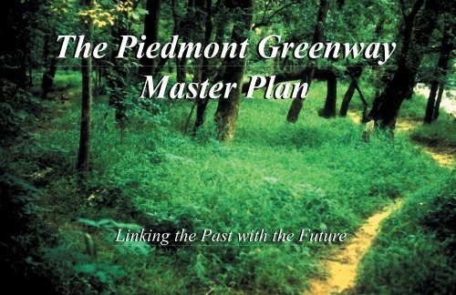
Linking the Past with the Future
The <strong>Piedmont</strong> <strong>Greenway</strong><br />
<strong>Master</strong> <strong>Plan</strong><br />
Linking the Past with the Future<br />
Prepared for:<br />
The <strong>Piedmont</strong> Land Conservancy<br />
Prepared by:<br />
<strong>Greenway</strong>s Incorporated<br />
January 2003
TABLE OF CONTENTS<br />
Executive Summary...............................................................................................................................................1<br />
Overview and Introduction...................................................................................................................................3<br />
Regional Context....................................................................................................................................................4<br />
Vision Goals and Objectives..................................................................................................................................5<br />
Benefits <strong>of</strong> <strong>Greenway</strong>s............................................................................................................................................7<br />
Inventory <strong>of</strong> Existing Conditions........................................................................................................................10<br />
<strong>Master</strong> <strong>Plan</strong> Recommendations ..........................................................................................................................22<br />
Segment 1: Salem Lake to East Forsyth High School....................................................................................................................................28<br />
Segment 2: East Forsyth High School to Cash Elementary School...............................................................................................................30<br />
Segment 3: <strong>Kernersville</strong> Lake Spur Trail .......................................................................................................................................................32<br />
Segment 4: Cash Elementary to YMCA..........................................................................................................................................................34<br />
Segment 5: YMCA Spur Trail .........................................................................................................................................................................36<br />
Segment 6: Kerners Mill Creek Spur Trail.....................................................................................................................................................38<br />
Segment 7: YMCA to Civitan Park.................................................................................................................................................................40<br />
Segment 8: Civitan Park to Triad Park..........................................................................................................................................................42<br />
Segment 9: Triad Park to Reedy Fork Creek..................................................................................................................................................44<br />
Segment 10: Reedy Fork Creek to Highway 68 Underpass ...........................................................................................................................46<br />
Segment 11: Highway 68 to Northwest School Road.....................................................................................................................................48<br />
Segment 12: Moore's Creek Corridor ............................................................................................................................................................50<br />
Segment 13: Pleasant Ridge Road Trail Head to Lake Higgins Trail Head..................................................................................................52<br />
Segment 14: Summerfield Spur Trail..............................................................................................................................................................54<br />
Design Guidelines.................................................................................................................................................56<br />
Estimates <strong>of</strong> Probable Costs................................................................................................................................60<br />
Sources <strong>of</strong> Funding ..............................................................................................................................................71<br />
Methods <strong>of</strong> Gaining Public Access .....................................................................................................................75<br />
PIEDMONT GREENWAY<br />
Final <strong>Master</strong> <strong>Plan</strong> Report<br />
TOC-1
<strong>Greenway</strong> Facility Safety and Security..............................................................................................................77<br />
Watersheds <strong>of</strong> Guilford and Forsyth Counties .................................................................................................83<br />
Appendix A: Trail Alignment........................................................................................................................... A-1<br />
Appendix B: Public Information Flyer........................................................................................................... A-2<br />
Appendix C: Public Survey.............................................................................................................................. A-3<br />
Appendix D: Survey Results ............................................................................................................................ A-4<br />
Appendix E: Newspaper Articles..................................................................................................................... A-6<br />
PIEDMONT GREENWAY<br />
Final <strong>Master</strong> <strong>Plan</strong> Report<br />
TOC-2
LIST OF MAPS & FIGURES<br />
Figure 1: Regional View <strong>of</strong> the <strong>Piedmont</strong> <strong>Greenway</strong> Corridor ........................................................................................................... 4<br />
Figure 2: Primary Spur Trail <strong>Piedmont</strong> <strong>Greenway</strong> Segments ............................................................................................................. 27<br />
Figure 3: Location <strong>of</strong> Segment 1 ......................................................................................................................................................... 28<br />
Figure 4: Map <strong>of</strong> Segment 1 ................................................................................................................................................................ 29<br />
Figure 5: Location <strong>of</strong> Segment 2 ......................................................................................................................................................... 30<br />
Figure 6: Map <strong>of</strong> Segment 2 ................................................................................................................................................................ 31<br />
Figure 7: Location <strong>of</strong> Segment 3 ......................................................................................................................................................... 32<br />
Figure 8: Map <strong>of</strong> Segment 3 ................................................................................................................................................................ 33<br />
Figure 9: Location <strong>of</strong> Segment 4 ......................................................................................................................................................... 34<br />
Figure 10: Map <strong>of</strong> Segment 4 ................................................................................................................................................................ 35<br />
Figure 11: Location <strong>of</strong> Segment 5 ......................................................................................................................................................... 36<br />
Figure 12: Map <strong>of</strong> Segment 5 ................................................................................................................................................................ 37<br />
Figure 13: Location <strong>of</strong> Segment 6 ......................................................................................................................................................... 38<br />
Figure 14: Map <strong>of</strong> Segment 6 ................................................................................................................................................................ 39<br />
Figure 15: Location <strong>of</strong> Segment 7 ......................................................................................................................................................... 40<br />
Figure 16: Map <strong>of</strong> Segment 7 ................................................................................................................................................................ 41<br />
Figure 17: Location <strong>of</strong> Segment 8 ......................................................................................................................................................... 42<br />
Figure 18: Map <strong>of</strong> Segment 8 ................................................................................................................................................................ 43<br />
Figure 19: Location <strong>of</strong> Segment 9 ......................................................................................................................................................... 44<br />
Figure 20: Map <strong>of</strong> Segment 9 ................................................................................................................................................................ 45<br />
Figure 21: Location <strong>of</strong> Segment 10 ....................................................................................................................................................... 46<br />
Figure 22: Map <strong>of</strong> Segment 10 .............................................................................................................................................................. 47<br />
Figure 23: Location <strong>of</strong> Segment 11 ....................................................................................................................................................... 48<br />
Figure 24: Map <strong>of</strong> Segment 11 .............................................................................................................................................................. 49<br />
Figure 25: Location <strong>of</strong> Segment 12 ....................................................................................................................................................... 50<br />
Figure 26: Map <strong>of</strong> Segment 12 .............................................................................................................................................................. 51<br />
Figure 27: Location <strong>of</strong> Segment 13 ....................................................................................................................................................... 52<br />
Figure 28: Map <strong>of</strong> Segment 13 .............................................................................................................................................................. 53<br />
Figure 29: Location <strong>of</strong> Segment 14 ....................................................................................................................................................... 54<br />
PIEDMONT GREENWAY<br />
Final <strong>Master</strong> <strong>Plan</strong> Report<br />
TOC-3
Figure 30: Map <strong>of</strong> Segment 14 .............................................................................................................................................................. 55<br />
Figure 31: Phase 1 Cost Estimates ......................................................................................................................................................... 61<br />
Figure 32: Phase 2 Cost Estimates ......................................................................................................................................................... 61<br />
Figure 33: Phase 3 Cost Estimates ......................................................................................................................................................... 62<br />
Figure 34: Phase 4 Cost Estimates ......................................................................................................................................................... 62<br />
Figure 35: Phase 5 Cost Estimates ......................................................................................................................................................... 63<br />
Figure 36: Phase 6 Cost Estimates ......................................................................................................................................................... 63<br />
Figure 37: Phase 7 Cost Estimates ......................................................................................................................................................... 64<br />
Figure 38: Phase 8 Cost Estimates ......................................................................................................................................................... 64<br />
Figure 39: Phase 9 Cost Estimates ......................................................................................................................................................... 65<br />
Figure 40: Phase 10 Cost Estimates ....................................................................................................................................................... 65<br />
Figure 41: Phase 11 Cost Estimates ....................................................................................................................................................... 66<br />
Figure 42: Phase 12 Cost Estimates ....................................................................................................................................................... 66<br />
Figure 43: Phase 13 Cost Estimates ....................................................................................................................................................... 67<br />
Figure 44: Total Phase Cost Estimates .................................................................................................................................................. 67<br />
Figure 45: Total Parcel Acres ................................................................................................................................................................ 69<br />
Figure 46: Total Easement Acres .......................................................................................................................................................... 69<br />
PIEDMONT GREENWAY<br />
Final <strong>Master</strong> <strong>Plan</strong> Report<br />
TOC-4
EXECUTIVE SUMMARY<br />
The <strong>Piedmont</strong> <strong>Greenway</strong> System Concept<br />
The vision for our <strong>Piedmont</strong> <strong>Greenway</strong> is <strong>of</strong> families walking with their children, bicyclists enjoying a<br />
sunny afternoon ride to Winston-Salem and back to Greensboro, the local high school's cross country team<br />
practicing, retired couples strolling, joggers running, birdwatchers catching a glimpse <strong>of</strong> a migrating warbler,<br />
kids spying their first glimpse <strong>of</strong> a deer on their way to school - all enjoying the outdoors on a maintained trail<br />
without worrying about traffic.<br />
To achieve this vision a technical <strong>Master</strong> <strong>Plan</strong> has to be created to include the interests <strong>of</strong> the local<br />
citizens and municipalities. These interests address community needs, which are incorporated into a guiding<br />
document.<br />
The proposed <strong>Piedmont</strong> <strong>Greenway</strong> should be viewed as a recreational, physical fitness, and alternative<br />
transportation resource incorporating multiple uses including environmental education, better floodplain management,<br />
enhancing wildlife habitat, and improving water quality.<br />
Recommendations for this multi-objective greenway are based largely on input from the general public,<br />
local businesses, civic and community organizations and public agencies. At the beginning <strong>of</strong> the planning<br />
process, a number <strong>of</strong> potential greenway corridors were identified through a meeting with staff members from<br />
the cities and counties. The greenway corridor alternative map was evaluated and presented at meetings with<br />
interested individuals and at two public workshops. Comments received from these meetings and workshops<br />
were incorporated into the <strong>Master</strong> <strong>Plan</strong> recommendations for the greenway system.<br />
Proposed greenway corridors are located along natural and man-made linear corridors and generally follow<br />
roadways, ridge tops and waterways within the study limits. This means greenways will fulfill objectives<br />
related to alternative transportation, natural resource conservation and water quality and floodplain management<br />
in addition to their function as recreational resources. Corridors were also selected to ensure development<br />
<strong>of</strong> a continuous greenway, centrally located and spanning the area from Salem Lake in Forsyth County<br />
to Lake Higgins in Guilford County. The greenway is designed with the potential to extend into neighboring<br />
jurisdictions when desired and funding becomes available.<br />
The <strong>Master</strong> <strong>Plan</strong>ning Process<br />
The <strong>Piedmont</strong> Land Conservancy (PLC) commissioned <strong>Greenway</strong>s Incorporated, <strong>of</strong> Durham, NC, to<br />
assist the communities <strong>of</strong> Forsyth and Guilford counties in preparing this <strong>Master</strong> <strong>Plan</strong>. The planning process<br />
consisted <strong>of</strong> several primary tasks. First, viable site evaluations were undertaken in Forsyth and Guilford<br />
Counties for potential <strong>Piedmont</strong> <strong>Greenway</strong> corridors. Representatives <strong>of</strong> city departments, local<br />
agencies, nonpr<strong>of</strong>it organizations and interested citizens provided focused feedback and input<br />
throughout the planning process. The formation <strong>of</strong> goals and objectives came next, crafted from<br />
comments received from staff meetings and citizen participation in two community workshops.<br />
Preliminary recommendations were then developed and presented to participants for review. Recommendations<br />
were implemented into the document by PLC and city and county staff and submitted<br />
by <strong>Greenway</strong>s, Inc. for final review. The last step <strong>of</strong> the planning process was the presentation<br />
<strong>of</strong> the final plan to PLC.<br />
Recommendations<br />
The <strong>Piedmont</strong> <strong>Greenway</strong> in Forsyth and<br />
Guilford counties is envisioned as a project with<br />
several objectives. The greenway corridor is<br />
designed to include improved floodplain management,<br />
protect wildlife habitat, enhance water<br />
quality, provide for passive recreation, encourage<br />
environmental and cultural education, promote<br />
personal fitness, accommodate alternative<br />
transportation and <strong>of</strong>fer recreational resources.<br />
The proposed <strong>Piedmont</strong> <strong>Greenway</strong> corridor<br />
is approximately eighteen miles in length, and<br />
is located along natural and man-made linear<br />
corridors which generally follow roadways, ridge tops and waterways within the study limits. The<br />
corridors have been selected to ensure development <strong>of</strong> a continuous system <strong>of</strong> on- and <strong>of</strong>f-road<br />
greenway system flowing through North, South, East, West and Central Forsyth and Guilford<br />
Counties, with the potential to extend into neighboring jurisdictions.<br />
Five regions are proposed as sites <strong>of</strong> the primary <strong>Piedmont</strong> <strong>Greenway</strong> System: (please refer to<br />
Figure 2, page 27):<br />
• Salem Lake<br />
• Residential <strong>Kernersville</strong><br />
• Downtown <strong>Kernersville</strong><br />
• Residential Greensboro<br />
• Lakes Segment<br />
PIEDMONT GREENWAY<br />
Final <strong>Master</strong> <strong>Plan</strong> Report 1
Spur trails are considered alternative options for neighborhoods served by the <strong>Piedmont</strong> <strong>Greenway</strong>. Such<br />
spurs can serve as enhancements <strong>of</strong> and additions to the primary system.<br />
<strong>Greenway</strong> per year as the plan recommends. Additional funding for <strong>Piedmont</strong> <strong>Greenway</strong> acquisition<br />
and capital improvements could come from a bond referendum.<br />
The <strong>Master</strong> <strong>Plan</strong> is intended to serve as a “living document” to be used as a reference guide for greenway<br />
development in the area for years to come. To this end, the plan includes design guidelines and associated<br />
amenities for all levels <strong>of</strong> <strong>Piedmont</strong> <strong>Greenway</strong> use. These guidelines should be consulted as the <strong>Piedmont</strong><br />
<strong>Greenway</strong> is developed to ensure a consistent, high quality system.<br />
<strong>Plan</strong> <strong>of</strong> Action<br />
The <strong>Piedmont</strong> <strong>Greenway</strong> <strong>Master</strong> <strong>Plan</strong> is comprehensive and visionary. The plan identifies a continuous<br />
greenway corridor through Forsyth and Guilford counties and proposes specific action steps to establish the<br />
greenway in two-year, five-year, and 10-year time frames. To realize the vision laid forth in this plan, the following<br />
will need to be incorporated into each <strong>Piedmont</strong> <strong>Greenway</strong> phase: master planning, land protection,<br />
design development and plans for greenway construction and maintenance.<br />
Implementation Strategy<br />
The <strong>Piedmont</strong> <strong>Greenway</strong> <strong>Master</strong> <strong>Plan</strong> can best be implemented through a public-private partnership.<br />
Successful implementation will require a concerted effort by private citizens as well as the counties and cities<br />
<strong>of</strong> Forsyth and Guilford. Implementation can not be achieved by any one city or county. To be truly successful,<br />
the greenway system must become the a partnership project.<br />
It is recommended that the <strong>Piedmont</strong> Land Conservancy facilitate the formation <strong>of</strong> a private, nonpr<strong>of</strong>it<br />
501 (c) (3) corporation, that would be formed to raise money from the private sector for use in parks, recreation<br />
and <strong>Piedmont</strong> <strong>Greenway</strong> projects. The counties <strong>of</strong> Forsyth and Guilford should create a new <strong>Piedmont</strong><br />
<strong>Greenway</strong> Advisory Commission, comprised <strong>of</strong> private citizens, to help prioritize projects in the <strong>Piedmont</strong><br />
<strong>Greenway</strong> <strong>Master</strong> <strong>Plan</strong>. The commission should also be prepared to recommend projects and their funding<br />
to city councils and aldermen, to assist in right-<strong>of</strong>-way acquisition and to act as strong advocates for the<br />
<strong>Piedmont</strong> <strong>Greenway</strong>. City and county staff will perform planning, design and management functions for the<br />
<strong>Piedmont</strong> <strong>Greenway</strong> System. Staff should work closely with both the nonpr<strong>of</strong>it corporation and the <strong>Piedmont</strong><br />
<strong>Greenway</strong> Advisory Commission described above.<br />
The Forsyth and Guilford counties <strong>Piedmont</strong> <strong>Greenway</strong> System is an initiative that will require a fresh<br />
look at how local dollars are spent to fulfill community-wide objectives. The greenway will serve as a functional<br />
land-use system providing financial return on money the communities invest in infrastructure, transportation,<br />
recreation and education. Based on the expenditures <strong>of</strong> similar communities, it is recommended that<br />
the set-aside amount should be at least $500,000 per year to be used as seed money for greenway planning,<br />
land acquisition and development. When matched with $500,000 in public and private funds (as identified in<br />
the <strong>Master</strong> <strong>Plan</strong>), this $1 million will contribute to the development <strong>of</strong> a minimum <strong>of</strong> two miles <strong>of</strong> <strong>Piedmont</strong><br />
PIEDMONT GREENWAY<br />
Final <strong>Master</strong> <strong>Plan</strong> Report 2
OVERVIEW AND INTRODUCTION<br />
Since the first city was founded in the heart <strong>of</strong> the <strong>Piedmont</strong>, the region has been recognized as one <strong>of</strong><br />
the best places to live in the South. The region’s popularity stems from the natural amenities <strong>of</strong> the <strong>Piedmont</strong>,<br />
combining the friendly atmosphere <strong>of</strong> small towns such as <strong>Kernersville</strong> and the cultural activities <strong>of</strong> the larger<br />
cities <strong>of</strong> Winston-Salem and Greensboro. Tourists and other visitors come to see a wide range <strong>of</strong> attractions,<br />
such as Old Salem Village and Wake Forest University, and many choose to make Forsyth and Guilford counties<br />
their permanent homes, creating a growing urban area.<br />
The development <strong>of</strong> a comprehensive greenway system will enhance the region’s natural amenities.<br />
<strong>Greenway</strong>s are linear corridors <strong>of</strong> natural land that serve a variety <strong>of</strong> purposes, especially when trails are<br />
developed within these corridors. As an alternative transportation route, tourist attraction and natural<br />
resource corridor, a central continuous greenway in Forsyth and Guilford counties affords important<br />
connections between workplaces and homes, shopping areas and neighborhoods, parks and schools,<br />
historic sites and hotels, rivers and ridge tops and lakes and valleys. A central greenway developed as a<br />
continuous link between the cities <strong>of</strong> Winston-Salem and Greensboro will bring further recognition to<br />
the region for its quality <strong>of</strong> life. <strong>Greenway</strong>s have also been proven to attract new business.<br />
Today, many <strong>of</strong> the features that drew new families to the region are threatened by growth and development.<br />
With few exceptions, the region is not a friendly place for bicyclists or pedestrians, especially in<br />
recently developed areas. Once it was easier and safer to travel on foot or by bicycle between neighborhoods<br />
and such destinations as local schools, parks, shops, restaurants and businesses. Today, these connections<br />
have been severed by the development <strong>of</strong> highways, unsafe intersections, sprawling land uses (increasing distances<br />
between destinations) and other automobile-oriented hazards that serve as physical and psychological<br />
barriers to bicycle and pedestrian travelers. To reach the city from either Greensboro to the northeast or Winston-Salem<br />
to the southwest tourists must negotiate strip commercial development and four-lane roadways, an<br />
unattractive prospect even for motorists. Tourists are <strong>of</strong>ten forced to remain in their cars instead <strong>of</strong> bicycling<br />
or walking around the area. Encouraging tourists to use bicycles or to walk will generate more tourist revenue<br />
for local businesses.<br />
Not only have connections between popular origins and destinations in the region been severed, but the<br />
community’s physical connections to its rivers and ridges have been limited. Many residents are unaware<br />
<strong>of</strong> the existence <strong>of</strong> the region’s lakes and creeks, even though they may drive across them on a regular basis.<br />
Encroachment by residences and businesses on these waterways has led to water quality degradation and<br />
increased the potential for flooding. The parks serving the region <strong>of</strong>fer residents and visitors excellent outdoor<br />
recreation opportunities, including trails along the major sites <strong>of</strong> Salem Lake, Lake Brandt and Lake Higgins.<br />
However, continuous public open space within the central core <strong>of</strong> the counties is minimal.<br />
Additionally, as is common in many other urban areas throughout the country, Forsyth and<br />
Guilford counties are beginning to experience the problems that accompany rapid growth, including<br />
increased traffic congestion, diminishing air and water quality, a loss <strong>of</strong> wildlife habitat and<br />
natural lands, and fewer close-to-home recreational opportunities.<br />
Responding to these growth problems, the <strong>Piedmont</strong> Land Conservancy (PLC) asked<br />
<strong>Greenway</strong>s Incorporated to assist the communities <strong>of</strong> Forsyth and Guilford counties in developing<br />
a <strong>Piedmont</strong> <strong>Greenway</strong> <strong>Master</strong> <strong>Plan</strong>. Prior to the initiation <strong>of</strong> the <strong>Master</strong> <strong>Plan</strong>, PLC is already at<br />
work in both counties and the region, negotiating with landowners to acquire land for greenways<br />
and other purposes.<br />
<strong>Greenway</strong>s Incorporated is a nationally recognized multi-disciplinary environmental planning<br />
and design firm that specializes in providing consulting services to government agencies, for-pr<strong>of</strong>it<br />
corporations and nonpr<strong>of</strong>it organizations. Their chosen pr<strong>of</strong>essional focus is greenway planning,<br />
design, development and management and they have provided services to more than 120 communities<br />
in 28 states. Chuck Flink, the president <strong>of</strong> the firm, participated in the development <strong>of</strong> the<br />
Bethabara <strong>Greenway</strong> in Forsyth County and the Bicentennial <strong>Greenway</strong> in Guilford County prior to<br />
the firm’s producing the <strong>Piedmont</strong> <strong>Greenway</strong> <strong>Master</strong> <strong>Plan</strong>.<br />
In association with local residents, the cities <strong>of</strong> Winston Salem, Greensboro and <strong>Kernersville</strong><br />
planning <strong>of</strong>fices, parks and recreation departments and other municipal government staff,<br />
<strong>Greenway</strong>s Incorporated has prepared this <strong>Master</strong> <strong>Plan</strong> report. The report and associated graphic<br />
elements represent initial investigations and evaluation <strong>of</strong> the <strong>Piedmont</strong> <strong>Greenway</strong> as a future multipurpose<br />
transportation corridor bridging the counties <strong>of</strong> Forsyth and Guilford and connecting the<br />
cities <strong>of</strong> Winston Salem, <strong>Kernersville</strong> and Greensboro.<br />
This report is divided into several sections describing the existing conditions <strong>of</strong> the project<br />
corridor, incorporating the comments <strong>of</strong> local residents who participated in the master planning<br />
process, making design development recommendations and estimating probable costs. The report<br />
also includes a recommended phasing strategy for the project and an action plan for involving local<br />
residents in the development and management <strong>of</strong> the <strong>Piedmont</strong> <strong>Greenway</strong>.<br />
The <strong>Piedmont</strong> <strong>Greenway</strong> <strong>Master</strong> <strong>Plan</strong> <strong>of</strong>fers new opportunities for broadening community<br />
interaction and enhancing the environment in one <strong>of</strong> the state’s most attractive growth areas.<br />
PIEDMONT GREENWAY<br />
Final <strong>Master</strong> <strong>Plan</strong> Report 3
REGIONAL CONTEXT<br />
The <strong>Piedmont</strong> <strong>Greenway</strong> Corridor is centrally located within the counties <strong>of</strong> Forsyth and Guilford. The<br />
corridor will span the Salem Lake area in Forsyth County to Lake Higgins in Guilford County. Because <strong>of</strong> its<br />
key location, the potential exists for this corridor to be the major recreational spine for parks and open spaces<br />
in the central region, connecting the cities <strong>of</strong> Winston Salem, <strong>Kernersville</strong>, and Greensboro. The primary<br />
function <strong>of</strong> the greenway will be to serve as an alternative transportation corridor for walking, bicycling and<br />
other forms <strong>of</strong> transportation. A greenway along portions <strong>of</strong> Kerners Mill Creek, Reedy Fork Creek and<br />
Moore’s Creek also provides an opportunity to manage the creeks’ significant natural resources, providing a<br />
continuous “green corridor” protecting riparian wildlife habitat and wetlands and improving water quality.<br />
Development <strong>of</strong> the <strong>Piedmont</strong> <strong>Greenway</strong> addresses a clearly identified need for walking paths and safe bicycling<br />
facilities within the cities and counties <strong>of</strong> the region.<br />
Regionally, the <strong>Piedmont</strong> <strong>Greenway</strong> is an<br />
important segment <strong>of</strong> a larger corridor which can<br />
link to existing trails such as the Winston-Salem<br />
Strollway, Salem Creek <strong>Greenway</strong>, Salem Lake<br />
Trail system, Triad Park trail system, Bicentennial<br />
<strong>Greenway</strong> (Greensboro and High Point systems),<br />
Lake Higgins trail system. Other important links<br />
are the natural resource areas <strong>of</strong> Reedy Fork Creek,<br />
Beaver Creek, Moore’s Creek, and the Lake Higgins<br />
and Lake Brandt natural areas (See Regional Map,<br />
Figure 1.). This regional network <strong>of</strong> open space<br />
and greenway corridors could serve as a recreation/<br />
alternative-transportation linkage into neighboring<br />
communities, and other parks and community<br />
facilities including schools, libraries, and neighborhoods.<br />
Additionally, spur trails would provide future<br />
connections along creek streambeds, equestrian<br />
trails and utility corridors to ultimately tie into<br />
<strong>Kernersville</strong> lake, and existing trails such as Bowen<br />
Branch Trail, Silas Creek <strong>Greenway</strong>, Bethabara<br />
Trail, Lake Brandt trail system, the proposed<br />
Haw River Regional <strong>Greenway</strong>, and the proposed<br />
Mountians-to-Sea North Carolina trail system.<br />
The creeks that form the continuous <strong>Piedmont</strong><br />
<strong>Greenway</strong> corridor are an important water resource and their recreational and educational<br />
opportunities are significant. Pedestrian access into the more southern portions <strong>of</strong> the greenway<br />
would create a new north-south route for greenway users, who could then access Salem Lake<br />
Natural Area with its several piers for fishing and viewing, picnic areas, walking trails and a fishing<br />
center. The <strong>Piedmont</strong> <strong>Greenway</strong> will link important existing educational and recreational areas<br />
such as Salem Lake, <strong>Kernersville</strong> Lake, Lake Higgins and Lake Brandt at Bur-Mil-Park to communities<br />
such as Old Salem, <strong>Kernersville</strong>, and Summerfield, while providing a link to urban and<br />
heavily commercialized areas within Winston-Salem and Greensboro.<br />
The cities <strong>of</strong> Winston-Salem, <strong>Kernersville</strong> and Greensboro <strong>of</strong>fer scenic surroundings and<br />
important historical sites. In recent years, residents and tourists have enjoyed the enhanced atmosphere<br />
<strong>of</strong> the revitalized downtowns. The <strong>Piedmont</strong> <strong>Greenway</strong> will further empower the region<br />
to provide opportunities that will connect communities, parks, wildlife corridors and historic and<br />
cultural sites.<br />
Figure 1. Regional view <strong>of</strong> the <strong>Piedmont</strong> <strong>Greenway</strong> Corridor.<br />
PIEDMONT GREENWAY<br />
Final <strong>Master</strong> <strong>Plan</strong> Report 4
VISION, GOALS AND OBJECTIVES<br />
The following is the vision statement crafted for the <strong>Piedmont</strong> <strong>Greenway</strong> System. Goals that support<br />
this vision and a series <strong>of</strong> objectives to achieve each goal follow the vision statement. The vision, goals and<br />
objectives reflect the needs and desires <strong>of</strong> residents living in the study corridors, as indicated in the public<br />
involvement process <strong>of</strong> the <strong>Master</strong> <strong>Plan</strong>ning effort (see Summary <strong>of</strong> Public Input).<br />
Vision<br />
Historically, land forms have provided the reason for the location <strong>of</strong> development in the <strong>Piedmont</strong><br />
Triad area. Settlers first came to the <strong>Piedmont</strong> Triad to build cities where people could live, work and play<br />
and where wildlife thrived. Through time, Native American trading routes became wagon trails which then<br />
became roadways across the land, connecting the cities to other towns and bringing the people <strong>of</strong> the region<br />
together. The future <strong>of</strong> land corridors in the region should build upon these connections through greenways<br />
which serve to protect and promote the qualities <strong>of</strong> these corridors, places where:<br />
• Land connects to water;<br />
• People connect to nature;<br />
• Past connects to the present;<br />
• Residents connect with each other;<br />
• Community connects to economy;<br />
• People connect to parks;<br />
• Home connects to work, school, and shops;<br />
• And city connects to countryside.<br />
Goals and Objectives<br />
The following goals and numbered objectives support the vision statement. These goal categories are<br />
representative <strong>of</strong> the benefits outlined in the previous chapter and reflect the “connections” theme which has<br />
been voiced by many citizens. Although the goals are not listed in priority order, the objectives rated as most<br />
important by residents during community workshops are listed first.<br />
Where Land Connects To Water<br />
Goal: <strong>Greenway</strong> corridors along waterways will improve water quality and reduce the impacts <strong>of</strong> flooding on<br />
lives and property by providing a more appropriate use for floodplain lands.<br />
3. Promote the use <strong>of</strong> native vegetation in greenway development;<br />
4. Protect drinking water sources by conserving lands adjacent to surface water bodies;<br />
5. Establish monitoring stations along greenways to measure water quality;<br />
6. Promote and support a comprehensive management plan for floodplains that reduces<br />
exposure to future flooding and financial losses;<br />
7. Help restore the quality <strong>of</strong> creeks and streams to levels suitable for recreational contact;<br />
8. Promote the use <strong>of</strong> soil bioengineering techniques in stream bank stabilization;<br />
9. Improve water quality by discouraging impervious surfaces in greenway lands;<br />
10.Encourage the development <strong>of</strong> greenways within sewer corridors.<br />
Where People Connect To Nature<br />
Goal: <strong>Greenway</strong> corridors will conserve plant and wildlife habitat and serve as sites to educate<br />
visitors on environmental issues.<br />
1. Protect, restore, and maintain environmentally sensitive lands to support plant and animal<br />
habitat;<br />
2. Provide public access to natural streams and reconnect the downtown with the creeks;<br />
3. Connect fragmented ecosystems and habitat areas to maintain native habitat and viable<br />
plant and wildlife communities;<br />
4. Establish “outdoor classrooms” along greenways to teach students about riparian and terrestrial<br />
trail ecology;<br />
5. Provide interpretive signage along greenways to highlight the natural resources <strong>of</strong> the area;<br />
6 .Improve air quality in the region through promoting non-motorized forms <strong>of</strong> transportation;<br />
7. Protect the native ecosystems <strong>of</strong> ridge lines and their view sheds;<br />
8. Connect ridge lines to nearby neighborhoods.<br />
Where The Past Connects To The Present<br />
Goal: <strong>Greenway</strong> corridors will highlight and enhance significant historical structures, places and<br />
people as part <strong>of</strong> the local landscape.<br />
1. Provide interpretive signage along greenways to highlight the historic resources <strong>of</strong> the area<br />
(this could be accomplished by working with nonpr<strong>of</strong>it organizations and local universities);<br />
2. Encourage the preservation and restoration <strong>of</strong> historic buildings, sites, and archeological<br />
resources in the greenway corridors;<br />
3. Connect historic and archeological sites to neighborhoods, parks, schools and other areas;<br />
4. Revitalize historic transportation corridors (railroads and roads) as greenway facilities.<br />
1. Restore degraded watershed, provide river and stream bank stabilization, and promote enhancement<br />
<strong>of</strong> natural waterways to improve water quality;<br />
2. Provide reasonable, adequate streamside vegetated buffers to filter pollutants and run<strong>of</strong>f;<br />
PIEDMONT GREENWAY<br />
Final <strong>Master</strong> <strong>Plan</strong> Report 5
Where Residents Connect With Each Other<br />
Goal: <strong>Greenway</strong> corridors will improve the quality <strong>of</strong> life for residents.<br />
1. Provide opportunities for physical fitness and activities to improve health and physical wellbeing;<br />
2. Promote greenways as “self-policing” facilities, where the potential for any criminal activity is<br />
reduced due to the numbers <strong>of</strong> trail users and neighbors;<br />
3. Connect neighborhoods within the study corridor to other neighborhoods;<br />
4. Present the <strong>Piedmont</strong>’s greenways as community “main streets”, where residents and visitors can<br />
enjoy one another amid pleasant surroundings;<br />
5. S<strong>of</strong>ten the negative impacts <strong>of</strong> heavily used roadways through the development <strong>of</strong> greenways as<br />
natural buffers;<br />
6. Provide greenways as places for community events;<br />
7. Educate the general public about the benefits <strong>of</strong> greenways.<br />
Where Community Connects With The Economy<br />
Goal: <strong>Greenway</strong> corridors will improve the continued economic health <strong>of</strong> the region.<br />
1. Increase the value <strong>of</strong> nearby residential, commercial and industrial properties through greenway<br />
development;<br />
2. Provide greenways as magnets for businesses seeking to relocate;<br />
3. Encourage appropriate land use <strong>of</strong> high-hazard landscapes, reducing exposure to future financial losses<br />
and providing a more cost effective method for managing these resource lands;<br />
4. Establish greenways as tourist destinations;<br />
5. Provide opportunities for economic growth through the creation <strong>of</strong> trail-related businesses (such as<br />
bike shops, restaurants, bed and breakfasts and plant nurseries);<br />
6. Promote the efficient use <strong>of</strong> existing resources through developing greenways within utility rights-<strong>of</strong>way.<br />
Where Home Connects To Work, School and Shops<br />
Goal: <strong>Greenway</strong> corridors will provide alternative transportation facilities for residents and<br />
visitors.<br />
1. Provide greenways as safe linkages between neighborhoods, businesses, schools and<br />
shopping areas;<br />
2. Promote bicycle and pedestrian friendly land uses;<br />
3. Establish on- and <strong>of</strong>f-road greenway corridors to maximize alternative transportation<br />
opportunities;<br />
4. Provide connections between greenways and transit facilities to promote alternative<br />
transportation modes;<br />
5. Coordinate greenway development with state and local transportation agencies and projects;<br />
6. Work with NCDOT, Winston-Salem DOT, and Greensboro DOT to incorporate bicycle and<br />
pedestrian facilities into future roadway maintenance and improvement projects.<br />
Where City Connects To Countryside<br />
Goal: <strong>Greenway</strong> corridors will provide a regional network <strong>of</strong> recreation and transportation routes.<br />
1. Protect and enhance the community’s scenic beauty, including views and vistas <strong>of</strong><br />
ridge lines, creeks, streams and lakes;<br />
2. Establish greenways as connections between the downtown areas and regional destinations<br />
including the Beaver Creek drainage, and Oak Ridge area including the Old Mill <strong>of</strong><br />
Guilford;<br />
3. Provide “urban green” in the downtown areas through on- and <strong>of</strong>f-road greenway<br />
development.<br />
Where People Connect To Parks<br />
Goal: <strong>Greenway</strong> corridors will improve opportunities for close-to-home recreation.<br />
1. Provide greenway access to multiple users, including hikers, joggers, bicyclists, horseback riders and<br />
rollerblades and wheelchair users;<br />
2. Establish greenways as connections among schools, parks and other recreation facilities;<br />
3. Construct greenways where people live, work, and play.<br />
PIEDMONT GREENWAY<br />
Final <strong>Master</strong> <strong>Plan</strong> Report 6
BENEFITS OF GREENWAYS<br />
A multi-objective greenway system for Forsyth and Guilford counties will address and resolve community<br />
issues that affect the future environmental and economic health <strong>of</strong> the region. <strong>Greenway</strong>s have been implemented<br />
by communities throughout the United States to provide recreation and alternative transportation,<br />
control flooding, improve water quality, protect wetlands, conserve habitat for wildlife and buffer adjacent<br />
land uses. <strong>Greenway</strong>s typically incorporate varying types and intensity <strong>of</strong> public use, among them trails for<br />
recreation and transportation and passive and active park facilities, including playing fields. <strong>Greenway</strong>s have<br />
also been shown to increase the value <strong>of</strong> adjacent private properties as an amenity to residential and commercial<br />
developments. These and other benefits <strong>of</strong> a central <strong>Piedmont</strong> <strong>Greenway</strong> network are described in the<br />
following pages.<br />
Transportation Benefits<br />
In past years, American communities have grown in a sprawling form because <strong>of</strong> dependence upon<br />
the automobile as the sole means <strong>of</strong> transportation. Americans have abandoned some traditional forms <strong>of</strong><br />
transportation (such as passenger train service) and have been slow to improve other forms <strong>of</strong> transportation<br />
(bicycle and pedestrian networks, bus systems, local<br />
train service). In order to provide relief from congested<br />
streets and highways, future transportation planning and<br />
development should be concentrated on providing local<br />
residents with a choice in modes <strong>of</strong> travel. These choices<br />
should <strong>of</strong>fer the same benefits and appeal currently <strong>of</strong>fered<br />
by the automobile: efficiency, safety, comfort, reliability<br />
and flexibility.<br />
A central continuous greenway corridor through<br />
Forsyth and Guilford counties can serve as an extension <strong>of</strong><br />
the road network, <strong>of</strong>fering realistic and viable connections<br />
between origins and destinations such as work, schools,<br />
libraries, parks, shopping areas and tourist attractions.<br />
<strong>Greenway</strong>-based bikeways and walkways are most effective<br />
for certain travel distances. Surveys by the Federal<br />
Highway Administration show that Americans are willing<br />
to walk as far as two miles to a destination and bicycle as<br />
far as five miles. The development <strong>of</strong> a central greenway<br />
system allows destinations to be linked to multiple origins<br />
throughout the region with a combination <strong>of</strong> <strong>of</strong>f-road<br />
trails and on-road bicycle and pedestrian facilities.<br />
Economic Benefits<br />
The greenway will bring economic benefits to the region, including raising real property values<br />
and increasing tourism and recreation-related revenues, and can <strong>of</strong>fer savings in the costs for<br />
public services. <strong>Greenway</strong>s have been shown to raise the value <strong>of</strong> immediately adjacent properties<br />
by as much as five to 20 percent. In a new development in Raleigh, North Carolina, new lots situated<br />
on greenways were priced $5,000 higher than comparable lots <strong>of</strong>f the greenway. Many home<br />
buyers and corporations are looking for real estate that<br />
provides direct access to public and private greenway systems.<br />
According to a survey by the National Association<br />
<strong>of</strong> Realtors (NAR) and the National Association <strong>of</strong> Home<br />
Builders (NAHB), trails help sell houses. The survey<br />
report, Consumers’ Survey on Smart Choices for Home<br />
Buyers, released in April 2002, shows that 36 percent <strong>of</strong><br />
2,000 recent home buyers designated walking, jogging or<br />
biking trails as either an “important” or “very important”<br />
community amenity. Trail availability outranked 16 other<br />
options including security, ball fields, golf courses, parks<br />
and access to shopping or business centers. Only highway<br />
access, at 44 percent, was specified as a top amenity by<br />
more <strong>of</strong> the home buyers surveyed. For more information<br />
on the survey, (see www.realtor.org, or www.nahb.org).<br />
<strong>Greenway</strong>s are viewed as amenities by residential,<br />
commercial and <strong>of</strong>fice park developers who, in turn, are<br />
realizing higher rental values and pr<strong>of</strong>its. Additionally,<br />
greenways can save local tax dollars by utilizing resourcebased<br />
strategies for managing community storm water and<br />
hazard mitigation, thus placing into productive use landscapes<br />
that possibly could not be developed in a conventional manner.<br />
Tourism plays a vital role in the economies <strong>of</strong> Forsyth and Guilford counties, and the development<br />
<strong>of</strong> a central greenway will work to enhance the industry. Tourism is currently ranked as the<br />
number one economic force in the world. In several localities throughout the nation, greenways<br />
have been specifically created to capture the tourism potential <strong>of</strong> a landscape or cultural destination.<br />
The state <strong>of</strong> Missouri, for example, spent $6 million to create the 200-mile KATY Trail, which, in<br />
its first full year <strong>of</strong> operation, generated travel and tourism expenditures <strong>of</strong> more than $6 million.<br />
PIEDMONT GREENWAY<br />
Final <strong>Master</strong> <strong>Plan</strong> Report 7
Health and Recreation Benefits<br />
<strong>Greenway</strong>s encourage people to walk or bike to short-distance destinations. Studies have shown that<br />
as little as 30 minutes a day <strong>of</strong> moderate-intensity exercise (such as bicycling, walking, in-line skating or<br />
cross-country skiing) can significantly improve mental and physical health and help prevent certain diseases.<br />
Providing opportunities for participation in outdoor activities<br />
close to where people live and work is an important component<br />
<strong>of</strong> promoting healthy lifestyles for <strong>Piedmont</strong> residents.<br />
In 1987, the President’s Commission on Americans Outdoors<br />
released a report that pr<strong>of</strong>iled the modern pursuit <strong>of</strong> leisure<br />
and defined the current quality <strong>of</strong> life for Americans. Limited<br />
access to outdoor resources was cited as a growing problem<br />
throughout the nation. The commission recommended that a<br />
national system <strong>of</strong> greenways could provide all Americans with<br />
access to linear open-space resources.<br />
This proposed central <strong>Piedmont</strong> <strong>Greenway</strong> is designed to complement the community’s existing parks<br />
and open space system. Trail systems are developed not only for alternative transportation, but also to serve<br />
as primary recreation and fitness resources. Additionally, the greenway can help meet the passive recreation<br />
needs <strong>of</strong> <strong>Piedmont</strong>’s growing population <strong>of</strong> older residents, enhancing the region’s reputation as a popular<br />
place to retire.<br />
Cultural Benefits<br />
<strong>Greenway</strong>s are a tool to enhance cultural assets and protect<br />
historic resources in the <strong>Piedmont</strong> area. Successful greenway<br />
projects across the United States have served as new “main<br />
streets”, where neighbors meet, children play and community<br />
groups gather to celebrate. For cities and towns large and small,<br />
greenways have become a focal point for community activities.<br />
Some communities sponsor “greenway days” to celebrate the<br />
outdoors and local traditions. Walking and running events are<br />
held on greenways to support charity or extend traditional sporting<br />
events. Many civic groups adopt segments <strong>of</strong> greenways for<br />
clean up, litter removal and environmental awareness programs.<br />
Some greenways, like San Antonio’s River Walk, are focal points not only for community activities, but also<br />
for economic development.<br />
Numerous National Register <strong>of</strong> Historic Places,<br />
locally significant sites and historic districts represent<br />
the richness and diversity <strong>of</strong> the <strong>Piedmont</strong> area’s<br />
historic resources. The interpretation <strong>of</strong> historic and<br />
archeological sites along greenways can serve to increase<br />
the awareness and appreciation <strong>of</strong> <strong>Piedmont</strong>’s<br />
rich history. As example, the historic Old Guilford<br />
Mill is an active restored grist-mill still in operation<br />
that could provide a future educational feature for the<br />
greenway system. <strong>Greenway</strong>s can also be vehicles to<br />
provide controlled public access to important cultural<br />
sites in ways that promote preservation and enhance<br />
interpretive opportunities.<br />
Safety Benefits<br />
Many Americans are concerned about crime. According to a report by the Rails-to-Trails<br />
Conservancy (RTC) and the National Park Service Rivers, Trails, and Conservation Assistance<br />
Program, crime and safety concerns are very low for trails. The report, Rail-Trails and Safe communities,<br />
released in January, 1998, shows that out <strong>of</strong> 372 trails that cover approximately 7,000<br />
miles <strong>of</strong> trail with more 45 million annual users, RTC found only 3% <strong>of</strong> responding trails which<br />
had experienced any type <strong>of</strong> major crime. The study found that common sense and preventative<br />
measures should be used on trails to ensure the lowest possible levels <strong>of</strong> crime, trails remain much<br />
safer than many other environments. Simply stated the study said "crime occurs on roads, parking<br />
lots, in shop-ping malls, <strong>of</strong>fice buildings, airports, and at zoos. However, no one would rationally<br />
argue that we shouldn’t build any <strong>of</strong> the above because crime will occur there." The same should be<br />
said for all trail types.<br />
Additionally, RTC also found that letters from law enforcement agencies support these findings.<br />
Crime statistics and reports from law enforcement <strong>of</strong>ficials have shown that parks and<br />
greenways are typically land uses with the lowest incidence <strong>of</strong> reported criminal activity. They<br />
consistently report that rail-trails do not encourage crime. Some <strong>of</strong> the most successful deterrents<br />
to criminal activity have involved increased neighborhood awareness by citizens and participation<br />
in community watch programs. <strong>Greenway</strong>s have proven to be an effective tool to encourage local<br />
residents to participate in neighborhood watch programs.<br />
As a recreation resource, alternative transportation corridor or site where fitness activities<br />
can take place, most greenways provide a safer and more user-friendly resource than other linear<br />
corridors, such as local roads. <strong>Greenway</strong>s typically attract local residents who use the facility<br />
frequently, thus creating an environment that is virtually self-policing. Additionally, greenways—<br />
PIEDMONT GREENWAY<br />
Final <strong>Master</strong> <strong>Plan</strong> Report 8
whether publicly or privately owned—are dedicated for multiple uses and are normally designed to meet<br />
federal, state, and local standards for public safety.<br />
Water Quality and Water<br />
Quantity Benefits<br />
<strong>Greenway</strong>s <strong>of</strong>ten preserve wooded open spaces along<br />
creeks and streams, which absorb floodwaters and filter<br />
pollutants from storm water. Flooding can be a significant<br />
problem, especially when building and other land uses encroach<br />
into flood-prone areas. As an example, by designating the<br />
floodplains <strong>of</strong> Reedy Fork Creek, and Moore’s Creek, and other<br />
tributary creeks <strong>of</strong> the system as greenways, the encroachments can be better managed and in some cases<br />
replaced with linear open space. This open space serves as an amenity to local residents and businesses whose<br />
property lies adjacent to the greenway.<br />
<strong>Greenway</strong>s can also provide needed floodwater storage capacity. As a flood control measure, greenway<br />
corridors serve as a primary storage zone during periods <strong>of</strong> heavy rainfall. The protected floodplain can be<br />
used during non-flood periods for other activities, including recreation and alternative transportation. In conjunction<br />
with existing storm water management policies and programs, greenway lands can be established as<br />
development occurs.<br />
The savings realized in reduced flood-damage claims can<br />
<strong>of</strong>fset the expense associated with the establishment <strong>of</strong> the<br />
greenway system. Additionally, for those residents who are<br />
required to purchase flood insurance, implementation <strong>of</strong> a community-wide<br />
central greenway system in the region is likely to<br />
result in reduced flood insurance rates.<br />
<strong>Greenway</strong> corridors can improve the surface water quality<br />
<strong>of</strong> local rivers and creeks. The floodplain forests and wetlands<br />
contained within the Reedy Creek, Moore’s Creek and small<br />
tributary creeks floodway act as filters for pollutants from storm<br />
water. These pollutants are not removed if storm water is collected<br />
in pipes and discharged directly into local streams and rivers. Improving surface water quality in streams<br />
not only benefits local residents, and the continued protection <strong>of</strong> the critical watershed boundary associated<br />
with Reedy Fork Creek in Guilford County, but also numerous forms <strong>of</strong> wildlife that depend on streams for<br />
their habitat. In the <strong>Piedmont</strong> <strong>Greenway</strong> <strong>Master</strong> <strong>Plan</strong>, one <strong>of</strong> the critical issues is regional protection <strong>of</strong> the<br />
natural environment.<br />
Air Quality Benefits<br />
<strong>Greenway</strong>s as alternative transportation corridors are designed to reduce traffic congestion,<br />
helping to improve local air quality. Automobile emissions in the <strong>Piedmont</strong> area are a major source<br />
<strong>of</strong> such air pollutants as nitrates and carbon monoxide. One <strong>of</strong> the important recommendations <strong>of</strong><br />
the assessment was the “study and implementation <strong>of</strong> appropriate transportation control measures/<br />
programs to reduce mobile emissions.” Offering viable, alternative transportation choices through<br />
greenways would encourage people to bicycle and walk more <strong>of</strong>ten, especially on short trips,<br />
thereby reducing traffic congestion and automobile emissions.<br />
The Triad is able to meet air quality standards at present and has not been designated as a<br />
federal “non-attainment” area (see www.epa.gov/airs/nonattn.html, for more information). However,<br />
air quality monitoring shows that levels <strong>of</strong> such air pollutants as ozone are increasing. Due to<br />
the area’s topography, weather inversions can confine and concentrate pollutants, causing sporadic<br />
increased air pollution.<br />
<strong>Plan</strong>t and Animal Habitat Benefits<br />
<strong>Greenway</strong> corridors serve as viable habitat for many species <strong>of</strong> plants and wildlife.<br />
<strong>Greenway</strong>s provide essential food sources and, most importantly, access to water that is required<br />
by all wildlife. Additionally, a central greenway corridor could become a primary migratory corridor<br />
for terrestrial wildlife, serving to help maintain the integrity <strong>of</strong> many plant and animal gene<br />
pools. Some wildlife biologists have extolled greenways as future “gene-ways” and determined<br />
that migration routes are essential to maintaining healthy wildlife populations. <strong>Greenway</strong>s can also<br />
serve as “gene-ways” for plant species,<br />
which migrate with changes<br />
in climate and habitat. These<br />
“gene-ways” <strong>of</strong>ten follow river<br />
and stream corridors that have long<br />
served as transportation routes for<br />
animals and humans. The <strong>Piedmont</strong><br />
<strong>Greenway</strong> can be targeted as<br />
a primary habitat for many species<br />
<strong>of</strong> plants and animals. Programs<br />
can be established to protect the<br />
valuable existing forest and wetland<br />
areas <strong>of</strong> the region, and to<br />
reclaim and restore streams to support<br />
higher quality habitat.<br />
PIEDMONT GREENWAY<br />
Final <strong>Master</strong> <strong>Plan</strong> Report 9
INVENTORY OF EXISTING CONDITIONS<br />
Summary <strong>of</strong> <strong>Greenway</strong> Efforts<br />
<strong>Plan</strong>ning for greenways and other bicycle and pedestrian facilities is not a new concept in the <strong>Piedmont</strong><br />
region. Comprehensive plans such as the 1995 Guilford County “Forecast 2015” plan and the Winston-Salem<br />
Forsyth County <strong>Greenway</strong> <strong>Plan</strong> "Legacy Development Guide", have involved numerous individuals and organizations<br />
working on promoting greenways to meet the region’s conservation, recreation and transportation<br />
needs. Past planning efforts and others that continue to the present day will be complemented by related<br />
recreation, bicycle and pedestrian planning efforts.<br />
In the 1995 Forecast 2015 <strong>Plan</strong>, Guilford County <strong>of</strong>ficials from two cities, four towns and county government<br />
formed various committees to inform and educate citizens about spatial relationships and physical<br />
features <strong>of</strong> the county which helped identify possible greenways and open space objectives. The <strong>Greenway</strong><br />
<strong>Plan</strong> for Winston-Salem/Forsyth County has formulated a greenway master plan that seeks to address missing<br />
links in its present system.<br />
In addition, parks and recreation departments from the cities <strong>of</strong> Winston-Salem, <strong>Kernersville</strong> and Greensboro<br />
are in the process <strong>of</strong> updating their parks and recreation master plans. The plans will address recreation<br />
needs and park development to the year 2015. <strong>Greenway</strong>s as linear parks are considered in the findings <strong>of</strong><br />
the master plans; however, the vision for parks and greenways has yet to be realized. The counties realize<br />
that their individual plans do not address the need for a common linked greenway that serves citizens <strong>of</strong> both<br />
Forsyth and Guilford counties.<br />
Topography and Drainage<br />
The major topographic features <strong>of</strong> the region encompassed by both counties are the rivers, ridge lines,<br />
and valleys. Elevations range from 720 to 1,050 feet above sea level. The region’s topographic character<br />
is mainly composed <strong>of</strong> wide and <strong>of</strong>ten abrupt variations in elevation due to ravines created by drainage<br />
courses, which lead from the higher elevations to the rivers. Of the major cities and towns in the study area,<br />
<strong>Kernersville</strong> in Forsyth County is the highest point in the study corridor.<br />
The study area includes Forsyth and Guilford Counties which cross five watersheds: the Haw River,<br />
Upper Yadkin River, Lower Yadkin River, Deep River and Upper Dan River. Reedy Fork Creek is the largest<br />
creek in length and volume in the study corridor and is part <strong>of</strong> the Haw River watershed located in Guilford<br />
County. The Haw River watershed spans 638 square miles or 96.9 percent <strong>of</strong> Guilford County, and 10 square<br />
miles or 0.1 percent <strong>of</strong> Forsyth County. The Haw River basin includes 25 rivers and streams for 2,233 total<br />
river miles with 1,680 listed as perennial for the entire watershed. The streams are made up <strong>of</strong> 75<br />
percent forested riparian habitat and 25 percent agricultural/urban riparian habitat. Reedy Fork<br />
creek is a protected water sensitive stream. The north-flowing creek terminates near its confluence<br />
with Lake Brandt in Guilford County. Near Lewiston Road in Guilford County, Moore’s Creek<br />
joins Reedy Fork Creek. Beaver Creek joins Reedy Fork south <strong>of</strong> Bunch Road in Guilford County.<br />
Guilford County is located on a plateau that ranges in elevation from 600 feet to nearly 1,000 feet<br />
within the watershed area. Reedy Fork Creek watershed covers an area <strong>of</strong> 464 square miles and<br />
meanders through low valleys that are separated by broken ridge lines.<br />
The <strong>Piedmont</strong> <strong>Greenway</strong> will follow the floodplains <strong>of</strong> Reedy Fork Creek and part <strong>of</strong> Moore’s<br />
Creek while avoiding some <strong>of</strong> the more sensitive land (wetlands and steep or erodible slopes). This<br />
topography could present constraints to trail development due to steep slopes. In some areas, it<br />
may be difficult or impossible to develop trails to ADA (Americans with Disabilities Act) standards<br />
and in other areas, changes in elevation may completely prohibit trail development. In these cases,<br />
an unimproved nature trail is recommended similar to the type <strong>of</strong> trails existing at Lake Higgins in<br />
Guilford County.<br />
Soils<br />
The composition <strong>of</strong> soil along the creek floodplains found within the greenway corridor directly<br />
affects the feasibility <strong>of</strong> <strong>Piedmont</strong> <strong>Greenway</strong> development in certain areas. The land associations<br />
found along the corridor is characterized by nearly level, well drained to poorly drained soils<br />
that have a sandy loam, loam, silt loam, clay loam, and silty clay loam subsoil, found mostly on<br />
floodplains. Relief, or topography, affects soil formation by causing differences in free drainage,<br />
surface run<strong>of</strong>f, soil temperature and the extent <strong>of</strong> geologic erosion. In Guilford County, the relief<br />
is largely determined by the kind <strong>of</strong> bedrock underlying the soils, by the geology <strong>of</strong> the area and<br />
the amount <strong>of</strong> landscape dissection by streams, and by slope retreat. For soils that have slopes <strong>of</strong><br />
15 percent, geologic erosion removes soil material almost as fast as the soil develops. As a result,<br />
steep slopes are characterized by thin soils and level slopes are characterized by deeper soils.<br />
The majority <strong>of</strong> the soils found along the Reedy Creek portion located in Guilford County are<br />
wetland soils <strong>of</strong> the Chewacla-Wehadkee-Congaree association. Wehadkee soils found within the<br />
Reedy Fork Creek drainage were formed on floodplains, are poorly drained and have similar parent<br />
material but different characteristics according to their topographic position and internal drainage.<br />
Two broad classes <strong>of</strong> parent material exist in the makeup <strong>of</strong> Guilford County soils: bedrock or<br />
those formed in place, and weathered material derived from the bedrock. Reedy Fork Creek and its<br />
tributaries were formed from alluvium soils that weathered upstream and were deposited along the<br />
floodplains.<br />
Soil associations along Moore's Creek in Guilford County show a number <strong>of</strong> areas that are<br />
PIEDMONT GREENWAY<br />
Final <strong>Master</strong> <strong>Plan</strong> Report 10
sensitive to erosion and need to be protected. Moore’s Creek has soils that are derived from the Madison-Cecil<br />
association and can be characterized as strongly sloping to steep, well-drained soils that have a sandy clay<br />
loam, clay loam and clay subsoil. These soils are formed mainly on uplands <strong>of</strong> the creek’s watershed. Beaver<br />
Creek in Guilford County has soils composed <strong>of</strong> the Cecil-Madison association, and they differ from Moore’s<br />
Creek soils due to the difference in slope and clay content. These soils are gently sloping and sloping, welldrained<br />
soils that have a sandy clay loam, clay loam, and clay subsoil. The parent material is derived from<br />
igneous and metamorphic rocks, reflected in the low pH <strong>of</strong> these soils.<br />
In Forsyth County, the relief is largely determined by knobs or ridges and valleys. A broad plateau near<br />
<strong>Kernersville</strong> borders this area on the east. The inter streams areas are remnants <strong>of</strong> an erosional landscape<br />
dissection by streams. The average elevation in the county is 870 feet above sea level. Forsyth County lies at<br />
the junction <strong>of</strong> four drainage basins. The Kerners Mill Creek watershed falls within the Deep River drainage<br />
basin. Chewacla-Wehadkee-Congaree soils predominate in the creek corridor. These poorly drained areas<br />
consist <strong>of</strong> loamy soils subject to frequent inundation by floodwaters. They are generally very nutrient-rich<br />
and can yield botanically interesting habitats. One <strong>of</strong> these areas exists at the terminus <strong>of</strong> Kerners Mill Creek<br />
at the headwaters <strong>of</strong> Salem Lake. Significant to the study corridor is an area east <strong>of</strong> the proposed <strong>Piedmont</strong><br />
<strong>Greenway</strong> along Kerners Mill Creek. This area is known as a <strong>Piedmont</strong>/Mountain Semipermanent Impoundment<br />
and is characterized by its location in the low-gradient floodplain <strong>of</strong> Kerners Mill Creek.<br />
The soils within the urban areas <strong>of</strong> the greenway corridor are well drained for the most part, with loamy<br />
subsoils on area ridges and side slopes <strong>of</strong> mountain areas. Hydric soils (waterlogged soils) can generally be<br />
found only in the floodplain areas <strong>of</strong> rivers and creeks. According to a soil map prepared by the Soil Conservation<br />
Service prior to 1985, soils which are the most unfavorable for development purposes are typically<br />
those located on the steep slopes <strong>of</strong> ridges within the city limits.<br />
(Source: Soil Survey <strong>of</strong> Guilford and Forsyth Counties, North Carolina, United States Department <strong>of</strong> Agriculture, Soil Conservation<br />
Service. 1980., and North Carolina Natural Heritage Inventory <strong>of</strong> Forsyth County, North Carolina. North Carolina<br />
Natural Heritage Program. 1998)<br />
Water Quality<br />
Land use in the study corridor is characterized by continuous urban development on the valley floors.<br />
The primary effects on watersheds <strong>of</strong> the creeks are increased imperviousness, increased frequency <strong>of</strong> flooding,<br />
destabilized stream configurations, disconnection <strong>of</strong> streams from floodplains and loss <strong>of</strong> riparian corridors.<br />
Pollutants and toxicity are a secondary concern. Improving the streams in the urbanized parts <strong>of</strong> the<br />
watersheds will require reconnecting the streams with their floodplains where feasible, and restoring riparian<br />
cover. To do so will require changing land-use patterns in the watersheds. In new and redeveloped areas,<br />
low-impact site design, where appropriate, will be most effective when aimed at a specific location within a<br />
sub-watershed. Similarly, municipal urban run<strong>of</strong>f pollution prevention programs will be most effective when<br />
they are targeted to subwatershed-scale objectives. Riparian buffers are some <strong>of</strong> the most effective tools to<br />
meet goals <strong>of</strong> improving and protecting water quality.<br />
Stream corridors in Guilford County identified for the greenway trail all flow into the City <strong>of</strong><br />
Greensboro's drinking water supply lakes, thus making water quality protection an important issue.<br />
Reedy Fork Creek water quality issues include pathogens due to point-source pollutants and<br />
nutrients from storm water. Agricultural lands adjacent to the creek can be sources <strong>of</strong> suspended<br />
solids and low dissolved oxygen levels due to the lack <strong>of</strong> buffers and (BMP’s). The ecological<br />
condition <strong>of</strong> the Reedy Fork Creek headwaters and Moore’s Creek and tributaries are rated as WS-<br />
III in the watershed. A critical area has been established around Lake Brandt, Lake Higgins and<br />
parts <strong>of</strong> Reedy Fork and the Moore’s Creek drainage area. This area is defined as “land adjacent to<br />
a water supply intake where risk associated with pollution is greater than from remaining portions<br />
<strong>of</strong> the watershed. A critical area is land bounded within one-half mile upstream and draining to a<br />
river intake or within one-half mile and draining to the normal pool elevation <strong>of</strong> water supply reservoirs.”<br />
The critical area restricts certain uses such as development density and the requirements <strong>of</strong><br />
agricultural (BMP’s). The rest <strong>of</strong> the watershed also has restrictions on development (more density<br />
than critical areas), and BMP’s are not required for agriculture. However, as you approach the<br />
more urban/suburban areas near <strong>Kernersville</strong>, water quality <strong>of</strong>ten degrades as the waters enter these<br />
more densely populated areas.<br />
The <strong>Piedmont</strong> <strong>Greenway</strong> corridor can serve to improve the surface water quality <strong>of</strong> Reedy<br />
Fork Creek, Beaver Creek, Moore’s Creek, Kerners Mill Creek and their tributaries. If left unprotected,<br />
some areas in those water bodies can fall below acceptable standards for recreational<br />
water contact. Currently, storm water is collected in pipes and is eventually discharged into the<br />
watershed <strong>of</strong> Reedy Fork and Moore’s Creeks. If more storm water were allowed to flow overland<br />
through floodplain forests and wetlands (hence the need for establishing buffers) more pollutants<br />
would be removed. Cleaner surface water in both creeks would benefit not only local residents,<br />
but also the numerous forms <strong>of</strong> wildlife which depend on streams and creeks for their habitat. Due<br />
to increasing land development along the creeks and within the watershed, water quality must<br />
be protected and monitored to evaluate and improve/preserve present conditions. Inappropriate<br />
agricultural, industrial, residential and commercial development adversely affects water quality and<br />
creates stress on aquatic life and the stability <strong>of</strong> the watersheds.<br />
By designating stream buffers through easements within floodplains will allow the development<br />
<strong>of</strong> the <strong>Piedmont</strong> <strong>Greenway</strong>. Implementing best-management practices will help maintain the<br />
water quality <strong>of</strong> Reedy Fork and Moore’s creeks.<br />
(Source: NCDENR, Dept. <strong>of</strong> Water Quality (DWQ) and The Environmental Protection Agency (EPA) Surf your<br />
Watershed Program, www.epa.gov).<br />
PIEDMONT GREENWAY<br />
Final <strong>Master</strong> <strong>Plan</strong> Report 11
Wetland Communities<br />
The <strong>Piedmont</strong> <strong>Greenway</strong> corridor is abundant in wetlands, especially in Guilford County. Wetlands are<br />
typically defined by the presence <strong>of</strong> three unique interrelated natural features: hydrology, certain soils and<br />
species <strong>of</strong> vegetation. Wetlands are important to many ecological systems and serve as habitat for a diverse<br />
variety <strong>of</strong> plant and animal life. Wetlands also serve to filter pollutants from surface waters, recharge underground<br />
aquifers and absorb floodwaters. Most wetlands are protected by Section 404 <strong>of</strong> the federal Clean<br />
Water Act, which authorizes the U. S. Army Corps <strong>of</strong> Engineers to regulate the discharge <strong>of</strong> dredged and fill<br />
materials into waters <strong>of</strong> the United States, including wetlands (called “Jurisdictional Wetlands”) that meet<br />
certain criteria.<br />
Reedy Fork Creek corridor’s floodplains have saturated soils at least part <strong>of</strong> the year, forming wetlands<br />
along the creek channel. These wetlands are valuable for maintenance <strong>of</strong> quality water resources and abatement<br />
<strong>of</strong> flooding. The U.S. Fish and Wildlife Service’s National Wetlands Inventory defines the different<br />
types <strong>of</strong> wetlands that may occur on a site according to characteristic vegetation and hydrological properties.<br />
Typically, wetlands occur in floodplain landscapes and the following is a listing <strong>of</strong> classified types <strong>of</strong> wetlands<br />
known to exist along Reedy Fork Creek, Beaver Creek, Moore’s Creek and Kerners Mill Creek: riverine,<br />
palustrine, palustrine scrub-shrub, palustrine forested (low water table), and palustrine open water.<br />
Fresh Water Marsh Ecosystem<br />
Fresh water marshes are characterized by herbaceous rather than hardwood plants emerging from water<br />
habitat. Cattails and reeds are two commonly recognized herbaceous wetland species. Marshes are <strong>of</strong>ten<br />
located along streams or immediately adjacent to other permanent water bodies such as the Reedy Fork Creek.<br />
Seasonal changes in water levels are common and complete drying <strong>of</strong> these marshes will occur during periods<br />
<strong>of</strong> drought.<br />
Wet meadows are another type <strong>of</strong> marsh. Water loving grasses, unlike freshwater marshes, characterize<br />
wet meadows. Like the marshes, they frequently do not have standing water.<br />
Field analysis revealed a range <strong>of</strong> marshes and wet meadows scattered throughout the corridor both in<br />
size and range. Several large marshes were found near Lake Brandt, Lake Higgins and the Audubon Acres<br />
and near Lakewood Memory Gardens. These areas are likely to be considered jurisdictional wetlands and are<br />
probably subject to protection under federal, state, and local laws. Some <strong>of</strong> the vegetation identified within<br />
these marshes includes s<strong>of</strong>t rush, wool grass, red maples and black tupelo (gum). Swamp saw grass, spikerush,<br />
dotted smartweed, pickerelweed, bulrush, tickseed and sedge dominate the vegetation.<br />
Riparian Forest Ecosystem<br />
The Reedy Fork Creek drains most <strong>of</strong> the corridor before emptying into Lake Brandt. The plant community<br />
that the stream and its tributaries support is classified as riparian forest. <strong>Plan</strong>t species common to riparian<br />
forests require moist soils to survive, but can also tolerate flooding. The National Wetland Inventory<br />
generally classifies riparian areas as jurisdictional wetlands. Some <strong>of</strong> the species identified<br />
during the field analysis include the red maple, sweetgum, american sycamore, eastern cottonwood,<br />
virginia pine, yellow poplar, black walnut, white oak, water locust, southern catalpa, river birch,<br />
willow oaks, live oaks and swamp chestnut oaks. The understory ranges from dense shrubs to a mix<br />
<strong>of</strong> herbs and grasses with little ground cover. The herbaceous understory consists <strong>of</strong> sedges, rushes,<br />
various ferns, royal fern, ragwort, cardinal flower, marsh mallow, eastern marsh fern, virginia<br />
spiderwort, aster and spleenwort.<br />
Floodplain Forest<br />
The Reedy Fork Creek corridor floodplain forest includes all <strong>of</strong> the land that runs parallel on<br />
either side <strong>of</strong> the creek and lies below the riparian forest community. This community is similar<br />
in species composition to the riparian community. This community has a closed to almost-closed<br />
canopy <strong>of</strong> trees, which include but are not limited to the red maple, honey locust, american elm,<br />
loblolly pine, sycamore, and oaks. The dominant woody understory consists <strong>of</strong> trumpet vine,<br />
american hornbeam, virginia creeper, eastern poison ivy, deerberry, smooth blackhaw, muscadine<br />
and summer grape. There is a combination <strong>of</strong> bottomland trees and pines in the terraces beyond the<br />
bank.<br />
Upland Communities<br />
Early Successional Fields Ecosystem<br />
The majority <strong>of</strong> the Reedy Fork Creek, Moore’s Creek, Beaver Creek and Kerners Mill Creek<br />
corridors are composed <strong>of</strong> abandoned farm fields in various stages <strong>of</strong> ecological succession. When<br />
these fields were originally abandoned, grasses and wildflowers first dominated. The area then<br />
began to support small shrubs and eventually saplings. These old fields are characterized by subtle<br />
differences in plant composition depending on the soil type, the amount <strong>of</strong> water available, the<br />
dominant types <strong>of</strong> trees nearby and the length <strong>of</strong> time the field has been abandoned. The dominant<br />
invasive tree species in these fields are generally eastern red cedar, red maple, sycamore and a variety<br />
<strong>of</strong> oaks and pines.<br />
Within these fields, many small pockets <strong>of</strong> wet meadows and fresh water marshes exist. Prior<br />
to extensive farming <strong>of</strong> the sites located adjacent to the creeks, the entire landscape most likely possessed<br />
factors which today define the presence <strong>of</strong> jurisdictional wetlands. As wetland vegetation<br />
becomes established in these areas and spreads, the wetlands will grow in size. The dominant trees<br />
are sweetgum, yellow poplar, willow oak, water oak, ash and loblolly pine. Some <strong>of</strong> the understory<br />
tree species identified in this community are cottonwood, sourwood and alders<br />
PIEDMONT GREENWAY<br />
Final <strong>Master</strong> <strong>Plan</strong> Report 12
Mixed Hardwood Forest Ecosystem<br />
Several small upland areas within the <strong>Piedmont</strong> <strong>Greenway</strong> corridor contain mature forest, with a variety<br />
<strong>of</strong> hardwood species scattered within a few areas <strong>of</strong> the corridor. They are characterized by species such as<br />
the white oak, scarlet oak and eastern red oak.<br />
Each <strong>of</strong> the ecosystems <strong>of</strong>fers opportunities and constraints to future land use development. Marshes<br />
and riparian areas protect water quality, filter sediment and dissolved nutrients, stabilize the stream structure,<br />
provide irreplaceable habitat and prevent flooding. Some are also protected by federal, state, and local laws,<br />
which protect them from significant alteration for the accommodation <strong>of</strong> many forms <strong>of</strong> development. These<br />
areas also serve to mitigate and absorb negative impacts <strong>of</strong> adjacent land development. Prior to actual construction<br />
<strong>of</strong> a <strong>Piedmont</strong> <strong>Greenway</strong> within the creek corridors, an in-depth evaluation <strong>of</strong> the wetland communities<br />
will be necessary to determine the areas appropriate and inappropriate for greenway development.<br />
(Partial Source: Ecology <strong>of</strong> <strong>Piedmont</strong> <strong>Greenway</strong>, Smith and Hellmund, 1993.)<br />
(Source: Landscape Restoration Handbook, Harker, Evans, Harker, Evans, Lewis Publishers, 1993.)<br />
Wildlife<br />
There are two broad categories <strong>of</strong> wildlife that are <strong>of</strong> concern to this planning effort. “Interior forest”<br />
species wildlife and “edge” species wildlife. Most species <strong>of</strong> wildlife that were observed to inhabit the <strong>Piedmont</strong><br />
<strong>Greenway</strong> corridor are known as “edge” species. These mammals, birds, amphibians and insects have<br />
adapted to urbanized landscapes and have developed harmonious relationships with urban residents. However,<br />
“interior” species require undisturbed forest environments to survive and because <strong>of</strong> human population<br />
growth and resulting land development have experienced significant habitat loss and population declines.<br />
According to the North Carolina Natural Heritage program, there are 22 endangered species and/or threatened<br />
species listed for Guilford County. Animals and plants include eastern fox squirrel, bald eagle loggerhead<br />
shrike, mole salamander, carolina darter, greensboro burrowing crayfish, american barberry, dissected toothwort,<br />
piedmont horsebalm, hellar's rabbit tobacco, glade wild quinine, purple fringeless orchid, dwarf chinquapin<br />
oak, carrion flower, and appalachian golden-banner. Natural communities include the basic mesic forest,<br />
basic oak-hickory forest, low elevation seep, piedmont/low mountain alluvial forest, piedmont/mountian<br />
swamp forest, upland depression swamp forest, and wading bird rookey.<br />
Forsyth County lists 30 endangered species and/or threatened species. The animals and plants include<br />
loggerhead shrike, red-cockaded woodpecker, bog turtle, bigeye jumprock, bog rose, blunt-lobed grape-fern,<br />
small-anthered bittercress, brown bog sedge, hop-like sedge, long-bracted frog orchid, granite flatsedge,<br />
heller's rabbit tobacco, creeping sunrose, northern green orchid, yellow fringeless orchid, purple fringeless<br />
orchid, small's portulaca, pursh's wild-petunia, northern cup-plant, appalachian golden-banner. Natural communities<br />
include the basic mesic forest, dry oak-hickory forest, dry-mesic oak-hickory forest, granitic flatrock,<br />
low elevation seep, mesic mixed hardwood forest, piedmont monadnock forest, piedmont acidic cliff, alluvial<br />
forest, and piedmont semipermanent impoundment.<br />
The lands that are part <strong>of</strong> and/or adjacent to the greenway corridor have not been formally<br />
studied or recorded as part <strong>of</strong> the North Carolina Natural Heritage program. However, habitats for<br />
rare and common “interior” and “edge” species may exist in various forms throughout the <strong>Piedmont</strong><br />
<strong>Greenway</strong> Study area. Edge environments exist in many locations throughout the <strong>Piedmont</strong><br />
<strong>Greenway</strong> corridor, such as Reedy Fork Creek and Moore's Creek. The <strong>Greenway</strong> <strong>Master</strong> <strong>Plan</strong> is<br />
primarily concerned with those edge environments that exist within the floodplains <strong>of</strong> the corridor.<br />
These resource areas are arguably the most valuable for wildlife in that they provide a food source,<br />
water and shelter, and connectivity. Approximately 80 percent <strong>of</strong> all wildlife depends on riparian<br />
corridors for survival. Therefore, the protection <strong>of</strong> floodplains is crucial to sustaining a diversity <strong>of</strong><br />
wildlife in <strong>Piedmont</strong>.<br />
The abundance <strong>of</strong> natural vegetation that covers the <strong>Piedmont</strong> <strong>Greenway</strong> corridor provides an<br />
excellent habitat for wildlife, which is diverse and abundant. However, in some <strong>of</strong> the more industrialized<br />
areas, the water quality <strong>of</strong> streams has affected aquatic habitat and stream banks, reducing<br />
their value for people and wildlife habitat.<br />
The corridor <strong>of</strong>fers several features that are beneficial to wildlife:<br />
• diverse types <strong>of</strong> ecosystems containing a variety <strong>of</strong> habitats for wildlife;<br />
• small tracts <strong>of</strong> interior forest habitat;<br />
• numerous corridors available along streams and fence lines for wildlife<br />
movement;<br />
• plentiful water; and<br />
• natural adjacent land uses, creating a greater range for wildlife<br />
The following is a list <strong>of</strong> wildlife species that commonly occur in these habitats. It may be<br />
desirable to employ a qualified wildlife biologist to document habitat recovery along the creek corridor<br />
as the <strong>Piedmont</strong> <strong>Greenway</strong> becomes more developed.<br />
Aquatic Species<br />
Sunfish<br />
Largemouth Bass<br />
Reptile<br />
Eastern Box Turtle<br />
Snapping Turtle<br />
Birds<br />
Red-winged Blackbird<br />
Common Crow<br />
Eastern Bluebird<br />
American Robin<br />
Northern Cardinal<br />
PIEDMONT GREENWAY<br />
Final <strong>Master</strong> <strong>Plan</strong> Report 13
Mourning Dove<br />
Great Blue Heron<br />
Sparrow<br />
Woodpecker<br />
Belted Kingfisher<br />
Red-Shoulder Hawk<br />
Mammals<br />
Muskrat<br />
Raccoon<br />
Beaver<br />
Gray Squirrel<br />
White-Tailed Deer<br />
The banks <strong>of</strong> the streams also <strong>of</strong>fer a wide variety <strong>of</strong> non-game wildlife, such as songbirds, kingfishers,<br />
blue heron, woodpeckers, cardinals, blue jays, mourning doves and field sparrows. Common aquatic species<br />
are bottom-dwelling fish. Deer, squirrels, gray fox, raccoon, mink, muskrat, beaver and ruffed grouse are<br />
common woodland wildlife.<br />
The overall good water quality in the Reedy Fork and Moore’s Creek watersheds promotes abundant<br />
aquatic life resulting in greater biological diversity, allowing many different species to live within the creek<br />
corridors.<br />
(Source: Inventory <strong>of</strong> Natural Heritage <strong>of</strong> Forsyth County, North Carolina, North Carolina Natural<br />
Heritage Program, Division <strong>of</strong> Parks and Recreation, Department <strong>of</strong> Environmental and Natural Re<br />
sources, <strong>Piedmont</strong> Land Conservancy. 1998.)<br />
(Source: Soil Survey <strong>of</strong> Forsyth County, North Carolina, United States Department <strong>of</strong> Agriculture, Soil<br />
Conservation Service.)<br />
(Source: Soil Survey <strong>of</strong> Guilford County, North Carolina, United States Department <strong>of</strong> Agriculture,<br />
Soil Conservation Service. 1975.)<br />
(Source: Landscape Restoration Handbook, Harker, Evans, Lewis Publishers, 1993.)<br />
Significant Species<br />
In addition to the aforementioned species, the 1998 Inventory <strong>of</strong> Natural Heritage <strong>of</strong> Forsyth County<br />
study has listed the following rare, and endangered or threatened plants and animals within the Salem Lake<br />
and Kerners Mill Creek corridor. The plant species include cinnamon fern (Osmunda cinnamomea), southern<br />
lady fern, Virginia day flower (Commelina virginica), orange touch-me-not, arrowleaf tearthumb (Polygonum<br />
sagittatum), halberd leaf tearthumb (Polygonum arifolium) and greenhead coneflower.<br />
Reedy Fork Creek, Beaver Creek, and Moore’s Creek contain diverse habitat as you near Lake Brandt.<br />
Reedy Fork Creek contains some excellent stands <strong>of</strong> 50-plus year old loblolly pine mixed with beech and<br />
short leaf pine. The areas located (see segment 12 and 13 maps, pages 50 and 52) in the critical watershed <strong>of</strong><br />
Lake Higgins and Lake Brandt have become wetter with the damming <strong>of</strong> these two Lakes. As a<br />
result, Reedy Fork Creek has become intertwined with wetlands and branded tributaries. In these<br />
areas you can find many large stands <strong>of</strong> reed grasses along the edges <strong>of</strong> the creek. Herbs such as<br />
spring beauty, foam flower, and wild ginger can be found here. Moore’s Creek is distinctive from<br />
Reedy Fork for its steep topography and various rock outcrops near the bases <strong>of</strong> these slopes. The<br />
slopes contain excellent remnants <strong>of</strong> a beech-hickory-oak forest, with running cedar at the base <strong>of</strong><br />
the slopes and skunk cabbage in the wetter flood plain. Beaver Creek has a rather narrow flood<br />
plain that features ash, maple and second-growth pine stands. Farms and pastures along its banks<br />
blanket this area.<br />
(Source: Inventory <strong>of</strong> Natural Heritage <strong>of</strong> Forsyth County, North Carolina, North Carolina Natural Heritage<br />
Program, Division <strong>of</strong> Parks and Recreation, Department <strong>of</strong> Environmental and Natural Resources, <strong>Piedmont</strong><br />
Land Conservancy. 1998.)<br />
Prominent Views<br />
Scenic views are common along the <strong>Piedmont</strong> <strong>Greenway</strong> corridor. The majority <strong>of</strong> the stream<br />
corridor viewshed is dominated by agricultural lands and forested areas. Reedy Fork Creek is typically<br />
20-50 feet wide, with the exception <strong>of</strong> a braided stream area where the creek widens to 100<br />
feet in some places. The stream corridor’s width changes constantly depending on the flow patterns<br />
<strong>of</strong> the creek, but the corridor is typically 100 - 350 feet in width for most areas. The majority<br />
<strong>of</strong> the corridor is buffered by vegetation with the exception <strong>of</strong> a few open areas <strong>of</strong> fields, bridges,<br />
pipelines and power line crossings. At these crossings, debris jams are common where pipelines<br />
and bridge footings obstruct flow and eventually views.<br />
Moore’s Creek is a smaller stream than Reedy Fork Creek with average widths between 10<br />
and 30 feet. The surrounding topography limits the width which varies from 75 -150 feet along the<br />
study corridor. Vegetation and steep slopes buffer the majority <strong>of</strong> the corridor, excepted by a few<br />
open areas <strong>of</strong> currently farmed fields, bridges and pipelines. At these crossings, debris jams are<br />
common where pipelines and bridge footings serve as obstructions.<br />
Land Use<br />
The majority <strong>of</strong> the area surrounding creeks prior to 1900 was used for agricultural practices<br />
or was forested. As the Triad region <strong>of</strong> the <strong>Piedmont</strong> began to rapidly expand after 1900, land use<br />
in the flood plain changed from predominately agricultural to a mix <strong>of</strong> residential, commercial,<br />
industrial and agricultural use.<br />
The <strong>Piedmont</strong> <strong>Greenway</strong> corridor, near the Forsyth and Guilford County border, is dominated<br />
by residential and agricultural land with a few open space areas. The predominate land use is com-<br />
PIEDMONT GREENWAY<br />
Final <strong>Master</strong> <strong>Plan</strong> Report 14
mercial in some parts and open farmland in others. As the corridor heads north into Guilford County, several<br />
road bridges and utilities cross over the creeks.<br />
After passing under Interstate business 40, increasing residential land use lies on both banks <strong>of</strong> Kerners<br />
Mill Creek and the neighborhoods <strong>of</strong> <strong>Kernersville</strong> surround the corridor on both sides. Many open space areas<br />
including recreation sites such as small pocket parks are interspersed along the corridor in this section.<br />
As you approach Triad Park to the east, the land use is urban and commercial/industrial and becomes<br />
suburban neighborhoods near Main Street in <strong>Kernersville</strong>.<br />
At the time <strong>of</strong> this writing, the Reedy Fork and Moore’s Creek property ownership and land use has<br />
not been studied intensively. In Guilford County, Reedy Forks Creek’s floodplain is still primarily used for<br />
agricultural purposes in the southern area that includes land to the south <strong>of</strong> Highway 68 and north <strong>of</strong> Beeson<br />
Road. The land north <strong>of</strong> Highway 68 is largely low density residential and is characterized by large tracts <strong>of</strong><br />
wetlands and or poorly drained areas north to the confluence <strong>of</strong> Moore’s Creek. Along the banks <strong>of</strong> Reedy<br />
Fork Creek there are estates and farmsteads that include agricultural land adjacent to the creek until reaching<br />
Triad Park to the south and land in Forsyth County.<br />
Moore’s Creek’s floodplain is primarily used for agricultural purposes south <strong>of</strong> its confluence with Reedy<br />
Fork Creek. There are areas that have a sparse amount <strong>of</strong> residential low-density developments and areas that<br />
support an active equestrian trail system along the eastern banks <strong>of</strong> the creek. Below Stanley Huff Road, the<br />
few roads that access the creek corridor are mostly private.<br />
Higher density suburban development begins as you approach Northwest School Road. Land use will be<br />
restricted in the Moore’s Creek corridor because <strong>of</strong> the unique topography and soils associated with the creek<br />
corridor. The land use for the Haw River watershed in Guilford County is 20.5 percent agricultural, 75 percent<br />
or greater forest and 4.5 percent suburban, according to the EPA’s land use data.<br />
Information on land use in the study area was obtained from current zoning information and consultant<br />
field visits. Those lands most conducive to encouraging bicycling and walking contain a mix <strong>of</strong> residential,<br />
commercial and institutional lands. In general, mixed land use occurs primarily in the downtown area<br />
<strong>of</strong> <strong>Kernersville</strong> with commercial use concentrated along main roadway thoroughfares and residential lands<br />
located outside <strong>of</strong> these commercial strips. Institutional uses, such as parks, schools and community centers<br />
are scattered throughout the study area, usually along main thoroughfares. Land uses within specific areas <strong>of</strong><br />
study are described in further detail in subsequent sections <strong>of</strong> this report.<br />
(Source: Environmental Protection Agency (EPA) EnviroMapper for Watersheds-Surf your Watershed Program -<br />
www.epa.gov).<br />
Population<br />
The population <strong>of</strong> the <strong>Piedmont</strong> region known as the Triad has been steadily increasing over<br />
the last two decades. In Forsyth County, the population grew from 265,878 in 1990 to 306,067 in<br />
2000, a 15.1 percent increase. The land is 410 square miles with 746 people per square mile. In<br />
Guilford County, the population grew from 331,785 in 1990 to 421,048 in 2000, a 21.2 percent<br />
increase. The county has 649 square miles in land area with 648 persons per square mile. The<br />
twelve counties that make up the <strong>Piedmont</strong> Triad region are ranked as the third most populated<br />
in North Carolina. Population projections for the study area indicate a steady increase <strong>of</strong> people<br />
every five years to the year 2015. As the population continues to grow, the need for conservation<br />
<strong>of</strong> undeveloped lands, such as greenway corridors, will also increase.<br />
Public Transportation<br />
Transportation plans are different from thoroughfare plans. The Winston-Salem/Forsyth<br />
County Urban Area thoroughfare plan is the street and highway system component <strong>of</strong> the Winston-Salem/Forsyth<br />
County Long Range Transportation <strong>Plan</strong> (LRTP). The plan makes area-wide<br />
recommendations for new streets and highways as well as improvements to existing roads based<br />
on traffic modeling data. The thoroughfare plan for the Winston-Salem/Forsyth County Urban<br />
Area was adopted in June 2002. The 2025 Multi modal Long Range Transportation <strong>Plan</strong> for the<br />
Winston-Salem/Forsyth County Urban Area was adopted in April 2002. Two <strong>of</strong> the objectives <strong>of</strong><br />
the transportation plan were:<br />
(1) Environment - Develop a transportation system that respects and enhances the<br />
natural and built environments, and,<br />
(2) Pedestrian and Bicycle Transportation - create a bikeway/sidewalk/greenway network<br />
that is an integral part <strong>of</strong> the transportation system which provides an alternative means <strong>of</strong><br />
transportation as well as recreational opportunities.<br />
Regional Transportation Study<br />
The Winston-Salem Forsyth County, Greensboro, and High Point Area Metropolitan <strong>Plan</strong>ning<br />
organizations with Forsyth, Guilford, Davidson and Randolph counties are currently undertaking<br />
a regional transportation study. The study has three elements: organizational, land use and<br />
transportation. The organizational element has been completed with legislation authorizing the<br />
creation <strong>of</strong> a Regional Transportation Authority. The land use and transportation elements are<br />
combined. Land use projections for the region and subsequent traffic modeling have been accomplished<br />
for the 2025 Trend Line <strong>Plan</strong>, for the 2025 Transit Directed <strong>Plan</strong>, which concentrates<br />
future growth in potential transit corridors, and for the 2025 Regional Growth Concept <strong>Plan</strong>, the<br />
recommended land-use alternative. Adoption <strong>of</strong> a Regional Transportation <strong>Plan</strong> will follow pub-<br />
PIEDMONT GREENWAY<br />
Final <strong>Master</strong> <strong>Plan</strong> Report 15
lic meetings and community input.<br />
The region’s public transit system consists <strong>of</strong> various bus routes which provide service to the more<br />
developed sections <strong>of</strong> the cities located within the study area. Additionally, the <strong>Piedmont</strong> Authority for Regional<br />
Transportation (PART) is undertaking an “Intercity Rail Study”. The focus <strong>of</strong> this study is to examine<br />
the feasibility <strong>of</strong> providing intercity rail travel between Raleigh and Asheville through Winston-Salem and<br />
Greensboro generally along the Interstate 40 corridor”. West Mountain Street in <strong>Kernersville</strong> is also under<br />
consideration as a possible corridor for the rail route. At the time <strong>of</strong> the creation <strong>of</strong> this <strong>Piedmont</strong> <strong>Greenway</strong><br />
<strong>Master</strong> <strong>Plan</strong> document, PART has not set a time line for a final rail alignment, nor has a final rail corridor been<br />
identified. If this rail route becomes the final alignment, then the trail could be placed on the other side <strong>of</strong><br />
West Mountain Street, however, this would require a significant amount <strong>of</strong> easement agreements, and would<br />
be the most expensive and disruptive choice for residents that live in this section <strong>of</strong> the corridor.<br />
<strong>Greenway</strong> connections to transit stops along these roadways would encourage bicycle and pedestrian<br />
ridership and improve the efficiency <strong>of</strong> an inter modal transportation system being developed and updated.<br />
Infrastructure<br />
Infrastructure includes public and private utilities and the transportation network that extends through,<br />
within and around the project corridor. Infrastructure provides opportunities and constraints to <strong>Piedmont</strong><br />
<strong>Greenway</strong> development and will shape the ultimate design development <strong>of</strong> the greenway as much as natural<br />
features. Some types <strong>of</strong> infrastructure, such as public roads with wide rights-<strong>of</strong>-way, can link the creek-based<br />
<strong>Piedmont</strong> <strong>Greenway</strong> corridor with other natural and cultural resources. Other infrastructure, such as electric<br />
power line utility easements, may intersect or run parallel with the greenway corridor, providing alternative<br />
routing for greenway development.<br />
The project corridor extends through a mix <strong>of</strong> rural and urban landscapes in Forsyth and Guilford Counties,<br />
most <strong>of</strong> which are served by municipal water supply and sanitary sewer services. Public facilities for the<br />
<strong>Piedmont</strong> <strong>Greenway</strong> should be located in urban areas <strong>of</strong> the counties in close proximity to electrical power<br />
and telephone service, municipal water supply and gravity feed municipal sanitary sewer services. Infrastructure<br />
that will influence design decisions includes the following:<br />
Electrical service lines<br />
Overhead electrical service lines that cross the <strong>Piedmont</strong> <strong>Greenway</strong> corridor and parallel or intersect the<br />
stream corridors (see segments 8, 9, 10, and 11 maps, pages 43, 45, 47, and 49 for locations) provide most<br />
electrical service. Information was obtained from the USGS 7.5 series quadrangles for Guilford and Forsyth<br />
Counties, North Carolina. The North Carolina Department <strong>of</strong> Transportation Geographic Information System<br />
data (NCDOT GIS) and the Counties <strong>of</strong> Guilford and Forsyth <strong>Plan</strong>ning Departments provided data. During<br />
the field review, local service line corridors were identified in areas that could serve as <strong>Piedmont</strong> <strong>Greenway</strong><br />
corridors. Final decisions regarding the location <strong>of</strong> these auxiliary greenway corridors will necessarily<br />
be left to the construction document phase <strong>of</strong> this project. For <strong>Piedmont</strong> <strong>Greenway</strong> development<br />
purposes, overhead transmission lines are generally not a constraint but rather an opportunity<br />
for shared use <strong>of</strong> a valuable land corridor.<br />
Natural Gas and Petroleum transmission service lines<br />
Natural gas and petroleum transmission lines are located within the corridor. Information was<br />
obtained from the USGS 7.5 series quadrangles for Guilford and Forsyth Counties, North Carolina.<br />
The North Carolina Department <strong>of</strong> Transportation Geographic Information System data (NCDOT<br />
GIS) and the Counties <strong>of</strong> Guilford and Forsyth <strong>Plan</strong>ning Departments provided data. A natural gas<br />
pipeline crosses the Moore’s Creek corridor near Faye Street to the southeast and Great Oaks to the<br />
northwest (see segment 11 and 12 map, pages 49 and 51 for location). Other transmission lines and<br />
service lines may exist within the corridor, but are not identified in the current known data layer.<br />
The American Natural Gas Association is on record as supporting the shared use <strong>of</strong> their transmission<br />
rights <strong>of</strong> way for <strong>Piedmont</strong> <strong>Greenway</strong> and conservation purposes.<br />
Water service<br />
The cities <strong>of</strong> <strong>Kernersville</strong> and Greensboro supply water through main lines and service lines<br />
that originate from water treatment plants located throughout the cities and counties. Most <strong>of</strong> the<br />
water lines observed during the site investigations were located parallel to the roadway network<br />
and perpendicular to the <strong>Piedmont</strong> <strong>Greenway</strong> corridor. These lines should not pose a problem for<br />
future development <strong>of</strong> the <strong>Piedmont</strong> <strong>Greenway</strong>.<br />
Sanitary Sewer service<br />
Gravity flow sanitary sewer lines are present throughout the <strong>Piedmont</strong> <strong>Greenway</strong> corridor and<br />
do not present a problem for greenway routing. Many communities use sanitary sewer easements<br />
as the basis for determining trail locations. A properly constructed greenway trail can also serve as<br />
an access road for maintenance vehicles. Sewer easements do not <strong>of</strong>fer easy access points to the<br />
<strong>Piedmont</strong> <strong>Greenway</strong> System. However, as growth occurs, these areas should be revisited for future<br />
subdivision access locations.<br />
In areas along the <strong>Piedmont</strong> <strong>Greenway</strong> corridor, sewer lines cross over the stream channels.<br />
In most instances the lines are elevated in order to avoid obstructions caused by floating debris during<br />
high flood levels.<br />
Storm water service<br />
Storm drainage pipes carry storm water from adjacent lands to the creeks. Many storm sewer<br />
outfalls discharge into the creeks throughout the corridor, especially near the suburban areas sur-<br />
PIEDMONT GREENWAY<br />
Final <strong>Master</strong> <strong>Plan</strong> Report 16
ounding Triad Park and <strong>Kernersville</strong>. Several pastures and other agricultural land uses have storm water<br />
drainage and irrigation pipes leading into the creek. These storm water outfalls will need to be more accurately<br />
defined during the construction document phase <strong>of</strong> the project.<br />
Flood gauging stations along the project corridor with service roads located along the corridor may be<br />
used for access to the <strong>Piedmont</strong> <strong>Greenway</strong>. There is one gauging station located at the confluence <strong>of</strong> Reedy<br />
Fork Creek and Beaver Creek (see segment 11, page 49 for location). This gauging station (02093800 USGA)<br />
is operated in cooperation with the city <strong>of</strong> Greensboro and could be a future link to a Beaver Creek spur trail<br />
segment, opening up the opportunity for linking into the Mountains-to-Sea statewide trail system. Sections <strong>of</strong><br />
the statewide trail are slated to be tied to the Haw River.<br />
Fiber Optic Service for Data Transmission<br />
<strong>Piedmont</strong> <strong>Greenway</strong> Incorporated is not aware <strong>of</strong> any fiber optic transmission lines present within the<br />
<strong>Piedmont</strong> <strong>Greenway</strong> corridor. Advanced telecommunications equipment in and around the urban and suburban<br />
areas probably utilize fiber optics.<br />
Roadway Network<br />
The <strong>Piedmont</strong> <strong>Greenway</strong> corridor is surrounded and bisected by an extensive network <strong>of</strong> local streets,<br />
collector streets, arterials, minor and major thoroughfares and the Interstate Highway System.<br />
Outside existing parks, pedestrians and bicyclists are currently forced to travel on sidewalks or share the<br />
travel lanes <strong>of</strong> roadways. Although many low speed, low traffic residential streets are safe for non-motorized<br />
travel, the major east-west corridor <strong>of</strong> West Mountain Street is not. Additionally, there are no readily defined<br />
routes to parks and schools. The current on-road system and the lack <strong>of</strong> adequate sight distances serves to<br />
discourage most recreational or transportation bicyclists.<br />
Portions <strong>of</strong> the proposed <strong>Piedmont</strong> <strong>Greenway</strong> corridor will make use <strong>of</strong> road rights-<strong>of</strong>-way and run parallel<br />
to the pavement on existing sidewalks (primarily in the <strong>Kernersville</strong> segments, see segments 1 - 8, pages<br />
29, 31, 33, 35, 37, 39, 41, and 43). The <strong>Piedmont</strong> <strong>Greenway</strong> will bisect some roads and it is anticipated that<br />
two types <strong>of</strong> crossings will occur: (1) at-grade crossings on local residential, collector, and arterial streets; (2)<br />
below-grade crossing <strong>of</strong> minor and major thoroughfares and Interstate Highways (Highway 68 and Proposed<br />
Interstate 73; see segment 10 and 11 maps, page 47 and 49, and Business Interstate 40; see segment 1 map,<br />
page 29).<br />
Railway Network<br />
The railway network that extends through the project area is significant and poses both opportunities and<br />
constraints to <strong>Piedmont</strong> <strong>Greenway</strong> development. The founding <strong>of</strong> the railway network gave birth to the cities<br />
<strong>of</strong> <strong>Kernersville</strong> and Greensboro, and was responsible for leading the communities into the Industrial Age.<br />
Many <strong>of</strong> the numerous rail corridors that parallel or bisect the <strong>Piedmont</strong> <strong>Greenway</strong> corridor are still<br />
in operation today.<br />
Where the <strong>Piedmont</strong> <strong>Greenway</strong> corridor crosses railway corridors, two types <strong>of</strong> crossings are<br />
most acceptable. At-grade crossings <strong>of</strong> rail corridors are appropriate where an existing roadway<br />
crossing is already in place. When a rail corridor can be crossed with an underpass, it is preferable.<br />
Most <strong>of</strong> the railroad bridges have been built to withstand heavy loads, so they lend themselves to<br />
easy conversion to pedestrian trails and maintenance connections.<br />
At West Mountain Street in <strong>Kernersville</strong>, the Norfolk Southern Railroad right-<strong>of</strong>-way (ROW)<br />
and NCDOT right-<strong>of</strong>-way will be used for the <strong>Kernersville</strong> segments (see segment 1, 2, 3, 4, 6 , 7<br />
and 8 maps, pages 29, 31, 33, 35, 39, 41 and 43). The proposed <strong>Piedmont</strong> <strong>Greenway</strong> will continue<br />
to follow West Mountain Street and Hastings Hill Road to the intersection <strong>of</strong> Nelson Street. The<br />
greenway trail follows the ROW on the south side <strong>of</strong> the railroad. On the east side <strong>of</strong> the creek,<br />
the <strong>Piedmont</strong> <strong>Greenway</strong> will provide access to central downtown <strong>Kernersville</strong> and alternative spur<br />
trails that will lead to historic and cultural points <strong>of</strong> interest and parks along the corridor. Interpretive<br />
signage relating to the railroad industry and history <strong>of</strong> the city <strong>of</strong> <strong>Kernersville</strong> could be<br />
placed near the former railroad depot at Main Oak Street.<br />
In Guilford County, the proposed Summerfield Spur Trail that would link Lake Higgins and<br />
Lake Brandt with Summerfield Elementary School would use an abandoned railroad corridor in<br />
Guilford County. The first segment <strong>of</strong> this trail would start at Strawberry Road and follow the rail<br />
corridor to Summerfield Road. This segment has not been thoroughly investigated for ownership<br />
and needs further review as it will cross wetlands via existing railroad bridge pilings that could be<br />
retr<strong>of</strong>itted for a pedestrian bridge/boardwalk. The existing bridge underpass at Summerfield Road<br />
is in good shape and will readily allow trail development.<br />
Parks and Recreation Lands<br />
In Forsyth County, numerous parks are located throughout the project corridor which <strong>of</strong>fers<br />
important opportunities for <strong>Piedmont</strong> <strong>Greenway</strong> destination points. These parks can be directly<br />
linked by the <strong>Piedmont</strong> <strong>Greenway</strong> and ultimately to other regional greenway systems. Most <strong>of</strong><br />
these parks are within walking and bicycling distance <strong>of</strong> the corridor. The Salem Lake Park,<br />
<strong>Kernersville</strong> Lake Park, Old <strong>Kernersville</strong> Lake Park, YMCA, Fourth-<strong>of</strong>-July Park, Civitan Park,<br />
Harmon Park and Triad Park can be a cooperative effort between Forsyth and Guilford Counties as<br />
destination points along the <strong>Piedmont</strong> <strong>Greenway</strong> at the southern terminus <strong>of</strong> the project corridor.<br />
The YMCA <strong>of</strong>fers indoor and outdoor facilities for basketball, volleyball, swimming, racquetball,<br />
weight lifting, exercise, field and roller hockey, s<strong>of</strong>tball, baseball, tennis and organized events.<br />
PIEDMONT GREENWAY<br />
Final <strong>Master</strong> <strong>Plan</strong> Report 17
A historic restored one-room schoolhouse stands in the 16-acre, wooded Fourth <strong>of</strong> July Park. Civitan Park has<br />
seven acres <strong>of</strong> open green parkland, a walking trail and a picnic shelter. Harmon Park, like the other parks,<br />
has a playground, parking and rest rooms.<br />
Salem Lake, <strong>Kernersville</strong> Lake Park and Triad Park will serve as major destinations in Forsyth County.<br />
Salem Lake serves as the southern terminus <strong>of</strong> the <strong>Piedmont</strong> <strong>Greenway</strong>. The park <strong>of</strong>fers six and one-half<br />
miles <strong>of</strong> existing trails that follow the lake shore for hiking, biking and equestrian uses. The lake also <strong>of</strong>fers<br />
picnic areas, fishing, boating and a marina. As part <strong>of</strong> the 2015 greenways plan for Winston-Salem and<br />
Forsyth County, Salem Lake will serve as a major link to an envisioned regional link to Guilford County and<br />
the cities <strong>of</strong> <strong>Kernersville</strong>, High Point and Greensboro.<br />
<strong>Kernersville</strong> Lake Park will be accessed by a spur trail that will link it to the <strong>Piedmont</strong> <strong>Greenway</strong> System.<br />
<strong>Kernersville</strong> Lake Park <strong>of</strong>fers a picnic shelter (150 people), rest rooms, picnic tables with grills, a 60-<br />
acre fishing lake, pedal and fishing boats for rent, sand volleyball court, horseshoe pits, a small playground<br />
and a parking lot. Groups and individuals enjoy lake side picnicking and the opportunity to fish from the bank<br />
or a boat. Children especially enjoy the brightly colored pedal boats and a chance to observe and enjoy the<br />
atmosphere <strong>of</strong> animal and marine life at this local water source.<br />
Triad Park is a joint venture <strong>of</strong> Forsyth and Guilford Counties. The counties have purchased a total <strong>of</strong><br />
426 acres as a regional centerpiece park, which has nature-based park facilities nestled in the woods and<br />
meadows. The park plan leaves the majority <strong>of</strong> the parkland in its natural state. Triad Park will serve as a<br />
central trailhead for the <strong>Piedmont</strong> <strong>Greenway</strong>. The <strong>Piedmont</strong> <strong>Greenway</strong> System will take advantage <strong>of</strong> numerous<br />
existing (and planned) trails and will enter the park via Reedy Fork Creek at its western boundary<br />
along an existing greenway easement. The <strong>Piedmont</strong> <strong>Greenway</strong> will leave the park near Cross creek Road.<br />
In Guilford County historic side tours <strong>of</strong> places like the Old Guilford Mill and Museum and Oak Ridge<br />
Military Academy are available. Lake Higgins will serve as the northern terminus <strong>of</strong> the primary <strong>Piedmont</strong><br />
<strong>Greenway</strong> System. The lake <strong>of</strong>fers numerous trails for hiking and biking and a marina that serves both angler<br />
and water enthusiasts. The system <strong>of</strong> Lake Higgins trails is <strong>of</strong>ten used by school groups because <strong>of</strong> the relatively<br />
short trails <strong>of</strong>fered in some easily accessible areas, and the many opportunities to spot bald eagles and<br />
diverse plant and animal species. The lake has a large parking area that will easily handle trailhead parking.<br />
Lake Brandt is directly across Route 220 from Lake Higgins, and the alternative Summerfield Spur Trail will<br />
<strong>of</strong>fer a direct link to Lake Brandt and a link to Summerfield Elementary School. The Greensboro Parks and<br />
Recreation Department maintains a diversity <strong>of</strong> park and open space resources. This planning effort is being<br />
coordinated with the <strong>Piedmont</strong> <strong>Greenway</strong> <strong>Master</strong> <strong>Plan</strong> to take advantage <strong>of</strong> any opportunities for joint use <strong>of</strong><br />
parklands or greenway connections between recreation facilities.<br />
Community Facilities and Schools<br />
There are many local government and community recreation facilities which <strong>of</strong>fer ball fields,<br />
soccer fields, basketball courts, playgrounds, picnic facilities, walking trails and tennis courts<br />
within the <strong>Piedmont</strong> <strong>Greenway</strong> corridor. Several schools are also adjacent or near the <strong>Piedmont</strong><br />
<strong>Greenway</strong> corridor.<br />
Schools<br />
Local elementary, middle, and high schools can benefit directly from the development <strong>of</strong> the<br />
<strong>Piedmont</strong> <strong>Greenway</strong>. School curricula could incorporate themes such as the heritage <strong>of</strong> communities,<br />
the stream corridors, wildlife habitats and water quality. The <strong>Piedmont</strong> <strong>Greenway</strong> could also<br />
provide an alternative transportation route (walking and bicycling) for schoolchildren and employees.<br />
In addition to large recreational regional facilities along the <strong>Piedmont</strong> <strong>Greenway</strong> corridor,<br />
schools with the potential for access to the main <strong>Piedmont</strong> <strong>Greenway</strong> include:<br />
• East Forsyth High School - easy and safe access to Salem Lake and <strong>Kernersville</strong> area.<br />
• Cash Elementary School - access to <strong>Kernersville</strong> Lake Park and Salem Lake.<br />
• <strong>Kernersville</strong> Elementary School - access to city parks and Triad Park.<br />
• Northwest High School - access to Lake Higgins and Lake Brandt.<br />
• Northwest Middle School - access to Lake Higgins and Lake Brandt.<br />
• Summerfield Elementary School - access to Lake Higgins and Lake Brandt.<br />
Historic and Cultural Resources<br />
The <strong>Piedmont</strong> region has a long and rich history. The region’s natural geography and topography,<br />
its rivers and valleys, attracted its first known inhabitants. Native Americans occupied the<br />
land until the arrival <strong>of</strong> European settlers. The history <strong>of</strong> <strong>Piedmont</strong>’s people, places and events attracts<br />
many tourists each year. The region’s natural and cultural heritages are defining elements <strong>of</strong><br />
the community that should continue to be protected for the enjoyment <strong>of</strong> visitors and residents for<br />
years to come. Some notable historic and cultural resources sites in the study area include:<br />
• Körner’s Folly - A National Register property since 1970, the Folly is a landmark located<br />
on <strong>Kernersville</strong>’s South Main Street. Long considered one <strong>of</strong> the strangest house ever<br />
constructed, it is considered an architectural wonder. The house can be accessed from the<br />
PIEDMONT GREENWAY<br />
Final <strong>Master</strong> <strong>Plan</strong> Report 18
main <strong>Piedmont</strong> <strong>Greenway</strong> trail along Mountain Street and South Main Street.<br />
• Hester-Vance House - located on Salisbury Street in <strong>Kernersville</strong>, originally was used as slave<br />
quarters.<br />
• Fourth <strong>of</strong> July Park School House - The historic restored one-room schoolhouse stands<br />
in the 16-acre wooded park.<br />
Existing Bicycle and Trail Routes<br />
Many roadways in the study area are not suitable for bicycle traffic. There is a system <strong>of</strong><br />
designated routes and cyclists can use the North Carolina Bicycle Transportation Map as a guide.<br />
This map was developed as part <strong>of</strong> a Bicycle and Pedestrian <strong>Plan</strong> funded by NCDOT, and is available<br />
from NCDOT. The map shows several roadways in the study area and their bicycle suitability<br />
rating—easy, moderate, advanced and use extreme caution—according to traffic conditions, sight<br />
distances and pavement width. In Guilford County, the City <strong>of</strong> Greensboro has also produced a<br />
• Old Mill <strong>of</strong> Guilford - Listed on the National Register <strong>of</strong> Historic Places, the mill is nestled<br />
just outside <strong>of</strong> Greensboro along highway 68 on the banks <strong>of</strong> Beaver Creek. The Mill<br />
started operation around 1764. Products from the Old Mill such as stone ground meals, grits<br />
and flours are sold on the premises and are shipped all over the world.<br />
• Oak Ridge Military Academy - The columned brick buildings <strong>of</strong> the Oak Ridge Military<br />
Academy have stood since the academy was established in 1852. Oak Ridge Military Academy was<br />
founded more than 150 years ago and continues to follow military traditions that have spanned world<br />
wars and other conflicts.<br />
Since both Körner’s Folly and the Hester-Vance House are important historical sites, the <strong>Piedmont</strong><br />
<strong>Greenway</strong> could provide interpretation trail <strong>of</strong> these sites in context <strong>of</strong> the historic evolution <strong>of</strong> the <strong>Town</strong> <strong>of</strong><br />
<strong>Kernersville</strong>.<br />
Careful planning and consideration must be given to these important cultural and historic sites in order<br />
to link <strong>Piedmont</strong> <strong>Greenway</strong> and future corridors within the town. Current access to these facilities from<br />
the corridor is generally inadequate. Many <strong>of</strong> the streets parallel to the corridor could provide access to the<br />
<strong>Piedmont</strong> <strong>Greenway</strong>, while others lack sidewalks and necessary width for safe walking and bicycling. The<br />
<strong>Piedmont</strong> <strong>Greenway</strong> can link to many <strong>of</strong> these historical and cultural sites. The proposed <strong>Piedmont</strong> <strong>Greenway</strong><br />
provides an expansion <strong>of</strong> the community-related theme that in the future can extend into the neighborhoods <strong>of</strong><br />
<strong>Kernersville</strong> and create an exciting partnership among its diverse socioeconomic groups.<br />
Existing Trail, Bicycle, and Pedestrian Facilities<br />
Although the natural beauty <strong>of</strong> the region surrounds the study corridor, significant opportunities for<br />
outdoor recreation are generally limited to public lands located outside <strong>of</strong> city limits. Residents and visitors<br />
to the area must travel along narrow and/or busy roadways to reach the hiking, bicycling or equestrian trails<br />
located within the parks such as Salem Lake, Lake Brandt and Lake Higgins. With a few exceptions, closeto-home<br />
recreation and non-motorized transportation facilities are currently unavailable within the study area.<br />
These exceptions include opportunities provided by a few scattered, short segments <strong>of</strong> trails located within the<br />
cities and counties which could serve as links for a future central greenway system. The following is a description<br />
<strong>of</strong> the major trails and bicycle and pedestrian facilities in the <strong>Piedmont</strong> region.<br />
“Greensboro Area Bike & Trail Map.” This map overlays the existing road system and shows<br />
existing bike and tails systems. The City <strong>of</strong> Greensboro Parks and Recreation Department, <strong>Plan</strong>ning<br />
Department, and Guilford County Department <strong>of</strong> Transportation produced the map. The map<br />
is available from any <strong>of</strong> these departments. The Winston-Salem/Forsyth County Bike Map identifies<br />
County and urban bicycle routes, greenways, urban parks, schools, and other points <strong>of</strong> interest.<br />
This plan is available at the Winston-Salem Transportation Department and from the City/County<br />
<strong>Plan</strong>ning Department.<br />
PIEDMONT GREENWAY<br />
Final <strong>Master</strong> <strong>Plan</strong> Report 19
Multi-Use Trails and <strong>Greenway</strong>s<br />
The counties have developed public greenway segments. The most important segments for this study are<br />
the Salem Lake <strong>Greenway</strong>, Triad Park trail system, Lake Higgins trail system and Lake Brandt trail system.<br />
The proposed <strong>Piedmont</strong> <strong>Greenway</strong> has been part <strong>of</strong> an identified potential corridor in both counties. Each<br />
county has planned various segments such as Kerners Mill Creek and Reedy Fork Creek, but they have not<br />
addressed the continuous system that the <strong>Piedmont</strong> <strong>Greenway</strong> <strong>Master</strong> <strong>Plan</strong> presents.<br />
Types <strong>of</strong> <strong>Greenway</strong> Corridors<br />
There are numerous potential corridors within the study area that could serve as greenways. These linear<br />
corridors will require future research to determine their viability for greenway and trail use. The predominant<br />
corridor types can be divided into two main categories: <strong>of</strong>f-road including river and stream corridors, abandoned<br />
roads, utility easements, and<br />
abandoned railroad corridors and<br />
on-road.<br />
Off-Road Corridors<br />
Rivers and Streams<br />
The first human inhabitants in<br />
what is now <strong>Piedmont</strong> Triad were<br />
attracted to the area in part by the<br />
fertile land and abundant water. The<br />
advent <strong>of</strong> the railroad later produced<br />
a major trading and transportation<br />
route. The creeks and streams have<br />
fostered economic prosperity as<br />
farms developed along the riverbanks,<br />
then suffered from floods and<br />
the pollution <strong>of</strong> human and animal<br />
waste. The area has enjoyed rather<br />
clean water throughout the development <strong>of</strong> the landscape, but population increases over the past decade have<br />
adversely affected water quality and the floodplains. The development <strong>of</strong> greenways along these creeks and<br />
streams can be an important part <strong>of</strong> efforts to reclaim these water bodies and reconnect the citizens to their<br />
historic past for sustainable future development.<br />
Numerous creeks meander through areas <strong>of</strong> the study corridor, as described in previous sections. Natural<br />
water features and floodplains in the urbanized areas <strong>of</strong> the corridor are channelized in some places and<br />
have been adversely affected by encroaching development. Increasing amounts <strong>of</strong> impervious surfaces within<br />
these floodplains are taxing both the health and basic function <strong>of</strong> these stream and creek corridors,<br />
resulting in the threat <strong>of</strong> poor water quality and flooding during peak storms. Most <strong>of</strong> the level land<br />
in the region is located within floodplains and development has occurred in these areas. Despite<br />
the threat <strong>of</strong> flooding, residential areas have encroached upon the creeks. In some places, houses<br />
have been constructed only a few feet away from running water. It will be critical in the future to<br />
preserve these creek corridors with greenways, not only to provide recreation and transportation<br />
trail resources, but also to protect floodplains from further degradation, improve water quality and<br />
protect lives and property from the devastation <strong>of</strong> flooding.<br />
Abandoned Roads<br />
There are abandoned farm roads in some<br />
sections <strong>of</strong> the floodplains along the creeks that<br />
could be used as greenway corridors. Although<br />
maps <strong>of</strong> these old roadways are not available,<br />
abandoned roads left chemicals in the ballast,<br />
soil and surrounding vegetation. Bridges and<br />
other facilities were removed as part <strong>of</strong> the rail<br />
operators’ salvage <strong>of</strong> some abandoned corridors<br />
and each section must be evaluated on an<br />
individual basis to determine its feasibility as a<br />
viable rail/trail conversion.<br />
Railroads<br />
Former rail corridors are well suited to<br />
trail development. The grades are normally<br />
flat to slightly sloping and the bridges, trestles<br />
and other support structures that lie within the<br />
corridor were developed to support heavy and<br />
frequent rail car use. It should be noted that<br />
existing railroad corridors also make ideal trail<br />
settings because impact to native vegetation and soil has already taken place and cross drainage<br />
<strong>of</strong> storm waters has been successfully resolved. The Summerfield Spur Trail segment in this plan<br />
proposes to use the abandoned railroad corridor just north <strong>of</strong> Lake Brandt. Some <strong>of</strong> the problems<br />
typically encountered with rail corridors conversion to trail use include title issues related to the<br />
possible use <strong>of</strong> the corridor, and opposition from landowners who are not acquainted with the positive<br />
benefits <strong>of</strong> trails.<br />
It will be important to monitor railroad activity in the study area. Active freight lines need to<br />
be identified and monitored so that action may be taken quickly should they become abandoned.<br />
PIEDMONT GREENWAY<br />
Final <strong>Master</strong> <strong>Plan</strong> Report 20
The status <strong>of</strong> local lines could change in the future, depending on freight demand, and short-line railroads<br />
could be abandoned with only a brief public notice to indicate their intent. Therefore, all railroad lines in the<br />
region should be monitored periodically to determine their current status.<br />
the street system. Disadvantages include proximity to automobile traffic, lack <strong>of</strong> pedestrian scale,<br />
narrow roads and high volume intersections. Retr<strong>of</strong>itting public roadways for bicycle and pedestrian<br />
use must be coordinated with the appropriate local and state departments <strong>of</strong> transportation.<br />
Once a railroad has formally registered its intent to abandon a specific line, the rail bed can be preserved<br />
as a corridor for trail use through “rail banking.” The rail-banking program was created through the 1983 National<br />
Trails System Act to allow for conversion <strong>of</strong> rail lines for trail use. The window <strong>of</strong> opportunity for filing<br />
for rail banking requests is relatively narrow. If a line is rail-banked, the corridor is treated as if it had not<br />
been abandoned, and as a result the integrity <strong>of</strong> the corridor is maintained and this stops reversions to adjacent<br />
landowners. However, the line is subject to possible future restoration <strong>of</strong> rail service.<br />
Even if railroad lines are not abandoned, they can still be utilized as trail corridors in the future under<br />
a concept called “rails-with-trails.” Developing a rail-with-trail involves installing a multiuse public trail<br />
alongside an active railroad track in a way that is safe to all users. This approach is becoming an increasingly<br />
important tool in trail building efforts across the country, according to Rails-to-Trails Conservancy, an<br />
organization that has published a study evaluating 16 existing rails-with-trails. The study, “Rails-with-Trails:<br />
Sharing Corridors for Recreation and Transportation,” found that appropriately designed rails-with-trails are<br />
highly successful and extremely safe. (Source: Rails-to-Trails Conservancy, www.railtrails.org)<br />
On-Road Corridors<br />
In urban areas, greenway systems<br />
inevitably connect to the existing street<br />
system. In many cases, local streets are the<br />
only linear corridors available for bicycle<br />
and pedestrian use. Therefore, the most<br />
successful greenway systems across the<br />
country combine <strong>of</strong>f-road trails with an<br />
extensive on-road system <strong>of</strong> bicycle facilities<br />
and sidewalks. This type <strong>of</strong> network<br />
best suits the needs <strong>of</strong> people who bicycle<br />
and walk for transportation reasons since<br />
all major destination points connect directly<br />
to the street system.<br />
Some advantages <strong>of</strong> this approach include<br />
availability <strong>of</strong> publicly owned land,<br />
presence <strong>of</strong> paved shoulders and wide<br />
outside lanes along some roads, ease <strong>of</strong><br />
access and use and public familiarity with<br />
PIEDMONT GREENWAY<br />
Final <strong>Master</strong> <strong>Plan</strong> Report 21
Overview<br />
MASTER PLAN RECOMMENDATIONS<br />
The <strong>Piedmont</strong> <strong>Greenway</strong> System is designed to be a network <strong>of</strong> land and water corridors in Forsyth and<br />
Guilford Counties. The greenway will serve to protect and promote the qualities <strong>of</strong> these corridors, places<br />
where land connects to water; people connect to nature; people connect to parks; home connects to work,<br />
school and shops; and city connects to countryside.<br />
The concept <strong>of</strong> a greenway in Forsyth and Guilford counties can be realized through implementation<br />
<strong>of</strong> the <strong>Piedmont</strong> <strong>Greenway</strong> <strong>Master</strong> <strong>Plan</strong> presented here. The plan provides background information and action<br />
steps for establishing a eighteen mile greenway corridor that will provide transportation, environmental,<br />
health, recreation, economic, educational and cultural benefits while improving air and water quality and<br />
preserving natural habitats.<br />
The <strong>Piedmont</strong> <strong>Greenway</strong> <strong>Master</strong> <strong>Plan</strong> will enhance future economic and social development in the communities<br />
it touches. If the recommendations contained in this visionary plan are implemented, local residents<br />
will find themselves connected in exciting new ways to their natural and cultural environment as they move<br />
forward into the 21st century.<br />
Eleven greenway segments are proposed as the primary <strong>Piedmont</strong> <strong>Greenway</strong> (Figure 2. page 27). The<br />
remaining four segments are considered alternative spur greenways and will serve as enhancements to the<br />
primary greenway. Together, the primary system and spur greenways make up the entire proposed <strong>Piedmont</strong><br />
<strong>Greenway</strong>. This system defines the location <strong>of</strong> multi-objective greenway segments but does not reflect specific<br />
greenway routing or the development and location <strong>of</strong> trails and other public access facilities. A site-specific<br />
evaluation and plan for each corridor must be completed before final greenway routing, level <strong>of</strong> use and facility<br />
development is determined.<br />
The primary <strong>Piedmont</strong> <strong>Greenway</strong> corridor extends from the existing Salem Lake trail system in Forsyth<br />
County to the Lake Higgins trail system in Guilford County. It includes spur trail segments from the YMCA<br />
Spur Trail linkage from Old <strong>Kernersville</strong> Lake Park to an on-road segment along Cherry Street to the intersection<br />
<strong>of</strong> the Norfolk Southern Railroad ROW and ends at Nelson Street where it will link back to the main<br />
<strong>Piedmont</strong> <strong>Greenway</strong>. There is a 2.2 mile (see Segment 5, YMCA Spur Trail map, page 37) segment from the<br />
<strong>Kernersville</strong> YMCA to Old <strong>Kernersville</strong> Lake Park. In addition, an alternative 1.3 mile <strong>Kernersville</strong> Lake<br />
Park Spur Trail (see Segment 3 map, page 33) will connect Cash Elementary to <strong>Kernersville</strong> Lake Park. The<br />
3-mile Summerfield Spur Trail will link not only the Summerfield area with the primary <strong>Piedmont</strong> <strong>Greenway</strong><br />
system, but will also link into the Lake Brandt trail system and the future Mountains-to-Sea Trail. The spur<br />
trails are primarily recreation-oriented and link together various landscapes and community land<br />
uses through a multifunctional system. The <strong>Master</strong> <strong>Plan</strong> for the <strong>Piedmont</strong> <strong>Greenway</strong> responds to<br />
the landscape that constitutes the project corridor and incorporates public comment. Recommendations<br />
include points <strong>of</strong> public entry, primary routes and spur trails.<br />
The public will be able to gain access to the <strong>Piedmont</strong> <strong>Greenway</strong> corridor at many locations.<br />
These access points are known as “trailheads.” Throughout the corridor, there are three principal<br />
trailheads:<br />
1.) Linville Road Trailhead, at the southern end <strong>of</strong> the project corridor in Forsyth County;<br />
2.) Triad Park Trailhead centrally located between both counties;<br />
3.) Pleasant Ridge Road Trailhead located in Guilford County;<br />
4.) Lake Higgins Trailhead, which is near the northern end <strong>of</strong> the project corridor in Guilford<br />
County.<br />
All <strong>of</strong> these trailheads exist at present and are associated with their respective parks except the<br />
proposed Pleasant Ridge Road Trailhead. This trailhead will serve the Moore’s Creek trail corridor<br />
and will provide parking for approximately 10 vehicles. Each trailhead will <strong>of</strong>fer trail users access<br />
to other transportation modes, public parking, trail information and bike racks. Additionally,<br />
some <strong>of</strong> the trailheads already <strong>of</strong>fer rest rooms, canoe access, drinking fountains, special events,<br />
concessions and tourist information. Secondary points <strong>of</strong> public entry exist throughout the project<br />
corridor in the form <strong>of</strong> spur connector trails and at intersections with roadways. The relevant components<br />
<strong>of</strong> the <strong>Piedmont</strong> <strong>Greenway</strong> recommendations will be described in the Proposed <strong>Piedmont</strong><br />
<strong>Greenway</strong> Alignment section (see page 25), and Design Guidelines (see page 56).<br />
Opportunities and Constraints<br />
The consultant has thoroughly examined the <strong>Piedmont</strong> <strong>Greenway</strong> corridor and Reedy Fork<br />
Creek and Moore’s Creek from its confluence with Lake Higgins, using field surveys, GIS, and city<br />
maps. Opportunities and constraints identified during the evaluation will serve to guide <strong>Piedmont</strong><br />
<strong>Greenway</strong> development.<br />
Opportunities:<br />
• Partial use <strong>of</strong> the Norfolk Southern railway right-<strong>of</strong>-way and NCDOT right-<strong>of</strong>-way along<br />
the north side <strong>of</strong> West Mountain Street and Hastings Hill Road to near Nelson Street in<br />
<strong>Kernersville</strong>. This alignment would <strong>of</strong>fer the trail user the least amount <strong>of</strong> vehicular/pedestrian<br />
conflicts because <strong>of</strong> the low number <strong>of</strong> driveways, and the signalled intersections for the rail<br />
road already in place.<br />
PIEDMONT GREENWAY<br />
Final <strong>Master</strong> <strong>Plan</strong> Report 22
• As an alternative, the south side <strong>of</strong> the West Mountain Street corridor could be used if the NCDOT or<br />
the Norfolk Southern railroad right-<strong>of</strong>-ways could not be obtained.<br />
• Most <strong>of</strong> Reedy Fork Creek has a gentle elevated bank on the east side which may be used for future<br />
trail development.<br />
• Numerous adjacent city parks, regional parks, farms, rivers, creeks, wetlands and historic and cultural<br />
sites provide environmental, historic and scenic interest.<br />
• Most road and railroad crossings are grade separated by bridge, others will use existing box culverts<br />
and or underpasses; some may have historic significance.<br />
• Some parts <strong>of</strong> the corridor are highly suitable for trail development due to the nearly flat, elevated<br />
slopes, making grading and other trail preparation unnecessary.<br />
• Canoe access can easily be provided at <strong>Piedmont</strong> <strong>Greenway</strong> trailheads. Salem Lake, Lake Higgins,<br />
and Lake Brandt are excellent canoeing resources.<br />
• Natural Heritage sites exist along Moore’s Creek where trail users will be able to observe flora and<br />
fauna <strong>of</strong> the area without disturbing the sites. Blue heron, turtles, kingfishers and other birds, reptiles<br />
and fish were sighted during the inventory.<br />
• The location <strong>of</strong> the <strong>Piedmont</strong> <strong>Greenway</strong> is in close proximity to many suburban areas <strong>of</strong> central<br />
Forsyth and Guilford Counties, while also linking trail users to the Triad Park and other destination<br />
points.<br />
• Many schools and community centers are located within the <strong>Piedmont</strong> <strong>Greenway</strong> corridor, <strong>of</strong>fering<br />
alternative modes <strong>of</strong> transportation to these sites and opportunities for environmental education.<br />
• Both the Reedy Fork and Moore’s Creek corridor are rich in local history and culture. Many nearby<br />
sites could be interpreted with displays and markers along the <strong>Piedmont</strong> <strong>Greenway</strong>.<br />
• Parking areas at existing Salem Lake, Triad Park, Lake Higgins and the various schools along the<br />
corridor are excellent, and provide ample parking space for a diverse set <strong>of</strong> trail users, including<br />
people with limited abilities and even equestrian users in designated areas.<br />
Constraints:<br />
• An existing box culvert that crosses under Business Interstate 40 will have to be retr<strong>of</strong>itted<br />
and the use will have to be approved by the NCDOT. A boardwalk or other flood prone<br />
trail will have to be built on the southern side to allow users access to the box culvert.<br />
• The southern West Mountain Street corridor would involve a significant number <strong>of</strong><br />
private land owners who may not grant easements on their property. There are numerous<br />
pedestrian/vehicluar conflicts with the existing driveways for the private residents.<br />
Facility Development and Use<br />
The level <strong>of</strong> facility development and use for a greenway corridor could vary significantly. Some<br />
might contain paved trails for walking, bicycling, rollerblading, and cross-country skiing while others<br />
would feature unpaved trails for multiple or single uses. Some may not contain trails. Moreover,<br />
levels <strong>of</strong> facility development and use could vary within individual corridors. During the<br />
second series <strong>of</strong> community workshops, participants were asked to complete a corridor-use survey<br />
to determine what they felt were the most appropriate levels <strong>of</strong> use for the primary greenway corridors.<br />
The detailed results <strong>of</strong> this survey are provided later in this chapter, and they indicate a need<br />
and willingness for a planned trail system. Levels <strong>of</strong> development and use should be assigned to<br />
specific corridors based on more detailed studies <strong>of</strong> each, and further community involvement.<br />
Level 1: No facility development<br />
This designation would apply to corridors containing environmentally sensitive areas, steep<br />
slopes, wetlands or other constraints that make greenway facility development undesirable or<br />
impossible. The corridor would remain primarily in a natural state and human access would be extremely<br />
limited. Other functions for these corridors would include floodplain management, water<br />
quality protection and conservation <strong>of</strong> important habitat for wildlife and plants.<br />
The restoration <strong>of</strong> stream banks and renegotiation <strong>of</strong><br />
natural areas may be necessary to facilitate a multi-objective<br />
corridor. Restoration and renegotiation activity may be<br />
required along those greenways containing trails and other<br />
facilities as well in order to maximize water quality, wildlife<br />
habitat and other functions <strong>of</strong> Level 2 through Level 4<br />
greenway corridors.<br />
Level 2: Limited development, low impact uses<br />
This designation would apply to corridors containing<br />
environmentally sensitive areas that limit the extent <strong>of</strong><br />
greenway facility development. The corridor would remain<br />
primarily in a natural state, with gravel or dirt trails<br />
(4 to 6 feet wide) for use by one or two low impact user groups such as hikers and/or equestrians.<br />
PIEDMONT GREENWAY<br />
Final <strong>Master</strong> <strong>Plan</strong> Report 23
Trailhead facilities and other amenities (such as signage and picnic<br />
tables) would be limited.<br />
Level 3: Multi-use unpaved trail development<br />
This designation would apply to greenway corridors where the<br />
adjacent natural areas, rural landscapes or historic sites dictate a more<br />
natural development objective. These would be corridors located outside<br />
<strong>of</strong> areas which experience frequent flooding, or greenways where<br />
use is anticipated to be lower than in other areas and primarily recreational.<br />
The unpaved trails could be surfaced with gravel or crushed<br />
stone (10 to 12 feet wide) for use by such groups as bicyclists, joggers<br />
and equestrians. Wheelchair users and persons with strollers can use<br />
trails designed to ADA standards and surfaced with compacted crushed<br />
stone. Trailhead facilities and other amenities such as benches, signage<br />
and picnic tables would be developed as needed where appropriate.<br />
Level 4: Multiuse paved trail development<br />
This designation would apply to corridors where high use is anticipated,<br />
greenways that do not contain environmentally sensitive areas,<br />
corridors likely to be used as transportation routes, greenways located<br />
within frequently flooded areas or those located in urban settings. User<br />
groups such as bicyclists, joggers, wheelchair users and rollerblades<br />
would require surfacing the paved trails with asphalt or concrete (10<br />
to 12 feet wide). Although asphalt is the most common paved surface<br />
used for greenway trails, concrete is best for areas experiencing frequent<br />
flooding. Trailhead facilities and other amenities such as lights,<br />
benches and signage would be developed as needed where appropriate.<br />
Level 5: On-road (sidewalks and bikeways)<br />
This designation would apply to corridors in urban areas where an<br />
<strong>of</strong>f-road option is not possible, or corridors which function as connections<br />
between <strong>of</strong>f-road trails and major origins and destinations. Onroad<br />
greenways would consist <strong>of</strong> sidewalks for pedestrian use and bikeways<br />
for cyclists. Bikeways can vary from 6-foot wide bicycle lanes<br />
(complete with pavement striping and signage) to 4-foot wide paved<br />
roadway shoulders to a 14-foot wide curb lane to be shared by cyclists<br />
and motorists. Pedestrian-scale lighting, street trees, benches and other<br />
amenities could be developed to encourage sidewalk use.<br />
Level 6: Water-Based Trails<br />
This designation applies to those rivers and streams<br />
that can successfully accommodate and/or which are<br />
designated to support canoeing, kayaking and boating.<br />
Water-based trails can be designed with features and facilities<br />
that make this activity more enjoyable for residents,<br />
including signage systems, safety systems, etc.<br />
Segment Descriptions<br />
The primary <strong>Piedmont</strong> <strong>Greenway</strong> is the backbone <strong>of</strong><br />
the entire system. Spur greenways are important components<br />
<strong>of</strong> the system because they will provide essential routes which support the primary corridors.<br />
Due to the number <strong>of</strong> these possible spur connections, only the feasible (a total <strong>of</strong> four) are described<br />
in detail in this <strong>Master</strong> <strong>Plan</strong>.<br />
Each <strong>of</strong> the primary greenway segments recommended for development is described as follows.<br />
The segments are not listed in priority order. The location <strong>of</strong> these corridors is depicted on<br />
the <strong>Greenway</strong> System Maps.<br />
The <strong>Master</strong> <strong>Plan</strong> for <strong>Piedmont</strong> <strong>Greenway</strong> establishes a short-term and long-term vision for<br />
how the community should develop new trail facilities and mange riparian landscapes adjacent to<br />
the <strong>Piedmont</strong> <strong>Greenway</strong>. Most importantly, this <strong>Master</strong> <strong>Plan</strong> defines a realistic and implementready<br />
action plan for improving the resources <strong>of</strong> <strong>Piedmont</strong> <strong>Greenway</strong> and the surrounding environs<br />
so that they will become a prized community and regional asset, promoting economic development<br />
and improved living conditions for residents <strong>of</strong> both counties.<br />
The recommendations <strong>of</strong> this <strong>Master</strong> <strong>Plan</strong> are the result <strong>of</strong> two primary sources <strong>of</strong> information:<br />
1) A technical review <strong>of</strong> the project corridor to define opportunities and constraints that<br />
influence <strong>Piedmont</strong> <strong>Greenway</strong> development adjacent to the <strong>Piedmont</strong> <strong>Greenway</strong>;<br />
2) The public input received during the master planning process through community<br />
workshops, and one-on-one discussions with landowners and local residents.<br />
This information was used to define a feasible, realistic and visionary design program for the<br />
<strong>Piedmont</strong> <strong>Greenway</strong>. This <strong>Master</strong> <strong>Plan</strong> owes much to local resources and citizen input. It reflects<br />
the desires, concerns and aspirations <strong>of</strong> the residents <strong>of</strong> Forsyth and Guilford counties, most <strong>of</strong><br />
whom concur with the goals, objectives and implementation strategies developed for the <strong>Piedmont</strong><br />
<strong>Greenway</strong>.<br />
PIEDMONT GREENWAY<br />
Final <strong>Master</strong> <strong>Plan</strong> Report 24
Proposed <strong>Piedmont</strong> <strong>Greenway</strong> Alignment<br />
The <strong>Piedmont</strong> <strong>Greenway</strong> <strong>Master</strong> <strong>Plan</strong> <strong>of</strong>fers a vision for the future economic and social development <strong>of</strong><br />
the community. In order to establish the eighteen mile <strong>Piedmont</strong> <strong>Greenway</strong> in a manner that meets the opportunities,<br />
constraints and goals <strong>of</strong> the project, the following primary <strong>Piedmont</strong> <strong>Greenway</strong> facilities are proposed<br />
for future development. The following maps illustrate important “built” systems and natural systems <strong>of</strong> the<br />
project corridor that served to influence the final <strong>Piedmont</strong> <strong>Greenway</strong> <strong>Master</strong> <strong>Plan</strong> map.<br />
Of particular importance is the scope <strong>of</strong> both private and public lands that will benefit from a connection<br />
to the <strong>Piedmont</strong> <strong>Greenway</strong>. These connections would enable local residents to gain access to the <strong>Piedmont</strong><br />
<strong>Greenway</strong> for transportation, recreation and education purposes defined within this <strong>Master</strong> <strong>Plan</strong>, and include<br />
elements that are directly related to development <strong>of</strong> the trail and associated support facilities. This description<br />
<strong>of</strong> the <strong>Piedmont</strong> <strong>Greenway</strong> alignment begins at the natural divisions that were identified as key regions for the<br />
generation <strong>of</strong> this master plan as follows:<br />
• Salem Lake Region<br />
• Residential and Downtown <strong>Kernersville</strong><br />
• Residential Greensboro<br />
• Lakes Segment<br />
Segment 1 <strong>of</strong> the <strong>Piedmont</strong> <strong>Greenway</strong> begins at Salem Lake and extends north to Segment 14 at Lake<br />
Higgins; some phases are alternative spur trails that are not part <strong>of</strong> the primary <strong>Piedmont</strong> <strong>Greenway</strong> but serve<br />
only as connecting trail systems, they include Segments 3, 5, 6, and 14. The following description <strong>of</strong> <strong>Piedmont</strong><br />
<strong>Greenway</strong> begins with a description <strong>of</strong> proposed trailheads, the major public entry points into the <strong>Piedmont</strong><br />
<strong>Greenway</strong> corridor.<br />
Salem Lake<br />
Anchored by the Salem Lake Natural Area, this section <strong>of</strong> the <strong>Piedmont</strong> <strong>Greenway</strong> is proposed as a recreational<br />
and educational trail stretching from Salem Lake to the East Forsyth High School. The Salem Lake<br />
section was field-surveyed in October 2000. It is proposed that the <strong>Piedmont</strong> <strong>Greenway</strong> will be a multiuse<br />
trail in this section that will include a diverse makeup <strong>of</strong> users such as walkers, bike riders and equestrians<br />
(for Salem Lake portion only). This portion <strong>of</strong> the trail will reconnect the public with city and county park<br />
land. The trail corridor will start at the existing Leesville Road trailhead at Salem Lake and continue across<br />
Leesville Road where it will follow existing an sewer easement while skirting significant wetland areas until<br />
reaching the box culvert at Business I-40, here the trail will cross under the highway before reaching the final<br />
destination <strong>of</strong> East Forsyth High School.<br />
Residential and Downtown <strong>Kernersville</strong><br />
This main arterial roadway is an urban section <strong>of</strong> the <strong>Piedmont</strong> <strong>Greenway</strong> that will serve as a central<br />
spine through <strong>Kernersville</strong>. Historical treasures such as Körner’s Folly <strong>of</strong>fer unique destinations<br />
from the <strong>Piedmont</strong> <strong>Greenway</strong>. <strong>Kernersville</strong> Lake will provide a northern link and <strong>of</strong>fers spectacular<br />
recreational opportunities. Ultimately, the <strong>Piedmont</strong> <strong>Greenway</strong> will link into an <strong>of</strong>f-road<br />
trail that connects the YMCA with Kerners Mill Creek and the downtown commercial district <strong>of</strong><br />
<strong>Kernersville</strong> and area neighborhoods with Triad Park.<br />
Residential Greensboro<br />
The Residential Greensboro section (Guilford County) including Reedy Fork Creek was fieldsurveyed<br />
in September 2000 and January 2001. It is proposed that the <strong>Piedmont</strong> <strong>Greenway</strong> will be<br />
a multiuse trail in this section that will include a diverse makeup <strong>of</strong> users such as walkers, bike riders<br />
and equestrians. This will be the central spine <strong>of</strong> the <strong>Piedmont</strong> <strong>Greenway</strong> network. Several segments<br />
<strong>of</strong> the creek will reconnect the public with city and county historic and scenic farmlands. The<br />
trail corridor will continue to the confluence <strong>of</strong> Reedy Fork Creek where it will follow the creek<br />
corridor until it reaches a major destination, Triad Park trail system. Triad Park is a joint venture <strong>of</strong><br />
Forsyth and Guilford counties. With sections <strong>of</strong> trail already completed in Triad Park’s eventual<br />
eight-mile trail system, plans are to extend the <strong>Piedmont</strong> <strong>Greenway</strong> northward along the scenic and<br />
rural areas <strong>of</strong> Reedy Fork Creek. The <strong>Piedmont</strong> <strong>Greenway</strong> will utilize the existing system, following<br />
the Reedy Fork Creek corridor at its southern entrance and northern exit from the park system.<br />
Triad Park <strong>of</strong>fers a unique central destination for the <strong>Piedmont</strong> <strong>Greenway</strong> and will <strong>of</strong>fer trailhead<br />
parking.<br />
As the <strong>Piedmont</strong> <strong>Greenway</strong> continues northeast in Guilford County, it traverses a corridor<br />
made up <strong>of</strong> suburban and rural countryside. Reedy Fork Creek <strong>of</strong>fers an opportunity to preserve<br />
a continuous green corridor from development. The trail will cross under the proposed Interstate<br />
73 near its confluence with Reedy Fork Creek. From this point, the trail will diverge along a drainage<br />
draw that will take it from Reedy Fork Creek near Northwest High School. Because <strong>of</strong> the<br />
fragmented traffic patterns and potential vehicular conflict areas near the adjacent schools, a highly<br />
visible crossing at Northwest School Road is recommended. The trail will follow Reedy Fork<br />
Creek and allow the corridor to act as a spine that enables users to link to schools, neighborhoods<br />
and historic sites including the Oak Ridge area, the Old Mill <strong>of</strong> Guilford and Northwest Middle and<br />
High Schools.<br />
Lakes Segment<br />
The lakes segment will serve as the central spine <strong>of</strong> the <strong>Piedmont</strong> <strong>Greenway</strong> network in northern<br />
Guilford County and will provide the final linkage to Lake Higgins. <strong>Plan</strong>s are to extend the<br />
<strong>Piedmont</strong> <strong>Greenway</strong> northward along the scenic and rural environs <strong>of</strong> Moore’s Creek. The trail will<br />
provide recreational activities and will use an existing equestrian trail system. Several segments <strong>of</strong><br />
the creek will reconnect the public with historic and scenic farmlands. Neighborhoods near the corridor<br />
will be able to link into the system, providing access to area schools and Lake Higgins Park.<br />
PIEDMONT GREENWAY<br />
Final <strong>Master</strong> <strong>Plan</strong> Report 25
The trail will meet Reedy Fork Creek and continue along its floodplain and link into sections <strong>of</strong> existing trails<br />
in Lake Higgins Park with linkages to Bur-Mil-Park and Lake Brandt.<br />
The lakes segment that included the Moore’s Creek corridor section was field-surveyed in January 2001.<br />
On September 15-16, 2000, the field teams surveyed the areas between Stanley Huff Road and the junction<br />
<strong>of</strong> Moore’s Creek and Reedy Fork Creek at Lewiston Road. This survey included the last segment <strong>of</strong> Reedy<br />
Fork Creek to the proposed Lake Higgins trailhead. A small portion <strong>of</strong> the northernmost section <strong>of</strong> Reedy<br />
Fork Creek was evaluated at its confluence with Lake Brandt. Representatives from Bur-Mil-Park extensively<br />
surveyed this area <strong>of</strong> the creek. This survey extended from the confluence <strong>of</strong> Reedy Fork Creek south to<br />
Lewiston Road. In addition to the field survey, a driving tour <strong>of</strong> adjacent roads and properties along the creek<br />
corridor was performed to understand the surrounding land use and character <strong>of</strong> the creek. This section <strong>of</strong><br />
the creek was deemed unsuitable for development because <strong>of</strong> the amount <strong>of</strong> disturbance to the watershed and<br />
numerous wetlands and branded stream patterns <strong>of</strong> Reedy Fork Creek in its headwaters with Lake Brandt.<br />
The primary trail will parallel a small portion <strong>of</strong> the road, then cross onto and use public school property<br />
to the confluence <strong>of</strong> Moore’s Creek. Moore’s Creek flows through a suburban corridor to Stanley Huff Road.<br />
A traffic crossing will be necessary to link to the other side <strong>of</strong> the trail. The <strong>Piedmont</strong> <strong>Greenway</strong> will follow<br />
a more rural segment as it leaves Stanley Huff Road and continues its track along the northern stream corridor<br />
<strong>of</strong> Moore’s Creek. This section <strong>of</strong> Moore’s Creek <strong>of</strong>fers some <strong>of</strong> the most spectacular views and natural<br />
biodiversity <strong>of</strong> the whole corridor. The trail will share use with some equestrian trails already in place and<br />
then continue through the stream corridor and open fields until reaching Lewiston Road and the confluence <strong>of</strong><br />
Moore’s Creek and Reedy Fork Creek.<br />
The trail will follow under the bridge at Lewiston Road and traverse a proposed boardwalk trail through<br />
the wetlands and riparian forest cover <strong>of</strong> Reedy Fork Creek. The trail takes on a more pronounced topography<br />
as it travels uphill and away from the creek bottom and follows the uplands to the vistas <strong>of</strong> Lake Higgins and<br />
Lake Brandt. The potential for pedestrian and bicycle activity within the Bur-Mil-Park to feed into the southern<br />
portion <strong>of</strong> the <strong>Piedmont</strong> <strong>Greenway</strong> is exciting. This connection would allow residents <strong>of</strong> nearby neighborhoods<br />
to access the <strong>Piedmont</strong> <strong>Greenway</strong> corridor. Important sites and schools include Lake Higgins, Lake<br />
Brandt, and Summerfield Elementary School.<br />
Spur Trails (Neighborhood) Connectors<br />
Intended to help spur the connectivity <strong>of</strong> neighborhoods to their surroundings, connector trails will <strong>of</strong>fer<br />
“safe walks” along public roads that will connect open spaces and provide residents with alternative routes to<br />
school, shopping or work, and recreational destinations (see figure 2, page 29).<br />
PIEDMONT GREENWAY<br />
Final <strong>Master</strong> <strong>Plan</strong> Report 26
Primary <strong>Piedmont</strong> <strong>Greenway</strong> Segments<br />
Spur Trail <strong>Piedmont</strong> <strong>Greenway</strong> Segments<br />
Figure 2. Primary & Spur Trail <strong>Piedmont</strong> <strong>Greenway</strong> Segments<br />
PIEDMONT GREENWAY<br />
Final <strong>Master</strong> <strong>Plan</strong> Report 27
Segment 1: Salem Lake<br />
to East Forsyth High School<br />
This segment <strong>of</strong> the trail system is approximately 1.5 miles in length and will consist <strong>of</strong> a 10-foot wide<br />
multi-use trail constructed <strong>of</strong> asphalt, boardwalk and/or concrete where deemed necessary due to site conditions<br />
and maintenance issues. At the southern terminus <strong>of</strong> the <strong>Piedmont</strong> <strong>Greenway</strong> portion <strong>of</strong> the corridor, an<br />
existing trailhead will be used on the Salem Lake property, a city-run park managed by the Winston-Salem<br />
Parks and Recreation Department. The Salem Lake trailhead serves the existing Salem Lake Trail System<br />
and this parking area can accommodate large buses and vans, recreational vehicles, and autos with trailers.<br />
At Linville Road, a small parking area exists that will allow vehicle access to the <strong>Piedmont</strong> <strong>Greenway</strong><br />
. The consultant recommends that a signed and/or signaled crosswalk be installed to access this greenway<br />
trailhead because <strong>of</strong> the heavy and high-speed traffic using this road.<br />
and dimensions lend itself to the retro-fit. The design will maintain the intended purpose <strong>of</strong> the<br />
box as a flood-prone side channel during heavy flooding. As the trail leaves the culvert underpass,<br />
there is a small section adjacent to Business I-40 on the northern side where boardwalk is recommended.<br />
City-owned land on the western side <strong>of</strong> Hastings Hill Road and a small portion <strong>of</strong> school<br />
property will allow easy access for both the school and trail users. Safety and controlled access to<br />
and from the school will need to be addressed. The trail can be fenced along the school property<br />
with a gated access provided in a controlled setting.<br />
On the Salem Lake <strong>Greenway</strong>, where the major greenway<br />
parking is located, an entry area is provided as a formal<br />
link to a 10-foot wide asphalt trail that circles the lake. This<br />
entry area provides bench seating, a bike rack, information<br />
signage and natural landscaping. The trail user can access the<br />
<strong>Piedmont</strong> <strong>Greenway</strong> trail by using this parking lot, or use the<br />
Linville Road parking lot for a more direct access point. Information<br />
markers will be placed at both trailheads showing the<br />
location and distances to various points <strong>of</strong> interest along the<br />
primary <strong>Piedmont</strong> <strong>Greenway</strong> trail (spur trail information can<br />
be added at a later date). In addition, an information kiosk to<br />
coordinate special events such as nature walks, historical and<br />
cultural walks, will be placed in the Linville Road Traihead.<br />
The <strong>Greenway</strong> trail will extend north along the west side <strong>of</strong><br />
Kerners Mill Creek and continue to East Forsyth High School.<br />
Access from the Linville Road Trail Head to the box culvert<br />
underpass at Business I-40, will require boardwalk and a<br />
trail capable <strong>of</strong> withstanding flooding, as it will be sited within<br />
the 100-year flood plain. The consultant has carefully considered<br />
all options for this section <strong>of</strong> the trail. The box culvert<br />
will have to be retro-fitted to accept the trail. Currently the<br />
box culvert consists <strong>of</strong> a four-chambered culvert with each<br />
"box" approximately 14 feet by 14 feet. The trail will use the<br />
northwestern-most box as a trail as its concrete construction<br />
Figure 3. Location <strong>of</strong> Segment 1<br />
SEGMENT 1<br />
Primary <strong>Greenway</strong> Segments<br />
Spur Trail <strong>Greenway</strong> Segments<br />
PIEDMONT GREENWAY<br />
Final <strong>Master</strong> <strong>Plan</strong> Report • 28
39<br />
Willow Bend<br />
Legend<br />
Deer Crossing<br />
Raven Ridge<br />
Primary <strong>Greenway</strong> Trail<br />
Walkertown Guthrie<br />
Road<br />
X<br />
Mountain<br />
Road<br />
X<br />
Doe Run<br />
Mill Brook<br />
Hunters<br />
Existing Parkland<br />
& Open Space<br />
Roads<br />
Road UC<br />
Road EOP<br />
Hunters Path<br />
Road<br />
X<br />
Timber Forest<br />
Streams & Rivers<br />
Road Unpaved<br />
Parking<br />
Gaither<br />
Martin Mi l Creek<br />
Powerlines<br />
23<br />
Johnson Controls<br />
State Road 2347<br />
EAST FORSYTH HIGH<br />
Hastings Hill<br />
City Owned<br />
Property<br />
Doe Run<br />
Forrest Acres<br />
Power lines<br />
Railroads<br />
Railroad OBS<br />
Athletic Field<br />
Fence<br />
Ruins<br />
Exisitng Wall<br />
Existing Retaining Wall<br />
Utility<br />
Exisitng Bridge<br />
Exisitng Building<br />
Existing Canopy<br />
Pool<br />
Sidewalk<br />
Tennis Court<br />
Cash Elementary School<br />
Johnson Control<br />
Hammond<br />
Willamont<br />
Deer Rack<br />
East Forsyth High School<br />
<strong>Kernersville</strong> Elem. School<br />
40<br />
Rail Road Corridor<br />
Mountain<br />
Box<br />
Culvert<br />
I 40 (Business)<br />
Buck Run<br />
Zoning<br />
Unknown<br />
CB<br />
GB<br />
GB S<br />
GI<br />
<strong>Kernersville</strong> Middle School<br />
100 year Flood FEMA<br />
NO S<br />
PB<br />
PB S<br />
RM12<br />
RM12 S<br />
Hastings Hill<br />
Old Greensboro<br />
GI S<br />
RM18<br />
Myer Lee<br />
I 40 (Business)<br />
Old Greensboro<br />
Linville<br />
City Owned<br />
Property<br />
Trail Inn<br />
Old Wood<br />
Woodbridge<br />
Ben Smith<br />
Hastings Hill<br />
GO S<br />
HB<br />
HB S<br />
IP<br />
IP S<br />
LB<br />
RM18 S<br />
RM5<br />
RM8<br />
RM8 S<br />
RMU S<br />
RS12<br />
New Greensboro<br />
52<br />
Kerners Mill Creek<br />
Sedge Garden<br />
LB S<br />
LI<br />
LI S<br />
LO S<br />
RS12 S<br />
RS20<br />
RS20 S<br />
RS7<br />
Laurel<br />
Acorn Knolls<br />
Pinebark<br />
Road<br />
X<br />
City Owned<br />
Property<br />
MH<br />
MH S<br />
NB<br />
RS7 S<br />
RS9<br />
RSQ<br />
Ashton<br />
Ray West<br />
NB S<br />
Salem Lake<br />
Salem Lake<br />
& Trails<br />
Road<br />
X<br />
Beginning and/or end points<br />
<strong>of</strong> measured trail segments.<br />
Trail crossing at Roads, Railroads,<br />
and/or Driveways.<br />
Feet<br />
0 340 680 1,360 2,040 2,720<br />
<strong>Piedmont</strong> <strong>Greenway</strong><br />
Figure 4. Map <strong>of</strong> Segment 1<br />
Note: The Zoning on these maps reflects County data, not individual<br />
city or town zoning. Zoning may differ. See cities and towns for individual<br />
zoning.<br />
Segment 1 : Salem Lake Trails to East Forsyth High<br />
Data From:<br />
Winston<br />
Salem GIS Dept.<br />
Greensboro GIS Depart.<br />
Forsyth County<br />
Guilford County<br />
NC DOT GIS Dept.<br />
PIEDMONT GREENWAY<br />
Final <strong>Master</strong> <strong>Plan</strong> Report • 29
Segment 2: East Forsyth High<br />
to Cash Elementary School<br />
The preferred alignment for this segment <strong>of</strong> the trail system is approximately 2.3 miles in length. The<br />
trail will consist <strong>of</strong> a 10-foot-wide multi-use trail constructed <strong>of</strong> asphalt. A crosswalk is required to cross<br />
West Mountain Street to provide access from the school to the trail. The consultant has carefully considered<br />
all options for crossing the road, and selected a location just north <strong>of</strong> Hastings Hill Road. This crossing will<br />
allow safer access to the primary trail located along the Norfolk Southern Railroad right-<strong>of</strong>-way (ROW).<br />
The trail will have two crossings, the first at Hastings Hill Road and the second at West Mountain Street to<br />
avoid the busy intersection at Hastings Hill Road and West Mountain Street. The trail will follow the existing<br />
ROW’s and consist <strong>of</strong> a 10-foot-wide paved asphalt trail. Because <strong>of</strong> some limitations along this route,<br />
the trail will need to shrink to 8 feet wide in some areas.<br />
Numerous driveways and road crossings will have to be properly addressed to make users<br />
and adjacent residents feel comfortable. It is recommended that a coordinated signage system be<br />
established is this urban section in conjunction with a wayfinder system that will allow users to<br />
know where they are on the trail. A crosswalk with a signalized pedestrian crossing will be needed<br />
to cross West Mountain Street at Old Hollow Road. The trail will use the existing railroad crossing<br />
and a proposed sidewalk along Old Hollow Road to access Cash Elementary School.<br />
Part <strong>of</strong> this trail will need to be built adjacent to the<br />
existing railroad tracks. There are three different treatments<br />
to satisfy safety issues for this segment <strong>of</strong> the greenway. A<br />
fence or a combination <strong>of</strong> a fence with a planting buffer must<br />
exist where the trail is within 10 feet <strong>of</strong> the center <strong>of</strong> the active<br />
track. This fence must be at least 6 feet in height. There<br />
are numerous driveways and road crossings in this phase that<br />
will have to be properly addressed to make users and adjacent<br />
businesses feel comfortable. It is recommended that a coordinated<br />
signage system be established is this urban section in<br />
conjunction with a wayfinder system that will allow users to<br />
know where they are on the trail. The trail will use the existing<br />
railroad crossing and the proposed sidewalk along Old Hollow<br />
Road to access Cash Elementary School.<br />
A second alternative trail alignment would use the southern<br />
side <strong>of</strong> West Mountain Street. PART is currently looking<br />
at the existing rail corridor (the north side) for a high-speed<br />
commuter rail line. At the time <strong>of</strong> this <strong>Master</strong> <strong>Plan</strong>, PART<br />
has not selected the corridor, but only looking at the feasibility<br />
<strong>of</strong> the corridor. The southern side could be used for a trail;<br />
however, the trail would most likely only accommodate a<br />
sidewalk.<br />
Figure 5. Location <strong>of</strong> Segment 2<br />
SEGMENT 2<br />
Primary <strong>Greenway</strong> Segments<br />
Spur Trail <strong>Greenway</strong> Segments<br />
PIEDMONT GREENWAY<br />
Final <strong>Master</strong> <strong>Plan</strong> Report • 30
Croyden<br />
Ches<br />
Legend<br />
Morris<br />
Primary <strong>Greenway</strong> Trail<br />
Conestoga<br />
Magnum<br />
Ches<br />
CASH ELEMENTARY<br />
<strong>Kernersville</strong> Lkae<br />
Spur Trail<br />
Walkertown Guthrie<br />
Martin Mill Creek<br />
Jones Brothers<br />
Road<br />
X<br />
Nandina<br />
McCracken<br />
Old Hollow<br />
Road<br />
X<br />
Kerwin<br />
Sutter<br />
Hopkins<br />
Mountain<br />
Existing Parkland<br />
& Open Space<br />
Roads<br />
Road UC<br />
Road EOP<br />
Streams & Rivers<br />
Road Unpaved<br />
Parking<br />
Power lines<br />
Railroads<br />
Railroad OBS<br />
Athletic Field<br />
Fence<br />
Ruins<br />
Exisitng Wall<br />
Existing Retaining Wall<br />
Utility<br />
Exisitng Bridge<br />
Exisitng Building<br />
Existing Canopy<br />
Pool<br />
Sidewalk<br />
Tennis Court<br />
Rubbins<br />
Pisgah Church<br />
Road<br />
X<br />
Clubb<br />
Cash Elementary School<br />
East Forsyth High School<br />
<strong>Kernersville</strong> Elem. School<br />
Wright<br />
<strong>Kernersville</strong> Middle School<br />
100 year Flood FEMA<br />
Elliott<br />
Zoning<br />
Road<br />
X<br />
Unknown<br />
NO S<br />
Weeping<br />
Chesham<br />
Road<br />
X<br />
Pisgah<br />
CB<br />
PB<br />
Peddycord Park<br />
GB<br />
GB S<br />
PB S<br />
RM12<br />
Walkertown Guthrie<br />
Road<br />
X<br />
Road<br />
X<br />
Road<br />
X<br />
Mountain<br />
Deer Crossing<br />
Hunters Path<br />
Doe Run<br />
Doe Run<br />
Willow Bend<br />
Raven Ridge<br />
Timber Forest<br />
Mill Brook<br />
Hunters<br />
Forrest Acres<br />
Timber Ridge<br />
Hunters<br />
Kerners Mill Creek<br />
Regents Park<br />
Windsor Park<br />
Regents Park<br />
Essen<br />
Reigate<br />
Regents Park<br />
Kelvdon<br />
Brightington<br />
Westbourne<br />
GI<br />
GI S<br />
GO S<br />
HB<br />
HB S<br />
IP<br />
IP S<br />
LB<br />
LB S<br />
LI<br />
LI S<br />
LO S<br />
MH<br />
RM12 S<br />
RM18<br />
RM18 S<br />
RM5<br />
RM8<br />
RM8 S<br />
RMU S<br />
RS12<br />
RS12 S<br />
RS20<br />
RS20 S<br />
RS7<br />
RS7 S<br />
State Road 2347<br />
Hastings Hill<br />
Mountain<br />
EAST FORSYTH HIGH<br />
Buck Run<br />
Raven Ridge<br />
Ashington<br />
Long Walk<br />
MH S<br />
NB<br />
NB S<br />
RS9<br />
RSQ<br />
Windsor Park<br />
Bluff School<br />
Road<br />
X<br />
Beginning and/or end points<br />
<strong>of</strong> measured trail segments.<br />
Trail crossing at Roads,<br />
Railroads, and/or Driveways.<br />
Feet<br />
0 425 850 1,700 2,550 3,400<br />
<strong>Piedmont</strong> <strong>Greenway</strong><br />
Figure 6. Map <strong>of</strong> Segment 2<br />
Note: The Zoning on these maps reflects County<br />
data, not individual city or town zoning. Zoning<br />
may differ. See cities and towns for individual<br />
zoning.<br />
Segment 2 : East Forsyth High to Old Hollow Road<br />
Data From:<br />
Winston Salem GIS Dept.<br />
Greensboro GIS Depart.<br />
Forsyth County<br />
Guilford County<br />
NC DOT GIS Dept.<br />
PIEDMONT GREENWAY<br />
Final <strong>Master</strong> <strong>Plan</strong> Report • 31
Segment 3: <strong>Kernersville</strong> Lake Spur Trail<br />
At Cash Elementary School, a major access point to the <strong>Kernersville</strong> Lake spur trail will be accessed<br />
by Roxbury Court. The existing roadway will lead to the trail access area. This spur will give users (including<br />
elementary school students) the opportunity to access <strong>Kernersville</strong> Lake Park.<br />
The trail will be 1.3 miles in length and will consist <strong>of</strong> a 10-foot-wide multi-use trail constructed <strong>of</strong><br />
asphalt and/or gravel as it transverses through active agricultural land until it reaches <strong>Kernersville</strong> Lake<br />
Park. This park is noted for its unique environs, which will give students from area schools an opportunity<br />
to study and understand the ecosystem. The trail follows a small drainage creek that starts at a pond and<br />
continues to the southern end <strong>of</strong> <strong>Kernersville</strong> Lake.<br />
SEGMENT 3<br />
Primary <strong>Greenway</strong> Segments<br />
Spur Trail <strong>Greenway</strong> Segments<br />
Figure 7. Location <strong>of</strong> Segment 3<br />
PIEDMONT GREENWAY<br />
Final <strong>Master</strong> <strong>Plan</strong> Report • 32
Brittainywood<br />
Roberson Farm<br />
Valleydale<br />
Legend<br />
Primary <strong>Greenway</strong> Trail<br />
<strong>Kernersville</strong> Lake<br />
Spur Trail<br />
Creekridge<br />
Ches<br />
Ches<br />
Beulah<br />
Shaddowfax<br />
Old Hollow<br />
Roburton<br />
West<br />
Brittainywood<br />
Jones Brothers<br />
<strong>Piedmont</strong> <strong>Greenway</strong><br />
West<br />
Ches<br />
Ches<br />
Brittainywood<br />
CASH ELEMENTARY<br />
Barry Knoll<br />
Rivendell<br />
Weather Ridge<br />
Roxbury Forest<br />
Rivendell<br />
Feet<br />
0 362.5 725 1,450 2,175 2,900<br />
Roxbury<br />
Roxbury<br />
Old Hollow<br />
McCracken<br />
Wright<br />
Road<br />
X<br />
Kerwin<br />
Hopkins<br />
Figure 8. Map <strong>of</strong> Segment 3<br />
Segment 3 : Old Hollow Road to <strong>Kernersville</strong> Lake Park<br />
Fulp<br />
Road<br />
X<br />
Woodland<br />
Morris<br />
Road<br />
X<br />
Hoyd<br />
Kerners Mill Creek<br />
Note: The Zoning on these maps reflects County data,<br />
not individual city or town zoning. Zoning may differ.<br />
See cities and towns for individual zoning.<br />
Weslo<br />
Eastview<br />
Fennell<br />
Hoyd<br />
Data From:<br />
Winston Salem GIS Dept.<br />
Greensboro GIS Depart.<br />
Forsyth County<br />
Guilford County<br />
NC DOT GIS Dept.<br />
Mountain<br />
Zoning<br />
Road<br />
X<br />
Unknown<br />
CB<br />
GB<br />
GB S<br />
GI<br />
GI S<br />
GO S<br />
HB<br />
HB S<br />
IP<br />
IP S<br />
LB<br />
LB S<br />
LI<br />
LI S<br />
LO S<br />
MH<br />
MH S<br />
NB<br />
NB S<br />
Existing Parkland<br />
& Open Space<br />
Roads<br />
Road UC<br />
Road EOP<br />
Streams & Rivers<br />
Road Unpaved<br />
Parking<br />
Power lines<br />
Railroads<br />
Railroad OBS<br />
Athletic Field<br />
Fence<br />
Ruins<br />
Exisitng Wall<br />
Existing Retaining Wall<br />
Utility<br />
Exisitng Bridge<br />
Exisitng Building<br />
Existing Canopy<br />
Pool<br />
Sidewalk<br />
Tennis Court<br />
Cash Elementary School<br />
East Forsyth High School<br />
<strong>Kernersville</strong> Elem. School<br />
<strong>Kernersville</strong> Middle School<br />
100 year Flood FEMA<br />
NO S<br />
PB<br />
PB S<br />
RM12<br />
RM12 S<br />
RM18<br />
RM18 S<br />
RM5<br />
RM8<br />
RM8 S<br />
RMU S<br />
RS12<br />
RS12 S<br />
RS20<br />
RS20 S<br />
RS7<br />
RS7 S<br />
RS9<br />
RSQ<br />
Beginning and/or end points<br />
<strong>of</strong> measured trail segments.<br />
Trail crossing at Roads, Railroads,<br />
and/or Driveways.<br />
PIEDMONT GREENWAY<br />
Final <strong>Master</strong> <strong>Plan</strong> Report • 33
Segment 4: Cash Elementary to YMCA<br />
The primary greenway trail will continue its journey from Old Hollow Road to the <strong>Kernersville</strong><br />
YMCA. This segment <strong>of</strong> the trail system is approximately 1.5 miles in length and will consist <strong>of</strong> a 10-footwide<br />
multi-use trail constructed <strong>of</strong> asphalt.<br />
The trail will continue along the existing NCDOT and railroad corridors. Numerous driveways and<br />
road crossings will require proper signage and crosswalk placement.<br />
The trail will stay on the north side <strong>of</strong> West Mountain Street to reduce the number <strong>of</strong> crosswalks due<br />
to the lack <strong>of</strong> feasible space on the south side. The trail will <strong>of</strong>fer an alternative spur connection at West<br />
Mountain Street and Asbury Drive. The consultant recommends that a signaled crosswalk be installed for<br />
this busy intersection.<br />
SEGMENT 4<br />
Primary <strong>Greenway</strong> Segments<br />
Spur Trail <strong>Greenway</strong> Segments<br />
Figure 9. Location <strong>of</strong> Segment 4<br />
PIEDMONT GREENWAY<br />
Final <strong>Master</strong> <strong>Plan</strong> Report • 34
Legend<br />
Roxbury<br />
Primary <strong>Greenway</strong> Trail<br />
Fulp<br />
Spur Trail<br />
Existing Parkland<br />
& Open Space<br />
Roads<br />
Road UC<br />
Road EOP<br />
Streams & Rivers<br />
Road Unpaved<br />
Parking<br />
CASH<br />
ELEMENTARY<br />
Old Hollow<br />
Road<br />
X<br />
Woodland<br />
Road<br />
X<br />
Hoyd<br />
Eastview<br />
Hoyd<br />
Road<br />
X<br />
Echols<br />
Power lines<br />
Railroads<br />
Railroad OBS<br />
Athletic Field<br />
Fence<br />
Ruins<br />
Exisitng Wall<br />
Existing Retaining Wall<br />
Utility<br />
Exisitng Bridge<br />
Exisitng Building<br />
Existing Canopy<br />
Pool<br />
Sidewalk<br />
Tennis Court<br />
Mountain<br />
Cash Elementary School<br />
Morris<br />
McCracken<br />
Road<br />
X<br />
Kerwin<br />
Fennell<br />
Road<br />
X<br />
Asbury<br />
Deere Hitachi<br />
Road<br />
X<br />
Zoning<br />
East Forsyth High School<br />
<strong>Kernersville</strong> Elem. School<br />
<strong>Kernersville</strong> Middle School<br />
100 year Flood FEMA<br />
Unknown<br />
NB S<br />
Mountain<br />
CB<br />
PB<br />
GB<br />
PB S<br />
GB S<br />
RM12<br />
Hopkins<br />
Asbury Drive<br />
YMCA<br />
GI<br />
GI S<br />
GO S<br />
HB<br />
HB S<br />
RM12 S<br />
RM18<br />
RM18 S<br />
RM8<br />
RMU S<br />
Nandina<br />
Sutter<br />
Weslo<br />
Lowergate<br />
IP<br />
IP S<br />
LB<br />
RS12<br />
RS12 S<br />
RS20<br />
LB S<br />
RS7<br />
LI<br />
RS7 S<br />
Road<br />
X<br />
LI S<br />
LO S<br />
RS9<br />
RSQ<br />
MH<br />
Wright<br />
Feet<br />
0 315 630 1,260 1,890 2,520<br />
<strong>Piedmont</strong> <strong>Greenway</strong><br />
Tryon<br />
Timberwood<br />
Knightwood<br />
Figure 10. Location <strong>of</strong> Segment 4<br />
Old Orchard<br />
Note: The Zoning on these maps reflects County data,<br />
not individual city or town zoning. Zoning may differ.<br />
See cities and towns for individual zoning.<br />
Segment 4 : Old Hollow Road to <strong>Kernersville</strong> YMCA<br />
Nickel Creek<br />
Old Orchard<br />
Susanna<br />
Data From:<br />
Winston Salem GIS Dept.<br />
Greensboro GIS Depart.<br />
Forsyth County<br />
Guilford County<br />
NC DOT GIS Dept.<br />
Road<br />
X<br />
Beginning and/or end points<br />
<strong>of</strong> measured trail segments.<br />
Trail crossing at Roads, Railroads,<br />
and/or Driveways.<br />
PIEDMONT GREENWAY<br />
Final <strong>Master</strong> <strong>Plan</strong> Report • 35
Segment 5: YMCA Spur Trail<br />
The YMCA will serve as a major access point to the 2.2 mile YMCA Spur trail. The greenway spur will<br />
allow users to take a side trail to the central core <strong>of</strong> <strong>Kernersville</strong> and Kerners Mill Creek via a loop. The trail<br />
will turn east and allow access to Old <strong>Kernersville</strong> Lake Park and end at Bodenhamer Street and link back<br />
into the primary trail.<br />
The YMCA will serve as a minor trailhead where users can access the spur trail and/or the primary<br />
<strong>Piedmont</strong> <strong>Greenway</strong> Trail. Old <strong>Kernersville</strong> Lake Park is accessible via Lake Drive and Susanna Street. The<br />
park contains an existing parking area that will serve as a minor trailhead to the spur trail and primary trail<br />
system. Parking is accessible in accordance with the ADA for both the YMCA and Old <strong>Kernersville</strong> Lake<br />
Park.<br />
An Education Center could be developed by city leaders at Old <strong>Kernersville</strong> Lake Park that would provide<br />
trail users with information about Kerners Mill Creek and<br />
historical information about Old <strong>Kernersville</strong> Lake.<br />
The composition <strong>of</strong> the surfaces along the spur trail<br />
includes 10-foot-wide gravel trails, natural footpaths and<br />
boardwalk trails (due to flooding) and/or concrete. <strong>Greenway</strong><br />
markers will be placed along the trail for mileage and natural<br />
or historical information about the park.<br />
SEGMENT 5<br />
Primary <strong>Greenway</strong> Segments<br />
Spur Trail <strong>Greenway</strong> Segments<br />
Figure 11. Location <strong>of</strong> Segment 5<br />
PIEDMONT GREENWAY<br />
Final <strong>Master</strong> <strong>Plan</strong> Report • 36
Legend<br />
Primary <strong>Greenway</strong> Trail<br />
Road<br />
X<br />
Kerners Mill Creek<br />
Spur Trail<br />
YMCA Spur Trail<br />
Road<br />
X<br />
Road<br />
X<br />
Existing Parkland<br />
& Open Space<br />
Roads<br />
Road UC<br />
Road EOP<br />
Streams & Rivers<br />
Road Unpaved<br />
Parking<br />
Power lines<br />
Railroads<br />
Railroad OBS<br />
Athletic Field<br />
Fence<br />
Ruins<br />
Exisitng Wall<br />
Existing Retaining Wall<br />
Utility<br />
Exisitng Bridge<br />
Exisitng Building<br />
Existing Canopy<br />
Pool<br />
Sidewalk<br />
Tennis Court<br />
Cash Elementary School<br />
East Forsyth High School<br />
<strong>Kernersville</strong> Elem. School<br />
<strong>Kernersville</strong> Middle School<br />
100 year Flood FEMA<br />
Zoning<br />
Public Pedestrian Access<br />
Old <strong>Kernersville</strong><br />
Unknown<br />
CB<br />
GB<br />
GB S<br />
GI<br />
GI S<br />
GO S<br />
HB<br />
HB S<br />
IP<br />
IP S<br />
LB<br />
CB<br />
NBS<br />
PB<br />
PB S<br />
RM12<br />
RM12 S<br />
RM18<br />
RM18 S<br />
RM8<br />
RMU S<br />
RS12<br />
RS12 S<br />
RS20<br />
Kerners Mill Creek<br />
LB S<br />
RS7<br />
LI<br />
RS7 S<br />
LI S<br />
RS9<br />
LO S<br />
RSQ<br />
MH<br />
Beginning and/or end points<br />
<strong>of</strong> measured trail segments.<br />
Road<br />
X<br />
Trail crossing at Roads, Railroads,<br />
and/or Driveways.<br />
Feet<br />
0 270 540 1,080 1,620 2,160<br />
<strong>Piedmont</strong> <strong>Greenway</strong><br />
Figure 12. Map <strong>of</strong> Segment 5<br />
Note: The Zoning on these maps reflects County data,<br />
not individual city or town zoning. Zoning may differ.<br />
See cities and towns for individual zoning.<br />
Segment 5 YMCA Spur Trail : YMCA to <strong>Kernersville</strong> Elementary School<br />
Data From:<br />
Winston Salem GIS Dept.<br />
Greensboro GIS Depart.<br />
Forsyth County<br />
Guilford County<br />
NC DOT GIS Dept.<br />
PIEDMONT GREENWAY<br />
Final <strong>Master</strong> <strong>Plan</strong> Report • 37
Segment 6: Kerners Mill Creek Spur Trail<br />
This segment <strong>of</strong> the trail system is approximately 2.4 miles in length and will consist <strong>of</strong> a 10-foot-wide<br />
multi-use trail constructed <strong>of</strong> asphalt, gravel, boardwalk and/or concrete where deemed necessary due to site<br />
conditions and maintenance issues.<br />
The Kerners Mill Creek spur trail will allow residents and visitors <strong>of</strong> the Kerners Mill Creek corridor to<br />
access the primary trail. The trail can be accessed either via the YMCA spur trail or via the primary trail at<br />
Civitan Park. The spur trail link will provide views <strong>of</strong> remaining farmland in the central downtown core <strong>of</strong><br />
<strong>Kernersville</strong>. Old <strong>Kernersville</strong> Lake Park will double as a destination and will also <strong>of</strong>fer parking and park<br />
amenities. At the present time there are no maps available that show the built-out parking areas and structures<br />
for Old <strong>Kernersville</strong> Lake Park.<br />
The spur trail <strong>of</strong>fers an opportunity to provide a link to <strong>Kernersville</strong> Elementary School via a portion<br />
<strong>of</strong> the existing railroad corridor between Cherry Street and Nelson Street. The spur trail follows the concept<br />
<strong>of</strong> the primary <strong>Piedmont</strong> <strong>Greenway</strong> System by providing<br />
school access including recreational and educational opportunities<br />
for students and trail users.<br />
SEGMENT 6<br />
Primary <strong>Greenway</strong> Segments<br />
Spur Trail <strong>Greenway</strong> Segments<br />
Figure 13. Location <strong>of</strong> Segment 6<br />
PIEDMONT GREENWAY<br />
Final <strong>Master</strong> <strong>Plan</strong> Report • 38
Old Orchard<br />
Woodfield<br />
Cathi<br />
Nickel Creek<br />
Drayton Park<br />
Kenton<br />
Woodfield<br />
Sattlewood<br />
Hopkins<br />
Kenton<br />
<strong>Piedmont</strong> <strong>Greenway</strong><br />
Susanna<br />
Old <strong>Kernersville</strong><br />
Lake Park<br />
Lake<br />
Kerners Mill Creek<br />
Dogwood<br />
Old Winston<br />
Irving Park<br />
Figure 45. Map <strong>of</strong> Segment 6<br />
Feet<br />
0 350 700 1,400 2,100 2,800<br />
Branchwood<br />
Vandyke<br />
Road<br />
X<br />
Beaucrest<br />
Mountain<br />
Fourth <strong>of</strong><br />
July Park<br />
Lake<br />
KERNERSVILLE ELEMENTARY<br />
Gordon<br />
Mountainview<br />
Oakhurst<br />
Baxter<br />
Cherry Cove<br />
Bodenhamer<br />
Clifton<br />
Center<br />
Fall<br />
Kerner<br />
Cherry<br />
School<br />
Joyce<br />
Main<br />
Salisbury<br />
Vernon<br />
Highfield<br />
Mountain<br />
Hepler<br />
Hastings<br />
Tanyard<br />
Note: The Zoning on these maps reflects County data,<br />
not individual city or town zoning. Zoning may differ.<br />
See cities and towns for individual zoning.<br />
Segment 6 Kerners Mill Creek Trail:<br />
Old <strong>Kernersville</strong> Lake Park to Civitan Park<br />
St<br />
Partridge<br />
Dobson<br />
Cemetery<br />
Harmon<br />
Main<br />
Woodbine<br />
Pineview<br />
Road<br />
X<br />
Church<br />
Oakland<br />
Mountain<br />
Harmon<br />
Nelson<br />
Armfield<br />
Hugh<br />
Allen<br />
Data From:<br />
Winston Salem GIS Dept.<br />
Greensboro GIS Depart.<br />
Forsyth County<br />
Guilford County<br />
NC DOT GIS Dept.<br />
Railroad<br />
Main<br />
Church<br />
New<br />
Orr<br />
Short<br />
Main<br />
Railroad<br />
Broad<br />
Piney Grove<br />
Road<br />
X<br />
King<br />
Bodenhamer<br />
Drummond<br />
Mountain<br />
Pineview<br />
Legend<br />
Zoning<br />
Road<br />
X<br />
Unknown<br />
CB<br />
GB<br />
GB S<br />
GI<br />
GI S<br />
GO S<br />
HB<br />
HB S<br />
IP<br />
IP S<br />
LB<br />
LB S<br />
LI<br />
LI S<br />
LO S<br />
MH<br />
Primary <strong>Greenway</strong> Trail<br />
Kerners Mill Creek<br />
Spur Trail<br />
YMCA Spur Trail<br />
Existing Parkland<br />
& Open Space<br />
Roads<br />
Road UC<br />
Road EOP<br />
Streams & Rivers<br />
Road Unpaved<br />
Parking<br />
Power lines<br />
Railroads<br />
Railroad OBS<br />
Athletic Field<br />
Fence<br />
Ruins<br />
Exisitng Wall<br />
Existing Retaining Wall<br />
Utility<br />
Exisitng Bridge<br />
Exisitng Building<br />
Existing Canopy<br />
Pool<br />
Sidewalk<br />
Tennis Court<br />
Cash Elementary School<br />
East Forsyth High School<br />
<strong>Kernersville</strong> Elem. School<br />
<strong>Kernersville</strong> Middle School<br />
100 year Flood FEMA<br />
CB<br />
NBS<br />
PB<br />
PB S<br />
RM12<br />
RM12 S<br />
RM18<br />
RM18 S<br />
RM8<br />
RMU S<br />
RS12<br />
RS12 S<br />
RS20<br />
RS7<br />
RS7 S<br />
RS9<br />
RSQ<br />
Beginning and/or end points<br />
<strong>of</strong> measured trail segments.<br />
Trail crossing at Roads, Railroads,<br />
and/or Driveways.<br />
PIEDMONT GREENWAY<br />
Final <strong>Master</strong> <strong>Plan</strong> Report • 39
Segment 7: YMCA to Civitan Park<br />
The <strong>Piedmont</strong> <strong>Greenway</strong> will leave the railroad corridor and continue east toward Fourth-<strong>of</strong>-July Park,<br />
<strong>Kernersville</strong> Elementary School and Civitan Park, following West Mountain Street on the northern side. A<br />
major access point to the YMCA spur trail will occur at Asbury Street and Bodenhamer and at Nelson Street<br />
for the Kerners Mill Creek spur trail. This segment will be a 10-foot-wide asphalt and/or gravel trail. <strong>Greenway</strong><br />
kiosks and markers will be placed along the trail for mileage as well as natural and historical information.<br />
Including the two spur trails, there are two major destinations in this segment <strong>of</strong> the <strong>Greenway</strong>. Fourth<strong>of</strong>-July<br />
Park will <strong>of</strong>fer a minor trailhead and make available use <strong>of</strong> its existing parking and bathroom facilities.<br />
<strong>Kernersville</strong> Elementary School is the second destination, allowing students to use the trail system.<br />
There are presently two alternatives to reaching Civitan Park in this segment. The first involves using<br />
Fourth <strong>of</strong> July Park as an extension <strong>of</strong> the primary trail, then <strong>Kernersville</strong> Elementary School’s northern<br />
boundary along the railroad ROW until reaching Nelson Street<br />
and finally Civitan Park. This first alternative is the most desirable<br />
because it <strong>of</strong>fers a true <strong>of</strong>f-road trail <strong>of</strong> approximately 0.6<br />
miles.<br />
The second alternative would be to use the existing<br />
sidewalk that fronts Fourth <strong>of</strong> July Park and <strong>Kernersville</strong> Elementary<br />
School along West Mountain Street, then continuing<br />
north along the sidewalk at Nelson School Road to Civitan<br />
Park. The major advantage to this alternative is that the sidewalks<br />
are already in place for this 0.7 mile segment. However,<br />
the trail would be restricted to a sidewalk width because<br />
<strong>of</strong> the lack <strong>of</strong> ROW along the road.<br />
SEGMENT 7<br />
Civitan Park can be reached by either trail alternative via<br />
Nelson School Road and the existing railroad crossing found<br />
here. Proper signage and intersection upgrades will be added<br />
to the existing railroad crossing for pedestrian and bicycle trail<br />
users.<br />
Primary <strong>Greenway</strong> Segments<br />
Spur Trail <strong>Greenway</strong> Segments<br />
Figure 14. Location <strong>of</strong> Segment 7<br />
PIEDMONT GREENWAY<br />
Final <strong>Master</strong> <strong>Plan</strong> Report • 40
Asbury<br />
Deere Hitachi<br />
<strong>Kernersville</strong> Lake Spur Trail<br />
YMCA<br />
Mountain<br />
Dobson<br />
Manorwood<br />
Dobson<br />
Oakwood Forest<br />
KERNERSVILLE MIDDLE<br />
Legend<br />
Brown<br />
Oxford Ridge<br />
Primary <strong>Greenway</strong> Trail<br />
Alternative Spur Trail<br />
Existing Parkland<br />
& Open Space<br />
Roads<br />
Road UC<br />
Road EOP<br />
Streams & Rivers<br />
Road Unpaved<br />
Parking<br />
Power lines<br />
Railroads<br />
Railroad OBS<br />
Athletic Field<br />
Fence<br />
Ruins<br />
Exisitng Wall<br />
Existing Retaining Wall<br />
Utility<br />
Exisitng Bridge<br />
Oak Forest<br />
Farmwood<br />
Exisitng Building<br />
Existing Canopy<br />
Pool<br />
Sidewalk<br />
Tennis Court<br />
Cash Elementary School<br />
East Forsyth High School<br />
<strong>Kernersville</strong> Elem. School<br />
Bodenhamer<br />
Zoning<br />
<strong>Kernersville</strong> Middle School<br />
100 year Flood FEMA<br />
Unknown<br />
NB S<br />
CB<br />
PB<br />
Susanna<br />
Irving Park<br />
Branchwood<br />
Road<br />
X<br />
Fourth <strong>of</strong> July Park<br />
Beaucrest<br />
KERNERSVILLE ELEMENTARY<br />
Cemetery<br />
Bodenhamer<br />
Cemetery<br />
Civitan<br />
Park<br />
Road<br />
X<br />
Nelson<br />
Bodenhamer<br />
GB<br />
GB S<br />
GI<br />
GI S<br />
GO S<br />
HB<br />
HB S<br />
IP<br />
IP S<br />
LB<br />
LB S<br />
LI<br />
LI S<br />
LO S<br />
PB S<br />
RM12<br />
RM12 S<br />
RM18<br />
RM18 S<br />
RM8<br />
RMU S<br />
RS12<br />
RS12 S<br />
RS20<br />
RS7<br />
RS7 S<br />
RS9<br />
RSQ<br />
Linville<br />
MH<br />
Dogwood<br />
Vandyke<br />
Mountain<br />
Street<br />
Beginning and/or end points<br />
<strong>of</strong> measured trail segments.<br />
Lake<br />
Gordon<br />
Oakhurst<br />
Fall<br />
Baxter<br />
Nelson<br />
Vernon<br />
Dobson<br />
Church<br />
Railroad<br />
Road<br />
X<br />
Trail crossing at Roads, Railroads,<br />
and/or Driveways.<br />
Feet<br />
0 230 460 920 1,380 1,840<br />
<strong>Piedmont</strong> <strong>Greenway</strong><br />
Figure 15. Map <strong>of</strong> Segment 7<br />
Segment 7 : YMCA to Civitan Park<br />
Note: The Zoning on these maps reflects County data, not<br />
individual city or town zoning. Zoning may differ. See cities and<br />
towns for individual zoning.<br />
Data From:<br />
Winston Salem GIS Dept.<br />
Greensboro GIS Depart.<br />
Forsyth County<br />
Guilford County<br />
NC DOT GIS Dept.<br />
PIEDMONT GREENWAY<br />
Final <strong>Master</strong> <strong>Plan</strong> Report • 41
Segment 8: Civitan Park to Triad Park<br />
This segment <strong>of</strong> the <strong>Piedmont</strong> <strong>Greenway</strong> trail system is approximately 1.7 miles in length and will<br />
consist <strong>of</strong> a 10-foot-wide multi-use trail constructed <strong>of</strong> asphalt and/or concrete where deemed necessary due<br />
to site conditions and maintenance issues.<br />
This segment leaves the urban character <strong>of</strong> <strong>Kernersville</strong> and represents the most challenging link into<br />
Triad Park. Many alternatives were considered for this alignment. To the south there are sidewalk improvements<br />
scheduled, however, there are numerous automobile and trail-user conflicts along West Mountain<br />
Street and/or the railroad ROW.<br />
The <strong>Town</strong> <strong>of</strong> <strong>Kernersville</strong> has already secured some fragmented greenway easements to the north that<br />
would improve the alignment. As the trail leaves Civitan Park along Nelson School Road, the sidewalk system<br />
will need to be extended past Piney Grove Road until reaching the AutoZone store where the trail will<br />
cross Main Street and continue north along the southern side<br />
to the Sara Lee Complex. At this juncture, the trail will leave<br />
the road system and become a multi-use <strong>of</strong>f-road trail.<br />
SEGMENT 8<br />
The trail will follow a small drainage channel until reaching<br />
the <strong>Town</strong> <strong>of</strong> <strong>Kernersville</strong> greenway easement near Gralin<br />
Street. The drainage channel becomes a small section <strong>of</strong> the<br />
southernmost part <strong>of</strong> Reedy Fork Creek as it exits Triad Park.<br />
The trail will continue along the creek's southern bank, taking<br />
advantage <strong>of</strong> some small segments <strong>of</strong> town easements as<br />
far as Triad Park. As the trail enters Triad Park, the <strong>Piedmont</strong><br />
<strong>Greenway</strong> will take advantage <strong>of</strong> the planned and existing<br />
trails. Triad Park is the central hub for the greenway and will<br />
serve as a major trailhead. Trail users will be able to take advantage<br />
<strong>of</strong> the amenities <strong>of</strong> the park and its resources.<br />
Primary <strong>Greenway</strong> Segments<br />
Spur Trail <strong>Greenway</strong> Segments<br />
Figure 16. Location <strong>of</strong> Segment 8<br />
PIEDMONT GREENWAY<br />
Final <strong>Master</strong> <strong>Plan</strong> Report • 42
Farmwood<br />
Legend<br />
Piney Grove<br />
Bost<br />
Ragland<br />
Main<br />
Chaucer Manor<br />
Primary <strong>Greenway</strong> Trail<br />
Kerners Mill Creek Spur Trail<br />
Existing Parkland<br />
& Open Space<br />
Roads<br />
Road UC<br />
Road EOP<br />
Smith Edwards<br />
Hollow Creek<br />
Hepler<br />
Vernon<br />
Dobson<br />
Cemetery<br />
Highfield<br />
Hastings<br />
Cemetery<br />
Harmon<br />
Main<br />
Road<br />
X<br />
Church<br />
Civitan<br />
Park<br />
Oakland<br />
Mountain<br />
Harmon<br />
Bodenhamer<br />
Cherry<br />
Hugh<br />
Allen<br />
Railroad<br />
Main<br />
Church<br />
New<br />
Orr<br />
Short<br />
Main<br />
Railroad<br />
Broad<br />
Road<br />
X<br />
Drummond<br />
Mountain<br />
King<br />
Corum<br />
Corum<br />
Nelson<br />
Bass<br />
Road<br />
X<br />
Pitts<br />
Holt<br />
Burke<br />
Bodenhamer<br />
Davis<br />
English<br />
Millis<br />
Adams<br />
Smith<br />
Vance<br />
Justice<br />
Park<br />
Hooker<br />
Green<br />
Jefferson<br />
Trent<br />
Mountain<br />
Main<br />
Road<br />
X<br />
Sara Lee<br />
Sam<br />
Branch<br />
Jefferson<br />
Oak<br />
Graves<br />
Gralin<br />
<strong>Town</strong> <strong>of</strong><br />
<strong>Kernersville</strong><br />
Existing 30’ greenway<br />
easement.<br />
Longview<br />
Corjon<br />
Broken Saddle<br />
Furlong Industrial<br />
Clay Flynt<br />
Thomas Drake<br />
Marylebone<br />
Reedy Fork Creek<br />
Berry Garden<br />
Kensal Green<br />
Running Springs<br />
Existing 30’ greenway<br />
easement .<br />
Berry Garden<br />
Huntington Run<br />
Eastgrove<br />
Lear<br />
Existing Powerline<br />
37<br />
TRIAD<br />
PARK<br />
Zoning<br />
Road<br />
X<br />
Streams & Rivers<br />
Road Unpaved<br />
Parking<br />
Power lines<br />
Railroads<br />
Railroad OBS<br />
Athletic Field<br />
Fence<br />
Ruins<br />
Exisitng Wall<br />
Existing Retaining Wall<br />
Utility<br />
Exisitng Bridge<br />
Exisitng Building<br />
Existing Canopy<br />
Pool<br />
Sidewalk<br />
Tennis Court<br />
Cash Elementary School<br />
East Forsyth High School<br />
<strong>Kernersville</strong> Elementary School<br />
<strong>Kernersville</strong> Middle School<br />
100 year Flood FEMA<br />
Existing <strong>Greenway</strong> Easement<br />
Unknown<br />
CB<br />
GB<br />
GB S<br />
GI<br />
GI S<br />
GO S<br />
HB<br />
HB S<br />
IP<br />
IP S<br />
LB<br />
LB S<br />
LI<br />
LI S<br />
LO S<br />
MH<br />
CB<br />
NB S<br />
PB<br />
PB S<br />
RM12<br />
RM12 S<br />
RM18<br />
RM18 S<br />
RM8<br />
RMU S<br />
RS12<br />
RS12 S<br />
RS20<br />
RS7<br />
RS7 S<br />
RS9<br />
RSQ<br />
Beginning and/or end points<br />
<strong>of</strong> measured trail segments.<br />
Trail crossing at Roads, Railroads,<br />
and/or Driveways.<br />
Feet<br />
0 330 660 1,320 1,980 2,640<br />
<strong>Piedmont</strong> <strong>Greenway</strong><br />
Figure 49. Map <strong>of</strong> Segment 8<br />
Segment 8 : Civitan Park to Triad Park<br />
Note: The Zoning on these maps reflects County data, not<br />
individual city or town zoning. Zoning may differ. See cities and<br />
towns for individual zoning.<br />
Data From:<br />
Winston Salem GIS Dept.<br />
Greensboro GIS Depart.<br />
Forsyth County<br />
Guilford County<br />
NC DOT GIS Dept.<br />
PIEDMONT GREENWAY<br />
Final <strong>Master</strong> <strong>Plan</strong> Report • 43
Segment 9: Triad Park to Reedy Fork Creek<br />
The <strong>Piedmont</strong> <strong>Greenway</strong> will continue as an <strong>of</strong>f-road trail as it leaves Triad Park near the confluence<br />
<strong>of</strong> the existing power line easement at Crosscreek Road in Guilford County. The power line easement will<br />
serve as part <strong>of</strong> the trail corridor until it reaches Beeson Road to the north.<br />
The intent is to provide a linkage to Reedy Fork Creek. However, the creek is heavily encroached upon<br />
by numerous subdivisions. The power line <strong>of</strong>fers a wide, fairly level corridor <strong>of</strong> large lots and rural farmland.<br />
At Beeson Road the trail will exit the power line and follow a small tributary <strong>of</strong> Reedy Fork Creek until<br />
it meets the main channel. Because the primary greenway alignment will take advantage <strong>of</strong> the existing and<br />
planned trail system in Triad Park, the <strong>Piedmont</strong> <strong>Greenway</strong> segment will begin at or near Crosscreek Road<br />
(the approximate length <strong>of</strong> the built trail is 1.3 miles). The route will consist <strong>of</strong> a 10-foot-wide multi-use<br />
trail constructed <strong>of</strong> asphalt and/or concrete (where deemed<br />
necessary due to site conditions and maintenance issues) and<br />
the trail will end at the main channel <strong>of</strong> Reedy Fork Creek.<br />
SEGMENT 9<br />
Primary <strong>Greenway</strong> Segments<br />
Spur Trail <strong>Greenway</strong> Segments<br />
Figure 17. Location <strong>of</strong> Segment 9<br />
PIEDMONT GREENWAY<br />
Final <strong>Master</strong> <strong>Plan</strong> Report • 44
0<br />
Ira<br />
Main<br />
Chaucer Manor<br />
Clay Flynt<br />
Marylebone<br />
Thomas Drake<br />
Maple<br />
Kensal Green<br />
Hicks Edwards<br />
Smith Edwards<br />
Eastgrove<br />
Lear<br />
County Line<br />
Chelsea Place<br />
37<br />
0<br />
0<br />
0<br />
0<br />
0<br />
Willow Creek<br />
FORSYTH COUNTY<br />
GUILFORD COUNTY<br />
Willow Creek<br />
0<br />
0<br />
Eden Bridge<br />
TRIAD<br />
PARK<br />
Bay Brook<br />
0<br />
0<br />
Eden Terrace<br />
0<br />
0<br />
Crosscreek<br />
Existing Powerline<br />
0<br />
0<br />
0<br />
Parcel Data not Available<br />
0<br />
0<br />
0<br />
Morning Glory<br />
Road ROAD<br />
X<br />
Reedy Fork Creek<br />
0<br />
0<br />
County Line<br />
0<br />
Cherry Blossom<br />
Hollow Hill<br />
Existing Powerline<br />
0<br />
Reedy Fork Creek<br />
0<br />
0<br />
Beeson<br />
0<br />
ROAD<br />
X<br />
Road<br />
X<br />
0<br />
0<br />
Joywood<br />
Stafford Mill<br />
Bull<br />
0<br />
Existing Powerline<br />
00<br />
0<br />
0<br />
0<br />
Atkins Lake<br />
Marshall Smith<br />
0<br />
Legend<br />
Primary <strong>Greenway</strong> Trail<br />
Existing Parkland<br />
& Open Space<br />
Roads<br />
Road UC<br />
Road EOP<br />
Streams & Rivers<br />
Road Unpaved<br />
Parking<br />
Power lines<br />
Railroads<br />
Railroad OBS<br />
Athletic Field<br />
Fence<br />
Ruins<br />
Exisitng Wall<br />
Existing Retaining Wall<br />
Utility<br />
obscured area<br />
Exisitng Bridge<br />
Exisitng Building<br />
Existing Canopy<br />
Pool<br />
Sidewalk<br />
Tennis Court<br />
Cash Elementary School<br />
East Forsyth High School<br />
<strong>Kernersville</strong> Elem. School<br />
<strong>Kernersville</strong> Middle School<br />
100 year Flood FEMA<br />
Forsyth County Parcels<br />
ZONING<br />
Unknown<br />
CB<br />
GB<br />
GB S<br />
GI<br />
GI S<br />
GO S<br />
HB<br />
HB S<br />
NB S<br />
PB<br />
PB S<br />
RM12<br />
RM12 S<br />
RM18<br />
RM18 S<br />
RM8<br />
RMU S<br />
Berry Garden<br />
Pratt<br />
Crouse<br />
0<br />
Seacrest<br />
El Toro<br />
Sherbow<br />
Bunker Hill<br />
Parcel Data not Available<br />
IP<br />
IP S<br />
LB<br />
LB S<br />
LI<br />
LI S<br />
LO S<br />
MH<br />
RS12<br />
RS12 S<br />
RS20<br />
RS7<br />
RS7 S<br />
RS9<br />
RSQ<br />
Graves<br />
Lakeview<br />
El Matador<br />
Guilford County Parcels<br />
ZONING information not availble<br />
Parcel color relates to property<br />
information found in GIS data table.<br />
Spring<br />
Market<br />
Market<br />
Kidd<br />
Kidd<br />
Parcel data with<br />
property information<br />
Parcel data without<br />
property information<br />
Mountain<br />
81<br />
Pratt<br />
Sherfield<br />
Beginning and/or end points<br />
<strong>of</strong> measured trail segments.<br />
Road<br />
X<br />
Trail crossing at Roads, Railroads,<br />
and/or Driveways.<br />
Feet<br />
0 600 1,200 2,400 3,600 4,800<br />
<strong>Piedmont</strong> <strong>Greenway</strong><br />
Figure 18. Map <strong>of</strong> Segment 9<br />
Segment 9 : Triad Park to Reedy Fork Creek<br />
Note: The Zoning on these maps reflects County data, not<br />
individual city or town zoning. Zoning may differ. See cities and<br />
towns for individual zoning.<br />
Data From:<br />
Winston Salem GIS Dept.<br />
Greensboro GIS Depart.<br />
Forsyth County<br />
Guilford County<br />
NC DOT GIS Dept.<br />
PIEDMONT GREENWAY<br />
Final <strong>Master</strong> <strong>Plan</strong> Report • 45
Segment 10: Reedy Fork Creek<br />
to Highway 68 Underpass<br />
As the trail continues north, the alignment <strong>of</strong> the trail in close proximity to the creek channel will allow<br />
users to enjoy the riparian forestlands <strong>of</strong> this segment. The trail will travel wholly within the flood zone to<br />
maximize the rural character <strong>of</strong> the creek.<br />
Land use in this section is low density housing and active farms. There is a significant number <strong>of</strong><br />
equestrian enthusiasts that either own farmland along this segment or live in close proximity to it.<br />
The trail will be a multi-use corridor that will accommodate pedestrian, biking and equestrian uses.<br />
The primary trail will be 10 feet wide for all users but equestrians. A 2- to 5-foot-wide crushed granite dust<br />
trail parallel to the main trail, and separated by a vegetated barrier is proposed for equestrians.<br />
There is an opportunity to provide a loop trail in the<br />
future that would link this segment with Beaver Creek to the<br />
north (which parallels Reedy Fork Creek). This segment <strong>of</strong><br />
the trail system is approximately 2.6 miles in length. Three<br />
bridges will be needed to span small drainage tributaries <strong>of</strong> the<br />
main channel. The northern bank will be the primary location<br />
<strong>of</strong> the trail in order to minimize creek crossings and maximize<br />
future links to residential areas.<br />
SEGMENT 10<br />
Primary <strong>Greenway</strong> Segments<br />
Spur Trail <strong>Greenway</strong> Segments<br />
Figure 19. Location <strong>of</strong> Segment 10<br />
PIEDMONT GREENWAY<br />
Final <strong>Master</strong> <strong>Plan</strong> Report • 46
Bunker Hill<br />
Saddle Brook<br />
Dapple Grey<br />
Beeson<br />
Parcel Data not Available<br />
Jerry<br />
Benbow Merrill<br />
Existing Powerlines<br />
Williard<br />
Beaver Creek<br />
Grayleigh<br />
Millstaff<br />
Stafford Mill<br />
Brittains Field<br />
Beckenham<br />
Hwy 68<br />
Underpass<br />
Peeples<br />
Legend<br />
Primary <strong>Greenway</strong> Trail<br />
Existing Parkland<br />
& Open Space<br />
Roads<br />
Road UC<br />
Road EOP<br />
Streams & Rivers<br />
Road Unpaved<br />
Parking<br />
Power lines<br />
Railroads<br />
Railroad OBS<br />
Athletic Field<br />
Fence<br />
Ruins<br />
Exisitng Wall<br />
Existing Retaining Wall<br />
Utility<br />
State Highway 68<br />
Exisitng Bridge<br />
Beaver Creek<br />
Baxter<br />
Stafford Mill<br />
Millstone<br />
Reedy Fork Creek<br />
Access<br />
Riding Trail<br />
Exisitng Building<br />
100 year Flood FEMA<br />
Stream Crossing<br />
Guilford County Parcels<br />
ZONING information not available<br />
Parcel color relates to property<br />
information found in GIS data table.<br />
Parcel data with<br />
property information<br />
Parcel data without<br />
property information<br />
County Line<br />
Beginning and/or end points<br />
<strong>of</strong> measured trail segments.<br />
Brynwood<br />
Road<br />
X<br />
Trail crossing at Roads, Railroads,<br />
and/or Driveways.<br />
Reedy Fork Creek<br />
ROAD<br />
X<br />
Ballard<br />
Castleford<br />
Lyon Creek<br />
Leabourne<br />
Barton<br />
Chrisfield<br />
Ballard<br />
Joywood<br />
Existing Powerlines<br />
Clairese<br />
Parcel Data not Available<br />
Cude<br />
Bull<br />
Atkins Lake<br />
<strong>Piedmont</strong> <strong>Greenway</strong><br />
Atkins Lake<br />
Feet<br />
0 550 1,100 2,200 3,300 4,400<br />
Figure 53. Map <strong>of</strong> Segment 10<br />
Note: The Zoning on these maps reflects County data, not<br />
individual city or town zoning. Zoning may differ. See cities and<br />
towns for individual zoning.<br />
Segment 10 : Reedy Fork Creek to Highway 68 Underpass<br />
Data From:<br />
Winston Salem GIS Dept.<br />
Greensboro GIS Depart.<br />
Forsyth County<br />
Guilford County<br />
NC DOT GIS Dept.<br />
PIEDMONT GREENWAY<br />
Final <strong>Master</strong> <strong>Plan</strong> Report • 47
Segment 11: Highway 68 to Northwest School Road<br />
Along the <strong>Piedmont</strong> <strong>Greenway</strong> Trail, the Highway 68 and the proposed I-73 corridor divides the<br />
trail corridor. Because <strong>of</strong> its central location and proximity to major transportation facilities, the area surrounding<br />
NC 68 has been experiencing rapid land use development and growth. The city <strong>of</strong> Greensboro is<br />
looking at the corridor <strong>of</strong> NC 68 below Pleasant Ridge Road as a potential Scenic Corridor Overlay District.<br />
This overlay seeks to maintain the appearance <strong>of</strong> the corridor while improving travel mobility along NC 68.<br />
Because the level <strong>of</strong> NC 68 was raised to reduce the potential <strong>of</strong> flooding, there exists an opportunity<br />
to install an underpass (box-culvert) to provide trail access beneath the highway trail. An overland crossing<br />
at the road level would be feasible. However, providing a signal light on this busy road may not be possible.<br />
The existing culvert <strong>of</strong> Reedy Fork Creek where it passes under the road is not large enough for the<br />
trail. The underpass could be installed as any part <strong>of</strong> NC 68 improvements occur to accommodate the rapid<br />
growth projected for this road corridor.<br />
SEGMENT 11<br />
The proposed I-73 will be a major link between NC 68<br />
and Battleground Avenue (US 220). Reedy Fork Creek contains<br />
an ever-enlarging flood zone as you pass Alcorn Road.<br />
This area becomes a wetland that is impassable from this<br />
point north. The trail corridor will follow a small drainage<br />
channel to an existing power line east <strong>of</strong> the creek and continue<br />
north along this easement until the I-73 overpass. The<br />
corridor will pass over Reedy Fork Creek near Brigade Trail<br />
and Wesscott.<br />
The <strong>Piedmont</strong> <strong>Greenway</strong> Trail will take advantage <strong>of</strong> a<br />
small tributary that is between Northwest Middle and High<br />
Schools, and the main channel <strong>of</strong> Reedy Fork. The I-73 road<br />
alignment will require the construction <strong>of</strong> a new bridge in this<br />
area and the trail will be able to pass under the bridge. As the<br />
trail leaves the small tributaries, it will proceed south for a<br />
short distance along the north side <strong>of</strong> Northwest School Road<br />
before linking to Northwest Middle/High Schools.<br />
The trail will be a multi-use corridor that will accommodate<br />
pedestrian and biking uses. The primary trail will be<br />
10 feet wide for all users. This segment <strong>of</strong> the trail system is<br />
approximately 2.0 miles in length. One bridge will be needed<br />
to span a small drainage tributary <strong>of</strong> the main channel.<br />
Figure 20. Location <strong>of</strong> Segment 11<br />
Primary <strong>Greenway</strong> Segments<br />
Spur Trail <strong>Greenway</strong> Segments<br />
PIEDMONT GREENWAY<br />
Final <strong>Master</strong> <strong>Plan</strong> Report • 48
Morganshire<br />
Parcel Data not Available<br />
Fogleman<br />
State Road 2299<br />
Beaver Creek<br />
Northwest School<br />
Macintosh<br />
Bunch<br />
Lomond<br />
Legend<br />
Primary <strong>Greenway</strong> Trail<br />
Existing Parkland<br />
& Open Space<br />
Roads<br />
Road UC<br />
Road EOP<br />
Streams & Rivers<br />
Road Unpaved<br />
Parking<br />
Power lines<br />
Railroads<br />
Railroad OBS<br />
Athletic Field<br />
Fence<br />
Ruins<br />
Exisitng Wall<br />
Existing Retaining Wall<br />
State Highway 68<br />
Hunting Cog<br />
Maloe<br />
Stafford Mill<br />
Beaver Creek<br />
Old Mill <strong>of</strong> Guilford<br />
Historic Site<br />
Reedy Fork Creek<br />
ROAD<br />
X<br />
PROPOSED I 73 CONNECTOR<br />
Parcel Data not Available<br />
Northwest Middle<br />
School<br />
Moore’s Creek<br />
Utility<br />
Exisitng Bridge<br />
Exisitng Building<br />
Wetlands<br />
100 year Flood FEMA<br />
Stream Crossing<br />
Data From:<br />
Winston Salem GIS Dept.<br />
Greensboro GIS Depart.<br />
Forsyth County<br />
Guilford County<br />
NC DOT GIS Dept.<br />
Guilford County Parcels<br />
ZONING information not availble<br />
Parcel color relates to property<br />
information found in GIS data table.<br />
Parcel data with<br />
property information<br />
Parcel data without<br />
property information<br />
Beginning and/or end points<br />
<strong>of</strong> measured trail segments.<br />
Grayleigh<br />
Brittains Field<br />
Gold Ridge<br />
Golden Acres<br />
Existing Powerlines<br />
Northwest High<br />
School<br />
Road<br />
X<br />
Trail crossing at Roads, Railroads,<br />
and/or Driveways.<br />
Note: The Zoning on these maps<br />
reflects County data, not individual city<br />
or town zoning. Zoning may differ. See<br />
cities and towns for individual zoning.<br />
Beckenham<br />
Millstaff<br />
Hwy 68<br />
Underpass<br />
Peeples<br />
Parcel Data not Available<br />
Knollcrest<br />
Alcorn<br />
Wallingford<br />
Wilder<br />
McAllen<br />
Feet<br />
0 462.5 925 1,850 2,775 3,700<br />
<strong>Piedmont</strong> <strong>Greenway</strong><br />
Figure 21. Map <strong>of</strong> Segment 11<br />
Segment 11 : Highway 68 to Northwest Middle School<br />
NOTE: Alignment <strong>of</strong> proposed I 73 Connector<br />
not yet determined, this map only should be<br />
used for general location <strong>of</strong> connector.<br />
Data From:<br />
Winston Salem GIS Dept.<br />
Greensboro GIS Depart.<br />
Forsyth County<br />
Guilford County<br />
NC DOT GIS Dept.<br />
PIEDMONT GREENWAY<br />
Final <strong>Master</strong> <strong>Plan</strong> Report • 49
Segment 12: Moore's Creek Corridor<br />
The Moore's Creek corridor will start at Northwest School Road, will follow the eastern boundary <strong>of</strong><br />
the school property and terminate at the confluence <strong>of</strong> Moore's Creek and Reedy Fork Creek at the Pleasant<br />
Ridge Road Trailhead. This segment is approximately 3.5 miles in length and has some <strong>of</strong> the most beautiful<br />
views along the <strong>Piedmont</strong> <strong>Greenway</strong> Trail. There are four known areas that will require pedestrian bridges.<br />
These areas could also provide access to the neighborhoods to the north <strong>of</strong> the primary trail. One existing<br />
gas pipeline crosses the trail and creek near Timber Peg Road. It is not known at this time if a bridge or<br />
another type <strong>of</strong> crossing over the pipeline will be needed.<br />
As the trail continues on the north side <strong>of</strong> the creek, it will merge with an existing farm road west <strong>of</strong><br />
Stanley Huff Road. This farm road parallels the creek for 600 feet more or less, and its use should help<br />
reduce overall trail costs. The farm road continues to Stanley Huff Road where the trail will cross-at-grade.<br />
Upon crossing Stanley Huff Road the trail parallels a large field on the left and the Moore's Creek floodplain<br />
on the right. Although the floodplain could support a natural<br />
foot trail, a paved trail would require the acquisition <strong>of</strong> the<br />
edge <strong>of</strong> the field for trail purposes. The trail continues past<br />
the farmland and will use an abandoned utility easement that<br />
still has poles (no wires were observed) until crossing over<br />
to the southern side <strong>of</strong> Moore's Creek near Deer Trail Road.<br />
A small section on either side <strong>of</strong> this crossing will require<br />
boardwalk for approximately 150 feet on the northern side<br />
and 40 feet on the southern side.<br />
will run parallel to the main trail separated by a vegetated barrier. This segment <strong>of</strong> the trail is approximately<br />
3.5 miles in length. Three bridges will be needed to span small drainage tributaries <strong>of</strong> the main channel and<br />
one bridge will be needed to cross Moore's Creek. The northern bank will be the primary location <strong>of</strong> the<br />
trail in order to minimize creek crossings.<br />
SEGMENT 12<br />
Moore's Creek is influenced by more pronounced topography<br />
and ridges in this section. The floodplain and associated<br />
wetlands will cause the trail to be located at the toe <strong>of</strong><br />
sloping land. There are existing equestrian trails in this area<br />
and it is proposed that the trail use them to minimize cost and<br />
land disturbance. As the trail nears Pleasant Ridge Road it<br />
will skirt an open section <strong>of</strong> farmland and then drop down to<br />
where Moore's Creek meets Reedy Fork Creek. A concrete<br />
ramp will allow trail users to access the proposed trailhead on<br />
the north side.<br />
The trail will be a multi-use corridor that will accommodate<br />
pedestrian, biking and equestrian uses. The primary<br />
trail will be 10 feet wide for all users but equestrians who will<br />
use a 2- to 5-foot-wide adjacent crushed granite dust trail that<br />
Figure 22. Location <strong>of</strong> Segment 12<br />
Primary <strong>Greenway</strong> Segments<br />
Spur Trail <strong>Greenway</strong> Segments<br />
PIEDMONT GREENWAY<br />
Final <strong>Master</strong> <strong>Plan</strong> Report • 50
Gaylord<br />
Morganshire<br />
Faye<br />
Legend<br />
Reedy Fork Creek<br />
Parcel Data not Available<br />
0<br />
Reedy Fork Creek<br />
Moore’s Creek<br />
Equestrian<br />
Trail Area<br />
Reedy Fork C<br />
Primary <strong>Greenway</strong> Trail<br />
Existing Parkland<br />
& Open Space<br />
Roads<br />
Road UC<br />
Road EOP<br />
Streams & Rivers<br />
Road Unpaved<br />
Parking<br />
Power lines<br />
Railroads<br />
Railroad OBS<br />
Athletic Field<br />
Fence<br />
Ruins<br />
Exisitng Wall<br />
Existing Retaining Wall<br />
Utility<br />
Bunch<br />
Exisitng Bridge<br />
Exisitng Building<br />
Westcott<br />
0<br />
Northwest School<br />
Macintosh<br />
Lomond<br />
Gwynedd<br />
Great Oaks<br />
Oak Glenn<br />
Timber Pegg<br />
Larue<br />
Windsor Farme<br />
Creed<br />
Trotter Ridge<br />
Dylan<br />
Existing Gas Pipeline<br />
Percheron<br />
Stanley Huff<br />
Horse Trail<br />
Deer Trail<br />
Ashbey<br />
Early<br />
Fitzhugh<br />
Ridge Trail<br />
Carlson Dairy<br />
Windcrest<br />
Hamburg Mill<br />
Data From:<br />
Winston Salem GIS Dept.<br />
Greensboro GIS Depart.<br />
Forsyth County<br />
Guilford County<br />
NC DOT GIS Dept.<br />
City Property<br />
Wetlands<br />
100 year Flood FEMA<br />
Stream Crossing<br />
Guilford County Parcels<br />
ZONING information not availble<br />
Parcel color relates to property<br />
information found in GIS data table.<br />
Parcel data with<br />
property information<br />
Parcel data without<br />
property information<br />
Beginning and/or end points<br />
<strong>of</strong> measured trail segments.<br />
Northwest Middle<br />
School<br />
0<br />
Moore’s Creek<br />
Pleasant Ridge<br />
Road<br />
X<br />
Trail crossing at Roads, Railroads,<br />
and/or Driveways.<br />
Note: The Zoning on these maps<br />
reflects County data, not individual<br />
city or town zoning. Zoning may<br />
differ. See cities and towns for<br />
individual zoning.<br />
Lewiston<br />
Northwest High<br />
School<br />
0<br />
Parcel Data not Available<br />
White Blossom<br />
Highland Grove<br />
Shoreline<br />
Long Valley<br />
Cedar Field<br />
0<br />
0<br />
0<br />
Feet<br />
0 600 1,200 2,400 3,600 4,800<br />
<strong>Piedmont</strong> <strong>Greenway</strong><br />
Figure 23. Map <strong>of</strong> Segment 12<br />
Segment 12 : Northwest Schools to Reedy Fork Creek<br />
Data From:<br />
Winston Salem GIS Dept.<br />
Greensboro GIS Depart.<br />
Forsyth County<br />
Guilford County<br />
NC DOT GIS Dept.<br />
PIEDMONT GREENWAY<br />
Final <strong>Master</strong> <strong>Plan</strong> Report • 51
Segment 13: Pleasant Ridge Road Trail Head<br />
to Lake Higgins Trail Head<br />
The <strong>Piedmont</strong> <strong>Greenway</strong> trail will continue northeast passing under the Pleasant Ridge Road Bridge.<br />
At this point the trail proceeds northeast along Reedy Fork Creek via a combination <strong>of</strong> boardwalk and paved<br />
trail tread. A pedestrian boardwalk will span the creek's floodplain and wetlands just beyond the bridge for<br />
approximately 100 feet. At the end <strong>of</strong> the boardwalk section, the trail will continue northeast and follow the<br />
Reedy Fork ridge line that parallels the creek. One bridge will be needed to span a small drainage tributary.<br />
For the most part the trail will stay within the city <strong>of</strong> Greensboro. However as stated previously, a section<br />
<strong>of</strong> boardwalk will be required or an easement will need to be acquired along a sloping ridge line outside<br />
<strong>of</strong> the city limits. After passing a small tributary, the city-owned land is fenced <strong>of</strong>f from the surrounding<br />
neighborhoods to protect the critical watershed area, but there is ample room for a trail in this section that<br />
will follow the fence.<br />
SEGMENT 13<br />
While completing the field survey, a series <strong>of</strong> small loop<br />
(unpaved) trails were discovered in the adjacent floodplain.<br />
The proposed ridge line trail alignment will not allow for<br />
users to view Reedy Fork Creek because the creek becomes a<br />
rather large braided series <strong>of</strong> side channels and wetlands from<br />
this point until reaching Lake Brandt. This section <strong>of</strong> trail<br />
can provide a loop trail that will <strong>of</strong>fer users the opportunity to<br />
view Lake Brandt from a beautiful vantage point as it makes<br />
it way to Hamburg Road and the Lake Higgins Trailhead.<br />
The trail will be a multi-use corridor that will accommodate<br />
pedestrians and cyclists. The primary trail will be 10<br />
feet wide for all users. There is an opportunity to provide<br />
a connection to the neighborhoods near Oak Forest Road<br />
and Horseshoe Road in the future. This segment <strong>of</strong> the trail<br />
system is approximately 1.9 miles in length. One bridge<br />
will be needed to span a small drainage tributary <strong>of</strong> the main<br />
channel. The southern ridge line will be the primary location<br />
<strong>of</strong> the trail to help minimize creek disturbance and maximize<br />
future links to residential areas.<br />
Primary <strong>Greenway</strong> Segments<br />
Spur Trail <strong>Greenway</strong> Segments<br />
Figure 24. Location <strong>of</strong> Segment 13<br />
PIEDMONT GREENWAY<br />
Final <strong>Master</strong> <strong>Plan</strong> Report • 52
Windcrest<br />
Bronco<br />
Wooden Rail<br />
Waterton<br />
Arabian<br />
Strawberry<br />
Legend<br />
Primary <strong>Greenway</strong> Trail<br />
Summerfield<br />
Trail crosses under<br />
existing bridge<br />
Annry<br />
Spur <strong>Greenway</strong> Trail<br />
Parcel Data not Available<br />
Existing Parkland<br />
& Open Space<br />
Roads<br />
Road UC<br />
Road EOP<br />
Horseshoe Bend<br />
Moore’s Creek<br />
Bunch<br />
Trail crosses under<br />
existing bridge<br />
Pleasant Ridge<br />
Reedy Fork Creek<br />
Summerfield Spur Trail<br />
Abandoned Rail Road Corridor<br />
Strawberry<br />
Strawberry<br />
Horseman<br />
Polo Farms<br />
Streams & Rivers<br />
Road Unpaved<br />
Parking<br />
Power lines<br />
Railroads<br />
Railroad OBS<br />
Athletic Field<br />
Fence<br />
Ruins<br />
Exisitng Wall<br />
Existing Retaining Wall<br />
Utility<br />
Hydro Buffers<br />
Wetlands<br />
100 year Flood FEMA<br />
City Property<br />
Stream Crossing<br />
Data From:<br />
Winston Salem GIS Dept.<br />
Greensboro GIS Depart.<br />
Forsyth County<br />
Guilford County<br />
NC DOT GIS Dept.<br />
Lake Brandt<br />
Guilford County Parcels<br />
ZONING information not availble<br />
Parcel color relates to property<br />
information found in GIS data table.<br />
Parcel data with<br />
property information<br />
Horseshoe<br />
Hamburg Mill<br />
Road<br />
ROAD<br />
X<br />
Parcel data without<br />
property information<br />
Beginning and/or end points<br />
<strong>of</strong> measured trail segments.<br />
Horse Trail<br />
Ashbey<br />
Early<br />
Deer Trail<br />
Fitzhugh<br />
Ridge Trail<br />
Parcel Data not Available<br />
Oak Forest<br />
Lake Higgins<br />
Trail Head<br />
Lake Higgins<br />
Battleground<br />
Bur Mill Club<br />
Road<br />
X<br />
Trail crossing at Roads, Railroads,<br />
and/or Driveways.<br />
Note: The Zoning on these maps reflects County<br />
data, not individual city or town zoning. Zoning<br />
may differ. See cities and towns for individual<br />
zoning.<br />
Data From:<br />
Winston Salem GIS Dept.<br />
Greensboro GIS Depart.<br />
Forsyth County<br />
Guilford County<br />
NC DOT GIS Dept.<br />
Feet<br />
0 445 890 1,780 2,670 3,560<br />
<strong>Piedmont</strong> <strong>Greenway</strong><br />
Figure 25. Map <strong>of</strong> Segment 13<br />
Segment 13: Pleasant Ridge Road Trail Head to Lake Higgins Trail Head<br />
PIEDMONT GREENWAY<br />
Final <strong>Master</strong> <strong>Plan</strong> Report • 53
Segment 14: Summerfield Spur Trail<br />
This segment <strong>of</strong> the trail will take advantage <strong>of</strong> the future road improvements <strong>of</strong> US Highway 220.<br />
The spur trail will to the primary greenway trail at Hamburg Road. The Hamburg Road section will follow<br />
the roadway and cross over US Highway 220 at their intersection. With the improvements <strong>of</strong> US Highway<br />
220, the trail will be able to run parallel to the road on the Lake Brandt side as far as Strawberry Road. This<br />
alignment and spur trail section seeks to resolve two long-awaited outcomes: a connection to Lake Higgins<br />
Trailhead, and access to the Lake Brandt trail system and surrounding parks.<br />
At Strawberry Road, the trail will connect with the small parking area adjacent to the road and then<br />
turn north toward Summerfield Road using an abandoned rail road corridor. This section will require retr<strong>of</strong>itting<br />
<strong>of</strong> existing remnants <strong>of</strong> the old railroad bridge adjacent to Strawberry Road and will cross wetlands<br />
and a small drainage tributary that flows into Lake Brandt. The railroad corridor will <strong>of</strong>fer an excellent<br />
route, avoiding the busy US Highway 220. The trail will pass under US Highway 220 at the intersection <strong>of</strong><br />
Summerfield Road by way <strong>of</strong> the old railroad bridge. The<br />
trail will use either existing or additional sidewalks and/or<br />
bike lanes at this point until reaching Summerfield Elementary<br />
School. The <strong>of</strong>f-road trail segment will be a multiuse<br />
corridor that will accommodate pedestrians and cyclists.<br />
SEGMENT 14<br />
The primary trail will be 10 feet wide for all users.<br />
There is an opportunity to provide a connection to the<br />
neighborhoods and town hall near Summerfield Elementary<br />
School. This segment <strong>of</strong> the trail system is approximately<br />
2.4 miles in length for the <strong>of</strong>f-road segment and 0.5 miles for<br />
the on-road or sidewalk segment. One bridge will be needed<br />
to span a drainage tributary <strong>of</strong> Lake Brandt near Strawberry<br />
Road. Five at-grade crossings will be needed for the <strong>of</strong>f-road<br />
segments: Hamburg Road and US Highway 220, Strawberry<br />
Road and existing parking trail head, Parsonage Road,<br />
Auburn Road, and Summerfield Road and Rhondan Road.<br />
There will be two at-grade crossings needed for the on-road<br />
or sidewalk section: Rhondan and Shadyside, and Rhondan<br />
and Pleasant Ridge Road.<br />
Primary <strong>Greenway</strong> Segments<br />
Spur Trail <strong>Greenway</strong> Segments<br />
Figure 26. Location <strong>of</strong> Segment 14<br />
PIEDMONT GREENWAY<br />
Final <strong>Master</strong> <strong>Plan</strong> Report • 54
Legend<br />
Hepatica<br />
Summerfield<br />
Summerfield<br />
Elementary School<br />
Centerfield<br />
Greenlawn<br />
Trainer<br />
Myers Fork<br />
Shadyside<br />
ROAD<br />
ROAD<br />
X<br />
X<br />
Rabbit Hollow<br />
Loire<br />
Oak<br />
United States Highway 220<br />
Addison<br />
Rhondan<br />
Parsonage<br />
ROAD<br />
X<br />
ROAD<br />
X<br />
Tuttle<br />
Auburn<br />
Denison<br />
Parcel Data not Available<br />
Roselle<br />
Strader<br />
Winchester Trail<br />
Appolossa<br />
Strawberry<br />
State Highway 150<br />
Latta<br />
Walker’s Farm<br />
Primary <strong>Greenway</strong> Trail<br />
Spur <strong>Greenway</strong> Trail<br />
Existing Parkland<br />
& Open Space<br />
Roads<br />
Road UC<br />
Road EOP<br />
Streams & Rivers<br />
Road Unpaved<br />
Parking<br />
Power lines<br />
Railroads<br />
Railroad OBS<br />
Athletic Field<br />
Fence<br />
Ruins<br />
Exisitng Wall<br />
Existing Retaining Wall<br />
Utility<br />
Hydro Buffers<br />
Summerfield<br />
Martin Lake<br />
Crestfield<br />
Trail to cross under<br />
existing bridge<br />
Bronco<br />
Wooden Rail<br />
Waterton<br />
Arabian<br />
Stallion<br />
Annry<br />
Strawberry<br />
Alley<br />
Palomino Ridge<br />
Wetlands<br />
Data From:<br />
Winston Salem GIS Dept.<br />
Greensboro GIS Depart.<br />
Forsyth County<br />
Guilford County<br />
NC DOT GIS Dept.<br />
100 year Flood FEMA<br />
City Property<br />
Guilford County Parcels<br />
ZONING information not availble<br />
Parcel color relates to property<br />
information found in GIS data table.<br />
rk Creek<br />
Stanley Huff<br />
Bunch<br />
Moore’s Creek<br />
Trail to cross under<br />
existing bridge<br />
Pleasant Ridge<br />
Reedy Fork Creek<br />
Oak Forest<br />
Hamburg Mill<br />
Abandoned Rail Road Corridor<br />
ROAD<br />
X<br />
Existing Trail<br />
Battleground<br />
Existing Parking for<br />
Lake Brandt<br />
Strawberry<br />
Horseman<br />
Strawberry<br />
Polo Farms<br />
Blacksmith<br />
Mustang<br />
Equestrian<br />
Lake Brandt<br />
Cross Hook<br />
Polo Farms<br />
Road<br />
X<br />
Parcel data with<br />
property information<br />
Parcel data without<br />
property information<br />
Beginning and/or end points<br />
<strong>of</strong> measured trail segments.<br />
Trail crossing at Roads, Railroads,<br />
and/or Driveways.<br />
Note: The Zoning on these<br />
maps reflects County data, not<br />
individual city or town zoning.<br />
Zoning may differ. See<br />
cities and towns for individual<br />
zoning.<br />
Parcel Data not Available<br />
Horse Trail<br />
Early<br />
Ridge Trail<br />
Windcrest<br />
Horseshoe<br />
Lake Higgins<br />
Lake Higgins<br />
Trail Head<br />
Data From:<br />
Winston Salem GIS Dept.<br />
Greensboro GIS Depart.<br />
Forsyth County<br />
Guilford County<br />
NC DOT GIS Dept.<br />
Feet<br />
0 700 1,400 2,800 4,200 5,600<br />
<strong>Piedmont</strong> <strong>Greenway</strong><br />
Figure 27. Map <strong>of</strong> Segment 14<br />
Segement 14: Summerfield Spur Trail : Hamburg Mill Road to Summerfield Elementary School<br />
PIEDMONT GREENWAY<br />
Final <strong>Master</strong> <strong>Plan</strong> Report • 55
DESIGN GUIDELINES<br />
Introduction<br />
This section provides guidelines to both public and private entities for the future development <strong>of</strong> the<br />
<strong>Piedmont</strong> <strong>Greenway</strong>. The guidelines noted herein are based on the best practices in use throughout the<br />
United States, as well as accepted national standards for greenway facilities.<br />
The guidelines should be used with the understanding that each greenway segment described in this<br />
plan is unique and that design adjustments will be necessary in certain situations in order to achieve the best<br />
results. Each segment should be evaluated on a case-by-case basis, in consultation with local or state bicycle<br />
and pedestrian coordinators, a qualified engineer and a landscape architect.<br />
Facility design is a broad topic that covers many issues. This section provides guidelines for typical<br />
greenway facilities and is not a substitute for more thorough design and engineering work. For more indepth<br />
information and design development standards, the following publications should be consulted:<br />
<strong>Greenway</strong>s: A Guide to <strong>Plan</strong>ning, Design and Development<br />
Published by Island Press, 1993<br />
Authors: Charles A. Flink and Robert Searns<br />
Trails for the Twenty-First Century<br />
Published by Island Press, 2nd ed. 2001.<br />
Authors: Charles A. Flink, Robert Searns, Kristine Olka<br />
Guide to the Development <strong>of</strong> Bicycle Facilities<br />
Updated in 1999 by the American Association <strong>of</strong> State Highway Transportation Officials<br />
(AASHTO).<br />
Manual on Uniform Traffic Control Devices (MUTCD)<br />
Updated in 2000. Published by the U. S. Department <strong>of</strong> Transportation, Washington, DC<br />
Mountain Bike Trails: Techniques for Design, Construction and Maintenance<br />
Published by Bike-Centennial, Missoula, MT<br />
Construction and Maintenance <strong>of</strong> Horse Trails<br />
Published by Arkansas State Parks<br />
Universal Access to Outdoor Recreation: A Design Guide<br />
Published by PLAE, Inc., Berkeley, CA, 1993<br />
In all cases, the recommended guidelines in this report meet or exceed national standards.<br />
Should these national standards be revised in the future and result in discrepancies with this chapter,<br />
the national standards should prevail for all design decisions.<br />
Primary Trail<br />
Based on the field review <strong>of</strong> the <strong>Piedmont</strong> <strong>Greenway</strong>, the consultant recommends that a multiuse,<br />
10-foot-wide trail tread be developed throughout the project corridor. The tread should be<br />
paved with either asphalt, gravel or concrete depending on the proximity <strong>of</strong> the trail to creeks. In<br />
areas where jurisdictional wetlands are encountered, the trail should be a 14-foot-wide boardwalk.<br />
For all on-grade trail treads, a 2-foot cleared shoulder is required on both sides <strong>of</strong> the trail for maneuverability<br />
and safety.<br />
This 10-foot width will provide ample room for a diversity <strong>of</strong> users. In heavily used sections,<br />
the trail will be divided by a centerline stripe in two 5-foot travel ways. At intersections<br />
with roads, the trail will be enlarged to 12 feet and divided into separated pedestrian and bicycle<br />
lanes. Lane striping, signage and pavement<br />
markings will help distinguish<br />
direction <strong>of</strong> travel, separation between<br />
user groups and other information that is<br />
essential to safe use <strong>of</strong> the facility.<br />
The primary trail will be accessible<br />
to all persons in accordance with ADA<br />
(where the trail is paved). The trail will<br />
be designed and posted to accommodate<br />
bicycle travel at a maximum speed <strong>of</strong> 20<br />
m.p.h. The trail will also be designed<br />
to support vehicle loading <strong>of</strong> 6.5 tons<br />
at a maximum travel speed <strong>of</strong> 15 m.p.h.<br />
for maintenance and security vehicles.<br />
When the trail is located adjacent to a<br />
creek, the trail will be located 20 to 25<br />
feet (minimum 15 feet) from the creek or sensitive areas.<br />
The <strong>Piedmont</strong> <strong>Greenway</strong> corridor has many different types <strong>of</strong> cross sections. It is important<br />
to understand the different cross sections, their drainage and safety to users. Most <strong>of</strong> the corridor<br />
<strong>of</strong>fers flat and level grades for trail construction. In some areas, however, the existing grade is<br />
not level or drops <strong>of</strong>f steeply which may create problems for trail users, especially in areas where<br />
slopes exceed 3:1 and a significant drop in elevation occurs. The consultant recommends that<br />
PIEDMONT GREENWAY<br />
Final <strong>Master</strong> <strong>Plan</strong> Report • 56
safety railings be installed where the distance from the edge <strong>of</strong> the trail to the top <strong>of</strong> a slope is less than 5<br />
feet, a slope <strong>of</strong> 2:1 exists, and the drop in elevation is more than 4 feet.<br />
Along portions <strong>of</strong> the trail, changes in elevation are required to conform with existing topography,<br />
avoid significant natural features (such as rock outcropping, or ridge line) or compensate for fill materials in<br />
the floodplain. In these areas <strong>of</strong> transition, the consultant recommends the installation <strong>of</strong> concrete ramped<br />
trail treads. All ramped trails will have a maximum 5-percent vertical slope in conformance with ADA<br />
guidelines for accessibility.<br />
In accordance with the American Association <strong>of</strong> State Highway Transportation Official (AASHTO) and<br />
the Manual on Uniform Traffic Control Devices (MUTCD), the entire trail will be signed with appropriate<br />
regulatory, warning and information signs. Pavement striping will be installed where necessary to separate<br />
user groups. Specific recommendations will be illustrated on appropriate design development drawings in<br />
the next phase <strong>of</strong> the design process for each segment.<br />
Asphalt Trail<br />
The most popular surface to use in flood-prone landscapes<br />
is asphalt. It is a durable, flexible pavement surface that is cost<br />
effective to build, relatively easy to maintain if built correctly,<br />
and provides a surface that can be used in all seasons.<br />
The key to developing asphalt trails is to make certain that<br />
the sub-grade and subbase are properly built. The asphalt surface<br />
is a reflection <strong>of</strong> how well the subbase and sub-grade have<br />
been constructed. Asphalt trails can also be made cost effective<br />
by using recycled materials.<br />
Concrete Trail<br />
Concrete trails are an excellent choice in urban landscapes<br />
and, again, in flood-prone areas. Concrete trails are generally<br />
more expensive to build than asphalt trails, however, they are<br />
easier to shape and mold to a particular site. Concrete can be<br />
colored, imprinted, shaped, hand formed and poured-in-place.<br />
It is a very durable surface and generally has a longer life expectancy<br />
than other surfaces.<br />
Natural Surface Trail<br />
Natural surface trails can consist <strong>of</strong> many different surface materials including gravel, soil cement,<br />
wood mulch or dirt. While they are easily and inexpensively installed, they are not recommended for<br />
floodplain environments as they will require more<br />
maintenance than asphalt and do not last nearly as<br />
long. Natural surface trails <strong>of</strong>ten have a wood, brick<br />
or similar edging to help define trail edges and contain<br />
surface material.<br />
Boardwalk Trail<br />
Boardwalk trails, while expensive, are <strong>of</strong>ten necessary<br />
to traverse poorly-drained and wetland areas.<br />
They are typically built <strong>of</strong> pressure-treated lumber but can also be constructed <strong>of</strong> recycled plastic<br />
lumber. Boardwalks can be built in a variety <strong>of</strong> styles depending on the intended user groups. A<br />
boardwalk intended for bicyclists and pedestrians<br />
should be at least 10 feet wide (preferably 14 feet<br />
wide) with 42-inch high safety railings. Boardwalks,<br />
intended for pedestrians only and placed low to the<br />
ground, do not need to be as wide (8 feet to 10 feet)<br />
and can be built without railings, greatly reducing<br />
construction cost.<br />
At-Grade Railroad Crossings<br />
At-grade railroad crossings that are rough and<br />
uneven, as well as those that are set at an acute angle to the roadway, are a particular obstacle to<br />
bicyclists. Some streets with trolley tracks can also be difficult for cyclists to negotiate due to<br />
deteriorating pavement adjacent to the rail.<br />
A rough and uneven railroad crossing can be<br />
made smooth for bicyclists in the same manner<br />
that they are improved for smoother crossing by<br />
motor vehicles. Such railroad crossings should<br />
be upgraded wherever possible, particularly on<br />
streets with bike lanes or bike routes, or on streets<br />
that are otherwise popular among bicyclists.<br />
On streets with trolley tracks, additional<br />
measures should be taken to ensure that the gap<br />
next to the rail (called the “flangeway”) is as narrow<br />
as possible. Repairs should be made in locations<br />
where deteriorating pavement has resulted<br />
in a wider gap, particularly where these coincide<br />
PIEDMONT GREENWAY<br />
Final <strong>Master</strong> <strong>Plan</strong> Report • 57
with bike lanes, bike routes or streets that are frequently used by bicyclists.<br />
On diagonal railroad crossings, the flangeway can trap a bike’s front wheel causing it to divert. The<br />
end result is a quick fall for the bicyclist. This problem is most serious when the track crosses at an angle<br />
less than 45 degrees to the direction <strong>of</strong> travel. One solution is to provide a way for bicyclists to approach<br />
the track at a 60 degree angle or greater, by flaring the street. This solution allows the bicyclist to cross at a<br />
right angle without swerving into the path <strong>of</strong> passing motor vehicle traffic.<br />
Another solution is to install a commercially-available rubberized flangeway filler strip. The filler<br />
normally fills the gap between the inside railbed and the rail. When a train wheel rolls over it, the flangeway<br />
filler compresses. This solution, however, is not acceptable for high-speed rail lines, as the filler will not<br />
compress fast enough and the train may derail (North Carolina Bicycle Facility Design Guidelines, 1994).<br />
Secondary Trails<br />
Several other trail types are defined within the <strong>Master</strong> <strong>Plan</strong>. These range from natural surface footpaths<br />
to sidewalk trails. Footpaths along creeks should be maintained as natural surface trails. The only construction<br />
necessary will be the removal <strong>of</strong> stumps, fallen limbs, rocks and trash. These trails will be usable most<br />
<strong>of</strong> the time except when heavy rain have made the surface exceptionally muddy.<br />
Secondary trails also include sidewalk trails from adjacent neighborhoods and businesses to the primary<br />
trial, and signage that includes all on-road bicycle routing. Sidewalk trails are constructed from concrete<br />
or asphalt where they are missing from the existing route plan, and should be at least 6 feet wide. The<br />
additional trails should consider usage by cyclists where possible. The cyclists should be encouraged to use<br />
existing roadways and follow the appropriate signage. Some joint use <strong>of</strong> sidewalks may be necessary due to<br />
constrained roadway width.<br />
Concrete trails will be used at all bridge underpasses<br />
and in areas that are near the creeks such as box-culverts or<br />
along sewer easements. Sidewalk trails will be (preferably)<br />
8 feet wide. Sidewalk trails should also consider usage by<br />
cyclists; especially in and near the downtown <strong>Kernersville</strong><br />
areas. Where possible, cyclists should be encouraged to use<br />
existing roadways, although some joint use <strong>of</strong> sidewalks<br />
may be necessary due to constrained roadway width. All<br />
ramps will be constructed <strong>of</strong> concrete for a sturdy trail tread.<br />
has existing equestrian trails which will share access with some sections <strong>of</strong> the corridor and will be<br />
maintained along the length <strong>of</strong> the greenway. At the Pleasant Ridge Road Trailhead, both gravel<br />
trails and boardwalk trails will be used throughout the site to the north. The boardwalk trails are<br />
located in areas that are usually wet or are considered jurisdictional wetlands.<br />
Bicycle Facilities<br />
A bicycle route is a “suggested way” for a cyclist to get from a point <strong>of</strong> origin to a destination.<br />
Bike routes do not necessarily require physical improvements in order to accommodate bicyclists<br />
as they meet minimum safety criteria in their present conditions. Bike routes are preferable for the<br />
on-road trail sections for a number <strong>of</strong> reasons including directness, scenery, less congestion and<br />
lower speed limits.<br />
Location and Use<br />
Bicycle routes may be used by all types<br />
<strong>of</strong> cyclists. In the urban areas <strong>of</strong> the <strong>Piedmont</strong><br />
<strong>Greenway</strong> they will be designated on residential<br />
streets with low traffic volumes where their use will<br />
be to direct cyclists to a destination within the community<br />
(parks, historic areas, etc.), or to provide a<br />
through-route for bicyclists. Additionally, the routes<br />
will serve as alternatives when the primary greenway<br />
is closed due to flooding and/or general maintenance. The routes will also serve as linkages<br />
for existing and proposed greenways within the corridor.<br />
Safety Criteria<br />
Residential streets do not necessarily have to be physically widened in order to be designated<br />
as bicycle routes. Most roads meet the minimum 12 foot standard wide lanes (or less) that can be<br />
designated as a bike route with appropriate signage, given that each condition below is met:<br />
Bike route signage should be used according to the standards in the MUTCD, which provides<br />
several choices in styles. Bicycle route signs should be placed at all areas where new incoming<br />
traffic enters the roadway. The recommended distance between signs should not be greater than<br />
two miles. In urban areas, directional arrows and captions are recommended to indicate nearby<br />
destinations <strong>of</strong> interest, particularly at intersections and railroad crossings.<br />
Where the elevation is higher and the soil is dryer<br />
(such as the Moore's Creek section), the trail tread will be<br />
densely compacted granular stone. The Moore's Creek trail<br />
PIEDMONT GREENWAY<br />
Final <strong>Master</strong> <strong>Plan</strong> Report • 58
ADA Requirements<br />
The Americans with Disabilities Act requires that portions <strong>of</strong> the <strong>Piedmont</strong> <strong>Greenway</strong> System trail<br />
be accessible to persons with varying motor skills and abilities. Perhaps the best way to comprehend the<br />
importance <strong>of</strong> ADA is to understand that most <strong>of</strong> us, at some time in our life, will experience a temporary<br />
disability which will affect the way in which we make use <strong>of</strong> outdoor resources. The best examples include<br />
relying on crutches due to a broken leg; limited ambulatory movement due to a sprained muscle; or carrying<br />
two sacks <strong>of</strong> groceries from the car to the front door and not being able to see the ground or stairs below<br />
your feet. ADA benefits all Americans by making the outdoor environment more accessible.<br />
For the <strong>Piedmont</strong> <strong>Greenway</strong> Trail and spur trails, the consultant and client need to focus on several important<br />
issues related to ADA. One <strong>of</strong> these involves the "path <strong>of</strong> travel", which essentially means that from<br />
the point where an individual parks an automobile, the path <strong>of</strong> travel from the auto to the desired public resource<br />
and the length <strong>of</strong> trail throughout that resource all need to be clearly defined and free <strong>of</strong> barriers. For<br />
persons confined to a wheelchair, this means that parking spaces should be located in an area that provides<br />
optimal access to the greenway trail and complementary facilities. The consultant is proposing a 10-footwide<br />
asphalt or concrete paved primary trail which is wide enough to accommodate a variety <strong>of</strong> users,<br />
including persons who depend on wheelchairs for mobility. The consultant does not foresee circumstances<br />
at this time that would require special design solutions along the trail, or within designated trailheads, to accommodate<br />
users with special physical challenges.<br />
Trail Signage System<br />
A comprehensive system <strong>of</strong> signage is required throughout the project to ensure that information is<br />
provided to trail users regarding the safe and appropriate use <strong>of</strong> all facilities. Signage includes post- or polemounted<br />
signs and pavement striping. Signage is further divided into information signs, directional signs,<br />
regulatory signs and warning signs. Trail signage should be developed to conform to the (2001) Manual on<br />
Uniform Traffic Control Devices and the American Association <strong>of</strong> State Highway Transportation Official<br />
Guide for the Development <strong>of</strong> Bicycle Facilities . The needs <strong>of</strong> cyclists will require special attention, since<br />
this project is designed to accommodate bicycle traffic.<br />
The graphic below illustrates the type <strong>of</strong> signage system<br />
proposed for installation along the <strong>Piedmont</strong> <strong>Greenway</strong>.<br />
The consultant recommends the use <strong>of</strong> recycled waste<br />
materials and products in the construction <strong>of</strong> all signage<br />
for the project. <strong>Greenway</strong>s Incorporated has already constructed<br />
one greenway project using all recycled waste materials<br />
which <strong>of</strong>fer design versatility, <strong>of</strong>ten have a long life<br />
span, and require less long-term maintenance than similar<br />
products constructed from natural materials. Recycled<br />
3 feet<br />
(min.)<br />
10 feet (min.)<br />
10 to 12 ft. Trail<br />
3 feet<br />
(min.)<br />
plastic lumber and or concrete can be used for the construction <strong>of</strong> posts and poles, and recycled<br />
aluminum can be used for signs.<br />
Wayside Exhibits and <strong>Greenway</strong> Kiosk<br />
In addition to signage, the consultant also recommends educational and historical wayside<br />
exhibits throughout the project at selected sites. Wayside exhibits should be built adjacent to the<br />
main trail (or spur trails), or at the terminus <strong>of</strong> a connecting trail and should provide information<br />
on the environment or an important historic event that occurred in close proximity to the greenway.<br />
The trail user will become more aware <strong>of</strong> the landscapes they are traversing with exhibits relating<br />
to stream ecology, Native American history, flood control or water quality. These wayside exhibit<br />
areas can also provide rest areas where people can sit and relax.<br />
The history <strong>of</strong> the surrounding area is rich in both environmental and educational opportunities.<br />
The <strong>Kernersville</strong> portion will have exhibits on the history in the area as <strong>Kernersville</strong> is the<br />
site <strong>of</strong> important historic landmarks such as the one-room school house located in Fourth-<strong>of</strong>-July<br />
Park. The greenway will provide an excellent opportunity to tell the history <strong>of</strong> the town <strong>of</strong> <strong>Kernersville</strong><br />
and allow local citizens to become more familiar with important events in the area’s past.<br />
There are numerous opportunities to use small informational sites to tell the story <strong>of</strong> Forsyth and<br />
Guilford counties and the entire greenway system.<br />
The consultant notes that it is difficult in some areas to view the creeks and greenway from<br />
the higher elevations <strong>of</strong> adjacent roads, such as Highway 68 and the Pleasant Ridge Road Trail<br />
Head. Therefore, the consultant proposes placing greenway kiosks at the intersection <strong>of</strong> Highway<br />
68 and Alcorn Road and at the Pleasant Ridge Road Bridge to inform passing motorists <strong>of</strong><br />
the greenway site. The<br />
landscape surrounding<br />
the kiosk would be<br />
simple, consisting <strong>of</strong> a<br />
walkway system connected<br />
to the main trail,<br />
trees and groundcover.<br />
PIEDMONT GREENWAY<br />
Final <strong>Master</strong> <strong>Plan</strong> Report • 59
ESTIMATE OF PROBABLE<br />
CONSTRUCTION COSTS<br />
Itemized below and on the following pages is the design team's estimate <strong>of</strong> probable construction costs<br />
for the <strong>Piedmont</strong> <strong>Greenway</strong>. These estimates are based on national greenway industry averages for building<br />
greenway facilities using contract labor, materials and high-quality construction practices. These<br />
estimates have not been adjusted for local construction values. Typically, more accurate estimates would be<br />
compiled during the preparation <strong>of</strong> construction documents for each phase <strong>of</strong> the project.<br />
Primary <strong>Greenway</strong> Trail Phasing<br />
Costs are divided into Phase I - Phase XIV. Phases are recommended in priority order.<br />
• Phase I encompasses the southern portion <strong>of</strong> the greenway (segment 1), including the Business I-40<br />
underpass to the intersection <strong>of</strong> West Mountain Street and Hastings Hill Road.<br />
• Phase II will include the greenway segment 13 that starts at Lake Higgins Trail Head until reaching<br />
the confluence <strong>of</strong> Reedy Fork Creek and Moore's Creek.<br />
• Phase III will begin at the Lewiston Road Trail Head (segment 12) and will follow Moore's Creek to<br />
Northwest School Road.<br />
• Phase IV will include segment 8 that will start at Civitian Park and continue until reaching Triad Park<br />
to the north. • Phase V will include segment 7 and <strong>Kernersville</strong> Elementary School, and will run from<br />
the YMCA to Civitan Park.<br />
• Phase VI will contain all <strong>of</strong> segment 2. This section <strong>of</strong> the trail will start at the end <strong>of</strong> Phase 1 (East<br />
Forsyth High School) and includes the urban corridor from the intersection <strong>of</strong> West Mountain Street<br />
and Hastings Hill Road and continues until reaching Old Hollow Road to the north.<br />
• Phase VII will include the greenway segment 4. This section runs from Old Hollow Road to the<br />
YMCA.<br />
• Phase X incudes all <strong>of</strong> segment 11. This is the last segment <strong>of</strong> the primary greenway to be completed<br />
due to the underpasses that will be needed at the proposed I-73 corridor and at Highway<br />
68 to the south.<br />
Alternative Spur Trail Phasing<br />
• Phase's XI, XII and XIII involve the alternative segments 3, 5, 6 and 14.<br />
• Phase XI includes segment 5 and segment 6.<br />
• Phase XII includes the alternative spur trail <strong>of</strong> segment 3. This trail will use existing sidewalks<br />
until turning north at the end <strong>of</strong> Roxbury. The final destination will be <strong>Kernersville</strong> Lake Park.<br />
• Phase XIII will include segment 14. This trail will take advantage <strong>of</strong> the widening <strong>of</strong> US 220<br />
and will use an existing abandoned railroad corridor to the north to reach Summerfield Elementary<br />
School.<br />
These cost estimates assume that all work will be completed by contract labor. These projects<br />
are viewed as long-term development objectives and no time frame for development has been established.<br />
Costs are divided into Phases I to Phases XIV.<br />
Phases are recommended in priority order.<br />
These cost estimates as <strong>of</strong> 2002 assume that all work will be<br />
completed by contract labor.<br />
These projects are viewed as long-range development objectives<br />
and no time frame for development has been established.<br />
• Phase VIII will include segment 9 that starts at Triad Park (as it exits the park at Crosscreek Road)<br />
and will end near Beeson Road and the confluence <strong>of</strong> Reedy Fork Creek.<br />
• Phase VIIII will include segment 10. This section will follow Reedy Fork Creek until reaching Highway<br />
68.<br />
PIEDMONT GREENWAY<br />
Final <strong>Master</strong> <strong>Plan</strong> Report 60
COST ESTIMATE FROM SALEM LAKE & LINVILLE ROAD TO LAKE HIGGINS MARINA<br />
PHASE I, II, III, IV, V, VI, VII, VIII, VIIII, X, XI, XII, XIII<br />
No. Item Qty. Unit Price Total<br />
I. Linville Rd. (Salem Lake) to West Mountain Street 8,020 lf or 1.52 miles<br />
A. OFF ROAD FACILITIES<br />
12' Boardwalk 200 lf $170.00 $34,000.00<br />
10' Asphalt Trail 7,520 lf $35.00 $263,200.00<br />
10' Concrete Trail 200 lf $70.00 $14,000.00<br />
B<br />
SITE FURNISHINGS<br />
Benches 2 each $400.00 $800.00<br />
Bicycle Racks 2 each $250.00 $500.00<br />
Information Kiosk w/tables 2 each $3,500.00 $7,000.00<br />
Trash Receptacles 2 each $200.00 $400.00<br />
Bollards 6 each $250.00 $1,500.00<br />
C. ELECTRICAL<br />
Phones 1 each $3,500.00 $3,500.00<br />
lighting for box-culvert 4 each $1,800.00 $7,200.00<br />
D. SIGNAGE<br />
Mile Markers 2 each $250.00 $500.00<br />
Warning Signs 4 each $250.00 $1,000.00<br />
Directional 4 each $250.00 $1,000.00<br />
Educational 1 each $2,000.00 $2,000.00<br />
Minor Trailhead Signs 2 each $1,750.00 $3,500.00<br />
E. STRUCTURAL<br />
Business I-40 Box Culvert Retro<br />
by others<br />
Concrete Ramps either side 100 lf $70.00 $7,000.00<br />
Safety Railing 40 lf $40.00 $1,600.00<br />
F. LANDSCAPING (Allowance)<br />
Reseed disturbed areas along School property $1,000.00<br />
PHASE ONE<br />
ITEM<br />
COST<br />
A. OFF ROAD FACILITIES $311,200.00<br />
B. SITE FURNISHINGS $10,200.00<br />
C. ELECTRICAL $10,700.00<br />
D. SIGNAGE $8,000.00<br />
E. STRUCTURAL $8,600.00<br />
F. LANDSCAPING $1,000.00<br />
SUBTOTAL $349,700.00<br />
10% Design Fee $34,970.00<br />
15% Contingency $52,455.00<br />
GRAND TOTAL: $437,125.00<br />
No. Item Qty. Unit Price Total<br />
II. Lake Higgins TH and ends at Pleasant Ridge Road TH 10,624 lf or 2.1 miles<br />
A. OFF ROAD FACILITIES<br />
12' Boardwalk 300 lf $170.00 $51,000.00<br />
10' concrete Trail 200 lf $70.00 $14,000.00<br />
10' Asphalt Trail 10,032 lf $35.00 $351,120.00<br />
12' wide Pedestrian Bridge 50 lf $1,000.00 $50,000.00<br />
10' Asphalt Connector Trail 300 lf $35.00 $10,500.00<br />
B. ON ROAD FACILITIES<br />
Minor TrailHead Pleasant Ridge Road<br />
Crosswalks 60 lf $22.00 $1,320.00<br />
Route Signage 1 each $250.00 $250.00<br />
Access Road to Parking area 20lf X32lf $3,500.00<br />
10-car gravel parking lot $32,000.00<br />
C. SITE FURNISHINGS<br />
Benches 1 each $400.00 $400.00<br />
Bicycle Racks 2 each $500.00 $1,000.00<br />
Information Kiosk w/tables 1 each $3,500.00 $3,500.00<br />
Trash Receptacles 1 each $100.00 $100.00<br />
Bollards 2 each $250.00 $500.00<br />
D. ELECTRICAL<br />
Lighting Under Bridge 2 each $1,800.00 $3,600.00<br />
Phones 1 each $3,500.00 $3,500.00<br />
E. SIGNAGE<br />
Mile Markers 4 each $250.00 $1,000.00<br />
Warning Signs 2 each $250.00 $500.00<br />
Directional 6 each $250.00 $1,500.00<br />
Educational 3 each $2,000.00 $6,000.00<br />
Minor Trailhead Signs 1 each $1,750.00 $1,750.00<br />
F. LANDSCAPING (Allowance)<br />
Reseed disturbed areas along School property $1,000.00<br />
PHASE TWO<br />
ITEM<br />
COST<br />
A. OFF ROAD FACILITIES $476,620.00<br />
B. ON ROAD FACILITIES $37,070.00<br />
C. SITE FURNISHINGS $5,500.00<br />
D. ELECTRICAL $7,100.00<br />
E. SIGNAGE $10,750.00<br />
F. LANDSCAPING $1,000.00<br />
SUBTOTAL $537,040.00<br />
10% Design Fee $53,704.00<br />
15% Contingency $80,556.00<br />
GRAND TOTAL: $671,300.00<br />
Figure 28. Phase 1 Cost Estimates<br />
Figure 29. Phase 2 Cost Estimates<br />
PIEDMONT GREENWAY<br />
Final <strong>Master</strong> <strong>Plan</strong> Report 61
No. Item Qty. Unit Price Total<br />
III. Pleasant Ridge Rd. TH to Northwest High School 13,364lf or 2.53 miles<br />
A. OFF ROAD FACILITIES<br />
12' Boardwalk 200 lf $170.00 $34,000.00<br />
10' Asphalt Trail 13,000 lf $35.00 $455,000.00<br />
Pedestrian Bridge (4) 120 lf $1,000.00 $120,000.00<br />
B. ON ROAD FACILITIES<br />
Crosswalks (2) 120 lf $22.00 $2,640.00<br />
Route Signage 2 each $250.00 $500.00<br />
C. SITE FURNISHINGS<br />
Benches 4 each $400.00 $1,600.00<br />
Bicycle Racks 2 each $500.00 $1,000.00<br />
Drinking Fountains 1 each $2,200.00 $2,200.00<br />
Information Kiosk w/tables 1 each $5,000.00 $5,000.00<br />
Trash Receptacles 4 each $200.00 $800.00<br />
Bollards 6 each $250.00 $1,500.00<br />
D. SIGNAGE<br />
Mile Markers 4 each $250.00 $1,000.00<br />
Warning Signs 4 each $250.00 $1,000.00<br />
Directional 6 each $250.00 $1,500.00<br />
Educational 4 each $2,000.00 $8,000.00<br />
Minor Trailhead Signs 1 each $1,750.00 $1,750.00<br />
E. LANDSCAPING (Allowance)<br />
Reseed disturbed areas along School property $1,000.00<br />
PHASE THREE<br />
ITEM<br />
COST<br />
A. OFF ROAD FACILITIES $609,000.00<br />
B. ON ROAD FACILITIES $3,140.00<br />
C. SITE FURNISHINGS $12,100.00<br />
D. SIGNAGE $13,250.00<br />
E. LANSCAPING $1,000.00<br />
SUBTOTAL $638,490.00<br />
10% Design Fee $63,849.00<br />
15% Contingency $95,773.50<br />
No. Item Qty. Unit Price Total<br />
IV. Civitan Park to Triad Park 9,089lf or 1.72 miles<br />
A. OFF ROAD FACILITIES<br />
10' Asphalt Trail 8,976 lf $35.00 $314,160.00<br />
Pedestrian Bridge (1) 25 lf $1,000.00 $25,000.00<br />
B. ON ROAD FACILITIES<br />
Crosswalks (4) 240 lf $22.00 $5,280.00<br />
C. SITE FURNISHINGS<br />
Benches 2 each $400.00 $800.00<br />
Trash Receptacles 2 each $200.00 $400.00<br />
D. SIGNAGE<br />
Mile Markers 4 each $250.00 $1,000.00<br />
Warning Signs 8 each $250.00 $2,000.00<br />
Directional 8 each $250.00 $2,000.00<br />
Minor Trailhead Signs 1 each $1,750.00 $1,750.00<br />
F. LANDSCAPING (Allowance)<br />
Reseed disturbed areas $1,000.00<br />
PHASE FOUR<br />
ITEM<br />
COST<br />
A. OFF ROAD FACILITIES $339,160.00<br />
B. SITE FURNISHINGS $5,280.00<br />
C. SIGNAGE $6,750.00<br />
D. LANDSCAPING $1,000.00<br />
SUBTOTAL $352,190.00<br />
10% Design Fee $35,219.00<br />
15% Contingency $52,828.50<br />
GRAND TOTAL: $440,237.50<br />
Figure 31. Phase 4 Cost Estimates<br />
GRAND TOTAL: $798,112.50<br />
Figure 30. Phase 3 Cost Estimates<br />
PIEDMONT GREENWAY<br />
Final <strong>Master</strong> <strong>Plan</strong> Report 62
No. Item Qty. Unit Price Total<br />
V. <strong>Kernersville</strong> Elementary School to Civitan Park 3,288lf or 0.62 miles<br />
A. OFF ROAD FACILITIES<br />
10' Asphalt Trail 3,168 lf $35.00 $110,880.00<br />
B. ON ROAD FACILITIES<br />
Crosswalks (2) 120 lf $22.00 $2,640.00<br />
Retr<strong>of</strong>it <strong>of</strong> Existing R.R tracks 1 each $10,000.00 $10,000.00<br />
C. SITE FURNISHINGS<br />
Bollards 4 each $250.00 $1,000.00<br />
D. SIGNAGE<br />
Mile Markers 4 each $250.00 $1,000.00<br />
Warning Signs 6 each $250.00 $1,500.00<br />
Directional 4 each $250.00 $1,000.00<br />
Minor Trailhead Signs 2 each $1,750.00 $3,500.00<br />
E. LANDSCAPING (Allowance)<br />
Reseed disturbed areas $1,000.00<br />
PHASE FIVE<br />
ITEM<br />
COST<br />
A. OFF ROAD FACILITIES $110,880.00<br />
B. ON ROAD FACILITIES $12,640.00<br />
C. SITE FURNISHINGS $1,000.00<br />
D. SIGNAGE $7,000.00<br />
E. LANDSCAPING $1,000.00<br />
SUBTOTAL $132,520.00<br />
10% Design Fee $13,252.00<br />
15% Contingency $19,878.00<br />
GRAND TOTAL: $165,650.00<br />
No. Item Qty. Unit Price Total<br />
VI. East Forsyth High School to Old Hollow Road 12,444lf or 2.35 miles<br />
A. OFF ROAD FACILITIES<br />
10' Asphalt Trail 12,144 lf $35.00 $425,040.00<br />
B. ON ROAD FACILITIES<br />
Crosswalks (5) 300 lf $22.00 $6,600.00<br />
Retr<strong>of</strong>it <strong>of</strong> Existing R.R tracks 3 each $10,000.00 $30,000.00<br />
Bollards 16 each $250.00 $4,000.00<br />
C. SIGNAGE<br />
Mile Markers 2 each $250.00 $500.00<br />
Warning Signs 16 each $250.00 $4,000.00<br />
Directional 6 each $250.00 $1,500.00<br />
E. LANDSCAPING (Allowance)<br />
Reseed disturbed areas $1,000.00<br />
PHASE SIX<br />
ITEM<br />
COST<br />
A. OFF ROAD FACILITIES $425,040.00<br />
B. ON ROAD FACILITIES $40,600.00<br />
C. SIGNAGE $6,000.00<br />
D. LANDSCAPING $1,000.00<br />
SUBTOTAL $472,640.00<br />
10% Design Fee $47,264.00<br />
15% Contingency $70,896.00<br />
GRAND TOTAL: $590,800.00<br />
Figure 33. Phase 6 Cost Estimates<br />
Figure 32. Phase 5 Cost Estimates<br />
PIEDMONT GREENWAY<br />
Final <strong>Master</strong> <strong>Plan</strong> Report 63
No. Item Qty. Unit Price Total<br />
VII. Old Hollow Rd. to YMCA 8,220lf or 1.56 miles<br />
A. OFF ROAD FACILITIES<br />
10' Asphalt Trail 7,920 lf $35.00 $277,200.00<br />
B. ON ROAD FACILITIES<br />
Crosswalks (5) 300 lf $22.00 $6,600.00<br />
Retr<strong>of</strong>it <strong>of</strong> Existing R.R tracks 1 each $10,000.00 $10,000.00<br />
C. SITE FURNISHINGS<br />
Bollards 14 each $250.00 $3,500.00<br />
C. SIGNAGE<br />
Warning Signs 14 each $250.00 $3,500.00<br />
Directional 6 each $250.00 $1,500.00<br />
Minor Trailhead Signs 1 each $1,750.00 $1,750.00<br />
Mile Markers 2 each $250.00 $500.00<br />
E. LANDSCAPING (Allowance)<br />
Reseed disturbed areas $1,000.00<br />
PHASE SEVEN<br />
ITEM<br />
COST<br />
A. OFF ROAD FACILITIES $277,200.00<br />
B. ON ROAD FACILITIES $16,600.00<br />
C. SITE FURNISHINGS $3,500.00<br />
D. SIGNAGE $7,250.00<br />
E. LANDSCAPING $1,000.00<br />
SUBTOTAL $305,550.00<br />
10% Design Fee $30,555.00<br />
15% Contingency $45,832.50<br />
GRAND TOTAL: $381,937.50<br />
Figure 34. Phase 7 Cost Estimates<br />
No. Item Qty. Unit Price Total<br />
VIII. Triad Park to Reedy Fork Creek 7,154lf or 1.35 miles<br />
A. OFF ROAD FACILITIES<br />
12' Boardwalk 200 lf $170.00 $34,000.00<br />
10' Asphalt Trail 6,864 lf $35.00 $240,240.00<br />
Pedestrian Bridge (1) 30 lf $1,000.00 $30,000.00<br />
B. ON ROAD FACILITIES<br />
Crosswalks (2) 120 lf $22.00 $2,640.00<br />
C. SITE FURNISHINGS<br />
Bollards 6 each $250.00 $1,500.00<br />
D. SIGNAGE<br />
Mile Markers 2 each $250.00 $500.00<br />
Warning Signs 6 each $250.00 $1,500.00<br />
Directional 2 each $250.00 $500.00<br />
Minor Trailhead Signs 1 each $1,750.00 $1,750.00<br />
E. LANDSCAPING (Allowance)<br />
Reseed disturbed areas $1,000.00<br />
PHASE EIGHT<br />
ITEM<br />
COST<br />
A. OFF ROAD FACILITIES $304,240.00<br />
B. ON ROAD FACILITIES $2,640.00<br />
C. SITE FURNISHINGS $1,500.00<br />
D. SIGNAGE $5,250.00<br />
E. LANDSCAPING $1,000.00<br />
SUBTOTAL $314,630.00<br />
10% Design Fee $31,463.00<br />
15% Contingency $47,194.50<br />
GRAND TOTAL: $393,287.50<br />
Figure 35. Phase 8 Cost Estimates<br />
PIEDMONT GREENWAY<br />
Final <strong>Master</strong> <strong>Plan</strong> Report 64
No. Item Qty. Unit Price Total<br />
VIIII. Reedy Fork Creek to Highway 68. 13,818lf or 2.60 miles<br />
A. OFF ROAD FACILITIES<br />
Pedestrian crossing at Hwy 68 to be determined by others (box culvert or at grade crossing)<br />
10' Asphalt Trail 13,728 lf $35.00 $480,480.00<br />
Pedestrian Bridge (1) 30 lf $1,000.00 $30,000.00<br />
B. ON ROAD FACILITIES<br />
Crosswalks (1) 60 lf $22.00 $1,320.00<br />
C. SITE FURNISHINGS<br />
Bollards 4 each $250.00 $1,000.00<br />
D. SIGNAGE<br />
Mile Markers 2 each $250.00 $500.00<br />
Warning Signs 4 each $250.00 $1,000.00<br />
Directional 2 each $250.00 $500.00<br />
E. LANDSCAPING (Allowance)<br />
Reseed disturbed areas $1,000.00<br />
PHASE NINE<br />
ITEM<br />
COST<br />
A. OFF ROAD FACILITIES $510,480.00<br />
B. ON ROAD FACILITIES $1,320.00<br />
C. SITE FURNISHINGS $1,000.00<br />
D. SIGNAGE $2,000.00<br />
E. LANDSCAPING $1,000.00<br />
SUBTOTAL $515,800.00<br />
10% Design Fee $51,580.00<br />
15% Contingency $77,370.00<br />
GRAND TOTAL: $644,750.00<br />
Figure 36. Phase 9 Cost Estimates<br />
No. Item Qty. Unit Price Total<br />
X. Highway 68 to Northwest School Rd. 10,740lf or 2.0 miles<br />
A. OFF ROAD FACILITIES<br />
12' Boardwalk 100 lf $170.00 $17,000.00<br />
10' Asphalt Trail 10,460 lf $35.00 $366,100.00<br />
Pedestrian Bridge (2) 60 lf $1,000.00 $60,000.00<br />
B. ON ROAD FACILITIES<br />
Crosswalks (2) 120 lf $22.00 $2,640.00<br />
C. SITE FURNISHINGS<br />
Benches 2 each $400.00 $800.00<br />
Bicycle Racks 1 each $500.00 $500.00<br />
Information Kiosk 1 each $5,000.00 $5,000.00<br />
Trash Receptacles 2 each $200.00 $400.00<br />
Bollards 8 each $250.00 $2,000.00<br />
D. SIGNAGE<br />
Mile Markers 2 each $250.00 $500.00<br />
Warning Signs 4 each $250.00 $1,000.00<br />
Directional 2 each $250.00 $500.00<br />
E. LANDSCAPING (Allowance)<br />
Reseed disturbed areas $1,000.00<br />
PHASE TEN<br />
ITEM<br />
COST<br />
A. OFF ROAD FACILITIES $443,100.00<br />
B. ON ROAD FACILITIES $2,640.00<br />
C. SITE FURNISHINGS $8,700.00<br />
D. SIGNAGE $2,000.00<br />
E. LANDSCAPING $1,000.00<br />
SUBTOTAL $457,440.00<br />
10% Design Fee $45,744.00<br />
15% Contingency $68,616.00<br />
GRAND TOTAL: $571,800.00<br />
Figure 37. Phase 10 Cost Estimates<br />
PIEDMONT GREENWAY<br />
Final <strong>Master</strong> <strong>Plan</strong> Report 65
No. Item Qty. Unit Price Total<br />
XI. This includes segments five and six to minimize disturbance 24,678lf to 4.7 miles<br />
A. OFF ROAD FACILITIES<br />
12' Boardwalk 150 lf $170.00 $25,500.00<br />
10' Asphalt Trail 24,138 lf $35.00 $844,830.00<br />
Pedestrian Bridge (3) 90 lf $1,000.00 $90,000.00<br />
B. ON ROAD FACILITIES<br />
Crosswalks (5) 300 lf $22.00 $6,600.00<br />
Retr<strong>of</strong>it <strong>of</strong> Existing R.R tracks 1 each $10,000.00 $10,000.00<br />
C. SITE FURNISHINGS<br />
Benches 4 each $400.00 $1,600.00<br />
Bicycle Racks 2 each $500.00 $1,000.00<br />
Information Kiosk 2 each $5,000.00 $10,000.00<br />
Trash Receptacles 4 each $200.00 $800.00<br />
Bollards 18 each $250.00 $4,500.00<br />
D. SIGNAGE<br />
Mile Markers 6 each $250.00 $1,500.00<br />
Warning Signs 18 each $250.00 $4,500.00<br />
Directional 6 each $250.00 $1,500.00<br />
E. LANDSCAPING (Allowance)<br />
Reseed disturbed areas $1,000.00<br />
PHASE ELEVEN<br />
ITEM<br />
COST<br />
A. OFF ROAD FACILITIES $960,330.00<br />
B. ON ROAD FACILITIES $16,600.00<br />
C. SITE FURNISHINGS $17,900.00<br />
D. SIGNAGE $7,500.00<br />
E. LANDSCAPING $1,000.00<br />
SUBTOTAL $1,003,330.00<br />
10% Design Fee $100,333.00<br />
15% Contingency $150,499.50<br />
GRAND TOTAL: $1,254,162.50<br />
No. Item Qty. Unit Price Total<br />
XII. <strong>Kernersville</strong> Lake Spur Trail and On Road segement from Cash Elm. School<br />
this phase does not include additions to sidewalk system 6,924lf or 1.31 miles<br />
A. OFF ROAD FACILITIES<br />
10' Asphalt Trail 6,864 lf $35.00 $240,240.00<br />
B. ON ROAD FACILITIES<br />
Crosswalks (1) 60 lf $22.00 $1,320.00<br />
C. SITE FURNISHINGS<br />
Information Kiosk 1 each $5,000.00 $5,000.00<br />
Bollards 4 each $250.00 $1,000.00<br />
D. SIGNAGE<br />
Mile Markers 2 each $250.00 $500.00<br />
Warning Signs 4 each $250.00 $1,000.00<br />
Directional 2 each $250.00 $500.00<br />
E. LANDSCAPING (Allowance)<br />
Reseed disturbed areas $1,000.00<br />
PHASE TWELVE<br />
ITEM<br />
COST<br />
A. OFF ROAD FACILITIES $240,240.00<br />
B. ON ROAD FACILITIES $1,320.00<br />
C. SITE FURNISHINGS $6,000.00<br />
D. SIGNAGE $2,000.00<br />
E. LANDSCAPING $1,000.00<br />
SUBTOTAL $250,560.00<br />
10% Design Fee $25,056.00<br />
15% Contingency $37,584.00<br />
GRAND TOTAL: $313,200.00<br />
Figure 39. Phase 12 Cost Estimates<br />
Figure 38. Phase 11 Cost Estimates<br />
PIEDMONT GREENWAY<br />
Final <strong>Master</strong> <strong>Plan</strong> Report 66
No. Item Qty. Unit Price Total<br />
XIII. Lake Higgins to Summerfield Elementary. 12,972lf or 2.46 miles<br />
A. OFF ROAD FACILITIES<br />
10' Asphalt Trail 12,672 lf $35.00 $443,520.00<br />
B. ON ROAD FACILITIES<br />
Crosswalks (5) 300 lf $22.00 $6,600.00<br />
C. SITE FURNISHINGS<br />
Bollards 10 each $250.00 $2,500.00<br />
D. SIGNAGE<br />
Mile Markers 4 each $250.00 $1,000.00<br />
Warning Signs 10 each $250.00 $2,500.00<br />
Directional 6 each $250.00 $1,500.00<br />
Minor Trailhead Signs 1 each $1,750.00 $1,750.00<br />
Educational 1 each $2,000.00 $2,000.00<br />
E. LANDSCAPING (Allowance)<br />
Reseed disturbed areas $1,000.00<br />
PHASE THIRTEEN<br />
ITEM<br />
COST<br />
A. OFF ROAD FACILITIES $443,520.00<br />
B. ON ROAD FACILITIES $6,600.00<br />
C. SITE FURNISHINGS $2,500.00<br />
D. SIGNAGE $5,000.00<br />
E. LANDSCAPING $1,000.00<br />
SUBTOTAL $458,620.00<br />
10% Design Fee $45,862.00<br />
15% Contingency $68,793.00<br />
Grand Total Phase Probable Costs<br />
ITEM<br />
COST<br />
A. Core Phase Segments I - X<br />
I $437,125.00<br />
II $671,300.00<br />
III $798,112.50<br />
IV $440,237.50<br />
V $165,650.00<br />
VI $590,800.00<br />
VII $381,937.50<br />
VIII $393,287.50<br />
VIIII $644,750.00<br />
X $571,800.00<br />
$5,095,000.00<br />
B. Alternative Phase Segemnets XI, XII, XIII<br />
XI $1,254,162.50<br />
XII $313,200.00<br />
XIII $573,275.00<br />
$2,140,637.50<br />
GRAND TOTAL: $7,235,637.50<br />
Primary <strong>Greenway</strong> (18.9 miles) cost per mile = $269,576.78<br />
Alternative Spur <strong>Greenway</strong> Segments (8.5 miles) cost per mile = $251,839.70<br />
Figure 41. Total Phase Cost Estimates<br />
GRAND TOTAL: $573,275.00<br />
Figure 40. Phase 13 Cost Estimates<br />
PIEDMONT GREENWAY<br />
Final <strong>Master</strong> <strong>Plan</strong> Report 67
Estimate <strong>of</strong> Probable Trail Maintenance<br />
and Management Costs<br />
The consultant recommends that the cities, towns and counties adopt a clear and concise maintenance<br />
and management program for the <strong>Piedmont</strong> <strong>Greenway</strong>. The primary objective <strong>of</strong> this maintenance and management<br />
plan is to assure that the public's health and safety are protected during normal use <strong>of</strong> the greenway.<br />
The greenway should be classified as a linear park and should be maintained in a clean, safe and usable<br />
condition like all other parks within the city. <strong>Greenway</strong> lands should be maintained in a natural condition to<br />
the largest extent possible so that they may fulfill multiple functions including passive recreation, alternative<br />
transportation, stormwater management, environmental and historical interpretation and plant and wildlife<br />
habitat protection.<br />
The cities, towns and counties can administer an Adopt-a-<strong>Greenway</strong> Program, or it can be administered<br />
by creating a <strong>Piedmont</strong> <strong>Greenway</strong> Alliance. The city, town and county staffs are best able to coordinate<br />
the activities <strong>of</strong> local volunteers providing equipment and materials to support management and maintenance<br />
activities. An Adopt-a-<strong>Greenway</strong> Program will create positive public relations for the cities, towns<br />
and counties for the greenway. The program <strong>of</strong>fers a way to bring local residents out to the greenway and<br />
enables them to participate in meaningful community activities. An Adopt-a-<strong>Greenway</strong> Program is a proven<br />
method <strong>of</strong> achieving a clean and safe greenway.<br />
Long-term maintenance <strong>of</strong> the fully built <strong>Piedmont</strong> <strong>Greenway</strong> will require a consistent source <strong>of</strong> annual<br />
funds. Based on the experience <strong>of</strong> the consultant with similar projects in other communities, the following<br />
maintenance costs are provided for the fully built (primary trail only) <strong>Piedmont</strong> <strong>Greenway</strong> in tax year 2001<br />
dollars. It is important to bear in mind that it may take several years for the greenway to reach a fully built<br />
condition.<br />
Description <strong>of</strong> Activity<br />
Annual Costs<br />
Drainage and storm channel maintenance (4 x per year) $ 6,800.00<br />
Sweeping /blowing debris from trail tread (24 x per year) $15,600.00<br />
Pick-up and removal <strong>of</strong> trash and debris (24 x per year) $15,600.00<br />
Weed control and vegetation management (10 x per year) $ 6,500.00<br />
Mow 3-foot grass safe-zone along trail edge (24 x per year) $16,000.00<br />
Minor repairs to trail furniture/safety features (as needed)* $ 5,000.00<br />
Park Ranger Patrol (Part-time employee) $15,000.00<br />
Supplies for labor force $ 4,000.00<br />
Equipment fuel, repairs and replacement parts $10,000.00<br />
Grand Total Operation and Maintenance Costs $94,500.00<br />
Cost per mile (divided by 18.9) $ 5,000.00<br />
* may increase as project ages<br />
PIEDMONT GREENWAY<br />
Final <strong>Master</strong> <strong>Plan</strong> Report 68
Estimate <strong>of</strong> Probable Land Acquisition Costs<br />
Land Ownership Inventory<br />
<strong>Greenway</strong>s, Inc. has completed a comprehensive land ownership inventory <strong>of</strong> the entire Forsyth<br />
County <strong>Piedmont</strong> <strong>Greenway</strong> corridor. The Guilford County parcel information is missing from this report<br />
because the County and the City <strong>of</strong> Greensboro will not release the information. Information that<br />
was obtained came from the Forsyth County Geo-Data web-site, and Winston-Salem/Forsyth County<br />
GIS and <strong>Plan</strong>ning Department data sets. The goal <strong>of</strong> identifying every parcel <strong>of</strong> land along both sides <strong>of</strong><br />
the greenway corridor and spur trails was not met due to the lack <strong>of</strong> information available from Guilford<br />
County. The research should be updated to reflect recent real estate transactions involving portions <strong>of</strong> the<br />
greenway corridor not yet included in tax records. It should be noted that city and county tax records are far<br />
from complete and, in some cases, may be out <strong>of</strong> date. In several instances, identification <strong>of</strong> owners <strong>of</strong> land<br />
in the greenway corridor was not possible.<br />
The ownership <strong>of</strong> the <strong>Piedmont</strong> <strong>Greenway</strong> corridor is highly fragmented. The corridor includes public,<br />
private and private nonpr<strong>of</strong>it landowners. Information about the public-private land ownership pattern was<br />
used in developing the proposed greenway trail alignment in order to maximize to the greatest extent possible<br />
utilization <strong>of</strong> publicly owned land for the greenway, thereby minimizing the cost <strong>of</strong> the public acquisition<br />
<strong>of</strong> land or easements for the greenway.<br />
A large portion <strong>of</strong> the land base required for the <strong>Piedmont</strong> <strong>Greenway</strong> is currently in public or private<br />
ownership. As discussed elsewhere in the <strong>Master</strong> <strong>Plan</strong> report, there are three large segments <strong>of</strong> the greenway<br />
owned by various city and county municipal governments. Public landowners in the corridor include<br />
the city <strong>of</strong> Winston Salem, city <strong>of</strong> Greensboro, the counties <strong>of</strong> Forsyth and Guilford and Duke Power Company.<br />
Public acquisition <strong>of</strong> land in public or private nonpr<strong>of</strong>it ownership is not included in the land acquisition<br />
cost estimate. However, although properties owned by these entities will not require public purchase<br />
for the greenway, land protection or management agreements must also be secured from public or private<br />
nonpr<strong>of</strong>it landowners.<br />
In all, there are 148 individual parcels <strong>of</strong> privately/publicly owned land in the greenway corridor (by<br />
an undetermined number <strong>of</strong> owners). A list <strong>of</strong> landowners is not included in the <strong>Master</strong> <strong>Plan</strong>, but can be<br />
obtained from the planning departments <strong>of</strong> Forsyth and Guilford Counties. Some information may also be<br />
available from Winston-Salem, Greensboro, and <strong>Kernersville</strong><br />
Land Acquisition Cost Estimate<br />
Based on the parcel depictions contained in tax maps, an approximate acreage for the greenway trail<br />
was calculated. As the entire parcel owned by each individual private landowner will not be required for the<br />
greenway, these acreage figures were reduced based on acquisition <strong>of</strong> a minimum 15-foot-wide easement<br />
(for an eight foot wide trail), in the urban Forsyth County section, and a 20-wide easement (for a ten foot<br />
wide trail) in the Guilford County section. Two alternatives trail segments were considered for the Forsyth<br />
Forsyth County Primary Trail<br />
Alignment 8 foot-wide trail<br />
15 foot easement needed<br />
Guilford County Trail Alignment<br />
10 foot-wide trail<br />
20 foot easement needed<br />
Figure 45. Total Easement Acres<br />
County portion <strong>of</strong> the trail due to the pending high speed<br />
rail corridor that PART is studying. The first segment<br />
would follow the railway ROW, and an alternative trail<br />
would follow the southern side <strong>of</strong> West Mountain Street<br />
(see segments 1- 8, pages 29 - 43). Segment costs may<br />
be more or less depending on the final alignments and<br />
agreements with the landowners. Acreage for each<br />
parcel <strong>of</strong> private land over which the greenway will cross<br />
was then calculated using figures for linear front footage<br />
along the <strong>Piedmont</strong> <strong>Greenway</strong>. The total amount <strong>of</strong> land<br />
within the proposed primary greenway corridor is 3,423<br />
acres, <strong>of</strong> this approximately 1,268 acres are in the Forsyth County section and 2,155 acres are in the<br />
Guilford County section. As an alternative, the total amount <strong>of</strong> land within the alternative trail alignment<br />
is 3, 619 acres, <strong>of</strong> this approximately 1,464 acres are in Forsyth County and 2,155 acres are in<br />
Guilford County.<br />
Land acquisition costs are based on estimates only and are qualified by several factors. First,<br />
land acquisition costs are based on estimates from other recent sales <strong>of</strong> similar properties in the area.<br />
Until a qualified appraisal is performed by an NC State certified appraiser, the “fair market value”<br />
<strong>of</strong> these properties<br />
Forsyth<br />
County<br />
Guilford<br />
County<br />
Primary<br />
Parcel Acres<br />
Figure 46. Total Parcel Acres<br />
34<br />
58<br />
Total Easement Acres 92<br />
Number<br />
<strong>of</strong> Parcels<br />
Alternative<br />
Parcel Acres<br />
Number<br />
<strong>of</strong> Parcels<br />
1,268 74 1,464 250<br />
2,155 72 2,155 72<br />
Total 3,423 146 3,619 322<br />
will not be known.<br />
Secondly, these<br />
acquisition cost<br />
estimates are based<br />
on estimated acreage<br />
figures. Although<br />
general acreage can<br />
be obtained from<br />
public records, until<br />
an <strong>of</strong>ficial boundary<br />
survey <strong>of</strong> the corridor<br />
is made, exact acreage<br />
is unknown.<br />
These land acquisition cost estimates are also based on one further very important assumption:<br />
that the privately owned parcels to be acquired for the greenway are located within the 100-year<br />
floodplain <strong>of</strong> the creeks (where needed). Typically, property within the 100-year floodplain has a<br />
significantly reduced value due to the fact that the development potential <strong>of</strong> such property is highly<br />
limited. In many cases, properties within the 100-year floodplain <strong>of</strong> the various creeks may also<br />
contain jurisdictional wetlands, which greatly reduces the property’s development potential, and thus<br />
PIEDMONT GREENWAY<br />
Final <strong>Master</strong> <strong>Plan</strong> Report 69
its value. It should be noted that if the acquisition <strong>of</strong> uplands is required for the greenway, acquisition costs<br />
would be substantially increased.<br />
The acquisition cost per acre is based on recent sales <strong>of</strong> property in the corridor. Recent sales in the<br />
corridor (a general fee simple cost for Guilford and Forsyth Counties) are between $6,000 per acre to $5,000<br />
per acre on average. The price per acre establishes a general range for the cost <strong>of</strong> property in the <strong>Piedmont</strong><br />
<strong>Greenway</strong> corridor. Costs may be higher or lower.<br />
Based on this average cost, the estimated easement acquisition costs for the <strong>Greenway</strong> corridor is as<br />
follows:<br />
$5,000/acre x 92.00 acres = $460,000<br />
Based on the experience <strong>of</strong> the <strong>Piedmont</strong> Land Conservancy in negotiating the acquisition <strong>of</strong> land in<br />
the region, it is reasonable to also assume that acquisition costs for the <strong>Piedmont</strong> <strong>Greenway</strong> could be significantly<br />
reduced by securing the donation <strong>of</strong> land or conservation easements.<br />
Pre-acquisition Costs<br />
Pre-acquisition costs include the cost <strong>of</strong> those services necessary to complete the acquisition <strong>of</strong> the<br />
corridor. These services are appraisals, surveys, title reports and environmental audits. Pre-acquisition<br />
costs vary widely, depending on the contractor used and the standard <strong>of</strong> service required. In general, preacquisition<br />
costs for greenways are considerably higher than for other types <strong>of</strong> parkland due to the appraisal<br />
problems posed by linear parcels. At this time, pre-acquisition costs are not available for the <strong>Piedmont</strong><br />
<strong>Greenway</strong> corridor.<br />
It should, however, be noted that pre-acquisition costs to date for the donation <strong>of</strong> land or conservation<br />
easements for greenways have been very low. If a property owner donating land or a conservation easement<br />
is not interested in the federal income tax benefits available for such a donation, it will not be necessary to<br />
obtain an appraisal. Further, due to the fact that floodplain properties do not generally have a history <strong>of</strong> any<br />
past use, the presence <strong>of</strong> hazardous or toxic waste is unlikely. Therefore, the acquisition <strong>of</strong> such properties<br />
will probably not warrant the expense <strong>of</strong> an environmental audit.<br />
Accurate boundary surveys and title information will be necessary for the acquisition <strong>of</strong> any parcel <strong>of</strong><br />
land in the <strong>Piedmont</strong> <strong>Greenway</strong> corridor.<br />
PIEDMONT GREENWAY<br />
Final <strong>Master</strong> <strong>Plan</strong> Report 70
GREENWAY FUNDING SOURCES<br />
The most successful method <strong>of</strong> funding greenways is to combine private sector funds with funds from<br />
local, state and federal sources. Many communities involved with greenway implementation will seek to<br />
leverage local money with outside funding sources to increase resources available for greenway acquisition<br />
and development.<br />
To implement this project, local advocates and government staff should pursue a variety <strong>of</strong> funding<br />
sources. Those listed in this chapter represent some <strong>of</strong> the greenway funding opportunities that have typically<br />
been pursued by other communities.<br />
Federal Government Funding Sources<br />
The Transportation Equity Act for the 21st Century (TEA-21)<br />
The primary source <strong>of</strong> federal funding for greenways is through the Transportation Equity Act for the<br />
21st Century (TEA-21, http://www.apta.com/govt/legis/tea21). This money is targeted at greenway projects<br />
that serve a transportation purpose and is administered through the state departments <strong>of</strong> transportation. All<br />
funded projects must meet certain design standards set forth by the state and because this may add to the<br />
cost <strong>of</strong> the project, this funding source should be investigated carefully before an application is completed.<br />
Many sections <strong>of</strong> the act support the development <strong>of</strong> bicycle and pedestrian transportation corridors. Those<br />
sections that could apply to the creation <strong>of</strong> the <strong>Piedmont</strong> <strong>Greenway</strong> include:<br />
Section 1302: Symms National Recreational Trails Fund Act (NRTFA)<br />
A component <strong>of</strong> TEA-21, the NRTFA is a funding source to assist with the development <strong>of</strong> non-motorized<br />
and motorized trails. The act uses funds paid into the highway trust fund from fees on non-highway<br />
recreation fuel used by <strong>of</strong>f-road vehicles and camping equipment. States can grant funds to private and<br />
public sector organizations. NRTFA projects are 80 percent federally funded; grant recipients must provide<br />
a 20 percent match. Projects funded must be consistent with the Statewide Comprehensive Outdoor Recreation<br />
<strong>Plan</strong>.<br />
Surface Transportation Program (STP) Funds<br />
These funds can be used for bicycle and pedestrian facility construction or non-construction projects<br />
such as brochures, public service announcements and route maps related to bicycle safety. The projects<br />
must be related to bicycle and pedestrian transportation and must be part <strong>of</strong> a long-range transportation plan.<br />
STP Transportation Enhancements Program<br />
Ten percent <strong>of</strong> North Carolina’s annual STP funds are available for transportation enhancements, which<br />
include projects such as scenic byways, historic transportation preservation, landscaping and the development<br />
<strong>of</strong> bicycle and pedestrian facilities. These funds are available to all cities and counties in the<br />
state. There are several key requirements that projects must meet in order to receive these funds.<br />
Contact the North Carolina State Bicycle and Pedestrian Coordinator for more information. (http:<br />
//www.fhwa.dot.gov/tea21/factsheets/stp.htm)<br />
Community Development Block Grant Program<br />
The U.S. Department <strong>of</strong> Housing and Urban Development (HUD) <strong>of</strong>fers financial grants to<br />
communities for neighborhood revitalization, economic development and improvements to community<br />
facilities and services, especially in low and moderate-income areas. Several communities have<br />
used HUD funds to develop greenways, including the Boscobel Heights’ “Safe Walk” <strong>Greenway</strong> in<br />
Nashville, TN. (http://www.hud.gov)<br />
Land and Water Conservation Fund (LWCF) Grants<br />
This federal funding source was established in 1965 to provide “close-to-home” park and recreation<br />
opportunities to residents throughout the United States. Money for the fund comes from the<br />
sale or lease <strong>of</strong> nonrenewable resources, primarily federal <strong>of</strong>fshore oil and gas leases and surplus federal<br />
land sales. LWCF grants can be used by communities to build a variety <strong>of</strong> park and recreation<br />
facilities, including trails and greenways.<br />
LWCF funds are distributed by the National Park Service to the states annually. Communities<br />
must match LWCF grants with 50 percent <strong>of</strong> the local project costs through in-kind services or cash.<br />
All projects funded by LWCF grants must be used exclusively for recreation purposes, in perpetuity.<br />
(http://www.ncrc.nps.gov/programs/lwcf)<br />
Wetlands Reserve Program<br />
The US Department <strong>of</strong> Agriculture also provides direct payments to private landowners who<br />
agree to place sensitive wetlands under permanent easements. This program can be used to fund the<br />
protection <strong>of</strong> open space and greenways within riparian corridors. It is administered by the North<br />
Carolina Resource Conservation Service in North Carolina. (http://www.itc.nrcs.usda.gov)<br />
Watershed Protection and Flood Prevention (Small Watersheds) Grants<br />
The USDA Natural Resource Conservation Service (NRCS) provides funding to state and local<br />
agencies or nonpr<strong>of</strong>it organizations authorized to carry out, maintain and operate watershed improvements<br />
involving less than 250,000 acres. The NRCS provides financial and technical assistance to<br />
eligible projects to improve watershed protection, flood prevention, sedimentation control, public<br />
water-based fish and wildlife enhancements and recreation planning. The NRCS requires a 50 percent<br />
local match for public recreation and fish and wildlife projects. (http://aspe.os.dhhs.gov/cfda/<br />
p10904.htm)<br />
PIEDMONT GREENWAY<br />
Final <strong>Master</strong> <strong>Plan</strong> Report • 71
State Funding Sources<br />
North Carolina Parks and Recreation Trust Fund<br />
This relatively new funding source provides more than $5 million in matching funds annually for local<br />
recreation land acquisition, development and renovation to communities across the state. The funding<br />
source, which comes from a real estate transfer tax, requires a 50/50 match from local government and no<br />
more than $250,000 can be requested. The Recreation Resources Service should be contacted for additional<br />
information (919-515-7118).<br />
Clean Water Management Trust Fund<br />
In 1996, the General Assembly established the Clean Water Management Trust Fund (CWMTF) to provide<br />
grants to local governments, state agencies and nonpr<strong>of</strong>it conservation organizations for projects that<br />
address water pollution problems. The state budget <strong>of</strong> the North Carolina General Assembly includes $66.5<br />
million for the Clean Water Management Trust Fund (CWMTF), nearly the full level <strong>of</strong> scheduled funding<br />
for the CWMTF in the 2002-2003 fiscal year.<br />
An appropriation <strong>of</strong> the unreserved credit balance in the state’s general fund, or a minimum is allocated<br />
to the CWMTF. CWMTF grants are selected by an independent 18-member Board <strong>of</strong> Trustees for projects<br />
that: 1) enhance or restore degraded waters; 2) protect unpolluted waters; and/or 3) contribute toward a network<br />
<strong>of</strong> riparian buffers and greenways for environmental, educational, and recreational benefits. Projects<br />
range from land acquisition for greenways and riparian buffers to sewage treatment plant upgrades to planning<br />
and mapping for water quality protection. (http://www.cwmtf.net)<br />
North Carolina Wetlands Restoration Program (NCWRP)<br />
The NC Wetlands Restoration Program (NCWRP) is an innovative, non regulatory program established<br />
by the NC General Assembly in 1996 to restore wetlands, streams and streamside (riparian) areas throughout<br />
the state. The goals <strong>of</strong> the NCWRP are to:<br />
• Protect and improve water quality by restoring wetland, stream and riparian area functions and<br />
values lost through historic, current and future impacts.<br />
• Achieve a net increase in wetland acreage, functions and values in all <strong>of</strong> North Carolina’s major river<br />
basins.<br />
• Promote a comprehensive approach for the protection <strong>of</strong> natural resources.<br />
• Provide a consistent approach to address compensatory mitigation requirements associated with<br />
wetland, stream, and buffer regulations, and to increase the ecological effectiveness <strong>of</strong> compensatory<br />
mitigation projects. (http://h2o.enr.state.nc.us/wrp)<br />
Urban and Community Forestry Assistance Program<br />
The USDA provides small grants <strong>of</strong> up to $10,000 to communities for the purchase <strong>of</strong> trees to<br />
plant along city streets and for greenways and parks. To qualify for this program, a community must<br />
pledge to develop a street-tree inventory; a municipal tree ordinance; a tree commission, committee<br />
or department; and an urban forestry-management plan. (for addition information contact Barry New,<br />
Grant Contact Administrator and Urban Forestry Specialist at (919) 733-2162, ext. 249.<br />
email: Barry.New@ncmail.net<br />
Small Business Tree <strong>Plan</strong>ting Program<br />
The Small Business Administration provides small grants <strong>of</strong> up to $10,000 to purchase trees for<br />
planting along streets and within parks or greenways. Grants are used to develop contracts with local<br />
businesses for the planting. (http://www4.law.cornell.edu/uscode/15/651.html)<br />
Design Arts Program<br />
The National Endowment for the Arts provides grants to states and local agencies, individuals<br />
and nonpr<strong>of</strong>it organizations for projects that incorporate urban design, historic preservation, planning,<br />
architecture, landscape architecture and other community improvement activities, including<br />
greenway development. Grants to organizations and agencies must be matched by a 50 percent local<br />
contribution. Agencies can receive up to $50,000. (http://www.nea.gov)<br />
North Carolina Wildlife Resources Commission<br />
This commission, through small grants, annually funds projects that increase wildlife habitat<br />
or improve public access and education related to wildlife. This money can be used for interpretive<br />
signage on local wildlife habitat along greenways. (http://216.27.49.98/fs_index_07_<br />
conservation.htm)<br />
North Carolina Department <strong>of</strong> Corrections<br />
Minimum-security prison labor can be used to construct and maintain greenways. Amenities<br />
such as picnic tables, signs and benches can be constructed using prison labor. An example <strong>of</strong> where<br />
this has been successful is in Guilford County, where prisoners regularly maintain the Bicentennial<br />
<strong>Greenway</strong>. (http://www.doc.state.nc.us/eprise/index.htm)<br />
North Carolina Division <strong>of</strong> Water Resources<br />
<strong>Greenway</strong> projects involving stream restoration or recreation can receive money from the Water<br />
Resources Development Grant Program, administered by the Division <strong>of</strong> Water Resources. (contact:<br />
Tina Dixon (919) 715-5429)<br />
PIEDMONT GREENWAY<br />
Final <strong>Master</strong> <strong>Plan</strong> Report • 72
PL 566-Watershed Protection and Flood Prevention Act<br />
Local communities can receive funding for greenway projects that incorporate flood prevention and<br />
watershed protection through this act. (http://www.nrcs.usda.gov/programs/watershed/index.html, contact:<br />
Bruce Julian, National Policy Coordinator, Water Resources, 202-720-3042)<br />
Local Funding Sources<br />
Taxes<br />
<strong>Greenway</strong>s can be funded through sales tax revenues. One example <strong>of</strong> a community that is using sales<br />
tax dollars to fund bicycle and pedestrian facilities is Cobb County, Georgia, where citizens voted to implement<br />
a one percent local sales tax to provide funding for transportation projects. Over four years, Cobb<br />
County DOT will receive $3.8 million <strong>of</strong> this sales tax revenue for bicycle improvements alone, to be used<br />
as a match for federal dollars. Another example is Oklahoma City, where voters approved a temporary<br />
$0.01 sales tax, which generated millions <strong>of</strong> dollars for greenway acquisition and development.<br />
In order to raise the sales tax above the current level, the cities and/or counties will need approval from<br />
the General Assembly, which may be currently reluctant to grant an additional statewide local option sales<br />
tax.<br />
Impact Fees<br />
Impact fees are monetary onetime charges levied by a local government on new development. Unlike<br />
required dedications, impact fees can be applied to finance greenway facilities located outside the boundary<br />
<strong>of</strong> development. The General Assembly has permitted a “small but growing number <strong>of</strong> local governments to<br />
impose impact fees.” These fees can be levied through the subdivision or building permit process to finance<br />
greenways.<br />
Bond Referendums<br />
Communities across the nation have successfully placed propositions on local ballots to support<br />
greenway development. The Charlotte-Mecklenburg County, NC, area passed four consecutive referenda<br />
that generated more than $3 million for greenways. In 1988 Guilford County, NC also passed a referendum<br />
that appropriated $1.6 million for development <strong>of</strong> the Bicentennial Trail. If a city chooses to propose a bond<br />
referendum, the city should consider combining the needs <strong>of</strong> the pedestrian thoroughfare plan and parks and<br />
recreation plan with the greenways plan. Since bonds rely on the support <strong>of</strong> the voting population, an aggressive<br />
education and awareness program will need to be implemented prior to any referendum vote.<br />
Local Capital Improvements Program<br />
Some local governments have initiated a yearly appropriation for greenway and trail development in<br />
the capital improvements program. In Raleigh, NC, greenways continue to be built and maintained, year<br />
after year, due to a dedicated source <strong>of</strong> annual funding that has ranged from $100,000 to $500,000,<br />
administered through the Parks and Recreation Department.<br />
Trail Sponsors<br />
A sponsorship program for trail amenities allows smaller donations to be received from both<br />
individuals and businesses. The program must be well planned and organized, with design standards<br />
and associated costs established for each amenity. Project elements that may be funded can include<br />
wayside exhibits, benches, trash receptacles, entry signage and picnic areas. Usually, plaques recognizing<br />
individual contributors are placed on the constructed amenities or at a prominent entry point<br />
to the trail.<br />
Local Private Sector Funding<br />
Local industries and private businesses may agree to provide support for development <strong>of</strong> the<br />
greenway through:<br />
• Donations <strong>of</strong> cash to a specific greenway segment;<br />
• Donations <strong>of</strong> services by large corporations which reduce the cost <strong>of</strong> greenway implement<br />
ation, including equipment and labor to construct and install elements <strong>of</strong> the greenway;<br />
• Reductions in the cost <strong>of</strong> materials purchased from local businesses that support greenway<br />
implementation and can supply essential products for facility development.<br />
One example <strong>of</strong> a successful endeavor <strong>of</strong> this type is the Swift Creek Recycled <strong>Greenway</strong> in<br />
Cary, NC. A total <strong>of</strong> $40,000 in donated construction materials and labor made this trail an awardwinning<br />
demonstration project. This method <strong>of</strong> raising funds requires a great deal <strong>of</strong> staff coordination.<br />
(Note: Some materials used in the “recycled trail” were considered waste materials by local<br />
industries.)<br />
Volunteer Work<br />
Community volunteers may help with greenway construction, as well as conduct fund-raisers.<br />
Individual volunteers can be recruited with those from local organizations such as church groups,<br />
civic groups, scout troops and environmental groups.<br />
A case in point is Cheyenne, Wyoming’s volunteer greenway program. The Greater Cheyenne<br />
<strong>Greenway</strong> has motivated an impressive amount <strong>of</strong> community support and volunteer work. The program<br />
has the unusual problem <strong>of</strong> having to insist that volunteers wait to begin landscaping the trail<br />
until construction is completed. A manual for greenway volunteers was developed in 1994 to guide<br />
and regulate volunteer work. The manual includes a description <strong>of</strong> appropriate volunteer efforts,<br />
PIEDMONT GREENWAY<br />
Final <strong>Master</strong> <strong>Plan</strong> Report • 73
equest forms, waiver and release forms, and a completion form (volunteers are asked to summarize their<br />
accomplishments). Written guidelines are also provided for volunteer work in 100-year floodplains.<br />
To organize volunteers, Cheyenne developed an “Adopt-a-Spot” program. Participants who adopt a<br />
segment <strong>of</strong> trail are responsible for periodic trash pickup, but can also install landscaping, prune trail side<br />
vegetation, develop wildlife enhancement projects and install site amenities. All improvements must be<br />
consistent with the greenway development plan and must be approved by the local greenway coordinator.<br />
Adopt-a-Spot volunteers are allowed to display their names on a small sign along the adopted section <strong>of</strong><br />
greenway. (http://www.cheyennecity.org/greenway.htm, David Romero, Director (307) 637-6423)<br />
“Buy-a-Foot” Programs<br />
“Buy-a-Foot” programs have been successful in raising funds and awareness for trail and greenway<br />
projects within North Carolina. Under local initiatives, citizens are encouraged to purchase one linear foot<br />
<strong>of</strong> the greenway by donating the cost <strong>of</strong> construction. An excellent example <strong>of</strong> a successful endeavor is the<br />
High Point <strong>Greenway</strong> “Buy-a-Foot” campaign, in which linear greenway “feet” were sold at a cost <strong>of</strong> $25/<br />
foot. Those who donated were given a greenway T-shirt and a certificate. This project provided more than<br />
$5,000 in funds. (http://www.americantrails.org/resources/funding/Funding.html)<br />
Private Foundations and Corporations<br />
Many communities have solicited greenway funding from a variety <strong>of</strong> private foundations and other<br />
conservation-minded benefactors.<br />
Walking Magazine Trail Restoration Fund<br />
Walking Magazine, hoping to encourage more volunteer efforts among trail users, established this fund<br />
for the restoration <strong>of</strong> urban, suburban or rural walking trails. The magazine provides small grants, generally<br />
from $200 to $500, to help walking clubs and other groups purchase trail maintenance equipment or supplies.<br />
To obtain an application, write to Trail Restoration Fund, Walking Inc., 9-11 Harcourt St., Boston, MA<br />
02116.<br />
Coors Pure Water Grants<br />
Coors Brewing Company and its affiliated distributors provide funding and in-kind services to grassroots<br />
organizations that are working to solve local, regional and national water-related problems. Coors<br />
provides grants, ranging from a few hundred dollars to $50,000, for projects such as river cleanups, aquatic<br />
habitat improvements, water quality monitoring, wetlands protection, pollution prevention, water education<br />
efforts, groundwater protection, water conservation and fisheries. (Contact: Coors Pure Water 2000 Initiative,<br />
1 - 800 - 642 - 6116)<br />
implement innovative strategies for the conservation <strong>of</strong> natural resources. Grants are <strong>of</strong>fered to support<br />
projects which:<br />
1. Conserve wetlands;<br />
2. Protect endangered species;<br />
3. Preserve migratory birds;<br />
4. Conserve coastal resources; and<br />
5. Establish and sustain protected natural areas, such as greenways.<br />
Innovation grants can help pay for the administrative costs for projects including planning,<br />
technical assistance, legal and other costs to facilitate the acquisition <strong>of</strong> critical lands; retaining<br />
consultants and other experts; and preparing visual presentations and brochures or other conservation<br />
activities. The maximum award for a single grant is $10,000. (http://www.worldwildlife.org)<br />
Local Foundations<br />
Local philanthropic foundations have among their priorities funding for community projects<br />
like greenways and an interest in environmental and conservation issues. All local foundations have<br />
differing eligibility requirements, application procedures and funding guidelines. Foundations that<br />
may fund greenway activities should be carefully researched. An initial letter <strong>of</strong> inquiry is usually<br />
the best way to determine if a foundation will consider an application for funding a greenway project.<br />
American <strong>Greenway</strong>s DuPont Awards<br />
The Conservation Fund’s American <strong>Greenway</strong>s Program has teamed with the DuPont Corporation<br />
and the National Geographic Society to award small grants ($250 to $2,000) to stimulate the<br />
planning, design and development <strong>of</strong> greenways. <strong>Piedmont</strong> Land Conservancy has been a recipient<br />
<strong>of</strong> such grants for this <strong>Master</strong> <strong>Plan</strong>. These grants can be used for activities such as mapping, conducting<br />
ecological assessments, surveying land, holding conferences, developing brochures, producing<br />
interpretive displays, incorporating land trusts, building trails and other creative projects. Grants<br />
cannot be used for academic research, institutional support, lobbying or political activities. For more<br />
information contact The Conservation Fund, 1800 N. Kent St., Suite 1120, Arlington VA 22209 (703/<br />
525-6300).<br />
World Wildlife Fund Innovative Grants Program<br />
This organization awards small grants to local, regional, and statewide nonpr<strong>of</strong>it organizations to help<br />
PIEDMONT GREENWAY<br />
Final <strong>Master</strong> <strong>Plan</strong> Report • 74
METHODS OF GAINING PUBLIC ACCESS<br />
Acquisition Tools<br />
The development <strong>of</strong> parks has traditionally occurred on land owned outright by the cities and counties.<br />
The expansion <strong>of</strong> these holdings usually have been through fee simple acquisition; that is, the city or county<br />
buys the property outright without any encumbrances or limitations upon the property title. Fee simple acquisition<br />
can be modified to allow life tenancy by the seller. While fee simple acquisition remains a primary<br />
tool in the effort to assemble land for recreational purposes, other tools for resource protection and use are<br />
being utilized. Alternatives to fee simple acquisition include:<br />
<strong>Greenway</strong> Easements<br />
The purpose <strong>of</strong> greenway easements is to establish legally binding contracts based on a mutual understanding<br />
<strong>of</strong> the specific use, treatment and protection that greenway lands will receive. Property owners<br />
who grant easements retain all rights to the property except those which have been extinguished by the<br />
easement. The property owner is responsible for all taxes associated with the property, less the value <strong>of</strong> the<br />
easement granted. Easements are generally restricted to certain portions <strong>of</strong> property, although in some cases<br />
an easement can be applied to an entire parcel. Easements are transferable through title transactions, thus<br />
the easement can remain in effect forever. Three components <strong>of</strong> greenway easements which may be appropriate<br />
for use in the <strong>Piedmont</strong> <strong>Greenway</strong> study corridor are:<br />
Conservation Easements<br />
This type <strong>of</strong> easement generally establishes permanent limits on the use and development <strong>of</strong> land in<br />
order to protect the natural resources <strong>of</strong> that land. A conservation easement may simply involve a property<br />
owner's agreement not to develop a particular site or it may provide for active management <strong>of</strong> the site by a<br />
city, county or land trust.<br />
For example, a scenic easement may establish a buffer zone adjacent to a creeks watershed where no<br />
development or clearing <strong>of</strong> vegetation could occur. The Upper Neuse Watershed management <strong>Plan</strong> Project,<br />
as an example, held workshops June 2002 with cities and towns, and private landowners to explain the<br />
benefits for dedicating greenway easements along the river for land within the 100-year flood plain or 150<br />
feet <strong>of</strong> its bank, whichever is less. This will allows the cities and towns, and private landowners the ability<br />
to develop and use a greenway trail. It is recommended that a provision <strong>of</strong> this type be implemented along<br />
the Reedy Fork and Moore's Creek corridors. The Conservation Easement language can be strengthened by<br />
changing the wording to establish a greenway easement over the 100-year flood plain or within 150 feet <strong>of</strong><br />
the creek bank, whichever is greater.<br />
Preservation Easements<br />
This type <strong>of</strong> easement is intended to protect the historical integrity <strong>of</strong> a structure or important elements<br />
<strong>of</strong> the landscape by sound management practices. Preservation easements may qualify for the same federal<br />
tax deductions and state tax credits as conservation easements.<br />
Donation/Tax Incentives<br />
A donation occurs when a local government agency agrees to receive full title to a parcel <strong>of</strong> land at virtually<br />
no cost. The city, county and land trust may accept gifts <strong>of</strong> property as a low-cost strategy for enlarging<br />
the <strong>Piedmont</strong> <strong>Greenway</strong> while providing a legacy for the donors. In most cases, the donor is eligible to<br />
receive federal and state deductions on personal income. In addition, property owners may be able for this<br />
for a piece <strong>of</strong> land to avoid inheritance taxes, capital gains taxes and recurring property taxes.<br />
North Carolina Conservation Tax Credits<br />
Donations <strong>of</strong> below fair market sales <strong>of</strong> conservation easements usually qualify landowners for federal<br />
income tax deductions and state income tax credits. The North Carolina Conservation Tax Credit allows:<br />
• State income tax credit is equal to 25 percent <strong>of</strong> the fair market value <strong>of</strong> open space or farmland, not<br />
to exceed $250,000.<br />
• Any unused portion <strong>of</strong> the credit may be carried over for the following five years.<br />
• (N.C. Gen. Stat., §105-130.34, §105-151.12).<br />
For more information contact <strong>Piedmont</strong> Land Conservancy (336 - 691 - 0088)<br />
Life Tenancy<br />
Property owners can sell or give the city or county property but retain the right to live on the land for<br />
the rest <strong>of</strong> their lives.<br />
Fee-Simple Purchase<br />
This is a common method <strong>of</strong> acquisition where a local government agency or private greenway manager<br />
purchases property outright. Fee simple ownership conveys full title to the land and the entire “bundle”<br />
<strong>of</strong> property rights including the right to possess land, to exclude others, to use land and to alienate or sell<br />
land.<br />
PIEDMONT GREENWAY<br />
Final <strong>Master</strong> <strong>Plan</strong> Report 75
Easement Purchase<br />
This mechanism is the fee simple purchase <strong>of</strong> an easement. Full title to the land is not purchased, only<br />
those rights granted in the easement agreement. Therefore the easement purchase price is less than full land<br />
value.<br />
Purchase/Lease Back<br />
A local government agency or private greenway organization can purchase a piece <strong>of</strong> land and then<br />
lease it back to the seller for a specified period <strong>of</strong> time. The lease may contain restrictions regarding the use<br />
and development <strong>of</strong> the property.<br />
Bargain Sale<br />
A property owner can sell property at a price less than the appraised fair market value <strong>of</strong> the land.<br />
Sometimes the seller can derive similar benefits as if the property were donated. Bargain sale is attractive to<br />
sellers when the seller wants cash for the property, the seller paid a low cash price and thus is liable for high<br />
capital gains tax, and/or the seller has a fairly high current income and could benefit from a partial donation<br />
<strong>of</strong> the property as federal and state income tax deductions, and for North Carolina Tax Credit.<br />
Option/First Right <strong>of</strong> Refusal<br />
This is when a local government agency or private organization establishes an agreement with a public<br />
agency or private property owner to provide the right <strong>of</strong> first refusal on a parcel <strong>of</strong> land that is scheduled to<br />
be sold. This form <strong>of</strong> agreement can be used in conjunction with other techniques, such as an easement, to<br />
protect the land in the short term. An option would provide the agency with sufficient time to obtain capital<br />
to purchase the property or successfully negotiate some other means <strong>of</strong> conserving the greenway resource.<br />
Land Banking<br />
Creating city and/or county partnerships with non-pr<strong>of</strong>it conservation groups can be beneficial to the<br />
objectives <strong>of</strong> both groups. These conservation groups can <strong>of</strong>ten acquire potential park land and critical<br />
greenway links on behalf <strong>of</strong> public agencies. They have the advantage <strong>of</strong> being able to move quickly to<br />
purchase and hold open space while a public agency secures financing -- in effect land banking the site until<br />
public ownership can occur. The <strong>Piedmont</strong> Land Conservancy, the Nature Conservancy, Trust for Public<br />
Land, or others, may be able to assist the cities and counties in this manner.<br />
Management Agreements<br />
A management agreement between a private landowner and the city and/or county may improve the<br />
condition <strong>of</strong> a natural landscape or protect the quality <strong>of</strong> land owned privately through the use <strong>of</strong> staff expertise<br />
and other resources. For example, an agreement to install additional storm water retention or to reestablish<br />
vegetation along the river in some areas could improve the overall water quality <strong>of</strong> the creeks, thus<br />
improving the resource for all.<br />
Zoning<br />
Zoning can be used as a tool to control certain aspects <strong>of</strong> a private land owner’s property for the benefit<br />
<strong>of</strong> the broader community. The use <strong>of</strong> a Conservation Buffer District as an overlay can be used to protect<br />
the 100-year flood plain in the portions <strong>of</strong> the corridor most recently rezoned or annexed into the city from<br />
the county. This type <strong>of</strong> protection could be strengthened by expanding a district that would use the overlay<br />
to allow for the protection <strong>of</strong> resources in the public interest.<br />
Condemnation<br />
The practice <strong>of</strong> condemning private land for use as greenways is viewed as an absolute last resort<br />
policy. Using condemnation to acquire property or property rights can be avoided if private and public<br />
support for the greenway program is present. Other successful greenway communities have seldom used<br />
condemnation for the purpose <strong>of</strong> dealing with an unwilling property owner. In most cases, condemnation<br />
for greenway purposes has been exercised when there has been absentee property ownership, when title to<br />
the property is not clear or when it becomes apparent that obtaining the consent for purchase will be difficult<br />
because there are numerous heirs located in other parts <strong>of</strong> the United States or in different countries. The<br />
community must exercise caution in using Eminent Domain.<br />
Impact Fees<br />
Impact fees are monetary one-time charges levied by a local government on new development to <strong>of</strong>fset<br />
some <strong>of</strong> the cost <strong>of</strong> providing public facilities for new development. Unlike subdivision exactions, impact<br />
fees can be applied to finance facilities located outside a specific land-use development and can account for<br />
the impact <strong>of</strong> a development on facilities beyond the boundary <strong>of</strong> the development. The purpose <strong>of</strong> impact<br />
fees is not to raise revenue but to ensure that adequate capital facilities will be provided to serve and protect<br />
the public. They can be levied through the subdivision or building permit process.<br />
Each <strong>of</strong> these strategies could be implemented to help the cities and counties reach the goals <strong>of</strong> this<br />
project. Each strategy has times when it is the most appropriate solution. These strategies can <strong>of</strong>ten be used<br />
to greatest advantage in tandem. Certain <strong>of</strong> these tools can also be used as interim solutions working toward<br />
outright acquisition.<br />
PIEDMONT GREENWAY<br />
Final <strong>Master</strong> <strong>Plan</strong> Report 76
<strong>Greenway</strong> Facility Safety and<br />
Security<br />
Safety is a duty and obligation <strong>of</strong> all public facility managers. Therefore, as the construction, documents<br />
for the <strong>Piedmont</strong> <strong>Greenway</strong> are completed in the next planning phase, appropriate local, state, and<br />
federal agencies should review these plans and specifications to ensure that they meet all existing regulations.<br />
In order to provide reasonable and ordinary safety measures, the Cities, <strong>Town</strong>s, and Counties impacted<br />
by the <strong>Piedmont</strong> <strong>Greenway</strong> should develop a cohesive coalition and implement a Safety and Security Program.<br />
This program should consist <strong>of</strong> well-defined safety and security policies; the identification <strong>of</strong> trail<br />
management, law enforcement, emergency and fire protection policies; and a system that <strong>of</strong>fers timely<br />
response to the public for issues or problems related to safety and security. The coalition <strong>of</strong> governments<br />
will need to implement internal coordination for safety and security between Parks and Recreation, Police,<br />
Fire, Public Works, and Legal Departments. Additionally, procedures and policies should be established for<br />
external coordination between the Cities and counties <strong>of</strong> the <strong>Piedmont</strong> <strong>Greenway</strong> and local alliances, local<br />
neighborhood watch associations, and “Adopt-a-<strong>Greenway</strong>” organizations. Important components <strong>of</strong> the<br />
Safety and Security Program should include:<br />
1) Establishment <strong>of</strong> a Safety Committee or Coordinator in each county;<br />
2) Preparation <strong>of</strong> a Trail Safety Manual for employees and agencies;<br />
3) Establishment <strong>of</strong> User Rules and Regulations;<br />
4) Development <strong>of</strong> <strong>Greenway</strong> and Trails Emergency Procedures;<br />
5) Preparation <strong>of</strong> a Safety Checklist for the trail;<br />
6) Preparation <strong>of</strong> a trail user response form;<br />
7) A system for accident reporting and analysis;<br />
8) Regular Maintenance and Inspection Program;<br />
9) Site and Facility Development and Review;<br />
10) Public Information Program;<br />
11) Employee Training Program for Safety and Emergency Response; and<br />
12) Ongoing Research and Evaluation <strong>of</strong> Program Objectives.<br />
The program should always discourage the general public from using any segment <strong>of</strong> the <strong>Greenway</strong><br />
that is under construction. Trail segments should not be considered <strong>of</strong>ficially opened for public use until a<br />
formal dedication ceremony and authorized agents <strong>of</strong> the county and or cities and towns have completed <strong>of</strong>ficial<br />
opening. Individuals who use greenway segments that are under construction, without written permission<br />
from an authorized agent, should be deemed in violation <strong>of</strong> the <strong>Piedmont</strong> <strong>Greenway</strong> Hours <strong>of</strong> Operation<br />
policy.<br />
Hours <strong>of</strong> Operation<br />
The consultant recommends that the <strong>Piedmont</strong> <strong>Greenway</strong> be operated like all other non-lighted City<br />
park and recreation facilities open for public use from dawn to dusk, 365 days a year, except as specifically<br />
designated by the local Parks and Recreation Departments. The consultant recommends that individuals who<br />
are found using these facilities after dusk and before dawn, be deemed in violation <strong>of</strong> these hours <strong>of</strong> operation<br />
and subject to fines and/or prosecution.<br />
Trail User Rules and Regulations<br />
One <strong>of</strong> the emerging safety issues in greenway trail planning, design, and development is multi-user<br />
conflict. Typically, these conflicts are caused by overuse <strong>of</strong> a trail. However, other factors may be lead to<br />
user conflicts and problems including poorly designed and engineered trail alignments, inappropriate user<br />
behavior, or inadequate facility capacity. The most effective trail use management plan is a well-conceived<br />
safety program that provides the individual user with a Code <strong>of</strong> Conduct for the trail, sometimes called a<br />
Trail Ordinance. Several multi-use trail systems across the United States have adopted progressive ordinances<br />
for public use. The consultant recommends that the following Rules and Regulations be implemented<br />
for the <strong>Piedmont</strong> <strong>Greenway</strong>. These rules should be displayed in both brochures and on information signs<br />
throughout the Trail. The consultant recommends that these rules and regulations be reviewed by the appropriate<br />
authorities and legally adopted by the Cities, towns, and counties.<br />
1) Be Courteous: All Trail users, including bicyclists, joggers, walkers, wheelchairs,<br />
skateboarders and skaters, should be respectful <strong>of</strong> other users regardless <strong>of</strong> their mode <strong>of</strong><br />
travel, speed, or level <strong>of</strong> skill. Never spook animals; like horses and dogs - talk to them in a<br />
calm voice as you approach. Respect the privacy <strong>of</strong> adjacent landowners.<br />
2) Keep Right: Always stay to the right as you use the Trail, or stay in the lane that has been<br />
designated for your user group. The exception to this rule occurs when you need to pass<br />
another user.<br />
3) Pass on the Left: Pass others going in your direction on their left. Look ahead and behind to<br />
make sure that your lane is clear before you pull out an around the other user. Pass with<br />
ample separation. Do not move back to the right until you have safely gained distance and<br />
speed on the other user. Faster traffic should always yield to slower and oncoming traffic.<br />
4) Give Audible Signal When Passing: All users should give a clear warning signal before<br />
passing. This signal may be produced by voice, bell, or s<strong>of</strong>t horn. Voice signals might<br />
include “Passing on the Left!” or “Cyclist on the left!” Always be courteous when providing<br />
the audible signal - pr<strong>of</strong>anity is unacceptable.<br />
5) Be Predictable: Travel in a consistent and predictable manner. Always look behind before<br />
changing position on the Trail, regardless <strong>of</strong> your mode <strong>of</strong> travel.<br />
6) Control Your Bicycle: Inattention, even for a second can cause disaster —always stay alert!<br />
Maintain a safe and legal speed at all times.<br />
PIEDMONT GREENWAY<br />
Final <strong>Master</strong> <strong>Plan</strong> Report • 77
7) Don’t Block the Trail: When in a group, including your pets, use no more than half the<br />
trailway, so as not to block the flow <strong>of</strong> other users. If users approach your group from both<br />
directions, form a single line, or stop and move to the far right edge <strong>of</strong> the Trail to allow safe<br />
passage by these users.<br />
8) Yield when entering or Crossing Trails: When entering or crossing a Trail at uncontrolled<br />
intersections, yield to traffic already using the other trail.<br />
9) The Use <strong>of</strong> Lights: When using a Trail during periods <strong>of</strong> low visibility each cyclist should<br />
be equipped with proper lights. Cyclists should have a white light that is visible from five<br />
hundred feet to the front, and a red or amber light that is visible from five hundred feet to the<br />
rear. Other Trail users should use white lights (bright flashlights) visible two hundred fifty<br />
feet to the front, and wear light or reflective clothing.<br />
10) Don’t Use this Trail Under the Influence <strong>of</strong> Alcohol or Drugs: It is illegal to use this Trail<br />
if you have consumed alcohol in excess <strong>of</strong> the statutory limits, or if you have consumed<br />
illegal drugs. Persons who use a prescribed medication should check with their doctor or<br />
pharmacist to ensure that it will not impair their ability to safely operate a bicycle or other<br />
wheeled vehicle.<br />
11) Cleanup Your Litter: Please keep this Trail clean and neat for other users to enjoy. Do not<br />
leave glass, paper, cans, or other debris on or near the trail. Please clean up after your pets.<br />
Pack out what you bring in —and remember to always recycle your trash.<br />
12) Keep Pets on Leashes: All pets must be kept on a secure and tethered leash. Failure to do so<br />
will result in fines and possible detention <strong>of</strong> the pet.<br />
13) Use the Buddy System: Use the Trail system with a friend!<br />
14) Trail Subject to Flash Flooding: Please be aware that the <strong>Piedmont</strong> <strong>Greenway</strong> is <strong>of</strong>ficially<br />
closed during times when floodwaters overflow the creek banks and cover the Trail surface.<br />
For your personal safety, please be prepared to leave the Trail immediately during periods <strong>of</strong><br />
heavy rainfall.<br />
15) Swimming Prohibited: Swimming is prohibited in creeks and tributary streams.<br />
16) Vegetation Removal: It is illegal to remove vegetation <strong>of</strong> any type, size, or species from the<br />
<strong>Greenway</strong>. Please contact the appropriate Parks and Recreation Department or <strong>Plan</strong>ning<br />
Department should you have concerns about noxious weeds, poisonous vegetation, dying or<br />
dead vegetation, or other concerns about vegetation growth in the greenway.<br />
17) Share the Trail! Always exercise due care and caution when using the Trail!<br />
Police/Park Ranger Patrol and Emergency<br />
Response System<br />
In order to provide effective patrol and emergency response to the needs <strong>of</strong> trail users and adjacent<br />
property owners, the consultant recommends that the various cities and county Police and Sheriff Departments<br />
and Parks and Recreation Departments work together, to develop a specific patrol and emergency response<br />
plan for the <strong>Piedmont</strong> <strong>Greenway</strong>. This plan should define a cooperative law enforcement strategy for<br />
the Trail based on the capabilities <strong>of</strong> different agencies and services typically required for the facility. There<br />
will be numerous phases <strong>of</strong> the greenway until completion, each consultant as they are hired for each phase<br />
should be required to work with the designated departments/agencies to deliver a site plan that illustrates:<br />
points <strong>of</strong> access to the trail; approved design details for making these access points safe, secure, and accessible<br />
to law enforcement <strong>of</strong>ficials; and potential locations for a system <strong>of</strong> cellular-type emergency phones.<br />
The consultant will also work with appropriate <strong>of</strong>ficials to locate other mechanisms or project elements that<br />
will aid local agencies in managing the trail in a safe and secure manner.<br />
The Police, Sheriffs, Parks, and Recreation Departments should also define an emergency response<br />
system in conjunction with appropriate local Fire Stations and Paramedical units that defines which agencies<br />
should respond to 911 calls, and provides easy-to-understand routing plans and access points for emergency<br />
vehicles. Local hospitals should be notified <strong>of</strong> these routes so that they may also be familiar with the size<br />
and scope <strong>of</strong> the project. The entire Trail system will be designed and developed to support a minimum<br />
gross vehicle weight <strong>of</strong> 6.5 tons to allow emergency vehicle access.<br />
At all public entrances to the <strong>Piedmont</strong> <strong>Greenway</strong>, appropriate signage should be installed to notify<br />
Trail users <strong>of</strong> the potential for flash flooding and the need to quickly exit the <strong>Greenway</strong> during periods <strong>of</strong><br />
heavy rainfall.<br />
Risk Management and Liability<br />
The design, development, management, and operation <strong>of</strong> the <strong>Piedmont</strong> <strong>Greenway</strong> must be carefully and<br />
accurately executed in order to provide a resource that protects the health, welfare, and safety <strong>of</strong> the public.<br />
Liability most <strong>of</strong>ten occurs when a facility has been under-designed for the intended volume <strong>of</strong> use;<br />
when management <strong>of</strong> the facility is poor; or when unexpected accidents occur because the trail manager<br />
failed to recognize the possibilities <strong>of</strong> a potentially hazardous situation. To reduce the exposure to liability,<br />
the Cities, <strong>Town</strong>s, and Counties should have in place the following measures prior to opening the first phase<br />
<strong>of</strong> the trail:<br />
1) a complete maintenance program that provides the appropriate duty or level <strong>of</strong> care to<br />
<strong>Greenway</strong> users;<br />
PIEDMONT GREENWAY<br />
Final <strong>Master</strong> <strong>Plan</strong> Report • 78
2) a risk management plan that appropriately covers all aspects <strong>of</strong> the trail<br />
3) a comprehensive working knowledge <strong>of</strong> public use laws and recent case history applicable in<br />
North Carolina<br />
Public use <strong>of</strong> the <strong>Piedmont</strong> <strong>Greenway</strong> should be covered under existing municipal policies for the<br />
use <strong>of</strong> parkland and public spaces. The Cities, <strong>Town</strong>s, and Counties should exercise reasonable care in the<br />
construction <strong>of</strong> all <strong>Greenway</strong> facilities to reduce hazardous, public nuisance and life threatening situations.<br />
The <strong>Piedmont</strong> <strong>Greenway</strong> is available for public use as defined by the Hours <strong>of</strong> Operation Policy; therefore,<br />
any individual found using the Trail outside the normal hours <strong>of</strong> operation would not be covered by the municipal<br />
insurance policies for public use.<br />
The Cities, <strong>Town</strong>s, and Counties should exercise reasonable care in the design and construction <strong>of</strong> all<br />
trail facilities to reduce hazardous, public, nuisance and life threatening situations. The trail should become<br />
available for public use as defined under the Hours <strong>of</strong> Operation Policy; any individual found using the Trail<br />
outside the normal hours <strong>of</strong> operation should be treated as a trespasser.<br />
Studies <strong>of</strong> Trail Liability<br />
A recent study by the Rails to Trails Conservancy (RTC) provides a primer on trail-related liability issues<br />
and risk management techniques. Below is a section <strong>of</strong> the report that addresses concerns in the proposed<br />
Haw River <strong>Greenway</strong> corridor. The report was written by Hugh Morris <strong>of</strong> RTC in cooperation with<br />
the National Park Service: Rivers, Trails, and Conservation Assistance Program.<br />
Concerns and Solutions<br />
There are two primary categories <strong>of</strong> people who might be concerned about liability issues presented<br />
by a trail: the trail managing and owning entity (typically a public entity) and private landowners. Private<br />
landowners can be divided into two categories, those who have provided an easement for a trail over their<br />
land and those who own land adjacent to a trail corridor.<br />
Similarly, there may be a pre-existing corridor traversing or lying adjacent to their property such as a<br />
former rail corridor that has been converted to a trail. In either situation, private landowners may have some<br />
concerns about the liability should a trail user stray onto their land and become injured. In the first instance,<br />
where an easement is granted, the concern may be over injuries on both the granted right-<strong>of</strong>-way as well as<br />
injuries that may occur on land under their control that is adjacent to the trail. Under the latter condition,<br />
where the landowner has no ownership interest in the trial, the landowner will only be concerned with injury<br />
to trail users wandering onto their property and getting hurt or perhaps a tree from their property falling onto<br />
the trail.<br />
In general, people owning land adjacent to a trail -- whether the trail is an easement granted by them or<br />
is held by separate title -- foresee that people using the trail may be endangered by a condition on their land.<br />
Potential hazards such as a pond, a ditch, or a dead tree may cause the landowner to worry about liability for<br />
a resulting injury. The landowners may reduce their liability by taking the following actions (BCEMC 1997,<br />
p. 58):<br />
• Work with trail designers to have the trail located away from hazards that cannot be corrected<br />
• Make it clear that trail users are not invited onto the adjoining land. This can be aided by<br />
having the trail designer develop signs, vegetative screening, or fencing.<br />
• If a hazardous condition does exist near the trail, signs should be developed to warn trail<br />
users <strong>of</strong> the hazard if it cannot be mitigated.<br />
Of particular concern to adjacent landowners are attractions to children that may be dangerous, such<br />
as a pond. Many states recognize that children may trespass to explore an attractive nuisance. These states<br />
require a legal responsibility to children, even as trespassers, that is greater than the duty <strong>of</strong> care owed to<br />
adults (BCEMC 1997, p.58).<br />
If a landowner provides an easement for a public-use-trail, the easement contract should specify that<br />
the managing agency will carry liability insurance, will design the trail to recognized standards and will develop<br />
and carry out a maintenance plan. The landowner may also request that an indemnification agreement<br />
be created in their favor.<br />
Abutting property owners frequently express concerns about their liability to trail users. In general,<br />
their liability, if any, is limited and is defined by their own actions in relation to the trail. If an abutting<br />
property owner possesses no interest in the trail, then he or she does not have any right or obligation to warn<br />
trail users about defects in the trail unless the landowner creates a dangerous condition on the trail by his<br />
own act or omission. In that event, the abutting landowner would be responsible for his own acts or omissions<br />
that caused the injury to a third party using the trail, just as the operator <strong>of</strong> one car is responsible to the<br />
operator <strong>of</strong> another for an accident he caused on a city street (Montange 1989, p. 127).<br />
Forms <strong>of</strong> Protection<br />
There are three legal precepts, either alone or in combination that define and in many cases limit liability<br />
for injury resulting from trail use. The first is the concept <strong>of</strong> duty <strong>of</strong> care, which speaks to the responsibility<br />
that a landowner (private or public) has to anyone on his or her land. Second is the Recreational Use<br />
Statute (RUS), which is available in all 50 states and provides protection to private landowners and some<br />
public landowners who allow public free access to land for recreational purposes. For those public entities<br />
not covered by a RUS, states tend to have a tort claims act, which defines and limits governmental liability.<br />
Third, for all private and public parties, liability insurance provides the final line <strong>of</strong> defense. Trail owners<br />
PIEDMONT GREENWAY<br />
Final <strong>Master</strong> <strong>Plan</strong> Report • 79
can also find much protection through risk management.<br />
Duty <strong>of</strong> Care<br />
Tort law, with regard to finding fault for an incident that occurs in a particular location is concerned<br />
with the “class” <strong>of</strong> person who incurs the injury, and the legal duty <strong>of</strong> care that a landowner owes a member<br />
<strong>of</strong> the general public varies from state to state but is generally divided into four categories. In most states,<br />
a landowner’s responsibility for injuries depends on the status <strong>of</strong> the injured person. A landowner owes<br />
increasingly greater duties <strong>of</strong> care (i.e.; is more at risk) if the injured person is a “trespasser”, a “licensee”,<br />
an “invitee”, or a “child”.<br />
Trespasser -- a person on land without the landowner’s permission, whether intentionally or by mistaken<br />
belief that they are on public land. Trespassers are due the least duty <strong>of</strong> care and therefore pose the<br />
lowest level <strong>of</strong> liability risk. The landowner is generally not responsible for unsafe conditions. The landowner<br />
can only be held liable for deliberate or reckless misconduct, such as putting up a trip wire. Adjacent<br />
landowners are unlikely to be held liable for injuries sustained by trespassers on their property.<br />
Licensee -- a person on land with the owner’s permission but only for the visitor’s benefit. This situation<br />
creates a slightly higher liability for the landowner. For example, a person who is permitted to hunt<br />
on a farm without paying a fee, if there were no RUS, would be classified as a licensee. If the landowner<br />
charged a fee, the hunter would probably be classified as an invitee. Again, the landowner is not responsible<br />
for discovering unsafe conditions; however, the landowner must provide warning <strong>of</strong> the known unsafe<br />
conditions.<br />
Invitee -- a person on the owner’s land with the owner’s permission, expressly or implied, for the owner’s<br />
benefit, such as a paying customer. This is the highest level <strong>of</strong> responsibility and therefore carries the<br />
highest level <strong>of</strong> liability. The owner is responsible for unknown dangers that should have been discovered.<br />
Put in a different way, the landowner has a duty to:<br />
1) Inspect the property and facilities to discover hidden dangers;<br />
2) Remove the hidden dangers or warn the user <strong>of</strong> their presence;<br />
3) Keep the property and facilities in reasonably safe repair: and<br />
4) Anticipate foreseeable activities by users and take precautions to protect users from<br />
foreseeable dangers.<br />
The landowner does not insure the invitee’s safety, but must exercise reasonable care to prevent injury.<br />
Generally, the landowner is not liable for injuries caused by known, open, or obvious dangers where<br />
there has been an appropriate warning. For example, customers using an ice rink open to the public for a fee<br />
would be invitees.<br />
Child -- even if trespassing, some states accord children a higher level <strong>of</strong> protection. The concept <strong>of</strong><br />
“attractive nuisance” is particularly relevant to children. Landforms such as ponds can be attractive to children<br />
who, unaware <strong>of</strong> potential danger, may be injured if they explore such items.<br />
Prior to the widespread adoption <strong>of</strong> RUS’ by the states (see discussion below), this classification<br />
system defined the liability <strong>of</strong> adjacent landowners. Even now, trail managers or private landowners who<br />
charge a fee are at greater risk <strong>of</strong> liability because they owe the payee a greater responsibility to provide a<br />
safe experience.<br />
Thus, where no RUS exists or is unavailable, trail users would be <strong>of</strong> the licensee class, provided the<br />
trail manager does not charge an access fee. If a trail manager charges a fee, the facility provider tends to<br />
owe a greater duty <strong>of</strong> care to the user and thus has a greater risk <strong>of</strong> liability if a trail user is injured due to a<br />
condition <strong>of</strong> the trail.<br />
Recreational Use Statutes (RUS)<br />
The Council <strong>of</strong> State Governments produced a model recreational use statute (RUS) in 1965 in an effort<br />
to encourage private landowners to open their land for public recreational use by limiting the landowner’s<br />
liability for recreational injuries when access was provided without charge (Kozlowski, p. V1D1).<br />
Recreational use statutes are now on the books in all 50 states. These state laws provide protection to<br />
landowners who allow the public to use their land for recreational purposes. The theory behind these statutes<br />
is that if landowners are protected from liability they would be more likely to open up their land for<br />
public recreational use and that, in turn, would reduce state expenditures to provide such areas. To recover<br />
damages, an injured person must prove “willful and wanton misconduct” on the part <strong>of</strong> the landowner, essentially<br />
the same duty <strong>of</strong> care owned to a trespasser. However, if the landowner is charging a fee for access<br />
to the property, the protection <strong>of</strong>fered by the recreational use statue is lost in most states.<br />
The preamble <strong>of</strong> the model RUS is clear that it was designed for private landowners but the actual<br />
language <strong>of</strong> the model legislation does not differentiate between private and public landowners. The result<br />
is that while some states have followed the intent <strong>of</strong> the model statute and limited the immunity to private<br />
landowners, other states have extended the immunity either to cover public landowners legislatively or judicially<br />
(Goldstein 1997, p. 788).<br />
Under the Federal Tort Claims Act, the federal government is liable for negligence like a private landowner<br />
under the law <strong>of</strong> the state. As a result, RUS’s intended for private individuals have been held applicable<br />
to the federal government where it has opened land up for public recreation (Kozlowski, p. V1D1).<br />
Under lease arrangements between a public agency and a private landowner, land can be provided for<br />
public recreation while the public agency agrees to defend and protect the private landowner. The private<br />
PIEDMONT GREENWAY<br />
Final <strong>Master</strong> <strong>Plan</strong> Report • 80
landowner may still be sued but the public agency holds the landowner harmless, taking responsibilities for<br />
the cost <strong>of</strong> defending a lawsuit and any resulting judgments (Kozlowski, p. V1D2).<br />
While state RUS’s and the court interpretations <strong>of</strong> these laws vary somewhat, a few common themes<br />
can be found. The statues were created to encourage landowners to make their land available for public<br />
recreation purposes by limiting their liability provided they do not charge a fee. The RUS limits the duty <strong>of</strong><br />
care a landowner would otherwise owe to a recreational licensee to keep his or her premises safe for use. It<br />
also limits a landowner’s duty to warn <strong>of</strong> dangerous conditions provided such failure to warn is not considered<br />
grossly negligent, willful, wanton, or reckless. The result <strong>of</strong> many <strong>of</strong> these statues is to limit landowner<br />
liability for injuries experienced by people partaking in recreational activities on their land. The existence<br />
<strong>of</strong> a RUS may also have the effect <strong>of</strong> reducing insurance premiums for landowners whose lands are used for<br />
recreation (BCEMC 1997, p. 58).<br />
These laws do not prevent somebody from suing a trail manager/owner or a private property owner<br />
who has made his or her land available to the public for recreational use, it only means the suit will not<br />
advance in court if certain conditions hold true. Thus, the trail manager/owner may incur costs to defend<br />
himself <strong>of</strong> herself. Such costs are the principal reason for purchasing liability insurance.<br />
Risk Management<br />
All <strong>of</strong> the above-mentioned forms <strong>of</strong> protection aside, perhaps the best defense a trail manager has are<br />
sound policy and practice for trail maintenance and usage. Developing a comprehensive technique is the<br />
best defense against an injury-related lawsuit (BCEMC 1997, p. 60).<br />
Trails that are properly designed and maintained go a long way to ward <strong>of</strong>f any potential liability. There<br />
are some general design guidelines (AASHTO and MUTCD) that, if adhered to, can provide protection by<br />
showing that conventional standards were used in designing and building the trail. Trails that are designed<br />
in accordance with recognized standards or “best practices” may be able to take advantage <strong>of</strong> any design immunities<br />
under state law. Within the spectrum <strong>of</strong> public facilities, trails are quite safe, <strong>of</strong>ten less risky than<br />
roads, swimming pools and playgrounds.<br />
The managing agency should also develop a comprehensive maintenance plan that provides for regular<br />
maintenance and inspection. These procedures should be spelled out in detail in a trail management<br />
handbook and a record should be kept <strong>of</strong> each inspection including what was discovered and any corrective<br />
action taken. The trail manager should attempt to ward <strong>of</strong>f or eliminate any hazardous situations before an<br />
injury occurs. Private landowners that provide public easements for a trail should ensure that such management<br />
plans are in place and used to reduce their own liability. Key points include (BCEMC 1997, p. 57);<br />
(LTA 1991, p. 8).<br />
During trail design and development:<br />
• Develop an inventory <strong>of</strong> potential hazards along the corridor;<br />
• Create a list <strong>of</strong> users that will be permitted on the trail and the risks associated with each;<br />
• Identify all applicable laws;<br />
• Design and location <strong>of</strong> the trail such that obvious dangers are avoided. Warnings <strong>of</strong> potential<br />
hazards should be provided, and mitigated to the extent possible;<br />
• Trail design and construction should be completed by persons who are knowledgeable about<br />
design guidelines, such as those listed in AASHTO and MUTCD documents;<br />
• Trail regulations should be posted and enforced.<br />
Once the trail is open for use:<br />
• Regular inspections <strong>of</strong> the trail by a qualified person who has the expertise to identify<br />
hazardous conditions and maintenance problems.<br />
• Maintenance problems should be corrected quickly and documented. Where a problem<br />
cannot be promptly corrected, warnings to trail users should be erected.<br />
• Procedures for handling medical emergencies should be developed. The procedures should<br />
be documented as well as any occurrence <strong>of</strong> medical emergencies.<br />
• Records should be maintained <strong>of</strong> all inspections, what was found, and what was done about<br />
it. Photographs <strong>of</strong> found hazardous conditions can be useful.<br />
These risk management techniques will not only help to ensure that hazardous conditions are identified<br />
and corrected in a timely manner, thereby averting injury to trail users, but will also serve to protect the trail<br />
owner and managing agency from liability. Showing that the agency had been acting in a responsible manner<br />
can serve as an excellent defense in the event that a lawsuit develops (BCEMC 1997, p. 58).<br />
Managing Special Situations<br />
The following are circumstances that the Rails-to-Trails Conservancy has heard about through numerous<br />
conversations with local trail advocates who have expressed concern about situations that might<br />
present themselves. For the most part, these situations can be addressed through management techniques.<br />
PIEDMONT GREENWAY<br />
Final <strong>Master</strong> <strong>Plan</strong> Report • 81
Hunting adjacent to Trails<br />
Some trails traverse public and/or private land that may at certain periods permit hunting. Such proximity<br />
can expose trail users to potential injury. Like pesticide use, hunting tends to take place at limited<br />
times during the year. Thus a similar mitigation technique can be used: post signs at the trail heads when<br />
hunting season is open. While the landowner may technically be liable for such an incident because it is<br />
generally unlawful to conduct a hazardous activity that can migrate into adjacent property, simple warnings<br />
to trail users can provide trail mangers with notification <strong>of</strong> when such activity will occur. Trails can also be<br />
closed during specific times <strong>of</strong> the year to allow hunting to take place unabated.<br />
10. RTC, 2000. “Rails-with-Trails: Design, Management, and Operating Characteristics <strong>of</strong> 61 Trails Along Active Rail<br />
Lines.” Rails-to-Trails Conservancy. Washington, D.C., 2000.<br />
11. TCRP, 1998. “Strategies to Minimize Liability under Federal and State Environmental Laws.” Transit Cooperative Research<br />
Program, Legal Research Digest. Transportation Research Board, National Research Council, Washington, D.C.<br />
Use <strong>of</strong> Volunteers for Trail Work<br />
Trail mangers <strong>of</strong>ten use volunteers for routine trail maintenance or even for trail construction. What<br />
happens if the volunteer is injured while performing trial-related work What happens if an action taken<br />
by a volunteer leads to an injury <strong>of</strong> a trail user First, make sure your insurance covers volunteer workers.<br />
Second, the trail manager should be protected from any user injury created by an act <strong>of</strong> a volunteer provided<br />
the act is not one <strong>of</strong> willful or reckless misconduct. The Federal Volunteer Protection Act <strong>of</strong> 1997 protects<br />
the volunteer worker. This act protects volunteers <strong>of</strong> nonpr<strong>of</strong>it organizations or governmental entities. The<br />
Act states that such volunteers are not liable for harm caused by their acts <strong>of</strong> commission or omission provided<br />
the acts are in good faith.<br />
References<br />
1. BARTC, 1998. “California’s Recreational Use Statute and Landowner Liability.” Bay Area Ridge Trail Council, San<br />
Francisco, CA.<br />
2. BCEMC, 1997. “Community Trails Handbook.” Brandywine Conservancy Environmental Management Center. Chadds<br />
Ford, PA.<br />
3. Drake, B. 1995. “Risk Management and Tort Liability.” Publication unknown.<br />
4. Ferster, A. and M. Jones. 1996. “Addressing Liability to Rails with Trails.” Rails-to-Trails Conservancy, Washington,<br />
D.C.<br />
5. Goldstein, D. 1997. The Recreation Use <strong>of</strong> Land and Water Act: Lory v. City <strong>of</strong> Philadelphia.” Duquesne Law Review,<br />
Vol. 35, Num. 3, Spring 1997.<br />
6. Kozlowski, J. C. et al._____. “The Supply <strong>of</strong> Recreational Land and Landowner Liability: Recreational Use Statutes<br />
Revisited.”<br />
7. LTA, 1991. “Land Trust Liability and Risk Management.” Exchange: Journal <strong>of</strong> the Land Trust Alliance. Vol. 10, No. 1.<br />
8. Montange, C., 1989. “Preserving Abandoned Railroad Rights-<strong>of</strong>-Way for Public Use: A Legal Manual.” Rails-to-Trails<br />
Conservancy, Washington, D.C.<br />
9. RTC, 1996. “Acquiring Rail Corridors: A How To Manual.” Edited by Jeff Allen and Tom Iurino, Rails-to-Trails Conservancy<br />
in Cooperation with the National Park Service. Washington, D.C.<br />
PIEDMONT GREENWAY<br />
Final <strong>Master</strong> <strong>Plan</strong> Report • 82
NORTH CAROLINA TORT CLAIMS ACTS<br />
AND RECREATIONAL USE STATUTES<br />
Tort Claims Act: NC General Statute ss 143-291 to 143-300.I<br />
Recreational Use Statute: NC General Statute Section 113A-95<br />
North Carolina Recreational Use Statute<br />
CHAPTER 113A: Pollution Control and Environment.<br />
ARTICLE 6: North Carolina Trails System.<br />
§113A-83. Short title.<br />
This Article shall be known and may be cited as the “North Carolina Trails System Act.”<br />
HISTORY: 1973, c. 670, § 1.<br />
§ 113A-84. Declaration <strong>of</strong> policy and purpose.<br />
(a) In order to provide for the ever-increasing outdoor recreation needs <strong>of</strong> an expanded population and in<br />
order to promote public access to, travel within, and enjoyment and appreciation <strong>of</strong> the outdoor, natural and<br />
remote areas <strong>of</strong> the State, trails should be established in natural, scenic areas <strong>of</strong> the State, and in and near<br />
urban areas.<br />
(b) The purpose <strong>of</strong> this Article is to provide the means for attaining these objectives by instituting a State<br />
system <strong>of</strong> scenic and recreation trails, coordinated with and complemented by existing and future local<br />
trail segments or systems, and by prescribing the methods by which, and standards according to which,<br />
components may be added to the State trails system.<br />
HISTORY: 1973, c. 670, s. 1; 1993, c. 184, s. 1.<br />
§ 113A-85. Definitions.<br />
Except as otherwise required by context, the following terms when used in this Article shall be construed<br />
respectively to mean:<br />
(1) “Department” means the North Carolina Department <strong>of</strong> Environment and Natural Resources.<br />
(2) “Political subdivision” means any county, any incorporated city or town, or other political subdivision.<br />
(3) “Scenic easement” means a perpetual easement in land which<br />
a. Is held for the benefit <strong>of</strong> the people <strong>of</strong> North Carolina,<br />
b. Is specifically enforceable by its holder or beneficiary, and<br />
c. Limits or obligates the holder <strong>of</strong> the servient estate, his heirs, and assigns with respect to their use and<br />
management <strong>of</strong> land and activities conducted thereon, the object <strong>of</strong> such limitations and obligations being<br />
the maintenance or enhancement <strong>of</strong> the natural beauty <strong>of</strong> the land in question or <strong>of</strong> areas affected by it.<br />
(4) “Secretary” means the Secretary <strong>of</strong> Environment and Natural Resources, except as otherwise specified in<br />
this Article.<br />
(5) “State trails system” means the trails system established in this Article or pursuant to the State Parks Act,<br />
Article 2C <strong>of</strong> Chapter 113 <strong>of</strong> the General Statutes, and including all trails and trail segments, together with<br />
their rights-<strong>of</strong>-way, added by any <strong>of</strong> the procedures described in this Article or Article 2C <strong>of</strong> Chapter 113 <strong>of</strong><br />
the General Statutes.<br />
(6) “Trail” means:<br />
a. Park trail. -- A trail designated and managed as a unit <strong>of</strong> the North Carolina State Parks System under<br />
Article 2C <strong>of</strong> Chapter 113 <strong>of</strong> the General Statutes.<br />
b. Designated trail. -- A trail designated by the Secretary pursuant to this Article as a component <strong>of</strong> the<br />
State trails system and that is managed by another governmental agency or by a corporation listed with the<br />
Secretary <strong>of</strong> State.<br />
c. A State scenic trail, State recreation trail, or State connecting trail under G.S. 113A-86 when the intended<br />
primary use <strong>of</strong> the trail is to serve as a park trail or designated trail.<br />
d. Any other trail that is open to the public and that the owner, lessee, occupant, or person otherwise in<br />
control <strong>of</strong> the land on which the trail is located allows to be used as a trail without compensation, including<br />
a trail that is not designated by the Secretary as a component <strong>of</strong> the State trails system.<br />
HISTORY: 1973, c. 670, s. 1; 1977, c. 771, s. 4; 1989, c. 727, s. 218(63); 1989 (Reg. Sess., 1990), c. 1004,<br />
s. 19(b); 1993, c. 184, s. 2; 1997-443, s. 11A.119(a).<br />
§ 113A-86. Composition <strong>of</strong> State trails system.<br />
The State trails system shall be composed <strong>of</strong> designated:<br />
(1) State scenic trails, which are defined as extended trails so located as to provide maximum potential for<br />
the appreciation <strong>of</strong> natural areas and for the conservation and enjoyment <strong>of</strong> the significant scenic, historic,<br />
natural, ecological, geological or cultural qualities <strong>of</strong> the areas through which such trails may pass.<br />
(2) State recreation trails, which are defined as trails planned principally for recreational value and may<br />
include trails for foot travel, horseback, nonmotorized bicycles, nonmotorized water vehicles, and twowheel-<br />
and four-wheel-drive motorized vehicles. More than one <strong>of</strong> the aforesaid types <strong>of</strong> travel may be<br />
permitted on a single trail in the discretion <strong>of</strong> the Secretary.<br />
(3) Connecting or side trails, which will provide additional points <strong>of</strong> public access to State recreation or<br />
State scenic trails or which will provide connections between such trails.<br />
HISTORY: 1973, c. 670, s. 1; 1993, c. 184, s. 3.<br />
§ 113A-87. Authority to designate trails.<br />
The Department may establish and designate trails on:<br />
(1) Lands administered by the Department,<br />
(2) Lands under the jurisdiction <strong>of</strong> a State department, political subdivision, or federal agency, or<br />
(3) Private lands provided, fee-simple title, lesser estates, scenic easements, easements <strong>of</strong> surface ingress<br />
and egress running with the land, leases, or other written agreements are obtained from landowners through<br />
which a State trail may pass.<br />
HISTORY: 1973, c. 670, s. 1; 1979, c. 6, s. 1; 1991, c. 115; 1993, c. 184, s. 4.<br />
§ 113A-88. North Carolina Trails Committee; composition; meetings and functions.<br />
(a) Repealed by Session Laws 1973, c. 1262, s. 82.<br />
(b) The Committee shall meet in various sections <strong>of</strong> the State not less than two times annually to advise the<br />
PIEDMONT GREENWAY<br />
Final <strong>Master</strong> <strong>Plan</strong> Report • 83
Department on all matters directly or indirectly pertaining to trails, their use, extent, location, and the other<br />
objectives and purposes <strong>of</strong> this Article.<br />
(c) The Committee shall coordinate trail development among local governments, and shall assist local<br />
governments in the formation <strong>of</strong> their trail plans and advise the Department quarterly <strong>of</strong> its findings.<br />
(d) The Secretary, with advice <strong>of</strong> the Committee, shall study trail needs and potentials, and make additions<br />
to the State Trails System as needed. He shall submit an annual report to the Governor and General<br />
Assembly on trail activities by the Department, including rights-<strong>of</strong>- way that have been established and on<br />
the program for implementing this Article. Each report shall include a short statement on the significance <strong>of</strong><br />
the various trails to the System. The Secretary shall make such rules as to trail development, management,<br />
and use that are necessary for the proper implementation <strong>of</strong> this Article.<br />
HISTORY: 1973, c. 670, s. 1; c. 1262, s. 82; 1987, c. 827, s. 132.<br />
§ 113A-89. Location <strong>of</strong> trails.<br />
The process <strong>of</strong> locating routes <strong>of</strong> designated trails to be added to the system shall be as follows:<br />
For State scenic trails, the Secretary or a designee, after consulting with the Committee, shall recommend<br />
a route. For State recreation trails and for connecting or side trails, the Secretary or a designee, after<br />
consulting with the Committee, shall select the route. The Secretary may provide technical assistance to<br />
political subdivisions or private, nonpr<strong>of</strong>it organizations that develop, construct, or maintain designated<br />
trails or other public trails that complement the State trails system. When a route shall traverse land within<br />
the jurisdiction <strong>of</strong> a governmental unit or political subdivision, the Department shall consult with such unit<br />
or such subdivision prior to its final determination <strong>of</strong> the location <strong>of</strong> the route. The selected route shall be<br />
compatible with preservation or enhancement <strong>of</strong> the environment it traverses. Reasonable effort shall be<br />
made to minimize any adverse effects upon adjacent landowners and users. Notice <strong>of</strong> the selected route<br />
shall be published by the Department in a newspaper <strong>of</strong> general circulation in the area in which the trail<br />
is located, together with appropriate maps and descriptions to be conspicuously posted at the appropriate<br />
courthouse. Such publication shall be prior to the designation <strong>of</strong> the trail by the Secretary.<br />
HISTORY: 1973, c. 670, s. 1; 1993, c. 184, s. 5.<br />
§113A-90. Scenic easements within right-<strong>of</strong>-way.<br />
Within the boundaries <strong>of</strong> the right-<strong>of</strong>-way, the Secretary <strong>of</strong> the North Carolina Department <strong>of</strong> Administration<br />
may acquire, on behalf <strong>of</strong> the State <strong>of</strong> North Carolina, lands in fee title, or interest in land in the form <strong>of</strong><br />
scenic easements, cooperative agreements, easements <strong>of</strong> surface ingress and egress running with the land,<br />
leases, or less than fee estates. Acquisition <strong>of</strong> land or <strong>of</strong> interest therein may be by gift, purchased with<br />
donated funds or funds appropriated by the governmental agencies for this purpose, proceeds from the sale<br />
<strong>of</strong> bonds or exchange. Any change in value <strong>of</strong> land resulting from the grant <strong>of</strong> an easement shall be taken<br />
into consideration in the assessment <strong>of</strong> the land for tax purposes.<br />
HISTORY: 1973, c. 670, s. 1.<br />
§113A-91. Trails within parks; conflict <strong>of</strong> laws.<br />
Any component <strong>of</strong> the System that is or shall become a part <strong>of</strong> any State park, recreation area, wildlife<br />
management area, or similar area shall be subject to the provisions <strong>of</strong> this Article as well as any other laws<br />
under which the other areas are administered, and in the case <strong>of</strong> conflict between the provisions the more<br />
restrictive provisions shall apply.<br />
HISTORY: 1973, c. 670, s.1.<br />
§113A-92. Uniform trail markers.<br />
The Department, in consultation with the Committee, shall establish a uniform marker for trails contained in<br />
the System. An additional appropriate symbol characterizing specific trails may be included on the marker.<br />
The markers shall be placed at all access points, together with signs indicating the modes <strong>of</strong> locomotion<br />
that are prohibited for the trail, provided that where the trail constitutes a portion <strong>of</strong> a national scenic trail,<br />
use <strong>of</strong> the national scenic trail uniform marker shall be considered sufficient. The route <strong>of</strong> the trail and the<br />
boundaries <strong>of</strong> the right-<strong>of</strong>-way shall be adequately marked.<br />
HISTORY: 1973, c. 670, s. 1.<br />
§ 113A-92.1. Adopt-A-Trail Program.<br />
The Department shall establish an Adopt-A-Trail Program to coordinate with the Trails Committee and<br />
local groups or persons on trail development and maintenance. Local involvement shall be encouraged, and<br />
interested groups are authorized to “adopt-a- trail” for such purposes as placing trail markers, trail building,<br />
trail blazing, litter control, resource protection, and any other activities related to the policies and purposes<br />
<strong>of</strong> this Article.<br />
HISTORY: 1987, c. 738, s. 153.<br />
§113A-93. Administrative policy.<br />
The North Carolina Trails System shall be administered by the Department according to the policies and<br />
criteria set forth in this Article. The Department shall, in addition, have or designate the responsibility for<br />
maintaining the trails, building bridges, campsites, shelters, and related public-use facilities where required.<br />
HISTORY: 1973, c. 670, s. 1.<br />
§113A-94. Incorporation in National Trails System.<br />
Nothing in this Article shall preclude a component <strong>of</strong> the State Trails System from becoming a part <strong>of</strong> the<br />
National Trails System. The Secretary shall coordinate the State Trails System with the National Trails<br />
System and is directed to encourage and assist any federal studies for inclusion <strong>of</strong> North Carolina trails<br />
in the National Trails System. The Department may enter into written cooperative agreements for joint<br />
federal-State administration <strong>of</strong> a North Carolina component <strong>of</strong> the National Trails System, provided such<br />
agreements for administration <strong>of</strong> land uses are not less restrictive than those set forth in this Article.<br />
HISTORY: 1973, c. 670, s. 1.<br />
§ 113A-95. Trail use liability.<br />
(a) Any person, as an owner, lessee, occupant, or otherwise in control <strong>of</strong> land, who allows without<br />
compensation another person to use the land for designated trail or other public trail purposes or to<br />
construct, maintain, or cause to be constructed or maintained a designated trail or other public trail owes the<br />
person the same duty <strong>of</strong> care he owes a trespasser.<br />
(b) Any person who without compensation has constructed, maintained, or caused to be constructed or<br />
maintained a designated trail or other public trail pursuant to a written agreement with any person who is an<br />
owner, lessee, occupant, or otherwise in control <strong>of</strong> land on which a trail is located shall owe a person using<br />
the trail the same duty <strong>of</strong> care owed a trespasser.<br />
(c) Repealed by Session Laws 1993, c. 184, s. 6.<br />
HISTORY: 1987, c. 498; 1991, c. 38; 1993, c. 184, s. 6.<br />
PIEDMONT GREENWAY<br />
Final <strong>Master</strong> <strong>Plan</strong> Report • 84
Supplemental Information<br />
ADDITIONAL INFORMATION: Text <strong>of</strong> Code also available at http://www.ncga.state.nc.us/statutes/<br />
statutes%5Fin%5Fhtml/chp113a.html on 11/13/00.<br />
CHAPTER 113A: Pollution Control and Environment.<br />
ARTICLE 5: North Carolina Appalachian Trails System Act.<br />
§113A-72. Short title.<br />
This Article may be cited as the North Carolina Appalachian Trails System Act.<br />
HISTORY: 1973, c. 545, s. 1.<br />
§113A-73. Policy and purpose.<br />
(a) In order to provide for the ever-increasing outdoor recreation needs <strong>of</strong> an expanded population and in<br />
order to promote public access to, travel within, and enjoyment and appreciation <strong>of</strong> the open-air, outdoor<br />
areas <strong>of</strong> the State, the Appalachian Trail should be protected in North Carolina as a segment <strong>of</strong> the National<br />
Scenic Trails System.<br />
(b) The purpose <strong>of</strong> this Article is to provide the means for attaining these objectives by instituting a North<br />
Carolina Appalachian Trail System, designating the Appalachian Trail lying or located in the North Carolina<br />
Counties <strong>of</strong> Avery, Mitchell, Yancey, Madison, Haywood, Swain, Graham, Macon, and Clay, as defined in<br />
the Federal Register <strong>of</strong> the National Trails Act as the basic component <strong>of</strong> that System, and by prescribing<br />
the methods by which, and standards according to which, additional connecting trails may be added to the<br />
System.<br />
HISTORY: 1973, c. 545, s. 2.<br />
§ 113A-74. Appalachian Trails System; connecting or side trails; coordination with the National Trails<br />
System Act.<br />
Connecting or side trails may be established, designated and marked as components <strong>of</strong> the Appalachian Trail<br />
System by the Department <strong>of</strong> Environment and Natural Resources in consultation with the federal agencies<br />
charged with the responsibility for the administration and management <strong>of</strong> the Appalachian Trail in North<br />
Carolina. Criteria and standards <strong>of</strong> establishment will coincide with those set forth in the National Trails<br />
System Act (PL 90- 543).<br />
HISTORY: 1973, c. 545, s. 3; 1977, c. 771, s. 4; 1989, c. 727, s. 218(61); 1997-443, s. 11A.119(a).<br />
§ 113A-75. Assistance under this Article with the National Trails System Act (PL 90-543).<br />
(a) The Department <strong>of</strong> Administration in cooperation with other appropriate State departments shall consult<br />
with the federal agencies charged with the administration <strong>of</strong> the Appalachian Trail in North Carolina and<br />
develop a mutually agreeable plan for the orderly and coordinated acquisition <strong>of</strong> Appalachian Trail right<strong>of</strong>-way<br />
and the associated tracts, as needed, to provide a suitable environment for the Appalachian Trail in<br />
North Carolina.<br />
(b) The Department <strong>of</strong> Environment and Natural Resources and the federal agencies charged with the<br />
responsibility <strong>of</strong> the administration <strong>of</strong> the Appalachian Trail in North Carolina shall give due consideration<br />
to the conservation <strong>of</strong> the environment <strong>of</strong> the Appalachian Trail and, in accordance with the National<br />
Trails System Act, may obtain advice and assistance from local governments, Carolina Mountain Club,<br />
Nantahala Hiking Club, <strong>Piedmont</strong> Appalachian Trail Hikers, Appalachian Trail Conference, other interested<br />
organizations and individuals, landowners and land users concerned.<br />
(c) The Board <strong>of</strong> Transportation shall cooperate and assist in carrying out the purposes <strong>of</strong> this Article and the<br />
National Trails System Act where their highway projects cross or may be adjacent to any component <strong>of</strong> the<br />
Appalachian Trail System.<br />
(d) Lands acquired by the State <strong>of</strong> North Carolina within the 200-feet right-<strong>of</strong>-way <strong>of</strong> the Appalachian Trail<br />
and within the exterior boundaries <strong>of</strong> the Pisgah or Nantahala National Forests, will be conveyed to the<br />
United States Forest Service as the federal agency charged with the responsibility for the administration and<br />
management <strong>of</strong> the Appalachian Trail within these specific areas.<br />
(e) Lands acquired by the State <strong>of</strong> North Carolina outside <strong>of</strong> the boundaries <strong>of</strong> the Appalachian Trail right<strong>of</strong>-way<br />
will be administered by the appropriate State department in such a manner as to preserve and<br />
enhance the environment <strong>of</strong> the Appalachian Trail.<br />
(f) In consultation with the Department <strong>of</strong> Environment and Natural Resources, the federal agency charged<br />
with the responsibility <strong>of</strong> the administration <strong>of</strong> the Appalachian Trail in North Carolina shall establish use<br />
regulations in accordance with the National Trails System Act.<br />
(g) The use <strong>of</strong> motor vehicles on the trails <strong>of</strong> the North Carolina Appalachian Trail System may be<br />
authorized when such use is necessary to meet emergencies or to enable adjacent landowners to have<br />
reasonable access to their lands and timber rights provided that the granting <strong>of</strong> this access is in accordance<br />
with limitations and conditions <strong>of</strong> such use set forth in the National Trails System Act.<br />
HISTORY: 1973, c. 507, s. 5; c. 545, s. 4; 1977, c. 771, s. 4; 1989, c. 727, s. 218(62); 1997-443, s.<br />
11A.119(a).<br />
§113A-76. Acquisition <strong>of</strong> rights-<strong>of</strong>-way and lands; manner <strong>of</strong> acquiring.<br />
The State <strong>of</strong> North Carolina may use lands for trail purposes within the boundaries <strong>of</strong> areas under its<br />
administration that are included in the rights-<strong>of</strong>-way selected for the Appalachian Trail System. The<br />
Department <strong>of</strong> Administration may acquire lands or easements by donation or purchase with funds donated<br />
or appropriated for such purpose.<br />
HISTORY: 1973, c. 545, s. 5.<br />
§ 113A-77. Expenditures authorized.<br />
The Department is authorized to spend any federal, State, local or private funds available for this purpose to<br />
the Department for acquisition and development <strong>of</strong> the Appalachian Trail System.<br />
HISTORY: 1973, c. 545, s. 6; 1977, c. 771, s. 4; 1989, c. 727, s. 125.<br />
§§113A-78 to 113A-82. Reserved for future codification purposes.<br />
PIEDMONT GREENWAY<br />
Final <strong>Master</strong> <strong>Plan</strong> Report • 85
End Notes:<br />
1) There is a long history in the United States <strong>of</strong> private landowners allowing public use <strong>of</strong> their land<br />
for recreation. This can happen in an informal way such as for hunting or fishing, or in a more formal<br />
way where a trail is established.<br />
2) Recreational Use Statute protects the property “owner.” While the definition <strong>of</strong> “owner” can vary<br />
somewhat from state to state, most define it broadly to include the legal owner <strong>of</strong> the land, a tenant,<br />
lessee, occupant or person in control <strong>of</strong> the premises. Some statutes specifically include public entities<br />
in the definition <strong>of</strong> owner while other states specifically exclude public entities, while still others have<br />
left it for the courts to decide.<br />
3) Most states define recreational use in the statute by listing a broad range <strong>of</strong> activities such as swimming<br />
and hiking and may even include the phrase “includes, but is not limited to” in order to prevent a<br />
narrow interpretation <strong>of</strong> the term recreation.<br />
4) “Guide for the Developments <strong>of</strong> Bicycle Facilities”. American Association <strong>of</strong> State Highway and<br />
Transportation Officials (AASHTO) 1999. More information can be found at: www.aashto.org Manual<br />
on Uniform Traffic Control Devices (MUTCD). More details can be found at: wwwohs.fhwa.dot.gov/<br />
devices/mutcd.html.<br />
5) “Rails-Trails and Liability -- A Primer on Trail-Related Liability Issues and Risk Management<br />
Techniques.” Published by the Rails-to-Trail Conservancy in cooperation with National Park Service<br />
Rivers, Trails, and Conservation Assistance Program. September, 2000.<br />
PIEDMONT GREENWAY<br />
Final <strong>Master</strong> <strong>Plan</strong> Report • 86
THE WATERSHEDS OF FORSYTH<br />
AND GUILFORD COUNTIES<br />
Effects <strong>of</strong> Land Use on Watersheds<br />
Land use dramatically effects creeks, rivers and estuaries. Understanding the impacts <strong>of</strong> land use is<br />
essential to effective watershed management planning. To assess the effects in a meaningful way requires<br />
careful analysis at the watershed level. Rural watershed management plans generally consider spatial<br />
relationships -- how close are grazing lands or manure storage to streams These plans also consider social<br />
and demographic aspects -- who owns the land and who takes care <strong>of</strong> it By contrast, federal mandates for<br />
urban areas generally require use <strong>of</strong> “best management practices”. The impacts <strong>of</strong> urbanization are closely<br />
linked to the spatial pattern <strong>of</strong> development. Pattern matters more than the proportion <strong>of</strong> the entire watershed<br />
that is urbanized, and more than the relative proportions <strong>of</strong> urban land uses. Urbanization causes by far<br />
the most severe impacts on the basin’s creeks, rivers and lakes.<br />
Non-urban land uses are factors, but the biggest challenge is to preserve and enhance streams in urban<br />
areas. Nor can the effects <strong>of</strong> urbanization be reduced to questions <strong>of</strong> pollutants per acre. A host <strong>of</strong> interrelated<br />
changes must be considered such as changes that accelerate run<strong>of</strong>f, alter patterns <strong>of</strong> erosion and deposition<br />
and alter the flow <strong>of</strong> water, sediment and nutrients between riparian areas and streams.<br />
Most municipalities have not made preservation <strong>of</strong> aquatic resources a goal <strong>of</strong> their comprehensive<br />
plans. They have the authority to undertake a variety <strong>of</strong> initiatives, but usually do not have a methodology<br />
for developing and carrying out measures on an appropriate watershed-wide scale.<br />
Effects <strong>of</strong> Urbanization on Forsyth<br />
and Guilford County Basin Watersheds<br />
Land Uses<br />
Changes in the land use characteristics <strong>of</strong> a watershed, individually or in combination, can alter its<br />
structure or impair key ecological functions. The interrelated components are connected and can be described<br />
as follows: changes in land use lead to changes in the shapes and contours <strong>of</strong> streams, thence to<br />
changes in the way water flows through them and how they carry and deposit sediment, with the result <strong>of</strong><br />
changing the way stream habitats function, both physically and ecologically.<br />
Suburban Sprawl<br />
Sprawl is characterized by segregation <strong>of</strong> land uses, overall low density and dependency on automobiles<br />
for transportation. These characteristics have a direct effect on the water quality and natural resources<br />
in the watershed. Vast areas covered by houses and workplaces affect watersheds principally by altering the<br />
way they drain. Particularly significant is the narrowing <strong>of</strong> streamside corridors and their division into non<br />
contiguous segments by roads and other development.<br />
Urbanization and Imperviousness<br />
A major effect <strong>of</strong> urbanization is imperviousness. This term is <strong>of</strong>ten applied to surfaces -- roads, sidewalks,<br />
ro<strong>of</strong>tops, parking lots -- that prevent or inhibit rainfall from sinking into groundcover and groundwater.<br />
Urbanization and increased imperviousness can produce smaller, more frequent floods. During<br />
extreme events, increased imperviousness has little effect on flows. The reason is that at such times rainfall<br />
saturates the natural soils and renders them effectively impervious. Nevertheless, urbanization and increased<br />
imperviousness can increase smaller, more frequent flooding -- 1.5- to 2-year floods -- by up to 10 times,<br />
particularly during smaller storms and in smaller streams. Greater imperviousness is also correlated to reduced<br />
habitat quality as measured by biological indices. To understand how this process happens it is necessary<br />
to examine the relationship<br />
Changes to stream structure and disconnection from floodplains are the most significant and characteristic<br />
impacts <strong>of</strong> land use on streams in the <strong>Piedmont</strong> <strong>Greenway</strong> Corridor. They include:<br />
• Destabilization <strong>of</strong> streambeds and banks (caused by the change in amount <strong>of</strong> timing and<br />
flows as the result <strong>of</strong> increased impervious cover), increased drainage density, and changes to<br />
sediment inputs.<br />
• Agricultural and urban encroachment on riparian corridors (especially along Reedy Fork<br />
Creek and Beaver Creek Corridors).<br />
• Increased subdivision building (including the Moore’s Creek corridor and areas <strong>of</strong> Reedy<br />
Fork, Beaver Creek, and Kerners Mill Creek outside <strong>of</strong> the critical watershed boundary).<br />
• Disconnection <strong>of</strong> streams from floodplains, caused by erosive down cutting <strong>of</strong> streambeds<br />
and by construction <strong>of</strong> channels (stormwater uses from roads, housing etc).<br />
Imperviousness is most significant during the smaller but more frequent storm events because these<br />
bankfull flows most strongly influence stream characteristics. They do the major “work” <strong>of</strong> a perennial<br />
stream in moving sediment and thereby determining the stream’s form. The configuration <strong>of</strong> the drainage<br />
patterns <strong>of</strong> the study corridor suggest a gently sloping plain underlain by alluvial material interspersed with<br />
clays, created by this work <strong>of</strong> streams, carrying sediment down from hillsides (see figures 7, 14, and 15).<br />
The relatively flat alluvial plain (Reedy Fork as an example) was created by streams moving back and forth<br />
over the valley floor. Periodic flooding is essential to some riparian plants such as willow, and helps to<br />
PIEDMONT GREENWAY<br />
Final <strong>Master</strong> <strong>Plan</strong> Report 87
eplenish floodplains with sediments and nutrients. The flooding yields a “pulsed” increase in habitat, which<br />
is essential for invertebrate communities <strong>of</strong> amphibians and reptiles, and fish spawning. Flooding also replenishes<br />
shallow groundwater and extends stream flows longer into the summer.<br />
Riparian Areas<br />
“Riparian buffers” is a term developed to convey the importance <strong>of</strong> both aquatic and terrestrial resources<br />
ecologically linked to river systems. No standard definition exists and municipalities have used<br />
various approaches. For the purpose <strong>of</strong> this study, we will define riparian corridors to include “. . . any<br />
defined stream channels including the area up to the bankfull flow line, as well as all riparian (streamside)<br />
vegetation in contiguous adjacent uplands.” Characteristic woody riparian vegetation species could include<br />
(but are not limited to) willow, alder, box elder, red maple, river birch, sycamore and oaks. Stream channels<br />
include all perennial and intermittent streams shown as a solid or dashed blue line on U.S. Geological<br />
Survey topographic maps. Riparian corridors and associated buffers provide a variety <strong>of</strong> important benefits<br />
for both wildlife and humans. They can:<br />
• Provide food and habitat for aquatic and some terrestrial organisms.<br />
• Preserve water quality by filtering sediment from run<strong>of</strong>f before it enters surface water bodies.<br />
• Protect streambanks from erosion.<br />
• Provide a storage area for floodwaters.<br />
• Preserve open space and aesthetic surroundings.<br />
Preserving riparian corridors <strong>of</strong>ten competes with other land uses, especially in growing urban areas.<br />
To address this problem, many municipalities have established either numeric or non-numeric development<br />
setbacks. Some numeric setbacks are 100 feet from creek center beds; others are wider -- 100 feet from the<br />
edge <strong>of</strong> riparian vegetation or the top <strong>of</strong> stream bank, whichever is wider. Non-numeric setbacks use language<br />
to describe buffers between adjacent land uses and natural creek side areas. At least as important as<br />
the width <strong>of</strong> riparian corridors is keeping them connected along their lengths, something <strong>of</strong>ten overlooked<br />
in setting policies. In highly urbanized areas, corridors are <strong>of</strong>ten fragmented, particularly by road crossings<br />
that disrupt habitat and introduce disturbances and pollutants to streams. The proposed I-73 corridor<br />
is an example <strong>of</strong> a major road that will affect the Reedy Fork Creek corridor in Guilford County. The total<br />
amount <strong>of</strong> land within riparian corridors in the study area varies by the watershed <strong>of</strong> each creek.<br />
Areas in need <strong>of</strong> protection or restoration<br />
Although the relative proportions <strong>of</strong> land uses within each watershed’s riparian corridors vary, several<br />
patterns exist:<br />
• The Kerners Mill Creek corridor is heavily impacted by subdivisions and other urban uses.<br />
experiencing rapid growth from residential land use.<br />
• The Moore’s Creek watershed contains steep ridge lines and erodible soils that are in need <strong>of</strong><br />
riparian and watershed buffers.<br />
The effect <strong>of</strong> land use on riparian areas is well known. Except for the critical watershed boundary (in<br />
Guilford County) and wetland areas, the creeks and rivers that historically supported relatively wide corridors<br />
<strong>of</strong> natural vegetation over their floodplains now support narrow bands <strong>of</strong> vegetation within their banks<br />
or have been modified for flood protection and water supply. Standing water and drainage <strong>of</strong> stormwater are<br />
significant problems throughout the Reedy Fork Creek watershed. Reedy Fork has large tracts <strong>of</strong> wetlands<br />
associated with its floodplain as it leaves Lake Brandt and approaches its confluence with Beaver Creek to<br />
the south. A problem that continues to occur in the project area is the encroachment <strong>of</strong> buildings and other<br />
land-use development into flood-prone areas outside <strong>of</strong> the critical area boundary.<br />
The purpose <strong>of</strong> a buffer is to reduce, diffuse and filter pollutants by providing vegetated areas along<br />
perennial and intermittent streams. The buffers reduce stormwater run<strong>of</strong>f from adjacent development and<br />
allow water and pollutants to infiltrate the soil where natural processes mitigate and slow their rapid movement<br />
in the water body. This is particularly important along the Guilford County portion <strong>of</strong> the <strong>Piedmont</strong><br />
<strong>Greenway</strong> where streams flow directly into drinking water supply areas.<br />
Most ecological studies have demonstrated how, in studying relationships between land use and aquatic<br />
communities, the scale <strong>of</strong> investigation influences the findings. They found land use within 50 meters <strong>of</strong><br />
tributaries to correlate more closely with the health <strong>of</strong> biological communities and in-stream structure than<br />
land use measured beyond 50 meters.<br />
In the state <strong>of</strong> North Carolina, the Department <strong>of</strong> Water Quality (DWQ) has two types <strong>of</strong> buffer requirements:<br />
an agricultural buffer and a development buffer. For agricultural practices, the buffer is only<br />
required (as are BMP’s) in the critical watershed area and is measured from the stream bank landward for a<br />
distance <strong>of</strong> 10 feet. For developments throughout a watershed, buffers are required along all perennial waters<br />
with a minimum width <strong>of</strong> 30 feet for low-density development and a minimum 100 feet for high-density<br />
development. The buffer is measured perpendicularly from the stream bank and serves as a setback for new<br />
structures such as houses, barns, and other buildings. Property owners are encouraged, but not required, to<br />
maintain at least the first 25 feet <strong>of</strong> the buffer next to the stream in a naturally vegetated or undisturbed state.<br />
Property owners and land developers are given recommendations to leave the buffer areas in public ownership<br />
and/or to dedicate them as linear greenway or parks.<br />
(Source: NCDENR, Dept. <strong>of</strong> Water Quality (DWQ).<br />
• The Reedy Fork Creek from the critical watershed boundary to Triad Park is<br />
PIEDMONT GREENWAY<br />
Final <strong>Master</strong> <strong>Plan</strong> Report 88
By designating buffers within floodplains and developing the <strong>Piedmont</strong> <strong>Greenway</strong>, the encroachments<br />
can be better managed and open space increased, creating an amenity and reducing future watershed degradation.<br />
Summary: Effects <strong>of</strong> Urbanization<br />
The pattern <strong>of</strong> urbanization in the study corridor (a continuous urbanized area) is the dominant effect<br />
<strong>of</strong> land use on the corridor’s watershed. The effects on water bodies are not so much due to the intensity <strong>of</strong><br />
land use as to the fact that the land is <strong>of</strong>ten developed without considering the natural structure and functions<br />
<strong>of</strong> stream corridors.<br />
many buffer recommendations should consider potential impacts associated with in-stream flood control<br />
and water supply infrastructure including dams, modified channels and fish ladders. The above-mentioned<br />
“buffers” are site specific to each creek and drainage channel. The needed setbacks for each creek and<br />
watershed will have to be investigated on a case-by-case basis rather than under the broad cover <strong>of</strong> the “one<br />
size fits all” mentality <strong>of</strong>ten used in these protection policies. As stated above, the function <strong>of</strong> buffers is to<br />
reduce stormwater run<strong>of</strong>f from developed areas nearby and allow pollutants to infiltrate the soil where natural<br />
processes mitigate and slow their rapid movement in the water body.<br />
To preserve and enhance the watershed will require changing land use in the basin so that more intensely<br />
urbanized areas are separate from broad, continuous streams. Floodplains should be reconnected to<br />
streams, where feasible, and development in the floodplain should be prevented to accommodate flooding.<br />
Such changes may take many decades, but the rapid growth <strong>of</strong> the region is already under way to alter the<br />
urban fabric.<br />
Efforts to reduce the impact <strong>of</strong> developed sites are shifting their emphasis to limiting imperviousness<br />
and to dispersing and infiltrating run<strong>of</strong>f rather than collecting and treating it. Proposed methods tend to<br />
mix urban planning and design objectives -- for example, control <strong>of</strong> sprawl and a more pedestrian-oriented<br />
urban environment -- with site planning and design methods. Design standards must mature beyond “do<br />
what you can, where you can.” If urban watersheds are to be managed effectively, site location and drainage<br />
to streams need to be explicitly considered. Imperviousness may be critical in a medium-density area with<br />
moderate slopes and an intact riparian corridor.<br />
Land use in the study corridor is characterized by continuous urban development on the valley floors.<br />
The primary effects on watersheds <strong>of</strong> the creeks are increased imperviousness, increased frequency <strong>of</strong> flooding,<br />
destabilized stream configurations, disconnection <strong>of</strong> streams from floodplains and loss <strong>of</strong> riparian corridors.<br />
Pollutants and toxicity are a secondary concern. Improving the streams in the urbanized parts <strong>of</strong> the<br />
watersheds will require reconnecting the streams with their floodplains where feasible, and restoring riparian<br />
cover. To do so will require changing land-use patterns in the watersheds. In new and redeveloped areas,<br />
low-impact site design, where appropriate, will be most effective when aimed at a specific location within<br />
a sub-watershed. Similarly, municipal urban run<strong>of</strong>f pollution prevention programs will be most effective<br />
when they are targeted to subwatershed-scale objectives. Riparian buffers are some <strong>of</strong> the most effective<br />
tools to meet goals <strong>of</strong> improving and protecting water quality.<br />
Finer resolution <strong>of</strong> land-use data (GIS information) would provide a more precise estimate <strong>of</strong> land-use<br />
acreages. A comprehensive creek coverage mapped at fine resolution would also help to accurately map<br />
riparian corridors. In addition to analyzing patterns <strong>of</strong> land uses within watersheds and riparian corridors,<br />
PIEDMONT GREENWAY<br />
Final <strong>Master</strong> <strong>Plan</strong> Report 89
Appendix A: <strong>Master</strong> <strong>Plan</strong> Alignment<br />
PIEDMONT GREENWAY<br />
Final <strong>Master</strong> <strong>Plan</strong> Report<br />
Appendix-1
Appendix B: Public Meeting & Workshop Flyer<br />
This first Flyer was sent out to over 200 people including adjacent landowners, and interested citizens.<br />
PIEDMONT GREENWAY<br />
Final <strong>Master</strong> <strong>Plan</strong> Report<br />
Appendix-2
Appendix C: Public Meeting & Workshop Flyer<br />
What Should be accomplished by<br />
<strong>Greenway</strong> development<br />
What is a <strong>Greenway</strong><br />
A greenway is:<br />
Who should manage and care<br />
for the <strong>Greenway</strong><br />
Additional Comments<br />
and Special Concerns<br />
Please check all that you feel should be accomplished<br />
Improve access to surrounding<br />
urban, suburban, and rural areas<br />
Build a trail system along stream corridors<br />
Remove unnecessary barriers that<br />
block access to the stream corridors<br />
Acquire more land for improving water quality<br />
<strong>of</strong> the area streams<br />
Acquire more land for public uses<br />
* A way <strong>of</strong> connecting people and places along natural<br />
or made-made corridors.<br />
* A linear feature that protects the natural,<br />
historic and social character <strong>of</strong> an area<br />
* Areas for people to play, walk, bicycle, socialize and<br />
relax.<br />
What activities are you most<br />
likely to do in the <strong>Greenway</strong><br />
Please check all that are applicable<br />
Walk along a stream corridor<br />
Please choose only one<br />
The communities <strong>of</strong> Winston-<br />
Salem, Greensboro, and<br />
<strong>Kernersville</strong><br />
The Counties <strong>of</strong> Guilford and Forsyth<br />
The State <strong>of</strong> North Carolina<br />
A Partnership <strong>of</strong> Public and<br />
Private Organizations<br />
Clean the water that flows in the<br />
stream corridors<br />
Ride a bike for fitness and fun<br />
Private Sector Organizations and Landowners<br />
Other:<br />
Link neighborhoods to<br />
the existing park systems<br />
Interpret the unique history <strong>of</strong><br />
the landscapes between Winston-<br />
Salem and Greenboro<br />
Ride a horse<br />
Picnic with friends or family<br />
Volunteer to plant native trees and other vegetation<br />
within the stream buffers<br />
Do you support using public<br />
funds for the development <strong>of</strong><br />
the <strong>Greenway</strong><br />
Yes<br />
Please choose only one<br />
Volunteer to help with clean up <strong>of</strong> the public<br />
lands along the corridor<br />
Learn about the environment and history <strong>of</strong><br />
the corridor from interpretive signs<br />
No<br />
Other:<br />
Not certain at this time<br />
PIEDMONT GREENWAY<br />
Final <strong>Master</strong> <strong>Plan</strong> Report<br />
Appendix-3
Appendix D: Public Meeting & Workshop Categories<br />
Activities within <strong>Greenway</strong>s<br />
What activities are you most likely to do in the <strong>Greenway</strong>:<br />
The goals and objectives listed below were analyzed and compiled from the lists developed by local<br />
citizens during the public workshops held on January 22 & 23, 2000. Participants that filled out comment<br />
sheets and surveys contributed to this base information, each making several additions. In order for<br />
public comments to be more useful to the design team, further discrete categories needed to be made. The<br />
categories consisted <strong>of</strong> the following objectives: goal <strong>of</strong> greenway, Recreation/Fitness, management, and<br />
funding. Those who participated stated their own objectives within these categories and an overall list was<br />
made. These objectives were then ranked by citizens at the workshop.<br />
<strong>Greenway</strong> Goal<br />
What should be accomplished by <strong>Greenway</strong> Development:<br />
Objectives and Results<br />
1) Improve access to surrounding urban, suburban, and<br />
rural areas.<br />
2) Build a trail system along stream corridors<br />
3) Remove unnecessary barriers that block access to the<br />
stream corridors<br />
4) Acquire more land for improving water quality <strong>of</strong> the<br />
area streams.<br />
5) Acquire more land for public uses.<br />
6) Clean the water that flows in the stream corridors.<br />
7) Link neighborhoods to the existing park systems.<br />
8) Interpret the unique history <strong>of</strong> the landscapes between<br />
Winston-Salem and Greensboro.<br />
9) Other:<br />
Total<br />
30<br />
32<br />
17<br />
26<br />
29<br />
22<br />
32<br />
23<br />
12<br />
Percentage Response<br />
75%<br />
80%<br />
43%<br />
65%<br />
0%<br />
55%<br />
80%<br />
58%<br />
30%<br />
Objectives and Results<br />
1) Walk along a stream corridor<br />
2) Ride a bike for fitness and fun<br />
3) Ride a horse<br />
4) Picnic with friends or family<br />
5) Volunteer to plant native trees and other vegetation<br />
within the stream buffers<br />
6) Volunteer to help with clean up <strong>of</strong> the public lands along<br />
the corridor<br />
7) Learn about the environment and history <strong>of</strong> the corridor<br />
from interpretive signs<br />
8) Other:<br />
Management <strong>of</strong> the <strong>Greenway</strong><br />
Who should manage the care <strong>of</strong> the <strong>Greenway</strong>:<br />
Objectives and Results<br />
1) The communities <strong>of</strong> Winston-Salem, Greensboro, and<br />
<strong>Kernersville</strong><br />
2) The Counties <strong>of</strong> Forsyth and Guildford<br />
3) The State <strong>of</strong> North Carolina<br />
Total<br />
29<br />
39<br />
1<br />
20<br />
22<br />
22<br />
14<br />
6<br />
Total<br />
5<br />
7<br />
3<br />
Percentage Response<br />
73%<br />
98%<br />
3%<br />
50%<br />
55%<br />
55%<br />
35%<br />
15%<br />
Percentage Response<br />
17%<br />
23%<br />
10%<br />
4) A partnership <strong>of</strong> public and private organizations<br />
19<br />
63%<br />
5) Private sector organizations and landowners<br />
PIEDMONT GREENWAY<br />
Final <strong>Master</strong> <strong>Plan</strong> Report<br />
Appendix-4
6) No Response<br />
Total<br />
0<br />
Percentage Response<br />
0%<br />
10<br />
25%<br />
Funding the <strong>Greenway</strong><br />
Do you support using public funds for the development <strong>of</strong> the <strong>Greenway</strong>:<br />
Objectives and Results<br />
1) Yes<br />
2) No<br />
3) Not certain at this time<br />
4) No Response<br />
Total<br />
28<br />
0<br />
2<br />
10<br />
Percentage Response<br />
93%<br />
0%<br />
7%<br />
25%<br />
Note: figures reflect the results <strong>of</strong> 40 respondents from public meetings.<br />
PIEDMONT GREENWAY<br />
Final <strong>Master</strong> <strong>Plan</strong> Report<br />
Appendix-5
Appendix E: NC News <strong>Piedmont</strong> <strong>Greenway</strong> Articles<br />
PIEDMONT GREENWAY<br />
Final <strong>Master</strong> <strong>Plan</strong> Report<br />
Appendix-6
PIEDMONT GREENWAY<br />
Final <strong>Master</strong> <strong>Plan</strong> Report<br />
Appendix-7
PIEDMONT GREENWAY<br />
Final <strong>Master</strong> <strong>Plan</strong> Report<br />
Appendix-8
GLOSSARY<br />
AASHTO: American Association <strong>of</strong> State Highway Transportation Officials.<br />
ADA: Americans with Disabilities Act.<br />
At-Grade Crossing: refers to a trail/roadway intersection where trail users are routed<br />
onto the road, rather than above (pedestrian bridge) or below (tunnel).<br />
BMP: best management practices. These practices reflect the most up-to-date<br />
technology to solve or improve design issues.<br />
Bollards: metal, wooden or concrete posts designed to restrict vehicle access to a trail.<br />
CAC: Citizens Advisory Committee.<br />
EPA: United States Environmental Protection Agency.<br />
Floodplain: the lowland that borders a stream, creek, river or water conveyance<br />
and is subject to flooding when the stream overflows its banks.<br />
“Gene-ways”: routes by which genetic diversity can occur, such as greenways,<br />
through the migration and breeding <strong>of</strong> plant and animal species.<br />
<strong>Greenway</strong>: a linear corridor <strong>of</strong> natural land, usually following features such as<br />
rivers, creeks, ridges, old railroad lines or utility lines. <strong>Greenway</strong>s generally contain<br />
trails.<br />
Gabions: rectangular, rock-filled, wire baskets which are building blocks that are used<br />
to stabilize stream banks.<br />
LRTP: Long Range Transportation <strong>Plan</strong>. The Winston-Salem/Forsyth County<br />
Long Range Transportation <strong>Plan</strong> (LRTP) is a comprehensive plan for the total<br />
transportation system encompassing each mode: transit, rail, bicycle, pedestrian,<br />
airport and streets and highways. The LRTP must be fiscally constrained and<br />
meet air quality conformity standards for the 2025 horizon year.<br />
MUTCD: Manual on Uniform Traffic Control Devices.<br />
Non-attainment area: The Clean Air Act and Amendments <strong>of</strong> 1990 define a “non<br />
attainment area” as a locality where air pollution levels persistently exceed<br />
National Ambient Air Quality Standards. Designating an area non-attainment is a formal<br />
rule making process and EPA normally takes this action only after air quality standards have<br />
been exceeded for several consecutive years. http://www.epa.govairs nonattn.html<br />
NCDOT (GIS): North Carolina Department <strong>of</strong> Transportation Geographic Information<br />
Survey. This public department provides and maintains a comprehensive road configuration<br />
and attributed digital data base for GIS, mapping, and road inventory.<br />
PART: <strong>Piedmont</strong> Authority for Regional Transportation. PART is a Regional<br />
Transportation Authority with a goal to improve transportation through regional<br />
cooperation. In 1997 the North Carolina General Assembly approved enabling<br />
legislation to form a regional transportation authority whereby local triad governments can<br />
work together to develop transportation systems throughout the region.<br />
Riparian: associated with a river or creek.<br />
Rip Rap: large angular rocks that are traditionally used to armor eroding<br />
banks <strong>of</strong> small streams.<br />
ROW: right-<strong>of</strong>-way. ROW is associated with NCDOT easements.<br />
Stormwater: rainfall or snowmelt which travels into streams and rivers during and after<br />
storm events.<br />
Trail tread: the surface <strong>of</strong> a trail.<br />
Trail head: a designated public access point along a greenway which can include bicycle<br />
and paved or gravel automobile parking, rest room facilities, drinking fountains, signage,<br />
benches and picnic tables.<br />
Watershed Ratings: North Carolina Department <strong>of</strong> Water Quality Classification.<br />
WS-I: watersheds are entirely composed <strong>of</strong> publicly owned land, and are used as<br />
PIEDMONT GREENWAY<br />
Final <strong>Master</strong> <strong>Plan</strong> Report i
sources <strong>of</strong> water supply for drinking, culinary, or food processing purposes for those users desiring maximum<br />
protection for their water supplies. WS-I waters are those within essentially natural and undeveloped<br />
watersheds with no permitted point source (wastewater) discharges.<br />
WS-II: waters are generally located within predominantly undeveloped watersheds. Waters used as sources<br />
<strong>of</strong> water supply for drinking, culinary, or food processing purposes for those users desiring maximum<br />
protection for their water supplies where a WS-I classification is not feasible.<br />
WS-III: waters are generally located within low to moderately developed watersheds. Waters used as<br />
sources <strong>of</strong> water supply for drinking, culinary, or food processing purposes for those users where a more<br />
protective WS-I or WS-II classification is not feasible.<br />
WS-IV: waters are generally located within moderately to highly developed watersheds. Waters used as<br />
sources <strong>of</strong> water supply for drinking, culinary, or food processing purposes for those users where a WS-I,<br />
WS-II, or WS-III classification is not feasible.<br />
WS-V: has no categorical restrictions on watershed development or wastewater dischargers like other WS<br />
classifications, and local governments are not required to adopt watershed protection ordinances. Waters<br />
protected as water supplies which are generally upstream and draining to WS-IV waters or waters used by<br />
industry.<br />
PIEDMONT GREENWAY<br />
Final <strong>Master</strong> <strong>Plan</strong> Report ii
Acknowledgements<br />
The <strong>Piedmont</strong> Land Conservancy would like to extend a sincere thank you to the following individuals and organizations that have made the production <strong>of</strong> this <strong>Master</strong> <strong>Plan</strong> possible.<br />
The vision for this plan is based on the work <strong>of</strong> many passionate and hard working people who have combined their talents to form the basis for this planning effort. This master plan<br />
would not have been possible without the generous support and financial contributions <strong>of</strong>:<br />
Donors:<br />
Foundations:<br />
Cemala Foundation<br />
Community Foundation <strong>of</strong> Greater Greensboro<br />
Winston-Salem Foundation<br />
Individuals:<br />
Other:<br />
Mike and Sylvia Berkelhammer<br />
John and Terrie Davis<br />
Jodi Dietrich<br />
Heather and Jeffrey Morgan<br />
Kathy and Lary Treanor<br />
Great Outdoor Provision Company<br />
St. Andrews Episcopal Church<br />
St. Paul the Apostle Church<br />
The Conservation Fund - Kodak American <strong>Greenway</strong>s Award<br />
Technical Assistance and Partners:<br />
Government Partners:<br />
Marylin Moniquette-John, Forsyth County & Winston-Salem <strong>Plan</strong>ning Board<br />
Judy Hunt, Forsyth County & Winston-Salem <strong>Plan</strong>ning Board<br />
Margaret Bessette, Forsyth County & Winston-Salem <strong>Plan</strong>ning Board<br />
Roger Bardsley, Guilford County<br />
Michael Brandt, Guilford County<br />
Jeff Hatling, <strong>Town</strong> <strong>of</strong> <strong>Kernersville</strong><br />
Mike Simpson, City <strong>of</strong> Greensboro, Parks and Recreation<br />
Other Technical Assistance and Community Volunteers:<br />
Dr. Ken Bridle, PLC Board <strong>of</strong> Directors<br />
Herb Pennington, community volunteer<br />
Kathy Treanor, PLC Sr. Executive Officer<br />
Bill Craft, community volunteer<br />
Tom Berry, community volunteer<br />
And several hundred outdoor enthusiasts who gave us ideas and<br />
encouragement.<br />
PIEDMONT GREENWAY<br />
Final <strong>Master</strong> <strong>Plan</strong> Report AK-1


