

Aerial Investigation and Mapping Report - English Heritage
Aerial Investigation and Mapping Report - English Heritage
Aerial Investigation and Mapping Report - English Heritage
SHOW LESS

You also want an ePaper? Increase the reach of your titles
YUMPU automatically turns print PDFs into web optimized ePapers that Google loves.
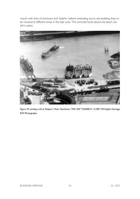
mouth with lines of pontoons <strong>and</strong> ‘dolphin’ tethers extending out to sea enabling ships tobe moored at different times in the tide cycle. The concrete hards above the beach arestill in place.Figure 32 L<strong>and</strong>ing craft at Sleeper’s Hole, Newhaven 1943. RAF TQ4400/15 15-SEP-194 <strong>English</strong> <strong>Heritage</strong>RAF Photography.© ENGLISH HERITAGE 54 22 - 2013


