

Aerial Investigation and Mapping Report - English Heritage
Aerial Investigation and Mapping Report - English Heritage
Aerial Investigation and Mapping Report - English Heritage

Create successful ePaper yourself
Turn your PDF publications into a flip-book with our unique Google optimized e-Paper software.
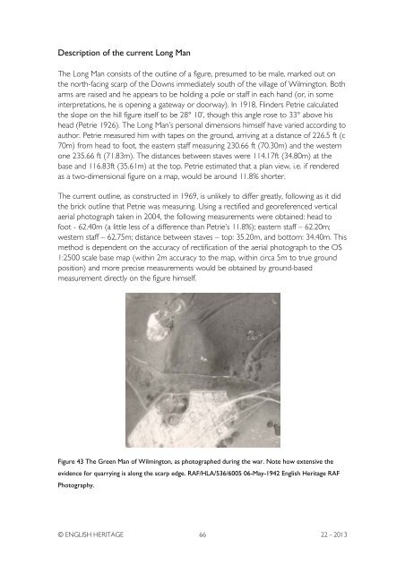
Description of the current Long ManThe Long Man consists of the outline of a figure, presumed to be male, marked out onthe north-facing scarp of the Downs immediately south of the village of Wilmington. Botharms are raised <strong>and</strong> he appears to be holding a pole or staff in each h<strong>and</strong> (or, in someinterpretations, he is opening a gateway or doorway). In 1918, Flinders Petrie calculatedthe slope on the hill figure itself to be 28° 10’, though this angle rose to 33° above hishead (Petrie 1926). The Long Man’s personal dimensions himself have varied according toauthor. Petrie measured him with tapes on the ground, arriving at a distance of 226.5 ft (c70m) from head to foot, the eastern staff measuring 230.66 ft (70.30m) <strong>and</strong> the westernone 235.66 ft (71.83m). The distances between staves were 114.17ft (34.80m) at thebase <strong>and</strong> 116.83ft (35.61m) at the top. Petrie estimated that a plan view, i.e. if renderedas a two-dimensional figure on a map, would be around 11.8% shorter.The current outline, as constructed in 1969, is unlikely to differ greatly, following as it didthe brick outline that Petrie was measuring. Using a rectified <strong>and</strong> georeferenced verticalaerial photograph taken in 2004, the following measurements were obtained: head tofoot - 62.40m (a little less of a difference than Petrie’s 11.8%); eastern staff – 62.20m;western staff – 62.75m; distance between staves – top: 35.20m, <strong>and</strong> bottom: 34.40m. Thismethod is dependent on the accuracy of rectification of the aerial photograph to the OS1:2500 scale base map (within 2m accuracy to the map, within circa 5m to true groundposition) <strong>and</strong> more precise measurements would be obtained by ground-basedmeasurement directly on the figure himself.Figure 43 The Green Man of Wilmington, as photographed during the war. Note how extensive theevidence for quarrying is along the scarp edge. RAF/HLA/536/6005 06-May-1942 <strong>English</strong> <strong>Heritage</strong> RAFPhotography.© ENGLISH HERITAGE 66 22 - 2013


