

Kingsclere - Basingstoke and Deane Borough Council
Kingsclere - Basingstoke and Deane Borough Council
Kingsclere - Basingstoke and Deane Borough Council

Create successful ePaper yourself
Turn your PDF publications into a flip-book with our unique Google optimized e-Paper software.
Conservation Area AppraisalIt has been subject to consultation with <strong>Council</strong>lors, the Parish <strong>Council</strong><strong>and</strong> local amenity groups. A full list of consultees, copies of theirresponses, <strong>and</strong> details of the <strong>Council</strong>’s consideration of the issuesraised during the consultation period are available for inspection, byappointment, at the Civic Offices, during normal office hours.Location <strong>and</strong> Population<strong>Kingsclere</strong> lies three miles inside the Hampshire county boundary withBerkshire, where the roads from Newbury, Andover, Whitchurch, <strong>and</strong><strong>Basingstoke</strong> meet. The settlement is located about one mile from thebase of the north-facing escarpment of the Upper Chalk, which marksthe northern boundary of the central Hampshire chalk downs. The villageis situated on the edge of the North Wessex Downs Area of Outst<strong>and</strong>ingNatural Beauty.<strong>Kingsclere</strong> streamThe <strong>Kingsclere</strong> Stream, also known as “Gaily Brook”, rises to the southof the village. It flows almost due north to join the River Enborne, whichforms part of the northern boundary of Hampshire with Berkshire.The population of the <strong>Kingsclere</strong> Conservation Area in 1998 wasapproximately 618. (Projection based on the Hampshire County <strong>Council</strong>Planning Department Small Area Population Forecasts 1995).Nos 12-18 George StreetHistorical DevelopmentSettlement Origins<strong>Kingsclere</strong> was possibly first recorded in the will of King Alfred, around880AD, when he left his middle daughter the ‘ham aet clearin’. The firstrecorded use of the name ‘Kyngesclera’ was in the reign of Henry I, in acharter confirming the grant by William I to Hyde Abbey.The origin of the name ‘Clere’ is uncertain. One possible derivationis from the same root as the Welsh word ‘claer’ meaning bright. Analternative is that it referred to a tribal grouping which inhabited this partof Hampshire. As the name ‘Clere’ was used over a very wide area this isa possibility. It probably pre-dates the Saxon era <strong>and</strong> is of Celtic origin.The settlement formed part of an ancient property of the Crown. TheDomesday Book records separately the manor <strong>and</strong> the church. Williamthe Conqueror exchanged the church of <strong>Kingsclere</strong> with Hyde Abbey,Winchester in 1107. Henry I gave the manor of Clere to the Canons ofthe Church of St Mary, Rouen, <strong>and</strong> they remained the owners until 1335.Rouen Cathedral provided the King’s administrators <strong>and</strong> the income fromthe manor was in recompense for this service. It also contributed to the<strong>Kingsclere</strong> 3
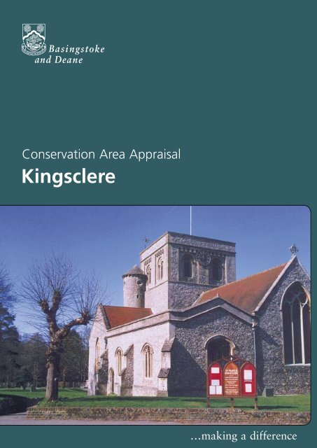
Conservation Area Appraisalrebuilding of the cathedral. In 1335 the King granted a licence for itto be alienated to William de Melton, Archbishop of York. The Mertonfamily sold the manor to Sir William Paulet, Lord St John, in 1544 <strong>and</strong>it remained with his successors, the Marquises of Winchester <strong>and</strong> theDukes of Bolton until the death of Harry, 6th Duke of Bolton, in 1794.The manor then came into the possession of Thomas Orde by marriage,who assumed the surname <strong>and</strong> arms of the Paulet family, becomingelevated to peerage as Lord Bolton.The Church of St MaryGaily MillSettlement DevelopmentThe development of the settlement is fundamentally related to itsposition at the convergence of several roads that link the larger markettowns of Newbury, Whitchurch <strong>and</strong> Overton, together with the proximityof the River Enborne <strong>and</strong> its position in relation to the surroundingagricultural area. Consequently, the market formed the focus of thevillage from early times, with mills <strong>and</strong> associated industries along theriver course, <strong>and</strong> with farms within the village environs.The village was first granted a market charter by Henry II in 1154.<strong>Kingsclere</strong> was granted further market rights in 1227 by Henry III, alongwith a fair. The market took place in what is now The Square, CrownGreen <strong>and</strong> Anchor Yard.The core of the village has retained its historic street pattern, with theprincipal streets radiating out from the central focus of the church <strong>and</strong>The Square. Historically, development appears to have concentratedalong the north section of Swan Street <strong>and</strong> the western part of GeorgeStreet. In the medieval period, North Street was referred to as a path,which may indicate that it was a less developed area of the village.Certainly the built form today has a distinctive, more dispersed, characterto that of the compact frontages of the main roads. The high quality ofthe buildings dating from the late medieval period, which are still locatedat the heart of the village, is evidence of the prosperity of the period,possibly based on the wool trade or the ability to grow high grademalting barley.During the 17th century there appears to have been limited growthin the population of the parish. This may have been influenced by thefact that <strong>Kingsclere</strong> was one of the worst hit Hampshire villages duringthe plague epidemic of 1665-6. It appears to have continued as a localmarket centre, whilst principally functioning as a larger agriculturalsettlement. The 1843 Tithe Apportionment map shows the arable l<strong>and</strong> tothe south divided into strips, even into the mid 19th century.4<strong>Kingsclere</strong>
Conservation Area AppraisalSignificant Groups of BuildingsAlthough the character of the Conservation Area, as a whole, is derivedfrom the combined quality of buildings <strong>and</strong> the spaces surrounding them,there are certain buildings which, due to their position in the streetsceneor architectural characteristics, contribute to the special interest <strong>and</strong>appearance of <strong>Kingsclere</strong>.At the centre of the Conservation Area, the Methodist Church <strong>and</strong> No3 George Street form the focus of long range views down Swan Street.Their visual impact is reinforced by the strong contrast in form <strong>and</strong> designbetween the buildings. The horizontal emphasis of the symmetricaldomestic brick façade counteracting the vertical emphasis of the flintgable of the church. These differences are reinforced further by thechurch, which is set back from the building line of George Street.Methodist ChurchA significant group of buildings, in historic <strong>and</strong> visual terms, are thebrewery buildings <strong>and</strong> house at the junction of Popes Hill <strong>and</strong> NewburyRoad. The 19th century brewery buildings form a courtyard of interlinkedstructures of varied form <strong>and</strong> scale whilst the 15th, 18th <strong>and</strong> 19thcentury Brewery House, with its Tuscan porch, forms a focal point forviews in an intimate <strong>and</strong> twisting streetscape. The historic association ofthe industry with the stream is reinforced by the proximity of the formerFalcon Inn (now Falcons) <strong>and</strong> the converted range of malting buildingsopposite.Nos 5 <strong>and</strong> 7 Newbury RoadAlong Newbury Road, three substantial buildings, namely No 9 The OldHouse (former Manor House), No 7 <strong>and</strong> Tower Hill Cottages, combine toreinforce the historic character of this part of the Conservation Area incontrast to the surrounding modern development.The collection of apparently 19th century buildings, which form thenorthern end to North Street, are of eclectic style <strong>and</strong> create an area ofpastoral character, again contrasting with the cohesive character of thecore area.Isolated on the periphery of the Conservation Area, Gailey Mill consistsof the mill house <strong>and</strong> associated 18th century ancillary structures. Theseform a distinctive cluster of buildings that can be seen from many viewpoints, within the Conservation Area. The semi-open pastoral setting isessential to appreciate the complex as a whole, <strong>and</strong> reinforce its positionoutside the settlement.The Rookery, Swan Street<strong>Kingsclere</strong> 9
Conservation Area AppraisalAt the eastern end of George Street, Nos 35 to 37 <strong>and</strong> Nos 39, 41,43 <strong>and</strong> 45, are contemporary 19th century buildings, constructed in acomplimentary style, with blue brick walling, slate roof covering <strong>and</strong> sashor casement windows. No’s 35 <strong>and</strong> 37 had this frontage (constructed in1832) but the rear of the property reveals cottages built in the mid 18thcentury. The former <strong>Council</strong> Offices in Swan Street have a particularlyimposing Queen Anne elevation, whilst The Rookery (26 Swan Street) hastwo notable doorcases.St Mary’s Churchyard from Swan StreetThe Character <strong>and</strong> Importanceof Public <strong>and</strong> Private SpacesForming the focal point of <strong>Kingsclere</strong>, the combination of the churchyard,(delineated by the pollarded Lime trees) <strong>and</strong> the former market area(at the intersection of the four main streets) is an essential componentin contributing to the distinctive character <strong>and</strong> appearance of theConservation Area. It serves to provide both a setting to the church <strong>and</strong> atangible link to the historic function of <strong>Kingsclere</strong> as a market centre.The churchyard <strong>and</strong> open spaces along the stream, both public <strong>and</strong>private, also allow the appreciation of the varied <strong>and</strong> complex rearroofscapes which run along the rear of Swan Street, North Street, <strong>and</strong>Popes Hill. The small, private areas which punctuate the properties alongSwan Street also afford glimpses through to the wooded stream course.The side views of frontage properties <strong>and</strong> their ancillary buildings areessential characteristics which contribute to the special interest <strong>and</strong>distinctiveness of the streetscape in this part of the Conservation Area.On the periphery of the village the wooded pasture area around GailyMill allows the buildings to remain within their rural context withoutencroachment from the village. This area provides views along the banksof the stream <strong>and</strong> across the surrounding countryside, especially to theeast <strong>and</strong> south.10<strong>Kingsclere</strong>
Conservation Area AppraisalOther Features of Architectural<strong>and</strong> Historic InterestThe focal point <strong>and</strong> village centre of <strong>Kingsclere</strong> is marked by the WarMemorial, located in the churchyard. There are also a number of wallsthat are important in defining the character of the local streetscape.Worthy of particular mention are: the brick boundary walls to BrooklynHouse <strong>and</strong> North Street, the brick <strong>and</strong> flint wall bounding the openspace of the former School Annex, at the southern end of North Street,the high brick wall to Priory House, in Newbury Street, <strong>and</strong> the almostcontinuous brick walls that define the southerly boundary to propertiesalong Popes Hill.Swan StreetBuilding MaterialsAlthough a variety of vernacular building materials <strong>and</strong> traditionsare apparent in <strong>Kingsclere</strong>, it is the predominant use of brick whichcharacterises the Conservation Area although timber-framing is stillapparent, particularly on side <strong>and</strong> rear elevations. The variety of uses,colours <strong>and</strong> bonds of the brickwork are of particular note <strong>and</strong> isinvariably of the highest quality. The use of blue brickwork, both enmasse <strong>and</strong> decoratively is, however, the overriding feature of distinctionthroughout the Conservation Area.Flint was introduced as a popular building material in the 19th century asdemonstrated by the recladding of St Mary’s Church, the construction ofthe Methodist Church, The Old Vicarage <strong>and</strong> also as decorative panels inseveral boundary walls.Nos 35-37 George StreetHigh quality examples of the use ofblue brickwork characteristic of <strong>Kingsclere</strong>Some buildings have painted exteriors, either painted brick or paintedrender. Plain orange/red clay tiles predominate as the main roofingmaterial, with the occasional use of slate, from the 19th century.Given the domestic scale <strong>and</strong> simple provincial architecture of thebuildings in the Conservation Area, historic joinery (such as sashwindows, doors <strong>and</strong> door cases) are often the features that definethe appearance of properties. This is also the case for more gr<strong>and</strong> <strong>and</strong>ordered elevations, such as the Swan Inn where the arrangement of sashwindows is key to the architectural design. Where buildings are closeknitin continuous street frontages the relationship of these features, <strong>and</strong>their historic arrangement, becomes a significant factor in the overallspecial character of the area. Although some groups of buildings havebeen modernised, the use <strong>and</strong> overall effect of inappropriate replacementwindows <strong>and</strong> doors is limited. The retention of original doorcases, hoods<strong>and</strong> porticos is also a significant characteristic of <strong>Kingsclere</strong>.Glazed <strong>and</strong> blue bricks are a distinctivefeature of the Conservation AreaNo’s 21 <strong>and</strong> 23 Swan Street<strong>Kingsclere</strong> 11
Conservation Area AppraisalGreen Spaces, Trees, Hedges <strong>and</strong>Other Natural or Cultivated FeaturesDespite the tight cohesive nature of the streetscape along Swan Street<strong>and</strong> George Street, trees <strong>and</strong> other pockets of vegetation do contributegreatly to the character <strong>and</strong> appearance of the area. In particular, themature vegetation which follows the course of Gaily Brook, north fromBear Hill, extending west as part of the grounds of <strong>Kingsclere</strong> House, <strong>and</strong>the area centred around Priors Mill, provide a verdant backdrop to theproperties along the west sides of Swan Street <strong>and</strong> North Street.View along Ecchinswell RoadView of Priors Mill from Brooklyn HouseThe trees within St Mary’s churchyard are perhaps the most significantin terms of their individual contribution to the special character of thearea. In particular, the line of pollarded limes define the boundary ofthe churchyard providing both a discreet setting to the church <strong>and</strong> adistinction between this space <strong>and</strong> that of the wide roadways meeting inthis location.Mature trees <strong>and</strong> hedges form the dominant character of the peripheralparts of the Conservation Area, particularly to the west around FoxesLane, Popes Hill <strong>and</strong> Ecchinswell Road, allowing only limited glimpsesof buildings in a secluded <strong>and</strong> private setting. Their contribution isan essential component of the special interest of this part of theConservation Area.There are a number of individual trees of note in the Conservation Area.These include several Crack Willows at Gaily Mill <strong>and</strong> a mature Ash inthe garden of Fieldgate Farmhouse. Amongst a number of trees in thegrounds of Elm Grove there is a notable, mature Cut Leaf Beech.The private garden of Brooklyn House provides a tranquil <strong>and</strong> unusualspace for <strong>Kingsclere</strong>. It is a visually essential component in thestreetscene, which contributes greatly to the character of North Street<strong>and</strong> the setting of the eclectic cluster of adjacent listed buildings. Plantedwith several more unusual trees (including a Tulip Tree) these will, in time,make a significant contribution to the Conservation Area.12<strong>Kingsclere</strong>
Conservation Area AppraisalThe Setting of the Conservation AreaThe l<strong>and</strong>scape north of <strong>Kingsclere</strong> is characterised by clay with aprofusion of streams, mixed farml<strong>and</strong> (predominantly arable) <strong>and</strong> al<strong>and</strong>scape with many isolated oak woodl<strong>and</strong>s. To the north-east of<strong>Kingsclere</strong> around Wolverton can be found a woodl<strong>and</strong> l<strong>and</strong>scapecharacterised by dense woodl<strong>and</strong>s <strong>and</strong> grazing l<strong>and</strong>. Whilst to thesouth-east of the village can be found the downl<strong>and</strong> l<strong>and</strong>scape. Thisis a clay plateau, with ancient woodl<strong>and</strong>s of oak <strong>and</strong> hazel coppice,<strong>and</strong> predominantly arable farming in medium or large fields with somegrazing.To the south-west of <strong>Kingsclere</strong> is the downl<strong>and</strong> l<strong>and</strong>scape, dominatedby the chalk scarp, a unifying element to the overall area, which contrastswith the more densely wooded lowl<strong>and</strong> l<strong>and</strong>scapes. This scarp forms alinear winding belt extending west of <strong>Kingsclere</strong>. It is often characterisedby ancient earthworks on the highest points, <strong>and</strong> sheep pasture withsome arable farming on the lower slopes.View southwards alongSwan Street <strong>and</strong> beyondDespite these contrasting <strong>and</strong> varied characteristics, the setting to<strong>Kingsclere</strong> is essentially rural. This is reinforced by many key views out ofthe Conservation Area of the surrounding farm <strong>and</strong> woodl<strong>and</strong>, <strong>and</strong> theproximity of several farms on the immediate boundary of the settlement.<strong>Kingsclere</strong> 13
Conservation Area AppraisalAreas of Archaeological SignificanceEvery settlement contains within it archeological evidence of its origins<strong>and</strong> development, for the economy <strong>and</strong> industry of the community <strong>and</strong>for the lives <strong>and</strong> lifestyles of past inhabitants.It is in the Areas of High Archeological Potential (AHAP) that it is mostlikely that such archeological remains will be encountered.Swan StreetWhere a development is proposed, the impact it might have on theseremains is a material consideration within the planning process. This may,from time to time, result in the need for archeological recording in thecase of some developments.There is one AHAP within the <strong>Kingsclere</strong> Conservation Area. Itencompasses the core medieval settlement, including Swan Street <strong>and</strong>George Street, parts of the village to the west <strong>and</strong> north-west of thechurch (where a medieval vicarage stood) <strong>and</strong> the church itself.There is one Area of Archeological Potential (AAP) within theConservation Area that includes areas of expansion along the southernpart of Swan Street <strong>and</strong> the eastern part of George Street. This areaencompasses post-medieval development, where evidence may be foundto date this expansion of the village. It is also possible that evidence maysurvive to show irregular medieval development at the fringes of the coreof the village.14<strong>Kingsclere</strong>
Conservation Area AppraisalConservation Area Planning ControlsThe following controls apply within the Conservation Area in addition tonormal planning controls:• Conservation Area Consent is normally required for thedemolition of buildings or structures over a certain size within aConservation Area.• The <strong>Council</strong> must be given six weeks notice of any intention toundertake works to, cut down or uproot any trees over a certain sizein the Conservation Area.• Planning applications which, in the opinion of the <strong>Borough</strong><strong>Council</strong> would affect the special character of the ConservationArea must be advertised <strong>and</strong> the opportunity given for publiccomment. This may include proposals outside the ConservationArea which nevertheless affect it setting.Statutory policies relating to Conservation Areas <strong>and</strong> listed buildingsare set out in the adopted <strong>Basingstoke</strong> <strong>and</strong> <strong>Deane</strong> <strong>Borough</strong> Local Plan.These policies reflect the statutory duty on the Local Planning Authorityto have regard to the preservation of historic buildings or their setting,<strong>and</strong> to the enhancement of areas designated as being of special interest.These policies seek to ensure that particular regard will be paid tothe scale, height, form, materials <strong>and</strong> detailing of proposals includingboundary treatments <strong>and</strong> other features of note. In order to consider theimplications of development <strong>and</strong> given the detail required, the <strong>Borough</strong><strong>Council</strong> will normally require proposals within the Conservation Areato be submitted in the form of a full, <strong>and</strong> not outline, application. The<strong>Borough</strong> <strong>Council</strong>’s Conservation Officers are available for advice <strong>and</strong>information on all matters relating to development proposals in theConservation Area.Newbury RoadNo 22 Swan Street from Fielden CourtGrantsThe <strong>Borough</strong> <strong>Council</strong> provides grants for various types of work. Theseinclude Environment <strong>and</strong> Regeneration Grants, Historic Buildings Grants,<strong>and</strong> Village <strong>and</strong> Community Hall Grants. Leaflets are available explainingthe purpose <strong>and</strong> criteria for each grant <strong>and</strong> an approach to the <strong>Council</strong> isrecommended for further information on any grant.<strong>Kingsclere</strong> 15
Conservation Area Appraisal - <strong>Kingsclere</strong> Historical OS MapCourtesy of Hampshire County <strong>Council</strong>16<strong>Kingsclere</strong>
Conservation Area Appraisal - - Archeological MapCourtesy of Hampshire County <strong>Council</strong><strong>Kingsclere</strong>17
Conservation Area Appraisal<strong>Kingsclere</strong>…making a difference<strong>Basingstoke</strong> <strong>and</strong> <strong>Deane</strong> <strong>Borough</strong> <strong>Council</strong>Civic Offices London Road <strong>Basingstoke</strong> Hants RG21 4AHTelephone 01256 844844 Fax 01256 845200www.basingstoke.gov.ukProduced by Graphics/Corporate Communications. April 20044757


