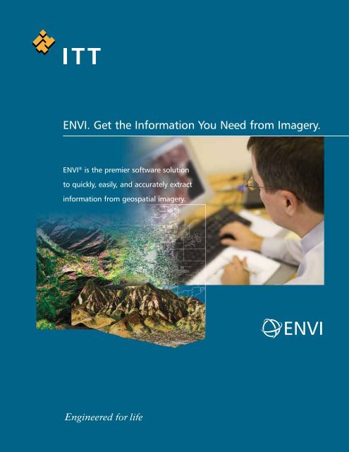
ENVI. Get the Information You Need from Imagery. - Exelis Visual ...
ENVI. Get the Information You Need from Imagery. - Exelis Visual ...
ENVI. Get the Information You Need from Imagery. - Exelis Visual ...

Create successful ePaper yourself
Turn your PDF publications into a flip-book with our unique Google optimized e-Paper software.
Read Virtually Any <strong>Imagery</strong> Type and Format<strong>ENVI</strong> supports imagery types ga<strong>the</strong>red <strong>from</strong> today’s popular satellite and airborne sensors including panchromatic,multispectral, hyperspectral, radar, <strong>the</strong>rmal, lidar, and more. <strong>ENVI</strong> can read over 70 data formats andincludes HDF, GeoTIFF and JITC compliant NITF support. <strong>ENVI</strong> also allows you to easily drag and drop files <strong>from</strong>Windows Explorer, search results, and ArcGIS ® making it easy to access and integrate information into <strong>ENVI</strong><strong>from</strong> o<strong>the</strong>r desktop applications. And, <strong>ENVI</strong> also delivers enterprise capabilities that allow you to quickly andeasily access imagery <strong>from</strong> OGC and JPIP compliant servers within your organization or over <strong>the</strong> internet.Prepare <strong>You</strong>r <strong>Imagery</strong><strong>ENVI</strong> provides automated pre-processing tools that allowyou to quickly and easily prepare your imagery for viewingor additional analysis. With <strong>ENVI</strong> you can:• Orthorectify imagery• Register two or more images• Calibrate imagery• Correct imagery for atmospheric distortions• Create vector overlays• Identify regions of interest (ROIs)• Create digital elevation models (DEMs)• Perform pan sharpening, masking, and mosaicking• Resize, rotate, or convert <strong>the</strong> data typeExplore <strong>You</strong>r <strong>Imagery</strong><strong>ENVI</strong> gives you an intuitive user interface and easy-to-usetools that allow you to quickly and easily view and explore yourimagery. <strong>You</strong> can use <strong>ENVI</strong> to view large datasets and metadata,visually compare imagery, create powerful 3D visualizations,create scatter plots, explore pixel signatures, and more. <strong>ENVI</strong> alsoallows you to display ArcGIS layers with your imagery, giving you<strong>the</strong> ability to view vector information with <strong>the</strong> same styling, symbologyand rendering as your GIS applications.<strong>ENVI</strong>
Process & Analyze <strong>You</strong>r <strong>Imagery</strong><strong>ENVI</strong> provides <strong>the</strong> leading image processing and analysis functionality you need to extract information for yourresearch, intelligence or planning purposes. <strong>ENVI</strong> provides a complete suite of tools based on proven scientificmethods to help you analyze your imagery. And, <strong>ENVI</strong> provides unique, automated processes and procedures tomake processing and analyzing your imagery easier than ever.Data Analysis ToolsUnderstanding your imagery often involves discerning informationabout your image. <strong>ENVI</strong> includes a comprehensivesuite of data analysis tools that allow you to access provenalgorithms to quickly, easily and accurately analyze imagery.• Create geospatial statistics such as autocorrelation andsemi-variance• Calculate image statistics such as mean, min/max,standard deviation• Extract linear features• Syn<strong>the</strong>size radar imagery• Calculate principal components• Detect change• Measure features• Model topographic characteristics• Apply common and user-defined filters• Perform custom band and spectral math functionsSpectral Analysis ToolsSpectral analysis allows you to use pixel responsesat different wavelengths to obtain informationabout <strong>the</strong> materials within each pixel. <strong>ENVI</strong> has <strong>the</strong>most advanced yet easy-to-use spectral analysistools that give you access to established, scientificmethods for imagery analyses. <strong>ENVI</strong>'s spectralanalysis tools allow you to:• Classify your imagery using supervised andunsupervised methods• Identify spectral signatures using robust libraries• Detect and identify targets• Identify features of interest• Analyze & map materials of interest• Perform whole-pixel and sub-pixel analyses• Use a suite of post classification tools torefine your results• Calculate forest health with vegetationanalysis toolsAutomated Workflows<strong>ENVI</strong> gives you automated workflows that step you through today’s popular image processing functions. Thisunique automation takes <strong>the</strong> complexity out of common image analysis methods and makes advanced imageanalysis accessible regardless of your experience level.<strong>ENVI</strong>’s automated workflows give you step by step windows with instructions and recommended settings,based on proven scientific methods, for each step of <strong>the</strong> process. Subsequent steps automatically update whileprompting you for required information. <strong>ENVI</strong> includes workflows that automate a wide range of imageexploitation tasks that include preparing imagery, finding features, detecting change over time, and classifyingsimilar materials. Whe<strong>the</strong>r you are new to <strong>ENVI</strong> or an experienced user, <strong>ENVI</strong>’s automated workflows will saveyou time and effort in getting <strong>the</strong> results you need <strong>from</strong> imagery.
Share <strong>You</strong>r <strong>Information</strong><strong>ENVI</strong> easily integrates into your existing workflow, allowing you to share maps, reports and presentationswith colleagues in virtually any environment. <strong>Information</strong> extracted <strong>from</strong> imagery in <strong>ENVI</strong> can be easily saveddirectly to your computer, your geodatabase, or o<strong>the</strong>r server environment as image files, shapefiles or Microsoft ®PowerPoint ® files. And, with its tight integration with ArcGIS, <strong>ENVI</strong> outcomes can also be output as map products,using <strong>the</strong> popular ArcGIS map templates and printing dialogs directly <strong>from</strong> <strong>the</strong> <strong>ENVI</strong> interface.Customize <strong>You</strong>r GeospatialImage Application<strong>ENVI</strong> is built on a powerful development language, IDL, allowingits features and functionality to be easily extended or customizedto fit your specific application. This powerful and flexible platformallows you to create batch processes, customize menus, add yourown algorithms and tools, integrate C++ and Java code into yourtools, and much more.Extend <strong>You</strong>r <strong>ENVI</strong> Functionality<strong>ENVI</strong>’s image processing and analysis functionality is robust,and can be even fur<strong>the</strong>r extended by adding any one of <strong>the</strong>semodules to expand its core capabilities:<strong>ENVI</strong> Orthorectification Module – provides geospatial imageryusers with simple but robust tools to accurately register imageryto ground coordinates and remove geometric distortions.<strong>ENVI</strong> NITF Module – allows you to access, read, write, process,and share imagery in <strong>the</strong> government standard NITF file format.<strong>ENVI</strong> DEM Extraction Module – improves <strong>the</strong> image analysisworkflow by allowing you to create spatially accurate 3-D datarepresentations directly within <strong>ENVI</strong>.SARscape Modules for <strong>ENVI</strong> – provide a unique set offunctionality to read, process, analyze and output SAR dataand integrate results with o<strong>the</strong>r remotely sensed data andgeospatial tools.<strong>Get</strong> started using <strong>ENVI</strong> atwww.ittvis.com/<strong>ENVI</strong>.<strong>ENVI</strong> Atmospheric Correction Module – removes challengingatmospheric conditions <strong>from</strong> imagery using both <strong>the</strong> provenFLAASH and QUAC algorithms.Easy-to-use tools. Proven functionality. Fast results.<strong>ENVI</strong> provides all this, in an easy to use solution. From reading andpreparing, to exploring, analyzing and sharing — you’ll find whatyou need in <strong>ENVI</strong> to get information <strong>from</strong> your imagery quicklyand easily.<strong>ENVI</strong>
ITT <strong>Visual</strong> <strong>Information</strong> Solutionswww.ittvis.com<strong>ENVI</strong>Today's imagery analysts and scientists in awide variety of disciplines choose <strong>ENVI</strong> ® ,<strong>the</strong> premier software solution for extractinginformation <strong>from</strong> geospatial imagery. <strong>ENVI</strong>provides advanced, user-friendly tools toaccess, analyze, and share information<strong>from</strong> geospatial imagery.All rights reserved. ITT, <strong>the</strong> Engineered Blocks logo, and ENGINEEREDFOR LIFE are registered trademarks of ITT Manufacturing Enterprises,Inc., and are used under license. <strong>ENVI</strong> and IDL are trademarks of ITTCorporation. All o<strong>the</strong>r marks are <strong>the</strong> property of <strong>the</strong>ir respective owners.©2009, ITT <strong>Visual</strong> <strong>Information</strong> Solutions.
<strong>ENVI</strong> 4.8 Functional SummaryOperating SystemsWindows XP SP2 (Intel/AMD 32- & 64-bit)Windows Vista (Intel/AMD 32- & 64-bit)Windows 7 (Intel/AMD 32- & 64-bit)Linux Kernel 2.6.x (Intel/AMD 32- & 64-bit)Mac OS X 10.5.x (Intel 32- & 64-bit)Max OS X 10.6 (Intel 32- & 64-bit)Sun Solaris 10 (SPARC 32- & 64-bit)Data ImportRaster Formats:• ADRG• ArcView Raster BIL• ASCII (x,y,z & gridded)• Binary (flat)• BMP• CADRG• CIB• DPPDB (with license)• DTED (levels 0, 1, 2)• ECW• <strong>ENVI</strong> Raster• <strong>ENVI</strong> Gzip Compressed• ER Mapper ERS• ERDAS IMAGINE (.img, .ige, .lan)• ESRI Geodatabase Raster Dataset:• Personal (.mdb)• File (.gdb)• Enterprise (.sde)• ESRI GRID• GeoJP2 / GeoJ2K• GeoTIFF• HDF4• HDF-EOS• JPEG• JPEG2000• MrSID (including MG3)• NITF 1.1, 2.0, 2.1 (with license)• NSIF 1.0 (with license)• PCI PIX• PDS• PICT• PNG• RemoteView R-Set (with license)• SRF• SRTM DEM• TFRD (with license)• TIFF• USGS DOQ• USGS DRG• USGS Native DEM• USGS SDTS DEM• XWDVector Formats:• ARC/INFO Interchange• AutoCAD DXF• <strong>ENVI</strong> Vector File• ESRI Geodatabase Feature Class:• Personal (.mdb)• File (.gdb)• Enterprise (.sde)• ESRI Layer• ESRI Shapefile• MapInfo MIF• Microstation DGN• USGS DLGLiDAR Formats:• ASCII• LASMultispectral Sensors:• ADS40• ALOS AVNIR-2• ALOS PRISM• ALSAT-1• ASTER• ATSR• AVHRR• CARTOSAT-1• DMSP (NOAA)• <strong>ENVI</strong>SAT AATSR• <strong>ENVI</strong>SAT MERIS• EROS• FORMOSAT-2• GeoEye-1• IKONOS• IRS• KOMPSAT-2• Landsat MSS, TM, ETM+• MAS-50• MASTER• MISR• MODIS• NigeriaSat-1• OrbView-3• RapidEye• SeaWiFS• QuickBird• SPOT• TIMS• UK-DMCSat-1• WorldView-1• WorldView-2Hyperspectral Sensors:• AISA• ARTEMIS (with license)• AVIRIS• CASI• HyMap• Hyperion• HyperScan• HySpex• MIVIS• PROBE-1• ProspecTIRRadar Sensors:• AIRSAR• ALOS PALSAR• COSMO-SkyMed• <strong>ENVI</strong>SAT ASAR• ERS• JERS• RADARSAT-1• RADARSAT-2• SIR-C / X-SAR• TOPSARRemore Connections:• IAS Server• JPIP• OGC WCS• OGC WMSSpectral Libraries:• ASCII• <strong>ENVI</strong> SLI• ASD Indico• MRSLAnnotations:• <strong>ENVI</strong> Annotation• <strong>ENVI</strong> Zoom AnnotationOutput FormatsRaster Formats:• ArcView Raster BIL• ASCII (x,y,z & gridded)• BMP• DTED (levels 0, 1, 2)• <strong>ENVI</strong> Raster• <strong>ENVI</strong> Gzip Compressed• ER Mapper ERS• ERDAS IMAGINE (.img)• ESRI Geodatabase Raster Dataset:• Personal (.mdb)• File (.gdb)• Enterprise (.sde)• ESRI GRID• GeoJP2 / GeoJ2K• GeoTIFF• HDF4• JPEG• JPEG2000• NITF 2.0, 2.1 (with license)• PICT• PCI PIX• PNG• SRF• TIFF• XWDVector Formats:• AutoCAD DXF• <strong>ENVI</strong> EVF• ESRI Geodatabase Feature Class:• Personal (.mdb)• File (.gdb)• Enterprise (.sde)• ESRI ShapefileO<strong>the</strong>r Formats:• Direct To Printer• Google Earth KML• MPEG• PostScript• VRMLChip Display To:• ArcMap• <strong>ENVI</strong> Raster• ESRI Geodatabase Raster Dataset• JPEG• JPEG2000 / GeoJP2• NITF 2.0, 2.1 (with license)• PowerPoint PPT• Printer• TIFF / GeoTIFFExport Map To:• AI• BMP• EMF• EPS• GIF• JPEG• PDF• PNG• Printer• SVGpg. 1
• TIFF<strong>ENVI</strong> tools for ArcGIS®Auto-Threshold Difference RasterCalculate Image DifferenceCalculate Thematic ChangeClassification Raster To VectorClassify With TrainingClassify Without TrainingCleanup Classification RasterConvert Raster FormatDetect AnomaliesFilter With ConvolutionIntersect RastersLiDAR To RasterThreshold By PercentageWorkflow Models with CleanupDisplay FunctionsChip To:• File• PowerPoint• Print• ArcMapDrag/Drop <strong>from</strong>:• ArcGIS• File System• Windows Explorer• Data ManagerDrag/Drop to <strong>the</strong>:• Display• Process• WorkflowsGeoLink with ArcMapColor MappingColor Tables:• Pre-built Tables• Interactive Color Table EditorCursor Query for Data/Screen Value, Elevation,Map CoordinatesDynamic Overlays (unlimited displays)Histogram Matching Between DisplaysImage Flickering and "Movies"Image Overlays:• Annotation• Classification Results• Contour Lines• Density (gray level) Color Slicing• Grid Lines• Regions of Interest• Vector LayersInteractive 2-D Scatter PlottingInteractive Histograms & Stretching:• Arbitrary Stretching• Auto Apply Stretches• Gaussian Stretching• Histogram Equalization Stretching• Histogram Matching Between Displays• Linear, Piecewise Linear Stretching• Square Root Stretching• Import/Export ASCII Look Up Tables• User-Defined Look Up TablesInteractive Pixel EditorLine-of-Sight (Viewshed) AnalysisLink Unlimited DisplaysMeasurement ToolOutput Displays PowerPoint:• Create New Presentation• Append to Existing PresentationOutput Displays to File or PrinterOutput Displays of Zoom WindowQuick Filters:• Sharpen• Smooth• MedianQuick Color-Infrared, True-Color DisplaysSave and/or Restore Display GroupSelect Display Bands <strong>from</strong> Spectral PlotsSet Default Display BandsSpatial and Spectral Pixel EditingSpatial and Spectral ProfilesSub-Pixel Cursor LocationUnlimited Number of DisplaysVirtual MosaicVector Overlays & GIS CapabilitiesRegions of InteresBuffer Zones Around ROIsClassification Images <strong>from</strong> ROIsExport ROIs to VectorsInput ROIs <strong>from</strong> ASCIIInteractive, Easy-to-use ROI Definition:• Draw Polygons, Polylines, Pixels• Draw ROIs with Interior Spaces (Donuts)• ROIs <strong>from</strong> Intersection of O<strong>the</strong>r ROIs• Multiple Objects Within One ROI• ROI Definition via Scatter Plots• Threshold Images to ROI• Merge ROIs• Import ROIs <strong>from</strong> VectorsOutput ROIs to ASCIIROI Save & RestoreReconcile ROIs between Images viaMap CoordinatesROI Growing Based on StatisticsROI StatisticsData PreparationCreate New Standard or Virtual Image File <strong>from</strong>Existing BandsGenerate Test ImageMask Generation From:• Annotation• Image Data Values• ROIs• Intersection of ROIs• Vectors• NaNMosaic Functions:• Color Mosaic Preview• Cutline & Edge Fea<strong>the</strong>ring• Interactively Mosaic Multiple Bands, Files• Mosaic by Pixel (Line, Sample) or MapCoordinates• Automatic Color Balancing• Standard Image or Virtual Mosaic OutputDefine Spatial Subset by:• Drawing on Display• File, Map Coordinates• Region of Interest• O<strong>the</strong>r Image Extent• Meta Scroll ExtentNITF Metadata BrowserRotate/Flip DataSpatial and Spectral SubsetsStorage Order (Interleave) Conversions:• BSQ, BIL, BIP• New File or Replace OriginalStretch DataSubsample ImagesPre-processing & CalibrationApply Gain & OffsetBad Band IdentificationBad Line ReplacementBad Pixel ReplacementCross-Track Illumination CorrectionDark SubtractionDestripe DataEmpirical Line CalibrationERS and Radarsat Data CalibrationFlat Field CalibrationIgnore Pixel ValueInternal Average Relative ReflectanceCalibrationLog ResidualsMODIS Bowtie CorrectionRadiometric Calibrations:• AVHRR• Landsat MSS, TM, ETM• TIMS• QuickBirdSea Surface Temperature From AVHRRThermal Atmospheric CorrectionRegistration & RectificationAssociate DEM With ImageAutomatic Georeferencing of ASTER, AVHRR,AATSR, ASAR, MERIS, MODIS, Radarsat,SeaWiFS, SPOTSubpixel Ground Control Point LocationsGeorectify SPOT Using <strong>Information</strong> From LeaderFileGround Control Points PredictionImage-to-Map RegistrationImage-to-Image RegistrationInteractive Ground Control Point CollectionImport Ground Control Points <strong>from</strong> FileOrthorectification:• Aerial Photographs (Digital and Frame)• ASTER• CARTOSAT-1• Generic RPC• Generic Pushbroom Sensors• IKONOS• OrbView-3GeoEye-1WorldView & WorldView-2FORMOSAT-2Kompsat-2QuickBirdSPOT 1-5Radial ResamplingRational Polynomial Coefficients(RPCs) SupportReplacement Sensor Model (RSM)Real-time GPS LinkRotated ProjectionsSave Transformation Matrix to ASCIIWarp Resampling Methods:• Bilinear• Cubic Convolution• Nearest NeighborWarping Methods:• Delaunay Triangulation• Polynomial• Rotation, Scaling, Translation (RST)Map Projection SupportDatum Support (90)Dozens of Prebuilt Map Projections (ExamplesInclude):• Universal Transverse Mercator (UTM)• State Plane• Albers Conical Equal Area• Lambert Conformal Conic• Miller CylindricalEllipsoid Support (35)Pseudo-Projections <strong>from</strong> RPCs and RSMpg. 2
Vector GIS FunctionsDrag/Drop ArcGIS LayersArcGIS Layer Attribute ViewingAdd Nodes to VectorsAnnotate Vector WindowsAttributes:• Create New Vector Attributes• Edit Query Vector Attributes• Import <strong>from</strong> ArcView Shapefiles, ASCII• Query to Create New Vector LayerBurn-in Vectors on Raster ImageConvert Vector Layer ProjectionCreate Contour Vectors <strong>from</strong> Raster DataCreate New Vector LayersCreate Vector Boundaries:• Countries, States, Coasts, Rivers• For Whole World• For Lat/Long BoundariesDirect Printing of GIS LayersDisplay Vectors with Different Projections in <strong>the</strong>Same WindowDrag/Drop to Arrange Layer OrderEdit Layer CharacteristicsExport Vector Data to Common GIS FormatsExport Vector AttributesGPS InputHeads-up (On-screen) DigitizingIntelligent DigitizerImport Common GIS Formats:• ESRI Shapefiles• Arc Interchange• AutoCAD DXF• MapInfo• Microstation DGN• USGS DLG• USGS SDTS• <strong>ENVI</strong> Native Vector FormatImport <strong>from</strong> ArcGIS GeoDatabaseInteractive Vector Layer QueryingJoin VectorsMultiple Vector SelectionOn-<strong>the</strong>-fly Vector Projection ConversionRaster to Vector ConversionsSave Vectors to ArcGIS GeoDatabaseSplit VectorsVector Cursor QueryVector Display ZoomingVector EditingVector to Raster ConversionSpectral Analysis ToolsAdaptive Coherence Estimator (ACE)Anomaly DetectionAutomated Corner Clustering in N-D Scatter PlotBandMax Band OptimizationConstrained Energy Mimimization (CEM)Continuum Removal of Images, SpectraDecision Tree ClassifierExtraction of Endmember SpectraIntegrated Spectral Viewing & AnalysisLinear Spectral UnmixingLeast Squares (LS) FitMatched FilteringMixture Tuned Matched FilteringMixture Tuned Target - Constrained Interference- Minimized Filter (MTTCIMF)N-Dimensional <strong>Visual</strong>izer (Scatter Plot)Orthogonal Subspace Projection (OSP)Pixel EditingPixel Purity Index (PPI)SAM Target Finder With BandMaxSMACC Endmember Extraction & Sub-pixelAnalysisSPEAR Tools:• Change Detection - Two Color Multi - View• Change Detection - PCA• Change Detection - Subtractive• Pan-Sharpening• Lines of Communication - Water• Lines of Communication - Roads• Watercraft Finder• Relative Water Depth• Vegetation Delineation and Stress Detection• Spectral Analogues• TERCAT (Terrain Categorizations)Spectral Resampling:• Predefined Sensor Band Filters• User Defined Filters• Spectral Libraries and ImagesSpectral Analyst for Material IdentificationSpectral Angle Mapper (SAM)Spectral Feature Fitting (SFF)Spectral Hourglass WizardSpectral <strong>Information</strong> Divergence (SID)Spectral Libraries Included:• Minerals, Vegetation, Rocks, Water, Soils, Snow,Manmade• VNIR, SWIR, MWIR, LWIRSpectral Library Builder/ImporterSpectral Library ViewerSpectral MathSpectral Plots:• Boxcar Average of Pixel Spectra• Continuum Removal• Cursor Query of X,Y Plot Values• Drag and Drop Spectra Among Plot• From 3D SurfaceView• From Image Pixels (Z Profile)• From Spectral Libraries• From ROI Averages• Link Spectral Plots <strong>from</strong> Multiple Images• Plot Stacked Spectra• User-Defined Plot Functions• Wavenumber or WavelengthSubspace Background SuppressionSpectral SlicesTarget - Constrained Interference - MinimizedFilter (TCIMF)Target Detection WizardVegetation Guided Workflows:• Fire Fuel Load• Agricultural Stress• Forest HealthVegetation Indices:• Greenness• Light-use Efficiency• Canopy Nitrogen• Senescent Carbon• Canopy Water• Leaf PigmentVegetation Suppression AlgorithmSPEAR ToolsAnomaly DetectionChange Detection - 2 Color Multi-view (2CMV)Change Detection - PCAChange Detection - SubtractiveGoogle Earth BridgeImage-to-Map RegistrationIndependent Component AnalysisLOC - Lines of Communication - RoadsLOC - Lines of Communication - WaterMetadata BrowserOrthorectificationPan SharpeningRelative Water DepthSpectral AnaloguesTerrain Categorization (TERCAT)Vegetation DelineationVertical Stripe RemovalWatercraft FinderTransformsAdaptive Coherence Estimator (ACE)Band RatiosColor Transforms:• RGB to HSV, HSL, or Munsell HSV• HSV, HSL, or Munsell HSV to RGBDecorrelation StretchIndependent Components AnalysisImage Sharpening:• Color Normalized Spectral• Gram-Schmidt Spectral• HSV and Brovey• PC Spectral• Preserving Spectral IntegrityMinimum Noise Fraction (MNF)Normalized Difference Vegetation Index (NDVI)Pan Sharpening (see Image Sharpening)Principal Components RotationSaturation StretchSyn<strong>the</strong>tic Color ImageTasseled CapFiltersAdaptive Filters:• Frost, Enhanced Frost Gamma, Kuan, Lee,Enhanced Lee, Local Sigma, Bit ErrorConvolution Filters:• High & Low Pass, Laplacian, Directional,Gaussian, Median, Sobel, RobertsFiltering PreviewInteractive Fourier Filtering:• Forward Transform• Interactive Frequency Domain Masking• Inverse TransformMorphology Filters:• Dilate, Erode, Opening, ClosingTexture Filters:• Data Range, Mean, Variance, Entropy,Skewness, Homogeneity, Contrast, Dissimilarity,Second Moment, CorrelationUser-Defined Filter KernelsMa<strong>the</strong>matics & StatisticsAutocorrelationBand HistogramsBand Math and Spectral Math:• Boolean Operators• Trigonometric Functions• Data Type Conversion Functions• Relational Operators• Many O<strong>the</strong>r Ma<strong>the</strong>matical ExpressionsCorrelogramsDisplay Statistics:• Minimum, Maximum, Mean, StandardDeviationImage Statistics:• Band Minimum, Maximum, Mean, StandardDeviation, Eigenvalues, Eigenvectors,Covariance, Correlation MatricesOutput Matrix Stats to Image Files:• Covariance Matrix• Correlation Matrix• EigenvectorsSemivariograms(continued on back)pg. 3
Image ClassificationAdaptive Coherence Estimator (ACE)Accuracy AssessmentAIRSAR Scattering Mechanism ClassifierAutomatic Legends for Classified ImagesChange Detection - PCAChange Detection - 2CMV (2 ColorMulti-view)Change Detection - SubtractiveChange Detection, Thematic and GrayscaleImagesClassification PreviewClass StatisticsClassification Image <strong>from</strong> ROIsConstrained Energy Mimimization (CEM)Decision TreesDensity SlicingInteractive User-Defined Rule ClassifierIndependent Components AnalysisOrthogonal Subspace Projection (OSP)Mixture Tuned Target-Constrained Interference-Minimized Filter (MTTCIMF)Receiver Operating Characteristic (ROC) Curves:• Find Optimal Classification Thresholds• Decrease False ClassificationsSeparate Classification Thresholds for Each ClassSupervised Classifications:• Binary Encoding• Parallelepiped• Mahalanobis Distance• Minimum Distance• Maximum Likelihood• Neural Network• Spectral Angle Mapper (SAM)• Spectral <strong>Information</strong> Divergence (SID)• Support Vector Machine (SVM)• TERCAT (Terrain Categorization)Target-Constrained Interference-Minimized Filter(TCIMF)Training Data From:• Regions of Interest• Pixel Spectra• Library SpectraUnsupervised Classifications:• K-Means• ISODATAVegetation Guided Workflows:• Fire Fuel Load• Agricultural Stress• Forest HealthPost Classification ToolsAccuracy Assessment:• Kappa Coefficient• Confusion MatrixClassification to VectorClass StatisticsInteractive Class Overlay ToolReassign Class Colors, NamesSpatial Functions:• Buffer Zones Around Classes• Clump, Sieve, Combine• Majority & Minority Analysis• Segmentation ImageStratified Random Point GenerationTopographic AnalysisAssociate DEM with ImageCalculate Slope and Aspect ImagesCalculate Shaded Relief ImageCreate DEM From Vector Elevation ContoursHillshade (Shaded Relief Combined with RGBImage)Line-of-Sight (Viewshed) AnalysisRasterize Point DataTopographic Measures:• Convexity• Plan Convexity• Longitudinal Convexity• Cross Sectional convexity• Minimum Curvature• Maximum CurvatureThree-Dimensional <strong>Visual</strong>izationTopographic Feature Extraction (Classification):• Ridge, Channel, Plane, Peak, Pit3-D SurfaceViewAnimated 360º <strong>Visual</strong>izationAssociate DEM With ImageChange View Interactively Using MouseCreate Fly-Through Sequence:• Interpolate Between User Selected Views• Follow Annotation LineCustom Background ColorDrape Image Over 3-D SurfaceOutput Fly-Through Sequence:• MPEG, VRML 2.0Overlay Vectors, Regions Of InterestSet Vertical ExaggerationSmooth Image, DEMAnnotation and Map CompositionMap/Print Layout utilizing ArcGIS TemplatesUtilize ArcGIS Layout TemplatesAutomatic Contour LabelingAutomatic Legends for Classified Images, ScaleBars, and Color Ramps Text, Polygons, Polylines,Points, SymbolsBurn-in or Overlay AnnotationsCartographic SymbolsContour Lines <strong>from</strong> DEM, O<strong>the</strong>r ImagesCounting ToolCreate Reusable Map TemplatesGrid Lines: Pixel, Lat/Long &/or Map GridsInset Images (e.g., Logos) or Vector PlotsInteractive Map Composition Using ImageDisplaysInteractively Reposition Annotation and MapElementsInteractive Plot ScalingRotated Map ProjectionsSave & Restore All ParametersTrueType® Fonts (Plus Add <strong>You</strong>r Own)User Definable Arrows, Declination Diagrams(True, Grid and Magnetic North)Vector OverlaysRadar FunctionalityAdaptive (Speckle Reduction) Filters:• Frost• Enhanced Frost• Gamma• Kuan• Lee• Enhanced Lee• Local Sigma• Bit ErrorAntenna Pattern CorrectionAIRSAR Scattering Mechanism ClassifierCEOS Tape ReadingConvert integrated TOPSAR to:• C-band VV data• Correlation image• Digital Elevation Model (DEM)• Incident Angle image• L- and P-band polarimetric AIRSAR DataDisplay and Analyze Radar Data Using Standard<strong>ENVI</strong> toolsEdge Enhancement FiltersImport ASAR, ERS, JERS, RADARSAT, AIRSAR,TOPSAR, SIR-C/X-SAR, ALOSIncident Angle ImagesMulti-Look SIR-C DataPedestal Height ImagesPhase Difference ImagesPolarization Signatures <strong>from</strong> ROIs & Single PixelsRADARSAT - 2 EndorsementSigma nought and Beta nought <strong>from</strong> ERS,RadarsatSlant-to-Ground Range ConversionSyn<strong>the</strong>tic Color ImageSyn<strong>the</strong>size Images <strong>from</strong> Compressed, ComplexScattering Matrix DataTexture MeasuresView CEOS HeadersGeneral Interface & Operation8- and 24-Bit Color, Multiple DisplaysAccess to IDL Functions*Add Custom Routines to MenuBatch Recording, Queuing, and PlaybackBuild Scripts for Common Functions*Command Line Use of <strong>ENVI</strong> Routines *Context-Sensitive Mouse DescriptionsCursor Coordinates (Pixel & Map) , Data Values,and ElevationsDirect Link to GPS Devices (Real-time Input)Edit <strong>ENVI</strong> Header <strong>Information</strong>Efficient Memory ManagementExtensive Preferences SettingsGeo-Browser Image Selection <strong>from</strong> GraphicalIndex MapLogical Menu-Based GUI (Graphical UserInterface)Multi-Processor Aware AlgorithmsPlatform-Independent OperationRecursive Directory Scanning for FilesSupport for Files Greater than 2GBUser-Configurable Menus & ButtonsModules<strong>ENVI</strong> Atmospheric Correction Module<strong>ENVI</strong> Certified NITF Module:• <strong>ENVI</strong> Certified NITF Module with TFRD<strong>ENVI</strong> DEM Extraction Module for Stereo Images<strong>ENVI</strong> Feature Extraction Module<strong>ENVI</strong> Orthorectification ModuleSARscape Family of Modules for <strong>ENVI</strong>DocumentationContext-Sensitive HelpModule DocumentationOn-line, Hyperlinked DocumentationPrinted DocumentationProgrammer's Guide (with Examples)Training ManualsTutorials & Sample DataUser's Guide* Only available in <strong>ENVI</strong>+IDL.<strong>ENVI</strong> and IDL are registered trademarksof ITT Industries Inc. All o<strong>the</strong>r trademarks orbrand names are <strong>the</strong> property of <strong>the</strong>ir respectiveowners. All Rights Reserved.ITT <strong>Visual</strong> <strong>Information</strong> Solutions4990 Pearl East Circle • Boulder CO, 80301303.786.9900 • www.ittvis.compg. 4
<strong>Visual</strong> <strong>Information</strong> Solutions<strong>ENVI</strong> 4.8Regardless of your industry, <strong>from</strong> forestry and agriculture to defense and intelligence, your reliance on geospatialimagery as a source of important geographic information continues to grow. <strong>ENVI</strong> is <strong>the</strong> premier software solutionfor extracting information <strong>from</strong> geospatial imagery. <strong>ENVI</strong> delivers innovative, time saving ways to get information<strong>from</strong> imagery, while making it easy to incorporate image processing and analysis into your existing workflow.Now, <strong>the</strong> latest release of <strong>ENVI</strong> delivers features and functionality to fur<strong>the</strong>r streamline your workflow and reduce<strong>the</strong> time you spend on image processing and analysis. <strong>ENVI</strong> 4.8 makes it seamless to update a GIS with currentinformation <strong>from</strong> geospatial imagery by delivering image analysis tools directly <strong>from</strong> <strong>the</strong> ArcGIS environment. Anew, high performance LiDAR viewer allows you to easily incorporate information <strong>from</strong> LiDAR data with your o<strong>the</strong>rgeospatial data, and a new workflow for viewshed analysis automates and streamlines a multi-step process. And,because <strong>ENVI</strong> is built on a fully extensible platform, you can easily customize it to your specific imagery needs.<strong>ENVI</strong> Image Analysis Tools Now Available in ArcGIS ®In <strong>the</strong> past, updating a GIS with valuable information obtained <strong>from</strong> geospatial imagery required multiple tools. With<strong>ENVI</strong> 4.8, image analysis capabilities are fully integrated with ArcGIS, eliminating <strong>the</strong> need to switch between softwarepackages.<strong>ENVI</strong> 4.8 completes <strong>the</strong> integration with ArcGIS <strong>from</strong> Esri – delivering for <strong>the</strong> first time, advanced image processingand analysis tools directly <strong>from</strong> <strong>the</strong> ArcGIS desktop and ArcGIS ® Server environments. Because <strong>ENVI</strong> 4.8 is completelycompatible with ArcGIS 10 and 9.3, you can now include imagery in your workflow while taking advantage of <strong>the</strong> latesttechnology that Esri has to offer.The new <strong>ENVI</strong> tools for ArcGIS are available in a familiar ArcGIStoolbox, exposing <strong>ENVI</strong> functionality through geoprocessingscripts that operate in both desktop and server environments.<strong>ENVI</strong> provides you with nearly 20 pre-built tools to easilyperform a variety of advanced image processing and analysistasks without leaving ArcGIS, allowing you to:• Detect change over time• Find and extract features of interest• Classify features or land cover• Identify anomalies• Much moreFor ArcGIS ® Server users, <strong>ENVI</strong> tools can also be delivered toyour entire organization using <strong>the</strong> newest addition to <strong>the</strong><strong>ENVI</strong> product line, <strong>ENVI</strong> for ArcGIS ® Server.Above you can see <strong>the</strong> <strong>ENVI</strong> tools within <strong>the</strong> ArcToolbox.The image in this scene is <strong>the</strong> result of running an <strong>ENVI</strong>image analysis tool designed to calculate <strong>the</strong> differencesbetween images.
Easily Add LiDAR Data to <strong>You</strong>r WorkflowGeospatial information comes in a variety of formats, all of which help to build a complete picture about a geographicarea. With <strong>ENVI</strong> 4.8, you’ll have <strong>the</strong> tools you need to combine different data sources and <strong>the</strong> information <strong>the</strong>y provideto piece toge<strong>the</strong>r a complete picture of an area of interest.<strong>ENVI</strong> 4.8 introduces <strong>the</strong> LiDAR viewer, extending <strong>the</strong> existing <strong>ENVI</strong> LiDAR functionality by adding a high performance,3-dimensional viewer that efficiently works with very large LiDAR data sets. And, with <strong>the</strong> ability to quickly and easilydisplay point clouds in a variety of colors and ranges, <strong>the</strong> new LiDAR viewer will help you visually interpret your dataand give you a more complete understanding of a particular area of interest.Use <strong>the</strong> <strong>ENVI</strong> LiDAR viewer to:• Filter by return, elevation, or point classification• Display your data with a variety of surface types• Measure height or volume of any structure• Add custom color palettesAnd, with <strong>the</strong> high performance <strong>ENVI</strong> LiDAR viewer, you caneasily underlay a satellite or airborne image with your LiDARdisplay to create important situational awareness.The new <strong>ENVI</strong> LiDAR viewer allows you to display point cloudsin a variety of colors and ranges.New Automated Workflow for Viewshed AnalysisIn recent releases, <strong>ENVI</strong> introduced automated workflows to make a variety of tasks less labor intensive. <strong>ENVI</strong>workflows deliver scientifically proven methods for processing and analyzing imagery in step-by-step, wizard-likeprocesses that make advanced functionality available to users of any experience level.The new viewshed analysis workflow in <strong>ENVI</strong> 4.8 guides youthrough <strong>the</strong> multi-step process of viewshed analysis, providingyou with <strong>the</strong> information you need to make important tacticaldecisions, such as where to strategically place a cell tower formaximum coverage, determining <strong>the</strong> safest path for troopmovement, or indentifying out-of-site locations for concealinglandfills and wastewater treatment centers. The <strong>ENVI</strong>viewshed workflow allows you to easily exploit a DEM anddetermine visible areas <strong>from</strong> a variety of view sources,including points, lines, or polygons, so you can easily:• Export results directly to raster, vector, or anArcGIS geodatabase• Define multiple, simultaneous viewshed points,polylines, or polygons• Determine viewshed and view range independentlyA new <strong>ENVI</strong> workflow guides you through <strong>the</strong> multi-stepprocess to perform a viewshed analysis.<strong>ENVI</strong><strong>Imagery</strong> becomes information.See <strong>the</strong> o<strong>the</strong>r ways <strong>ENVI</strong> 4.8 can help streamline your image analysis workflow. Learn more today atwww.ittvis.com/<strong>ENVI</strong>, or call your <strong>ENVI</strong> representative at 303-786-9900.©2010, ITT <strong>Visual</strong> <strong>Information</strong> Solutions. All rights reserved. www.ittvis.com
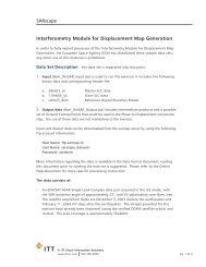
<strong>Visual</strong> <strong>Information</strong> Solutions<strong>ENVI</strong> Orthorectification ModuleOrthorectify <strong>You</strong>r <strong>Imagery</strong> Quickly and Easily.
Rigorous Orthorectification.Simple Workflow. Trusted Method.The <strong>Need</strong> for OrthorectificationSatellite and aerial imagery is used increasingly in GIS and scientific applications for <strong>the</strong> rich information itprovides about a geographic area. If you use imagery as a source of information, you've encountered aneed to perform orthorectification - <strong>the</strong> process of accurately registering imagery to ground coordinatesand geometrically correcting it to remove distortions that occur during image capture.A Rigorous Solution <strong>from</strong> <strong>ENVI</strong>Previously, methods for orthorectifying imagery requiredextensive knowledge of <strong>the</strong> process and complex softwaresystems that were not necessarily available to <strong>the</strong> typicalimage consumer. Now, <strong>the</strong> add-on <strong>ENVI</strong> OrthorectificationModule delivers a trusted, rigorous orthorectification methodand robust capabilities, all distilled into an easy-to-use workflow.This solution creates a seamless data transition, easily takingyou <strong>from</strong> data ingest to orthorectification and fur<strong>the</strong>rexploitation of results using your <strong>ENVI</strong> software. Designedfor use by non-expert and expert users alike, <strong>the</strong> wizardbasedinterface guides users through orthorectificationsteps to quickly produce accurate results.Trusted Method for Rigorous OrthorectificationThe method in <strong>the</strong> <strong>ENVI</strong> Orthorectification Module is based on <strong>the</strong> ma<strong>the</strong>matical model for rigorousorthorectification designed by worldwide ortho experts, Spacemetric. Spacemetric's engineers haveworked closely with satellite and aerial providers for many years, optimizing <strong>the</strong>ir models to accuratelywork with today's most popular airborne and satellite sensors.This extensive research and development has produced a solid, truly rigorous method that is widelyaccepted as an industry standard in image orthorectification technology. Spacemetric's highly optimizedsoftware allows imagery users to produce high quality results quickly. Since this trusted method is nowcombined with <strong>the</strong> image processing and analysis capabilities in <strong>ENVI</strong>, you can trust that yourorthorectification results are scientifically accurate and of <strong>the</strong> highest quality.Orthorectify your imagery quickly and easily.<strong>ENVI</strong>
Automated Workflow<strong>ENVI</strong> is known for making scientifically advanced image processing and analysis capabilities accessible toall levels of geospatial imagery users by incorporating easy-to-use, automated processes and procedures.Now, <strong>the</strong> <strong>ENVI</strong> Orthorectification Module delivers orthorectification capabilities in an automated,wizard-based workflow, so you can perform advanced techniques, regardless of your experience withimage processing or orthorectification.And, since <strong>ENVI</strong> is integrated with ArcGIS, you can seamlessly output your results to a GIS without everinterrupting your workflow.Steps to Orthorectify an Image with <strong>the</strong> <strong>ENVI</strong> Orthorectification Module:Select Input <strong>Imagery</strong> and DEMThe first step in <strong>the</strong> <strong>ENVI</strong> Orthorectification workflowis to load your imagery and digital elevation modelsby simply choosing files <strong>from</strong> <strong>the</strong> current availablebands list.• Include multiple data files, even <strong>from</strong> multiplesensors• Restore a project file to work with previouslysaved resultsCollect and Edit Ground Control PointsOnce input data is defined, this optional step allowsyou to associate image pixels with points on <strong>the</strong>ground whose locations are known throughgeographic coordinate data.• Manually enter ground control points or restorepoints <strong>from</strong> a previous session• View <strong>the</strong> distribution of ground control pointsover <strong>the</strong> project area• Evaluate errors between <strong>the</strong> ground controlpoints and <strong>the</strong> model solution
Collect and Edit Tie PointsWhen multiple images are orthorectified and mosaicked,you may choose to establish tie points in areas ofimage overlap.• Restore previously created tie point files• Add new tie points• Edit existing tie pointsReorder Images and Define CutlinesOnce tie points are collected, you can define <strong>the</strong> imageextent and specify which areas between two or moreoverlapping images should appear in <strong>the</strong> final output.• Define <strong>the</strong> hierarchy of each image relative toall o<strong>the</strong>rs• Define an optional cutline for <strong>the</strong> image by simplydrawing a polygon or polyline on <strong>the</strong> imageSelect Output ParametersIn <strong>the</strong> final step of <strong>the</strong> workflow, you will specify<strong>the</strong> output map projection, pixel size, filenameand path.• Perform automatic image-to-image color balancing• Preview option will show you preliminary resultsbefore <strong>the</strong> entire result is processedRigorous Orthorectification. Simple Workflow. Trusted Method.
Robust CapabilitiesThe <strong>ENVI</strong> Orthorectification Module delivers a rigorous method for precision orthorectification. Whencompared with simple geometric registration or <strong>the</strong> RPC method, <strong>ENVI</strong>’s rigorous method is far moreaccurate and essential to applications where precision matters, such as engineering roadways or bridges,or targeting specific objects of interest.Orthorectify Using an Automated WorkflowA wizard-based interface guides you through<strong>the</strong> rigorous orthorectification process step-bystepto achieve expert level results.Utilize <strong>Imagery</strong> <strong>from</strong> a Broad Range of SensorsThe <strong>ENVI</strong> Orthorectification Module comes withbuilt-in sensor model support for <strong>the</strong> followingsensors: SPOT 1-5, IKONOS-2, QuickBird-2,WorldView-1, EROS A1, Landsat 4-5, Landsat 7ETM+, ERS SAR, Radarsat-1, IRS P6,CARTOSAT-1, FORMOSAT-2, OrbView-3,KompSat-2, and ASTER. <strong>You</strong> can also add yourown sensor model via custom coding.Perform Block Bundle AdjustmentAchieve optimized results and minimize modelerror using GCP’s and tie points.Create Mosaics Using CutlinesEasily draw cutlines for control of multipleimage output seams.Preview <strong>You</strong>r ResultsTry different parameters and preview yourresults before processing <strong>the</strong> entire image.Extend <strong>the</strong> Module's FunctionalityAdd custom sensor support using XML sensordefinition files. Additionally, access <strong>the</strong> moduleprogrammatically using IDL to automate yourworkflow and perform batch processing.<strong>ENVI</strong> Orthorectification ModuleOrthorectifying your imagery is easier than ever.To learn more about <strong>the</strong> <strong>ENVI</strong> Orthorectification Module or about our customimplementation services, visit www.ittvis.com/<strong>ENVI</strong>/Ortho.
ITT <strong>Visual</strong> <strong>Information</strong> Solutionswww.ittvis.com<strong>ENVI</strong>Today's imagery analysts and scientists in awide variety of disciplines choose <strong>ENVI</strong> ® ,<strong>the</strong> premier software solution for extractinginformation <strong>from</strong> geospatial imagery. <strong>ENVI</strong>provides advanced, user-friendly tools toaccess, analyze, and share information<strong>from</strong> geospatial imagery.All rights reserved. ITT, <strong>the</strong> Engineered Blocks logo, and ENGINEEREDFOR LIFE are registered trademarks of ITT Manufacturing Enterprises,Inc., and are used under license. <strong>ENVI</strong> and IDL are trademarks of ITTCorporation. All o<strong>the</strong>r marks are <strong>the</strong> property of <strong>the</strong>ir respective owners.©2009, ITT <strong>Visual</strong> <strong>Information</strong> Solutions.