Town of Summerville Planning Area - BCD Council of Governments
Town of Summerville Planning Area - BCD Council of Governments
Town of Summerville Planning Area - BCD Council of Governments
- No tags were found...

You also want an ePaper? Increase the reach of your titles
YUMPU automatically turns print PDFs into web optimized ePapers that Google loves.
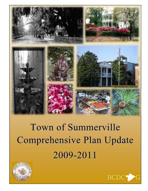
<strong>Town</strong> <strong>of</strong> <strong>Summerville</strong>Comprehensive Plan Update2009-2011
This Page Is Intended To Be Blank.
<strong>Town</strong> <strong>of</strong> <strong>Summerville</strong>Comprehensive Plan Update2009-2011Adopted by the <strong>Town</strong> <strong>of</strong> <strong>Summerville</strong>, August 12, 2009Amended by <strong>Town</strong> <strong>of</strong> <strong>Summerville</strong>, XXXXXXXX.XX, 2011
Table <strong>of</strong> ContentsI. Future Land Use ElementOverview ‐‐‐‐‐‐‐‐‐‐‐‐‐‐‐‐‐‐‐‐‐‐‐‐‐‐‐‐‐‐‐‐‐‐‐‐‐‐‐‐‐‐‐‐‐‐‐‐‐‐‐‐‐‐‐‐‐‐‐‐‐‐‐‐‐‐‐‐‐‐‐‐‐‐‐‐‐‐‐‐‐‐‐‐‐‐‐‐‐‐‐‐‐‐‐‐‐‐‐‐‐‐‐‐‐‐‐‐‐‐‐‐‐‐‐‐‐ Page 1Goals and Objectives One: Future Land Use Districts ‐‐‐‐‐‐‐‐‐‐‐‐‐‐‐‐‐‐‐‐‐‐‐‐‐‐‐‐‐‐‐‐‐‐‐‐‐‐‐‐‐‐‐‐‐‐‐‐‐‐‐‐‐‐‐‐‐‐‐‐ Page 2Goals and Objectives Two: Future Land Use Corridors ‐‐‐‐‐‐‐‐‐‐‐‐‐‐‐‐‐‐‐‐‐‐‐‐‐‐‐‐‐‐‐‐‐‐‐‐‐‐‐‐‐‐‐‐‐‐‐‐‐‐‐‐‐‐‐‐‐‐‐ Page 7Goals and Objectives Three: Future Land Use Focal Points ‐‐‐‐‐‐‐‐‐‐‐‐‐‐‐‐‐‐‐‐‐‐‐‐‐‐‐‐‐‐‐‐‐‐‐‐‐‐‐‐‐‐‐‐‐‐‐‐‐‐‐‐‐ Page 8Implementation Strategy One: Future Land Use Districts ‐‐‐‐‐‐‐‐‐‐‐‐‐‐‐‐‐‐‐‐‐‐‐‐‐‐‐‐‐‐‐‐‐‐‐‐‐‐‐‐‐‐‐‐‐‐‐‐‐‐‐‐‐‐Page 10Implementation Strategy Two: Future Land Use Corridors ‐‐‐‐‐‐‐‐‐‐‐‐‐‐‐‐‐‐‐‐‐‐‐‐‐‐‐‐‐‐‐‐‐‐‐‐‐‐‐‐‐‐‐‐‐‐‐‐‐‐‐‐Page 14Implementation Strategy Three: Future Land Use Focal Points ‐‐‐‐‐‐‐‐‐‐‐‐‐‐‐‐‐‐‐‐‐‐‐‐‐‐‐‐‐‐‐‐‐‐‐‐‐‐‐‐‐‐‐‐‐‐Page 16<strong>Town</strong> <strong>of</strong> <strong>Summerville</strong> <strong>Planning</strong> <strong>Area</strong> Map ‐‐‐‐‐‐‐‐‐‐‐‐‐‐‐‐‐‐‐‐‐‐‐‐‐‐‐‐‐‐‐‐‐‐‐‐‐‐‐‐‐‐‐‐‐‐‐‐‐‐‐‐‐‐‐‐‐‐‐‐‐‐‐‐‐‐‐‐‐‐‐‐‐‐ Map # 1<strong>Town</strong> <strong>of</strong> <strong>Summerville</strong> Future Land Use Map ‐‐‐‐‐‐‐‐‐‐‐‐‐‐‐‐‐‐‐‐‐‐‐‐‐‐‐‐‐‐‐‐‐‐‐‐‐‐‐‐‐‐‐‐‐‐‐‐‐‐‐‐‐‐‐‐‐‐‐‐‐‐‐‐‐‐‐‐‐‐‐‐ Map # 2Dorchester County Future Land Use Map ‐‐‐‐‐‐‐‐‐‐‐‐‐‐‐‐‐‐‐‐‐‐‐‐‐‐‐‐‐‐‐‐‐‐‐‐‐‐‐‐‐‐‐‐‐‐‐‐‐‐‐‐‐‐‐‐‐‐‐‐‐‐‐‐‐‐‐‐‐‐‐‐‐‐ Map # 3II.Transportation Design ElementOverview ‐‐‐‐‐‐‐‐‐‐‐‐‐‐‐‐‐‐‐‐‐‐‐‐‐‐‐‐‐‐‐‐‐‐‐‐‐‐‐‐‐‐‐‐‐‐‐‐‐‐‐‐‐‐‐‐‐‐‐‐‐‐‐‐‐‐‐‐‐‐‐‐‐‐‐‐‐‐‐‐‐‐‐‐‐‐‐‐‐‐‐‐‐‐‐‐‐‐‐‐‐‐‐‐‐‐‐‐‐‐‐‐‐‐‐‐‐ Page 1Figure TD1: Level <strong>of</strong> Service ‐‐‐‐‐‐‐‐‐‐‐‐‐‐‐‐‐‐‐‐‐‐‐‐‐‐‐‐‐‐‐‐‐‐‐‐‐‐‐‐‐‐‐‐‐‐‐‐‐‐‐‐‐‐‐‐‐‐‐‐‐‐‐‐‐‐‐‐‐‐‐‐‐‐‐‐‐‐‐‐‐‐‐‐‐‐‐‐‐‐‐‐‐ Page 2Figure TD2: Road Functional Class Definition ‐‐‐‐‐‐‐‐‐‐‐‐‐‐‐‐‐‐‐‐‐‐‐‐‐‐‐‐‐‐‐‐‐‐‐‐‐‐‐‐‐‐‐‐‐‐‐‐‐‐‐‐‐‐‐‐‐‐‐‐‐‐‐‐‐‐‐‐‐‐ Page 2Goals and Objectives One: Transportation System Design ‐‐‐‐‐‐‐‐‐‐‐‐‐‐‐‐‐‐‐‐‐‐‐‐‐‐‐‐‐‐‐‐‐‐‐‐‐‐‐‐‐‐‐‐‐‐‐‐‐‐‐‐‐‐ Page 3Goals and Objectives Two: Community System Design ‐‐‐‐‐‐‐‐‐‐‐‐‐‐‐‐‐‐‐‐‐‐‐‐‐‐‐‐‐‐‐‐‐‐‐‐‐‐‐‐‐‐‐‐‐‐‐‐‐‐‐‐‐‐‐‐‐‐ Page 7Goals and Objectives Three: Transporation System Improvements ‐‐‐‐‐‐‐‐‐‐‐‐‐‐‐‐‐‐‐‐‐‐‐‐‐‐‐‐‐‐‐‐‐‐‐‐‐‐‐‐‐‐ Page 8Implementation Strategy One: Transportation System Design ‐‐‐‐‐‐‐‐‐‐‐‐‐‐‐‐‐‐‐‐‐‐‐‐‐‐‐‐‐‐‐‐‐‐‐‐‐‐‐‐‐‐‐‐‐‐‐‐ Page 9Implementation Strategy Two: Community System Design ‐‐‐‐‐‐‐‐‐‐‐‐‐‐‐‐‐‐‐‐‐‐‐‐‐‐‐‐‐‐‐‐‐‐‐‐‐‐‐‐‐‐‐‐‐‐‐‐‐‐‐‐‐ Page 9Implementation Strategy Three: Transporation System Improvements ‐‐‐‐‐‐‐‐‐‐‐‐‐‐‐‐‐‐‐‐‐‐‐‐‐‐‐‐‐‐‐‐‐‐‐‐‐Page 10<strong>Town</strong> <strong>of</strong> <strong>Summerville</strong> <strong>Planning</strong> <strong>Area</strong> Road Type Map ‐‐‐‐‐‐‐‐‐‐‐‐‐‐‐‐‐‐‐‐‐‐‐‐‐‐‐‐‐‐‐‐‐‐‐‐‐‐‐‐‐‐‐‐‐‐‐‐‐‐‐‐‐‐‐‐‐‐‐‐ Map # 4<strong>Town</strong> <strong>of</strong> <strong>Summerville</strong> <strong>Planning</strong> <strong>Area</strong> Transit Service and Proposed Commuter Rail Map ‐‐‐‐‐‐‐‐‐‐‐‐‐‐‐ Map # 5III.Priority Investment <strong>Area</strong>s ElementOverview ‐‐‐‐‐‐‐‐‐‐‐‐‐‐‐‐‐‐‐‐‐‐‐‐‐‐‐‐‐‐‐‐‐‐‐‐‐‐‐‐‐‐‐‐‐‐‐‐‐‐‐‐‐‐‐‐‐‐‐‐‐‐‐‐‐‐‐‐‐‐‐‐‐‐‐‐‐‐‐‐‐‐‐‐‐‐‐‐‐‐‐‐‐‐‐‐‐‐‐‐‐‐‐‐‐‐‐‐‐‐‐‐‐‐‐‐‐ Page 1Goals and Objectives One: Coordination ‐‐‐‐‐‐‐‐‐‐‐‐‐‐‐‐‐‐‐‐‐‐‐‐‐‐‐‐‐‐‐‐‐‐‐‐‐‐‐‐‐‐‐‐‐‐‐‐‐‐‐‐‐‐‐‐‐‐‐‐‐‐‐‐‐‐‐‐‐‐‐‐‐‐‐‐‐ Page 2Goals and Objectives Two: Investment ‐‐‐‐‐‐‐‐‐‐‐‐‐‐‐‐‐‐‐‐‐‐‐‐‐‐‐‐‐‐‐‐‐‐‐‐‐‐‐‐‐‐‐‐‐‐‐‐‐‐‐‐‐‐‐‐‐‐‐‐‐‐‐‐‐‐‐‐‐‐‐‐‐‐‐‐‐‐‐ Page 2Goals and Objectives Three: Conservation ‐‐‐‐‐‐‐‐‐‐‐‐‐‐‐‐‐‐‐‐‐‐‐‐‐‐‐‐‐‐‐‐‐‐‐‐‐‐‐‐‐‐‐‐‐‐‐‐‐‐‐‐‐‐‐‐‐‐‐‐‐‐‐‐‐‐‐‐‐‐‐‐‐‐ Page 2Goals and Objectives Four: Workforce Housing ‐‐‐‐‐‐‐‐‐‐‐‐‐‐‐‐‐‐‐‐‐‐‐‐‐‐‐‐‐‐‐‐‐‐‐‐‐‐‐‐‐‐‐‐‐‐‐‐‐‐‐‐‐‐‐‐‐‐‐‐‐‐‐‐‐‐‐‐ Page 2Implementation Strategy One: Coordination ‐‐‐‐‐‐‐‐‐‐‐‐‐‐‐‐‐‐‐‐‐‐‐‐‐‐‐‐‐‐‐‐‐‐‐‐‐‐‐‐‐‐‐‐‐‐‐‐‐‐‐‐‐‐‐‐‐‐‐‐‐‐‐‐‐‐‐‐‐‐‐ Page 3Implementation Strategy Two: Investment ‐‐‐‐‐‐‐‐‐‐‐‐‐‐‐‐‐‐‐‐‐‐‐‐‐‐‐‐‐‐‐‐‐‐‐‐‐‐‐‐‐‐‐‐‐‐‐‐‐‐‐‐‐‐‐‐‐‐‐‐‐‐‐‐‐‐‐‐‐‐‐‐‐ Page 3Figure PIA1: Transportation Improvements – Roads ‐‐‐‐‐‐‐‐‐‐‐‐‐‐‐‐‐‐‐‐‐‐‐‐‐‐‐‐‐‐‐‐‐‐‐‐‐‐‐‐‐‐‐‐‐‐‐‐‐‐‐‐‐‐‐‐‐‐‐‐‐ Page 7Figure PIA2: Education Facility Needs in Dorchester County School District 2 ‐‐‐‐‐‐‐‐‐‐‐‐‐‐‐‐‐‐‐‐‐‐‐‐‐‐‐‐‐ Page 8Implementation Strategy Three: Conservation ‐‐‐‐‐‐‐‐‐‐‐‐‐‐‐‐‐‐‐‐‐‐‐‐‐‐‐‐‐‐‐‐‐‐‐‐‐‐‐‐‐‐‐‐‐‐‐‐‐‐‐‐‐‐‐‐‐‐‐‐‐‐‐‐‐‐‐‐ Page 9Implementation Strategy Four: Workforce Housing ‐‐‐‐‐‐‐‐‐‐‐‐‐‐‐‐‐‐‐‐‐‐‐‐‐‐‐‐‐‐‐‐‐‐‐‐‐‐‐‐‐‐‐‐‐‐‐‐‐‐‐‐‐‐‐‐‐‐‐‐‐‐ Page 9<strong>Town</strong> <strong>of</strong> <strong>Summerville</strong> <strong>Planning</strong> <strong>Area</strong> Priority Investment <strong>Area</strong>s Map ‐‐‐‐‐‐‐‐‐‐‐‐‐‐‐‐‐‐‐‐‐‐‐‐‐‐‐‐‐‐‐‐‐‐‐‐‐‐‐‐ Map # 6Table <strong>of</strong> ContentsPage i
Table <strong>of</strong> ContentsIV.Population ElementFigure P1: Population Trends, <strong>Summerville</strong> ‐‐‐‐‐‐‐‐‐‐‐‐‐‐‐‐‐‐‐‐‐‐‐‐‐‐‐‐‐‐‐‐‐‐‐‐‐‐‐‐‐‐‐‐‐‐‐‐‐‐‐‐‐‐‐‐‐‐‐‐‐‐‐‐‐‐‐‐‐‐‐‐‐ Page 1Figure P2: Population Increase Comparison, 2000‐2007 ‐‐‐‐‐‐‐‐‐‐‐‐‐‐‐‐‐‐‐‐‐‐‐‐‐‐‐‐‐‐‐‐‐‐‐‐‐‐‐‐‐‐‐‐‐‐‐‐‐‐‐‐‐‐‐‐ Page 1Figure P3: Land <strong>Area</strong> Growth in Square Miles, <strong>Summerville</strong> 1990‐2008 ‐‐‐‐‐‐‐‐‐‐‐‐‐‐‐‐‐‐‐‐‐‐‐‐‐‐‐‐‐‐‐‐‐‐‐‐‐ Page 2Figure P4: Total Construction, 2006 ‐‐‐‐‐‐‐‐‐‐‐‐‐‐‐‐‐‐‐‐‐‐‐‐‐‐‐‐‐‐‐‐‐‐‐‐‐‐‐‐‐‐‐‐‐‐‐‐‐‐‐‐‐‐‐‐‐‐‐‐‐‐‐‐‐‐‐‐‐‐‐‐‐‐‐‐‐‐‐‐‐‐‐ Page 2Figure P5: Population, <strong>Summerville</strong>, 2000‐2010 ‐‐‐‐‐‐‐‐‐‐‐‐‐‐‐‐‐‐‐‐‐‐‐‐‐‐‐‐‐‐‐‐‐‐‐‐‐‐‐‐‐‐‐‐‐‐‐‐‐‐‐‐‐‐‐‐‐‐‐‐‐‐‐‐‐‐‐ Page 2Figure P6: Household Types, <strong>Summerville</strong>, 2000 ‐‐‐‐‐‐‐‐‐‐‐‐‐‐‐‐‐‐‐‐‐‐‐‐‐‐‐‐‐‐‐‐‐‐‐‐‐‐‐‐‐‐‐‐‐‐‐‐‐‐‐‐‐‐‐‐‐‐‐‐‐‐‐‐‐‐‐ Page 3Figure P7: Educational Attainment, Population 25 yrs +, <strong>Summerville</strong>, 2000 ‐‐‐‐‐‐‐‐‐‐‐‐‐‐‐‐‐‐‐‐‐‐‐‐‐‐‐‐‐‐‐ Page 3Figure P8: <strong>Summerville</strong> Residents That Attended Some College ‐‐‐‐‐‐‐‐‐‐‐‐‐‐‐‐‐‐‐‐‐‐‐‐‐‐‐‐‐‐‐‐‐‐‐‐‐‐‐‐‐‐‐‐‐‐‐ Page 4Figure P9: <strong>Summerville</strong> Residents That Did Not Graduate High School ‐‐‐‐‐‐‐‐‐‐‐‐‐‐‐‐‐‐‐‐‐‐‐‐‐‐‐‐‐‐‐‐‐‐‐‐‐‐ Page 4Figure P10: Median Household Income Comparison, 2000 ‐‐‐‐‐‐‐‐‐‐‐‐‐‐‐‐‐‐‐‐‐‐‐‐‐‐‐‐‐‐‐‐‐ Page 4Figure P11: <strong>Summerville</strong> Children & Seniors Living in Poverty, 2000 ‐‐‐‐‐‐‐‐‐‐‐‐‐‐‐‐‐‐‐‐‐‐‐‐‐‐‐‐‐‐‐‐‐‐‐‐‐‐‐‐‐‐ Page 5Figure P12: Percentage <strong>of</strong> Children Living Below Poverty Threshold, <strong>Summerville</strong>, 2000 ‐‐‐‐‐‐‐‐‐‐‐‐‐‐‐ Page 6Figure P13: Children & Seniors Living in Poverty, Comparison, 2000 ‐‐‐‐‐‐‐‐‐‐‐‐‐‐‐‐‐‐‐‐‐‐‐‐‐‐‐‐‐‐‐‐‐‐‐‐‐‐‐‐‐ Page 6Figure P14: Racial Composition, <strong>Summerville</strong>, 2000 ‐‐‐‐‐‐‐‐‐‐‐‐‐‐‐‐‐‐‐‐‐‐‐‐‐‐‐‐‐‐‐‐‐‐‐‐‐‐‐‐‐‐‐‐‐‐‐‐‐‐‐‐‐‐‐‐‐‐‐‐‐‐ Page 7Figure P15: Age & Sex, <strong>Summerville</strong>, United States Comparison, 2000 ‐‐‐‐‐‐‐‐‐‐‐‐‐‐‐‐‐‐‐‐‐‐‐‐‐‐‐‐‐‐‐‐‐‐‐‐‐‐ Page 7V. Natural Resources ElementOverview Page 1Table NR1: Techniques to Improve Water Quality Page 2Figure NR1: Example <strong>of</strong> a Rain Garden Page 4Figure NR2: Furman Office Building, Greenville SC. Page 4Table NR2: Endangered Plant and Animal Species in the <strong>Summerville</strong> <strong>Planning</strong> <strong>Area</strong> Page 6Table NR3: Partial Listing <strong>of</strong> Invasive Species Reported in the <strong>Summerville</strong> <strong>Planning</strong> <strong>Area</strong> Page 8Conclusion Page 10Goals, Objectives, and Strategies Page 11VI.Energy ElementOverview Page 1Background Page 1Figure EN1: Trends in Total US Energy Imports (in Quadrillion Btus) Page 2Existing Energy Conditions Page 3Figure EN2: Historic Net Energy Production in South Carolina (in Trillion Btus) Page 4Figure EN3: Sources <strong>of</strong> Energy Production in South Carolina Page 4Figure EN4: Trends in Total Statewide Energy Consumption (in Trillion Btu's) Page 5Figure EN5: Energy Consumption by Sector, South Carolina, 2008 Page 6Figure EN6: Energy Consumption by Sector, South Carolina vs. United States, 2008 Page 6Table EN1: Residential Energy Use for the <strong>Town</strong> <strong>of</strong> <strong>Summerville</strong>, 2008 Page 7Figure EN7: Home Heating Source for Owner‐ Occupied Units in <strong>Summerville</strong> Page 8Figure EN8: Home Heating Source for Rental Units in <strong>Summerville</strong> Page 8Table EN2: Commercial Energy Use for the <strong>Town</strong> <strong>of</strong> <strong>Summerville</strong> in 2008 Page 9Table EN3: Industrial Energy Use for the <strong>Town</strong> <strong>of</strong> <strong>Summerville</strong> in 2008 Page 10Figure EN9: Method <strong>of</strong> Commute for <strong>Summerville</strong> Residents, by Percentage Page 11Table EN4: Fuel Consumption for Households in the <strong>Town</strong> <strong>of</strong> <strong>Summerville</strong> Page 12Renewable Energy Page 12Goals, Objectives, and Strategies Page 14Table <strong>of</strong> ContentsPage ii
Table <strong>of</strong> ContentsVII.Housing ElementIntroduction Page 1Existing Conditions Page 1Table HO1: Number <strong>of</strong> Total Housing Units in the <strong>Town</strong> <strong>of</strong> <strong>Summerville</strong> from1970‐2008, by type Page 1Figure HO1: Historical Composition <strong>of</strong> Housing in <strong>Summerville</strong> Page 2Figure HO2: Owner vs. Rental Occupancy in <strong>Summerville</strong>, 2006‐2008 Page 3Figure HO3: Trends in Owner vs. Renter Occupancy for Occupied Homes in <strong>Summerville</strong> Page 3Figure HO4: Year <strong>Summerville</strong> Residents Moved into Current Home, by Percentage Page 4Table HO2: Home Tenure by Age in the <strong>Town</strong> <strong>of</strong> <strong>Summerville</strong> Page 5Figure HO5: Year Homes Built in <strong>Summerville</strong>, By Percentage Page 6Figure HO6: Percentage <strong>of</strong> Overcrowded Dwellings in <strong>Town</strong> <strong>of</strong> <strong>Summerville</strong> Page 7Figure HO7: Trends in Median Home Value in <strong>Town</strong> <strong>of</strong> <strong>Summerville</strong> (Owner‐occupied homes) Page 8Figure HO8: Median Home Values for <strong>Summerville</strong> and Nearby Communities Page 8Figure HO9: Median Gross Rent for <strong>Summerville</strong> and Nearby Communities Page 9Figure HO10: Percentage <strong>of</strong> Household Income Spent on Monthly Housing Costsin <strong>Summerville</strong> Page 10Figure HO11: Comparison <strong>of</strong> Households Spending Greater or Less than30% <strong>of</strong> Monthly Housing Costs, <strong>Summerville</strong> vs. Nearby Communities Page 11Table HO3: Comparison <strong>of</strong> Median Household Income to Median Sales Price forHomes, <strong>Summerville</strong> vs. Nearby Communities Page 12Table HO4: Workforce Housing Affordability for <strong>Summerville</strong> based on HUD standards Page 13Table HO5: Projects in <strong>Summerville</strong> Funded by the Low Income Housing Tax Creditsince 1989 Page 14Table HO6: Apartment complexes in the <strong>Summerville</strong> <strong>Area</strong> that Funded Through theUSDA Rural Development Multi‐Family Rental Program Page 14Table HO7: Subdivisions or Apartment Complexes in <strong>Summerville</strong>Completed since 2000 Page 15Table HO8: Approved and Partially Built or Unbuilt Subdivisions in <strong>Summerville</strong> Page 16Goals, Objectives, and Strategies Page 20<strong>Town</strong> <strong>of</strong> <strong>Summerville</strong> Approved Subdivisions Since 2000 Map # 7VIII.Community Facilities ElementBackground Page 1Existing Conditions Page 1Figure CF1: Trends in Calls for Police Service, <strong>Town</strong> <strong>of</strong> <strong>Summerville</strong> 2000‐2009 Page 2Figure CF2: Trends in Arrests in <strong>Town</strong> <strong>of</strong> <strong>Summerville</strong> Page 3Table CF1: Crime Trends in <strong>Town</strong> <strong>of</strong> <strong>Summerville</strong>, 2002‐2009 Page 3Table CF2: <strong>Summerville</strong> Fire and Rescue Department Stations Page 4Table CF3: Emergency Shelter Locations in the Charleston <strong>Area</strong> Page 7Figure CF3: Wastewater Treatment Use and Capacity in <strong>Summerville</strong> as<strong>of</strong> August 2010 (in MGD) Page 8Figure CF4: Water Filtration Use and Capacity in <strong>Summerville</strong>, as <strong>of</strong> August, 2010 (in MGD) Page 9Table CF4: Parks, Playgrounds, and Community Centers Owned and Maintainedby the <strong>Town</strong> <strong>of</strong> <strong>Summerville</strong> Page 13Table CF5: Recreation Facility Surplus or Deficit in the <strong>Summerville</strong> <strong>Area</strong> 2009 Page 14Table CF6: <strong>Summerville</strong> Sports Leagues Page 15Table CF7: Public schools Serving <strong>Summerville</strong> Residents Page 16Table <strong>of</strong> ContentsPage iii
Table <strong>of</strong> ContentsTable CF8: Private schools in the <strong>Summerville</strong> <strong>Planning</strong> <strong>Area</strong> (As <strong>of</strong> 2010) Page 17Goals, Objectives, and Strategies Page 18<strong>Summerville</strong> <strong>Planning</strong> <strong>Area</strong> Fire and EMS Stations Map # 8<strong>Summerville</strong> <strong>Planning</strong> <strong>Area</strong> Sewer Facilities Map # 9<strong>Summerville</strong> <strong>Planning</strong> <strong>Area</strong> Sewer Service <strong>Area</strong>s Map # 10<strong>Summerville</strong> <strong>Planning</strong> <strong>Area</strong> Water Facilities Map # 11<strong>Summerville</strong> <strong>Planning</strong> <strong>Area</strong> Parks and Recreation Facilities Map # 12<strong>Summerville</strong> <strong>Planning</strong> <strong>Area</strong> Public Schools Map # 13IX.Economic Development ElementOverview Page 1Figure ED1: Unemployment Rate (in %) for <strong>Summerville</strong>, 2008‐2010 Page 1Table ED1: Comparison <strong>of</strong> Unemployed Workers to Job Openings, August 2010 Page 2Figure ED2: Employment, by Employment Type for <strong>Summerville</strong> Residents Page 3Figure ED3: Employment <strong>of</strong> <strong>Summerville</strong> Residents, by Job Type Page 3Figure ED4: Employer Type <strong>of</strong> <strong>Summerville</strong> Residents, by Percentage Page 4Table ED2: Private Sector Employment in the <strong>Town</strong> <strong>of</strong> <strong>Summerville</strong>, byEmployment Type, 2007 Page 5Table ED3: Major Regional Employers with Facilities in the <strong>Summerville</strong> <strong>Planning</strong> <strong>Area</strong> Page 6Table ED4: Largest Employment Sites in the <strong>Town</strong> <strong>of</strong> <strong>Summerville</strong> Page 7Table ED5: Businesses with Multiple Facilities with Headquarters Located in the<strong>Summerville</strong> <strong>Area</strong> Page 8Figure ED5: Percentage <strong>of</strong> Residents over the Age <strong>of</strong> 25 with at Least aHigh School DiplomaPage 9Figure ED6: Percentage <strong>of</strong> residents over the age <strong>of</strong> 25 with at Least a Bachelors Degree Page 9Table ED6: Existing Office Facilities in the <strong>Town</strong> <strong>of</strong> <strong>Summerville</strong> Larger than10,000 Square Feet (As <strong>of</strong> 2008) Page 11Table ED7: Retail Market Snapshot, Second Quarter 2010, Charleston S.C. MSA Page 12Table ED8: <strong>Summerville</strong> Retail Complexes Larger than 30,000 Square FeetGross Leasable <strong>Area</strong> Page 13Table ED9: Retail Market Opportunities in <strong>Summerville</strong> Page 14Table ED10: Snapshot <strong>of</strong> Industrial Development in the Charleston <strong>Area</strong>, July 2010 Page 15Table ED11: Existing Available Industrial Buildings in <strong>Summerville</strong>, as <strong>of</strong> September, 2010 Page 15Table ED12: Proposed Commercial Projects in <strong>Summerville</strong> Page 16Table ED13: Economic Development Organizations Serving the <strong>Summerville</strong> <strong>Planning</strong> <strong>Area</strong> Page 18Figure ED7: <strong>Summerville</strong> Residents Working Outside <strong>of</strong> County <strong>of</strong> Residence Page 21Figure ED8: Home Based Work Trip Destinations from <strong>Summerville</strong>, by Percentage, 2003 Page 21Figure ED9: Mean One‐way Commute Time (in Minutes) for <strong>Summerville</strong> Residentsvs. Metro Charleston Region Counties Page 22Figure ED10: Percentage <strong>of</strong> Workers with a Commute Time <strong>of</strong> Greater than 35 Minutes Page 23Figure ED11: Percentage <strong>of</strong> Workers with a Commute Time <strong>of</strong> Greater than 45 Minutes Page 23Table ED14: Comparison <strong>of</strong> Median and Per‐Capita incomes between<strong>Summerville</strong> and Nearby Communities Page 23Figure ED12: Median Household Income for the <strong>Town</strong> <strong>of</strong> <strong>Summerville</strong>, 2000 vs. 2006‐2008 Page 25Table ED15: Comparison <strong>of</strong> Property Values in Dorchester County Section <strong>of</strong> <strong>Summerville</strong> and DorchesterCounty. 1999‐2009 Page 26Table ED16: Assessed and Real Property Values in <strong>Summerville</strong> 2009 Page 26Goals, Objectives, and Strategies Page 28Table <strong>of</strong> ContentsPage iv
Table <strong>of</strong> Contents<strong>Town</strong> <strong>of</strong> <strong>Summerville</strong> Large Retail Complexes Map # 14<strong>Summerville</strong> <strong>Planning</strong> <strong>Area</strong> Industrial Sites Map # 15<strong>Town</strong> <strong>of</strong> <strong>Summerville</strong> Proposed Commercial Projects Map # 16X. Cultural Resources ElementOverview Page 1Table CR1: Listed National Register <strong>of</strong> Historic Places properties locatedin or near <strong>Summerville</strong> Page 2Table CR2: Partial listing <strong>of</strong> <strong>Summerville</strong> properties eligible for inclusion in the NationalRegister <strong>of</strong> Historic Places Page 4Table CR3: Unique Commercial Structures in the <strong>Town</strong> <strong>of</strong> <strong>Summerville</strong> Page 5Table CR4: Partial listing <strong>of</strong> Places <strong>of</strong> Worship Within the <strong>Summerville</strong> <strong>Planning</strong> <strong>Area</strong> Page 6Major Places <strong>of</strong> Worship within <strong>Summerville</strong> <strong>Planning</strong> <strong>Area</strong>Table CR5: Key Cultural Events & Activities in the <strong>Summerville</strong> <strong>Planning</strong> <strong>Area</strong> Page 8Table CR6: Educational Institutions, Civic Organizations & Clubs in the <strong>Summerville</strong> area Page 10Goals, Objectives, and Strategies Page 11<strong>Summerville</strong> Historic District Map # 17<strong>Summerville</strong> <strong>Planning</strong> <strong>Area</strong> Major Places <strong>of</strong> Worship Map # 18XI.Appendix 1: <strong>BCD</strong>COG Travel Demand Modeling ScenariosFigure 2.1: Roadway Capacity Improvements, Description, & Purpose: ‐‐‐‐‐‐‐‐‐‐‐‐‐‐‐‐‐‐‐‐‐‐‐‐‐‐‐‐‐‐‐‐‐‐‐‐‐ Page 1Figure 2.2: Road Classification Types identified under the C & B Traffic Plan ‐‐‐‐‐‐‐‐‐‐‐‐‐‐‐‐‐‐‐‐‐‐‐‐‐‐‐‐‐‐‐ Page 1Figure 2.3: Carter & Burgess – <strong>Town</strong> <strong>of</strong> <strong>Summerville</strong> Comprehensive Traffic Plan ‐‐‐‐‐‐‐‐‐‐‐‐‐‐‐‐‐‐‐‐‐‐‐‐ Page 2Figure 2.4 TAZ Map: Population forecast re‐allocation in <strong>Summerville</strong> ‐‐‐‐‐‐‐‐‐‐‐‐‐‐‐‐‐‐‐‐‐‐‐‐‐‐‐‐‐‐‐‐‐‐‐‐‐‐ Page 3Figure 2.5 TAZ Map: Employment forecast ‐‐‐‐‐‐‐‐‐‐‐‐‐‐‐‐‐‐‐‐‐‐‐‐‐‐‐‐‐‐‐‐‐‐‐‐‐‐‐‐‐‐‐‐‐‐‐‐‐‐‐‐‐‐‐‐‐‐‐‐‐‐‐‐‐‐‐‐‐‐‐‐‐‐ Page 3Figure 2.6 TAZ Map: Roadway LOS with Four Lanes and Continuous Middle Turn Lane ‐‐‐‐‐‐‐‐‐‐‐‐‐‐‐‐‐ Page 4Figure 2.7 TAZ Map: Roadway LOS with Four Lanes and Landscaped Median ‐‐‐‐‐‐‐‐‐‐‐‐‐‐‐‐‐‐‐‐‐‐‐‐‐‐‐‐‐‐ Page 4Figure 2.8: Capacity increase with Median (Bacons Bridge Rd – 2 to 4 Lanes) ‐‐‐‐‐‐‐‐‐‐‐‐‐‐‐‐‐‐‐‐‐‐‐‐‐‐‐‐‐ Page 5Figure 2.9 TAZ Map: Roadway LOS with two lane section between Edisto Rd. and Crestwood Dr. ‐‐ Page 5Figure 2.10 TAZ Map: Roadway LOS with only planted median ‐‐‐‐‐‐‐‐‐‐‐‐‐‐‐‐‐‐‐‐‐‐‐‐‐‐‐‐‐‐‐‐‐‐‐‐‐‐‐‐‐‐‐‐‐‐‐‐ Page 5Figure 2.11 TAZ Map: LOS with Median and On‐street parking for certain sections ‐‐‐‐‐‐‐‐‐‐‐‐‐‐‐‐‐‐‐‐‐‐ Page 6Figure 2.12 TAZ Map: LOS with continuous center turn lane ‐‐‐‐‐‐‐‐‐‐‐‐‐‐‐‐‐‐‐‐‐‐‐‐‐‐‐‐‐‐‐‐‐‐‐‐‐‐‐‐‐‐‐‐‐‐‐‐‐‐‐ Page 6Figure 2.13: Capacity increase with a Median Fifth Street North (US 78) ‐‐‐‐‐‐‐‐‐‐‐‐‐‐‐‐‐‐‐‐‐‐‐‐‐‐‐‐‐‐‐‐‐‐‐‐ Page 6Table <strong>of</strong> ContentsPage v
I. Future Land Use Element
OverviewFuture Land Use ElementThe purpose <strong>of</strong> land use planning is to identify locations and sites for various types and styles <strong>of</strong> landdevelopment. The Future Land Use element <strong>of</strong> a comprehensive plan considers existing and future land use bycategories including: residential, commercial, industrial, recreation open space and civic uses. Localgovernments are enabled to plan for future growth and development to promote “public health, safety,morals, convenience, order, appearance, prosperity, and general welfare,” through the South CarolinaLegislature in SC (6‐29‐710).The Future Land Use Element <strong>of</strong> the <strong>Town</strong> <strong>of</strong> <strong>Summerville</strong>’s comprehensive plan update will provide land userecommendations for the municipal <strong>Town</strong> boundaries and unincorporated land located along the <strong>Town</strong>’speriphery. <strong>Planning</strong> <strong>Area</strong>‐Map #1Dorchester County’s 2008 Comprehensive Plan indentifies four “growth areas” within the county as mapped on2008 Dorchester County Future Land‐Use‐Map #3. The lower portion <strong>of</strong> Dorchester County, located within theGreat Cypress Swamp and the Ashley River, is classified as “Managed Growth <strong>Area</strong>s” in accordance with therecommendations <strong>of</strong> the Dorchester County’s comprehensive plan. The <strong>Town</strong> <strong>of</strong> <strong>Summerville</strong>’s <strong>Planning</strong> <strong>Area</strong> islocated in the Managed Growth <strong>Area</strong>s <strong>of</strong> Dorchester County’s Comprehensive Plan. Managed Growth <strong>Area</strong>s aredefined as existing <strong>Town</strong>s and neighborhoods and are well suited for development considering reasonableaccess to existing or planned transportation infrastructure. These areas predominately occupy high ground,removed from sensitive environmental and natural resource areas.Existing Land UseAn inventory <strong>of</strong> existing land use was conducted for Dorchester County in 2006, including all municipalities. In2009, the land area <strong>of</strong> the <strong>Town</strong> <strong>of</strong> <strong>Summerville</strong>’s municipal boundary encompassed 14.5 square miles or 9,273acres. According to the 2009 survey 55% is classified as residential, 14% is agricultural forested lands, and 12% iscommercial and industrial land. Parks/open space and vacant land occupies almost 10% <strong>of</strong> total land area withinthe <strong>Town</strong>.Population GrowthThe citizen population and municipal boundaries <strong>of</strong> the <strong>Town</strong> <strong>of</strong> <strong>Summerville</strong> have grown substantially over thepast ten years. According to growth projections, the total citizen population within the municipal boundary willincrease 59 percent from 2000 to 2010. Portions <strong>of</strong> this population growth can be credited to annexationmeasures by the <strong>Town</strong> <strong>of</strong> <strong>Summerville</strong>. Population ElementThe Census Bureau’s 2005 population estimate for Dorchester County is 117,660. Dorchester County’s 2008Comprehensive Plan projects the population <strong>of</strong> Dorchester County to exceed 160,000 by the year 2030, aprojected population growth <strong>of</strong> 38 percent from 2005 to 2030. These projections include the majority <strong>of</strong>incorporated <strong>Summerville</strong>. In order to effectively manage the projected population for the <strong>Town</strong> <strong>of</strong> <strong>Summerville</strong>and Dorchester County, it is essential to identify suitable areas to accommodate the increased populationgrowth.Future Land Use Element Page 1
Future Land Use ElementGoals and ObjectivesThe Future Land‐Use Element is intended to guide and manage the projected population growth and landdevelopment <strong>of</strong> the <strong>Town</strong> <strong>of</strong> <strong>Summerville</strong>’s <strong>Planning</strong> <strong>Area</strong>. This Element is comprised <strong>of</strong> three components:Future Land Use Districts, Corridors, and Focal Points identified on Future Land Use‐Map #2.Goal One – Future Land Use Districts: The <strong>Town</strong> <strong>of</strong> <strong>Summerville</strong> should encourage the preservation<strong>of</strong> existing neighborhoods while promoting planned growth when reviewing land development and site planproposals within the <strong>Town</strong>’s <strong>Planning</strong> <strong>Area</strong>.Objective: The <strong>Planning</strong> <strong>Area</strong> is divided into eleven Future Land Use Districts identified on the FutureLand Use Map. These districts are intended to guide projected growth, encourage sustainabledevelopment and promote redevelopment within the <strong>Planning</strong> <strong>Area</strong>.Employment Growth (EG) DistrictThe Employment Growth District promotes economic development opportunities within the <strong>Planning</strong> <strong>Area</strong>.The Employment Growth District is located northeast <strong>of</strong> Fifth Street North toward and across Interstate 26. TheEG District is bisected by Hodge Road and Old Dairy Road, encompassing McQueen Industrial Park.The EG District is intended to serve as an economic development area for the <strong>Town</strong> <strong>of</strong> <strong>Summerville</strong> <strong>Planning</strong><strong>Area</strong>. The EG District’s location within close proximity to existing and planned transportation corridors andfreight rail lines is a key component to successful industrial and wholesale trade sites.Industrial land uses such as construction, manufacturing, transportation, communication, utilities and wholesaletrade are recommended for the EG District. Residential land uses are not encouraged within the EG District.Commercial (C) DistrictThe Commercial District classifies commercial land uses providing a variety <strong>of</strong> general commercial goods andretail services within the <strong>Planning</strong> <strong>Area</strong>.Four locations have been classified as Commercial Districts: 1) Main Street (Highway 17A) 2) TrolleyRoad/Berlin G. Myers Intersection 3) Ladson Road/Trolley Road/Dorchester Road Intersection and 4) eastLadson Road towards the intersection <strong>of</strong> Lincolnville Road. These areas consist <strong>of</strong> predominately suburban stylecommercial land uses such as shopping centers, big box retail stores, restaurants, automobile dealerships andservice stations.The Main Street (Highway 17A) Commercial District should continue to experience commercial growth along theInterstate 26 (I‐26) interchange. The majority <strong>of</strong> this growth is expected to include large scale retail. Thesouthern portion <strong>of</strong> this district below the I‐26/Highway 78 Interchange is planned for general commercial landuses including retail, <strong>of</strong>fice, hotel and restaurants. High density residential development is also planned for thisarea.The Commercial District located along the Trolley Road/Berlin G. Myers Intersection includes a traditionalsuburban retail shopping center with close proximity to the Dorchester County library. Redevelopment andrehabilitation <strong>of</strong> these areas will be encouraged through the <strong>Town</strong>’s Commercial Design Review Boards oversightand ordinances that require thoughtful site design and architecture. Completion <strong>of</strong> Phase III <strong>of</strong> the Berlin G.Myers Parkway will increase vehicle trips and provide an opportunity for redevelopment <strong>of</strong> these existingcommercial sites.Future Land Use Element Page 2
The Ladson Road/Trolley Road/Dorchester Road Intersection Commercial District should be planned forcontinued expansion <strong>of</strong> the commercial, residential and a mixture <strong>of</strong> retail, pr<strong>of</strong>essional <strong>of</strong>fice, recreation andinstitutional land uses. Plans are underway for a CARTA Express transit route in this area as identified on theTransit Service and Potential Commuter Rail‐Map #5.The east Ladson Road Commercial District located towards the intersection <strong>of</strong> Lincolnville Road is planned forcontinued commercial growth. Commercial land uses should remain predominate in this District.Traditional suburban style shopping centers and other commercial sites located in these Commercial Districtsshould be redeveloped considering the proximity to existing infrastructure and surrounding services. Highdensity residential and mixed use is recommended and should be planned in redevelopment projects. Shoppingcenters with large oversized parking lots should consider out‐parceling to facilitate redevelopment. Outparcelingis a lot separated from a commercial development which may be sold or developed.Gateway Mixed Use (GMU) DistrictThe Gateway Mixed Use District is intended to enhance the traditional street grid system within the <strong>Town</strong> <strong>of</strong><strong>Summerville</strong> and encourage a mixture <strong>of</strong> light and heavy commercial, retail, <strong>of</strong>fice and residential land uses.The GMU District comprises portions <strong>of</strong> “New <strong>Town</strong>” <strong>Summerville</strong> with a mixture <strong>of</strong> commercial and residentialland uses. The boundaries <strong>of</strong> the GMU District extend northward <strong>of</strong> the NSX Rail line along Main Street towardsthe Berlin G. Myers Parkway intersection <strong>of</strong> Main Street. The western boundary is along Pine Street, the easternboundary is approximately a quarter mile south <strong>of</strong> the Berlin G. Myers Parkway north <strong>of</strong> the NSX Rail line.The Berlin G. Myers Parkway, Fifth Street North (US 78) and Main Street (Highway 17A) are major transportationcorridors bisecting the GMU District. Transportation widening projects and new road construction is planned forportions <strong>of</strong> the GMU District. Fifth Street North is scheduled to be widened from a two lane to four lane road;while the Berlin G. Myers/Maple Street Extension is programmed in the CHATS Long Range Transportation Plan.The GMU District is located adjacent to the NSX rail line. A Commuter Rail Feasibility Study is currently beingundertaken by the <strong>BCD</strong>COG.Multiple land uses encouraging a variety <strong>of</strong> intensities to support transit and commuter rail will be encouragedwithin the GMU District through zoning regulations. High residential densities are recommended for the GMUDistrict. Potential commuter rail station sites have been identified on the Transit Service and PotentialCommuter Rail‐Map #5 and referenced in the Transportation Design Element and Priority Investment <strong>Area</strong>sElement.The GMU District contains the luxury <strong>of</strong> a highly connected street network, major transportation corridors andsupporting transit services. Vertical growth and compact land development will be planned for the GMUDistrict.Neighborhood Mixed Use (NMU) DistrictThe Neighborhood Mixed Use District is intended to encourage the integration <strong>of</strong> commercial and residentialland uses.The NMU District is proposed in three areas: 1) North <strong>of</strong> Main Street along the Fifth Street North corridor,spanning west along Richardson Avenue towards the Fifth Street North/Richardson Avenue intersection. Thisportion consists <strong>of</strong> mainly residential land uses with commercial and industrial land uses surrounding the FifthStreet North/Richardson Avenue intersection. 2) Surrounding Miles Jamison Road /Gahagan Road intersection,spanning towards the Berlin G. Myers Parkway. This segment consists <strong>of</strong> commercial and residential land uses.3) The Coastal Center tract located along Miles Jamison Road.Future Land Use Element Page 3
The NMU District promotes neighborhood service‐oriented businesses and residential land uses. Servicesshould include low intensity commercial land uses such as sales <strong>of</strong> consumer goods, health and personal care,insurance, real estate, financial services, senior housing and religious institutions. Residential land uses such as,townhomes, rowhouses, duplexes, single‐family housing and accessory dwelling units are encouraged in theNMU District. Medium to high residential densities are recommended for the NMU District.Downtown (D) DistrictThe Downtown District is intended to maintain, protect and enhance the historic integrity <strong>of</strong> Old <strong>Town</strong><strong>Summerville</strong> while promoting new business growth.The D District classification encompasses the commercial district <strong>of</strong> Historic Downtown <strong>Summerville</strong> and extendsbeyond the boundaries and purview <strong>of</strong> the <strong>Town</strong> <strong>of</strong> <strong>Summerville</strong> Historic Board <strong>of</strong> Architectural Review andCommercial Design Review Board. A mixture <strong>of</strong> commercial, <strong>of</strong>fice, service, retail and residential land usescomprise the land uses <strong>of</strong> the district. The boundaries are adjacent to the GMU District, west <strong>of</strong> Gum and NorthMain Street crossing portions <strong>of</strong> Carolina Avenue, Richardson Avenue and Salisbury Drive.Historic buildings, places <strong>of</strong> worship and Victorian homes located along winding roads comprise the distinctresidential character <strong>of</strong> the district. The commercial portion is the original center <strong>of</strong> the <strong>Town</strong> <strong>of</strong>fering a variety<strong>of</strong> retail and dining options in a pleasant pedestrian friendly environment that is only a short walk to residentialneighborhoods, recreational amenities, parks and other facilities. An average residential density <strong>of</strong> 1 to 2dwelling units per acre is recommended for the residential area <strong>of</strong> the D District, moderate residential densitiesand adaptive reuse <strong>of</strong> existing structures is recommended for the commercial area.The integrity <strong>of</strong> D District is to be maintained and protected while fostering new business growth. The <strong>Town</strong> <strong>of</strong><strong>Summerville</strong> will strive to preserve the historic character <strong>of</strong> the D District while encouraging a sustainablebalance between preservation, rehabilitation and redevelopment. Residential development such as l<strong>of</strong>t‐styleapartments and live‐work units should be encouraged in the commercial portion <strong>of</strong> the D District but should becarefully monitored by the <strong>Town</strong> Board <strong>of</strong> Architectural Review and Commercial Design Review Board for areasoutside the Historic District. Future growth and development within the D District will form a pleasant balancebetween new opportunities and historic preservation.Village (V) DistrictThe Village District is intended to preserve residential land uses while promoting the enhancement <strong>of</strong> residentialcommunity character.The primary land use <strong>of</strong> the V District is single‐family residential housing with an average density <strong>of</strong> 1 to 4dwelling units per acre with small commercial land uses dispersed along Central Avenue. Future residentialdevelopment and growth will be planned and designed to effectively reflect the existing character <strong>of</strong> the VDistrict. Low to moderate residential densities are recommended for the V District.Medium Residential Neighborhood (MRN) DistrictThe Medium Residential Neighborhood District promotes single‐family neighborhoods <strong>of</strong> medium density.The majority <strong>of</strong> the MRN District contains single‐family residential subdivisions with an average residentialdensity <strong>of</strong> 4 to 6 dwelling units per acre. Future residential subdivisions should be <strong>of</strong> comparable densities.Medium residential densities are recommended for the MRN District.Future Land Use Element Page 4
The transportation network <strong>of</strong> new residential subdivisions should promote connectivity with existing residentialneighborhoods. These transportation connection points will disperse traffic, increase mobility and provide avariety <strong>of</strong> travel routes for vehicles and pedestrians, while limiting congestion on arterial roads. Morerecommendations for transportation connectivity and street network design are provided in the TransportationDesign Element.Rural Residential (RR) DistrictThe Rural Residential District is intended to promote and preserve low‐density residential neighborhoods withlimited infrastructure.The RR District is intended to encourage rural‐density residential neighborhoods with average densities <strong>of</strong> 1 unitper 5 to 8 acres. Environmental and culturally sensitive resources are prevalent in the RR District and should bepreserved. Future development will be designed to conserve environmentally sensitive resources and preserverural character. Residential land uses requiring limited public infrastructure are recommended for the RRDistrict.Public utilities, services and infrastructure capable <strong>of</strong> supporting large scale commercial, industrial or residentialdevelopment should be discouraged within the RR District.Rural Agricultural (RA) DistrictThe Rural Agricultural District is intended to preserve rural, agricultural and farm lands.The RA District encourages rural densities <strong>of</strong> 1 dwelling unit per 8 to 12 acres. The majority <strong>of</strong> the RA Districtconsists <strong>of</strong> large estate residential tracts with agricultural land uses. Natural and environmental resources areprevalent within the RA District.Large residential subdivisions are discouraged within the RA District. Future residential land uses shouldconserve rural character. <strong>Planning</strong> and land development techniques such as open space dedication,conservation subdivision design, low impervious surface coverage ratios, and preservation <strong>of</strong> roadside trees areencouraged to preserve the natural beauty and scenic landscape <strong>of</strong> the area.Sufficient buffering and setback requirements from cultural and natural resources will be encouraged. Limitedcurb cuts and alternative street design standards should be implemented to limit impervious surface coverage.Recreation Open SpaceThe Recreation Open Space designation classifies public and privately dedicated open space and passiverecreational land uses.Recreation Open Space District includes the Pine Forest and Miler Golf Course, the Sawmill Branch CanalPedestrian and Bicycle Trail, privately dedicated open space and easements in addition to the ColonialDorchester State Historic Site.The Recreation Open Space District designates passive recreational amenities and open space. Open space island that is essentially unimproved, set‐aside, and/or reserved and may be publicly or privately dedicated orowned. Passive recreational amenities are typically classified as walking trails, public parks, golf courses andother areas with limited structural improvements.The <strong>Town</strong> <strong>of</strong> <strong>Summerville</strong> will encourage the advancement <strong>of</strong> recreational efforts to provide a variety <strong>of</strong> activeand passive recreational conveniences for existing and future residents.Future Land Use Element Page 5
Goal Two – Future Land Use Corridors: Transportation corridors within the <strong>Town</strong> <strong>of</strong> <strong>Summerville</strong><strong>Planning</strong> <strong>Area</strong> should provide mobility and complement future adjoining land uses.Objective:Transportation corridors have been designated as Community‐oriented, Automobileorientedand Limited Access to ensure adjacent land uses are consistent with the proposedtransportation function <strong>of</strong> the scheduled road type.Community‐oriented Corridors (Mixed Use)These corridors are intended to support neighborhood services such as doctor’s <strong>of</strong>fices and small scale retailestablishments. Commercial uses such as restaurants, supermarkets and gas stations are appropriate withinCommercial Activity Centers along these corridors. Detached single‐family units and townhouses arerecommended along these corridors while, planned Central Neighborhoods along these corridors may includehigher residential densities and mixed use.Automobile‐oriented Corridors (General Commercial)These corridors are intended to facilitate a variety <strong>of</strong> general commercial uses, including gas stations,supermarkets, restaurants and shopping malls. General commercial sales and service oriented land uses aresuitable along these corridors. Higher residential housing densities and mixed use are allowable, single‐familyresidential land uses are discouraged along Automobile‐oriented Corridors.Limited Access CorridorsThese corridors are intended to provide alternative community transportation routes and/or community bypass.Limited vehicular and pedestrian access to adjoining land uses is recommended. Adjoining land uses shouldhave access by way <strong>of</strong> perpendicular streets leading to the planned intersections <strong>of</strong> these corridors.Transportation mobility is the primary function <strong>of</strong> Limited Access Corridors.Future Land Use‐Map #2Future Land Use Element Page 7
Goal Three – Future Land Use Focal Points: Responsible land development and growth patternspromoting sustainability <strong>of</strong> the natural and built environment will be encouraged within the <strong>Town</strong> <strong>of</strong><strong>Summerville</strong>. Growth, development and redevelopment within the <strong>Town</strong> <strong>of</strong> <strong>Summerville</strong> are to occur in anefficient and effective manner to maximize existing and proposed infrastructure and municipal services.Objective: Focal Points have been identified on the Future Land Use Map to recommend appropriatelocations for Commercial Activity Centers, Gathering Places, Central Neighborhoods and EmploymentCenters. Focal Points should be used in conjunction with the Land Use Districts and Corridors to guidegrowth and land development.Commercial Activity CentersCommercial Activity Centers should confine general sales and retail land uses within anapproximate location. Intensity <strong>of</strong> Commercial Activity Centers is determined based uponvehicular access by way <strong>of</strong> Community & Automobile Oriented Corridors and proximity tosurrounding neighborhoods.Commercial Activity Centers provide destination points for surrounding residential communities and<strong>of</strong>fer a mixture <strong>of</strong> commercial land uses while providing safe, walkable, pedestrian access to surroundingresidential neighborhoods. Land uses within Commercial Activity Centers should include regional and/orneighborhood shopping centers in addition to other general sales and commercial establishments. Highdensity residential and mixed use is recommended and can be incorporated in Commercial ActivityCenters.Careful planning and design measures should be considered to effectively integrate Commercial ActivityCenters within the transportation network and character <strong>of</strong> the surrounding Land Use District asrecommended in the Transportation Design Element.Central NeighborhoodsCentral Neighborhoods are planned to supply a variety <strong>of</strong> residential housing options andneighborhood oriented services. Central Neighborhoods should target residents with varyinghousing needs such as empty‐nesters looking to downsize, young pr<strong>of</strong>essionals and smallfamilies entering the housing market.Central Neighborhoods may include a mixture <strong>of</strong> housing types such as rowhouses, townhouses,apartments, condominiums or a combination <strong>of</strong> these four. Bicycle and pedestrian accessibility andfacilities are essential to Central Neighborhoods.Central Neighborhoods will provide customers for surrounding Commercial Activity Centers and shouldincrease property tax revenue for <strong>Town</strong> <strong>of</strong> <strong>Summerville</strong> while generating minimal impacts on municipalservices, infrastructure and surrounding school districts.Future Land Use Element Page 8
Future Land Use Element ‐ Implementation StrategiesStrategy One: Future Land Use DistrictsDistrictsEmploymentGrowthCommercialDistrictGatewayMixed UseLand UsesConstructionrelatedbusinessManufacturing &Wholesale TradeTransportation,Communications,Information &UtilitiesGeneral Sales &Services, MixedUseStructuralIntensityResidentialDensityAccess toInfrastructureMedium N/A Very High:interconnectedtransportationnetwork, waterand sewerMedium: lotsize mustconfinevibration andsound to notdisruptadjoiningpropertyN/AVery High:interconnectedtransportationnetwork, waterand sewerHigh N/A Very High:interconnectedtransportationnetwork, waterand sewerMedium: 1 –2.5 storiesN/AResidences N/A Very High:12 to 15dwellingunits peracreRetail Sales(exceptautomobile andheavy consumergoods)Very High: 1to 4 stories,may have<strong>of</strong>fices anddwellingunits aboveN/AVery High:interconnectedtransportationnetwork withbicycle andpedestrianoriented access,water andsewerVery High:interconnectedtransportationnetwork withbicycle andpedestrianoriented access,water andsewerHigh on arterialor atintersection <strong>of</strong>two collectorroads withbicycle andpedestrianoriented access,alleys providealternativeaccess waterand sewerDesignStandards;LandscapingLow;bufferingandlandscaping<strong>of</strong> primaryroadsLow;bufferingandlandscaping<strong>of</strong> primaryroadsLow;bufferingandlandscaping<strong>of</strong> primaryroadsHigh; heavybufferingandlandscapingalongprimaryroadsHigh;bufferingbetweenauto andpedestrianfacilitiesHigh;landscapealong publicright‐<strong>of</strong>‐wayToolsPlan infrastructureextension & capacityimprovements duringthe municipal siteplan approvalprocess, engineertransportationcorridors to increasemobility for heavytruck traffic,implement zoningrestrictions to limitresidential land uses,<strong>Summerville</strong> <strong>Planning</strong>Commission site anddevelopment planreview, <strong>Summerville</strong>Commercial DesignReview Board reviewprocessCommercial DesignReview Board reviewprocess, outparceling<strong>of</strong> platted lots, formbased codes,<strong>Summerville</strong> <strong>Planning</strong>Commission site anddevelopment planreviewCommercial DesignReview Board reviewprocess, outparceling<strong>of</strong> platted lots, formbased codes,<strong>Summerville</strong> <strong>Planning</strong>Commission site anddevelopment planreviewForm based codes,large buildingfootprints, zero lotlines, minimum buildto lines, increasedbuilding height limits,utility placementunderground orbehind structuresalong alleyways, TIFDistricts fortransportation facilityFuture Land Use Element Page 10
DistrictsNeighborhoodMixed UseDowntownLand UsesNeighborhoodServices(business,pr<strong>of</strong>essional,scientific,technical &personal services)StructuralIntensityVery High: 1to 4 stories,may have<strong>of</strong>fices anddwellingunits aboveResidentialDensityN/AResidences N/A Very High:12 to 15dwellingunits peracreNeighborhoodServices(Business,pr<strong>of</strong>essional,scientific,technical &personal services)Residences &AccommodationsRetail Sales &Light Services(Commercial<strong>Area</strong>)Medium ‐High : 1 to 3storiesN/AN/A Medium –High: 7 to11 dwellingunits peracreMedium: 1 to2.5 stories,may have<strong>of</strong>fices anddwellingunits aboveN/AAccess toInfrastructureHigh on arterialor atintersection <strong>of</strong>two collectorroads withbicycle andpedestrianoriented access,alleys providealternativeaccess waterand sewerHigh on arterialor atintersection <strong>of</strong>two collectorroads withbicycle andpedestrianoriented access,alleys providealternativeaccess waterand sewerHigh on arterialor atintersection <strong>of</strong>two collectorroads withbicycle andpedestrianoriented access,alleys providealternativeaccess waterand sewerHigh on arterialor atintersection <strong>of</strong>two collectorroads withbicycle andpedestrianoriented access,alleys providealternativeaccess waterand sewerHigh: onarterial or atintersection <strong>of</strong>two collectorroads withbicycle andpedestrianoriented access,water andsewerDesignStandards;LandscapingHigh;landscapealong publicright‐<strong>of</strong>‐wayHigh;landscapealong publicright‐<strong>of</strong>‐wayHigh;landscapealong publicright‐<strong>of</strong>‐wayHigh;landscapealong publicright‐<strong>of</strong>‐wayHigh;landscapealong publicright‐<strong>of</strong>‐wayToolsenhancements,pedestrian scalestreetscaping andpublic squares,transit and commuterrail facilities,<strong>Summerville</strong> <strong>Planning</strong>Commission site anddevelopment planreviewForm based codes,large buildingfootprints, zero lotlines, minimum buildto lines, increasedbuilding height limits,utility placementunderground orbehind structuresalong alleyways, TIFDistricts fortransportation facilityenhancements,pedestrian scalestreetscaping andpublic squares,transit and commuterrail facilities,<strong>Summerville</strong> <strong>Planning</strong>Commission site anddevelopment planreviewHistoric Board <strong>of</strong>Architectural Reviewprocess, HistoricPreservation,acquisitions <strong>of</strong>historic properties,adaptive reuse,<strong>Planning</strong> Commissionsite and developmentplan reviewFuture Land Use Element Page 11
DistrictsLand UsesResidences(Residential <strong>Area</strong>)StructuralIntensityResidentialDensityN/A Low ‐Medium: 1to 3dwellingunits peracreVillage Residences N/A Low –Medium: 1to 3dwellingunits peracreMediumResidentialNeighborhoodRuralResidentialRuralAgricultureRecreationOpen SpaceResidences N/A Medium: 4to 6dwellingunits peracreResidences N/A Low: 1dwellingunit per 5to 8 acresResidences N/A Very Low: 1dwellingunit per 8to 12 acresAgriculture &ForestryOpen SpaceN/AUnimproved,conservationeasements≥ 12 acresper tractN/AAccess toInfrastructureMedium:Interconnectedroads andpedestrianfacilities, waterand sewerMedium:Interconnectedroads andpedestrianfacilities, waterand sewerMedium:Interconnectedroads andpedestrianfacilities, waterand sewerLow: ruralroads, unpavedroadsides, somewater andsewer service,mostlyindividual wellsand septicVery Low: ruralroads, unpavedroadsides,mostlyindividual wellsand septicVery Low: ruralroads, unpavedroadsides,unimprovedroads, accesseasementsVery Low:vehicle, High:bicycle &pedestrianDesignStandards;LandscapingN/AN/AN/AN/AN/AN/AN/AToolsHistoric Board <strong>of</strong>Architectural Reviewprocess, HistoricPreservation,acquisitions <strong>of</strong>historic properties,adaptive reuse,<strong>Summerville</strong> <strong>Planning</strong>Commission site anddevelopment planreview<strong>Summerville</strong> <strong>Planning</strong>Commission site anddevelopment planreview, subdivisionregulations<strong>Summerville</strong> <strong>Planning</strong>Commission site anddevelopment planreview, subdivisionregulations<strong>Planning</strong> Commissionsite and developmentplan review,subdivisionregulations,alternative roadconstruction anddesign standards,(pervious material),cluster provisions<strong>Planning</strong> Commissionsite and developmentplan review,subdivisionregulations,alternative roadconstruction anddesign standards,(pervious material),conservation styledevelopmentpatterns<strong>Summerville</strong> <strong>Planning</strong>Commission site anddevelopment planreview,environmental andnatural resourceconservationConstruct andmaintainfacilities/amenitiesthrough joint useFuture Land Use Element Page 12
DistrictsLand UsesPassiveRecreationStructuralIntensityWalkingtrails, publicparks, golfcoursesResidentialDensityN/AAccess toInfrastructureLow: vehicle,High: bicycle &pedestrianDesignStandards;LandscapingN/AToolsagreements andpublic/privatepartnerships, landacquisition programsfor parks/open space,open spacededication throughmunicipal landdevelopmentapproval,<strong>Summerville</strong> <strong>Planning</strong>Commission site anddevelopment planreviewFuture Land Use Element Page 13
Strategy Two: Future Land Use CorridorsCorridors Land UsesStructural ResidentialIntensity DensityCommunity Residences N/A Medium –High: 7 to11 dwellingunits peracreAutomobileRetail andOfficeGeneralSales &ServicesLow: 1story, >1,000square feetMedium: 1– 2.5storiesN/AN/AAccess toInfrastructureVery High: frontingdirectly on roadonly, parking inalleys, on‐streetparking atCommercial ActivityCenters,interconnectedtransportationnetwork tosurrounding futureland use districts,water and sewerVery High: frontingdirectly on roadonly, parking inalleys, on‐streetparking atCommercial ActivityCenters,interconnectedtransportationnetwork tosurrounding futureland use districts,water and sewerVery High: frontingon road, sharedaccess easements,limited curb‐cuts,interconnectedtransportationnetwork tosurrounding futureland use districts,water and sewerDesign Standards;LandscapingCorridor TypeMap,TransportationDesign Element,Road Type Map,AASHTO GreenBook, ITE ContextSensitive StreetDesign Solutions(CSSD)Corridor TypeMap,TransportationDesign Element,Road Type Map,AASHTO GreenBook, ITE ContextSensitive StreetDesign Solutions(CSSD)Corridor TypeMap,TransportationDesign Element,Road Type Map,AASHTO GreenBook, ITE ContextSensitive StreetDesign Solutions(CSSD)Tools<strong>Summerville</strong> <strong>Planning</strong>Commission review andapproval process forsite plans, developmentplans andtransportation facilityimprovement plans,DorchesterComprehensive Plan,Funding sourcesthrough DCTA, CHATS,TIF, MID, SIB andtransportation impactfees, coordination withsurroundingmunicipalities andadjacent land‐owners<strong>Summerville</strong> <strong>Planning</strong>Commission review andapproval process forsite plans, developmentplans andtransportation facilityimprovement plans,DorchesterComprehensive Plan,Funding sourcesthrough DCTA, CHATS,TIF, MID, SIB andtransportation impactfees, coordination withsurroundingmunicipalities andadjacent land‐owners<strong>Summerville</strong> <strong>Planning</strong>Commission review andapproval process forsite plans, developmentplans andtransportation facilityimprovement plans,DorchesterComprehensive Plan,Funding sourcesthrough DCTA, CHATS,TIF, MID, SIB andtransportation impactfees, coordination withsurroundingmunicipalities andadjacent land‐ownersFuture Land Use Element Page 14
CorridorsLimitedAccessLand UsesStructural ResidentialIntensity DensityResidences N/A Very High:12 to 15dwellingunits peracreAccess toInfrastructureVery High: frontingon road, sharedaccess easements,limited curb‐cuts,interconnectedtransportationnetwork tosurrounding futureland use districts,water and sewerN/A N/A N/A Medium ‐ High:bypass, expressway,limited vehicleaccess by parallelroads at plannedperpendicularintersections,priority istransportationmobility, separatedbike/ pedestrianfacilities, water andsewerDesign Standards;LandscapingCorridor TypeMap,TransportationDesign Element,Road Type Map,AASHTO GreenBook, ITE ContextSensitive StreetDesign Solutions(CSSD)Corridor TypeMap,TransportationDesign Element,Road Type Map,AASHTO GreenBook, ITE ContextSensitive StreetDesign Solutions(CSSD)Tools<strong>Summerville</strong> <strong>Planning</strong>Commission review andapproval process forsite plans, developmentplans andtransportation facilityimprovement plans,DorchesterComprehensive Plan,Funding sourcesthrough DCTA, CHATS,TIF, MID, SIB andtransportation impactfees, coordination withsurroundingmunicipalities andadjacent land‐owners<strong>Summerville</strong> <strong>Planning</strong>Commission review andapproval process forsite plans, developmentplans andtransportation facilityimprovement plans,DorchesterComprehensive Plan,Funding sourcesthrough DCTA, CHATS,TIF, MID, SIB andtransportation impactfees, coordination withsurroundingmunicipalities andadjacent land‐ownersFuture Land Use Element Page 15
Strategy Three: Future Land Use Focal PointsFocal PointsCommercialActivity CenterCentralNeighborhoodsGathering PlacesLand UsesGeneral Sales &Services, Mixed UseStructuralIntensityMedium: 1– 2.5storiesResidentialDensityN/AResidences N/A Very High:12 to 15dwellingunits peracreNeighborhoodServices (Business,pr<strong>of</strong>essional,scientific, technical& personalservices)Residences &AccommodationsArts, entertainment& recreation (noncommercial)Medium ‐High : 1 to3 storiesN/AN/A Medium –High: 7 to11 dwellingunits peracre,workforcehousingMedium: 1– 2.5storiesEducation Medium ‐High : 1 to3 storiesN/AN/AAccess toInfrastructureVery High:interconnectedtransportationnetwork withbicycle andpedestrianoriented access,shared on‐streetparking, waterand sewer, 1/4mile target radiusVery High:interconnectedtransportationnetwork withbicycle andpedestrianoriented access,water and sewer,1/4 mile targetradiusHigh: Arterial orat intersection <strong>of</strong>two collectorroads with bicycleand pedestrianoriented access,alleys providealternative accesswater and sewer,1/4 mile targetradiusHigh: Arterial orat intersection <strong>of</strong>two collectorroads with bicycleand pedestrianoriented access,alleys providealternative accesswater and sewer,1/4 mile targetradiusMedium:Collector roads oralong an avenue,pedestrianfacilities, waterand sewerMedium:Collector roads oralong an avenue,pedestrianDesign Standards;LandscapingCorridor TypeMap,TransportationDesign Element,Road Type Map,AASHTO GreenBook, ITE ContextSensitive StreetDesign Solutions(CSSD)Corridor TypeMap,TransportationDesign Element,Road Type Map,AASHTO GreenBook, ITE ContextSensitive StreetDesign Solutions(CSSD)Corridor TypeMap,TransportationDesign Element,Road Type Map,AASHTO GreenBook, ITE ContextSensitive StreetDesign Solutions(CSSD)Corridor TypeMap,TransportationDesign Element,Road Type Map,AASHTO GreenBook, ITE ContextSensitive StreetDesign Solutions(CSSD)Very Low:voluntary designstandardsLow; bufferingand landscaping <strong>of</strong>primary roadsToolsForm based codes,Commercial DesignReview Boardreview process,outparceling <strong>of</strong>platted lots, formbased codes,<strong>Summerville</strong><strong>Planning</strong>Commission site anddevelopment planreviewForm based codes,large buildingfootprints, zero lotlines, minimumbuild to lines,increased buildingheight limits, utilityplacementunderground oralong alleyways, TaxIncrement FinancingDistricts fortransportationfacilityenhancements,pedestrian scalestreetscaping andpublic squares,transit andcommuter railfacilities;<strong>Summerville</strong><strong>Planning</strong>Commission site anddevelopment planreviewPublic and Privatepartnerships withneighboringmunicipalities,developmentcommunity,neighborhoodorganizations,business and civicgroups ,Future Land Use Element Page 16
Focal PointsEmploymentCentersLand UsesStructural Residential Access toIntensity Density Infrastructurefacilities, (grades9 ‐ 12 arterialroad only), waterand sewerPublicMedium ‐ N/A High: Arterial oradministration and High : 1 toat intersection <strong>of</strong>safety3 storiestwo collectorroads with bicycleand pedestrianoriented access,water and sewerReligiousMedium ‐ N/A High: Arterial orinstitutions High : 1 toat intersection <strong>of</strong>3 storiestwo collectorroads with bicycleand pedestrianoriented access,water and sewerSee: Employment Growth District Implementation StrategiesDesign Standards;LandscapingLow; bufferingand landscaping <strong>of</strong>primary roadsVery Low:voluntary designstandardsSee: EmploymentGrowth DistrictImplementationStrategies,Performancestandards shouldbe proportionateto the site's size,scale andoperation.ToolsRehabilitationand/or construction<strong>of</strong> new publicbuildings, Joint‐usefacilities with SchoolDistricts,Communities andMunicipalities,ResidentialImprovementDistricts, Acquisition<strong>of</strong> Historic Buildingsthrough NationalTrust for HistoricBuildingsSpecified ZoningDistricts,Public/PrivatePartnerships,InfrastructureCapacity,TransportationMobility,<strong>Summerville</strong><strong>Planning</strong>Commission and City<strong>Council</strong> streamlineddevelopment planreview andpermitting processFuture Land Use Element Page 17
!"a$Mallard RdJedburg Rdtu 78Deming WayFifth Street North (US78)Hodge RdOld Dairy RdSheep Island RdRichardson AveW. Butternut RdCentral AveOrangeburg RdGreenwave BlvdLuden DrCentral AveBoone Hill RdN. Main StBerlin G. Myers Pkwytu 17A tu 17A !"a$Bacons Bridge RdGahagan RdMiles RdOld Trolley RdJamison RdLadson RdJamison Rdtu 78Ladson RdDorchester Rd?ÌLegend<strong>Town</strong> Limits<strong>Town</strong> <strong>Planning</strong> <strong>Area</strong>InterstateUS HighwaySC HighwayLocal roadNew Roads (Approximate Route)NSX Rail LineSawmill Branch Canal TrailAshley River<strong>Town</strong> <strong>of</strong> LincolnvilleCity <strong>of</strong> Goose CreekCity <strong>of</strong> North Charleston?ò<strong>Town</strong> <strong>of</strong> <strong>Summerville</strong><strong>Planning</strong> <strong>Area</strong> ‐ Map # 12009‐2030Miles0 0.5 1 2¯
Jedburg Rd!"a$Mallard Rdtu 78Deming WayFifth Street North (US78)Hodge RdOld Dairy RdSheep Island RdRichardson AveW. Butternut RdOrangeburg RdGreenwave BlvdLuden DrCentral AveBoone Hill RdN. Main StBerlin G. Myers Pkwytu 17A tu 17A !"a$Bacons Bridge RdGahagan RdMiles RdOld Trolley RdLadson RdJamison Rdtu 78Ladson RdDorchester RdFuture Land UseAutomobile-orientedCommunity-orientedLimited Access?ÌCommercial Activity CenterEmployment CenterCentral NeighborhoodGathering PlacesEmployment Growth DistrictCommercial DistrictGateway Mixed Use DistrictNeighborhood Mixed Use DistrictDowntown DistrictVillage DistrictMedium Residential Neighborhood DistrictRural Residential DistrictRural Agriculture DistrictRecreation Open Space DistrictParks <strong>of</strong> BerkeleyLegendInterstateUS HighwaySC HighwayLocal roadNew Roads (Approximate Route)NSX Rail LineSawmill Branch Canal TrailAshley RiverWetlands<strong>Town</strong> <strong>of</strong> LincolnvilleCity <strong>of</strong> Goose CreekCity <strong>of</strong> North Charleston?ò<strong>Town</strong> <strong>of</strong> <strong>Summerville</strong> <strong>Planning</strong> <strong>Area</strong>Future Land Use ‐ Map # 22009‐2030¯Miles0 0.5 1 2
Francis Beidler ForestDorangeI-26COLLETONCOUNTYCattleUS-78REEVESVILLECreek SwampBadhamI-95US-178ShadyGroveRosinvilleEdisto RiverI-95I-95 weighstationPolk SwampST. GEORGEUS-15St. GeorgeMunicipal AirportSC-453HARLEYVILLEORANGEBURGCOUNTYUS-15GroverTexasIndianByrdsSwampFieldWoodlandHSNorfolk Southern RailroadPregnallBrosnan ForestrailroadUS-78Brosnan ForestUS-178I-26LegendDorchesterTransportation RoutesExisting RoadExisting Minor RoadRoad to Be WidenedNew Road (Approximate Route)RailroadCorridorsAutomobile-oriented (General Commercial)Community-oriented (Mixed Use)Wire Rd.Four Holes SwampRidge Rd.RIDGEVILLEUS-78I-26SC-27BERKELEYCOUNTY<strong>Town</strong>/County Gateway District &possible commuter rail station locationLand-use NodesEmploymentCommmercialCivicHousingGrowth <strong>Area</strong>sEmploymentManagedConstrainedRestricted - RuralRestricted - ConservationNatural ResourcesWater CourseForested WetlandsNon-forested WetlandsProtected LandGreenbeltCounty Line Rd.GeddisvilleEdisto RiverClubhouseCornersBeech Hill Rd.US-17AGivhans FerryState ParkGivhansSC-61CoachmansCornerGatewayDistrictAshleyRidgeHSSC-27Great Cypress SwampGatewayDistrictDorchesterCounty AirportKnightsvilleCooksCrossroadsOrangeburg Rd.GatewayDistrict<strong>Summerville</strong>HSSC-642BrownsvilleSUMMERVILLETrolley Rd.Jedburgpossible commuterrail station locationLincolnville Rd.I-26ProposedExit 197<strong>Summerville</strong>GatewayDistrictsUS-17Apossiblecommuter railstation locationsUS-78Ladson Rd.Dorchester CountyFuture Land Use 2008-2030 -Map # 3Approved 11/17/08CHARLESTONCOUNTYDelemarsCrossroadsSC-165Poplar GroveGlenn McConnellWatson HillMiddleton PlaceFt.Dorch.HSAshley RiverPalmettoCommercePkwy.NORTHCHARLESTONAshleyPhosphateRd.Norfolk SouthernRailroadData sources: Dorchester County GIS Department,SCDOT, SCDHEC-OCRM, The Nature Conservancy,US Census Bureau TIGER Files, <strong>BCD</strong>COGPath - C:/Projects/Dorchester Comp Plan 07/DorCoFLUM.aiCreated 8/14/07, revised 10/9, 11/28, 12/11/07 (awb3)US-17RAVENELSC-61CHARLES-TONSC-642
OverviewTransportation Design ElementThis Element provides a transportation enhancement and design component to supplement the <strong>Town</strong> <strong>of</strong><strong>Summerville</strong>’s existing Comprehensive Traffic Plan (C & B Plan) provided by Carter & Burgess,Transportation Consulting Firm based out <strong>of</strong> Atlanta, GA.The Transportation Design section identifies opportunities for alternative transportation designstandards to be combined within scheduled improvements under the C & B Plan. Design standardsconsist <strong>of</strong> pedestrian friendly characteristics and construction design alternatives that will expand andcontribute to the existing small town qualities and character <strong>of</strong> the <strong>Town</strong> <strong>of</strong> <strong>Summerville</strong>. The Carter &Burgess Traffic Plan was adopted by <strong>Town</strong> <strong>Council</strong> in January 2008 and provides recommendations forscheduled transportation improvements for the <strong>Town</strong> <strong>of</strong> <strong>Summerville</strong> <strong>Planning</strong> <strong>Area</strong>.BackgroundThe <strong>Town</strong> <strong>of</strong> <strong>Summerville</strong>, located in the lower portion <strong>of</strong> Dorchester County, consists <strong>of</strong> three distinctareas with individual identities. The styles <strong>of</strong> development within these areas are reflective <strong>of</strong> historictrends that have transpired throughout the years to shape and define the characteristics <strong>of</strong> the <strong>Town</strong> <strong>of</strong><strong>Summerville</strong>. Two <strong>of</strong> these areas are commonly referred to as “Old <strong>Town</strong>” and “New <strong>Town</strong>”. The thirdarea encompasses primarily the suburban fringe.The portion <strong>of</strong> <strong>Summerville</strong> commonly referred to as Old <strong>Town</strong> was settled in 1832 and laid out in anorganic fashion, following topography and conventional horse drawn trails and stagecoach roads. Thepresent day Old <strong>Town</strong> consists <strong>of</strong> long, interconnected, winding roads flanked by old live oaks andanchored by antebellum homes. The portion <strong>of</strong> <strong>Summerville</strong> referred to as New <strong>Town</strong> consists <strong>of</strong> atraditional street grid system, located slightly northeast <strong>of</strong> the Historic downtown area. Historic<strong>Summerville</strong> consisted mainly <strong>of</strong> single‐family residential homes. A mixture <strong>of</strong> commercial developmentsoon followed, providing goods and services to meet the demand <strong>of</strong> an expanding residentialpopulation.The <strong>Town</strong> <strong>of</strong> <strong>Summerville</strong> experienced a relaxed rate <strong>of</strong> growth for most <strong>of</strong> the 20 th century until rapidgrowth and development by the Charleston metropolitan area enveloped portions <strong>of</strong> the <strong>Town</strong>. The<strong>Town</strong>’s population grew from 6,371 in 1980 to 22,537 in 2000 (Population Element).Existing Transportation ConditionsThe <strong>Town</strong> <strong>of</strong> <strong>Summerville</strong> and lower Dorchester County experienced an accelerated rate <strong>of</strong> growth incommercial and residential land development in recent years, consequently affecting existinginfrastructure and contributing to a high level <strong>of</strong> traffic congestion.Mobility and Access are two variables that ultimately define a roadway’s function. Mobility is a primaryfunction <strong>of</strong> a freeway where entrance and exit points are determined at specific locations by way <strong>of</strong>interchange ramps. Access is a primary function <strong>of</strong> the local street where direct access to businessesand residences is provided by driveways and multiple connections at frequent locations along theroadways. Figure TD1 graphically represents Levels <strong>of</strong> Service (LOS) for specific roadway conditions.Transportation Design Element Page 1
Figure TD1: Level <strong>of</strong> ServiceSource: Charleston <strong>Area</strong> Transportation Study, 2006A typical road network includes a variety <strong>of</strong> facilities ranging from freeways engineered to accommodatelong distance trips to collector and local streets serving lower travel speeds and shorter length trips.Figure TD2 provides functional class definitions <strong>of</strong> various road classifications within a typicaltransportation network. The current transportation fabric for the <strong>Town</strong> <strong>of</strong> <strong>Summerville</strong> <strong>Planning</strong> <strong>Area</strong>consists <strong>of</strong> principal urban arterial roads linking collector and residential streets.Figure TD2: Road Functional Class DefinitionInterstates: Roadways that serve high‐speed and high volume regional traffic. Access to aFreeway is limited to grade separated interchanges with mainline traffic signals (e.g., I‐26)Principal Arterials: Roadways that serve high‐volume traffic over long distances. Access ishighly controlled with a limited number <strong>of</strong> intersections, medians with infrequent openings,and no direct parcel access. Adjacent land uses are served by other network roadways,service roads and inter parcel connections (e.g., US‐17A, US‐78)Minor Arterials: Roadways that serve high‐volume traffic over medium distances. Access isrestricted through prescribed distances between intersections, use <strong>of</strong> medians, and no orlimited direct parcel access (e.g. Ladson Road, Trolley Road)Collectors: Roadways that serve as links between local access facilities and arterial facilitiesover medium to long distances, outside <strong>of</strong> or adjacent to subdivision developments.Collectors are managed to maximize the safe operation <strong>of</strong> through‐movements and todistribute traffic to local access (e.g., Miles Jamison Road).Source: Charleston <strong>Area</strong> Transportation Study, 2006Transportation Design Element Page 2
Transportation Design ElementGoals and ObjectivesGoal One – Transportation System Design: The <strong>Town</strong> <strong>of</strong> <strong>Summerville</strong> will promote atransportation system that promotes community and economic development, manages freight andcommuter traffic, and provides a sustainable balance between pedestrian, bicycle and automobiletraffic.Objective:Fulfill land use planning objectives and encourage a fully functioningtransportation system, three conceptual road types are proposed: (1) “Avenue,” (2)“Boulevard,” and (3) “Thoroughfare.”The Transportation Road Type ‐ Map # 4 schedules major arterial and collector roads as one <strong>of</strong>these three road types discussed above. Each road type carries implications for land use anddesign as well as road design criteria. The indication <strong>of</strong> an existing two‐lane road as a Boulevarddoes not commit the <strong>Town</strong> to immediately adding a median. Rather, adjacent landdevelopment should plan around the eventuality. Local streets and collector roads should beconstructed or improved by private‐sector interests or, in the case <strong>of</strong> a thoroughfare, state andfederal funds.The <strong>Town</strong> in coordination with the Bicycle and Pedestrian Citizen Committee will work towardsachieving Bicycle Friendly Community (BFC) status from the League <strong>of</strong> American Bicyclists. TheBFC designation is based on a set <strong>of</strong> five standards: Engineering, Education, Encouragement,Enforcement, and Evaluation. Improvements to the physical and built environment shouldencourage and incorporate bicycle and pedestrian facilities.Transportation Design Element Page 3
The AvenueCross-section 2-laneAvenue with left turnlane and parallelparking on one sideThe Avenue serves areas <strong>of</strong> higher intensity land uses in the community, such as Commercial Activity Centers,Gathering Places, and Central Neighborhoods, with wide sidewalks, on‐street parking, and frequent pedestriancrossings. Pedestrian, bicycle traffic and parking facilities are prioritized over heavy truck mobility. Intersectionsare designed so trucks crawl around corners to protect pedestrians. The typical curb radius ranges from 15 to 30feet. The target speed for the road is 20 miles per hour in a central business district, up to 30 miles per hourbetween Commercial Activity Centers and/or Central Neighborhoods.An Avenue may have two or four travel lanes. Outer lanes are designed as shared travel lanes for bicycles,typically 15 feet wide. The typical inside travel lane is 11 feet wide. Sidewalk width ranges from eight feet andup. Pedestrian crossings occur at intersections and mid‐block crosswalks, ideally separated by no more than 1/8mile.The Avenue is best suited with a narrow median, about six feet across, to serve as a refuge for crossingpedestrians. The median also helps control access to Arterial Avenues with left‐turns allowed typically atintersections only, not at driveways. Collector Avenues may have two‐way‐left‐turn lanes.On‐street parking is essential in Commercial Activity Centers along the Avenue, and should be angled or parallelto the travel lane, not perpendicular. Landowners should have the option to install on‐street parallel alongCommunity‐oriented corridors and in Commercial Activity Centers. The incentive to do so is a reduction in the<strong>of</strong>f‐street parking required for each land use.Additional parking may be included along alleys that run parallel to the Avenue, behind buildings that front thesidewalk. Parking lots may be located on the side <strong>of</strong> a building and directly access a collector Avenue, but not onan arterial Avenue, in which case alleys access parking areas. Utility lines should be located under the sidewalkor along alleys. Land development in Commercial Activity Center or Central Neighborhoods should site buildingsno more than 15 feet from the Avenue sidewalk, with a primary entrance onto the sidewalk, and on‐site parkingto the rear.Transportation Design Element Page 4
The BoulevardTwo-lane Blvdwith left and rightturn lanes, wideplanted medianand street trees.The Boulevard typically serves areas <strong>of</strong> lower intensity land uses such as the Medium Residential NeighborhoodDistrict identified on the Future Land Use Map. The Boulevard balances mobility for all travel modes, includingheavy truck traffic. Traffic moves freely through intersections, without channelized (or “protected”) right‐turnlanes and double right‐turn lanes. Roundabouts and traffic circles are suitable alternatives to four‐wayintersections.A Boulevard may also have two or four travel lanes. The outer lanes may be designed as shared travel lanes forbicyclists, typically 15 feet wide; however, separated bike lanes may be desirable, especially if the target speed is35, rather than 30, miles per hour. The typical travel lane is 11 feet wide, and bike lanes are typically five to sixfeet in width.Sidewalk width ranges from five feet up, separated by five to ten feet from the curb by a verge. Trees andshrubs are planted in the verge to shield pedestrians from motor vehicle traffic. A verge is commonly referredto as a planting strip typically located between the pedestrian facilities and the road. Utility lines in the right‐<strong>of</strong>wayshould be located under the verge.The Boulevard is characterized by a landscaped median, typically 15 to 20 feet wide. A wider median may bedesirable to preserve mature trees in certain situations. The median also helps manage access and breaks forleft‐turn lanes at intersections.Within Commercial Activity Centers or Central Neighborhoods, land development is coordinated to ensureadequate pedestrian access and mobility. Commercial buildings and housing units are typically oriented to aperpendicular road that intersects the Boulevard. The Boulevard is more <strong>of</strong> a parkway such as Bacons BridgeRoad identified on the Road Type‐Map #4. On‐site parking between the road and the primary building shouldnot be discouraged and pedestrian access to the primary entrance should be protected. Land developmentdesign along the parkway is addressed in more detail in the Land Use Element. On‐street parallel parking isoptional on Boulevards; angled parking is inappropriate. Avenues should regularly intersect a Boulevard,providing on‐street parking and access to Commercial Activity Centers.Transportation Design Element Page 5
The ThoroughfareThoroughfares should haveheavy buffering. Smallercommercial establishmentsabutting the road may haveaccess by way <strong>of</strong> alleys andshare access easements, notcurb cuts.The Thoroughfare is a route between communities or a community bypass. This road allows limited access toprivate property and prioritizes mobility. Only perpendicular streets (Avenues, Boulevards, or narrowercollector streets) intersect the Thoroughfare, not driveways. Intersection <strong>of</strong> the Thoroughfare by quiet, slow,local streets is undesirable and should be discouraged. The target speed is typically 40 to 50 miles per hour. Arural section may have 55‐mph target speed.A Thoroughfare may have two or four travel lanes, typically 12 feet wide each. Service for pedestrians might notbe desirable if facilities on lower speed roads are nearby. Otherwise, multi‐use trails serve bicyclists andpedestrians, separated from parallel travel lanes by at least ten feet; 25 feet or more in the absence <strong>of</strong> a curb.The multi‐use trail is eight to 14 feet wide for one‐way facilities and up to 20 feet for two‐ways. Trees andshrubs in the verge separate non‐motorized travelers from high‐speed automobile traffic. Utility lines in theright‐<strong>of</strong>‐way are under the verge.The Thoroughfare may be divided by a median, a swale, or even a barrier where right‐<strong>of</strong>‐way width isconstrained. A continuous two‐way‐left‐turn lane is undesirable because it leaves open the possibility <strong>of</strong> futuredriveway encroachments on the road and because it collects debris.Land development in the Thoroughfare corridor is oriented towards the perpendicular streets. Parking areas arescreened from the Thoroughfare travel lanes. Direct access to the Thoroughfare should be discouraged toincrease traffic circulation and mobility, although this is <strong>of</strong>ten difficult along existing roads. If multiple directvehicle access points are desired, a Boulevard should be planned instead.Transportation Design Element Page 6
Goal Two – Community System Design: New communities and neighborhoods planned for the <strong>Town</strong><strong>of</strong> <strong>Summerville</strong> should be designed and developed as extensions <strong>of</strong> existing communities or transitional parts <strong>of</strong>new communities.Objective:Provide an interconnected network <strong>of</strong> local roads linking to existing and plannedneighborhoods, community transportation design concepts proposed to benefit current and futureresidents <strong>of</strong> the <strong>Planning</strong> <strong>Area</strong> utilizing either the Modified Street Grid or Neighborhood Unit approach.Modified Street GridThe traditional street grid involves a series <strong>of</strong> two streets running perpendicular to each other resulting inrectangular blocks <strong>of</strong> private property for development. This development pattern was common practice in the18 th and 19 th centuries and exists in portions <strong>of</strong> the <strong>Planning</strong> <strong>Area</strong>.Development patterns <strong>of</strong> present day communities must reflect special consideration for environmentalconstraints within the natural landscape. Environmental constraints such as unsuitable soils and wetlands mayinhibit a definite traditional street grid system as currently in existence within older portions <strong>of</strong> the <strong>Planning</strong><strong>Area</strong>.The Modified Street Grid System is recommended for future land use districts with proposed high populationand residential densities such as the Gateway Mixed Use and Neighborhood Mixed Use District in addition toCentral Neighborhoods and Commercial Activity Centers.Neighborhood UnitThe Neighborhood Unit concept was originated by Clarence Perry, drawing upon Raymond Unwin’sneighborhood design planning principles in 1929. The initial design <strong>of</strong> the neighborhood unit was to provide analternative design approach to new communities opposite the typical residential style development <strong>of</strong> the streetgrid system. Perry’s approach to the Neighborhood Unit was designed for communities with lower residentialdensities, emphasizes open space components and less congestion when compared to the modified street gridsystem.The Neighborhood Unit is designed to integrate residential housing with schools, churches, and parksthroughout the one‐half mile <strong>of</strong> each quadrant. Avenues within the Neighborhood Unit should include amixture <strong>of</strong> <strong>of</strong>fice, retail and attached residential land uses to complement surrounding employment and singlefamilyresidential housing opportunities within the community.The Neighborhood Unit conceptual design is recommended for areas <strong>of</strong> predominately residential and serviceoriented land uses. Neighborhood Unit should be encouraged in the Neighborhood Mixed Use District, CentralNeighborhoods and Commercial Activity Centers.Transportation Design Element Page 7
Goal Three – Transportation System Improvements: The <strong>Town</strong> <strong>of</strong> <strong>Summerville</strong> will supportimproved transportation roadways, express transit service and commuter rail service for commuters traveling toand/or from commercial, residential and employment centers within the region and <strong>Planning</strong> <strong>Area</strong>.Objective: Construct twenty‐two (22) road widening projects identified in the Dorchester CountySales Tax (DCTA) Program and the C & B Traffic Plan, continue support for the express transit service,including “park and ride” locations, and facilitate commuter rail service for the <strong>Town</strong> <strong>of</strong> <strong>Summerville</strong><strong>Planning</strong> <strong>Area</strong>.The <strong>Town</strong> <strong>of</strong> <strong>Summerville</strong> will collaborate with Dorchester County to construct road widening projects in theDCTA program through coordination with SCDOT, CHATS, DCTA and surrounding local governments.Enhancement components and alternative road design should be implemented to increase transportationcapacity and mobility. These components may be implemented through planted and raised medians and strongaccess management plans. Completion <strong>of</strong> the Berlin G. Myers Parkway, widening <strong>of</strong> Bacons Bridge Road, US‐78(Fifth Street North), Dorchester Road and Miles Jamison Road are essential to alleviating traffic congestion in the<strong>Planning</strong> <strong>Area</strong>.Through partnerships with Charleston <strong>Area</strong> Regional Transportation Authority (CARTA), Tri‐County Link TransitSystem, and Dorchester County, the <strong>Town</strong> <strong>of</strong> <strong>Summerville</strong> will support express transit and commuter rail servicefor commuters traveling to and from commercial, residential and employment centers within the <strong>Planning</strong> <strong>Area</strong>and region.CARTA and Tri‐County Link operate express transit service to employment centers from the <strong>Town</strong> <strong>of</strong><strong>Summerville</strong> into North Charleston and downtown Charleston. “Park‐and‐ride” locations have been identifiedon the Transit Service and Proposed Commuter Rail‐Map #5.Commuter rail service from <strong>Summerville</strong> through North Charleston to downtown Charleston will be supportedby the <strong>Town</strong> <strong>of</strong> <strong>Summerville</strong>. Potential commuter rail station locations have been identified on the TransitService and Proposed Commuter Rail‐Map #5. Land use policies will encourage higher residential densities andtransportation planning will encourage supporting transit facilities along the existing rail lines to improve masstransit and commuter rail service.Transportation Design Element Page 8
Transportation Design Element ‐Implementation StrategiesStrategy One: Transportation System DesignStrategy Lead, Partners Implementation1 ‐ Road and streetdesign standardsDCTA, <strong>Town</strong><strong>Planning</strong>Commission,County <strong>Planning</strong>Staff, <strong>BCD</strong>COG,SCDOT1 ‐ Road and street design standardsTools Funding Priority TimelineTransportationDesign element,AASHTO GreenBook, ITE ContextsensitiveSolutionsPenny Sales Tax,CHATS,transportationimpact fees, taxincrementfinancing,HIGH1‐5 yearsThe transportation network <strong>of</strong> the <strong>Planning</strong> <strong>Area</strong> is intertwined with multiple planning jurisdictions thuswarranting extensive coordination across jurisdictional boundaries. Multiple transportation projects have beenidentified in the Dorchester County Sales Tax Program, the C & B Traffic Plan, and the CHATS Long RangeTransportation Plan to alleviate traffic congestion within the <strong>Planning</strong> <strong>Area</strong>. Transportation system and facilitydesign is an effective and necessary tool to complement surrounding land uses and achieve land planning goals.Assistance can be provided by the manual <strong>of</strong> the Institute <strong>of</strong> Transportation Engineers, Context Sensitive Solutionin Designing Major Urban Thoroughfares for Walkable Communities: An ITE Proposed Recommended Practice.These standards, practices and guidelines should be combined with the recommended practices <strong>of</strong> the AmericanAssociation <strong>of</strong> State Highway and Transportation Officials’ “Green Book”. Alternative and innovative road designand construction standard solutions should be derived through a combination <strong>of</strong> principles from these unifiedsources. Bicycle and Friendly Community (BFC) Status may be achieved by programming bicycle and pedestrianfacilities in conjunction with transportation facility upgrades.Land use recommendations are provided in the Future Land Use Element for adjacent property located alongexisting transportation corridors and transportation corridors scheduled for improvements in the <strong>Planning</strong> <strong>Area</strong>.Strategy Two: Community System DesignStrategy Lead, Partners ImplementationTools Funding Priority Timeline2 ‐ Local streets, Real estate Zoning & Land Operating MEDIUM 0‐4 yearsinterconnectivityand circulationdevelopmentindustry, <strong>Town</strong><strong>Planning</strong>Commission,SCDOTDevelopmentOrdinancebudget,developmentreview feesTransportation Design Element Page 9
2 ‐ Local Streets, interconnectivity and circulationA joint municipal development review process with land development applicants would provide opportunitiesfor members <strong>of</strong> the <strong>Planning</strong> Commission, <strong>Town</strong> Staff and SCDOT to encourage innovative road and streettransportation design standards promoting interconnectivity, on‐street parking, alleyways and othertransportation enhancements within land development and site plan submittals.Strategy Three: Transportation System ImprovementsStrategy Lead, Partners Implementation3 ‐ Road wideningprojects3.1 ‐ CompleteBerlin G. MyersPkwy., WidenBacons BridgeRoad, DorchesterRoad, and US‐78(Fifth Street North)3.2 ‐ Add mediansto Bacons BridgeRoad and US‐78(Fifth Street North)3.3 ‐ Expandexpress bus servicewith park and ridelots3.4 ‐ BuildCommuter rail andconstructsupporting transitfacilitiesDCTA, CHATS,SCDOT,surroundinglocalgovernmentsDCTA, CHATS,Real estatedevelopmentindustryDCTA, CHATS,Real estatedevelopmentindustryCARTA/TRI‐COUNTY LINK,DCTDCHATS, CARTA,Tri‐county Link,DCPC, DCTATools Funding Priority TimelineCIP, SIB, CHATSGuide‐share FundsCIP, SIB, TrafficImpact analysis,Developmentagreements, Accessmanagement plansCIP, SIB, TrafficImpact analysis,Developmentagreements, Accessmanagement plansCARTA Plan, Tri‐County LinkCHATS CommuterRail Study, <strong>BCD</strong>COGTransportationModelPenny Sales Tax,CHATS GuideshareFunds,SIB,TransportationImpact feesTransportationimpact fees, SIB,CHATS GuideshareFundsTransportationimpact fees, SIB,CHATS GuideshareFundsCARTA Funds,Sales Tax,Federal TransitFunds, StateMass TransitFundsTo be identified,a combination<strong>of</strong> federal, state,and localfunding sourcesHIGH5‐10 yrsMEDIUM 10‐20yrsMEDIUM 10‐20yrsMEDIUM2‐5 yrsMEDIUM 10‐30yrsTransportation Design Element Page 10
3 – Road widening projectsCapacity improvements and new alignments in a road network are very expensive considering the cost <strong>of</strong>construction, materials and maintenance. These undertakings must combine federal, state and local fundingsources. All federal funds in the <strong>BCD</strong> Region are administered through CHATS ‐ a policy making body formedwith elected <strong>of</strong>ficials from all three counties, to prioritize and allocate federal dollars to Transportation projects.CHATS study area is a subset <strong>of</strong> the tri‐county area, composed only <strong>of</strong> those areas now urbanized and areasexpected to be urbanized over in the next 20 years. The <strong>Town</strong> <strong>Planning</strong> <strong>Area</strong> is located in the CHATS study area.Guide‐share funds for CHATS supported improvements are typically used for roadway improvements andenhancement monies are typically used for pedestrian and bicycle facilities. Funding may be used for any type<strong>of</strong> transportation improvement including corridor planning, transit improvements and other forms <strong>of</strong>transportation investment. Historically, Guide‐share has been $13.993 million per year, but commitments topreviously bonded projects reduced that allocation to about $7 million in 2007. Enhancement funds totalapproximately $700,000 per year.Two other funding sources for transportation needs are (1) C‐funds that are generated from state‐collected GasTaxes channeled through the Dorchester County Transportation Committee and (2) Statewide AdministeredFunds are allocated to projects through specific programs (e.g., road maintenance, safety, bridge replacement,and interstate highways). C‐funds total about one million dollars each year. Projects funded with this moneyare selected by the County Transportation Committee (CTC) and commonly include intersection improvements,small capital projects, and maintenance.State Administered Funds combined with Federal funding are prioritized at the state level by SCDOT. A recentreview <strong>of</strong> the CHATS Long Range Transportation Plan (LRTP) suggests that as much as $21 million per year <strong>of</strong>non‐Guide Share funds have been allocated for the region in the last 10 years. High priority projects such asCooper River Bridge replacement, interstate widening, and other bridge projects received this funding.The South Carolina State Infrastructure Bank selects and assists with the financing <strong>of</strong> major qualified projects byproviding loans and other financial assistance for constructing and improving major regional highway andtransportation facilities that contribute to economic development.Transportation Design Element Page 11
3.1 – Complete Berlin G. Myers Parkway; Widen Bacons Bridge Road, DorchesterRoad, and US‐78 (Fifth Street North)In November 2004, Charleston and Dorchester counties passed local sales taxes dedicated to fundtransportation improvements. Funding has been programmed through CHATS for 2.5 million dollars per year tomatch Dorchester County’s sales tax revenue. In this manner, federal funds have been leveraged to addresstransportation needs. Of the 22 transportation items identified by DCTA, the following projects areprogrammed in the current (2007‐2012) CHATS Transportation Improvement Plan (TIP):1. Berlin Myers Parkway (SC‐165 to US‐17A): Project programmed in the bonding package, with CHATS’stotal projected share to be $5.58 million. (SAFETEA‐LU Earmark funds have been identified for thisproject.)2. Bacon’s Bridge Rd. (currently 4 lanes to just past SC‐61): Programmed in the Cost‐Share category,project cost will be paid with CHATS Guide‐share and Dorchester County sales tax funds, with CHATStotal projected share <strong>of</strong> $3 million to year 2012.3. Dorchester Rd. (US‐17A to Trolley Rd.): Programmed in the Cost‐Share category, project cost will bepaid with CHATS Guide‐share and Dorchester County sales tax funds, with CHATS total projected share<strong>of</strong> $3 million to year 2012.4. US‐78 (Berlin Myers Pkwy. to CHATS boundary): Programmed in the Cost‐Share category; project costwill be paid with CHATS Guide‐share and Dorchester County sales tax funds. Bonding package onlyincludes intersection improvements between Berlin Myers Pkwy. and Jedburg Rd. with $1.5 millionprogrammed in the CHATS TIP through 2012.3.2 – Add medians to Bacons Bridge Road and US‐78 (Fifth Street North)Bacons Bridge Road widening from 2 to 4 lanes ‐ Modeling figures show a 40% gain in traffic capacity on BaconsBridge Road when a landscaped median is constructed in conjunction with proper access management measuresfor the Bacons Bridge Widening from 2 to 4 lanes.Compared to the widening from 2 to 4 lanes with a continuous center turn lane, the planted median provides aboost in traffic capacity.US‐78 (Fifth Street North) widening from 2 to 4 lanes – Modeling figures show a 17% increase in capacity onFifth Street North when a planted median and on‐street parking is constructed with the widening between HuffStreet and Cedar Street.An increase in traffic capacity is achieved by the planted median and on‐street parking when compared towidening with a continuous center turn lane.More information is provided in the supplemental <strong>BCD</strong> Travel Demand Modeling Scenarios.Transportation Design Element Page 12
3.3 – Expand Express Bus Service with park and ride lotsThe Federal Transit Administration (FTA) provides funds through Section 5307 and 5309 Grants. Charleston <strong>Area</strong>Regional Transportation Authority (CARTA) is the designated recipient <strong>of</strong> these funds in the region. <strong>BCD</strong>COG isthe recipient <strong>of</strong> Section 5316 and 5317 Grants; Tri‐County Link is the recipient <strong>of</strong> Section 5311 Grants.Sales tax referendums have increased funding for public transportation for two <strong>of</strong> the region’s publictransportation service providers, CARTA and Tri‐County Link (formerly known as <strong>BCD</strong> RTMA). Plans are currentlyunderway for the expansion <strong>of</strong> service areas for both providers to alleviate roadway congestion by providingtravel options on major roadways within the region.Tri‐County Link is currently operating an express route to connect <strong>Summerville</strong> to downtown Charleston throughcoordination with CARTA. A current park and ride facility is located on the corner <strong>of</strong> the Berlin G. MyersParkway and US‐78 (Fifth Street North), in the Old K‐Mart Shopping Center, Heritage Square, as shown on theTransit Service and Proposed Commuter Rail‐Map #5. This location is ideal for a park and ride facilityconsidering its relationship to existing and planned infrastructure and surrounding future land use districts.Tri‐county Link provides transit service in rural areas <strong>of</strong> the three counties. Plans are currently underway fornew service routes to connect rural communities in Dorchester County to <strong>Summerville</strong>. These bus routes andplans for expansion <strong>of</strong> existing service areas should be coordinated with the future land use districts and PriorityInvestment <strong>Area</strong>s as identified in this Plan.Transit service routes will provide access to jobs for people living in the <strong>Planning</strong> <strong>Area</strong>. Further expansion <strong>of</strong>these services is an ongoing goal <strong>of</strong> regional transit service providers. Funding for these planned routes hasbeen secured through federal formula funds administered through <strong>BCD</strong>COG intended specifically for thispurpose: FTA Job Access and Reverse Commute Program (FTA Section 5316).In addition to planned expansion <strong>of</strong> the region’s transit service, a study is currently underway for the possibility<strong>of</strong> constructing a high‐occupancy‐vehicle (HOV) lane for the I‐26 corridor. A planned widening project for thestretch <strong>of</strong> I‐26 between Ashley Phosphate Road and I‐526 is currently scheduled. An HOV lane would enhanceexpress bus routes between <strong>Summerville</strong> and Downtown Charleston.3.4 – Build Commuter Rail and generate supporting transit facilitiesCommuter rail service is an attractive solution to commuter congestion in the <strong>BCD</strong> Region, considering theexisting freight rail is aligned parallel to I‐26. By definition, Commuter Rail may share existing freight trackfacilities. Wilbur Smith & Associates (WSA) is examining the potential <strong>of</strong> the Norfolk‐Southern Railroad corridorto support commuter rail. Transit Service and Proposed Commuter Rail‐Map #5In order to adequately serve commuters, each commuter rail station location will need a “park‐and‐ride” lot. Inthe short term, this will be a surface lot at which commuters leave their cars on the way to work. Eventually, thesurface lot may evolve to a multi‐level parking structure, with transit‐oriented development and feeder busservice occurring near the station to increase ridership and decrease daily car trips.These locations would also be advantageously located park‐and‐ride lots for CARTA express bus service. Theseparking facilities can be constructed with revenue from municipal improvement districts or tax‐incrementfinancing districts. Further information regarding these concepts will be provided in the Priority Investment<strong>Area</strong>s Element.<strong>BCD</strong>COG is a recent recipient <strong>of</strong> a FTA grant to fund the enhancement <strong>of</strong> the existing travel demand forecastingmodel. This grant will expand the capabilities <strong>of</strong> the model, adding transit modes and provide investment‐gradeTransportation Design Element Page 13
information on ridership projections. This will lay the foundation for the <strong>BCD</strong> region to qualify for FTA SmallStart/New Start funding. Furthermore, land use and transportation scenarios can be tested to identify the bestvaluetransportation option.FTA administered funds typically require a local match. Both Charleston County and Dorchester County leviedsales taxes for transportation in 2004 that expire by 2030. In the future, both should consider extending theirsales taxes for another package <strong>of</strong> transportation improvements, including commuter rail. Like most transitservices, fares will also contribute to cost recovery for a growing region. Transit also shows great potential toalleviate traffic congestion and effectuate desired land use patterns. Furthermore, transit will play an integralrole in contributing to the regions goals <strong>of</strong> maintaining the Environmental Protection Agency (EPA) standards forAir Quality Level Attainment.Transportation Design Element Page 14
!"a$Mallard RdJedburg Rdtu 78Deming WayFifth Street North (US78)Hodge RdOld Dairy RdSheep Island RdRichardson AveW. Butternut RdCentral AveOrangeburg RdGreenwave BlvdLuden DrCentral AveBoone Hill RdN. Main StBerlin G. Myers Pkwytu 17A tu 17A !"a$Bacons Bridge RdGahagan RdMiles RdOld Trolley RdJamison RdLadson RdJamison Rdtu 78Ladson RdDorchester Rd?ÌProposed Road Type2-lane Avenue4-lane Avenue6-lane Avenue2-lane Boulevard4-lane Boulevard6-lane Boulevard2-lane Thoroughfare4-lane ThoroughfareLegendInterstateUS HighwaySC HighwayLocal roadNew Roads (Approximate Route)NSX Rail LineSawmill Branch Canal TrailAshley River<strong>Town</strong> <strong>of</strong> LincolnvilleCity <strong>of</strong> Goose CreekCity <strong>of</strong> North Charleston?ò<strong>Town</strong> <strong>of</strong> <strong>Summerville</strong> <strong>Planning</strong> <strong>Area</strong>Road Type ‐ Map # 4¯2009‐2030Miles0 0.5 1 2
Jedburg Rd!"a$Old Dairy RdMallard RdOld Orangeburg Rdp¤Hodge RdW. Butternut RdCentral AveFifth Street North (US78)Orangeburg Rdtu 78Deming Wayp¤Parson RdRichardson AveSheep Island Rdúûütu 17A !"a$p¤tu 17ACentral AveBerlin G. Myers Pkwy ExtensionBacons Bridge RdFields Drive (Possible Extension)Boone Hill RdMiles RdMaple Street ExtensionN. Main StGahagan RdBerlin G. Myers PkwyJamison RdJamison Rdtu 78Ladson RdOld Trolley RdLadson RdDorchester Rdúûü?ÌTransit Service&Potential Commuter RailLegend?òProposed CARTA ExpressInterstateUS HighwayTri-County Link Rt. D-305SC HighwayTri-County Link ExpressLocal roadNew Roads (Approximate Route)Potential Commuter Rail LineSawmill Branch Canal TrailPark and Ride SitesAshley Riverúûü <strong>Town</strong> <strong>of</strong> LincolnvilleCity <strong>of</strong> Goose Creekp¤ Potential Commuter Rail Sites City <strong>of</strong> North Charleston<strong>Town</strong> <strong>of</strong> <strong>Summerville</strong> <strong>Planning</strong> <strong>Area</strong>Transit Service&Potential Commuter Rail ‐ Map # 52009‐2030¯Miles0 0.5 1 2
II.Transportation DesignElement
III.Priority Investment Element
Priority Investment <strong>Area</strong>s ElementOverviewThis chapter addresses recent amendments to the SouthCarolina Local Government <strong>Planning</strong> Enabling Act – SouthCarolina Priority Investment Act.The purpose <strong>of</strong> this chapter is to enhance coordination <strong>of</strong>local governments and public service agencies in the <strong>Town</strong><strong>of</strong> <strong>Summerville</strong> <strong>Planning</strong> <strong>Area</strong>; to synchronize public andprivate investment in land and infrastructure and toconserve cultural, environmental and fiscal resources.The Priority Investment Act legislation requires a ninthcomprehensive planning element. This element instructslocal government entities to analyze the likely federal,state, and local funds available for public infrastructureand facilities during the next ten years and encourages theprioritization <strong>of</strong> funds for public infrastructure and facilitiessuch as water, sewer, roads, and schools. Coordination isrecommended between local governments and agencies,in addition to relevant jurisdictions such as public andprivate utilities, school districts, transportation agenciesand other public entities affected by or that have planningauthority over the public projects.SC Priority Investment Act“South Carolina Priority Investment Act byamending section 6-29-510, relating tocomprehensive plans <strong>of</strong> local planningcommissions, so as to amend the housingelement and to provide for transportation andpriority investment elements <strong>of</strong> comprehensiveplans; to amend section 6-29-720, relating toregulation <strong>of</strong> zoning districts, so as to allow localgovernments to develop market-based incentivesand elimination <strong>of</strong> nonessential housingregulatory requirements to encourage privatedevelopment, traditional neighborhood design,and affordable housing in priority investmentareas; to amend section 6-29-1110, relating todefinitions, so as to defined “affordablehousing”, “market based incentives”,“traditional neighborhood design”, and“nonessential housing regulatory requirements”;to amend section 6-29-1130, relating toregulations <strong>of</strong> a local governing body governingthe development <strong>of</strong> land upon therecommendation <strong>of</strong> the local planningcommission, so as to further provide for thecontent <strong>of</strong> these regulations relating to landdevelopment; and to provide that localgovernments amend their comprehensive plansto comply with these provisions.”Capital Improvements Program and Transportation ProjectsThe <strong>Town</strong> <strong>of</strong> <strong>Summerville</strong> is a member <strong>of</strong> the Charleston <strong>Area</strong> Transportation Study (CHATS) and participated inthe composition <strong>of</strong> the CHATS Long Range Transportation Plan for the Berkeley‐Charleston‐Dorchester Region.The CHATS LRTP schedules road construction and enhancement projects with subsequent funding sources.Funding sources for these transportation projects include Guide‐Share Funds, Sales Tax Funds, and Non‐Guide‐Share funds drawing upon public and private funding sources and other innovative financing methods.Scheduled transportation projects with corresponding funding sources are identified on the region’sTransportation Improvement Program (TIP). Funding timelines are scheduled and arranged accordingly with setproject completion dates.The <strong>Town</strong> <strong>of</strong> <strong>Summerville</strong>’s Capital Improvements Program (CIP) provides a funding timeline for public facilityimprovements including Public Safety, Culture/Recreation, General Government and Public Service projects tobe undertaken from 2008‐2012. These projects include the construction and additions for fire and policestations, town parks and other supporting facilities. <strong>Summerville</strong>’s Capital Improvements Program alsoidentifies programmed intersection improvements, but does not identify scheduled transportation roadimprovements.The <strong>Town</strong> <strong>of</strong> <strong>Summerville</strong> and Dorchester County have projects scheduled in the CHATS LRTP. These projectsinclude the completion <strong>of</strong> Phase III <strong>of</strong> the Berlin G. Myers Parkway, widening <strong>of</strong> Dorchester Road, widening <strong>of</strong> USHighway 78 (Fifth Street North) and completion <strong>of</strong> the Glenn McConell Parkway. These transportationinfrastructure projects are also identified under the Dorchester County Penny Sales Tax Transportation Authority(DCTA).p Priority Investment <strong>Area</strong>s Element Page 1
Coordination <strong>of</strong> Goals and ObjectivesPublic input meetings have been held throughout the course <strong>of</strong> this comprehensive plan update. Jointworkshops, public input and task force meetings for the <strong>Town</strong> <strong>of</strong> <strong>Summerville</strong> were held in conjunction with theupdate to Dorchester County’s comprehensive land use plan. Continued coordination by local governmentswith public service entities is needed not only during the comprehensive planning process but on a continualbasis. An ongoing level <strong>of</strong> dialogue between these entities will increase efficiency and contribute to the ultimatesuccess and future <strong>of</strong> the <strong>Town</strong> <strong>of</strong> <strong>Summerville</strong> <strong>Planning</strong> <strong>Area</strong>.Priority Investment <strong>Area</strong>s ElementGoals and ObjectivesGoal One – Coordination: The <strong>Town</strong> <strong>of</strong> <strong>Summerville</strong> should facilitate a productive and ongoing level <strong>of</strong>dialogue and coordination with neighboring jurisdictions, agencies, and public service authorities.Objective: To increase intergovernmental coordination, promote and sustain the quality <strong>of</strong> lifeenjoyed and shared by the residents <strong>of</strong> the <strong>Planning</strong> <strong>Area</strong>.Goal Two – Investment: The <strong>Town</strong> <strong>of</strong> <strong>Summerville</strong> should foster public and private investment in thePriority Investment <strong>Area</strong>s and Employment Growth <strong>Area</strong>s identified on the Priority Investment <strong>Area</strong>s‐Map #6.Objective: To advance and accommodate economic development opportunities.Goal Three – Conservation: The <strong>Town</strong> <strong>of</strong> <strong>Summerville</strong> should examine opportunities to encourage avoluntary, market‐driven program to encourage conservation and preservation <strong>of</strong> natural and historic areas.Objective: To guide development to desirable and suitable locations targeted for investment andpoised for growth.Goal Four – Workforce Housing: The <strong>Town</strong> <strong>of</strong> <strong>Summerville</strong> should provide opportunities for workforcehousing in the <strong>Planning</strong> <strong>Area</strong>.Objective: To encourage a variety <strong>of</strong> housing types for existing and future residents with varyingincome levels.p Priority Investment <strong>Area</strong>s Element Page 2
Priority Investment <strong>Area</strong>s Implementation StrategiesStrategy One: CoordinationCommunication between local governments and public service providers should be initiated by the <strong>Town</strong> <strong>of</strong><strong>Summerville</strong>. <strong>Town</strong> <strong>Planning</strong> Staff should provide written notification to relevant jurisdictions, public serviceand governing authorities regarding development and subdivision proposals as it relates to the municipality orpublic service districts.The <strong>Town</strong> <strong>of</strong> <strong>Summerville</strong>’s <strong>Planning</strong> Staff should facilitate a monthly Technical Review Committee for large scaledevelopment and subdivision proposals with representatives from Water and Sewer Authorities, UtilityProviders, School Districts, SCDOT and in the future, CARTA and Tri‐County Link as public transit serviceincreases within the <strong>Planning</strong> <strong>Area</strong>.The convergence <strong>of</strong> these authority and agency representatives will provide an opportunity for applicants <strong>of</strong>large development and subdivision proposals to obtain feedback and comment regarding their application. Thismeeting will also reduce administrative overlap and ultimately increase efficiency throughout all levels <strong>of</strong> themunicipal approval process.Strategy Two: InvestmentPriority Investment <strong>Area</strong>sThe <strong>Town</strong> <strong>of</strong> <strong>Summerville</strong>’s Priority Investment <strong>Area</strong>s Map identifies six locations. These Priority Investment<strong>Area</strong>s are located at strategic points along major corridors where major transportation improvements projectsare scheduled.The Priority Investment <strong>Area</strong>s are positioned as attractive points <strong>of</strong> entry into the <strong>Planning</strong> <strong>Area</strong> while beinglocated near existing transportation routes with programmed capacity improvements. These scheduledimprovements consist <strong>of</strong> improved roadways with enhanced transit routes in addition to planned commuter railservice and supporting facilities.Priority Investment <strong>Area</strong>s for the <strong>Town</strong> <strong>of</strong> <strong>Summerville</strong> <strong>Planning</strong> <strong>Area</strong> are identified on the Priority Investment<strong>Area</strong>s‐Map #6.Locations <strong>of</strong> the five Priority Investment <strong>Area</strong>s are these:1) North Main Priority Investment <strong>Area</strong>: at US‐17A and US‐78; <strong>Town</strong> <strong>of</strong> <strong>Summerville</strong>2) Brownsville Priority Investment <strong>Area</strong>: at US‐78 and SC‐165; <strong>Town</strong> <strong>of</strong> <strong>Summerville</strong>3) Downtown Priority Investment <strong>Area</strong>: at South Main Street and East Richardson Avenue; <strong>Town</strong> <strong>of</strong><strong>Summerville</strong>4) Oakbrook Priority Investment <strong>Area</strong>: at Ladson Road/Trolley Road/Dorchester Road Intersection; <strong>Town</strong> <strong>of</strong><strong>Summerville</strong>5) Jedburg Priority Investment <strong>Area</strong>: on Mallard Road near US‐78; Dorchester County6) Limehouse Crossroads Priority Investment <strong>Area</strong>: at SC‐165 and SC‐642; Dorchester CountyThe North Main Priority Investment <strong>Area</strong> should draw upon activity generated by the County Services Building at500 North Main Street. This Priority Investment <strong>Area</strong> should include regulatory changes and infrastructureimprovements to increase private property values. Among these are height increases and an improved FifthStreet North (US‐78) corridor. A potential commuter rail station is located on the edge <strong>of</strong> this PriorityInvestment <strong>Area</strong> as identified on the Transit Service and Proposed Commuter Rail‐Map #5.p Priority Investment <strong>Area</strong>s Element Page 3
The Fifth Street North corridor is proposed for widening from two to four lanes. This improvement should becoupled with on‐street parking, wide sidewalks, and street trees to create an Avenue. Tax‐increment financing(TIF’s), municipal improvement districts (MID’s) and residential improvement districts (RID’s) may fund theseimprovements; reinvestment in adjacent private property will generate the new revenue for the <strong>Town</strong> <strong>of</strong><strong>Summerville</strong>. This Avenue will be the spine <strong>of</strong> the North Main Priority Investment <strong>Area</strong>.The Brownsville Priority Investment <strong>Area</strong> is planned around the possibility that MeadWestvaco will ceaseoperations at its facility by 2030. Should that occur, the property would be an excellent opportunity for acommuter rail station and transit‐oriented development. If the planned Exit 197 on Interstate Highway 26 isrealized, the Brownsville Priority Investment <strong>Area</strong> will have convenient access to the highway. It is also near acurrent, growing economic development district, affording future residents <strong>of</strong> the Priority Investment <strong>Area</strong>short, in‐town commutes.The Downtown Priority Investment <strong>Area</strong> is located surrounding the intersection <strong>of</strong> South Main Street andRichardson Avenue, anchored by the new <strong>Town</strong> Hall annex and parking garage. Enhancement improvementsand transporation facility upgrades have been undertaken for this intersection to include decorative mast armintersection signals, lighting and street lamps. Stamped concrete has been installed along South Main Streetfrom the railroad tracks to 2 nd Street South. On‐street parking spaces are provided along Central Avenuetowards the intersection <strong>of</strong> Richardson Avenue. Pedestrian signage and pavement markings have beenconstructed and future upgrades are planned for this area. Bicycle and pedestrian scale amenities are plannedfor various points in this area to include additional pavement markings and bicycle racks. The <strong>Town</strong> shouldanalyze opportunities to replace existing overhead power lines with underground utilities and continuereplacing existing stop and street light fixtures with new decorative mast arms in this area.Capital Improvements planned Downtown Priority Investment <strong>Area</strong> includes a potential commuter rail sitewithin the area adjacent to the NSX rail line and a possible performing arts center. This possibility <strong>of</strong> aperforming arts center has also been discussed for other locations such as Heritage Square Shopping Center andOakbrook Shopping Center.The Oakbrook Priority Investment area bordered by the Ashley River and the only major transportation corridorwith North Charleston along the river should encourage public and private partnerships as anemployment/commercial center. These opportunities will help support the large residential, the low incomepopulations and the senior residents in the area. A pedestrian friendly mixed use development area should beencouraged along the Midland Park and Dorchester Road area. The connection between the Saw Mill BranchTrail and North Charleston’s bike pedestrian trail along Dorchester Road shall be pursued. There is a growingmedical cluster that should be supported and encouraged to grow. Draft plans in place for express bustransportation to Charleston should be encouraged and coupled with possible bus connections to the HistoricDistrict and Azalea Square providing city wide access for all citizens. <strong>Planning</strong> cooperation with the Countyshould be encouraged in the mixed governed area <strong>of</strong> Trolley Road. The <strong>Town</strong> should continue to research andplan for potential recreational opportunities within this area.Further study should be undertaken by the <strong>Town</strong> <strong>of</strong> <strong>Summerville</strong> in conjunction with adjacent local governmentsand private developers to achieve a mutual vision for the ultimate design <strong>of</strong> these areas.More information on land use and transportation planning surrounding these areas is included in the FutureLand Use Element and the Transportation Design Element.Transportation Improvements – RoadsThe <strong>Town</strong> <strong>of</strong> <strong>Summerville</strong>, through coordination with surrounding counties, should continually review andanalyze existing and alternative funding sources for transportation infrastructure improvements. Thep Priority Investment <strong>Area</strong>s Element Page 4
Transporation Improvements – Roads Table identifies tools the <strong>Town</strong> <strong>of</strong> <strong>Summerville</strong> should pursue throughpartnerships with Dorchester County to establish and generate funding sources for transportation projects. Themunicipal boundaries <strong>of</strong> the <strong>Town</strong> <strong>of</strong> <strong>Summerville</strong> and unincorporated Dorchester County are closely tied andinterwoven thus further advancing the necessity <strong>of</strong> inter‐governmental coordination across municipalboundaries.Dorchester County voters approved a one‐cent sales tax in 2006 thus enabling the Dorchester County PennySales Tax Authority (DCTA) to enact a program including 22 road improvement projects with a timeline <strong>of</strong> five toseven years. The project revenue <strong>of</strong> $125‐million dollars will be combined with funds available to DorchesterCounty from the South Carolina (SCDOT), Federal Highways Administration (FHWA), private contributors andother sources (DCTA, www.dorchesterroadstax.org, 2007).The <strong>Town</strong> <strong>of</strong> <strong>Summerville</strong> and Dorchester County are members <strong>of</strong> the Charleston <strong>Area</strong> Transportation Study(CHATS). CHATS is the regional transportation‐planning authority for the urbanized portion <strong>of</strong> the Charleston‐North Charleston Metropolitan Statistical <strong>Area</strong> (MSA). Federal funds for transportation infrastructureimprovements are channeled through CHATS and the Berkeley‐Charleston‐Dorchester <strong>Council</strong> <strong>of</strong> <strong>Governments</strong>(<strong>BCD</strong>COG). Dorchester County applied to the State Infrastructure Bank (SIB) in December 2007 for financialassistance with five major road improvement projects. Although the funding timeline has not been finalized,the SIB committed $213.2 million dollars to Dorchester County.Alternative funding sources for transportation infrastructure improvements should be considered by the <strong>Town</strong><strong>of</strong> <strong>Summerville</strong> by assessing “transportation impact fees.” The Dorchester County comprehensive land use planrecommended “transportation impact fees” to fund transportation infrastructure improvements. To assure auniformed transportation strategy throughout geographic Dorchester County, it’s essential the <strong>Town</strong> <strong>of</strong><strong>Summerville</strong> consider pursuing similar lines <strong>of</strong> funding sources for these transportation improvements.Dorchester County has commissioned Kimley Horn & Associates, a transportation planning firm, to compile acomprehensive transportation plan for Dorchester County. The <strong>Town</strong> <strong>of</strong> <strong>Summerville</strong>’s Transporation Planconducted by Carter & Burgess is discussed in the Transporation Design Element. The <strong>Town</strong> <strong>of</strong> <strong>Summerville</strong>should consider the potential <strong>of</strong> conflicting public policy regarding funding mechanisms for transportationimprovements in the event that transportation impact fees are adopted by Dorchester County. These itemsshould be addressed by the <strong>Town</strong> <strong>of</strong> <strong>Summerville</strong> during the composition <strong>of</strong> their Transporation Impact FeeStudy being conducted by Kimly Horn and Associates.Prior to implementing transportation impact fees, the <strong>Town</strong> <strong>of</strong> <strong>Summerville</strong> should amend their CapitalImprovements Plan to identify plans for expansion <strong>of</strong> transportation infrastructure throughout the <strong>Planning</strong><strong>Area</strong> over the next five to ten years. The <strong>Town</strong> <strong>of</strong> <strong>Summerville</strong> should confirm a “rational nexus” (Nolan v.California Coastal Communities, 483 U.S. 825, 1987) exists between the assessed transportation impact fees andthe impact projected from the new development or user.Impact fees can provide a counter balance <strong>of</strong> the proposed development or new user on existing infrastructure.The fees collected from a new user on the transportation network should benefit that user, as opposed t<strong>of</strong>unding a transportation improvement project in another location <strong>of</strong> the municipality in which the user has nodirect impact. Impact fees are determined based upon the cost <strong>of</strong> new facilities relative to the size, proportionand demand a new proposal has on the facility.Transportation impact fees redirect the construction costs <strong>of</strong> new public facilities from taxpayers to theimmediate beneficiaries <strong>of</strong> those facilities. The <strong>Town</strong> <strong>of</strong> <strong>Summerville</strong> may combine revenue from transportationimpact fees with other local funding sources to accelerate major infrastructure and facility improvements.Special consideration should be made to address future land use planning issues in order to direct new growthand development towards the newly constructed public facilities.p Priority Investment <strong>Area</strong>s Element Page 5
Local governments in South Carolina are enabled to designate special tax assessment districts to generaterevenue for construction <strong>of</strong> infrastructure projects and public facilities through tax‐increment financing (TIF),municipal improvement districts (MID) and residential improvement districts (RID). TIF Districts allow amunicipality to channel property tax revenue to an account programmed for financing infrastructure or publicfacility improvements within predetermined district locations. Municipal Improvement Districts (MID) functionin the same manner as a TIF District, however MID’s are special assessments primarily used to fund verticalpublic facilities as opposed to infrastructure improvements use primarily through TIF Districts. RID’s functionsimilar to MID’s, however RID’s may be used to construct schools.The <strong>Town</strong> <strong>of</strong> <strong>Summerville</strong> should consider utilizing TIF, MID and RID Districts to finance public infrastructureimprovements. These funding tools could be combined with other local funding sources to supplement publicinvestment within Priority Investment <strong>Area</strong>s. Priority Investment <strong>Area</strong>s‐Map #6TIF Districts may be coupled with additional funding sources to construct the recommended transportationenhancement improvements for the (US‐78) Fifth Street North corridor as identified under the TransportationElement <strong>of</strong> this plan. A MID District may be designated to fund the construction <strong>of</strong> vertical facilities or perhapssupporting transportation facilities for a Commuter Rail Station. RID Districts are similar to MID Districts, excepta RID District may be used to fund the construction <strong>of</strong> schools.The two Priority Investment <strong>Area</strong>s as identified in this comprehensive plan element are positioned in locationwhere existing public investment is currently planned.The final funding source for transportation improvement projects is Toll Roads. Toll roads charge a fee formotorists to use a road, upon entry or exit <strong>of</strong> the facility. Toll roads are only allowed for limited access facilitiesbut should be considered to fund certain long range transportation improvements for the <strong>Town</strong> <strong>of</strong> <strong>Summerville</strong>and Dorchester County.p Priority Investment <strong>Area</strong>s Element Page 6
Figure PIA1:Transportation Improvements – RoadsMajor Dorchester County and <strong>Town</strong> <strong>of</strong> <strong>Summerville</strong> Road ProjectsTimeline forCompletion DCTA CHATS SIBUS-17A: BGM Pkwy. to Clubhouse Rd. 20-30 years X X*New or potential funding sourcesSource: Dorchester County Sales Tax Authority (DCTA) & Charleston <strong>Area</strong> Regional Transportation StudyTransportation Facility Improvements ‐ Commuter Rail Stations*ImpactFees *TIF *MID *RID *TollsProjectGlenn McConnell Pkwy. (Bees Ferry Rd. toUS-17A) 20-30 years X X XBerlin Myers Pkwy, Phase III (SC-165 to US-17A) 5-10 years X X X XBacon’s Bridge Rd. (SC-165): Trolley Rd. toAshley Ridge HS) 5-10 years X X X XDorchester Rd. (SC-642): US-17A to TrolleyRd. 5-10 years X X X XUS-78: College Park Rd. to Berlin G. MyersPkwy.) 20-30 years X X XFifth North Street (US-78): Berlin G. MyersPkwy. to Jedburg Rd. 10-20 years X X X X X X XUS-78: Jedburg Rd. to CHATS Boundary 15-30 years X X XThe Dorchester County and <strong>Town</strong> <strong>of</strong> <strong>Summerville</strong> comprehensive land use plans have identified four potentiallocations for a commuter rail station. Three <strong>of</strong> these four commuter rail locations have been identified in thetown <strong>of</strong> <strong>Summerville</strong> <strong>Planning</strong> <strong>Area</strong>. Cooperation between the <strong>Town</strong> <strong>of</strong> <strong>Summerville</strong> and surroundingmunicipalities will be essential in order to effectively implement a commuter rail program set to provide serviceto commuters traveling from Dorchester County to employment centers within North Charleston and the City <strong>of</strong>Charleston.Financing for a commuter rail program should draw upon a combination <strong>of</strong> funding sources including local, stateand federal sources in addition to possible sales tax, SIB money, and Federal Transit Administration funds whichmay be arranged to facilitate a commuter rail program for the <strong>Town</strong> <strong>of</strong> <strong>Summerville</strong>, Dorchester County and the<strong>BCD</strong> Region.A commuter rail program would provide an opportunity to reduce vehicle trips and provide alternativetransportation options for commuters. The <strong>BCD</strong>COG has hired a transportation planning firm, Wilbur Smith andAssociates to conduct an analysis <strong>of</strong> existing infrastructure for the Norfolk‐Southern and CSX rail lines locatedwith the Berkeley‐Charleston‐Dorchester Region. Current and proposed mass transit service projects and othersupporting facilities are explained in the Transportation Element <strong>of</strong> this comprehensive plan update.The first potential commuter rail station site is located near the intersection <strong>of</strong> Berlin G. Myers Parkway and US‐78 (Fifth Street North) in the <strong>Town</strong> <strong>of</strong> <strong>Summerville</strong>. The second site is located in the <strong>Town</strong> <strong>of</strong> <strong>Summerville</strong> alongUS‐78 (Fifth Street North) at the intersection <strong>of</strong> SC‐165 in the Brownsville community. The third site is locatedalong the US‐78 at the intersection <strong>of</strong> Jedburg.Special consideration should be taken into account to provide supplementary parking facilities to support thesecommuter station locations. The <strong>Town</strong> <strong>of</strong> <strong>Summerville</strong> should consider TIF, MID, & RID Districts for the twocommuter rail site locations within the town boundaries to generate revenue for the construction <strong>of</strong> verticalparking facilities for commuters. The ideal location for these parking facilities would be the North Main PriorityInvestment <strong>Area</strong> at the intersection <strong>of</strong> 17‐A and US‐78 (Fifth Street North) considering the location is withinwalking distance <strong>of</strong> potential commuter rail stations and may also serve as an ideal location for supporting parkp Priority Investment <strong>Area</strong>s Element Page 7
and ride facilities for express bus routes. Partnerships between the <strong>Town</strong> <strong>of</strong> <strong>Summerville</strong>, Dorchester County,Charleston <strong>Area</strong> Transportation Authority (CARTA) and Tri‐County Links should be considered to implement anexpress bus route to provide support for commuter rail service.Education Facility Improvements – Public SchoolsThe following table lists the projected education facilities needed for Dorchester County District 2 Schools forthe next eight to ten years <strong>of</strong> projected growth. Dorchester School District 2 enlisted the expertise <strong>of</strong> KennethStevenson to advise the School Board <strong>of</strong> facility needs and assign a cost to them, totaling $162 million.Dorchester County’s comprehensive plan recommends the County partner with school districts to construct andupgrade capital facilities on school grounds. Dorchester County’s comprehensive land use plan recommends theidentification <strong>of</strong> funding sources and timeline for inclusion in the County’s CIP. This would allow the County anopportunity to raise revenue to construct joint‐use auxiliary facilities (i.e., not to include classrooms) throughtax‐increment financing, or new state legislation, residential improvement districts in which to raise newrevenue for school buildings, including classrooms.The <strong>Town</strong> <strong>of</strong> <strong>Summerville</strong> should coordinate and maintain an ongoing level <strong>of</strong> dialogue with Dorchester CountySchool District 2 to determine growth and facility needs. The <strong>Town</strong> <strong>of</strong> <strong>Summerville</strong> supports the location,placement and construction <strong>of</strong> public or private school facilities within the town boundaries. The <strong>Town</strong> <strong>of</strong><strong>Summerville</strong> should pursue these goals through partnerships with Dorchester County District 2 Schools and theprivate development community. The <strong>Town</strong> <strong>of</strong> <strong>Summerville</strong> should consider certain tools to further facilitatethese undertakings such as development agreements, planned developments and residential improvementdistricts (RID Districts) depending on current South Carolina Legislation. These tools should be considered inorder to solidify these arrangements during the municipal approval process to assist in the financing <strong>of</strong> publicand private school facilities.Figure PIA2:Education Facility Needs in Dorchester County School District 2New SchoolsAddress Municipality Opening DateAshley Ridge High School 9800 Delemar Highway Dorchester County Aug-08William M. Reeves, Jr. Elementary 1003 DuBose School Road Dorchester County Aug-07River Oaks Middle School 8642 River Oaks Drive North Charleston Aug-07Eagle Nest Elementary School 8640 River Oaks Drive North Charleston Aug-07New elementary school A To be determined (TBD) TBD 2009New elementary school B TBD TBD 2010New elementary school C TBD TBD 2014New elementary school D TBD TBD 2016New middle school A TBD TBD 2010New middle school B TBD TBD 2013New middle school C TBD TBD 2016Additions to Ashley Ridge HS TBD TBD 2011New High School TBD TBD 2014Source: Dorchester County – School District Twop Priority Investment <strong>Area</strong>s Element Page 8
Strategy Three: ConservationTransfer <strong>of</strong> Development Rights (TDR Program)A Transfer <strong>of</strong> Development Rights (TDR) program may be used to redirect growth and development away fromenvironmentally sensitive areas to locations in which existing and planned infrastructure capacity andtransportation improvements are scheduled. The <strong>Town</strong> <strong>of</strong> <strong>Summerville</strong> in concert with Dorchester County andthe <strong>Town</strong> <strong>of</strong> Ridgeville should consider implementing a TDR program to conserve culturally, historically, andenvironmentally sensitive areas in Dorchester County.A TDR program is a voluntary, market‐driven program which grants a landowner the ability to sell thedevelopment potential <strong>of</strong> a site to another landowner, while continuing to maintain ownership <strong>of</strong> his or herrespective property. These acquired “rights” may be transferred from one site to another as it relates to “byright zoning”.An area where development rights may be purchased is the TDR “sending area.” The purchaser <strong>of</strong> thesedevelopment rights may be allowed by the local governing body to increase residential density in anotherpredetermined location, referred to as a TDR “receiving area.”In Dorchester County’s comprehensive land use plan, environmentally sensitive areas such as the Ashley RiverRoad Historic Overlay District, the Edisto River floodplain, the Great Cypress Swamp, the Four Holes Swamp havebeen designated as TDR “sending areas”. The Great Cypress Swamp, Four Holes Swamp, Ashley River floodplain,and Edisto River floodplain are natural greenbelt corridors consisting <strong>of</strong> isolated conservation easements. A TDRProgram may be used to enhance these conservation areas. Successful implementation <strong>of</strong> a TDR program couldtake years, the <strong>Town</strong> <strong>of</strong> <strong>Summerville</strong> in partnership with Dorchester County and the <strong>Town</strong> <strong>of</strong> Ridgeville shouldidentify TDR “receiving areas”. The <strong>Town</strong> <strong>of</strong> <strong>Summerville</strong> and the <strong>Town</strong> <strong>of</strong> Ridgeville will need to continuallymaintain zoning records as it relates to the TDR Program, Dorchester County should consider maintaining alldeed restrictions and easements on file at the County Courthouse.Strategy Four: Workforce HousingWorkforce Housing is housing that is made affordable to people who earn 80 to 120 percent <strong>of</strong> the area’smedian income. The US Department <strong>of</strong> Housing and Urban Development (USDHUD) classifies homes asaffordable when the amount spend on rent or mortgage payments does not exceed 30 percent <strong>of</strong> a household’scombined gross income.Market‐based incentives may be enacted by the <strong>Town</strong> <strong>of</strong> <strong>Summerville</strong> to encourage workforce housing. A fasttrackpermitting and/or development review process may be considered to expedite municipal approval fordevelopment proposals that contain wholly or portions <strong>of</strong> workforce housing. Workforce housing should beencouraged in Central Neighborhoods, Gateway Mixed Use and Neighborhood Mixed Use Districts and alongCommunity‐oriented Corridors.By‐right zoning districts should be tailored for these future land use districts to allow a variety <strong>of</strong> housing typesincluding accessory dwelling units, rowhouses, townhouses, apartments, condominiums and live‐work units.p Priority Investment <strong>Area</strong>s Element Page 9
Jedburg Rd!"a$Mallard Rdtu 78Deming WayFifth Street North (US78)Hodge RdOld Dairy RdSheep Island RdRichardson AveW. Butternut RdOrangeburg RdGreenwave BlvdLuden DrCentral AveBoone Hill RdN. Main StBerlin G. Myers Pkwytu 17A tu 17A !"a$Bacons Bridge RdGahagan RdMiles RdOld Trolley RdLadson RdJamison Rdtu 78Ladson RdDorchester Rd?ÌPriority Investment <strong>Area</strong>sPriority Investment <strong>Area</strong>s2-lane Avenue4-lane Avenue6-lane Avenue2-lane Boulevard4-lane Boulevard6-lane Boulevard2-lane Thoroughfare4-lane ThoroughfareLegendInterstateUS HighwaySC HighwayLocal roadNew Roads (Approximate Route)NSX Rail LineSawmill Branch Canal TrailAshley River<strong>Town</strong> <strong>of</strong> LincolnvilleCity <strong>of</strong> Goose CreekCity <strong>of</strong> North Charleston?ò<strong>Town</strong> <strong>of</strong> <strong>Summerville</strong> <strong>Planning</strong> <strong>Area</strong>Priority Investment <strong>Area</strong>s ‐ Map # 62009‐2030¯Miles0 0.5 1 2
IV.Population Element
Population ElementPopulation Trends and ProjectionsThe <strong>Town</strong> <strong>of</strong> <strong>Summerville</strong> has experienced an increased rate <strong>of</strong> growth over the last two decades. Figure P1identifies an increase in population and includes a projected population for the year 2010. The <strong>Town</strong>experienced dramatic growth in the 1980’s, a 254% increase between 1980 and 1990. Although that dramaticpopulation increase has slowed, the <strong>Town</strong>’s population continues to grow rapidly, increasing a projected 67%between 2000 and 2010.50,00045,00040,00035,00030,00025,00020,00015,00010,0005,0000Figure P1: Population Trends, <strong>Summerville</strong>6,37122,53727,75246,3801980 1990 2000 2010Source: 1980,1990, & 2000 US CensusPlease Note: 2010 population projection based on <strong>BCD</strong> COG Traffic Analysis Zone ProjectionsIn the past decade, Dorchester County has grown faster by rate <strong>of</strong> population increase than any other county inthe state. Between 2000 and 2007, <strong>Summerville</strong>’s population increased by 52%. This increase is significant whencompared to other municipalities in Dorchester County and population growth for unincorporated DorchesterCounty. The trend <strong>of</strong> steady growth, however, is common among them all, as identified in Figure P2.60%50%40%30%20%10%0%Figure P2: Population Increase Comparison, 2000‐+52%2007+20%<strong>Summerville</strong> Ridgeville+1%+28%St. George DorchesterCounty+10%SouthCarolinaSource 2000 US Census& 2007 US Census Population EstimatesPopulation growth in <strong>Summerville</strong> can be attributed to a combination <strong>of</strong> the annexation <strong>of</strong> formallyunincorporated land and successive residential development within the expanding <strong>Town</strong> limits. This trend isPopulation Element Page 1
visually expressed in Figures P3 and P4. In 2006, 30% <strong>of</strong> the County’s total construction took place in<strong>Summerville</strong>.Figure P3: Land <strong>Area</strong> Growth in Square Miles,<strong>Summerville</strong> 1990‐2008Figure P4: TotalConstruction, 20062008200015.5117.36<strong>Summerville</strong>Total Value: $131,751,624Total Units: 79430%199013.9512.5 13.5 14.5 15.5 16.5 17.5 18.5Remainder <strong>of</strong> Dorchester CountyTotal Value: $428,836,857Total Units: 297670%Source: <strong>Town</strong> <strong>of</strong> <strong>Summerville</strong>Source: Building Permit Records Compiled by <strong>BCD</strong> COGFigure P5 illustrates the year by year population estimates for <strong>Summerville</strong> between 2000 and 2007. Thepopulation projections for the years 2008‐2010 were estimated using traffic analysis <strong>of</strong> the <strong>Summerville</strong> area incombination with data regarding planned and approved residential development in the town. Based on growthand market trends in the region, it is projected that <strong>Summerville</strong> will continue to sustain steady growth, yet at aslower rate than was previously seen.60,00050,00040,00030,000Figure P5: Population, <strong>Summerville</strong>, 2000‐2010Please Note‐ The percentagesdisplayed above represent thepercent that the populationincreased between two particularyears. (For Example, Between 2000 &2001, it increased 3%).29,064 29,941 31,007 32,571 34,938 38,325 42,180 44,036 44,817 45,598 46,38020,00010,00002000 2001 2002 2003 2004 2005 2006 2007 2008 2009 2010Source: 2000‐2007 US Census2008‐2010 projections are estimates based on <strong>BCD</strong> COG Taffic Analysis Zone ProjectionsPopulation Element Page 2
Household CharacteristicsAt the time <strong>of</strong> the 2000 census,<strong>Summerville</strong> was comprised primarily <strong>of</strong>family households. According to theCensus, family households includemarried couples with or without childrenor single parents with children. Nonfamilyhouseholds consist <strong>of</strong> singleindividuals living alone or with others. Asthere was an increase in population in<strong>Summerville</strong> between 1990 and 2000,there was a corresponding increase inthe total number <strong>of</strong> households.There was a decrease, however, in the average household size between 1990 and 2000, from 2.8 to 2.6 personsper household. This is a trend that follows suit on both regional and national levels, mostly due to culturalchanges and trends.Educational AttainmentPr<strong>of</strong>essional Degree1%Master's Degree7%Doctorate Degree1%Figure P6: Household Types, <strong>Summerville</strong>, 2000Non‐FamilyHouseholds28%Figure P7: Educational Attainment, Population 25yrs+, <strong>Summerville</strong>, 2000< 5th Grade1%*These percentages are relatively consistantwith Dorchester County wide percentages <strong>of</strong>76% family & 24% non‐family households.FamilyHouseholds72%5th‐8th Grade3%9th‐12th Grade, noDiploma10%Source: 2000 US CensusAssociate Degree7%Bachelor's Degree18%Some College, NoDegree25%High SchoolGraduate orEquivalency27%In 2000:*86% <strong>of</strong> population had atleast a high school diploma*34% had a college degreeSource: 2000 US CensusEducational attainment for residents <strong>of</strong> the <strong>Town</strong> <strong>of</strong> <strong>Summerville</strong> in 2000 is shown above in Figure P7.Population Element Page 3
70%60%50%40%30%20%10%0%Figure P8: <strong>Summerville</strong> Residents ThatAttended Some College45%57%59%1980 1990 2000Source: 1980, 1990, & 2000 Census35%30%25%20%15%10%5%0%Figure P9: <strong>Summerville</strong> Residents ThatDid Not Graduate High School31%18%14%1980 1990 2000Source: 1980, 1990, & 2000 CensusTrends in the educational attainment <strong>of</strong> <strong>Summerville</strong> residents are displayed above in Figures P8 and P9. Thepercentage <strong>of</strong> <strong>Summerville</strong> residents not attaining a high school diploma has been on a steady decline since the1980’s, and the percentage <strong>of</strong> those going on to achieve a college education, on a steady incline. Whencompared to Dorchester County in 2000, <strong>Summerville</strong> had a higher percentage <strong>of</strong> residents going on to collegeand a lower percentage <strong>of</strong> residents not graduating high school.Income Trends & CharacteristicsAccording to the US Census, household income is the sum <strong>of</strong> money income received within one calendar yearby all household members 15 years and over. Household members include all related and/or unrelatedmembers living in one household. Income may include earned wage or salary income, and supplemental income<strong>of</strong> any kind (such as social security, disability, or public assistance income). Median Household Income then, isthe number (income) at which 50% <strong>of</strong> households earn more than and 50% <strong>of</strong> households earn less than. In2000, the median household income in <strong>Summerville</strong> was $43,635, a 28% increase over the <strong>Town</strong>’s 1990 medianhousehold income.Figure P10: Median Household Income Comparison, 2000$50,000$45,000$40,000$35,000$30,000$25,000$20,000$15,000$10,000$5,000$0$43,635$32,639$24,651$43,316$37,082$41,994<strong>Summerville</strong> Ridgeville St. George DorchesterCountySouthCarolinaUnitedStatesSource: 2000 US CensusThis median is high when compared to other municipalities in Dorchester County, and is also above the County,State and National medians. This relatively high median income suggests <strong>Summerville</strong>’s status as the economichub <strong>of</strong> Dorchester County.Population Element Page 4
The poverty line or threshold is determined yearly by the US Census Bureau. It varies by family size andcomposition and represents the minimum income that a family or individual can survive on comfortably. If theincome gained by a given family or individual is below its prescribed threshold than that individual or family isconsidered by the Census Bureau to be living in a state <strong>of</strong> poverty.In 2000, the poverty threshold for a single person was $8,350. That is, if a single person’s income was less than$8,350, he/she was considered to be living in poverty. For families or households consisting <strong>of</strong> more than anindividual, $2,900 is added for each additional person. For example, the poverty threshold for a family <strong>of</strong> 2 in2000 was $11,250 ($8,350+$2,900), and for a family <strong>of</strong> 3, $14,150 ($8,350+$2,900+$2,900).In 2000, 9% <strong>of</strong> <strong>Summerville</strong> residents, compared to 10% <strong>of</strong> county residents, were considered to be living belowthe poverty threshold.Figure P11: <strong>Summerville</strong> Children & Seniors Living in Poverty, 200065+12%Under 1810%*9% <strong>of</strong> <strong>Summerville</strong>'stotal population wasconsidered, in 2000, to beliving in poverty.Between 18 & 6578%Source: 2000 US CensusWhen evaluating a given community’s trends in poverty, vulnerable populations such as children and seniorcitizens must be taken into account first and foremost. Children living below the poverty line may be at risk forhealth and developmental complications due to the cost <strong>of</strong> good nutrition, healthcare, and other essentialitems. Senior Citizens living below the poverty line are similarly at a higher risk <strong>of</strong> health complications due tothe cost associated with quality health care and medications.Of the 2,566 <strong>Summerville</strong> residents living below the poverty line in 2000, 10% were children and 12% weresenior citizens. Displayed in Figure P12, the percentage <strong>of</strong> <strong>Summerville</strong> children living below the povertythreshold has been steadily declining since the 1980’s.Population Element Page 5
Figure P12: Percentage <strong>of</strong> Children Living Below PovertyThreshold , <strong>Summerville</strong>, 200020009%199012%198020%0% 5% 10% 15% 20% 25%Source: 2000 US CensusAs <strong>Summerville</strong> has a comparatively high median income, the <strong>Town</strong> also has significantly lower percentages <strong>of</strong>Senior Citizens and Children living in poverty, especially when compared to other municipalities located inDorchester County. This combined data suggests a high quality <strong>of</strong> life for the residents <strong>of</strong> <strong>Summerville</strong>.Figure P13: Children & Seniors Living in Poverty, Comparison, 200030%28%25%20%15%10%12%10%21%19%25%13%12%14%14%16%10%5%0%<strong>Summerville</strong>Ridgeville St. George DorchesterCountyUnder 18 65+South Carolina United StatesSource: 2000 US CensusPopulation Element Page 6
Demographic CharacteristicsFigure P 14: Racial Composition, <strong>Summerville</strong>, 2000AfricanAmerican20%Other Race2%In 2000, Dorchester County was:72% Caucasian26% African American2% OtherCaucasian78%Source: 2000 US CensusThe racial composition <strong>of</strong> <strong>Summerville</strong> is displayed above. Other races represented in the <strong>Town</strong> include Asian,Native Hawaiian and other Pacific Islander, American Indian and Alaskan Native. In 2000, 1% <strong>of</strong> the <strong>Summerville</strong>population was categorized by the US Census as “other race” (excluding the previously mentioned), a categorywhich also includes those from mixed racial backgrounds.Figure P: 15 Age & Sex, <strong>Summerville</strong>, United States Comparison, 2000MaleFemale90 +85‐8980‐8475‐7970‐7465‐6960‐6455‐5950‐5445‐4940‐4435‐3930‐3425‐2920‐2415‐1910‐145‐9Under 5*<strong>Summerville</strong> populationis represented in shades <strong>of</strong>blue*National population isrepresented in shades <strong>of</strong>redSource: 2000 US CensusPopulation Element Page 7
Figure P15 compares age distribution among <strong>Summerville</strong> residents with that <strong>of</strong> the nation as a whole. Whencompared to the nation, <strong>Summerville</strong> has significantly larger percentages <strong>of</strong> its population under the age <strong>of</strong> fifty,particularly between 6 and 19 and 30 and 50. The high concentration <strong>of</strong> individuals under 19 years <strong>of</strong> age in<strong>Summerville</strong> accounts for the communities ever expanding school district, which currently includes 11elementary schools, 6 middle schools, 3 high schools, 1 alternative program, and 1 adult/community educationprogram. According to recent state statistics, this district is the fastest growing in the State, expanding byapproximately 900 students per year. The implication when considering the high percentages <strong>of</strong> school‐agedchildren and child‐rearing aged adults combined with the high percentage <strong>of</strong> family households in the<strong>Summerville</strong> area is that the school system attracts residents, particularly families, to <strong>Summerville</strong> and enhancesthe quality <strong>of</strong> life <strong>of</strong> all its residents.Population Element Page 8
V. Natural Resources Element
Natural Resources ElementOverviewThe natural resources <strong>of</strong> the <strong>Summerville</strong> <strong>Planning</strong> <strong>Area</strong> continue to be a vital asset to residents andvisitors to the area. Tourists continue to be attracted to lands along the Ashley River and to the treelinedareas <strong>of</strong> the Old and New <strong>Town</strong> areas within the <strong>Town</strong> limits. The <strong>Town</strong> <strong>of</strong> <strong>Summerville</strong>, inconjunction with various government agencies and private landowners, continues to work to protectand enhance these natural resources. By doing so, this will help to improve the quality <strong>of</strong> the resourcesand the quality <strong>of</strong> life for the residents <strong>of</strong> the <strong>Planning</strong> <strong>Area</strong>. In the period since the 1999Comprehensive Plan was approved, there have been some changes to the <strong>Town</strong>’s relationship to itsnatural resources, both within the <strong>Town</strong> limits and inside <strong>of</strong> the <strong>Planning</strong> <strong>Area</strong>. These changes aredescribed in this element.The LandSince 1999, the <strong>Town</strong> has added approximately 4 square miles <strong>of</strong> land. The soil types present on theselands are similar to the lands that were in the <strong>Town</strong> at the time <strong>of</strong> the 1999 Comprehensive Planadoption.The WaterAshley River WatershedIn 1998, the State General Assembly designated 22 miles <strong>of</strong> the Ashley River, extending from Route 17Anear <strong>Summerville</strong> to the Mark Clark Expressway (Interstate 526) in Charleston County, as a State ScenicRiver. As a result <strong>of</strong> this designation, in conjunction with the South Carolina Department <strong>of</strong> NaturalResources, the Ashley Scenic River Advisory <strong>Council</strong> was formed in 1999, and began a nearly three yearplanning process for the Ashley Scenic River Management Plan, approved in 2003.The completed plan detailed four major goals and gives a number <strong>of</strong> recommendations for themanagement <strong>of</strong> the Ashley River Scenic Corridor, including sections <strong>of</strong> the <strong>Planning</strong> <strong>Area</strong> along theAshley River. These recommendations address water quality, recreational use and access, preservationand conservation, and land management and development. The <strong>Town</strong> <strong>of</strong> <strong>Summerville</strong> has workedclosely with the Advisory <strong>Council</strong> to implement the recommendations included in the Ashley Scenic RiverManagement Plan. The <strong>Town</strong> also worked closely with Dorchester County in creation <strong>of</strong> the Ashley RiverHistoric Overlay District in 2007.Water QualityBecause <strong>of</strong> the presence <strong>of</strong> the Ashley River, a designated State Scenic River, at the western end <strong>of</strong> the<strong>Summerville</strong> <strong>Planning</strong> <strong>Area</strong>, water quality is an important factor for <strong>Summerville</strong> and its residents. Waterquality in a community is impacted by the creation <strong>of</strong> impervious surfaces, such as asphalt, concrete,and man‐made structures that prevent the percolation <strong>of</strong> rainwater into the soil. These surfaces divertNatural Resources Element Page 1
subsurface flow to surface run<strong>of</strong>f, resulting in soil erosion, flooding, and an overall decrease in waterquality. Water becomes polluted as it moves across impervious surfaces, picking up oils, debris, andother residues along its way, polluting the water body that it runs into.There are several techniques that communities can use to improve water quality along watershed areas.These options range from policy options that limit development near key water bodies, allowingdevelopment to be shifted on a property by allowing denser development on a section <strong>of</strong> a property inexchange for protecting vulnerable watershed areas to mechanisms that permanently protect the land.Additionally, numerous site design mechanisms can be utilized to limit potential impacts to a watershedarea, several <strong>of</strong> which have been recommended as strategies in the Future Land Use and PriorityInvestment <strong>Area</strong>s Elements. These items are indicated in Table NR1 on this page.Impact FeesTable NR1: Techniques to Improve Water QualityFinancing TechniquesDevelopment impact fees can be imposed and applied towardprovision <strong>of</strong> public facilities, including common stormwater facilitiesTIF funding can be used by communities and developments to fundTax Increment Financing localized stormwater management improvements.Compact Development and Land Preservation TechniquesConservation EasementsPurchase <strong>of</strong> DevelopmentRightsTransfer <strong>of</strong> Development RightsCompact DevelopmentUrban Growth BoundaryConservation Easements ensure that a property is maintained in itsnatural state or present useThe purchase <strong>of</strong> development rights on key parcels allows theindividual landowner to sell their development rights to a localgovernment. This allows the landowner to continue to use the land,while eliminating the potential for future development and at thesame time keeps the property on the local tax rolls.The transfer <strong>of</strong> development rights allows an owner <strong>of</strong> realproperty to sell or exchange the development rights associatedwith a property in an identified conservation or "sending" area toanother owner <strong>of</strong> a property in a "receiving area" slated for futuredevelopment. <strong>Summerville</strong> has previously identified theimplementation <strong>of</strong> a TDR program as Strategy Three in the PriorityInvestment <strong>Area</strong> Element.A town's zoning and land use regulations should provide theflexibility to permit a reduction in the otherwise applicable lot sizerequirements to preserve substantial open space on the remainder<strong>of</strong> a propertyUrban Growth Boundaries are <strong>of</strong>ficially adopted and clearlymapped lines around urban areas that divide land uses into areas tobe developed and areas to be protected for rural areas. This hasbeen utilized by Charleston County in the metro Charleston region.Natural Resources Element Page 2
Land UseDensity BonusesDensity ZoningInfill ZoningOverlay ZoningWatershed Based ZoningSources: Taming Stormwater Toolbook, <strong>BCD</strong>COGZoning TechniquesCompatible and functionally related land uses may reduce dependenceon automobiles and the impervious cover they require.Development that voluntarily meets certain performance standardsabove and beyond the minimum standards set forth in a community'szoning and land use regulations may be allowed to build at a greaterdensity within the project area than otherwise allowed.Density Zoning Regulations are land use regulations that look at thedevelopment intensity on the site as a whole, rather than the minimumlot size requirements, allowing for compact development whileprotecting key natural features on a site.Infill Zoning promotes dense development <strong>of</strong> various land uses in andadjacent to existing development where infrastructure already is inplace. The Future Land Use Element recommends strategies related toinfill zoning in several sections <strong>of</strong> the <strong>Summerville</strong> <strong>Planning</strong> <strong>Area</strong>.Overlay zones are zoning districts that impose or relax an additional set<strong>of</strong> requirements on an underlying zoning district to address localizedneeds. Overlay zones have been recommended as part <strong>of</strong> thedeveloping a master plan for the five Priority Investment <strong>Area</strong>sidentified in the Priority Investment <strong>Area</strong>s ElementWatershed based zoning uses use subwatershed boundaries for futureland use decisions.FloodplainsThe Berkeley Dorchester Hazard Mitigation Plan, originally passed in 2004 and updated in 2010, showsthat due to the setting <strong>of</strong> much <strong>of</strong> the <strong>Planning</strong> <strong>Area</strong> on sand hills at a higher elevation than in most <strong>of</strong>the metro Charleston region; most <strong>of</strong> <strong>Planning</strong> <strong>Area</strong> is not located in the 100‐year floodplain. However, aportion <strong>of</strong> the <strong>Summerville</strong> <strong>Planning</strong> <strong>Area</strong> located near the Ashley River is located within the floodplainarea. More importantly, due to the large amount <strong>of</strong> development that has taken place in within the<strong>Summerville</strong> <strong>Planning</strong> <strong>Area</strong> over the last 40 or so years and the subsequent amount <strong>of</strong> impervioussurfaces that have been created by the development, a number <strong>of</strong> sections <strong>of</strong> the <strong>Planning</strong> <strong>Area</strong> aresusceptible to flash flooding.In order to limit the impact <strong>of</strong> development to floodplain areas and watersheds, property owners andresidents can utilize several methods <strong>of</strong> mitigation. Some <strong>of</strong> these are:Rain gardens are designed to limit storm water impacts to the regional system at the local level throughgarden design and the utilization <strong>of</strong> plants that can withstand a variety <strong>of</strong> water conditions. In concertwith this, property owners can also utilize rain barrels or cisterns to collect rain water for use at a latertime. An example <strong>of</strong> a rain garden is seen in Figure NR1.Natural Resources Element Page 3
Figure NR1: An Example <strong>of</strong> a Rain Garden.Source: Rain Gardens, a Rain Garden Manual for South Carolina, Clemson Cooperative ExtensionGreen Ro<strong>of</strong>sFigure NR2: Furman Office Building, Greenville SC.Photo Courtesy: Greenro<strong>of</strong>s.com; Source: Ralph P. VelasquezAnother method that can be used to mitigatestorm water impacts are so‐called greenro<strong>of</strong>s. These ro<strong>of</strong>s utilize plantings and soil toboth limit the effects <strong>of</strong> heating and coolingon a building and to help mitigate the stormwater impacts <strong>of</strong> an otherwise impervioussurface. Depending on the type and depth <strong>of</strong>a green ro<strong>of</strong> and the design <strong>of</strong> the ro<strong>of</strong>structure, this area can also be used forrecreational and functional uses as well. Anexample <strong>of</strong> a green ro<strong>of</strong> is shown in FigureNR2.The AirAir QualitySince the approval <strong>of</strong> the <strong>Town</strong>’s Comprehensive Plan in 1999, growth and development both within the<strong>Summerville</strong> <strong>Planning</strong> <strong>Area</strong> and within the metro Charleston region has continued to have an impact onair quality. As <strong>of</strong> September 2010, the metro Charleston region, including Dorchester County, isNatural Resources Element Page 4
considered to be in compliance under the current federal air quality regulations. However, if stricterstandards for air quality were passed in the near future, the region’s compliance would be imperiled.South Carolina and Charleston continue to enjoy some <strong>of</strong> the best air quality in the US. This is due, inpart, to the ocean breezes that help to sweep away ozone, particulate matter, and carbon monoxide.Updated air quality standards are currently being proposed at the federal level that would lower themaximum amounts <strong>of</strong> ozone in the air. If this occurs, the new regulations may require mitigationmeasures to take place across the metro Charleston region. Local governments are currentlyconsidering a number <strong>of</strong> mitigation measures related to transportation and industrial impacts to theregion’s air quality to achieve this objective.All three counties in the metro Charleston region are participating in a voluntary Early Action Compactprogram administered by the US Environmental Protection Agency. In this program, participating areashelp to determine what actions can be taken at the state and local levels to ensure compliance withfederal ozone standards before the federal deadline to do so.The Living EnvironmentWildlife, Habitat, and VegetationTable NR2 is an updated list <strong>of</strong> the federal and state endangered and threatened species <strong>of</strong> wildlife andvegetation that are present in the <strong>Summerville</strong> <strong>Planning</strong> <strong>Area</strong>.Invasive SpeciesWhile many plant species that are non‐native to the Lowcountry have benefitted <strong>Summerville</strong> over theyears, including the azaleas that decorate many <strong>of</strong> the streets and parks within <strong>Summerville</strong>, other plantand animal species have become a concern to residents <strong>of</strong> the metro Charleston region. While many <strong>of</strong>these species were introduced accidentally into the local ecosystem through shipping activities at thePort <strong>of</strong> Charleston and other US ports, others were intentionally introduced to the area. Some invasiveplant species were introduced for ornamental use in area gardens, while other (mostly animal) specieswere introduced in order to control the population <strong>of</strong> so‐called nuisance pests. Because <strong>of</strong> a variety <strong>of</strong>factors, including a lack <strong>of</strong> natural local predators and the ability to <strong>of</strong> these species thrive in theconditions present in <strong>Summerville</strong> and other areas <strong>of</strong> South Carolina, many invasive species havebecome a threat to the natural ecosystem <strong>of</strong> the Lowcountry. Invasive plant and animal species havedamaged local ecosystems, eliminating key habitat areas for native animals and starving nativevegetation <strong>of</strong> resources, including water and sunlight. Every effort should be made for residents andbusinesses to continue to eradicate these species. A listing <strong>of</strong> invasive plant and animal species that maybe present in the <strong>Summerville</strong> <strong>Planning</strong> <strong>Area</strong> is included as Table NR3.Natural Resources Element Page 5
Table NR2 : Endangered Plant and Animal Speciesin the <strong>Summerville</strong> <strong>Planning</strong> <strong>Area</strong>Species NameCommon NameAgalinis tenellaAsplenium resiliensBlack‐stem spleenwortCarex basianthaCarex cherokeensisCarex granularisCarex oligocarpaCherokee sedgeMeadow sedgeEastern few‐fruit sedgeCarolina bayColonial waterbirdCoreopsis gladiataCorynorhinus rafinesquiiElanoides forficatusEleocharis viviparaEpidendrum conopseumGopherus polyphemusHaliaeetus leucocephalusHeterodon simusIlex amelanchierLimnothlypis swainsoniiSoutheastern tickseedRafinesque's big‐eared batAmerican swallow‐tailed kiteViviparous spike‐rushGreen‐fly orchidGopher tortoiseBald eagleSouthern hognose snakeSarvis hollySwainson's warblerNatural Resources Element Page 6
Species NameCommon NameListera australisMagnolia macrophyllaMenispermum canadenseMyotis austroripariusNeotoma floridanaPicoides borealisPilea fontanaPlantago sparsifloraPonthieva racemosaPseudacris triseriataPteroglossaspis ecristataRana capitoTrillium pusillum var pusillumSouthern twaybladeBigleaf magnoliaCanada moonseedSoutheastern myotisEastern woodratRed‐cockaded woodpeckerSprings clearweedPineland plantainShadow‐witch orchidWestern chorus frogCrestless plume orchidGopher frogLeast trilliumXyris strictaPineland yellow‐eyed grassSource: USDA National Agricultural LibraryNatural Resources Element Page 7
Table NR3: Partial Listing <strong>of</strong> Invasive Species Reported in the<strong>Summerville</strong> <strong>Planning</strong> <strong>Area</strong>Asian Citrus PsyllidAsian Tiger MosquitoEuropean Gypsy MothName <strong>of</strong> SpeciesFormosan Subterranean TermiteGlassy Winged SharpshooterRed Imported Fire AntSilverleaf or Sweet Potato WhiteflySoybean Cyst NematodeEuropean StarlingWild BoarChinese Tallow TreeAutumn OliveChinese PrivetMultiflora RoseJapanese HoneysuckleKudzuWisteriaName <strong>of</strong> SpeciesAnimal SpeciesInvasive Because?Damages citrus plants by feeding on sap; serves asa vector for citrus greening disease, which causes adecline in citrus production.Can transmit viruses such as Eastern equineencephalitis and West Nile virusDefoliates treesCompetes with native species; causes structuraldamage to buildingsVector <strong>of</strong> Pierce's disease (lethal disease <strong>of</strong>grapevines)Can attack and cause painful stings on humans,pets, and livestockDamages crops by feeding on them andtransmitting virusesCauses stunted growth and reduced yields <strong>of</strong>soybean cropsCompetes with native species; destroys cropsDamages native plants and cropsPlant SpeciesInvasive Because?Hinders the establishment <strong>of</strong> natural plant speciesand forest regenerationScattered trees in forest openings eventually formdense stands that grow at the expense <strong>of</strong> otherspeciesPrevents growth <strong>of</strong> other plant speciesThickets exclude other desirable plant species andhinder site management.Overwhelming thickets replace native species onforest margins and rights‐<strong>of</strong>‐way. Shade tolerantand can be a problem in understories.Rapid and dense growth completely overwhelms allother plant species including large trees. Must havedirect sunlight for rapid growthForms dense growth capable <strong>of</strong> killing trees andexcluding other plant speciesNatural Resources Element Page 8
English IvyCogongrassJapanese SiltgrassChinese SilvergrassCommon ReedWart Removing HerbName <strong>of</strong> SpeciesSource: Clemson Cooperative Extension, USDA Invasive Species Information CenterPlant SpeciesInvasive Because?Amasses on infested trees, decreasing vigor andincreasing chance <strong>of</strong> windthrow. Serves as areservoir for bacterial leaf scorch that infects oaks,elms, and maples. Inhibits regeneration <strong>of</strong> nativewildflowers, trees, and shrubs forming amonoculture.Cogongrass can spread by rhizomes and standsbecome extremely dense, excluding native plants.Can withstand drought. Leaves that die out in thewinter create a substantial fire hazard.Will overtake and dominate sites on floodplains,streamsides, forest edges, roadsides, ditchbanks,trails, damp fields, swamps and lawns.Forms extensive infestations by escaping olderornamental plantings to roadsides, forest margins,and disturbed sites, especially after burning. Shadetolerant, highly flammable and a fire hazardMay threaten wildlife because they alter thestructure and function <strong>of</strong> relatively diverse SpartinamarshesHas an aggressive ability to establish and take overwetlands and marshes at the exclusion <strong>of</strong> nativeplants.Enhancement ProjectsSince the passage <strong>of</strong> the Comprehensive Plan in 1999, <strong>Summerville</strong> and its residents have undertaken anumber <strong>of</strong> projects to enhance open spaces and corridor areas. One such project was the Trolley RoadEnhancement Effort, or TREE, resulting in the creation <strong>of</strong> a Master Plan for Trolley Road in 2001 that hasbeen implemented along the right <strong>of</strong> way <strong>of</strong> Trolley Road and has encouraged numerous propertyowners to upgrade the existing landscaping or to take the effort to landscape their property. Theseproperty owners have also been encouraged by the local Rotary Club, who has presented beautificationawards to property owners who have updated the landscaping on their properties. This landscaping hasimproved the appearance <strong>of</strong> properties along the corridor; attracting customers to local businesseswhile improving the property values along the corridor. This provides a template for additionalenhancement projects that would be undertaken as part <strong>of</strong> the redevelopment <strong>of</strong> Priority Investment<strong>Area</strong>s identified elsewhere in the Comprehensive Plan.Farm and ForestryBecause <strong>of</strong> the largely built out nature <strong>of</strong> much <strong>of</strong> the <strong>Summerville</strong> <strong>Planning</strong> <strong>Area</strong>, there are few largescalefarms or forest areas remaining in or near <strong>Summerville</strong>. There are two key areas that may beNatural Resources Element Page 9
considered for protection, either through annexation or via an extraterritorial jurisdiction arrangementwith adjacent counties. If the latter were to occur, the land use regulations present in the <strong>Town</strong> wouldextend into the adjacent areas that, at some future date, would be annexed into the <strong>Town</strong>. One area,comprising <strong>of</strong> mainly forestlands, is parts <strong>of</strong> the <strong>Planning</strong> <strong>Area</strong> located near the Ashley River, while theother area, currently an existing farm, is located adjacent to Interstate 26 on the southeastern side <strong>of</strong>the <strong>Town</strong>. Because <strong>of</strong> the lack <strong>of</strong> services required for farms or forest lands, a farm or forest arearequires approximately 37 cents worth <strong>of</strong> service for every tax dollar collected by a community,according to a 2007 study by the American Farmland Trust. By having a plan in place for annexation, the<strong>Town</strong> can better help to protect these sensitive areas.ConclusionThe existing natural resources <strong>of</strong> <strong>Summerville</strong> continue to be <strong>of</strong> great importance and enhance thequality <strong>of</strong> life for residents. It is imperative for the <strong>Town</strong> to continue to protect these resources, bothwithin its borders and inside the limits <strong>of</strong> the <strong>Summerville</strong> <strong>Planning</strong> <strong>Area</strong>, while leveraging these assetsto attract new opportunities and to continue to benefit the residents <strong>of</strong> <strong>Summerville</strong>.Natural Resources Element Page 10
NATURAL RESOURCES GOALS, OBJECTIVES, AND STRATEGIES<strong>Summerville</strong> is located in a beautiful area under a canopy <strong>of</strong> large trees. Its natural resources are a realbenefit to its residents. <strong>Summerville</strong> has historically been successful in balancing economic andresidential development with preservation <strong>of</strong> natural resources. As the area continues to develop,<strong>Summerville</strong> and its residents need to continue to strive for this balance.The LandThe suitability <strong>of</strong> different uses depends on various factors that allow the land to support development.These factors include providing a stable base for buildings, amount <strong>of</strong> risk for flooding, or adequateslope for stormwater run<strong>of</strong>f. Whether a land owner or land manager is planning to build homes, roads,an industrial site, manage land for forestry, or agriculture, matching land use to land suitability savesmoney, time, and prevents future problems. Improper land uses can damage the natural resources andreduce the land’s value for more suitable uses.Goal: Match development with land suitability.Objective: Encourage the redevelopment <strong>of</strong> areas that are currently developed before allowingdevelopment in greenfield areas.STRATEGY PARTNERS IMPLEMENTATIONTOOLS FUNDING PRIORITY TIMEFRAMEReview and revise, ifnecessary, the landdevelopment ordinance toencourage uses other thanstructures on poor soils.Require soil surveys beforeany large‐scale developmentis undertaken.<strong>Planning</strong> Commission,<strong>Town</strong> Engineer’s OfficeLandDevelopmentOrdinance,Updated SoilSurveyGeneral Fund Low toMediumShort‐termNatural Resources Element Page 11
STRATEGY PARTNERS IMPLEMENTATIONTOOLS FUNDING PRIORITY TIMEFRAMEReview and revise, ifnecessary, stormwaterregulations to reduce thepotential <strong>of</strong> erosion andflooding.<strong>Planning</strong> Commission,<strong>Town</strong> StaffStormwaterRegulationsGeneral Fund Medium Short‐termImplement the utilization <strong>of</strong>a TDR (Transfer <strong>of</strong>Development Rights)program to assist in thepreservation <strong>of</strong> open space.<strong>Planning</strong> Commission,<strong>Town</strong> Staff, PropertyOwnersComprehensivePlan, LandDevelopmentOrdinance,DevelopmentAgreement,Planned UnitDevelopmentGeneralFund, PrivatePropertyOwners FeesLowLong‐termNatural Resources Element Page 12
Goal: Plan and build new development in a manner that reduces the effects <strong>of</strong> a natural disaster.STRATEGY PARTNERS IMPLEMENTATIONTOOLS FUNDING PRIORITY TIMELINERevise and updateemergency plans andearthquake building andstructure codes(limitations on buildingheights, structuralstandards, etc.) asconditions warrant, basedon a thorough analysis <strong>of</strong>various seismic data andan understanding <strong>of</strong>community concern.<strong>Planning</strong> Commission,<strong>Town</strong> <strong>Council</strong>, <strong>Town</strong>Staff, DorchesterCounty HazardMitigation CommitteeLandDevelopmentOrdinance,Building Code,HazardMitigationPlanGeneralFundMediumOn‐goingContinue debris removalcontract for removal <strong>of</strong>debris after a naturaldisaster.<strong>Town</strong> <strong>Council</strong>, <strong>Town</strong>StaffContract withdebrisremovalproviderGeneralFundMedium‐HighOn‐goingContinue to enforcebuilding codes related tohazard mitigation.<strong>Town</strong> Staff, <strong>Town</strong><strong>Council</strong>Building Code,HazardMitigationPlanGeneralFundHighOn‐goingNatural Resources Element Page 13
The WaterRivers and their adjacent lands provide multiple uses to their communities. Watersheds and rivercorridors represent complex, interactive systems, and their management needs to be considered duringthe development process.Goal: Recognize the need to plan projects to reduce the impact within the watershed system.STRATEGY PARTNERS IMPLEMENTATIONTOOLS FUNDING PRIORITY TIMELINEReview site plans based onthe location and impact tothe watershed withinwhich it is located.<strong>Planning</strong> Commission,<strong>Town</strong> StaffSubdivisionRegulations,WatershedRegulationsGeneralFundHighOn‐goingReview site plans forstorm water impacts inaccordance withregulations set forth bythe South Carolina Office<strong>of</strong> Coastal ResourcesManagement.<strong>Planning</strong> Commission,<strong>Town</strong> Staff, SC Office<strong>of</strong> Coastal ResourcesManagementStormwaterRegulations,Site PlanReview,SubdivisionRegulationsGeneralFundHighOn‐goingNatural Resources Element Page 14
Goal: Recognize the importance <strong>of</strong> ensuring the quality <strong>of</strong> surface and groundwater systems.STRATEGY PARTNERS IMPLEMENTATIONTOOLS FUNDING PRIORITY TIMELINEResearch implementation<strong>of</strong> buffers alongwatercourses to protectwater quality inaccordance withrequirements set forth bythe South CarolinaDepartment <strong>of</strong> CoastalResources Management.These buffers should bedifferent sizes dependingon the size <strong>of</strong> thewaterway.<strong>Planning</strong> Commission,<strong>Town</strong> Staff, SouthCarolina Department<strong>of</strong> Coastal ResourcesManagementState CoastalManagementRequirementsGeneralFundHighOn‐goingResearch the use <strong>of</strong>alternative surfacingmaterials that are perviousfor driveways, parkinglots, and some roadwaysto reduce the amount <strong>of</strong>impervious surfaces.Review and revisestormwater and landdevelopment regulationsto encourage use <strong>of</strong> thesematerials.<strong>Planning</strong> Commission,<strong>Town</strong> StaffComprehensive Plan,StormwaterOrdinanceGeneralFundMediumOn‐goingEncourage residents toconstruct rain gardensusing native plantings, andto utilize rain barrels as awatering tool as a meansto assist in mitigatingstormwater impacts.<strong>Town</strong> <strong>Council</strong>, <strong>Town</strong>Staff, <strong>Planning</strong>CommissionCommercialDesign ReviewBoard, ZoningOrdinance,StormwaterOrdinanceGeneralFundMediumOn‐goingNatural Resources Element Page 15
STRATEGY PARTNERS IMPLEMENTATIONTOOLS FUNDING PRIORITY TIMELINEReview and revise, ifnecessary, drainage andstormwater requirements.Encourage the use <strong>of</strong>landscaped areas in a sitedrainage plan.<strong>Planning</strong> Commission,<strong>Town</strong> StaffStormwaterOrdinanceGeneralFundHighOn‐goingResearch the use <strong>of</strong> greenro<strong>of</strong>s as a means <strong>of</strong> stormwater mitigation for newstructures constructed inthe <strong>Planning</strong> <strong>Area</strong> and forretr<strong>of</strong>itting onto existingstructures. Review andrevise storm water, landdevelopment, and buildingregulations to encouragetheir construction.<strong>Planning</strong> Commission,<strong>Town</strong> Staff, <strong>Town</strong><strong>Council</strong>CommercialDesign ReviewBoard,Building Code,ZoningOrdinance,StormwaterOrdinanceGeneralFundMediumOn‐goingGoal: Ensure that the <strong>Town</strong>’s Stormwater Management program continues to be implemented.STRATEGY PARTNERS IMPLEMENTATIONTOOLS FUNDING PRIORITY TIMELINEContinue to implementthe <strong>Town</strong>’s StormwaterManagement Program andreview and updatedrainage ordinances asappropriate to ensure thatthese provide an adequatelevel <strong>of</strong> standards.<strong>Town</strong> Staff, <strong>Town</strong><strong>Council</strong>, DevelopersStormwaterOrdinanceGeneralFund,DevelopmentFeesHighOn‐goingNatural Resources Element Page 16
The AirAir quality in <strong>Summerville</strong> is affected by many natural and man‐made factors that cannot be containedat the boundaries <strong>of</strong> the <strong>Planning</strong> <strong>Area</strong>. Moderate temperatures, clean air, and generally good weathercharacterize the metro Charleston region. The creation <strong>of</strong> public awareness <strong>of</strong> the need to maintaincurrent air quality standards may be necessary.Goal: Maintain healthy and safe air quality.Objective: Working with other communities in the metro Charleston region, ensure that complianceis met with the air quality standards set forth by the US Environmental Protection Agency.STRATEGY PARTNERS IMPLEMENTATIONTOOLS FUNDING PRIORITY TIMELINEGuide land use policiesthat achieve a moreefficient use <strong>of</strong> theexisting infrastructure andminimize emissions byreducing per capitamotorized vehicular travelconsumption.<strong>Planning</strong> Commission,<strong>Town</strong> Staff,Developers, Bike PedAdvisory CommitteeComprehensivePlan, TrafficStudiesGeneralFund,PrivateFundingHighOngoingSupport a variety <strong>of</strong>measures to reduce thenumber <strong>of</strong> vehicle milestraveled. Why wouldn’tyou say such as?<strong>Town</strong> Staff, <strong>Town</strong><strong>Council</strong>, BPAC, Tri‐County Link, CHATS,<strong>BCD</strong>COG, LocalColleges andUniversities, JointBase CharlestonCarter andBurgessTransportationPlan,ComprehensivePlan, TrafficStudiesGeneralFund,Grants,CHATSFunding,TaxIncrementFinancingHighOngoingSTRATEGY PARTNERS IMPLEMENTATIONTOOLS FUNDING PRIORITY TIMELINEContinue to require themaintaining and planting<strong>of</strong> trees and landscapingfor all development in the<strong>Planning</strong> <strong>Area</strong>, especiallyin urbanized and highgrowth areas for climate<strong>Town</strong> Staff,Developers,Commercial DesignReview BoardComprehensivePlan, ZoningOrdinance,LandDevelopmentRegulations,GeneralFunds,GrantsHighOngoingNatural Resources Element Page 17
control and to help inmaintaining high airquality.Tree OrdinanceContinue to pursueenhancement grantfunding to assist with theimplementation <strong>of</strong> theabove strategies.<strong>Town</strong> Staff, <strong>Town</strong><strong>Council</strong>ComprehensivePlans, GrantwriterGeneralFund,GrantsMediumOngoingNatural Resources Element Page 18
The Living EnvironmentPerhaps no component <strong>of</strong> the landscape is more directly related to land use and environmental changethan the living environment. Besides being the most visible part <strong>of</strong> most landscapes, it is also a sensitive“thermometer” <strong>of</strong> conditions and trends in parts <strong>of</strong> the landscape that are otherwise not apparentwithout the aid <strong>of</strong> detailed observation and measurement. In order to conserve and protect what it has,<strong>Summerville</strong> needs to continue to work towards protecting and enhancing the living environment in<strong>Town</strong>.Goal: Preserve and protect scenic sites throughout the <strong>Summerville</strong> <strong>Planning</strong> <strong>Area</strong> to enhance thenatural landscape.Objective: Through developer agreements, purchases <strong>of</strong> open space land, and via conservationeasement, continue to protect additional scenic sites in <strong>Summerville</strong>STRATEGY PARTNERS IMPLEMENTATIONTOOLS FUNDING PRIORITY TIMELINEWork to gain anunderstanding <strong>of</strong> vacantlands that should bepurchased or encouragedfor placement inconservationeasements/trusts for useas green areas.<strong>Planning</strong> Commission,<strong>Town</strong> Staff, <strong>Town</strong><strong>Council</strong>, DevelopersDevelopmentAgreements,ComprehensivePlanGeneralFunds,GrantsLowLongtermWork with Dorchester,Charleston, and Berkeleycounties in development<strong>of</strong> an overlay district forpockets <strong>of</strong> land around<strong>Summerville</strong> that would becompatible with<strong>Summerville</strong>’s policies andlandscaping regulations.This would be inaccordance with StrategyOne <strong>of</strong> the PriorityInvestment <strong>Area</strong>sElement.<strong>Planning</strong> Commission,<strong>Town</strong> Staff, <strong>Town</strong><strong>Council</strong> incoordination withCountyCommissioners andStaffZoningOrdinance,IntergovernmentalAgreements,ComprehensivePlanGeneralFundHighShorttermNatural Resources Element Page 19
STRATEGY PARTNERS IMPLEMENTATIONTOOLS FUNDING PRIORITY TIMELINEEncourage/require newdevelopments to identifyand preserve and/or setaside natural and scenicareas <strong>of</strong> a site. In largerdevelopments,encourage/requiredevelopers to providewalking trails and otherpassive recreationopportunities.<strong>Planning</strong> Commission,<strong>Town</strong> Staff, <strong>Town</strong><strong>Council</strong>, DevelopersDevelopmentAgreements,Planned UnitDevelopmentsGeneralFundHighOngoingGoal: Preserve and protect the resources necessary to maintain and enhance the vitality <strong>of</strong> wildlifehabitats.STRATEGY PARTNERS IMPLEMENTATIONTOOLS FUNDING PRIORITY TIMELINEThrough land useregulations, encouragedevelopment to occur inalready developed areasthat are already degradedto wildlife beforedeveloping in areasutilized by wildlife.<strong>Planning</strong>Commission, <strong>Town</strong>Staff, <strong>Town</strong> <strong>Council</strong>,DevelopersZoningRegulations,Land UseRegulationsComprehensivePlans, TaxIncrementFinancingGeneralFund, TaxIncrementFinancingHighOngoingGain an understanding <strong>of</strong>sensitive and valuablehabitat areas and establishstandards and guidelinesfor their protection andpreservation.<strong>Town</strong> <strong>Council</strong> and<strong>Town</strong> Staff withassistance <strong>of</strong> SCDept. <strong>of</strong> NaturalResourcesLandDevelopmentRegulations,Planned UnitDevelopmentsGeneralFundsHighOngoingNatural Resources Element Page 20
STRATEGY PARTNERS IMPLEMENTATIONTOOLS FUNDING PRIORITY TIMELINEIn accordance with the2009 Comprehensive PlanUpdate recommendations,Encourage governmentagencies and utilitycompanies to adhere tobest managementpractices that avoidfurther habitatfragmentation byconsolidatingtransportation and utilitycorridors that avoidtransecting undevelopedland.<strong>Town</strong> Staff, <strong>Town</strong><strong>Council</strong>, LocalUtilities, SCDOT,<strong>BCD</strong>COG/CHATS,CountiesLRTP,ComprehensivePlanPrivateFundsHighOngoingNatural Resources Element Page 21
Tree ProtectionVegetation plays a functional role in the landscape since it is an important control on run<strong>of</strong>f, soilerosion, slope stability, microclimate, air pollution, and noise. Trees and natural vegetation also providehabitat, food, and shelter for wildlife. In site planning, plants are used not only for environmentalcontrol, but also to improve aesthetics, frame spaces, influence pedestrian behavior, and controlboundaries. Tree protection has a long history in <strong>Summerville</strong>. The <strong>Town</strong> is credited for implementingthe first tree protection ordinance. This protection should be continued and enhanced.Goal: Preserve and protect important trees in the <strong>Summerville</strong> <strong>Planning</strong> <strong>Area</strong>.Objective: Enhance the <strong>Town</strong>’s Tree Ordinance in order to ensure the future protection <strong>of</strong><strong>Summerville</strong>’s tree canopy.STRATEGY PARTNERS IMPLEMENTATIONTOOLS FUNDING PRIORITY TIMELINEReview and revise, ifnecessary, tree protectionregulations to ensureadequate protection <strong>of</strong>existing trees. Provisionsshould include: Identification <strong>of</strong>important trees; Specification <strong>of</strong> bestmanagement practicesduring construction toprotect trees; and Specifications for treereplacement or a fee paidto the <strong>Town</strong> for a treefund when treereplacementrequirements cannot besatisfied.Review standards for treeremoval listed in the treeprotection regulations andinvestigate whether feasiblealternatives to removal arecurrently available and are inuse in other areas.Tree AdvisoryProtectionCommittee,<strong>Planning</strong>Commission,<strong>Town</strong> Staff, <strong>Town</strong><strong>Council</strong>Tree AdvisoryProtectionCommittee,<strong>Planning</strong>Commission,<strong>Town</strong> Staff, <strong>Town</strong><strong>Council</strong>ZoningOrdinanceZoningOrdinanceGeneralFundGeneralFundHighHighShorttermShorttermNatural Resources Element Page 22
Goal: Promote the retention <strong>of</strong> existing and native vegetation and removal <strong>of</strong> invasive species.STRATEGY PARTNERS IMPLEMENTATIONTOOLS FUNDING PRIORITY TIMELINEIdentify specific areas inwhich SCDOT and the <strong>Town</strong>can develop a program forplanting trees, shrubs, orwildflowers on rights‐<strong>of</strong>‐way<strong>of</strong> major thoroughfares andhighways and at keygateways. Some <strong>of</strong> thesewould include theintersection <strong>of</strong> Bacon’s BridgeRoad and East CarolinaAvenue.<strong>Town</strong> Staff,<strong>Planning</strong>Commission,SCDOT, GardenClubs, Chamber <strong>of</strong>CommerceMaintenanceAgreementGrants,GeneralFundHighOngoingEncourage the use <strong>of</strong> nativeplantings for rights <strong>of</strong> wayand gateway areas.<strong>Town</strong> Staff,<strong>Planning</strong>Commission,Garden ClubsZoningOrdinanceGeneralFundHighOngoingEncourage the removal <strong>of</strong>existing Invasive Species thatare listed in the <strong>Town</strong>’sComprehensive Plan.<strong>Town</strong> Staff,Garden Clubs,Parks andRecreationDepartment, TAPZoningOrdinance,ComprehensivePlanGrants,GeneralFundsHighOngoingNatural Resources Element Page 23
FARM AND FORESTRYFarm and forest areas have always existed on the periphery <strong>of</strong> the <strong>Summerville</strong> <strong>Planning</strong> <strong>Area</strong>. As thepopulation and development have occurred, many <strong>of</strong> these farming areas have been developed ascommercial and residential uses. There has been a previous desire to preserve a few <strong>of</strong> the remainingfarms as reminders <strong>of</strong> how the edge <strong>of</strong> the developed area used to look.Goal: Encourage the preservation or recognition <strong>of</strong> the remaining farms and forest areas in <strong>Summerville</strong>.Objective: Ensure that a plan is in place to protect any remaining farm areas within the <strong>Summerville</strong><strong>Planning</strong> <strong>Area</strong>STRATEGY PARTNERS IMPLEMENTATIONTOOLS FUNDING PRIORITY TIMELINEIdentify and investigate ways<strong>of</strong> preserving the remainingagricultural areas in the<strong>Summerville</strong> <strong>Planning</strong> <strong>Area</strong>.This could be done eitherthrough purchase, long termleasing, or working with theproperty owner to place theproperty in a conservationeasement or trust.<strong>Planning</strong>Commission, <strong>Town</strong>Staff, <strong>Town</strong><strong>Council</strong>.ZoningOrdinance,ComprehensivePlanGeneralFund,GrantsLowLongtermNatural Resources Element Page 24
VI. Energy Element
Energy ElementOverviewThe Energy Element will discuss the type, quantity, and uses <strong>of</strong> energy in <strong>Summerville</strong>. It will discuss thecurrent energy resources utilized by the <strong>Town</strong> <strong>of</strong> <strong>Summerville</strong> and the current energy usage <strong>of</strong> the <strong>Town</strong>and its residents. The Energy Element will help the <strong>Town</strong> outline goals for the reduction <strong>of</strong> energy useand strategies by which to achieve these goals both within the <strong>Town</strong> limits and elsewhere within the<strong>Summerville</strong> <strong>Planning</strong> <strong>Area</strong>, as set forth by the <strong>Summerville</strong> <strong>Town</strong> <strong>Council</strong>.<strong>Summerville</strong> has abundant energy resources and several local and regional energy companies that willcontinue to provide energy for the <strong>Town</strong> and its residents far into the future. The <strong>Town</strong> has theopportunity to reduce their energy usage and save money while helping reduce pollution. There areseveral ways that the <strong>Town</strong> and its residents and businesses may reduce usage <strong>of</strong> traditional energysources. These options may include the use <strong>of</strong> solar energy, the use <strong>of</strong> transit, the use <strong>of</strong> architecture totake advantage <strong>of</strong> natural heating and cooling, and the placement <strong>of</strong> trees and landscaping in locationsthat take advantage <strong>of</strong> natural heating and cooling. A reduction in energy usage will not only help toplower energy costs to residents and businesses, but it will also improve the quality <strong>of</strong> life for residents <strong>of</strong>the <strong>Planning</strong> <strong>Area</strong>.BackgroundSince the 1950’s, the United States has increasingly become dependent on imported energy sources,primarily, but not exclusively, in the form <strong>of</strong> petroleum products. While there are some petroleumsources that are still available in the US and elsewhere in North America, the extraction <strong>of</strong> these sourcesis increasingly difficult, both from a cost standpoint and from the effect <strong>of</strong> the extraction on sensitivelands, waterways, or nearby ecosystems. These petroleum products are derived from crude oil with endproducts including gasoline, jet fuel, asphalt, fuel oil, waxes, asphalt, and other lubricants, as well asbase products for the manufacture <strong>of</strong> plastics. In 2010, the US is expected to import 53 percent <strong>of</strong> thepetroleum that is consumed in the country. While the US produces 10 percent <strong>of</strong> the world’s petroleum,it consumes nearly a quarter <strong>of</strong> all petroleum products that are extracted worldwide.Energy Element Page 1
35302520151050Figure EN1: Trends in Total US Energy Imports(in Quadrillion Btus)28.973 29.818.81715.7968.3421.9134.1881950 1960 1970 1980 1990 2000 2008Source: US Energy Information AdministrationIn order to reduce our dependence on foreign oil and the impacts that energy extraction andconsumption have on our planet, a sensible approach to energy conservation must be addressed by alllevels <strong>of</strong> government. Before energy consumption can be addressed on the regional or national level,communities need to assess the issue at the local level. The Energy Element will assist <strong>Summerville</strong> inassessing its energy needs and will provide the framework for creating an action plan for energyconservation in the <strong>Planning</strong> <strong>Area</strong> in future years.Local EffectsWhile <strong>Summerville</strong> and its residents continues to be reliant on fossil fuels for its transportation needs forits transportation and heating needs; the location <strong>of</strong> <strong>Summerville</strong> in the Lowcountry region has allowedfor a wide variety <strong>of</strong> energy resources for the community and serve to benefit homes and businessesthat are located in the <strong>Town</strong>. According to the US Energy Information Administration, the <strong>Town</strong>'senergy needs are supplied by hydroelectricity, coal, wood, solar energy, nuclear power and natural gas.While <strong>Summerville</strong>’s residents struggled with the rise in gasoline prices in 2008 (when the price <strong>of</strong> crudeoil rose to over $145 per barrel), in dealing with its transportation needs; for the most part, theabundance <strong>of</strong> existing energy resources available to residents for its overall needs has limited the worry<strong>of</strong> <strong>Summerville</strong> residents at this time.Energy Element Page 2
Existing Energy ConditionsSources and ProductionThe energy used by <strong>Summerville</strong> residents and businesses comes from a variety <strong>of</strong> sources. Thesesources are both regional and national in nature. These sources include hydropower plants overseen bySantee Cooper at Lake Moultrie and Lake Marion in Berkeley County and the four nuclear power plantslocated throughout the state. The energy is transmitted along the section <strong>of</strong> the Eastern InterconnectionGrid overseen by the SERC Reliably Corporation. South Carolina Electric and Gas (SCE&G) is a majorsupplier <strong>of</strong> electricity and natural gas to residences and businesses in the <strong>Summerville</strong> <strong>Planning</strong> <strong>Area</strong>,while Berkeley Electric Cooperative also supplies electricity to a number <strong>of</strong> customers within theBerkeley County portion <strong>of</strong> the <strong>Planning</strong> <strong>Area</strong>.Santee Cooper is South Carolina’s state owned electrical and water utility. Santee Cooper, throughenergy production at its various production facilities, encompassing biomass, coal, natural gas andnuclear power in addition to its hydropower facilities in Berkeley County, creates the electricity topower over 2 million homes throughout the southeastern US, including energy for all electricalcooperatives in the state. Santee Cooper is also the primary water source for over 137,000 homes inBerkeley and Dorchester counties, including all homes served by the <strong>Summerville</strong> Commissioner <strong>of</strong>Public Works.SCE&G is the principal subsidiary <strong>of</strong> SCANA Corporation, a Fortune 500 energy holding company withover $12 billion in assets. SCANA’s businesses include regulated electricity and natural gas operations inNorth Carolina, South Carolina, and Georgia. SCE&G serves approximately 659,000 residential electricalcustomers in a 24‐county area <strong>of</strong> South Carolina encompassing nearly 17,000 square miles. Additionally,SCE&G serves over 313,000 natural gas customers in a service area <strong>of</strong> nearly 25,000 square miles in thecentral and southern parts <strong>of</strong> the state.The Berkeley Electric Cooperative is the largest electric cooperative in the State <strong>of</strong> South Carolina.Formed in 1940 under President Franklin Roosevelt’s Rural Electrification Administration by six BerkeleyCounty residents in coordination with the County Agent’s <strong>of</strong>fice, the Cooperative today is a state <strong>of</strong> theart utility serving over 80,000 accounts in Berkeley, Charleston, and Dorchester counties along a 5,000mile transmission system. The Cooperative operates on a member‐owned, not for pr<strong>of</strong>it, cost <strong>of</strong> servicebasis, and gives price margins back to the Cooperative members in the form <strong>of</strong> capital credits to reduceoverall energy costs.Energy Element Page 3
7006005004003002001000Figure EN2: Historic Net Energy Productionin South Carolina (in Trillion Btus)65.1261560.4623.3 6341970 1980 1990 2000 2008Source: US Energy Information AdministrationProduction SourcesOf the 634 trillion Btus <strong>of</strong> energy production that occurred in South Carolina in 2008 from internalsources (not including coal‐powered plants), 541 trillion Btus were produced by the four nuclear powerfacilities located in the state, while the remaining 92.8 trillion Btus were produced by renewablesources. The majority <strong>of</strong> this power was created by the numerous hydropower facilities in the state, andthe remainder created by a variety <strong>of</strong> other renewable sources, including solar power, wind, geothermalpower, and tidal action. As <strong>of</strong> 2008, there is no extraction <strong>of</strong> coal, natural gas, or crude oil occurringwithin South Carolina’s borders.Figure EN3: Sources <strong>of</strong> Energy Productionin South CarolinaRenewableEnergy16%NuclearElectric Power84%Source: US Energy Information AdministrationEnergy Element Page 4
ConsumptionIn 2008, South Carolina residents and businesses consumed 545 trillion Btus <strong>of</strong> energy. In 2008, theaverage resident <strong>of</strong> South Carolina consumed a total <strong>of</strong> 369 million Btus over the course <strong>of</strong> the year. Thisplaced the state 19 th in the nation in terms <strong>of</strong> per‐capita energy consumption (see Figure EN4). Thisranking can be attributed to a number <strong>of</strong> factors, including the high demand for air conditioning duringthe summer months and the widespread use <strong>of</strong> less‐efficient electricity for home heating during thewinter months.600Figure EN4: Trends in Total Statewide EnergyConsumption (in Trillion Btu's)545500400300200219.5302.2365.8404.3475.110001960 1970 1980 1990 2000 2008Source: US Energy Information AdministrationIn 2008, South Carolina’s total energy consumption was 1,660 trillion Btus. Of this amount, 35 percent <strong>of</strong>the consumption was by the industrial sector, 27 percent was by the transportation sector, including bycommuters, 22 percent was by residences, and 15 percent was by commercial businesses, as shown inFigure EN5. In comparison to the US (Figure EN6), South Carolina’s industrial sector uses more energy inrelation to other user types than in the nation as a whole.Energy Element Page 5
40%35%30%25%20%15%10%5%0%22%Figure EN6: Energy Consumption by Sector,South Carolina vs. United States, 200822%16%19%Residential Commercial Industrial Transportation35%32%27%28%South CarolinaUnited StatesSource: US Energy Information AdministrationResidential UseIn 2008, the average South Carolina residential energy user consumed approximately 214,569,680 Btus<strong>of</strong> energy. Based on data from the US Energy Information Administration, this consumer paid anaverage <strong>of</strong> $31 per million Btus <strong>of</strong> energy, or $6,651.66 per year for energy. The total amount <strong>of</strong> energyconsumed in 2008 by residents <strong>of</strong> the <strong>Town</strong> <strong>of</strong> <strong>Summerville</strong> was 2,897,548,961,000 Btus, at a cost <strong>of</strong>$89,824,017.Energy Element Page 6
Table EN1: Residential Energy Use for the<strong>Town</strong> <strong>of</strong> <strong>Summerville</strong>, 2008Total SC Residential Energy ConsumptionTotal Residential Energy Consumers in SC 1,852,667Average SC Energy Price per Million Btu $31361.887 Trillion BtusAverage Annual Energy Consumption per Residential Consumer214,569,680 BtusTotal Number <strong>of</strong> <strong>Summerville</strong> Residential Consumers 13,504Total Annual Residential Energy Consumption for the <strong>Town</strong> <strong>of</strong><strong>Summerville</strong>Total Annual Residential Energy Expenditure for <strong>Summerville</strong>Resident2,897,548,961,000 Btus$6,651.66Total Annual Residential Energy Consumption for <strong>Summerville</strong> $89,824,017Sources: US Energy Information Administration, South Carolina Energy Pr<strong>of</strong>ile and US Economic CensusHome Heating and CoolingThe majority <strong>of</strong> homes (70% <strong>of</strong> owner‐occupied homes and 89 % <strong>of</strong> rental homes) (Figures EN7 & EN8)in <strong>Summerville</strong> are heated with electricity, with most <strong>of</strong> the remainder <strong>of</strong> homes relying on natural gasfor heating and cooking. A small number <strong>of</strong> homes utilize a variety <strong>of</strong> energy sources, including wood,coal, or solar heating for home heating and cooking needs.Energy Element Page 7
Figure EN7: Home Heating Source forOwner‐ Occupied Units in <strong>Summerville</strong>Utility gasBottled, tank, or LP gasElectricityFuel oil, kerosene, etc.Coal or cokeAll other fuelsNo fuel usedSource: 2006‐2008 American CommunitySurvey, US Census BureauFigure EN8: Home Heating Source forRental Units in <strong>Summerville</strong>Utility gasBottled, tank, or LP gasElectricityFuel oil, kerosene, etc.Coal or cokeAll other fuelsNo fuel usedSource: 2006‐2008 American CommunitySurvey, US Census BureauEnergy Element Page 8
Commercial UseThe average South Carolina commercial consumer in 2008 consumed approximately 742,240,956.6 Btus<strong>of</strong> energy. This commercial consumer paid an average <strong>of</strong> $28.12 per million Btus, or $20,871.82 per yearfor energy. The total amount <strong>of</strong> energy consumed by commercial consumers in the <strong>Town</strong> <strong>of</strong><strong>Summerville</strong> was 1,192,993,630,000 Btus, at a cost <strong>of</strong> $ 11,548,178.34, as seen in Table EN2.Table EN2: Commercial Energy Use for the<strong>Town</strong> <strong>of</strong> <strong>Summerville</strong> in 2008Total SC Commercial Energy ConsumptionTotal Commercial Energy Consumers in SC 273,294Average SC Energy Price per Million Btus $28.12265.785 Trillion BtusAverage Annual Energy Consumption per Commercial Consumer742,240,956.6 BtusTotal Number <strong>of</strong> <strong>Summerville</strong> Commercial Consumers 720Total Annual Commercial Energy Consumption for the <strong>Town</strong> <strong>of</strong><strong>Summerville</strong>Total Annual Energy Expenditure for <strong>Summerville</strong> CommercialCustomer53,441,348,880 Btus$20,871.82Total Annual Commercial Energy Expenditure for <strong>Summerville</strong> $15,027,530.40Sources: US Energy Information Administration, South Carolina Energy Pr<strong>of</strong>ile, and US Economic CensusEnergy Element Page 9
In 2008, the average South Carolina industrial consumer consumed approximately 121,271,597,300Btus. This industrial consumer paid an average <strong>of</strong> $28.12 per million Btus, or $3,410,157.54 for energyper year. The total amount <strong>of</strong> energy consumed by industrial consumers in the <strong>Town</strong> <strong>of</strong> <strong>Summerville</strong>was 58,453 billion Btus, or $1,653,695,674 <strong>of</strong> energy as shown in Table EN3.Table EN3: Industrial Energy Use for the<strong>Town</strong> <strong>of</strong> <strong>Summerville</strong> in 2008Total SC Industrial Energy ConsumptionTotal Industrial Energy Consumers in SC 4,827585.378 Trillion BtusAverage SC Energy Price per Million BtuAverage Annual Energy Consumption per Industrial Consumer$28.12/Million Btus121,271,597,300 BtusTotal Number <strong>of</strong> <strong>Summerville</strong> Industrial Consumers 247Total Annual Industrial Energy Consumption for the <strong>Town</strong> <strong>of</strong><strong>Summerville</strong>Total Annual Energy Expenditure for <strong>Summerville</strong> IndustrialCustomer2,995,408,450,000 Btus$3,410,157Total Annual Industrial Energy Consumption for <strong>Summerville</strong> $842,308,857Sources: US Energy Information Administration, South Carolina Energy Pr<strong>of</strong>ile and US Economic CensusEnergy Element Page 10
Auto Use and Fuel ConsumptionThe 2006‐2008 American Community Survey, a three‐year average that replaces the “long form” <strong>of</strong> theUS Census, describes the method by which <strong>Town</strong> residents commute to work. The results <strong>of</strong> the ACSshow that 18,196 <strong>Town</strong> residents commute to work. Of the total <strong>of</strong> <strong>Summerville</strong> commuters, 15,428residents drive themselves to work, while over nineteen hundred (1,927) <strong>Summerville</strong> residents utilizeda carpool for their commute to work. It is estimated that as <strong>of</strong> 2008, no <strong>Summerville</strong> residents utilizesome sort <strong>of</strong> public transportation to commute to work. However, 90 <strong>Summerville</strong> residents use othermeans, such as bicycling, to commute, and 215 individuals walk to work. Finally, the mean one‐waytravel time to work for <strong>Summerville</strong> residents was approximately 27.3 minutes. The consequences <strong>of</strong> theneed <strong>of</strong> <strong>Summerville</strong> residents to commute great distance to work in relation to others in the metroCharleston region are described in more detail in the Transportation and Economic DevelopmentElements <strong>of</strong> the Comprehensive Plan.Figure EN9: Method <strong>of</strong> Commute for <strong>Summerville</strong>Residents, by Percentage1.2 0.5 2.9010.684.8Drive AloneCarpooledPublic TransitWalkedOtherWork at HomeSource: 2006‐2008 American CommunitySurvey, US Census BureauTable EN4 shows the fuel consumption patterns for the <strong>Town</strong> <strong>of</strong> <strong>Summerville</strong>. There are approximately13,504 households in <strong>Summerville</strong> as <strong>of</strong> 2008. The average gasoline consumption per household in<strong>Summerville</strong> in 2008, based on an average annual gasoline consumption <strong>of</strong> 583 gallons per individual isapproximately 1,573 gallons per year.Energy Element Page 11
Table EN4: Fuel Consumption for Households in <strong>Town</strong> <strong>of</strong> <strong>Summerville</strong>VehicleType2008 USAverage FuelConsumptionPer Vehicle(Gallons perYear)2008 SCAverage FuelConsumptionper Capita(Gallons perYear)Number <strong>of</strong>HH in<strong>Summerville</strong>TotalConsumption2008FuelRate(MPG)September2010 Costper GallonTotalExpendituresPassengerCars 522 N/A N/A N/A 22.6 N/A N/AVans,PickupTrucks,andSUV’s 605 N/A N/A N/A 18.1 N/A N/ALargeTrucks 4,075 N/A N/A N/A 7.7 N/A N/AAllMotorVehicles 667 582.68 13,50421,245,156 gallons 17.4 $2.53$53,750,246Sources: 2006‐2008 American Community Survey, US Census Bureau; US Energy Information Administration, Gasbuddy.comRenewable EnergyIn recent years, the extraction <strong>of</strong> fossil fuels has increased substantially in cost and effort to obtain, bothwithin the US and elsewhere in the world. Consequently, the availability <strong>of</strong> easily obtained fossil fuelshas diminished. As the awareness <strong>of</strong> the effects <strong>of</strong> the use <strong>of</strong> fossil fuels on the environment hasbecome more documented over time, customers and businesses have increasingly consideredrenewable energy as a viable source <strong>of</strong> power for home or business use.In South Carolina, the largest renewable energy source has traditionally been the power produced bythe rivers located throughout the state. For the residents and businesses located within the <strong>Summerville</strong><strong>Planning</strong> <strong>Area</strong>, whose power is primarily supplied via facilities owned by Santee Cooper, the renewableenergy created at the hydroelectric dams at Lakes Moultrie and Marion are the main source <strong>of</strong>electricity. However, the ability to draw more power from the existing water supply is limited, due toEnergy Element Page 12
the current production that takes place along the Cooper River and other state rivers, including theAshley and Edisto Rivers.A second option for renewable energy in South Carolina is via the burning <strong>of</strong> biomass products from avariety <strong>of</strong> fuel sources. . An example <strong>of</strong> this is being proposed for the Oak Ridge landfill in DorchesterCounty by Santee Cooper, where waste wood product from existing forestry activities will be burned toprovide energy. The power plant, which will produce an estimated 15 MW <strong>of</strong> energy, is expected toopen in 2012 and will employ 20 individuals.Another option to create usable energy is to convert methane and other gases created through thedegrading <strong>of</strong> landfill products into electricity. This process is currently in place at a number <strong>of</strong> landfillsthroughout the state and has also been considered for the Oak Ridge landfill.Another renewable energy option that South Carolina is considering is through the conversion <strong>of</strong> thewind blowing just <strong>of</strong>f the state’s shores into electricity through a series <strong>of</strong> windmills that would beconnected to the electrical grid. While this could help the state in meeting a significant portion <strong>of</strong> itsenergy needs in the coming years, the cost <strong>of</strong> transmission both from the production site to shore andinland to the main electricity grid and the effects <strong>of</strong> the wind generation facilities on military readinessshould be considered. Onshore, the potential for wind generation is limited, due to the lack <strong>of</strong> aconstant breeze to power the wind turbines in most inland areas <strong>of</strong> the metro Charleston region.A number <strong>of</strong> South Carolina homeowners and businesses have also begun to invest in solar power as arenewable energy source through the installation <strong>of</strong> photovoltaic cells that draw energy from the sunand convert it to power. This power can be stored locally in large battery grids for use at a later time,used at the time <strong>of</strong> generation (to assist in heating or cooling or to heat water for a swimming pool) or,in a limited (but expanding) number <strong>of</strong> cases, sold onto the larger power grid by the homeowner inexchange for a lowering <strong>of</strong> a home or businesses electric bill. While this solution may assist homeownersor businesses in addressing their energy needs, the potential for wide scale commercial solar power inthe state is limited due to the amount <strong>of</strong> sunshine present during peak daylight hours. An example <strong>of</strong>this in the <strong>Summerville</strong> planning area can be found at IMO USA, a leading manufacturer <strong>of</strong> slewing ringsand slew drives that assist in the generation <strong>of</strong> wind power, located in the McQueen Industrial Park. AtIMO USA’s new 40,000 square foot building where 190 people will eventually be employed, the largestdual axis PV solar tracker in the state has recently been installed. This will assist IMO USA in providingpower for its manufacturing activities at the site.In order to encourage the adoption <strong>of</strong> renewable power energy sources as a means <strong>of</strong> lowering energycost and dependency, various state and federal agencies have created and continue to fund a series <strong>of</strong>incentive programs to aid in the purchase and installation <strong>of</strong> energy efficient products and materials. Afull listing <strong>of</strong> federal and state energy efficiency and renewable energy incentive programs forhomeowners and business customers can be found at the US Department <strong>of</strong> Energy’s Database <strong>of</strong> StateIncentives for Renewables and Efficiency (www.dsireusa.org).Energy Element Page 13
Energy Element Goals, Objectives, and StrategiesThe Energy Element will help residents and businesses in the <strong>Summerville</strong> <strong>Planning</strong> <strong>Area</strong> outline goalsfor the reduction <strong>of</strong> energy use and the increased utilization <strong>of</strong> renewable energy sources, as well asstrategies by which to achieve these goals, as set forth by the <strong>Summerville</strong> <strong>Town</strong> <strong>Council</strong>.Energy UsageGoal: Promote energy efficiency in municipal buildings, equipment, and vehiclesSTRATEGY PARTNERS IMPLEMENTATIONTOOLS FUNDING PRIORITY TIMEFRAMEReplace energy intensiveequipment with energyefficient products i.e. lightbulbs, appliances, machinery,windows, insulation, ro<strong>of</strong>ing,etc.<strong>Town</strong> Staff,<strong>Town</strong> <strong>Council</strong>Building Code,ComprehensivePlanGeneralFund, CapitalImprovementPlan, GrantsHighOn‐goingReplace fuel intensivevehicles and equipment withfuel efficient products such asalternative fuel vehicles,bicycles, etc<strong>Town</strong> Staff,<strong>Town</strong> <strong>Council</strong>ComprehensivePlan, CapitalImprovementPlanGeneralFund, CapitalImprovementPlanMediumOn‐goingExplore efficient use <strong>of</strong> townvehicles such as routeefficiency for trash collection<strong>Town</strong> StaffComprehensivePlan, GISGeneralFund, GrantsLowLong‐termApply for energy ratereductions for energyefficiency and energy creditsfor retr<strong>of</strong>itting.<strong>Town</strong> Staff,ElectricCompanies,<strong>Town</strong> <strong>Council</strong>FranchiseAgreementGeneralFund, SCE&G,BerkeleyElectric Co‐OpHighOn‐goingEnergy Element Page 14
Goal: Promote energy efficiency in local businessesSTRATEGY PARTNERS IMPLEMENTATIONTOOLS FUNDING PRIORITY TIMEFRAMEWork with County EconomicDevelopment Departments toattract energy efficientcompanies and those thatrecycle and reuse byproductsto locate in the <strong>Summerville</strong><strong>Planning</strong> <strong>Area</strong><strong>Town</strong><strong>Council</strong>,<strong>Town</strong> Staff,CountyEconomicDevelopmentDepartments,<strong>BCD</strong>COGComprehensivePlan, EconomicDevelopmentPlanGeneralFund, CountyEconomicDevelopmentFunding,<strong>BCD</strong>COGLoansMediumOn‐goingEncourage companies toreuse and recycle goods<strong>Town</strong> Staff,<strong>Town</strong><strong>Council</strong>,County<strong>Governments</strong>CountyRecyclingProgramsCountyFundsHighOn‐goingIncrease awareness <strong>of</strong>opportunities for residentsand businesses to recycleelectronic equipment such ascomputers, monitors,televisions, and cellularphones.<strong>Town</strong> Staff,Counties,<strong>Town</strong> <strong>Council</strong>CountyRecyclingProgramsCountyFundsHighOn‐goingEncourage businesses withinthe <strong>Summerville</strong> <strong>Planning</strong><strong>Area</strong> to incorporaterenewable energy sourcesinto their building design<strong>Town</strong> Staff,Counties,<strong>Town</strong><strong>Council</strong>,CommercialDesignReviewBoard,DevelopersBuilding Code,Energy Code,ComprehensivePlanGeneralFund, Grants,Tax CreditsHighOn‐goingEnergy Element Page 15
STRATEGY PARTNERS IMPLEMENTATIONTOOLS FUNDING PRIORITY TIMEFRAMEIncrease awareness <strong>of</strong> stateSmart Business RecyclingProgram and other staterecycling programs forbusinesses.<strong>Town</strong> Staff,SCDepartment<strong>of</strong>Commerce,CountiesState recyclingprogramGeneralFund, StateFundsHighOn‐goingGoal: Encourage energy efficiency in existing developmentSTRATEGY PARTNERS IMPLEMENTATIONTOOLS FUNDING PRIORITY TIMEFRAMEEncourage residents andbusinesses to apply forapplicable SCE&G andBerkeley Energy Co‐Openergy rate reduction<strong>Town</strong> Staff,<strong>Town</strong><strong>Council</strong>,EnergyCompaniesComprehensivePlan, BuildingCodeGeneral Fund Medium On‐goingEncourage energy savingadditions, retr<strong>of</strong>itting, andrenovation to homes andbusinesses, such as installingdouble pane windows,installing energy efficientro<strong>of</strong>ing, using insulation forhomes, etc.<strong>Town</strong> Staff,<strong>Town</strong> <strong>Council</strong>Building Code,Energy CodeGrants,General FundHighOn‐goingCreate awareness <strong>of</strong> stateand federal tax incentives forenergy efficient homeimprovements.<strong>Town</strong> StaffBuilding Code,ComprehensivePlanGrants,General FundHighOn‐goingEnergy Element Page 16
Goal: Promote energy efficiency in new developmentSTRATEGY PARTNERS IMPLEMENTATIONTOOLS FUNDING PRIORITY TIMEFRAMEEducate local developers onenergy efficient building andlandscaping techniques<strong>Town</strong> Staff,<strong>Town</strong><strong>Council</strong>,CommercialDesignReviewBoardDevelopersBuilding Code,ZoningOrdinanceGeneralFund, GrantsHighOn‐goingEncourage energy efficientlandscaping and xeriscaping<strong>Town</strong> Staff,CommercialDesignReviewBoard,DevelopersZoningOrdinance,GeneralFund, GrantsHighOn‐goingEncourage compact, mixeduse, and infill developmentwithin the <strong>Summerville</strong><strong>Planning</strong> <strong>Area</strong><strong>Town</strong> Staff,<strong>Town</strong><strong>Council</strong>,<strong>Planning</strong>CommissionZoningOrdinance,ComprehensivePlanGeneral Fund High On‐goingEncourage developmentwithin the <strong>Planning</strong> <strong>Area</strong> tointegrate into existingtransportation andinfrastructure networks<strong>Town</strong> Staff,<strong>Town</strong><strong>Council</strong>,<strong>Planning</strong>Commission,Utilities,SCDOTLandDevelopmentRegulations,ComprehensivePlan, ZoningOrdinanceGeneral Fund High On‐goingEnforce the InternationalEnergy Conservation Code<strong>Town</strong> Staff,<strong>Town</strong> <strong>Council</strong>Building Code,EnergyConservationCodeGeneral Fund High On‐goingEnergy Element Page 17
Goal: Promote energy efficiency in transportation decisionsSTRATEGY PARTNERS IMPLEMENTATIONTOOLS FUNDING PRIORITY TIMEFRAMEEncourage connectivitybetween commercial andresidential developmentswithin the <strong>Planning</strong> <strong>Area</strong><strong>Town</strong> Staff,<strong>Planning</strong>Commission,<strong>Town</strong><strong>Council</strong>,CommercialDesignReviewBoardLandDevelopmentRegulationsGeneralFundsHighOn‐goingEncourage and work tostrengthentransitopportunities in the <strong>Planning</strong><strong>Area</strong>, such as Teleride, Tri‐County Link, etc.<strong>Town</strong> Staff,<strong>Planning</strong>Commission,<strong>Town</strong><strong>Council</strong>, Tri‐County Link,<strong>BCD</strong>COGComprehensivePlan, LongRangeTransportationPlan, CountyTransportationPlanGeneralFunds,<strong>BCD</strong>COG,GrantsHighOn‐goingEncourage pedestrianfriendly developments andrenovations to existingresidential and commercialdevelopments to be designedin ways that decreasereliance on motor vehicles<strong>Town</strong> Staff,<strong>Planning</strong>Commission,<strong>Town</strong><strong>Council</strong>.CommercialDesignReviewBoard, Bike‐Ped AdvisoryCommitteeZoningOrdinance,ComprehensivePlan, LandDevelopmentRegulationsGeneralFund,DeveloperFundedProjectsHighOn‐goingEnergy Element Page 18
STRATEGY PARTNERS IMPLEMENTATIONTOOLS FUNDING PRIORITY TIMEFRAMEConsider working with otherlocal governments toimplement a regional bikeshare program similar to theCapital Bike Share program inWashington DC.<strong>Town</strong> Staff,<strong>Town</strong> <strong>Council</strong>,<strong>BCD</strong>COG,Other Local<strong>Governments</strong>,Joint BaseCharleston,Colleges andUniversities,Bike PedAdvisoryCommitteeComprehensivePlanGrants,GeneralFundLowLong‐termConsider the implementation<strong>of</strong> a car share program similarto those in place in otherparts <strong>of</strong> the US. This could bedone at the local level, or incombination with othercommunities in the region<strong>Town</strong> Staff,<strong>Town</strong> <strong>Council</strong>,<strong>BCD</strong>COG,Joint BaseCharlestonOther Local<strong>Governments</strong>,Colleges andUniversitiesComprehensivePlanGrants,GeneralFundLowLong‐termEnergy Element Page 19
VII. Housing Element
Housing ElementIntroductionHousing is a vital need and component <strong>of</strong> any community. The presence <strong>of</strong> a range <strong>of</strong> quality housingoptions has a great effect on the ability <strong>of</strong> a community to attract and retain residents. Demand forhousing in most areas is affected by other elements discussed in the Comprehensive Plan and, in manycases, is based on regional, rather than local demand for homes. This has been the case in <strong>Summerville</strong>,where the overall growth <strong>of</strong> the metro Charleston region has moved to the northwest along Interstate26, US 78, and Dorchester Road (SC Route 642) into the <strong>Summerville</strong> <strong>Planning</strong> <strong>Area</strong>. It is important for<strong>Summerville</strong> to continue to work to provide residents with a diverse, high quality housing stock.Existing ConditionsResidential UnitsBetween 1980 and 2008, it is estimated that 12,365 new homes were built in the <strong>Town</strong> <strong>of</strong> <strong>Summerville</strong>.This includes the replacement <strong>of</strong> a number <strong>of</strong> mobile homes. Figure HO1 and Table HO1 shows thegrowth in the number <strong>of</strong> housing units built in <strong>Summerville</strong> between 1970 and 2008. Between 2000 and2008, it is estimated that 3,516 residences have been built in the <strong>Town</strong>, with approximately 2,100, or 60percent being single family homes and an additional 30 percent being either condominiums, townhomes (approximately 560 homes), or apartments.YearTable HO1: Number <strong>of</strong> Total Housing Unitsin the <strong>Town</strong> <strong>of</strong> <strong>Summerville</strong> from 1970‐2008, by typeTotalHousingUnitsSingle FamilyDetachedMulti‐family(Including SingleFamily Attached)Mobile Home andOther1970 1,301 1,145 144 111980 2,405 1,938 2,370 331990 8,872 5,557 2,630 6472000 11,254 7,160 3,081 1,0132006‐2008 14,770 9,261 4,103 1,409Source: <strong>BCD</strong>COG, US Census BureauHousing Element Page 1
100%90%80%70%60%50%40%30%20%10%0%Figure HO1: Historical Composition <strong>of</strong>Housing in <strong>Summerville</strong>1970 1980 1990 2000 2006‐2008Percent Single FamilyPercent SF Attached and MultiFamilyPercent Mobile HomeSource: <strong>BCD</strong>COG, US Census BureauOwner OccupancyAs <strong>of</strong> 2008, approximately 64% <strong>of</strong> residences within the <strong>Town</strong> limits <strong>of</strong> <strong>Summerville</strong> were owneroccupied,28% <strong>of</strong> residences were renter‐occupied, and approximately 8% <strong>of</strong> homes were vacant, asshown in Figure HO2. The percentage <strong>of</strong> vacancies is up somewhat from the 6% <strong>of</strong> homes that werevacant at the time <strong>of</strong> the 2000 Census, but similar to the vacancies that were present at the time theprevious censuses.Housing Element Page 2
Figure HO2: Owner vs. Rental Occupancy in<strong>Summerville</strong>, 2006‐2008Vacant8%Renteroccupied28%Owneroccupied64%Figure HO3: Trends in Owner vs.Renter Occupancy for OccupiedHomes in <strong>Summerville</strong>80%70%60%60%68%60%66%70%50%40%30%40%32%40%34%30%20%10%0%1970 1980 1990 2000 2006‐2008Owner OccupiedSource: 2006‐2008 American CommunityRenter OccupiedSurvey, US Census BureauHousing Element Page 3
Length <strong>of</strong> time in homeFigure HO4 looks at the year that residents <strong>of</strong> <strong>Summerville</strong> moved into their current home. According tothe American Community Survey, over 65 percent <strong>of</strong> all residents in the town moved into their currenthome after 2000, including over 55 percent <strong>of</strong> all homeowners.Figure HO4: Year <strong>Summerville</strong> Residents Movedinto Current Home, by Percentage3% 2%21%8%38%Moved in 2005 or laterMoved in 2000 to 2004Moved in 1990 to 1999Moved in 1980 to 1989Moved in 1970 to 1979Moved in 1969 or earlier28%Source: 2006‐2008 AmericanCommunity Survey, US Census BureauHousing Element Page 4
Home Tenure by AgeIn order to anticipate the potential demand on services and potential users <strong>of</strong> community facilities,understanding who are your community’s owners and renters is important. The majority <strong>of</strong> residents inall age groups in the <strong>Planning</strong> <strong>Area</strong>, including the <strong>Town</strong> lived in owner‐occupied housing, while thegreatest percentage <strong>of</strong> renters in the town are under the age <strong>of</strong> 35 with nearly 37 percent <strong>of</strong> residentsunder 35 living in rental housing. This is typical for many communities, since younger residents aretypically not in a position to commit to a community for a long‐term period. Additionally, the largestgroup <strong>of</strong> homeowners is between the ages <strong>of</strong> 45‐54 and over 89 percent <strong>of</strong> residents over the age <strong>of</strong> 45are homeowners. By this time, people are in stable jobs and are concerned about providing theirchildren with a high quality, safe place to live. Communities like <strong>Summerville</strong> with a high‐quality schooldistrict and ample park space provide attract potential homeowners and serve to retain those livingwithin the <strong>Planning</strong> <strong>Area</strong>. A detailed summary is included in Table HO2.Table HO2: Home Tenure by Age in the <strong>Town</strong> <strong>of</strong> <strong>Summerville</strong>AgeNumber<strong>of</strong> OwnerOccupiedHouseholds% <strong>of</strong> totalOwnerOccupiedHouseholdsNumber<strong>of</strong> RentalHouseholds% <strong>of</strong>TotalRentalHouseholdsNumber<strong>of</strong>Households% <strong>of</strong>TotalHouseholdsOwner %<strong>of</strong> totalfor ageRenter %<strong>of</strong> totalfor ageUnder35 1,565 14.6% 908 36.7% 2,473 23.7%63.3% 36.7%35‐44 2,069 19.3% 687 27.8% 2,757 21.8% 75% 25%45‐54 2,477 23.1% 408 16.5% 2,885 21.1% 85.9% 14.1%55‐64 2,445 22.8% 218 8.8% 2,662 18.5% 91.8% 8.2%65‐74 1,072 10.0% 156 6.3% 1,228 8.9% 87.3% 12.7%75‐84 783 7.3% 67 2.7% 849 5.9% 92.2% 7.8%Over 85 322 3.0% 30 1.2% 351 2.4% 91.7% 8.3%Source: 2006‐2008 American Community Survey, US Census BureauHousing Element Page 5
Housing Stock ConditionsAge <strong>of</strong> HousingAccording to the American Community Survey, and as shown in Figure HO5, the majority <strong>of</strong> the housinghas been built in the <strong>Town</strong> since 1980. Approximately 27% <strong>of</strong> all housing in the <strong>Town</strong> <strong>of</strong> <strong>Summerville</strong> hasbeen built since 2000. This includes the replacement <strong>of</strong> some mobile homes within the <strong>Town</strong> limits.Over half <strong>of</strong> all owner‐occupied housing has been constructed since 1990. Within the last decade, therehas been a greater balance between construction <strong>of</strong> rental and owner‐occupied housing in <strong>Summerville</strong>than in the 1990’s, when over 80% <strong>of</strong> all residential units constructed were for ownership. Additionally,approximately 10% <strong>of</strong> the housing in the <strong>Town</strong> was built before 1950. The homes, while older, tend tohave design and decorative features that are desirable to a segment <strong>of</strong> the residential population. Many<strong>of</strong> these homes are part <strong>of</strong> <strong>Summerville</strong>’s Historic District, located in and surrounding the DowntownDistrict.Figure HO5: Year Homes Built in <strong>Summerville</strong>, byPercentage1960 to 197922%2000 or later27%1980 to 198923%1990 to 199918%Housing Element Page 6
Overcrowdedness <strong>of</strong> HousingThe presence <strong>of</strong> overcrowded housing in a community can indicate levels <strong>of</strong> poverty or affordability. .Figure HO6 shows the percentage <strong>of</strong> <strong>Summerville</strong> residents living in overcrowded housing (defined asmore than one resident per room in a household by the US Department <strong>of</strong> Housing and UrbanDevelopment). Since 2000, this figure has declined significantly from 2.7 percent <strong>of</strong> households in 2000to 0.9 percent in 2008. This is, in large part, because much <strong>of</strong> the housing in the town has been built assingle‐family housing since 1980. During this period, the housing market has encouraged the provision<strong>of</strong> one bedroom per family member, when combined with the decrease in household size has limitedthe number <strong>of</strong> overcrowded dwellings.Figure HO6: Percentage <strong>of</strong> Overcrowded Dwellingsin <strong>Town</strong> <strong>of</strong> <strong>Summerville</strong>9%8%7%6%5%4%3%2%1%0%1970 1980 1990 2000 2006‐2008Housing AffordabilityOwner Occupied HousingLike many areas <strong>of</strong> the US, the median value <strong>of</strong> owner‐occupied housing in <strong>Summerville</strong> has risensubstantially in the last decade to an estimated $179,800 for all owner occupied units. Homes without amortgage had a median value <strong>of</strong> $174,800, while homes that were mortgaged were valued at anestimated $180,400. While this figure is not indexed for inflation, it does indicate that the rise in housingvalues has exceeded the rate <strong>of</strong> inflation (an average <strong>of</strong> 2.8% per year since 1990) in the US. Figure HO7shows the increase in median home value in <strong>Summerville</strong> since 1980.Housing Element Page 7
$200,000$180,000$160,000$140,000$120,000$100,000$80,000$60,000$40,000$20,000$0Figure HO7: Trends in Median Home Value in <strong>Town</strong> <strong>of</strong><strong>Summerville</strong> (Owner‐occupied homes)$47,500$79,500$116,600$179,8001980 1990 2000 2006‐2008Source: 2006‐2008 AmericanCommunity Survey, US Census BureauAs shown in Figure HO8, in relation to the regional and state median home values, the value <strong>of</strong> housingin the <strong>Town</strong> <strong>of</strong> <strong>Summerville</strong>, while higher than the value <strong>of</strong> housing statewide and in nearbycommunities, is lower than the value <strong>of</strong> housing in the metro Charleston region.$250,000$200,000$150,000$100,000$50,000$0$179,800Figure HO8: Median Home Values for<strong>Summerville</strong> and Nearby Communities$169,500$139,600$195,800$131,000$192,000Source: 2006‐2008 AmericanCommunity Survey, US Census BureauHousing Element Page 8
Rental HousingAbove: An example <strong>of</strong> rental housing in <strong>Summerville</strong>Another component <strong>of</strong> assessing the cost <strong>of</strong>housing in a community is in looking at howmuch renters are paying for their units. Rentersoccupy a mix <strong>of</strong> housing consumers, rangingfrom young pr<strong>of</strong>essionals just out <strong>of</strong> college to alarge portion <strong>of</strong> the population working in theservice industries with lower than median pay,to seniors who have made the choice todownsize. According to the AmericanCommunity Survey, the median gross cost <strong>of</strong>rental housing (Rent plus basic utilities such aswater, sewer, electricity, and natural gas) in<strong>Summerville</strong> as <strong>of</strong> 2008 was $870 per month.As shown in Figure HO9, rental costs in<strong>Summerville</strong> are lower than in Goose Creek, buthigher than in North Charleston and theCharleston MSA as a whole.Figure HO9: Median Gross Rent for <strong>Summerville</strong> andNearby Communities$1,000$900$800$700$870$928$765$836$676$819$600$500$400$300$200$100$0<strong>Summerville</strong> Goose CreekNorthCharlestonCharlestonMSASouthCarolinaUnitedStatesHousing Element Page 9
Overall Housing AffordabilityAccording to the US Department <strong>of</strong> Housing and Urban Development, the generally accepted definition<strong>of</strong> affordability is for a household to pay no more than 30 percent <strong>of</strong> its annual gross income for housingcosts. In <strong>Summerville</strong>, over 29 percent <strong>of</strong> residents are paying greater than 30 percent <strong>of</strong> their incomefor housing costs, according to the 2006‐2008 American Community Survey, as illustrated in FigureHO10.Figure HO10: Percentage <strong>of</strong> HouseholdIncome Spent on Monthly Housing Costs in<strong>Summerville</strong>70.6%29.4%>30% <strong>of</strong> Income
Figure HO11: <strong>Summerville</strong> Comparison,Households Spending More & Less than 30% <strong>of</strong>Monthly Household Income on Homeowner Costs80%70%60%50%40%30%20%10%0%<strong>Town</strong> <strong>of</strong><strong>Summerville</strong>North Charleston Goose Creek Charleston MSALess Than 30% <strong>of</strong> incomeGreater than 30 % <strong>of</strong> incomeSource: 2006‐2008 American CommunitySurvey, US Census BureauAffordable and Workforce HousingAffordable HousingA concern to <strong>Summerville</strong> and its residents is in ensuring that residents working at locations within the<strong>Planning</strong> <strong>Area</strong> can afford to live there. According to the Lowcountry Housing Trust, a variety <strong>of</strong> workersin fields as diverse as education, law enforcement, and retail may desire to live in the communitieswhere they work in, yet housing might not be affordable to these workers,. For home ownership, theUS Department <strong>of</strong> Housing and Urban Development assumes that a household will not spend more than3 times their income for housing. Based on the most recent sales data from the Charleston TridentAssociation <strong>of</strong> Realtors, the median price <strong>of</strong> a newly sold home in <strong>Summerville</strong> in 2010 is $162,960. Thisis approximately 3.1 times the median income for residents <strong>of</strong> the town. In relation to the region, whilethe average worker may be less likely to affordably purchase a home than a similar buyer in GooseCreek, a homebuyer would be in better position to afford a home in <strong>Summerville</strong> than in the metroCharleston region as a whole, as shown by the affordability ratio in Table HO3.Housing Element Page 11
Table HO3: Comparison <strong>of</strong> Median Household Income to MedianSales Price for Homes, <strong>Summerville</strong> vs. Nearby CommunitiesCommunityMedianHouseholdIncomeMedian Sales Price Median Mortgage toIncome Ratio<strong>Summerville</strong> $53,312 $162,960 3.1Goose Creek $57,992 $143,599 2.5North Charleston $36,461 $114,485 3.1Charleston MSA $50,887 $197,495 3.88Sources: 2006‐2008 American Community Survey, Charleston Trident Association <strong>of</strong> Realtors Local Market Updates, October2010Workforce HousingAccording to the US Department <strong>of</strong> Housing and Urban Development, workforce housing is defined ashousing that is available to workers earning an income <strong>of</strong> between 80% and 120% <strong>of</strong> the Annual MedianIncome for a community. The <strong>Town</strong> has identified the need for workforce housing within the<strong>Summerville</strong> <strong>Planning</strong> <strong>Area</strong> in the Priority Investment <strong>Area</strong>s element <strong>of</strong> its 2009 Comprehensive PlanUpdate. In <strong>Summerville</strong>, a family making the median income or higher would be typically able to affordto either own or rent a home. For lower income workers that work in <strong>Summerville</strong> and may choose tolive within the <strong>Town</strong>, particularly those making 80 percent or less <strong>of</strong> <strong>Summerville</strong>’s median householdincome, options become more limited, and renting or owning a home in the <strong>Town</strong> would be a struggle.Table HO4 shows the affordability <strong>of</strong> workforce housing in <strong>Summerville</strong>.Housing Element Page 12
Table HO4: Workforce Housing Affordability for<strong>Summerville</strong> based on HUD standardsMonthly Income80% <strong>of</strong> MedianIncomeMedian Income120% <strong>of</strong> Median Income$3570.14 $4,462.67 $5,355.20Median Monthly MortgageCost $1340.00 $1,340.00 $1,340.00Median Rental Housing Cost $870.00 $870.00 $870.00Homeowner Cost as % <strong>of</strong>income 37.5% 30.0% 25.0%Rental Cost as % <strong>of</strong> income 24.4% 19.5% 16.2%Source: 2006‐2008 American Community Survey, US Census BureauFederal Funding <strong>of</strong> Affordable and Workforce Housing in <strong>Summerville</strong>In the last 20 years, a number <strong>of</strong> housing projects in the <strong>Town</strong> have received Low Income Housing TaxCredits (LIHTC) from the US Department <strong>of</strong> Housing and Urban Development to assist in theirconstruction or revitalization <strong>of</strong> low‐income housing. Low Income Housing Tax Credits is funding for thedevelopment <strong>of</strong> low‐income housing created by allowing a taxpayer (usually the partners <strong>of</strong> apartnership that owns the housing) to take a federal tax credit equal to a large percentage <strong>of</strong> the costincurred for development <strong>of</strong> the low‐income units in a rental housing project. As part <strong>of</strong> an affordablehousing strategy, programs such as LIHTC should continue to be utilized by the town and in the<strong>Summerville</strong> <strong>Planning</strong> <strong>Area</strong>. Table HO5 lists the multi‐unit apartment projects in <strong>Summerville</strong> that havebeen built with the assistance <strong>of</strong> LIHTC since 1989.Housing Element Page 13
Table HO5: Projects in <strong>Summerville</strong> Funded by theLow Income Housing Tax Credit since 1989Name <strong>of</strong>Project Location Municipality County # <strong>of</strong> Units # <strong>of</strong> Low Income UnitsCountry ClubApartments<strong>Summerville</strong>Villas303CountryClub Blvd.350 LudenDrive<strong>Summerville</strong> Dorchester 32 32<strong>Summerville</strong> Dorchester 41 41Source: Lowcountry Housing TrustRural Development HousingIn addition to housing funded through the LIHTC, additional low‐income rental housing in <strong>Summerville</strong>has been funded with the assistance <strong>of</strong> the US Department <strong>of</strong> Agriculture’s Rental Assistance program.This program assists very low income (Less than 50 percent <strong>of</strong> an area’s median income), low income(less than 80 percent <strong>of</strong> the area median), disabled renters, and elderly renters by assisting in paying thedifference between 30 percent <strong>of</strong> their adjusted monthly income and the market rent <strong>of</strong> a unit. Thereare two apartment complexes in the <strong>Summerville</strong> area funded through the Rental Assistance Program(Table HO6).Table HO6: Apartment Complexes in the <strong>Summerville</strong> <strong>Area</strong> Funded by theUSDA Rural Development Multi‐Family Rental ProgramName <strong>of</strong> Complex Location Number <strong>of</strong> UnitsSummer Pines Apts. 400 Diana Ct. 48<strong>Summerville</strong> Villas 350 Luden Dr 42Source: USDA Rural DevelopmentHousing Element Page 14
Recent DevelopmentWhile the <strong>Town</strong> has seen a great deal <strong>of</strong> development pressure over the last forty years, this pressureintensified significantly between 2000 and the end <strong>of</strong> the recent housing boom in 2007. During this time,numerous large subdivisions and multi‐family complexes were approved for development within the<strong>Town</strong> limits. Due to the decline in the US housing market since 2007, there are a large number <strong>of</strong> homesthat have been approved but have not been constructed. As <strong>of</strong> March 2010, the number <strong>of</strong> homes thatwere approved but had not yet been constructed within the <strong>Town</strong> <strong>of</strong> <strong>Summerville</strong> boundaries amountedto nearly 4,900 homes <strong>of</strong> the nearly 11,200 dwellings that had been approved by the <strong>Town</strong> since 2000.Because <strong>of</strong> this surplus <strong>of</strong> unbuilt units, combined with the slowdown in population growth since thebeginning <strong>of</strong> the 2008 national recession, the number <strong>of</strong> approved but unbuilt housing units in<strong>Summerville</strong> could potentially exceed the demand for housing in the <strong>Town</strong> over the next decade. TableHO7 list all approved and completed residential subdivisions in the <strong>Summerville</strong> community since 2000,while Table HO8 shows the locations <strong>of</strong> approved residential development in the <strong>Town</strong> that have unbuiltunits as <strong>of</strong> March, 2010 and shown on the <strong>Town</strong> <strong>of</strong> <strong>Summerville</strong> Approved Subdivisions since 2000‐Map#7.Table HO7: Subdivisions or Apartment Complexes in<strong>Summerville</strong> Completed since 2000NAME LOCATION ACRES UNITSArbor Oaks Holly Street 57 11444 (SF attached)Boykin Creek Luden Drive 16 13Bridges <strong>of</strong> <strong>Summerville</strong> Old Trolley Road 340 773Cottages <strong>of</strong> Gahagan Gahagan Road 10 39Farmington Village Apts. Marymeade Road 31 280Heatherwoods Recess Road 55 135Midland Terrace Apts. Midland Parkway 10 120Oakbrook Village Apts. Springview Lane 14 168Planter's Retreat Apts. Ladson Road 12 192Sands Apartments Sheep Island Road 18 280Scotts Mill Highway 78 78 312Shepard Place Shepard Street 6 23Simmons Terrace Simmons Avenue 7 11Springview <strong>Town</strong>houses Springview Lane 5 16Summer Park Lincolnville Road 152 320Summer Ridge Old Trolley Road 27 64Summer Trace Old Trolley Road 48 143Summerhaven Lincolnville Road 95 282The Grove At Oakbrook Apts. Midland Parkway 12 280The Village on Central Central Avenue 9 54Tradition Apartments Marymeade Road 29 232Weatherstone Sheep Island Road 278 748Source: <strong>Town</strong> <strong>of</strong> <strong>Summerville</strong>, as <strong>of</strong> 3/25/10Housing Element Page 15
Table HO8: Approved and Partially Built orUnbuilt Subdivisions in <strong>Summerville</strong>.NAME LOCATION ACRES UNITSArbor WalkBellewoodBend on theAshleyBranch CreekCameron PlaceCarrington ChaseCentralCommonsDaniel's OrchardFieldviewGuilford GatesLakes <strong>of</strong><strong>Summerville</strong># UNITSCompBacon's BridgeRoad @ DolphinDr. 70 162 157Beverly Drive andGarden Grove Ln. 21 66 0Ladson Road Ext.BetweenDorchester andAshley River 35 9 0Highway 78 @Branch Creek Trail 65 116 47DATE APPD.1/20/2006 FP1/27/2010 FP2/14/2007 CP11/29/2005 FP116 SFAHarvest Way @12/12/2006 CP*Central Avenue 5 40 0Miles‐JamisonRoad @ BlackwellDr 61 57 011/11/2005 CP*112 SFAParsons Rd. at2/1/2007 FPHemingway Circle 12 97 63SFAW. 5th N. St.(Hwy. 78) & N.12/11/2006 FPLaurel St. 69 152 1560 SFABoundary Street12/18/2006 FP@ Calhoun St 30 96 920 SFACentral Avenue &2/28/2005 FPGuilford Dr. 28 30 921 SFAMiles‐JamisonRoad & Savannah5/25/2004 FPRiver Dr. 343 809 425NOTESHousing Element Page 16
NAMELOCATIONACRES*UNITS# UNITSCompLegends atAzalea SquareApts Holiday Drive 40 258 0DATE APPD.11/20/2008 CDRLimehouse2/14/2007 DAPlantation Dorchester Road 187 1200 7Limehouse Villas Ladson Road 13 87 52 4/12/2005 FPRidge Road @4/26/2006 FPMadison Ridge Balsam Circle 18 55 31Palmetto Place Gahagan Road 19 108 12 10/13/2006 FPPine Forest CC(Linkside Village) Butternut Road 175 460 35812/23/1998 FPMiles‐JamisonPine Trace Road 331 737 01/14/2009 DA200Pines at Gahagan Gahagan Road 28 109 4 4/5/2007 FPSimmons atOolong Simmons Avenue 2 7 01/9/2008 FPSimmons Grove Simmons Avenue 11 23 0 7/10/2007 FPSouthpointe Southpointe1/30/2006 CPEstatesBoulevard 68 127 0St. Phillips Place St. Phillips Row 5 28 24 12/16/1999 FPBacon's Bridge9/8/2008 FPSunnyfield Road 23 68 6White Gables Central Avenue 171 757 489 11/8/2000 FPWoodlandsVillage / The I'OnGroupWynfield ForestW. RichardsonAvenue 31 188 0Miles‐JamisonRoad 60 154 0B8/8/2007 DA2/15/2007 CP70 SFATotal 6,599 1,708Source: <strong>Town</strong> <strong>of</strong> <strong>Summerville</strong>NOTESFPThe date the original final plat was approved by the <strong>Town</strong>. If phased, the date is for the first phase approved.CPNo final plat has been approved, so date provided is when civil plans were approved by the <strong>Town</strong>'s Engineering Department.CP*No final plat or civil plans have been approved, so date is when civil plans were submitted to the <strong>Town</strong>'s Engineering Department.DAPlanned development has Development Agreement (DA), so date is the date the DA was approved by <strong>Town</strong> <strong>Council</strong>.CDRBApartments are considered commercial, so date is the date the development received final approval from the <strong>Town</strong>'s CommercialDesign Review Board (CDRB).SFA= Single Family Attached Housing.Housing Element Page 17
Community Development Block Grant EntitlementAs a principal city in the Charleston‐North Charleston‐<strong>Summerville</strong> Metropolitan Statistical <strong>Area</strong>,<strong>Summerville</strong> is entitled to annual grants for housing and development programs through the USDepartment <strong>of</strong> Housing and Urban Development’s (HUD) Community Development Block Grant (CBDG)program for areas within the <strong>Town</strong> limits. CBDG entitlement funds can be utilized by communities for avariety <strong>of</strong> purposes, including but not limited to the following:Acquisition <strong>of</strong> real property;Relocation and demolition;Rehabilitation <strong>of</strong> residential and non‐residential structures;Construction <strong>of</strong> public facilities and improvements, such as water and sewer facilities, streets,neighborhood centers, and the conversion <strong>of</strong> school buildings for eligible purposes;Public services, within certain limits;Activities relating to energy conservation and renewable energy resources; andProvision <strong>of</strong> assistance to pr<strong>of</strong>it‐motivated businesses to carry out economic development andjob creation/retention activities.Source: US Department <strong>of</strong> Housing and Urban Developmenthttp://www.hud.gov/<strong>of</strong>fices/cpd/communitydevelopment/programs/entitlement/According to HUD, a community “must develop and submit to HUD its Consolidated Plan, (which is ajurisdiction's comprehensive planning document and application for funding under the followingCommunity <strong>Planning</strong> and Development formula grant programs: CDBG, HOME Investment Partnerships,Housing Opportunities for Persons with AIDS (HOPWA), and Emergency Shelter Grants (ESG). In itsConsolidated Plan, the jurisdiction must identify its goals for these programs as well as for housingprograms. The goals will serve as the criteria against which HUD will evaluate a jurisdiction's Plan and itsperformance under the Plan.” More information about the CBDG entitlement program can be found athttp://www.hud.gov/<strong>of</strong>fices/cpd/communitydevelopment/programs/entitlement/.ForeclosuresIn recent years, one <strong>of</strong> the key concerns for communities related to their existing housing is theincreasing rate <strong>of</strong> foreclosures due to residents being unable to pay for the existing mortgage on theirhomes. <strong>Summerville</strong> is no exception to this trend and is more susceptible to this for a variety <strong>of</strong> reasons.These include the significant jump in the town’s unemployment rate in recent years and the largenumber <strong>of</strong> residents who purchased homes during the most recent housing boom. During this boom(between 2002 and 2007), the use <strong>of</strong> formerly esoteric financing mechanisms such as adjustable ratemortgages and interest only mortgages became a standard means <strong>of</strong> financing homes for manypotential homeowners in the US. For a community, foreclosures have a high cost to a municipality(between $19,000 and $34,000 per home, based on a number <strong>of</strong> studies) and approximately $75,000overall.Housing Element Page 18
The fiscal impact on a municipality is due to a variety <strong>of</strong> factors. These factors can include1) The decrease in taxes from the drop in home value;2) Costs related to the eviction <strong>of</strong> residents3) Costs related to the auction or sales <strong>of</strong> the home;4) Cost <strong>of</strong> ensuring the home continues to meet code;5) Increased law enforcement costs;6) Potential demolition costs if a foreclosed home falls too far into disrepair; and7) The decrease in the tax base as a whole if clusters <strong>of</strong> foreclosed homes were to occur in acommunity.Conversely, the cost to keep a home out <strong>of</strong> foreclosure has been estimated to be between $3,000 and$5,000. Foreclosed homes also serve to depress the overall housing market, making it more difficult forexisting homeowners to sell their homes if circumstances required them to move or downsize.According to Realtytrac, a database that is the leading source <strong>of</strong> information on home foreclosures inthe United States, as <strong>of</strong> September <strong>of</strong> 2010, there were 864 homes in the <strong>Summerville</strong> area that were atsome point in the foreclosure process. Of these homes, approximately 454 homes are in preforeclosure,335 homes are owned by the banks, and 75 homes are being advertised for sale at auction by the localsheriff’s departments.ConclusionWhile there is a large range <strong>of</strong> housing options available for <strong>Summerville</strong> residents, much <strong>of</strong> the housingavailable in the town is traditional suburban tract housing, and a large portion <strong>of</strong> the housing stock hasbeen constructed in recent years. Because <strong>of</strong> these factors, a significant number <strong>of</strong> residents (nearly 30percent <strong>of</strong> all households in <strong>Summerville</strong>) are spending more than 30 percent <strong>of</strong> their gross income onhousing related costs, putting them at greater risk for foreclosure if an unforeseen life change (divorce,sickness, unemployment) occurs. Additionally, a portion <strong>of</strong> the local workforce is unable to afford to livein the <strong>Planning</strong> <strong>Area</strong>, and a more significant portion <strong>of</strong> the local workforce is unable to afford topurchase a home in <strong>Summerville</strong>. As previously discussed in the 2009 Comprehensive Plan Update,<strong>Summerville</strong> should look for opportunities to work to create quality housing that is safe and affordablefor all residents and workers within the <strong>Summerville</strong> <strong>Planning</strong> <strong>Area</strong>.Housing Element Page 19
Housing Goals, Objectives, and StrategiesThe <strong>Summerville</strong> <strong>Planning</strong> <strong>Area</strong>, including areas located within the <strong>Town</strong> limits, possesses a variety <strong>of</strong>housing opportunities for existing and new residents to the community. Nearly 50 subdivisions orapartment complexes have been approved or built within the <strong>Town</strong> limits since 2000, and a great deal <strong>of</strong>housing at a variety <strong>of</strong> price points is available both within the <strong>Town</strong> and within the <strong>Planning</strong> <strong>Area</strong>. Adiversity <strong>of</strong> housing types, sizes, costs, and ownership opportunities is important to the health <strong>of</strong> acommunity. A community that <strong>of</strong>fers few types <strong>of</strong> housing options will not be able to support thediversity <strong>of</strong> income levels needed to provide a diverse workforce for needed community services, norwill it enable residents to continue to live in a community as they age or when lifestyle changes occur.HOUSING DIVERSITYHousing diversity means providing a variety <strong>of</strong> housing types (such as single family and apartments), in adiversity <strong>of</strong> sizes, on a variety <strong>of</strong> lot sizes, and <strong>of</strong>fered for sale or rent at a wide range <strong>of</strong> cost. Diversity<strong>of</strong> housing types is needed in order to maintain housing affordability. The most common housing typewithin <strong>Summerville</strong> is the single‐family house (63% <strong>of</strong> all homes within the <strong>Town</strong> limits). Multifamilyhousing made up 28% <strong>of</strong> the <strong>Town</strong>’s housing stock, while mobile homes accounted for about 9%.<strong>Summerville</strong> continues to have a healthy diversity <strong>of</strong> housing available for current and future residents.Goal: Encourage a balance <strong>of</strong> housing types to address the needs <strong>of</strong> all segments <strong>of</strong> the existing andfuture population striving for a balanced and diverse housing market.STRATEGY PARTNERS IMPLEMENTATIONTOOLS FUNDING PRIORITY TIMEFRAMEContinue to develop land use anddevelopment regulations that aredesigned to encourage a variety <strong>of</strong>housing options. These may include:Zero lot‐line developments;Higher densities in appropriateareas (and investigate innovativedesign measures to allow forcompatibility <strong>of</strong> duplexes andother multifamily units withsurrounding single family units);Cluster housing and other compactneighborhood layouts (partlyaccomplished through greaterflexibility in lot size and layoutzoning);Neo‐traditional developments<strong>Planning</strong>Commission,<strong>Town</strong> Staff,<strong>Town</strong> <strong>Council</strong>ZoningOrdinance,DesignGuidelines,Form‐BasedCodeGeneralFundHighOn‐goingHousing Element Page 20
HOUSING COSTSHousing affordability considers the ability <strong>of</strong> the population, based on income, housing costs, andhousing value, to pay for living costs and meet other basic needs. A mix <strong>of</strong> housing types, sizes, values,and tenure will ensure housing opportunities for the entire population. Without such a mix, residentsmay be forced to find housing elsewhere or settle for housing that does not meet their needs.<strong>Summerville</strong> needs to recognize and strive for housing diversity within the <strong>Planning</strong> <strong>Area</strong> as a tool forproviding appropriate housing for its residents.Goal: Encourage opportunities for quality, affordable housing for all residents <strong>of</strong> the <strong>Summerville</strong><strong>Planning</strong> <strong>Area</strong>STRATEGY PARTNERS IMPLEMENTATIONTOOLS FUNDING PRIORITY TIMEFRAMEAllow accessory units in all areas <strong>of</strong>the <strong>Summerville</strong> <strong>Planning</strong> <strong>Area</strong> as anoption for providing affordablehousing for residents and workers.<strong>Planning</strong>Commission,<strong>Town</strong> Staff,<strong>Town</strong> <strong>Council</strong>ZoningOrdinance,GeneralFundHighOn‐goingInvestigate the need for nonmonetaryincentives andopportunities for supplying affordableand/or workforce housing within the<strong>Planning</strong> <strong>Area</strong>.<strong>Planning</strong>Commission,<strong>Town</strong> <strong>Council</strong>,<strong>Town</strong> Staff,LowcountryHousing TrustComprehensivePlanGeneralFund,GrantsLowLong‐termReview and revise, where necessary,land use and development regulationsin order to limit obstacles to housingproduction and opportunities for lowto moderate‐income individuals.<strong>Planning</strong>Commission,<strong>Town</strong> Staff,<strong>Town</strong> <strong>Council</strong>,State, andLowcountryHousing TrustZoningOrdinanceGeneralFundLowLong‐termHousing Element Page 21
STRATEGY PARTNERS IMPLEMENTATIONTOOLS FUNDING PRIORITY TIMEFRAMEEnsure regulations do not preclude orimpose burdens on development <strong>of</strong>housing for special need groups.<strong>Planning</strong>Commission,<strong>Town</strong> <strong>Council</strong>,<strong>Town</strong> Staff,State, County<strong>Governments</strong>,South CarolinaDevelopmentalDisabilities<strong>Council</strong>ComprehensivePlanGeneralFundLowOn‐goingEnsure that senior residents are aware<strong>of</strong> programs to assist in themaintenance <strong>of</strong> their homes and theinstallation <strong>of</strong> senior‐friendly designfeatures that will allow seniors toremain in their homes.<strong>Town</strong> Staff,DorchesterSeniors andotherorganizationsComprehensivePlanGeneralFundHighOn‐goingHousing Element Page 22
HOUSING CONDITIONThree indicators can be used to measure the level <strong>of</strong> substandard housing within a community: age,completeness <strong>of</strong> plumbing and kitchen facilities, and overcrowding. Used in conjunction with oneanother, these indicators enable the <strong>Town</strong> to estimate the number <strong>of</strong> substandard housing units.Although few <strong>of</strong> the housing units both in the <strong>Town</strong> and within the <strong>Planning</strong> <strong>Area</strong> are consideredsubstandard, in the past, there have been sections <strong>of</strong> both the <strong>Town</strong> and the <strong>Planning</strong> <strong>Area</strong> identified ashaving high concentrations <strong>of</strong> these substandard units. Elimination <strong>of</strong> substandard housing is animportant step for working towards meeting the goal <strong>of</strong> providing the opportunity safe and decenthousing to all residents.Goal: Encourage the opportunity for all residents to live in sound, healthy, and safe housing.Goal: Preserve and protect neighborhoods from physical deterioration resulting from substandardconstruction practices, lack <strong>of</strong> maintenance, and encroachment <strong>of</strong> incompatible development.STRATEGY PARTNERS IMPLEMENTATIONTOOLS FUNDING PRIORITY TIMEFRAMEGain an understanding <strong>of</strong> areas inthe <strong>Summerville</strong> <strong>Planning</strong> <strong>Area</strong>where substandard housing unitsare concentrated.<strong>Town</strong> Staff,<strong>Town</strong> <strong>Council</strong>Building Code,CodeEnforcementGeneral Fund,CommunityBlockDevelopmentGrantsHighOn‐goingMaintain the <strong>Town</strong>’s status as aCBDG entitlement community toobtain funding to assist in theupgrading <strong>of</strong> substandard housing.<strong>Town</strong> Staff,<strong>Town</strong> <strong>Council</strong>EnhancementPlan, GrantsWriterCommunityBlockDevelopmentGrants,General FundHighOn‐goingConsider to fund the <strong>Town</strong> Grantwriter position<strong>Town</strong> Staff,<strong>Town</strong> <strong>Council</strong>ComprehensivePlanGeneral Fund High On‐goingSupport volunteer organizationsthat to assist people living insubstandard housing and to makehomes more energy efficient.<strong>Town</strong><strong>Council</strong>,VolunteerorganizationsComprehensivePlan,General Fund Medium On‐goingHousing Element Page 23
STRATEGY PARTNERS IMPLEMENTATIONTOOLS FUNDING PRIORITY TIMEFRAMEContinue to enforce and revise, ifnecessary, building codes andordinances related to housingmaintenance and construction.<strong>Town</strong> Staff,<strong>Town</strong> <strong>Council</strong>ComprehensivePlan, BuildingCodeGeneral Fund High On‐goingProvide information and guidanceto local seniors to assist them inthe implementation <strong>of</strong> homeimprovements and retr<strong>of</strong>itting thatwill create a safer home across theentire lifecycle.<strong>Town</strong> Staff,Trident <strong>Area</strong>Agency onAging,DorchesterSeniorsComprehensivePlan,EntitlementPlan, BuildingCodeGeneral Medium On‐goingHousing Element Page 24
HOUSING DEVELOPMENT AND SUBDIVISION DESIGNThree basic forms <strong>of</strong> information are needed to calculate future housing needs: population projections,average household size, and projected vacancy rates. Calculations indicate that even with the slowdownin growth since 2007, an estimated 2,500 new housing units may be needed by the year 2020 to meethousing demands. While this may be accommodated by proposed but yet unbuilt housing, any newhousing in within the <strong>Summerville</strong> <strong>Planning</strong> <strong>Area</strong> should be developed in a manner that complementsthe existing assets <strong>of</strong> the <strong>Town</strong> and surrounding areas, and does not overly burden its services.Goal: Encourage all housing developments to consider the natural and cultural resources in the<strong>Summerville</strong> <strong>Planning</strong> <strong>Area</strong> and not develop in a fashion that does not diminish the importance <strong>of</strong> theseresources.STRATEGY PARTNERS IMPLEMENTATIONTOOLS FUNDING PRIORITY TIMEFRAMEExplore methods <strong>of</strong> preservingidentified important and sensitiveareas including: Encourage propertyowners to placeconservation easement(s)on property througheducation <strong>of</strong> the taxbenefits derived. Explore PDRs (purchase <strong>of</strong>development rights) andTDRs (transfer <strong>of</strong>development rights) asmethods for preservingimportant properties.<strong>Town</strong> Staff,<strong>Planning</strong>Commission,<strong>Town</strong> <strong>Council</strong>,DevelopersComprehensivePlan, LandDevelopmentRegulationsGeneralFunding,GrantsHighShort‐termHousing Element Page 25
STRATEGY PARTNERS IMPLEMENTATIONTOOLS FUNDING PRIORITY TIMEFRAMEReview and revise, wherenecessary, land developmentregulations addressing thefollowing: Amount <strong>of</strong> stormwater run<strong>of</strong>fshould be no greater than predevelopmentlevels forresidential and commercialdevelopments; Provision <strong>of</strong> open space inresidential developments; and Limiting the number <strong>of</strong> curbcuts to major roads.Review and revise, if necessary,land development regulations topreserve open space and maintainthe natural beauty <strong>of</strong> theenvironment, provide enhancedpedestrian circulation, and utilizeprogressive design techniques <strong>of</strong>roadways within the <strong>Summerville</strong><strong>Planning</strong> <strong>Area</strong>.<strong>Town</strong> Staff,<strong>Planning</strong>Commission,<strong>Town</strong> <strong>Council</strong>,Developers<strong>Planning</strong>Commission,<strong>Town</strong> Staff,<strong>Town</strong> <strong>Council</strong>,Bike‐PedAdvisoryCommitteeComprehensivePlan,CommercialDesignGuidelines, LandUse OrdinanceComprehensivePlan, LandDevelopmentRegulationsGeneralFundGeneralFundHighHighOn‐goingOn‐goingHousing Element Page 26
LegendSubdivisions Approved Since 2000STATUSCOMPLETEIN PROGRESSPLANNED<strong>Summerville</strong> <strong>Town</strong> LimitsOther Municipalities<strong>Summerville</strong> <strong>Planning</strong> <strong>Area</strong>¯Sources: <strong>BCD</strong>COG, <strong>Town</strong> <strong>of</strong> <strong>Summerville</strong><strong>Town</strong> <strong>of</strong> <strong>Summerville</strong>Approved SubdivisionsSince 2000 - Map # 7Miles0 0.30.6 1.2 1.8 2.4
VIII. Community Facilities Element
Community Facilities ElementThe Community Facilities Element is an inventory <strong>of</strong> existing facilities that are available for use byresidents, visitors, and businesses <strong>of</strong> the <strong>Summerville</strong> <strong>Planning</strong> <strong>Area</strong>. This inventory includes a variety <strong>of</strong>public facilities such as schools, social and recreational facilities, emergency and public safety facilities,and other services <strong>of</strong>fered by the town or its contractors.BackgroundThe Community Facilities Element will assist the <strong>Town</strong> in understanding what facilities are currentlyavailable to residents <strong>of</strong> the <strong>Summerville</strong> <strong>Planning</strong> <strong>Area</strong>, and will serve as a tool that residents and localgovernment <strong>of</strong>ficials can use to assess potential needs, both within the <strong>Town</strong> limits and within the<strong>Planning</strong> <strong>Area</strong>. The presence, or conversely the absence, <strong>of</strong> certain community facilities may influencewhether people may choose to reside in a community or whether a business chooses to locate there.Increasingly, people (and to a lesser extent, employers) look at quality <strong>of</strong> life factors, such as good schools,park and recreational facilities, walkability, and quality neighborhoods when considering relocationoptions. For certain user groups, the presence <strong>of</strong> healthcare and eldercare options may influencerelocation choices.As the population <strong>of</strong> the <strong>Summerville</strong> <strong>Planning</strong> <strong>Area</strong> continues to increase, resources such as schools,police and fire protection, and parks and recreation facilities must be expanded to support the needs <strong>of</strong>the town, its residents, and its businesses. The following information will help the <strong>Town</strong> to make informeddecisions and direct future growth within the <strong>Planning</strong> <strong>Area</strong>.Existing ConditionsPublic Safety and Emergency PreparednessThe role <strong>of</strong> public safety and emergencypreparedness <strong>of</strong>ficials in the town is a largefactor in the quality <strong>of</strong> life <strong>of</strong> the <strong>Summerville</strong><strong>Planning</strong> <strong>Area</strong>.Above: The <strong>Summerville</strong> Public Safety BuildingThe <strong>Summerville</strong> Police Department is comprised<strong>of</strong> 80 sworn <strong>of</strong>ficers spread over a variety <strong>of</strong>sections, including Command Staff, patrol,investigations, rescue, traffic, school resource, K‐9 unit, emergency services, and reserves.Additionally, there are an additional 20graduates <strong>of</strong> the town’s Civilian Police Academythat assist the department. These resourcesCommunity Facilities Element Page 1
work to reduce crime and improve the safety <strong>of</strong> residents <strong>of</strong> <strong>Summerville</strong>. To raise awareness <strong>of</strong> thedepartment and its efforts, the department coordinates several outreach programs, such as theCommunity against Domestic Abuse, School Resource Officer, and Explorer Post 751. The department alsohelps to implement the Youth Court program in schools located in the <strong>Town</strong>. The following figures give abrief overview <strong>of</strong> trends in police service and crime in <strong>Summerville</strong> over the last decade.140,000120,000100,00080,00060,00040,000Figure CF1: Trends in Calls for PoliceService, <strong>Town</strong> <strong>of</strong> <strong>Summerville</strong> 2000‐200965,240 67,976 74,23562,97046,152 50,24653,70089,704125,266114,25020,00002000 2001 2002 2003 2004 2005 2006 2007 2008 2009Source: <strong>Summerville</strong> PoliceDepartmentDue to steady population growth in the town over the last several years, the general trends in terms <strong>of</strong> thenumber <strong>of</strong> police calls per year has increased substantially, as shown in Figure CF1, more than doublingbetween 2000 and 2009 with a large spike in calls in 2008, when the total number <strong>of</strong> calls increased by 40percent to over 125,000. It is understood from conversations with <strong>Town</strong> <strong>of</strong>ficials that a large portion <strong>of</strong>these calls that took place in 2008 were related to <strong>Town</strong> residents calling to have their homes checkedwhile on vacation.While the number <strong>of</strong> police calls has increased substantially in recent years, the number <strong>of</strong> arrests thathave taken place in <strong>Summerville</strong> is more in line with the overall increase in population in the <strong>Town</strong>,increasing 35 percent between 2000 and 2009, as shown in Figure CF2. The largest change in the <strong>Town</strong> forspecific types <strong>of</strong> crimes in percentage terms would be in the number <strong>of</strong> robberies and aggravated assaults,while the greatest change in overall number <strong>of</strong> crimes would be in larcenies (as shown in Table CF1).<strong>Area</strong>s within the <strong>Summerville</strong> <strong>Planning</strong> <strong>Area</strong> that are outside <strong>of</strong> the <strong>Town</strong> boundaries are served by theirrespective county’s Sheriff’s Department.Community Facilities Element Page 2
3,0002,5002,0001,500Figure CF2: Trends in Arrests in <strong>Town</strong> <strong>of</strong> <strong>Summerville</strong>2,7472,5032,3592,118 2,1502,1602,0101,600 1,6351,5021,00050002000 2001 2002 2003 2004 2005 2006 2007 2008 2009Source: <strong>Summerville</strong> Police DepartmentTable CF1: Crime Trends in <strong>Town</strong> <strong>of</strong> <strong>Summerville</strong>, 2002‐2009Crime Type 2002 2003 2004 2005 2006 2007 2008 2009Arson 5 4 5 1 7 3 1 0Aggravated Assault 38 55 51 65 58 65 72 74Burglary 210 173 163 185 174 162 161 97Criminal Sexual Conduct 23 30 25 32 23 36 29 34Homicide 0 2 0 1 0 3 2 3Larceny 1,029 890 1,042 1,022 1,147 1,205 1,238 1,366Motor Vehicle Theft 58 71 81 100 127 108 163 94Robbery 24 26 38 40 52 42 60 51Other 248 867 745 1,301 915 376 633 441Total 1,635 2,118 2,150 2,747 2,503 2,010 2,359 2,160Population 31,007 32,571 34,938 38,325 42,180 44,036 44,536 45,239Crimes Per Capita .052 .065 .062 .072 .059 .046 .053 .048Source: <strong>Summerville</strong> Police Department‐ www.summervillepolice.com, US Census BureauLaws that are not directly enforced by <strong>Summerville</strong> Police <strong>of</strong>ficers are enforced by the <strong>Town</strong>’s CodesEnforcement Division. Such laws include those dealing with nuisance, litter abatement, unsafe housing,and similar violations. For areas outside <strong>of</strong> the <strong>Town</strong> limits that are within the <strong>Summerville</strong> <strong>Planning</strong> <strong>Area</strong>,these issues are handled by the code enforcement staff in the applicable county.Community Facilities Element Page 3
<strong>Summerville</strong> Fire and RescueThe <strong>Summerville</strong> Fire and RescueDepartment is a combinationpaid/volunteer department. Thedepartment consists <strong>of</strong> 90 career and 43volunteer fire suppression personnel, withmany <strong>of</strong> the firemen being trainedEmergency Medical Technicians (EMT’s).Suppression personnel are divided into 3battalions working 24 hour and 15 minuteshifts. Locations <strong>of</strong> existing and future fireand rescue stations in the <strong>Town</strong> areindicated on Table CF2.Above: Weber Fire StationTable CF2: <strong>Summerville</strong> Fire and Rescue Department StationsStation Location EquipmentStation #1‐Weber Fire Station‐FireDepartment Headquarters300 W. 2 nd North StreetStation #2 110 Luden Drive Two (2) enginesStation #3‐Richard G Waring III FireStationStation #4‐Avery J. Lord Fire Station1701 Old Trolley Road164 Sheep Island RoadStation #5 (Planned) Location TBD One (1) EngineSource: <strong>Town</strong> <strong>of</strong> <strong>Summerville</strong>Three (3) engines, one (1) 75'aerial ladder truck, and two (2)squadsOne (1) Engine and one (1) 100'aerial platformOne (1) Engine and one (1) 95'aerial platformCommunity Facilities Element Page 4
The Fire and Rescue Department provides a range <strong>of</strong> emergency services including, but not limited to, firesuppression, fire investigation, vehicle and industrial extraction, hazardous materials incident response,disaster preparedness and response, emergency medical first responder service, and mutual aid to otherlocal fire and law enforcement agencies. In addition, the Department provides fire prevention educationand fire safety training to local businesses, industry, churches, schools, and civic organizations.Department personnel are also heavily involved in various student‐mentoring programs at the elementaryand high school levels.The Insurance Service Office (ISO) is an organization that inspects and successively rates the Nation’s firedepartments to help insurance companies determine premiums for homeowners and businesses in theareas that each individual department serves. Assessed fire departments are assigned a class rating basedon fire suppression ability, water availability and communications. Class 1 is given to exemplary firedepartments and Class 10 to fire departments that do not meet minimum criteria. Homeowners served byfire departments with higher‐class ratings must pay higher premiums to insure their properties. The<strong>Summerville</strong> Fire Department maintains a Class 3 rating, placing the <strong>Summerville</strong> Fire Department in thetop 5 percentile <strong>of</strong> fire departments in the US, according to the ISO.Other Fire DepartmentsThe Old Fort Fire Department serves most areas outside <strong>of</strong> the <strong>Town</strong> limits within the Dorchester Countysection <strong>of</strong> the <strong>Planning</strong> <strong>Area</strong>. In addition, areas <strong>of</strong> the <strong>Planning</strong> <strong>Area</strong> that are within Charleston County areserved by the C&B Volunteer Fire Department. All area fire departments have mutual aid agreements thatallow for additional resources to be available to any department if a large scale fire or emergency eventtakes place in a given area. Locations <strong>of</strong> existing fire stations and EMS stations are shown on <strong>Summerville</strong><strong>Planning</strong> <strong>Area</strong> Fire and EMS Stations‐ Map # 8.Community Facilities Element Page 5
Emergency Medical ServicesResidents <strong>of</strong> most <strong>of</strong> the <strong>Summerville</strong> <strong>Planning</strong> <strong>Area</strong> are provided Emergency Medical Services byproviders in the county <strong>of</strong> their residence. Within the Dorchester County section <strong>of</strong> <strong>Summerville</strong>, there arethree EMS stations, whose locations are shown on the map on the previous page. These stations operateon a 24‐hour basis. Additionally, there is an ambulance service during the prime hours <strong>of</strong> the day(approximately 12 hours per day) to provide additional coverage when needed in <strong>Summerville</strong> and otherareas <strong>of</strong> the county. There are approximately 50 employees, providing ambulance services in DorchesterCounty. 47 <strong>of</strong> these employees are certified Emergency Medical Technicians (EMT’s) and paramedics, andfour employees provide billing and administrative services. Overall, the EMS averages over 14,000response calls per year. These calls are handled by the <strong>Town</strong>’s own dispatchersThe EMS not only provides paramedic service to residents, but also performs various community services.These services include speaking to local groups, emergency service training and CPR/First Aid training. TheEMT’s, along with the <strong>Summerville</strong> Fire Department, also participates in the “Vial for Life” program. Thisprogram allows senior citizens to place vital information medical information in a known location so thatEMT’s may find and utilize it during a medical emergency.While the majority <strong>of</strong> sites in the <strong>Planning</strong> <strong>Area</strong> are served by the Dorchester County EMS, BerkeleyCounty locations within the <strong>Summerville</strong> <strong>Planning</strong> <strong>Area</strong> are provided EMS service through Berkeley CountyEMS and Charleston County locations are served by Charleston County EMS.EMS Special Operations TeamThe Dorchester County EMS Special Operations Team became operational on March 13, 2010. The goal<strong>of</strong> the team is to support any extended operation <strong>of</strong> emergency and public service departments withinDorchester County. The Special Operations Team is comprised <strong>of</strong> (as <strong>of</strong> October 2010) 26 members fromDorchester County EMS with various levels <strong>of</strong> certifications within the National Registry <strong>of</strong> EmergencyMedical Technicians and South Carolina Fire Academy.Emergency PreparednessDorchester County’s Emergency Operations Center works in conjunction with both Berkeley andCharleston County’s EOC. In the event <strong>of</strong> an evacuation, the Dorchester County EOC would ensure thatnecessary information be disseminated to the media at the EOC location in each county. The shelterlocations for Berkeley, Charleston, and Dorchester counties are listed in Table CF3. Please note thatlocations marked with an asterisk are those that may also be open in case <strong>of</strong> a voluntary evacuation.Community Facilities Element Page 6
Table CF3: Emergency Shelter Locations in the Charleston <strong>Area</strong>Berkeley County Charleston County Dorchester CountyGoose Creek High School * Stall High School * Fort Dorchester High School *Berkeley High School * Midland Park Elementary * <strong>Summerville</strong> High School *St. Stephen Elementary School *Morningside Middle School*Harleyville‐Ridgeville ElementarySchool *Hanahan Middle School *Garrett Academy <strong>of</strong>TechnologyWoodland High SchoolCainhoy Middle / ElementarySchools A.C. Corcoran Elementary <strong>Summerville</strong> Elementary SchoolCross Elementary SchoolPepperhill ElementarySchoolBeech Hill Elementary SchoolSangaree Elementary School Brentwood Middle School<strong>Summerville</strong> Senior Center(Special Needs)Stratford High School Lambs Elementary SchoolWestview Primary SchoolMacedonia Middle SchoolSource: Berkeley Charleston Dorchester <strong>Council</strong> <strong>of</strong> <strong>Governments</strong>In case <strong>of</strong> a mandatory or voluntary evacuation, the primary designated evacuation route for residents <strong>of</strong>the <strong>Planning</strong> <strong>Area</strong> is Interstate 26 going west toward Columbia. Residents <strong>of</strong> <strong>Summerville</strong> would also beable to utilize SC 61 and US 78 as secondary evacuation routes, depending on where in the <strong>Town</strong> they live.<strong>Summerville</strong> Medical CenterThe <strong>Summerville</strong> Medical Center, located onMidland Parkway in the Oakbrook area, is a 94‐bed acute care medical center with a 24‐houremergency room. The Medical Center is part <strong>of</strong>the regional Trident Health System, servingresidents <strong>of</strong> Berkeley, Dorchester, andnorthwestern Charleston counties. In late2010, Trident Health System applied to theSouth Carolina Department <strong>of</strong> Health andEnvironmental Control (DHEC) to expand theMedical Center by 30 beds as part <strong>of</strong> a $26million expansion <strong>of</strong> the complex. In thevicinity <strong>of</strong> the Medical Center, there are a Above: <strong>Summerville</strong> Medical Centercluster <strong>of</strong> medical <strong>of</strong>fices and laboratories serving the <strong>Summerville</strong> community The area surrounding theMedical Center has been designated as an Employment Center in the Future Land Use element <strong>of</strong> thePlan.Community Facilities Element Page 7
InfrastructureWater and Sewer ServicesThe <strong>Summerville</strong> Commissioners <strong>of</strong> Public Works (CPW), based on Richardson Avenue, is the provider <strong>of</strong>water and sewer utility services to most properties in the <strong>Summerville</strong> <strong>Planning</strong> <strong>Area</strong>. The <strong>Summerville</strong>CPW funds sixty‐six full time employees and four part time staff members. The operational and capitalbudget exceeds $18 million and the replacement value <strong>of</strong> water and wastewater facilities exceeds $175million. Revenue for the operation <strong>of</strong> <strong>Summerville</strong>’s CPW is generated by the fees and charges for waterand sewer services. <strong>Summerville</strong> CPW does not receive any tax revenue for its operations. Other sections<strong>of</strong> the <strong>Planning</strong> <strong>Area</strong> are served by a variety <strong>of</strong> providers, including Berkeley County Water and Sanitation,Dorchester County Water and Sewer, and the North Charleston Department <strong>of</strong> Public Works.The CPW’s wastewater treatment plant is located on Old Orangeburg Road. The facility has a capacity <strong>of</strong>10 million gallons per day (MGD). As <strong>of</strong> August 2010, the plant was operating at 60 percent <strong>of</strong> capacity,treating six MGD on average.Figure CF3: Wastewater Treatment Use andCapacity in <strong>Summerville</strong> as <strong>of</strong> August 2010(in MGD)RemainingCapacity40%In Use60%Source: <strong>Summerville</strong> Commissioner <strong>of</strong> Public WorksThe <strong>Summerville</strong> CPW is part <strong>of</strong> the Santee Cooper Regional Water System. The Santee Cooper system iscomprised <strong>of</strong> a 31 MGD surface treatment plant located at Lake Moultrie, three emergency or standbywells capable <strong>of</strong> producing an additional 5 MGD, and approximately 26 miles <strong>of</strong> water transmissionpipeline. <strong>Summerville</strong>’s allocation <strong>of</strong> this facility is approximately 16.4 MGD. According to <strong>Summerville</strong>CPW, as <strong>of</strong> August, 2010, the average use per day <strong>of</strong> <strong>Summerville</strong>’s water allotment is 7.5 MGD.Community Facilities Element Page 8
Figure CF4: Water Filtration Use and Capacity in<strong>Summerville</strong>, as <strong>of</strong> August, 2010 (in MGD)RemainingCapacity54%In Use46%Source: <strong>Summerville</strong> Commissioner <strong>of</strong> Public WorksThe Santee Cooper Regional Water System and the <strong>Summerville</strong> Commissioners <strong>of</strong> Public Works routinelymonitor drinking water to ensure that it meets federal and state laws. During the most recent drinkingwater quality monitoring period (2009), there were no state or federal water quality violations by eitherorganization.There are a number <strong>of</strong> other water service providers that operate in the in other parts <strong>of</strong> the <strong>Summerville</strong><strong>Planning</strong> <strong>Area</strong>. These include Berkeley County Water and Sanitation, Dorchester County Water and Sewer,and the North Charleston Department <strong>of</strong> Public Works. The existing sewer and water facilities aredepicted on <strong>Summerville</strong> <strong>Planning</strong> <strong>Area</strong> Sewer Facilities – Map # 9, <strong>Summerville</strong> <strong>Planning</strong> <strong>Area</strong> SewerService Facilities – Map # 10, and <strong>Summerville</strong> <strong>Planning</strong> <strong>Area</strong> Water Facilities – Map # 11.Utilities, Cable, and Phone ServiceSouth Carolina Electric and Gas (SCE&G) is the main provider <strong>of</strong> energy products to homes and businessesin the <strong>Summerville</strong> <strong>Planning</strong> <strong>Area</strong>, while the Berkeley Electric Cooperative provides electricity to a number<strong>of</strong> customers in parts <strong>of</strong> Berkeley County that are within the <strong>Planning</strong> <strong>Area</strong>. More information about theseentities can be found in the Energy Element.AT&T and Knology provide landline telephone service to <strong>Summerville</strong> residents. Additionally, a variety <strong>of</strong>providers (Time Warner, Knology, and Comcast being the most prevalent) provide internet phone serviceto residences. There are additionally an increasing number <strong>of</strong> homes and businesses that rely exclusivelyon cellular phone services as their primary form <strong>of</strong> communication. Currently, there are numerous cellulartowers located in the <strong>Planning</strong> <strong>Area</strong>, <strong>of</strong> which nearly all have several providers’ co‐located on them toCommunity Facilities Element Page 9
serve the needs <strong>of</strong> residents and businesses in the <strong>Summerville</strong> <strong>Planning</strong> <strong>Area</strong>. As <strong>of</strong> September 2010,Time Warner, Knology, and Comcast <strong>of</strong>fer cable services to <strong>Summerville</strong> residents, while AT&T is in theprocess <strong>of</strong> launching their U‐verse service to homes and businesses in the <strong>Planning</strong> <strong>Area</strong>.Solid WasteThe <strong>Town</strong> <strong>of</strong> <strong>Summerville</strong> contracts with a private company to pick up and dispose <strong>of</strong> residential curbsidewaste on a weekly basis. The contracted company also administers <strong>Summerville</strong>’s curbside recyclingprogram, picking up paper recyclables and co‐mingled recyclables on alternating weeks. Additionally, the<strong>Town</strong>’s Street Department collects yard debris weekly and household debris once per month (the 2 nd week<strong>of</strong> the month). Residents pay a yearly fee for curbside solid waste service as part <strong>of</strong> their annual propertytaxes.For areas <strong>of</strong> the <strong>Planning</strong> <strong>Area</strong> outside <strong>of</strong> the <strong>Town</strong> limits, solid waste service is handled by a variety <strong>of</strong>providers, most <strong>of</strong> which are contracted either by individual property owners or as part <strong>of</strong> a HomeownersAssociation.Waste from homes and businesses in <strong>Summerville</strong> is transported to the Oakridge Landfill, owned by WasteManagement and located on US 78 between Harleyville and Ridgeville. The Landfill also accepts asbestosthat may be removed from local homes and businesses, as well construction and demolition debris.Dorchester County operates a number <strong>of</strong> convenience sites for recycling in the <strong>Summerville</strong> area,including locations on SC Highway 61 and in the Oakbrook/Old Fort areas. These locations accept a variety<strong>of</strong> recycled materials including mixed paper, corrugated cardboard, car batteries, and used oil and oilfilters. In addition, the Highway 61 location also accepts computers and a variety <strong>of</strong> computer relatedelectronic equipment for recycling. Additionally, there is a recycling drop‐<strong>of</strong>f site in Berkeley County at theCollege Park Middle School in Ladson.Public WorksWithin the <strong>Town</strong> limits, <strong>Summerville</strong>’s Public Works Department is divided into four departments (Street,Parks and Recreation, Maintenance, and Stormwater and Drainage).The Street Department is responsible for keeping all roads and adjacent drainage systems in good repair,as well as to pick up yard debris from the curbside <strong>of</strong> all residences in the <strong>Town</strong>. During the second fullweek <strong>of</strong> each month, a curbside pickup <strong>of</strong> household debris such as furniture, mattresses, old grills,metals, etc is conducted. These materials are then hauled to the landfill for proper disposal. Thedepartment also uses an eight cubic yard street sweeper to sweep all streets in <strong>Summerville</strong>. Thedepartment also works on special projects for the <strong>Town</strong>, such as installing new sidewalks. The StreetDepartment installs and replaces street signs, removes dead animals, and performs other tasks as needed.The department has a variety <strong>of</strong> equipment that is housed in a 12,000 square foot <strong>of</strong>fice and maintenancefacility. Information about local streets and their design is included in the Transportation Design Element<strong>of</strong> the Comprehensive Plan.Community Facilities Element Page 10
The <strong>Town</strong>’s Parks and Recreation Department is responsible for the maintenance <strong>of</strong> all parks andrecreation facilities owned by the <strong>Town</strong>, including eight baseball/s<strong>of</strong>tball fields, one football field, sixtennis courts, and two parks with playground equipment. The department’s staff maintains all vegetationalong the <strong>Town</strong>’s rights <strong>of</strong> way and plants trees and bushes in all <strong>Town</strong> parks. The department is housed ina 7,200 square foot facility that houses <strong>of</strong>fices, storage areas for all equipment owned by the department,and a small engine repair shop.The <strong>Town</strong>’s Maintenance Department is responsible for the repair and general maintenance <strong>of</strong> all townowned equipment and vehicles. The maintenance team ensures that all vehicles and equipment are keptin proper and safe operating condition. The department ensures compliance with all safety standards,promotes personal safety, and serves on 24‐hour call to eliminate downtime for emergency vehicles. Thestaff maintains approximately 130 vehicles and other types <strong>of</strong> equipment owned by the <strong>Town</strong>.The <strong>Summerville</strong> Stormwater and Drainage Department is responsible for the maintenance <strong>of</strong> the <strong>Town</strong>’sstormwater systems, ranging from small drainage ditches along area roadways to the 8‐mile long SawmillBranch Canal. The department is responsible for the installation <strong>of</strong> pipe and other drainageappurtenances.For areas <strong>of</strong> the <strong>Summerville</strong> <strong>Planning</strong> <strong>Area</strong> outside <strong>of</strong> the <strong>Town</strong> limits, services are provided by the PublicWorks Department in the county where the property is located. Services in each <strong>of</strong> the counties may differfrom what is provided by the <strong>Town</strong>.Community Facilities Element Page 11
Parks and RecreationThe <strong>Town</strong> <strong>of</strong> <strong>Summerville</strong> has numerous publically and privately maintained parks and recreationalvenues. Facilities owned and maintained by the <strong>Town</strong>’s Parks and Recreation Department are listed on inTable CF4, and the locations <strong>of</strong> these facilities, along with other recreational areas within the <strong>Summerville</strong><strong>Planning</strong> <strong>Area</strong> can be seen on the <strong>Summerville</strong> <strong>Planning</strong> <strong>Area</strong> Parks and Recreation Facilities – Map # 12.Additionally, a complete list <strong>of</strong> publically and privately maintained recreation facilities within the<strong>Summerville</strong> <strong>Planning</strong> <strong>Area</strong> and within Dorchester County can be found in the Dorchester County Parksand Recreation Master Plan.(Top <strong>of</strong> Page: Azalea Park; Bottom <strong>of</strong> Page Doty Park)Community Facilities Element Page 12
Table CF4: Parks, Playgrounds, and Community CentersOwned and Maintained by the <strong>Town</strong> <strong>of</strong> <strong>Summerville</strong>Park/Playground Name Location AmenitiesAzalea ParkSaul Alexander Playground500 S. Main Street615 S. Laurel St.Tennis courts, bronze sculpturecollection, gazebos and walking pathsTennis courts, children's playground,picnic shelter & tables, Miracle Leagueball fieldHuger Playground 615 W. Richardson Avenue Children's playground and picnic tablesBaseball fields, restrooms andAlston Ball Fields500 Bryan St.concession standDoty Park320 N. Laurel StreetCommunity bldg., covered pavilion,gazebo, horseshoe pits, walking trailsand tennis courtsShepard Park 200 Parkwood Dr Children's playground, park and pondS<strong>of</strong>tball/baseball and football fields(including press box and concessionJerry Blackwell SportsComplexstand), playground and picnic shelter,walking trail,Sawmill Branch Walk/BikeTrailHutchinson Square515 W. Boundary Lane7.2 mile trail begins at GahaganRoad and ends at the <strong>Summerville</strong>YMCA in the Oakbrook area102 S. Main StreetLandscaped <strong>Town</strong> Square that hosts avariety <strong>of</strong> exhibits throughout theyear.Walking trail overlooking the AshleyRiver, fishing pier, public boat ramp,docks and picnic sheltersJessen Boat Landing/ RotaryCentennial Park4820/4850 Ladson RoadGahagan PlantationCommunity Park 515 W. Boundary Street Children’s playground.Newington Plantation Circle10 Plantation Circle6 acres <strong>of</strong> green space, amenities areunder constructionCuthbert Community CenterWassamassaw CommunityParkSource: <strong>Town</strong> <strong>of</strong> <strong>Summerville</strong>105 W. 5th Street (at Azalea Park)651 Wassamassaw Rd.Community bldg. with kitchen (nostove), 75 chairs, 15 tables, restrooms.Basketball courts, covered pavilionw/restrooms, separate large and smalldog parks, playground and walkingtrails.Community Facilities Element Page 13
Dorchester County Parks and Recreation Master PlanIn 2009, Dorchester County approved its 2009 Dorchester County Parks and Recreation Master Plan. Acomponent <strong>of</strong> the Master Plan was to evaluate recreational facilities, activities, and programs currently<strong>of</strong>fered in the County and to provide guidance in the creation <strong>of</strong> additional County facilities to meet thecurrent and future needs <strong>of</strong> Dorchester County and its residents. As part <strong>of</strong> the Parks and RecreationMaster Plan, the Plan split Dorchester County into four areas (<strong>of</strong> which the <strong>Summerville</strong> area was ParkDistrict 4) and looked at needs and recommendations for each <strong>of</strong> the areas. For each area, the planlooked at whether there was a shortfall or a surplus <strong>of</strong> specific facility types, based on the existing number<strong>of</strong> public and private recreational facilities in place. As shown on Table CF5, there is a deficit <strong>of</strong> a number<strong>of</strong> facilities, including picnic shelters and basketball courts in the <strong>Town</strong> and its environs, even after either<strong>of</strong> the development scenarios described in the Parks and Recreation Master Plan were to occur.Table CF5: Recreation Facility Surplus or Deficit inthe <strong>Summerville</strong> <strong>Area</strong> 2009Source: 2009 Dorchester County Parks and Recreation Master PlanIn addition, there are numerous sports leagues and teams for residents <strong>of</strong> the <strong>Summerville</strong> <strong>Planning</strong> <strong>Area</strong>to enjoy. While none <strong>of</strong> the teams and leagues are sponsored by the <strong>Town</strong>, many <strong>of</strong> the organizationsutilize <strong>Town</strong>‐owned fields and parks for their practices and games. A partial listing <strong>of</strong> current teams andleagues are listed in Table CF6.Community Facilities Element Page 14
Table CF6: <strong>Summerville</strong> Sports Leagues<strong>Summerville</strong> Girl’s S<strong>of</strong>tball LeagueOakbrook/<strong>Summerville</strong> Little LeagueCarolina Dixie Youth LeagueYMCA Dixie Boy’s LeagueYMCA Dixie Pre‐Majors<strong>Summerville</strong> Men’s and Women’s Church LeagueOakbrook/<strong>Summerville</strong> Fall Ball LeagueSertoma Football LeagueSertoma CheerleadingSource: <strong>Town</strong> <strong>of</strong> <strong>Summerville</strong><strong>Summerville</strong> Girls Fast‐Pitch S<strong>of</strong>tballLeagueIndustrial Recreation Leagues<strong>Summerville</strong> Co‐ed S<strong>of</strong>tball League<strong>Summerville</strong> YMCA SwimmingVarious Golf LeaguesVarious Tennis LeaguesVarious Bowling Leagues<strong>Summerville</strong> Soccer ClubEducationPublic EducationThe majority <strong>of</strong> the <strong>Summerville</strong> <strong>Planning</strong> <strong>Area</strong> is located inside <strong>of</strong> Dorchester County School District 2.According to recent statistics, the District is the fastest growing school district in South Carolina, serving(as <strong>of</strong> the 2009‐2010 school year) over 22,000 students. District 2 is comprised <strong>of</strong> 22 schools, including 11elementary schools, 6 middle schools, 3 high schools, an alternative program for students in grades 6through 12, and an adult/community education program that serves residents from pre‐school agethrough adulthood. District 2 is also the second largest employer in Dorchester County.In addition, because <strong>of</strong> <strong>Summerville</strong>’s location in the metro Charleston region, a portion <strong>of</strong> <strong>Summerville</strong>’sresidents attend school in Berkeley and Charleston counties. A listing <strong>of</strong> schools in <strong>Summerville</strong> andnearby public schools serving <strong>Summerville</strong> residents is provided as Figure CF7 and the location <strong>of</strong> publicschools within the <strong>Planning</strong> area are shown on <strong>Summerville</strong> Public Schools – Map # 13.Private SchoolsStudents attend a number <strong>of</strong> private schools that are located in the <strong>Summerville</strong> <strong>Planning</strong> <strong>Area</strong>. A partiallisting <strong>of</strong> these schools is included as Figure CF8.Community Facilities Element Page 15
Table CF7 : Public Schools Serving <strong>Summerville</strong> ResidentsSchool Name Grade Level CountyLadson Elementary School PreK‐5 CharlestonNorthwoods Middle School 6‐8 CharlestonR.B. Stall High School 9‐12 CharlestonBerkeley Elementary School PreK‐2 BerkeleyBerkeley Intermediate School 3‐5 BerkeleyBerkeley Middle School 6‐8 BerkeleyCollege Park Middle School 6‐8 BerkeleyBerkeley High School 9‐12 BerkeleyCane Bay High School 9‐12 BerkeleyBeech Hill Elementary School PreK‐5 DorchesterEagle Nest Elementary School PreK‐5 DorchesterFlowertown Elementary School PreK‐5 DorchesterFort Dorchester Elementary School PreK‐5 DorchesterKnightsville Elementary School PreK‐5 DorchesterNewington Elementary School PreK‐5 DorchesterOakbrook Elementary School PreK‐5 DorchesterSpann Elementary School PreK‐5 Dorchester<strong>Summerville</strong> Elementary School PreK‐5 DorchesterWilliam M Reeves Elementary School PreK‐5 DorchesterWindsor Hill Arts Infused Elementary School PreK‐5 DorchesterAlston Middle School 6‐8 DorchesterDubose Middle School 6‐8 DorchesterGregg Middle School 6‐8 DorchesterOakbrook Middle School 6‐8 DorchesterRiver Oaks Middle School 6‐8 DorchesterRollings Middle School <strong>of</strong> the Arts 6‐8 DorchesterAshley Ridge High School 9‐12 DorchesterFort Dorchester High School 9‐12 Dorchester<strong>Summerville</strong> High School 9‐12 DorchesterGivhans Alternative Program 6‐12 DorchesterSources: <strong>Town</strong> <strong>of</strong> <strong>Summerville</strong>, Dorchester County School District #2Community Facilities Element Page 16
LibrariesTable CF8: Partial Listing <strong>of</strong> Private Schools in the<strong>Summerville</strong> <strong>Planning</strong> <strong>Area</strong> (as <strong>of</strong> 2010)Name Location Grades<strong>Summerville</strong> Catholic 226 Black Oak Boulevard K‐8Pinewood Prepatory School 1114 Orangeburg Rd K‐12The Oaks Christian School 505 Gahagan Rd K‐8Ridge Christian Academy 2168 Ridge Church Road K‐12Faith Christian School 337 Farmington Rd K‐12Montessori School <strong>of</strong> the Arts 105 Mayrent K‐2New Alpha Christian 815 Miles Road A K‐6Eagle Military Academy 1136 Drop Off Road 6‐12Rhema Christian Military Academy 301 Cross Creek Dr<strong>Summerville</strong> Apostolic PO Box 913 K‐12Vision Christian Academy 131 West 5th South Street 3‐12Sources: <strong>Town</strong> <strong>of</strong> <strong>Summerville</strong>, <strong>BCD</strong>COGPublic LibraryThe George H. Seago Library, a branch <strong>of</strong> the Dorchester County Library is located at 76 Old Trolley Road isthe only public library located within the <strong>Summerville</strong> <strong>Planning</strong> <strong>Area</strong>. Opened in 1979, the library providesa range <strong>of</strong> reading and audiovisual materials for residents <strong>of</strong> the <strong>Summerville</strong> area. <strong>Summerville</strong> <strong>Planning</strong><strong>Area</strong> residents whose residences are in Berkeley or Charleston Counties are served by their respectivecounty library system. For residents <strong>of</strong> Charleston County, the nearest library location is the Otranto RoadRegional Library and for Berkeley County residents, the nearest location is the Berkeley County Librarybranch in Sangaree.Timrod LibraryThe Timrod Library, located on CentralAvenue just west <strong>of</strong> downtown, is amembership library that has served theresidents <strong>of</strong> <strong>Summerville</strong>’s reading needssince 1908. Until the opening <strong>of</strong> the SeagoLibrary, the Timrod Library was the onlylibrary facility in the town. The Timrod Libraryholds a collection <strong>of</strong> over 50,000 volumes in afacility that is listed on the National Register<strong>of</strong> Historic Places.Above: The Timrod Library, located on Central Avenue, has servedthe readers <strong>of</strong> <strong>Summerville</strong> for over 100 years.Community Facilities Element Page 17
COMMUNITY FACILITIES GOALS, OBJECTIVES, AND STRATEGIESThe Community Facilities Element includes information about governmental facilities and services,educational facilities, health care facilities, and transportation networks serving the <strong>Summerville</strong> <strong>Planning</strong><strong>Area</strong>. The quality, efficiency, and costs <strong>of</strong> these vital services contribute to the high quality <strong>of</strong> life in<strong>Summerville</strong>. New population growth and development should not be allowed to develop in a way thatwill diminish the quality <strong>of</strong> these services.Public SafetyThere is a high quality <strong>of</strong> life in <strong>Summerville</strong>, and security and safety are major attributes to <strong>Summerville</strong>’sefficient public safety department. The Police Department is fortunate to have fine facilities andequipment. Even though the Department has the up‐to‐date equipment needed to fulfill its duties, in thenext five years, an expansion <strong>of</strong> physical facilities will be necessary. (note: while specific references in thissection are to the <strong>Summerville</strong> Police Department, these goals and strategies are also applicable to theentire <strong>Planning</strong> <strong>Area</strong>.)Goal: Expand community oriented policing throughout the <strong>Town</strong> by involving more citizens and groups.STRATEGY PARTNERS IMPLEMENTATIONTOOLS FUNDING PRIORITY TIMEFRAMEHave more community meetings.PoliceDepartmentSPDPersonnelGeneralFundLowOn‐goingProvide additional programs forcommunity groups.PoliceDepartmentSPDPersonnelGeneralFund,GrantsMediumOn‐goingExpand existing programs, such as theCitizens Police Academy.PoliceDepartmentSPDPersonnelGeneralFund,GrantsMediumOn‐goingEncourage more communityinvolvement and responsibility.PoliceDepartmentSPDPersonnelGeneralFund,GrantsMediumOn‐goingCommunity Facilities Element Page 18
Goal: Develop community intolerance for domestic violence and a community response to interdict andreduce violence.STRATEGY PARTNERS IMPLEMENTATIONTOOLS FUNDING PRIORITY TIMEFRAMEExpand existing C.A.D.A. program.PoliceDepartment,Victim AdvocateProgramSPDPersonnelVictimAdvocateFund,GrantsLowOn‐goingProvide a mechanism for mandatedtreatment.PoliceDepartmentSPDPersonnelVictimAdvocateFund,GrantsMediumOn‐goingEducate community about problem andresources available.PoliceDepartmentSPDPersonnelVictimAdvocateFundMediumOn‐goingSeek legislative assistance to increasefines and other penalties.PoliceDepartmentSPDPersonnelVictimAdvocateFundLowOn‐goingCommunity Facilities Element Page 19
Goal: Develop a program for elder assistance and prevention <strong>of</strong> crime against the elderly.STRATEGY PARTNERS IMPLEMENTATIONTOOLS FUNDING PRIORITY TIMEFRAMEDevelop a phone tree for checking onthe elderly.PoliceDepartmentSPD PersonnelGeneralFundLowOn‐goingProvide programs to senior citizengroups on abuse.PoliceDepartment,DorchesterSeniorsSPD Personnel,Elder AbuseGrants Low On‐goingProvide programs on how to avoidbeing a victim.PoliceDepartmentSCEJAGeneralFundMediumOn‐goingMobilize community groups andchurches to assist and expand efforts.PoliceDepartmentSPD Personnel,CommunityGroups,ChurchesGeneralFundMediumOn‐goingGoal: Work with the community and the schools to create a cooperative atmosphere with students andprevent juvenile crime.STRATEGY PARTNERS IMPLEMENTATIONTOOLS FUNDING PRIORITY TIMEFRAMEExpand school resource <strong>of</strong>ficercurriculum to educate young peopleabout crimes and consequences.PoliceDepartment,School BoardSite School AidGrants,GeneralFundMediumOn‐goingWork with the school board andparent organizations to developprogram.PoliceDepartment,School Boards,PTA’sSite School AidGeneralFund,SchoolDistrictFundsMediumOn‐goingCommunity Facilities Element Page 20
STRATEGY PARTNERS IMPLEMENTATIONTOOLS FUNDING PRIORITY TIMEFRAMEEnforce applicable laws related tojuvenile justice fairly and equitably.PoliceDepartmentSouthCodeCarolinaGeneralFundHighOn‐goingWork with student groups to gainmutual trust and respect.PoliceDepartment,StudentGroupsSite School AideGeneralFund,SchoolDistrictFundsMediumOn‐goingGoal: Obtain adequate human and equipment resources.STRATEGY PARTNERS IMPLEMENTATIONTOOLS FUNDING PRIORITY TIMEFRAMEWork with council to determinecommunity requirements for adequatepersonnel.PoliceDepartment,<strong>Town</strong> <strong>Council</strong>Operating PlanGeneralFundHighOn‐goingIdentify present and future needs forequipment.PoliceDepartment,<strong>Town</strong> <strong>Council</strong>CapitalImprovementPlanGeneralFund, CIPHighOn‐goingIdentify alternative funding sources.PoliceDepartment,GrantsCoordinatorGrant WriterGrants,PrivateDonationsMediumOn‐goingCommunity Facilities Element Page 21
Fire ProtectionAdequate fire protection is an important element for the health and safety <strong>of</strong> the members <strong>of</strong> the<strong>Summerville</strong> community. The <strong>Town</strong> <strong>of</strong> <strong>Summerville</strong> Fire and Rescue Department, the Old Fort FireDepartment, and other fire companies serving the <strong>Summerville</strong> area provide fire and rescue services toresidents and businesses within the <strong>Planning</strong> <strong>Area</strong>. Emergency services rendered include, but are notlimited to, fire suppression, investigation, interior structural firefighting, operations involving aboveground,below‐ground, and aquatic search and rescue, vehicle and industrial extrication, hazardousmaterials incident control, disaster preparedness, emergency medical services, and mutual aid to otherlocal fire and law enforcement agencies. (Note: while specific references in this section are to the<strong>Summerville</strong> Fire and Rescue Department, these goals and strategies are also applicable to the entire<strong>Planning</strong> <strong>Area</strong>.)Goal: Provide fire protection to all areas <strong>of</strong> the <strong>Planning</strong> <strong>Area</strong> in approximately the same response time.STRATEGY PARTNERS IMPLEMENTATIONTOOLS FUNDING PRIORITY TIMEFRAMEBuild more stations as required. Fire Departments,<strong>Town</strong> <strong>Council</strong>ComprehensivePlanImpactFeeMediumOn‐goingCoordinate with adjoining firecompanies to ensure fire coverage toall sections <strong>of</strong> the <strong>Planning</strong> <strong>Area</strong>Fire Departments,Adjoining FireDistricts, <strong>Town</strong>ComprehensivePlanImpactFeeMediumOn‐going<strong>Council</strong>Community Facilities Element Page 22
Goal: Continue and improve Public Fire Safety Education in the schools and community.STRATEGY PARTNERS IMPLEMENTATIONTOOLS FUNDING PRIORITY TIMEFRAMEContact more civic groups andassociations to present FireSafety programs.Visit schools all year long, not justduring Fire Prevention Week.Encourage visits to the FireDepartment by the public.Fire DepartmentFire DepartmentFire Department,School Groups,CommunityOrganizationsOn‐goingOn‐goingOn‐goingGoal: Maintain adequate equipment and human resources.STRATEGY PARTNERS IMPLEMENTATIONTOOLS FUNDING PRIORITY TIMELINEIdentify present and futureneeds for equipment.<strong>Town</strong> <strong>Council</strong>, FireDeptCIPOn‐goingWork with <strong>Town</strong> <strong>Council</strong> andother local governments forsufficient staffing <strong>of</strong> FireStations.<strong>Town</strong> <strong>Council</strong>, FireDeptOn‐goingCommunity Facilities Element Page 23
Water SupplyThe Commissioners <strong>of</strong> Public Works <strong>of</strong> the <strong>Town</strong> <strong>of</strong> <strong>Summerville</strong> (<strong>Summerville</strong> CPW) is responsible forproviding water service to most <strong>of</strong> the <strong>Summerville</strong> <strong>Planning</strong> <strong>Area</strong>. The Commissioners are a separatelyelected public agency and have the full authority for operating and controlling the water system. Othersections <strong>of</strong> the <strong>Summerville</strong> <strong>Planning</strong> <strong>Area</strong> are served by Dorchester County, the City <strong>of</strong> North Charleston,and the Berkeley County Water and Sanitation Authority. . (Note: while specific references in this sectionare to the <strong>Summerville</strong> Commissioner <strong>of</strong> Public Works, these goals and strategies are also applicable toagencies serving the entire <strong>Planning</strong> <strong>Area</strong>.)Goal: Provide adequate potable water in quantities and quality sufficient to provide service to the existingcustomer base and to work with existing service providers to enable the expansion <strong>of</strong> the <strong>Summerville</strong>service area to encompass the <strong>Summerville</strong> <strong>Planning</strong> <strong>Area</strong>.STRATEGY PARTNERS IMPLEMENTATIONTOOLS FUNDING PRIORITY TIMELINEProvide for the efficient operationand expansion <strong>of</strong> the water supplycapabilities <strong>of</strong> the Regional WaterSystem.<strong>Summerville</strong>Santee CooperCPW,Lake MoultrieWater AgencyContractRateStructureHighOn‐goingProvide for the maintenance andexpansion <strong>of</strong> the waterdistribution system.<strong>Summerville</strong> CPWIn‐house<strong>Planning</strong>RateStructureHighOn‐goingCommunity Facilities Element Page 24
Sewage System and Wastewater TreatmentThe Commissioners <strong>of</strong> Public Works <strong>of</strong> the <strong>Town</strong> <strong>of</strong> <strong>Summerville</strong> (<strong>Summerville</strong> CPW) is responsible forproviding wastewater service to most <strong>of</strong> the <strong>Summerville</strong> <strong>Planning</strong> <strong>Area</strong>. The Commissioners are aseparately elected public agency and have the full authority for operating and controlling the wastewatersystem. A small portion <strong>of</strong> the <strong>Town</strong> west <strong>of</strong> Bryan Street and areas outside <strong>of</strong> the <strong>Town</strong> limits is providedwastewater service by Dorchester County. Subdivisions located in Charleston County between LincolnvilleRoad and Miles Jameson Road are provided sewer service by the North Charleston Sewer District.Berkeley County Water and Sanitation serves other sections <strong>of</strong> the <strong>Summerville</strong> <strong>Planning</strong> <strong>Area</strong>.Goal: Provide for the collection and treatment <strong>of</strong> sanitary sewer sufficient to provide service to theexisting customer base and to enable the expansion <strong>of</strong> the <strong>Summerville</strong> service area to encompass the<strong>Summerville</strong> <strong>Planning</strong> <strong>Area</strong>.STRATEGY PARTNERS IMPLEMENTATIONTOOLS FUNDING PRIORITY TIMELINEContinue to provide for theefficient and environmentallyeffective operation <strong>of</strong> thewastewater treatment plant thatwas placed into service in June1995.<strong>Summerville</strong> CPWOperating andMaintenanceProgramsRateStructureHighOn‐goingMaintain the treatment capacityand discharge limits currentlypermitted for the wastewatertreatment plan.<strong>Summerville</strong> CPW,SCDHECNPDES PermitRateStructureHighOn‐goingProvide for the maintenance andexpansion <strong>of</strong> the wastewatercollection system including thereduction <strong>of</strong> inflow andinfiltration, rehabilitation <strong>of</strong> agingcollection lines and increasedefficiency <strong>of</strong> the wastewater pumpstations.<strong>Summerville</strong> CPWCMORProgramRateStructureHighOn‐goingContinue to meet State andFederal guidelines related towastewater treatment.<strong>Summerville</strong> CPW,SCDHEC, US EPANPDES PermitRateStructureHighOn‐goingCommunity Facilities Element Page 25
Public WorksThe <strong>Town</strong>’s Public Works Department consists <strong>of</strong> four departments: Street, Parks and Recreation,Maintenance, and Stormwater. Each department is responsible for maintenance and enhancement <strong>of</strong>town‐owned property. (Note: while specific references in this section are to the <strong>Summerville</strong> Public WorksDepartment, these goals and strategies are also applicable to the entire <strong>Planning</strong> <strong>Area</strong>.)Goal: Create and maintain an efficient maintenance schedule for town‐owned and maintained roadways.STRATEGY PARTNERS IMPLEMENTATIONTOOLS FUNDING PRIORITY TIMELINEEstablish a priority formaintenance <strong>of</strong> <strong>Town</strong> ownedroads, such as minor repairs,resurfacing, etc. Establish knownamounts and a dependable source<strong>of</strong> funds to resurface some <strong>of</strong> theroads annually.<strong>Town</strong> Staff, <strong>Town</strong><strong>Council</strong>CapitalImprovementPlanCIP High On‐goingGoal: Create and maintain a maintenance and replacement schedule for <strong>Town</strong> equipment.STRATEGY PARTNERS IMPLEMENTATIONTOOLS FUNDING PRIORITY TIMELINEIdentify all town‐ownedequipment, when purchased andcreate a replacement schedule.Earmark funds for replacement asneeded.<strong>Town</strong> Staff, <strong>Town</strong><strong>Council</strong>CapitalImprovementPlanCIP On‐goingCommunity Facilities Element Page 26
Stormwater FacilitiesThe <strong>Town</strong> has created a Stormwater Department to maintain and improve the stormwater infrastructure.This department is funded through a stormwater fee. The fee is used to maintain and improve the <strong>Town</strong>’sstormwater system. The <strong>Town</strong> needs to continue to address stormwater problems as they are discoveredand ensure that new developments are designed to insure stormwater problems do not occur in thefuture.Goal: Implement the Stormwater Management Plan.STRATEGY PARTNERS IMPLEMENTATIONTOOLS FUNDING PRIORITY TIMELINEContinue to use the stormwaterfee to maintain the <strong>Town</strong>’sStormwater system.<strong>Town</strong> Staff, <strong>Town</strong><strong>Council</strong>StormwaterManagementPlan,ComprehensivePlanStormwaterFeeHighOn‐goingSeek grant funding to increase thebenefit <strong>of</strong> the stormwater fee toassist in stormwater maintenanceand water quality projects.<strong>Town</strong> StaffStormwaterManagementPlan,ComprehensivePlanGrants Medium On‐goingReview and revise, if necessary,the stormwater requirements fornew developments to comply withany future permit requirements bySCDHEC and/or EPA.<strong>Town</strong> <strong>Council</strong>, <strong>Town</strong>StaffStormwaterManagementPlan,ComprehensivePlanGeneralFundHighOn‐goingCommunity Facilities Element Page 27
Solid Waste<strong>Summerville</strong> contracts with a private company to collect curbside household garbage once a week. Inaddition, the <strong>Town</strong> collects yard debris during the second week <strong>of</strong> each month, and during the last fullweek <strong>of</strong> the month collects bulk items. Dorchester County, working with its contractor, has a recyclingprogram, which includes the <strong>Town</strong> <strong>of</strong> <strong>Summerville</strong>. The contractor operates a number <strong>of</strong> conveniencecenters for the drop‐<strong>of</strong>f <strong>of</strong> recyclables. (Note: while specific references in this section are to the<strong>Summerville</strong> and/or Dorchester County, these goals and strategies are also applicable to the entire<strong>Planning</strong> <strong>Area</strong>.)Goal: Provide efficient garbage collection services.STRATEGY PARTNERS IMPLEMENTATIONTOOLS FUNDING PRIORITY TIMELINEReview and revise, if necessary,garbage collection rules tominimize the accumulation <strong>of</strong>trash along the roadside.<strong>Town</strong> <strong>Council</strong>, <strong>Town</strong>Staff<strong>Town</strong> Code,CollectionScheduleGeneralFundHighOn‐goingEncourage the utilization <strong>of</strong> the<strong>Town</strong>’s recycling program thatexpands on the services providedby the county.<strong>Town</strong> <strong>Council</strong>, <strong>Town</strong>StaffComprehensivePlan, RecyclingProgramGeneralFundHighOn‐goingIn conjunction with other localgovernments, expand existingrecycling programs to encompassadditional materials and producttypes, including electronic andcomputer equipment andbatteries, and other types <strong>of</strong>plastic materials<strong>Town</strong> Staff, <strong>Town</strong><strong>Council</strong>, Other localgovernmentsComprehensivePlan, Contractor IntergovernmentalAgreementsGeneralFund,GrantsLowShort‐termCommunity Facilities Element Page 28
UtilitiesDue to rapidly changing technologies, it is becoming increasingly important to have the most up‐to‐dateutilities available to the citizens and businesses in a community. The <strong>Town</strong> should work with privateutilities as a tool in achieving economic development goals for locations within the <strong>Summerville</strong> <strong>Planning</strong><strong>Area</strong>.Goal: Protect natural and critical areas within the <strong>Summerville</strong> <strong>Planning</strong> <strong>Area</strong> from developmentpressures. Ensure that key natural and critical areas are not defined as Future Land Use Focal Points asdescribed in the Future Land Use Element <strong>of</strong> the Comprehensive Plan.STRATEGY PARTNERS IMPLEMENTATIONTOOLS FUNDING PRIORITY TIMELINEFully discuss environmentalconcerns, future land use goals,and possible impacts to naturaland critical areas prior to theexpansion <strong>of</strong> utility services to anarea.<strong>Planning</strong> Staff,Utility ProvidersComprehensivePlan, LandDevelopmentRegulationsGeneralFund,PrivateFundingHighOn‐goingGoal: Ensure that electrical and telecommunications utilities are relocated underground in order toprotect vital services from hazard impacts.STRATEGY PARTNERS IMPLEMENTATIONTOOLS FUNDING PRIORITY TIMELINEEncourage electric providers toretr<strong>of</strong>it key areas, especially thehistoric district, with undergroundutilities<strong>Town</strong> Staff, UtilityProvidersLandDevelopmentRegulations,ComprehensivePlanPrivateFunding,GrantsHighOn‐goingContinue to require newdevelopments to place utilityservices underground<strong>Planning</strong>Commission,<strong>Council</strong><strong>Town</strong>LandDevelopmentRegulationsGeneralFundHighOn‐goingCommunity Facilities Element Page 29
Goal: Ensure that telecommunications facilities and services within the <strong>Summerville</strong> <strong>Planning</strong> <strong>Area</strong> aresufficient to handle current and future demandsSTRATEGY PARTNERS IMPLEMENTATIONTOOLS FUNDING PRIORITY TIMELINEEnsure that telecommunicationsproviders regularly update theirsystems to ensure that there issufficient capacity for futuredemand.<strong>Town</strong> Staff,<strong>Town</strong> <strong>Council</strong>,Telecommunications ProvidersComprehensivePlanPrivateFundingHighOn‐goingCommunity Facilities Element Page 30
Interagency CoordinationThe <strong>Summerville</strong> <strong>Planning</strong> <strong>Area</strong> is located within three counties: Berkeley, Charleston, and Dorchester. Itis also adjacent to the municipalities <strong>of</strong> North Charleston, Goose Creek, and Lincolnville. Much <strong>of</strong> thegrowth that <strong>Summerville</strong> is witnessing is taking place in sections <strong>of</strong> the <strong>Summerville</strong> <strong>Planning</strong> <strong>Area</strong> that areoutside <strong>of</strong> the <strong>Town</strong> limits. In order to achieve many <strong>of</strong> its goals, <strong>Summerville</strong> needs to coordinate withadjacent and nearby local governments in its actions.Goal: Coordinate with Berkeley, Charleston, and Dorchester Counties, adjacent municipalities, and specialpurpose districts to ensure the efficient provision <strong>of</strong> services.STRATEGY PARTNERS IMPLEMENTATIONTOOLS FUNDING PRIORITY TIMELINECoordinate with Berkeley,Charleston, and DorchesterCounties in their use <strong>of</strong> land useregulations to ensure thatdevelopment adjacent to <strong>Town</strong>limits will not be developed in away that strains the communityfacilities and infrastructurelocates within the <strong>Planning</strong> <strong>Area</strong>.<strong>Town</strong> <strong>Council</strong>, <strong>Town</strong>Staff, County<strong>Governments</strong>ComprehensivePlan(PriorityInvestment<strong>Area</strong>s), LandDevelopmentRegulationsGeneralFundHighOn‐goingCoordinate with Berkeley,Charleston, and DorchesterCounties to encourage thedevelopment <strong>of</strong> overlay districtsin the <strong>Summerville</strong> <strong>Planning</strong> <strong>Area</strong>that utilize regulations thatrespect and are similar to<strong>Summerville</strong>’s policies andregulations.<strong>Town</strong> Staff, <strong>Planning</strong>Commission, <strong>Town</strong><strong>Council</strong>, Other Local<strong>Governments</strong>, County<strong>Governments</strong>GeneralFundHighComprehensivePlan(PriorityInvestment<strong>Area</strong>s),ZoningOrdinanceShorttermEncourage utility providers tomeet regularly with localplanning staff to discuss mutualneeds and concerns.<strong>Planning</strong> Staff, UtilityProviders, SCDHEC,SCDOTComprehensivePlan(PriorityInvestment<strong>Area</strong>s)GeneralFundOn‐goingCommunity Facilities Element Page 31
STRATEGY PARTNERS IMPLEMENTATIONTOOLS FUNDING PRIORITY TIMELINECoordinate with adjacentmunicipalities, public servicecommissions, and with Berkeley,Charleston, and Dorchestercounties to share in the cost <strong>of</strong>the development <strong>of</strong> communityfacilities that impact more thanone local government. Encourageinteragency service agreementsto avoid duplication <strong>of</strong> existingservices provided by both the<strong>Town</strong> and adjacent municipalities<strong>Town</strong> <strong>Council</strong>, <strong>Town</strong>Staff, AdjacentMunicipalities andCounty <strong>Governments</strong>,Public ServiceCommissionsComprehensivePlan(PriorityInvestment<strong>Area</strong>s)GeneralFund, Fundsfrom OtherAgenciesHighOn‐goingContinue to work closely withDorchester County School District#2 and other area school districtsto ensure that the expansion <strong>of</strong>school facilities occurs in concertwith growth in the region<strong>Town</strong> Staff, <strong>Town</strong><strong>Council</strong>, <strong>Planning</strong>Commission,Dorchester CountySchool District #2,Large‐Scale DevelopersComprehensivePlan(PriorityInvestment<strong>Area</strong>s,CapitalImprovement PlanImpact Fees,DeveloperAgreements,TaxIncrementFinancing,ResidentialImprovementDistrictsHighOn‐goingCommunity Facilities Element Page 32
AnnexationsWhile defining the <strong>Summerville</strong> <strong>Planning</strong> <strong>Area</strong> is a good first step, the creation <strong>of</strong> an annexation plan willensure that <strong>Summerville</strong> grows in a manner in which it can provide efficient services to existing and futureresidents and businesses. In addition, an annexation plan will allow the <strong>Town</strong> to plan for projected growthand work with adjacent municipalities in the development <strong>of</strong> areas that would be potentially annexed intothe <strong>Town</strong> limits <strong>of</strong> <strong>Summerville</strong>.Goal: Focus annexation efforts on filling in gaps in the <strong>Town</strong> limits.Goal: Focus annexation efforts on expanding <strong>Town</strong> limits within the <strong>Summerville</strong> <strong>Planning</strong> <strong>Area</strong>Goal: Focus annexation efforts on bringing potential properties for industrial and <strong>of</strong>fice uses into the <strong>Town</strong>limits.STRATEGY PARTNERS IMPLEMENTATIONTOOLS FUNDING PRIORITY TIMELINEDevelop and implement anannexation plan for <strong>Summerville</strong><strong>Town</strong> <strong>Council</strong>, <strong>Town</strong>Staff, <strong>Planning</strong>CommissionComprehensivePlan,ZoningOrdinanceGeneralFundHighOn‐goingIn order to encourage propertiesto annex into the <strong>Summerville</strong><strong>Town</strong> limits, research anddevelop incentives for annexationinto <strong>Summerville</strong> and penaltiesfor using <strong>Town</strong> services withoutannexing into <strong>Town</strong><strong>Town</strong> <strong>Council</strong>, <strong>Town</strong>Staff, <strong>Planning</strong>Commission,<strong>Summerville</strong>Commissioner <strong>of</strong> PublicWorksComprehensivePlan,AnnexationPlan, ZoningOrdinanceGeneralFundLowOn‐goingWork with the state legislature todevelop more progressiveannexation laws.<strong>Town</strong> <strong>Council</strong>, StateLegislatureComprehensivePlanGeneralFundMediumLong‐termCommunity Facilities Element Page 33
²µ"C$²µ"C$²µ²µ²µ²µ"C$"C$²µ"C$²µ²µLegend²µ"C$Fire StationsEMS StationsAjdacent Municipalities<strong>Summerville</strong> <strong>Planning</strong> <strong>Area</strong><strong>Summerville</strong> Boundary<strong>Summerville</strong> Boundary!F Hospitals<strong>Summerville</strong> <strong>Planning</strong> <strong>Area</strong>Fire and EMS StationsMap # 8Miles0 0.3 0.6 1.2 1.8 2.4Sources: <strong>BCD</strong>COG, <strong>Town</strong> <strong>of</strong> <strong>Summerville</strong>¯
LegendAjdacent Municipalities<strong>Summerville</strong> <strong>Planning</strong> <strong>Area</strong><strong>Summerville</strong> <strong>Town</strong> LimitsSewer LinesSewer Line Diameter0 - 10 inches11 - 21 inches22 - 42 inches43 - 98 inches<strong>Summerville</strong> <strong>Planning</strong> <strong>Area</strong>Sewer Facilities - Map # 9Miles0 0.375 0.75 1.5 2.25 3Sources: <strong>Summerville</strong> CPW, <strong>BCD</strong>COG¯
LegendAjdacent Municipalities<strong>Summerville</strong> <strong>Planning</strong> <strong>Area</strong><strong>Summerville</strong> <strong>Town</strong> LimitsSewer LinesSewer Line Diameter0 - 10 inches11 - 21 inches22 - 42 inches43 - 98 inchesSewer Service <strong>Area</strong>sBerkeley CountyDorchester CountyNorth CharlestonNorth Charleston PSD<strong>Summerville</strong><strong>Summerville</strong> CPW<strong>Summerville</strong> <strong>Planning</strong> <strong>Area</strong>Sewer Service <strong>Area</strong>s- Map # 10Miles0 0.375 0.75 1.5 2.25 3Sources: <strong>Summerville</strong> CPW, <strong>BCD</strong>COG¯
LegendAjdacent Municipalities<strong>Summerville</strong> <strong>Planning</strong> <strong>Area</strong><strong>Summerville</strong> <strong>Town</strong> LimitsWater LinesWater Line Diameter0 - 6 inches7 - 10 inches11 - 20 inches21 - 48 inches<strong>Summerville</strong> <strong>Planning</strong> <strong>Area</strong>Water Facilities - Map # 11Miles0 0.375 0.75 1.5 2.25 3Sources: <strong>Summerville</strong> CPW, <strong>BCD</strong>COG¯
! !ExistingLegend<strong>Town</strong> Maintained ParksAjdacent Municipalities<strong>Summerville</strong> <strong>Planning</strong> <strong>Area</strong><strong>Summerville</strong> Boundary<strong>Summerville</strong> BoundaryTrails<strong>Town</strong> Parks and Recreation Facilities<strong>Summerville</strong> <strong>Planning</strong> <strong>Area</strong>Parks and Recreation FacilitiesMap # 12Miles0 0.3 0.6 1.2 1.8 2.4Sources: <strong>BCD</strong>COG, <strong>Town</strong> <strong>of</strong> <strong>Summerville</strong>¯
ÅÆÇ ÅÆÇÅÆÇÅÆÇ ÅÆÇ ÅÆÇÅÆÇÅÆÇÅÆÇÅÆÇ ÅÆÇLegendÅÆÇPublic SchoolsAjdacent Municipalities<strong>Summerville</strong> <strong>Planning</strong> <strong>Area</strong><strong>Summerville</strong> Boundary<strong>Summerville</strong> Boundary<strong>Summerville</strong> <strong>Planning</strong> <strong>Area</strong>Public SchoolsMap # 13Miles0 0.3 0.6 1.2 1.8 2.4Sources: <strong>BCD</strong>COG, <strong>Town</strong> <strong>of</strong> <strong>Summerville</strong>¯
IX. Economic Development Element
Economic Development ElementOverviewThe state <strong>of</strong> a local or regional economy affects all other aspects <strong>of</strong> a community. Without a strongemployment base, either in a community or in a region, the quality <strong>of</strong> life for residents and businessesstagnates, and communities struggle to maintain their existing infrastructure and services, much less look atexpansion. <strong>Summerville</strong> is in a time <strong>of</strong> transition as the most recent global recession has had a pr<strong>of</strong>oundimpact on the <strong>Summerville</strong> <strong>Planning</strong> <strong>Area</strong> and on the economic fortunes <strong>of</strong> the residents <strong>of</strong> the community.One symptom <strong>of</strong> this climate is the substantial increase in the local unemployment rate, both within the<strong>Town</strong> limits and within the <strong>Planning</strong> <strong>Area</strong>, as evidenced by an increase <strong>of</strong> the unemployment rate within the<strong>Town</strong> from 6.2 percent in April 2008 to 14.5 percent one year later (Figure ED1). This increase was due, inlarge part, to the decline <strong>of</strong> the housing construction market in the metro Charleston regionAs a bedroom community for numerous employment centers located in Charleston County, <strong>Summerville</strong>should consider options for diversifying its employment base as a means <strong>of</strong> increasing its role in theeconomic future <strong>of</strong> the metro Charleston region. These decisions will impact the overall quality <strong>of</strong> life in<strong>Summerville</strong> and will affect the needs <strong>of</strong> residents and businesses for energy resources, transportationaccess and facilities, and telecommunications infrastructure.181614Figure ED1: Unemployment Rate (in %)for <strong>Town</strong> <strong>of</strong> <strong>Summerville</strong>, 2008‐20101414.515.6 16 15.416.913.5 13.51210866.3 6.289.2UnemploymentRate in<strong>Summerville</strong>,2008‐2010420Jan Apr Jul Oct Jan Apr Jul Oct Nov Jan Apr Jul2008 2008 2008 2008 2009 2009 2009 2009 2009 2010 2010 2010Source: US Bureau <strong>of</strong>Labor StatisticsEconomic Development Element Page 1
Unemployment and Employment OpportunitiesAccording to the South Carolina Labor One Stop, as <strong>of</strong> August 2010, over 6,400 residents in DorchesterCounty were unemployed. Of these individuals, approximately 40% resided in the <strong>Summerville</strong> area. Duringthis period, there were 1,303 job openings that were posted in Dorchester County, most <strong>of</strong> which werebased within the <strong>Planning</strong> <strong>Area</strong>. While the gap between local employment opportunities in <strong>Summerville</strong> isbetter than in Dorchester County as a whole, it still trails the rate for the metro Charleston region.Table ED1: Comparison <strong>of</strong> Unemployed Workers to Job Openings, August 2010<strong>Area</strong> Name Number <strong>of</strong> Unemployed Job Openings Number <strong>of</strong> Unemployedper Job OpeningCharleston MSA 32,997 19,302 1.71Dorchester 6,417 1,303 4.92Source: South Carolina Labor One StopOne‐Stop Career CentersAs part <strong>of</strong> the unemployment process, residents are able to utilize the <strong>Summerville</strong> One‐Stop Career Center,an affiliate <strong>of</strong> the Trident One Stop Career Centers overseen by the Berkeley Charleston Dorchester <strong>Council</strong><strong>of</strong> <strong>Governments</strong>, located on West 5 th North Street. One‐Stop Career Centers provide a range <strong>of</strong> services forthe job seeker, including classes related to finding and keeping a new job, including training on a range <strong>of</strong>computer s<strong>of</strong>tware applications, access to employers via job fairs held on‐site, job postings, and access tocomputers, printers, and copiers for creating resumes and sending out job applications. As part <strong>of</strong> theunemployment process, the newly unemployed are required to utilize the One Stop Career Center in orderto help to organize their job search.Labor ForceEmployer TypeAs <strong>of</strong> the most recent version <strong>of</strong> the American Community Survey (a 3 year rolling average that replaces theUS Census ‘long‐form), there were over 19,000 employed residents living within the <strong>Summerville</strong> <strong>Town</strong>limits. Of these residents, over 14,400, or slightly more than 79 percent <strong>of</strong> employed residents, wereworking in private sector jobs. 3,225, or 16.6 percent <strong>of</strong> the total labor force, were working in the publicsector, and the remainder defined themselves as being self‐employed. Figure ED2 shows the breakdown <strong>of</strong>workers in <strong>Summerville</strong> by type <strong>of</strong> employer.Economic Development Element Page 2
16,00014,00012,00010,0008,0006,0004,0002,0000Figure ED2: Employment by Employment Typefor <strong>Summerville</strong> ResidentsPrivate wageand salaryworkersGovernmentworkersSelf‐employedworkers in ownnot incorporatedbusinessUnpaid familyworkersSource: 2006‐2008 AmericanCommunity Survey, US Census BureauJob TypeFigure ED3: Employment <strong>of</strong> <strong>Summerville</strong>Residents, by Job TypeProduction,Transportation &Material MovingOccupations13%Construction,Extraction,Maintinance &RepairOccupations13%Sales & OfficeOccupations30%Management,Pr<strong>of</strong>essional &RelatedOccupations30%Service IndustryOccupations14%While <strong>Summerville</strong> residents work in a variety <strong>of</strong>fields and occupations, as <strong>of</strong> 2008, the largestportion <strong>of</strong> workers residing in the community areemployed in either sales related occupations or inpr<strong>of</strong>essional occupations (30 percent each <strong>of</strong> thetotal workforce residing in the town), as shown inFigure ED3. Looking at specific fields <strong>of</strong> work, thelargest portion <strong>of</strong> <strong>Summerville</strong> workers (19 percent<strong>of</strong> the total workforce, as <strong>of</strong> the 2006‐2008American Community Survey) are employed in theeducation services, health care, and social servicesfields. An additional 15 percent are working in thearts, entertainment, recreation, accommodation,and food service areas, and 12 percent <strong>of</strong> allresidents working in manufacturing. Thebreakdown <strong>of</strong> employment by type <strong>of</strong> employer isshown in Figure ED4.Economic Development Element Page 3
Figure ED4: Employer Type <strong>of</strong><strong>Summerville</strong> Residents, by PercentageAgriculture, Forestry, Fishing & Hunting,MiningConstruction0.5%ManufacturingWhole & Retail Trade3.7%7.7%9.1%Transportation, Warshousing & Utilities9.8%19.0%12.1%14.7%InformationFinance, Insurance, Real Estate, Rental &LeasingPr<strong>of</strong>essional, Scientific, Management,Administrative & Waste ManagementServicesEducation Services, Health Care & SocialAssistanceArts, Entertainment, Recreation,Accomodation & Food Services8.8%6.3%6.5%Other Service(Excluding PublicAdministration)Public Administration1.7%Employment in <strong>Summerville</strong>Private Sector EmploymentAccording to the 2007 US Economic Census, private sector employers with business locations in <strong>Summerville</strong>employ between 10,650 and 13,650 individuals. While <strong>Summerville</strong> has a wide range <strong>of</strong> employmentopportunities located within its borders, according to the Economic Census the largest type <strong>of</strong> privateemployers in the community are the numerous retailers and food service employers located there. Inaddition between 1,000 and 2,499 workers are employed in the 27 manufacturing concerns that are basedwithin the <strong>Town</strong> <strong>of</strong> <strong>Summerville</strong>. There are also numerous employers that are located elsewhere within the<strong>Planning</strong> <strong>Area</strong> that are providing employment opportunities for residents. Table ED2 shows the breakdown<strong>of</strong> private sector employment in the <strong>Town</strong>.Economic Development Element Page 4
In looking at the total number <strong>of</strong> employers in the <strong>Town</strong> and the <strong>Planning</strong> <strong>Area</strong>, what stands out is that thelargest percentage <strong>of</strong> employers in the town are retailers, with at least 206 separate retail businesseslocated in the <strong>Town</strong> <strong>of</strong> <strong>Summerville</strong>. These retailers represent over 22 percent <strong>of</strong> the total number <strong>of</strong> privateemployers in the <strong>Town</strong> and between 23 and 30 percent <strong>of</strong> the total number <strong>of</strong> people employed by privatebusinesses in <strong>Summerville</strong>. In 2009, total retail sales in the <strong>Town</strong> including auto sales) were over $1.17billion, according to a 2010 regional study. This is also indicated by the high number <strong>of</strong> retail stores that areshown on the list <strong>of</strong> large regional employers with operations in the <strong>Summerville</strong> <strong>Planning</strong> <strong>Area</strong> (Table ED3)and the list <strong>of</strong> largest employers and employment sites in the <strong>Town</strong> (Table ED4). Nearly all <strong>of</strong> the retaillocations are within areas defined as Commercial Districts in the Future Land Use Element <strong>of</strong> the 2009Comprehensive Plan update.Table ED2: Private Sector Employment in the <strong>Town</strong> <strong>of</strong> <strong>Summerville</strong>,by Employment Type, 2007Employer TypeNumber <strong>of</strong>EmployersAnnualSales/Invoiced(in $1,000's)AnnualPayroll (in$1,000) Number <strong>of</strong> EmployeesManufacturing 27 N/A N/A 1,000‐2,499Retail Trade 206 751,934 63,422 3,142Information 19 N/A 9,298 244Real Estate 78 40,238 5,807 214Pr<strong>of</strong>essional, 106 41,295 15,738 503Administrative andSupport 66 58,699 17,483 969Educational Services 6 1,186 357 26Health Care and SocialAssistance 139 N/A N/A 1,000‐2,499Arts, entertainment, andrecreation 14 9,051 2,455 225Accommodation andFood Service 114 116,123 32,445 3,049Other Services (exceptpublic administration) 96 36,399 11,640 481Source: 2007 Economic Census, US Census BureauEconomic Development Element Page 5
Table ED3: Major Regional Employers with Facilities in the<strong>Summerville</strong> <strong>Planning</strong> <strong>Area</strong>Medical University <strong>of</strong> South CarolinaJEM Restaurant GroupDorchester County School District IITrident Health SystemWal‐MartPiggly Wiggly Carolina Co. IncSantee CooperBi‐LoUS Postal ServiceVerizon WirelessSCANA/SCE&GFood Lion StoresCarolina One Real EstateKapStone Paper and Packaging Co.Berkeley County GovernmentGoodwill IndustriesFirst Federal <strong>of</strong> CharlestonUS Coast GuardDorchester County GovernmentEvening Post Publishing CompanyAT &TTrident Technical CollegeSouth Carolina Federal Credit UnionSource: Charleston Metro Chamber <strong>of</strong> Commerce Center for Business ResearchEconomic Development Element Page 6
Table ED4: Largest Employment Sites in the <strong>Town</strong> <strong>of</strong> <strong>Summerville</strong>Name Primary Address Business DescriptionNumber <strong>of</strong>EmployeesWal‐Mart Supercenter 1317 N Main St # A1Discount DepartmentStore/Grocery Store 500<strong>Summerville</strong> Medical Center 295 Midland Pkwy Hospital 500Mead Westvaco Forestry 309 N Maple St Land Subdivision 300<strong>Summerville</strong> High School 1101 Boone Hill Rd High School 250Dorchester County Board PO Box 2950 Local Government 240Village <strong>of</strong> <strong>Summerville</strong> 201 W 9th North St # 140Continuing Care RetirementCommunity 220Mead Westvaco Forestry LLC PO Box 1950 Timber Tract Operation 200Pines Residential Treatment 225 Midland PkwyPsychiatric & Substance AbuseHospitals 200Heritage Trust Federal CreditUnion PO Box 118000 Credit Union Offices 198Linde Material HandlingNorth2450 W 5th North StIndustrial Truck Trailer & StackerManufacturer 190Publix Super Market 1575 Old Trolley Rd Supermarkets 155Scout Boats Inc 2531 W 5th North St Boat Manufacturer 150Target 450 Azalea Square Blvd Discount Department Store 140Lowe's 1207 N Main St Home Improvement Products 130Spann Elementary School 901 John McKissick Way Elementary School 130Kohl's Department Store 480 Azalea Square Blvd Department Store 129Best Buy321 Azalea Square BlvdHousehold Appliance andElectronics Store 125BI‐LO 975 Bacons Bridge Rd Supermarket 125Flowertown ElementarySchool 20 King Charles Cir Elementary School 125Home Depot 190 Marymeade Dr Home Improvement Products 120<strong>Summerville</strong> ElementarySchool 835 S Main St Elementary School 120Hallmark Health Care Center 255 Midland Pkwy Nursing Care Facilities 120Logan's Roadhouse 211 Azalea Square Blvd Full‐Service Restaurant 110Source: Berkeley Charleston Dorchester <strong>Council</strong> <strong>of</strong> <strong>Governments</strong>Economic Development Element Page 7
A number <strong>of</strong> employers in a variety <strong>of</strong> fields have located their headquarters in the <strong>Summerville</strong> area. TableED5 lists these employers, as well as their particular fields <strong>of</strong> business.Table ED5: Businesses with Multiple Facilities withHeadquarters Located in the <strong>Summerville</strong> <strong>Area</strong>NameBusiness TypeASWA/Bumper to Bumper Auto PartsArborgenForestry GeneticsBunch TransportTrucking and TransportAmerican LaFranceFire TrucksGiant Cement Holding Cement ManufactureGyrotrac (USA) Inc.Industrial MachineryKnights CorporationConstruction Materials and ServicesLauscha Fiber International Micr<strong>of</strong>iber ManufacturingThrace‐LinqPetroleum Based TextilesZodiac <strong>of</strong> North America Rigid Hull Inflatable BoatsSource: Charleston Metro Chamber <strong>of</strong> Commerce Center for Business ResearchEducation <strong>of</strong> the WorkforceOne <strong>of</strong> the key criteria that employers look for in assessing potential for relocation to, and/or expansion <strong>of</strong>,a business in a community is the education <strong>of</strong> the workforce. According to the results <strong>of</strong> the TridentWorkforce Investment Board’s 2008 Workforce Skills Survey, employers in the metro Charleston region arenearly a third more likely to hire a resident with at least a Bachelors degree than the percentage <strong>of</strong> existingresidents with a degree in the region. Additionally, employers are more than twice as likely to hire a personwith at least a graduate degree than the existing percentage <strong>of</strong> residents with the relevant degree thatcurrently reside in the metro Charleston region. According to the survey, the prerequisite <strong>of</strong> education as anecessity for employers to consider a potential employee is likely to continue to increase in the future sincethe educational costs that will benefit an employer have been borne by the applicant. With sufficienteducation, residents <strong>of</strong> <strong>Summerville</strong> will be better positioned to exploit the existing job market and tobenefit from future employment opportunities. Additionally, with an educated workforce, employers will bemore likely to look at the <strong>Summerville</strong> <strong>Planning</strong> <strong>Area</strong> as a viable place to start or relocate a business.Economic Development Element Page 8
Figure ED5: Percentage <strong>of</strong> Residents over the Age <strong>of</strong> 25 withat Least a High School Diploma1009080706050403020100<strong>Summerville</strong>MetroCharlestonSouthCarolinaUnitedStatesSource: 2006‐2008 AmericanCommunity Survey, US CensusBureauFigure ED6: Percentage <strong>of</strong> Residents over the Age <strong>of</strong> 25 withat Least a Bachelors Degree.4035302520151050<strong>Summerville</strong>MetroCharlestonSouthCarolinaUnited StatesSource: 2006‐2008 AmericanCommunity Survey, US CensusBureauEconomic Development Element Page 9
Business Locations and FacilitiesExisting Business FacilitiesThe <strong>Summerville</strong> <strong>Planning</strong> <strong>Area</strong> has a wide range <strong>of</strong> <strong>of</strong>fice, retail, and industrial locations that are availablefor businesses, much <strong>of</strong> which has been constructed in the last 35 years. The majority <strong>of</strong> business locationswithin the <strong>Summerville</strong> <strong>Planning</strong> <strong>Area</strong> are along the transportation corridors identified in the Future LandUse Element <strong>of</strong> the 2009 Comprehensive Plan Update, including along Alternate US 17, both withinDowntown and in the vicinity <strong>of</strong> Interstate 26, along Old Trolley Road going southwest from downtown tothe Oakbrook area, along Berlin Myers Parkway, and along US 78 (West 5 th Street North). A summary <strong>of</strong> theexisting <strong>of</strong>fice, retail, and industrial facilities located within <strong>Summerville</strong> are included in the followingsections.Existing Office FacilitiesOwing to <strong>Summerville</strong>’s location at the outer edge <strong>of</strong> the urbanized Charleston area, there has traditionallybeen less demand for <strong>of</strong>fice space than in areas closer to the center <strong>of</strong> the region. Consequently, limited<strong>of</strong>fice development has taken place in the <strong>Summerville</strong> area. Most <strong>of</strong> the existing business complexescurrently located within the <strong>Summerville</strong> <strong>Planning</strong> <strong>Area</strong> are small in size, in contrast to the larger <strong>of</strong>fice andindustrial parks that are located in other sections <strong>of</strong> the metro Charleston region, such as Mount Pleasant,North Charleston, and Daniel Island. Many <strong>of</strong> these <strong>of</strong>fice facilities are located within areas designated asEmployment Centers in the Future Land Use Element <strong>of</strong> the Comprehensive Plan.The Urban Land Institute (ULI), in its Office Development Handbook, provides a definition for the varioustypes <strong>of</strong> <strong>of</strong>fice space that might exist in a community, ranging from Class A to Class C <strong>of</strong>fice space. Accordingto the ULI, Class A space can be characterized as buildings that have excellent location and access, attracthigh quality tenants, and are managed pr<strong>of</strong>essionally. Building materials are high quality and rents arecompetitive with other new buildings. Class B buildings have good locations, management, and construction,and tenant standards are high. Class B <strong>of</strong>fice buildings should have very little functional obsolescence anddeterioration. Class C buildings are typically 15 to 25 years old or older and have typically not have beenupdated, but are maintaining steady occupancy.Based on the ULI definition given above, it is a reasonable assumption that much <strong>of</strong> the <strong>of</strong>fice spacecurrently utilized in <strong>Summerville</strong> is <strong>of</strong> a Class B variety, due to the design and age <strong>of</strong> the buildings. Because<strong>of</strong> this, <strong>of</strong>fice space in <strong>Summerville</strong> tends to rent for considerably less than elsewhere in the region, due tothe quality <strong>of</strong> the existing space and the demand that exists in the <strong>Summerville</strong> market. A listing <strong>of</strong> <strong>of</strong>ficefacilities <strong>of</strong> greater than 10,000 square feet in size located in <strong>Summerville</strong> is provided as Table ED6.Economic Development Element Page 10
Table ED6: Existing Office Facilities in the <strong>Town</strong> <strong>of</strong> <strong>Summerville</strong>Larger than 10,000 Square Feet (As <strong>of</strong> 2008)<strong>Area</strong>NameAddress(in Square Feet)0 Cedar Street 0 Cedar Street 10,00089 Old Trolley Road 89 Old Trolley Road 13,0001516 Trolley Road 1516 Trolley Road 16,0001668 Old Trolley 1668 Old Trolley 13,000180 Westvaco Road 180 Westvaco Road 21,0001801 Old Trolley Road 1801 Old Trolley Road 14,000301 E 5th North St 301 E 5th St North 27,328Briarwood Executive Center 402 Old Trolley Road 16,000Burton Ave Medical Center 109 Burton Ave 12,490Magnolia Square 133 E. 1st North St 21,278N. Main St Building 140 N. Main St 11,000Planters Park 4340 Ladson Road 10,000Pr<strong>of</strong>essional Bldg. 107 W 6th North St 15,000Source: Charleston Metro Chamber <strong>of</strong> CommerceBusiness and Office IncubatorsA business incubator typically provides <strong>of</strong>fice space, management advice, and a variety <strong>of</strong> shared services forstart‐up companies for a set period (usually five years). In some cases, business incubators are associatedwith a college or university, while in other cases, a business incubator may be associated with a venturecapital organization (as part <strong>of</strong> the investment in a startup firm, the venture capital company provides spaceand advice to the company). In late 2009, KFR Services, a local computer s<strong>of</strong>tware and services businessserving a variety <strong>of</strong> customer bases, opened up part <strong>of</strong> its location in the Oakbrook area for other businessesto utilize as a business incubator. According to the KFR website, as <strong>of</strong> November 2010, there were threebusinesses located in the business incubator.Existing Retail FacilitiesNearly 55 percent <strong>of</strong> all shoppers that frequent stores and restaurants in <strong>Summerville</strong> reside in the <strong>Town</strong> orwithin the <strong>Planning</strong> <strong>Area</strong>, according to the 2010 Retail Market Study and Marketing Strategy for DorchesterCounty (Retail Market Study). While the majority <strong>of</strong> day‐to‐day shopping done by <strong>Summerville</strong> residentstakes place within the <strong>Summerville</strong> <strong>Planning</strong> <strong>Area</strong>, for a number <strong>of</strong> product types and shopping needs,options in <strong>Summerville</strong> are limited. The paucity <strong>of</strong> options for these products encourages residents <strong>of</strong> the<strong>Summerville</strong> area to shop in centers throughout the region particularly retail centers located in NorthCharleston (Northwoods Mall and the Tanger Outlets/Center Pointe area) or to purchase these productsfrom a variety <strong>of</strong> online retailers.This has begun to change in recent years, however, due to <strong>Summerville</strong>’s location near the intersection <strong>of</strong>Interstate 26 and Alternate US 17 at the northwestern edge <strong>of</strong> the urbanized area <strong>of</strong> the metro Charlestonregion. In the last decade, retail centers in <strong>Summerville</strong> such as Azalea Square and North Main Market haveEconomic Development Element Page 11
ecome magnets for shoppers from Berkeley and Dorchester counties, as well as counties to the west <strong>of</strong> themetro Charleston region along Interstates 26 and 95. This is also indicated in the Retail Market Study, whichfound that after <strong>Summerville</strong> residents, the next largest contingent <strong>of</strong> shoppers in <strong>Summerville</strong> (25% <strong>of</strong> allshoppers) come into the area from nearby communities such as Goose Creek and the area commonly knownas Ladson.As <strong>of</strong> mid‐2010, there was approximately 2.6 million square feet <strong>of</strong> retail space available in the <strong>Summerville</strong>area, including the <strong>Summerville</strong> <strong>Planning</strong> <strong>Area</strong>, according to the Charleston Regional Development Alliance.Of this amount, approximately 247,683 square feet or 9.3 percent <strong>of</strong> the total retail space in the<strong>Summerville</strong> area was vacant, as shown in Table ED7. These areas are also indicated as Commercial Districtsor as Commercial Activity Centers in the Future Land Use Element <strong>of</strong> the Comprehensive Plan.Most <strong>of</strong> this space is comprised <strong>of</strong> what is defined by the International <strong>Council</strong> <strong>of</strong> Shopping Centers (ICSC) asneighborhood or community centers. Neighborhood centers are described as convenience‐orientedshopping centers, while community centers are those that specialize in the selling convenience items, yetalso providing a wider range <strong>of</strong> apparel and s<strong>of</strong>t goods than neighborhood centers. In addition, there aretwo shopping centers in <strong>Summerville</strong> (North Main Center and Azalea Square) that can be defined by ICSC as“power centers.” According to the ICSC, power centers consist <strong>of</strong> “Category‐dominant anchors, includingdiscount department stores, <strong>of</strong>f‐price stores, (and) wholesale clubs, with only a few small tenants”. A listing<strong>of</strong> existing large retail centers (greater than 30,000 square feet in size) is included as Table ED8, and thelocation <strong>of</strong> the centers is shown on <strong>Town</strong> <strong>of</strong> <strong>Summerville</strong> Large Retail Complexes – Map # 14.Table ED7: Retail Market Snapshot, Second Quarter 2010,Charleston MSAVacantUnder ConstructionBy Submarket Total Square Feet% VacantSquare FeetSquare FeetDowntown Charleston 473,652 27,791 5.90% ‐‐East Cooper 3,368,570 294,147 8.70% 60,500Goose Creek 931,333 49,320 5.30% ‐‐Moncks Corner 419,614 ‐‐ ‐‐ ‐‐North Charleston 5,790,650 752,292 13.00% 42,437<strong>Summerville</strong> 2,674,888 247,683 9.30% ‐‐West Ashley 4,447,920 341,085 7.70% ‐‐West Islands 1,293,796 205,226 15.90% ‐‐Total MSA 19,400,423 1,917,544 9.90% 102,937Source: Charleston Regional Development AllianceEconomic Development Element Page 12
NameTable ED8: <strong>Summerville</strong> Retail Complexes Larger than30,000 Square Feet Gross Leasable <strong>Area</strong>Gross Leasable<strong>Area</strong>Address (in Square Feet)Azalea Square US 17A at I‐26 272,000AnchorsTarget, Kohl's, DicksSporting Goods622 Old Trolley Rd 622 Old Trolley Road 36,000404 Cedar St 404 Cedar St 33,000 Piggly WigglyCentral Plaza 1115 Central Avenue 40,200 Food LionDorchester VillageDorchester Road @OldTrolley Road 60,135 Bi‐LoLadson Oakbrook ShoppingCenter 4500 Ladson Road 48,552 Cinemark Movies 8North Main Market 1317 North Main St 458,000 Wal‐Mart. Belk, Lowe's<strong>Summerville</strong> Galleria 975 Bacons Bridge Road 106,390 Bi‐Lo, Dollar General<strong>Summerville</strong> Plaza 680 Bacons Bridge Road 107,600 Piggly Wiggly, Rite Aid<strong>Summerville</strong> ShoppingCenter 10055 Dorchester Road 40,000Trolley Square 1525 Old Trolley Road 33,458Source: Charleston Metro Chamber <strong>of</strong> CommerceRetail Target BusinessesAs part <strong>of</strong> the overall assessment <strong>of</strong> the retail conditions in Dorchester County, the Retail Market Studylooked at specific retail needs and strategies for the <strong>Summerville</strong> area. The Retail Market Studyrecommended that the efforts are focused on attracting several types <strong>of</strong> retailers that would assist inkeeping existing shoppers in <strong>Summerville</strong>, attract more shoppers from elsewhere in the metro Charlestonregion, and to continue to allow <strong>Summerville</strong>’s fortunes to evolve and grow. These retail opportunities areincluded in Table ED9.Economic Development Element Page 13
Existing Lodging and AccommodationsOwing to its location along Interstate 26 at the northwestern edge <strong>of</strong> the metro Charleston region, there areat least one dozen hotels and motels located within the <strong>Planning</strong> <strong>Area</strong>. Most <strong>of</strong> these are located in thevicinity <strong>of</strong> the intersection <strong>of</strong> Interstate 26 and Alt. US 17 (Exit 199). Additionally, there are numerous bedand breakfasts located throughout the <strong>Planning</strong> <strong>Area</strong>, but particularly in close proximity to the DowntownDistrict. Unlike other communities <strong>of</strong> similar size and regional stature, however, <strong>Summerville</strong> also is home toone <strong>of</strong> only three properties in South Carolina that has been awarded a five diamond (top) rating by theAutomobile Association <strong>of</strong> America (AAA), the Woodlands Inn, situated on a historic estate in the Old <strong>Town</strong>section <strong>of</strong> <strong>Summerville</strong>.Existing Industrial FacilitiesTable ED9: Retail Market Opportunities in <strong>Summerville</strong>Type <strong>of</strong> RetailNotesFurniture and Home FurnishingsGrocery Stores and Specialty FoodsClothing and Clothing Accessory storesGift Shops, Book Stores, and SpecialtyRetailFull Service Specialty RestaurantsFocus on small scale home furnishings retailers, artdealers, and related businesses, preferably in thedowntown area.Higher end general grocer (Whole Foods/Earth Fare/FreshMarket) in I‐26/Alt. US 17 area and smaller scale specialtyshops (wine shop, cheese shop, greengrocer, butcher, etc)in the downtown area .Some <strong>of</strong> this may be done byexpansion <strong>of</strong> Farmers Market vendors into permanentstorefronts.Concentrate on cultivating independently ownedmerchants, tie into the downtown area.Expansion <strong>of</strong> existing specialty retail district in downtowndistrict area. Could also expand on existing needleworkstores in downtown district area to create a home craftcluster.While there are some in the downtown district, there is aniche for locally owned restaurants with a "<strong>Summerville</strong>"feel near Interstate 26 that could complement the existingchain restaurants located here.Source: “A Retail Market Study and Marketing Strategy for Dorchester County SC: Including Strategies for St.George and <strong>Summerville</strong>.”, Arnett Muldrow and Associates, 2010According to the Charleston Regional Development Alliance, there is slightly more than 7 million square feet<strong>of</strong> industrial space in the <strong>Summerville</strong> sub‐area (Table ED10). According to the Dorchester County EconomicDevelopment website, there are a number <strong>of</strong> larger industrial sites available for development in Dorchesterand Berkeley counties are located within the <strong>Summerville</strong> <strong>Planning</strong> <strong>Area</strong>, but outside <strong>of</strong> the <strong>Town</strong> limits. As<strong>of</strong> September 2010, there were a limited number <strong>of</strong> small industrial sites (existing buildings <strong>of</strong> less than10,000 square feet in size) and industrial properties available in the <strong>Town</strong>, according to the CharlestonRegional Development Alliance. The existing industrial facilities, as well as several potential industriallocations, are within areas that are defined as Employment Centers or Employment Growth Districts in theEconomic Development Element Page 14
Future Land Use Element. These sites are listed in Tables ED11 and ED12, and the locations <strong>of</strong> these sites areshown on <strong>Summerville</strong> <strong>Planning</strong> <strong>Area</strong> Industrial Sites – Map # 15.By Submarket (AllProperty Types)Table ED10: Snapshot <strong>of</strong> Industrial Development in theCharleston <strong>Area</strong>, July, 2010Total Square FeetVacantSquare Feet% VacantUnderConstructionSquare FeetBerkeley 6,774,030 462,315 6.80% 1,100,000Downtown 2,682,144 339,760 12.70% ‐East Cooper/ClementsFerry 4,267,749 1,026,463 24.10% ‐North Charleston 18,537,646 2,318,306 12.50% ‐<strong>Summerville</strong> 7,015,192 1,608,646 22.90% 60,000West Ashley 880,950 167,273 19.00% ‐Total MSA 40,157,711 5,922,763 14.70% 1,160,000Source: Charleston Regional Development AllianceTable ED11: Existing Available Industrial Buildings in<strong>Summerville</strong>, as <strong>of</strong> September, 2010Name <strong>of</strong> siteSquare footageDingler Welding 3,000114 Trigard St 10,528219 Varnfield St. 25,382396 5th North 1,885Coastal Recovery Services 1,500Source: Charleston <strong>Area</strong> Regional AllianceProposed Commercial Projects in <strong>Summerville</strong>Because <strong>of</strong> the growth <strong>of</strong> the <strong>Summerville</strong> <strong>Planning</strong> <strong>Area</strong> in the early and middle parts <strong>of</strong> the last decade, anumber <strong>of</strong> commercial, <strong>of</strong>fice, and hotel projects have been proposed for construction in the <strong>Town</strong>. Basedon information from the <strong>Town</strong> <strong>of</strong> <strong>Summerville</strong>, these projects, if all were to be completed, would includeover 511,000 square feet <strong>of</strong> new or rebuilt retail, <strong>of</strong>fice, or storage space. This would include over 250,000square feet <strong>of</strong> new retail space within the <strong>Summerville</strong> town limits. Much <strong>of</strong> the proposed growth is in areasthat are designated as Commercial or Mixed Use Districts in the Future Land Use Element in the 2009Comprehensive Plan Update. In addition, nearly 300 additional hotel rooms are proposed for locationswithin the <strong>Town</strong>. While many <strong>of</strong> these projects have been delayed as a result <strong>of</strong> the recession <strong>of</strong> 2008‐2009and its impacts on the overall credit market for commercial building projects, it would be reasonable toassume that many <strong>of</strong> these projects would be completed once economic conditions improve. Table ED12Economic Development Element Page 15
provides a listing <strong>of</strong> these projects, and the locations <strong>of</strong> these projects are shown on <strong>Town</strong> <strong>of</strong> <strong>Summerville</strong>Proposed Commercial Projects – Map # 16.Table ED12: Proposed Commercial Projects in <strong>Summerville</strong>Proposed SquareName <strong>of</strong> Project AddressFootage Rooms NotesLowes <strong>of</strong> <strong>Summerville</strong> 1207 N. Main St 145,000The Shoppes At Azalea Azalea Square 20,405Azalea Square SelfStorage 380 Holiday Drive 65,250Comfort Inn 121 Holiday Drive 71Hilton Garden Inn Holiday Drive 116Wisteria Square Marymeade Dr. 156,500McCreeley Coal LandProject 301 E. 5th North St 24,252Kangaroo ExpressBerlin Myers and US78 3,808Nason Medical Center Ladson and Midland 65,317Midland ParkwayMedical OfficeBuildingsDemolition <strong>of</strong> currentstore and construction<strong>of</strong> new store on site,Current Store approx93,000 Sq. Ft. + 25,000Sq Ft Garden Center2 Restaurant Spaces and8 retail spaces7 buildings, boat/RVstorage3,900 Sq. Ft. <strong>of</strong> meetingspace8 building <strong>of</strong>ficecomplexRemoving 2 buildings onexisting site16 pump stations andcar washEmergency medical<strong>of</strong>fices296 and 298 MidlandParkway 9,234 ` Two <strong>of</strong>fice buildingsSCB&T 301 E. 3rd North St 3,900 BankTrolley Road RetailCenter1201 & 1203 OldTrolley Road 15,000 2 buildingsStaybridge Suites 200 Grandview Dr 99Wassamassaw Rd &Duke's BBQIris St 1,440Totals 508,806 286Source: <strong>Town</strong> <strong>of</strong> <strong>Summerville</strong>Economic Development Element Page 16
InfrastructureBusinesses look at a variety <strong>of</strong> factors whenconsidering relocation or expansion options. One<strong>of</strong> the key considerations is the availability <strong>of</strong>infrastructure suitable for a business’ needs.While a more detailed description <strong>of</strong> the <strong>Planning</strong><strong>Area</strong>’s infrastructure is available in theCommunity Facilities Element, a quick overview <strong>of</strong><strong>Summerville</strong>’s existing infrastructure and how itspresence relates to economic development isindicated here.Above: The <strong>Summerville</strong> Commissioners <strong>of</strong> Public Works is theprimary sewer and water provider for the <strong>Town</strong>.Owing to its location adjacent to Exit 199 onInterstate 26 and along two key US highways(Alternate US 17 and US 78), <strong>Summerville</strong> hasdirect access to major highways that serve themetro Charleston region and to other areas inSouth Carolina.<strong>Summerville</strong> also has the advantages <strong>of</strong> being near the port facilities in Charleston and the expandingCharleston International Airport. A number <strong>of</strong> airlines serve the airport, including Southwest Airlines as <strong>of</strong>March 2011, providing non‐stop service to regional destinations. The airport is also located adjacent to thefacility where Boeing will begin manufacturing its 787 Dreamliner jet in 2011. For smaller scale generalaviation, the Dorchester County Airport, located approximately 5 miles from the center <strong>of</strong> <strong>Summerville</strong>,provides a local option. With the future extension <strong>of</strong> the airport’s runway to 4,501 feet in length (andeventually to just over 5,000 feet), <strong>Summerville</strong>’s airport will be able to serve larger airplanes, includingcorporate jets.Rail service is available in the industrial areas <strong>of</strong> the town at this time, providing links to the nearby portfacilities in Charleston, as well as to other parts <strong>of</strong> the US. Additionally, discussions are underway betweenregional agencies and the rail companies that serve the region about possibilities <strong>of</strong> a new regionalcommuter rail service that would connect the <strong>Town</strong> to downtown Charleston and other employmentcenters in the metro Charleston region.The <strong>Summerville</strong> Commissioners <strong>of</strong> Public Works provides sewer and water service to much <strong>of</strong> the <strong>Planning</strong><strong>Area</strong>. As <strong>of</strong> September <strong>of</strong> 2010, each <strong>of</strong> these facilities is operating at 60 percent or less <strong>of</strong> their maximumcapacity. South Carolina Electric and Gas (SCE&G) provides electricity to most <strong>of</strong> the <strong>Planning</strong> <strong>Area</strong>’sresidents and businesses. According to SCE&G, there is sufficient capacity for new businesses to expandwithin their network in the <strong>Planning</strong> <strong>Area</strong>.Numerous internet and telecommunications options are available to <strong>Summerville</strong> businesses. These optionsallow <strong>Summerville</strong> businesses to reach a worldwide customer base.Economic Development Element Page 17
Local and Regional Economic Development AgenciesSeveral economic development agencies work closely with existing and prospective businesses in<strong>Summerville</strong>. At a regional level, the Charleston Regional Development Alliance works to attract, assist, andpromote businesses in the metro Charleston region. In addition, the Berkeley Charleston Dorchester <strong>Council</strong><strong>of</strong> <strong>Governments</strong> works to assist location and expansion <strong>of</strong> businesses in the metro Charleston through itsEconomic Development section.Closer to home, each county that <strong>Summerville</strong> is part <strong>of</strong> has their own Economic Development Departmentthat focuses on the recruitment and retention <strong>of</strong> businesses in their constituent jurisdictions. In <strong>Summerville</strong>proper, there are two organizations that play a key role in economic development within the <strong>Planning</strong> <strong>Area</strong>.The Greater <strong>Summerville</strong> Dorchester County Chamber <strong>of</strong> Commerce has served and promoted the businesscommunity <strong>of</strong> <strong>Summerville</strong> since 1911, assisting in the support <strong>of</strong> existing businesses and the promotion <strong>of</strong>the <strong>Summerville</strong> and Dorchester County area to new businesses. Additionally, <strong>Summerville</strong> DREAM(Downtown Restoration Enhancement and Management) works to promote and support businesses withinhistoric Downtown <strong>Summerville</strong>.A listing <strong>of</strong> the economic development organizations that work with <strong>Summerville</strong> businesses can be foundon Table ED13.Table ED13: Economic Development OrganizationsServing the <strong>Summerville</strong> <strong>Planning</strong> <strong>Area</strong>OrganizationFocus <strong>Area</strong>Charleston Regional Development AllianceRegional Business RecruitmentBerkeley Charleston Dorchester <strong>Council</strong> <strong>of</strong><strong>Governments</strong>Berkeley County Economic DevelopmentDepartmentCharleston County Economic DevelopmentDepartmentDorchester County Economic DevelopmentDepartment<strong>Summerville</strong> Dorchester County Chamber <strong>of</strong>CommerceSmall Business Assistance andCommunity Development Block GrantFundingBusiness RecruitmentBusiness RecruitmentBusiness RecruitmentSupport <strong>of</strong> Member BusinessesDowntown enhancement and support <strong>of</strong><strong>Summerville</strong> DREAMdowntown businessesSource: Berkeley Charleston Dorchester <strong>Council</strong> <strong>of</strong> <strong>Governments</strong>Economic Development Element Page 18
Downtown DistrictRecent Downtown Business InitiativesAbove: The conversion <strong>of</strong> Short Central Avenue to a pedestrianonly area has created a unique setting for restaurants and retailbusinesses in <strong>Summerville</strong>’s downtown.<strong>Summerville</strong> DREAM, in concert with a number<strong>of</strong> other organizations in the <strong>Summerville</strong> area,has worked to create a pedestrian orientedcommunity in areas defined as the DowntownDistrict in the Future Land Use Element. Withassistance from a series <strong>of</strong> federal grants, thetown has been able to update its sidewalks andstreetscapes within the downtown area topreserve the “traditional” nature <strong>of</strong> thedowntown area. Additionally, a section <strong>of</strong> the“Short” Central Avenue has been converted intoa pedestrian walkway, giving this area <strong>of</strong> the<strong>Town</strong> a different feel in comparison tocomparable communities in the region, helpingto draw visitors to the restaurants, unique shops,and art galleries along the corridor. This providesshopping and dining opportunities that areunique to the suburban areas in the northernand western sections <strong>of</strong> the metro Charlestonregion.<strong>Summerville</strong> has also taken efforts to beautify itsdowntown in recent years. As part <strong>of</strong> itspermanent public sculpture program, inauguratedin 1999 as part <strong>of</strong> the Sculpture in the SouthFestival, the acquisition <strong>of</strong> over 20 pieces <strong>of</strong> publicsculpture has taken place. These works <strong>of</strong> art arelocated throughout the town, and the acquisition<strong>of</strong> future pieces will take place as funds arederived from proceeds from the Sculpture in theSouth Festival.In order to remain competitive with othercommunities, <strong>Summerville</strong> also constructed adowntown parking garage. Completed in 2007,the garage provides free parking to visitors <strong>of</strong>downtown <strong>Summerville</strong> and residents doingbusiness in the adjacent <strong>Town</strong> Hall complex.Above: An example <strong>of</strong> the public sculptures located in<strong>Summerville</strong> resulting from the <strong>Town</strong>’s permanent publicsculpture program.Economic Development Element Page 19
While downtown <strong>Summerville</strong> has been reasonably successful attracting and retaining businesses in recentyears, there is a need to continue to expand on these successes and continue to attract customers andbusinesses to the Downtown District. One recommendation <strong>of</strong> the 2010 Retail Market Study was to developa master plan for the Downtown District that would depict both potential infrastructure improvements anddevelopment opportunities for vacant lots (both privately and publicly owned) located in the downtownarea. Additionally, the plan calls for looking at redevelopment options for the vacant lands in downtown thatare owned by the <strong>Town</strong> through a Request for Proposals process that would allow <strong>Summerville</strong>’sgovernment to have more <strong>of</strong> a role in the redevelopment <strong>of</strong> lands currently owned by the municipality thanthey may have otherwise.<strong>Summerville</strong> and Regional EmploymentCommunities similar to <strong>Summerville</strong> face a variety <strong>of</strong> issues that residents have to factor in when assessingtheir employment options. First, due to the distance from regional employment centers and the limitedamount <strong>of</strong> public transportation options that are currently available to residents in the <strong>Summerville</strong><strong>Planning</strong> <strong>Area</strong>, when commuting costs rise substantially (the spring and summer <strong>of</strong> 2008 would be anexample <strong>of</strong> this), a greater financial burden is placed on workers residing in communities like <strong>Summerville</strong>.More importantly from a quality <strong>of</strong> life standpoint, the ability <strong>of</strong> workers to juggle the various non‐workobligations that are part <strong>of</strong> life becomes increasingly compromised as the commute time for workersincreases.Because <strong>of</strong> <strong>Summerville</strong>’s location at the edge <strong>of</strong> the urbanized area <strong>of</strong> the metro Charleston region, a greatnumber <strong>of</strong> residents commute into employment centers located in Charleston County. In 2008, only 40percent <strong>of</strong> <strong>Summerville</strong>’s labor force worked in their home county, with many <strong>of</strong> the remaining workerscommuting into employment centers in Charleston and North Charleston (Figures ED7 and ED8). The mostrecent Household Travel Behavior Survey Report completed by the Berkeley Charleston Dorchester <strong>Council</strong><strong>of</strong> <strong>Governments</strong> also confirms this pattern. The Travel Behavior Survey Report showed that over 37% thetotal work trips for workers in the <strong>Summerville</strong> area (and more than half <strong>of</strong> all work trips outside <strong>of</strong> the<strong>Summerville</strong> area) were to locations in Charleston County. Secondary employment centers for <strong>Summerville</strong>residents were Goose Creek and Moncks Corner.Economic Development Element Page 20
Figure ED7: <strong>Summerville</strong> Residents WorkingOutside <strong>of</strong> County <strong>of</strong> Residence70%60%50%40%30%20%10%0%<strong>Summerville</strong>BerkeleyCountyCharlestonCountyDorchesterCountyFigure ED8: Home Based Work Trip Destinationsfrom <strong>Summerville</strong>, by Percentage, 200339.6%7.5%1.6%15.5%14.4%3.7%8.6%4.3%3.7%1.1%CharlestonCharleston AFBDaniel IslandGoose CreekHanahanHollywoodIsle <strong>of</strong> PalmsJames IslandJohns IslandLadsonMoncks CornersMt. PleasantN. CharlestonRidgevilleSt. GeorgeSt. Stephen<strong>Summerville</strong>OtherSource: 2006‐2008 American Community Survey, US Census BureauEconomic Development Element Page 21
Because <strong>of</strong> <strong>Summerville</strong>’s location in relation to existing regional employment centers, residents <strong>of</strong> the<strong>Planning</strong> <strong>Area</strong> tend to have a longer commute than in most other communities in the metro Charlestonregion. <strong>Summerville</strong> residents spend an average <strong>of</strong> 28 minutes each way commuting to work. This is a longercommute than the average worker in the metro Charleston region (Figure ED9). Approximately 30 percent<strong>of</strong> all workers in <strong>Summerville</strong> had commutes <strong>of</strong> at least 35 minutes and nearly 19 percent <strong>of</strong> all workershaving a commute <strong>of</strong> at least 45 minutes to their work destination (Figures ED10 and ED11). By comparison,due to the large number <strong>of</strong> employment opportunities located in close proximity to residences, thecommute time for a worker in Charleston County is 22 minutes and for workers in Berkeley County, 26minutes.30252028Figure ED9: Mean One‐way Commute Time(in Minutes) for <strong>Summerville</strong> Residents vs.Metro Charleston Region Counties262227151050<strong>Summerville</strong>Berkeley County Charleston County Dorchester CountySource: 2006‐2008 American Community Survey, US Census BureauEconomic Development Element Page 22
Figure ED10: Percentage <strong>of</strong> Workers with aCommute Time <strong>of</strong> Greater than 35 Minutes353025302824.82018.41513.51050<strong>Summerville</strong> Dorchester County Berkeley County Charleston County South CarolinaSource: 2006‐2008 American Community Survey, US Census BureauFigure ED11: Percentage <strong>of</strong> Workers witha Commute Time <strong>of</strong> Greater than 45 Minutes2018.7 18.6181616.41412.7121088.26420<strong>Summerville</strong>DorchesterCountyBerkeley CountyCharlestonCountySouth CarolinaSource: 2006‐2008 American Community Survey, US Census BureauEconomic Development Element Page 23
Income <strong>of</strong> ResidentsA means <strong>of</strong> assessing the wealth and potential economic power <strong>of</strong> a community is by looking at incomes <strong>of</strong>its residents and households.Median and Per capita incomesAs <strong>of</strong> the computation <strong>of</strong> the 2006‐2008 American Community Survey (a rolling three year average that theUS Census Bureau is in the process <strong>of</strong> substituting for the census long‐form for communities <strong>of</strong> 20,000 orlarger) the median household income (half <strong>of</strong> <strong>Summerville</strong>’s households make more and half less than thisamount) for residents in the <strong>Town</strong> <strong>of</strong> <strong>Summerville</strong> had increased to $53,312 and the per capita (per person)income had increased to $25,582. While there has been a 22 percent increase in the median householdincome and a 27 percent increase in per‐capita income, <strong>Summerville</strong>’s residents had a smaller percentageincrease in income in relation to other municipalities in the metro Charleston region and in relation to each<strong>of</strong> the counties that <strong>Summerville</strong> is a part <strong>of</strong>, as seen on Table ED14.Table ED14: Comparison <strong>of</strong> Median Household and Per‐Capita Incomesbetween <strong>Summerville</strong> and Nearby Communities2000CommunityMedianHHIncome2006‐2008Median HHIncome%Increase2000 PerCapitaIncome2006‐2008 PerCapita Income%Increase<strong>Summerville</strong> $43,365 $53,312 22.9% $20,103 $25,582 27.3%Goose Creek $45,919 $57,992 26.3% $16,905 $22,289 31.8%Charleston $35,295 $49,096 39.1% $22,414 $31,967 42.6%NorthCharleston $29,307 $36,461 24.4% $14,361 $19,045 32.6%MountPleasant $61,054 $77,641 27.2% $30,823 $41,873 35.8%MetroCharlestonRegion $39,491 $50,887 28.9% $19,772 $27,242 37.8%BerkeleyCounty $39,908 $57,437 43.9% $16,879 $22,817 35.2%CharlestonCounty $37,810 $49,118 29.9% $21,393 $30,457 42.4%DorchesterCounty $43,316 $56,321 30.0% $18,840 $24,133 28.1%Sources: US Census Bureau 2000 US Census and 2006‐2008 American Community SurveyEconomic Development Element Page 24
According to the 2000 US Census, the median household income in <strong>Summerville</strong> was $43,635 and its percapita income was $20,103. A comparison <strong>of</strong> income distribution between the 2000 Census and 2006‐2008ACS for <strong>Summerville</strong> households is shown in Figure ED12.25%Figure ED12: Median Household Income for the<strong>Town</strong> <strong>of</strong> <strong>Summerville</strong>, 2000 vs. 2006‐200820%15%10%5%0%20002006‐2008Source: 2006‐2008 AmericanCommunity Survey, US Census BureauProperty ValuesAnother metric that can be used to understand the economic fortunes <strong>of</strong> a community is in looking at thevalue <strong>of</strong> properties in a community. As a community grows and evolves, it is hoped that increasingdevelopment will spur increases in the property value <strong>of</strong> the municipality. According to reports from thecounty appraiser’s <strong>of</strong>fice for all three counties that <strong>Summerville</strong> is a part <strong>of</strong>, the total value <strong>of</strong> all realproperty within the <strong>Town</strong> limits <strong>of</strong> <strong>Summerville</strong> as <strong>of</strong> 2009 is slightly more than $3 Billion.The <strong>Summerville</strong> <strong>Planning</strong> <strong>Area</strong> is an important part <strong>of</strong> the economic makeup <strong>of</strong> two <strong>of</strong> its three componentcounties (Berkeley and Dorchester). While most <strong>of</strong> the <strong>Town</strong> (and its tax base) is located within DorchesterCounty, a portion <strong>of</strong> <strong>Summerville</strong> located in Berkeley County (Azalea Square, North Main Place, and thesurrounding areas), comprises approximately four percent <strong>of</strong> the total property value for Berkeley County.This can be expected to increase in the coming years as more development takes place in the BerkeleyCounty sections <strong>of</strong> the <strong>Planning</strong> <strong>Area</strong>. Additionally, there is a very small section <strong>of</strong> <strong>Summerville</strong> in CharlestonCounty that constitutes less than two/tenths <strong>of</strong> one percent <strong>of</strong> the county’s property value as a whole. Thesection <strong>of</strong> the <strong>Town</strong> <strong>of</strong> <strong>Summerville</strong> in Dorchester County comprises approximately 31% <strong>of</strong> the total value <strong>of</strong>all properties in Dorchester County, as shown in Table ED15. Based on data obtained from DorchesterCounty, while the real property value in the <strong>Town</strong> increased by 63 percent between 2004 and 2009, theEconomic Development Element Page 25
increase in the county as a whole was much higher (nearly 76% between 2004 and 2009.). The increase inproperty values was due, in large part, to the nationwide increase in housing values in the period that endedin advance <strong>of</strong> the recession that began in late 2007 which also affected <strong>Summerville</strong> and the metroCharleston region. Table ED16 shows the property values within the <strong>Town</strong> limits <strong>of</strong> <strong>Summerville</strong> brokendown by each <strong>of</strong> the counties that <strong>Summerville</strong> is a part <strong>of</strong>.Table ED15: Comparison <strong>of</strong> Property Values in Dorchester County Section <strong>of</strong><strong>Summerville</strong> and Dorchester County. 1999‐2009RealProperty ValueAppraisedProperty Value% <strong>of</strong>CountyRealValue% <strong>of</strong>CountyAppraisedValueMean RealPropertyValue% increasein MeanRealPropertyValue<strong>Summerville</strong>1999 $926,807,298 $43,432,934 31.5% 32.5% $99,506.902004 $1,219,333,533 $56,717,218 31.9% 32.7% $104,439.70 5.0%2009 $2,528,972,192 $118,593,548 30.8% 31.3% $170,014.94 62.8%DorchesterCounty1999 $2,940,424,579 $133,780,790 $59,797.542004 $3,819,658,205 $173,708,624 $68,210.62 14.1%2009 $8,222,181,558 $378,406,828 $119,752.13 75.6%Source: Dorchester County AssessorTable ED16: Assessed and Real Property Values in <strong>Summerville</strong> 2009<strong>Summerville</strong>/Berkeley% <strong>Summerville</strong>/Dorchester% <strong>Summerville</strong>/Charleston% <strong>Summerville</strong>TotalAssessed $22,148,310 4.2% $118,593,548 31.3% $3,934,230 0.15% $144,676,088PropertyValueReal $415,336,460 3.7% $2,528,972,192 30.8% $85,418,600 0.16% $3,029,727,252PropertyValueSource: Berkeley County Assessor, Dorchester County Assessor, Charleston County AssessorBanksAnother way to assess the economic power <strong>of</strong> a community is by looking at monies deposited in acommunity’s financial institutions. While there are no banks based in the <strong>Summerville</strong> <strong>Planning</strong> <strong>Area</strong>,according to the Federal Deposit Insurance Corporation (FDIC), approximately $863,013,000 is on deposit atEconomic Development Element Page 26
the 30 bank branches with a <strong>Summerville</strong> mailing address as <strong>of</strong> June 2010. This includes approximately$839,095,000 in deposits for banks located in the Dorchester County section <strong>of</strong> <strong>Summerville</strong> orapproximately 75 percent <strong>of</strong> the $1,120,193,000 in bank deposits in all banking institutions in DorchesterCounty.Economic Development Element Page 27
Economic Development Goals, Objectives, and StrategiesEconomic development is a long‐term process <strong>of</strong> change in how people earn a living and conduct business inthe community. The goals <strong>of</strong> economic development are generally: more and better jobs, a growing taxbase, the reduction <strong>of</strong> poverty, a more stable and diversified economic base, and improved public services.EMPLOYMENT OPPORTUNITIESHistorically, the <strong>Summerville</strong> <strong>Planning</strong> <strong>Area</strong> has not provided a large number or variety <strong>of</strong> employmentopportunities for its residents. <strong>Summerville</strong> is located at the edge <strong>of</strong> the metro Charleston region, limitingthe desire for employers to locate away from employment centers that are more centrally located. As<strong>Summerville</strong> grows and further develops, more emphasis should be placed on locating regional <strong>of</strong>fices, lightindustries, and employment opportunities that better reflect the skillsets <strong>of</strong> potential employees residingwithin the <strong>Summerville</strong> <strong>Planning</strong> <strong>Area</strong>.Goal: Seek to increase employment opportunities and increase wage base.Goal: Encourage diversification <strong>of</strong> the local economic base by attracting new <strong>of</strong>fices and manufacturingfirms while encouraging and facilitating the expansion <strong>of</strong> existing firms in the community.Objective: Create an atmosphere that encourages businesses to succeed in <strong>Summerville</strong>.STRATEGY PARTNERS IMPLEMENTATIONTOOLS FUNDING PRIORITY TIMELINECoordinate with County EconomicDevelopment Departments, theChamber <strong>of</strong> Commerce, regional, andstate agencies for promoting industrial,<strong>of</strong>fice, and commercial recruitmentand expansion.<strong>Town</strong> Staff, <strong>Town</strong><strong>Council</strong>, Regionaland LocalEconomicDevelopmentAgencies,Chamber <strong>of</strong>Commerce,Retail MarketStudy,ComprehensivePlanGeneralFundHighOn‐goingContinue and increase the interactionbetween local government leaders andthe business and industry community.D.R.E.A.M., <strong>Area</strong>chambers <strong>of</strong>commerce withcooperation by<strong>Town</strong> <strong>Council</strong> and<strong>Town</strong> StaffComprehensivePlanGeneralFundHighOn‐goingEconomic Development Element Page 28
STRATEGY PARTNERS IMPLEMENTATIONTOOLS FUNDING PRIORITY TIMELINESeek to attract regional corporate<strong>of</strong>fices to locate in the areas <strong>of</strong> the<strong>Summerville</strong> <strong>Planning</strong> <strong>Area</strong> identified inthe Future Land Use Element<strong>Planning</strong>Commission,<strong>Town</strong> <strong>Council</strong>,<strong>Town</strong> Staff,working withCounty EconomicDevelopmentDepartments andthe Chamber <strong>of</strong>CommerceComprehensivePlan, TaxIncrementFinancing,GeneralFund, TaxIncrementFinancing(TIF),StateFundingProgramsHighOn‐goingEncourage the creation <strong>of</strong> small andstart‐up businesses throughestablishment <strong>of</strong> home occupations andthe implementation <strong>of</strong> regulations thatprovide a balance between businessneeds and the quality <strong>of</strong> life inresidential areas where homeoccupations may exist.<strong>Planning</strong>Commission;<strong>Town</strong> <strong>Council</strong>;<strong>Town</strong> StaffComprehensivePlan, ZoningOrdinanceGeneralFundHighOn‐goingEconomic Development Element Page 29
STRATEGY PARTNERS IMPLEMENTATIONTOOLS FUNDING PRIORITY TIMELINEAnnex applicable sections <strong>of</strong> the<strong>Summerville</strong> <strong>Planning</strong> <strong>Area</strong> into thetown that may be suitable for <strong>of</strong>ficepark development.<strong>Planning</strong>Commission,Local EconomicDevelopmentAgencies, <strong>Town</strong><strong>Council</strong>, <strong>Town</strong>StaffComprehensivePlanGeneralFundHighOn‐goingEncourage pr<strong>of</strong>essional and militarypersonnel to work to encourage smallbusiness creation in the <strong>Summerville</strong><strong>Planning</strong> <strong>Area</strong><strong>Planning</strong>Commission,Local EconomicDevelopmentAgencies, <strong>Town</strong><strong>Council</strong>, <strong>Town</strong>Staff Chamber <strong>of</strong>Commerce, JointBase Charleston,VeteransAdministrationComprehensivePlanGeneralFundHighOn‐goingIncrease awareness <strong>of</strong> the existingbusiness incubator located in<strong>Summerville</strong> and alternative <strong>of</strong>ficearrangements, such as coworkingfacilities, and seek opportunities forlocations <strong>of</strong> this type within the<strong>Summerville</strong> <strong>Planning</strong> <strong>Area</strong><strong>Town</strong> <strong>Council</strong>,<strong>Town</strong> Staff,CountyEconomicDevelopmentDepartments,<strong>Area</strong> Colleges,KFRComprehensivePlanGeneralFundMediumOn‐goingEconomic Development Element Page 30
INDUSTRIAL DEVELOPMENTThere is a great deal <strong>of</strong> industrial development occurring within sections <strong>of</strong> the <strong>Summerville</strong> <strong>Planning</strong> <strong>Area</strong>outside <strong>of</strong> the <strong>Town</strong> boundaries. In association with the recommendations <strong>of</strong> the Future Land Use Element,<strong>Summerville</strong> may look into annexing many <strong>of</strong> these industrial areas and consider the development <strong>of</strong> a smallindustrial park to be located <strong>of</strong>f Interstate 26 in the Brownsville Priority <strong>Area</strong>.Goal: Encourage new industrial businesses to locate in industrial parks or existing industrial areas.Objective: Continue to encourage new industrial jobs that are new to the <strong>Summerville</strong> <strong>Planning</strong> <strong>Area</strong>and/or the metro Charleston regionObjective: Continue to create new jobs through the expansion <strong>of</strong> existing companies with locations inthe <strong>Summerville</strong> <strong>Planning</strong> <strong>Area</strong>.STRATEGY PARTNERS IMPLEMENTATIONTOOLS FUNDING PRIORITY TIMELINEIdentify and promote available sitesthat are located within either industrialparks or existing industrial areas withinthe <strong>Summerville</strong> <strong>Planning</strong> <strong>Area</strong>.Continue and enhance an up‐to‐dateinventory <strong>of</strong> available industrial sites,buildings, and parks.<strong>Town</strong> <strong>Council</strong>,<strong>Planning</strong>Commission,<strong>Town</strong> Staff, incoordinationwith localEconomicDevelopmentagencies and theChamber <strong>of</strong>CommerceComprehensivePlanGeneralFundMediumShorttermUtilize TIFs (Tax Increment Financing) asincentives to attracting locally desirablebusinesses to areas identified in theFuture Land Use Element.Local EconomicDevelopmentagencies;<strong>Planning</strong>Commission,<strong>Town</strong> <strong>Council</strong>,<strong>Town</strong> Staff;Chamber <strong>of</strong>CommerceComprehensivePlanTIF,GeneralFundMediumShorttermEconomic Development Element Page 31
STRATEGY PARTNERS IMPLEMENTATIONTOOLS FUNDING PRIORITY TIMELINEEncourage the expansion <strong>of</strong> successfullocal businesses and provideopportunities for their expansion in the<strong>Summerville</strong> <strong>Planning</strong> <strong>Area</strong>.Local EconomicDevelopmentagencies,<strong>Planning</strong>Commission,<strong>Town</strong> <strong>Council</strong>,<strong>Town</strong> Staff;Chamber <strong>of</strong>CommerceComprehensivePlanTIF,GrantsMediumOn‐goingEncourage the development <strong>of</strong>industries developing or utilizingrenewable energy sources.<strong>Town</strong> <strong>Council</strong><strong>Town</strong> Staff,Chamber <strong>of</strong>Commerce, LocalEconomicDevelopmentagenciesComprehensivePlanGrants,TIFMediumOn‐goingWork with local economicdevelopment agencies and areacolleges and universities to create abusiness incubator for industrialbusinesses in the <strong>Summerville</strong> <strong>Planning</strong><strong>Area</strong>.<strong>Town</strong> <strong>Council</strong>,Local EconomicDevelopmentagencies, <strong>Area</strong>colleges anduniversities,CRDA, <strong>BCD</strong>COGComprehensivePlanGeneralFund,GrantsLowLong‐termGoal: When feasible, work to annex industrial areas into the <strong>Town</strong> limits.STRATEGY PARTNERS IMPLEMENTATIONTOOLS FUNDING PRIORITY TIMELINEDevelop and follow an annexation planfor the <strong>Town</strong> for properties in the<strong>Summerville</strong> <strong>Planning</strong> <strong>Area</strong>.<strong>Town</strong> <strong>Council</strong>,<strong>Town</strong> Staff,<strong>Planning</strong>CommissionComprehensivePlanGeneralFundMediumOn‐goingEconomic Development Element Page 32
DOWNTOWN DISTRICTThe Downtown District needs to continue to market to a different clientele than the other retail centers.This clientele should include tourists, local residents, and people seeking specialty items and services.Personal service and knowledgeable staff were noted as benefits found in downtown businesses that arenot always available in larger scale businesses located along highway corridors within the <strong>Planning</strong> <strong>Area</strong>.Goal: To encourage a diversity <strong>of</strong> healthy businesses and services to locate in the Downtown District.Goal: To create an atmosphere that encourages the relocation or opening <strong>of</strong> target business typesidentified in the 2010 Retail Market Study and Marketing Strategy for Dorchester County within theDowntown District.Objective: Implement the recommendations <strong>of</strong> the Retail Market Study and Strategy GuideSTRATEGY PARTNERS IMPLEMENTATIONTOOLS FUNDING PRIORITY TIMELINEContinue to support and assistthe efforts <strong>of</strong> state and localorganizations concerned withthe Downtown District.<strong>Town</strong> <strong>Council</strong>, <strong>Town</strong>Staff <strong>Area</strong> chambers <strong>of</strong>commerce, D.R.E.A.M ,Municipal Association<strong>of</strong> South Carolina, andother similarorganizationsComprehensivePlan, RetailMarket StudyGeneral Fund,Grants,Hospitality andAccommodationsTaxHighOn‐goingEncourage residents tosupport and shop at localbusinesses.D.R.E.A.M., Chamber <strong>of</strong>Commerce, <strong>Town</strong><strong>Council</strong>ComprehensivePlan, RetailMarket StudyGeneralGrants,HospitalityFund,andHighOn‐goingAccommodationsTaxConsider catalyst projects toenhance visitor appeal <strong>of</strong> theDowntown DistrictD.R.E.A.M. andChamber <strong>of</strong> Commercewith support from<strong>Town</strong> <strong>Council</strong> and<strong>Town</strong> StaffComprehensivePlan, RetailMarket StudyGeneral Fund,Grants,Hospitality andAccommodationsTaxMediumOn‐goingEconomic Development Element Page 33
STRATEGY PARTNERS IMPLEMENTATIONTOOLS FUNDING PRIORITY TIMELINEUse Accommodations orHospitality Tax to create amarketing fund for theChamber <strong>of</strong> Commerce andDREAM to deploy a set <strong>of</strong>incentives for existingqualified businesses.<strong>Town</strong> <strong>Council</strong>, <strong>Town</strong>Staff, D.R.E.A.M,Chamber <strong>of</strong> CommerceOrdinance,StateLegislationAccommodationsTax, HospitalityTaxHighOn‐goingContinue to encourage thecultural arts in the DowntownDistrictD.R.E.A.M, <strong>Town</strong><strong>Council</strong>, Chamber <strong>of</strong>Commerce, CulturalorganizationsResolution,ComprehensivePlanHospitalityGrantsTax,MediumOn‐goingEncourage the development<strong>of</strong> target retail businesses inthe Downtown Districtidentified in the 2010 RetailMarket Study and MarketingStrategy for DorchesterCounty.Dorchester CountyEconomicDevelopment, Othereconomic developmentagencies, <strong>Town</strong> <strong>Council</strong>,<strong>Town</strong> Staff, D.R.E.A.M,and other similarorganizationsRetail MarketStudy,ComprehensivePlan, ZoningOrdinanceGeneral Fund High On‐goingContinue to encourage startupbusinesses to useopportunities such as the<strong>Town</strong>’s Farmers Market as ashowplace for their productsand wares, and encouragesuccessful businesses toexpand into permanentstorefronts in the DowntownDistrict.<strong>Town</strong> <strong>Council</strong>, <strong>Town</strong>Staff Dorchester CountyEconomicDevelopment,D.R.E.A.MComprehensivePlan, RetailMarket StudyGeneralGrantsFund,MediumOn‐goingCreate a permanent locationfor the <strong>Town</strong>’s FarmersMarket<strong>Town</strong> <strong>Council</strong>, <strong>Town</strong>Staff, <strong>Planning</strong>Commission, SouthCarolina Department <strong>of</strong>AgricultureComprehensivePlanGeneralGrantsFund,LowLong‐termEconomic Development Element Page 34
Goal: Encourage new residential development in and near the Downtown District, to continue to enhancethe vitality <strong>of</strong> downtown <strong>Summerville</strong>.Goal: Encourage both in‐fill residential development and residential use <strong>of</strong> space above downtown shops.Goal: Encourage the development <strong>of</strong> residential development in and adjacent to the Downtown Districtgeared towards housing for older populations and people who do not want to, or cannot be dependent onautomobile transportation.STRATEGY PARTNERS IMPLEMENTATIONTOOLS FUNDING PRIORITY TIMELINERetain current flexible zoningfor the Downtown District<strong>Planning</strong> Commission,<strong>Town</strong> <strong>Council</strong>, <strong>Town</strong>StaffZoningOrdinanceGeneral Fund High On‐goingReview and revise, ifnecessary, the ZoningOrdinance for any barriers toin‐fill development consistentwith these goals.<strong>Planning</strong> Commission,<strong>Town</strong> <strong>Council</strong>, <strong>Town</strong>StaffZoningOrdinanceGeneral Fund High On‐goingEncourage the development<strong>of</strong> transportation options thatwill limit the need <strong>of</strong>Downtown District residentsto be dependent onautomobile transportation.Bike‐Ped AdvisoryCommittee; <strong>Planning</strong>Commission, <strong>Town</strong><strong>Council</strong>, <strong>Town</strong> Staff,<strong>BCD</strong>COGZoningOrdinanceGeneralFund, Grants,Transportation FundsMediumOn‐goingDevelop a Master Plan thatwill provide a blueprint forfuture improvements andenhancements to theDowntown District.<strong>Town</strong> <strong>Council</strong>,D.R.E.A.M., <strong>Planning</strong>Commission, <strong>Town</strong>Staff, Consultant TeamRetail MarketStudy,ComprehensivePlanGeneral Fund Medium ShorttermEconomic Development Element Page 35
STRATEGY PARTNERS IMPLEMENTATIONTOOLS FUNDING PRIORITY TIMELINEIssue Requests for Proposalfor redevelopment <strong>of</strong> keypublicly owned sites withinand adjoining the DowntownDistrict.<strong>Town</strong> <strong>Council</strong>, <strong>Town</strong>Staff, <strong>Planning</strong>Commission,Dorchester CountyEconomic DevelopmentRetail MarketStudy,ComprehensivePlanGeneral Fund High ShorttermEncourage the construction <strong>of</strong>new housing in the DowntownDistrict including live‐workhousing to provide locationsfor small companies whileencouraging residentialdevelopment in the area. Thisis in accordance with therecommendations <strong>of</strong> theFuture Land Use and PriorityInvestment Elements<strong>Town</strong> <strong>Council</strong>, <strong>Town</strong>Staff, <strong>Planning</strong>CommissionZoningOrdinance,ComprehensivePlanGeneral Fund Medium On‐goingEconomic Development Element Page 36
COMMERCIAL, MIXED USE, COMMERCIAL ACTIVITY CENTERS AND OTHER BUSINESS DISTRICTSWith the development <strong>of</strong> Azalea Square and other shopping centers, <strong>Summerville</strong> is challenged with theneed to balance its accommodation <strong>of</strong> significant commercial growth within the <strong>Summerville</strong> <strong>Planning</strong> <strong>Area</strong>to serve the region without giving up its local residential flavor.Goal: Encourage current and future business development to utilize quality building design and site designtechniques.STRATEGY PARTNERS IMPLEMENTATIONTOOLS FUNDING PRIORITY TIMELINESupport the efforts <strong>of</strong> theBoard <strong>of</strong> Architectural Reviewand Commercial DesignReview Board.<strong>Town</strong> <strong>Council</strong>, <strong>Town</strong>Staff, CommunityDesign Review BoardZoning Ordinance General Fund High On‐goingReview and revise, ifnecessary, the ZoningOrdinance and landdevelopment regulations forsite design, landscaping, andtree protection requirements.This could include elements <strong>of</strong>Form Based Code.<strong>Planning</strong> Commission,<strong>Town</strong> <strong>Council</strong>, <strong>Town</strong>StaffComprehensivePlan, ZoningOrdinanceGeneral Fund High On‐goingResearch ways to encourageneighborhood commercialdevelopment adjacent toexisting neighborhoods withinthe <strong>Summerville</strong> <strong>Planning</strong><strong>Area</strong>.<strong>Town</strong> Staff; <strong>Planning</strong>Commission, <strong>Town</strong><strong>Council</strong>ComprehensivePlanGeneral Fund Low toMediumOn‐goingDevelop a redevelopmentplan for the Oakbrook area.<strong>Planning</strong> Commission,<strong>Town</strong> <strong>Council</strong>, <strong>Town</strong>Staff, PropertyOwners in OakbrookComprehensivePlan, RetailMarket Study,Zoning OrdinanceGeneral Fund Medium Short‐termEconomic Development Element Page 37
STRATEGY PARTNERS IMPLEMENTATIONTOOLS FUNDING PRIORITY TIMELINECreate and implement adevelopment plan for otherPriority Investment <strong>Area</strong>s inthe <strong>Summerville</strong> <strong>Planning</strong><strong>Area</strong>.<strong>Planning</strong> Commission,<strong>Town</strong> <strong>Council</strong>, <strong>Town</strong>Staff, PropertyOwnersComprehensivePlan, RetailMarket Study,Zoning OrdinanceGeneral Fund Medium Short‐termCreate a development planfor Priority Investment <strong>Area</strong>s<strong>Planning</strong> Commission,<strong>Town</strong> <strong>Council</strong>, <strong>Town</strong>Staff, PropertyOwnersComprehensivePlan, RetailMarket Study,Zoning OrdinanceGeneral Fund Medium Short‐termImprove and createawareness <strong>of</strong> designguidelines/stylebook fordevelopment throughout the<strong>Summerville</strong> <strong>Planning</strong> <strong>Area</strong>.<strong>Planning</strong> Commission,<strong>Town</strong> <strong>Council</strong>, <strong>Town</strong>Staff, Other <strong>Area</strong>agencies, Board <strong>of</strong>Architectural Review,Commercial DesignReview BoardComprehensivePlan, RetailMarket StudyGeneral Fund Medium Short‐termEncourage better connectivitybetween existing commercialareas and new commercialand residential areas, asrecommended in Goal 2 <strong>of</strong>the Transportation Element<strong>Planning</strong> Commission,<strong>Town</strong> <strong>Council</strong>, <strong>Town</strong>StaffComprehensivePlan,TransportationPlanGeneral Fund High On‐goingEconomic Development Element Page 38
Goal: Attract retail businesses that will increase shopping options for <strong>Summerville</strong> residents and encourageshoppers from outside the <strong>Summerville</strong> area to shop at businesses located in the <strong>Summerville</strong> <strong>Planning</strong><strong>Area</strong>.STRATEGY PARTNERS IMPLEMENTATIONTOOLS FUNDING PRIORITY TIMELINEEncourage the development<strong>of</strong> target retail and servicebusinesses in the <strong>Summerville</strong><strong>Planning</strong> <strong>Area</strong>, as identified inthe 2010 Retail Market Studyand Marketing Strategy forDorchester County.<strong>Town</strong> <strong>Council</strong>, <strong>Town</strong>Staff, Local EconomicDevelopmentAgenciesRetail Market StudyGeneralFundHighOn‐goingEncourage existing local retailand service businesses thatmay be ripe for expansion intotarget fields to expand inlocations in the <strong>Summerville</strong><strong>Planning</strong> <strong>Area</strong>.<strong>Town</strong> <strong>Council</strong>, <strong>Town</strong>Staff, Local EconomicDevelopmentAgenciesRetail Market StudyGeneralFundHighOn‐goingEconomic Development Element Page 39
²·²·²·²·²·²·²·²·²·²·²·Legend²·RoadsCLASSRetail CentersInterstateLocal roadSC HighwayUS Highway<strong>Summerville</strong> <strong>Town</strong> Limits<strong>Summerville</strong> <strong>Planning</strong> <strong>Area</strong><strong>Town</strong> <strong>of</strong> <strong>Summerville</strong>Large Retail CentersMap # 140 0.5 1 2 MilesSource: <strong>Town</strong> <strong>of</strong> <strong>Summerville</strong>,Charleston Metro Chamber <strong>of</strong> Commerce¯
!. !. !.!.!.Legend!.RoadsCLASSAvailable Industrial BldgTurnpike TractIndustrial Sites - Dorchester GISInterstateLocal roadSC HighwayUS Highway<strong>Summerville</strong> <strong>Town</strong> Limits<strong>Summerville</strong> <strong>Planning</strong> <strong>Area</strong><strong>Summerville</strong> <strong>Planning</strong> <strong>Area</strong>Industrial SitesMap # 150 0.5 1 2 MilesSources: CRDA, <strong>BCD</strong>COG¯
LegendRoadsCLASSProposed Commercial ProjectsInterstateLocal roadSC HighwayUS Highway<strong>Summerville</strong> <strong>Town</strong> Limits<strong>Summerville</strong> <strong>Planning</strong> <strong>Area</strong><strong>Summerville</strong> <strong>Planning</strong> <strong>Area</strong>Proposed Commercial Projects¯Map # 160 0.5 1 2 MilesSources: CRDA, <strong>BCD</strong>COG
X. Cultural Resources Element
Cultural Resources ElementOverviewLike many communities in the metro Charleston region, the <strong>Summerville</strong> <strong>Planning</strong> <strong>Area</strong> has culturalresources that are a key component <strong>of</strong> the appeal and quality <strong>of</strong> life <strong>of</strong> the community. These culturalresources serve as a source <strong>of</strong> pride for residents, as well as draw visitors. It is important for<strong>Summerville</strong> and its residents to preserve and enhance these resources to continue to progress as acommunity.The <strong>Town</strong> <strong>of</strong> <strong>Summerville</strong> continues to maintain its core areas and small‐town character, despite theincreases in population and development that have taken place in other sections that have beenannexed over the years and in sections <strong>of</strong> the <strong>Summerville</strong> <strong>Planning</strong> <strong>Area</strong> outside <strong>of</strong> the <strong>Town</strong> limits.Within the <strong>Town</strong> limits, this has been accomplished through a variety <strong>of</strong> means. These include the civicinvolvement <strong>of</strong> its residents, the creation <strong>of</strong> historic or conservation districts within its boundaries, viathe encouragement <strong>of</strong> local public art programs, by the donation <strong>of</strong> conservation easements byresidents to assist in the creation <strong>of</strong> trails and walkways, and by obtaining federal and state grants toassist in the implementation <strong>of</strong> plans set forth by the <strong>Town</strong> and its residents.<strong>Summerville</strong> continues to increase opportunities to observe and interact with its natural and culturalresources, both inside <strong>of</strong> the <strong>Town</strong> limits and within the <strong>Summerville</strong> <strong>Planning</strong> <strong>Area</strong>. These scenicresources are <strong>of</strong> importance to the tourism industry in <strong>Summerville</strong> and the metro Charleston region,and help to improve the quality <strong>of</strong> life for residents <strong>of</strong> the <strong>Planning</strong> <strong>Area</strong>.Historic ResourcesAbove: An example <strong>of</strong> a historic home in the<strong>Summerville</strong> Historic District.The <strong>Town</strong> <strong>of</strong> <strong>Summerville</strong>, due to its long and storiedhistory and retention <strong>of</strong> core elements <strong>of</strong> its downtownand central areas, has made the effort to enhance itssmall‐town qualities and historic structures throughinclusion <strong>of</strong> these structures and properties in theNational Register <strong>of</strong> Historic Places. The <strong>Town</strong> hasworked with a number <strong>of</strong> local and regionalorganizations that are active in preservation efforts.These organizations include the Middleton PlantationFoundation, the <strong>Summerville</strong> Preservation Society, theAshley River Corridor Preservation Coalition, the SouthCarolina Heritage Corridor, and the Historic CharlestonFoundation.The <strong>Town</strong> continues to work with property owners, other local governments, preservation activists, andwith local and state agencies to support and enhance its historic properties. One <strong>of</strong> the numerous plansand preservation efforts completed was the creation <strong>of</strong> the 2003 Ashley Scenic River Management Plan.Cultural Resources Element Page 1
One <strong>of</strong> the goals <strong>of</strong> that Plan is to preserve the natural beauty <strong>of</strong> the lands along the Ashley River inDorchester and Charleston counties and protect them from development pressures that have affecteddownstream areas <strong>of</strong> the river closer to Charleston.The <strong>Summerville</strong> area is fortunate to have a number <strong>of</strong> properties and corridors that are listed on theNational Register <strong>of</strong> Historic Places (NRHP). These locations are listed in Table CR1. In addition, thelocation <strong>of</strong> the <strong>Summerville</strong> Historic District in the <strong>Town</strong> is shown on the <strong>Summerville</strong> Historic District –Map # 17.Table CR1: Listed National Register <strong>of</strong> Historic Places PropertiesLocated In and Near <strong>Summerville</strong>Approximate DateName <strong>of</strong> Site<strong>of</strong> ConstructionLocation <strong>of</strong> SiteAshley River Historic DistrictvariesAlong the Ashley River & S.C. Hwy.61, Charleston & <strong>Summerville</strong>vicinitiesAshley River RoadvariesS.C. Hwy. 61 between Church Creek& S.C. Hwy. 165, Charleston &<strong>Summerville</strong> vicinitiesMiddleton Place (Birthplace <strong>of</strong> ArthurMiddleton) ca. 1755 S.C. Hwy. 61, <strong>Summerville</strong> vicinityOld Dorchester (Old Dorchester StatePark; Fort Dorchester) ca. 1757 S.C.Hwy.642, <strong>Summerville</strong> vicinityOld White Meeting House Ruins &Cemetery ca. 1700 S.C. Hwy. 642, <strong>Summerville</strong> vicinity<strong>Summerville</strong> Historic District varies <strong>Summerville</strong>Source: National Register <strong>of</strong> Historic Places, National Park ServiceAdditionally, there are a number <strong>of</strong> sites that are eligible for inclusion in the National Register. Accordingto the National Park Service, properties that meet the following criteria:Are associated with events that have made a significant contribution to the broad patterns <strong>of</strong>our history; orAre associated with the lives <strong>of</strong> significant persons in or past; orEmbody the distinctive characteristics <strong>of</strong> a type, period, or method <strong>of</strong> construction, or thatrepresent the work <strong>of</strong> a master, or that possess high artistic values, or that represent asignificant and distinguishable entity whose components may lack individual distinction; orHave yielded or may be likely to yield, information important in history or prehistory.Source: National Register Criteria for Evaluation, National Park ServiceCultural Resources Element Page 2
According to the National Park Service, while “cemeteries, birthplaces, graves <strong>of</strong> historical figures,properties owned by religious institutions or used for religious purposes, structures that have beenmoved from their original locations, reconstructed historic buildings, properties primarilycommemorative in nature, and properties that have achieved significance within the past 50 years shallnot be considered eligible for the NRHP, such properties will qualify if they are integral parts <strong>of</strong> districtsthat do meet the criteria or if they fall within the following categories: (spacing and numbering <strong>of</strong> thefollowing list is not consistent with the one on previous page, plus lettering is a different font than rest<strong>of</strong> text) A religious property deriving primary significance from architectural or artistic distinction orhistorical importance; or A building or structure removed from its original location but which is primarily significant forarchitectural value, or which is the surviving structure most importantly associated with ahistoric person or event; or A birthplace or grave <strong>of</strong> a historical figure <strong>of</strong> outstanding importance if there is no appropriatesite or building associated with his or her productive life; or A cemetery that derives its primary importance from graves <strong>of</strong> persons <strong>of</strong> transcendentimportance, from age, from distinctive design features, or from association with historic events;or A reconstructed building when accurately executed in a suitable environment and presented ina dignified manner as part <strong>of</strong> a restoration master plan, and when no other building or structurewith the same association has survived; or A property primarily commemorative in intent if design, age, tradition, or symbolic value hasinvested it with its own exceptional significance; or A property achieving significance within the past 50 years if it is <strong>of</strong> exceptional importance.”Source: National Register Criteria for Evaluation. National Park ServiceBased on these criteria, there are a number <strong>of</strong> additional properties within the <strong>Summerville</strong> <strong>Planning</strong><strong>Area</strong> that may be eligible for inclusion on the NRHP. These may be listed in the future as part <strong>of</strong> anexpansion <strong>of</strong> existing districts, or as stand‐alone historic sites. A partial listing <strong>of</strong> these sites is includedin Table CR2. Additionally, the <strong>Town</strong> and other local governments may look into identifying additionalareas as desired.Cultural Resources Element Page 3
Table CR2: Partial Listing <strong>of</strong> <strong>Summerville</strong> Properties Eligible forInclusion into the National Register <strong>of</strong> Historic PlacesNameApproximate Date <strong>of</strong>ConstructionLocationSt. Stephen’s Reformed1885 104 N. Palmetto St.Episcopal ChurchOld Dorchester County Hospital 1937 500 N. Main St.Properties in the <strong>Summerville</strong>VariesCentral <strong>Summerville</strong>Historic District areaLimehouse House Early 1900’s 225 Stallsville LoopSource: Preservation Consultants, Inc. 1997 Dorchester County SC Historic Resources SurveyCertified Local GovernmentThe <strong>Town</strong> can better protect existing historic resources by gaining Certified Local Government (CLG)Designation from the National Park Service and the South Carolina State Historic Preservation Office(SHPO). Certified Local <strong>Governments</strong> are eligible to apply for earmarked historic preservation funding,can receive technical help directly from the SHPO, can directly participate in statewide preservationprograms, and can comment on nominations <strong>of</strong> historic properties before they are submitted for statereview. As <strong>of</strong> October 2010, there are 28 CLG’s in South Carolina, including the City <strong>of</strong> Charleston andthe <strong>Town</strong>s <strong>of</strong> McClellanville and Mount Pleasant.According to the South Carolina SHPO, a community interested in applying for CLG designation wouldneed to do the following:Enforce appropriate state or local legislation for the designation and protection <strong>of</strong> historicproperties. This means <strong>Summerville</strong> would need to pass a historic preservation ordinance thatmeets state guidelines.Establish an adequate and qualified historic preservation commission by state or locallegislation.Maintain a system for the survey and inventory <strong>of</strong> historic properties.Encourage public participation in the local historic preservation program, including the process<strong>of</strong> recommending properties for nomination to the National Register.Submit an application to the SHPO requesting certification.Unique Structures and <strong>Area</strong>sThe Short Central area <strong>of</strong> historic downtown <strong>Summerville</strong> has recently received a facelift that has turneda block <strong>of</strong> Central Avenue into a pedestrian‐only byway, allowing for outdoor dining along the street, aswell as creating a small green space at the end <strong>of</strong> the Avenue. In addition, a number <strong>of</strong> structures in theDowntown District have , as part <strong>of</strong> the 1997 Historic Survey, been considered as “unique structures” inthe <strong>Town</strong>. Table CR3 lists some <strong>of</strong> the unique structures that are present in the <strong>Summerville</strong> area.Cultural Resources Element Page 4
Table CR3: Unique Commercial Structures in the <strong>Town</strong> <strong>of</strong> <strong>Summerville</strong>Location Former Use Current Use208 W. Doty Ave. Coca‐Cola Plant <strong>Summerville</strong> Family YMCA140 W. Richardson Ave. Kornahrens Dry Goods The Finishing Touch135 W. Richardson Ave. <strong>Summerville</strong> Post Office <strong>Summerville</strong> CPW100‐120 Main St. O.J. Sires Shops129 W. Richardson Ave. Cauthen's Hardware Peoples, Places, and QuiltsSource: <strong>Summerville</strong> <strong>Planning</strong> CommissionScenic ResourcesThe <strong>Summerville</strong> <strong>Planning</strong> <strong>Area</strong> is blessed with anumber <strong>of</strong> aesthetically pleasing environmentalelements. These elements are a source <strong>of</strong> greatbenefit to residents and visitors. For centuries,these elements have helped to attract people tothe community, beginning when residents <strong>of</strong>Charleston would summer in <strong>Summerville</strong> inorder to avoid the high humidity and malarialconditions present along the region’s coastline.The stands <strong>of</strong> long‐leaf pine also provided for anaesthetically pleasing backdrop to life for the<strong>Town</strong>’s residents. Many <strong>of</strong> these pine trees havebeen preserved over the years by the <strong>Town</strong>’s firstin the nation Tree Ordinance; as evidenced by thepine in the <strong>Town</strong>’s seal and the <strong>Town</strong> Motto“Sacra Pinus Esto- The Pine is Sacred”.Above: The tree‐lined streets and walkways create scenicbeauty for residents <strong>of</strong> <strong>Summerville</strong> and visitors to the <strong>Town</strong>.In <strong>Summerville</strong>’s Old <strong>Town</strong> section, winding roadways lined with pine trees and larger‐lot homes help toremind residents and visitors <strong>of</strong> what <strong>Summerville</strong>’s original residents saw. In the downtown area,Hutchinson Square and Azalea Park provide a scenic backdrop and a pleasant place to sit, converse, andpeople watch. Finally, the western part <strong>of</strong> the <strong>Planning</strong> <strong>Area</strong> is located along the banks <strong>of</strong> the AshleyRiver, a State Scenic River that has served as a corridor for residents and goods moving betweensections <strong>of</strong> the Lowcountry region since pre‐historic times. A goal that <strong>Summerville</strong> has previouslyidentified for itself is to ensure that future generations <strong>of</strong> residents are able to gain access to the AshleyRiver for recreational needs, including boating and fishing. The Dorchester County Parks and RecreationMaster Plan identifies an Ashley River park site that if built would potentially include a canoe/kayaklaunch for boaters, as well as multiple fishing locations along the river side.Cultural Resources Element Page 5
Gathering PlacesAs identified in the Future Land Use Element, Gathering Places are “places <strong>of</strong> worship, schools, parks,and active recreational amenities within a community.” The following is a summary <strong>of</strong> the GatheringPlaces located within the <strong>Town</strong>’s boundaries and within the <strong>Summerville</strong> <strong>Planning</strong> <strong>Area</strong>.Recreational Facilities<strong>Summerville</strong> continues to be the major provider <strong>of</strong> public recreation facilities for the lower part <strong>of</strong>Dorchester County. The <strong>Town</strong>’s Parks and Recreation Department oversees the development,maintenance, and operation <strong>of</strong> the <strong>Town</strong>’s parks. Dorchester County and private recreation providersare beginning to take a greater role in the provision <strong>of</strong> recreational opportunities for the area,particularly in sections <strong>of</strong> the <strong>Summerville</strong> <strong>Planning</strong> <strong>Area</strong> outside <strong>of</strong> the <strong>Town</strong> boundaries. A listing <strong>of</strong>the <strong>Town</strong>’s publicly maintained recreational facilities is included in the Community Facilities Element <strong>of</strong>the Plan. More information about privately owned and maintained recreational facilities and futurerecreational needs for the <strong>Town</strong> and surrounding areas <strong>of</strong> Dorchester County is included in the 2009Dorchester County Parks and Recreation Master Plan.Religious FacilitiesThe role <strong>of</strong> religion is <strong>of</strong> great importance to many <strong>Summerville</strong>’s residents. Churches and other religiousfacilities serve as gathering places, community centers, places <strong>of</strong> bonding over common theologicalground, and locations for spiritual nurturing for people <strong>of</strong> various races, creeds, and culturalbackgrounds. The architectural design <strong>of</strong> many churches also serves as an attraction to visitors. A partiallisting <strong>of</strong> the churches and religious institutions in the <strong>Summerville</strong> <strong>Planning</strong> <strong>Area</strong> is included as TableCR4, most <strong>of</strong> which are shown on the <strong>Summerville</strong> <strong>Planning</strong> <strong>Area</strong> Major Places <strong>of</strong> Worship – Map # 18.Table CR4: Partial Listing <strong>of</strong> Places <strong>of</strong> Worship Within the<strong>Summerville</strong> <strong>Planning</strong> <strong>Area</strong> (as <strong>of</strong> November 2010)Congregation NameBaum's Temple AME Zion ChurchBethel AME ChurchBethany United Methodist ChurchBoone Hill United Methodist ChurchCentral Baptist ChurchChurch Of ChristCrossroads Community ChurchEmanuel Baptist ChurchEpiphany Episcopal ChurchFellowship Of OakbrookFirst Missionary Baptist ChurchFlowertown Baptist ChurchSt. Luke’s Evangelical Lutheran ChurchCornerstone Baptist ChurchStallsville United Methodist ChurchKingdom Hall‐Jehovah's WitnessGrace Lutheran MSNorth Trident Baptist ChurchOakbrook Community ChurchOlive Branch Baptist ChurchReformed Episcopal ChurchScots KIRK Associate Reformed ChurchSt Paul's Episcopal Church<strong>Summerville</strong> Baptist Church<strong>Summerville</strong> Presbyterian Church<strong>Summerville</strong> Seventh Day ChurchWesley United Methodist Church<strong>Summerville</strong> Seventh Day Adventist ChurchSt. John the Beloved Roman Catholic ChurchSeacoast Church <strong>Summerville</strong>Source: Berkeley Charleston Dorchester <strong>Council</strong> <strong>of</strong> <strong>Governments</strong>, <strong>Town</strong> <strong>of</strong> <strong>Summerville</strong>Cultural Resources Element Page 6
SchoolsAs described in the Community Facilities Element, residents <strong>of</strong> the <strong>Summerville</strong> <strong>Planning</strong> <strong>Area</strong> are servedby schools in Berkeley, Charleston, and Dorchester Counties. The primary school district serving the<strong>Summerville</strong> <strong>Planning</strong> <strong>Area</strong> is the Dorchester County School District #2. There are also a number <strong>of</strong>private schools located within the <strong>Summerville</strong> <strong>Planning</strong> <strong>Area</strong>.Educational and Civic InstitutionsAs mentioned in the Community Facilities andEconomic Development Elements, the role <strong>of</strong>education is <strong>of</strong> great importance to<strong>Summerville</strong>. In addition to the public andprivate schools located in the <strong>Planning</strong> <strong>Area</strong>,numerous local museums and library facilities,including the <strong>Summerville</strong> Dorchester Museumand the Timrod Library, continue to educateresidents and visitors <strong>of</strong> the history <strong>of</strong> the<strong>Summerville</strong> area and its role in the history <strong>of</strong>the metro Charleston region and SouthCarolina.Above: The <strong>Summerville</strong>‐Dorchester Museum.Cultural EventsAbove: The <strong>Summerville</strong> Farmers Market held every Saturdaybetween April and November, is one <strong>of</strong> the many culturalevents that take place in the <strong>Planning</strong> <strong>Area</strong> throughout theyear.Numerous cultural events throughout the yearare held within the <strong>Summerville</strong> <strong>Planning</strong> <strong>Area</strong>.These events range from those that are typicalto communities <strong>of</strong> <strong>Summerville</strong>’s size,including a weekly Saturday morning FarmersMarket during the spring, summer, and earlyfall months, an annual Fourth <strong>of</strong> Julycelebration (Red, White, & Blue on the Green),and an annual Christmas parade, to eventsthat are unique to <strong>Summerville</strong> that drawregional and/or national interest. These eventsnot only provide a cultural benefit to residents<strong>of</strong> the <strong>Summerville</strong> <strong>Planning</strong> <strong>Area</strong>, but also aneconomic benefit to local businesses.Two <strong>of</strong> the largest <strong>of</strong> the regional events are the Flowertown Festival and the Sculpture in the SouthAnnual Show and Sale. Since 1973, The Flowertown Festival has been held to coincide with thebeginning <strong>of</strong> spring in the <strong>Summerville</strong> area. Visitors come to the festival to view the azaleas anddogwoods that are blossoming in the town parks, to sample the entertainment and food <strong>of</strong>ferings, andto view and purchase arts and crafts.Cultural Resources Element Page 7
Since 1999, Sculpture in the South provides visitors with the chance to interact and purchase sculpturesfrom leading sculptors from throughout the Southeastern US (more than 35 sculptors had exhibits in2010), and is held in mid May in and around Azalea Park. Proceeds from sculpture sales at the show areused for a Permanent Public Sculpture Program. Sponsored by the non‐pr<strong>of</strong>it Sculpture in the South, thisprogram has resulted in the installation <strong>of</strong> 20 sculpture pieces (as <strong>of</strong> August 2010) in parks and otherpublic locations in <strong>Summerville</strong>.A partial listing <strong>of</strong> key cultural events that take place in the <strong>Summerville</strong> <strong>Planning</strong> <strong>Area</strong> is included on thenext page as Table CR5.Table CR5: Key Cultural Events & Activities in the <strong>Summerville</strong> <strong>Planning</strong> <strong>Area</strong>Event NameApproximate DatesWalking Tours <strong>of</strong> Historic Homes and GardensThird Thursdays/ Art WalkFarmers MarketFlowertown Garden Club Spring House TourFlowertown FestivalConcerts in the ParkSculpture in the South Show and Sale"Red, White & Blue on the Green"Greater <strong>Summerville</strong>/Dorchester CountyChamber <strong>of</strong> Commerce Business Exposition<strong>Summerville</strong> Kitchen Tour"Ghostwalk"Harvest Moon Hayride"Scarecrows in the Square"Taste <strong>of</strong> the <strong>Town</strong>Tree Lighting in <strong>Town</strong> Square"Holly Days"Christmas ParadeSource: <strong>Town</strong> <strong>of</strong> <strong>Summerville</strong>Year‐RoundMarch to SeptemberEarly Spring‐Late Fall, Saturday MorningsMarchEarly AprilAll SummerMid MayJuly 4thSeptemberOctoberOctoberOctoberOctober‐NovemberEarly NovemberDecemberDecember, Thursdays and SaturdaysDecemberCultural Resources Element Page 8
Performing Arts GroupsWithin the <strong>Summerville</strong> <strong>Planning</strong> <strong>Area</strong>,several groups and troupes play a continuingrole in the performing arts in the community.These performances bring attention to<strong>Summerville</strong> and its residents, as well asprovide an economic benefit for nearbybusinesses. The Singers <strong>of</strong> <strong>Summerville</strong>, acommunity choir founded in 2003, performschoral versions <strong>of</strong> what, according to theirwebsite, is the “best sacred and secular music<strong>of</strong> the last five centuries for the enjoymentand musical education <strong>of</strong> the GreaterCharleston community.” The <strong>Town</strong> is alsohome to the <strong>Summerville</strong> CommunityOrchestra, a group <strong>of</strong> approximately 30residents that perform several times per yearin <strong>Summerville</strong> and in other communities inthe metro Charleston region.Above: The James F. Dean Theater, a restored movie theateracross from the <strong>Town</strong> Square, is the home <strong>of</strong> the FlowertownPlayers.The best known <strong>of</strong> <strong>Summerville</strong>’s performing arts organizations is the Flowertown Players. Since 1976,the Flowertown Players have presented quality community theater productions while providing,according to the Players’ website, “education and literary performing arts projects for all segments <strong>of</strong>the tri‐county population.” The Players perform several shows per year at its long‐time home in therestored James F. Dean Theatre in downtown <strong>Summerville</strong>.Civic and Performing Arts CenterAbove: The <strong>Summerville</strong> National Guard Armory is beingconsidered as a potential site for a civic center forperforming arts and other civic activities.In 2008 the <strong>Town</strong>’s Arts, Business and Civic Coalition(ABCC) was formed. The primary goal <strong>of</strong> thisorganization is to encourage the creation <strong>of</strong> a civiccenter facility in the <strong>Summerville</strong> area that wouldprovide a home for the <strong>Summerville</strong> CommunityOrchestra and the Singers <strong>of</strong> <strong>Summerville</strong>, as well asa venue for other performing arts endeavors, andcivic events. As discussed in the 2009 ComprehensivePlan Update, several locations have been consideredfor a performing arts and civic center. Since the time<strong>of</strong> the Update, the ABCC has narrowed its search fora potential civic center site to the former NationalGuard Armory. The committee hopes it can workwith the <strong>Town</strong>, businesses, and other donors, toopening and operating a center at either the Armorysite, at one <strong>of</strong> the locations identified in the 2009Comprehensive Plan Update, or elsewhere in the<strong>Summerville</strong> <strong>Planning</strong> <strong>Area</strong>.Cultural Resources Element Page 9
Civic OrganizationsOver the years, a great number <strong>of</strong> civic organizations and clubs have taken root within the <strong>Summerville</strong><strong>Planning</strong> <strong>Area</strong>. These organizations provide events, projects, fellowship, and community developmentactivities for <strong>Summerville</strong> and its residents. While a listing <strong>of</strong> public and private schools located in andnear the <strong>Summerville</strong> <strong>Planning</strong> <strong>Area</strong> is included in the Community Facilities Element <strong>of</strong> theComprehensive Plan, a partial summary <strong>of</strong> other community educational institutions, civic organizations,and clubs is included as Table CR6.Table CR6: Partial listing <strong>of</strong> Educational Institutions, Civic Organizations &Clubs in the <strong>Summerville</strong> <strong>Planning</strong> <strong>Area</strong>Dorchester County Public Library‐<strong>Summerville</strong> Branch<strong>Summerville</strong>‐Dorchester MuseumGreater <strong>Summerville</strong> Chamber <strong>of</strong> CommerceLibraries associated with various churchesMiddleton Place<strong>Summerville</strong> D.R.E.A.M.<strong>Summerville</strong> Family YMCA<strong>Summerville</strong> JayceesSource: <strong>Town</strong> <strong>of</strong> <strong>Summerville</strong><strong>Summerville</strong> Kiwanis Club<strong>Summerville</strong> Preservation Society<strong>Summerville</strong> Rotary Club<strong>Summerville</strong> Sertoma ClubTimrod Library<strong>Summerville</strong> Cultural Arts AllianceSculpture in the SouthFlowertown Garden ClubCultural Resources Element Page 10
Cultural Resources Goals, Objectives, and StrategiesHISTORIC SITESBuildings, sites and landscapes <strong>of</strong> historic significance are some <strong>of</strong> the most valuable and tangible linksto a community’s past. Hundreds <strong>of</strong> these resources still exist in <strong>Summerville</strong>, many <strong>of</strong> which have notbeen delineated. Identification and preservation <strong>of</strong> unmapped and mapped sites ensures that thesecontributions to the cultural resources in the <strong>Summerville</strong> <strong>Planning</strong> <strong>Area</strong> are not lost. As growthcontinues, protection <strong>of</strong> these resources will become more difficult and will require greater effort.Goal: Preserve and enhance existing historic buildings and sites within the <strong>Summerville</strong> <strong>Planning</strong> <strong>Area</strong>.Objective: Expand the Downtown historic district and identify other locations within the <strong>Planning</strong><strong>Area</strong> where National Register <strong>of</strong> Historic Places designation would be appropriate.Objective: Explain the benefits and techniques that can be used to protect and enhance historicbuildings in the <strong>Town</strong>.STRATEGY PARTNERS IMPLEMENTATIONTOOLS FUNDING PRIORITY TIMELINEContinue periodic studies thatidentify potential historic properties,sites, and areas.<strong>Town</strong> Staffcoordinatingwith SC Dept. <strong>of</strong>Archives andHistory, SouthCarolinaHistoricalPreservationOffice, LocalColleges andUniversities,County<strong>Governments</strong>,<strong>Town</strong> <strong>Council</strong>ComprehensivePlan,PreservationSocietyGrants Medium On‐goingCultural Resources Element Page 11
STRATEGY PARTNERS IMPLEMENTATIONTOOLS FUNDING PRIORITY TIMELINEFollowing the recommendations <strong>of</strong>the Dorchester County HistoricResources Survey <strong>of</strong> 1997, expandthe Historic District to includeadjacent areas and other scatteredsites <strong>of</strong> importance in the<strong>Summerville</strong> <strong>Planning</strong> <strong>Area</strong>.<strong>Town</strong> Staffcoordinatingwith SC Dept. <strong>of</strong>Archives andHistory, SouthCarolinaHistoricalPreservationOffice, LocalColleges,DorchesterCounty andother County<strong>Governments</strong>.ComprehensivePlan, HistoricResourcesSurvey <strong>of</strong> 1997,ZoningOrdinanceGeneralFund,GrantsHighOn‐goingInvestigate the possibility <strong>of</strong> thedevelopment <strong>of</strong> local tax incentivesto encourage private propertyowners to maintain historicproperties.<strong>Town</strong> <strong>Council</strong>,DorchesterCountyEconomicDevelopmentTax IncentivesTaxIncentivesLowLongtermIn accordance with the 2009Comprehensive Plan Update,coordinate with Berkeley,Charleston, and Dorchester countieson historic preservation issuesrelevant to each county<strong>Town</strong> <strong>Council</strong><strong>Town</strong> Staff,<strong>Planning</strong>CommissionComprehensivePlanGeneralFundMediumOn‐goingEducate the public on historicpreservation issues and techniquessuch as use <strong>of</strong> deed restrictions onhistoric properties to protect thesesites for future generations.<strong>Town</strong> Staff,Dorchester‐<strong>Summerville</strong>Museum,<strong>Summerville</strong>PreservationSociety, <strong>Area</strong>colleges anduniversitiesSeminars,BrochuresPrivateGrantsMediumOn‐goingCultural Resources Element Page 12
STRATEGY PARTNERS IMPLEMENTATIONTOOLS FUNDING PRIORITY TIMELINEEducate property owners on the taxbenefits, grants, and low‐interestloans available to sites listed on theNRHP.<strong>Town</strong> Staff, SCDepartment <strong>of</strong>Archives andHistory, StateHistoricPreservationOfficeSeminars,BrochuresPrivateGrantsMediumOn‐goingEncourage coordination <strong>of</strong> existingorganizations (garden clubs, DREAM,etc.) in their efforts to promote andenhance downtown <strong>Summerville</strong>.<strong>Town</strong> <strong>Council</strong>,<strong>Town</strong> Staff andCitizen BoardsComprehensivePlan, DowntownMaster PlanGeneralFundHighOn‐goingCreate a historic preservation planfor the <strong>Summerville</strong> <strong>Planning</strong> <strong>Area</strong><strong>Town</strong> <strong>Council</strong>,<strong>Town</strong> Staff,<strong>Planning</strong>CommissionComprehensivePlan, PreservationPlan, <strong>Town</strong> CodeGeneralFundMediumShorttermPass a historic preservationordinance applicable to the<strong>Summerville</strong> <strong>Planning</strong> <strong>Area</strong><strong>Town</strong> <strong>Council</strong>,<strong>Town</strong> Staff,<strong>Planning</strong>CommissionComprehensivePlan, PreservationPlan, <strong>Town</strong> CodeGeneralFundMediumShorttermBecome a Certified LocalGovernment in conjunction with thestandards set forth by the StateHistoric Preservation Office and theNational Park Service<strong>Town</strong> <strong>Council</strong>,<strong>Town</strong> Staff,<strong>Planning</strong>Commission,State HistoricPreservationOfficeCertified LocalGovernmentProgram,ComprehensivePlanGeneralFundMediumShorttermCultural Resources Element Page 13
Goal: In accordance with the recommendations <strong>of</strong> the 2009 Comprehensive Plan Update, develop andcoordinate parks and green spaces to preserve the historic and scenic atmosphere <strong>of</strong> the <strong>Summerville</strong><strong>Planning</strong> <strong>Area</strong>.Objective: Preserve additional areas <strong>of</strong> parks and green space in the <strong>Summerville</strong> <strong>Planning</strong> <strong>Area</strong>STRATEGY PARTNERS IMPLEMENTATIONTOOLS FUNDING PRIORITY TIMELINEIdentify potential areas forexpansion or preservation <strong>of</strong> parksand green areas.<strong>Town</strong> <strong>Council</strong>,<strong>Planning</strong>Commission,<strong>Town</strong> Staff,PrivateDevelopersComprehensivePlan, GIS,DevelopmentAgreementsGeneralFund,GrantsHighOn‐goingWork with private funding sourcesand property owners in thepreservation and development <strong>of</strong>parks and green areas.<strong>Town</strong> <strong>Council</strong>,<strong>Town</strong> Staff,PrivatePropertyOwners, LandTrustsComprehensivePlans,ConservationEasements,DevelopmentAgreementsPrivateFundingMediumShorttermResearch financing options forplanting trees, historic preservation,and other enhancement projectswithin the <strong>Summerville</strong> <strong>Planning</strong><strong>Area</strong>.<strong>Town</strong> Staff,<strong>Town</strong> <strong>Council</strong>ComprehensivePlan, ZoningOrdinanceGrants,Accommo‐dationsandHospitalityTaxMediumOn‐goingEncourage the use <strong>of</strong> clusterdevelopment and conservationsubdivision techniques to protectand enhance open space areas.<strong>Town</strong> <strong>Council</strong>,<strong>Planning</strong>Commission,<strong>Town</strong> StaffComprehensivePlan, ZoningOrdinance, LandDevelopmentRegulations,Expedited ReviewGeneralFundHighOn‐goingCultural Resources Element Page 14
Goal: In accordance with the recommendations <strong>of</strong> the 2009 Comprehensive Plan Update, require newdevelopment in and around historic areas within the <strong>Summerville</strong> <strong>Planning</strong> <strong>Area</strong> to be developed in acompatible manner.STRATEGY PARTNERS IMPLEMENTATIONTOOLS FUNDING PRIORITY TIMELINEIn combination with therecommendations <strong>of</strong> the FutureLand Use Element, maintaindensity comparable todevelopment patterns in historicareas.<strong>Town</strong> <strong>Council</strong>,<strong>Planning</strong>CommissionZoningOrdinance,ComprehensivePlanGeneralFundHighOn‐goingSupport the efforts <strong>of</strong> the Board<strong>of</strong> Architecture Review and theCommercial Design ReviewBoard.<strong>Town</strong> <strong>Council</strong>,<strong>Town</strong> Staff,<strong>Planning</strong>CommissionZoningOrdinance,ComprehensivePlanGeneralFundHighOn‐goingGoal: Recognize local culture and to promote and encourage locally owned businesses to take root inthe <strong>Summerville</strong> community.STRATEGY PARTNERS IMPLEMENTATIONTOOLS FUNDING PRIORITY TIMELINEPromote local culture in festivalsand parades.Various CivicGroups; <strong>Town</strong><strong>Council</strong>; <strong>Town</strong> StaffComprehensivePlan, VariousFestivals andEvents, FarmersMarketPrivate,Non‐Pr<strong>of</strong>it,Accommodations andHospitalityTaxHighOn‐goingEncourage businesses to displayphotos or memorabilia <strong>of</strong>historic events or sites in<strong>Summerville</strong>.VariousGroupsCivicComprehensivePlanPrivate Low On‐goingCultural Resources Element Page 15
STRATEGY PARTNERS IMPLEMENTATIONTOOLS FUNDING PRIORITY TIMELINESupport the continued efforts<strong>of</strong> DREAM, merchants,property owners, and the <strong>Town</strong>to improve and expand theexisting arts/arts education/entertainment district in the“Short” Central/ RichardsonAvenue area.<strong>Town</strong> <strong>Council</strong>,Various CivicGroups; <strong>Town</strong> StaffComprehensivePlan, DowntownPlan, SpecialEventsAccommodations andHospitalityTaxHighOn‐goingWork with local groups tocreate a performance centerfor <strong>Summerville</strong> basedperforming arts groups thatcould serve as a civic center forother events.Arts, Business andCivic Coalition;<strong>Town</strong> <strong>Council</strong>, <strong>Town</strong>StaffFundraising Plan,Feasibility PlanGrants,FundraisingMediumLong‐termContinue to support and fundthe <strong>Town</strong>’s Permanent PublicSculpture ProgramSculpture in theSouth, <strong>Town</strong><strong>Council</strong>, Parks andRecreationDepartmentComprehensivePlan, DowntownPlanFunds fromSculpture inthe South,Accommodations andHospitalityTaxHighOn‐goingCultural Resources Element Page 16
SCENIC AREAS<strong>Summerville</strong>’s natural physical environment is aesthetically pleasing and a source <strong>of</strong> great benefit to itscitizens. As a major contributor to the quality <strong>of</strong> life, natural resources provide scenic value and culturalopportunities. Although ideas about what is scenic may vary, people tend to agree on what areas andplaces are the most visually pleasing. Rural roads, tree‐lined boulevards, landscapes <strong>of</strong> agricultural lands<strong>of</strong> open space and forests are examples <strong>of</strong> scenic vistas. Protection <strong>of</strong> scenic resources surroundinghistoric sites and structures contributes to protection <strong>of</strong> their view sheds and integrity. (Why is thisdiscussion here? Wasn’t it covered above?Goal: Protect, preserve, and expand the existing natural scenic resources and open space within the<strong>Summerville</strong> <strong>Planning</strong> <strong>Area</strong>Objective: Additional areas <strong>of</strong> Scenic greenway should be protected in the <strong>Summerville</strong> <strong>Planning</strong><strong>Area</strong>Objective: The <strong>Town</strong> <strong>of</strong> <strong>Summerville</strong> will create an enhanced tree ordinance that provides greaterprotection for existing woodland.STRATEGY PARTNERS IMPLEMENTATIONTOOLS FUNDING PRIORITY TIMELINEEncourage SC Department <strong>of</strong>Transportation to allowlandscaping in road right‐<strong>of</strong>ways.<strong>Town</strong> <strong>Council</strong>; <strong>Town</strong>Staff, <strong>Planning</strong>Commission, StateLegislature, SCDOTContract(MaintenanceAgreement)GeneralFund,Accommodations andHospitalityTaxMediumOn‐goingProvide consistent landscaping,including the planting <strong>of</strong> treesalong the Berlin G. MyersParkway.<strong>Town</strong> <strong>Council</strong>; <strong>Town</strong>Staff, SCDOT, LocalGarden ClubsComprehensivePlan, ZoningOrdinanceGeneralFund,ImpactFeesforHighOn‐goingpropertiesalongcorridorCultural Resources Element Page 17
STRATEGY PARTNERS IMPLEMENTATIONTOOLS FUNDING PRIORITY TIMELINEReview and revise, ifnecessary, Zoning Ordinanceand/or land developmentrequirements to protectdesignated areas through theuse <strong>of</strong> scenic road setbackrequirements, landscapebuffers, and other elements.<strong>Planning</strong>Commission, <strong>Town</strong><strong>Council</strong>, <strong>Town</strong> StaffComprehensivePlan, ZoningOrdinance, LandDevelopmentRegulationsGeneral Fund Medium On‐goingReview and revise, ifnecessary, the LandDevelopment Ordinance torequire the provision <strong>of</strong> openspace in large developmentswithin the <strong>Summerville</strong><strong>Planning</strong> <strong>Area</strong>.<strong>Planning</strong>Commission, <strong>Town</strong>Staff, <strong>Town</strong> <strong>Council</strong>Zoning Ordinance,LandDevelopmentRegulations,DevelopmentAgreements,Planned UnitDevelopmentsGeneral Fund High On‐goingSupport the efforts <strong>of</strong> landconservation trusts byproviding landowners withtax incentives for donatingperpetual easements.<strong>Town</strong> Staff,Lowcountry OpenLand Trust andOther Land TrustsCounty/State TaxIncentiveProgramsCounty/StateTaxIncentivesLowOn‐goingCultural Resources Element Page 18
RECREATIONAL FACILITIESThe <strong>Town</strong> has historically been the major provider <strong>of</strong> public recreation facilities for lower DorchesterCounty. The <strong>Town</strong> houses a Parks and Recreation Department that oversees the numerous parks andrecreation facilities that are owned by the <strong>Town</strong>. Additionally, Dorchester County has begun to look atits role in providing parks and recreational options to residents <strong>of</strong> the <strong>Summerville</strong> <strong>Planning</strong> <strong>Area</strong> whosehomes are outside <strong>of</strong> the <strong>Town</strong> limits.Goal: Provide a variety <strong>of</strong> recreational opportunities and facilities.Objective: The <strong>Town</strong> <strong>of</strong> <strong>Summerville</strong>, in coordination with private organizations and applicablecounty governments, will provide recreational <strong>of</strong>ferings that meet or exceed the standards set forthin the 2009 Dorchester County Parks and Recreation Master Plan for residents within the<strong>Summerville</strong> <strong>Planning</strong> <strong>Area</strong>.STRATEGY PARTNERS IMPLEMENTATIONTOOLS FUNDING PRIORITY TIMELINEIdentify where growth isoccurring and identify futurepark sites. Seek funding topurchase land for potentialparks and recreationalfacilities prior to populationgrowth.<strong>Town</strong> Staff, County<strong>Governments</strong>, <strong>Town</strong><strong>Council</strong>GIS,ComprehensivePlan, DorchesterCounty Parksand RecreationMaster PlanImpact Fees,AccommodationsandHospitalityTax, CapitalImprovementPlanHighOn‐goingContinue to develop andexpand the recreationalopportunities at theGahagan recreationalcomplex to continue toprovide activities and/orequipment for all age groupsspecifically targeting teensand senior citizens.<strong>Town</strong> <strong>Council</strong>, <strong>Town</strong>StaffComprehensivePlanImpact Fees,AccommodationsandHospitalityTax, CapitalImprovementPlanHighOn‐goingCultural Resources Element Page 19
STRATEGY PARTNERS IMPLEMENTATIONTOOLS FUNDING PRIORITY TIMELINEContinue to work withlandowners along keycorridors to obtain accesseasementsforbicycle/pedestrian pathsthroughoutthe<strong>Summerville</strong> <strong>Planning</strong> <strong>Area</strong>.<strong>Town</strong> <strong>Council</strong>,<strong>Planning</strong>Commission,<strong>Town</strong> Staff, Bike‐Ped AdvisoryCommittee,LandownersComprehensive Plan,Private Easements,Transportation PlanGrants,CapitalImprovementPlanAccommodationsandHospitalityTaxMediumOn‐goingContinue to seek funding toincrease the number <strong>of</strong>bicycle/pedestrian pathsthroughoutthe<strong>Summerville</strong> <strong>Planning</strong> <strong>Area</strong>.<strong>Town</strong> Staff, Bike‐Ped AdvisoryCommittee,DevelopersComprehensive Plan,Transportation Plan,DevelopmentAgreements, PlannedUnit Developments,Land DevelopmentRegulationsGrants,AccommodationsandHospitalityTaxes,PrivateFundingHighOn‐goingCultural Resources Element Page 20
Goal: Complete and expand trail systems to link Gathering Places within the <strong>Summerville</strong> <strong>Planning</strong> <strong>Area</strong>.STRATEGY PARTNERS IMPLEMENTATIONTOOLS FUNDING PRIORITY TIMELINEContinue to work to provideadditional recreationalopportunities in accordancewith the recommendations<strong>of</strong> the Dorchester CountyParks and RecreationMaster Plan<strong>Town</strong> Staff,<strong>Planning</strong>Commission,<strong>Town</strong> <strong>Council</strong>Dorchester CountyParks and RecreationMaster PlanCapitalImprovementsPlan,AccommodationsandHospitalityTax, GrantsMediumOn‐goingCreate and implement alandscaping andimprovements plan for theSawmill Branch Canal Trailand trailhead locations.<strong>Town</strong> Staff, <strong>Town</strong><strong>Council</strong>Comprehensive PlanAccommodationsandHospitalityTax, GrantsMediumShorttermSeek funding through eitherthe TransportationEnhancement Program orthrough the RecreationalTrails Fund Program andthrough other fundingsources<strong>Town</strong> Staff, <strong>Town</strong><strong>Council</strong>Comprehensive PlanTransportationEnhancementProgram,RecreationalTrailsFundProgram,PrivateFunding,GrantsMediumOn‐goingCultural Resources Element Page 21
STRATEGY PARTNERS IMPLEMENTATIONTOOLS FUNDING PRIORITY TIMELINEContinue to work to providetrail linkages to existing andproposed trail systems inDorchester, Charleston, andBerkeley counties.<strong>Town</strong> Staff, <strong>Town</strong><strong>Council</strong>, County<strong>Governments</strong>,<strong>BCD</strong>COGComprehensive Plan,Dorchester CountyParks and RecreationMaster Plan, Regional<strong>Planning</strong>Grants,CapitalImprovementsPlan,TransportationEnhancementProgramMediumShorttermGoal: Provide waterway access to the Ashley River for residents <strong>of</strong> the <strong>Summerville</strong> <strong>Planning</strong> <strong>Area</strong>STRATEGY PARTNERS IMPLEMENTATIONTOOLS FUNDING PRIORITY TIMELINEInvestigate the annexation <strong>of</strong>areas along the Ashley Riverinto the <strong>Town</strong> that may beutilized for waterway access<strong>Town</strong> <strong>Council</strong><strong>Planning</strong>Commission,DorchesterCounty, StateLegislature,PropertyOwnersAnnexation Plan,Comprehensive Plan,Dorchester CountyParks and RecreationMaster PlanGeneralFundLowLong‐termCooperate with DorchesterCounty on the construction<strong>of</strong> a park at the Ashley Riversite identified in the 2009Dorchester County Parks andRecreation Master Plan.<strong>Town</strong> <strong>Council</strong>,DorchesterCountyComprehensive Plan,Dorchester CountyParks and RecreationMaster Plan.GeneralFundMediumLong‐termCultural Resources Element Page 22
LegendAjdacent Municipalities<strong>Summerville</strong> <strong>Planning</strong> <strong>Area</strong> BoundaryHistoric District Boundaries<strong>Town</strong> <strong>of</strong> <strong>Summerville</strong> Parks<strong>Summerville</strong> Historic DistrictMap # 17Miles0 0.05 0.1 0.2 0.3 0.4Source: <strong>Town</strong> <strong>of</strong> <strong>Summerville</strong>¯
îîîîîîîîî îîîî îî î îî îîîîîî îîîî îîîîîîîîîLegendîAjdacent MunicipalitiesMajor Places <strong>of</strong> Worship<strong>Summerville</strong> <strong>Planning</strong> <strong>Area</strong> BoundaryHistoric District Boundaries<strong>Town</strong> <strong>of</strong> <strong>Summerville</strong> Parks<strong>Summerville</strong> <strong>Town</strong> BoundariesMajor Places <strong>of</strong> Worshipwithin <strong>Summerville</strong> <strong>Planning</strong> <strong>Area</strong>Map #18Miles0 0.4 0.8 1.6 2.4 3.2Sources: <strong>Town</strong> <strong>of</strong> <strong>Summerville</strong>, <strong>BCD</strong>COG¯
XII. Appendix 1: <strong>BCD</strong>COGTravel Demand ModelingScenarios
<strong>BCD</strong>COG Travel Demand Modeling ScenariosThe Carter and Burgess Comprehensive Traffic Plan (C & B Traffic Plan) for the <strong>Town</strong> <strong>of</strong> <strong>Summerville</strong>identifies eight projects for Roadway Capacity Improvements listed in the table below. The TransportationDesign Element addresses conceptual road types and alternative design features recommended forincorporation with the construction <strong>of</strong> these improvements. By adopting these alternative design featuresfor scheduled road improvements, the <strong>Town</strong> will ensure the long term sustainability <strong>of</strong> land use planningobjectives addressed in this comprehensive plan update. This document is intended to be used assupplemental information to provide a basis for the recommendations provided in the TransporationDesign Element.Figure 2.1 ‐ Roadway Capacity Improvements, Description, & Purpose:Transporation Improvements Description Purpose1 Berlin Myers Parkway (SC165) ExtensionConstruction <strong>of</strong> 4 lane limited accessfacility from SC 165 to US 17-A- Congestion Relief, Truck TrafficManagement, Safety, School Access2 Dorchester Road (SC 642) Widening the current 2 lane section t<strong>of</strong>our lanes. Total length <strong>of</strong> 5.3 miles.- Congestion Relief, Truck TrafficManagement, Safety3 Bacons Bridge Road (SC 165) Widening roadway from 2 lanes to 4lanes. Includes intersection alignment at- Congestion Relief, Truck TrafficManagement, Safety, School AccessMikel Drive and Edisto Drive.4 Fifth Street North (US 78) Widening current 2 lane facility to a fourlane- Congestion Relief, Truck TrafficManagement, Safety, School Access5 Old Orangeburg Road Widening the current two lane section t<strong>of</strong>our lanes- Truck Traffic Management,Congestion Relief, School Access6 Central Avenue Widen to include turn lanes. - Truck Traffic Management,Congestion Relief, Safety7 Miles Jamison Road Widen to include turn lanes. - Congestion Relief, Safety8 Maple Street Extension New four lane divided roadway Maple - Congestion Relief, Truck Traffic,Source: C & B Traffic PlanStreet to Berlin Myers ParkwayManagement, SafetyFigure 2.2 ‐ Road Classification Types identified under the C & B Traffic Plan:ThoroughfareClassificationI-26 Interstate HighwayUS 78 (Fifth Street North)Principal ArterialBerlin Myers ParkwayPrincipal ArterialSC 642 (Dorchester Road)Principal ArterialUS 17A (Boone Hill Road W <strong>of</strong> Old Orangeburg Road) Principal ArterialUS 17A (N. Main Street N <strong>of</strong> Berlin Myers Parkway)Principal ArterialUS 17A (Boone Hill Road E <strong>of</strong> Old Orangeburg Road) Minor ArterialUS 17A (Main Street S <strong>of</strong> Berlin Myers Parkway)Minor ArterialSC 165 (Bacons Bridge Road)Minor ArterialOld Trolley RoadMinor ArterialEast Carolina AvenueMinor ArterialLadson RoadMinor ArterialOld Orangeburg Road (US 17A to SC 642)Minor ArterialMiles Jamison Road (Beverly Road to Ladson Road) Minor ArterialOld Orangeburg Road (N <strong>of</strong> US 17A)Collector RoadTupperway DriveCollector RoadWest Carolina AvenueCollector RoadCentral AvenueCollector RoadButternut RoadCollector RoadRichardson AvenueCollector RoadGahagan RoadCollector RoadMiles Jamison Road (SC 165 to Beverly Road)Collector RoadSource: C & B Traffic PlanAppendix 1: <strong>BCD</strong>COG Travel Demand Modeling Scenarios Page 1
Figure 2.3‐ Carter and Burgess – <strong>Town</strong> <strong>of</strong> <strong>Summerville</strong> Comprehensive Traffic PlanAppe ndix 1: B CDCOGTravel D emand M odelingScenariosPage 2
Transportation Model AnalysisThe <strong>BCD</strong>COG employs a traditional 4‐step Travel Demand Model (TDM): 1) Trip Generation 2) TripDistribution 3) Mode Split and 4) Network Assignment ‐ to forecast future year traffic volumes on theregion’s roadways. There are two major inputs to this model – socio‐economic data (SE Data), todetermine the trip‐making characteristics; and road networks, to assign these trips. SE data is reported byTraffic Analysis Zones (TAZ). TAZ are based on census geographies. All major roads (almost anything aboveneighborhood street level) are modeled in the road network. As a part <strong>of</strong> the <strong>Town</strong>’s Traffic Plan, Carter &Burgess modified these inputs to better reflect the <strong>Town</strong>’s land use activities and transportation needs.Changes were made to the road network and the SE data by augmenting the TAZ data. These changes aredescribed below.Socio‐economic Data (SE Data):As mentioned above, trip‐making characteristics <strong>of</strong> the study area are determined by demographiccomposition. In the current model set up, these variables are analyzed in a series <strong>of</strong> algorithms to rendertrip generations and distribution steps <strong>of</strong> the process for each TAZ: total number and average size <strong>of</strong>households, total number <strong>of</strong> students, number <strong>of</strong> households by household characteristics,presence/number <strong>of</strong> vehicles and workers, total number <strong>of</strong> jobs, and number <strong>of</strong> jobs in differentcategories. .As a part <strong>of</strong> <strong>Town</strong>’s Transporation Plan, Carter & Burgess updated data for the following TAZs: 801‐802,804‐806, 816‐818, 820‐828, 830‐837, 839‐846, 854; the control total for population and jobs for the<strong>Summerville</strong> area remain the same. (Figures 2.4 & 2.5)Figure 2.4 - TAZ Map: Populationforecast re-allocation in <strong>Summerville</strong>Figure 2.5 - TAZ Map - EmploymentforecastData: C & B Traffic PlanData: C & B Traffic PlanAppendix 1: <strong>BCD</strong>COG Travel Demand Modeling Scenarios Page 3
Transporation Corridor Analysis – Travel Demand Modeling ScenariosTwo roadway corridors within the <strong>Planning</strong> <strong>Area</strong> have been analyzed with alternative design andconstruction standard recommendations. The first modeling scenarios identified in Figures 2.6 – 2.10examine design alternatives for Bacons Bridge Road (near Trolley Rd intersection to Ashley River Rd). Thesecond modeling scenario identified in Figures in 2.11 ‐ 2.13 examine alternatives for US Highway 78 (FifthStreet North) from Berlin G. Myers Parkway towards the Four Hole Swamp.Bacons Bridge Road:The modeling scenario for Bacons Bridge Road begins at the end <strong>of</strong> the existing four lane section <strong>of</strong> BaconsBridge Road near the Trolley Road intersection. The Dorchester County Penny Sales Tax Program proposesa four lane section stretching to approximately ½ mile south <strong>of</strong> Ashley River Rd. Two sets <strong>of</strong> scenarios areanalyzed for the scheduled upgrades <strong>of</strong> Bacons Bridge Road from two to four travel lanes.Figure 2.6 shows projected Level <strong>of</strong> Service (LOS) with four lanes and a continuous middle turn lane.Figure 2.7 shows Bacons Bridge Road with four lanes and a landscaped median. The second set <strong>of</strong>scenarios identified in Figures 2.9 & 2.10, show roadway levels <strong>of</strong> service for two different designalternatives discussed as potential options by the <strong>Town</strong>’s <strong>Planning</strong> Commission during the Comprehensive<strong>Planning</strong> process.Two Scenarios ‐ Continuous Middle Turn Lane and Landscaped Median:Figure 2.7 identifies a relief in traffic congestion between Dorchester Road and Ashley River Road by way<strong>of</strong> increased capacity. The scenario shows a 40% gain in traffic capacity when a median is constructed inconjunction with proper access management measures. While the traffic volumes do not differsubstantially between Figure 2.6 & 2.7 there is approximately a 17% increase in corridor capacity with theconstruction <strong>of</strong> a median with the 4 lane widening project as illustrated in Figure 2.8.Figure 2.6 - Roadway LOS with FourLanes and Continuous Middle Turn LaneFigure 2.7 - Roadways LOS with FourLanes and Landscaped MedianAppendix 1: <strong>BCD</strong>COG Travel Demand Modeling Scenarios Page 4
Figure 2.8 ‐ Capacity increase with Median (Bacons Bridge Rd – 2 to 4 Lanes)50000Number <strong>of</strong> Vehicles40000300002000010000Continuous Middle Turn LaneLandscaped Median0VolumeCapacityData: C & B Traffic PlanAlternative Scenarios – Suggested by the <strong>Planning</strong> CommissionTwo alternatives were suggested by members <strong>of</strong> the <strong>Planning</strong> Commission for Bacons Bridge Road. Thefirst alternative identified in Figure 2.9 is to widen Bacons Bridge Road from two to four lanes with alandscaped median, but retaining a two lane section between Edisto Road and Crestwood Drive to avoidwidening the bridge over Dorchester Creek; this reduces capacity for the section between Edisto Road andCrestwood Drive and consequently the level <strong>of</strong> service fails.The scenario identified in Figure 2.10 is to forgo the widening <strong>of</strong> Bacons Bridge Road, and to construct amedian between the two existing travel lanes. This alternative also reduces capacity for that particularsection, thus increasing corridor congestion. Therefore, both scenarios 2.9 and 2.10 are unsuccessful ineliminating congestion and increasing travel capacity along the full extent <strong>of</strong> Bacons Bridge Road.Figure 2.9 – Roadway LOS with twolane section between Edisto Road andCrestwood DriveFigure 2.10 ‐ Roadway LOS with only aplanted medianAppendix 1: <strong>BCD</strong>COG Travel Demand Modeling Scenarios Page 5
US Highway 78 (Fifth Street North):Two alternative scenarios were analyzed for US Highway 78 (Fifth Street North). The first scenarioidentified in Figure 2.11 models scheduled upgrades <strong>of</strong> Fifth Street North from two to four lanes with aplanted median and on‐street parking between Huff Street and Cedar Street. Figure 2.12 models theupgrades from two to four lanes with a continuous middle turn lane for the entire length <strong>of</strong> the project.These alternatives do not differ greatly but there is an overall increase in corridor capacity <strong>of</strong> about 17%when comparing the two scenarios as identified in Figure 2.13.Figure 2.11 - LOS with Median andOn-street parking for certain sectionsFigure 2.12 - LOS with continuouscenter turn laneFigure 2.13: Capacity increase with a Median (Fifth Street North)50000Number <strong>of</strong> Vehicles40000300002000010000Continuous Middle Turn LaneLandscaped Median/On-streetParking0VolumeCapacityData: C & B Traffic PlanAppendix 1: <strong>BCD</strong>COG Travel Demand Modeling Scenarios Page 6