

download PDF - Imaging Notes
download PDF - Imaging Notes
download PDF - Imaging Notes

You also want an ePaper? Increase the reach of your titles
YUMPU automatically turns print PDFs into web optimized ePapers that Google loves.
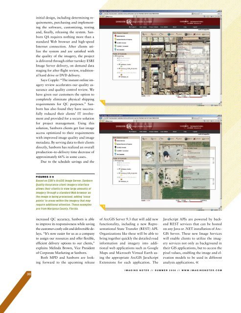
initial design, including determining requirements,purchasing and implementingthe software, customizing, testingand, finally, releasing the system. SanbornQA requires nothing more than astandard Web browser and high-speedInternet connection. After clients utilizethe system and are satisfied withthe quality of the imagery, the projectis delivered through either turnkey ESRIImage Server delivery, on demand datastaging for after flight review, traditionalhard drive or DVD delivery.Says Copple: “The instant online imageryreview accelerates our quality assuranceand quality control review. Wehave given our customers the option tocompletely eliminate physical shippingrequirements for QC purposes.” Sanbornhas also found they have successfullyreduced their clients’ IT involvementand provided for a secure solutionfor project management. Using thissolution, Sanborn clients get fast imageaccess optimized to their requirementswith improved image quality and imagemetadata. By serving data to their clientsdirectly, Sanborn has realized an overallproduction–to-delivery time decrease ofapproximately 66% in some cases.Due to the schedule savings and theFIGURES 3-5increased QC accuracy, Sanborn is ableto improve its responsiveness while savingthe customer costly edit and deliverable delays.“It’s now easier for us as a companyto assign our resources and offer flexible,efficient delivery options to our clients,”explains Melinda Brown, Vice Presidentof Corporate Marketing at Sanborn.Both MPD and Sanborn are lookingforward to the upcoming releaseof ArcGIS Server 9.3 that will add newfunctionality, including a new RepresentationalState Transfer (REST) API.Organizations like these will be able tobring together quickly the detailed roadinformation and imagery into additionalweb applications such as GoogleMaps and Microsoft Virtual Earth usingthe appropriate ArcGIS JavaScriptExtensions for each application. TheJavaScript APIs are powered by backendREST services that can be hostedon any Java or .NET installation of Arc-GIS Server. These new Image Serviceswill enable clients to utilize the imageryservices not only as background intheir GIS applications, but to access thepixel values, enabling the image and elevationmodels to be used in differentanalysis applications.30IMAGING NOTES // S UMMER 2008 // WWW.IMAGINGNOTES.COM


