Final Report A Comparison of Mobile Scanning to a Total Station ...
Final Report A Comparison of Mobile Scanning to a Total Station ...
Final Report A Comparison of Mobile Scanning to a Total Station ...
You also want an ePaper? Increase the reach of your titles
YUMPU automatically turns print PDFs into web optimized ePapers that Google loves.
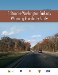
1. <strong>Report</strong> No.RB22-0112. Government Accession No.N/A4 Title and SubtitleA <strong>Comparison</strong> <strong>of</strong> <strong>Mobile</strong> <strong>Scanning</strong> <strong>to</strong> a <strong>Total</strong> <strong>Station</strong> Survey atthe I-35 and IA 92 Interchange in Warren County, Iowa7. Author(s)Iowa DOT: Norm Miller, Brian Smith, Kent Nicholson.9 Performing Organization Name and AddressIowa Department <strong>of</strong> Transportation800 Lincoln WayAmes, IA 50010REY Engineers, Inc.12 Sponsoring Organization Name and AddressIowa Department <strong>of</strong> Transportation800 Lincoln WayAmes, IA 50010Federal Highway Administration15 Supplementary Notes3. Recipient Catalog No.N/A5 <strong>Report</strong> DateAugust 15, 20126 Performing Organization CodeSPR8 Performing Organization <strong>Report</strong> No.RB22-01110 Work Unit No. (TRAIS)N/A11 Contract or Grant No.N/A13 Type <strong>of</strong> <strong>Report</strong> and Period Covered<strong>Final</strong>. 201214 Sponsoring Agency CodeSPR 90-00-RB22-01116 AbstractThe purpose <strong>of</strong> this project was <strong>to</strong> investigate the potential for collecting and using data from mobile terrestrial laser scanning(MTLS) technology that would reduce the need for traditional survey methods for the development <strong>of</strong> highway improvementprojects at the Iowa Department <strong>of</strong> Transportation (Iowa DOT). The primary interest in investigating mobile scanningtechnology is <strong>to</strong> minimize the exposure <strong>of</strong> field surveyors <strong>to</strong> dangerous high volume traffic situations.Issues investigated were cost, timeframe, accuracy, contracting specifications, data capture extents, data extraction capabilitiesand data s<strong>to</strong>rage issues associated with mobile scanning. The project area selected for evaluation was the I-35/IA 92interchange in Warren County, Iowa. This project covers approximately one mile <strong>of</strong> I-35, one mile <strong>of</strong> IA 92, 4 interchangeramps, and bridges within these limits.Delivered LAS and image files for this project <strong>to</strong>taled almost 31GB. There is nearly a 6-fold increase in the size <strong>of</strong> the scandata after post-processing. Camera data, when enabled, produced approximately 900MB <strong>of</strong> imagery data per mile using a 2-camera, 5 megapixel system.A comparison was done between 1823 points on the pavement that were surveyed by Iowa DOT staff using a <strong>to</strong>tal station andthe same points generated through the MTLS process. The data acquired through the MTLS and data processing met the IowaDOT specifications for engineering survey.A list <strong>of</strong> benefits and challenges is included in the detailed report. With the success <strong>of</strong> this project, it is anticipate thatadditional projects will be scanned for the Iowa DOT for use in the development <strong>of</strong> highway improvement projects.17 Key Words<strong>Mobile</strong> mapping – survey – highway design – scanning –<strong>to</strong>tal station19 Security Classification(<strong>of</strong> this report)UnclassifiedForm DOT F 1700.7 (8-72)20 Security Classification(<strong>of</strong> this page)Unclassified18 Distribution StatementNo restrictions. This document isavailable <strong>to</strong> the public through theNational Technical Information Service,Springfield, Virginia 2216121 No. <strong>of</strong> pages2222 PriceN/A


