CORINE Land Cover 2006 for Continental Portugal
CORINE Land Cover 2006 for Continental Portugal
CORINE Land Cover 2006 for Continental Portugal

You also want an ePaper? Increase the reach of your titles
YUMPU automatically turns print PDFs into web optimized ePapers that Google loves.
<strong>CORINE</strong> <strong>Land</strong> <strong>Cover</strong> <strong>2006</strong> <strong>for</strong> <strong>Continental</strong> <strong>Portugal</strong> ix<br />
Caetano et al., 2009<br />
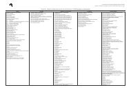
Table Table index<br />
index<br />
Table 1 - Characteristics of CHA06_PT, CLC00_PT and CLC06_PT.................................... 4<br />
Table 2 – <strong>CORINE</strong> <strong>Land</strong> <strong>Cover</strong> (CLC) nomenclature. .......................................................... 5<br />
Table 3 - General characteristics of the satellite images used as base data...................... 7<br />
Table 4 – Detailed characteristics of the satellite images used as base data. .................... 8<br />
Table 5 – Summary of ancillary data characteristics. ........................................................ 9<br />
Table 6 – Technical specifications of the orthorectified digital aerial images. ................. 10<br />
Table 7 – Examples of the tools created by the National Technical Team <strong>for</strong> the extension<br />
of Interchange 2.0. .................................................................................................. 13<br />
Table 8 – Key-features of the accuracy assessment strategy developed <strong>for</strong> CLC06_PT.... 17<br />
Table 9 - Areas gained (+) and lost (-) per CLC class between 2000 and <strong>2006</strong> in<br />
<strong>Continental</strong> <strong>Portugal</strong>................................................................................................ 20<br />
Table 10 – 2000-<strong>2006</strong> land use and land cover change matrix <strong>for</strong> <strong>Continental</strong> <strong>Portugal</strong><br />
(areas are presented in hectares). ............................................................................ 21<br />
Table 11 - Top-10 level-3 changes in <strong>Continental</strong> <strong>Portugal</strong> between 2000 and <strong>2006</strong>. ... 22<br />
Table 12 – Area differences per CLC class between the revised and the original CLC2000-<br />
PT databases. .......................................................................................................... 24<br />
Table 13 – Percentage area occupied per mapped land cover class (Nh). Estimates <strong>for</strong><br />
percentage area occupied per reference land cover class (Ng), percentage overall<br />
accuracy (P), percentage user’s accuracy (Ph), and percentage producer’s accuracy (Pg).<br />
The absolute precision (d) was estimated at the 95% confidence level. ..................... 26<br />
Table 14 – CLC level-1 class areas in CLC06_PT and CLC00_PT. .................................... 28<br />
Table 15 - CLC level-2 class areas in CLC06_PT and CLC00_PT. .................................... 28<br />
Table 16 - CLC level-3 class areas in CLC06_PT and CLC00_PT. .................................... 29