CORINE Land Cover 2006 for Continental Portugal
CORINE Land Cover 2006 for Continental Portugal
CORINE Land Cover 2006 for Continental Portugal

Create successful ePaper yourself
Turn your PDF publications into a flip-book with our unique Google optimized e-Paper software.
<strong>CORINE</strong> <strong>Land</strong> <strong>Cover</strong> <strong>2006</strong> <strong>for</strong> <strong>Continental</strong> <strong>Portugal</strong> 11<br />
Caetano et al., 2009<br />
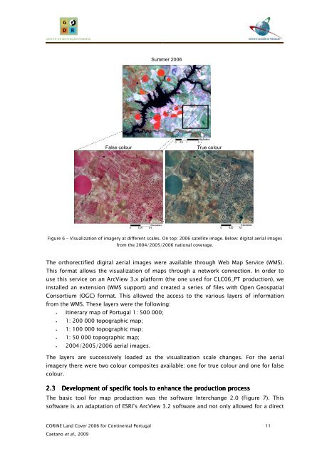
Summer <strong>2006</strong><br />
False colour True colour<br />
Figure 6 – Visualization of imagery at different scales. On top: <strong>2006</strong> satellite image. Below: digital aerial images<br />
from the 2004/2005/<strong>2006</strong> national coverage.<br />
The orthorectified digital aerial images were available through Web Map Service (WMS).<br />
This <strong>for</strong>mat allows the visualization of maps through a network connection. In order to<br />
use this service on an ArcView 3.x plat<strong>for</strong>m (the one used <strong>for</strong> CLC06_PT production), we<br />
installed an extension (WMS support) and created a series of files with Open Geospatial<br />
Consortium (OGC) <strong>for</strong>mat. This allowed the access to the various layers of in<strong>for</strong>mation<br />
from the WMS. These layers were the following:<br />
• Itinerary map of <strong>Portugal</strong> 1: 500 000;<br />
• 1: 200 000 topographic map;<br />
• 1: 100 000 topographic map;<br />
• 1: 50 000 topographic map;<br />
• 2004/2005/<strong>2006</strong> aerial images.<br />
The layers are successively loaded as the visualization scale changes. For the aerial<br />
imagery there were two colour composites available: one <strong>for</strong> true colour and one <strong>for</strong> false<br />
colour.<br />
2.3 Development Development Development of of specific specific tools tools to to enhance enhance enhance the the production production process process<br />
process<br />
The basic tool <strong>for</strong> map production was the software Interchange 2.0 (Figure 7). This<br />
software is an adaptation of ESRI’s ArcView 3.2 software and not only allowed <strong>for</strong> a direct