PDF file (2.44 MB) - Asia Pacific Adaptation Network
PDF file (2.44 MB) - Asia Pacific Adaptation Network
PDF file (2.44 MB) - Asia Pacific Adaptation Network

You also want an ePaper? Increase the reach of your titles
YUMPU automatically turns print PDFs into web optimized ePapers that Google loves.
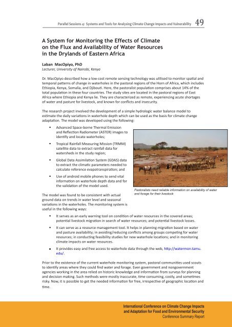
Parallel Sessions 4: Systems and Tools for Analysing Climate Change Impacts and Vulnerability49A System for Monitoring the Effects of Climateon the Flux and Availability of Water Resourcesin the Drylands of Eastern AfricaLaban MacOpiyo, PhDLecturer, University of Nairobi, KenyaDr. MacOpiyo described how a low-cost remote sensing technology was utilised to monitor spatial andtemporal patterns of change in waterholes in the pastoral regions of the Horn of Africa, which includesEthiopia, Kenya, Somalia, and Djibouti. Here, the pastoralist population comprises about 14% of thetotal population in these four countries. The study sites are located in the pastoral regions of EastAfrica where Ethiopia and Kenya lie. They are characterized as remote, experiencing acute shortagesof water and pasture for livestock, and known for conflicts and insecurity.The research project involved the development of a simple hydrologic water balance model toestimate the daily variations in waterhole depth which can be used as the basis for climate changeadaptation. The model was developed using the following:• Advanced Space-borne Thermal Emissionand Reflection Radiometer (ASTER) images toidentify and locate waterholes;• Tropical Rainfall Measuring Mission (TRMM)satellite data to extract rainfall data forwatersheds in the study region;• Global Data Assimilation System (GDAS) datato extract the climatic parameters needed tocalculate reference evapotranspiration; and• Use of android mobile phones to send vitalinformation on waterhole depth data and forthe validation of the model used.The model was found to be consistent with actualground data on trends in water level and seasonalvariations in the waterholes. The monitoring system isuseful in the following ways:Pastoralists need reliable information on availability of waterand forage for their livestock• It serves as an early warning tool on condition of water resources in the covered areas;potential livestock migration in search of water resources; and potential livestock losses.• It can serve as a resource management tool. It helps in planning migration based on waterand pasture availability; in avoiding/reducing conflicts among groups competing for waterresources; in conducting feasibility studies for new waterhole locations; and in monitoringclimate impacts on water resources.• It provides easy and free access to waterhole data through the web, http://watermon.tamu.edu/.Prior to the existence of the current waterhole monitoring system, pastoral communities used scoutsto identify areas where they could find water and forage. Even government and nongovernmentagencies working in the area relied on historic knowledge and information from surveys for planningand decision making. Such methods were mostly inaccurate, time consuming, costly, and sometimesrisky. Now, it is possible to get the needed information for free, irrespective of geographic location andtime.International Conference on Climate Change Impactsand <strong>Adaptation</strong> for Food and Environmental SecurityConference Summary Report