PDF file (2.44 MB) - Asia Pacific Adaptation Network
PDF file (2.44 MB) - Asia Pacific Adaptation Network
PDF file (2.44 MB) - Asia Pacific Adaptation Network
You also want an ePaper? Increase the reach of your titles
YUMPU automatically turns print PDFs into web optimized ePapers that Google loves.
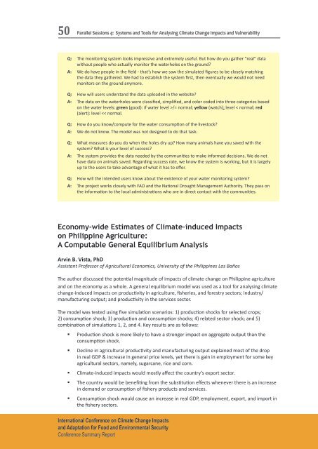
50Parallel Sessions 4: Systems and Tools for Analysing Climate Change Impacts and VulnerabilityQ: The monitoring system looks impressive and extremely useful. But how do you gather “real” datawithout people who actually monitor the waterholes on the ground?A: We do have people in the field - that’s how we saw the simulated figures to be closely matchingthe data they gathered. We had to establish the system first, then eventually we would not needmonitors on the ground anymore.Q: How will users understand the data uploaded in the website?A: The data on the waterholes were classified, simplified, and color coded into three categories basedon the water levels: green (good): if water level >/= normal; yellow (watch): level < normal; red(alert): level


