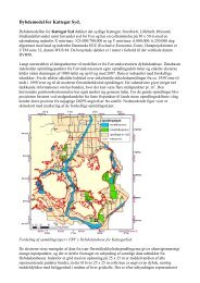
Automatic generation of elevation data over Danish landscape
Automatic generation of elevation data over Danish landscape
Automatic generation of elevation data over Danish landscape

Create successful ePaper yourself
Turn your PDF publications into a flip-book with our unique Google optimized e-Paper software.
3 Experience and investigation strategy<br />
Scale<br />
Opinions also differ about the influence <strong>of</strong> scale. [Krzystek et al., 1992] shows that the same accuracy<br />
can be achieved by different scales, regardless <strong>of</strong> which scale is in question. However, this is only valid<br />
for images in medium or small scale. As regards large scale, it is stated that the <strong>landscape</strong> type gives<br />
problems. [Schenk, 1996]. It can also be seen from the OEEPE presentations that an accuracy <strong>of</strong> 0.1‰ <strong>of</strong><br />
the flight altitude cannot always be counted on.<br />
Mesh size<br />
The sources disagree on the influence <strong>of</strong> mesh size on the accuracy. [Krzystek et al., 1992] mentions that<br />
the mesh size has an influence; the greater the mesh size, the better the result, whereas [Catalunya,<br />
Brussels and the undersigned OEEPE, 1998] found no such influence.<br />
Landscape type<br />
The sources agree that <strong>landscape</strong> types pose a fundamental problem. A <strong>generation</strong> only succeeds in<br />
open areas with solitary objects which Match-T can eliminate on its own [Ackermann et al., 1992; a)<br />
Krzystek et al., 1995]. In addition, the investigations show [Ackermann, 1992; a) Krzystek et al. 1995] that<br />
housing estates appear promising. The investigation [Seyfert, 1995] shows clearly that the <strong>landscape</strong><br />
type has an influence. Here, it is shown that built-up areas give three times as poor results as open fields.<br />
Likewise, [Thorpe et al., 1996] have shown that <strong>generation</strong> <strong>over</strong> built-up areas gives a poor result. In addition,<br />
the presentations from OEEPE show that there are problems with vegetation and buildings.<br />
Terrain type<br />
The sources agree that the terrain type has an influence. According to [Ackermann et al., 1992; Ackermann<br />
1992; Eide et al., 1993; a) Krzystek et al., 1995], an accuracy <strong>of</strong> better than 0.1‰ <strong>of</strong> the flight altitude<br />
can be achieved <strong>over</strong> a flat to slightly hilly <strong>landscape</strong> with solitary objects, as Match-T according to<br />
[Krzystek, 1991; Ackermann 1992; a) Krzystek et al., 1995; b) Krzystek et al., 1995] can handle these objects.<br />
[Ackermann,1996] mentions that photogrammetric DEM <strong>generation</strong> <strong>over</strong> open terrain will run into<br />
problems. Opinions differ about what accuracy can be achieved <strong>over</strong>, for instance, mountainous terrain.<br />
In the investigation by [Eide et al., 1993], it is shown that in mountainous terrain, an accuracy <strong>of</strong> 0.55‰ <strong>of</strong><br />
the flight altitude can be achieved, while, for instance [a) Krzystek et al., 1995], show that an accuracy <strong>of</strong><br />
between 0.2‰ and 0.35‰ can be achieved.<br />
Texture<br />
The sources agree that poor texture has a negative influence on the accuracy. Several sources [Krzystek<br />
1991; b) Krzystek et al., 1995; Inpho (OEEPE), 1998] mention that there are problems with areas with<br />
poor texture, and thus lack <strong>of</strong> interest points for <strong>generation</strong> <strong>of</strong> grid points.<br />
Summation<br />
As seen from the above, there is divergent information about, for instance, the influence <strong>of</strong> pixel size,<br />
scale and mesh size, or the impact <strong>of</strong> <strong>landscape</strong> type and texture. This divergent information forms the<br />
basis for the choice <strong>of</strong> topic for the investigation with Match-T under <strong>Danish</strong> conditions with regard to a<br />
nationwide <strong>elevation</strong> model.<br />
3.3 The investigation strategy <strong>of</strong> this project<br />
On the basis <strong>of</strong> finding out how good a result can be achieved by using Match-T, the lessons learned<br />
from various investigations and the workshop in Stuttgart, a series <strong>of</strong> investigations have been set up with<br />
relevance to a <strong>Danish</strong> terrain. The investigations are chosen with regard to optimising the accuracy, and<br />
at the same time minimising the <strong>data</strong> quantity and editing work. The <strong>data</strong> quantity is evaluated in relation<br />
to the scale and resolution (pixel size) <strong>of</strong> the aerial photos. The editing is evaluated, among other things,<br />
on the basis <strong>of</strong> the influence <strong>of</strong> <strong>landscape</strong> type on the accuracy. Furthermore, a closer analysis <strong>of</strong> the impact<br />
<strong>of</strong> the mesh size has been included.<br />
47