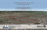
Phase A - Alternatives Analysis Report - Urban Drainage and Flood ...
Phase A - Alternatives Analysis Report - Urban Drainage and Flood ...
Phase A - Alternatives Analysis Report - Urban Drainage and Flood ...

You also want an ePaper? Increase the reach of your titles
YUMPU automatically turns print PDFs into web optimized ePapers that Google loves.
PHASE A – ALTERNATIVES ANALYSIS REPORTMajor <strong>Drainage</strong>way Planning Update for Hidden Lake-Bates Lake2 STUDY AREA DESCRIPTION2.1 Project AreaThe total area of the study area is approximately 4.89 square miles <strong>and</strong> is located within Adams County <strong>and</strong>Jefferson County, including portions of the City of Arvada, the City of Westminster, <strong>and</strong> unincorporatedAdams County. The study area is roughly bordered by 76 th Avenue on the north, Clear Creek on the south,Estes Street on the west, <strong>and</strong> Zuni Street on the east. This study is with in the Project Reuse Basin Number4304. Elevations within the Hidden Lake-Bates Lake study area range from5190 to 5640 feet above meansea level. Slopes within the study area vary from 0.5% to 5%. The Hidden Lake <strong>and</strong> Bates Lakewatersheds flow in a southeasterly direction toward Clear Creek with the main confluence of the HiddenLake watershed with Clear Creek located immediately upstream of the Federal Boulevard Bridge. The BatesLake watershed joins with the Hidden Lake watershed in Lake Sangraco. The project area can be seen onFigure 1.2.2 L<strong>and</strong> Use & Percent ImperviousProposed l<strong>and</strong> use data was obtained from the City of Arvada, the City of Westminster, <strong>and</strong> Adams County.These future l<strong>and</strong> uses were grouped into 14 l<strong>and</strong> use categories. The future l<strong>and</strong> uses within the study areaare shown on Table 2-1 <strong>and</strong> Figure 2-1. As can be seen on Table 2-1 <strong>and</strong> Figure 2-1, the study area isdominated by residential development with pockets of commercial, industrial <strong>and</strong> open space l<strong>and</strong> uses.Impervious values for the specific l<strong>and</strong> uses identified in UDFCD’s Table RO-3 were used wheneverpossible. The percent impervious values used in this study range from 5 percent to 100 percent. The futurel<strong>and</strong> use percent imperviousness is shown in Table 2-1 <strong>and</strong> on Figure 2-2.Table 2-1Future L<strong>and</strong> UseL<strong>and</strong> UseCodeDescriptionUDFCDL<strong>and</strong> Use Acres% of StudyArea%ImperviousO-1 Parks <strong>and</strong> Open SpaceParks,Cemeteries 81 2.59% 5OS-1 Open Space NA 220 7.02% 10R-S-4R-3.5 = (Residential -under 3.5 DU/AC) Residential 126 4.02% 40R-0R-8 = (Residential - up to8 DU/AC) Residential 1228 39.21% 48R-3-XMedium DensityResidential Residential 107 3.42% 57R-2AR-18 = (Residential - upto 18 DU/AC) Residential 11 0.35% 61R-5 Public/Quasi-Public NA 46 1.47% 64R-3 High Density Residential Residential 8 0.26% 66C-MU-30Neighborhood/CommunityCommercialIndustrial -Light Areas 58 1.85% 80T-MU-30 Transit Mised Use NA 28 0.89% 80I-1 Clear Creek - Subarea A Industrial 197 6.29% 85R-MU-30 Mixed Use NA 0 0.00% 87Commercial CommercialBusiness -CommercialAreas 249 7.95% 95Water Water NA 274 8.75% 100Rights OfWay Rights Of Way NA 499 15.93% 100Total 3,132 100%2.3 Soils InformationThe Soil Conservation Service groups soils into four hydrologic groups; Type A, Type B, Type C, <strong>and</strong> TypeD. All four of these hydrologic soil groups were found within the study area. The dominating soil groupwithin the study area is Type C. The hydrologic soil groups within the study area are shown on Figure 2-3.2-12.4 Reach DescriptionHidden Lake is a large recreational lake <strong>and</strong> neighborhood amenity that also serves for flood control.Hidden Lake has a normal water surface area of 100 acres <strong>and</strong> an active flood control storage volume of 530acre feet. During a major rainstorm event, the lake level is raised by as much as 5 feet to store <strong>and</strong> attenuatethe flood event. Although the 100-year flow into Hidden Lake is estimated to be approximately 2,300 cfs,the release rate is reduced to approximately 300 cfs.