Draft Housing and Settlement Strategy - South Gippsland Shire ...
Draft Housing and Settlement Strategy - South Gippsland Shire ...
Draft Housing and Settlement Strategy - South Gippsland Shire ...

Create successful ePaper yourself
Turn your PDF publications into a flip-book with our unique Google optimized e-Paper software.
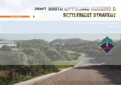
DRAFTFOR THE SOUTH GIPPSLAND SHIRE COUNCILAPRIL 2013i
<strong>South</strong> Gippsl<strong>and</strong> <strong>Housing</strong> <strong>and</strong> <strong>Settlement</strong> <strong>Strategy</strong> | Consultation <strong>Draft</strong>ACKNOWLEDGEMENTSThe <strong>South</strong> Gippsl<strong>and</strong> <strong>Shire</strong> Council acknowledges the traditional custodiansof this l<strong>and</strong>, Elders, past <strong>and</strong> present, their spirits <strong>and</strong> ancestors.SOUTH GIPPSLAND SHIRE COUNCIL TEAMVictor Ng, Strategic Planning OfficerCraig Lyon, Coordinator Strategic PlanningPaul Stampton, Manager PlanningProject Manager© Planisphere 2013.This publication is copyright. No part may be reproduced by any processexcept in accordance with the provisions of the Copyright Act 1968.PROJECT CONTROLNAME NO. PM APPROVED PD APPROVED DATE<strong>Draft</strong> for Consultation 1 CR JLR 15/4/2013CONSULTANT STUDY TEAMJames Larmour-Reid, PlanisphereChris Renkin, PlanisphereJulia Miller-R<strong>and</strong>le, PlanisphereTina Ngu, PlanisphereMatt Ainsarr, Urban EnterprisePaul Shipp, Urban EnterpriseCarmel Boyce, Equity Justice AccessSTEERING COMMITTEEProject DirectorProject ManagerStrategic PlannerStrategic PlannerDirector, EconomistEconomic Strategic PlannerSocial PlannerCr. Lorraine Brunt, Cr Moyha Davies, Cr. Don Hill, Cr. Nigel Hutchinson-Brooks, Paul Stampton, Victor Ng, Craig Lyon, Vicki Bradley, David Simon,Senaviratna Abeykoon (SGSC)Robyn Begg (DPCD)
<strong>South</strong> Gippsl<strong>and</strong> <strong>Housing</strong> <strong>and</strong> <strong>Settlement</strong> <strong>Strategy</strong> | Consultation <strong>Draft</strong>HOW TO READ THIS DOCUMENTGLOSSARY OF TERMSThe <strong>South</strong> Gippsl<strong>and</strong> <strong>Shire</strong> Council is preparing a <strong>Housing</strong> <strong>and</strong> <strong>Settlement</strong><strong>Strategy</strong> (HSS) to provide an integrated <strong>and</strong> coherent framework formanaging the future growth <strong>and</strong> development of its 44 settlements.The HSS is presented in three parts:PART A <strong>Housing</strong> & <strong>Settlement</strong> <strong>Strategy</strong> Page 7PART BPART CUrban Design Frameworks (UDFs for 17 of the<strong>Shire</strong>’s settlementsReview of Rural Living Zone Areas <strong>and</strong> Review ofRestructure OverlaysPage 95Page 145ACATCMADPCDDSEESOFZGRGPHSSLDRZLPPFR1ZRLUSRLZROSGSCSPPFTZUDFVCSVIFAged Care Assessment TeamCatchment Management AuthorityDepartment of Planning <strong>and</strong> Community DevelopmentDepartment of Sustainability <strong>and</strong> EnvironmentEnvironmental Significance OverlayFarming ZoneGippsl<strong>and</strong> Regional Growth Plan (formerly known as GILUP)<strong>Housing</strong> <strong>and</strong> <strong>Settlement</strong> <strong>Strategy</strong>Low Density Residential ZoneLocal Planning Policy FrameworkResidential 1 ZoneRural L<strong>and</strong> Use <strong>Strategy</strong>Rural Living ZoneRestructure Overlay<strong>South</strong> Gippsl<strong>and</strong> <strong>Shire</strong> CouncilState Planning Policy FrameworkTownship ZoneUrban Design FrameworkVictorian Coastal <strong>Strategy</strong>Victoria in Future
<strong>South</strong> Gippsl<strong>and</strong> <strong>Housing</strong> <strong>and</strong> <strong>Settlement</strong> <strong>Strategy</strong> | Consultation <strong>Draft</strong>4.26 Port Franklin ............................................................................... 884.27 Ruby............................................................................................ 894.28 Stony Creek ................................................................................ 894.29 Jumbunna ................................................................................... 904.30 Arawata ...................................................................................... 904.31 Berrys Creek ................................................................................ 914.32 Darlimurla ................................................................................... 914.33 Kardella ....................................................................................... 924.34 Mt Best – Agnes - Hedley ............................................................ 924.35 Nerrena ....................................................................................... 934.36 Strzelecki .................................................................................... 94PART B: URBAN DESIGN FRAMEWORKS ............................................. 95INTRODUCTION .......................................................................................... 975.1 Overview ..................................................................................... 985.2 The Context .............................................................................. 100SETTLEMENT UDFs ................................................................................... 1036.1 Arawata .................................................................................... 1046.2 Bena .......................................................................................... 1066.3 Buffalo ...................................................................................... 1096.4 Darlimurla ................................................................................. 1126.5 Dumbalk ................................................................................... 1146.6 Fish Creek .................................................................................. 1166.7 Jumbunna ................................................................................. 1196.8 Kardella ..................................................................................... 1216.9 Kongwak ................................................................................... 1236.10 Koonwarra................................................................................. 1266.11 Mirboo ...................................................................................... 1296.12 Nerrena ..................................................................................... 1316.13 Ruby .......................................................................................... 1336.14 Stony Creek ............................................................................... 1356.15 Strzelecki .................................................................................. 1376.16 Walkerville ................................................................................ 1396.17 Yanakie ..................................................................................... 143PART C : INVESTIGATION AREAS ...................................................... 1456.18 Rural Living Zone ...................................................................... 1476.19 Restructure Overlay................................................................... 167APPENDICES ..................................................................................... 191Appendix A: State, Regional & Local Policy ................................................ 193Appendix B: Development Opportunities ................................................... 201
<strong>South</strong> Gippsl<strong>and</strong> <strong>Housing</strong> <strong>and</strong> <strong>Settlement</strong> <strong>Strategy</strong> | Consultation <strong>Draft</strong>
EXECUTIVE SUMMARY
<strong>South</strong> Gippsl<strong>and</strong> <strong>Housing</strong> <strong>and</strong> <strong>Settlement</strong> <strong>Strategy</strong> | Consultation <strong>Draft</strong>HOUSING & SETTLEMENT STRATEGYThe Gippsl<strong>and</strong> Region is projected to grow by an additional 76,000 people by2031 (Victoria in Future 2012). To manage the growth, the Department ofPlanning <strong>and</strong> Community Development (DPCD) is currently undertakingstate-wide regional growth planning including for Gippsl<strong>and</strong>, the Gippsl<strong>and</strong>Regional Growth Plan (GRGP).GRGP will provide an integrated settlement framework as well as detailedplanning frameworks for key regional centres in Gippsl<strong>and</strong>. This includesregional coordination <strong>and</strong> planned prioritised provision of infrastructure tosupport regional employment <strong>and</strong> regional communities.In this policy context, <strong>South</strong> Gippsl<strong>and</strong> is preparing a <strong>Housing</strong> <strong>and</strong><strong>Settlement</strong> <strong>Strategy</strong> to provide Council with a <strong>Shire</strong>-based integratedframework for managing the future growth <strong>and</strong> development of itssettlements to 2031.Council has already developed a strategic framework for its rural areasthrough the <strong>South</strong> Gippsl<strong>and</strong> Rural L<strong>and</strong> Use <strong>Strategy</strong> 2011 which wasimplemented into the <strong>South</strong> Gippsl<strong>and</strong> Planning Scheme in March 2012.<strong>South</strong> Gippsl<strong>and</strong>’s 44 settlements are widely dispersed across the <strong>Shire</strong>.They vary significantly in terms of their size, population characteristics, role,economic activities <strong>and</strong> access to service <strong>and</strong> facilities. The <strong>Shire</strong> is expectedto grow by 1.4% per annum from 28,500 residents to 36,927 residents in2031. The key issues <strong>and</strong> challenges include:• Managing population changes, from population growth associatedwith ‘tree-change’ <strong>and</strong> ‘sea change’ migration to populationdecrease in smaller settlements.• Providing for a future which demographic trends indicate willinclude an increasing proportion of aged residents <strong>and</strong> changinghousehold structures that will affect dem<strong>and</strong> for housing diversity<strong>and</strong> services.• Protecting agricultural practices <strong>and</strong> associated infrastructurefrom development pressure or conflict from other l<strong>and</strong> uses.• Preserving <strong>and</strong> enhancing the quality of natural assets includingwater catchments, habitats, coastal environments <strong>and</strong> l<strong>and</strong>scapes.• Planning for the impact of climate change.• Acknowledging the service limitations <strong>and</strong> the costs of providingcommunity <strong>and</strong> physical infrastructure in a <strong>Shire</strong> containing 44dispersed settlements.• Providing direction for non-residential uses within settlements tomaintain a sustainable economy <strong>and</strong> employment opportunities.The project was undertaken in two parts.Stage 1: Issues, Opportunities <strong>and</strong> Constraints Paper - prepared inDecember 2012, provides an outlines of the strategic policy frameworkcontext, key issues, <strong>and</strong> opportunities <strong>and</strong> constraints for the <strong>Shire</strong>’ssettlements. This includes a community infrastructure analysis <strong>and</strong>economic analysis, examining housing characteristics <strong>and</strong> trends,demographic <strong>and</strong> population forecasts, <strong>and</strong> dem<strong>and</strong> <strong>and</strong> supply forresidential, commercial/retail <strong>and</strong> industrial l<strong>and</strong>.Stage 2: <strong>Housing</strong> <strong>and</strong> <strong>Settlement</strong> <strong>Strategy</strong> – (this Paper) which provides:• The principles <strong>and</strong> strategies for future growth.• A settlement hierarchy <strong>and</strong> community infrastructure framework.• A set of Urban Design Frameworks (UDFs) for 17 settlements thatare currently without a strategic plan.• Investigates precincts proposed for rezoning to Rural Living Zone.• Identifies l<strong>and</strong> in ‘old Crown townships’ to be restructured in orderto avoid negative impacts associated with full development whileproviding development options for l<strong>and</strong>owners.© planisphere 2013 2
<strong>South</strong> Gippsl<strong>and</strong> <strong>Housing</strong> <strong>and</strong> <strong>Settlement</strong> <strong>Strategy</strong> | Consultation <strong>Draft</strong>The following strategic directions have guided the development of this HSS:• The larger settlements that are serviced by reticulated seweragewill be the focus for growth in the <strong>Shire</strong> including Leongatha,Korumburra, Foster, <strong>and</strong> Mirboo North. These settlements willalso be the focus for diversifying the municipal economy,particularly through industry <strong>and</strong> business.• Growth will be directed <strong>and</strong> managed by the preparation of<strong>Settlement</strong> Structure Plans. This will ensure that future populationcommunities are efficiently serviced by the necessary community<strong>and</strong> physical infrastructure that is established in largersettlements.• Focusing growth in the larger settlements will ensure thatdevelopment is managed in a way that will not encroach onproductive agricultural l<strong>and</strong>, negatively impact on environmentalvalues, expose residents to hazards, or lead to pockets of isolateddevelopment.• In the smaller settlements that do not have access to reticulatedsewerage, development will be encouraged only within thesettlement boundary. The existing role, services <strong>and</strong> character ofeach settlement will be retained <strong>and</strong> enhanced in accordance withthe relevant settlement Structure Plan or UDF.• Other than the l<strong>and</strong> identified in the relevant Structure Plans,commercial growth will be focused on the towns of Leongatha,Korumburra <strong>and</strong> Foster, with industrial growth to be concentratedin Leongatha, Korumburra <strong>and</strong> the industrially zoned port areasadjacent to Corner Inlet.• Dem<strong>and</strong> for lifestyle residential development will be managed byensuring an adequate supply of Low Density Residential Zone l<strong>and</strong>on the periphery of larger settlements where this is consistent withstructure planning <strong>and</strong> access to reticulated sewerage is available.The rezoning of additional l<strong>and</strong> into the Rural Living Zone will belimited to addressing zoning anomalies or conflicting l<strong>and</strong> uses.• The 2000 potential rural living lots identified for potentialdwellings in the RLUS are considered to address the RLZ dem<strong>and</strong>.• In coastal areas development will be carefully managed inaccordance with the Victorian Coastal <strong>Strategy</strong> <strong>and</strong> take intoaccount the projected impact of climate change on low-lyingcoastal areas.• The findings <strong>and</strong> directions of the RLUS will be supported by theHSS by defining settlement boundaries <strong>and</strong> focusing developmentwithin them. The HSS will aim to ensure an adequate supply ofurban l<strong>and</strong> for both residential <strong>and</strong> lifestyle residentialdevelopment to reduce development pressure on agricultural l<strong>and</strong>.• The development of connected, resilient <strong>and</strong> sustainablesettlements will be a priority for the <strong>Strategy</strong>. Access <strong>and</strong>connection to community infrastructure between the larger <strong>and</strong>smaller settlements will be integral to community infrastructureprovision across the <strong>Shire</strong>.© planisphere 2013 3
<strong>South</strong> Gippsl<strong>and</strong> <strong>Housing</strong> <strong>and</strong> <strong>Settlement</strong> <strong>Strategy</strong> | Consultation <strong>Draft</strong>URBAN DESIGN FRAMEWORKSOver the last five years the <strong>Shire</strong> has prepared strategic plans for many of itssettlements. This section of the HSS focuses on the outst<strong>and</strong>ing 17settlements for which no strategic plan currently exists. These are:• Arawata• Bena• Buffalo• Darlimurla• Dumbalk• Fish Creek• Jumbunna• Kardella• Kongwak• Koonwarra• Mirboo• Nerrena• Ruby• Stony Creek• Strzelecki• Walkerville• YanakieEach settlement has a unique <strong>and</strong> valued identity supported by activecommunity members. Each settlement is similar in terms of having smaller,static or decreasing populations, dependence of residents on servicesprovided in the bigger townships, <strong>and</strong> limited growth potential due to lackof physical <strong>and</strong> community infrastructure such as reticulared sewerage <strong>and</strong>water provision.Given these constraints to residential growth <strong>and</strong> development, the UDFsidentify a settlement boundary to provide an integrated <strong>and</strong> coherentframework for managing the future of the settlements focusing on thephysical aspects of the towns <strong>and</strong> localities, their images <strong>and</strong> identities.State policy objectives for planning include the creation of safe, healthy,functional <strong>and</strong> good quality environments. Good urban design is critical tothis <strong>and</strong> ensures future development or redevelopment contributes to senseof place, cultural identity, health <strong>and</strong> wellbeing, <strong>and</strong> environmentalsustainability. Contextually appropriate design principles <strong>and</strong> strategiesprovide the framework to achieve these objectives.Each UDF includes the following:• Character Statement including Town Role <strong>and</strong> Zone <strong>and</strong> OverlayControls• L<strong>and</strong> Use Actions• Urban Design Actions• L<strong>and</strong> Use & Urban Design Framework PlanIt is intended that Urban Design Frameworks be reviewed periodically. Thiswill be important if new infrastructure, such as reticulated sewerage, isintroduced or new business opportunities arise.© planisphere 2013 4
<strong>South</strong> Gippsl<strong>and</strong> <strong>Housing</strong> <strong>and</strong> <strong>Settlement</strong> <strong>Strategy</strong> | Consultation <strong>Draft</strong>RURAL LIVING ZONE REVIEW ANDRESTRUCTURE AREASPart C: Investigation Areas examines a number of current proposals torezone l<strong>and</strong> to Rural Living (RLZ) in Nyora, Kongwak, S<strong>and</strong>y Point, <strong>South</strong>ernLeongatha <strong>and</strong> Yanakie. It also considers the merits <strong>and</strong> application of theRestructure Overlay to ‘old <strong>and</strong> inappropriate’ subdivisions in elevenlocations across the <strong>Shire</strong>, of these 9 are referred to in the Rural L<strong>and</strong> Use<strong>Strategy</strong> (RLUS), adopted by Council in August 2011The RLUS identifies that rural areas within the <strong>Shire</strong> are experiencing a highlevel of fragmentation due to historical settlement patterns <strong>and</strong> a lack ofrobust planning policy guidance in the past.The RLUS was developed to assist Council in managing furtherfragmentation caused by subdivision of its rural areas for lifestyle residentialpurposes. Poorly managed subdivision can have considerable implicationsfor agricultural production, l<strong>and</strong>scape values, natural resource management<strong>and</strong> servicing of populations in outlying areas.The HSS must provide Council with a tool to assist in guiding the appropriatelocations for the lifestyle residential property market. This market is drivingdem<strong>and</strong> for larger ‘rural living’ <strong>and</strong> ‘low density residential’ zoned properties(0.4 – 4 ha), particularly in areas of high amenity <strong>and</strong> environmental valueoutside settlement boundaries.The principles around settlement planning contained in the HSS can alsoprovide a strategic framework for managing the numerous historicalsubdivisions (often called ‘old Crown townships’) that were either neverdeveloped or correspond with the sites of former settlements that havedepopulated. In many cases the development (or redevelopment) of thesesubdivisions to full capacity would present significant environmental,servicing <strong>and</strong> social impacts; or expose residents to environmental risks.The following principles have been applied to both the Rural Living Zone<strong>and</strong> Restructure Overlay Investigations:• avoid the loss of quality agricultural l<strong>and</strong>;• avoid the potential for l<strong>and</strong> use conflicts;• discourage residential development in locations without access to anappropriate range of services <strong>and</strong> employment opportunities;• recognise that infrastructure <strong>and</strong> community services cannot beprovided to rural living areas to the same st<strong>and</strong>ards as settlements;• ensure that opportunities for population growth are notcompromised by the fragmentation of larger parcels of l<strong>and</strong>adjacent to settlement boundaries;• protect environmental values <strong>and</strong> natural resources; <strong>and</strong>• avoid exposure to natural <strong>and</strong> human induced hazards, such asbushfire, l<strong>and</strong>slip, flooding, <strong>and</strong> l<strong>and</strong> contamination from pastmining <strong>and</strong> agricultural practices.The HSS recognises that lifestyle residential properties are an importantcomponent of the residential market in <strong>South</strong> Gippsl<strong>and</strong> <strong>and</strong> a significantdriver of dem<strong>and</strong> <strong>and</strong> change. In light of the overarching policy directionsaimed at consolidating residential growth in key townships <strong>and</strong> protectingrural l<strong>and</strong> for agricultural purposes the HSS does not support populationgrowth in rural areas. It therefore recommends that the subdivision <strong>and</strong>rezoning of l<strong>and</strong> for this purpose be strongly controlled.The HSS recommends that the Low Density Residential Zone be used as thepreferred zone for lifestyle residential lots <strong>and</strong> that these lots should belocated in close proximity to higher order settlements where sewerage <strong>and</strong>services can be provided. Investigation of existing Rural Living Zoned l<strong>and</strong>should be undertaken for rezoning to LDRZ subject to reticulated sewageprovision. Given that the RLUS identified a large supply of lots within theFarming Zone that fall into the lifestyle residential category (4.0 hectares or© planisphere 2013 5
<strong>South</strong> Gippsl<strong>and</strong> <strong>Housing</strong> <strong>and</strong> <strong>Settlement</strong> <strong>Strategy</strong> | Consultation <strong>Draft</strong>less) further expansion of the Rural Living Zone should not be supportedexcept in limited circumstances. Relevant circumstances should be limitedto addressing zoning anomalies or resolving existing l<strong>and</strong> use conflicts.The HSS also recommends that the Restructure Overlay be applied to oldCrown townships to provide certainty to l<strong>and</strong>owners <strong>and</strong> service providers<strong>and</strong> avoid the adverse impacts of fragmentation that would likely occur ifthe townships were fully developed.The investigation into the Rural Living Zone rezoning proposalsrecommends that parts of <strong>South</strong>ern Leongatha, Nyora <strong>and</strong> Kongwak besupported by Council, however the remaining parts of Nyora, Kongwak <strong>and</strong>S<strong>and</strong>y Point not be supported.The investigation into the Restructure Overlay areas supports theapplication of the overlay to the identified old Crown townships. Theproposed Restructure Plans will facilitate larger lots of a size <strong>and</strong>configuration that better reflect the environmental capacity <strong>and</strong> l<strong>and</strong>scapevalues of the relevant localities.© planisphere 2013 6
PART A : HOUSING & SETTLEMENT STRATEGY© planisphere 2013 7
© planisphere 2013 8
1INTRODUCTION© planisphere 2013 9
<strong>South</strong> Gippsl<strong>and</strong> <strong>Housing</strong> <strong>and</strong> <strong>Settlement</strong> <strong>Strategy</strong> | Consultation <strong>Draft</strong>1.1 INTRODUCTION<strong>South</strong> Gippsl<strong>and</strong> <strong>Shire</strong> Council is preparing a <strong>Housing</strong> <strong>and</strong> <strong>Settlement</strong><strong>Strategy</strong> to provide an integrated framework for managing the futuregrowth <strong>and</strong> development of its 44 settlements over the next 15 to 20 years.This <strong>Housing</strong> <strong>and</strong> <strong>Settlement</strong> <strong>Strategy</strong> 2013 incorporates the results ofextensive community consultation, settlement surveys, policy review <strong>and</strong>research <strong>and</strong> analysis undertaken by Council <strong>and</strong> the consultant team.1.1.1 WHY A HOUSING & SETTLEMENT STRATEGY?Gippsl<strong>and</strong> is projected to grow by an additional 76,000 people by 2031(Victoria in Future 2012). To manage the growth, the Department ofPlanning <strong>and</strong> Community Development (DPCD) is currently undertakingStatewide Regional growth planning including the Gippsl<strong>and</strong> RegionalGrowth Plan (GRGP).GRGP will provide a broad direction for regional l<strong>and</strong> use <strong>and</strong> developmentas well as detailed planning frameworks for key regional centres. Thisincludes regional coordination <strong>and</strong> planned provision of infrastructure tosupport regional employment <strong>and</strong> regional communities.<strong>South</strong> Gippsl<strong>and</strong> is expected to grow by 1.4% from 28,500 residents to36,927 residents in 2031 (based on a moderate growth forecast prepared byid consulting). In the context of regional based settlement planning, <strong>South</strong>Gippsl<strong>and</strong> is preparing a <strong>Housing</strong> <strong>and</strong> <strong>Settlement</strong> <strong>Strategy</strong> to provideCouncil with a <strong>Shire</strong>-based integrated framework to determine whichsettlements can accommodate growth; consider the type of infrastructureneeded to support the population growth <strong>and</strong> change; <strong>and</strong> managedevelopment in a manner that respects the environmental, social <strong>and</strong>economic context of the <strong>Shire</strong>.GRGP identified the following key issues <strong>and</strong> challenges for <strong>South</strong> Gippsl<strong>and</strong>including:• Managing population growth, including population loss fromsmaller settlements in favour of larger urban centres.• Providing for demographic trends that point to an increasinglyaged population in the future, <strong>and</strong> changing household structuresthat will affect housing dem<strong>and</strong> <strong>and</strong> preferences.• Managing dem<strong>and</strong> for rural living <strong>and</strong> lower density ‘lifestyleresidential’ properties, particularly in areas of high amenity <strong>and</strong>environmental value.• Promoting growth in settlements with reticulated sewerage <strong>and</strong>allowing managed <strong>and</strong> incremental growth only in the settlementswith no reticulated sewerage.• Protecting agricultural l<strong>and</strong> <strong>and</strong> capital investment.• Preserving <strong>and</strong> enhancing natural assets including watercatchments, habitat, coastal environments <strong>and</strong> l<strong>and</strong>scapes.• Planning for the impact of climate change.• Delivering community services recognizing the limitations <strong>and</strong>costs of providing infrastructure in a <strong>Shire</strong> of 44 dispersedsettlements.• Providing direction for non-urban uses within settlements tomaintain a sustainable economy <strong>and</strong> employment sources in lightof trend towards larger farm holdings, fewer farm workopportunities, <strong>and</strong> an increase in the importance of larger urbancentres such as Traralgon <strong>and</strong> Bairnsdale for commercial <strong>and</strong> retailfunctions.The <strong>Housing</strong> <strong>and</strong> <strong>Settlement</strong> <strong>Strategy</strong> is a key action by Council discussed inthe Annual Council Plan 2012-2013 <strong>and</strong> <strong>South</strong> Gippsl<strong>and</strong> Council Plan 2010-2014.© planisphere 2013 10
<strong>South</strong> Gippsl<strong>and</strong> <strong>Housing</strong> <strong>and</strong> <strong>Settlement</strong> <strong>Strategy</strong> | Consultation <strong>Draft</strong>1.1.2 STUDY AREA COVERED BY THE PLANThe <strong>South</strong> Gippsl<strong>and</strong> <strong>Shire</strong> is located about 100km south east of Melbourne.The <strong>Shire</strong> covers an area of approximately 3,297 square kilometres.The <strong>Shire</strong> adjoins the south eastern growth corridor, which encompassessome of the fastest growing municipalities in Victoria such as the City ofCasey <strong>and</strong> the <strong>Shire</strong>s of Cardinia <strong>and</strong> Baw Baw.The Study Area includes the entire <strong>Shire</strong> of <strong>South</strong> Gippsl<strong>and</strong> focusing on its44 dispersed settlements.Error! Reference source not found. illustrates the study area for the <strong>South</strong>Gippsl<strong>and</strong> <strong>Housing</strong> <strong>and</strong> <strong>Settlement</strong> <strong>Strategy</strong>.1.1.3 APPROACHThe project is being undertaken in the following four stages:• Stage 1: Inception & Background Review [August 2012]• Stage 2: Consultation & Analysis [November 2012]• Stage 3: <strong>Draft</strong> <strong>Strategy</strong> [Current]• Stage 4: Final <strong>Strategy</strong> [July 2013]Council will consider adopting a final version of the report after it has beenrevised in response to community <strong>and</strong> stakeholder comments. At this stage,apart from placing the report on exhibition, no decisions have been made byCouncil in relation to this report or its recommendations.Urban EnterpriseEquity Justice Access1.1.5 CONSULTATIONEconomic Analysis, L<strong>and</strong> Dem<strong>and</strong> & Supply AnalysisSpecialist <strong>Housing</strong> & Community Infrastructure AnalysisA vital component of the project is engaging with a broad range ofstakeholders from private, public <strong>and</strong> not-for-profit sectors. The projectConsultation <strong>and</strong> Communication <strong>Strategy</strong> outlines the key projectstakeholders, consultation approach <strong>and</strong> key questions <strong>and</strong> issues to beinvestigated through the project.The program of community <strong>and</strong> stakeholder consultation can be viewed inthe <strong>Housing</strong> <strong>and</strong> <strong>Settlement</strong> <strong>Strategy</strong> Consultation Plan.Figure 1: <strong>South</strong> Gippsl<strong>and</strong> <strong>Shire</strong> Context Map1.1.4 STUDY TEAMCouncil appointed a team led by Planisphere to assist with preparation ofthe <strong>Housing</strong> <strong>and</strong> <strong>Settlement</strong> <strong>Strategy</strong>. The study team <strong>and</strong> their various rolescomprise:PlanisphereProject Management, Planning & Urban Design© planisphere 2013 11
FIGURE 2– STUDY AREA AND INVESTIGATION SETTLEMENTS<strong>South</strong> Gippsl<strong>and</strong> <strong>Housing</strong> <strong>and</strong> <strong>Settlement</strong> <strong>Strategy</strong> | Consultation <strong>Draft</strong>© planisphere 2013 12
2THE SHIRE SNAPSHOT© planisphere 2013 13
Project Name | Introduction2.1 POLICY CONTEXTA range of State, regional <strong>and</strong> local policies, plans <strong>and</strong> other data sourcesare relevant to the planning, management <strong>and</strong> development of <strong>South</strong>Gippsl<strong>and</strong>’s settlements. A summary of State, Regional <strong>and</strong> Local Policy islocated at Appendix 1. The key strategic documents are:STATE POLICYState Planning PolicyFrameworkMelbourne 2030Melbourne @ 5 MillionVictorian Coastal <strong>Strategy</strong>REGIONAL POLICY<strong>Draft</strong> Gippsl<strong>and</strong> IntegratedL<strong>and</strong> Use Plan May 2012Gippsl<strong>and</strong> Regional Plan 2010Gippsl<strong>and</strong> Transport <strong>Strategy</strong>2008-2020Gippsl<strong>and</strong> Estuaries CoastalAction PlanGippsl<strong>and</strong> Boating CoastalAction Plan 2012LOCAL POLICYCouncil Plan 2010-2014Municipal StrategicStatementMunicipal Public Health &Wellbeing Plan 2010-2012Overall <strong>Settlement</strong> Plan(2006)Rural L<strong>and</strong> Use <strong>Strategy</strong>(2011)<strong>Draft</strong> Economic Development& Tourism <strong>Strategy</strong> 2012-2017Open Space <strong>Strategy</strong> (2007)Recreation Plan (2007)Infrastructure Design Manual(2010)<strong>Draft</strong> Municipal DomesticWastewater ManagementPlan 2012-2022Aquatic <strong>Strategy</strong> 2012These policy directions have the following implications for the <strong>Housing</strong> <strong>and</strong><strong>Settlement</strong> <strong>Strategy</strong>:• The HSS should address l<strong>and</strong> supply from a municipal perspectiverather than on an individual settlement basis.• The <strong>Draft</strong> GILUP (recently renamed the Gippsl<strong>and</strong> Regional GrowthPlan contains the following directions for the HSS:o A settlement hierarchy, including Regional Centre, DistrictCentre <strong>and</strong> Towns that should be consistent in the HSS.o Leongatha <strong>and</strong> Korumburra are identified as ‘District Towns’.Leongatha is identified as having an adequate supply of l<strong>and</strong>.o Foster is identified as a settlement with moderate spatialgrowth capacity.o Identifies commuters, retirees <strong>and</strong> second home owners, as akey driver of growth in the <strong>Shire</strong>.o Encourage a diversity of housing options <strong>and</strong> access toaffordable housing.• The Victorian Coastal <strong>Strategy</strong> seeks to limit growth along thecoast by identifying key settlements in which growth <strong>and</strong>infrastructure development should be focused. Coastal towns in<strong>South</strong> Gippsl<strong>and</strong> <strong>Shire</strong> are classified as having: ‘Low SpatialGrowth Capacity’ where growth should be contained withinexisting urban or appropriately zoned l<strong>and</strong> primarily through infillcapacity <strong>and</strong> renewal within defined settlement boundaries.• Growth drivers vary significantly across the <strong>Shire</strong>, with some townswell positioned to cater for st<strong>and</strong>ard density residential growth<strong>and</strong> associated employment growth, while other towns <strong>and</strong>regions are more tourism <strong>and</strong> lifestyle oriented. These valuesshould be supported <strong>and</strong> protected.© planisphere 2013 14
Project Name | Introduction• The economic strengths of the region should be supportedthrough providing sufficient l<strong>and</strong> supply in appropriate locations<strong>and</strong> zones.• L<strong>and</strong> with high agricultural quality should be protected from urbanencroachment.• Sufficient industrial l<strong>and</strong> should be made available for expansion ofkey food manufacturing businesses.• Large lot industrial l<strong>and</strong> is required in strategic locations for dairyrelated <strong>and</strong> value-add industries.• Industrial l<strong>and</strong> supply should be sufficient to allow for 15 years oforganic growth at the moderate growth scenario as a minimum.• Commercial l<strong>and</strong> supply is sufficient to allow for 15 years of organicgrowth at the moderate growth scenario as a minimum,particularly in areas surrounding the commercial core of existingtown centres.• Towns with strong tourism activity/potential are appropriatelylocated for the development of tourist accommodation <strong>and</strong>associated facilities.ZONE REFORMSIn July 2012 the State Government proposed a series of reforms to theexisting residential, commercial, industrial <strong>and</strong> farming zones contained inthe Victorian Planning Provisions. Public consultation on the zones ended inSeptember 2012. The Reformed Zones Advisory Committee submitted itsprogress report on the residential zones to the Minister for Planning on 14December 2012. The government has responded to this report with a set offinal residential zones.These changes are likely to impact the implementation of this <strong>Housing</strong> <strong>and</strong><strong>Settlement</strong> <strong>Strategy</strong>.2.2 ENVIRONMENTAL & CULTURALNATURAL FEATURESWATER CATCHMENTThe <strong>Shire</strong> is located in the West Gippsl<strong>and</strong> region <strong>and</strong> extends across theBunurong <strong>and</strong> Corner Inlet catchments. Significant waterways <strong>and</strong>waterbodies include the Tarwin River, Bass River, <strong>and</strong>, importantly, theRamsar listed Corner Inlet wetl<strong>and</strong>.<strong>South</strong> Gippsl<strong>and</strong> Water notes that any future developments within theTarwin Lower catchment area can pose significant risk to the potable watersupply for Dumbalk <strong>and</strong> Meeniyan. The State Government has recentlyreleased revised guidelines for development in declared water catchments.Figure 3 identifies the areas subject to natural resources <strong>and</strong> features <strong>and</strong>environmental constraints.FAUNA<strong>South</strong> Gippsl<strong>and</strong> <strong>Shire</strong> Council is currently preparing an EnvironmentalSignificance Overlay for the Giant Gippsl<strong>and</strong> Earthworm (GGE) to protect<strong>and</strong> manage populations <strong>and</strong> habitat of the species. The GGE is listed as athreatened species under both Commonwealth <strong>and</strong> State legislation <strong>and</strong> asan endangered species on the Department of Sustainability <strong>and</strong>Environment’s Advisory List of Threatened Invertebrate Fauna in Victoria –2009. The Victorian Biodiversity Atlas records GGE presence scatteredacross the <strong>Shire</strong>.VEGETATIONWilsons Promontory National Park <strong>and</strong> coastal areas to the north <strong>and</strong> to thenorth-west of the National Park contain large areas of native vegetation.Native forests <strong>and</strong> plantation forestry occur in the Strzelecki Ranges.© planisphere 2013 15
Project Name | IntroductionThe most common habitats are wet forest, dry sclerophyll woodl<strong>and</strong>, coastalBanksia woodl<strong>and</strong>, heath <strong>and</strong> grassl<strong>and</strong>s.PARKS & RESERVESThe <strong>Shire</strong> contains a network of parks <strong>and</strong> reserves, protecting ecosystems<strong>and</strong> significant environmental assets. These areas are of State, National <strong>and</strong>International natural significance, <strong>and</strong> include Wilson’s Promontory NationalPark, Cape Liptrap Coastal Park <strong>and</strong> the Strzelecki Ranges These Parks <strong>and</strong>Reserves are managed by a range of agencies <strong>and</strong> organisations includingParks Victoria, Council <strong>and</strong> local volunteer committees of management.Two marine parks are declared immediately adjacent to the <strong>Shire</strong>, namelythe Corner Inlet <strong>and</strong> Nooramunga Marine Parks. These are associated withinternationally recognised RAMSAR wetl<strong>and</strong> areas.NATURAL RESOURCES<strong>South</strong> Gippsl<strong>and</strong> <strong>Shire</strong> contains some of the most productive agriculturalareas in Victoria <strong>and</strong> provides a substantial proportion of Victoria’s milk aswell as beef, prime lamb <strong>and</strong> vegetables. The future outlook for agriculturein the <strong>Shire</strong> is strong with the advantages of high rainfall, soil <strong>and</strong> l<strong>and</strong> typessuited to producing a wide range of agricultural commodities. It isimportant for the <strong>Shire</strong> to ensure l<strong>and</strong> with high agricultural quality isprotected from urban encroachment.The <strong>Shire</strong> also contains State recognised s<strong>and</strong> reserves to the west of Nyora<strong>and</strong> coal deposits in the east.HERITAGE<strong>South</strong> Gippsl<strong>and</strong> has a rich <strong>and</strong> diverse cultural heritage, whichdemonstrates the history of area from the occupation of the l<strong>and</strong> byaboriginal people from the Gunnai, Bun Wurrung <strong>and</strong> Wurundjeri clansthrough to the post-contact era.Over 1,200 cultural heritage places have been identified in the <strong>Shire</strong>including buildings, structures, monuments, trees, l<strong>and</strong>scapes <strong>and</strong> sites ofaboriginal or archaeological significance. All places are of local significance<strong>and</strong> some, such as Korumburra Railway Station, are of State or Nationalsignificance.POST-SETTLEMENT HERITAGEThe post-contact cultural heritage places in the <strong>Shire</strong> illustrate the historicthemes that were important in the development of the area <strong>and</strong> provide anhistorical explanation of the existing physical fabric <strong>and</strong> l<strong>and</strong> use patterns.The majority of places reflect four of the key historic themes that had thegreatest influence upon the distinctive pattern of towns <strong>and</strong> settlementsthroughout the <strong>Shire</strong>:• Early pastoralism <strong>and</strong> settlement• The development of railways• The development of agricultural industries (particularly dairying)• Coal <strong>and</strong> gold mining, which had a significant influence atKorumburra <strong>and</strong> Foster respectively.ABORIGINAL CULTURAL HERITAGEFew places of aboriginal cultural heritage remain from the pre-contactperiod, <strong>and</strong> almost none from the post-contact period. The remaining placesare therefore highly significant in demonstrating the indigenous history ofthe <strong>Shire</strong>.Examples include the evidence of shell middens along the coast, artefactscatters in these areas <strong>and</strong> elsewhere, <strong>and</strong> scarred trees. The Venus BayUrban Design Framework identified a site on its eastern edge that is a site of‘strong’ aboriginal significance. Aboriginal culture is also reflected in placenames derived from the local language groups including Woorayl,Bunurong, <strong>and</strong> Gunyah Gunyah.© planisphere 2013 16
Project Name | IntroductionENVIRONMENTAL HAZARDSBUSHFIRESignificant areas of the <strong>Shire</strong> are covered by the Bushfire ManagementOverlay. Bushfires have had a significant effect on the <strong>Shire</strong> <strong>and</strong> itsindustries in recent years including the Wilsons Promontory fires of 2005 <strong>and</strong>2009, <strong>and</strong> the ‘Black Saturday’ fires in 2009.Bushfire mapping for <strong>South</strong> Gippsl<strong>and</strong> <strong>Shire</strong> is currently under review. It isunderstood that updated bushfire mapping will be available from theDepartment of Planning <strong>and</strong> Community Development early 2013.<strong>Settlement</strong>s subject to bushfire risk include Mirboo North, Foster, Kongwak,Darlimurla, Walkerville, Venus Bay, Waratah Bay, Port Welshpool <strong>and</strong> S<strong>and</strong>yPoint. This will influence planning for growth <strong>and</strong> the vulnerability ofsettlements.FLOODThe <strong>Shire</strong> has a number of areas that are subject to inundation. These havebeen extensively mapped. The <strong>South</strong> Gippsl<strong>and</strong> Planning Scheme applies theL<strong>and</strong> Subject to Inundation Overlay (LSIO) <strong>and</strong> the EnvironmentalSignificance Overlay Schedule 6 (ESO6) to l<strong>and</strong> subject to flooding for thepurpose of protecting human lives <strong>and</strong> preventing economic loss.Vulnerability to flooding will have implications for future settlementplanning in the <strong>Shire</strong>. The <strong>Strategy</strong> should ultimately seek to minimiseflood risks to life, property <strong>and</strong> community infrastructure <strong>and</strong> protect theenvironmental significance of floodplains.Council is currently preparing Planning Scheme Amendment C81 to updatedflood-related planning controls across the <strong>Shire</strong>.COASTAL SEA LEVEL RISE AND FLOODINGPolicy direction on coastal inundation <strong>and</strong> erosion caused by climate changeis detailed at Clause 13.01 of the State Planning Policy Framework.The Victorian Coastal <strong>Strategy</strong> 2008 (VCS) states that during this century, itis likely the Victorian coastline will be impacted by sea level rise <strong>and</strong>increased frequency <strong>and</strong> severity of storm events leading to inundation <strong>and</strong>erosion. Further, higher temperatures will increase bushfire risk along thecoast, <strong>and</strong> increased sea temperatures, changing sea currents <strong>and</strong> furtheracidification of the ocean will affect the marine environment.Further, the Future Coasts Program, led by the Victorian Department ofSustainability <strong>and</strong> Environment in partnership with the Department ofPlanning <strong>and</strong> Community Development, implements a number of theactions of the VCS. The Program will continue to map areas physicallyvulnerable to climate change impacts along the coasts <strong>and</strong> has developeddecision making support tools.Council practice is for the use <strong>and</strong> development of l<strong>and</strong> in coastal areaswhere the lot or its access is below 5 metres Australian Height Datum (AHD)to be conditional on a section 173 agreement requiring a Coastal ClimateChange Management Plan or/<strong>and</strong> a detailed Coastal Hazard VulnerabilityAssessment being registered on title.The HSS should ultimately seek to minimise risks to life, property <strong>and</strong>community infrastructure <strong>and</strong> protect the environmental significance offloodplains <strong>and</strong> s<strong>and</strong> dunes.EROSIONThere are extensive areas of the municipality which are prone to erosion.These are identified by the Environmental Significance Overlay, Schedule 5 -Areas Susceptible to Erosion.The incidence of l<strong>and</strong>slip <strong>and</strong> erosion, particularly within the steep areas ofthe <strong>Shire</strong>, impacts the development <strong>and</strong> use potential of l<strong>and</strong>. Erosion can© planisphere 2013 17
Project Name | Introductionreduce agricultural productivity, limit development potential, contribute tosilting of water bodies, <strong>and</strong> reduce the capacity of the l<strong>and</strong> to treatwastewater.© planisphere 2013 18
FIGURE 3 – ENVIRONMENTAL FEATURES AND PLANNING SCHEME OVERLAYS<strong>South</strong> Gippsl<strong>and</strong> <strong>Housing</strong> <strong>and</strong> <strong>Settlement</strong> <strong>Strategy</strong> | Consultation <strong>Draft</strong>© planisphere 2013 19
<strong>South</strong> Gippsl<strong>and</strong> <strong>Housing</strong> <strong>and</strong> <strong>Settlement</strong> <strong>Strategy</strong> | Consultation <strong>Draft</strong>2.3 WHO LIVES IN SOUTH GIPPSLANDThere are 44 settlements dispersed across <strong>South</strong> Gippsl<strong>and</strong> <strong>Shire</strong>, ranging insize from Leongatha with over 5,000 people to hamlets such as Mt Best withless than 100 people. They vary significantly in terms of their size,population characteristics, role, economic activities <strong>and</strong> access to service<strong>and</strong> facilities. All settlements possess strong linkages to settlements outsideof the <strong>Shire</strong> for retail, community <strong>and</strong> health services, as well asemployment. <strong>Shire</strong> residents often access higher level goods <strong>and</strong> services inplaces such as Wonthaggi, Inverloch, the Latrobe Valley <strong>and</strong> GreaterMelbourne.In 2011, the <strong>Shire</strong> contained approximately 28,500 residents. In comparisonto neighbouring municipalities, <strong>South</strong> Gippsl<strong>and</strong> <strong>Shire</strong>’s settlements arehighly dispersed, with Leongatha, Korumburra <strong>and</strong> Foster containing thejust under half of the population.THE POPULATION IS AGEINGResidents in the older age brackets (55 - 64 years <strong>and</strong> 65+) were the only agegroups to increase in number between 2001 <strong>and</strong> 2011. All other age groupsremained steady or decreased in number, with the '10 - 19 years' <strong>and</strong> '30 - 44years' age groups having the largest decrease between 2001 <strong>and</strong> 2011. Themedian age in <strong>South</strong> Gippsl<strong>and</strong> <strong>Shire</strong> increased from 39 years to 44 years ofage between 2001 <strong>and</strong> 2011.SMALLER HOUSEHOLD TYPES DOMINATESmaller households, such as couples without children <strong>and</strong> lone personhouseholds have been the most dominant household types in <strong>South</strong>Gippsl<strong>and</strong> <strong>Shire</strong> since 2001. The average household size (that is, the numberof people living in each dwelling) decreased from 2.6 persons per householdin 2001 to 2.4 persons in 2011. This trend is in-line with the regional Victorianaverage.THERE ARE SOME POCKETS OF DISADVANTAGE IN THE SHIREWhen compared to regional Victoria in 2011, <strong>South</strong> Gippsl<strong>and</strong> had slightlymore lower-income households (incomes less than $999 per week) <strong>and</strong>fewer high-income households ($2,000 or more per week). Medianhousehold income increased from $623 in 2001 to $919 per week in 2011 in<strong>South</strong> Gippsl<strong>and</strong> <strong>Shire</strong>. When compared to regional Victorian, <strong>South</strong>Gippsl<strong>and</strong> had a lower median weekly household income between 2001 <strong>and</strong>2011.THE MAJORITY OF DWELLINGS ARE SEPARATE HOUSESIn 2011, the <strong>South</strong> Gippsl<strong>and</strong> <strong>Shire</strong> contained 10,882 occupied privatedwellings. Of these, 94% were separate houses, 2% were semi detached<strong>and</strong> 2% were apartments. The proportion of separate houses in <strong>South</strong>Gippsl<strong>and</strong> was significantly higher than the regional Victorian average (94%compared to 88%). Furthermore the majority of houses in the <strong>Shire</strong> hadthree or more bedrooms in 2011. This had been the trend in the <strong>Shire</strong> since2001.SOME TOWNSHIPS ARE CHARACTERISED BY SEASONAL POPULATIONSSeveral settlements, particularly those on the coast, have part-timepopulations <strong>and</strong> consequently experience a seasonal influx of residents. Forexample, Venus Bay had 275 occupied private dwellings <strong>and</strong> 1,281unoccupied dwellings in 2011. Unoccupied dwellings made up 82% of totaldwellings in the township. This reflects the significant holiday home market.THERE ARE HIGH LEVELS OF HOME OWNERSHIP IN THE SHIREThe <strong>Shire</strong>’s dwelling stock is characterised by high levels of dwellingownership. As a consequence the supply of rental properties is low. In 201119% of properties were rental properties. This is significantly lower than thenational (29.6%) <strong>and</strong> State (26.5%) levels.© planisphere 2013 20
<strong>South</strong> Gippsl<strong>and</strong> <strong>Housing</strong> <strong>and</strong> <strong>Settlement</strong> <strong>Strategy</strong> | Consultation <strong>Draft</strong>2.4 EXISTING SETTLEMENTSWithin the <strong>Shire</strong>, Leongatha is the principal service centre containing thewidest range <strong>and</strong> highest level of retail, commercial, community <strong>and</strong>recreational facilitates <strong>and</strong> services; <strong>and</strong> the highest population of anysettlement.Korumburra is the <strong>Shire</strong>’s secondary service centre. Located 100 kilometresfrom metropolitan Melbourne on the <strong>South</strong> Gippsl<strong>and</strong> Highway, <strong>and</strong> 15minutes by car from Leongatha, the centre contains a variety of services <strong>and</strong>facilities that complement Leongatha.Foster serves the role of a district town. It is the third most populatedtownship <strong>and</strong> houses key retail activities <strong>and</strong> services for the surroundingarea, however not to the extent of the higher order centres. This is followedby Mirboo North which has recorded strong growth in house <strong>and</strong> l<strong>and</strong>values.<strong>South</strong> Gippsl<strong>and</strong> is also well known for its coastal settlements: Yanakie,Venus Bay, Waratah Bay, S<strong>and</strong>y Point <strong>and</strong> Walkerville which supportpart-time <strong>and</strong> seasonal populations. These settlements cater to thesignificant lifestyle <strong>and</strong> tourism housing market within the <strong>Shire</strong>.The study has also identified three township clusters, which possessimportant interdependencies in terms of access to retail <strong>and</strong> communityinfrastructure.Poowong, Nyora <strong>and</strong> Loch: This relationship is based on access tocommunity services, education, employment <strong>and</strong> retail facilities. Theforthcoming introduction of reticulated sewerage to the settlements,coupled with their strategic location in proximity to the Urban GrowthBoundary, is likely to reinforce the relationship between the settlementswhile spurring residential growth.Venus Bay <strong>and</strong> Tarwin Lower: Venus Bay contains a significant proportionof holiday homes but has a limited range of retail activity <strong>and</strong> communityinfrastructure. Residents of the township look to Tarwin Lower forimmediate access to education, retail <strong>and</strong> a limited range of commerciall<strong>and</strong> uses.Welshpool <strong>and</strong> Port Welshpool: There are strong historical linkagesbetween Welshpool <strong>and</strong> Port Welshpool. The former contains a wider rangeof community facilities <strong>and</strong> services (e.g. early years, education <strong>and</strong>recreational), while the latter contains regionally significant portinfrastructure.The remainder of smaller rural settlements throughout the <strong>Shire</strong> havelimited existing physical <strong>and</strong> social infrastructure or play a more localisedrole than the other settlements.© planisphere 2013 21
<strong>South</strong> Gippsl<strong>and</strong> <strong>Housing</strong> <strong>and</strong> <strong>Settlement</strong> <strong>Strategy</strong> | Consultation <strong>Draft</strong>2.5 PHYSICAL INFRASTRUCTURE2.5.1 ACCESS AND TRANSPORTROADThe <strong>Shire</strong> is serviced by three highways connecting its settlements to eachother, the wider region <strong>and</strong> Melbourne:• <strong>South</strong> Gippsl<strong>and</strong> Highway extends from the north-west to thesouth-east of the <strong>Shire</strong> <strong>and</strong> connects to Cranbourne in the west<strong>and</strong> Sale in the east.• Bass Highway provides a key north-south linkage, providingconnections to Inverloch <strong>and</strong> Wonthaggi in the west• Strzelecki Highway comprises the primary north-south link,providing a connection between the Latrobe Valley <strong>and</strong> <strong>South</strong>Gippsl<strong>and</strong>.Meeniyan-Promontory Road, Foster-Promontory Road, <strong>and</strong> Inverloch-Venus Bay Road are important road connections during peak holiday <strong>and</strong>tourist periods, providing access to the coastal towns <strong>and</strong> WilsonsPromontory.The <strong>Shire</strong>’s highways <strong>and</strong> many local roads are facing increasing usage dueto expansion in the tourism, forestry <strong>and</strong> other industries. There is alsosignificant heavy vehicle traffic on roads associated with dairy <strong>and</strong>agricultural transport.VicRoads has recently secured funding to undertake a planning study <strong>and</strong>detailed design for the construction of a heavy vehicle alternate route forthe Leongatha town centre. This project will increase the accessibility ofheavy vehicles to key industrial areas <strong>and</strong> improve the amenity <strong>and</strong> safety ofthe town centre.RAILThe <strong>Shire</strong> is not currently serviced by passenger rail. The nearest V/Linetrain stations are located in Warragul <strong>and</strong> Morwell.The <strong>South</strong> Gippsl<strong>and</strong> Tourist Railway runs a collection of historical diesellocomotives <strong>and</strong> railcars between Leongatha, Korumburra <strong>and</strong> Nyora alonga 36-kilometre section of former Victorian Railways main line. This is apopular tourist attraction in the region. Vic Track administers the railwayreserve.BUSV/Line bus routes along <strong>South</strong> Gippsl<strong>and</strong> Highway connect commuters to<strong>and</strong> from Melbourne. There are also services connecting the <strong>Shire</strong> to theLatrobe Valley via Mirboo North.There has recently been an upgrade of bus stops facilities <strong>and</strong> an increase ofV/Line coach services between townships on the <strong>South</strong> Gippsl<strong>and</strong> <strong>and</strong> BassCoast Highways. Notwithst<strong>and</strong>ing, two key outst<strong>and</strong>ing issues to beaddressed include:• Relocation of the interchange from Koo Wee Rup to Pakenham,which would not only improve the flow of other regional busservices utilising the interchange;• Development of an exchange between Korumburra <strong>and</strong>Melbourne on the Yarram- Melbourne route.Council provides community transport in some townships.WALKING & CYCLINGThe <strong>Shire</strong> is serviced by a network of on- <strong>and</strong> off-road walking <strong>and</strong> cyclingtracks. The most significant of these is the Great <strong>South</strong>ern Rail Trail whichextends between Leongatha <strong>and</strong> Foster, <strong>and</strong> Yarrum <strong>and</strong> Port Albert alongthe former Great <strong>South</strong>ern Railway line.© planisphere 2013 22
<strong>South</strong> Gippsl<strong>and</strong> <strong>Housing</strong> <strong>and</strong> <strong>Settlement</strong> <strong>Strategy</strong> | Consultation <strong>Draft</strong>The protection, maintenance <strong>and</strong> improvement of the trail is overseen by aCommittee of Management made up of community volunteers, withsupport from Council.2.5.2 PHYSICAL SERVICINGRETICULATED SEWERAGEThe settlements of Leongatha, Korumburra, Foster, Mirboo North,Meeniyan, Toora, Welshpool, Port Welshpool <strong>and</strong> Waratah Bay are the onlysettlements in the <strong>Shire</strong> serviced by reticulated sewerage.<strong>South</strong> Gippsl<strong>and</strong> Water is preparing for the introduction of sewage schemesfor Loch, Nyora <strong>and</strong> Poowong by 2018. This will have significant implicationsfor the growth potential for these towns.Wastewater treatment facilities in some areas will need upgrading in thefuture. Effluent disposal is a major problem in the smaller coastalsettlements which do not have a reticulated sewerage system, particularly inthe peak holiday periods due to the associated influx of population.On-site waste disposal from rural dwellings within the Declared WaterSupply Catchment areas has the potential to impact on the quality ofpotable water supplies. Rural dwellings in the Tarwin River Catchment areaare putting pressure on the quality of potable water supply for Dumbalk <strong>and</strong>Meeniyan.Council is reviewing its Municipal Domestic Wastewater Management Plan<strong>and</strong> the new plan is expected to be adopted by Council by mid 2013.RETICULATED WATERThe settlements of Leongatha, Korumburra, Foster, Mirboo North, Toora,Meeniyan, Nyora, Poowong, Loch, Koonwarra, Fish Creek, Dumbalk,Welshpool, Port Franklin, Agnes, <strong>and</strong> Port Welshpool are serviced byreticulated water supply.<strong>South</strong> Gippsl<strong>and</strong> Water’s Water Supply Dem<strong>and</strong> <strong>Strategy</strong> proposes tointerconnect the reticulated water systems of Leongatha, Korumburra,Poowong, Loch <strong>and</strong> Nyora using water supplied by Lance Creek with theMelbourne supply system as a backup alternative supply.ELECTRICITYAll settlements in the <strong>Shire</strong> are connected to electricity.TELECOMMUNICATIONSMobile telephone coverage is inconsistent across the <strong>Shire</strong> due in part to thedispersed population <strong>and</strong> undulating topography. Residents in Dumbalk, inparticular, reported poor reception.NATIONAL BROADBAND NETWORKThe Commonwealth Government is currently implementing a newhigh‐speed National Broadb<strong>and</strong> Network (NBN). This will provide 93 percent of Australian premises with access to a high‐speed fibre networkcapable of providing broadb<strong>and</strong> speeds of up to 1 gigabit per second.Whilst the NBN cable is laid through the main townships across the <strong>Shire</strong>wireless towers are proposed in the following locations:Bena Korumburra (out of town) RubyDumbalk Leongatha <strong>South</strong> TooraFish Creek Meeniyan WelshpoolFoster Northeast Port Franklin YanakieKongwak Port Welshpool Yanakie NorthKoonwarra© planisphere 2013 23
FIGURE 4 – PHYSICAL INFRASTRUCTURE<strong>South</strong> Gippsl<strong>and</strong> <strong>Housing</strong> <strong>and</strong> <strong>Settlement</strong> <strong>Strategy</strong> | Consultation <strong>Draft</strong>© planisphere 2013 24
<strong>South</strong> Gippsl<strong>and</strong> <strong>Housing</strong> <strong>and</strong> <strong>Settlement</strong> <strong>Strategy</strong> | Consultation <strong>Draft</strong>2.6 COMMUNITY INFRASTRUCTURECommunity infrastructure may be defined as a collection of physical,publically accessible assets used by the community to support health, wellbeing, sense of place <strong>and</strong> community.Community infrastructure includes physical assets <strong>and</strong> buildings (‘hardinfrastructure’), supportive infrastructure designed to assist people to accessphysical assets (‘soft infrastructure’), <strong>and</strong> social capital developed throughcapacity building. In its broadest sense community infrastructure caninclude:• buildings of a variety of sizes capable of delivering services <strong>and</strong>supporting social activities <strong>and</strong> groups• outdoor spaces for gatherings, markets <strong>and</strong> events• footpaths, bike paths <strong>and</strong> bike lanes• parks <strong>and</strong> other open spaces, <strong>and</strong> the amenity that supports use,such as pavilions, swimming pools, change rooms <strong>and</strong> toilets• outdoor furniture <strong>and</strong> amenity such as drinking fountains, seats,shade trees, barbecues, rotundas, playgrounds, playgroundequipment• community <strong>and</strong> public transport services, stops <strong>and</strong> shelters.Community infrastructure may be developed <strong>and</strong> managed by localgovernment, State Government, community groups, not-for-profitorganisations, religious organisations, <strong>and</strong> even the private sector. Given therange of potential stakeholders a partnership approach is required in orderto ensure community infrastructure meets the needs of the communities itserves <strong>and</strong> is delivered in an efficient manner.Compared to other parts of regional Victoria, <strong>South</strong> Gippsl<strong>and</strong> has a highlydispersed population, with only 35% of people living in its two largestsettlements – Leongatha <strong>and</strong> Korumburra. In addition, there are significantdifferences in age structure <strong>and</strong> income across the municipality <strong>and</strong> itssettlements. Population projections suggest that these differences willbecome more significant in the future as growth is focussed in the northwestof the <strong>Shire</strong>; <strong>and</strong> as the population profile ages, particularly towardsthe south-east.The purpose of Community Infrastructure is to deliver potential to all <strong>Shire</strong>residents,-‐‐to live culturally rich, successful <strong>and</strong> socially included lives. Inrelation to Community Infrastructure, the context for the <strong>Shire</strong> includes:• The <strong>Shire</strong> has changed significantly over the past few decades.People are now moving into the <strong>Shire</strong> to retire, or to commute tomajor employment areas -‐‐ Melbourne, D<strong>and</strong>enong, or the LatrobeValley. These populations have different needs to longer termresidents of the <strong>Shire</strong>.• Places identified for permanent settlement, <strong>and</strong> others identifiedas holiday destinations have changed purpose <strong>and</strong> now contain amix of both types of residents <strong>and</strong> will continue to do so.• Many of the most disadvantaged [poor, renting <strong>and</strong> in housingstress] live many kilometers from shops <strong>and</strong> amenity in areaspreviously used as holiday destinations, <strong>and</strong> in areas that were notpreviously permanent settlements but now are for example VenusBay.• Many older residents also live some distance from amenity on theperiphery of the <strong>Shire</strong>. For some, local amenity can mean thedifference between successfully ageing in place, or needingadditional care.The dispersed <strong>and</strong> diverse nature of the <strong>Shire</strong>’s population createschallenges in relation to the planning <strong>and</strong> delivery of communityinfrastructure. While growth is occurring, <strong>and</strong> is projected to continue, it isfocussed on a small number of settlements. The rate of growth in thesesettlements is relatively modest, making it difficult to fund investment in© planisphere 2013 25
<strong>South</strong> Gippsl<strong>and</strong> <strong>Housing</strong> <strong>and</strong> <strong>Settlement</strong> <strong>Strategy</strong> | Consultation <strong>Draft</strong>new community infrastructure. At the other end of the scale many of thevery small settlements have stable or declining populations, creatingpressures in relation to the ongoing retention <strong>and</strong> maintenance ofcommunity infrastructure.<strong>South</strong> Gippsl<strong>and</strong> has a wide range of community infrastructure assetsdistributed throughout its settlements. No detailed analysis of the use,capacity or conditions of these assets exists. Anecdotally, many assets areageing <strong>and</strong> mismatches exist between available assets <strong>and</strong> contemporarycommunity needs.Given the challenges described above, emphasis needs to be placed on:• Locating different types of community facilities in settlementswhere they can most effectively meet the needs of the catchmentpopulation (based on a 15-20 minute drive);• Creating multi-functional, flexible spaces that serve a variety ofpurposes, e.g. community hubs;• Facilitating low cost access to community facilities for people onlow incomes;• Facilitating access to community facilities for those who havetransport limitations;• Designing, siting, or upgrading community facilities to provideaccess for people of all abilities <strong>and</strong> enhance linkages to housing,shops <strong>and</strong> other services;• Monitoring population growth <strong>and</strong> demographic change toidentify trends <strong>and</strong> emerging needs <strong>and</strong> priorities;• ‘Celebrating’ (making the best use out of) existing communityinfrastructure assets;• Fostering partnerships with other providers to run local services orto deliver services <strong>and</strong> activities in underutilised buildings orspaces;• Acknowledging that it is not feasible or practical in municipalitiessuch as <strong>South</strong> Gippsl<strong>and</strong> to expect the range of facilities <strong>and</strong>services likely to be available in a metropolitan context;• Working with communities to develop resilience <strong>and</strong>independence, by providing leadership <strong>and</strong> strategy throughcommunity planning <strong>and</strong> fostering opportunities for social activity.2.6.1 DEVELOPMENT CONTRIBUTIONSDevelopment contributions are payments (or infrastructure provided in lieuof payment) towards higher order infrastructure such as major roads <strong>and</strong>intersections, catchment drainage works, active <strong>and</strong> passive open spacel<strong>and</strong> <strong>and</strong> improvements, <strong>and</strong> community facilities..Development contributions can be levied through planning permitconditions, a voluntary agreement between developers <strong>and</strong> Council, orthrough a Development Contributions Plan (DCP) that is incorporated intothe Planning Scheme.Development Contribution Plans must have a strategic basis <strong>and</strong>justification which must demonstrate need, a time horizon, <strong>and</strong> beapportioned on the basis of projected share of usage. They mustdemonstrate a commitment to deliver infrastructure <strong>and</strong> be transparent <strong>and</strong>accountable in operation.Development contributions may be collected by a Council towards twocategories of infrastructure:• Development Infrastructure (including any l<strong>and</strong> required forpublic purposes <strong>and</strong> the construction of roads, intersections,drainage works, trails, maternal <strong>and</strong> child health centres,kindergartens <strong>and</strong> basic improvements to public open space).• Community Infrastructure (including sporting pavilions,community centres, libraries, etc.).© planisphere 2013 26
<strong>South</strong> Gippsl<strong>and</strong> <strong>Housing</strong> <strong>and</strong> <strong>Settlement</strong> <strong>Strategy</strong> | Consultation <strong>Draft</strong>The Development Infrastructure Levy (DIL) is payable prior to the issue of aStatement of Compliance for a subdivision <strong>and</strong> applies to all development(with some exceptions such as schools).The Community Infrastructure Levy applies only to residential development<strong>and</strong> is payable prior to the issue of a Building Permit for each dwelling. TheCIL is capped at a maximum of $900 per dwelling under Section 46L thePlanning <strong>and</strong> Environment Act (1987).Development Contributions Plans are most effective in situations wheresignificant growth is expected within a specific area. In other situations,where growth is slow or highly dispersed, the cost <strong>and</strong> restrictionsassociated with preparing <strong>and</strong> administering a Development ContributionsPlan may outweigh the benefits.At present the <strong>Shire</strong> does not collect development contributions but it iscommitted to seeking contributions in new growth areas.The Minister for Planning has established an Advisory Committee to adviseon a framework for a new st<strong>and</strong>ard Development Contributions System. TheAdvisory Committee has proposed a new system of st<strong>and</strong>ard levies basedaround five infrastructure categories:• Community facilities• Open Space facilities• Transport infrastructure• Drainage infrastructure• Public l<strong>and</strong>The new system will enable different levies to be set for differentdevelopment contexts, including rural <strong>and</strong> regional development. This willassist municipalities such as <strong>South</strong> Gippsl<strong>and</strong> which have been unable toestablish feasible development contributions systems under previousarrangements.© planisphere 2013 27
<strong>South</strong> Gippsl<strong>and</strong> <strong>Housing</strong> <strong>and</strong> <strong>Settlement</strong> <strong>Strategy</strong> | Consultation <strong>Draft</strong>© planisphere 2013 28
3GROWTH FRAMEWORK© planisphere 2013 29
<strong>South</strong> Gippsl<strong>and</strong> <strong>Housing</strong> <strong>and</strong> <strong>Settlement</strong> <strong>Strategy</strong> | Consultation <strong>Draft</strong>3.1 POPULATION & HOUSING GROWTHThree population <strong>and</strong> dwelling projection scenarios were prepared for theperiod between 2011 <strong>and</strong> 2031. The growth scenarios are based on thefollowing sources:• Low - State Government’s Victoria in Future 2012.• Moderate – i.d forecast undertaken on behalf of SGSC• High / Aspirational - Prepared by Urban EnterpriseTable 1 provides an overview of the three scenarios for the municipality as awhole.The ‘moderate’ growth scenario, as outlined above in Table 1, is consideredto be the most realistic <strong>and</strong> appropriate growth projection for <strong>South</strong>Gippsl<strong>and</strong> over the next 20 years. This has formed the basis of analysis forthis strategy.TABLE 1 - SOUTH GIPPSLAND SHIRE POPULATION & HOUSING GROWTH SCENARIOS3.1.1 PROJECTED HOUSING GROWTH BY TOWNSHIPTable 2 provides an overview of projected population <strong>and</strong> housing growthover the next 20 years for each of the settlements expected to experiencethe most significant growth. The settlements analysed in Table 2 areexpected to be the focus of the most significant population <strong>and</strong> housinggrowth, accounting for approximately 50 to 55% of housing growth duringthe study period. The balance of growth will be distributed among othersettlements.TABLE 2 – PROJECTED POPULATION GROWTH FOR MAJOR SETTLEMENTSKEYSETTLEMENTPOPULATION2011POPULATION2031 –[MODERATEGROWTHSCENARIO]TOTAL NEW299+OCCUPIEDDWELLINGS2011-2031LEONGATHA 5,332 7,158 945 47KORUMBURRA 4,373 5,871 756 38NEW OCCUPIEDDWELLINGSREQUIREDANNUALLYSCENARIOGROWTHRATEPOPULATIONOCCUPIEDDWELLINGSSOURCEFOSTER 1,677 2,251 333 17MIRBOONORTH2,296 3,082 365 182011 2031 2011 2031NYORA 1,332 1,788 202 10Low 0.67%31,42812,817 VIF 2012VENUS BAY 589 791 124 27Moderate 1.48%27,506 36,927 10,882 15,774 ID ForecastHigh 2.2%Source: Forecast ID, VIF 2011 <strong>and</strong> ABS Census 201142,506 19,090 Urban Enterprise2012Source: Moderate Growth Scenario - i.d forecast undertaken on behalf of SGSCThe smaller settlements have not been included in projected population <strong>and</strong>housing figures as it is expected these settlements without reticulatedsewerage will only accommodate infill development with the settlementboundary.© planisphere 2013 30
<strong>South</strong> Gippsl<strong>and</strong> <strong>Housing</strong> <strong>and</strong> <strong>Settlement</strong> <strong>Strategy</strong> | Consultation <strong>Draft</strong>3.1.2 PROJECTED HOUSEHOLD SIZEVictoria in Future 2012 (VIF 2012) projected a decrease in average householdsize for <strong>South</strong> Gippsl<strong>and</strong> <strong>Shire</strong> between 2011 (2.40) <strong>and</strong> 2031 (2.23). This willhave a twofold effect on future housing needs. First, it will increase thenumber of dwellings required to accommodate expected growth. Secondly,it will emphasise the need for a greater diversity of housing stock given thatthe current stock is dominated by detached houses.3.1.3 PROJECTED AGE STRUCTUREVIF 2012 projects that the category of residents ‘aged 65 years <strong>and</strong> over’ willincrease significantly over the next 20 years from 19% of the population in2011 to 32% in 2031, a continuation of the current trend. This will increasedem<strong>and</strong> for housing appropriate to older people <strong>and</strong> for associated health,aged care, disability <strong>and</strong> social services. As the population continues to agedem<strong>and</strong> for ‘low care’ aged care is likely to decline as dem<strong>and</strong> for ‘high care’increases.The ageing of the population will occur across the <strong>Shire</strong>, but will be mostpronounced in the central <strong>and</strong> south-eastern precincts where populationgrowth associated with new residents will be limited.3.2 RESIDENTIAL LAND USEThe following provides an overview of key drivers of growth <strong>and</strong> change inthe <strong>Shire</strong>, in particular residential dem<strong>and</strong> <strong>and</strong> supply, the role of non-urbanl<strong>and</strong> <strong>and</strong> environmental considerations.3.2.1 URBAN RESIDENTIAL LAND SUPPLYIt is estimated that zoned l<strong>and</strong> in the municipality has capacity forapproximately 2,762 lots, including vacant house blocks <strong>and</strong> vacant broadhectarel<strong>and</strong>.TABLE 3 -SUMMARY OF INDICATIVE RESIDENTIAL LOT CAPACITYVACANTSUBDIVIDED LOTSINDICATIVE LOTCAPACITY OFBROAD-HECTARELOTSResidential 1 Zone 280 1066 1346Township Zone 927 181 1108TOTAL INDICATIVELOT CAPACITYSt<strong>and</strong>ard DensityResidentialLow DensityResidential Zone1207 1247 245479 92 171Rural Living 49 88 137Lower DensityResidential128 180 308Total 1335 1427 2762© planisphere 2013 31
<strong>South</strong> Gippsl<strong>and</strong> <strong>Housing</strong> <strong>and</strong> <strong>Settlement</strong> <strong>Strategy</strong> | Consultation <strong>Draft</strong>Source: <strong>South</strong> Gippsl<strong>and</strong> <strong>Shire</strong> Council.It is important to note that vacant l<strong>and</strong> supply data has been provided byCouncil. The vacant lots identified are all appropriately zoned for residentialdevelopment <strong>and</strong> it has been assumed that the lots are unconstrained.However, some lots may in fact be constrained by factors such asvegetation, topography, bushfire risk, or flood inundation planning controls.Indicative lot capacity has been calculated based on the following broadassumptions of density (refer to table below). This is comparable to thevacant lot supply as measured by the Regional Urban DevelopmentProgram, prepared by DPCD.TABLE 4 - INDICATIVE RESIDENTIAL LOT CAPACITY (ASSUMPTIONS)ZONE LOTS PER HECTARE BROAD-HECTARE DEFINITIONResidential 1 Zone 10 Vacant, greater than 4,000m2Township Zone 5 Vacant, greater than 4,000m2Low Density Residential Zone 1 Vacant, greater than 1haRural Living Zone 0.5 Vacant, greater than 2 haFurther detail at the township level is provided through township specificplanning projects (eg. Structure Plans <strong>and</strong> Framework Plans) to ascertainlocal development constraints <strong>and</strong> likely development yields.structure plans. At present, there is insufficient zoned l<strong>and</strong> to meet theprojected residential needs of the <strong>Shire</strong>. However, once planned re-zoningsare implemented, this imbalance could be effectively addressed.TABLE 5 - PROJECTED LOT SUPPLYGROWTH SCENARIOS LOT CAPACITY LOW MOD. HIGHNew Dwellings Required perannum (projected dem<strong>and</strong>)Years supply based on existingvacant lotsYears supply based on existing<strong>and</strong> future vacant lotsidentified in settlement plans200 348 5142,762 14 8 56,452 32 19 13The undersupply of residential l<strong>and</strong> is confirmed by the recent AmendmentC70 Planning Panel Report for Korumburra, which notes that “the work doneby Essential Economics <strong>and</strong> Forecast ID in preparing the basis ofAmendment C70 clearly demonstrates the need for additional l<strong>and</strong> to berezoned for residential purposes within the Korumburra Township. Inaddition, the Panel considers that whilst the amount of l<strong>and</strong> considered forrezoning through Amendments C52 <strong>and</strong> C66 is significant, it will not bedetrimental in terms of creating an oversupply of available l<strong>and</strong> <strong>and</strong> therebydistorting the residential l<strong>and</strong> market in Korumburra”. 13.2.2 URBAN RESIDENTIAL LOT SUPPLYThe table below shows the current <strong>and</strong> future lot supply expressed in yearsbased on the dem<strong>and</strong> projections outlined earlier in this report. It should benoted that the State planning requirement is to provide a minimum 15 yearszoned l<strong>and</strong> supply, which excludes ‘future’ lot supply identified in township1 Refer to Amendment C70 Planning Panel Report for Korumburra, page 26.© planisphere 2013 32
<strong>South</strong> Gippsl<strong>and</strong> <strong>Housing</strong> <strong>and</strong> <strong>Settlement</strong> <strong>Strategy</strong> | Consultation <strong>Draft</strong>The Leongatha Structure Plan prepared in 2008 identified that at that timethere was approximately 8 years of l<strong>and</strong> supply for st<strong>and</strong>ard densityresidential purposes <strong>and</strong> 7 years supply for low density residential purposes.The overall l<strong>and</strong> dem<strong>and</strong> <strong>and</strong> supply figures presented in this report indicatethat there is still an undersupply of residential l<strong>and</strong> in Leongatha. AsLeongatha is the major existing <strong>and</strong> future residential area in the <strong>Shire</strong>, theundersupply of residential l<strong>and</strong> should be addressed as a matter of priority.In this regard it is noted that Council resolved in December 2012 to progresswith rezoning in Leongatha.3.2.3 LIFESTYLE LOTS SUPPLYAt the municipal level, there is capacity for 380 lifestyle residential lotsbetween 0.4 <strong>and</strong> 4 ha in size. This figure includes vacant lots <strong>and</strong> broadhectarelots in the Low Density Residential Zone (LDRZ) <strong>and</strong> Rural LivingZone (RLZ). It excludes lots in the Farming Zone (FZ) that fall within this sizerange.Dem<strong>and</strong> for lifestyle lots as measured by building approvals has averaged 33lots per annum, with 11 lots per annum in the RLZ <strong>and</strong> 22 lots in the LDRZ.Assuming that dem<strong>and</strong> for lifestyle lots will continue at the historical trend,the current lot capacity is equivalent to 11.5 years supply as shown in thetable below. A significant proportion of this supply is subject to furthersubdivision, which may limit or delay the delivery of these lots to themarket.TABLE 6 - LOWER DENSITY RESIDENTIAL LAND SUPPLYDem<strong>and</strong> for lower density residential lots (per annum) 33Lot capacity 380SOUTH GIPPSLAND SHIREYears Supply 11.5The supply of lifestyle lots needs to be carefully managed to avoid adverseimpacts on agricultural productivity <strong>and</strong> environmental <strong>and</strong> l<strong>and</strong>scapevalues; recognise the difficulty in servicing dispersed populations; <strong>and</strong> avoidnatural <strong>and</strong> human induced hazards.In the context of <strong>South</strong> Gippsl<strong>and</strong> it is recommended that the Low DensityResidential Zone be utilised as the preferred zone for addressing dem<strong>and</strong> forlifestyle properties. It is recommended that additional l<strong>and</strong> be rezoned tothe Low Density Residential Zone in strategic locations adjacent to higherorder settlements to increase the zoned l<strong>and</strong> supply to at least 15 years. Thisis equivalent to an additional 115ha of l<strong>and</strong> in the LDRZ (3.5 years x 33 lotsper year @ 1 lot per hectare).Addressing dem<strong>and</strong> for lifestyle lots by ensuring a sufficient supply of LowDensity Residential Zone l<strong>and</strong> will reduce pressure to rezone l<strong>and</strong> into theRural Living Zone <strong>and</strong> remove the justification for doing so in all but limitedcircumstances. Relevant circumstances may include addressing existingzoning anomalies or l<strong>and</strong> use conflicts. Over time this will result in areduction in the supply of vacant Rural Living Zone l<strong>and</strong> as existingbroadhectare parcels are subdivided <strong>and</strong> developed.It is acknowledged that notwithst<strong>and</strong>ing this suggested approach dem<strong>and</strong>will continue to exist for larger lifestyle residential lots in locations remotefrom settlements. In other words, a supply of Low Density Residential Zonelots in close proximity to settlements will not meet the lifestyle expectationsof all buyers.In response to this it is noted that in 2010 the RLUS identified approximately2,000 Farming Zone lots with an area of less than 4.1 hectares across themunicipality. The Rural Dwellings Policy states that a permit may be grantedfor a rural residential dwelling on a lot of less than 4.1 hectares in theFarming Zone provided the impact on nearby agricultural activities, ruralcharacter, l<strong>and</strong>scape values, natural systems <strong>and</strong> water quality are assessed© planisphere 2013 33
<strong>South</strong> Gippsl<strong>and</strong> <strong>Housing</strong> <strong>and</strong> <strong>Settlement</strong> <strong>Strategy</strong> | Consultation <strong>Draft</strong>as part of the application. Accordingly, due to their large number <strong>and</strong> widedistribution these small Farming Zone lots provide substantial opportunitiesfor rural lifestyle development without the need to rezone additional l<strong>and</strong>into the Rural Living Zone.The 11 old Crown townships across the municipality represent an exceptionto this approach. At present the Rural Dwellings Policy does not supportdwelling developments within the 9 affected townships (with the exceptionof Meeniyan <strong>and</strong> Tarwin Lower RO Areas).The application of the RestructureOverlay provides an opportunity to facilitate some redevelopment of theselots subject to the consolidation of existing small titles. This type ofmeasured approach to redevelopment has the potential to provide somecertainty for l<strong>and</strong>owners while avoiding further fragmentation <strong>and</strong> dispersalof population. Once the Restructure Overlay has been introduced the RuralDwellings Policy will need to be revised to accommodate limiteddevelopment in old Crown Townships.3.2.4 DIRECTIONS FOR URBAN RESIDENTIAL LAND USE<strong>Settlement</strong>s in the <strong>Shire</strong> are highly dispersed, with Leongatha, Korumburra<strong>and</strong> Foster containing the majority of the population.The majority of housing growth is taking place in the vicinity of the <strong>South</strong>Gippsl<strong>and</strong> Highway in the towns of Leongatha, Korumburra, Loch, Nyora<strong>and</strong> Poowong driven by proximity to employment in metropolitanMelbourne, Wonthaggi <strong>and</strong> Warragul. Dem<strong>and</strong> for dwellings in this area islargely driven by local families attracted by relatively low property prices<strong>and</strong> large dwellings.Council has developed Structure Plans for these settlements that provide al<strong>and</strong> use frameworkSTANDARD RESIDENTIALThe majority of recent residential development has comprised ‘st<strong>and</strong>ardresidential housing’, namely detached dwellings within the Residential 1Zone. Key considerations for the future provision of st<strong>and</strong>ard residentialhousing relate to diversity, location <strong>and</strong> design.DensityLocationDesignTOWNSHIP ZONEThere is currently a lack of housing diversity across the <strong>Shire</strong>;detached houses are the predominant housing type. Anecdotally,there is a growing dem<strong>and</strong> for both 4+ bedroom dwellings <strong>and</strong> smallerdwellings (i.e. around 180 - 400 sqm blocks). The <strong>Shire</strong> currently haslimited supply of these dwelling types.The location of existing dwellings in <strong>South</strong> Gippsl<strong>and</strong> is highlydispersed. There is housing growth pressure in Leongatha,Korumburra, Venus Bay <strong>and</strong> Nyora.There are opportunities to encourage the incorporation ofenvironmentally sensitive design <strong>and</strong> universal design principles in thedevelopment of new housing.The Township Zone currently applies to l<strong>and</strong> within many of the smallersettlements across the <strong>Shire</strong>. This zone provides for residentialdevelopment as well as a range of commercial, industrial <strong>and</strong> other uses. Itprovides flexibility for a variety of l<strong>and</strong> uses to operate <strong>and</strong> establish withinsettlements.The flexibility offered by the Township Zone is appropriate in smallersettlements where growth is limited <strong>and</strong> reticulated sewerage is unavailable.While greater flexibility does create the potential for l<strong>and</strong> use conflict, thiscan be mitigated by the larger lot sizes <strong>and</strong> other constraints associated withthe operation of septic tanks.© planisphere 2013 34
<strong>South</strong> Gippsl<strong>and</strong> <strong>Housing</strong> <strong>and</strong> <strong>Settlement</strong> <strong>Strategy</strong> | Consultation <strong>Draft</strong>3.2.5 DIRECTION FOR NON-URBAN RESIDENTIAL LAND‘Non-urban’ l<strong>and</strong> refers to l<strong>and</strong> outside the settlement boundaries. TheRLUS provides policy direction for up to 2000 dwellings that can bedeveloped on existing l<strong>and</strong> within the Farming Zone. The HSS does notprovide for any additional population growth in the non-urban areas of the<strong>Shire</strong> than that identified in the RLUS.The <strong>South</strong> Gippsl<strong>and</strong> Rural L<strong>and</strong> Use <strong>Strategy</strong> (RLUS) adopted by Council inAugust 2011, identified the <strong>Shire</strong>’s non-urban areas have experienced a highlevel of l<strong>and</strong> fragmentation, arising from both historical settlement patterns<strong>and</strong> less stringent planning policies under earlier planning schemes. Leftunchecked, further fragmentation through l<strong>and</strong> subdivision will haveconsiderable implications for agricultural production, l<strong>and</strong>scape, <strong>and</strong> theservicing of populations in outlying areas (<strong>South</strong> Gippsl<strong>and</strong> <strong>Shire</strong> Rural L<strong>and</strong>Use Study, August 2011).State planning policy discourages ad hoc residential development in ruralareas <strong>and</strong> local policy continues to be revised to ensure this is consistent. Tolimit the further fragmentation of rural l<strong>and</strong> by subdivision, maintainingclear <strong>and</strong> robust planning criteria around such practices will ensure the fair,sustainable <strong>and</strong> economic use <strong>and</strong> development of rural l<strong>and</strong>. Mostimportant, is to ensure l<strong>and</strong> with high agricultural quality is protected fromurban encroachment.Council will maintain a strong commitment to discouraging growth inlocations not serviced by reticulated water <strong>and</strong> sewerage.FARMING ZONEThe Rural L<strong>and</strong> Use <strong>Strategy</strong> 2011 (RLUS) found that rural areas of the <strong>Shire</strong>have experienced a high level of l<strong>and</strong> fragmentation arising from historicalsettlement <strong>and</strong> subdivision patterns. It supports the consolidation of rurallots to reduce fragmentation, avoid l<strong>and</strong> use conflicts <strong>and</strong> supportagricultural production.The RLUS identified a significant supply of 2,000 vacant lots under 4.0ha insize within the Farming Zone that may also be suitable for the rural lifestylemarket. These lots have not been included in dem<strong>and</strong> analysis as thepurpose of the zone does not support residential dwelling growth. Approvalto develop these lots for dwellings is subject to the provisions <strong>and</strong> decisionguidelines of the Farming Zone <strong>and</strong> relevant local policies.The HSS has investigated eleven old Crown townships identified in theRLUS. It recommends the application of the Restructure Overlay to betteralign these subdivisions with the purposes of the Farming Zone <strong>and</strong> providecertainty to l<strong>and</strong> owners.Clause 22.08 - Rural Dwellings Policy of the <strong>South</strong> Gippsl<strong>and</strong> PlanningScheme currently applies to applications for the use <strong>and</strong> development ofdwellings in the Farming Zone. The Clause addresses matters such asdevelopment of dwellings on lots in association with or without agriculture,development of second <strong>and</strong> subsequent dwelling <strong>and</strong> development ofdwellings in association with native vegetation <strong>and</strong> biodiversity outcomes.The scheduled lot size over which a planning permit is not required to usethe l<strong>and</strong> for a Dwelling in the Planning Scheme is 40ha. At present the policyseeks to prohibit the development of dwellings in old Crown townships.This policy intent is supported by this <strong>Housing</strong> <strong>and</strong> <strong>Settlement</strong> <strong>Strategy</strong>. Thepolicy relating to old Crown townships should be revised in the event thatthe Restructure Overlay provides an alternative mechanism for dealing withdevelopment in these locations.LIFESTYLE RESIDENTIAL MARKETThere is also a strong lifestyle residential property market in <strong>South</strong>Gippsl<strong>and</strong>, driven largely by the tree-change <strong>and</strong> retirement dem<strong>and</strong>sectors.These residents are driving dem<strong>and</strong> for rural living <strong>and</strong> lower densityresidential properties. This is particularly evident in areas of high amenity<strong>and</strong> environmental value, such as Foster, Mirboo North, smaller coastal© planisphere 2013 35
<strong>South</strong> Gippsl<strong>and</strong> <strong>Housing</strong> <strong>and</strong> <strong>Settlement</strong> <strong>Strategy</strong> | Consultation <strong>Draft</strong>settlements; <strong>and</strong> farming areas west of Korumburra which are withincommuting distance of metropolitan Melbourne.The second home or holiday home market also plays a significant role in the<strong>Shire</strong>, with Venus Bay a particularly popular holiday home location. Dem<strong>and</strong>for holiday homes in the <strong>Shire</strong> is expected to continue into the future.Lifestyle residential opportunities are provided in the <strong>Shire</strong> via l<strong>and</strong> zonedLow Density Residential (LDRZ) <strong>and</strong> Rural Living Zone (RLZ). These zonesare widely distributed across the municipality. In general terms both LDRZ<strong>and</strong> RLZ precincts can be found at the periphery of settlements, while thereare also some RLZ precincts located more remotely.The direction contained in Council’s rural l<strong>and</strong> use strategies including theRLUS <strong>and</strong> proposed Restructure Overlay, will result in over 2000 rural livingopportunities in the Farming Zone. In addition, recent approval by Councilof part of Amendment C50 will see additional dwelling opportunity in Foster.The minimum lot sizes for subdivisions <strong>and</strong> dwellings are 0.4 ha in the LDRZ<strong>and</strong> between 1 <strong>and</strong> 8ha in the RLZ.There are approximately 70 vacant LDRZ lots across the municipality, someof which have potential for further subdivision. These are located inLeongatha, Korumburra, Mirboo North, Foster, Nyora, Venus Bay,Poowong, Tarwin Lower <strong>and</strong> Dumbalk.There are approximately 73 vacant lots zoned RLZ located across thesettlements of Korumburra, Mirboo North, Foster, Nyora, Meeniyan <strong>and</strong>Venus Bay. Again, several of these have potential for further subdivision <strong>and</strong>Council has recently approved additional lots in Foster as part ofAmendment C50.The Low Density Residential Zone is preferable to the Rural Living Zone as ameans of addressing dem<strong>and</strong> for lifestyle residential development assmaller lot sizes achieve more efficient development, higher infrastructurest<strong>and</strong>ards (including sewerage), <strong>and</strong> the narrower range of permissible l<strong>and</strong>uses enables better integration with residential areas. The HSS supportsupzoning of existing underdeveloped RLZ l<strong>and</strong> to LDRZ where developmentconstraints such as physical <strong>and</strong> community infrastructure are addressed,Apart from areas identified for investigation in existing Structure Plans, thisstrategy does not support rezoning of further areas to RLZ as a means ofmeeting the future housing growth projected for the municipality due to itsimpact on agricultural l<strong>and</strong> <strong>and</strong> the difficulty of providing infrastructure <strong>and</strong>services to dispersed communities.RETIREE MARKETThe median age of <strong>Shire</strong> residents is well above the regional Victorianaverage. Retirees make up a high proportion of the population, comprisingboth long-st<strong>and</strong>ing residents <strong>and</strong> more recent arrivals. The population of<strong>South</strong> Gippsl<strong>and</strong> is predicted to age significantly over the next 20 years(projected by VIF 2011).The population of the <strong>Shire</strong> is expected to continue to age. This will increasethe need for aged care, health services <strong>and</strong> age-specific communityprograms. In terms of the housing market, there is likely to be an increaseddem<strong>and</strong> for smaller, low-maintenance dwellings in locations with goodaccess to retail, entertainment <strong>and</strong> community facilities.3.2.6 RESIDENTIAL POLICY RESPONSESSTANDARD RESIDENTIAL• Support the development of smaller housing types (1-2 bedrooms)in proximity of retail, community infrastructure <strong>and</strong> publictransport nodes.• Encourage infill development within settlement boundariesidentified in adopted township Structure Plans <strong>and</strong> Urban DesignFrameworks.© planisphere 2013 36
<strong>South</strong> Gippsl<strong>and</strong> <strong>Housing</strong> <strong>and</strong> <strong>Settlement</strong> <strong>Strategy</strong> | Consultation <strong>Draft</strong>• Support residential development in areas serviced by reticulatedwater <strong>and</strong> sewerage.• Encourage the incorporation of universal <strong>and</strong> environmentalsustainable design principles into new residential development.TOWNSHIP ZONE• Continue to apply/administer the Township Zone in smallersettlements where l<strong>and</strong> use flexibility is desirable <strong>and</strong> projectedgrowth is limited.FARMING ZONE• Continue to support Clause 22.08 - Rural Dwellings Policy <strong>and</strong> therecommendations of the <strong>South</strong> Gippsl<strong>and</strong> Rural L<strong>and</strong> Use<strong>Strategy</strong>, with the exception of the provisions relating to old <strong>and</strong>inappropriate subdivisions.• Discourage dwelling development in the Farming Zone on lotsbetween 4.1 <strong>and</strong> 40 ha that are not essential to support agriculturalproduction on the l<strong>and</strong>.• Apply the Restructure Overlay to old <strong>and</strong> inappropriatesubdivisions throughout the <strong>Shire</strong> <strong>and</strong> amend the Rural DwellingsPolicy to reflect the provisions of the Overlay• Plan for lifestyle residential development in an integrated mannerthrough settlement structure planning that takes into account l<strong>and</strong>capability, natural hazards, locational suitability, existing <strong>and</strong> likelyfuture l<strong>and</strong> dem<strong>and</strong>/supply <strong>and</strong> the efficient provision of services<strong>and</strong> infrastructure.• Discourage the rezoning of additional l<strong>and</strong> to Rural Living Zoneexcept for the purpose of addressing zone anomalies or townshipinterface issues.• Discourage increasing the supply of lifestyle residential l<strong>and</strong> in the<strong>Shire</strong> beyond 10 years.LIFESTYLE RESIDENTIAL MARKET• Encourage future residential development in existing towns <strong>and</strong>residentially zoned areas.• Ensure sufficient l<strong>and</strong> supply for lifestyle residential developmentby encouraging existing RLZ l<strong>and</strong> to rezone to Low DensityResidential Zone in close proximity to growth settlements wheresewerage connection is available.© planisphere 2013 37
<strong>South</strong> Gippsl<strong>and</strong> <strong>Housing</strong> <strong>and</strong> <strong>Settlement</strong> <strong>Strategy</strong> | Consultation <strong>Draft</strong>3.3 SPECIAL NEEDS HOUSINGIn the context of the <strong>South</strong> Gippsl<strong>and</strong> <strong>Shire</strong>, ‘special needs housing’ refers tohousing that meets the essential housing needs of those residents who’sneeds cannot be met by the traditional housing stock. Vulnerable groupsinclude the elderly, disabled persons, the youth, single person households,homeless persons <strong>and</strong> the Indigenous community.<strong>Housing</strong> should be considered in conjunction with local economic, social,educational, <strong>and</strong> environmental opportunity. This <strong>Strategy</strong> should take theopportunity to address the broader needs of community. For example, thelow proportion of rental properties across the <strong>Shire</strong> (around 19%) suggestslimited opportunity for housing vulnerable groups outside of homeownership, state owned public housing or via social housing providers.More flexible housing options should be provided in close proximity to thekey centres of Leongatha <strong>and</strong> Korumburra, to reduce future travel burden<strong>and</strong> ensure access to exiting services <strong>and</strong> amenity. For example, thereappears to be a large market for attractive, adaptable, accessible, energyefficient units for long term residents who recognise the challenges ofageing in place, particularly in terms of maintenance of larger properties.DIRECTIONS<strong>South</strong> Gippsl<strong>and</strong> has a community facing varying degrees of hardship. Thepopulation is ageing, has a higher than average proportion of persons with adisability (5.31% compared to 4.77% in Victoria), changing family structures(increasing single parent/person households <strong>and</strong> double income no kids) aswell as settlements having variable levels of service provision.Within the <strong>Shire</strong> these groups have specific housing needs in terms ofdesign, location, tenure <strong>and</strong> cost, outside of the existing traditional dwellingstock. Specialist housing forms, such as public <strong>and</strong> social housing, nursinghomes <strong>and</strong> emergency housing, currently represent only a marginalpercentage of dwelling stock in the <strong>Shire</strong>.There is a need to ensure that the <strong>Shire</strong> provides well located <strong>and</strong>appropriate housing forms for the future population. Principles aroundaccess to transport, flexible housing options (ie. accommodation outside ofthe traditional 3 bedroom detached house or 2 bedroom unit) <strong>and</strong> secureprovision of essential services (ie. gas, water, electricity) are important toimplement. Other key qualities include:• Highly energy efficient dwellings, with small footprint, good solaraccess, north facing, good winter light.• Dwellings that are accessible or adaptable, built on flat l<strong>and</strong> withwider doorways, <strong>and</strong> reinforced frames for grab rails.• Dwellings located in walkable environments in close proximity toshops for food, chemist <strong>and</strong> services (i.e. medical services), morespecifically in Leongatha or Korumburra, but potentially also inMeeniyan, Mirboo North <strong>and</strong> Foster.• Close proximity refers to direct walking distance (1-1.5 kilometres)on flat l<strong>and</strong> <strong>and</strong> in a pleasant environment if possible, <strong>and</strong> withseats supporting walking journeys.3.3.1 POLICY RESPONSES• Encourage the provision of a diverse housing stock which meetsthe needs of residents across life stages, abilities <strong>and</strong>circumstances.• Support the development of housing types suitable for elderlyresidents in higher order settlements where medical <strong>and</strong>community services are readily available, including Leongatha,Korumburra, Meeniyan, Mirboo North <strong>and</strong> Foster.• Support housing that is designed for people with disabilities inLeongatha <strong>and</strong> Korumburra.© planisphere 2013 38
<strong>South</strong> Gippsl<strong>and</strong> <strong>Housing</strong> <strong>and</strong> <strong>Settlement</strong> <strong>Strategy</strong> | Consultation <strong>Draft</strong>• Strengthen housing options for people with mental illnesses insettlements where medical <strong>and</strong> community services are readilyavailable, including Meeniyan, Mirboo North, Leongatha,Korumburra, Foster <strong>and</strong> Fish Creek.• Support housing options for younger people in Leongatha <strong>and</strong>Korumburra with good access to secondary <strong>and</strong> tertiary (TAFE)education, employment <strong>and</strong> transport.• Encourage development of housing that is adaptable to a range ofhousehold types to support Indigenous housing needs, including inMeeniyan, Mirboo North, Leongatha, Korumburra, Foster <strong>and</strong> FishCreek.• Encourage the provision of affordable housing options inappropriate locations across the <strong>Shire</strong>, particularly well servicedsettlements including Leongatha, Korumburra <strong>and</strong> Foster. Thismay also be appropriate in settlements that support large industryemployers such as Poowong.• Support the development of social housing to address gaps in theprivate rental market <strong>and</strong> the specific needs of vulnerablecommunity members• Maintain existing, <strong>and</strong> support new housing options for residentsassessed by the ACAT team as eligible for nursing homeaccommodation at High or Low Care Levels in higher ordersettlements where medical <strong>and</strong> aged care services are readilyavailable, including Leongatha.3.4 INFRASTRUCTURE3.4.1 COMMUNITY INFRASTRUCTUREFor <strong>South</strong> Gippsl<strong>and</strong> an important step towards improving communitycohesion is through supporting its existing stock of communityinfrastructure, particularly as work continues into assessing future need <strong>and</strong>increasing dem<strong>and</strong>.Lateral <strong>and</strong> creative solutions to community infrastructure provision canproduce similar or even better results for a community than just the creationof new infrastructure. For example, by identifying well designed <strong>and</strong> flexiblecommunity halls/rooms these can then take on many new uses frompromoting lifelong learning <strong>and</strong> educational opportunities, seminars, gymclasses, art <strong>and</strong> sewing groups <strong>and</strong> even envelope stuffing for campaigns.Importantly, by supporting a community doing things for itself Council canprovide leadership <strong>and</strong> strategy through its community planning capacity.The purpose of Community Infrastructure is to deliver potential to all <strong>Shire</strong>residents,-‐‐to live culturally rich, successful <strong>and</strong> socially included lives.• The <strong>Shire</strong> has changed significantly over the past few decades.People are now moving into the <strong>Shire</strong> to retire, or to commute tomajor employment areas -‐‐ Melbourne, D<strong>and</strong>enong, or the LatrobeValley. These populations have different needs to longer termresidents of the <strong>Shire</strong>.• Places identified for permanent settlement, <strong>and</strong> others identifiedas holiday destinations have changed purpose <strong>and</strong> now contain amix of both types of residents <strong>and</strong> will continue to do so• Many of the most disadvantaged [poor, renting <strong>and</strong> in housingstress] live many kilometers from shops <strong>and</strong> amenity in areaspreviously used as holiday destinations, <strong>and</strong> in areas that were notpreviously permanent settlements but now are.© planisphere 2013 39
<strong>South</strong> Gippsl<strong>and</strong> <strong>Housing</strong> <strong>and</strong> <strong>Settlement</strong> <strong>Strategy</strong> | Consultation <strong>Draft</strong>• Many older residents also live some distance from amenity on theperiphery of the <strong>Shire</strong>. As they age they should no longer be underpressure to drive as far or as often.• For these people providing centralised amenity in the largesttownships will have very little effect on their lives• For some, particularly older residents, local amenity can mean thedifference between successfully ageing in place, or needingadditional care3.4.2 TRANSPORT AND ACCESSThe <strong>Shire</strong> is serviced by a network of road, bus <strong>and</strong> walking <strong>and</strong> cyclingroutes. Passenger rail does not operate through in the <strong>Shire</strong>.The <strong>Shire</strong>’s highways <strong>and</strong> many local roads are facing increasing usage dueto expansion in the tourism, forestry <strong>and</strong> other industries. There is alsosignificant heavy vehicle traffic on roads associated with dairy <strong>and</strong>agricultural transport.There are also some areas of the <strong>Shire</strong>, particularly towards the southern<strong>and</strong> eastern extents, which are not well serviced by public transport. Thiscan be particularly problematic in the context of the <strong>Shire</strong>’s ageingpopulation.The provision of efficient <strong>and</strong> quality transport linkages is particularlyimportant in the context of the <strong>Shire</strong>’s dispersed settlement pattern <strong>and</strong>ageing population profile. It is also important to the economic prosperity ofthe area.3.4.3 RETICULATED WATER SUPPLY AND SEWERAGEThe extent of physical servicing across the <strong>Shire</strong>’s townships is varied.Leongatha, Korumburra, Foster, Mirboo North, Toora, Meeniyan, PortWelshpool <strong>and</strong> Welshpool are the only settlements that are serviced by bothreticulated water <strong>and</strong> sewerage. Reticulated sewerage is anticipated to beprovided in the settlements of Nyora, Loch <strong>and</strong> Poowong by 2018.Urban growth should be directed to locations where reticulated services areavailable in order to make the most effective use of those services <strong>and</strong> toavoid adverse environmental impacts associated with the use of septictanks.3.4.4 INFRASTRUCTURE POLICY RESPONSESCOMMUNITY INFRASTRUCTURE• Support the implementation <strong>and</strong> development of communityinfrastructure plans, such as the draft Korumburra CommunityInfrastructure Plan recently released by Council for publicexhibition.• Foster partnerships by working with external providers to runservices locally. For example supporting a local school to hold outof-hourservices (i.e. adult education), working withneighbourhood hall committees to provide a supported outreachlibrary service or space for outreach Maternal <strong>and</strong> Child Healthservices.• Foster social cohesion, promote activity <strong>and</strong> support economicviability. Providing <strong>and</strong>/or improving amenity, for example parks<strong>and</strong> spaces for local exchange (i.e. community markets) orimprovements to footpaths/trails, is an important component inpromoting social activity, supporting economic activity throughpassing foot traffic <strong>and</strong> fostering social cohesion.© planisphere 2013 40
<strong>South</strong> Gippsl<strong>and</strong> <strong>Housing</strong> <strong>and</strong> <strong>Settlement</strong> <strong>Strategy</strong> | Consultation <strong>Draft</strong>• Encourage the creative use of space. Opportunistically leveragingspace for service <strong>and</strong> amenity is another strategy in times ofresource constraints. For example, running sessional <strong>and</strong> youthoutreach sessions from existing local shop front, or a school; alibrary outlet in an established coffee shop or holding pop up artdisplays in unlet shops.• Consider accessibility <strong>and</strong> mobility needs <strong>and</strong> constraints <strong>and</strong>facilitate access at a lower personal inconvenience <strong>and</strong> costbetween communities <strong>and</strong> services.• Manage <strong>and</strong> maintain existing community infrastructure assets byCouncil ensuring buildings are used as efficiently <strong>and</strong> effectively aspossible to deliver best value to a community <strong>and</strong> people. This canresult in communities sharing buildings to allow all people in thecommunity the opportunity to thrive. Shared buildings orcollections of spatially related or management linked buildings arecommonly referred to as ‘Community hubs’.• Advocate for <strong>and</strong> facilitate the provision of infrastructure requiredto support the development of business <strong>and</strong> industry, includingwater, telecommunications, energy <strong>and</strong> waste systems.• Require new Low Density Residential Developments to connect toreticulated sewerage systems (on site waste water containmentwill not be supported in Declared Water Supply Catchments).TRANSPORT & ACCESS• Support the development of an efficient <strong>and</strong> sustainable transportnetwork.• Encourage the expansion of public <strong>and</strong> community transportacross the <strong>Shire</strong>.RETICULATED WATER SUPPLY & SEWERAGE• Direct residential <strong>and</strong> non-residential growth to settlementsserviced by reticulated water <strong>and</strong> sewerage.• Ensure that new development in settlements with reticulatedinfrastructure constraints does not result in adverse environmentalimpacts or overburden existing services.© planisphere 2013 41
<strong>South</strong> Gippsl<strong>and</strong> <strong>Housing</strong> <strong>and</strong> <strong>Settlement</strong> <strong>Strategy</strong> | Consultation <strong>Draft</strong>3.5 NON-RESIDENTIAL LAND USERETAILIn terms of retail development, the majority of retail options <strong>and</strong>opportunities exist within Leongatha <strong>and</strong> Korumburra. Additional retailfloorspace will be needed in these centres to support projected residentialgrowth.It is important to note, there is only two major supermarkets located in<strong>South</strong> Gippsl<strong>and</strong> (Woolworths Leongatha). Large independentsupermarkets with a diverse range of stock operate in Leongatha,Korumburra, Mirboo North <strong>and</strong> Foster; with the other settlements servicedby local convenience retail. As designated settlements begin to grow theremay be sufficient dem<strong>and</strong> for additional full line supermarkets, particularlyin the north-west of the <strong>Shire</strong>, such as Korumburra.Given the relatively low population in <strong>South</strong> Gippsl<strong>and</strong>, a supermarket iscurrently a higher order retail facility, <strong>and</strong> careful consideration should begiven to the locations of future supermarkets given the significant trade thatcan be expected to be drawn to this location as a proportion of existingexpenditure in the <strong>Shire</strong> <strong>and</strong> impact on local businesses <strong>and</strong> amenity. As ageneral rule, higher order retail facilities should be located in District Townsor larger.Apart from providing access to goods <strong>and</strong> services, retail areas make asignificant contribution to town identity <strong>and</strong> provide a focus for communityactivity <strong>and</strong> local amenity. The Economic Development <strong>and</strong> Tourism <strong>Strategy</strong>2012 encourages the expansion of retail opportunities, particularlysupermarkets <strong>and</strong> general merch<strong>and</strong>ise.The location <strong>and</strong> type of retail l<strong>and</strong> uses is varied <strong>and</strong> dispersed across the<strong>Shire</strong>. Leongatha <strong>and</strong> Korumburra are currently, <strong>and</strong> will remain, theprimary retail centres. There are also smaller outlets located in smallercentres.COMMERCIALCommercial development has centred on Leongatha in recent years, drivenlargely by the key employment <strong>and</strong> economic generator of the MurrayGoulburn food processing plant. Similarly, the milk processing facilities inKorumburra <strong>and</strong> Poowong, <strong>and</strong> Poowong Abattoir are significant employersin the north west of the <strong>Shire</strong>. These industries provide an employment <strong>and</strong>economic anchor for supporting development <strong>and</strong> residential dem<strong>and</strong> inthese areas.There is low non-retail commercial dem<strong>and</strong> across the <strong>Shire</strong>. This is largelydue to the absence of larger regional centres which are typically the locationfor public <strong>and</strong> private sector regional offices. However, a small amount ofnon-retail commercial l<strong>and</strong> use should be facilitated to support areasexperiencing significant retail <strong>and</strong> residential growth. This is particularlyimportant in retaining local employment <strong>and</strong> reducing environmentalimpact related to work travel.Leongatha <strong>and</strong> Korumburra are identified as the key locations forcommercial l<strong>and</strong> however there may be strategic opportunities forcommercial development in Port Welshpool <strong>and</strong> Port Anthony, particularlyin supporting the dominant industrial uses.Further, new business opportunities should be sought to support theprinciple of diversifying <strong>and</strong> strengthening the economy as directed by theEconomic Development <strong>and</strong> Tourism <strong>Strategy</strong> 2012.INDUSTRIALIndustrial development has centred on Leongatha in recent years. The <strong>Shire</strong>contains port facilities at Barry’s Beach <strong>and</strong> Port Welshpool. There ispotential to promote future growth at these locations associated with theirstrategic location <strong>and</strong> existing infrastructure.The <strong>Shire</strong> also contains extractive industry, most notably s<strong>and</strong> around Nyora<strong>and</strong> stone quarrying near Leongatha.© planisphere 2013 42
<strong>South</strong> Gippsl<strong>and</strong> <strong>Housing</strong> <strong>and</strong> <strong>Settlement</strong> <strong>Strategy</strong> | Consultation <strong>Draft</strong>The <strong>Shire</strong> supports a significant manufacturing industry closely linked toagricultural production, particularly the food production sector. The UrbanDevelopment Program Regional Industrial Report 2012 – <strong>Shire</strong> of <strong>South</strong>Gippsl<strong>and</strong> provides a detailed breakdown of the dem<strong>and</strong> <strong>and</strong> supply forindustrial l<strong>and</strong> in the municipality. The key finding of the UDP report is that“there is an adequate stock of zoned <strong>and</strong> unzoned industrial l<strong>and</strong> stocks tomeet trend <strong>and</strong> accelerated consumption rates across the <strong>Shire</strong> <strong>and</strong> withineach of the towns.”Industrial activities are generally concentrated in Leongatha, Korumburra<strong>and</strong> Barrys Beach.Industrially zoned l<strong>and</strong> is also located in Mirboo North, Port Welshpool,Toora <strong>and</strong> Nyora. It is noted that the 567 hectares of industrial l<strong>and</strong> atBarrys Beach is not included in the l<strong>and</strong> dem<strong>and</strong> <strong>and</strong> supply calculations dueto the long term, strategic nature of the l<strong>and</strong>.Dem<strong>and</strong> for industrial l<strong>and</strong> remains strong in Leongatha, with around 40 haof vacant industrial l<strong>and</strong> identified in 2008, some of which is subject todevelopment constraints. It is anticipated that Leongatha would require anadditional 30 hectares of industrial l<strong>and</strong> to accommodate dem<strong>and</strong> to 2026.This suggests there is sufficient supply available to accommodate dem<strong>and</strong>within the study period.There may also be strategic opportunities for industrial <strong>and</strong> commercialdevelopment in Port Welshpool <strong>and</strong> Port Anthony as well as an existingsupply of industrial l<strong>and</strong> close to Barry’s Beach. This could be a strategicresource for future development in the event that port facilities are furtherdeveloped.Council is conducting an industrial l<strong>and</strong> review for Leongatha thatrecommends <strong>and</strong> additional 12 hectares of net developable l<strong>and</strong> to berezoned for industrial use.3.5.1 TOURISM<strong>South</strong> Gippsl<strong>and</strong> contains significant natural <strong>and</strong> cultural assets whichprovide the basis for a strong tourism industry. The <strong>Shire</strong> has limited nonnaturalattractions <strong>and</strong> high quality accommodation venues. The EconomicDevelopment <strong>and</strong> Tourism <strong>Strategy</strong> 2012 encourages development oftourism-related infrastructure within the <strong>Shire</strong>.Given the role, location, amenity <strong>and</strong> environmental values of Mirboo North,Foster <strong>and</strong> Venus Bay in the regional <strong>and</strong> local context, there may betourism opportunities in these towns, particularly in hospitality <strong>and</strong>accommodation.Council has recently rezoned l<strong>and</strong> to the Rural Activity Zone to encouragetourism related activities within key areas of the <strong>Shire</strong>, generally in areasclose to tourist focal points for example Wilsons Promontory <strong>and</strong> CoalCreek. Council is conducting a study on recreational vehicles <strong>and</strong> locationsfor complementary facilities. It is also currently extending the Great<strong>South</strong>ern Rail Trail with further areas to be added as funding is acquired.3.5.2 NON-RESIDENTIAL USES POLICY RESPONSESRETAIL• Reinforce the role of Leongatha <strong>and</strong> Korumburra as the key retailcentres of the <strong>Shire</strong>.• Encourage the provision of retail development in accordance withadopted settlement Structure Plans <strong>and</strong> Urban DesignFrameworks.• Support expansion of ‘in-centre’ retail development in strategiclocations experiencing growth / in accordance with the settlementhierarchy.© planisphere 2013 43
<strong>South</strong> Gippsl<strong>and</strong> <strong>Housing</strong> <strong>and</strong> <strong>Settlement</strong> <strong>Strategy</strong> | Consultation <strong>Draft</strong>COMMERCIAL• Support the establishment of new businesses in a manner thatsupports the settlement hierarchy.• Ensure commercial l<strong>and</strong> supply is sufficient to allow for 15 years oforganic growth at the moderate growth scenario as a minimum.• Provide commercial l<strong>and</strong> supply in areas surrounding thecommercial core of existing town centres <strong>and</strong> transport nodes,specifically Leongatha which has been identified as havinginsufficient supply to meet dem<strong>and</strong> by 2020.TOURISM• Encourage <strong>and</strong> promote the development of the local tourismsector.• Support the development of larger scale tourism infrastructurecapable of attracting year round visitation, such as conferencecentres <strong>and</strong> major accommodation venues, in appropriatelocations.• Strengthen tourism links with adjoining municipalities.• Infrastructure & ServicingINDUSTRIAL• Reinforce the role of Leongatha <strong>and</strong> Korumburra as the majorindustrial centres of the <strong>Shire</strong> given the developable l<strong>and</strong> supply,proximity to population <strong>and</strong> commercial centres <strong>and</strong> the presenceof major industries <strong>and</strong> businesses.• Continue to direct <strong>and</strong> exp<strong>and</strong> the role of industrial use at BarrysBeach.• Ensure sufficient industrial l<strong>and</strong> is available for expansion of keyfood manufacturing businesses.• Ensure large lot industrial l<strong>and</strong> is available in strategic locations fordairy related <strong>and</strong> value-add industries.• Support the development of new port related industries at Barry’sPoint.• Ensure industrial l<strong>and</strong> supply is sufficient to allow for 15 years oforganic growth at the moderate growth scenario as a minimum.• Discourage the encroachment of sensitive l<strong>and</strong> uses in closeproximity to industrial uses particularly where industrial noise,odour, lighting <strong>and</strong> truck movements may cause amenityconcerns.© planisphere 2013 44
4SETTLEMENT HIERARCHY© planisphere 2013 45
<strong>South</strong> Gippsl<strong>and</strong> <strong>Housing</strong> <strong>and</strong> <strong>Settlement</strong> <strong>Strategy</strong> | Consultation <strong>Draft</strong>4.1 SETTLEMENT HIERARCHY &COMMUNITY FACILITIES FRAMEWORK4.1.1 GROWTH FRAMEWORK PRINCIPLESThe following principles have been developed to guide the preparation ofthe <strong>South</strong> Gippsl<strong>and</strong> <strong>Settlement</strong> Hierarchy <strong>and</strong> assist in the management ofgrowth <strong>and</strong> development in the <strong>Shire</strong>.• Support the development of connected, resilient <strong>and</strong> sustainablesettlements• Diversify the local economy, particularly through local industries<strong>and</strong> business.• Strengthen liveability <strong>and</strong> character• Protect <strong>and</strong> enhance environmental <strong>and</strong> l<strong>and</strong>scape values• Optimise access to existing infrastructure <strong>and</strong> services• Minimise risks to life, property <strong>and</strong> built assets4.1.2 THE SETTLEMENT HIERARCHYA <strong>Settlement</strong> Hierarchy for <strong>South</strong> Gippsl<strong>and</strong> <strong>Shire</strong> has been prepared toassist in guiding urban growth across the municipality <strong>and</strong> identifyinginfrastructure deficits. The hierarchy defines the role of differentsettlements <strong>and</strong> describes the relationships <strong>and</strong> interdependencies betweenlocalities. Refer to Figure 5.The hierarchy has been informed by an analysis of:• Existing <strong>and</strong> future population• Existing l<strong>and</strong> uses• Physical <strong>and</strong> community infrastructure provision• <strong>Settlement</strong> patterns <strong>and</strong> relationships• State, regional <strong>and</strong> local policies.The hierarchy contained in this document complements <strong>and</strong> implements theGRGP hierarchy. In addition, the hierarchy has been informed byconsideration for identified key features of the <strong>Shire</strong>’s settlements reflectinglocal conditions, settlement <strong>and</strong> l<strong>and</strong> use patterns <strong>and</strong> seeks to ultimatelyinform future Council decision making.It is important to note that designation in the hierarchy is not fixed, ratherdesignation is an important tool to assess local character <strong>and</strong> availability <strong>and</strong>access to services. Where settlements function, growth patterns <strong>and</strong> or/keyfeatures change in the life of this <strong>Strategy</strong>, particular settlement conditions<strong>and</strong> hierarchy can be reviewed (where possible).Consistency with the GRGP hierarchy may assist Council <strong>and</strong> others in theprocess of future funding applications.4.1.3 COMMUNITY FACILITIES FRAMEWORKThe following community facilities framework has been prepared to supportthe settlement hierarchy developed as part of the <strong>Housing</strong> <strong>and</strong> <strong>Settlement</strong><strong>Strategy</strong>. The framework has been developed in response to the communityfacilities principles outlined above <strong>and</strong> in light of the Municipal StrategicStatement <strong>and</strong> the Growth Areas Authority’s Planning for CommunityFacilities in Growth Areas. The framework does not make specificcommitments in relation to community infrastructure, nor does it identifyexpected thresholds at which particular facilities should be provided. Rather,a principles-based approach has been adopted due to: the highly dispersed<strong>and</strong> diverse nature of <strong>South</strong> Gippsl<strong>and</strong> <strong>Shire</strong>, the relatively modest <strong>and</strong>geographically uneven nature of anticipated growth <strong>and</strong> change, <strong>and</strong> theinappropriateness of applying metropolitan st<strong>and</strong>ards in a regional context.Table 4 sets out the settlement hierarchy <strong>and</strong> community facilitiesframework for each of <strong>South</strong> Gippsl<strong>and</strong>’s <strong>Settlement</strong>s.© planisphere 2013 46
FIGURE 5 – SETTLEMENT HIERARCHY MAP<strong>South</strong> Gippsl<strong>and</strong> <strong>Housing</strong> <strong>and</strong> <strong>Settlement</strong> <strong>Strategy</strong> | Consultation <strong>Draft</strong>© planisphere 2013 47
<strong>South</strong> Gippsl<strong>and</strong> <strong>Housing</strong> <strong>and</strong> <strong>Settlement</strong> <strong>Strategy</strong> | Consultation <strong>Draft</strong>TABLE 4 – SETTLEMENT HIERARCHY & COMMUNITY FACILITIES FRAMEWORKSETTLEMENTTYPEDEFINITIONTYPICAL SERVICES &UTILITIESSETTLEMENTKEY EXISTING COMMUNITYINFRASTRUCTUREGROWTH STRATEGY & COMMUNITY FACILITIESDIRECTIONSMUNICIPALCENTREMunicipal Centres are the dominantresidential, commercial <strong>and</strong> retailnode within the <strong>Shire</strong>. They supporta large <strong>and</strong> diverse population,housed in a variety of dwelling typesincluding specialist forms, as well asprovide access to all levels ofeducation as well as a range ofhealth, recreational <strong>and</strong> culturalopportunities. Municipal Centres areconnected to all essential utilityservices <strong>and</strong> are well serviced bypublic transport, possessing strongrelationships with surroundingsettlements of all types.Utilities - reticulatedwater, sewer,electricity & gasServices - PostOffice, Ambulance &Police Stations, CFA,medical facilities,local govt office,accommodation,primary / secondary /tertiary educationLEONGATHAEarly Years – children’s centres,preschool, playgroupsEducation – special, primary,secondary, tertiary <strong>and</strong> trainingMedical – medical services, hospitalSpecialist housing – nursing homes,crisis housing, transitional housing,caravan parksRecreation – indoor swimming pool,velodrome, squash centre, indoorrecreation centre, recreation reserves,playgrounds, parksPromote Growth (Primary Growth <strong>Settlement</strong>)Highest level facilities <strong>and</strong> services commensuratewith municipal catchment.Avoid duplication of facilities <strong>and</strong> servicesassociated with close proximity to Korumburra.Key transport node providing access to higher levelservices in Melbourne <strong>and</strong> the Latrobe Valley.Monitor dem<strong>and</strong> for children’s, family <strong>and</strong> agedservices associated with population growth <strong>and</strong>ageing.LARGEDISTRICTCENTRELarge District Centres have a diversepopulation base. They are thesecondary residential, commercial<strong>and</strong> retail node within the <strong>Shire</strong> <strong>and</strong>contain a moderate employmentbase. Large District Centres provideaccess to a range of educational,health <strong>and</strong> recreationalopportunities, are connected to allessential utility services <strong>and</strong> are wellserviced by public transport.Utilities - reticulatedwater, sewer,electricity & gasServices - Postoffice/general store,medical services,CFA, ambulance,police, localgovernment office,accommodation,primary <strong>and</strong>secondary educationKORUMBURRAEarly Years – Maternal child <strong>and</strong>health, kindergarten, childcare,playgroupsEducation – primary, secondary,libraryMedical – medical services, hospitalSpecialist housing – nursing home,community housing, caravan parkRecreation – swimming pool, indoorrecreation centre, recreation reserves,playgrounds, parksPromote Growth (Primary Growth <strong>Settlement</strong>)High level facilities <strong>and</strong> services commensurate withthe north-western growth corridor catchment.Complementary municipal services associated withclose proximity to Leongatha.Key transport node providing access to higher levelservices in Melbourne.Monitor dem<strong>and</strong> for children’s <strong>and</strong> family services,particularly kindergartens <strong>and</strong> childcare, associatedwith growth within Korumburra <strong>and</strong> north-westerncorridor.Support aged housing in close proximity to towncentre.© planisphere 2013 48
<strong>South</strong> Gippsl<strong>and</strong> <strong>Housing</strong> <strong>and</strong> <strong>Settlement</strong> <strong>Strategy</strong> | Consultation <strong>Draft</strong>SETTLEMENTTYPEDEFINITIONTYPICAL SERVICES &UTILITIESSETTLEMENTKEY EXISTING COMMUNITYINFRASTRUCTUREGROWTH STRATEGY & COMMUNITY FACILITIESDIRECTIONSDISTRICTTOWNDistrict towns function as a key retail<strong>and</strong> service centre for a ruralhinterl<strong>and</strong>. They contain a limitedrange retail, education, health <strong>and</strong>recreational opportunities. Theremay be some specialist housingforms. Access to higher orderservices is generally sought in LargeDistrict Centres, Municipal Centres<strong>and</strong> outside the <strong>Shire</strong>.Utilities - reticulatedwater, sewer &electricityServices - PostOffice/general store,basic medicalservices, CFA,ambulance, police,accommodation,primary <strong>and</strong>secondary educationMIRBOO NORTHEarly Years – maternal <strong>and</strong> childhealth, playgroup, children’s centreEducation – primary, secondary,libraryMedical – community health centre,medical centreSpecialist housing – aged care,caravan parkRecreation – skate park, swimmingpool, hockey field, recreation reserve,parksPromote Growth (Secondary Growth <strong>Settlement</strong>)District level facilities <strong>and</strong> services commensuratewith the north-eastern precinct catchment.Key transport node providing access to higher levelservices in the Latrobe Valley.Monitor dem<strong>and</strong> for children’s, family <strong>and</strong> agedservices associated with development of lifestyleproperties.FOSTEREarly Years – maternal <strong>and</strong> childhealth, children’s hub, children’scentre, preschoolEducation – primary, secondary,libraryMedical – community health centre,dentist, hospitalSpecialist housing – aged care,caravan parkRecreation – swimming pool,showgrounds, skate park. recreationreserve, parksPromote Growth (Secondary Growth <strong>Settlement</strong>)District level facilities <strong>and</strong> services commensuratewith the southern <strong>and</strong> eastern precinct catchment.Key transport node providing access to higher levelservices in Leongatha.Established role in providing retirement living, agedhousing, health <strong>and</strong> disability facilities <strong>and</strong> servicesis likely to continue to grow due to ageingpopulation.Likely to experience increased dem<strong>and</strong> for smallerhouses suitable for older residents.© planisphere 2013 49
<strong>South</strong> Gippsl<strong>and</strong> <strong>Housing</strong> <strong>and</strong> <strong>Settlement</strong> <strong>Strategy</strong> | Consultation <strong>Draft</strong>SETTLEMENTTYPEDEFINITIONTYPICAL SERVICES &UTILITIESSETTLEMENTKEY EXISTING COMMUNITYINFRASTRUCTUREGROWTH STRATEGY & COMMUNITY FACILITIESDIRECTIONSSMALLTOWNSmall towns provide access to alimited range essential education<strong>and</strong> health services for a ruralhinterl<strong>and</strong> <strong>and</strong> contain a small retailcentre. They may be connected toboth reticulated water <strong>and</strong> sewerservices <strong>and</strong> usually have strongrelationships with larger settlementsnearby.Utilities - reticulatedwater, sewer(possible) &electricityServices - Postoffice/general store,CFA, police station,accommodation,primary schoolNYORAPlaygroup, primary school, communityhall, open spaces, recreation reserve,skate parkSupport GrowthLocal facilities <strong>and</strong> services commensurate with asub-district catchment.Monitor dem<strong>and</strong> for children’s <strong>and</strong> family servicesassociated with projected population growth.Enhance connections to Korumburra for higher levelservices.Explore opportunities to address dem<strong>and</strong> forcommunity facilities by enhancing connectionswithin the Nyora-Poowong-Loch cluster, particularlyin light of expected growth in Nyora where limitedcommunity services exist.TOORAKindergarten, primary school,community house, medical centre,swimming pool, recreation reserve,skate park, caravan park, supportedhousing, aged care, parksSupport GrowthLocal facilities <strong>and</strong> services commensurate with asub-district catchment.Enhance connections to Foster for higher levelservices, particularly aged services.MEENIYANPreschool, primary school, playgroups,community hall, recreation reserve,golf club, basketball/volleyball indoorstadium, parksSupport GrowthLocal facilities <strong>and</strong> services commensurate with asub-district catchment.Enhance connections to Leongatha for higher levelservices, particularly aged services.© planisphere 2013 50
<strong>South</strong> Gippsl<strong>and</strong> <strong>Housing</strong> <strong>and</strong> <strong>Settlement</strong> <strong>Strategy</strong> | Consultation <strong>Draft</strong>SETTLEMENTTYPEDEFINITIONTYPICAL SERVICES &UTILITIESSETTLEMENTKEY EXISTING COMMUNITYINFRASTRUCTUREGROWTH STRATEGY & COMMUNITY FACILITIESDIRECTIONSPOOWONGMaternal <strong>and</strong> child health,kindergarten, primary school, library,swimming pool, recreation reserve,basketball stadium, community hall,open spacesSupport GrowthLocal facilities <strong>and</strong> services commensurate with asub-district catchment.Monitor dem<strong>and</strong> for children’s <strong>and</strong> family servicesassociated with projected population growth.Enhance connections to Korumburra for higher levelservices.Explore opportunities to address dem<strong>and</strong> forcommunity facilities by enhancing connectionswithin the Nyora-Poowong-Loch cluster.Support development of a community hub in thePoowong in the longer term given its good level ofexisting infrastructure <strong>and</strong> services.LOCHPreschool, primary school, market site,community hall, skate ramp, medicalcentre, recreation reserve, local parks,lawn bowls clubSupport GrowthLocal facilities <strong>and</strong> services commensurate with asub-district catchment.Enhance connections to Korumburra for higher levelservices.Explore opportunities to address dem<strong>and</strong> forcommunity facilities by enhancing connectionswithin the Nyora-Poowong-Loch cluster.FISH CREEKKindergarten, primary school, dentalclinic, community hall, recreationreserveSupport GrowthLocal facilities <strong>and</strong> services commensurate with asub-district catchment.Enhance connections to Foster for higher levelservices, particularly aged services.VILLAGESVillages support small populations <strong>and</strong> provide afocal point for the surrounding rural community.Access to services such as education <strong>and</strong> retail arefound in a small commercial area <strong>and</strong> connections toreticulated water <strong>and</strong> sewerage vary.Utilities – electricity,reticulated water(possible)Services - Postoffice/general store,CFA, primary school,KONGWAKWELSHPOOLPrimary school, community hall,recreation reserveKindergarten, primary school,community hall, Rural TransactionCentre, recreation reserve, indoorstadiumContain Growth within <strong>Settlement</strong> BoundaryLocal facilities <strong>and</strong> services commensurate withvillage <strong>and</strong> environs catchment.Explore opportunities to optimise use of existingfacilities <strong>and</strong> take advantage of Welshpool-Port© planisphere 2013 51
<strong>South</strong> Gippsl<strong>and</strong> <strong>Housing</strong> <strong>and</strong> <strong>Settlement</strong> <strong>Strategy</strong> | Consultation <strong>Draft</strong>SETTLEMENTTYPEDEFINITIONTYPICAL SERVICES &UTILITIESSETTLEMENTKEY EXISTING COMMUNITYINFRASTRUCTUREGROWTH STRATEGY & COMMUNITY FACILITIESDIRECTIONSaccommodationPORTWELSHPOOLSkate park, playgroundKOONWARRA Community hall, recreation reserve ,shopsWelshpool Cluster.Enhance connections to larger centres for higherlevel services.COASTALVILLAGESCoastal villages perform a keytourist function <strong>and</strong> experienceseasonal population influxes. Theysupport small permanentpopulations <strong>and</strong> have limited accessto public transport <strong>and</strong> communityservices. Coastal villages possessstrong linkages to nearby towns <strong>and</strong>centres for access to essential <strong>and</strong>higher order services. Connectionsto reticulated water <strong>and</strong> seweragevary.VENUS BAYSANDY POINTTARWIN LOWERWARATAH BAYWALKERVILLEYANAKIEPlaygroup, lifesaving club, communitycentre, skate park, parksCommunity hall, lifesaving club,recreation reserveMaternal <strong>and</strong> child health, playgroup,primary school, mobile library site,community health centre, tenniscourts, sports park, community hallRecreation reserveCommunity hallRecreation reserveContain Growth in accordance with the VictorianCoastal <strong>Strategy</strong>Local facilities <strong>and</strong> services commensurate withvillage <strong>and</strong> environs catchment.Coastal villages contain a high proportion of holidayhomes, however small <strong>and</strong> vulnerable permanentpopulations require access to services.Explore opportunities to optimise use of existingfacilities <strong>and</strong> take advantage of Venus Bay-TarwinLower Cluster.Enhance connections to larger centres for higherlevel services.HAMLETHamlets contain a small cluster ofhousing generally within theTownship Zone. Limited services orfacilities are located within thesettlement other than a possiblecommunity space <strong>and</strong>/or CFAservice.Utilities – ElectricityServices -Community space,CFA (potentially)BENABUFFALODUMBALKMIRBOOPORT FRANKLINRUBYSTONY CREEKJUMBUNNACommunity halls <strong>and</strong>/or recreationreserves exist in most hamlets <strong>and</strong>localitiesContain Growth within <strong>Settlement</strong> BoundaryExplore opportunities to optimise use of existingfacilities.Enhance connections to larger centres for higherlevel services.© planisphere 2013 52
<strong>South</strong> Gippsl<strong>and</strong> <strong>Housing</strong> <strong>and</strong> <strong>Settlement</strong> <strong>Strategy</strong> | Consultation <strong>Draft</strong>SETTLEMENTTYPEDEFINITIONTYPICAL SERVICES &UTILITIESSETTLEMENTKEY EXISTING COMMUNITYINFRASTRUCTUREGROWTH STRATEGY & COMMUNITY FACILITIESDIRECTIONSLOCALITYA locality comprises a cluster ofhousing located on smaller thanaverage rural sized allotments withinnon-urban zones. Reticulated water<strong>and</strong> / or sewer is generally notavailable. Usually no services arelocated within the settlement.Utilities – ElectricityServices - NilARAWATABERRYS CREEKDARLIMURLAKARDELLAMT HEDLEY-AGNESNERRENASTRZELECKICommunity halls <strong>and</strong>/or recreationreserves exist in most hamlets <strong>and</strong>localitiesDiscourage GrowthExplore opportunities to optimise use of existingfacilities.Enhance connections to larger centres for higherlevel services.© planisphere 2013 53
<strong>South</strong> Gippsl<strong>and</strong> <strong>Housing</strong> <strong>and</strong> <strong>Settlement</strong> <strong>Strategy</strong> | Consultation <strong>Draft</strong>4.2 LEONGATHASETTLEMENT TYPE:Municipal CentreKEY REFERENCE DOCUMENT:Leongatha Structure Plan (2008)<strong>South</strong>ern Leongatha Outline Development Plan (2012)EXISTING PHYSICAL INFRASTRUCTURE:• Reticulated sewerage, water• Electricity <strong>and</strong> Gas• Situated along <strong>South</strong> Gippsl<strong>and</strong> Hwy• Bus ServiceEXISTING COMMUNITY INFRASTRUCTURE• Early Years: Children’s centres, preschools, playgroups• Education: Special, primary, secondary, tertiary, training• Medical: Leongatha hospital, maternal child & health,medical services, specialist medical• Specialist <strong>Housing</strong>: Nursing homes, crisis housing, transitionalhousing, caravan parks• Other Services CFA brigade, SES, Police, Ambulance,Council Office, Community & Visitor Centre• Recreation Indoor swimming pool, velodrome, squashcentre, indoor soccer, recreation reserves,playgrounds, parksKEY CONSTRAINTS• Lack of housing diversity• L<strong>and</strong> surrounding Leongatha is erosion <strong>and</strong> flood prone• Habitat of the Giant Gippsl<strong>and</strong> Earthworm• Tarwin Declared Water Catchment.• Vacant industrial l<strong>and</strong> subject to a range of environmental constraintsEXISTING LAND SUPPLYResidential 1Zone*Low DensityResidentialZone**TOTALExisting Vacant Lots 110 6 116 lotsPotential Lots 528 29 557 lotsSub-Total 638 35 673 lots*Note: less than 4,000m 2**Note: less than 1haINFLUENCES AND INDICATORSLeongatha is the largest township <strong>and</strong> a regional industrial service centrewith a significant dairy industry.Leongatha is an urban density township (600 - 750 sqm), 3 bedroom housesmake up 56% of the housing supply in the township. Despite that separatehouses remain the most prevalent dwelling type in the area, Leongatha hadone of the highest proportion (10%) of townhouses/units <strong>and</strong> apartments inthe <strong>Shire</strong> (2011).© planisphere 2013 54
<strong>South</strong> Gippsl<strong>and</strong> <strong>Housing</strong> <strong>and</strong> <strong>Settlement</strong> <strong>Strategy</strong> | Consultation <strong>Draft</strong>The key markets for housing in Leongatha are young couples/families fromthe local area, metropolitan Melbourne, Latrobe Valley <strong>and</strong> surrounds.These markets find property prices in Leongatha to be more affordable, <strong>and</strong>the town has the physical infrastructure to commute to other regionalcentres <strong>and</strong> Melbourne. These markets are also more likely to have highereducation qualifications <strong>and</strong> earn a higher household income.Anecdotal information suggests that there is an increasing dem<strong>and</strong> forlarger (4 beds +) dwellings from young families market <strong>and</strong> smaller, morecondensed housing for senior residents. This dem<strong>and</strong> is not matched bysupply at present.Leongatha has the highest dem<strong>and</strong> for new dwellings in the <strong>Shire</strong> - itsdwelling approvals accounted for 30% of the <strong>Shire</strong>'s total (2007-2011).Leongatha is a commercial service centre to <strong>South</strong> Gippsl<strong>and</strong> <strong>Shire</strong>. Overhalf of the new commercial <strong>and</strong> industrial development was in Leongatha inthe past 5 years.GROWTH PRESSURES• In-migration from smaller settlements.• Exp<strong>and</strong> to a regional service centre• R1Z development most in dem<strong>and</strong>• Future Rural Living Expansion Areas restricting township growth• Increasing dem<strong>and</strong> for smaller dwellings (400sqm or less) <strong>and</strong> largerdwellings (4 beds+) to support young families <strong>and</strong> children, <strong>and</strong> peoplemoving to Leongatha from smaller settlements.• High dem<strong>and</strong> for commercial <strong>and</strong> industrial l<strong>and</strong>• Will require 1ha commercial l<strong>and</strong>, 5ha retail l<strong>and</strong>, 8ha for 'out of centre'bulky goods development <strong>and</strong> 30 ha industrial l<strong>and</strong>PROJECTED HOUSING DEMANDPOPULATION2011POPULATION2031*TOTAL NEW OCCUPIEDDWELLINGS 2011-20315,332 7,158 945 47*Based on Moderate Growth ScenarioFUTURE GROWTH STRATEGY:Promote Growth (Primary Growth <strong>Settlement</strong>]FUTURE ROLE:NEW OCCUPIEDDWELLINGS REQUIREDANNUALLY*Leongatha is the primary service centre for the <strong>Shire</strong>. The majority ofindustrial <strong>and</strong> commercial development in the <strong>Shire</strong> over the past 5 yearshas taken place in Leongatha, <strong>and</strong> the town is expected to be one of the<strong>Shire</strong>’s major residential growth locations going forward. The town has goodurban l<strong>and</strong> supply, <strong>and</strong> will continue to be the focus for dem<strong>and</strong> for housing<strong>and</strong> settlement in close proximity to services, employment <strong>and</strong> retailfacilities. Key businesses should be supported, with regular consideration ofstrategic commercial l<strong>and</strong> requirements <strong>and</strong> facilitating expansion ofexisting business <strong>and</strong> attraction of supporting industries.RECOMMENDATIONS:• Provision of highest level facilities <strong>and</strong> services to support a municipalcatchment including:oooall levels of educationa range of health, recreational <strong>and</strong> cultural opportunitiesconnected to all essential utility serviceso transport services, possessing strong relationships withsurrounding settlements of all types© planisphere 2013 55
<strong>South</strong> Gippsl<strong>and</strong> <strong>Housing</strong> <strong>and</strong> <strong>Settlement</strong> <strong>Strategy</strong> | Consultation <strong>Draft</strong>• Encourage higher density residential development in accordance withthe <strong>South</strong>ern Leongatha Outline Development Plan.• Provide smaller residential allotments <strong>and</strong> housing options suitable forsmaller households including elderly residents within a 400 metre radiusof the Leongatha town centre.• Advocate to Nursing Home / Aged Care <strong>Housing</strong> Services to provideadditional supply of low care <strong>and</strong> high care beds in accordance withFederal aged care allocations of 113 places per 1,000 persons aged 70years <strong>and</strong> over.• Maintain existing, <strong>and</strong> support new housing options for residentsassessed by the ACAT team as eligible for nursing homeaccommodation at High or Low Care Levels.• Provide housing options for people with mental illnesses ideally withinan 800m radius of the Town Centre <strong>and</strong> where medical <strong>and</strong> communityservices are readily available.• Support housing that is designed for people with disabilities, includinglocations with flat topography that supports access <strong>and</strong> movement, <strong>and</strong>where medical <strong>and</strong> community services are readily available.• Support smaller residential housing for younger people with goodaccess to secondary <strong>and</strong> tertiary (TAFE) education, employment <strong>and</strong>transport.• Support development of affordable housing that is adaptable to a rangeof household types to support Indigenous <strong>and</strong> non-indigenous housingneeds. Work with the Aboriginal <strong>Housing</strong> <strong>and</strong> Red Shield <strong>Housing</strong>providers to determine dem<strong>and</strong>.• Support the development of social housing to address gaps in theprivate rental market <strong>and</strong> the specific needs of vulnerable communitymembers:ooAdvocate to the National Rental Affordability Scheme (NRAS)to provide allocation for NARS housing stock in Leongatha.Strengthen partnerships between housing associations,transitional housing managers, <strong>and</strong> service groups i.e.Aboriginal <strong>Housing</strong> <strong>and</strong> Red Shield <strong>Housing</strong>, RSL, Lions Club tosupport <strong>and</strong> increase social housing options in Leongatha.• Support key businesses with regular consideration of strategiccommercial l<strong>and</strong> requirements <strong>and</strong> facilitating expansion of existingbusiness <strong>and</strong> attraction of supporting industries.• Industrial development should be encouraged <strong>and</strong> promoted, withoutthe need to rezone l<strong>and</strong> for industrial use.FURTHER WORK• The undersupply of residential l<strong>and</strong> should be addressed as a matter ofpriority through implementation of the <strong>South</strong>ern Leongatha OutlineDevelopment Plan <strong>and</strong> relevant rezoning.• Investigate the potential of the l<strong>and</strong> identified for commercial useadjoining the <strong>South</strong> Gippsl<strong>and</strong> Highway in the <strong>South</strong>ern LeongathaOutline Development Plan (2012) for the 8ha of l<strong>and</strong> required for bulkygoods development.© planisphere 2013 56
<strong>South</strong> Gippsl<strong>and</strong> <strong>Housing</strong> <strong>and</strong> <strong>Settlement</strong> <strong>Strategy</strong> | Consultation <strong>Draft</strong>© planisphere 2013 57
<strong>South</strong> Gippsl<strong>and</strong> <strong>Housing</strong> <strong>and</strong> <strong>Settlement</strong> <strong>Strategy</strong> | Consultation <strong>Draft</strong>4.3 KORUMBURRASETTLEMENT TYPE:Large District CentreKEY REFERENCE DOCUMENT:Korumburra Structure Plan (2010)Amendment C70EXISTING PHYSICAL INFRASTRUCTURE:• Reticulated sewerage <strong>and</strong> water• Electricity <strong>and</strong> gas• Situated along <strong>South</strong> Gippsl<strong>and</strong> Hwy• V-line Bus Service, community transportEXISTING COMMUNITY INFRASTRUCTURE• Early Years: Maternal child & health, kindergarten,childcare, playgroups• Education: primary, secondary• Medical: medical services, hospital• Specialist <strong>Housing</strong>: nursing home, community housing, caravan park• Other Services CFA brigade, Police station, Ambulance,Council Office, Tourist Information Centre• Recreation swimming pool, indoor recreation centre,recreation reserves, playgrounds, parks, tenniscourtsKEY CONSTRAINTS• Limited larger l<strong>and</strong> parcels• L<strong>and</strong> surrounding township is erosion prone• Habitat of the Giant Gippsl<strong>and</strong> Earthworm• Declared Tarwin Water Catchment covers the eastern half ofKorumburra• Vacant industrial l<strong>and</strong> subject to a range of environmental constraintsEXISTING LAND SUPPLYResidential 1Zone*Low DensityResidentialZone**TOTALExisting Vacant Lots 121 15 136Potential Lots 390 3 393Sub-Total 511 18 529*Note: less than 4,000m 2**Note: less than 1haINFLUENCES AND INDICATORSKorumburra is the second largest urban settlement in <strong>South</strong> Gippsl<strong>and</strong> <strong>Shire</strong><strong>and</strong> has a significant industrial <strong>and</strong> dairy sector.It has a similar housing stock as Leongatha, mostly separate houses with 3bedrooms in R1Z l<strong>and</strong> of st<strong>and</strong>ard density (600-750 sqm). There are also anumber of lifestyle properties. The key markets for housing are similar toLeongatha's, probably with more work force in the industrial/manufacturingsector <strong>and</strong> a higher number of retirees compared to Leongatha.© planisphere 2013 58
<strong>South</strong> Gippsl<strong>and</strong> <strong>Housing</strong> <strong>and</strong> <strong>Settlement</strong> <strong>Strategy</strong> | Consultation <strong>Draft</strong>Korumburra had the second highest new dwelling growth in the <strong>Shire</strong> in thepast 5 years (21% of total <strong>Shire</strong>). The majority of growth happened in R1Z,some in rural zones. The Structure Plan identified a range of urban <strong>and</strong> ruralresidential l<strong>and</strong> supply in Korumburra in 2008.Anecdotal information also suggests an increasing dem<strong>and</strong> for 4 beds+houses <strong>and</strong> smaller dwellings (approx 180-400 sqm).26% of new commercial <strong>and</strong> industrial development in the <strong>Shire</strong> was inKorumburra.GROWTH PRESSURES• Dem<strong>and</strong> for Residential 1 Zone (R1Z) <strong>and</strong> Low Density Residential Zone(LDRZ)• Increasing dem<strong>and</strong> for 4 beds+ houses <strong>and</strong> smaller dwellings (approx180-400sqm) to support young families <strong>and</strong> children <strong>and</strong> people movingto Korumburra from smaller settlements.• Dem<strong>and</strong> for retail/commercial l<strong>and</strong> in flat topography locations• Recent rezoning of the former saleyards site to the Industrial 3 Zone inKorumburra has further added to the stock of industrial l<strong>and</strong>.PROJECTED HOUSING DEMAND / SUPPLYPOPULATION2011POPULATION2031 *TOTAL NEW OCCUPIEDDWELLINGS 2011-20314,373 5,871 756 38*Based on Moderate Growth ScenarioNEW OCCUPIEDDWELLINGS REQUIREDANNUALLY*FUTURE GROWTH STRATEGYPromote Growth (Primary Growth <strong>Settlement</strong>)FUTURE ROLEKorumburra is the secondary service centre for the <strong>Shire</strong>, often performing asimilar role to Leongatha but with a reduced civic <strong>and</strong> employment role. Dueto the capacity of the town to accommodate future growth <strong>and</strong> the strategiclocation in the north-west section of the <strong>Shire</strong> in relatively close proximity toMetropolitan Melbourne, Korumburra is considered to be a long termDistrict Town, but to remain as a secondary centre in comparison toLeongatha. Consideration should be given to the retail <strong>and</strong> businessrequirements for the town as it grows, including protecting <strong>and</strong> facilitatinggrow in key business sectors <strong>and</strong> supporting industries.RECOMMENDATION:• High level facilities <strong>and</strong> services commensurate with the north-westerndistrict, complementary to municipal services associated with closeproximity to Leongatha, including:ooooosecondary residential, commercial <strong>and</strong> retailprimary <strong>and</strong> secondary educationa range of health, recreational <strong>and</strong> cultural opportunitiesconnected to all essential utility servicestransport services• Limit settlement expansion in locations subject to the proposedEnvironmental Significance Overlay (Giant Gippsl<strong>and</strong> Earthworm).• Monitor dem<strong>and</strong> for children’s <strong>and</strong> family services, particularlykindergartens <strong>and</strong> childcare, associated with growth within Korumburra<strong>and</strong> north-western corridor of Nyora <strong>and</strong> Poowong.© planisphere 2013 59
<strong>South</strong> Gippsl<strong>and</strong> <strong>Housing</strong> <strong>and</strong> <strong>Settlement</strong> <strong>Strategy</strong> | Consultation <strong>Draft</strong>• Prefer higher density residential development with two or moredwellings on an urban residential site, on sites within a 400m radius ofthe Korumburra Town Centre in accordance with the KorumburraStructure Plan 2010.• Discourage further rezoning of l<strong>and</strong> for Rural Residential Zone <strong>and</strong> LowDensity Residential Zone that may limit settlement expansion.• Advocate to Nursing Home to provide additional supply of low care <strong>and</strong>high care beds in accordance with Federal aged care allocations of 113places per 1,000 persons aged 70 years <strong>and</strong> over.• Maintain existing, <strong>and</strong> support new housing options for residentsassessed by the ACAT team as eligible for nursing homeaccommodation at High or Low Care Levels.• Provide housing options for people with mental illnesses ideally withinan 800m radius of the Korumburra Town Centre <strong>and</strong> where medical <strong>and</strong>community services are readily available.• Support housing that is designed for people with disabilities, includinglocations with flat topography that supports access <strong>and</strong> movement, <strong>and</strong>where medical <strong>and</strong> community services are readily available.• Encourage the provision of affordable housing options in appropriatelocations.• Support the development of social housing to address gaps in theprivate rental market <strong>and</strong> the specific needs of vulnerable communitymembers:ooAdvocate to the National Rental Affordability Scheme (NRAS)to provide allocation for NARS housing stock in Korumburra.Strengthen partnerships between housing associations,transitional housing managers, <strong>and</strong> service groups i.e.Aboriginal <strong>Housing</strong> <strong>and</strong> Red Shield <strong>Housing</strong>, RSL, Lions Club tosupport <strong>and</strong> increase social housing options in Korumburra.• Support key businesses with regular consideration of strategiccommercial l<strong>and</strong> requirements <strong>and</strong> facilitating expansion of existingbusiness <strong>and</strong> attraction of supporting industries.• Industrial development should be encouraged <strong>and</strong> promoted, withoutthe need to rezone l<strong>and</strong> for industrial use in Korumburra, however thisincludes rezoning of the former saleyard site for ‘future light industry<strong>and</strong> highway business’ .FURTHER WORK• As part of the Korumburra Town Centre Plan, identify additional retailfloorspace in the Korumburra Town Centre, including identifyingsite/sites with potential for a medium size supermarket.© planisphere 2013 60
<strong>South</strong> Gippsl<strong>and</strong> <strong>Housing</strong> <strong>and</strong> <strong>Settlement</strong> <strong>Strategy</strong> | Consultation <strong>Draft</strong>© planisphere 2013 61
<strong>South</strong> Gippsl<strong>and</strong> <strong>Housing</strong> <strong>and</strong> <strong>Settlement</strong> <strong>Strategy</strong> | Consultation <strong>Draft</strong>4.4 FOSTERSETTLEMENT TYPE:District TownKEY REFERENCE DOCUMENT:Foster Structure Plan (2008)Amendment C46, C50EXISTING PHYSICAL INFRASTRUCTURE:• Serviced by reticulated water <strong>and</strong> sewerage• Electricity• Water supply during drought• Situated along <strong>South</strong> Gippsl<strong>and</strong> HwyEXISTING COMMUNITY INFRASTRUCTURE• Early Years: maternal <strong>and</strong> child health, children’s hub,children’s centre, preschool• Education: primary, secondary, library• Medical: community health centre, dentist, hospital• Specialist <strong>Housing</strong>: aged care, caravan park• Other Services CFA brigade, Police station, Ambulance,Council Office, Tourist Information Centre• Recreation swimming pool, showgrounds, skate park.recreation reserve, parksKEY CONSTRAINTS• Limited vacant retail/commercial l<strong>and</strong>• Some areas of inundation <strong>and</strong> flooding• Areas to the north <strong>and</strong> west of township are bushfire prone• Area surrounding township has significant l<strong>and</strong>scape characterEXISTING LAND SUPPLYResidential 1ZoneLow DensityResidential ZoneTOTALExisting Vacant Lots 25 3 28Potential Lots 101 - 101Sub-Total 126 3 129*Note: less than 4,000m 2**Note: less than 1haRecent Planning Scheme Amendment C50 has rezoned l<strong>and</strong> south of Fostertown centre, creating an additional lifestyle residential supply for about 26RLZ lots.INFLUENCES AND INDICATORSFoster has a significant retiree <strong>and</strong> holiday home role. The most prevalentdwelling type is separate houses, most with 3 bedrooms. However, it alsohas the largest proportion of apartments in the <strong>Shire</strong> (10% of all Fosterdwellings in 2011).Its key housing markets are retirees <strong>and</strong> 'tree-changers' from Melbourne orMornington Peninsula <strong>and</strong> surrounds. There is an increasing dem<strong>and</strong> forsmaller dwellings due to the aging population in Foster (91% dwellingapprovals in R1Z in past 5 years), No semi-detached dwellings were recordedin 2006 <strong>and</strong> 2011 Census.© planisphere 2013 62
<strong>South</strong> Gippsl<strong>and</strong> <strong>Housing</strong> <strong>and</strong> <strong>Settlement</strong> <strong>Strategy</strong> | Consultation <strong>Draft</strong>There is high dem<strong>and</strong> for aged care services <strong>and</strong> facilities in the township.<strong>South</strong> Gippsl<strong>and</strong> Hospital is located in Foster <strong>and</strong> a 60 bed (high <strong>and</strong> low)care facilities is being developed in the town.GROWTH PRESSURES• Dem<strong>and</strong> for smaller dwellings (eg. 180 - 400 m 2 lots)• Some dem<strong>and</strong> for high <strong>and</strong> low aged care facilities• Dem<strong>and</strong> for more retail servicesPROJECTED HOUSING DEMAND / SUPPLYPOPULATION2011POPULATION2031 *TOTAL NEW299+OCCUPIEDDWELLINGS 2011-20311,677 2,251 333 17*Based on Moderate Growth ScenarioFUTURE GROWTH STRATEGYPromote Growth (Primary Growth <strong>Settlement</strong>)NEW OCCUPIEDDWELLINGS REQUIREDANNUALLY*• Create smaller residential allotments within a 400m radius of theFoster Town Centre (250 -400sqm)• Encourage housing diversity including specialist forms of housing,particularly aged care.• Established role in providing retirement living, aged housing, health<strong>and</strong> disability facilities <strong>and</strong> services is likely to continue to grow dueto ageing population.• Advocate to Nursing Home to provide additional supply of low care<strong>and</strong> high care beds in accordance with Federal aged care allocationsof 113 places per 1,000 persons aged 70 years <strong>and</strong> over.• Maintain existing, <strong>and</strong> support new housing options for residentsassessed by the ACAT team as eligible for nursing homeaccommodation at High or Low Care Levels.• Provide housing options for people with mental illnesses ideallywithin an 800m radius of the Foster Town Centre <strong>and</strong> where medical<strong>and</strong> community services are readily available.• Encourage the provision of affordable housing options in appropriatelocations in new development.KEY CONSIDERATIONSFoster is the key service centre for the eastern section of the <strong>Shire</strong>. Dem<strong>and</strong>is expected to continue for st<strong>and</strong>ard <strong>and</strong> medium density residentialdwellings, particularly due to the ageing population in this section of the<strong>Shire</strong>. There is expected to be ongoing dem<strong>and</strong> for basic services, healthcare <strong>and</strong> retirement living in Foster, which performs the role of a DistrictTown.RECOMMENDATION• District level facilities <strong>and</strong> services commensurate with the <strong>South</strong>Gippsl<strong>and</strong> southern <strong>and</strong> eastern precinct catchment.© planisphere 2013 63
<strong>South</strong> Gippsl<strong>and</strong> <strong>Housing</strong> <strong>and</strong> <strong>Settlement</strong> <strong>Strategy</strong> | Consultation <strong>Draft</strong>© planisphere 2013 64
<strong>South</strong> Gippsl<strong>and</strong> <strong>Housing</strong> <strong>and</strong> <strong>Settlement</strong> <strong>Strategy</strong> | Consultation <strong>Draft</strong>4.5 MIRBOO NORTHSETTLEMENT TYPE:District TownKEY REFERENCE DOCUMENT:Mirboo North Structure Plan (2004)EXISTING PHYSICAL INFRASTRUCTURE:• Reticulated water <strong>and</strong> sewerage supply• ElectricityEXISTING COMMUNITY INFRASTRUCTURE• Early Years: maternal <strong>and</strong> child health, playgroup,children’s centre• Education: primary, secondary, library• Medical: community health centre, medical centre• Specialist <strong>Housing</strong>: aged care, caravan park• Other Services CFA brigade• Recreation skate park, swimming pool, hockey field,recreation reserve, parksKEY CONSTRAINTS• Limited vacant retail/commercial l<strong>and</strong>• No reticulated gas• Steep slope <strong>and</strong> Tarwin Declared Water Catchment in south of the towncentreEXISTING LAND SUPPLYResidential 1ZoneLow DensityResidential ZoneTOTALExisting Vacant Lots 24 8 32Potential Lots 48 25 73Sub-Total 72 33 105*Note: less than 4,000m 2**Note: less than 1haINFLUENCES AND INDICATORSMirboo North is a lifestyle <strong>and</strong> retirement location due to its attractiveenvironmental setting. The large majority of dwellings in town are separatehouses (3+ bedrooms).Mirboo North also serves as a satellite town to Morwell, Traralgon etc, asmany residents live in Mirboo North <strong>and</strong> work in the Latrobe Valley.Mirboo North has the highest annual growth in l<strong>and</strong> <strong>and</strong> house values in thepast 10 years in the <strong>Shire</strong> (18% <strong>and</strong> 12% p.a. respectively). New dwellingswere half R1Z <strong>and</strong> half rural lifestyle properties between 2007 <strong>and</strong> 2011.GROWTH PRESSURES• Dem<strong>and</strong> for smaller dwellings <strong>and</strong> lifestyle properties• Dem<strong>and</strong> for aged care facilities• Opportunities for some additional retail floorspace• Extensive application of the Bushfire Management Overlay (BMO)around <strong>and</strong> within the settlement© planisphere 2013 65
<strong>South</strong> Gippsl<strong>and</strong> <strong>Housing</strong> <strong>and</strong> <strong>Settlement</strong> <strong>Strategy</strong> | Consultation <strong>Draft</strong>PROJECTED HOUSING DEMAND / SUPPLYPOPULATION2011POPULATION2031 *TOTAL NEW299+OCCUPIEDDWELLINGS 2011-2031NEW OCCUPIEDDWELLINGS REQUIREDANNUALLY*2,296 3,082 365 18*Based on Moderate Growth ScenarioFUTURE GROWTH STRATEGYPromote Growth (Primary Growth <strong>Settlement</strong>)KEY CONSIDERATIONSMirboo North has a current population of just over 2,000 persons. In the past5 years, more dwellings have been developed in the LDRZ <strong>and</strong> RLZ thanResidential 1 Zone, indicating the attractiveness of the location for lowerdensity, high amenity living. Given the proximity to key regionalemployment locations including Leongatha <strong>and</strong> the Latrobe Valley, it isconsidered that Mirboo North will predominantly play a residential role, witha town centre servicing the local residents as well as leveraging tourismopportunities such as accommodation <strong>and</strong> hospitality.RECOMMENDATION• Encourage housing diversity• Create smaller residential allotments within a 400m radius of theMirboo North Town Centre (250 -400sqm)• Encourage specialist forms of housing, particularly aged care• District level facilities <strong>and</strong> services commensurate with the <strong>South</strong>Gippsl<strong>and</strong> north-eastern precinct catchment.• Key transport node providing access to higher level services in theLatrobe Valley.• Monitor dem<strong>and</strong> for children’s, family <strong>and</strong> aged services associatedwith development of lifestyle properties© planisphere 2013 66
<strong>South</strong> Gippsl<strong>and</strong> <strong>Housing</strong> <strong>and</strong> <strong>Settlement</strong> <strong>Strategy</strong> | Consultation <strong>Draft</strong>© planisphere 2013 67
<strong>South</strong> Gippsl<strong>and</strong> <strong>Housing</strong> <strong>and</strong> <strong>Settlement</strong> <strong>Strategy</strong> | Consultation <strong>Draft</strong>4.6 NYORASETTLEMENT TYPE:Small TownKEY REFERENCE DOCUMENT:Nyora Structure Plan (2011)EXISTING PHYSICAL INFRASTRUCTURE:• Reticulated water• ElectricityEXISTING COMMUNITY INFRASTRUCTURE• Early Years: playgroup• Education: primary school• Other Services Community Hall• Recreation parksKEY CONSTRAINTS• No reticulated gas <strong>and</strong> sewerage (sewerage expected to be introducedin 2015)• The town has limited retail/commercial services.• Railway reserve (which supports tourist train) provides the main openspace• Habitat of the Giant Gippsl<strong>and</strong> Earthworm• Topographical constraints• Areas to the west of State significance including s<strong>and</strong> resources (bufferto s<strong>and</strong> mining)• Protecting the economic value of agricultural l<strong>and</strong> in the Farm ZoneEXISTING LAND SUPPLY• 26 existing vacant Lots in the Township Zone (TZ)• 30 potential vacant lots in Township Zone (TZ)Will be updated in light of Amendment C72 for Nyora Structure Plan <strong>and</strong>Henley L<strong>and</strong> rezoning.INFLUENCES AND INDICATORSNyora is identified as a peri-urban settlement within 100 kilometres ofmetropolitan Melbourne. There are currently large scale proposals forResidential 1 Zoned l<strong>and</strong> adjoining the existing township to the north-east(Wallis Watson). Recent adoption of Amendment C72 for Nyora will seedevelopment of additional residential l<strong>and</strong>.Nyora is a rural residential town that has the highest proportion of separatehouses with 4+ bedrooms in the <strong>Shire</strong> (2011).All new dwellings were rural properties in the past 5 years (5% of total <strong>Shire</strong>).Dem<strong>and</strong> for new housing slowed since 2009.The town has limited retail/commercial services. Residents rely onKorumburra <strong>and</strong> Leongatha for essential services.GROWTH PRESSURESDem<strong>and</strong> for lifestyle properties <strong>and</strong> some st<strong>and</strong>ard density/ commuter lotsDem<strong>and</strong> on existing primary school associated with growthLimited service provision in comparison to high growth projectionPROJECTED HOUSING DEMAND / SUPPLYPOPULATION2011POPULATION2031 *TOTAL NEW OCCUPIEDDWELLINGS 2011-20311,332 1,788 202 10NEW OCCUPIEDDWELLINGS REQUIREDANNUALLY*© planisphere 2013 68
<strong>South</strong> Gippsl<strong>and</strong> <strong>Housing</strong> <strong>and</strong> <strong>Settlement</strong> <strong>Strategy</strong> | Consultation <strong>Draft</strong>*Based on Moderate Growth ScenarioKEY CONSIDERATIONSThe towns of Nyora, Poowong <strong>and</strong> Loch are considered to play a similareconomic role, in that the relative proximity to services <strong>and</strong> employment inmetropolitan Melbourne, combined with a regional setting <strong>and</strong> improvinglocal services <strong>and</strong> infrastructure, are driving dem<strong>and</strong> for st<strong>and</strong>ard densityresidential dwellings in these small settlements. These settlements act as acluster, with improving l<strong>and</strong> supply <strong>and</strong> infrastructure fundamentalsallowing incremental growth that should continue to be supported by higherorder facilities in Korumburra <strong>and</strong> Leongatha, alongside incremental growthin local services.FUTURE GROWTH STRATEGY• Support GrowthRECOMMENDATION• Local facilities <strong>and</strong> services commensurate with a sub-districtcatchment.• Monitor dem<strong>and</strong> for children’s <strong>and</strong> family services associated withprojected population growth.• Enhance connections to Korumburra for higher level services.• Explore opportunities to address dem<strong>and</strong> for community facilities byenhancing connections within the Nyora-Poowong-Loch cluster.© planisphere 2013 69
<strong>South</strong> Gippsl<strong>and</strong> <strong>Housing</strong> <strong>and</strong> <strong>Settlement</strong> <strong>Strategy</strong> | Consultation <strong>Draft</strong>© planisphere 2013 70
<strong>South</strong> Gippsl<strong>and</strong> <strong>Housing</strong> <strong>and</strong> <strong>Settlement</strong> <strong>Strategy</strong> | Consultation <strong>Draft</strong>4.7 LOCHSETTLEMENT TYPE:Small TownKEY REFERENCE DOCUMENT:Loch Structure Plan (2011)EXISTING PHYSICAL INFRASTRUCTURE:• Reticulated water supply• Electricity• Located adjoining the <strong>South</strong> Gippsl<strong>and</strong> HighwayEXISTING COMMUNITY INFRASTRUCTURE• Early Years: Preschool• Education: Primary school• Medical: Disability services• Other Services Community Hall, market site• Recreation Recreation reserve, playground, Skate Ramp,Parks, Bowling ClubKEY CONSTRAINTS• No sewerage or gas (reticulated expected sewerage by 2018)• Areas with steep topography <strong>and</strong> environmental overlays (east, west<strong>and</strong> south of Loch)• Habitat of the Giant Gippsl<strong>and</strong> Earthworm• Areas prone to inundation (north, west <strong>and</strong> east of Loch)• <strong>South</strong> Gippsl<strong>and</strong> Highway to the north• Heritage buildingsGROWTH PRESSURES• Provision of reticulated sewerage will allow for small lots• Retail/commercial development dependent on tourism in townPROJECTED HOUSING DEMAND / SUPPLY• There are 32 existing vacant lots in 2011.• Replacement of the Township Zone can create 53 R1Z lots <strong>and</strong> 15 LDRZlots as per the recommendations of the Loch Structure Plan 2011.INFLUENCES AND INDICATORSThe towns of Nyora, Poowong <strong>and</strong> Loch are considered to play a similareconomic role, in that the relative proximity to services <strong>and</strong> employment inmetropolitan Melbourne, combined with a regional setting <strong>and</strong> improvinglocal services <strong>and</strong> infrastructure, are driving dem<strong>and</strong> for st<strong>and</strong>ard densityresidential dwellings in these small settlements. These settlements act as acluster, with improving l<strong>and</strong> supply <strong>and</strong> infrastructure fundamentalsallowing incremental growth that should continue to be supported by higherorder facilities in Korumburra <strong>and</strong> Leongatha, alongside incremental growthin local services.FUTURE GROWTH STRATEGY• Support GrowthRECOMMENDATION• Local facilities <strong>and</strong> services commensurate with a sub-districtcatchment.• Explore opportunities to address dem<strong>and</strong> for community facilities byenhancing connections within the Nyora-Poowong-Loch cluster.FURTHER WORK• Implement the Design <strong>and</strong> Development Overlay to control buildingswithin Loch.© planisphere 2013 71
<strong>South</strong> Gippsl<strong>and</strong> <strong>Housing</strong> <strong>and</strong> <strong>Settlement</strong> <strong>Strategy</strong> | Consultation <strong>Draft</strong>4.8 POOWONGSETTLEMENT TYPE:Small TownKEY REFERENCE DOCUMENT:Poowong Structure Plan (2011)EXISTING PHYSICAL INFRASTRUCTURE:• Reticulated water supply• ElectricityEXISTING COMMUNITY INFRASTRUCTURE• Early Years: Maternal & Child Health, kindergarten• Education: Primary school, library• Other Services Community Hall• Recreation Recreation reserve, swimming pool, basketballstadium, open spacesKEY CONSTRAINTS• No sewerage or gas (reticulated expected sewerage by 2018)• Much of the l<strong>and</strong> in <strong>and</strong> around Poowong is steeply sloping• Habitat of the Giant Gippsl<strong>and</strong> Earthworm• Aboriginal Cultural Heritage sensitive area in south of town centre.• Dem<strong>and</strong> for lifestyle properties <strong>and</strong> potential to constrain settlementgrowth• Existing industry provides a constraint due to required buffers (abattoir<strong>and</strong> UDP Dairy)GROWTH PRESSURES• Provision of reticulated sewerage will allow for small lots.PROJECTED HOUSING DEMAND / SUPPLY• Approximately 30 existing vacant lots in 2011.• Approximately 126 new lots can be created in the township based onrezoning of the Township Zone to the Residential 1 Zone (R1Z)FUTURE GROWTH STRATEGY• Support GrowthINFLUENCES AND INDICATORSThe towns of Nyora, Poowong <strong>and</strong> Loch are considered to play a similareconomic role, in that the relative proximity to services <strong>and</strong> employment inmetropolitan Melbourne, combined with a regional setting <strong>and</strong> improvinglocal services <strong>and</strong> infrastructure, are driving dem<strong>and</strong> for st<strong>and</strong>ard densityresidential dwellings in these small settlements. These settlements act as acluster, with improving l<strong>and</strong> supply <strong>and</strong> infrastructure fundamentalsallowing incremental growth that should continue to be supported by higherorder facilities in Korumburra <strong>and</strong> Leongatha, alongside incremental growthin local services.RECOMMENDATION• Local facilities <strong>and</strong> services commensurate with a sub-districtcatchment.• Monitor dem<strong>and</strong> for children’s <strong>and</strong> family services associated withprojected population growth.• Explore opportunities to address dem<strong>and</strong> for community facilities byenhancing connections within the Nyora-Poowong-Loch cluster.• Support housing developments suitable for workers employed in town.© planisphere 2013 72
<strong>South</strong> Gippsl<strong>and</strong> <strong>Housing</strong> <strong>and</strong> <strong>Settlement</strong> <strong>Strategy</strong> | Consultation <strong>Draft</strong>4.9 TOORASETTLEMENT TYPE:Small TownRECOMMENDATION• Local facilities <strong>and</strong> services commensurate with a sub-districtcatchment.KEY REFERENCE DOCUMENT:<strong>South</strong> Gippsl<strong>and</strong> Eastern District UDFs (2012)EXISTING PHYSICAL INFRASTRUCTURE:• Reticulated sewerage, water supply <strong>and</strong> electricityEXISTING COMMUNITY INFRASTRUCTURE• Early Years: Maternal & Child Health, kindergarten• Education: Primary school• Specialist <strong>Housing</strong>: Caravan park, supported housing• Medical: Medical centre• Other Services Community House, library, aged care• Recreation Swimming pool, recreation reserve, skate parkKEY CONSTRAINTS• No gas supply• Significant l<strong>and</strong>scape characterPROJECTED HOUSING DEMAND / SUPPLY• 24 existing vacant lots. 5.6ha un-subdivided TZ l<strong>and</strong> (yield 56 lots)FUTURE GROWTH STRATEGYSupport Growth© planisphere 2013 73
<strong>South</strong> Gippsl<strong>and</strong> <strong>Housing</strong> <strong>and</strong> <strong>Settlement</strong> <strong>Strategy</strong> | Consultation <strong>Draft</strong>4.10 FISH CREEKSETTLEMENT TYPE:Small TownKEY REFERENCE DOCUMENT:<strong>South</strong> Gippsl<strong>and</strong> Small Towns Urban Design Framework, 2013FUTURE GROWTH STRATEGY• Support GrowthRECOMMENDATION• Local facilities <strong>and</strong> services commensurate with a sub-districtcatchment.EXISTING PHYSICAL INFRASTRUCTURE:• Reticulated water supply <strong>and</strong> electricityEXISTING COMMUNITY INFRASTRUCTURE• Early Years: Kindergarten• Education: Primary school• Medical: Dental Clinic• Other Services Community Hall• Recreation Recreation reserveKEY CONSTRAINTS• No reticulated gas or sewerage• Waste disposal issues in some parts associated with soil capacity• Waterway <strong>and</strong> Aboriginal Cultural Heritage Sensitive area runningthrough the town.• Erosion prone l<strong>and</strong>• Fish Creek is prone to flooding <strong>and</strong> inundationPROJECTED HOUSING DEMAND / SUPPLYLimited growth pressure in township.© planisphere 2013 74
<strong>South</strong> Gippsl<strong>and</strong> <strong>Housing</strong> <strong>and</strong> <strong>Settlement</strong> <strong>Strategy</strong> | Consultation <strong>Draft</strong>4.11 MEENIYANSETTLEMENT TYPE:Small TownKEY REFERENCE DOCUMENT:Meeniyan Structure Plan (2011)EXISTING PHYSICAL INFRASTRUCTURE:• Reticulated sewerage, water supply <strong>and</strong> electricity• Located on <strong>South</strong> Gippsl<strong>and</strong> Highway• Connection to Great <strong>South</strong>ern Rail TrailEXISTING COMMUNITY INFRASTRUCTURE• Early Years: Preschool, playgroups• Education: Primary school• Other Services Community hall• Recreation Recreation reserve, golf club,basketball/volleyballPROJECTED HOUSING DEMAND / SUPPLY• 11 existing vacant Township Zone lots• Initial proposed rezoning from TZ to R1Z - can create 25 urban lotsFUTURE GROWTH STRATEGY• Support GrowthRECOMMENDATION• Create smaller residential allotments (500 -1,000sqm)• Support strengthening of commercial <strong>and</strong> retail centre• Support local facilities <strong>and</strong> services commensurate with a sub-districtcatchment.KEY CONSTRAINTS• No gas supply• Significant vegetated, swampy <strong>and</strong> sloping l<strong>and</strong>• Inadequate supply of existing vacant residential l<strong>and</strong>/urban lots• Erosion prone l<strong>and</strong> surrounding settlement• Large part of settlement is located within Tarwin Declared WaterCatchment• Bushfire <strong>and</strong> flood prone l<strong>and</strong> to north of township© planisphere 2013 75
<strong>South</strong> Gippsl<strong>and</strong> <strong>Housing</strong> <strong>and</strong> <strong>Settlement</strong> <strong>Strategy</strong> | Consultation <strong>Draft</strong>4.12 KONGWAKSETTLEMENT TYPE:VillageKEY REFERENCE DOCUMENT:<strong>South</strong> Gippsl<strong>and</strong> Small Towns Urban Design Framework (2013)EXISTING PHYSICAL INFRASTRUCTURE:• Reticulated water supply <strong>and</strong> electricityEXISTING COMMUNITY INFRASTRUCTURE• Education Primary school• Other Services Community hall• Recreation Recreation reserveKEY CONSTRAINTS• No reticulated water, sewerage or gas• Aboriginal Cultural Heritage Sensitive Area covers half of the towncentre <strong>and</strong> surrounding l<strong>and</strong>• Bushfire Management Overlay (BMO) applies to l<strong>and</strong> south of thetownshipFUTURE GROWTH STRATEGYContain Growth within <strong>Settlement</strong> Boundary4.13 KOONWARRASETTLEMENT ROLEVillageREFERENCE<strong>South</strong> Gippsl<strong>and</strong> Small <strong>Settlement</strong>s Urban Design Framework (2013)EXISTING PHYSICAL INFRASTRUCTURE:• ElectricityEXISTING COMMUNITY INFRASTRUCTURE• Other Services Community hall, shops• Recreation Recreation reserveKEY CONSTRAINTSNo reticulated water supply or sewerageBushfire prone settlementWithin a Declared Water Supply Catchment – Tarwin RiverFUTURE GROWTH STRATEGYContain Growth within <strong>Settlement</strong> BoundaryRECOMMENDATIONS: Explore opportunities to optimise use of existing facilities.RECOMMENDATION• Local facilities <strong>and</strong> services commensurate with village <strong>and</strong> environscatchment.• Explore opportunities to optimise use of existing facilities• Enhance connections to Wonthaggi <strong>and</strong> Korumburra for servicesEnhance connections to larger centres for higher level services.Encourage new development in accordance with adopted Urban DesignFramework for the settlement.© planisphere 2013 76
<strong>South</strong> Gippsl<strong>and</strong> <strong>Housing</strong> <strong>and</strong> <strong>Settlement</strong> <strong>Strategy</strong> | Consultation <strong>Draft</strong>4.14 WELSHPOOLSETTLEMENT TYPE:VillageKEY REFERENCE DOCUMENT:<strong>South</strong> Gippsl<strong>and</strong> Eastern Districts UDF (2012)EXISTING PHYSICAL INFRASTRUCTURE• Reticulated sewerage, water supply <strong>and</strong> electricityRECOMMENDATION• Local facilities <strong>and</strong> services commensurate with village <strong>and</strong> environscatchment.• Explore opportunities to optimise use of existing facilities <strong>and</strong> takeadvantage of Welshpool-Port Welshpool Cluster.• Enhance connections to larger centres for higher level services.• Monitor l<strong>and</strong> supply <strong>and</strong> housing dem<strong>and</strong> / supply in Welshpool ascommercial <strong>and</strong> industry growth increases in Barrys Beach <strong>and</strong> PortWelshpool.EXISTING COMMUNITY INFRASTRUCTURE• Early Learning: Kindergarten• Education: Primary school• Other Services Community hall, Rural Transaction Centre, CFA• Recreation Recreation reserveKEY CONSTRAINTS• No reticulated gas• Significant l<strong>and</strong>scape character• Aboriginal Cultural Heritage Sensitive Area covers large area north ofthe main street.• Ability to accommodate dem<strong>and</strong> for housing <strong>and</strong> associatedcommunity <strong>and</strong> physical service infrastructure in association withpotential commercial / industrial development at Barrys Beach <strong>and</strong> PortWelshpool.FUTURE GROWTH STRATEGY• Contain Growth within <strong>Settlement</strong> Boundary© planisphere 2013 77
<strong>South</strong> Gippsl<strong>and</strong> <strong>Housing</strong> <strong>and</strong> <strong>Settlement</strong> <strong>Strategy</strong> | Consultation <strong>Draft</strong>4.15 PORT WELSHPOOLSETTLEMENT TYPE:VillageKEY REFERENCE DOCUMENT:<strong>South</strong> Gippsl<strong>and</strong> Eastern Districts UDF (2012)Victorian Coastal <strong>Strategy</strong>EXISTING PHYSICAL INFRASTRUCTURE• Reticulated water supply <strong>and</strong> electricityEXISTING COMMUNITY INFRASTRUCTURE• Skate park, playground, foreshore reserveKEY CONSTRAINTS• No reticulated gas• Prone to impacts of coastal processes• Significant l<strong>and</strong>scape character• Aboriginal Cultural Heritage Sensitive Area covers the entire settlement• L<strong>and</strong> to north <strong>and</strong> west of township is bushfire proneFUTURE GROWTH STRATEGY• Contain Growth within <strong>Settlement</strong> BoundaryRECOMMENDATION• Local facilities <strong>and</strong> services commensurate with village <strong>and</strong> environscatchment.• Explore opportunities to optimise use of existing facilities <strong>and</strong> takeadvantage of Welshpool-Port Welshpool Cluster.• Enhance connections to larger centres for higher level services.4.16 VENUS BAYSETTLEMENT TYPE:VillageKEY REFERENCE DOCUMENT:Venus Bay Urban Design Framework (2006)EXISTING PHYSICAL INFRASTRUCTURE• ElectricityEXISTING COMMUNITY INFRASTRUCTURE• Early Learning: Playgroup• Other Services Community centre, Lifesaving Club• Recreation Skate park, parksKEY CONSTRAINTS• No reticulated water or sewerage.• Fragmented retail services, only a town centre in Estate 1• Crown l<strong>and</strong> reserve along the coast within Aboriginal Cultural HeritageSensitive Area• Prone to coastal processes• Bushfire prone• L<strong>and</strong> to southeast is flood prone• Significant l<strong>and</strong>scape character• Acid Sulfate soils© planisphere 2013 78
<strong>South</strong> Gippsl<strong>and</strong> <strong>Housing</strong> <strong>and</strong> <strong>Settlement</strong> <strong>Strategy</strong> | Consultation <strong>Draft</strong>GROWTH PRESSURES• Dem<strong>and</strong> for lifestyle properties <strong>and</strong> some st<strong>and</strong>ard density/ commuterlots• Service delivery given the very high rate of unoccupied dwellings(mostly holiday homes)PROJECTED HOUSING DEMAND / SUPPLY<strong>Housing</strong> dem<strong>and</strong> is mainly driven by the holiday home market in Venus Bay,demonstrated by the very high proportion of dwellings that wereunoccupied at the last Census (82%). Therefore, a different housing dem<strong>and</strong>method was used to project dwelling requirements for Venus Bay to theother settlements in the <strong>Shire</strong>.For Venus Bay:• The requirement for new occupied dwellings is based on permanentresident population growth (the 3 scenarios used in this report); <strong>and</strong>• The requirement for new unoccupied dwellings (mostly holiday homes)is based on the average number of dwelling approvals between 2007<strong>and</strong> 2011 <strong>and</strong> assuming the current proportion of unoccupied dwellingsto continue in 2031.facilities can be appropriately accessed in Tarwin Lower, Inverloch <strong>and</strong>Wonthaggi as incremental growth progresses.FUTURE GROWTH STRATEGY• Contain Growth in accordance with the Victorian Coastal <strong>Strategy</strong>RECOMMENDATION• Local facilities <strong>and</strong> services commensurate with village <strong>and</strong> environscatchment.• Coastal villages contain a high proportion of holiday homes, howeversmall <strong>and</strong> vulnerable permanent populations require access to services.• Explore opportunities to optimise use of existing facilities <strong>and</strong> takeadvantage of Venus Bay-Tarwin Lower Cluster.• Enhance connections to larger centres for higher level services.POPULATION2011POPULATION2031 *TOTAL NEW OCCUPIEDDWELLINGS 2011-2031NEW OCCUPIEDDWELLINGS REQUIREDANNUALLY*589 791 124 27*Based on Moderate Growth ScenarioKEY CONSIDERATIONSVenus Bay is the key holiday home location in the <strong>Shire</strong>. 82% of dwellings inthe town were unoccupied on Census night, <strong>and</strong> historical dem<strong>and</strong> fordwellings in this location is high. It is considered that the town is appropriatefor local convenience retail <strong>and</strong> commercial facilities, but that higher order© planisphere 2013 79
<strong>South</strong> Gippsl<strong>and</strong> <strong>Housing</strong> <strong>and</strong> <strong>Settlement</strong> <strong>Strategy</strong> | Consultation <strong>Draft</strong>© planisphere 2013 80
<strong>South</strong> Gippsl<strong>and</strong> <strong>Housing</strong> <strong>and</strong> <strong>Settlement</strong> <strong>Strategy</strong> | Consultation <strong>Draft</strong>4.17 TARWIN LOWERSETTLEMENT TYPE:VillageKEY REFERENCE DOCUMENT:Victorian Coastal <strong>Strategy</strong>RECOMMENDATION• Local facilities <strong>and</strong> services commensurate with village <strong>and</strong> environscatchment.• Explore opportunities to improve accessibility between Venus Bay <strong>and</strong>Tarwin Lower.• Enhance connections to Leongatha <strong>and</strong> Korumburra for higher levelservices.EXISTING PHYSICAL INFRASTRUCTUREReticulated water supplyElectricityEXISTING COMMUNITY INFRASTRUCTURE• Early Learning: Playgroup, primary school• Other Services Maternal <strong>and</strong> child health, Community centre,mobile library site, community health centre,Community hall• Recreation Parks, River Reserve, Tennis courts, Sports parkKEY CONSTRAINTS• Prone to coastal processes• Bushfire prone• L<strong>and</strong> is flood prone• Significant l<strong>and</strong>scape character• Acid Sulfate soilsFUTURE GROWTH STRATEGYContain Growth within <strong>Settlement</strong> Boundary© planisphere 2013 81
<strong>South</strong> Gippsl<strong>and</strong> <strong>Housing</strong> <strong>and</strong> <strong>Settlement</strong> <strong>Strategy</strong> | Consultation <strong>Draft</strong>4.18 SANDY POINTSETTLEMENT TYPE:VillageKEY REFERENCE DOCUMENT:S<strong>and</strong>y Point Structure Plan (2006)Victorian Coastal <strong>Strategy</strong>EXISTING PHYSICAL INFRASTRUCTURE• ElectricityEXISTING COMMUNITY INFRASTRUCTURE• Early Learning: Playgroup• Other Services Community Hall, Lifesaving Club• Recreation Recreation ReserveOnly a small proportion of permanent residential population. The townrelies heavily on Leongatha for major retail, commercial <strong>and</strong> industrialservices.• S<strong>and</strong>y Point provides accommodation for tourists to surroundingcoastal towns/parks.FUTURE GROWTH STRATEGYContain Growth in accordance with the Victorian Coastal <strong>Strategy</strong>RECOMMENDATION• Local facilities <strong>and</strong> services commensurate with village <strong>and</strong> environscatchment.• Coastal villages contain a high proportion of holiday homes, howeversmall <strong>and</strong> vulnerable permanent populations require access to services.• Explore opportunities to optimise use of existing facilities <strong>and</strong> takeadvantage of Venus Bay-Tarwin Lower Cluster.• Enhance connections to larger centres for higher level services.KEY CONSTRAINTS• No reticulated water or sewerage.• Prone to coastal processes• Acid Sulphate Soils• Bushfire Prone• Aboriginal Cultural Heritage Sensitive Area surrounding the settlementPROJECTED HOUSING DEMAND / SUPPLY• 12 vacant lots in the Township ZoneGROWTH PRESSURES• 90% of dwellings in S<strong>and</strong>y Point were unoccupied in 2011 (holidayhomes). Large majority of dwellings were large beach holiday houses.© planisphere 2013 82
<strong>South</strong> Gippsl<strong>and</strong> <strong>Housing</strong> <strong>and</strong> <strong>Settlement</strong> <strong>Strategy</strong> | Consultation <strong>Draft</strong>4.19 WARATAH BAY• Explore opportunities to optimise use of existing facilities <strong>and</strong> takeadvantage of Venus Bay-Tarwin Lower Cluster.SETTLEMENT TYPE:VillageKEY REFERENCE DOCUMENT:Waratah Bay Structure Plan (2006)Victorian Coastal <strong>Strategy</strong>EXISTING PHYSICAL INFRASTRUCTURE• Sewerage <strong>and</strong> electricityEXISTING COMMUNITY INFRASTRUCTURE• Recreation ReserveKEY CONSTRAINTS• No reticulated water or sewerage.• Prone to coastal processes• Acid Sulfate soils• Aboriginal Cultural Heritage Sensitive Area covers most of thesettlementFUTURE GROWTH STRATEGY• Contain Growth in accordance with the Victorian Coastal <strong>Strategy</strong>RECOMMENDATION• Local facilities <strong>and</strong> services commensurate with village <strong>and</strong> environscatchment.• Coastal villages contain a high proportion of holiday homes, howeversmall <strong>and</strong> vulnerable permanent populations require access to services.© planisphere 2013 83
<strong>South</strong> Gippsl<strong>and</strong> <strong>Housing</strong> <strong>and</strong> <strong>Settlement</strong> <strong>Strategy</strong> | Consultation <strong>Draft</strong>4.20 WALKERVILLESETTLEMENT TYPE:Village• Explore opportunities to optimise use of existing facilities <strong>and</strong> takeadvantage of Venus Bay-Tarwin Lower Cluster.• Enhance connections to larger centres.KEY REFERENCE DOCUMENT:<strong>South</strong> Gippsl<strong>and</strong> Small <strong>Settlement</strong>s Urban Design Framework (2013)<strong>Draft</strong> Walkerville Coastal Foreshore Management Plan (2013)Victorian Coastal <strong>Strategy</strong>PHYSICAL INFRASTRUCTURE• ElectricityEXISTING COMMUNITY INFRASTRUCTURE• Community HallKEY CONSTRAINTS• No reticulated water supply or sewerage• Prone to coastal processes• Acid Sulfate soils• Aboriginal Cultural Heritage Sensitive Area in Crown l<strong>and</strong> south <strong>and</strong>east of the settlement.FUTURE GROWTH STRATEGY• Contain Growth in accordance with the Victorian Coastal <strong>Strategy</strong>RECOMMENDATION• Coastal villages contain a high proportion of holiday homes, howeversmall <strong>and</strong> vulnerable permanent populations require access to services.© planisphere 2013 84
<strong>South</strong> Gippsl<strong>and</strong> <strong>Housing</strong> <strong>and</strong> <strong>Settlement</strong> <strong>Strategy</strong> | Consultation <strong>Draft</strong>4.21 YANAKIESETTLEMENT TYPE:Village• Explore opportunities to optimise use of existing facilities <strong>and</strong> takeadvantage of Venus Bay-Tarwin Lower Cluster.• Enhance connections to larger centres for higher level services.KEY REFERENCE DOCUMENT:<strong>South</strong> Gippsl<strong>and</strong> Small <strong>Settlement</strong>s Urban Design Framework (2013)Victorian Coastal <strong>Strategy</strong>EXISTING PHYSICAL INFRASTRUCTURE• ElectricityEXISTING COMMUNITY INFRASTRUCTURE• RecreationKEY CONSTRAINTS• No reticulated water supply or sewerageGROWTH PRESSURES• Increase in dem<strong>and</strong> for commercial/retail options associated withdevelopment of the Rural Activity Zone - Prom Gate.FUTURE GROWTH STRATEGY• Contain Growth in accordance with the Victorian Coastal <strong>Strategy</strong>RECOMMENDATION• Local facilities <strong>and</strong> services commensurate with village <strong>and</strong> environscatchment.• Coastal villages contain a high proportion of holiday homes, howeversmall <strong>and</strong> vulnerable permanent populations require access to services.© planisphere 2013 85
<strong>South</strong> Gippsl<strong>and</strong> <strong>Housing</strong> <strong>and</strong> <strong>Settlement</strong> <strong>Strategy</strong> | Consultation <strong>Draft</strong>4.22 BENASETTLEMENT ROLEHamletREFERENCE<strong>South</strong> Gippsl<strong>and</strong> Small <strong>Settlement</strong>s Urban Design Framework (2013)EXISTING PHYSICAL INFRASTRUCTURE• ElectricityEXISTING COMMUNITY INFRASTRUCTURECommunity hallKEY CONSTRAINTS• No reticulated water supply or sewerage• Habitat of the Giant Gippsl<strong>and</strong> EarthwormFUTURE GROWTH STRATEGYContain Growth within <strong>Settlement</strong> BoundaryRECOMMENDATIONS:• Explore opportunities to optimise use of existing facilities.• Enhance connections to larger centres for higher level services.Encourage new development in accordance with adopted Urban DesignFramework for the settlement.4.23 BUFFALOSETTLEMENT ROLEHamletREFERENCE<strong>South</strong> Gippsl<strong>and</strong> Small <strong>Settlement</strong>s Urban Design Framework (2013)EXISTING PHYSICAL INFRASTRUCTURE• ElectricityEXISTING COMMUNITY INFRASTRUCTURECommunity hall <strong>and</strong> general storeKEY CONSTRAINTS• No reticulated water supply or sewerage• Aboriginal Cultural Heritage Sensitive Area along waterway south oftown centre• Fire prone town centreFUTURE GROWTH STRATEGYContain Growth within <strong>Settlement</strong> BoundaryRECOMMENDATIONS:• Explore opportunities to optimise use of existing facilities.• Enhance connections to larger centres for higher level services.Encourage new development in accordance with adopted Urban DesignFramework for the settlement.© planisphere 2013 86
<strong>South</strong> Gippsl<strong>and</strong> <strong>Housing</strong> <strong>and</strong> <strong>Settlement</strong> <strong>Strategy</strong> | Consultation <strong>Draft</strong>4.24 DUMBALKSETTLEMENT ROLEHamletREFERENCE<strong>South</strong> Gippsl<strong>and</strong> Small <strong>Settlement</strong>s Urban Design Framework (2013)EXISTING PHYSICAL INFRASTRUCTURE• ElectricityEXISTING COMMUNITY INFRASTRUCTURE Other Services: Community hall, CFA, general store (includingpost office), cafe, farm <strong>and</strong> hardwaresupplies store, nursery <strong>and</strong> Church Recreation: Recreational reserve with sporting clubs <strong>and</strong>campdraft, Memorial Park <strong>and</strong> playground, picnicfacilitiesKEY CONSTRAINTSNo reticulated water supply or sewerageWithin a declared Water Supply Catchment – Tarwin RiverFUTURE GROWTH STRATEGYContain Growth within <strong>Settlement</strong> BoundaryRECOMMENDATIONS:Explore opportunities to optimise use of existing facilities.Enhance connections to larger centres for higher level services.Encourage new development in accordance with adopted Urban DesignFramework for the settlement.4.25 MIRBOOSETTLEMENT ROLEHamletKEY REFERENCE DOCUMENT<strong>South</strong> Gippsl<strong>and</strong> Small <strong>Settlement</strong>s Urban Design Framework (2013)EXISTING PHYSICAL INFRASTRUCTURE• ElectricityEXISTING COMMUNITY INFRASTRUCTUREFormer Community hall <strong>and</strong> recreation reserveKEY CONSTRAINTSMirboo is in Tarwin Catchment area, The Environmental SignificanceOverlay No. 2 “Water Catchments” applies to whole settlement.<strong>South</strong> Gippsl<strong>and</strong> Water has serious concerns with growth <strong>and</strong>associated increase in septic tanks creating catchment contamination.No reticulated water supply or sewerageAboriginal Cultural Heritage Sensitive AreaBushfire riskFUTURE GROWTH STRATEGYContain Growth within <strong>Settlement</strong> BoundaryRECOMMENDATIONS: Explore opportunities to optimise use of existing facilities.Enhance connections to Leongatha for higher level services.Encourage new development in accordance with adopted Urban DesignFramework for the settlement.© planisphere 2013 87
<strong>South</strong> Gippsl<strong>and</strong> <strong>Housing</strong> <strong>and</strong> <strong>Settlement</strong> <strong>Strategy</strong> | Consultation <strong>Draft</strong>4.26 PORT FRANKLINSETTLEMENT ROLEHamletKEY REFERENCE DOCUMENT<strong>South</strong> Gippsl<strong>and</strong> Small <strong>Settlement</strong>s Urban Design Framework (2013)Victorian Coastal <strong>Strategy</strong>EXISTING PHYSICAL INFRASTRUCTURE Reticulated water supply <strong>and</strong> electricityEXISTING COMMUNITY INFRASTRUCTURE Community hall, basketball courts, oval Corner Inlet <strong>and</strong> Coastal Park Franklin River Reserve <strong>and</strong> Foreshore ReservePROJECTED HOUSING DEMAND / SUPPLY• Approximately 16 existing vacant lots in 2010.• Approximately 5.3 hectares of un-subdivided l<strong>and</strong> within the TownshipZone in 2010. Due to the absence of sewerage, the un-subdivided l<strong>and</strong>would yield a maximum of 1 dwelling per 4,000 square metres, equatingto a further 13 lots. However, some of the un-subdivided l<strong>and</strong> isunsuitable for further subdivision due to its close proximity to theFranklin River.FUTURE GROWTH STRATEGYContain Growth within <strong>Settlement</strong> BoundaryRECOMMENDATIONS:Explore opportunities to optimise use of existing facilities.Enhance connections to Foster <strong>and</strong> Leongatha for higher level services.Encourage new development in accordance with adopted Urban DesignFramework for the settlement.KEY CONSTRAINTSNo reticulated water supply or sewerageProne to coastal processesL<strong>and</strong> Subject to Inundation Overlay (LSIO) applies to low-lying areasadjacent to Corner Inlet, including the ‘peninsula’ reserve.Environmental Significance Overlays apply to the entire town (ESO3)<strong>and</strong> to the riparian public l<strong>and</strong> (ESO6)Aboriginal Cultural Heritage Sensitive AreaA Significant L<strong>and</strong>scape Overlay (SLO) applies to the majority of l<strong>and</strong>outside the town boundary© planisphere 2013 88
<strong>South</strong> Gippsl<strong>and</strong> <strong>Housing</strong> <strong>and</strong> <strong>Settlement</strong> <strong>Strategy</strong> | Consultation <strong>Draft</strong>4.27 RUBYSETTLEMENT ROLEHamletKEY REFERENCE DOCUMENT:<strong>South</strong> Gippsl<strong>and</strong> Small <strong>Settlement</strong>s Urban Design Framework (2013)EXISTING PHYSICAL INFRASTRUCTUREElectricityEXISTING COMMUNITY INFRASTRUCTURECommunity hall, tennis court, CFA buildingKEY CONSTRAINTSNo reticulated water supply or sewerageWithin a Declared Water Supply Catchment - Tarwin River.Aboriginal Cultural Heritage Sensitive AreaFUTURE GROWTH STRATEGYContain Growth within <strong>Settlement</strong> BoundaryRECOMMENDATIONS:Explore opportunities to optimise use of existing facilities.Enhance connections to larger centres for higher level services.Encourage new development in accordance with adopted Urban DesignFramework for the settlement.4.28 STONY CREEKSETTLEMENT ROLEHamletKEY REFERENCE DOCUMENT:<strong>South</strong> Gippsl<strong>and</strong> Small <strong>Settlement</strong>s Urban Design Framework (2013)EXISTING PHYSICAL INFRASTRUCTUREElectricityEXISTING COMMUNITY INFRASTRUCTURECommunity Hall, Glass manufacturer, <strong>and</strong> Victorian-era former shopbuildings, Stony Creek Racecourse <strong>and</strong> Recreation Reserve, Great<strong>South</strong>ern Rail TrailKEY CONSTRAINTSNo reticulated water supply or sewerageNorthern half of the settlement is within a Declared Water SupplyCatchment - Tarwin River.Western half of the settlement is bushfire proneFUTURE GROWTH STRATEGYContain Growth within <strong>Settlement</strong> BoundaryRECOMMENDATIONS:Explore opportunities to optimise use of existing facilities.Enhance connections to Foster <strong>and</strong> Leongatha for higher level services.Encourage new development in accordance with adopted Urban DesignFramework for the settlement.© planisphere 2013 89
<strong>South</strong> Gippsl<strong>and</strong> <strong>Housing</strong> <strong>and</strong> <strong>Settlement</strong> <strong>Strategy</strong> | Consultation <strong>Draft</strong>4.29 JUMBUNNASETTLEMENT ROLEHamletKEY REFERENCE DOCUMENT:<strong>South</strong> Gippsl<strong>and</strong> Small <strong>Settlement</strong>s Urban Design Framework (2013)EXISTING PHYSICAL INFRASTRUCTUREElectricityEXISTING COMMUNITY INFRASTRUCTURECommunity hallKEY CONSTRAINTSNo reticulated water supply or sewerageFUTURE GROWTH STRATEGYContain Growth within <strong>Settlement</strong> BoundaryRECOMMENDATIONS:Explore opportunities to optimise use of existing facilities.Enhance connections to larger centres for higher level services.Encourage new development in accordance with adopted Urban DesignFramework for the settlement.4.30 ARAWATASETTLEMENT ROLE:LocalityKEY REFERENCE DOCUMENT:<strong>South</strong> Gippsl<strong>and</strong> Small <strong>Settlement</strong>s Urban Design Framework (2013)EXISTING PHYSICAL INFRASTRUCTUREElectricityEXISTING COMMUNITY INFRASTRUCTURECommunity hallKEY CONSTRAINTSNo servicesWithin a Declared Water Supply Catchment - Tarwin RiverFUTURE GROWTH STRATEGYDiscourage GrowthRECOMMENDATIONS:Encourage infill development in accordance with adopted Urban DesignFramework for the settlement.Explore opportunities to optimise use of existing facilities.Enhance connections to larger centres for higher level services.© planisphere 2013 90
<strong>South</strong> Gippsl<strong>and</strong> <strong>Housing</strong> <strong>and</strong> <strong>Settlement</strong> <strong>Strategy</strong> | Consultation <strong>Draft</strong>4.31 BERRYS CREEKSETTLEMENT ROLE:LocalityKEY REFERENCE DOCUMENT:<strong>South</strong> Gippsl<strong>and</strong> Small <strong>Settlement</strong>s Urban Design Framework (2013)EXISTING PHYSICAL INFRASTRUCTUREElectricityEXISTING COMMUNITY INFRASTRUCTURECommunity halls <strong>and</strong>/or recreation reserves exist in most hamlets <strong>and</strong>localitiesKEY CONSTRAINTSNo servicesWithin a Declared Water Supply Catchment - Tarwin RiverFUTURE GROWTH STRATEGYDiscourage GrowthRECOMMENDATIONS:Encourage infill development in accordance with adopted Urban DesignFramework for the settlement.Explore opportunities to optimise use of existing facilities.Enhance connections to larger centres for higher level services.4.32 DARLIMURLASETTLEMENT ROLE:LocalityKEY REFERENCE DOCUMENT:<strong>South</strong> Gippsl<strong>and</strong> Small <strong>Settlement</strong>s Urban Design Framework (2013)EXISTING PHYSICAL INFRASTRUCTUREElectricityAccess to Mirboo North (Gr<strong>and</strong> Ridge) Rail TrailEXISTING COMMUNITY INFRASTRUCTURECommunity hallKEY CONSTRAINTSNo servicesFUTURE GROWTH STRATEGYDiscourage GrowthRECOMMENDATIONS:Encourage infill development in accordance with adopted Urban DesignFramework for the settlement.Explore opportunities to optimise use of existing facilities.Enhance connections to larger centres for higher level services.© planisphere 2013 91
<strong>South</strong> Gippsl<strong>and</strong> <strong>Housing</strong> <strong>and</strong> <strong>Settlement</strong> <strong>Strategy</strong> | Consultation <strong>Draft</strong>4.33 KARDELLA4.34 MT BEST – AGNES - HEDLEYSETTLEMENT ROLE:LocalityKEY REFERENCE DOCUMENT:<strong>South</strong> Gippsl<strong>and</strong> Small <strong>Settlement</strong>s Urban Design Framework (2013)EXISTING PHYSICAL INFRASTRUCTURESETTLEMENT ROLE:LocalityKEY REFERENCE DOCUMENT:Eastern District Urban Design Framework (2012)EXISTING PHYSICAL INFRASTRUCTUREElectricityElectricityEXISTING COMMUNITY INFRASTRUCTUREEXISTING COMMUNITY INFRASTRUCTURECommunity halls <strong>and</strong>/or recreation reserves exist in most hamlets <strong>and</strong>localitiesKEY CONSTRAINTSCommunity hall in Mt Best <strong>and</strong> HedleyTennis Court in Mt BestGreat <strong>South</strong>ern Rail Trail in Hedley <strong>and</strong> AgnesNo servicesKEY CONSTRAINTSWithin a Declared Water Supply Catchment - Tarwin RiverNo servicesEnvironmental Significance Overlay (ESO5) ‘Areas Susceptible toErosion’ applies to all l<strong>and</strong> surrounding the Township Zone (TZ).FUTURE GROWTH STRATEGYDiscourage GrowthRECOMMENDATIONS:Mt Best: susceptible to erosion, bushfire risk to much of Mt BestHedley: BMO applies to l<strong>and</strong> to the east <strong>and</strong> west of Hedley; SLO3applies to the smaller lots in Hedley <strong>and</strong> the LSIO applies to l<strong>and</strong> closeto the Nine Mile Creek.Agnes: L<strong>and</strong> within Agnes subject to ESO6, the LSIO applies to l<strong>and</strong>adjacent to the Agnes River; SLO3 applies to the smaller lots.Encourage infill development in accordance with adopted Urban DesignFramework for the settlement.Explore opportunities to optimise use of existing facilities.Enhance connections to larger centres for higher level services.FUTURE GROWTH STRATEGYDiscourage GrowthRECOMMENDATIONS:• Encourage infill development in accordance with adopted Urban DesignFramework for the settlement.© planisphere 2013 92
<strong>South</strong> Gippsl<strong>and</strong> <strong>Housing</strong> <strong>and</strong> <strong>Settlement</strong> <strong>Strategy</strong> | Consultation <strong>Draft</strong>• Explore opportunities to optimise use of existing facilities.• Enhance connections to larger centres for higher level services.4.35 NERRENASETTLEMENT TYPE:LocalityKEY REFERENCE DOCUMENT:<strong>South</strong> Gippsl<strong>and</strong> Small <strong>Settlement</strong>s Urban Design Framework (2013)EXISTING PHYSICAL INFRASTRUCTURE:ElectricityEXISTING COMMUNITY INFRASTRUCTURE:Recreation Reserve, playground, former school building, Communityhall, CFA brigadeKEY CONSTRAINTS:No servicesWithin a Declared Water Supply Catchment - Tarwin RiverEnvironmental Significance Overlay (ESO5) ‘Areas Susceptible toErosion’ applies to settlementHeritage Overlay (HO102) applies to the Community Hall.FUTURE GROWTH STRATEGY:Discourage GrowthRECOMMENDATIONS:Encourage infill development in accordance with adopted Urban DesignFramework for the settlement.Explore opportunities to optimise use of existing facilities.Enhance connections to larger centres for higher level services.© planisphere 2013 93
<strong>South</strong> Gippsl<strong>and</strong> <strong>Housing</strong> <strong>and</strong> <strong>Settlement</strong> <strong>Strategy</strong> | Consultation <strong>Draft</strong>4.36 STRZELECKISETTLEMENT TYPE:LocalityKEY REFERENCE DOCUMENT:<strong>South</strong> Gippsl<strong>and</strong> Small <strong>Settlement</strong>s Urban Design Framework (2013)EXISTING PHYSICAL INFRASTRUCTURE:ElectricityEXISTING COMMUNITY INFRASTRUCTURE:Community hall <strong>and</strong> local ChurchKEY CONSTRAINTS:Area south of the Korumburra Warragul Road is within a DeclaredWater Supply Catchment - Tarwin River.The Environmental Significance Overlay (ESO5) ‘Areas Susceptible toErosion’ applies to entire localityNo servicesFUTURE GROWTH STRATEGY:Discourage GrowthRECOMMENDATIONS:Encourage infill development in accordance with adopted Urban DesignFramework for the settlement.Explore opportunities to optimise use of existing facilities.Enhance connections to larger centres© planisphere 2013 94
<strong>South</strong> Gippsl<strong>and</strong> <strong>Housing</strong> <strong>and</strong> <strong>Settlement</strong> <strong>Strategy</strong> | Growth & ChangePART B: URBAN DESIGN FRAMEWORKS© planisphere 2013 95
<strong>South</strong> Gippsl<strong>and</strong> Small Towns UDF | PART B© planisphere 2013 96
5INTRODUCTION© planisphere 2013 97
<strong>South</strong> Gippsl<strong>and</strong> Small Towns UDF | PART B5.1 OVERVIEWThe <strong>South</strong> Gippsl<strong>and</strong> Small Towns Urban Design Frameworks (SGST UDFs)have been prepared for the following 17 settlements within the municipality: Arawata Buffalo Dumbalk Jumbunna Kongwak Mirboo Ruby Strzelecki Yanakie Bena Darlimurla Fish Creek Kardella Koonwarra Nerrena Stony Creek WalkervilleThe UDFs provide an integrated <strong>and</strong> coherent framework for managing thefuture growth <strong>and</strong> development of these settlements. Currently thesesettlements have no detailed strategic plan. In order to provide long terml<strong>and</strong> use directions for these townships, Council aims to incorporate the l<strong>and</strong>use elements of 17 UDFs into the relevant sections of the Planning Scheme.The UDFs are being undertaken concurrently with the <strong>South</strong> Gippsl<strong>and</strong><strong>Housing</strong> <strong>and</strong> <strong>Settlement</strong> <strong>Strategy</strong> (SG HSS) to inform the future role of the17 settlements within the hierarchy of towns in <strong>South</strong> Gippsl<strong>and</strong> <strong>Shire</strong>. TheUDFs focus on the settlements’ physical aspects, images <strong>and</strong> identities.PROJECT OBJECTIVESThe project objectives are:• Review existing work regarding the roles of the 17 settlements in thebroader Gippsl<strong>and</strong> region.• Analyse the urban design opportunities <strong>and</strong> constraints within the 17settlements.• Assess <strong>and</strong> incorporate outputs from community consultation <strong>and</strong>engagement processes being undertaken by Council into the UDFs.• Identify urban design objectives for each area that reflect the values,priorities <strong>and</strong> aspirations of the community within the framework ofopportunities / constraints <strong>and</strong> community planning work alreadyundertaken.• Identify boundaries for each of the 17 settlements that reflect thecurrent <strong>and</strong> projected population within the context ofopportunities/constraints <strong>and</strong> community aspirations.• Recommend l<strong>and</strong> use <strong>and</strong> urban design actions to achieve preferredoutcomes in the short, medium <strong>and</strong> long term.APPROACHThe development of the UDFs involves seven stages:1. Project inception <strong>and</strong> background analysis2. Identification of draft Issues & Opportunities3. Issues & Opportunities Community consultation4. <strong>Draft</strong> Urban Design Frameworks5. DRAFT UDFS COMMUNITY CONSULTATION (CURRENT)6. Final Urban Design Frameworks for adoption by Council.7. Planning Scheme Amendment to implement relevant objectives,actions <strong>and</strong> Framework Plans into the planning scheme <strong>and</strong> to addthe SG UDFs as a Reference document. This process includes itsown public exhibition component.© planisphere 2013 98
<strong>South</strong> Gippsl<strong>and</strong> Small Towns UDF | PART BSTUDY TEAM<strong>South</strong> Gippsl<strong>and</strong> <strong>Shire</strong> Council (SGSC) appointed a consultant team led byPlanisphere to prepare the Study. The study team <strong>and</strong> their various rolesare:PlanisphereUrban EnterpriseEquity JusticeAccessREVIEWProject Management, Planning & Urban DesignEconomic Analysis, L<strong>and</strong> Dem<strong>and</strong> & Supply AnalysisSpecialist <strong>Housing</strong> & Community Infrastructure AnalysisThe UDFs are intended to guide decisions so that they are made in aconsistent manner <strong>and</strong> for the benefit of the whole community. It isrecognised that circumstances can change <strong>and</strong> that plans will need to berevised over time <strong>and</strong> in response to changed circumstances, for examplethe provision of the of reticulated sewerage.URBAN DESIGN PRINCIPLESUrban design involves applying a localised contextual approach to theanalysis <strong>and</strong> development of settlements. It requires engagement with localcommunities in order to recognise the elements that support a sense ofownership, identity, pride <strong>and</strong> resilience. Well-designed places are inhabitedby engaged communities who support <strong>and</strong> help to achieve positiveenvironmental, economic <strong>and</strong> social outcomes.The Victorian Urban Design Charter has twelve principles that establish thefoundation for good urban design.• Accessibility - provide ease, safety <strong>and</strong> choice of access for allpeople• Legibility - help people to underst<strong>and</strong> how places work <strong>and</strong> to findtheir way around• Animation - stimulate activity <strong>and</strong> a sense of vitality in publicplaces• Fit <strong>and</strong> function - support the intended uses of spaces while alsoallowing for their adaptability• Complementary mixed uses - integrate complementary activitiesto promote synergies between them• Sense of place - recognise <strong>and</strong> enhance the qualities that giveplaces a valued identity• Consistency <strong>and</strong> variety - balance order <strong>and</strong> diversity in theinterests of appreciating both• Continuity <strong>and</strong> change - maintain a sense of place <strong>and</strong> time byembracing change yet respecting heritage values• Safety - design spaces that minimise risks of personal harm <strong>and</strong>support safe behaviour• Sensory pleasure - create spaces that engage the senses <strong>and</strong>delight the mind• Inclusiveness <strong>and</strong> interaction - create places where all people arefree to encounter each other as equals.Source: DPCD Urban Design Charter for Victoria© planisphere 2013 99
<strong>South</strong> Gippsl<strong>and</strong> Small Towns UDF | PART B5.2 THE CONTEXTPOLICYSTATE & REGIONAL POLICYState policy objectives for planning include the creation of safe, functional<strong>and</strong> good quality environments. Good urban design is critical to this <strong>and</strong>ensures future development or redevelopment contributes to a sense ofplace, cultural identity <strong>and</strong> environmental sustainability. Contextuallyappropriate design principles <strong>and</strong> strategies provide the framework toachieve these objectives.SGSC is one of six municipalities included in the Gippsl<strong>and</strong> Regional Plan2010. The Plan sets out strategic priorities <strong>and</strong> infrastructure directions, tenkey priorities are listed in the Plan to promote improvements in theliveability, productivity <strong>and</strong> sustainability of the region. The priorities <strong>and</strong>issues most relevant to the UDF settlements are those concerned with port<strong>and</strong> freight transport, regional planning, the introduction of broadb<strong>and</strong>infrastructure, nature based tourism, <strong>and</strong> sea level rise linked to climatechange.The Plan identified the need for the preparation of a Gippsl<strong>and</strong> RegionalGrowth Plan (GRGP). This plan is currently being prepared.The Victorian Coastal <strong>Strategy</strong> 2008 (VCS) provides an integratedmanagement framework for the coast that is supported by regional coastalactions plans <strong>and</strong> the State Planning Policy Framework. It includes a coastalsettlement framework aimed at managing spatial growth. The five coastalsettlements including Yanakie, S<strong>and</strong>y Point, Waratah Bay, Tarwin Lower<strong>and</strong> Venus Bay are classified as having:Low Spatial Growth Capacity: Growth contained within existing urban orappropriately zoned l<strong>and</strong> primarily through infill capacity <strong>and</strong> renewal withindefined settlement boundaries.The VCS provides a framework for action <strong>and</strong> ensures that decision makerswill be better informed on how to manage climate change risks <strong>and</strong> likelyimpacts on the coast.LOCAL POLICYSGSC’s Municipal Strategic Statement (MSS) sets out the <strong>Shire</strong>’s l<strong>and</strong> use<strong>and</strong> development vision, <strong>and</strong> the policies <strong>and</strong> provisions by which it will beimplemented utilising the <strong>South</strong> Gippsl<strong>and</strong> Planning Scheme. It highlights arange of municipal priorities including: protecting the environment, culturalheritage <strong>and</strong> l<strong>and</strong>scape values; encouraging economic development,particularly in relation to tourism <strong>and</strong> agriculture; promoting high qualityliving environments; improving transport; <strong>and</strong> facilitating communityservices.PLACELOCATION<strong>South</strong> Gippsl<strong>and</strong> <strong>Shire</strong> is located in the south western area of the Gippsl<strong>and</strong>region, approximately 100km southeast of metropolitan Melbourne,abutting the Baw Baw, Latrobe, Wellington, Bass Coast <strong>and</strong> Cardinia Councilareas.NATURAL FEATURES<strong>South</strong> Gippsl<strong>and</strong> comprises a rich l<strong>and</strong>scape of farmed <strong>and</strong> forestedundulating hills <strong>and</strong> valleys, <strong>and</strong> low-lying coastal plains. The <strong>Shire</strong> includesplaces such as Wilsons Promontory, Cape Liptrap, Andersons Inlet <strong>and</strong>Waratah Bay. Significant waterways include the Tarwin River, Bass River,<strong>and</strong> the Ramsar-listed Corner Inlet marine wetl<strong>and</strong>s. The <strong>Shire</strong> also containsa large number of parks <strong>and</strong> reserves containing flora <strong>and</strong> fauna of State <strong>and</strong>Federal significance.© planisphere 2013 100
<strong>South</strong> Gippsl<strong>and</strong> Small Towns UDF | PART BThese features <strong>and</strong> l<strong>and</strong>scape settings provide a defining characteristic tomany of the rural settlements in <strong>South</strong> Gippsl<strong>and</strong> <strong>and</strong> are highly valued bythe community.ENVIRONMENTAL CONSTRAINTSKey environmental constraints affecting the <strong>Shire</strong>’s settlements includeerosion, flooding, coastal sea level rise <strong>and</strong> bushfires. A majority of themunicipality is covered by Environmental Significance Overlays, indicatingareas susceptible to erosion <strong>and</strong> flooding. The Bushfire ManagementOverlay applies to Wilsons Promontory National Park <strong>and</strong> the eastern areasof the <strong>Shire</strong>.Bushfire mapping for the <strong>Shire</strong> is currently under review with data expectedfor release in early 2013. The Victorian Government has released broadscaledstate-wide mapping for areas at risk of sea-level rise, <strong>and</strong> is currentlyworking on more detailed assessments to provide clearer information toCouncils on the potential future impacts.Guidance for the planning <strong>and</strong> management of sea level rise is outlined inClause 13.01-1 of the State Planning Policy Framework. It stipulates thatplanning should take into account a possible sea level rise of 0.8 metres by2100, <strong>and</strong> that development should be avoided in identified coastal hazardareas.Future developments must be sensitively sited <strong>and</strong> designed in response tothese environmental constraints, particularly in coastal areas.ACCESS AND TRANSPORTThe <strong>Shire</strong> is accessible by vehicle from the <strong>South</strong> Gippsl<strong>and</strong>, Strzelecki <strong>and</strong>Bass Highways. Many major <strong>and</strong> local roadways provide connectionsbetween the settlements, <strong>and</strong> are used by locals, tourists, <strong>and</strong> industries. Asa result of expected increases in tourist <strong>and</strong> heavy vehicle traffic, these roadsrequire constant maintenance <strong>and</strong> some may require upgrades.The former railway line to <strong>South</strong> Gippsl<strong>and</strong> was closed in 1993 <strong>and</strong> nowterminates in Cranbourne. A section of rail line between Nyora <strong>and</strong>Leongatha is currently used on a monthly basis by the <strong>South</strong> Gippsl<strong>and</strong>Tourist Railway. The rail alignment from Leongatha to Foster has beentransformed into the Great <strong>South</strong>ern Rail Trail (GSRT) which is used as ashared pedestrian, horse riding <strong>and</strong> cyclist path. Funding was allocated in2012 to complete the GSRT to Welshpool by 2015.The V-line passenger coach service provides a connection from Melbourneto <strong>South</strong> Gippsl<strong>and</strong> via the <strong>South</strong> Gippsl<strong>and</strong> Highway. Limited local busservices also exist between some settlements <strong>and</strong> a coach service also links<strong>South</strong> Gippsl<strong>and</strong> to Bass Coast <strong>and</strong> the Latrobe Valley.The MSS notes that it is important for the <strong>Shire</strong> to maintain the former railreserves to provide the opportunity for rail services to return in the future.SERVICES & UTILITIESKorumburra, Leongatha, Foster, Mirboo North, Toora, Meeniyan, Welshpool<strong>and</strong> Port Welshpool are serviced by reticulated sewerage <strong>and</strong> water.Waratah Bay is serviced by reticulated sewerage but not reticulated water.The UDF settlements including Fish Creek, Koonwarra, Dumbalk <strong>and</strong> someproperties in Ruby have reticulated water but not reticulated sewerage. Theother UDF settlements do not receive these services, which is a constraint toany future growth of these areas.Many of the UDF settlements have limited services or facilities, <strong>and</strong> benefitfrom strong linkages to other nearby towns <strong>and</strong> centres for access toessential <strong>and</strong> higher order services. These constraints will be overcome byfacilities provided in the larger towns.© planisphere 2013 101
<strong>South</strong> Gippsl<strong>and</strong> Small Towns UDF | PART BPEOPLEPOPULATION<strong>South</strong> Gippsl<strong>and</strong> has a population of 27,506 persons based on the 2011Census, an increase of 1,475 since the 2006 Census. The residents aredispersed across the 44 settlements of the <strong>Shire</strong>. Based on a moderategrowth scenario (1.48% per annum), the population is projected to increaseto 36,927 by 2031, requiring approximately 5,000 new dwellings 2 .The draft <strong>South</strong> Gippsl<strong>and</strong> <strong>Housing</strong> <strong>and</strong> <strong>Settlement</strong> <strong>Strategy</strong> identifies thatgrowth within the <strong>Shire</strong> will be directed to the larger townships serviced byreticulated sewerage e.g. Leongatha <strong>and</strong> Korumburra. The balance ofgrowth will be distributed among other settlements. The settlements withno reticulated sewerage, including the 17 UDF townships, will only supportinfill development within a settlement boundary.FAMILY COMPOSITIONThe key households in the <strong>Shire</strong> are couples without children (32.4%),couples with children (26.5%) <strong>and</strong> lone persons (25.9%). Since 2006, therehas been growth in couples without children <strong>and</strong> lone person households.SOCIO-ECONOMIC CHARACTERISTICSThe municipality has slightly lower household <strong>and</strong> median weekly incomes,<strong>and</strong> a smaller portion of high income households compared to regionalVictoria in 2011.AGE STRUCTUREAround 43% of <strong>South</strong> Gippsl<strong>and</strong> residents are aged 50 years <strong>and</strong> over (20%of which are 65 <strong>and</strong> over). Based on current Victoria in Future (VIF) 2012forecasts the number of residents aged 65 years <strong>and</strong> over is expected toincrease significantly in the <strong>Shire</strong> over the next 20 years. This indicates thataccess to <strong>and</strong> the provision of aged care services <strong>and</strong> facilities will be criticalto the quality of life experienced by the ageing population if these residentsare to stay in the <strong>Shire</strong>.2 Urban Enterprise (2013), <strong>South</strong> Gippsl<strong>and</strong> <strong>Shire</strong> <strong>Housing</strong> & <strong>Settlement</strong><strong>Strategy</strong>: Economic Analysis© planisphere 2013 102
6SETTLEMENT UDFs© planisphere 2013 103
Arawata6.1 ARAWATAArawata is a small rural residential settlement situated high along FairbankRoad, north of Korumburra <strong>and</strong> Leongatha. Rich in heritage <strong>and</strong> pridingitself on a strong sense of community, the settlement is privileged withexpansive views overlooking the surrounding hills <strong>and</strong> valleys.The settlement is sign posted at both entranceways <strong>and</strong> includes a cluster ofrural farm houses, community hall, church <strong>and</strong> art gallery. Buildings aremodest in height <strong>and</strong> scale, <strong>and</strong> sited close to the road behind transparenttimber or post <strong>and</strong> wire fences. Fairbank Road at Arawata is lined withformally planted native <strong>and</strong> exotic trees <strong>and</strong> provides vistas of the rurall<strong>and</strong>scape.Apply the Public Use Zone to the Community Hall site (Refer to map)Review the Environmental Significance Overlay (ESO2) where it appliesto properties within the Arawata settlement boundary.6.1.2 URBAN DESIGN ACTIONSProtect the well-defined sense of arrival on Fairbank Road <strong>and</strong> enhancethe identity of Arawata by maintaining its streetscape <strong>and</strong>environmental amenity through l<strong>and</strong>scaping. This should includesupporting the township l<strong>and</strong>scaping activities of the Arawata L<strong>and</strong>careGroup. (Refer to map)TOWN ROLE & FUNCTIONArawata is defined in the draft <strong>South</strong> Gippsl<strong>and</strong> <strong>Housing</strong> <strong>and</strong> <strong>Settlement</strong><strong>Strategy</strong> as a ‘locality’ comprising a cluster of housing <strong>and</strong> a community hall.The locality is not serviced by reticulated water or sewer.EXISTING PLANNING CONTROLSArawata is located in the Township Zone (TZ).The Environmental Significance Overlay (ESO2) ‘Water Catchment’ appliesacross the entire township.6.1.1 LAND USE ACTIONSEstablish a settlement boundary to consolidate future development inthe absence of reticulated sewerage <strong>and</strong> in response to environmentalconstraints. (Refer to map)© planisphere 2013 104
ARAWATA LAND USE & URBAN DESIGN FRAMEWORK PLAN© planisphere 2013 105
Bena6.2 BENABena is a small rural residential settlement located between Loch <strong>and</strong>Korumburra that is now bypassed by the <strong>South</strong> Gippsl<strong>and</strong> Highway. Awelcome sign <strong>and</strong> rail overpass signify the gateway into the settlement fromthe Highway. Despite the bypass, Bena still receives regular through-traffic.Bena is centred around a T-intersection. The settlement includes acommunity hall, shop, tennis court, park, playground, bus stop, formerchurch <strong>and</strong> former school buildings (the primary school closed <strong>and</strong> was soldin 2006). The <strong>South</strong> Gippsl<strong>and</strong> Tourist Railway runs in a cutting along thenorthern side of the settlement, reflecting its past as a former railwaysettlement. Light-coloured residential buildings are constructed along themain roads, with an 11-lot cul-de-sac subdivision under developmentimmediately to the south.The SGSC has allocated funds for reconstruction of the Bass Valley Road in1014/2015.TOWN ROLE & FUNCTIONBena is defined in the draft <strong>South</strong> Gippsl<strong>and</strong> <strong>Housing</strong> <strong>and</strong> <strong>Settlement</strong> <strong>Strategy</strong>as a ‘hamlet’. Bena has a community hall that services local residents <strong>and</strong>the rural hinterl<strong>and</strong>. At 2011, the population’ of Bena (which includes thesurrounding hinterl<strong>and</strong>, Jumbunna <strong>and</strong> Moyarra) was 238 persons.PLANNING CONTROLSBena is located in the Township Zone (TZ).The Environmental Significance Overlay (ESO5) ‘Areas Susceptible toErosion’ borders the settlement boundary.The proposed Environmental Significance Overlay (Giant Gippsl<strong>and</strong>Earthworm) may impact Bena.6.2.1 LAND USE ACTIONSEstablish a settlement boundary to consolidate future development inthe absence of reticulated sewerage <strong>and</strong> in response to environmentalconstraints. (Refer to map)6.2.2 URBAN DESIGN ACTIONSStrengthen the town centre by improving pedestrian safety, legibility,traffic movement <strong>and</strong> appearance of the public realm, including:oooInvestigate potential for the provision of street lighting alongMain Road. (Refer to map)Liaise with VicTrack to facilitate maintenance <strong>and</strong> l<strong>and</strong>scapingof railway reserve. (Refer to map)Actively engage with the Bena Community Group to explorel<strong>and</strong>scaping opportunities along road reserves, particularly atgateways / entrance points. (Refer to map)Investigate potential for the provision of toilet facilities located withinthe playground / picnic area on Main Road. (Refer to map)Support the activities of the Bena Community Group to strengthenopportunities for tourism <strong>and</strong> community-building at a local scale.Continue use of the Bena Community Hall <strong>and</strong> the activities it providesto the local community© planisphere 2013 106
BenaLiaise with VicTrack to ensure future sale / subdivision of l<strong>and</strong> providesan appropriate interface with the existing township <strong>and</strong> also protectsthe rail alignment for potential return of rail service.© planisphere 2013 107
BENA LAND USE & URBAN DESIGN FRAMEWORK PLAN© planisphere 2013 108
Buffalo6.3 BUFFALOBuffalo is located south of Meeniyan <strong>and</strong> accessed via Meeniyan-Promontory Road. Open pastoral views <strong>and</strong> shelterbelts lead into the smallformer railway settlement, which begins once crossing the Great <strong>South</strong>ernRail Trail (GSRT).Buffalo includes a main street consisting of a general store with post office,retail shop (organic cotton products), a former primary school <strong>and</strong> ruraldwellings. Informal, spacious bush settings, large lots <strong>and</strong> proximity to thewater <strong>and</strong> beaches are valued by the local community. Adjacent to the GSRTcar park, there are picnic facilities, public toilets <strong>and</strong> a playground.The community hall is used for local activities <strong>and</strong> is located on a side roadnot visible from the main street. Buffalo’s V-Line coach stop is located justoutside of the settlement at the Meeniyan-Promontory Road intersection.The closure <strong>and</strong> sale of the primary school <strong>and</strong> the closure of the ruralproduce store have had an impact on the local sense of community.Buffalo’s General Store has experienced a subsequent decline <strong>and</strong> themobile library visits have ceased. The railway tracks have been removed <strong>and</strong>the l<strong>and</strong> is part of the GSRT. The original station platform remains <strong>and</strong> ismanaged by the GSRT Management Committee.The Buffalo/Fish Creek Community Plan Vision is to be thriving communitythat: values its people <strong>and</strong> environment, honours its history, embraces newideas, has a culture that encourages existing, new <strong>and</strong> returning residents;<strong>and</strong> celebrates <strong>and</strong> encourages strengths <strong>and</strong> diversity.The rehabilitation of the Buffalo-Waratah Road is included in the <strong>Shire</strong>’sbudget for 2015/2016.TOWN ROLE & FUNCTIONBuffalo is defined in the draft <strong>South</strong> Gippsl<strong>and</strong> <strong>Housing</strong> <strong>and</strong> <strong>Settlement</strong><strong>Strategy</strong> as a ‘hamlet’, with its general store <strong>and</strong> community hall servicingthe local residents <strong>and</strong> rural hinterl<strong>and</strong>.EXISTING PLANNING CONTROLSBuffalo is in the Township Zone (TZ).L<strong>and</strong> adjoining the township to the east is located within EnvironmentalSignificance Overlay (ESO5) ‘Areas Susceptible to Erosion’.6.3.1 LAND USE ACTIONSEstablish a settlement boundary to consolidate future development,including the Recreation Reserve on Meeniyan-Fish Creek Road. (Refer to map)6.3.2 URBAN DESIGN ACTIONSInvestigate potential to reopen the former recreation reserve locatedwest of the township. (Refer to map)Support tourism opportunities associated with the Great <strong>South</strong>ern RailTrail. (Refer to map)Liaise with the GSRT Committee of Management, the Department ofSustainability <strong>and</strong> Environment <strong>and</strong> the local community to maintain<strong>and</strong> enhance the historic rail corridor. (Refer to map)Continue to use the Buffalo Community Hall for activities for the localcommunity. (Refer to map)© planisphere 2013 109
BuffaloInvestigate potential to construct car parking facility at BuffaloCommunity Hall. (Refer to map)Investigate potential to improve the drainage infrastructure along HallRoad. (Refer to map)© planisphere 2013 110
BUFFALO LAND USE & URBAN DESIGN FRAMEWORK PLAN© planisphere 2013 111
Darlimurla6.4 DARLIMURLADarlimurla is a heavily forested settlement situated 5km north east ofMirboo North. The settlement is defined by its dense l<strong>and</strong>scape of trees <strong>and</strong>is bordered by the Little Morwell River, a softwood plantation <strong>and</strong> StateForest. The Gr<strong>and</strong> Ridge Rail Trail (GRRT), a pergola <strong>and</strong> picnic tables arelocated on the western entrance to the settlement close to the communityhall <strong>and</strong> a small group of modest timber dwellings.Rural properties are large, tucked into the l<strong>and</strong>scape <strong>and</strong> partially hidden byvegetation <strong>and</strong> the undulating topography, offering a much sought afterlifestyle. Darlimurla was heavily impacted by bushfires in 2009.TOWN ROLE & FUNCTIONDarlimurla is defined in the draft <strong>South</strong> Gippsl<strong>and</strong> <strong>Housing</strong> <strong>and</strong> <strong>Settlement</strong><strong>Strategy</strong> as a ‘locality’, with rural residential properties, a community hall<strong>and</strong> access to the Mirboo North (Gr<strong>and</strong> Ridge) Rail Trail.6.4.1 LAND USE ACTIONSEstablish a settlement boundary to consolidate future development. (Refer to map)6.4.2 URBAN DESIGN ACTIONSSupport tourism opportunities associated with the Gr<strong>and</strong> Ridge RailTrail. (Refer to map) Protect the forest character of Darlimurla by ensuring newdevelopments are sensitive to surrounding l<strong>and</strong>scape <strong>and</strong> topographyof the area consistent with Council’s draft Siting <strong>and</strong> Design Guide:Dwellings (<strong>and</strong> associated buildings) in the Rural <strong>and</strong> Farming Zones.Support the Community in lobbying for improved telecommunication<strong>and</strong> broadb<strong>and</strong> services in the region.EXISTING PLANNING CONTROLSDarlimurla is in the Rural Activity Zone (RAZ).The settlement is included in Environmental Significance Overlay (ESO5)‘Areas Susceptible to Erosion’ <strong>and</strong> the Bushfire Management Overlay(BMO).© planisphere 2013 112
DARLIMURLA LAND USE & URBAN DESIGN FRAMEWORK PLAN© planisphere 2013 113
Dumbalk6.5 DUMBALKDumbalk is located in the Tarwin Valley surrounded by dairy farms <strong>and</strong> hillyrises to the east of Leongatha <strong>and</strong> Meeniyan. It is defined by a formalisedmain street with established residential houses <strong>and</strong> low set gardens. Thelocality is relatively well serviced with a general store (including post office),cafe, farm <strong>and</strong> hardware supplies store, nursery, recreational reserve withsporting clubs <strong>and</strong> campdraft, memorial park <strong>and</strong> playground, picnicfacilities, CFA, church, <strong>and</strong> large community hall. A steel fabricationmanufacturer <strong>and</strong> water treatment plant are also located on the outskirts ofthe settlement.The Dumbalk & District Community Plan aspires to be “a strong <strong>and</strong> vibrantcommunity. Future growth <strong>and</strong> development will be in harmony with thecommunity, its aspirations <strong>and</strong> rural life style”.Dumbalk has a strong community that participates in local activities <strong>and</strong>values the affordable lifestyle, surrounding l<strong>and</strong>scapes <strong>and</strong> access toservices, employment <strong>and</strong> nearby towns. The community respects <strong>and</strong>values the historical, economic <strong>and</strong> environmental significance of farming inthe Dumbalk Districts.Dollar Road has undergone recent widening <strong>and</strong> other upgrade works. TheSGSC proposes to undertake rehabilitation of Goads Road Bridge <strong>and</strong>Farmers Road in 2013-15.TOWN ROLE & FUNCTIONDumbalk is defined in the draft <strong>South</strong> Gippsl<strong>and</strong> <strong>Housing</strong> <strong>and</strong> <strong>Settlement</strong><strong>Strategy</strong> as a ‘hamlet’, servicing the local residents <strong>and</strong> hinterl<strong>and</strong>. The 2011ABS Census State Suburb (including rural hinterl<strong>and</strong> areas) population was421.PLANNING CONTROLSDumbalk is located within the Township Zone (TZ), Public Use Zone 1(PUZ1) <strong>and</strong> a pocket in the Low Density Residential Zone (LDRZ).Dumbalk is surrounded by the Environmental Significance Overlay (ESO5)‘Areas Susceptible to Erosion’ <strong>and</strong> Environmental Significance OverlayESO6) ‘Areas Susceptible to Flooding’ to the north <strong>and</strong> south-west6.5.1 LAND USE ACTIONSEstablish a settlement boundary to consolidate future development. (Refer to map)Apply the Public Park <strong>and</strong> Recreation Zone to the Dumbalk RecreationReserve. (Refer to map)6.5.2 URBAN DESIGN ACTIONSImprove way finding signage to the recreation reserve from theintersection of Farmers <strong>and</strong> Nerrena Roads. (Refer to map)Investigate potential for the provision of a recreational trail connectingplaces such as the community hall to the recreation reserve <strong>and</strong> itsfacilities.Investigate potential to upgrade existing recreational facilities (tenniscourts, Skate Park, basketball courts).Support the Dumbalk Progress Association in securing an ongoing leaseof the old Kindergarten facilities to continue <strong>and</strong> exp<strong>and</strong> on thedevelopment of a community centre/hub.© planisphere 2013 114
DUMBALK LAND USE & URBAN DESIGN FRAMEWORK PLAN© planisphere 2013 115
Fish Creek6.6 FISH CREEKFish Creek is a small town located to the south of Meeniyan <strong>and</strong> Fostertowards Wilsons Promontory. Comprising four different entrance pointswith mixed signage <strong>and</strong> gateway treatments, the GSRT <strong>and</strong> the creekknown as Fish Creek run through the centre of the settlement. Thesettlement often experiences frequent flooding during heavier periods ofrain.Fish Creek is defined by a creative community, which is reflected in thestudios, galleries <strong>and</strong> local art installations throughout the area. The townalso consists of a supermarket, service station, pub, two cafes, post office,hardware store, clothing shop, community hall, community garden, primaryschool, kindergarten, CFA, recreational reserve with a number of sportingclubs, <strong>and</strong> churches. Tourist signage provided by VicRoads has beenbeneficial in raising awareness <strong>and</strong> profile of Fish Creek’s creative assets.TOWN ROLE & FUNCTIONFish Creek is defined in the draft <strong>South</strong> Gippsl<strong>and</strong> <strong>Housing</strong> <strong>and</strong> <strong>Settlement</strong><strong>Strategy</strong> as a ‘small town’ with a population (including rural hinterl<strong>and</strong>,Hoddle <strong>and</strong> Waratah North) of 791 persons in 2011.PLANNING CONTROLSFish Creek is predominantly located within the Township Zone (TZ), withtracts of Public Park <strong>and</strong> Recreation Zone (PPRZ), <strong>and</strong> Public Use Zone(PUZ2).No Overlays apply to areas within the Township Zone.Environmental Significance Overlay (ESO5) ‘Areas Susceptible to Erosion’applies to l<strong>and</strong> surrounding the TZ. Environmental Significance Overlay(ESO6) ‘Areas Susceptible to Flooding’ applies to Fish Creek water bodyenvirons.6.6.1 LAND USE ACTIONSEstablish a settlement boundary to consolidate future development. (Refer to map)Investigate a L<strong>and</strong> Subject to Inundation Overlay <strong>and</strong> require floodmitigation of Fish Creek to the areas undergoing frequent flooding (Refer to map)6.6.2 URBAN DESIGN ACTIONSConsolidate the commercial centre of Fish Creek on Falls Road. (Referto map)Strengthen Fish Creek’s sense of arrival, including:ooOpportunities to enhance the creek interface to improve thewestern entrance into town. (Refer to map)Consolidating town signage at Meeniyan-Promontory Road(east) to reduce clutter <strong>and</strong> improve clarity. (Refer to map)Promote the tourism role of Fish Creek associated with existing arts <strong>and</strong>cultural facilities, <strong>and</strong> Great <strong>South</strong>ern Rail Trail, including:oOpportunities for public art / sculpture within the town centreto highlight local artists.© planisphere 2013 116
Fish CreekooImprove place making / way-finding around town to promotebusinesses, facilities <strong>and</strong> features.Investigate potential to install bollards at intersection of Great<strong>South</strong>ern Rail Trail <strong>and</strong> Synan Road to improve legibility ofGSRT (Refer to map)Work with the Fish Creek community to facilitate relocation of thepublic toilets to the GSRT Park.Improve access to the creek <strong>and</strong> the quality of the interface at therecreation reserve. (Refer to map)Investigate potential to upgrade <strong>and</strong> install footpaths, particularly fromHarding Lawson along Falls Road <strong>and</strong> Old Waratah Road.Investigate potential to install a school crossing on the western edge ofthe crest outside Fish Creek & District Primary School. (Refer to map)Investigate potential for a roundabout, at the intersection of Meeniyan-Promontory Road <strong>and</strong> Old Waratah Road to slow traffic <strong>and</strong> increasegreen space opportunities. (Refer to map)Investigate potential to provide external lighting at public facilities.Investigate potential to strengthen the existing recreational reserve <strong>and</strong>its facilities.Investigate potential use of open space in car parks of hotel <strong>and</strong> petrolstation to plant new canopy trees, where possible.© planisphere 2013 117
FISH CREEK LAND USE & URBAN DESIGN FRAMEWORK PLAN© planisphere 2013 118
Jumbunna6.7 JUMBUNNAApply the Restructure Overlay to inappropriately subdivided lots to thenorth-east <strong>and</strong> south of the settlement. (Refer to map)Jumbunna is located southwest of Korumburra <strong>and</strong> is a former coal mining<strong>and</strong> railway settlement. The quiet settlement is accessed off Korumburra-Wonthaggi Road, <strong>and</strong> receives very little through traffic. Long rangingviews of the surrounding l<strong>and</strong>scape <strong>and</strong> rural hinterl<strong>and</strong>s are visible uponentering <strong>and</strong> exiting the town. The older Victorian character is emphasisedby an avenue of mature birches <strong>and</strong> heavily planted exotic gardens, valuedby the local community. The locality consists of modest older homes, acommunity hall, park, olive store, a combined nursery / tea room, <strong>and</strong>former pub <strong>and</strong> post office. The community hall provides information intothe town’s history, with photographs, timelines <strong>and</strong> an iron mining bucket.A recent subdivision was approved in the Township Zone for nine residentiallots.TOWN ROLE & FUNCTIONJumbunna is defined in the draft <strong>South</strong> Gippsl<strong>and</strong> <strong>Housing</strong> <strong>and</strong> <strong>Settlement</strong><strong>Strategy</strong> as a rural ‘hamlet’ with a community hall servicing local residents.6.7.2 URBAN DESIGN ACTIONSFor properties in the Farm Zone within the settlement boundary, referto Council’s draft Siting <strong>and</strong> Design Guide: Dwellings (<strong>and</strong> associatedbuildings) in the Rural <strong>and</strong> Farming Zones to ensure future developmentscontribute to the existing character of Jumbunna.Support the activities of the Jumbunna Community Hall. (Refer tomap)Strengthen community building <strong>and</strong> tourism opportunities at a localscale, including the farmers’ market. Actively engage with local community to explore l<strong>and</strong>scapingopportunities along road reserves.PLANNING CONTROLSJumbunna is included in the Township Zone <strong>and</strong> Farm Zone.Jumbunna is surrounded by the Environmental Significance Overlay (ESO5).6.7.1 LAND USE ACTIONSEstablish a settlement boundary to consolidate future development. (Refer to map)© planisphere 2013 119
JUMBUNNA LAND USE & URBAN DESIGN FRAMEWORK PLAN© planisphere 2013 120
Kardella6.8 KARDELLAKardella is located at the foothills east of Korumburra, along an existingrailway line <strong>and</strong> accessed via Kardella Road. The locality is defined by asmall group of houses sited close to the roadway along an historicallysignificant Avenue of Honour with established oak <strong>and</strong> elm trees, openswale drains, roadside planting <strong>and</strong> formal front gardens. Historically <strong>and</strong>socially, the Avenue is important as one of a series of honour avenues <strong>and</strong>other memorials that were established throughout <strong>Shire</strong> after World War 1,which demonstrate the effect of this conflict upon small rural communities.The road through the Avenue is closed, protecting its unique grass covering.A remnant avenue of trees <strong>and</strong> a bus stop at the entrance to the settlementalso reflect Kardella’s past as a former railway settlement.6.8.1 LAND USE ACTIONSEstablish a settlement boundary to consolidate future development. (Refer to map)Liaise with VicRoads to investigate opportunities to realign road zone<strong>and</strong> cadastre to reflect the existing road alignment. (Refer to map)6.8.2 URBAN DESIGN ACTIONSLiaise with VicTrack <strong>and</strong> the local community to maintain <strong>and</strong> enhancethe historic rail corridor <strong>and</strong> Avenue of Honour. (Refer to map)TOWN ROLE & FUNCTIONKardella is defined in the draft <strong>South</strong> Gippsl<strong>and</strong> <strong>Housing</strong> <strong>and</strong> <strong>Settlement</strong><strong>Strategy</strong> as a ‘locality’ comprising a cluster of dwellings.PLANNING CONTROLSKardella is located within the Township Zone.Heritage Overlay (HO48) applies to the Avenue of Honour.Heritage Overlay (HO49) applies to the Boer War Memorial Oak Trees onKardella Road.Environmental Significance Overlay (ESO5) ‘Areas Susceptible to Erosion’applies to all l<strong>and</strong> surrounding the Township Zone (TZ).© planisphere 2013 121
KARDELLA LAND USE & URBAN DESIGN FRAMEWORK PLAN© planisphere 2013 122
Kongwak6.9 KONGWAKKongwak is located in the foothills west of Outtrim, between Korumburra<strong>and</strong> Wonthaggi. The village stretches along Korumburra-Wonthaggi Road,is intersected by Foster Creek <strong>and</strong> framed by the surrounding hills.Established street trees define the entrances into the township, with anAvenue of Honour to the east <strong>and</strong> tall birches to the west. Kongwak is aslightly larger village in the context of the <strong>Shire</strong>, with several homes, aprimary school, park, reserve, tennis courts, l<strong>and</strong>scape supplies, CFA, bed<strong>and</strong> breakfast, community hall / church, gallery, book store, <strong>and</strong> formerhistoric butter factory. A highly successful weekend market attracts largenumbers of people including visitors from outside of the township.Residential homes are clustered along the main road to the west <strong>and</strong> behindthe primary school to the east. Council proposes to upgrade the Kongwak-Inverloch Road in 2013.TOWN ROLE & FUNCTIONKongwak is defined in the draft <strong>South</strong> Gippsl<strong>and</strong> <strong>Housing</strong> <strong>and</strong> <strong>Settlement</strong><strong>Strategy</strong> as a ‘village’ with a population (including Outtrim <strong>and</strong> ruralhinterl<strong>and</strong>) of 388 persons in 2011.PLANNING CONTROLSKongwak is included within the Township Zone (TZ). An area to the south ofthe township, <strong>and</strong> the Foster Creek environs are located within the PublicConservation <strong>and</strong> Resource Zone (PCRZ).The Heritage Overlay applies to the Avenue of Honour. The BushfireManagement Overlay (BMO) applies to l<strong>and</strong> south of the township <strong>and</strong> theEnvironmental Significance Overlay (ESO5) ‘Areas Susceptible to Erosion’applies to l<strong>and</strong> surrounding the township.6.9.1 LAND USE ACTIONSEstablish a settlement boundary to consolidate future development. (Refer to map)6.9.2 URBAN DESIGN ACTIONSConsolidate the commercial centre in Kongwak on the western side ofKorumburra – Wonthaggi Road. (Refer to map)Liaise with property owners of the Butter Factory to ensure future usescontribute to consolidating a commercial centre of Kongwak. (Referto map)Work with l<strong>and</strong> owners <strong>and</strong> <strong>South</strong> Gippsl<strong>and</strong> Water to resolve the longst<strong>and</strong>ingeffluent disposal issue that is constraining the tourismpotential of the former Butter Factory <strong>and</strong> General Store, includinginvestigation to involve the construction of effluent disposal facilities onthe subject l<strong>and</strong>. The resolution of this issue may require the rezoning ofa small portion of the l<strong>and</strong> to facilitate its subdivision <strong>and</strong> developmentfor this purpose.Support tourism opportunities associated with the Kongwak Market.Liaise with VicRoads to advocate for improvements to existing roadsidedrainage, car access <strong>and</strong> parking facilities, particularly close to theKongwak Market. (Refer to map) Investigate opportunities to improve the street lighting alongKorumburra - Wonthaggi Road. (Refer to map)© planisphere 2013 123
KongwakInvestigate potential to provide an improved l<strong>and</strong>scape interface (eg.seats <strong>and</strong> paths) <strong>and</strong> access to Foster Creek. (Refer to map)Investigate opportunities to improve the quality, safety <strong>and</strong> function ofexisting footpaths, crossings, kerbs <strong>and</strong> channels. In particularimproving pedestrian safety of both sides of the bridge.Investigate the provision of additional footpaths along Kongwak-Inverloch Road <strong>and</strong> Korumburra-Wonthaggi Road. (Refer to map)© planisphere 2013 124
KONGWAK LAND USE & URBAN DESIGN FRAMEWORK PLAN© planisphere 2013 125
Koonwarra6.10 KOONWARRAKoonwarra is located south of Leongatha between the rolling hills of theStrzelecki Ranges, <strong>and</strong> at the intersection of the <strong>South</strong> Gippsl<strong>and</strong> Highway<strong>and</strong> Koonwarra-Inverloch Road. The settlement provides a unique hub oflocal goods <strong>and</strong> services, while promoting environmental awareness <strong>and</strong>sustainability. This includes the main street comprising two cafes, two dayspas, galleries, pottery, bed & breakfast, bakery / cooking school, organicgrocers, food store / emporium, memorial park, nature reserve, primaryschool (private Montessori), counselling centre, community hall, communitycentre, library, kitchen garden, CFA brigade, <strong>and</strong> BBQ <strong>and</strong> picnic facilities.Rural residential homes are clustered behind tall trees <strong>and</strong> vegetation,hiding them from the main street. The Great <strong>South</strong>ern Rail Trail crosses theentrance to the settlement <strong>and</strong> provides a connection to the nature reserve.A recreational reserve is located just outside of the settlement across the<strong>South</strong> Gippsl<strong>and</strong> Highway.TOWN ROLE & FUNCTIONKoonwarra is defined in the draft <strong>South</strong> Gippsl<strong>and</strong> <strong>Housing</strong> <strong>and</strong> <strong>Settlement</strong><strong>Strategy</strong> as a ‘hamlet’ with a population (including rural hinterl<strong>and</strong>) of 385persons in 2011.PLANNING CONTROLSKoonwarra is located in a range of zones including Township Zone (TZ), LowDensity Residential Zone (LDRZ), Rural Activity Zone (RAZ) <strong>and</strong> PublicConservation <strong>and</strong> Resource Zone (PCRZ).The Environmental Significance Overlay (ESO5) ‘Areas Susceptible toErosion’ applies to areas outside of the Township Zone (TZ) <strong>and</strong> Low DensityResidential Zone (LDRZ).6.10.1 LAND USE ACTIONS© planisphere 2013 126Establish a settlement boundary to consolidate future development. (Refer to map)6.10.2 URBAN DESIGN ACTIONSInvestigate opportunities to improve pedestrian connections to therecreational reserve. (Refer to map)Investigate potential to form an integrated network of the existingnature walking tracks <strong>and</strong> recreational reserve to enhance connectionsbetween the different reserves. (Refer to map)Support tourism opportunities associated with the Great <strong>South</strong>ern RailTrail. (Refer to map)Liaise with Liaise with the GSRT Committee of Management, theDepartment of Sustainability <strong>and</strong> Environment <strong>and</strong> the local communityto improve safety conditions where the GSRT runs alongside the <strong>South</strong>Gippsl<strong>and</strong> Highway.Investigate future opportunities for Nirvana Park including restoration<strong>and</strong>/or sale of the l<strong>and</strong>. (Refer to map)Investigate opportunities to mitigate septic / grey water run-off issuesinto open gutters <strong>and</strong> channels.Encourage boutique tourism around the ‘gourmet’ <strong>and</strong> ‘slow food’themes with the promotion of sustainable practices.
KoonwarraSupport <strong>and</strong> promote the Koonwarra Farmers Market <strong>and</strong> relatedactivities.Support the Koonwarra Community Hall <strong>and</strong> the activities it provides tothe local community.© planisphere 2013 127
KOONWARRA LAND USE & URBAN DESIGN FRAMEWORK PLAN© planisphere 2013 128
Mirboo6.11 MIRBOORezone l<strong>and</strong> within the Farming Zone to a Rural Living Zone (RLZ) (orsimilar) to restrict further subdivision <strong>and</strong> development in Mirboo.Mirboo is situated along the hills of the Strzelecki Ranges in a verdantl<strong>and</strong>scape of tall trees, shelterbelts <strong>and</strong> panoramic views. Winding roads,unsealed kerbs <strong>and</strong> large setbacks complement the natural setting. Locatednorth east of Leongatha, the settlement comprises a recreational reserve, aformer community hall <strong>and</strong> rural dwellings. Residential development isconcealed in well-vegetated blocks, with discreet <strong>and</strong> transparent fencing.A major culvert is being replaced by Council in 2012.Mirboo is within the Tarwin Catchment area. <strong>South</strong> Gippsl<strong>and</strong> Water hasserious concerns with growth <strong>and</strong> associated increase in septic tankscreating catchment contamination.TOWN ROLE & FUNCTIONIn the <strong>South</strong> Gippsl<strong>and</strong> settlement hierarchy, Mirboo is defined as a ‘hamlet’with a population (including Mardan, Dumbalk North <strong>and</strong> rural hinterl<strong>and</strong>) of563 persons in 2011.6.11.2 URBAN DESIGN ACTIONSInvestigate opportunities to improve the existing conditions of theformer community hall, <strong>and</strong> investigate for heritage significance. (Refer to map)Ensure new development is appropriately sited away from areas proneto bushfire risk.For Farm Zone areas within the settlement boundary, refer to Council’sdraft Siting <strong>and</strong> Design Guide Dwellings in the Rural <strong>and</strong> Farming Zones toensure future developments contribute to the existing rural character ofMirboo <strong>and</strong> are sensitively located along visible slopes.PLANNING CONTROLSMirboo is included within the Farming Zone (FZ) with pockets of Public Park<strong>and</strong> Recreation Zone (PPRZ).Environmental Significance Overlay No. 5 (ESO5) ‘Areas Susceptible toFlooding’ applies to all areas.6.11.1 LAND USE ACTIONSEstablish a settlement boundary to consolidate future development. (Refer to map)© planisphere 2013 129
MIRBOO LAND USE & URBAN DESIGN FRAMEWORK PLAN© planisphere 2013 130
Nerrena6.12 NERRENANerrena is located southeast of Leongatha <strong>and</strong> is surrounded by grassy hills<strong>and</strong> plains. The locality is defined by tall roadside trees leading to acollection of properties comprising the recreation reserve, former schoolbuilding, community hall, CFA brigade <strong>and</strong> a small number of ruraldwellings. Nerrena Road is under VicRoads jurisdiction. Council has cobudgetedwith VicRoads to rehabilitate Meeniyan-Nerrena Road in2015/2016.TOWN ROLE & FUNCTIONNerrena is defined in the draft <strong>South</strong> Gippsl<strong>and</strong> <strong>Housing</strong> <strong>and</strong> <strong>Settlement</strong><strong>Strategy</strong> as a ‘locality’ with a population (including Berry’s Creek,Koorooman, Boorool <strong>and</strong> rural hinterl<strong>and</strong>) of 534 persons in 2011.PLANNING CONTROLSThe locality is included in the Farming Zone (FZ), Public Park <strong>and</strong> RecreationZone (PPRZ) <strong>and</strong> a parcel of Public Use Zone (PUZ3).Environmental Significance Overlay (ESO5) ‘Areas Susceptible to Erosion’applies to all areas, <strong>and</strong> the Heritage Overlay (HO102) applies to theCommunity Hall.6.12.2 URBAN DESIGN ACTIONSSupport the Nerrena Community Hall <strong>and</strong> the activities it provides tothe local community. (Refer to map)Investigate opportunities to relocate the electricity pole in middle ofplayground. (Refer to map)Investigate potential to improve car parking facilities <strong>and</strong> l<strong>and</strong>scapesurrounding community hall. (Refer to map)In the Farming Zone areas within the settlement boundary, refer toCouncil’s draft Siting <strong>and</strong> Design Guide Dwellings in the Rural <strong>and</strong>Farming Zones to ensure future developments maintain views acrossthe rolling l<strong>and</strong>scape to the south. (Refer to map)Strengthen the settlement’s sense of arrival by improving signageprovisions into Nerrena at the intersection of Nerrena <strong>and</strong> Nerrena-HallRoads. (Refer to map)6.12.1 LAND USE ACTIONSEstablish a settlement boundary to consolidate future development. (Refer to map)© planisphere 2013 131
NERRENA LAND USE & URBAN DESIGN FRAMEWORK PLAN© planisphere 2013 132
Ruby6.13 RUBYFramed by a dramatic hilly backdrop, Ruby is accessed off the <strong>South</strong>Gippsl<strong>and</strong> Highway between Leongatha <strong>and</strong> Korumburra. Its proximity tothese two main district towns provides close access to services <strong>and</strong> facilitiesfor local residents. The settlement provides a gateway to the cattle farms<strong>and</strong> rural homes further north along Old Ruby Road, <strong>and</strong> consists of a CFAbuilding, community hall, old tennis court <strong>and</strong> a small number of residentialproperties nested between a railway line <strong>and</strong> Coalition Creek. Road vergesare partly formalised with concrete kerbs <strong>and</strong> channels to direct stormwaterrunoff <strong>and</strong> overl<strong>and</strong> flows. The Avenue of Honour includes plaques. RubyHall is well-signed <strong>and</strong> a valued feature of the settlement.TOWN ROLE & FUNCTIONRuby is defined in the draft <strong>South</strong> Gippsl<strong>and</strong> <strong>Housing</strong> <strong>and</strong> <strong>Settlement</strong><strong>Strategy</strong> as a ‘hamlet’ servicing the local residents <strong>and</strong> surroundinghinterl<strong>and</strong>. Identified as part of the Leongatha North State Suburb, Rubyrecorded a population of 436 in the 2011 Census.6.13.1 LAND USE ACTIONSEstablish a settlement boundary to consolidate future development (Refer to map)6.13.2 URBAN DESIGN ACTIONSInvestigate potential upgrade <strong>and</strong> maintenance of the Ruby CommunityHall, carpark <strong>and</strong> tennis court facilities. (Refer to map)Actively engage with the Ruby L<strong>and</strong>care Group to explore l<strong>and</strong>scapingopportunities to protect, preserve <strong>and</strong> regenerate native flora <strong>and</strong>fauna, <strong>and</strong> weed removal in the creek corridor. (Refer to map)Support the Ruby Community Hall <strong>and</strong> the activities it provides to thelocal community.Consider Council seal <strong>and</strong> upgrade of Kardell-Fairbank Road.PLANNING CONTROLSThe locality is zoned Rural Activity Zone (RAZ) with a pocket of Public UseZone (PUZ1) <strong>and</strong> Public Park <strong>and</strong> Recreation Zone (PPRZ).Environmental Significance Overlay (ESO5) ‘Areas Susceptible to Erosion’applies to all areas.© planisphere 2013 133
Stony Creek6.14 STONY CREEKStony Creek is located between Foster <strong>and</strong> Leongatha, to the east ofMeeniyan. The former rail township is developed along a T-intersectionadjacent to the railway reserve, which is now a part of the Great <strong>South</strong>ernRail Trail. The Stony Creek Racehorse <strong>and</strong> Recreational Reserve is a keyfeature at the entrance of the locality, which also includes residentialdwellings, a glass manufacturer, <strong>and</strong> Victorian-era former shop buildings.Wide nature strips, swale drains <strong>and</strong> transparent fencing emphasise theopen <strong>and</strong> spacious l<strong>and</strong>scape settings <strong>and</strong> remnant gums.Reconstruction of Stony Creek Road is scheduled for 2012/2013 <strong>and</strong> MainStreet for 2014/2015.TOWN ROLE & FUNCTIONStony Creek is defined in the draft <strong>South</strong> Gippsl<strong>and</strong> <strong>Housing</strong> <strong>and</strong> <strong>Settlement</strong><strong>Strategy</strong> as a ‘hamlet’ with a population (including Foster North, WoorarraWest <strong>and</strong> hinterl<strong>and</strong>s) of 446 persons in 2011.PLANNING CONTROLSStony Creek is located within the Township Zone (TZ) to the north of theGreat <strong>South</strong>ern Rail Trail, with Farming Zone (FZ) applying to l<strong>and</strong> south ofthe Rail Trail, <strong>and</strong> between the Township Zone (TZ) <strong>and</strong> racecourse zoned(Public Park <strong>and</strong> Recreation Zone (PPRZ).Environmental Significance Overlay (ESO5) ‘Areas Susceptible to Erosion’applies to l<strong>and</strong> south of the Great <strong>South</strong>ern Rail Trail.6.14.1 LAND USE ACTIONSEstablish a settlement boundary to consolidate future development. (Refer to map)Apply the Restructure Overlay to rural lots west of Stony Creek Road. (Refer to map)6.14.2 URBAN DESIGN ACTIONSSupport the activities of the Stony Creek Racecourse <strong>and</strong> RecreationReserve to strengthen opportunities for tourism <strong>and</strong> communitybuilding at a local scale. (Refer to map)Liaise with VicRoads to advocate for improvements to existing roadsidedrainage, car access <strong>and</strong> parking facilities around the race track. (Refer to map)Investigate opportunities to improve pedestrian connections betweenthe Great <strong>South</strong>ern Rail Trail <strong>and</strong> the racetrack. (Refer to map)Liaise with the GSRT Committee of Management, the Department ofSustainability <strong>and</strong> Environment <strong>and</strong> the local community to enhancethe great GSRT reserve area with l<strong>and</strong>scaping <strong>and</strong> community planting. (Refer to map)Support the Community Hall <strong>and</strong> the activities it provides to the localcommunity. (Refer to map)Investigate potential to enhance bus stop facilities on Main Street. (Refer to map)© planisphere 2013 135
STONY CREEK LAND USE & URBAN DESIGN FRAMEWORK PLAN© planisphere 2013 136
Strzelecki6.15 STRZELECKIStrzelecki is situated high along the ranges, overlooking distant townships,farms, rises <strong>and</strong> valleys. It is located east of Poowong, towards the northernborder of the <strong>Shire</strong>. The rural locality has a small cluster of buildingsconstructed among the sloping topography, <strong>and</strong> is made up of houses, alocal church <strong>and</strong> a community hall. The entrance to Strzelecki is via awinding road climbing uphill, bordered by occasional shelterbelts, tall native<strong>and</strong> exotic trees, with an avenue of honour.TOWN ROLE & FUNCTIONIn the <strong>South</strong> Gippsl<strong>and</strong> settlement hierarchy, Strzelecki is defined as a‘locality’.PLANNING CONTROLSThe Farming Zone applies to the locality, the racetrack is zoned PublicConservation <strong>and</strong> Resource Zone (PCRZ).The Environmental Significance Overlay (ESO5) ‘Areas Susceptible toErosion’ applies to entire locality.6.15.2 URBAN DESIGN ACTIONSInvestigate opportunities to improve pedestrian <strong>and</strong> vehicle access tothe Community Hall. (Refer to map)Support the Strzelecki Community Hall <strong>and</strong> the activities it provides tothe local community. Actively engage with the community to explore l<strong>and</strong>scapingopportunities to protect, preserve <strong>and</strong> regenerate native flora <strong>and</strong>fauna.Investigate including the Turntable in the Heritage Overlay.For Farming Zone areas within the settlement boundary, refer toCouncil’s draft Siting <strong>and</strong> Design Guide Dwellings in the Rural <strong>and</strong>Farming Zones to ensure future developments contribute to the existingrural character of Strzelecki <strong>and</strong> are sensitively located along visibleslopes.6.15.1 LAND USE ACTIONSACTIONSEstablish a settlement boundary to consolidate future development.(Refer to map)© planisphere 2013 137
STRZELECKI LAND USE & URBAN DESIGN FRAMEWORK PLAN© planisphere 2013 138
Walkerville6.16 WALKERVILLEWalkerville is located on the coast within the Cape Liptrap Coastal Park,between Inverloch <strong>and</strong> Wilsons Promontory. The coastal village is dividedinto three areas, Walkerville North <strong>and</strong> <strong>South</strong>, <strong>and</strong> the Promontory ViewsEstate, consisting of vacation homes, rural dwellings, CFA brigade, acaravan park, kiosk, <strong>and</strong> a boat ramp. The coastal village has a strongcoastal character, with unsealed roads <strong>and</strong> well-established coastalvegetation. Walkerville has a strong sense of community, comprisingpermanent residents <strong>and</strong> holiday makers who regularly return to the area.The community value the natural coastal settings, historical features,recreational activities <strong>and</strong> affordability of housing.Council has recently completed works to the Fish Creek – Walkerville Road.The draft Walkerville Foreshore Reserve Coastal Management Plan has beenprepared by Walkerville Foreshore Reserve Committee of Management, <strong>and</strong>Department of Sustainability <strong>and</strong> Environment. The draft Plan applies to41.3 hectares of the Crown l<strong>and</strong> stretching approximately 3.3 km along thecoast from a point just south of Bird Rock at Walkerville <strong>South</strong>, to the northend of the camping area at Walkerville North. The Vision of the draft Planis:• “Visitors <strong>and</strong> residents using the Walkerville Foreshore in 2020find a peaceful retreat with wellprotected natural, cultural <strong>and</strong>l<strong>and</strong>scape values, <strong>and</strong> small-scale facilities, which provideopportunities for nature-based relaxation <strong>and</strong> quiet enjoyment.• The camping area has been enhanced <strong>and</strong> offers a range of lowkeyaccommodation nestled in coastal vegetation. Coastal walksprovide fine views <strong>and</strong> interpretive information helps visitors toappreciate Walkerville’s rich heritage.”TOWN ROLE & FUNCTIONWalkerville is defined in the draft <strong>South</strong> Gippsl<strong>and</strong> <strong>Housing</strong> <strong>and</strong> <strong>Settlement</strong><strong>Strategy</strong> as a ‘coastal village’.PLANNING CONTROLSWalkerville is included within the Township Zone (TZ) <strong>and</strong> surrounded byPublic Conservation <strong>and</strong> Resource Zone (PCRZ).Areas in the Township Zone are also included within the BushfireManagement Overlay (BMO), the Environmental Significance Overlay No. 3(ESO3) ‘Coastal <strong>Settlement</strong>s’ <strong>and</strong> Environmental Significance Overlay No. 5(ESO5) ‘Areas Susceptible to Erosion’.6.16.1 LAND USE ACTIONSEstablish a settlement boundary to consolidate future development. (Refer to map)6.16.2 URBAN DESIGN ACTIONS Protect the integral character of Walkerville by ensuring newdevelopment contributes to the valued coastal bush character <strong>and</strong>l<strong>and</strong>scape of the settlement.Enhance existing recreational spaces that promote active <strong>and</strong> passiverecreation for all age groups, <strong>and</strong> celebrates the natural attributes ofWalkerville <strong>and</strong> its coastal l<strong>and</strong>scape context.Enhance connections between Walkerville North, Walkerville <strong>South</strong> <strong>and</strong>the Promontory Views Estate.© planisphere 2013 139
WalkervilleInvestigate potential to support <strong>and</strong> enhance the facilities <strong>and</strong> activitiesof the Walkerville Caravan Park <strong>and</strong> kiosk.) (Refer to map)Investigate opportunities to improve existing access to <strong>and</strong> amenity ofcar parking areas in Walkerville North <strong>and</strong> <strong>South</strong>.Continue to enhance access to public facilities <strong>and</strong> recreational areas forpeople with disabilities.Support any potential creation of pedestrian / cyclist trails to linkPromontory Views Estate with Walkerville North, <strong>South</strong> <strong>and</strong> othertownships in the region.Investigate potential to enhance existing wayfinding / signage facilitiesto clarify connections between Walkerville North <strong>and</strong> <strong>South</strong>, withindicative point-to-point distances for vehicles, cyclists <strong>and</strong> pedestrians. Support the Walkerville Foreshore Management Committee toimplement the actions in the draft Walkerville Foreshore Reserve CoastalManagement PlanSupport implementation of a water management plan with thePromontory Views Estate community.Liaise with the community <strong>and</strong> relevant government agencies toenhance feral pest <strong>and</strong> weed management.Liaise with CFA to increase fire safety within the region <strong>and</strong> to advocatefor establishment of Community Fire Refuge in Walkerville.© planisphere 2013 140
WALKERVILLE LAND USE & URBAN DESIGN FRAMEWORK PLAN© planisphere 2013 141
© planisphere 2013 142
Yanakie6.17 YANAKIEYanakie is located along a retail strip at the centre of the locality consistingof a general store, take away shop, petrol station, CFA brigade, communityhall, camp draft <strong>and</strong> recreational reserve. Tourist accommodation, includinga caravan park, is also located within the hamlet. The coastal villageprovides a service stop for locals <strong>and</strong> tourists heading into the WilsonsPromontory National Park. The coastal hamlet is surrounded by low-lyingcoastal planes with views of rolling hills along the horizon.TOWN ROLE & FUNCTIONYanakie is defined in the draft <strong>South</strong> Gippsl<strong>and</strong> <strong>Housing</strong> <strong>and</strong> <strong>Settlement</strong><strong>Strategy</strong> as a ‘coastal village’ with a State Suburb population of 382 people inthe 2011 ABS Census (including S<strong>and</strong>y Point <strong>and</strong> coastal hinterl<strong>and</strong>).Recent rezoning of Prom Gates area for tourism <strong>and</strong> related developmentmay support opportunities for retail growth in Yanakie.6.17.1 LAND USE ACTIONSEstablish a settlement boundary to consolidate future development. (Refer to map)6.17.2 URBAN DESIGN ACTIONSSupport <strong>and</strong> consolidate the commercial hub on the Highway alongwith potential investment opportunities. (Refer to map)Encourage retail growth opportunities in <strong>and</strong> around the commercialhub on the Highway.Investigate potential to improve existing rest stop facilities. (Refer tomap)Liaise with VicRoads to advocate for maintenance of the Highwayincluding roadside drainage, car access <strong>and</strong> parking facilities.PLANNING CONTROLSL<strong>and</strong> outside the township has recently been rezoned to the Rural ActivityZone (RAZ) to encourage tourist related use <strong>and</strong> development. Noapplications have been received to date.Yanakie has a mix of Township Zone (TZ), Low Density Residential Zone(LDRZ) <strong>and</strong> Public Conservation <strong>and</strong> Resource Zone (PCRZ).Environmental Significance Overlay (ESO3) ‘Coastal <strong>Settlement</strong>s’ applies tothe entire area, <strong>and</strong> the Significant L<strong>and</strong>scape Overlay (SLO3) apply to l<strong>and</strong>within the LDRZ <strong>and</strong> FZ.© planisphere 2013 143
YanakieYANAKIE LAND USE & URBAN DESIGN FRAMEWORK PLAN© planisphere 2013 144
PART C : INVESTIGATION AREAS© planisphere 2013 145
PART C SG <strong>Housing</strong> & <strong>Settlement</strong> <strong>Strategy</strong> | Investigation Areas© planisphere 2013 146
PART C SG <strong>Housing</strong> & <strong>Settlement</strong> <strong>Strategy</strong> | Investigation Areas6.18 RURAL LIVING ZONE6.18.1 INTRODUCTION<strong>South</strong> Gippsl<strong>and</strong> <strong>Shire</strong> has a strong lifestyle residential property marketdriven by the ‘tree change’, ‘sea change’ <strong>and</strong> retirement sectors. Theseresidents are driving dem<strong>and</strong> for larger ‘rural living’ <strong>and</strong> ‘low densityresidential’ properties, particularly in areas of high amenity <strong>and</strong>environmental values.The Low Density Residential Zone (LDRZ) <strong>and</strong> Rural Living Zone (RLZ)provide opportunities for larger allotments to meet the lifestyle aspirationsof these residents. While these larger lots represent a legitimate lifestylechoice for many, the rezoning of l<strong>and</strong> to this type of development needs tobe managed carefully to:• avoid the loss of quality agricultural l<strong>and</strong>;• avoid the potential for l<strong>and</strong> use conflicts;• discourage residential development in locations without access to anappropriate range of services <strong>and</strong> employment opportunities;• recognise that infrastructure <strong>and</strong> community services cannot beprovided to rural living areas to the same st<strong>and</strong>ards as settlements;• ensure that opportunities for population growth are notcompromised by the fragmentation of larger parcels of l<strong>and</strong>adjacent to settlement boundaries;• protect environmental values <strong>and</strong> natural resources; <strong>and</strong>• avoid exposure to natural <strong>and</strong> human induced hazards, such asbushfire, l<strong>and</strong>slip, flooding, <strong>and</strong> l<strong>and</strong> contamination from pastmining <strong>and</strong> agricultural practices.The <strong>Housing</strong> <strong>and</strong> <strong>Settlement</strong> <strong>Strategy</strong> notes that dem<strong>and</strong> for RLZ lots, asmeasured by building approvals on such lots, averaged approximately 11 lotsper annum between 2007 <strong>and</strong> 2011. This represents a small proportion oftotal residential building activity in the <strong>Shire</strong>. By comparison, buildingactivity in the Low Density Residential Zone averaged approximately 22 lotsper annum.The HSS recommends that the Low Density Residential Zone be used as thepreferred zone for lifestyle residential lots <strong>and</strong> that these lots should belocated in close proximity to higher order settlements where sewerage <strong>and</strong>services can be provided.Given that the RLUS identified a large supply of lots within the FarmingZone that fall into the lifestyle residential category (4.0 hectares or less) theHSS recommends that further expansion of the Rural Living Zone should notbe supported except in limited circumstances. Relevant circumstancesshould be limited to addressing zoning anomalies or resolving existing l<strong>and</strong>use conflicts.Initial assessment in accordance with the Bushfire Management Overlaymapping methodology Practice Note has identified a number of areas thatwill require detailed assessment before rezoning should be considered,these are discussed where applicable to investigation areas.6.18.2 THE RURAL LIVING ZONEThe purpose of the Rural Living Zone is:• To implement the State Planning Policy Framework <strong>and</strong> theLocal Planning Policy Framework, including the MunicipalStrategic Statement <strong>and</strong> local planning policies.• To provide for residential use in a rural environment.• To provide for agricultural l<strong>and</strong> uses which do not adverselyaffect the amenity of surrounding l<strong>and</strong> uses.• To protect <strong>and</strong> enhance the natural resources, biodiversity <strong>and</strong>l<strong>and</strong>scape <strong>and</strong> heritage values of the area.© planisphere 2013 147
PART C SG <strong>Housing</strong> & <strong>Settlement</strong> <strong>Strategy</strong> | Investigation Areas• To encourage use <strong>and</strong> development of l<strong>and</strong> based oncomprehensive <strong>and</strong> sustainable l<strong>and</strong> management practices <strong>and</strong>infrastructure provisionThe Department of Planning <strong>and</strong> Community Development’s Applying theRural Zones Practice Note provides guidance on the strategic justificationneeded to apply the four rural zones, in addition to detailing the purposes<strong>and</strong> features of each zone <strong>and</strong> the circumstances as to where they may beapplied.The Practice Note requires that the planning authority demonstrate that theapplication of the Rural Living Zone is part of a strategy to provideappropriate housing diversity <strong>and</strong> choice to meet local needs. It states thatin applying the Rural Living Zone:• The allotment size <strong>and</strong> subdivision layout should provide theopportunity for farming activities to occur.• Areas are provided with a certain level of community infrastructure<strong>and</strong> services normally expected in residential areas.According to the Practice Note, the Rural Living Zone is designed to beapplied in locations where:• The rural l<strong>and</strong> has a mainly residential function.• Farming may take place on the l<strong>and</strong> but this is subordinate to theresidential use.• Residents require certainty about the residential amenity of the area<strong>and</strong> are protected from potentially incompatible l<strong>and</strong> uses.• Farming is of a nature or scale that will not conflict with housing.• Residents will have access to most of the normal services <strong>and</strong>infrastructure provided in urban areas.Possible areas where the zone may be applied include rural areas that havebeen substantially subdivided <strong>and</strong> developed for dwellings in proximity to anurban area or township with a range of urban services <strong>and</strong> infrastructure<strong>and</strong>/or rural l<strong>and</strong> adjacent to an urban area or township.These will be key considerations for the assessment of the appropriatenessof the Rural Living Zone in the identified locations in the <strong>Shire</strong>.When undertaking investigation for the potential for LDRZ developmentthis will require consideration against the Rural Residential DevelopmentPractice Note.6.18.3 REZONING PROPOSALSIn the context of the HSS, the following analysis examines a number ofcurrent proposals submitted to Council to rezone l<strong>and</strong> to Rural Living (RLZ)in the following locations:• Nyora• Kongwak (two areas)• S<strong>and</strong>y Point• <strong>South</strong>ern Leongatha• YanakieBased on the high level investigation undertaken as part of this assessment,the analysis recommends further investigation to be undertaken in relationto a number of c<strong>and</strong>idate sites. The further investigation will look into issuessuch as access, native vegetation management, serviceability, naturalhazard risk, cultural heritage, effluent disposal, l<strong>and</strong>slip <strong>and</strong> compatibilitywith nearby l<strong>and</strong> uses.© planisphere 2013 148
PART C SG <strong>Housing</strong> & <strong>Settlement</strong> <strong>Strategy</strong> | Investigation Areas6.18.4 NYORAThrough the significant consultation that occurred as part of the NyoraStructure Plan process in 2011 <strong>and</strong> Planning Scheme Amendment C72‘Nyora Structure Plans’, a number of precincts are identified for potentialrezoning surrounding Nyora. For ease of discussion these have beengrouped into Investigation Areas ‘A’, ‘B’ <strong>and</strong> ‘C’. These areas are illustrated inFigure 1. The description of properties in each area has been summarised ina table under the appropriate subheadings.The investigation does not include a proposal to rezone l<strong>and</strong> at 675Yannathan Road, Nyora to RLZ. Council resolved on 15 July 2012 not toinclude this l<strong>and</strong> as an investigation area in the Nyora Structure Plan. Thisdecision was supported by the Amendment C72 Panel Report. The Panelconcluded that the inclusion of this property in the Structure Plan was ‘notstrategically justified’ (p. 55).INVESTIGATION AREA APROPERTY SUMMARY TABLELot 2, TP340450, 100 Lang Lang-PoowongRoad, Nyora (part of title)ApproximateL<strong>and</strong> AreaApproximateYield*30.4 hectares 23 lots 160 Henrys Road, Nyora 5.5 hectares 4 lots 135 Henrys Road, Nyora (part of title)** 18.9 hectares 14 lots 115 Henrys Road Nyora 1.2 hectares 1 lot 175 Henrys Road, Nyora 4 hectares 4 lots 185 Henrys Road, Nyora 2 hectares 2 lots 195 Henrys Road, Loch 4 hectares 4 lotsTotal 66 hectares 52 lots*Assuming 75% of the l<strong>and</strong> is developable into 1 hectare lots.** Investigation area includes l<strong>and</strong> immediately to the east of the parcel identified in theCouncil report of 15 July 2012.Nyora Investigation Area A comprises all or part of seven properties,covering a total area of approximately 66 hectares. The properties arelocated on either side of Henrys Road to the south of Nyora township <strong>and</strong>between two existing Rural Living Zone areas.A submission to request realignment of the eastern boundary further to thewest was submitted as part of consultation. This l<strong>and</strong> has not beenidentified in any strategic plan for further investigation, <strong>and</strong> there is nostrategic justification, including demonstrated need for further RLZ areaswithin <strong>South</strong> Gippsl<strong>and</strong>.DiscussionAll of the properties are currently located within the Farming Zone (FZ),which in this area has a minimum subdivision area of 40 hectares. Despitethis the historic subdivision pattern in the area is highly fragmented <strong>and</strong> it isunderstood that the area is not used for commercial agricultural production.As such none of the existing lots meet the minimum lot size in the FarmingZone Schedule <strong>and</strong> five of them have very small lot sizes ranging from 1.2hectare to 5.5 hectares, making them de facto rural living allotments.All of the lots, apart from one, contain an existing dwelling. Five are used forrural lifestyle purposes with limited grazing. The two larger lots are used forgrazing. The l<strong>and</strong> has been extensively cleared of native vegetation apartfrom two patches to the west of Henrys Road. Extensive formal gardens inassociation with a residence comprise the dominant or entire l<strong>and</strong> use on anumber of the smaller allotments.The quantity of l<strong>and</strong> included in the Rural Living Zone around Nyora isalready extensive. The introduction of reticulated sewerage to Nyora isexpected to provide opportunities for infill development that will meet aproportion of the dem<strong>and</strong> for new housing. Nevertheless, there is anongoing dem<strong>and</strong> for larger lots in this part of the <strong>Shire</strong> given its proximity toMelbourne <strong>and</strong> the area in question is in reasonably close proximity to theNyora’s commercial <strong>and</strong> community facilities.© planisphere 2013 149
PART C SG <strong>Housing</strong> & <strong>Settlement</strong> <strong>Strategy</strong> | Investigation AreasPart of the l<strong>and</strong> is within the habitat of Giant Gippsl<strong>and</strong> Earthworm, aspecies protected by Commonwealth legislation. It is also within the courseof three waterways. However, the coverage of the constraints is limited <strong>and</strong>could be addressed in further investigation.The rezoning of Area A to RLZ would not constrain Nyora’s future expansionor the rollout of sewerage infrastructure. The Area is separated from theexisting Township Zone by an existing RLZ Area <strong>and</strong> is not identified as aResidential 1 Zone investigation area in the Nyora Structure Plan. Similarly,the rezoning would not have a significant impact on agricultural productivityin the area given the fragmented nature of the subdivision pattern, existingl<strong>and</strong> uses <strong>and</strong> the existence of Rural Living areas immediately to the north<strong>and</strong> south.Essentially Investigation Area A represents an infill opportunity, providing aconnection between two existing RLZ areas. This was acknowledged by theAmendment C72 Panel which observed that the Area had more merit thanthe Yannathan Road site (p. 60). It is noted that the Panel did not reach aconclusion or make a formal recommendation about either site.There are no known natural hazards, resource reserves or cultural heritagesites affecting investigation Area A. More detailed assessment of theseissues would be required if rezoning were to be considered. It would also bedesirable to seal Henrys Road to improve road safety <strong>and</strong> emergency accessif the l<strong>and</strong> is subdivided. Melbourne Water is currently undertaking adrainage study for Nyora the outcomes of which would also need to betaken into account.Any further investigation should also make recommendations as to theappropriate location for the western boundary of the proposed zone. It maybe appropriate to move the boundary further east than shown in Figure 1 inorder to avoid development across the vegetated gully located towards thesouth-west of the precinct. This could be addressed as part of the preapplicationinvestigation undertaken prior to an amendment request.In response to the proposal to extend the investigation area to accord withthe eastern property boundary of 135 Henrys Road, which would result inpotentially additional 18 lots to the RLZ supply, it is considered the proposedextension is inappropriate due to the following reasons:• The l<strong>and</strong> doesn’t meet the limited circumstances requirementestablished in the guiding principles for rezoning to RLZ, in thatrezoning the l<strong>and</strong> does not address zoning anomalies or resolvingexisting l<strong>and</strong> use conflicts.• Initial Bushfire Risk Assessment indicates likely fire risk to thenorthern half of the l<strong>and</strong> due to vegetation cover. This northernportion is also partly affected by a waterway <strong>and</strong> the Gippsl<strong>and</strong>Giant Earthworm;• Further expansion would extend beyond the logical boundary of theoverall RLZ precinct south of Nyora• The southern half of the l<strong>and</strong> appears to be steeper;RecommendationNyora Investigation Area A is considered to be suitable for further detailedassessment for inclusion in the Rural Living Zone for the following reasons:• Infill opportunity which does not substantially increase the area ofRLZ l<strong>and</strong> surrounding Nyora;• Close proximity to Nyora <strong>and</strong> existing <strong>and</strong> potential services;• Contribution to lot diversity;• Opportunity to provide a connection <strong>and</strong> continuity between twoexisting Rural Living precincts;• Existing fragmented lot pattern <strong>and</strong> small lot sizes;• Existing de facto rural living uses within the precinct;• Absence of any known environmental significance or natural hazardrelatedoverlays;© planisphere 2013 150
PART C SG <strong>Housing</strong> & <strong>Settlement</strong> <strong>Strategy</strong> | Investigation Areas• Would not compromise Nyora’s future urban growth oncereticulated sewerage is connected;• Sufficiently close to the Melbourne metropolitan area to enableresidents to commute to a wide range of employment opportunities<strong>and</strong> higher level urban services;• Would not remove l<strong>and</strong> from existing or likely future commercialagricultural production.• Not supported for LDRZ unless reticulated sewage provided.INVESTIGATION AREA BPROPERTY SUMMARYApproximateL<strong>and</strong> Area 145 Berrys Road, Nyora 26 hectares 19 lots*Assuming 75% of the l<strong>and</strong> is developable into 1 hectare lots.Approximate Yield*Investigation Area B is a single property located to the east of Nyora on thenorthern side of Berrys Road. The l<strong>and</strong> has an area of approximately 26hectares. The l<strong>and</strong> has been included in this investigation in response to asubmission made to the Amendment C72 Panel.DiscussionArea B is primarily used for grazing, <strong>and</strong> contains a substantial dwelling <strong>and</strong>two large areas of native vegetation, each of approximately 2 hectares inarea. The <strong>South</strong> Gippsl<strong>and</strong> Tourist Railway abuts its northern <strong>and</strong> easternboundaries.The l<strong>and</strong> is a similar distance from Nyora town centre to Investigation AreaA (approximately 1.5km) <strong>and</strong> abuts the eastern edge of the settlementboundary identified in the Nyora Framework Plan. It is accessible via anunmade road. Although the subdivision pattern along Berrys Road isrelatively fragmented all of the surrounding lots are included in the FarmingZone. The Nyora Structure Plan recommends that the smaller lots to thewest of the site be rezoned to Rural Living to reflect existing conditions.Existing vegetation on the site is likely to constrain its developmentpotential given the associated fire risk. Part of the l<strong>and</strong> is also a habitat ofGiant Gippsl<strong>and</strong> Earthworm protected by Commonwealth legislation.A submission made to the Amendment C72 Panel stated that the l<strong>and</strong> wasunderutilised <strong>and</strong> formed a potential buffer between the proposed RuralLiving Zone to the west <strong>and</strong> broader Farming Zone. The Panel, while notmaking a recommendation about the proposal, stated: ‘The Panel agreesthat given the location of 145 Berrys Road <strong>and</strong> the fact that it is a discretepocket bounded by the rail reserve <strong>and</strong> Berrys Road in an attractive l<strong>and</strong>scapethat the property may have merit for rural living.’ (p. 61)RecommendationDespite the Panel’s comments <strong>and</strong> the Area having several similarcharacteristics to Investigation Area A, the rezoning of Investigation Area Bis considered inappropriate for the following reasons:• The rezoning of the adjoining properties to the west of Area B toRLZ proposed by the Nyora Structure Plan is intended to reflectexisting conditions rather than increase the supply of RLZ l<strong>and</strong>.• Rezoning of Area B would have the effect of creating a linear strip ofRLZ l<strong>and</strong> along the northern side of Berrys Road, increasing pressureto rezone l<strong>and</strong> on the opposite side of the road.• The l<strong>and</strong> contains two large areas of native vegetation that wouldpotentially be fragmented <strong>and</strong> their environmental values reduced ifthe l<strong>and</strong> was subdivided as a result of rezoning.• Initial Bushfire Risk Assessment <strong>and</strong> likely presence of GiantGippsl<strong>and</strong> Earthworm.Not supported for LDRZ investigation due to constraints.© planisphere 2013 151
PART C SG <strong>Housing</strong> & <strong>Settlement</strong> <strong>Strategy</strong> | Investigation AreasINVESTIGATION AREA CPROPERTY SUMMARYApproximateL<strong>and</strong> Area Lot 1, LP204739, Berrys Road, Nyora 12 hectares 9 lots*Assuming 75% of the l<strong>and</strong> is developable into 1 hectare lots.Approximate Yield*Investigation Area C is a long, narrow property located immediately to theeast of an existing Rural Living Zone, which is itself located to the south-eastof Nyora.DiscussionThe l<strong>and</strong> is used for grazing <strong>and</strong> contains a dwelling. A large area(approximately 2ha) of native vegetation exists toward the southernboundary of the property.The property has a narrow frontage to Berrys Road. Its characteristics <strong>and</strong>context are similar to Investigation Area A <strong>and</strong> the existing subdivision tothe west (zoned Rural Living), namely:• Gently undulating l<strong>and</strong> with shallow gullies;• Primarily cleared l<strong>and</strong> with scattered trees, apart from a largervegetated area adjacent to the southern boundary which mayintroduce fire risk to dwellings• The northern half of the property is a likely habitat of Gippsl<strong>and</strong>Giant Earthworm protected by Commonwealth legislation.• Used primarily for grazing, although unlikely to be a commercialoperation due to the small size of the title;• Included in the Farming Zone with no overlays;• No recorded hazards, natural resources or heritage significance;• Outside, but adjacent to, the Nyora settlement boundary;• No reticulated services;• Fragmented subdivision pattern.• Not supported for LDRZ due to constraints <strong>and</strong> lack of reticulatedsewageConclusionRezoning of the l<strong>and</strong> is considered inappropriate as the configuration of theproperty would result in a narrow, linear subdivision with a single accesspoint. This is an unsatisfactory arrangement that would not achieveintegration with the subdivision pattern to the west; would contribute to thefurther fragmentation of farming l<strong>and</strong> in the locality; <strong>and</strong> create pressure forfurther rezoning <strong>and</strong> subdivision along Berrys Road. Environmentalconstraints such as potential presence of Gippsl<strong>and</strong> Giant Earthworm <strong>and</strong>bushfire risk also contribute to this conclusion.© planisphere 2013 152
PART C SG <strong>Housing</strong> & <strong>Settlement</strong> <strong>Strategy</strong> | Investigation AreasFIGURE 1 – NYORA RLZ INVESTIGATION AREAS© planisphere 2013 153
PART C SG <strong>Housing</strong> & <strong>Settlement</strong> <strong>Strategy</strong> | Investigation Areas6.18.5 KONGWAKTwo properties have been identified for potential rezoning surroundingKongwak. These areas are illustrated in Figure 2. The description ofproperties in each area has been summarised <strong>and</strong> tabled under theappropriate headings.Kongwak itself is a small settlement with basic services, including a PrimarySchool. Although vacant l<strong>and</strong> is available within the Township Zone itsdevelopment potential is constrained by steep slopes of similar gradient tothose existing on the subject l<strong>and</strong>.The settlement has established a highly successful weekend market, whichattracts large numbers of people on a weekly basis. Further tourismdevelopment in the town is constrained due to the absence of reticulatedsewerage. In particular, this constrains the redevelopment <strong>and</strong> re-use of twosignificant buildings within the main street – the former butter factory <strong>and</strong>the former general store.The key question to be answered for the RLZ review of Kongwak is to arrivean underst<strong>and</strong>ing of the character of Kongwak identified in the UDF sectionof the HSS, the capacity of the settlement to support rural livingopportunities within the regional context, <strong>and</strong> the protection of farmingl<strong>and</strong>.INVESTIGATION AREA APROPERTY SUMMARY1515 Korumburra-WonthaggiRoad, Kongwak*Based on l<strong>and</strong> owners’ submissionApproximateL<strong>and</strong> Area30hectaresApproximate Yield*7 lots*A proposal has been submitted to Council which seeks to rezone theFarming Zone portion of the l<strong>and</strong> to Rural Living <strong>and</strong> to subdivide the l<strong>and</strong>into seven lots. One of the purported benefits of the proposal includes thepotential to construct a sewerage treatment plant for the former butterfactory, facilitating its use for tourism-related purposes with considerationof extension for nearby residential properties. There are no existing RuralLiving Zone areas within close proximity to Kongwak.DiscussionThe subject l<strong>and</strong> is predominantly cleared <strong>and</strong> used for grazing. It contains adwelling <strong>and</strong> a number of farm buildings. The l<strong>and</strong> is bounded by thetownship to the north, Korumburra-Wonthaggi Road to the west, FosterCreek to the east <strong>and</strong> a deep gully to the south. As such the site is physicallyseparated from surrounding farml<strong>and</strong>.The highest point of the l<strong>and</strong> is towards its southern end, from which itslopes steeply down to a flatter area adjacent to the Township Zone to thenorth.Several environmental constraints influence the development potential ofthe site. The entire area within the Farming Zone is subject toEnvironmental Significance Overlay Schedule 5 (ESO5) ‘Areas subject toerosion’. The Bushfire Management Overlay currently applies to the easternportion of the site abutting Foster Creek. An initial Bushfire RiskAssessment indicates a significant area is likely to be affected. Due to itsproximity to the heavy vegetation to the east, an initial Bushfire RiskAssessment suggests the additional eastern half of the l<strong>and</strong> is also subject tofire risk <strong>and</strong> is a constraint to future development.The low-lying area adjacent to the creek requires particularly sensitivetreatment. Any rezoning proposal would necessitate further investigationregarding drainage, siting of septic tank effluent fields, vulnerability tobushfire <strong>and</strong> potential Aboriginal cultural heritage significance.© planisphere 2013 154
PART C SG <strong>Housing</strong> & <strong>Settlement</strong> <strong>Strategy</strong> | Investigation AreasThe West Gippsl<strong>and</strong> Catchment Management Authority notes that theproperty contains a number of designated waterways which require a 30metre development buffer on either side. It also notes that parts of the l<strong>and</strong>adjacent to Foster Creek are subject to inundation. The CMA has indicatedthat while it would not support any future residential development either onthe l<strong>and</strong> subject to inundation or within the setback areas, it would beunlikely to object to development elsewhere on the l<strong>and</strong>.With this proposal for a reticulated sewage solution to the town or part ofthe town it is recommended that support be provided to enable thisprovision through limited additional development opportunities to facilitatethis.RecommendationThe rezoning of Area A to Rural Living is not supported. While it isacknowledged that the Township Zone areas of Kongwak are subject todevelopment constraints the settlement is not a preferred area for growthgiven its limited services, environmental sensitivity <strong>and</strong> lack of reticulatedsewerage.The l<strong>and</strong> itself is visually <strong>and</strong> environmentally sensitive, steeply sloping (inparts) <strong>and</strong> subject to flooding <strong>and</strong> bushfire hazards. Its configuration <strong>and</strong>relationship to surrounding l<strong>and</strong> uses do not justify an exception to thegeneral policy position outlined in the HSS that further l<strong>and</strong> should not berezoned to Rural Living.Notwithst<strong>and</strong>ing this conclusion, it is desirable to resolve the long-st<strong>and</strong>ingeffluent disposal issue that is constraining the tourism potential of theformer Butter Factory <strong>and</strong> General Store <strong>and</strong> affecting existing residentialproperties. Further investigation should be undertaken into mechanisms toaddress this issue, the resolution of which may involve the construction ofeffluent disposal facilities on, <strong>and</strong> improvement of access to, the subjectl<strong>and</strong>. The resolution of this issue may require the rezoning of a portion of thel<strong>and</strong> to LDRZ or TZ to facilitate its subdivision <strong>and</strong> development for thispurpose.INVESTIGATION AREA BPROPERTY SUMMARY40 Kongwak Inverloch Road,Kongwak*Based on l<strong>and</strong>owner’s submissionApproximateL<strong>and</strong> AreaApproximate Yield*28.2 hectares 19 RLZ lots*Formally known as Crown allotment 16E, Parish of Kongwak, InvestigationArea B is a single title property in FZ adjoining to the east of the TZ area ofKongwak, south of Kongwak Inverloch Road. The l<strong>and</strong> has an area ofapproximately 28 hectares.In his submission to Council following the release of the Issues,Opportunities <strong>and</strong> Constraints Paper, the l<strong>and</strong> owner proposed to Council torezone part of his l<strong>and</strong> with frontage to Kongwak-Inverloch Road to TZ tofacilitate 6 lot subdivision, with the balance of his l<strong>and</strong> to be rezoned to RLZrelying on road access on Kongwak-Inverloch Road. <strong>Draft</strong> subdivision layoutfor the TZ lots were supplied but not the customization of the RLZcomponent. This part of the strategy focuses on the RLZ review hence themerit of only the RLZ rezoning will be discussed below.DiscussionThe subject l<strong>and</strong> is predominantly cleared <strong>and</strong> used for grazing. It contains adwelling <strong>and</strong> a number of farm buildings. The l<strong>and</strong> is bounded by thetownship to the west, Kongwak-Inverloch Road to the north, <strong>and</strong> other farmproperties to the east <strong>and</strong> south. As such the site is located on the edge ofthe township centre.The highest point of the l<strong>and</strong> is towards its north-western end, from which itslopes steeply down to a flatter low-lying area in the south.Several environmental constraints influence the development potential ofthe site. The entire area within the Farming Zone is subject to© planisphere 2013 155
PART C SG <strong>Housing</strong> & <strong>Settlement</strong> <strong>Strategy</strong> | Investigation AreasEnvironmental Significance Overlay Schedule 5 (ESO5) ‘Areas subject toerosion’.In addition to the heavy vegetation adjoining the site to the west, an initialBushfire Risk Assessment suggests a portion of the l<strong>and</strong> is subject to fire risk<strong>and</strong> is a constraint to future development.Due to proximity to the declared waterway running north south to the westof the l<strong>and</strong>, the south-western part of the subject l<strong>and</strong> is within theAboriginal Cultural Heritage sensitivity area.The low-lying area adjacent to the creek requires particularly sensitivetreatment. Any rezoning proposal would necessitate further investigationregarding drainage, siting of septic tank effluent fields, vulnerability tobushfire <strong>and</strong> potential Aboriginal cultural heritage significance.While the CMA submission did not specifically address this InvestigationArea the l<strong>and</strong> appears to be subject to similar constraints to those addressedin its submission to Area A.RecommendationThe rezoning of Area B to either RLZ or LDRZ for rural residential purpose isnot supported for the same reasons outlined in relation to Area A. Kongwakis not a preferred area for growth given its limited services, environmentalsensitivity <strong>and</strong> lack of reticulated sewerage. The configuration <strong>and</strong>relationship of the l<strong>and</strong> to surrounding l<strong>and</strong> uses do not justify an exceptionto the general policy position outlined in the HSS that further l<strong>and</strong> shouldnot be rezoned to Rural Living.© planisphere 2013 156
PART C SG <strong>Housing</strong> & <strong>Settlement</strong> <strong>Strategy</strong> | Investigation AreasFIGURE 2 – KONGWAK RLZ INVESTIGATION AREA© planisphere 2013 157
PART C SG <strong>Housing</strong> & <strong>Settlement</strong> <strong>Strategy</strong> | Investigation Areas6.18.6 SOUTHERN LEONGATHAThrough a submission from l<strong>and</strong>owners, four adjoining lots in southernLeongatha have also been identified for potential rezoning. These lots areillustrated in Figure 3. The description of the l<strong>and</strong> has been summarisedbelow.Leongatha as the main town in <strong>South</strong> Gippsl<strong>and</strong> has the highest population<strong>and</strong> provide the highest order of community services within the <strong>Shire</strong>. Thesettlement has a high portion of permanent residents, with provision oftertiary education <strong>and</strong> hospital services. With a population of over fivethous<strong>and</strong>s in 2013, the town is expected to grow <strong>and</strong> remain to be theregional centre in the foreseeable future.The town of Leongatha is serviced by reticulated gas, water supply <strong>and</strong>sewerage. The provision of these services in the southern growth area hasbeen a key consideration in the <strong>South</strong>ern Leongatha Outline DevelopmentPlan (ODP).INVESTIGATION AREAPROPERTY SUMMARYTotalLot 2, LP205525Lot 6, LP216051Lot 1, TP515391Lot 1, TP816113APPROXIMATELAND AREA58.4 hectares38.5 hectares35.1 hectares34.9 hectares166.9 hectares*Assuming 75% of the l<strong>and</strong> is developable into 1 hectare lots.APPROXIMATE YIELD*43 lots28 lots26 lots26 lots123 lotsLocated approximately 630 metres from the Leongatha Residential 1 Zonearea to the north, the l<strong>and</strong> is in Farm Zone with frontage to Bass Highway tothe east. Out of the 166.9 hectares, about 58.2 hectares of the l<strong>and</strong> has beendesignated for Rural Living Expansion in the Planning Scheme, subject toinvestigation associated with normal rezoning process.The owners in their submission contends that the identification of only partof the l<strong>and</strong> for Rural Living Expansion raise questions about the ability of thel<strong>and</strong> as a whole, or as individual parcels, to be realised for rural livingpurposes, <strong>and</strong> requested that through the HSS <strong>and</strong> subsequent PlanningScheme Amendment process, the whole l<strong>and</strong> be identified for future ruralliving purpose in the Planning Scheme.It is argued that the overall supply envisaged through the Structure Plan iscompromised by l<strong>and</strong> constraints such as flooding (ESO6), buffer area(ESO4) <strong>and</strong> <strong>South</strong> Gippsl<strong>and</strong> Water’s requirement to service the Leongathagrowth area with reticulated sewerage. The submission suggests theproposal to extend the identification area would meet the projected l<strong>and</strong>dem<strong>and</strong>s. It is not however, the purpose of this report to determine theoutcome of additional submissions relating to application of the Rural LivingZone.DiscussionThe draft HSS identifies that no further RLZ l<strong>and</strong> is required within <strong>South</strong>Gippsl<strong>and</strong>. Where l<strong>and</strong> subject to environmental or other constraints thatlimits the potential for R1Z, such as the subject l<strong>and</strong>, LDRZ is preferred toRLZ given Leongatha’s provision of higher order services <strong>and</strong> infrastructure.A general principle of the State Planning Policy Framework is that rezoningof l<strong>and</strong> where it adjoins a settlement boundary, should not constrainsettlement growth.The subject l<strong>and</strong> is predominantly cleared <strong>and</strong> used for grazing. Three of thefour parcels contain an existing dwelling.The highest point of the l<strong>and</strong> is towards its north-eastern half of the end,from which it slopes gently to a flatter area in the west <strong>and</strong> further east.© planisphere 2013 158
PART C SG <strong>Housing</strong> & <strong>Settlement</strong> <strong>Strategy</strong> | Investigation AreasThe environmental constraints influencing the development potential of theinvestigation area are the neighbouring sewerage treatment plant to thenorth, with the northern lot subject to Environmental Significance OverlaySchedule 4 (ESO4) ‘Sewage Treatment Plant <strong>and</strong> Environs’. All the l<strong>and</strong> isaffected by to the Environmental Significance Overlay Schedule 5 (ESO5)‘Areas susceptible to erosion’, <strong>and</strong> Environmental Significance OverlaySchedule 6 (ESO6) ‘Areas susceptible to flooding’.There are two waterways running across the north-most parcel Lot 1,TP816113. One of the waterways also marginally affects the north-easterncorner of the abutting parcel Lot 1, TP515391.The parcels with dwellings have existing to Bass Highway, <strong>and</strong> all fourparcels have frontage to the local roads, either Racecourse Road orAndersons Road.It is acknowledged that the subject l<strong>and</strong> is part of prime agricultural l<strong>and</strong>,<strong>and</strong> farming operations are easily serviced by the township of Leongatha.Council acknowledges that the drafting of the boundary of the Rural LivingExpansion area in the Planning Scheme was based on overall need for thetownship <strong>and</strong> could be adjusted if justified by dem<strong>and</strong>/supply analysis.However, it is evident that realignment of this boundary is not necessary torealise development within the designated area, contrary to the suggestionin the submission, as re-customization of existing lots remains an option tothe owners.Preliminary assessment against DPCD assessment on rural residentialdevelopment (Practice note 37, revised May 2012)<strong>Strategy</strong>: The <strong>Strategy</strong> supports the SPPF <strong>and</strong> recognizes the need toprotect fertile agricultural l<strong>and</strong> in <strong>South</strong> Gippsl<strong>and</strong>, identified in the Stategovernment document. The <strong>Strategy</strong> recommends LDRZ as a solution toprovide opportunities for rural residential development. It is also understoodthat, In light of its concern of contamination to groundwater, <strong>South</strong>Gippsl<strong>and</strong> Water is unlikely to support developments without connection toreticulated sewerage in the absence of a Regional Catchment <strong>Strategy</strong>.<strong>Housing</strong> need: The background economic analysis suggested additional115ha of l<strong>and</strong> in the LDRZ to cater for future rural living residential needacross the <strong>Shire</strong>. With over 166 hectares of l<strong>and</strong>, rezoning the investigationarea to LDRZ would exceed the estimated need for rural living in the next 15years.Location:As guided by the Practice note, given the proximity of the l<strong>and</strong> tohigh level community services <strong>and</strong> potential for reticulatedsewerage, the l<strong>and</strong> should be considered first as a c<strong>and</strong>idate fordevelopment at urban densities.The l<strong>and</strong> is also productive agricultural l<strong>and</strong>, <strong>and</strong> is with a specialwater supply catchment area, which is considered inappropriate forrural residential development according to the practice note.For the most part, the l<strong>and</strong> has relatively few physical constraintsfor future developments.Staged rural residential developments in this site could be met byexisting social <strong>and</strong> community infrastructure provided withinLeongatha. Major urban density development would however likelyto create a need for substantial urban community <strong>and</strong> physicalinfrastructure upgrade.Regardless of which residential zone is applied, the cost ofproviding the services to the l<strong>and</strong> must be at the developer’s cost.Subdivision <strong>and</strong> lot design: No preliminary subdivision layout has beenprovided in the submission.© planisphere 2013 159
PART C SG <strong>Housing</strong> & <strong>Settlement</strong> <strong>Strategy</strong> | Investigation AreasRecommendationAs a guiding principle, LDRZ is preferred to RLZ given Leongatha’s provisionof higher order services <strong>and</strong> infrastructure. Council works to increase LDRZsupply within the existing expansion area within the Leongatha frameworkplan.Subject to further investigation, it is considered the portion of theinvestigation area already included in the Planning Scheme be suitable forrezoning to LDRZ with sewerage provision. Subject to detailed surveyingwork to be done by the proponent, area to the ridge line to the west isconsidered suitable for further detailed assessment for rezoning to LDRZ.Further expansion beyond this line is unsuitable due to the followingreasons:The HSS recommends that the rezoning of further l<strong>and</strong> to RuralLiving Zone should be limited to exceptional circumstances,particularly given the large number of small lots below 4.0hectares that exist in the Farming Zone across the municipality.The Leongatha Investigation Area does not exhibit anyexceptional qualities that would warrant a variation to thisapproach.Exp<strong>and</strong>ing the currently identified expansion boundary willcreate an excessive supply of RLZ l<strong>and</strong>, at the expense of losingfertile agricultural l<strong>and</strong>.There are no apparent zone anomalies or township interfaceissue to justify RLZ which is of lower density. It does not justifyan exception to the general policy position outlined in the HSSthat further l<strong>and</strong> should not be rezoned to Rural Living.It is understood that boundary realignment of existing l<strong>and</strong>could facilitate the rezoning as identified in the PlanningScheme.© planisphere 2013 160
PART C SG <strong>Housing</strong> & <strong>Settlement</strong> <strong>Strategy</strong> | Investigation AreasFIGURE 3 – SOUTHERN LEONGATHA RLZ INVESTIGATION AREA© planisphere 2013 161
PART C SG <strong>Housing</strong> & <strong>Settlement</strong> <strong>Strategy</strong> | Investigation Areas6.18.7 SANDY POINTThe investigation area at S<strong>and</strong>y Point involves two small existingsubdivisions that are currently included in the Rural Living Zone located tothe north side of S<strong>and</strong>y Point Road, namely:• 1-5 Tilikum Court & 5 S<strong>and</strong>y Point Road (7 lots); <strong>and</strong>• 65-85 S<strong>and</strong>y Point Road (‘Aqua Court’, 4 lots).The two subdivisions are currently developed for rural living purposes,consistent with their zoning. The total area of the two precincts isapproximately 12 hectares, comprising 11 lots at an average of just over 1hectare per lot. This is consistent with the minimum lot size for the RuralLiving Zone. Only one of the lots is currently vacant.Environmental Significance Overlay 3 (Coastal <strong>Settlement</strong>s) (ESO3) <strong>and</strong>Significant L<strong>and</strong>scape Overlay 3 (Corner Inlet Amphitheatre) (SLO3) apply tothe sites.S<strong>and</strong>y Point Community Group <strong>and</strong> some of the affected l<strong>and</strong> owners haverequested a review of the zoning of the subdivisions. Given that the l<strong>and</strong> isalready subdivided to an average of 1 hectare per lot further subdivisionwould require rezoning to the either the Low Density Residential or theTownship Zone.DiscussionAs shown in Figure 3, the two subdivisions are developed with dwellings <strong>and</strong>associated gardens. The l<strong>and</strong> is relatively flat <strong>and</strong> is located to the north of,<strong>and</strong> at a lower elevation than, the dune system on which the S<strong>and</strong>y Pointsettlement is situated. Aside from the precincts themselves, the surroundingl<strong>and</strong> is included in the Farming Zone <strong>and</strong> primarily used for commercialagriculture (grazing) purposes.S<strong>and</strong>y Point is a coastal settlement with limited services, no reticulatedsewerage <strong>and</strong> a high vacancy rate reflecting a significant proportion ofholiday homes. Currently there are 91 vacant lots within the Township Zonethat are capable of meeting dem<strong>and</strong> for new housing.The overlays which apply to the subdivisions emphasise the sensitivity <strong>and</strong>significance of the locality as they are applied to protect environmental <strong>and</strong>l<strong>and</strong>scape values respectively. The subdivisions are also in an estuaryenvironment with potential Aboriginal cultural heritage significance.The West Gippsl<strong>and</strong> Catchment Management Authority has advised thatparts of the subdivisions are within 30 metre buffer distances that apply toeither side of water courses; or are proposed for inclusion in the L<strong>and</strong>Subject to Inundation Overlay. The CMA has advised that it would notsupport any future subdivision that would result in new lots being whollyfloodprone or within 30 metres of a designated waterway.Due to the level of vegetation on the sites <strong>and</strong> surrounding l<strong>and</strong>, an initialBushfire Risk Assessment suggests that Tilikum Court is likely to beincorporated in the Bushfire Management Overlay.State Government Future Coast mapping indicates that l<strong>and</strong> in <strong>and</strong> aroundS<strong>and</strong>y Point will be subject to the impacts of sea level rise in the long term.While significant proportions of the settlement <strong>and</strong> the subject subdivisionslie above the area likely to be impacted, sea level rise is predicted to affectroad access to both subdivisions.RecommendationIt is considered that there is insufficient justification to consider rezoning thel<strong>and</strong> to facilitate further infill development. Namely:• Opportunities exist elsewhere within S<strong>and</strong>y Point for infilldevelopment to meet housing dem<strong>and</strong> for the size of lots that couldbe obtained by further subdivision of the investigation area l<strong>and</strong>.© planisphere 2013 162
PART C SG <strong>Housing</strong> & <strong>Settlement</strong> <strong>Strategy</strong> | Investigation Areas• The rezoning of the l<strong>and</strong> to allow further subdivision would requireconsideration of residential or township zones that would not beconsistent with the orderly planning of the locality or the S<strong>and</strong>yPoint Structure Plan.• The existing subdivisions are out of character with the surroundingl<strong>and</strong>scape, being isolated from the main S<strong>and</strong>y Point settlement <strong>and</strong>surrounded by farml<strong>and</strong>. Rezoning the l<strong>and</strong> to facilitate furthersubdivision would exacerbate the existing zoning anomaly <strong>and</strong> beinconsistent with the sensitive environmental <strong>and</strong> l<strong>and</strong>scape valuesof the locality this precludes LDRZ development as well.• In the absence of reticulated sewerage further investigation wouldbe required into the capacity of the l<strong>and</strong> to appropriately manageeffluent disposal. This in itself may limit the further subdivisionpotential of the l<strong>and</strong>, particularly as many of the existing dwellingsare located centrally within their sites.• The l<strong>and</strong> is subject to a range of existing <strong>and</strong> proposed planningscheme overlays which highlight its environmental significance <strong>and</strong>vulnerability to hazards.• Modelling undertaken by the State Government demonstrates thatthe low-lying nature of the l<strong>and</strong> makes it vulnerable to risksassociated with coastal climate change in the long term. In particularit is projected that access roads may be cut during high tides <strong>and</strong>flooding events.• Heavy vegetation covers in Tilikum Court <strong>and</strong> potential fire risk.© planisphere 2013 163
PART C SG <strong>Housing</strong> & <strong>Settlement</strong> <strong>Strategy</strong> | Investigation AreasFIGURE 4 – SANDY POINT RLZ INVESTIGATION AREA© planisphere 2013 164
PART C SG <strong>Housing</strong> & <strong>Settlement</strong> <strong>Strategy</strong> | Investigation Areas6.18.8 YANAKIEPROPERTY SUMMARY20 Leslea Court, Yanakie30 Leslea Court, Yanakie36 Leslea Court, Yanakie38 Leslea Court, Yanakie41 Leslea Court, YanakieApproximateL<strong>and</strong> Area7.9 hectares1.5 hectares1.5 hectares1.4 hectares31.8 hectaresApproximate Yield*5 lots1 lot1 lot1 lot23 lotsTotal 44.1 hectares 31 lots*Assuming 75% of the l<strong>and</strong> is developable into 1 hectare lots.The investigation area is located 8km northwest of Yanakie service centre,<strong>and</strong> 9km southeast of Fish Creek. It comprises five lots in separateownerships. The l<strong>and</strong> is in the FZ adjoining the Corner Inlet Motorcycle Club<strong>and</strong> the Yanakie-Fish Creek Road to the north, <strong>and</strong> surrounding by farmingl<strong>and</strong> to the south <strong>and</strong> west.In his submission to Council prior to this project, one of the l<strong>and</strong> owners ofthe area proposed to Council to rezone the area to RLZ to facilitate futuresubdivision. No subdivision details were supplied.DiscussionThe investigation area is predominantly cleared. It contains a dwelling ineach of the 3 smaller properties <strong>and</strong> a number of farm buildings.The highest point of the l<strong>and</strong> is towards its north-western end, from which itslopes steeply down to the area in the east.There are a few tributaries of declared waterway flowing to the east formfrom within the l<strong>and</strong>. Based on submissions by the West Gippsl<strong>and</strong>Catchment Management Authority in relation to other localities thesewaterways are likely to require a 30 metre buffer on either side.There is no concentration of residential use across the l<strong>and</strong>scape.Yanakie has experienced extremely limited growth in recent years, with onlytwo dwellings constructed in the period 2007-11.The adjoining Corner Inlet Motorcycle Club is a local attraction, but due tonoise generated by the activities, may pose detriments to the amenity ofany future developments in the investigation area.Several environmental constraints influence the development potential ofthe investigation area. The entire l<strong>and</strong> is within the Farming Zone <strong>and</strong>subject to Environmental Significance Overlay Schedule 3 (ESO3) ‘Coastal<strong>Settlement</strong>s’, <strong>and</strong> Significant L<strong>and</strong>scape Overlay Schedule 3 (SLO3) ‘CornerInlet Amphitheatre’.RecommendationThe rezoning of this Investigation Area to either RLZ or LDRZ is consideredinappropriate for the following reasons:• Yanakie is not identified by the HSS as a settlement where growthshould be supported.• The HSS recommends that the rezoning of further l<strong>and</strong> to RuralLiving Zone should be limited to exceptional circumstances,particularly given the large number of small lots below 4.0hectaresthat exist in the Farming Zone across the municipality.• The Yanakie Investigation Area does not exhibit any exceptionalqualities that would warrant a variation to this approach.• There is no existing facility to service any new residents in theneighbouring area. None of the abutting properties are included inthe Rural Living Zone or any urban zones, therefore rezoning thearea would create an isolated pocket of this type of l<strong>and</strong>.© planisphere 2013 165
PART C SG <strong>Housing</strong> & <strong>Settlement</strong> <strong>Strategy</strong> | Investigation Areas• Noise generated from activities within the Corner Inlet MotorcycleClub may be detrimental to health <strong>and</strong> wellbeing of residents inclose proximity.• Rezoning would create the potential for multiple subdivisions, <strong>and</strong>without substantial capital improvement to the turn-off, wouldcreate traffic risk along the highway• Increased density of residential development would bring detrimentto the aesthetic amenity of the area protected by SignificanceL<strong>and</strong>scape Overlay• Presence of waterway tributaries poses constraints to developmentpotential.• Subject to future investigation, expansion of the existing RuralActivity Zone precinct nearby may be warranted to facilitatecompatible tourism based developments.© planisphere 2013 166
PART C SG <strong>Housing</strong> & <strong>Settlement</strong> <strong>Strategy</strong> | Investigation Areas6.19 RESTRUCTURE OVERLAY6.19.1 INTRODUCTIONThroughout regional Victoria there are numerous historical subdivisions(often called ‘old Crown townships’) that were either never developed or arethe sites of former settlements. It is common for these lots to be held in asingle ownership as a tenement (Rural L<strong>and</strong> Use Study, 2011).In many cases the development (or redevelopment) of these subdivisions tofull capacity would present significant environmental, servicing <strong>and</strong> socialimpacts; or expose residents to environmental risks. These types ofsubdivisions are referred to as ‘old <strong>and</strong> inappropriate’ subdivisions.Restructuring of ‘old <strong>and</strong> inappropriate’ subdivisions provides certainty forl<strong>and</strong> owners, the community <strong>and</strong> service providers about their developmentpotential. The process involves the preparation of Restructure Plans whichidentify how smaller lots may be consolidated to create new, larger lots of asize <strong>and</strong> configuration that better reflect the environmental capacity <strong>and</strong>l<strong>and</strong>scape values of the area. In many cases Restructure Overlays offer agreater potential for development than would otherwise exist under therelevant rural zone provisions.6.19.2 RESTRUCTURE OVERLAYThe Restructure Overlay (RO) is a planning scheme tool that identifies l<strong>and</strong>affected by Restructure Plans <strong>and</strong> outlines site specific rules governingsubdivision <strong>and</strong> development. The RO may be applied to l<strong>and</strong> in any zone;however it is most commonly applied to l<strong>and</strong> within the rural zones whereold <strong>and</strong> inappropriate subdivisions have the greatest potential to conflictwith the purposes of the zone.The purpose of the RO is:• To implement the State Planning Policy Framework <strong>and</strong> theLocal Planning Policy Framework, including the MunicipalStrategic Statement <strong>and</strong> local planning policies.• To identify old <strong>and</strong> inappropriate subdivisions which are to berestructured.• To preserve <strong>and</strong> enhance the amenity of the area <strong>and</strong> reduce theenvironmental impacts of dwellings <strong>and</strong> other development.The RO operates to ensure that the following matters are taken intoaccount:• Environmental hazards <strong>and</strong> constraints, such as slope, drainage,salinity <strong>and</strong> erosion;• Protection <strong>and</strong> enhancement of the natural environment, includingprotection of vegetation <strong>and</strong> fauna habitat, <strong>and</strong> the revegetation ofwaterways, gullies, ridgelines <strong>and</strong> property boundaries;• The availability of utility services;• The relationship between the use of the l<strong>and</strong> <strong>and</strong> surrounding l<strong>and</strong>uses;• The effect of development on surrounding uses, particularlyagriculture; <strong>and</strong>• Building design.6.19.3 RURAL DWELLINGS POLICYThis Rural Dwellings Policy (<strong>South</strong> Gippsl<strong>and</strong> Planning Scheme) applies toapplications for the use <strong>and</strong> development of dwellings in the Farming Zone.It seeks to discourage ad hoc rural lifestyle development <strong>and</strong> the conversionof agricultural l<strong>and</strong> into rural residential l<strong>and</strong> use activities.© planisphere 2013 167
PART C SG <strong>Housing</strong> & <strong>Settlement</strong> <strong>Strategy</strong> | Investigation AreasImportantly the policy specifically states that:• A permit must not be granted to use l<strong>and</strong> for a dwelling underSection 2 of the Table of uses to Clause 35.07-1 if the lot is withinan historic crown township or settlement.This policy currently applies to all of the old Crown townships described inthis chapter, with the exception of the two precincts to the west ofMeeniyan. Although the policy does not apply to these precincts itsobjective is still relevant to them.The policy also contains detailed requirements associated with thedevelopment of dwellings on lots between 4.1ha <strong>and</strong> 40ha.The application of the RO will provide certainty to l<strong>and</strong> owners who own lotsthat form part of Crown townships by specifying the number of dwellingsthat may be constructed <strong>and</strong> outlining the preferred subdivisionconfiguration.Once implemented the Overlay will superseded the relevant provisions ofthe local policy. An amendment to the Rural Dwellings Policy will berequired to remove reference to old Crown Townships. The policy willcontinue to apply to the construction of dwellings elsewhere in the FarmingZone.6.19.4 RESTRUCTURE OVERLAY INVESTIGATION AREAS<strong>Draft</strong> Restructure Plans have been examined in Bennison, Hedley, Hoddle,Jeetho, Jumbunna, Meeniyan West, Newcastle, Outtrim, Port Franklin,Tarwin <strong>and</strong> Whitelaw as part of the <strong>Housing</strong> <strong>and</strong> <strong>Settlement</strong> <strong>Strategy</strong>.The Restructure Plan for each locality is described in the following section.The maps associated with each show existing buildings, the currentsubdivision pattern, the proposed restructure plan <strong>and</strong> any specialconditions that would apply in each locality (refer to the map ‘Notes’ whererelevant). The restructure boundaries shown on the maps have beendesigned to respond to existing ownership patterns <strong>and</strong> physicalcharacteristics of the locality.Each of the proposed Restructure Plans seeks to control the number ofdwellings permissible within the relevant old Crown Township. In addition tothe provisions of the RO, planning permit applications would be subject tothe Farming Zone <strong>and</strong> any relevant planning scheme overlay. The siting <strong>and</strong>design of proposed dwellings will therefore need to take into accountneighbouring l<strong>and</strong> uses, identified environmental values <strong>and</strong> hazards,infrastructure connections <strong>and</strong> septic tank effluent requirements.The Restructure Plans were placed on public exhibition as part of the<strong>Housing</strong> <strong>and</strong> <strong>Settlement</strong> <strong>Strategy</strong> consultation process. Meetings were heldwith affected l<strong>and</strong>owners, including in relation to the two Meeniyanprecincts that were not included in the original exhibition process.RecommendationThe application of the RO to old <strong>and</strong> inappropriate subdivisions identifiedthroughout the <strong>Shire</strong> is supported by the State Planning Policy Framework<strong>and</strong> is consistent with the current Municipal Strategic Statement, theobjectives of the Rural L<strong>and</strong> Use <strong>Strategy</strong> <strong>and</strong> the findings of the <strong>Housing</strong> <strong>and</strong><strong>Settlement</strong> <strong>Strategy</strong>.The existing policy framework strongly emphasises the need to control thedevelopment of dwellings within rural areas. The application of the ROsupports this objective by providing limited opportunities for developmentthat take into account existing development <strong>and</strong> ownership patterns <strong>and</strong>site constraints.It is recommended that the RO be applied to the areas identified under thefollowing headings as exhibited.© planisphere 2013 168
PART C SG <strong>Housing</strong> & <strong>Settlement</strong> <strong>Strategy</strong> | Investigation Areas6.19.5 BENNISONCRITERIADESCRIPTION / ANALYSISHeritageNo sites of heritage significance identified in the <strong>South</strong>Gippsl<strong>and</strong> Heritage Study 2004.L<strong>and</strong> Area Total Area No. Lots Average Lot SizeSlopeRelatively flat.Current ZoneOverlaysExisting Use &DevelopmentOwnershippatternClosest<strong>Settlement</strong>/s10.195Ha 10 1019.5sqmFarming ZoneSignificant L<strong>and</strong>scape Overlay, Schedule 3 - Corner InletAmphitheatreThe former Crown Township currently comprises two dwellingsseparated by high vegetation coverage.The lots are held in two ownership tenements.Located approximately 2.5km north of the Port Franklintownship <strong>and</strong> approximately 8km east of Foster.Physical & SocialInfrastructureIssuesThe former Crown Township is accessed via Port Franklin Road.The area is not serviced by reticulated sewerage, water or gas. Itis connected to electricity.Foster <strong>and</strong> Port Franklin are well serviced by recreationalfacilities.Area of environmental <strong>and</strong> l<strong>and</strong>scape sensitivity, due toproximity to Corner Inlet coastal location <strong>and</strong> characterHigh quality, extent of coverage <strong>and</strong> maturity of vegetation onthe siteTotal area below minimum lot size for a dwelling <strong>and</strong> subdivisionin Farming Zone.Adjoins the Great <strong>South</strong>ern Rail Trail <strong>and</strong> will be in the firstextension of the trail extension east of Foster.Supply & Dem<strong>and</strong> There is no record of any new dwellings constructed in Bennisonor Port Franklin between 2007 <strong>and</strong> 2011.Recommendation It is considered appropriate to apply the Restructure Overlay byamendment to the <strong>South</strong> Gippsl<strong>and</strong> Planning Scheme.NaturalResourcesL<strong>and</strong>scape /EnvironmentNone known in proximity of the site.The former Crown Township is located in an area of regionall<strong>and</strong>scape significance.Mature vegetation covers the site <strong>and</strong> adjoining l<strong>and</strong> comprisingthe Great <strong>South</strong>ern Rail Trail.© planisphere 2013 169
PART C SG <strong>Housing</strong> & <strong>Settlement</strong> <strong>Strategy</strong> | Investigation AreasFIGURE 5 - BENNISON RESTRUCTURE PLAN© planisphere 2013 170
PART C SG <strong>Housing</strong> & <strong>Settlement</strong> <strong>Strategy</strong> | Investigation Areas6.19.6 OUTTRIMCRITERIADESCRIPTION / ANALYSISNaturalResourcesNone known in proximity of the site.L<strong>and</strong> Area Total Area No. Lots Average Lot Size75ha 852 886m 2Current Zone Farming ZoneL<strong>and</strong>scape /EnvironmentHeritageThe area does not contain any significant environmental orl<strong>and</strong>scape features.No sites of heritage significance identified in the <strong>South</strong>Gippsl<strong>and</strong> Heritage Study 2004.OverlaysExisting Use &DevelopmentOwnershipPatternClosest<strong>Settlement</strong>Environmental Significance Overlay, Schedule 5 - AreasSusceptible to ErosionRoad Closure OverlayThe majority of the former township is currently used forcommercial agriculture. There are several existing dwellings <strong>and</strong>structures throughout the area. The site has been largelycleared of vegetation.Precinct tenements are complex <strong>and</strong> in multiple ownership.The RO seeks to address this by identifying a ‘Restructure Area’in which l<strong>and</strong> owners will need to identify sites with minimumareas of 4 hectares <strong>and</strong> legal access to a road. The 4 ha lot size isconsistent with the smaller rural lot provisions of the RuralDwelling Policy. ESO requirements would also need to beaddressed <strong>and</strong> as such lots may need to be larger than 4 ha.The Crown Township is located approximately 2 km to the southof Jumbunna, which is itself a small rural settlement.Supply & Dem<strong>and</strong> There is no record of any new building approvals in Outtrim orJumbunna between 2007 <strong>and</strong> 2011.SlopePhysical & SocialInfrastructureIssuesHeavily sloping with some evidence of erosion.The main access is via Outtrim-Moyarra Road.The area is not serviced by reticulated sewerage, water or gas. Itis connected to electricity.Outtrim township contains a main public space, comprising acricket oval, community centre, playground <strong>and</strong> tennis courts.Complex tenement pattern on steeply sloping l<strong>and</strong>.Unclear status of road reservations.Limited physical <strong>and</strong> social infrastructure servicing the area.Area has largely been cleared.Total area below minimum lot size for a dwelling <strong>and</strong> subdivisionin Farming Zone.Limited or no existing road access to some allotments.Entire area is subject to erosion potential.Recommendation It is considered appropriate to apply the Restructure Overlay byamendment to the <strong>South</strong> Gippsl<strong>and</strong> Planning Scheme.© planisphere 2013 171
PART C SG <strong>Housing</strong> & <strong>Settlement</strong> <strong>Strategy</strong> | Investigation AreasFIGURE 6 - OUTTRIM RESTRUCTURE PLAN© planisphere 2013 172
PART C SG <strong>Housing</strong> & <strong>Settlement</strong> <strong>Strategy</strong> | Investigation Areas6.19.7 HODDLECRITERIAANALYSISL<strong>and</strong> Area Total Area No. Lots Average Lot Size118ha 90 13,159m 2HeritageSlopeNo sites of heritage significance identified in the <strong>South</strong>Gippsl<strong>and</strong> Heritage Study 2004. Located in an area of Aboriginalcultural heritage sensitivity due to its proximity to awatercourse.Undulating.Current ZoneOverlaysExisting Use &DevelopmentOwnershipPatternClosest<strong>Settlement</strong>Farming ZoneEnvironmental Significance Overlay, Schedule 5 - AreasSusceptible to ErosionThe Township is currently be used for the purposes ofagriculture. It contains an existing dwelling <strong>and</strong> infrastructureassociated with its farming use. The site has been largelycleared of vegetation.The lots are held in multiple ownership tenements.The area is located approximately 5km east of Fish Creek <strong>and</strong> 8km west of Foster.Supply & Dem<strong>and</strong> There have been 47 new dwellings constructed in Fosterbetween 2007 <strong>and</strong> 2011. Four new dwellings have beenconstructed in Fish Creek between 2007 <strong>and</strong> 2011.NaturalResourcesL<strong>and</strong>scape /EnvironmentNone known in proximity of the site.Cherokee Creek traverses the site.Located in the Hoddle Range, which has environmentallysignificant vegetation <strong>and</strong> is within a water catchment.Physical & SocialInfrastructureIssuesThe area is accessed via Hoddle <strong>Settlement</strong> Road <strong>and</strong> Fish CreekRoad.The area is not connected to reticulated sewerage, water or gas.It is connected to electricity.Adjacent to the Great <strong>South</strong>ern Rail Trail.Foster Township is well serviced by retail <strong>and</strong> communityinfrastructure. Limited services <strong>and</strong> facilities are available inFish Creek.Limited physical infrastructure servicing the area.Area has largely been cleared.Located in close proximity of Foster, which has experiencedsome recent growth.Total area is above the minimum lot size for a dwelling <strong>and</strong>subdivision in Farming Zone however the allotments could notbe further subdivided <strong>and</strong> a second dwelling could not beconstructed under planning scheme provisions.Limited existing road access to some allotments.Entire area is potentially subject to erosion.Recommendation It is considered appropriate to apply the Restructure Overlay byamendment to the <strong>South</strong> Gippsl<strong>and</strong> Planning Scheme.© planisphere 2013 173
PART C SG <strong>Housing</strong> & <strong>Settlement</strong> <strong>Strategy</strong> | Investigation AreasFIGURE 7 - HODDLE RESTRUCTURE PLAN© planisphere 2013 174
PART C SG <strong>Housing</strong> & <strong>Settlement</strong> <strong>Strategy</strong> | Investigation Areas6.19.8 JEETHOCRITERIAANALYSISL<strong>and</strong> Area Total Area No. Lots Average Lot Size7ha 80 889m 2HeritageThe area contains a site of heritage significance, the <strong>Shire</strong> ofPoowong & Jeetho Offices & Hall (HO46) identified in the <strong>South</strong>Gippsl<strong>and</strong> Heritage Study 2004.Part of the former Crown Township is located in an area ofAboriginal cultural heritage sensitivity due to its proximity to awatercourse.Current ZoneFarming ZoneSlopeUndulating.OverlaysExisting Use &DevelopmentOwnershipPatternClosest<strong>Settlement</strong>Environmental Significance Overlay, Schedule 5 - L<strong>and</strong>Susceptible to ErosionThe Crown Township is currently used for the purposes ofcommercial agriculture. The site is vacant has been largelycleared of vegetation.The lots are held in one ownership tenement.Bena is located approximately 4km southeast of the area.Loch is located approximately 8km northwest of the area.Supply & Dem<strong>and</strong> There has been 1 new dwelling constructed in Loch <strong>and</strong> no newdwellings developed in Bena between 2007 <strong>and</strong> 2011.NaturalResourcesL<strong>and</strong>scape /EnvironmentNone known in proximity of the site.The area does not possess any significant environmental orl<strong>and</strong>scape features.Physical & SocialInfrastructureIssuesThe Crown Township is accessed via Wettenhalls Road <strong>and</strong>Jeetho Road.The area is not serviced by reticulated water, sewerage or gas. Itis connected to electricity.There is no existing community infrastructure servicing the area,however Loch contains a range of services <strong>and</strong> facilities.Total area below minimum lot size for a dwelling <strong>and</strong> subdivisionin Farming Zone.There is limited existing residential dem<strong>and</strong> in the area.Area is not well serviced by physical infrastructure.Area has largely been cleared.Located in close proximity to Loch <strong>and</strong> Bena.Total area is below the minimum lot size for a dwelling <strong>and</strong>subdivision in Farming Zone.Heritage significance <strong>and</strong> sensitivity - the area possesses bothAboriginal <strong>and</strong> non-Aboriginal values.Entire area is subject to erosion potential.Recommendation It is considered appropriate to apply the Restructure Overlay byamendment to the <strong>South</strong> Gippsl<strong>and</strong> Planning Scheme.© planisphere 2013 175
PART C SG <strong>Housing</strong> & <strong>Settlement</strong> <strong>Strategy</strong> | Investigation AreasFIGURE 8 - JEETHO RESTRUCTURE PLAN© planisphere 2013 176
PART C SG <strong>Housing</strong> & <strong>Settlement</strong> <strong>Strategy</strong> | Investigation Areas6.19.9 HEDLEYCRITERIAANALYSISL<strong>and</strong> Area Total Area No. Lots Average Lot SizeL<strong>and</strong>scape /EnvironmentNine Mile Creek adjoins the former Crown Township to the eastof the area (PCRZ).The Crown Township is located in an area of regional l<strong>and</strong>scapesignificance.Current Zone14ha 145 992m 2Farming ZoneHeritageNo sites of heritage significance identified in the <strong>South</strong>Gippsl<strong>and</strong> Heritage Study 2004. The former Crown Township islocated in an area of Aboriginal cultural heritage sensitivityOverlaysExisting Use &DevelopmentOwnershipPatternClosest<strong>Settlement</strong>Significant L<strong>and</strong>scape Overlay, Schedule 3 - Corner InletAmphitheatreL<strong>and</strong> Subject to Inundation OverlayThe area is currently used for the purposes of agriculture. TheCrown Township supports an existing dwellings as well as aseries of buildings <strong>and</strong> infrastructure associated with its farminguse.The lots are held in one ownership tenement.Located approximately 2.5km west of Hedley <strong>and</strong>approximately 4km east of Welshpool.Supply & Dem<strong>and</strong> There have been 8 dwellings constructed in Welshpool between2007 <strong>and</strong> 2011.NaturalResourcesNone known in proximity of the site.SlopePhysical & SocialInfrastructureIssuesModerate slopes.The area is not serviced by reticulated water, sewerage or gas. Itis connected to electricity.The former Crown Township is located between the <strong>South</strong>Gippsl<strong>and</strong> Highway <strong>and</strong> Great <strong>South</strong>ern Rail Trail.Total area below minimum lot size for a dwelling <strong>and</strong> subdivisionin Farming Zone.There is limited existing residential dem<strong>and</strong> in the area.Located in an area of potential Aboriginal cultural heritagesensitivityArea is not well serviced by physical infrastructure.Area has largely been cleared.Adjoins Nine Mile Creek, which is prone to inundation <strong>and</strong> drainsto Corner Inlet (a RAMSAR site).Accessed via the <strong>South</strong> Gippsl<strong>and</strong> Highway.Located in an area of regional l<strong>and</strong>scape significance.Recommendation It is considered appropriate to apply the Restructure Overlay byamendment to the <strong>South</strong> Gippsl<strong>and</strong> Planning Scheme.© planisphere 2013 177
PART C SG <strong>Housing</strong> & <strong>Settlement</strong> <strong>Strategy</strong> | Investigation AreasFIGURE 9 - HEDLEY RESTRUCTURE PLAN© planisphere 2013 178
PART C SG <strong>Housing</strong> & <strong>Settlement</strong> <strong>Strategy</strong> | Investigation Areas6.19.10 JUMBUNNACRITERIAANALYSISHeritageNo sites of heritage significance identified in the <strong>South</strong>Gippsl<strong>and</strong> Heritage Study 2004.L<strong>and</strong> Area Total Area No. Lots Average Lot SizeSlopeThe l<strong>and</strong> is undulating.Current ZoneOverlays34ha 335 974m 2Farming ZoneEnvironmental Significance Overlay, Schedule 5 - AreasSusceptible to ErosionPhysical & SocialInfrastructureThe former Crown Township is accessed via Rees RoadThe area is not serviced by reticulated water, sewerage or gas. Itis connected to electricity.There is no existing community infrastructure servicing the area,however nearby Korumburra contains a wide range of services<strong>and</strong> facilities.Existing Use &DevelopmentOwnershipPatternClosest<strong>Settlement</strong>The area is currently used for the purposes of agriculture. TheCrown Township supports several existing dwellings as well as aseries of buildings <strong>and</strong> infrastructure associated with its farminguse. The l<strong>and</strong> is generally cleared of vegetation.The lots are held in multiple ownership tenements.The area is located to the south of Jumbunna Township.Korumburra is located approximately 7km northeast of the area.IssuesTotal area below minimum lot size for a dwelling <strong>and</strong> subdivisionin Farming Zone.There are no significant environmental, l<strong>and</strong>scape or heritagevalues associated with the area.Area is not well serviced by physical infrastructure.Area has largely been cleared.Entire area is subject to erosion potentialSeveral existing dwellings developed throughout former CrownTownship.Supply & Dem<strong>and</strong> No new dwellings have been constructed in Jumbunna between2007 <strong>and</strong> 2011.Korumburra had the second highest new dwelling growth in the<strong>Shire</strong> between 2007 <strong>and</strong> 2011 (21% of total <strong>Shire</strong>). The majorityof growth occurred in the Residential 1 Zone.There has also been recent commercial <strong>and</strong> retail developmentin Korumburra.Recommendation It is considered appropriate to apply the Restructure Overlay byamendment to the <strong>South</strong> Gippsl<strong>and</strong> Planning Scheme.NaturalResourcesL<strong>and</strong>scape /EnvironmentNone known in proximity of the site.The area does not contain any significant environmental orl<strong>and</strong>scape features.© planisphere 2013 179
PART C SG <strong>Housing</strong> & <strong>Settlement</strong> <strong>Strategy</strong> | Investigation AreasFIGURE 10 - JUMBUNNA RESTRUCTURE PLAN© planisphere 2013 180
PART C SG <strong>Housing</strong> & <strong>Settlement</strong> <strong>Strategy</strong> | Investigation Areas6.19.11 NEWCASTLECRITERIAANALYSISL<strong>and</strong>scape /EnvironmentThe area does not contain any significant environmental orl<strong>and</strong>scape features.L<strong>and</strong> Area Total Area No. Lots Average Lot SizeCurrent ZoneOverlaysExisting Use &Development7ha 28 2,365m 2Farming ZoneEnvironmental Significance Overlay, Schedule 5 - AreasSusceptible to ErosionThe area is currently used for the purposes of agriculture <strong>and</strong>does not support any existing buildings or structures. The l<strong>and</strong> isgenerally cleared of vegetation.HeritageSlopePhysical & SocialInfrastructureNo sites of heritage significance identified in the <strong>South</strong>Gippsl<strong>and</strong> Heritage Study 2004.The l<strong>and</strong> is undulating.The former Crown Township is accessed via the <strong>South</strong> Gippsl<strong>and</strong>Highway.The area is not serviced by reticulated water, sewerage or gas. Itis connected to electricity.There is no existing community infrastructure servicing the area,however nearby Korumburra contains a wide range of services<strong>and</strong> facilities.OwnershipPatternClosest<strong>Settlement</strong>The lots are held in two ownership tenements.The former Crown Township is located to the south ofKorumburra Township, approximately 2km from the towncentre.Supply & Dem<strong>and</strong> Korumburra had the second highest new dwelling growth in the<strong>Shire</strong> between 2007 <strong>and</strong> 2011 (21% of total <strong>Shire</strong>). The majorityof growth occurred in the Residential 1 Zone.There has also been recent commercial <strong>and</strong> retail developmentin Korumburra.IssuesTotal area below minimum lot size for a dwelling <strong>and</strong> subdivisionin Farming Zone.L<strong>and</strong> is located in close proximity of Korumburra.The l<strong>and</strong> appears to be undeveloped <strong>and</strong> substantially cleared ofvegetation.There are no significant environmental, l<strong>and</strong>scape or heritagevalues associated with the area.Entire area is subject to erosion potentialRecommendation It is considered appropriate to apply the Restructure Overlay byamendment to the <strong>South</strong> Gippsl<strong>and</strong> Planning Scheme.NaturalResourcesNone known in proximity of the site.© planisphere 2013 181
PART C SG <strong>Housing</strong> & <strong>Settlement</strong> <strong>Strategy</strong> | Investigation AreasFIGURE 11 - NEWCASTLE RESTRUCTURE PLAN© planisphere 2013 182
PART C SG <strong>Housing</strong> & <strong>Settlement</strong> <strong>Strategy</strong> | Investigation Areas6.19.12 WHITELAWCRITERIAANALYSISL<strong>and</strong>scape /EnvironmentThe area does not possess any significant environmental orl<strong>and</strong>scape features.L<strong>and</strong> Area Total Area No. Lots Average Lot SizeCurrent ZoneOverlaysExisting Use &DevelopmentOwnershipPatternClosest<strong>Settlement</strong>2ha 27 818m 2Farming ZoneEnvironmental Significance Overlay, Schedule 5 - AreasSusceptible to ErosionThe Crown Township is currently used for the purposes ofagriculture. It currently contains one existing dwelling <strong>and</strong>infrastructure associated with its farming use. The site has beenlargely cleared of vegetation.The lots are held in three ownership tenements.Korumburra is located approximately 4km west of the formerCrown Township.Supply & Dem<strong>and</strong> There is no record of any new building approvals in Whitelawbetween 2007 <strong>and</strong> 2011.HeritageSlopePhysical & SocialInfrastructureIssuesNo sites of heritage significance identified in the <strong>South</strong>Gippsl<strong>and</strong> Heritage Study 2004.The l<strong>and</strong> is undulating <strong>and</strong> steep in parts.The Crown Township is accessed via Bena-Korumburra Road.The area is not serviced by reticulated water, sewerage or gas. Itis connected to electricity.There is no existing social infrastructure within Whitelaw.However, the subject site is located in close proximity ofKorumburra township.L<strong>and</strong> is substantially cleared.L<strong>and</strong> below minimum lot size for a dwelling <strong>and</strong> subdivision inFarming Zone.Entire area is subject to erosion potential.Limited physical infrastructure servicing site.Recommendation It is considered appropriate to apply the Restructure Overlay byamendment to the <strong>South</strong> Gippsl<strong>and</strong> Planning Scheme.NaturalResourcesNone known in proximity of the site.© planisphere 2013 183
PART C SG <strong>Housing</strong> & <strong>Settlement</strong> <strong>Strategy</strong> | Investigation AreasFIGURE 2 - WHITELAW RESTRUCTURE PLAN© planisphere 2013 184
PART C SG <strong>Housing</strong> & <strong>Settlement</strong> <strong>Strategy</strong> | Investigation Areas6.19.13 PORT FRANKLINCRITERIADESCRIPTION / ANALYSISNaturalResourcesNone known in proximity of the site.L<strong>and</strong> Area Total Area No. Lots Average Lot SizeCurrent ZoneOverlaysExisting Use &DevelopmentOwnershipPatternClosest<strong>Settlement</strong>24.5ha 182 2697m 2Farming ZoneEnvironmental Significance Overlay, Schedule 3 - Coastal<strong>Settlement</strong>sEnvironmental Significance Overlay, Schedule 6 - AreasSusceptible to FloodingSignificant L<strong>and</strong>scape Overlay, Schedule 3 - Corner InletAmphitheatreThe Crown Township is currently used for the purposes ofagriculture. It contains two existing dwellings <strong>and</strong> infrastructureassociated with its farming use. The site has been largelycleared of vegetation.The lots are held in one ownership tenement.Located approximately 2km north of the Port Franklinsettlement <strong>and</strong> approximately 8km east of Foster.Supply & Dem<strong>and</strong> There is no record of any new dwellings constructed in Bennisonor Port Franklin between 2007 <strong>and</strong> 2011.There are 80 private dwellings in Port Franklin, 50 of which wereoccupied, representing a vacancy rate of 37.5% (<strong>South</strong>Gippsl<strong>and</strong> <strong>Shire</strong> Council).L<strong>and</strong>scape /EnvironmentHeritageSlopePhysical & SocialInfrastructureIssuesThe Franklin River adjoins the former Crown Township to theeast <strong>and</strong> drains into Corner Inlet (a RAMSAR site).The former Crown Township is located in an area of regionall<strong>and</strong>scape significance.No sites of heritage significance identified in the <strong>South</strong>Gippsl<strong>and</strong> Heritage Study 2004. The former Crown Township islocated in an area of Aboriginal cultural heritage sensitivity.The l<strong>and</strong> is flat to undulating.The Crown Township is accessed via Port Franklin Road.The area is not serviced by reticulated sewerage, water or gas. Itis connected to electricity.Port Franklin is well serviced by recreational facilities.Area of environmental <strong>and</strong> l<strong>and</strong>scape sensitivity due to coastallocation <strong>and</strong> characterAdjoins the Franklin River, some areas are prone to floodingLocated in close proximity to Port FranklinLocated in an area of Aboriginal Cultural Heritage sensitivityArea has largely been clearedTotal area below minimum lot size for a dwelling <strong>and</strong> subdivisionin Farming Zone.Site is a short distance from the Great <strong>South</strong>ern Rail Trail.Recommendation It is considered appropriate to apply the Restructure Overlay byamendment to the <strong>South</strong> Gippsl<strong>and</strong> Planning Scheme.© planisphere 2013 185
FIGURE 13 – PORT FRANKLIN RO INVESTIGATION AREA© planisphere 2013 186
SG <strong>Housing</strong> & <strong>Settlement</strong> <strong>Strategy</strong> Issues Paper | Appendices6.19.14 TARWINCRITERIAANALYSISL<strong>and</strong> Area Total Area No. Lots Average Lot SizeCurrent ZoneOverlaysExisting Use &DevelopmentClosest<strong>Settlement</strong>7ha 80 6023m 2Farming ZoneN/AThe former Crown Township contains three existing dwellingsdissected by Tarwin Lower Road. The site has been largelycovered by vegetation.Koonwarra is located approximately 5km northwest of the area.Meeniyan is located approximately 2km east of the area.Supply & Dem<strong>and</strong> There have been 9 new dwellings constructed in Koonwarrabetween 2007 <strong>and</strong> 2011, 7 of which in the township (LDRZ) <strong>and</strong> 2in the rural area. 15 dwellings have been built within theMeeniyan township <strong>and</strong> 25 in the surrounding rural area in thesame period.Physical & SocialInfrastructureIssuesThe Crown Township is accessed via <strong>South</strong> Gippsl<strong>and</strong> Highway,Hanilys Road <strong>and</strong> Tarwin Lower Road.The area is not serviced by reticulated water, sewerage or gas. Itis connected to electricity.There is no existing community infrastructure servicing the area,however Meeniyan <strong>and</strong> Koonwarra contain a range of services<strong>and</strong> facilities.Total area below minimum lot size for a dwelling <strong>and</strong> subdivisionin Farming Zone. Small lot sizes also pose difficulties with onsitewastewater treatment.Area is not well serviced by physical infrastructure.Heavy vegetation cover poses challenges to furtherdevelopment.Entire area is within the Tarwin water catchment area.Recommendation It is considered appropriate to apply the Restructure Overlay byamendment of the SGPSNaturalResourcesL<strong>and</strong>scape /EnvironmentHeritageSlopeThis area is within the Tarwin water catchment area.Over three quarter of the l<strong>and</strong> is covered by vegetation, overhalf of which is located within crown l<strong>and</strong>.The area does not contain any sites of heritage significance.Undulating.© planisphere 2013 187
FIGURE 14 – MEENIYAN RO INVESTIGATION AREA© planisphere 2013 188
SG <strong>Housing</strong> & <strong>Settlement</strong> <strong>Strategy</strong> Issues Paper | Appendices6.19.15 MEENIYANCriteriaDescription / AnalysisL<strong>and</strong> Area Total Area No. Lots Average Lot SizeCurrent Zone4.7Ha (including roadreserve)Farming Zone16 2801.9sqmOverlays Environmental Significance Overlay, Schedule 5Environmental Significance Overlay, Schedule 6Existing Use &DevelopmentOwnershippatternClosest<strong>Settlement</strong>/sThe former Crown Township currently comprises two dwellingsin separate properties. A permit has been granted for thereplacement of the dwelling with condition to consolidate the allthe lots within the proposed restricted lot 2 in the RestructurePlan.The lots are held in two ownership tenementsLocated approximately 0.5km west of the Meeniyan township<strong>and</strong> approximately 2.5km east of the Tarwin former crowntownship.Supply & Dem<strong>and</strong> There is an existing dwelling in each of the two ownershiptenements.A planning permit was issued in December 2012 for the use <strong>and</strong>development of 35-55 McIlwaine Street (Crown Allotment 9-16Section 9 Meeniyan) for the purpose of a dwelling <strong>and</strong>associated works, to replace the existing dwelling on-site.L<strong>and</strong>scape /EnvironmentHeritageSlopePhysical & SocialInfrastructureIssuesThe former Crown Township is located in an area of regionall<strong>and</strong>scape significance.Mature vegetation covers the site <strong>and</strong> l<strong>and</strong> nearby comprising<strong>South</strong> Gippsl<strong>and</strong> Highway <strong>and</strong> the Great <strong>South</strong>ern Rail Trail.A few lots in the western part of this area are within the areas ofaboriginal cultural heritage sensitivity.Moderately sloped.The former Crown Township is accessed via Mcilwaine StThe area is connected to reticulated water supply but notreticulated gas or sewerage.There is no existing community infrastructure servicing the area.However Meeniyan contains a range of services <strong>and</strong> facilities.Area of environmental <strong>and</strong> l<strong>and</strong>scape sensitivity, due toproximity to Corner Inlet coastal location <strong>and</strong> characterHigh quality, extent of coverage <strong>and</strong> maturity of vegetationadjoining the site.Total area below minimum lot size for a dwelling <strong>and</strong> subdivisionin Farming Zone.Adjoins the Meeniyan township via existing Rural Living Zoneprecinct.Recommendation It is considered appropriate to apply the Restructure Overlay byamendment of the SGPSNaturalResourcesThis area is within the Tarwin water catchment area.© planisphere 2013 189
FIGURE 15 – MEENIYAN RO INVESTIGATION AREA© planisphere 2013 190
APPENDICES© planisphere 2013 191
<strong>South</strong> Gippsl<strong>and</strong> <strong>Housing</strong> <strong>and</strong> <strong>Settlement</strong> <strong>Strategy</strong> | Consultation <strong>Draft</strong>© planisphere 2013 192
<strong>South</strong> Gippsl<strong>and</strong> <strong>Housing</strong> <strong>and</strong> <strong>Settlement</strong> <strong>Strategy</strong> | Consultation <strong>Draft</strong>Appendix A: State, Regional & Local Policy© planisphere 2013 193
<strong>South</strong> Gippsl<strong>and</strong> <strong>Housing</strong> <strong>and</strong> <strong>Settlement</strong> <strong>Strategy</strong> | Consultation <strong>Draft</strong>STATE PLANNING POLICY FRAMEWORK (SPPF)The State Planning Policy Framework (SPPF) at Clause 11 of the <strong>South</strong>Gippsl<strong>and</strong> Planning Scheme identifies aims for settlement planning,including to facilitate sustainable development that takes full advantage ofexisting settlement patterns, <strong>and</strong> investment in transport <strong>and</strong>communication, water <strong>and</strong> sewerage <strong>and</strong> social facilities.Regarding accommodating future growth, the SPPF includes the keyrequirement that Council must:“Plan to accommodate projected population growth over at least a 15 yearperiod <strong>and</strong> provide clear direction on locations where growth should occur.Residential l<strong>and</strong> supply will be considered on a municipal basis, rather than atown-by-town basis.” (Clause 11.02-1)Clause 11 (<strong>Settlement</strong>) also includes the following objectives relevant to thisstudy:• Build up activity centres as a focus for high-qualitydevelopment, activity <strong>and</strong> living for the whole community bydeveloping a network of activity centres;• Encourage the concentration of major retail, residential,commercial, administrative, entertainment <strong>and</strong> culturaldevelopments into activity centres which provide a variety ofl<strong>and</strong> uses <strong>and</strong> are highly accessible to the community;• Locate urban growth close to transport corridors <strong>and</strong> services<strong>and</strong> provide efficient <strong>and</strong> effective infrastructure to createbenefits for sustainability while protecting primaryproduction, major sources of raw materials <strong>and</strong> valuedenvironmental areas;• Develop regions <strong>and</strong> settlements which have a strong identity,are prosperous <strong>and</strong> are environmentally sustainable;• Support a network of diverse coastal settlements whichprovides for a broad range of housing types, economicopportunities <strong>and</strong> services.In response to these directions the HSS addresses l<strong>and</strong> supply from amunicipal perspective rather than on an individual settlement basis.VICTORIAN COASTAL STRATEGYThe Victorian Coastal <strong>Strategy</strong> is an integrated management framework forthe Victorian coast that is supported by regional coastal actions plans <strong>and</strong>the State Planning Policy Framework. The VCS seeks to limit growth alongthe coast by identifying key settlements in which growth <strong>and</strong> infrastructuredevelopment should be focused.Coastal towns in <strong>South</strong> Gippsl<strong>and</strong> <strong>Shire</strong> are classified as having:Low Spatial Growth Capacity: Growth contained within existing urban orappropriately zoned l<strong>and</strong> primarily through infill capacity <strong>and</strong> renewal withindefined settlement boundaries.REGIONAL POLICYDRAFT GIPPSLAND INTEGRATED LAND USE PLAN MAY 2012The <strong>Draft</strong> GILUP (recently renamed the Gippsl<strong>and</strong> Regional Growth Plan)outlines the strategic priorities <strong>and</strong> infrastructure directions for the region. Itrepresents regional stakeholders’ aspirations <strong>and</strong> sets an agenda for regionaldevelopment <strong>and</strong> long term strategic planning. The plan contains thefollowing directions for the HSS:• Contains a settlement hierarchy, including Regional Centre,District Centre <strong>and</strong> Towns.• Leongatha <strong>and</strong> Korumburra are identified as ‘District Towns’.Leongatha is identified as having an adequate supply of l<strong>and</strong>.© planisphere 2013 194
<strong>South</strong> Gippsl<strong>and</strong> <strong>Housing</strong> <strong>and</strong> <strong>Settlement</strong> <strong>Strategy</strong> | Consultation <strong>Draft</strong>• Foster is identified as a settlement with moderate spatialgrowth capacity.• Identifies commuters, retirees <strong>and</strong> second home owners, as akey driver of growth in the <strong>Shire</strong>.• Encourage a diversity of housing options <strong>and</strong> access toaffordable housing.GIPPSLAND REGIONAL PLANThe Gippsl<strong>and</strong> Regional Plan was prepared in 2010. Selected findings <strong>and</strong>observations relevant to this study include the following:• Gippsl<strong>and</strong> is one of Australia’s major resource regions with aneconomy based on a wide range of natural assets unmatchedin Victoria, including oil <strong>and</strong> gas, coal, water, timber <strong>and</strong>agriculture <strong>and</strong> nature-based tourism.• The peri-urban south-western part of the region, whichincludes the fast growing centres of Warragul <strong>and</strong> Drouin, hasfreeway access to Melbourne <strong>and</strong> a V/Line rail service. Thispart of the region includes the Bass Coast, <strong>and</strong> parts of <strong>South</strong>Gippsl<strong>and</strong>, which have access back to Melbourne via the“coastal corridor” of the <strong>South</strong> Gippsl<strong>and</strong> <strong>and</strong> Bass CoastHighways.• “Many people have chosen to live in the south-west ofGippsl<strong>and</strong> to experience a coastal-country lifestyle with accessto Melbourne <strong>and</strong> it is projected that more than 25,000 peoplewill move to the area by 2026. With highway upgrades,increased bus services <strong>and</strong> the delivery of broadb<strong>and</strong> network,this trend is expected to continue.”• Leongatha is identified as a ‘district town’ <strong>and</strong> “mediumgrowth centre with nearby Korumburra”.ZONE REFORMS• Councils should “accommodate future residential <strong>and</strong>economic growth, addressing the likely impacts of climatechange <strong>and</strong> protecting the region’s natural assets.”• Encourage a diversity of housing options <strong>and</strong> access toaffordable housing• “Much of the recent growth has been in the region’ssouthwest, from Warragul through to Wonthaggi <strong>and</strong> parts of<strong>South</strong> Gippsl<strong>and</strong>. A commuting population, who work in theMelbourne metropolitan area, thereby creating a significantperi-urban development challenge, largely drives this.”• The GRP identified the need for the preparation of a Gippsl<strong>and</strong>Regional Growth Plan (GRGP). This plan is currently beingprepared.• In July 2012 the State Government proposed a series ofreforms to the existing residential, commercial, industrial <strong>and</strong>farming zones contained in the Victorian Planning Provisions.Public consultation on the zones ended in September 2012.An advisory committee is currently considering the final formof the zones <strong>and</strong> how they will be introduced.• These changes are likely to impact the implementation of this<strong>Housing</strong> <strong>and</strong> <strong>Settlement</strong> <strong>Strategy</strong>.GIPPSLAND TRANSPORT STRATEGY 2008-2020<strong>Strategy</strong> to improve transport infrastructure <strong>and</strong> services in the Gippsl<strong>and</strong>region. Relevant actions include:• Advancing heavy vehicle bypasses of Leongatha <strong>and</strong>Korumburra© planisphere 2013 195
<strong>South</strong> Gippsl<strong>and</strong> <strong>Housing</strong> <strong>and</strong> <strong>Settlement</strong> <strong>Strategy</strong> | Consultation <strong>Draft</strong>• Investigate the expansion of Port Anthony <strong>and</strong> developmentof route from Barrys Beach to product destination. This mayaffect Toora <strong>and</strong> Foster in particular.GIPPSLAND ESTUARIES COASTAL ACTION PLANAddresses the ongoing health <strong>and</strong> management of estuaries along theGippsl<strong>and</strong> Coast, including Corner Inlet, Franklin River, Agnes River <strong>and</strong>Anderson Inlet.Issues relevant to river health, include:• Inappropriate development along the coastal strip near VenusBay, Coastal Acid Sulfate Soils (CASS) <strong>and</strong> l<strong>and</strong> use pressuresfrom Venus Bay <strong>and</strong> S<strong>and</strong>y Point.LOCAL POLICYRelevant local policies are summarised below.MUNICIPAL STRATEGIC STATEMENTObjectives relevant to settlement in the <strong>South</strong> Gippsl<strong>and</strong> MunicipalStrategic Statement include:• To encourage diversity in housing types to meet the changingneeds of the population;• To promote new housing that provides for the retention <strong>and</strong>development of sustainable communities throughout the<strong>Shire</strong>;• To encourage consolidated residential development adjacentto central activity districts of towns to achieve a more efficientuse of urban infrastructure.The MSS refers to the various Structure Plans for main townships. Thefindings of the various Structure Plans <strong>and</strong> Urban Design Frameworks arereferenced in later sections of this report.As an overview, the MSS identifies the major towns in the <strong>Shire</strong> <strong>and</strong> theirrespective roles as follows:• Leongatha: the principal township of the <strong>Shire</strong> <strong>and</strong> a centre ofState significance in the dairy milk processing industry. As thelargest provider of retail, professional, industrial <strong>and</strong> socialservices, Leongatha plays a central role as a service provider tothe <strong>South</strong> Gippsl<strong>and</strong> community with elements such asleisure, health <strong>and</strong> educational services, fulfilling a broaderregional role.• Korumburra: A significant economic, service <strong>and</strong> tourismcentre in the <strong>Shire</strong>.• Foster: the principal township in the eastern half of the <strong>Shire</strong>.A compact township rich in heritage, Foster benefits from arange of education, health <strong>and</strong> community services that wouldbe the envy of many townships of similar size. In addition to itsrole servicing surrounding communities <strong>and</strong> the agriculturalsector, Foster’s close proximity to Wilsons Promontory hassecured the township a leading role in the region’s growingtourism industry. Foster is also well situated to benefit fromthe economic activity likely to be generated from thecontinuing development of port related activities aroundCorner Inlet. With its pristine environment <strong>and</strong> open farmedl<strong>and</strong>scapes, Foster is an attractive location for retirementliving <strong>and</strong> ‘lifestyle change’ residential growth.© planisphere 2013 196
<strong>South</strong> Gippsl<strong>and</strong> <strong>Housing</strong> <strong>and</strong> <strong>Settlement</strong> <strong>Strategy</strong> | Consultation <strong>Draft</strong>• Mirboo North: the principal township in the north of themunicipality servicing the surrounding agricultural activities<strong>and</strong> rural population. Tourism is an increasingly importanteconomic contributor <strong>and</strong> a basis upon which future growthmay be promoted.• Nyora: to be strengthened as a sustainable low-densitycommunity through the promotion of economic growth <strong>and</strong>the provision of a quality lifestyle, <strong>and</strong> to be promoted as theGateway to the <strong>Shire</strong>.• Loch: the first ‘real country town’ along the <strong>South</strong> Gippsl<strong>and</strong>Highway in the <strong>Shire</strong>. The character <strong>and</strong> design of the builtform provides a critical component to the overall image <strong>and</strong>identity of the township <strong>and</strong> underpins both its tourism role<strong>and</strong> village atmosphere. Growth should be supported,provided the essential compact ‘village’ character can bemaintained.• Venus Bay: in the future, Venus Bay will be known as a smallcoastal village that supports a small permanent population<strong>and</strong> is seen as an attractive holiday destination.• Waratah Bay: in the future, Waratah Bay will be known as asmall, coastal holiday hamlet that supports a small permanentpopulation <strong>and</strong> is a peaceful holiday destination.• S<strong>and</strong>y Point: in the future, S<strong>and</strong>y Point will be known as asmall, coastal holiday village that supports a small permanentpopulation <strong>and</strong> is seen as an attractive holiday destination. Itwill rely on Foster <strong>and</strong> Leongatha for access to major retail,industrial <strong>and</strong> commercial facilities.At the time of writing a Panel Report had been released regardingAmendment C72 to the <strong>South</strong> Gippsl<strong>and</strong> Planning Scheme ‘Western DistrictTowns’. The Amendment proposes to change the UDF provisions in the MSSfor Loch, Nyora, Poowong <strong>and</strong> Meeniyan. Similarly, Amendment C77proposes to update the relevant MSS directions for the Eastern Districtsettlements of Toora, Port Franklin, Welshpool, Port Welshpool, Agnes, MtBest <strong>and</strong> Hedley.OTHER LOCAL POLICYPOLICY OVERVIEW KEY ISSUES / DIRECTIONSCouncil Plan2010-2014MunicipalPublic Health& WellbeingPlan 2010-2012Overall<strong>Settlement</strong>Plan (2006)Sets out Council’sorganisational goals,outcomes, strategies,actions, resourcerequirements <strong>and</strong>performance measures fora four year period.Provides a framework forguiding Council decisionmaking in relation tocommunity health <strong>and</strong>wellbeing.Guides the growth <strong>and</strong>development of the <strong>Shire</strong>’ssettlements.The Plan contains for strategic goals: A vibrant, engaged community A sustainable environment A strong economy Appropriate infrastructure A leading organisation.The Plan is currently underdevelopment for 213-17.Strategies are grouped under thefollowing key priorities: Health Protection Community wellbeing Natural <strong>and</strong> built environment Broader service system. Discourage growth in townshipswithout reticulated sewerage. Identifies Nyora <strong>and</strong> to a lesserextent Tarwin Lower as twosettlements with existingpopulation growth pressures.Rural L<strong>and</strong> Reviews the function, Directs the application of the FZ:© planisphere 2013 197
<strong>South</strong> Gippsl<strong>and</strong> <strong>Housing</strong> <strong>and</strong> <strong>Settlement</strong> <strong>Strategy</strong> | Consultation <strong>Draft</strong>Use <strong>Strategy</strong>(2011)<strong>Draft</strong>EconomicDevelopment& Tourism<strong>Strategy</strong>2012-2017values <strong>and</strong> prospects ofthe varied rural areas of<strong>South</strong> Gippsl<strong>and</strong> <strong>Shire</strong> <strong>and</strong>aligns these with planningcontrols that areresponsive to local <strong>and</strong>regional requirements.The combined EconomicDevelopment <strong>and</strong> Tourism<strong>Strategy</strong> seeks to build onthe <strong>Shire</strong>’s strengths toenhance the economicwell being <strong>and</strong> quality oflife of its residents. Minimum lot size for which nopermit is required for a dwelling at40ha Minimum lot size for subdivision is80haApplies the Rural Activity Zone tosupport tourism development in areasin proximity of Loch, Kardella, Yanakie,Koonwarra, Savages Road, Foster <strong>and</strong>Mirboo North.Resulted in the development of threenew local policies: Rural Subdivision Policy Rural Dwellings Policy Rural Activity Zone Policy The key economic sectors (<strong>and</strong> subsectors)in the <strong>Shire</strong> are tourism,agriculture, food manufacturing,retail (particularly accommodation<strong>and</strong> food services), education <strong>and</strong>health Three major dairy processingfacilities (located in Leongatha,Korumburra <strong>and</strong> Poowong)generate significant localemployment <strong>and</strong> economic output; Tourism strengths are almostexclusively nature-based, includingWilsons Promontory, Cape LiptrapCoastal Park, Agnes Falls <strong>and</strong> othercoastlines <strong>and</strong> beaches. There is a lack of supportinginfrastructure, includingOpen Space<strong>Strategy</strong>(2007)RecreationPlan 2007Analyses the <strong>Shire</strong>’s openpublic space, for long termstrategic planningacquisition, <strong>and</strong>development of futurereserves/facilities in orderto provide a basis forCouncil policy <strong>and</strong> decisionmaking.Provides the strategicdirections for futureplanning of recreationfacilities in <strong>South</strong>Gippsl<strong>and</strong> <strong>Shire</strong>.This Plan considers thestrategic development <strong>and</strong>management ofinfrastructure provided forrecreation on open space<strong>and</strong> elsewhere.accommodation (especially highquality establishments) <strong>and</strong>conference centres.Establishes a four-tiered settlementclassification system to guide futureopen space provision.The goals of the <strong>Strategy</strong> are: Leadership in local open spaceplanning <strong>and</strong> design Off-road cycle <strong>and</strong> walking traildevelopment Sports development Environmental quality <strong>and</strong>sustainability Asset <strong>and</strong> informationmanagement.Contains recommendations to refinethe open space contributions policy. Ensure recreation planning plays akey role in l<strong>and</strong> use <strong>and</strong> communityfacility planning As a priority seek to extend theGreat <strong>South</strong>ern Rail Trail, <strong>and</strong>provide information about cyclingroutes including the rail trails <strong>and</strong>associated facilities Support the creation of end ofjourney facilities <strong>and</strong> activity hubsalong trails, as well as links from railtrails to community facilities <strong>and</strong>town centres Establish a hierarchy of sports© planisphere 2013 198
<strong>South</strong> Gippsl<strong>and</strong> <strong>Housing</strong> <strong>and</strong> <strong>Settlement</strong> <strong>Strategy</strong> | Consultation <strong>Draft</strong>InfrastructureDesignManual(2010)Document Council’srequirements for thedesign <strong>and</strong> developmentof infrastructure that is orwill become municipalinfrastructurefacilities to guide levels of provision<strong>and</strong> maintenance Connect <strong>and</strong> jointly promoteexisting facilities to enhance use.For example: connect facilities torail trails, signposts, <strong>and</strong> encourageclubs providers, schools <strong>and</strong>committees to run jointdevelopment <strong>and</strong> outreachprogramsProvides st<strong>and</strong>ards <strong>and</strong> directionregarding: Subdivision <strong>and</strong> planning permits Outline development plans Design requirements Road, intersection, pavement <strong>and</strong>traffic calming, car parkingmeasuresAquatic<strong>Strategy</strong>2009linkages to planning,storm water management<strong>and</strong> water supply (waterauthority).Identifies conditions <strong>and</strong>future strategy for sixCouncil owned ormanaged public outdoorpools in Toora, Foster,Mirboo North, Poowong<strong>and</strong> Korumburra, <strong>and</strong> thenew regional indooraquatic leisure centre atLeongatha. to increase participation bymaintaining the same number ofpools but increasing the st<strong>and</strong>ard offacilities <strong>and</strong> service, whileextending the season <strong>and</strong>improving marketing is likely to bemore effective Mobility <strong>and</strong> access provisions Drainage Stormwater treatment.<strong>Draft</strong>DomesticWastewaterManagementPlan 2012-2022Identifies risks to publichealth <strong>and</strong> theenvironment <strong>and</strong> ways toimprove onsitewastewater management.The MDWMP informs localwater authorities <strong>and</strong> theEPA about towns that mayrequire installation of areticulated seweragesystem. It has policy Discourages urban growth in areasthat are not provided with sewer Identifies improvement options forthe <strong>Shire</strong>’s key settlements. Nominates draft Catchments© planisphere 2013 199
<strong>South</strong> Gippsl<strong>and</strong> <strong>Housing</strong> <strong>and</strong> <strong>Settlement</strong> <strong>Strategy</strong> | Consultation <strong>Draft</strong>© planisphere 2013 200
<strong>South</strong> Gippsl<strong>and</strong> <strong>Housing</strong> <strong>and</strong> <strong>Settlement</strong> <strong>Strategy</strong> | Consultation <strong>Draft</strong>Appendix B: Development Opportunities© planisphere 2013 201
Project Name | Appendices<strong>Settlement</strong> units * houses * vacant blocks*Indicative existing no. ofTotal:dwellings &vacantPotential lots to be created throughsubdivision (Infill without rezoning)Note: 1) Criteria used to calculate infilledopportunities between sources are slightlydifferent. 2) A min. lot size of 4000m2 is usedin unsewered towns. 3) Min. lot size ofrespective zones appliedResidentiallots fromfuturerezoningNote: 75% ofgreen field l<strong>and</strong>as developableSourcesNote: data fromaerial counttakes precedenceover othersourcesLeongathaR1Z:265Source: Rate, Mar2013R1Z: 1868LDRZ: 40RLZ: 17Source: Rate, Mar 2013R1Z: 90LDRZ: 6RLZ: 0Source: Rate, Mar 20132286R1Z:528LDRZ: 29Source: HSS economic study1,370Source: UDP 2012MultipleKorumburraMirboo NorthFosterR1Z:185Source: Rate, April2013R1Z:54Source: Rate, April2013R1Z:131Source: Rate, April2013R1Z: 1211LDRZ: 108RLZ: 120RAZ: 46Source: Rate, April 2013R1Z: 400LDRZ: 45RLZ: 135Source: Rate, April 2013R1Z: 444LDRZ: 24RLZ: 34RAZ:55Source: Rate, April 2013R1Z: 98LDRZ: 16RLZ: 13RAZ: 8Source: Rate, April 2013R1Z: 32LDRZ: 13RLZ: 16Source: Rate, April 2013R1Z: 27LDRZ: 3RLZ: 12RAZ: 4Source: Rate, April 20131805695734R1Z:390LDRZ: 3Source: HSS economic studyR1Z: 48LDRZ: 25RLZ: 20Source: HSS economic study(To be further limited by Bushfire ManagementOverlay <strong>and</strong> other constraints)R1Z: 101RLZ: 8Source: HSS economic study(To be further limited by Bushfire ManagementOverlay <strong>and</strong> other constraints)780Source: UDP 20120Source: UDP 2012200Source: UDP 2012MultipleMultipleMultiple© planisphere 2013 202
Project Name | AppendicesAgnes 0FZ: 8 (soon to beRLZ)FZ: 3(soon to beRLZ)11 0(septic requirement) 0Aerial count, UDFas boundaryArawata 0 TZ: 5 TZ: 4 9 3 0Aerial count, UDFas boundaryBena 0 TZ: 19 TZ: 2 2112 (incl. C73 l<strong>and</strong> <strong>and</strong> an approvedsubdivision)0Aerial count, UDFas boundaryBuffalo 0 FZ: 15 FZ: 4 21 0(septic requirement) 0Darlimurla 0 RAZ: 8 RAZ: 0 8 0(septic requirement) 0Aerial count, UDFas boundaryAerial count, UDFas boundaryDumbalk0Source: aerialcountTZ:81LDRZ: 4Source: aerial countTZ: 8LDRZ: 1Source: HSS economicstudy94TZ: 14(septic requirement)Source: HSS economic study0 MultipleFish Creek 0 TZ: 99 TZ: 14 113 90(septic requirement) 0Aerial count, UDFas boundaryHedley(No settlementboundary; guidedby LSIO <strong>and</strong> l<strong>and</strong>use)0 FZ: 7 FZ: 1 8 0(septic requirement) 0Aerial count, UDFas boundaryTZ: 8 TZ: 2Jumbunna 0FZ: 4 FZ: 4TZ: 1Kardella 0 TZ: 5FZ: 118 0(septic requirement) 07 0(septic requirement) 0Aerial count, UDFas boundaryAerial count, UDFas boundaryKongwak 0 TZ: 28 TZ: 0 28 0(septic requirement) 0Aerial count, UDFas boundary© planisphere 2013 203
Project Name | AppendicesKoonwarra 0TZ: 14LDRZ: 29TZ: 4LDRZ: 250 0(septic requirement) 0RAZ: 1R1Z: 57Loch 0 TZ: 82 TZ: 29 111 0LDRZ: 37Aerial count, UDFas boundaryAerial count,Structure Plan asboundaryMt Best(N/A No map as guidance for settlement centre/boundary)MeeniyanTZ: 4 (soon tobe R1Z)Source: aerialcountTZ: 167 (soon tobe R1Z)RLZ: 68Source: aerial countTZ: 15(soon to beR1Z)RLZ: 5Source: HSS economicstudy259TZ: 3RLZ: 8Source: HSS economic study0 MultipleMirboo 0 FZ: 26 FZ: 13 39 0(septic requirement) 0Nerrena 0 3 0 3 0(septic requirement) 0Aerial count, UDFas boundaryAerial count, UDFas boundaryNyora0Source: aerialcountTZ: 145FZ: 38Source: aerial countTZ: 6LDRZ: 8RLZ: 12Source: HSS economicstudy209TZ: 21LDRZ: 7RLZ: 62Source: HSS economic study(Aerial count reveals potential 131 potential lotsfrom existing TZ lot subject to rezoning to R1Z asper Structure plan.)R1Z: 260RLZ: 59MultiplePoowong0Source: aerialcountR1Z: 11TZ: 72LDRZ: 43Source: aerial countLDRZ: 13TZ: 3Source: HSS economicstudy142TZ: 72Source: HSS economic study195 Multiple© planisphere 2013 204
Project Name | AppendicesPort FranklinPortWelshpool0Source: aerialcount3Source: aerialcountTZ: 83Source: aerial countTZ: 202Source: aerial countTZ: 9Source: HSS economicstudyTZ: 59Source: HSS economicstudy92264TZ: 9Source: HSS economic studyTZ: 16Source: HSS economic studyRuby 0 RAZ: 2 0 2 0(septic requirement) 00 Multiple0(Easterndistrict UDF:l<strong>and</strong> rezoned fortourismpurpose)MultipleAerial count, UDFas boundaryS<strong>and</strong>y Point3Source: aerialcountTZ: 652 TZ: 91RLZ: 11Source: aerial countSource: HSS economicstudy736TZ: 8Source: HSS economic study0 MultipleStony Creek 0 FZ+FZ: 35 FZ+FZ: 6 41 0(septic requirement) 0Aerial count, UDFas boundaryStrzelecki 0 FZ: 2 FZ: 0 2 0(septic requirement) 0Tarwin Lower0Source: aerialcountTZ: 91LDRZ: 18Source: aerial countTZ: 21LDRZ: 18Source: HSS economicstudy148LDRZ: 29Source: HSS economic study8 MultipleAerial count, UDFas boundaryToora3Source: aerialcountTZ: 237Source: aerial countTZ: 12Source: HSS economicstudy252TZ: 38Source: HSS economic study0 MultipleVenus Bay(estate 1) 0Venus Bay(estate 2)Source: aerialcountTZ: 959LDRZ: 22TZ: 664 Source: aerialcountTZ: 692LDRZ: 7Source: HSS economicstudy2344RLZ: 7Source: HSS economic study20 Multiple;© planisphere 2013 205
Project Name | AppendicesWalkerville 0Waratah Bay 0TZ: 242 (175PromViews Estate+67North&<strong>South</strong>)TZ: 103 345 0(septic requirement) 0LDRZ: 18 LDRZ: 8TZ: 85TZ: 16 (sewered)127 0 0Aerial count, UDFas boundaryAerial count, UDFas boundaryWelshpool0Source: aerialcountTZ: 96Source: aerial countTZ: 11Source: HSS economicstudy1120Source: HSS economic studyYanakie 0 24 14 38 0(septic requirement) 01 (Easterndistrict UDF)MultipleAerial count, UDFas boundary© planisphere 2013 206